The Heart of Neolithic Orkney UNESCO World Heritage Site consists of four prehistoric monuments dating to some 5,000 years ago. They include the ancient settlement of Skara Brae, the Maeshowe chambered tomb, and two ceremonial stone circles: the Standing Stones of Stenness and the Ring of Brodgar.
After freeing our ensnarled anchor at Widewall Bay, we moved Dirona to nearby St. Margaret’s Hope where we made a day trip to tour the neolithic sites and visit Kirkwall, the largest town in the Orkney Islands.
Below are trip highlights from September 30th, 2017 in the Orkney Islands, Scotland. Click any image for a larger view, or click the position to view the location on a map. And a live map of our current route and most recent log entries always is available at http://mvdirona.com/maps
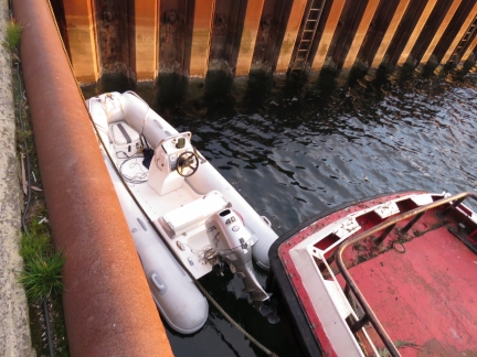 |
Tender
Position: -2 57.77, 58 49.92
The tender tied off along the pier at St. Margaret’s Hope.
|
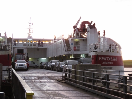 |
Pentalina
Position: -2 57.77, 58 49.92
We’ve been enjoying watching the ferry Pentalina depart and arrive three times a day since we arrive earlier in the week. It departed shortly after we arrived ashore, so we had a chance to watch it leave.
|
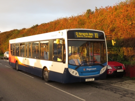 |
Bus
Position: -2 57.76, 58 49.91
We’ll be taking a half-hour bus ride to Kirkwall to start our Mainland tour. Mainland is the largest island in the Orkney Group.
|
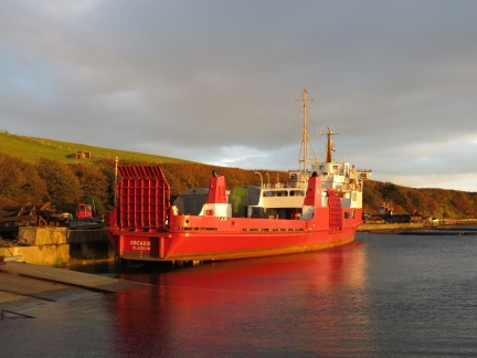 |
Orcadia
Position: -2 57.74, 58 49.92
For former CalMac ferry Saturn, now Orcadia, docked at St. Margaret’s Hope. The Pentland Ferry Company, that owns the Pentalina, had purchased the Saturn in 2015 for freight work and for working with the renewable energy sector around Orkney and the Pentland Firth. But the ship is now for sale.
|
 |
St Margaret’s Hope
Position: -2 57.08, 58 49.63
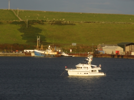
The anchorage at St. Margaret’s Hope from the bus en route to Kirkwall. Our tender is just visible in the distance, rightmost of all the boats on the pier.
|
 |
Churchill Barrier
Position: -2 54.55, 58 51.77
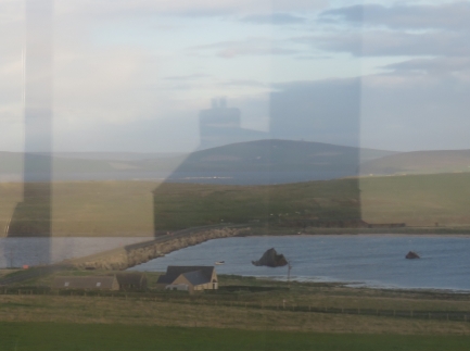
Churchill Barrier Number 3 looking north from the road above. On the right is one of several blockships the Navy sunk to partially block the entrance prior to the Churchill Barrier construction.
|
 |
Kirkwall
Position: -2 57.52, 58 57.78
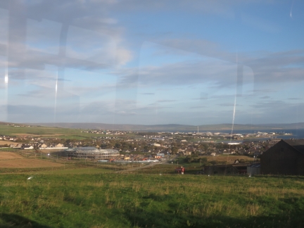
View into Kirkwall as our bus arrives.
|
 |
Standing Stones of Stenness
Position: -3 12.51, 58 59.61
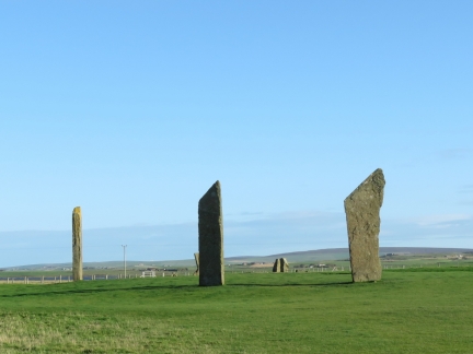
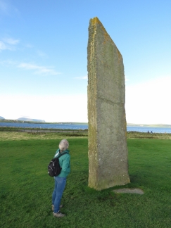
The Heart of Neolithic Orkney UNESCO World Heritage Site consists of four neolithic monuments dating to some 5,000 years ago. The Standing Stones of Stenness are one of the earliest stone circles in Britain. Only four of the original 11 or 12 stones still stand (archaeologists aren’t sure on the original number of stones).
|
 |
Standing Stone
Position: -3 12.49, 58 59.64
Each stone is buried about 3 feet in the ground and the tallest stands about 16ft high.
|
 |
Echo
Position: -3 12.48, 58 59.64
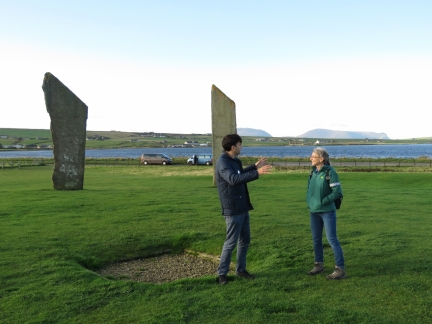
A large hearth was at the center of the circle. Our guide, Simon, demonstrated a curious echo property that occurs when standing at one specific corner. The hills visible in the distance are on the island of Hoy, where Longhope is.
|
 |
Barnhouse Village
Position: -3 12.41, 58 59.75
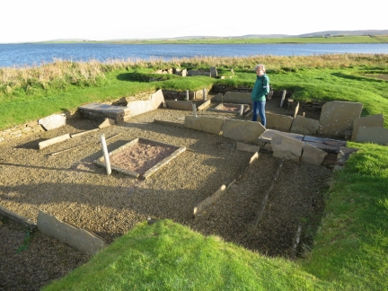
In 1984, archaeologists discovered a village near the Stones of Stenness, also dating to about 5,000 years ago. It’s possible the villagers erected the Stone of Stenness, or at least used them for ceremonial purposes.
|
 |
Ring of Brodgar
Position: -3 13.81, 59 0.05
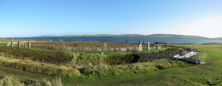
The Ring of Brodgar, also part of the Heart of Neolithic Orkney UNESCO World Heritage Site, is a stone ring built in a circle roughly 341ft (104m) wide. The interior has never been fully excavated, or scientifically dated, so the age remains uncertain. Archaeologists believe it was erected between 2500 BC and 2000 BC, making it among the last of the great Neolithic monuments built in the area.
|
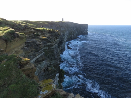 |
Marwick Head
Position: -3 20.98, 59 6.59
Marwick Head wasn’t on our list of places to visit on our tour, but our guide Simon Alvarez, thought we’d like it. He was right—the cliffs here are fabulous. Jennifer and Simon are just visible in the upper left of the picture, and the tall tower in the distance is the Kitchener Memorial.
|
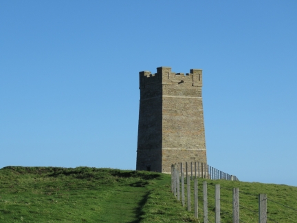 |
Kitchener Memorial
Position: -3 21.25, 59 6.31
During the First World War, in June of 1916, the British warship HMS Hampshire was underway near Marwick Head during a gale and struck a mine laid by a German U-Boat. All but 12 of the 749 passengers and crew perished, including Earl Kitchener, Britain’s Secretary of State for War. The Kitchener Memorial was unveiled in 1926.
|
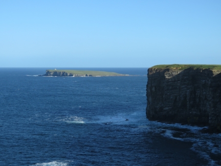 |
Brough of Birsay
Position: -3 21.32, 59 6.31
The view north along the Marwick Head cliffs to our next stop in the distance, the Brough of Birsay with a lighthouse perched above the cliffs at Brough Head.
|
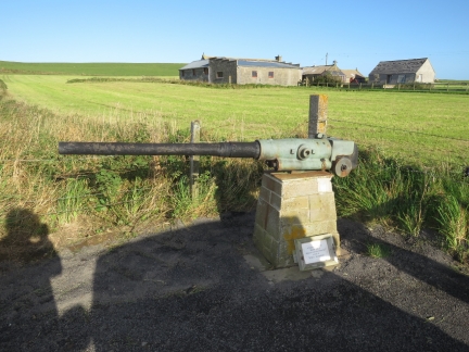 |
Gun
Position: -3 20.49, 59 6.35
This deck gun at the Kitchener Memorial parking lot was salvaged from the HMS Hampshire.
|
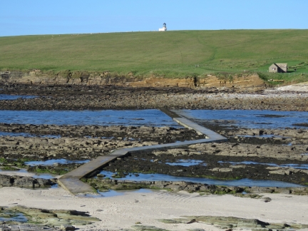 |
Causeway
Position: -3 19.51, 59 8.12
The Brough of Birsay is connected to the mainland by a causeway, built to service the lighthouse, that is only accessible at low tide.
|
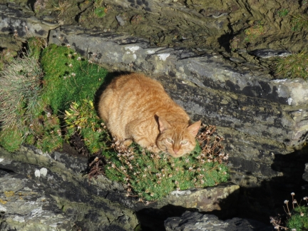 |
Cat
Position: -3 20.05, 59 8.26
On our walk to the lighthouse, we came across this cat sunning on the cliff. This particular face is actually near-vertical, with just barely space for the cat on a little patch of grass. It kept a close eye on us, but otherwise didn’t seem very concerned.
|
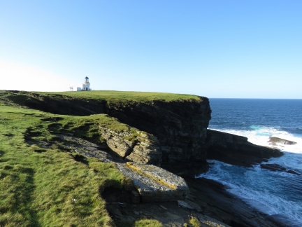 |
Brough Head
Position: -3 20.21, 59 8.27
The lighthouse at Brough Head was built in 1925, another Stevenson family design.
|
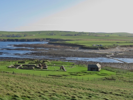 |
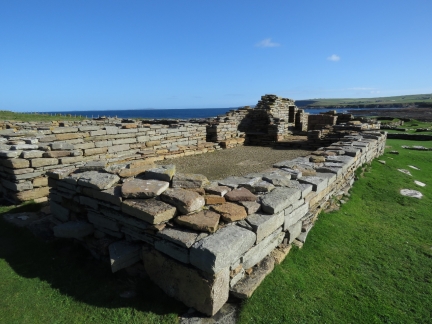
Ruins
Position: -3 19.96, 59 8.19
Centuries of habitation on the Brough of Birsay, starting with a Pict (Scotland’s oldest indigenous people) fortress in the 6th and 7th centuries. Viking settled here in the 9th century and the visible ruins are from their village.
|
 |
Monastery
Position: -3 19.82, 59 8.19
Ruins from the 12th century Viking monastery. This was the final phase of the Viking construction on the island.
|
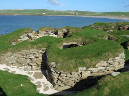 |
Skara Brae
Position: -3 20.52, 59 2.92
In the winter of 1850, a severe storm stripped the earth from a beach and locals found the outline of a village. Skara Brae, it is called, is the third site of the four locations that comprise the Heart of Neolithic Orkney UNESCO World Heritage Site. The stone-built Neolithic settlement was occupied roughly between 3180 BC and 2500 BC, making it older than Stonehenge and Great Pyramids of Egypt. It is the most complete Neolithic village in Europe.
|
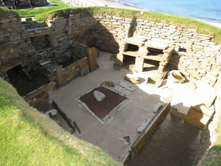 |
House
Position: -3 20.50, 59 2.93
The houses at Skara Brae had sleeping areas along the walls, a hearth in the middle and a dresser, all made of stone.
|
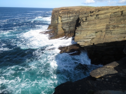 |
Yesnaby
Position: -3 21.63, 59 1.48
The dramatic cliffs at Yesnaby, just south of Skara Brae.
|
 |
Orkney Travel
Position: -3 21.53, 59 1.49
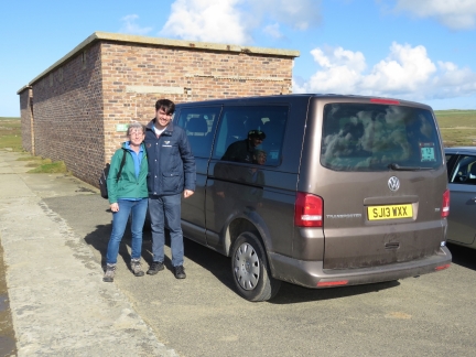
We had a great day with Simon Alvarez of Orkney Travel. Simon knows the area and it’s history well.
|
 |
Maeshowe
Position: -3 12.51, 58 59.19
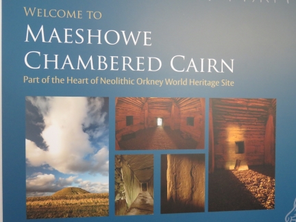
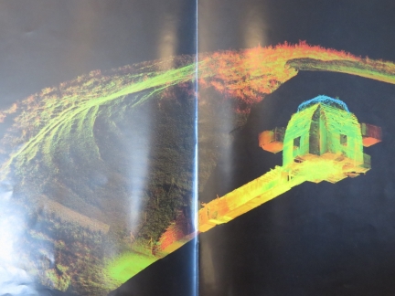
The chambered tomb of Maeshowe was built around 2800 BC and is the fourth and final site in the Heart of Neolithic Orkney UNESCO World Heritage Site. Photographs aren’t allowed inside the tomb, so we took a picture of this poster instead.
|
 |
Tomb
Position: -3 12.51, 58 59.19
Representation of the tomb at Maeshows inside a grass mound. The 36-foot (11m) entrance passage is oriented so that the winter solstice shines down the corridor and lights up the back of the tomb.
|
 |
Exiting Maeshowe
Position: -3 11.31, 58 59.79
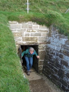
Jennifer exiting Maeshowe. The entrance passage is less than three feet high, so even she had to crouch down to enter.
|
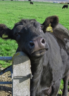 |
Cow
Position: -3 11.29, 58 59.77
As we walked along a field back from Maeshowe, a cow came over the visit.
|
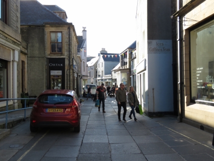 |
Albert Street
Position: -2 57.47, 58 59.03
Simon dropped us back off in Kirkwall, the largest town in the Orkney Islands, where we spent a few hours before returning back to Dirona. This is looking down Albert Street.
|
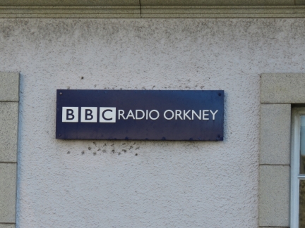 |
BBC Radio Orkney
Position: -2 57.64, 58 58.94
Having listened to BBC for years, it seemed kind of cool to see the BBC Radio Orkney sign.
|
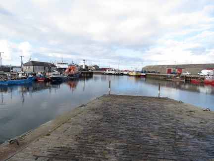 |
Kirkwall Harbour
Position: -2 57.58, 58 59.07
The Kirkwall commercial harbor, with the RNLI lifeboat Margaret Foster. The station here is relatively new, and was established in 1972.
|
 |
Helgi’s
Position: -2 57.56, 58 59.07
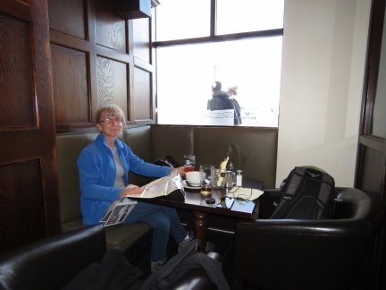
An excellent lunch with a view to Kirkwall Harbour at Helgi’s.
|
 |
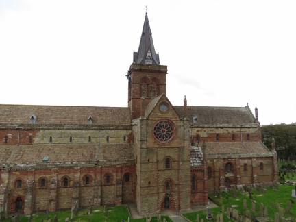
St Magnus Cathedral
Position: -2 57.63, 58 58.89
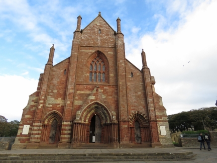
After lunch, we toured around Kirkwall some more. This is St. Magnus Cathedral, founded in 1137.
|
 |
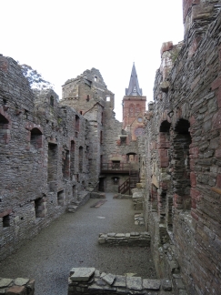
Earl’s Palace
Position: -2 57.55, 58 58.83
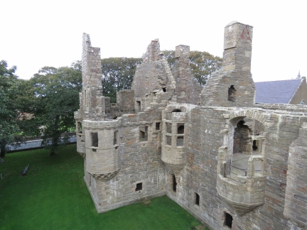
Patrick, Earl of Orkney, built Earl’s Palace starting in 1607. Earl Patrick later was executed for treason and the castle fell into ruin in the 18th century.
|
 |
Hallway
Position: -2 57.55, 58 58.83
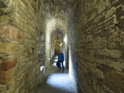
Hallway inside Earl’s Palace.
|
 |
Bishop’s Palace
Position: -2 57.59, 58 58.85
Bishop’s Palace was built in the 12th century at the same time as St. Magnus Cathedral, as the residence for the cathedral’s first bishop. Historic Scotland has made both this and Earl’s Palace surprisingly accessible. We could walk all the way to the top floor of the tower at the far end.
|
 |
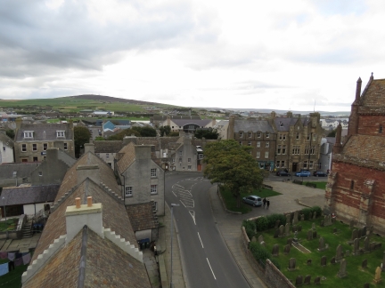
Cathedral View
Position: -2 57.59, 58 58.86
View to St. Magnus Cathedral from the tower in Bishop’s Palace.
|
 |
Kirkwall View
Position: -2 57.59, 58 58.86
Looking across Kirkwall from the tower in Bishop’s Palace.
|
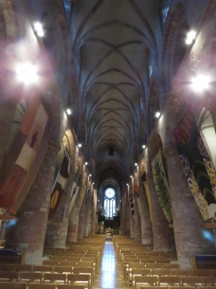 |
Cathedral Interior
Position: -2 57.62, 58 58.89
The soaring interior of St. Magnus Cathedral.
|
 |
John Rae
Position: -2 57.59, 58 58.89
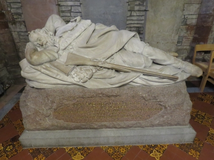
Memorial to surgeon and Arctic explorer John Rae, who is buried in the graveyard at St. Magnus Cathedral. Rae was born in the Orkney Islands, worked for the Hudson’s Bay Company and became an Arctic explorer, finding the final link in the Northwest Passage.
|

|
Click the travel log icon on the left to see these locations on a map, with the complete log of our cruise.
On the map page, clicking on a camera or text icon will display a picture and/or log entry for that location, and clicking on the smaller icons along the route will display latitude, longitude and other navigation data for that location. And a live map of our current route and most recent log entries always is available at http://mvdirona.com/maps. |

cool… sounds very good to me – to come up to dublin to meet up with spitfire… but then we’ve begun our ‘Peak’ here in ORK (and all other sites – i would presume), hence it’ll be a raincheck for the timebeing. not to worry, as i am confident our paths will cross some other time.
and yes, i’ve browsed through your itinerary while you were in kinsale and all of the emerald isle and of course scotland.
best regards to the three of you (Jennifer, James & Spitfire)
It’s surprising cold up here right now. This morning it’s 39F (4C) and the wind is blowing in the mid 20 kt range. It’s nice and warm in the boat but, even with all of it’s insulation, we’re consuming way more power than usual.
welcome back to the emerald isle… ahoy the Dirona! although i am located south of the island (which the natives call “the Real Capital”) – am really delighted to assume that you are now enjoying a really good ‘craic’ coupled with warm Irish hospitality as i type this comment. i do hope you can squeeze in ORK in your port-o-call in the coming days so that maybe i can meet Spitfire or a quick tour of Dirona.
Thanks for the welcome to Ireland. As you guessed, we’re having a great time.
We won’t be heading further south on this visit since we arrived into Kinsale earlier this year and did get a chance to visit Cork earlier: //mvdirona.com/2017/06/cork-ireland/. We like all of Ireland but our time in the Kinsale and Cork area was a great introduction to what was a fun visit that extended from Kinsale all the way up the west coast of Ireland to Lough Swilly. From there we continued north to Northern Ireland and Scotland. You can find find out route up on //mvdirona.com/maps.
If you want a visit of Dirona and to say hi to Spitfire, it’ll have to be up in Dublin.
There’s 50 stone circles in Cumbria, which just happens to be the County I live in. Three of them are among the earliest stone circles in Britain and they’re vast in size. Castlerigg, Swinside and Long Meg are the best ones in the County. Castlerigg for instance dates from 3000 BC and is thought to be a religious site. It’s quite a thing watching the National Trust move the stones around to put the hour on for British Summertime! ;-)
The stone circle which is closest to my home is the Druid Circles located on Birkrigg Common. These are thought to be bronze age relics and consists of two roughly concentric circles. The stones are limestone. The circles themselves are not very big, the inner ring diameter is about 8-9m and has 12 stones with a height of roughly 1m. The outer has 20 stones with a diameter of about 24m and the maximum height being about 0.35m they’re almost hidden by turf in places.
Birkrigg circle is quite unique to the area and is thought to be one of only 30 concentric circles which have been found in the UK. The best example of a concentric circle is Stonehenge which I’m sure you’ll have heard of.
These things have a bit of a draw for me, simply to wonder why, who and when. Obviously there’s the megalithic geometry and significant astrological alignments associated with them but, as is the way with these historical sites, there’s always more questions than answers.
Looks like great part of the Trip.
I love the pictures ,especially the one of Earls Palace.
AI see by the plotter that you are now in Dún Laoghaire.
Your very Welcome and enjoy your time here.
Ken.
Thanks Ken. We’re having a great time in this area.