The currents around the Orkney Islands are among the swiftest in Great Britain. Currents in the Pentland Firth separating the islands from mainland Scotland can reach nine knots on spring tides and powerful tide rips form on the west-bound current, particularly in an opposing wind. We had lovely, calm conditions on our overnight run from St. Kilda to the Orkney Islands and hurtled through the Pentland Firth at 13.5 knots in a 6-knot current.
Below are trip highlights from Sept. 18th and 19th in northern Scotland. Click any image for a larger view, or click the position to view the location on a map. And a live map of our current route and most recent log entries always is available at http://mvdirona.com/maps
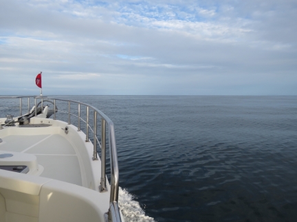 |
Calm
Position: -6 3.05, 58 34.11
Lovely calm conditions about ten miles northeast of the Butt of Lewis en route to the Orkney Islands. The seas and winds have been like this all day since leaving St. Kilda about twelve hour ago and we expect them to last until we arrive.
|
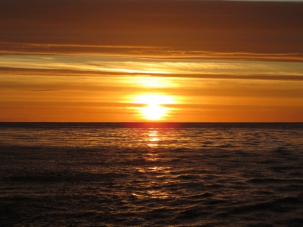 |
Sunset
Position: -5 47.44, 58 35.51
Beautiful sunset about a third of the way between the Butt of Lewis and Cape Wrath.
|
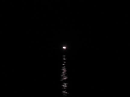 |
Cape Wrath
Position: -5 1.81, 58 39.61
The Cape Wrath light visible about two miles to our south as we round the most north west point on mainland Scotland. The light was completed in 1828, one of the earliest in the country. The Ministry of Defense operates the Cape Wrath Gunnery Range in this area, but it wasn’t in operation as we passed through.
|
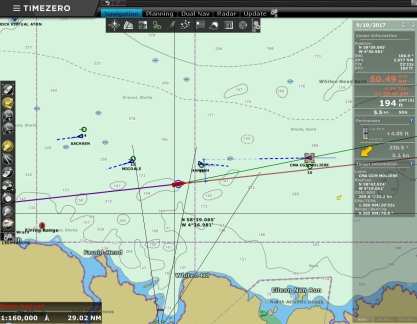 |
Traffic
Position: -4 36.66, 58 41.11
Lots of traffic as we pass north of Loch Eriboll. The 459ft German air-defense frigate Sachsen and the 132ft Norwegian fish carrier Migdale both just passed us heading west, while the 554ft Liberian bulker Hannah just overtook us heading east and the 984ft cargo ship CMA CGM Moliere is approaching from the east.
|
 |
Orkneys Ho!
Position: -3 31.28, 58 44.86
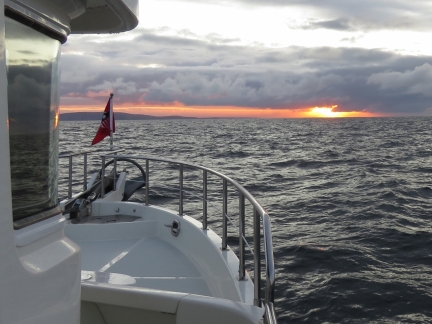
Sunrise with the Orkney Island of Hoy visible on the left in the distance.
|
 |
Hamnavoe
Position: -3 26.30, 58 45.16
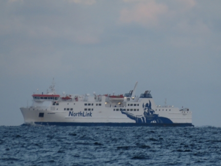
The 367ft North Link ferry Hamnavoe en route to Stromness in the Orkney Islands from Scrabster on the Scottish mainland. That crossing can be a rough one—the ferry looks strong and capable.
|
 |
Old Many of Hoy
Position: -3 26.07, 58 45.17
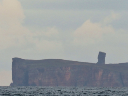
The 449ft (137m) sea stack Old Man of Hoy visible beyond 331ft (101m) Rora Head off the west coast of Hoy Island.
|
 |
13.4 knots
Position: -3 15.90, 58 45.64
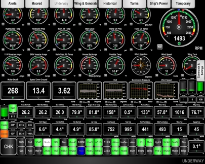
The currents around the Orkney Islands are among the swiftest in Great Britain. The charts show a recommend path for deep draft vessels with a warning that “due to possible tidal effects, vessels may need to steer noticeably different courses from those shown in order to maintain the recommended path”. Currents in the Pentland Firth separating the islands from mainland Scotland can reach nine knots on spring tides and dangerous tide rips form on the west-bound current, particularly in an opposing wind. We’ve timed our arrival with the milder east-going current in calm conditions, so don’t expect any rough water. We are getting quite a push though. We’re doing 13.4 knots at 1500 RPM where normally we’d be doing about 7.5 knots.
|
 |
Cantick Head
Position: -3 8.45, 58 46.80
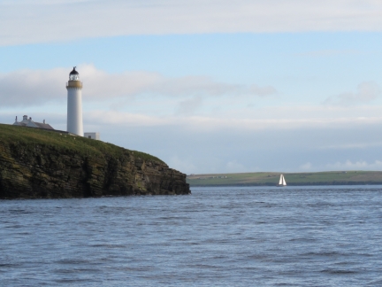
The Cantick Head Lighthouse was a dramatic first view of the Orkneys for Jennifer who got up from her off-watch just as it came into view. The light has been in service since 1858.
|
 |
Martello Tower
Position: -3 8.43, 58 48.52
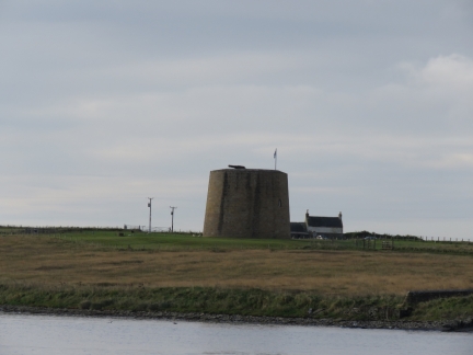
Martello Tower with gun, built in the early 1800s to guard the entrance to Scapa Flow.
|
 |
Long Hope
Position: -3 11.81, 58 48.18
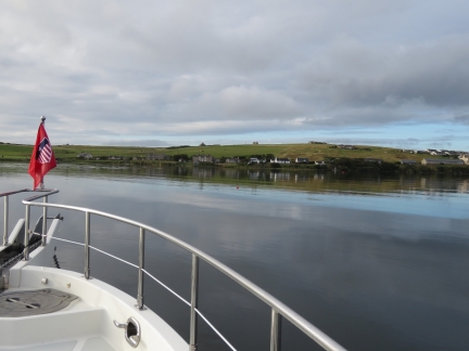
At anchor in Long Hope with our anchor buoy, “Wilson”, visible in the distance. The anchor buoy supports a trip line that allows the anchor to be retrieved by its crown rather than its shank, hopefully releasing it should the flukes be fouled in a cable or something similar. We deployed an anchor buoy a lot in the Pacific Northwest with its logging debris, but haven’t used ours much since leaving that area. But we have read that the bottom in many Orkney anchorages is foul, so we’re using one here.
|
 |
Caspian
Position: -3 11.84, 58 48.19
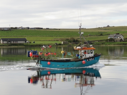
The fishing vessel Caspian heading toward the village of Longhope.
|
 |
First Smell
Position: -3 11.84, 58 48.19
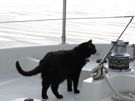
Spitfire getting his first smell of the Orkney Islands.
|

|
Click the travel log icon on the left to see these locations on a map, with the complete log of our cruise.
On the map page, clicking on a camera or text icon will display a picture and/or log entry for that location, and clicking on the smaller icons along the route will display latitude, longitude and other navigation data for that location. And a live map of our current route and most recent log entries always is available at http://mvdirona.com/maps. |

10-19-2017
Hi James
Which one of those Real GIANT ships shown in your – traffic – article photo on the radar plot screen did you come closest to??
James I was looking at the bungee cord trying to figure out what its purpose was and I recall reading where you had found a loose connection on one of your power modules so “loose connections sink ships” was fresh on my mind. I have a Hans Christian sail boat and I am thinking that its about time to move into something that will do 9 knots in the right direction 24/7. My sail boat wouldn’t do 9 knots unless it was falling off a very steep wave just before it pitch poled.
I have enjoyed your posts along with Ken Williams but I detect that one has to be a computer guru to operate a modern boat. I am sure everything mechanical and electrical that you have experienced is within my wheel house but electronics seems to be foreign to me. I am computer literate to the extent I can turn a computer on and use Excel, PowerPoint and Word although certainly not to the extent that the software designers have incorporated into the programs. But your networking and communications between all of your many devices seems like Greek to me. If I can plug it in and it works great but when it doesn’t I am lost. While I am very comfortable with an electric wiring diagram not so much with an electronic schematic. So I wonder can the average non computer person actually maintain such a complex electronic system.
BTW I enjoyed your your presentation on server farms to the students in Seattle. I now can see how mega server farms can invest in renewable energy.
No, there is no real need to be a software specialist to use a boat. Not many are. Ken Williams has a very nicely instrumented boat but he is using all commercially available systems and, although he is a software legend, those skills we’re required to configure Ken’s boat. It’s commercially available equipment installed by professional installers. Our boat does have a lot of custom software but almost everything we have done can be done with commercially available Maretron equipment without software skills.
No need to be a software specialist to boat all around the world and most who are out there enjoying themselves don’t have a software background. It really helps to have logical problem solving skills but engineers don’t have a lock on those abilities. I’ve seen them in airline pilots, business executives, manufacturing plant owners, and many others.
A non-computer person can easily manage a modern boat and, remember, most boats out there cruising lean to the simple side and just don’t carry as many complex systems. Many boaters have exactly your computer skills and are having fun.
Unrelated, since you watched my Seattle work presentation, here’e a more recent one: https://www.youtube.com/watch?v=AyOAjFNPAbA&t=2523s.
10.27.2017
BRAVO well said!
A recent follower of your round the world odyessey . Is the lock nut on the turn buckle for the lower safety line in the picture with Spitfire getting his first smell backed off.
Good catch. I’m impressed. That safety line lock nut has indeed backed off.
Safety harnesses are available for dogs & cats as well ! Could probably obtain one reasonable from
Amazon on line !
Some of the show off stuff you see two legged critters do on boats could benefit from a safety harness ! Valuable cargo should always be secured!