From Cairns we made a 150-mile overnight run to Lizard Island. Everyone we knew who’d been there said it was a must-do stop. They were enthusiastic, but it might have been even better than described. We did several excellent dives while there, plus a hike up to the top of the island for 360-degree views.
Highlights from our stay at Lizard Island follow. Click any image for a larger view, or click the position to view the location on a map. And a live map of our current route and most recent log entries always is available at http://mvdirona.com/maps
 |
North Reef
Position: 145 27.22, -14 38.74
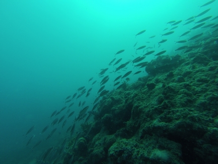
Once anchored at Lizard Island, we ran the tender out to Mermaid Cove and tied off to the mooring there to dive the North Reef. The coral life and visibility wasn’t as good as some recent dives, but the underwater seascape and abundant sea life more than made up for that. The video http://youtu.be/-Bz86IpO6K4 (2:09) starts with us swimming through a channel near the northern reef tip. At 1:02 is a large ray, perhaps 4 ft in diameter, and at 1:46 is a reef shark.
|
 |
Lu Ali
Position: 145 27.13, -14 39.74
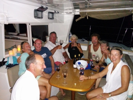
Sundowners on Lagoon 50 Lu Ali. Owners Noel and Jenny Roots are at the center, directly to Jennifer’s right. At the left are the two crew of La Medianoche who are on a westbound circumnavigation from Germany. We’ve seen La Medianoche a few times over the past several weeks, and finally met in person tonight.
|
 |
Catch!
Position: 145 27.03, -14 39.56
The jacket flying through the air was left on board Lu Ali last night from La Medianoche. Nobody was visible on La Medianoche when Lu Ali left early this morning, so we took the jacket to return later. (James did catch it.)
|
 |
Ready to climb
Position: 145 27.29, -14 39.65
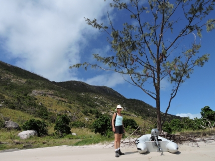
We landed the micro-tender to climb to Cook’s Look, the hilltop in the background just to the left of Jennifer.
|
 |
Lizard Island National Park
Position: 145 27.29, -14 39.80
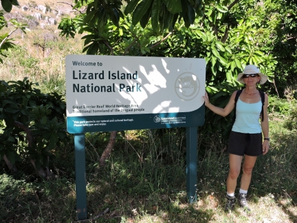
Another park sign to add to our burgeoning collection.
|
 |
Watsons Bay
Position: 145 27.35, -14 39.42
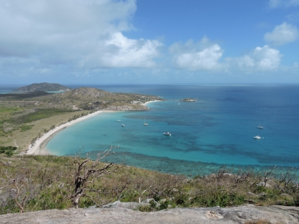
A steep climb brought us to this excellent viewpoint looking southwest over Watsons Bay. Dirona is at the bottom right of the photo (click image for a larger view). The Lizard Island Resort is in the smaller cove beyond the anchorage.
|
 |
Cook’s Look
Position: 145 27.78, -14 39.96
The panoramic view looking south to north from Cook’s Look. At the left of the photo is Blue Lagoon, on the south end of the island, and left of center is the island airstrip with a research station to the south beyond. The Lizard Island Resort is off the right end of the airstrip, with our anchorage in Watsons Bay farther right. Mermaid Cove at the north end of the island, where we dove from yesterday, is at the far right. The hilltop we’re on is so named because Captain Cook climbed it in 1770 looking for a way out through the reef. (Click the image for a larger view.)
|
 |
Work camp
Position: 145 27.00, -14 39.97
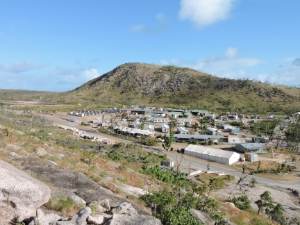
After our hike up Cook’s Look, we followed a road from the beach to the airstrip, then walked it back to the Lizard Island Resort. The exclusive resort, ranked among the top ten hotels worldwide, suffered $45 million dollars damage in April, 2014 in Cyclone Ita’s 160-km winds. The resort was about to reopen when Cyclone Nathan‘s 170-km winds did another few million in damage this March. Pictured is the work camp, between the resort and the airstrip, for the 200-person crew that has been on-site to prepare the resort for it’s soft-opening in three weeks. The tents at the fair left each have their own air-conditioning unit.
|
 |
Coral Princess II
Position: 145 27.04, -14 39.57
Sunset with the Coral Princess II on a mooring behind us. We could see the ship to our west when we were ashore and it looked very close, but back on Dirona it wasn’t really that near and it turned out to be fun watching them work and moving their small boats around.
|
_cropped_2.web.jpg) |
Cod Hole
Position: 145 39.77, -14 39.86
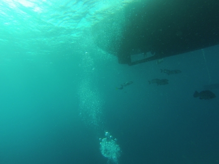
From Lizard Island we made a day trip to the Cod Hole on the outer reefs and picked up a Marine Park mooring. The Cod Hole is one of the most famous dive sites on the Great Barrier Reef, mainly due to the huge potato cod that live there. We had a fantastic first dive right off the boat, swimming north along the reef. The visibility was excellent, the seascape was complex and the sealife was rich and varied. In the video http://youtu.be/d4Sog-iPXls (1:41), a small stingray is at 0:22 seconds and a reef shark at 0:34. At 0:50, a second shark can be seen skidding to a stop along the bottom, much like an airplane might land. And at 1:05 is one of the famous resident potato cod. Many of the charter boats feed the cod, so they tend to follow the divers around, looking for a handout. This one kept pretty close and followed us all the way back to Dirona.
|
 |
Under Dirona
Position: 145 39.77, -14 39.86
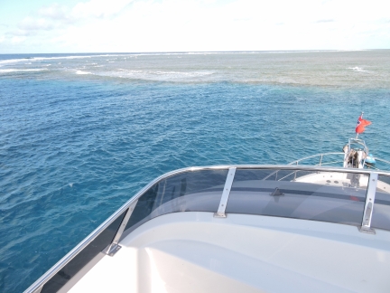
We don’t often dive directly from Dirona, so rarely get footage of the hull below the water. The video at http://youtu.be/C9cCl_ohwjU (0:41) starts with the potato cod that followed us back from our dive and then shows the flopper-stopper in action.
|
 |
North buoy
Position: 145 39.88, -14 39.77
The diving improved as we worked north along the reef, so we moved the boat to the more northern buoy to dive from there. Both buoys are quite close to the reef and we’d swing uncomfortably close if the wind switched to northwest from the southeast. If we were staying here overnight we would definitely anchor off to get more clearance from the reef.
|
 |
Second Dive
Position: 145 39.88, -14 39.77
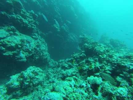
The current was running south on both dives, so we again swam north to start the dive against the current. We worked all the way to the tip of the reef and found an excellent wall there. The seascape along the way was particularly complex and covered with soft and hard coral. Both dives were among the best we’ve done in the reef. In the video at http://youtu.be/N0mvthFovfA (1:52), you can see the waves crashing into the reef above us at 0:45, and Jennifer swimming through one of the complex formations at 1:31.
|

|
Click the travel log icon on the left to see these locations on a map, with the complete log of our cruise.
On the map page, clicking on a camera or text icon will display a picture and/or log entry for that location, and clicking on the smaller icons along the route will display latitude, longitude and other navigation data for that location. And a live map of our current route and most recent log entries always is available at http://mvdirona.com/maps. |
If your comment doesn't show up right away, send us email and we'll dredge it out of the spam filter.

so many place you have visited, i really love your trip and place you go, i heard about Lizard Island, really want to go now :)