The Swedish began building Olavinlinna castle in 1475 to strengthen their eastern border with Russia, and the town of Savonlinna grew up around the fortification. Today the city of 33,000 hosts the Savonlinna Opera Festival at Olavinlinna, annually drawing about 60,0000 visitors. Savonlinna also is the home port of Finland’s largest fleet of historic steamships, operated by VIP Cruise.
From Kuopio, we took the deep-water route south to return to Savonlinna. We’d only passed by on the way north, but this time stopped for a couple of nights. There we explored the town and the castle, and met VIP Cruise owner Janne Leinonen, who took us on a tour of his boats and also out on a lake cruise on the S/S Punkaharju.
Below are trip highlights from June 11th and 12th en route to and in Savonlinna, Finland. Click any image for a larger view, or click the position to view the location on a map. And a live map of our current route and most recent log entries always is available at mvdirona.com/maps.
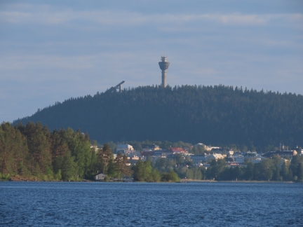 |
Puijo Tower
Position: 62°51.09’N, 27°43.51’E
The Puijo Tower and adjacent ski jumps prominent above Kuopio as we look back heading south.
|
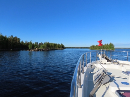 |
Kolikon Kaivanto
Position: 62°40.44’N, 27°40.46’E
Entering the Kolikon Kaivanto, part of the deepwater route between Savonlinna and Kuopio built between 1969-1972 a few years after the Saimaa Canal was re-opened.
|
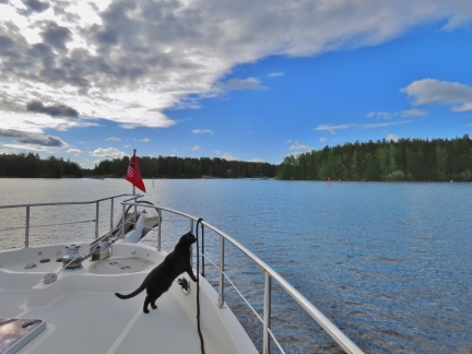 |
Spitfire
Position: 62°33.00’N, 27°45.54’E
Spitfire enjoying another day of lake cruising.
|
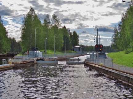 |
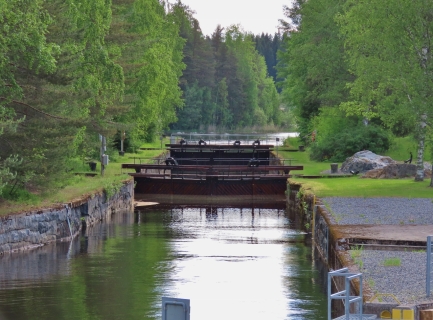
Leppavirta Konnus Canal
Position: 62°32.90’N, 27°46.10’E
Approaching the Leppavirta Konnus Canal, one of two locks we’ll pass through today en route to Savonlinna. The canal was completed in the early 1970s as part of the new deepwater route between Savonlinna and Kuopio. Unlike the Heinavesi Route canals, these canals on this route are are not self-service with a pull-cord. Rather they are similar to the Saimaa Canal locks and opened as we approached.
|
 |
Old Lock
Position: 62°32.91’N, 27°46.12’E
Looking across the old lock adjacent to the Leppavirta Konnus Canal, completed sometime in the 1840s when Finland was part of Russia.
|
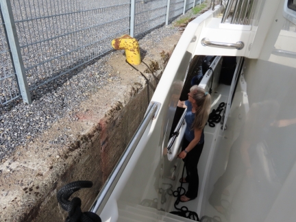 |
Bollard
Position: 62°32.90’N, 27°46.27’E
The canals on the deepwater route are designed for large commercial boats and barges, so have bollards to secure a boat to rather than just the lines strung along the sides as on the older Heinavesi Route canals. The drop height is only 0.6m, so we don’t have to tend the line much.
|
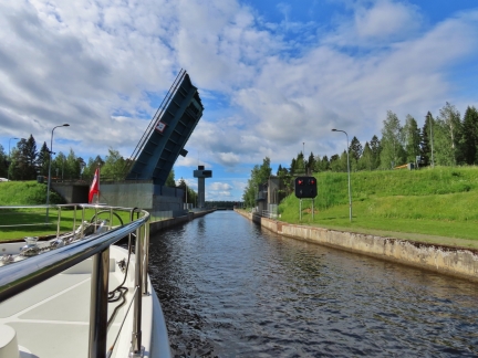 |
Taipale Canal
Position: 62°18.27’N, 27°54.70’E
The bridge up for us to enter the modern Taipale Canal. A canal originally was built here in the 1830s then replaced in the late 1860s. The current canal was built in the 1960s as part of the new deepwater route between Savonlinna and Kuopio. An operator in the control tower visible manages canal and the Leppavirta Konnus Canal we passed through earlier today.
|
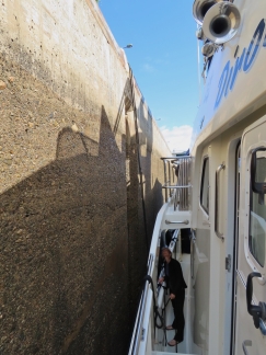 |
Drop
Position: 62°18.20’N, 27°54.61’E
The drop height in the Taipale Canal is 17 feet (5.4m), much more than any other canal we’ve passed through within the Saimaa Lakes. But it brings us back to the same lake level as before we passed through the four locks along the Heinavesi route a few days ago. With a fixed bollard above, the drop was large enough that we were reaching the limit of our 50ft line, doubled back to the boat, so we released it and re-secured to a bollard along the wall.
|
 |
Underway
Position: 62°13.15’N, 28°8.24’E
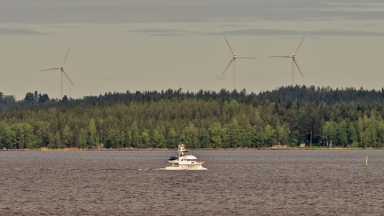
Arto Juvonen sent us this picture he took from his lakeside cabin deck of Dirona at the north end of Linnansaari National Park. In the background are the Leppavirta windmills, about 10 miles away.
|
 |
Laitatsalmi
Position: 61°52.89’N, 28°50.22’E
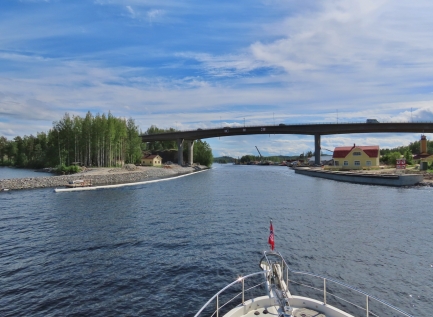
Entering the channel Laitatsalmi en route to Savonlinna. En our way north we’d passed east of town, alongside the castle, through the railway bridge. But we noticed that the fixed 1.4m bridge showing on our charts across Laitatsalmi had been removed. So we could pass south this way without needing the railway bridge opened for us.
|
 |
S/S Punkaharju Greeting
Position: 61°51.70’N, 28°52.05’E
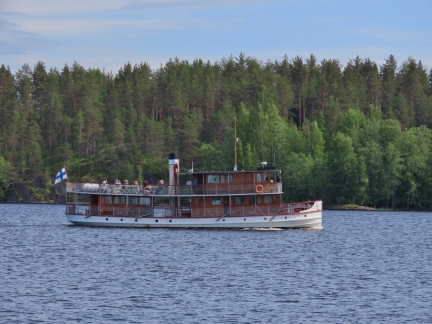
The 1905 steamship S/S Punkaharju underway off Savonlinna. We’d been introduced by Paivi and Markku Kankaala to the owner if VIP Cruise, Janne Leinonen, and had been conversing with him via email for the past few days. And by chance, he was captaining the S/S Punkaharju as we entered Savonlinna Harbour. He gave us a classic steamship welcome toot and a quick call on the VHF radio to say hello.
|
 |
Approaching Savonlinna
Position: 61°51.90’N, 28°53.07’E
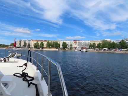
Approaching our berth along the Savonlinna waterfront between the S/S Savonlinna, left, and the M/S Puijo.
|
 |
Savonlinna Harbour
Position: 61°51.99’N, 28°53.21’E
Paivi and Markku Kankaala keep their boat here in Savonlinna and offered us the use of their berth while they were out cruising. It’s a great location right downtown.
|
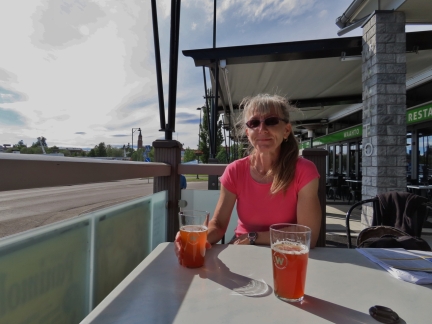 |
Waahto
Position: 61°52.04’N, 28°53.14’E
Enjoying a pint of the craft beer from the local Savonlinna brewery, Waahto, at their waterfront bistro.
|
 |
S/S Punkaharju
Position: 61°51.99’N, 28°53.21’E
The S/S Punkaharju arriving back into port behind the S/S Savonlinna after a 90-minute cruise of the area. Dirona is moored in front of the S/S Savonlinna, just out of the picture on the left.
|
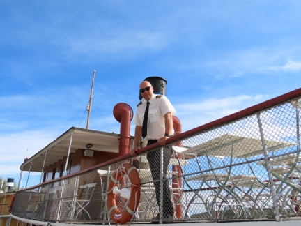 |
Janne Leinonen
Position: 61°52.02’N, 28°53.15’E
Janne Leinonen owns and operates VIP Cruise with the largest fleet of classic steamships in Finland, including the 1904 S/S Savonlinna, the 1919 S/S Paul Wahl and the 1905 S/S Punkaharju.
|
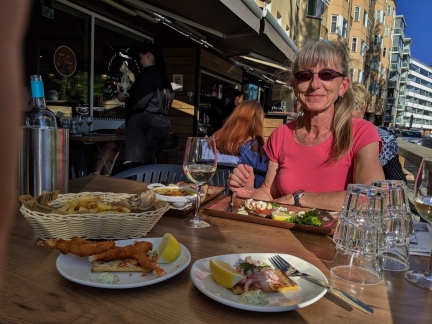 |
Majakka
Position: 61°52.04’N, 28°53.19’E
A good meal on the terrace at Majakka overlooking the harbour.
|
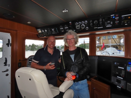 |
Janne & James
Position: 61°51.99’N, 28°53.21’E
After his final cruise of the day, Janne Leinonen stopped by for a visit on Dirona. Janne is a former professional hockey player with wide-ranging interests and experiences. We had a great time with Janne talking hockey, boating and travelling.
|
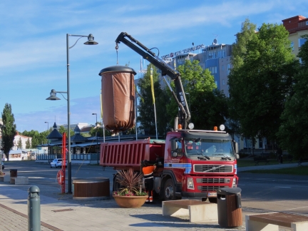 |
Garbage Truck
Position: 61°51.99’N, 28°53.21’E
We’re always curious about how things work so watched with interest as a garbage truck arrived to empty the large street-side receptacle. Like many European garbage bins, this one is huge and mostly below grade.
|
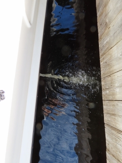 |
Media Filter
Position: 61°51.99’N, 28°53.21’E
In high plankton areas like North America’s Pacific Northwest, having to change the water maker prefilter once a day is not uncommon. This can get tedious, so we ordered a simple solution. In front of the standard 5-micron pleated paper filter, we have a media filter.
A media filter is essentially a large vessel full of carefully-selected sand. This approach is the most common approach used in swimming pool filtration and is very effective. We can run the water maker full time for 2 to 4 weeks until the filter begins to show signs of needing to be cleaned. On ours pressure gauges on the inlet and the outlet allow us to check the pressure loss across the filter. Towards the end of a month of operation, it’ll need a clean and that’s pretty simple. Rotate the inlet and outlet valves and turn on the media filter booster pump to backflush the filter. In the picture, the backflush is just beginning and the water has some color. After a couple of minutes, it clears and the process is done. Restore the valves and it’s ready to return to use. Using the media filter we can change the prefilter only once a year even when in heavy use. |
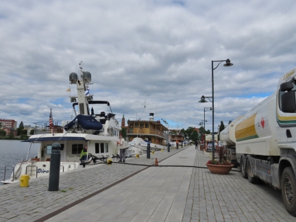 |
Fueling
Position: 61°51.99’N, 28°53.21’E
Janne Leinonen arranged for a truck to fuel us in Savonlinna. After making other deliveries, the truck didn’t have quite enough to fill our tanks. We took on 1360 gallons (5148 liters), about 90 gallons less than full, and likely will top up the tanks when we get gasoline.
|
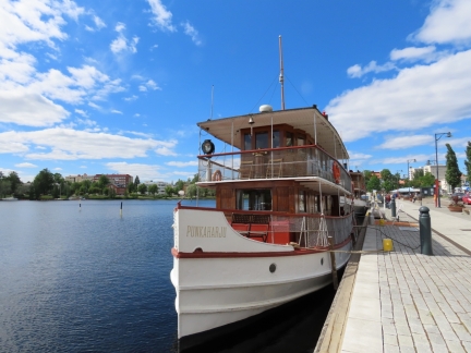 |
SS Punkaharju
Position: 61°51.99’N, 28°53.21’E
Today we toured the VIP Cruise steamships SS Savonlinna and SS Punkaharju and went out on a 90-minute cruise of the area with the SS Punkaharju. The video of the cruise, including the steamship’s mechanical systems and layout, is at https://youtu.be/akk8H8xqpwM and we’ll blog more of the details.
|
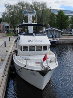 |
Dirona
Position: 61°51.99’N, 28°53.21’E
View to Dirona moored at Savonlinna from the deck of the SS Savonlinna.
|
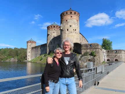 |
Olavinlinna
Position: 61°51.85’N, 28°53.91’E
Janne Leinonen‘s wife Leena Pietarinen works for Olavinlinna castle and took us on a private after-hours tour.
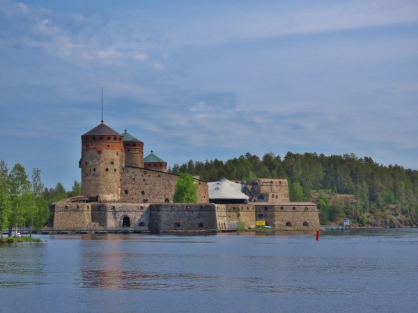
The Swedish began building Olavinlinna castle in 1475 to strengthen their eastern border with Russia. The castle is situated on an island surrounding by narrow, channels with current so strong that the water doesn’t freeze in the winter, protecting the castle from an over-ice enemy siege. The Swedes held the castle through several battles and control swapped multiple times between Sweden and Russia in the 1800s before finally landing in Russian control until Finnish Independence. Olavinlinna has been restored several times and now is one of Finland’s most popular tourist attractions. |
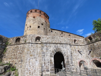 |
Castle Entry
Position: 61°51.83’N, 28°53.99’E
You can see how thick the castle walls are from the windows on either side above the entry.
|
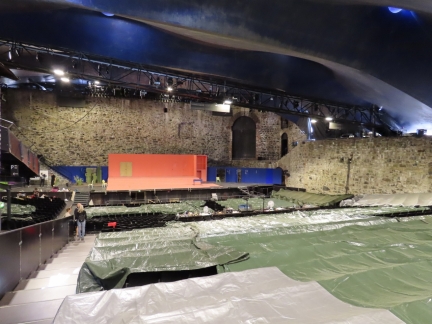 |
Opera
Position: 61°51.84’N, 28°54.08’E
In 1912, Finnish opera singer Aino Ackte directed the first of five opera festivals in Olavinlinna castle. The festivals were a success, but were discontinued due to World War I and the Finnish Civil War.
A small opera performance staged in the castle in 1967 began the resurrection of the event, and today the Savonllinna Opera Festival draws 60,000 attendees annually with a quarter from abroad. The opera takes place in July and the museum has been setting up the stage for weeks, with rehearsals starting this evening. |
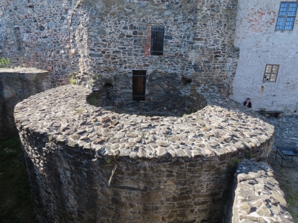 |
Tower Base
Position: 61°51.83’N, 28°54.06’E
Olavinlinna castle used to have five towers, but only three have survived. This base is all that remains of one of the original five.
|
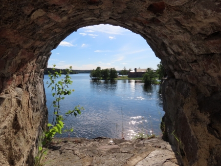 |
View
Position: 61°51.82’N, 28°54.00’E
View to the waterway from inside Olavinlinna castle.
|
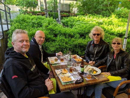 |
Sarastro
Position: 61°51.88’N, 28°53.75’E
We finished the day with a good meal in great company at Restaurant Sarastro near Olavinlinna castle. With us are Jyri Koponen (left), who captained the SS Punkaharju on our cruise today, and Janne Leinonen who owns VIP Cruise.
|
 |
Click the travel log icon on the left to see these locations on a map, with the complete log of our cruise.
On the map page, clicking on a camera or text icon will display a picture and/or log entry for that location, and clicking on the smaller icons along the route will display latitude, longitude and other navigation data for that location. And a live map of our current route and most recent log entries always is available at mvdirona.com/maps. |
If your comment doesn't show up right away, send us email and we'll dredge it out of the spam filter.