Our plan to return to southern Scotland via the Caledonian Canal was put together while we were still in Daytona, Florida in February of this year. So we’ve been looking forward to it for a long time. Since the canal is only a short distance from Inverness, we took the bikes over for a preview in anticipation of our upcoming transit.
Below are trip highlights from October 8th, 2017 in Inverness, Scotland. Click any image for a larger view, or click the position to view the location on a map. And a live map of our current route and most recent log entries always is available at http://mvdirona.com/maps
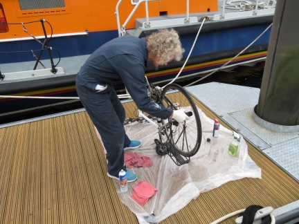 |
Bike Maintenance
Position: -4 14.06, 57 29.67
Both bikes needed the chains lubricated and James’ needed a derailer adjustment. We tried putting a throw sheet down below the work area and it worked well. This kept the dock clean and minimized the chance that any loose parts would fall through the cracks.
|
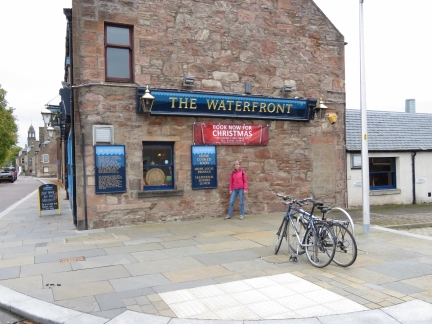 |
The Waterfront
Position: -4 14.03, 57 28.82
An excellent Sunday lunch at The Waterfront pub along the River Ness a quick bike ride from the marina.
|
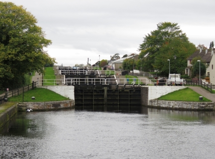 |
Locks
Position: -4 14.84, 57 28.95
After lunch, we biked a short distance to the Caledonian Canal, where we’ll transit south in a few days. This is looking south from the Telford Street Swing Bridge to the first major flight of locks.
|
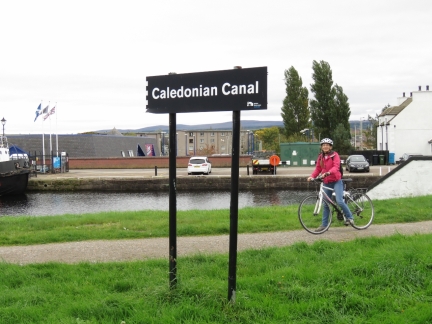 |
Caledonian Canal
Position: -4 14.87, 57 28.98
A happy Jennifer biking along the Caledonian Canal.
|
 |
Seaport Marina
Position: -4 14.89, 57 29.03
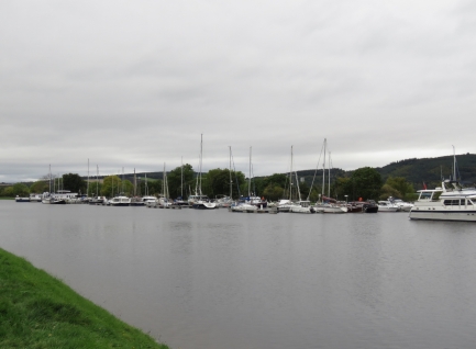
Seaport Marina is one of two reasonable sized marinas in the area. It looked pretty full.
|
 |
Clachnaharry
Position: -4 15.48, 57 29.36
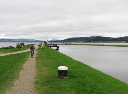
Jennifer riding north to the Clachnaharry sea lock with Beauly Firth visible in the distance beyond the canal.
|
 |
Welcome
Position: -4 15.77, 57 29.44
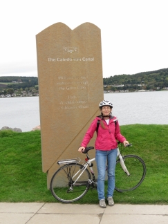
The engraving reads “The Caledonian Canal: Welcome to the waterway through the Great Glen”. The Great Glen is a geological fault running in a straight line from Inverness to Fort William, also the route of the Caledonian Canal. Glaciers carved deep troughs through the fault line that now are a series of deep lochs, including Loch Ness.
|
 |
Sea Lock Office
Position: -4 15.74, 57 29.43
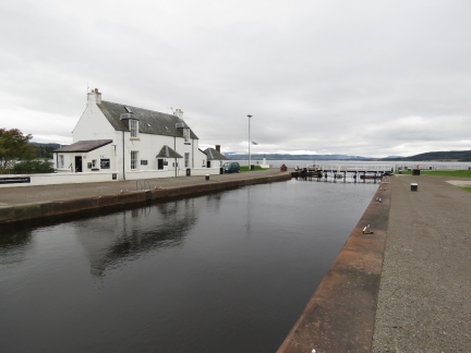
The Clachnaharry Sea Lock Office above the sea lock.
|
 |
ScotRail
Position: -4 15.35, 57 29.36
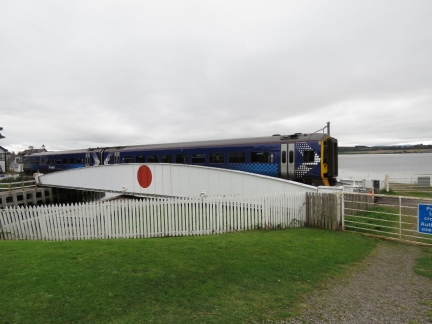
A ScotRail train crossed the canal shortly after we’d crossed the tracks.
|
 |
Merkinch Local Nature Reserve
Position: -4 15.18, 57 29.33
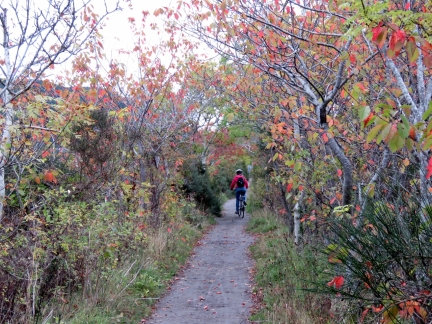
Fall colors in the woods along Beauly Firth through the Merkinch Local Nature Reserve. It’s a beautiful area and the woods are an unexpected change from the wide-open canal area we just left.
|
 |
Boardwalk
Position: -4 15.03, 57 29.45
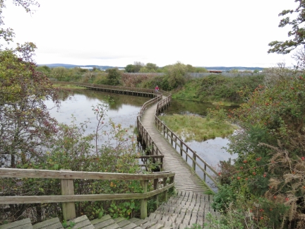
Jennifer returning back to the Beauly Firth path from a short detour we took on a boardwalk across the marsh at Merkinch Local Nature Reserve.
|
 |
Dirona
Position: -4 14.35, 57 29.53
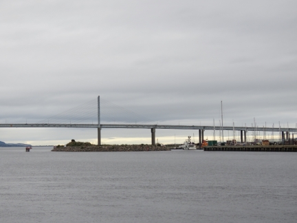
View to Dirona at the Inverness Marina from the west shore at the mouth of the River Ness.
|
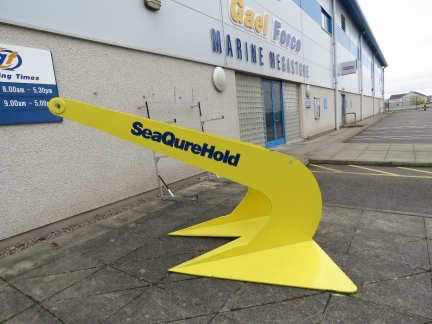 |
SeaQureHold
Position: -4 14.09, 57 29.27
We stopped in at this Gael Force superstore. In the rear lot they had dozens of large sea buoys, likely for aquaculture, and this massive “SeaQureHold” anchor in the parking lot out front. We were expecting the store to be more commercial, but it was similar to a consumer West Marina store in the US.
|
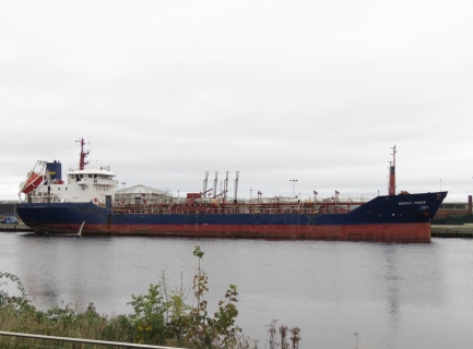 |
Mersey Fisher
Position: -4 13.93, 57 29.16
The oil tanker Mersey Fisher, viewed from the west short of the River Ness, likely offloading at the Scottish Fuels depot.
|

|
Click the travel log icon on the left to see these locations on a map, with the complete log of our cruise.
On the map page, clicking on a camera or text icon will display a picture and/or log entry for that location, and clicking on the smaller icons along the route will display latitude, longitude and other navigation data for that location. And a live map of our current route and most recent log entries always is available at http://mvdirona.com/maps. |

If your comment doesn't show up right away, send us email and we'll dredge it out of the spam filter.