MV Dirona travel digest for Florida 2017

|
Click the travel log icon on the left to see these locations on a map,
with the complete log of our cruise. On the map page, clicking on a camera or text icon will display a picture and/or log entry for that location, and clicking on the smaller icons along the route will display latitude, longitude and other navigation data for that location. And a live map of our current route and most recent log entries always is available at //mvdirona.com/maps/LocationCurrent.html. |
 |
2/2/2017: Fishing Vessel
Position: 30°42.67'N, -81°22.59'W
We left Cumberland Island at 5am today to reach St. Augustine Inlet at high tide. It was still dark as we passed this fishing vessel working St. Marys Entrance.
|
 |
2/2/2017: Apartments
Position: 30°33.96'N, -81°21.12'W
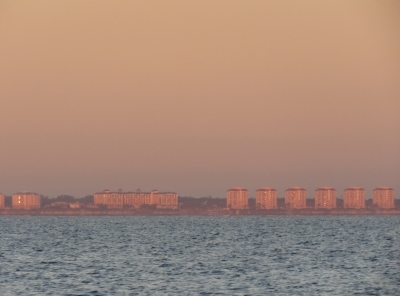
St. Marys Entrance is at the border between Georgia and Florida. As soon as we had some daylight, we noticed that the coast had changed from Georgia's mostly undeveloped coast to rows and rows of apartment buildings.
|
 |
2/2/2017: Fishing Vessels
Position: 29°55.75'N, -81°15.42'W
Several large fishing vessels were working the coast off St. Augustine.
|
 |
2/2/2017: Pelicans
Position: 29°56.12'N, -81°15.47'W
A huge flock of perhaps 200 pelicans also were fishing off St. Augustine.
|
 |
2/2/2017: St Augustine Channel
Position: 29°54.72'N, -81°16.79'W
Jennifer sighting the entry buoys as we pass through St. Augustine Channel. This is one of several shoaling inlets along the US East Coast where the buoys frequently are repositioned to match the channel. We'd read that sometimes the buoys were off-position and that the inlet was closed and impassable after Hurricane Mathew last year, but was now open and passable with all buoys in the correct position. We still were concerned about the entry and had arrived at 4.5ft high tide in calm weather for optimum conditions. The entry turned out to be relatively straightforward and we saw no less than 18ft all the way through.
|
 |
2/2/2017: NIC
Position: 29°53.98'N, -81°18.46'W
We've been chasing network instability issues since installing the new router a few weeks back. At high network loads, several apps running on the navigation computer lost data for long periods. The new router is a fairly complex combination of open-source and custom software, so naturally we looked there first to resolve these problems.
On the way to St. Augustine, we isolated the issue to the navigation computer alone and determined it was a server hardware issue. So we tried switching the Network Interface Card (NIC) with a spare when we arrived into St. Augustine. |
 |
2/2/2017: Problem Solved?
Position: 29°53.98'N, -81°18.46'W
Switching the Network Interface Card (NIC) immediately solved the problem. Our happiness was short-lived as this introduced a new problem: Windows randomly disabled the network adapter once or twice a day and the only way to resolve it was a reboot. A different NIC with a different driver also failed the same way, so we knew it was a lower-level issue. We eventually isolated the problem to a motherboard power issue.
|
 |
2/2/2017: Switch-box
Position: 29°53.98'N, -81°18.46'W
Now that we can switch between the three different soureces (WiFi, cellular, or satellite) connected to our router via our Router Control web app, we can ditch the switch-box that originally was required to switch the router source between our WiFi radio and the KVH mini-VSAT system. Nice to see that clunker gone.
|
 |
2/2/2017: Dinghy Dock
Position: 29°53.52'N, -81°18.60'W
On the dinghy dock at St. Augustine Municipal Marina just south of our anchorage.
|
 |
2/2/2017: Dinner
Position: 29°53.48'N, -81°18.64'W
An excellent meal on the patio at OC White Seafood and Spirits in St. Augustine.
|
 |
2/3/2017: Bridge of Lions
Position: 29°53.99'N, -81°18.46'W
We're anchored just north of St. Augustine in a 17ft-deep indent off the channel with just barely enough room to swing between the shallows on either side. It's a surprisingly sheltered anchorage with excellent views in all directions. This is the dawn view south to the Bridge of Lions. The bridge was built in the 1920s with a pair of lions at each end modelled after the Medici Lions in Florence, Italy.
|
 |
2/3/2017: Castillo de San Marcos
Position: 29°53.99'N, -81°18.47'W
Our anchorage is just off the Castillo de San Marcos, the oldest masonry fort in the US. The fort was originally constructed in 1672 when the Spanish controlled the area.
|
 |
2/3/2017: The Great Cross
Position: 29°53.99'N, -81°18.47'W
The Great Cross of St. Augustine aglow in the morning sun a few hundred feet from our anchorage. The 208ft cross is the largest in the world and marks the approximate spot where Spanish settlers arrived in 1565 to found St. Augustine. The cross looks wonderful at night, lit from below by powerful lamps.
|
 |
2/3/2017: Ms. Bonnie
Position: 29°53.96'N, -81°18.48'W
The fishing vessel Ms. Bonnie attracting hundreds of seagulls and pelicans as they shovel fish waste overboard.
|
 |
2/3/2017: Customs
Position: 29°53.49'N, -81°18.51'W
During short time at anchor in St. Augustine, we'd witnessed several enforcement boat chases in and around St. Augustine Inlet. We were thinking that either speed limits were incredibly well-enforced or there was some kind of serious crime concern here. While at the St. Augustine Municipal Marina office, we spoke with a Customs officer who was refueling their boat. He told us that St. Augustine was a training center for marine law enforcement and those were all just training exercises.
|
 |
2/3/2017: A1A Ale Works
Position: 29°53.53'N, -81°18.66'W
We had a good lunch with locally brewed beer at A1A Ale Works micro-brewery. A1A is the roadway that runs along the eastern seaboard.
|
 |
2/3/2017: Tourists
Position: 29°53.71'N, -81°18.78'W
St. Augustine is a very popular tourist town. The streets are full of pedestrians and jam-packed tourist trams constantly circle the town.
|
 |
2/3/2017: Town Wall
Position: 29°53.87'N, -81°18.79'W
After the British burned St. Augustine in 1702, the Spanish built a wall around the city. The first part was built on this site in 1704.
|
 |
2/3/2017: Gun
Position: 29°53.88'N, -81°18.66'W
Reenactors in Colonial-era costumes give a historic weapons demonstration several times a day at Castillo de San Marcos. Our boat is directly underneath the muzzle of this cannon. Nothing really brings you to attention like cannon fire directly off the beam. :)
|
 |
2/3/2017: Anchorage
Position: 29°53.83'N, -81°18.67'W
The view east across our anchorage toward out St. Augustine Inlet from the grounds of Castillo de San Marcos.
|
 |
2/3/2017: Ponce de Leon Hotel
Position: 29°53.54'N, -81°18.88'W
In the 1880s, hotel and railroad magnate Henry Flagler built the magnificent Ponce de Leon Hotel that hosted celebrities from around the world, including several US Presidents. The hotel became a US Coast Guard training center in World War II and now is the home of Flagler College, an accredited liberal arts institution.
|
 |
2/3/2017: Rotunda
Position: 29°53.55'N, -81°18.90'W
The spectacular grand entranceway of the historic Ponce de Leon Hotel.
|
 |
2/3/2017: Oldest House
Position: 29°53.28'N, -81°18.61'W
The Gonzalez–Alvarez House dates from the 16th-century and is the oldest house in Florida. Horse-drawn carriages are another popular mode of tourist transportation in St. Augustine.
|
 |
2/3/2017: Cellar 6
Position: 29°53.50'N, -81°18.70'W
We stopped for a drink street-side at Cellar 6 and enjoyed the venue so much we ended up staying for a delicious meal.
|
 |
2/4/2017: Bridge of Lions
Position: 29°53.53'N, -81°18.44'W
Passing under the Bridge of Lions on our way south through the ICW to Daytona Beach. We're going to pass eleven bridges today, but we'll only need to have four opened. The Bridge of Lions operates on a fixed half-hourly schedule and the other three open on demand, so we don't need to time our arrivals at the rest.
We initially were planning to run offshore from St. Augustine to Daytona Beach, but decided to take the ICW for a couple of reasons. The nearest inlet to Daytona Beach is about 14 miles south of the city at Ponce de Leon Inlet and it looked like a challenging entry. (The breakwater there was damaged during Hurricane Mathew and the light on the end swept away. The local Coast Guard office did tell us last week that the buoys are all on station and the light is scheduled to be replaced Feb 1st). But the least depth through the channel is only 14ft and winds were forecast to reach 25knots there today, so we would have had to leave St. Augustine yesterday morning to have calm conditions through the inlet. Partly due to this, but also because we would also have to run an extra 30 miles south of Daytona Beach and back north, we decided to take the ICW instead. From studying the Active Captain and Waterway Guide hazards and comments, we knew there would be a few challenging places where shoaling restricted the channel, but expected that we could work our way through them. We did, but it turned out to be much more difficult than we expected. In several places we could barely find 7ft of water for our 6ft 7in draft despite travelling near high tide. The video https://youtu.be/8r2Bfn3lcFA shows highlights from the trip, including our arrival into Halifax Harbor Marina at Daytona Beach and a section of the ICW where we had to run so close to a beach shore we feel like we're on top of it to avoid severe shoaling in the channel. As we near Daytona Beach, the number of bridges increases noticabely as the shore becomes more developed. We also pass the site of a bridge that has been removed with a new bridge is under construction. The replacements for most ICW bridges usually are fixed with a 65ft clearance. |
 |
2/4/2017: Network Failure
Position: 29°51.07'N, -81°18.07'W
We've been chasing network instability issues since installing the new router a few weeks back and finally isolated the issue to the navigation computer. Changing the NIC in St. Augustine solved the problem but introduced a new one: Windows randomly disabled the network adapter once or twice a day and the only way to resolve it was a reboot. This occurred during our ICW run to Daytona Beach and prevents N2kView from communicating with the IPG100 data source. We didn't realize it, but it also meant we weren't tracking our route anymore, so we lost a portion of it until we rebooted the nav computer.
|
 |
2/4/2017: Crescent Beach Bridge
Position: 29°46.04'N, -81°15.56'W
The Crescent Beach (SR 206) Bridge has a 25ft clearance when closed. We're about 5ft too tall to pass under with our 30ft air draft.
|
 |
2/4/2017: Damage
Position: 29°45.77'N, -81°15.25'W
Many of the docks and roofs along this stretch of the waterway looked severely damaged, likely from Hurricane Mathew.
|
 |
2/4/2017: Beach
Position: 29°43.16'N, -81°14.80'W
The buoyed channel runs within 50ft of shore in this section of the ICW. And we'll get even closer—shoaling is visible on the left just beyond the green buoy.
|
 |
2/4/2017: Off the Chart
Position: 29°43.01'N, -81°14.85'W
The charts aren't even close to accurate here due to shoaling. This is one of three particularly difficult sections that we've annotated with a red skull marker, visible to the right of the green buoy.
|
 |
2/4/2017: Breakers
Position: 29°42.29'N, -81°14.18'W
Breakers rolling on the other side of the bridge at Matanzas Inlet. Seeing that we're especially glad not to be trying to enter Ponce de Leon inlet today.
|
 |
2/4/2017: Stilts
Position: 29°41.19'N, -81°13.42'W
The beach houses in this area were all up on high stilts to avoid storm surge.
|
 |
2/4/2017: Shoaling
Position: 29°40.57'N, -81°13.29'W
It's not visible on our web track, but on the chartplotter track you can see where we left the center of the channel to avoid shallows near the top of the screenshot, and backtracked as it got even shallower farther west. We eventually found sufficient depth, although barely 7ft, by running right along the edge of the charted channel. We tried centering up a little farther south, but returned to the edge when we found shallows again.
|
 |
2/4/2017: Aground
Position: 29°40.25'N, -81°13.13'W
Not us fortunately. This catamaran is well off the channel, possibly another Hurricane Mathew victim.
|
 |
2/4/2017: Bulow Bridge
Position: 29°24.52'N, -81°6.07'W
The Bulow (L.B. Knox) Bridge has only a 15ft clearance when closed.
|
 |
2/4/2017: Main Street Bridge
Position: 29°13.29'N, -81°1.11'W
Passing through the 22ft Daytona Beach Main Street Bridge. We're almost there. The next and final bridge we'll pass under is International Speedway Blvd.—we're getting close to Daytona!
|
 |
2/4/2017: Halifax Harbor
Position: 29°12.30'N, -81°0.52'W
Coming through the entry channel to Halifax Harbor Marina, our home for the next few weeks.
|
 |
2/4/2017: Sounding
Position: 29°12.17'N, -81°0.83'W
The marina is supposed to have a minimum depth of 8ft, but we were sounding only 7.5ft in the slip with 2-2.25ft of tide. The soundings are slightly off due to thick weed, but we probably have less than 6ft of water at low tide and will be resting in the mud with our 6ft 7in draft.
James is using a boat hook to test the depth in another slip to push past the weed and see if it's any deeper. If anything it was a little shallower, so we'll stay where we are and be sure to leave on a high tide. One concern we did have was that our HVAC intakes might pull in mud, but the raw water intakes are far enough up the keel on Dirona that wasn't a problem. |
 |
2/5/2017: Mother Board
Position: 29°12.17'N, -81°0.83'W
We've been chasing network instability issues since installing the new router a few weeks back. We eventually isolated the issue to the navigation computer alone and determined it was a server hardware issue. In St. Augustine, we switched the Network Interface Card (NIC) and that immediately solved the problem, but introduced a new one: Windows randomly disabled the network adapter once or twice a day and the only way to resolve it was a reboot. A different NIC with a different driver also failed the same way, so we knew it was a lower-level issue.
We built our nav computer from components and have a full set of spares, including two mother boards. So today we replaced the motherboard and found a burned component on the system board. After replacing the system board and the NIC, the system returned to running well. This system has very heavy USB load, with nearly 20 connections. The failed component provides power to the USB subsystem. We suspect USB overdraw was the source of the motherboard failure. The NIC failure was likely a side-effect of the motherboard failure. To avoid this problem going forward, we moved 12 of the USB connections off to a powered USB hub. And while the system was open, we upgraded the memory from 8GB to 16GB. It's now running well. |
 |
2/5/2017: Super Bowl
Position: 29°12.17'N, -81°0.83'W
We have a KVH TracVision M7 satellite TV receiver that we often used in the US and also in Australia a couple of years ago. We haven't enabled it this time back in the US because both Dish and DirectTV want you to sign up for a two-year plan and we won't be here that long. We problably could work around that problem, but its annoying when companies have such restrictive service terms, so we haven't signed up again on this trip. The only thing we use the TV for are movies and live sports, both of which we currently watch over-the-top using whatever internet connection we have at the time. We also have a digital television antenna on board that we rarely connect but it seemed worth it for the Super Bowl. So we slapped it on and it worked great.
This was the first time we've watched the Super Bowl on board Dirona without the help of satellite connectivity. In 2010-2013, we watched over our KVH TracVision satellite TV system using US-based Dish network. In 2014 we "watched" the Super Bowl in Fiordland, New Zealand on a cell phone app as we hadn't setup satellite TV for New Zealand and had only limited satellite data connectivity. In 2015, we watched the game in Tasmania, Australia again using our KVH M7 with the Australian VAST satellite TV system. And in 2016 we watched the game on a beach in Barbados. |
 |
2/6/2017: McKs Tavern
Position: 29°12.58'N, -81°1.09'W
After a day spent getting the navigation computer up and running again following the mother board replacement, we strolled out to nearby McKs Irish Tavern for dinner over pints of Smithwicks.
|
 |
2/7/2017: TV Lift
Position: 29°12.17'N, -81°0.83'W
The last time we lowered our TV it went 90% of the way down and then jammed up, made noise, and then stopped. Through the front doors we could just see the lift motor control cable caught up in the lift gears. We replaced the fuse and attempted to power the TV up, but the fuse popped into a direct short. This one was going to take considerably more work to solve.
The TV is mounted to a teak case that in turn is screwed into the black TV lift inside the cabinet at the bottom of the photo below the boxes. From talking the manufacturer, if the lift gets jammed in the down position there is no non-destructive recovery. The lift motor and gear assembly would need to be cut out and replaced. That alone is bad news, but the worse news is that there's no way to access the assembly without first removing the TV and the teak box. After studying the problem extensively, there's simply no way in without damaging the teak case or breaking up the TV to access the bolts that hold the teak case onto the motor and gear assembly. If it had jammed 100% of the way down, it's likely we would have had to do that. We got lucky, if you can call spending an entire day servicing a TV lift "lucky". Since the system wasn't in the fully down position, we were able to fabricate small tools and work through the gap between the top of the TV enclosure and the cabinet to get the TV box separated from the gear and motor assembly. The two of use were then able to lift the several-hundred-pounds of case and TV up and support them on a stack of Really Useful Boxes (those suckers are strong!). This gave us access to the TV mounting bolts behind the teak case. In the picture, James is unbolting the TV from the teak case. We then could remove the TV from the case, and finally lift the case out. We then were able to get the cable out of the gears, at which point the lift worked again. The motor hadn't burned out, it was just electrically shorting where the gears had cut into the cable. We repaired the damage, reassembled the system and it's now fully-functional again. |
 |
2/9/2017: Fail-over
Position: 29°12.17'N, -81°0.83'W
We've now implemented fail-over support in our network router project. The router has three Wide-Area Connections: WiFi, cellular and VSAT satellite. With fail-over support, the router will automatically run on the WiFi until WiFi stops working. It will then run cellular until WiFi returns, and then automatically switch back. If neither WiFi or cellular is available, the router will automatically switch to satellite.
Our Router Control web app now supports three fail-over modes. In restricted mode, when the system automatically fails over to the satellite system, it only allows outbound email from the automation systems. This allows boat operational problems to be reported without inadvertently running up a large satellite bill. We use this mode when we're not on the boat to ensure alerts and warnings always get delivered. Full failover mode runs the least-cost option whenever it is available without any restrictions at all. Manual mode disables fail-over so we can explicitly select the source. Our standard operating mode where WiFi and/or cellular data are readily available is Restricted. This way if we lose both, the nav computer can still send emergency email via the satellite but we won't accidentally run up a big satellite bill. At sea where we might be falling in and out of cell coverage, we'll set the operating mode to Full because we want full connectivity if we are running on satellite but would prefer to use cellular data when it's available. Fail-over allows us to take advantage of the cheapest form of connectivity when available, but to fall back to the next level if not. It's been working out super-well at our current marina where the WiFi is a little flaky and we frequently lose connectivity. We just setup the system to run in Restricted mode and we use WiFi while the connection is good, and otherwise fall back to the cell. Prior to implementing fail over, in this situation we'd just run off the cell because constantly switching back and forth manually is annoying. But that means we would have been spending more on cellular data than really is necessary. |
 |
2/10/2017: Faster Network
Position: 29°12.17'N, -81°0.83'W
Part of the router upgrade was moving from 100Mbps to 1Gbps which required upgrading all of the ethernet switches as well.
|
 |
2/12/2017: Air Filters
Position: 29°12.17'N, -81°0.83'W
We noticed the generator air filter element was breaking down (left) so we replaced it with a spare (right).
|
 |
2/13/2017: Stacy & Tina
Position: 29°12.58'N, -81°1.09'W
Stacy Kenworthy and Tina Gee came down from Atlanta to visit. They both work in technology so we had a great time talking boats and technology in general, first on Dirona and later over lunch at McKs Irish Tavern.
|
 |
2/14/2017: Publix
Position: 29°10.26'N, -81°2.51'W
We picked up a rental car today and stopped in at Publix for a few groceries. The tan grocery bags are Earthtote Reusable Bags from reuseit.com. We love them—they last super-well (we've never replaced one yet), we can pack them right to the top, and they can handle very heavy loads. When transferring groceries to the boat (and sometimes to the dinghy first), it's much more convenient to have a few large sturdy bags than many smaller ones that might rip and risk dropping items in the water. The bags also are great for loading up our folding cart to maximum capacity.
|
 |
2/15/2017: Cochise
Position: 26°6.26'N, -80°7.27'W
We drove down to Miami for a couple of days to check out the Miami Boat Show. On the way south, we stopped off in Fort Lauderdale to tour FBP 781 Cochise and spend some time at sea. It's an impressive and very well thought-out design. Read more ...
|
 |
2/15/2017: Group Photo
Position: 26°6.26'N, -80°7.27'W
On Cochise today were, from left-to-right, Bill Parlatore, Linda and Steve Dashew, ourselves, and Scott and Mary Flanders. Jeff Merrill, who sold originally sold us Dirona and is founder of Jeff Merrill Yacht Sales, was also on board and took this picture.
Bill is the founder of PassageMaker Magazine and currently explores the cruising lifestyle at Following Seas. Steve and Linda Dashew are well-known cruisers, authors, boat designers, boat builders and explorers. They have spent much of their lives cruising the world in boats they designed and built, the latest being the FPB (Functional Power Boat) series of which Cochise is a member. They share their passion and learnings at SetSail.com. Scott and Mary Flanders circumnavigated in their Nordhavn 46 Egret and documented their experiences in widely-read Voyage of Egret. The Flanders are long-time friends of Steve and Linda and just happened to be staying on board Cochise for a couple of days when we visited. Coincidentally, we saw Egret a few weeks earlier in Brunswick, GA. We first met Bill Parlatore over a decade ago at Trawler Fest in Poulsbo, WA and we've written articles for him when he was editor of PassageMaker Magazine. We first met Steve and Linda many years ago, also at a Poulsbo Trawler Fest, at a session they gave while attending on their previous boat Wind Horse. We've talked so frequently with the Flanders over email that it was a surprise to realize that we'd never had an opportunity to meet in person. We had a wonderful afternoon with them all. We enjoyed getting to know Steve and Linda better, and it was great to see Bill again and to finally meet Scott and Mary in person. |
 |
2/15/2017: At Sea
Position: 26°4.93'N, -80°2.58'W
In 25-knot winds and tight chop, Cochise is an amazingly dry ride, with hardly any spray on the bow. Riding forward is Pam Wall, a circumnavigator and member of the FPB team.
|
 |
2/15/2017: Tight Quarters
Position: 26°6.15'N, -80°7.51'W
Jeff Merrill on the bow showing clearance while Steve turns the 78ft boat in a channel that looked about 80ft wide, with 20 knots of wind. Steve is an incredibly experienced helmsman and Cochise is very maneuverable.
|
 |
2/15/2017: Hinano Time
Position: 26°6.26'N, -80°7.27'W
Steve and Linda had brought Cochise to Florida from New Zealand late last year. You know you have a fast and capable ocean-going boat when going from New Zealand to Florida is just "a trip". Linda offered us a beer, and what do you know, it was Hinano, the beer of French Polynesian. We haven't enjoyed "Hinano Time" since 2013. (Jeff Merrill photo.)
|
 |
2/16/2017: Yachts Miami Beach
Position: 25°49.44'N, -80°7.42'W
The view from our Miami Beach Resort hotel window to Yachts Miami Beach, one of two boat shows taking place in Miami this week. We'll be heading a little south this morning to the Miami International Boat show, then returning for the afternoon to Yachts Miami Beach.
|
 |
2/16/2017: Miami Boat Show
Position: 25°44.56'N, -80°10.23'W
At the Miami Boat Show. We spent a lot of time in the Engine and Accessories tent.
|
 |
2/16/2017: Engine
Position: 25°44.60'N, -80°10.24'W
For lovers of technology and high-output racing engines, offshore powerboat racing is hard to beat. This is the most powerful engine produced by Mercury racing. This 9 liter (550 CID), twin turbocharged monster is putting out an incredible 1,750 hp.
|
 |
2/16/2017: KVH
Position: 25°44.42'N, -80°10.12'W
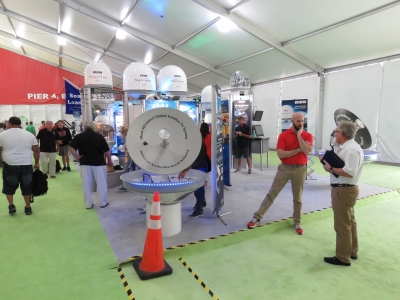
We stopped by to say hello to folks from our favorite satellite provider, KVH Industries, in their booth at the Miami boat show.
|
 |
2/16/2017: Seven Marine
Position: 25°44.61'N, -80°10.19'W
Seven Marine bills their product as "the most powerful outboard on the planet". They turn a 6.2L Cadillac V8 on end and somehow stuff it into an outboard motor case. We saw at least two boats at the boat show with four Seven Marine 627s for a total of 2508HP. That's a lot of ponies. Q: Why put 4 627-HP outboards on the back of a center-console? A: Because five wouldn't fit.
|
 |
2/16/2017: Ranger R-29 CB
Position: 25°44.58'N, -80°10.10'W
We spent ages touring a Ranger Tug R-29 CB at the boat show. The trailerable Rangers are wonderfully-executed boats with amazing attention to comfort and space utilization. We'd not sell Dirona, but would like to spend a season or two cruising the ICW and doing the Great Loop on a faster boat with less air and water draft. The Ranger R-29 CB looks like a pretty good candidate. We really fell in love with that boat.
|
 |
2/16/2017: Evo 43
Position: 25°48.95'N, -80°7.45'W
The Yachts Miami Beach show was focused primarily on large yachts, with many vendors having appointment-only areas for customers. This high-tech Evo 43 caught our attention with slide-out sides. It's a pretty innovative design and we're expecting slide-outs are going to open up a lot of new possibilities in boat design just as they have in the recreational vehicle industry.
|
 |
2/16/2017: Nordhavn
Position: 25°49.23'N, -80°7.40'W
Nordhavn 92 Rest Assured and Nordhavn 52 Stella Maris at the Yachts Miami Beach show.
|
 |
2/16/2017: Rest Assured
Position: 25°49.24'N, -80°7.40'W
We toured Nordhavn 92 Rest Assured. It's an incredibly beautiful boat.
|
 |
2/16/2017: N92 Engine Room
Position: 25°49.24'N, -80°7.40'W
The engine room in Nordhavn 92 Rest Assured is amazing. We eventually dragged ourselves out after a good half-hour.
|
 |
2/16/2017: Bruce & Pam Harris
Position: 25°49.24'N, -80°7.39'W
We haven't seen Stella Maris owners Bruce & Pam Harris since we were both moored at Soverel Harbor Marina in Palm Beach a year ago. We've stayed in touch, but it was great see them in person again and catch up.
|
 |
2/17/2017: Crackerjacks
Position: 28°37.17'N, -80°48.02'W
On our drive back from Miami to Daytona Beach, we stopped off at Crackerjacks for a great lunch in an awesome venue right almost in the middle of the Indian River and the ICW. We especially enjoyed the view to the Vehicle Assembly Building and the launch pads at the Kennedy Space Center (just barely out of sight behind the thatched roofs).
|
 |
2/17/2017: Volusia
Position: 29°12.88'N, -81°20.67'W
At Volusia Motor Speedway for a weekend of the World of Outlaws Sprint Car racing, "The Greatest Show on Dirt!" The last dirt track racing we saw was at Northline Speedway in Darwin, Australia.
|
 |
2/17/2017: Pit Area
Position: 29°12.93'N, -81°20.54'W
Spectators are allowed into the pits before the racing starts. We spent hours walking through and watching the various teams prepare their cars for the race. Sprint car racing is a weird combination of old technology and new. The cars use fairly dated solid-axle suspension and push-rod engines which sounds a bit boring these days. What's amazing is that these cars are 410 cubic-inch, alcohol-burning screamers putting out well over 900 hp in only a 1,400 lb package including the driver. That's very similar power-to-weight ratios to Formula 1 but, what makes it a real spectacle, is they run on dirt. To get speed on dirt, the cars employ giant wings with adjustable angle of attack that can develop enormous down-force at the over 100MPH average speeds at Volusia. The cars lap the half-mile oval at Volusia Speedway Park at right around 13 seconds with most of that 13 seconds spent in a 4-wheel drift with bits of clay flung nearly 100' above the cars.
|
 |
2/17/2017: Sprint Car Engine
Position: 29°12.95'N, -81°20.55'W
The heart of a World of Outlaws sprint car is a 410 cubic-inch displacement (CID) all-aluminum engine running on Methanol and putting out right around 900 hp. These engines cost about $50,000 and some teams blew up 3 engines during their multi-day visit to the half-mile oval at Volusia Speedway Park in Florida. Some teams chose to run "budget" engines that are 360 CID and cost around $30,000. Engine service life usually runs between 15 and 20 races with some teams able to push out to 30. The big budget teams will use shorter-lived engines that can turn to up to 9,000 RPM and can put out just a bit more power for some of the more important races during the course of the year.
|
 |
2/17/2017: Lawn Mower
Position: 29°12.88'N, -81°20.62'W
We loved this sprint-car themed Ferris lawn mower, complete with wing, on display at the track.
|
 |
2/17/2017: Track
Position: 29°13.00'N, -81°20.62'W
The World of Outlaws competes on dirt tracks. You would think that track preparation is to grate and smooth it and just go racing, but track preparation is an art. If the track is too dry, the stadium is dusty which is hard on the fans and the track will take on rubber and be highly likely to develop only a single fast grove. Fast sounds like fun but fans want passing so a single-groove race track is boring. On the other end of the spectrum, if a track is too wet, large clumps of clay (nearly mud) end up in the stands and the track is slow neither of which is all that much fun. A slow track is an equalizer where teams can't get the power down. The upside is the racing can be closer and the track is usually multi-grove but the downside is much lower overall speeds. Ideally a dirt track has a solid base so the racing can continue without interruption through the night, it's evenly prepared and watered all the way around, and there are multiple, fast-racing grooves.
|
 |
2/17/2017: Late Model
Position: 29°13.03'N, -81°20.61'W
The World of Outlaws Late Model series competes in purpose-built race cars on dirt tracks. These full-bodied cars weigh in at 2,350 lbs and are designed to resemble popular domestic street cars.
|
 |
2/17/2017: Late Model Engine
Position: 29°13.08'N, -81°20.60'W
World of Outlaw Late Models have no limit on engine size but most teams are using 400-430 cubic-inch engines that produce over 800 hp. These engines have aluminum heads and burn gasoline rather than the Methanol used by the Sprint Car series.
|
 |
2/17/2017: Alligators
Position: 29°13.07'N, -81°20.66'W
While not as fierce as the Australian saltwater crocodile, the Florida gator is not something you want to get close to either.
|
 |
2/17/2017: Fuel
Position: 29°12.97'N, -81°20.56'W
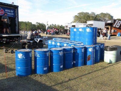
Picture are 33 50-gallon drums of fuel for a total of 1650 gallons of methanol. That fuel takes up a lot of space, so it's surprising to realize that Dirona carries more than that below deck (1747 gallons).
|
 |
2/17/2017: ATL
Position: 29°12.96'N, -81°20.55'W
For our long runs, we can carry an additional 960 gallons in deck fuel in ATL fuel bladders. We went with ATL FueLocker bladders and are very happy with that decision. ATL bladders had a good reputation with other boat owners, and from his car-racing days, James knows they can smack the wall at nearly 200 MPH without leaks or fire. In the World of Outlaws, where flipping, multi-car wrecks aren't uncommon, many teams choose ATL fuel bladders.
|
 |
2/17/2017: Driver
Position: 29°12.96'N, -81°20.55'W
One of the Sprint Car drivers belting in before qualifying. There's not much room in that cockpit. This is what helps keeps drivers safe when the cars flip or roll.
|
 |
2/17/2017: Push
Position: 29°12.99'N, -81°20.60'W
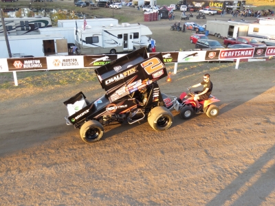
Sprint Cars don't have starters, a clutch, or even reverse gear. They are started in gear by a push-truck, or in this case, an ATV.
|
 |
2/17/2017: Dirt
Position: 29°12.89'N, -81°20.63'W
The lower seats at the dirt track get pelted with chunks of mud that fly off as the cars pass. We reserved seats at the top of the stands for a better view. But avoiding flying dirt is another very good reason to want to be up high.
|
 |
2/17/2017: Under the Lights
Position: 29°12.89'N, -81°20.65'W
All the racing this weekend is at night under the lights. Super-exciting.
|
 |
2/17/2017: Four Wide
Position: 29°12.89'N, -81°20.65'W
The field running four-wide in signature in World of Outlaws style prior to the start.
|
 |
2/17/2017: Fireworks
Position: 29°12.89'N, -81°20.65'W
The track put on an excellent show, including fireworks as part of the pre-race show.
|
 |
2/19/2017: Helicopter
Position: 29°12.89'N, -81°20.65'W
Sprint cars have Formula 1-like power-to-weight ratios with relatively high centers of gravity and open wheels, so flips are not unusual. Car construction, and the World of Outlaws focus on safety, means that few of these horrific wrecks injure drivers. While we were at Volusia we saw many wrecks where cars threw off parts as they flipped to a stop but there were no driver injuries. The teams quickly rebuild the cars and the drivers are back racing the next night and, in many cases, the next race. I wouldn't go so far as to call the cars safe but the sanctioning body has done a pretty good job of keeping the drivers safe and racing.
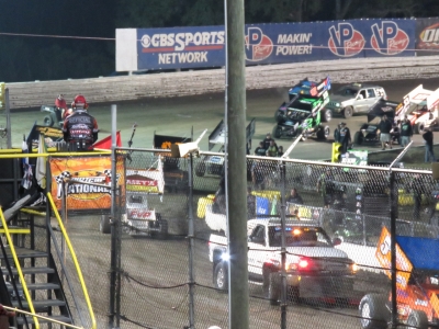
Sunday at Volusia ran into a different type of problem. Rico Abreu, Jason Sides, and Dale Blaney got together between turns 1 and 2 and Dale Blaney's car began cart-wheeling. It flew up over the guardrail surrounding the track and then flipped higher before hitting the top of the spectator safety fence. The car then continued to cart-wheel over the fence and into a crowd of what we would estimate to be 100 spectators and crew members watching the race from the garage track entrance near the corner two exit. The driver was fine but three spectators were seriously injured. The race was stopped for over an hour while the police investigated the accident and a medivac helicopter was brought down on the track back straightaway. The last report we saw had one of the injured released from hospital Sunday night while the other two remained in hospital with one in critical condition and one in serious. We wish a fast and full recovery to all three. |
 |
2/19/2017: Red Flag
Position: 29°12.89'N, -81°20.65'W
Cars parked on the track during the red-flag race-stoppage on Sunday night.
|
 |
2/19/2017: Late Start
Position: 29°12.89'N, -81°20.65'W
After the red flag, the final Sunday evening race didn't get underway until past 11pm. It was a late night, but we had a great time.
|
 |
2/20/2017: Pump Out
Position: 29°12.17'N, -81°0.83'W
Halifax Harbor Marina has some excellent amenities, including oil disposal a free pump-out service.
|
 |
2/21/2017: AutoZone
Position: 29°12.42'N, -81°2.46'W
At AutoZone to purchase a couple of pails of engine oil. When at full capacity we have enough oil on board for three main oil changes and two generator changes.
|
 |
2/21/2017: Daytona Schedule
Position: 29°11.51'N, -81°4.06'W
We stopped by the Daytona Speedway ticket office this afternoon to pickup our tickets for the Daytona 500 on Feb 26th. We'll also be attending the Can-Am Duel on Feb 23rd, the Nextera Energy Resources 250 on the 24th, the Powershares QQQ 300 on the 25th.
|
 |
2/21/2017: Propane Fill
Position: 29°12.44'N, -81°1.87'W
Filling up our propane tanks in preparation for our trip to Europe where filling will be much more difficult. We carry four tanks and, surprisingly, have only had to fill them twice since leaving Hawaii in 2013, in Nelson, NZ and St. Lucia. We specified a propane cooktop for ease of use, because a 240V electric cooktop would only operate if we were plugged in or running the generator and having to start the generator while at anchor or underway in order to boil a pot of water would be inconvenient. Our other propane consumer is an outdoor barbecue. Were we to design another boat, we'd definitely have a 240V inverter, and then would likely go with an electric cooktop and barbecue and get rid of propane altogether. Propane is a fire hazard, a hassle to fill and our four tanks take up a fair bit of space.
|
 |
2/21/2017: Fuel Fill
Position: 29°12.18'N, -81°0.83'W
We used the crane to lower one of our two deck tanks into the tender and ran over the marina fuel dock to fill it. We're not using the tender much right now, so only keep one tank full.
|
 |
2/21/2017: Tia Cori's Tacos
Position: 29°12.87'N, -81°1.24'W
Dinner on the patio at our favourite Daytona Beach restaurant, Tia Cori's Tacos. The food is excellent authentic Mexican, and the margaritas are delicious.
|
 |
2/22/2017: Joe's Crab Shack
Position: 29°13.64'N, -81°0.34'W
Lunch on the pier at Joe's Crab Shack. Our marina is along the ICW on the Halifax River and we finally made it over to the ocean side. The day was windy and blustery, perfect for a meal perched over the ocean. We had a great meal and conversation with Brian Lewis, the owner of Nordhavn 46 Egret who'd stopped by for a visit. We'd just missed Brian in Brunswick, so were glad he was able to make it to Daytona Beach.
|
 |
2/22/2017: Daytona Beach
Position: 29°13.64'N, -81°0.33'W
Not the typical beach picture for the city that was once the "Spring Break Capitol of the World", but definitely more our style.
|
 |
2/23/2017: Seafair Miami
Position: 29°12.17'N, -81°0.83'W
The 222-ft mega-yacht Seafair Miami arrived into Halifax Harbor Marina today to host the Daytona 500 Bash, a party for drivers and special guests. The $40M vessel was purpose-built to navigate the ICW, with a 57-ft air draft to fit under the fixed 65-ft bridges. The ship is massive, and looks even more huge towering over the fuel dock and dwarfing the nearby pleasure craft. The vast expanse of steel completely eliminated WiFi coverage in the marina and their Friday-night fireworks display covered all the boats with partially burned fireworks debris.
|
 |
2/23/2017: Daytona
Position: 29°11.51'N, -81°3.99'W
For the first of our four days at Daytona, we bought tickets to the UNOH FanZone inside the track area adjacent to the garages and pit road. We'll be entering through the tunnel under corner four the second they open it up for us. It's a little wet today, but should clear up for Can-Am Duel 150s racing tonight.
|
 |
2/23/2017: Truck Inspection
Position: 29°11.35'N, -81°4.09'W
NASCAR is fairly nimble in adjusting rules to keep the racing close, safe, and competitive. The teams are fairly nimble at "interpreting" the rules and finding loopholes. As a consequence, the NASCAR technical inspection process has become a science where every detail is checked before the cars are allowed to qualify or race. Here suspension geometry is being verified on the NASCAR trucks.
|
 |
2/23/2017: Gas Cans
Position: 29°11.31'N, -81°4.10'W
NASCAR-approved 12-gallon fuel cans used to fill the 22-gallon in-vehicle fuel tanks. If you ever find yourself in an argument with a NASCAR gas man, remember that he's used to running with and tossing around these 81-lb containers like toys. Note the no spill fitting and the clear hose vent system to make the can level visible.
|
 |
2/23/2017: Main Stretch
Position: 29°11.28'N, -81°4.27'W
View to the stands from the FanZone. The speedway has painted the seats random colors so they appear to be filled even when empty. NASCAR attendance tends to track the economy and, no surprise, it's usually strongest when the economy is as well. But there is increasing evidence that NASCAR popularity is slipping somewhat and some tracks, including Daytona, have removed seating.
|
 |
2/23/2017: Window
Position: 29°11.31'N, -81°4.21'W
One of the excellent FanZone features is windows into each garage area. NASCAR really does a great job for the fans.
|
 |
2/23/2017: Toolbox Envy
Position: 29°11.31'N, -81°4.17'W
Mmmmmm ... toolbox.
|
 |
2/23/2017: Restrictor Plate
Position: 29°11.30'N, -81°4.19'W
Over the years, speeds have ramped up at all largest NASCAR tracks as the cars improve and the engineers keep finding more horsepower. At most NASCAR tracks, the speed is controlled somewhat by corners but the 33-degree banking at the massive 2.5 mile tri-ovals of Daytona and Talladega allows the speeds to escalate without bound. Running these big, heavy cars well over 200 MPH can get dangerous. In an effort to keep the racing safer for fans and, potentially for drivers, NASCAR mandates the use of restrictor plates at Daytona and Talladega. These plates restrict the amount of air that can get to the engine intake, which reduces engine output to around 430 hp down from an estimated 750-800 hp normally used. The good news is that it's probably safer for fans. The bad news is that the racing at the restrictor plate-limited tracks becomes a procession where anyone in the top 20 positions can win and no leader can draw away from pack regardless of driving skill or car preparation. Another downside is the cars run so close together, often pushing each other, that even the tiniest mistake will yield a 15+ car accident. Too frequently, the best drivers and cars aren't around at the end of the race.
|
 |
2/23/2017: Air Titan
Position: 29°11.29'N, -81°4.25'W
Most of the day a whole fleet of Air Titan trucks were out drying the track. These trucks carry high-pressure blowers that pump air through hoses to nozzles dragged on the track. The blower strength is so high that they almost form a squeegee, forcing water out of the track. NASCAR also has pickup trucks with jet engines installed in the bed that blow onto the track. These are used both to dry the track and to efficiently clean off debris during yellow flags.
|
 |
2/23/2017: Tech Inspection II
Position: 29°11.28'N, -81°4.26'W
At this NASCAR technical inspection station, officials are measuring rear spoiler height, front splitter height, checking for track clearance using a laser beam, and checking compliance with chassis and suspension rules.
|
 |
2/23/2017: Victory Lane
Position: 29°11.25'N, -81°4.29'W
This will be one crazy place at the end of Sunday's Daytona 500.
|
 |
2/23/2017: Garage Area
Position: 29°11.30'N, -81°4.25'W
The view down the road between the garage area and pit road from a balcony above the garages.
|
 |
2/23/2017: Napa No 24
Position: 29°11.32'N, -81°4.20'W
Back-to-back Daytona 500 pole winner Chase Elliot's Napa No. 24 car being wheeled out to tech inspection. His father Bill Elliott, aka "Awesome Bill from Dawsonville", ran in many of the live races we've watched.
|
 |
2/23/2017: M&M No 18
Position: 29°11.33'N, -81°4.19'W
One of the first things we did on entering the FanZone is get ourselves on the list for a garage tour. Tours run every half-hour and are limited to 15 people, so slots are scarce. This is Kyle Busch's M&M No 18 car in the garage.
|
 |
2/23/2017: Tech Inspection III
Position: 29°11.34'N, -81°4.17'W
At high speed tracks like Daytona, even an 1/8 of an inch off the width of the car could propel that ride to victory. NASCAR uses templates that are exactly the legal dimensions of the car across several planes. Above, and in the video https://youtu.be/Vnm3hffpU7o, you can see these templates being used. The plate is lowered to the race car body and an inspector checks that a feeler gauge doesn't fit between the template and the race car body.
The exact shape up front has a massive impact on air resistance so these dimensions are checked especially closely. Above and in the video you can see the wheeled templates that have to exactly fit the car. Because there are three different manufacturers competing, there is one front template for each of Chevrolet, Ford, and Toyota. |
 |
2/23/2017: Rusty Wallace
Position: 29°11.32'N, -81°4.21'W
Rusty Wallace recognized Jennifer and rushed over to say hello. Well, not so much. But she did shake his hand. We've often seen the former Winston Cup Chamption racing live when we used to drive down to Michigan International Speedway from Toronto in the 1990s. He's one of the best.
|
 |
2/23/2017: Junior
Position: 29°11.31'N, -81°4.23'W
Perennial most-popular driver Dale Earnhart Jr was in the garage talking with his crew preparing for the Can-Am Duel that evening. The two 150-mile races that make up the Can-Am Duel Thursday night sets the starting position for the Daytona 500.
|
 |
2/23/2017: Covers
Position: 29°11.29'N, -81°4.25'W
Back on the balcony above the garages looking down on all the cars that have passed tech inspection and are now sitting covered and ready to race tonight. The crews aren't allowed access to the cars at this point except under the watchful eye of a NASCAR official.
|
 |
2/23/2017: Kyle Petty
Position: 29°11.30'N, -81°4.25'W
Kyle Petty (on the right), son of seven-time NASCAR champion"King" Richard Petty, is another NASCAR driver we've seen race frequently.
|
 |
2/23/2017: Thunderbirds
Position: 29°11.29'N, -81°4.25'W
The USAF Thunderbirds will be doing a flyover for the Daytona 500 and were practicing today.
|
 |
2/23/2017: Not So Sure
Position: 29°11.26'N, -81°4.26'W
We're not sure what this is, but we hope it tastes better than it looks.
|
 |
2/23/2017: Waiting To Cross
Position: 29°11.26'N, -81°4.28'W
Our FanZone tickets give us access to the track when it opens later in the afternoon. A big crowd had built up waiting for the gates to open.
|
 |
2/23/2017: War Wagon
Position: 29°11.27'N, -81°4.30'W
We entered the track by crossing pit road. Each team has a "war wagon" at their pit for the crew to monitor the race. On top are seats for up to eight and below the crew can monitor the weather and track data such as fuel consumption and tire wear.
|
 |
2/23/2017: Pit Lane
Position: 29°11.27'N, -81°4.30'W
The cars lined up on the track ready for tonight's Can-Am Duel.
|
 |
2/23/2017: On the Track
Position: 29°11.33'N, -81°4.29'W
Wild to be out on the track at Daytona!
|
 |
2/23/2017: SAFER Barrier
Position: 29°11.29'N, -81°4.34'W
The SAFER barrier is racing safety breakthrough at NASCAR tracks. SAFER is a Steel and Foam Energy Reduction Barrier designed by a team of engineers lead by Dean Sicking at the Midwest Roadside Safety Facility and the University of Nebraska-Lincoln. Developed between 1998 and 2002, the first installation was at Indianapolis Motor Speedway in May 2002. It's now in use at nearly every NASCAR and IndyCar track.
The principle behind the SAFER barrier is a smooth sheet of steel with high-density closed-cell foam behind. The steel spreads the energy out over a wider area and the closed cell foam absorbs it. Key in the design is the outer steel panel being sufficiently strong that cars will normally not pierce or get under it, which takes off energy too quickly and leads to driver injury. Instead, the cars just slide down track with the wall absorbing energy and deflecting the car back across the track rather than catching on the wall and being rolled or flipped which can be hard on cars, drivers, and even fans. SAFER has really made the sport far less dangerous even as speeds continue to escalate at most tracks. |
 |
2/23/2017: Signing the Track
Position: 29°11.27'N, -81°4.35'W
Jennifer was very keen to sign the track at Daytona International Speedway. James still says he has her beat in signing the outer door of the upper port side missile tube on the USS California while cruising 500ft below the surface.
|
 |
2/23/2017: Dinner
Position: 29°11.25'N, -81°4.45'W
The race didn't start until 7:00pm so we had time beforehand for a bite to eat with a great view east from the speedway. There's little better than NASCAR racing under the lights. Daytona recently completed a multi-million dollar renovation of the stadium and they've done an awesome job. The facility is beautiful, getting to and from the seats is efficient and easy, and we hardly had to stand in a line the entire weekend, even on Sunday. This is the nicest facility we've ever seen across all sports.
|
 |
2/23/2017: Start Your Engines!
Position: 29°11.25'N, -81°4.41'W
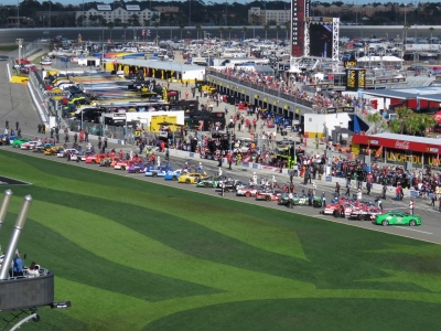
The field lined up on pit road ready for the Can-Am Duels. For Daytona, only the front row is decided during standard qualifying. The finishing order in the two 150-mile Can-Am Duel races, formerly called the Twin 125s, set the majority of the starting grid.
|
 |
2/23/2017: Lets Go Racing!
Position: 29°11.24'N, -81°4.40'W
Dale Earnhardt Jr. on the pole as the pace car leaves the track at the start of the second Duel. It was awesome to watch a NASCAR race live again after so many years. Earnhardt was very strong and led the majority of the race, but was eliminated from the race by a crash in front of him.
|
 |
2/24/2017: Tia Coris Tacos
Position: 29°12.87'N, -81°1.24'W
We walked down to Tia Cori's Tacos for a great meal before the NASCAR truck race at 7:30 tonight.
|
 |
2/24/2017: Anthem
Position: 29°11.25'N, -81°4.40'W
Just before race time, each truck is positioned at the start of the pit road with the crew lined up beside for the national anthem. The cars look beautiful under the lights as each crew tensely waits to learn what an off-season of hard work has produced. In a couple of hours, one of these cars will be in victory lane and a good many crews will loading up and heading home to rebuild seriously damaged trucks.
|
 |
2/24/2017: Racing Under the Lights
Position: 29°11.25'N, -81°4.40'W
Many stock car racers learned their sport racing under the lights at the many short tracks across the country. Friday night at Daytona International Speedway is a great way to start the Camping World Truck Series for 2017 and, for many of these drivers, this will be their first race in the series. Time to go racing.
|
 |
2/24/2017: Restart
Position: 29°11.25'N, -81°4.40'W
The field accelerating up to speed through the tri-oval as the green flag waves for a race restart after a yellow flag. 32 cars remain able to compete for the first victory of the year.
|
 |
2/24/2017: Pit Crew
Position: 29°11.25'N, -81°4.40'W
Bobby Gerhart in for a pit stop on his way to finishing 21st. A modern NASCAR pit stop is like a drag race. Exciting but over so quickly it's hard to really see the details in real time.
Here you can see the jack man dropping the car as the front wheel changer finishes up tightening the lug nuts. The rear tire changer is long since done at the right rear and is sprinting to the left side for the next change. The crew chief is on the toolbox above using a stop watch to see how the team is performing, with other teams, fire crew, and officials all watching carefully. |
 |
2/24/2017: Body Work
Position: 29°11.25'N, -81°4.40'W
J.J. Yeley is in trouble here where, like most of the field over the course of the race, he's been involved in a multi-car wreck. Small changes in aerodynamics make a huge difference at super-speedway racing speeds and the crew is dealing with front end damage where the hood has been pushed back and it's buckled up.
After carefully preparing the car to be aerodynamically clean and having then been checked by NASCAR with a template and feeler gauge to be exactly the legal shape, they are now down to using a couple of 240-lb crewmen to push the hood back down to something close to what they started with. They did well, avoided going a lap down while completing the bodywork, and Yeley eventually brought the car to a 9th place finish. |
 |
2/24/2017: Daytona 500 Bash
Position: 29°12.23'N, -81°0.73'W
The massive Seafair Miami hosting the "Daytona 500 Bash, a drivers party and Fox media event at Halifax Harbor Marina. This 222-ft steel mega-yacht is designed for shallow intra-coastal water operation rather than the open ocean cruising expected by most mega-yacht designs.
|
 |
2/25/2017: Hosing Off
Position: 29°12.17'N, -81°0.83'W
Jennifer hosing off the boat. The Daytona 500 Bash fireworks display last night covered all the boats in the marina with partially burned fireworks debris. At least we got to enjoy it a bit—we could see the fireworks display from our seats at the Truck race at Daytona International Speedway last night.
|
 |
2/25/2017: Thunderbirds
Position: 29°12.17'N, -81°0.83'W
The Thunderbirds were practicing today and their flight path was right over the marina. We could almost reach out and touch them.
|
 |
2/25/2017: Seafair
Position: 29°12.17'N, -81°0.83'W
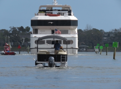
An assist boat arrived this morning to accompany the 228-ft mega-yacht Seafair Miami out of our marina and presumably back to Miami. The video https://youtu.be/ojLaA7Dc8aI shows the Seafair Miami working out the channel with only feet to spare on either side. The assist boat is taking up the stern radioing distances back to the captain in the SeaFair Bridge.
|
 |
2/25/2017: Powershares QQQ 300
Position: 29°11.25'N, -81°4.41'W
It's just 10 minutes prior to the flag dropping at this point on the NASCAR Xfinity Series Powershares QQQ 300 at Daytona. The national anthem has been sung and all the crews have been cleared out leaving the drivers alone in their cars as the last of the crews clear the area. For the drivers, it's been a busy weekend of sponsor meetings, interviews, prepartion, qualifying, and other commitments but none of that matters at this point. Now it's time for a deep breath, last minute radio checks, thinking through race strategy, and focusing on settling down and not making any early race mistakes. The pace car will soon pull out onto the 33 degree banking of corner 1 leading the field towards the green flag.
The NASCAR Xfinity Series is the second-most prestigious stock car touring series after the Monster Cup cars that will race in the Daytona 500 the next day. Many young drivers that will someday be household names racing in the premier series will race first in the Xfinity series, so it is a chance to see the best in the nation on their way to Monster Cup. And, many of the Monster Cup drivers race in this series as well, so the quality of competition is very high. And, just as Junior A hockey is sometimes more exciting than NHL, so too here. Many of these drivers really do have something to prove and they go hard. |
 |
2/25/2017: Race Start
Position: 29°11.25'N, -81°4.41'W
It's finally time to forget about the press, the sponsors, and all other distractions and get to work. The pace car controls the speed of the 40 car pack as they head towards the starting line. At the last second the pace car turns sharply to the left to head down the pit lane. They drivers throttle up and the speed increases rapidly as the entire field thunders towards the tri-oval anticipating the green flag. All eyes are on the flagman as they wait for the first hint of a green flag and the begining of a big day at the office.
|
 |
2/25/2017: Close Quarters
Position: 29°11.25'N, -81°4.41'W
Tracks like Daytona have much more space than most short tracks but still, during buys green flag stops when every second matters, the pit area is remarkably cramped. Cars are entering and leaving their pits while crews are changing tires and fueling competitors in adjoining pit stalls. It's amazingly rare that a crew member gets hit but it's always close and contact does sometimes happen.
|
 |
2/25/2017: Pit Crew 1
Position: 29°11.25'N, -81°4.41'W
Anthony Kumpen has just run at the speed limit down pit lane before throwing the wheel over to the left at the last second to enter his pit. His pit crew can't legally cross the wall until he is one pit stall away and yet before he slides to a stops the right front tire man is sliding in on his knees to where the driver will (nearly) always put his right front wheel. Already some lug nuts are off even though the jack man hasn't yet lifted the car. The jack man is just begining the first of two big strokes that will lift the car and, by that time, both right side tires will be free. The tire carrier is just arriving with the new tire. Teams are allowed six crew over the wall but this particular stop is early in the race and they are only changing the right side rubber and won't be taking much fuel. It's going to be a quick stop.
|
 |
2/25/2017: Pit Crew 2
Position: 29°11.25'N, -81°4.41'W
It's only been seconds since the previous picture but the right side tires are changed, the old tires have nearly been carried back to the pit wall and the front tire changer is in full sprint to get himself and the air hose out of the way of the soon to be exiting race car. The jack man is slightly behind but picking up speed. The moment he clears the front of the car the crew chief will be yelling, "go, go, go" and Kumpen will dump the clutching trying to get enough wheel spin to avoid stalling with the tall gears they use at Daytona. The fuel man, wearing a silver fireproof vest, has just completed his work and passed the gas can back over the wall. The gas man is still beside the car ready to help push the car back to life if the driver stalls on pit lane exit.
|
 |
2/25/2017: Red Flag
Position: 29°11.25'N, -81°4.41'W
It's a 300 mile race this is far too early in the race for a big accident. But this is the first race of the year, many drivers are in their first Grand National competition, and racing at Daytona has been a life long goal. The racing has been hard from the drop of a flag, as it was clear from the first lap that a mistake would happen soon. The wreck started towards the front of the pack, as is typical of restrictor plate racing, where a small mistake impacted a large number of cars. There is wreckage and debris everywhere and NASCAR has red-flagged the race to allow the safety crews to clear the wrecked cars and debris.
|
 |
2/25/2017: Clearing the Track
Position: 29°11.25'N, -81°4.41'W
Another accident and another red flag. This is a smaller incident in corner four it led to a short race stoppage as well. Note the angle of the safety crews heading up to help the driver in the car at the top of corner 4. thirty-three degrees of banking is amazingly steep.
|
 |
2/25/2017: Twilight
Position: 29°11.24'N, -81°4.40'W
The race started at 3:30 but, even though the race is 200 miles shorter than the Daytona 500 race scheduled for the next day, this restart is under the lights and the race won't finish until nearly 7:30. NASCAR under the lights is hard to beat. Here the field is rumbling up to speed having just seconds earlier taken the green flag to restart the race. At this point in the race, only 24 cars remain from the original 40 car field and many of these are damaged. The crewmen have been hard at work on some cars during yellows trying to get suspension alignment back to something drivable and creatively reattaching body panels with massive sheets of tape.
|
 |
2/25/2017: Uber
Position: 29°11.15'N, -81°4.61'W
Waiting for an Uber to pick us up after the Powershares QQQ 300. Rather than drive back and forth to the track and deal with the traffic jams, we instead went by Uber. This worked out super-well and we'd do it again.
|
 |
2/26/2017: Race Day
Position: 29°11.25'N, -81°4.40'W
In our seats just before the start of the Daytona 500. We're wearing headphones hooked to a Uniden Bearcat BC125 radio scanner. Race officials communicate via radio, as do the drivers and their teams. Fans use scanners to listen in.
|
 |
2/26/2017: Pre-Race Festivities
Position: 29°11.25'N, -81°4.40'W
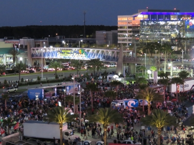
The infield was packed with fans taking in the pre-race festivities. The Daytona 500 is both the opening race of the NASCAR Monster Energy season and, if not the most important race of the year, right up there. It's exciting to be here.
|
 |
2/26/2017: Mario Andretti
Position: 29°11.25'N, -81°4.41'W
Mario Andretti, who we've seen race in Indy Cars, was one of the many celebreties attending the Daytona 500. He's the only driver ever to win Daytona 500 (1967), the Indianapolis 500 (1969), and the Formula One World Championship (1978).
|
 |
2/26/2017: Lady Antebellum
Position: 29°11.25'N, -81°4.40'W
Seven-time GRAMMY award winners Lady Antebellum headlined the pre-race show.
|
 |
2/26/2017: Drivers Intro
Position: 29°11.25'N, -81°4.40'W
Ryan Blaney (left) and Martin Truex Jr. walking down during the drivers introductions.
|
 |
2/26/2017: Cleanup
Position: 29°11.25'N, -81°4.40'W
We were impressed with how fast crews moved out the stages from the pre-race festitivites and got the infield cleaned of any garbage left by the thousands of fans.
|
 |
2/26/2017: Thunderbirds
Position: 29°11.25'N, -81°4.40'W
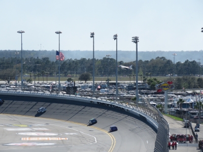
The USAF Thunderbirds doing a pre-race flyover.
|
 |
2/26/2017: Landing
Position: 29°11.25'N, -81°4.40'W
Race cars rounding corner two with one of the Thunderbirds landing at the airport directly behind.
|
 |
2/26/2017: Pace Car
Position: 29°11.25'N, -81°4.40'W
The pace car leading the pack just before the start of the race. The video https://youtu.be/32G3xxRF1DI shows the opening lap of the the 500 followed by Kurt Busch doing donuts on the infield after taking the victory 3 hours 29 minutes and 9 seconds after the start flag fell.
|
 |
2/26/2017: Pit Stops
Position: 29°11.25'N, -81°4.40'W
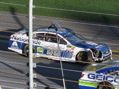
Under an early yellow flag most of the field heads into the pits for tires and fuel lead by Kyle Bush and Kevin Harvick. Even this early in the race, pit strategy is important and we can hear extensive discussions between drivers and crew on whether they were taking two tires or four. And those drivers not happy with handling are asking for adjustments.
|
 |
2/26/2017: Damage
Position: 29°11.25'N, -81°4.40'W
Dale Earnhart junior has been having a super strong weekend and he's been running right up front for most of the first half of race. There was contact between the car directly in front of him and a car that got turned into the wall. Junior went low but stayed on the throttle. If you back off in a restrictor plate race, you'll pretty quickly find the back of the pack. Unfortunately, he didn't quite have enough room and his right front corner contacted the car he was trying to avoid in front of him. The damage looks minor as he passes our spectating position at the start finish line but, having watched the accident, we knew it was worse. Earnhart's car hit hard enough to climb right up over the car in front and then come down hard. The suspension damage was bad enough to end his race.
|
 |
2/26/2017: Jimmy Johnson
Position: 29°11.24'N, -81°4.40'W
Jimmy Johnson's Lowes No. 48 car in the pits. Johnson is one of only three driver to have won the NASCAR championship seven times. He was knocked out of the race on lap 127.
|
 |
2/26/2017: Caution
Position: 29°11.24'N, -81°4.40'W
The caution flag flying from the flag stand as cars slide off the track and into the wall at the entry to pit road.
|
 |
2/26/2017: Donuts
Position: 29°11.24'N, -81°4.40'W
2017 Daytona 500 winner Kurt Busch doing doing donuts on the infield following his victory. We aren't really restrictor plate racing fans but it was a surprisingly entertaining day of racing. Unlike some of the races earlier in the week, we didn't lose half the field to wrecks and the racing stayed close through an action-packed race day. The renovated Daytona stadium is a model for all other racing venues in fan comfort, convienence of facilities, and ability to see the action. It's one of the premier facilities in the sporting world.
|
 |
2/26/2017: Crowds
Position: 29°11.33'N, -81°4.38'W
Daytona's 101,000 seats were sold out and when all those people leave at once, the crowds are thick. We were planning to walk out of the crowds and then call an Uber, but ended up just walking all the way. We went for dinner at McKs Irish Tavern and were amazed to be one of the first there as the place filled up with fans who had driven back from the speedway.
|
 |
3/2/2017: Mail Run
Position: 29°12.17'N, -81°0.83'W
We run the tender almost daily to the marina office to pickup packages. The office is a long walk from our berth, but a short ride in the tender.
|
 |
3/2/2017: Irish Tri-Color
Position: 29°12.17'N, -81°0.83'W
One of the packages contained a set of courtesy flags for the countries we'll visit in the next year, including an Irish Tri-Color (It looked the right way around from where Jennifer was sitting.)
|
 |
3/2/2017: Reeds Almanac
Position: 29°12.17'N, -81°0.83'W
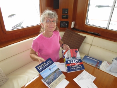
Michael and Frances Crofts of N40 Coracle in England sent us a copy of the 2017 Reeds Nautical Almanac and Marina Guide. The 1056-page Almanac is hefty and covers an impressive amount of ground in Atlantic Europe from Denmark to Gibraltar. We hope to cover it all. :)
|
 |
3/2/2017: Scottish Islands
Position: 29°12.17'N, -81°0.83'W
British residents Jean and Matt Findlay of Superted V recommended Hamish Haswell-Smith's The Scottish Islands for our upcoming Scottish cruise this summer. Hamish covers 168 individual Scottish islands. He's rather strict in his interpretation of what is and what is not an island, where the moment you get a bridge, you're no longer an island.
|
 |
2/28/2017: Chart House
Position: 29°12.11'N, -81°0.65'W
We just discovered the nearby Chart House has a great Happy Hour menu and a deck overlooking the ICW. This became one of our favourite stops for the remainder of our stay in Daytona Beach.
|
 |
3/2/2017: Route Planning
Position: 29°12.17'N, -81°0.83'W
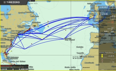
We've been looking at a variety of routes for our upcoming Atlantic passage. Here are some of the possibilities. Ideally we'd run 1,700nm from Newfoundland to Ireland, but would have to wait until July when the icebergs are gone. Likely we'll run 2,900nm from Newport, RI directly to Cork, Ireland in May and keep south of the ice risk.
|
 |
2/2/2017: James Watt Dock
Position: 55°56.55'N, -4°43.51'W
In addition to route planning, we've also been planning out some of our stops this summer. We plan to stay at James Watt Dock Marina near Glasgow for a few weeks and we've also got tickets to the famed Edinburgh Tattoo in early August.
|
 |
3/4/2017: Chart House
Position: 29°12.11'N, -81°0.65'W
Back at the Chart House for Happy Hour on a rainy day. We're reading through Reeds Nautical Almanac together and doing trip planning.
|
 |
3/5/2017: Don & Jinhee
Position: 29°12.17'N, -81°0.83'W
Fellow Canadians Don and Jinhee Magie came down from their home near Toronto to attend the Stuart,FL TrawlerFest and stopped by to visit Dirona. They've looked at many different Nordhavn models and had lots of questions for us. We spent a great afternoon with them talking boats, showing them around Dirona and grabbing lunch in town.
|
 |
3/11/2017: BGAN
Position: 29°12.17'N, -81°0.83'W
We tested our BGAN satellite terminal earlier this week, and it worked for a while before packing it in. It probably would make to sense to replace it with a newer model, but we found a new one on sale at Amazon for one-third the price of new and couldn't resist.
|
 |
3/15/2017: Memory
Position: 29°12.17'N, -81°0.83'W
Our navigation computer twice locked-up while we were streaming a video through it last night. This morning we replaced the memory and that seems to have resolved the problem.
|
 |
3/15/2017: Brrrr
Position: 29°12.17'N, -81°0.83'W
The temperature dropped down to 44°F (6.6°C) last night. That's pretty chilly for Florida.
|
 |
3/16/2017: PassageMaker
Position: 29°12.17'N, -81°0.83'W
The latest issue of PassageMaker Magazine just came out and it's cool to see Dirona on the cover (the picture was taken at Cascade Falls in Prince William Sound Alaska). This issue contains the first of a three-part series describing our trip around the world. In this issue, we describe where we went and why, how we planned the trip, various aspects of being underway, such as watch keeping and weather routing, and the communications options and organizational approach that allow James to continue to work in the technology sector no matter where we are in the world. The second article is expected in the May issue and will cover logistics such as country clearing, fueling, handling surface mail, obtaining spares, and travelling with our cat Spitfire. The third article will describe how we rigged Dirona for the trip.
The first in the series is available online at PassageMaker.com. |
 |
3/16/2017: Flow Sensor
Position: 29°12.17'N, -81°0.83'W
The hydraulic raw-water cooling flow sensor stops working about once a year. That by itself is not too bad, but it's quite difficult to get the front glass out of it to clean it up and re-assemble it. So James replaced it today with a similar design with a screw-on front housing rather than a circlip.
|
 |
3/17/2017: Latch
Position: 29°10.26'N, -81°2.46'W
The locker latch in the master stateroom shower was getting sticky, so we replaced it with a spare. We have a big bin of all sorts of locker and door hardware.
|
 |
3/17/2017: Provisioning
Position: 29°11.72'N, -81°1.23'W
We picked up a rental car for the day to run some errands. One was to stock up on some non-perishables for Europe that we likely can't get there, such as Planter's nuts. We've tried nuts from all over the world and nothing seems to comes close to Planters.
|
 |
3/17/2017: Speedway Custom Photo
Position: 29°11.26'N, -81°4.63'W
We stopped in at Speedway Custom Photo for pictures to renew our Canadian passports. They have a huge shop and in one room had this aerial photograph of Daytona Speedway on race day.
|
 |
3/17/2017: Batteries Plus
Position: 29°10.86'N, -81°4.83'W
James testing a spare battery for our UPS before we purchase it. We've learned from experience to test any batteries before we bring them home—some batteries sit around the shop for a long time.
|
 |
3/17/2017: Bike Week
Position: 29°12.87'N, -81°1.25'W
Barely have the Daytona 500 crowds dissipated when Daytona Beach hosts the 76th annual Bike Week. The 10-day motorcycle event originated in 1937 and draws an estimated 500,000 people. The rally started last weekend and from the marina we've been hearing motorcycles pass all week. After we dropped off our rental car, we spent the rest of the day at Bike Week.
|
 |
3/17/2017: Bike Traffic
Position: 29°13.27'N, -81°1.37'W
This was pretty much the view all day on every road we drove on: dozens and dozens of motorcycles.
|
 |
3/17/2017: Renegade
Position: 29°13.27'N, -81°1.37'W
If you want to buy something motorcycle-related, this is the place to be. Vendors selling everything from leather doggie vests to highly-custom bikes pack the streets. Here Jennifer is checking out a Renegade Trikes custom hardtop trike. It's powered by an automative V8, automatic transmission and automotive rear-axle.
|
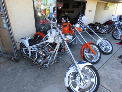 |
3/17/2017: Choppers
Position: 29°13.26'N, -81°1.37'W
Beautiful paint jobs and lots of chrome on these these choppers.
|
 |
3/17/2017: Kawasaki
Position: 29°13.23'N, -81°1.36'W
A field of Kawasakis for sale. Harley Davidsons were the dominant bike, but pretty much every other manufacturer was represented.
|
 |
3/17/2017: Parking
Position: 29°13.15'N, -81°1.36'W
The streets were jammed with parked motorcycles. The city had put out signs down much of Beach Street restricting parking to motorcycles only.
|
 |
3/17/2017: Wide
Position: 29°13.18'N, -81°1.36'W
Custom everything on this chopper, from the paint job to the design, but still with Harley Davidson power at the core.
|
 |
3/17/2017: V8
Position: 29°13.15'N, -81°1.34'W
We were amazed to see a few "regular" motorcycles with V8 engines. This is a Boss Hoss, the only globally-approved V8 motorcycle manufacturer.
|
 |
3/17/2017: Can-Am
Position: 29°13.09'N, -81°1.32'W
Motor trikes are very popular, both with single front wheel and single rear wheel designs. The stable platform and extra space likely appeal to the aging biker population.
|
 |
3/17/2017: Ford F650
Position: 29°13.17'N, -81°1.34'W
The Ford F650 is a beast. It's about as big as you can get on a pickup chassis.
|
 |
3/17/2017: Motor Trike
Position: 29°13.20'N, -81°1.34'W
Motor Trike makes trike conversion kits for the most popular brands.
|
 |
3/17/2017: Toy Hauler
Position: 29°13.20'N, -81°1.34'W
Optimum RV had a number of toy haulers on display. We were impressed with the layout and quality of this Forest River model with a large galley, slide-out seating area, and two fold-down decks. The area behind the photo had space for two large motorcycles and converts to a deck and seating area when not in use.
|
 |
3/17/2017: Misfit Industries
Position: 29°13.25'N, -81°1.34'W
We loved the slogan for Misfit Industries: "Black Collar Goods". They do incredible bike customizations.
|
 |
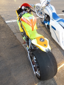
3/17/2017: Trike
Position: 29°13.21'N, -81°1.34'W
This trike is an incredible work of art, by far the top of the trikes we saw.
|
 |
3/17/2017: BMW
Position: 29°13.06'N, -81°1.31'W
Most of the heavily-customized bikes were Harley Davidson-powered, but this one sports a BMW engine.
|
 |
3/17/2017: St Patrick's Day
Position: 29°12.58'N, -81°1.09'W
The St. Patrick's Day celebration was in full swing at McKs Irish Tavern that evening.
|
 |
3/18/2017: Our Deck Down Under
Position: 29°8.94'N, -80°58.41'W
Lunch along the ICW at Our Deck Down Under with, counterclockwise from right, Duane Rodgers, Marcus Edwards, Kylie Solum and Michelle Walker. We last saw Duane and Michelle when we were in Melbourne. They happened to be in Orlando, FL on a business trip with Marcus and Kylie and stopped by for a visit. It was excellent to see Duane and Michelle again, and we enjoyed meeting Marcus and Kylie. We have a great afternoon with them all.
|
 |
3/18/2017: Jim Shira
Position: 29°12.17'N, -81°0.83'W
Jim Shira had already read the current PassageMaker issue and came by to tour Dirona and, for fun, to have us sign the cover.
|
 |
3/19/2017: Power Wash
Position: 29°12.17'N, -81°0.83'W
James power washing the tender as we lift it in preparation for our departure tomorrow morning. We've been using the tender daily from running back and forth to pickup mail at the marina office. But six weeks is a long time in warm Florida waters and the tender had a significant amount of growth on the hull. Fortunately the growth was mostly soft, with no barnacles, and cleaned off relatively easily.
|