MV Dirona travel digest for Caledonian Canal, Scotland 2017

|
Click the travel log icon on the left to see these locations on a map,
with the complete log of our cruise. On the map page, clicking on a camera or text icon will display a picture and/or log entry for that location, and clicking on the smaller icons along the route will display latitude, longitude and other navigation data for that location. And a live map of our current route and most recent log entries always is available at //mvdirona.com/maps/LocationCurrent.html. |
 |
10/7/2017: Troms Castor
Position: 57°40.85'N, -4°2.99'W
Offshore supply vessel Troms Castor, of Tromso, Norway, departing Cromarty Firth this morning beyond the two jack-up oil rigs. Tromso is at the northern tip of mainland Norway‐we hope to visit next summer when we cruise Norway.
|
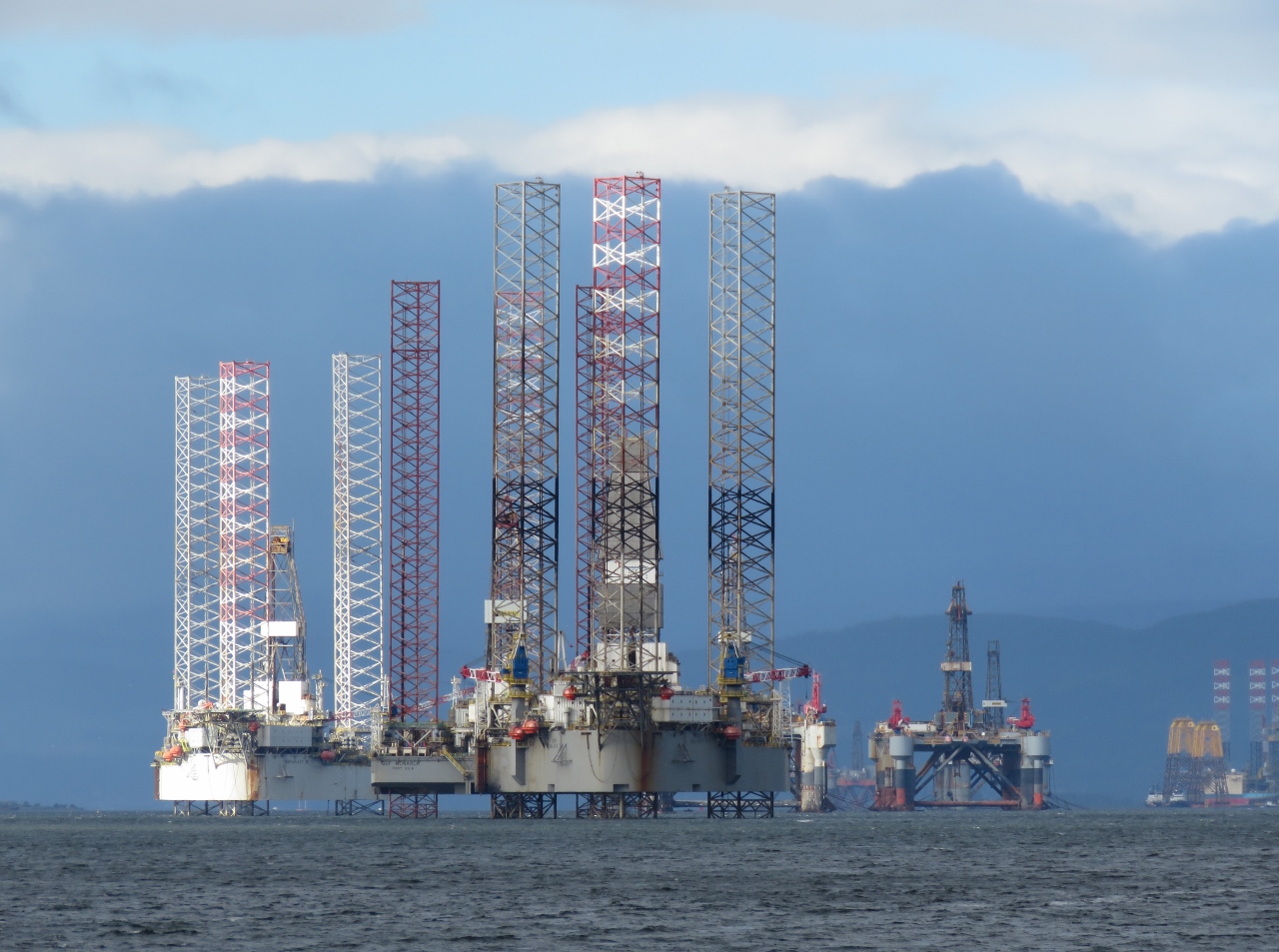 |
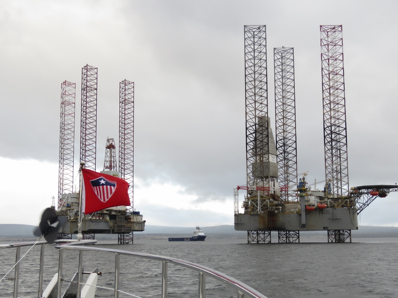
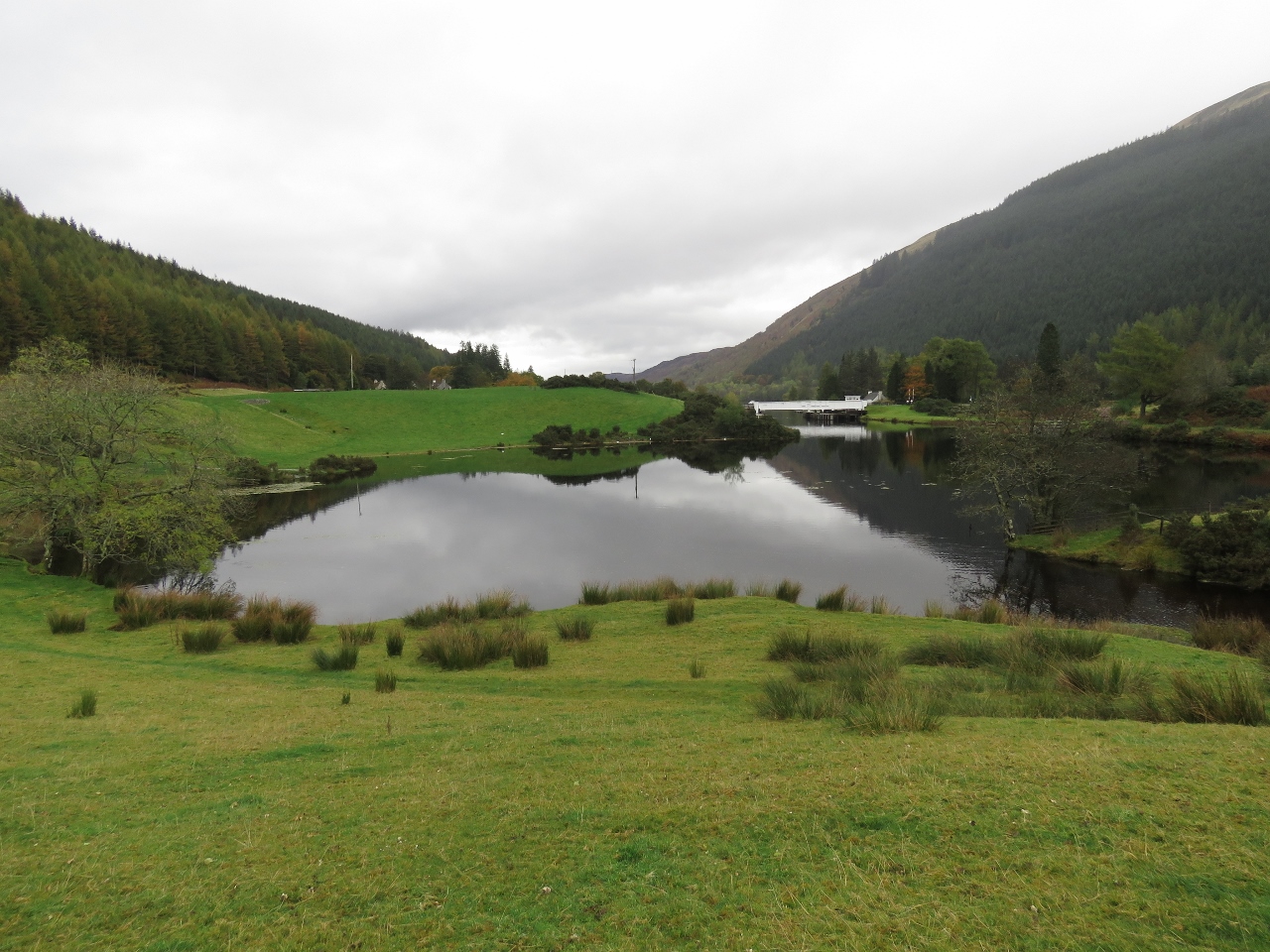
10/7/2017: Oil Rig Graveyard
Position: 57°41.17'N, -4°0.16'W
A last look to the Cromarty Firth oil rig graveyard as we depart.
|
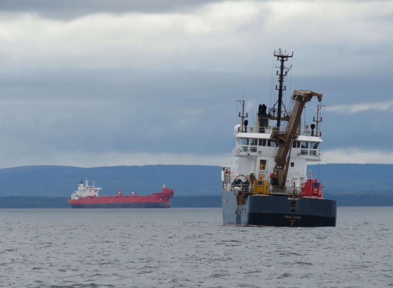 |
10/7/2017: Pole Star
Position: 57°41.16'N, -3°59.97'W
Buoy tender Pole Star of Leith working off Cromarty Firth.
|
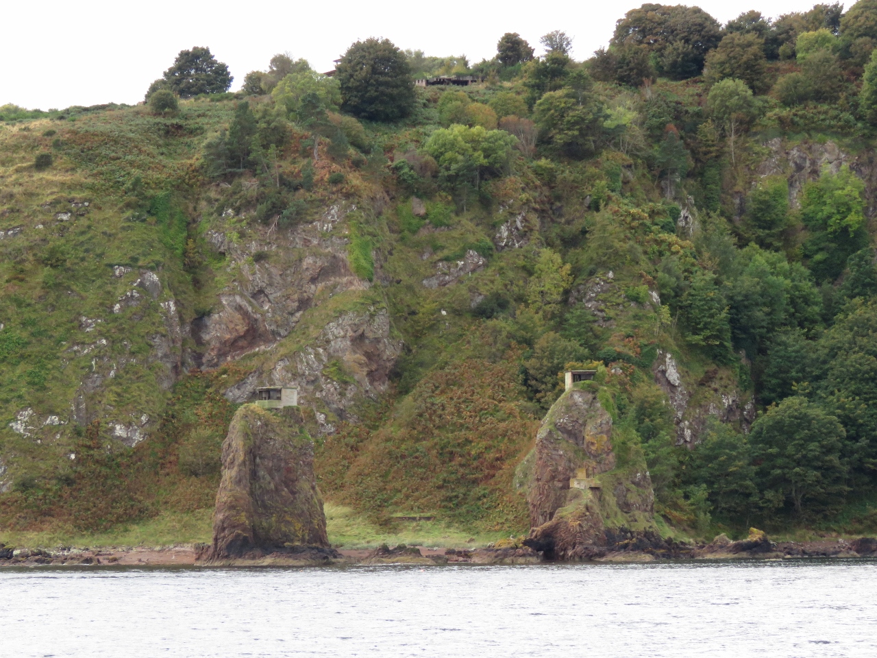 |
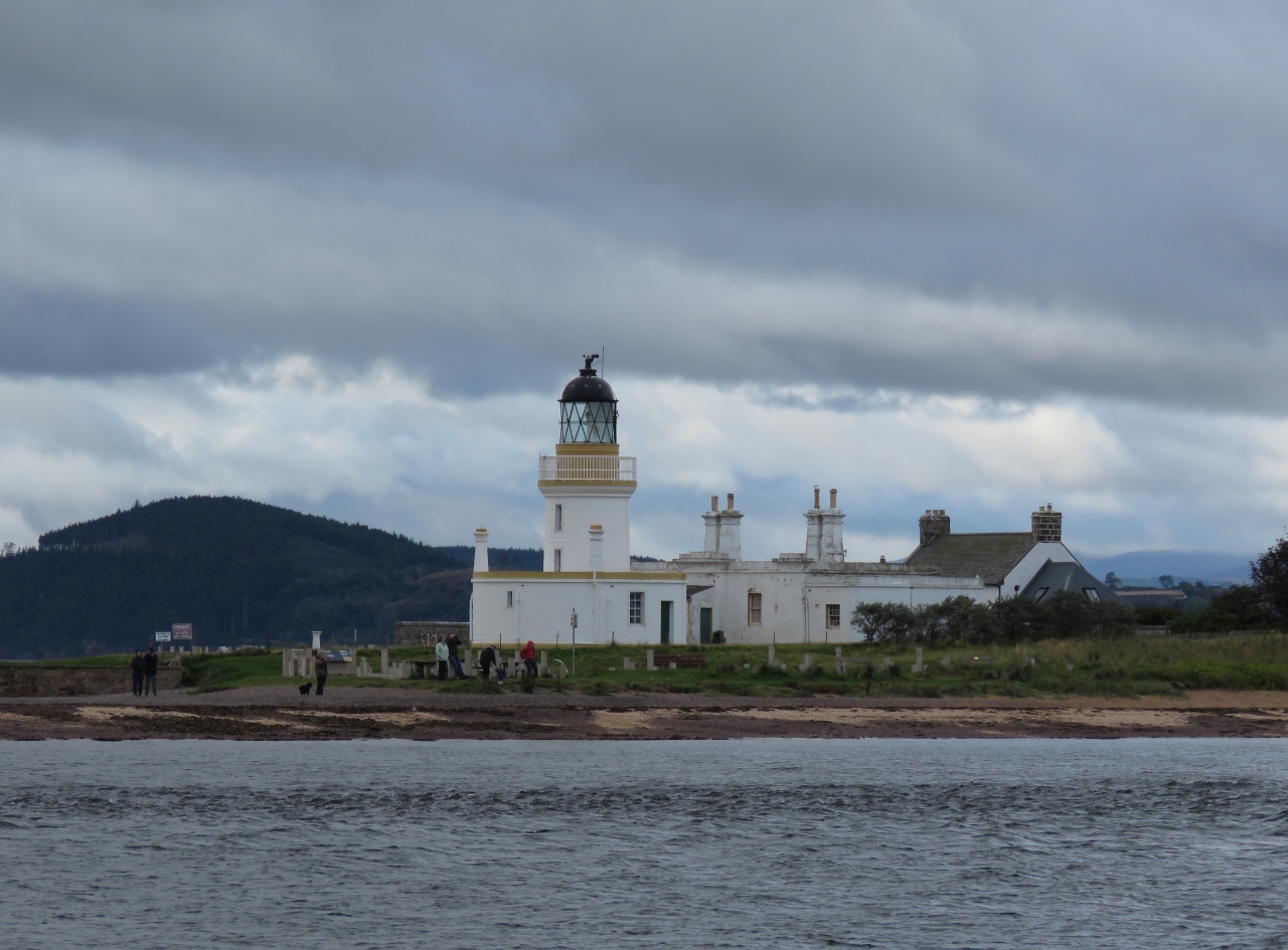
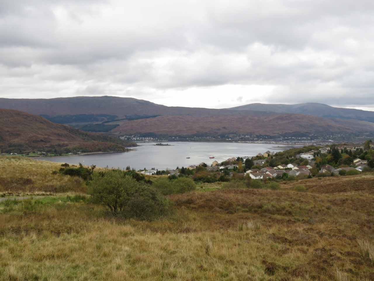
10/7/2017: South Sutor
Position: 57°40.77'N, -3°59.17'W
Cromarty Firth was a naval base during both World Wars. Coastal fortifications and gun emplacements are on both sides of the opposing headlands, called the Sutors, that guard the entrance. This is looking to South Sutor where two lookouts are visible on the pinnacle hills.
|
 |
10/7/2017: Chanonry Point
Position: 57°34.51'N, -4°5.22'W
Chanonry Point is the best land-based place in Scotland to spot dolphins, who come to feed when the tide turns. We passed through the narrows about three hours before high water at Inverness on a flooding spring tide and the water surface was smooth. Apparently conditions can get rough here with a large wind and/or swell against an ebbing current.
|
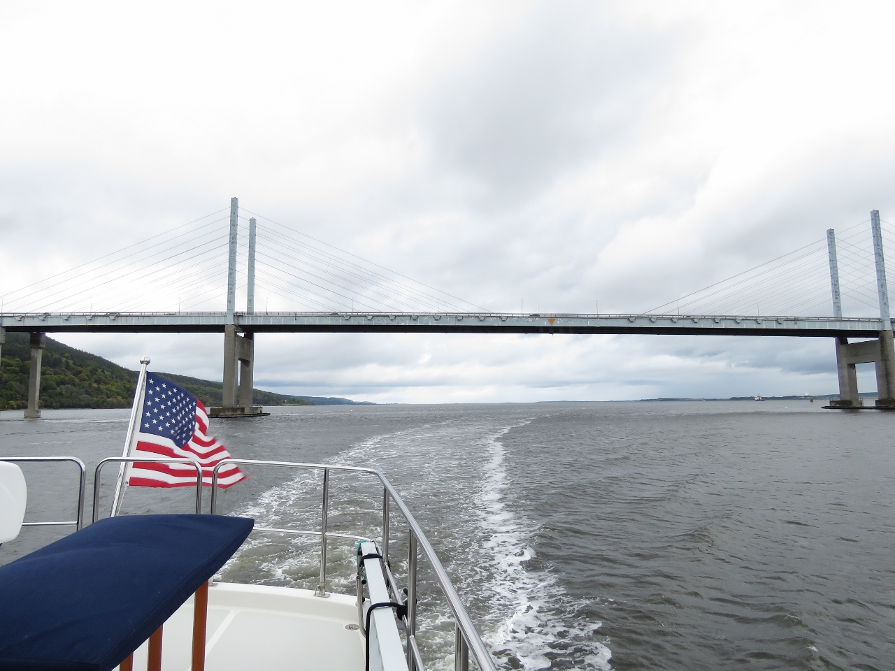 |
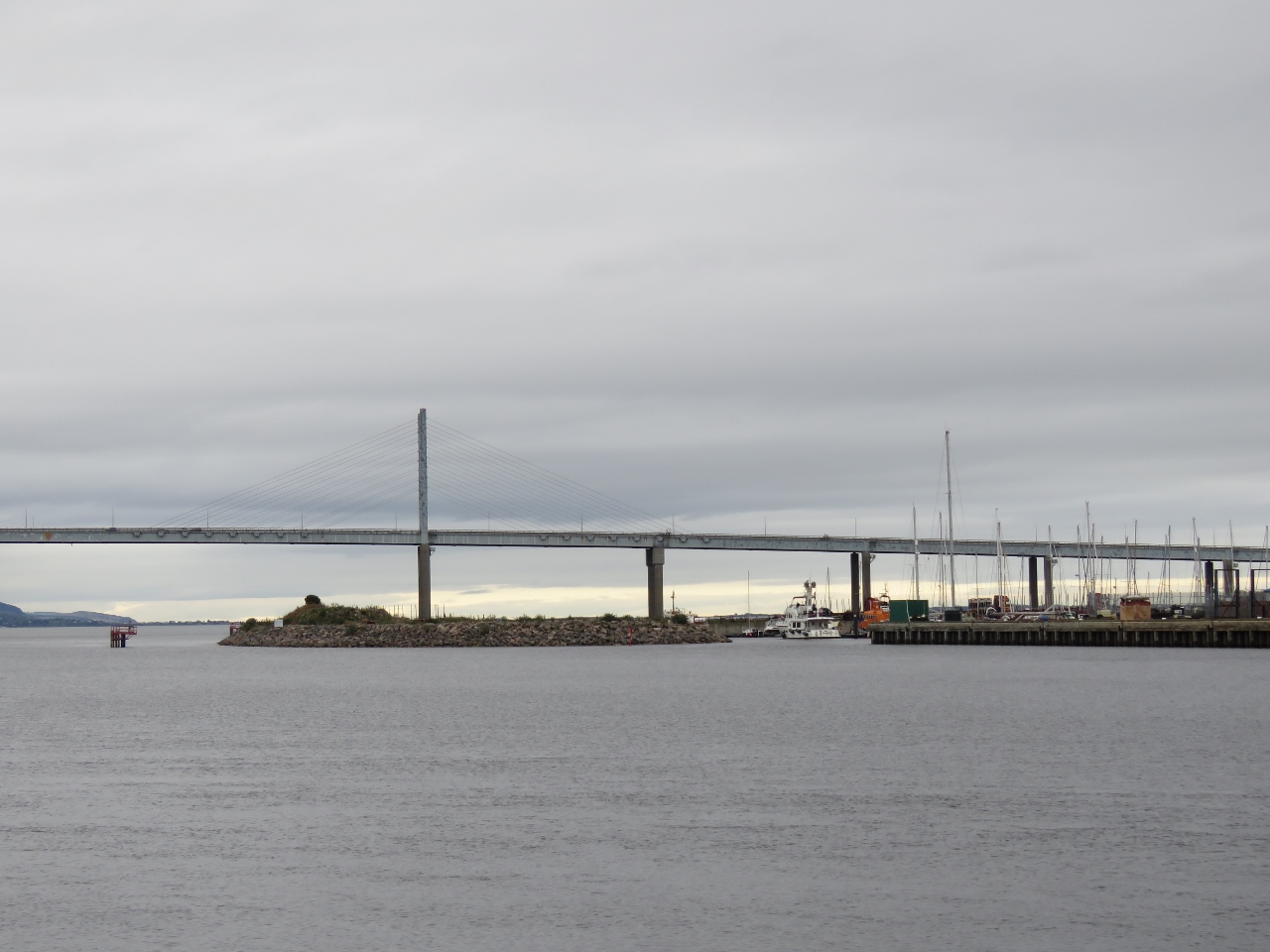
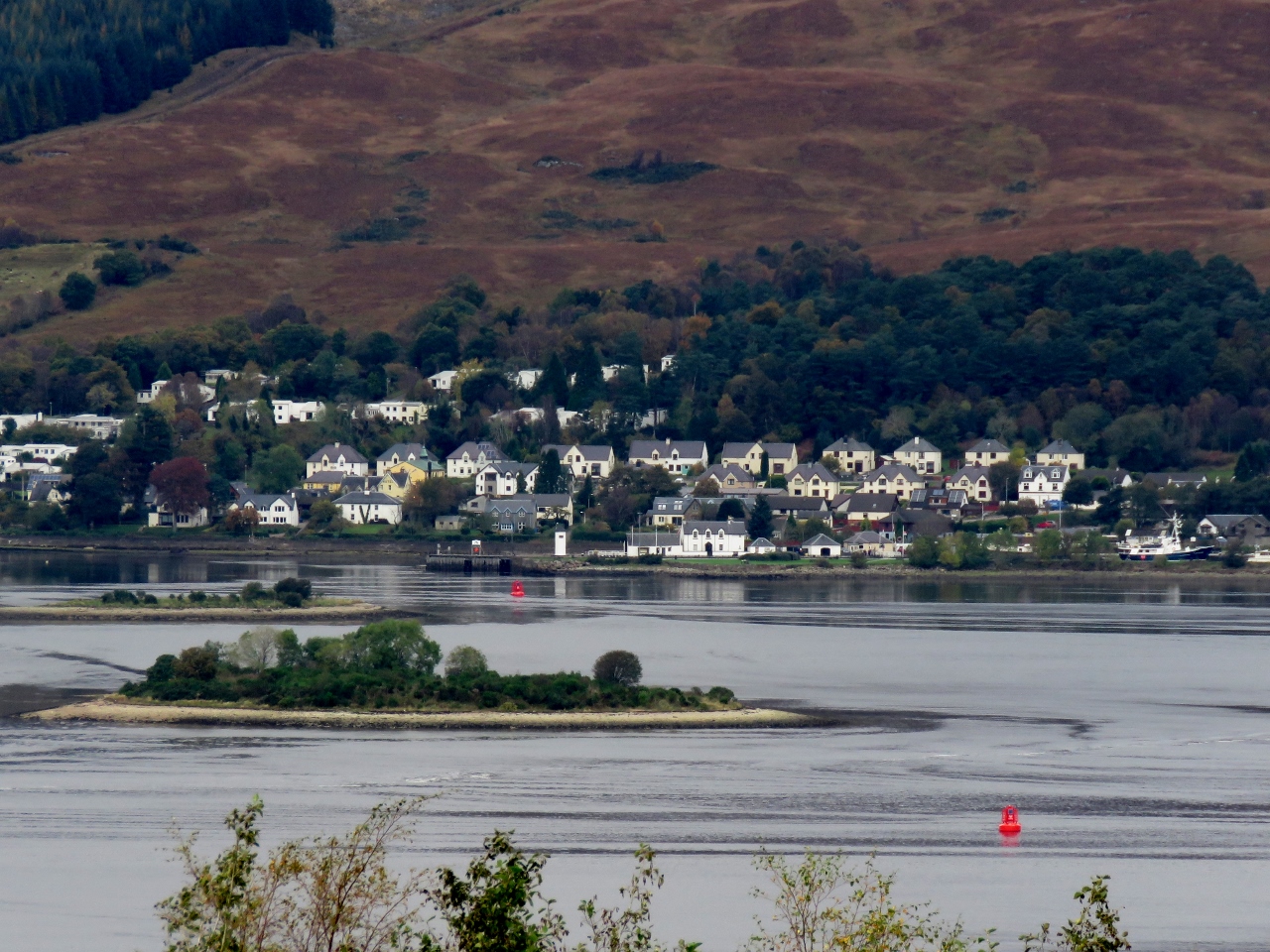
10/7/2017: Kessock Narrows
Position: 57°29.88'N, -4°14.03'W
Currents in Kessock Narrows can run up to 6 knots on spring tides. Today is a spring tide, so we timed our passage through the narrows for about an hour before high water at Inverness and felt little current. The Kessock Bridge was built in 1982 to withstand winds of up to 86 kts and tidal currents of up to 8 knots and is the only cable-stay bridge in Britain.
|
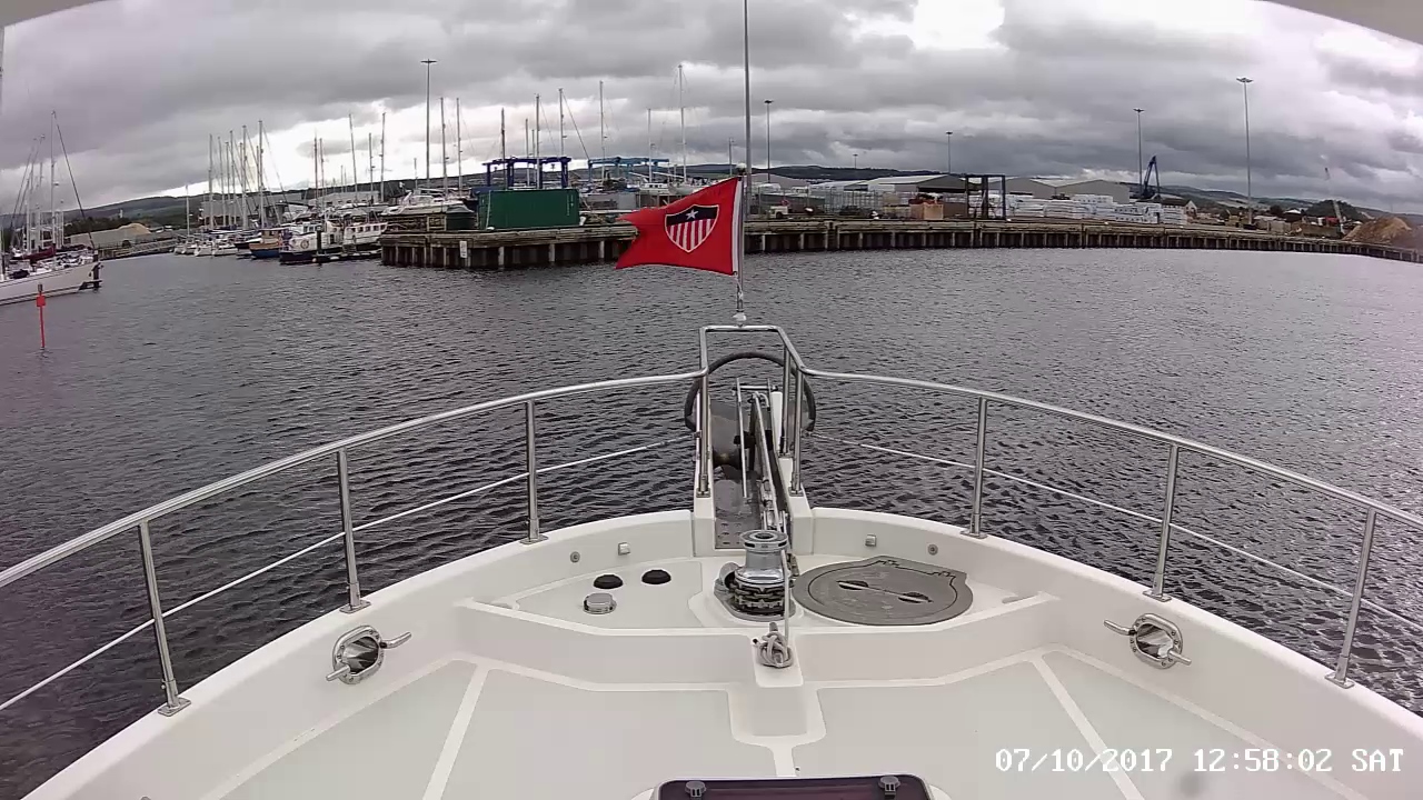 |
10/7/2017: Entrance Channel
Position: 57°29.65'N, -4°14.11'W
Entering the Inverness Marina along the River Ness. We'll enter between the red mark on the left and the pier on the right. A slight but constant ebb current flows out of the river, so we'll bias to the starboard side on entry to keep from being swept over to the port side.
|
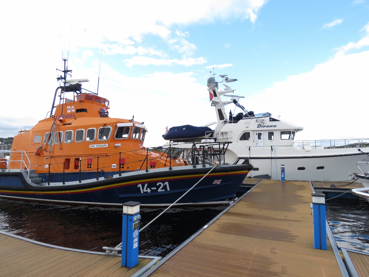 |
10/7/2017: RNLB Macquarie
Position: 57°29.67'N, -4°14.04'W
Once again we're moored next to an RNLI lifeboat, this one the 14-meter Macquarie.
|
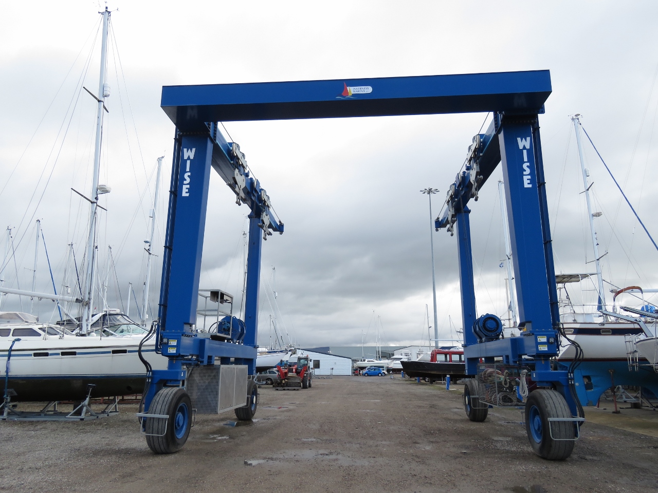 |
10/7/2017: Boat Hoist
Position: 57°29.61'N, -4°14.06'W
Inverness Marina has a 75-ton hoist. They could lift 50-ton Dirona with lots of safety margin.
|
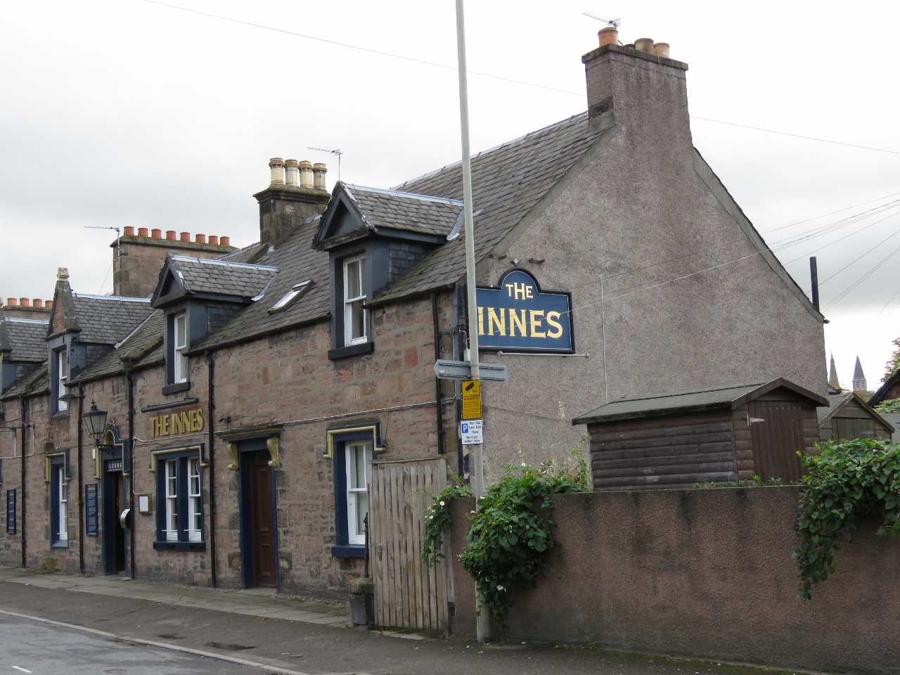 |
10/7/2017: The Innes
Position: 57°29.01'N, -4°13.77'W
We passed the local pub, The Innes, on a walk into town. We tried to stop in for a drink later that evening on the way home, but it was completely packed with locals.
|
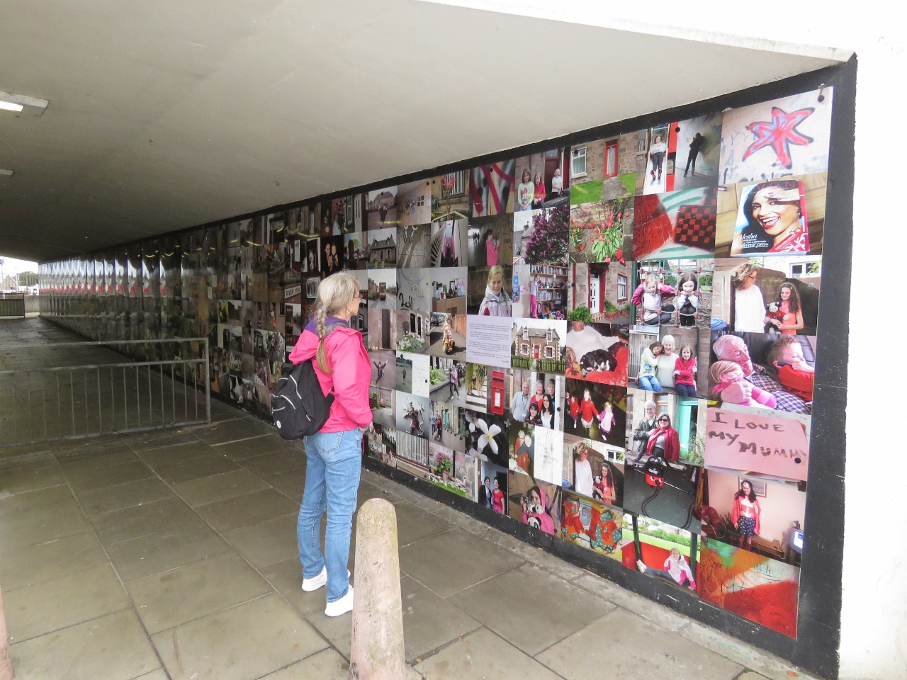 |
10/7/2017: Underpass
Position: 57°28.94'N, -4°13.56'W
A simple pedestrian underpass has been transformed into a work of art with a photographic mural of local people and sights. What an excellent idea.
|
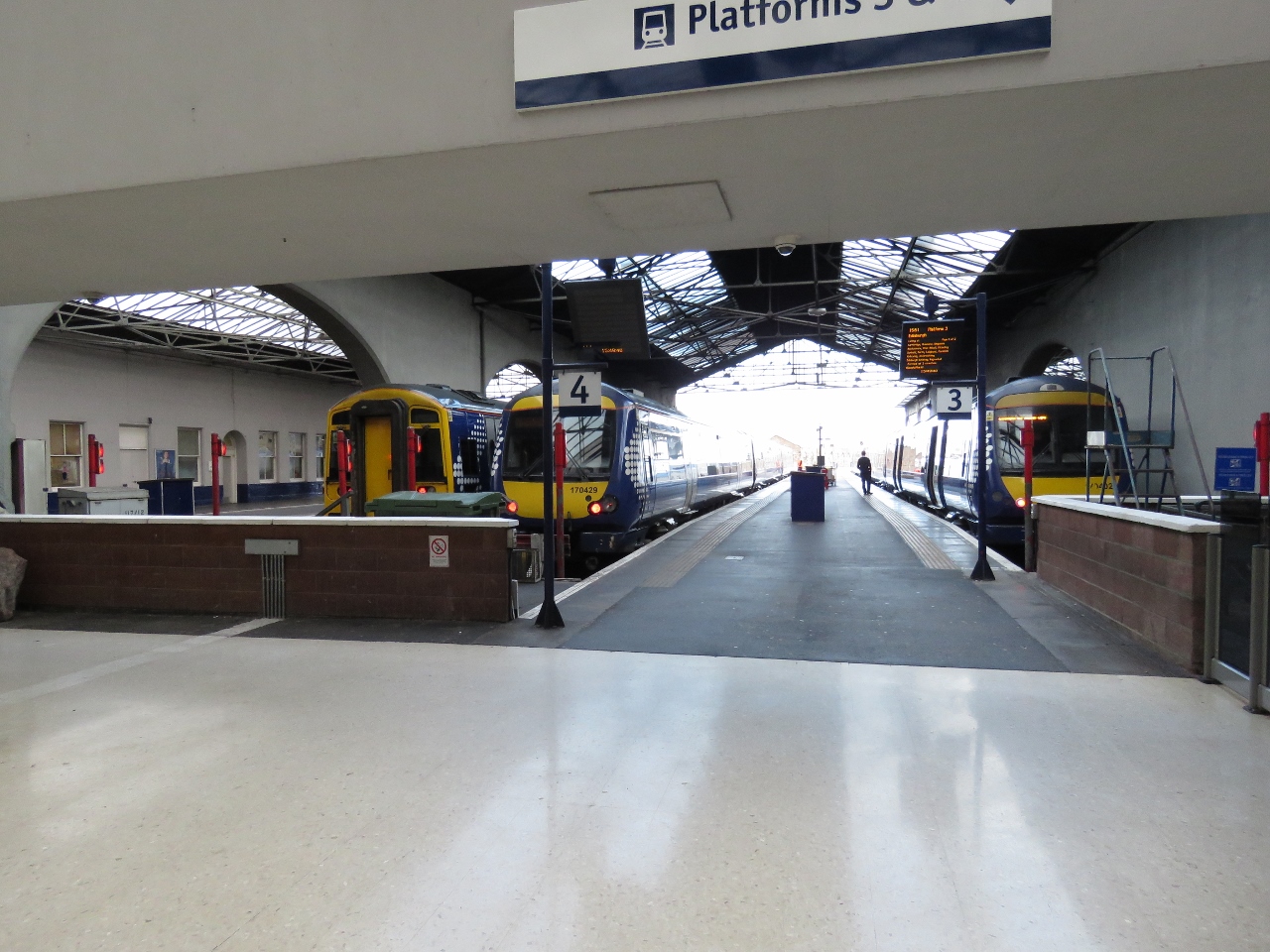 |
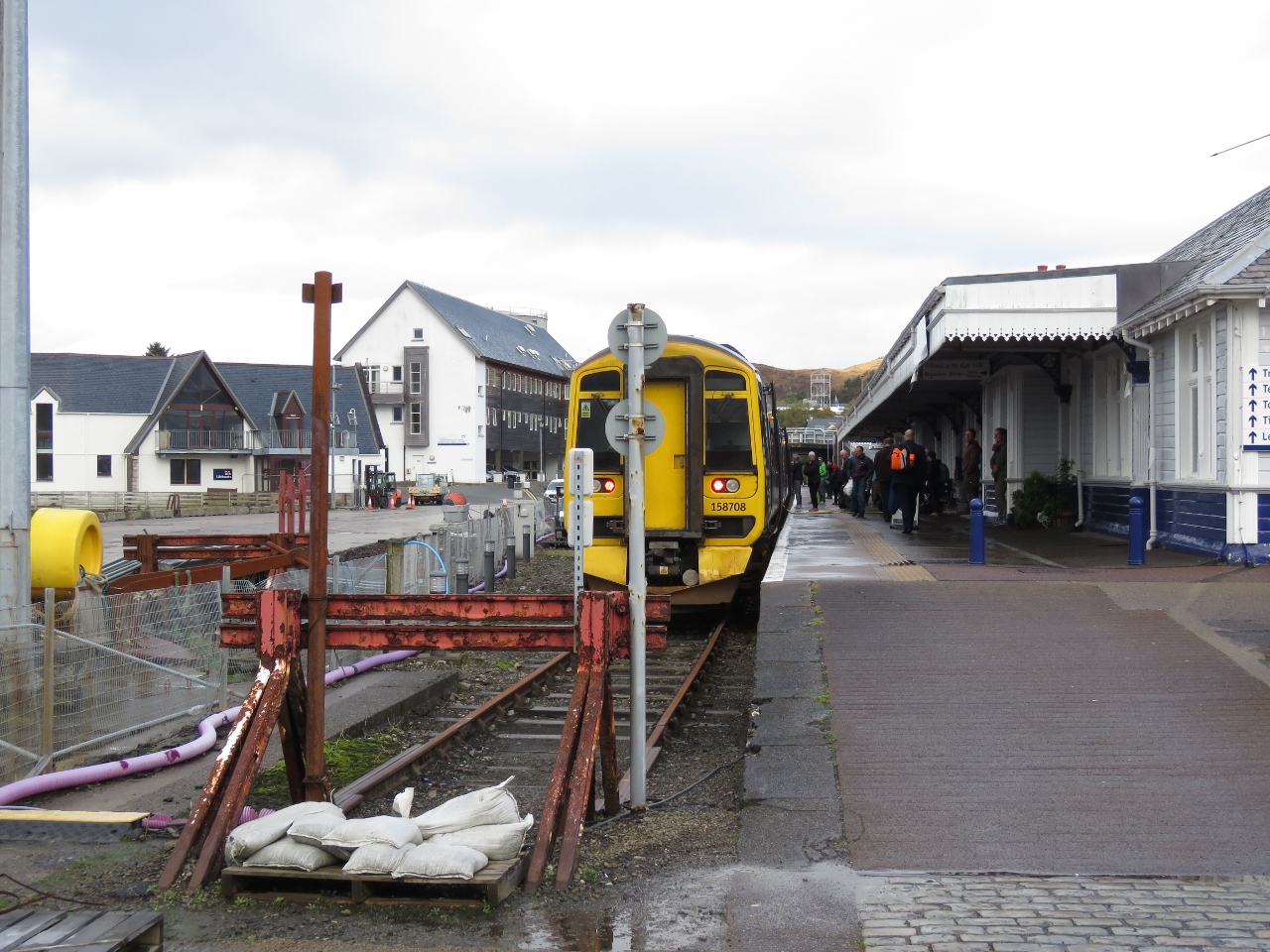
10/7/2017: Train Station
Position: 57°28.78'N, -4°13.42'W
The Inverness train station. We'll be taking a train in a couple of days to Kyle of Lochalsh.
|
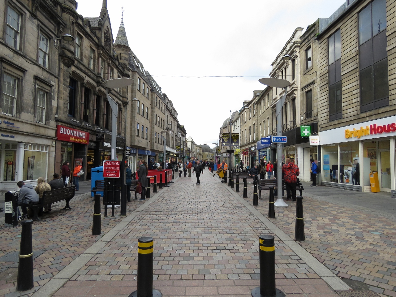 |
10/7/2017: High Street
Position: 57°28.65'N, -4°13.50'W
Pedestrian mall along High Street in downtown Inverness.
|
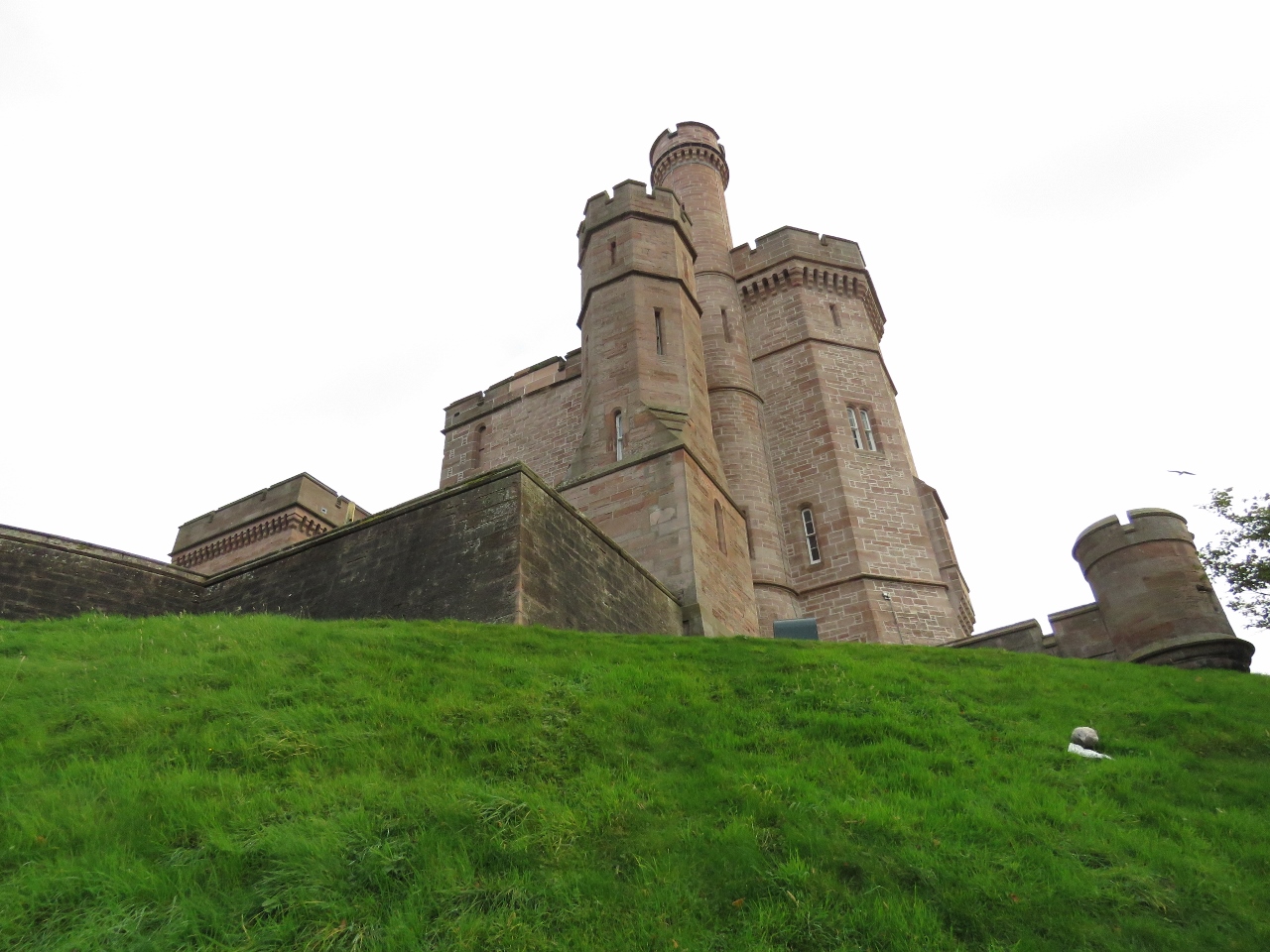 |
10/7/2017: Inverness Castle
Position: 57°28.61'N, -4°13.54'W
Looking up to Inverness Castle from an adjacent walkway. It is believed the first fortification on the site was built in the 11th century during the reign of Malcolm 3rd. Bonnie Prince Charlie's army destroyed the castle there in 1745 and it lay in ruins until the present castle was built in 1834.
|
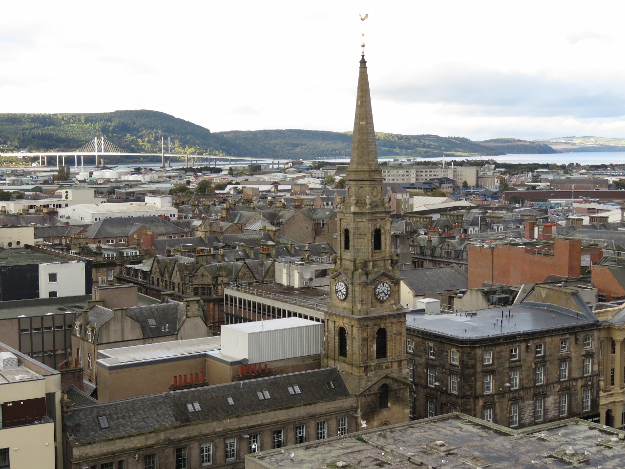 |
10/7/2017: Tolbooth Steeple
Position: 57°28.60'N, -4°13.54'W
Tolbooth Steeple viewed from the top of Inverness Castle. The steeple was erected in 1791 next to the Old Court House and jail. Kessock Bridge is visible in the distance, and the Inverness Marina is just out of the shot to the left of the photo.
|
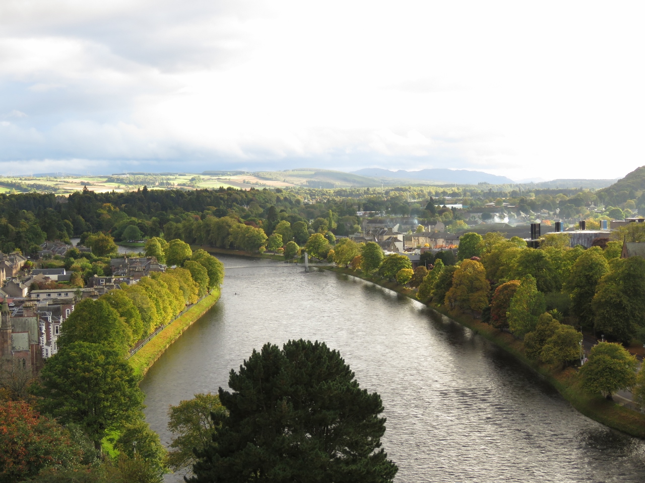 |
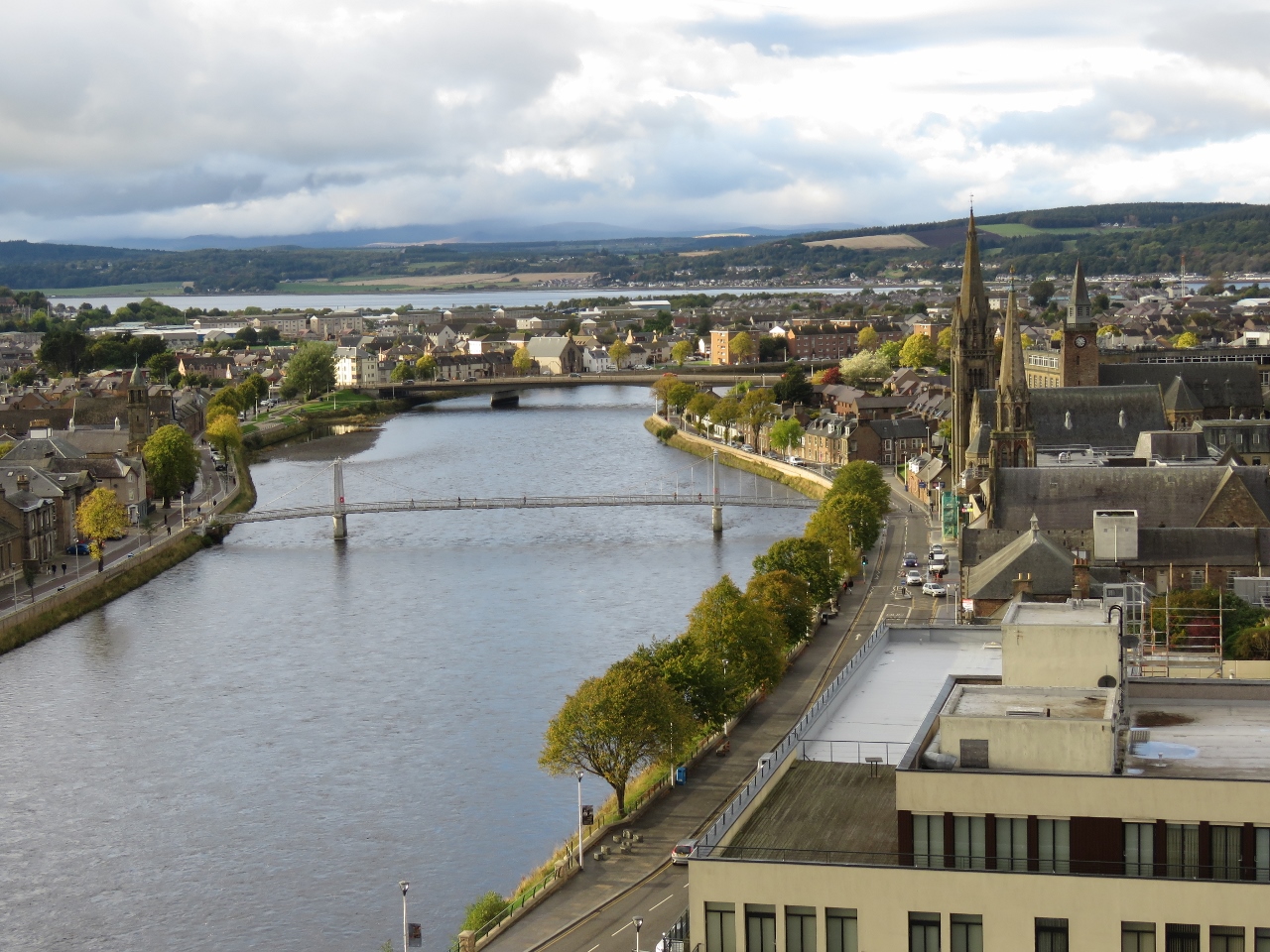
10/7/2017: River South View
Position: 57°28.60'N, -4°13.54'W
Looking south along the River Ness from the top of Inverness Castle. The Caledonian Canal runs parallel to the River Ness and is just on the other side of the partially visible hill at the far right of the picture.
|
 |
10/7/2017: River North View
Position: 57°28.60'N, -4°13.55'W
The view north along the River Ness from the top of Inverness Castle. The spire on the right is St. Columbo's High Church, built in 1852. The Inverness Marina and Kessock Bridge are just out of the picture at top right.
|
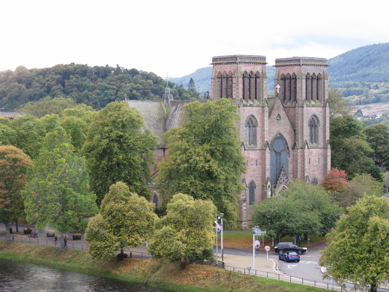 |
10/7/2017: Inverness Cathedral
Position: 57°28.55'N, -4°13.54'W
Inverness Cathedral, completed in 1869, near Inverness Castle across the River Ness.
|
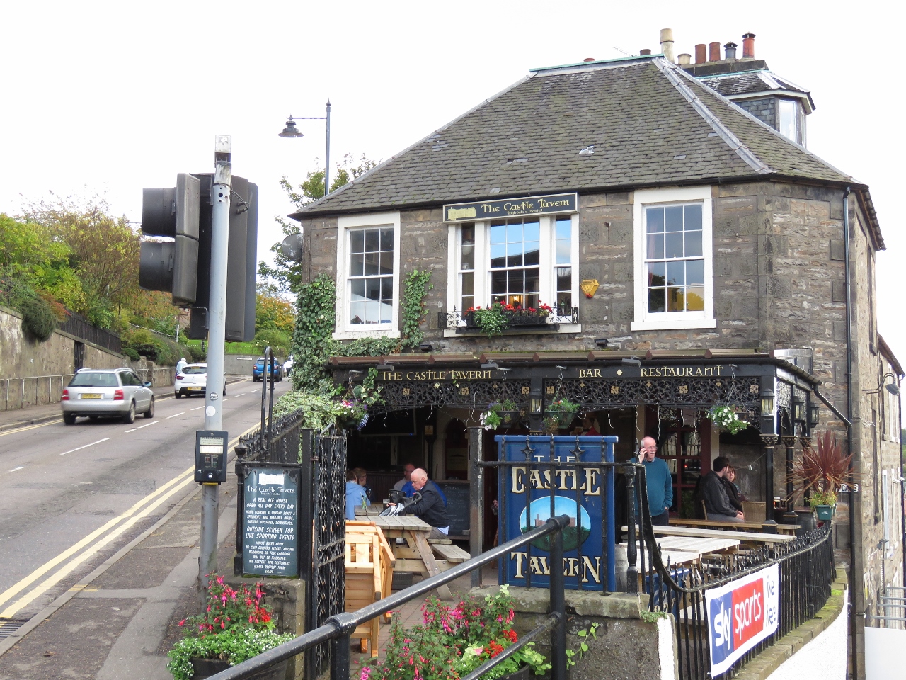 |
10/7/2017: Castle Tavern
Position: 57°28.52'N, -4°13.52'W
The Castle Tavern, near Inverness Castle, advertises themselves as "A real ale house—Open every day—Home cooking & Sunday roast a specialty and available inside, outside, upstairs, downstairs". We'll definitely be back.
|
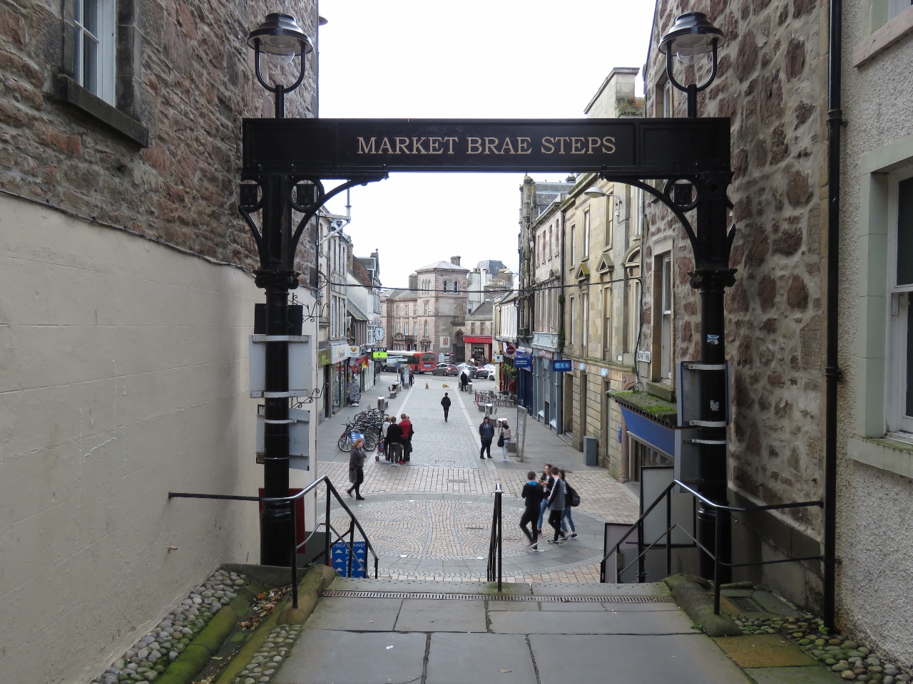 |
10/7/2017: Market Brae Steps
Position: 57°28.67'N, -4°13.35'W
Looking out to Inglis Street from the bottom of Market Brae Steps.
|
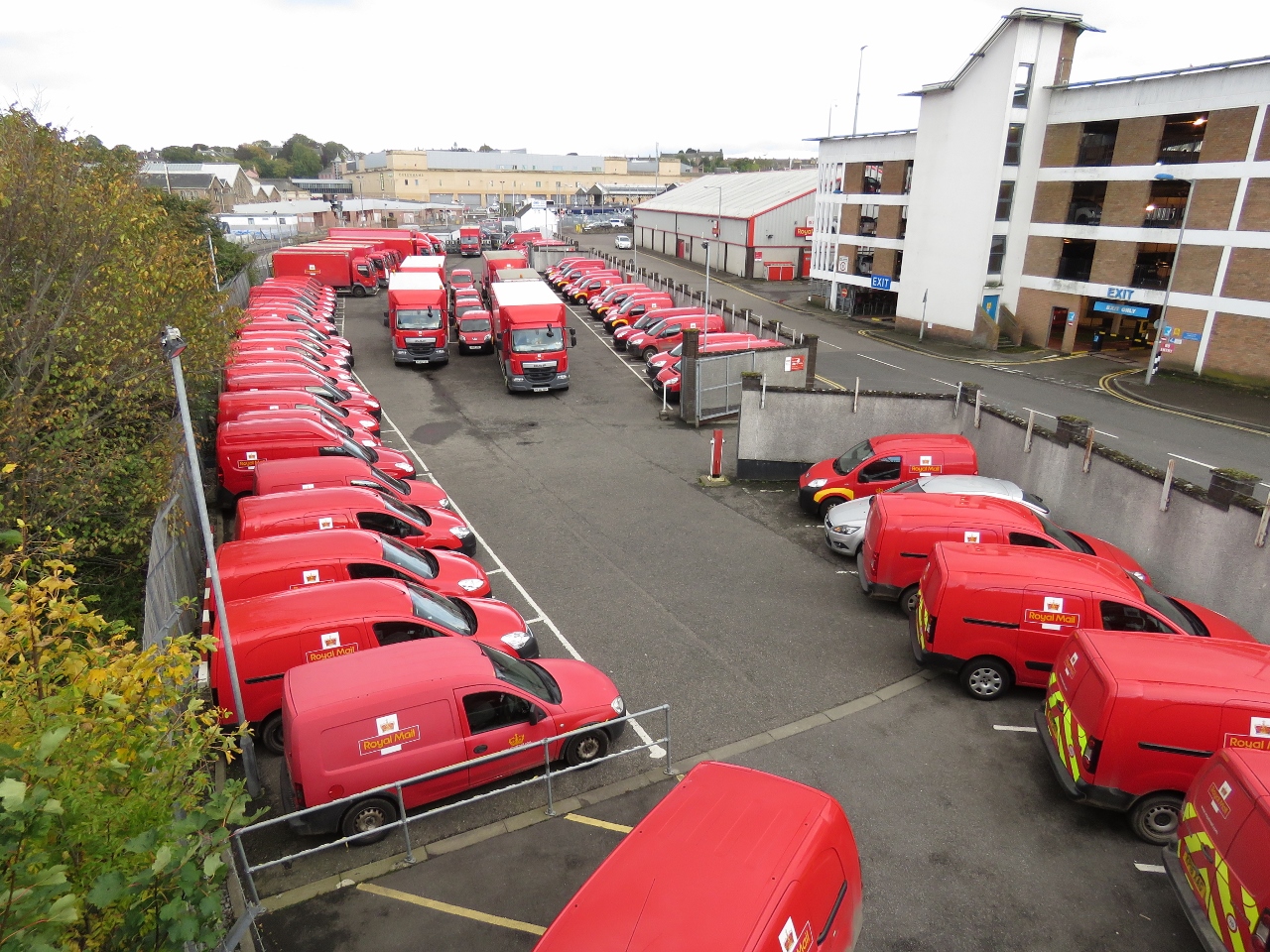 |
10/7/2017: Royal Mail
Position: 57°28.94'N, -4°13.47'W
We see the bright red Royal Mail vehicles all over Britain. Here's a large group, ready for the start of the next work day.
|
 |
10/7/2017: Strong Current
Position: 57°29.06'N, -4°13.80'W
Strong currents flowing out of the River Ness.
|
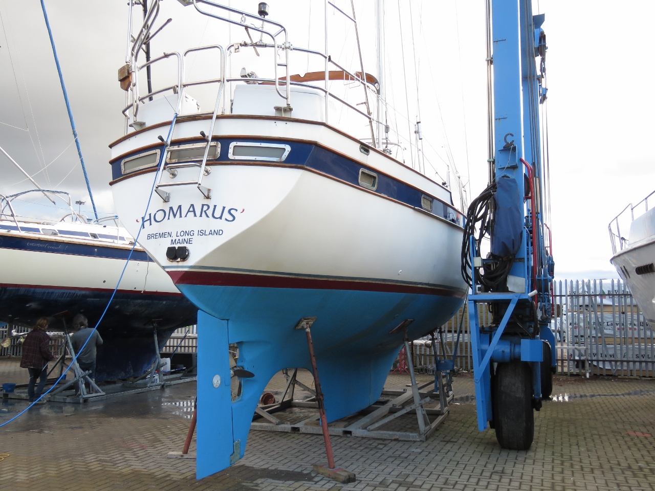 |
10/7/2017: Homarus
Position: 57°29.60'N, -4°14.06'W
Homarus of Bremen, Long Island, Maine is only the second US-flagged boat we've since since arriving in Europe in May of this year. The first was Nordhavn 55 Odyssey. Vast numbers of US-flagged vessels are in the Mediterranean but not that many are in this area.
|
 |
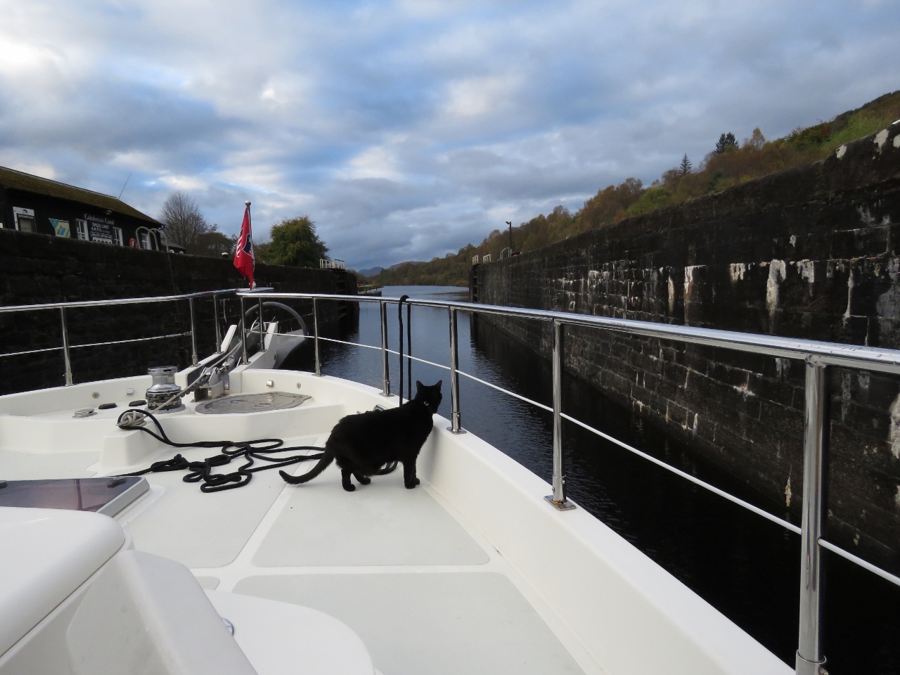
10/7/2017: First Smell
Position: 57°29.67'N, -4°14.06'W
Spitfire getting his first smell of Inverness. We've been telling him Nessie stories and he's been worriedly studying the water since we arrived.
|
 |
10/8/2017: Bike Maintenance
Position: 57°29.67'N, -4°14.06'W
Both bikes needed the chains lubricated and James' needed a derailer adjustment. We tried putting a throw sheet down below the work area and it worked well. This kept the dock clean and minimized the chance that any loose parts would fall through the cracks.
|
 |
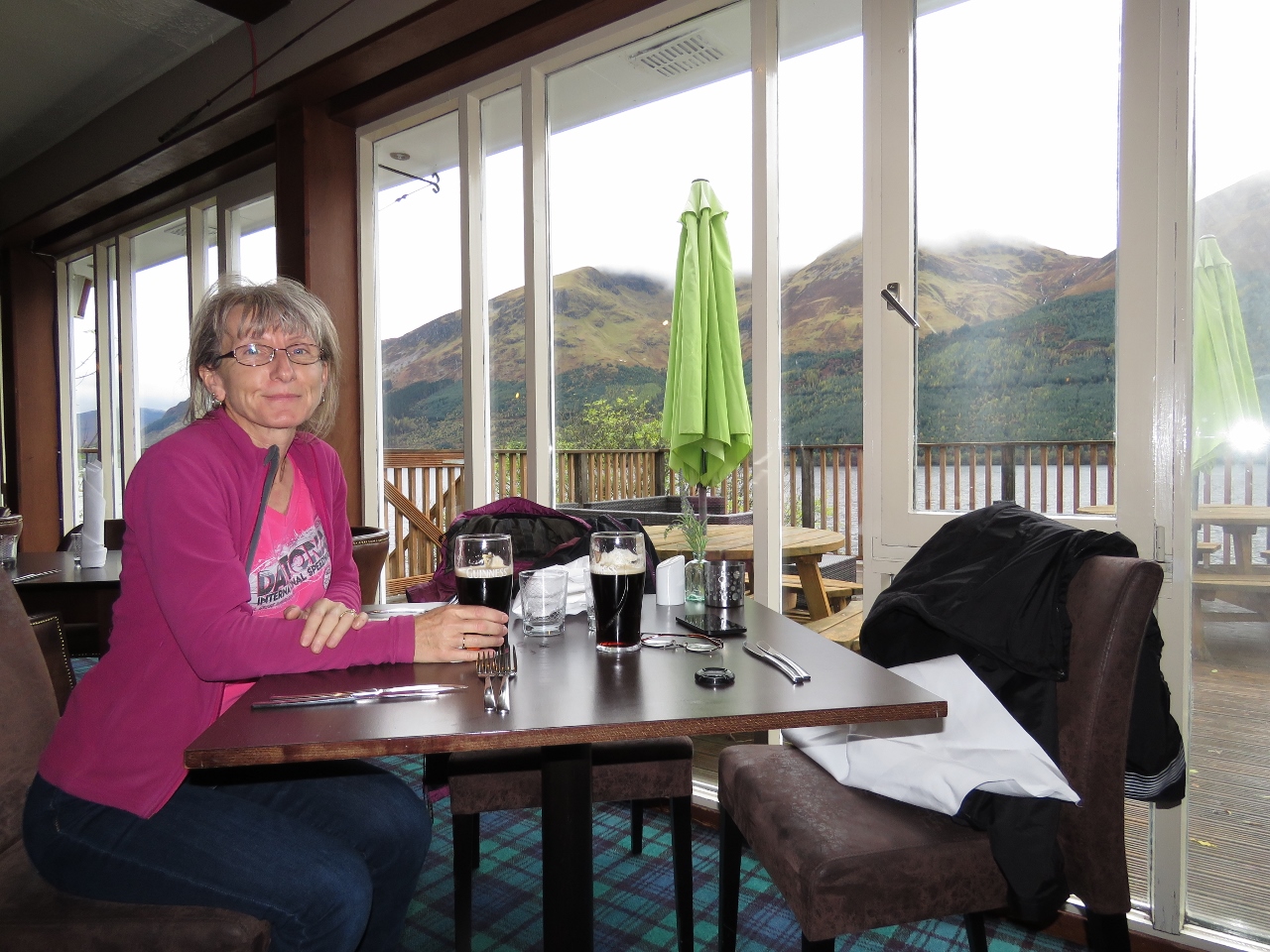
10/8/2017: The Waterfront
Position: 57°28.82'N, -4°14.03'W
An excellent Sunday lunch at The Waterfront pub along the River Ness a quick bike ride from the marina.
|
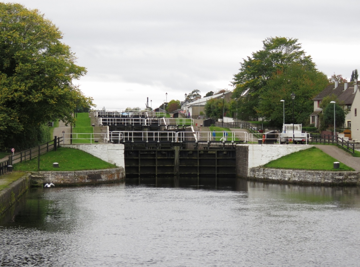 |
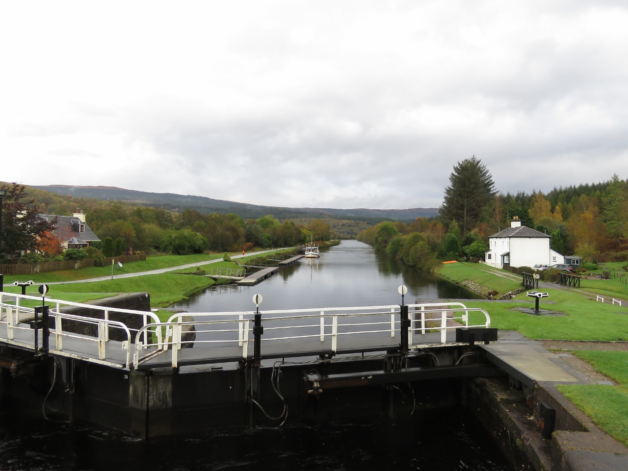
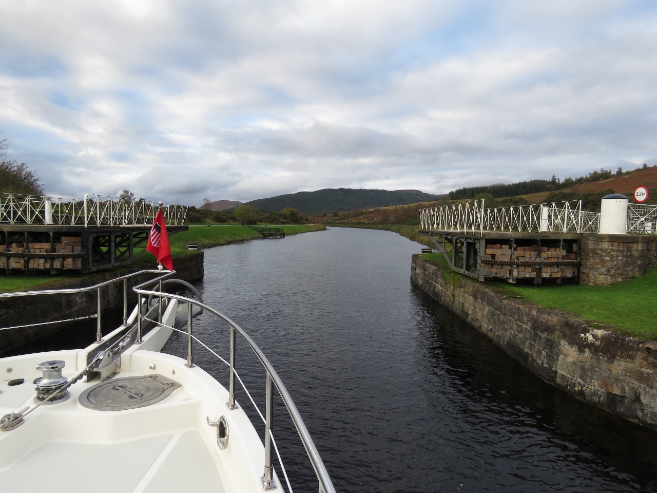
10/8/2017: Locks
Position: 57°28.95'N, -4°14.84'W
After lunch, we biked a short distance to the Caledonian Canal, where we'll transit south in a few days. This is looking south from the Telford Street Swing Bridge to the first major flight of locks.
|
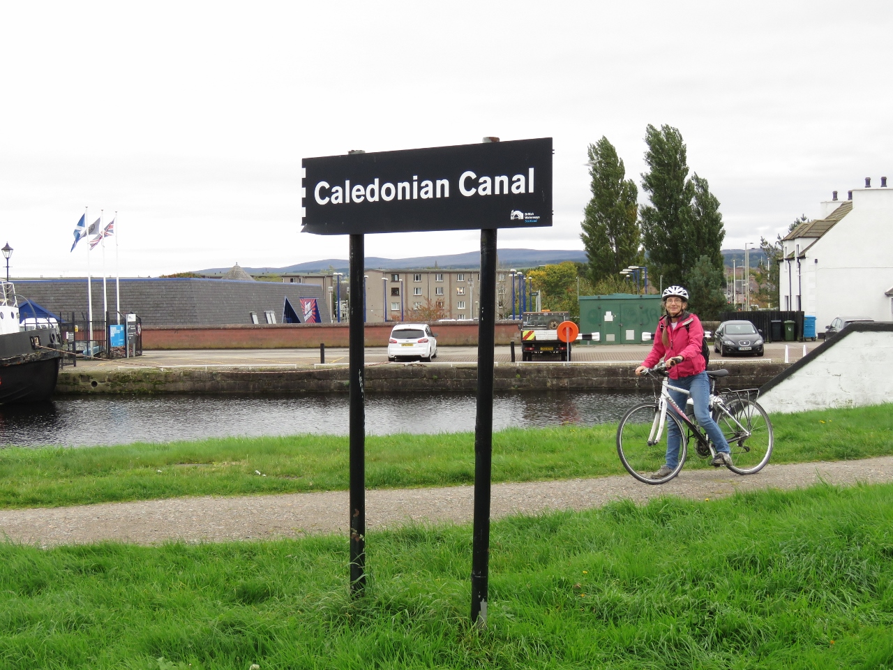 |
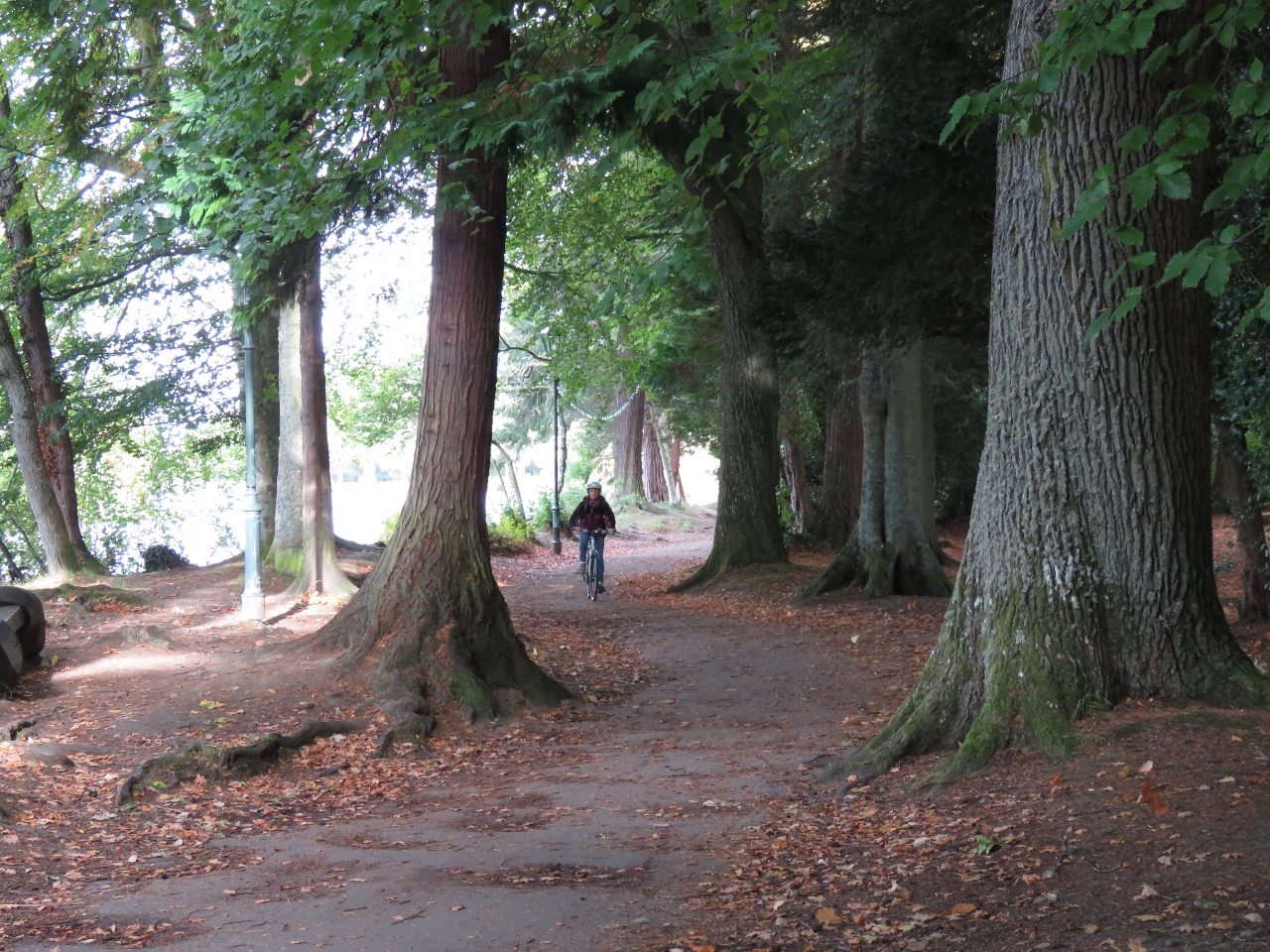
10/8/2017: Caledonian Canal
Position: 57°28.98'N, -4°14.87'W
A happy Jennifer biking along the Caledonian Canal.
|
 |
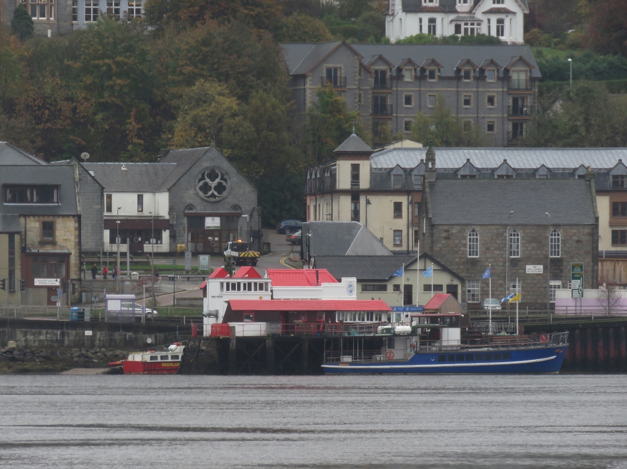
10/8/2017: Seaport Marina
Position: 57°29.03'N, -4°14.89'W
Seaport Marina is one of two reasonable sized marinas in the area. It looked pretty full.
|
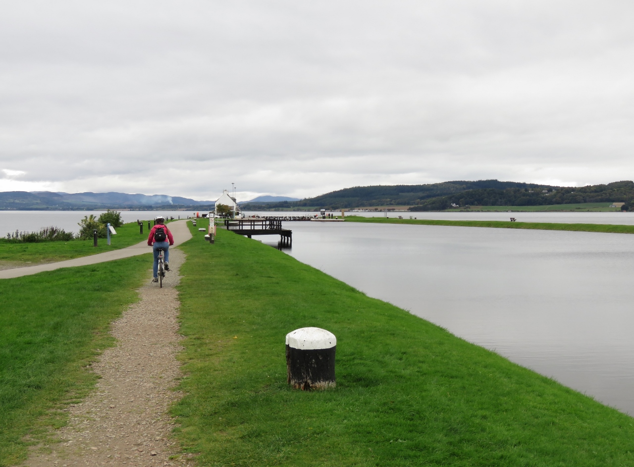 |
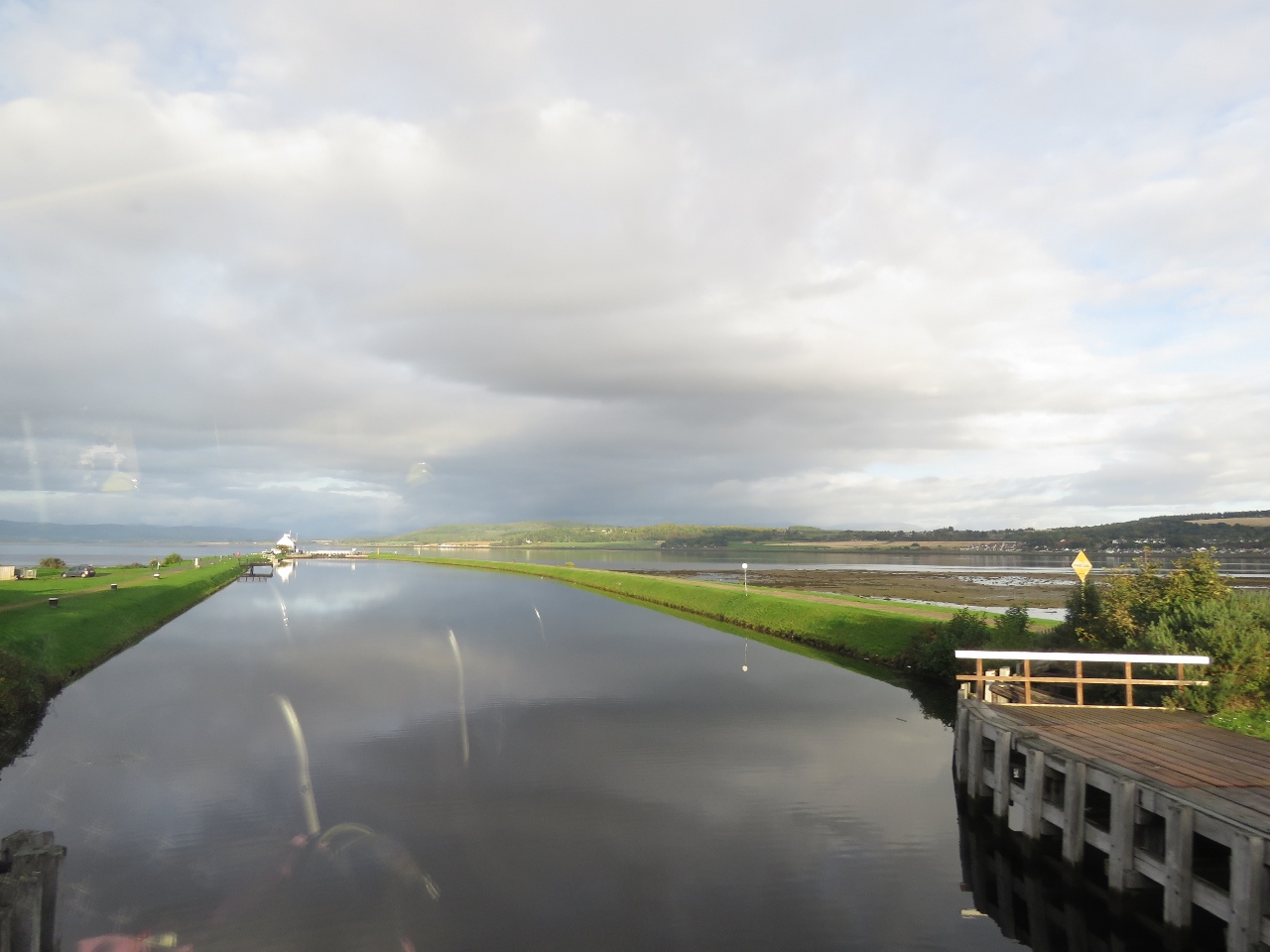
10/8/2017: Clachnaharry
Position: 57°29.36'N, -4°15.48'W
Jennifer riding north to the Clachnaharry sea lock with Beauly Firth visible in the distance beyond the canal.
|
 |
10/8/2017: Welcome
Position: 57°29.44'N, -4°15.77'W
The engraving reads "The Caledonian Canal: Welcome to the waterway through the Great Glen". The Great Glen is a geological fault running in a straight line from Inverness to Fort William, also the route of the Caledonian Canal. Glaciers carved deep troughs through the fault line that now are a series of deep lochs, including Loch Ness.
|
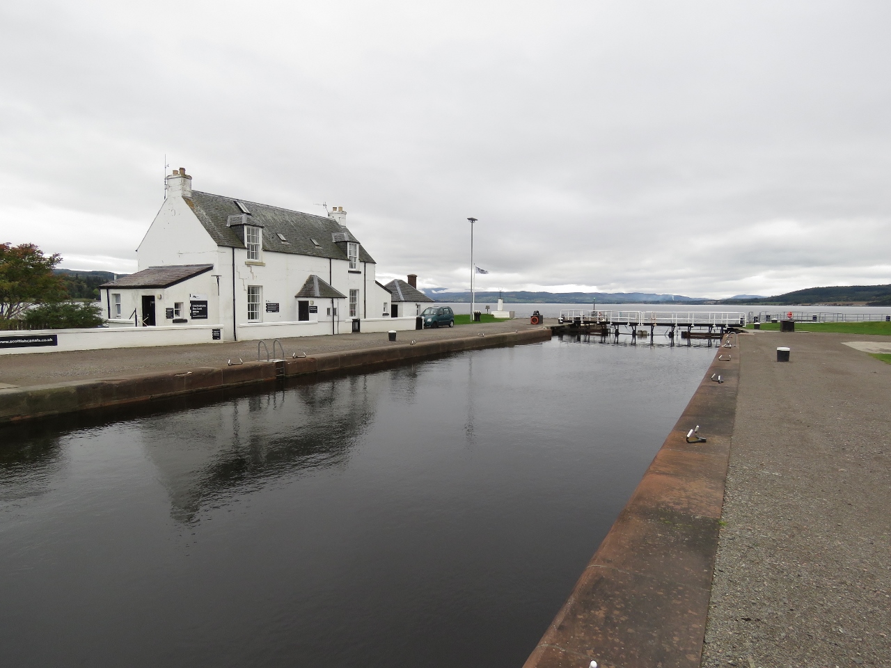 |
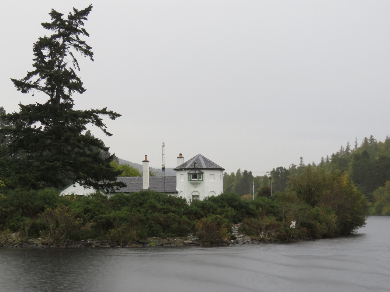
10/8/2017: Sea Lock Office
Position: 57°29.43'N, -4°15.74'W
The Clachnaharry Sea Lock Office above the sea lock.
|
 |
10/8/2017: ScotRail
Position: 57°29.36'N, -4°15.35'W
A ScotRail train crossed the canal shortly after we'd crossed the tracks.
|
 |
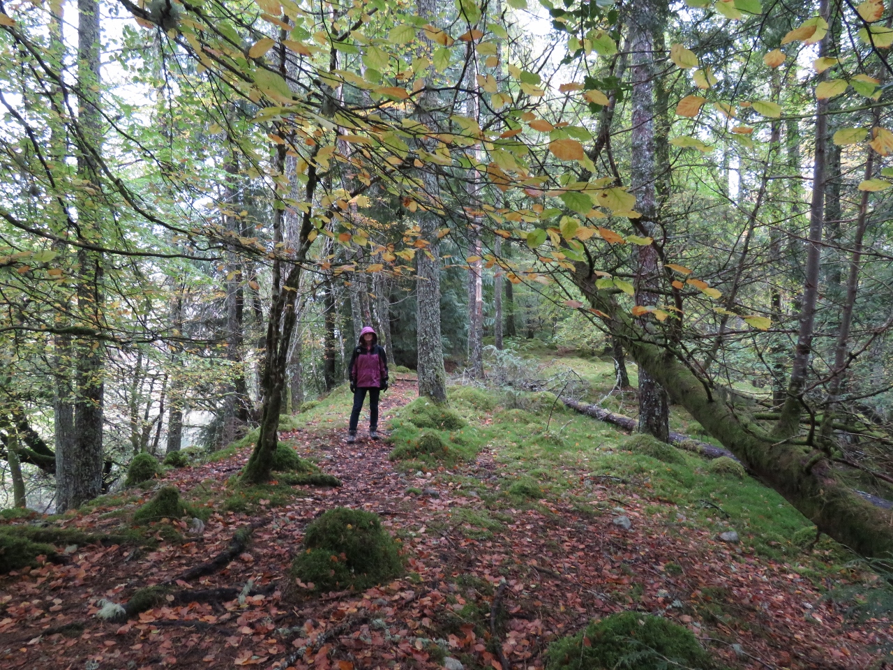
10/8/2017: Merkinch Local Nature Reserve
Position: 57°29.33'N, -4°15.18'W
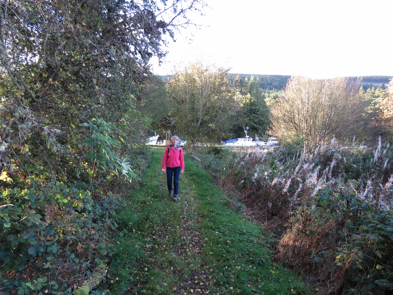
Fall colors in the woods along Beauly Firth through the Merkinch Local Nature Reserve. It's a beautiful area and the woods are an unexpected change from the wide-open canal area we just left.
|
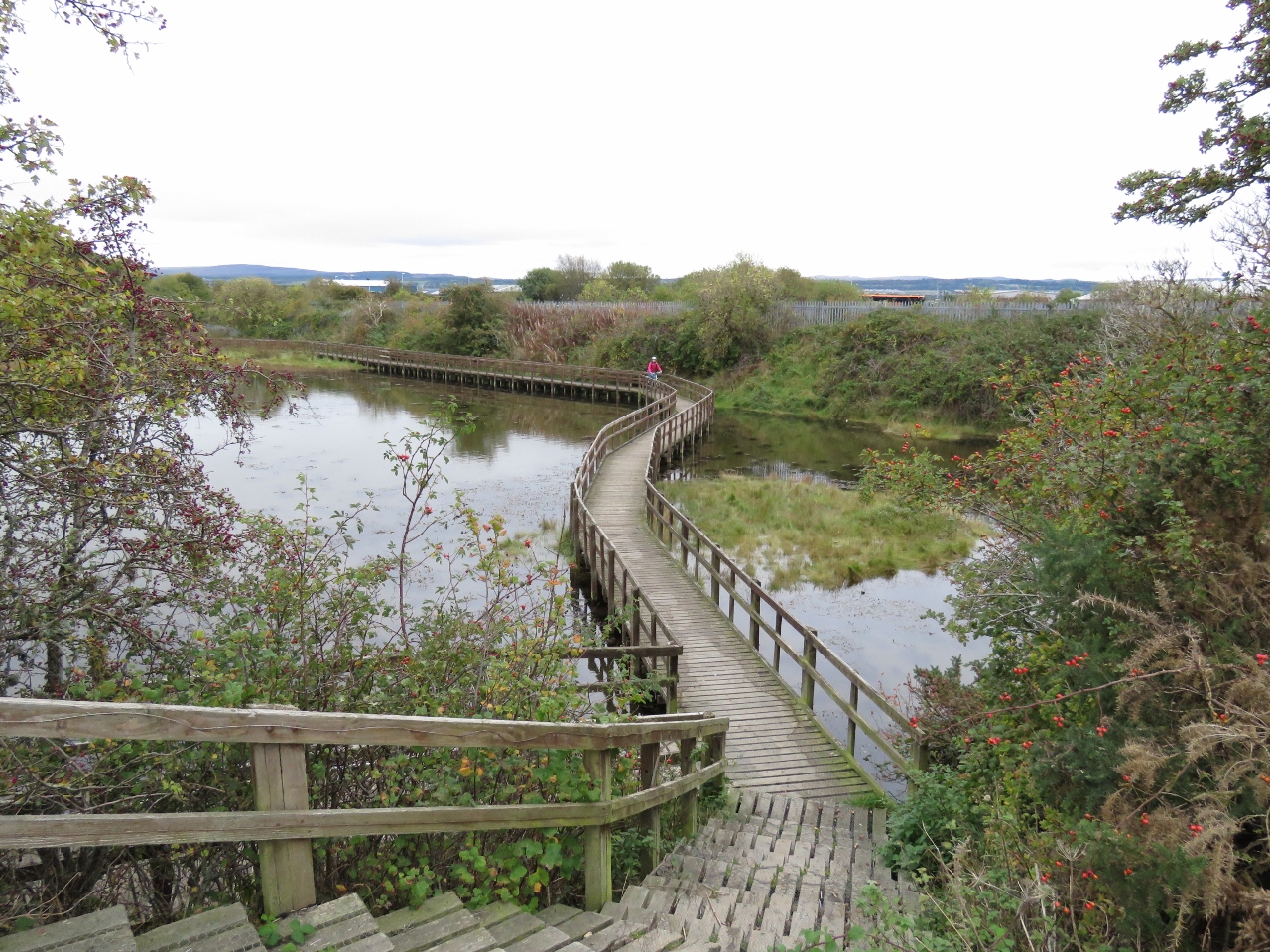 |
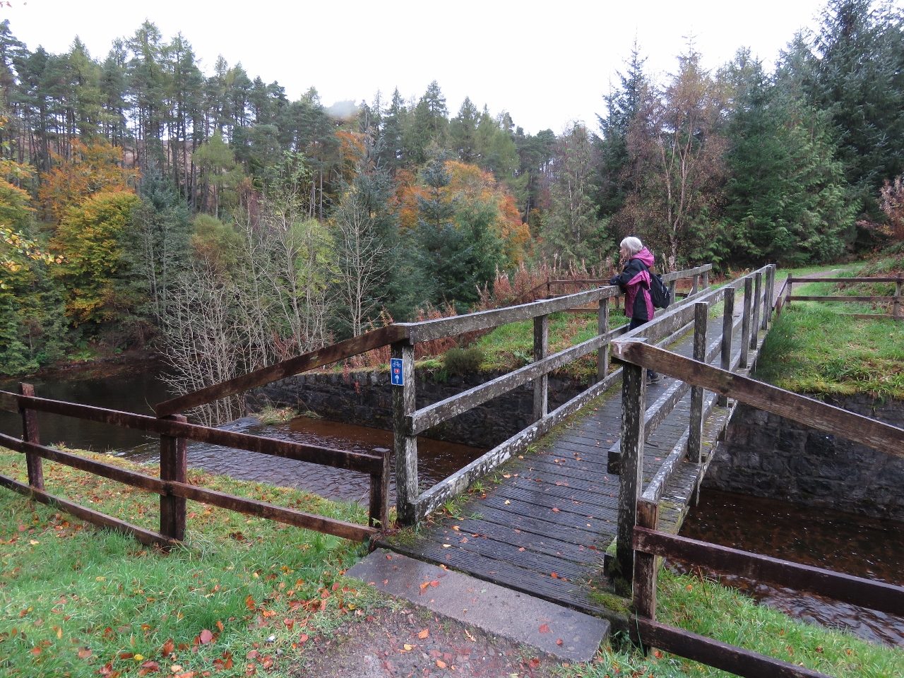
10/8/2017: Boardwalk
Position: 57°29.45'N, -4°15.03'W
Jennifer returning back to the Beauly Firth path from a short detour we took on a boardwalk across the marsh at Merkinch Local Nature Reserve.
|
 |
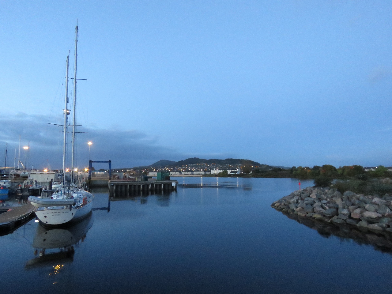
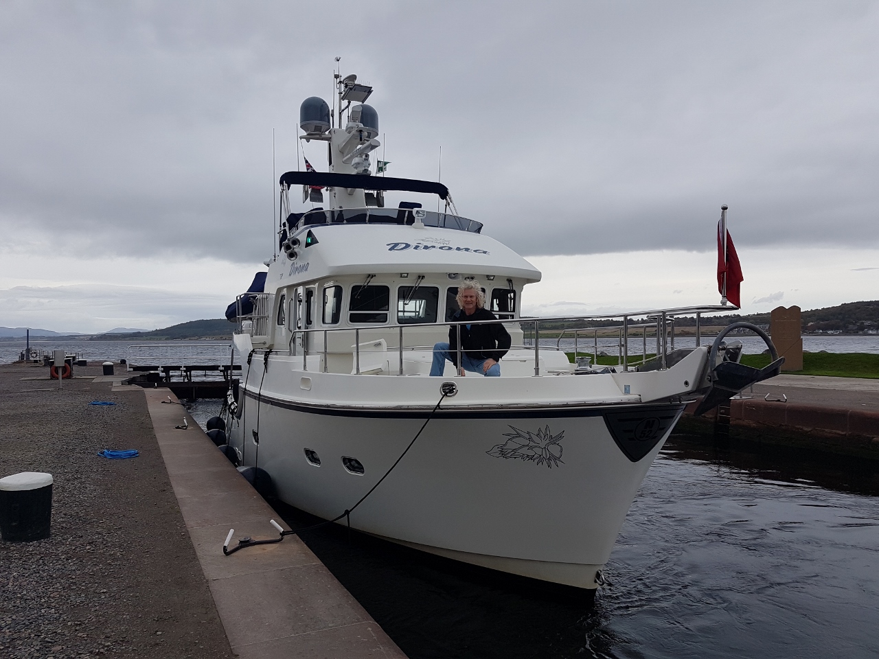
10/8/2017: Dirona
Position: 57°29.53'N, -4°14.35'W
View to Dirona at the Inverness Marina from the west shore at the mouth of the River Ness.
|
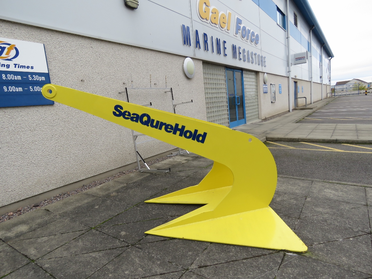 |
10/8/2017: SeaQureHold
Position: 57°29.27'N, -4°14.09'W
We stopped in at this Gael Force superstore. In the rear lot they had dozens of large sea buoys, likely for aquaculture, and this massive "SeaQureHold" anchor in the parking lot out front. We were expecting the store to be more commercial, but it was similar to a consumer West Marina store in the US.
|
 |
10/8/2017: Mersey Fisher
Position: 57°29.16'N, -4°13.93'W
The oil tanker Mersey Fisher, viewed from the west short of the River Ness, likely offloading at the Scottish Fuels depot.
|
 |
10/9/2017: ScotRail
Position: 57°28.80'N, -4°13.40'W
Richard Green recommended we take the scenic train ride from Inverness to the Kyle of Lochalsh. So we purchased tickets and also booked bicycle reservations to ride out to Eilean Donan Castle.
|
 |
10/9/2017: Caledonian Canal
Position: 57°29.38'N, -4°15.33'W
Crossing the Caledonian Canal by train. We've been to this crossing by bicycle and train now. Soon we'll be here by boat.
|
 |
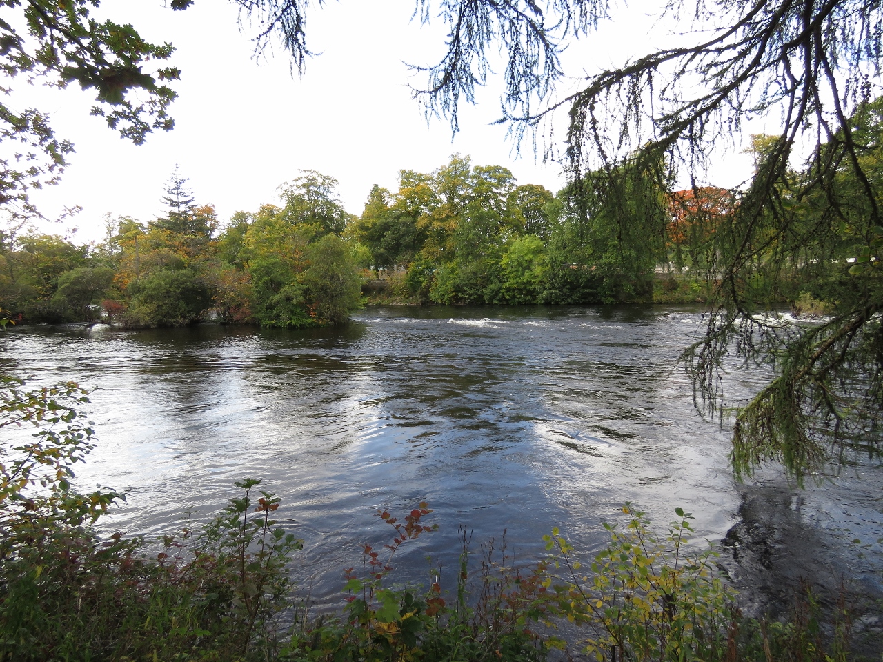
10/9/2017: River Conan
Position: 57°34.09'N, -4°26.57'W
Pedestrian and car bridges crossing the River Conan near Mayburgh.
|
 |
10/9/2017: Loch Garve
Position: 57°35.59'N, -4°39.28'W
Loch Garve with Meall Ruighe an Fhirch (left with antennas) and Carn Fearna (right). Both are 1417ft (432m) high.
|
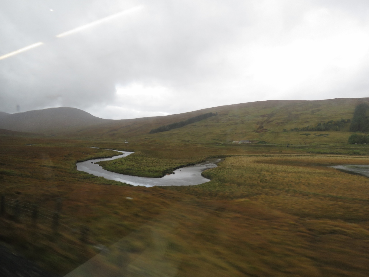 |
10/9/2017: River Bran
Position: 57°32.95'N, -5°6.47'W
The River Bran draining Loch Gowan near Achnasheen.
|
 |
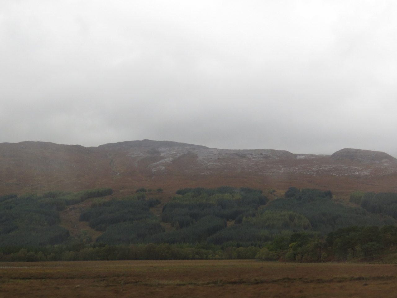
10/9/2017: Loch Dughaill
Position: 57°27.81'N, -5°21.78'W
Looking south to Loch Dughaill with 2,000ft (600m) ridges beyond.
|
 |
10/9/2017: New Kelso
Position: 57°25.93'N, -5°24.86'W
2,391ft (729m) Glas Bheinn in the distance, with tree farms on the lower slopes.
|
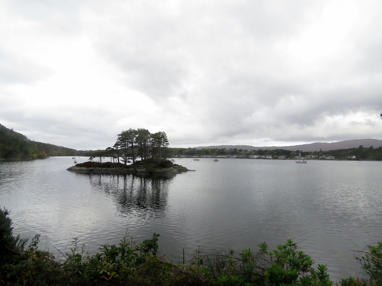 |
10/9/2017: Plockton
Position: 57°20.22'N, -5°38.23'W
The tree-covered islet of Sgeir Bhuidhe with Plockton visible across the harbour.
|
 |
10/9/2017: Skye
Position: 57°18.67'N, -5°43.11'W
The hills of Skye visible in the distance across Inner Sound.
|
 |
10/9/2017: End of Line
Position: 57°16.76'N, -5°42.83'W
Kyle of Lochalsh is the literal end of the train line. We'd really enjoyed the trip—the scenery was fabulous.
|
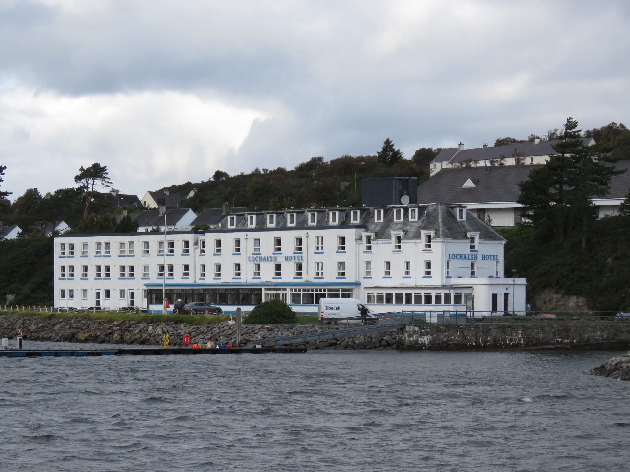 |
10/9/2017: Lochalsh Hotel
Position: 57°16.76'N, -5°42.85'W
The grand-looking Lochalsh Hotel along the Kyle waterfront.
|
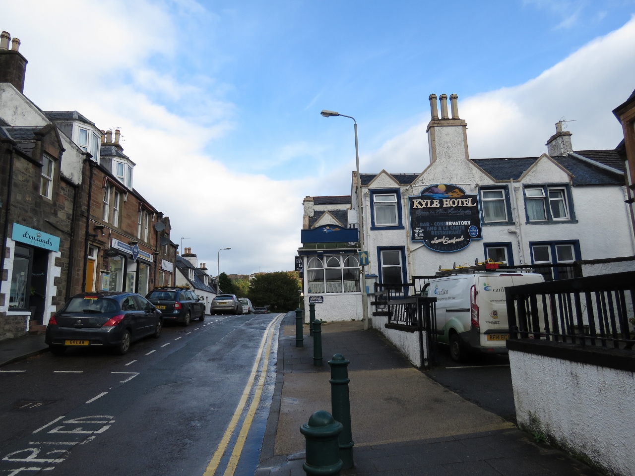 |
10/9/2017: Main Street
Position: 57°16.90'N, -5°42.94'W
Main Street in Kyle of Lochalsh. Before the bridge to Skye was opened in 1995, Kyle was the main ferry terminal to Skye. Kyle still is a popular tourist destination, but is less busy than it once was.
|
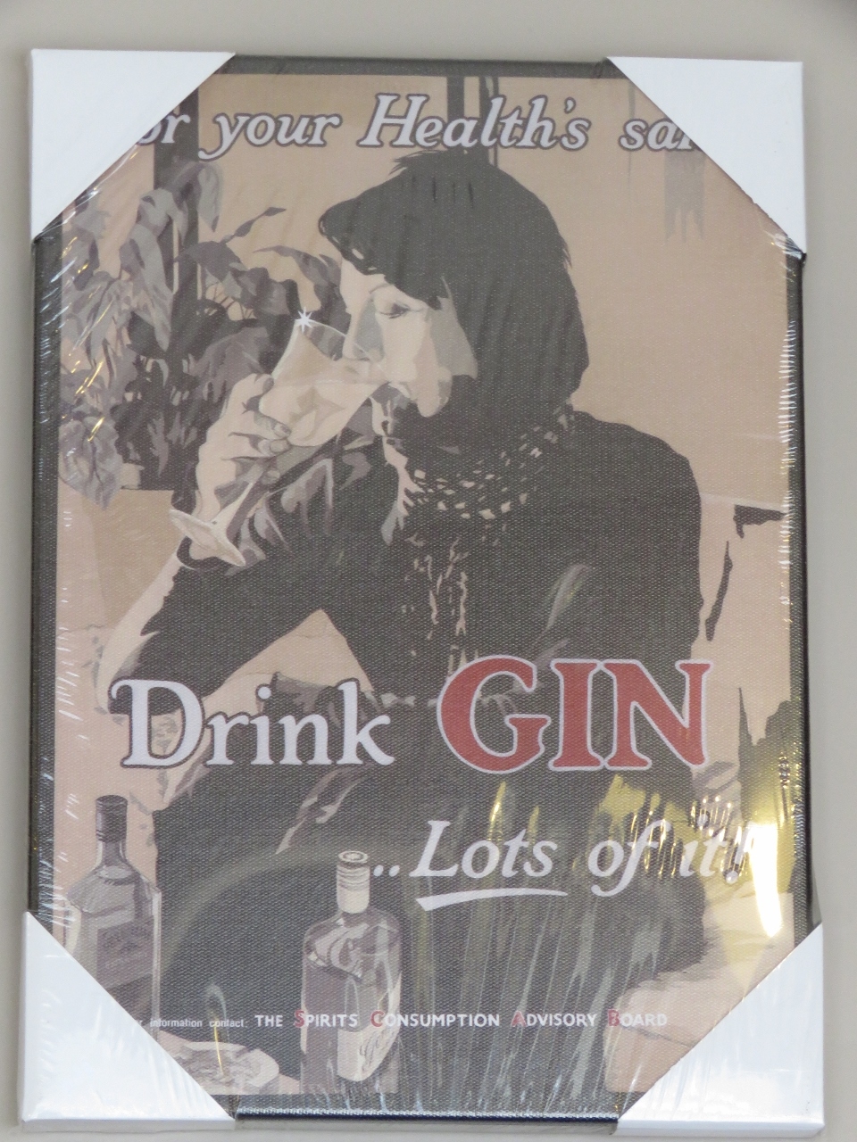 |
10/9/2017: Hector's Brothy
Position: 57°16.84'N, -5°42.93'W
We had a good lunch at Hector's Brothy cafe in Kyle and got a giggle out of some of their retro posters on the wall.
|
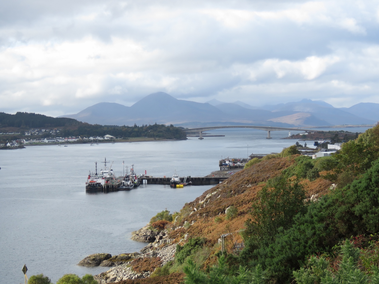 |
10/9/2017: Loch Alsh Viewpoint
Position: 57°16.86'N, -5°41.89'W
After lunch, we set out on our bike ride to Eilean Donan Castle. We had to climb a reasonable steep hill initially, but the reward was this view from the Loch Alsh Viewpoint. In the foreground is the Kyle commercial docks, with the bridge to Skye visible beyond and the Isle of Skye in the distance.
|
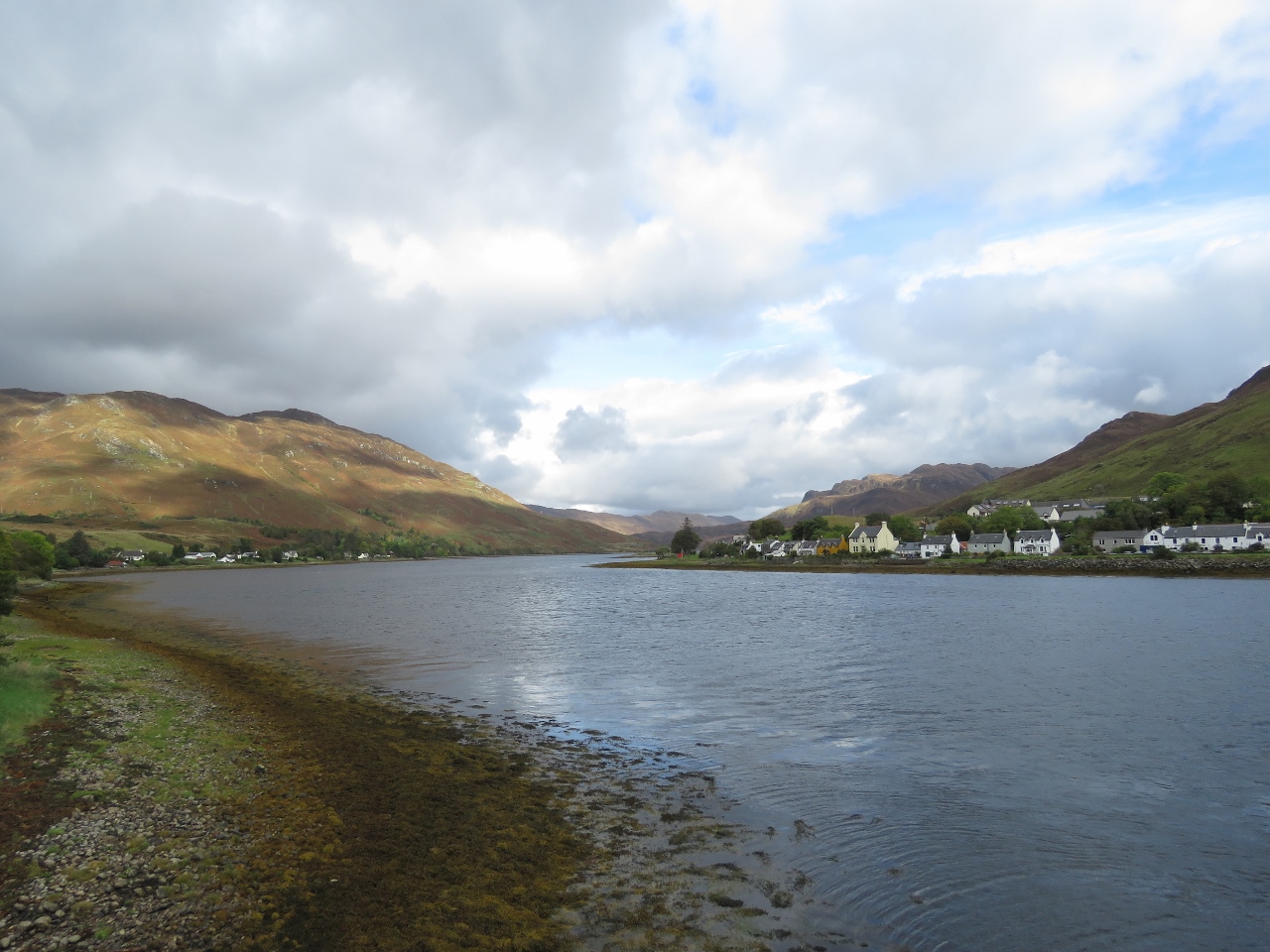 |
10/9/2017: Loch Long
Position: 57°16.71'N, -5°31.16'W
Looking up Loch Long, near Eilean Donan Castle, with the village of Dornie on the opposite shore.
|
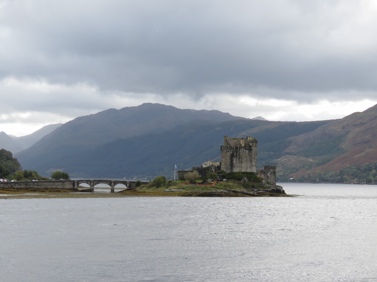 |
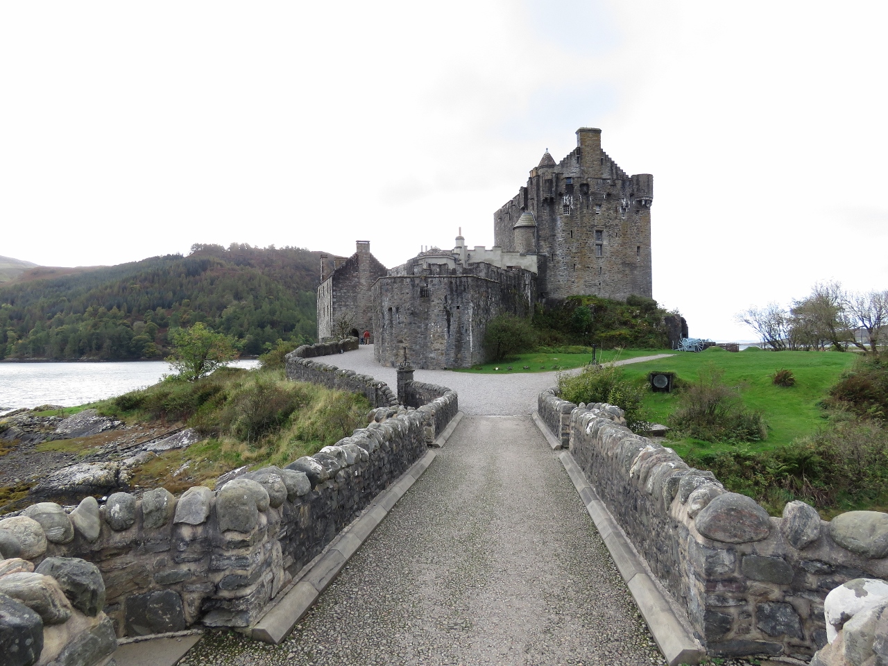
10/9/2017: Eilean Donan
Position: 57°16.71'N, -5°31.16'W
Picturesque Eilean Donan Castle, linked to the mainland with an elegant stone bridge, is one of Scotland's most photographed castles.
|
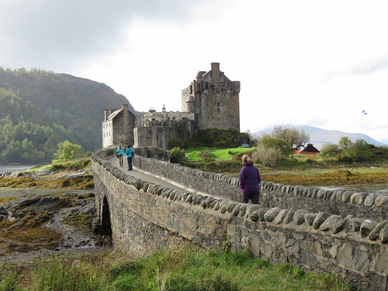 |
10/9/2017: Bridge
Position: 57°16.48'N, -5°30.84'W
The bridge to Eilean Donan castle. The castle was built in the 13th century, was destroyed during the Jacobite rebellions in the 18th century and was later restored in the 19th century.
|
 |
10/9/2017: Gate
Position: 57°16.43'N, -5°30.95'W
The castle gate and operating machinery weigh 1,000 pounds and it's a nice design with appropriately-sized counterweights such that a single person easily can raise and lower it.
|
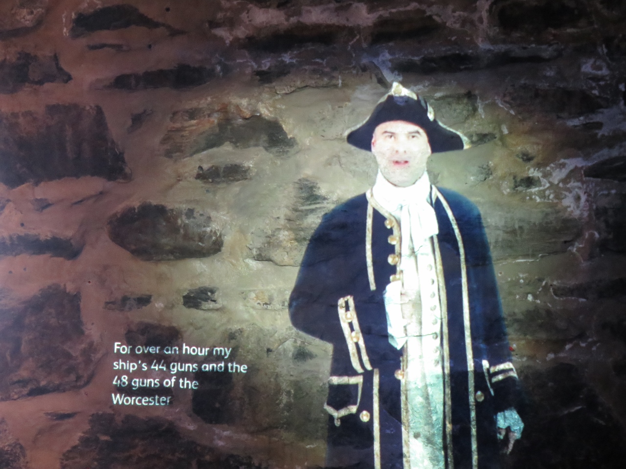 |
10/9/2017: Projection
Position: 57°16.43'N, -5°30.98'W
Several effective video projections and other exhibits told of the castle's history. It's a fun way to present a video by using super-bright projection directly onto one of the original stone walls.
|
 |
10/9/2017: Loch Duich
Position: 57°16.42'N, -5°30.98'W
Jennifer taking in the view along Loch Duich from the courtyard at Eilean Donan castle.
|
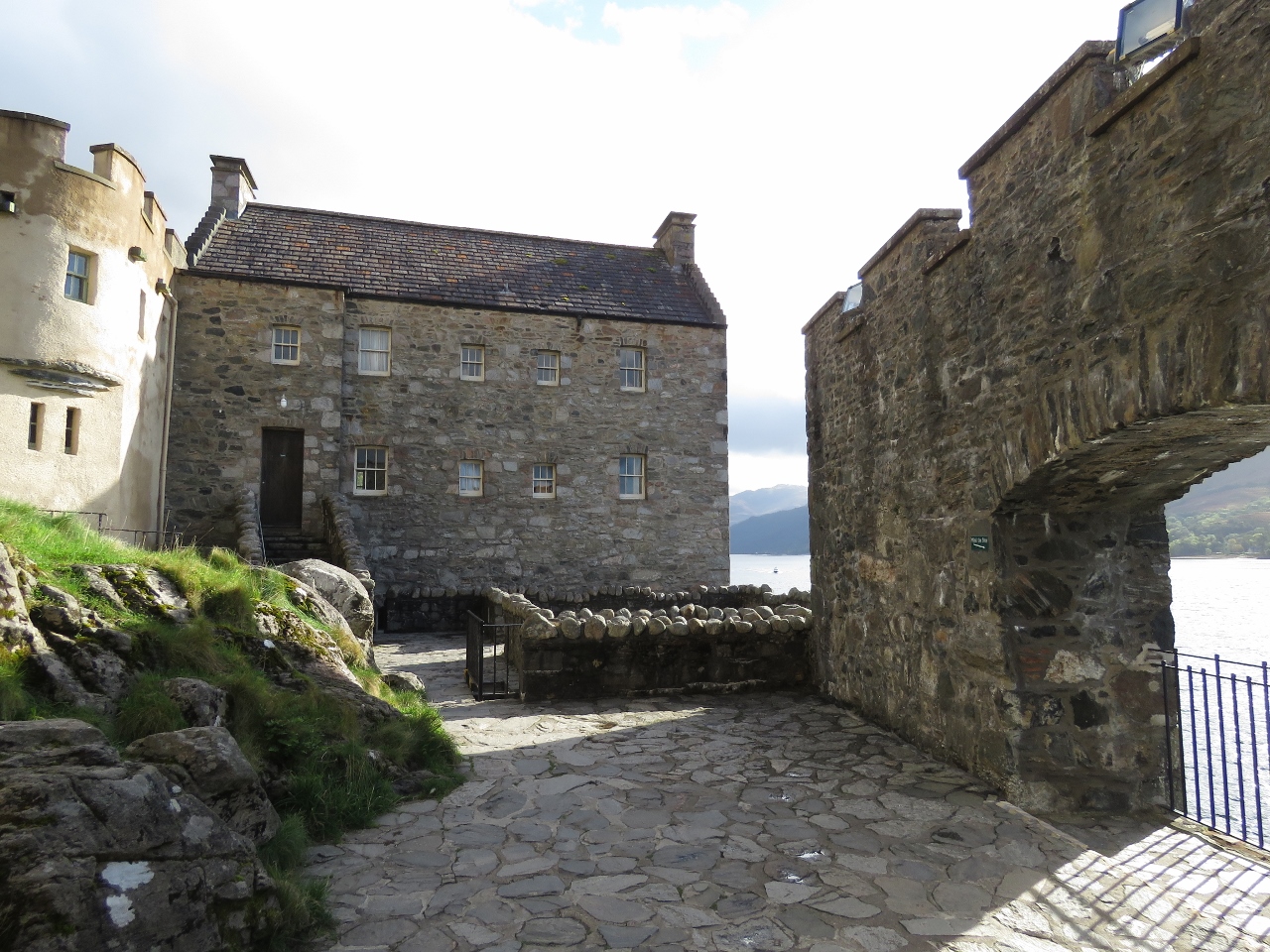 |
10/9/2017: Inner Courtyard
Position: 57°16.43'N, -5°31.00'W
The inner courtyard at Eilean Donan castle. Inside the castle are displays and recreations of 19th-century life in the castle, but photographs aren't allowed.
|
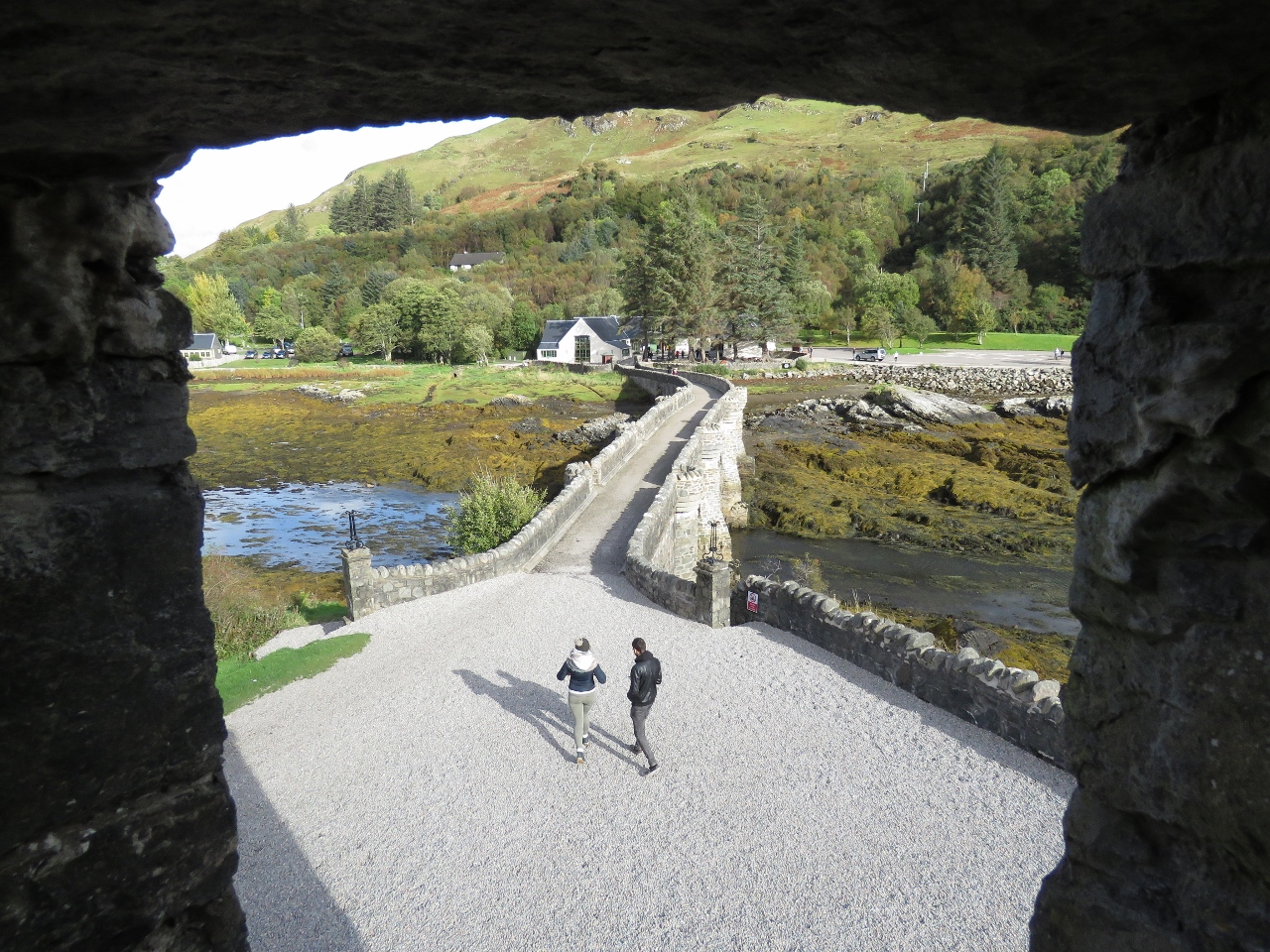 |
10/9/2017: Bridge
Position: 57°16.43'N, -5°30.96'W
Looking out to the bridge from the castle bastion.
|
 |
10/9/2017: Last View
Position: 57°16.45'N, -5°30.92'W
Last view to the castle before we leave.
|
 |
10/9/2017: Dornie
Position: 57°16.70'N, -5°30.92'W
We made a quick pass through the tidy village of Dornie before cycling back to Kyle.
|
 |
10/9/2017: Royal Scotsman
Position: 57°16.77'N, -5°42.82'W
The Royal Scotsman luxury train was at the station when we returned. The interior looks beautiful, but at over £1,000 per person per night, we'll stick with ScotRail.
|
 |
10/9/2017: RNLI
Position: 57°16.81'N, -5°42.89'W
The Klye of Lochalsh RNLI lifeboat lives in a shed and is launched via tractor when needed.
|
 |
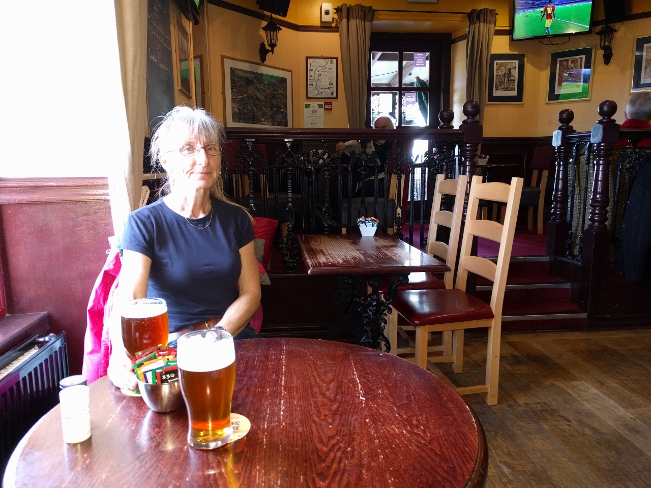
10/10/2017: The Snow Goose
Position: 57°28.97'N, -4°11.06'W
We biked out to the Snow Goose pub and had an excellent lunch there. Our original plan was to continue north to visit Fort George, but the sidewalk that we'd hoped would extend the entire way ended and we found ourselves on the edge of a major highway inches from cars running at speed. The risk vs reward ratio didn't balance out well so we returned back to Inverness to cycle through the Ness Islands south of town.
|
 |
10/10/2017: Fishers
Position: 57°27.95'N, -4°13.71'W
Fishers along the River Ness with Inverness Cathedral visible beyond the footbridge.
|
 |
10/10/2017: Ness Islands
Position: 57°27.85'N, -4°13.84'W
Biking through the beautiful Ness Islands park just outside Inverness. A series of pedestrian bridges connect the small islands that straddle the River Ness.
|
 |
10/10/2017: River Ness
Position: 57°27.82'N, -4°13.86'W
Swift current in the River Ness viewed from the Ness Islands.
|
 |
10/10/2017: Bridge
Position: 57°27.71'N, -4°14.14'W
Jennifer crossing one of the many pedestrian bridges in and around the Ness Islands.
|
 |
10/10/2017: Tomnahurich Bridge
Position: 57°27.87'N, -4°14.65'W
From the Ness Islands, we continued west to see more of the Caledonian Canal. This is the Tomnahurich Bridge, the third bridge in the Inverness area. The boat passing through is a charter boat—chartering is extremely popular on the Caledonian Canal.
|
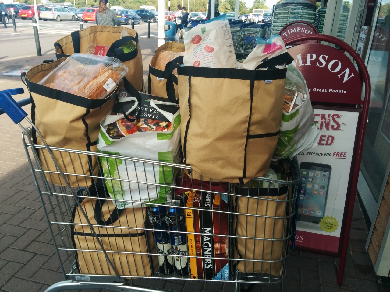 |
10/11/2017: Groceries
Position: 57°29.02'N, -4°10.55'W
When you only shop once a month, you buy a lot of groceries. Our last grocery purchase was four weeks ago in Stornoway.
The brown grocery bags are Earthtote Reusable Bags from reuseit.com. We love them–they last super-well (we’ve never replaced one yet), we can pack them right to the top, and they can handle very heavy loads. When transferring groceries to the boat (and sometimes to the dinghy first), it’s much more convenient to have a few large sturdy bags than many smaller ones that might rip and risk dropping items in the water. They’re also great for loading up our folding cart to maximum capacity. |
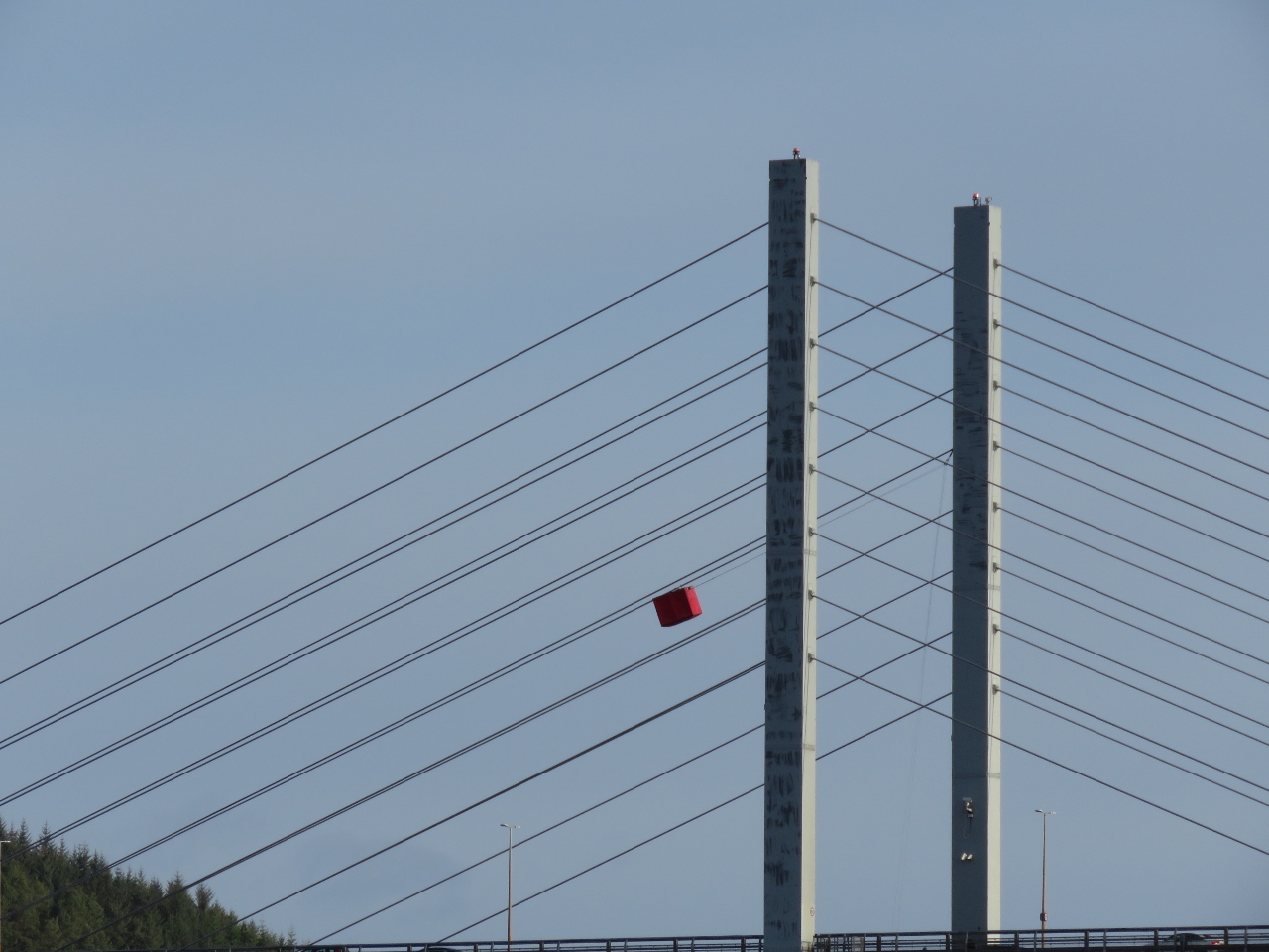 |
10/12/2017: Maintenance
Position: 57°29.67'N, -4°14.06'W
From our berth at Inverness Marina, we noticed this red box suspended from the Kessock Bridge. An interesting approach to bridge wire maintenance where a two-person car rides on the suspension wire and can be pulled up to the top or lowered down to the bottom.
|
 |
10/12/2017: UK Customs
Position: 57°29.67'N, -4°14.06'W
A friendly visit from UK Customs. They were patrolling the coast on their vessel Seeker, noticed the US flag and came over to ensure we'd properly cleared through into the UK. This we'd done at Rathlin Island three months ago over the phone via the UK's National Yachtline.
|
 |
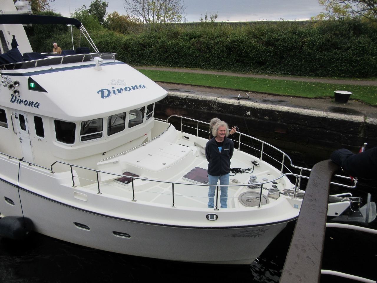
10/13/2017: RNLB Macquarie
Position: 57°29.67'N, -4°14.06'W
The RNLB Macquarie heading out. We were wondering where they'd gone after the boat didn't come back that night, and it turns out they were only here temporarily. The main RNLI station here is at Kessock under the Kessock Bridge.
|
 |
10/13/2017: Castle Tavern
Position: 57°28.50'N, -4°13.51'W
An excellent lunch at the Castle Tavern overlooking the River Ness.
|
 |
10/13/2017: EE
Position: 57°28.76'N, -4°13.27'W
We stopped in at the Inverness Mall to purchase a new UK SIM card. The package we'd purchased with O2 in Greenock supported data only and we couldn't renew it online with a non-UK credit card. We decided instead to get a package with EE that would allow us to make local calls and renew online with our US credit card.
|
 |
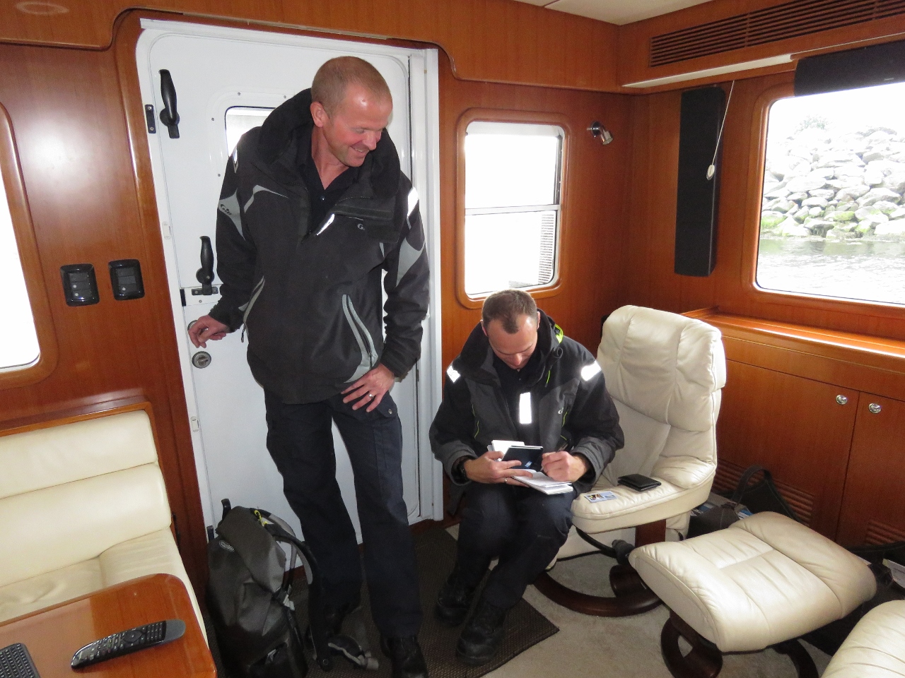
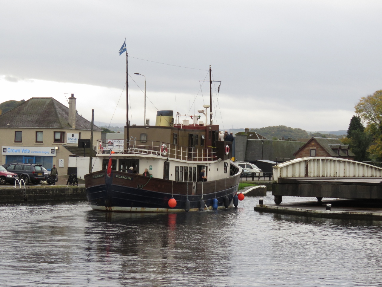
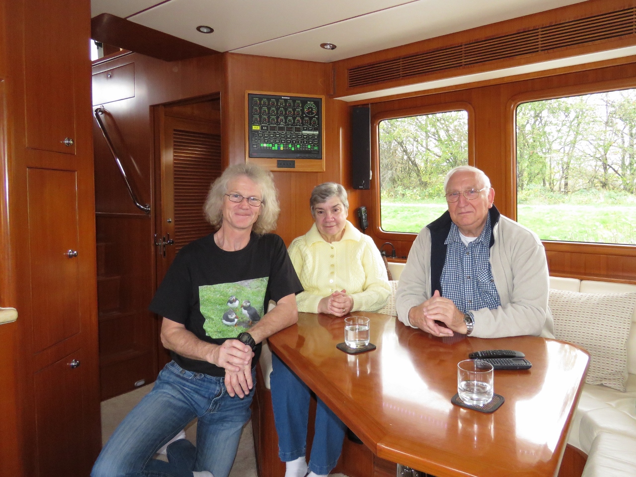
10/13/2017: Pamela and Neil White
Position: 57°29.67'N, -4°14.06'W
Pamela and Neil White stopped by to visit, and shared some local knowledge about the Caledonian Canal. They live in Paisley, near Greenock, and noticed Dirona at James Watt Dock Marina earlier this year. Neil's company, Saltire Marine Services, provides a variety of marine services such as boat delivery and captain services. He's recently been skippering the Glen Tarson through the Caledonian Canal and the Inner Hebrides and is docked nearby at Muirtown Basin just inside the Caledonian Canal.
|
 |
10/14/2017: Inverness Marina
Position: 57°29.67'N, -4°14.06'W
Beautiful calm morning at Inverness Marina.
|
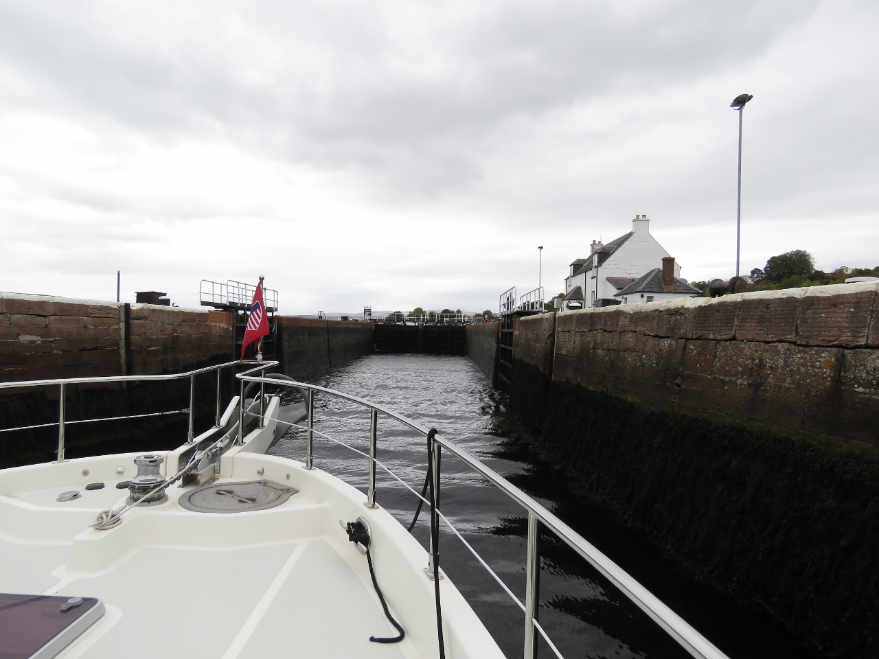 |
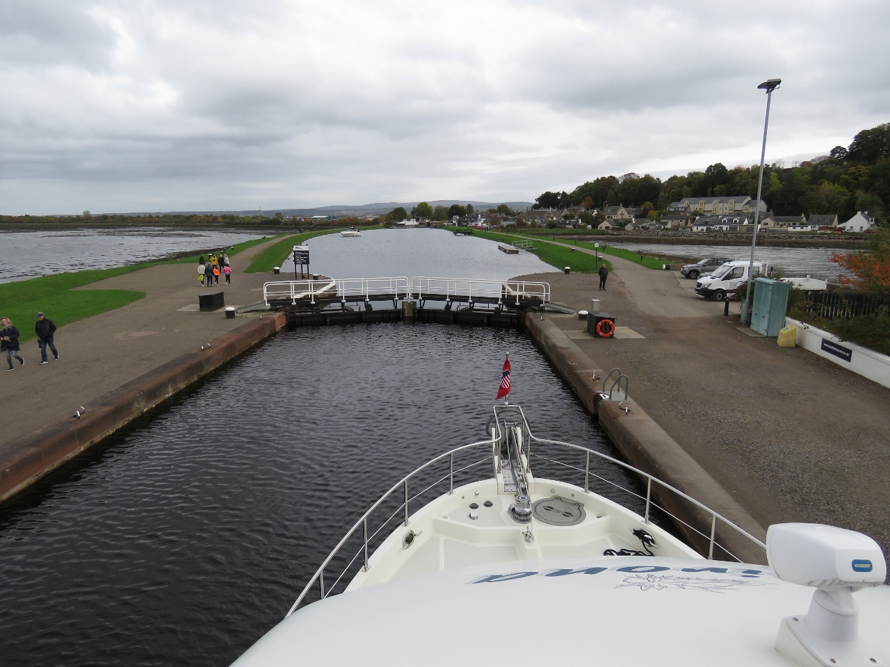
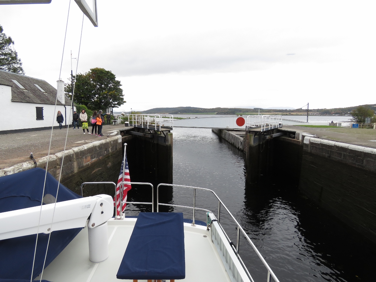
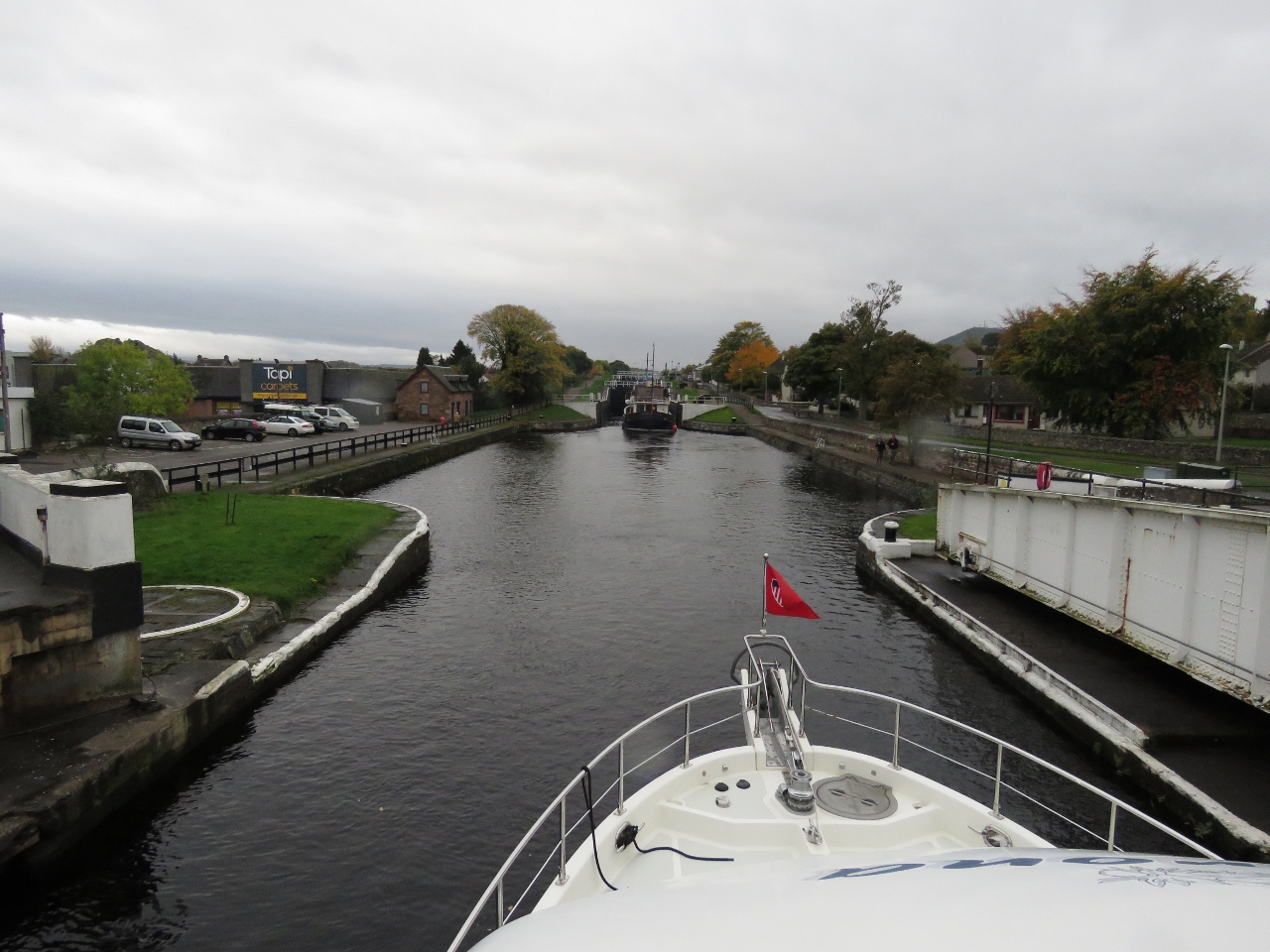
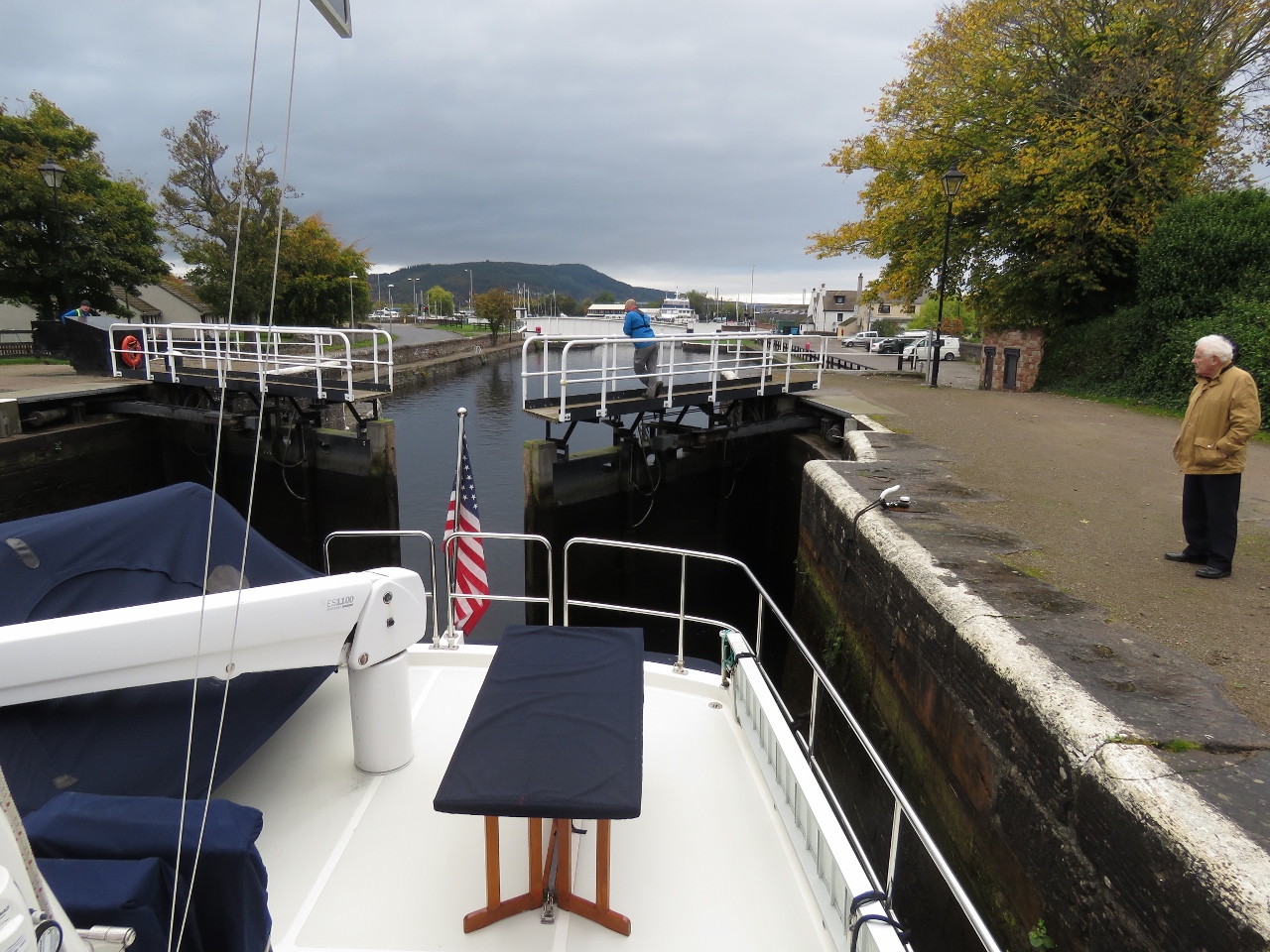
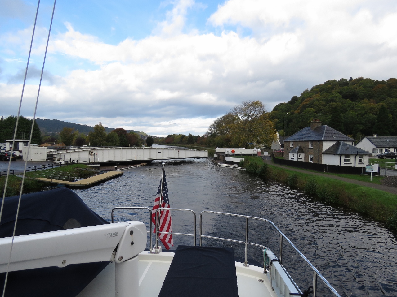
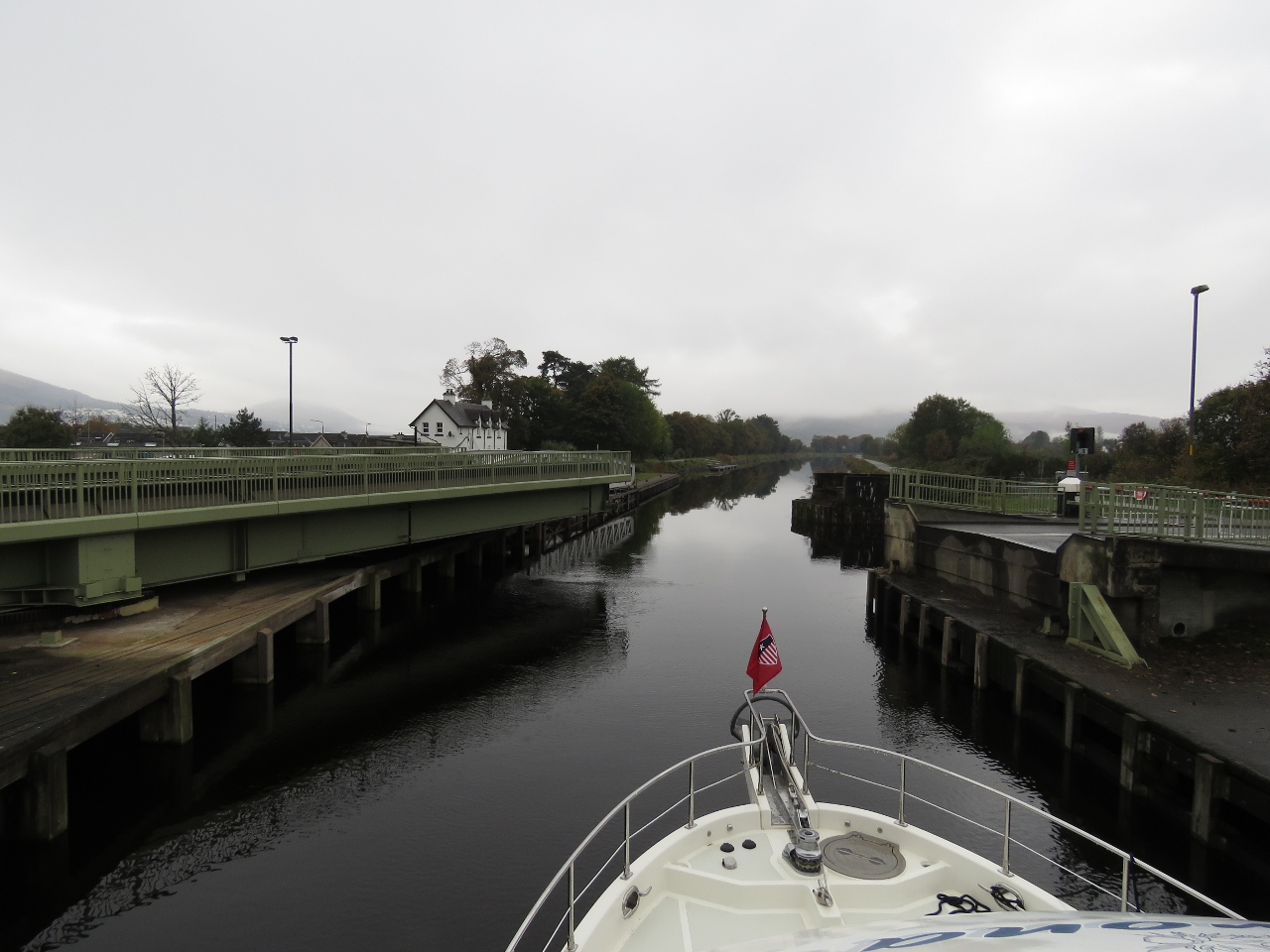
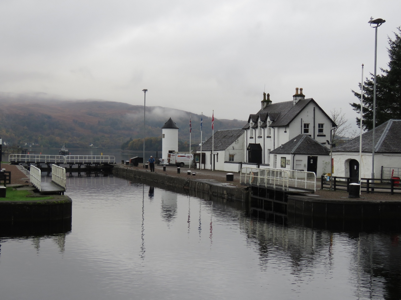
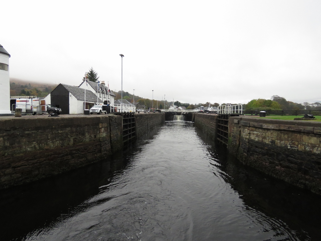
10/14/2017: Entering Caledonian Canal
Position: 57°29.44'N, -4°15.81'W
Entering the sea lock into the Caledonian Canal at Clachnaharry. We arrived mid-afternoon near low tide when the current would be minimal, but did have some cross-winds to contend with.
|
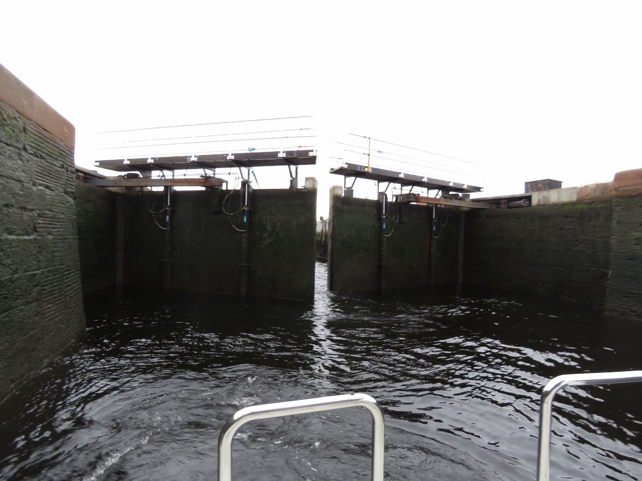 |
10/14/2017: Gates Closing
Position: 57°29.43'N, -4°15.77'W
The sea lock gates closing. We're officially in the Caledonian Canal now.
|
 |
10/14/2017: Rising
Position: 57°29.43'N, -4°15.77'W
Dirona rising in the sea lock (Neil White photo).
|
 |
10/14/2017: Clachnaharry Sea Lock
Position: 57°29.43'N, -4°15.77'W
A happy James tending the bow line as we near the top of the Clachnaharry Sea Lock (Neil White photo).
|
 |
10/14/2017: Looking Forward
Position: 57°29.43'N, -4°15.77'W
Looking forward from the top of the Clachnaharry sea lock.
|
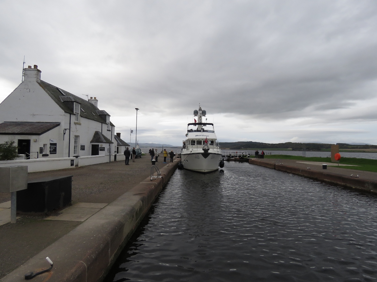 |
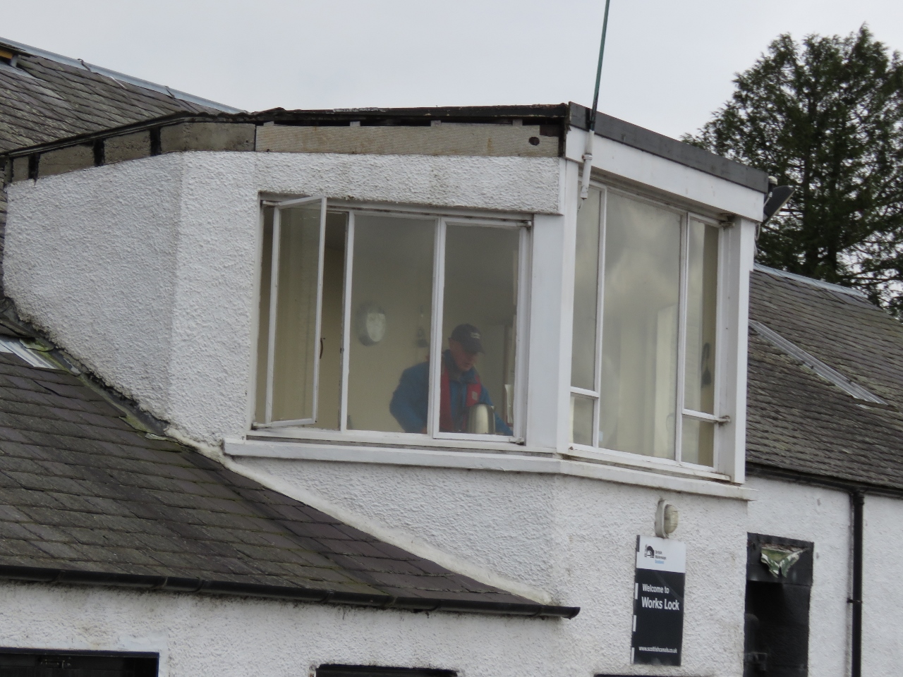
10/14/2017: Sea Lock Office
Position: 57°29.43'N, -4°15.77'W
Moored outside the Clachnaharry sea lock office while we go in to purchase a permit. The cost for a short-term transit through the Caledonian Canal is £20.10 per meter outward and £15.90 return. This includes moorage for up to seven nights on the canal for a maximum of 192 hours. Up to three additional nights can be purchased for £1.45 per meter.
|
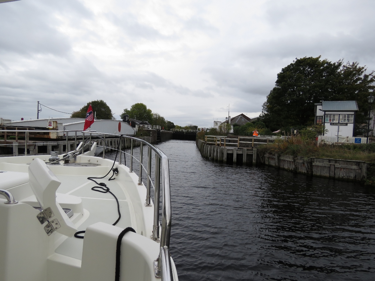 |
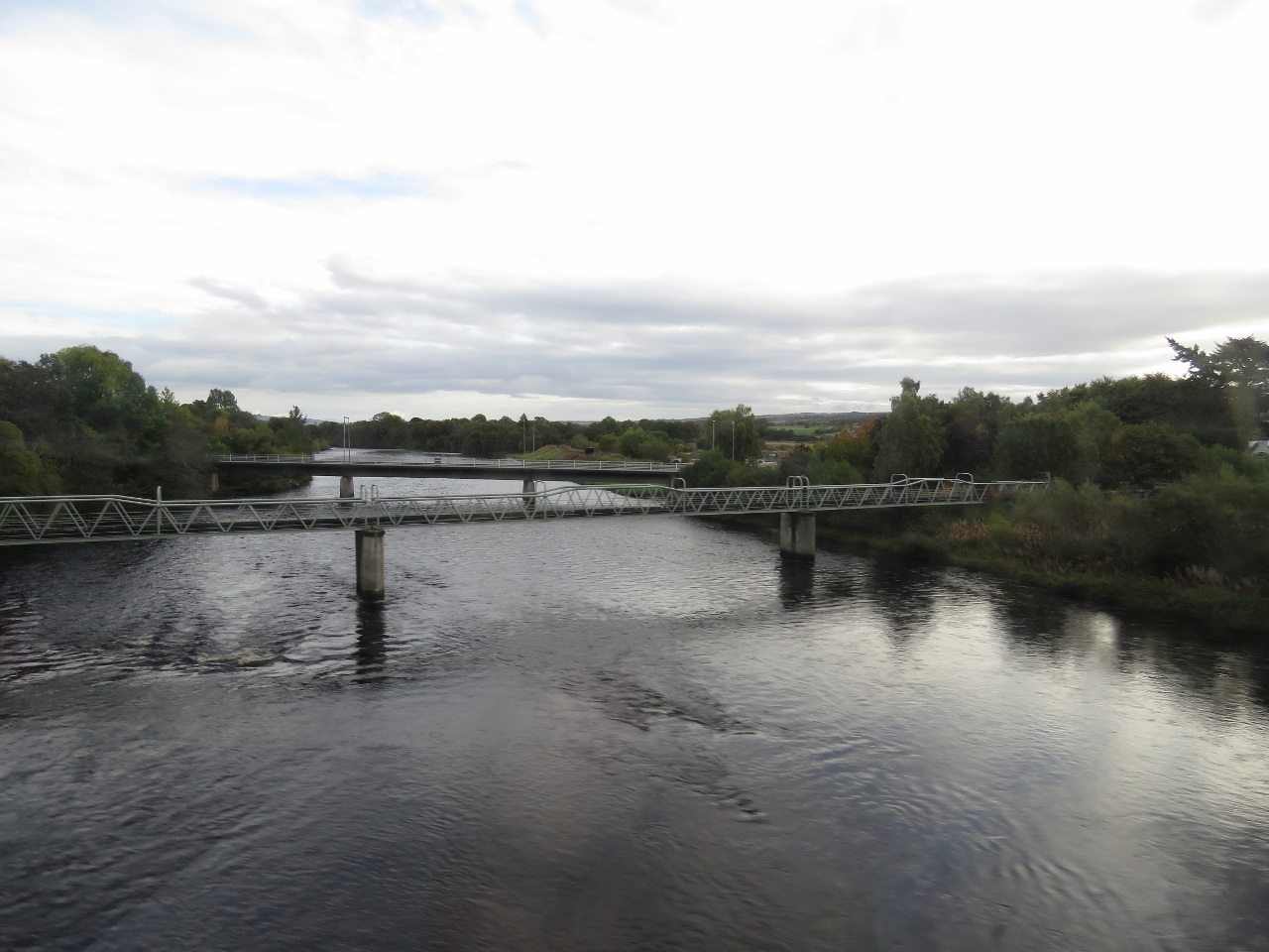
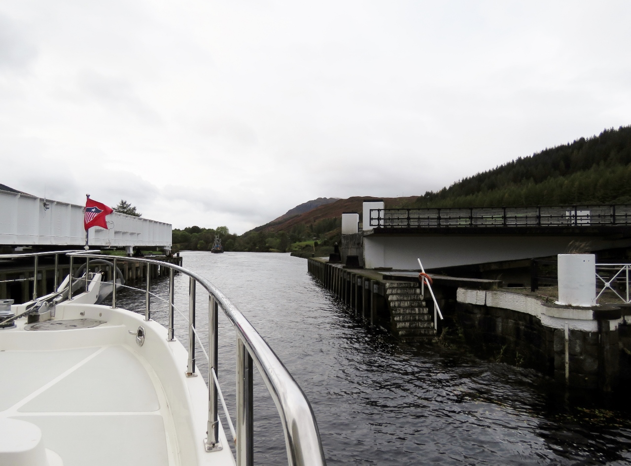
10/14/2017: Railway Bridge
Position: 57°29.37'N, -4°15.43'W
Passing through the railway bridge that we'd crossed by train a few days earlier on our trip to Kyle of Lochalsh, and passed by bicycle a few days before that.
|
 |
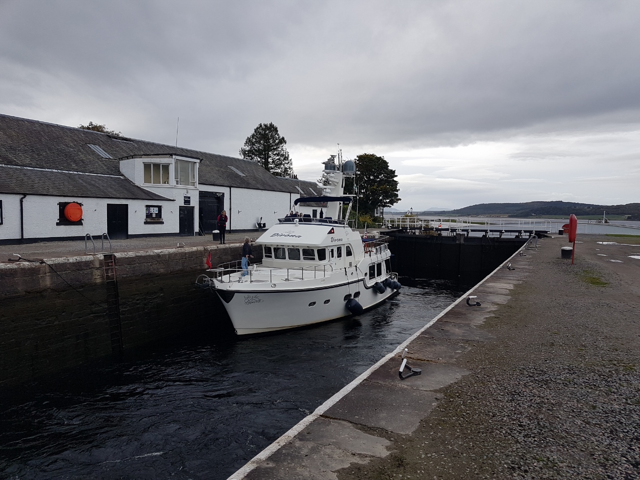
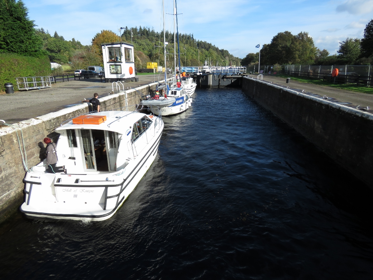
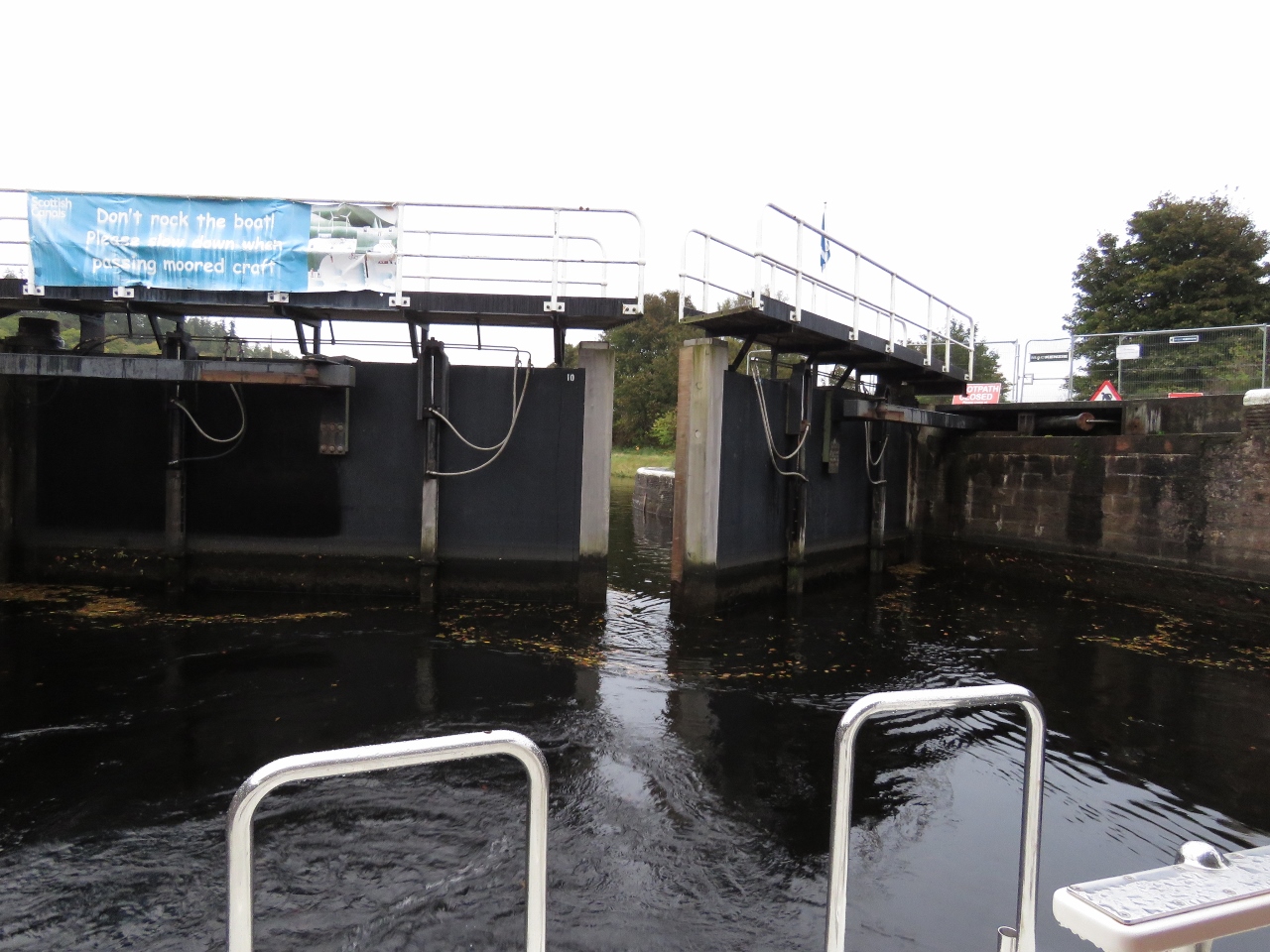
10/14/2017: Clachnaharry Works Lock
Position: 57°29.34'N, -4°15.34'W
The gates closing behind us on our second and final lock for the day at Clachnaharry, just beyond the railway bridge.
|
 |
10/14/2017: Rising
Position: 57°29.34'N, -4°15.34'W
Dirona rising in the Clachnaharry Works Lock. The Caledonian Canal locks feel roomy compared to the Crinan Canal. The maximum vessel dimensions in the Caledonian Canal are 150ft (45.72 m) long, with a 35ft (10.67m) beam and a 13.5ft (4.1m) draft, whereas for the maximums for the Crinan Canal are 88ft (26.82m ) long, with a 20ft (6.09m) beam and a draft of 8ft 10in (2.7m) (Neil White photo).
|
 |
10/14/2017: Lock Operator
Position: 57°29.33'N, -4°15.32'W
Another big difference between the Crinan and Caledonian Canals is that here the locks and sluice gates all are operated hydraulically by the canal staff, whereas we had to operate them ourselves manually on the Crinan. Jennifer felt like she was on vacation.
|
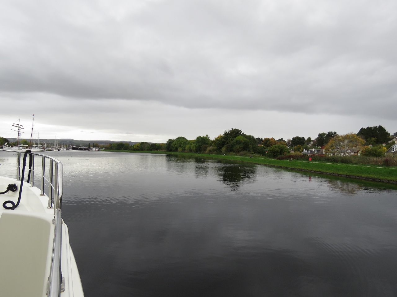 |
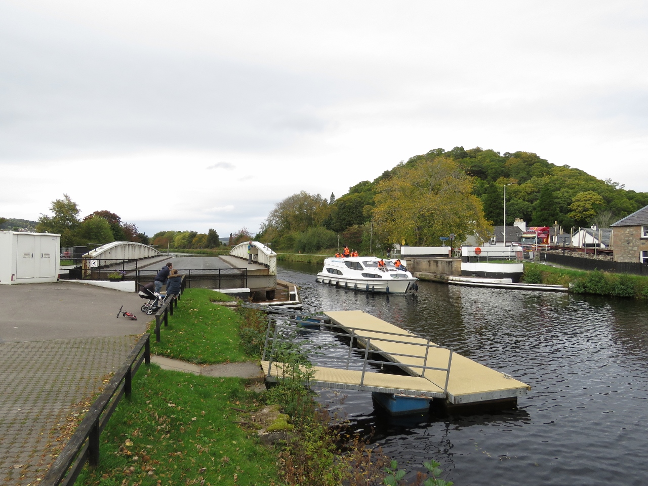
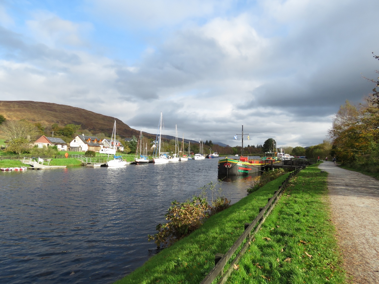
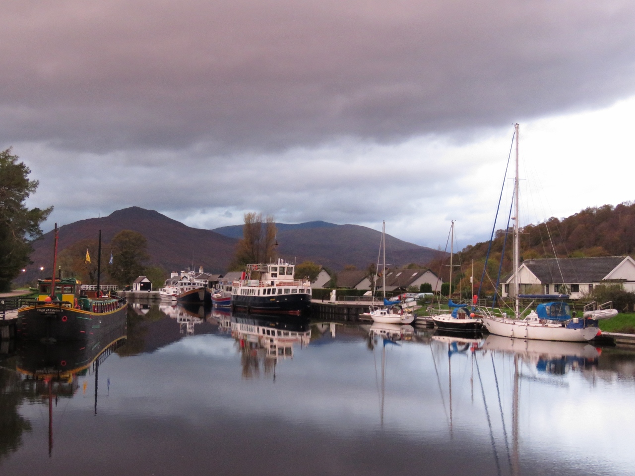
10/14/2017: Muirtown Basin
Position: 57°29.24'N, -4°15.15'W
Entering tranquil Muirtown Basin where we'll spend the night.
|
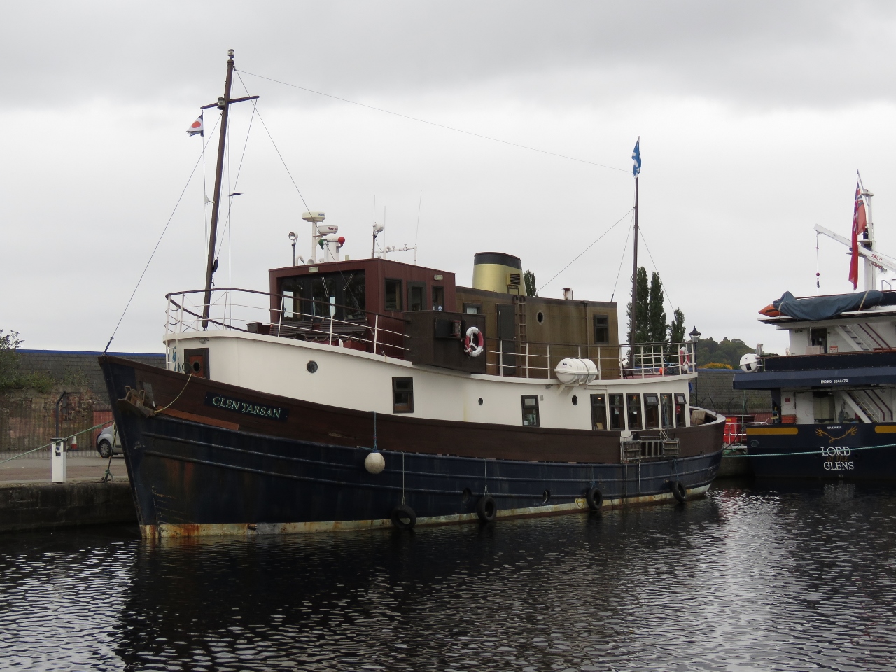 |
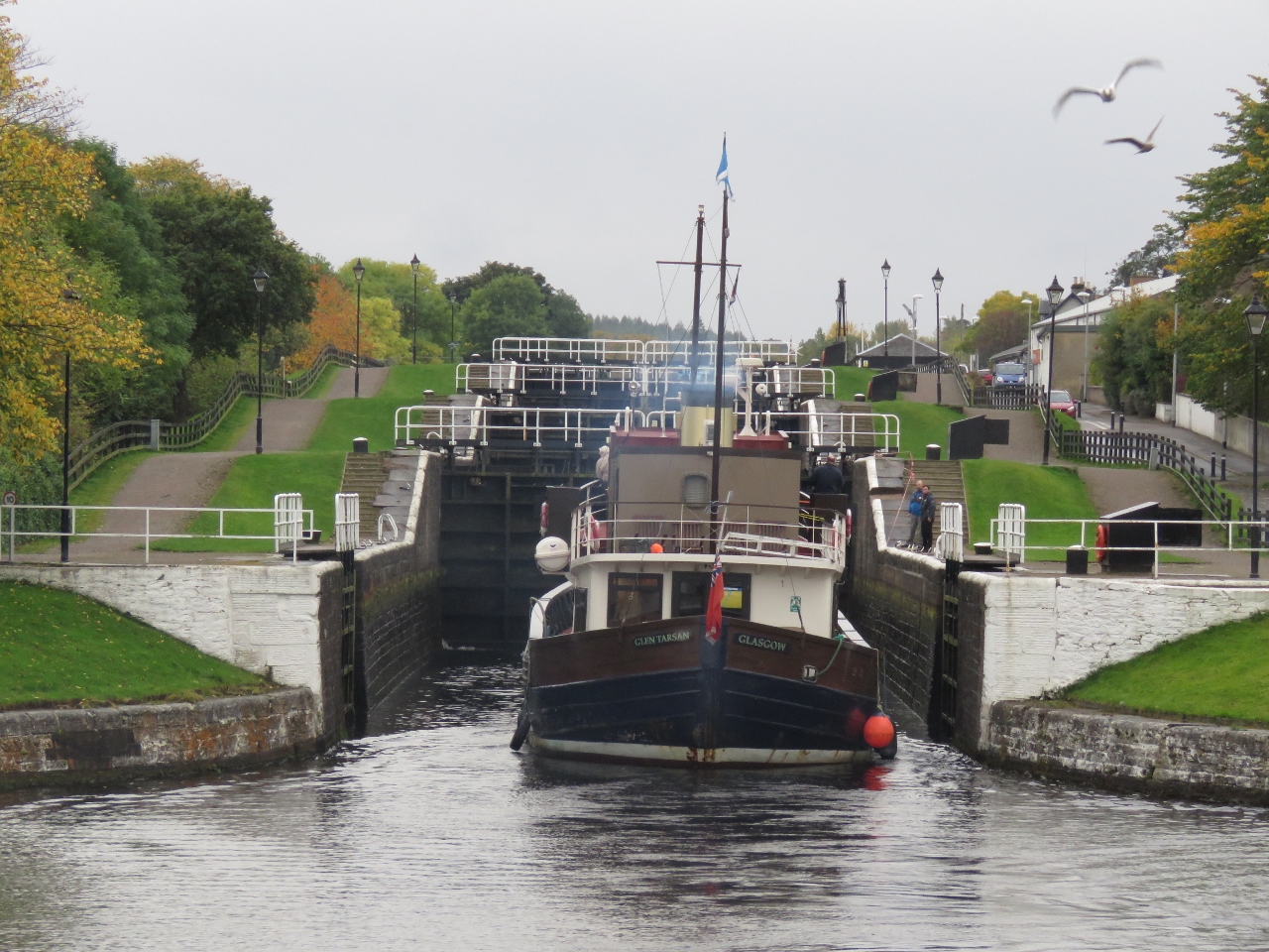
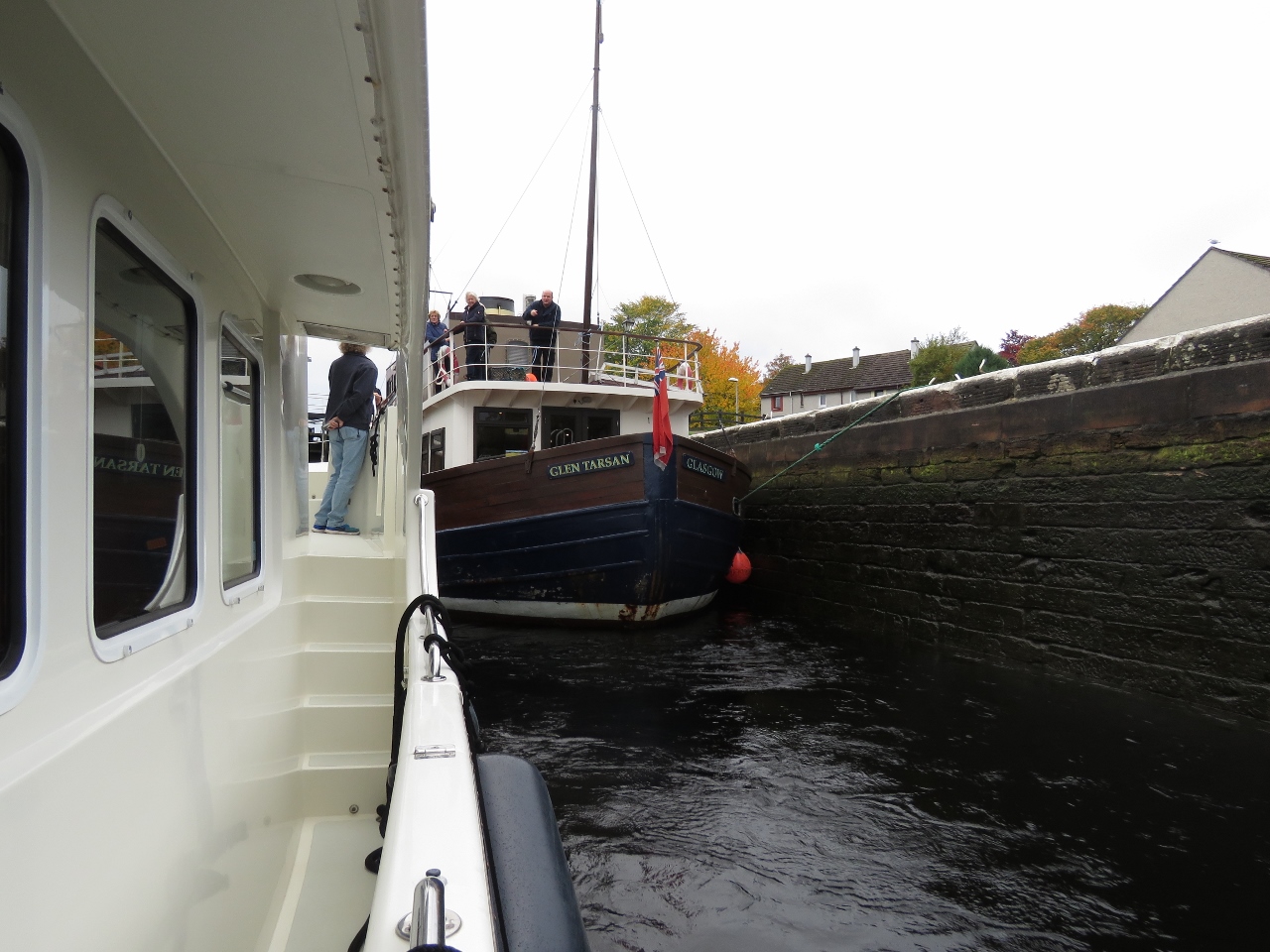
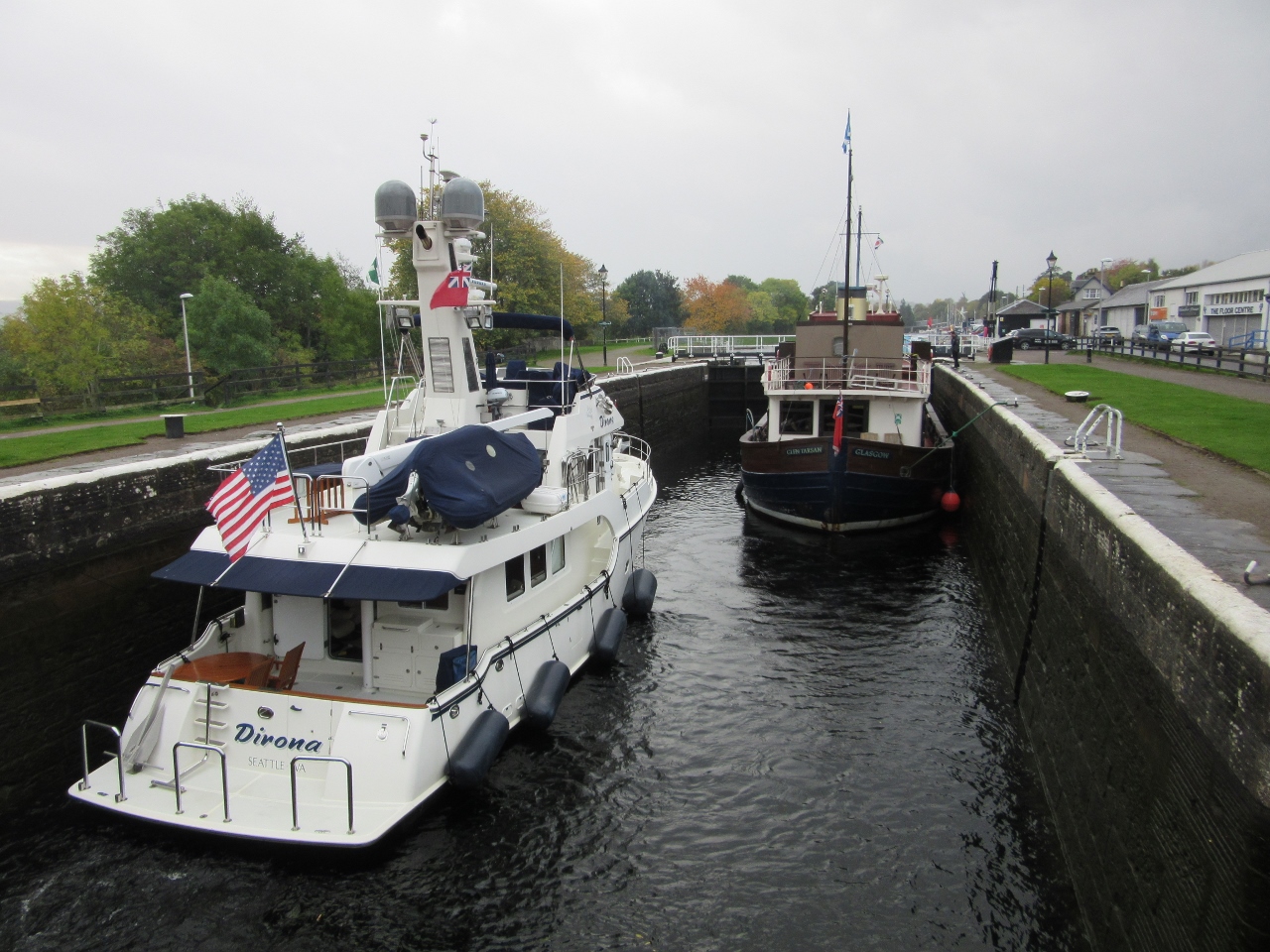
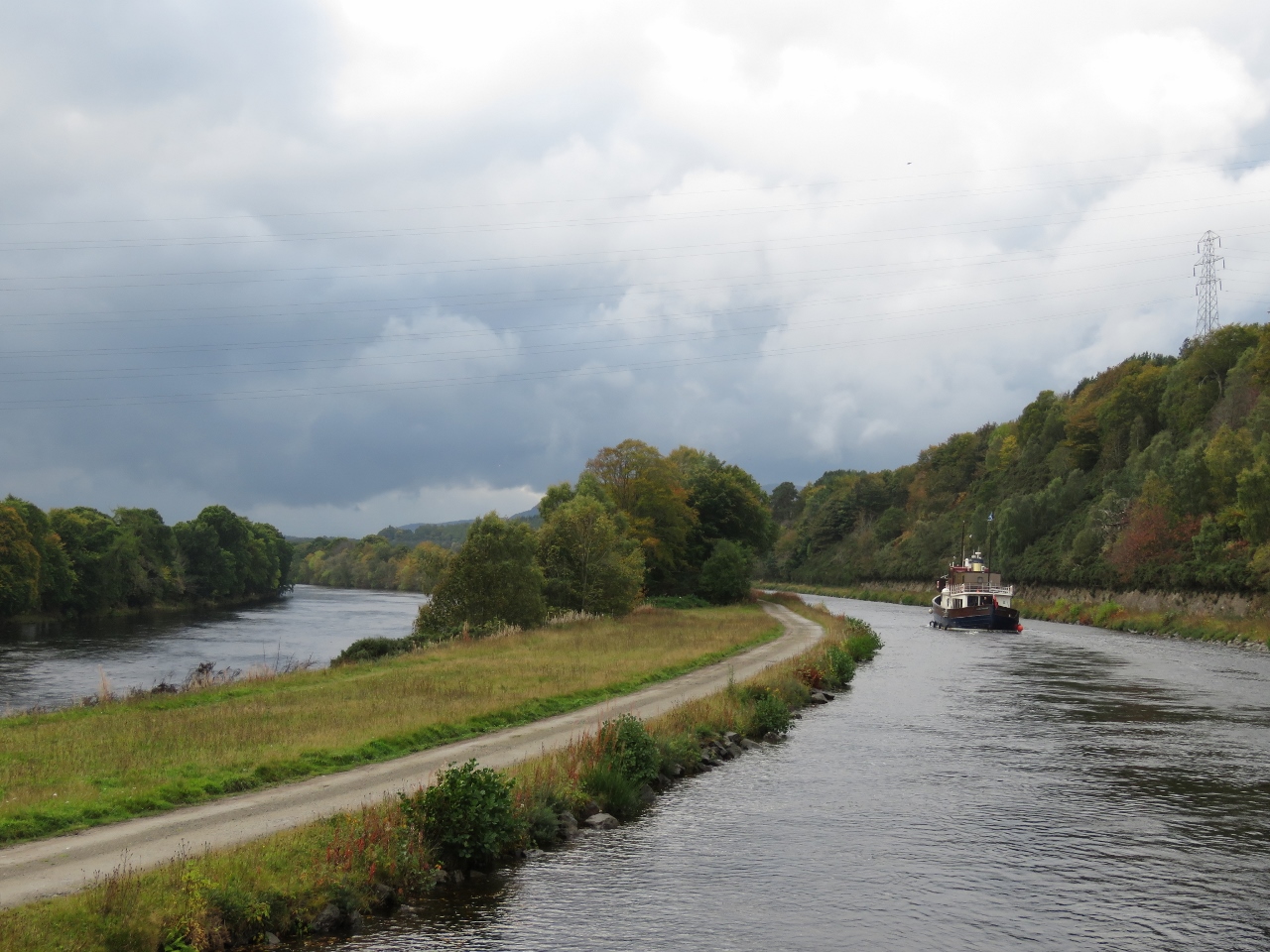
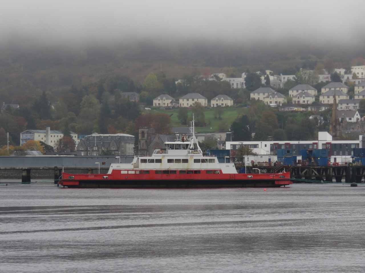
10/14/2017: Glen Tarsan
Position: 57°29.04'N, -4°14.78'W
The Glen Tarsan is one of nearly a dozen cruise boats that ply the Caledonian Canal, taking guests on multi-day cruises.
|
 |
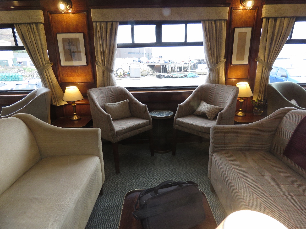
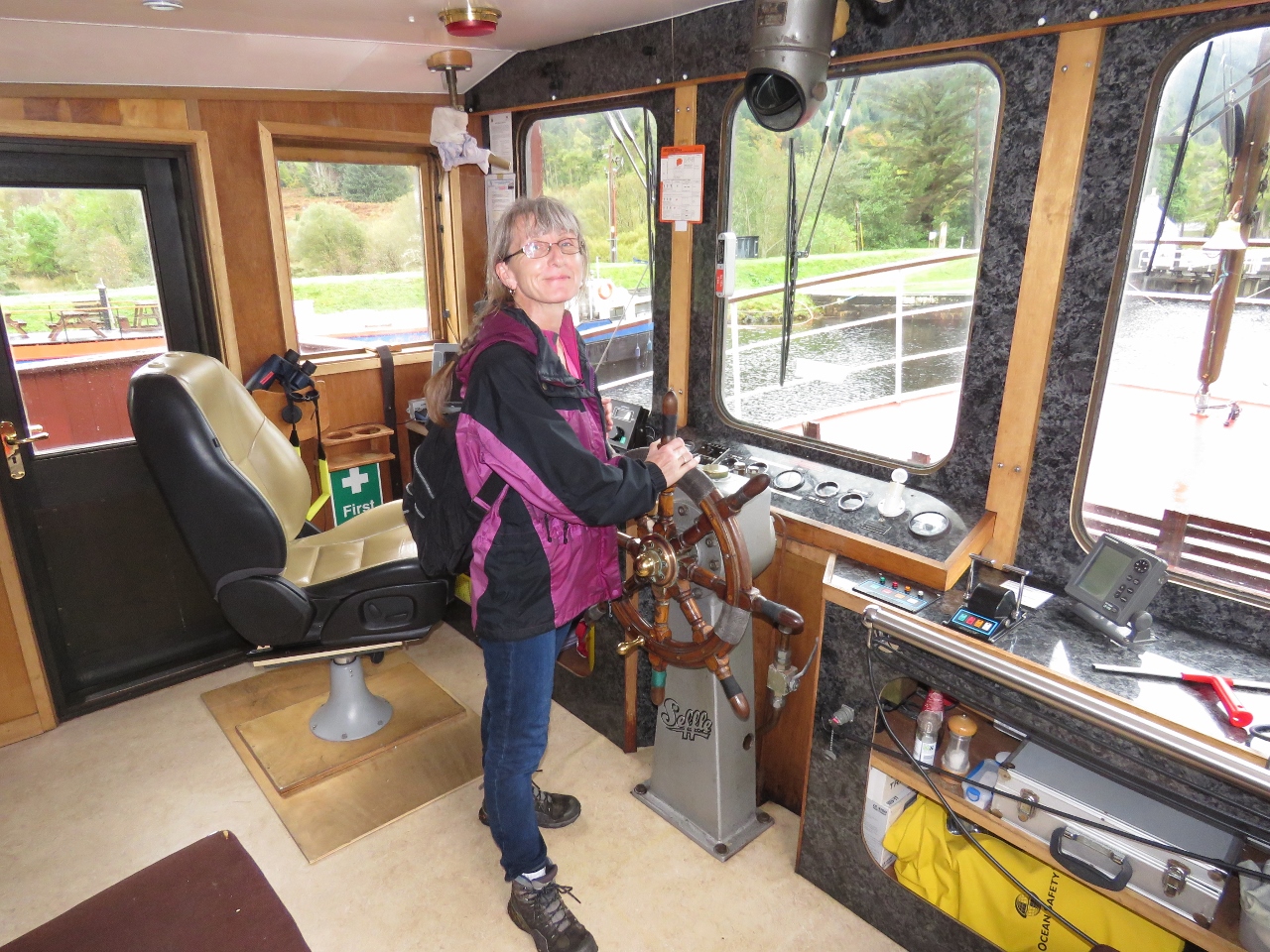
10/14/2017: Neil White
Position: 57°29.03'N, -4°14.78'W
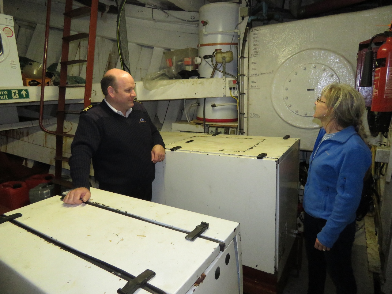
We've been in discussions with commercial captain Neil White since arriving in Scotland, and he's been offering us advice on local cruising. By chance, he and his guests on the Glen Tarson are in the canal the same time we are and we got a tour of the ship.
|
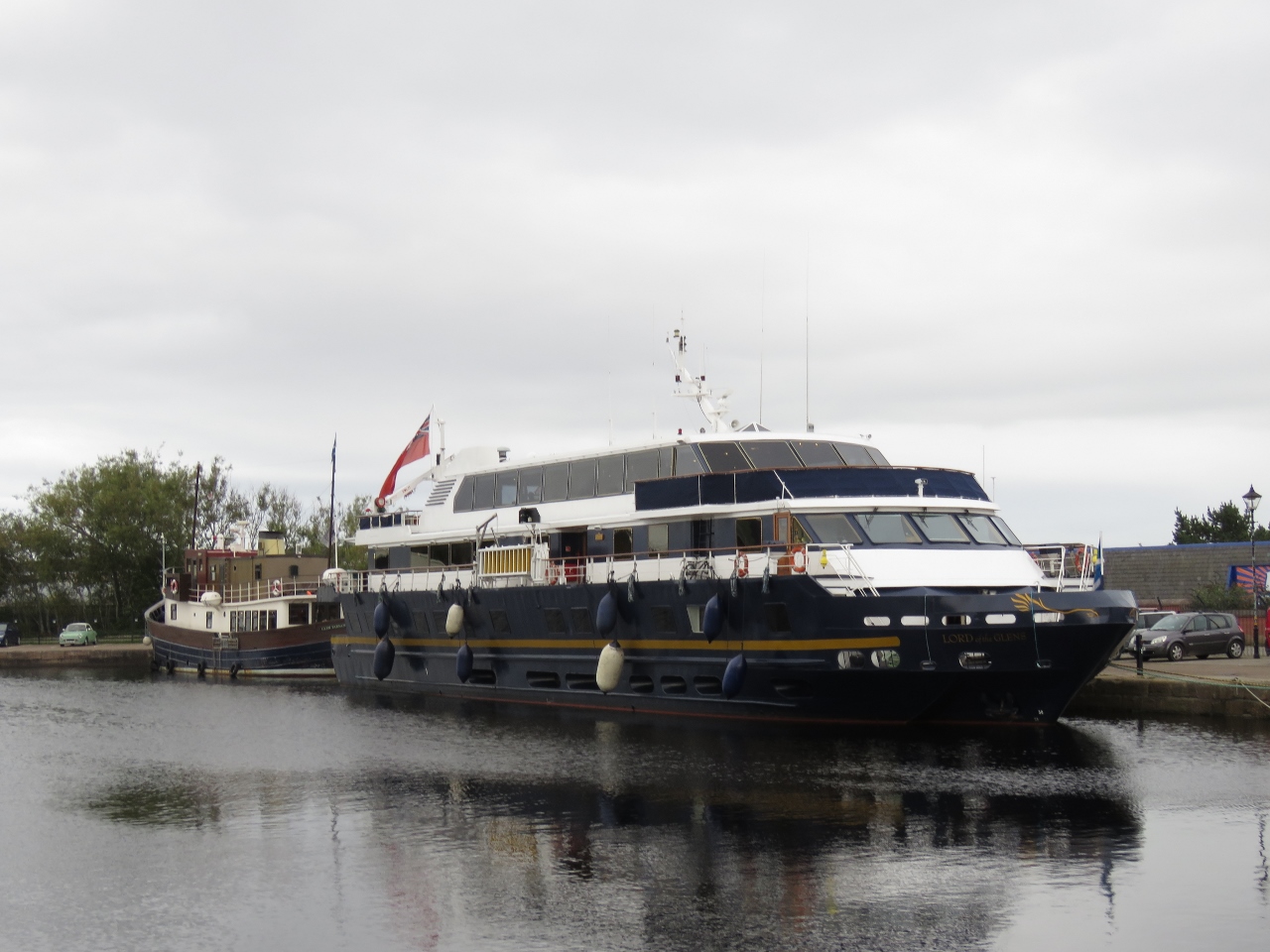 |
10/14/2017: Lord of the Glens
Position: 57°29.00'N, -4°14.86'W
The Lord of the Glens is the largest cruise boat on the Caledonian Canal and was purpose-built for the job, absolutely filling the locks front-to-back and side-to-side.
|
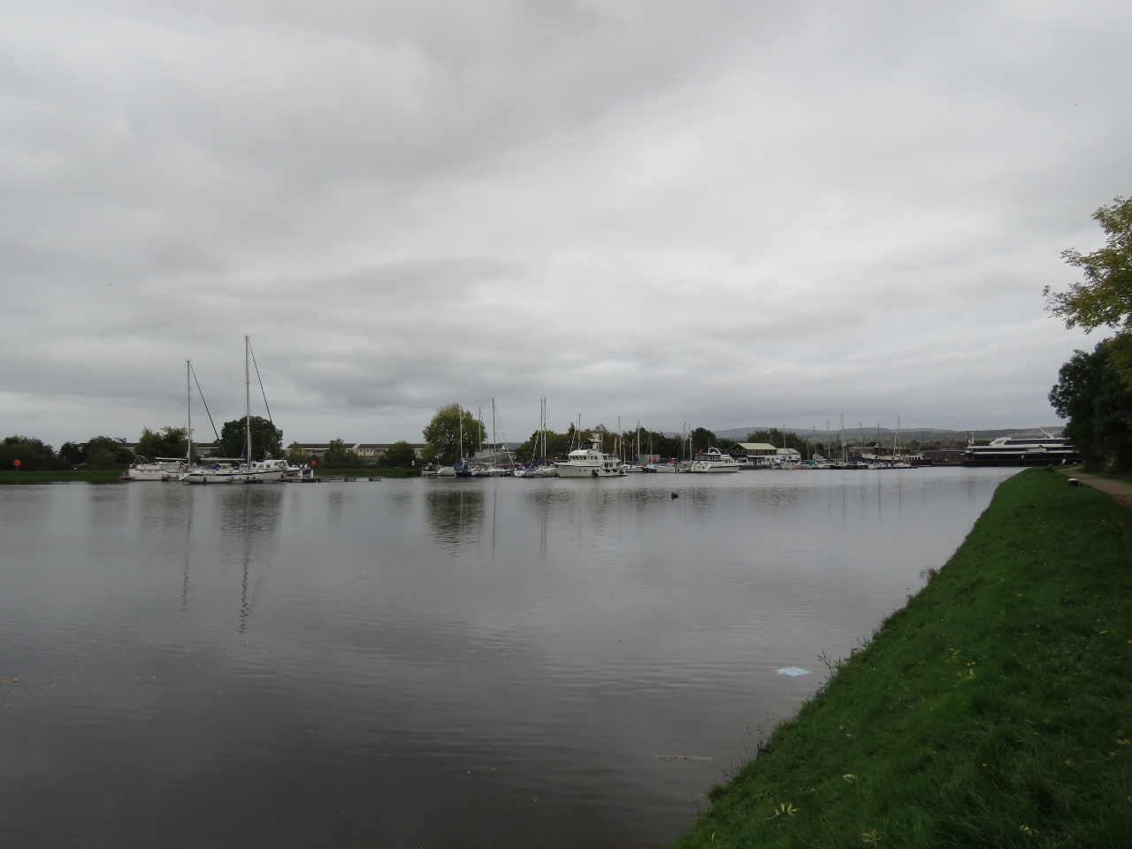 |
10/14/2017: Seaport Marina
Position: 57°29.11'N, -4°15.07'W
Looking across the canal to Seaport Marina, where Dirona is moored for the night. Glen Tarsan and Lord of the Glens are visible in the distance (click image for larger view).
|
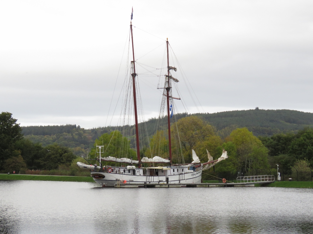 |
10/14/2017: Flying Dutchman
Position: 57°29.11'N, -4°15.07'W
The sailing vessel Flying Dutchman will be departing tomorrow for a sailing tour to Amsterdam.
|
 |
10/14/2017: Clachnaharry Inn
Position: 57°29.31'N, -4°15.50'W
The view to the sea lock we'd just passed through from the Clachnaharry Inn, where we had an excellent meal.
|
 |
10/14/2017: Evening
Position: 57°29.31'N, -4°15.21'W
Evening calm along the canal. This is a little different from the windswept Orkney Islands.
|
 |
10/15/2017: Glen Tarsan
Position: 57°29.02'N, -4°14.84'W
Following the Glen Tarsan through the Muirtown Road Swing Bridge. The locks and bridges along the Caledonian Canal were operating from 8:30am to 5:30pm when we passed through. But several of the bridges had restricted opening times to avoid backing up the local traffic. The first opening of the day for the Muirtown Road Swing Bridge was 10am—it's a busy road, and traffic backed up immediately.
|
 |
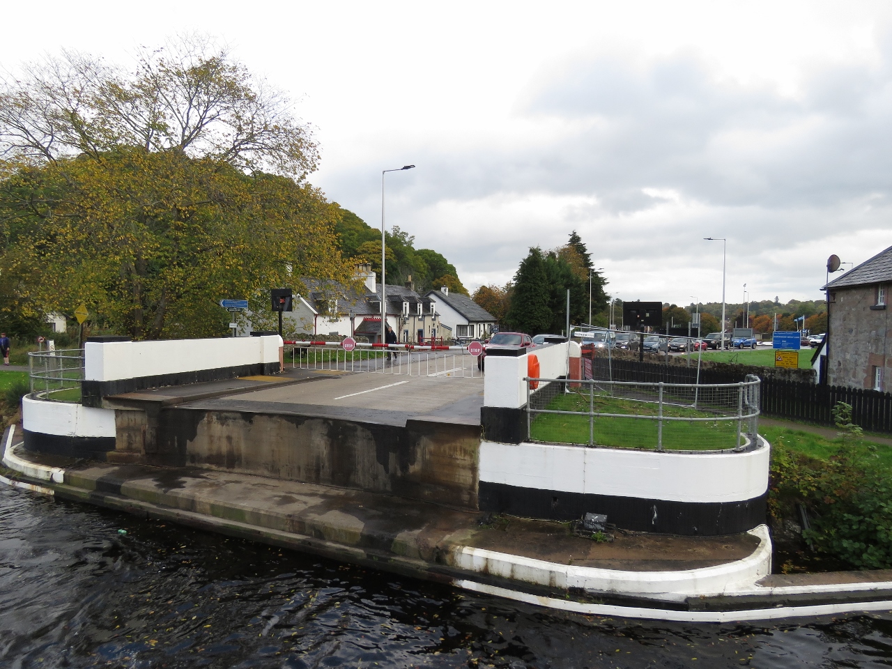
10/15/2017: Muirtown Road Swing Bridge
Position: 57°28.94'N, -4°14.86'W
Passing through the Muirtown Road Swing Bridge. We bicycled over this bridge a week earlier.
|
 |
10/15/2017: Muirtown Flight
Position: 57°28.94'N, -4°14.86'W
The Glen Tarsan entering the first of the four locks in the Muirtown Flight that will take us up a total of 32 feet (9.8m). We'll be tucking in behind on the port side.
|
 |
10/15/2017: Gates Closing
Position: 57°28.89'N, -4°14.89'W
The gates closing behind us in the first lock.
|
 |
10/15/2017: Lock Filling
Position: 57°28.89'N, -4°14.90'W
Tucked in behind the Glen Tarsan. You can see turbulence in the water as the visible Glen Tarsan motors slightly forward to stay tight against the wall as the lock fills.
|
 |
10/15/2017: Enjoying the Ride
Position: 57°28.89'N, -4°14.90'W
Enjoying the ride as we ascend in the first lock of the Muirtown Flight (Neil White photo).
|
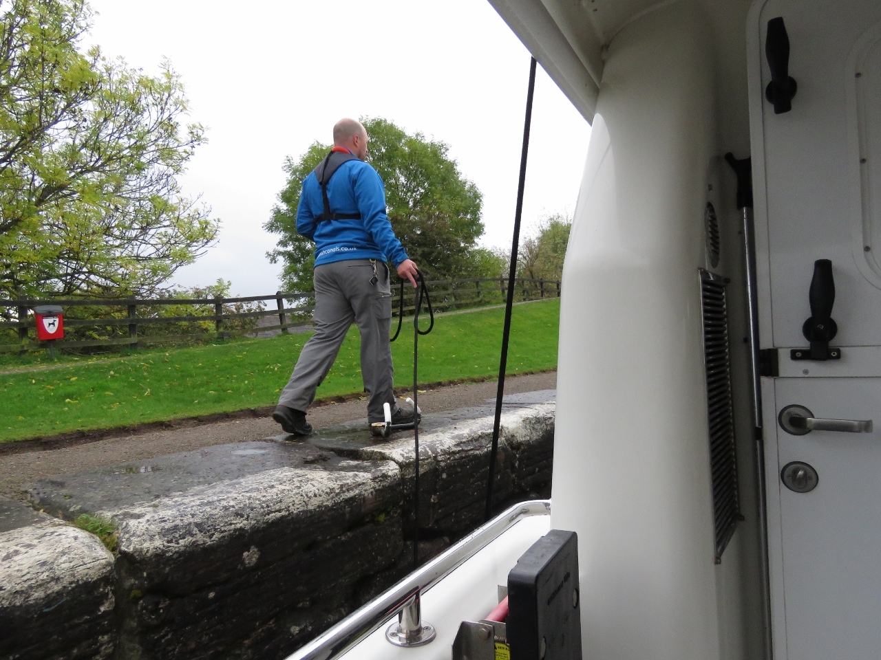 |
10/15/2017: Walking Line
Position: 57°28.88'N, -4°14.91'W
The canal staff walked our stern line between flights so we didn't have to toss it up each time.
|
 |
10/15/2017: Last Lock
Position: 57°28.81'N, -4°14.96'W
Dirona and the Glen Tarsan ascending in the fourth and final lock of the Muirtown flight (Neil White photo).
|
 |
10/15/2017: Traffic
Position: 57°27.88'N, -4°14.64'W
The Tomnahurick Swing Bridge is about a half-mile past the Muirtown Flight. The canal operators open the bridge for the minimal amount possible and you can see why. Traffic is backed up a long way beyond the bridge.
|
 |
10/15/2017: Bridge Closing
Position: 57°27.82'N, -4°14.62'W
The Tomnahurick Swing Bridge closing behind us.
|
 |
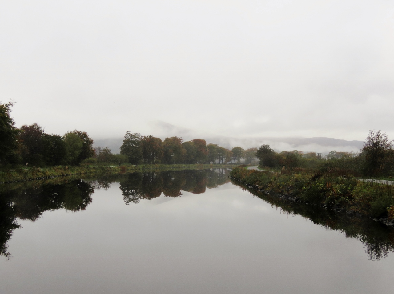
10/15/2017: River Ness
Position: 57°27.51'N, -4°15.28'W
We particularly enjoyed the section of the canal beyond the Tomnahurick Swing Bridge, with the trees showing fall colors and the River Ness visible below to our left.
|
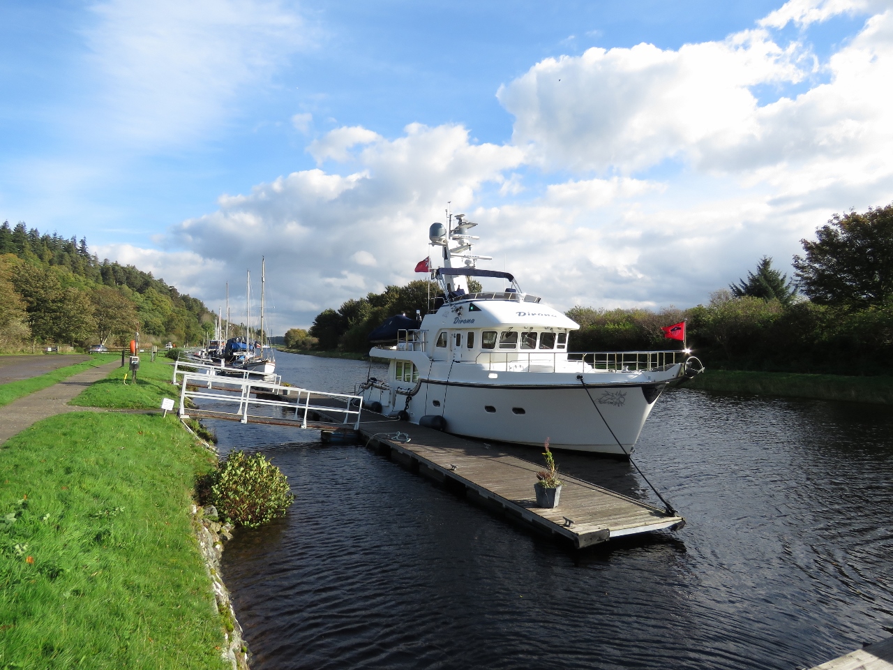 |
10/15/2017: Dochgarroch
Position: 57°26.03'N, -4°18.04'W
Moored for the night in a lovely berth at Dochgarroch.
|
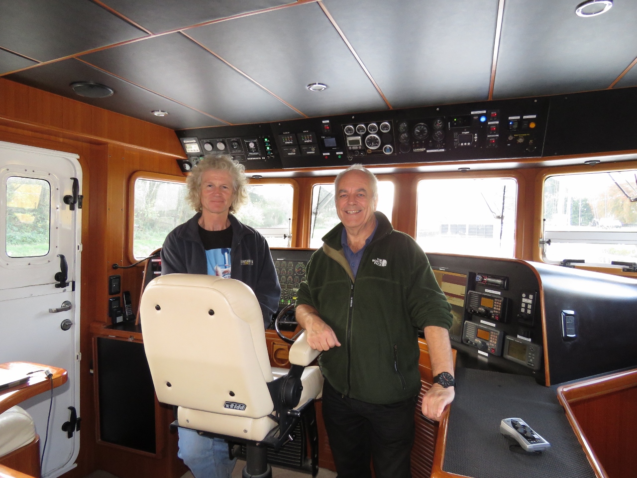 |
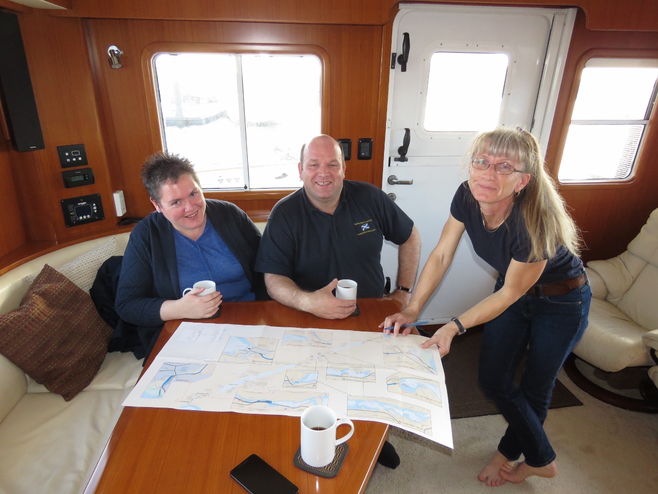
10/15/2017: Martin Reed
Position: 57°26.03'N, -4°18.04'W
Martin Reed has been following our progress through Scotland. Martin had just missed us at our previous stop, but we weren't far away so he drove down to meet us and tour Dirona at Dochgarroch.
|
 |
10/15/2017: Dochgarroch Lock
Position: 57°25.98'N, -4°18.18'W
Shortly after arriving, we went for a walk around and watched some boats passing northbound through the Dochgarroch Lock. The front and rear boats are charters—we were surprised how many still were on the canal this late in the year.
|
 |
10/15/2017: Glendinning
Position: 57°26.03'N, -4°18.04'W
Our Glendinning shore power cable retractor was jamming up, so James squeezed into the aft starboard corner of the lazarette to take a look. A kink in the power cable stuck against the cable guide when powering out and bent the guide on a sharp angle to the cable route, causing the cable to jam up. We can't complain too much since it's been nearly eight years and it was an easy fix to take the senstive parts off, bend the guide straight again, and re-attach everything.
|
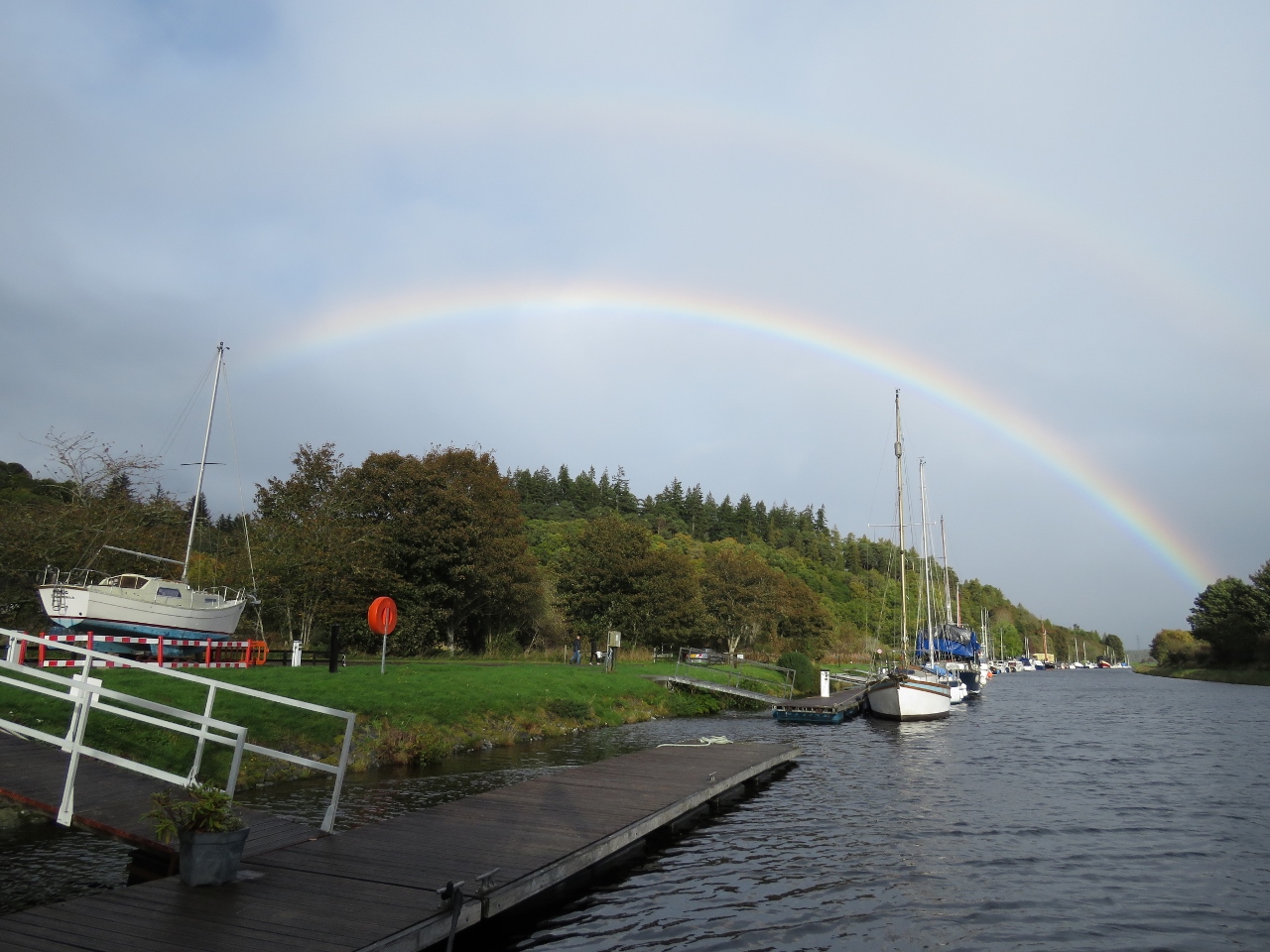 |
10/15/2017: Rainbow
Position: 57°26.03'N, -4°18.04'W
Rainbow viewed from our berth at Dochgarroch.
|
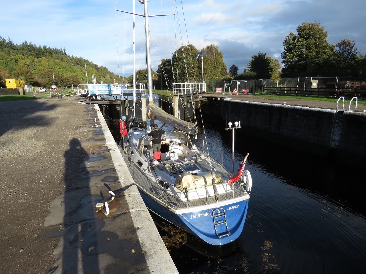 |
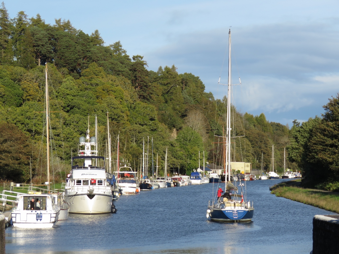
10/15/2017: De Briele
Position: 57°25.98'N, -4°18.15'W
After lunch, we took a longer walk around the area and watched some more boats locking through. This is De Briele of Aberdeen, likely heading home after a summer cruise on the west coast of Scotland.
|
 |
10/15/2017: Wintering
Position: 57°25.97'N, -4°18.17'W
De Briele passing alongside Dirona and the Dochgarroch pontoons after locking through. Dochgarroch has a lot of dock space, but most of it is taken by wintering boats. The Caledonian Canal is a popular place to winter a vessel.
|
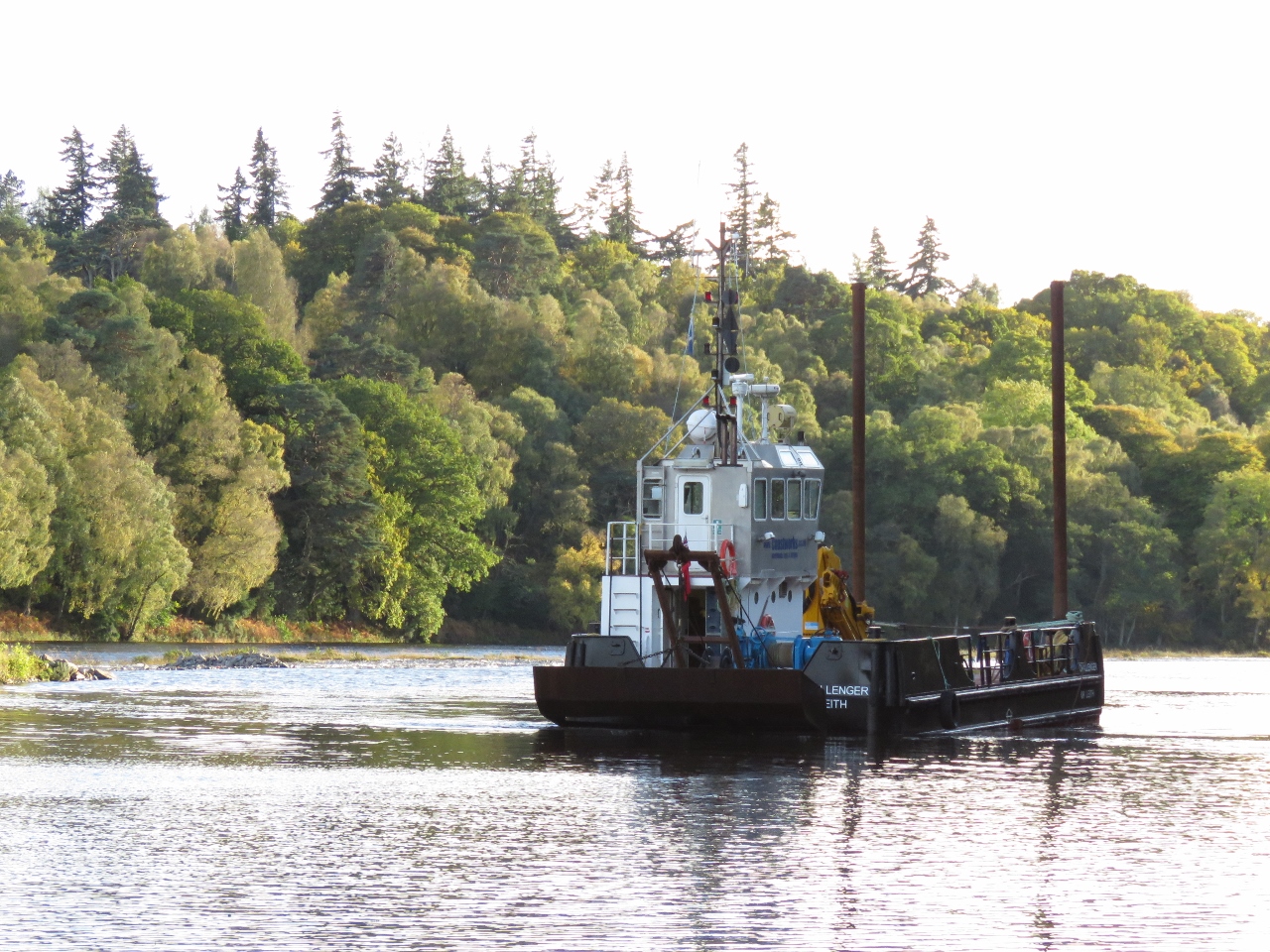 |
10/15/2017: Challenger of Leith
Position: 57°25.79'N, -4°18.49'W
The Challenger of Leith dredging the channel just north of Dochgarroch.
|
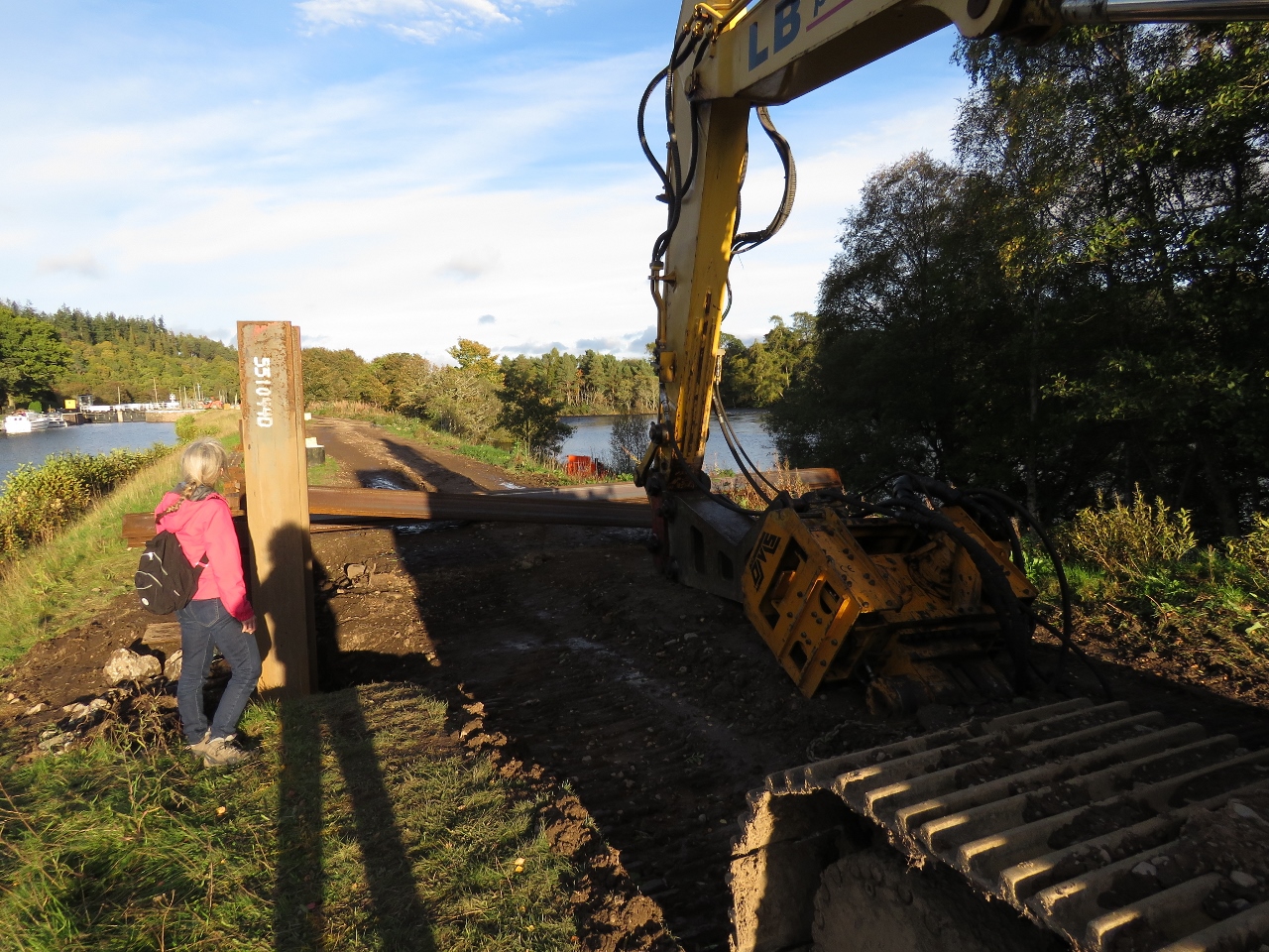 |
10/15/2017: Construction
Position: 57°25.89'N, -4°18.32'W
On the south side of the canal a major construction project was underway to reinforce the shore. They were pounding beams about 15ft high into the canal shore.
|
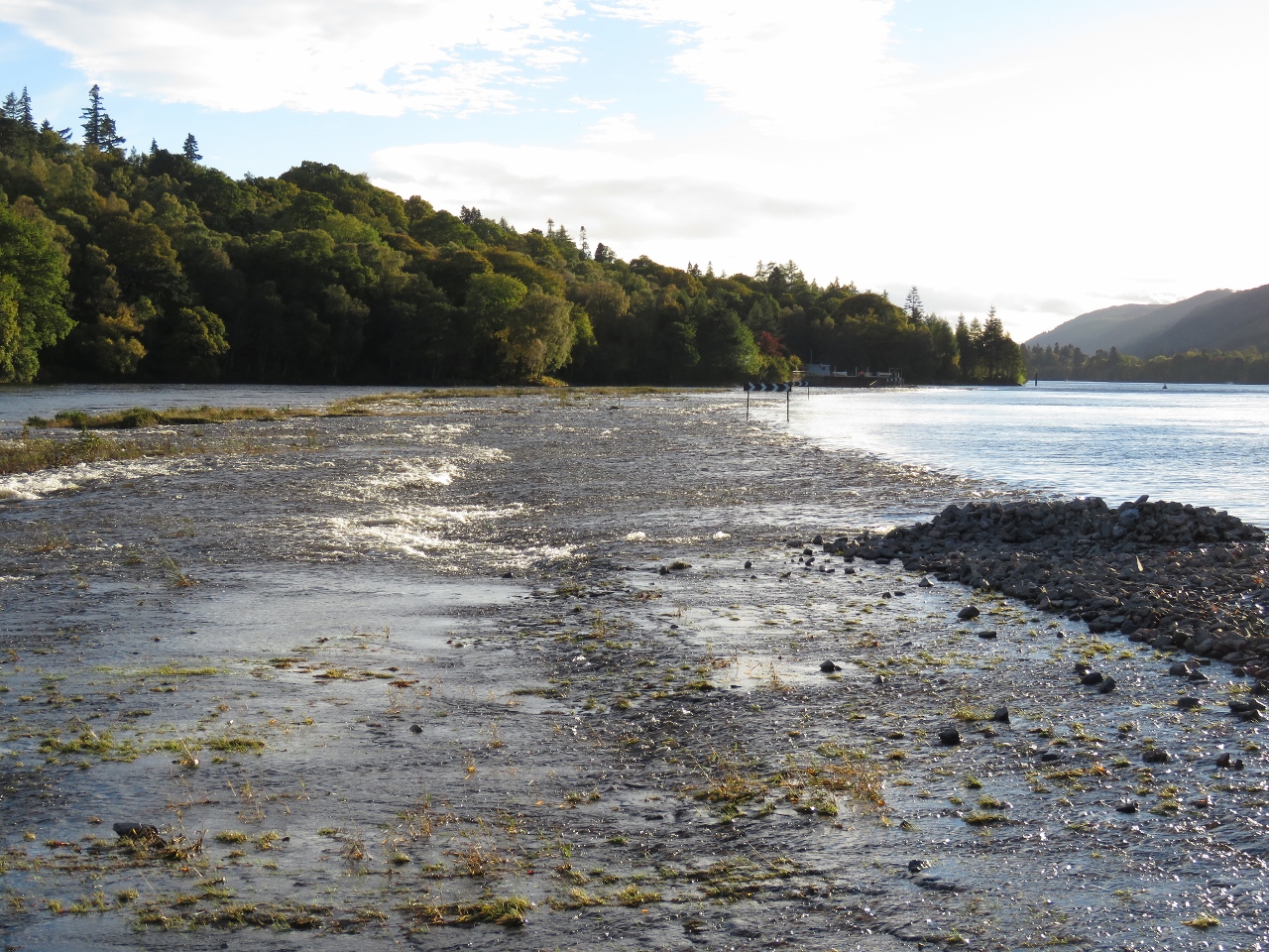 |
10/15/2017: Wiers
Position: 57°25.72'N, -4°18.48'W
Weirs where the canal joins the River Ness. The canal level is quite high right now, and water is flowing down into the River Ness.
|
 |
10/15/2017: Walk
Position: 57°25.79'N, -4°18.38'W
Walking along a short path toward the River Ness.
|
 |
10/15/2017: Ducks
Position: 57°25.97'N, -4°18.21'W
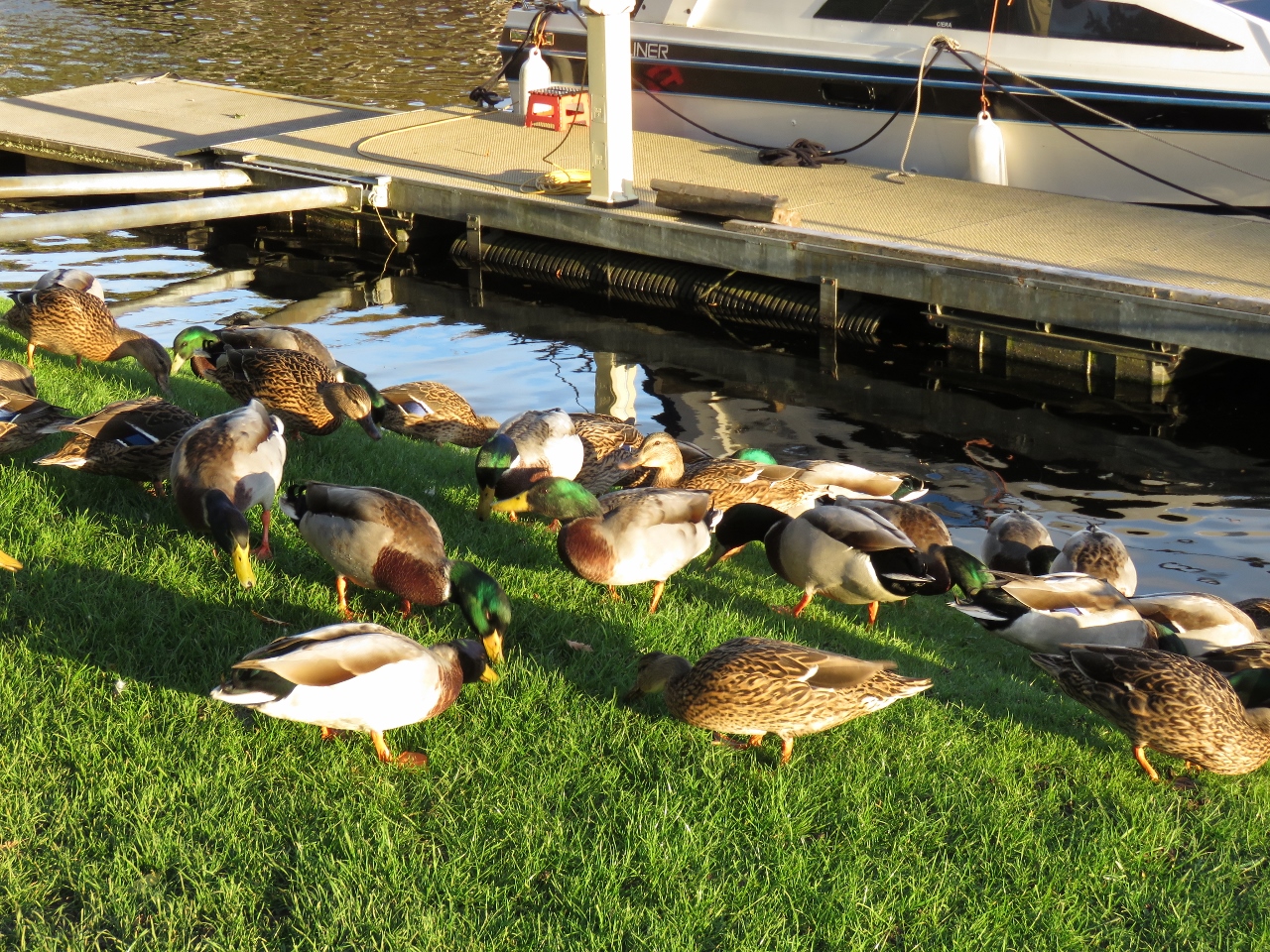
The owner of a canal-front home spread some birdseed on the grass by the lock and the ducks were chowing down. This probably is a daily routine.
|
 |
10/15/2017: Row Boat
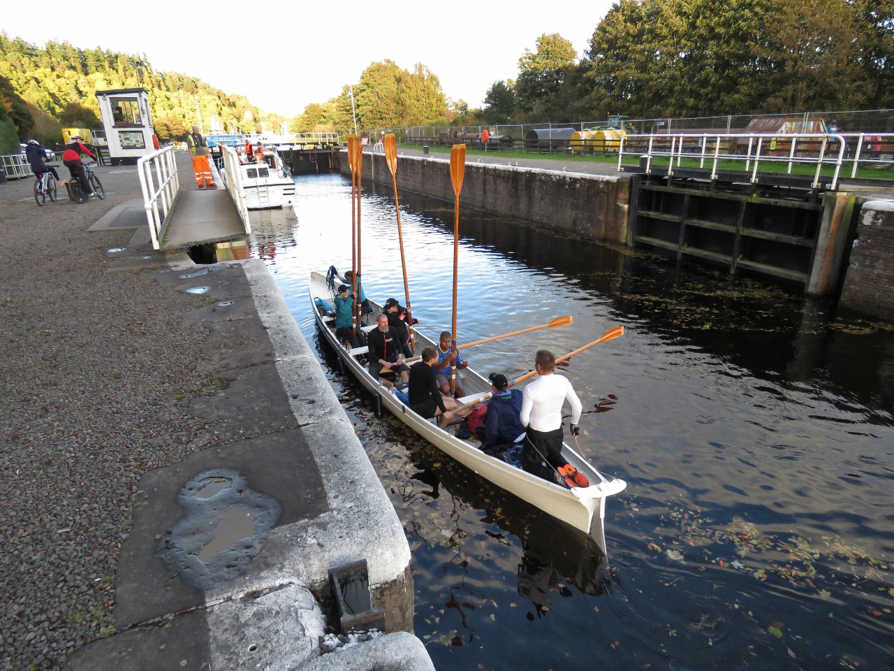
Position: 57°25.98'N, -4°18.17'W
One of several row boats that passed through the Dochgarroch Lock while we were there.
|
 |
10/15/2017: Happy Hour
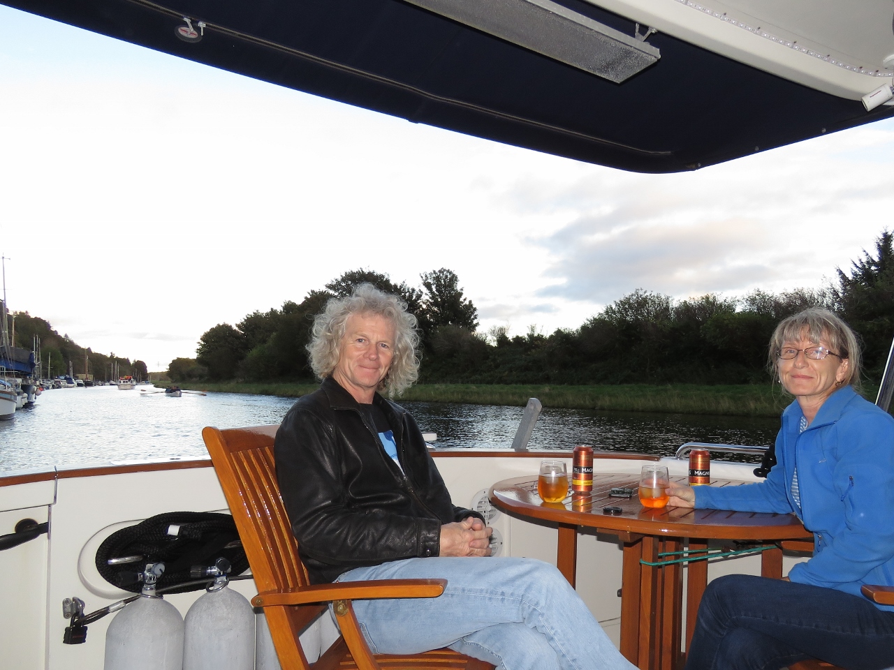
Position: 57°26.03'N, -4°18.04'W
With a little help from our patio heater, the evening was warm enough at 52°F (11°C) for drinks in the cockpit.
|
 |
10/16/2017: Dochgarroch Lock
Position: 57°25.98'N, -4°18.14'W
Entering the Dochgarroch Lock at 8:32am. We'd spoken to the canal staff yesterday to arrange an 8:30am opening and the gates opened exactly on time.
|
 |
10/16/2017: Gate Closing
Position: 57°25.98'N, -4°18.14'W
The Dochgarroch Lock gate closing behind us.
|
 |
10/16/2017: Underway
Position: 57°25.87'N, -4°18.39'W
Dirona underway through the Caledonian Canal after passing through the Dochgarroch Lock. Neil White took this photo as we passed the Glen Tarsan, moored for the night upstream of the lock.
|
 |
10/16/2017: Weir
Position: 57°25.52'N, -4°18.79'W
Passing the weirs where the Caledonian Canal joins the River Ness.
|
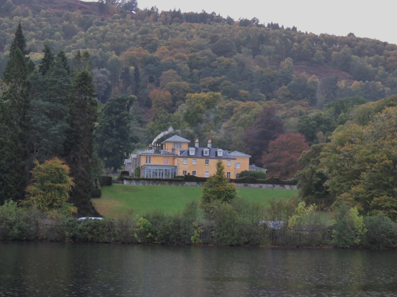 |
10/16/2017: Dochfour House
Position: 57°25.17'N, -4°19.35'W
Dochfour House above Loch Dochfour. The current house was built around 1780 and includes an extensive series of terraced gardens cut into the sloping land.
|
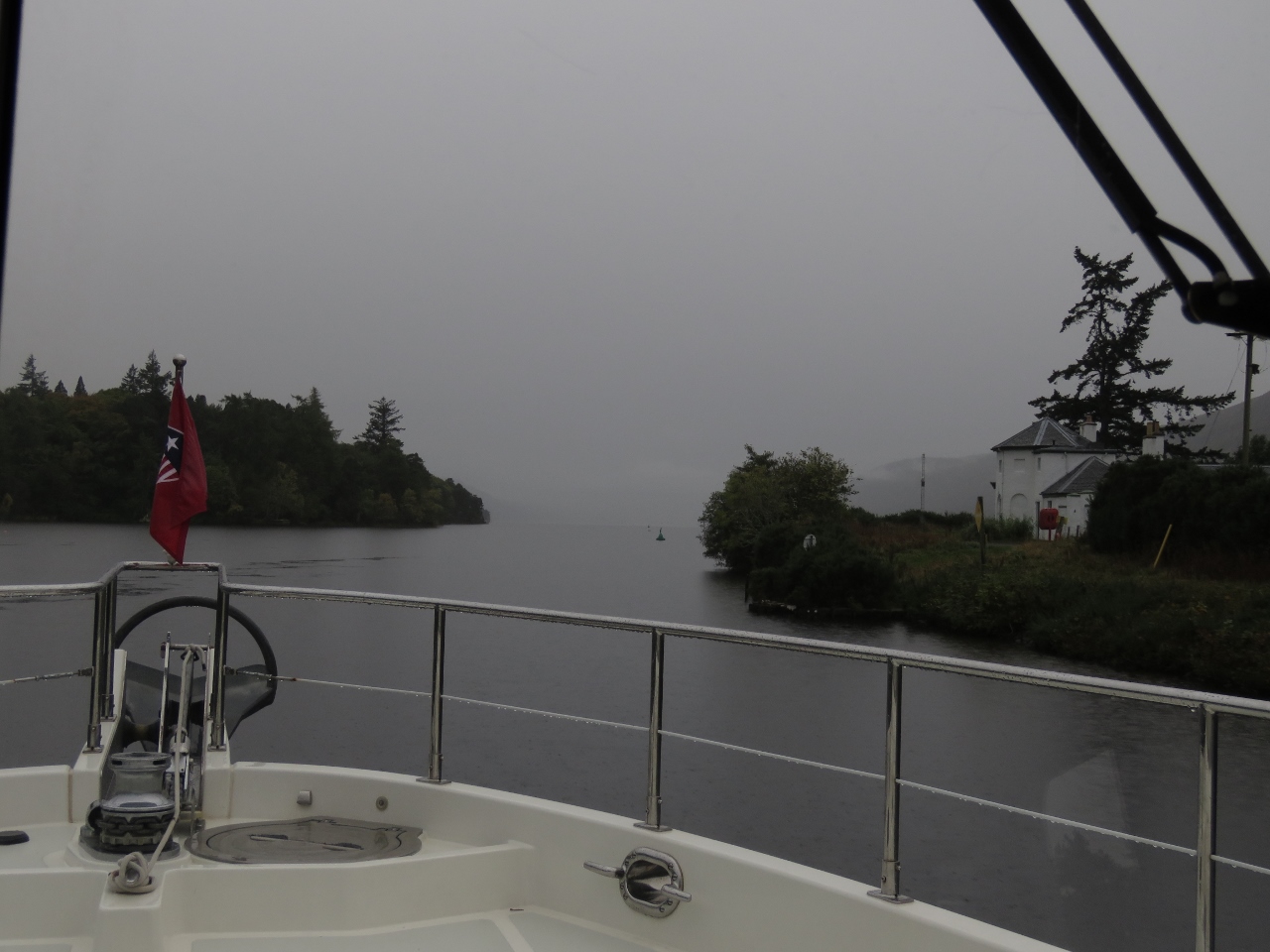 |
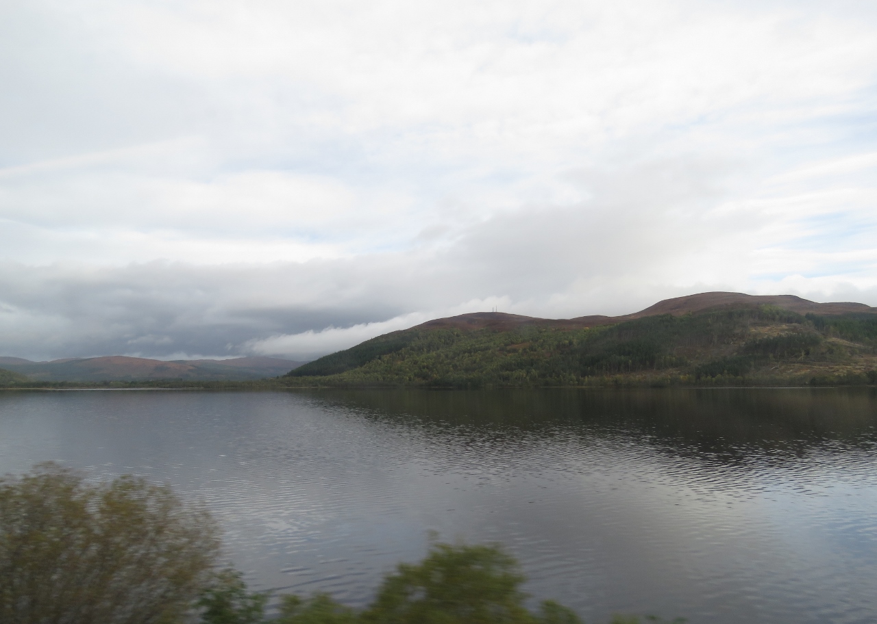
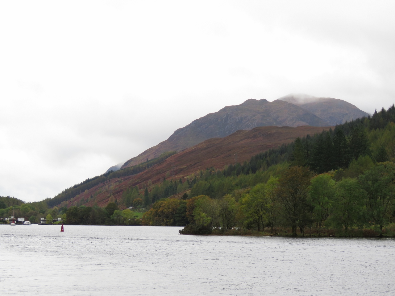
10/16/2017: Loch Ness
Position: 57°24.49'N, -4°19.68'W
Our first view to Loch Ness felt like a typical Scottish scene. Although in reality, we've not seen much fog during our time in Scotland.
|
 |
10/16/2017: Bona Lighthouse
Position: 57°24.41'N, -4°19.82'W
Bona Lighthouse at the northern end of Loch Ness is one of only two inland lighthouses in Scotland.
|
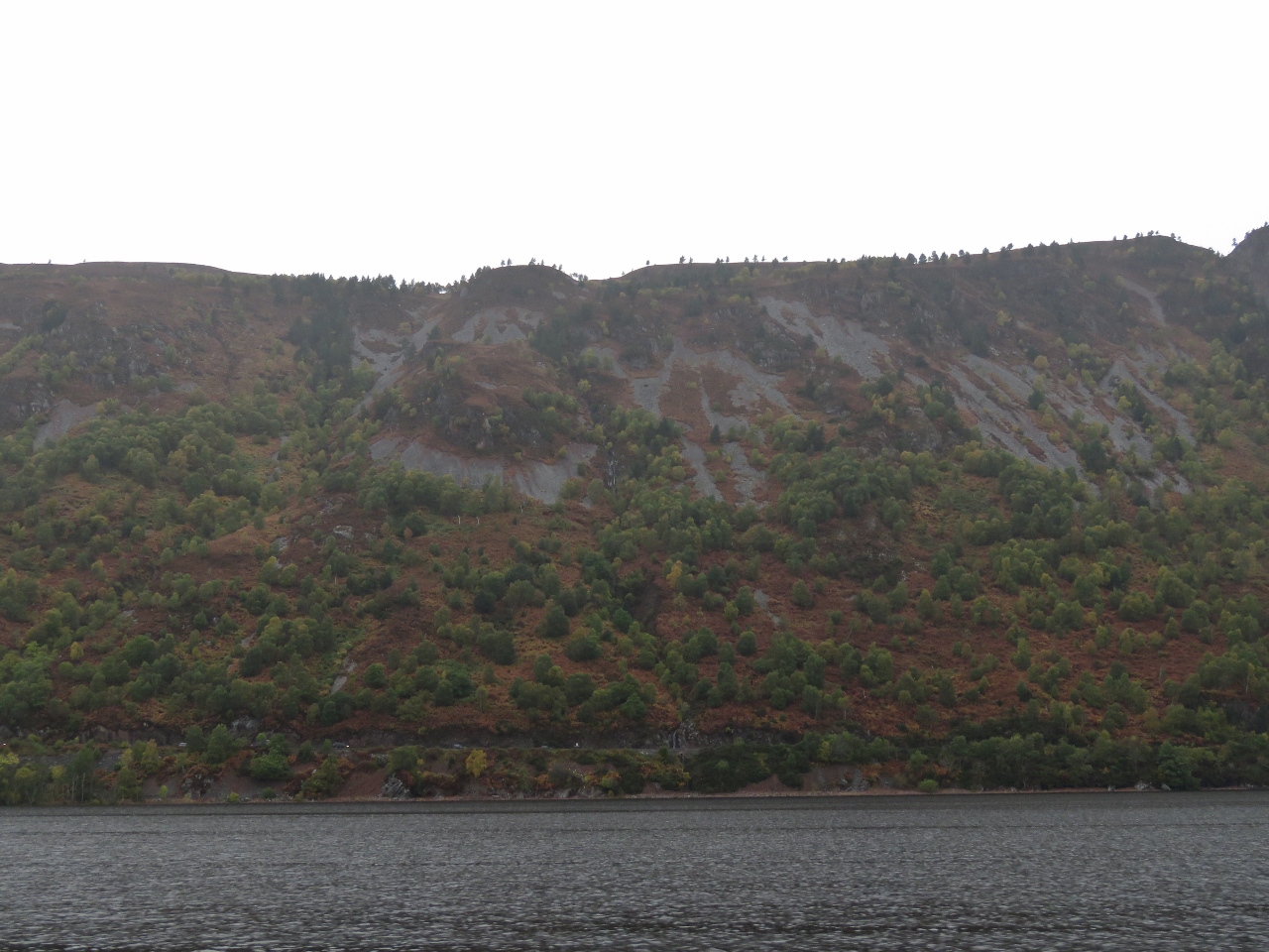 |
10/16/2017: Scenery
Position: 57°23.29'N, -4°21.47'W
The fog lifted as we entered Loch Ness and we got a chance to enjoy the striking scenery. No sign of Nessie though.
|
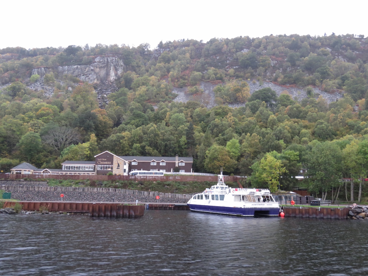 |
10/16/2017: Jacobite
Position: 57°21.80'N, -4°23.50'W
Loch Ness is one of the top three tourist destinations in Scotland, along with Edinburgh and the Isle of Skye, and Loch Ness cruises are a big business. This is the Jacobite dock midway along, with room for several vessels.
|
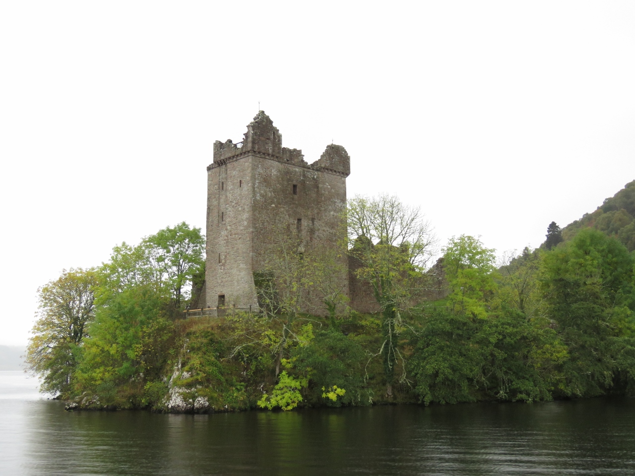 |
10/16/2017: Grant Tower
Position: 57°19.51'N, -4°26.45'W
Second to Nessie, a major draw of Loch Ness is Urquhart Castle. Founded in the 13th century, Urquhart Castle was involved in numerous conflicts during it's 500 years as a medieval fortress. The prominent five-story Grant Tower stands at the north end of the castle above the water.
|
 |
10/16/2017: Dirona and Castle
Position: 57°19.49'N, -4°26.43'W
The Glen Tarsan left Dochgarroch after we did and caught up with us at Urquhart Castle. Neil took this picture of Dirona off the castle as they passed.
|
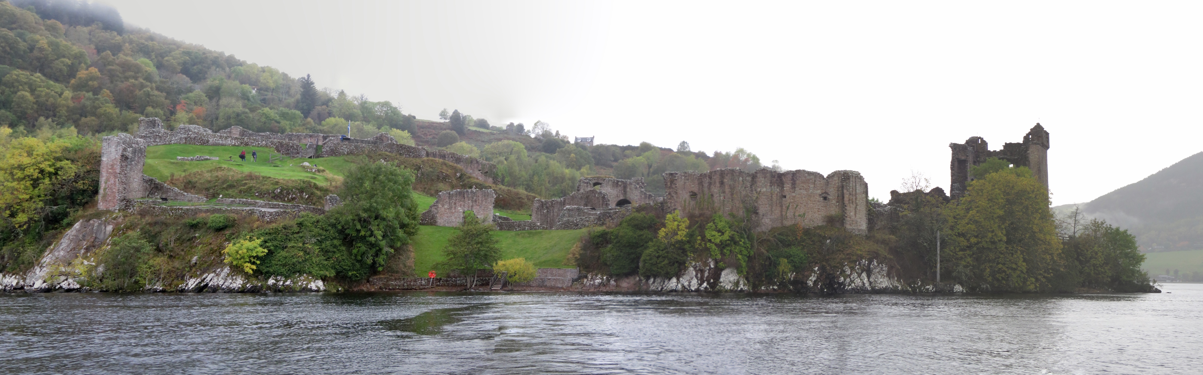 |
10/16/2017: Urquhart Castle
Position: 57°19.40'N, -4°26.41'W
Full view to Urquhart Castle and its enclosures, with Grant Tower on the right. The castle one of the largest in Scotland.
|
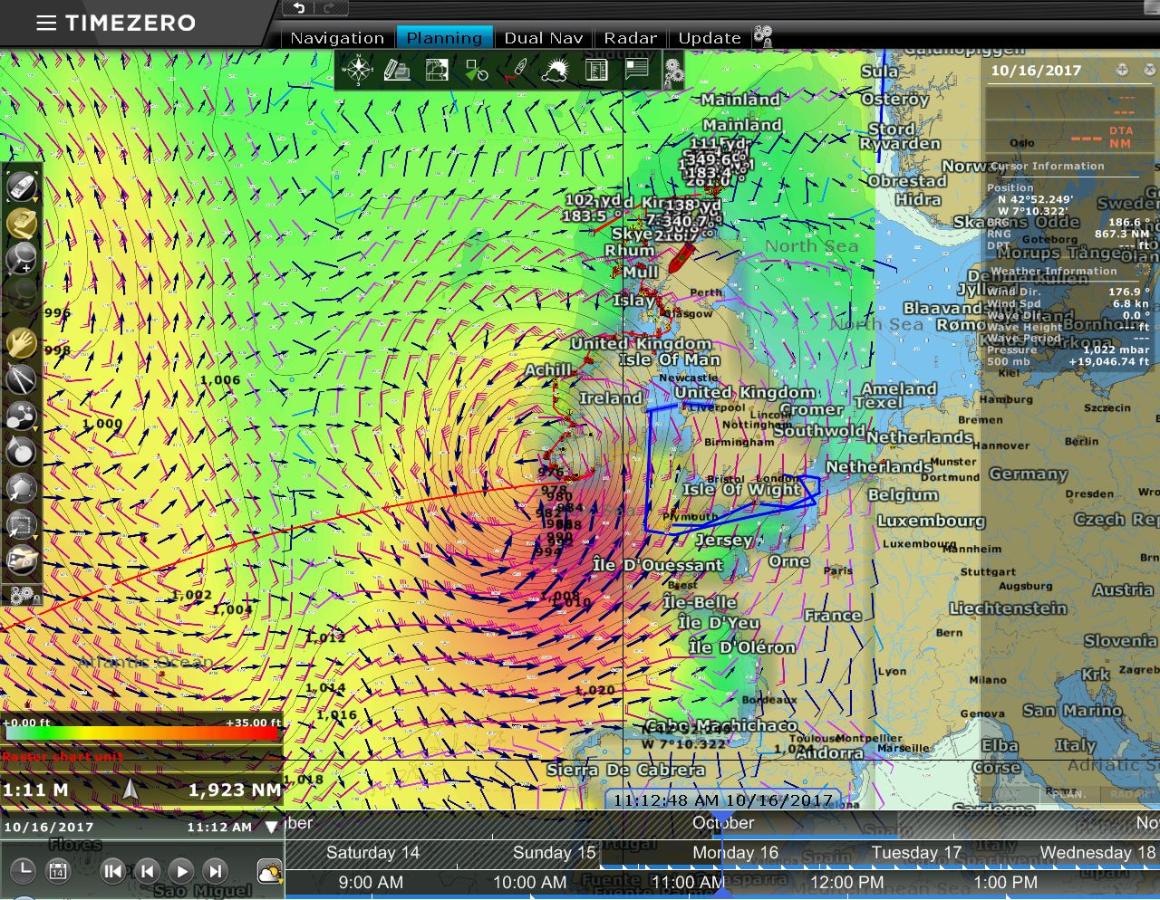 |
10/16/2017: Ophelia
Position: 57°13.01'N, -4°34.12'W
Hurricane Ophelia shows up as a big orange ball in the weather model visualization via our chartplotter Timezero. We don't expect big winds where we are in the Caledonian Canal, but we're keeping an eye on it.
|
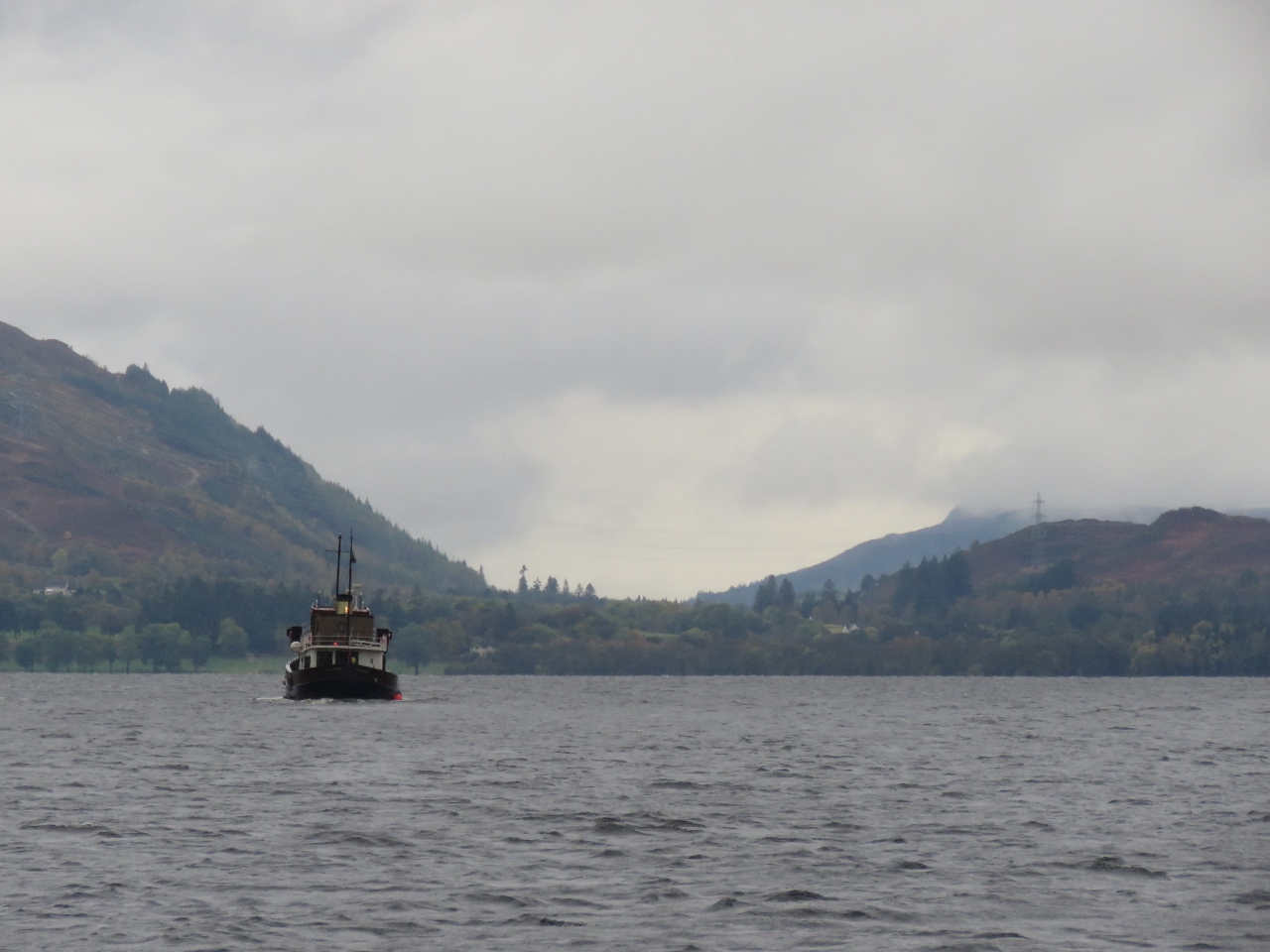 |
10/16/2017: Cruising Loch Ness
Position: 57°11.27'N, -4°36.46'W
Cruising through the southern end of Loch Ness with the Glen Tarsan.
|
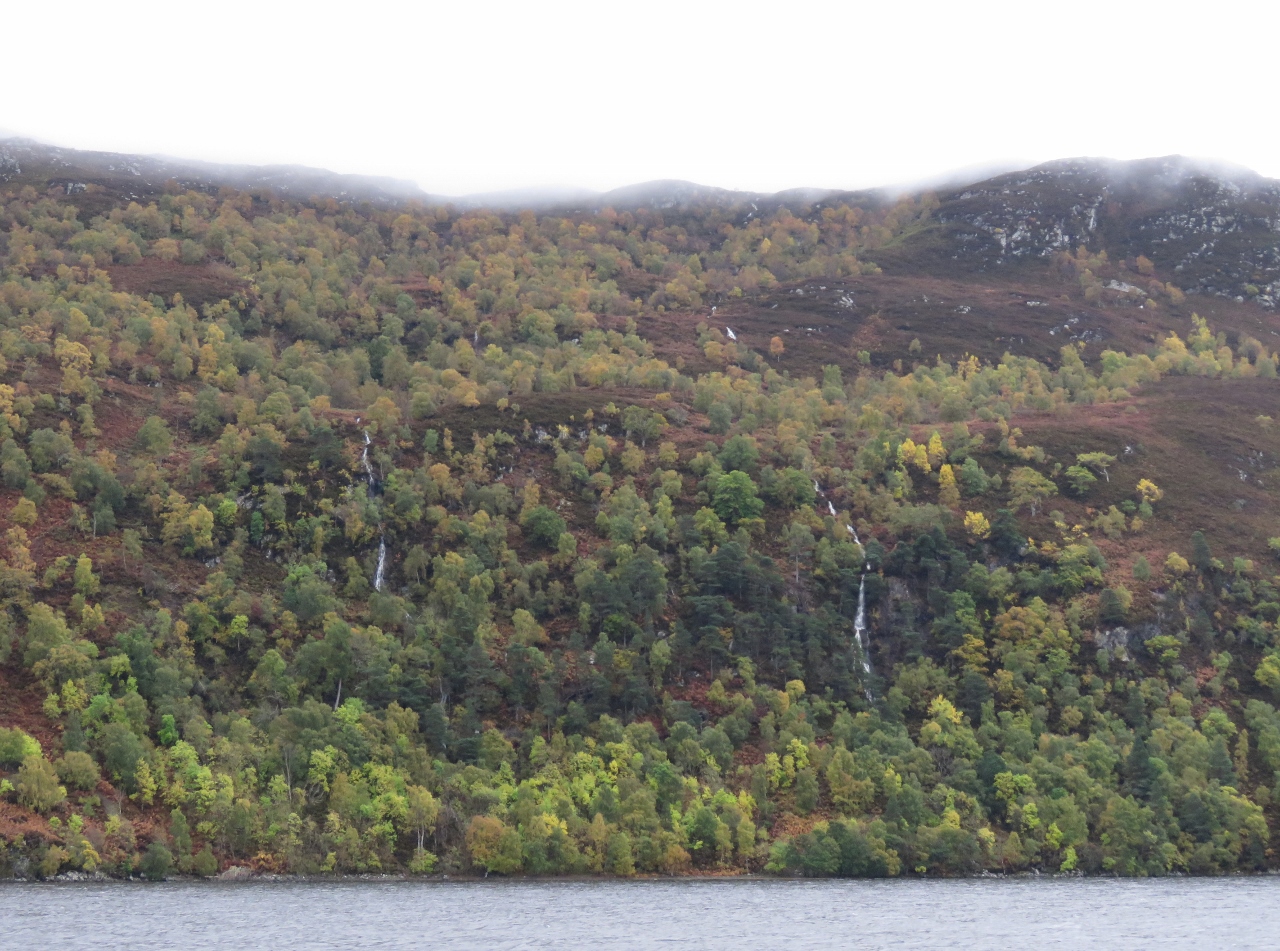 |
10/16/2017: Waterfalls
Position: 57°10.92'N, -4°36.95'W
Waterfalls along the east shore of Loch Ness. Despite the overcast conditions, the scenery is fabulous.
|
 |
10/16/2017: Manor
Position: 57°8.93'N, -4°40.10'W
A manor high in the hills above Loch Ness.
|
 |
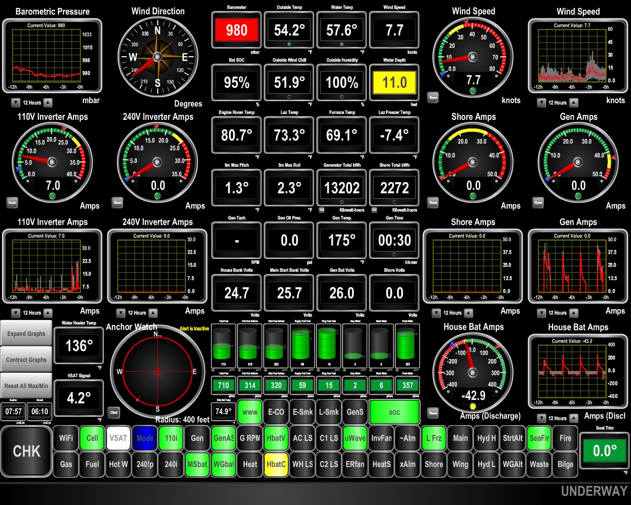
10/16/2017: Barometer
Position: 57°8.83'N, -4°40.25'W
The barometer has been plummeting today and is now down to 977mb as Ophelia approaches. The winds were calm as we started across Loch Ness, but had reached steady 20 kts with gusts into the 30s by the time we reached Fort Augustus at the south end.
|
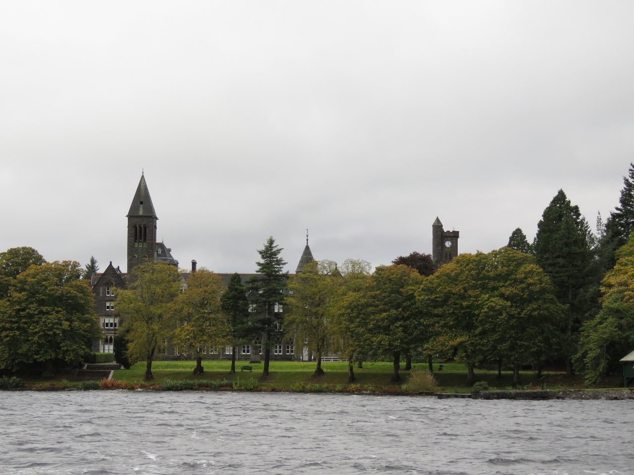 |
10/16/2017: St Benedict's Abbey
Position: 57°8.77'N, -4°40.26'W
St. Benedict's Abbey, in Fort Augustus as the south end of Loch Ness, was completed in 1880 and was a Benedictine monastery until 1998. In 2013, the BBC Scotland program The Sins of Our Fathers reported allegations that the monastery was used as a dumping ground for monks accused of sexual abuse elsewhere in the world.
|
 |
10/16/2017: Fort Augustus Light House
Position: 57°8.79'N, -4°40.43'W
The Fort Augustus light house, known locally as the "pepper pot", was built in 1822. At 3 metres in diameter and 7 meters tall, it is believed to be the smallest lighthouse in the UK.
|
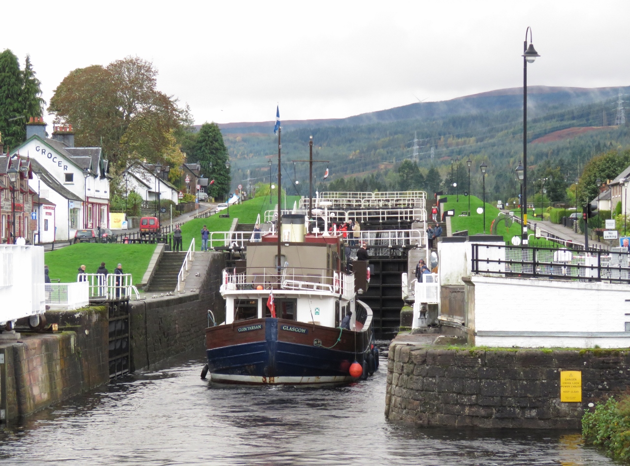 |
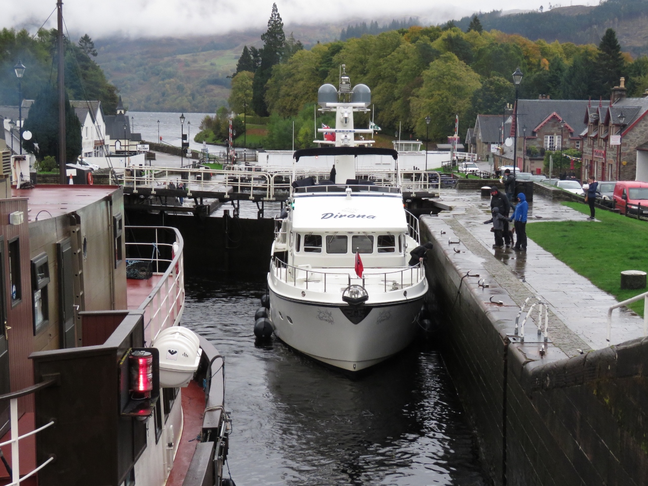
10/16/2017: Flight
Position: 57°8.70'N, -4°40.81'W
The Glen Tarsan entering the first of five locks in the Fort Augustus flight. Each lock is 180ft (54.9m) long and 40ft (12.2m) wide, and the flight will raise Dirona and Glen Tarsan 40ft (12.2m) from Loch Ness to the Kytra reach.
|
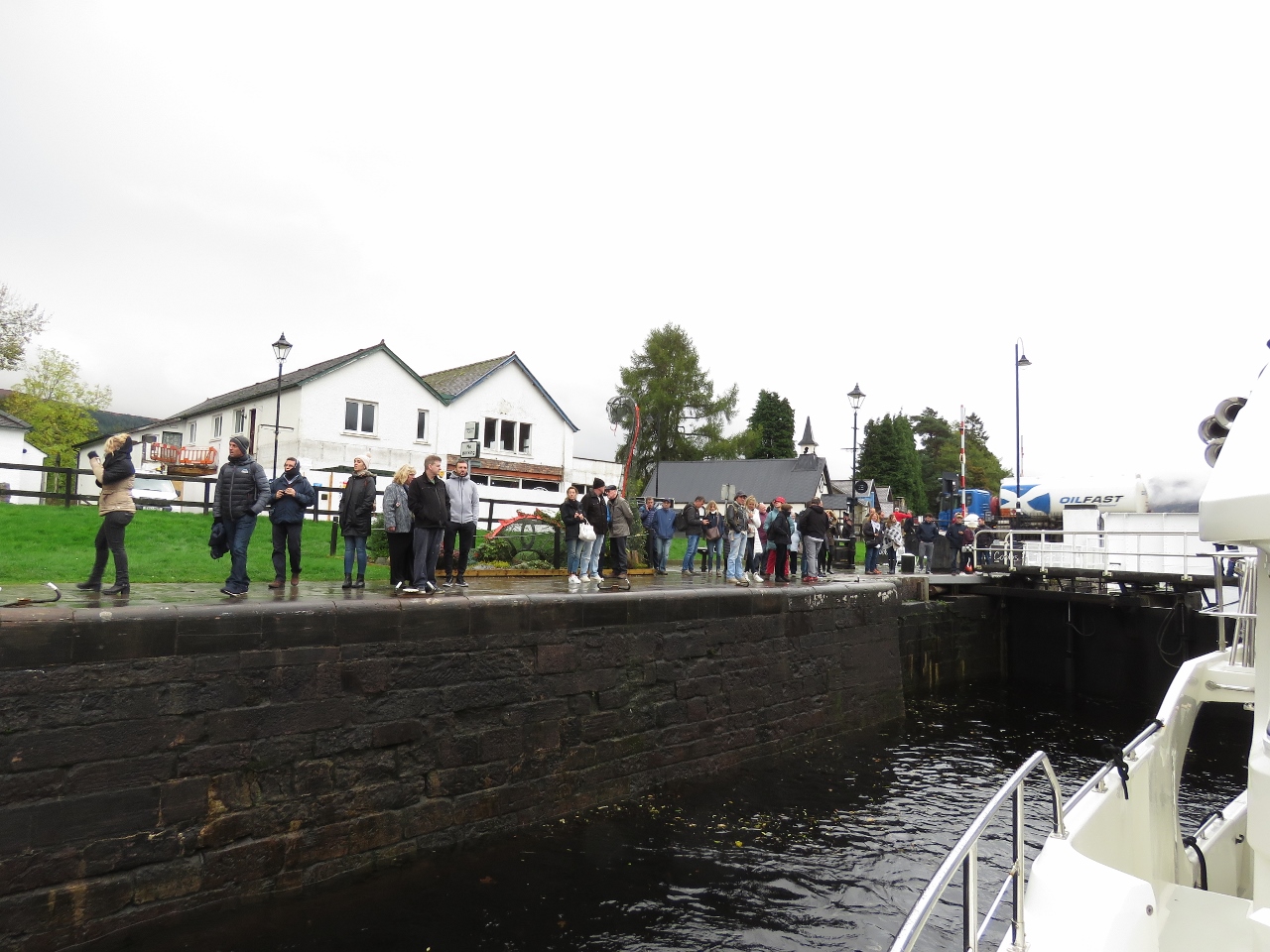 |
10/16/2017: Crowds
Position: 57°8.69'N, -4°40.87'W
Crowds of tourists watching us lock through. Another major difference between the Crinan Canal and the Caledonian Canal is the number of people around, even this late in the season.
|
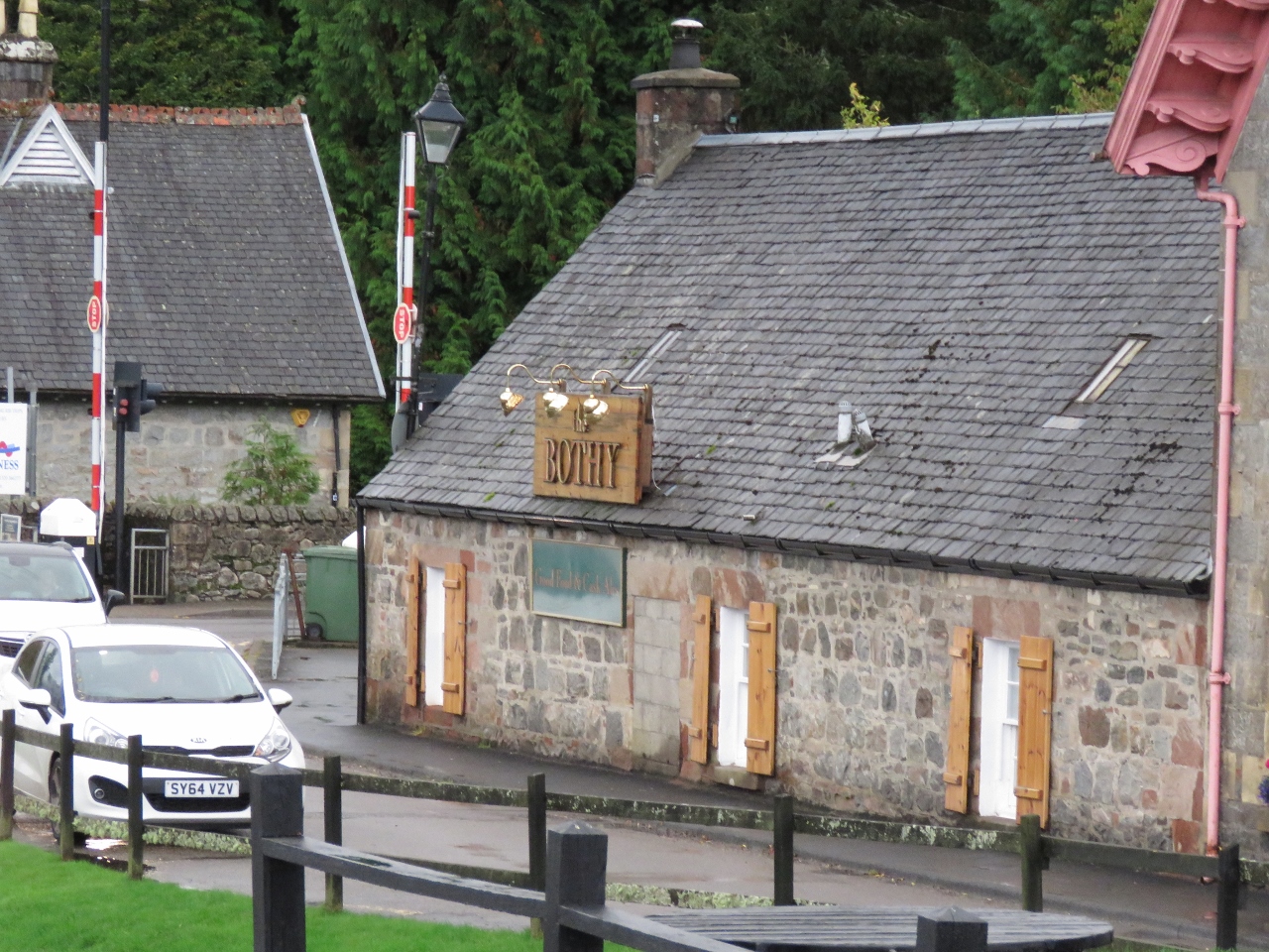 |
10/16/2017: The Bothy
Position: 57°8.69'N, -4°40.92'W
We'll be stopping for the night at the top of the flight and are scoping out pubs for lunch. The Bothy is one good possibility.
|
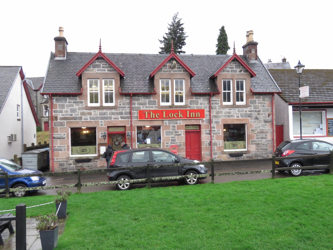 |
10/16/2017: The Lock Inn
Position: 57°8.69'N, -4°40.92'W
The Lock Inn is another possible pub for lunch. Yet another major difference from the Crinan Canal is that the towns along the Caledonian Canal generally are much larger, so we have multiple choices for a meal.
|
 |
10/16/2017: Third Lock
Position: 57°8.68'N, -4°40.97'W
Ascending the third lock behind the Glen Tarsan, with Loch Ness visible in the distance.
|
 |
10/16/2017: Flow
Position: 57°8.68'N, -4°41.03'W
The canal staff brought us through the flight quickly, partly by rapidly raising the water level. This is the surge as the sluice gates are opened.
|
 |
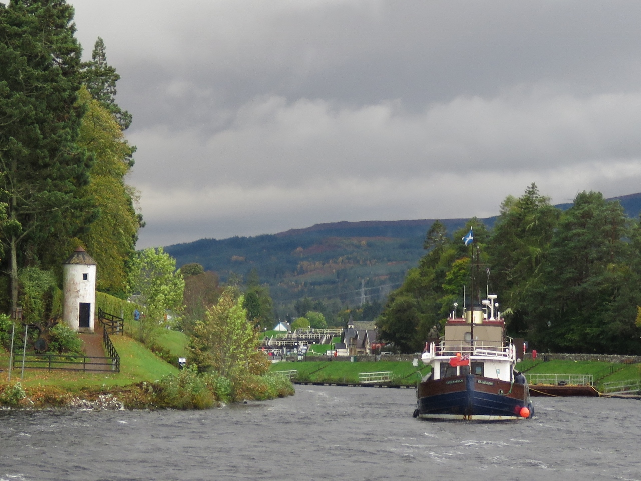
10/16/2017: Fort Augustus
Position: 57°8.67'N, -4°41.14'W
Moored for the night at the top of the flight in Fort Augustus.
|
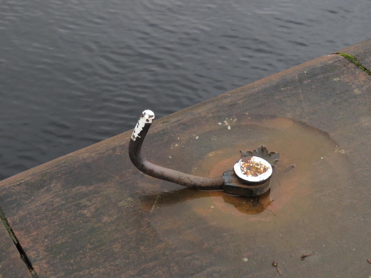 |
10/16/2017: Bent
Position: 57°8.68'N, -4°40.96'W
The attachment points for lines alongside the lock run parallel to the ground, but this one had been bent up. That must have taken considerable force.
|
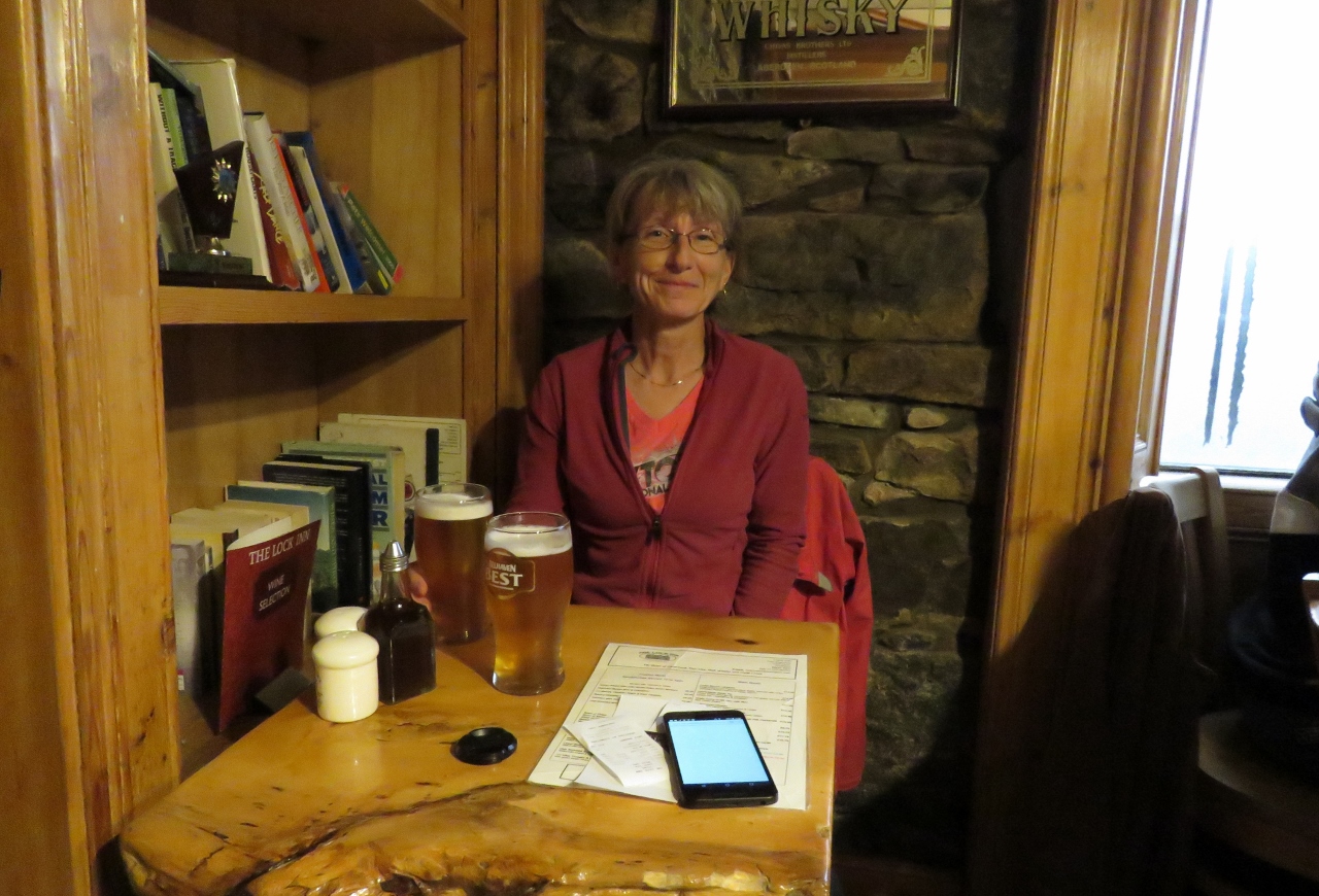 |
10/16/2017: Lunch
Position: 57°8.68'N, -4°40.92'W
|
 |
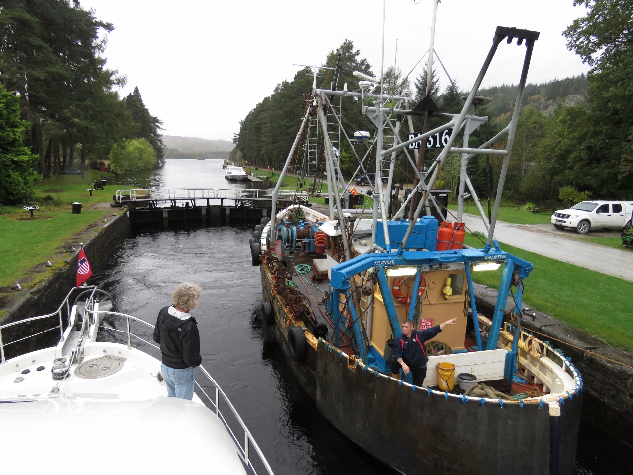
10/16/2017: Islander
Position: 57°8.70'N, -4°40.88'W
The commercial fishing vessel Islander locking through the Fort Augustus flight. We were surprised to see several commercial fishing vessels passing through the canal, but the route is so much more protected than through the Pentland Firth and around Cape Wrath, so if they aren't in a rush it's an easier option.
|
 |
10/17/2017: Wind
Position: 57°8.67'N, -4°41.17'W
The barometer has remained low overnight and we got some gusty winds, but nothing serious. We expect the winds to last into this morning then settle down by the afternoon as Ophelia passes northeast of the UK.
|
 |
10/17/2017: Fall Colours
Position: 57°7.63'N, -4°42.40'W
Beautiful fall colors in the trees just south of Fort Augustus.
|
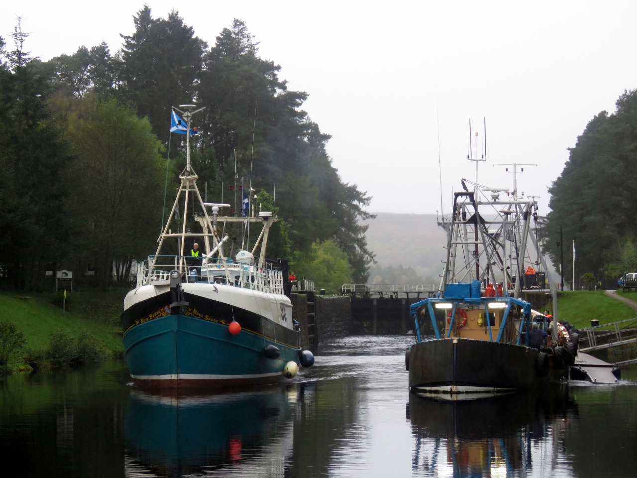 |
10/17/2017: Traffic
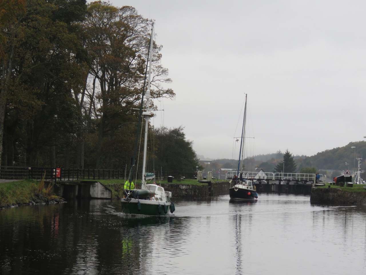
Position: 57°7.42'N, -4°43.21'W
The fishing vessel Nova Spero of Stornoway, heading northbound, got the first lock of the day at Kytra lock. We waited behind the fishing vessel Islander to pass through southbound once Nova Spero had cleared the lock.
|
 |
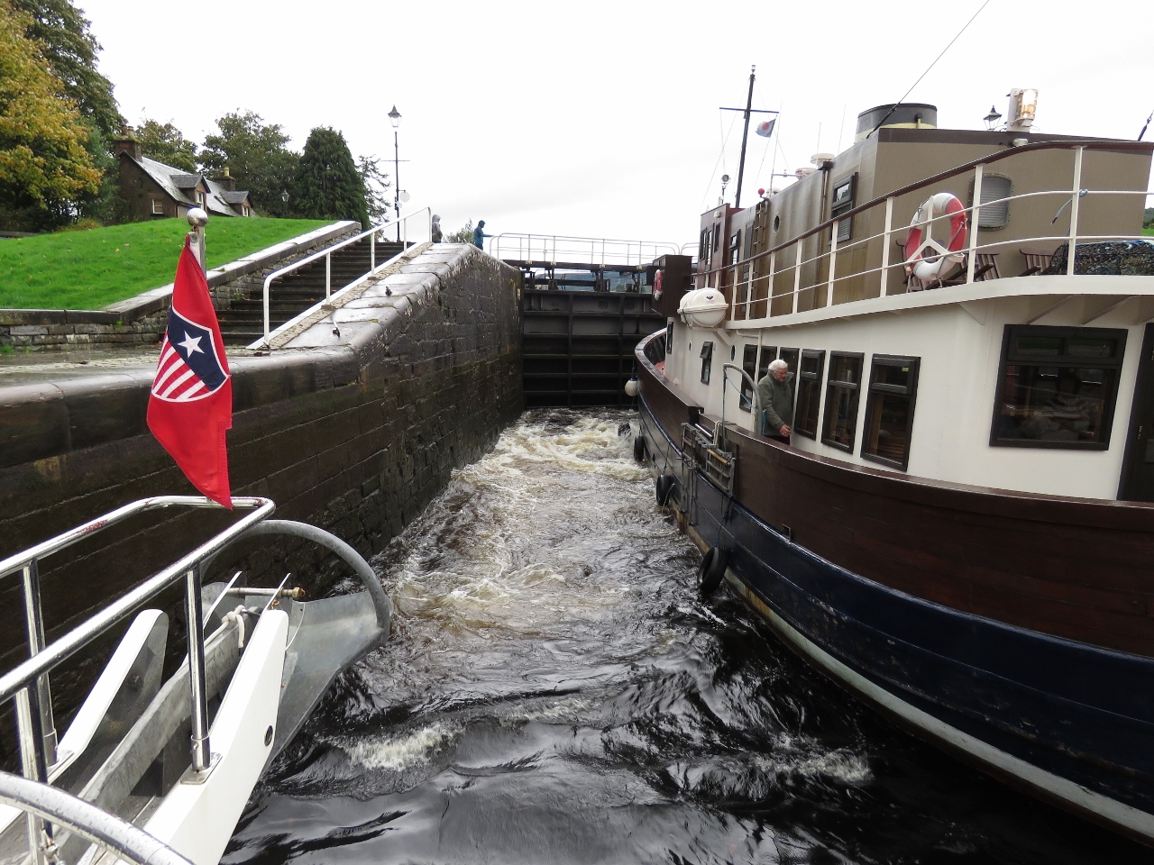
10/17/2017: Kytra Lock
Position: 57°7.36'N, -4°43.32'W
Locking through with the fishing vessel Islander in front and a charter boat beside us.
|
 |
10/17/2017: Islander
Position: 57°7.36'N, -4°43.32'W
James chatting with the crew of Islander as we lock through.
|
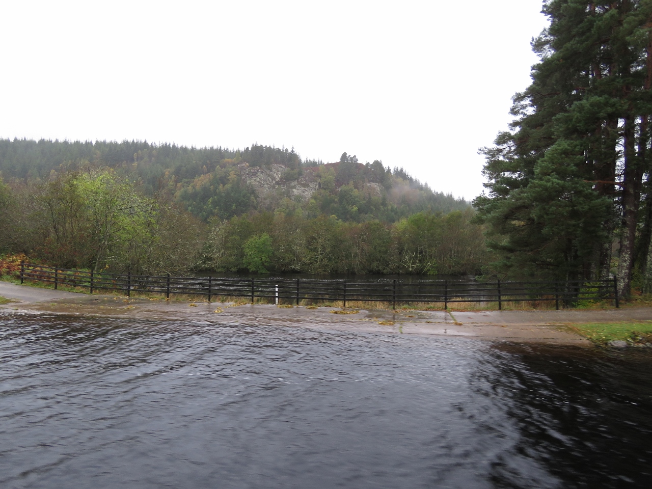 |
10/17/2017: High Water
Position: 57°7.21'N, -4°43.62'W
The water in the canal is so high right now that the sidewalk is flooded. That's the River Oich visible below.
|
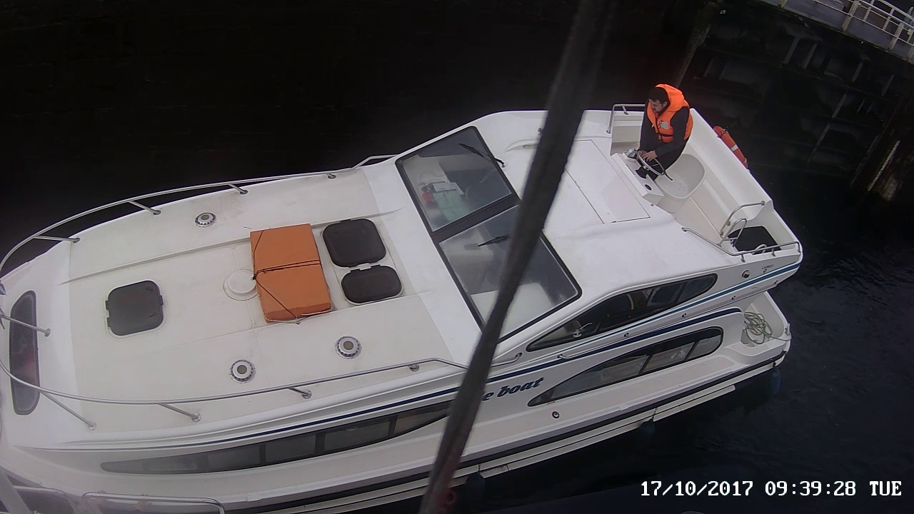 |
10/17/2017: Fending Off
Position: 57°5.91'N, -4°44.37'W
The charter boat we'd locked through with at Kytra Lock came in after us, and would have hit us twice if we hadn't fended them off each time. James' hands are just visible at the bottom left of the picture pushing them away. Charter boats frequently have first-time captains at the wheel, so this happens all the time.
|
 |
10/17/2017: Cullochy Lock
Position: 57°5.91'N, -4°44.37'W
Rising in Cullochy Loch with fishing vessel Islander and the charter boat behind.
|
 |
10/17/2017: Canal View
Position: 57°5.91'N, -4°44.37'W
The view behind us into the Caledonian Canal from near the top of Cullochy Loch.
|
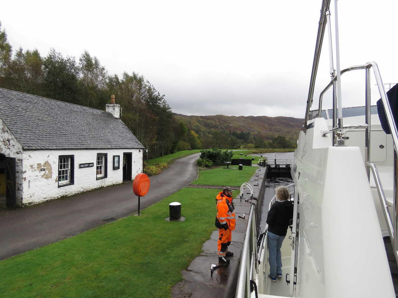 |
10/17/2017: Lock Keeper
Position: 57°5.91'N, -4°44.37'W
Chatting with the lock keeper at Cullochy Loch as we ascend.
|
 |
10/17/2017: Bridge of Oich
Position: 57°5.48'N, -4°44.71'W
Passing through the Bridge of Oich behind the fishing vessel Islander.
|
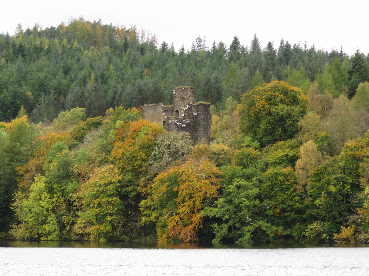 |
10/17/2017: Invergarry Castle
Position: 57°3.84'N, -4°46.62'W
Invergarry Castle, the seat of the Chiefs of the Clan MacDonnell, was built in the 1600s.
|
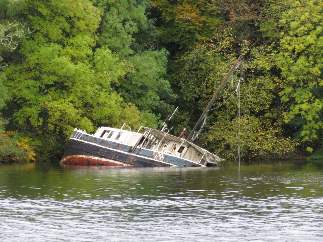 |
10/17/2017: Wreck
Position: 57°3.72'N, -4°46.73'W
Partially submerged boat just south of Invergarry Castle.
|
 |
10/17/2017: Loch Oich
Position: 57°3.05'N, -4°47.63'W
Fabulous scenery in Loch Oich.
|
 |
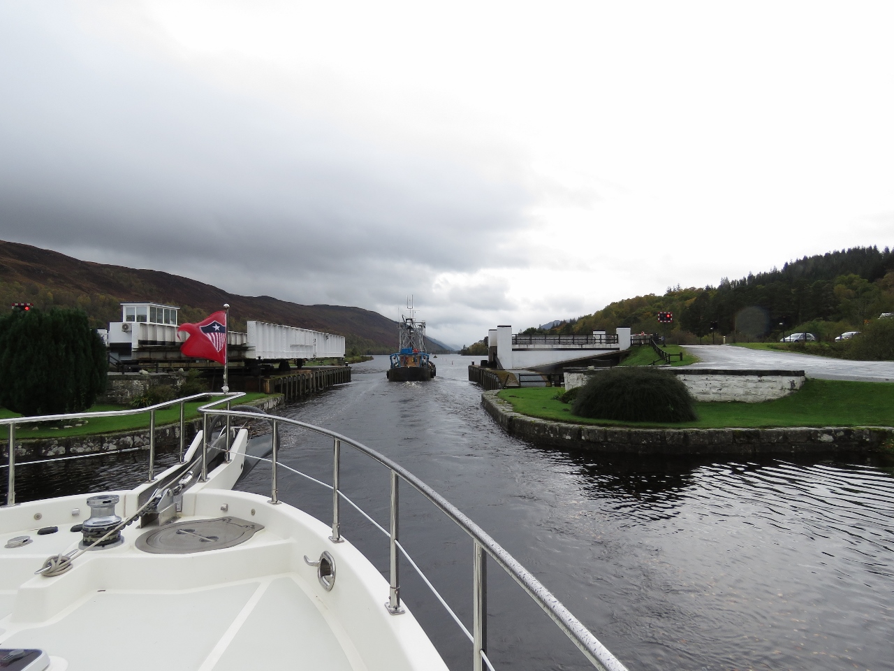
10/17/2017: Laggan Bridge
Position: 57°2.65'N, -4°48.27'W
Passing through the Laggan Swing Bridge with fishing vessel Islander visible in the distance.
|
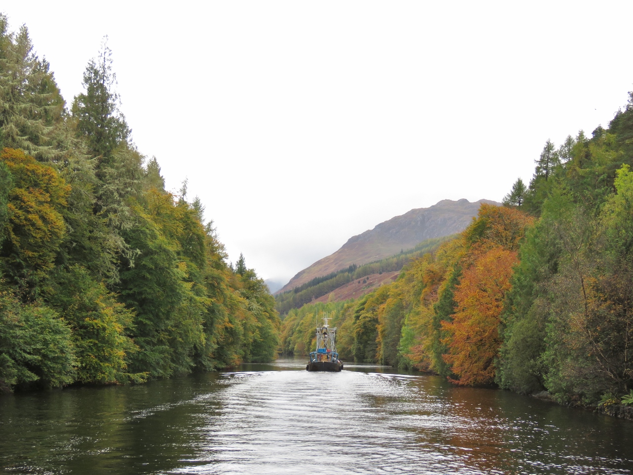 |
10/17/2017: Woods
Position: 57°2.29'N, -4°48.69'W
South of the Laggan Bridge, we passed through one of the most beautiful sections of the Caledonian Canal where the trees grow right up to the water's edge and extend over the water. The fall colours made the scene even more impressive. We liked this section of the canal so much that we later walked from Laggan all the way up to the bridge on one side of the waterway and back again on the other side.
|
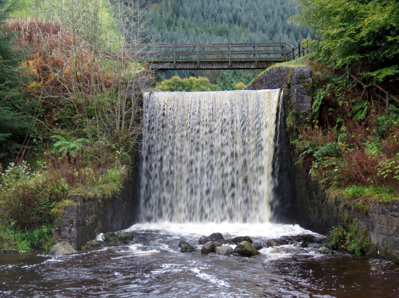 |
10/17/2017: Waterfall
Position: 57°2.24'N, -4°48.80'W
Spectacular waterfall where Allt an Lagain empties into the Caledonian Canal.
|
 |
10/17/2017: Laggan Lock
Position: 57°1.60'N, -4°49.49'W
Approaching the Laggan Lock, our fourth and final lock for the day, with Loch Lochy visible beyond.
|
 |
10/17/2017: Macavity
Position: 57°1.48'N, -4°49.58'W
The motor sailer Macavity preparing to enter the Laggan Lock northbound after we've passed through.
|
 |
10/17/2017: View from Dock
Position: 57°1.47'N, -4°49.58'W
The canal staff had a one-boat berth waiting for us on the other side of Laggan Lock. This is the amazing view from there.
|
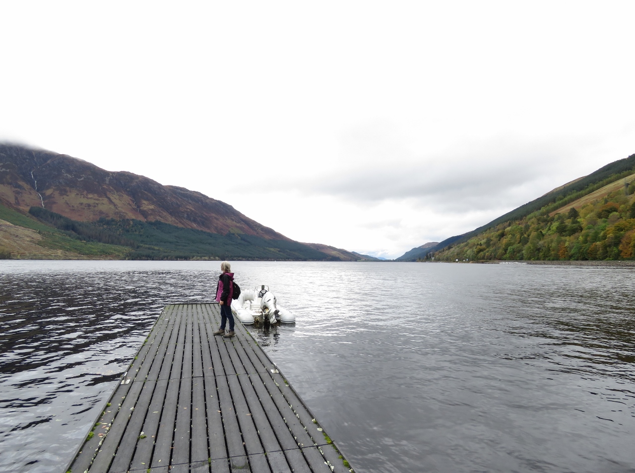 |
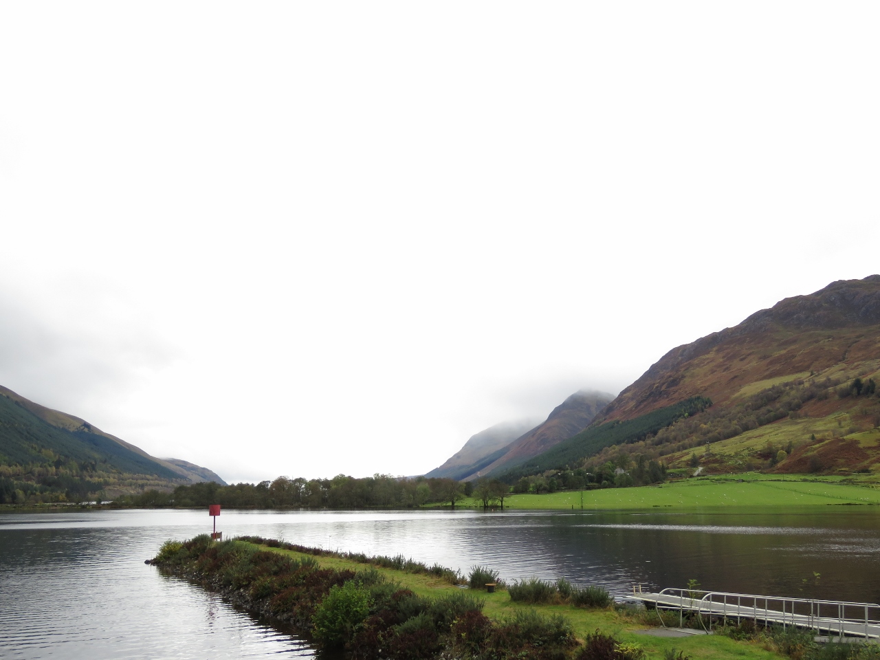
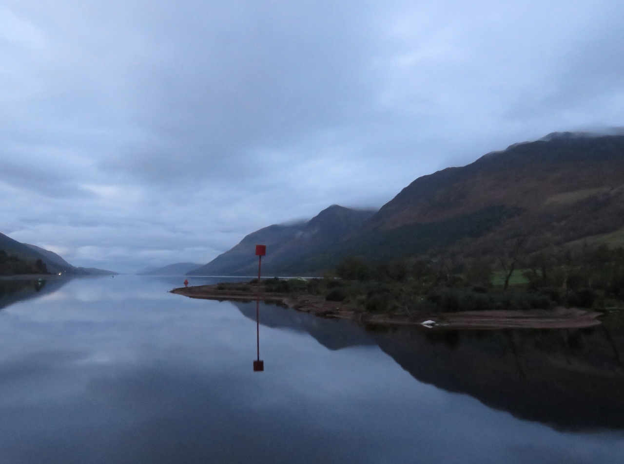
10/17/2017: Loch Lochy
Position: 56°58.81'N, -4°52.88'W
We dropped the tender in and ran down Loch Lochy to have lunch at the Letterfinlay Lodge.
|
 |
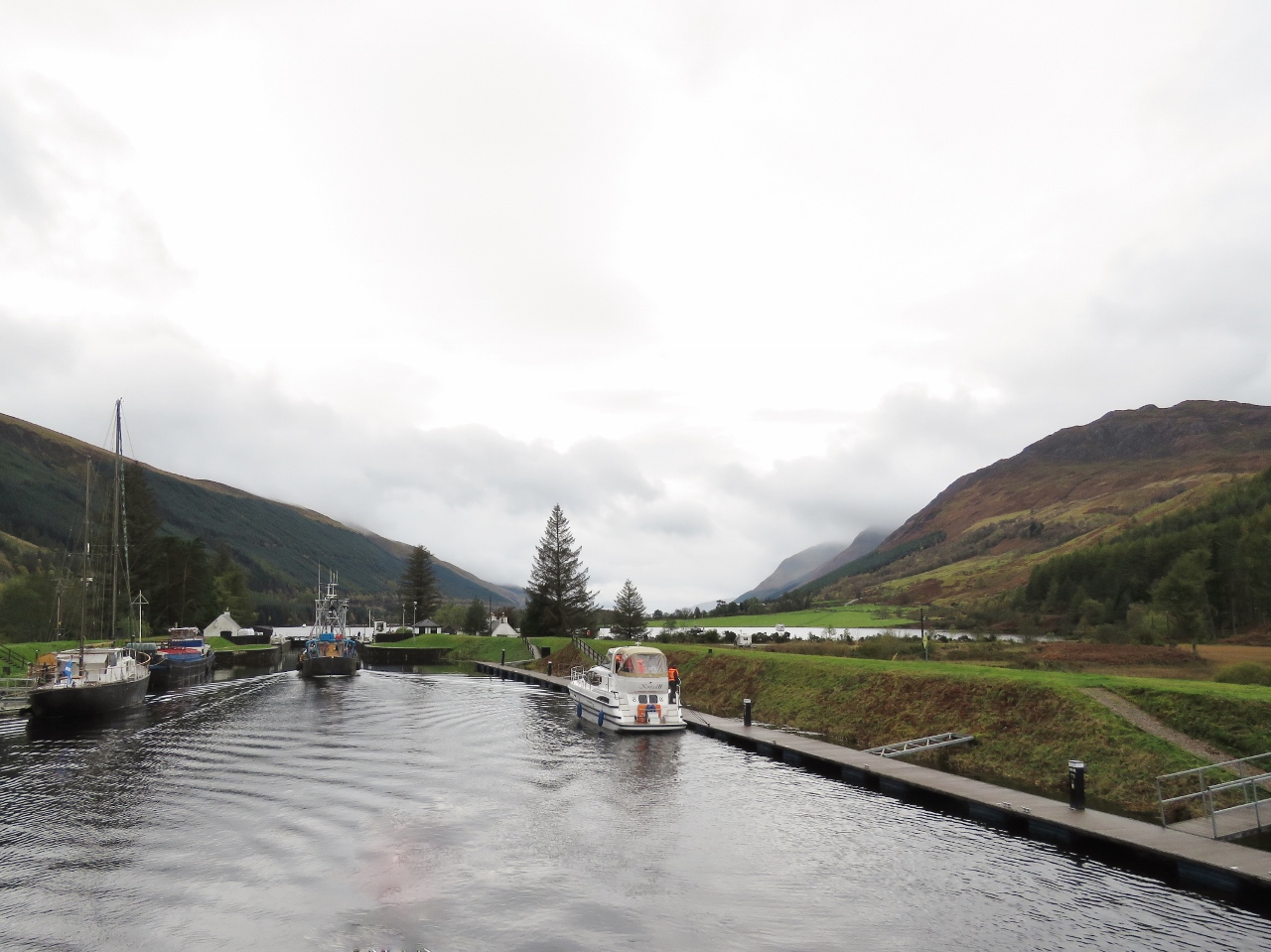
10/17/2017: Fawlty Towers
Position: 56°58.71'N, -4°52.97'W
For some reason, we were both reminded of Fawlty Towers as we entered the Letterfinlay Lodge. And the man at the desk sounded just like Basil Fawlty when he looked surprised to see us and said "Sorry! Lunch is off! The cooker's broken!". When we mentioned that we'd called earlier and were told they were serving lunch, he said we must have been talking to headquarters. He then offered us a look at the menu to see if there might be anything we wanted that didn't require the cooker. James asked if they could do burgers. He said "Of course". "I'm assuming that french fries wouldn't be possible," said James. "No, that's not a problem either", the man responded. So James asked what on the lunch menu was not available and he said "It looks like it's mostly there, maybe just some steamed vegetables". Lunch seemed pretty "on" to us.
|
 |
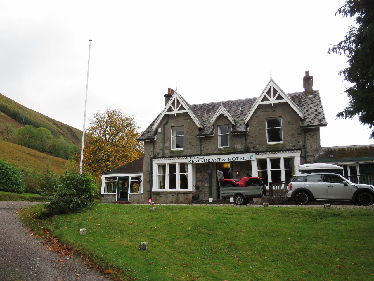
10/17/2017: Letterfinlay Lodge
Position: 56°58.71'N, -4°52.98'W
After a bit of an unusual start, we had an excellent meal at the Letterfinlay Lodge with a fabulous view over Loch Lochy. With lunch being "off", we weren't surprised to be the only lunch patrons.
|
 |
10/17/2017: Path
Position: 57°2.09'N, -4°49.17'W
After returning back to Dirona, we walked a path through the woods along the north shore of the canal.
|
 |
10/17/2017: Stream
Position: 57°2.53'N, -4°48.47'W
We wanted to cross over to the Laggan Bridge to walk back along the other side of the canal, but had trouble finding a dry way across the stream that was just beyond jumping width. We eventually walked a tree branch down to the point where it got thin and jumped to shore from there.
|
 |
10/17/2017: Bay
Position: 57°2.60'N, -4°48.46'W
Calm bay with the Laggan Bridge visible in the distance. The scenery here sure is beautiful.
|
 |
10/17/2017: Glen Tarsan
Position: 57°2.68'N, -4°48.23'W
We arrived at Laggan Bridge just as the Glen Tarsan was passing through.
|
 |
10/17/2017: Footbridge
Position: 57°2.23'N, -4°48.76'W
Jennifer on the footbridge above the waterfall we'd passed earlier.
|
 |
10/17/2017: At the Wheel
Position: 57°1.62'N, -4°49.50'W
Back in Laggan, the Glen Tarsan had beat us back. Neil White invited us aboard for a visit.
|
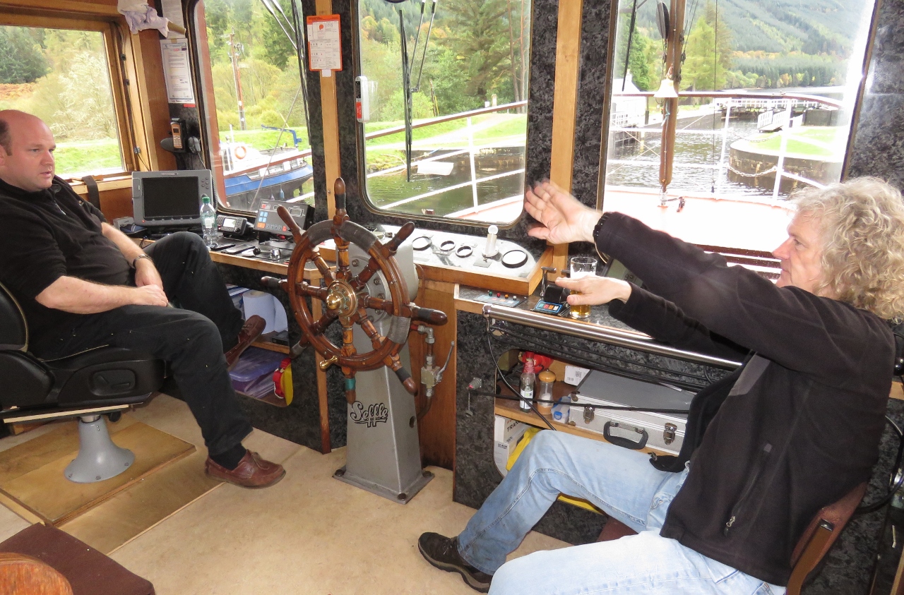 |
10/17/2017: Visit
Position: 57°1.62'N, -4°49.50'W
James and Neil discussing bank effect in the wheelhouse of the Glen Tarsan.
|
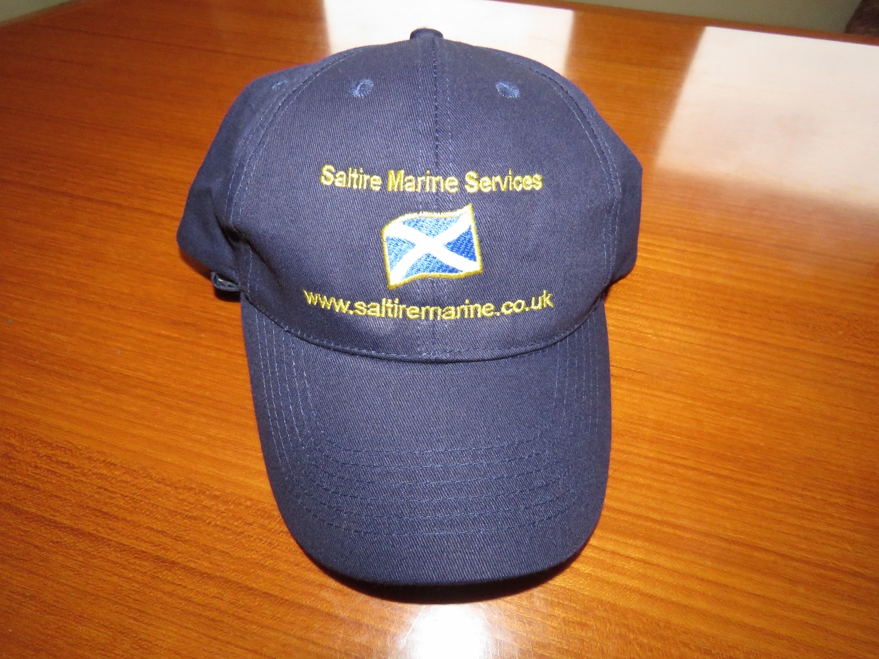 |
10/17/2017: Saltire Marine Services
Position: 57°1.47'N, -4°49.58'W
We were the happy recipients of Saltire Marine Services caps from Neil White.
|
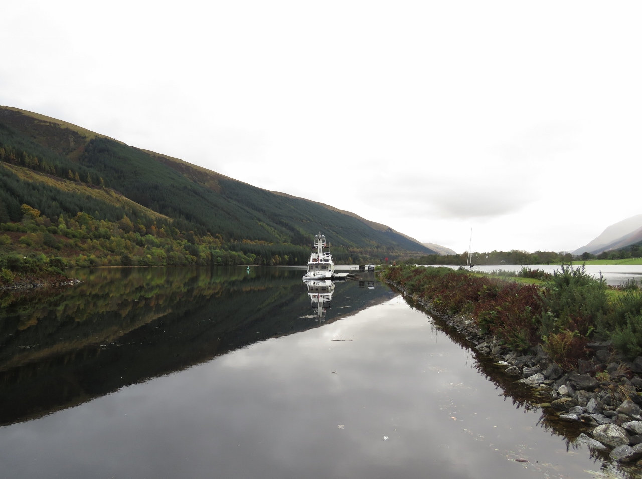 |
10/17/2017: Berth
Position: 57°1.51'N, -4°49.57'W
Our private berth below the Laggan Lock with a view to Loch Lochy.
|
 |
10/18/2017: Loch Lochy
Position: 57°1.11'N, -4°49.83'W
Beautiful calm conditions looking ahead into Loch Lochy as we depart Laggan.
|
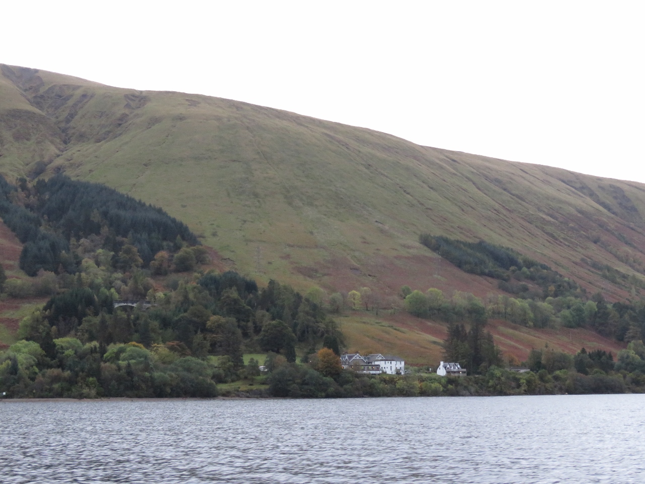 |
10/18/2017: Letterfinlay Lodge
Position: 56°58.97'N, -4°53.23'W
The Letterfinaly Lodge on Loch Lochy, where we had lunch yesterday.
|
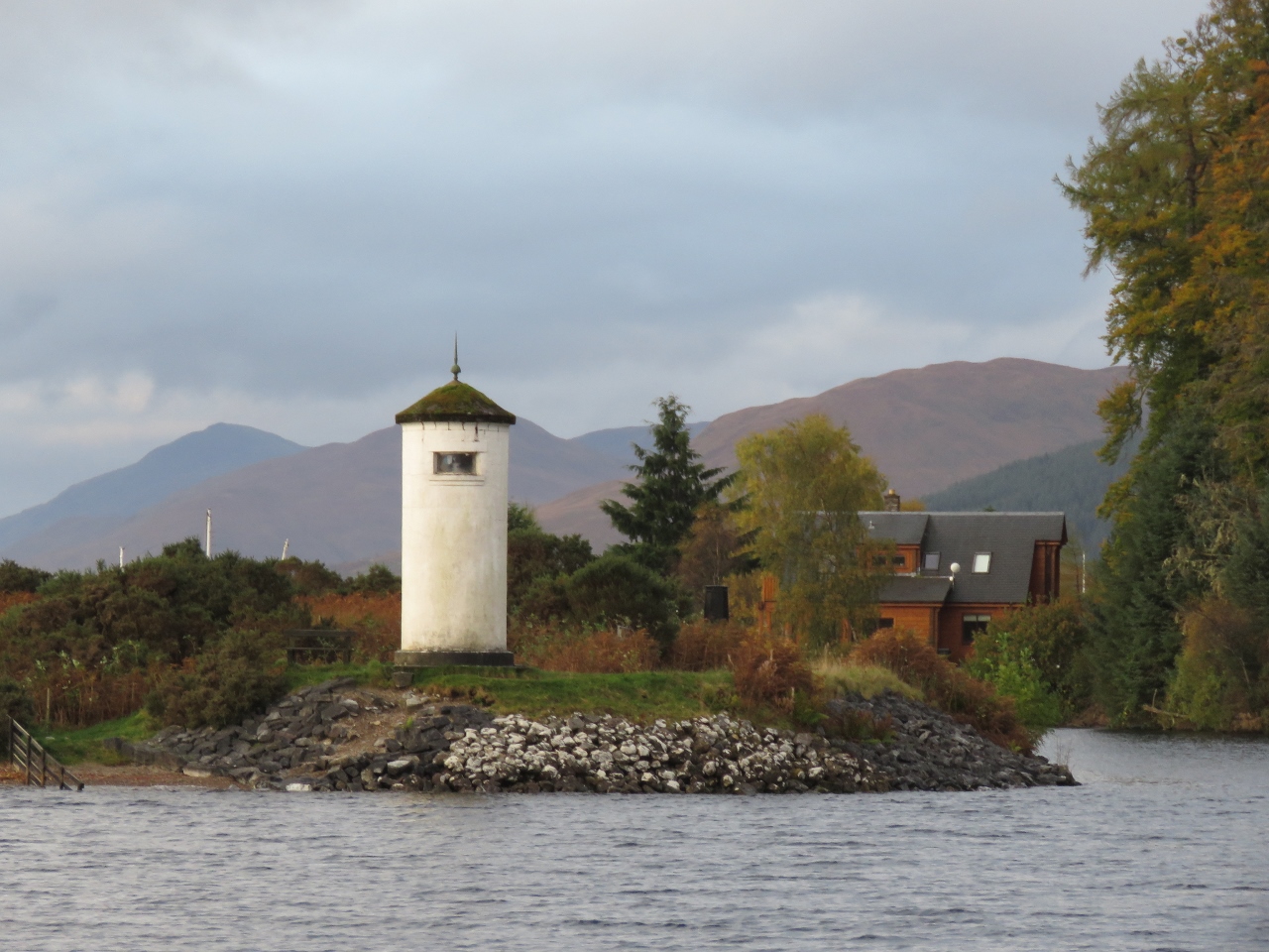 |
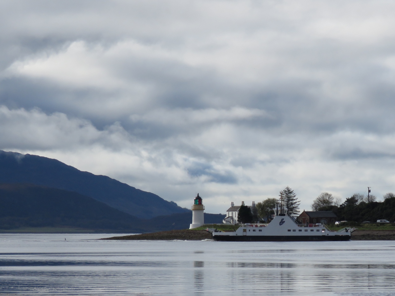
10/18/2017: Gairlochy Light
Position: 56°55.04'N, -4°59.26'W
The Gairlochy Light at the south end of Loch Lochy, where we will return back into the Caledonian Canal proper until we exit at Fort William.
|
 |
10/18/2017: Gairlochy Lock
Position: 56°54.87'N, -4°59.59'W
We waited about 15 mintues for the Gairlochy Lock to open shortly before 9am.
|
 |
10/18/2017: Gairlochy Bridge
Position: 56°54.78'N, -4°59.84'W
Spitfire checking clearances as we pass through the Gairlochy Bridge.
|
 |
10/18/2017: Moy Bridge
Position: 56°53.91'N, -5°1.15'W
Passing through the Moy Bridge, our second and last bridge of the day. The bridges in this area aren't as busy as at Fort William and Inverness, and don't have restricted opening times.
|
 |
10/18/2017: Aqueduct
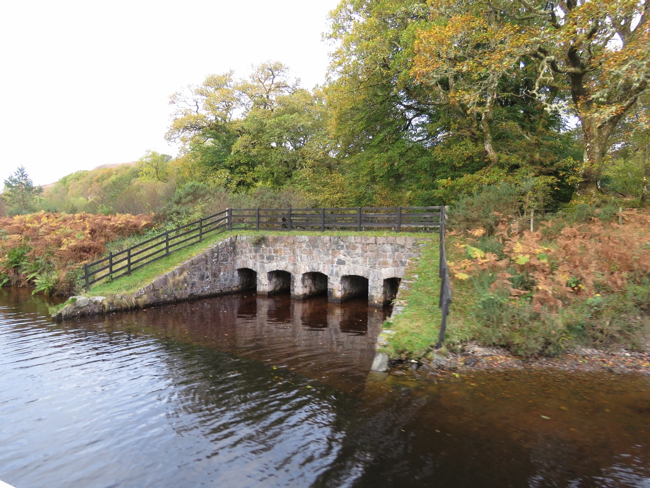
Position: 56°52.22'N, -5°3.68'W
Aqueduct where Allt Sheangain joins the Caledonian Canal.
|
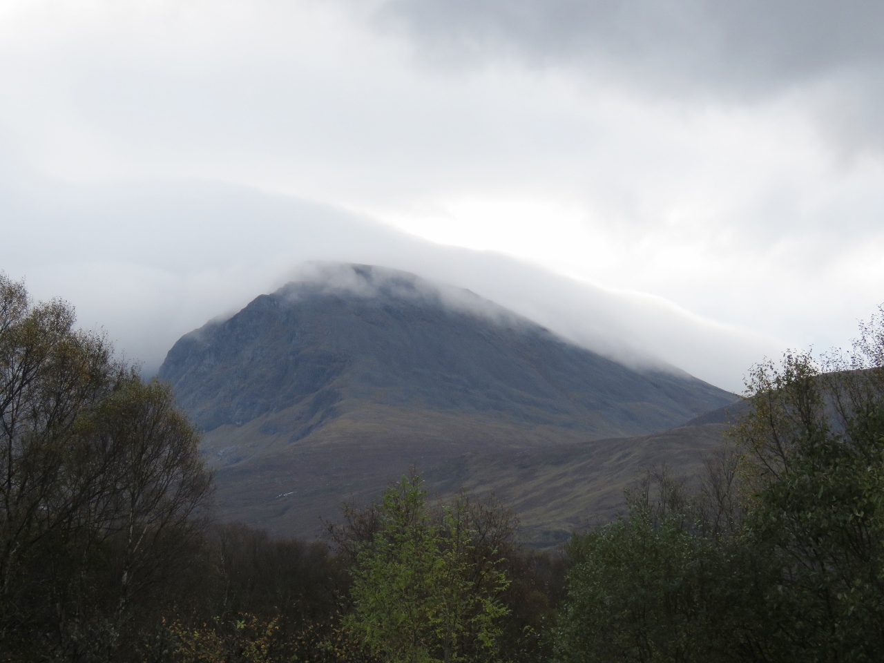 |
10/18/2017: Ben Nevis
Position: 56°51.12'N, -5°4.95'W
Slightly cloud-shrouded Ben Nevis is the tallest mountain in the British Isles at 4,412ft (1,345m).
|
 |
10/18/2017: Sandra & Barry Kempster
Position: 56°50.95'N, -5°5.32'W
Fort William residents Sandra and Barry Kempster have been monitoring our progress since our North Atlantic crossing, and were on hand to greet us when we arrived at the Banavie Top Basin to moor for a couple of nights. They also carried with them some parts and mail that they'd accepted on our behalf, and some treats for Spitfire.
|
 |
10/18/2017: Banavie Top Basin
Position: 56°50.89'N, -5°5.42'W
Looking north across Banavie Top Basin, above the famous Neptune's Staircase. Dirona is just visible on the right beyond the colorful barge.
|
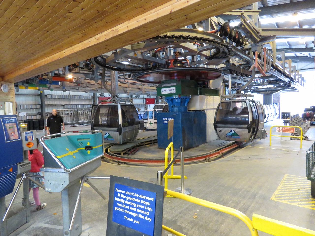 |
10/18/2017: Mountain Gondola
Position: 56°51.14'N, -4°59.93'W
Sandra and Barry Kempster are season ticket holders for the Nevis Range Mountain Gondola and drove us there for a ride to the top.
|
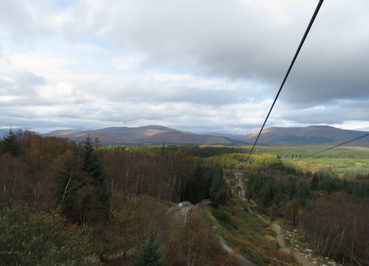 |
10/18/2017: Gondola View
Position: 56°50.86'N, -4°59.48'W
We're only partway up and the views from the gondola are excellent.
|
 |
10/18/2017: Gairlochy
Position: 56°50.13'N, -4°58.44'W
|
 |
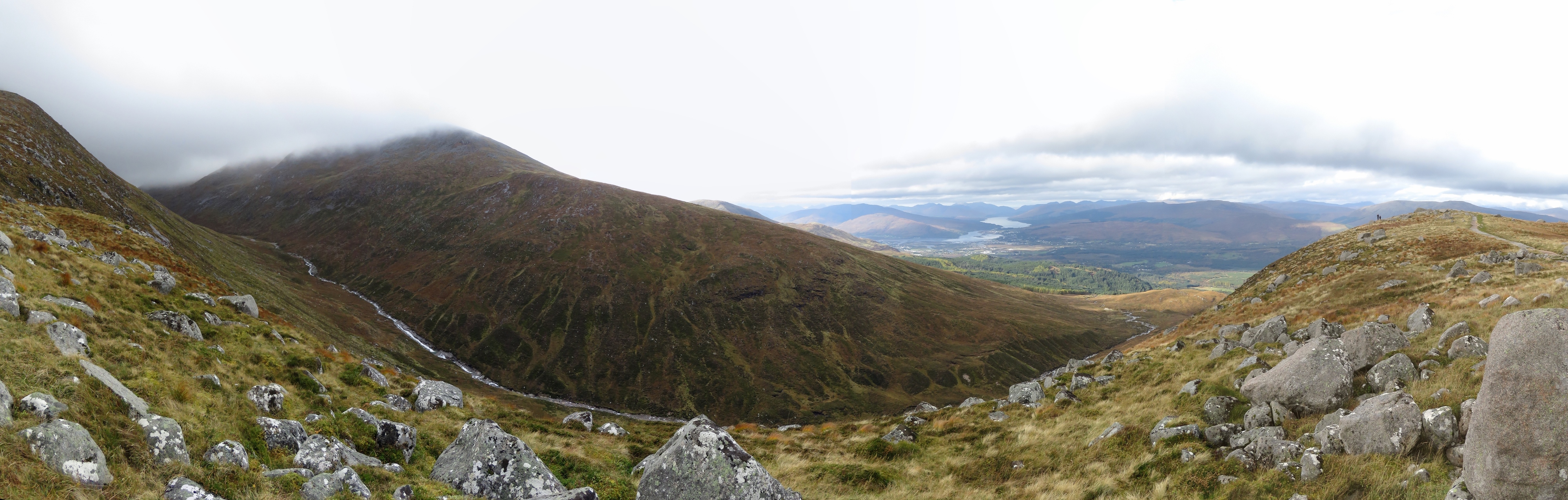
10/18/2017: Lochs
Position: 56°49.98'N, -4°59.24'W
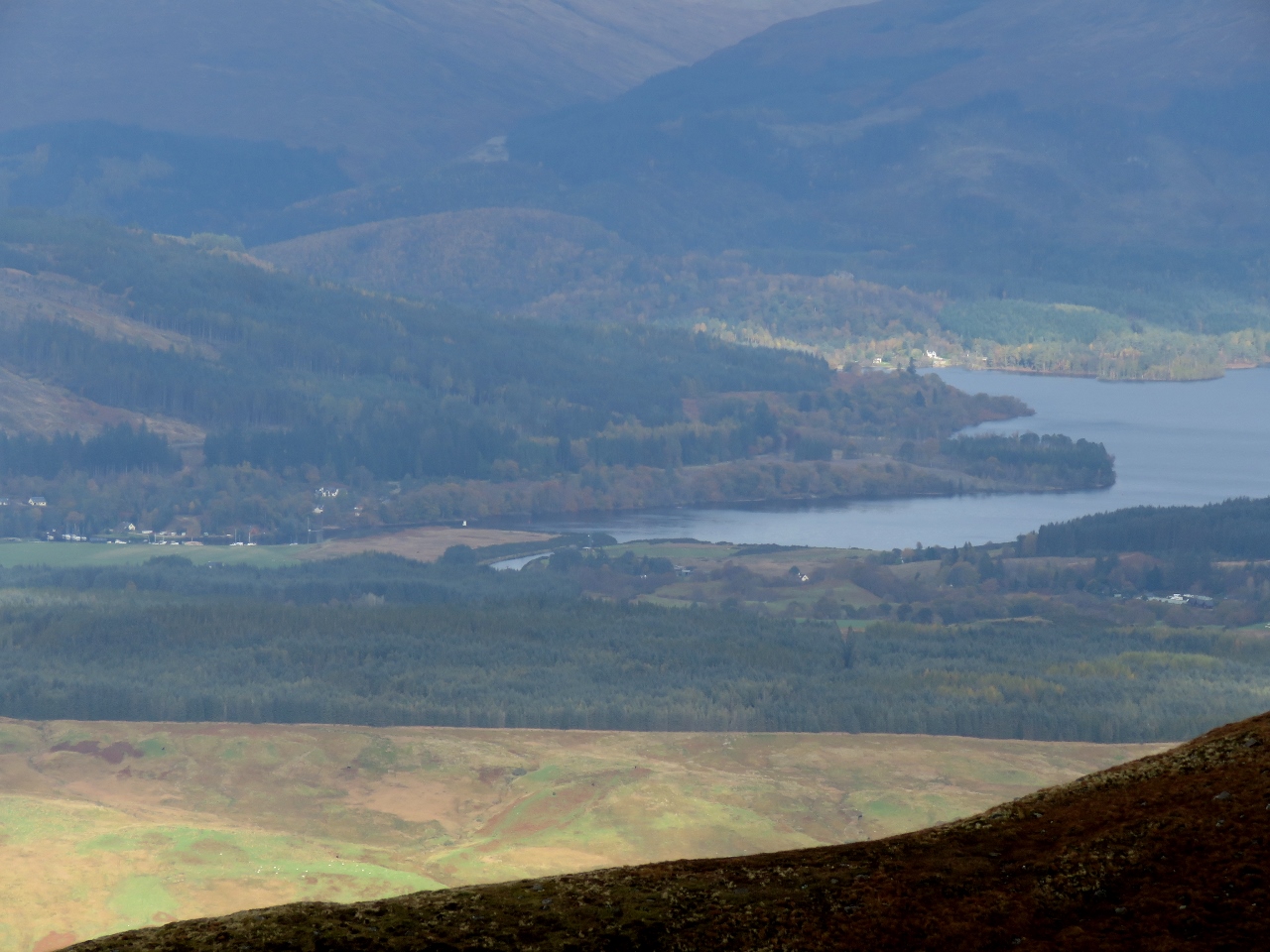
The view west from the Nevis Range to Loch Linnhe (foreground) and Loch Eil, with The Narrows running between them. The village of Corpach is at the head of Loch Linnhe on the right, where the Caledonian Canal exits to sea.
|
 |
10/18/2017: Allt a Mhuillinn
Position: 56°49.98'N, -4°59.24'W
Allt a Mhuillinn running between 4,412ft (1,345m) Ben Nevis on the left and (1,220m) Carn Mor on the right. The bodies of water in the center distance are Loch Linnhe (left) and Loch Eil.
|
 |
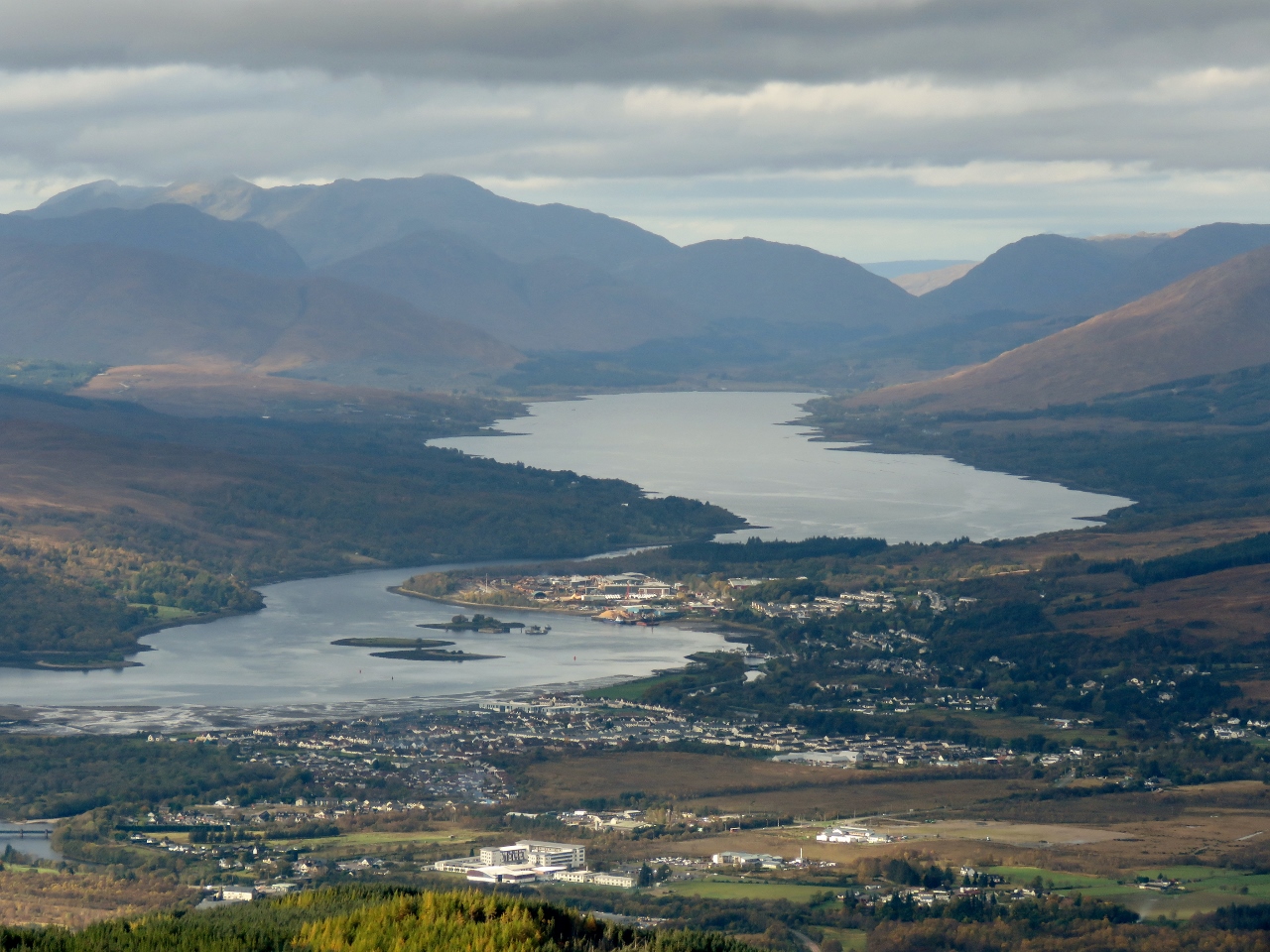
10/18/2017: View
Position: 56°50.05'N, -4°59.32'W
The fabulous view from the Nevis Range. The Caledonian Canal runs between Loch Linnhe on the left and Loch Lochy on the right. (Click picture for a better view).
|
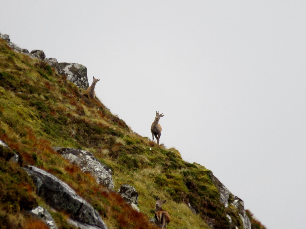 |
10/18/2017: Deer
Position: 56°49.97'N, -4°59.20'W
Cautious deer atop the Nevis Range.
|
 |
10/18/2017: Commando Memorial
Position: 56°53.87'N, -4°56.63'W
Sandra and Barry Kempster spoiled us silly and took us to another great viewpoint to the Nevis Range at the Commando Memorial. The memorial is dedicated to the British Special Forces members of World War II who trained nearby starting in 1942.
|
 |
10/18/2017: Garden of Remembrance
Position: 56°53.90'N, -4°56.64'W
The Garden of Remembrance, adjacent to the Commando Memorial, contains tributes to those Commando members who died in more modern conflicts such as the Falklands War and Afghanistan.
|
 |
10/18/2017: Blarmacfoldach Viewpoint
Position: 56°48.09'N, -5°7.08'W
The view northwest to Loch Linnhe from the Blarmacfoldach Viewpoint
|
 |
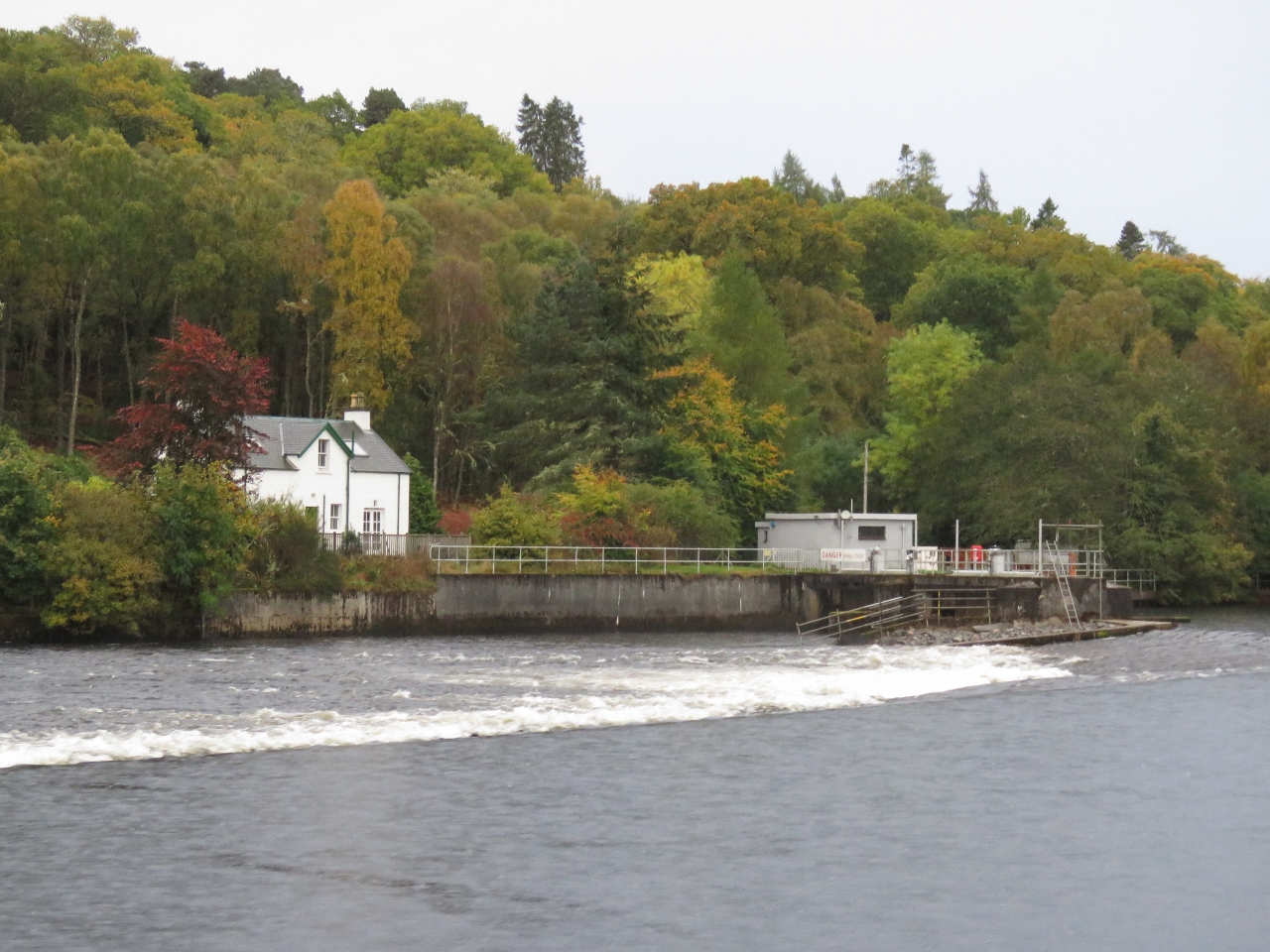
10/18/2017: Caledonian Canal
Position: 56°48.77'N, -5°6.60'W
Sandra and Barry Kempster have a lovely home overlooking Loch Linnhe and the terminus of the Caledonian Canal. The white building in the center foreground is the Corpach Basin Sea Lock office. At the right of the picture is the distinct Hjalmar Bjorge, that we'd seen in Loch Maddy. (Click image for a larger view).
|
 |
10/19/2017: Banavie Top Basin
Position: 56°50.95'N, -5°5.32'W
Morning calm at the Banavie Top Basin above Neptune's Staircase on the Caledonian Canal.
|
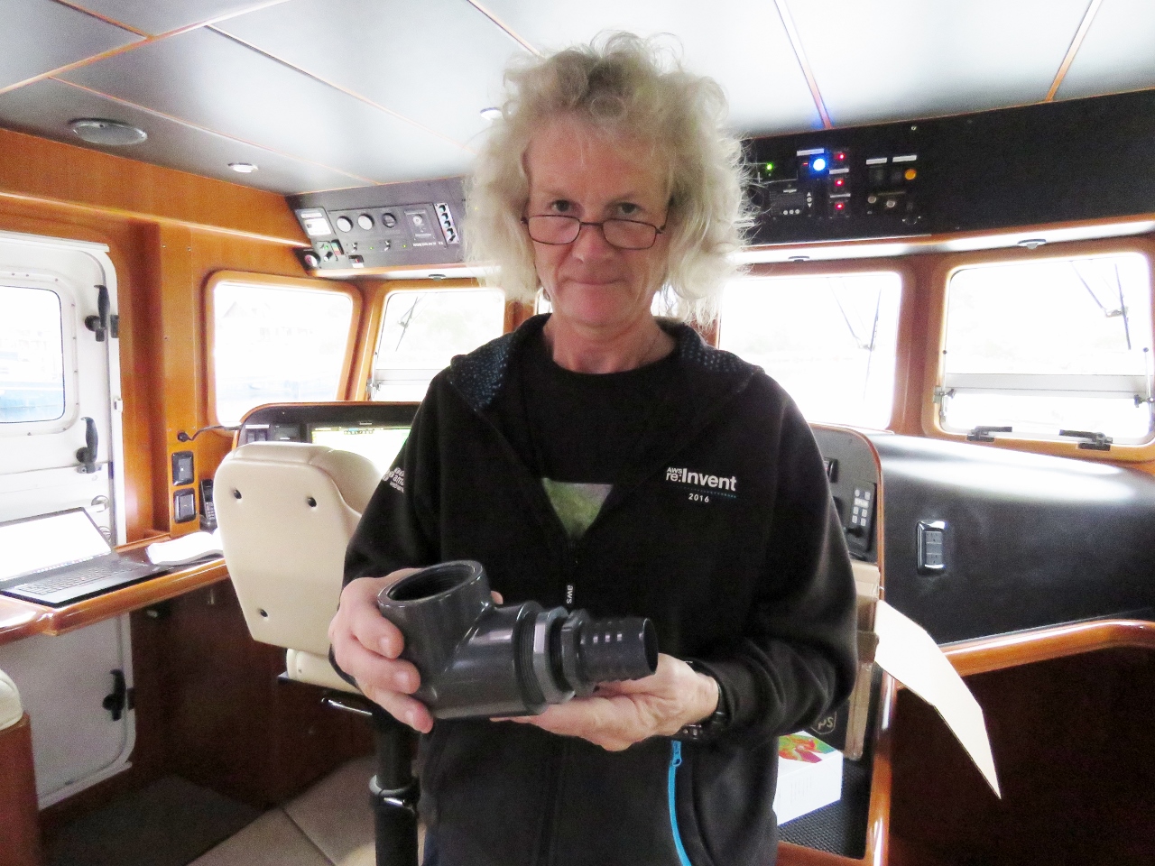 |
10/19/2017: Plumbing Part
Position: 56°50.95'N, -5°5.32'W
As part of the post mortem from Alarms at 1:15am, we decided we needed a reliable, high-capacity, automatic bilge pump added to our main bilge. We have a Jabsco 34600-0010, but it's really just a bilge-drying pump, not offering the volume we want. Nor is it sufficiently reliable.
We had ordered all the parts we need to install this pump when we returned to Seattle earlier this year, but we ran into a rare ordering snafu from Amazon and the 2" to 1 1/2" plumbing bushing came in as 1" to 1/2". For the lack of a tiny part worth only $9.62, we weren't able to take on the project of adding a high capacity bilge pump in the lower bilge. Barry and Sandra Kempster knew we would be cruising near where they lived in Fort William, Scotland and they offered to hold some packages for us. We ordered a bunch of things we needed. But, the most welcome of the group, was that last part needed for the bilge pump project. Here is the part we were missing, adapting a 1 1/2" pipe nipple to a 2" elbow. In the UK, British Standard Thread (BST) is the standard tapered pipe thread, whereas the parts we're using are National Pipe Thread (NPT), the tapered pipe thread used in North America. NPT parts are available in the UK, but they are rare and poorly-stocked, so this one had to come from the US. Barry Kempster did the research to figure out this difference and help us avoid starting the job with an easy-to-get BST part that wouldn't have fit properly. |
 |
10/19/2017: Complete Unit
Position: 56°50.95'N, -5°5.32'W
Now that we have all the parts, we're finally ready to install the additional high capacity bilge pump. We have elected to install a Rule 3700 which has sufficient capacity to completely pump the water we had flowing into the boat in Alarms at 1:15am. We are taking a two-step defense, where we first prevent the inflow and then put enough pump capacity into the system that the inflow can be easily handled without the pump running anywhere close to 100% cycle.
This a simple design where the Rule 3700 will be mounted in the bilge aft of the engine, and the blue hose will connect the two large grey 90-degree fittings that mate up with a 2-inch hose for dumping overboard. What makes this installation challenging is the pump doesn't fit. We're preparing the design outside of the bilge but will have to assemble it like a ship-in-a-bottle in the main bilge. It'll be tedious but the flow from this pump is so phenomenally different from the current Jabsco 34600-0010 that it's worth the time. |
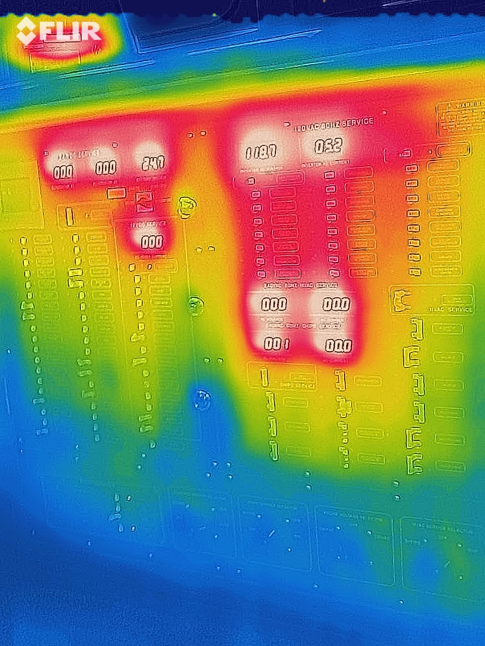 |
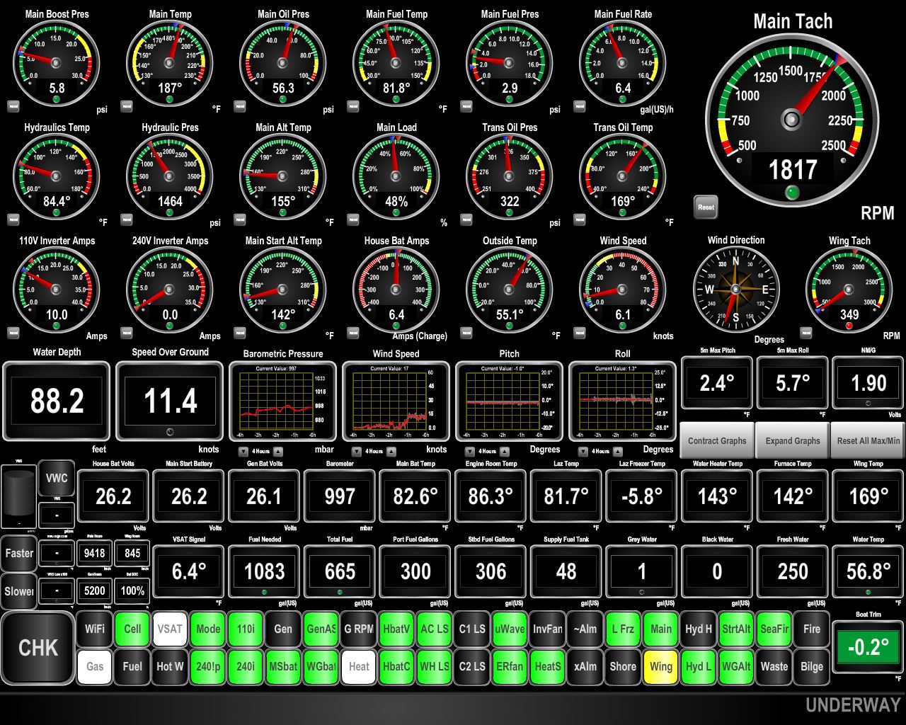
10/19/2017: Flir One Pro
Position: 56°50.95'N, -5°5.32'W
We picked up a Flir One Pro Thermal Camera from Amazon. It's only USD$200 and operates as an extension to an Android phone (IOS also supported on similar hardware) with an on-phone application. This picture shows the AC electrical panel on Dirona. The bright orange sections are the 10 LED voltage and amperage displays. Above and to the left is the Furuno FA150 AIS glowing brightly (under the FLIR logo). There is electrical load on the system but no heat around any other breaker or transfer switch, so we can see the system is healthy and operating with low resistance.
We also took the obligatory pet picture and found that Spitfire is pretty well insulated except for heat leaks at the ears and face area. :) |
 |
10/19/2017: Crannog
Position: 56°49.01'N, -5°6.89'W
We had an excellent dinner at the Crannog Restaurant on the Fort William waterfront with Barry and Sandra Kempster.
|
 |
10/20/2017: Fog
Position: 56°50.95'N, -5°5.32'W
A calm, but foggy morning, at Banavie Top Basin.
|
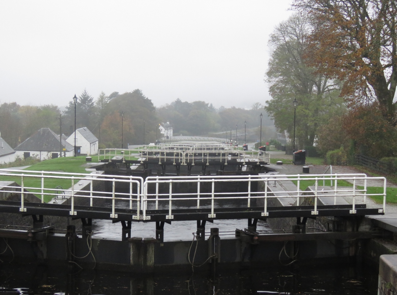 |
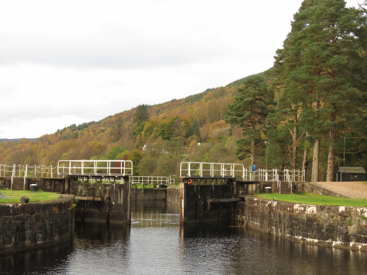
10/20/2017: Neptune's Staircase
Position: 56°50.85'N, -5°5.52'W
We had arranged an 8:30am transit through the famous Neptune's Staircase. At 180 feet (55 m) long, Neptune's Staircase is the longest lock flight in Britain and will lower Dirona 64 ft (20m) through a series of eight locks.
|
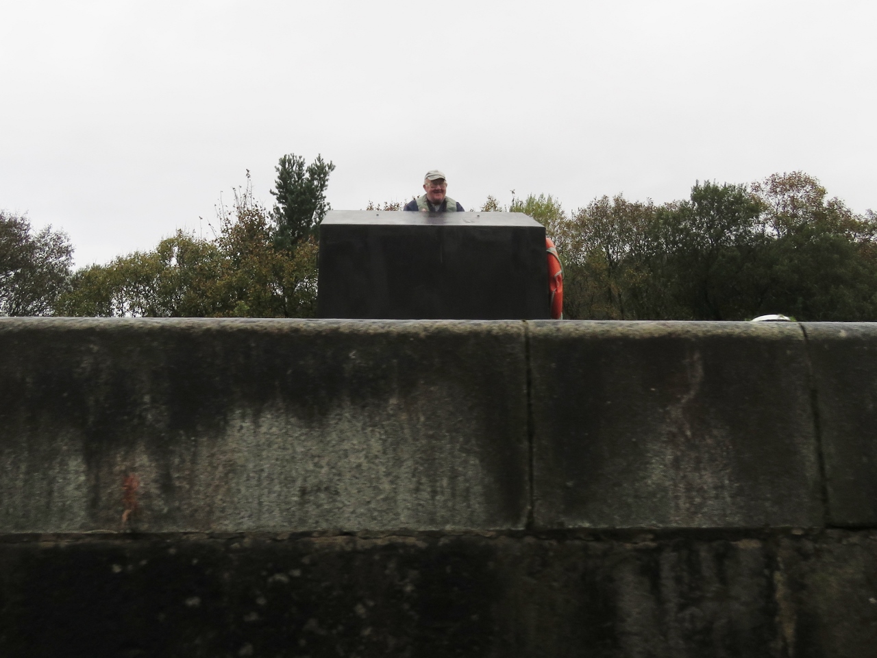 |
10/20/2017: Lock Keeper
Position: 56°50.72'N, -5°5.73'W
Looking up to the lock keeper in Neptune's Staircase in the seventh lock of Neptune's Staircase. We're almost down now.
|
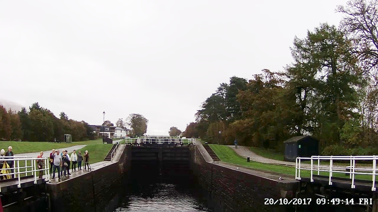 |
10/20/2017: Bottom
Position: 56°50.61'N, -5°5.95'W
The typical time to pass through Neptune's Staircase is about 90 minutes, but the Scottish Canal staff rushed us through in barely 70 minutes so we could reach the sea lock before it shut down for several hours at low tide. Corpach Sea Lock only operates with at least 1m of tide, and closes for about 2 hours either side of a spring tide. Today is a spring tide, with low tide around 1:30pm, so we need to be through by 11:30am.
|
 |
10/20/2017: Banavie Swing Bridge
Position: 56°50.61'N, -5°5.95'W
Passing through the Banavie Swing Bridge, our last bridge on the Caledonian Canal. We have two more interior locks to pass through before we reach the sea lock, roughly a mile away.
|
 |
10/20/2017: Reflections
Position: 56°50.50'N, -5°6.26'W
Reflections in the calm channel beyond the Banavie Swing Bridge.
|
 |
10/20/2017: Heading North
Position: 56°50.52'N, -5°7.02'W
We waited for two sailboats heading north to clear the locks above Corpach Basin before we passed through.
|
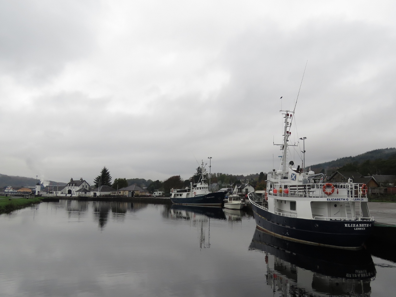 |
10/20/2017: Norwegian Rescue Ships
Position: 56°50.53'N, -5°7.33'W
Two former Norwegian Rescue Ships, the Hjalmar Bjorge and the Elizabeth G moored at Corpach Basin. Both are now charter boats for the Northern Light Cruising Company. We saw the Hjalmar Bjorge at Loch Maddy in the Outer Hebrides a few weeks back. We know another former Norwegian Rescue Ship well—the Paul Johansen that we visited most recently in Lunenburg, Nova Scotia and frequently saw in Port Madison near Seattle.
|
 |
10/20/2017: Corpach Sea Lock
Position: 56°50.52'N, -5°7.39'W
At least 1m of tide is needed to float the sea lock gate here at Corpah, with 1.4m needed at Clachnaharry at the north end of the canal. We entered the Corpach Sea Lock at 10:22am with plenty of time to get through before the low tide closure around 11:30am.
|
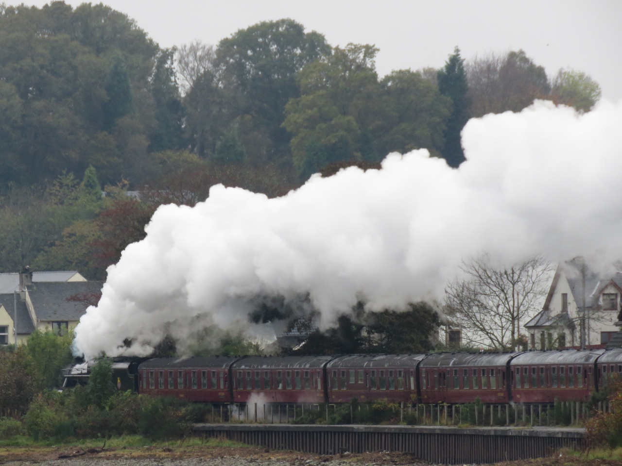 |
10/20/2017: Jacobite Steam Train
Position: 56°50.52'N, -5°7.40'W
The Jacobite Steam Train heading north to Malaig from Fort William along the West Highland Line. This train portrayed the Hogwarts Express in the Harry Potter movies.
|
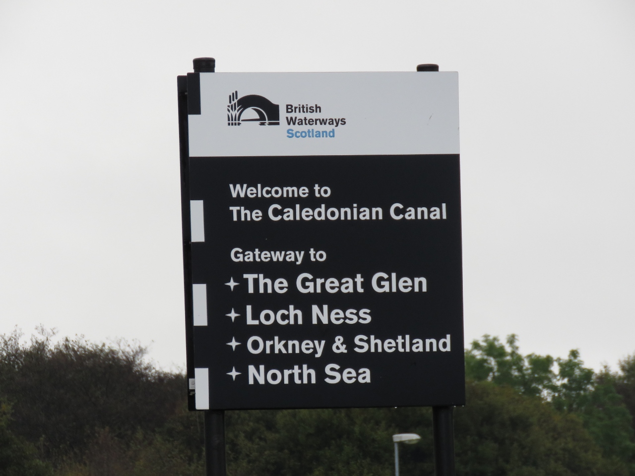 |
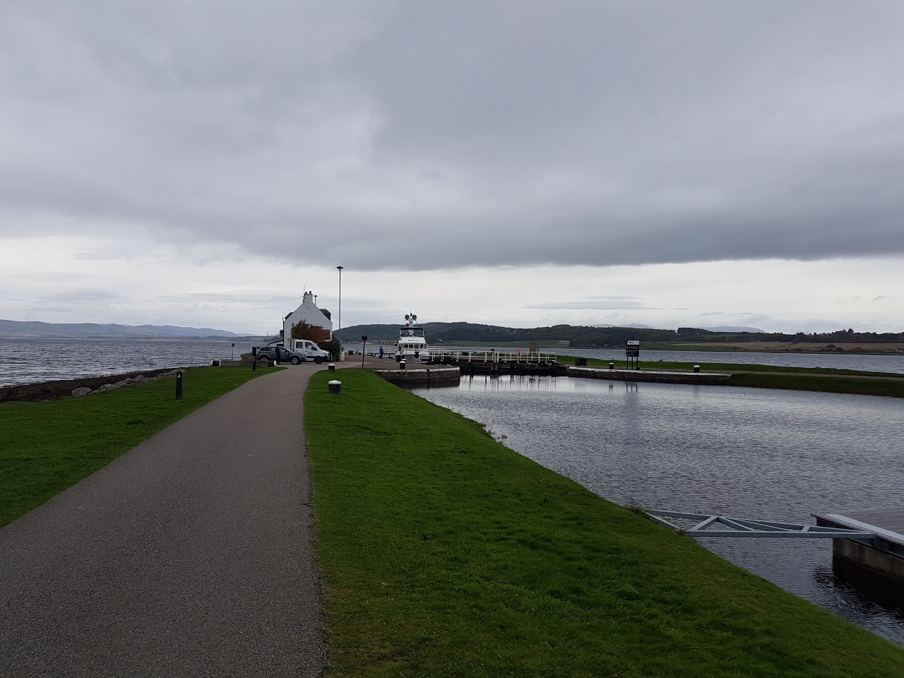
10/20/2017: End of the Line
Position: 56°50.52'N, -5°7.40'W
Those entering the Caledonian Canal at Corpach see this sign the on way in. And this is the last sign we see as we leave the canal. What a fabulous trip we had.
|
 |
10/20/2017: Back to Sea
Position: 56°50.47'N, -5°7.49'W
Exiting the sea lock at Corpach and entering Loch Linnhe.
|
 |
10/20/2017: Underwater Center
Position: 56°49.35'N, -5°7.32'W
One of several dive platforms of the commercial dive school Underwater Center.
|
 |
10/20/2017: Crannog
Position: 56°49.23'N, -5°7.43'W
Passing the Crannog restaurant where we had dinner last night.
|
 |
10/20/2017: Mountains
Position: 56°45.88'N, -5°11.52'W
The clouds are clearing and we're getting view to the mountain scenery along Loch Linnhe.
|
 |
10/20/2017: Corran Lighthouse
Position: 56°43.70'N, -5°14.15'W
The small car ferry arriving into Ardgour from Corran with the Corran Lighthouse in the background. The lighthouse was built in 1860 by Thomas and David Stevenson, father and uncle to author Robert Louis Stevenson.
|
 |
10/20/2017: 11.4 knots
Position: 56°42.97'N, -5°14.66'W
We passed through the Corran Narrows about an hour before slack water on an ebbing tide and were making 11.4 knots when we'd normally be doing 8.25 knots at 1800 RPM. The water level dropped visibly in the channel as the water surged out.
|
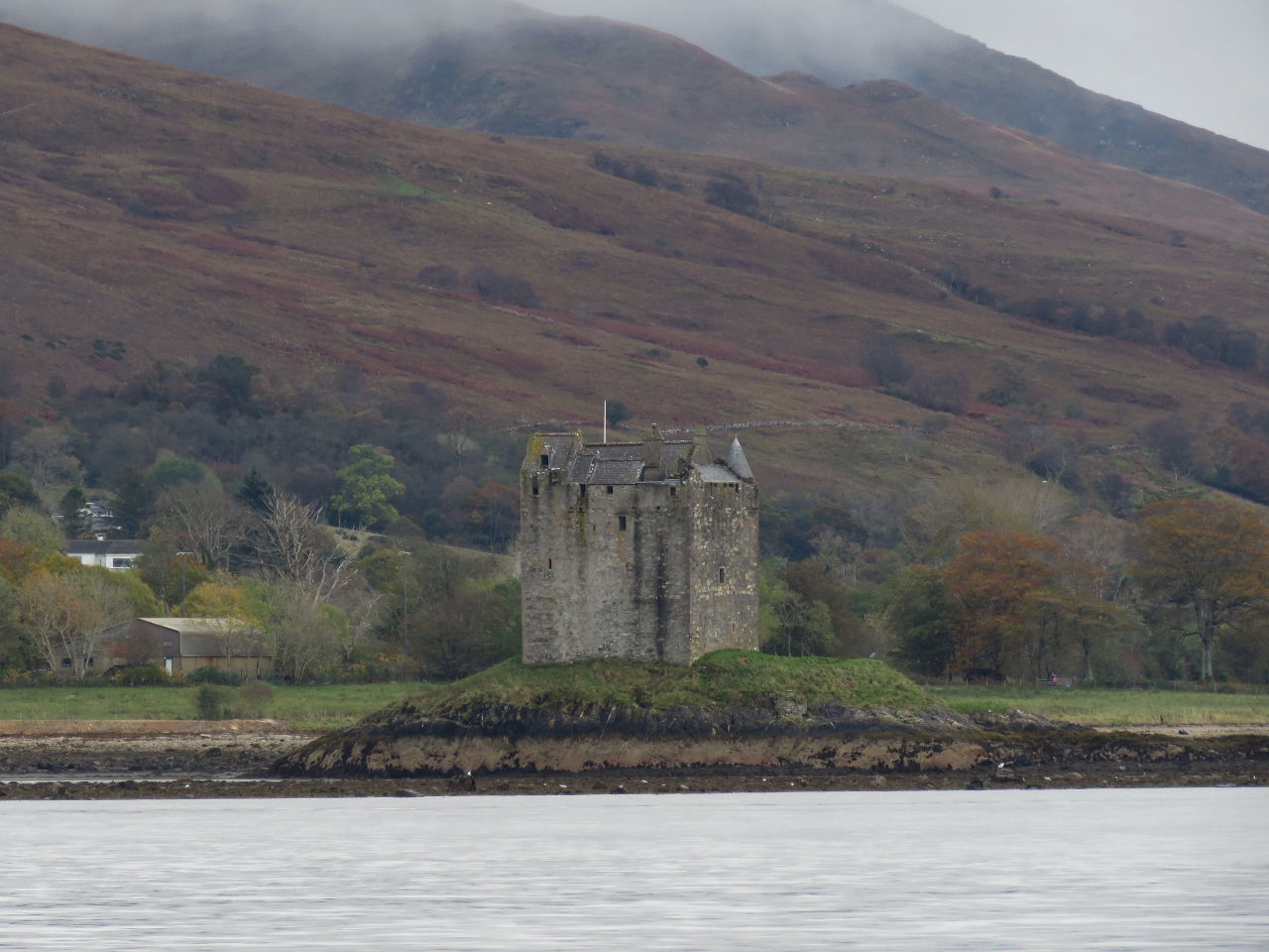 |
10/20/2017: Castle Stalker
Position: 56°34.25'N, -5°24.42'W
Castle Stalker on the east side of Loch Linnhe is believed to have been built in the 1400s. The castle was the scene for the Castle Aargh! at the end of the movie Monty Python and the Holy Grail.
|
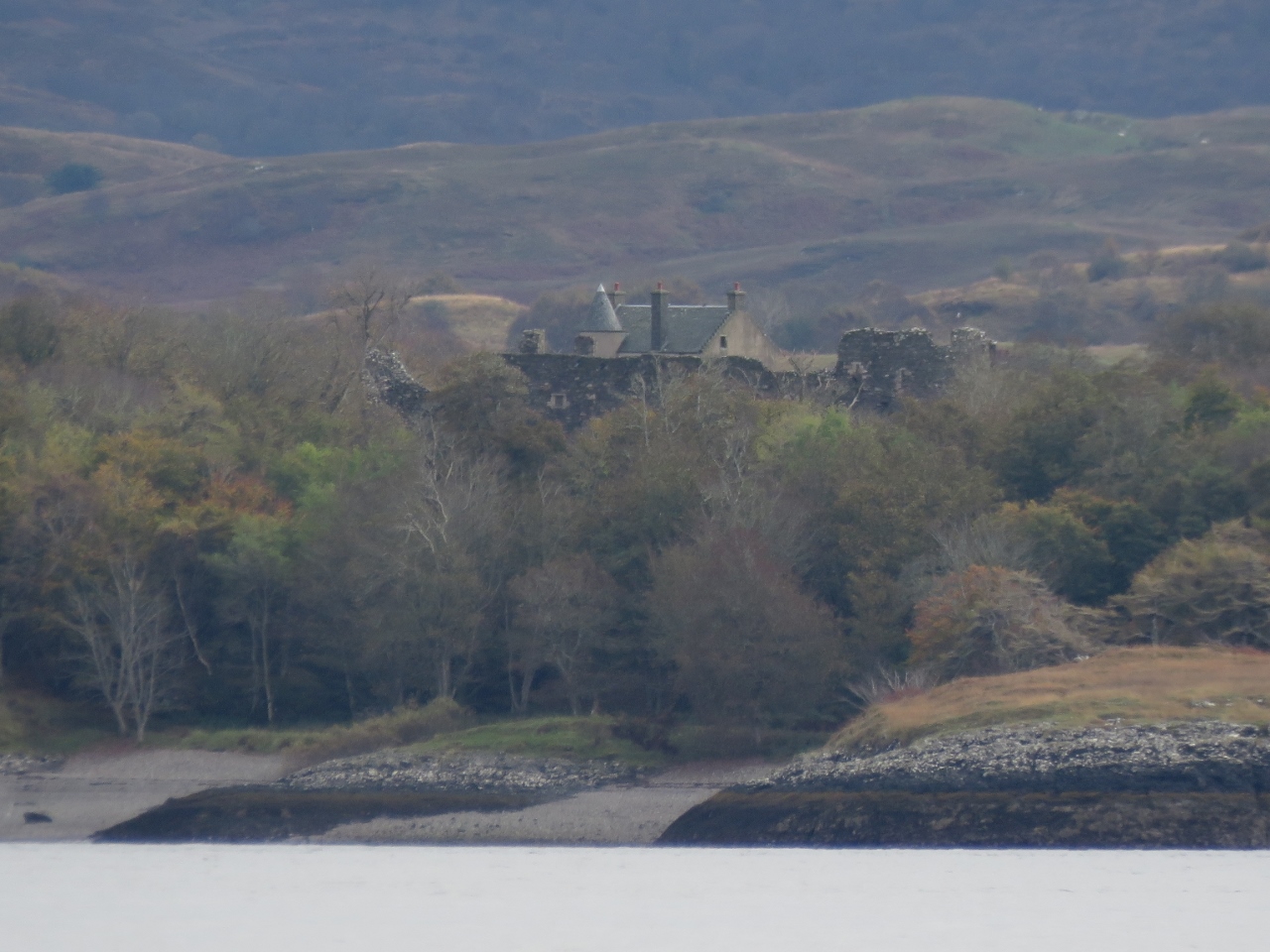 |
10/20/2017: Dunstaffnage Castle
Position: 56°28.09'N, -5°29.16'W
Dunstaffnage Castle just visible above the trees to our southeast dates to the 13th century and is one of Scotland's oldest castles.
|
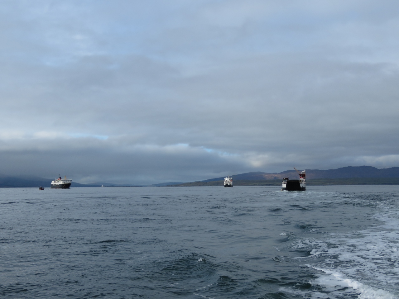 |
10/20/2017: Traffic
Position: 56°25.52'N, -5°29.29'W
Oban is a busy ferry terminal—we saw near-constant ferry traffic for the first few hours of our arrival. These are three CalMac ferries off the north end of Kerrera Island at the entrance to Oban Bay.
|
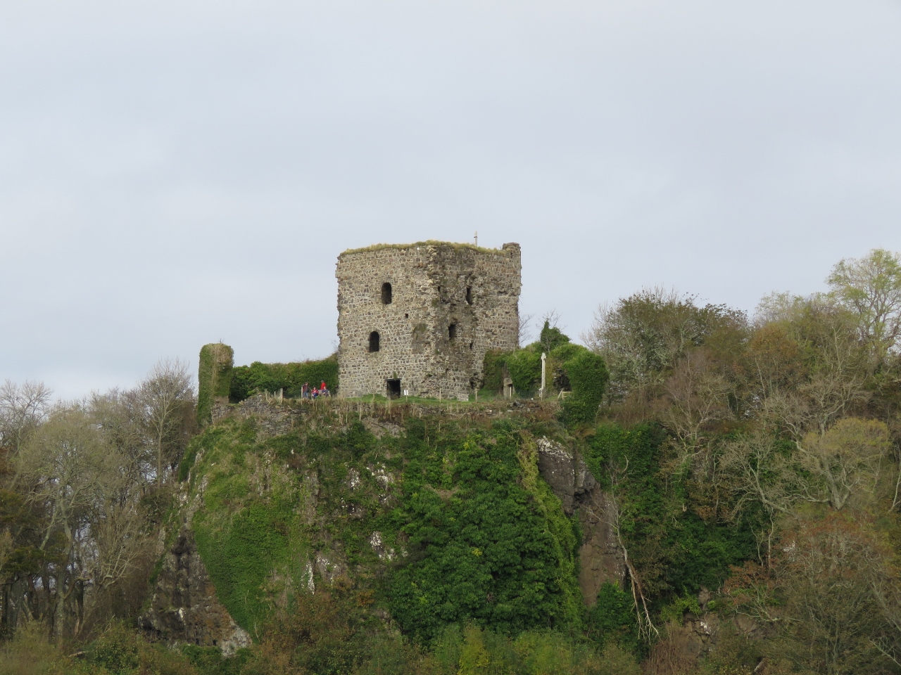 |
10/20/2017: Dunollie Castle
Position: 56°25.40'N, -5°29.18'W
Scotland sure has a lot of castles—Dunollie Castle is our third castle sighting of the day. The ruins date from the 15th century, but a fortification existed on the site since the late 7th century.
|
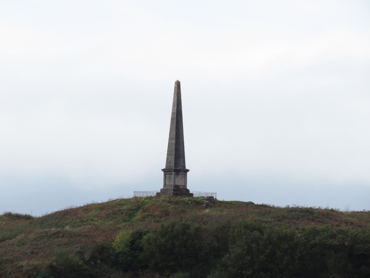 |
10/20/2017: Hutchenson Memorial
Position: 56°25.40'N, -5°29.18'W
Memorial on Kerrera Island to David Hutchenson, who in 1851 started a steamship company to serve northwest Scotland that evolved into today's CalMac enterprise.
|
 |
10/20/2017: War Memorial
Position: 56°25.28'N, -5°29.14'W
Memorial to those from Oban who lost their lives in World War I. Fallen soldiers from World War II and the Falklands were later added.
|
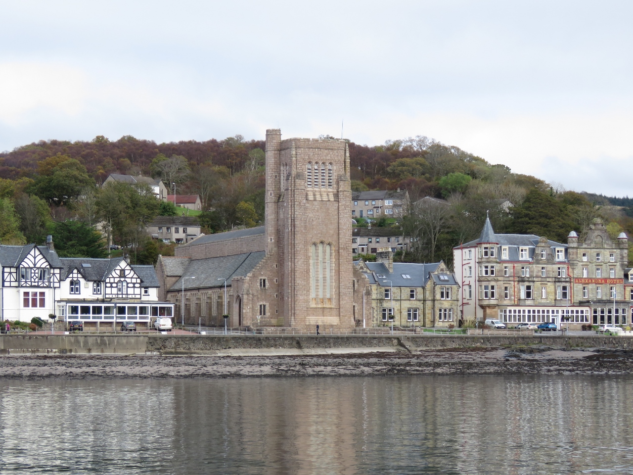 |
10/20/2017: St. Columba's Cathedral
Position: 56°25.15'N, -5°29.09'W
St. Columba's Cathedral in Oban was completed in 1959 and funded partly from money raised in Scotland, Ireland and Canada.
|
 |
10/20/2017: Kerrera Sound
Position: 56°25.05'N, -5°28.90'W
Looking south through Kerrera Sound—we'll be passing through there in the dark when we leave Oban early tomorrow morning.
|
 |
10/20/2017: Glen Tarsan
Position: 56°24.95'N, -5°28.67'W
At the North Pier Pontoons in downtown Oban we caught up with the Glen Tarsan, that left Fort William a day ahead of us. Prominent above Oban is McCaig's Tower —we plan to walk up there this afternoon.
|
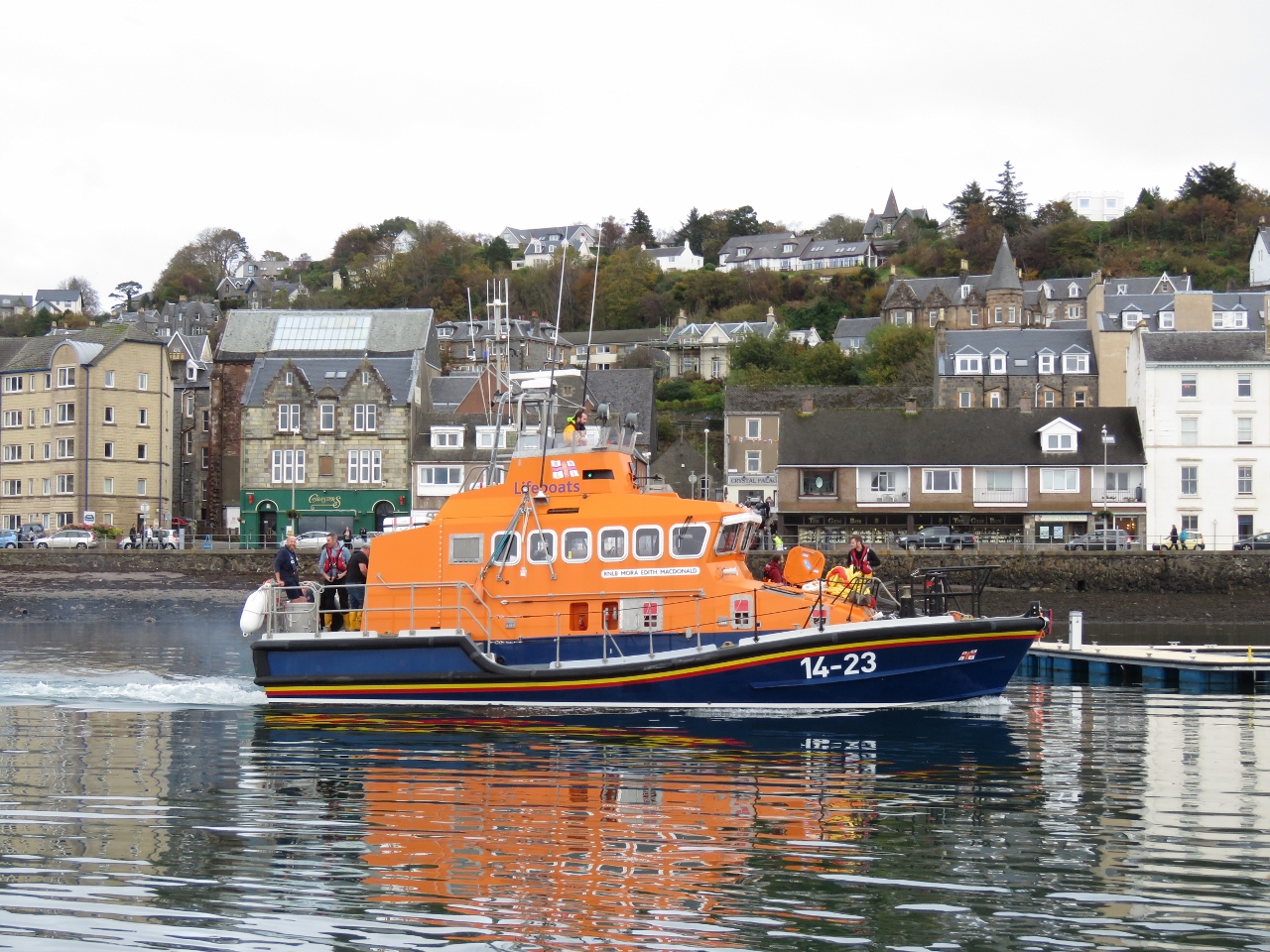 |
10/20/2017: Mora Edith MacDonald
Position: 56°24.96'N, -5°28.62'W
It was looking like we were going to be yet again moored beside an RNLB lifeboat, but they only stopped briefly on the dock. Their permanent berth is along the south shore of Oban Bay.
|
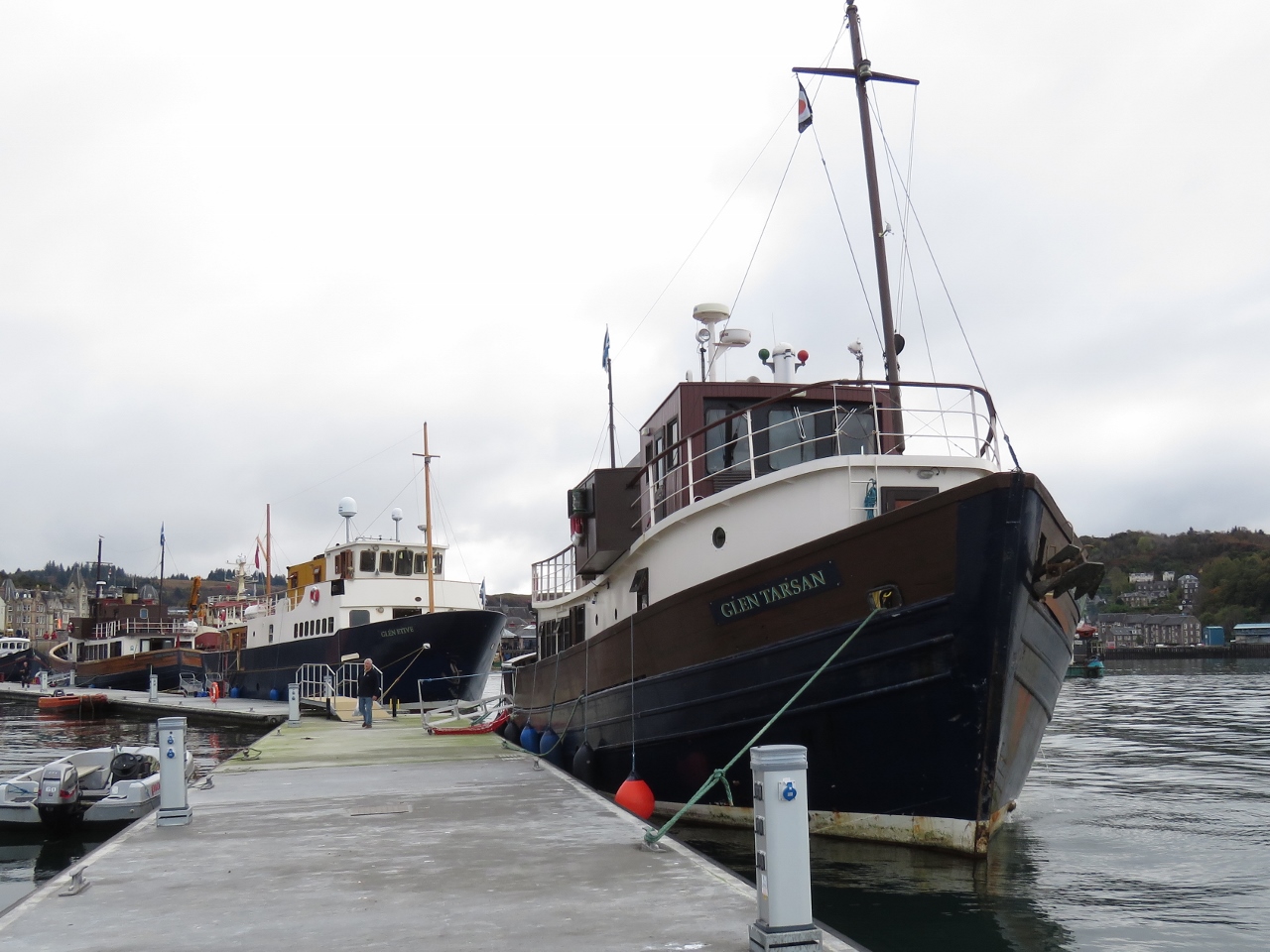 |
10/20/2017: Majestic Line
Position: 56°24.96'N, -5°28.61'W
All three vessels of the Majestic Line were moored at the North Pier Pontoons. Behind the Glen Tarsan is the newest boat in the fleet, the Glen Etive, that cruises to the Outer Hebrides and St. Kilda. The third boat is the Glen Massan, a converted traditional fishing vessel like the Glen Tarsan.
|
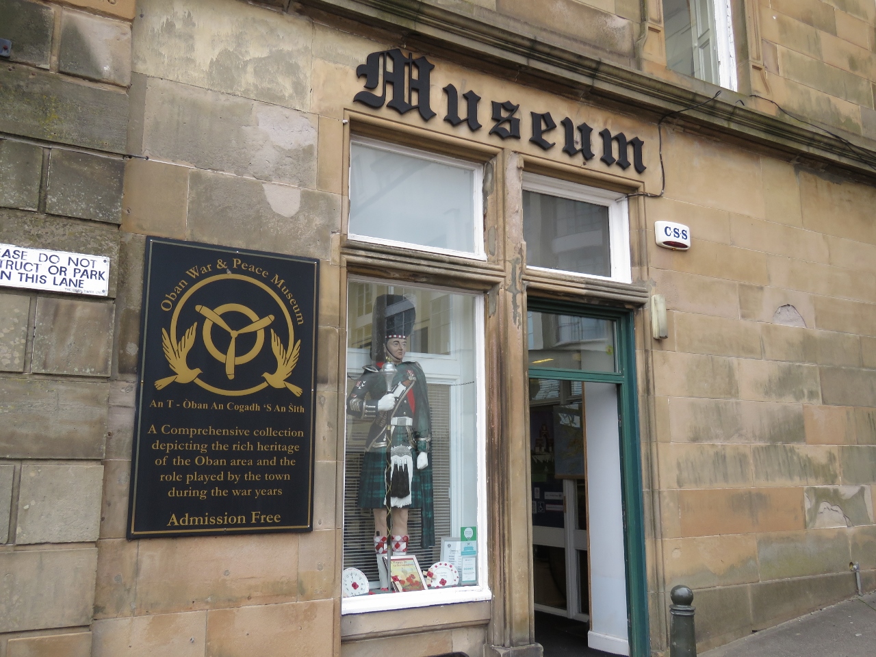 |
10/20/2017: Museum
Position: 56°24.94'N, -5°28.43'W
Our first stop was the small but information-packed Oban War and Peace Museum that provided a great introduction to Oban and it's history.
|
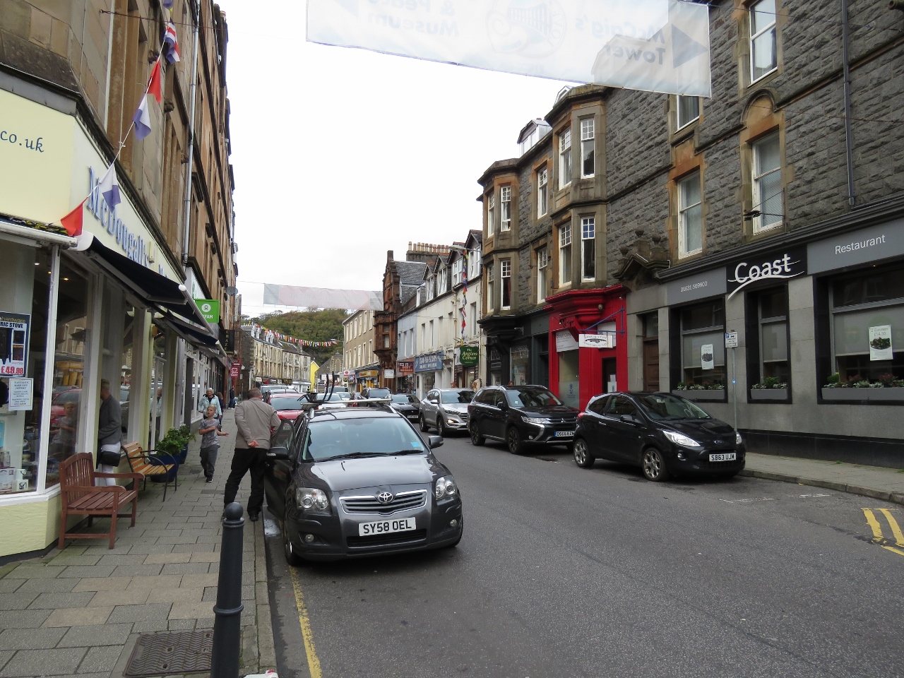 |
10/20/2017: George Street
Position: 56°24.95'N, -5°28.38'W
Looking north along George Street in downtown Oban.
|
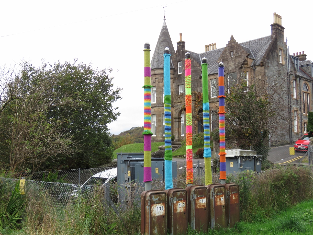 |
10/20/2017: Vent Covers
Position: 56°24.96'N, -5°28.26'W
We got a kick out of these colorful knitted covers on a series of heating oil tank vents.
|
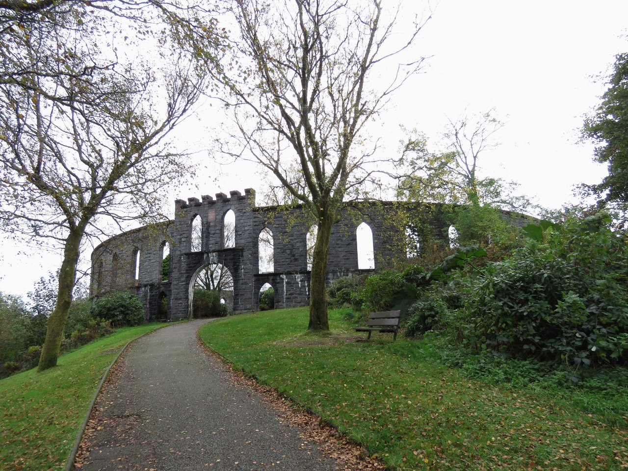 |
10/20/2017: McCaig's Tower
Position: 56°24.97'N, -5°28.13'W
McCaig's Tower was a philanthropic project of wealthy local banker John Stuart McCaig, who wanted to built a monument to his family and provide work for local stonemasons in the winter.
|
 |
10/20/2017: Tower Interior
Position: 56°24.95'N, -5°28.15'W
Construction of McCaig's Tower started in 1897 with an elaborate plan to include a museum and an art gallery. But only the outer walls were completed when construction ceased after McCaig died in 1902.
|
 |
10/20/2017: North Pier Pontoons
Position: 56°24.94'N, -5°28.16'W
View to the Glen Tarsan and Dirona on the North Pier Pontoons from McCaig's Tower.
|
 |
10/20/2017: CalMac Ferries
Position: 56°24.94'N, -5°28.18'W
The CalMac ferry Isle of Mull departing Oban with another CalMac ferry moored close by.
|
 |
10/20/2017: Channel Out
Position: 56°24.94'N, -5°28.18'W
The Isle of Mull heading out the channel through which we arrived into Oban earlier today.
|
 |
10/20/2017: Jacob's Ladder
Position: 56°24.89'N, -5°28.22'W
Taking Jacob's Ladder back down into Oban from McCaig's Tower.
|
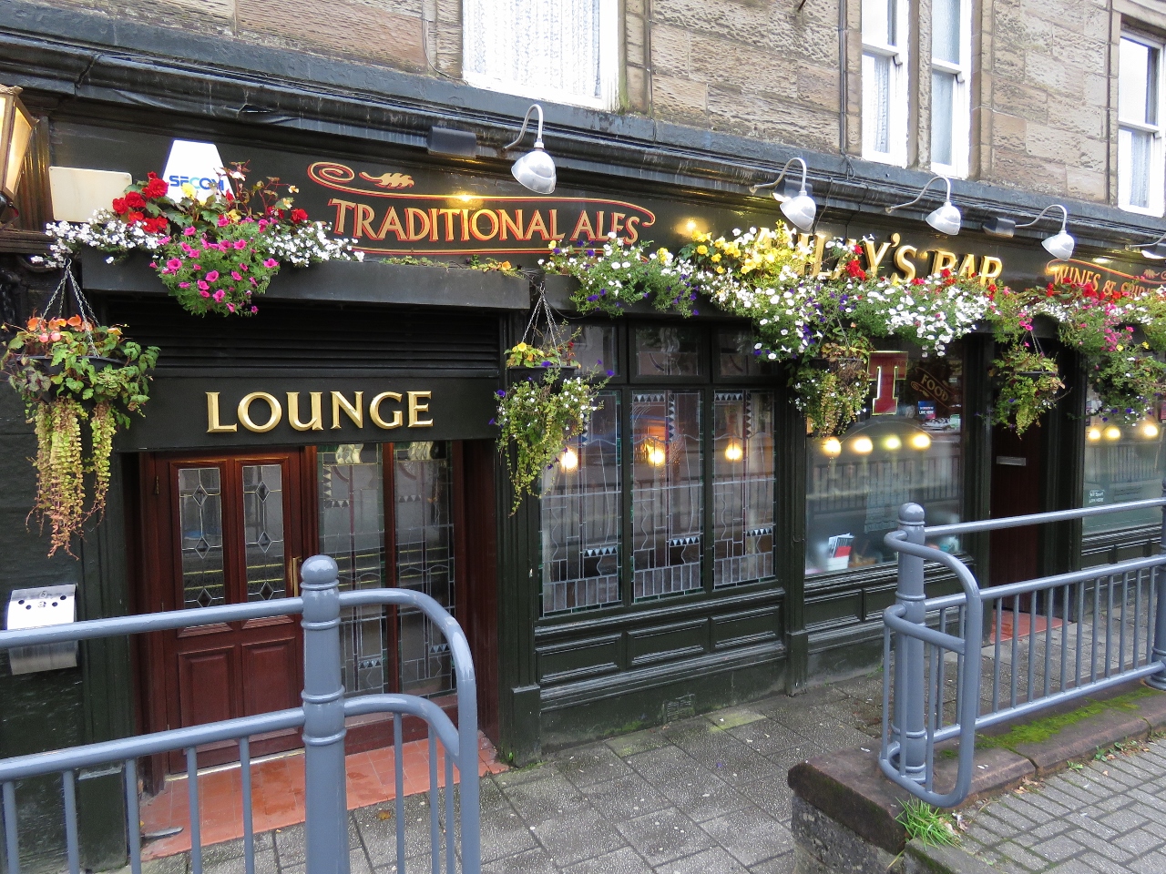 |
10/20/2017: Aulay's Bar
Position: 56°24.76'N, -5°28.32'W
We'd read that Aulay's Bar was a good local's pub and was it ever. We sat down for a pint shortly before the end of the business day and the place filled within minutes with everyone knowing everyone else (except us).
|
 |
10/20/2017: Waterfront Fishouse
Position: 56°24.75'N, -5°28.49'W
After a little more walking around, we stopped in at the Waterfront Fishouse shortly after they opened for dinner and snagged the best seat in the house for an excellent fresh seafood meal. Dirona is visible at the far right of the picture, left of the orange windsock.
|
 |
10/21/2017: Crossing Our Path
Position: 56°16.91'N, -5°41.18'W
We're just about to cross our path from two months ago between the Crinan Canal and Loch Spelve. We're also about to pass through the narrows into the Sound of Luing as we did before heading northbound, except this time it's 5:44am and pitch black outside. We left Oban at 4am this morning in order to pass through the narrows at slack and ride the flood current heading south.
|
 |
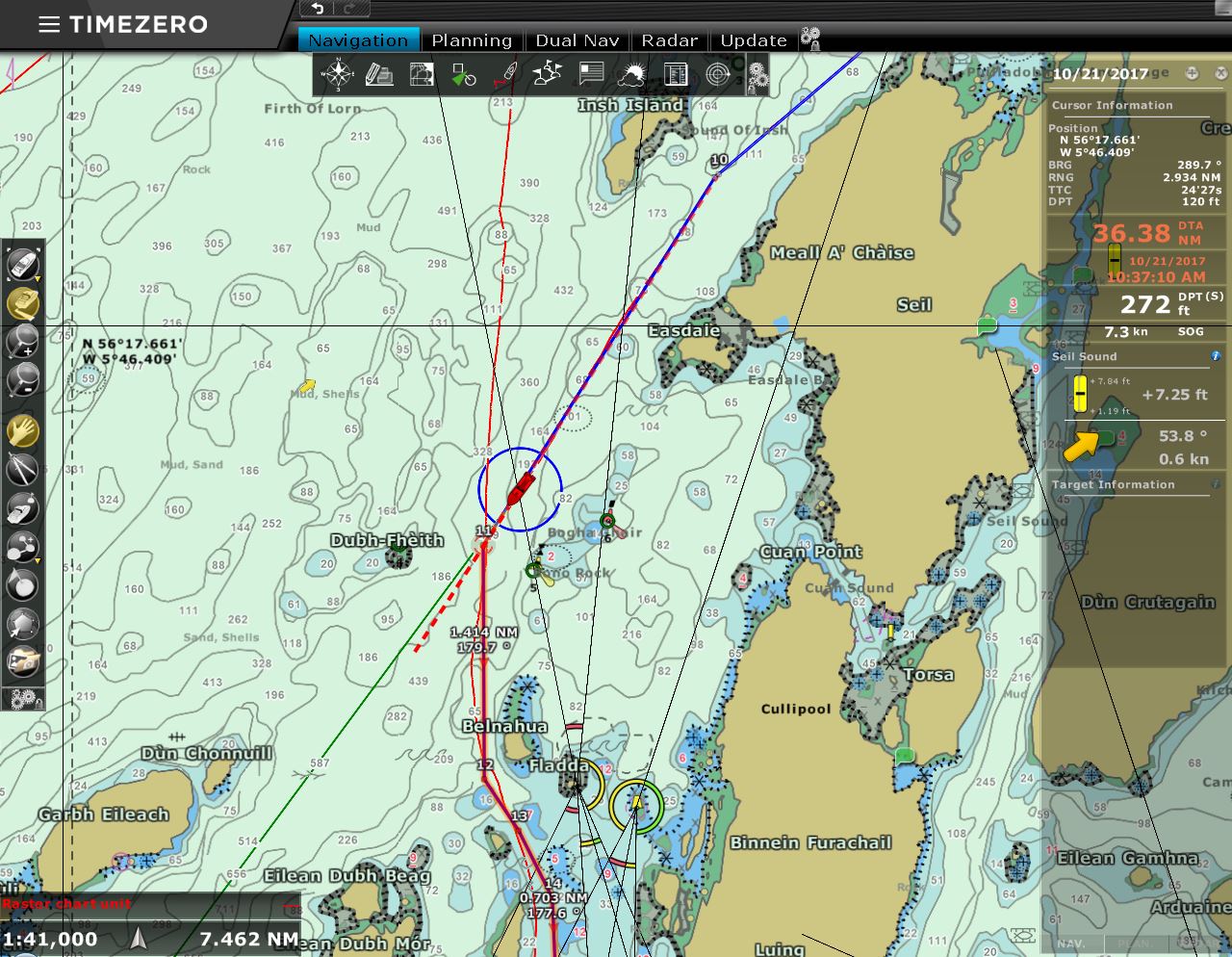
10/21/2017: Gulf of Corryvreckan
Position: 56°8.52'N, -5°40.27'W
We typically run with our autopilot in NAV mode, which essentially asks the autopilot to steer to a plotted route rather than just in a specific direction. The blue line is our plotted course and the left red line is our actual course. (The right red line is our path north from the Crinan Canal two months earlier.) Normally our actual course follows the plotted course almost exactly, but here we're tracking badly due to strong tidal streams in the Gulf of Corryvreckan to our west. We're on a spring tide, where 8.5-knot currents generate hazardous whirlpools and overfalls. When a west-bound current meets an opposing large Atlantic swell, conditions make the passage nearly impassable.
|
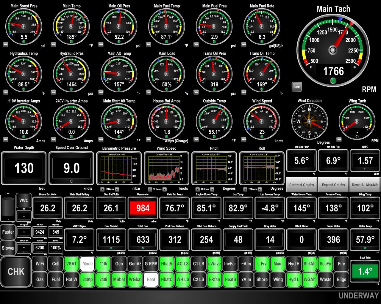 |
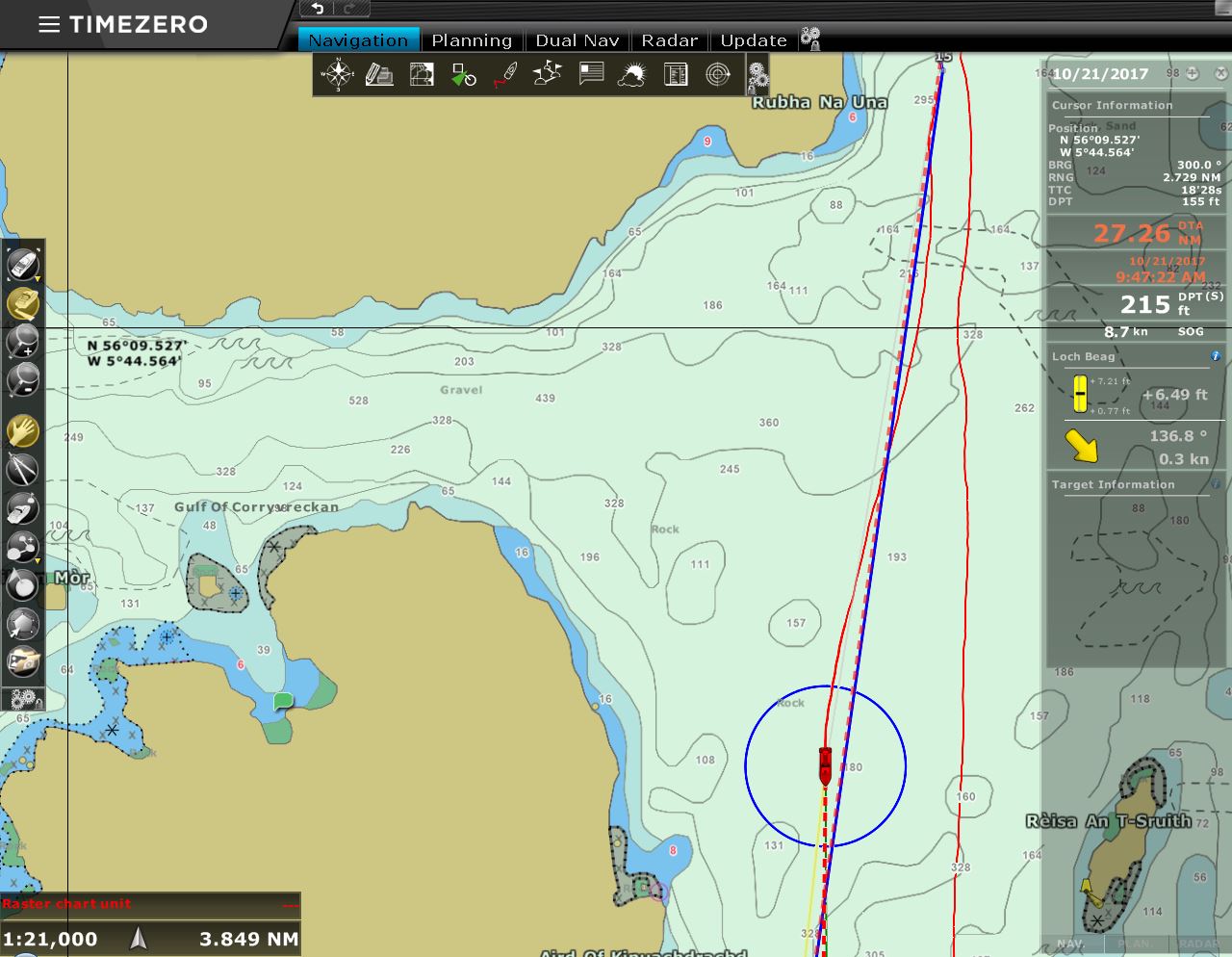
10/21/2017: Speed
Position: 56°4.52'N, -5°41.60'W
We've got some daylight and a little positive current now. We're making 9.0 knots, close to our top speed of 9.5 knots, when normally we'd be doing about 8 knots at 1766 RPM.
|
 |
10/21/2017: Pitching
Position: 55°53.75'N, -5°45.28'W
We'd planned to spend a couple of nights at the Isle of Gigha while a weather system passed through before we continue on to Belfast. As we expected, the winds were just starting to pick from the southeast as we passed the mouth of Loch Sween. (Our weather station failed shortly before this screen shot was taken, so neither the wind nor the barometer data are accurate). Where the Sound of Jura meets Loch Sween, the combined strength there of the outgoing tides against 20 knots of winds generated large and tight waves. The charts warn that these conditions can be dangerous for small craft, and we're pitching nearly twenty degrees as we pass through.
|
 |
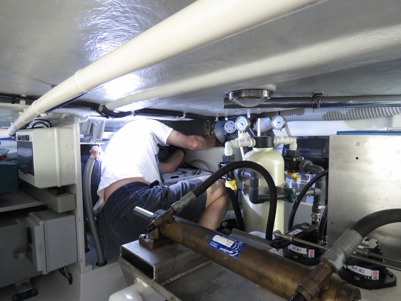
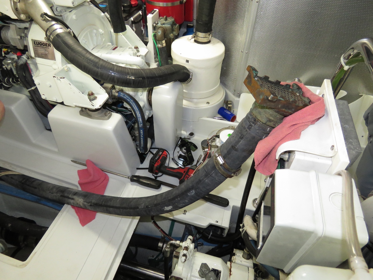
10/21/2017: Bilge Pump Hose
Position: 55°41.49'N, -5°43.48'W
Safely anchored at the Isle of Gigha, James set to work on installing the new bilge pump. Here James is pulling up the extremely stiff hose from the manual bilge pump that we'll use as the discharge hose for the new pump.
|
 |
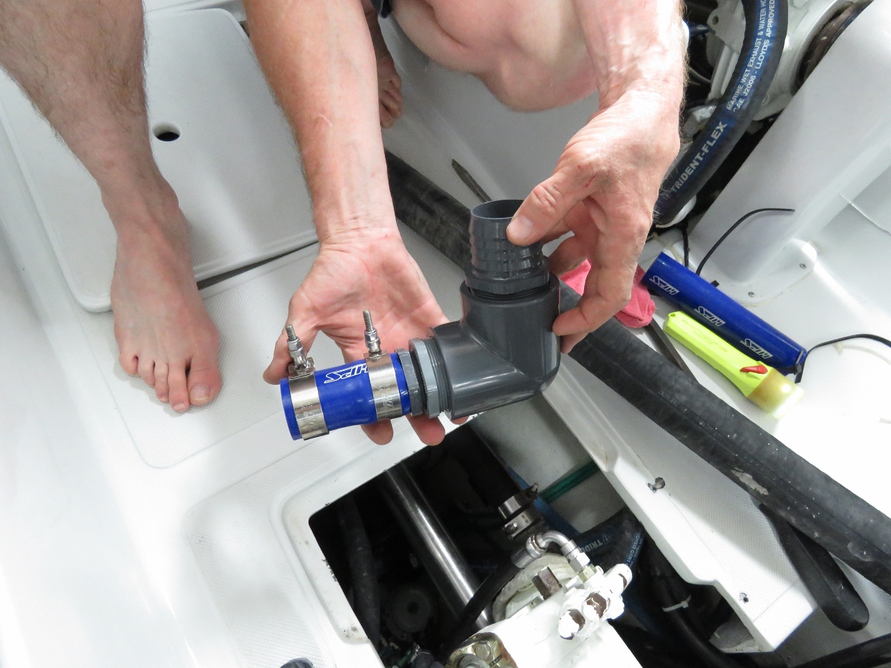
10/21/2017: Hose Out
Position: 55°41.49'N, -5°43.48'W
After much effort, we finally got the manual bilge pump hose out of it’s installed position in the bilge. What you can see here is the grate at the end of the hose where it picks up from the bottom of the bilge. Due to tight quarters in the main bilge, the design we have taken is have the new bilge pump share the 2-inch manual bilge pump hose. It's an unusual configuration, but we've tested both the manual bilge pump and the new Rule 3700 in this configuration and they both work well without noticeable loss of volume.
|
 |
10/21/2017: Bilge Pump in a Bottle
Position: 55°41.48'N, -5°43.48'W
The main bilge is actually too small to slide in the new Rule 3700 even without plumbing. With five through-hulls bringing in raw water and the main prop shaft in the way, the new pump can't just be lowered into the bilge. But, with the through-hull handles set to closed and the strainer removed from the bilge pump, it can be worked into place. But this means that the float switch, strainer, and plumbing need to all be added in at the bottom of the bilge. We need to build the assembly in place like a ship in a bottle.
|
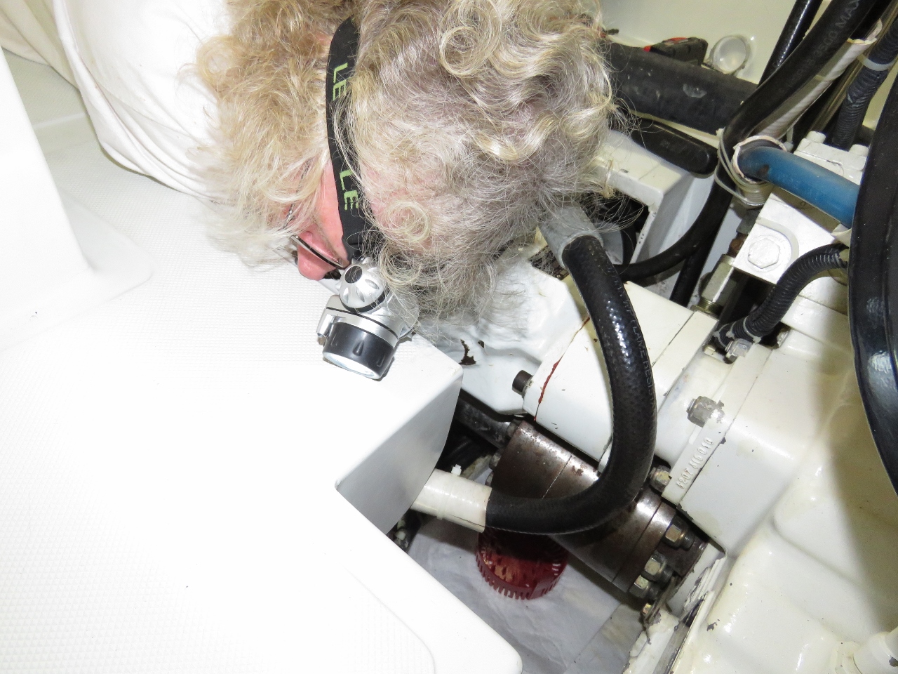 |
10/21/2017: Working by Feel
Position: 55°41.49'N, -5°43.48'W
It's hard to see what James is doing here, but he's lying face down with each arm down into the bilge holding the pump in one hand and installing parts with the other hand. It's good that he can get both arms down, but he has to work blind since there is no angle that allows him to see while at the same time having both arms in deeply enough to access the pump just below the five sea water through-hulls.
|
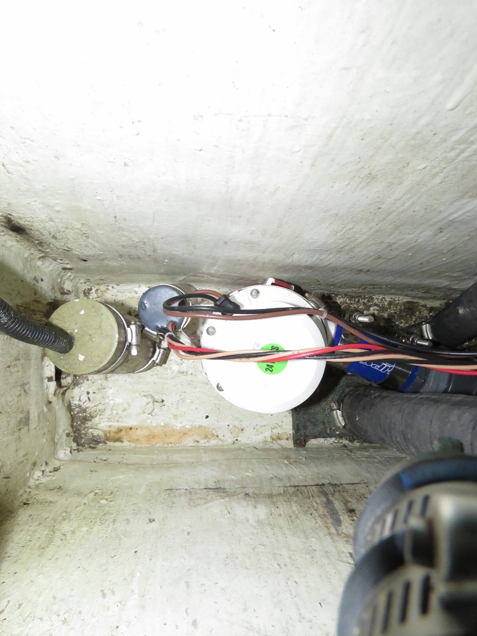 |
10/21/2017: Pump Installed
Position: 55°41.49'N, -5°43.48'W
Aside from the difficulty of getting the system plumbed in, this picture shows that everything actually fits quite nicely. Even better, in testing, the new pump really empties that bilge quickly.
|
 |
10/21/2017: Fishing Floats
Position: 55°41.49'N, -5°43.46'W
While we were working on the bilge pump, a fish boat dropped a series of floats near our anchorage. They're not very easy to see, and we'll be leaving in the dark for Belfast in a couple of days.
|
 |
10/21/2017: Isle of Gigha
Position: 55°41.49'N, -5°43.48'W
Neil White took this photo of Dirona at anchor at the Isle of Gigha as he passed by in the Glen Tarsan en route to Campbeltown around the Mull of Kintyre .
|
 |
10/22/2017: Wind
Position: 55°41.47'N, -5°43.39'W
We'd planned to stop at the Isle of Gigha for a couple of nights while a storm system passed through. Winds were from the southeast when we arrived, and the anchorage was surprisingly well-protected from that direction. But the bigger winds that we were expecting would be coming from the west, where we'd be completely sheltered behind the island. And that's how it turned out. Winds have been steadily in the high 20s and 30s from the west, with gusts over 40 kts. Gigha was an excellent anchorage for these conditions, and a good jumping off point to reach Belfast once conditions had settled.
|
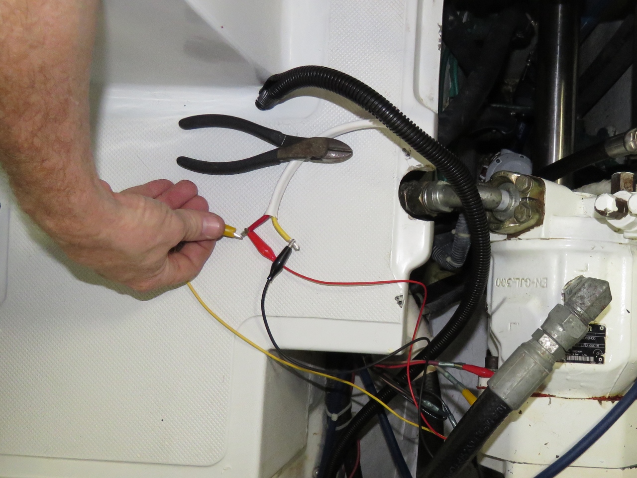 |
10/22/2017: Testing
Position: 55°41.46'N, -5°43.39'W
In addition to installing the new Rule 3700, we also wanted the ability to control the pump manually and to sense when it was on and pumping, whether automatically or manually. Here James is testing that circuit.
|
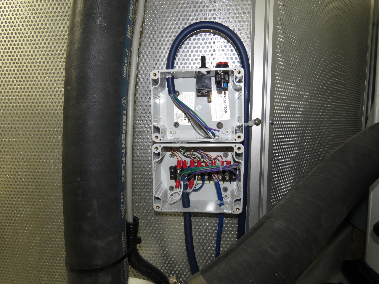 |
10/22/2017: Switch
Position: 55°41.47'N, -5°43.39'W
We installed a new switch box to 1) allow manual operation of the new Rule 3700 bilge pump, 2) show a red LED when the bilge pump is operating and 3) to house a relay that signals when the pump is on that we will read from one of our Raspberry Pis.
|
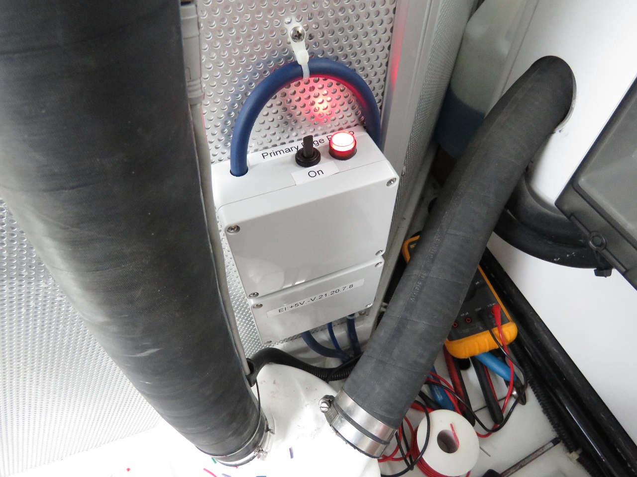 |
10/22/2017: Switch Complete
Position: 55°41.47'N, -5°43.39'W
We can now flip a switch to manually turn on the new pump, and if the pump is on, a red indicator light will display and a relay will close.
|
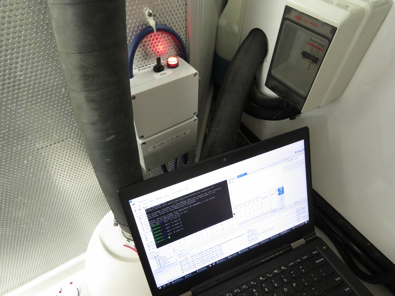 |
10/22/2017: Sensor
Position: 55°41.47'N, -5°43.39'W
With the hardware changes complete, the next step is to integrate the pump into our alerting system. Here James is programming one of our Raspberry Pis to sense when the pump is on and feed that information into our control systems.
|
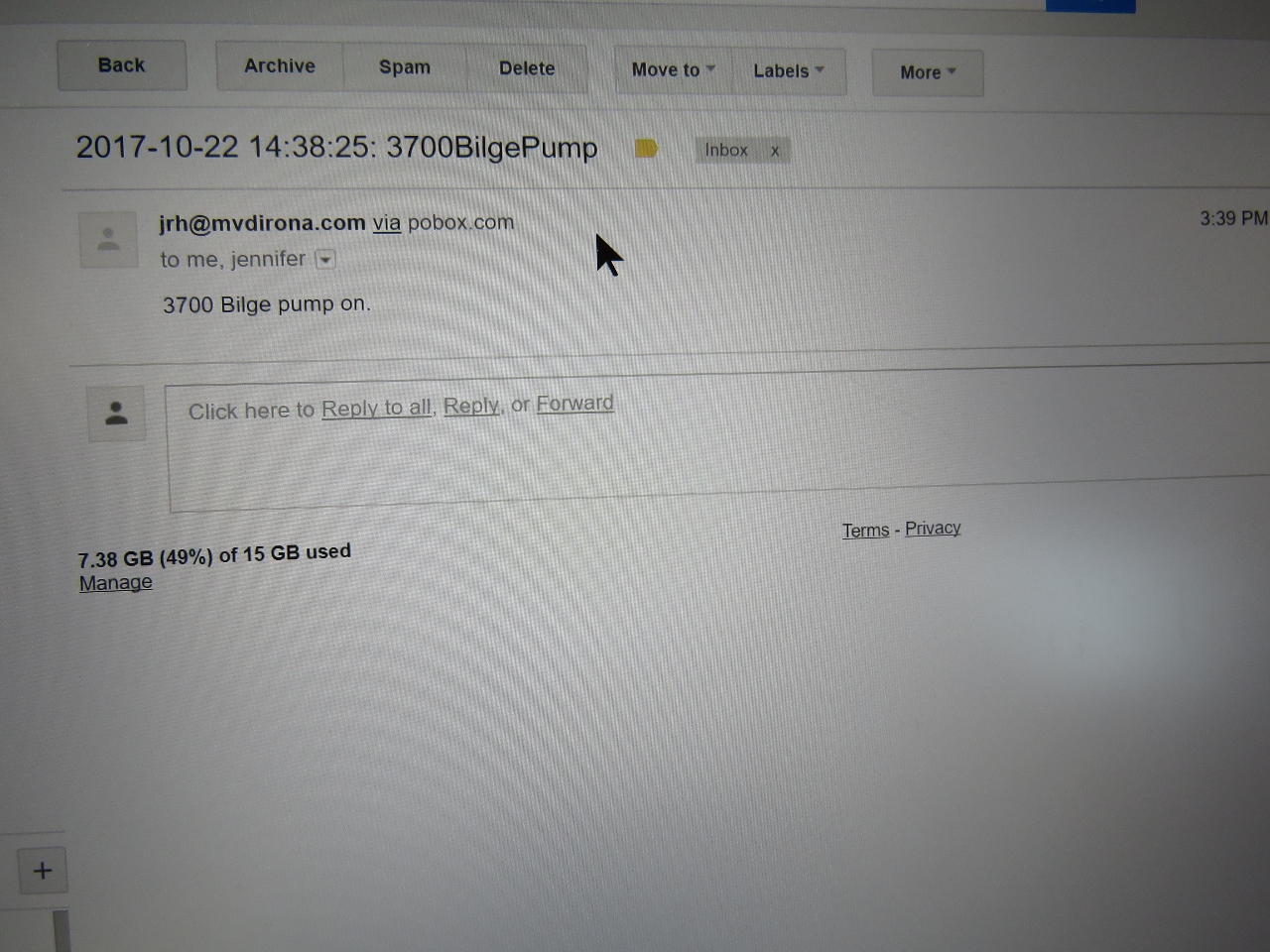 |
10/22/2017: Bilge Pump Alert
Position: 55°41.47'N, -5°43.39'W
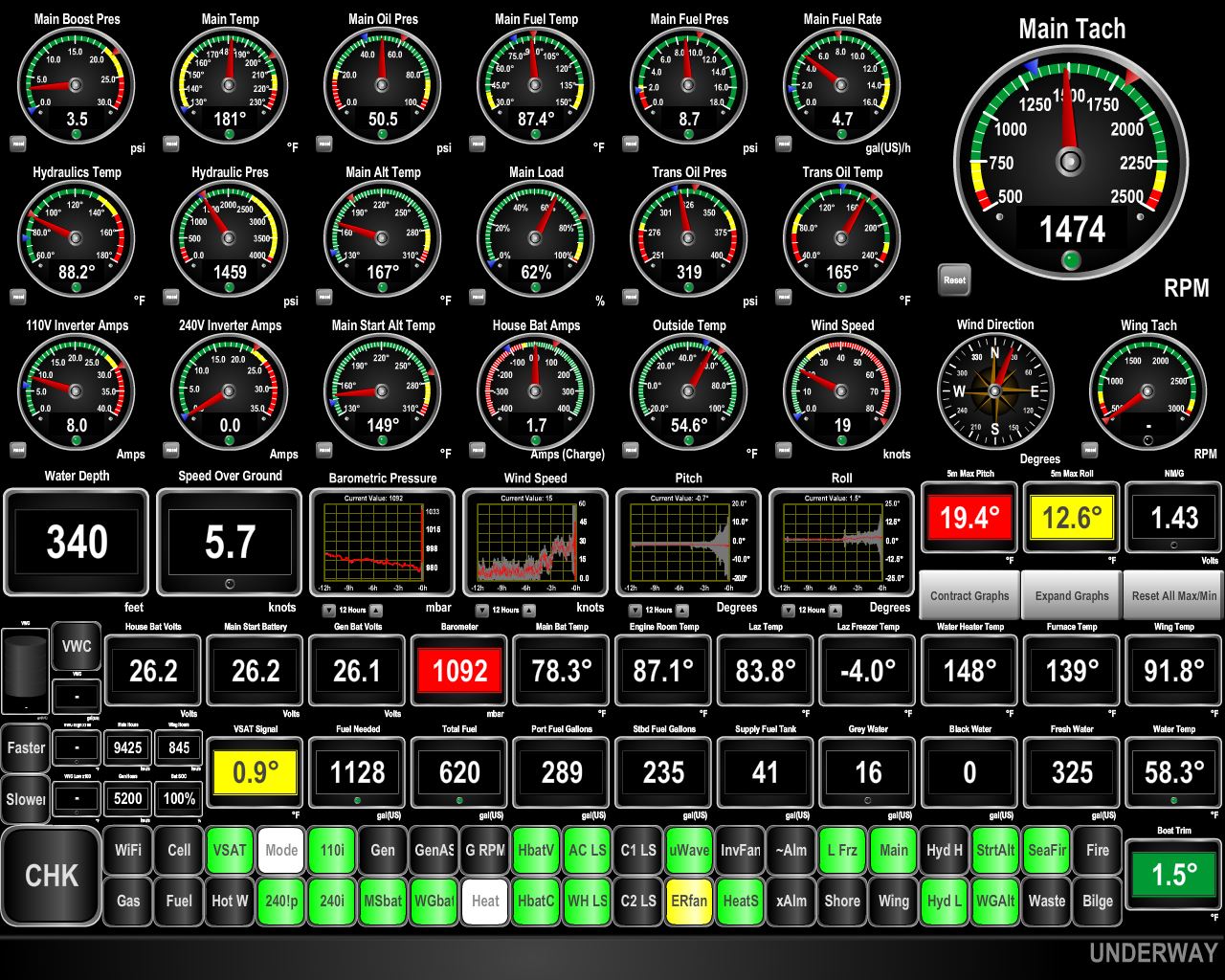
When the new primary bilge pump, the Rule 3700, operates, the control system will send email, generate an audible alarm, and display an indicator light on our Maretron N2kView display.
|
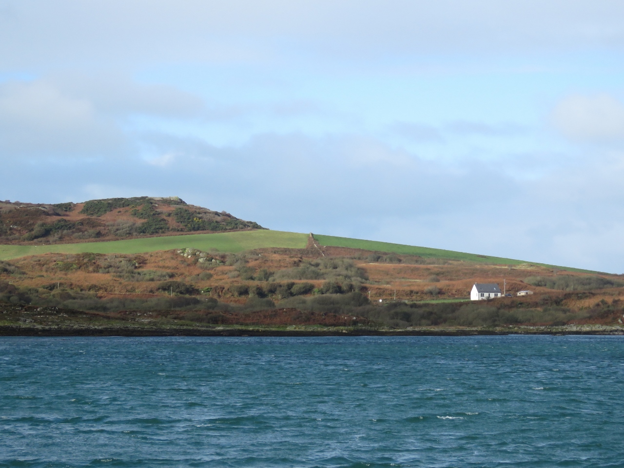 |
10/22/2017: Isle of Gigha
Position: 55°41.46'N, -5°43.39'W
The hills on the Isle of Gigha behind our anchorage are giving us good wind protection.
|