The West Highland Line was voted the world’s best train journey by Wanderlust Magazine. The trip runs through the scenic Scottish highlands and across the Glenfinnan Viaduct to Mallaig on the coast north of Oban. The Glenfinnan Viaduct is the dramatic span crossed by the Hogwarts Express in the Harry Potter movies. We had wonderfully clear weather for the trip and very much enjoyed the views and our stops for lunch in Mallaig and dinner in Fort William. We had also planned to visit the underground power station at the Falls of Cruachan, but our train the next day was disabled after hitting a boulder on the track, so we did a little more touring in Glasgow instead.
Trip highlights from July 18th and 19th, 2017 follow. Click any image for a larger view, or click the position to view the location on a map. And a live map of our current route and most recent log entries always is available at http://mvdirona.com/maps
 |
Tickets
Position: -4 43.57, 55 56.57
We’ve got a swack of tickets for a somewhat complex two-day train trip. From nearby Cartsdyke station we’ll take a tain to Glasgow Central Station, then transfer to Queen St. Station for Fort William. We’ll change seats in Fort William on to Mallaig, the most beautiful part of the trip, then return to spend the night in Fort William. The next day we’ll travel from Fort William to Crianlarich and transfer to the Oban line to visit the underground power station at the Falls of Cruachan. Finally, we’ll travel return to Cartsdyke station via Glasgow. We have separate tickets for almost every leg and picked them up while we were in Glasgow over the weekend.
|
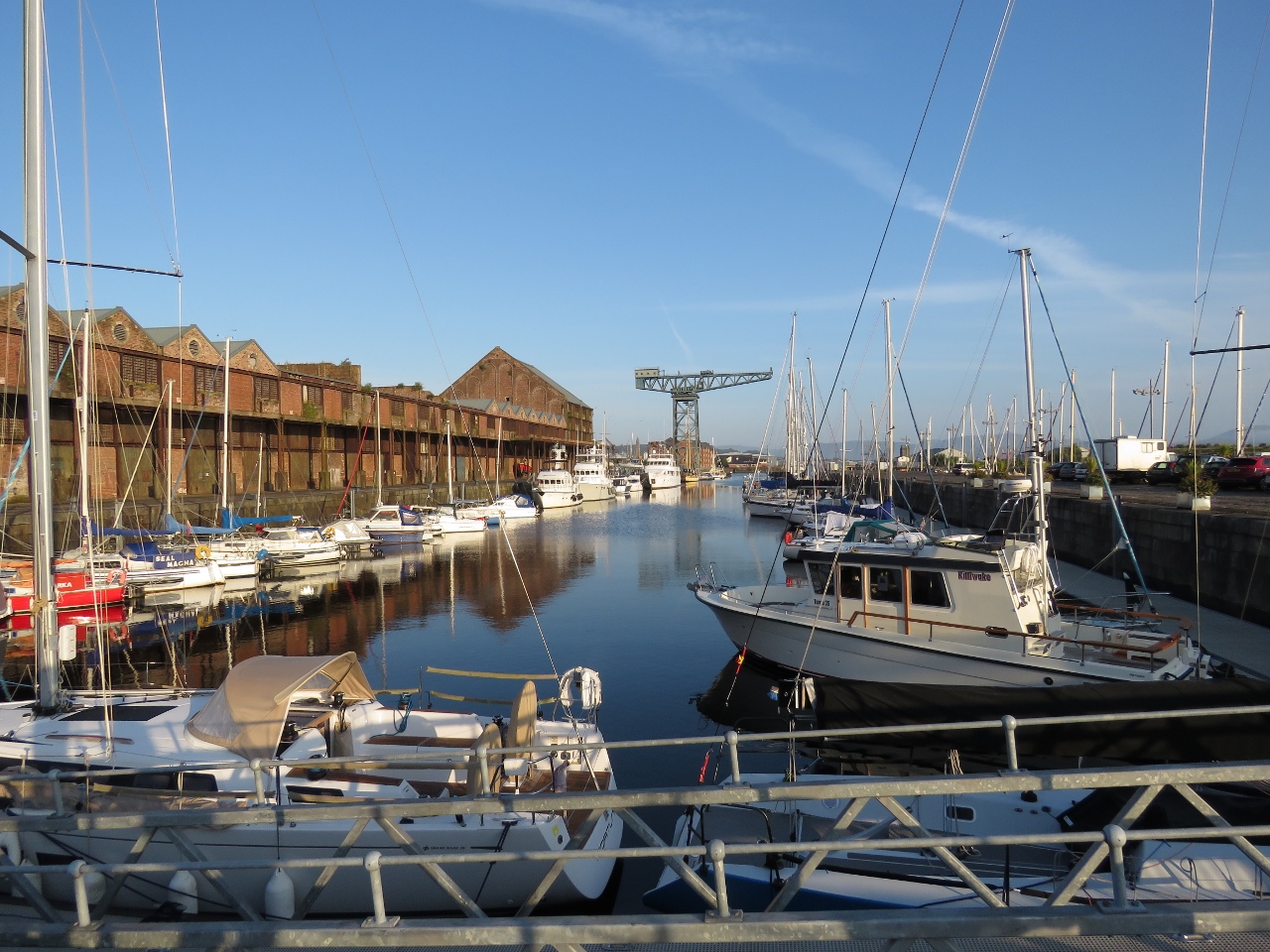 |
James Watt Dock
Position: -4 43.47, 55 56.55
We’re lucky to have a beautiful sunny day for our trip through the West Highlands.
|
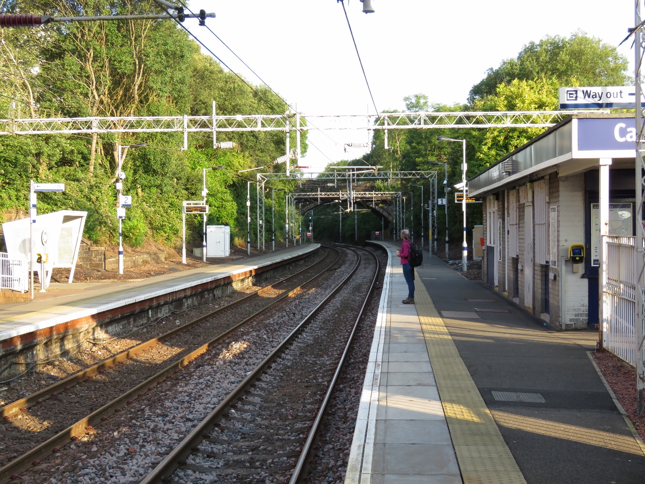 |
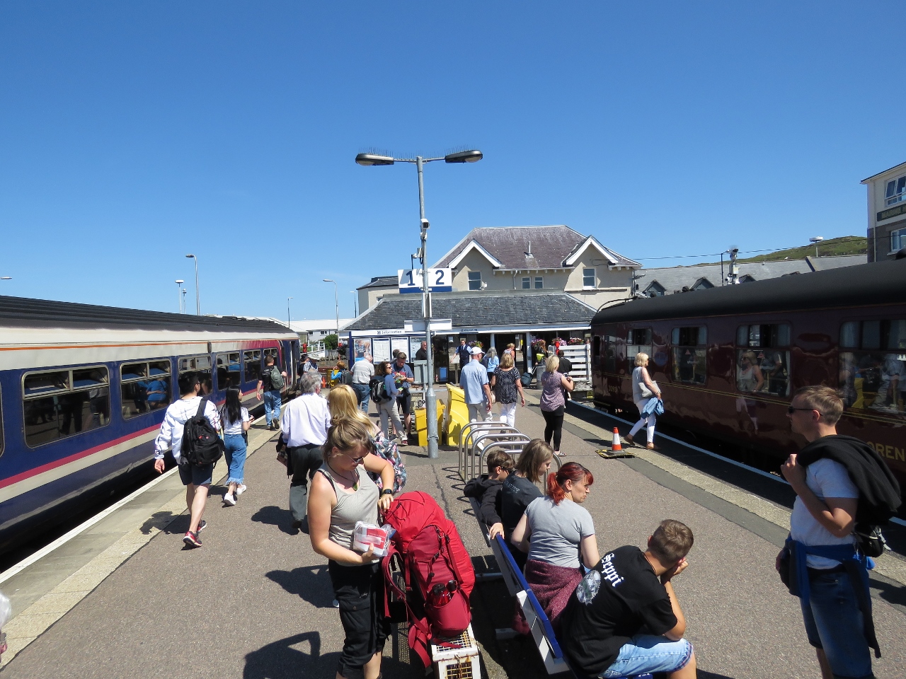
Cartsdyke Station
Position: -4 43.89, 55 56.52
At Cartsdyke station to take the train into Glasgow.
|
 |
Departures
Position: -4 15.07, 55 51.73
At Queen St. Station, the departure platform isn’t announced until about five minutes before the train leaves. Our train is third from the left, departing at 8:21am for Mallaig.
|
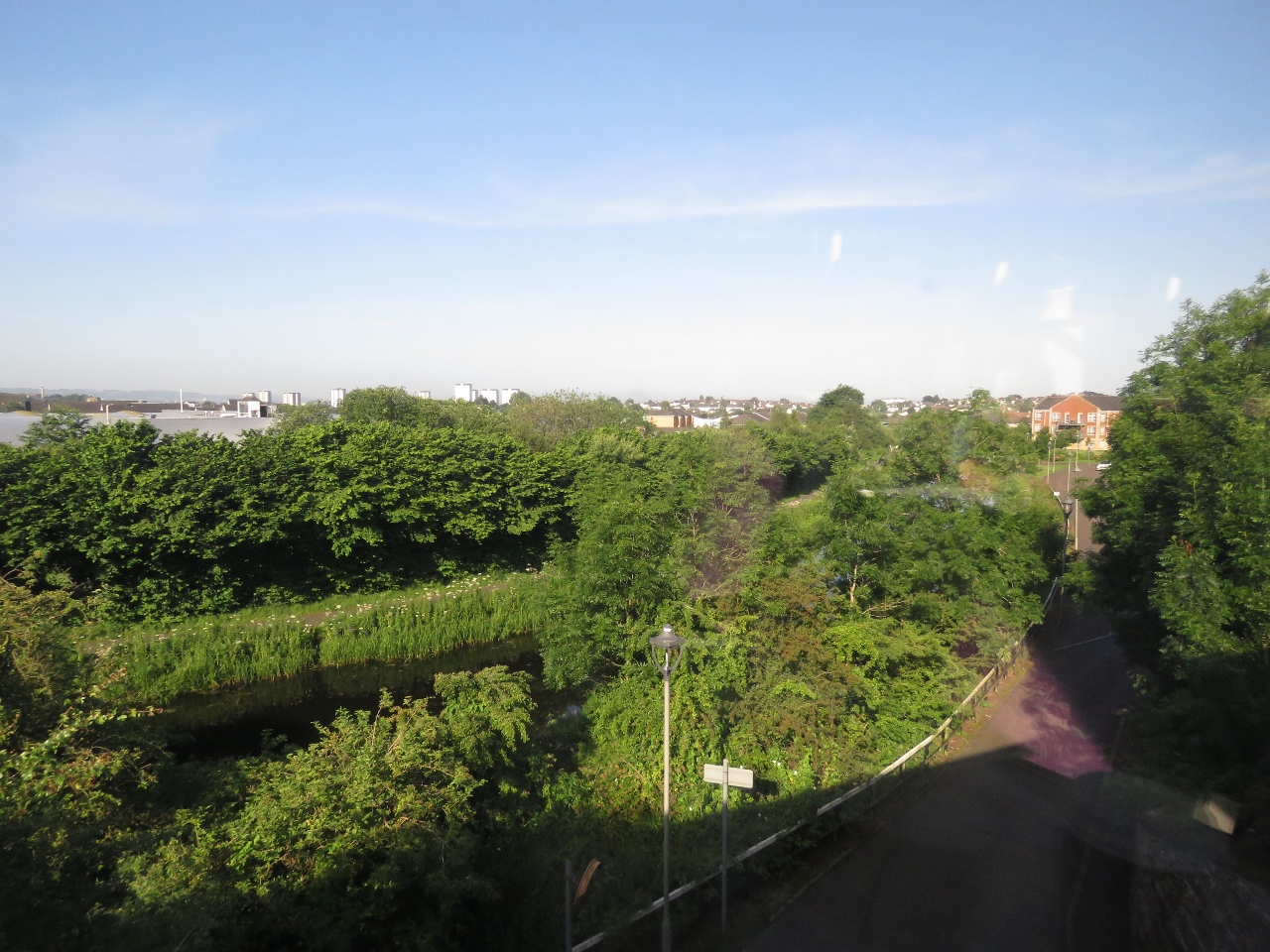 |
Forth and Clyde Canal
Position: -4 19.41, 55 53.94
The railway runs alongside the old Forth and Clyde Canal for a bit, visible at lower left. The 35-mile canal opened in 1790 between the River Clyde at Bowling and the River Carron at Grangemouth. The canal initially was successful, but fell into disuse as oceangoing vessels were built larger and could no longer pass through. The advent of rail also reduced traffic. The canal was closed in the 1960s, but reopened in the early 21st century. A narrowboat today can be run from Bowling, on the River Clyde about ten miles east of Greenock, east through the Falkirk Wheel and into the Union Canal and another 31 miles to Edinburgh.
|
 |
River Clyde
Position: -4 33.07, 55 56.29
Looking south to a large navigation marker along the River Clyde. The river is navigable in Dirona until the Science Center just west of the Glasgow central core where several low fixed bridges block further progress. Plans are in place to build a new marina complex there.
|
 |
Crossing
Position: -4 34.44, 55 56.80
Crossing the River Levern.
|
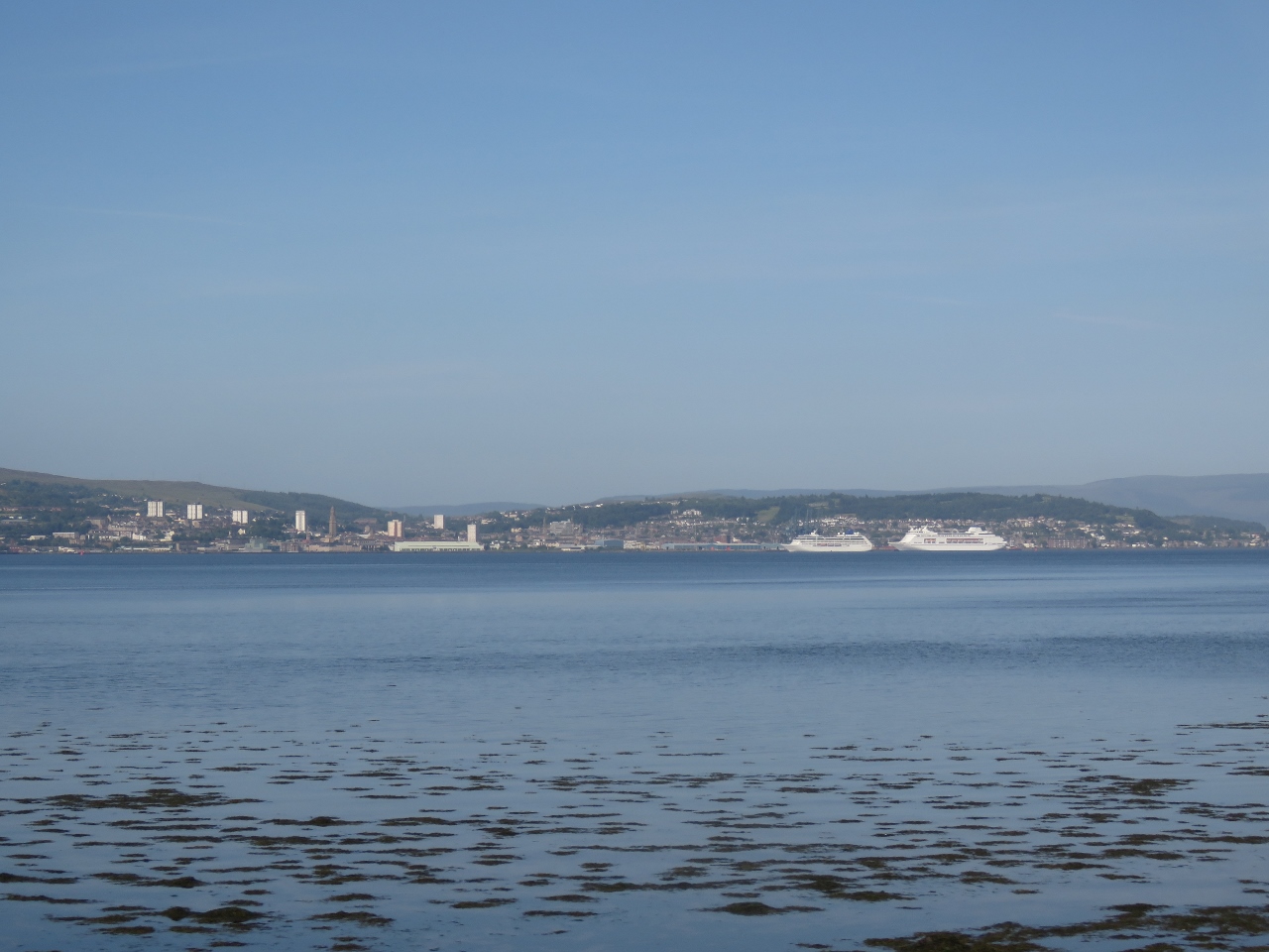 |
Greenock
Position: -4 41.07, 55 58.53
Cruise ships in Greenock to our southwest. James Watt Dock Marina where we are moored is just out of the picture on the left.
|
 |
Loch Goil
Position: -4 45.71, 56 11.27
Drymsynie House Hotel on Loch Goil.
|
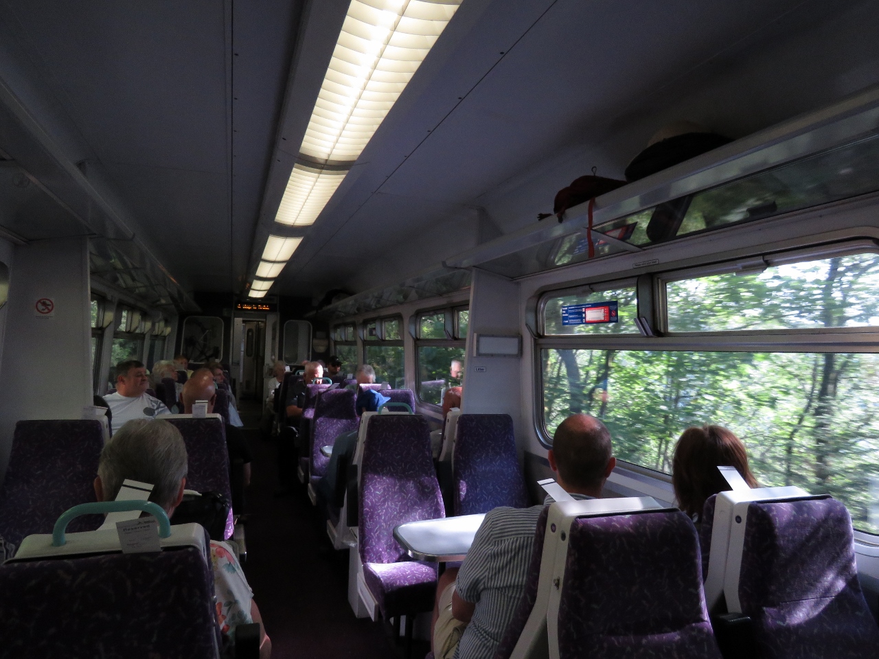 |
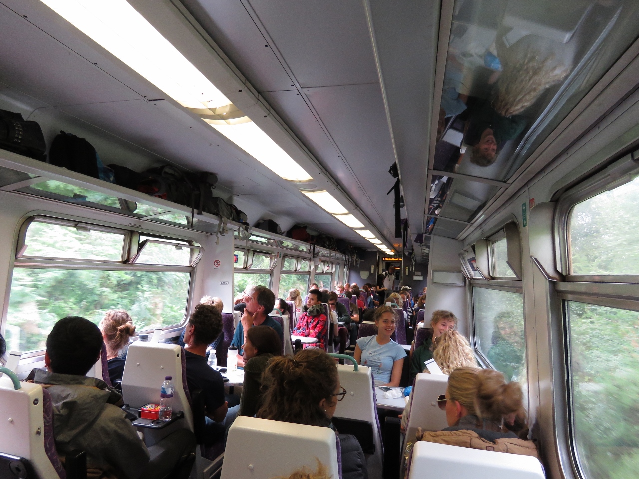
Coach
Position: -4 41.91, 56 13.32
Our coach on the West Highland Line.
|
 |
Semaphore
Position: -4 43.40, 56 18.37
Most of the signalling on the West Highland Line is radio-controlled but the line around Fort William is still semaphore-controlled. The signs say “Obtain Token and Permission To Proceed”.
|
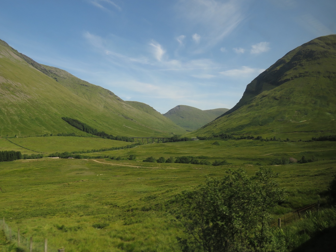 |
Horseshoe Curve
Position: -4 42.15, 56 29.13
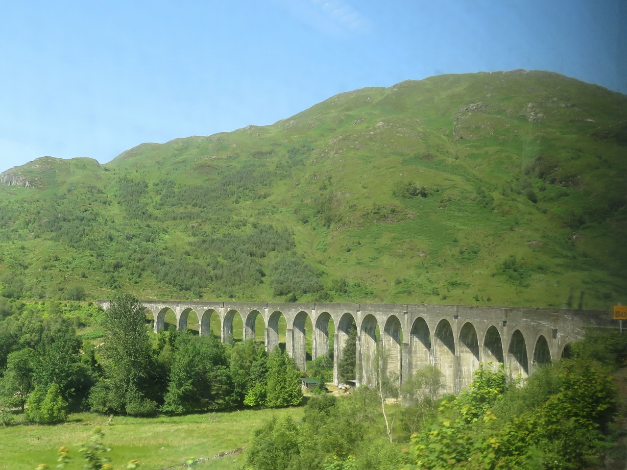
When the railway was built in the late 1800s, the builders couldn’t afford to run a viaduct across the mouth of a broad valley. They instead created the famous ‘horseshoe curve’ where the line follows the foothills of the several mountains around the valley. We’ll turn right and eastward, then curve left and northward to cross the viaduct visible in the center of the photo (click image for a larger view) and continue the curve westward along the left side of the picture and finally turn right again to continue north.
|
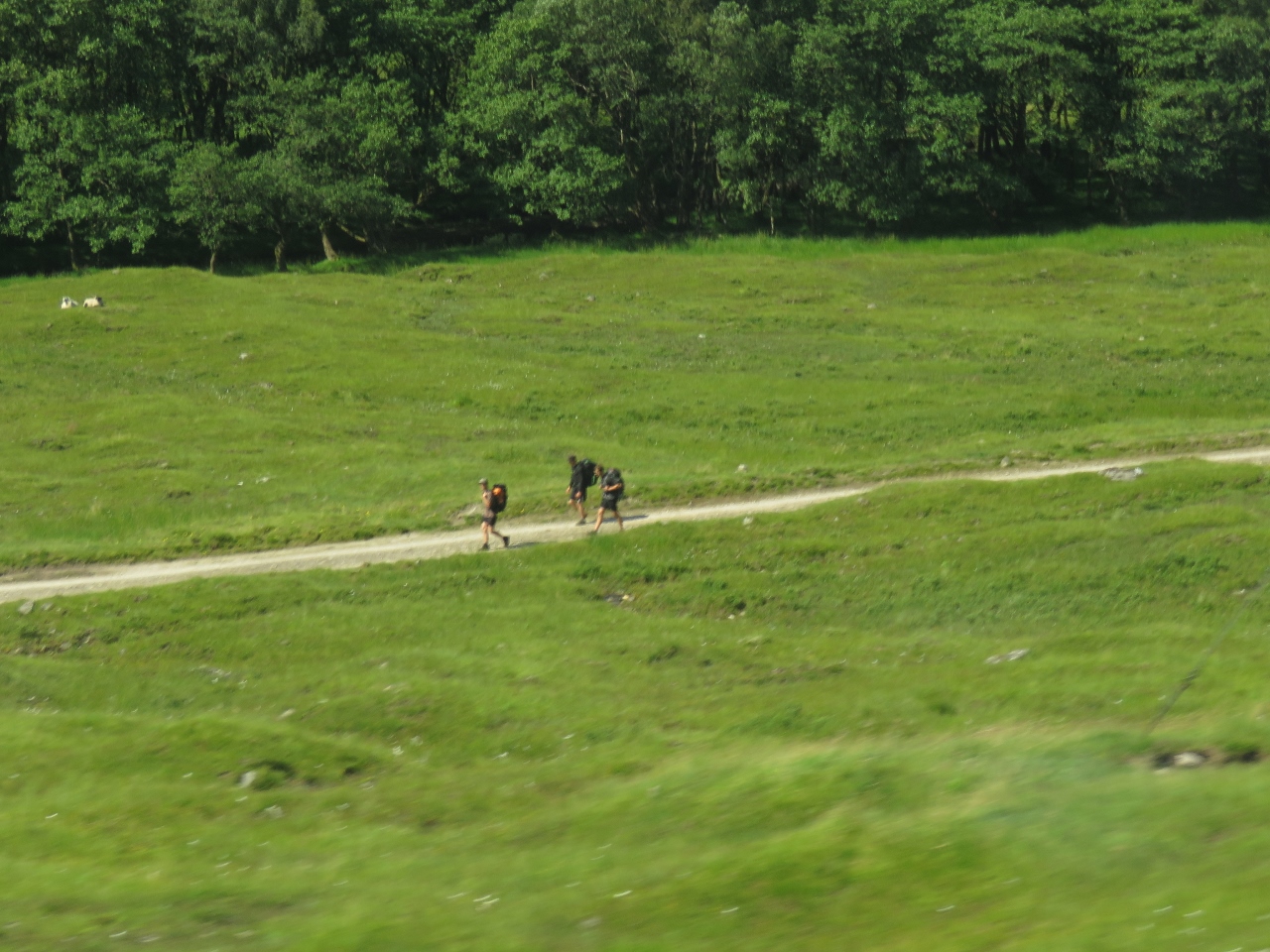 |
West Highland Way
Position: -4 44.97, 56 29.96
The West Highland Way is a popular hiking trail running 96 miles from Mingavie north of Glasgow to Fort William. We saw lots and lots of hikers en route.
|
 |
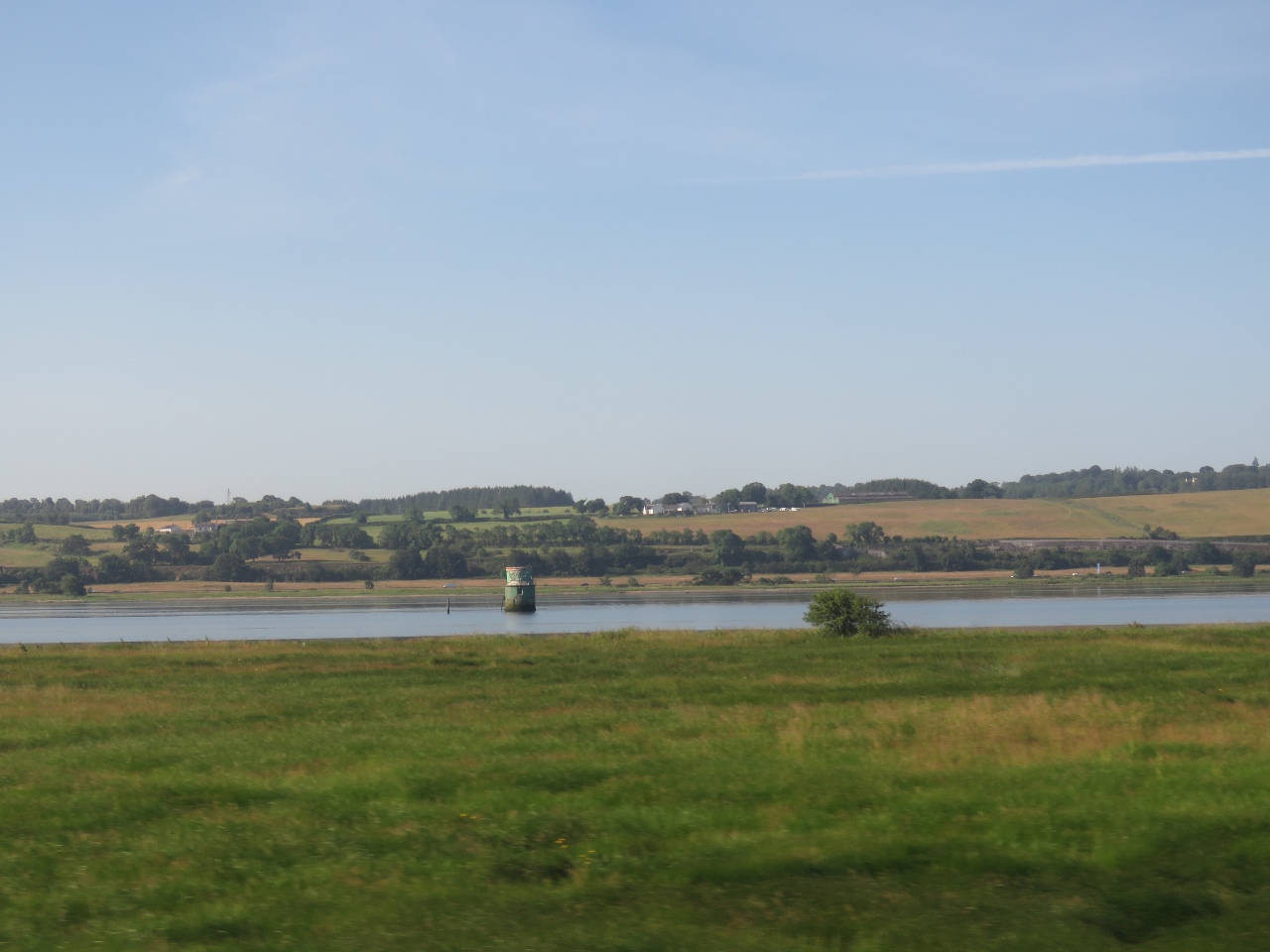
Moor of Ranoch
Position: -4 34.00, 56 39.11
Passing through an area of bogs, streams and lakes called the Moor of Ranoch.
|
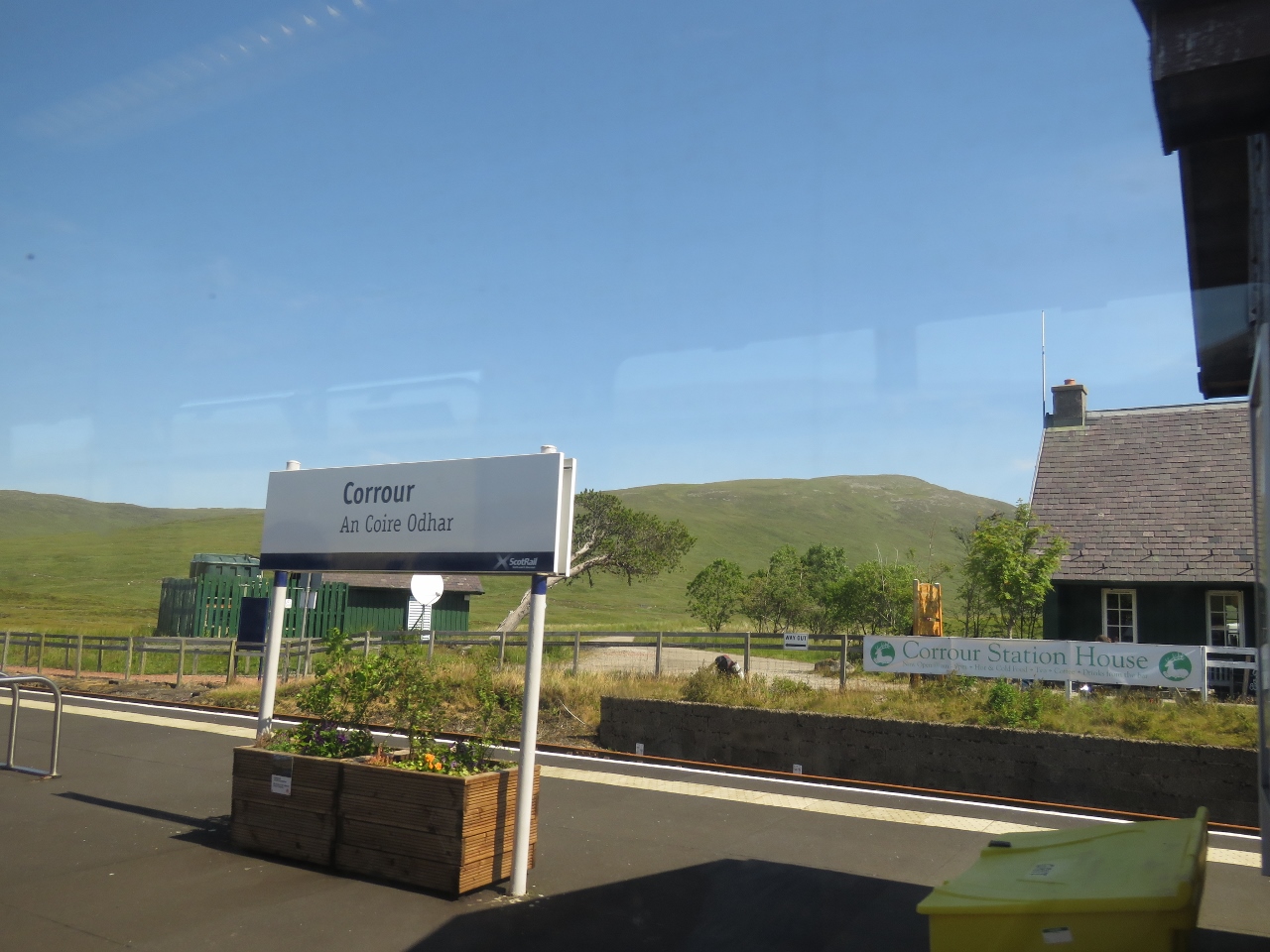 |
Corrour
Position: -4 41.84, 56 45.85
Corrour is one of the most remote train stations in Britain—the nearest road is a ten-mile walk along a hill track. The station was featured in the movie Trainspotting. You can see them walk past the semaphore signs in the going for a walk scene.
|
 |
Loch Treig
Position: -4 43.53, 56 47.61
The train runs along beautiful Loch Treig for several miles.
|
 |
Fort William Station
Position: -5 6.35, 56 49.24
At Fort William, the largest town on the West Highland Line.
|
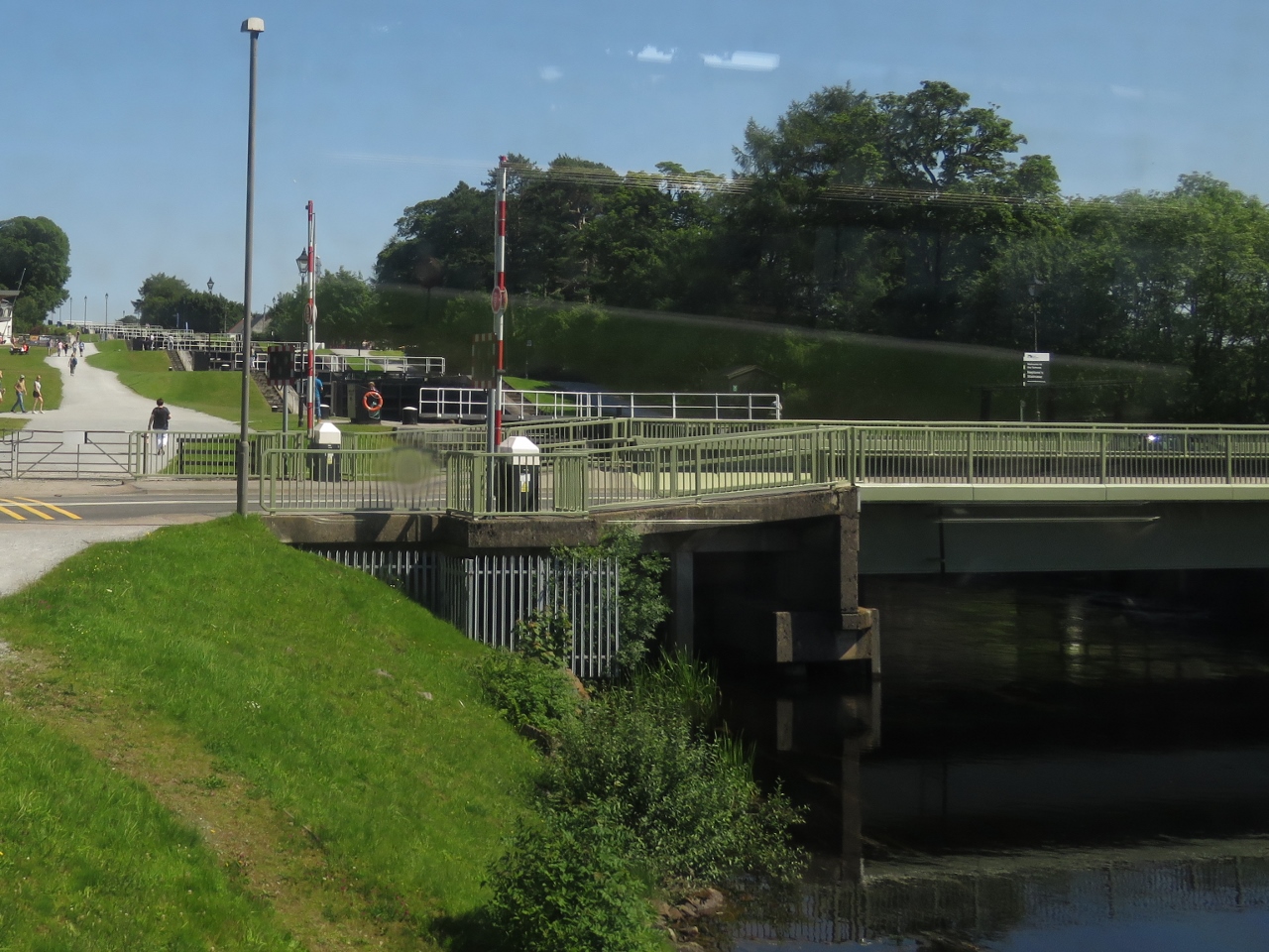 |
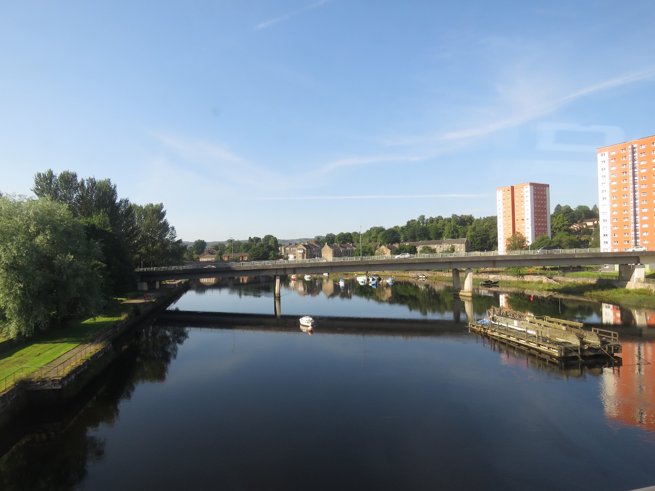
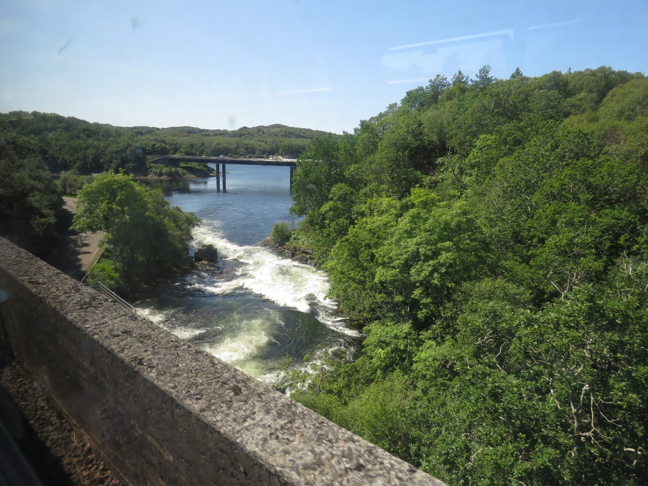
Neptune’s Staircase
Position: -4 43.53, 56 53.31
Just outside Fort William we cross over the Caledonian Canal at Neptune’s Staircase, the longest staircase lock in Britain. A series of eight locks carry boats up or down 64 feet. We’ll be passing through southbound likely some time in October after cruising the west and north coast of Scotland and the Orkney Islands.
|
 |
Ben Nevis
Position: -5 13.93, 56 51.30
Looking southeast across saltwater Loch Eil to Ben Nevis, the highest mountain in the British Isles at 4,411 ft (1,345 m) above sea level.
|
|
|
Glenfinnan Viaduct
Position: -5 25.81, 56 52.57
A highlight of the West Highland Line is passing over Glenfinnan Viaduct made famous in the Harry Potter films. Built in 1901, it was one of the first viaducts built of concrete.
|
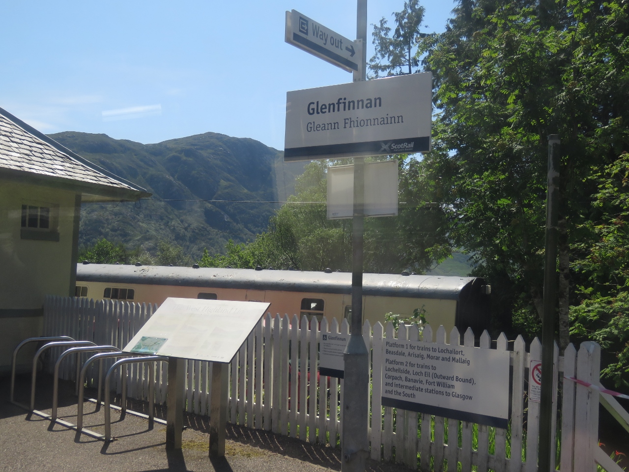 |
Glenfinnan Station
Position: -5 26.97, 56 52.34
Glenfinnan Station has a museum and you can even spend the night in a converted rail car.
|
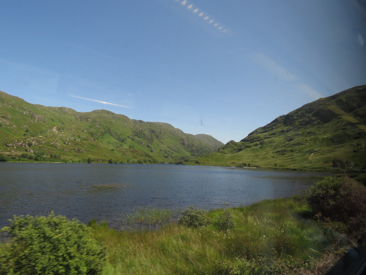 |
Loch Eilt
Position: -5 34.95, 56 52.59
Loch Eilt is one of the most picturesque lochs along the route, with many tree-covered islets.
|
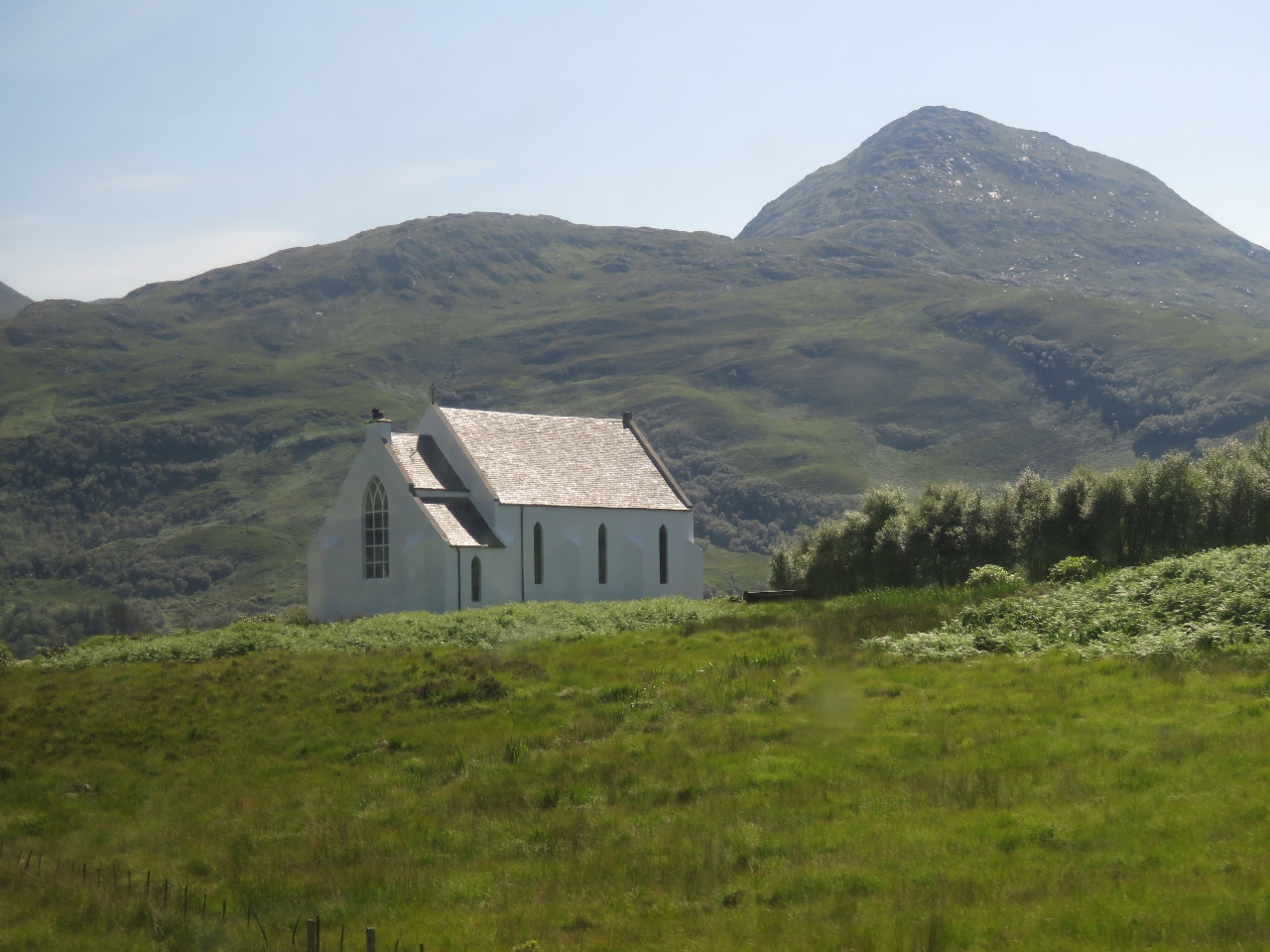 |
Church of Our Lady of the Braes
Position: -5 42.27, 56 52.94
The Church of Our Lady of the Braes was featured in the film Local Hero.
|
 |
Rapids
Position: -5 48.94, 56 57.80
Crossing a small rapid over the River Morar.
|
 |
Mallaig
Position: -5 49.80, 57 0.34
The end of the line in Mallaig.
|
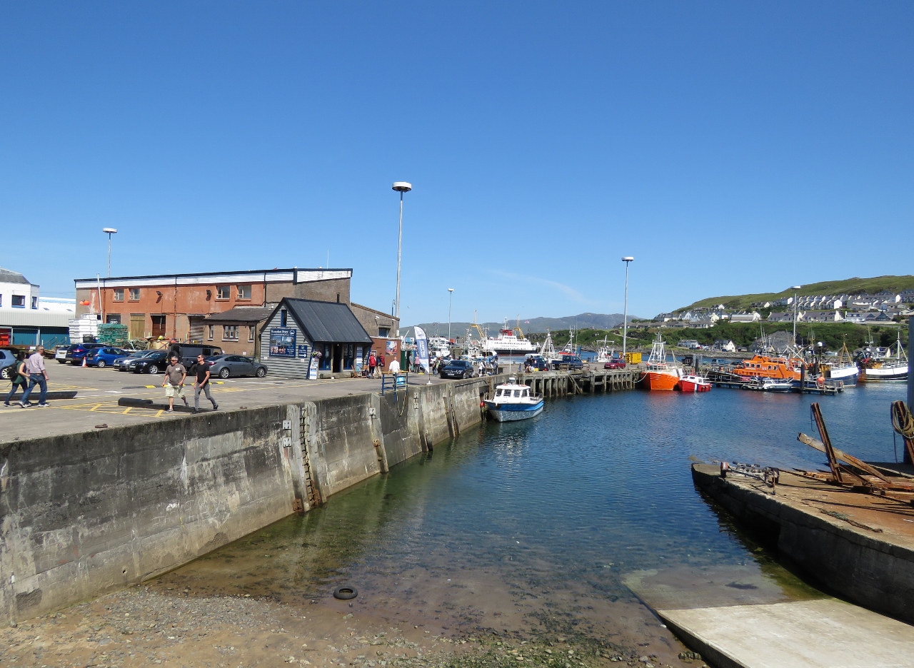 |
Mallaig Harbor
Position: -5 49.72, 57 0.32
It was nearly 2pm by the time we arrived in Mallaig, but we wanted stretched our legs a bit and check out the town before stopping for lunch. Mallaig has a busy commercial harbour with ferries and tour boats constantly arriving and departing.
|
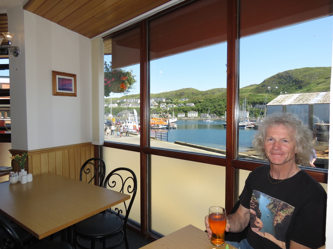 |
Lunch
Position: -5 49.71, 57 0.33
An excellent lunch overlooking the harbor at The Fishmarket.
|
 |
RNLI
Position: -5 49.62, 57 0.36
The Mallaig RNLI lifeboat.
|
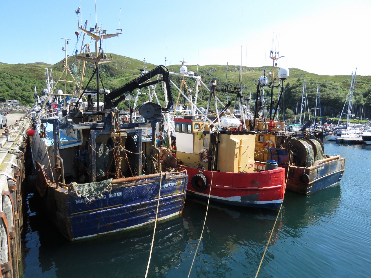 |
Fishboats
Position: -5 49.59, 57 0.37
Fishboats rafted in the harbor.
|
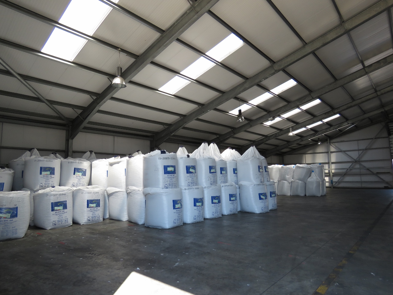 |
Fish Feed
Position: -5 49.73, 57 0.43
This warehouse had bags and bags of fish feed for the local fish farms.
|
 |
View
Position: -5 49.71, 57 0.11
After lunch we walked up to the top of a hill where a radio tower was mounted for sweeping views of the area. You can see one large ferry loading on the right and another arriving farther out.
|
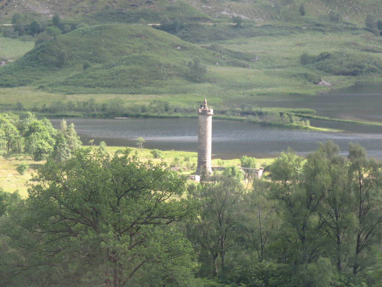 |
Glenfinnan Monument
Position: -5 26.28, 56 52.45
On the return run to Fort William, we got a good view to the Glenfinnan Monument south of the tracks. The monument was erected in 1815 to commemorate Bonnie Prince Charlie raising his standard here in August 1745.
|
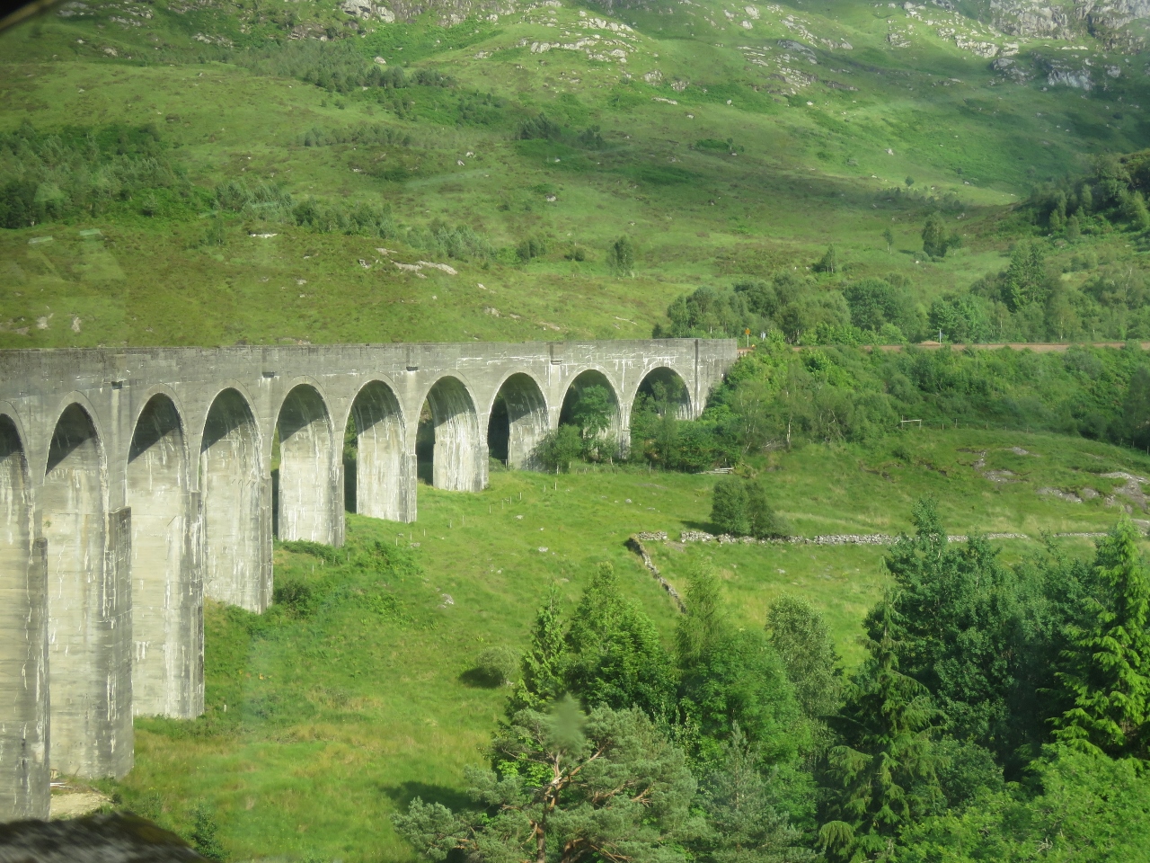 |
Viaduct From West
Position: -5 26.10, 56 52.52
The view to the Glenfinnan Viaduct from the west.
|
 |
Loch Eil
Position: -5 7.59, 56 50.58
Beacon marking the entrance to the Caledonian Canal on saltwater Loch Eil.
|
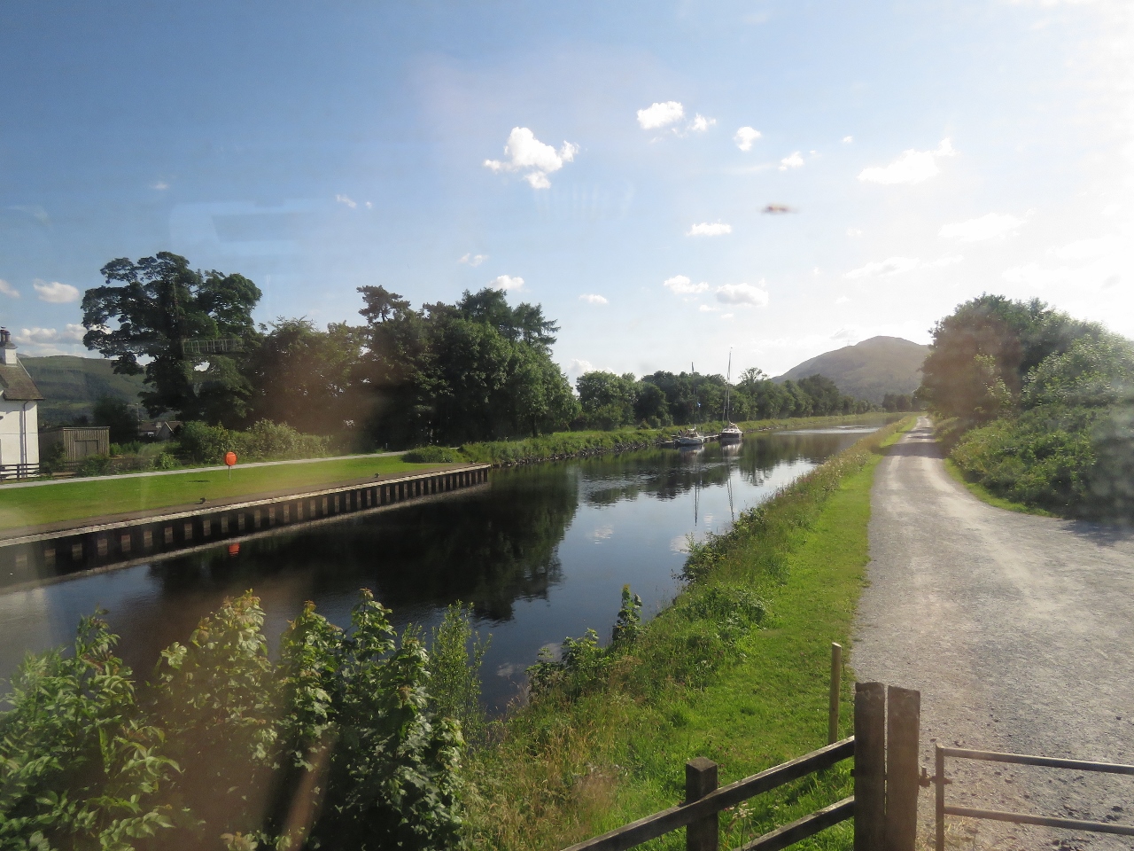 |
Caledonian Canal
Position: -5 5.81, 56 50.65
Boats moored for the night at the bottom of Neptune’s Staircase on the Caledonian Canal.
|
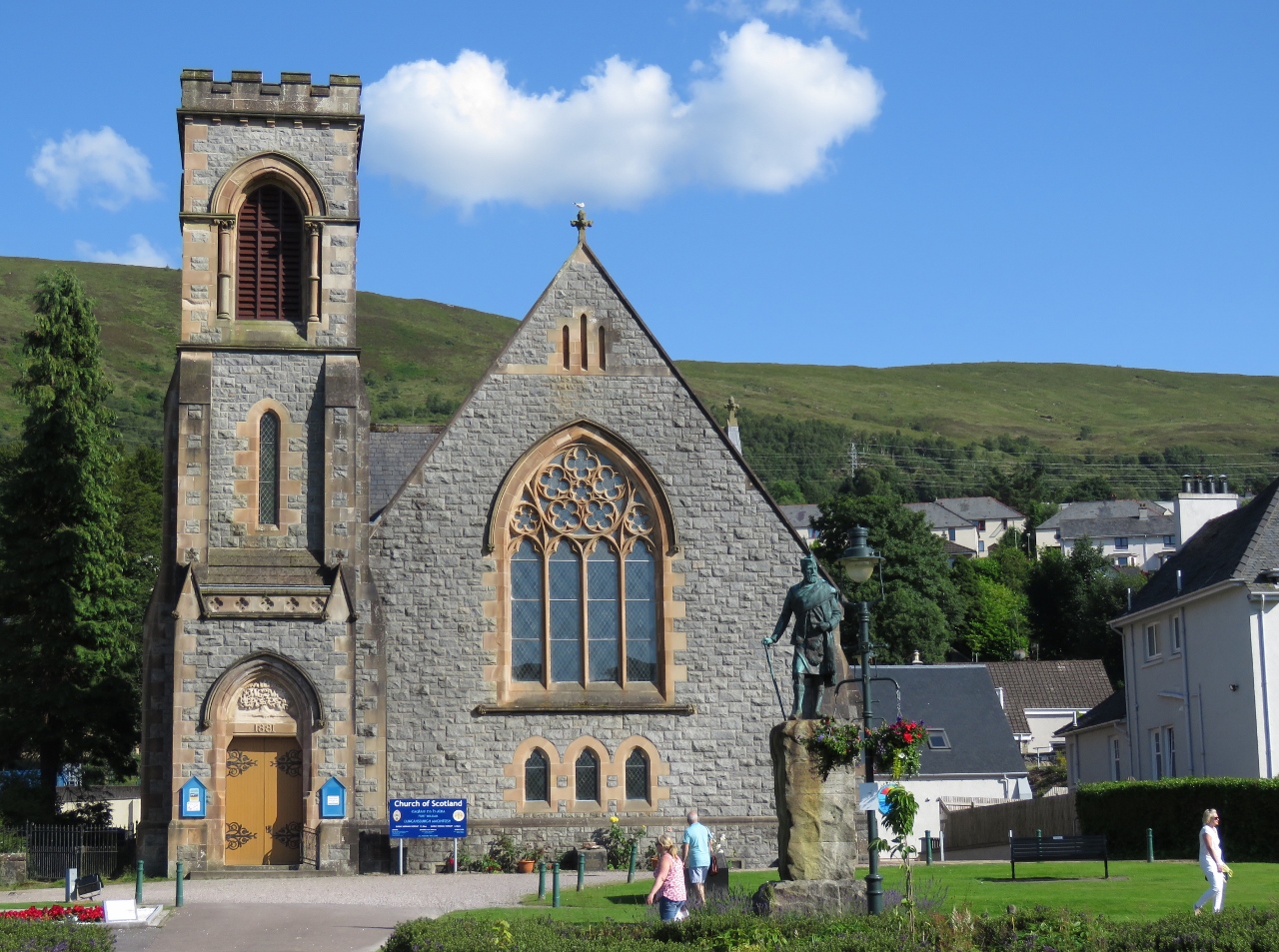 |
Duncansburgh MacIntosh Parish Church
Position: -5 6.49, 56 49.18
We checked in and dropped our bags off at the hotel then went for a walk around Fort William. Near our hotel is the Duncansburgh MacIntosh Parish Church, opened in 1882.
|
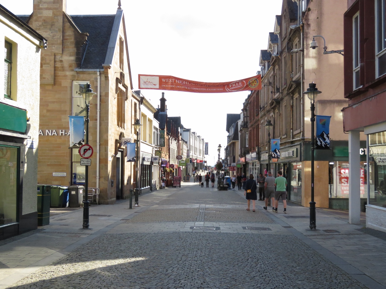 |
High Street
Position: -5 6.73, 56 49.04
High Street in Fort William had a great selection of bars and restaurants. This time of year, the town is busy with tourists, many who hiked the West Highland Way. We had a good meal overlooking the water at the Ben Nevis restaurant, then stopped in for an after-dinner drink at the Grog and Gruel.
|
 |
Change of Plans
Position: -4 43.03, 56 48.70
We took the 7:44am train from Fort William with plans to visit the underground power station at the Falls of Cruachan. Unfortunately the train hit a boulder near the south end of Loch Trieg, punctured a fuel tank, and disabled the train. The train limped backward to the previous station at 5 miles per hour, were we would be bussed out.
|
 |
Tulloch Station
Position: -4 42.11, 56 53.04
The train backed up at 5 miles per hour, stopping every ten minutes or so. It took about ten minutes to reach the south end of Loch Trieg this morning after passing Tulloch Station and nearly two hours to slowly limp backward to it. Surprisingly, ScotRail never made an announcement to explain where we were going or how we were getting there. Everyone just got off at the station when the train stopped.
|
 |
Buses
Position: -4 42.08, 56 53.06
Buses were waiting for us at the station. We eventually asked someone what the plan was and were told the buses would take us to Fort William and perhaps Glasgow, but no still no announcement was made.
|
 |
Loch Leven
Position: -5 10.94, 56 41.36
Crossing the bridge over Loch Leven south of Fort William. The bus didn’t stop in Fort William, which was a surprise to a couple of passengers who wanted to get off there. The driver let them out, but they had to walk several miles back into town. We still had no idea where we were going and eventually asked the driver, who told us we’d be going straight to Glasgow with a brief stop at Crianlarich. One person got very upset at the train station, but otherwise all the passengers seemed to just take the whole thing in stride and didn’t seem bothered by the lack of information. We did get a refund for all of today’s train tickets.
|
 |
Scenery
Position: -5 2.23, 56 39.93
The road follows a different route from the the train track, so we got some different views of the mountain scenery on the bus trip back.
|
 |
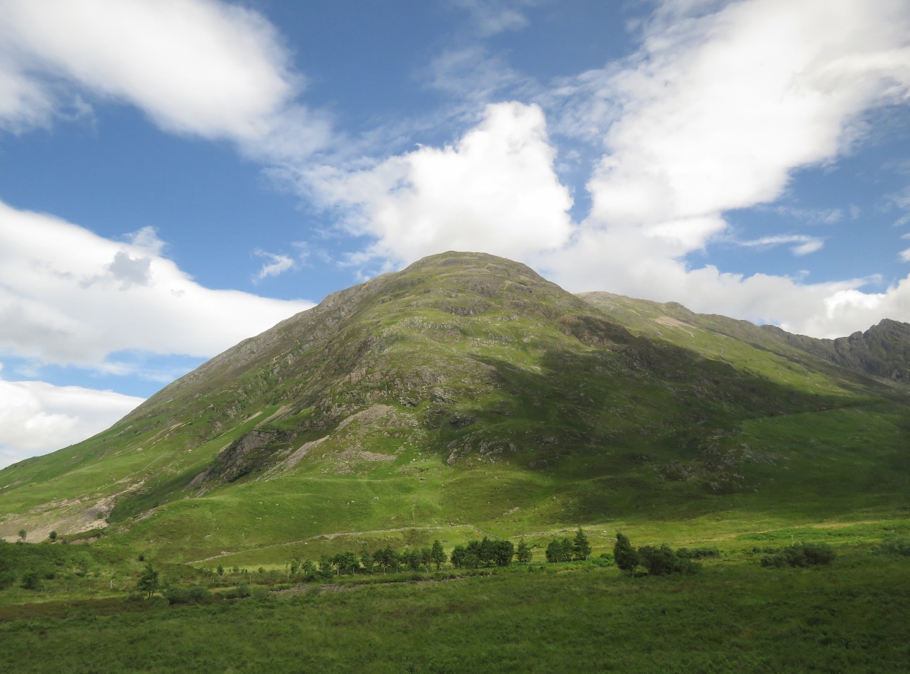
Aonach Eagach
Position: -5 0.09, 56 40.16
The Aonach Eagach ridge extends for 6 miles.
|
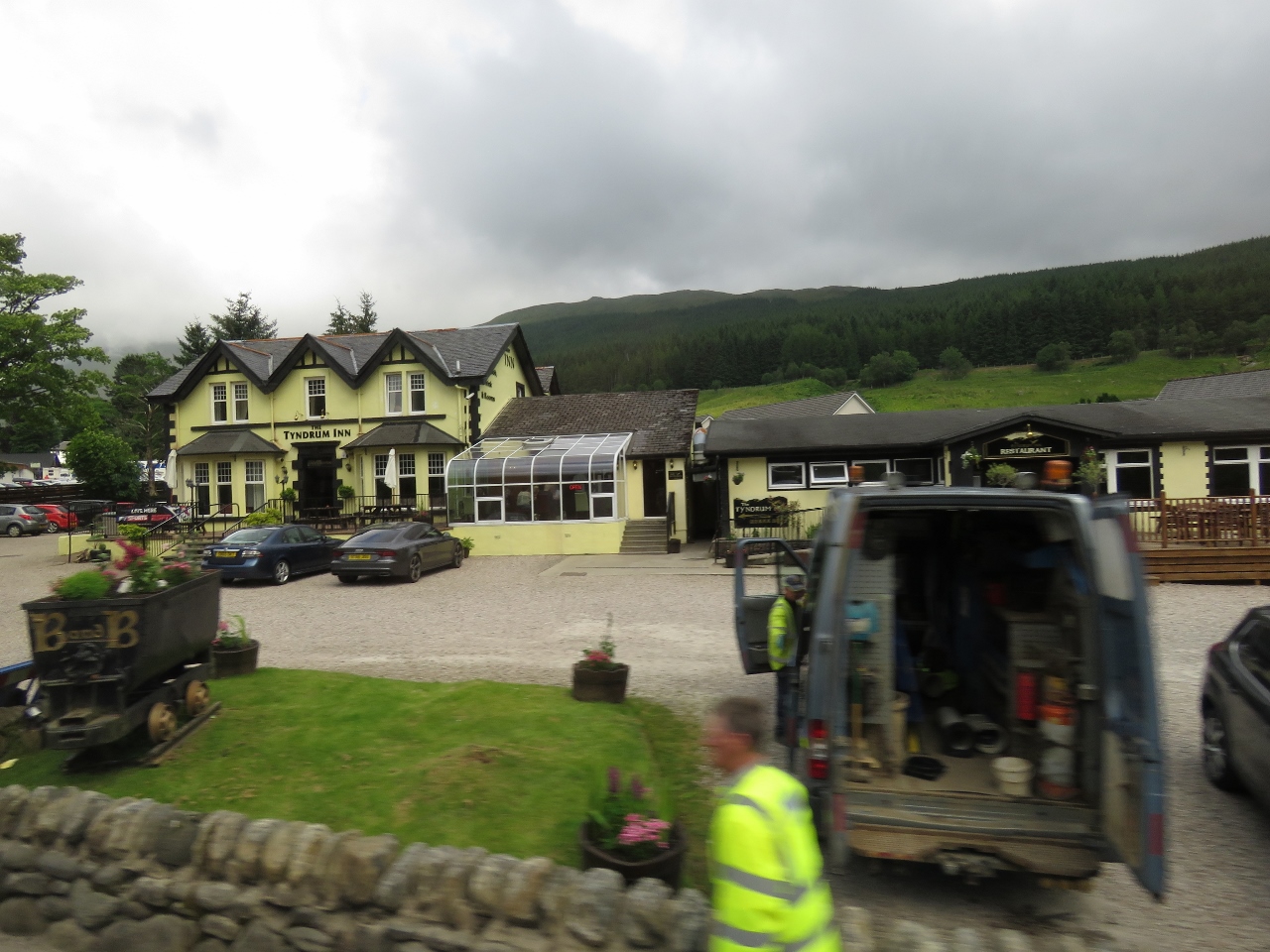 |
Tyndrum Inn
Position: -4 42.39, 56 26.00
The Tyndrum Inn near Tyndrum station.
|
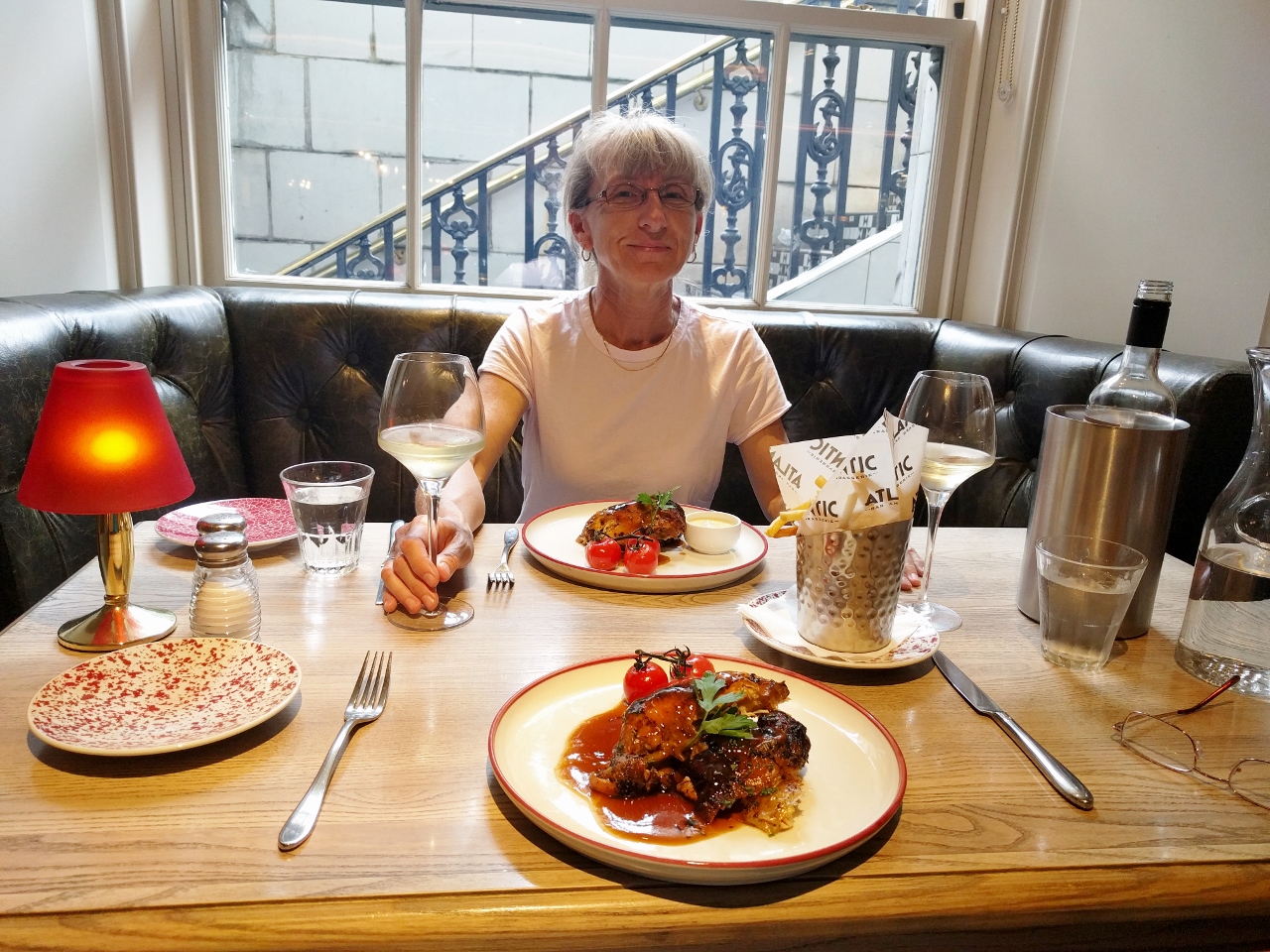 |
Lunch
Position: -4 15.15, 55 51.66
After arriving back into Glasgow, we treated ourselves to a fabulous late lunch/early dinner at the Atlantic Brasserie to make up for our lost day.
|
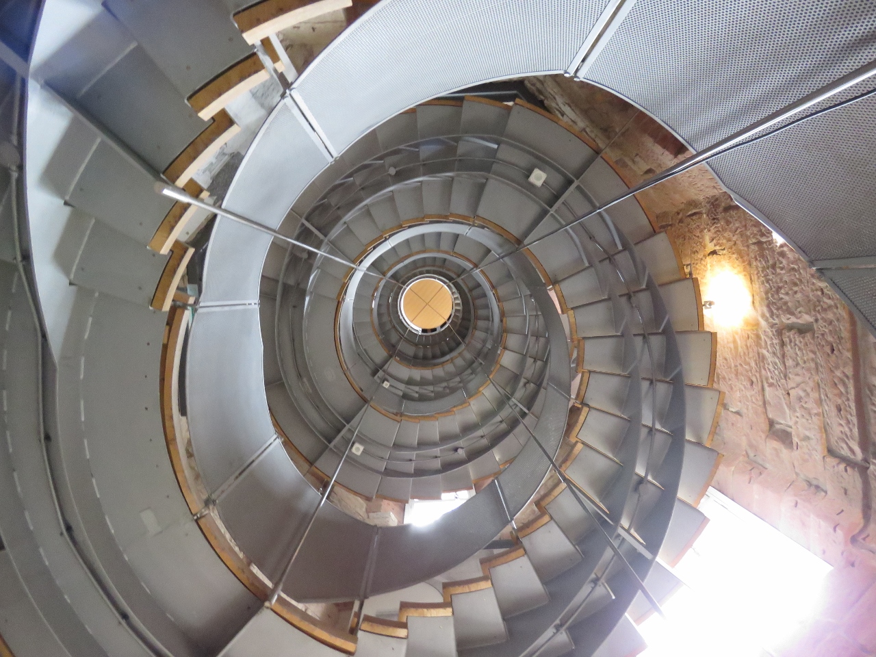 |
The Lighthouse
Position: -4 15.29, 55 51.58
We’d wanted to visit The Lighthouse on our first trip to Glasgow, but it had closed for the day by the time we got there, so we took the opportunity to visit today instead. Renowned Scottish artist and architect Charles Rennie Mackintosh designed The Lighthouse in 1893 as the striking new headquarters for the Glasgow Herald. It was the first building Mackintosh designed and now houses Scotland’s Center for Architecture and Design.
|
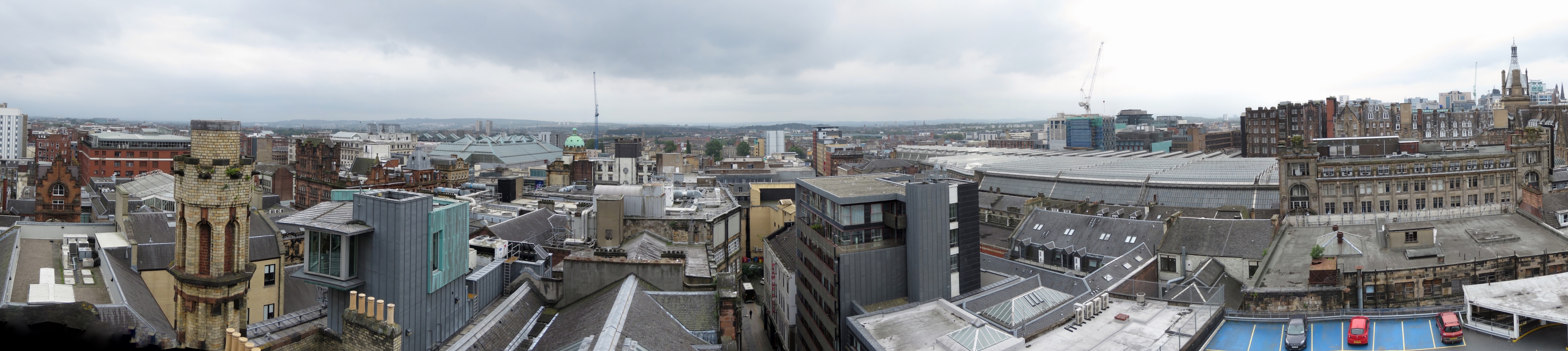 |
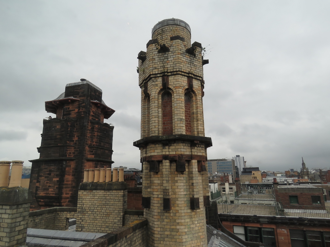
Rooftop View
Position: -4 15.33, 55 51.59
The top floor of The Lighthouse is an open-air balcony with a 360-degree rooftop view of the city. Typically a viewpoint like that will be caged or glassed in–it was wonderful to be just out there in the open and feel that you could almost reach out and touch the surrounding buildings.
|
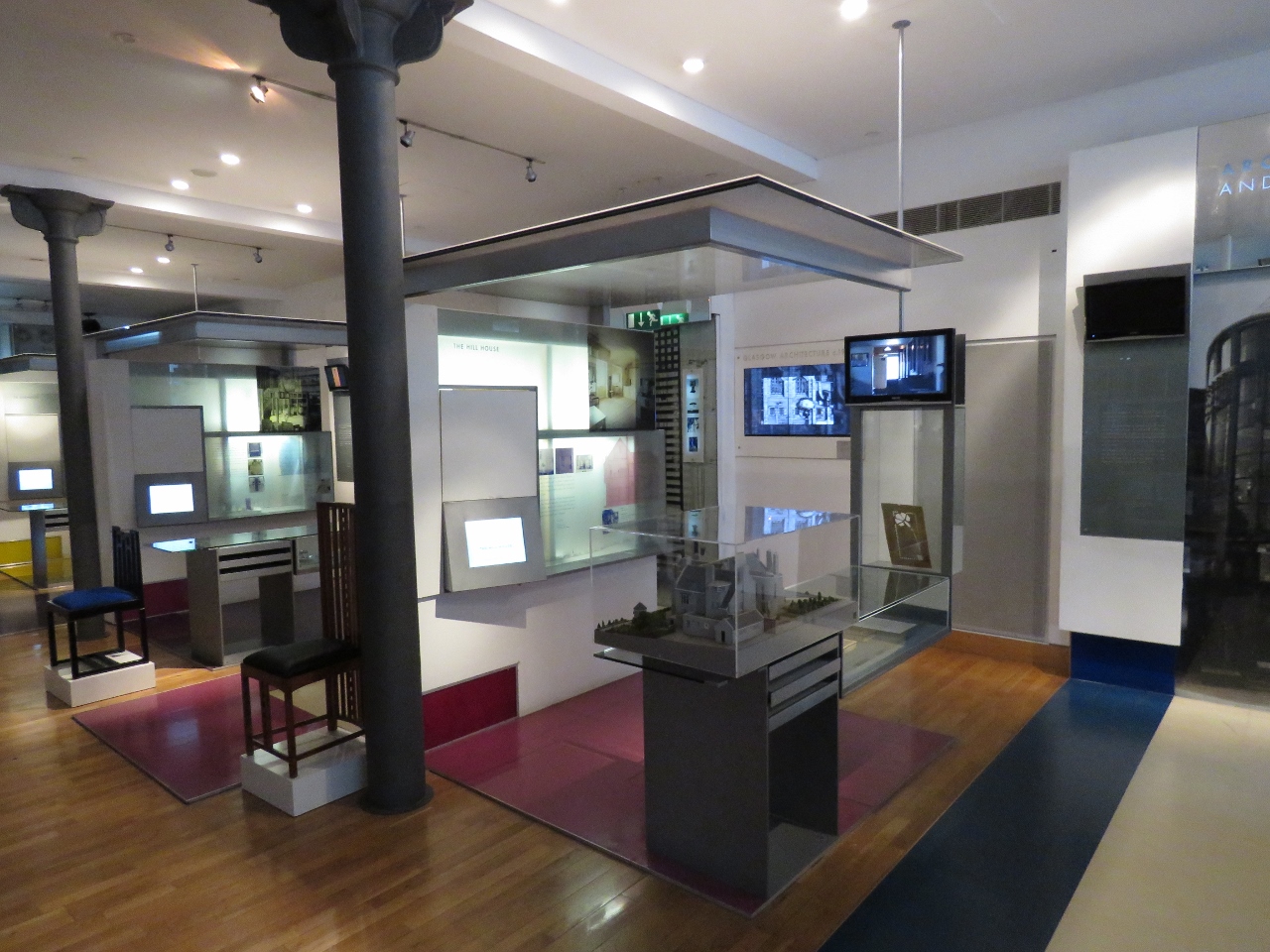 |
Museum
Position: -4 15.34, 55 51.59
After the balcony, we spent some time in a small museum detailing Mackintosh’ life and work.
|
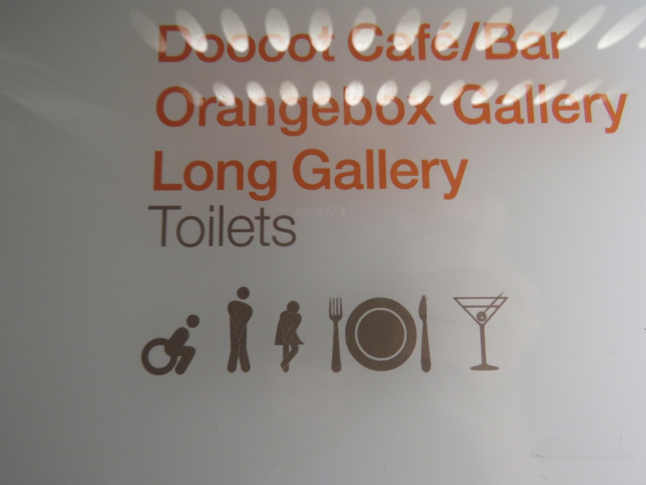 |
Toilets
Position: -4 15.34, 55 51.59
We loved the toilet signs in the Center for Architecture and Design, with all the figures looking a little desperate to find the loo.
|
 |
Lower Observation Deck
Position: -4 15.33, 55 51.58
A modern observation deck gave a slightly different view to the city. This is looking back up the the open-air balcony (on the left) that we were on earlier.
|
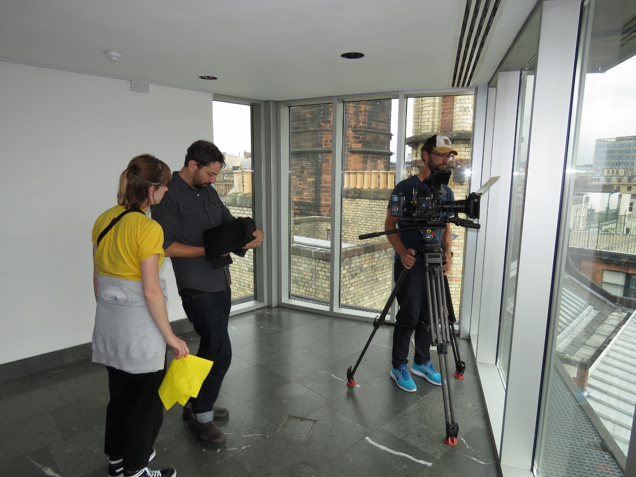 |
Crew
Position: -4 15.33, 55 51.58
A documentary crew was at the observation deck taking footage. One of them was from Canada and had even gone to the University of Victoria where James and I met. Small world.
|
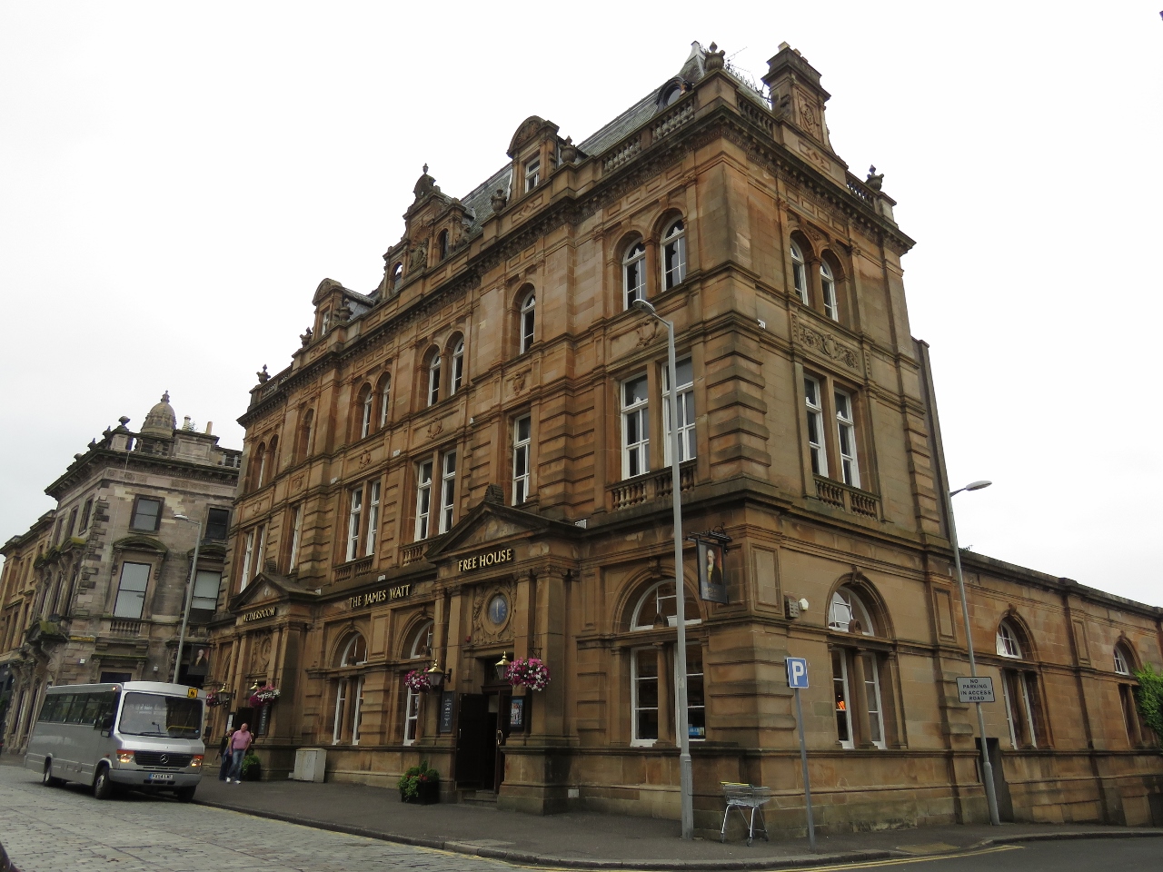 |
The James Watt
Position: -4 45.21, 55 56.80
We stopped for a cider at the James Watt pub in Greenock before returning home. The day hadn’t gone according to plan, but we had a great time anyway.
|

|
Click the travel log icon on the left to see these locations on a map, with the complete log of our cruise.
On the map page, clicking on a camera or text icon will display a picture and/or log entry for that location, and clicking on the smaller icons along the route will display latitude, longitude and other navigation data for that location. And a live map of our current route and most recent log entries always is available at http://mvdirona.com/maps. |
If your comment doesn't show up right away, send us email and we'll dredge it out of the spam filter.