MV Dirona travel digest for Kinsale, Ireland 2017

|
Click the travel log icon on the left to see these locations on a map,
with the complete log of our cruise. On the map page, clicking on a camera or text icon will display a picture and/or log entry for that location, and clicking on the smaller icons along the route will display latitude, longitude and other navigation data for that location. And a live map of our current route and most recent log entries always is available at //mvdirona.com/maps/LocationCurrent.html. |
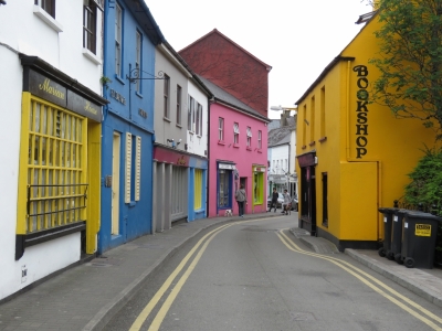 |
5/24/2017: Main Street
Position: 51°42.31'N, -8°31.38'W
Looking down narrow and colorful Main Street in Kinsale on our first foray into town. Most of Kinsale's narrow streets support two-way traffic. Somehow cars, vans and small trucks work their way past each other and the pedestrians.
|
 |
5/24/2017: Kitty O Se's
Position: 51°42.38'N, -8°31.41'W
After a bit of a walk around town, we decided on Kitty O Se's for a celebratory landfall lunch. We had an excellent meal over a pint of Smithwicks. Sharing our first pint at an Irish pub is something we’d been looking forward to from almost the moment we left Newport.
|
 |
5/24/2017: Old Head of Kinsale
Position: 51°42.47'N, -8°31.29'W
This mural might be the best view we get of the light on the Old Head of Kinsale. We've read a private golf course operates there and aren't sure if visitors can reach the light anymore.
|
 |
5/24/2017: Cork Street
Position: 51°42.45'N, -8°31.45'W
Looking south along Cork Street. Kinsale is a lovely town—we're really enjoying being here.
|
 |
5/24/2017: Compass Hill
Position: 51°42.04'N, -8°31.20'W
After a week or more on board, we often take a long walk the day we land after a passage. This post-passage walk took us to Compass Hill, looking for some harbor views.
|
 |
5/24/2017: Castlepark Marina
Position: 51°41.87'N, -8°31.33'W
The view south from Compass Hill to Castlepark Marina, the other major marina in Kinsale. We chose the Kinsale Yacht Club because it's more centrally located. That grey boat on the left on the outside of the dock is a Customs patrol boat.
|
 |
5/24/2017: View
Position: 51°41.99'N, -8°31.16'W
Jennifer enjoying the view from a perch on an old stone wall with Dirona moored behind.
|
 |
5/24/2017: Dinner
Position: 51°42.10'N, -8°31.15'W
Guest moorage at the Kinsale Yacht Club includes temporary club membership. We stopped in at the beautiful clubhouse for a light dinner overlooking the harbor. Dirona is just visible through the window.
|
 |
5/24/2017: Race Results
Position: 51°42.10'N, -8°31.15'W
Kinsale Yacht Club has an active racing membership. The clubhouse was nearly empty when we arrived, but filled in quickly when the evening's racing was done. The man standing at the back at the podium on the left is announcing the race results.
|
 |
5/25/2017: St Patrick's St
Position: 51°53.97'N, -8°28.24'W
Cork, Ireland's second largest city, is about a 45-minute bus ride from Kinsale. This is Cork's premier shopping avenue, St. Patrick's Street.
|
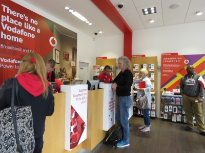 |
5/25/2017: Vodafone
Position: 51°53.93'N, -8°28.26'W
The main reason we'd come to Cork was to pickup a SIM card for cellular data. Our first stop was Vodafone, where we picked up a pre-paid SIM card and a data plan that will work throughout Europe. Communications is super-important to us, so getting a cell phone SIM is always one of our first stops. This was very close to the easiest and fastest transaction we've ever got. The price is quite good as well.
|
 |
5/25/2017: Cork City Marina
Position: 51°53.91'N, -8°27.81'W
The Port of Cork City Marina is right in downtown Cork along the River Lee. Stays are limited to six nights though, so it wasn't an ideal landing point for us as we wanted to spend longer after we arrived in Ireland. And the marina is a good ten miles in from sea. Boats typically clear through at Crosshaven at the entrance to Cork Harbour.
|
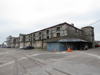 |
5/25/2017: Customs House Quay
Position: 51°53.97'N, -8°27.79'W
These two-story warehouses at Cork Customs House Quay were completed in 1818. They look at least that old and have been commercially occupied until recently. The River Lee splits here and takes two paths through Cork, reconnecting a few miles to the west.
|
 |
5/25/2017: Oliver Plunkett
Position: 51°53.91'N, -8°28.18'W
We had a great lunch at the Oliver Plunkett pub. We've been surprised not to find Jennifer's favourite Irish beer, Kilkenny, anywhere. So we decided to try a Murphy's Stout instead. Neither of us has been a big fan of stout in the past, but Murphy's is a bit smoother and subtle and it turns out we really like it. It is now our new favourite Irish beer.
|
 |
5/25/2017: St. Francis Church
Position: 51°53.89'N, -8°28.70'W
Cork has many churches. St. Francis, opened in 1953, is one of the more modern ones.
|
 |
5/25/2017: Cork Courthouse
Position: 51°53.86'N, -8°28.68'W
The Cork Courthouse is considered one of the best examples of Neo-Classical public architecture in Ireland. The building was originally designed in the 1830s, but was rebuilt in 1895 after a fire.
|
 |
5/25/2017: Oliver Plunkett St.
Position: 51°53.83'N, -8°28.49'W
300-year-old Oliver Plunkett Street was the only Irish street shortlisted in 2015 for the London Academy of Urbanism's "Great Street Award" as an outstanding example of good urbanism.
|
 |
5/25/2017: Holy Trinity Church
Position: 51°53.73'N, -8°28.24'W
Holy Trinity church was completed in 1725 and is covered with complex sculptures. It replaced a medieval parish church where the poet Edmund Spenser married Elizabeth Boyle in 1594.
|
 |
5/25/2017: River Lee
Position: 51°53.76'N, -8°28.44'W
Looking east along the southern tributary of the River Lee to Holy Trinity Church.
|
 |
5/25/2017: National Monument
Position: 51°53.75'N, -8°28.48'W
The National Monument was erected in 1906 to commemorate great Irish patriots who fought for Irish independence, particularly those involved in the risings of 1798, 1803, 1848, and 1867.
|
 |
5/25/2017: Elizabeth Fort
Position: 51°53.66'N, -8°28.64'W
Without really meaning to, we've been following the South Parish Walk through Cork. Elizabeth Fort along the walk was completed in 1626 in one of the oldest occupied parts of Cork City.
|
 |
5/25/2017: Saint Fin Barre's Cathedral
Position: 51°53.66'N, -8°28.87'W
The first service was held in Saint Fin Barre's Cathedral in 1870, but building, carving and decorating of the ornate structure continued well into the 20th century.
|
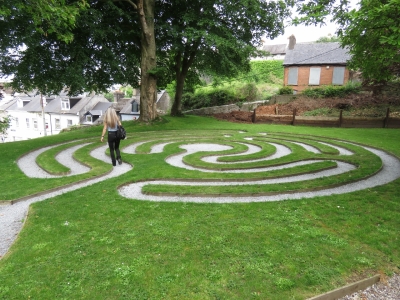 |
5/25/2017: Labyrinth
Position: 51°53.66'N, -8°28.77'W
Jennifer walking the labyrinth, dedicated in 2015, behind Saint Fin Barre's Cathedral.
|
 |
5/25/2017: Footbridge
Position: 51°53.80'N, -8°28.75'W
About to cross another of the dozen or so footbridges across the River Lee in downtown Cork.
|
 |
5/25/2017: Kilkenny
Position: 51°53.91'N, -8°28.35'W
Jennifer finally found a pint of her previous favourite Irish beer, Kilkenny, at Le Chateau Bar on St. Patrick's Street. We were beginning to think it was an export product only. Ireland is actually the primary market for Kilkenny, but it's particularly popular in Canada, where we first tried it, and also New Zealand and Australia. In those latter two countries, Kilkenny was readily available in cans in the grocery store.
|
 |
5/25/2017: Bus Ride
Position: 51°44.61'N, -8°29.43'W
On the bus ride back to Kinsale. Even the highways are narrow here--the bus is right up against the lane. We've seen a few cyclists on these roads, but we're not sure we want to try it without a bicycle lane.
|
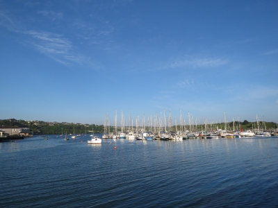 |
5/25/2017: Kinsale Harbour
Position: 51°42.21'N, -8°31.19'W
The evening sun lighting up Kinsale Harbour and the Kinsale Yacht Club.
|
 |
5/26/2017: Immigration
Position: 51°42.13'N, -8°31.04'W
In some places, a Customs officer handles immigration clearance. In others, a separate Immigration officer might arrive with Customs to clear us through all at once. And a third possibility is that we clear through Immigration separately, either from a Immigration officer visiting later, as in South Africa, or by going to the Immigration Office or Police Station, such as in St. Helena.
Ireland falls into the third category, where an Immigration officer stamped our passports a couple of days after we arrived. As with Customs, the process was fast and efficient, and we only had to present our passports with no other paperwork required. |
 |
5/26/2017: WiFi
Position: 51°42.13'N, -8°31.04'W
The WiFi at Kinsale Yacht Club is excellent, but we've had trouble keeping our Bullet WiFi antenna connected when we can get a reasonably stable connection directly from any of our other devices. We tried using a spare Bullet and that worked. We couldn't find any obvious config differences between the two Bullets, but the spare was on an earlier firmware version. So we downgraded the firmware on the failing to match the spare and it's now working well.
This is the first place we've been outside of North America with unlimited WiFi, and it's high-speed too, so we really wanted to get it working properly. |
 |
5/26/2017: Landfall Celebration
Position: 51°42.14'N, -8°31.23'W
We had a fabulous and lengthy landfall celebration meal at one of Kinsale’s highly-rated restaurants, The Steakhouse, courtesy of our friends Adam and Eve Block, former owners of Nordhavn 47 Eden.
Adam and Eve thought we might be tired on arrival and, invariably, arriving in a new country has some overhead and administrivia. So, they decided to help us out and take us to dinner, accepting the complexity of taking someone to dinner in Kinsale Ireland when you are situated in San Francisco California. They are innovators and didn't let a few thousand miles get in the way. They solved the problem by finding a well-regarded restaurant, contacting them, and setting it all up for us so all we needed to is show up, order, and enjoy. It was great—thanks Adam and Eve! |
 |
5/26/2017: The Steakhouse
Position: 51°42.14'N, -8°31.23'W
Kinsale is considered the gourmet capital of Ireland, which is one of the reasons we decided to enter Ireland here rather than at Crosshaven on the outskirts of Cork. Like many Kinsale restaurants, The Steakhouse occupies what looks like a centuries-old building that has been beautifully renovated. Judging by the large hearth, this one likely was originally a house. We had what we considered the best table in the house: street-side on a balcony overlooking the lower level.
|
 |
5/26/2017: Fog
Position: 51°42.10'N, -8°31.13'W
The weather here changes a lot. Yesterday's sunshine gave way to pouring rain all day and fog in the evening.
|
 |
5/27/2017: Fishing Vessels
Position: 51°42.13'N, -8°31.04'W
The commercial pier just off our bow has been busy with fishing vessels coming and going the entire we've been here.
|
 |
5/27/2017: Seal
Position: 51°42.13'N, -8°31.04'W
We made our first spotting of an Ireland seal in the water next to Dirona.
|
 |
5/27/2017: Ross Oil
Position: 51°42.13'N, -8°31.04'W
Fueling in Ireland generally is done by truck. At Kinsale, we can refuel on the commercial pier or the ramp between the pier and the marina (shown).
|
 |
5/27/2017: Low Tide
Position: 51°42.34'N, -8°31.10'W
With a sunny forecast, we decided to walk out to Charles Fort that we'd passed on our arrival into Kinsale. This is looking across the head of Kinsale Harbour at low tide.
|
 |
5/27/2017: The Spaniard
Position: 51°42.30'N, -8°31.02'W
The Spaniard Pub was built on the ruins of an old castle around 1650 and has been a well-known pub ever since. We pretty much had to stop there for a pint of Murphy's.
|
 |
5/27/2017: Lower Road
Position: 51°42.31'N, -8°30.85'W
Narrow Lower Road with a mix of old and new architecture.
|
 |
5/27/2017: Scilly Walk
Position: 51°42.32'N, -8°30.75'W
Scilly Walk follows the harbour and out to Charles Fort with great views along the way. The name derives from the Kinsale-area settlers from the Isles of Scilly off the British Cornish Coast.
|
 |
5/27/2017: Kinsale Yacht Club
Position: 51°42.32'N, -8°30.72'W
View to Kinsale Yacht Club from the Scilly Walk.
|
 |
5/27/2017: Alice Again
Position: 51°42.30'N, -8°30.48'W
The fishing vessel Alice Again returning to port with James Fort at center in the background.
|
 |
5/27/2017: Greenery
Position: 51°42.28'N, -8°30.43'W
We really enjoyed the view and the nature along Scilly Walk.
|
 |
5/27/2017: Lamp Post
Position: 51°42.23'N, -8°30.33'W
An old lamp post along Scilly Walk. The path likely was once the main road into town, and actually still is used as a road for some of the harbour-front houses.
|
 |
5/27/2017: Charles Fort
Position: 51°41.84'N, -8°29.93'W
Charles Fort was completed in 1682 and is one of the largest military installations in Ireland. The fort is open to the public and receives over 85,000 visitors a year. The parking lot was packed with cars and tour-buses when we arrived.
|
 |
5/27/2017: Aerial Photo
Position: 51°41.82'N, -8°29.91'W
Charles Fort is a classic example of a star-shaped fort and has five bastions, two to seaward and three landward.
|
 |
5/27/2017: Seaward Bastions
Position: 51°41.80'N, -8°30.00'W
Looking across the seaward bastions with the white lighthouse on the point between them.
|
 |
5/27/2017: Ruins
Position: 51°41.74'N, -8°29.97'W
During the Irish Civil War in 1922, forces opposed to the Anglo-Irish treaty burned the fort during their retreat. But much of the brick structures remain.
|
 |
5/27/2017: Battery
Position: 51°41.78'N, -8°29.87'W
Looking west across one of the gun batteries to the lighthouse and Kinsale Harbour
|
 |
5/27/2017: Magazine
Position: 51°41.79'N, -8°29.95'W
The powder magazine was specially constructed to avoid sparks with a wall around it to contain an explosion.
|
 |
5/27/2017: Governor's House
Position: 51°41.79'N, -8°29.95'W
The Governor of Kinsale was a military officer who commanded the garrison at Kinsale and Charles Fort. This is the Governor's House inside the fort.
|
 |
5/27/2017: James Fort
Position: 51°41.83'N, -8°29.95'W
Looking across to Kinsale with part of James Fort is at center in the foreground.
|
 |
5/27/2017: Water Tanks
Position: 51°41.82'N, -8°29.93'W
These octagonal structures at Charles Fort were built to support large water tanks.
|
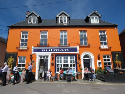 |
5/27/2017: Bulman Pub
Position: 51°42.00'N, -8°29.99'W
We'd walked past the Bulman Pub on our way to Charles Fort, but it was completely packed. We were able to get a spot on our return and had a great late lunch. On sunny days, the pub apparently is packed most of the time, particularly outside. Even a wedding party, at left of photo, stopped by for a pint.
|
 |
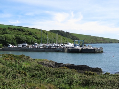
5/27/2017: Lower Cove Harbour Walk
Position: 51°41.69'N, -8°29.82'W
After lunch, we decided to do a little more walking. This is the view back to Charles Fort from the Lower Cove Harbour Walk.
|
 |
5/27/2017: Kinsale Boatyard
Position: 51°41.38'N, -8°29.59'W
The Kinsale Boatyard looked busy. The yard area ahead was full of boats, with many more not visible to the left of the photo. The boating season is just starting up here, so likely many are getting ready for the summer.
|
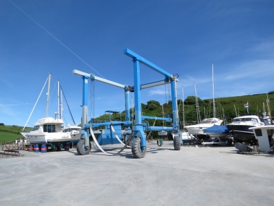 |
5/27/2017: Boat Lift
Position: 51°41.31'N, -8°29.61'W
We couldn't see a weight rating on this boat lift, but it looked about 20-30 tons. Much too light for Dirona's 55 tons. Fortunately we have no need of a lift.
|
 |
5/27/2017: High Road
Position: 51°42.37'N, -8°30.69'W
We returned to Kinsale along the High Road with its sweeping harbour view. Charles Fort is at the far left, Kinsale Boatyard is right of and just beyond Charles Fort, James Fort is at center, Castlepark Marina is right of James Fort, Compass Hill is across the water to the right, and Kinsale Yacht Club is on the far right.
|
 |
5/28/2017: Cockpit Locker
Position: 51°42.13'N, -8°31.04'W
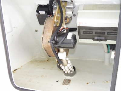
We emptied the starboard cockpit locker this morning to look for any other possible sources of that water leak. There really are no other sources of water intrusion. The one-inch drain hole is the primary source, with the louvres and potential door weatherstrip leaks/seeps being potential secondary sources. In the short term, we'll completely close off the drain. In the longer term, we'll install a small-boat self-bailing transom plug.
|
 |
5/28/2017: Stack
Position: 51°42.13'N, -8°31.04'W
Our stack and domes were filthy with soot from the long run. It was much worse than normal due to torrential rainstorms tracking soot down. We spent much of the afternoon washing the boat, and waxing the stack to remove the soot. It looks much better now.
|
 |
5/28/2017: Wharf Tavern
Position: 51°42.06'N, -8°31.10'W
Dinner with a pint of Murphy's overlooking the commercial pier at the Wharf Tavern.
|
 |
5/29/2017: Boat Launch
Position: 51°42.13'N, -8°31.04'W
Something is always happening at the commercial pier off our bow. Today that crane in the center of the photo is launching the power boat just to the right.
|
 |
5/29/2017: White House
Position: 51°42.39'N, -8°31.40'W
An excellent meal at the White House pub. We're really enjoying our stay in Kinsale.
|
 |
5/30/2017: Pigtail
Position: 51°42.13'N, -8°31.04'W
The generator started about 2am this morning and we could see on our master stateroom N2KView display that we'd lost shore power, causing the generator to auto-start when the house battery level got sufficiently low. We could have just waited until morning, but were curious if we could find an easy fix. It turned out to be an unlikely issue: the wire connecting the two ends on our power adapter pigtail had a very slight current leak between conductors and ground. It was over three million ohms, so barely detectable, but enough to trigger European-spec RCDs (Residual Current Device). James put in a new length of wire and we were back up with power again.
|
 |
5/30/2017: Raspberry Pi
Position: 51°42.13'N, -8°31.04'W
James preparing to mount under the the salon settee the Raspberry Pi package he'd built during the Atlantic crossing. This Pi will implement fourteen new digital inputs and temperature sensors in the rear of the boat, the lazarette and the engine room area.
|
 |
5/30/2017: View
Position: 51°42.38'N, -8°30.58'W
Rosie and Bill Skelton, previous owners of Nordhavn 47 Nexus, invited us over for lunch at their beautiful view home on High Road. This is looking to Kinsale Yacht Club from their property, where they took the picture of Dirona arriving into Kinsale.
|
 |
5/30/2017: Rosie and Bill Skelton
Position: 51°42.39'N, -8°30.57'W
Rosie and Bill Skelton are perhaps the best hosts ever. The multi-course lunch was incredible, including our first traditional Irish stew. We had such a good time that we eventually had to drag ourselves away after seven hours, rivalling the eleven-hour meal at Peats Bite near Sydney, Australia for our longest lunch ever. This will certainly be one of the high points of our Kinsale visit.
|
 |
5/31/2017: Jim Edwards
Position: 51°42.13'N, -8°31.04'W
We arrived at Jim Edwards for dinner just before the crowds did and had our pick of seats. We had a great meal, with a pint of Murphy's of course. By the time we left, not one table was available.
|
 |
6/2/2017: Wharf Tavern
Position: 51°42.05'N, -8°31.10'W
Lunch on the patio at the Wharf Tavern before we bicycle over to James Fort.
|
 |
6/2/2017: Bike Parking
Position: 51°41.78'N, -8°30.90'W
We added our bikes to the two already tied to a lamp post to walk the footpath to James Fort.
|
 |
6/2/2017: Castlepark Marina
Position: 51°41.86'N, -8°30.86'W
Looking down to Castlepark Marina from the path to James Fort.
|
 |
6/2/2017: Kinsale
Position: 51°41.88'N, -8°30.88'W
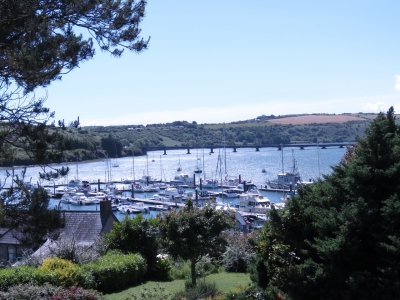
The path to James Fort has great views across the harbour to Kinsale.
|
 |
6/2/2017: James Fort
Position: 51°41.91'N, -8°30.77'W
Construction began on James Fort was built in 1602 after the British victory over the Spanish and Irish in the 1601 Battle of Kinsale. The regular pentagonal design allowed those inside the fort to cover all external faces with gunfire.
|
 |
6/2/2017: Inner Fort
Position: 51°41.91'N, -8°30.74'W
The original pentagonal fort was considered too large, so a smaller rectangular fort was built inside. James Fort fell into neglect, and became known as "Old Fort", once contruction began in 1678 on Charles Fort across the harbour.
|
 |
6/2/2017: Charles Fort
Position: 51°41.90'N, -8°30.74'W
The Spirit of Kinsale harbour cruise boat passing by Charles Fort across the water.
|
 |
6/2/2017: Bulman
Position: 51°41.91'N, -8°30.71'W
Bulman Pub, where we had lunch last week, viewed from James Fort.
|
 |
6/2/2017: High Road
Position: 51°41.91'N, -8°30.71'W
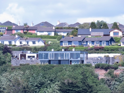
High Road has some striking view homes that aren't very visible except from the water. This one we can see from our marina berth looks amazing, with a floor-to-ceiling glass face and sides.
|
 |
6/2/2017: Blockhouse
Position: 51°42.00'N, -8°30.51'W
A blockhouse, for observation and defence, was added on the promontory point following an outbreak of war with Spain and France in the 1620s. A trench connected to the blockhouse to the fort.
|
 |
6/2/2017: Castlepark Beach
Position: 51°41.76'N, -8°30.74'W
The day wasn't particularly warm at around 60°F (15°C), but the sunny weather was enough to attract plenty of people to Castlepark Beach.
|
 |
6/2/2017: The Dock
Position: 51°41.80'N, -8°30.89'W
All that walking is thirsty business. We enjoyed a pint of delicious Bulmers Irish cider on the patio at The Dock pub.
|
 |
6/2/2017: R606
Position: 51°43.06'N, -8°33.73'W
The day was early and still sunny, so we continued north on Route 606 along the River Brandon rather than return directly back to Kinsale. We really enjoyed the ride—the countryside is beautiful.
|
 |
6/2/2017: Countryside
Position: 51°42.86'N, -8°32.59'W
Looking north across the countryside from Route 605 on our return to Kinsale.
|
 |
6/2/2017: The Grey Hound
Position: 51°42.39'N, -8°31.44'W
All that biking is thirsty business. We've twice before looked for a patio table at the exceedingly popular Grey Hound and finally scored a table, just barely, on our third attempt.
|
 |
6/3/2017: Smoke
Position: 51°42.13'N, -8°31.04'W
One of the fishing vessel on the commercial pier nearly obscured in its own smoke.
|
 |
6/3/2017: SuperValu
Position: 51°42.51'N, -8°31.27'W
Jennifer rode her bike up to SuperValu to buy a few things. Their produce section is quite international—we bought product ranging from Irish strawberries to South African grapefruit.
|
 |
6/3/2017: Sailing
Position: 51°42.13'N, -8°31.04'W
Sailboats from the Kinsale Yacht Club were landing behind Dirona today.
|
 |
6/3/2017: Kinsale Yacht Club
Position: 51°42.13'N, -8°31.04'W
The striking entrance to the Kinsale Yacht Club docks.
|
 |
6/3/2017: Fish Boats
Position: 51°42.13'N, -8°31.04'W
Fishing vessels tucked in for the night along the commercial pier.
|
 |
6/4/2017: Quarry Point
Position: 51°38.45'N, -8°33.04'W
Today was forecast to be the last sunny day for a while, so we took the opportunity to make the 8-mile bike ride to the Old Head of Kinsale. This is a small boat harbour north of Quarry Point as we neared the Old Head. We've been finding cycling in Ireland easier than we expected, given the narrowness of the roads. Passing cars give us plenty of space and the roads are in good condition. That didn't make the hilly ride any less strenuous—we were pooped by the time we arrived.
|
 |
6/4/2017: Speckled Door
Position: 51°38.38'N, -8°33.04'W
We passed the Speckled Door pub as we neared our destination. We'll be back for lunch.
|
 |
6/4/2017: Signal Tower
Position: 51°37.21'N, -8°32.56'W
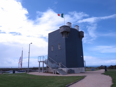
The Old Head Signal Tower is the highest point on the head—we could see it from a mile or two away as we approached. The tower was built in 1804 as part of a coastal military defense against a possible French Napoleonic invasion. The tower was the 25th in a series of 81 such towers along Ireland's coast. The towers were in sight of each other and messages could be quickly passed along the coast through visual signal codes using flags and balls. The tower has since been renovated and now houses a Lusitania Museum, detailing the ship and its sinking off the Old Head following a German submarine attack in 1915
|
 |
6/4/2017: Old Head
Position: 51°37.20'N, -8°32.56'W
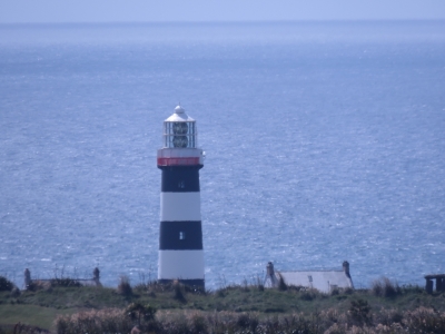
The Parapet Walk at the top of the Signal Tower has sweeping views all around. This is looking across the Lusitania Memorial Garden, opened only a month ago, across to the Old Head of Kinsale. The lighthouse we passed as we neared landfall in Ireland is visible in the distance.
|
 |
6/4/2017: Lighthouse
Position: 51°37.21'N, -8°32.56'W
Close-up to the Old Head Lighthouse. The structure is not generally open to the public, partly for safety reasons and partly because a private golf course, Old Head Golf Links, operates on the head and allows access only to members or guests. The clubhouse has an ordinary publican's license, which requires them to provide public access to the clubhouse, but they remain quite comfortable refusing non-member access.
|
 |
6/4/2017: Old Head Castle
Position: 51°37.20'N, -8°32.56'W
The de Courcy family built a castle at the narrowest point of the headland in the 12th century AD. The ruins of the tower house and medieval wall are incorporated into the entrance to the Old Head Golf Links.
|
 |
6/4/2017: View East
Position: 51°37.21'N, -8°32.56'W
The panoramic view east from the Signal Tower. Dirona's route into Kinsale is along the right portion of the photo, with the entrance to Kinsale Harbour in the distance roughly above where the cars are parked.
|
 |
6/4/2017: Coastline
Position: 51°37.08'N, -8°32.56'W
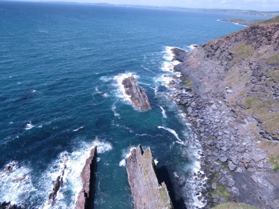
The spectacular but forbidding coastline along the western portion of the headland, viewed from the narrow neck.
|
 |
6/4/2017: Erosion
Position: 51°37.08'N, -8°32.55'W
Wind and waves have carved the offshore rocks into narrow, razor-like projections.
|
 |
6/4/2017: Lunch
Position: 51°38.39'N, -8°33.02'W
The Speckled Door may look traditional from the entrance, but the restaurant has a modern floor-to-ceiling glass wall with sweeping views to sea.
|
 |
6/4/2017: Garrettstown Beach
Position: 51°38.32'N, -8°33.73'W
From the Speckled Door we took Route 604 west toward Ballinspittle. Despite the windy day, plenty of people were out enjoying Garrettstown Beach on this sunny Sunday afternoon.
|
 |
6/4/2017: Kitesurfers
Position: 51°38.32'N, -8°33.73'W
As we approached Garrettstown Beach, we could see kites high in the air well before we could see the beach or these kitesurfers. There even were a few people out swimming.
|
 |
6/4/2017: Airborne
Position: 51°38.49'N, -8°34.30'W
One of the kitesurfers was particularly good. He'd run northwest, parallelling the shore, and just when it looked like he'd crash into the cliff, he'd execute a leap, spin or tumble.
|
 |
6/4/2017: Hurleys
Position: 51°39.97'N, -8°35.75'W
Enjoying a Bulmers Irish cider on the patio at Hurleys pub in Ballinspittle, about halfway back to Kinsale from the Old Head.
|
 |
6/6/2017: Fishy Fishy
Position: 51°42.23'N, -8°31.29'W
An delicious seafood meal at Fishy Fishy near the marina.
|
 |
6/7/2017: Sea Hunter
Position: 51°42.13'N, -8°31.04'W
The ship Sea Hunter arrived into Kinsale Habour early this morning with tug assist. The ship looked much too large for the commercial pier, but they managed to get a good three-quarters on the dock, although with the bow nearly touching the Wharf Tavern behind the pier. One time a docking ship went too far forward and the bow actually went through the second-floor wall above the tavern.
|
 |
6/7/2017: Navy
Position: 51°42.13'N, -8°31.04'W
For the past couple of days, high-speed Navy tenders have been picking up and dropping off passengers in Kinsale. We're told several Irish Navy ships are in the waters off the Old Head.
|
 |
6/7/2017: Crane
Position: 51°42.10'N, -8°31.04'W
The Sea Hunter was carrying a cargo of British malt for whiskey production. The cargo was offloaded by crane into this elevated bin, and was then dropped into a bin to supply a procession of trucks. The trucks moved back and forth below the bin to get an even load.
|
 |
6/8/2017: 968mb
Position: 51°42.13'N, -8°31.04'W
We're glad not to be in the North Atlantic right now. A 968-mb low pressure-system is passing right across our path to Ireland, bringing 45-knot winds and 25ft seas. June apparently isn't a lot better than May for a crossing.
|
 |
6/8/2017: Fueling
Position: 51°42.10'N, -8°31.04'W
Rosie and Bill Skelton sent us this picture they took from their home above the harbour of Dirona fueling by truck on the commercial pier. We took on 1,398 gallons (5293 liters) of diesel by truck for €0.62/liter, which works out to $2.63/gallon in US dollars. That's not much more than the price we paid in Newport, RI. We're told Ireland has the lowest fuel prices in Europe.
|
 |
6/7/2017: Husks
Position: 51°42.10'N, -8°31.04'W
We'd picked a bad day to fuel. With the Sea Hunter offloading so close by and upwind from us, we were literally covered in malt husks by the time we'd finished fueling. Fortunately it sprayed off easily with not much scrubbing required.
|
 |
6/8/2017: Restocking
Position: 51°42.47'N, -8°31.30'W
SuperValu had a sale on a New Zealand Marlborough Sauvingon Blanc that we like, so Jennifer walked the folding cart up to restock our stores. That folding cart sure has been useful over the years.
|
 |
6/8/2017: Brunos
Position: 51°42.23'N, -8°31.31'W
Rosie and Bill Skelton came by for a tour of Dirona and then we had an excellent meal and a wonderful evening at Bruno's Italian restaurant near the marina.
|
 |
6/9/2017: White Lady
Position: 51°42.08'N, -8°31.16'W
We had an excellent meal at the White Lady just behind the Kinsale Yacht Club. Despite our best efforts, we've still not come close to visiting all the pubs in Kinsale, let alone all the restaurants. The problem seems as challenging as in Halifax, NS, despite Kinsale having a population of only 5,000 compared to Halifax's 316,000. We're told that at one point Kinsale had 38 pubs.
|
 |
6/10/2017: Fighting Water Ingress
Position: 51°42.13'N, -8°31.04'W
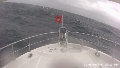
In crossing the North Atlantic we saw some of the most difficult conditions we have encountered thus far in our world-rounding trip (North Atlantic Gales). The conditions were not actually bad enough to be frightening except for a couple of mechanical problems, one of which allowed considerable water to enter the boat (Alarms at 1:15am).
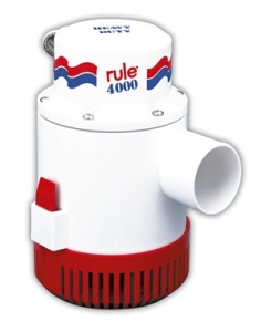
In spending a half day fighting the water ingress, we learned several important things about our bilge dewatering systems. The first is the primary bilge pump is not that reliable and doesn't pump that much volume. The second lesson is the high-water bilge pump, although it produces excellent volume, is mounted way too high in the bilge to serve as a primary high-volume dewatering system. The third lesson is a confirmation that the hydraulic bilge pump moves absolutely prodigious amounts of water, but ends up being a two-person job to operate. It pumps so fast it can easily run dry and/or lose prime so someone needs to be down in the engine room to monitor it while a second person operates the off/on switch in the pilot house. These are the changes we plan:
|
 |
6/10/2017: North Atlantic Gales
Position: 51°42.13'N, -8°31.04'W
On our North Atlantic crossing, the weather was far worse than expected (North Atlantic Gales). It was not dangerous, but was a bit of a reminder that the conditions in the North Atlantic can often be worse than predicted. Andrew Dickenson just sent us this article: Canada Launches Rescue as Winds hit Trans-Atlantic Sailing Race.
It's a month closer to the ideal time to cross the North Atlantic and yet the conditions these boaters face are dangerous and potentially life-threatening when coupled with the mechanical problems they are seeing. Conditions are reported by the Canadian military to be 10 to 15 meter seas (32 to 49 feet) with 50 to 70 knot (58 to 81 mph) winds, much worse than the weather models indicate. Rescue efforts are still 24 to 72 hours away as we write this. The North Atlantic can be punishing. |
 |
6/10/2017: Fuel Spill
Position: 51°42.13'N, -8°31.04'W
A fishing vessel on the commercial pier overflowed it's fuel tank today and dumped several hundred gallons of diesel into the water. You can smell diesel a long way away.
|
 |
6/10/2017: Spitfire
Position: 51°42.13'N, -8°31.04'W
In addition to investigating any open locker, Spitfire always inspects the work area whenever James wedges himself in a difficult spot. Here James is in the port aft engine room alcove to install a stitch for the hydraulic bilge pump into the box directly right of Spitfire.
|
 |
6/10/2017: Testing
Position: 51°42.13'N, -8°31.04'W
The hydraulic control box on Dirona. James has read the wiring diagram and is in the process of installing a new circuit to control the hydraulic bilge pump from in the engine room as well as the from the pilot house. The ABT hydraulic system is unusually well documented, easy to understand, and to service.
|
 |
6/10/2017: Circuit
Position: 51°42.13'N, -8°31.04'W
The new switch in place at the upper right of the photo.
|
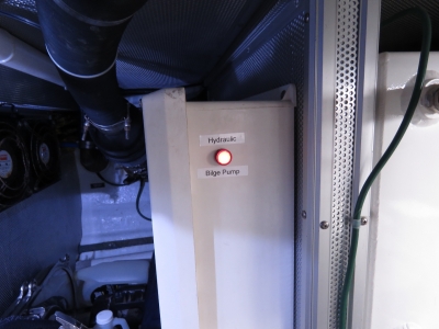 |
6/10/2017: New Switch
Position: 51°42.13'N, -8°31.04'W
The new switch installed on the outside of the hydraulics control panel will allow one-person operation of the hydraulic bilge pump from the engine room.
|
 |
6/11/2017: Blue Haven
Position: 51°42.39'N, -8°31.39'W
An exceptional final meal in Kinsale at the Blue Haven with fish tacos, raw oysters and Kinsale crab claws. This was probably our second or third best dinner here. We've not had anything close to a bad meal in Kinsale—even simple pub food is fresh and delicious. The town certainly deserves its reputation as the "Gourmet Capital of Ireland".
|