MV Dirona travel digest for Bass Strait & Melbourne 2015

|
Click the travel log icon on the left to see these locations on a map,
with the complete log of our cruise. On the map page, clicking on a camera or text icon will display a picture and/or log entry for that location, and clicking on the smaller icons along the route will display latitude, longitude and other navigation data for that location. And a live map of our current route and most recent log entries always is available at //mvdirona.com/maps/LocationCurrent.html. |
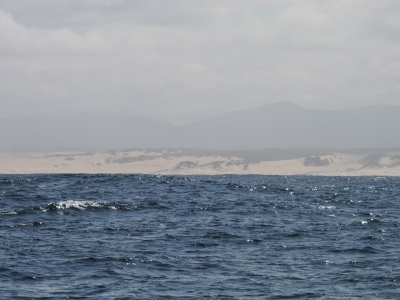 |
2/17/2015: Sandy Cape
Position: -41°37.72'S, 144°49.92'E
We're just south of aptly-named Sandy Cape on a 225-mile overnight run to the River Tamar from Macquarie Harbour. We're currently seeing 10-15 knot winds, and are expecting that for most of the run except for a brief period of 20-25kt winds as we round Cape Grim at the northest corner of Tasmania.
|
 |
2/17/2015: Wind farm
Position: -40°42.01'S, 144°37.72'E
Hydro Tasmania's first wind farm just south of Cape Grim. Winds are reliable here and recordings from the nearby Baseline Air Pollution Station indicate the air here is the cleanest in the world. No surprise since the closest upwind industrial facility is in in South America.
|
 |
2/17/2015: Cape Grim
Position: -40°39.70'S, 144°38.49'E
The lighthouse on Cape Grim, with Steeple Rock below. As expected, the winds are starting to pick up as we near the northwest corner.
|
 |
2/17/2015: Hunter Passage
Position: -40°35.80'S, 144°43.63'E
We took the shortcut through Hunter Passage, recommended in the Tasmanian Anchorage Guide, rather than travel the approximatly 30 extra miles around the top of Hunter Island and Three Hummock Islands. Fortunately we were able to pass through the most narrow section before nightfall.
|
 |
2/18/2015: 5,019 hours
Position: -41°2.35'S, 146°43.83'E
We crossed 5,000 hours on the main engine last night. We've averaged 1,000 hours per year since taking delivery of Dirona on Feb 19th, 2010, five years ago tomorrow. The generator has 3865 hours and the wing has 639 hours.
|
 |
2/18/2015: River Tamar
Position: -41°4.29'S, 146°47.46'E
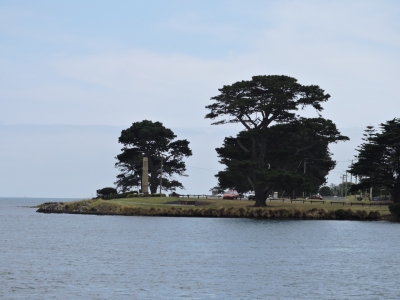
After a bit of wind rounding Cape Grim last night, we finished the run to the River Tamar in wonderfully calm conditions. Here we are just sound of the leading lights off She-Oak Point. Large commercial traffic frequenst the river, and the waterway is well-marked.
|
 |
2/18/2015: Garden Island
Position: -41°6.73'S, 146°49.14'E
We anchored off George Town, but the current there are over five knots at the height of the tide and our even our prop shaft is spinning. So we decided to find a more settled location.
|
 |
2/18/2015: Concorde
Position: -41°7.53'S, 146°48.93'E
The commercial fishing boat Concorde has an unusual passive-stabilizer system with paravanes mounted to rigid tubes connected to a super-structure. In this picture, the superstructure is deployed and the paravanes are tucked underneath.
|
 |
2/18/2015: West Arm
Position: -41°8.22'S, 146°48.43'E
The entrance into West Arm is narrow and shallow, but well-marked and easily navigated.
|
 |
2/19/2015: Sunset
Position: -41°8.50'S, 146°47.90'E
We found an excellent anchorage in 22 feet the sheltered waters of West Arm, with sandstone cliffs to the north and awesome sunsets.
|
 |
2/20/2015: Morning calm
Position: -41°8.50'S, 146°47.88'E
Afternoon breezes often blew through West Arm, but nothing strong, and most mornings were dead calm like this one.
|
 |
2/21/2015: Paddlers
Position: -41°9.66'S, 146°46.30'E
Several paddlers, in canoes and kayaks, were entering one of the streams at the head of West Arm when we were touring the area in the dinghy.
|
 |
2/21/2015: Inspection Head
Position: -41°9.06'S, 146°49.50'E
Two large tractor tugs, that support the commercial traffic in the region, were moored at Inspection Head.
|
 |
2/21/2015: Van Diemen's Land Circumnavigation
Position: -41°9.48'S, 146°49.42'E
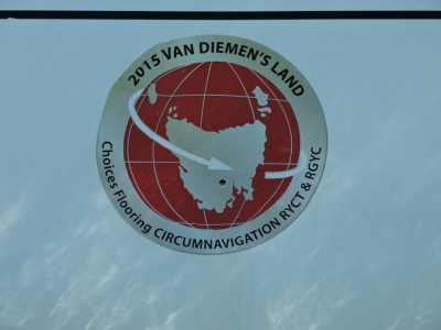
Van Diemen's Land was Tasmania's original name until 1856 (and also a U2 song). The Royal Yacht Club of Tasmania's 11th biennial Van Diemen's Land Circumnavigation was at the Tamar Yacht Club while we were anchored in West Arm. The marina was packed with boats carrying their logo. The rally was scheduled to leave Hobart on February 11th and return on March 18th, running counterclockwise around the island. With 43 boats registered in this year's rally, we're glad to have crossed paths here and not in some small anchorage along the way.
|
 |
2/21/2015: Alstroemeria
Position: -41°8.40'S, 146°50.93'E
The wood chip bulker Alstroemeria was in port at Bell Bay picking up a load of chips.
|
 |
2/21/2015: Mooring bollard
Position: -41°8.00'S, 146°52.27'E
Some commercial ports are now using automatic radio-release mooring bollards.
|
 |
2/21/2015: Bell Bay Power Station
Position: -41°8.60'S, 146°54.06'E
When commissioned in 1971, the Bell Bay Power Station ran on fuel oil that was delivered by tanker to a dedicated jetty at the site. The plant has since been converted to natural gas via a pipeline from Victoria and supplies 345 megawatts of power.
|
 |
2/24/2015: The Pier
Position: -41°6.51'S, 146°49.28'E
We'd been working hard on the web site transfer while anchored at West Arm, and now have it pretty much where we want it. So we are back out exploring. We ran the tender to George Town and stopped for pints on deck at The Pier pub. We had a James Boag's Draught and an XXX Ale, brewed nearby at the head of the River Tamar in Launceston.
|
 |
2/24/2015: Woolworths
Position: -41°6.43'S, 146°49.38'E
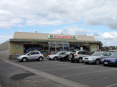
While in George Town, we stopped in at Woolworths for a few provisions, mostly fresh fruit and vegetables.
|
 |
2/25/2015: Current
Position: -41°6.92'S, 146°48.98'E
A strong ebb tide carried us out of the River Tamar. The screen shot shows us doing 10.5 knots in a 9.5kt boat, and at 1844 RPM we should be doing about 7 3/4 knots. We actually hit 10.9 knots at one point.
|
 |
2/25/2015: South Croppies Point
Position: -40°52.07'S, 147°34.54'E
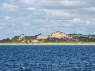
We considered anchoring off the sand dunes at South Croppies Point, but shallows extended a long way off shore and we couldn't get far enough behind the point for shelter from the current 10-20kt northeasterly winds. We anchored instead a little farther north off Croppies Point. The winds blew over the point and generated a bit of chop in the anchorage, but it was reasonably comfortable. Early the next morning the wind fell and shifted to the north, however, putting us beam to the swell and rocking the boat a fair bit. We'd planned to leave early that morning for Flinders Island anyway, but the swell moving through the anchorage was one more incentive for an early departure.
|
 |
2/26/2015: Strzelecki National Park
Position: -40°13.70'S, 148°1.98'E
Strzelecki National Park covers 16 square miles at the south-west side of Flinders Island. The park is mostly inland, but also includes Point Trousers along the coast. We had landed on the beach to walk the track around the point.
|
 |
2/26/2015: Point Trousers
Position: -40°13.72'S, 148°1.97'E
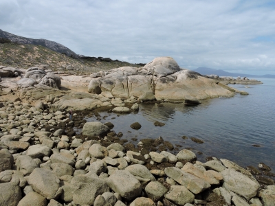
The scenery at Point Trousers is striking. This is looking east across orange lichen-covered rocks to Point Trousers Beach, with Lovett's Hill in the background. Dirona is anchored just out of the picture to the right.
|
 |
2/26/2015: Pied Cormorants
Position: -40°13.79'S, 148°1.66'E
Flinders is known for its diverse and healthy bird life. These Pied Cormoramnts were among the many birds we saw in the short walk around the point.
|
 |
2/26/2015: Lunch
Position: -40°13.79'S, 148°1.66'E
We climbed a big boulder and had lunch overlooking Bass Strait. That's Cape Barren Island in the distance to our south.
|
 |
2/26/2015: Boulders
Position: -40°13.62'S, 148°1.60'E
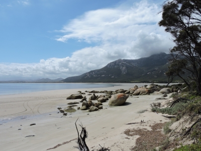
The huge weather-worn boulders around Point Trousers reminded us of those at Stewart Island in New Zealand. The rocks are bigger than they look--Jennifer is barely visible standing near the water's edge at the left third of the picture (click the image for a larger view).
|
 |
2/26/2015: Fotheringate Beach
Position: -40°13.03'S, 148°1.77'E
The track continued to beautiful Fotheringate Beach on the north side of Point Trousers.
|
 |
2/26/2015: Trousers Point Beach
Position: -40°13.65'S, 148°2.04'E
When we returned to the anchorage, the sky had cleared to a deep blue. With the broad sand beach and the turquoise waters, we felt like we were back in the South Pacific. We couldn't resist walking to the far end of the beach before returning to Dirona.
|
 |
2/27/2015: Fotheringate Beach
Position: -40°12.17'S, 148°2.51'E
We ran the boat around to the north side of Point Trousers and landed the micro-tender on Fotheringate Beach for the Mt. Strzelecki hike.
|
 |
2/27/2015: Bull
Position: -40°12.21'S, 148°2.88'E
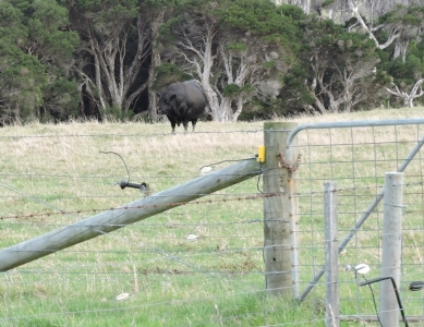
We had only land-based directions for reaching the start of the Mt. Strzelecki track. We luckliy had landed the dinghy almost exactly opposite the track, but first had to cross a pasture and hop a couple of electrified fences to reach it. We were glad this bull was on the other side of the fence from us.
|
 |
2/27/2015: Mt. Strzelecki track
Position: -40°12.25'S, 148°2.91'E
At the trailhead with our goal, 2,480' Mt. Strzelecki, in the background.
|
 |
2/27/2015: Granite face
Position: -40°12.33'S, 148°3.35'E
The track is well-marked and easy to follow, but fairly steep. Here we are passing alongside a granite face and you can see the track disappearing below behind Jennifer.
|
 |
2/27/2015: Partway there
Position: -40°12.35'S, 148°3.36'E
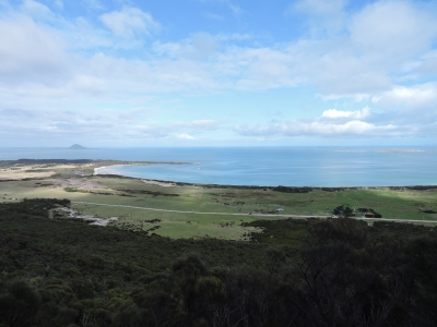
Less than halfway to the top, the views already were fabulous. Dirona is barely visible anchored just north of Point Trousers (click the image for a larger view).
|
 |
2/27/2015: Granite peaks
Position: -40°12.18'S, 148°3.98'E
Flinders Island continued to remind us of Stewart Island. The granite peaks along the way were similar to those we'd seen hiking mountains such as Magog there.
|
 |
2/27/2015: Socked in
Position: -40°12.12'S, 148°4.21'E
We stopped for lunch at the summit and enjoyed the "view", which at this point was assorted Tasmanian cloud formations since the peak had clouded in.
|
 |
2/27/2015: View
Position: -40°12.01'S, 148°4.27'E
We knew the cloud line was fairly distinct, so we elected to drop down and enjoy the view from whatever level we could get it. The ridge where this panorama was taken was clouded in on our way up, but had cleared as we descended. The views were just amazing.
|
 |
2/27/2015: Summit view
Position: -40°12.11'S, 148°4.20'E
While enjoying the view a few hundred feet down from the peak, the cloud formation broke, revealing the peak above. We couldn't resist and hiked back up to the top for a 360-degree view of Flinders Island and the surrounding waters. This photo is looking across Point Trousers to Mount Chappell and Little Badger Islands. Big Green and East Kangaroo Islands are at the right of the photo.
|
|
2/27/2015: East Kangaroo Island
Position: -40°11.27'S, 147°54.23'E
The winds were 20kts from the west by the time we returned to the boat, and substantial wind waves were moving through the anchorage, so we moved to find better westerly shelter. East Kangaroo Island didn't provide as much shelter as we'd hoped, but was reasonable. The anchorage was shallow and for the first time ever, we couldn't get the anchor to set in the heavy weed. So we decided to leave and try Big Green Island instead.
|
|
2/27/2015: Big Green Island
Position: -40°11.06'S, 147°59.29'E
We found the same heavy weed in the shallows of Big Green Island as at East Kangaroo Island, and again the anchor didn't set. Certainly we could have anchored in deeper water without the weed, but as soon as you get deeper water you also give up shelter and in this weather it was unappealing. We have a large Fortress anchor mounted on the bow for heavy weed or light silt conditions, but decided to just return back to the south side of Point Trousers where both the holding and shelter were good.
|
|
2/28/2015: Roydon Island
Position: -39°54.42'S, 147°46.93'E
Winds were predicted to blow 25-30kt southwest the next day. We were hoping to find good protection behind Roydon Island, which our cruising guide said was an excellent anchorage with protection from most weather. But we again couldn't get a set in the shallow weed-filled waters--the anchor came up so wrapped in weeds we couldn't see any part of it. The anchorage wasn't appealing enough to warrant the effort of using the Fortress anchor--in the current 15-20 knots northerly winds, 2-foot waves were rolling through. Nothing else in the area provided protection from both directions, so we decided to continue on to Deal Island. Ironically, conditions were better out in Bass Strait than in the Roydon Island anchorage and got even calmer as we proceeded.
|
 |
2/28/2015: Fishing vessel
Position: -39°34.26'S, 147°22.25'E
This fishing vessel was working a net just south of Deal Island. The other end of the net was marked with a pole and an orange buoy--we diverted course slightly to give it space.
|
 |
2/28/2015: Lighthouse
Position: -39°31.89'S, 147°19.58'E
The old lighthouse atop the rugged cliffs of Deal Island.
|
 |
2/28/2015: Cliffs
Position: -39°29.53'S, 147°18.20'E
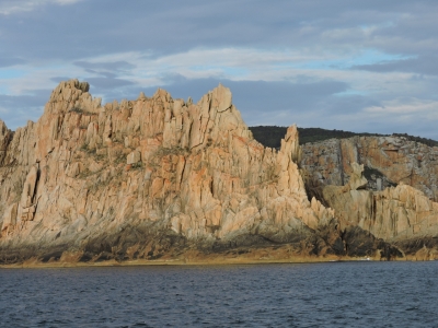
The steep cliffs of Deal Island were incredibly beautiful, particularly in the late afternoon light.
|
 |
2/28/2015: Murray Pass
Position: -39°28.87'S, 147°18.02'E
The dramatic scenery continued as we passed through Murray Pass betweeh Deal and Dover Islands.
|
 |
2/28/2015: Sunset
Position: -39°28.33'S, 147°18.65'E
We'd gotten a bit of a late start for the run to Deal Island, and arrived at the East Cove anchorage just in time for a sunset over Dover Island.
|
 |
3/1/2015: Southwesterly
Position: -39°28.33'S, 147°18.65'E
The predicted southwesterly winds arrived early this morning, with steady 25-knot winds and gusts to 40 through the anchorage. East Cove doesn't have great southwest protection, and fair-sized large waves were rolling through Murray Pass and into the anchorage. But we were reasonably comfortable: the winds mostly kept our bow into the waves, where the weight of the boat tends to limit the motion. And the flopper-stopper (passive at-rest roll stabilizer) dampened any roll when we did take any waves on the beam. The current in Murray Pass can run reach 5 knots and 6-meter seas can build at either end in strong opposing winds. We noticed conditions worsened when the tide was flooding south against the wind, stacking up the seas, and smoothed out on the northbound ebb. The catamaran Shadowfax left East Cove during the height of the winds and was getting bounced around a bit in the waves as she entered the channel.
|
 |
3/2/2015: Cellular
Position: -39°28.38'S, 147°18.84'E
We landed the dinghy at the old jetty in East Cove to hike to the lighthouse. A steep road leads up to the top of the hill above the anchorage. Partway along is this bench where you can apparently pickup a cell phone signal.
|
 |
3/2/2015: Wallabies
Position: -39°28.42'S, 147°18.85'E
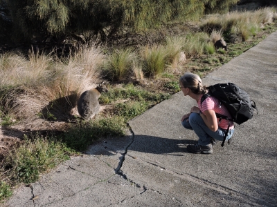
One of the first things we saw as we started up the hill was a wild wallaby. And then another, and another--on the road, beside the road, jumping through the grass. There must be thousdands on the island--they're incredibly cute.
|
 |
3/2/2015: Wallaby encounter
Position: -39°28.45'S, 147°18.83'E
The wallabies didn't seem particularly concerned by our presence and let us get quite close.
|
 |
3/2/2015: East Cove
Position: -39°28.50'S, 147°18.80'E
The view from the hilltop to the anchorage and across Murray Pass to the gap between Dover and Erith Islands. We'd had the anchorage to ourselves since Shadowfax had left yesterday morning.
|
 |
3/2/2015: Lighthouse
Position: -39°29.66'S, 147°19.34'E
The Deal Island Lighthouse operated for nearly 150 years, from 1948 until 1992. At 1,000 feet above sea level, it was the highest lighthouse in the southern hemisphere. Height is not always an advantage for lighthouses: the light atop Triangle Island at the northern tip of Vancouver Island in western Canada was 650 feet above sea level, the highest in the province. The light was constantly shrouded in fog--one year for 240 days--and operated only from 1909 to 1919. Although not as severe at Deal Island, fog also was a problem for this lighthouse, and replacement automated lights were located elsewhere at lower points on the island.
|
 |
3/2/2015: View
Position: -39°29.66'S, 147°19.35'E
We climbed the tower. This is the 360-degree panoramic view from the top of the lighthouse. South Bluff on Deal Island is at the left of the photo, in the center are ruins of the lighthouse support building in the foreground and in the distance is Norfolk Point on Dover Island at the southern entrance to Murray Pass. The caretakers compound above our anchorage is visible to the right of center, and Squally Cove at the south end off Deal Island is rightmost. (Click the image for a larger view).
|
 |
3/2/2015: Light
Position: -39°29.66'S, 147°19.35'E
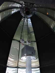
The light source is a dual-redundant 100W tungsten halogen, inside a 12' Chance lantern using a Chance lens with a 3' focal radius. The light had a nominal range (how far it can be seen in 10nm of visibility) of 24 miles, and geographical range (how far it can be seen limited by curvature of the earth) of 40 miles.
|
 |
3/2/2015: Crash
Position: -39°29.73'S, 147°19.55'E
Not far from the lighthouse are the remains of an Australian Air Force plane that crashed here while on a training run in 1943, killing all four on board.
|
 |
3/2/2015: Snake
Position: -39°29.49'S, 147°19.33'E
This white-lipped snake was on the track as we returned. They apparently are shy and not particularly venomous, but this one didn't move as we approached and seemed rather agressive. We gave it plenty of space.
|
 |
3/2/2015: More wallabies
Position: -39°28.53'S, 147°18.96'E
We never tired of seeing the wallabies during our time on Deal Island.
|
 |
3/2/2015: Caretakers
Position: -39°28.51'S, 147°18.85'E
On our return we met the current caretakers on the island, Andrew Welling and Maria Duggan, pictured with their children Eve, Luka, and Xavier. Eve is holding some apples we'd brought for them--fresh fruit often is in short supply for the caretakers here.
|
 |
3/2/2015: Museum
Position: -39°28.51'S, 147°18.86'E
A excellent museum is in the caretakers complex, detailing the island's history including shipwrecks, the caretakers lifestyle, and of course, the lighthouse.
|
 |
3/2/2015: Company
Position: -39°28.43'S, 147°18.84'E
While at the lighthouse, we could see several boats approaching Deal Island from the northwest. When we returned, seven other boats were now at anchor with us. We were planning leave anyway to take advantage of the good weather in Bass Strait and make the overnight run to Melbourne. A storm was expected to come through in a couple of days, so we'd have plenty of time to make the ivernight crossing. Had we stayed, we certainly would have had to re-anchor, as at least one other boat had anchored well within our anchor swing.
|
 |
3/2/2015: Conditions
Position: -39°26.36'S, 147°18.64'E
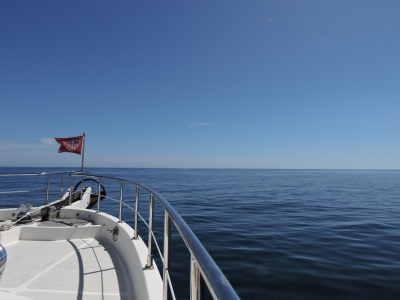
Conditions in Bass Strait were unusually smooth as we set off for Melbourne, and remained that way for the entire trip. The winds frequently were below five knots.
|
 |
3/2/2015: Dolphins
Position: -39°20.20'S, 146°47.66'E
A pod of dolphins chase our bow a couple of hours into the run.
|
 |
3/2/2015: Traffic lanes
Position: -39°19.73'S, 146°45.22'E
We're approaching the first traffic separation scheme we've been in for a long while and are seeing a lot of commercial traffic on AIS. Here the APL Arabia and the Kite Arrow are heading north around Wilsons Promontory at the southeast corner of mainland Australia.
|
 |
3/2/2015: APL Arabia
Position: -39°17.42'S, 146°33.23'E
The container ship APL Arabia rounding Wilsons Promontory to head north.
|
 |
3/2/2015: Cleft Island
Position: -39°11.31'S, 146°13.94'E
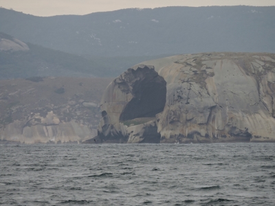
A huge cavern--425' wide, 200' deep and 200' tall--indents the end of Cleft Island to our north in the Anser Group. The island also is called Skull Rock, because the cave looks somewhat like a skull at certain angles.
|
 |
3/3/2015: Traffic
Position: -38°37.27'S, 145°3.92'E
We're seeing steady commercial vessel traffic as we near Melbourne.
|
 |
3/3/2015: The Rip
Position: -38°18.44'S, 144°37.60'E
Approaching the entrance to Port Phillips with the Point Lonsdale light to our north. The entry channel to Port Phillip is known locally as "The Rip", and is one of only three tidal current stations in all of Australia. The other two are near Mackay, north of Brisbane, and in Torres Strait at the northeastern tip of Australia. Coming from British Columbia in western Canada, with its dozens of primary and secondary tidal current stations, three feels strangely small for a country as large as Australia. So long as winds aren't blowing strongly from the north, The Rip can safely be transited any time on a rising tide. On a falling tide, the ebb current against incoming swell on shallow Rip Bank creates dangerous conditions for small craft. We entered exactly at low-water slack, and conditions were excellent.
|
 |
3/3/2015: Queenscliff
Position: -38°16.88'S, 144°40.41'E
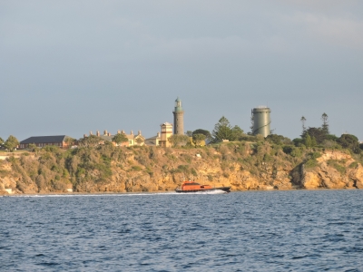
A pilot boat passing under historic Queenscliff in the morning light. The town was a seaside resort in the late 1800s and has many Victorian-era heritage sites.
|
 |
3/3/2015: Searoad Ferry
Position: -38°16.82'S, 144°40.57'E
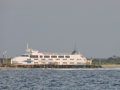
The Searoad Ferry Queenscliff moored at its namesake. This is one of two car ferries that cross between Queenscliff and Sorrento on the Mornington Peninsula. We saw the other end of the ferry run when we visited Sorrento in January for 2015 Moth Worlds.
|
 |
3/3/2015: STI Beryl
Position: -37°53.91'S, 144°54.35'E
The STI Beryl was one of several large commercial ships moored in Port Phillips as we passed through. Several other ships were underway coming and going--this is a busy harbour.
|
 |
3/3/2015: Aurora
Position: -37°51.59'S, 144°55.07'E
The cruise ship Aurora moored at the Port of Melbourne with the city in the background.
|
 |
3/3/2015: Adelaide
Position: -37°51.49'S, 144°54.97'E
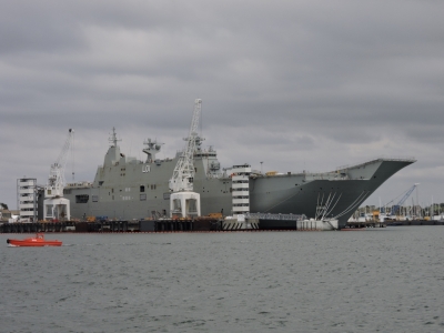
The HMAS Adelaide is the second of Australia's two Canberra Class Amphibious Assault Ships. The hull was built in Spain and shipped to Melbourne where it is being fitted out for a 2016 launch. We saw her sister ship, the HMAS Canberra at Fleet Base East in Sydney last December.
|
 |
3/3/2015: Sea Sheppard
Position: -37°51.20'S, 144°54.66'E
The Steve Irwin is part of the Sea Sheppard ship Antarctic anti-whaling campaign.
|
 |
3/3/2015: Container port
Position: -37°49.21'S, 144°54.91'E
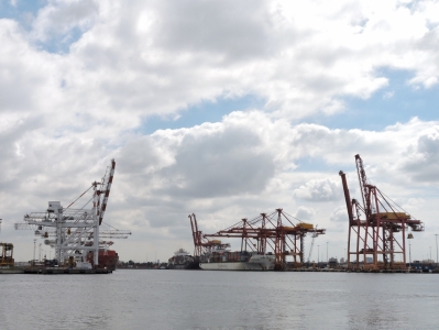
From Port Phillips, we entered the River Yarra and passed Melbourne's large container port as we neared the city.
|
 |
3/3/2015: Bolte Bridge
Position: -37°49.17'S, 144°55.51'E
Approaching the Bolte Bridge over the River Yarra. This is the final bridge over the river that Dirona can pass under. The next one looks barely passable in the dinghy.
|
 |
3/3/2015: YE Marina
Position: -37°49.45'S, 144°56.70'E
David Fincham met us at Yarra's Edge (YE) Marina when we arrived. He'd offered us his slip while his Nordhavn 57 Speedbird is in Hobart.
|
 |
3/3/2015: Berth
Position: -37°49.47'S, 144°56.70'E
Yarra's Edge Marina is a beautiful facility in an excellent location right in downtown Melbourne.
|
 |
3/3/2015: Boatbuilders Yard
Position: -37°49.44'S, 144°57.20'E
Dozens of restaurants line the river. We had a great lunch at the Boatbuilders Yard.
|
 |
3/3/2015: Constellation
Position: -37°49.21'S, 144°57.64'E
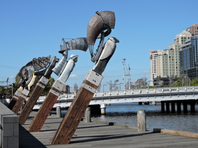
Melbourne is a beautiful city with wonderful art all over, particularly along the waterfront. The five figureheads in the sculpture Constellation reflect the ethnic backgrounds of those who worked along the waterfront during Melbourne's settlement years.
|
 |
3/3/2015: The Travellers
Position: -37°49.18'S, 144°57.78'E
The Travellers is a series of ten figures on the Sandridge Bridge representing various waves of immigration to Melbourne since aboriginal times.
|
 |
3/3/2015: F1
Position: -37°49.05'S, 144°58.08'E
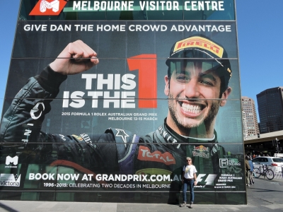
Jennifer posing beneath a huge photo of Australian Formula One driver Daniel Ricciardo on the Melbourne Visitors Center. One of the reasons we came to Melbourne is to attend the F1 race on March 15th. We're really looking forward to it.
|
 |
3/3/2015: Federation Square
Position: -37°49.06'S, 144°58.06'E
Looking southeast across Federation Square. Melbourne's public "square" is not rectangular, but definitely is a popular gathering place.
|
 |
3/3/2015: Hosier Lane
Position: -37°49.00'S, 144°58.15'E
Hosier Lane is covered in creative and whimsical street art.
|
 |
3/4/2015: Fueling
Position: -37°49.03'S, 144°55.63'E
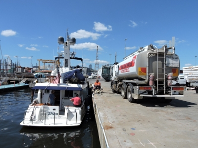
David Fincham had arranged for a refueling truck a short distance from the marina. We thought we were taking on 600 gallons in Hobart just to keep our options open. But having taken on 1,047 gallons (3,964 L) here, without that 600 gallons we would be very close to empty with our 1,750-gallon (6,624 liters) total capacity. We spent more time, more fun and more fuel than expected in Tasmania.
|
 |
3/4/2015: Meat Market
Position: -37°49.43'S, 144°56.97'E
We had a great meal riverside at the Meat Market, a short walk from the marina.
|
 |
3/5/2015: Whitworths
Position: -37°48.31'S, 144°57.56'E
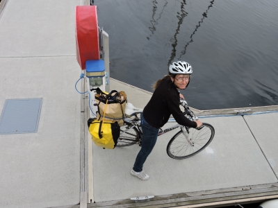
We got the bikes out for the first time since Brisbane seven months ago. Having them aboard the boat has been really convenient for everything from grocery shopping to longer-range exploring and it's unusual for us to have gone so long without using them. In the seven months since Brisbane, we only lubricated the chains once and have done nothing else to them. We dropped them down, filled up the tires, and were off with them running perfectly. The quality of these Giant bikes and their resistance to a horrendous saltwater environments is impressive. Our first stop was the local Whitworths marine supply store to pick up a new steering cable for the dinghy (that large coil leaning against the rear tire).
|
 |
3/5/2015: Bunnings
Position: -37°49.89'S, 144°56.30'E
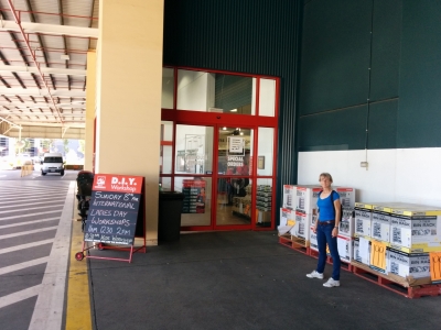
We rode our bikes to a nearby Bunning hardware store. We found Melbourne quite bicycle-friendly--good bike paths are throughout the city and this was the first hardware store we'd been to that actually had bicycle racks.
|
 |
3/5/2015: Duane Rodgers
Position: -37°49.45'S, 144°56.71'E
Melbourne residents Duane Rodgers and his partner Michelle stopped by for a visit. We correspond with them periodically about boats, and had discussed meeting in the Whitsundays while we were both there, but the timing didn't quite work with them leaving just as we arrived. Ironically, it almost happened again--they are flying to the US the next day for a month, but at least this time there was a couple of days of overlap. We enjoyed their visit and it was nice to finally meet in person.
|
 |
3/6/2015: David and Meryl
Position: -37°49.45'S, 144°56.71'E
David Newnham and Meryl Kate, owners of Nordhavn 62 Celebrate, live in Melbourne but currently keep their boat on the Gold Coast where we'd met David last year. We had an excellent lunch with them and came back for a quick tour of Dirona after.
|
 |
3/6/2015: Mail
Position: -37°49.45'S, 144°56.71'E
David Newnham, owner of Nordhavn 62 Celebrate, had offered to accept mail for us. The two seals are spare auto steering pump seals from AccuSteer in the US. And we've been gone for a while now, so needed to get our passports updated. When you travel as much as we do, this is actually more difficult to organize than one might expect. We rarely return to the US for more than two weeks at a time, so renewing them there is difficult as the processing times are 4-6 weeks standard, 3 weeks expedited, or possibly 8 days expedited based on need. None except the last option would work for us, and even if we could get that assuredly, 8 days still is a little tight. Handling this while in Australia turned out to be remarkably efficient and straightforward with the US Consulate's committed 2-3 weeks procesing time. We mailed our applications in Hobart to the Melbourne US Consulate, and the new passports were waiting for us with David when we arrived in town.
|
 |
3/6/2015: Andrew McDougall
Position: -37°49.45'S, 144°56.71'E
Andrew McDougall of Gosford was in town and stopped by for a visit. We forgot to take a picture, but here's one we took when we were helping to raise the mast on his Melges 32 last October at the Gosford Sailing Club. We've not seen him since, so it was great to catch up.
|
 |
3/7/2015: Boat Books
Position: -37°51.74'S, 144°59.12'E
David Fincham took us on a car tour of the area this morning. We stopped off at Boat Books in St Kilda to pickup a copy of the Western Australia Cruising Guide for cruising the Kimberly region in northwestern Australia.
|
 |
3/7/2015: Richmond Oysters
Position: -37°49.58'S, 144°59.87'E
We stopped for a delicious seafood luch at Richmond Oysters.
|
 |
3/8/2015: Birdman Rally
Position: -37°49.14'S, 144°58.21'E
The annual Melbourne Moomba Festival runs from March 6th through 9th. A highlight of the festival is Birdman Rally, where contestants in homemade flying devices and elaborate costumes vie for honours of the furthest flight or most creative costume. We ran the dinghy up the River Yarra to watch from the water-it was great fun. Spectators crowded the river banks, but only a couple of other boats were there watching. The parks department had a barge there to dispose of any costumes/flying devices that contestants didn't want to salvage. (Click the image to watch the video.)
|
 |
3/8/2015: Steering cable
Position: -37°49.44'S, 144°56.70'E
The steering on our dinghy has been stiff since new, but it's recently gotten much, much worse and was at risk of failing entirely. We'd picked up a new cable earlier in the week at Whitworth's and replaced it today. The entire process went much more quickly and smoothly than we'd anticipated. Because the cable is so stiff, we were expecting we'd need to lift the motor off with the crane in order to disconnect the cable, and possibly have to remove the console too. But we were able to pull enough slack through that we could remove the old cable and attach the new cable with everything in place. The dinghy is now unbelievable
|
 |
3/8/2015: Gas Brigades
Position: -37°49.28'S, 144°57.62'E
On an hourly basis in the evenings, 3-7m fireballs are released from eight towers along the Yarra River. The spectacle is called the Gas Brigades and is amazing to see.
|
 |
3/8/2015: Fireworks
Position: -37°49.15'S, 144°58.20'E
The Moomba Festival has a nightly fireworks display. We ran the dinghy back up-river to watch the show. The fireworks were excellent and we had a great time. (Click the image to watch the video.)
|
 |
3/10/2015: Woolworths
Position: -37°49.45'S, 144°56.71'E
We picked up some fresh produce in Hobart and the River Tamar, but this is our first bulk grocery order since Sidney. As usual, we're taking advantage of Woolworths grocery delivery service to stock up on heavy items, such as wine, beer and cordial, that are more difficult to carry on the bike or on foot. Woolworths quality and selection is remarkably good, so we end up getting the vast majority of what we need from them. Here's the Woolworths driver on the first of what will be six trips down to the boat.
|
 |
3/10/2015: Black swans
Position: -37°49.45'S, 144°56.71'E
Two black swans came over this afternoon, clearly expecting a handout. Likely they are well-fed around here. The one behind has a large band encircling its neck, covered partially by the tail feathers of the one in front, probably identifying the bird for the local wildlife service.
|
 |
3/11/2015: Swan Street Bridge
Position: -37°49.58'S, 144°58.81'E
On a beautiful sunny day, we set off on a dinghy trip up the Yarra River. We weren't able to do this when we arrived, as the river was closed most of the day at the Moomba Festival location. We passed under a lot of bridges on our way, several dating from the 1800s--the first permanent bridge over the Yarra was completed in 1850. The Swan Street Bridge in the distance behind us was completed 100 years later in 1952.
|
 |
3/11/2015: River Homes
Position: -37°49.92'S, 145°1.05'E
Many beautiful houses line this section of the river, some modern and some more than a century old.
|
 |
3/11/2015: Tranquil
Position: -37°48.63'S, 145°0.62'E
As we left the city, we slipped into quiet, rural parkland.
|
 |
3/11/2015: Carlton Brewhouse
Position: -37°48.38'S, 144°60.00'E
This tall smokestack is part of a large Carlton Brewery. Hundreds and hundreds of beer kegs were stacked in the lot. The brewery offers tours and has a brew pub, but unfortunately there wasn't any obvious access from the river.
|
 |
3/11/2015: Studley Park
Position: -37°48.12'S, 145°0.36'E
We had good depth for the dinghy until Studley Park, where depths dropped below two feet. Around the next bend are Dights Falls. an artificial wier built across the river in the 1840s to supply water for a flour mill. We were hoping to reach the falls by dinghy, but had to turn back here. It's a fairly short walk from here to the falls, but the landings didn't look that inviting and we elected to start the return trip.
|
 |
3/11/2015: West Beach
Position: -37°51.57'S, 144°58.15'E
We rode the bikes to Albert Park to pick up our tickets for the Australian Grand Prix, then continued on to the Port Phillip waterfront. The wind had picked up in the afternoon, and the West Beach area was full of sail boarders and kite surfers.
|
 |
3/11/2015: Kite foilboard
Position: -37°51.46'S, 144°58.06'E
We'd never seen a kite foilboard before--foiling is beginning to take over all forms of sailing.
|
 |
3/11/2015: Spirit of Tasmania
Position: -37°50.47'S, 144°55.92'E
The Spirit of Tasmania and Spirit of Tasmania II carries freight, passengers and vehicles between Melbourne and Tasmania. The high-speed ferries make the 232nm run at 27 knots, taking 9-11 hours. They look tough--they'd have to be to cross the Bass Strait. In 2005, the ship was forced back to port when 20m seas broke some windows on the upper deck and flooded some passenger cabins.
|
 |
3/11/2015: Flyboard
Position: -37°50.52'S, 144°55.87'E
Two people were out on flyboards near Station Pier. A flyboards is a board attached via hose to a jetpack on a personal water craft. The PWC drives the boards water jet, lifting the rider 15m in the air or propelling them headlong through the water. The jetski is nearby out of the picture, and the connection isn't that visible, so the flyboard looks like a lot like a personal jet-pack.
|
 |
3/11/2015: Tasmanian Achiever
Position: -37°50.32'S, 144°54.38'E
We biked as far as we could along the Port Phillip waterfront, but had to turn back at Webb Dock. Here we watched drivers back double-decked container loads onto the Tasmanian Achiever, bound for Tasmania.
|
 |
3/11/2015: Southbank
Position: -37°49.20'S, 144°57.95'E
We took the Sandridge Rail Trail from Station Pier directly back to the Southbank district and had drinks and dinner in overlooking the River Yarra, where we'd passed by on our dinghy tour earlier today.
|
 |
3/12/2015: Australian Grand Prix
Position: -37°50.98'S, 144°57.96'E
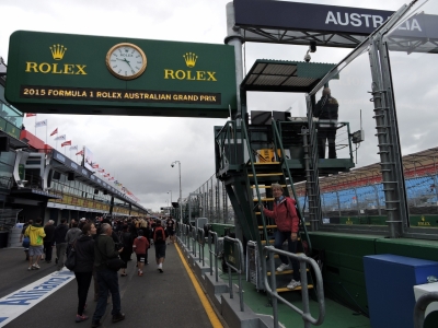
We weren't the only ones to arrive at the track when the gates opened at 8am Thursday morning for opening day of the Australian Grand Prix weekend. In addition to the Formula 1 cars, there will be competetion from V8 Supercars, Porsche Carreras, and Heritage Touring Cars.
|
 |
3/12/2015: Pit lane walk
Position: -37°51.01'S, 144°58.15'E
We'd purchased 4-day grandstand tickets prior to November 30th last year, which gave us GP Silver Advantage membership. One of the perks was a Pit Lane Walk on Thursday morning where we got to watch the teams preparing the most exotic machines in motor sport for what should be an exciting weekend.
|
 |
3/12/2015: Scuderia Ferrari
Position: -37°51.03'S, 144°58.18'E
Seeing the cars up-close and in person was super-exciting. James has attended the Canadian and US Grand Prixs many times in the 1970s and 1980s, but hasn't been for several decades, and Jennifer has never attended a Formula 1 race.
|
 |
3/12/2015: V8 Supercars
Position: -37°51.09'S, 144°58.26'E
Just past the F1 pits were the V8 Supercars, an exciting and competitive Australian racing series that has much in common with the NASCAR Sprint Cup series in the US. Both use powerful highly-modified V8 engines in what looks a bit like commonly-available street cars. We've been enjoying the V8 supercar races on TV and have been looking forward to seeing race in person. This is car #1 driven by Jamie Whincup, six-time and current champion.
|
 |
3/12/2015: Daniel Riciardo
Position: -37°51.05'S, 144°58.33'E
The ever-smiling and always upbeat Daniel Ricciardo at in interview session. He has a knack for getting the most out of a car, even when his equipment really can't win. There's a good chance he will one day deliver a Formula 1 championship back to Australia. Also on-stage were Daniel's teammate Daniil Kyvat, the current F1 champion Lewis Hamilton, and Hamilton's teammate Nico Rosberg.
|
 |
3/12/2015: Viewing deck
Position: -37°51.07'S, 144°58.25'E
Our tickets included all-day access to a viewing deck directly above the start-finish line. Here we are watching the V8 cars in a qualifying session.
|
 |
3/13/2015: Groceries
Position: -37°49.45'S, 144°56.71'E
Jennifer returning from a run to the nearby Woolworth's for fresh produce and a few items that weren't available for delivery.
|
 |
3/13/2015: RAAF Roulettes
Position: -37°51.07'S, 144°58.16'E
We'd started day two amazed there were three days of excitement still in front of us-we'd already had so much fun. The Royal Australian Air Force Roulettes performed five times throughout the weekend in their PC-9/A aircraft.
|
 |
3/13/2015: Tested on animals
Position: -37°51.10'S, 144°58.22'E
We got a kick out of this advertisement: "Tested on animals".
|
 |
3/13/2015: Lewis Hamilton
Position: -37°51.17'S, 144°58.42'E
The first Formula 1 lap of the weekend viewed from our seats in the Schumacher grandstand. This is Lewis Hamilton between corners 15 and 16.
|
 |
3/13/2015: V8 Supercars start
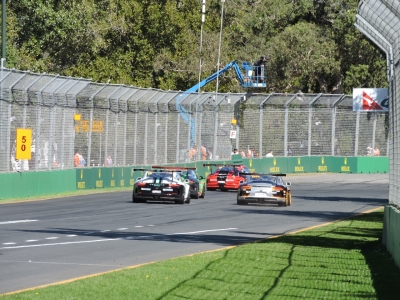
Position: -37°51.17'S, 144°58.42'E
The V8 Supercars raced twice Friday. Here the field is accelerating through turn 16 and down the front straight to take the starting flag.
|
 |
3/13/2015: Corner 13
Position: -37°51.07'S, 144°58.67'E
Thursday we'd watched some of the practice sessions from corner 13. It's the second fastest part of the track, and one of the best passing opportunities in a lap. From this vantage point, there's a gap in the fencing designed to allow safety personal to enter the track when needed, so it's a wonderful unobstructed view of high-speed braking and passing. Here's passing for position in the second Porsche Carrera Cup race of the weekend.
|
 |
3/13/2015: Sunset
Position: -37°49.44'S, 144°57.26'E
Sunset looking downriver towards the striking Seafarers pedestrian bridge.
|
 |
3/13/2015: CBD
Position: -37°49.44'S, 144°57.26'E
Melbourne ranks with some of the most beautiful cities in the world. We love living on the boat in the core of the city and being able to stroll up the river at nightfall, watch the sunset, and enjoy dinner at a different venue every night. We don't usually go to restaurants all that often, but it's a hard-to-turn-down treat here.
|
 |
3/14/2015: Bob Jane T-Marts
Position: -37°50.91'S, 144°58.19'E
We spoke several times to the crew of the two Bob Jane T-Marts Porshe Carrera Cup cars. Their entries were fast, and the team had a 1st, 3rd and 5th in the three races over the weekend. By far the most friendly crew in the entire garage area, they invited us in to the garage to see the cars more closely and explained the details of how they're setup.
|
 |
3/14/2015: Porsche 919
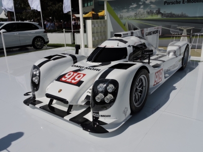
Position: -37°50.95'S, 144°58.15'E
This Porsche 919 is a hybrid sports-prototype built for the Le Mans Prototype 1-Hybrid category. Ex-Formula 1 driver Mark Webber of Australia was one of the drivers in the car's 2014 Le Mans entry.
|
 |
3/14/2015: Heritage Touring cars
Position: -37°51.17'S, 144°58.42'E
The Heritage Touring Cars put on a great show, with lots of passing at corner 15 in front of our stands. The race didn't end well for everyone though--this car lost a left front wheel while braking for corner 15.
|
 |
3/14/2015: V8 Supercars
Position: -37°51.17'S, 144°58.42'E
Passing for position in the 3rd V8 Supercar race of the weekend. These cars are fast, the drivers fight hard, and no-one is afraid to swap some paint.
|
 |
3/14/2015: Black Hawk
Position: -37°51.17'S, 144°58.24'E
The Australian Defense Force had a Sikorsky S70A-9 Black Hawk helicopter on display. It sure is a big beast.
|
 |
3/14/2015: Nico Rosberg
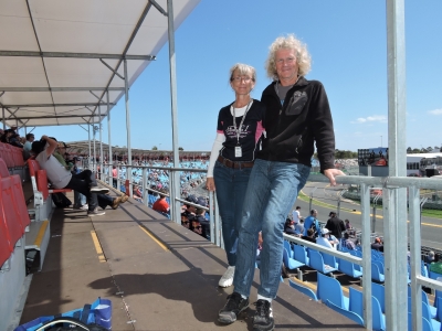
Position: -37°51.17'S, 144°58.42'E
Nico Rosberg and Daniel Riciardo were pushing very hard all weekend, Rosberg to catch up to Hamilton and Riciardo to find some speed in his car. Both were driving hard enough during practice and qualifying to leave the track at one point or another at corner 15. They put on an excellent show, but Rosberg did not overcome Hamilton, nor did Riciardo fully overcome the deficiencies of the 2015 Renault power plant.
|
 |
3/15/2015: Race day!
Position: -37°51.18'S, 144°58.41'E
In the stands, ready for the big show.
|
 |
3/15/2015: Drivers parade
Position: -37°51.17'S, 144°58.42'E
Classic 1920s Bentley and Delage autos carried the drivers around the track for a parade lap.
|
 |
3/15/2015: Leaders
Position: -37°51.17'S, 144°58.42'E
Lewis Hamilton and Nico Rosberg qualified one and two and finished in the same position. As races go, it wasn't the most exciting we'd ever seen, but there's something special about being there, smelling the cars, being close to the technology and watching the details. It was an incredible weekend.
|
 |
3/15/2015: Start-finish line
Position: -37°51.03'S, 144°58.18'E
Right after the race was over, the officials opened the track and we joined the tens of thousands that poured from the stands towards the start-finish line to watch the trophy presentation and podium interviews. "It's Arnold Schwarzenegger, man!", said Lewis Hamilton of the surprise podium interviewer. Schwarzenegger did a great job of the interview--many said this was the best part of the race--and signed off jointly with Hamilton: "I'll be back!".
|
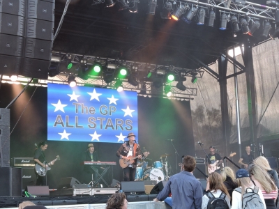 |
3/15/2015: GP All Stars
Position: -37°50.79'S, 144°58.04'E
We'd been taking the tram back and forth from town. Thursday and Friday were no problem, but the tram lineups were long after Saturday's sessions. So we spent some time watching the entertaining GP All Stars while the crowds thinned out. Nothing better than a beer and some good music on the lawn.
|
 |
3/16/2015: Kate Humphries
Position: -37°49.45'S, 144°56.71'E
Syndey resident Kate Humphries had sent us pictures of Dirona as we arrived in Farm Cove beside the famous Sydney Opera House four months ago. Now that we're attached to land and actually can be visited, Kate happened to be in town and stopped by to enjoy glass of wine and talk boats.
|
 |
3/17/2015: Lawrence and Hanson
Position: -37°49.90'S, 144°57.84'E
We biked out to Lawrence and Hanson Electrical Distributors to pickup some parts only available in large centers. It's nice to visit a store with such a big selection.
|
 |
3/17/2015: Finchams
Position: -37°49.45'S, 144°56.71'E
David and Jennifer Fincham from Nordhavn 57 Speedbird stopped by for a goodbye visit before we set off the next morning for the Gold Coast. They'd taken excellent care of us while we were in Melbourne and we'll miss their conversation and hospitality.
|