MV Dirona travel digest for Tasmania West Coast 2015

|
Click the travel log icon on the left to see these locations on a map,
with the complete log of our cruise. On the map page, clicking on a camera or text icon will display a picture and/or log entry for that location, and clicking on the smaller icons along the route will display latitude, longitude and other navigation data for that location. And a live map of our current route and most recent log entries always is available at //mvdirona.com/maps/LocationCurrent.html. |
|
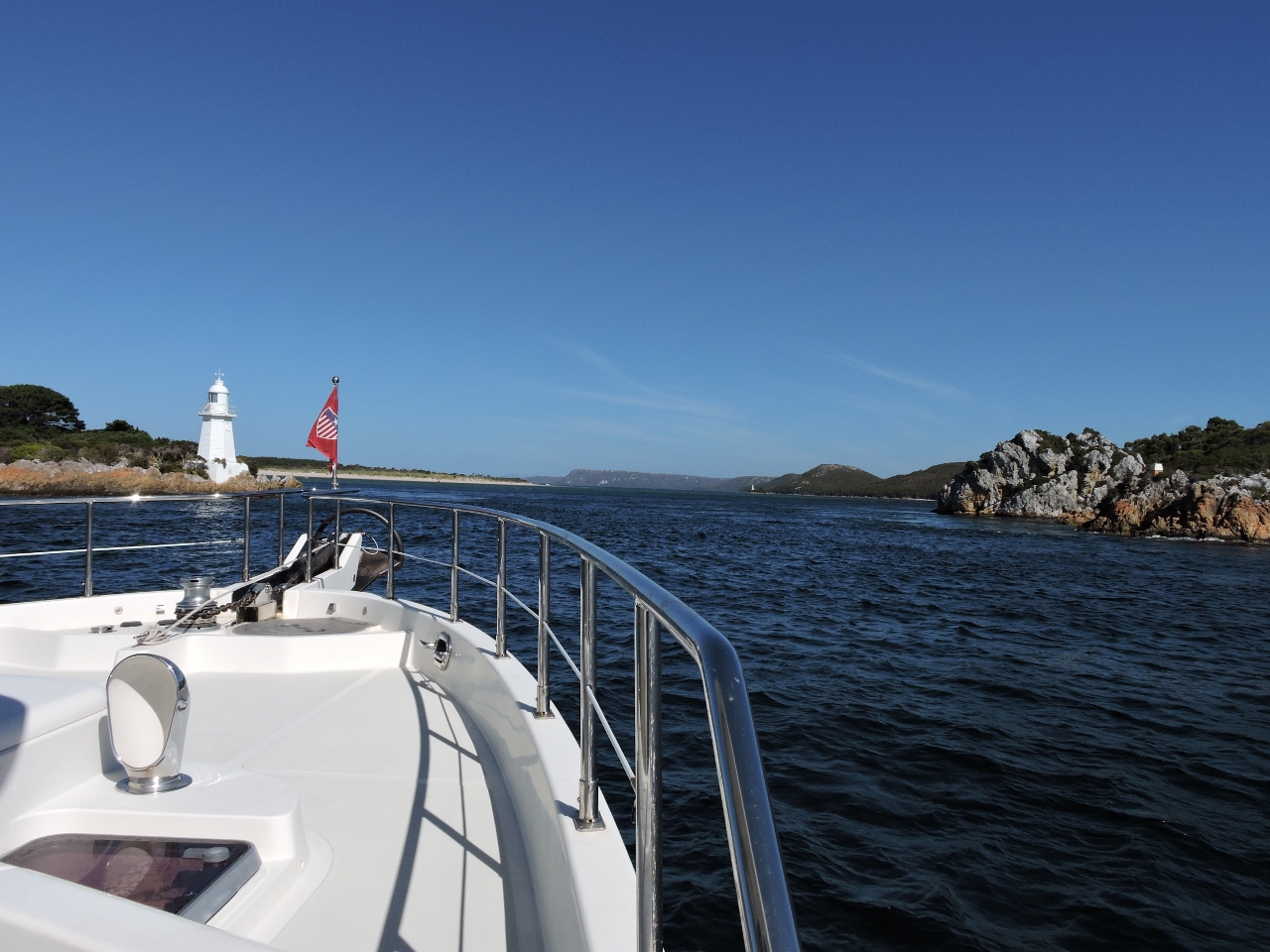
1/27/2015: Deep Hole
Position: -43°27.08'S, 146°58.37'E
We returned to Port Huon around 6:30 last night and just managed to reach Deep Hole in Southport before total darkness. The 90-mile run to Port Davey from Port Huon is through aquaculture, islands and reefs best done during daylight, so we wanted to take advantage of remaining light today to get through as much as possible. We left just before daybreak this morning, so didn't get a chance to see much of Southport. The anchorage had good swell protection though, with plenty of swing room.
|
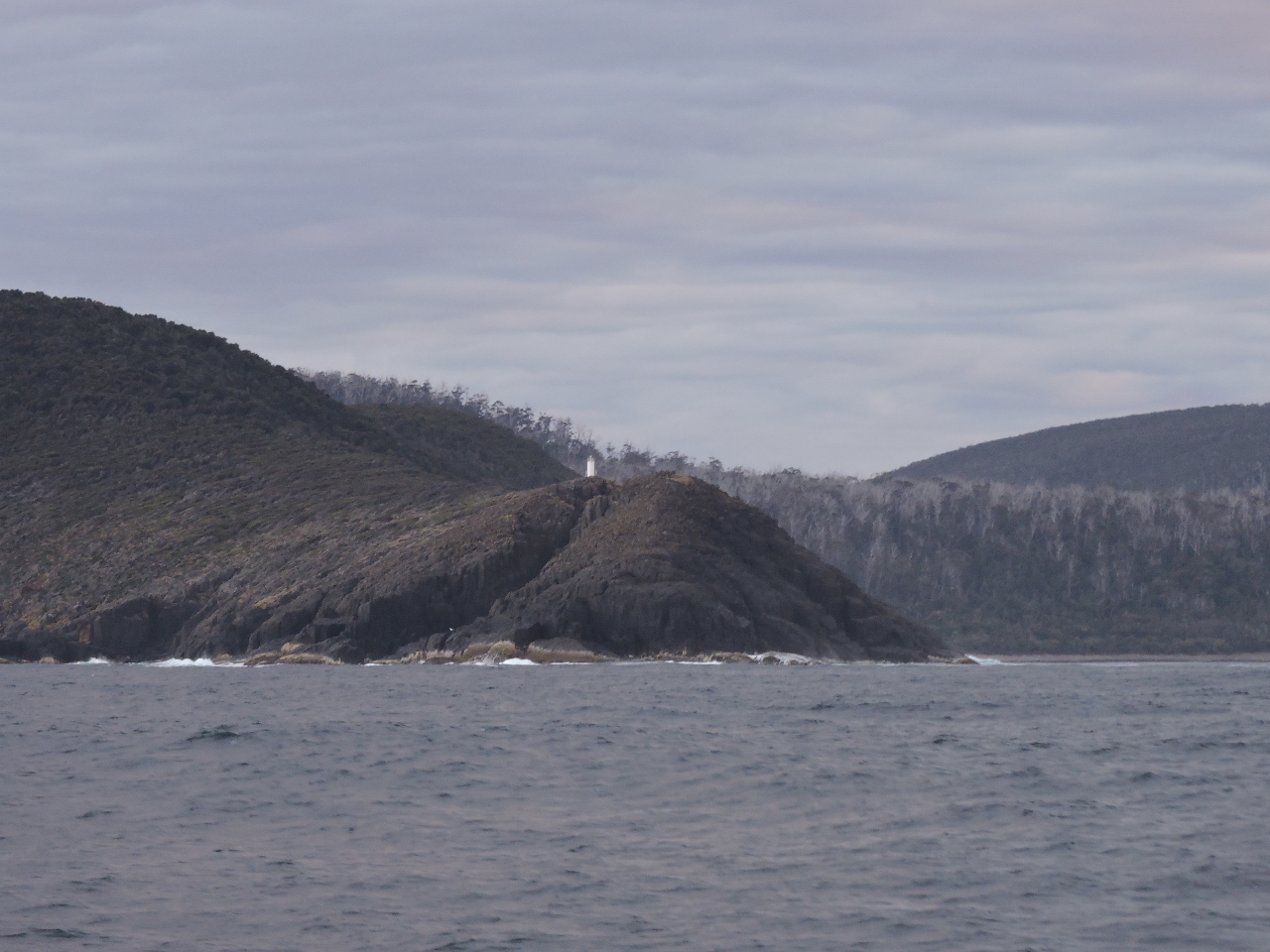 |
1/27/2015: Whale Head
Position: -43°39.24'S, 146°52.19'E
The lonely-looking light on Whale Head.
|
 |
1/27/2015: Southeast Cape
Position: -43°39.29'S, 146°50.32'E
This is the second of the five southernmost capes that we have rounded. The first was Southwest Cape on Stewart Island. The other three are Cape Leeuwin, southwest Australia; Cape Froward, Africa and Cape Horn, Chile.
|
 |
1/27/2015: South Cape
Position: -43°38.85'S, 146°41.58'E
Rounding South Cape, the second of three capes on the south side of Tasmania. The third is Southwest Cape to our west. The explorers don't seem to have been in a particularly creative mood when they named these landmarks.
|
 |
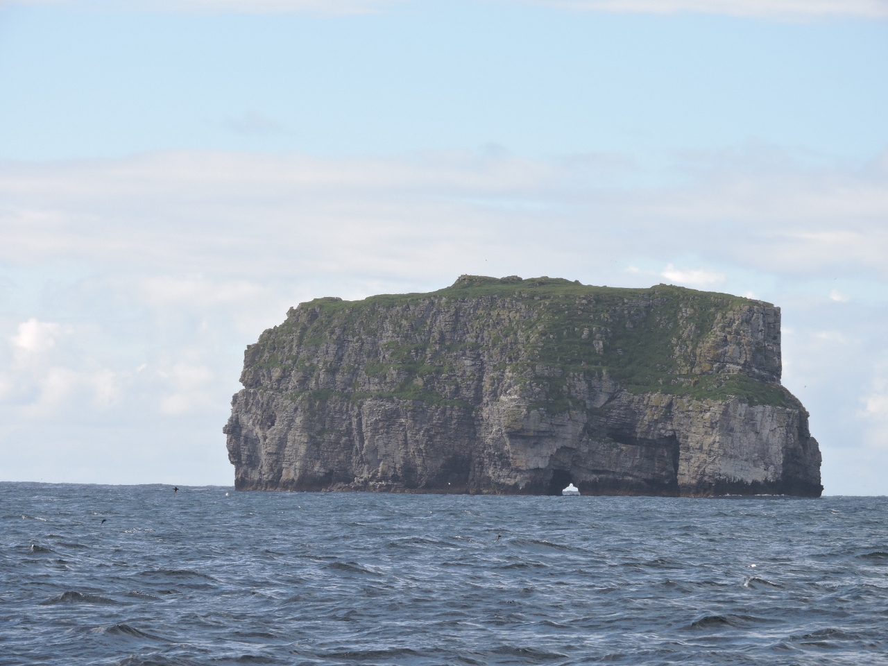
1/27/2015: Mewstone
Position: -43°38.23'S, 146°33.18'E
We can just make out barren and remote Mewstone, about ten miles to our south. The island is a breeding ground for Shy Albatrosses, Silver Gull, Black-faced Cormorant, and Fairy Prions.
|
 |
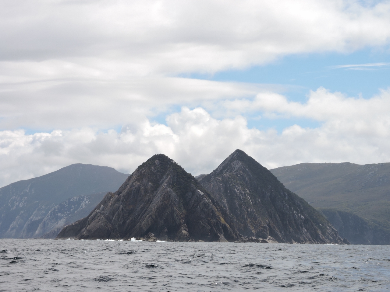
1/27/2015: Flat Top Island
Position: -43°37.44'S, 146°22.71'E
Looking south through the arch at the bottom of Flat Top Island.
|
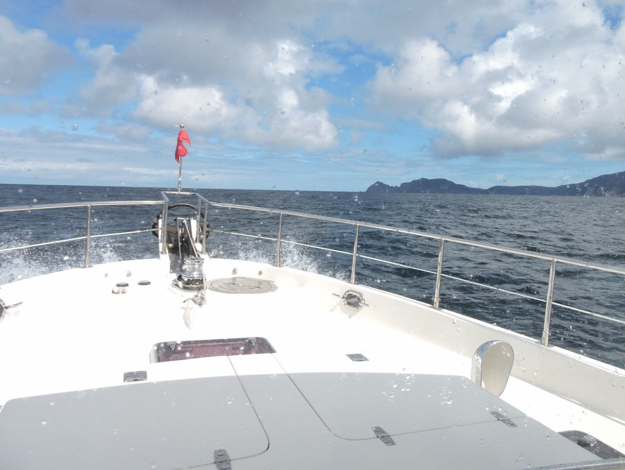 |
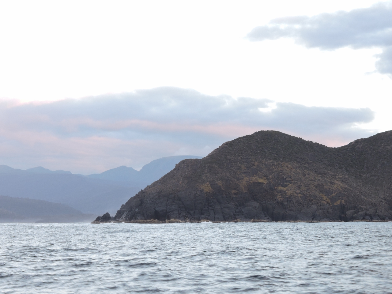
1/27/2015: Getting close
Position: -43°35.86'S, 146°7.23'E
We're approaching Southwest Cape and soon will turn the corner north to Port Davey. Conditions have been mostly calm on this run. The wind was blowing southeasterly 15-20 kts when we rounded Southeast Cape, but have dropped to 10-15 know with a low southwesterly swell.
|
 |
1/27/2015: Southwest Cape
Position: -43°35.58'S, 146°1.55'E
Tasmania's Southeast Cape is one of the five southernmost capes and Southwest Cape is one of the five Great Capes, as is Southwest Cape on Stewart Island. The other three Great Capes are Cape Leeuwin, southwest Australia; Cape of Good Hope, Africa and Cape Horn, Chile. The distinguishing factor seems to be that the Great Capes are at the southwestern point of a continent or island, where sailing vessels traveling west could finally turn northward, no longer sailing directly into opposing westerly winds. Either way, we're two for five today.
|
 |
1/27/2015: Port Davey
Position: -43°21.13'S, 145°56.96'E
As we approached Port Davey, the scenery changed from the bleak and remote cliffs along Tasmania's southern coast to the dramatic mountains and beautiful formations of Port Davey. We can tell we're going to love it here.
|
 |
1/27/2015: Spain Bay
Position: -43°22.26'S, 145°57.84'E
Our first Port Davey anchorage was in Spain Bay, off a wide sand beach with a great view to 2,534' (772m) Mount Rugby to the east.
|
 |
1/27/2015: Stephens Bay
Position: -43°22.88'S, 145°57.68'E
We followed an easy, but muddy, track from Spain Bay to the windswept and remote beach at Stephens Bay. We had lunch there, watching the surf pound in and gazing out to the area we'd run through earlier today in Dirona. A kayaker walking the track mentioned a midden at the south end of the beach, but that was farther than we felt like walking.
|
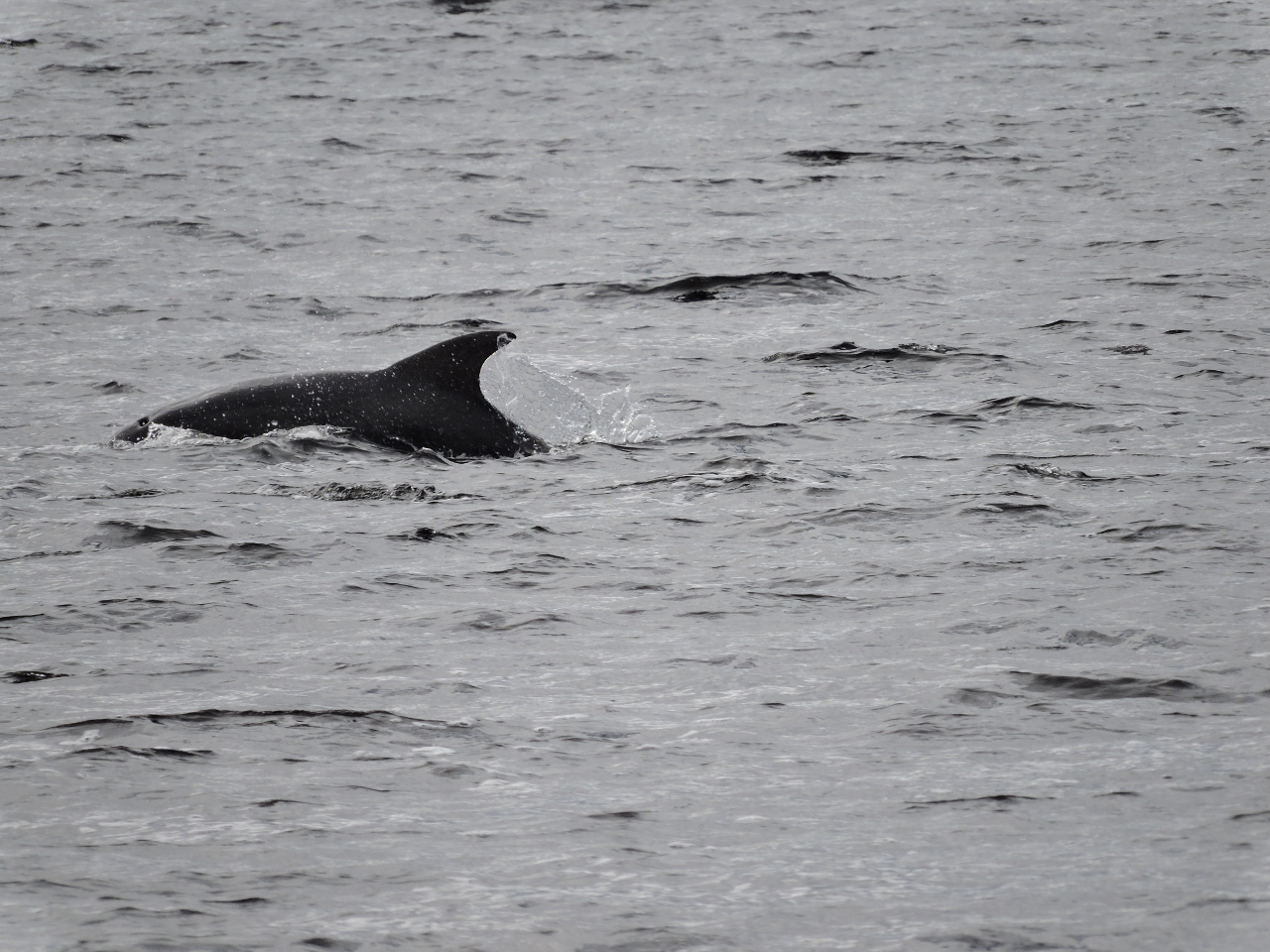 |
1/28/2015: Bond Bay
Position: -43°15.48'S, 145°54.95'E
A pod of dolphins swam around the boat shortly after we'd anchored in Bond Bay. We stopped there to run the dinghy up to the gorges along the Davey River. The bay is shallow, so we didn't go very close to the head. But we still had reasonable protection when 20-knot southeast winds blew later in the day.
|
 |
1/28/2015: Davey River bar
Position: -43°13.36'S, 145°55.73'E
This shot from later in the day shows the Davey River Bar. We crossed the bar where the Tasmanian Anchorage Guide recommended. On a 0.34m tide at Bramble Bay we had to paddle the tender through water about 1/2m deep, as we were expecting. On the return, with perhaps a 0.5m tide, we were able to motor out a little farther east in about 0.6m of water. The exit was even more interesting than the entrance, with 0.6m waves rolling in against the outgoing river flow.
|
 |
1/28/2015: Davey River
Position: -43°10.70'S, 145°55.75'E
Once across the bar and into the river proper, depths generally were good enough for us to run at speed. The river was quite scenic, with low hills on each side and mountains in the distance.
|
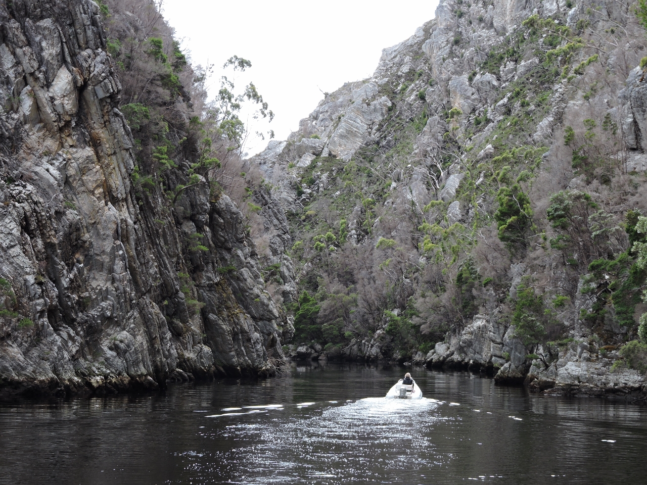 |
1/28/2015: Gorge
Position: -43°9.36'S, 145°56.03'E
This is the first of three gorges along the Davey River. We could only reach the first--shallow rapids blocked the way beyond. But no matter-this one was impressive enough to easily warrant the trip, and the risk of getting stuck on the bar.
|
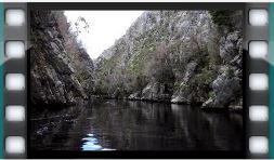 |
1/28/2015: Running the gorge
Position: -43°9.26'S, 145°56.10'E
Here's a video of us us running downriver back through the first gorge.
|
 |
1/28/2015: Lunch
Position: -43°9.28'S, 145°56.10'E
We had lunch perched on the cliff in the middle of the gorge.
|
 |
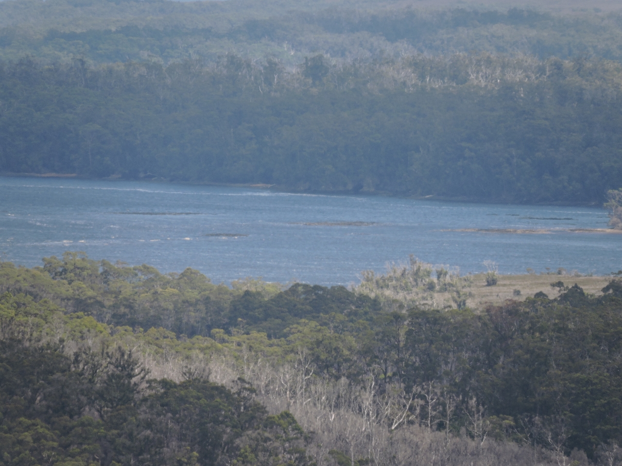
1/28/2015: View
Position: -43°9.58'S, 145°56.12'E
We climbed a steep hill just south of the gorge for a panoramic view of the area. The Davey River extends from left to right through most of the shot, and the gorge is just out of the picture to the right. Our anchorage at Bond Bay is slightly to the right of center in the distance, but the boat is behind the trees. (Click the image to enlarge.)
|
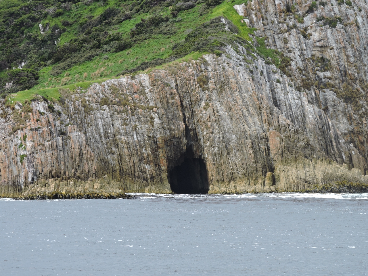 |
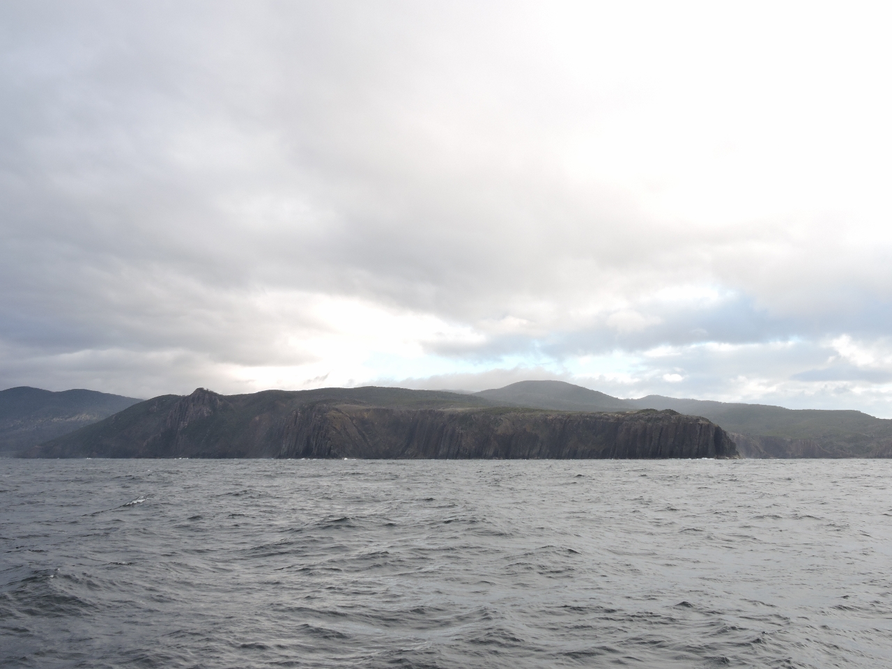
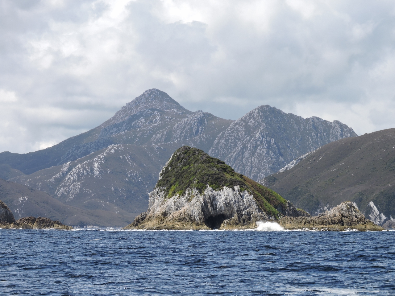
1/29/2015: Breaksea Islands
Position: -43°19.01'S, 145°57.93'E
One of several caves along the exposed Breaksea Islands shore.
|
 |
1/29/2015: Exercise
Position: -43°19.35'S, 146°0.08'E
A group of kayakers camped ashore were stretching on the beach as we arrived in Bramble Cove this morning.
|
 |
1/29/2015: Mt. Milner
Position: -43°19.16'S, 145°59.34'E
We climbed the short track to the top of 610ft (186m) Mt. Milner for an awesome 360-degree view. The Breaksea Islands are at the far left and right of the picture. In the center of the picture are 2,135ft (651m) Mt. Berry on the left and 1,161ft (354 m) Mt. Stokes (previously called Mt. Misery) on the right. Dirona is just visible anchored in Bramble Cove below Mt. Stokes to the right of center.
|
 |
1/30/2015: On the track
Position: -43°18.86'S, 146°0.13'E
While hiking Mt. Milner yesterday we noticed another track that appeared to lead to Mt. Stokes, so we set off today to find out where it went. This is the view looking down into Bramble Cove from partway up. Dirona is visible anchored off the point of land to Jennifer's right.
|
 |
1/30/2015: Mt Stokes
Position: -43°18.84'S, 146°0.87'E
This video shows the 360 degree view from the peak of Mt. Stokes. Stokes at 1,397' isn't the tallest in the area but it does command an impressive view of the area. Even though the day was somewhat overcast, from the peak we can see all three of our anchorages so far in Port Davey. We were lucky to take the video and pictures soon after arriving at the top. You can hear the wind blowing hard in the video and that wind was bringing in another weather system. Only 20 minutes later it was raining and the clouds were so thick, we couldn't see 100 yards.
|
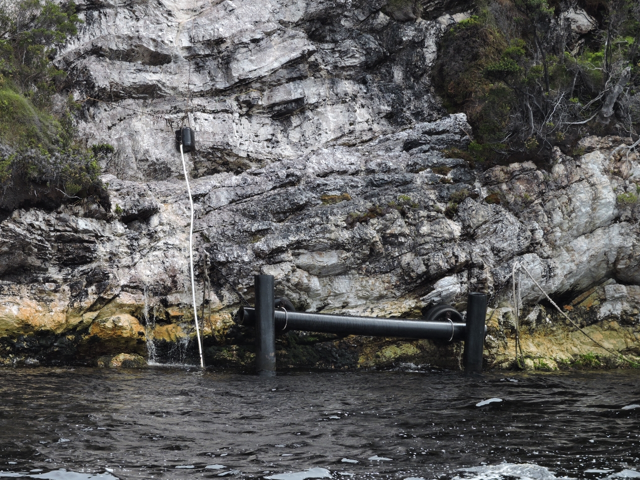 |
1/30/2015: Watering Bay
Position: -43°20.03'S, 145°59.62'E
Just across Bathurst Channel from Turnbull Island a waterfall flows down from Morning Hill. The black pilings at the bottom allow boats to tie off and fill their water tanks at the falls using a ose leading out of the bottom of a permanently installed bucket. We enjoyed viewing the falls, but didn't stop to fill our water tank.
|
 |
2/1/2015: Horseshoe Inlet
Position: -43°21.31'S, 146°4.31'E
Our first anchorage in Bathurst Channel just outside of Casilda Cove. Most boaters prefer to slip into the well sheltered anchorage inside Casilda Cove but, surprisingly frequently, we'll choose a slightly less sheltered anchorage if we are able to use ample scope. Partly we like a bit more room for error than some boaters and partly because we often use more scope than many, particularly in shallow anchorage. Casilda is very nice and Balmoral Hill directly above it gives a great view of the anchorage. But, as nice as I'm sure Balmoral Hill is, we had our eye on the 2,534' gem of the area, Mt. Rugby.
|
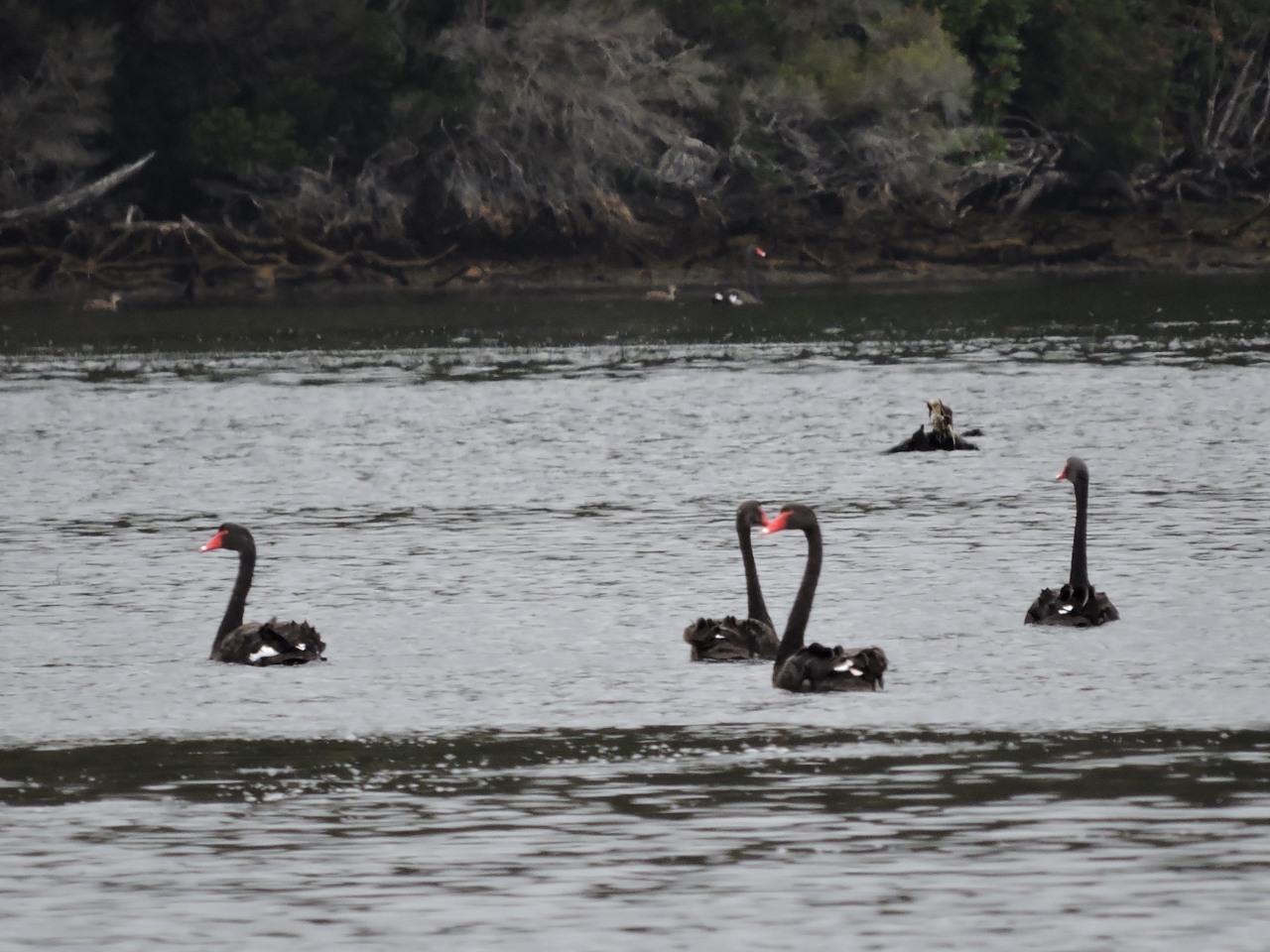 |
2/1/2015: Black Swans
Position: -43°18.29'S, 146°3.55'E
Nassim Taleb wrote a popular business book called The Black Swan: The Impact of the Highly Improbable'. What Taleb is writing about are Black Swan events. These are events that are sufficiently rare that history becomes a very poor predictor. The Black Swan has emerged as part of the lexicon in many fields to describe the very unlikely. Well, in the Port Davey area and especially around Joe Page Bay and up into Spring River, it's the white swans that are rare. We have never seen so many black swans in our lives. Motorboats are not permitted beyond the lagoon inside the Spring River mouth to help protect the breeding grounds for the black swans in the area.
|
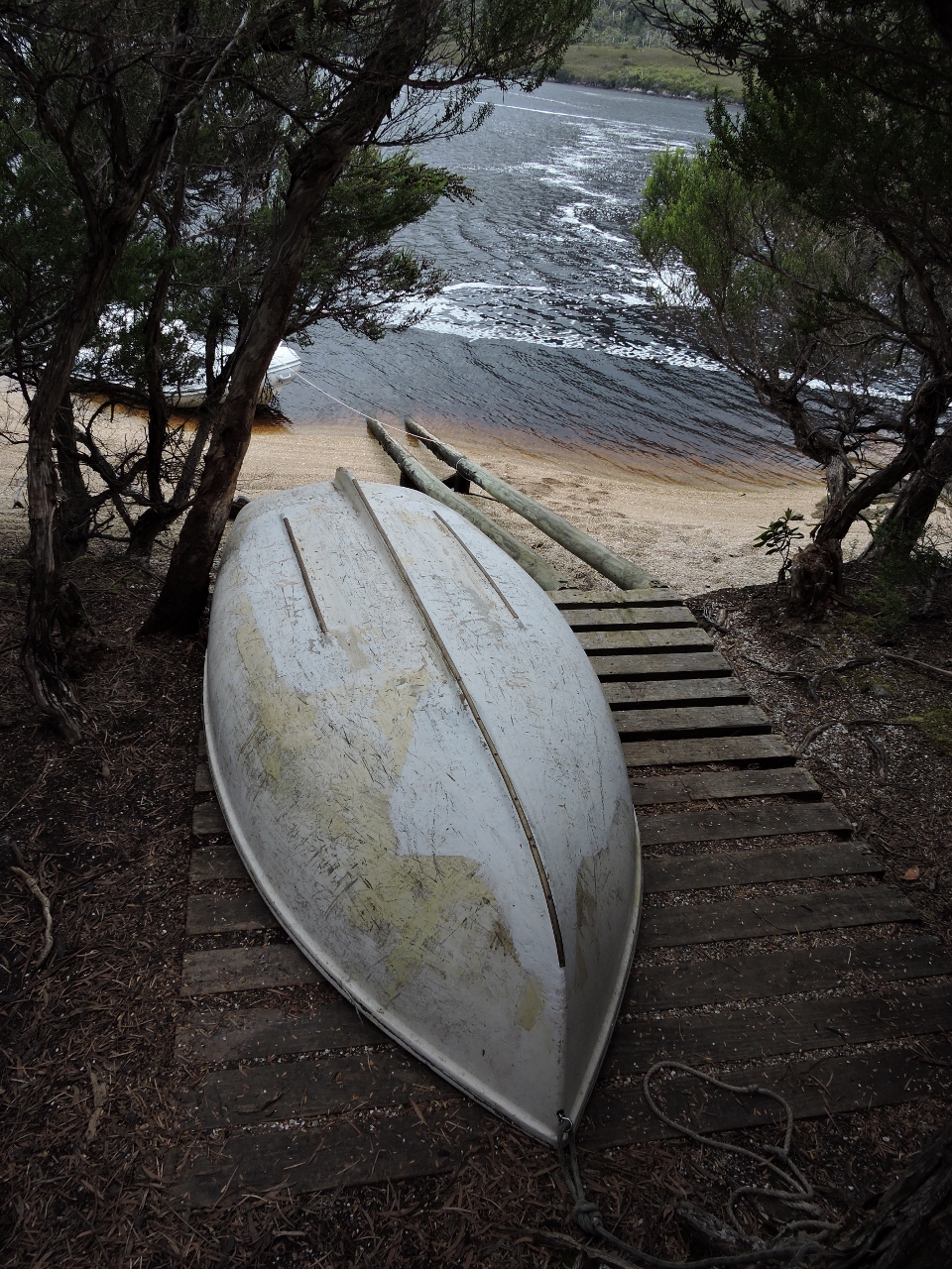 |
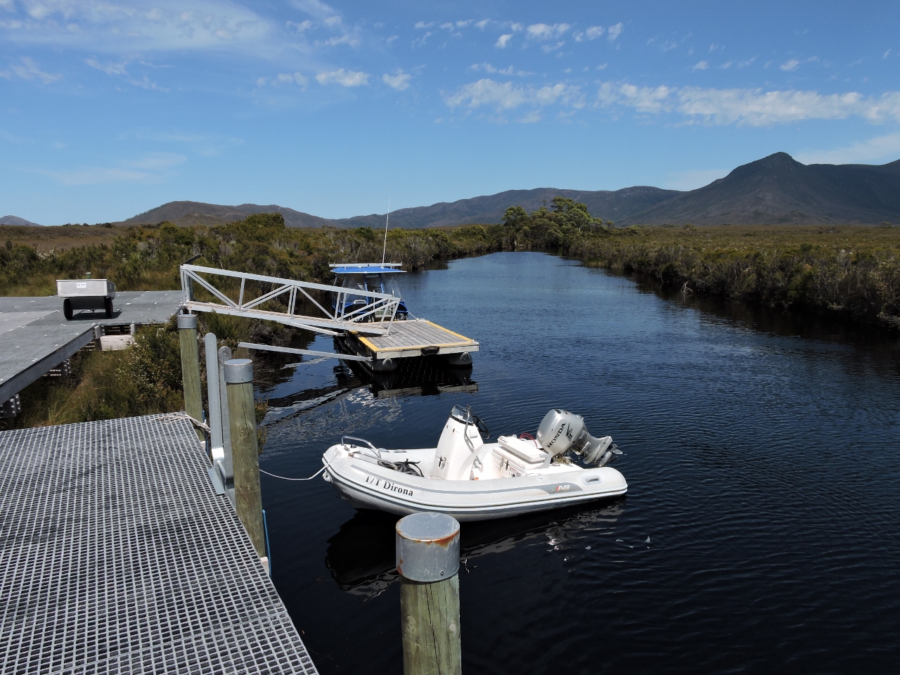
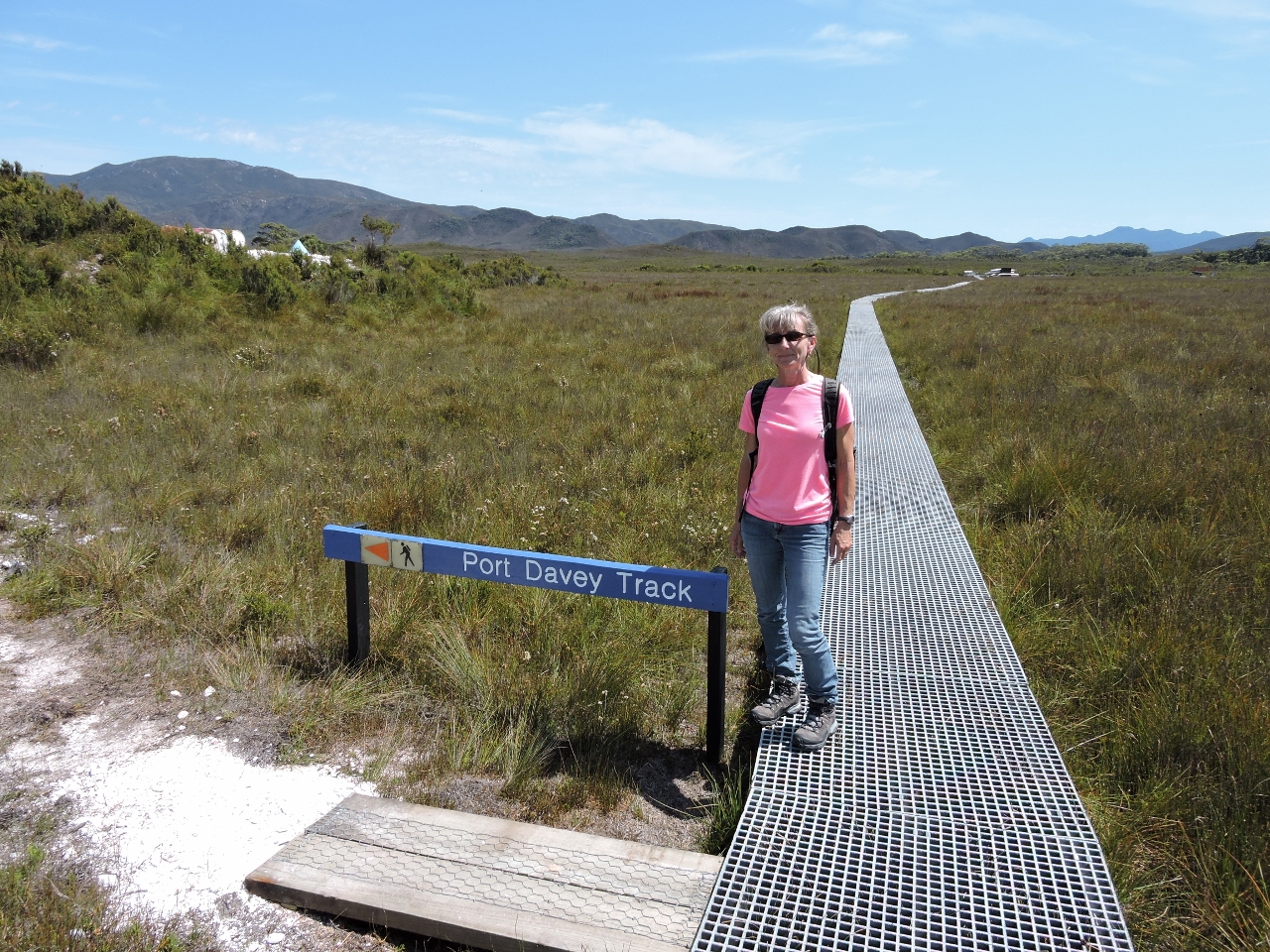
2/1/2015: Port Davey Track
Position: -43°20.36'S, 146°5.13'E
The Port Davey Track runs from Scotts Peak Dam to Melaleuca Inlet. It's a nice track and we enjoyed parts of it, but what makes the Port Davey Track different is it crosses Bathurst Channel. Many trails cross channels by forcing hikers to wade, and some offer bridges, but the Port Davey Track makes the crossing by providing dinghys for hikers. There are three dinghies available for the crossing, with the only constraint being that they must leave at least one boat at both sides. Puzzle question: if you are walking alone and arrive at the side with only one dinghy, how do you make the crossing while ensuring there are still at least one dinghy at each shore of the crossing for future hikers?
|
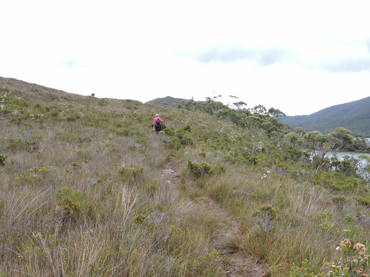 |
2/1/2015: Hiking the Port Davey Track
Position: -43°20.36'S, 146°5.13'E
Jennifer can't resist a trail so we walked part of the Port Davey Track enjoying the walk and some of the views.
|
 |
2/1/2015: Farrell Point dinghy landing
Position: -43°20.36'S, 146°5.12'E
Hikers arriving at the Port Davey Track Bathurst Channel crossing need to flip the dinghy over onto the plastic rails, push it down into the water, and cross over to other side. If a hiker arrives at a side with only one dinghy, in order to leave a dinghy at both sides for others, they would would need to row across, launch the other dinghy from the other side, cross back towing it, put the original dinghy back where it was found, and then re-cross and put the second dinghy back where it was found. I suspect that is why many hikers prefer bridges :-).
|
 |
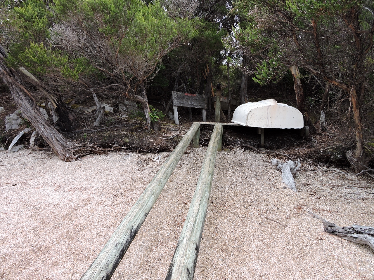
2/1/2015: Joan Point dingy landing
Position: -43°20.51'S, 146°5.16'E
These are the plastic rails that make it easier to launch the dinghy to cross Bathurst Channel.
|
 |
2/2/2015: Super Bowl in Australia
Position: -43°21.06'S, 146°3.89'E
We were lucky this year to actually watch the Super Bowl over satellite TV via an Australian station. Last year our only connectivity was via a 64kbs satellite connection and we could "watch" only over a mobile play-by-play app. The local television coverage was enjoying it being summer in the southern Hemisphere by preparing to watch the game on lawn furniture in the studio while their corrspondant reported from the Super Bowl during the pre-game show.
|
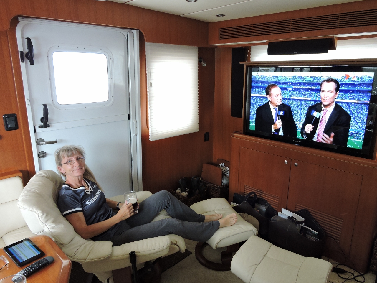 |
2/2/2015: Game time
Position: -43°21.06'S, 146°3.89'E
We don't get much opportunity to wear our Seattle Seahawks gear these days, but the Superbowl definately warranted it. It was a very exciting game that wasn't decided to the final seconds. The Hawks, with one of the best running backs in the leaque in an obvious run situation where victory is probable, decided to innovate and surprise us all by passing. It was a surprise to just about everyone but the defense. The pass was picked off, the Seahawks lost, and that was their final play of the season. Victory would have been fun, but it was a good game and really fun to be able to watch it in Port Davey, Tasmania.
|
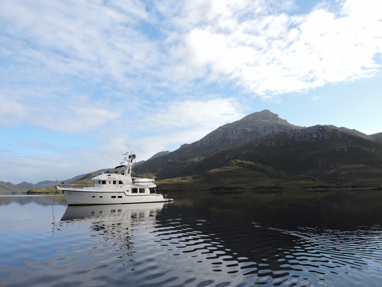 |
2/4/2015: Clytie Cove
Position: -43°20.89'S, 146°5.63'E
At anchor in Clytie Cove with an exellent view to 2,534' Mt. Rugby in the background.
|
 |
2/4/2015: Partway up
Position: -43°20.22'S, 146°6.93'E
We landed the dinghy in a small cove opposite Iola Bay to hike to the peak of 2,534' Mt. Rugby. Well before the top, the views were amazing.
|
 |
2/4/2015: The goal
Position: -43°20.13'S, 146°7.01'E
We still have a long way to go....
|
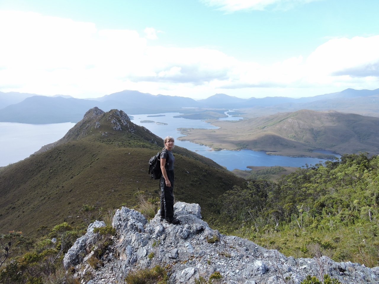 |
2/4/2015: Ridge summit
Position: -43°20.01'S, 146°6.88'E
Here we are still a distance from the summit of Mt. Rugby and already the view to the east over Bathurst Harbor is exciting.
|
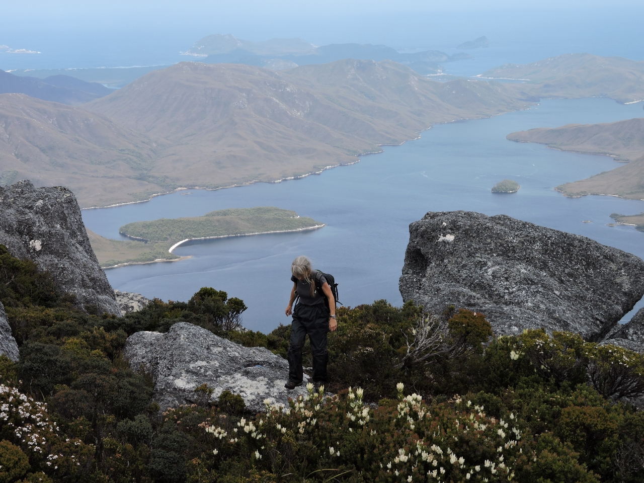 |
2/4/2015: Summit
Position: -43°19.68'S, 146°6.73'E
Here's the prize. As good as the view was from the ridge below, this is incredible. The climb is steeper and longer than many we do, but the view is the reward and this one is worth the just over five-hour return trip.
|
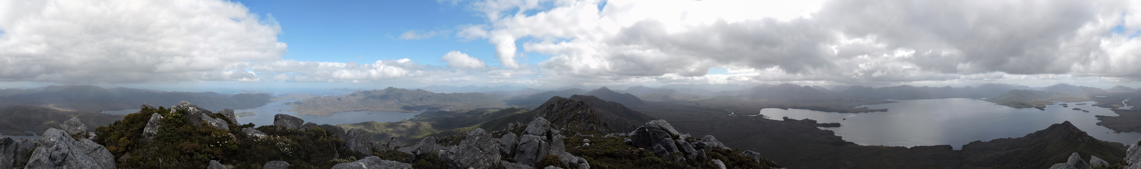 |
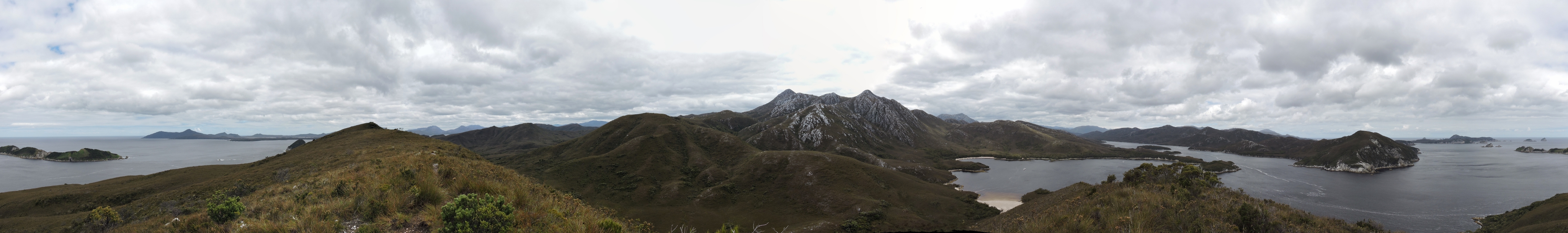
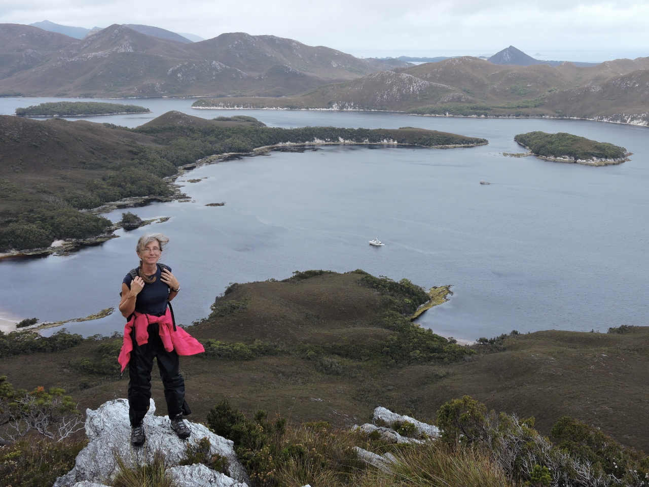
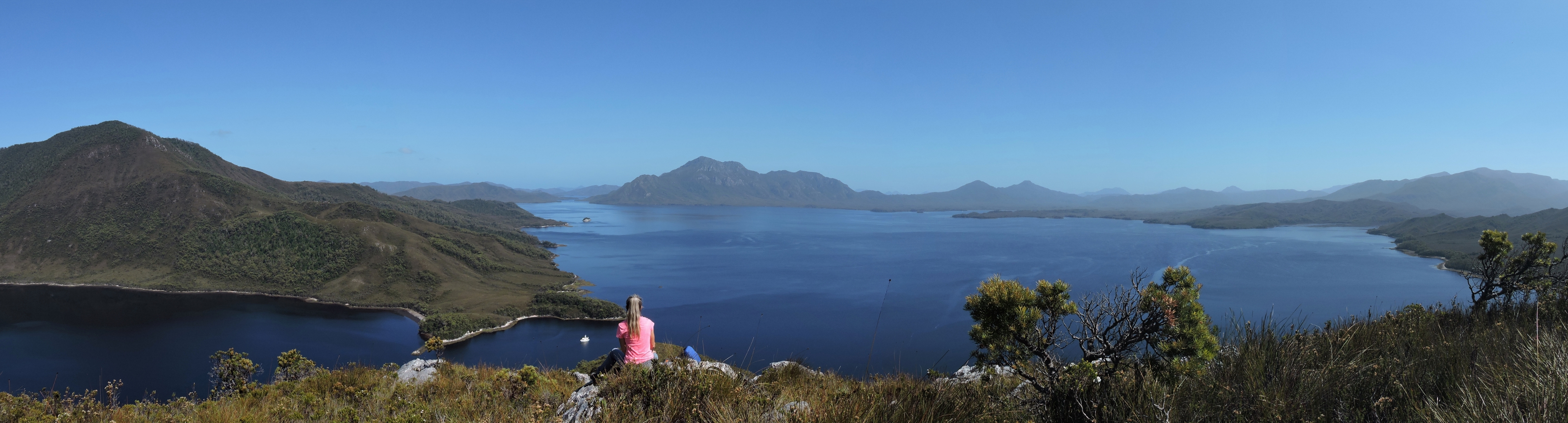
2/4/2015: 360 degrees
Position: -43°19.68'S, 146°6.74'E
This panorama takes advantage of Mt. Rugby being the highest point in the area affording excellent views in all directions. Scanning the major waterways left to right we can see Bathurst Channel and Joe Page Bay on the left, with Bathurst Harbor to the right. We had a great picnic lunch on the peak before starting the decline back to sea level. (Click the image for a larger view.)
|
 |
2/6/2015: Celery Top Islands
Position: -43°22.20'S, 146°8.63'E
The view from our anchorage on the south side of the Celery Top Island group. For an area where settled weather isn't the norm, we have had what feels like unusually good luck with the weather.
|
 |
2/7/2015: Melaluca Inlet
Position: -43°24.44'S, 146°8.55'E
The weather remained excellent, so we plan to head up Meleuca Inlet to Melaleuca Creek and then explore the air strip and the area around Melaleuca Landing. Depths vary considerably in the inlet but it's been informally marked by the small commercial boat operators that take tourists arriving by airplane out on day trips of the area.
|
 |
2/7/2015: Kings Landing
Position: -43°24.88'S, 146°9.31'E
With a deep blue sky and no wind, the scenery along the inlet was beautiful.
|
 |
2/7/2015: Melaleuca Creek
Position: -43°25.11'S, 146°9.56'E
Melaleuca Creek enters enters the head of Melaleuca Inlet. Partway along the creek is a floating dock and a wharf, both very new and well-constructed. Tourists fly in on small prop planes to be taken out on boat trips for the day.
|
 |
2/7/2015: Port Davey Track
Position: -43°25.20'S, 146°9.69'E
We had been on Port Davey Track earlier where it crosses over Bathurst Channel. This is right near the end of the track and it is also the walkway from the airstrip to the landing on Melaleuca Creak.
|
 |
2/7/2015: Par-Avion
Position: -43°25.24'S, 146°9.69'E
Two Par-Avion commercial planes were waiting at the airstrip for their customers to return from their day trip of Port Davey.
|
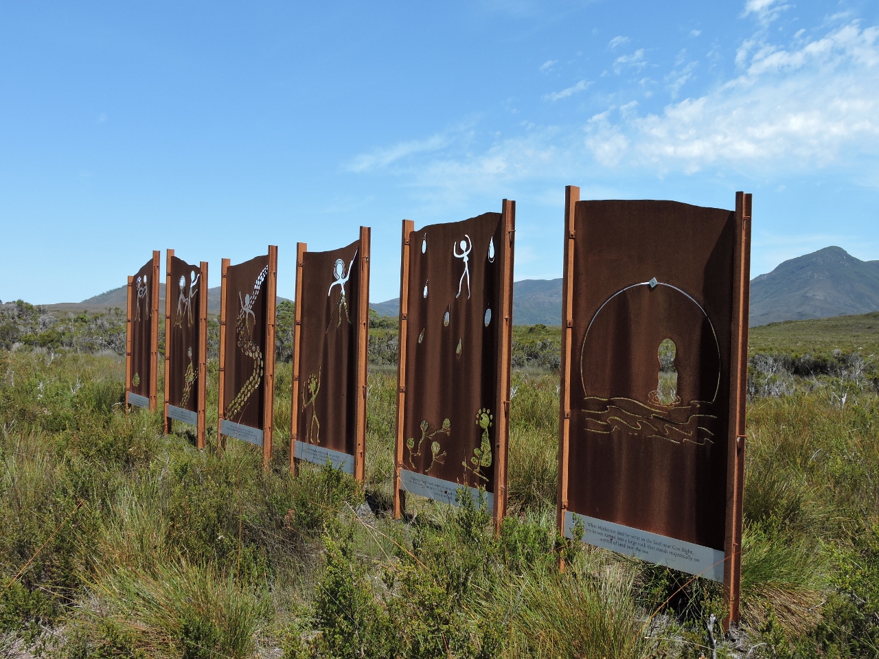 |
2/7/2015: Needwonnee Walk
Position: -43°25.03'S, 146°9.53'E
We took the Needwonnee Walk which forms a loop from the dock to the air-strip, north to Melaleuca Lagoon, and then back to the dock. The lagoon is closed to the public and it's quiet, beautiful, and a great place to enjoy the many birds that live and breed in the area. Near the landing on the return leg from Melaleuca Lagoon is this sculpture, also visible from the creek. It depitcs a legend of the Needwonnee people, who inhabited the area before Europeans arrived.
|
 |
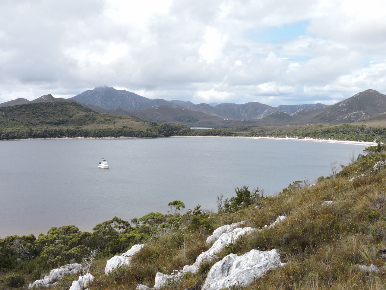
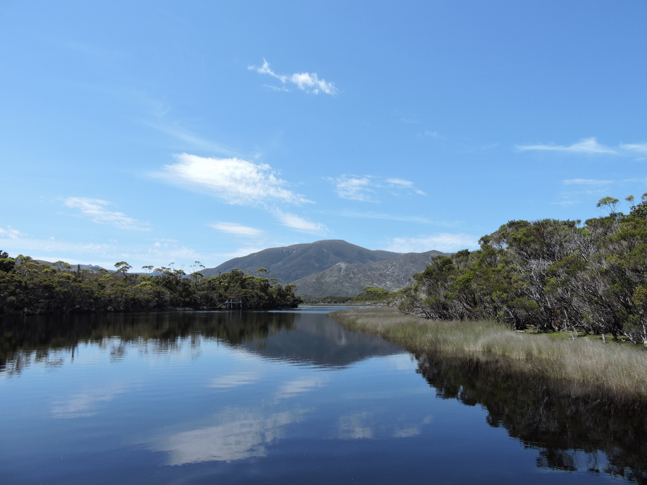
2/9/2015: Moulters Inlet
Position: -43°21.96'S, 146°13.24'E
There is a great little anchorage in the neck of the entrance to Moulters Inlet. It's very well sheltered, has lots of room for scope, and as well as being picturesque at sea level, it looks even better from above. From the anchorage, it's a short dinghy hop to the point and then a fairly easy but steep hike up to the top of Kroanna Hill. The hill is just high enough to afford a view of the anchorage and the entire Bathurst Harbor area. In this picture, Moulters Inlet is on the left and all of Bathurst Harbor extends off to the right, with Mt Rugby in the distance at the center. (Click the image for a larger view.)
|
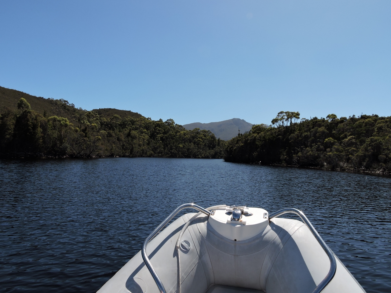 |
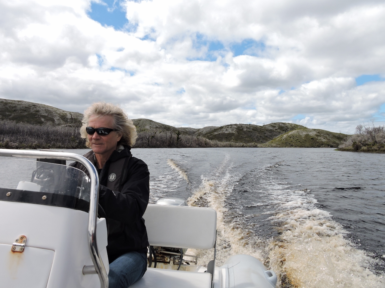
2/9/2015: Running Old River
Position: -43°19.42'S, 146°13.90'E
A dinghy can run a few miles up Old River from the northeast corner of Bathurst Harbour. We love exploring rivers and took advantage of the clear day to run up Old River and have lunch at the first set of rapids.
|
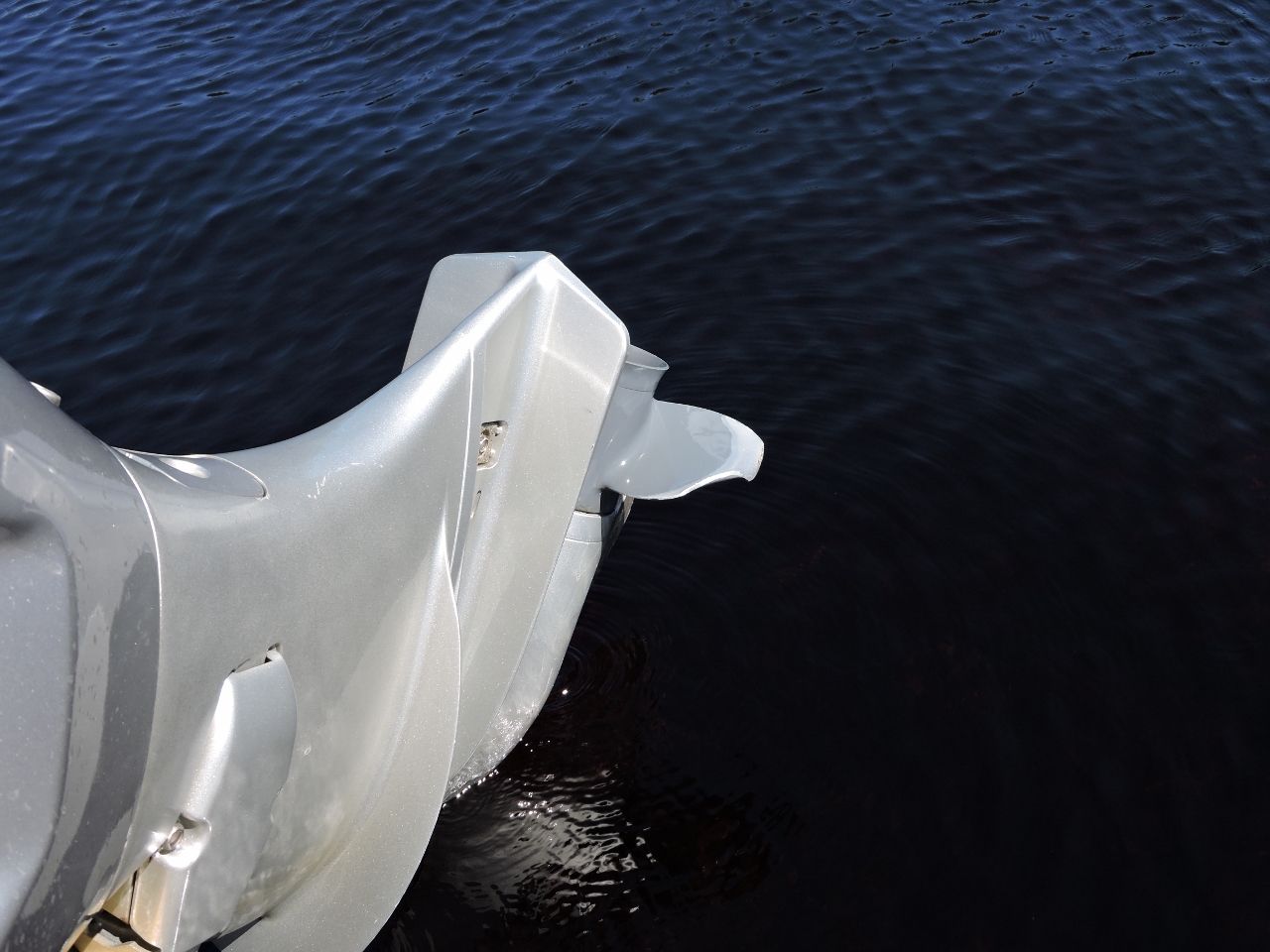 |
2/9/2015: Prop "wear"
Position: -43°18.94'S, 146°14.52'E
Old River has excellent depth most of the way to the first set of rapids. But, if you aren't careful, there are some pinnacles that aren't easy to see (at least that's our claim). Over the years, we've found the bottom on the dinghy many times and consequently gotten fairly good at bending the props straight and cleaning it up with a Dremel. This one clearly needs some love.
|
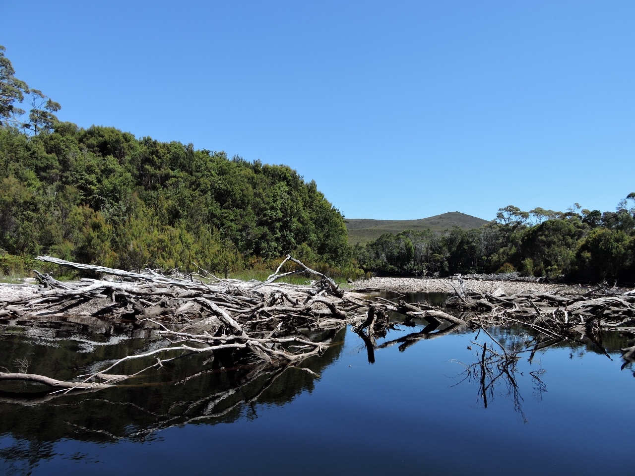 |
2/9/2015: River snags
Position: -43°18.78'S, 146°14.73'E
From the snags and debris along the Old River shoreline, we can see that the water runs hard during the rainy season. Today, the flow is hardly noticeable in the lower reaches and we enjoyed the scenery. It's a worthwhile trip.
|
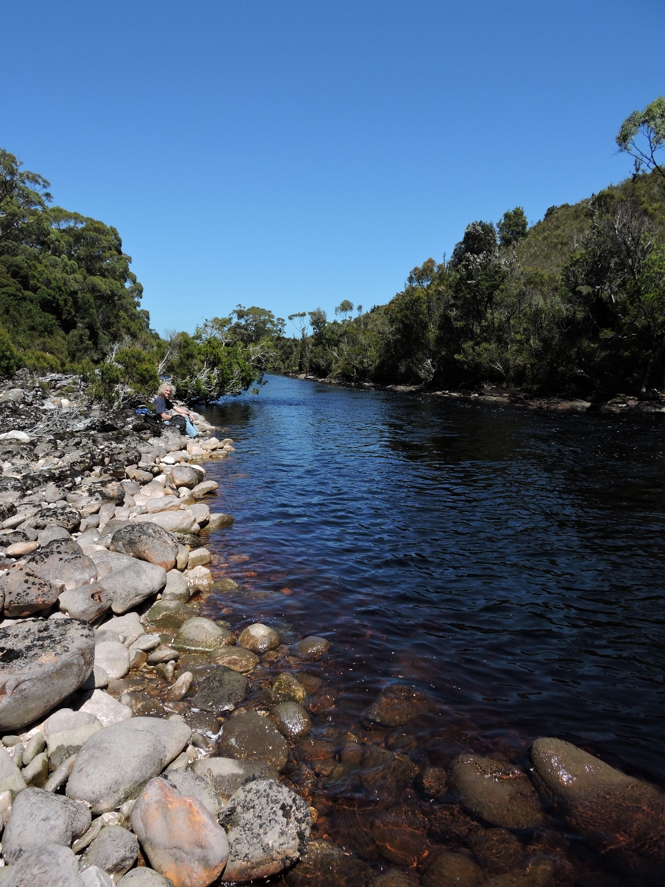 |
2/9/2015: Shoreline Lunch
Position: -43°18.64'S, 146°14.75'E
We tied off the dinghy on shore once we had traveled as far up the river as possible in the current conditions, and then took the short walk up to the first set of rapids. We found a great spot on the shoreline to enjoy the rapids, watch the whirlpools and have lunch in the comfortable temperatures and gentle sun.
|
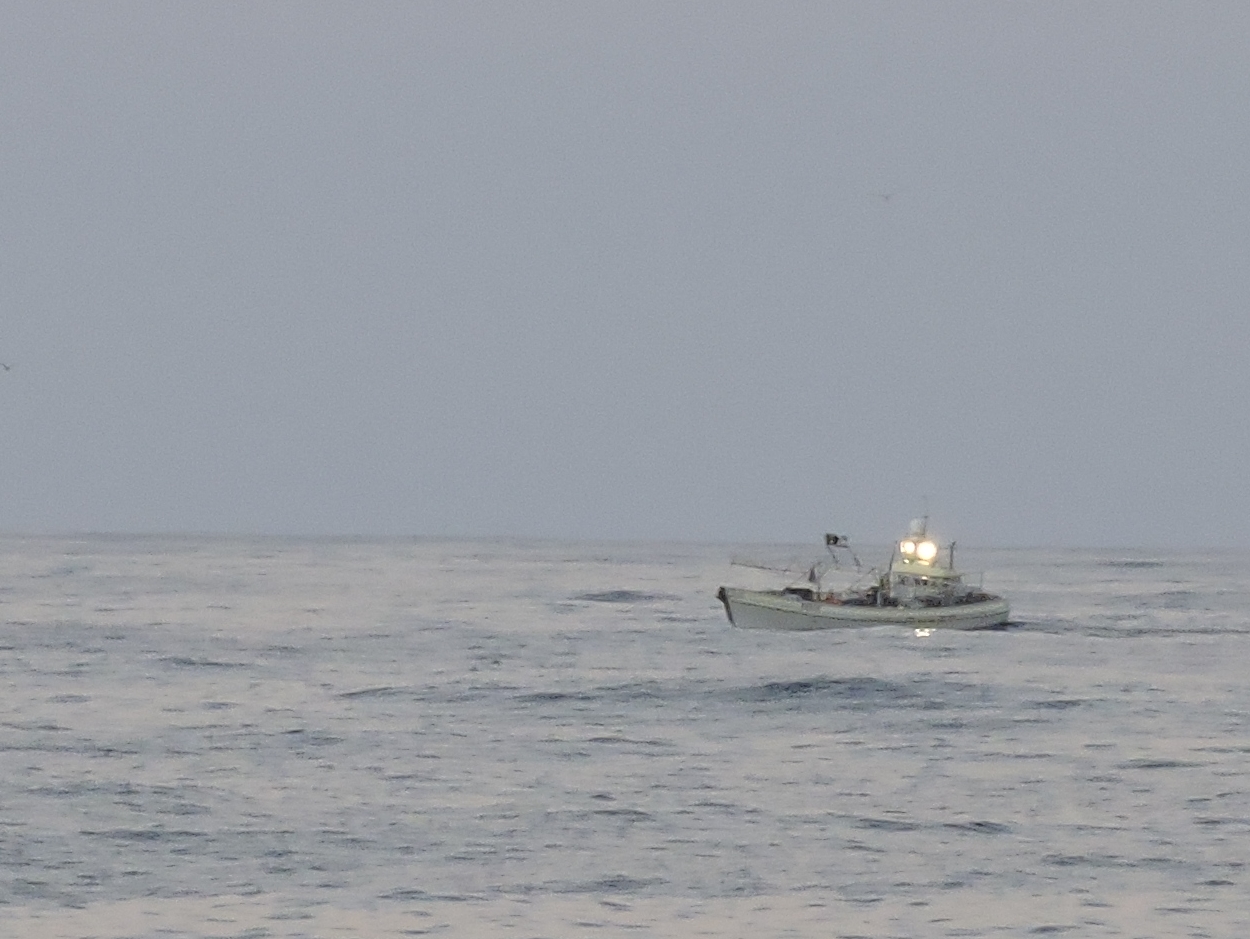 |
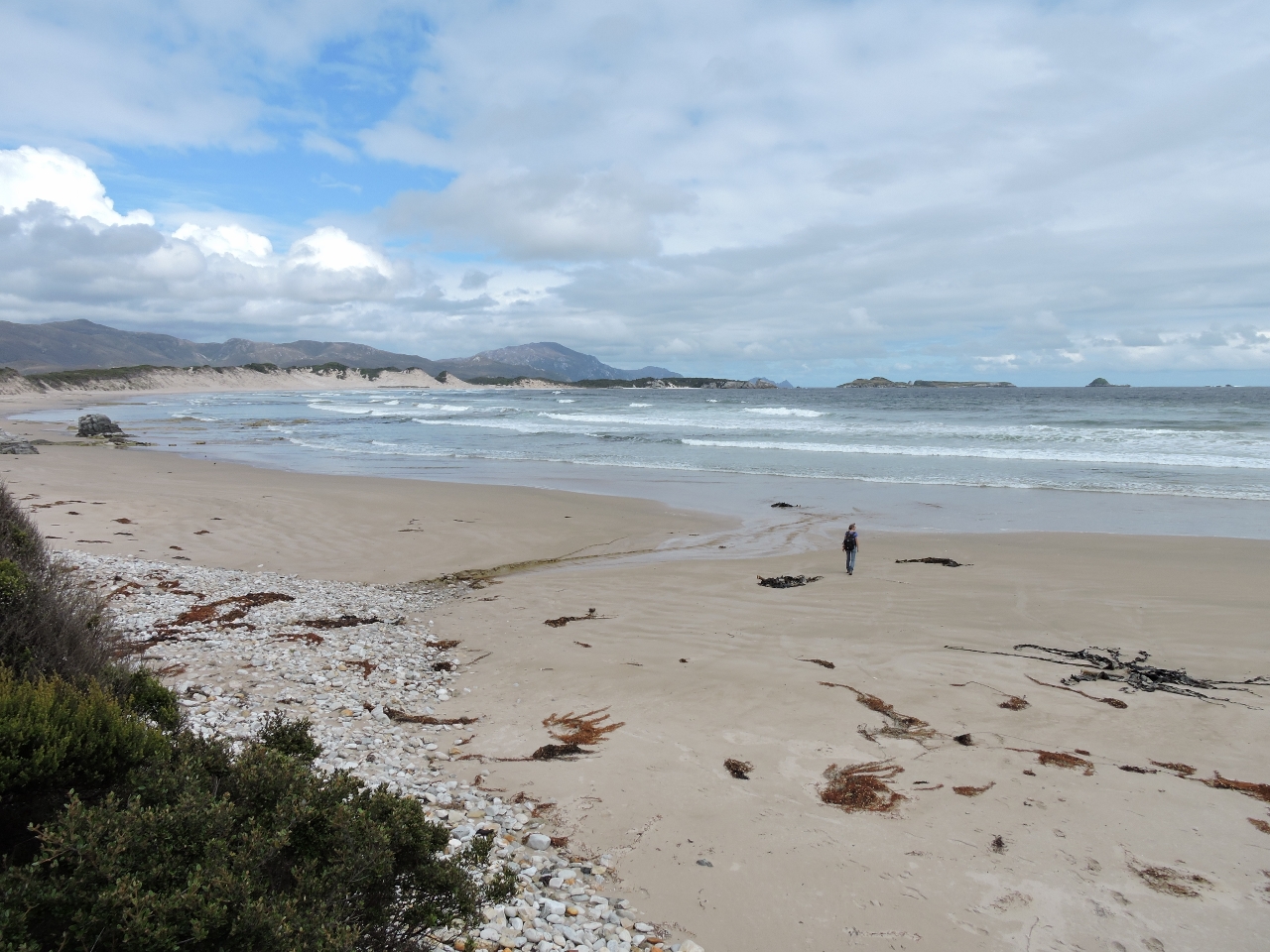
2/10/2015: Just outside Port Davey
Position: -43°15.26'S, 145°42.96'E
Quite a few small commercial fishing boats were working the shoreline between Port Davey and Macquarie Harbour as we ran north. Their floats are relatively easy to see during the day, but would be very difficult at night. Not far out of Port Davey, one of the fishers asked if we would be willing to run further inshore to avoid his gear. We normally prefer a bit more off shore to moving onshore when avoid obstructions but, if he wants us inshore, it's easy for us and it's bright clear day.
|
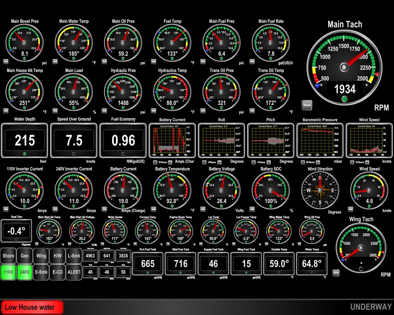 |
2/10/2015: Low water
Position: -43°14.56'S, 145°42.65'E
We chose to not make water inside Port Davey since the waters were so heavily tannin colored. As we were leaving and starting to do laundry, our low water alarm fired (red box at bottom left--click image for larger view). We signal low water at 50 gallons to give time to solve the problem. In retrospect, there was probably no need to avoid making water in Port Davey. The only reason to avoid water making is to avoid going through pre-filters excessively quickly but, on Dirona, we have a sand filter very much like a pool filter. When the filter starts to get dirty, it just needs a quick back flush and that'll last another couple of months. We have a standard perfilter after the media filter but the media filter is so effective, we only change the prefilter annually despite our heavy water maker use. With all things being equal, we slightly prefer to make water off-shore since the water is cleaner out there. And with the main engine able to generate 9kw, we don't need to run the generator to use the water maker, dryer, HVAC, or any other appliance.
|
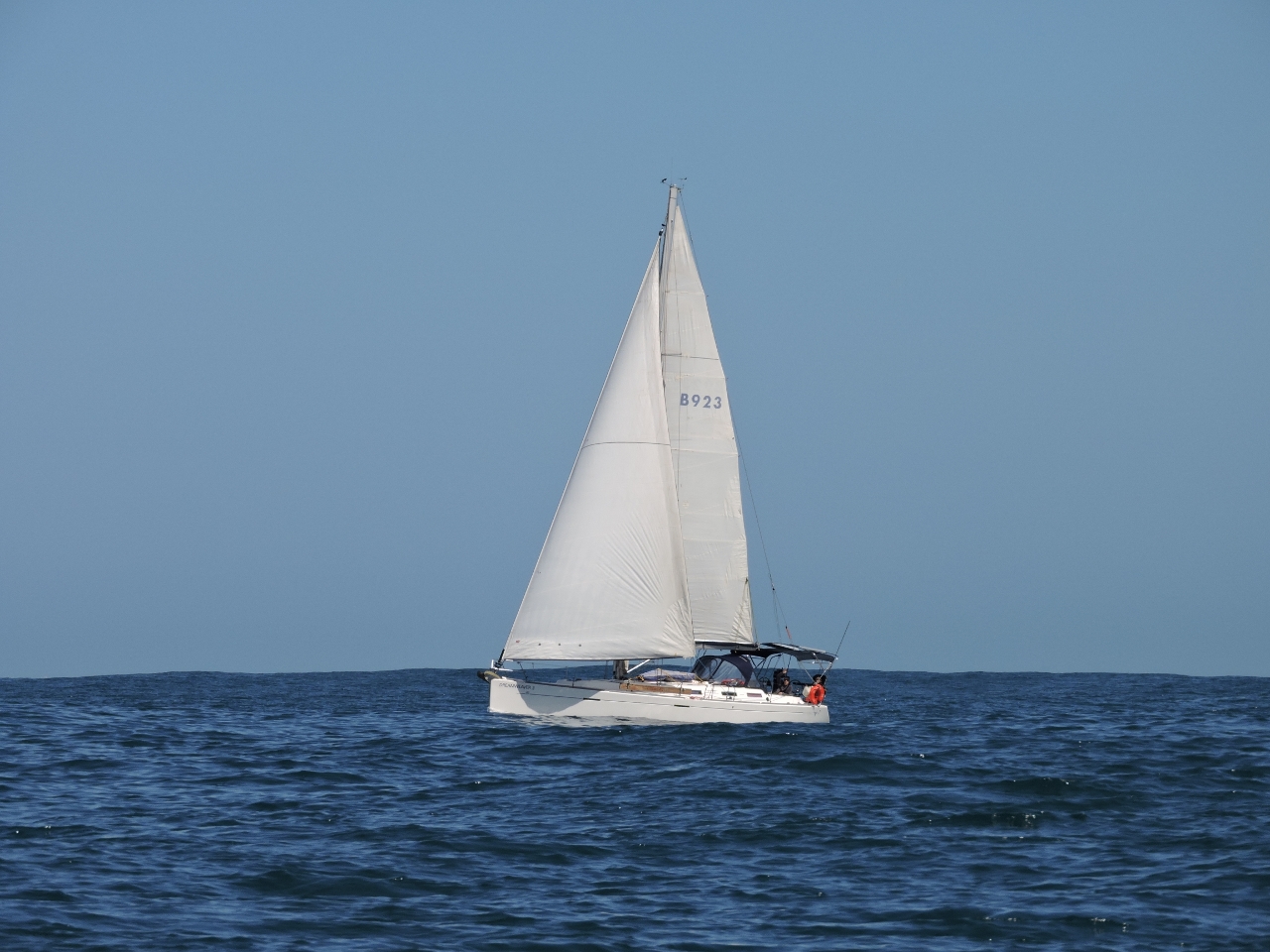 |
2/10/2015: Traffic
Position: -42°40.51'S, 145°14.51'E
We only passed one non-commercial boat on the entire trip. Conditions have been excellent with the winds below 15 kts, with a long low swell. We suspect the sailboat would have preferred a bit more wind but we were enjoying it.
|
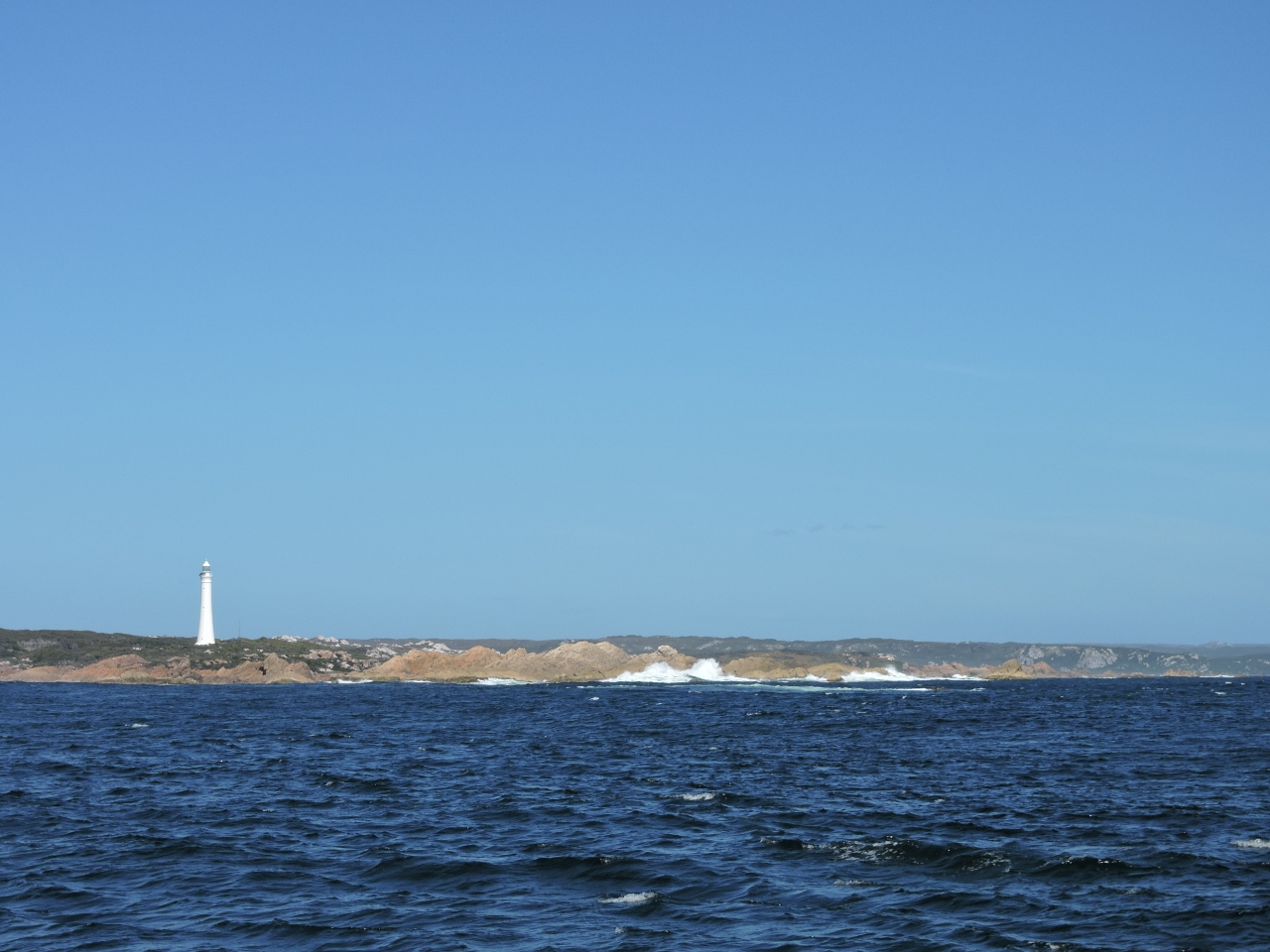 |
2/10/2015: Cape Sorrell
Position: -42°11.34'S, 145°9.38'E
As we approach the narrow entrance of Macquarie Harbor, we can see the Cape Sorrell light near the entrance.
|
 |
2/10/2015: Hells Gate
Position: -42°12.68'S, 145°12.91'E
Macquarie Harbor is a large body of water with an unusually narrow entrance called Hells Gate. The name didn't derive from the difficulty of navigating the channel though--early 19th-century convicts imprisoned on Sarah Island gave it that name because conditions there were among the worst of all the convict prisons in Tasmania. When the wind and swell is from the west and the current is flowing out of the harbor, Hells Gate likely is a suitable name for the channel. Fortunately conditions are near perfect for us.
|
|
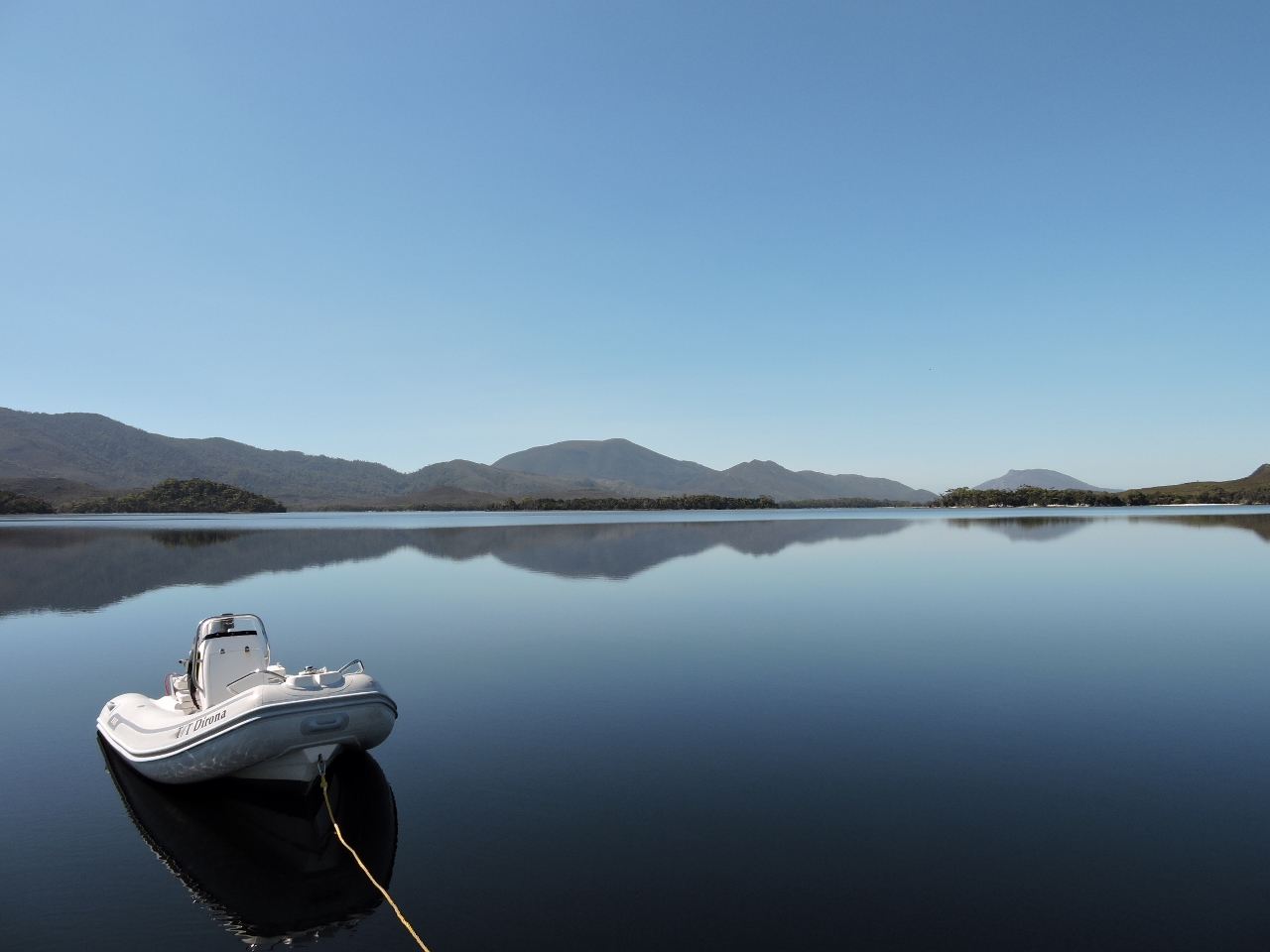
2/10/2015: Neck Island
Position: -42°12.10'S, 145°17.48'E
Our first anchorage at Neck Island was very calm in light westerly winds. The scenery was quite nice with a good view of Neck Island and the surrounding area. We regret not taking a picture of it.
|
 |
2/12/2015: GoDaddy to AWS
Position: -42°12.10'S, 145°17.43'E
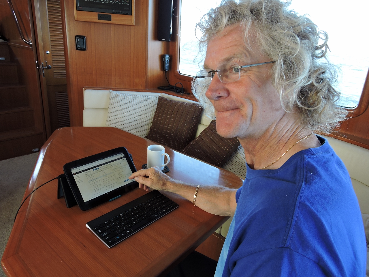
Long time readers of our site will recall that about once a year the site is down for multiple days. What happens on our end during those outages is that we notice the outage, or someone tells us, and we have to get on the phone with the hosting provider GoDaddy. We don't think it was a bad choice of hosting provider a decade back, but it's been getting harder to live with recently. They promised a 72-hour turnaround on site outages, which seems unbelievably slow when looking forward and contemplating the site being down for 3 entire days. The funny thing is, once the problem is fixed and we're looking backwards, 72 hours sounds like a great goal because it often took more than a week to get these issues resolved. The problems usually were minor to fix, and needed only 5 minutes of system administrator time, but required nearly a week with many hours on the phone to get sufficient attention to obtain that needed 5 min of system administrator time. The satellite phone bill alone can end up being fairly eye-opening. mvdirona.com now has been moved to Amazon Web Services. This sounds easy, but at the same time we moved the web site, we also changed operating systems from Windows to Linux, blog software from Das Blog to WordPress, implementation language from ASP to PHP, and DNS registrar from GoDaddy to Route53. It was a big move and the hassle of finding time to squeeze in all that work was why we didn't take this on years ago. It's nice to see this done though. In the picture James is committing the last change that severs the links to the old provider. Clearly we still can have the odd outage, but at least we now can actually fix them rather than feeling powerless and having to beg someone else to have a look. Read more ...
|
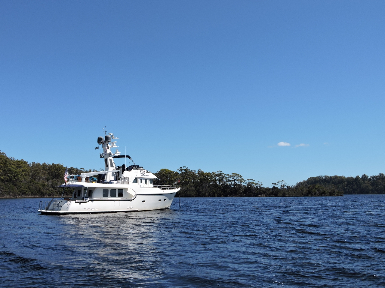 |
2/12/2015: Kelly Basin
Position: -42°22.03'S, 145°32.82'E
Kelly Basin is in the North east corner of Macquarie Harbor. It's a beautiful well protected harbor and near two sets of ruins that can be explored while in the area.
|
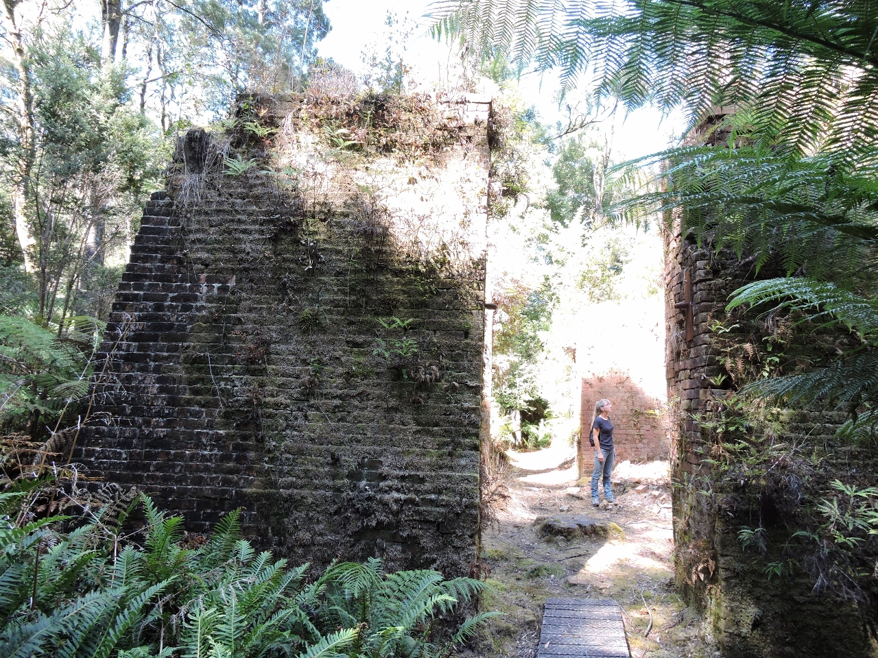 |
2/12/2015: Brick Kiln
Position: -42°21.35'S, 145°33.34'E
Our first stop was the ruins of East Pillinger, which is the industrial side of a late 1800s mining boom town. The main settlement of Pillinger is on the west side of Kelly Basin and the two settlements were connected by a railway. The industrial ruins of East Pillinger are better preserved, less grown over, and more interesting, so we visited there first. In the picture, Jennifer is standing inside one of two giant kilns for making clay building bricks. The clay is taken from the neighboring hillside, compressed into bricks, and then placed in the kiln to be finished.
|
 |
2/12/2015: Boiler
Position: -42°21.34'S, 145°33.38'E
Not far from the brick kilns is an old steam boiler.
|
 |
2/12/2015: Luxury Train Car
Position: -42°21.40'S, 145°33.31'E
Closer to the water are the remains of an old luxury passenger train car. The rail line between Pillinger and Queenstown was originally mostly for carrying freight, but later luxury passenger cars were added to the line.
|
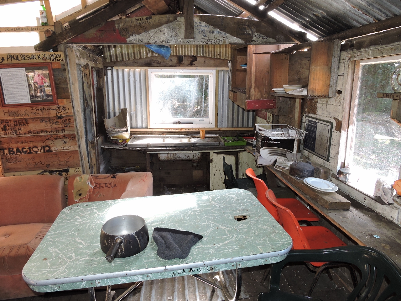 |
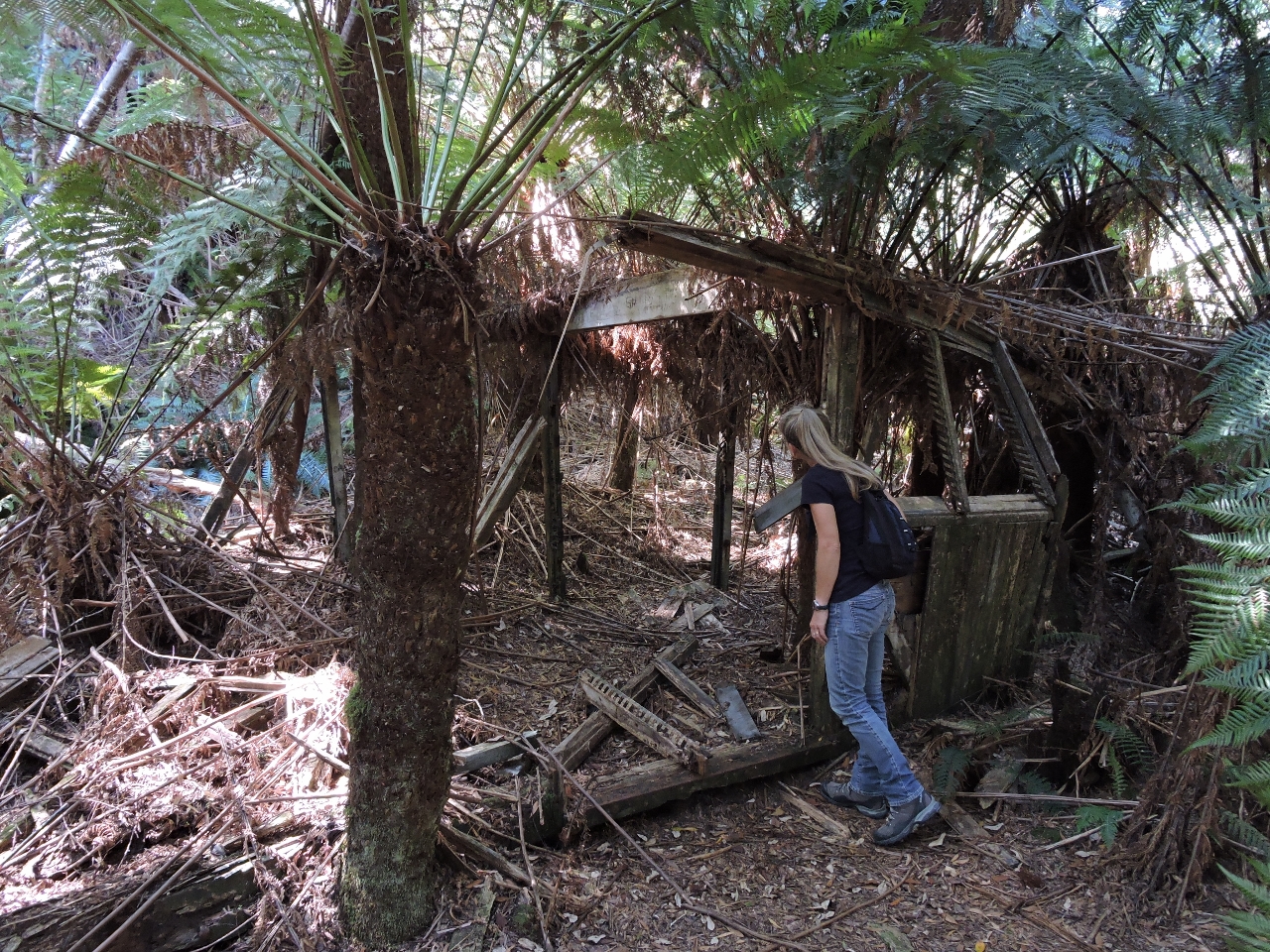
2/12/2015: West Pillinger
Position: -42°21.28'S, 145°32.56'E
Having really enjoyed exploring East Pillinger we took the dinghy over to West Pillinger to look around there. At the mouth of a stream is the ruins of the large dock that once served the town, and a more modern shack. The picture is of the inside of the shack, which is in fairly good repair and apparently is still being used.
|
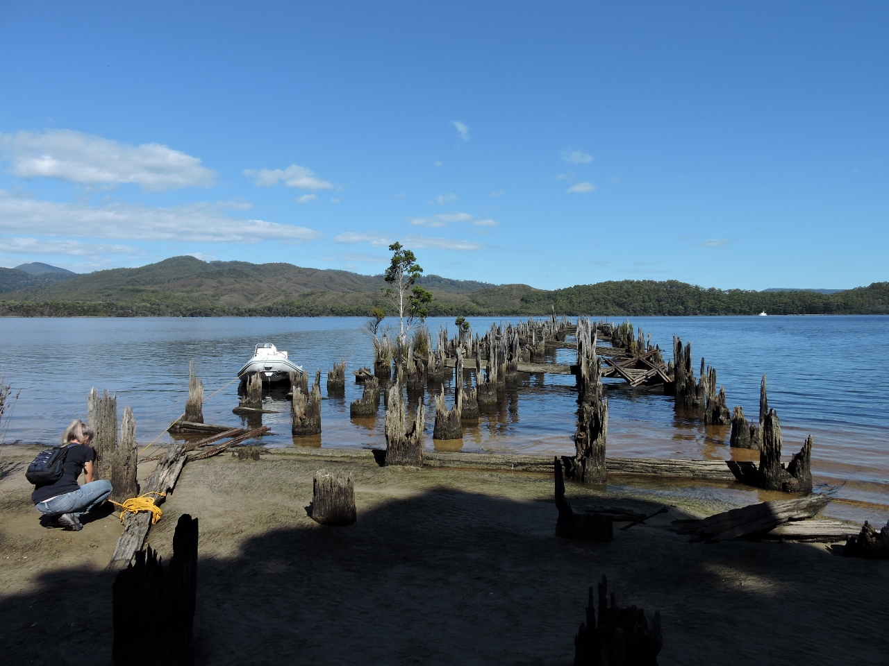 |
2/12/2015: Railway Jetty:
Position: -42°21.36'S, 145°32.54'E
The remains of a large railway jetty juts out from the West Pillinger. The jetty marks the end of Queenstown to Pillinger rail line.
|
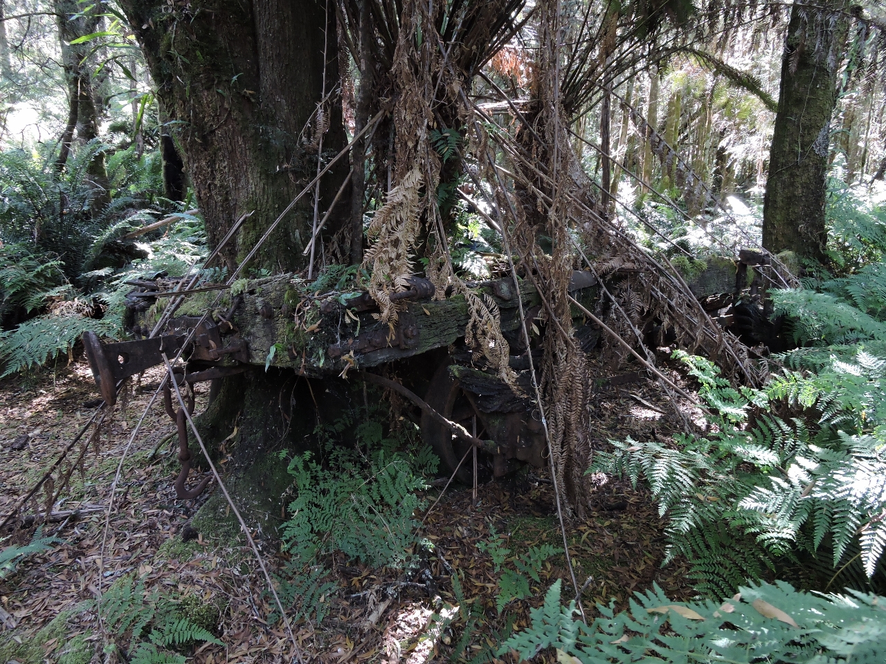 |
2/12/2015: Old Rail Car
Position: -42°21.33'S, 145°32.52'E
The tracks from the railway jetty lead inland about 100' to the remains of an old rail car where a tree has grown up through middle but the suspension and frame are still well preserved. Vegetation is a bit thick on the way in, but the rail car is not hard to find. We'd tried to reach it from near the shack at West Pillinger, but gave up in the thick brush. Looking at our track later, we were surprisingly close.
|
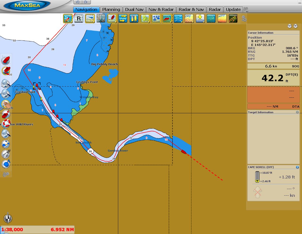 |
2/13/2015: Off the Charts
Position: -42°26.68'S, 145°34.31'E
We're heading up the Gordon River and just leaving the area covered by charts so, from this point forward we don't have depth information other than that provided by the Tasmania Anchorage Guide. Their advice is to stick to the outside of river bends where the water is deepest. Depths are expected to be deeper than 4m all the way up to Warners Landing.
|
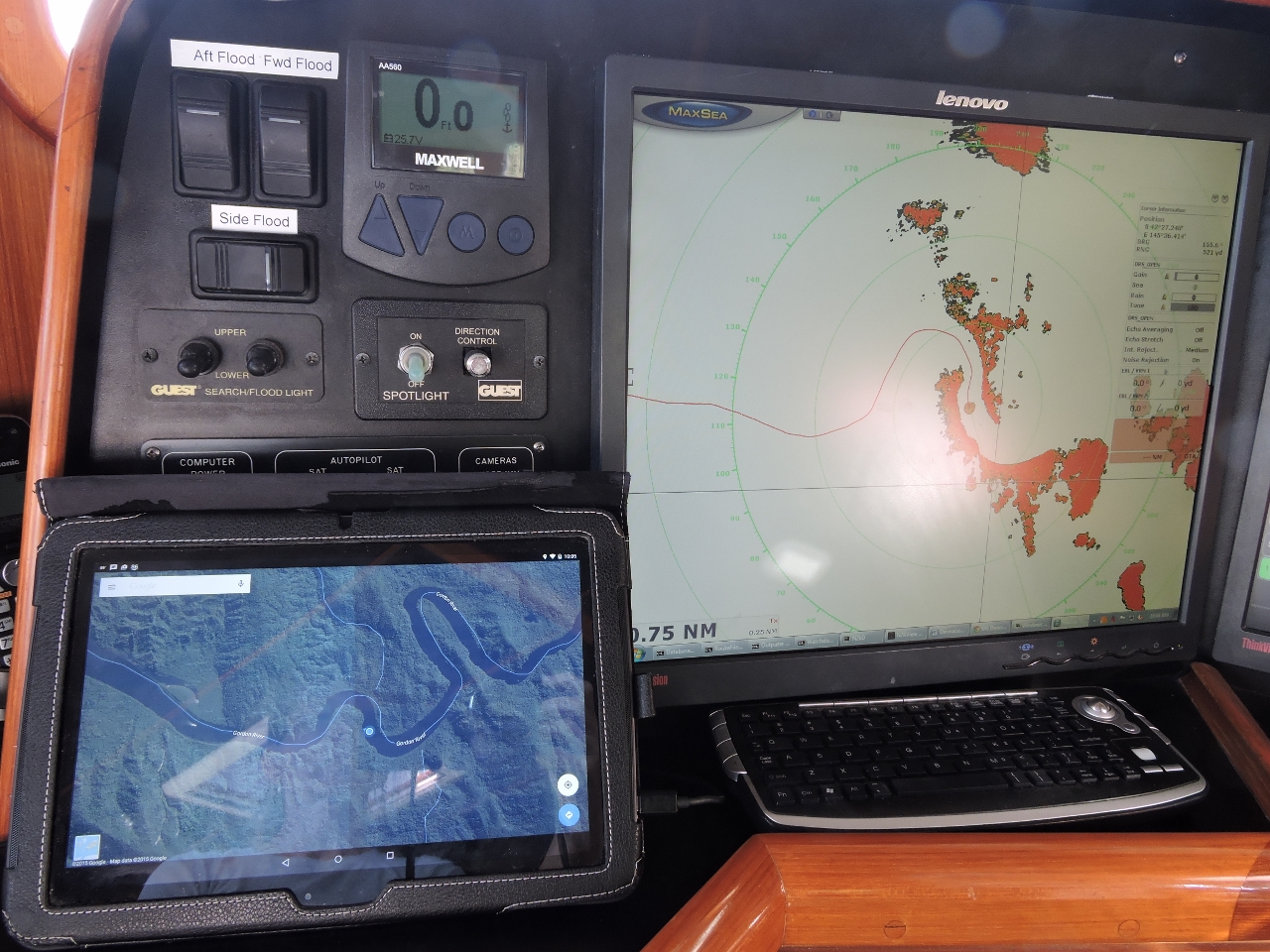 |
2/13/2015: Google Earth and RADAR
Position: -42°27.07'S, 145°36.32'E
Here we are navigating up the Gordon River using RADAR, Google Earth, and care, since we are well out of the area covered by the available navigational charts.
|
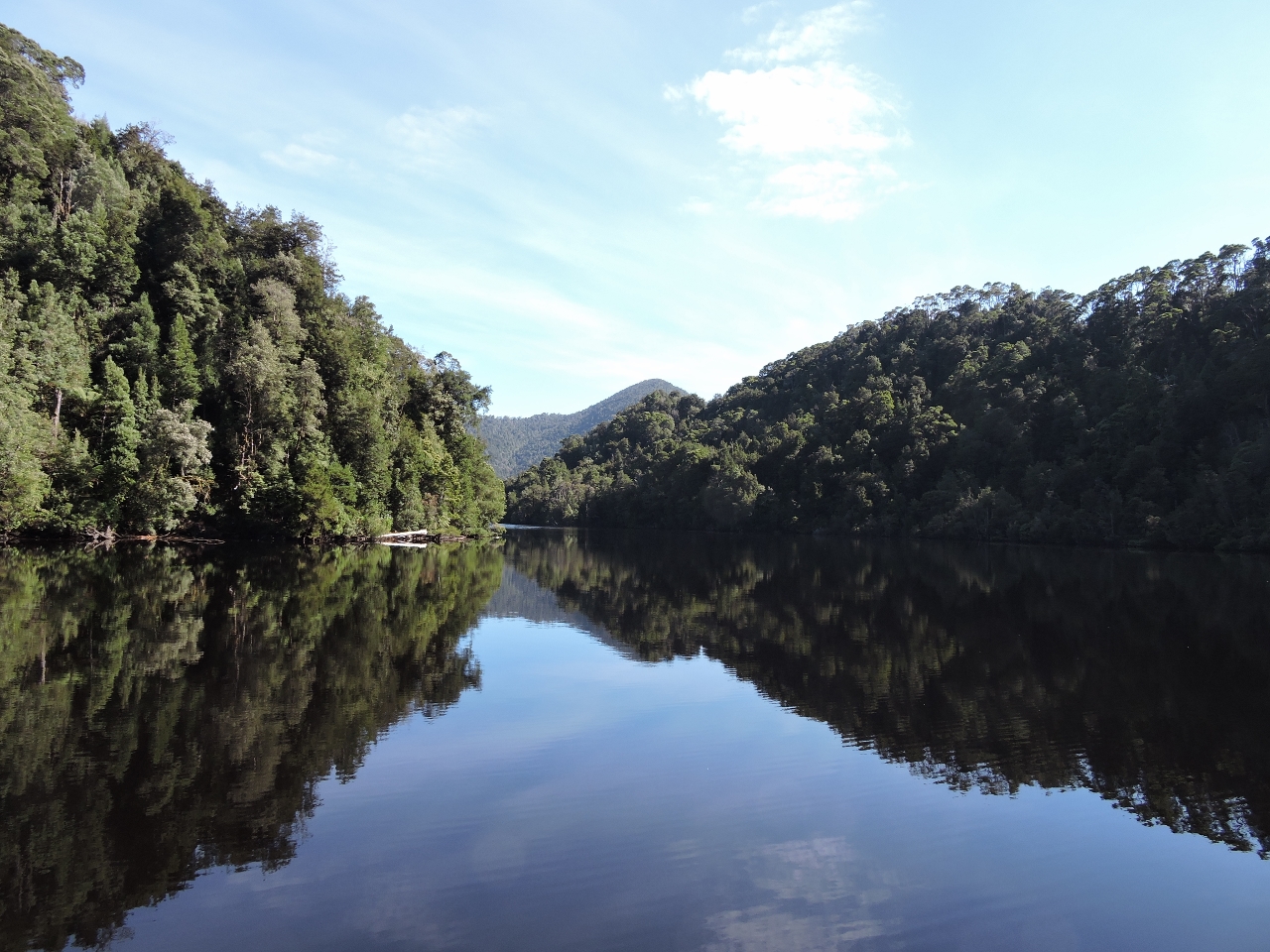 |
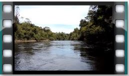
2/13/2015: Gordon River
Position: -42°26.79'S, 145°37.02'E
The Gordon River is beautiful and one of the must do trips if you are in the Macquarie Harbor area.
|
 |
2/13/2015: Heritage Landing
Position: -42°26.51'S, 145°36.81'E
Heritage Landing is used by the tourist boats sailing out of Strahan for what they describe as a rainforest experience.
|
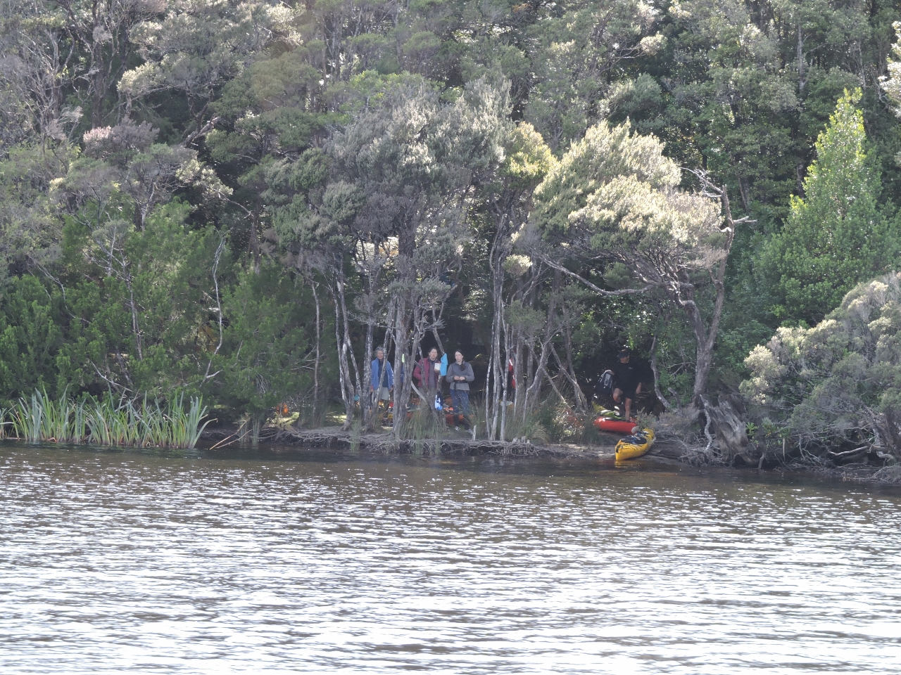 |
2/13/2015: Kayak Camp
Position: -42°26.59'S, 145°40.36'E
The Gordon River is serene and feels nearly uninhabited but, if you look carefully, there are people everywhere. Regular tour bouts make the run, pleasure boats run up, multi-day kayak trips traverse the river, and even amphibious aircraft. Here's the camp of one group of kayakers.
|
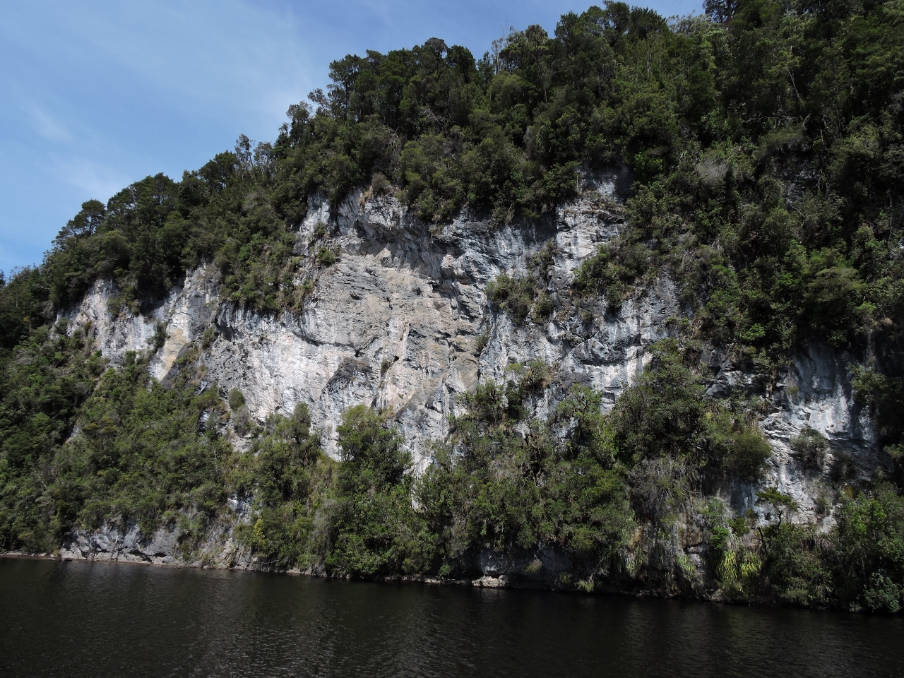 |
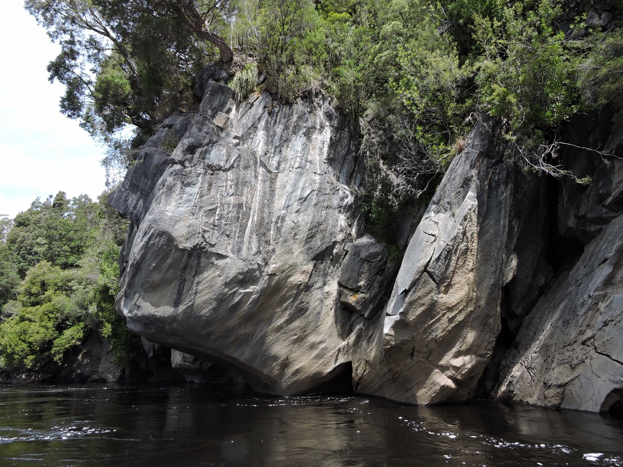
2/13/2015: Marble Cliffs
Position: -42°32.41'S, 145°40.08'E
The majestic Marble Cliffs are on the right side of the river about 2 miles before reaching Butler Island when heading up river.
|
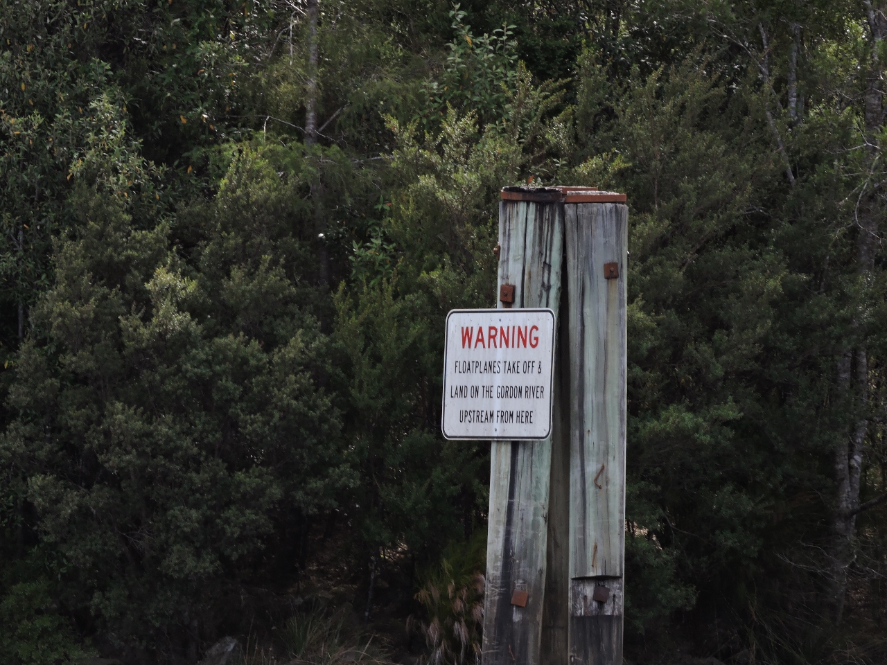 |
2/13/2015: Aircraft Landing Area
Position: -42°34.13'S, 145°41.39'E
This signs marks the beginning of the float plane landing area bringing tourist in to see Sir John Falls. We took Dirona up past Warners landing but eventually decided to return to the area just before the sign to anchor since it was a wider section with less depth and more swing room. We explored from there in the dinghy.
|
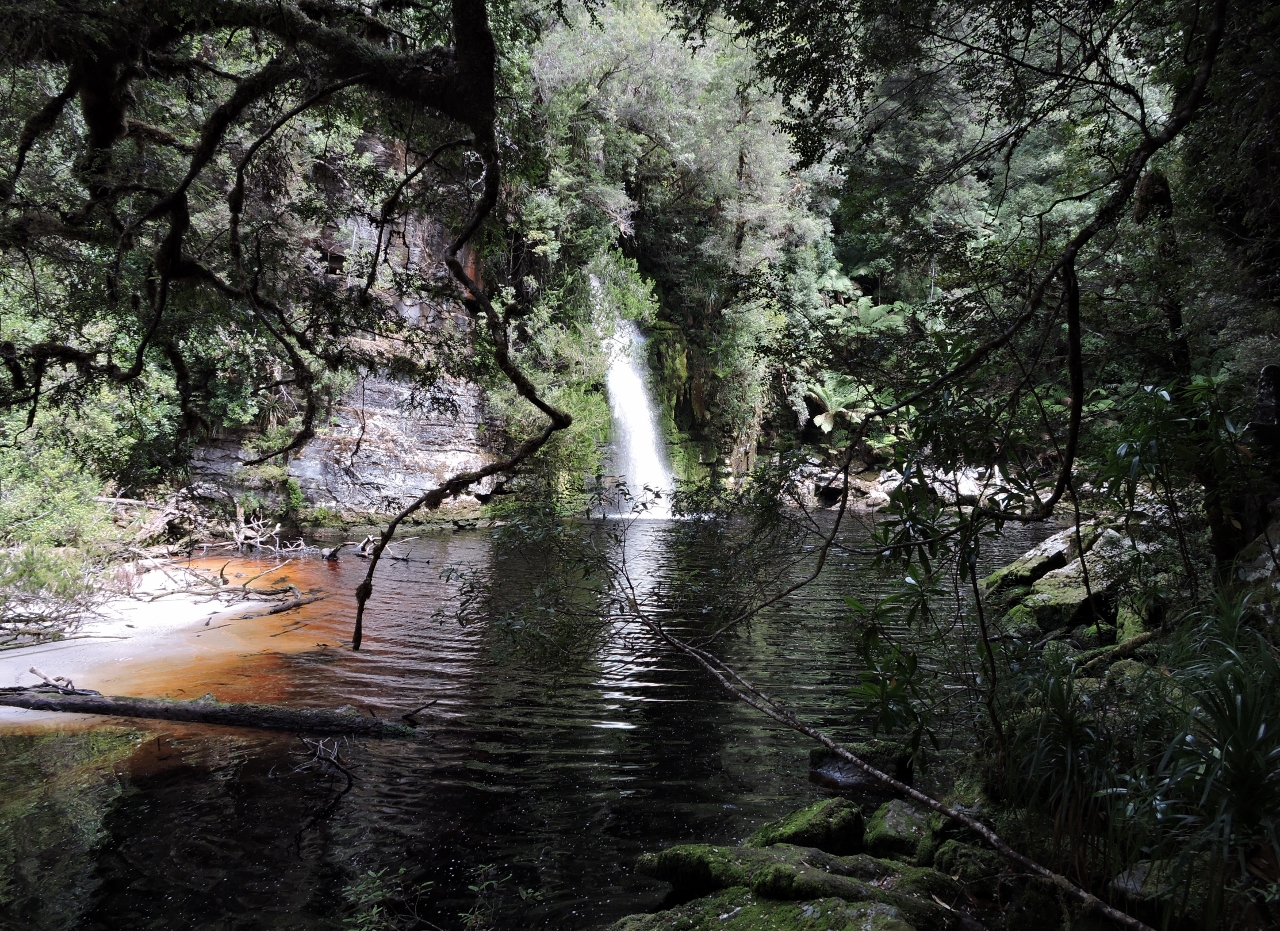 |
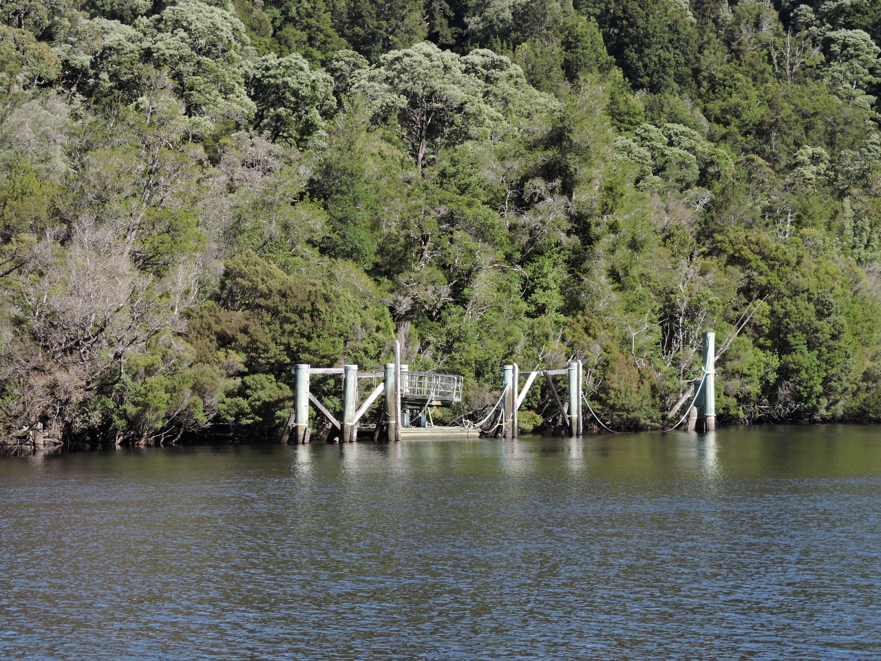
2/13/2015: Sir John Falls
Position: -42°34.26'S, 145°41.59'E
Just up river from where we anchored is a large, fairly new jetty that is used by the tourist boats that run up river and the float planes that land in the area as a stopping place to see Sir John Falls just a few hundred feet inland.
|
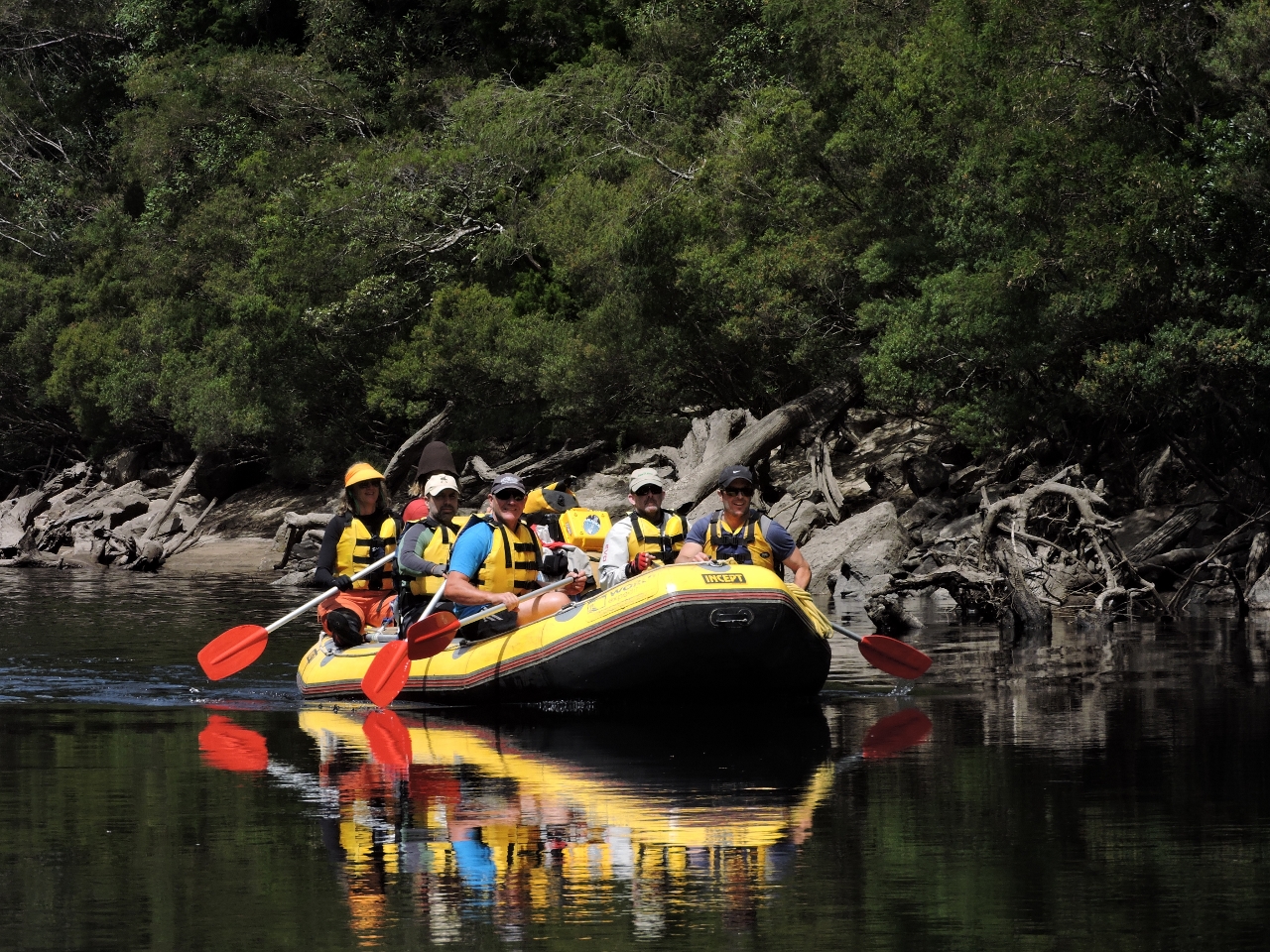 |
2/13/2015: White Water Adventure
Position: -42°34.99'S, 145°43.89'E
One of the many ways to enjoy the Gordon River is a multi-day inflatable boat run down river. These folks have been out for days running down river, shooting rapids, and occasionally needing to unload the boat and go around excessively shallow sections. They said it was a lot of work but there sure were a lot of smiles. They seemed to be having a lot of fun and the weather was close to perfect.
|
 |
2/13/2015: Franklin River
Position: -42°35.26'S, 145°44.45'E
We went a short distance up the beautiful Franklin River, but soon reached rapids with no water to float the dinghy. We'd hoped to get further and possibly reach Pangana Cave a little farther up. The rafters we'd passed ealier had come down the Franklin River--when we spoke with them later they said the water level was extremely low this year.
|
 |
2/13/2015: Shooting the Rapids
Position: -42°36.08'S, 145°44.60'E
Not far up river from where we met the paddlers heading down river, we hit the first of progressively more difficult sets of rapids. What makes the rapids interesting is the combination of high water flow and almost no water. In our dinghy if you follow the flow carefully, you can "climb" up the rapids but it is notably higher when going up the worst of them. What makes it a challenge is the flow is high enough that considerable power is needed, and yet there is only a foot or two of water and, if you get just off the main channel, only a few inches of water. We didn't hit bottom on this run but this is exactly how we end up chewing up a prop every couple of years :-). The end of the last one was the a bit more than 40 nm up the Brisbane River.
|
 |
2/13/2015: River Narrowing
Position: -42°36.18'S, 145°44.66'E
The river narrowed as we headed further up, and the flow got much stronger. But the reward was an interesting shorelines and an exciting ride.
|
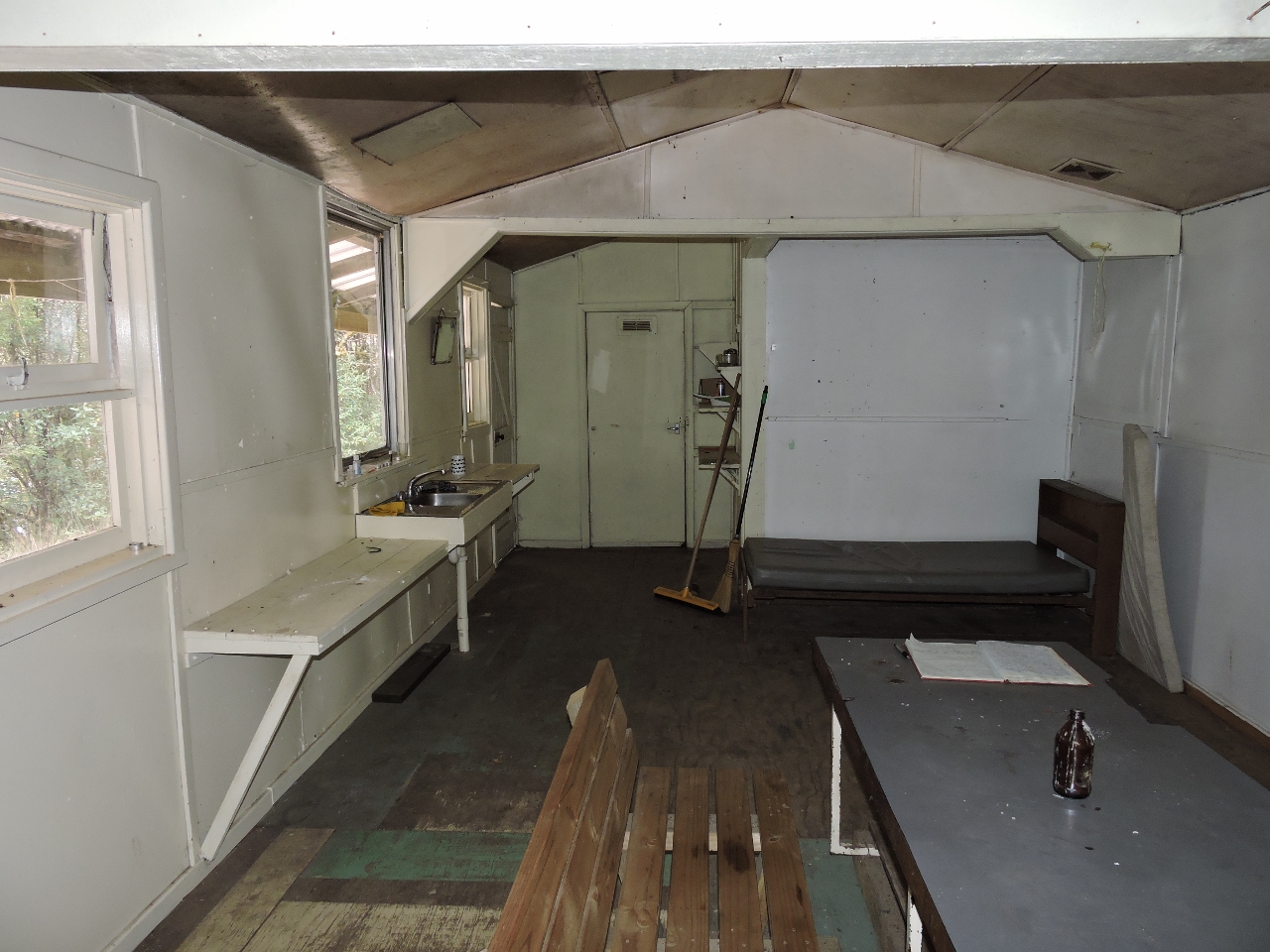 |
2/13/2015: Parks hut
Position: -42°34.19'S, 145°41.38'E
Near our anchorage, we hadn't noticed originally but in the trees near us there appeared to be a hut so we want off to explore. It turned out to be a Tasmania Parks hut. The building was well-built, very clean and appeared to get used frequently. While we were there a group of paddlers landed to stay the night there.
|
 |
2/13/2015: Walkway to falls
Position: -42°34.21'S, 145°41.54'E
From the hut, a short and well-maintained walkway led back to the dock at Sir John Falls.
|
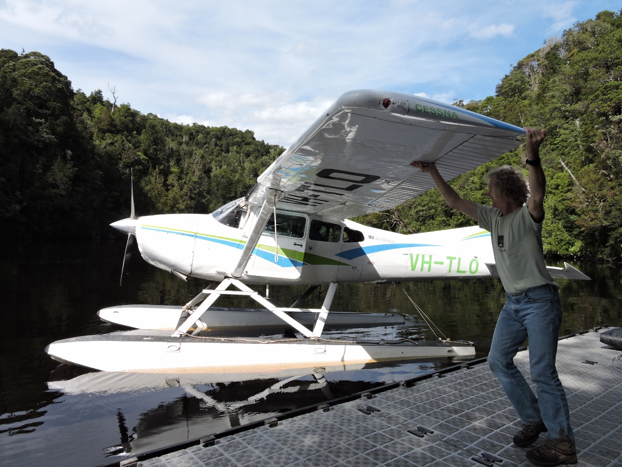 |
2/13/2015: Float plane launch
Position: -42°34.23'S, 145°41.60'E
James helps launch a Cessna from the Sir John Falls dock. The plane had come in from Strahan to show passengers the falls and give them a beautiful aerial view of the area. We enjoyed talking to the pilot and passengers and watching them take off, after which they did a low pass over the river just in front of them. That looks like fun--we wish we had room for a plane on Dirona :-).
|
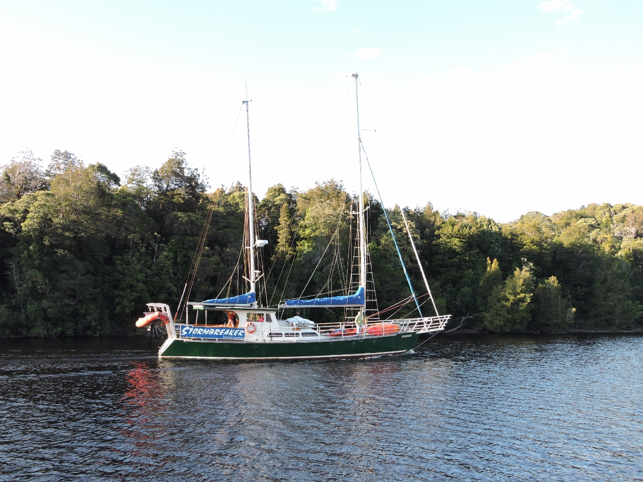 |
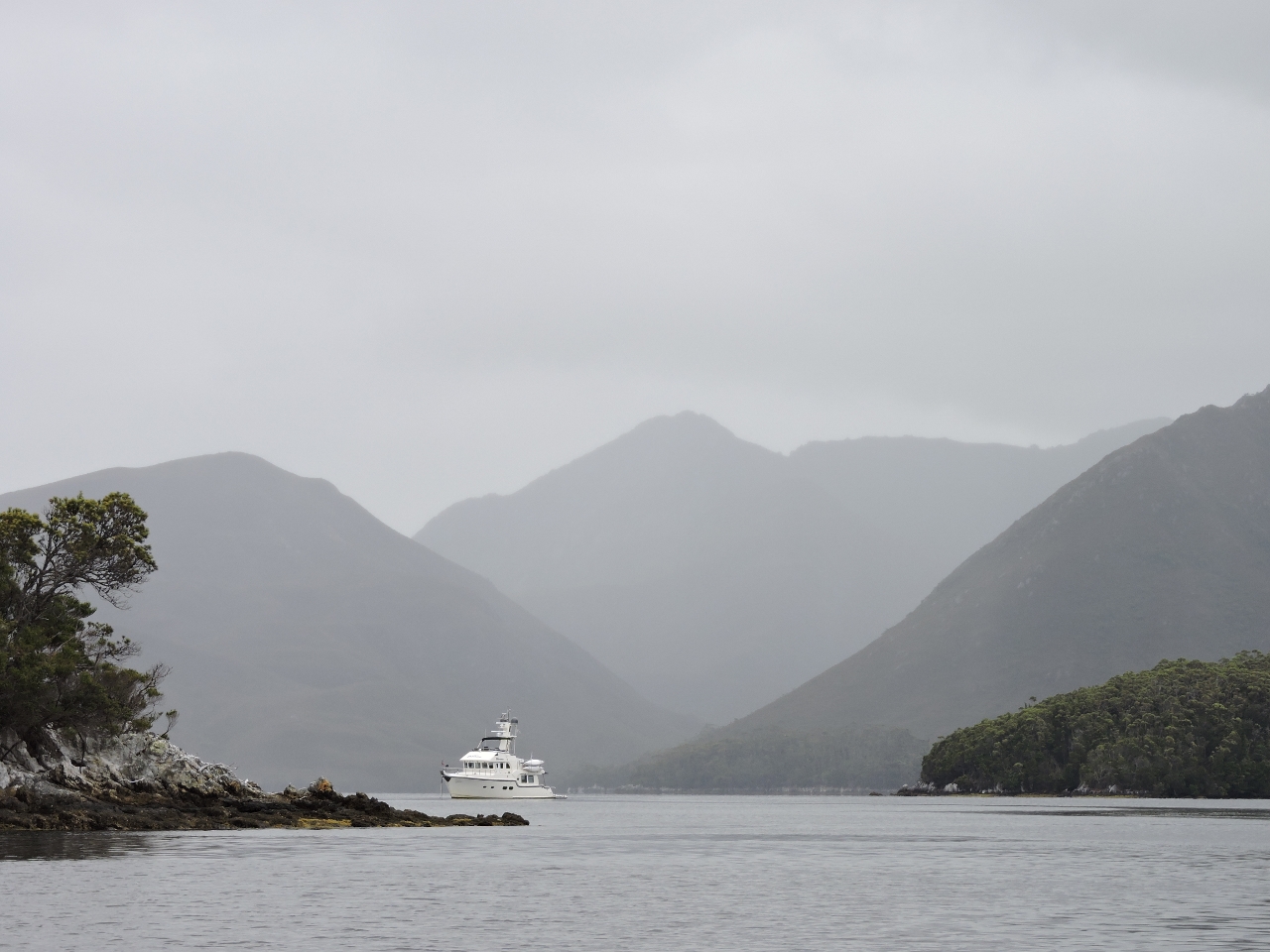
2/13/2015: Stormbreaker
Position: -42°34.16'S, 145°41.32'E
Just before nightfall Stormbreaker, a well equipped 65' sailboat owned by West Coast Yacht Charters, arrived carrying passengers up the river for the night. The passengers will get to meet the river rafters who just completed their multi-day down the Gordon River adventure and were camped on the Sir John Falls dock. The next morning, Stormbreaker will head back down river with the rafters on board to carry them to Strahan. Stormbreaker also brings in dinner for the rafters. We'd spoken earlier with the rafters, who reported they have been eating like kings, but still looking forward to a dinner coming in from civilization.
|
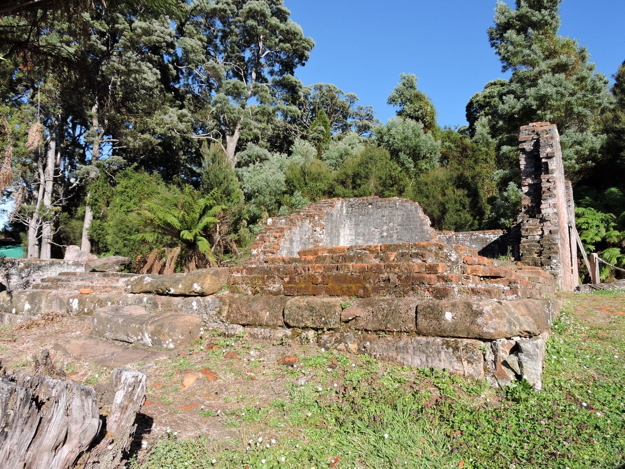 |
2/15/2015: Sarah Island
Position: -42°23.37'S, 145°26.84'E
Sarah Island earned the unfortunate reputation of having the worst prison conditions in all of Tasmania and that really is saying something. None of them were great. It's now a well preserved park where the old ruins of the prison facility can be toured. The ruins pictured here are from the solitary confinement cells. No light gets in and probably just about no sound with the walls being over a half meter thick. These cells were less than 1m wide and only 1.7m high floor to ceiling.
|
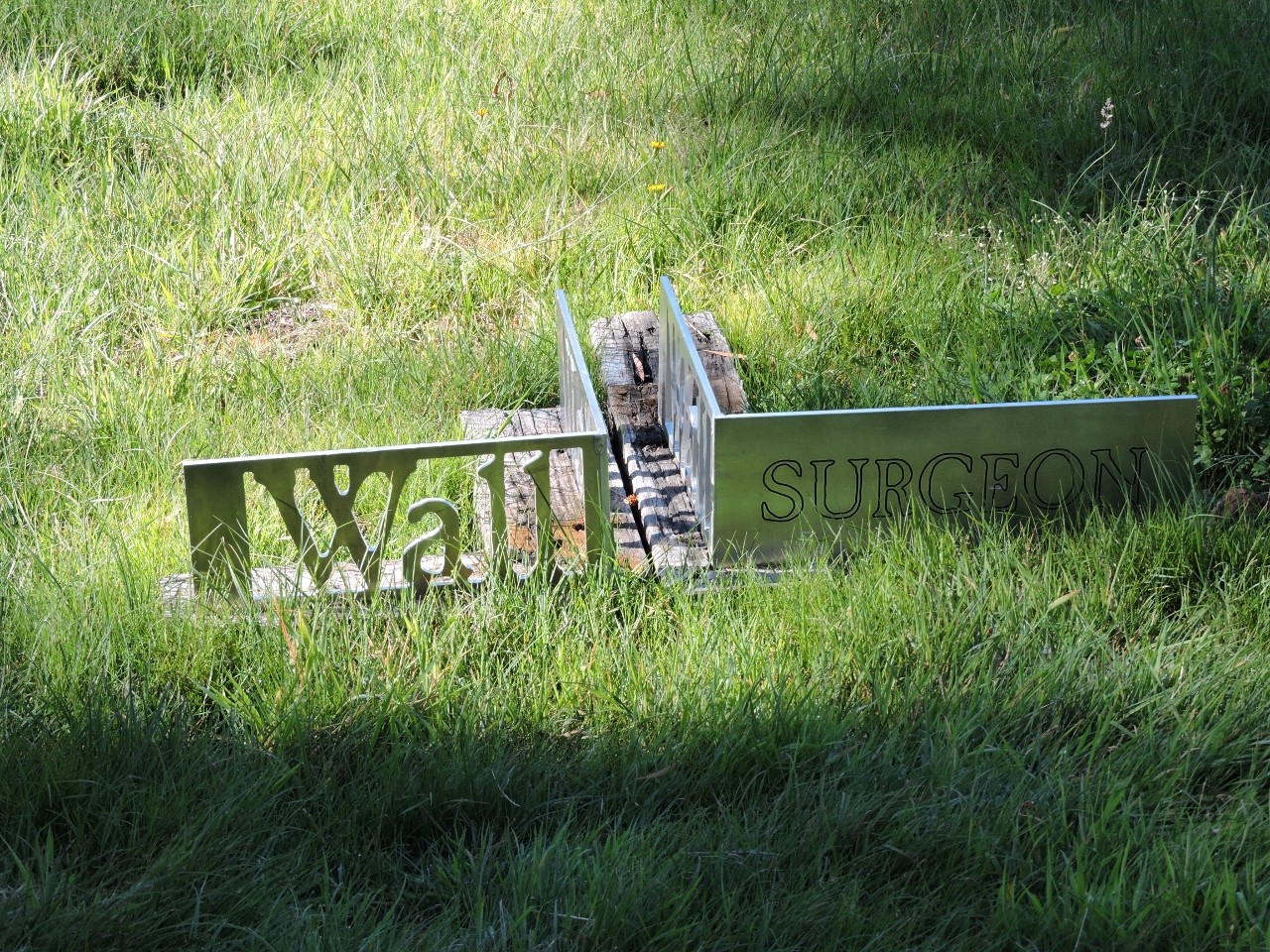 |
2/15/2015: Surgeon's office
Position: -42°23.34'S, 145°26.88'E
Some of the Sarah Island buildings where built less stoutly than the confinement buildings and have faded away to almost nothing. These are marked with stainless corner braces showing the outline of the building and including the name of the facility. Here we are looking at the Surgeon's house. The Commandant's house is on one side and both the Military Officer and the Chaplain's houses are on the other.
|
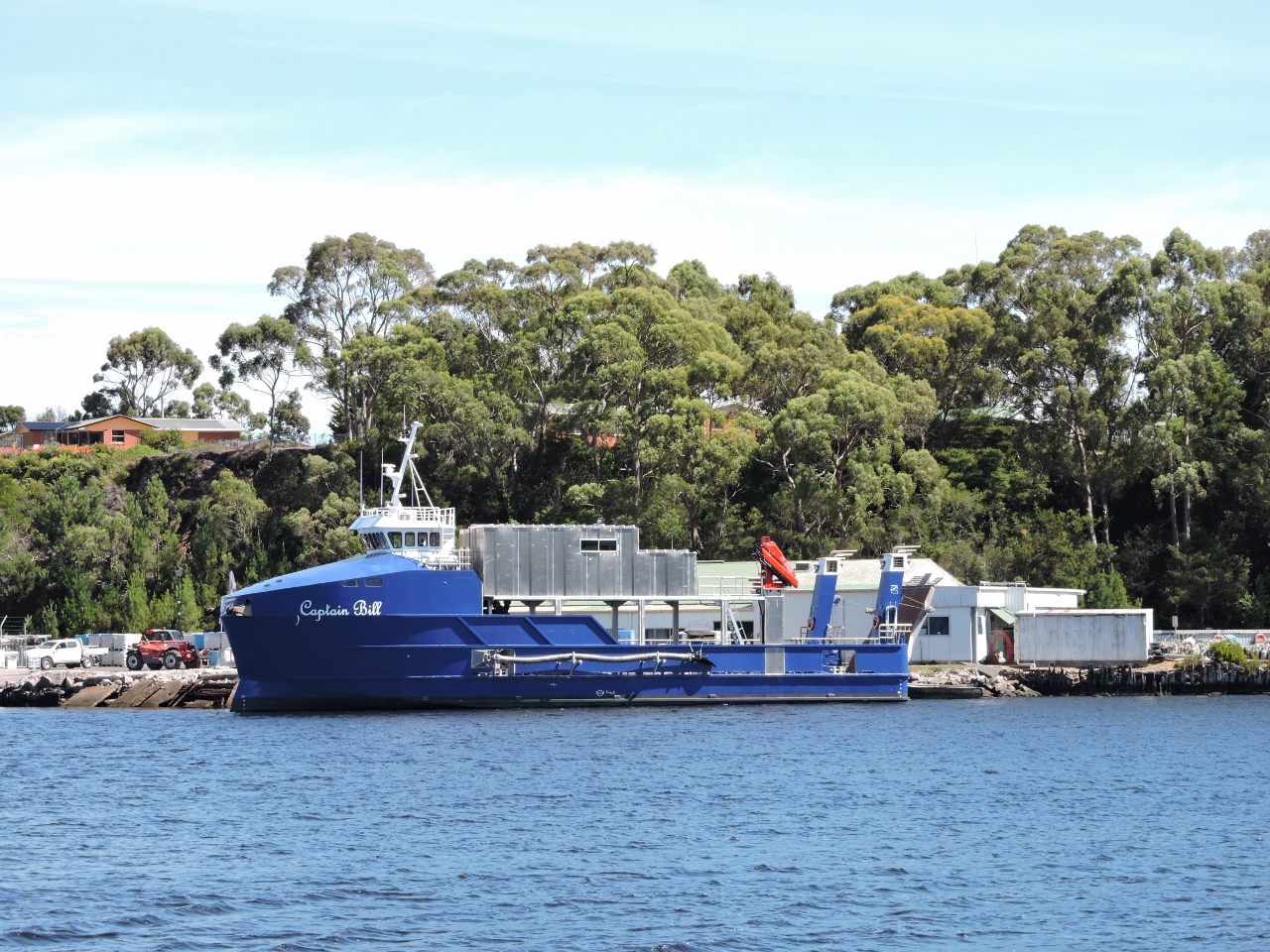 |
2/15/2015: Strahan
Position: -42°9.46'S, 145°19.63'E
We're now anchored in Risby Cove off Strahan near the well-maintained commercial tender Captain Bill. The Captain Bill appears to be used to maintain the fish farms in the area in a similar capacity as the Ronja Huon that we saw at Port Huon.
|
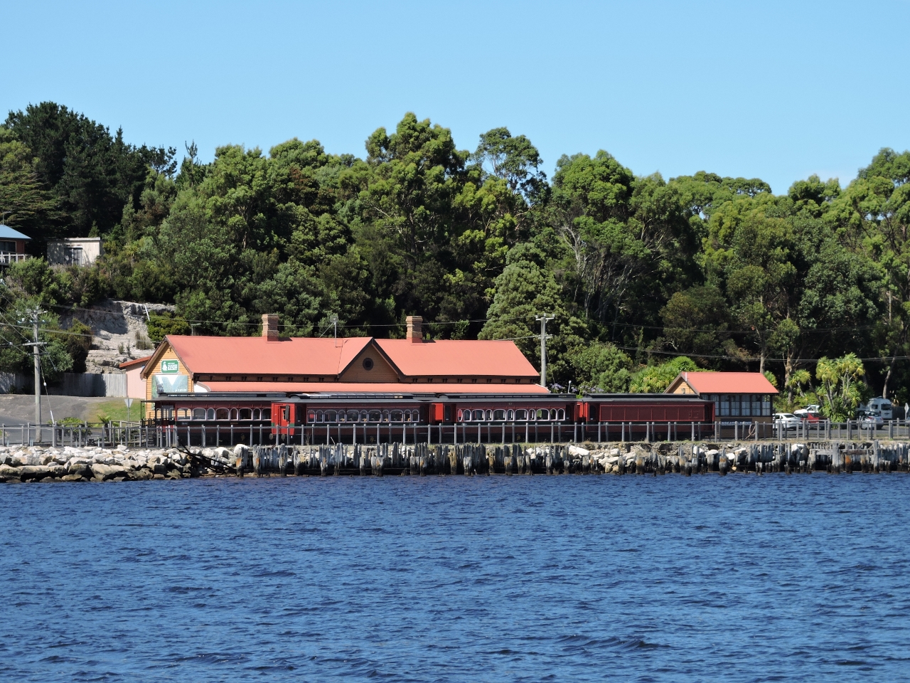 |
2/15/2015: Regatta Point Station
Position: -42°9.46'S, 145°19.63'E
Opposite our anchorage, looking to the south in the other direction from the Captain BillM, the West Coast Wilderness Railway's Regatta Point Station. We will be taking the train from that station the next day and making the trip on the historic tracks behind one of the original steam engines on our way to Queenstown.
|
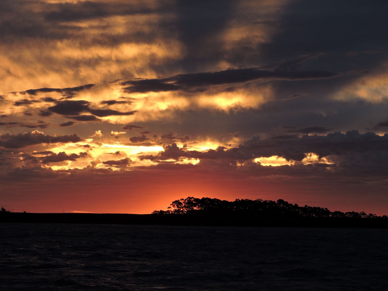 |
2/15/2015: Sunset
Position: -42°9.46'S, 145°19.63'E
I'm not sure what it is about boating and sunsets, but we just never tire of them. Our anchorage in Risby Cove is beautiful, surrounded on three sides by the town and the fourth by a spectacular sunset.
|
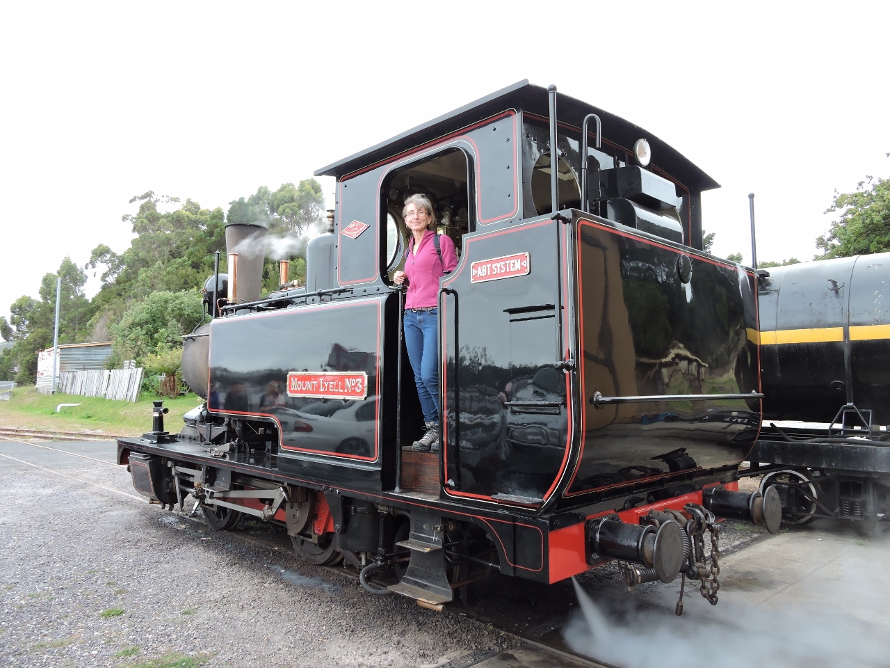 |
2/16/2015: Mount Lyle #3
Position: -42°9.60'S, 145°19.69'E
Around breakfast time we noticed black clouds of smoke billowing out of the storage building beside the Regatta Point Station. We initially thought there was a fire in the facility but shortly thereafter the Mount Lyle #3 steam engine inched out of the building into the bright sunlight of the morning. It turns out that steam engines, like old sailors, don't all like getting started in the morning. If the engine has been run the previous day, they give it an hour and a half to get started. In this case, having not run yesterday, they gave it a full three hours to warm up. Those first few minutes are black and sooty ones but, once it's warmed up, it actually runs remarkably cleanly. The engine itself is absolutely immaculate. Original in almost every respect other than we doubt any working engine was every polished that carefully and cleaned that well. It's a beautiful piece of history but it's about to go to work. In an hour, it'll leave with three full car loads of passengers and head up tracks so steep that sand is sometimes automatically dispensed onto the tracks by the engine for extra traction. A portion of the trip is so steep that a third cog rail is required to allow the engine sufficient traction to make the grade. Read more ...
|
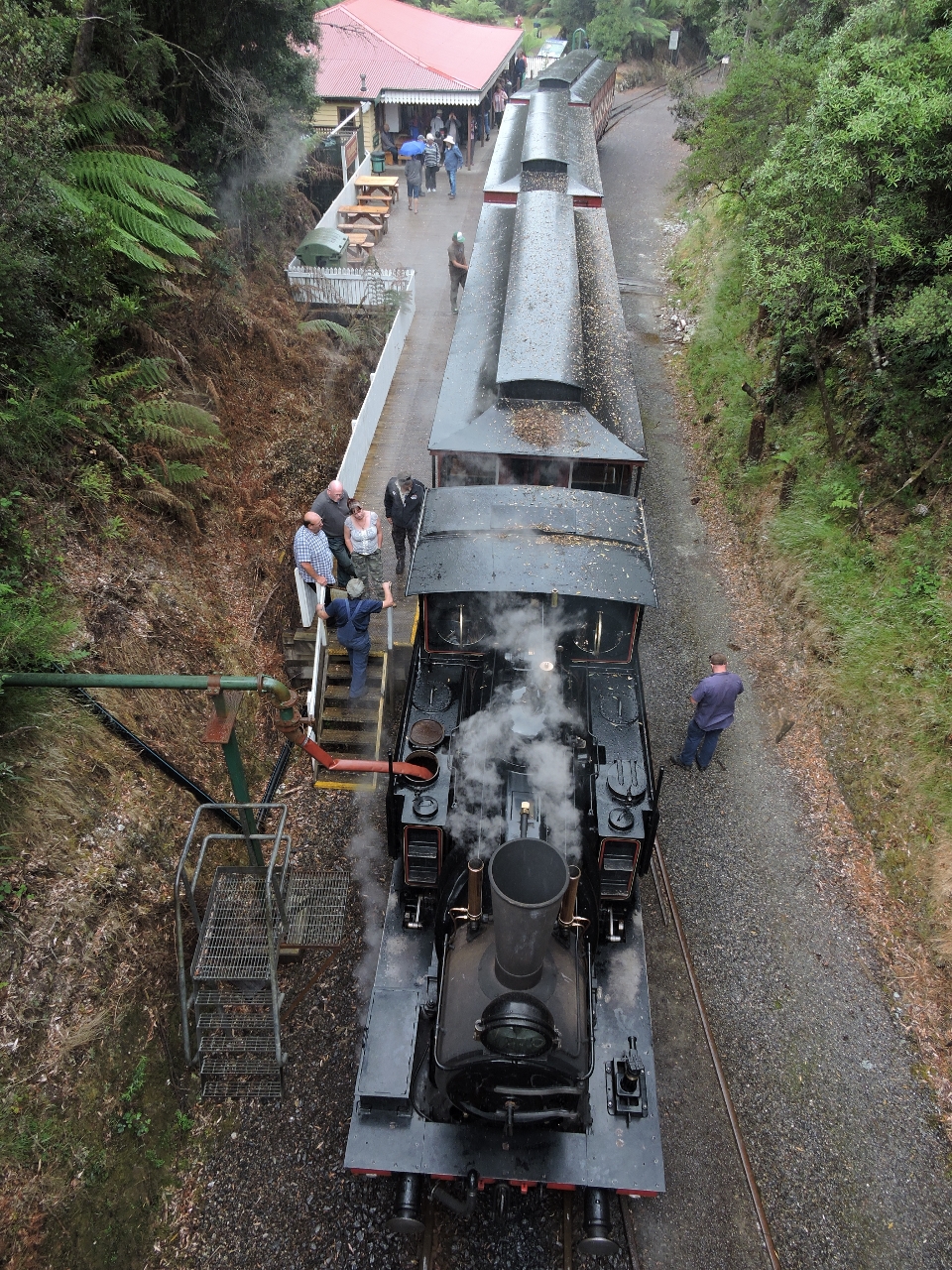 |
2/16/2015: Rinadeena Saddle
Position: -42°9.16'S, 145°29.74'E
The Mount Lyle #3 and its load of three passengers cars have successfully climbed to highest point of the trip, the Rinadeena Saddle. And no surprise after that climb, the engineer is refilling the steam boiler using the red hose at the bottom left of the photo. The steepest part of this return trip is 1 in 15 which is to say for every 15m traveled, the train will climb 1m vertically. This is incredibly steep for a metal wheels on metal tracks, so an ingenious system is used where an engine drives two cog wheels that engages in a central third rail to give the engine the purchase it needs to haul the load up the hill. Going down the grade doesn't require the massive power required when going up, but the same system is used to provide the traction needed to maintain a safe speed. And for extra traction, when not using the central cog rail, sand is sometimes automatically dispensed onto the tracks by the engine.
|
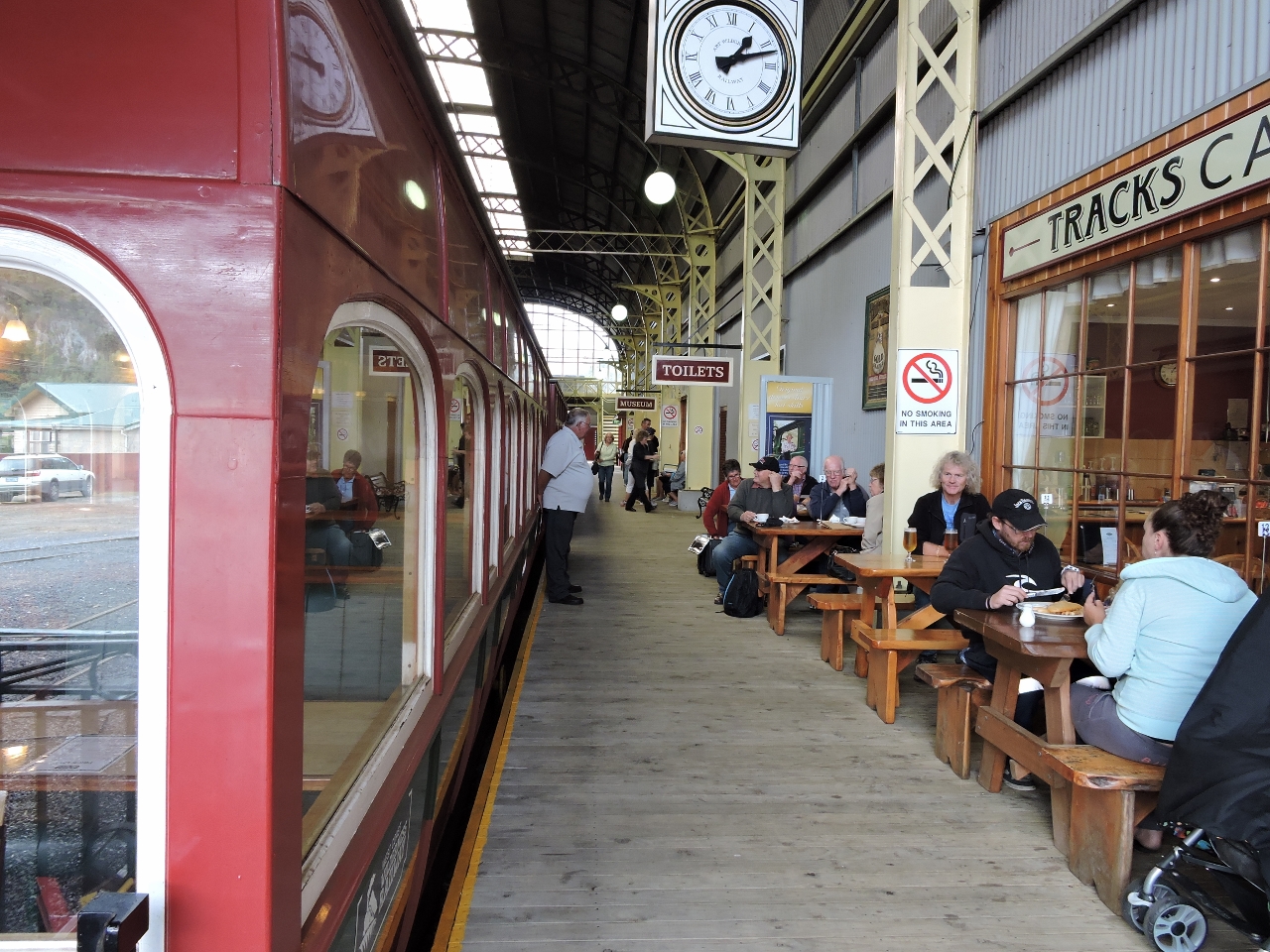 |
2/16/2015: Queenstown
Position: -42°4.78'S, 145°33.25'E
We walked all through Queenstown's commercial district and explored the outdoor mining exhibits, then had a good meal at Tracks Cafe in Queenstown station before returning back to Strahan.
|
 |
2/17/2015: Sandy Cape
Position: -41°37.72'S, 144°49.92'E
We're just south of aptly-named Sandy Cape on a 225-mile overnight run to the River Tamar from Macquarie Harbour. We're currently seeing 10-15 knot winds, and are expecting that for most of the run except for a brief period of 20-25kt winds as we round Cape Grim at the northest corner of Tasmania.
|