MV Dirona travel digest for Cape Town 2015

|
Click the travel log icon on the left to see these locations on a map,
with the complete log of our cruise. On the map page, clicking on a camera or text icon will display a picture and/or log entry for that location, and clicking on the smaller icons along the route will display latitude, longitude and other navigation data for that location. And a live map of our current route and most recent log entries always is available at //mvdirona.com/maps/LocationCurrent.html. |
 |
11/20/2015: Entry gate
Position: -33°54.54'S, 18°25.07'E
The marina basin was built in the 1800s and later converted into the V&A waterfront complex. These might be original steps that lead ashore from our dock. It's a little unusual for a dock to be accessible only through stairs--hopefully we won't need to transport anything heavy or wheeled.
|
 |
11/20/2015: Lock
Position: -33°54.53'S, 18°25.05'E
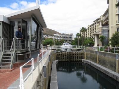
This small lock leads to a canal between residential buildings behind the marina basin.
|
 |
11/20/2015: V&A Waterfront Marina
Position: -33°54.49'S, 18°25.08'E
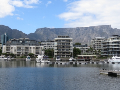
Our slip at the V&A Waterfront Marina with dramatic Table Mountain as a backdrop. The dock mostly is empty now, but will fill up when the World ARC fleet arrives in December.
|
 |
11/20/2015: 5261
Position: -33°54.48'S, 18°25.11'E
The V&A Waterfront Marina is home port to Nordhavn 5261. We know many South African Nordhavn owners, but as far as we know this is the only Nordhavn that is actually moored long-term in South Africa.
|
 |
11/20/2015: V&A Waterfront
Position: -33°54.57'S, 18°25.25'E
When we checked in at the marina office, they gave us a couple of maps of the area. This shows the V&A Waterfront complex which is full of shops and restaurants.
|
 |
11/20/2015: Robinson Dry Dock
Position: -33°54.47'S, 18°25.09'E
The Robinson Dry Dock was built in 1882 and is the oldest operating dry dock of its kind in the world. Two large ships had just entered and a crew was closing the gate as we passed by.
|
 |
11/20/2015: Sculptures
Position: -33°54.36'S, 18°25.29'E
Some fabulous, and huge, sculptures for sale along the waterfront.
|
 |
11/20/2015: Christmas Tree
Position: -33°54.29'S, 18°25.22'E
A year ago we took a picture of Jennifer by Sydney's Happy Christmas tree. This year, with temperatures in the 60s, we're getting closer to Northern Hemisphere Christmas weather.
|
 |
11/20/2015: Victoria Basin
Position: -33°54.25'S, 18°25.24'E
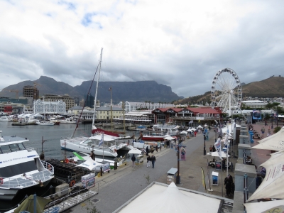
Looking southeast across Victoria Basin.
|
 |
11/20/2015: Granger Bay
Position: -33°54.12'S, 18°25.25'E
A view to the Atlantic Ocean at Granger Bay. This looks like a great place for storm-watching.
|
 |
11/20/2015: Mitchell's
Position: -33°54.31'S, 18°25.16'E
We had tasty pub fare for lunch on the patio at Mitchell's Scottish Ale House.
|
 |
11/20/2015: Sea Rescue
Position: -33°54.32'S, 18°25.21'E
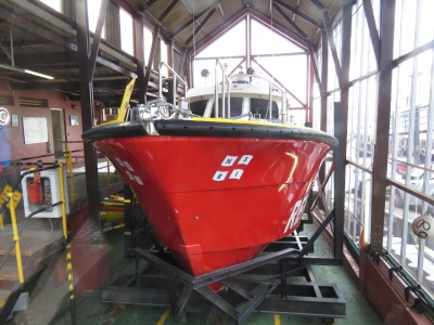
Like all the other port cities we've visited in South Africa, Cape Town has a capable-looking Sea Rescue station. But this one also sells souvenir T-shirts.
|
 |
11/20/2015: Swing Bridge
Position: -33°54.38'S, 18°25.28'E
The Swing Bridge was the first of the two bridges we passed to enter the marina.
|
 |
11/20/2015: Boat yard
Position: -33°54.64'S, 18°25.36'E
Several large commercial boats were hauled out across the water. Cape Town Harbour is very much a working waterfront.
|
 |
11/20/2015: Fuel leak
Position: -33°54.54'S, 18°25.13'E
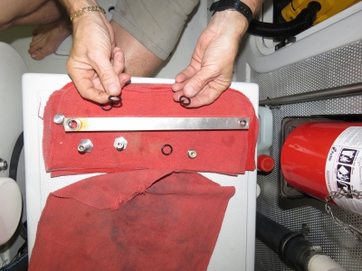
On investigating a fuel leak at the wing engine tank James found the o-rings in the sight gauges needed replacing. That metal bar on the rag is the sight gauge itself.
|
 |
11/20/2015: Sight gauge
Position: -33°54.54'S, 18°25.13'E
The sight gauge for the wing engine fuel tank was easy enough to remove and since it was leaking due to a tired o-ring, James replaced the o-rings in all the sight gauges.
|
 |
11/20/2015: Seals
Position: -33°54.54'S, 18°25.13'E
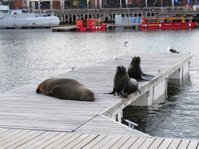
South African Fur Seals are abundant in Cape Town Harbour. This male and two females hauled out on the dock behind Dirona.
|
 |
11/20/2015: Close-up
Position: -33°54.53'S, 18°25.13'E
A close-up view of the male fur seal on the dock behind the boat, only a couple of yards away from James as he takes the picture.
|
 |
11/21/2015: Hydraulics leak
Position: -33°54.54'S, 18°25.13'E
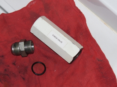
A minor hydraulics leak at the wing engine check valve. This was just barely enough of a leak to wet the hose on the outside, but not run to the bilge, so it's pretty minor. Nonetheless, hydraulic leaks don't get better so we aim to have all joints dry and dusty.
|
 |
11/21/2015: Belthazar
Position: -33°54.27'S, 18°25.22'E
A delicious whole baby Kingklip for Jennifer on the patio at Belthazar. We're taking full advantage of the high quality and excellent prices at the wide variety of V&A Waterfront restaurants. Dinner for two with a good bottle of wine runs about $70 US.
|
 |
11/24/2015: Goal
Position: -33°54.40'S, 18°25.19'E
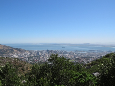
Clear weather if forecast for the full day, so we're going to hike up to the top of Table Mountain. There's our goal in the distance, viewed from the V&A Waterfront.
|
 |
11/24/2015: Tafelberg Road
Position: -33°57.31'S, 18°24.94'E
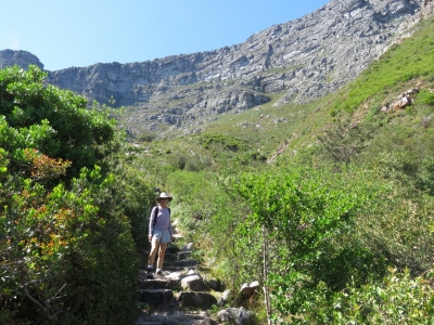
We took a taxi up to the trailhead on Tafelberg Road at 1,260ft above sea level. The view from here already is pretty impressive and we haven't even gotten started yet.
|
 |
11/24/2015: Platteklip Gorge Track
Position: -33°57.33'S, 18°24.96'E
At the start of the Platteklip Gorge Track to the top of Table Mountain. It's going to be pretty much straight up from here.
|
 |
11/24/2015: Signal Hill
Position: -33°57.41'S, 18°24.99'E
Looking back to Cape Town with Signal Hill on the left. We're at 1,472ft elevation now.
|
 |
11/24/2015: Break
Position: -33°57.65'S, 18°24.65'E
Taking a break at 2,996ft. We've climbed 1,736 feet in an hour.
|
 |
11/24/2015: Success!
Position: -33°57.69'S, 18°24.55'E
We ascended 2,166ft in 90 minutes to reach the top of Platteklip Gorge at 3,426ft. We were pretty pooped by this point.
|
 |
11/24/2015: Back Table
Position: -33°57.86'S, 18°24.57'E
From the top Platteklip Gorge, we walked the path along the Back Table towards Maclear's Beacon. This is the sweeping view south with False Bay on the far left, Cape Point and Cape of Good Hope slightly left of center, Hout Bay at center, and the Atlantic ocean coast on the right (click image for a larger view).
|
 |
11/24/2015: Maclear's Beacon
Position: -33°58.00'S, 18°25.51'E
The highest point on Table Mountain is 6,102 ft (1,860m). In 1884, astronomer Thomas Maclear had a beacon built here for his work in measuring the curvature of the earth.
|
 |
11/24/2015: Jan Smuts
Position: -33°58.01'S, 18°25.57'E
This plaque honours former South African Prime Minister General Jan Smuts, who regularly walked Table Mountain. Smuts fought against the British as a commando leader in the Second Boer War, but was a strong British supporter in both World Wars and served in Winston Churchill’s Imperial War Cabinet. He is also the only person to have signed the peace treaties ending both world wars.
|
 |
11/24/2015: Edge Path
Position: -33°57.80'S, 18°25.20'E
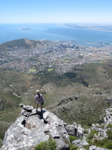
We returned to the top of Platteklip Gorge along the Edge Path, with spectacular views to Cape Town. It really is as straight down as it looks from Jennifer's perch above the city.
|
 |
11/24/2015: View
Position: -33°57.80'S, 18°25.21'E
The amazing view from the Edge Path. From left to right is the Table Mountain Upper Cableway station, Lion's Head, Signal Hill, Cape Town Harbour and Table Bay (click image for a larger view).
|
 |
11/24/2015: Lunch
Position: -33°57.50'S, 18°24.19'E
We bought a light lunch from the Table Mountain Cafe and ate on the terrace overlooking the Atlantic Ocean.
|
 |
11/24/2015: Cableway
Position: -33°57.44'S, 18°24.19'E
Looking down the steep cableway to the lower station just before we descend back to Tafelberg Road.
|
 |
11/25/2015: Robben Island
Position: -33°47.93'S, 18°22.54'E
Nelson Mandela and other political prisoners were improsoned on Robben Island before the fall of apartheid. The island is now a UNESCO World Heritage Site with daily tours through the former prison. This is looking back to the main jetty after we'd disembarked the ferry that carried us here from the V&A waterfront.
|
 |
11/25/2015: Robert Sobukwe house
Position: -33°48.21'S, 18°22.58'E
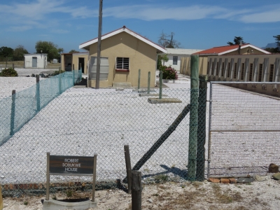
Robert Sobukwe founded the Pan Africanist Congress to opposed apartheid in South Africa. He was arrested in protest of the Pass Law, a form of internal passport system to segregate the population that required non-whites to carry a pass book at all times which severaly restricted their movemeents. Sobukwe was kept at Robben Island in solitary confinement in this small hut to prevent him from influencing other prisoners.
|
 |
11/25/2015: African penquins
Position: -33°49.06'S, 18°22.77'E
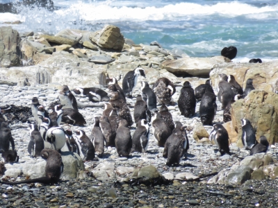
The island's original colony of African penguins was wiped out by early settlers before 1800. A new colony established itself in 1993 and is now third-largest for the species.
|
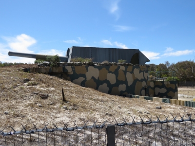 |
11/25/2015: WWII gun
Position: -33°48.86'S, 18°22.24'E
Robben Island was a military base during World War II. This gun from that era still fires.
|
 |
11/25/2015: Lighthouse
Position: -33°48.77'S, 18°22.39'E
The lighthouse on Robben Island was built in 1864 and is visible for 24 nautical miles.
|
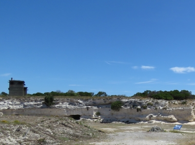 |
11/25/2015: Quarry
Position: -33°48.29'S, 18°22.46'E
This is the limestone quarry where prisoners were forced to do hard labour. The rock pile on the right of the photo is a memorial rock pile started by Mandela at a 1995 reunion of political prisoners. He placed a single rock in memory of those who could had died in the prison and the other attendees each added their own rock to the pile.
|
 |
11/25/2015: Graves
Position: -33°48.09'S, 18°22.44'E
Robben Island was a leper colony in the last half of the 19th century. Hundreds of people died of leprosy here and are buried in several graveyards on the island.
|
 |
11/25/2015: Political prison
Position: -33°48.09'S, 18°22.44'E
The entrance to the political prison.
|
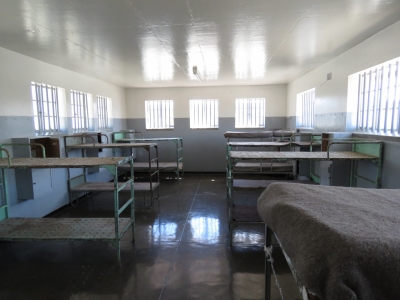 |
11/25/2015: Barracks
Position: -33°48.00'S, 18°22.30'E
Policital prisons initially slept on the floor with only a small padding and a mat. The windows were barred, but with no glass, so conditions were particularly difficult in the cold winters. Bunks and glass windows were later added.
|
 |
11/25/2015: Kgotso Dede Ntsoelengoe
Position: -33°48.00'S, 18°22.30'E
One of the most powerful aspects of our visit was that former policital prisoners of Robben Island give part of the tour. This is Kgotso Dede Ntsoelengoe, who was imprisoned in the barracks we are in from 1984 through 1991. Kgotso described his experiences as a political prisoner and guided us through the prison buildings.
|
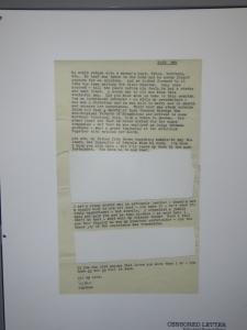 |
11/25/2015: Censorship
Position: -33°48.00'S, 18°22.30'E
One of the many ways the apartheid regime tried to wear down the spirit of the policital prisoners was through censorship of their letters. Kgotso told us he once got a letter from his mother that had everything but the salutation and closing cut out. Prisoners also were allowed only two short visits a year from their families, who had to apply for approval and cover travel costs to reach the island.
|
 |
11/25/2015: Mandela's cell
Position: -33°48.00'S, 18°22.35'E
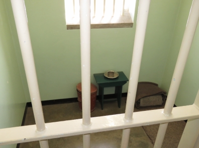
This is the cell where Nelson Mandela was imprisoned for 18 years with no toilet and only a mat to sleep on. The cell was too small for him to lie down, so he had to sleep partially curled up.
|
 |
11/26/2015: Hard drive replacement
Position: -33°54.54'S, 18°25.13'E
The boot drive in Jennifer's laptop (top left) died in East London, so she's been running off our boat laptop (right) with the data drive from her laptop plugged in externally (bottom right). We just got a new drive here in Cape Town and are starting the somewhat slow and painful process of reloading all the software. The boat laptop is purely a spare that we normally kept in the safe with any other sensitive electronic spares, such as our spare engine ECU. If a lightning strike should wipe out our electronics, hopefully the safe will act as a Farraday Cage and we can continue to function on the spares.
|
 |
11/27/2015: Woolies
Position: -33°54.53'S, 18°25.13'E
Both Richards Bay and Cape Town have small, but incredibly well-stocked Woolworth's grocery stores with excellent quality food.
|
 |
11/28/2015: Moorings
Position: -33°54.54'S, 18°25.13'E
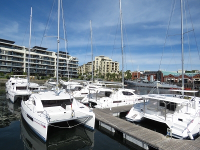
South African boat builders Roberston and Caine builds catamarans under the Moorings, Leopard and Sunsail brands. Over the time we've been here, the docks around us have slowly been filling up with brand new, mostly with Mooring's branded catamarans. Apparently this happens every month as the boats are produced and launched. The docks then drain quickly as the boats are moved onto a bulker for transit.
|
 |
11/28/2015: Dinghy tour
Position: -33°54.44'S, 18°25.25'E
We set off on a dinghy tour of the harbour as another Moorings boat was arriving into the marina.
|
 |
11/28/2015: V&A Waterfront
Position: -33°54.30'S, 18°25.28'E
The V&A Waterfront is packed with people on this sunny Saturday afternoon.
|
 |
11/28/2015: Krupp
Position: -33°54.33'S, 18°25.37'E
This massive Krupp crane moored in the waterfront has a 200-ton lifting capacity.
|
 |
11/28/2015: Danah Explorer
Position: -33°54.28'S, 18°25.41'E
An unusually diverse collection of ships are at Cape Town, and some are just unusual. The Danah Explorer operated as an offshore supply vessel in the Gulf of Mexico for 30 years, then became a fishing vessel and later a research vessel. Last year Southern African Shipyards of Durban, South Africa transformed the ship into a luxury yacht whose working roots still are clearly visible.
|
 |
11/28/2015: Leon Thevenin
Position: -33°54.26'S, 18°25.47'E
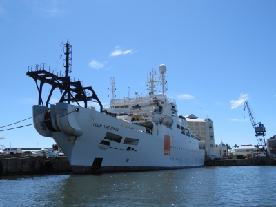
The French cable-laying vessel Leon Thevenin is famous for recovering the flight and cockpit data recorders from Air India Flight 182 that was bombed over Irish airspace in 1985.
|
 |
11/28/2015: S.A. Agulhas II
Position: -33°54.17'S, 18°25.45'E
The S.A. Agulhas II is a South African ice-breaking and polar supply ship built in 2012.
|
 |
11/28/2015: Helicopter
Position: -33°54.03'S, 18°25.70'E
About eight helicopters were staged just outside the harbor for aerial tours.
|
 |
11/28/2015: Paragon DPDS2
Position: -33°54.44'S, 18°25.86'E
The Paragan DPDS2 drillship can in water up to 5,600 feet deep and drill down to 25,000 ft.
|
 |
11/28/2015: Marina
Position: -33°54.62'S, 18°25.76'E
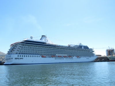
Oceania Cruises' 782-ft Marina, launched in 2011, was in port for the start of a 24-day cruise from Cape Town to Buenos Aires.
|
 |
11/28/2015: Lavela
Position: -33°54.93'S, 18°26.09'E
The tug Merlot assisting the bulker Lavela out of the harbour.
|
 |
11/28/2015: SA Explorer
Position: -33°55.04'S, 18°26.46'E
The 2,632 gross tonne mining ship SA Explorer.
|
 |
11/28/2015: Dry dock door
Position: -33°55.05'S, 18°26.64'E
Robinson dry dock at the V&A waterfront is the smaller of two dry docks in Cape Town. This is one of the two door for the larger one, Sturrock Dry dock, that can be divided into two separate compartments.
|
 |
11/28/2015: Sturrock Dry Dock
Position: -33°55.05'S, 18°26.67'E
The Sturrock Dry Dock was designed for battleships and aircraft carriers and can handle ships up to 359m long and 45m wide.
|
 |
11/28/2015: RCYC
Position: -33°55.19'S, 18°26.71'E
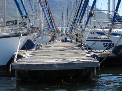
The Royal Cape Yacht Club is the other pleasure craft marina at Cape Town and like the V&A Waterfront Marina has Table Mountain as a beautiful backdrop.
|
 |
11/28/2015: Docks
Position: -33°55.14'S, 18°26.65'E
The setting at RCYC is beautiful, but docks don't look strong enough to hold Dirona. We're glad to be at V&A.
|
 |
11/28/2015: Beast
Position: -33°55.15'S, 18°26.65'E
Cape Diving's Beast has 4 300-HP Sizuki outboards. 1,200 HP of outboards is the most we've ever seen. The previous record was 3 by 350-HP in a law-enforcement boat being tested in the Puget Sound near Seattle.
|
 |
11/28/2015: Pacific Dolphin
Position: -33°54.86'S, 18°26.39'E
The 92m offshore supply vessel Pacific Dolphin has a bollard pull of 220-240 tonnes and 500-tonnne winch line pull.
|
 |
11/28/2015: YA Toivo
Position: -33°55.04'S, 18°26.35'E
The mining vessel YA Toivo has two massive anchors at each end to secure it for mining operations. The British Navy previously owned the ship as the HMS Challenger and used it for deep sea operations and saturation diving. Namibian Minerals Corp later purchased the ship and named it after Namibian anti-apartheid activist Andimba Toivo ya Toivo, who also was imprisoned on Robben Island.
|
 |
11/28/2015: Debmar Atlantic
Position: -33°55.16'S, 18°26.39'E
The Debmar Atlantic is a diamond-mining ship owned and operated by Debmarine Namibia, a joint partership of De Beers and the Namibian Government.
|
 |
11/28/2015: Fishing vessels
Position: -33°55.09'S, 18°26.27'E
Several foreign fishing vessels like this were throughout the harbour. The decks were ringed with bright lights and small platforms with spools on the end that could be lowered out over the water.
|
 |
11/28/2015: Victoria Basin
Position: -33°54.31'S, 18°25.63'E
South African fishing vessels rafted in Victoria Basin.
|
 |
11/28/2015: Seal
Position: -33°54.35'S, 18°25.50'E
This African Fur Seal was curled up in a tire hung from the wharf.
|
 |
11/28/2015: Thembekile
Position: -33°54.35'S, 18°25.40'E
Thembekile returning from Robben Island with a full load.
|
 |
11/28/2015: Cape Cormorant
Position: -33°54.36'S, 18°25.32'E
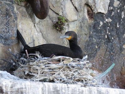
Cape Cormorants, with their distinctive orange neck patch, were nesting along the wall by the swing bridge.
|
 |
11/28/2015: Synchrolift
Position: -33°54.54'S, 18°25.27'E
Fishing vessels moored off the synchrolift.
|
 |
11/28/2015: Another Moorings
Position: -33°54.47'S, 18°25.19'E
Another Moorings catamaran was arriving as we returned.
|
 |
11/29/2015: Mini Peninsula Tour
Position: -33°55.67'S, 18°24.83'E
We purchased a City Sightseeing day pass that allows us to take unlimited rides on any of their four main bus routes and get on and off at any stop along the way. We started off on the Mini Peninsula Tour, which runs through downtown Cape Town, then east of Table Mountain to Hout Bay, and back along the Atlantic Coast. Here we are passing through downtown Cape Town with Table Mountain in the background.
|
 |
11/29/2015: Mount Nelson Hotel
Position: -33°55.90'S, 18°24.82'E
The five-star Mount Nelson Hotel has hosted many celebrities and dignitaries include Agathie Christie, Arthur Conan Doyle, Winston Churchil and U2.
|
 |
11/29/2015: Devils' Peak
Position: -33°56.30'S, 18°26.55'E
3,300-ft (1,000m) Devil's Peak is a prominent landmark in the Cape Town mountain backdrop when viewed from the water.
|
 |
11/29/2015: Red Bus
Position: -33°59.35'S, 18°26.07'E
The City Sightseeing buses are more commonly called the Red Buses for obvious reasons. Our first stop was at the Kirstenbosch Botanical Gardens. The 36-hectare property showcases about 9,000 of Southern Africa's 22,000 plant species.
|
 |
11/29/2015: Goslings
Position: -33°59.34'S, 18°25.91'E
Fluffy goslings at the Main Pond in Kirstenbosch Botanical Gardens.
|
 |
11/29/2015: Helmeted Guineafowl
Position: -33°59.33'S, 18°25.91'E
The Helmeted Guineafowl is native to Africa and common at the gardens.
|
 |
11/29/2015: Pincushion
Position: -33°59.43'S, 18°25.78'E
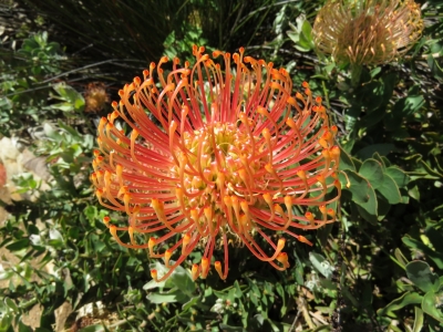
These striking pincushions were in full bloom in the expansive Kirstenbosch Protea garden.
|
 |
11/29/2015: Fynbos Walk
Position: -33°59.49'S, 18°25.81'E
With its combination of unique flora and dramatic scenery, Kirstenbosch is considered one of the most beautiful botanical gardens in the world.
|
 |
11/29/2015: Viewing deck
Position: -33°59.51'S, 18°25.83'E
Taking in the scenery, and getting a bit of a sun break, at the viewing deck.
|
 |
11/29/2015: Tree Canopy Walkway
Position: -33°59.39'S, 18°25.83'E
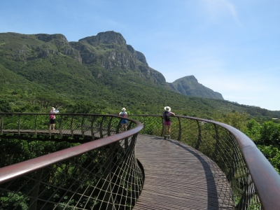
The 130m Tree Canopy Walkway leads 12m aboveground with great views across the gardens.
|
 |
11/29/2015: Sculpture Garden
Position: -33°59.23'S, 18°26.01'E
The Sculpture Garden features a rotating display of African stone sculptures.
|
 |
11/29/2015: Constantia Valley
Position: -34°0.48'S, 18°25.01'E
A glimpse through the trees to the Constantia Valley where South Africa's wine farming industry began in the late 1600s. Our Red Bus day pass includes a tour through the vineyards, but we already had a full day ahead of us and stayed on the Mini Peninsula bus route.
|
 |
11/29/2015: Hout Bay
Position: -34°2.84'S, 18°20.91'E
The beach at Hout Bay was busy on this warm, sunny Sunday.
|
 |
11/29/2015: Wharfside Grill
Position: -34°2.85'S, 18°20.91'E
We arrived at Hout Bay just before noon and were able to snag a patio table for an excellent meal at the popular Wharfside Grill restaurant on Mariner's Wharf.
|
 |
11/29/2015: Lichtenstein Castle
Position: -34°2.92'S, 18°20.96'E
Perched above Hout Bay, the privately owned Lichtenstein Castle was modeled after its German namesake. The castle was completed in 1998 and apparently took longer to build than the original.
|
 |
11/29/2015: Fish boats
Position: -34°2.92'S, 18°20.96'E
Hout Bay is an active fishing harbour and was crammed with fishing boats.
|
 |
11/29/2015: Lions Head
Position: -33°58.97'S, 18°21.54'E
The return trip north hugged the Atlantic coast with close-up views of the dramatic scenery we'd first glimpsed en route to Cape Town on Dirona. Above us are the ridges known as the Twelve Apostles with Lions Head in the distance.
|
 |
11/29/2015: Camps Bay
Position: -33°57.14'S, 18°22.64'E
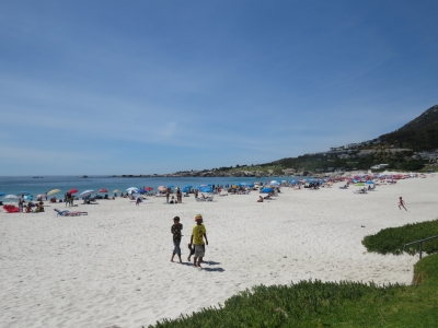
Camps Bay is an exceedingly popular beachfront resort area packed with hotels, restaurants and people.
|
 |
11/29/2015: Green Point Lighthouse
Position: -33°54.08'S, 18°23.98'E
The Green Point Lighthouse, built in 1824, is South Africa's oldest working lighthouse and can be seen for 25 nautical miles. We were hoping to tour the light, but it was closed.
|
 |
11/29/2015: Calm seas
Position: -33°54.04'S, 18°24.00'E
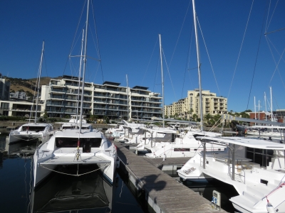
It's a nice day to be out on the water.
|
 |
11/30/2015: Moorings
Position: -33°54.54'S, 18°25.13'E
Close to twenty brand new Moorings, Leapord and Sunsail catamarans now fill every available space on the pier we're on. Today they'll all be loaded onto a ship and the marina will be almost empty for a few days until the World ARC fleet arrives.
|
 |
11/30/2015: Flag replacement
Position: -33°54.54'S, 18°25.13'E
Our US ensign, South African courtesy flag and Nordhavn pennant are all looking pretty beat so we replaced them all today. We'd been holding off until we got to Cape Town and through the worst of the flag-shredding winds along the coast. We put up a 35,000nm Nordhavn pennant and we've got 40,000 and 45,000nm pennants waiting in our mailbox in Seattle. By the time we reach Barbados, we'll have logged over 50,000nm.
|
 |
11/30/2015: Barrel bolt
Position: -33°54.54'S, 18°25.13'E
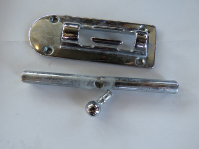
We tried to straighten the barrel bolt that bent in the big wave near East London, but it broke before straighening so we replaced it. We now carry spares after damaging one during the 69.1-degree roll at Wide Bay Bar.
|
 |
11/30/2015: Yellowstone
Position: -33°54.72'S, 18°25.84'E
The bulker Yellowstone will carry the new catamarans to Tortola in the British Virgin Islands.
|
 |
12/1/2015: Quay Four
Position: -33°54.32'S, 18°25.24'E
The view towards Victoria Basin over dinner at the Quay Four Tavern. The pilot boat Petrel and the tug Merlot are moored on the wall at the left of the photo.
|
 |
12/2/2015: Carpet cleaning
Position: -33°54.54'S, 18°25.13'E
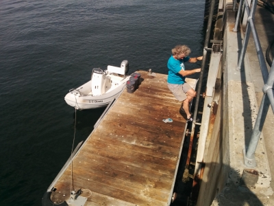
We had the carpets professionally cleaned a couple of times while in Australia, but they didn't come as clean as we'd hoped. they're quite dirty now, particularly after all the dust in Richards Bay so we experimented with cleaning them using the pressure washer and scrubbing the dirtiest areas with soap and water. This washed out rivers of dirt. We then left them out to dry for a day in the hot African sun, turning them over occasionally. The time and effort was worth it. The carpets now look and feel quite clean, much more so than after professional cleaning.
|
 |
12/2/2015: Engine oil
Position: -33°54.19'S, 18°25.67'E
We'd order three 20L pails of Castrol Vecton 15W40 from All Shipping at Bunker Point. This also is where we will take on fuel before departing Cape Town on our run across the Atlantic. The oil arrived today, so we took the dinghy over to pick it up. All Shipping transported the oil down to the dock for us while we climbed the ladder up to their office to pay.
|
 |
12/2/2015: V&A Waterfront
Position: -33°54.54'S, 18°25.13'E
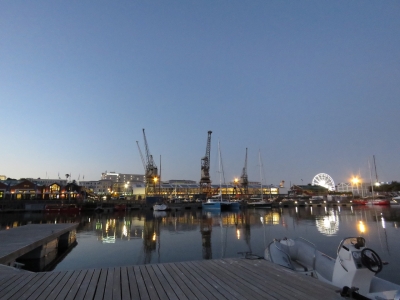
The view to the V&A Waterfront over dinner on our back deck. We sure have a great spot here.
|
 |
12/3/2015: Pick n Pay
Position: -33°54.24'S, 18°25.20'E
We often find ourselves in a new city and finding a high quality grocery store is always high on the agenda. Besides an excellent Woolworths food store, the V&A Waterfront mall also has a large and well-stocked Pick N Pay grocery store with a high-quality and exctensive meat selection.
|
 |
12/5/2015: World ARC
Position: -33°54.54'S, 18°25.13'E
All but one of the fourteen-strong World ARC fleet have now arrived. We're in the only non-ARC berth on the entire pontoon. That boat on the left of the photo is Makena, a massive 62' Lagoon catamaran with a 45' beam.
|
 |
12/5/2015: Sanding
Position: -33°54.54'S, 18°25.13'E
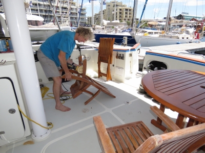
It's been two years since we last repainted our teak in New Zealand. The caprail and cockpit table surface still looks good, but the chairs had worn down to the wood in a few places. Here James is giving the furniture a light sand before we paint. We're only doing the cockpit furniture and caprail this time. We'll do the boat deck furniture separately to keep the job size more manageable.
|
 |
12/5/2015: Cetol light
Position: -33°54.54'S, 18°25.13'E
Done for the day with a full coat of Cetol Marine Light on all the lower deck furniture. It already looks much better.
|
 |
12/6/2015: More painting
Position: -33°54.54'S, 18°25.13'E
Applying a second coat of Cetol Marine Light.
|
 |
12/6/2015: Photo shoot
Position: -33°54.54'S, 18°25.13'E
The V&A Waterfront is understandably a popular photo-shoot locale. We've seen several since we've arrived.
|
 |
12/6/2015: Lock
Position: -33°54.54'S, 18°25.13'E
After passing by countless times, we finally saw an opening of the small lock off the marina. Note the power cord hanging from the gate on the left (click image for a larger view). Someone had run an extension cord across the lock door/walkway to power a boat on the other side. When the lock opened, the cable was torn out and one end fell in the water, fortunately it was the non-powered end.
|
 |
12/7/2015: Cable theft
Position: -33°54.38'S, 18°25.23'E
Power and communications cable theft for raw materials resale is a big problem here. We're surprised even live power cables can get taken.
|
 |
12/7/2015: Final coat
Position: -33°54.54'S, 18°25.13'E
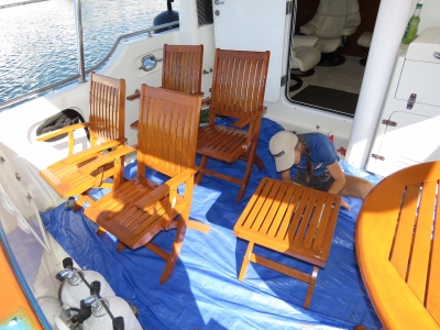
Applying the final coat of paint--the teak is looking wonderful. We've been putting on two coats a day, one in the morning and one in the late afternoon, for 2-3 coats each of Cetol Light followed by Cetol Gloss. The paint takes longer to dry this way, but we get the job done and the cockpit back in order sooner.
|
 |
12/8/2015: Cape Town Film Studios
Position: -34°2.23'S, 18°43.10'E
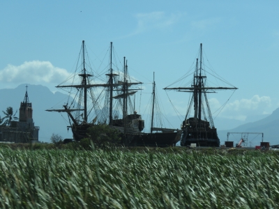
On a trip out to the winelands, we were surprised to see several ship's masts in an inland field. This turned out to be the set for the US television series Black Sails, filmed at Cape Town Film Studios.
|
 |
12/8/2015: Zorgvliet Wines
Position: -33°54.92'S, 18°56.14'E
The Zorgvliet Wines buildings display the Cape Dutch Afrikaner architecture found mostly in the Western Camp region of South Africa and particularly in the wine district.
|
 |
12/8/2015: Boschendal Estate
Position: -33°52.61'S, 18°58.41'E
Boschendal Estate, founded in 1685, is the second-oldest winery in South Africa.
|
 |
12/8/2015: Farm
Position: -33°52.49'S, 18°58.55'E
Like many of the wineries in the area, Boschendal has an excellent restaurant supplied through an on-site organic garden.
|
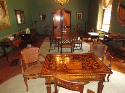 |
12/8/2015: Manor house
Position: -33°52.45'S, 18°58.57'E
The manor house, open for self-guided tours, is full of beautiful wood furniture
|
 |
12/8/2015: Wine tasting
Position: -33°53.12'S, 18°58.18'E
We did a tasting of five excellent Boschendal wines. With us are Knut and Christine Hildebrand, current owners of Nordhavn 4710 Wofanu. Their boat, then called Kelly Ann, and Nordhavn 4715 Oso Blanco were the first two Nordhavn 47s we'd ever been aboard. Seeing the two boats at the 2004 TrawlerFest in Poulsbo Washington sparked our strong interest in the Nordhavn 47 that eventually led to our our 2009 purchase of the 52, a similar model to the 47. Knut and Christine live in Port Elizabeth, South Africa. They were in Cape Town for a few days and invited us out to tour the winelands with them.
|
 |
12/8/2015: Vineyard tour
Position: -33°52.32'S, 18°56.92'E
We took a guided tour through the vineyard up into the hills above the farm. Here we are passing Sauvignon Blanc vines that grow best in the higher altitude and shadow of the mountain behind.
|
 |
12/8/2015: King Pretoria
Position: -33°52.57'S, 18°56.54'E
A few fabulous King Pretoria, South Africa's national flower, still were in bloom along the road.
|
 |
12/8/2015: View
Position: -33°52.66'S, 18°56.47'E
The view into the valley from the slopes above the vineyard. Much of the visible land is part of the extensive 2,400 hectare Boschendal estate.
|
 |
12/8/2015: Grapes
Position: -33°52.54'S, 18°56.57'E
Sauvignon Blanc grapes on the vine. They'll be harvested in a few weeks.
|
 |
12/8/2015: Cellar
Position: -33°53.14'S, 18°58.05'E
Hundreds of barrels of red wine aging in oak casks.
|
 |
12/8/2015: Picnic basket
Position: -33°53.10'S, 18°58.19'E
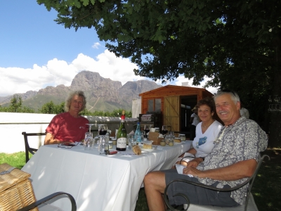
The wonderful Boschendal picnic lunch basket included bread, cheeses, sliced meat, pate and several salads. And we of course had a bottle of wine to accompany it.
|
 |
12/8/2015: Lunch
Position: -33°53.10'S, 18°58.19'E
Our decadent picnic lunch on the lawn at Boschendal with incredible mountain scenery on both sides.
|
 |
12/8/2015: Drakenstein Valley
Position: -33°54.65'S, 19°8.77'E
The view looking down into the Drakenstein Valley from the road above Franschhoek.
|
 |
12/8/2015: Franschhoek Pass
Position: -33°54.23'S, 19°9.39'E
Franschhoek Pass reminded us of some of the twisty, winding roads in Reunion. The views were similarly impressive too.
|
 |
12/8/2015: Kleinmond Coastal Nature Reserve
Position: -34°21.32'S, 18°58.40'E
We arrived at the coast through Kleinmond Coastal Nature Reserve. This is the view southwest across the reserve with the Birkenhead Peninsula in the distance.
|
 |
12/8/2015: Stoney Point Penguin Colony
Position: -34°22.35'S, 18°53.62'E
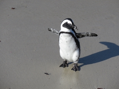
Only two African Penguin colonies exist on the South African mainland, one at Boulders Beach near Simon's Town and the other here at Stony Point. We'd arrived in the late afternoon, a perfect time to view the penguins after they'd returned from a day of fishing at sea. The beaches were packed with the delightful birds whose donkey-like call gave them the nickname Jackass Penguin.
|
 |
12/8/2015: Look at me!
Position: -34°22.36'S, 18°53.63'E
The penguins were adorable--we spent ages watching them.
|
 |
12/8/2015: Dassie
Position: -34°22.34'S, 18°53.60'E
Stony Point also is home to many Rock Dassie, who are unbelievably the closest relative to the elephant. Several Dassie were feeding in the grass above the penguin colony.
|
 |
12/8/2015: Koelberg Mountains
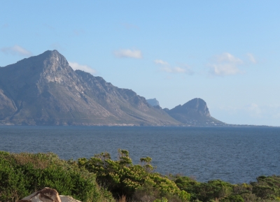
Position: -34°17.22'S, 18°49.51'E
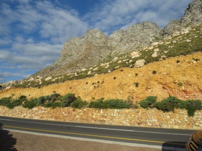
Looking east to the Koelberg Mountains from the road along the eastern shore of False Bay.
|
 |
12/8/2015: Hangklip Mountain
Position: -34°11.80'S, 18°49.35'E
Distinctive Hangklip Mountain rises to our south above Pringle Bay at the right of the photo, with the Koelberg Mountains on the left. The scenery all day has been just amazing.
|
 |
12/9/2015: Beer run
Position: -33°54.58'S, 18°25.25'E
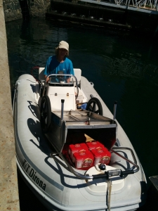
Jennifer made a beer run with our folding cart to Pick n Pay in the V&A Waterfront mall. With several sets of steps to negotiate in order to reach the pontoon, it was a easier for James to pick her up by dinghy near the marina office. We sure love that folding cart--it gets a ton of use.
|
 |
12/9/2015: Racing
Position: -33°54.54'S, 18°25.13'E
Every Wednesday evening, a small group of race boats heads out to sea. We've never actually seen the racing, but everyone always seems to return happy, beer in hand.
|
 |
12/9/2015: Furniture
Position: -33°54.54'S, 18°25.13'E
We started in on repainting the upper deck furniture today. It's a big job and nice to get started. We'll be even happier to finish.
|
 |
12/9/2015: Drone
Position: -33°54.54'S, 18°25.13'E
Someone from one of the apartments around the marina was flying a drone around the area. It hovered over Dirona for quite some time.
|
 |
12/10/2015: Superted
Position: -33°54.54'S, 18°25.13'E
Jean and Matt Findlay of Superted V stopped by for lunch. They're staying in Simon's Town over Christmas and were in Cape Town to pick up a rental car. We've not seen them since Reunion and had a great time catching up.
|
 |
12/14/2015: Chicken with red peppers
Position: -33°54.54'S, 18°25.13'E
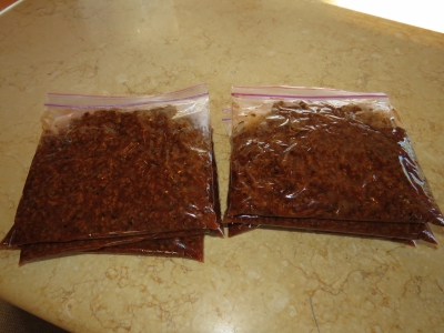
Making a batch of stir-fried chicken with dried red peppers to have on hand for the Atlantic Ocean crossing. We generally cook regular meals while at sea, but when conditions are rough or we've gotten busy with something, it's nice to have a quick and hearty meal available.
|
 |
12/15/2015: Groceries
Position: -33°54.57'S, 18°25.24'E
Bringing back a load of groceries from Pick n Pay and Woolworths by cart and dinghy. This is our third trip and we have one or two more to do before we are all stocked up for the Atlantic crossing.
|
 |
12/15/2015: Alfa Romeo
Position: -33°55.99'S, 18°25.28'E
One of the many rare and exotic cars at Crossley & Web in the Cape Town central business district. James didn't recognize this particular car, but it is Alfa Romeo-powered.
|
 |
12/15/2015: Lotus Elise
Position: -33°55.99'S, 18°25.28'E
One of James' favorites from Lotus. It's a bit light on horsepower but is a great-looking machine.
|
 |
12/15/2015: Spaghetti sauce
Position: -33°54.54'S, 18°25.13'E
A batch of spaghetti sauce for the Atlantic crossing.
|
 |
12/16/2015: Groot Contstantia
Position: -34°1.84'S, 18°25.15'E
Amazon has an office in Cape Town so James has been in the office most days over the last couple of weeks. Today was a public holiday in South Africa so those visiting from the Seattle office compromised and did a morning at the office. Jennifer then joined them for a great lunch at the Groot Constantia winery for excellent food, great company, and incredible views from our table out towards the ocean.
|
 |
12/17/2015: Voltage Diversity
Position: -33°54.54'S, 18°25.13'E
Dirona runs on a wide range of different shore power voltages ranging from 120V 60 cycle through to the common 240V 50 cycle. But that's just the start of the diversity. In Papeete we had 240V 60 cycle. In Victoria, we had 208V at 60 cycle. Here in Cape Town we have 220V at 50 cycle. The graph shows the nominal 220V being pulled down by load to below 200V, and a few minutes ago we had an alarm as the voltage sagged down below 195V. This wide voltage and frequency diversity is one of the reasons why we charge the boat via shore power but run the boat off 240V 60 cycle inverters (see A more flexible power system for Dirona). Technically, the HVAC system on Dirona is 240V 60 cycle, but will run on 50 cycle and the manufacture is fine with this. I suspect neither the equipment nor the manufacturer would be fine running the HVAC system on only 200V at 50 cycle. That's why we run the HVAC system and the rest of the boat off the inverters and only subject the battery chargers to direct shore power.
|
 |
12/18/2015: Barnacle Jill
Position: -33°54.54'S, 18°25.13'E
Terry Lee (left) and crew from her company Barnacle Jill about to clean Dirona's hull in preparation for our Atlantic crossing. We had a fair bit of growth since our last bottom clean in Darwin. The zincs, amazingly, still were in good shape since our last change two years ago in New Zealand. It's amazing how long zincs last when you don't spend much time in marinas.
|
 |
12/19/2015: British pounds
Position: -33°54.54'S, 18°25.13'E
We'll be vising St. Helena next, where the economy generally is cash-based, there are no ATMs, and cash can only be obtained at the local bank. In addition, the local currency, St. Helena Pounds, are difficult to sell elsewhere. So we got some British Pounds which are equivalent in value, accepted locally, and easier to convert should we have surplus.
|
 |
12/19/2015: Iridium
Position: -33°54.54'S, 18°25.13'E
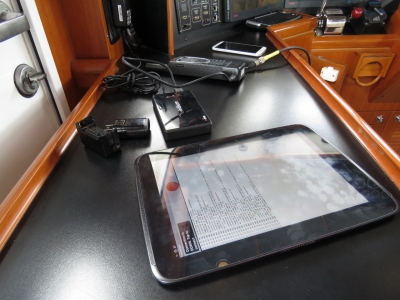
Testing our Iridium satellite data support in preparation for the Atlantic Ocean crossing. Here we are using a table to connect via WiFi to a special-purpose Iridum WiFi hub that is physically connected to our satellite phone. On Dirona, Iridium is used as a backup to our preferred mini-VSAT service and the Immarsat BGAN backup.
|
 |
12/20/2015: Quay Four
Position: -33°54.33'S, 18°25.25'E
Dinner overlooking the waterfront on the upper deck at Quay Four. We love watching the traffic in the busy commercial harbour.
|
 |
12/20/2015: Crowds
Position: -33°54.32'S, 18°25.24'E
The V&A Waterfront is getting busier and busier as we get into the holiday season.
|
 |
12/20/2015: Cape Town Wheel
Position: -33°54.31'S, 18°25.21'E
The Cape Town Wheel is prominent in the V&A skyline--we can see it from our berth. The wheel was running mostly empty when we first arrived in Cape Town a month ago, but is full tonight.
|
 |
12/21/2015: Titanic
Position: -33°54.42'S, 18°25.09'E
The travelling Titanic Artifact Exhibit opened at the V&A Waterfront shortly after we arrived in Cape Town and we finally went to see it. The exhibit focuses on the personal stories of those aboard and included over 300 artifacts recovered from the sea floor along with a description of the recovery process.
|
 |
12/21/2015: Springbok Museum
Position: -33°54.33'S, 18°25.12'E
The Springboks are national team of rugby-obsessed South Africa. The Springbok Museum does an excellent job of detailing the country's tumultuous rugby history, particularly during the international outcry and protests against apartheid. Soon after becoming president, Nelson Mandela used rubgy as a way of uniting a country close to civil war. This statue shows the famous exchange between Nelson Mandela and Springbok captain François Pienaar after underdog South Africa won the 1995 Rugby World Cup. As Mandela handed the cup over, he said to Pienaar "François, thank you for what you have done for our country." Pienaar replied: "No, Mr President. Thank you for what you have done."
|
 |
12/21/2015: McLaren
Position: -33°54.22'S, 18°25.07'E
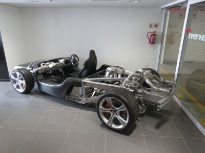
The Cape Town McLaren dealership has some amazing machines on display, including several McLaren 650Ss and and a 675LT.
|
 |
12/21/2015: Inside McLaren
Position: -33°54.22'S, 18°25.07'E
A McLaren with the bodywork removed is more interesting, and almost as beautiful, as a McLaren with the bodywork on.
|
 |
12/21/2015: Grand Cafe and Beach
Position: -33°54.09'S, 18°24.97'E
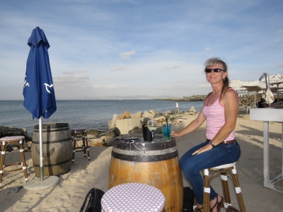
We stopped in at the Grand Cafe and Beach for a pre-dinner drink overlooking Table Bay.
|
 |
12/22/2015: Jellyfish
Position: -33°54.47'S, 18°25.07'E
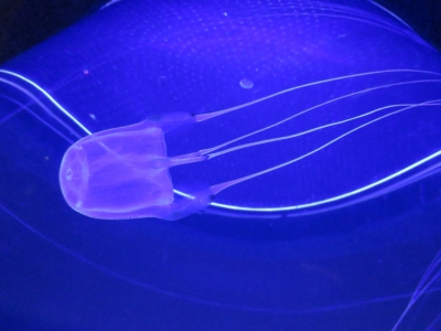
The beautiful jellyfish exhibit at the Two Oceans Aquarium above the V&A Waterfront marina.
|
 |
12/22/2015: Penguins
Position: -33°54.49'S, 18°25.04'E
The African penguins at the Two Oceans Aquarium seem to enjoy being the center of attention.
|
 |
12/22/2015: Kelp Forest
Position: -33°54.49'S, 18°25.05'E
The Two Oceans Aquarium has one of only three live kelp forest exhibits in the world and it's fabulous. We've seen one of the other two at the Monterey Bay Aquarium in California.
|
 |
12/22/2015: Predator exhibit
Position: -33°54.46'S, 18°25.07'E
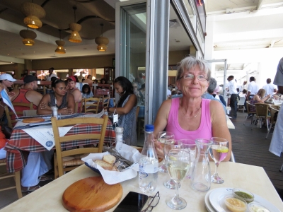
The massive predator tank includes ragged-tooth sharks and many large pelagic fish. For a fee, you can dive the tank with a guide.
|
 |
12/22/2015: Ocean Basket
Position: -33°54.30'S, 18°25.18'E
We had a delicious lunch on the patio at The Ocean Basket. The restaurant sponsors the Kelp Forest Exhiibit at the Two Oceans Aquarium and serves only sustainable catches.
|
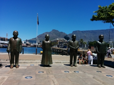 |
12/22/2015: Nobel Square
Position: -33°54.39'S, 18°25.18'E
Nobel Square has larger-than-life statues of South Africa's four Nobel Peace Prize laureates: Nkosi Albert Luthuli, Archbishop Emeritus Desmond Tutu, former State President F. W. de Klerk and former President Nelson Mandela.
|
 |
12/22/2015: Diamond museum
Position: -33°54.41'S, 18°25.34'E
On a guided tour through the Cape Town Diamond Museum, we learned about the history of South Africa's diamond industry and how the stones are valued and cut.
|
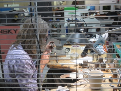 |
12/22/2015: Shimansky
Position: -33°54.41'S, 18°25.34'E
The Diamond Museum was created by South African diamond jeweler Shimansky, and the tour includes a view into their factory where diamonds are cut and set into fine jewelry.
|