MV Dirona travel digest for Vesterålen Islands, Norway 2018

|
Click the travel log icon on the left to see these locations on a map,
with the complete log of our cruise. On the map page, clicking on a camera or text icon will display a picture and/or log entry for that location, and clicking on the smaller icons along the route will display latitude, longitude and other navigation data for that location. And a live map of our current route and most recent log entries always is available at //mvdirona.com/maps/LocationCurrent.html. |
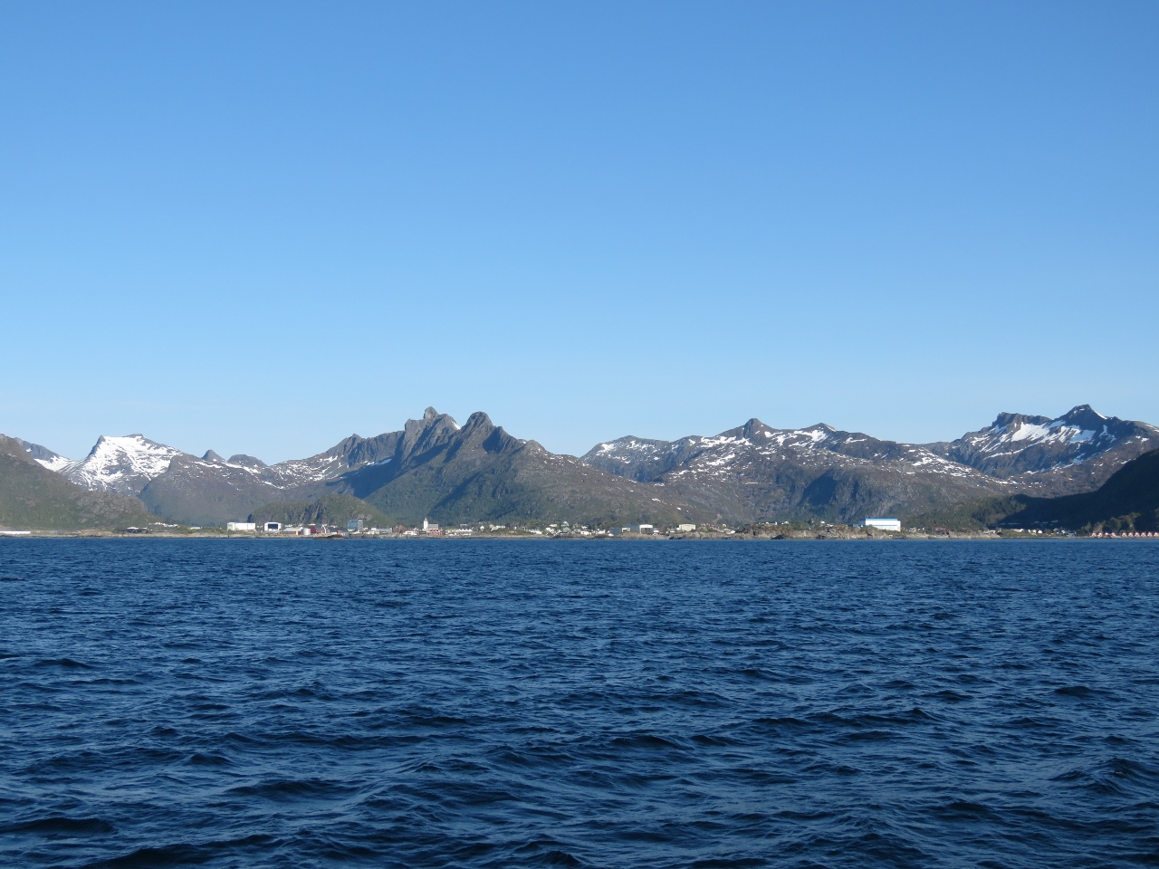 |
5/31/2018: Svolvær
Position: 68°13.26'N, 14°38.19'E
A last view to Svolvær as we depart for Trollfjord.
|
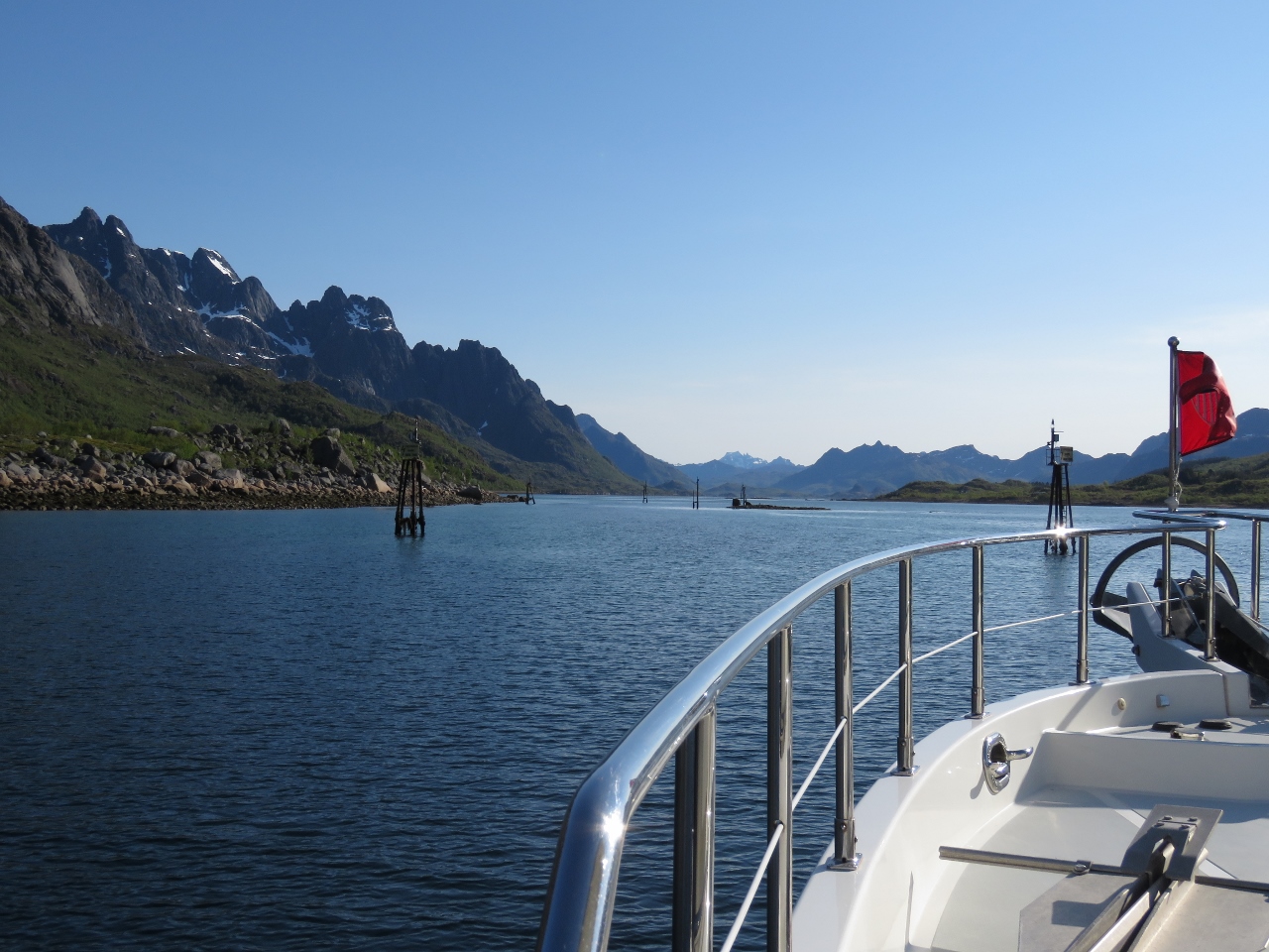 |
5/31/2018: Narrows
Position: 68°17.53'N, 14°50.77'E
The channel Øyhellsundet generally is wide and deep, but has a narrow section with a minimum charted depth of 9ft. The narrows are well-marked and relatively easy to transit, but you need to pay attention.
|
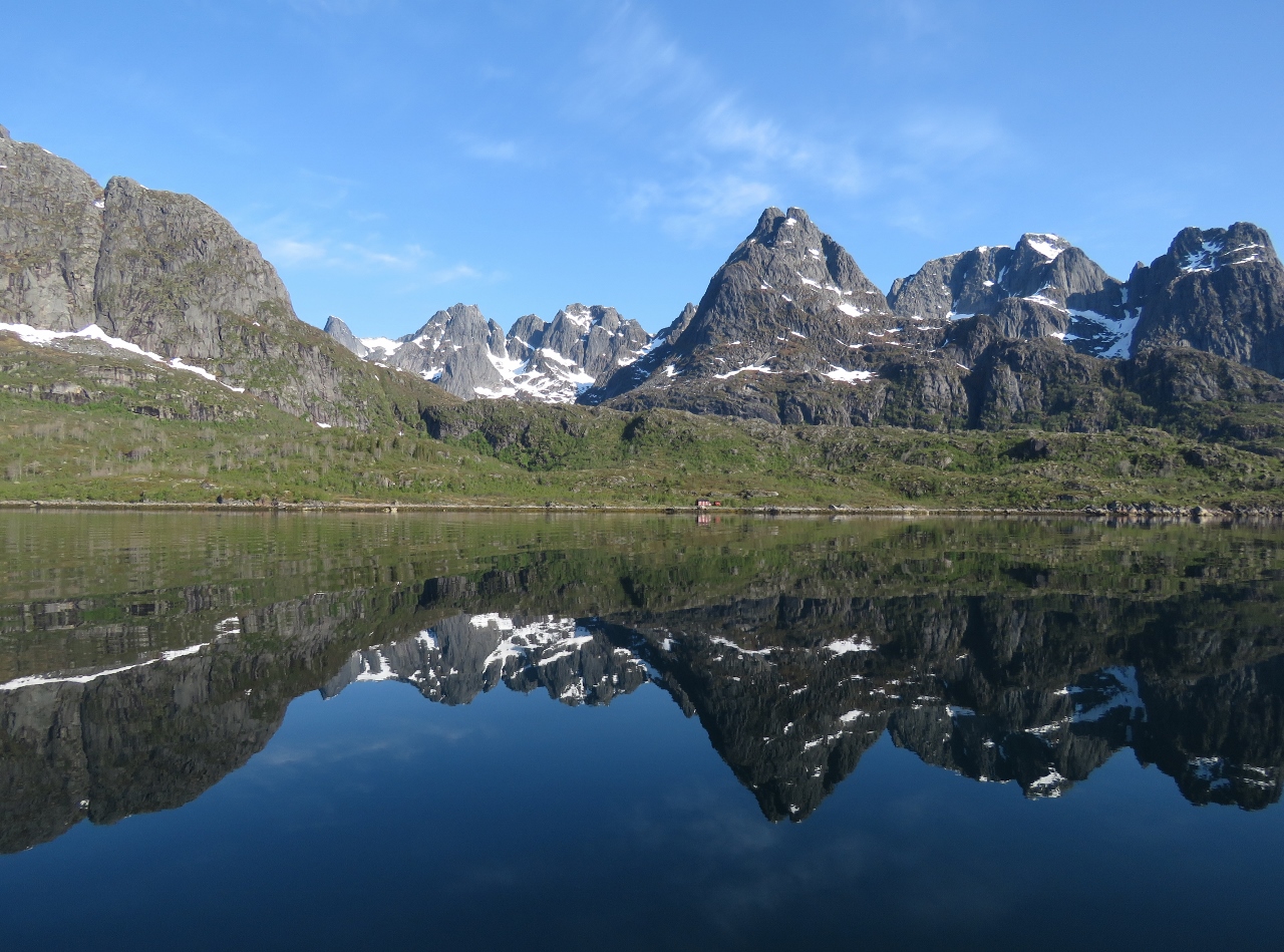 |
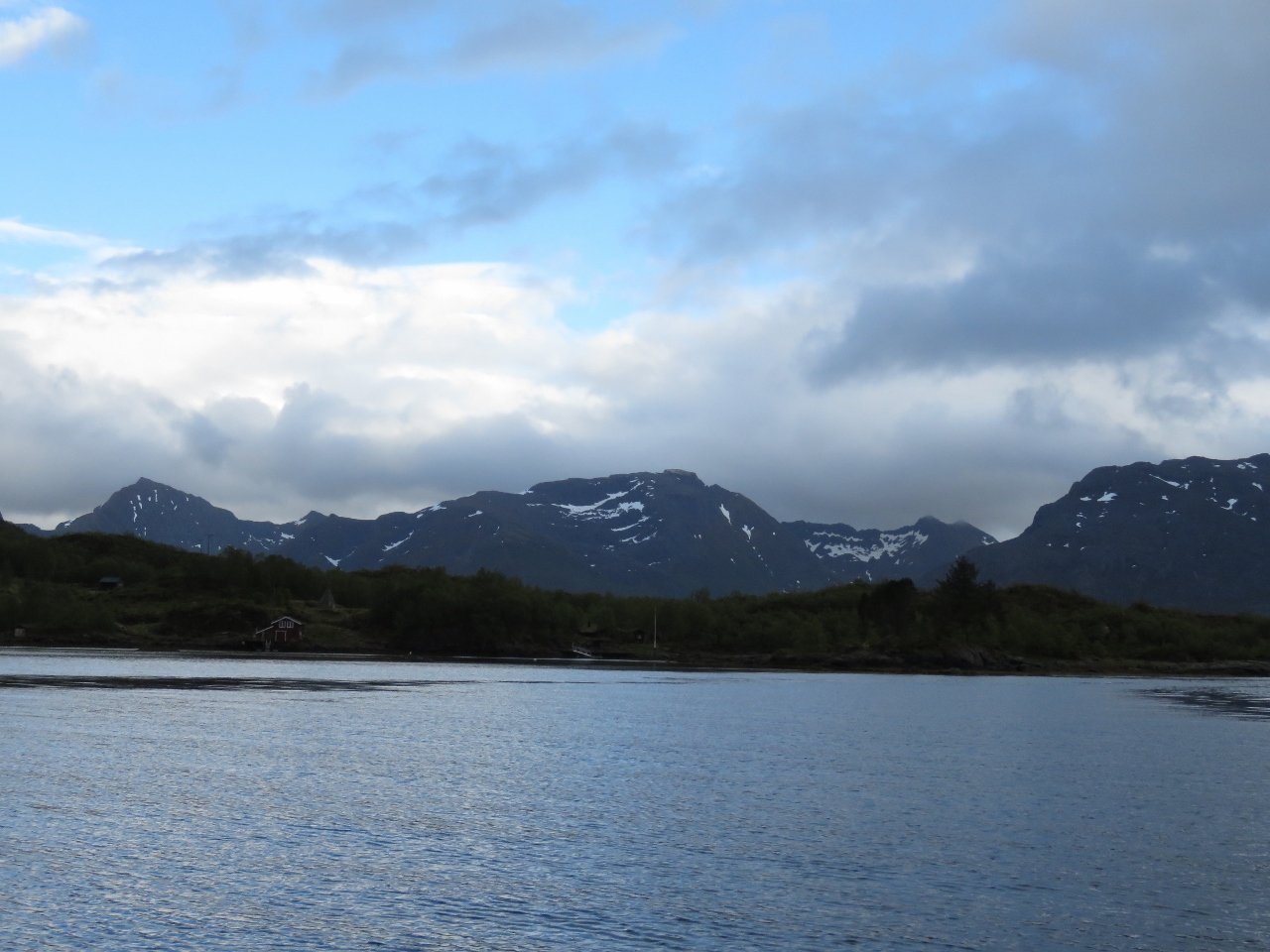
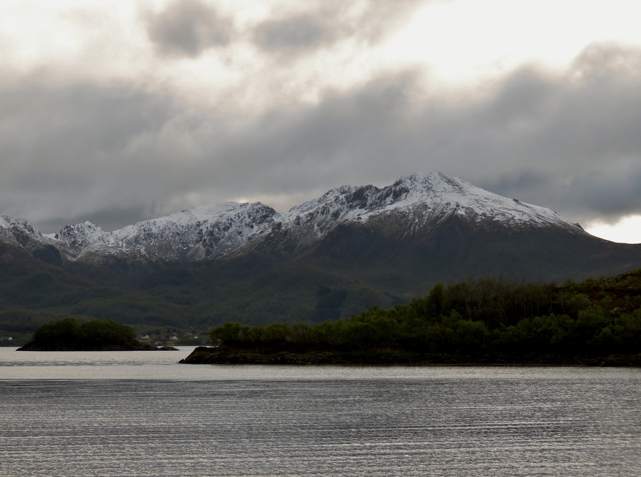
5/31/2018: Reflections
Position: 68°18.82'N, 14°54.17'E
The calm and clear day is yielding wonderful mountain reflections.
|
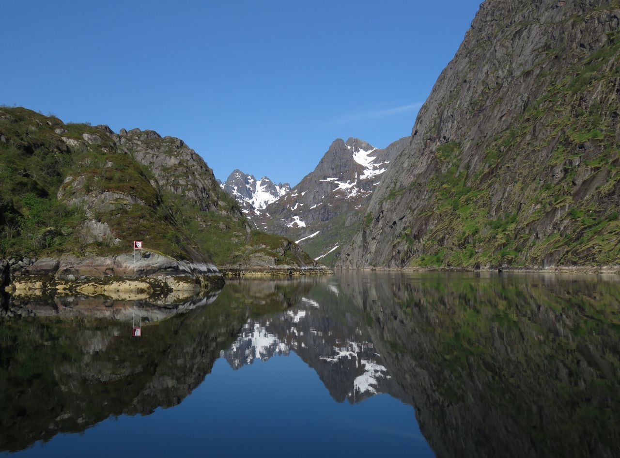 |
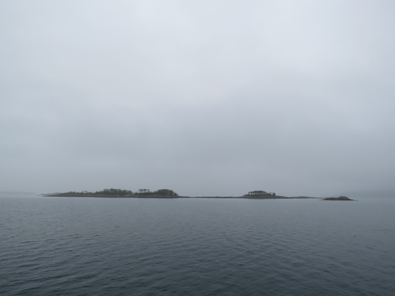
5/31/2018: Trollfjord Mouth
Position: 68°21.84'N, 14°59.45'E
At the mouth of Trollfjord, a major tourist draw. Tourist boats were running here from Svolvær several times a day, with more gearing up as the height of the season approaches.
|
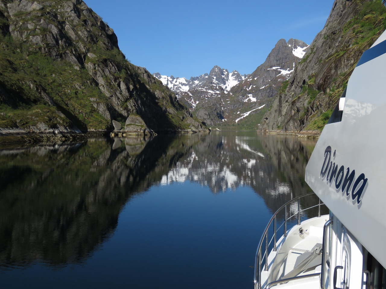 |
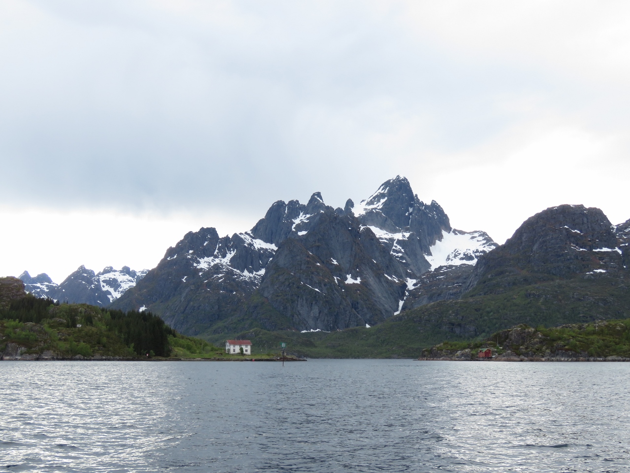
5/31/2018: Trollfjord
Position: 68°21.86'N, 14°58.95'E
Heading down Trollfjord. The fjord is 1.5 miles long and only 100m wide at the narrowest point, with spectacular scenery. We were lucky to visit on such a clear and calm day.
|
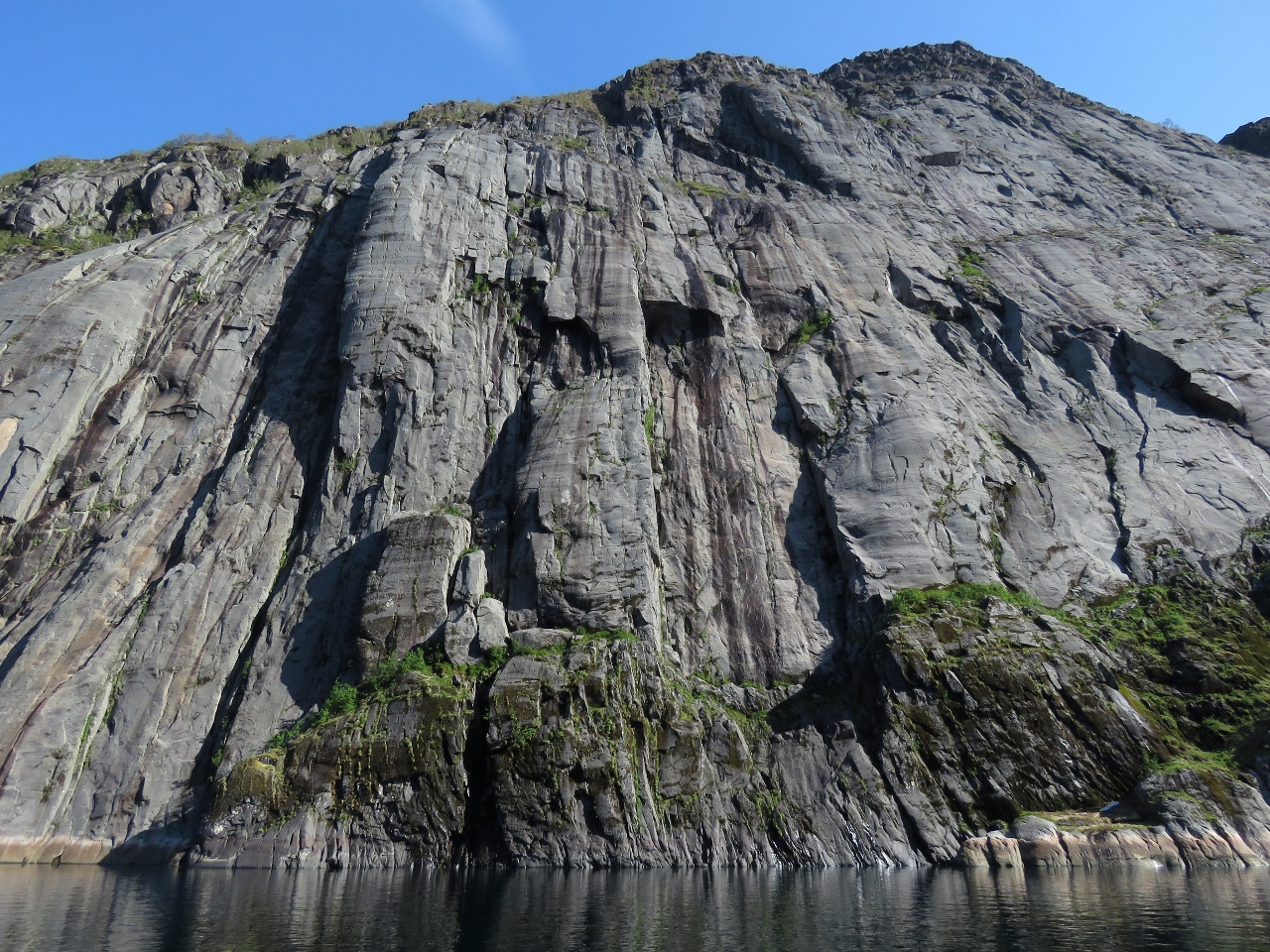 |
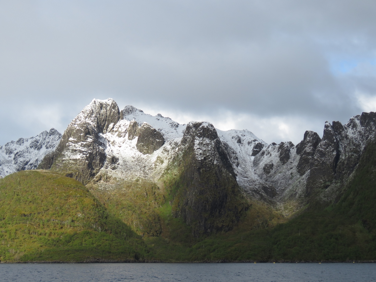
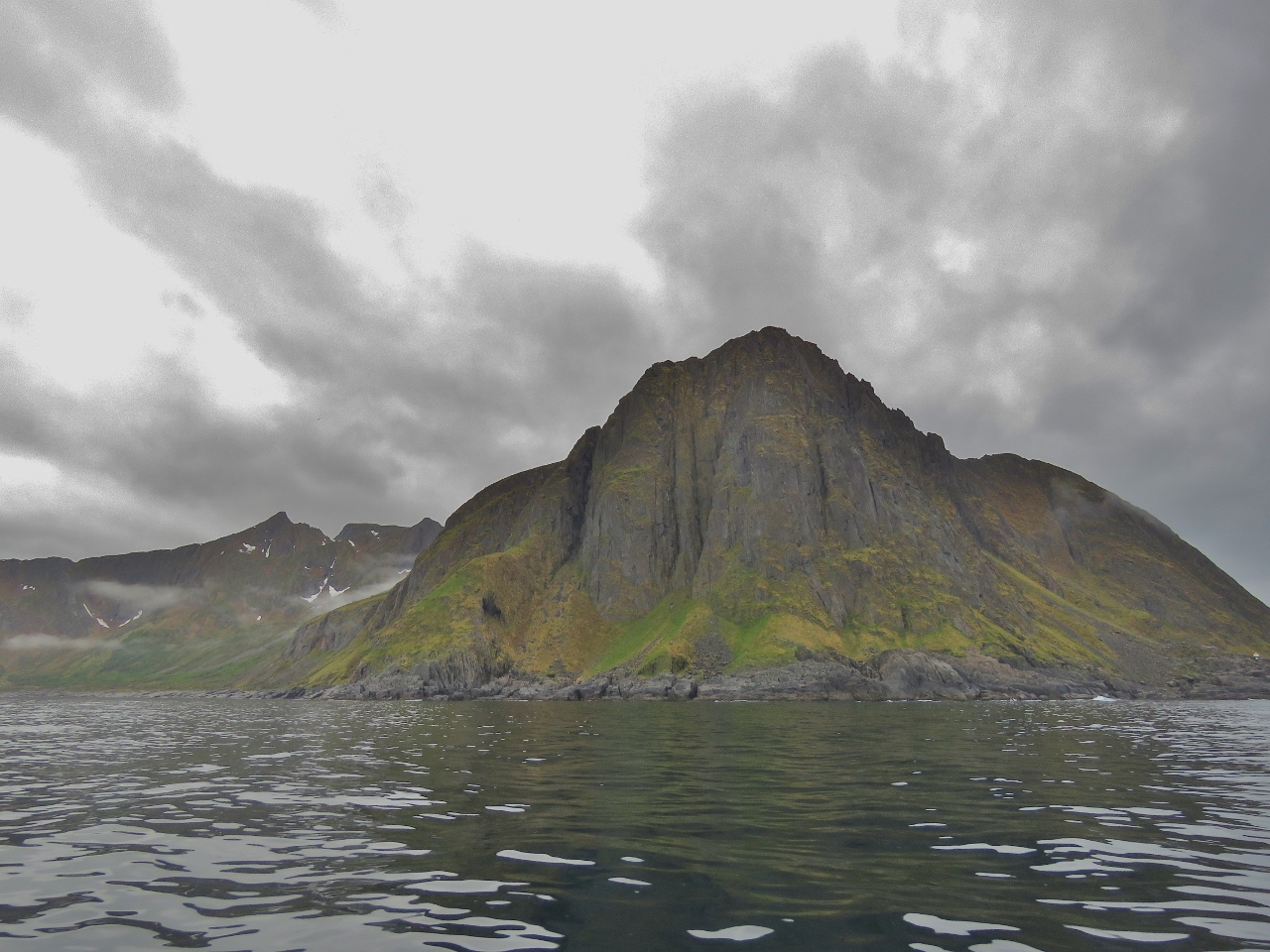
5/31/2018: Cliff
Position: 68°21.82'N, 14°57.49'E
Dramatic cliff partway along Trollfjord.
|
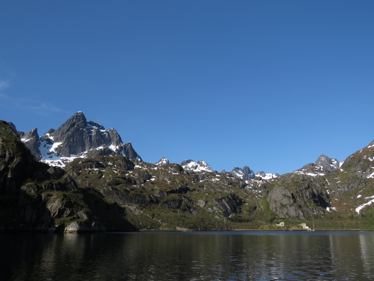 |
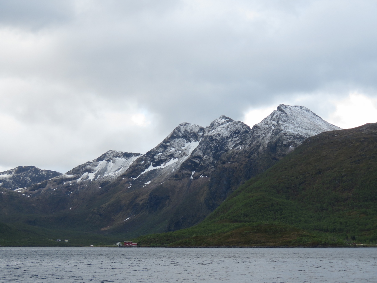
5/31/2018: Trollfjord Head
Position: 68°21.82'N, 14°56.73'E
Mountain scenery at the head of Trollfjord.
|
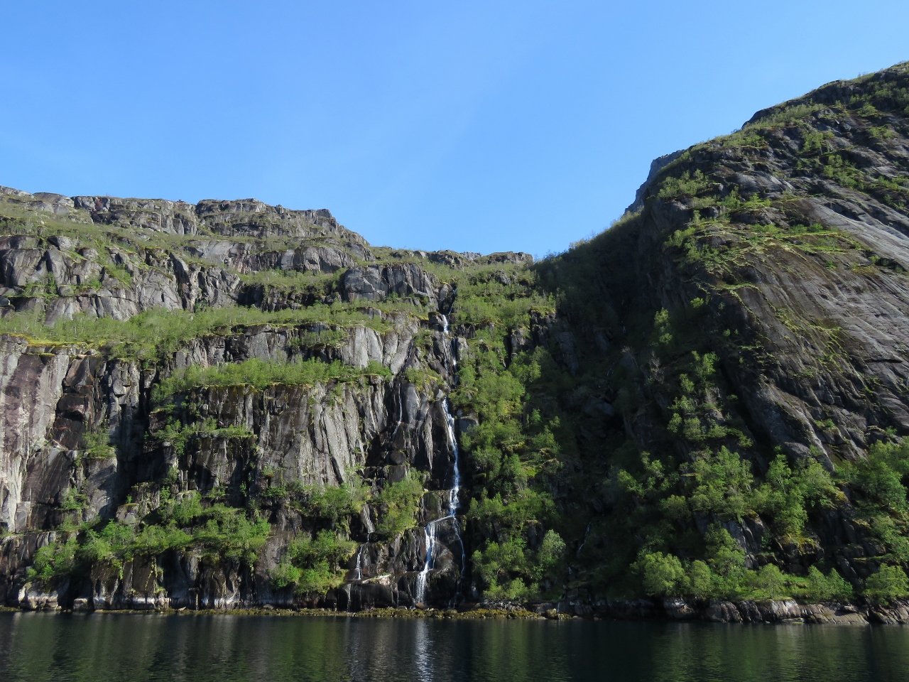 |
5/31/2018: Jarsteinelva
Position: 68°21.82'N, 14°56.73'E
The waterfall Jarsteinelva plummeting into the head of Trollfjord.
|
 |
5/31/2018: No Connectivity
Position: 68°21.81'N, 14°56.24'E
The head of Trollfjord is the only place since we've arrived in Norway where we've had no connectivity for any appreciable period of time. There's no cellular coverage here, and the steep shores are blocking our KVH V7hts mini-VSAT satellite system. I guess we can last for an hour or two. :)
|
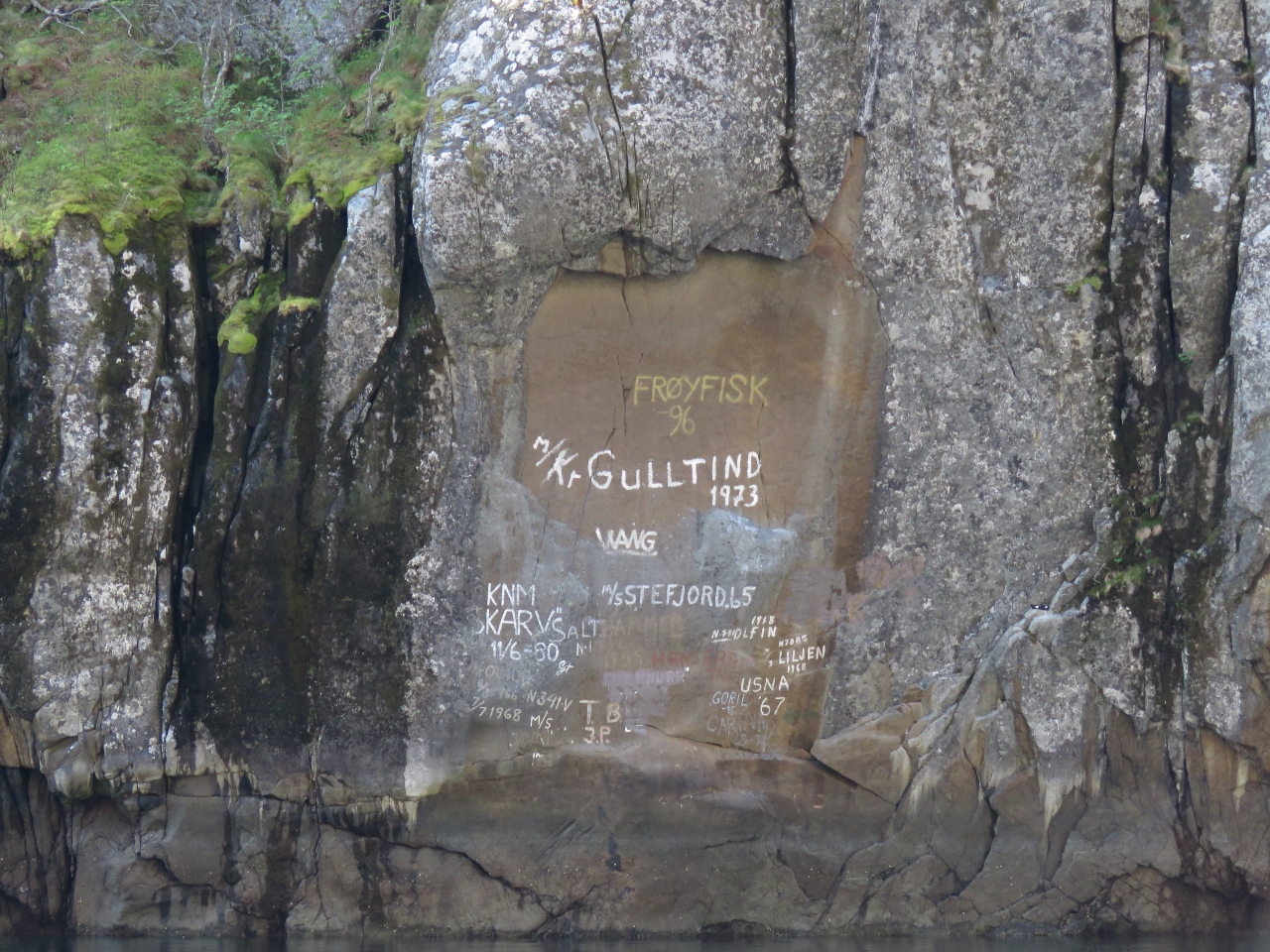 |
5/31/2018: Graffiti
Position: 68°21.84'N, 14°58.03'E
Some boaters write the names of the boats on the walls of Trollfjord. We'd prefer them natural.
|
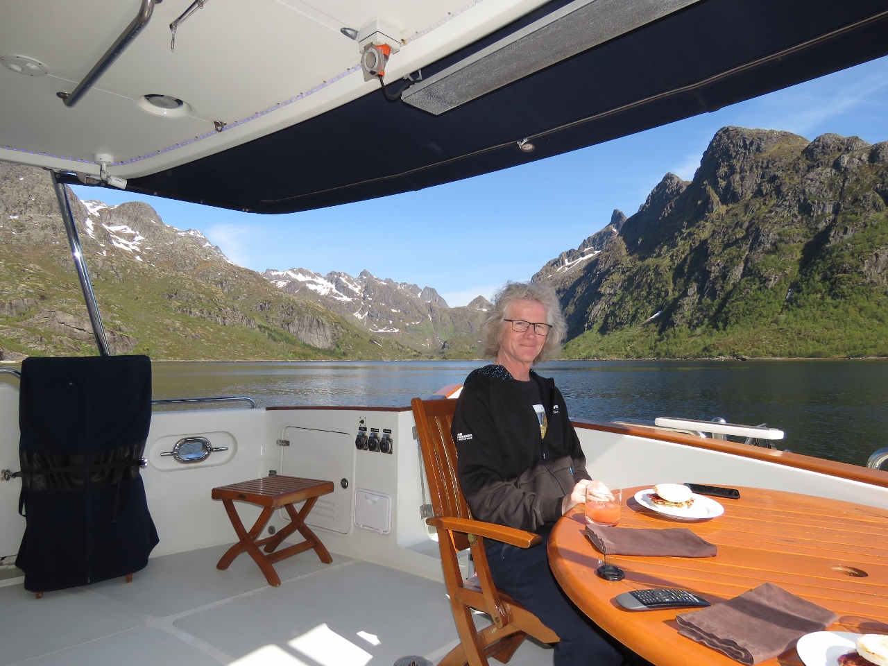 |
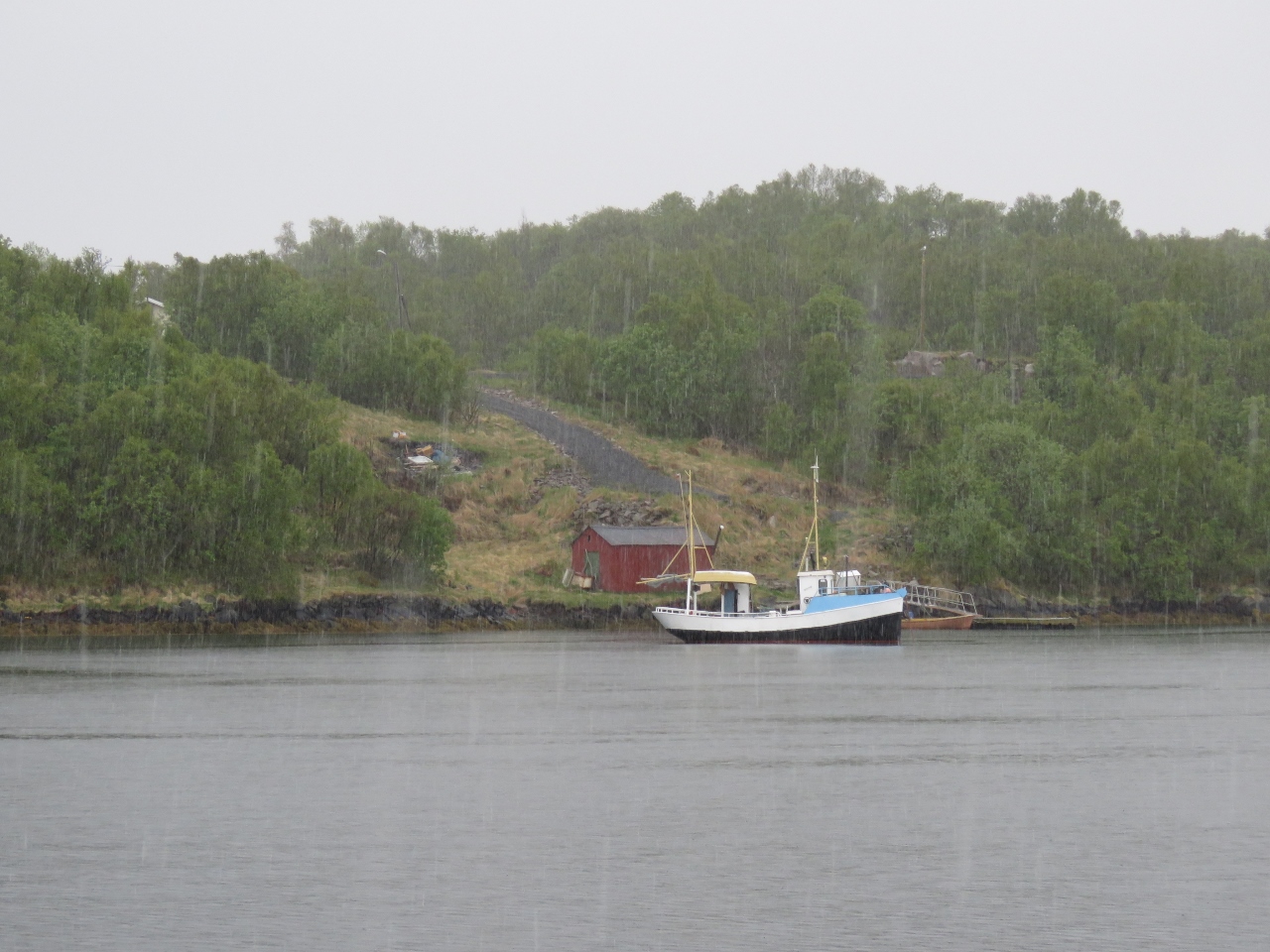
5/31/2018: Brunch
Position: 68°21.85'N, 15°0.95'E
We anchored opposite Trollfjord in 95ft on 350ft of all-chain rode with good holding. It's a wonderful anchorage with beautiful views straight down Trolljford and also down Grunnfjord. Conditions were so warm and calm that we had brunch on deck and didn't even need the patio heater. The view behind James is northwest into Grunnfjord.
|
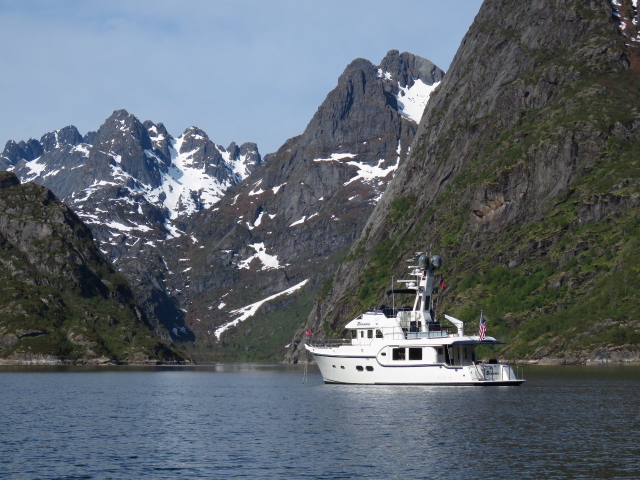 |
5/31/2018: Anchorage
Position: 68°21.84'N, 15°0.95'E
Our fabulous anchorage with a view up Trollfjord and Grunnfjord (not visible).
|
 |
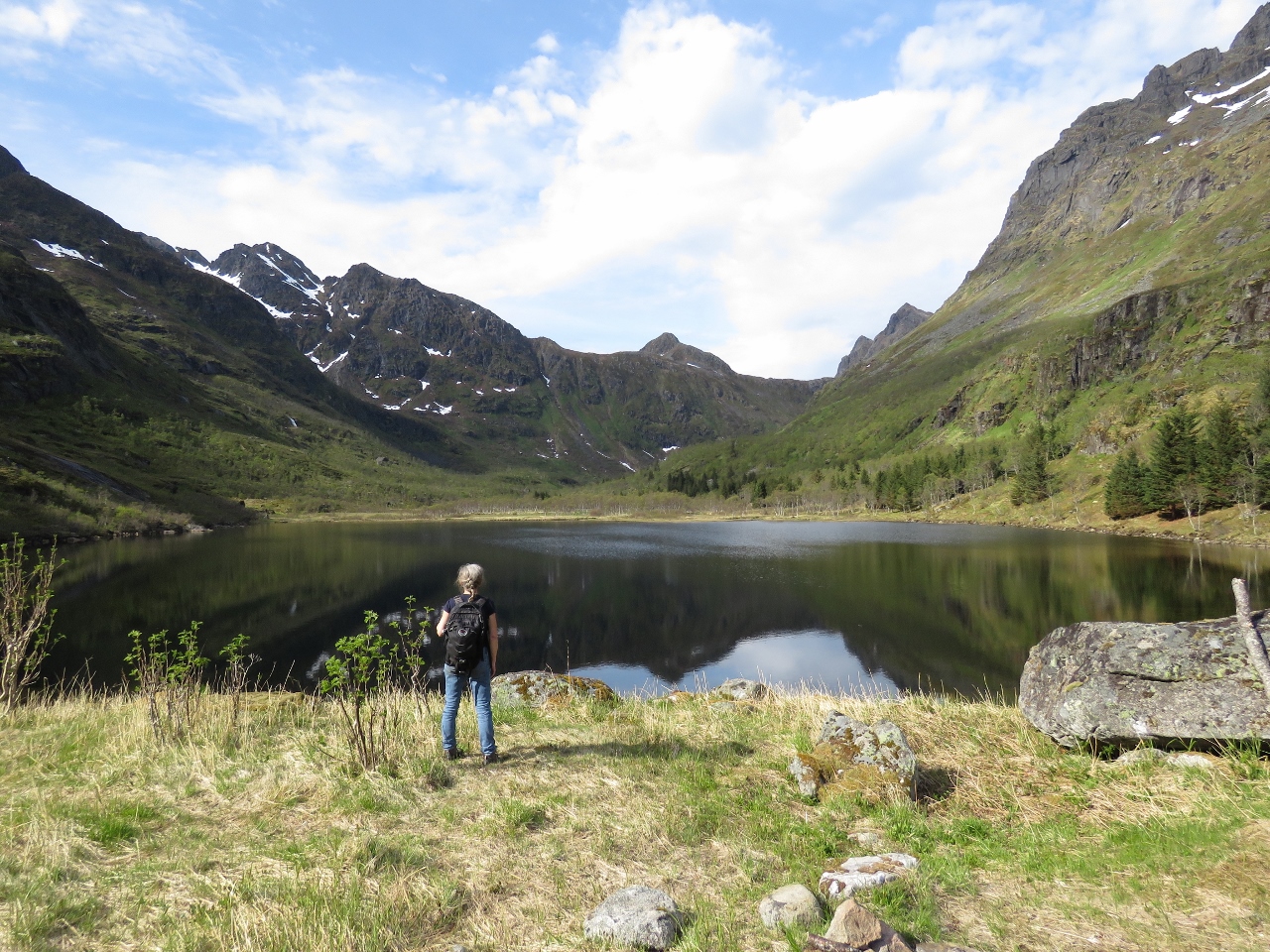
5/31/2018: Grunnfjord
Position: 68°23.08'N, 14°59.66'E
The tender tied off near a waterfall at the head of Grunnfjord.
|
 |
5/31/2018: Grunnfjordvatnet
Position: 68°23.08'N, 14°59.67'E
Looking across Grunnfjordvatnet that drains into Grunnfjord.
|
 |
5/31/2018: Hurtigruten
Position: 68°23.19'N, 15°5.33'E
The Hurtigruten Nordnorge heading south through Raftsund. It had slowed to transfer passengers to a smaller tour boat.
|
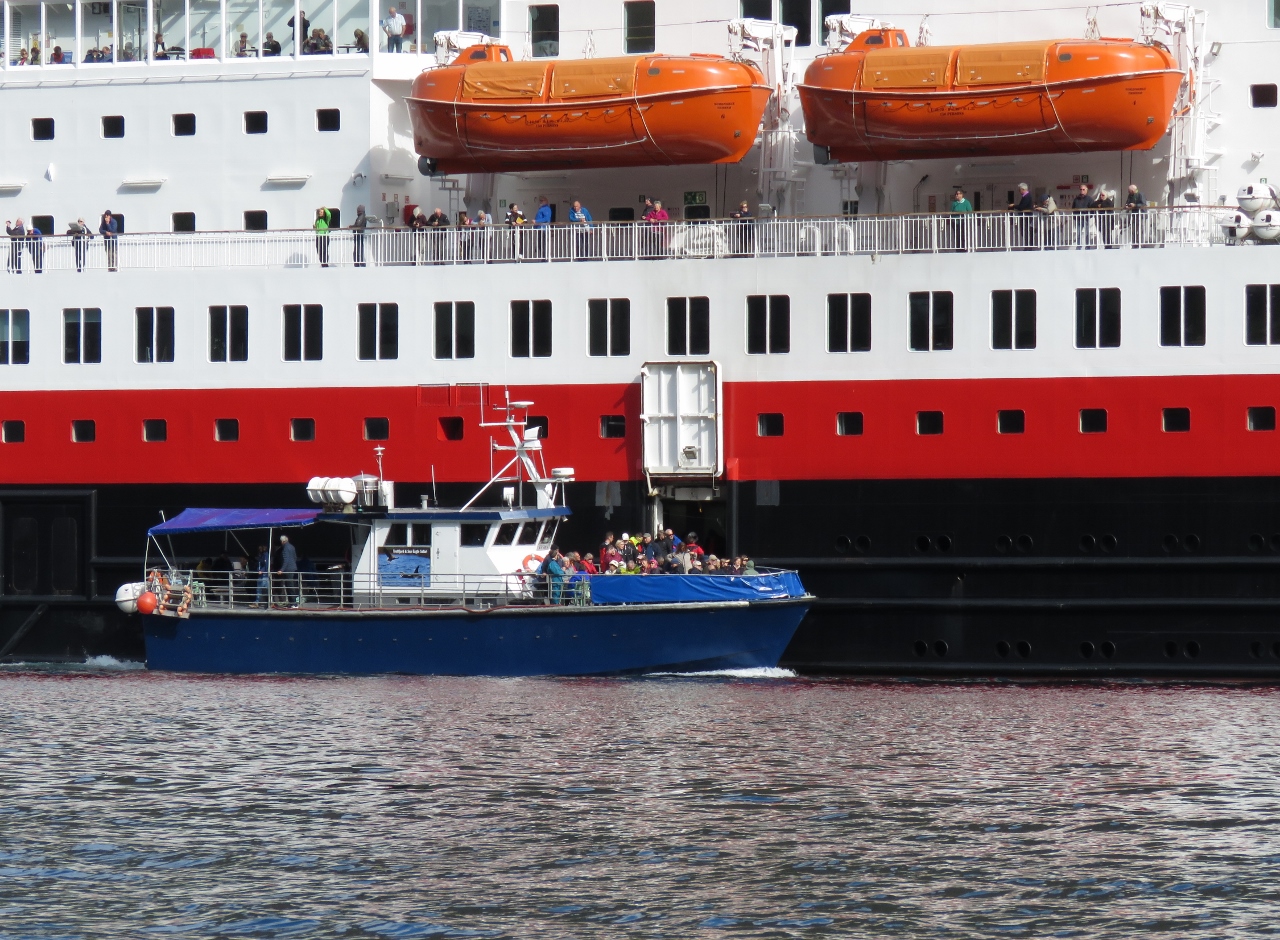 |
5/31/2018: Offloading
Position: 68°23.09'N, 15°4.52'E
A small tour boat from Svolvær pulled up beside the underway Nordnorge and did a harbor pilot-like transfer, but rather than taking on a single experienced pilot instead it brought on board as many passengers as it could carry. This is the first underway transfer we've seen from a cruise ship to a tourist boat.
|
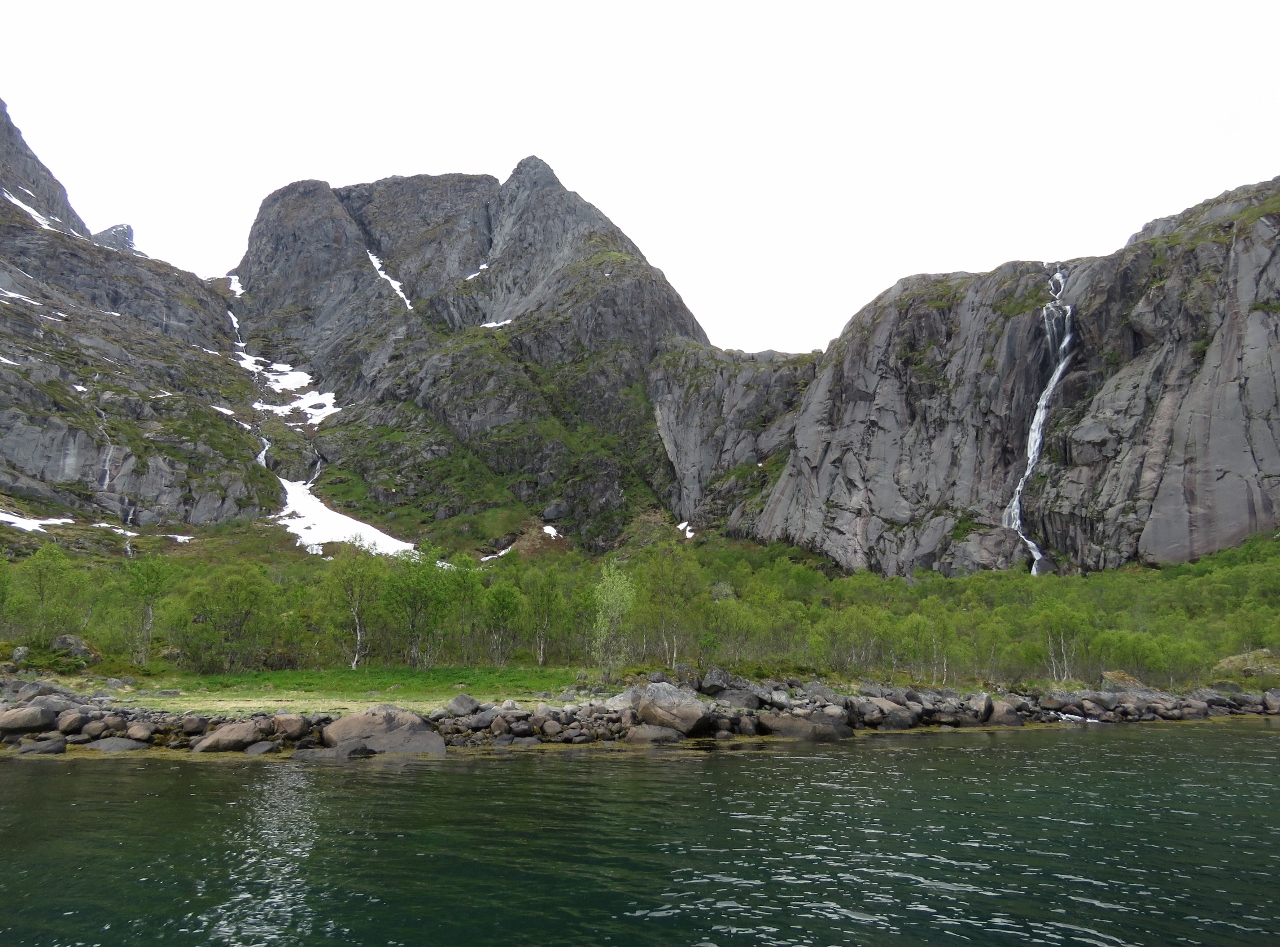 |
5/31/2018: Fallvika
Position: 68°23.82'N, 15°5.02'E
The waterfall Fallvika, right, amid dramatic scenery along the west shore of Raftsund.
|
 |
5/31/2018: Mountains
Position: 68°20.88'N, 15°1.03'E
Mountain views look west as we pass between the islands of Brakøy and Ulvøy
|
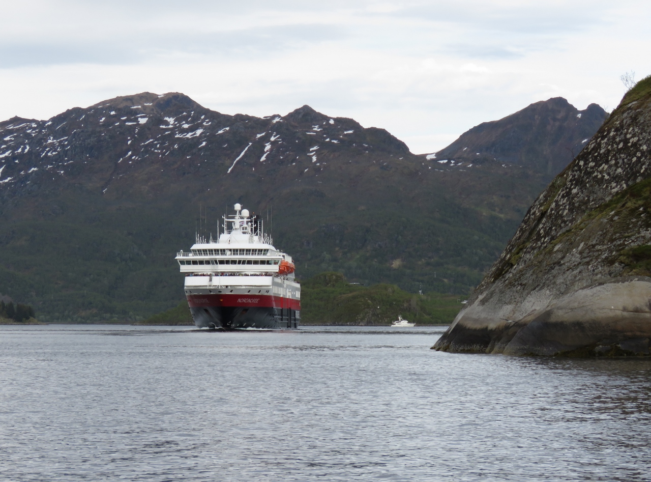 |
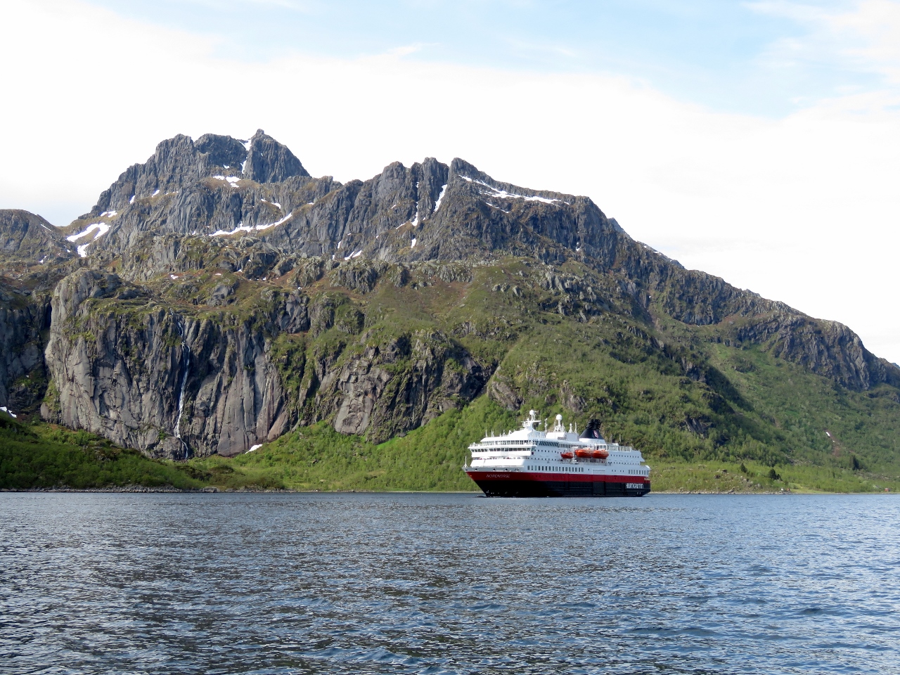
5/31/2018: Nordnorge
Position: 68°21.81'N, 14°58.41'E
We'd read that the Hurtigruten ships passed through Trollfjord and were looking forward to seeing one inside when we first saw the Nordnorge. But when passengers were offloaded to the tour boat, we expected the Nordnorge would continue south and meet the passengers at Svolvær. It was therefore both surprising and exciting to see it round the corner and start heading towards us in Trollfjord. Dirona at anchor is visible in the distance on the right.
|
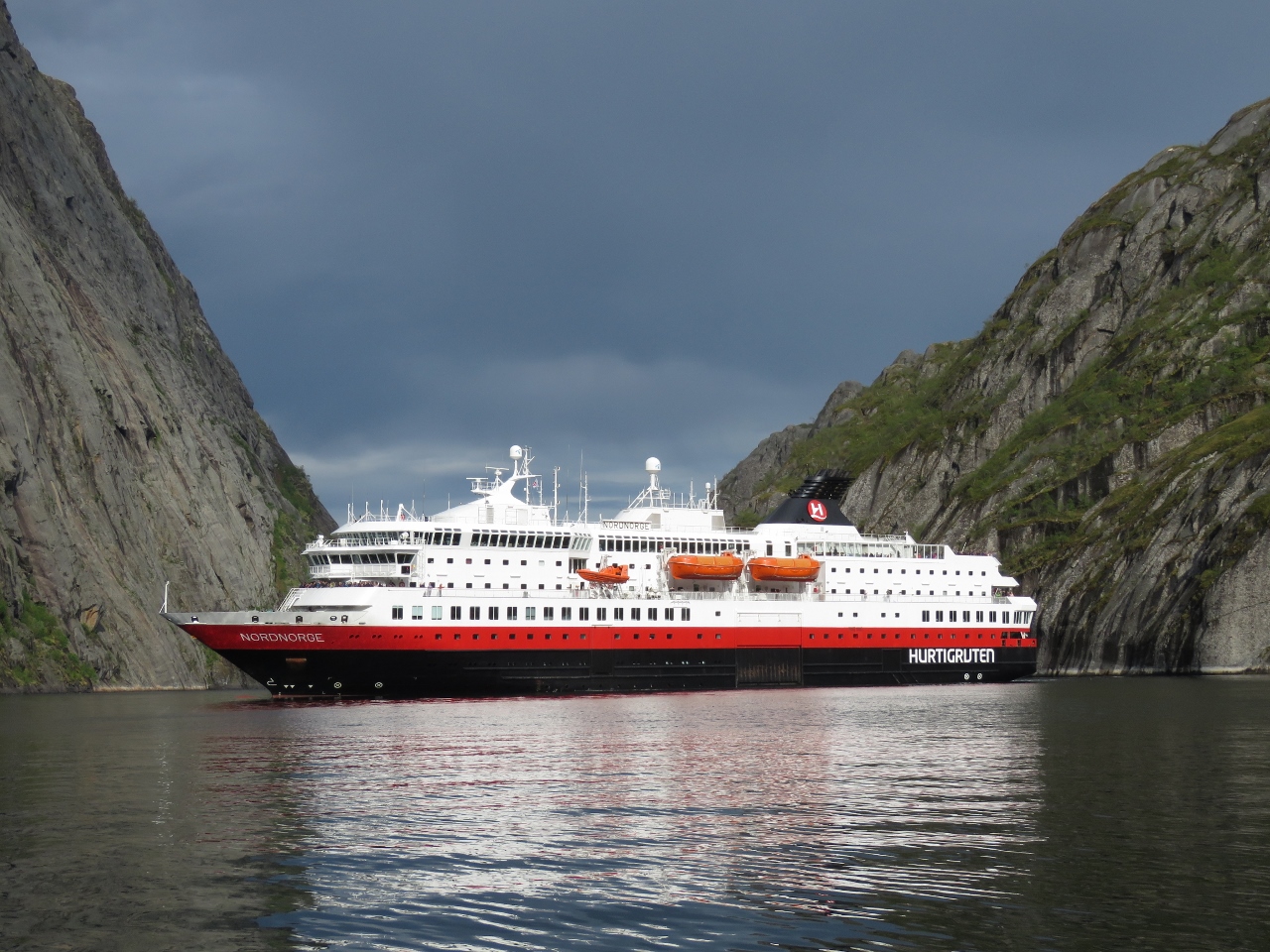 |
5/31/2018: Almost Touching
Position: 68°21.79'N, 14°56.17'E
One of the reasons we wanted to see a Hurtigruten in Trollfjord was we'd read they turned around inside such that the passengers could almost touch the walls. The Nordnorge did not disappoint—what a sight.
|
 |
6/1/2018: Fallvika
Position: 68°23.97'N, 15°6.15'E
The waterfall Fallvika, right, with mountain peaks just visible behind the clouds as we continue north through Raftsund.
|
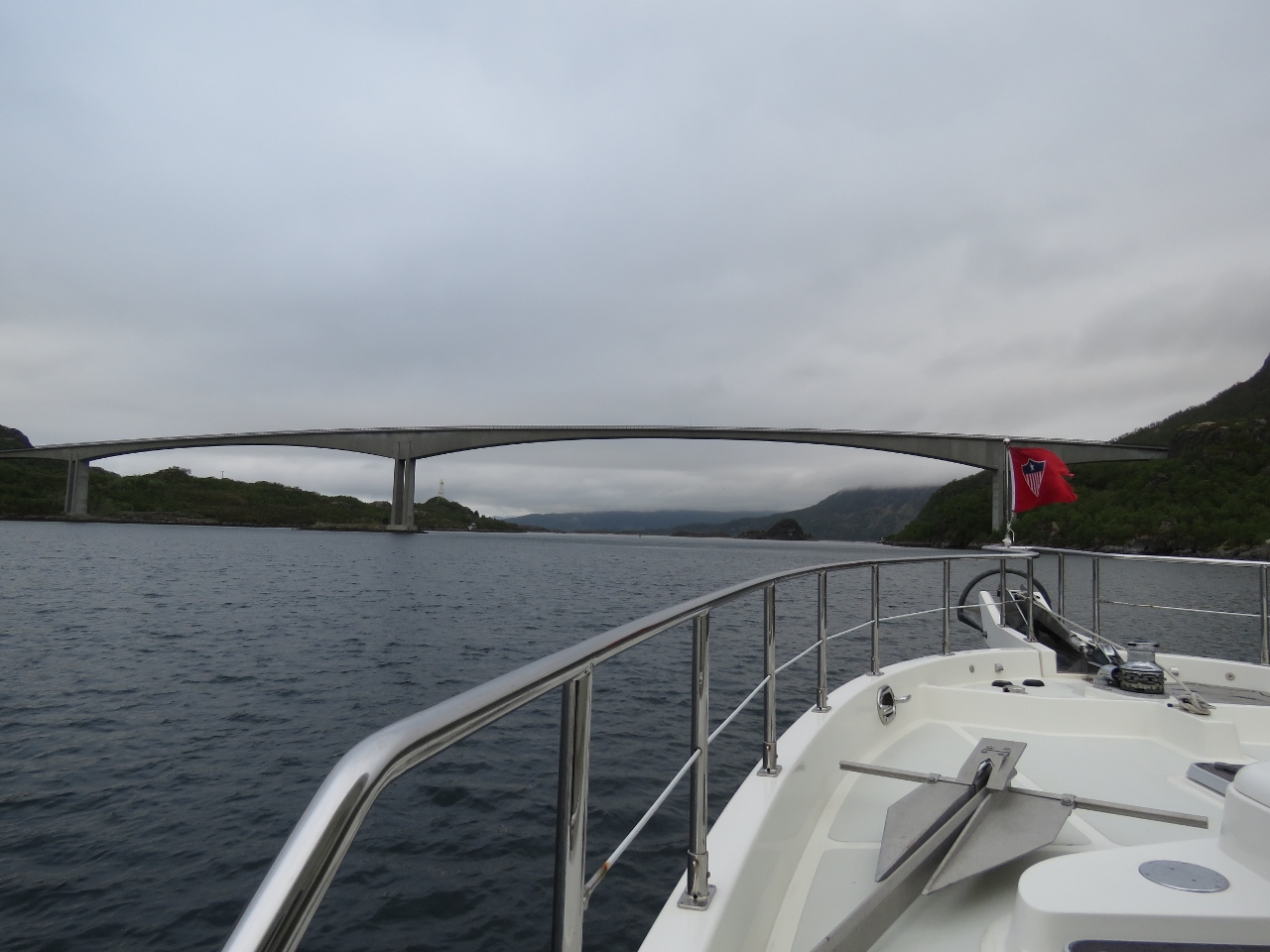 |
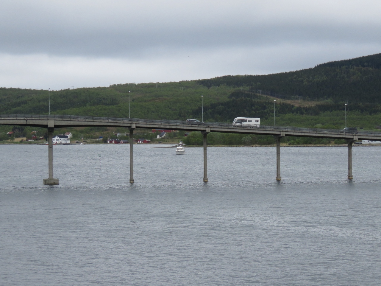
6/1/2018: Raftsund Bridge
Position: 68°27.27'N, 15°11.47'E
About to pass under Raftsund Bridge at the north end of Raftsund.
|
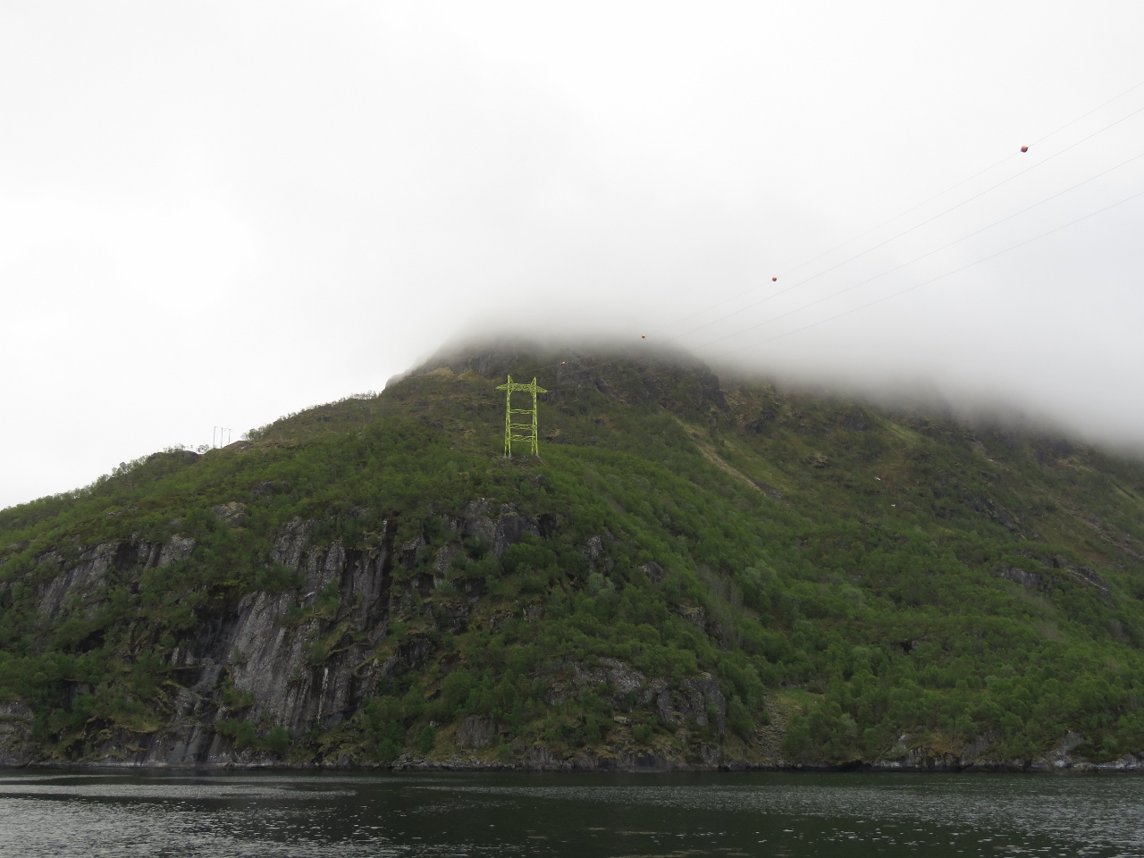 |
6/1/2018: Power Lines
Position: 68°28.05'N, 15°12.10'E
Power lines crossing Raftsund as we exit the channel.
|
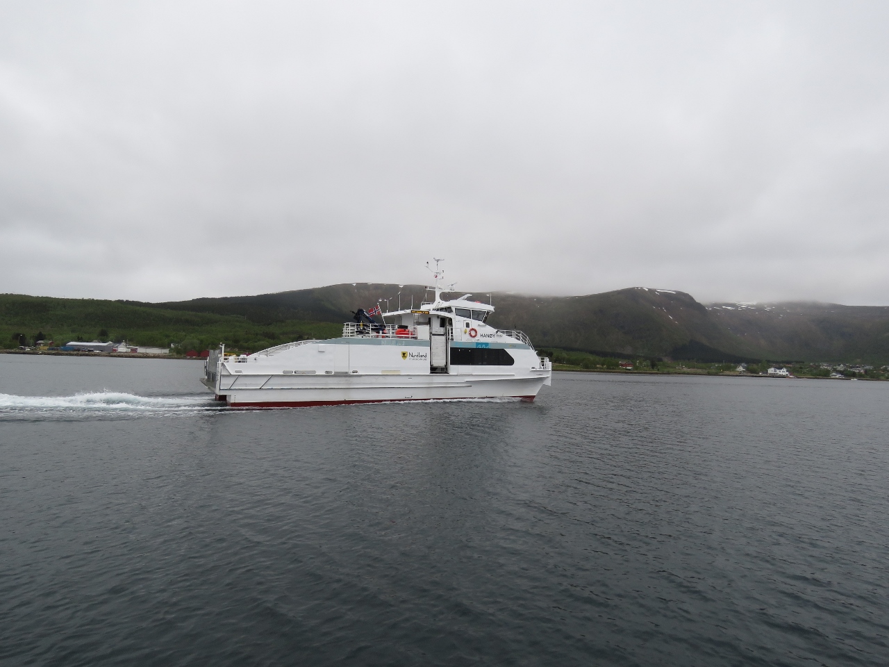 |
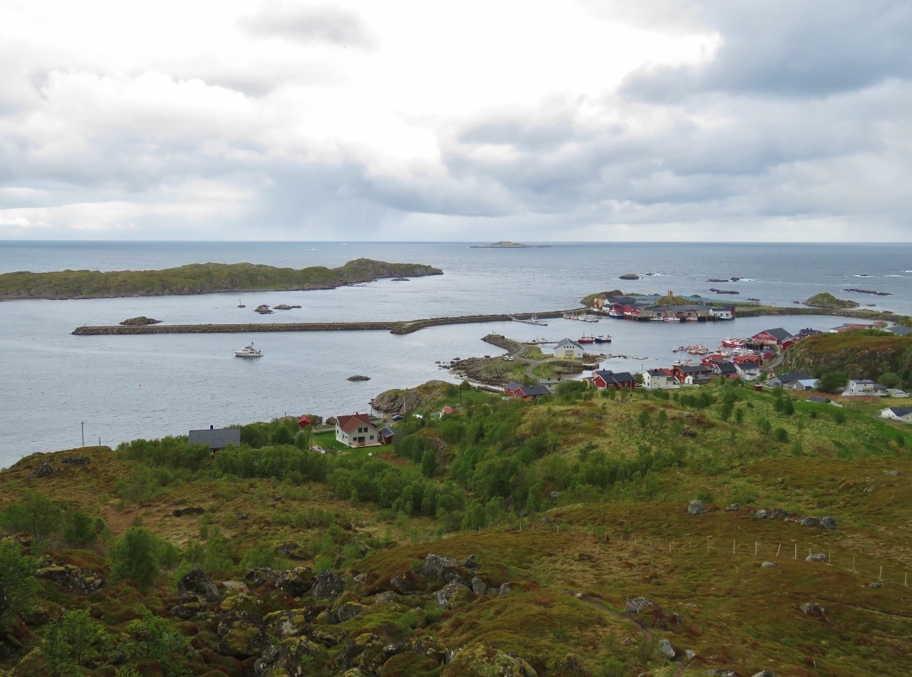
6/1/2018: Hanøy
Position: 68°33.80'N, 14°57.09'E
The fast ferry Hanøy passing us as we enter the harbour off Stokmarknes.
|
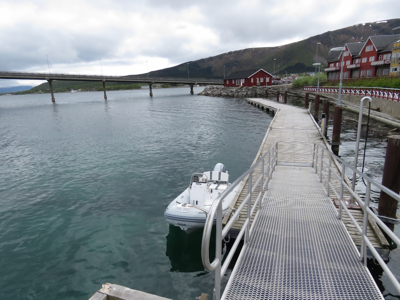 |
6/1/2018: Tender
Position: 68°33.84'N, 14°55.52'E
The tender tied off at the guest dock in Stokmarknes.
|
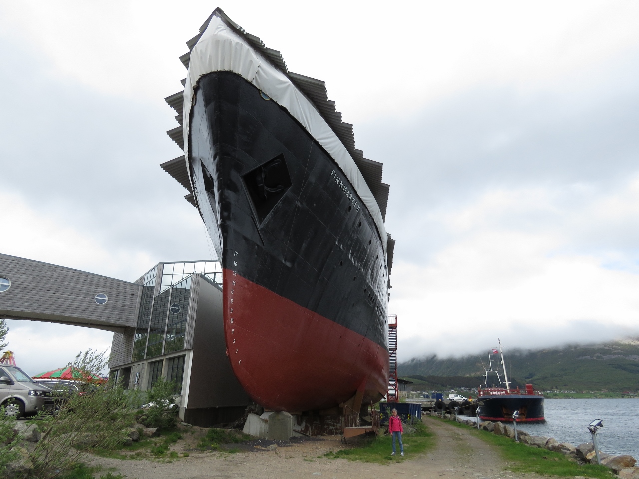 |
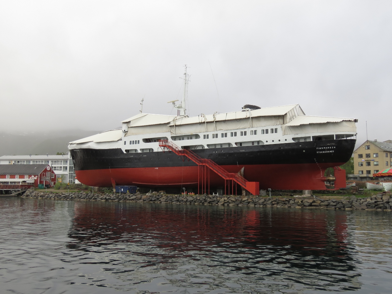
6/1/2018: Finnmarken
Position: 68°33.84'N, 14°55.51'E
Norwegian ship captain Richard With founded the Hurtigruten coastal ferry service in 1893 in Stokmarknes, where he lived and worked. At that time, no year-round scheduled ferry existed in northern Norway. The Hurtigruten pioneered the service and became a vital link between northern Norway and the rest of the country. When the Hurtigruten vessel Finnmarken was retired in 1993, it was brought to Stokmarknes and became the first exhibit in the Hurtigruten Museum that followed. Plans are in place to build a dramatic new museum in a huge glass enclosure completely surrounding the Finnmarken.
|
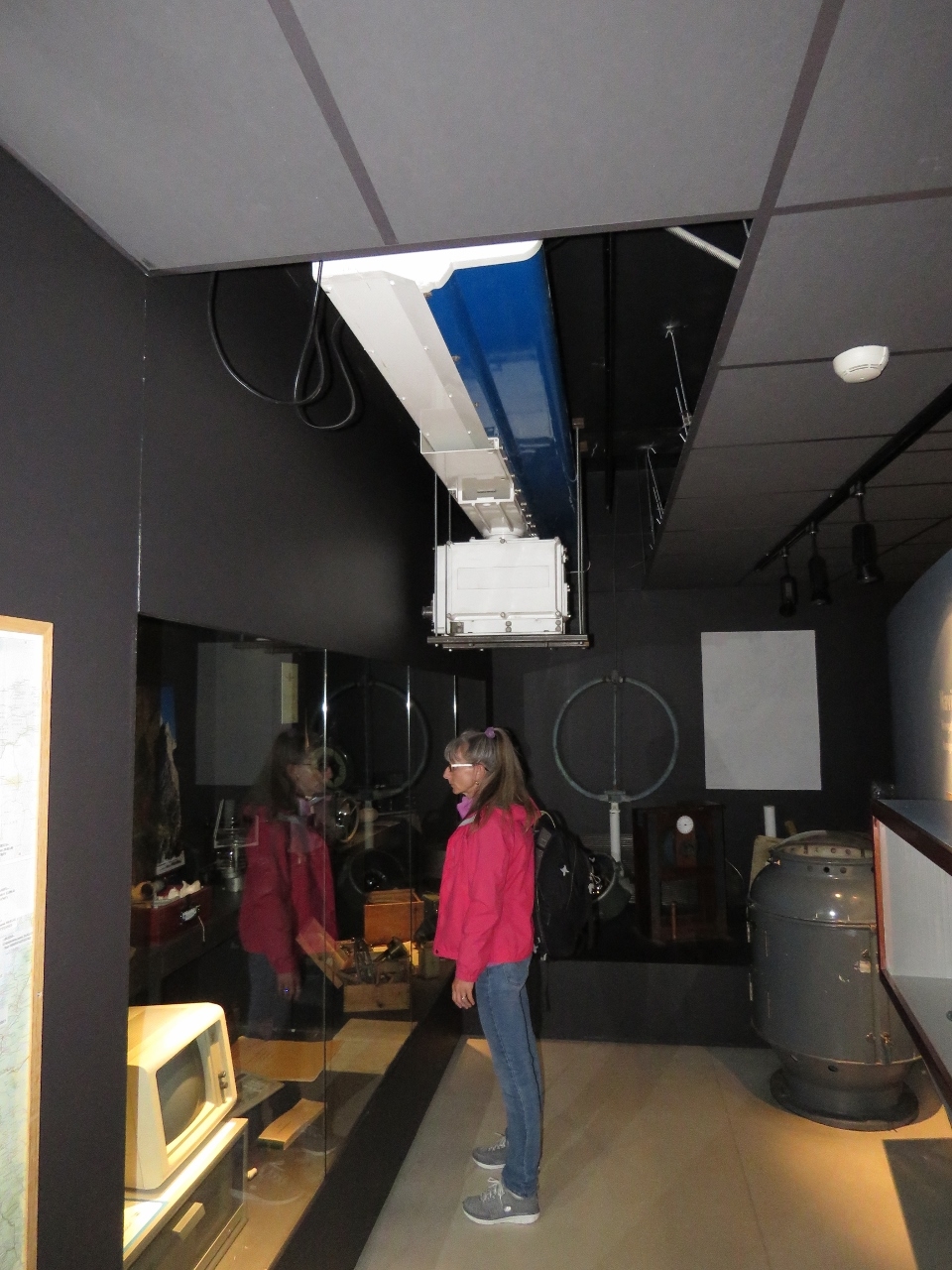 |
6/1/2018: Radar
Position: 68°33.84'N, 14°55.52'E
A display on ship's electronics inside the Hurtigruten Museum. Jennifer is standing underneath a huge Furuno radar that would sink Dirona.
|
 |
6/1/2018: Transfer
Position: 68°33.84'N, 14°55.52'E
This photograph shows how goods and people were transfered in earlier days when a dock wasn't available for the large coastal steamers. A small boat came alongside to shuttle between ship and shore.
|
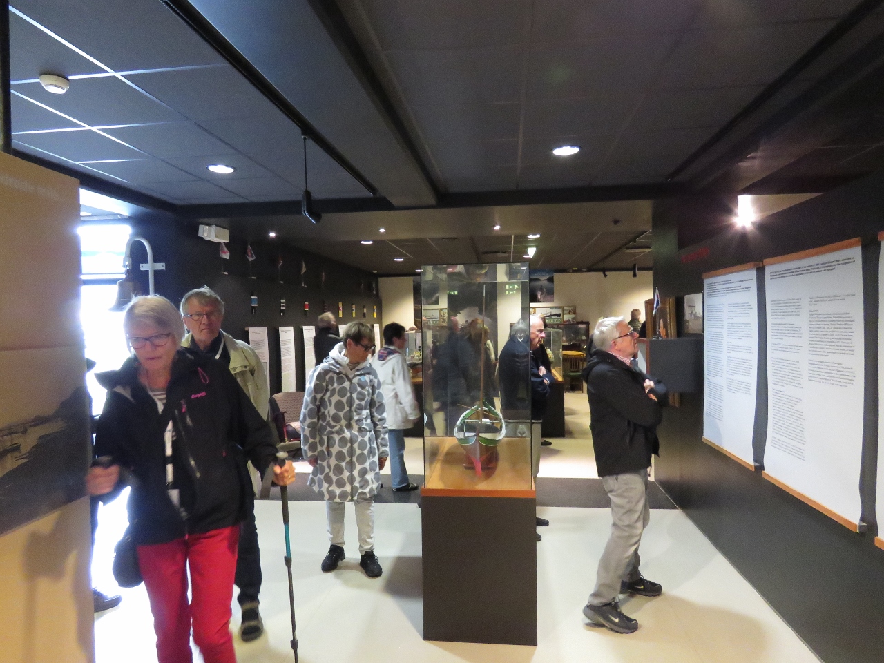 |
6/1/2018: Crowds
Position: 68°33.84'N, 14°55.51'E
When we arrived, the museum was pretty much empty. As we watched an excellent movie detailing the history of the coastal steamer service in Norway, the museum quickly filled up. The daily Hurtigruten had arrived.
|
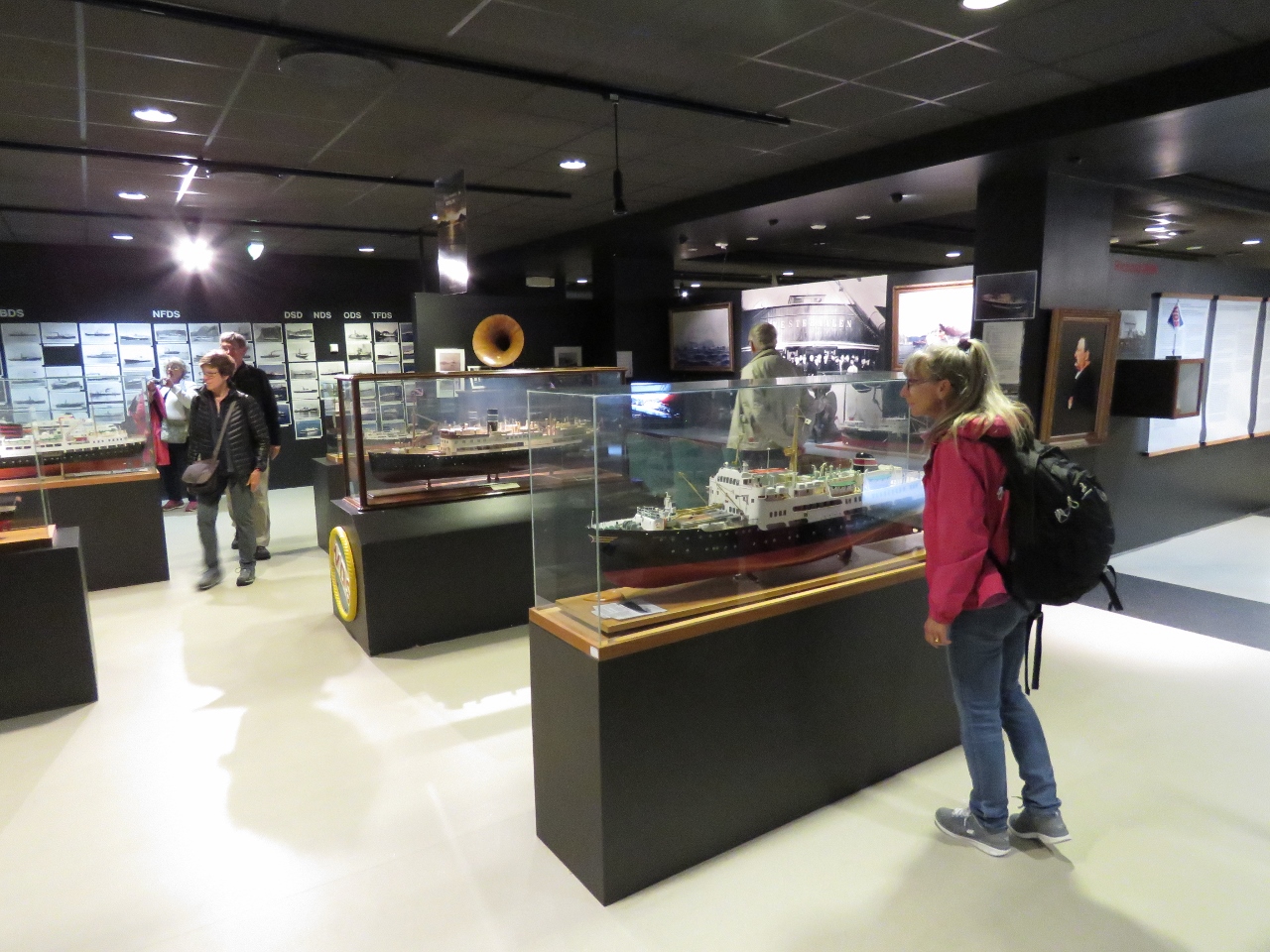 |
6/1/2018: Model Ships
Position: 68°33.84'N, 14°55.52'E
The Hurtigruten Museum has an excellent display of model ships. We were overall quite impressed with the museum and really enjoyed our visit.
|
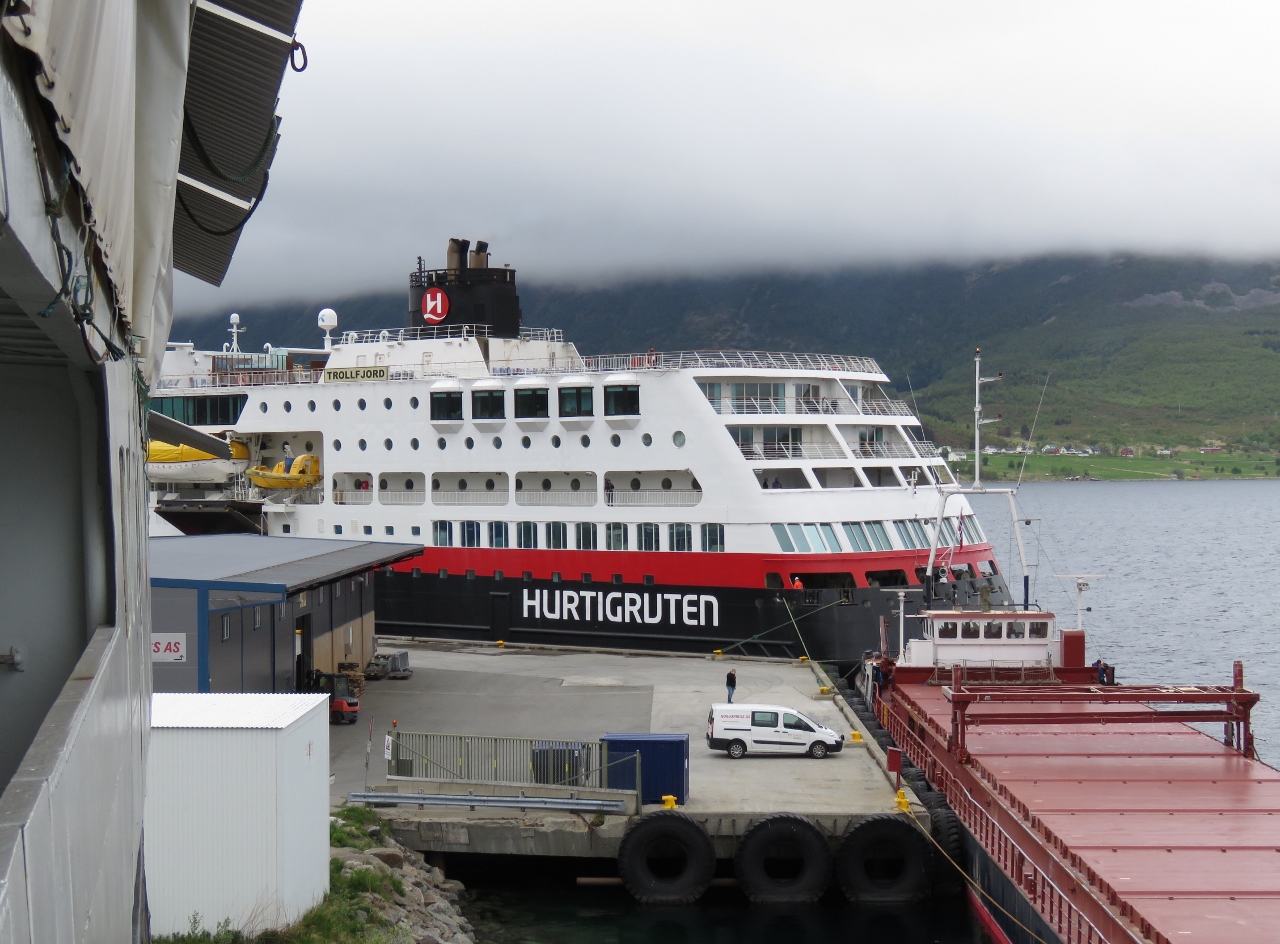 |
6/1/2018: Trollfjord
Position: 68°33.84'N, 14°55.51'E
On board the Finnmarken we had a view to the Hurtigruten Trollfjord that was docked in town. That's where all the people came from.
|
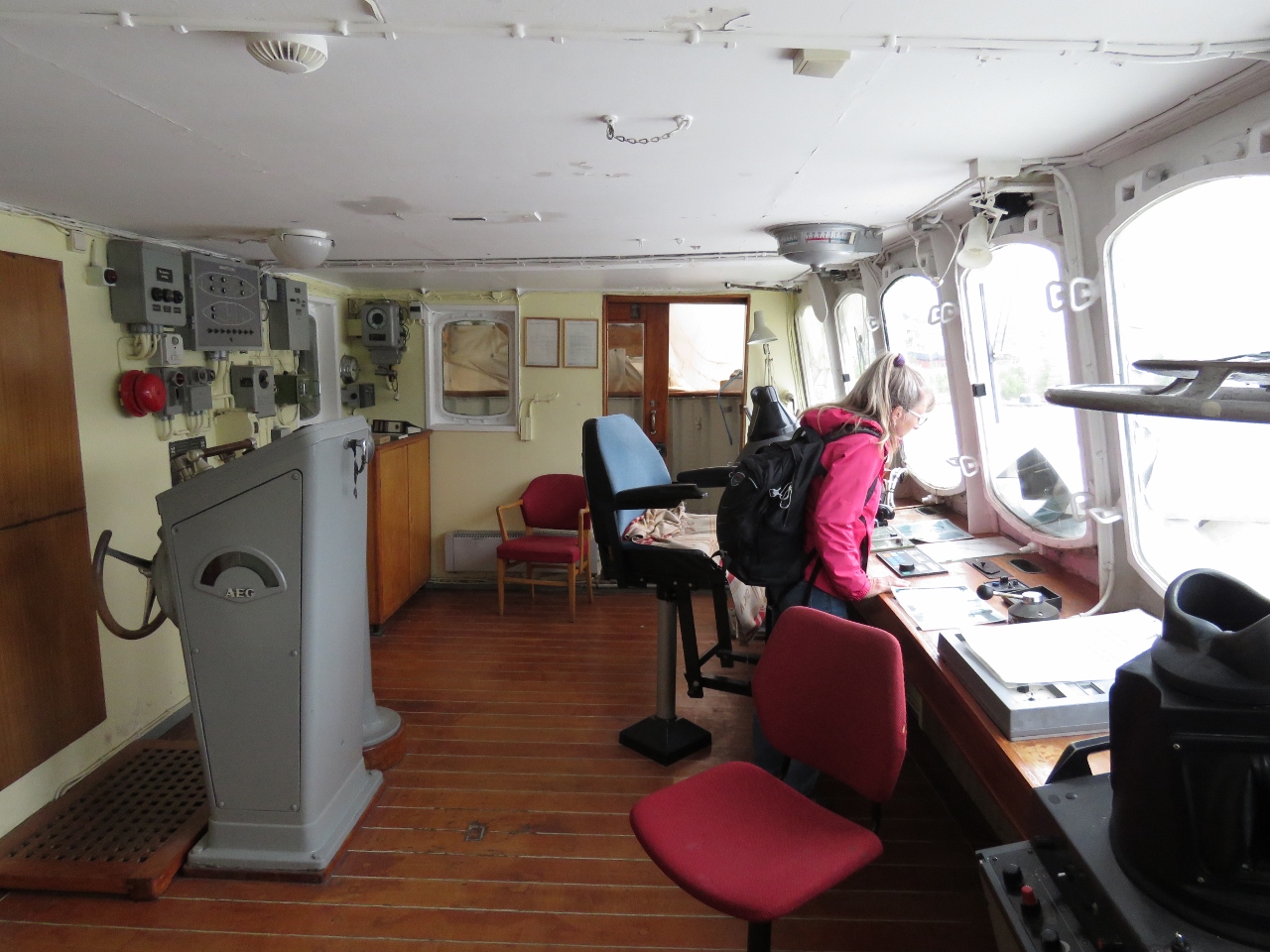 |
6/1/2018: Bridge
Position: 68°33.84'N, 14°55.51'E
At the bridge of the Finnmarken, with much of the electronics still in place. We had access to most of the Finnmarken except for the engine room. Too bad, as we would have loved to see it.
|
 |
6/1/2018: Anchorage
Position: 68°33.84'N, 14°55.52'E
A view to our anchorage off Stokmarknes from the bridge of the Finnmarken. It was an easy and convenient stop with reasonable depths, good holding and plenty of swing room.
|
 |
6/1/2018: Helm
Position: 68°33.84'N, 14°55.52'E
Jennifer at the helm of the Finnmarken.
|
 |
6/1/2018: Sailor
Position: 68°33.84'N, 14°55.52'E
Piles of old Sailor satellite communications equipment piled on the Finnmarken.
|
 |
6/1/2018: Spare Bank
Position: 68°33.84'N, 14°55.51'E
After visiting the Hurtigruten Museum, we walked through Stokmarknes. We're big believers in redundancy, so appreciate the idea of a spare bank. :) They even have a backup mini-bank too.
|
 |
6/2/2018: Finnmarken
Position: 68°34.26'N, 14°54.87'E
A view to the Finnmarken as we depart Stokmarknes.
|
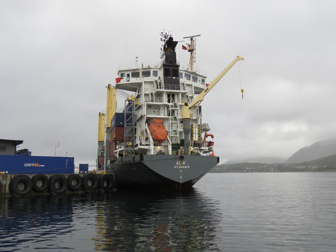 |
6/2/2018: Alk
Position: 68°34.26'N, 14°54.87'E
The small cargo ship Alk loading up at Stokmarknes.
|
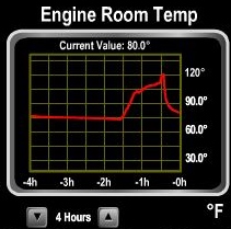 |
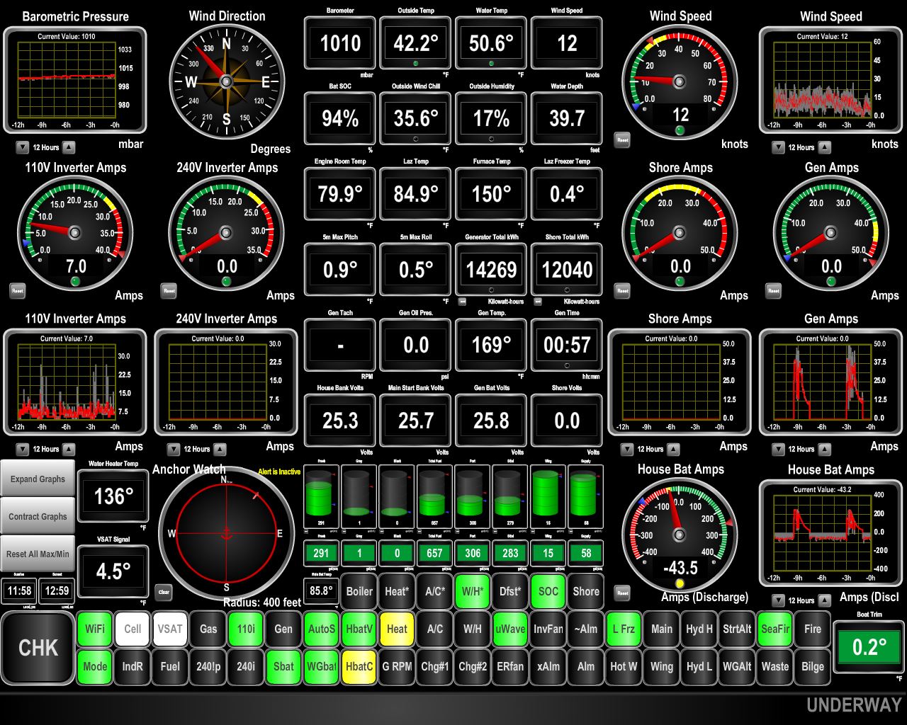
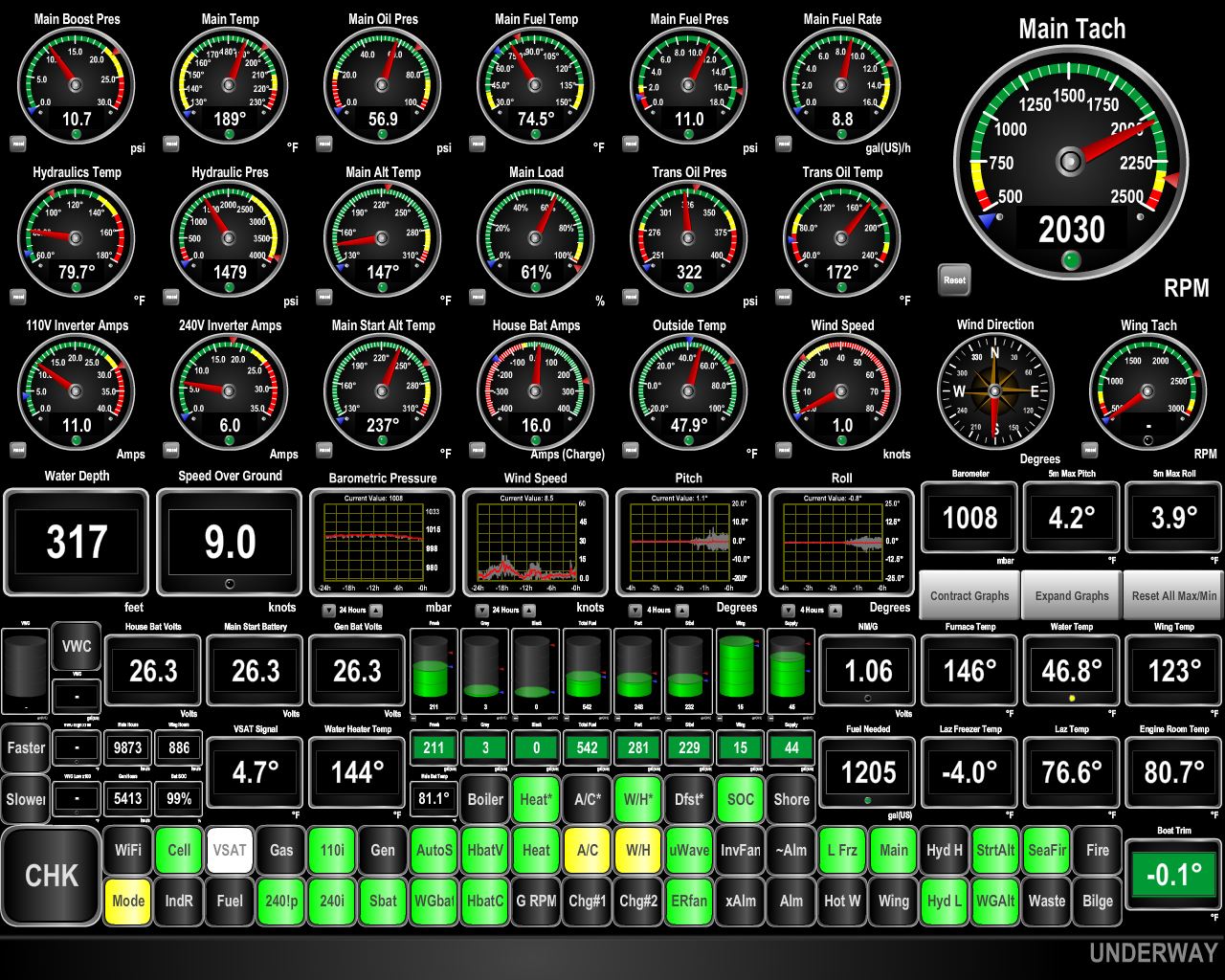
6/2/2018: Sensors At Work
Position: 68°39.87'N, 14°51.64'E
This graph shows one of our more than 20 temperature sensors at work. Shortly after leaving the anchorage this morning, we got a high ER temp alarm. We had accidentally left the ER fans in manual mode. A quick switch to auto mode and the system dropped back down to near-ambient temperatures.
|
 |
6/2/2018: Autostart Event
Position: 68°40.90'N, 14°55.82'E
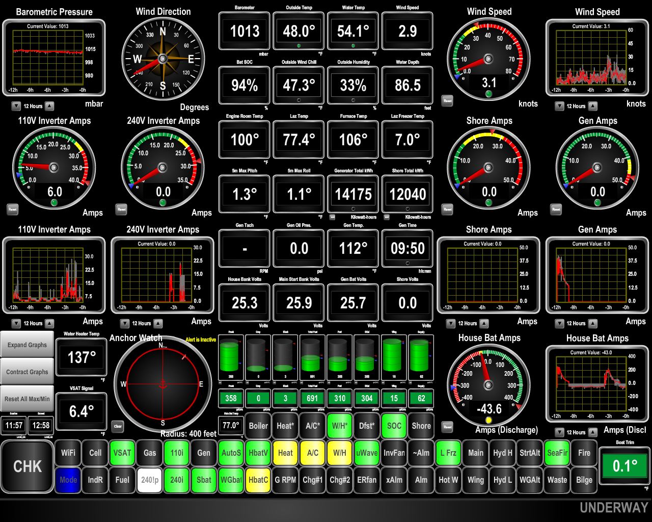
When we arrived back to the boat after visiting the Hurtigruten museum, our onboard control system was showing a yellow warning indicating it was in main engine generator mode. That means the generator has failed to start or failed during operation and the auto-start system instead used the 9kw of power generation from the main engine to charge the batteries. The good news is our new batteries didn't go through a deep discharge as that's an excellent way to dramatically shorten the house bank battery life. What's less good news is the generator appears to have had a problem.
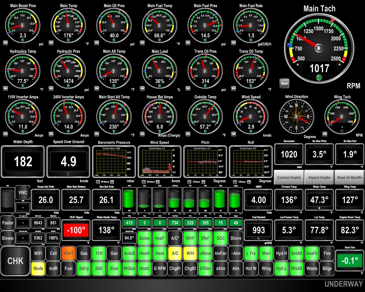
The first place we go is to the power system report. This subset of the report shows the battery states since yesterday, whether discharging, on shore power, charging via the generator, or charging by the main engine. Most generator runs are just over 2 hours but yesterday at 15:38 GMT, the generator went offline after only an hour and 45 min. The batteries were not yet charged, so the automation started the main and it was run for 19 min to complete the charge. Everything was exactly as it should be except the generator wasn't able to complete the charge. We ran the generator and it tested out fine. After a deeper investigation, it appears the generator controller, a Northern Lights WaveNet system, briefly went offline and stopped sending telemetry. In the absence of data from the generator, the automation used the main engine instead. This is the first time the main has been used so it's nice to see everything worked as it should. And it's nice to see the generator continues it's unblemished record of always delivering power when called upon. |
 |
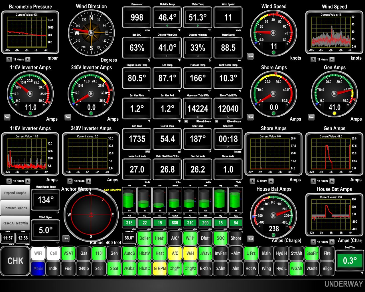
6/2/2018: Connectivity
Position: 68°42.53'N, 14°58.44'E
Oldenfjord is our first stop in Norway where we've not had excellent 4G cellular connectivity. (The box labelled 'Cell' at the bottom left of the screenshot is black, indicating no connectivity is available.) Despite a few houses around shore, cellular connectivity is close to non-existent. Fortunately our KVH V7hts satellite system is working well.
|
 |
6/2/2018: Oldenfjord
Position: 68°42.53'N, 14°58.43'E
We're expecting big winds and steady rain over the next couple of days, so will stay at the mouth of Oldenfjord until conditions improve for us to run around the west coast of Langoya.
|
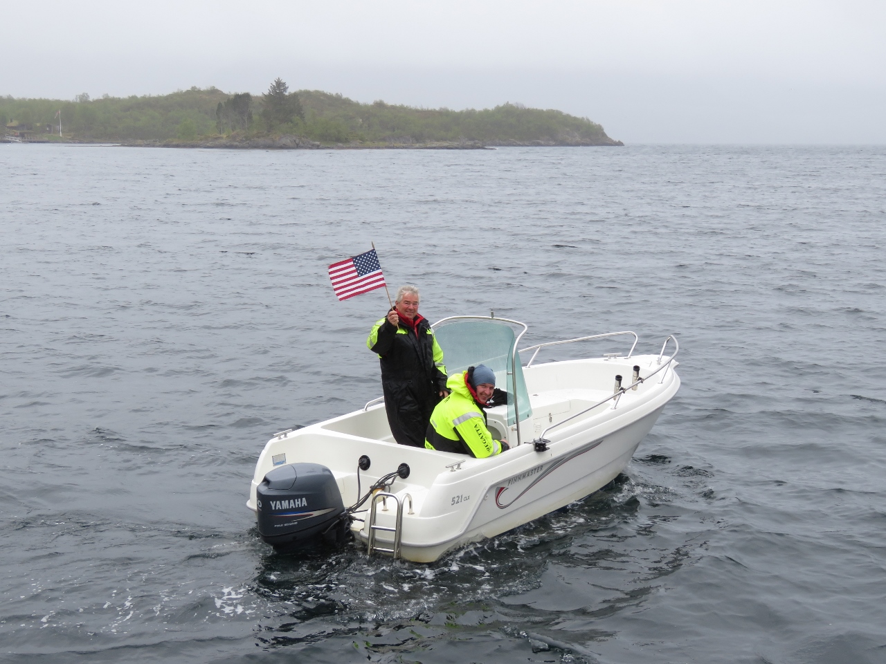 |
6/2/2018: Locals
Position: 68°42.54'N, 14°58.41'E
Some friendly locals came over to chat, waving a Stars and Stripes.
|
 |
6/3/2018: 43 knots
Position: 68°42.50'N, 14°58.44'E
Our expected big winds arrived today, bringing gusts to 43 kts. The anchorage at Oldefjorden is scenic, with good holding, and is protected from all directions except the south. When the wind is really howling up Eidsfjorden some waves do reach inside, but it's still comfortable.
|
 |
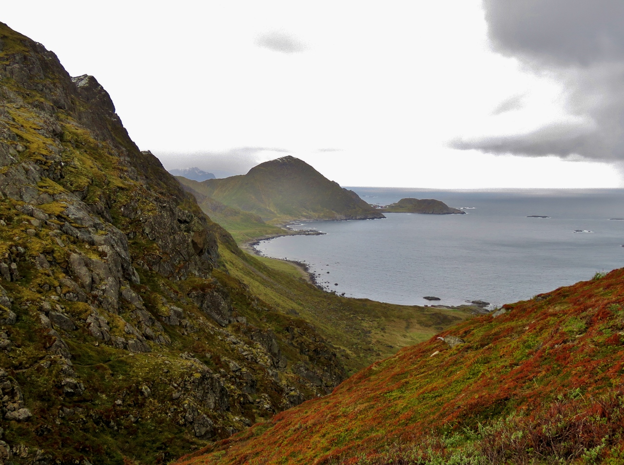
6/3/2018: Mountains
Position: 68°42.50'N, 14°58.43'E
The weather has been overcast since we arrived and cleared a bit this evening, giving us our first view to the mountains south of the anchorage.
|
 |
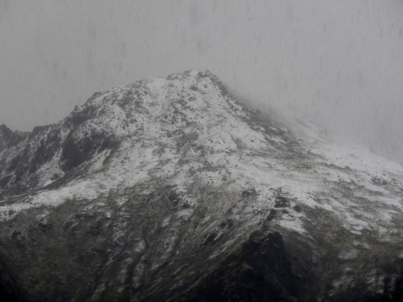
6/4/2018: Fresh Snow
Position: 68°40.94'N, 14°55.80'E
The temperature is 42°F (5.5°C) this morning and the mountains around us got a fresh dusting of snow overnight. We were a little surprised given we're into June now, but that's probably normal north of the Arctic Circle.
|
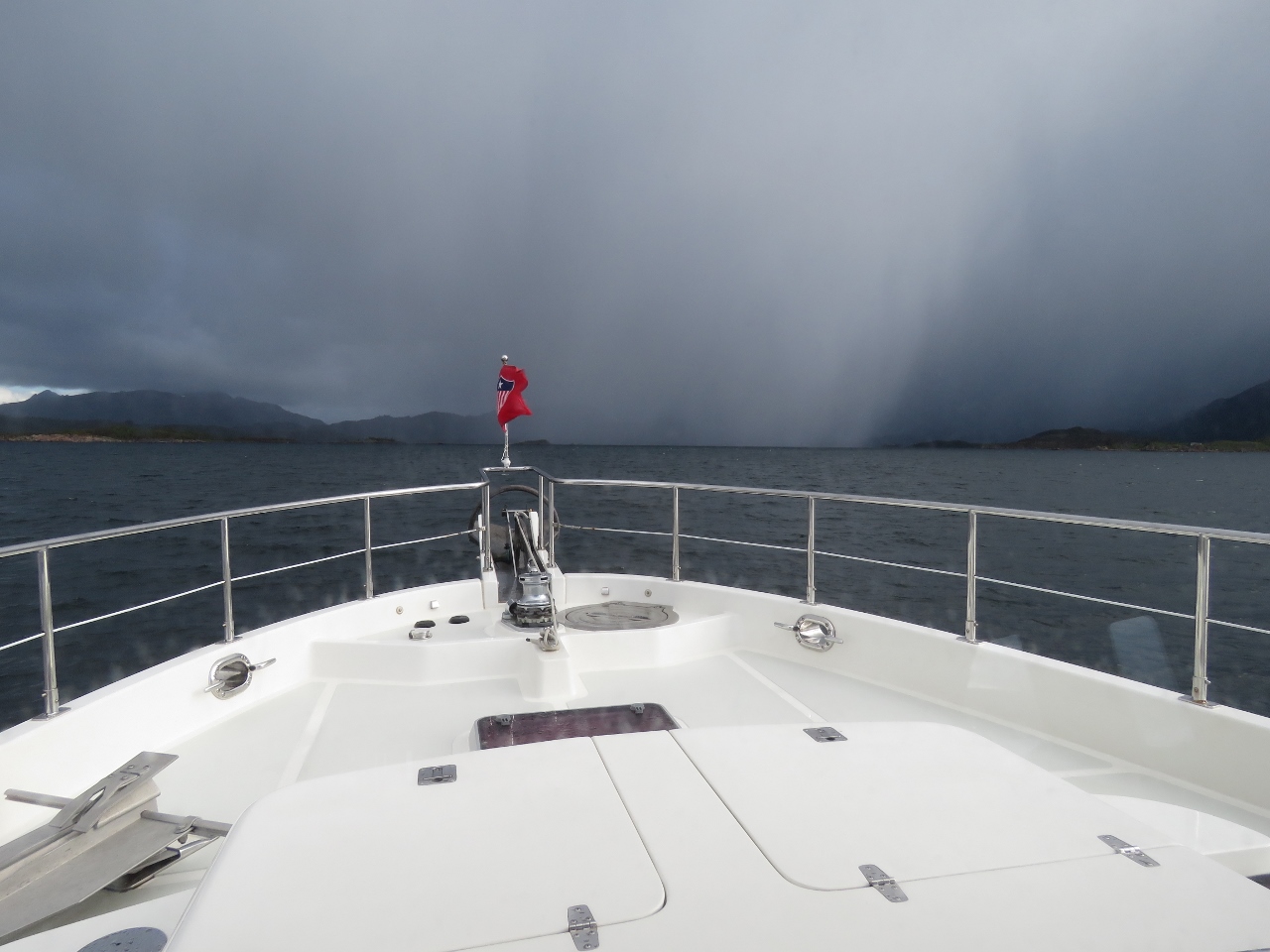 |
6/4/2018: Squall
Position: 68°39.31'N, 14°42.42'E
Squall headed our way as we near the anchorage at Nordvågen. The squall brought a small amount of hail, but passed quickly.
|
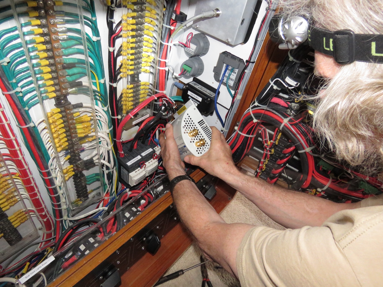 |
6/4/2018: Galvanic Isolator
Position: 68°39.98'N, 14°40.08'E
James removing the no-longer-in-use galvanic isolator.
|
 |
6/4/2018: Contactor
Position: 68°39.98'N, 14°40.09'E
This large contactor has developed an annoying hum when we're using 50hz shore power, but doesn't hum on 60hz. The contactor is rated for both frequencies so that shouldn't be a factor but the hum is annoying. On inspection when least on shore power, I noticed it wasn't mounted tightly and when the bottom was pried up, it got quiet. I didn't want to take the boat off shore power and it's too difficult to take it off hot, so I deferred the work until we were running on batteries. Today we took the contactor down, put insulation under it, and re-attached it tightly. We can't test the fix since it only makes noise on 50hz but I suspect this will solve the problem.
|
 |
6/4/2018: Control Box
Position: 68°39.98'N, 14°40.08'E
James is assembling a multi-function control box for eventual installation in the laz. This junction box will allow manual switching with interlock of the second shore power connection and, in addition, will support remote operation driven by a Raspberry Pi. The Pi will also implement load shedding on the two 100A at 24V chargers, drive a small i2c-connected display panel in the engine room and support more digital inputs and outputs. This will be the busiest Pi on the boat and, consequently, a lot of wiring is needed on this project. We're missing a few needed parts, so probably won't complete this project until later in the year.
|
 |
6/4/2018: Snow
Position: 68°39.99'N, 14°40.11'E
The temperature dropped to 38°F (3.3°C) and it's snowing.
|
 |
6/4/2018: Peak
Position: 68°39.99'N, 14°40.11'E
Snow falling on a peak on the southeast penninsula of the island of Langøya.
|
 |
6/4/2018: Wind
Position: 68°39.98'N, 14°40.11'E
The anchorage at Nordvågen is a Norwegian Cruising Guide favourite harbour for its all-weather protection and we agree. Conditions are calm here, despite the gusts in the high 20s. But on the exposed outer coast the winds are gusting into the high 30s with seas close to 10ft. We'll wait at least another day before heading out there.
|
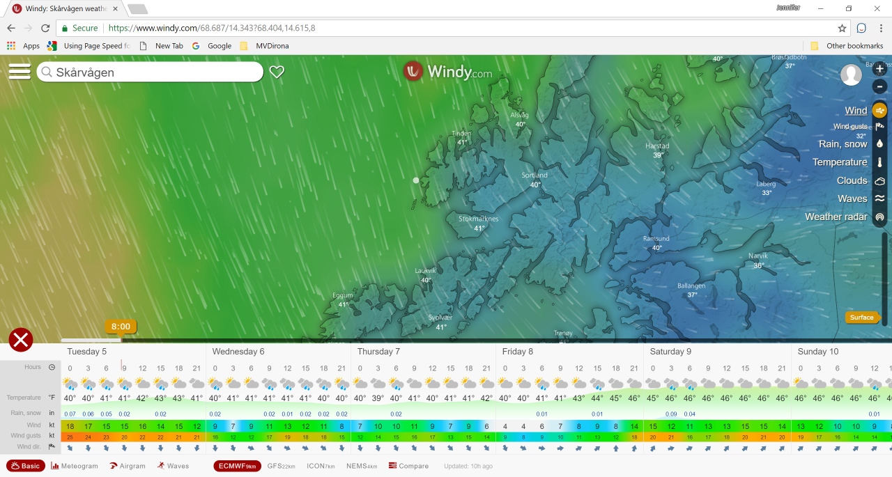 |
6/5/2018: Windy.com
Position: 68°39.98'N, 14°40.08'E
Conditions are calm in our sheltered anchorage, but this report from windy.com shows the winds are still up on the outer coast and we're better waiting until tomorrow.
We use the WW3 and GFS weather models via GRIB files at sea and find these models reasonably accurate to predict larger weather systems, but less so when coastal cruising, when we usually look to a local source such as XC Weather in the UK. Since we're coastal-cruising in Norway, we've been using windy.com on Trond Saetre's recommendation and have been finding it more accurate than the other sources. To understand why, we dug deeper into their web site and learned it actually does use a different weather model: ECMWF. According to windy.com, ECMWF is a very accurate medium-range forecast commercial model that only a few companies offer. We'll likely continue using it as we cruise Europe. |
 |
6/5/2018: Snow
Position: 68°39.98'N, 14°40.10'E
The mountains on the southeast penninsula of the island of Langøya look fabulous with a fresh coating of snow.
|
 |
6/6/2018: Calm
Position: 68°39.99'N, 14°40.09'E
A beautiful calm morning as we prepare to get underway from the anchorage at Nordvågen.
|
 |
6/6/2018: Secondary Pump
Position: 68°39.99'N, 14°40.09'E
This morning we switched on the autopilot as usual but it immediately alarmed there was no steering pump control. The pump has been producing bearing noise of late so we've kind of known it's days where numbered. Given the bearing noise it's been producing, we suspect it just seized up. Not a problem, we switched to the other pump and we got underway without delay. However, the other pump actually was taken out of use at 4,900 hours due to a shaft seal beginning to leak. It doesn't leak much and otherwise works well, but it's since been moved to backup duty.
Checking the hours on the two pumps, we only got 4,900 hours on the primary pump before seal failure sidelined it. The second pump has now done 4,958 hours before failing this morning. It turns out the Accu-Steer HPU212 wasn't an excellent pump and we have actually already gotten better life from this pump than most other users. Knowing this, we've been looking for a replacement pump for the last 3 weeks and planned to buy a new pump and use the noisy bearing pump as an emergency backup. Technically we could rebuild the two HPU212 pumps we have, but Accu-Steer owner Kobelt estimates the rebuild cost at $1,500 each and warns that not all pumps are rebuildable. And, of course, there would be the two way air freight cost of shipping both pumps (roughly 180 lbs) from Norway to North America and back :-). Since the HPU212 doesn't have a very good service record, we was planning to replace one pump with something better. After this morning's failure, we suspect I'm now needing to buy two new pumps. But we're underway without delay and the leaking pump isn't currently leaking any oil at all. However, we know it's days are numbered so we will order a couple of replacements. But at 90+ pounds each, I'm sure the air freight bill will be an eye opener. |
 |
6/6/2018: Litlåya
Position: 68°35.31'N, 14°23.70'E
Stubby lighthouse on the south end of the island of Litlåya.
|
 |
6/6/2018: Gauværøyra
Position: 68°37.58'N, 14°21.97'E
Looking back to the dramatic twin hills on the island of Gauværøyra.
|
 |
6/6/2018: Langøya
Position: 68°38.30'N, 14°22.55'E
Striking scenery at the southwest corner of the island of Langøya.
|
 |
6/6/2018: Nykvåg
Position: 68°47.28'N, 14°27.13'E
The village of Nykvåg nestled beneath soaring slopes.
|
 |
6/6/2018: Windmill
Position: 68°49.43'N, 14°32.03'E
Looking south past a windmill along the west coast of Langøya.
|
 |
6/6/2018: Møklandsfjorden
Position: 68°50.63'N, 14°42.96'E
Mountains at mouth of Møklandsfjorden. Norway has no shortage of dramatic scenery.,
|
 |
6/6/2018: Tøa
Position: 68°49.48'N, 14°43.88'E
Fast ferry docked at the village of Tøa. We were considering the cove as a possible anchorage, but the ferry wake made it a lot less appealing.
|
 |
6/6/2018: Graveyard
Position: 68°48.18'N, 14°46.47'E
After anchoring in Finnvågen, we tied the tender off at an old wood pier and followed a path that led up to a small graveyard.
|
 |
6/6/2018: Lunch
Position: 68°48.07'N, 14°46.20'E
We continued up into the hills for lunch with a fabulous view to the area.
|
 |
6/6/2018: Finnvågen
Position: 68°48.12'N, 14°46.75'E
The sun came out as we were walking around and we climbed another hill for an even better view to the anchorage at Finnvågen.
|
 |
6/6/2018: Mermaid
Position: 68°47.16'N, 14°45.53'E
A statue resembling the Copenhagen Mermaid at the southern tip of Naerøya.
|
 |
6/6/2018: Barkestad
Position: 68°48.99'N, 14°48.02'E
Barkestad is one of several villages in the area.
|
 |
6/6/2018: Houses
Position: 68°47.25'N, 14°54.00'E
It's rare to be anywhere on the Norway coast without there being a few houses. These are partway down Ånnfjorden.
|
 |
6/6/2018: Annfjorden
Position: 68°44.96'N, 14°53.74'E
Snow-covered mountains visible at the head of Ånnfjorden.
|
 |
6/6/2018: Steering Pump
Position: 68°48.33'N, 14°47.06'E
We investigated the steering pump issue from earlier today and it turns out, as loud as those bearings have been screaming, that's not what disabled the pump. It has suffered an armature winding failure but this particular failure is an interesting one. If the pump stops with the bad winding in the "right' place it won't start. It won't turn, pop a breaker, or do anything. But, if the pump is turned 1/4 turn, it'll start fine. And, once running, it'll run fine. When it comes time to turn it on a second time, it might work or it might not. If it doesn't work, we can easily turn the pump and it'll run fine. Not ideal and clearly we'll need to replace it. But, fairly good news.
We now have one pump that leaks slightly but is serviceable as a backup. And we have this pump that has the starting problem with excessively noisy bearings as a primary. We've got two new pumps on order from Emerald Harbor Marine in Seattle but we still are in good shape with two functioning pumps to keep us safe until the new pumps arrive. Much better news than we expected. |
 |
6/7/2018: Fresh Snow
Position: 68°48.35'N, 14°47.01'E
Snow had fallen overnight and the mountains around the anchorage that were almost bare of snow yesterday now had a fresh coating. This is looking northwest to the 563m Blåtinden on Drøya island.
|
 |
6/7/2018: 38 Degrees
Position: 68°48.14'N, 14°48.22'E
With the morning temperature at 38°F (3.3°C), Jennifer is working on deck in her Mustang exposure suit. The suits are similar to ski jumpsuits, but with built-in flotation and extra insulation. We can toss these on over light clothing, add a pair of gloves and perhaps some ear warmers and be instantly warm in the coldest weather. And they also have a nice slimming effect. :)
|
 |
6/7/2018: Blåtinden
Position: 68°48.63'N, 14°51.75'E
A close-up to other side of Blåtinden, the backdrop for last night's anchorage, with a cloud passing in front as we cruise along the eastern side of the island of Drøya.
|
 |
6/7/2018: Skogsøya
Position: 68°55.16'N, 15°0.17'E
Snow-dusted mountains at the northeast corner of the island of Skogsøya.
|
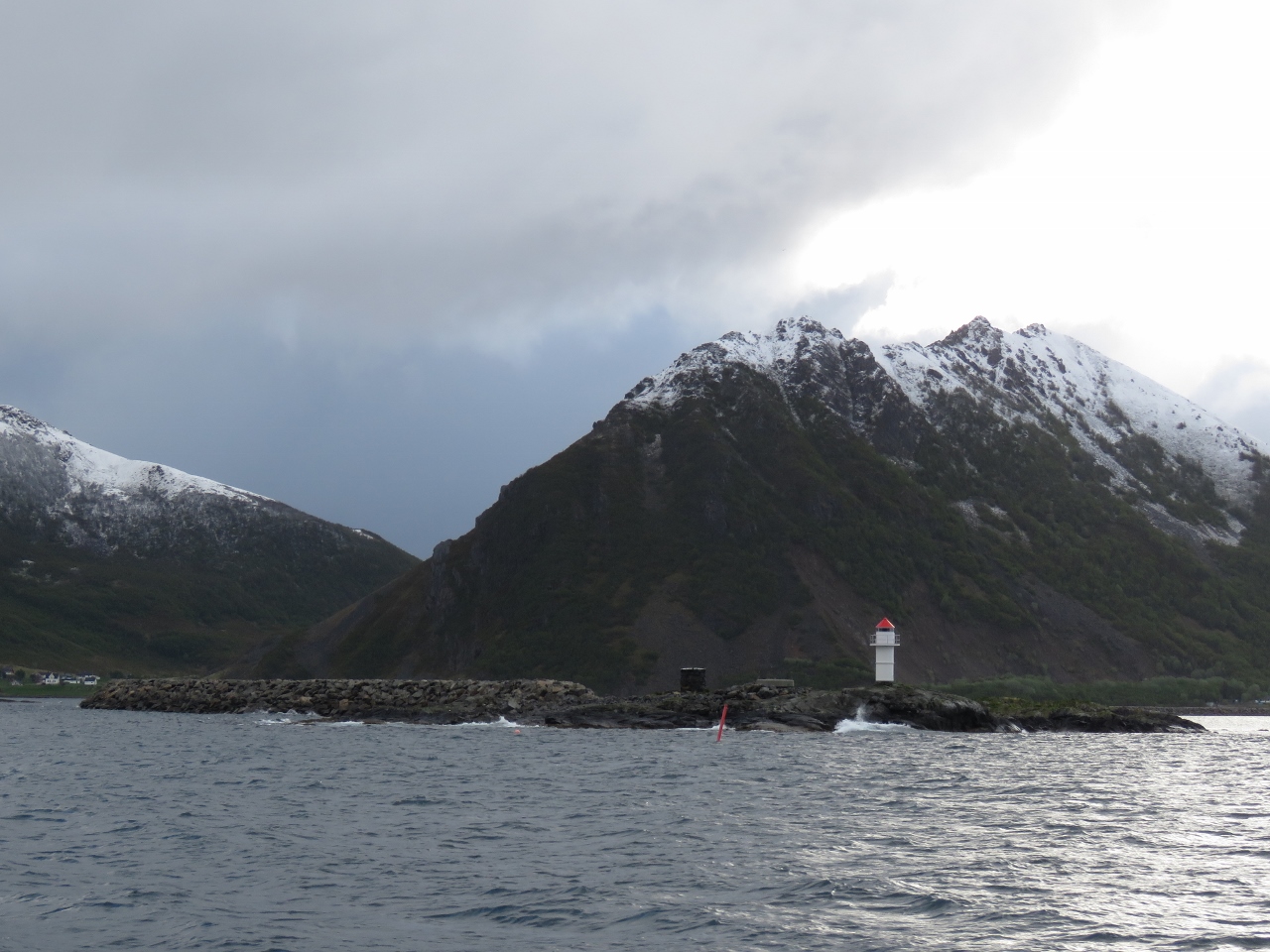 |
6/7/2018: Breakwater
Position: 68°55.28'N, 15°0.03'E
A mile-long breakwater has been built almost halfway across the channel to protect the town of Myre from northerly wind waves and swell.
|
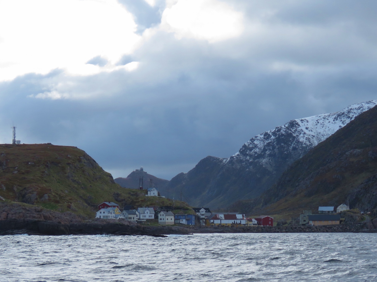 |
6/7/2018: Nyksund
Position: 68°59.53'N, 14°59.13'E
The town of Nyksund near the northern tip of the island of Langøya. Our plan is to hike there from Stø along the spectacular Dronningruta trail.
|
 |
6/7/2018: 69 Degrees
Position: 69°0.86'N, 15°4.94'E
We just crossed 69 degrees north. That's the final latitude line we'll be crossing on this trip. We plan to turn south at Tromsø, at 69°39'N.
|
 |
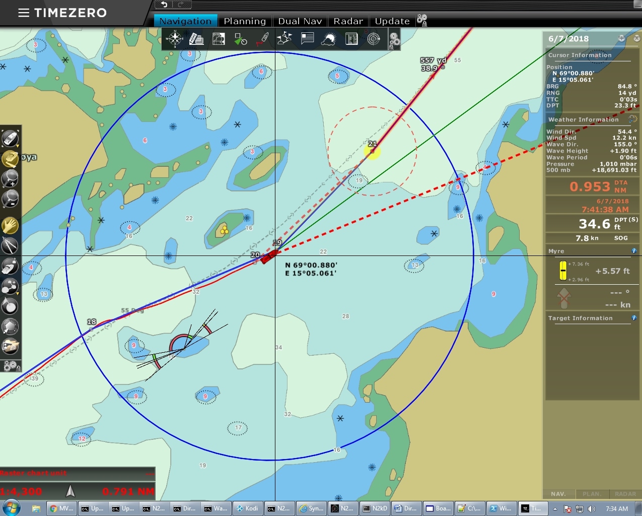
6/7/2018: Anchor Plan
Position: 69°1.21'N, 15°7.06'E
When we anchor, we use the dividers tool on our chart plotter to check distances to shore or other obstructions, then we drop anchor at the mark and pull back in the direction we expect to pull. We then set the anchor by pulling back at 1200 RPM. We use 1200 RPM as it pulls the anchor rode out to roughly the same angle as a 40-kt wind. Many would say its crazy to set the anchor so aggressively and point out that it will sometimes not hold when giving the anchor time to soak would have worked. This is true, but our approach has the upside of letting us know if we have a potential problem with anchor holding at this location. Once we have set that way, we sleep well and haven't dragged for more than a decade. We have seen winds as high as 60 kts in an anchorage but not felt the need to post an anchor watch. Sleeping well is worth a lot to us so we set aggressively.
Once we have set the anchor, we again use the dividers to measure back to the anchor to see if it set instantly or dragged before setting. This tells us where the anchor actually is and we can see how close we are to any other possible obstruction knowing our entire swing diameter. If you look closely at the screen shot, you'll see the shorter dashed line which is the anchor rode radius. This tells us if an obstruction or a new boat arriving is in the swing circle. The diameter of a boat's swing radius is easy to compute so it shouldn't be surprising and yet, at least to us, it's surprisingly large when overlaid on a chart. And if we subsequently move past this point, we know we are dragging. |
 |
6/7/2018: Pitch and Roll
Position: 69°1.21'N, 15°7.06'E
We encountered a fairly large northwesterly swell as we rounded the exposed northern side of Langøya, generating a fair bit of boat motion (pitch and roll graphs slightly right of center) but it's nice and calm in the anchorage.
|
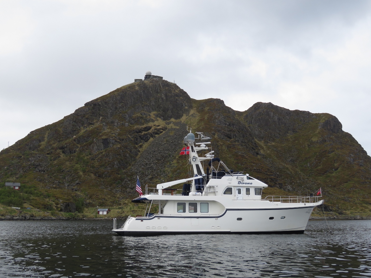 |
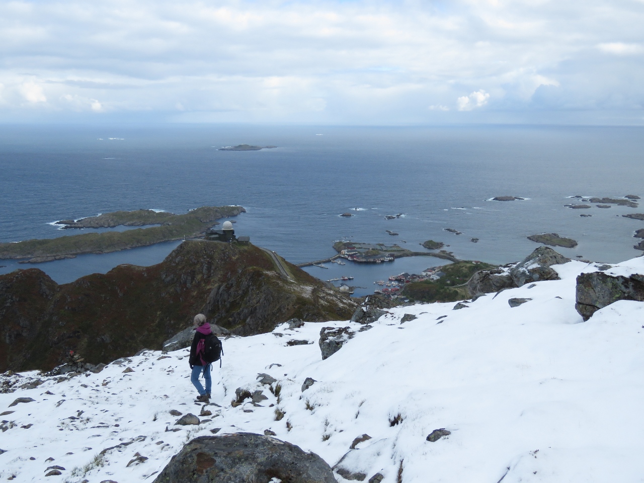
6/7/2018: Stø Anchorage
Position: 69°1.25'N, 15°7.25'E
Our first anchorage north of 69° at Stø. The holding is good and we have plenty of swing room, so we're quite happy with it. Behind us atop the hill is another radar station similar to the one we hiked to on the island of Sanna.
|
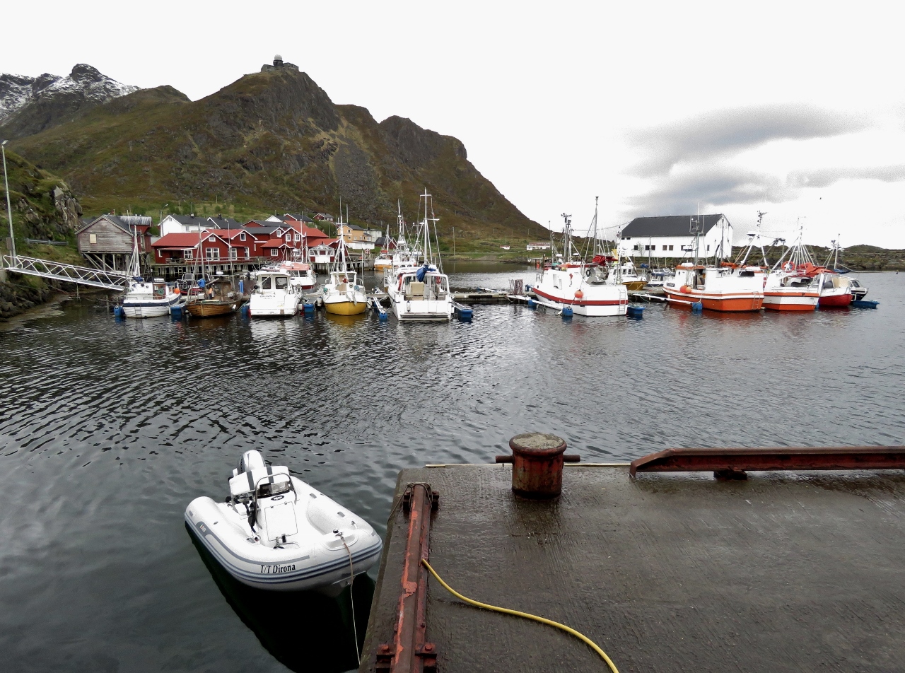 |
6/7/2018: Tender
Position: 69°1.18'N, 15°7.56'E
The tender tied off at side of the community wharf in Stø.
|
 |
6/7/2018: Trailhead
Position: 69°1.08'N, 15°6.98'E
At the Dronningruta trailhead, a strenuous (for us) 9-mile (15km) loop walk between Stø and Nyksund with exceptional scenery. Dronnigruta means "The Queen's Route"—the trail was named in honour of Queen Sonja of Norway who hiked the trail in 1994.
|
 |
6/7/2018: View to Stø
Position: 69°0.95'N, 15°7.04'E
The view back down to our anchorage and the village of Stø from 185ft (56m).
|
 |
6/7/2018: View to Nyksund
Position: 69°0.90'N, 15°6.78'E
Looking southwest at altitude 576ft (175m) toward Nyksund, our eventual goal.
|
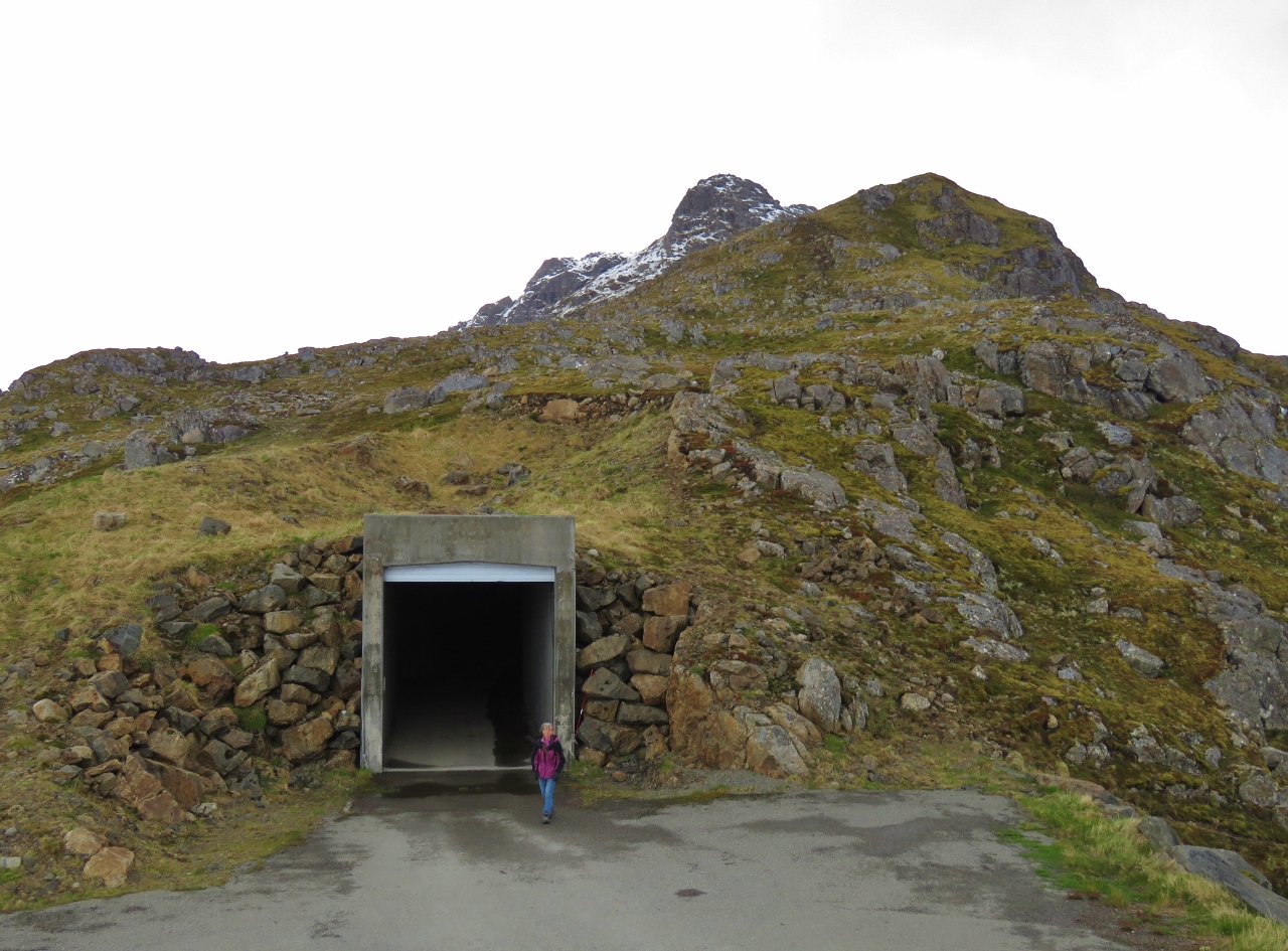 |
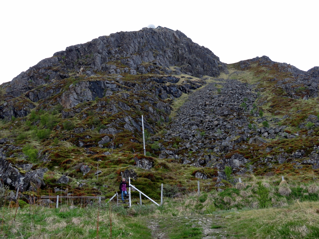
6/7/2018: Tunnel
Position: 69°0.87'N, 15°6.78'E
This tunnel brings a road through the mountain Valaksla to the radar station we can see above the anchorage. Photographing the station isn't allowed up here, but it's directly behind the camera.
|
 |
6/7/2018: Hail
Position: 69°0.74'N, 15°6.59'E
We could see a squall coming, and we debated whether we should wait for clear weather in the tunnel or continue. We decided to continue and just put up with it if we got a little bit damp. It turns out it was hail, so we threw on our hoods and stayed warm and dry. Here we're passing through the squall at 756ft (230m).
|
 |
6/7/2018: Snow Line
Position: 69°0.60'N, 15°6.38'E
We're above the snow line now at 1,019ft (310m) with a fabulous view back down to the radar station and Stø. Dirona is hidden by the mountain Valaksla where the radar station stands.
|
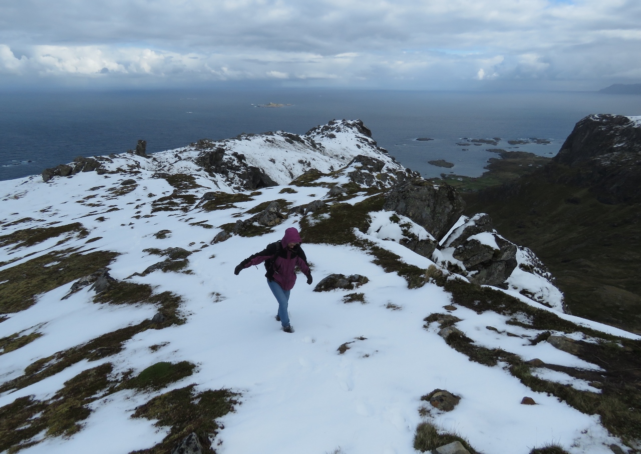 |
6/7/2018: Deeper Snow
Position: 69°0.45'N, 15°6.22'E
The snow generally wasn't very deep on the entire trail, but we did pass through a few patches that were up past our shins.
|
 |
6/7/2018: Sørkulan and Norkulen
Position: 69°0.36'N, 15°6.36'E
The view south to the peaks of Sørkulan and Norkulen.
|
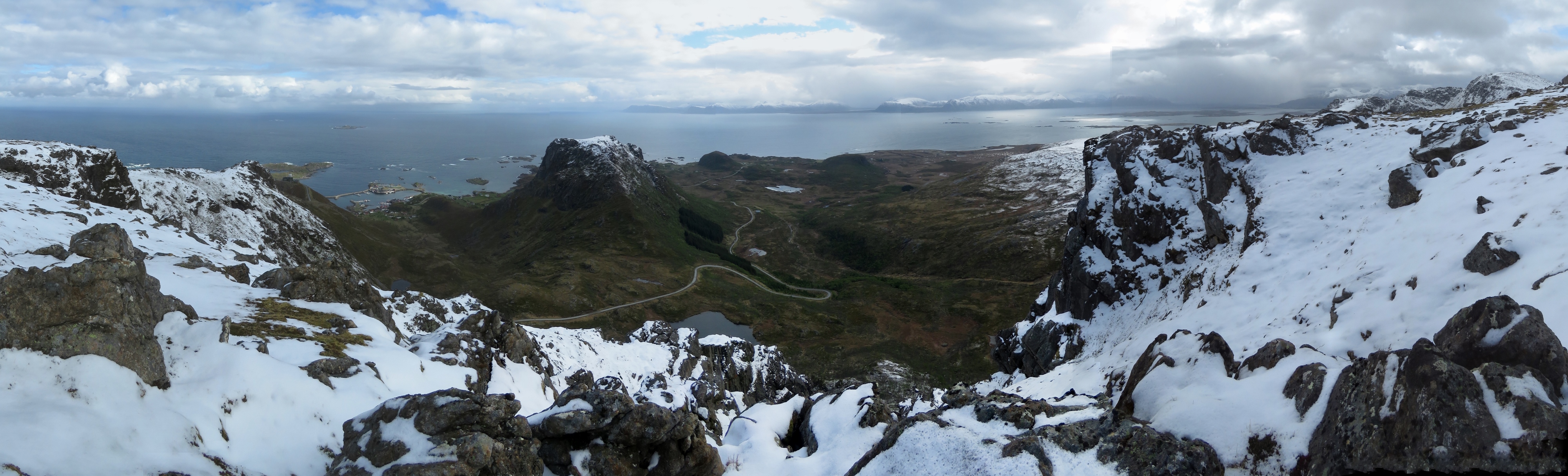 |
6/7/2018: Panorama North
Position: 69°0.36'N, 15°6.36'E
A panoramic view north toward Stø (click image for a larger view). The road to the radar station snakes around Geitberget and then disappears into the tunnel through Valaksla on the left. The island visible in the distance is Andøya.
|
 |
6/7/2018: Vertical Drop-off
Position: 69°0.34'N, 15°6.35'E
Vertical drop-off above the lake Kjolvatnet at 1,285ft (391m).
|
 |
6/7/2018: Toward Kjølen
Position: 69°0.23'N, 15°6.02'E
The trail snaking away beyond Jennifer toward the top of Kjølen at 1,590ft (460m).
|
 |
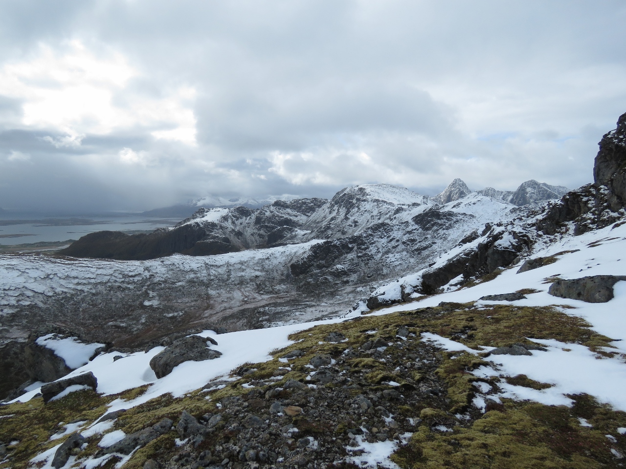
6/7/2018: Kjølen
Position: 68°59.97'N, 15°5.56'E
The spectacular mountain scenery at 1,248ft (380m) near Kjølen. The pictures we've seen of the trail in the summer look beautiful, but the snow really adds another dimension altogether.
|
 |
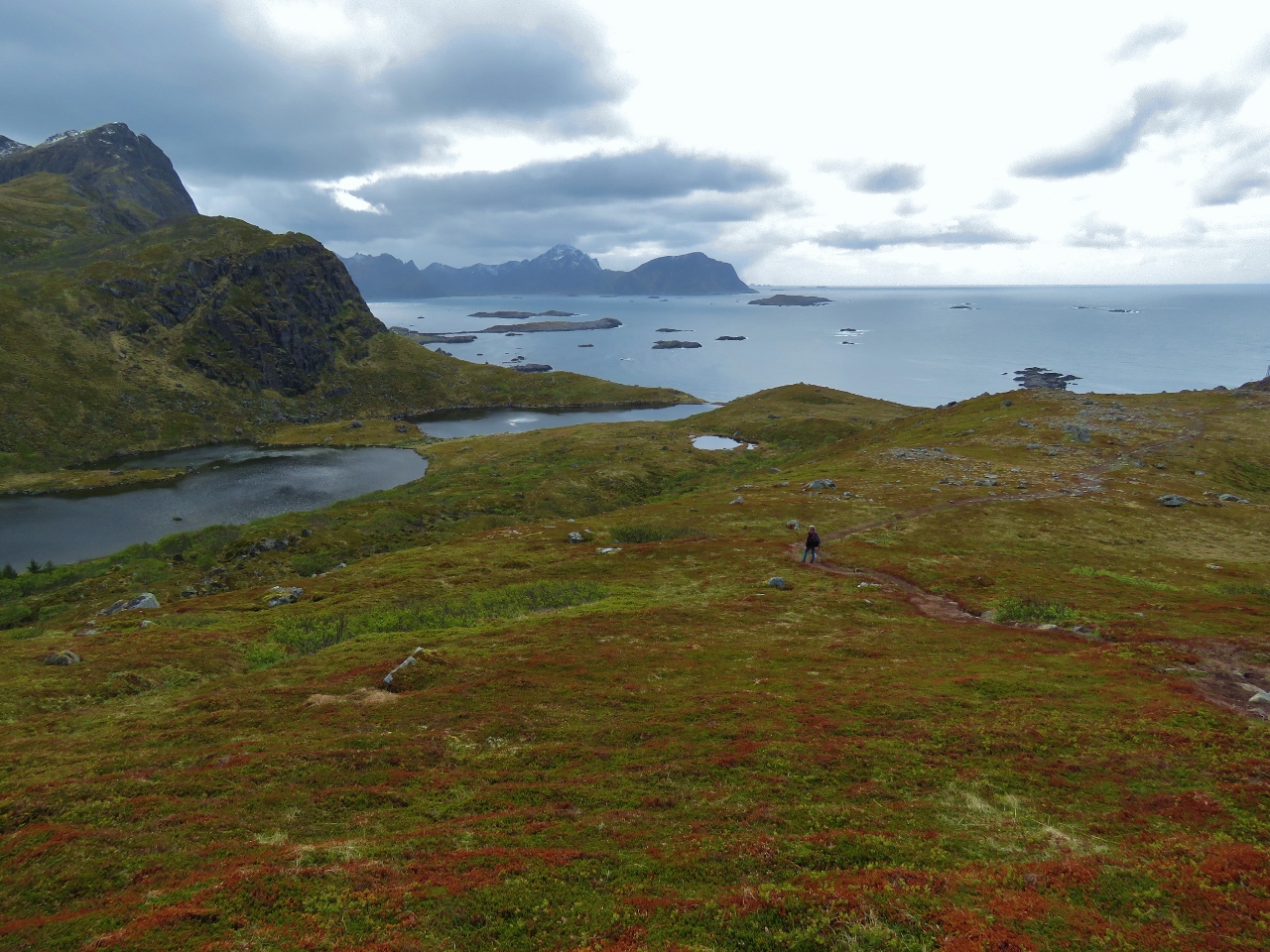
6/7/2018: Langvaddalsvatnan
Position: 68°59.93'N, 15°5.60'E
The Langvaddalsvatnan groups of lakes to our southwest. The trail loops to the left and around the south of these lakes and across to the other side. Did we mention it is a strenuous hike?
|
 |
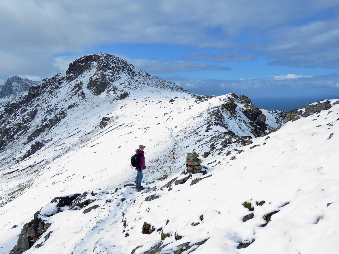
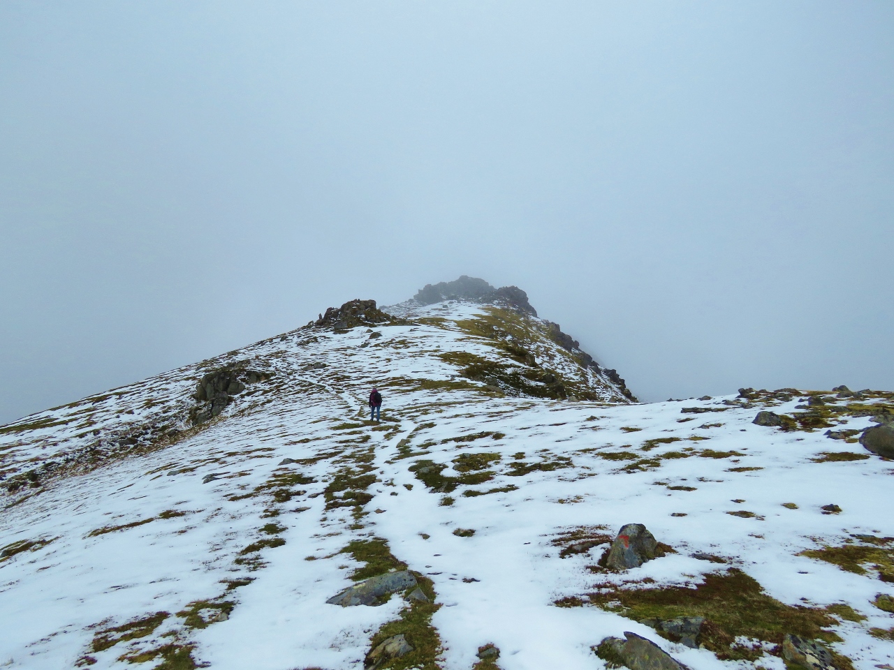
6/7/2018: Trail to Sørkulen
Position: 68°59.86'N, 15°5.72'E
Way in the distance we can see the trail heading across a ridge toward 1,700ft (518m) Sørkulen.
|
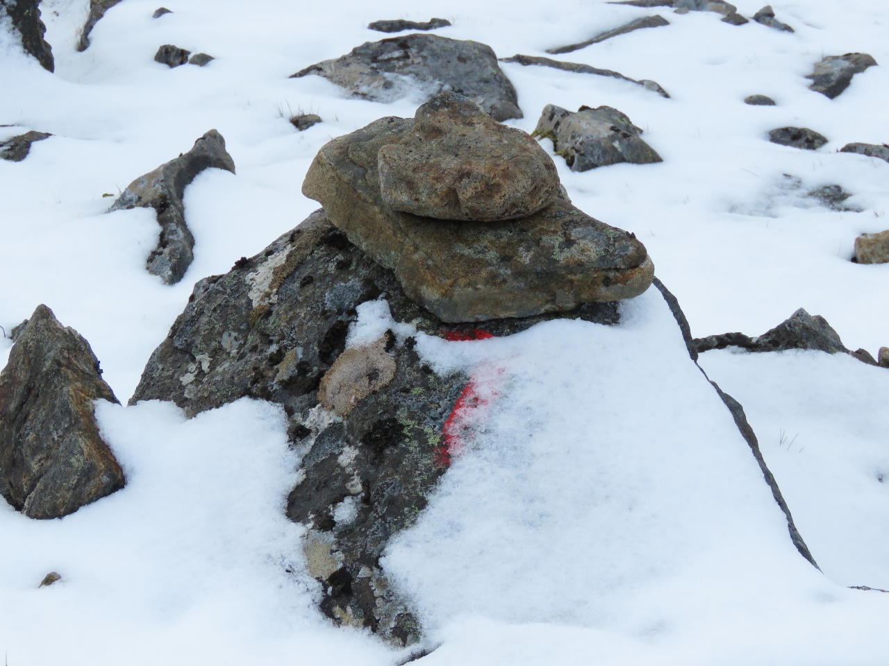 |
6/7/2018: Trail Mark
Position: 68°59.83'N, 15°5.75'E
The trail is well-marked with the National Trekking Association's red T's, and generally easy to follow. But occasionally snow obscures one of the markers.
|
 |
6/7/2018: Break
Position: 68°59.74'N, 15°5.85'E
Taking a break just beyond the Kjølen.
|
 |
6/7/2018: Next Ridge
Position: 68°59.54'N, 15°5.90'E
Crossing another ridge toward 1,700ft (518m) Sørkulen.
|
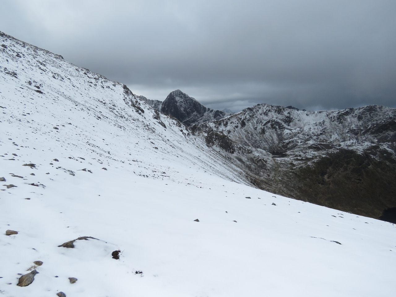 |
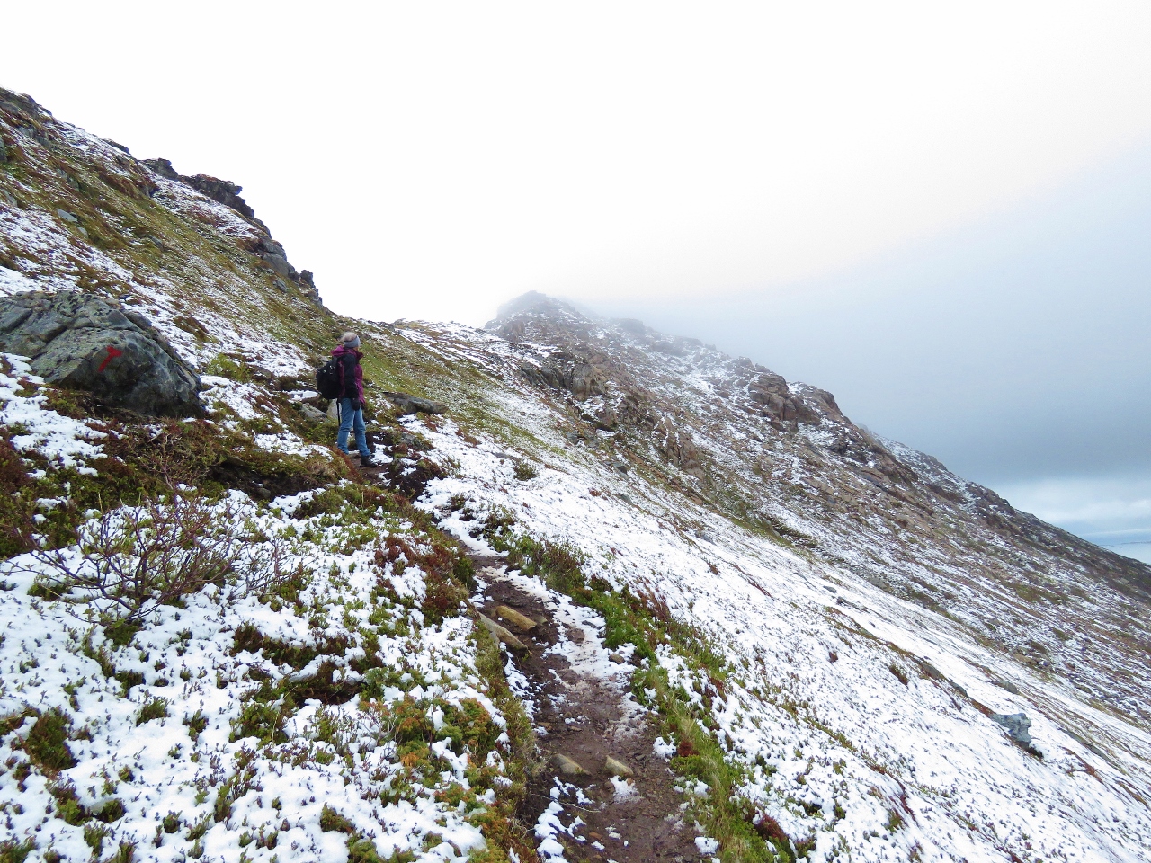
6/7/2018: Sørkulen Flank
Position: 68°59.32'N, 15°6.11'E
The trail turns southwest and ahead crosses along the steep slide-riddled flank of Sørkulan. Generally the trail felt pretty safe, but towards the end of this face the going is getting very steep and some fresh slides have come through the area. So the combination of nothing to grab onto and a snow-covered steep slope made this section difficult.
|
 |
6/7/2018: Weather System
Position: 68°59.27'N, 15°6.09'E
As we passed along the most difficult section of the trail, a small weather system came in behind us, bringing dark clouds, strong winds and hail. The gusts were probably only to around 25 kts, but they felt bigger on the steep slope.
|
 |
6/7/2018: Near Snow Line
Position: 68°58.98'N, 15°5.30'E
At 979ft (298m) we're almost below the snow line again. Our hike had a maximum altitude of 1,469 ft (448 m), but a total altitude gain of nearly twice that as we ascended and descended between the high points.
|
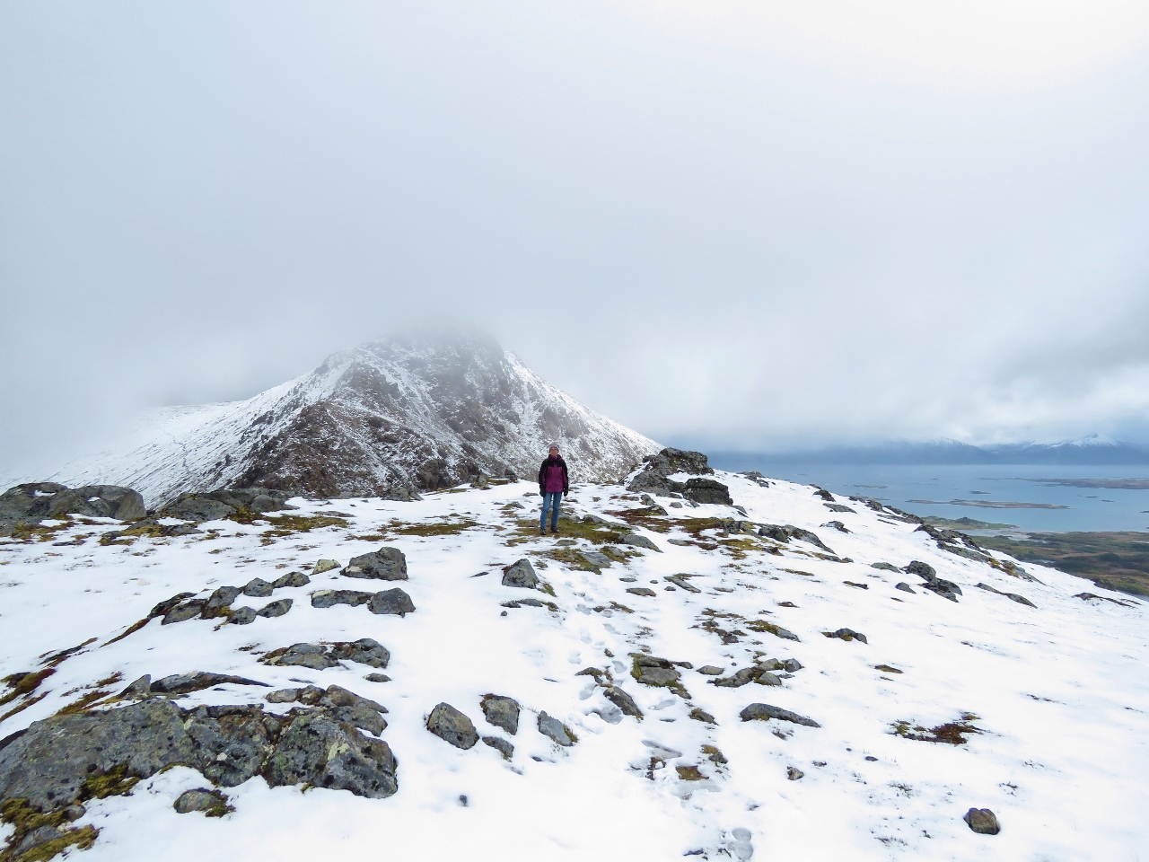 |
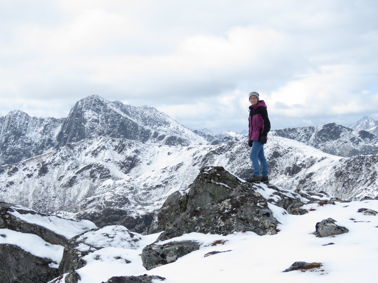
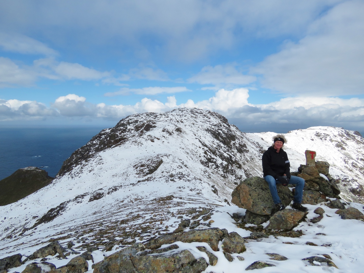
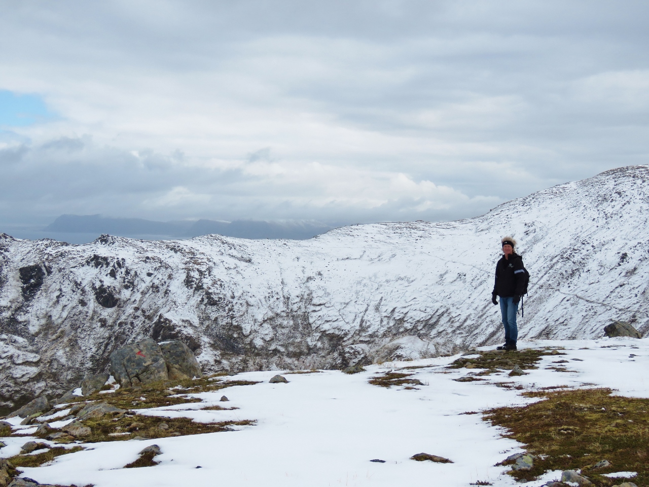
6/7/2018: Sørkulen
Position: 68°58.87'N, 15°5.00'E
1,700ft (518m) Sørkulen almost hidden in the clouds behind Jennifer.
|
 |
6/7/2018: Re-ascending
Position: 68°58.87'N, 15°4.98'E
At 1,179ft (459) and ascending to 1,469ft (448m) Finngamheia.
|
 |
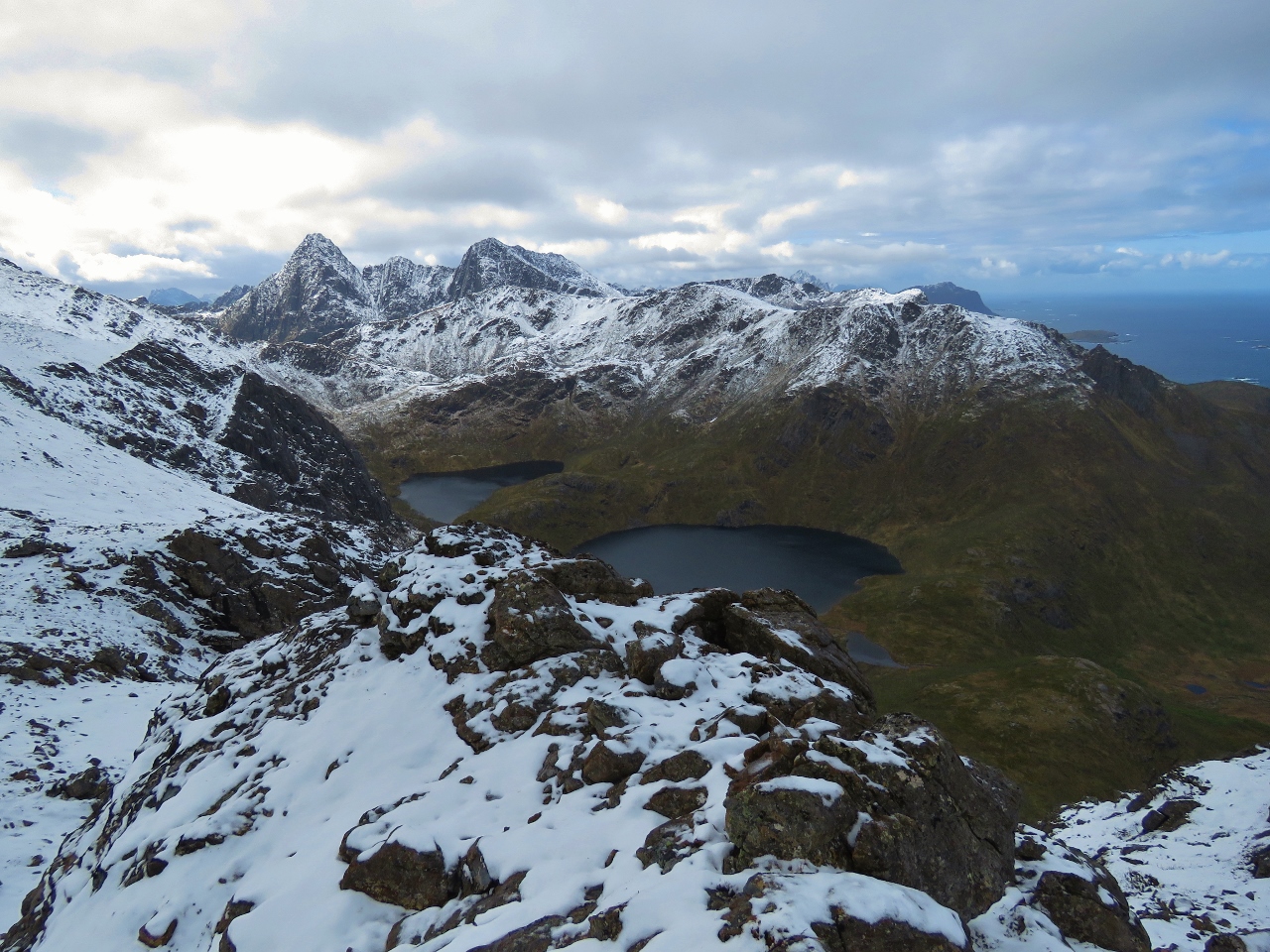
6/7/2018: Langvaddalsvatnan and Sørkulen
Position: 68°59.05'N, 15°4.12'E
Looking southeast near the summit of Finngamheia across the Langvaddalsvatnan lakes to our trail across the face of Sørkulen.
|
 |
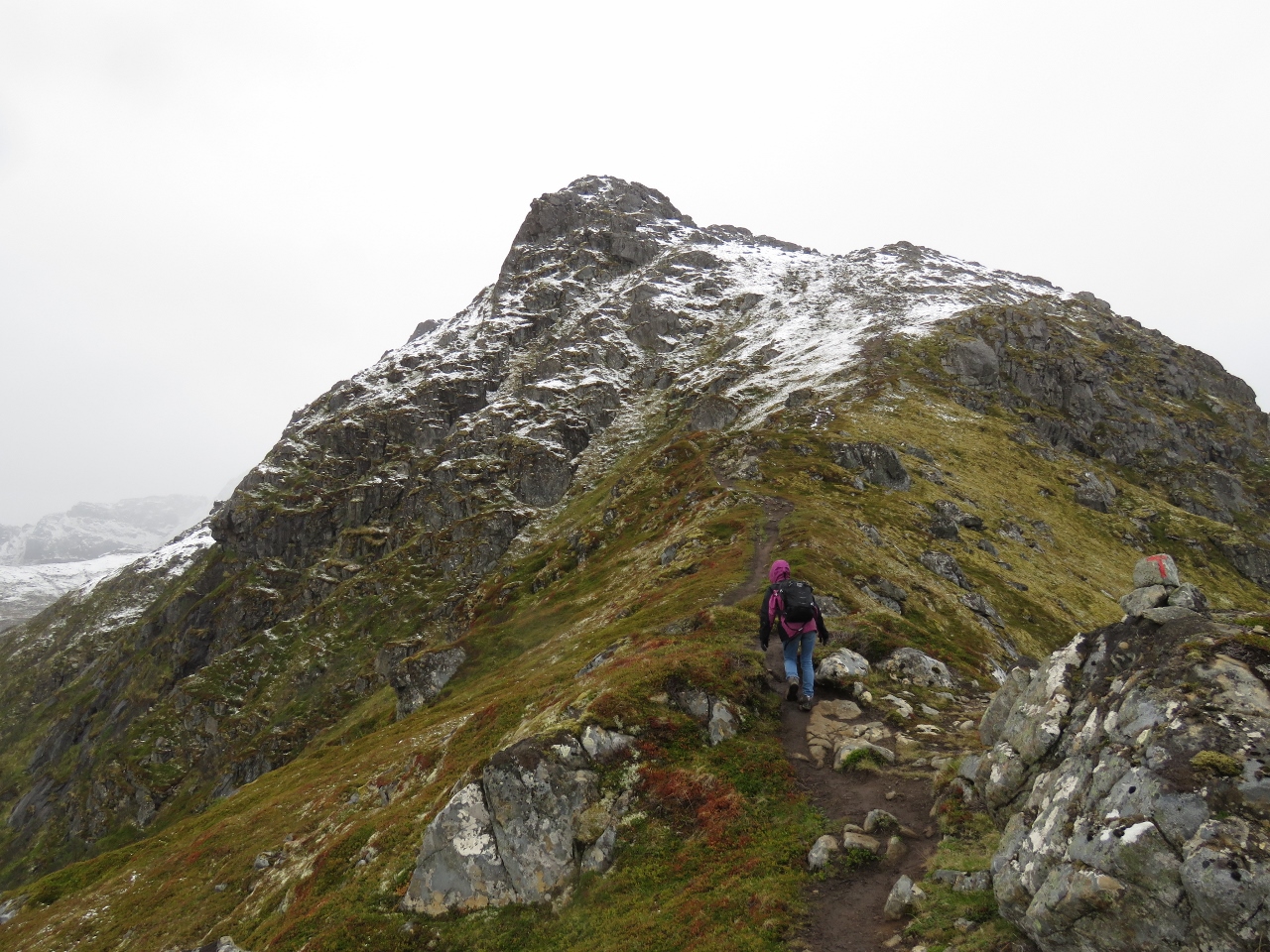
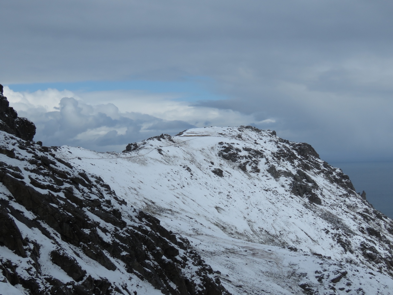
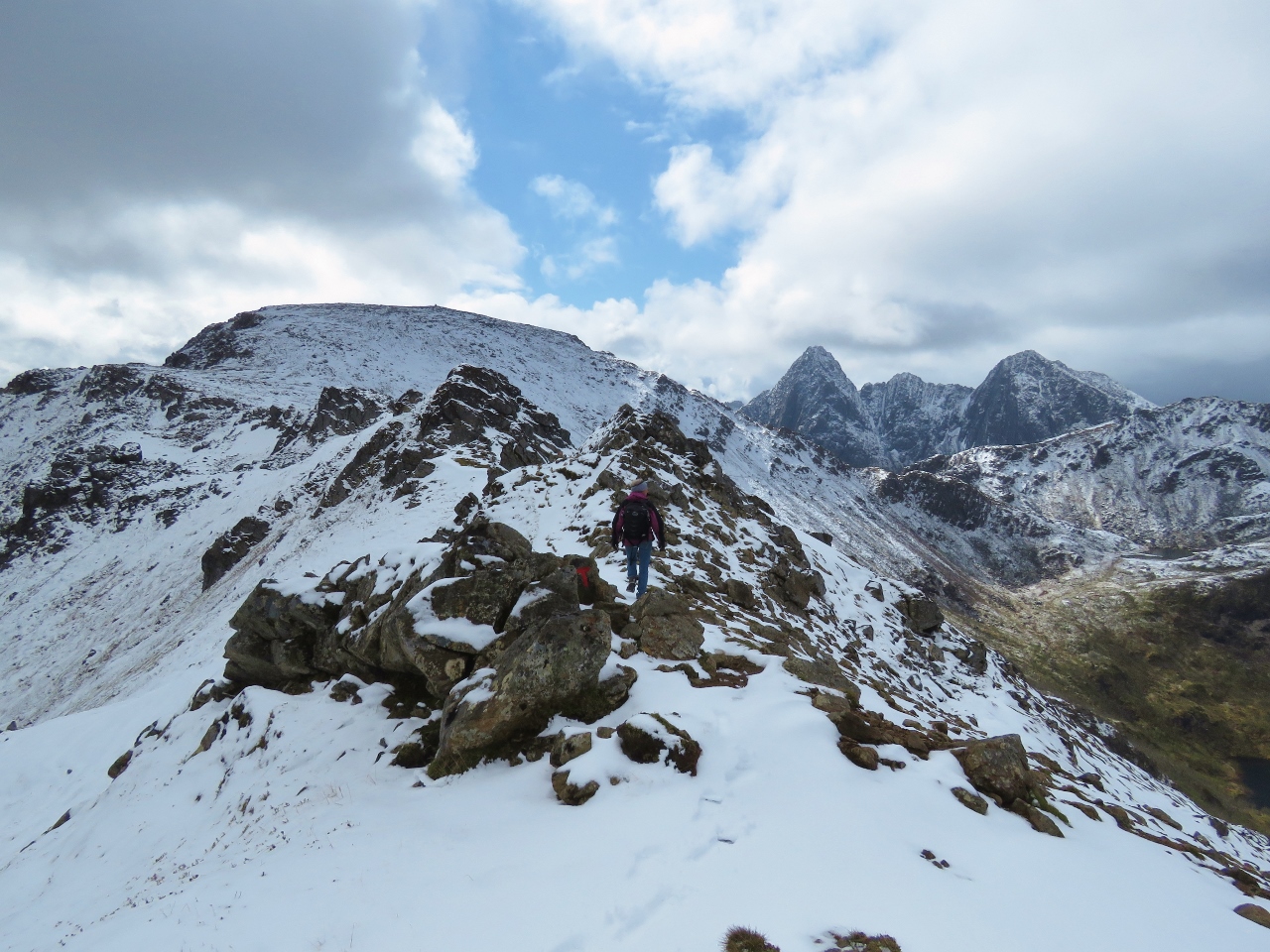
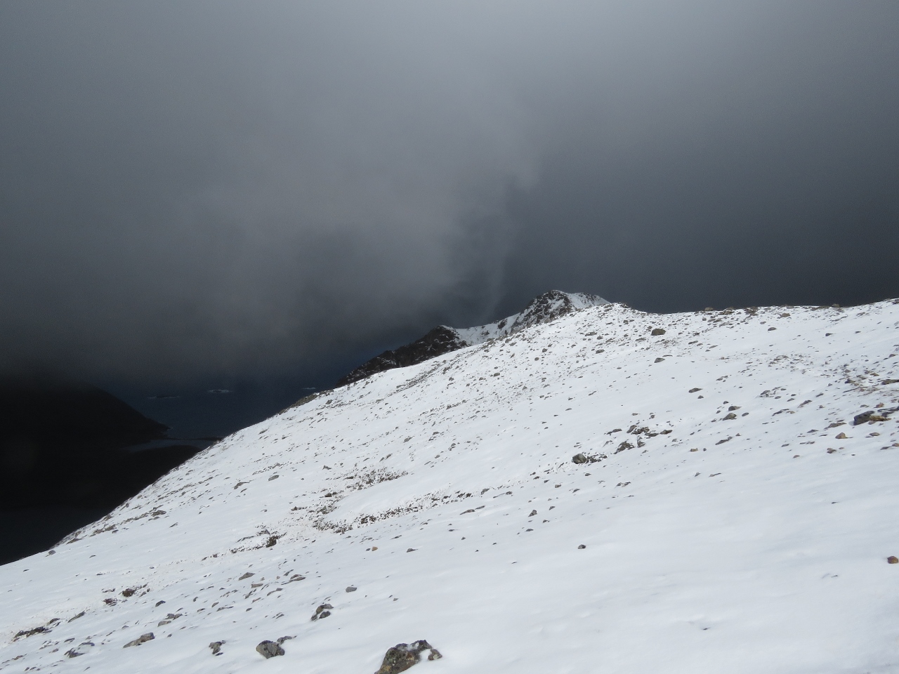
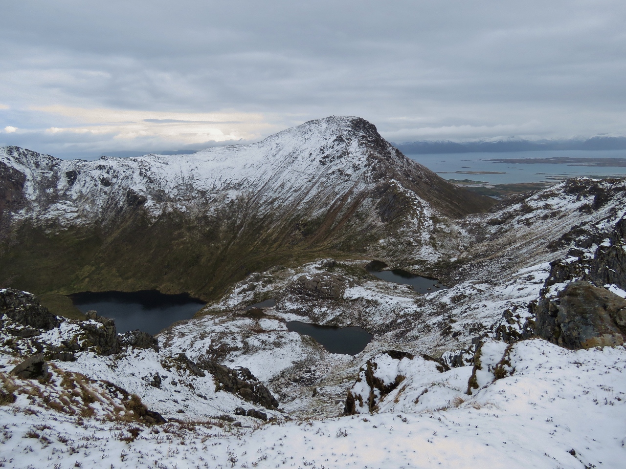
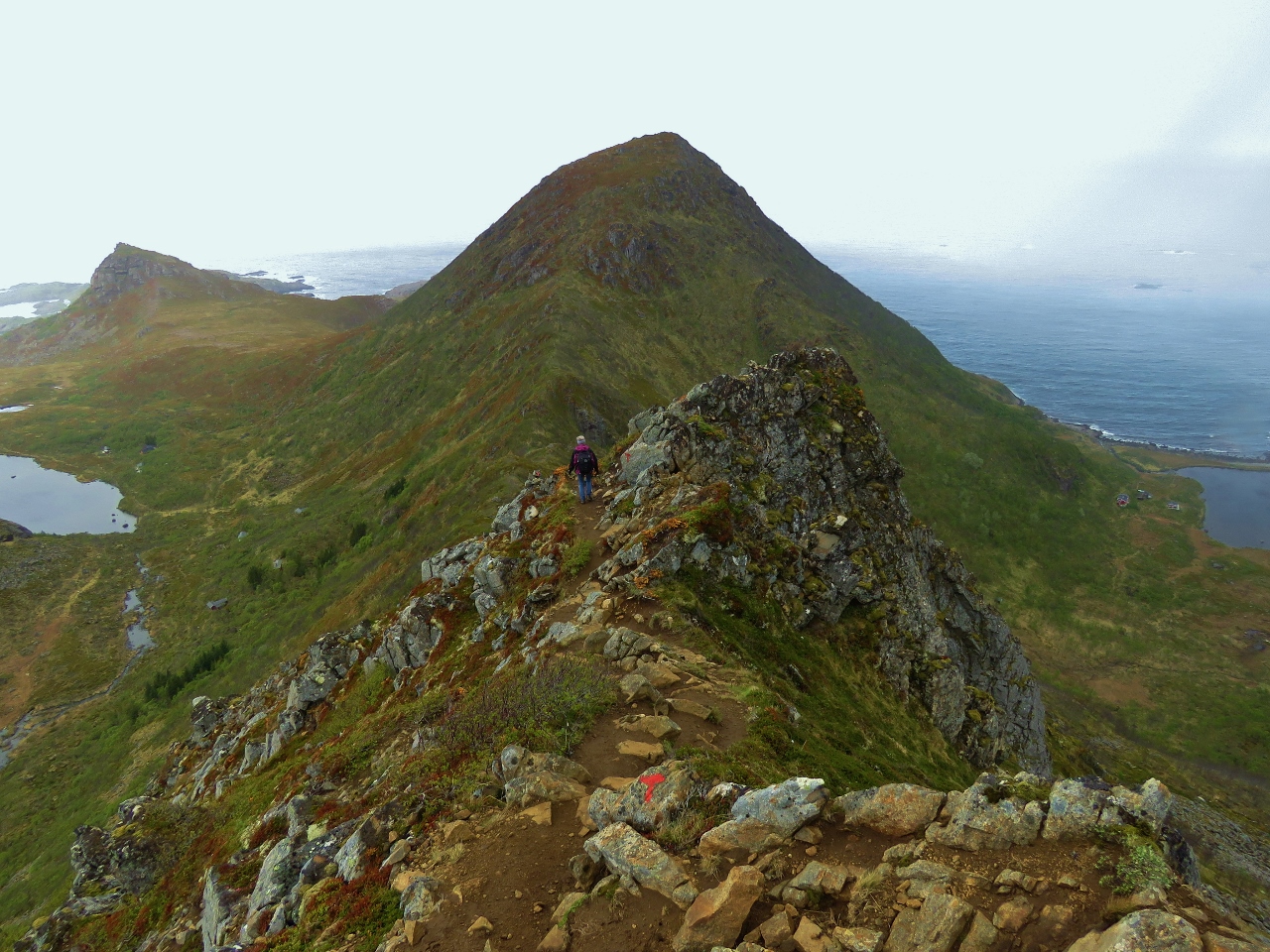
6/7/2018: Finngamheia
Position: 68°59.09'N, 15°4.09'E
At the summit of 1,469ft (448m) Finngamheia, the highest point on the route, with the trail across the face of Sørkulen visible beyond James. We've hiked all over the world and this was definitely the most spectacular trail we've ever hiked. And amongst the most strenuous as well.
|
 |
6/7/2018: Closer to Nyksund
Position: 68°59.09'N, 15°4.08'E
We're getting closer to our goal of lunch in Nyksund, but we have a lot of "down" left in front of us.
|
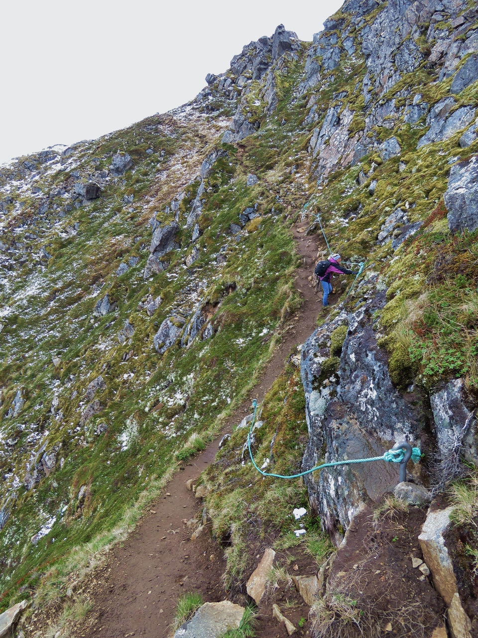 |
6/7/2018: Climbing Ropes
Position: 68°59.45'N, 15°3.58'E
The track down the north side of Finngamheia is steep. Here climbing ropes are in place not so much because of the difficulty of the trail, but because of the drop-off to the left. It's a really long way straight down.
|
 |
6/7/2018: Ridge Down
Position: 68°59.47'N, 15°3.49'E
The trail down follows a razorback ridge and then switchbacks down a face just in front of Jennifer. The scenery remains astonishing as we descend toward Nyksund.
|
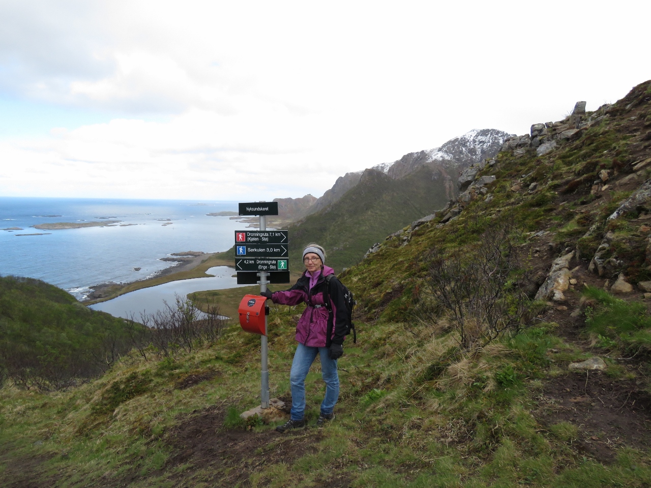 |
6/7/2018: Intersection
Position: 68°59.59'N, 15°3.10'E
At the intersection of the high mountain route we just took from Stø and the low, mostly coastal route. We'll continue on to Nyksund, then return back to take the coastal route home.
|
 |
6/7/2018: Nyksundvatnet Lakes
Position: 68°59.68'N, 15°2.41'E
The Første Nyksundvatnet and Andre Nyksundvatnet lakes that provide freshwater to Nyksund.
|
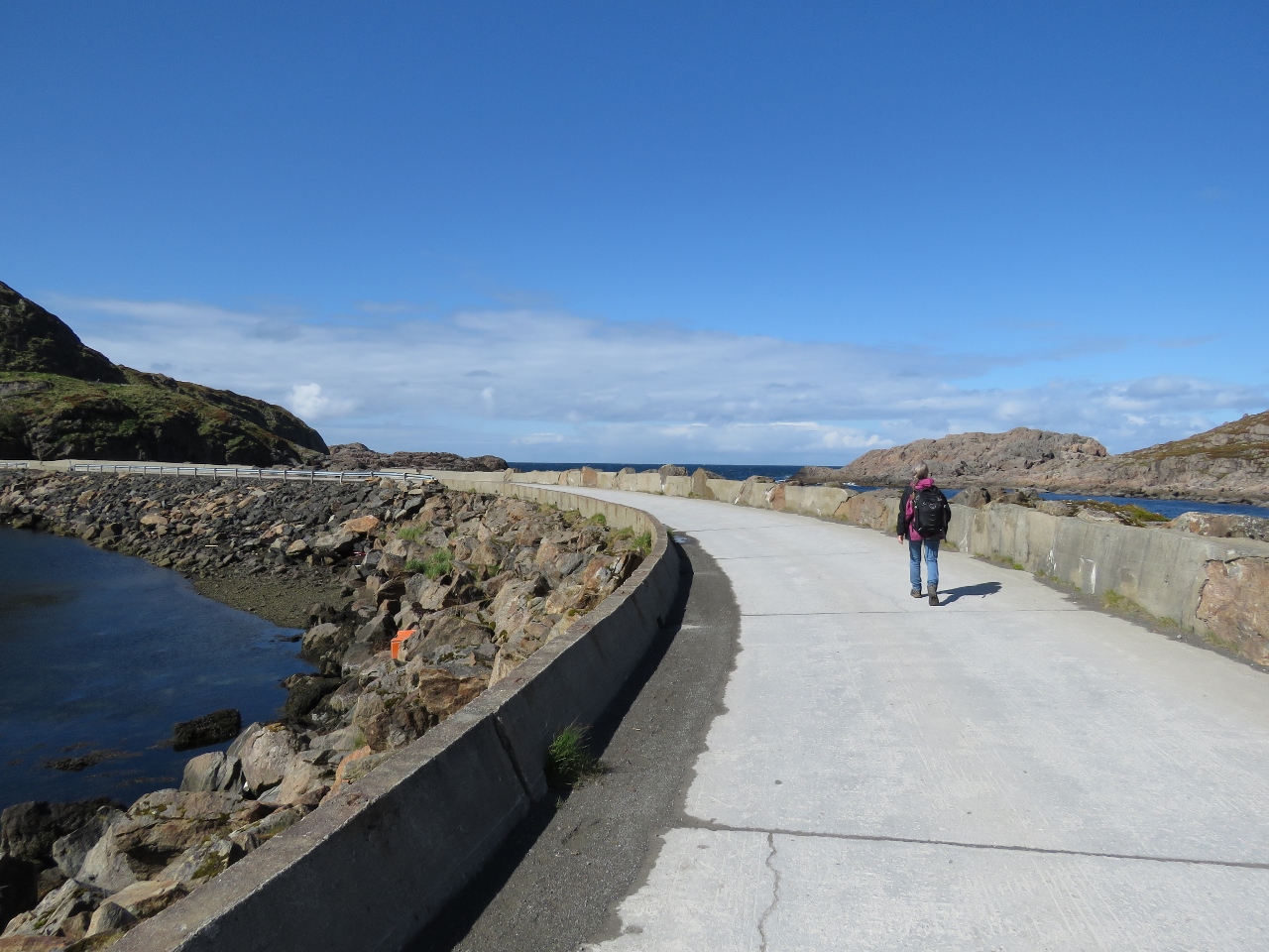 |
6/7/2018: Road
Position: 68°59.82'N, 15°1.21'E
Nyksund is a sheltered harbour created with breakwaters between the islands of Nyksundsøya and Ungsmaløya for protection from the south and between Nyksundsøya and Langøya for protection from the north. Here Jennifer is walking the road along the breakwater from Langøya to Nyksundsøya.
|
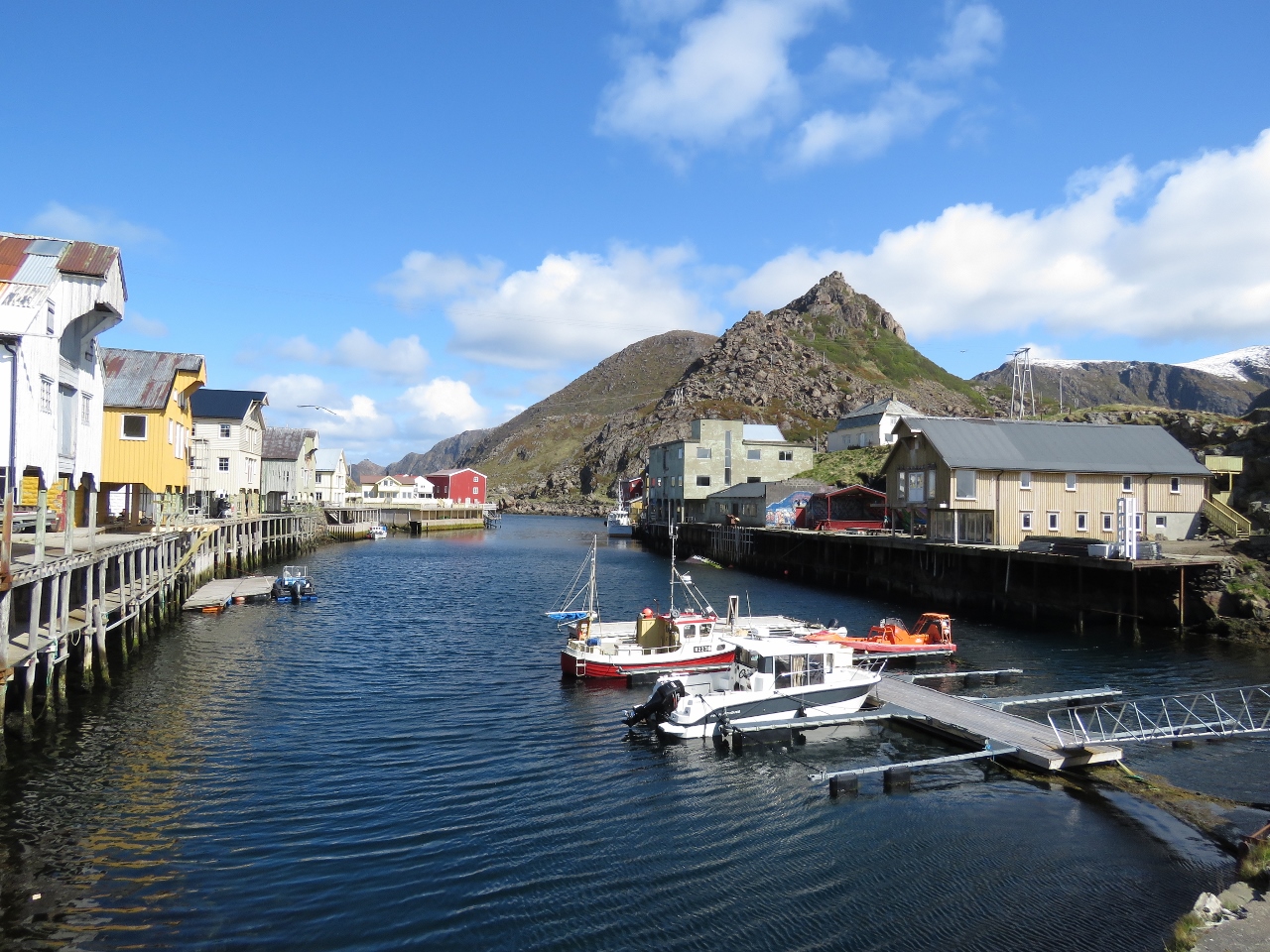 |
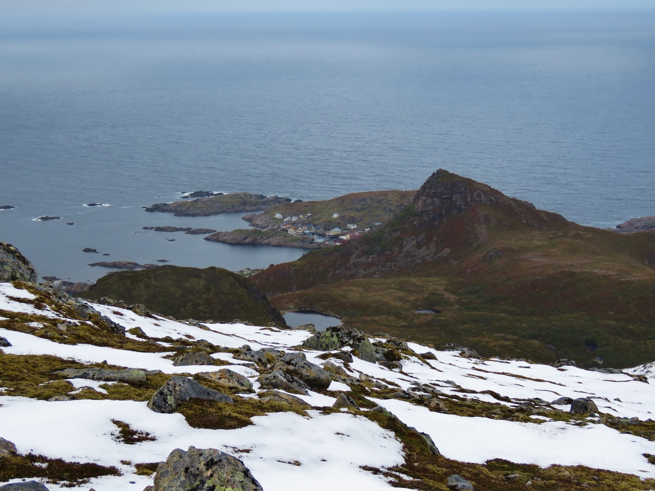
6/7/2018: Nyksund
Position: 68°59.67'N, 15°0.66'E
The fishing village at Nyksund was already in decline in 1975 when a storm inflicted major damage and the last inhabitant left. Starting at the turn of the millennium, the abandoned town was reborn as an artist's colony and the crumbling buildings and structures are slowly being restored. It's a lovely town, perched on the edge of the wild Norwegian Sea. This is looking northeast across the protected harbour from the road across the breakwater from Nyksundsøya to Ungsmaløya.
|
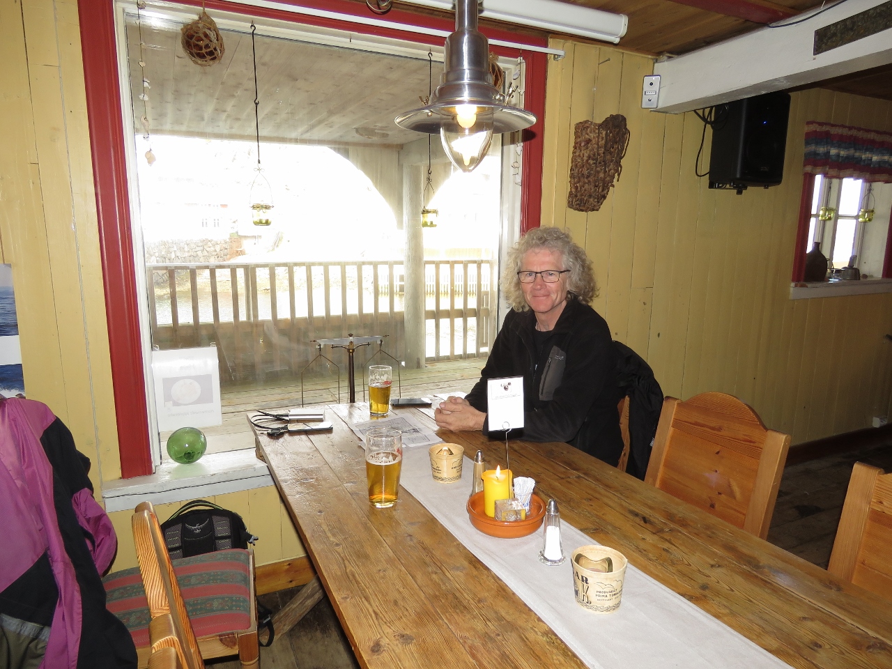 |
6/7/2018: Holmvik Brygge
Position: 68°59.71'N, 15°0.81'E
After that hike, a cold beer never tasted so good. We had an excellent lunch at Holmvik Brygge.
|
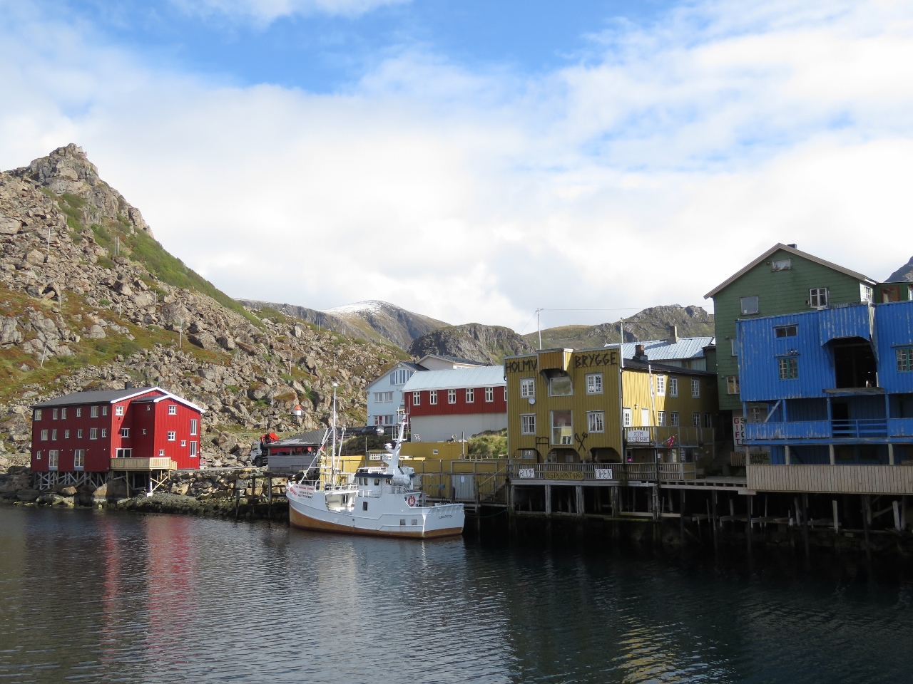 |
6/7/2018: Ungsmoløya
Position: 68°59.75'N, 15°0.79'E
Looking across to the island of Ungsmoløya from Nyksundsøya. The yellow building is Holmvik Brygge, where we had lunch. It also is a guest house and offers guided trips in the area.
|
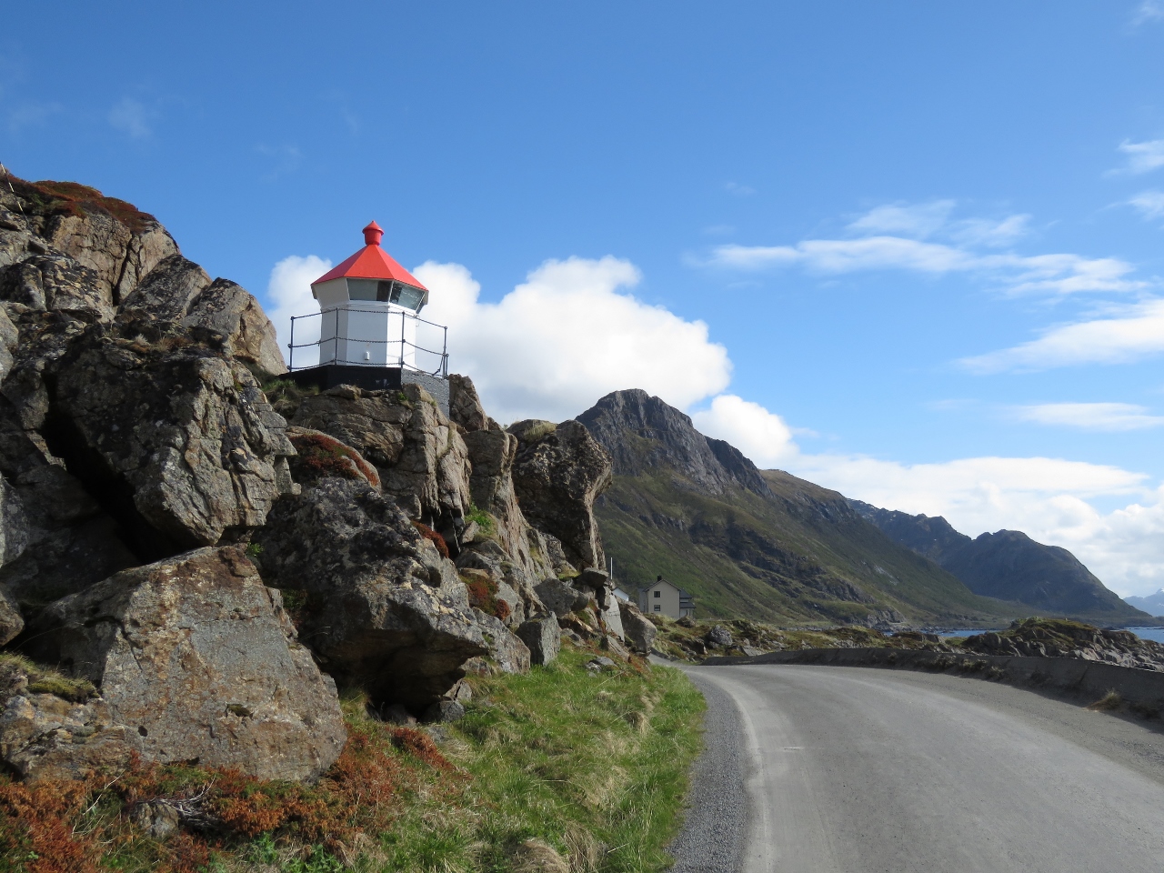 |
6/7/2018: Lighthouse
Position: 68°59.66'N, 15°1.10'E
Walking under the Nyksund lighthouse as we return back to the trail.
|
 |
6/7/2018: Coastal Route
Position: 68°59.59'N, 15°3.10'E
Back as the intersection with the high route. We'll be taking the trail down to the lagoons at sea level and back along the coast to return. The radar station above Stø is just barely visible in the distance.
|
 |
6/7/2018: Chained Down
Position: 68°59.87'N, 15°3.34'E
This cabin near the lagoons is actually chained down (you can see heavy chain going from the roof down to the left), indicative of the strong winds the area must get.
|
 |
6/7/2018: Fallen Rock
Position: 68°59.89'N, 15°3.36'E
A second cabin built next to a fallen rock almost as big as the cabin itself. If a rock that big fell once ...
|
 |
6/7/2018: Snow Melted
Position: 68°59.99'N, 15°3.53'E
Looking back up to the trail we took along the flank of Sørkulen. When we crossed earlier today the slope was covered with snow, but a few hours later it's mostly gone.
|
 |
6/7/2018: Trail Shelter
Position: 69°0.53'N, 15°5.36'E
National Trekking Association hut along the trail. It looked heavily used.
|
 |
6/7/2018: Beach
Position: 69°0.71'N, 15°5.71'E
Looking across a nice sand beach near Stø. The radar station above town is visible at top right. We're almost back.
|
 |
6/7/2018: Cairn
Position: 69°1.05'N, 15°6.22'E
Cairn at the coastal route trailhead, with a view to Dirona moored at Stø.
|
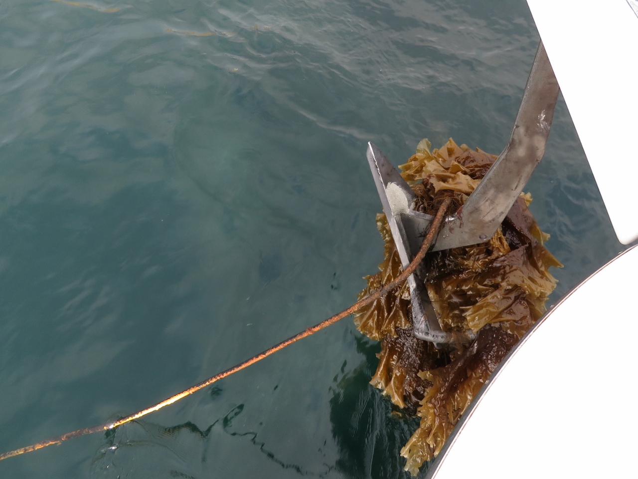 |
6/8/2018: Anchor Fouled
Position: 69°1.26'N, 15°7.00'E
The anchor came up with a heavy rope, possibly the remains of an old mooring. Fortunately it was easy to release with a boat hook. We also carry an Ultra trip hook that is useful for freeing heavier items such as a steel cable that we pulled up while anchored in British Columbia. Another notable case was on our previous boat, where we had to slip an anchor fouled on logging debris. In a more recent situation, we had to dive to free the anchor in the Orkney Islands in northern Scotland. Given how much we've anchored, and all over the world, we've had surprisingly few situations where the anchor has been fouled.
|
 |
6/8/2018: Anda Lighthouse
Position: 69°3.52'N, 15°10.94'E
The Anda Lighthouse, constructed in 1932, was the last lighthouse built in Norway and the last manned station in Norway until it was automated in 1987.
|
 |
6/8/2018: Continental Shelf
Position: 69°19.66'N, 15°43.72'E
The continental shelf runs within five miles of the Norwegian coast off the island of Andøya. We're crossing over it now, and the sea bottom has plummeted from 350 feet to 1034 feet in a short distance and continues down to over 3,000 ft (900 m).
|
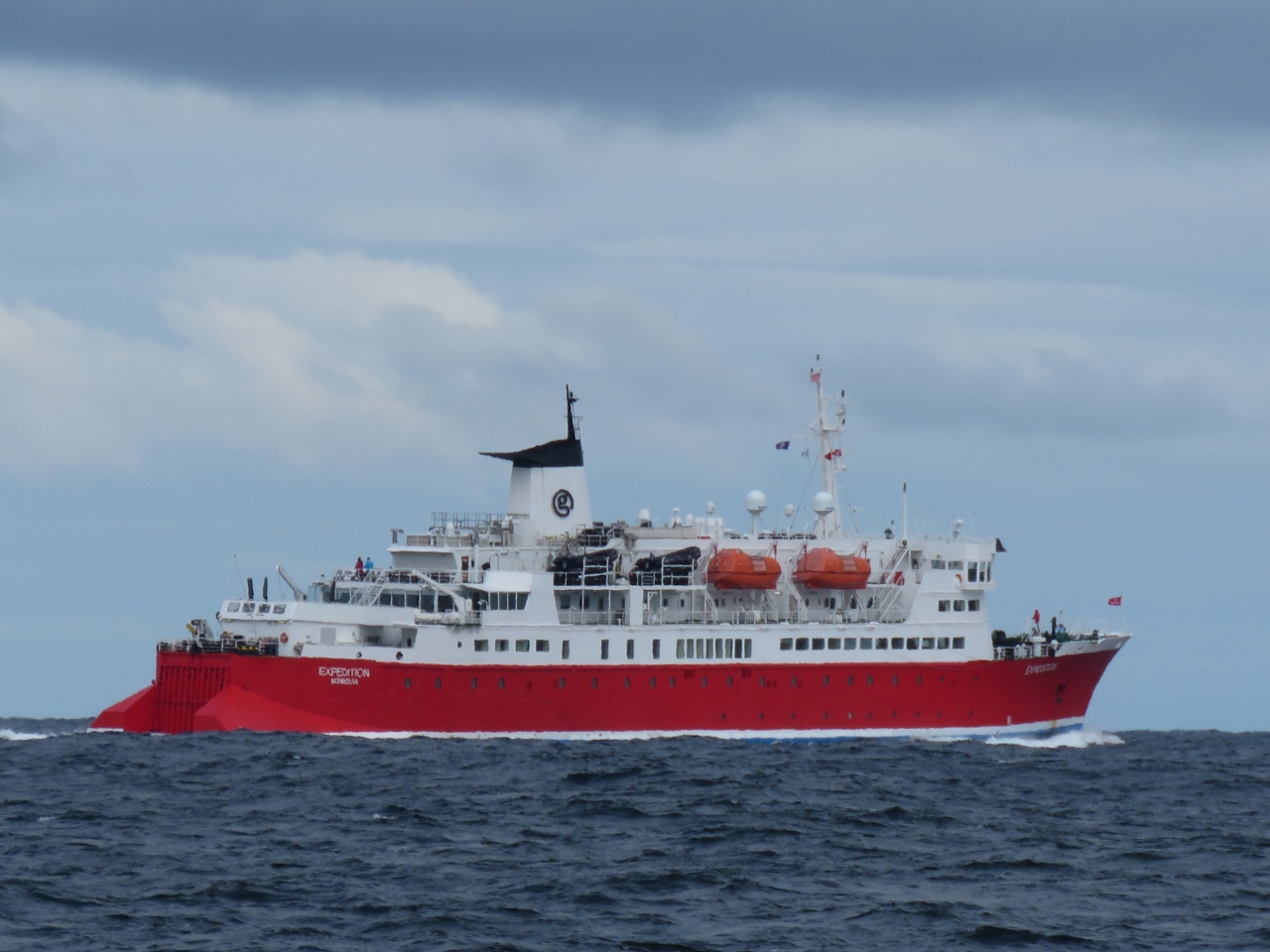 |
6/8/2018: Expedition
Position: 69°23.11'N, 15°45.50'E
The 344-ft (105-m) pocket cruise ship Expedition carries 140 passengers on high-latitude adventures. The fare includes a free bright red expedition parka—everyone on deck seemed to wearing theirs.
|
 |
6/8/2018: Fish Boats
Position: 69°23.81'N, 15°41.95'E
The continental shelf is a favorite place for the commercial fishery since fish tend to feed in this area. Nearly a dozen fishing boats are nearby.
|
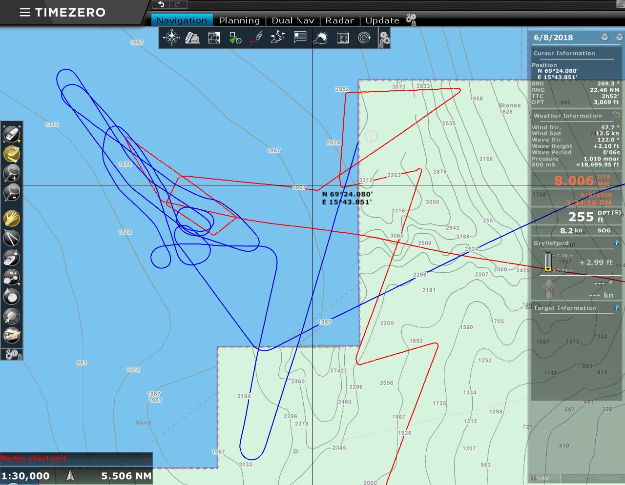 |
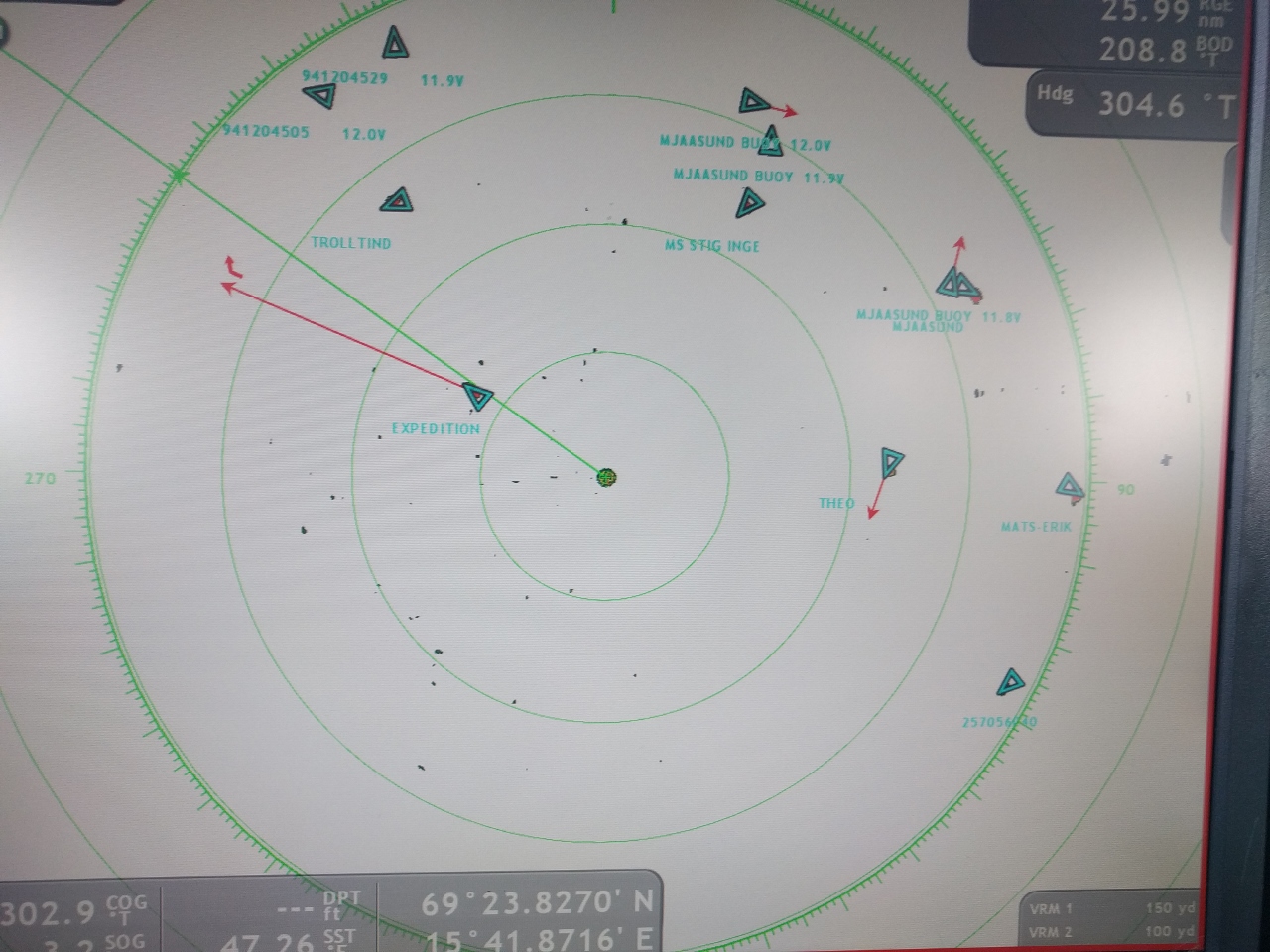
6/8/2018: Whale Hunting
Position: 69°24.02'N, 15°41.15'E
The blue line is Expedition's course and the red line is ours as we weave about the sharp ledge of the continental shelf looking for whales. The deep cold water at the continental shelf attracts squid, that in turn attracts whales, and that in turn attracts tourists. Whale-watching is a big business in the area.
The whales aren't easy to spot though. We did see a few, but they seem to be fairly busy feeding and only came up for a quick breath before returning to work. Perhaps they were diving deep for food but, whatever the reason, there was no frolicking at the surface, just a quick blow with the whale barely visible and then back under with no tails to be seen. Since there wasn't all that much to see, we didn't end up with any interesting pictures from this expedition. |
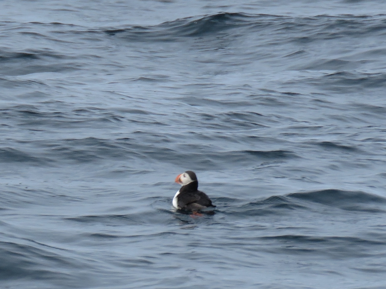 |
6/8/2018: Puffin
Position: 69°23.17'N, 16°0.61'E
We didn't get a good photo of a whale, but we got a nice shot of a puffin, one of our favourite birds.
|
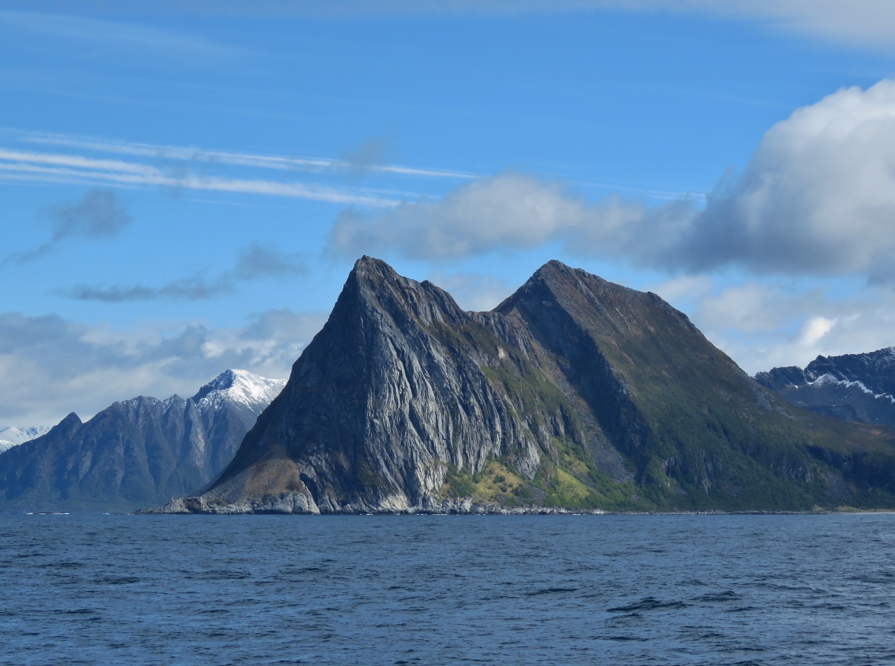 |
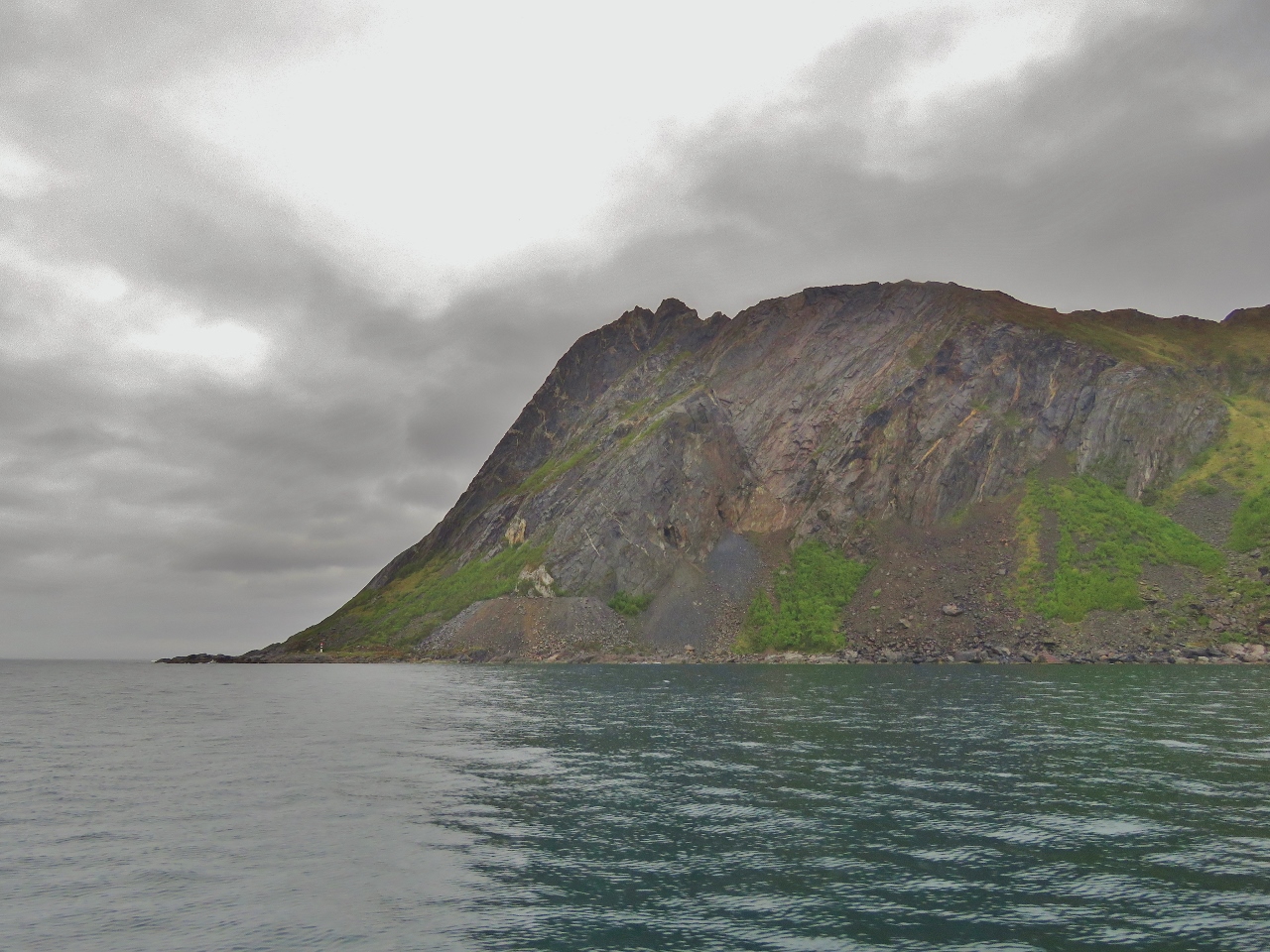
6/8/2018: Ytre Teisten
Position: 69°24.41'N, 16°49.38'E
1,470 ft (448m) Ytre Teisten forms a dramatic headland on the island of Senja.
|
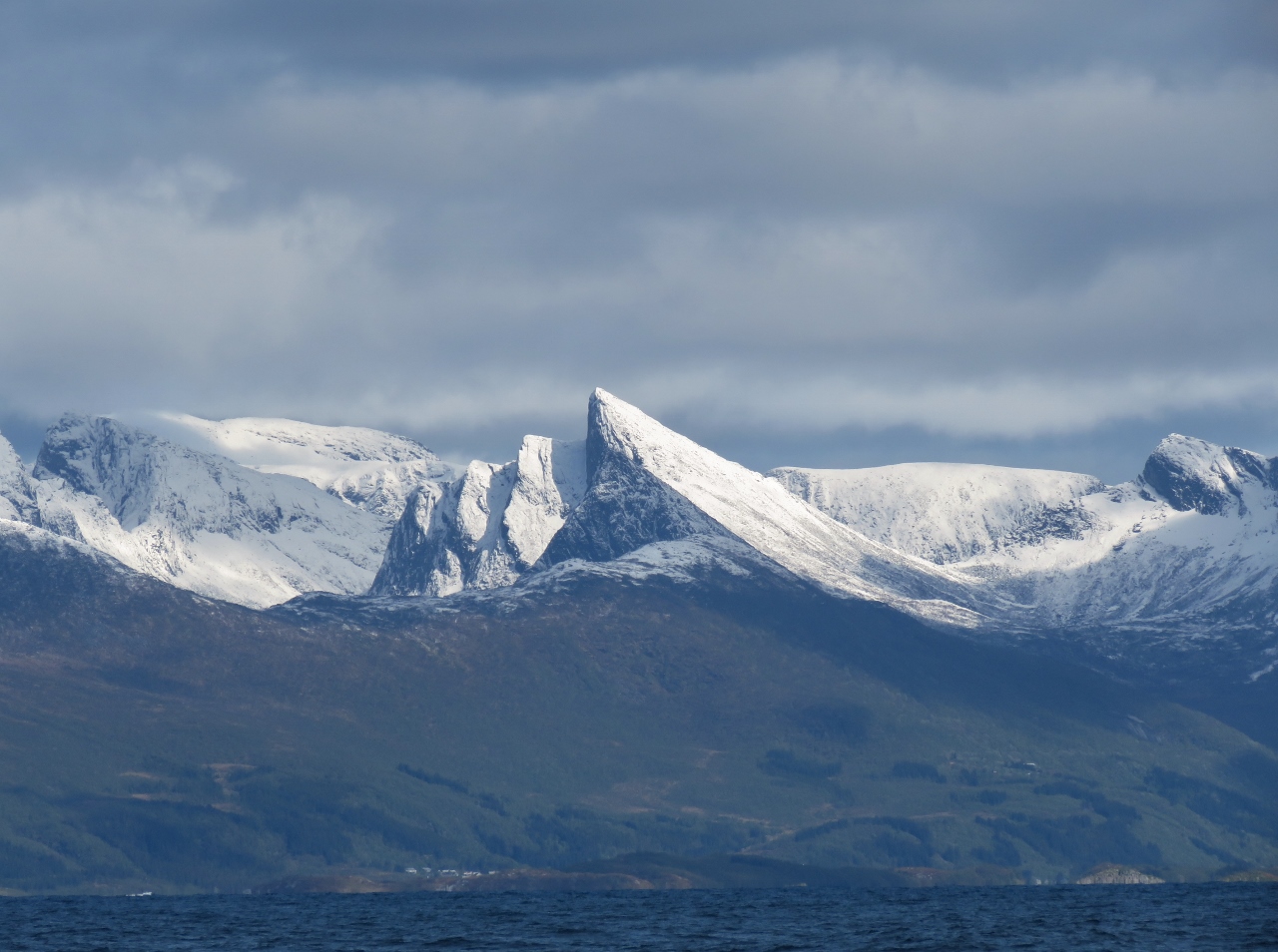 |
6/8/2018: Mountains
Position: 69°24.47'N, 16°52.82'E
Striking snow-covered mountains on the north side of Bergsfjorden.
|
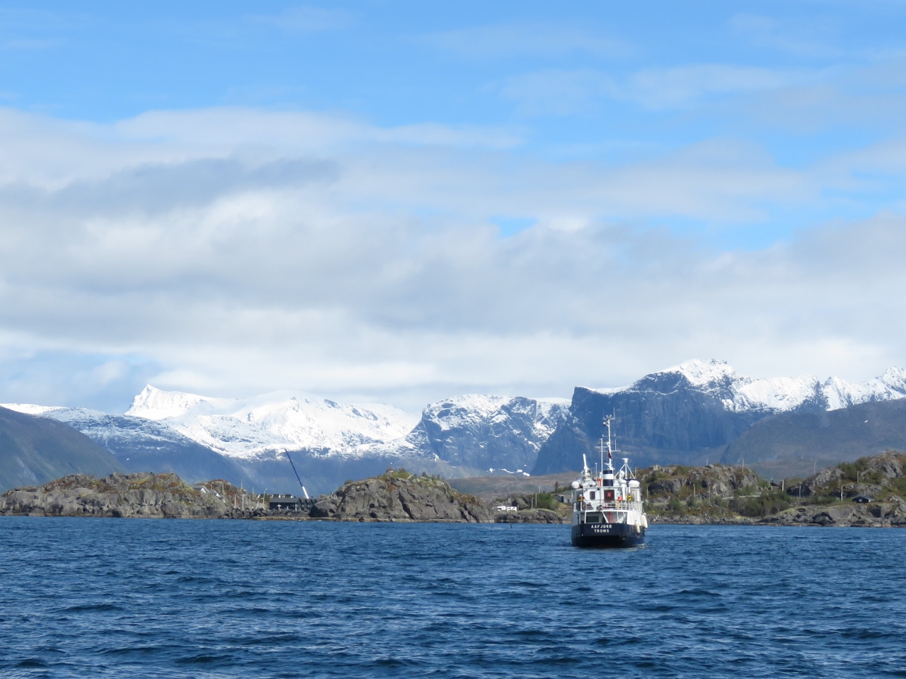 |
6/8/2018: Aafjord
Position: 69°24.90'N, 17°8.08'E
Following the tour boat Aafjord toward Hamn. We were planning to anchor for the night in the small cove there, but holding was poor over weed, the swing room was restricted and with a resort ringing the shore we felt a bit like we were in someone's backyard. What's not to love?
|
 |
6/8/2018: Laukvika
Position: 69°24.97'N, 17°13.48'E
We continued east from Hamn a short distance to an excellent anchorage at Laukvika. This is our view northeast to the mountains across Bergsfjorden (click image for a larger view).
|
 |
6/9/2018: NMEA Cable
Position: 69°24.96'N, 17°13.57'E
James was looking at the NMEA 2000 network with Maretron N2kAnalyzer and found a failed device showing with no information about what it was. We correctly guessed that one of our first-generation fuel sensors that are no longer in use had failed.
We originally used Maretron TLM200s to measure fuel levels and they worked fairly poorly. We subsequently moved to the combination of Maretron FPM100 and Setra 0-3PSI pressure sensors and got excellent results. That's what we have used for the last 5 years but the old TLM200s were still on the NMEA2000 network. Having been reminded of their presence by one failing, we decided to remove them both from our NMEA200 network. We took them off the network, and removed the tees and drop cables that ran to them. |
 |
6/9/2018: Overcast
Position: 69°24.96'N, 17°13.56'E
We were planning to walk up to the small dam above Hamn, built in 1882 and said to be the world's first hyrdo-electric plant. But rain has been falling all day, so we've not been very motivated to get out there. Good thing we took pictures of the mountain view yesterday as this is all we can see today.
|
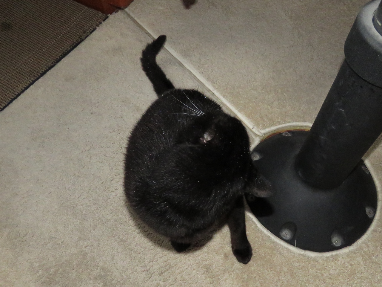 |
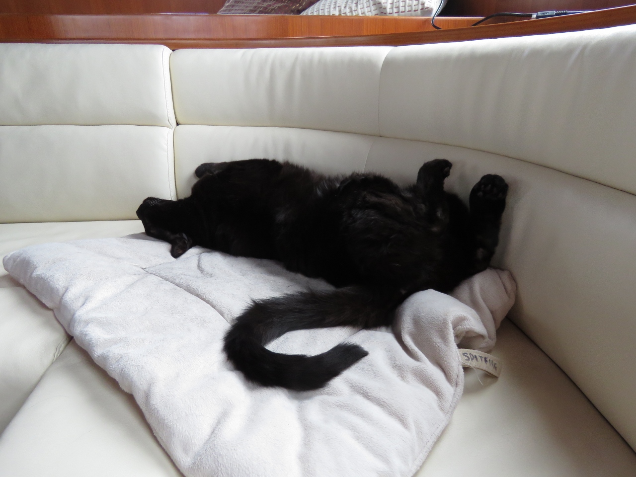
6/9/2018: Spitfire Don't Care
Position: 69°24.97'N, 17°13.53'E
Those white dots all over Spitfire's fur are drops of rain. He's been hunting out on the bow in the pouring rain for ages, doing his best Honey Badger imitation, and is now inside cleaning up.
|
 |
6/10/2018: Trælen
Position: 69°29.57'N, 17°11.51'E
1,712ft (522m) Trælen, one of several dramatic headlands on the west coast of Senja.
|
 |
6/10/2018: Ersfjorden
Position: 69°32.52'N, 17°17.78'E
Looking southeast along the north shore of Ersfjorden.
|
 |
6/10/2018: Calm
Position: 69°33.87'N, 17°21.72'E
We have wonderfully calm conditions on our final open ocean run for a few weeks. The wind is so light it's barely registering and the ocean swell is hardly perceptible.
|
 |
6/10/2018: Kjølva
Position: 69°36.26'N, 17°30.59'E
1,358ft (414m) Kjølva with Øyfjorden extending to the left.
|
 |
6/10/2018: Coastal Cruising
Position: 69°34.78'N, 17°53.93'E
We've rounded the north side of Senja and are now in even calmer water along the east coast. Spitfire is enjoying the relaxed coastal cruising.
|
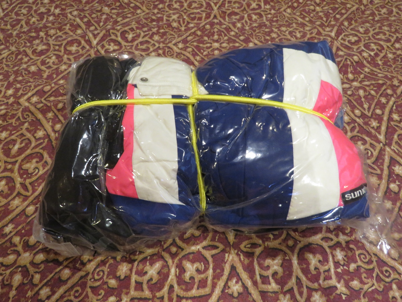 |
6/10/2018: Ski Jackets
Position: 69°33.71'N, 17°58.09'E
We're going to fly to Svalbard in a few days and are digging out our warmest clothes in preparation. Our ski jackets haven't been used since we left Seattle in 2012. We stow them and and other out-of-season clothes in space-saving Space Bags. We put a bungee around them to keep the package small even if air does get in.
|
 |
6/10/2018: 2011 Tickets
Position: 69°32.35'N, 18°3.43'E
We found these tickets from the Seattle Seahawks 2011 season in our ski jacket pockets. This was the last time they were worn.
|
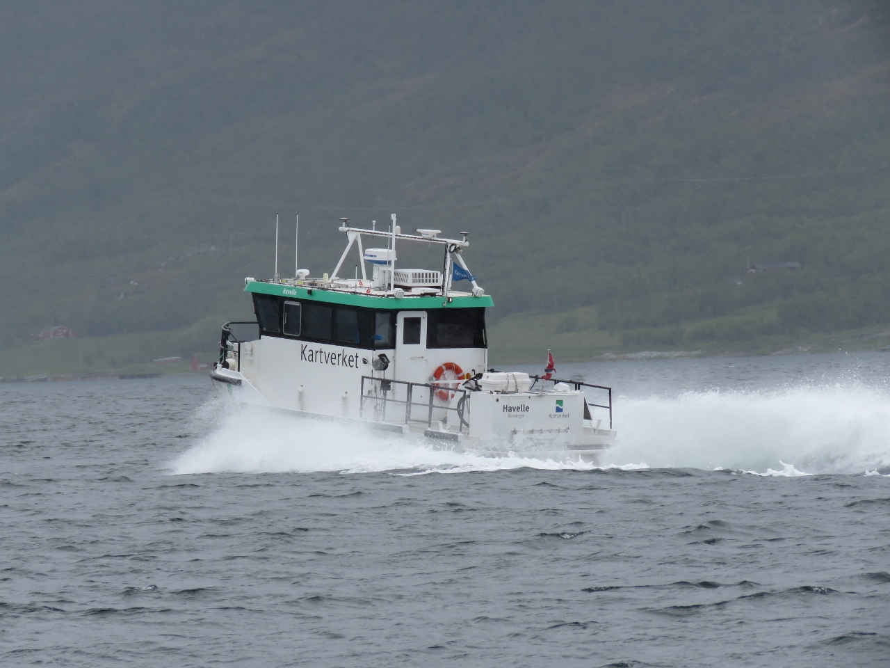 |
6/10/2018: Havelle
Position: 69°32.63'N, 18°36.28'E
Kartverket is Norway's national mapping agency—we've been heavy users of their online hydrographic charts and topographic maps. The chart data they produce is excellent. Havelle is one of Kartverket's coastal survey vessels.
|
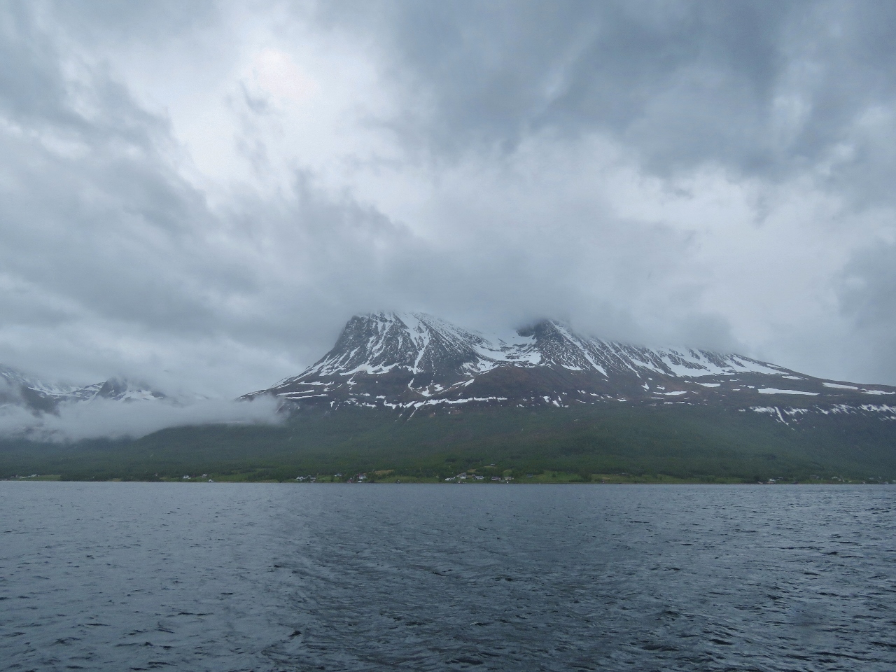 |
6/10/2018: Rystraumen
Position: 69°32.71'N, 18°37.14'E
Mountain view to the south as we pass through Rystraumen.
|
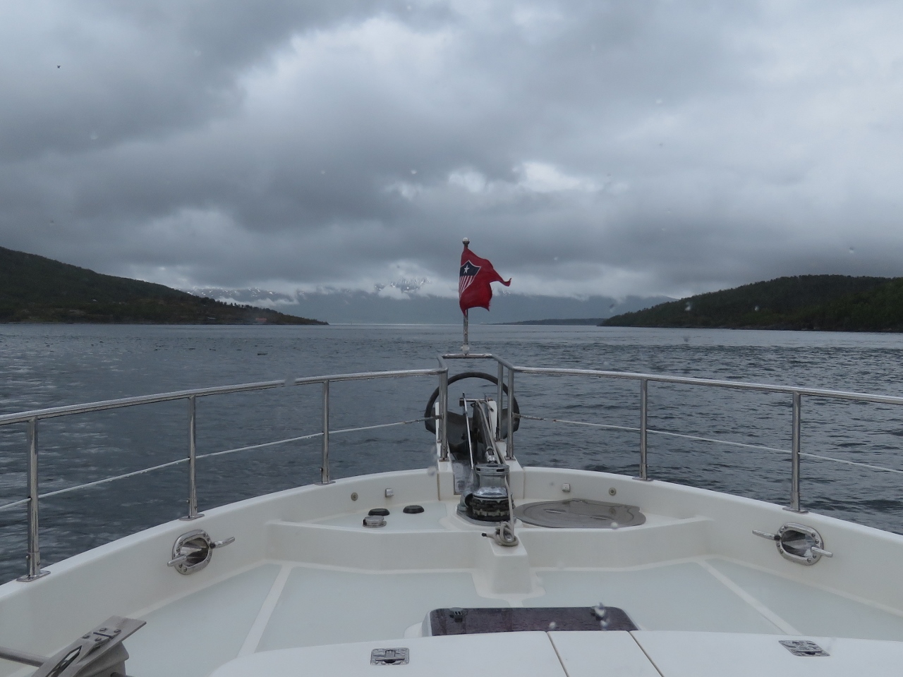 |
6/10/2018: Rystraumen Narrows
Position: 69°33.15'N, 18°41.84'E
Heading through the narrows at Rystraumen. On spring tides currents can reach 7 knots here, with upwelling and whirlpools. We're passing through close to slack, so conditions are calm.
|
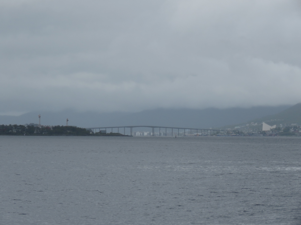 |
6/10/2018: Tromsø
Position: 69°35.98'N, 18°50.98'E
Our first view to Tromsø in the distance, with the Arctic Cathedral the prominent white building on the right. We'll anchor off for the night, then pick up a load of fuel first thing tomorrow morning before proceeding to the guest dock for a few days.
|
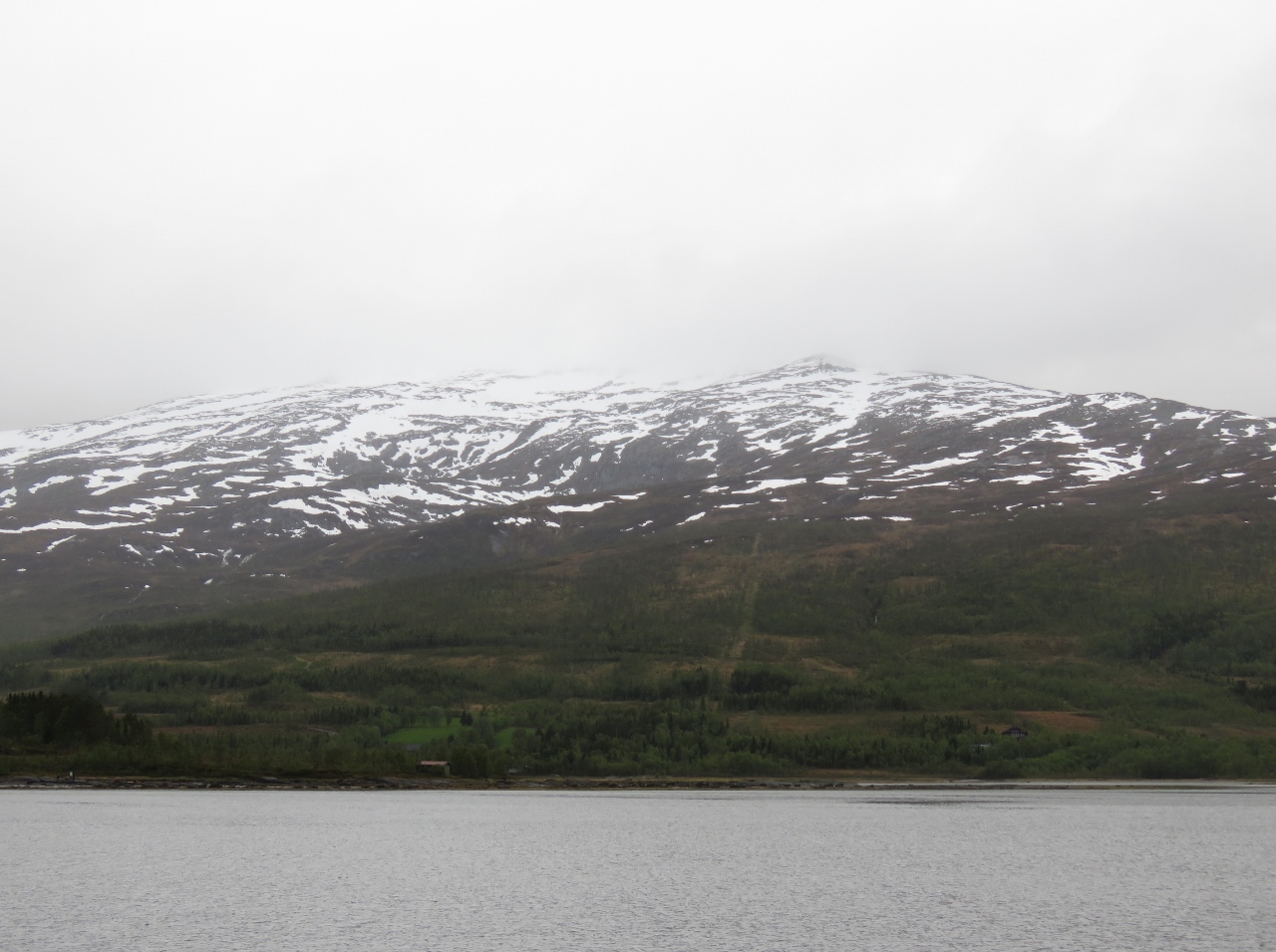 |
6/10/2018: Sørbotn
Position: 69°38.03'N, 18°45.46'E
Mountain view from the anchorage at Sørbotn just south of Tromsø. This was a great stop.
|