MV Dirona travel digest for Vorlandsvågen to Sognefjord, Norway 2018

|
Click the travel log icon on the left to see these locations on a map,
with the complete log of our cruise. On the map page, clicking on a camera or text icon will display a picture and/or log entry for that location, and clicking on the smaller icons along the route will display latitude, longitude and other navigation data for that location. And a live map of our current route and most recent log entries always is available at //mvdirona.com/maps/LocationCurrent.html. |
 |
4/29/2018: Impeller
Position: 59°36.99'N, 5°13.88'E
The hydraulic oil temperature rose to 160°F (71°C) while we were anchoring. The impeller had thrown all twelve fins, but luckily James found them all. It's really important to find every missing impeller blade because if you don't, where they'll end up is blocking the cooling tubes in the heat exchanger. After installing a new impeller, the temperature was back down to 119°F (48°C) under load.
|
 |
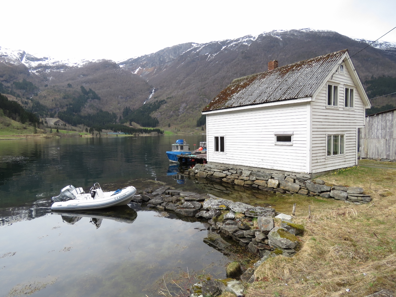
4/29/2018: T/T Dirona
Position: 59°36.99'N, 5°13.92'E
We installed the lettering on our new tender as one of our final rigging tasks. We'd applied the lettering to our previous tender while in Whangarie, New Zealand and bought three extra sets as we expected they would eventually need replacement. But the letters outlasted the tender and we still had all three sets left when we purchased the new tender.
Most countries require even small powerboats to be registered, unless they are a tender to a larger vessel. With the letters showing our RIB was a tender to a larger boat, we'd only been stopped once in our previous tender, at night en route to watch the Moomba Festival fireworks in Melbourne Australia. But with the new unmarked tender, we were stopped within minutes by the Netherlands police asking for our registration. Hard to know for sure, but we suspect identifying the boat clearly as a tender helps avoid these concerns. |
 |
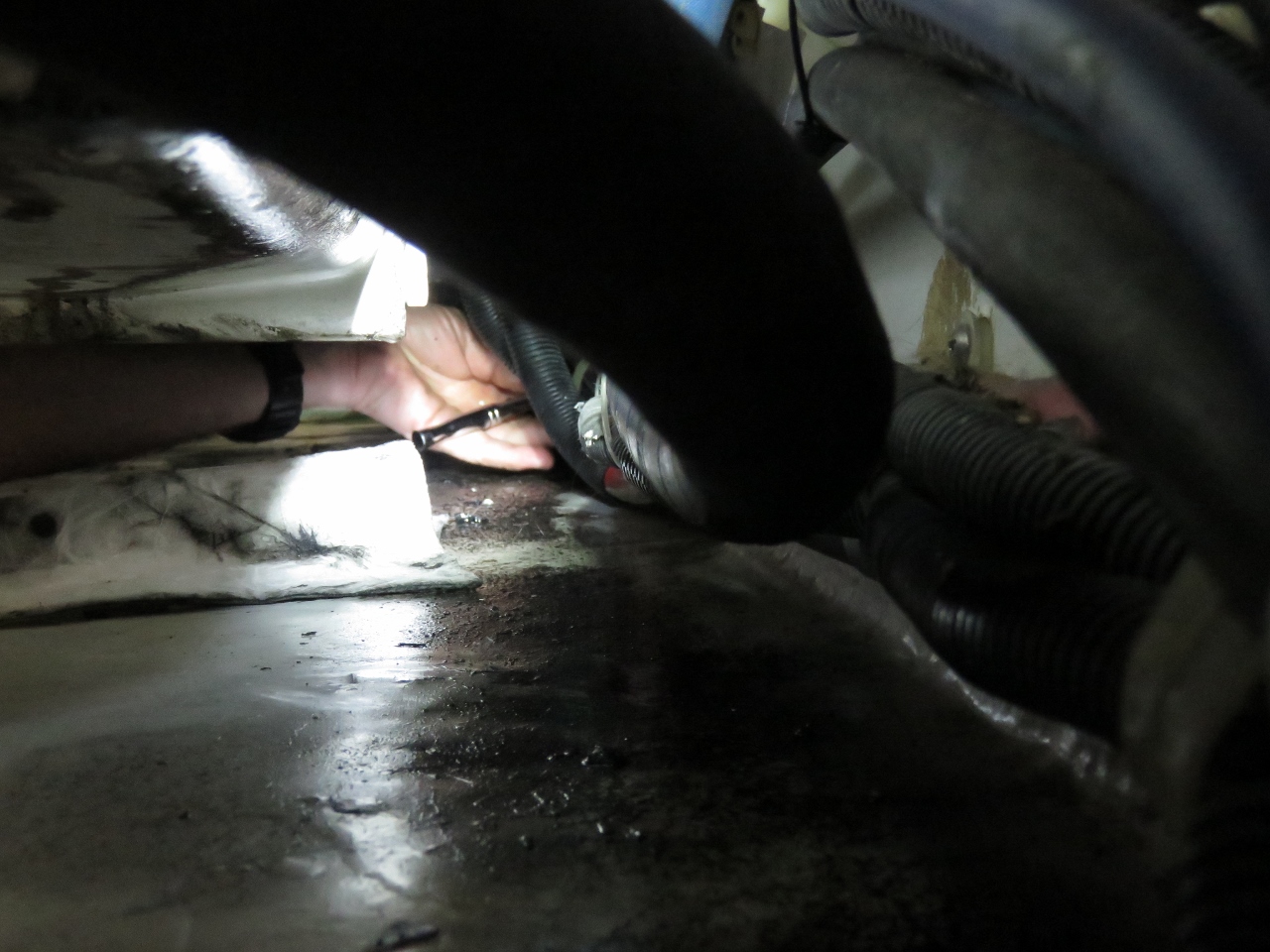
4/29/2018: Failed Guage
Position: 59°36.99'N, 5°13.91'E
Last August, while in Scotland, we replaced all the hydraulic gauges with gauge ports that allow a gauge to be snapped on quickly to check pressures without spilling oil. This removes the gauges from the system and avoids a failure mode where the gauge fails and the hydraulic system leaks its oil out through the damaged gauge. This can make a real mess, and if left, will cause serious damage.
American Bow Thruster (ABT), the manufacturer of the hydraulic and stabilization systems on Dirona, now does all new builds this way and recommends that older builds be upgraded. Today when changing the hydraulic cooling impeller, James noticed that he had missed one of these old gauges. This guage is both leaking and the indicator needle is floating in the bottom. |
 |
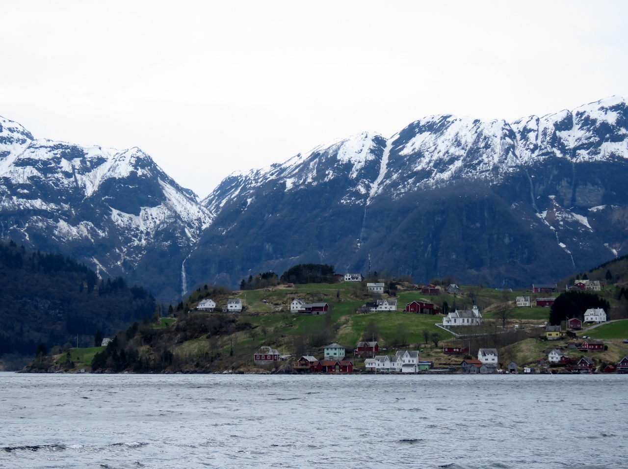
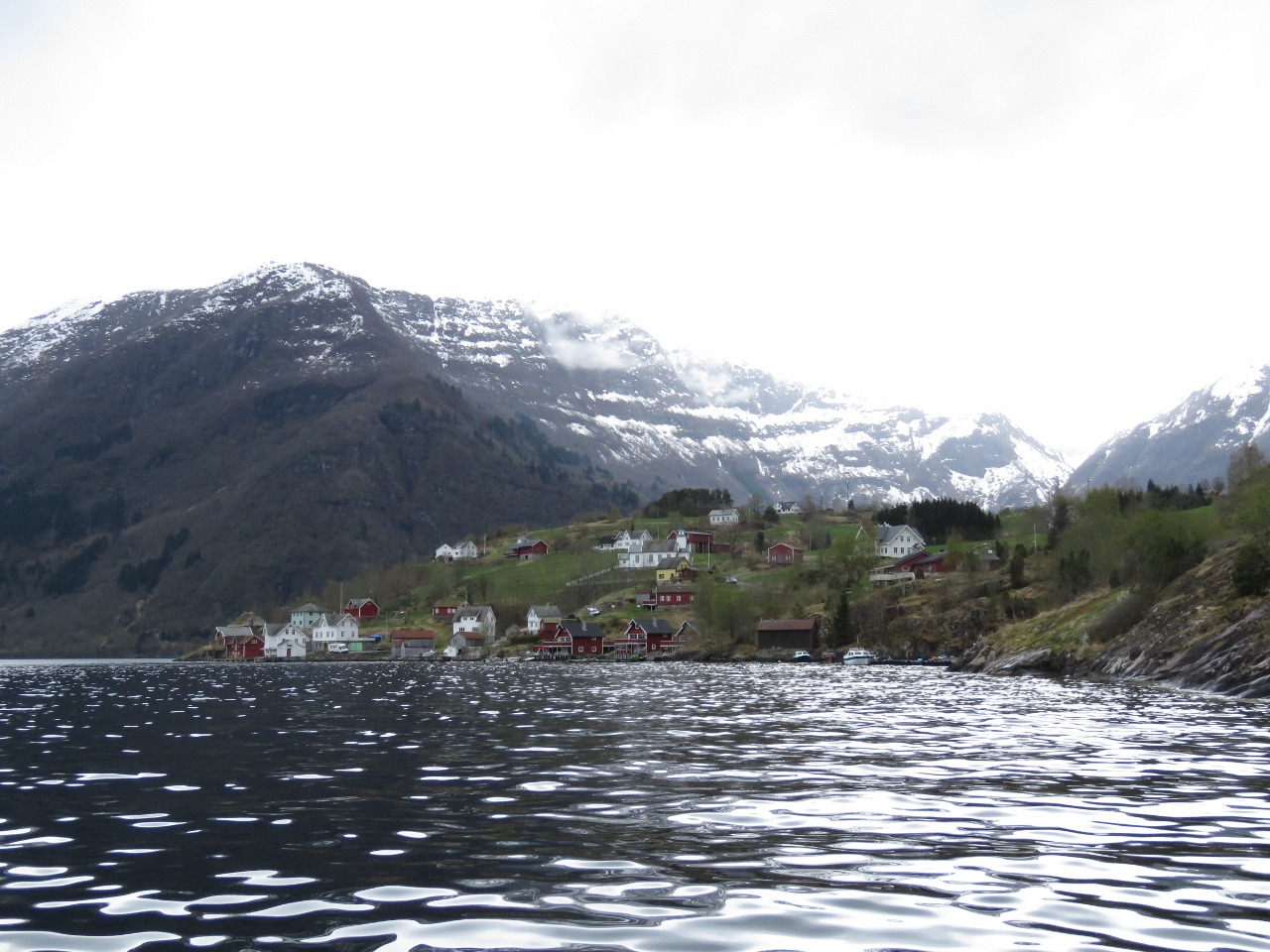
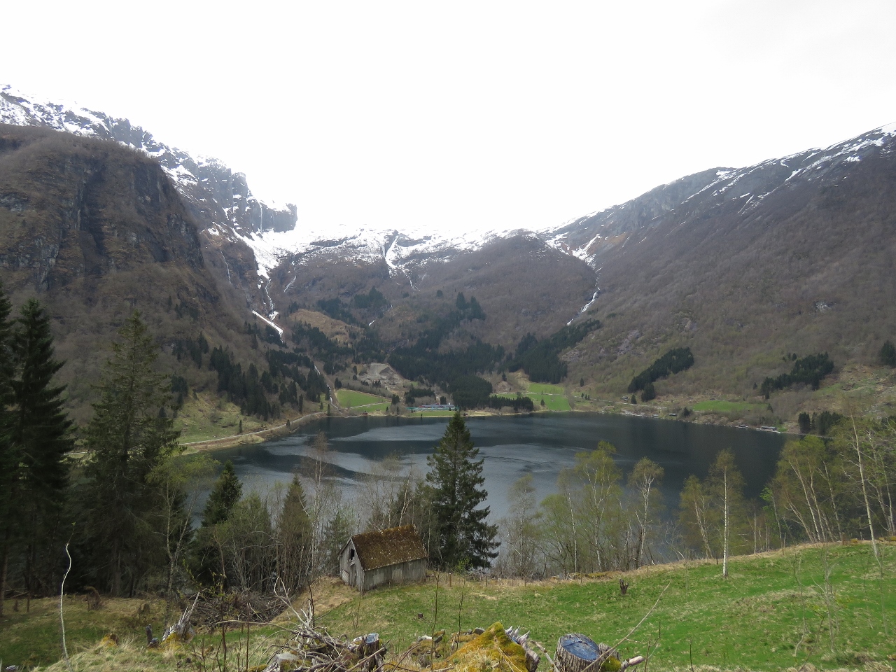
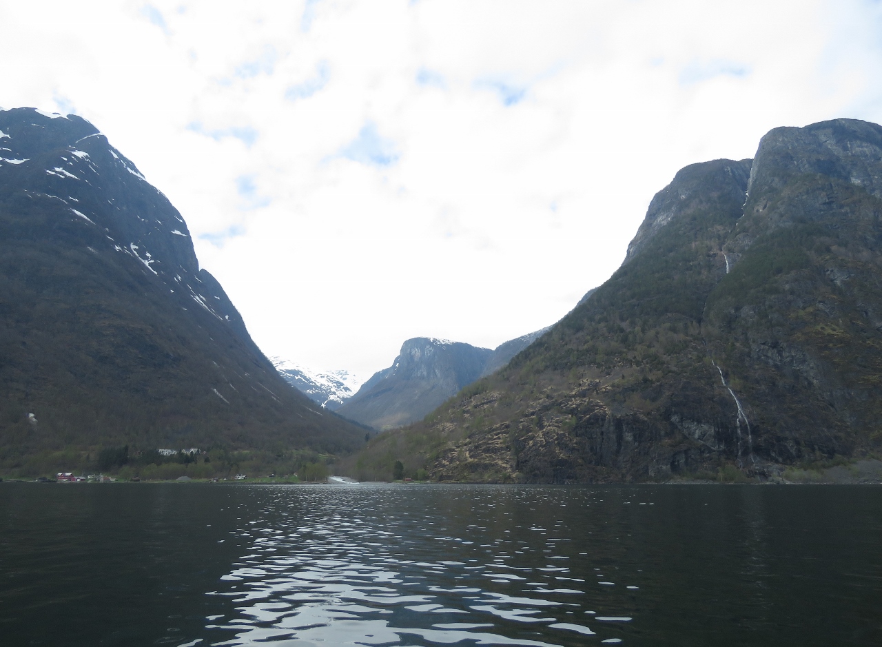
4/29/2018: Vorlandsvågen
Position: 59°37.15'N, 5°13.85'E
Our first Norwegian anchorage at Vorlandsvågen.
|
 |
4/29/2018: Bømlahamn
Position: 59°35.82'N, 5°14.00'E
At the protected bay off Bømlahamn on a tender tour of the area. Norway must go through a lot of red paint—many of the buildings are painted red and most look recently painted.
|
 |
4/29/2018: M. H. Master
Position: 59°36.85'N, 5°14.71'E
The offshore supply vessel M. H. Master and M. H. Merchant at Langavåg.
|
 |
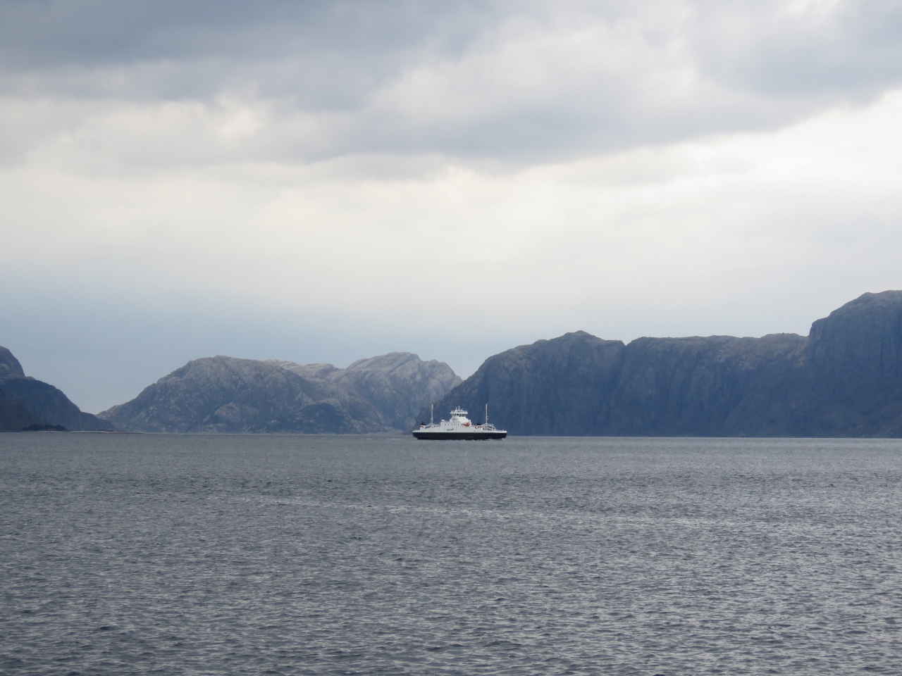
4/29/2018: Ferry
Position: 59°36.62'N, 5°14.40'E
Looking north past the ferry arriving into Langavåg. We're not yet in the most famous visitor attractions in Norway and already the scenery is spectacular.
|
 |
4/29/2018: Tender
Position: 59°36.11'N, 5°12.58'E
Tied off at Langavåg for a walk around.
|
 |
4/29/2018: Krone
Position: 59°36.11'N, 5°12.51'E
We found a cash machine at Langavåg and got some of our first Norwegian Krone.
|
 |
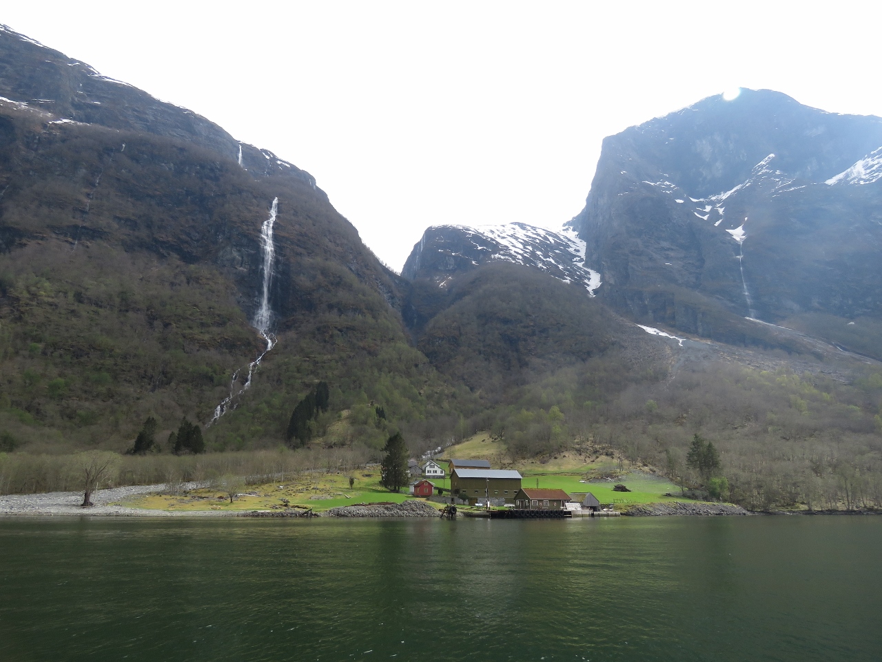
4/29/2018: Mute Swans
Position: 59°36.99'N, 5°13.91'E
After a great meal on deck we were visited by some hungry locals. Here, James is experimenting with how far up out the water they are willing to stretch to get a piece of bread. The Mute Swan, so called because they are less vocal than other swans, can be found year-round in southern Norway.
|
 |
4/30/2018: Moon
Position: 59°36.99'N, 5°13.89'E
The moon over on the south shore of Vorlandsvågen as we raise anchor just past 5am.
|
 |
4/30/2018: Mosterhamn
Position: 59°41.69'N, 5°23.89'E
Looking west to the village of Mosterhamn, or Moster, population 1,354 in 2013. It is one of literally hundreds of villages in Norway, but holds a special place in Norweigan history. In 1024 King Olav held a meeting in the old Moster church that brought Christianity to Norway.
|
 |
4/30/2018: With Junior
Position: 59°43.09'N, 5°23.96'E
The cargo ship With Junior just south of the bridge between Spyssøya and Nautøya islands.
|
 |
4/30/2018: Fish Farm
Position: 59°50.34'N, 5°16.57'E
Norway has a lot of bridges, islands, villages, and also fish farms. And the coastline also is intricate and well-marked. As we work north we'll pass dozens of fish farms and hundreds of navigation markers. Small lighthouses, such as the one in the foreground, are installed throughout the coast and usually are turned off in the summer when it is never dark.
|
 |
4/30/2018: Siem Emerald
Position: 59°51.65'N, 5°14.80'E
The 298-ft (91 m) offshore supply vessel Siem Emerald, launched in 2009. Norway must set a high standard for ship maintenance—all the ships we've seen look brand-new.
|
 |
4/30/2018: Bekkjarvik
Position: 60°0.23'N, 5°13.03'E
The village of Bekkjarvik on the east coast of the island of Selbørn. The village once was a trading post, and the inn there has been in operation since the late 17th century.
|
 |
4/30/2018: Trondheim
Position: 60°6.60'N, 5°11.01'E
Norway also has a lot of ferries. 105 ferry routes operated within the country in 2017—that's four times the number of routes that BC Ferries operates in British Columbia Canada. Here the ferry Trondheim is arriving into Hufthamar from Krokeide with more of that fabulous Norwegian scenery in the background.
|
 |
4/30/2018: Entry
Position: 60°8.31'N, 5°10.48'E
Coming into the anchorage at Fargosen between the islands of Skarøya (left) and Krossøya.
|
 |
4/30/2018: Fargosen
Position: 60°8.83'N, 5°10.27'E
At anchor in Fargosen with a view northeast to snow-capped peaks.
|
 |
4/30/2018: Fish Boats
Position: 60°6.98'N, 5°10.01'E
A fleet of fishboats moored in Tornager just south of our anchorage at Fargosen.
|
 |
4/30/2018: More Lights than Boat
Position: 60°6.88'N, 5°9.73'E
We've seen 100-ft trawlers with less lots on them than this boat in Tornager.
|
 |
4/30/2018: Trondheim Arriving
Position: 60°7.30'N, 5°11.57'E
We could see the Trondheim arriving back at Hufthamar with bow lifted and went over to have a look.
|
 |
4/30/2018: Trondheim Loading
Position: 60°7.35'N, 5°12.01'E
Cars loading onto the Trondheim through the "gate" of the raised bow. Norwegian ferry operations are incredibly efficient where the unload/load time is amazingly short.
|
 |
4/30/2018: Tjelden
Position: 60°7.35'N, 5°12.00'E
The Trondheim wasn't the only ferry docking at Hufthamar—the high-speed ferry Tjelden also was there. Pwowered by twin 687HP Volva Penta D13B-L MP engines, the Tjelden has an operating speed of 25 knots.
|
 |
4/30/2018: Ambulanse
Position: 60°5.97'N, 5°12.04'E
High-speed water ambulance tucked into a cove on the island of Storholmen.
|
 |
4/30/2018: Garbage Disposal
Position: 60°8.84'N, 5°10.35'E
Our garbage disposal popped a breaker and wouldn't budge. We expected the motor was seized and the unit would need replacing, but found a small piece of metal wedged in the teeth. It looks like a short segment of solid-core alumnium home wiring, but the wierd thing is there's no solid core aluminum used aboard Dirona. We eventually conluded it was the metal piece that seals the end of a sausage. Once removed, the unit was fine. It isn't a critical appliance, but we do use it heavily and would miss having it.
|
 |
4/30/2018: Expiry Date
Position: 60°8.83'N, 5°10.34'E
We could almost believe our impellers had an expiration date: the day after we replaced the hydraulics impeller, the gen impeller needed replacing as well.
|
 |
4/30/2018: Boat Wash
Position: 60°8.83'N, 5°10.32'E
Here James is doing a final rinse of the swimstep with our power washer. Dirona was coated in salt from the rough conditions on the second night of our run to Norway. We spent an hour today to clean it off—much better.
|
 |
5/1/2018: Liafjord
Position: 60°17.94'N, 5°8.37'E
The Norwegian trawler Liafjord that we saw early on the first morning of our arrival into Norway.
|
 |
5/1/2018: Endre Dyroy
Position: 60°21.60'N, 5°10.09'E
The 209-ft (64m) trawler Endre Dyroy, launched in 2001, berthed just south of its home port of Bergen.
|
 |
5/1/2018: Black Watch
Position: 60°23.48'N, 5°12.47'E
The 583 ft (177 m) Black Watch, of Norwegian-based Fred Olsen Cruise Lines, passing under a bridge at Bergen.
|
 |
5/1/2018: Ocean Response
Position: 60°24.08'N, 5°14.88'E
The 222-ft (67m) Ocean Response, designed by Wärtsilä Ship Design and launched in 2013. It was built as a multi-purpose standby vessel and owner Atlantic Offshore plans to convert it to a dedicated oil recovery and oil spill response vessel.
|
 |
5/1/2018: Bergen
Position: 60°24.14'N, 5°15.07'E
Looking east to Bergen strung below steep mountains. We're focused on getting north during the first part of our trip through Norway, but plan to stop and visit the city on our way back south.
|
 |
5/1/2018: Offshore Supply Ships
Position: 60°24.22'N, 5°15.21'E
Several offshore supply ships moored at Bergen.
|
 |
5/1/2018: Alversund
Position: 60°34.26'N, 5°13.75'E
The waterway becomes narrow and intimate off the village of Alversund north of Bergen.
|
 |
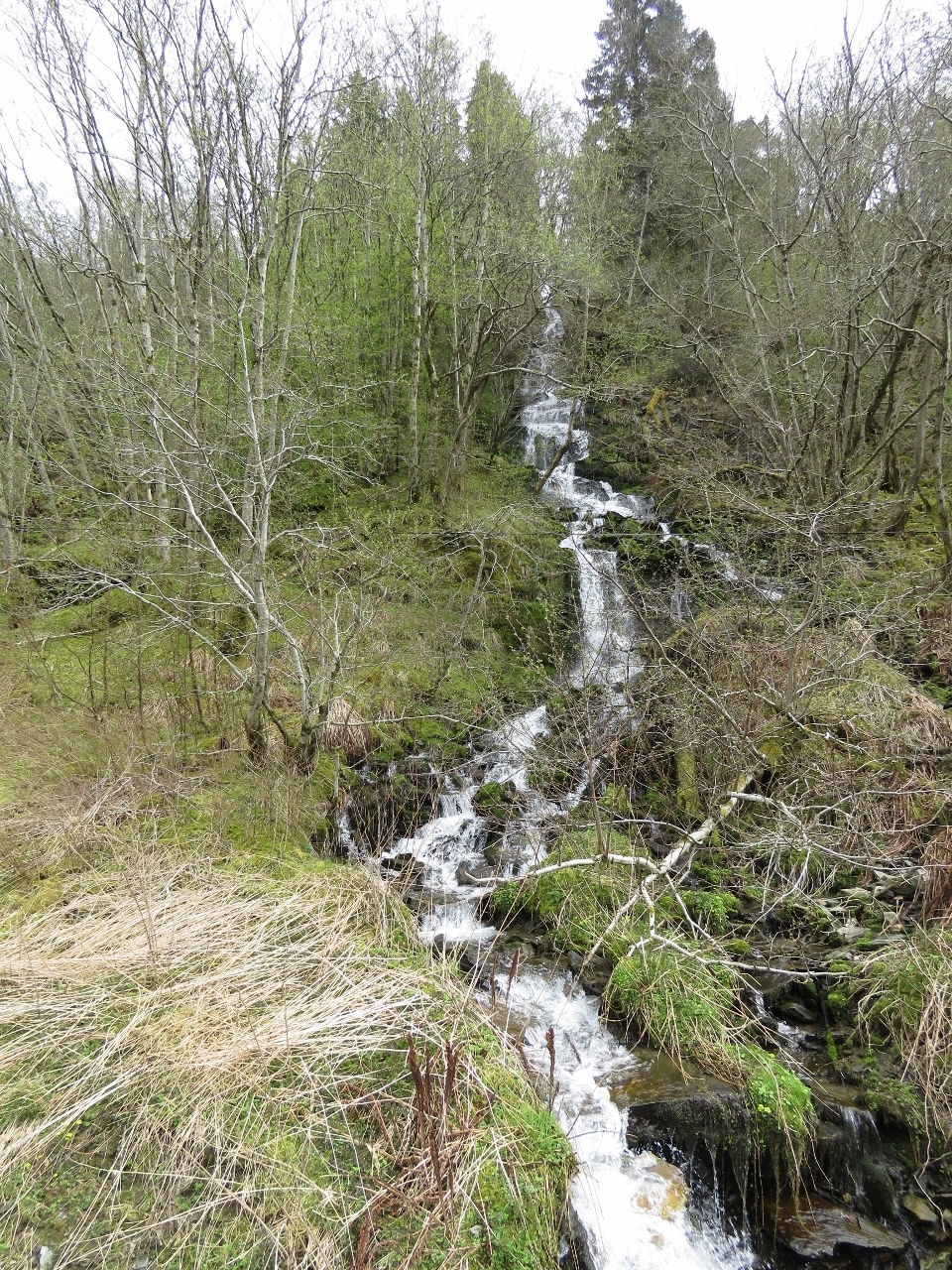
5/1/2018: Waterfall
Position: 60°35.83'N, 5°12.72'E
Small waterfall next to an old building north of the village of Alversund.
|
 |
5/1/2018: Street Lamp
Position: 60°45.85'N, 5°1.82'E
We've seen street lamps such as this one lighting the waterway as we've proceeded along the Norwegian coast. It seemed a little odd at first, but the Norwegian navigational marking system is practical, easy to follow and it's clear they've designed it to work in the dark, since that's all they have in the winter.
|
 |
5/1/2018: 3.4 knots
Position: 60°47.55'N, 4°58.45'E
The current in Fonnesstraumen, between Alverstraum and Fonnes, can flow at up to 6 knots. We'd normally do just under 8.5 knots in calm water at 1900RPM so in making only 3.4 knots we had about a 5-knot current against us with lots of upwellings and whirlpools.
|
 |
5/1/2018: King Olav
Position: 60°56.53'N, 4°57.06'E
Statue at Skjerjehamn of the immensely popular King Olav V, who reigned in Norway from 1957 until his death in 1991. The Oslo city council commissioned the statue in the early 2000s, but the final result was rejected because it made the king appear more like a dictator than the "People's King" he was known as. Many municipalities vied for the rejected statue, but Skjerjehamn prevailed.
|
 |
5/1/2018: Markers
Position: 60°57.79'N, 4°59.37'E
Looking forward to a few of the approximately 13,400 markers along the Norwegian coast as we pass through a tight spot north of Skjerjehamn.
|
 |
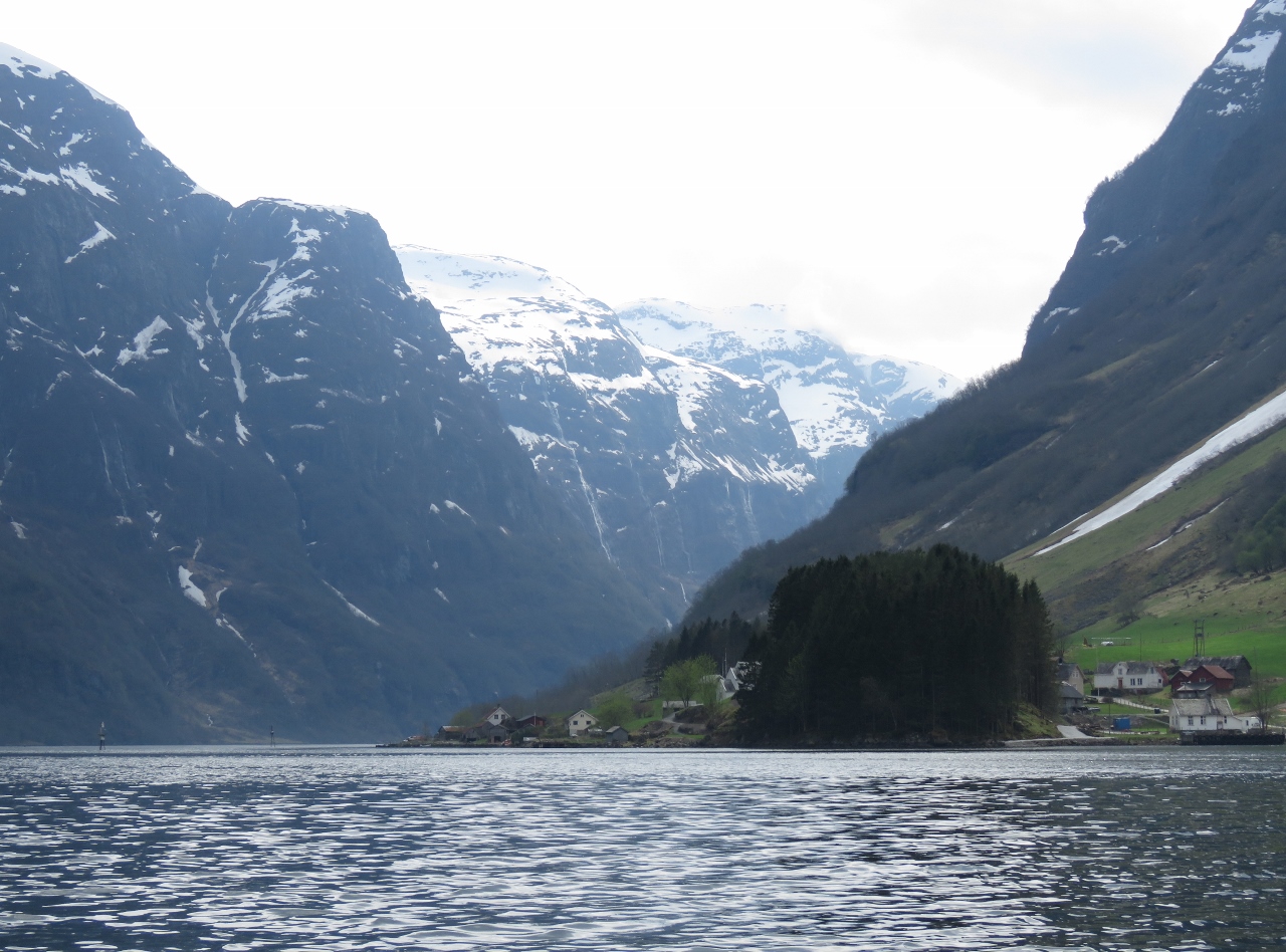
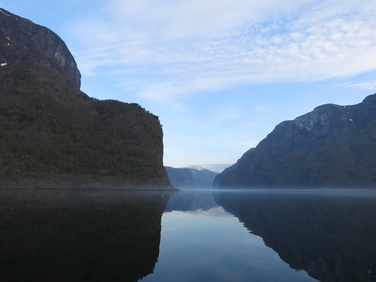
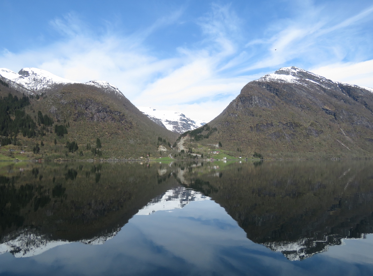
5/1/2018: Sognefjord
Position: 61°3.94'N, 5°3.28'E
The hills dwarf two ferries at the mouth of Sognefjord. And these are small hills compared to the real mountains we'll see as we proceed up the fjord.
|
 |
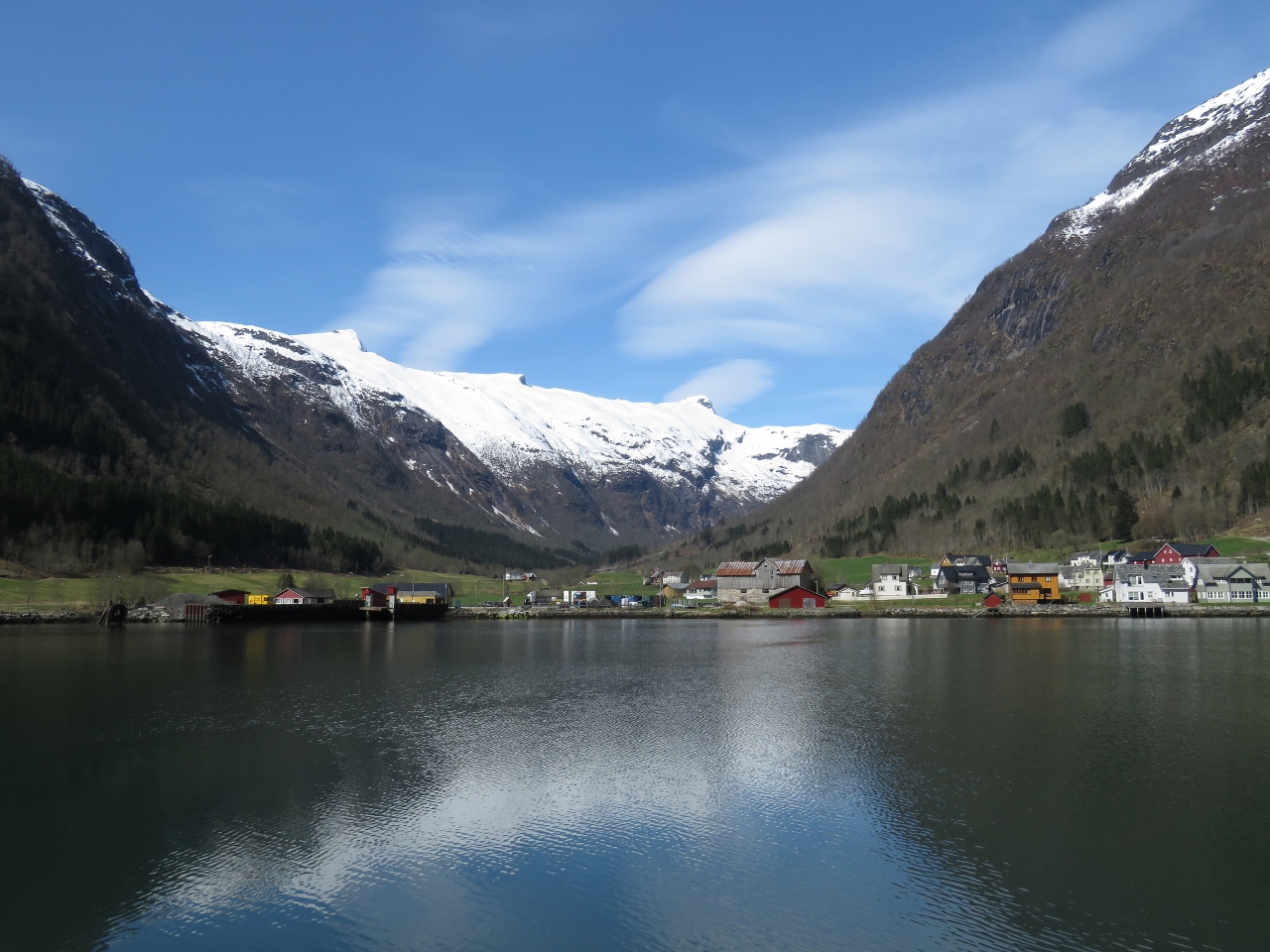
5/1/2018: Rutledal
Position: 61°4.83'N, 5°9.98'E
The wonderful view north across the mouth of Sognefjord from our anchorage tucked in between islets off Rutledal. Our initial plan was to run straight north and tour the fjords on our return trip south. But we've decided to take a few days to explore Sognefjord to see the mountains still thick with snow as much will have melted when we return in August.
|
 |
5/1/2018: Vacuum Cleaner
Position: 61°4.84'N, 5°9.95'E
James working on the brush roll (often referred to incorrectly as a "beater bar") of our built-in vacuum cleaner. What happens in our vacuum is the slight salt air, even down below where it's stowed, causes the brush roll shaft to corrode and over time friction develops and it seizes. Here James is taking it apart using a wire wheel to remove the corrosion from the shaft, lubricating the shaft and reassembling it.
|
 |
5/1/2018: Leak Testing
Position: 61°4.84'N, 5°9.97'E
Leak testing the main engine cooling system. We've been having an issue where air accumulates in the furnace heat exchangers, since that is the high point in the engine cooling system. The leak test at the full 20 PSI operating pressure detected no leaks over 20 minutes. We found aluminum corrosion at the outer seal of the radiator cap that almost certainly was the source of air in the system. This outer seal is used by the recovery system to pull coolant back into the system as the engine cools. If that seal leaks, it pulls in air rather than coolant. We sanded off the corrosion and made sure everything was sealing perfectly.
The header tank visible in the foreground of the picture was the culprit. It's a small aluminum tank used in automotive racing applications that we installed when the boat was new to get the radiator fill cap to be the highest point in the cooling system since those heat exchangers in the aft end of the boat are actually slightly higher than the engine header tank. |
 |
5/1/2018: Swan
Position: 61°4.83'N, 5°9.95'E
Swan swimming across our anchorage in the evening. At 8:40pm the sun isn't close to setting yet.
|
 |
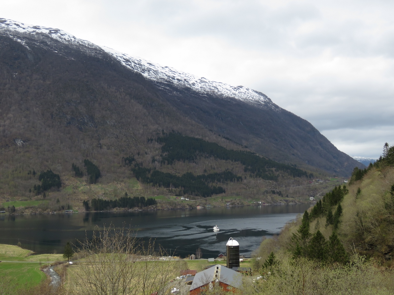
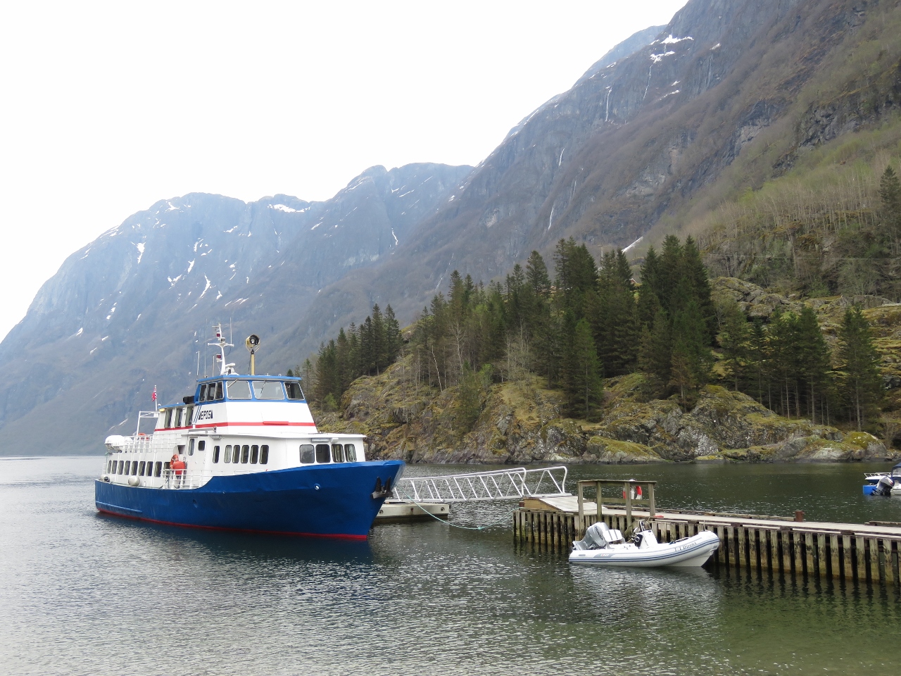
5/2/2018: Ferry
Position: 61°5.15'N, 5°9.54'E
Ferry crossing from Losnegard to Rutledal as we depart the anchorage to head up Sognefjord.
|
 |
5/2/2018: Stølsheimen
Position: 61°7.38'N, 6°7.67'E
Looking south into the mountains of the Stølsheimen Nature Preserve.
|
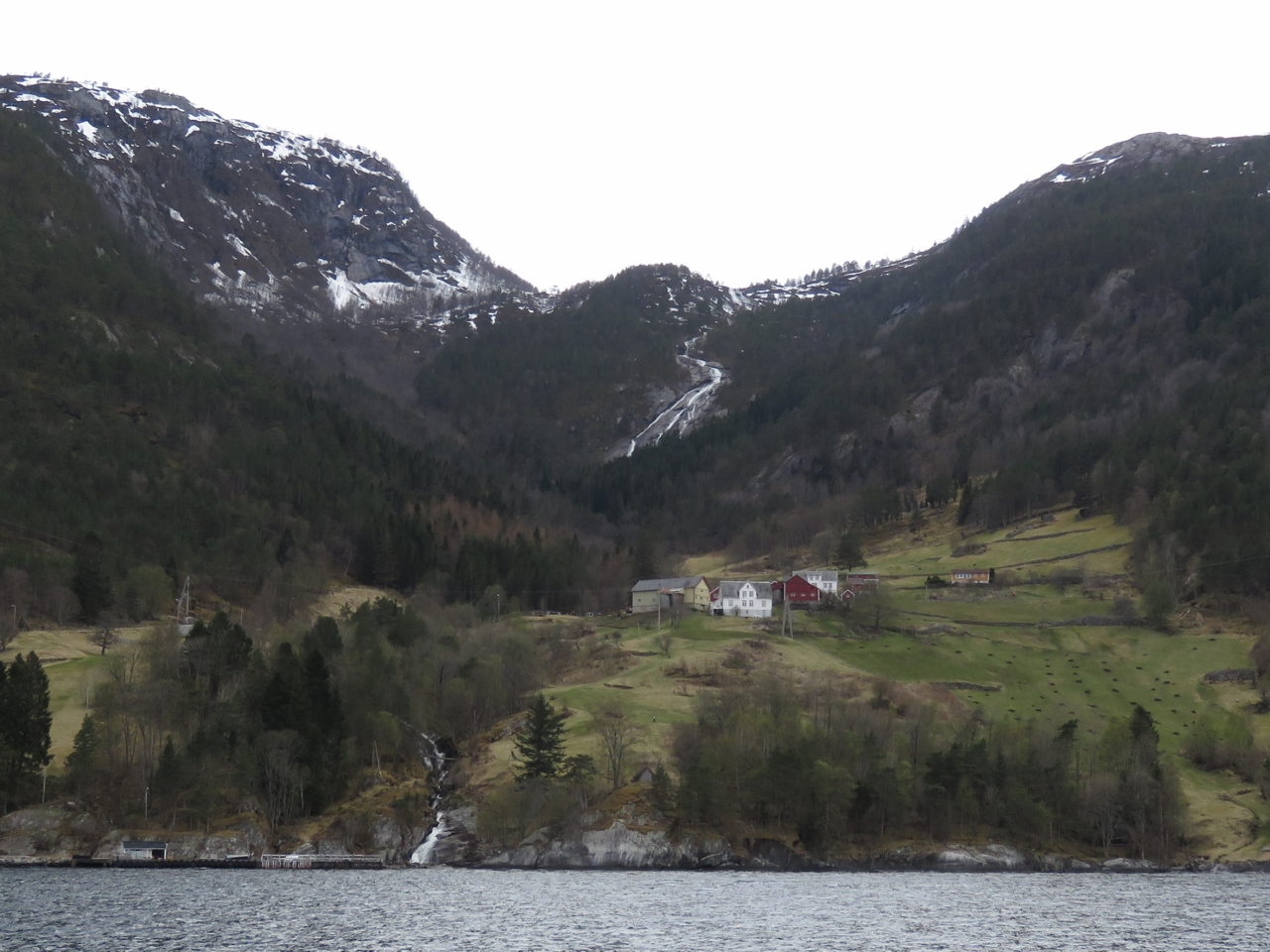 |
5/2/2018: Farm
Position: 61°5.90'N, 6°17.91'E
Norway doesn't have much flat ground, but has a huge number of small farms. It seems that any patch of land where a tractor won't actually tip over is deemed arable.
|
 |
5/2/2018: Finnafjorden
Position: 61°5.35'N, 6°20.43'E
Another view to the mountains of the Stølsheimen Nature Preserve down Finnafjorden.
|
 |
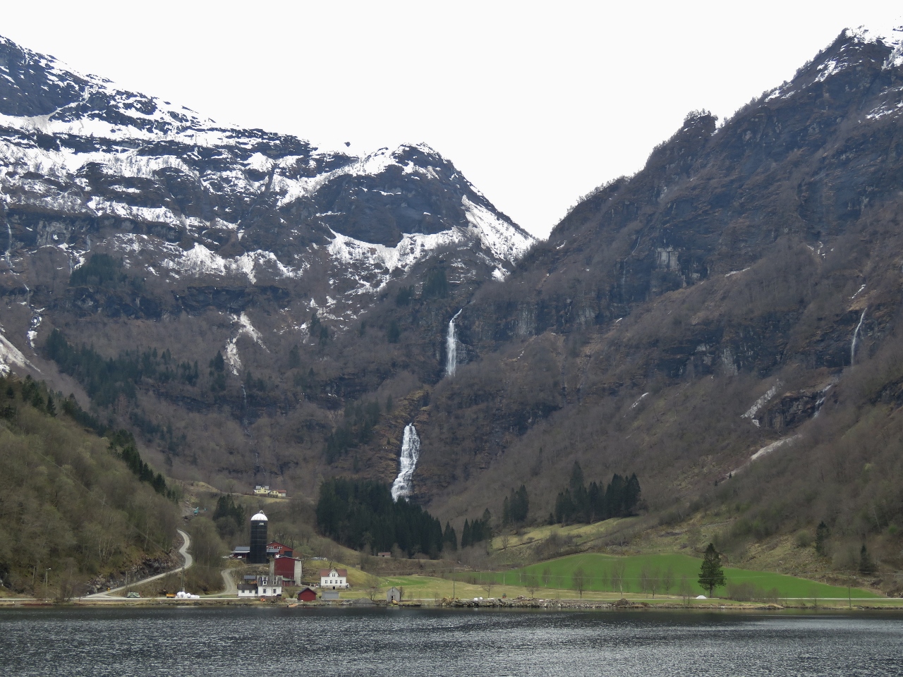
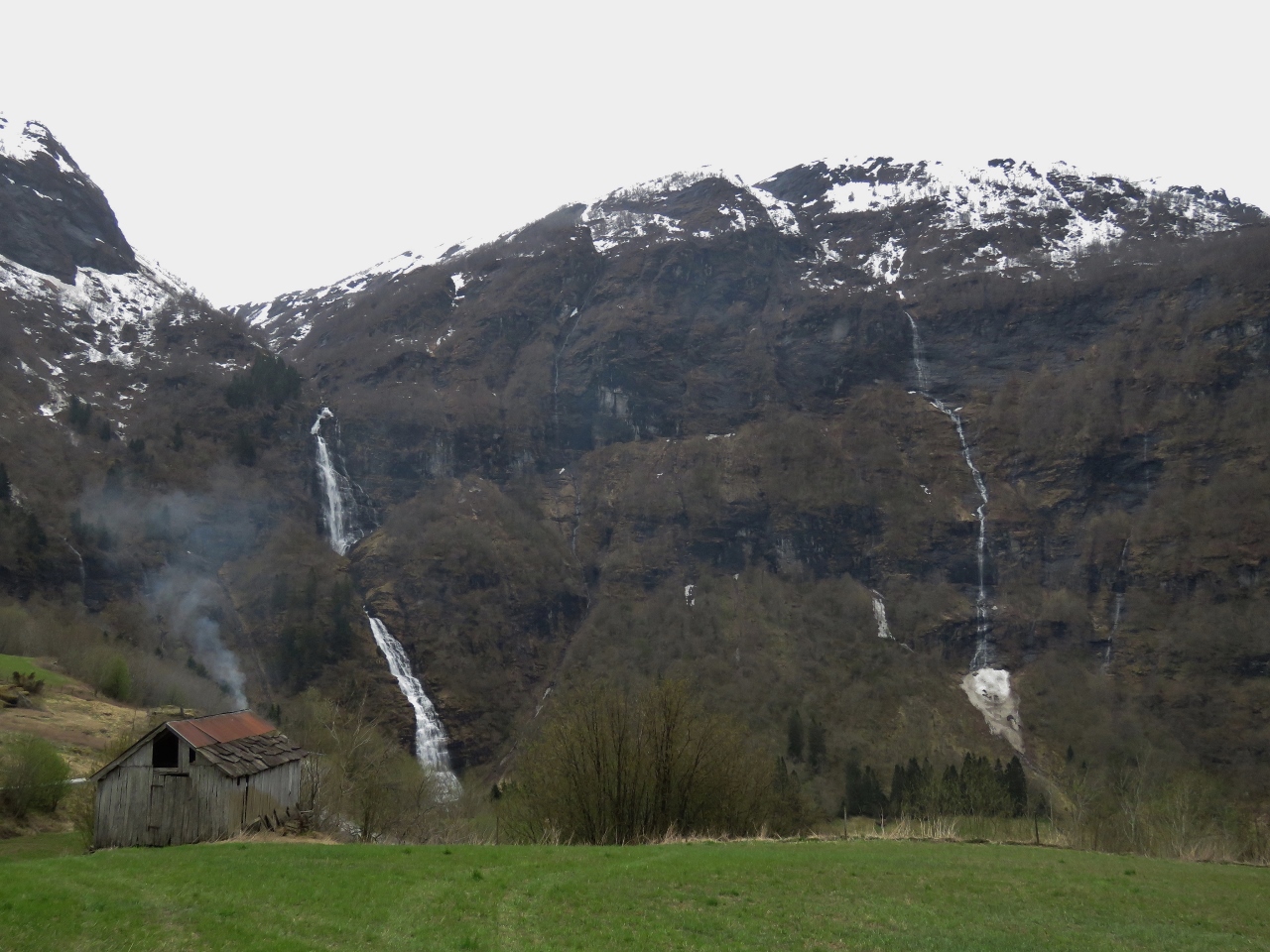
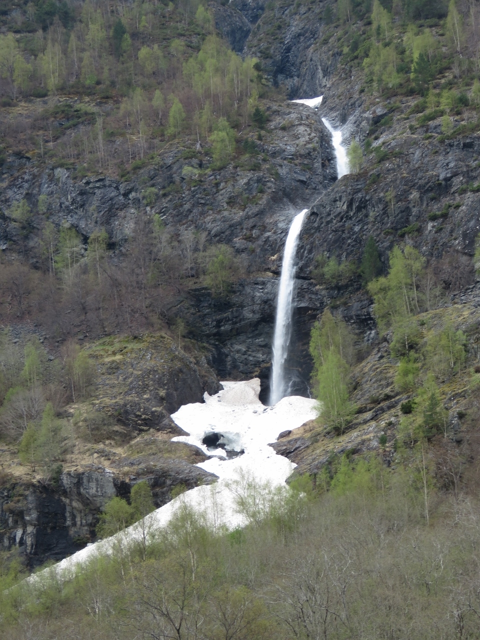
5/2/2018: Waterfall
Position: 61°4.11'N, 6°25.46'E
Waterfall at the mouth of Arnafjorden.
|
 |
5/2/2018: Nese
Position: 61°1.77'N, 6°23.80'E
The village of Nese at the intersection of Arnaforden and Indrefjord. Arnafjord Church in the village was built in 1880 to replace an older one that dated to the 17th century.
|
 |
5/2/2018: Cliff Waterfall
Position: 61°0.94'N, 6°23.12'E
A waterfall spilling over the edge of a cliff high up in the snow-covered mountains above Indrefjord.
|
 |
5/2/2018: Indrefjord
Position: 61°0.35'N, 6°21.85'E
We anchored at the head of Indrefjord in 70ft with 400ft of chain out and excellent holding. This is one of several fabulous views from the boat.
|
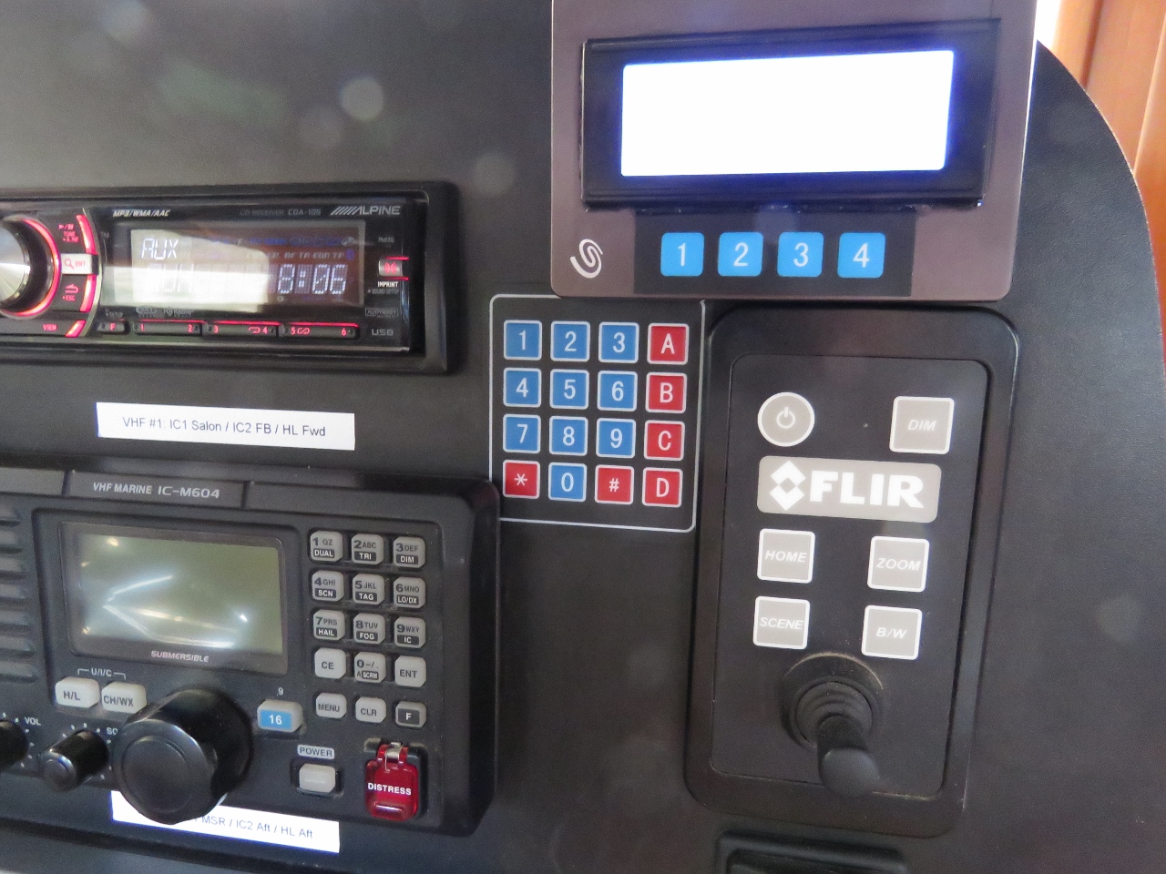 |
5/3/2018: Keyboard
Position: 61°0.37'N, 6°21.79'E
We installed a 4x4 matrix keyboard on the dash today and wrote code to allow it to control our entertainment system (pause/play, previous song, next song, mute), HVAC, hot water heater, furnace and defrost. We can control all of these through web pages, but sometimes a hard mechanical switch on the dash is more convenient.
|
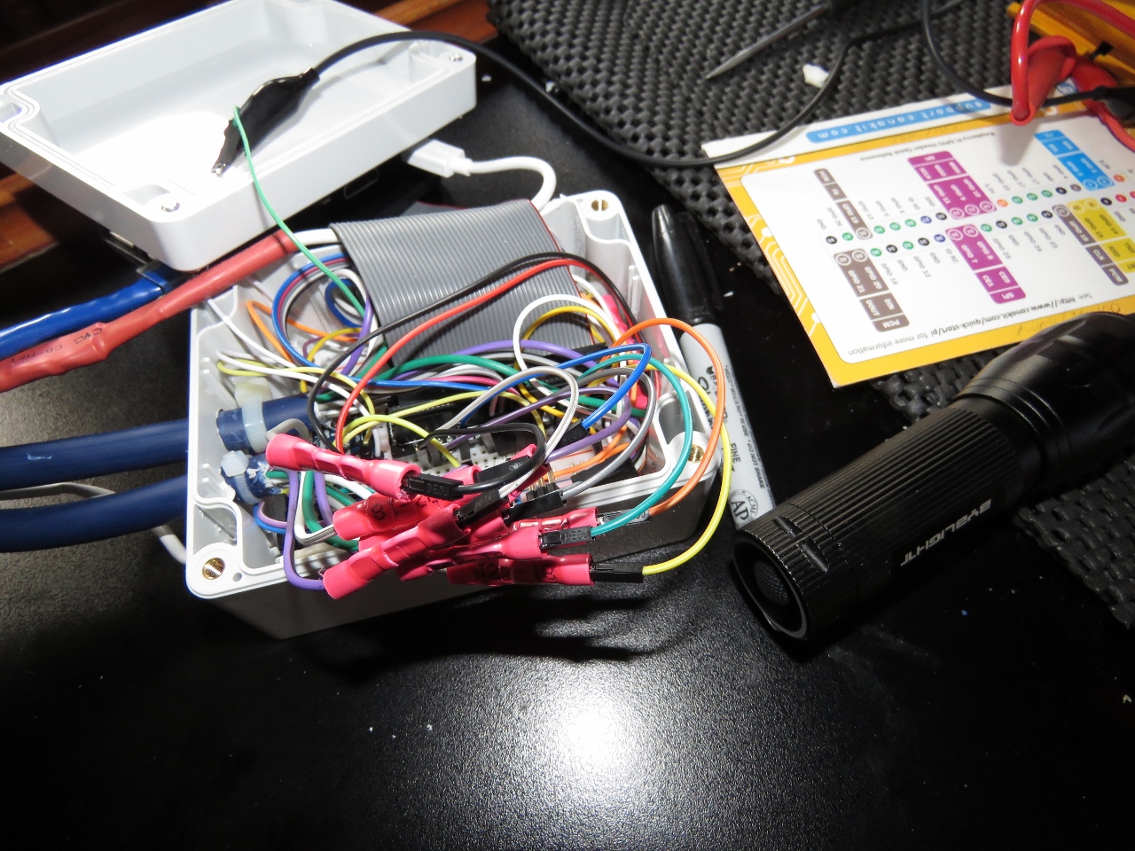 |
5/3/2018: Raspberry Pi
Position: 61°0.37'N, 6°21.79'E
This is the fourth Raspberry Pi we've added to Dirona. This one controls the 4x20 LCD; a four-channel analog input, one of which is used to sense the 12-volt navigation battery state; the 1x4 matrix keyboard; and the 4x4 matrix keyboard we just installed. You can hardly see the Pi below all the connections to it.
|
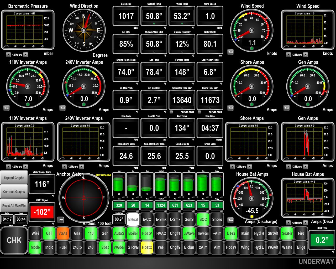 |
5/4/2018: Cellular Data
Position: 61°0.35'N, 6°21.80'E
The orange VSAT light at the bottom left of the display shows that we have no satellite connectivity at the head of Indrefjord. We expected the steep fjords would block our view to the satellites, so this is not a surprise.
What we didn't expect was excellent cellular connectivity. Since nearing the Norwegian coast we've probably not been without a solid 4G connection (the green light left of the VSAT light) for more than 10-15 minutes. And the recent EU "Roam Like at Home" rule means our UK cellular data plan works in Norway the same as in the UK, so we can defer getting a Norway SIM until we visit a city. |
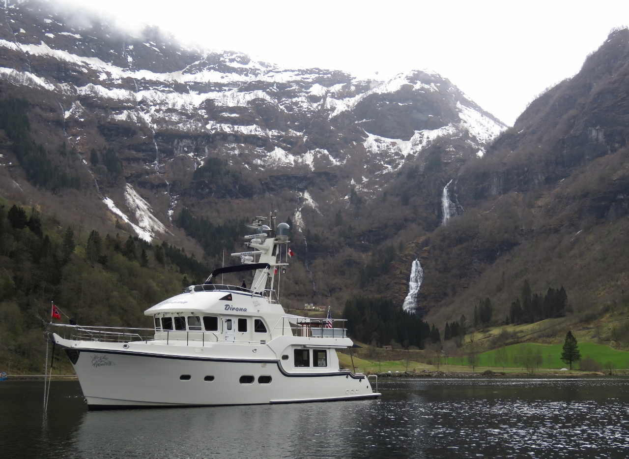 |
5/4/2018: At Anchor
Position: 61°0.33'N, 6°21.79'E
At anchor in spectacular Indrefjord off Songefjord.
|
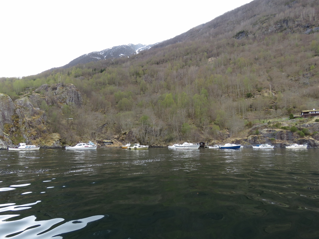 |
5/4/2018: Boats
Position: 61°1.43'N, 6°23.22'E
This cove off the village of Nese must be the most sheltered spot in the area—nearly a dozen boats are tucked away here.
|
 |
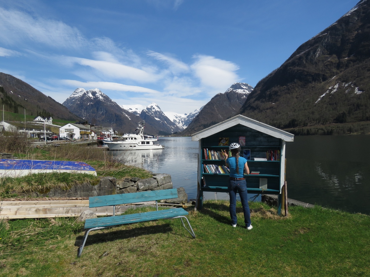
5/4/2018: Nese
Position: 61°1.50'N, 6°23.15'E
|
 |
5/4/2018: Indrefjord
Position: 61°0.77'N, 6°22.15'E
Dirona is the small white dot right of center in this view to the head of Indrefjord from the village of Nese.
|
 |
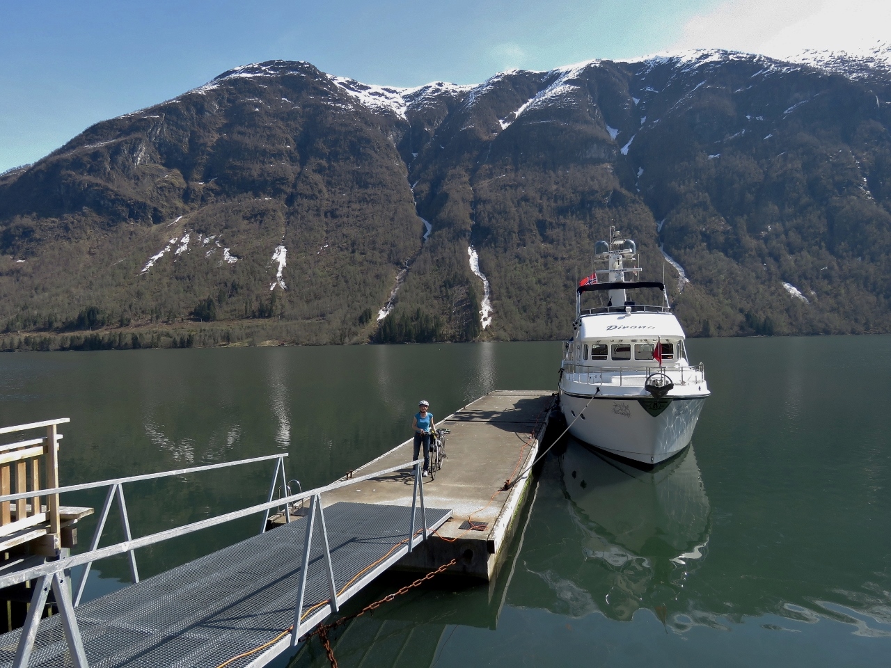
5/4/2018: Tender
Position: 61°0.18'N, 6°21.86'E
The tender tied off at the village of Fretheim for a walk ashore.
|
 |
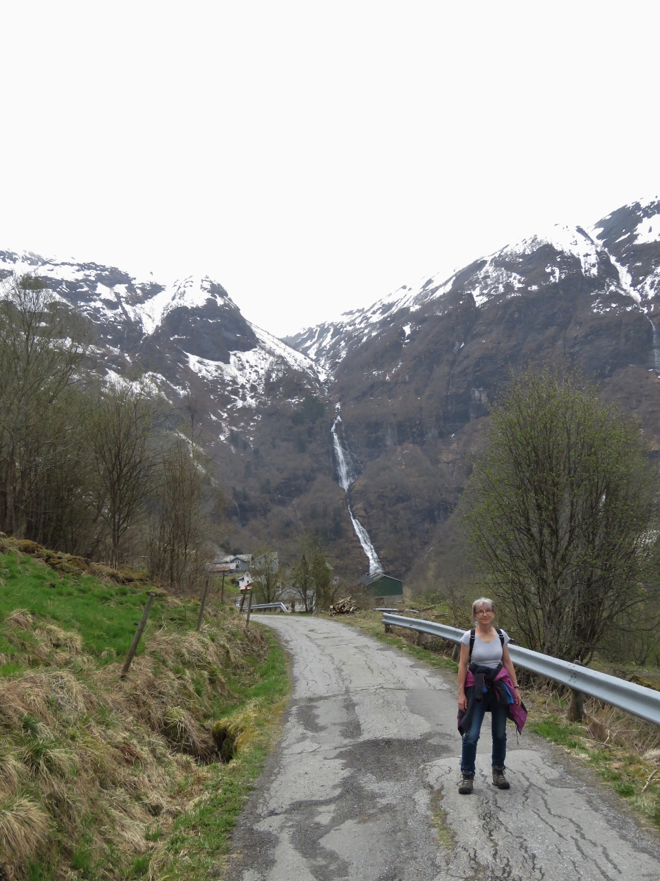
5/4/2018: Roadside Waterfall
Position: 61°0.19'N, 6°21.89'E
A small waterfall alongside the road.
|
 |
5/4/2018: View
Position: 60°59.84'N, 6°21.68'E
View back to the anchorage from partway up the hill.
|
 |
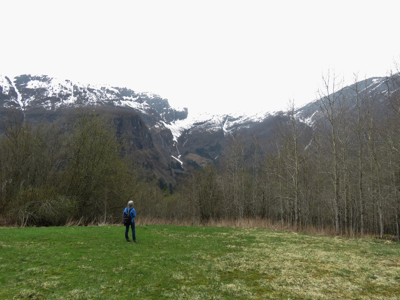
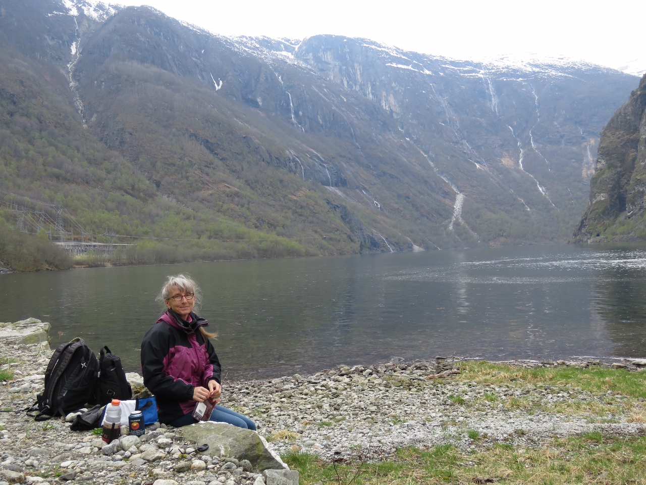
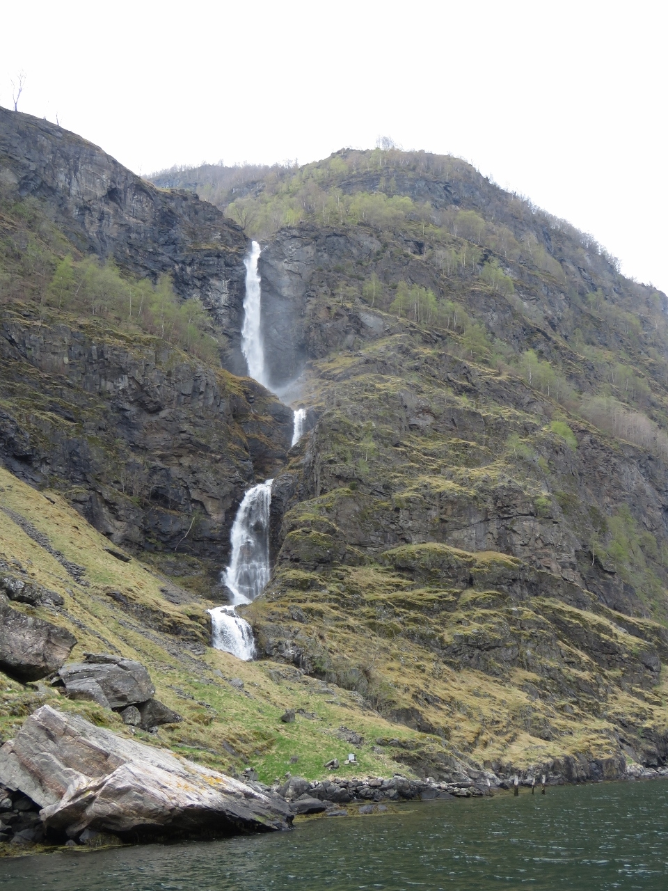
5/4/2018: Botnafossen
Position: 60°59.78'N, 6°21.65'E
Jennifer standing at the base of Botnafossen, the spectacular double-level waterfall we can see from the anchorage.
|
 |
5/4/2018: Anchorage View
Position: 61°0.24'N, 6°22.21'E
We followed a dirt road off the main paved road, looking for more views. This is looking back down to the anchorage from a meadow along the way. Dirona is just out of site behind the old building at the bottom of the photo.
|
 |
5/4/2018: Arnaforden
Position: 61°0.40'N, 6°22.38'E
Looking up Arnaforden from another meadow along our walk. We found lots of evidence of long-time cattle-grazing the area, with several old buildings and long-felled trees along with brand-new fencing.
|
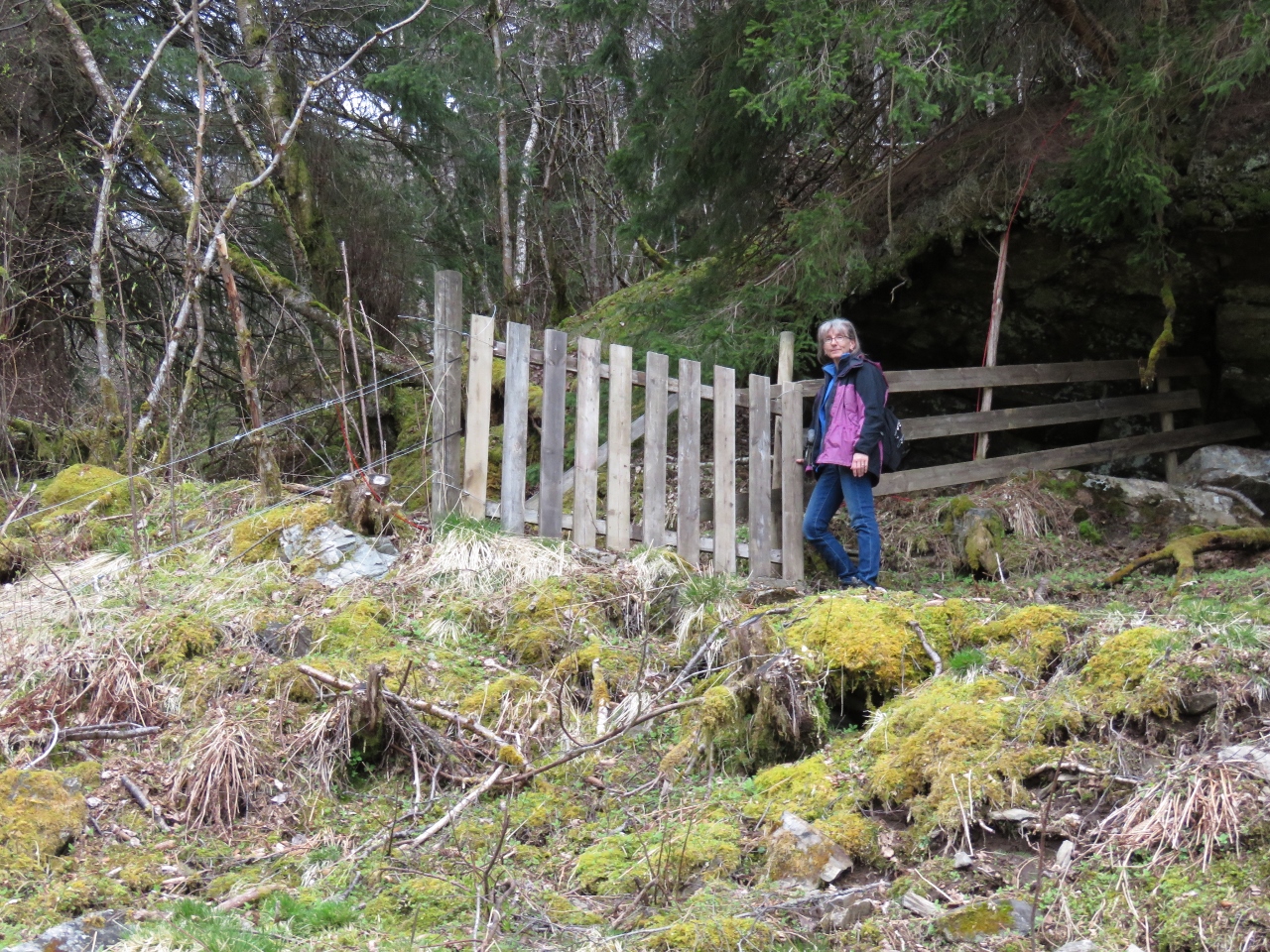 |
5/4/2018: Gate
Position: 61°0.39'N, 6°22.45'E
We'd ended up directly above the village of Fretheim along the south shore of the anchorage, and were hoping to find a path down, but no luck. We were thinking we might have to retrace our steps when we found this gate with a path continuing beyond. We took a chance that it would bring us back to the main road, which it did.
|
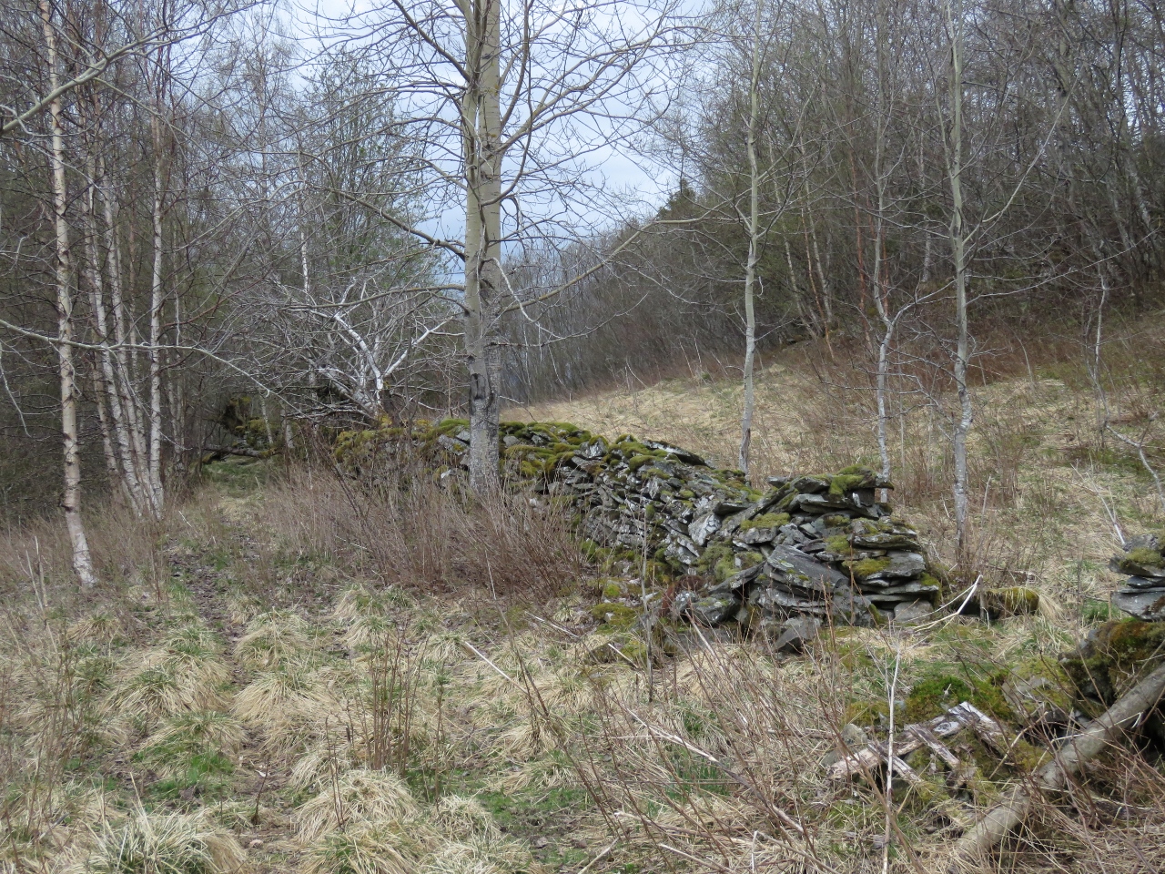 |
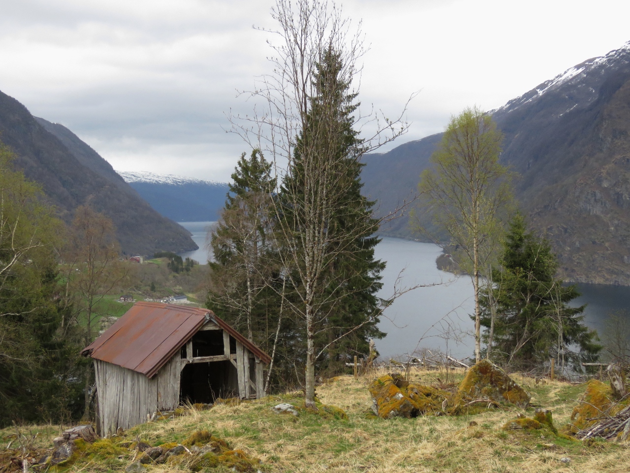
5/4/2018: Stone Fence
Position: 61°0.37'N, 6°22.56'E
Old stone fence along the path.
|
 |
5/4/2018: Meadow
Position: 61°0.37'N, 6°22.56'E
Jennifer enjoying the mountain view from a meadow along the path.
|
 |
5/4/2018: Warm
Position: 61°0.25'N, 6°22.57'E
We eventually did find a way back to the main road. Surprisingly, the temperature was warmer up here and we were hot from hiking uphill, so we shed our three layers of coats for a bit.
|
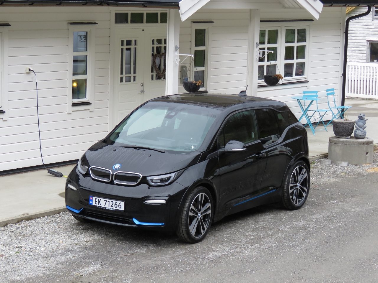 |
5/4/2018: BMW i3
Position: 61°0.12'N, 6°22.39'E
This BMW i3 passed us on our way up the hill—it's an appealing-looking all-electric car.
|
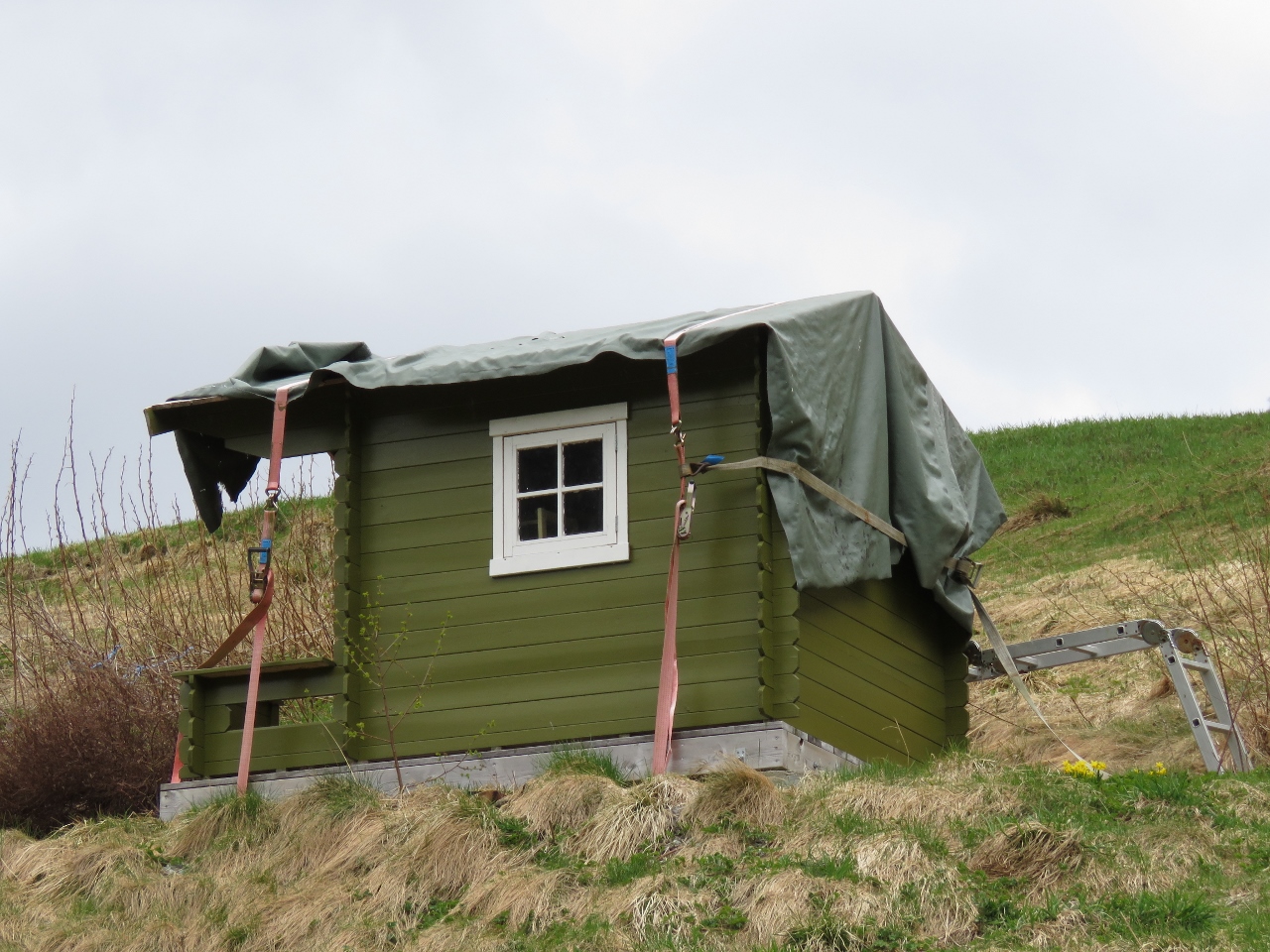 |
5/4/2018: Tie-downs
Position: 61°0.01'N, 6°22.22'E
The tie-downs on this children's playhouse give an idea of the winds they must get up here in the winter.
|
 |
5/4/2018: Waterfalls
Position: 60°59.98'N, 6°22.19'E
A final view to Botnafossen and another to the right as we descend back to Dirona.
|
 |
5/5/2018: Vangsnes
Position: 61°10.69'N, 6°38.30'E
Wikipedia describes Vangsnes as being "on a relatively flat and fertile peninsula". Fertile it may be, but flat is not the first word that comes to mind. But it is relatively flat compared to some of the farms we saw farther up Songefjord. The statue prominent above the town is of Fridtjof The Bold, the hero of a 14th-century Norse saga. The statue, erected in 1913, was commissioned by Kaiser Wilhelm II of Germany as a thank you for the hospitality shown him over 20 years of travelling through Norway in his ship.
|
 |
5/5/2018: Line in water
Position: 61°8.45'N, 6°52.64'E
This line crossing diagonally from top right to bottom left looked to be an overhead cable line that had fallen.
|
 |
5/5/2018: Frönningen
Position: 61°3.93'N, 7°1.13'E
Small farm at Frönningen at the junction of Aurlandsfjord and Songefjord.
|
 |
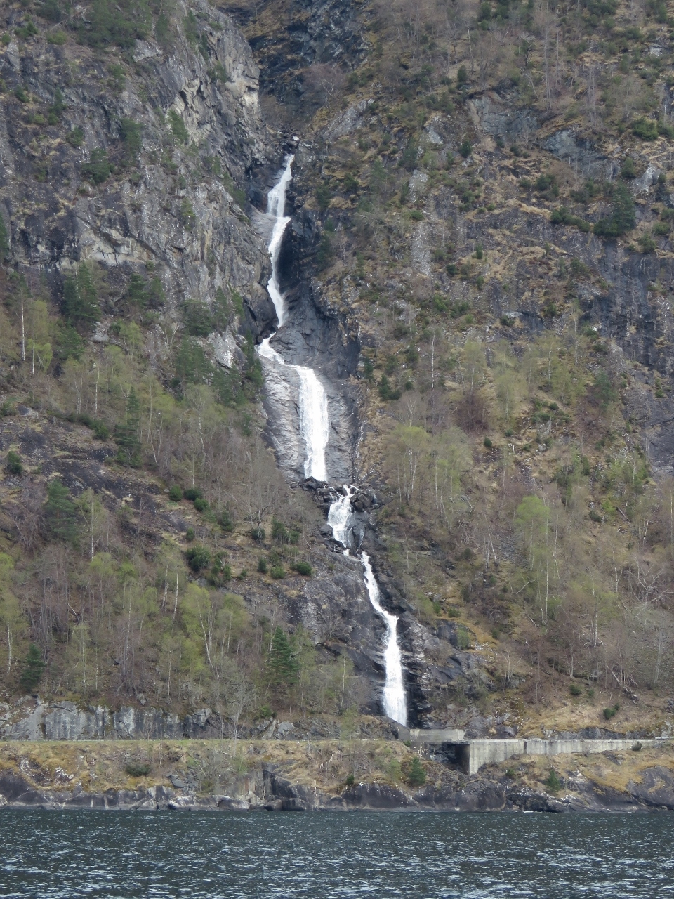
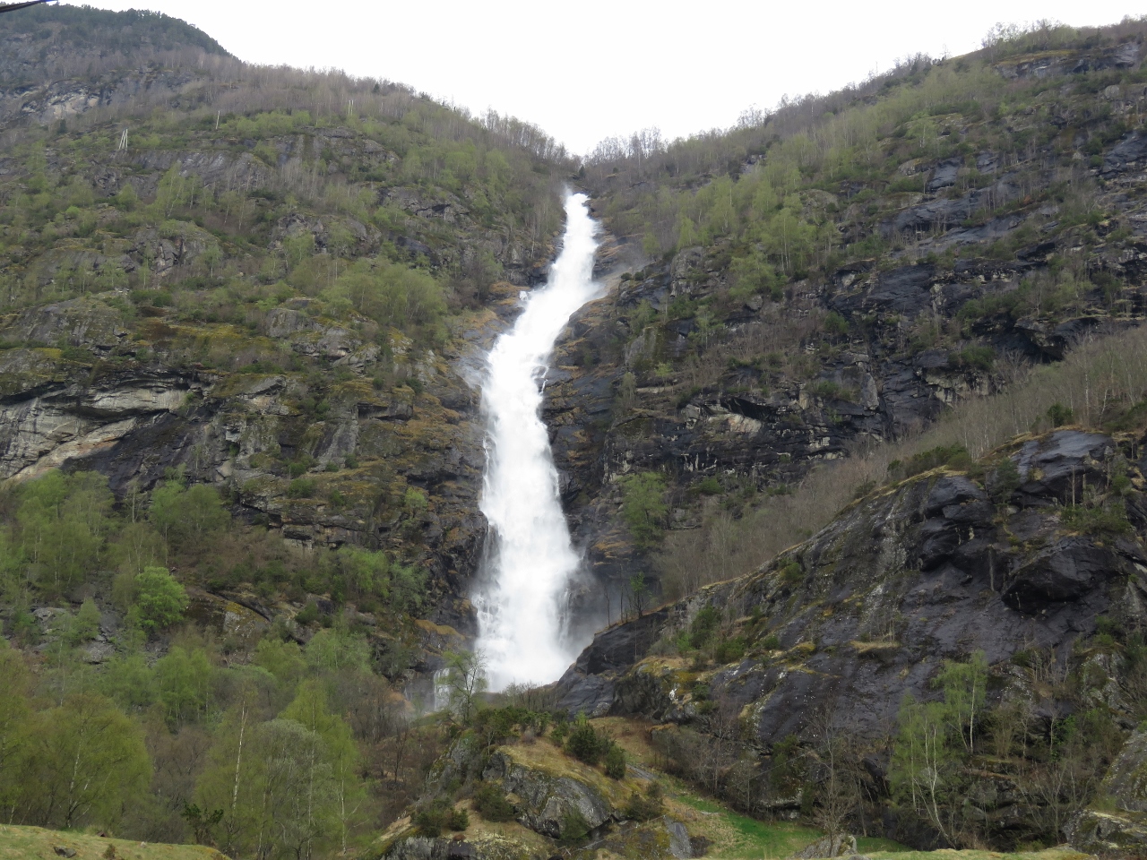
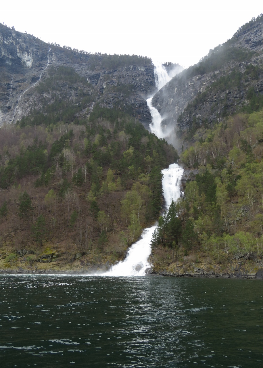
5/5/2018: Waterfall
Position: 61°2.95'N, 7°1.58'E
We're seeing some spectacular waterfalls today.
|
 |
5/5/2018: Overcast
Position: 61°2.95'N, 7°1.58'E
Even on an overcast day, the scenery is dramatic. And we're expecting the clouds to clear later today.
|
 |
5/5/2018: Waterfall II
Position: 61°2.58'N, 7°1.67'E
Another impressive waterfall a short distance inside Aurlandsfjord.
|
 |
5/5/2018: Mountain Scenery
Position: 61°0.90'N, 7°2.56'E
The scenery along Aurlandsfjord is just incredible. We're running out of superlatives.
|
 |
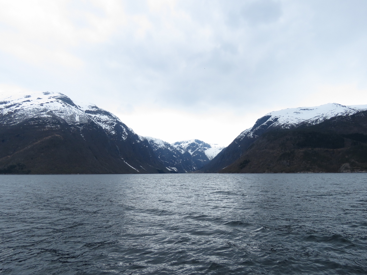
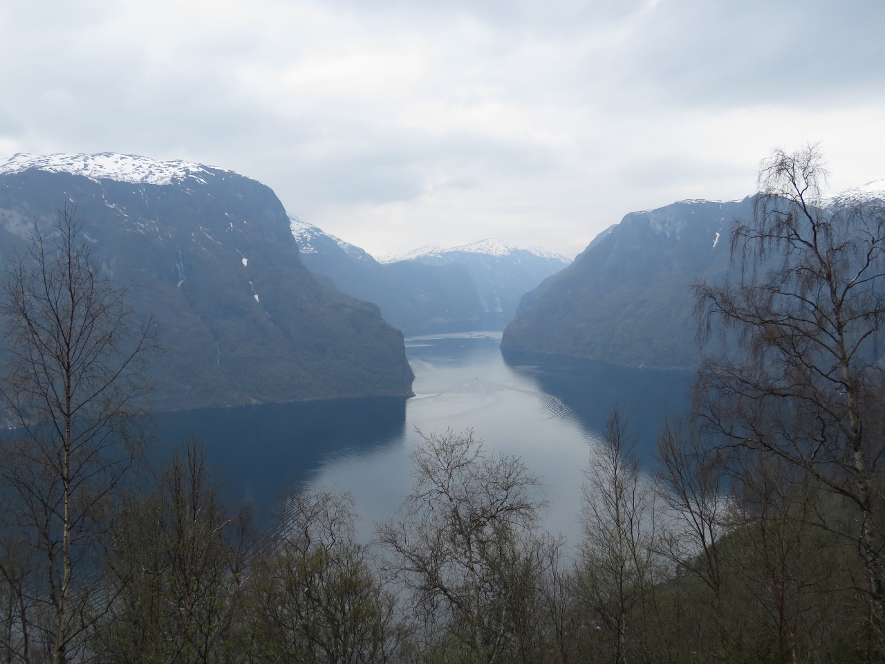
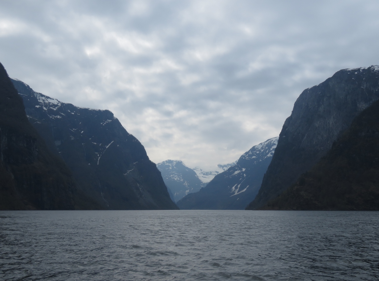
5/5/2018: Nærøyfjord
Position: 60°59.87'N, 7°3.46'E
Looking south down Nærøyfjord, a UNESCO World Heritage site and one of the more beautiful fjords in the area. The soaring mountains dwarf the two large tour boats visible.
|
 |
5/5/2018: Scenery
Position: 60°59.87'N, 7°3.46'E
Our view forward as we pass the mouth of Nærøyfjord.
|
 |
5/5/2018: Vision of the Fjords
Position: 60°58.86'N, 7°4.23'E
We started seeing lot of tour boats as we neared Nærøyfjord and the head of Aurlandsfjord. Vision of the Fjords, launched in 2016, is a hybrid electric fast ferry designed to minimize the environmental impact of emissions and wakes in sensitive Nærøyfjord.
|
 |
5/5/2018: Final Corner
Position: 60°56.95'N, 7°7.97'E
The final corner of Aurlandsfjord before we reach Flåm at the head.
|
 |
5/5/2018: Head of Aurlandsfjord
Position: 60°54.82'N, 7°9.84'E
The head of Aurlandsfjord coming into view.
|
 |
5/5/2018: Waterfall III
Position: 60°54.36'N, 7°9.61'E
Another beautiful waterfall along Aurlandsfjord.
|
 |
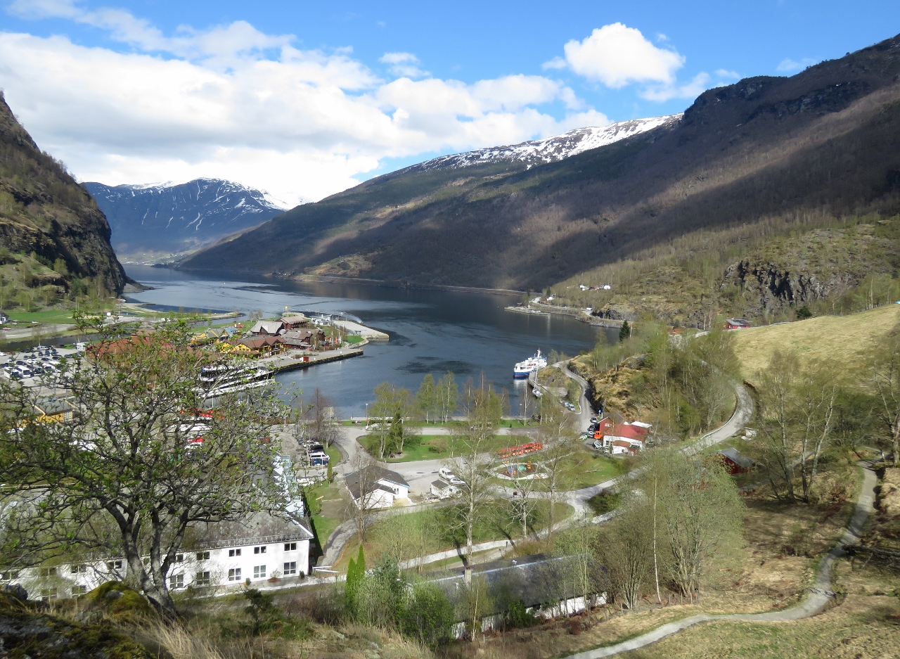
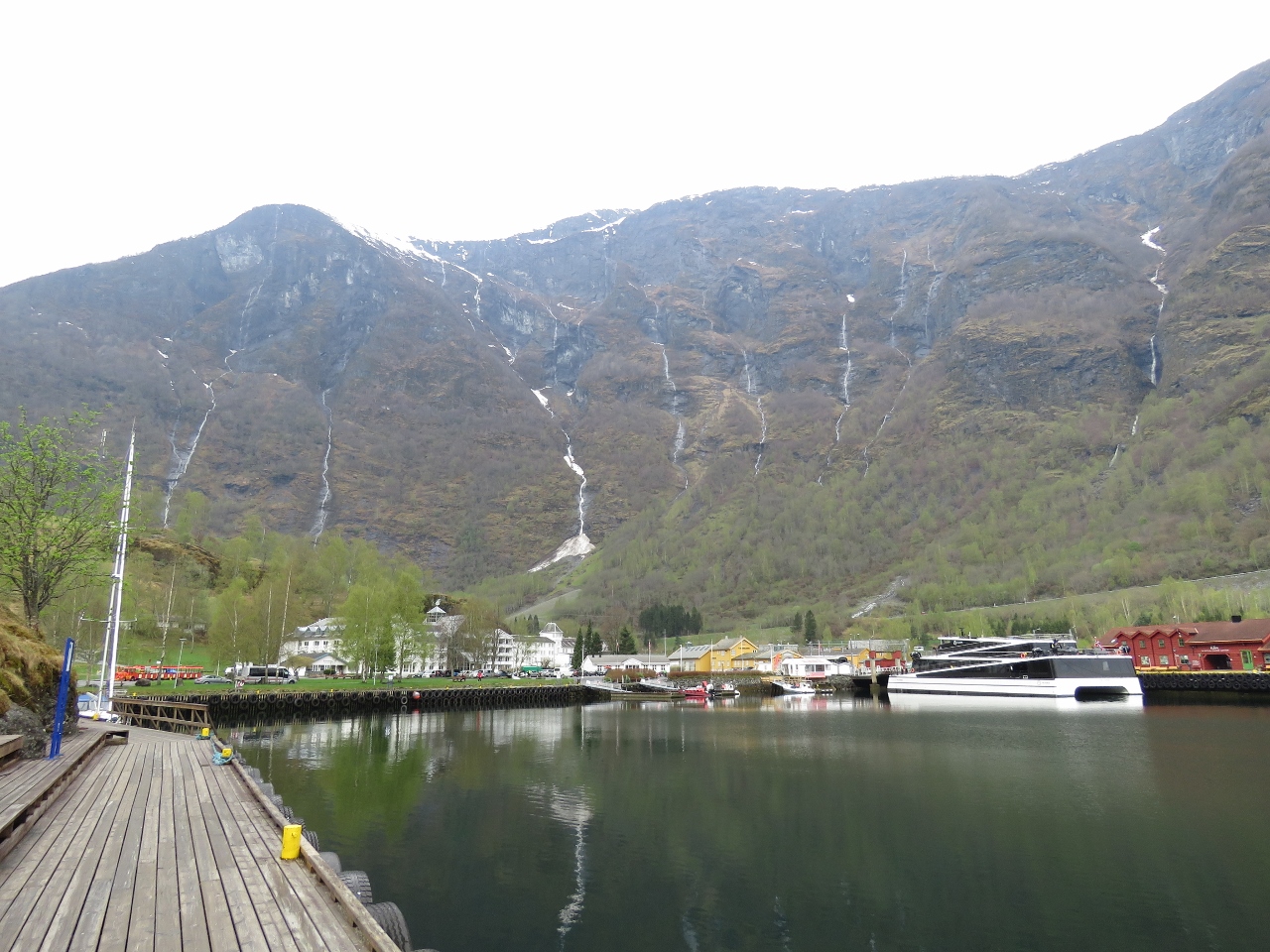
5/5/2018: Flåm
Position: 60°51.70'N, 7°7.23'E
The commercial harbour at Flåm, at the head of Aurlandsfjord.
|
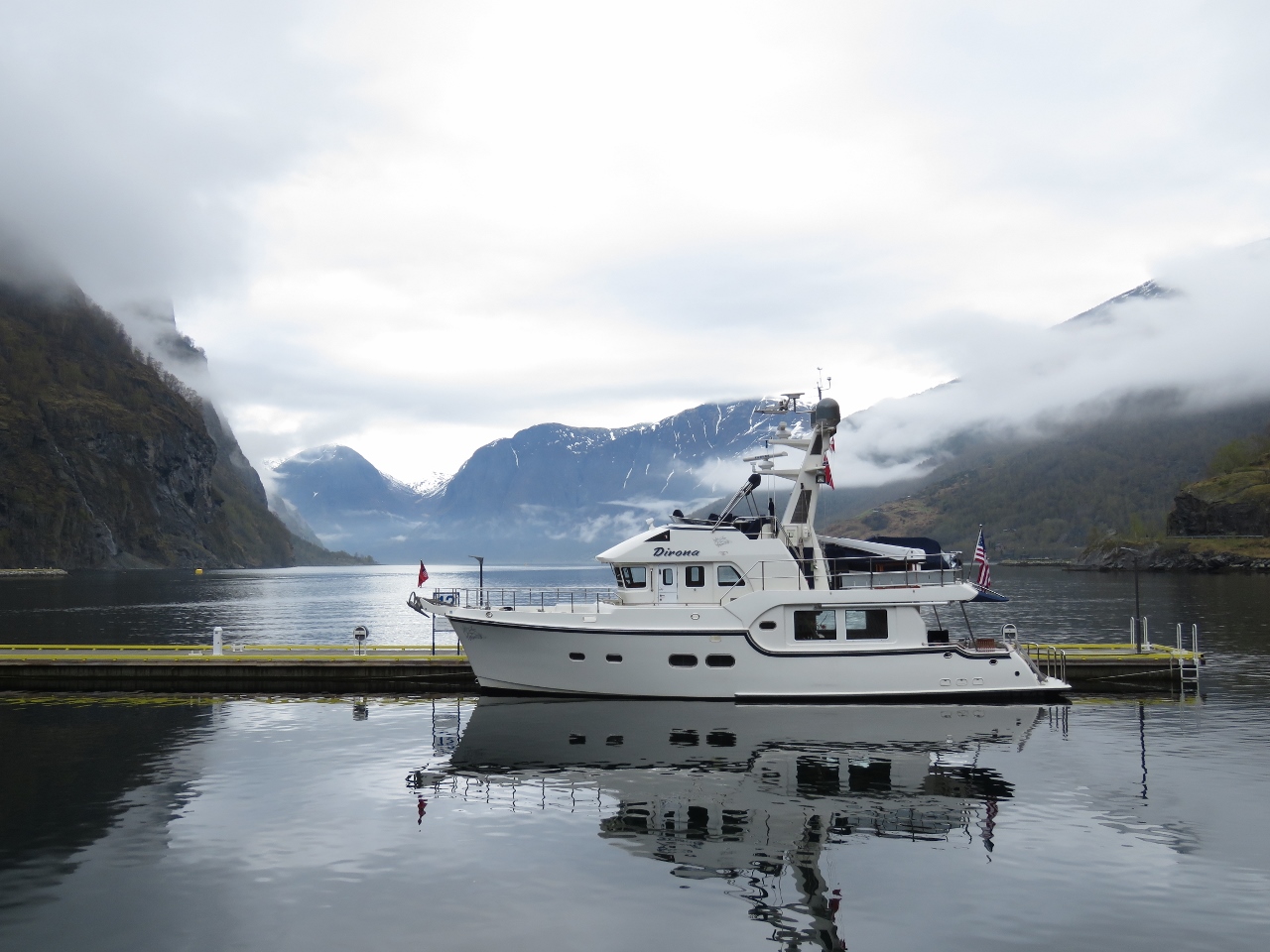 |
5/5/2018: Moored
Position: 60°51.67'N, 7°7.19'E
Moored for a couple of nights at Flåm with a spectacular view down Aurlandsfjord. We expected Dirona might be a little over-sized and heavy for most of the village docks in Norway, but not at Flåm. It would take some pretty serious weather to impact this hefty new concrete dock.
|
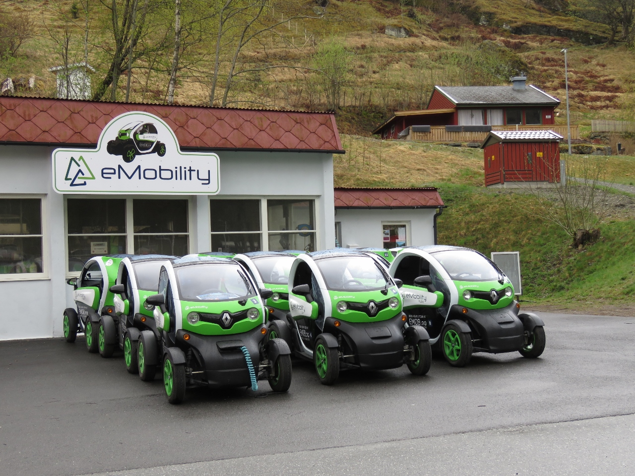 |
5/5/2018: eMobility
Position: 60°51.70'N, 7°6.90'E
In a bid to minimize the environmental impact of tourism, the main form of rental car in Flåm are these cute electric cars from eMobility. These are Renault Twizys and we'll likely rent one tomorrow.
|
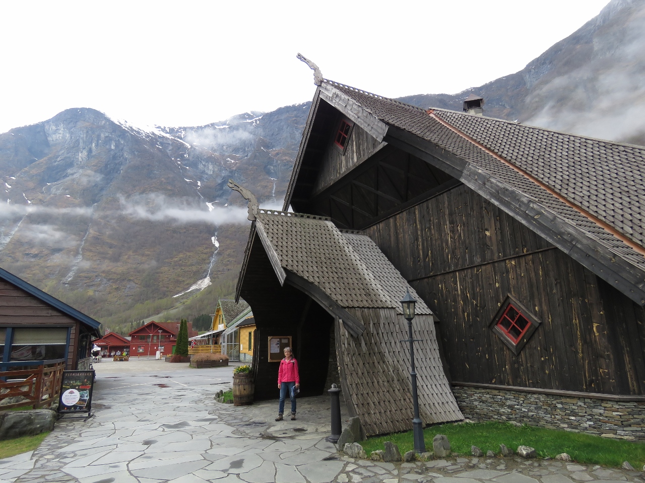 |
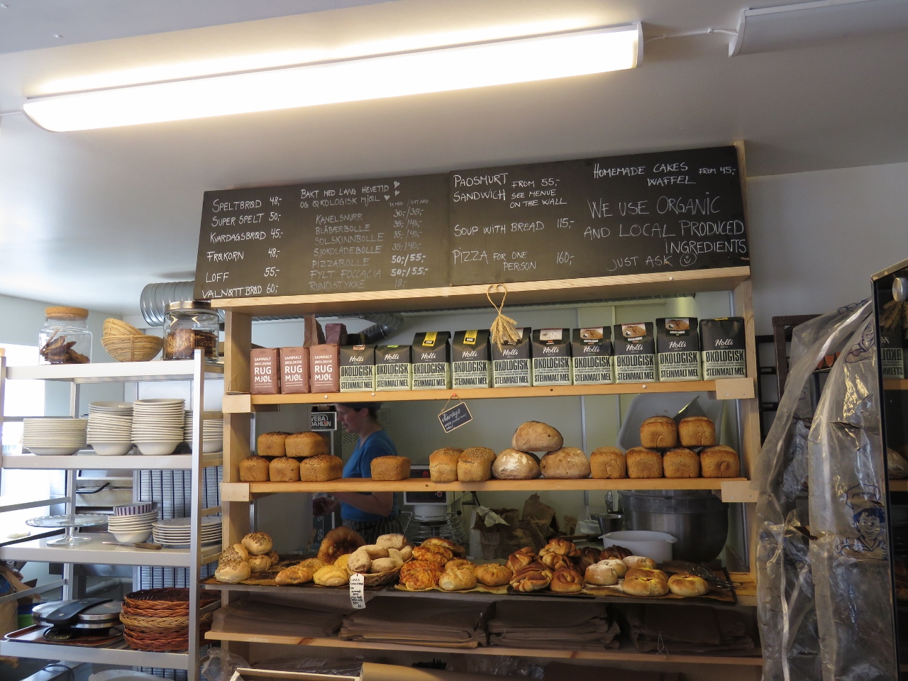
5/5/2018: Ægir Brew Pub
Position: 60°51.82'N, 7°7.03'E
It didn't take us long to find the local brew pub. Ægir has been brewing craft beer in Flåm since 2007 and their brew pub exterior is fashioned after a Stave church, a medieval wooden church common in northwest Europe.
|
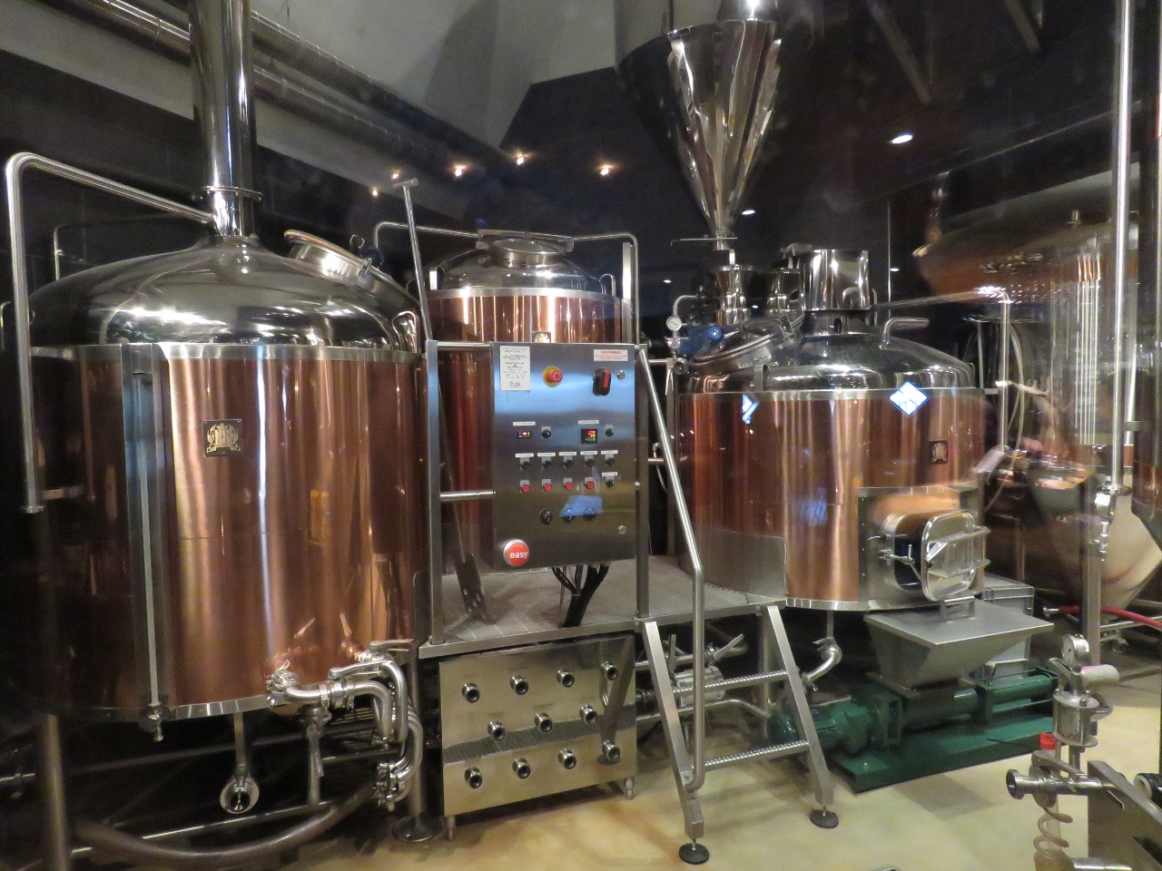 |
5/5/2018: Brewery
Position: 60°51.82'N, 7°7.03'E
Copper brewing tanks at Ægir Brew Pub in Flåm.
|
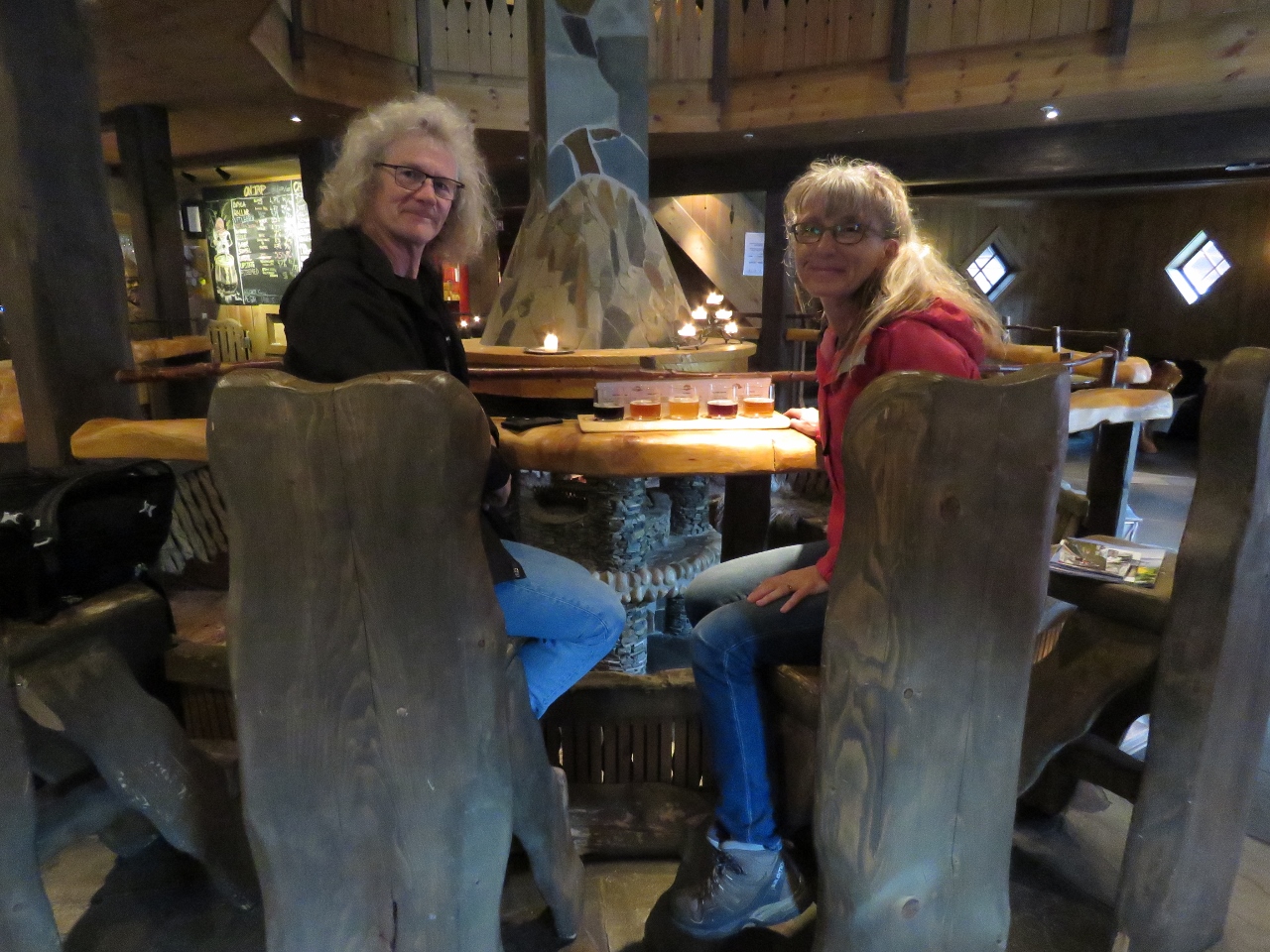 |
5/5/2018: Tasting Flight
Position: 60°51.82'N, 7°7.03'E
A tasting flight before an exceptional lunch at Ægir Brew Pub in Flåm. The two-story interior is designed after a Viking ceremonial house with a large fireplace in the center, beautiful wood furniture and furs on the walls.
|
 |
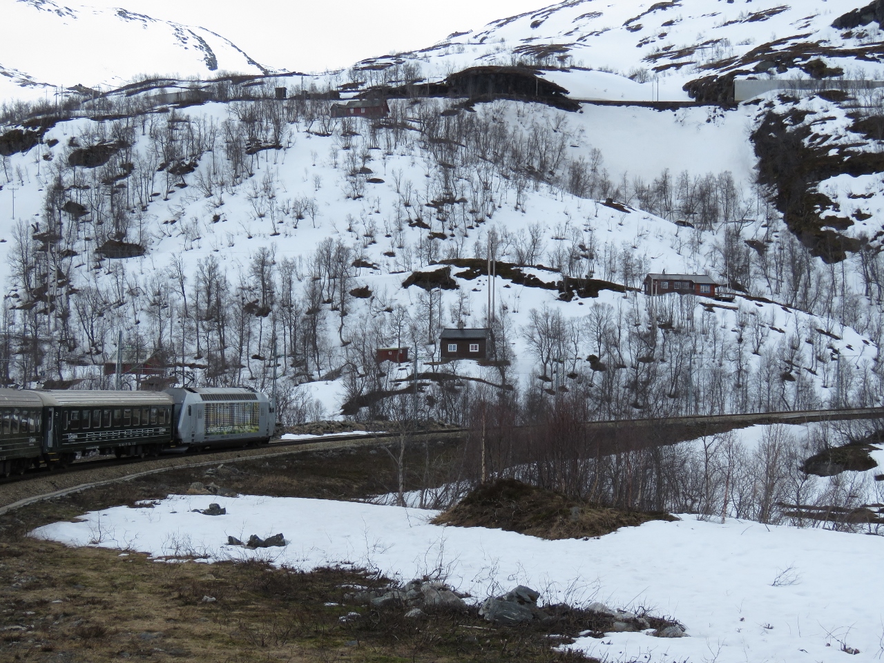
5/5/2018: Flåmsbana
Position: 60°51.77'N, 7°6.79'E
As we've been travelling the world, longtime blog reader Jacques Vuye has been scouting ahead and recommending scenic and unique train trips. One of our favourites was the West Coast Wilderness Railway in Tasmania, Australia. Shortly after we arrived into Norway, Jacques encouraged us to take a trip on Flåmsbana (the Flåm Railway), considered one of the world's most scenic railway trips.
The train departs from Flåm near the end of 115-mile Sogneford, the longest fjord in Norway and the second longest in the world. We initially planned to visit on the return trip south in August, but decided that it would be more beautiful to see the mountains with snow on them. So that was the initial impetus for our detour down Sogneford a few days ago and now we are sitting on the train, ready to go. And when we purchased our train tickets we realized another good reason to visit now instead of August is that the area is much less crowded with tourists this time of year. |
 |
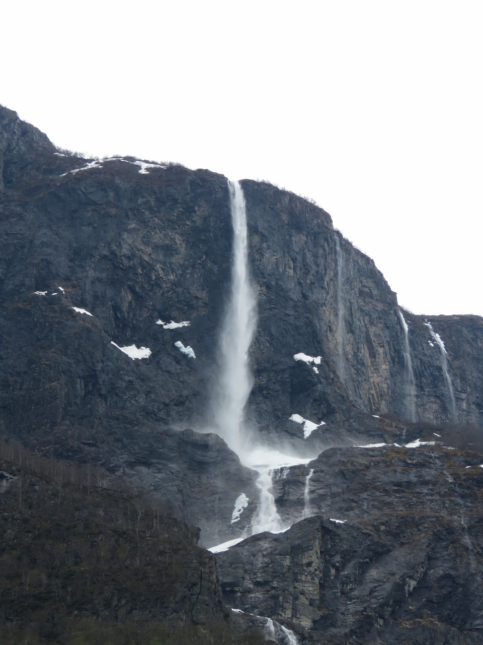
5/5/2018: Brekkfosen Waterfall
Position: 60°51.48'N, 7°6.50'E
We didn't have to travel far for some great scenery. The 100m Brekkfosen Waterfall is just outside Flåm.
|
 |
5/5/2018: Mountains
Position: 60°50.96'N, 7°6.94'E
Some of that snow-covered mountain scenery we were expecting.
|
 |
5/5/2018: Vibmesnosi Mountain
Position: 60°50.27'N, 7°7.44'E
Looking southwest toward 4,133-ft (1,260m) Vibmesnosi Mountain and Rjoande Waterfall.
|
 |
5/5/2018: Flåm
Position: 60°49.91'N, 7°7.40'E
The picturesque village of Flåm, tucked into a valley below soaring cliffs, is well inland from the commercial harbour.
|
 |
5/5/2018: Tunnel
Position: 60°49.91'N, 7°7.40'E
Entering the first of twenty tunnels that we'll pass through en route to Myrdal.
|
 |
5/5/2018: Rjoande Waterfall
Position: 60°49.28'N, 7°7.25'E
The spectacular Rjoande Waterfall with a 460-ft (140m) vertical drop.
|
 |
5/5/2018: 715 ft
Position: 60°49.08'N, 7°7.38'E
Looking back through Flåm Valley with the Rjoande Waterfall visible in the distance. Ten minutes after departing Flåm Station we're at already at an altitude of 715ft (217m) and eventually will climb to 2,841 ft (866m) to reach Myrdel. Almost 80% of the railway has a gradient of 55%, or 1:18. This is the steepest climb in the world for an adhesion-type railway using normal tracks.
|
 |
5/5/2018: Farm
Position: 60°47.28'N, 7°5.70'E
Farms and small settlements are all along the route. Before the Flåm Railway was completed in 1940 they would have been very isolated, particularly in the winter.
|
 |
5/5/2018: Passing
Position: 60°47.28'N, 7°5.70'E
The Flåm Railway is single track the entire way except here at Berekvam where double tracks allow trains going opposite directions to pass.
|
 |
5/5/2018: Kårdal Waterfall
Position: 60°45.93'N, 7°6.19'E
The Kårdal Waterfall at Kårdal, the highest hamlet in the Flåm Valley.
|
 |
5/5/2018: Rallarvegen Road
Position: 60°44.89'N, 7°7.52'E
Rallarvegen Road to Myrdal climbs Myrdal Mountain through an amazing 21 switchbacks beside a beautiful waterfall.
|
 |
5/5/2018: Vatnahalsen and Bakli Tunnels
Position: 60°44.89'N, 7°7.52'E
The Flåm Railway climbs Myrdal Mountain through three switchbacks and the two tunnels visible on the other side of the valley, one above the other. The lower tunnel, 2,916ft (889m) Vatnahalsen Tunnel, is one of only two tunnels on the line built using machines. The rest, including 639-ft (195m) Bakli Tunnel at top, were built by hand.
|
 |
5/5/2018: Kjosfoss Station
Position: 60°44.83'N, 7°8.14'E
The train makes one stop along the way, at Kjosfoss Station, where passengers can disembark to take pictures.
|
 |
5/5/2018: Kjosfossen
Position: 60°44.82'N, 7°8.14'E
Kjosfoss Station is only there so tourists can view the waterfall Kjosfossen. The pictures we'd seen showed a gushing torrent that filled the are with spray and mist. Given we were here during the spring run-off we were surprised that the flow was so low.
|
 |
5/5/2018: Huldra
Position: 60°44.82'N, 7°8.16'E
As we took in Kjosfossen, music began to play and women dressed in red danced at several places in the hills above. These apparently are dancers from the Norwegian ballet school playing Huldra, a seductive forest creature in Scandinavian folklore.
|
 |
5/5/2018: Snow
Position: 60°44.83'N, 7°8.14'E
From Kjosfoss station at elevation 2,194ft (669m) we climbed through a series of switchbacks and tunnels and now are at 2565ft (781 m) and are above the snow line.
|
 |
5/5/2018: Houses
Position: 60°44.54'N, 7°8.47'E
Our train winding past houses through snow-covered fields.
|
 |
5/5/2018: Myrdal Station
Position: 60°44.10'N, 7°7.36'E
At Myrdal Station, elevation 2,841 ft (866m), the final station on the route from Flåm. Most passengers on the train are doing the return trip to Flåm to enjoy the view. But a few will get off here and transfer to a train bound for Bergen.
|
 |
5/5/2018: South from Myrdal
Position: 60°44.17'N, 7°7.36'E
Looking southwest from Myrdal Station, where the tracks to Bergen lead into a tunnel.
|
 |
5/5/2018: Reununga Lake
Position: 60°44.64'N, 7°7.83'E
The view to snow-covered Reununga Lake on the return trip to Flåm before a horseshoe curve takes us into the two tunnels above Kjosfoss Station. Reununga Lake feeds Kjosfossen, so perhaps the reason Kjosfossen is not flowing so strongly right now is because the lake is partially frozen.
|
 |
5/5/2018: Window
Position: 60°44.72'N, 7°8.09'E
Looking out through a "window" in Bakli Tunnel on the descent. It's hard to believe that our train will be passing through that tunnel visible way below.
|
 |
5/5/2018: River Flåmselvi
Position: 60°48.37'N, 7°6.99'E
Rather than build a bridge over the river Flåmselvi, the railway engineers instead diverted the river through a tunnel under the tracks. This is looking downriver as we pass over the tunnel.
|
 |
5/5/2018: Flåm Valley
Position: 60°49.78'N, 7°7.41'E
The village of Flåm just visible in the distance. We're now back down to 695ft (211m). What an incredible journey.
|
 |
5/5/2018: Viewpoint
Position: 60°51.66'N, 7°6.71'E
After our train ride, we walked a trail above Flåm harbour. Dirona is moored, but not visible, in front of the white and blue ferry at the right of the picture.
|
 |
5/5/2018: Spitfire
Position: 60°51.67'N, 7°7.19'E
Even Spitfire appreciates the fabulous scenery here in Aurlandsfjorden.
|
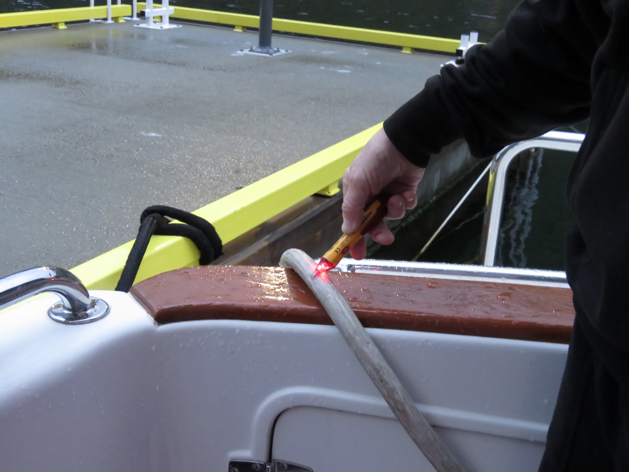 |
5/6/2018: Voltage detector
Position: 60°51.67'N, 7°7.19'E
The shore power failed last night. New shore power systems include a super-sensitive Residual Current Device and these RCDs are frequently set as low as 30 milliamps so even tiny current leaks that in the past decade would never even be noticed, now cause a breaker to release. We now have a Fluke 1507 Megaohmeter that can find these tiny current leaks fast. In this case rain water last night had run down into our shore power plug and leaked just enough. Quick and easy to correct.
Here James is using our Klein NCVT-2. It's a non-contact voltage detector. It's great to have this small writing pen-sized device when plugging in the shore power. If it's a live connection, the tool touched or even waved near the shore power cord anywhere will beep and show a light. This under $20 tool makes plugging in and ensuring that power is actually available at the shore pedestal super-easy. A wave of the tester show which sockets are live and which aren't. A quick touch to the shore power cord confirms voltage is present. |
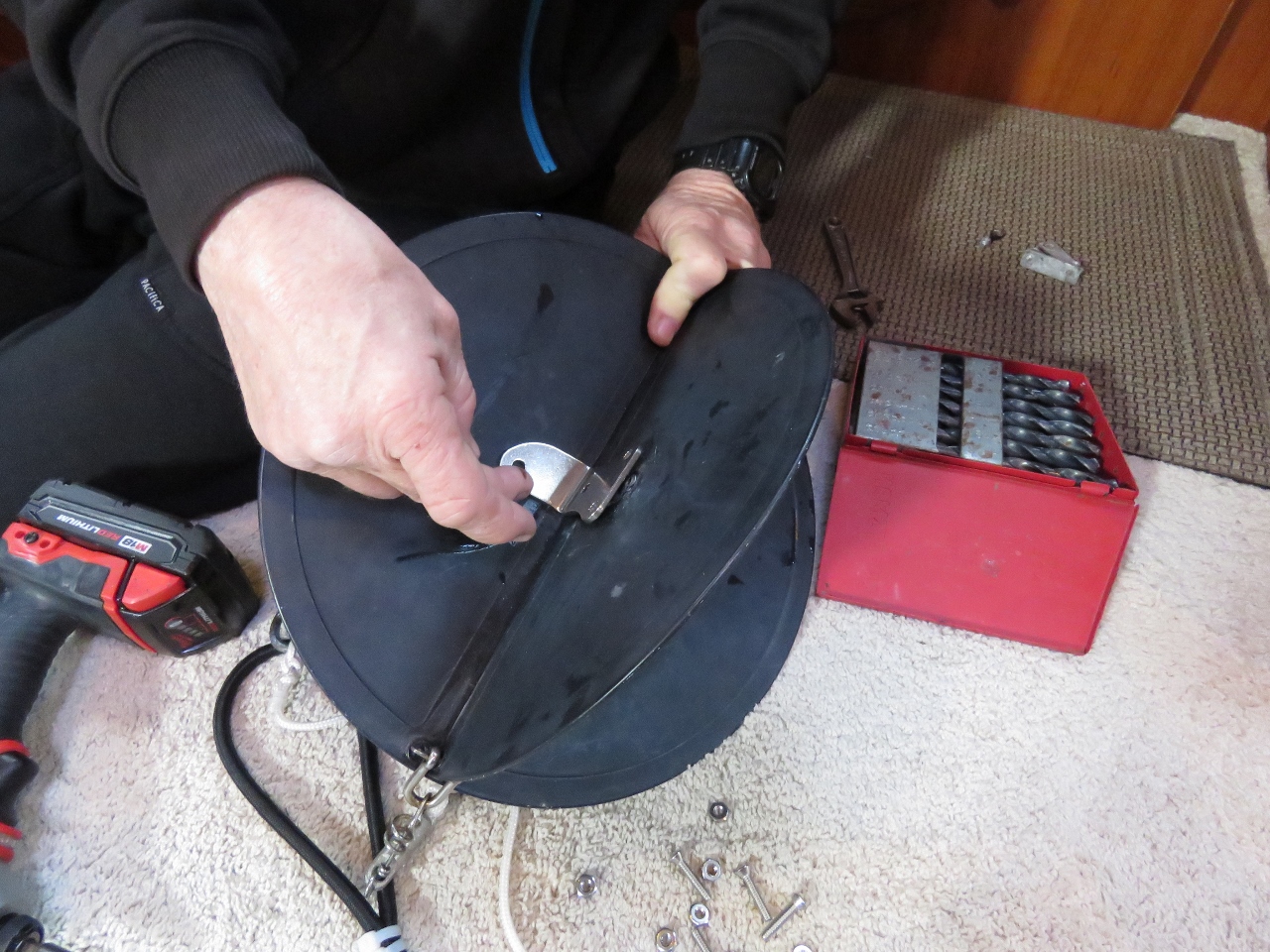 |
5/6/2018: Anchor Ball
Position: 60°51.67'N, 7°7.19'E
We rigged an anchor ball back in 2013 while in French Polynesia and used 90-degree aluminum brackets to keep the ball from collapsing in higher winds. After five years the brackets flexed and broke, so we installed new stainless-steel ones today. These should outlast the anchor ball (and probably us and the boat as well).
|
 |
5/6/2018: Cooling System
Position: 60°51.67'N, 7°7.19'E
When the main engine cooling system is running correctly the coolant reservoir bottle shows a specific level for hot and another for cold and these levels don't change through multiple warm-up/cool-down cycles. On Dirona, we have a fairly large capacity cooling system so we adjust cold be about halfway between empty and the "cold" mark (pictured). Using that setting, hot is halfway between the top and the "hot" mark. Since fixing the problem with air entering the cooling system the system levels are now stable.
|
 |
5/6/2018: Hose Clamp
Position: 60°51.67'N, 7°7.19'E
We fixed the problem with air entering the cooling system, but the very next day noticed a minor coolant leak under the engine, possibly triggered by the pressure test the previous day. We tighten the hose clamps when the engine is a year old and again a year after any hoses are changed. New hoses settle in and the clamps loosen off. We probably could check them every couple of years, but it seems once they've settled in they don't seem to change. A couple of days ago we'd tightened all the hose clamps on the engine. Well, all but the four that are in the near-impossible to access spot down near the keel cooler. We've never been able to get to these. On this engine you can tighten every hose clamp except these four in about five minutes. These four took more than four hours.
The location under the engine is at the extremes of James' reach and can't be seen, so all the work is done by feel. And for the most difficult one, only an open-end wrench will fit and there's only sufficient clearance to get a 16th of a turn at a time. Between each 16th of a turn, Jennifer has to verbally guide James back to the right location to get reposition the wrench on the hose clamp nut. James' chest and arms had bruises from stretching to reach. But the clamps are tightened and the engine coolant system is sealed up nicely and will hold a leak test at 20 PSI indefinately. |
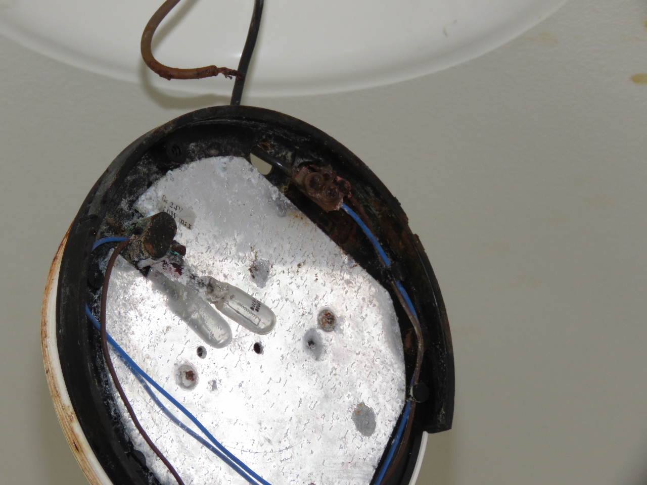 |
5/6/2018: Deck Light
Position: 60°51.67'N, 7°7.19'E
One of our outside deck lights appears to have filled with seawater. It's amazing that lights tucked away underneath the deck can get hammered so hard with waves that they will fill with water. There's little to save on this one, so we just replaced it with a spare.
|
 |
5/6/2018: Aurlandsfjorden
Position: 60°51.67'N, 7°7.19'E
Even on a cloudy day the view down Aurlandsfjorden is spectacular.
|
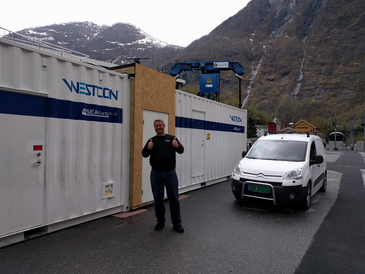 |
5/6/2018: Westcon
Position: 60°51.77'N, 7°6.90'E
The Future of the Fjords is a super interesting large catamaran that is 100% electric. Its sister ship, hybrid Vision of the Fjords, has run well so they went with an all-electric propulsion system for the just-delivered Future of the Fjords.
We talked briefly with the Westcon engineer working on site to ensure the new system is working as designed. They faced an interesting problem here where local town Flam unsurprisingly doesn't have the 2 million watts of power needed to quickly charge the on-board battery system in the Future of the Fjords. The solution they chose was an innovative one I've also seen used on short-run electric ferries. They trickle charge the large on-shore battery system stored in the container on the left and, when the boat arrives, quickly charge it's batteries from the shore-side battery system. The shore-side facility is always charging at a low level in the background whether the boat is there or is off with a load of tourists. |
 |
5/6/2018: Power Connection
Position: 60°51.77'N, 7°6.88'E
Now that's a power connection. This is the 2 MW shore power supply for all-electric cruise ship Future of the Fjords
|
 |
5/6/2018: Ægir Brew Pub
Position: 60°51.82'N, 7°7.04'E
We had another excellent meal at the Ægir Brew Pub in Flåm. This is looking down to their central fireplace and seating area from the dining room upstairs.
|
 |
5/7/2018: Flåm Harbour
Position: 60°51.71'N, 7°7.08'E
Flåm Harbour viewed from the commercial dock on the other side.
|
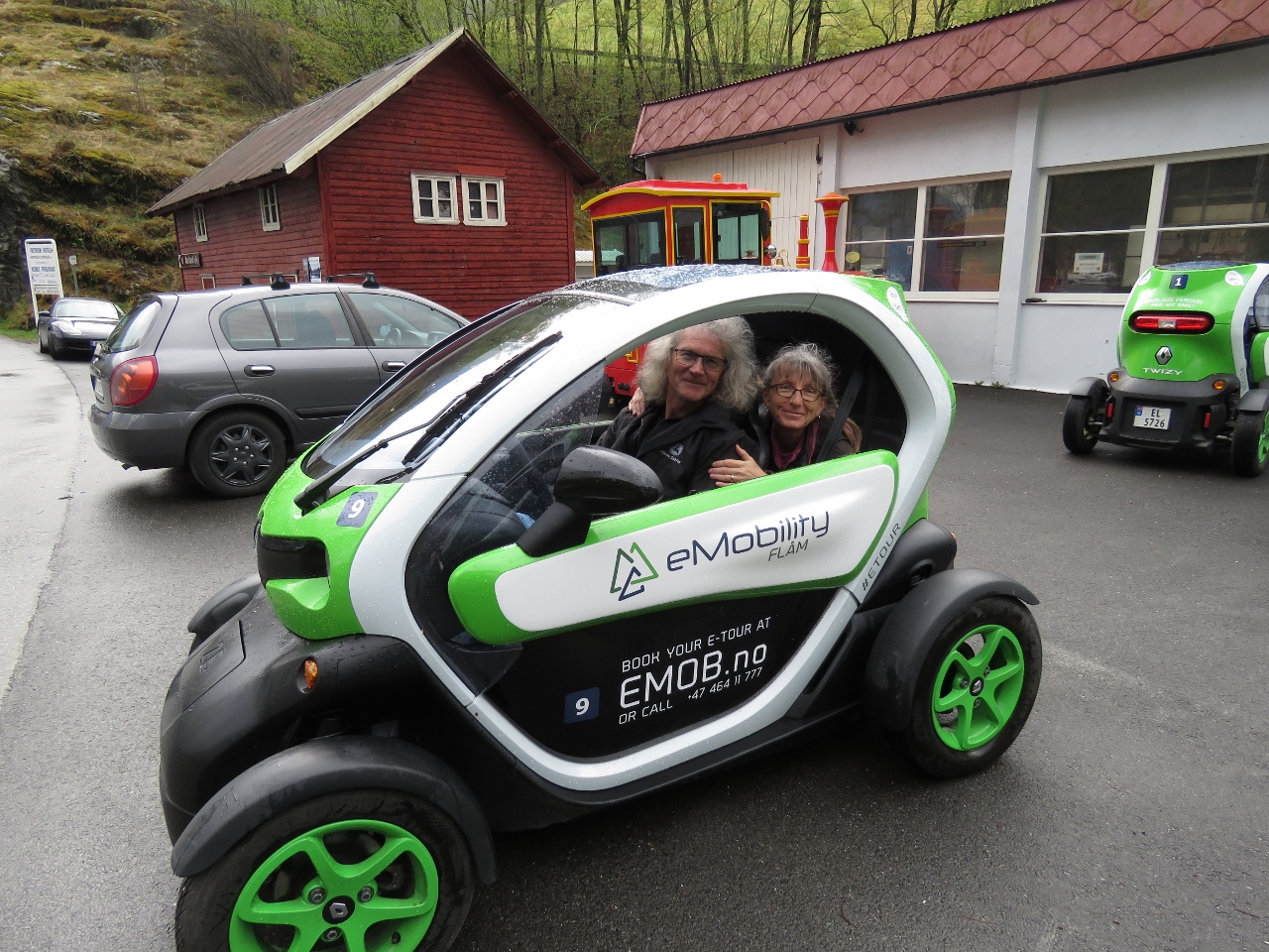 |
5/7/2018: eMobility
Position: 60°51.69'N, 7°6.90'E
In a bid to minimize the environmental impact of tourism, the main form of rental car in Flåm are these Renault Twizy electric cars from eMobility. We rented one today to explore a few attractions by road.
|
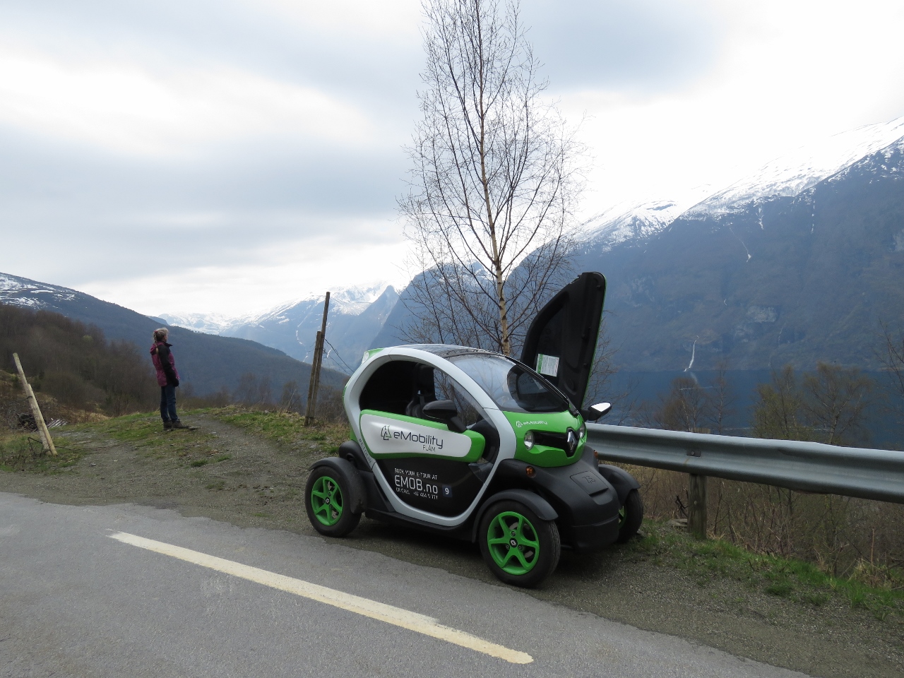 |
5/7/2018: Twizy
Position: 60°55.13'N, 7°12.77'E
Taking in the view over Aurlandsfjord partway up to the Stegastein Viewpoint. You can see the Twizy has gull-wing doors and the left door is open.
|
 |
5/7/2018: Aurlandsfjord
Position: 60°55.02'N, 7°12.84'E
Looking down Aurlandsfjord toward the junction with Nærøyfjord.
|
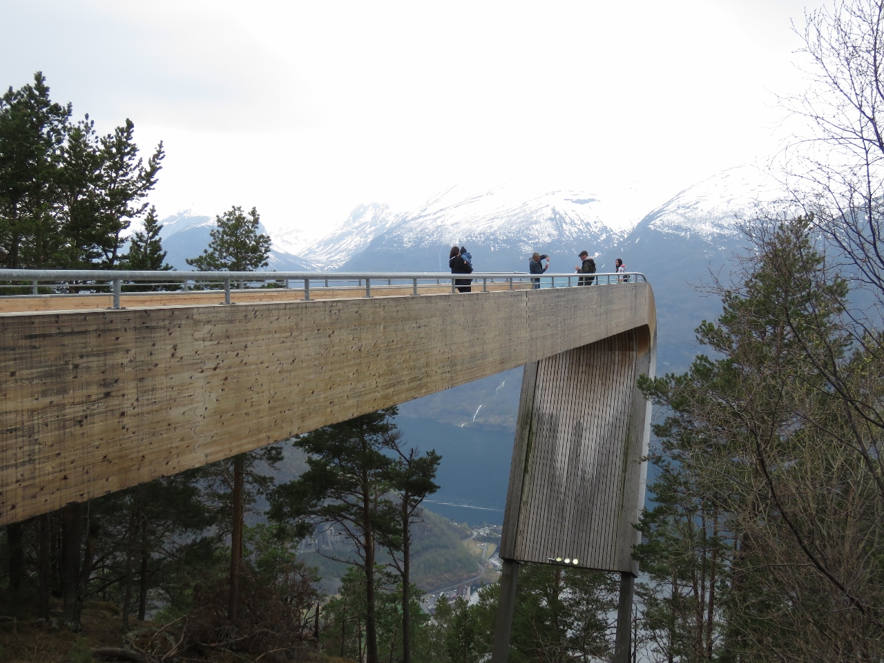 |
5/7/2018: Stegastein Viewpoint
Position: 60°54.52'N, 7°12.74'E
The Stegastein Viewpoint juts 100ft (30m) out from the mountain 1,250ft (650m) above Aurlandsfjord.
|
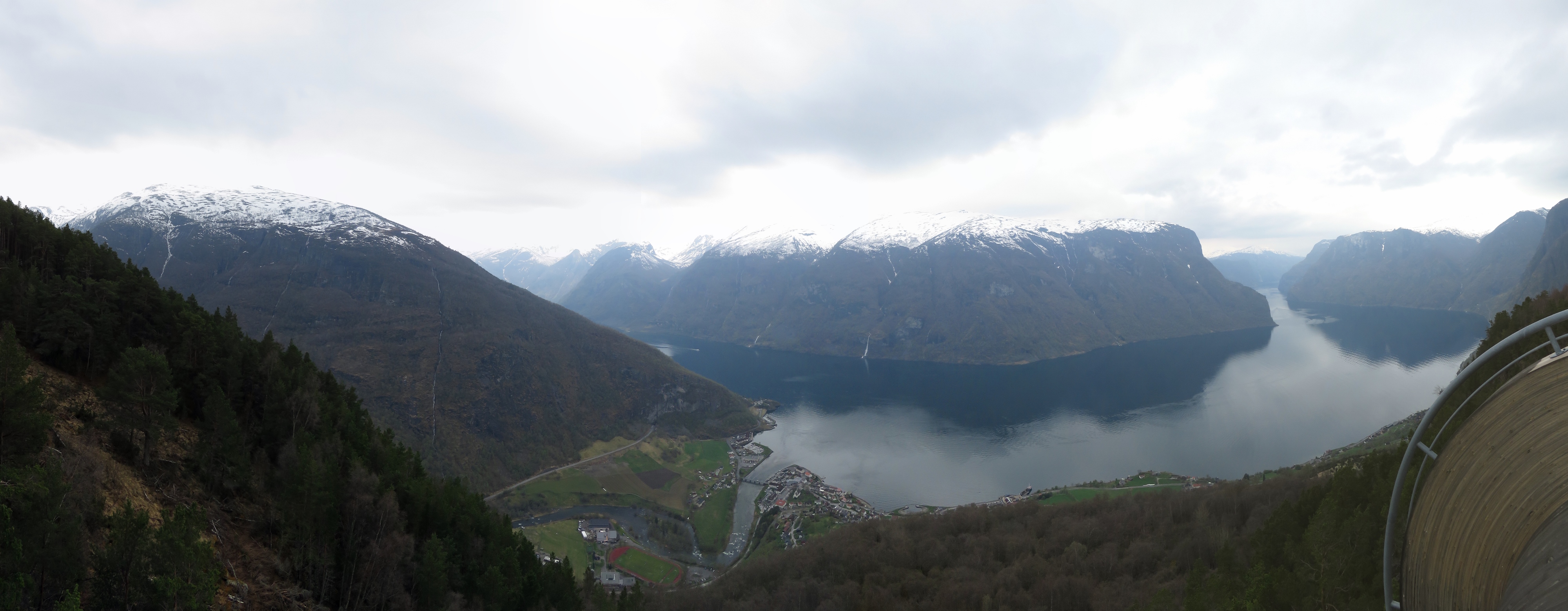 |
5/7/2018: Platform View
Position: 60°54.52'N, 7°12.71'E
The sweeping view from Stegastein Viewpoint across Aurlandsfjord with the town of Aurlandsvangen directly below.
|
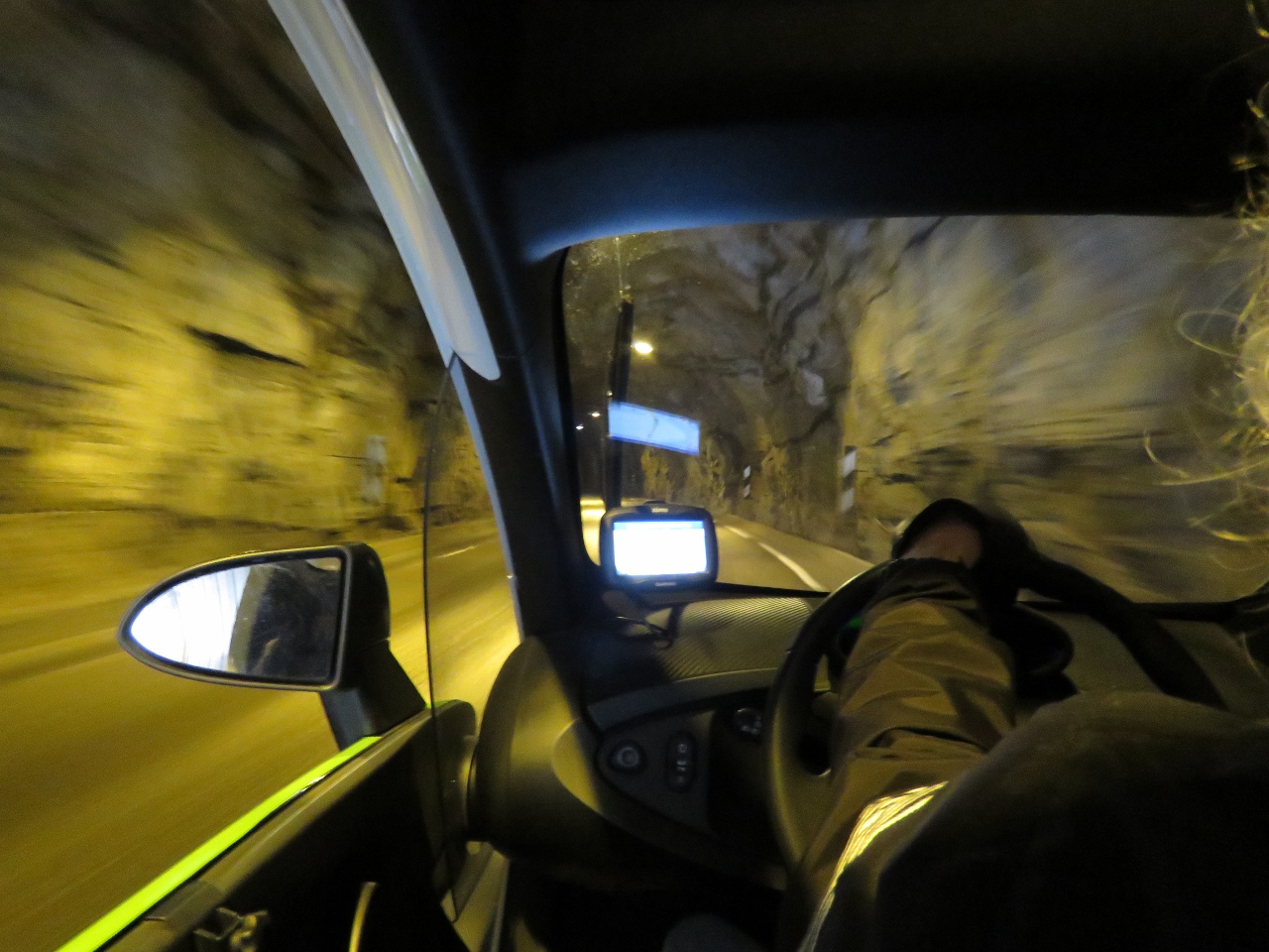 |
5/7/2018: Tunnel
Position: 60°52.32'N, 7°16.42'E
Heading into a tunnel in our Twizy on our way up the river valley east of Aurlandsvangen.
eMobility offers two two-hour tours, one to the Stegastein Viewpoint and the other up the valley to the village of Vassbygdi just past the Aurland III power station. If you conserve power extremely carefully, it looked possible to be able to do both. So James was at his best driving behaviour ever. We did them both and were still one power indicator bar from the bottom when we returned to Flåm. |
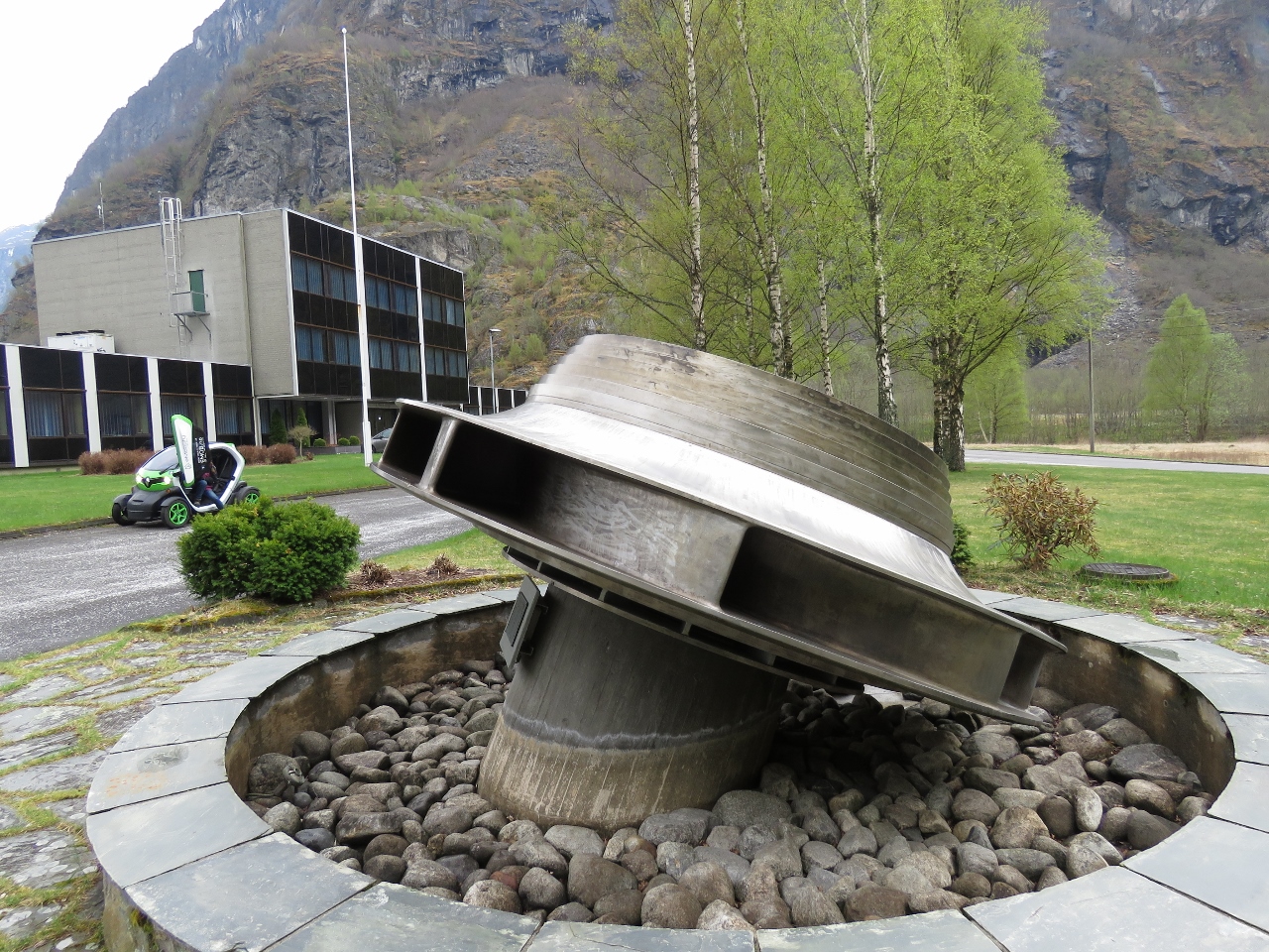 |
5/7/2018: Turbine
Position: 60°52.43'N, 7°19.31'E
At the Aurland III power station. The facility isn't open for tours, but they did have an impressive turbine mounted out front.
|
 |
5/7/2018: Vassbygdi Lake
Position: 60°52.06'N, 7°18.68'E
A quick lunch at the edge of the Vassbygdi Lake before returning back to Flåm.
|
 |
5/7/2018: Turlifossen
Position: 60°53.82'N, 7°13.07'E
Turlifossen waterfall on the road back toward Aurlandsvangen.
|
 |
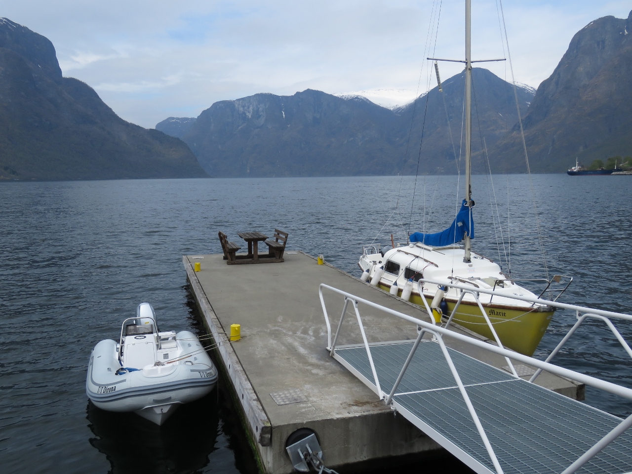
5/7/2018: Dirona
Position: 60°51.66'N, 7°7.20'E
After returning to Flåm and returning our Twizy, we set off on a tender tour to Nærøyfjord. This is our berth viewed from the tender.
|
 |
5/7/2018: Aurlandsvangen
Position: 60°54.39'N, 7°11.12'E
We would have stopped in Aurlandsvangen for lunch on the way back from the power station, but we only had the car for two hours so didn't have time. Instead, we came over by tender.
|
 |
5/7/2018: Marianne
Position: 60°54.33'N, 7°11.21'E
We had an excellent pizza for lunch at Marianne Bakery and Cafe in Aurlandsvangen.
|
 |
5/7/2018: Vertical
Position: 60°56.15'N, 7°9.61'E
A vertical cliff as we round a bend toward Nærøyfjord.
|
 |
5/7/2018: Undredal
Position: 60°57.06'N, 7°6.86'E
The village of Undredal.
|
 |
5/7/2018: Kayaks
Position: 60°58.23'N, 7°4.18'E
At least a dozen kayaks were piled up on shore here, with no people in evidence. We could see a trail snaking up the near-vertical cliffside, so the only likely explanation is they hiked up somewhere out of sight.
|
 |
5/7/2018: Waterfall I
Position: 60°58.47'N, 7°3.98'E
We saw literally dozens of waterfalls today. Here is one of the better ones.
|
 |
5/7/2018: Unknown
Position: 60°58.51'N, 7°3.91'E
This box was mounted on a point about twenty feet above the water line. We didn't come up with any solid theories for its application.
|
 |
5/7/2018: First View
Position: 60°59.17'N, 7°2.71'E
A first view down Nærøyfjord. The fjord was named a UNESCO World Heritage site in 2005 for being among the most scenically outstanding in the world.
|
 |
5/7/2018: Lægdafossen
Position: 60°58.66'N, 7°0.76'E
Lægdafossen waterfall plunges nearly 2,000ft (600m) in four tiers.
|
 |
5/7/2018: Waterfall III
Position: 60°58.07'N, 6°58.59'E
.
|
 |
5/7/2018: Drydal
Position: 60°57.30'N, 6°57.01'E
Looking east into the valley behind the hamlet of Drydal.
|
 |
5/7/2018: Styvi
Position: 60°56.63'N, 6°56.06'E
Outside the Styvi farm is a ferry dock where passengers can be picked up or dropped off on request. The farm museum there has artifacts dating back to prehistoric times.
|
 |
5/7/2018: Waterfall IV
Position: 60°56.33'N, 6°54.34'E
.
|
 |
5/7/2018: Tour boat
Position: 60°55.47'N, 6°52.31'E
Tour boats of all sizes and speeds operate in Nærøyfjord.
|
 |
5/7/2018: Narrows
Position: 60°55.30'N, 6°52.38'E
At its narrowest Nærøyfjord is only 820ft (250m) across with sheer cliffs on either side.
|
 |
5/7/2018: Head
Position: 60°54.94'N, 6°52.40'E
Gudvangen village at the head of Nærøyfjord.
|
 |
5/7/2018: Gudvangen
Position: 60°52.80'N, 6°50.60'E
We were going to land the tender in a small cove and clamber up some rocks to get ashore, but the dock master called us over and "assigned us" this much nicer landing spot on the main dock.
|
 |
5/7/2018: Footbridge
Position: 60°52.80'N, 6°50.52'E
Footbridge over the river Nærøydalselvi in Gudvangen with more waterfalls visible in the distance.
|
 |
5/7/2018: Kjelsfossen
Position: 60°52.68'N, 6°50.37'E
The Kjelsfossen waterfall at Gudvangen has a total fall height of 2,477 ft (755 m). It's the one of the highest waterfalls in Norway and the 18th tallest in the world.
|
 |
5/7/2018: Cafe
Position: 60°52.85'N, 6°50.51'E
The Viking-inspired cafe at the Gudvangen visitor center. Big cruise ships visit here and the village is setup for large groups of tourists. It was thankfully quiet when we were there.
|
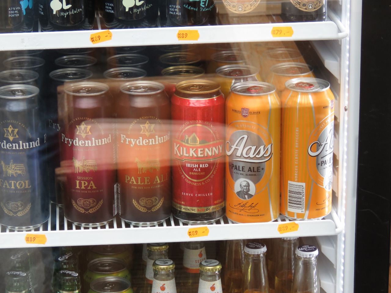 |
5/7/2018: Kilkenny
Position: 60°52.85'N, 6°50.51'E
We noticed the cafe stocked Kilkenny— one of Jennifer's favourite Irish beers. We haven't seen it for sale for a long time.
|
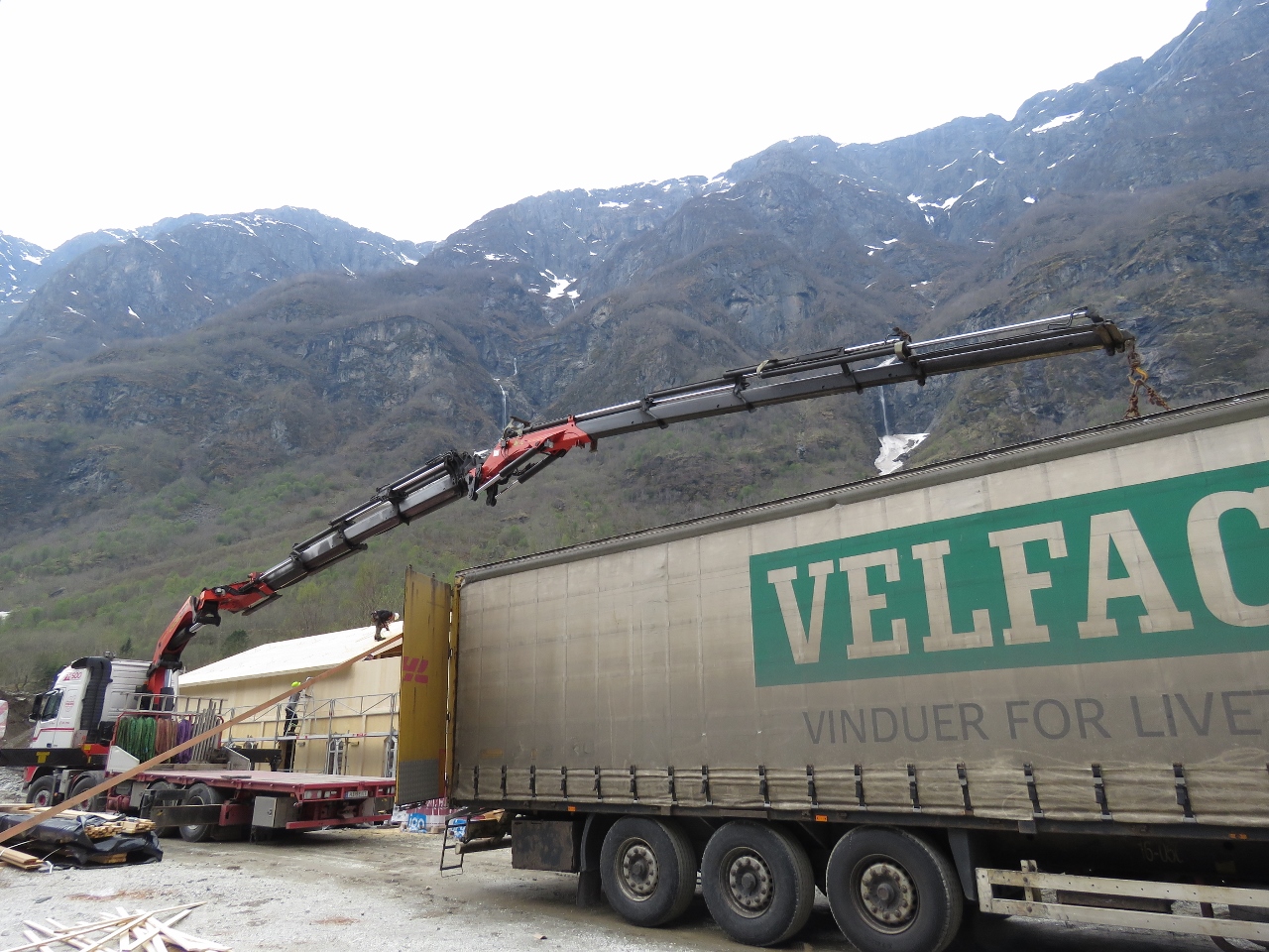 |
5/7/2018: Knuckle Crane
Position: 60°52.71'N, 6°50.55'E
We love the reach of the knuckle cranes and would love to have one on Dirona.
|
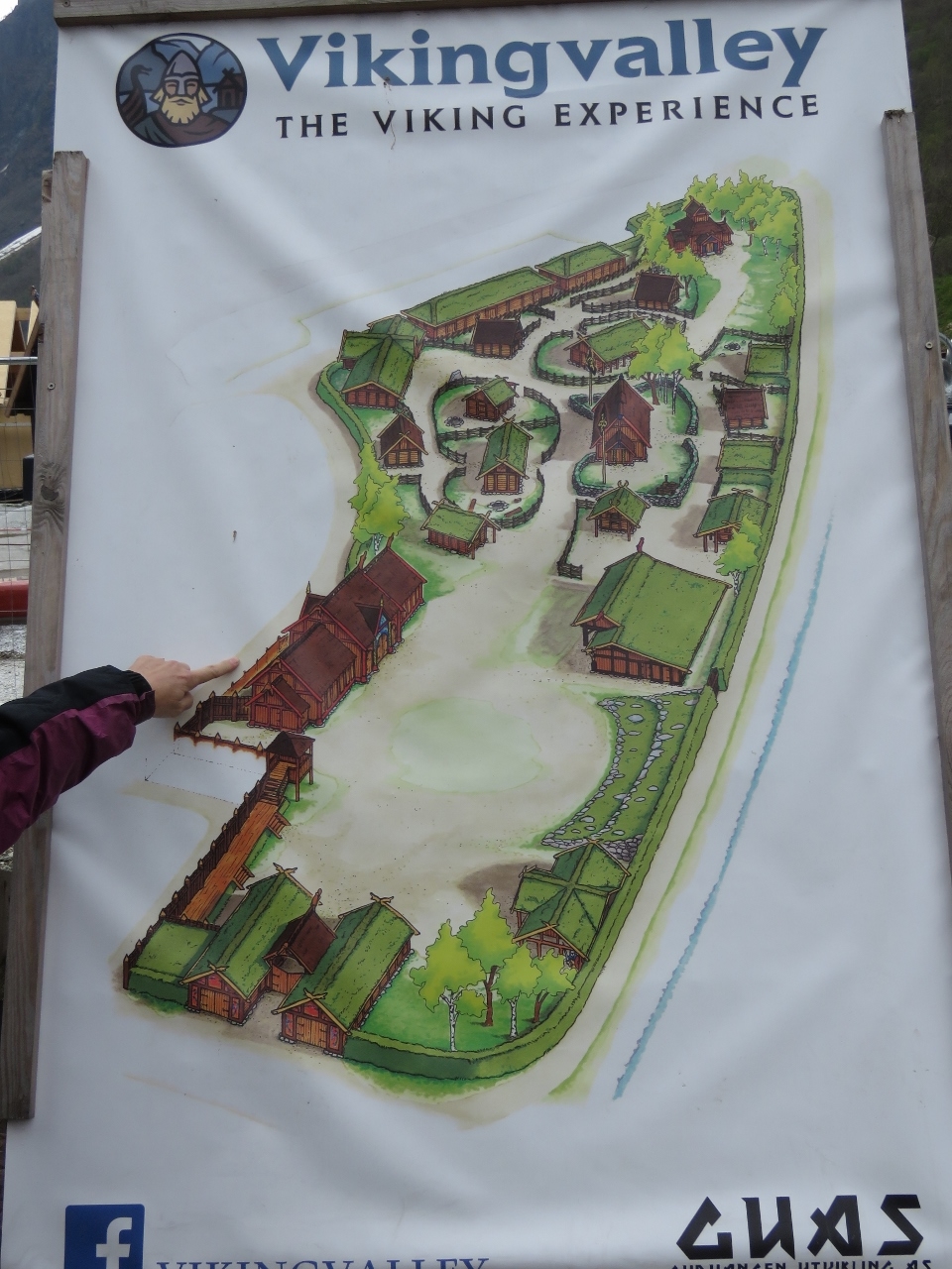 |
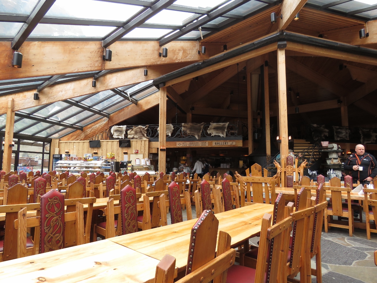
5/7/2018: Vikingvalley
Position: 60°52.74'N, 6°50.57'E
The construction we saw earlier was to extend the Vikingvalley Viking Experience. Portions already were open, but looked designed to appeal to the cruise ship crowd and didn't tempt us to visit.
|
 |
5/7/2018: Museum
Position: 60°51.67'N, 7°7.19'E
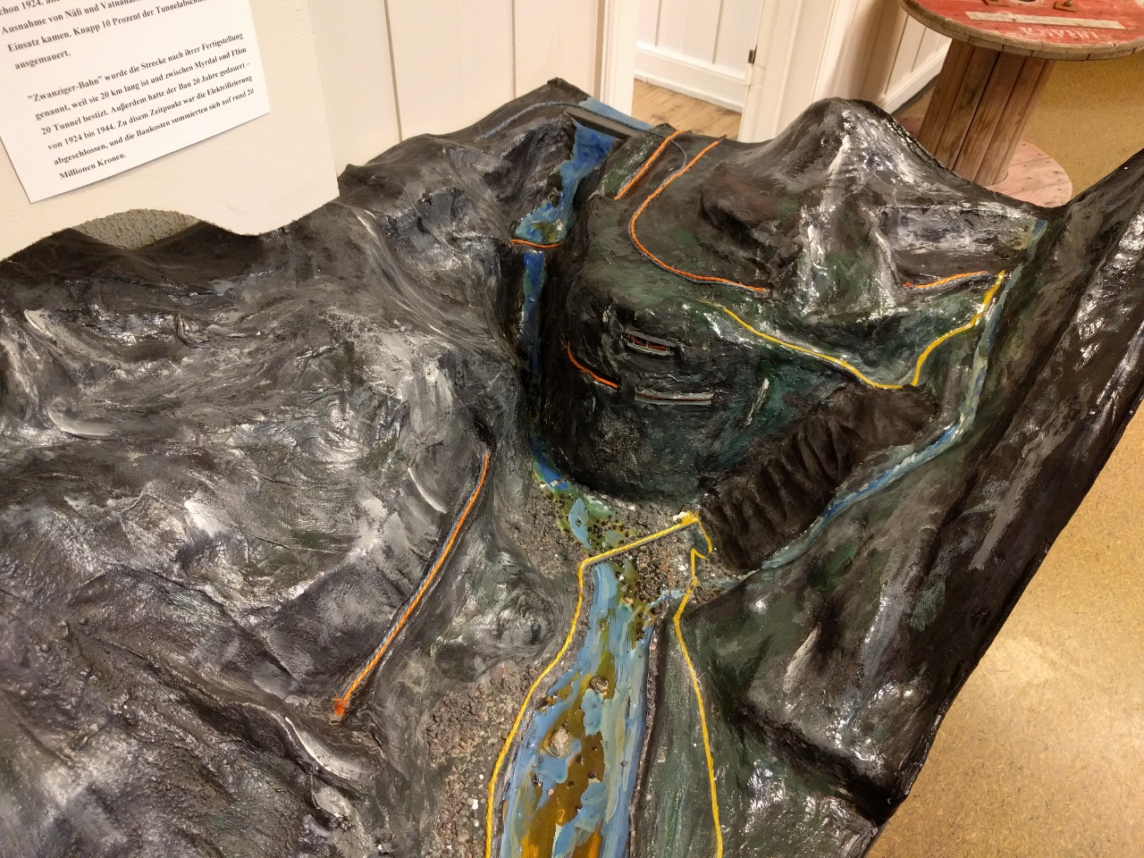
Back at Flåm we stopped in at the railway museum, which has excellent displays detailing the history and construction of the Flåm Railway. This model shows in orange how the train tracks run up Myrdal Mountain. From bottom left the tracks climb steeply and turn right to emerge at Kjosfoss station where we stopped to view the waterfall Kjosfossen. The tracks turn right again and enter the Vatnahalsen tunnel, the bottom of two stacked tunnels, then makes a sharp horseshoe curve left and passes through Bali tunnel, the top of the stacked tunnels. From Bali the tracks extend away from the valley, paralleling the river that feeds Kjosfossen waterfall, then make another horseshoe curve to return toward the valley and make a final right turn and pass through a tunnel to reach Myrdal station.
The vehicle road is shown in yellow, with the switchbacks of Rallarvegen Road in black at the right of the model |
 |
5/7/2018: Rune Bergkvam
Position: 60°51.67'N, 7°7.19'E
Rune Bergkvam, who runs the eMobility shop where we rented the Twizy, stopped by for a visit later in the evening. Rune travelled here in his boat that he keeps in the marina where we are moored, and lives in the hills above the marina with a view down Aurlandsfjord.
|
 |
5/8/2018: Flåm
Position: 60°51.76'N, 7°7.29'E
A last look at Flåm as we depart.
|
 |
5/8/2018: Calm
Position: 60°56.13'N, 7°9.74'E
The weather is wonderfully calm and clear today.
|
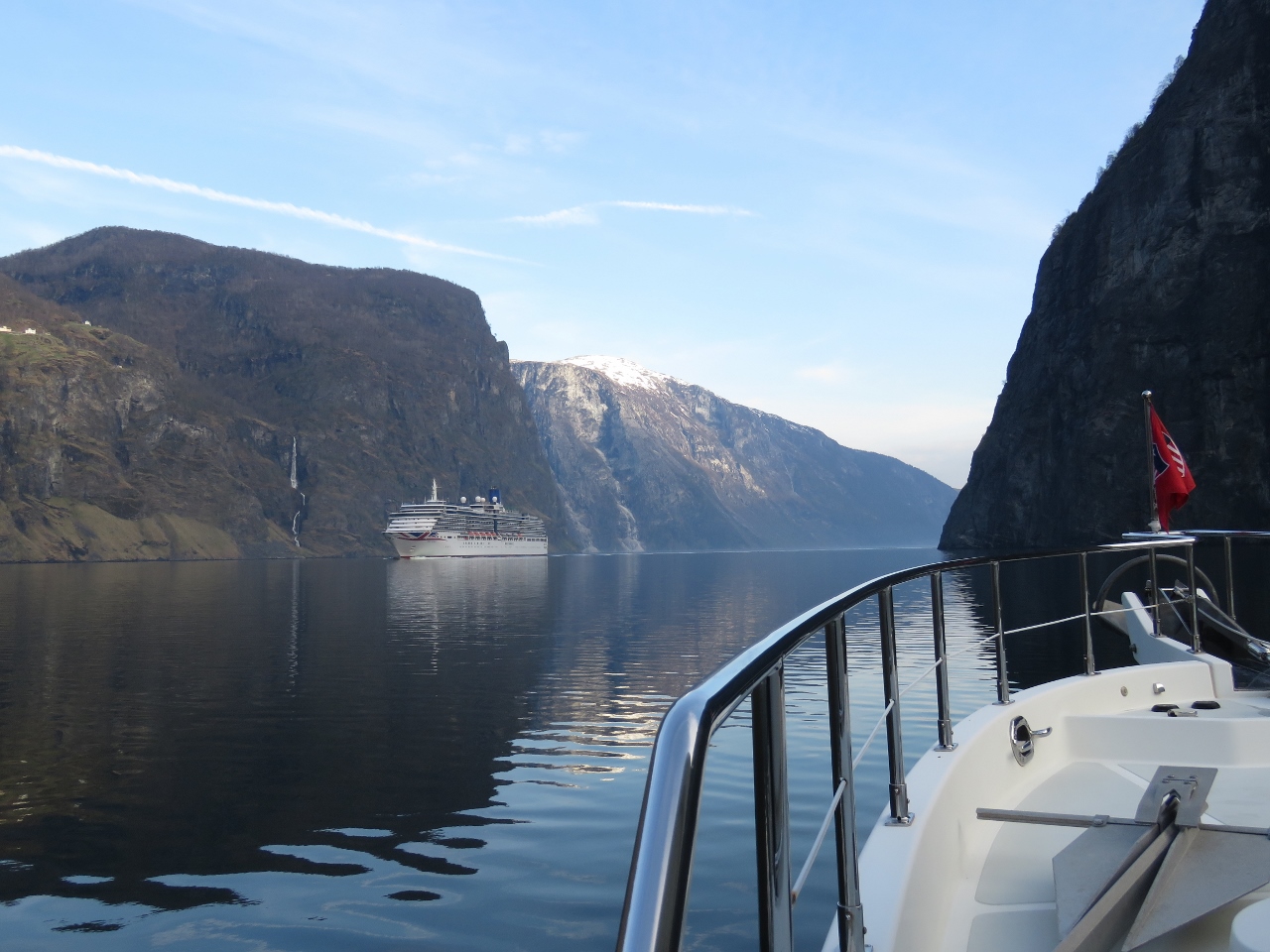 |
5/8/2018: Arcadia
Position: 60°58.14'N, 7°5.49'E
We thought we'd arrived in Flåm before the cruise ship season, but a some have already been here and two will arrive today. Although it would have been fun to see the cruise ship docked at tiny Flåm, we're glad to have missed the crowds. The 950ft (290m) Arcadia can carry up to 2,388 passengers. These ships are one of the few things not dwarfed by the surrounding scenery.
|
 |
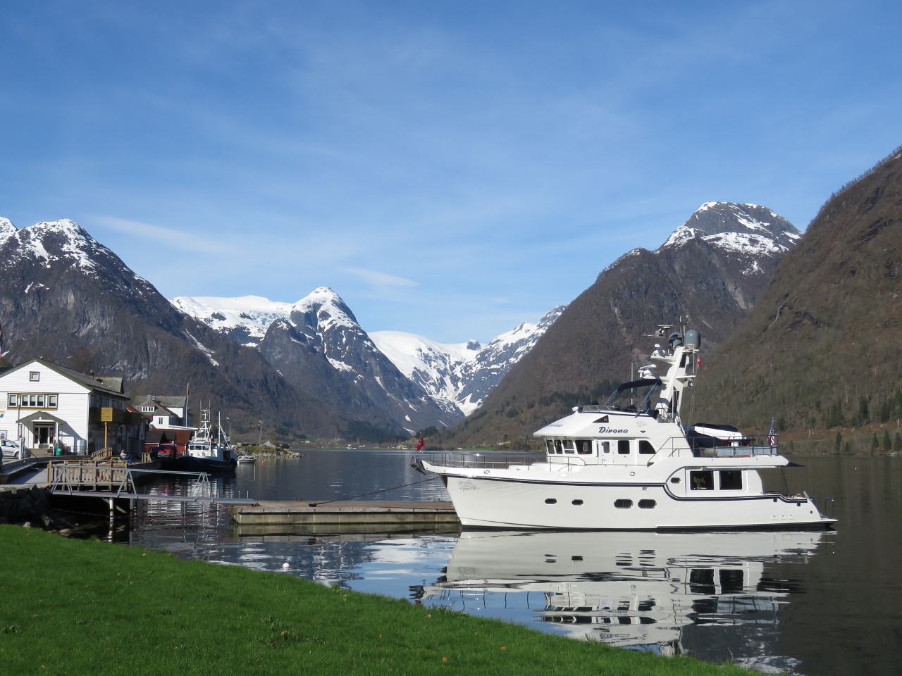
5/8/2018: Esefjord
Position: 61°12.47'N, 6°35.30'E
Snow-covered mountains at the end of Esefjord as we turn north into Fjærlandsfjord.
|
 |
5/8/2018: Reflections
Position: 61°19.48'N, 6°41.99'E
The calm weather continues as we head up Fjærlandsfjord with the mountains reflected almost perfectly in the water.
|
 |
5/8/2018: Fjærland
Position: 61°24.05'N, 6°44.62'E
The village of Fjærland at the head of Fjærlandsfjord.
|
 |
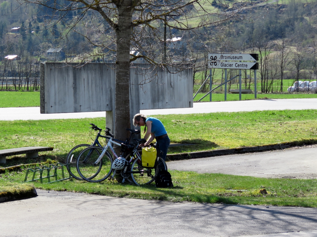
5/8/2018: Bikes
Position: 61°24.27'N, 6°44.44'E
Once tied off at the Fjærland quay, we immediately got the bikes down to ride up to Supphellebreen glacier.
|
 |
5/8/2018: Book Town
Position: 61°24.24'N, 6°44.45'E
Fjærland is an International Book Town with ten second-hand bookstores in various buildings throughout town. Here Jennifer is browsing the selection at one near our dock.
|
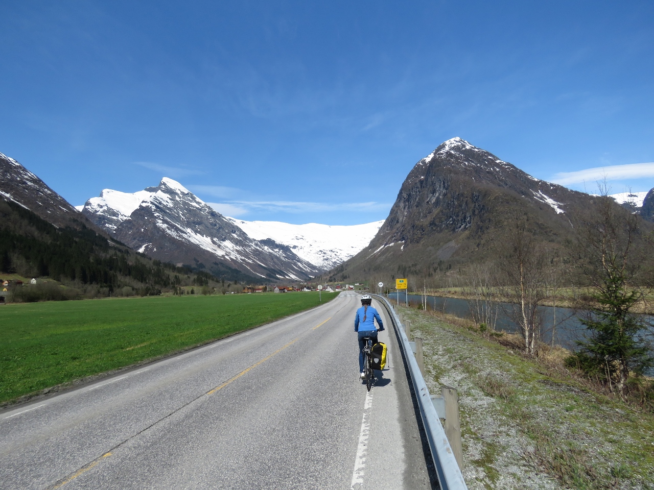 |
5/8/2018: On the Road
Position: 61°25.42'N, 6°45.90'E
Biking along Riksvei 5 (national road 5) en route to Supphellebreen glacier.
|
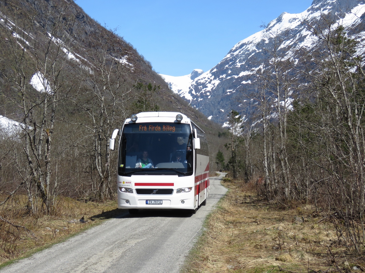 |
5/8/2018: Tour Bus
Position: 61°27.58'N, 6°48.94'E
Supphellebreen glacier and nearby Bøyabreen glacier are popular tourist draws. A tour bus was departing as we approached.
|
 |
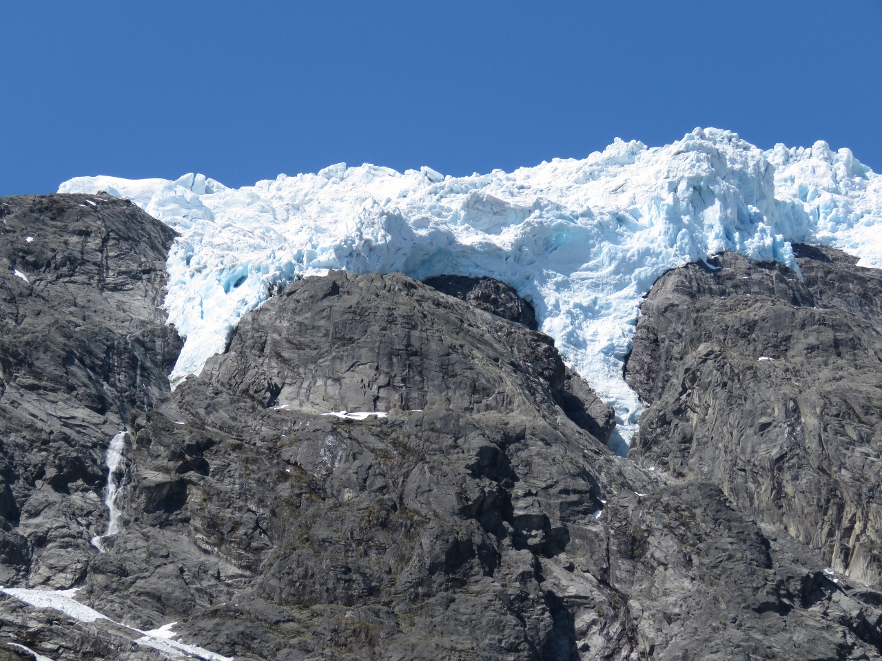
5/8/2018: At the Glacier
Position: 61°27.83'N, 6°49.26'E
At the base of Supphellebreen glacier. The glacier itself is at the top of the cliff and the big pile of snow below is from ice that has calved off. The yellow signs warn of falling rock and ice.
|
 |
5/8/2018: Supphellebreen glacier
Position: 61°28.00'N, 6°49.41'E
Close-up to the edge of Supphellebreen glacier.
|
 |
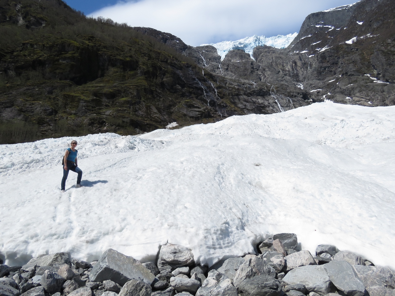
5/8/2018: Below Glacier
Position: 61°27.92'N, 6°49.24'E
Jennifer perched on a rock outcropping under Supphellebreen glacier.
|
 |
5/8/2018: Snow
Position: 61°27.93'N, 6°49.27'E
With the river below to wide to cross, we had to hike across the snow a few time to get to the other side.
|
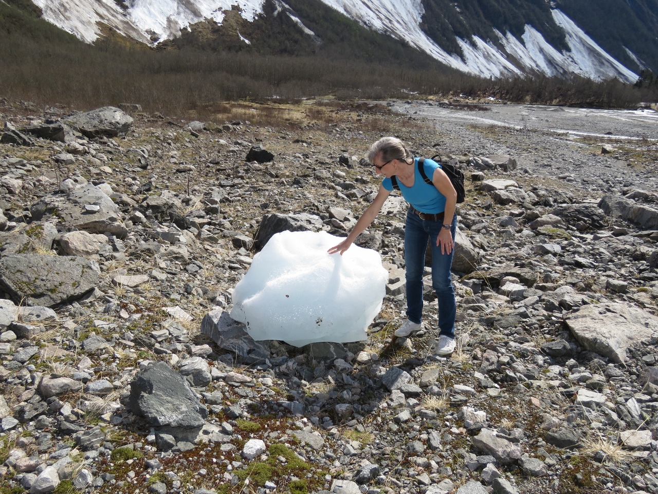 |
5/8/2018: Glacial Ice
Position: 61°27.96'N, 6°49.37'E
A big chunk of glacial ice from Supphellebreen glacier.
|
 |
5/8/2018: Lunch
Position: 61°27.99'N, 6°49.37'E
Lunch on the east side of Supphellebreen glacier. It was so warm we were just in T-shirts.
|
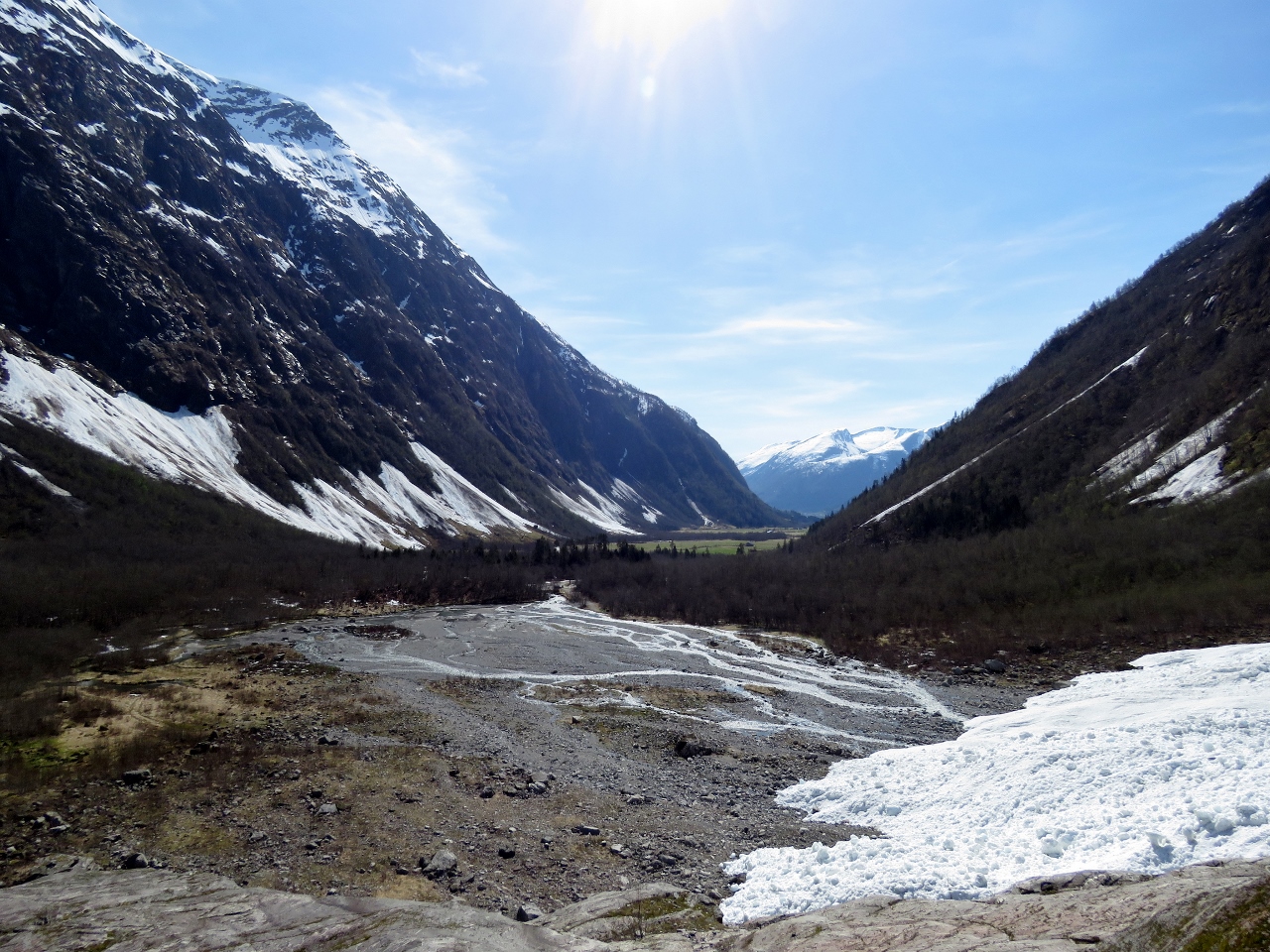 |
5/8/2018: Valley
Position: 61°28.00'N, 6°49.41'E
Looking back across the valley we'd biked up to reach Supphellebreen glacier.
|
 |
5/8/2018: Glacier Museum
Position: 61°25.39'N, 6°45.72'E
After visiting Supphellebreen glacier we returned back to Fjærland to visit the Norwegian Glacier Museum.
|
 |
5/8/2018: Rooftop View
Position: 61°25.41'N, 6°45.77'E
The Glacier Museum has a rooftop deck with excellent mountain views.
|
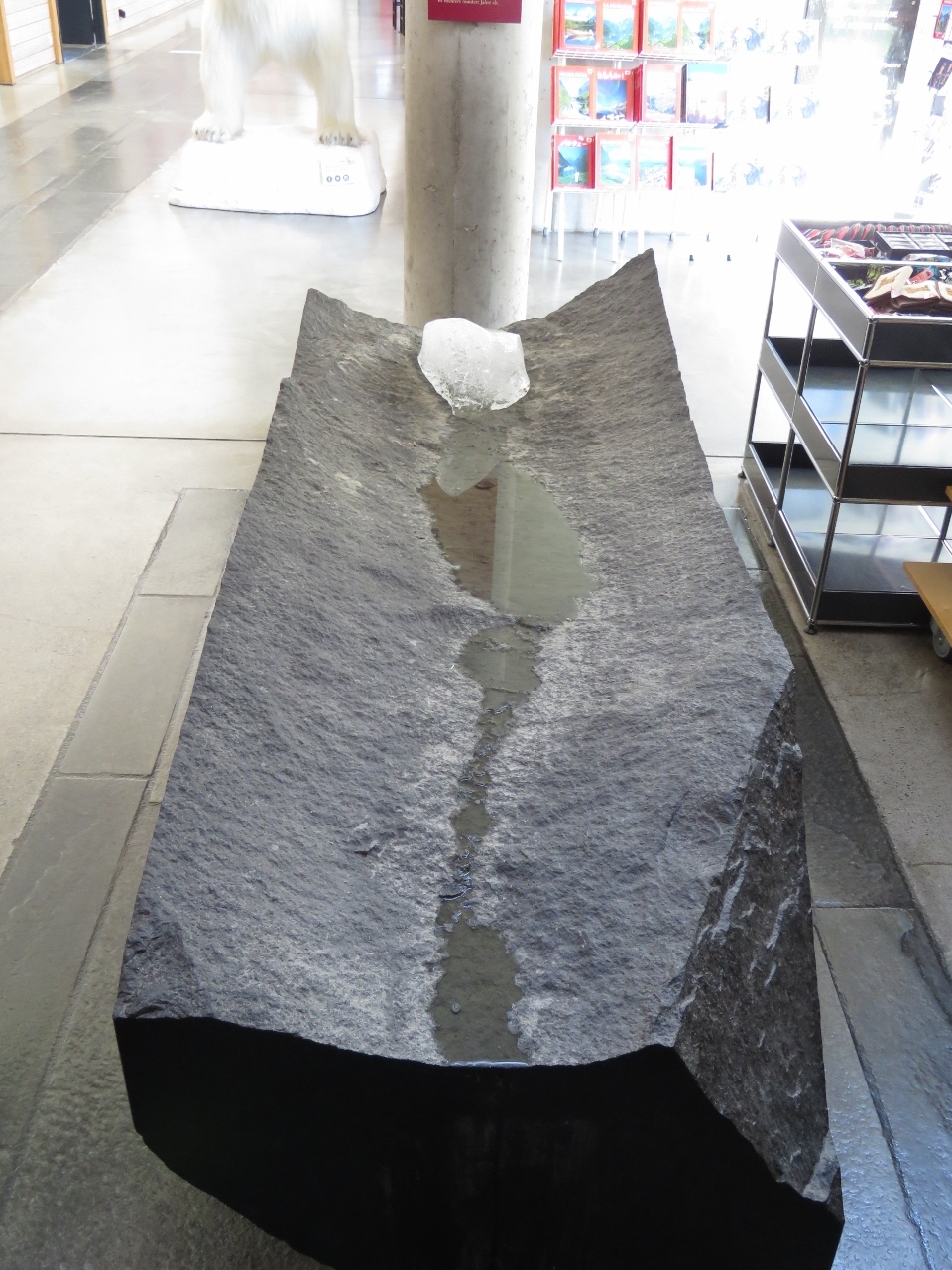 |
5/8/2018: Melting Glacial Ice
Position: 61°25.40'N, 6°45.77'E
1000-year old glacial ice at the entrance to the Glacier Museum.
|
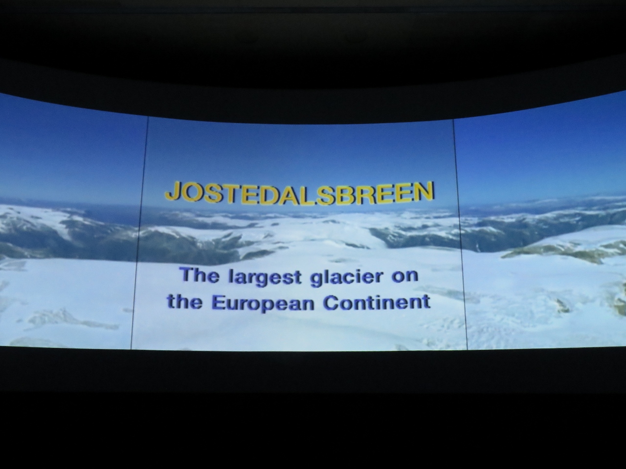 |
5/8/2018: Jostedalsbreen
Position: 61°25.40'N, 6°45.78'E
Supphellebreen glacier that we visited is part of Jostedalsbreen, the largest icecap in mainland Europe. The Glacier Museum has an excellent movie describing Jostedalsbreen with impressive aerial videography.
|
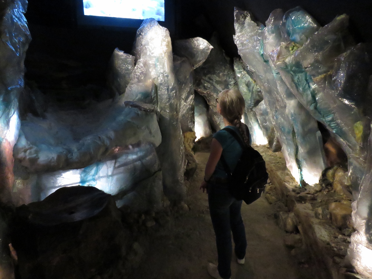 |
5/8/2018: Climate Change
Position: 61°25.40'N, 6°45.78'E
Another impressive exhibit at the Glacier Museum covered climate change through time. The museum also had a number of other interesting displays. We really enjoyed our visit—this is one of the better museums we've seen in the last year or so.
|
 |
5/8/2018: Fjærlandsfjord
Position: 61°24.25'N, 6°44.44'E
The view past the quay to the head of Fjærlandsfjord as we return back to Dirona.
|
 |
5/8/2018: Boat Deck
Position: 61°24.27'N, 6°44.48'E
Drinks on the boat deck in the warm afternoon sun.
|
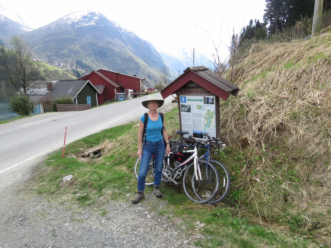 |
5/9/2018: Trail Head
Position: 61°23.34'N, 6°44.41'E
At the the Nesahaugen trail head, 1.2 miles (2km) south of Fjærland. We could have easily walked there from the boat, but since we already had the bikes down we rode there instead.
Before arriving in the area we had planned to hike up to the Flatbrehytta Mountain Cabin, 3,280 ft (1000 m) up at the head of Fjærlandsfjord. But the Fjærland information center said the trail wasn't passable yet due to snow and suggested Nesahaugen instead for great views. |
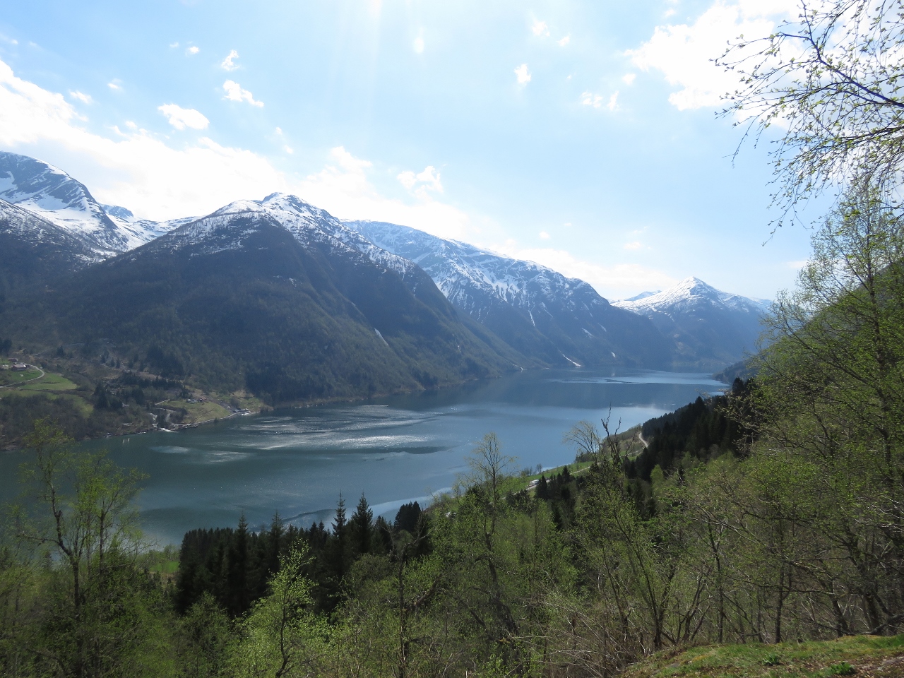 |
5/9/2018: Fjærlandsfjord
Position: 61°23.31'N, 6°43.93'E
The view down Fjærlandsfjord at 790 ft (240 m).
|
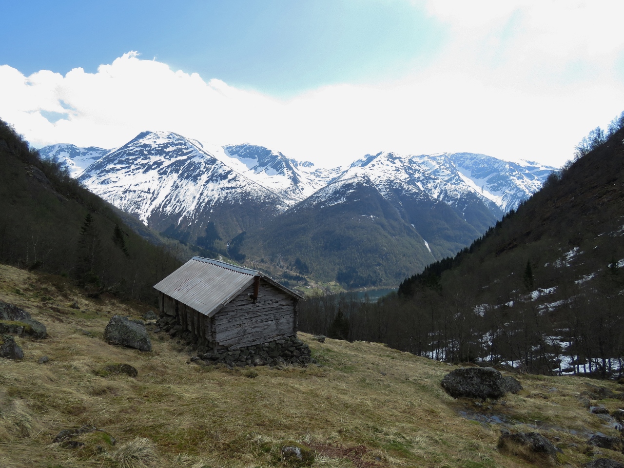 |
5/9/2018: Summer Farm
Position: 61°23.43'N, 6°43.20'E
Old summer farm house at altitude 1560 ft (475 m)
|
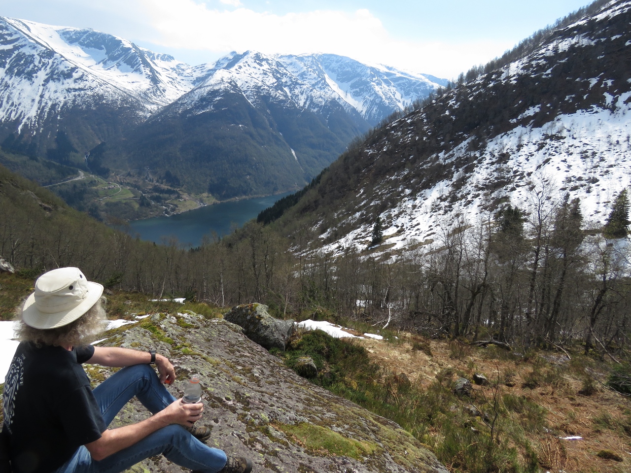 |
5/9/2018: Break
Position: 61°23.51'N, 6°43.04'E
Taking a break at altitude 1825 ft (556 m).
|
 |
5/9/2018: Snow
Position: 61°23.63'N, 6°43.22'E
We'd crossed a few snow patches to reach Nesahaugen, but near the top at 2217 ft (675 m) the snow was much thicker and deeper. In places we'd sink in well past our knees. The temperature was so warm though, and we were hot from hiking, that we were down to T-shirts as we walked across.
|
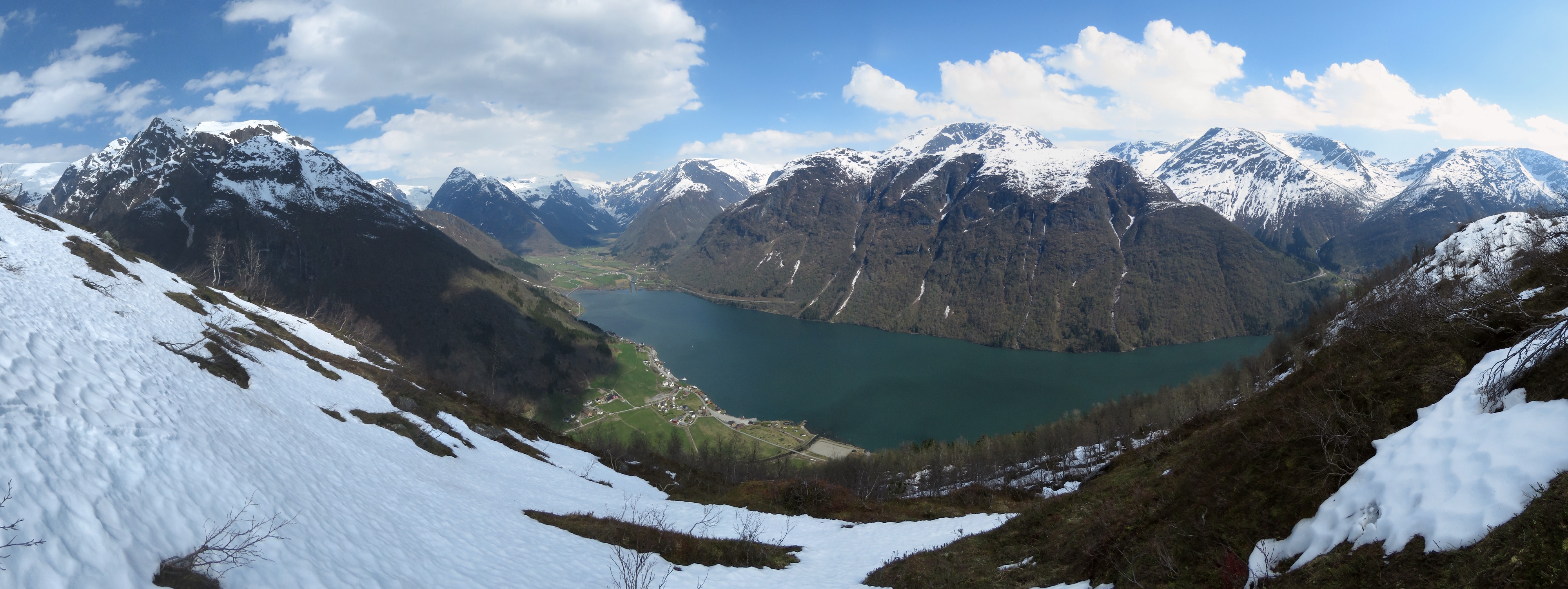 |
5/9/2018: Nesahaugen
Position: 61°23.69'N, 6°43.26'E
The fabulous view from Nesahaugen to Fjærlandsfjord and the Jostedalsbreen icecap in the distance beyond the head.
|
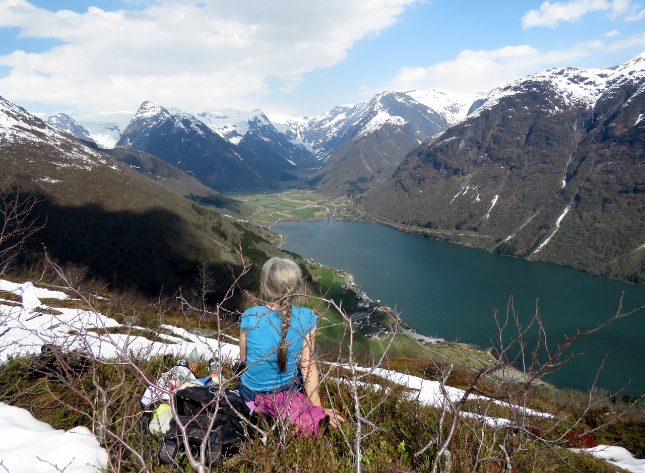 |
5/9/2018: Lunch
Position: 61°23.69'N, 6°43.26'E
We found a reasonably dry spot to have a picnic lunch overlooking Fjærlandsfjord.
|
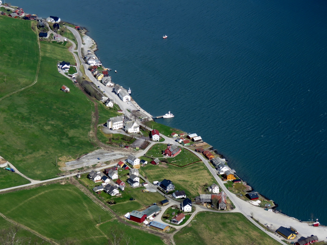 |
5/9/2018: Fjærland
Position: 61°23.69'N, 6°43.26'E
Close-up to Fjærland from Nesahaugen. Dirona is on the dock at center.
|
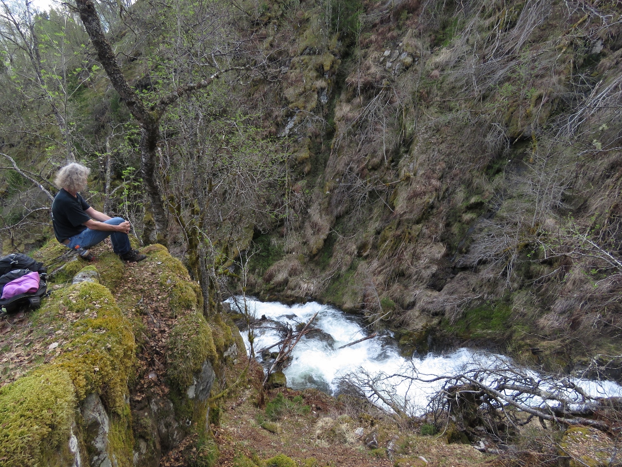 |
5/9/2018: River
Position: 61°23.24'N, 6°43.62'E
Taking a break by a fast-flowing river on the descent.
|
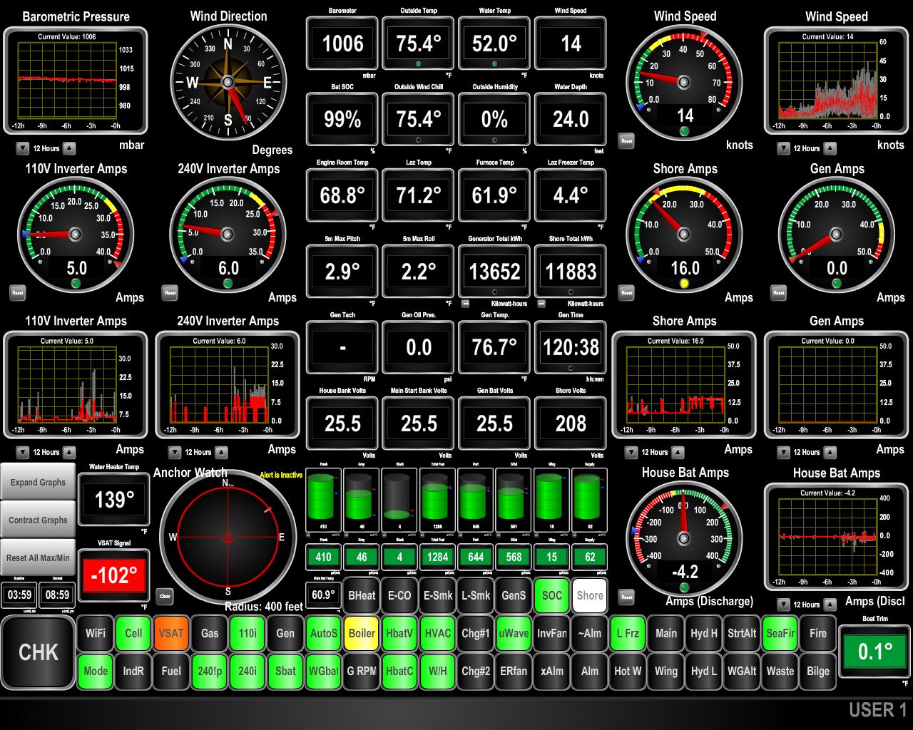 |
5/9/2018: 47 knots
Position: 61°24.27'N, 6°44.48'E
The winds came up this afternoon, gusting to 47 knots. The winds are predicted to be light most places in the area, so we expect the high winds we're seeing are a sea breeze due to the heat of the day. At 9pm the outside temperature still is 75.4°F (24°C).
|