MV Dirona travel digest for Cuxhaven, DE to Hoorn, NL 2018

|
Click the travel log icon on the left to see these locations on a map,
with the complete log of our cruise. On the map page, clicking on a camera or text icon will display a picture and/or log entry for that location, and clicking on the smaller icons along the route will display latitude, longitude and other navigation data for that location. And a live map of our current route and most recent log entries always is available at //mvdirona.com/maps/LocationCurrent.html. |
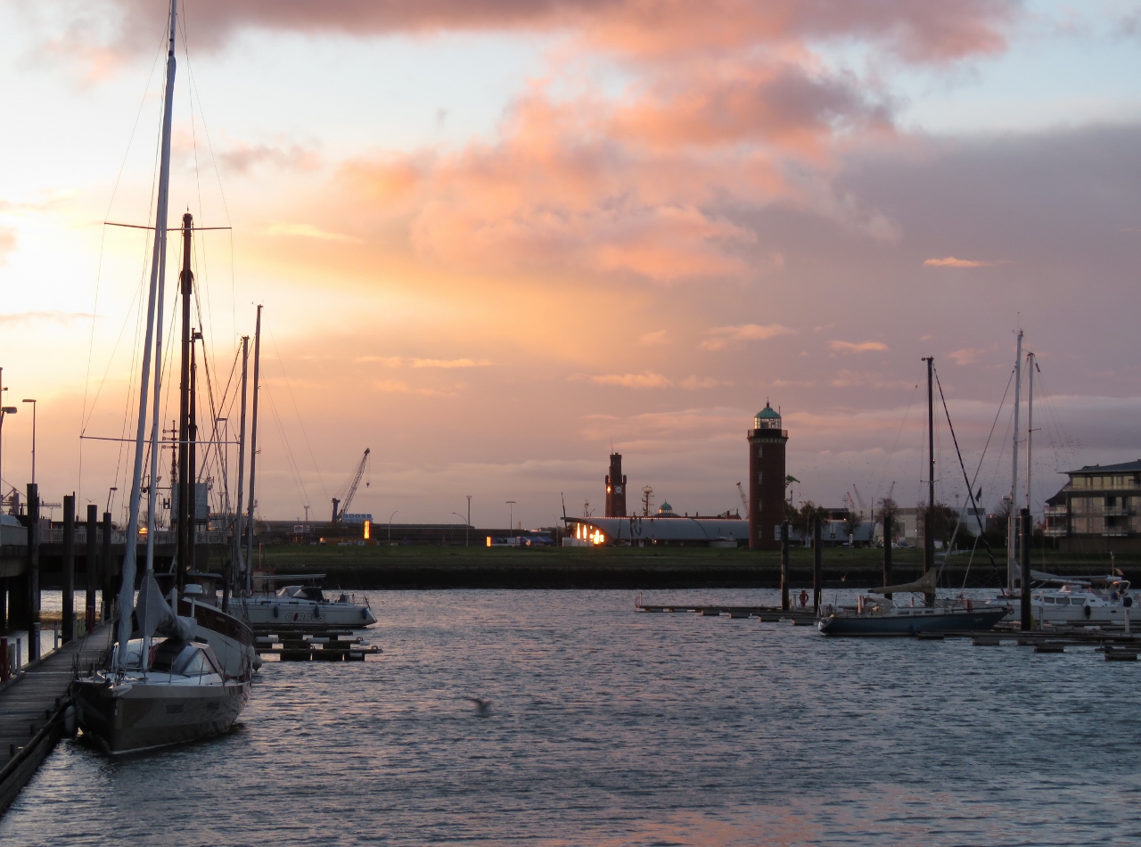 |
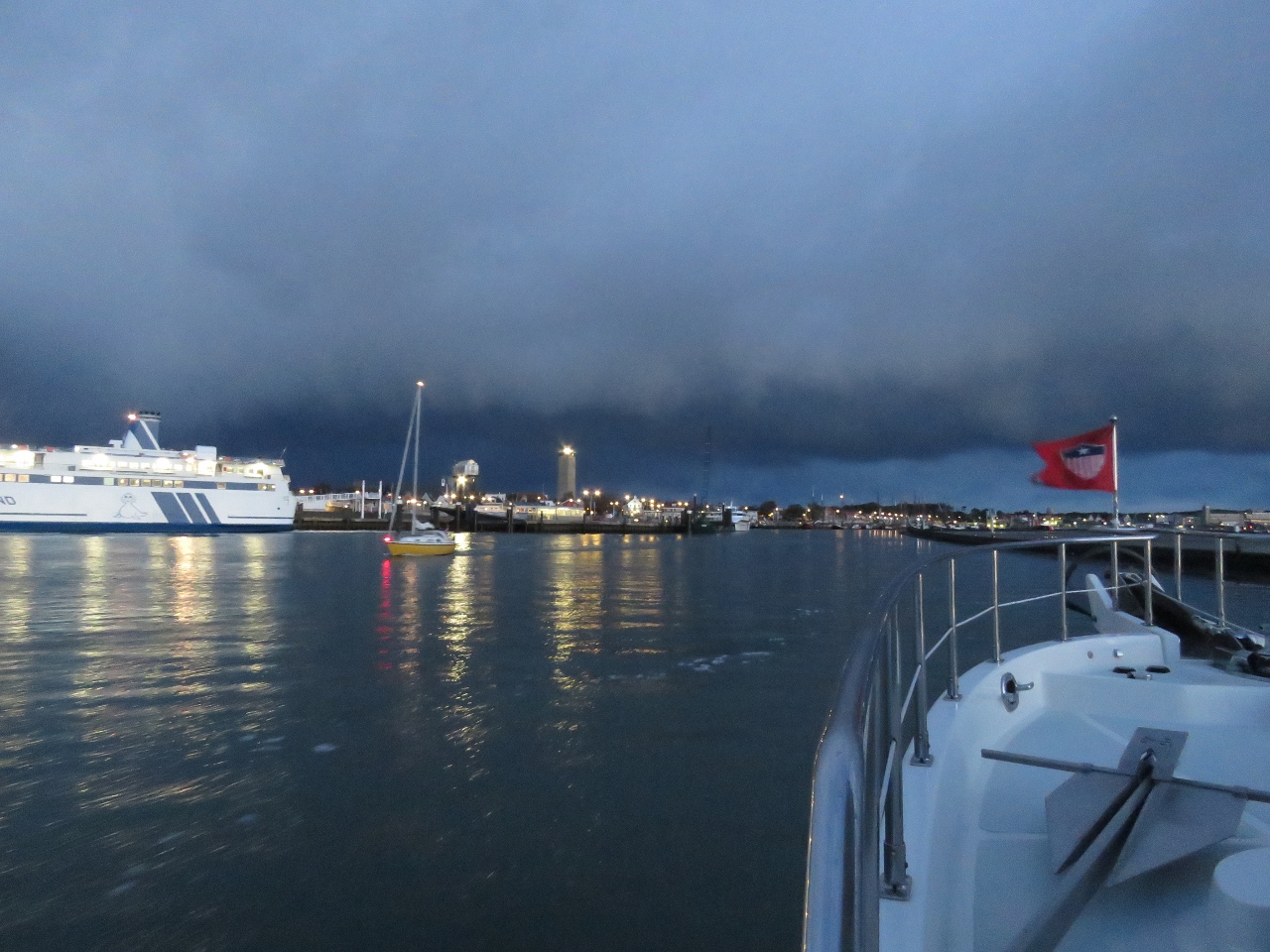
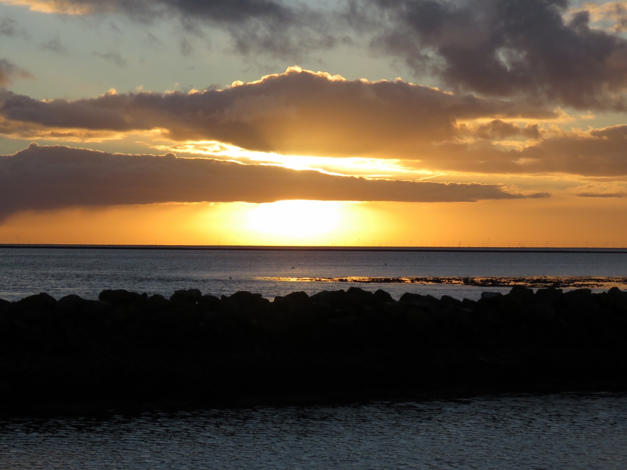
10/27/2018: Sunrise
Position: 53°52.55'N, 8°42.33'E
An 8:30am sunrise shortly before we depart Cuxhaven, Germany for the Netherlands.
|
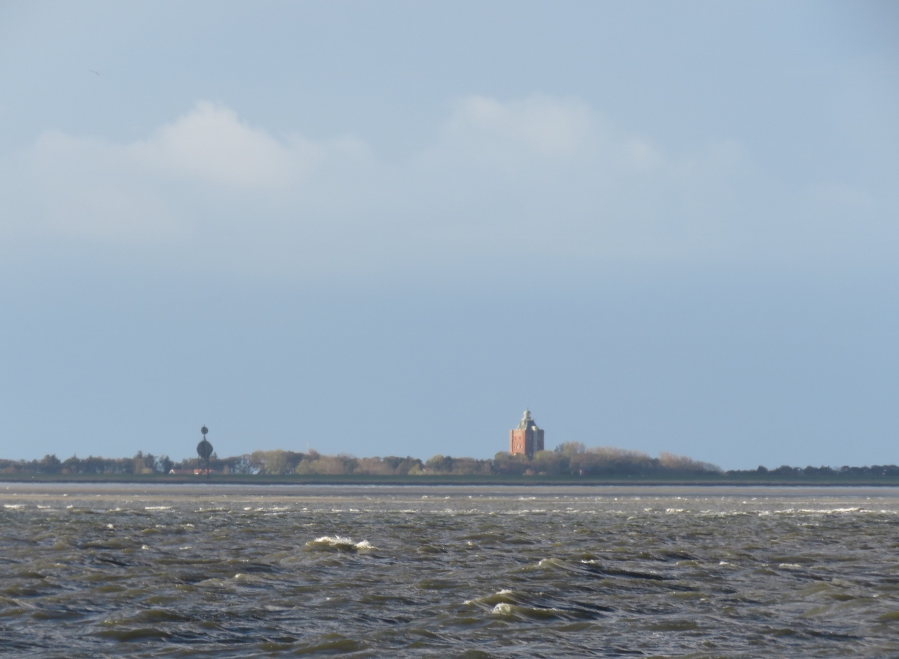 |
10/27/2018: Neuwerk Island
Position: 53°57.66'N, 8°33.18'E
We've been underway for about an hour and are just abeam of Neuwerk. At low tide you can walk 4 miles across the tidal flats to reach the island from the German mainland coast.
|
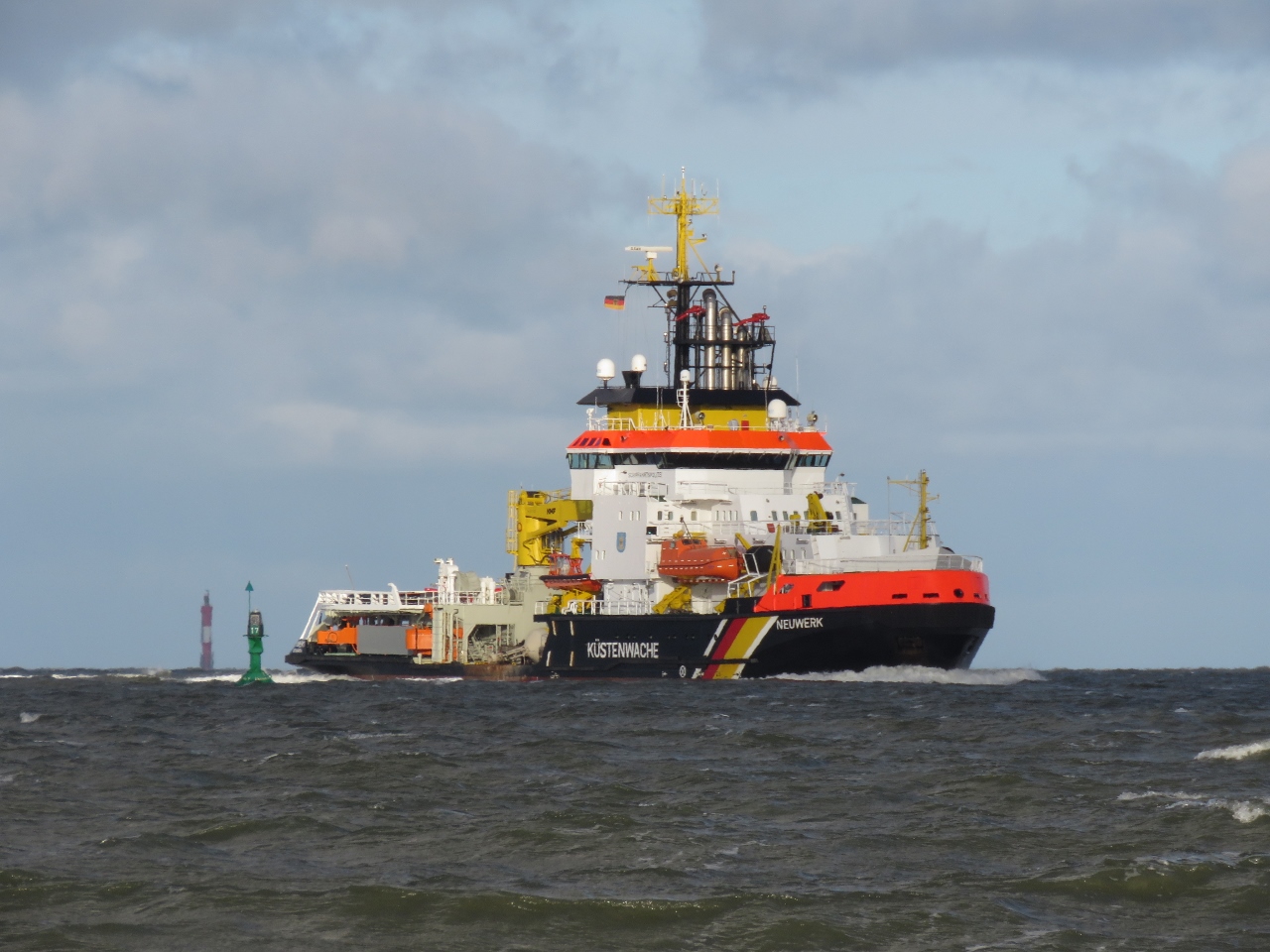 |
10/27/2018: Neuwerk
Position: 53°57.70'N, 8°32.70'E
Passing the 260ft (79m) German Coast Guard vessel Neuwerk that we saw earlier at Cuxhaven.
|
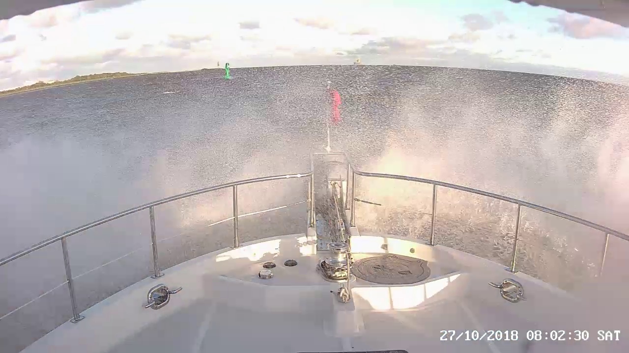 |
10/27/2018: Head Seas
Position: 53°57.95'N, 8°30.83'E
As expected, we're running into head seas as we exit the River Elbe in a several-knot current against 15-20 kt winds.
|
 |
10/27/2018: Traffic
Position: 53°58.14'N, 8°29.20'E
We're running just outside the busy Elbe River vessel traffic lanes.
|
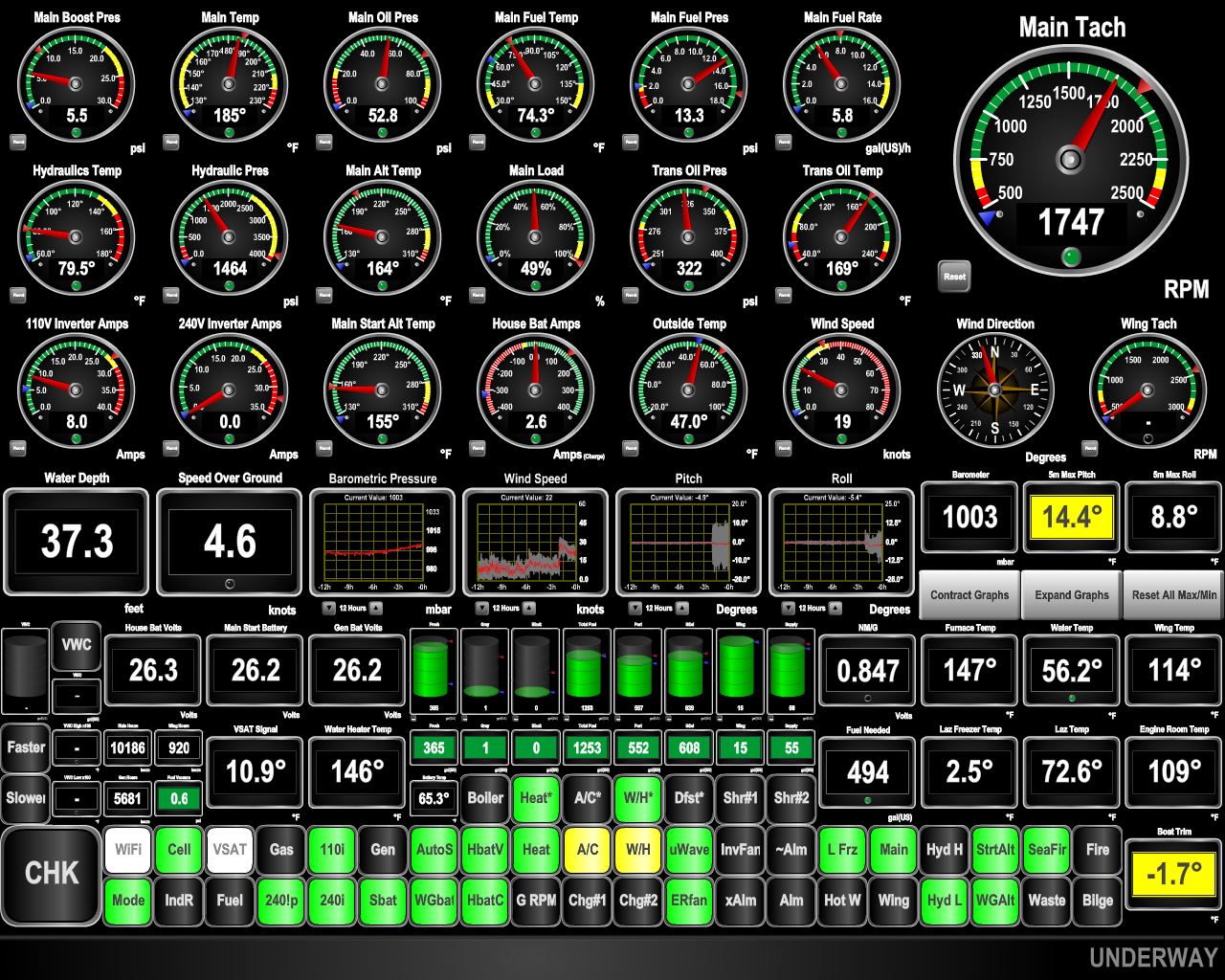 |
10/27/2018: Slow
Position: 53°59.11'N, 8°19.94'E
We expected the seas to be against us for the first part of the trip and they are, with a maximum pitch over the past five minutes of 14.4°. We're aiming to arrive in the Netherlands just past daybreak, so rather than working hard to force through the conditions and arrive earlier, we maintained RPM and let the speed fall. Conditions should improve as we get on a more southwesterly course.
|
 |
10/27/2018: Pilots
Position: 53°59.18'N, 8°13.88'E
The pilot ship Duhnen at Elbe estuary, with the larger pilot base vessel Elbe in the background. The Elbe has accommodation for 34 crew and 50 pilots—most Elbe river pilots start their assignments here.
|
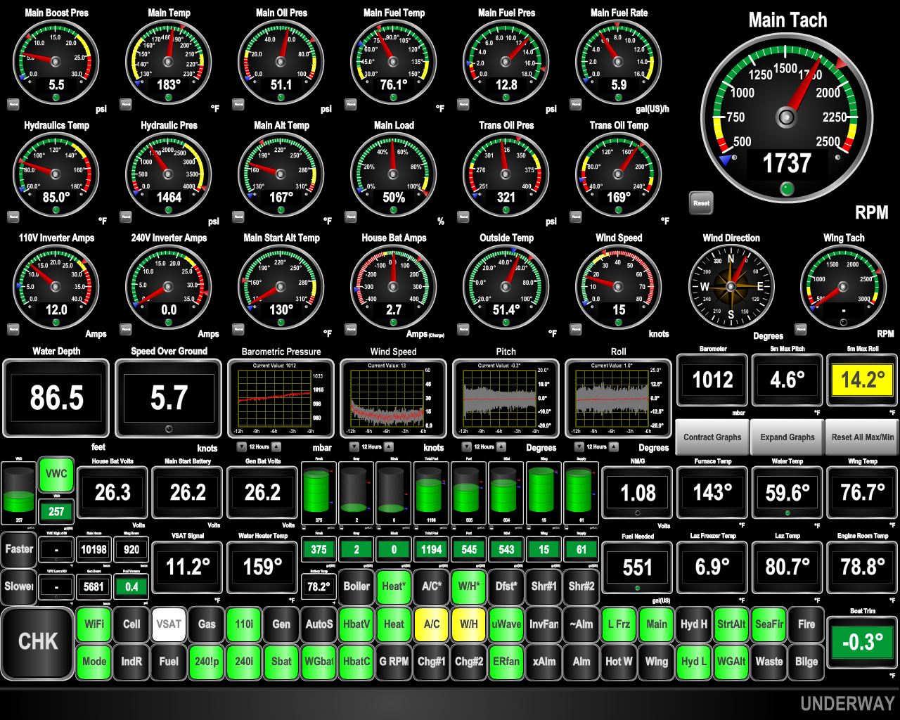 |
10/27/2018: Smoother Seas
Position: 53°39.58'N, 6°10.96'E
Conditions have improved markedly as we turned southeast. The maximum pitch over the past five minutes is down to 4.6° from 14.4°. With the waves more on our beam we are rolling a fair bit at 14.2°, but that is a much more tolerable motion than a similar degree of pitch. The tide has turned against us, so we're only making 5.7kts, but that also should improve as we pull away from the Elbe estuary.
|
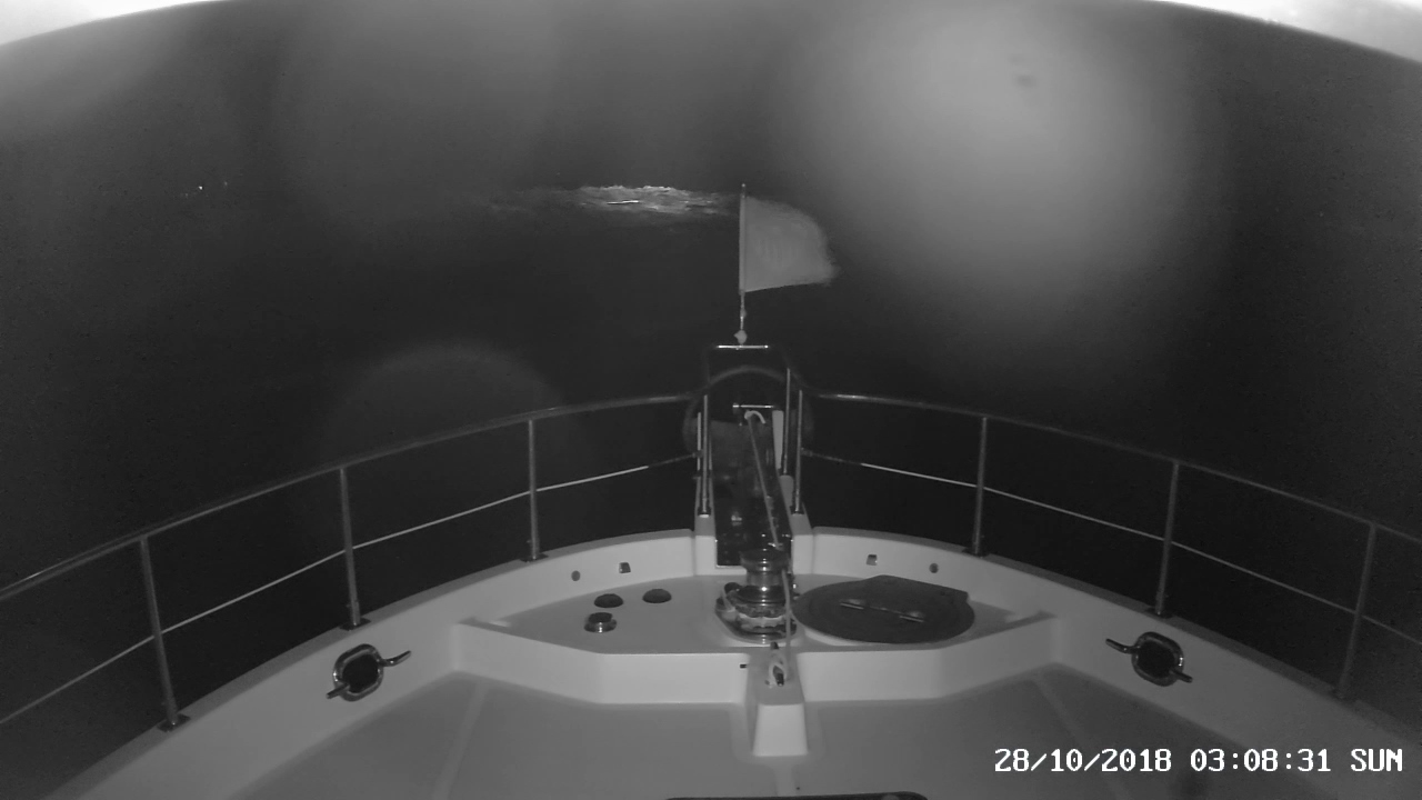 |
10/28/2018: Breakers
Position: 53°21.31'N, 4°59.48'E
Our initial plan was to enter the Het Vlie following the same path we'd exited en-route from Harlingen to Norway earlier this year, taking a short-cut across a narrow bar with depths of 40ft (12m). But as we neared in the dark, we could see a solid line of breakers ahead of us, so opted for the slightly longer route through the main channel entry. This is a beautiful example of where the forward spotlight really does add a degree of safety. It's difficult to see breaking waves on a river bar when you're on the sea side of the waves.
|
 |
10/28/2018: Terschelling Approach
Position: 53°21.53'N, 5°13.07'E
Entering the channel along the West-Terschelling waterfront with a car ferry to Harlingen on the left. Prominent in the backround is the oldest lighthouse in the Netherlands, the Brandaris, built in 1594. We could see the light from the 180ft (55m) tower for miles as we neared landfall.
|
 |
10/28/2018: Regatta
Position: 53°21.88'N, 5°13.55'E
We passed a constant stream of boats exiting as we followed the channel towards West-Terschelling, and the marina was completely packed with vessels rafted three-deep. We were a little surprised as only a few boats were in the harbour when we'd looked on their web cam Friday morning before leaving Cuxhaven. A regatta of 117 had since arrived, and many were in the process of departing as we neared. By late Sunday afternoon, the marina was empty again.
|
 |
10/28/2018: Sunrise
Position: 53°21.90'N, 5°13.54'E
Sunrise viewed from our berth at West-Terschelling.
|
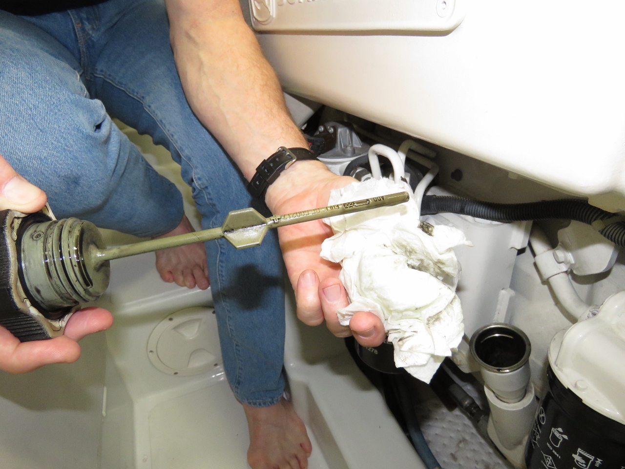 |
10/28/2018: Clean Oil
Position: 53°21.90'N, 5°13.54'E
We are back on 10 ppm sulfur diesel and, as we were speculating might happen, the oil has again cleaned up. Some background: our Deere 6068AFM75 has always turned the oil black just about instantly. We went for a year on 10 ppm sulfur fuel and the oil seemed to be staying much cleaner. In this picture, we have 19 hours on the oil and it's still quite clean. It's highly unlikely that a 10,000 hour engine is going to suddenly improve and we're using the same oil quality. The only factor we can think of is low sulfur fuel is much easier on the oil.
|
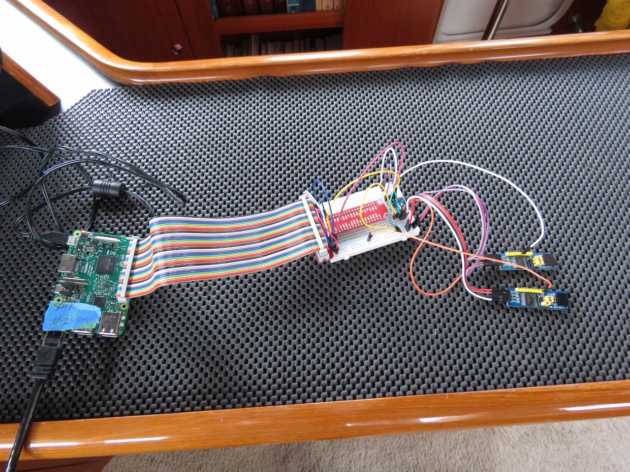 |
10/28/2018: I2C
Position: 53°21.90'N, 5°13.54'E
We make such extensive use of the 5 Raspberry Pi's we have in use on Dirona that we have run out of digital I/O pins on a couple. We have some work that will require another 16 pins of digital input (detecting off and on state of various switches and equipment on the boat). So the plan is to use two PCF8574 chips to get 16 more I/O pins. Each PCF8574 is controlled by a I2C bus and each chip provides 8 digital I/O pins. Using 2 PCF8574s we get 16 more pins controlled by a single 4 wire I2C bus. And up to 8 PCF8574s can be driven by the single I2C bus that provides 5v+, 5v-, SDA, and SCL signaling. It's a nice, simple way to get a lot more dgital input and output.
|
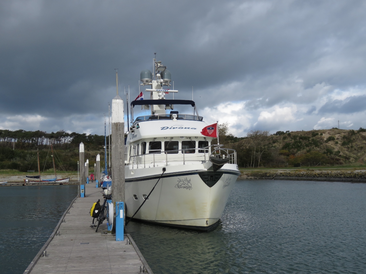 |
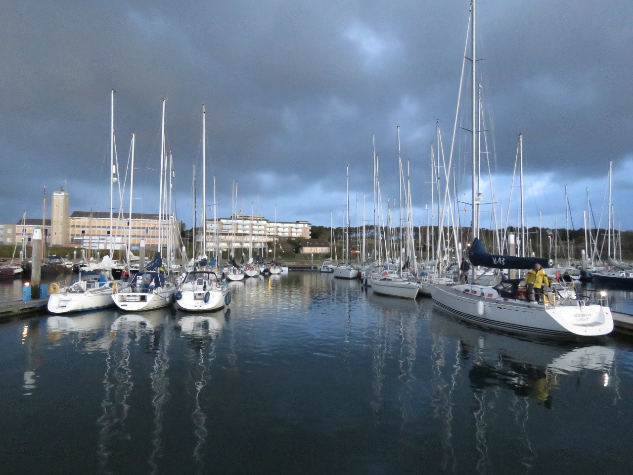
10/28/2018: Dirona
Position: 53°21.89'N, 5°13.54'E
Dirona moored at the West-Terschelling marina. You can see we have quite the brown "Kiel Canal moustache".
|
 |
10/28/2018: Buoys
Position: 53°21.88'N, 5°13.25'E
Navigation buoys of many shapes, sizes and colours ashore at West-Terschelling.
|
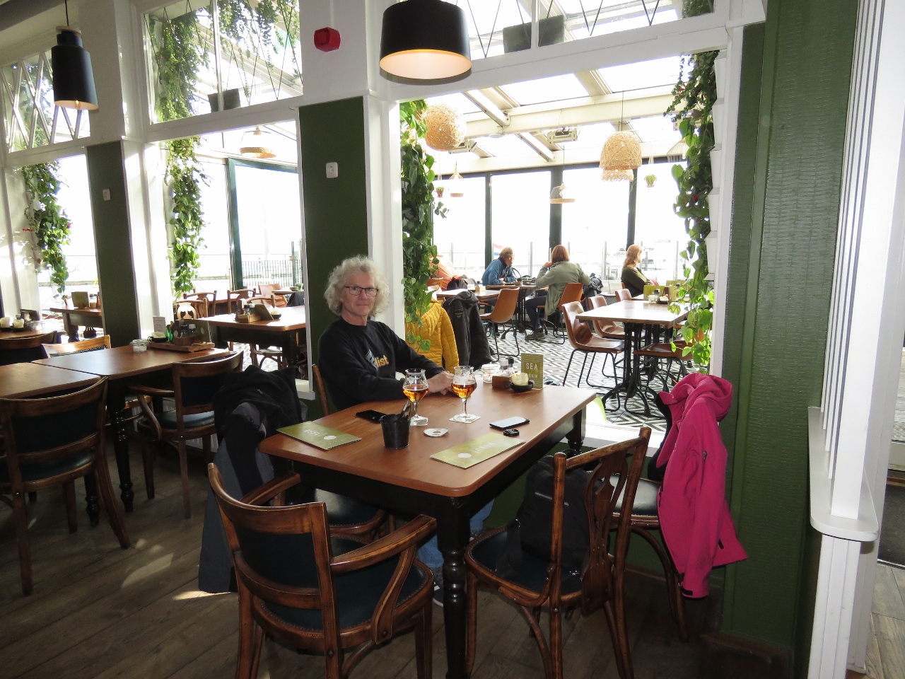 |
10/28/2018: Grand Cafe Zeezicht
Position: 53°21.53'N, 5°12.97'E
Enjoying the light-filled Grand Cafe Zeezicht with a view to the harbour. We had a delicious fresh seafood lunch.
|
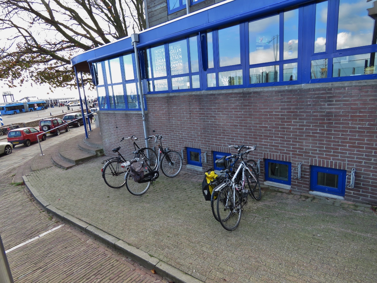 |
10/28/2018: Bikes
Position: 53°21.88'N, 5°13.25'E
Our Giant FCR2 hybrid bikes locked outside Grand Cafe Zeezicht at right, with two traditional sturdy Dutch bikes on the left. We've not been used the bikes for a month or so—it was great to be out riding again.
|
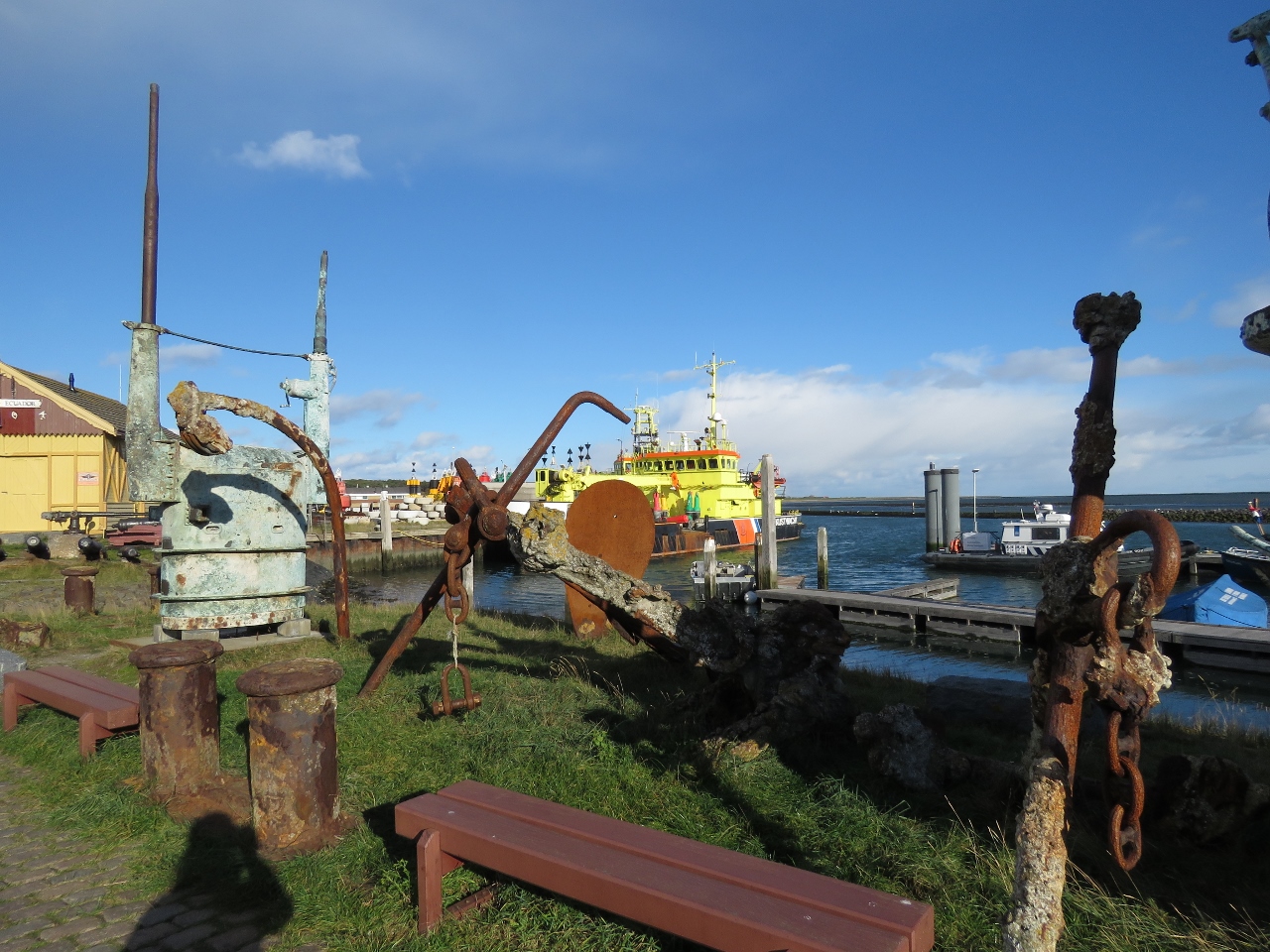 |
10/28/2018: Salvaged
Position: 53°21.70'N, 5°13.07'E
Salvaged items along the West-Terschelling waterfront. Leftmost is a submarine conning tower.
|
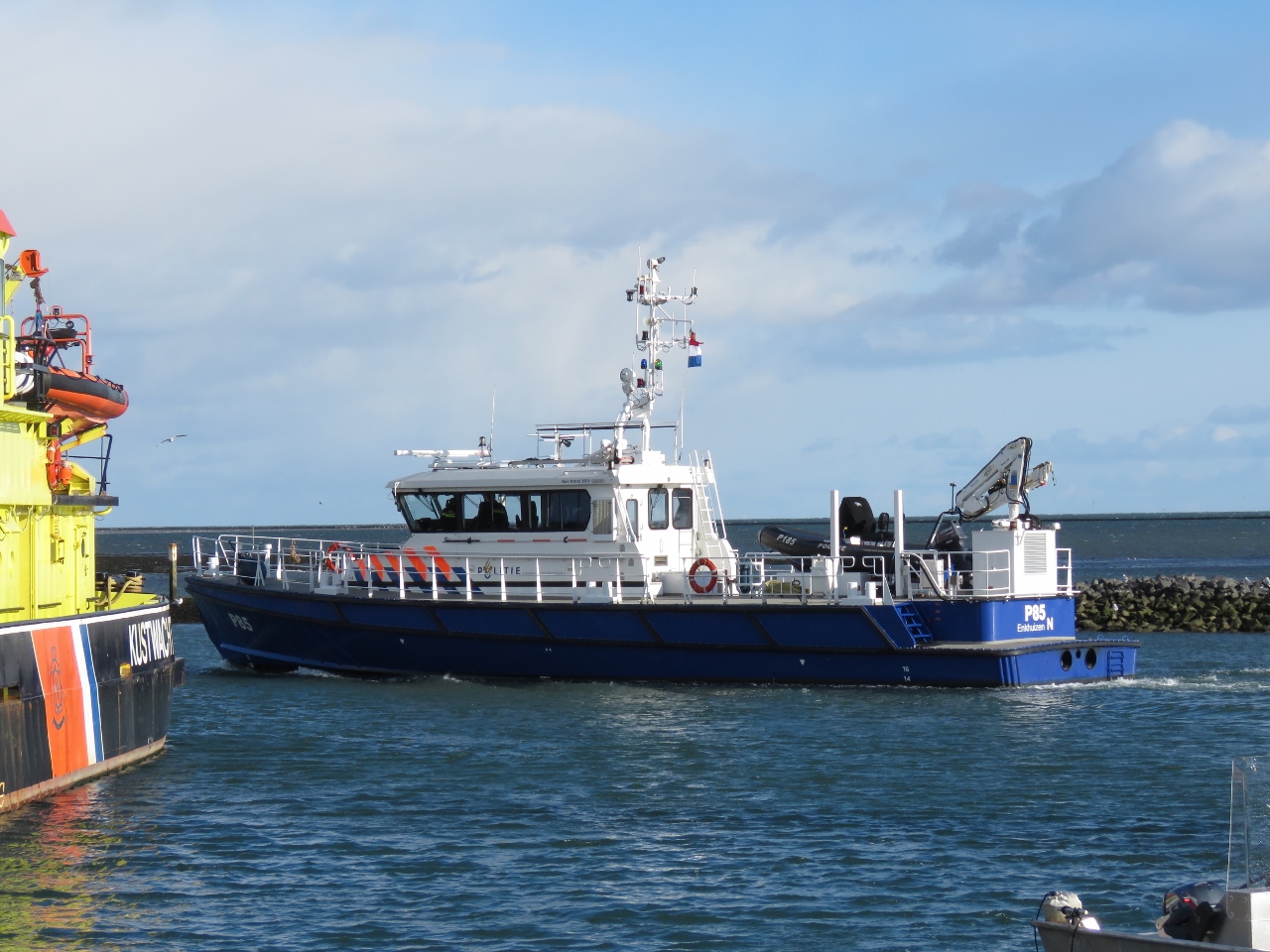 |
10/28/2018: Politie
Position: 53°21.73'N, 5°13.07'E
The capable-looking Politie patrol vessel P85 underway at West-Terschelling. The boat has a shallow draft of only 4.7ft (1.45m) to reach almost anywhere in the IJsselmeer, its patrol area. And it can get there quickly, with a top speed of 47 kts, powered by two 875 HP main engines.
|
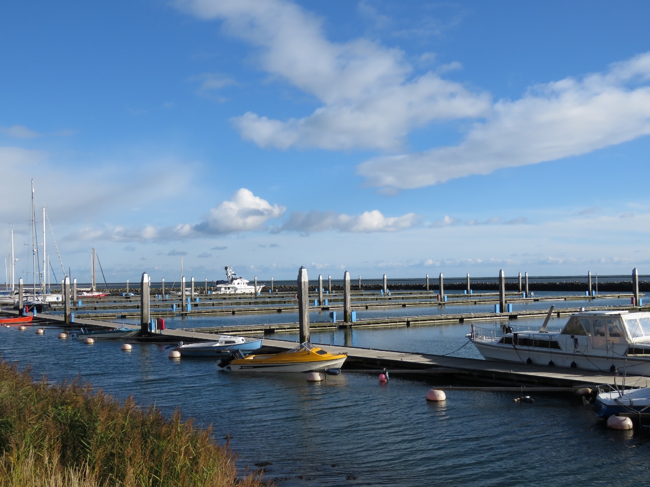 |
10/28/2018: Empty Marina
Position: 53°21.95'N, 5°13.41'E
By the time we'd finished lunch and the regatta had departed and marina was almost empty again.
|
 |
10/28/2018: Dellewal
Position: 53°21.99'N, 5°14.44'E
Looking across the flats at the edge of Dellewal, the only natural bay in The Netherlands.
|
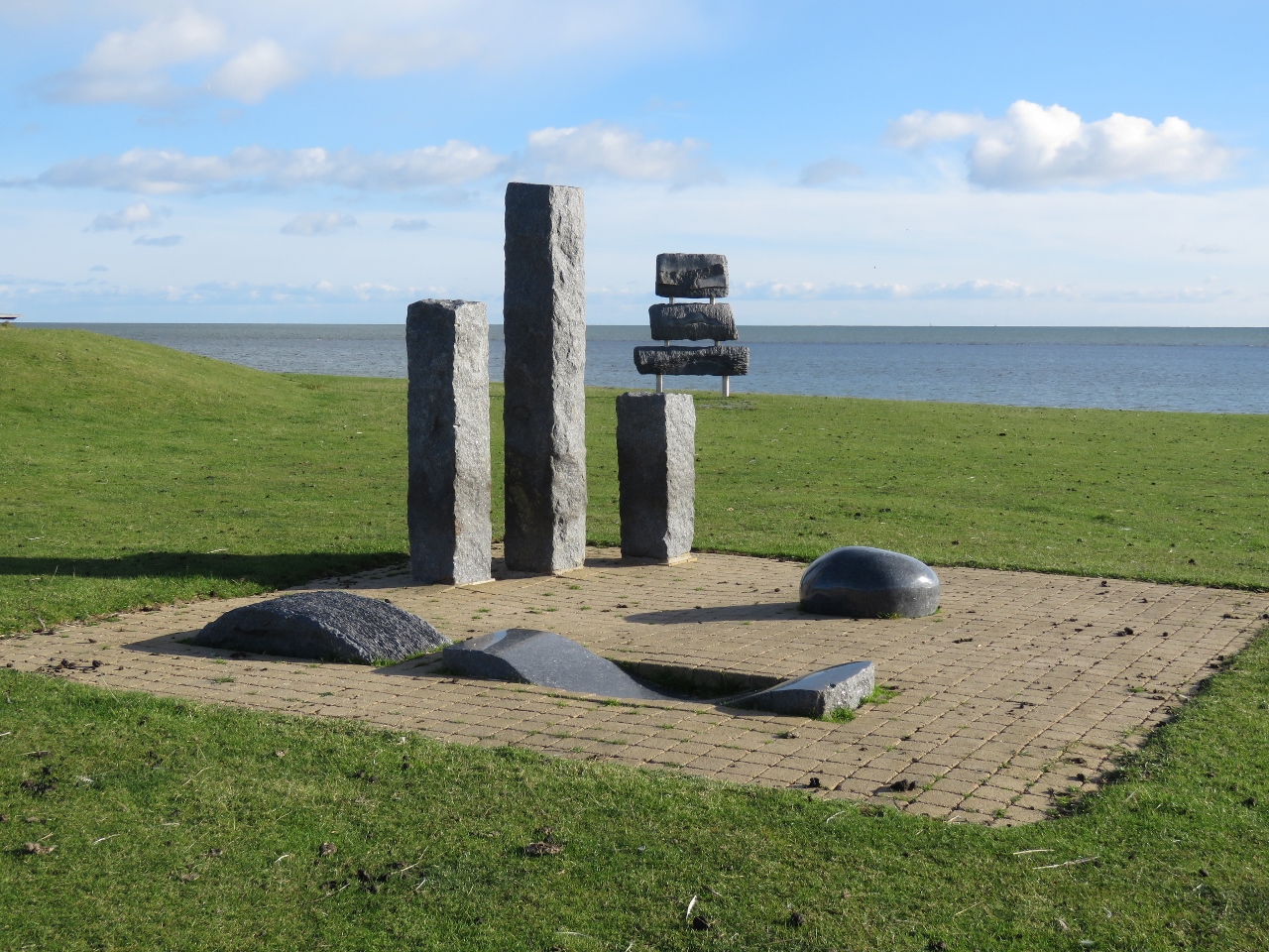 |
10/28/2018: Images from the Sea
Position: 53°21.95'N, 5°14.60'E
A portion of the "Images from the Sea" sculpture park along the Dellewal. The sculptures, inspired by nautical elements such as a wave, sail and bollard, were carved from 22 Norwegian labrador granite stones salvaged from Swedish steamship Otto. The ship sunk off Terschelling in 1903 en route to Manchester, UK.
|
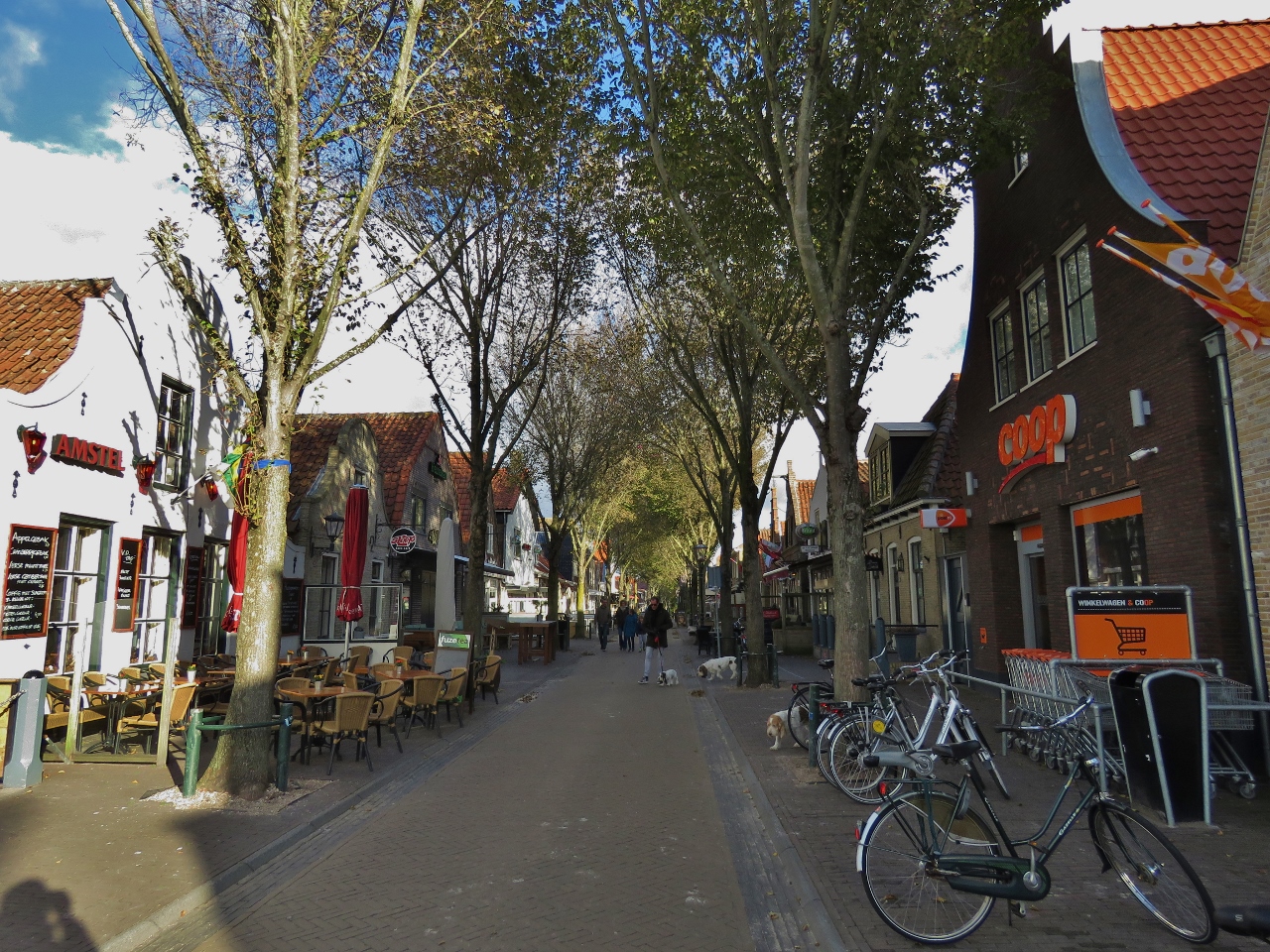 |
10/28/2018: Midsland
Position: 53°23.01'N, 5°17.08'E
A cafe-lined street in Midsland, the second-largest town on Terschelling.
|
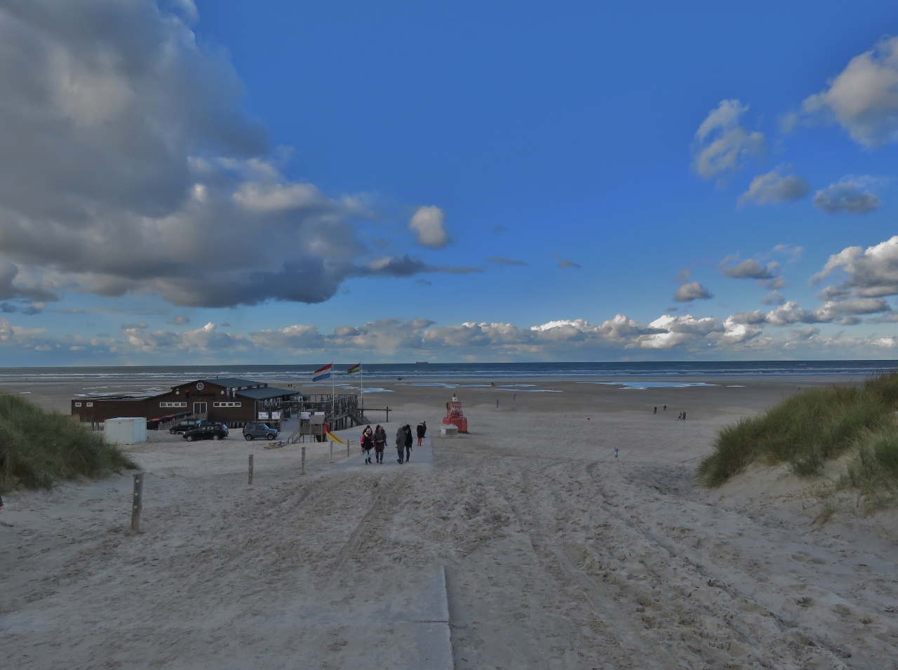 |
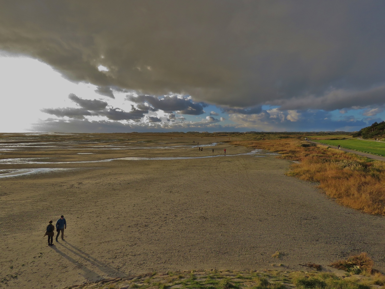
10/28/2018: Beach
Position: 53°24.36'N, 5°17.21'E
Soft-sand beaches line the north shore of Terschelling. They're certainly more popular in the summer, but many people were out taking in the scene on this sunny, but cold and windy, Sunday afternoon.
|
 |
10/28/2018: Shipping Lanes
Position: 53°24.06'N, 5°15.13'E
A bright red Wallenius Wilhelmsen RoRo working north in the traffic lanes off Terschelling. 14 hours ago we were running just inside those lanes, about 4.5 miles offshore from where this picture was taken.
|
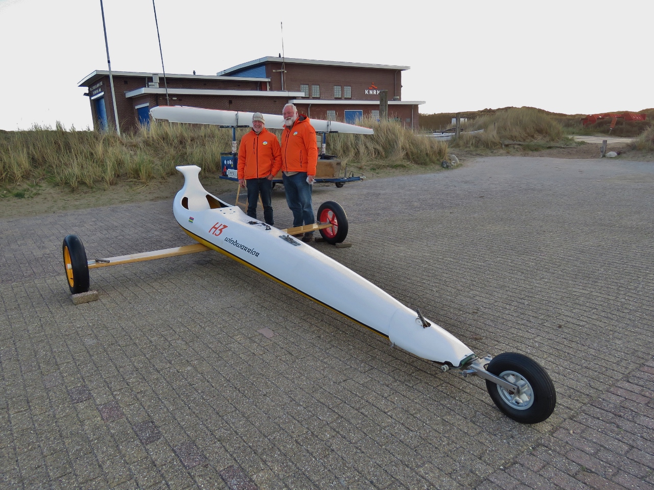 |
10/28/2018: Land Yacht
Position: 53°23.96'N, 5°14.96'E
We spent ages talking to these two men from a local Land Yacht club about their sport. Land yachts are the land-based form of a racing sail boat. Just as in sailing, light weight is key as is minimizing drag. Race boats carry deep keels (sometimes to as much as 22') to allow them to carry more sail power. With land yachts, its the width of the platform formed by the three wheels. The wider the spread, the more sail power they can carry. Speeds of up above 120 km/hr are possible so, like all things that race, this some risk.
|
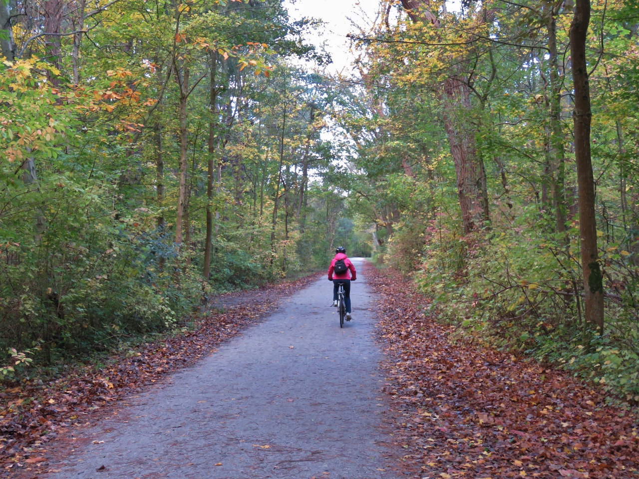 |
10/28/2018: Woods
Position: 53°22.29'N, 5°13.05'E
Cycling through the woods back to West-Terschelling. We really enjoyed the ride with it's diverse scenery, and this is only one of several rides you can take on Terschelling. Blog readers Andre and Annemarie Verhoek had recommended we make landfall in the Netherlands at Terschelling, particularly for the cycling.
|
 |
10/28/2018: Paviljoen De Walvis
Position: 53°21.38'N, 5°12.73'E
The blustery and chilly day did not discourage the crowds enjoying the sunshine on the patio at Paviljoen De Walvis.
|
 |
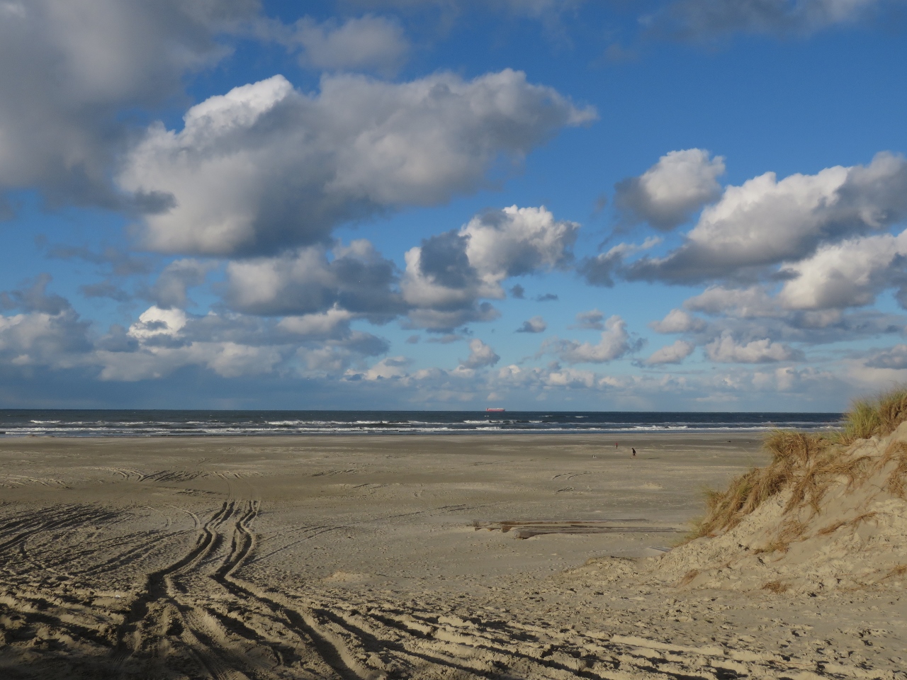
10/28/2018: Shadows
Position: 53°21.36'N, 5°12.72'E
Long shadows cast in the late afternoon sun on the flats off West-Terschelling.
|
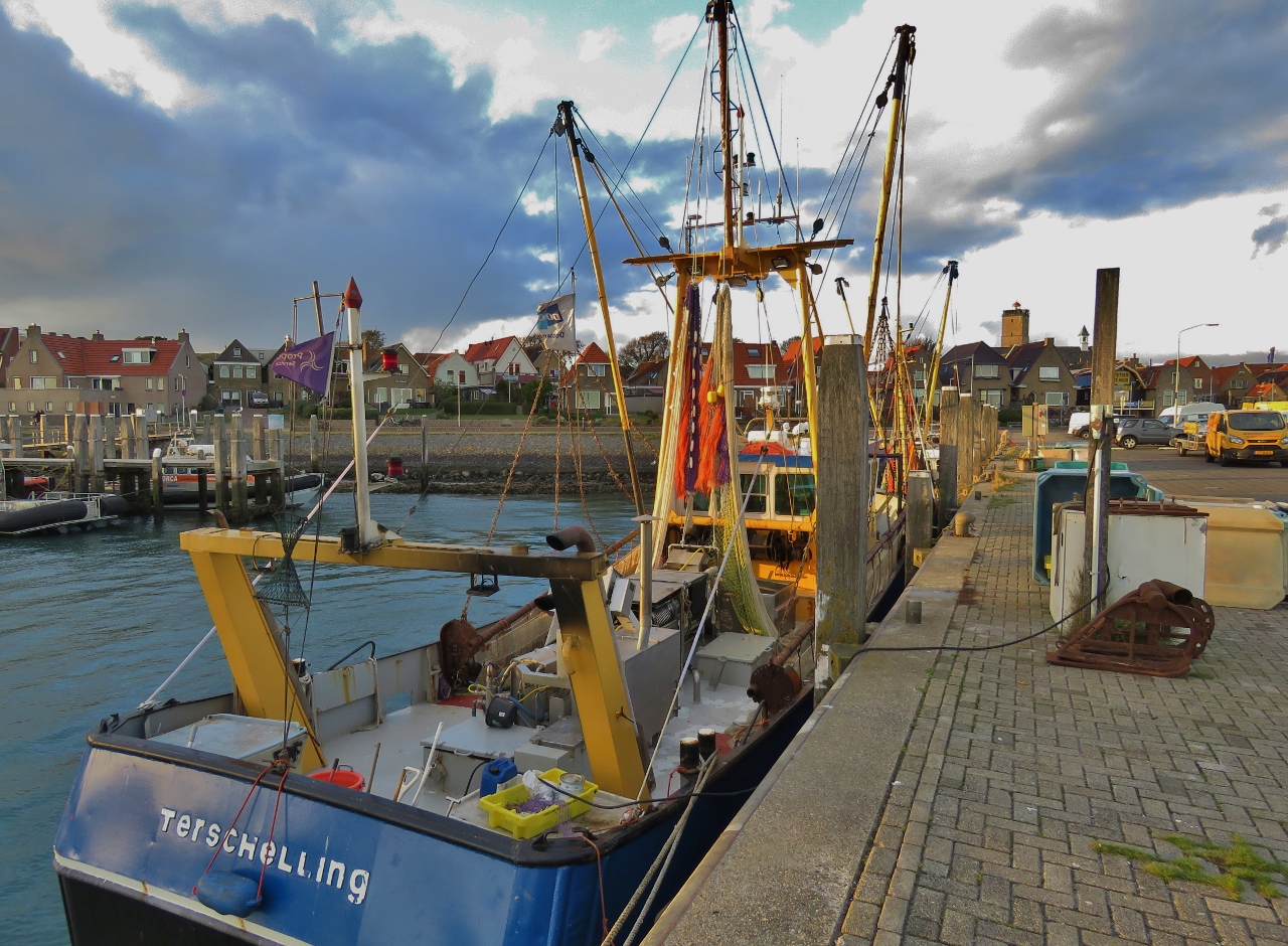 |
10/28/2018: Fishboats
Position: 53°21.40'N, 5°12.93'E
Fishboats in the West-Terschelling commercial harbour.
|
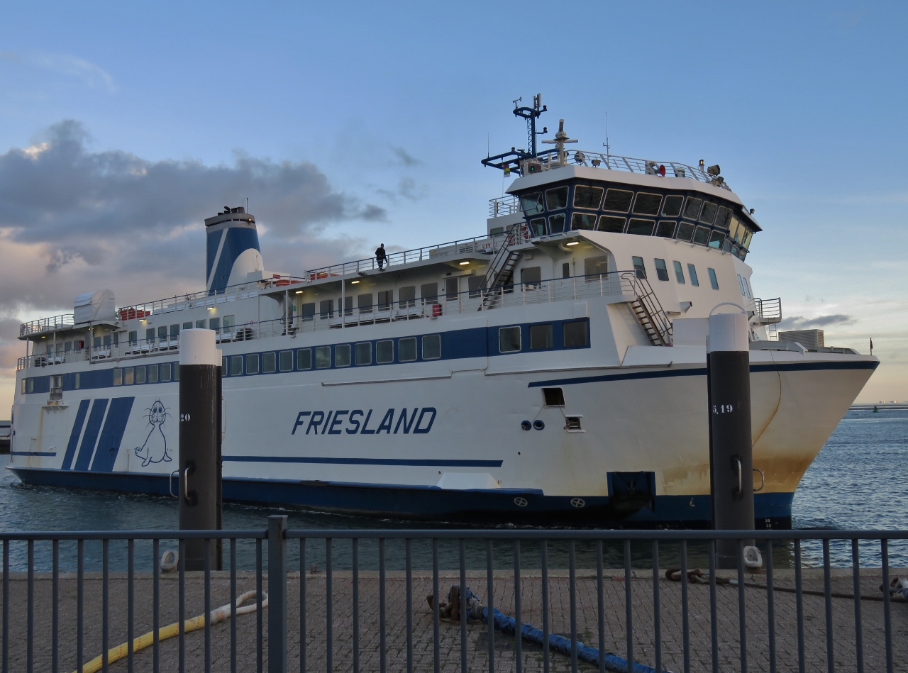 |
10/28/2018: Friesland
Position: 53°21.38'N, 5°12.97'E
The 226ft (69m) vehicle ferry Friesland arriving into West-Terschelling from Harlingen. The skipper did a masterful job of docking in the strong winds, barely nudging the ship against the pier as the crew tied off.
|
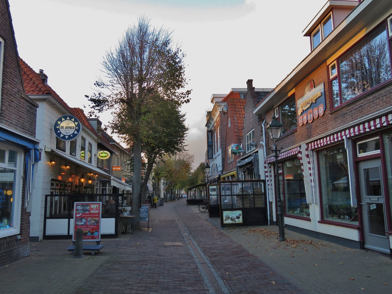 |
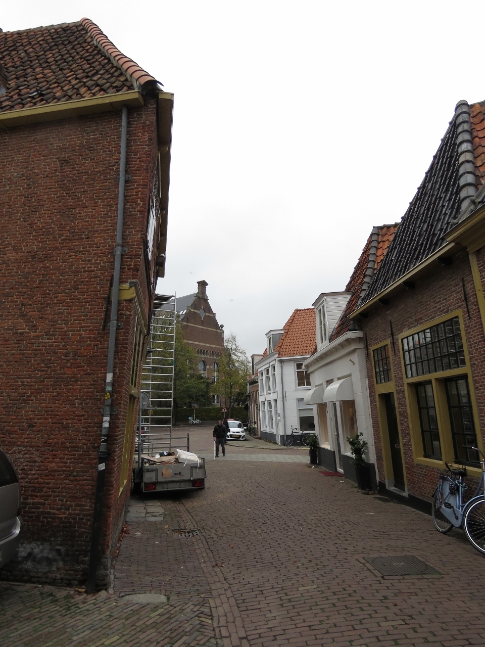
10/28/2018: Torenstraat
Position: 53°21.57'N, 5°12.87'E
Restaurant-lined Torenstraat in West-Terschelling.
|
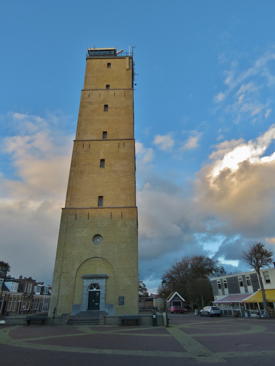 |
10/28/2018: The Brandaris
Position: 53°21.61'N, 5°12.86'E
The Brandaris dominates the West-Terschelling skyline. Built in 1594, it's the oldest lighthouse in the Netherlands. We could see the light from the 180ft (55m) tower for miles as we neared landfall.
|
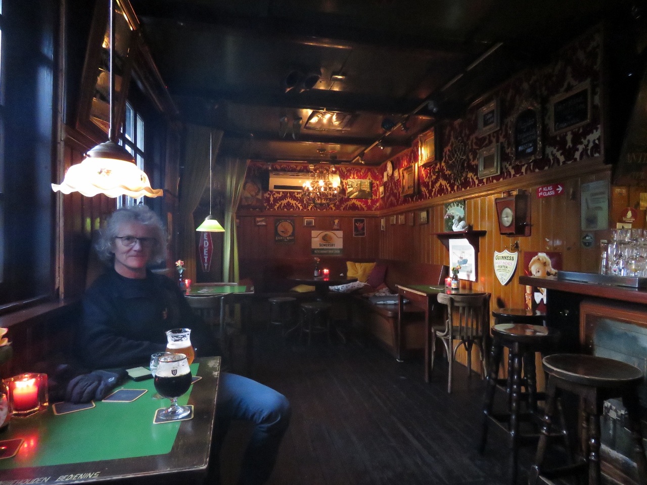 |
10/28/2018: Warming Up
Position: 53°21.55'N, 5°12.96'E
Enjoying a local brew at the Cafe 't Zwaantje. It was a real locals' bar—everyone knew each other.
|
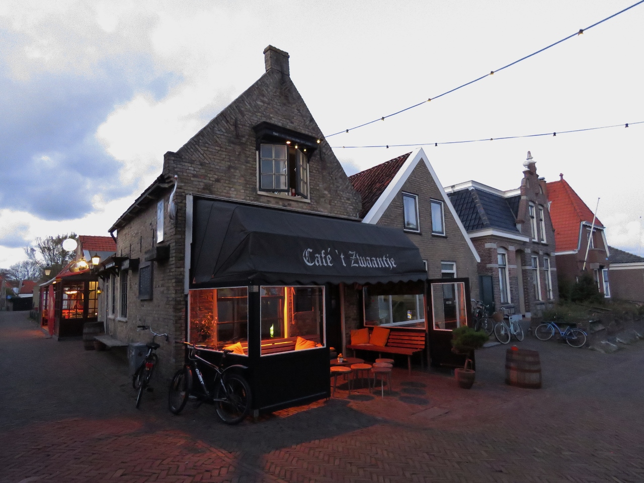 |
10/28/2018: Cafe 't Zwaantje
Position: 53°21.55'N, 5°12.96'E
We were almost tempted to sit on the heated patio at Cafe 't Zwaantje, but the warm, cosy interior drew us in.
|
 |
10/29/2018: Friesland
Position: 53°21.18'N, 5°13.04'E
The vehicle ferry Friesland moored overnight at West-Terschelling as we depart just past 6am.
|
 |
10/29/2018: Over Land
Position: 53°20.90'N, 5°12.41'E
The buoys in the channel to West-Terschelling have been moved to account for silting. Consequently, our older charts show us going over land as we followed the marked channel. We're following our own known track back out, so we're not too concerned. But it was a little unnerving as we arrived in the dark yesterday morning.
|
 |
10/29/2018: Joining Route
Position: 53°16.14'N, 5°10.04'E
Joining up with our route into Harlingen over six months ago.
|
 |
10/29/2018: Sunrise
Position: 53°13.77'N, 5°13.37'E
Daylight savings time just ended, so the sun is rising at around 7:30am now.
|
 |
10/29/2018: Vlieland
Position: 53°13.36'N, 5°17.12'E
The ferry Vlieland passing us from behind en route from Vlieland to Harlingen.
|
 |
10/29/2018: Terschellinger Bank
Position: 53°12.61'N, 5°18.01'E
The ferry Terschellinger Bank aglow in the morning sun en route from Harlingen.
|
 |
10/29/2018: Positive Current
Position: 53°10.76'N, 5°23.08'E
One of the reasons we left in the dark this morning was to take advantage of the flood current. We're currently doing 10.8 knots at 1734 RPM, when normally we'd be making about 8 kts at that RPM.
|
 |
10/29/2018: Harlingen
Position: 53°9.94'N, 5°23.36'E
Passing Harlingen with St. Michael's church prominent in the skyline. We berthed below the church earlier this year.
|
 |
10/29/2018: Negative Current
Position: 53°9.77'N, 5°23.29'E
Once we exited the main channel to Harlingen, we hit a strong negative current and our speed halved to 5.1 knots.
|
 |
10/29/2018: Chart Detail
Position: 53°8.99'N, 5°23.05'E
Our C-Map charts don't have much detail for this area.
|
 |
10/29/2018: Better Chart Detail
Position: 53°8.62'N, 5°22.87'E
When available, we purchase Navionics charts to run on our tablet and phone—they are particularly handy when out in the tender. Fortunately the Navionics charts have much better detail for this area.
|
 |
10/29/2018: Fishboat
Position: 53°5.06'N, 5°20.32'E
A fishboat with a cloud of seagulls following.
|
 |
10/29/2018: Waiting
Position: 53°4.60'N, 5°19.97'E
Moored behind a fishing vessel on the waiting pontoon at the Kornwerderzand lock, part of the 20-mile (32km) Afsluitdijk dam. We visited the lock by bicycle from Harlingen earlier this year, so it was particularly fun to be back here in Dirona.
|
 |
10/29/2018: Fort Kornwerderzand
Position: 53°4.60'N, 5°19.97'E
Old Fort Kornwerderzand bunker on the entrance to the Kornwerderzand locks. Fort Kornwerderzand is famous for successfully holding off an attack during the 1940 German invasion of the Netherlands. The fort remained under Dutch control until the Netherlands surrendered to Germany.
|
 |
10/29/2018: Commercial Traffic
Position: 53°4.50'N, 5°20.05'E
A barge at the far left is exiting the lock, while another is passing through the opened bridge to the right. Commercial traffic has priority in the locks, so we'll follow behind the sailing canal boat in the foreground and the fishing boat visible beyond it at right.
|
 |
10/29/2018: Bridge
Position: 53°4.33'N, 5°20.16'E
Passing through the opened road bridge behind the sailing canal barge.
|
 |
10/29/2018: East Lock
Position: 53°4.18'N, 5°20.24'E
The large barge and the sailing canal barge went into the larger west lock. We followed the fishing vessel into the smaller east lock.
|
 |
10/29/2018: Gates Closing
Position: 53°4.18'N, 5°20.24'E
The locks operate efficiently—we'd barely tied off before the gates started to close behind us.
|
 |
10/29/2018: Dual Locks
Position: 53°4.18'N, 5°20.24'E
Looking south across the paired locks.
|
 |
10/29/2018: Exiting Lock
Position: 53°3.94'N, 5°20.33'E
The skipper of fishing vessel ahead exited with a lot of power, so we were anticipating a bit of current. But there wasn't much to contend with.
|
 |
10/29/2018: Buitenhaven
Position: 52°41.96'N, 5°17.58'E
Anchored for the night at Buitenhaven in Enkhuizen.
|
 |
10/29/2018: Naviduct
Position: 52°41.96'N, 5°17.58'E
Our berth at Enkhuizen is within sight the naviduct through the Houtribdijk. A naviduct is a special type of navigable aquaduct that also includes a lock. We'll be passing through tomorrow—another first for us.
|
 |
10/29/2018: Enkhuizen Lock
Position: 52°41.97'N, 5°17.59'E
The town harbours along the former Zuiderzee saltwater bay once were all guarded by locks. The completion of Afsluitdijk Dam in 1932 transformed the Zuiderzee into a freshwater lake, renamed IJsselmeer, and locks at town such as Enkhuizen can be left permanently open.
|
 |
10/29/2018: View East
Position: 52°42.02'N, 5°17.59'E
Looking east across our berth at Buitenhaven with the Naviduct in the distance on the left.
|
 |
10/29/2018: Drommedaris
Position: 52°42.03'N, 5°17.60'E
The 16th-century tower Drommedaris guarding the entrance to Enkhuizen's old harbour. The tower name derives from the Latin word for camel, "dromedarius," as the building's shape resembles a camel's hump.
|
 |
10/29/2018: 1626
Position: 52°42.10'N, 5°17.56'E
Enkhuizen received city rights in 1355 and, as a Dutch East India Company harbour, was among the most important cities in the Netherlands. So this building dating from 1626 is relatively modern.
|
 |
10/29/2018: Zuiderkerk
Position: 52°42.22'N, 5°17.53'E
Construction of the Zuiderkerk began in the 1400s and the top of the tower was completed in 1524.
|
 |
10/29/2018: Dutch Cheese
Position: 52°42.25'N, 5°17.43'E
Cheese is very popular in The Netherlands.
|
 |
10/29/2018: 1616 Facade
Position: 52°42.21'N, 5°17.29'E
This building looks old, but actually was built in 1906 using the facade of an orphanage from 1616 that once stood there.
|
 |
10/29/2018: Canal
Position: 52°42.17'N, 5°17.07'E
Looking down one of Enkhuizen's many tranquil canals.
|
 |
10/29/2018: Herberg De Compagnie
Position: 52°42.06'N, 5°17.39'E
The large tap selection at Herberg De Compagnie enticed us, so we stopped in for a drink.
|
 |
10/29/2018: Restaurant van Bleiswijk
Position: 52°42.24'N, 5°17.42'E
The ornate interior of Restaurant van Bleiswijk, where we had a nice dinner.
|
 |
10/29/2018: Drommedaris at Night
Position: 52°42.01'N, 5°17.58'E
Drommedaris and a pedestrian bridge over the harbor at right look great lit up at night.
|
 |
10/29/2018: Dutch Customs
Position: 52°41.97'N, 5°17.55'E
Dutch Customs knocked on the boat around 8:30 that night to check our paperwork and the boat's VAT status. They had come by earlier in the day, but we weren't on board. They'd actually come up from Amsterdam in response to a report of an American boat in the harbour since Enkhuizen has no Customs office, so they stayed in town and tried again later. And they mentioned that Customs at West-Terschelling had also tried to visit when we were there, but we weren't on board then either. We expressed concern for having brought them so far and kept them waiting around, but they were quite friendly and didn't seem at all bothered.
As non-EU residents, we can bring Dirona into the EU VAT-free for a maximum of 18-months at a time. We contacted Danish Customs prior to entering the EU from Norway at Denmark, but they didn't require an inspection. And most EU countries we've contacted don't require us to check in with Customs or Immigration on further movement within the EU. Notable exceptions are the UK and Ireland, who maintain control of their borders. But any country we visit within the EU, or outside, can of course choose to inspect us. |
 |
10/30/2018: Naviduct
Position: 52°41.43'N, 5°17.48'E
We rode the bikes over this morning to check out the naviduct before passing through. A naviduct is a special type of navigable aqueduct that also includes a lock. Here you can see vehicles passing under the waterway with the lock control tower at left.
|
 |
10/30/2018: Aqueduct
Position: 52°41.48'N, 5°17.70'E
The aqueduct carrying boat traffic over the road between the Markermeer and the IJsselmeer lakes.
|
 |
10/30/2018: Lock
Position: 52°41.49'N, 5°17.72'E
The locks are what make the aqueduct a naviduct. Although the two lakes at either end have the same target water level, wind surge and feed flows can cause differing water levels. The locks are each 410ft (125m) long by 41ft (12.5m) wide and can accommodate large Rhine River barges.
|
 |
10/30/2018: Old Lock
Position: 52°41.56'N, 5°16.98'E
Prior to the construction of the naviduct, boats had to pass through this lock and a bridge that required opening for vessels with an air draft of greater than 19ft (6m). The delays for both boat and vehicle traffic were substantial, so the naviduct was built at a before-tax cost of €55M to eliminate vehicle delays and reduce vessel traffic delays.
|
 |
10/30/2018: River Queen
Position: 52°41.87'N, 5°17.41'E
We watched the River Queen river cruise ship arrive at Enkhuizen this morning via the naviduct. The ship is designed after a 1930s river steamboat and has a opulent Art Deco interior.
|
 |
10/30/2018: Power
Position: 52°41.86'N, 5°17.46'E
We often see three-phase power supplied here on five separate cables, one for each phase (brown, black and grey in the photo) plus ground (green) and neutral (blue).
|
 |
10/30/2018: Allegro
Position: 52°41.85'N, 5°17.43'E
The Enkhuizen-based river cruise boat Allegro moored adjacent to the River Queen.
|
 |
10/30/2018: Train Station
Position: 52°41.98'N, 5°17.48'E
Enkhuizen's train station opened in 1885.
|
 |
10/30/2018: Green Light
Position: 52°41.54'N, 5°17.76'E
A green light showing that we can enter the naviduct lock behind a large commercial barge.
|
 |
10/30/2018: Gate Closing
Position: 52°41.48'N, 5°17.74'E
The naviduct lock gates closing behind us.
|
 |
10/30/2018: Locking Through
Position: 52°41.47'N, 5°17.74'E
Locking through with traffic passing underneath the aqueduct.
|
 |
10/30/2018: Exiting Naviduct
Position: 52°41.44'N, 5°17.73'E
Passing over a truck as we exit the naviduct.
|
 |
10/30/2018: Playmate
Position: 52°38.00'N, 5°11.92'E
Playmate, one of the participants in a sailboat race we passed through en route to Hoorn from Enkhuizen.
|
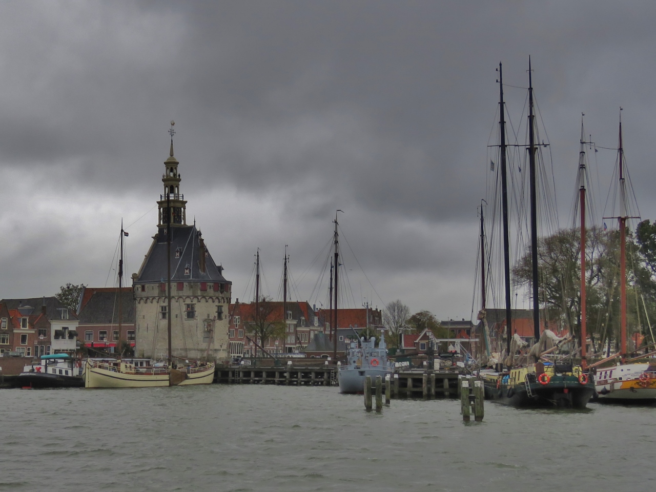 |
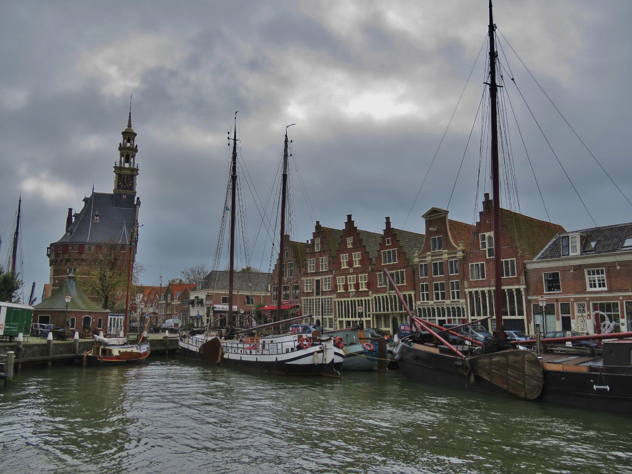
10/30/2018: Approaching Hoorn
Position: 52°38.18'N, 5°3.86'E
Approaching the town of Hoorn, our final stop before Amsterdam. Hoorn was the birthplace of Dutch explorer Willem Schoutens, who in 1616 named South America's Cape Horn after his home town. Prominent on the waterfront is the defensive tower Hoofdtoren.
|
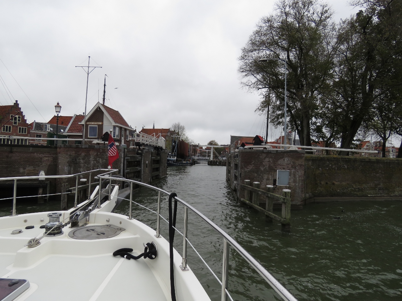 |
10/30/2018: Entering Binnenhaven
Position: 52°38.23'N, 5°3.82'E
Entering Hoorn's old harbour, Binnenhaven, through lock gates that now stand permanently open.
|
 |
10/30/2018: Binnenhaven
Position: 52°38.28'N, 5°3.82'E
Looking southwest across Binnenhaven to the tower Hoofdtoren with canal barges lining the walls.
|
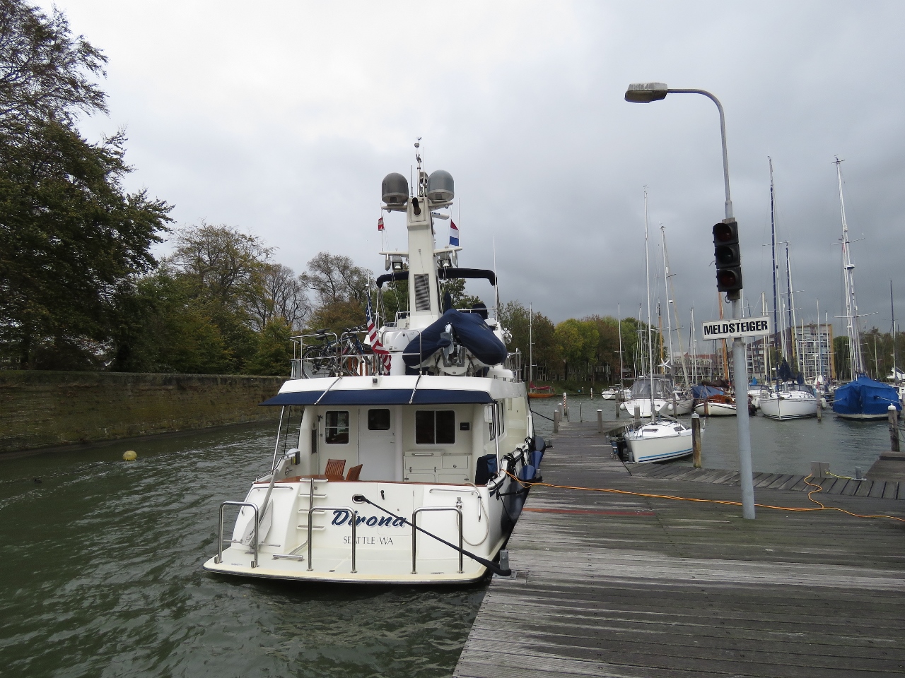 |
10/30/2018: WSV Hoorn
Position: 52°38.26'N, 5°3.89'E
Hoorn has four areas where guest boats can moor and we had a little confusion as to where we were supposed to be. We thought it was Binnenhaven, which is why we went in, but our berth was outside at WSV Hoorn. This worked out super-well and was an easy walk into the town center.
The berth also gave us a chance to do another test of our new dual shorepower system. We're currently plugged into two 10-amp supplies, giving us a total of 20 amps, which is fine. Before we added the second shore-power connection, we'd only be able to get a single 10-amp feed, a little lean for our power consumption. |
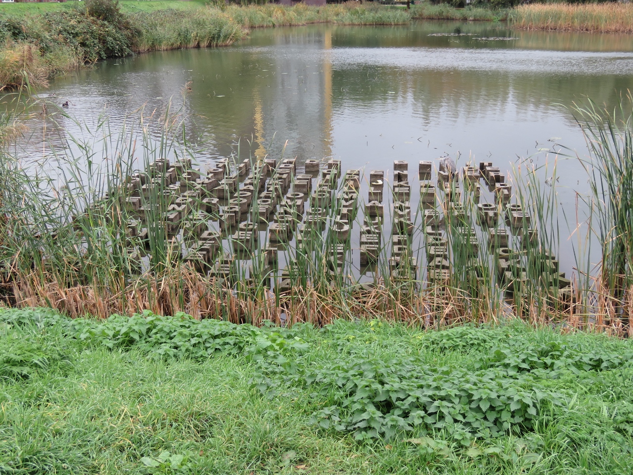 |
10/30/2018: Letters
Position: 52°38.30'N, 5°4.02'E
We couldn't quite make out the words, presumably in Dutch, of this intriguing artwork in a pond adjacent to WSV Hoorn.
|
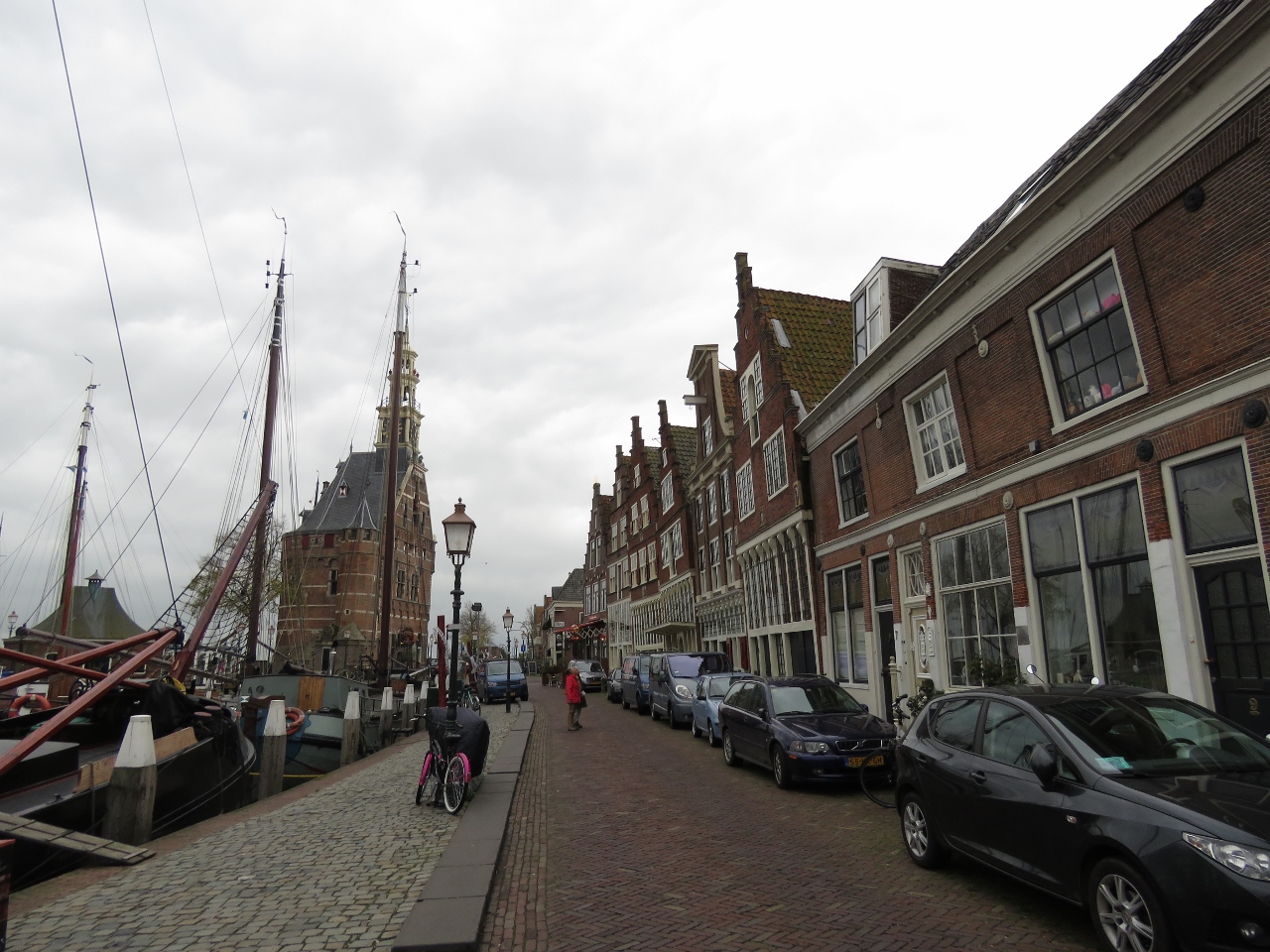 |
10/30/2018: Veermanskade
Position: 52°38.26'N, 5°3.78'E
Historic buildings overlooking Binnenhaven along Veermanskade.
|
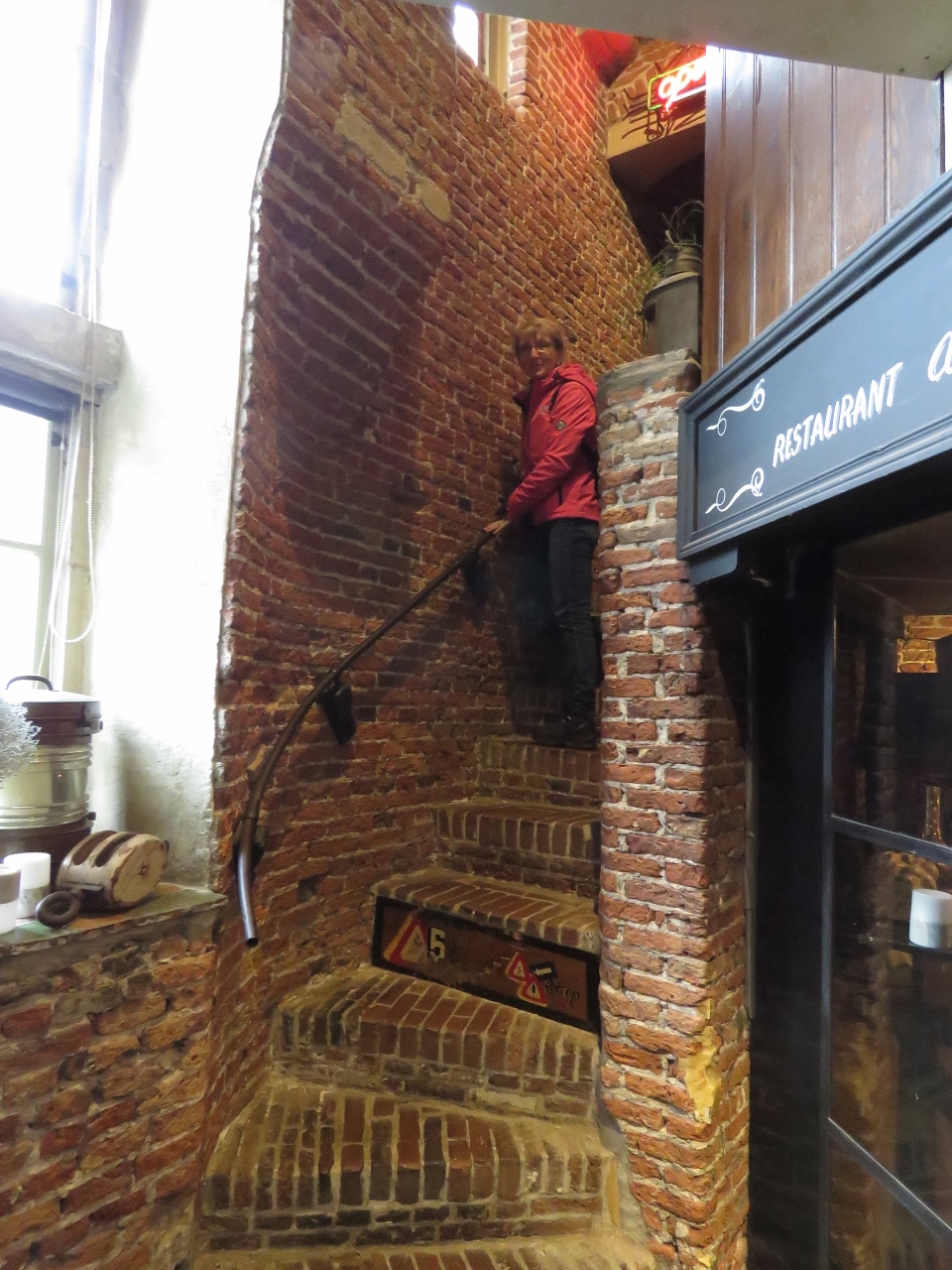 |
10/30/2018: Stairs
Position: 52°38.22'N, 5°3.79'E
Climbing the well-worn stairs inside Hoofdtoren to the restaurant on the second floor. The tower has been standing since 1532.
|
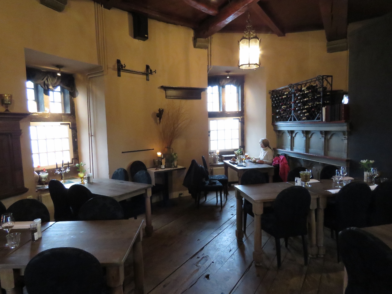 |
10/30/2018: De Hoofdtoren
Position: 52°38.22'N, 5°3.79'E
We had an excellent late lunch with a harbour view at De Hoofdtoren inside the Hoofdtoren tower.
|
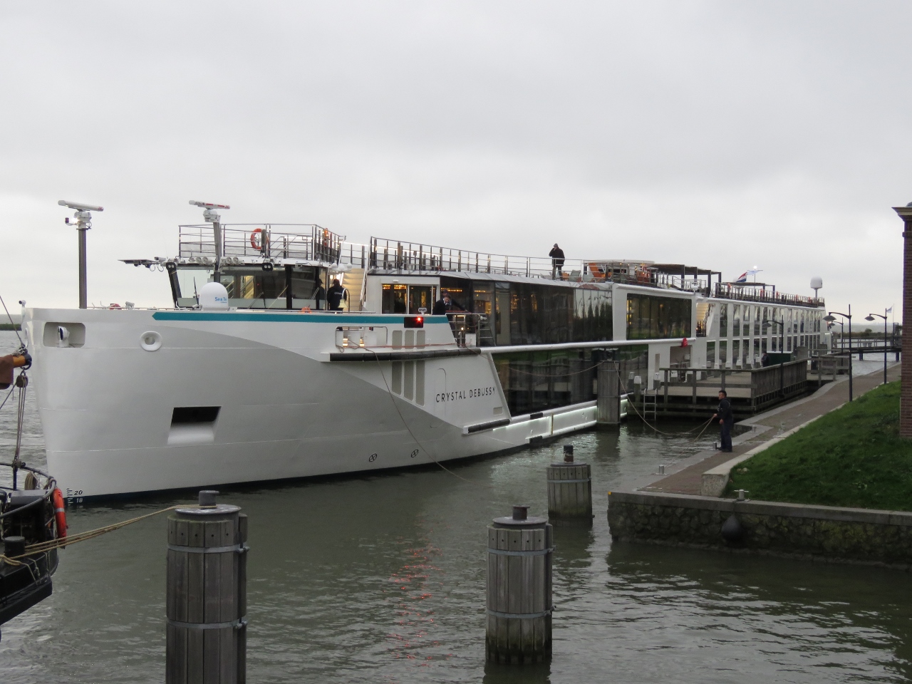 |
10/30/2018: Crystal Debussy
Position: 52°38.17'N, 5°3.78'E
The river cruise ship Crystal Debussy arriving into Hoorn.
|
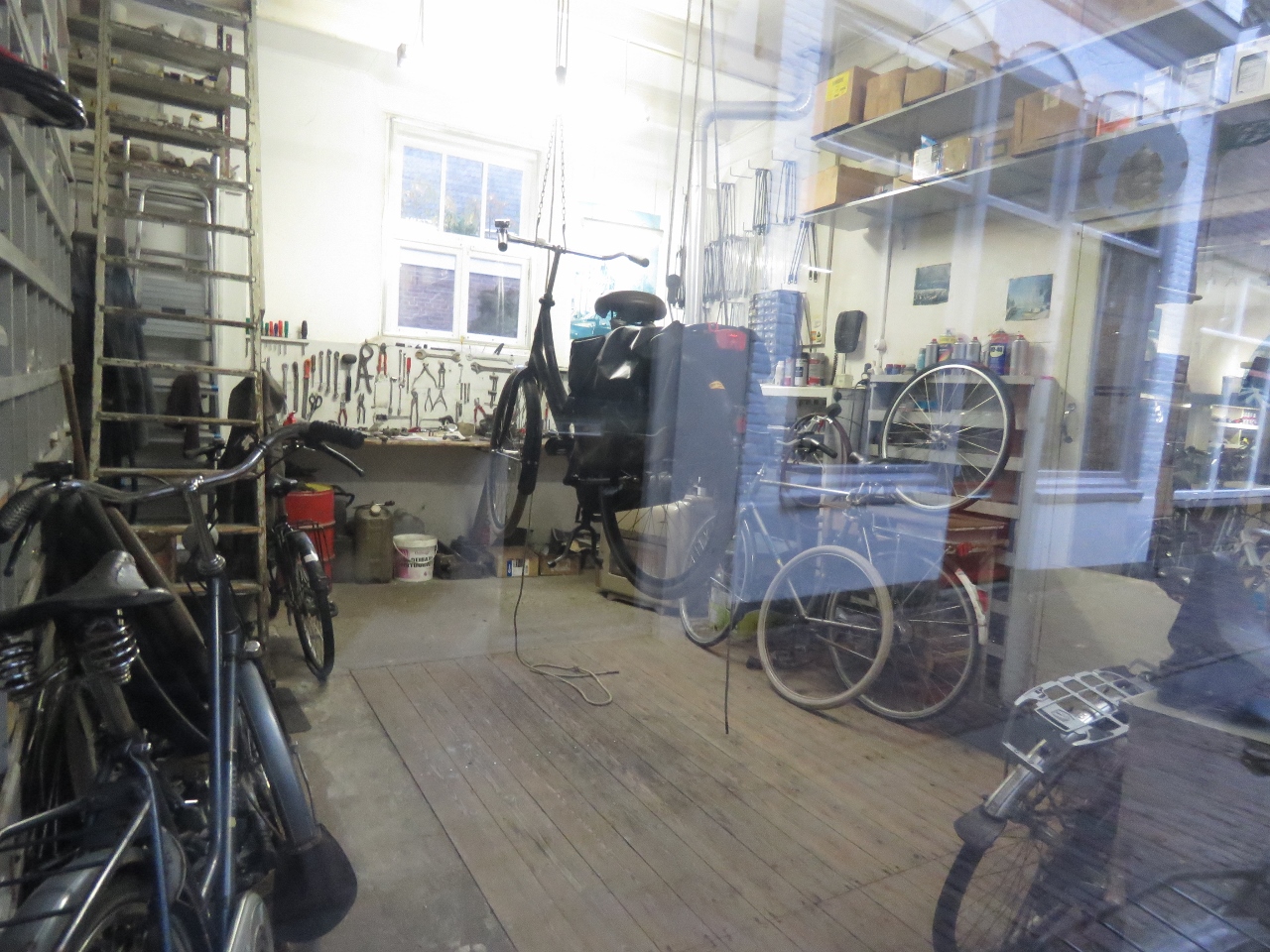 |
10/30/2018: W. Wormsbecher
Position: 52°38.32'N, 5°3.59'E
Bicycles and tools at W. Wormsbecher bicycle repair. With the number of bicycles in The Netherlands, bicycle-repair must be a steady business.
|
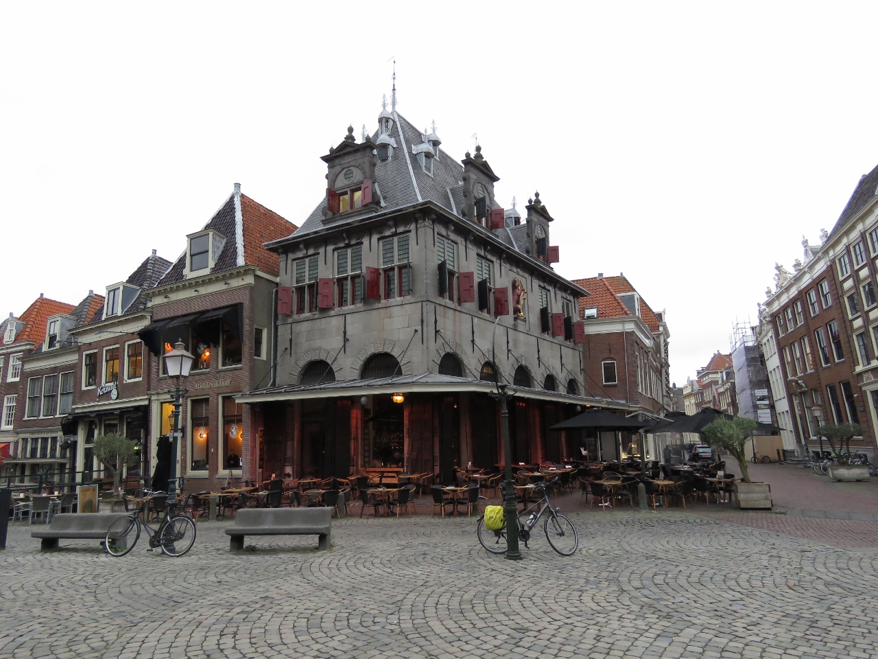 |
10/30/2018: The Waag
Position: 52°38.36'N, 5°3.56'E
The 17th-century weigh house, the Waag, on Hoorn's main square with Hoorn's symbol of a unicorn on the upper right face. The building now contains a popular restaurant.
|
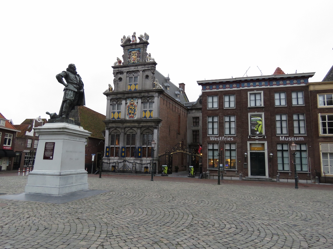 |
10/30/2018: Jan Pieterszoon Coen
Position: 52°38.38'N, 5°3.57'E
Statue in Hoorn's main square of Hoorn-born Jan Pieterszoon Coen, who was an officer of the Dutch East India Company and a two-time Governor-General of the Dutch East Indies. Immediately to the right of the statue, across the square, is the 16th-century State Council building that now houses a museum.
|
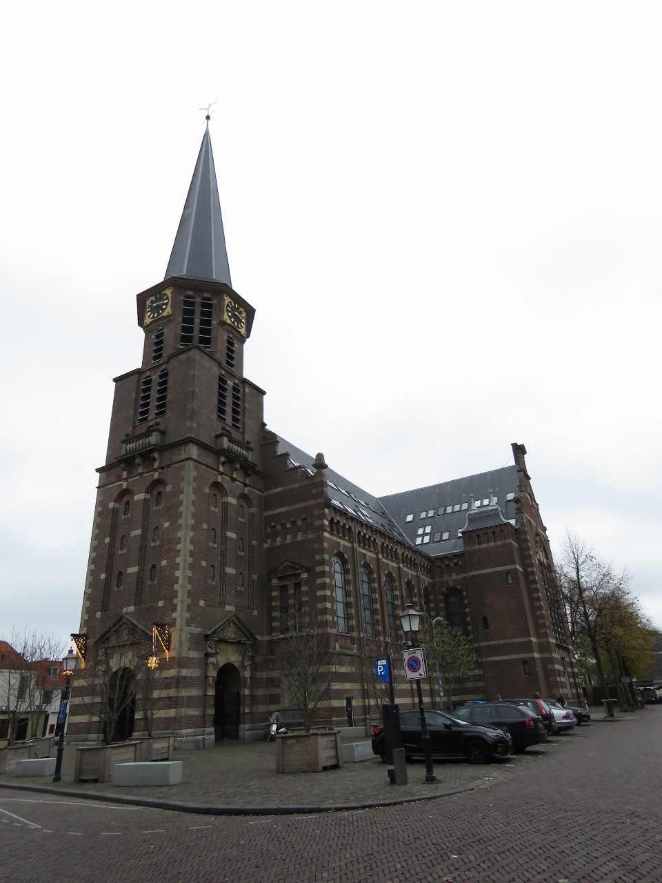 |
10/30/2018: Grote Kerk
Position: 52°38.43'N, 5°3.58'E
The skylights in the roof of the Grote Kerk intrigued us as they were unusual for a church. Built in the last 1800s the church closed in 1968 and was converted to commercial function including thirty-six residential apartments. That explains the skylights.
|
 |
10/30/2018: Town Hall
Position: 52°38.49'N, 5°3.61'E
Hoorn's fabulous twin-gabled old town hall building dates from 1613.
|
 |
10/30/2018: Leaning
Position: 52°38.41'N, 5°3.68'E
This house was built leaning forward, a building technique common in Europe through the middle ages when houses were made of wood. The major advantage is that rainwater is less likely the enter the floor below. It also allows the upper floor to be bigger without taking up as much street space. When brick came into use as a construction medium, the tradition continued. Many buildings included commercial space in the attic and the lean also reduced the risk of damaging windows or the building itself when goods were hoisted up.
|
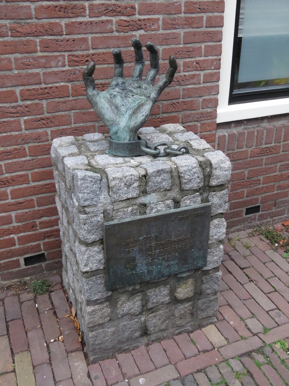 |
10/30/2018: Despair
Position: 52°38.40'N, 5°3.43'E
"Despair", one of several bronze chained hand sculptures in Hoorn that warn against injustice and war. The works are by Dutch artist Truus Menger-Oversteegen who, along with her sisters, was a member of the anti-Nazi Dutch armed resistance during World War II.
|
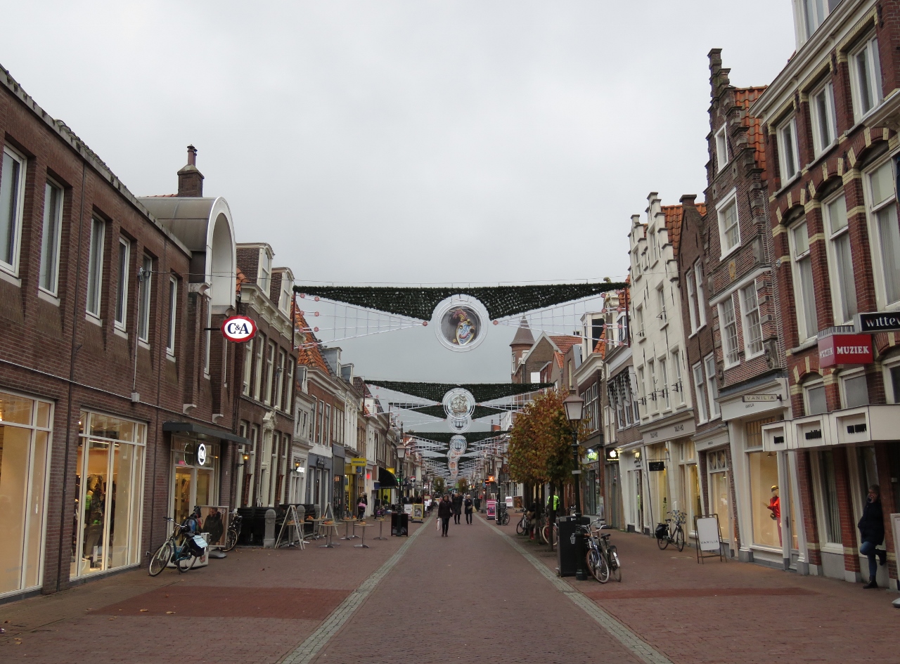 |
10/30/2018: Grote Noord
Position: 52°38.42'N, 5°3.47'E
Looking along Grote Noord, a pedestrian mall and shopping district.
|
 |
10/30/2018: Oude Waegh
Position: 52°38.36'N, 5°3.58'E
We capped off an excellent walking tour of Hoorn with a meal at Oude Waegh in the Waag building on Hoorn's main square. Blog reader Rene Bornmann recommended we visit Hoorn (and Enkhuizen), and we very much enjoyed both towns.
|
 |
10/30/2018: Barometer
Position: 52°38.26'N, 5°3.88'E
The barometer has fallen hard in the past couple of days and now is on the upswing. This likely will bring strong winds, so it's nice to be in a protected inland waterway.
|
 |
10/31/2018: Heron
Position: 52°38.26'N, 5°3.89'E
Spitfire just about blew a gasket when this heron landed on our railing.
|
 |
10/31/2018: Hoofdtoren
Position: 52°38.22'N, 5°3.89'E
Looking across Binnenhaven to Hoofdtoren as we head out to enjoy the sunshine.
|
 |
10/31/2018: Winter Garden
Position: 52°38.37'N, 5°3.59'E
We had a good lunch at the Winter Garden in Restaurant Cafe Ridderikhoff along Hoorn's main square.
|
 |
10/31/2018: F21
Position: 52°37.26'N, 5°0.42'E
On the wonderful National Bike Route F21 from Hoorn to Edam. The 12mi (20km) ride took about an hour.
|
 |
10/31/2018: Scheppenmakersdjik
Position: 52°30.66'N, 5°2.72'E
Our first view to beautiful Edam along Scheppenmakersdjik.
|
 |
10/31/2018: Edammer Kaaswinkel
Position: 52°30.75'N, 5°2.89'E
A wide variety of cheese for sale at Edammer Kaaswinkel. Cheese has been a major economy in Edam since the town's cheese market began in the 16th century. At peak times, 250,000 rounds of cheese were sold annually.
|
 |
10/31/2018: Voorhaven
Position: 52°30.80'N, 5°3.31'E
Tranquil scene along Voorhaven in Edam.
|
 |
10/31/2018: Edam in Edam
Position: 52°30.74'N, 5°2.93'E
Enjoying some Edam at the L'Auberge Damhotel in Edam. We didn't see cheese on the menu, and asked if we could have a small plate of cheese with our glass of wine. The response was a polite and friendly "Of course", but we felt a bit like we'd asked a bartender if we could get a drink.
|
 |
10/31/2018: Edams Museum
Position: 52°30.76'N, 5°2.96'E
Edams Museum is housed in the town's oldest building, dating from 1540. The cellar floats up and down with the groundwater level to decrease pressure on the structure, a building technique in the Netherlands exclusive to towns with high and non-stabilized groundwater levels. Basements often would burst as the groundwater levels changed due to tides and storm floods.
Floating cellars were commonly built in Amsterdam during the major 17th- and 18th-century growth periods when the cost of digging down generally was less expensive than purchasing land. These structures no longer were needed after 1871 when Amsterdam stabilized the groundwater levels with locks. |
 |
10/31/2018: Dike
Position: 52°32.21'N, 5°3.44'E
We returned to Hoorn from Edam along the old dike, no longer needed now that locks stabilize the outside water levels.
|
 |
10/31/2018: Dusk
Position: 52°35.70'N, 5°1.04'E
Wonderful dusk scene at Schardam on our bike ride back to Hoorn.
|
 |
10/31/2018: Sunset
Position: 52°36.12'N, 5°0.85'E
Spectacular sunset just south of Hoorn.
|
 |
10/31/2018: Lucas Rive
Position: 52°38.26'N, 5°3.89'E
A birthday dinner for Halloween baby Jennifer at Michelin-starred Lucas Rive in Hoorn. We normally don't order a fixed menu, but the tasting samples included with all the meals (pictured) were so impressive that we decided to put ourselves in the chef's hands for both food and wine. We're glad we did—the evening was truly exceptional.
|
 |
10/31/2018: Binnenhaven
Position: 52°38.26'N, 5°3.89'E
Binnenhaven at night as we return to the boat from Lucas Rive.
|