MV Dirona travel digest for Dampier to Rodrigues 2015

|
Click the travel log icon on the left to see these locations on a map,
with the complete log of our cruise. On the map page, clicking on a camera or text icon will display a picture and/or log entry for that location, and clicking on the smaller icons along the route will display latitude, longitude and other navigation data for that location. And a live map of our current route and most recent log entries always is available at //mvdirona.com/maps/LocationCurrent.html. |
 |
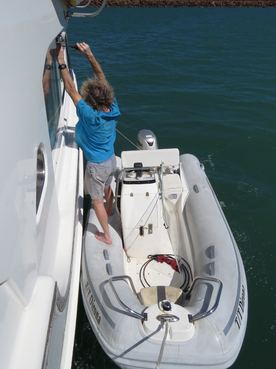
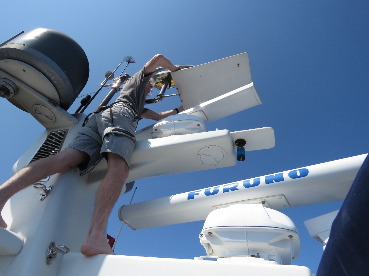
8/23/2015: Storm plates
Position: -20°40.10'S, 116°41.55'E
Large expanses of glass are great for views, but may not be strong enough for survival conditions. Storm plates fit over large windows to protect them. Rugged storm-capable boats really have only two options: very small, very thick windows, or larger windows that need protection at sea. Smaller windows make the boat less liveable, and given the frequeuncy of being at sea and the ease in which storm plates can be installed, the latter approach used by Nordhavn works quite well. We only install ours on longer runs when the weather is less predictable. Here James is installing the storm plates on the starboard windows.
|
 |
8/23/2015: Port side storm plates
Position: -20°40.10'S, 116°41.55'E
The three windows on the starboard side are easy because we have a walkway there. For the port side, we either have to use a dock or install them from the dinghy. Using the dinghy is about as quick as working on a dock with only a small increased risk of dropping something. Today the water was a little rough, making the job more challenging.
|
 |
8/23/2015: Deadlights
Position: -20°39.71'S, 116°41.99'E
We also installed the deadlights over the lower windows throughout the boat. Deadlights are metal covers that fit over a porthole to provide additional strength over the glass alone.
|
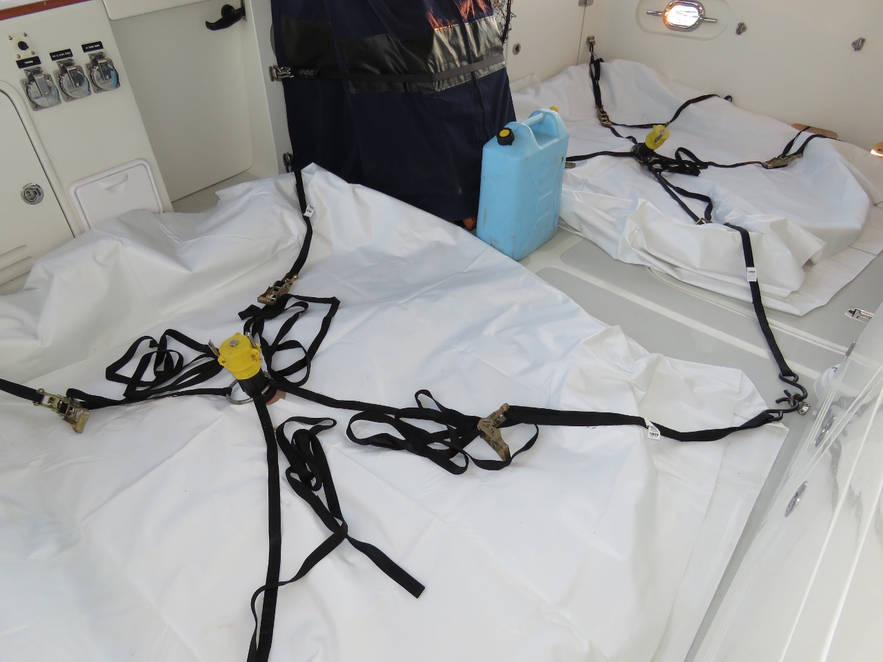 |
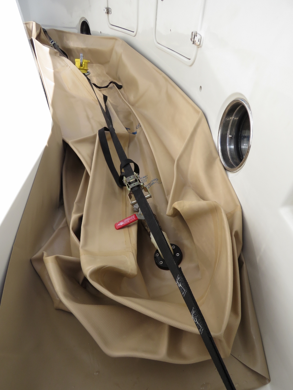
8/24/2015: Bladders
Position: -20°40.09'S, 116°41.56'E
The aft fuel bladders ready for filling. We haven't had them out since the run from Hawaii to the Marquesas Islands.
|
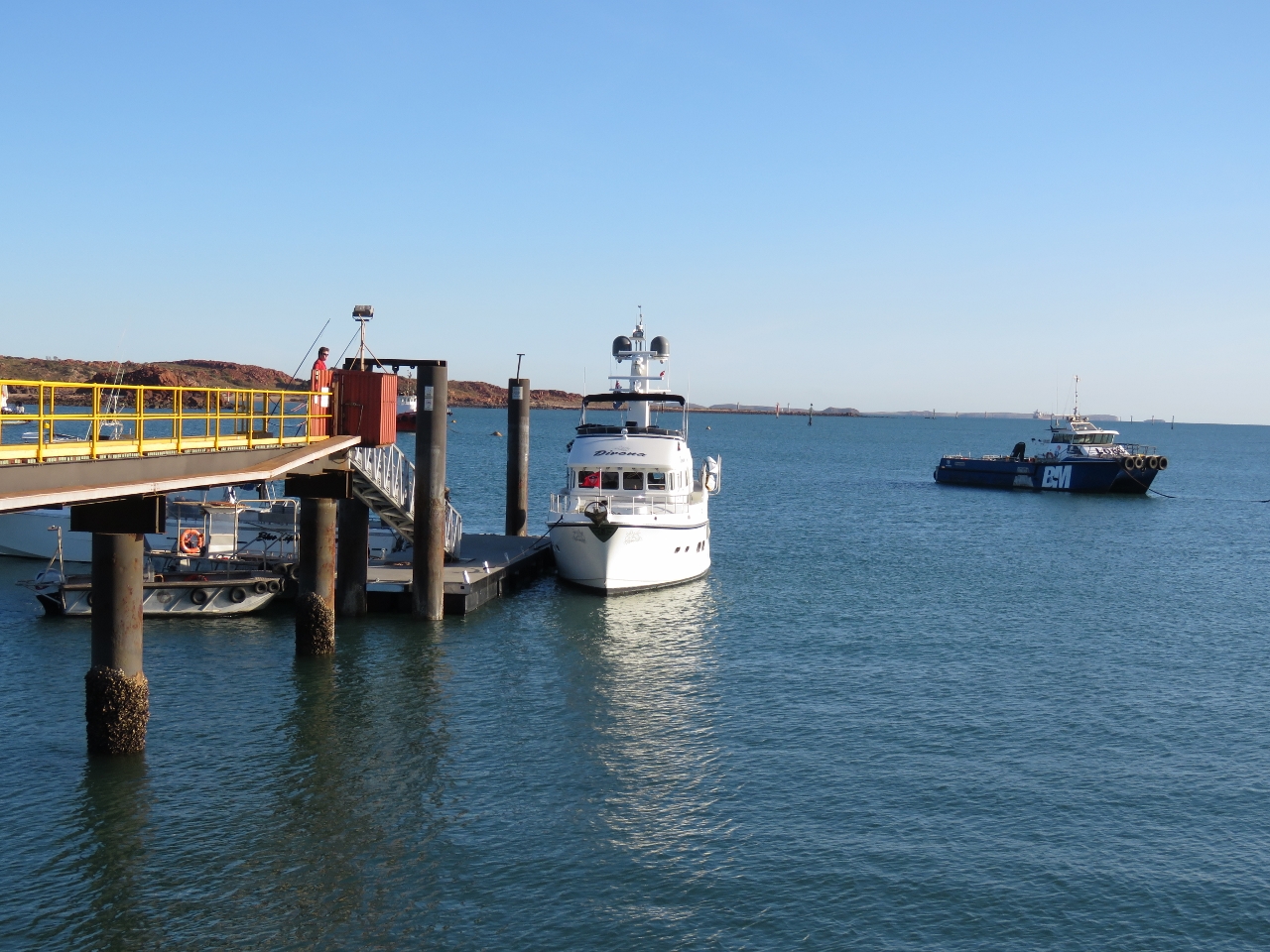 |
8/24/2015: HHBSC dock
Position: -20°39.71'S, 116°41.99'E
We landed on the Hampton Harbour Boat and Sailing Club (HHBSC) dock shortly after seven this morning to fuel up and clear customs.
|
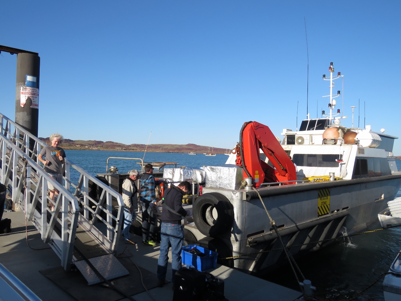 |
8/24/2015: Crew transfer
Position: -20°39.71'S, 116°41.99'E
The HHBSC dock is the only small craft dock in the area and is heavily-used for commercial activities. A constant stream of commercial vessels came and left while we were there. This boat is taking crew out to a nearby ship for a four-week stint.
|
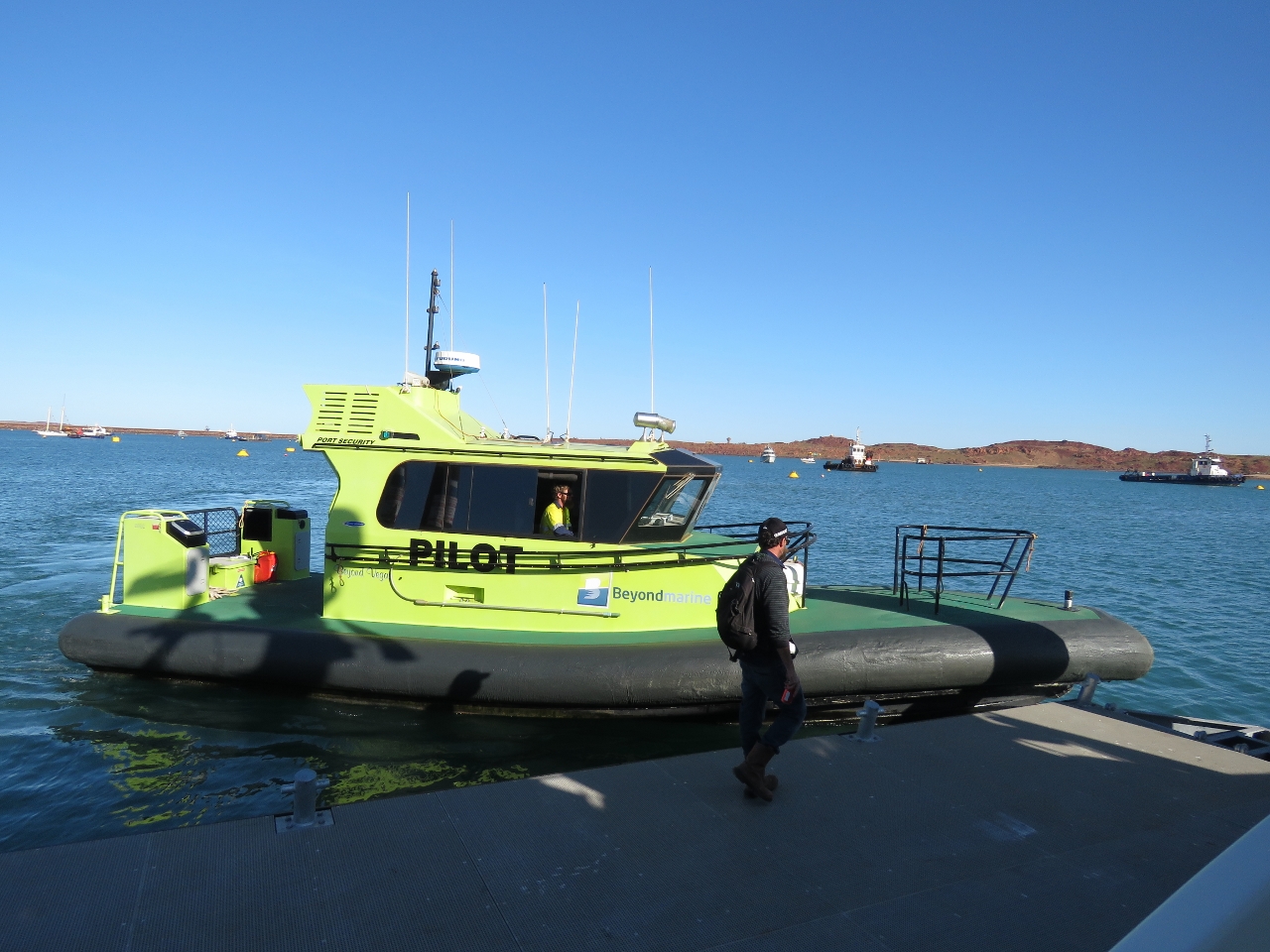 |
8/24/2015: Pilot
Position: -20°39.71'S, 116°41.99'E
This harbour pilot boat was moored near us over the weekend and came by to pick up a pilot this morning.
|
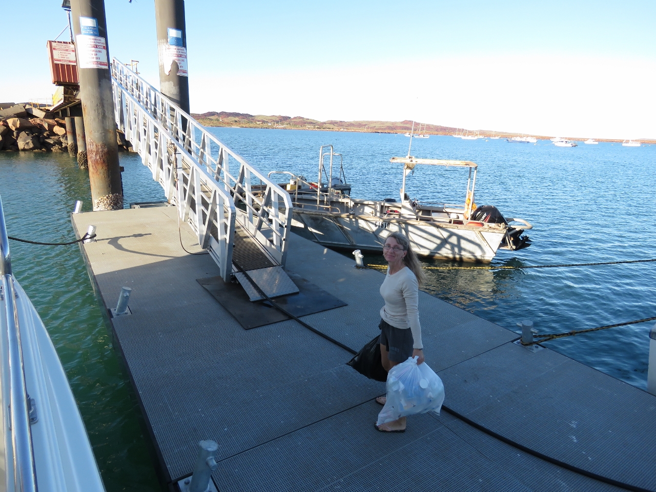 |
8/24/2015: Garbage
Position: -20°39.71'S, 116°41.99'E
A final garbage run before we depart.
|
 |
8/24/2015: Filling the main tanks
Position: -20°39.71'S, 116°41.99'E
James filling the main tanks before we fill the bladders. In front of him is our teak cockpit table that we fold down and strap to the walkway when we deploy the cockpit bladders.
|
 |
8/24/2015: Filling the aft bladders
Position: -20°39.71'S, 116°41.99'E
Filling the two 300-gallon aft bladders. After filling all the bladders, we were carrying 2,587 gallons. With a 200-gallon reserve, we need to make 1.26 nm/gallon to travel the 3,005 miles from here to Rodrigues, Mauritus.
|
|
|
8/25/2015: Certificate of Clearance
Position: -20°39.71'S, 116°41.99'E
The HHBSC dock also is the customs clearance dock. Customs arrived just as we were finishing up the fueling and we were cleared out a half-hour later. At some Australian ports such as Darwin and Broome, you can clear out a day or so before actually departing. In Dampier, you have to leave once you've cleared. That was our plan anyway, so not an issue for us.
|
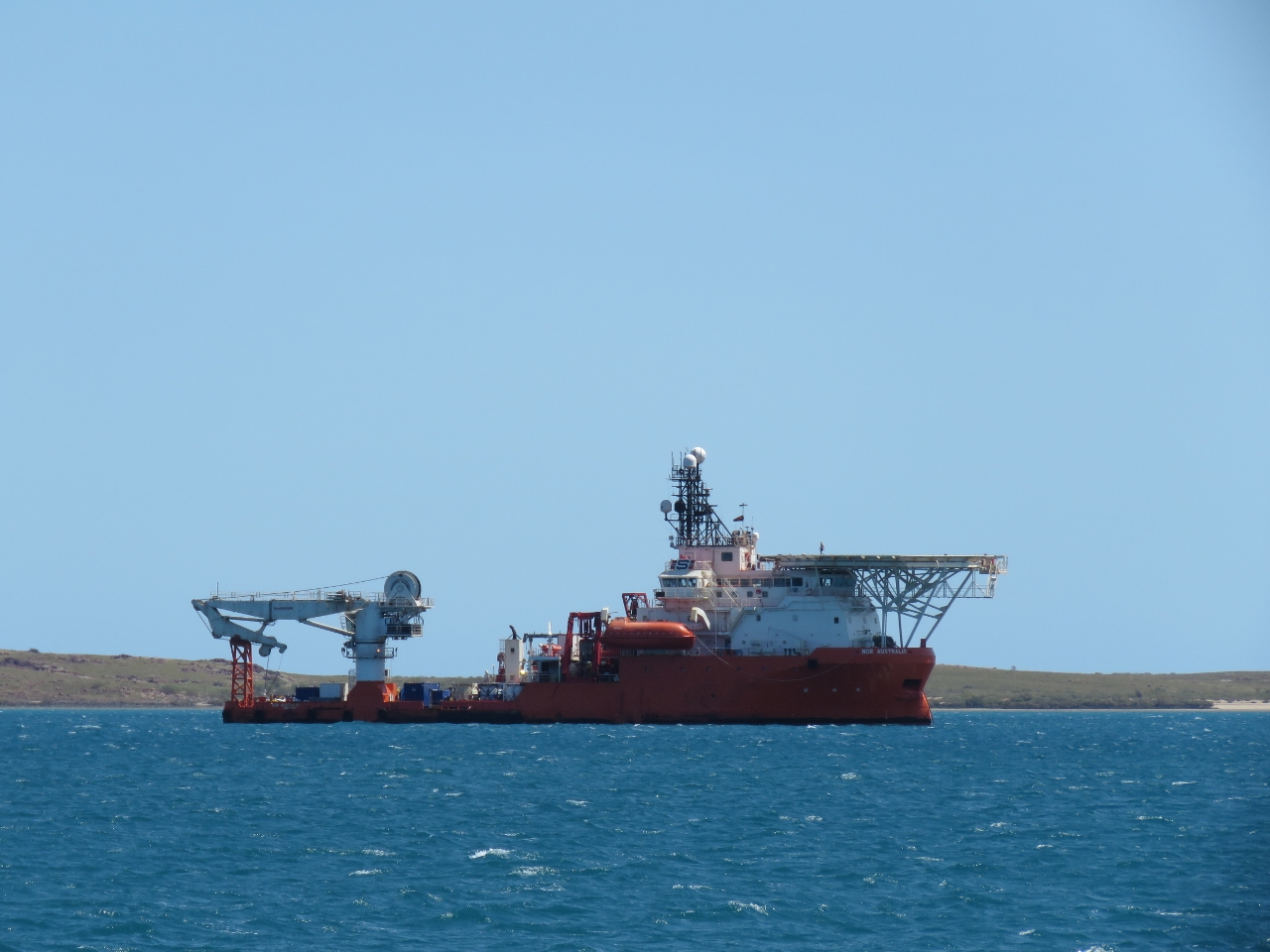 |
8/24/2015: Nor Australis
Position: -20°36.85'S, 116°35.79'E
Several anchor-handling tugs and offshore supply vessels like the Nor Australis were anchored in Mermaid Strait as we passed. The Dampier area servers the fairly substantial oil and gas industry in this region of Australia.
|
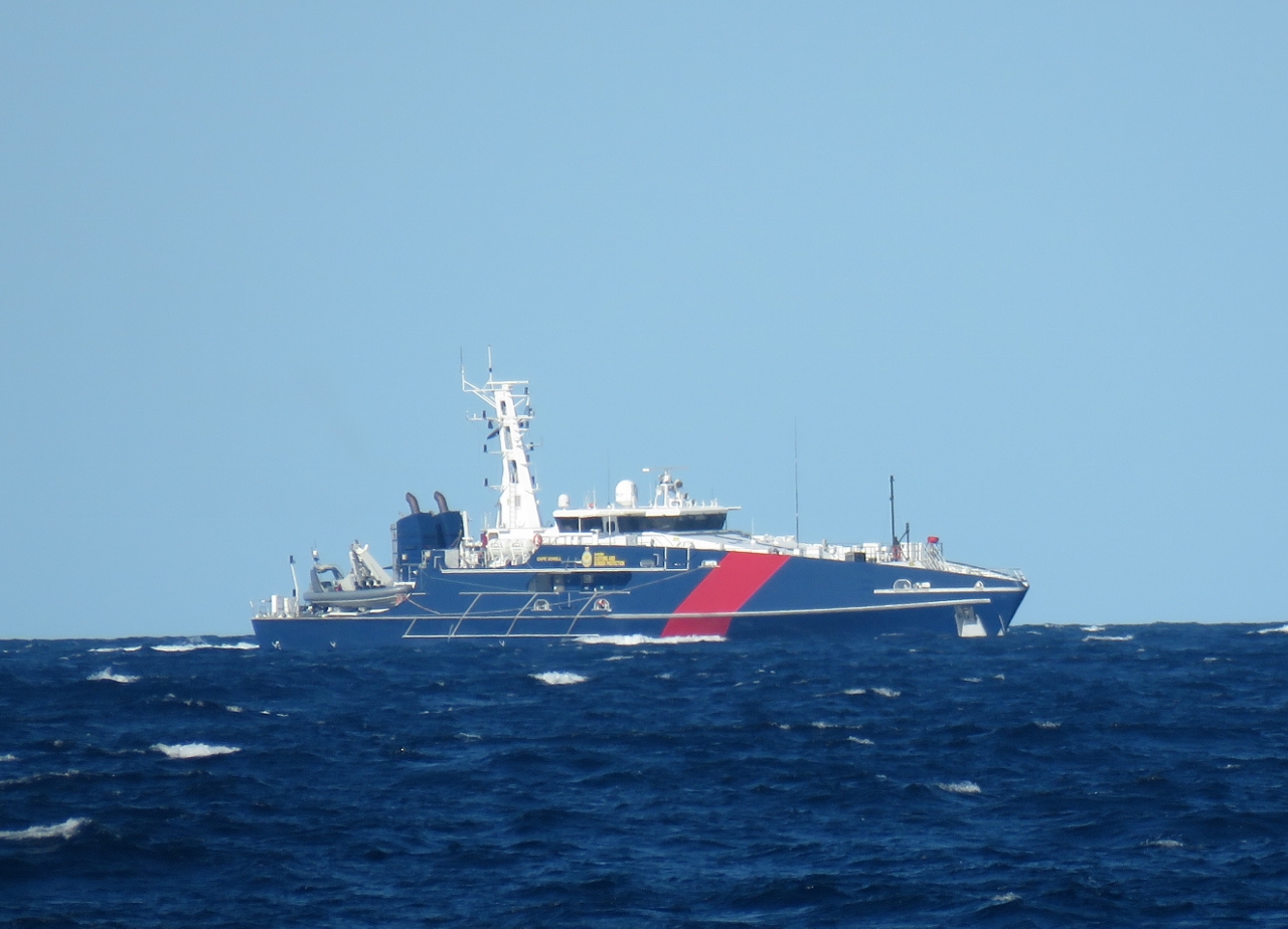 |
8/24/2015: Cape Sorrel
Position: -20°28.00'S, 116°15.95'E
The Australia Customs and Border protection patrol boat Cape Sorrel came up astern of us soon after we'd cleared the Dampier Archipelago. They radiod us and asked for vessel details and our last and next port of call. Once satisfied, they returned back towards Dampier. Australia sure does protect it's border carefully.
|
 |
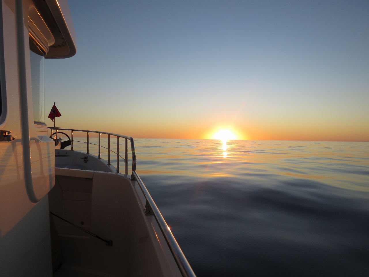
8/24/2015: Sunset
Position: -20°25.10'S, 116°0.88'E
Enjoying our first sunset of the trip. Conditions are wonderfully calm, with winds below 10 and only a light swell. We expect this will hold out for the next five days at least.
|
 |
8/24/2015: Last course change
Position: -20°19.34'S, 115°30.49'E
As we round North West Island, at the northern end of the Montebello Islands, we'll make our final scheduled course change for three weeks until we reach Rodrigues. And it will be our last sighting of land until then as well. It's night, so we can't actually see the island, just the navigations lights on it. Offshore gas platforms ring the Montebello Islands. We can see their bright lights way in the distance and are picking up several AIS targets, likely support vessels, moored among the islands.
|
 |
8/25/2015: Baked potato
Position: -20°22.61'S, 114°57.81'E
Jennifer does just one scheduled watch, from 10pm to 5am, and often has a starch craving in the middle of the night. A baked potatoe or plain pasta usually is the cure.
|
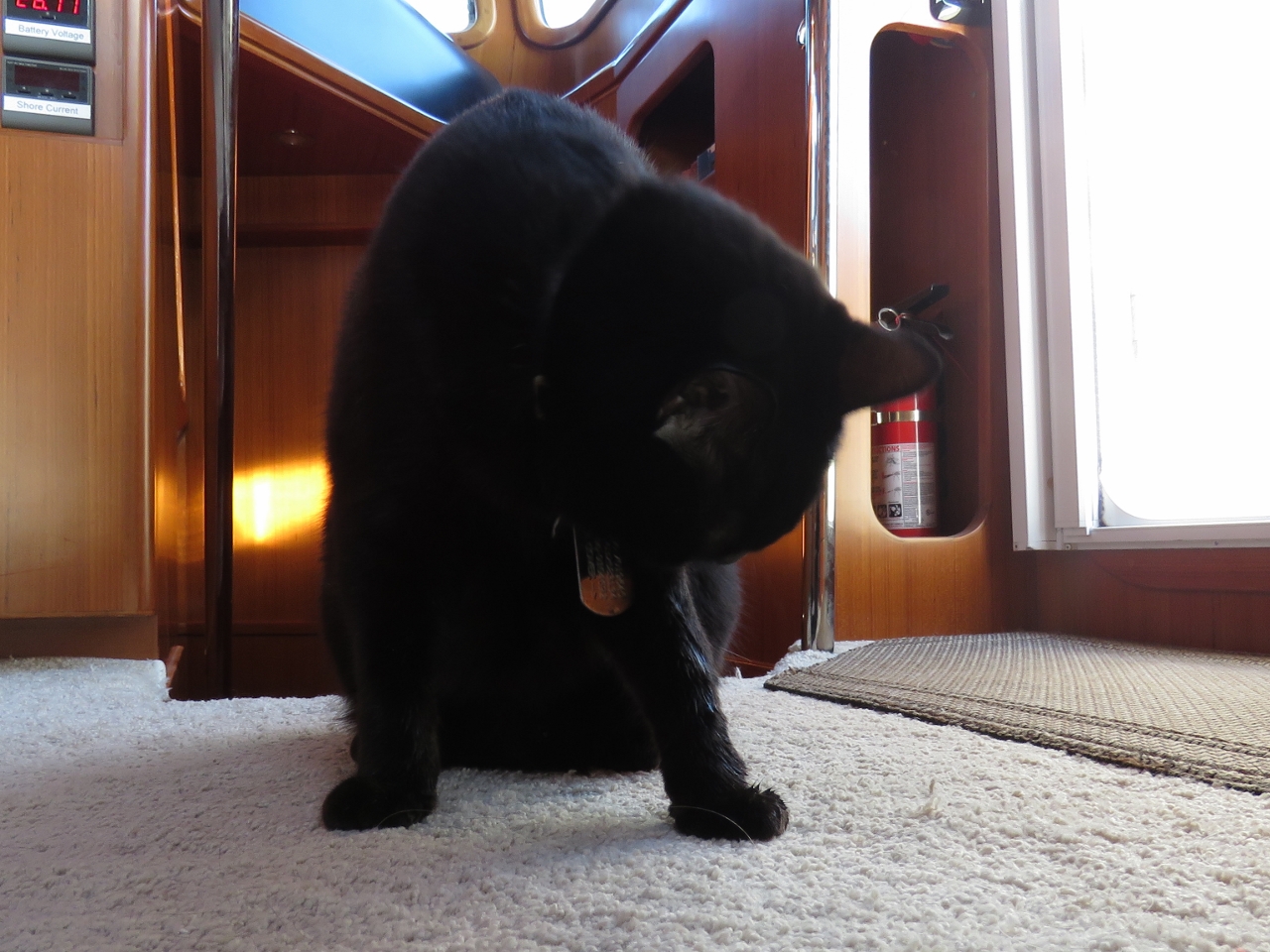 |
8/25/2015: Wet paw
Position: -20°25.95'S, 114°27.54'E
Spitfire badly wanted outside, so we let him out on a supervised walk. As he passed a scupper on his way from the pilot house to the cockpit, a wave came through and soaked his paw. He let out a howl of indignation and spent about a half-hour cleaning himself up after he came back inside. He's likely less eager to get outside now.
|
 |
8/25/2015: Far Shogun
Position: -20°26.68'S, 114°20.90'E
Far Shogun was at anchor in the Port of Dampier when we arrived. The ship was holding position just north of our course this morning, frequently emitting big puffs of black smoke as the dynamic positioning system held the ship in place. We radioed several times to make sure we wouldn't be too close for whatever operations they had underway, but never received a response. The ship didn't show up on AIS until we were quite close, but we continued to receive their AIS signal several miles after we'd passed, so likely they turned it on when they saw us.
|
 |
8/25/2015: Shrimp pitas
Position: -20°28.71'S, 114°2.44'E
Shrimp salad in pita pockets for lunch.
|
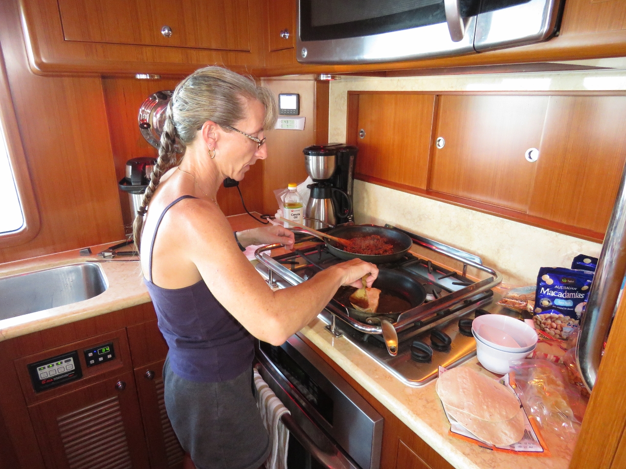 |
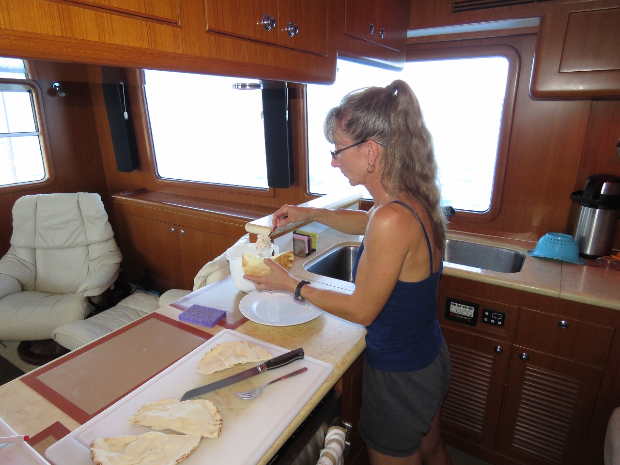
8/25/2015: Taco night
Position: -20°31.85'S, 113°33.86'E
Jennifer frying tortillas for a taco dinner. We don't actually have a taco night, although we used to have a pizza night. A longstanding tradition in the Hamilton household, dating back to our Toronto days in the late 1980s, was a pizza while watching Monday Night Football.
|
 |
8/25/2015: Sunset
Position: -20°32.34'S, 113°29.48'E
Our second sunset of the trip. Conditions are even calmer than last night, remeniscent of our Tasman Sea crossing. It won't last, but we're sure enjoying it while it does.
|
 |
8/26/2015: Four knots
Position: -20°37.34'S, 112°44.03'E
The only problem with the current conditions is we're often fighting a wicked counter-current. Since we're running to fuel economy, we have to slow down to reduce fuel burn. We need to attain 1.26 gallons per hour, but nothing makes you nervous about fuel economy like 1,500 miles to the closest shore. So we continue to aim for a little bit better than that and consequently are giving up more speed than needed.
|
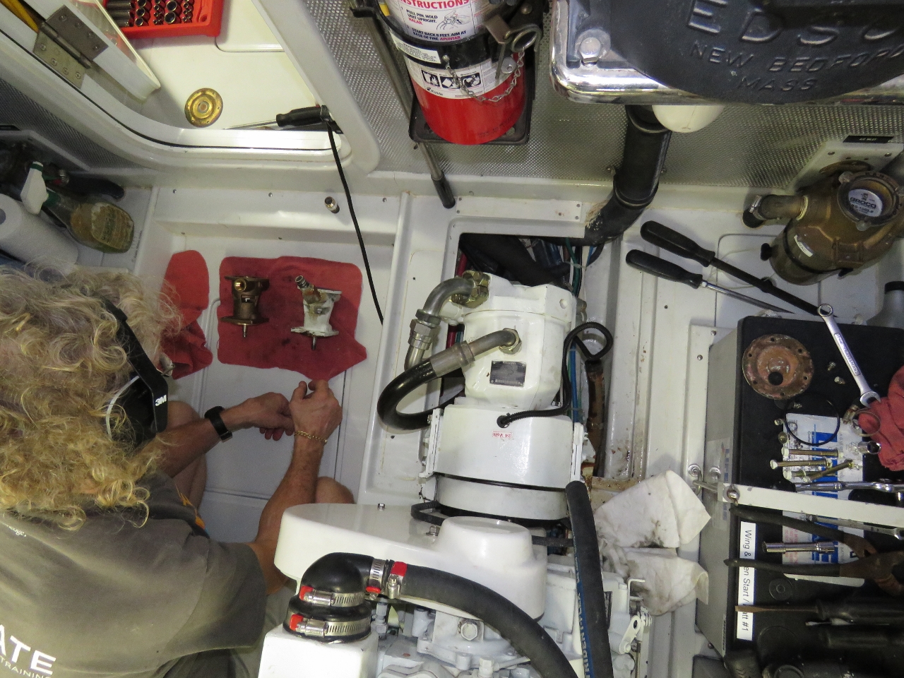 |
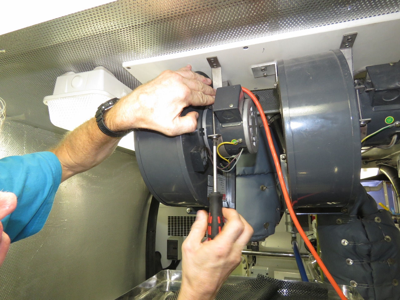
8/26/2015: Raw water pump
Position: -20°42.81'S, 111°54.66'E
As unlikely as it sounds, just as we set off on a 3,005nm trip with all mechanical systems in top operating condition, the wing engine cooling pump water seal failed as we were maneuvering off the fuel dock at Dampier. The wing only is used for anchoring, close-quarters maneuvering and in emergency operations. But in the short run with the leak it had sprayed saltwater everywhere. Even with the motor shut off, it dribbled water. So today James spent a couple of hours to install the spare. The water pump change on these engines and generators is remarkably easy. This one is made a little more challenging in that the hydraulic power take-off (PTO) pump interferes with the removal of the cooling pump. The hydraulic pump driven by the engine PTO extends from the center of the front of the engine in the middle of the photo and the cooling pump mounting position is also at the front of the engine between the hydraulic pump and the batteries further outboard. (Click photo for larger view).
|
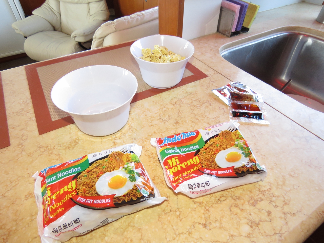 |
8/26/2015: Mi Goreng
Position: -20°44.67'S, 111°38.60'E
Spicy Mi Goreng fried noodles for lunch.
|
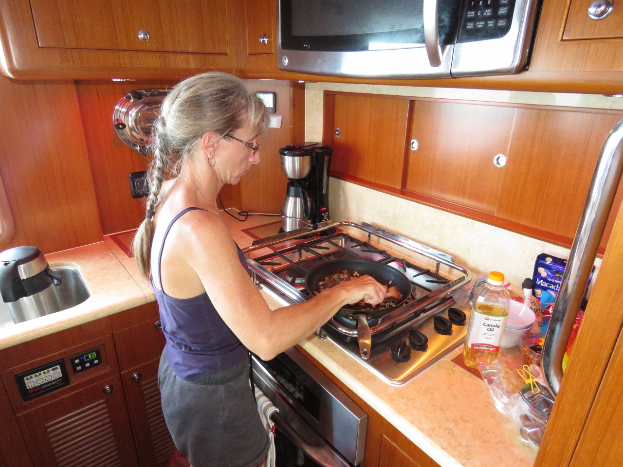 |
8/26/2015: Steak and ginger
Position: -20°46.83'S, 111°19.95'E
Making beef stir-fried with onions and fresh ginger over rice for dinner.
|
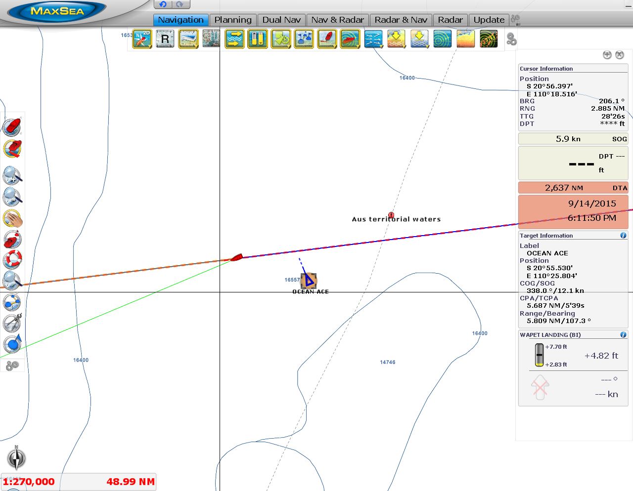 |
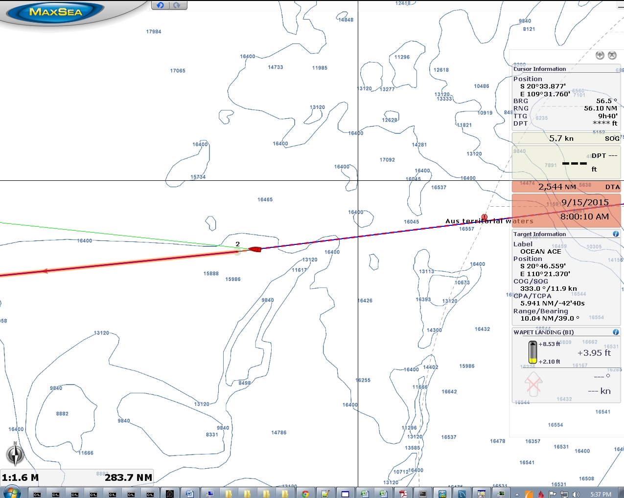
8/27/2015: Ocean Ace
Position: -20°53.76'S, 110°20.18'E
The bulker Ocean Ace passed about 5.5 miles behind us shortly after we exited Australian territorial waters. The ship was en-route from Geraldton, Australia to Jakarta, Indonesia.
|
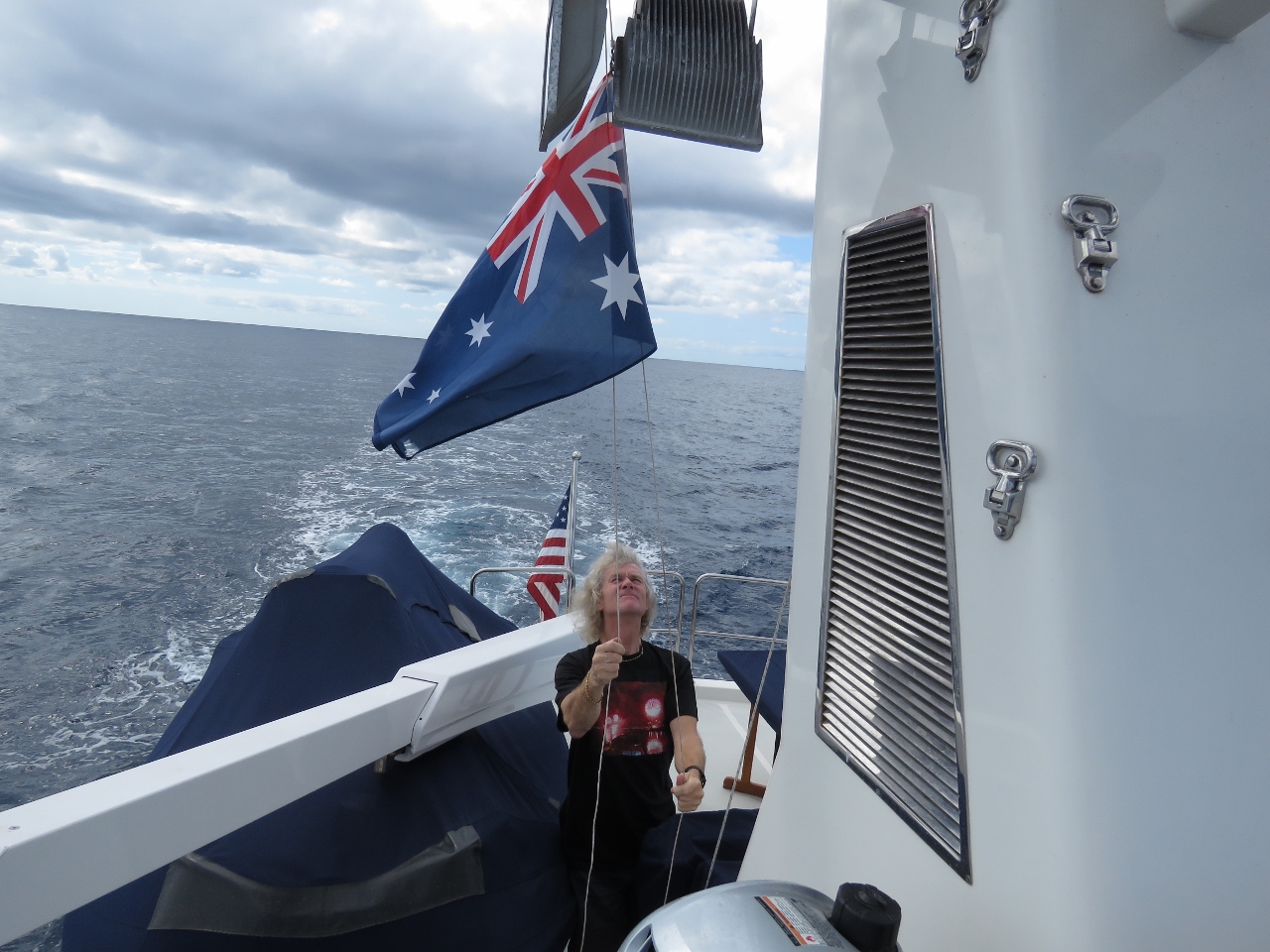 |
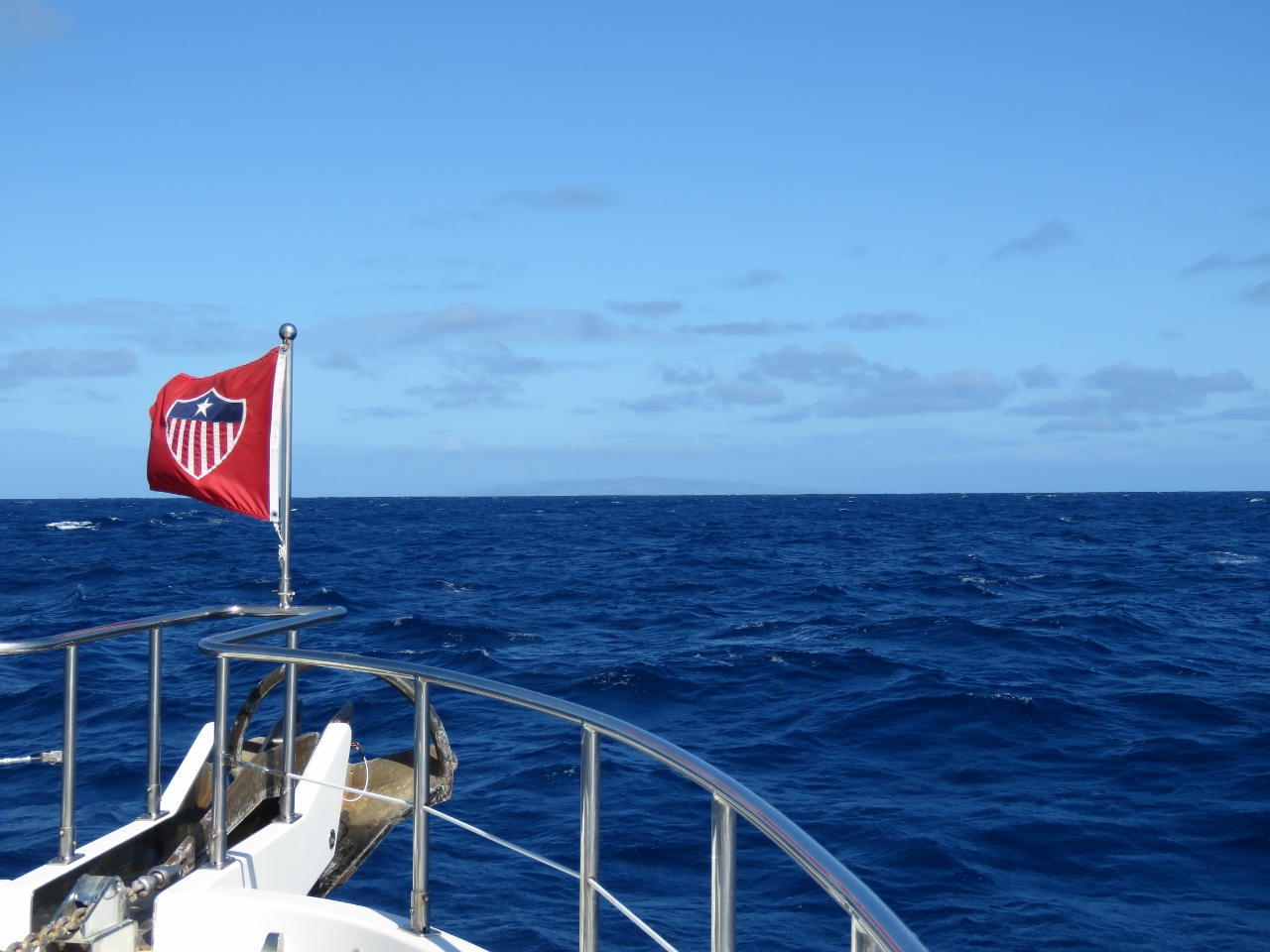
8/27/2015: Courtesy flag
Position: -20°59.60'S, 109°29.79'E
Taking down our Australian courtesy flag as we leave Australian territorial waters. That's sure been up for a long time. Well, not that particular flag--we went through three others before it. We buy ours from J&S Surplus where a 2ftx3ft flag is only $13. The flags aren't very durable, but usually will last a couple of months. We also bought one high-quality one in Australia that lasted well.
|
 |
8/27/2015: 7.1 knots
Position: -21°0.43'S, 109°22.65'E
We escaped the clutches of that strong counter-current late last night and most of the day have been avereraging over 6 knots while well within our fuel economy goal. The negative current was a bit of a surprise. The recent GRIBs and OSCAR models indicated the current should be slightly with us. The pilot charts did show a 1/2-knot eastbound current to our south in the month of September--it's possible that current was stronger and further north. Another possibility is that we were in a backeddy of the south-flowing Leeuwin current. Whatever the cause, we're glad to be free of it and back to making close to the normal speed you'd expect at this fuel economy level in these conditions.
|
 |
8/27/2015: Fried rice
Position: -21°5.15'S, 108°41.94'E
Korean barbecued beef fried rice for dinner, made with beef we'd cooked prior to the passage.
|
 |
8/27/2015: Cross-current
Position: -21°5.67'S, 108°37.38'E
We passed through a strong cross-current today and NAV mode had the boat angled at 15 degrees to our course to keep us on track. This likely is the West Australian Current that flows northbound several hundred miles offshore. This isn't quite as bad as a direct counter-current, but it does reduce speed at a given fuel economy.
|
 |
8/27/2015: Boat
Position: -21°5.68'S, 108°37.27'E
We saw what looked like a fishing boat about six miles away. This is only our third sighting of another boat in as many days.
|
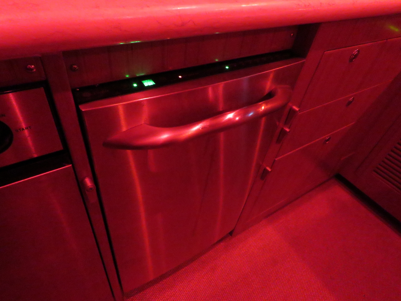 |
8/27/2015: Dishwasher
Position: -21°8.13'S, 108°12.12'E
Our dishwasher is a standard household appliance and, like most houses, is designed to be on a level surface. If the boat is pitching and rolling substantially, water will slosh out. So we only use it in reasonably calm conditions.
|
 |
8/27/2015: 6,000 hours
Position: -21°8.62'S, 108°7.07'E
We just crossed 6,000 hours on our Deere main engine, and it's nowhere close to getting a rest--we have 2,426nm remaining in our Indian Ocean crossing. Love that Deere. We put 4,100 hours on our previous boat's Cummins engines. In total, we've now spent over 10,000 hours exploring, adventuring and having fun in boats.
|
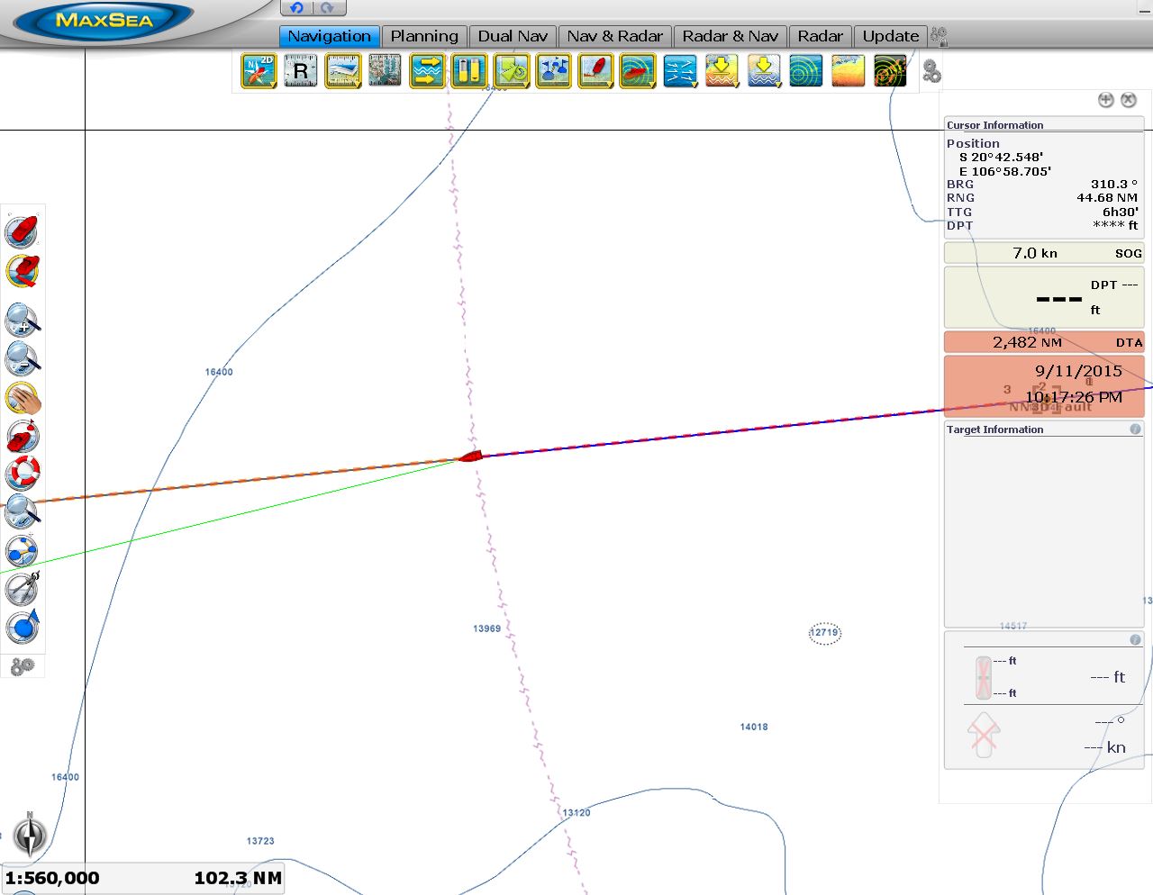 |
8/28/2015: 2,482 miles left
Position: -21°11.65'S, 107°35.33'E
We've covered 523 miles and have less than 2,500 remaining. It's nice to know we still have 2,200 gallons of diesel on board.
|
 |
8/28/2015: Salmon dip
Position: -21°17.99'S, 106°28.84'E
Smoked salmon dip for lunch.
|
 |
8/28/2015: Looking forward
Position: -21°18.69'S, 106°21.36'E
We've been incredibly lucky with the conditions. Winds have generally been less than ten, if not less than five, with only a low, gentle swell. The boat is running perfectly and we're really enjoying the trip. The only negative to the trip so far are the sometimes very strong counter-currents.
|
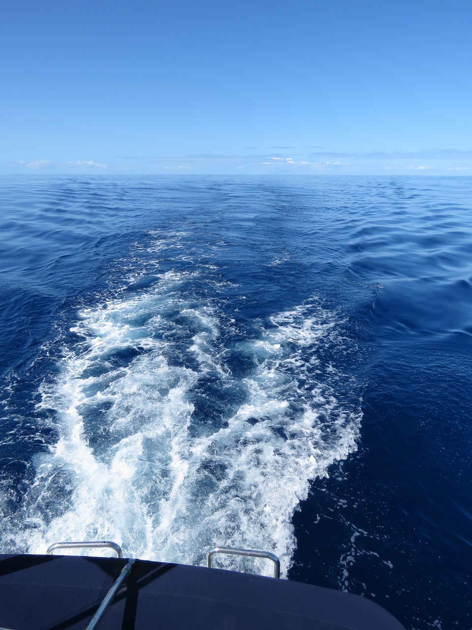 |
8/28/2015: Looking back
Position: -21°18.70'S, 106°21.25'E
Our wake trailing behind us in the distance with no waves to wipe it away. It feels like we're on a protected lake rather than 500 miles out into the Indian Ocean.
|
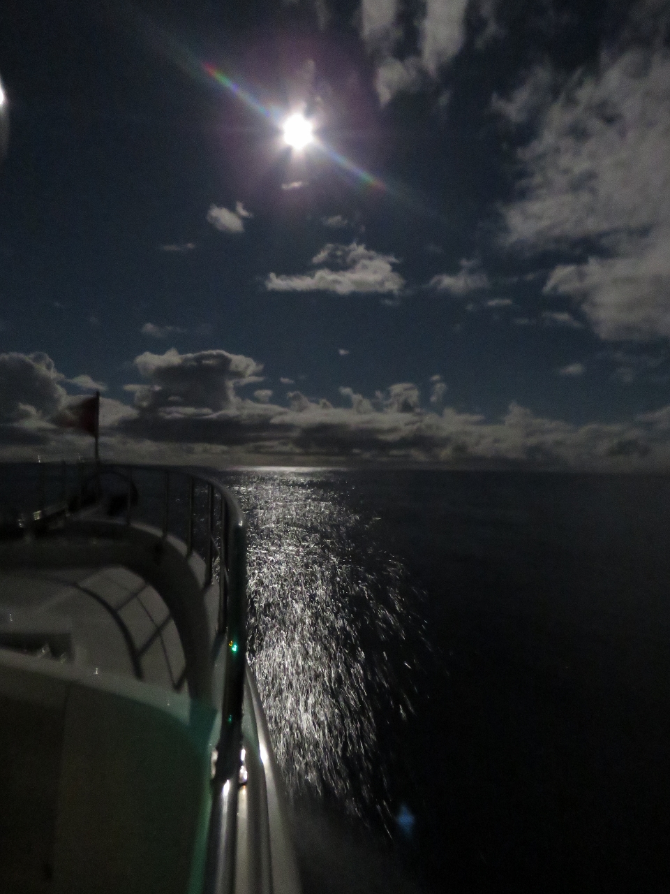 |
8/29/2015: Moon
Position: -21°27.01'S, 104°50.77'E
Purring along at 7 knots under a moon almost as bright as the sun.
|
 |
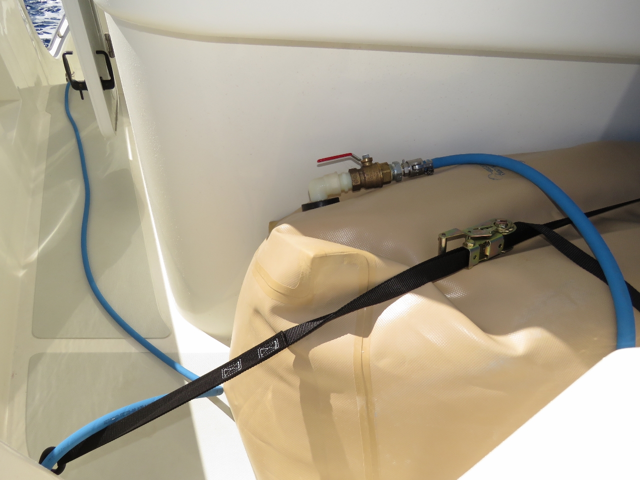
8/29/2015: Forward bladder
Position: -21°29.88'S, 104°11.64'E
The forward bladder, made by ATL, sits securely in the portuguese bridge area and gives us an additional 360 gallons of fuel range. We still strap it down, but nothing short of turning the boat upside down will shift it. We tested this third bladder on the Tasman Sea crossing, but this is the first time we've needed it. And the first time we've had all three bladders deployed.
|
 |
8/29/2015: Draining forward bladder
Position: -21°30.22'S, 104°7.01'E
To transfer fuel from the bladder to the main fuel tanks, we use the same system as described in Fuel for the Crossing with a fuel hose that runs directly from the bladder to the cockpit bulkhead fuel fitting.
|
 |
8/29/2015: Fuel transfer
Position: -21°30.33'S, 104°5.61'E
James monitoring the fuel transfer from the forward bladder. Because the fuel bladder is plumbed directly into the cockpit bulkhead, which connects to our fuel transfer pump, the entire volume of fuel can be transfered from the bladder with nobody standing outside and no fuel tank openings exposed to weather and water.
|
 |
8/29/2015: Empty bladder
Position: -21°31.24'S, 103°53.46'E
The forward bladder completely pumped down, but still secured on deck. We plan to fill it in Rodrigues, even though South Africa is only 1800 miles away, to give us the option to run much faster if we choose to since the weather is volatile and potentially dangerous in that area.
|
 |
8/29/2015: Tank levels
Position: -21°31.39'S, 103°51.33'E
Nice to see the main tank fuel levels going up 725 miles from shore.
|
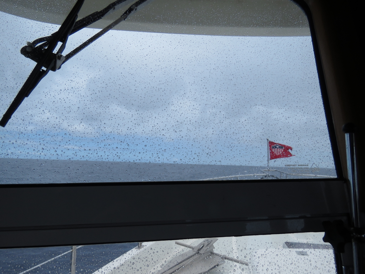 |
8/29/2015: Rain
Position: -21°31.56'S, 103°49.03'E
The first rain we've seen in months, since well before Cape York in May.
|
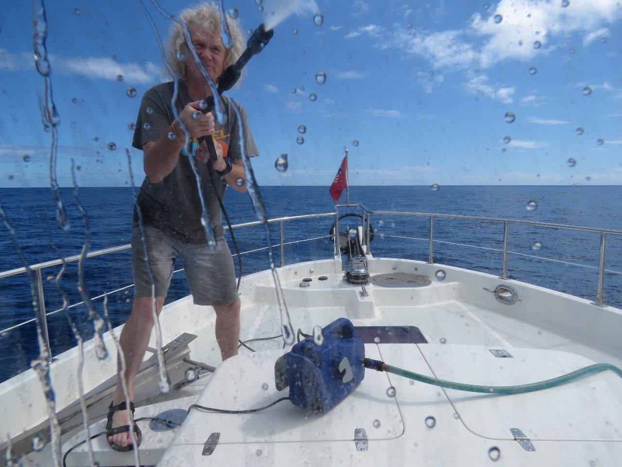 |
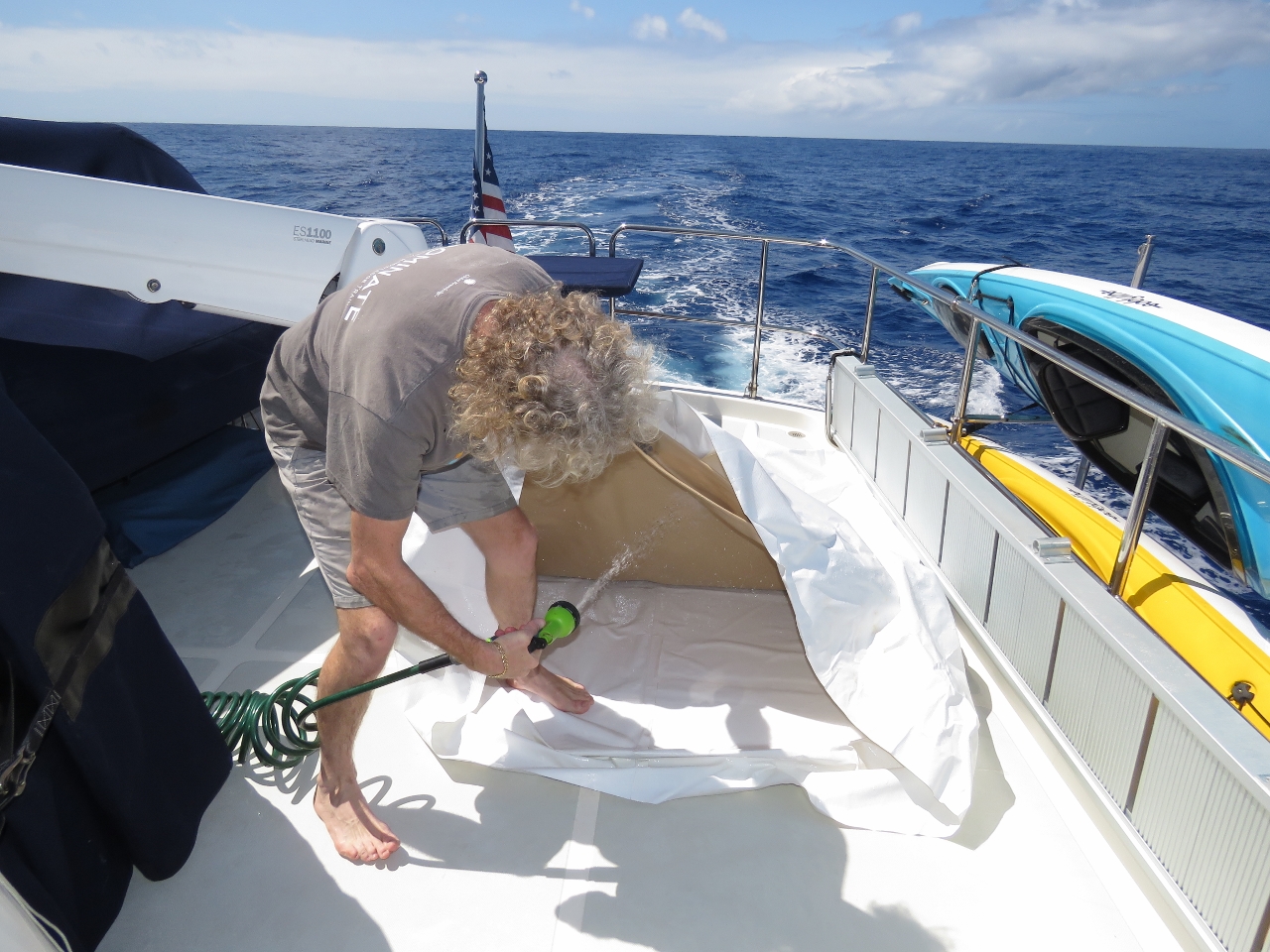
8/29/2015: Power wash
Position: -21°32.20'S, 103°40.50'E
Even though we just got some rain, it was just a small sprinkle and the boat still was crusted in salt from the run to Dampier. So James gave it a quick washdown with the power washer. It's sooo much nicer to be able to go outside without getting covered in salt.
|
 |
8/29/2015: Counter-current
Position: -21°32.94'S, 103°30.63'E
We're back in a strong counter-current again and at times have had to reduce speed to four knots to maintain our fuel economy goal.
|
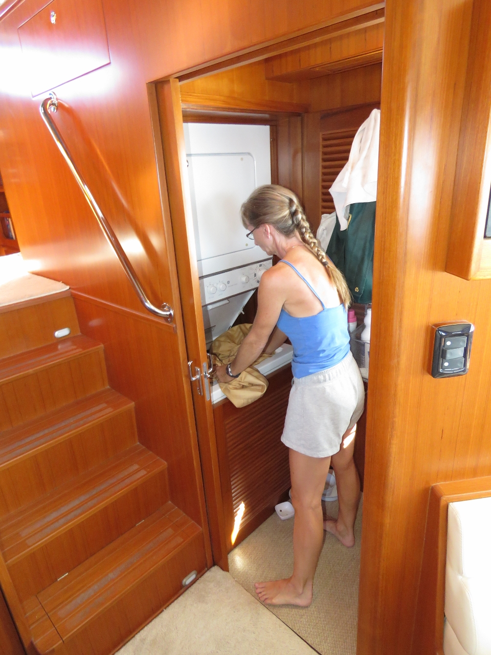 |
8/30/2015: Laundry
Position: -21°39.65'S, 102°0.37'E
We've been out for a week, so it's time to change and launder the sheets.
|
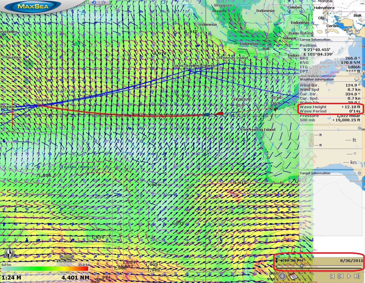 |
8/30/2015: 12ft seas
Position: -21°41.61'S, 101°32.75'E
In this screenshot of yesterday's GRIB data visualation, the red boat icon shows our current position and the blue boat icon our projected position for 4pm on Aug 30th. The slider along the bottom right visualizes the data for a given date and time. The model data indicated we'd be in 12-ft seas on a 14-second period right now and that's pretty much what we're seeing. The waves are big, but so far apart that the motion is gentle as we slowly rise up and down each one. And despite the wave height, our fuel-economy-limited speed is back over 6 knots.
|
 |
8/30/2015: Still connected
Position: -21°42.02'S, 101°24.99'E
We love our KVH mini-VSAT satellite data system—the service is excellent and the data rates are very good. They cover most of the planet, but unfortunately not the central Indian Ocean, the South Pacific, or either pole. We weren't expecting it to last much more than a few days out of Dampier, and amazingly, it still is connected nearly 900 miles out. We expect to be out of range in a day or so through. Then we'll be using Immarsat BGAN and only connecting a few times a day instead of always on.
|
 |
8/31/2015: Popcorn
Position: -21°45.48'S, 100°20.13'E
A midnight snack of air-popped popcorn.
|
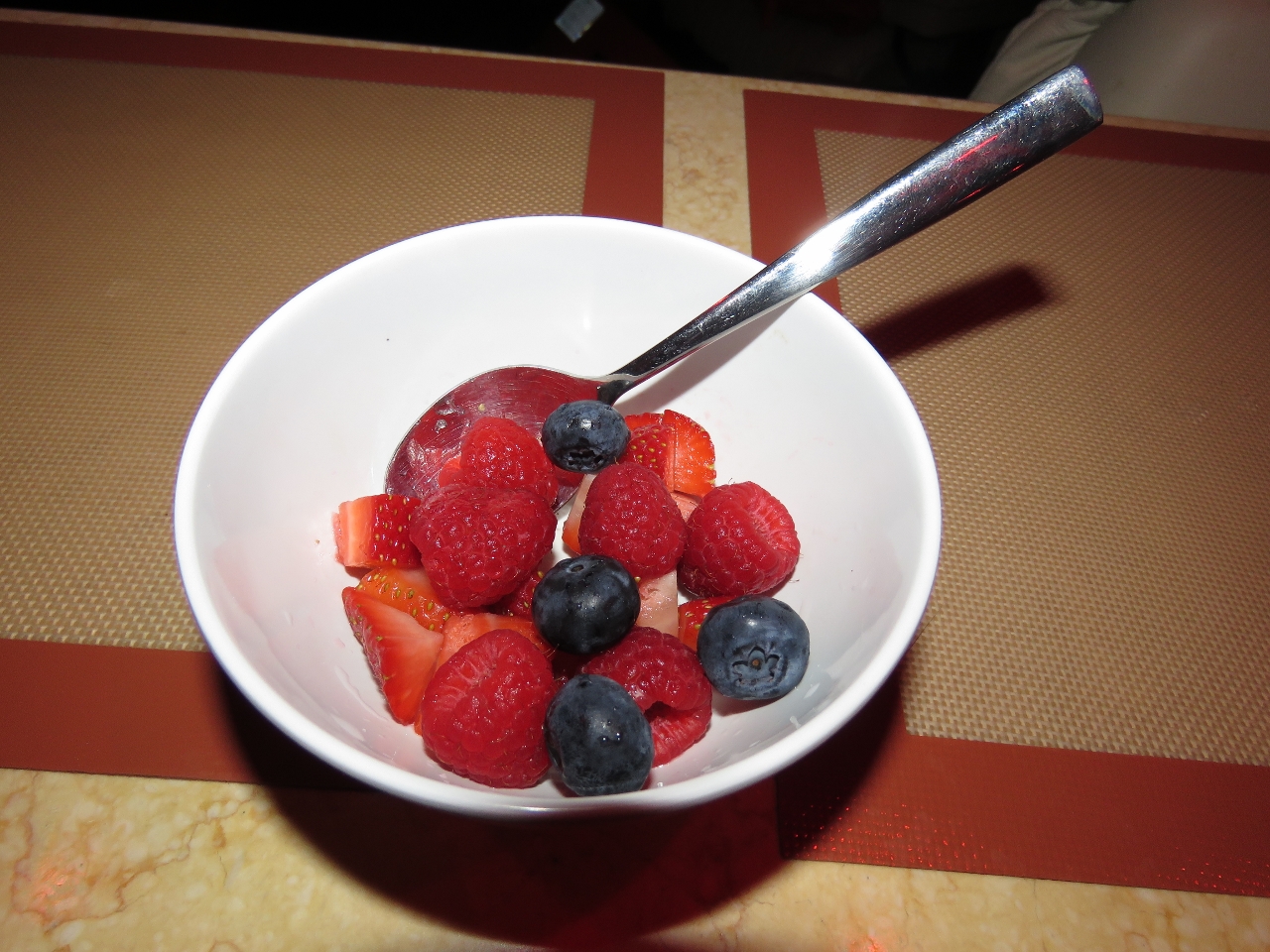 |
8/31/2015: Berries
Position: -21°47.27'S, 99°46.39'E
The last of the strawberries and rasberries from Darwin. They lasted well, particularly the rasberries, with no losses. Our Sub-Zero fridge, with it's excellent humidity control, is a major factor in that.
|
 |
8/31/2015: Loose screw
Position: -21°48.86'S, 99°16.18'E
The screws holding the barrel bolt on the guest stateroom door all backed out and the door was almost free to move. It's amazing what 6,000 hours and a lot of time at sea can do.
|
 |
8/31/2015: Conditions
Position: -21°49.17'S, 99°10.79'E
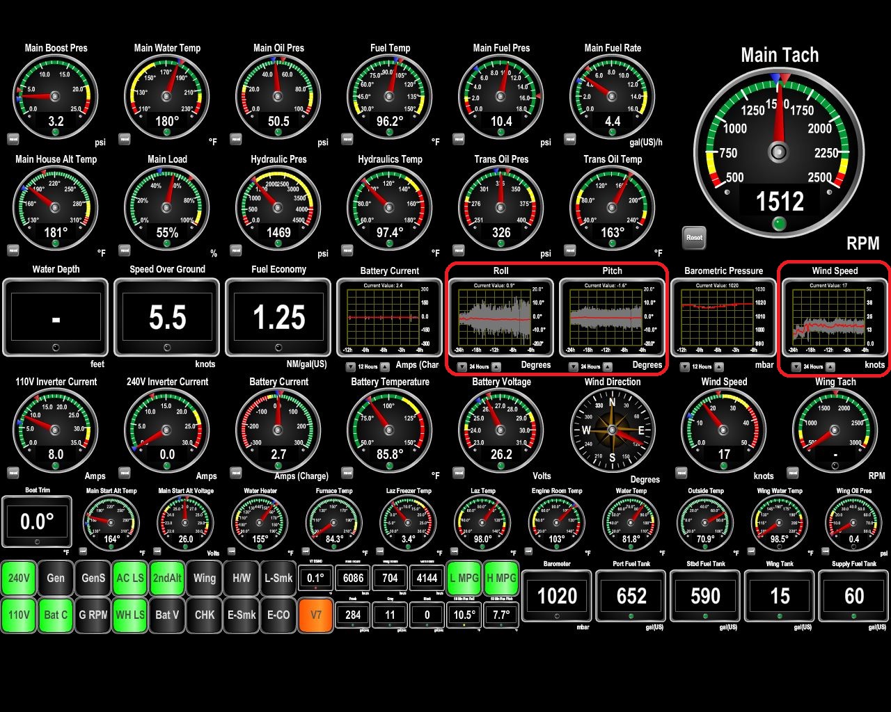
The wind came up to around 20 kts overnight, kicking up the seas, and we've started to pitch and roll much more than the first few days. The maximum roll still is only around 13 degrees though. That orange indicator light at the bottom of the screen is our V7 (KVH Mini-VSAT) status. It shows green when the system is connected and orange when powered but not able to make a connection. Yesterday we were seeing more green than orange, today it's more orange than green as we approach the coverage boundary. The bigger seas aren't helping.
|
 |
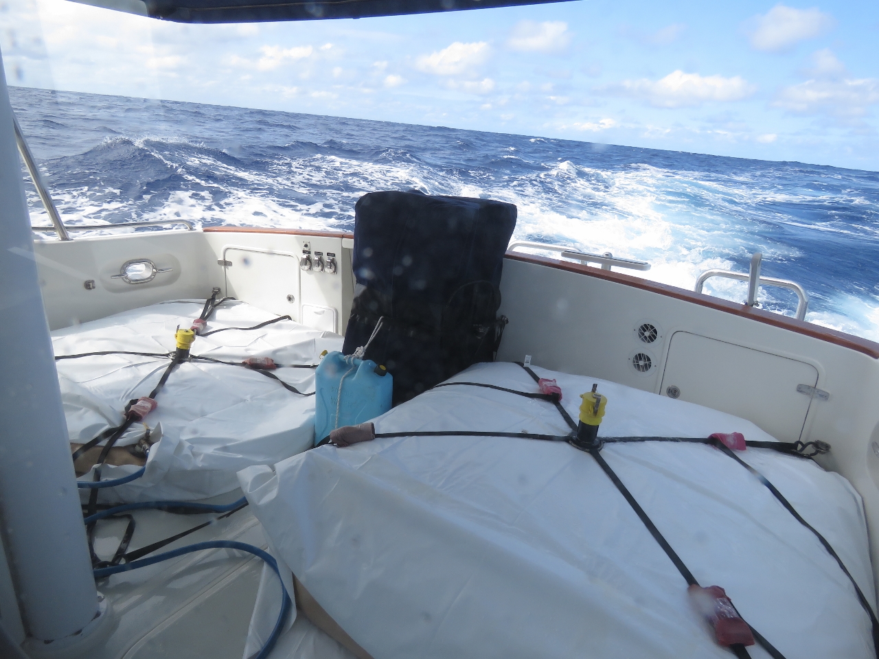
8/31/2015: Looking behind
Position: -21°49.44'S, 99°5.50'E
The view behind isn't nearly as calm as a few days ago. The cockpit fuel bladders have been very stable throughout. Having them filled to capacity makes a big difference, as does securing them tightly to the deck.
|
 |
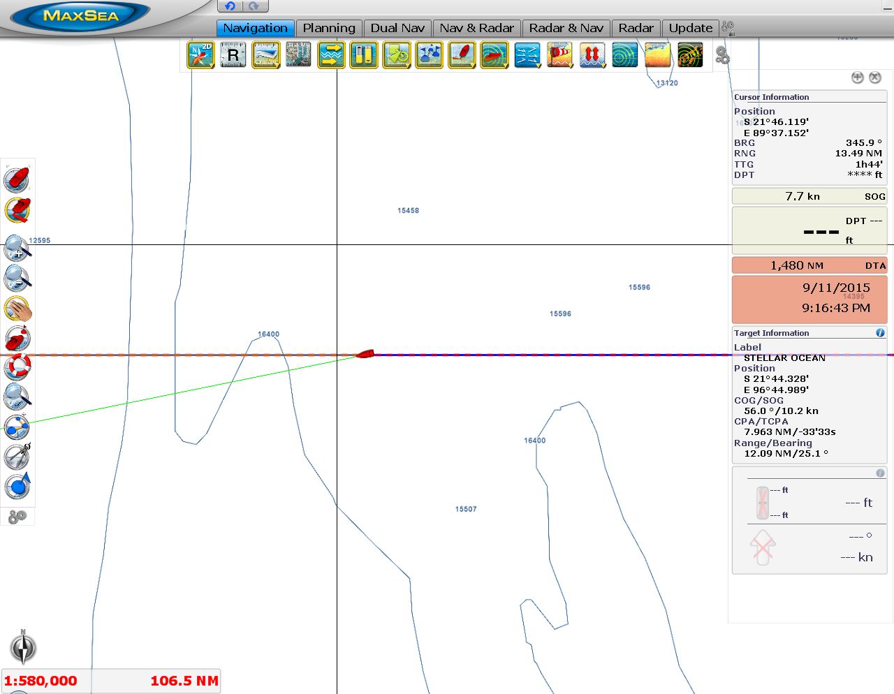
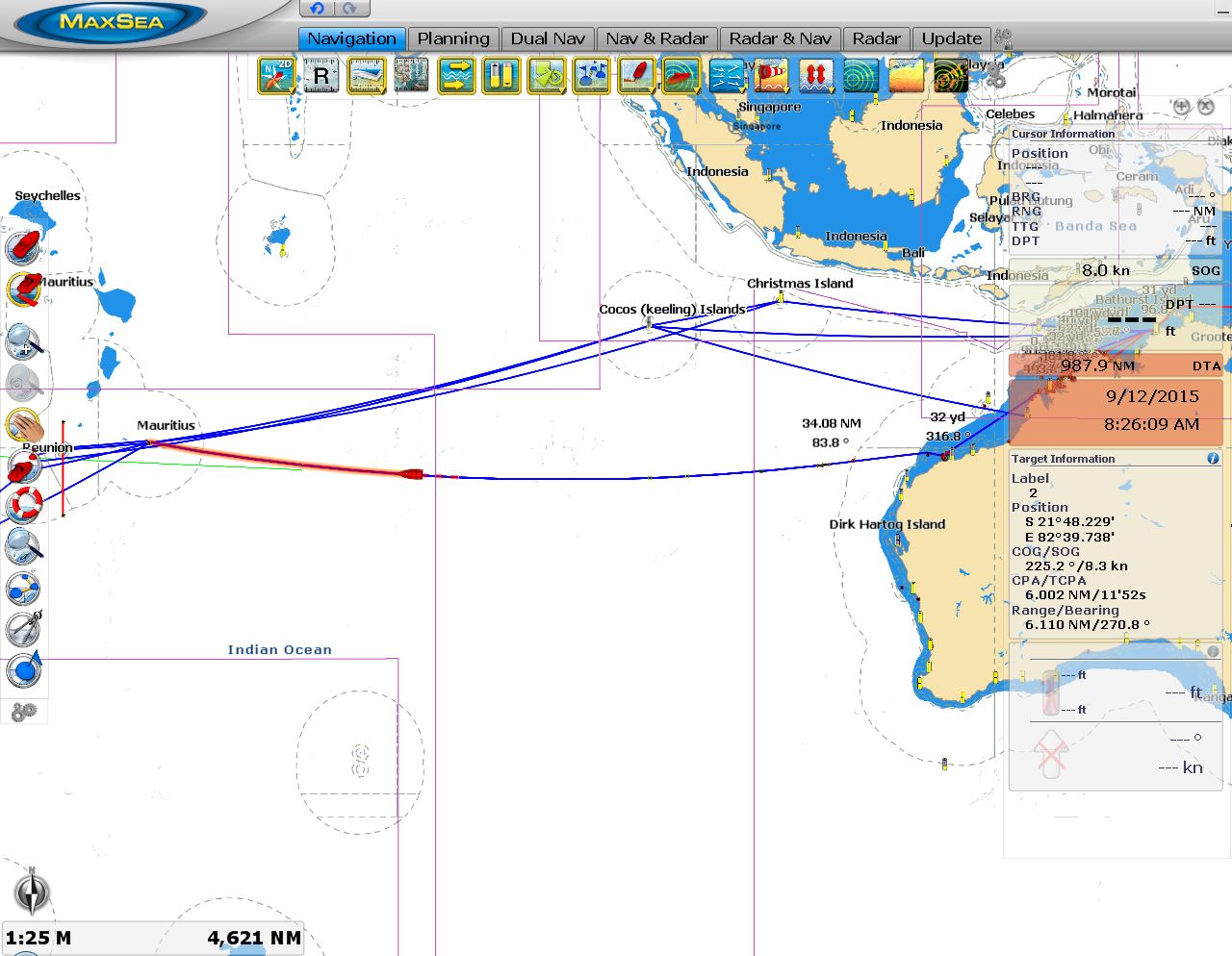
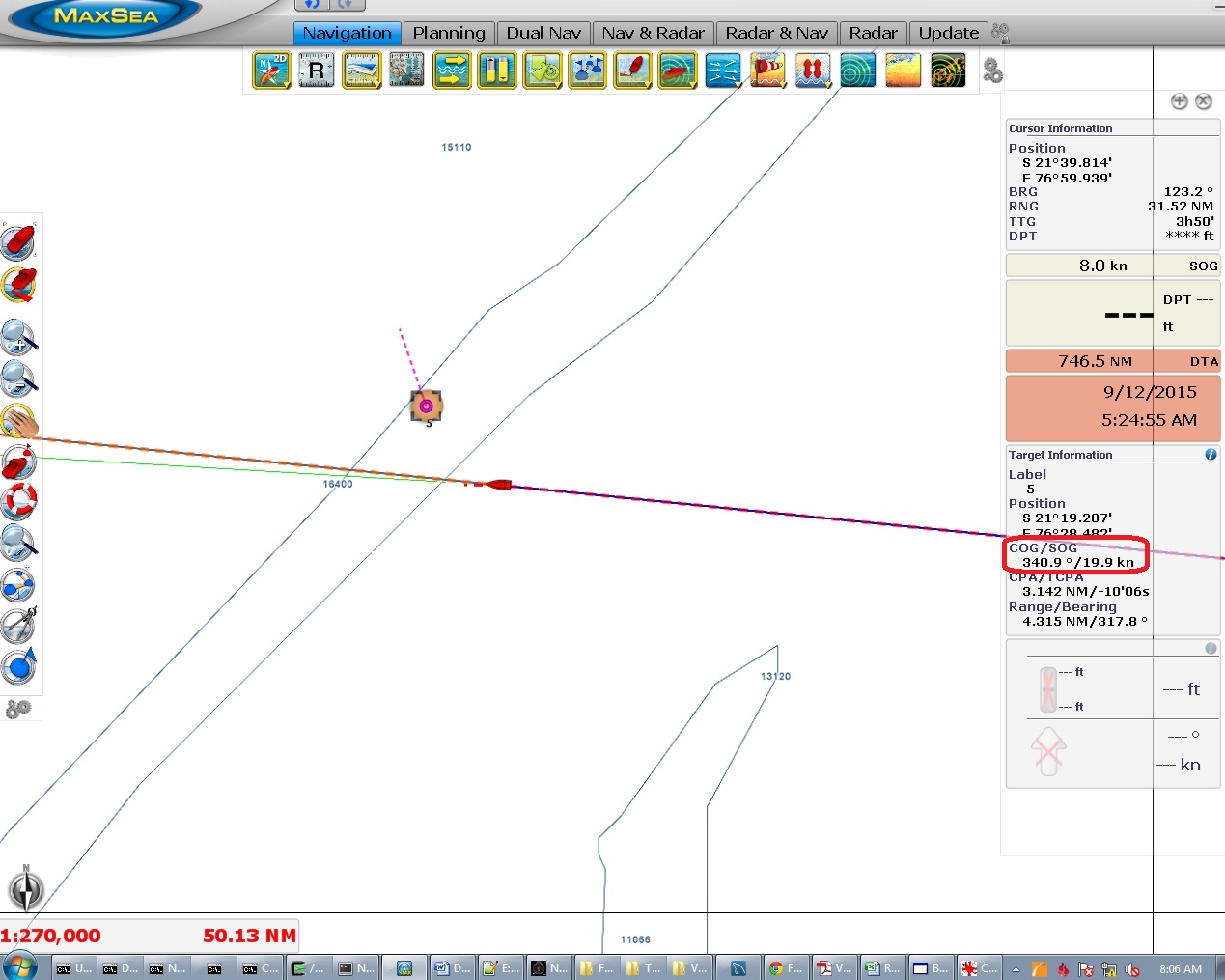
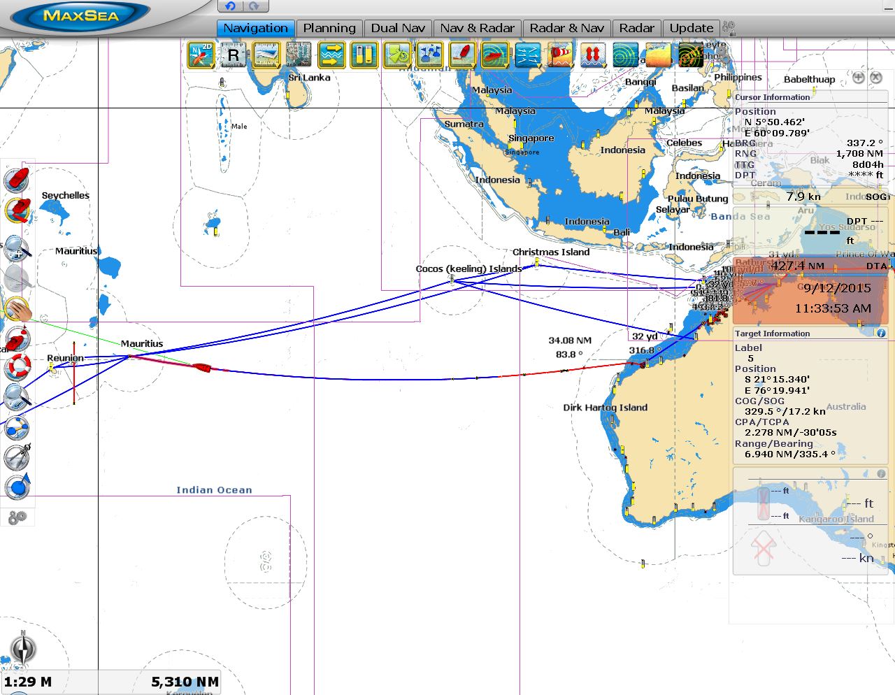
8/31/2015: 2,000 miles left
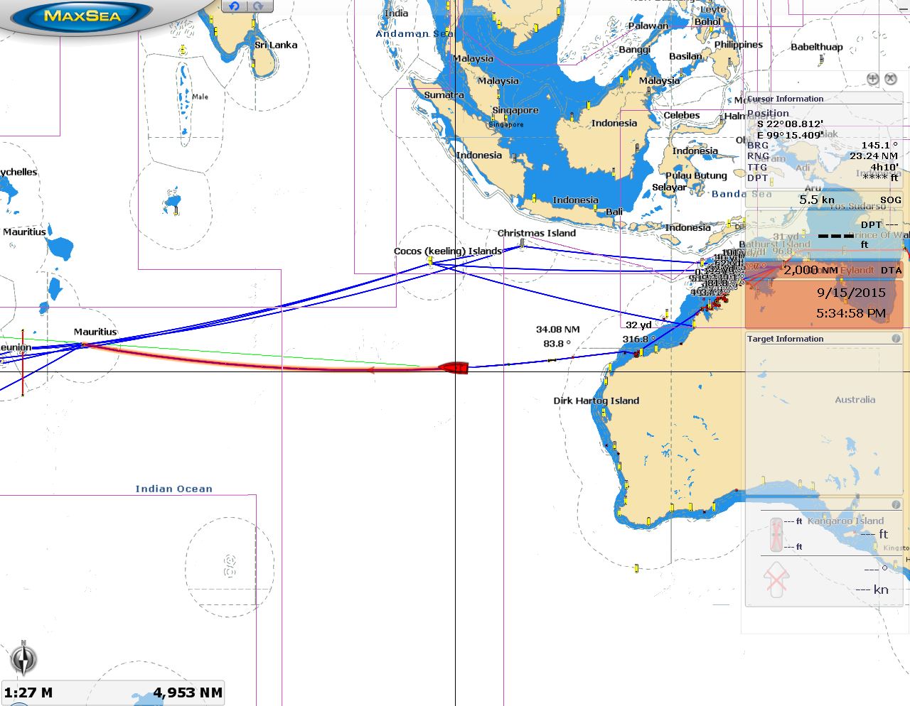
Position: -21°49.66'S, 99°1.32'E
We've covered over 1,000 miles already and have 2,000 left to go. The orange line is our route from Dampier to Rodrigues. The other blue lines are various routes we've drawn to measure distances for planning and comparing alternatives. Right now we're almost directly south of Cocos Keeling.
|
 |
8/31/2015: Velcro
Position: -21°50.10'S, 98°53.16'E
The velcro holding our night-running monitor covers in place was losing it's grip, so we replaced it today.
|
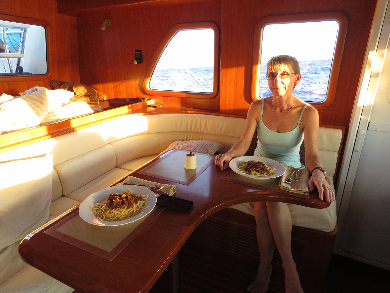 |
8/31/2015: Spaghetti
Position: -21°51.29'S, 98°30.71'E
Spaghetti with meat sauce for dinner. Rodrigues is four hours ahead of Dampier so we've decided to move the clocks back in two increments so Jennifer can enjoy the sunset before she goes off watch.
|
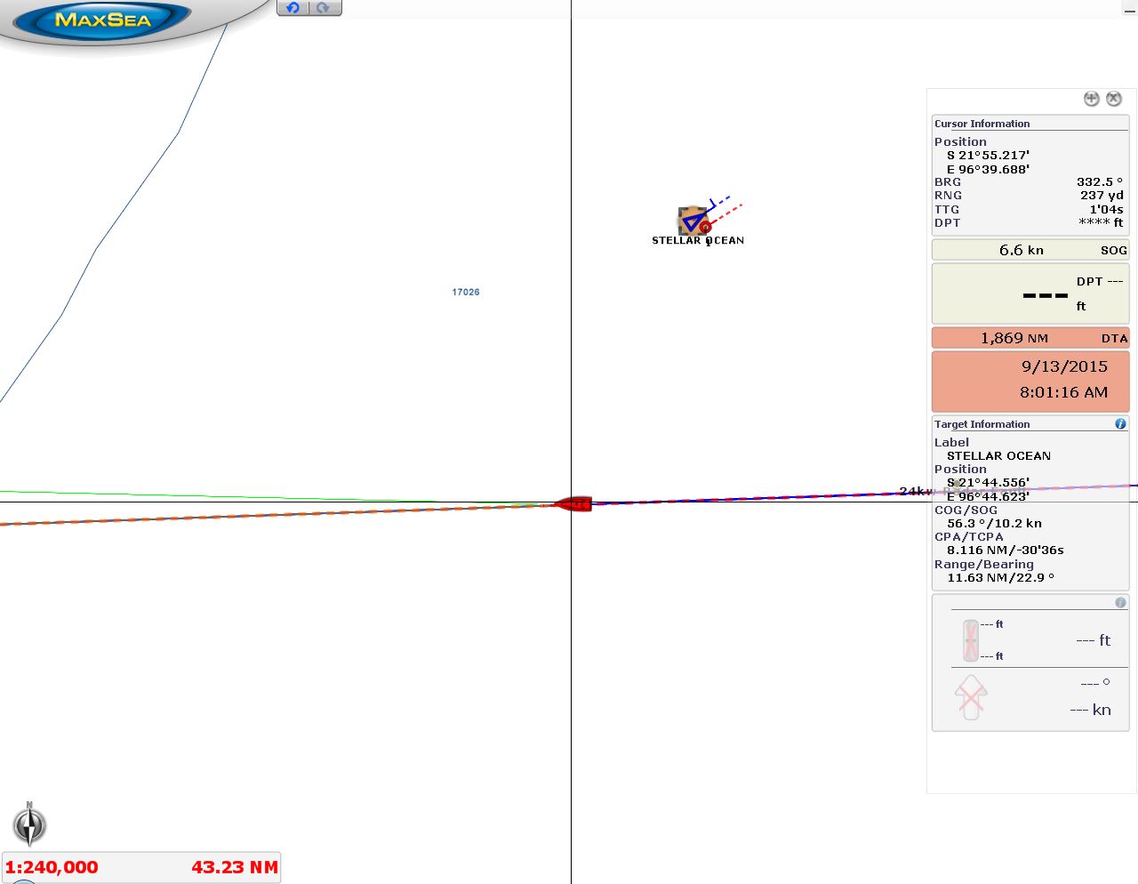 |
9/1/2015: Stellar Ocean
Position: -21°55.32'S, 96°40.06'E
We saw our first ship today since since the unidentified boat we saw five days ago. This one, the 1085ft (331m) cargo ship Stellar Ocean, was displaying AIS. The ship passsed about ten miles ahead of us en route to the port with designation CNTAO, likely somewhere in Asia.
|
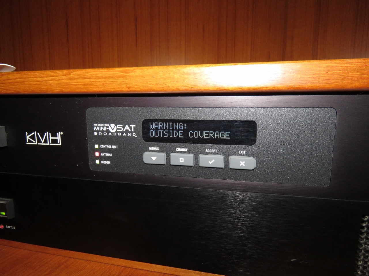 |
9/1/2015: Outside coverage
Position: -21°56.01'S, 96°18.35'E
We just passed outside the coverage area of our KVH mini-VSAT satellite data system. We had sporadic, brief connectivity until this morning, enough to push the route updates through, but it eventually stopped entirely. We're amazed it lasted so far--over 1,000 miles into the Indian Ocean from Dampier. Today will be our first day using Immarsat BGAN since arriving in New Zealand.
|
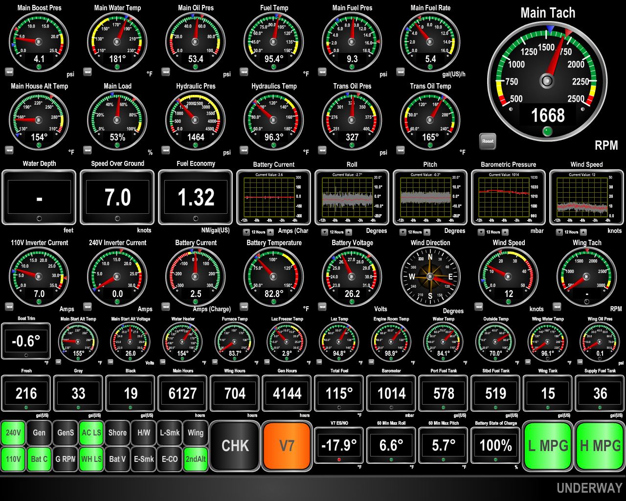 |
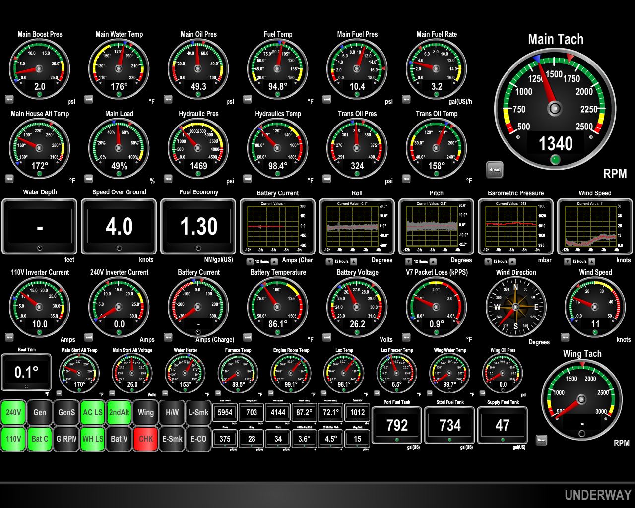
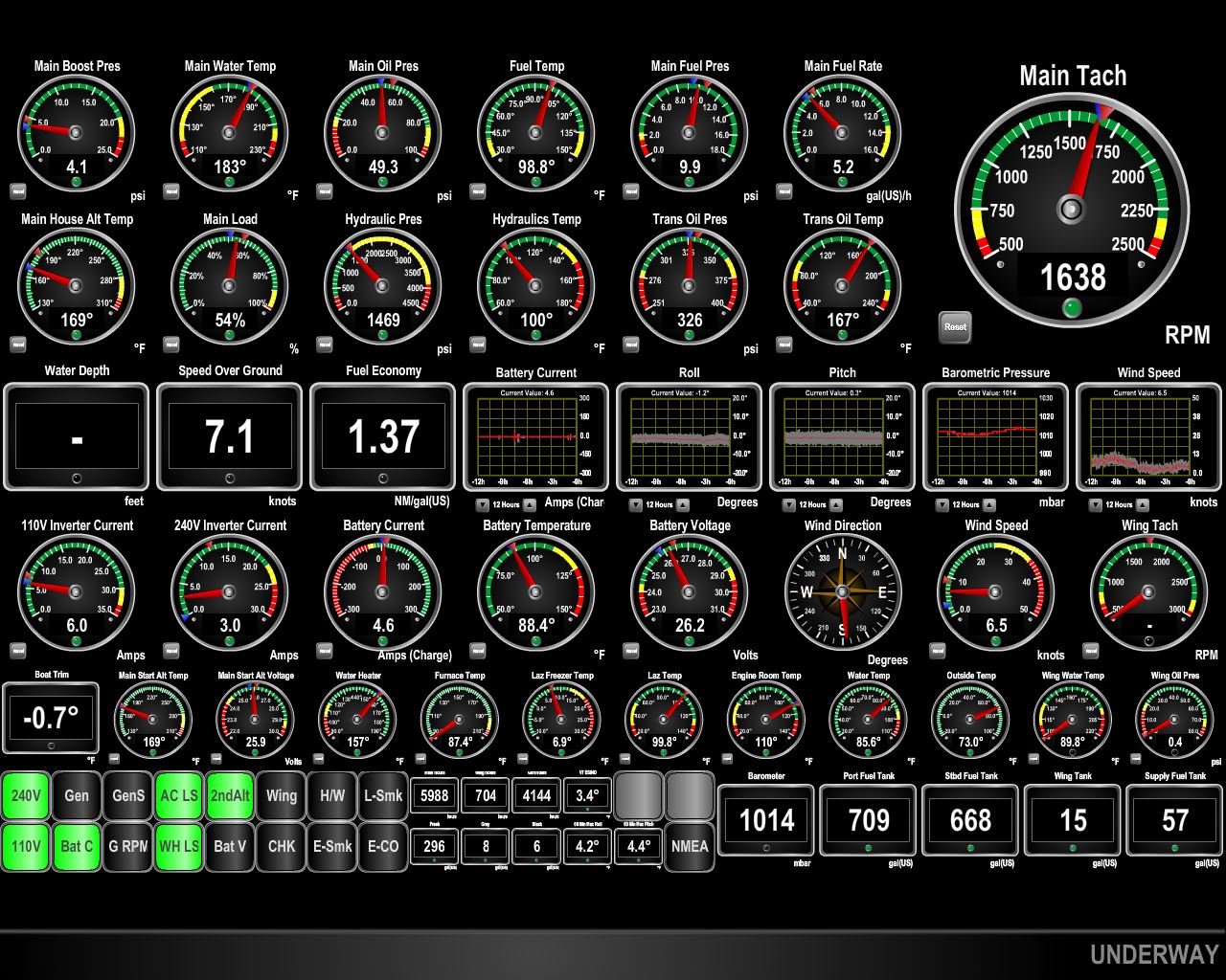
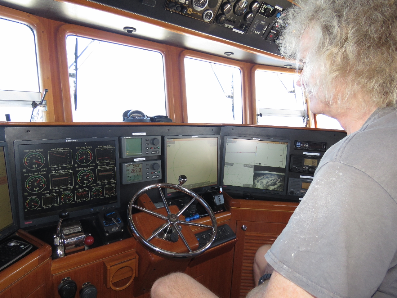
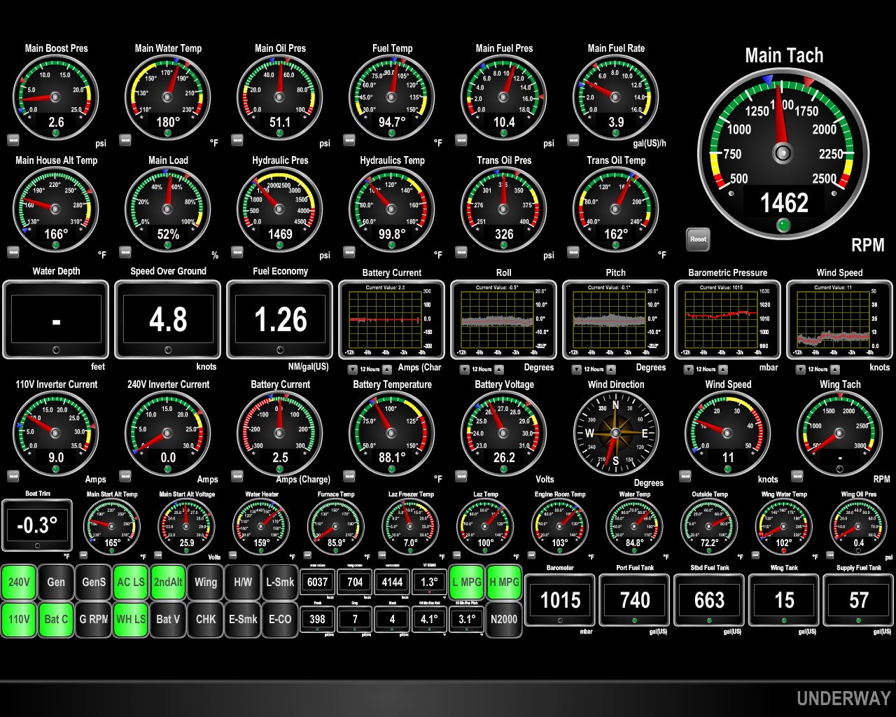
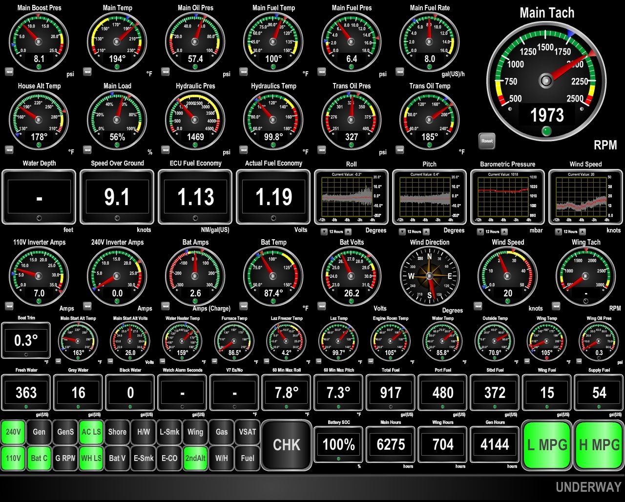
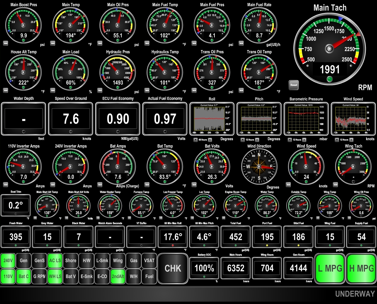
9/2/2015: Conditions
Position: -21°59.22'S, 94°37.99'E
Conditions have calmed down again and the seas are more on the stern than the beam. Winds are below 15 knots, pitch and roll (third and fourth from right on third row) have greatly reduced, and we're making excellent speed around 7 knots.
|
 |
9/2/2015: Are we there yet?
Position: -21°59.23'S, 93°13.04'E
Spitfire scouting forward for land—it's going to be a while little feller. Conditions have remained calm, with light winds and a low swell.
|
 |
9/3/2015: Aft bladders
Position: -21°59.26'S, 90°34.78'E
We drained the cockpit bladders today. The bladders have been super-stable on deck, even when the seas kicked up (and the seas are building again today as you can see behind us). Before this use, the bladders were in storage for over two years in the hot flybridge brow, with a small amount of residual diesel inside from their last use. We were a little worried about algae growth, but detected no obvious issues. This time we treated the bladders with a biocide after they were emptied to hopefully head off any potential future problems.
|
 |
9/3/2015: Full tanks
Position: -21°59.26'S, 90°9.70'E
We've now got all the fuel off the deck and into the side tanks where it belongs. Nice to see nearly full tanks again.
|
 |
9/3/2015: Halfway
Position: -21°59.27'S, 89°41.09'E
We've a little over halfway now, at 1480 miles remaining. All systems are operating perfectly, especially that Deere main engine.
|
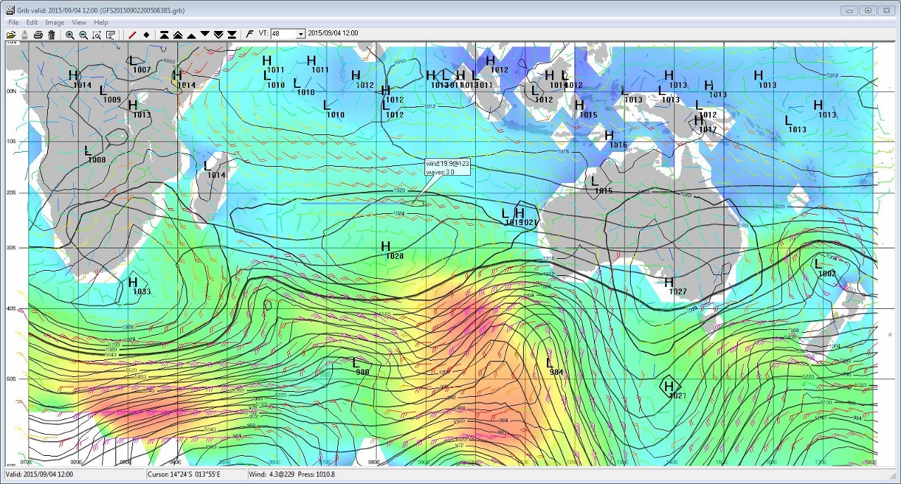 |
9/4/2015: Weather systems
Position: -21°59.28'S, 87°44.03'E
On our routing, the biggest negative weather impact is high-pressure systems coming from the south that produce large, tight beam seas. This screen shot is of a GFS GRIB file displayed in ViewFax. We're passing through the north quadrant of a high pressure system now, with beam seas and winds building. We expect this to last a couple of days. Then we'll have a couple of days of calm weather, as a low-pressure system passes well to our south, until we meet that high pressure system over South Africa as it moves east and intensifies. The GRIB model indicates we'll then be in 11ft beam seas on an 8-sec period for a day or two as it passes. That's perfectly safe, but it won't be comfortable. Overall conditions have been quite good on this trip, but when those high pressure systems hit, our stabilizers are getting a real workout.
|
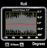 |
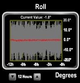
9/5/2015: Roll
Position: -21°57.74'S, 86°49.33'E
The wind picked up to steady in the 20s yesterday as we entered the northern quadrant of a high pressure system. Seas have been 10+ ft on the beam, with an 8-second period for the past 24 hours and we've been rolling steadily over 10 degrees and occasionally to near 20 degrees.
|
 |
9/5/2015: Bulb replacement
Position: -21°55.15'S, 85°27.42'E
Our forward-facing floodlight failed two nights ago and conditions finally are settled enough for James to climb the stack to replace the bulb. We've replaced several bulbs over the years. They rarely actually burn out on Dirona--typically they fail from vibration. Fortunately that takes a year or two. We consider the floodlight an important piece of safety gear when at sea in making us visible at night many miles before our navigation lights can be seen. We've seen fishing boats with their floodlights on eight and ten miles away, when we'd likely not see just their navigation lights until we're within two or three miles. Most of our outside lights are LED, but for this application where brightness is important the halogens still outperform LED. We expect to be able to change to LED in the near future as technology continues to improve.
|
 |
9/6/2015: Rainbow
Position: -21°48.66'S, 82°52.89'E
We've had occasional light showers on this trip, but overall not much rain.
|
 |
9/6/2015: BGAN
Position: -21°48.65'S, 82°52.77'E
The BGAN terminal needs to be hand-aimed towards the satellite. This often is a little easier at sea compared to at anchor because the boat orientation remains relatively constant. On this trip, we've been able to strap the terminal to the boat deck table when in use to get a good, consistent connection without having to constantly hand-steer it.
|
 |
9/6/2015: Bladder wash
Position: -21°46.87'S, 82°18.92'E
We brought the cockpit bladders up to the boat deck today and rinsed the saltwater off with freshwater before stowing them.
|
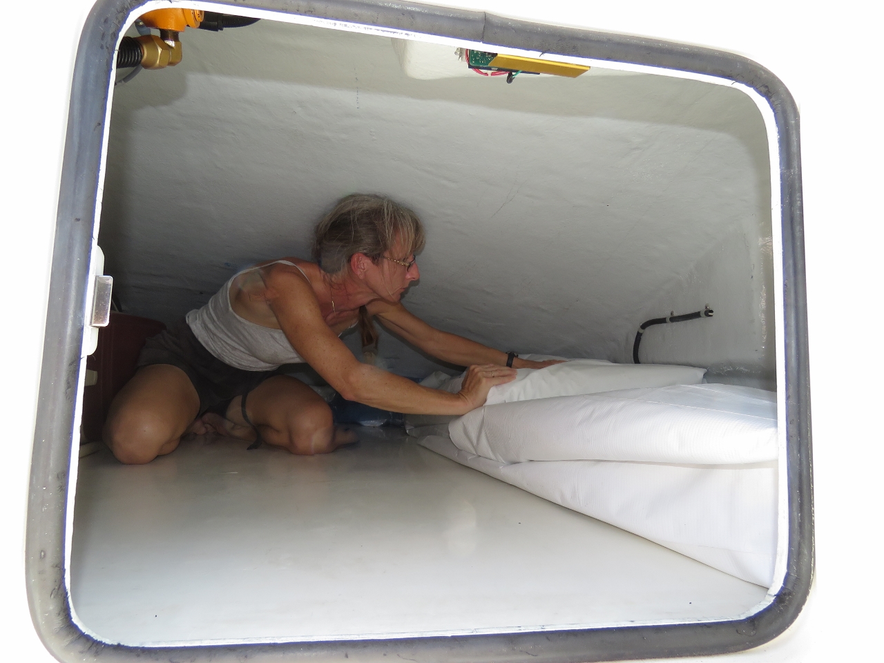 |
9/6/2015: Bladder stowage
Position: -21°46.54'S, 82°12.73'E
We stow the bladders folded up in the flybridge brow. Here Jennifer is pushing them into position along the outside wall. We decided to keep them in their white protective covers when stowing them this time, to reduce the risk of abrasion damage.
|
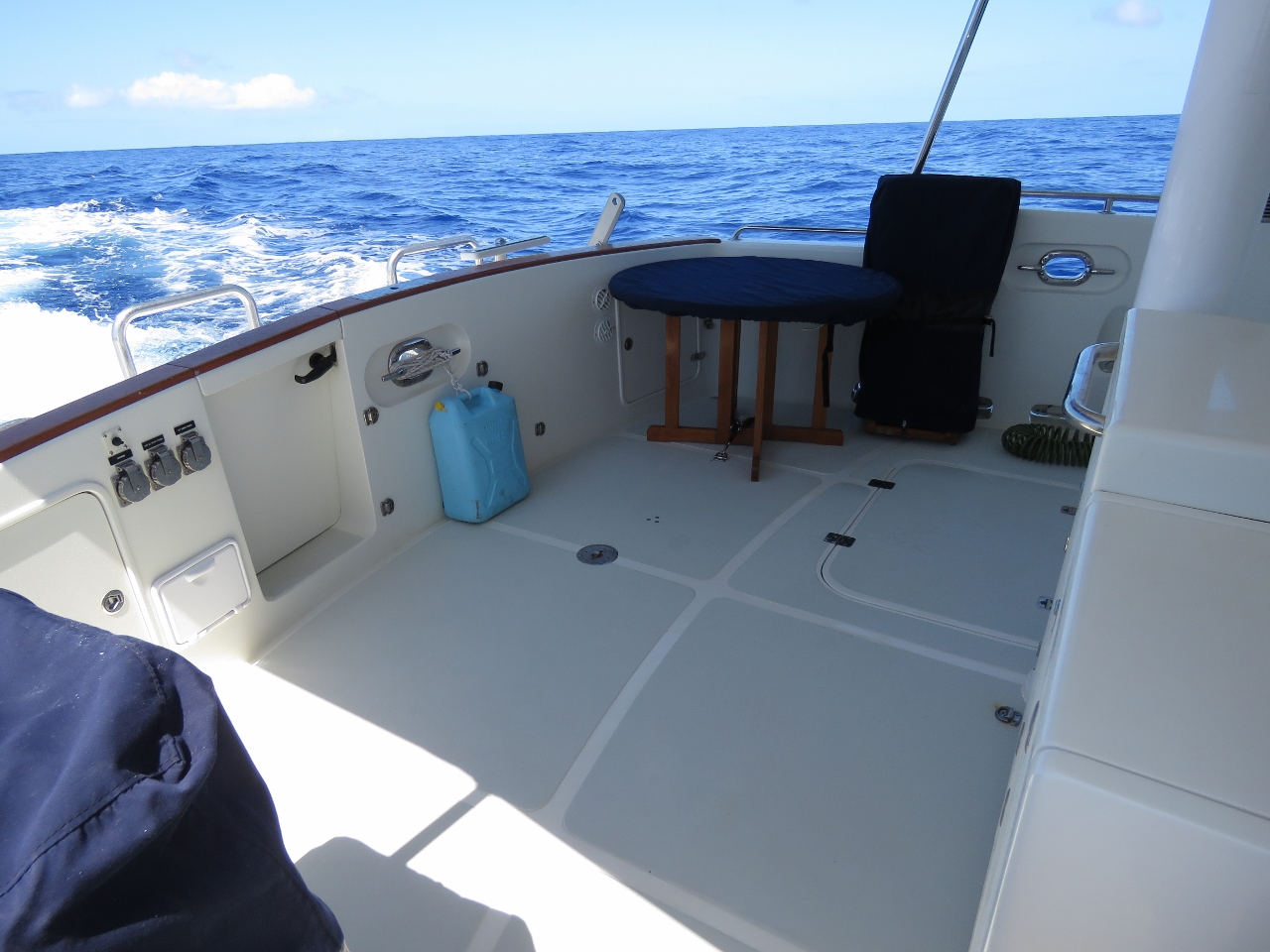 |
9/6/2015: Cockpit
Position: -21°46.22'S, 82°6.57'E
After stowing the bladders, we repositioned the cockpit furniture to it's normal location. Nice to have the cockpit functional again and the bladders stowed. That blue jug strapped to the aft wall is an emergency water supply should we need to abandon ship.
|
 |
9/7/2015: Triple digits left
Position: -21°42.27'S, 80°51.96'E
We just crossed down into triple-digit miles remaining with only 987 miles to go two weeks after leaving Dampier. This is the longest time we've ever been at sea before. Our longest passage previous to this was eleven nights over 2,000 miles from San Francisco to Hawaii. And our longest run between fuel stops was previously 2,650nm. But on that run we stopped at both Palmyra Atoll and Fanning Island. We're enjoying the trip overall--we're both feeling well-rested and surprisingly energetic.
|
 |
9/7/2015: Positive current
Position: -21°41.64'S, 80°39.94'E
With some help from a positive current and unexpectedly good fuel economy, giving us both a push and allowing us to run faster than usual, we're making excellent speed at 8.2 knots burning roughly 1.2 nm/gallon. Once that high-pressure system passed a couple of days ago, conditions have been wonderfully calm again, with winds less than 5 knots and only a gentle swell. We'll only get another day or so of these conditions before we get into that next high-pressure system though.
|
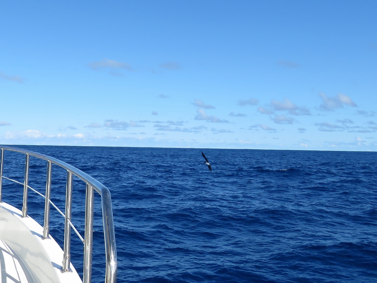 |
9/7/2015: Birds
Position: -21°36.40'S, 79°28.74'E
Each day a few large grey seabirds circle the boat, giving Spitfire a little entertainment. We're surprised to see them when we're 1,000 miles from the nearest shore. We haven't seen much of anything else though. Only one ship has passed in ten days, the Stellar Ocean en route to China. We were expecting to see a lot of garbage and debris in the water, but we've only seen one small white float and a 3-inch circular plastic ring two days ago.
|
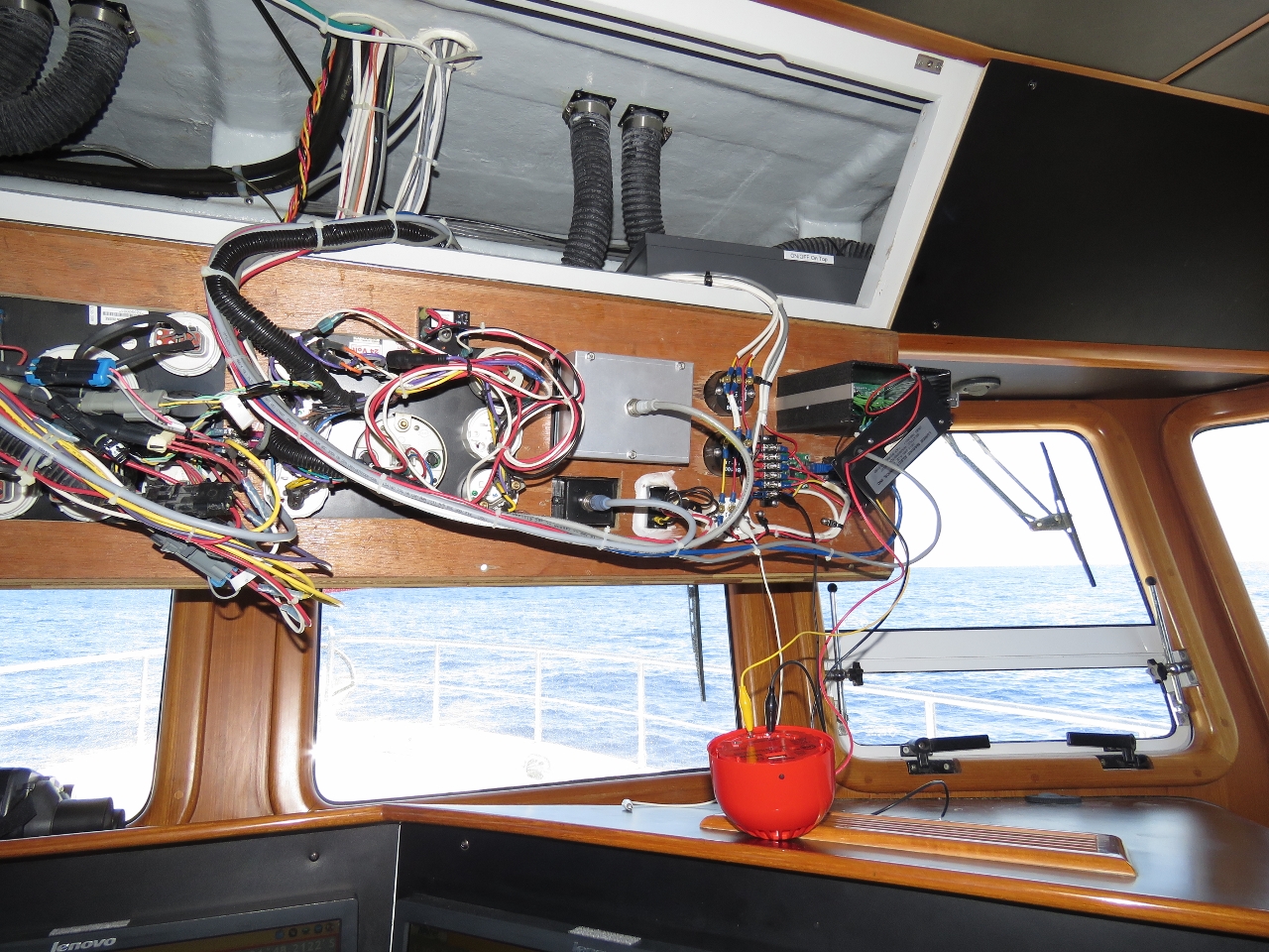 |
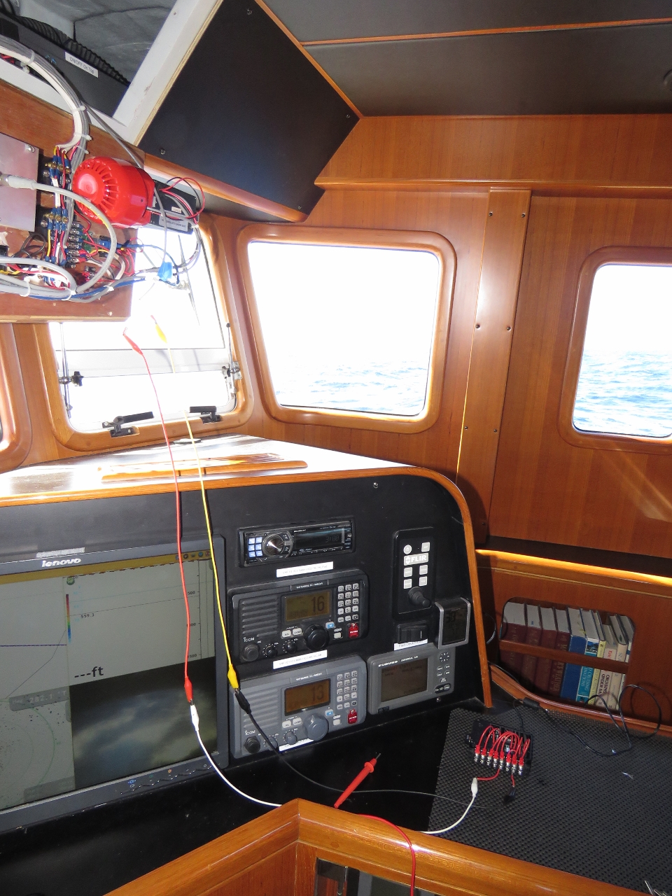
9/7/2015: Watch commander
Position: -21°33.55'S, 78°50.22'E
We use a Watch Commander Pro watch alarm as a guard against the person on watch falling asleep. If the alarm isn't pushed within a preset time, the unit first flashes a light for 30 seconds, then emits a beep for 30 seconds, and then sounds an external alarm or siren. The external alarm on ours had failed, so we replaced it with a Klaxon spare (the red bowl-shaped device on the dash).
|
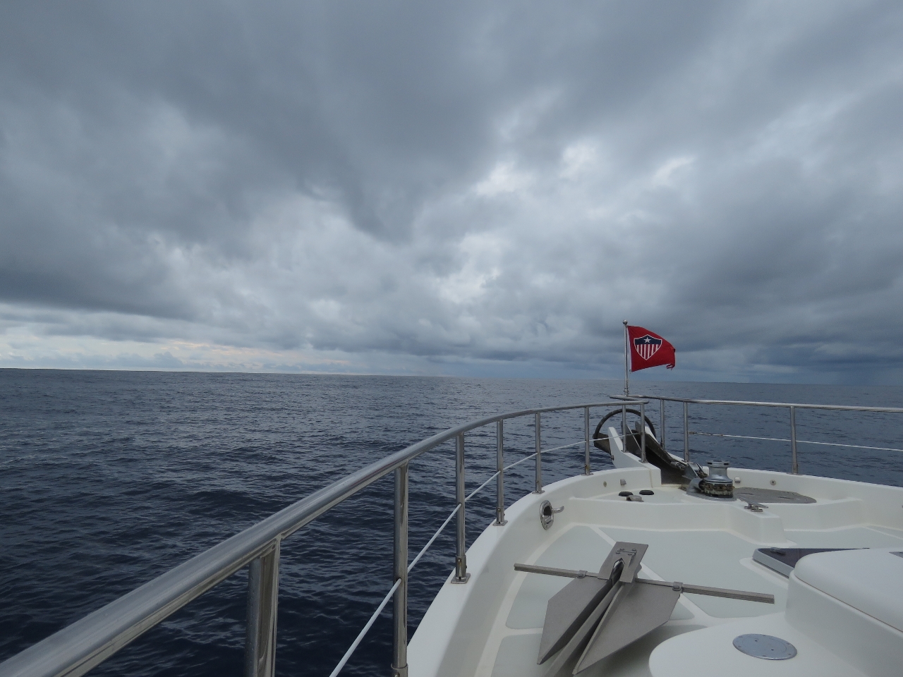 |
9/7/2015: Squall
Position: -21°31.21'S, 78°18.59'E
Approaching a small storm system. We were hoping for a little rain to rinse the light coating of salt that has settled on the boat, but only got a quick sprinkle.
|
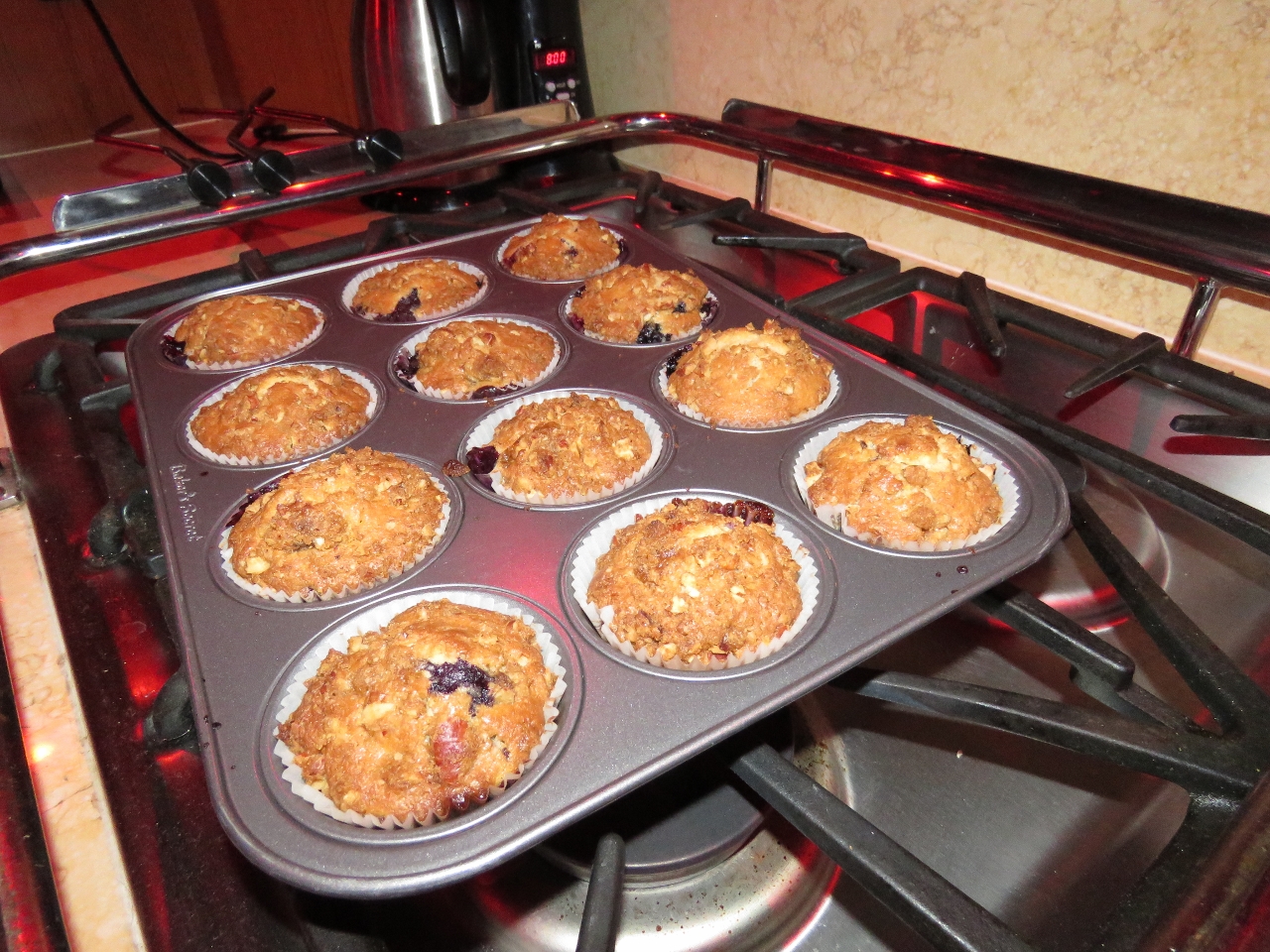 |
9/8/2015: Muffins
Position: -21°23.97'S, 76°47.14'E
Fresh-baked blueberry muffins for breakfast using a recipe from SV Ocelot.
|
 |
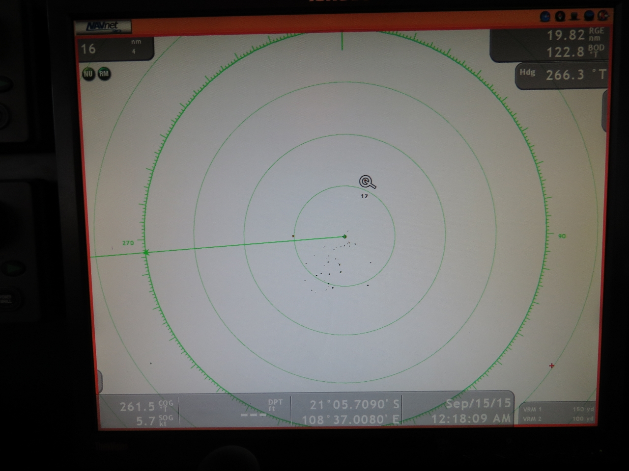
9/8/2015: Squall
Position: -21°22.50'S, 76°31.61'E
Squalls show up clearly on our radar and we can track them as ARPA (Automatic Radar Plotting Aid) targets. This one is moving at 20 knots, which is quite common. Some are faster, some are slower, but it shows why it can sometimes be a challenge to avoid the path of a storm at trawler speeds. These squalls don't pose quite the same risk to us as to boats under sail, as we don't have to reduce sail or make any other equipment adjustments when sudden gusts hit.
|
 |
9/8/2015: 9.1 knots
Position: -21°20.42'S, 76°9.76'E
The winds are picking up and we're starting to roll more as we enter the eastern edge of that high-pressure system we've been tracking. Conditions are predicted to deteriorate over the next couple of days, then slowly improve as we close on Rodrigues. The good news is that we're doing 9.1 knots with a push from the current.
|
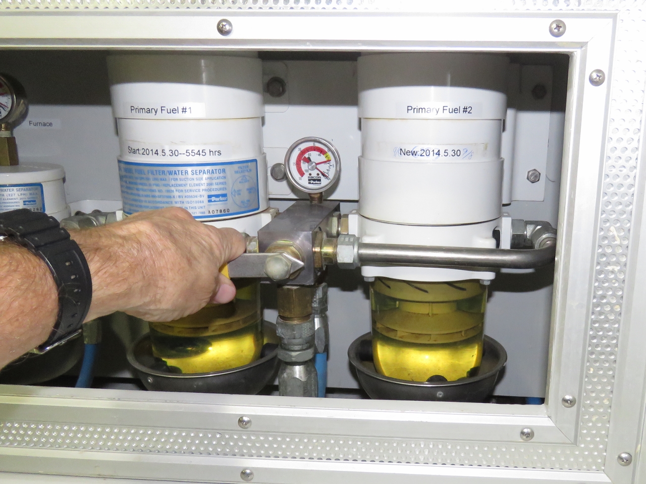 |
9/8/2015: Fuel filter
Position: -21°13.77'S, 74°59.63'E
It's time to change the main engine fuel filter. Our normal replacement indication is 5-7 inches of mercury on the vacuum gauge. This one was only running 3-4, but once it gets to there, the rest comes fairly quickly so we figured we might as well change it. The Racor design used in all Nordhavns allows for an easy change by pulling a lever to switch between two fuel filters so the other can be changed without shutting down the engine. It seems like we just changed this one, and in fact we did in May of this year, but that was 700 hours ago, so its due. The shortest interval between changes was 200 hours on low-volume fuel from Vanuatu and the best was 1,800 hours from the very high-volume Covich and Williams commercial fueling dock in Seattle, but most get changed in the mid hundreds of hours.
|
 |
9/9/2015: Roll
Position: -21°5.26'S, 73°32.21'E
We're well into that high pressure system now, with 12' beam seas on 11 seconds, and have been rolling steadily up to 20 degrees with occasional rolls over 30. This is perfectly safe, but not particularly relaxing.
|
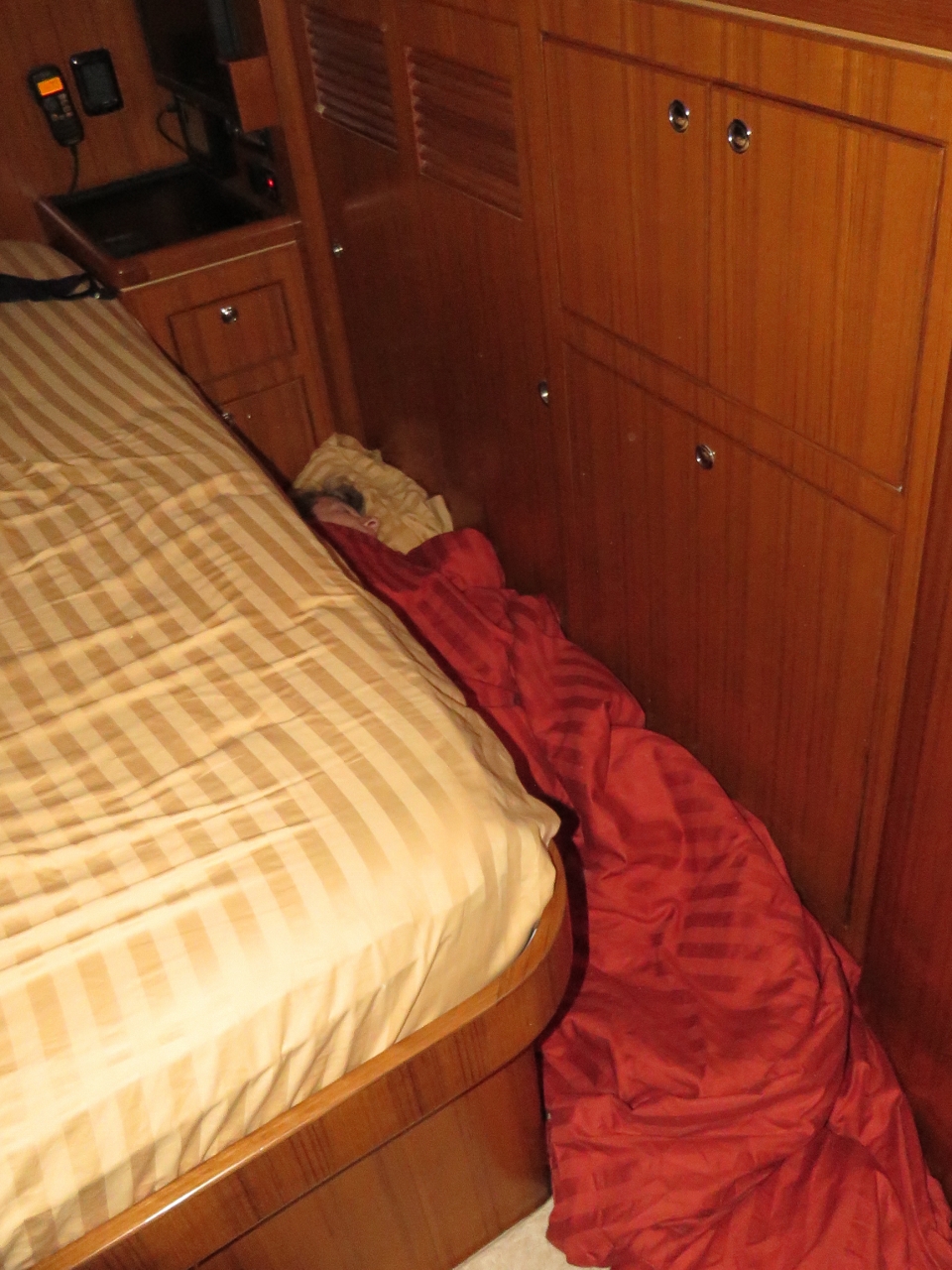 |
9/9/2015: Sleeping
Position: -21°5.05'S, 73°30.29'E
When conditions get rough, we slide around on the berth too much and have trouble sleeping. Jennifer sleeps well by wedging herself on the floor between the berth and the port side wall. James does the same, but in the larger walkway to starboard of the berth.
|
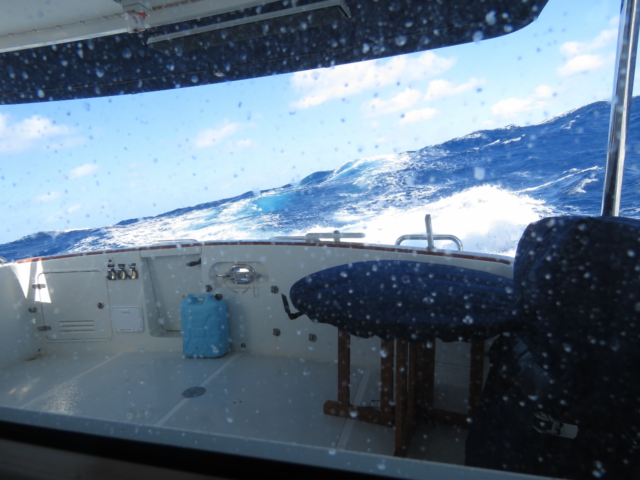 |
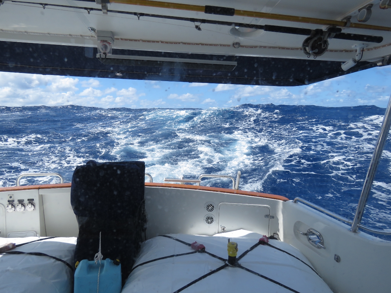
9/9/2015: Seas
Position: -20°56.37'S, 72°15.29'E
Waves never look as big in a picture as in person, but you can get a feel for conditions by the water height above the stern and the boat angle to the water surface.
|
 |
9/9/2015: At the helm
Position: -20°55.32'S, 72°6.11'E
Spitfire at the helm. You're, um, facing the wrong way Spit.
|
 |
9/10/2015: Roll
Position: -20°50.04'S, 71°20.51'E
The waves tightened last night to 12 feet on 9 seconds, but also shifted from the beam to more on the stern. The end result was we're rolling slightly less than before, and no longer are seeing swings to 30 degrees. But we're in steady 15-degree rolls and frequently over 20.
|
 |
9/10/2015: Below 500 miles
Position: -20°46.76'S, 70°52.23'E
We're down to only 427 miles left to go and likely will arrive into Rodrigues in two days. Unfortunately conditions likely will be similar to now for the remainder of the run. The weather models indicate the wave height will gradually fall to 9 feet, but on an 8-9 second period, so we'll still see a fair bit of boat motion.
|
 |
9/10/2015: Squid
Position: -20°42.77'S, 70°17.75'E
This morning we found the first sea life to land on the boat the entire passage: a half-dozen squid were along both walkways. On most passages we usually get a landing or two every couple of days. We've learned to look carefully for those that land in tucked-away or difficult-to-find spots. If you don't, you'll find them by the aroma in a couple of days. Apparently a stressed squid is able to spray ink more than a yard up the walls. In the picture you can see it running out on the deck. The ink bakes on to a persistent stain.
|
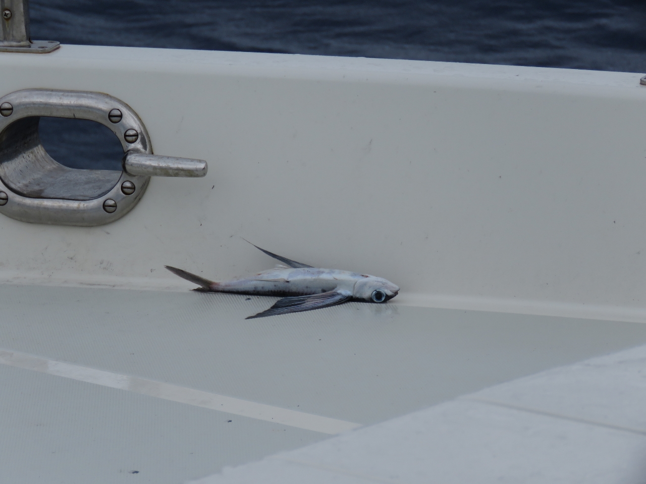 |
9/10/2015: Flying fish
Position: -20°41.23'S, 70°6.08'E
In addition to the squid, one flying fish hand landed on the fore deck as well.
|
 |
9/10/2015: Power wash
Position: -20°40.22'S, 69°58.61'E
James gave the boat another quick power wash today to clean off the squid ink and saltwater.
|
 |
9/11/2015: BGAN
Position: -20°14.84'S, 66°52.28'E
We had a moment of concern when the BGAN terminal would not hook up at all today. Then we realized we'd traveled outside the range of the satellite we'd been using and now need to aim the terminal westward instead of eastward. This direction is much better as the terminal can be strapped to the flybridge helm chair, with less risk of flying overboard or taking spray than on the boat deck table.
|
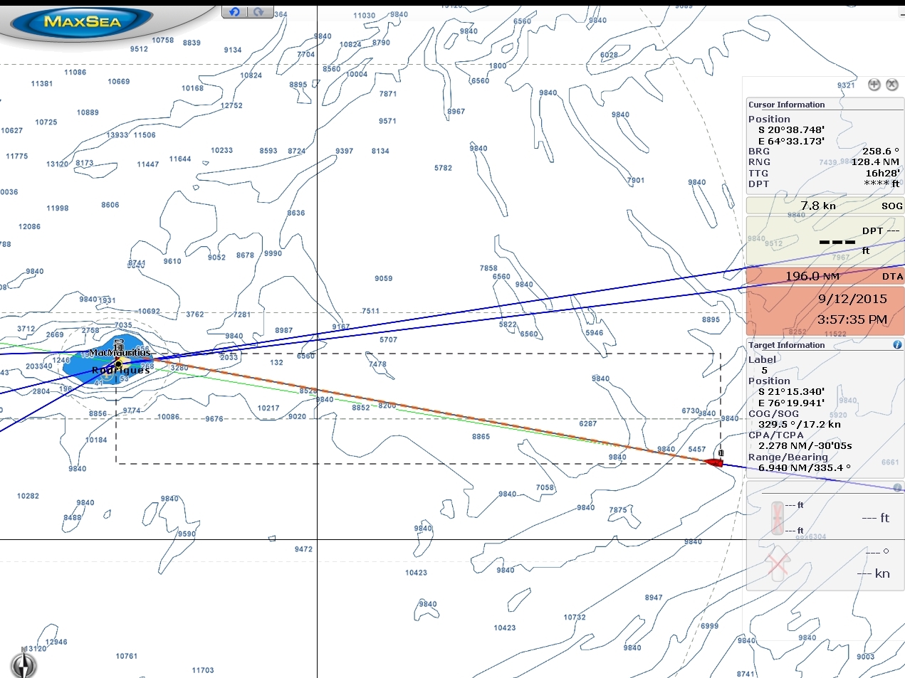 |
9/11/2015: Less than 200
Position: -20°14.15'S, 66°47.84'E
We're only 195 miles out of Rodrigues and can now see the island outline and the boat at the same time on the chartplotter.
|
 |
9/11/2015: Conditions
Position: -20°13.88'S, 66°46.27'E
The winds and waves settled down a bit last night, but ramped up again this morning. We're again seeing 25 kts of wind with waves about 9 ft on 9 seconds and we're rolling between 15 and 20 degrees. The waves still are mostly from astern, which reduces boat motion somewhat. And we're making good speed between 7 and 8 knots. We've been running with a 300-gallon fuel reserve for most of the trip, but have reduced that to 250 so we can speed up and have a better change of reaching Rodrigues before nightfall on the 12th.
|
 |
9/11/2015: Raspberry Pi
Position: -20°8.34'S, 66°14.42'E
Testing out a Rasberry Pi as a sensor controller.
|
 |
9/11/2015: Stack fan
Position: -20°7.13'S, 66°7.43'E
Reinstalling the secondary stack fan. On longer runs, it appears helpful.
|
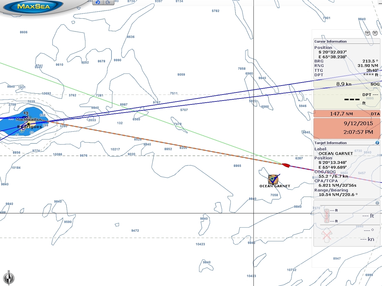 |
9/11/2015: Ocean Garnet
Position: -20°5.34'S, 65°57.20'E
The 751ft cargo ship Ocean Garnet en route to Singapore--the first ship we've seen since Ocean Ace ten days ago. We saw about ten ships in the course of twelve hours as we crossed the shipping route between South Africa and Asia and went almost two weeks without seeing any.
|
 |
9/12/2015: Smell the barn
Position: -19°43.86'S, 63°53.95'E
Doing 9.1 kts as we can "smell the barn" less than twenty miles out of Rodrigues.
|
 |
9/12/2015: Land ho!
Position: -19°42.91'S, 63°48.47'E
The outline of Rodrigues is just barely visible sixteen miles ahead.
|
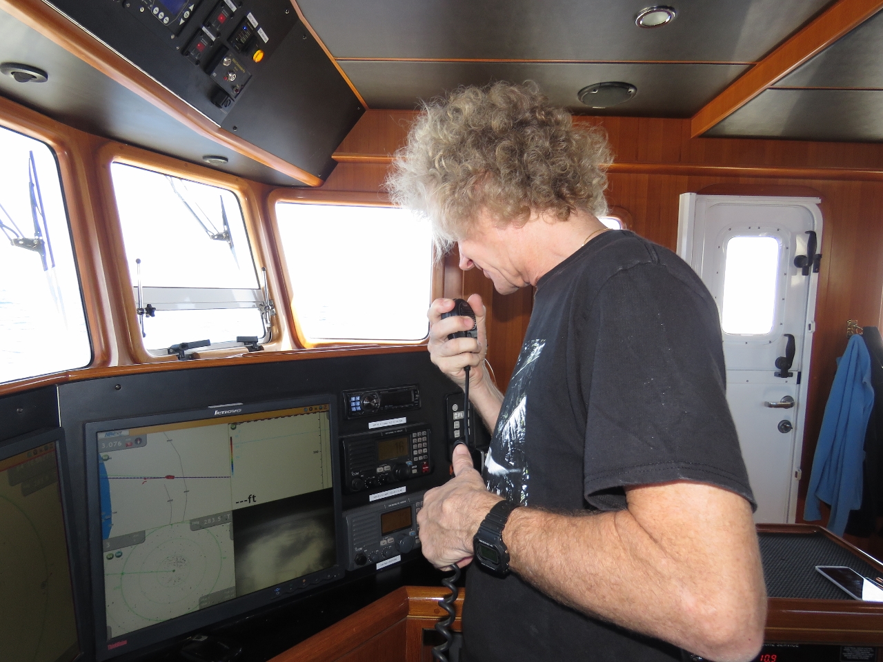 |
9/12/2015: First contact
Position: -19°41.50'S, 63°40.35'E
Our instructions were to contact the Coast Guard about a mile out of Port Mathurin, but they picked us up on AIS much earlier and contacted us to ask our destination. After we supplied boat and crew information, we were cleared to enter the harbour.
|
 |
9/12/2015: "Q" flag
Position: -19°40.47'S, 63°34.45'E
Raising our Quarantine, or "Q" flag, to indicate that we request clearance into the country.
|
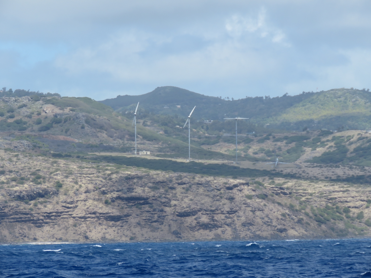 |
9/12/2015: Wind mills
Position: -19°39.87'S, 63°31.06'E
A few wind mills on the windward shore of Rodrigues.
|
 |
9/12/2015: Approaching Port Mathurin
Position: -19°40.17'S, 63°25.64'E
Entering the channel into Port Mathurin. Our destination is in the center of the photo in the distance.
|
 |
9/12/2015: Quarantine
Position: -19°40.84'S, 63°25.23'E
A crowd of people were waiting for us on the jetty when we arrived to clear us through. The first was a quarantine officer.
|
 |
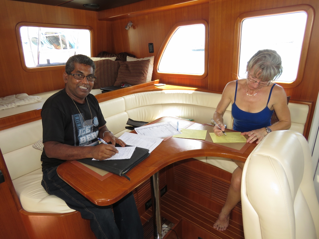
9/12/2015: Immigration and customs
Position: -19°40.84'S, 63°25.23'E
After quarantine approved our entry, customs (left) and immigration cleared us and the boat through.
|
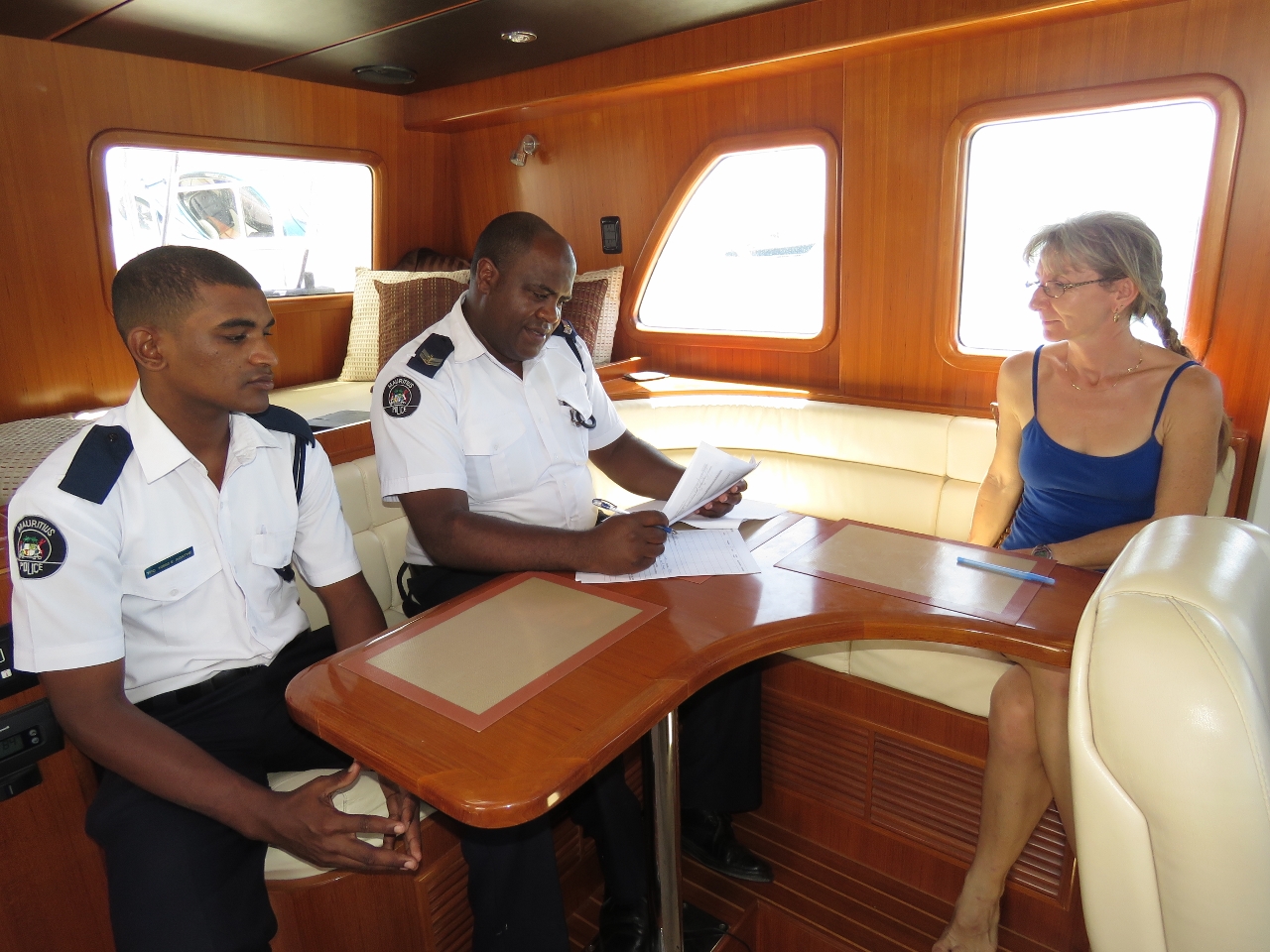 |
9/12/2015: Coast guard
Position: -19°40.84'S, 63°25.23'E
The Coast Guard checked us in after customs and immigration.
|
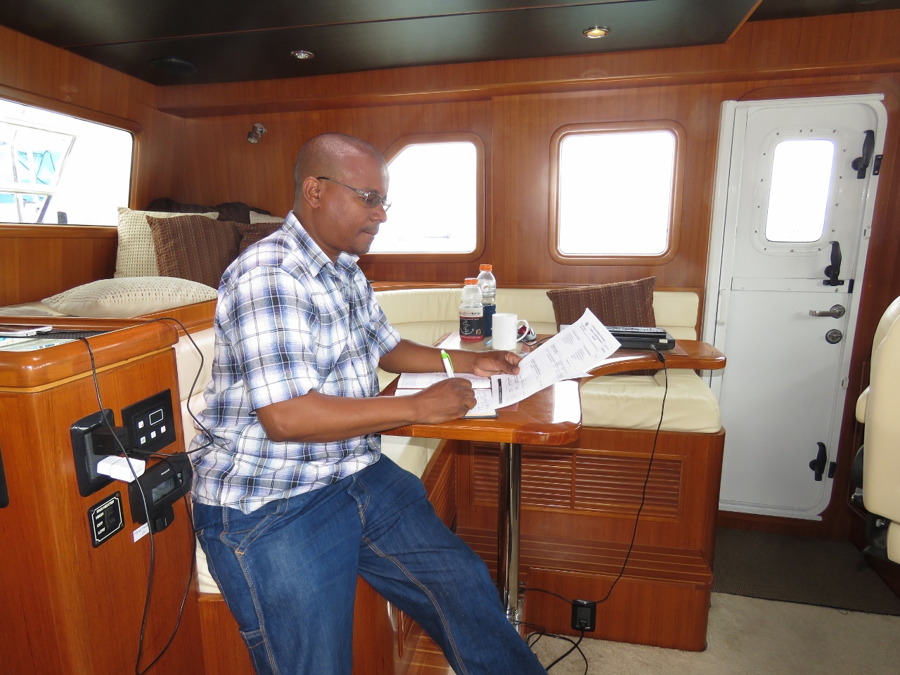 |
9/12/2015: Govt. vet
Position: -19°40.84'S, 63°25.23'E
The last official to visit us was a government veterinarian to inspect Spitfire and check his paperwork. Spitfire continues to lead the pack in paperwork. We have a single sheet of paper between us with a scan of our two passport face pages and another with the ship's registration. Spitfire has four pages: a two-page Australian health certificate, an Australian rabies vaccination certificate, and a USDA health certificate showing previous vaccinations and test results. Before arriving at a foreign port, we print out multiple copies of all our paperwork to give to the officials, which often makes the check-in process smoother. Here the government vet could just take a copy of our passports and Spitfire's papers with him rather than transcribe all the data into his log book while we waited.
|
 |
9/12/2015: Port Mathurin
Position: -19°40.84'S, 63°25.23'E
All cleared through at Port Mathurin with our Mauritian courtesy flag flying. About ten other pleasure craft are anchored off, with two more on the jetty with us. We can stay here until Monday morning, when the supply ship arrives and all boats must clear the jetty and the inner harbour while it docks.
|