MV Dirona travel digest for Baltimore 2016

|
Click the travel log icon on the left to see these locations on a map,
with the complete log of our cruise. On the map page, clicking on a camera or text icon will display a picture and/or log entry for that location, and clicking on the smaller icons along the route will display latitude, longitude and other navigation data for that location. And a live map of our current route and most recent log entries always is available at //mvdirona.com/maps/LocationCurrent.html. |
 |
11/4/2016: Underway
Position: 41°6.52'N, -71°34.64'W
We're underway on a 350-mile 3-night trip from Newport, Rhode Island to Baltimore, Maryland. We'll spend a few weeks there before continuing south through the Chesapeake area and farther down the US coast. We've just made our final turn out of Rhode Island Sound and now have 36 hours of straight running to arrive at the mouth of Delaware Bay.
This run has more than the usual timing considerations. Frequent weather systems are in play now. A front passed through yesterday while we were in Newport and another is expected in 3-4 days, but we have a good window now with 10-15kt N-NW winds expected for most of the offshore portion of the trip. Currently winds are less than 10 knots from the northwest. We're travelling at barely 5 knots to arrive at the mouth of Delaware Bay two nights from now at daylight Sunday morning on the end of the ebb tide. We could have left Newport later in the day and run a faster, but leaving earlier saves us some fuel and allows us to transit Rhode Island Sound in daylight and be offshore for most of our night running. On Sunday morning, the flood tide should carry us north through Delaware Bay to the east entrance of the C&D Canal as it turns to westbound ebb that afternoon. We'll ride the ebb through, anchor for the night outside the west end of the canal, then continue to Baltimore Monday morning. |
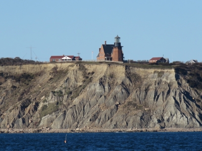 |
11/4/2016: Southeast Light
Position: 41°12.60'N, -71°29.02'W
The brick keeper's cottage and attached light on Mohegan Bluffs at the southeastern corner of Block Island, Rhode Island. Built in 1874, the structure was designated a National Historic Landmark as one of the most architecturally sophisticated lighthouses 19th-century US lighthouses.
|
 |
11/4/2016: Block Island Wind Farm
Position: 41°8.40'N, -71°31.88'W
The Block Island Wind Farm, about 4 miles east of Block Island, is the first offshore wind farm in the nation and is designed to withstand a Cat 3 storm with sustained winds of up to 112 kts. Construction began in 2015 and the facility is expected to be operational in late 2016. Pictured are three of the five GE wind turbines that combined will produce 30 megawatts of energy.
|
 |
11/4/2016: Long Island
Position: 41°2.30'N, -71°40.81'W
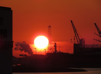
Sunset in calm conditions off the eastern tip of Long Island. We had considered stopping in New York on our way south, but decided to push farther south to spend time in Chesapeake Bay instead.
|
 |
11/4/2016: Conditions
Position: 40°38.67'N, -72°15.16'W
We were expected 10-20 knots of wind from the N-NW, but have been seeing a steady 20-30 knots from the NNW instead (12-hour wind display is rightmost graph in 4th row). Even though the winds are partly behind us, the waves are forward enough of our beam to generate 10 degrees of pitch (12-hour pitch display is leftmost graph in 4th row).
|
 |
11/5/2016: HVAC
Position: 40°0.81'N, -73°9.86'W
On stabilizing a loose part that was rattling with the boat motion, we noticed that the HVAC air filter and evaporator were coated in dust. We pulled out the mesh air filter to clean it, but needed to use a toothbrush taped to a long handle to clean the evaporator.
|
 |
11/5/2016: Float
Position: 39°59.76'N, -73°11.39'W
We didn't see much in the way of floats, or anything else, in the water through Rhode Island Sound. We did pass a small field of floats like this one today. Unlike the big field we passed through at night en route to Boston earlier in the year, these were not marked with radar reflectors, but were quite visible during the day. At night, invisible.
|
 |
11/6/2016: Fourteen Foot Bank
Position: 39°2.51'N, -75°11.09'W
The Fourteen Foot Bank Light was completed in 1886 and was the the first lighthouse built with a pneumatic caisson. A cassion is a water-tight retaining structure used for underwater work, while a pneumatic caisson also is airtight and filled with compressed air for working in soft mud. "The wooden caisson structure was excavated to a depth of 23 feet (7.0 m) below the seabed, then filled with 2,000 cubic yards (1,500 m3) of concrete. A cast iron base was meanwhile erected on the caisson as it sank. A house-like structure was built on top of the base, designed by H.A. Ramsay and Son of Baltimore. ... It was added to the National Register of Historic Places in 1989." (wikipedia.com)
|
 |
11/6/2016: Ship John Shoal
Position: 39°18.09'N, -75°22.56'W
The Ship John Shoal and nearby Cross Ledge lights were originally planned to be built over pilings screwed into the sea bed. But ice carried away the entire Cross Ledge Light during it's construction in 1856, and both were instead built using the new cassion construction technique. The Ship John Shoal light was completed in 1870 and was surrounded with 2,000 tons of riprap to protect it from ice damage. The light was automated in 1973.
|
 |
11/6/2016: Jag Lok
Position: 39°20.69'N, -75°25.52'W
The 900ft crude oil tanker Jag Lok passing us en route to Philadelphia. The boat appeared to be running lightly-loaded with its bulbous bow showing.
|
 |
11/6/2016: Nuclear Power
Position: 39°27.21'N, -75°32.44'W
The Hope Creek Nuclear Generating Station (left) and the Salem Nuclear Power Plant share Artificial Island along the east side of Delaware Bay. Hope Creek came online in 1986 and the two Salem units began operating in 1977 and 1981. Both use Delaware Bay for cooling and together the plants produce 3,572 megawatts, the largest nuclear generating facility in the Eastern United States and the second largest nationwide. As a scale callibration point, the monstrous Bonneville hydro plant on the Columbia River has a total nominal output of "only" 526.7 megawatts and an overload capacity of 577 megawatts.
|
 |
11/6/2016: MG Winfield Scott
Position: 39°28.72'N, -75°33.46'W
The 128ft US Army tug MG Winfield Scott, named for Major General Winfield Scott, was built in 1993. The tug has a range of 5,000nm at 13.5kts when light or 12kts when loaded. We're near the location where Nordhavn 47 Ghost Rider struck a rock jetty and sunk earlier this year.
|
 |
11/6/2016: Heron
Position: 39°32.82'N, -75°33.07'W
The Coast Guard cutter Heron anchored just south of the east entrance to the C&D Canal.
|
 |
11/6/2016: C&D Canal
Position: 39°33.63'N, -75°34.00'W
Traffic control tower at the east entrance to the C&D Canal (Chesapeake and Delaware Canal). When the lights are flashing, small craft must contact the canal dispatcher for permission to pass.
The C&D Canal is a 12-mile cut that connects Delaware and Chesapeake bays. The canal originally opened in 1829 with four locks and six-mule teams to pull boats through. The modern canal has no locks and passes under six bridges, a gas pipeline and power lines. All bridges are fixed, with a minimal clearance of 132ft, except for the Conrail Lift Bridge that is normally open but has a 45ft clearance when closed. The maximum current through the canal generally is about 2 knots, with 2.5 knots on the flood at the east entrance. We timed our arrival at the mouth of Delaware Bay at dawn for the flood current to carry us north to arrive at the C&D Canal mid-afternoon for the westbound ebb to carry us through. After a lumpy two-night run from Newport, RI to Cape May and choppy seas in Delaware Bay, it was wonderful to be in the calm, protected waters of the canal. We were hoping to see a large RO/RO or other ship in the waterway, but only saw a few pleasure craft in the canal proper and a tugboat pulling a large petroleum barge at the west entrance. Our C&D Canal video starts in Delaware Bay where we pass several anchored ships and barges, including the Coast Guard cutter Heron, shortly before we arrive at the canal entrance. The last bridge we pass under is the Chesapeake City Bridge at Chesapeake City. Beyond that bridge is the Delaware Responder at the Marine Spill Response Corporation's Chesapeake Bay station. |
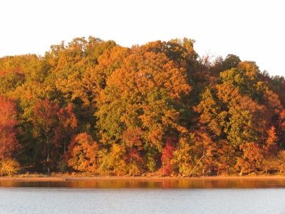 |
11/6/2016: Fall Colors
Position: 39°22.91'N, -76°0.68'W
After passing through the C&D Canal, we anchored off the north shore of the Sassafras River just as the late afternoon sun put the trees aglow. This was a wonderfully calm and sheltered anchorage. We had drinks on the back deck then watched the Baltimore Ravens Sunday home game from earlier that day on NFL Gamepass.
|
 |
11/6/2016: Sunset
Position: 39°22.91'N, -76°0.68'W
A gorgeous sunset looking south from our anchorage along the Sassafras River.
|
 |
11/7/2016: Morning
Position: 39°18.27'N, -76°12.92'W
Conditions were wonderfully clear and calm as we made our way from our anchorage at the Sassafras River to Baltimore.
|
 |
11/7/2016: Craighill Channel Lighthouse
Position: 39°13.05'N, -76°21.51'W
The Craighill Channel Lower Range Light Rear 1.5 miles to our north is the rear light of the lower range-mark pair that guides ships through Craighill Channel. the front light of the pair is just under a mile to our south. The rear light was constructed in 1873 in a style unique for the Chesapeake Bay and is the tallest light in Maryland at 105ft.
|
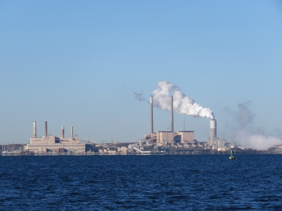 |
11/7/2016: Generating Stations
Position: 39°11.23'N, -76°27.63'W
The Herbert A. Wagner (left) and Brandon Shores electric generating stations at the mouth of the Cox River to our south. The H. A. Wagner station began operation in 1956 and with an oil-fired unit. Two coal-fired units and one fueled by natural gas have since been added for a total capacity of 1,040MWe. The Brandon Shores plant began operating in 1981 and has a 1370MWe capacity. Its 700ft exhaust and 400ft flue-gas desulfurization system stacks dominate the site.
|
 |
11/7/2016: Baltimore Arrival
Position: 39°16.50'N, -76°35.05'W
Baltimore has a beautiful inner harbor ringed with marinas, commercial docks and interesting architecture. This video https://youtu.be/OLVfYkA43AQ shows the view from the pilot house as we cruise up the Patapsco River from Lazaretto Point near Fort McHenry, travel through Baltimore Inner Harbor, enter the marina, and bring the boat into the slip to complete docking.
|
 |
11/7/2016: Inner Harbor
Position: 39°16.81'N, -76°36.51'W
The view to our slip at Baltimore Marine Center Inner Harbor, taken from Federal Hill Park just south of the marina. Nearly every boat in the marina is a power boat, with Carver, Meridian, Bayliner and SeaRay making up the majority. Dirona is slightly to the right of center, roughly in line with a large cylindrical concrete structure on the opposite shore (click image to view larger).
The 130ft Westport yacht farther to the right is Winning Drive, owned by Steve Bisciotti who also owns the Baltimore Ravens NFL team. Bisciotti keeps the boat in Annapolis, and brings it to Baltimore for game day. Since the Ravens have two games only five days apart (yesterday and this Thursday) he kept the boat here. We've got tickets to the Thursday night game and are looking forward to seeing an NFL game live. We had season's tickets for the Seattle Seahawks for more than a decade and are suffering from withdrawal. |
 |
11/7/2016: Brasil
Position: 39°16.82'N, -76°36.53'W
The Brazilian Navy training ship Brasil leaving Baltimore after a week-long visit. The crew is lined up on the back deck as tugs pull the vessel off the dock and guide it out of the inner harbor.
|
 |
11/7/2016: Dusk
Position: 39°16.94'N, -76°36.51'W
The dusk view to the inner harbor from the outer docks at Baltimore Marine Center Inner Harbor (click image for larger view). Baltimore certainly is a beautiful city. The building with the blue wave is the National Aquarium.
|
 |
11/7/2016: Power Adapter
Position: 39°16.94'N, -76°36.51'W
It's common for widely-travelled boats to have an assortment of adapters for different shore power connections, such as the ones we used in Papeete. Winning Drive takes a slightly different approach where the end of their shorepower cable has all four conductors separately pluggable. They can just put different ends onto their shorepower cable. In this particular picture, they have a short pigtail with an adapter in addition to the reconfigurable end.
|
 |
11/8/2016: Morning Sky
Position: 39°16.94'N, -76°36.51'W
A dramatic morning sky looking southeast from Dirona toward the Baltimore's commercial shipping area.
|
 |
11/8/2016: Crane Bolt
Position: 39°16.94'N, -76°36.51'W
In Newport we found a washer on deck below the crane and concluded we likely had a critical crane issue, so haven't used the crane since. We then found a bolt on deck as we arrived into Baltimore. James took the crane apart today and found the boom extension hydraulic ram mounting bolts were all loose. Two bolts had fallen out, damaging the threads, and the other two were close to falling out. It's good that we caught it before more damage was done.
|
 |
11/8/2016: Package
Position: 39°16.94'N, -76°36.51'W
Jennifer setting off to return a package via UPS.
|
 |
11/8/2016: Phoenix Shot Tower
Position: 39°17.43'N, -76°36.41'W
The Phoenix Shot Tower was the tallest structure in the US from 1828 until 1846 and produced ammunition shot until the turn of the twentieth century. 'Molten lead was dropped from a platform at the top of the tower, through a sieve-like device, into a vat of cold water at the bottom of the tower to produce both "drop shot" for pistols and rifles and "moulded shot" for larger weapons such as cannons. When hardened, dried, and polished, the shot was sorted into 25-pound bags. The annual production was about 100,000 bags of shot a year, with the capability of doubling that in case of war or other high demand.' (Wikipedia)
|
 |
11/8/2016: Tir Na Nog
Position: 39°17.17'N, -76°36.70'W
Dinner overlooking the Inner Harbor at Tir Na Nog Irish Pub. Jennifer's favourite beer, Kilkenny, is not that common in the US.
|
 |
11/9/2016: Caught on Film
Position: 39°16.94'N, -76°36.51'W
Our new forward-looking camera caught Spitfire sitting on the foredeck this morning. It was pouring rain much of the time he was out there, but he never seems to care.
|
 |
11/10/2016: Camden Yards
Position: 39°17.05'N, -76°37.19'W
We’re finally back in an NFL town during the season. Tonight it is Ravens vs Browns. Baltimore does NFL games right. The stadium is beautiful and the fans are serious. Tonight’s game time is not until 8:25pm but by 4pm, the number of fans streaming through the inner harbor towards M&T Stadium already had our attention. The excitement drew us in and we left the boat at 5pm and walked a mile to Camden Yards (baseball's Oriole Park) to have dinner at Dempsey’s Brew Pub.
|
 |
11/10/2016: Dempsey's Brew Pub
Position: 39°17.03'N, -76°37.23'W
Dinner at Dempsey's Brew Pub at Camden Yards before the Ravens game. Ten minutes after we arrived, there wasn't a table left as Ravens fans poured in.
|
 |
11/10/2016: Ravens Walk
Position: 39°16.75'N, -76°37.32'W
The parking lot between Camden Yards and M&T stadium contains the famous Ravens Walk. In the video https://youtu.be/GQmQNHXG8Uw, we capture the fun along the Ravens Walk heading towards the stadium, including a full marching band, music, food, beer, and tailgating. From inside the stadium, more of the marching band and pre-game celebrations as the stadium transitions from empty to full, the players are announced, and the opening kickoff. We’ve been to a lot of NFL games over the years, but row 13 on the 45-yard line was a first for us. We felt like we were part of the game as the Ravens beat the Browns 28-7.
|
 |
11/11/2016: Trash Skimmer
Position: 39°16.94'N, -76°36.51'W
The 39-mile Patapsco River reaches saltwater at Baltimore's inner harbor, carrying all sorts of debris. City trash skimmers work the inner harbor every day to keep it free of garbage and hazards. This one is passing between our bow and shore.
|
 |
11/11/2016: Galvanizing
Position: 39°16.94'N, -76°36.51'W
Our anchor and chain was last galvanized in 2012 at Ace Galvanizing in Seattle. They did a great job, and the anchor and chain made it around the world, particularly the South Pacific where the warm waters are tough on galvanization. Four years and hundreds of anchorings later, the job needs to be done again. One difficulty is finding a galvanizer that's reasonably close to the boat and is able to fit in the job. But the real challenge is getting 1,154 pounds of steel off the boat and delivered to the galvanizing shop. We finally found a solution here in Baltimore. Pictured with James is the sales manager Derek from Baltimore Galvanizing. Derek came down with a pickup truck to collect the 154lb anchor and 500 feet of 7/16" chain at 2lb/foot. We loaded the chain into two dock carts and the anchor into a third. This worked out well, but we're glad the tidal range here is only a few feet. We'd never have been able to get the carts up a steep ramp.
|
 |
11/12/2016: Swivels
Position: 39°16.94'N, -76°36.51'W
We use an Ultra anchor swivel to attach the anchor to the chain. The current swivel on the left has been in use since we bought the boat in 2010 and has seen a lot of anchorings. The swivel still is undamaged, but showing significant wear, so we decided to switch to our spare and keep the original as a backup. The new swivel has what looks to be a useful design change. The swivel has a bridge (top right of picture) that connects over the top of the anchor shaft. This will both add strength and, more importantly, prevent the swivel from sliding down the anchor shaft and jamming out of position. This isn't common, but when it does happen the anchor cannot be retrieved until the swivel is moved back to the end of the anchor shaft.
|
 |
11/12/2016: Side Light
Position: 39°16.94'N, -76°36.51'W
One of our two side-facing LED floodlights failed, so James replaced it with a spare. The mounting point is a bit difficult to access, so he used the crane and a climbing harness to hoist himself into position. We use the lights to help navigate at night in close quarters—they light up the area for a good two hundred feet on either side of the boat. The picture also shows one of the two aft-facing lights, identical to the side lights, that illuminate the boat deck for loading and unloading the tender or working on deck at night.
|
 |
11/13/2016: Donuts
Position: 39°16.94'N, -76°36.51'W
Jennifer returning from a Dunkin' Donuts run.
|
 |
11/13/2016: Main Oil Change
Position: 39°16.94'N, -76°36.51'W
Time to change the main engine oil for the seventh time this calendar year.
|
 |
11/13/2016: Gen Oil Change
Position: 39°16.94'N, -76°36.51'W
The generator also was due for an oil change.
|
 |
11/13/2016: Gordon Biersch
Position: 39°16.94'N, -76°35.97'W
We rode our bikes to the Harbor East neighbourhood on other side of the inner harbor to have lunch at Gordon Biersch brewery. Baltimore is very bicycle-friendly and we followed a shared bike/pedestrian path the entire way. The day was so sunny and warm that we had lunch in T-shirts on the patio outside and the sidewalks and paths were full of pedestrians, bicyclists and skateboarders. Baltimore is really working out well for us.
|
 |
11/13/2016: Under Armour
Position: 39°16.94'N, -76°36.12'W
Activewear manufacturer Under Armour is an incredibly popular brand in Baltimore—during lunch people frequently passed wearing Under Armour gear. Under Armour founder Kevin Plank was born near Baltimore and their world headquarters is across the harbor at Locust Point.
|
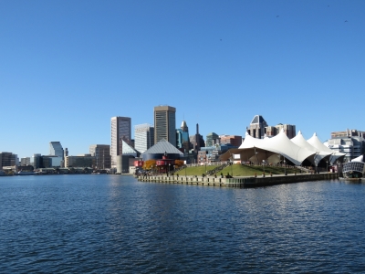 |
11/13/2016: Pier Six
Position: 39°16.98'N, -76°36.12'W
Looking west across the Pier Six Concert Pavilion to downtown Baltimore.
|
 |
11/13/2016: Katyn Massacre
Position: 39°17.00'N, -76°36.18'W
The forty-four-foot tall Katyn Memorial commemorates the 22,000 estimated Poles executed by Stalin’s secret police at the Katyn forest and other Soviet detainment camps in 1940.
|
 |
11/13/2016: Seven Foot Knoll Lighthouse
Position: 39°17.02'N, -76°36.33'W
The Seven Foot Knoll lighthouse was originally constructed in 1855 where the Patapsco River flows into Chesapeake Bay. The light was automated in 1948 and the structure transported to it's current location at Pier Five in downtown Baltimore and is open to the public as a museum.
|
 |
11/13/2016: View South
Position: 39°17.02'N, -76°36.32'W
Looking southeast down the Patapsco River from the balcony of the Seven Foot Knoll lighthouse.
|
 |
11/13/2016: Public Works Museum
Position: 39°17.02'N, -76°36.32'W
Baltimore has some beautiful historic buildings and reminds us of Boston. This is the Baltimore Public Works Museum viewed from the Seven Foot Knoll lighthouse balcony. The museum is housed in a still-operating sewage pumping station built in 1912.
|
 |
11/13/2016: Taney
Position: 39°17.05'N, -76°36.40'W
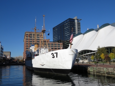
The Historic Ships in Baltimore Museum is steward of several ships moored along the inner harbor, plus the Seven Foot Knoll lighthouse. This is the USCGC Taney, a high-endurance cutter that is the only surviving ship to have seen action in the 1941 attack on Pearl Harbor.
|
 |
11/13/2016: Chesapeake
Position: 39°17.17'N, -76°36.55'W
The lightship 116 Chesapeake was in service from 1930 through 1965 and for much of that time marked the mouth of Chesapeake Bay.
|
 |
11/13/2016: Torsk
Position: 39°17.17'N, -76°36.55'W
The USS Torsk is a diesel submarine built at the Portsmouth Navy Yard where the USS Albacore was also built. The Torsk was commissioned in 1944 and deployed to the Pacific during World War II and later participated in the 1958 Lebanon Crisis and the 1962 Cuban Missile Crisis. The ship was decommissioned in 1968 with an impressive record of over 10,600 career dives.
|
 |
11/13/2016: Chessie Paddle Boats
Position: 39°17.17'N, -76°36.55'W
Paddle boats in the inner harbor modeled after 'Chessie', a legendary sea monster reported to live in Chesapeake Bay. We'd seen these boats as part of the coverage of the Sunday night Ravens home game that we watched while anchored in the Sassafress River, but we'd not seen them in action until today.
|
 |
11/13/2016: World Trade Center
Position: 39°17.18'N, -76°36.59'W
A sobering memorial in front of the Baltimore World Trade Center to the 69 Maryland residents who died in the September 11, 2001 terrorist attacks. The 22-foot twisted beams are from the 94th to 96th floors of the north of the twin towers. The inscriptions on the marble base depict events in the attack and are arranged so that each year on September 11 the Baltimore World Trade Center building acts as a sundial, highlighting each event at the time of day it occurred.
|
 |
11/13/2016: USS Constellation
Position: 39°17.17'N, -76°36.72'W
The USS Constellation was commissioned in 1854 and is the second of four US Navy ships with that name. This ship was built from parts salvaged from the original Constellation and was in commission until 1954.
|
 |
11/13/2016: Ice Rink
Position: 39°17.08'N, -76°36.78'W
We'd been watching the outdoor ice rink being built over the past week and its now up-and-running.
|
 |
11/13/2016: Michael and Haley
Position: 39°16.94'N, -76°36.51'W
Wilmington, Delaware residents Michael Owen and Haley were in Baltimore for a few days and stopped by for a visit. They're been following the blog for a while and are quite interested in Nordhavns. Micheal grew up nearby on the Sassafrass River and his parents kept a boat in the marina we're in. It's always fun to meet people who are enthusiastic about boating.
|
 |
11/13/2016: Supermoon
Position: 39°16.94'N, -76°36.51'W
We were enjoying a drink on the back deck when this week's supermoon appeared between the highrises on the opposite side of the inner harbor.
|
 |
11/14/2016: Detail
Position: 39°16.94'N, -76°36.51'W
Land & Sea Detailing arrived at 7am this morning with a crew of five to six and nearly that many cartfulls of gear, plus an inflatable boat. They had Dirona cleaned and waxed by end of day. The boat looks and feels wonderful. It's great to have Dirona clean and shiny again, and to lose the brown saltwater bow mustache we had developed in Newfoundland.
|
 |
11/14/2016: Pumpout
Position: 39°16.94'N, -76°36.51'W
The marina has a pumpout cart that wheels down to the slips and hooks up to pre-plumbed pipes along the dock. Our tank wasn't close to full, but we wanted to test out the pump-out system before we got too close.
|
 |
11/15/2016: Hold the Boston
Position: 39°16.94'N, -76°36.51'W
Spitfire loves Boston Cream Donuts, hold the Boston.
|
 |
11/15/2016: Steering
Position: 39°16.94'N, -76°36.51'W
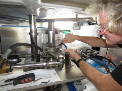
James removing the steering arm for service. Every 2,000 to 3,000 hours, the spherical bearing on the end of the steering hydraulic ram starts to get loose. We replace it, but they are expensive. James' theory on the problem is that play between the bolt and steering arm is wearing very slightly, dropping a tiny bit of metal dust below, which wears out the bearing.
|
 |
11/15/2016: Excel
Position: 39°16.65'N, -76°37.59'W
We biked over to Excel Machine & Fabrication near the Baltimore Ravens stadium to drop off our steering parts. The plan for the steering arm repair is to weld up the hole between the steering arm and the bolt that holds the spherical bearing on the end of the hydraulic steering ram. Once the hole has been welded up, it'll be drilled out to a slight press fit on the bolt. The idea behind the design change is the slight interference fit between the steering arm and the bolt that holds the steering ram rod end will prevent movement between the bolt and steering arm. With no movement, there will be no wear and no metallic dust to cause the spherical bearing to fail early. Let see if this can last 4,000 to 6,000 hours rather than the current 2,000 to 3,000.
|
 |
11/15/2016: MaGerk's
Position: 39°16.62'N, -76°36.85'W
After dropping off the parts at Excel, we stopped in for an excellent lunch at MaGerk's Pub in the Federal Hill neighbourhood. James is just barely visible in the back of the picture to the left of the person standing near the bar.
|
 |
11/15/2016: Whisper Dishes
Position: 39°16.86'N, -76°36.58'W
We've passed the "whisper dishes" behind the Maryland Science Center a number of times and finally stopped to check them out. The dishes are about fifty feet apart and focus sound so that someone whispering into one dish can be heard clearly in the other dish.
|
 |
11/15/2016: Grate
Position: 39°16.87'N, -76°36.50'W
Baltimore is quite bicycle-friendly, except for grates like these that are common on city streets.
|
 |
11/15/2016: Pride of Baltimore
Position: 39°16.88'N, -76°36.50'W
A memorial to the Pride of Baltimore in Rash Field, adjacent to our marina. The ship was a replica of the Baltimore clipper topsail schooner Chassuer that fought in the war of 1812. The Pride of Baltimore was built in the inner harbor and launched in 1975 as a goodwill ambadassor for the city of Baltimore and the state of Maryland. While returning to Baltimore from Europe in May of 1986, the ship capsized 250 miles north of Puerto Rico in the 80-knot winds of a microburst squall. The captain and three crew were lost and the remaining eight crew were rescued after being adrift for four days.
|
 |
11/15/2016: Investigating
Position: 39°16.94'N, -76°36.52'W
Spitfire continues to pursue his mission of investigating every open locker. This one is the underneath the guest stateroom floor.
|
 |
11/15/2016: More Investigating
Position: 39°16.94'N, -76°36.52'W
It's been a busy day for Spitfire. We had several lockers open.
|
 |
11/16/2016: Sunrise
Position: 39°16.94'N, -76°36.51'W
A spectacular sunrise looking southeast from the boat deck. The Under Armour headquarters building is partially visible at the right of the photo.
|
 |
11/17/2016: Winterizing
Position: 39°16.94'N, -76°36.51'W
The water and pumpout will be winterized early next week, so we'll be getting all our laundry done, topping of the freshwater tank and pumping out the black water tank this weekend. When we booked the slip the marina did let us know this would happen, so it's not a surprise. With 415 gallons of freshwater and a 120-gallon blackwater tank, we'll be fine for the remaining two weeks that we are here. We are very much enjoying Baltimore, but are starting to feel that it is time to get somewhere warmer for the rest of the winter.
|
 |
11/17/2016: Baltimore Galvanizing
Position: 39°16.94'N, -76°36.51'W
Derek, the sales manager at Baltimore Galvanizing, returned our anchor and chain today. It looks like an excellent galvanization, but the true test is how it wears in use.
|
 |
11/17/2016: Winterized
Position: 39°16.94'N, -76°36.51'W
A crew showed up today with carts of gear and large pieces of wood to build a winter enclosure for this boat near us in the marina.
|
 |
11/17/2016: Forward Light
Position: 39°16.94'N, -76°36.51'W
Most fish boats run both deck lights and forward lights. They use the deck lights of course for working at night and the forward-facing lights to see things in the water. Our experience from operating around commercial fishing vessels at night is their forward-facing floodlights can be seen from great distances, occasionally from as far away as twenty miles. The commercial boats typically run 1,000 watts or well beyond, whereas we run a 500-watt light. Running at Night shows a picture of the light mounting position with the marineboard shield to avoid back-scatter. The light hasn't been as bright as we like and it draws 4 amps from the 120V inverter which is more than we like.
We love the light, but sometimes have to turn if off in order to have sufficient power left on the 120v system to run a kettle or the microwave, and it's not particularly helpful at spotting debris. We've been waiting for LED technology to evolve to the point where brighter lights with much less power draw are economical. Jerry Fraelic of N68 Grace of Tides pointed us to the Rigid Industries LEDs that his Nova Scotia fishing family have been using. They're using the 40-inch version of these lights, and we don't have an easy spot for a 40-inch light. But we realized that we do have room for 4 10-inch lights. We assembled a module of the four lights, turned around our existing 500-watt light and mounted our four LEDs onto the back of the current light. This allows us to use the existing mount shield and light mounting hardware largely unchanged. The original light was 120 volts, whereas this one is 12 volts. Fortunately the existing wiring is of a large-enough gauge to be able to deliver the 12 amps at 12 volts required by this lighting system. James moved the power source of the lighting from a 120V breaker to a 24-volt DC breaker that feeds a 24V-to-12V DC power converter to deliver the 12 volts needed. It's nice to have 4 amps back available on the 120V inverter, and this light assembly is much brighter than the 500-watt halogen ever was. The old light was 8,500-10,000 lumens and the new one is 15,000 lumens. That's 50%-76% more. |
 |
11/18/2016: Steering Assembly
Position: 39°16.94'N, -76°36.51'W
We got our steering arm back from Excel Machine and Fabrication today. They welded up the rudder arm, redrilled it so the bolt again fits snuggly, and added a washer between the washer arm and the spherical bearing to ensure that even small amounts of wear don't find their way into the bearing. We think this should be good for a few thousand more hours.
|
 |
11/19/2016: Calm Before Storm
Position: 39°16.94'N, -76°36.51'W
Another beautiful, calm and clear morning at Baltimore's Inner Harbor. It won't last though—a gale warning is in effect for this evening.
|
 |
11/19/2016: Door Latch
Position: 39°16.94'N, -76°36.51'W
The door latch assembly for our cockpit-to-swim platform door broke in Cape Lookout earlier this year. The assembly needs to be at an unusual angle to fit the 52, so Nordhavn takes a standard latch, cuts it and then rewelds it at the appropriate angle. This leads to two problems: 1) because the weld has impurities or hasn't been properly passivated, it rusts, and 2) it's effectively a hand-made part at a boat-specific angle and so it's almost impossible to buy another one that fits.
It might be possible to get a welder to cut and weld this piece to fit but it would be expensive and just doesn't feel like the right approach. Instead, we built a marineboard wedge that holds an unmodified latch at the appropriate angle. We expect this one will probably last indefinitely as the other latches have. But if it doesn't we can just easily slap a replacement on. |
 |
11/19/2016: Gale
Position: 39°16.94'N, -76°36.51'W
The barometer has been falling over the last 24 hours and started a rapid ascent about an hour ago. With that came nearly-instant gusts to almost 40 knots. We'll be surprised if there is any sand left in the Rash Field volleyball courts across from the marina with the amount we've seen blown from it.
|
 |
11/20/2016: Black Water
Position: 39°16.94'N, -76°36.51'W
When we pumped out our black water tanks last week the outlet flow seemed poor so we suspected a vent issue. James took apart the hoses this today and found the ninety-degree elbow at the tank was almost completely plugged. He cleaned it out with a screw driver, washed it and finished the job with a Dremel wire brush. We then blew compressed air through to the hose and established that the upper vent line was clear.
|
 |
11/20/2016: Guests
Position: 39°16.94'N, -76°36.51'W
Locals from the boats docked around us were interested in seeing Dirona, so we had a group of them board for a tour today.
|
 |
11/21/2016: Valve Adjustment
Position: 39°16.94'N, -76°36.51'W
James did our fourth main engine valve adjustment today. This is due after the first 1,000 hours and every 2,000 hours thereafter. The next adjustment will be due after 10,459 hours.
|
 |
11/22/2016: Zipcar
Position: 39°16.90'N, -76°36.79'W
We booked a Zipcar to do some provisioning today. Several Zipcar locations are in the inner harbour, this one is about a 5-minute walk away.
|
 |
11/22/2016: Total Wine
Position: 39°23.93'N, -76°33.81'W
We've been buying from Total Wine where available since returning to the US. The prices are good and its especially convenient to buy in bulk on-line and just stop by to pick up the order.
|
 |
11/22/2016: Harris Teeter
Position: 39°16.08'N, -76°36.00'W
Jennifer already did a produce provisioning run by bicycle shortly after arriving in Baltimore, but we took advantage of the car to pickup some heavier items, plus a twelve-pound frozen turkey for Thanksgiving.
|
 |
11/23/2016: Fitness Club
Position: 39°16.91'N, -76°36.62'W
We often see large groups out running at Rash Field opposite the marina and one was there this morning. Shortly after, they had collected at the pavilion north of the field and were exercising to music amid hoots and whoops. They appeared to be having a great time despite this morning's near-freezing temperature.
|
 |
11/23/2016: Hydraulics Leak
Position: 39°16.94'N, -76°36.51'W
We found a light oil misting around the rear thruster proportional valve inlet. Replacing a hardened and failing O-ring quickly fixed the problem.
|
 |
11/23/2016: Anti-Chafe
Position: 39°16.94'N, -76°36.51'W
The turbo coolant pipe and fuel inlet pipe were rubbing (at the brown discoloration), so we isolated them with a piece of clear hose.
|
 |
11/24/2016: Sweet Hope 2
Position: 39°16.94'N, -76°36.51'W
The Nordhavn 76 Sweet Hope 2 arrived yesterday afternoon and then left early this morning. It's last AIS position showed it moored against the cargo ship Sampogracht at Baltimore's South Locust Point Marine Terminal, so we suspect it is being shipped somewhere. That explains the short stop in Baltimore inner harbor.
|
 |
11/24/2016: Happy Thanksgiving!
Position: 39°16.94'N, -76°36.51'W
Jennifer preparing gravy for our Thanksgiving feast with our 12-lb turkey on the counter behind her. We'll be eating leftovers for a while. We had a great meal and a fun evening watching the Detroit-Minnesota Thanksgiving day NFL game from earlier in the day.
|
 |
11/25/2016: Christmas Village
Position: 39°17.03'N, -76°36.76'W
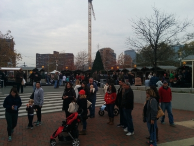
Workers started assembling the Baltimore Christmas Village at the inner harbor shortly after we arrived and it's now in full swing. The village is modeled after German Christmas Markets such as Nuremberg's famous Christkindlesmarkt. Indoor and outdoor booths sell traditional European food, sweets and drinks plus a variety of holiday gifts, ornaments, jewelry and arts and crafts.
|
 |
11/25/2016: Living Wall
Position: 39°17.19'N, -76°36.89'W
PNC Bank bills their "living wall" at their headquarters in downtown Baltimore as the largest in North America. The vertical garden has 602 2x2ft panels each containing 24 plants, with the bank's logo at the bottom. Each panel is estimated to offset the carbon footprint of one person.
|
 |
11/25/2016: France-Merrick Fountain
Position: 39°17.19'N, -76°37.00'W
The water wasn't running in the France-Merrick Fountain at the corner of Pratt and Charles streets when we passed. Perhaps it has been winterized like our marina.
|
 |
11/25/2016: Pratt Street Ale House
Position: 39°17.17'N, -76°37.08'W
We had an excellent lunch at Oliver Breweries' Pratt Street Ale House opposite the Baltimore Convention Center. Great service, good beer and a nice atmosphere.
|
 |
11/26/2016: Glendinning Parts
Position: 39°16.94'N, -76°36.51'W
We have a Glendinning power cord storage system that automatically pays out and retracts our power cord through a hawsepipe at the stern. The hawsepipe cap rotates on and is retained by a central pin that had corroded. The pin broke when we retracted the cable while leaving Boston and the cap flipped off and fell in the water. We built a temporary replacement, pictured at bottom right corner, using the rim of a tupperware container secured with hot glue into a larger lid and have been investigating the availability of replacement parts. They finally arrived today. The smallest unit of replacement part we could get was a full hawsepipe assembly. Luckily you can remove the cap assembly, visible at bottom left of the photo, from the hawsepipe so the whole assembly doesn't need to be replaced. As well as allowing us to replace just the cap, this also leaves us with a spare retraction limit switch, which certainly will fail in the future.
|
 |
11/26/2016: Glendinning Cap
Position: 39°16.94'N, -76°36.51'W
The new Glendinning cap in place. The temporary replacement cap lasted surprisingly well and we'll keep it as a backup.
|
 |
11/26/2016: Visionary Art
Position: 39°16.80'N, -76°36.42'W
The American Visionary Art Museum featuring self-taught artists is just up the road from our marina. We walked past it on the way to lunch in Federal Hill. Notable pieces oustide the building include this 55ft wind-powered Giant Whirligig by Vollis Simpson.
|
 |
11/26/2016: Bird's Nest
Position: 39°16.79'N, -76°36.43'W
A giant bird's nest forms the fourth-floor balcony for the American Visionary Art Museum.
|
 |
11/26/2016: Fall Leaves
Position: 39°16.68'N, -76°36.42'W
Jennifer enjoying a romp through the fall leaves that have collected along the sidewalk.
|
 |
11/26/2016: Wayward
Position: 39°16.56'N, -76°36.85'W
We had lunch at the Wayward Southern Bar and Kitchen in Federal Hill. The spice-rubbed wings were exceptional, as was the "Baltimore Benny" (Eggs Benedict with Chesapeake crab).
|
 |
11/26/2016: Job Well Done?
Position: 39°16.87'N, -76°36.46'W
We've passed this not-so-impressive wiring job at Rash Field a few times. What was the person doing the job thinking when they called this one done? We hope they don't enter the marine service industry.
|
 |
11/28/2016: Frost
Position: 39°16.94'N, -76°36.51'W
Another calm and beautiful morning in Baltimore's Inner Harbor. You can see in the frost that Spitfire has already done his morning round. He likes to go outside every morning, but in these temperatures usually only lasts a few minutes.
Baltimore is feeling a little cold, but the average low and high for November is 43°F and 58°F (6.1°C and 14.4°C), with an average 145 hours of sunshine. That is warmer and sunnier than Seattle at 40°F and 51°F (4.4°C and 10.6°C) with only 52 hours of sunshine on average. Seattle never felt very cold in November when we lived there, so we must be getting a little wimpy on the temperature. |
 |
11/28/2016: re:Invent
Position: 36°7.34'N, -115°10.14'W
Last week AWS held our annual re:Invent conference and I spent a good chunk of our time in Baltimore preparing for it. The conference is my favorite opportunity to get into more detail with customers and partners and to learn more about some of the incredible innovations AWS customers are producing. On Tuesday morning I presented at the Global Partner Summit and even worked in a little bit about Dirona: https://www.youtube.com/watch?v=CyNt2lPOEoY. My section is from 41:00 through 1:00:00.
|
 |
11/28/2016: Tuesday Night Live
Position: 36°7.34'N, -115°10.14'W
I presented the first re:Invent keynote at 8pm on Tuesday. Starting a presentation at 8pm was a bit unusual but what really caught my surprise is that a band was playing beforehand. As I arrived back stage I could hear music which is pretty normal but, when I looked up at one of the monitors, it was Reggie Watts and Karen performing playing live. The Reggie Watts band did an excellent job and I wish we had access to a video of it. My talk is posted at https://www.youtube.com/watch?v=AyOAjFNPAbA.
|
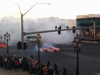 |
11/30/2016: NASCAR Burnouts
Position: 36°7.51'N, -115°10.13'W
As part of the festivities during NASCAR's Championship Week in Las Vegas this week, all 16 drivers in the Chase for the NASCAR Sprint Cup did a victory lap along The Strip. The lap included burnouts outside our hotel at Las Vegas Blvd and Spring Mountain Rd. We found a great spot to view the excitement along a nearby stairway: https://youtu.be/Tgc1N7GlR1c.
|
 |
11/30/2016: re:Play
Position: 36°7.11'N, -115°9.95'W
This year's re:Invent re:Play party featured 20-year-old Dutch DJ Martin Garrix. He was ranked the number one DJ in the world for 2016 and put on a fantastic show: Martin Garrix at re:Play 2016.
|
 |
12/3/2016: James Joyce
Position: 39°17.03'N, -76°36.12'W
We rode our bikes over to Harbor East neighbourhood on other side of the inner harbor and had a great lunch at James Joyce Irish pub. This is the second pub we've found in Baltimore that has Jennifer's favourite beer, Kilkenny. It's not that common in the US.
|
 |
12/3/2016: Lighted Boat Parade
Position: 39°16.97'N, -76°36.57'W
Baltimore's annual Light Boat Parade passed through the inner harbor tonight with boats ranging in size from small runabouts to massive tugs. We has a great time watching from the docks in our marina as the parade passed close by.
|
 |
12/3/2016: John Deere
Position: 39°16.94'N, -76°36.51'W
John Deere sent us a couple of nice windbreakers and here we are with the star of the show.
|
 |
12/5/2016: TimeZero Professional
Position: 39°16.94'N, -76°36.51'W
Today we upgraded from MaxSea TimeZero Explorer V1.9 to TimeZero Professional V3.0. The upgrade was amazingly seamless—TimeZero Pro picked up all our data and device settings from MaxSea and was pretty much good to go out of the box. All we had to do was setup our UI preferences. We had one minor issue with the radar display appearing to draw only white-on-white, but that resolved itself when we restarted TimeZero. The new software looks great and renders incredibly quickly. So far it looks like a really good upgrade with a few nice new features but near-universal improvements in fit-and-finish.
|
 |
12/5/2016: Water Fill
Position: 39°16.94'N, -76°36.51'W
Over the weekend we'd noticed some boaters had run a long hose down the dock to wash their boats using several long marina-supplied hoses. This morning we hooked the hoses back up, did all our laundry and filled our water tank. The hose you can see runs all the way down the dock, up the ramp and into the marina laundry room under the Rusty Scupper restaurant. We still had over 200 gallons left, but it was nice to get the laundry done and refill the tank.
|
 |
12/5/2016: Lunch
Position: 39°16.33'N, -76°35.50'W
On a bycicle trip to Fort McHenry, we stopped in for a good lunch at J.R.'s Bar and Grill tucked into a residential area in the Locust Point neighbourhood southeast of the marina. Baltimore seems to have a lot of neighbourhood pubs like this one.
|
 |
12/5/2016: C. Steinweg
Position: 39°15.91'N, -76°34.96'W
C. Steinweg was founded as a shipping agent in 1847 in Rotterdam by Constantin Steinweg and has since developed into a multinational logistics group. This statue outside their Baltimore terminal is the company's logo. In Baltimore C. Steinweg handles break bulk, project, forest products, steel, metals, and RO-RO cargo. We were particularly interested in stacks and stacks of what looked like aluminum ingot around the facility.
|
 |
12/5/2016: Star-Spangled Banner
Position: 39°15.92'N, -76°34.80'W
The failed British bombardment of Fort McHenry during the war of 1812 inspired Francis Scott Key to pen the "Star-Spangled Banner". The fort was completed in 1803, among the first forts built by the post-revolutionary American government. It is now a National Monument and Historic Shrine, the only site to have both designations.
|
 |
12/5/2016: Battle of Baltimore
Position: 39°15.92'N, -76°34.80'W
During the War of 1812, the British occupied and burned Washington in August of 1814. Shortly after, they sent a fleet to invade Baltimore, a key American trading port. Starting at 6am on September 13th, 1814, Fort McHenry successfully repelled a 25-hour British attack that included over 1,500 rockets and mortar shells. When Francis Scott Key saw the American flag hoisted over the fort early the morning of the 14th, he was was inspired to write the "Defence of Fort M'Henry" that became known as the "Star-Spangled Banner" and was designated the US national anthem in 1931. The museum at the fort had excellent displays describing the War of 1812 and the Battle of Baltimore.
|
 |
12/5/2016: Movie
Position: 39°15.92'N, -76°34.80'W
The museum showed a movie re-enactment of the Battle of Baltimore, including how Francis Scott Key was inspired to write the "Star-Spangled Banner". At the end of the movie, the screen raised to show the fort behind, with the Star-Spangled Banner flag flying. Most effective.
|
 |
12/5/2016: Fort McHenry
Position: 39°15.79'N, -76°34.76'W
The fort itself is in excellent condition, with additional museum displays inside.
|
 |
12/5/2016: Guns
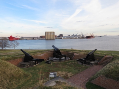
Position: 39°15.78'N, -76°34.78'W
Looking southeast across the Fort McHenry guns to the Patapsco River. In the Battle of Baltimore the British ships would have been slightly to the right of the picture.
|
 |
12/5/2016: Flag Change
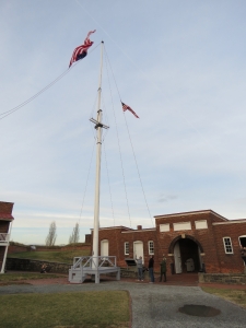
Position: 39°15.80'N, -76°34.78'W
Twice a day at Fort McHenry, visitors can help the rangers raise and lower a reproduction of the Star-Spangled Banner flag. Also as the Great Garrison Flag, this flag was specific to Fort McHenry and featured fifteen stars and broad stripes, representing the total states after Vermont and Kentucky joined the Union.
|
 |
12/6/2016: National Aquarium
Position: 39°17.13'N, -76°36.52'W
We'd been moored across from the National Aquarium for over a month now and had passed the eye-catching facility many times. Part of the multi-story main building is glass-enclosed with waterfalls and jungles visible, and looks especially dramatic from the outside at night. We'd heard many great things about the aquarium, but James has been pretty busy at work, so we hadn't yet had a chance to visit. This is a fabulous multi-story waterfall just inside the entrance.
|
 |
12/6/2016: 4-D Immersion Theatre
Position: 39°17.10'N, -76°36.50'W
We started our visit with a showing of Sea Monsters 4-D: A Prehistoric Adventure depicting prehistoric sea life. The 4-D immersion theatre extends the 3-D experience with special effects such as mist, wind, smells and seat vibrations.
|
 |
12/6/2016: Bubble Tubes
Position: 39°17.10'N, -76°36.48'W
Striking water-and-bubble filled tubes mark the entrance to the Blacktip Reef tank.
|
 |
12/6/2016: Blacktip Reef Tank
Position: 39°17.10'N, -76°36.48'W
The aquarium's Blacktip Reef Tank replicates an Indo-Pacific reef and is packed with life, including a 500-lb green sea turtle, a reticulated whiptail ray, hundreds of tropical fish and of course, blacktip reef sharks.
|
 |
12/6/2016: Looking Down
Position: 39°17.10'N, -76°36.49'W
The Blacktip Reef Tank is visible below from walkways and escalators that carry visitors up to the displays on higher levels.
|
 |
12/6/2016: Marina View
Position: 39°17.10'N, -76°36.51'W
The view to our marina from the aquarium viewing deck. Dirona is slightly to the left of the flagpole on Federal Hill.
|
 |
12/6/2016: Dwarf Caimen
Position: 39°17.09'N, -76°36.50'W
This Dwarf Caimen in the Amazon River Forest exhibit was only about three feet long, but looked as fierce as its much larger cousins.
|
 |
12/6/2016: Rainforest
Position: 39°17.09'N, -76°36.50'W
At the very top of the aquarium, visible from outside through a glass ceiling, is the Upland Tropical Rainforest exhibit.
|
 |
12/6/2016: Parrots
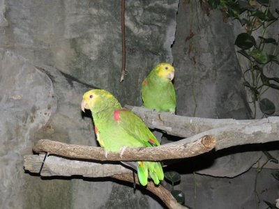
Position: 39°17.10'N, -76°36.50'W
Yellow-crowned Amazon Parrots in the tropical rainforest exhibit.
|
 |
12/6/2016: Dart Frog
Position: 39°17.10'N, -76°36.50'W
The tropical rainforest exhibit also had Several Dyeing Poison Dart Frogs. Some were bright blue like this one, and others were yellow and black. It's amazing that these colors are natural.
|
 |
12/6/2016: Atlantic Coral Reef
Position: 39°17.09'N, -76°36.50'W
Among the most impressive features at the National Aquarium is the 335,000-gallon, 13-foot-deep Atlantic Coral Reef Exhibit where visitors descend down ramps from above the tank through the exhibit.
|
 |
12/6/2016: Shark Alley
Position: 39°17.09'N, -76°36.50'W
The 225,000-gallon ring-shaped Shark Alley tank sits below the Atlantic Coral Reef. A variety of sharks circle visitors, including several Largetooth Sawfish such as the one pictured. The combination of a dark display and the sharks moving quickly made it almost impossible to get a decent picture.
|
 |
12/6/2016: Ray
Position: 39°17.11'N, -76°36.51'W
Jennifer taking in a ray and the hundreds of fish in the Atlantic Coral Reef.
|
 |
12/6/2016: Dolphin Discovery Exhibit
Position: 39°17.08'N, -76°36.43'W
The Dolphin Discovery Exhibit includes 6 female and 2 male Bottlenose Dolphins. We didn't catch a show, but we could see the dolphins swimming around their pool through viewing windows in the side of the tank.
|
 |
12/6/2016: Filtration
Position: 39°17.09'N, -76°36.43'W
Just beyond the Dolphin Discovery Exhibit is a window with a view into the aquarium's extensive filtration, pump and plumbing system.
|
 |
12/6/2016: Upsidedown Jellies
Position: 39°17.09'N, -76°36.43'W
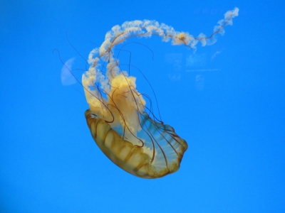
We love jellyfish and the National Aquarium has a fabulous exhibit. These are Upside-Down Jellyfish.
|
 |
12/6/2016: Pacific Sea Nettle
Position: 39°17.08'N, -76°36.43'W
The Pacific Sea Nettles are the most dramatic in the aquarium's display.
|
 |
12/6/2016: Waterfall From Above
Position: 39°17.18'N, -76°36.47'W
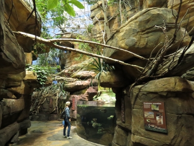
Our final stop on the National Aquarium visit was the "Australia: Wild Extremes" exhibit. This is looking down from the top of the waterfall at the aquarium entrance.
|
 |
12/6/2016: Australia: Wild Extremes
Position: 39°17.18'N, -76°36.47'W
The "Australia: Wild Extremes" exhibit reminded us very much of our trip through the Kimberley region of Western Australia, minus the giant crocodiles.
|
 |
12/6/2016: Eastern Roselia
Position: 39°17.18'N, -76°36.47'W
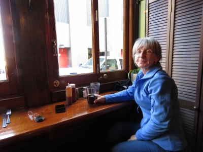
The Eastern Rosella is native to southern Australia and Tasmania.
|
 |
12/7/2016: Mick O'Shea's
Position: 39°17.60'N, -76°36.90'W
Lunch street-side at Mick O'Shea's Irish Pub. We rode our bikes there en route to the Washington Monument.
|
 |
12/7/2016: Washington Monument
Position: 39°17.85'N, -76°36.93'W
The 178ft Baltimore Washington Monument was completed in 1829 in honor of George Washington. It was designed by American architect Robert Mills, who would later design the Washington Monument in Washington DC.
|
 |
12/7/2016: Climbing
Position: 39°17.85'N, -76°36.94'W
Climbing the 227 steps to the top of the Washington Monument.
|
 |
12/7/2016: View
Position: 39°17.85'N, -76°36.95'W
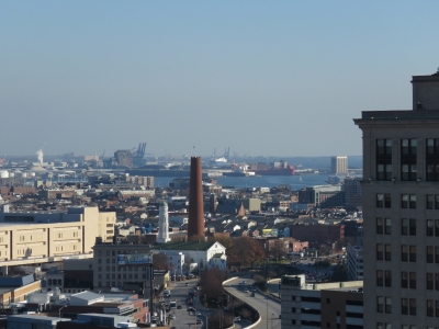
The view looking east from the top of the Washington Monument. The day had started out overcast, but ended up clear and sunny, perfect for our visit. The large group of brick buildings in the distance just right of center is Johns Hopkins Hospital.
|
 |
12/7/2016: Phoenix Shot Tower
Position: 39°17.85'N, -76°36.95'W
Looking southeast toward the Phoenix Shot Tower from the Washington Monument.
|
 |
12/7/2016: United Methodist Church
Position: 39°17.87'N, -76°36.92'W
The Mount Vernon Place United Methodist Church, next to the Washington Monument, was completed in 1872. The church is constructed of six different types of stone, including green serpentine.
|
 |
12/7/2016: Interior
Position: 39°17.87'N, -76°36.92'W
The main sanctuary of the Mount Vernon Place United Methodist Church seats 900 people. The pews are made of American walnut and hand-carved by one man who took seven years to complete them all. A second-floor sanctuary seats an additional 300 people.
|
 |
12/7/2016: Francis Scott Key
Position: 39°17.84'N, -76°36.94'W
A memorial on the side of the the Mount Vernon Place United Methodist Church to Francis Scott Key, who wrote the Star-Spangled Banner. Key died in 1843 at the home of his daughter in the location where the church now stands.
|
 |
12/7/2016: Baltimore Basilica
Position: 39°17.65'N, -76°37.01'W
The Baltimore Basilica was built between 1806 and 1821 and is considered American's first cathedral.
|
 |
12/7/2016: World Trade Center
Position: 39°17.16'N, -76°36.60'W
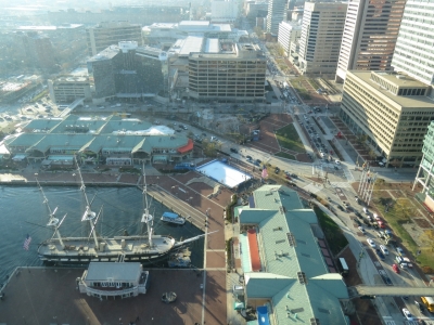
The view looking north from the top of the World Trade Center at the inner harbor. The Phoenix Shot Tower is near the right of the picture.
|
 |
12/7/2016: USS Constellation
Position: 39°17.16'N, -76°36.60'W
Looking west and down to the USS Constellation from the top of the World Trade Center.
|
 |
12/7/2016: National Aquarium
Position: 39°17.17'N, -76°36.59'W
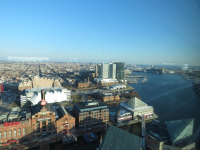
The glass-enclosed buildings of the National Aquarium are just east of the World Trade Center. Dirona is just visible across the harbor at the far right of the picture.
|
 |
12/7/2016: Harbor East
Position: 39°17.17'N, -76°36.58'W
Looking east from the World Trade Center to the Harbor East neighbourhood, where we've stopped in at a few pubs and restaurants.
|
 |
12/7/2016: Race Pace Bicycles
Position: 39°16.41'N, -76°36.12'W
We needed new bicycle seats, so we stopped by Race Pace Bicycles to get new ones installed. We're really loving our Giant FCR IIs--they've lasted amazingly well in an incredibly harsh marine environment outside on our flybridge.
|
 |
12/7/2016: World of Beer
Position: 39°16.10'N, -76°36.01'W
We finished the day with wings and brews at the World of Beer in the nearby Locust Point neighborhood.
|
 |
12/8/2016: B&O Railway Museum
Position: 39°17.11'N, -76°37.95'W
Baltimore is considered the birthplace of American railroading. The first regular passenger railway began here in 1830 from Baltimore and Ohio Railroad's Mount Clare station. That station and its adjacent roundhouse now is the B&O Railway Museum, housing the largest collection of 19th-century locomotives in the country and one of the most significant collections of railway treasures in the world.
Pictured is a B&O No. 147, built by B&O Railroad in 1863. This is a ten-wheeler design that B&O first introduced a decade earlier to handle Virginia's steep mountainous grades. |
 |
12/8/2016: Tom Thumb
Position: 39°17.12'N, -76°37.96'W
B&O used horse to pull its freight and passenger trains until 1830 when Peter Cooper introduced the "Tom Thumb", considered the first successful American steam locomotive. The small coal-burning steam locomotive suited the B&O's planned right of way and track, had an upright boiler, and could travel at a then-impressive 10-14 mph.
|
 |
12/8/2016: B&O 305
Position: 39°17.12'N, -76°37.95'W
The B&O 305 was built in 1869 as part of the "Camel" series of locomotives that were the first produced in large quantities. The name "Camel" refers to the locomotives' unique shape with a large firebox behind the engine's mainframe and the engineer's cab above the boiler. In more typical designs, the engineer and the fireman are together in a cab behind the boiler and ahead of the coal and water storage. With the "Camel" design, the engineer is above the boiler in a separate space from the fireman who is keeping the boiler stoked. The design, although productive from a locomotive perspective, was dangerous for the engineer who would not likely survive a derailment and impractical for the separated crew who were unable to communicate, and was eventually outlawed by the Interstate Commerce Commission.
|
 |
12/8/2016: CNJ No. 592
Position: 39°17.13'N, -76°37.96'W
The CNJ (Central Railroad of New Jersey) No. 592 "Atlantic Camelback" was built in 1901. The design incorporated a larger firebox to accommodate the burning of waste anthracite coal, forcing the engineer's cab to the side of the boiler. Like the earlier B&O Camels, these were dangerous and impractical for the crew and also were outlawed.
|
 |
12/8/2016: Shay Locomotive
Position: 39°17.13'N, -76°37.96'W
We're familiar with Shay locomotives because they were used extensively in the early British Columbia logging industry. Until the introduction of the Shay in 1880, lumber companies used mule and oxen teams to transport heavy logs to the mill. The Shay was lighter than the locomotives of the time and featured a geared truck and boiler mounted on a flat car that could pivot, allowing it to handle the steep grades and curved terrain of logging country. The locomotive pictured has three side-mount cylinders, which powered a long crankshaft fitted with beveled gears. The Shay locomotive was an immediate success—around 2,700 were built in over 65 years.
|
 |
12/8/2016: Model Railroad
Position: 39°17.14'N, -76°37.86'W
The B&O Railway Museum has several large model railroads with incredible detail.
|
 |
12/8/2016: Mile One Express
Position: 39°17.07'N, -76°37.97'W
We booked a seat on the "Mile One Express", a 20-minute train ride over the first commercial mile of railroad track laid in America.
|
 |
12/8/2016: Locomotive Construction
Position: 39°16.86'N, -76°38.52'W
The remains of B&O's locomotive construction building along the "Mile One Express". The red-and-tan building on the left is where locomotives today are restored.
|
 |
12/8/2016: Zella's Pizzeria
Position: 39°17.24'N, -76°38.20'W
We zipped the bikes over to Zella's Pizzeria for an excellent pizza lunch after our train ride. In the background is a local fire department crew.
|
 |
12/8/2016: G Scale Model
Position: 39°17.12'N, -76°38.00'W
The museum has a large G scale model railway outside of the roundhouse building. G scale is a durable design suitable for outdoor use.
|
 |
12/8/2016: HO Scale Model
Position: 39°17.14'N, -76°37.94'W
This huge HO Scale Model extends the entire length of a train car. The layout represents the route from Baltimore to the Ohio River depicts the topographical challenges faced by railroads builders. Besides entertainment is used a a teaching tool to discuss topics related to railroading such as geography and the importance of signalling.
|
 |
12/8/2016: Control Panel
Position: 39°17.14'N, -76°37.94'W
The control panel for the HO scale model stands in a full-sized rack the height of the train car.
|
 |
12/8/2016: Washington
Position: 39°17.09'N, -76°37.96'W
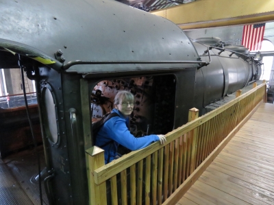
The B&O built the "President Washington" in 1927, the first of 20 massive class P-7 Pacific-type locomotives. These were the flagships of the railway, known as the "President Class" because they were named after US Presidents.
|
 |
12/8/2016: Washington cab
Position: 39°17.07'N, -76°37.97'W
Jennifer looking out from the cab of the "President Washington".
|
 |
12/8/2016: Allegheny
Position: 39°17.06'N, -76°38.00'W
At the controls of Chesapeake & Ohio's No. 1604 Allegheny. These locomotives were designed in the 1940s to handle the tough Allegheny Mountain grades more efficiently than contemporary designs. The new locomotive had a 109-inch wide boiler and a fire box that was so large it required a six-wheel trailing truck to support it.
|
 |
12/8/2016: B&O Emblem
Position: 39°17.07'N, -76°37.98'W
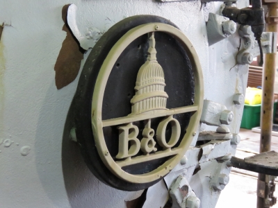
The B&O emblem on the front of the B&O No. 4500. During World War I, the federal government took control of the nation's railroads and formed the United States Railroad Administration (USRA) to efficiently mobilize troops and supplies. The B&O No. 4500 was the first USRA locomotive produced under federal management and was constructed in just 20 days by Baldwin Locomotive Works, It was equipped with the latest technology of its time, including a superheater and stoker.
|
 |
12/9/2016: CS Responder
Position: 39°15.99'N, -76°36.20'W
Today we visited TE Connectivity, a $12B global techonology company that specializes in connectors, sensors and electronic components and has a major business laying and maintaining undersea cable. TE has a base in Baltimore where one of their cable layers, CS Responder, was in port. The visit included an overview of the TE Connectivity cable-laying business and their solutions, demonstrations on how undersea cables are made, and best of all, a tour of their cable layer CS Responder. Read more ...
|
 |
12/9/2016: Navy vs Army
Position: 39°16.94'N, -76°36.51'W
Navy Yard Patrol Craft 708 arriving into Baltimore inner harbor as part of the festivities for the big Navy vs Army college football game that will take place tomorrow at M&T Bank Stadium where we watched the Ravens game. This was one of at least four Navy ships that arrived today.
|
 |
12/9/2016: USAV Matamoris
Position: 39°17.06'N, -76°36.73'W
The Army also had a couple of vessels in port for the big game, including the USAV Matamoris, a 174-ft landing craft.
|
 |
12/9/2016: Aquarium
Position: 39°17.15'N, -76°36.53'W
The National Aquarium building looks amazing at night.
|