MV Dirona travel digest for Nova Scotia 2016

|
Click the travel log icon on the left to see these locations on a map,
with the complete log of our cruise. On the map page, clicking on a camera or text icon will display a picture and/or log entry for that location, and clicking on the smaller icons along the route will display latitude, longitude and other navigation data for that location. And a live map of our current route and most recent log entries always is available at //mvdirona.com/maps/LocationCurrent.html. |
 |
9/10/2016: Petit de Grat Island
Position: 45°29.36'N, -60°54.54'W
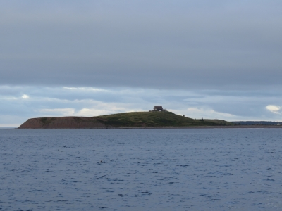
This hilltop house on Petit de Grat Island was surrounded in deck and had an awesome 360-degree view.
|
 |
9/10/2016: Loose Connection
Position: 45°28.04'N, -60°58.45'W
The fuel levels and start battery voltage disappeared from our Maretron N2KView display and the N2KMeter and showed a high number of NMEA errors. Interestingly, our Maretron DSM150 display in the engine room still was showing the fuel levels. We traced the problem down to a loose connection, where James is pointing, between a tee and the left side of the engine room N2k power inserter. After tightening it, we saw no errors for hours after so this problem appears resolved. We did retest the failed DSM250 display, as it plugs into the bus at the same area, and it still produced a large number of errors. So we just had two independent issues. Both problems were resolved quickly with the N2KMeter. For larger NMEA 2000 networks it's a great way to save time.
Update: We later took out the "faulty" DSM250 that was producing all the bus errors and it tested out fine. The problem cause was a poorly fabricated field installable cable between the main bus and the DSM250 producing the errors. That is two connection problems in the last 6 months. One a loose knurled connection between a Tee fitting and the power lower inserter and the other was this bad drop cable. Good news across the board. |
 |
9/10/2016: Entry Channel
Position: 45°22.69'N, -61°29.38'W
The entrance to Guysborough Harbour is a narrow channel that we'd read can run at two knots a couple of hours after high water. About a half-hour after low water at Guysborough on an exchange from 3.3ft down to 1.5ft the current was ebbing slightly, but was hardly noticeable.
|
 |
9/10/2016: Guysborough
Position: 45°23.57'N, -61°29.69'W
Looking to the Guysborough waterfront as we approach. The large red building is the award-winning Rare Bird Pub, one of our reasons for visiting Guysborough.
|
 |
9/10/2016: Walking
Position: 45°23.48'N, -61°29.88'W
Guysborough has lots of walking trails, including the 26km Guysborough Trail, part of the Trans Canada Trail between Victoria BC and St. John's Newfoundland. We weren't up for a huge hike, so we opted for a walking tour through town.
|
 |
9/10/2016: Guysborough Journal
Position: 45°23.41'N, -61°29.83'W
We liked the Guysborough Journal slogan: "Keeping an Eye on the Coast".
|
 |
9/10/2016: Wesley United Church
Position: 45°23.42'N, -61°30.01'W
Wesley United Church is one of perhaps six churches we passed while taking a short walk around Guysborough. That's a lot of churches for one town. This is one of several located on appropriately named Church Street.
|
 |
9/10/2016: Court House
Position: 45°23.44'N, -61°30.04'W
The Guysborough Court House was built in 1842 and operated for 150 years. It has been restored as a museum and visitor information center.
|
 |
9/10/2016: Vats
Position: 45°23.51'N, -61°29.87'W
Beautiful copper vats at the Rare Bird brewpub.
|
 |
9/10/2016: Brewmaster
Position: 45°23.50'N, -61°29.89'W
The brewmaster saw us with our noses pressed against the glass and invited us inside the brewing area to explain what was being brewed and how. He was making a stout in the foreground vat.
|
 |
9/10/2016: Lunch
Position: 45°23.51'N, -61°29.87'W
We had a delicious lunch on the deck at the Rare Bird Pub with their excellent craft beer.
|
 |
9/10/2016: Distillery
Position: 45°24.10'N, -61°30.22'W
The owners of the Rare Bird Pub, Authentic Seacoast, recently opened a distillery and off-site brewery just north of Guysborough. We walked up to see if we any tours were available. Unfortunately we arrived 15 minutes late for the daily 2pm tour, but we did get a good look at some of the equipment.
|
 |
9/10/2016: Shipbuilding
Position: 45°23.38'N, -61°29.78'W
Returning to town, we continued south to walk the Shoreline Trail along the water's edge. Guysborough was a major shipbuilding center in the late 1800s and a port of registry. Two shipyards were located where we're standing.
|
 |
9/10/2016: Shoreline Trail
Position: 45°23.29'N, -61°29.88'W
Looking east to the water across the Shoreline Trail.
|
 |
9/10/2016: Rare Bird
Position: 45°23.51'N, -61°29.89'W
All that walking is thirsty business, so we returned to the Rare Bird to sample another of their excellent craft beers. This one we had inside as the patio was a little colder and windier than earlier in the day.
|
 |
9/10/2016: Guysborough Harbour
Position: 45°26.44'N, -61°31.22'W
Out on a dinghy tour to the northern end of Guysborough Harbour.
|
 |
9/10/2016: Broad Cove
Position: 45°26.55'N, -61°30.40'W
We really wanted to get under this bridge, but the water was too shallow.
|
 |
9/10/2016: Church
Position: 45°25.82'N, -61°30.27'W
Another church in the area, with a very large graveyard.
|
 |
9/10/2016: Caboose
Position: 45°22.88'N, -61°29.89'W
Someone had transported a caboose to Mill Cove, installed rail tracks to support it, and made a residence overlooking the water. It's super-interesting trying to figure out how they got the caboose there. The caboose is sitting on tracks, but they don't connect to anything and it's too far for a crane reach from the water or the road.
|
 |
9/11/2016: Current
Position: 45°22.84'N, -61°29.33'W
We exited Guysborough Harbour about a half-hour before low water on an exchange from 3.3ft to 1.5ft. The navigation buoys were leaning slightly in the current, but as with the entry, we hardly noticed the water motion.
|
 |
9/11/2016: Tight
Position: 45°22.57'N, -61°29.31'W
You can see how tight the channel to Gusyborough Harbour is. We need to pass between shore and the red buoy on our port side.
|
 |
9/11/2016: Queensport Lighthouse
Position: 45°20.96'N, -61°16.16'W
We diverted course slightly to view the scenic Queensport Lighthouse. The lighthouse was built in 1936 and is an evolution from the traditional design of having the house and light separate. We were jokingly guessing that a light house keeper who had to shuttle through gales between house and light finally was involved in this more modern design.
|
 |
9/11/2016: Canso
Position: 45°20.29'N, -60°59.03'W
Looking north to Canso as we pass through Canso Harbour. Visibility is poor with gusty winds and rain.
|
 |
9/11/2016: Range Markers
Position: 45°20.29'N, -60°59.03'W
A sea of navigation markers guide boats through convoluted and shallow Canso Harbour. These range markers on Grave Island are one of several sets en route.
|
 |
9/11/2016: C-Map
Position: 45°19.76'N, -60°57.84'W
Our older C-Map charts showed a red mark northeast of the Grave Island range markers and a preferred channel mark to the northwest. But the buoyage looked quite different as we approached, a little concerning especially in the gusty winds and poor visibility.
|
 |
9/11/2016: Navionics
Position: 45°19.40'N, -60°57.32'W
Our newer Navionics charts showed what we actually saw on approaching Grave Island, a cardinal bouy to our east and a read mark to our west. It appears the buoyage has changed a bit in the harbour over the past few years.
|
 |
9/11/2016: Andrew Passage
Position: 45°18.53'N, -60°58.08'W
We opted to pass through Andrew Passage rather than going around the outside of Andrew Island. It didn't really save much time, but we figured it would be more interesting and sheltered. The only potentially difficult part is the shallow bar at the north end of the channel. We saw a least depth of about 13ft on a 1.6ft tide at Canso Harbour. As at Canso Harbour, the buoyage was different from what are older C-MAP charts showed, but consistent with the newer Navionics charts.
|
 |
9/11/2016: Pitch
Position: 45°14.56'N, -60°57.95'W
Andrew Passage was sheltered as expected, with several spots we might have anchored. Outside the winds were blowing a steady 25knts from the southwest and we were pitching nearly 18 degrees at times (4th gauge from the left reading 17.8 degrees near the bottom of the display).
|
 |
9/11/2016: Black Rock
Position: 45°13.68'N, -61°4.29'W
Waves churned over ominous-looking Black Rock at the entrance to Port Howe. We initially were planning to run a little farther south to Yankee Cove, but the weather forecast indicated conditions would worsen around noon, so we stopped at Port Howe instead.
|
 |
9/12/2016: Anchorage Track
Position: 45°14.26'N, -61°5.23'W
When we arrived at Port Howe the winds were blowing from the southeast. Some swell reached the anchorage, but it wasn't noticable except for a brief period as the winds shifted and put us beam-to the seas. The winds were supposed to back to the northwest quickly and it did exactly that, putting us more perpendicular to the swell.
You can see our track while we are at anchor showing the initial winds from the southeast, that formed the top half of the arc. As the winds backed to the northwest, this formed the bottom part of the arc. The yellow marks near the top of the display show where shore actually is on radar—a lot farther north than the chart indicates. The mark labelled with a date near the boat is where we dropped anchor and then pulled back to the northwest, to the top left of the arc, to set the anchor. Our swing arc is on a rode length about half of the real rode length and offset from where the anchor was set. We've not seen this before, but it looks like the anchor rode got snagged on some underwater debris and rather than rotating about the anchor, we were rotating around a point about 100ft away from where the anchor was dropped and retrieved. Fortunately the anchor and rode came up without difficulty. |
 |
9/12/2016: White Head Island
Position: 45°11.30'N, -61°6.91'W
The morning sun setting the White Head Island light aglow as we pass to the south.
|
 |
9/12/2016: Pipelines
Position: 45°2.83'N, -61°32.32'W
We're about to cross over the two pipelines that run over 100 miles between mainland Nova Scotia and Sable Island. In the 1990s, a massive natural gas field was discovered off Sable Island and Canada's first natural gas project began operation there in 1999. Most of the $1.9-billion Nova Scotia has made from offshore energy comes from this field.
|
 |
9/12/2016: Winds
Position: 44°58.49'N, -61°53.67'W
The prevailing southwest winds that carried us north to Newfoundland are now right on the bow. We're not pitching quite as much as yesterday's run to Port Howe, but are seeing a maximum over the past hour of nearly twelve degrees.
|
 |
9/12/2016: Liscomb Island
Position: 44°59.03'N, -61°58.43'W
The seas are settling as we pass the Liscomb Island lighthouse in the entrance to Liscomb Harbour.
|
 |
9/12/2016: Wharf
Position: 45°0.76'N, -62°6.18'W
Within minutes of anchoring in Liscomb Harbour, we had the tender down and ran up the Liscomb River to the Liscombe Lodge to hike the Liscomb River Trail. This is looking south downriver. We're tied off out of sight on the left side of the wharf.
|
 |
9/12/2016: Bears
Position: 45°0.91'N, -62°5.75'W
A sign at the trail head warns of bears. We didn't see any signs of bears though.
|
 |
9/12/2016: Lunch
Position: 45°0.91'N, -62°5.73'W
We'd arrived at Liscomb Harbour shortly before 2pm and stopped for a late picnic lunch along the Liscomb River before the hike.
|
 |
9/12/2016: Crooked Falls
Position: 45°1.07'N, -62°5.81'W
The water levels are low right now in mid-September, so the Crooked Falls aren't doing much right now. But we're enjoying the scenery.
|
 |
9/12/2016: Footbridge
Position: 45°1.36'N, -62°6.39'W
The trail is well-built and maintained, with several footbridges spanning creeks and muddy sections.
|
 |
9/12/2016: Suspension Bridge
Position: 45°1.96'N, -62°6.34'W
We'll cross this suspension bridge and return to the lodge along the east side of the river. Beyond the bridge, Liscomb Falls are spilling into a narrow gorge.
|
 |
9/12/2016: Fish Ladder
Position: 45°2.04'N, -62°6.35'W
This 15-level fish ladder along the Liscomb River was built to help reconstruct the Atlantic salmon runs. A hydro dam built in the early 1900s prevented salmon from accessing the higher reaches of the river.
|
 |
9/12/2016: Crossing
Position: 45°2.07'N, -62°6.31'W
Taking in the view from the suspension bridge across the river.
|
 |
9/12/2016: Liscomb Falls
Position: 45°2.07'N, -62°6.32'W
Liscomb Falls isn't running very hard this late in the summer, but still are a pretty sight.
|
 |
9/12/2016: Pipe
Position: 45°2.07'N, -62°6.30'W
Jennifer crouching inside the pipe from the old hydro dam alongside the trail. We believe the dam was removed sometime in the late 20th century. This is the only substantial remains we could find.
|
 |
9/12/2016: Frog
Position: 45°1.14'N, -62°5.78'W
A well-camouflaged frog along the trail.
|
 |
9/12/2016: Liscombe Lodge
Position: 45°0.73'N, -62°6.10'W
We finished the day with an excellent meal on the patio of the highly-rated Liscombe Lodge. Jennifer is having planked salmon, the house specialty.
|
 |
9/13/2016: Sunrise
Position: 45°0.11'N, -62°4.87'W
A beautiful sunrise at the Liscomb River. We call these "Roy Vickers" sunrises, after one of our favourite Pacific Northwest artists who often depicts these colours in his work.
|
 |
9/13/2016: Egg Island
Position: 44°40.12'N, -62°51.70'W
The stubby light on windswept Egg Island. We initially were planning to make another stop along the way before reaching Halifax, but the forecast was for 30-knot winds over the next couple of days, so we decided to run straight through to Halifax today.
|
 |
9/13/2016: Devil's Island
Position: 44°34.00'N, -63°27.19'W
After numerous shipwrecks, a light on Devil's Island was first lit in 1852. The current lighthouse replaced the first in 1877, but no longer is functioning and has fallen into disrepair.
|
 |
9/13/2016: HMCS Windsor
Position: 44°35.15'N, -63°31.64'W
As we approached Halifax Harbour, we could hear Halifax Vessel Traffic conversing with "the submarine Windsor". And there it was shortly after we turned into the harbour. The HMCS Windsor is a long-range hunter-killer class and can travel 12kts at the surface and 20+ kts under the water. It is 230.5 ft (70.26 m) long, with a 25.9 ft (7.5m) beam and an 18.1 ft (5.5m) draft. Unlike most US submarines that we've seen recently, the Windsor travelled alone, without a single escort vessel.
|
 |
9/13/2016: McNabs Island
Position: 44°36.14'N, -63°32.36'W
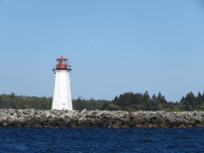
Maugers Beach Lighthouse on McNabs Island at the entrance to Halifax Harbour. The beach also is known as "Hangman's Beach" because the Royal Navy hung the bodies of executed mutineers there during the Napoleonic wars to warn to crews of ships entering the harbour that they should behave themselves in port. In 1851, Abraham Gesner used the light to test out the new fuel he had invented to replace whale oil: kerosene. McNabs Island contains a number of fortifications belonging to the 19th-century "Halifax Defense Complex" and is now a National Historic Site.
|
 |
9/13/2016: Refinery
Position: 44°37.09'N, -63°32.91'W
The now-defunct Imperial Oil refinery at Dartmouth across the harbour from Halifax. The refinery opened in 1918, partly to meet the needs of World War I and supplied much of the fuel for the Allied convoys in World War II. At its peak, the refinery processed some 89,000 barrels per day. The facility closed temporarily in 2011 after suffering damage in an electrical storm and in 2013 the refinery was closed and the site converted to a marine storage terminal.
|
 |
9/13/2016: Port of Halifax
Position: 44°37.09'N, -63°32.91'W
Container ship loading cranes at the Port of Halifax in the distance to our west as we near downtown Halifax.
|
 |
9/13/2016: Arctic Sunrise
Position: 44°37.83'N, -63°33.33'W
Greenpeace icebreaker Arctic Sunrise moored at the Port of Halifax. In 1997, the ship was the first to circumnavigate James Ross Island in the Antarctic, after the over half-foot-thick ice shelf connecting the island to the Antarctic continent collapsed.
|
 |
9/13/2016: Georges Island
Position: 44°38.54'N, -63°33.77'W
The Georges Island lighthouse is a prominent landmark in Halifax Harbour. The current lighthouse was built in 1917 to replace the original tower built in 1876 and was automated in 1972 and the light-keeper's house still stands a few hundred feet to the north.
|
 |
9/13/2016: Museum Wharf South
Position: 44°38.85'N, -63°34.18'W
Moored in our new temporary home at the Museum Wharf South. This is an excellent spot within walking distance of everything in downtown Halifax. Moored next to us is the HMCS Sackville, the last surviving World War II Flower-class corvette. The ship is on display at the Maritime Museum of the Atlantic. Moored on our other side, but not visible, is the tugboat Theodore Too.
|
 |
9/13/2016: Maritime Museum of the Atlantic
Position: 44°38.85'N, -63°34.18'W
Our berth is right below the Maritime Museum of the Atlantic. If you look closely in the museum windows, you can see the reflection of the tugboat Theodore Too, our neighbour to the north.
|
 |
9/13/2016: Halifax Waterfront
Position: 44°38.85'N, -63°34.18'W
A boardwalk lined with cafes, restaurants and small shops runs the length of the Halifax waterfront. The city has done a wonderful job in rejuvinating its waterfront while keeping the flavor of its commercial heritage.
|
 |
9/13/2016: Fast Friends
Position: 44°38.85'N, -63°34.18'W
Dirona and new friend Theodore Too. Theodore Tugboat is the title character of a Canadian children's television series that aired from 1993 to 2001 depicting the adventures of the tugboat Theodore and his friends in the "Big Harbour". The show originated and was set in Halifax, and the Big Harbour was based on Halifax Harbour. Theodore Too is a full-sized replica of Theodore Tugboat that does tours through Halifax Harbour in the summer.
|
 |
9/13/2016: Woodside I
Position: 44°39.00'N, -63°34.30'W
The Woodside I, one of several ferries that run across Halifax Harbour between Halifax and Dartmouth. The vessels are a rather unusual oval shape, and have a ton of power. Check out that prop wash.
|
 |
9/13/2016: Salty's
Position: 44°39.04'N, -63°34.33'W
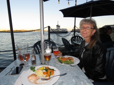
We had a delicious meal waterside at Salty's in the Historic Properties with a pitcher of locally-brewed craft beer while watching the ferries come and go. The Historic Properties are restored Napoleon-era warehouses covering three blocks that now house shops and restaurants. Seven of the buildings are National Historic Sites.
|
 |
9/13/2016: Gahan House
Position: 44°39.02'N, -63°34.33'W
We walked around town a bit after dinner, then stopped of at Gahan House brewpub, also in the Historic Properties, to sample their excellent craft beer brewed on site. Halifax is really working for us so far.
|
 |
9/14/2016: Welcome Package
Position: 44°38.85'N, -63°34.18'W
Waterfront Development, a Nova Scotia Crown Corporation, is responsible for rejuvenating Halifax's beautiful waterfront. They also operate the Halifax Waterfront Marina, a collection of wharves and floating docks along the waterfront. They do an excellent job, including providing this extensive welcome package to visiting boaters. We're quite impressed.
|
 |
9/14/2016: The Maxwell's Plum
Position: 44°38.75'N, -63°34.48'W
Nova Scotia has a lot of craft breweries, and Halifax has a lot of great pubs. We plan to sample as many of each as we can. Here we are tasting four local craft beers at The Maxwell's Plum, which has sixty beers on tap.
|
 |
9/14/2016: Webcam
Position: 44°38.85'N, -63°34.18'W
This photo is a screenshot taken from the museum webcam showing, from left to right, the CSS Acadia, Theodore Too, Dirona, and the HMCS Sackville. Our next stop will be Lunenberg, also with a waterfront webcam.
|
 |
9/14/2016: Lower Deck
Position: 44°39.04'N, -63°34.37'W
A waterfront dinner, with local craft beer of course, at the Lower Deck.
|
 |
9/14/2016: Construction
Position: 44°38.89'N, -63°34.47'W
We spent a good half hour watching this power shovel digging up the road. We were amazed at how quickly the driver was able to tear out huge chunks of the pavement and with incredible accuracy. Within fifteen minutes he had removed a strip the width of the road.
|
 |
9/15/2016: Garbage
Position: 44°38.85'N, -63°34.18'W
We've not disposed of any garbage since leaving Boston nearly eight weeks ago. The white bag on the ground next to Jennifer is one of the two trash compactor bags we filled in that time. We mainly put plastics and anything else not recyclable or biodegradable in the trash compactor, and don't put anything in there that can smell. When the trash compactor is full, we stow the bag inside a plastic bin in one of the bow lockers. We put smelly, non-biodegradable foodstuff garbage in a small plastic container that we keep sealed under the galley sink. When we transfer the trash compactor bag forward, we also empty the smelly garbage into it. Using this system, we only produce one garbage cube every 3-4 weeks, allowing us to go multiple months without getting rid of any garbage.
|
 |
9/15/2016: Prepare To Dive!
Position: 44°38.85'N, -63°34.18'W
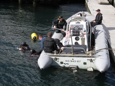
A crew from the HMCS Sackville came over this morning to warn us they'd be cleaning the bottom and request that we not move the boat or run the engine. An hour or so later, the divers were in the water from a tender off our bow. Each time the divers popped up to ask a question or get a tool, they had to stay above the water until the commanding officer yelled "Prepare to Dive!" then "Dive!", at which point they were allowed to go down.
|
 |
9/15/2016: Visit
Position: 44°38.85'N, -63°34.18'W
Nova Scotia resident Gary has been following our travels since Australia at least and stopped by to say hello during his work day.
|
 |
9/15/2016: Old Triangle
Position: 44°38.85'N, -63°34.33'W
The Irish alehouse Old Triangle wins points for one of the most attractive pub signs in Halifax.
|
 |
9/15/2016: Kilkenny
Position: 44°38.84'N, -63°34.31'W
We sat at the bar and had an excellent lunch while chatting with the bartender at the wonderful Irish alehouse Old Triangle. Despite our goal of sampling only local craft beer, Jennifer couldn't resist a pint of her favourite brew, Kilkenny. That last time we found it on tap was in Australia. None of the Irish pubs that we'd visited recently in the US carried it. When we mentioned this to the bartender, he said "Then they weren't Irish pubs were they?"
|
 |
9/15/2016: Merlin
Position: 44°38.85'N, -63°34.26'W
After lunch we visited the excellent Maritime Museum of the Atlantic. This is the museum greeter, Merlin the parrot.
|
 |
9/15/2016: Fresnel Lens
Position: 44°38.85'N, -63°34.26'W
A giant first-order Fresnel lens from the Sambro light house southwest of Halifax Harbour.
|
 |
9/15/2016: Model Ships
Position: 44°38.85'N, -63°34.26'W
The museum has a model ship workshop and an impressive collection of models on display. We found it interesting that this ship had both active stabilizers and what looked like a flopper-stopper pole.
|
 |
9/15/2016: Hurricanes
Position: 44°38.86'N, -63°34.26'W
This placard in the museum tracks all the Atlantic hurricanes this year. Our approach to hurricane-avoidance has been to not be anywhere that has named storms during that area's hurricane or cyclone season. But you pretty much can't avoid it on the east coast of North America. The entire area sees hurricanes from the Caribbean up to at least Newfoundland. On September 29, 2003 Hurricane Juan hit Halifax with winds gusting to 110mph. The tidal surge sent large pieces of the boardwalk ashore and the HMCS Sackville broke loose and destroyed the vessel Lucina, moored where we are right now. Yikes! September 29th is only two weeks from when we were there.
|
 |
9/15/2016: Polar Bear
Position: 44°38.84'N, -63°34.25'W
We loved this photo in the museum's Arctic exhibit of a polar bear climbing down a sheer cliff to hunt for bird eggs.
|
 |
9/15/2016: Halifax Explosion
Position: 44°38.85'N, -63°34.22'W
On December 6th, 1917 the explosives-laden SS Mont-Blanc collided with the SS Imo in the Narrows that connect Halifax Harbour with Bedford Basin to the north. A fire started on board the Mont-Blanc and ignited the cargo, generating the largest man-made explosion prior to the development of nuclear weapons. All buildings within a half-mile radius were obliterated, 2,000 people were killed and another 9,000 were injured. Pictures are fragments from the Mont-Blanc, which were scattered for miles.
|
 |
9/15/2016: CSS Acadia
Position: 44°38.87'N, -63°34.18'W
The CSS Acadia is the first ship built specifically to survey Canada's northern waters. She was launched in 1913 and is the only surviving ship to serve Canada during both World Wars. The ship was retired in 1969 and became part of the museum's collection in 1982. the steel-hulled boat is beautifully built, with extensive woodwork throughout.
|
 |
9/15/2016: Cruise Ships
Position: 44°38.88'N, -63°34.19'W
Halifax is a major cruise ship port. Last year 141 cruise ships brought 22,309 passengers to the city. We could see two of the three in port today from the deck of the Acadia.
|
 |
9/15/2016: Neighbours
Position: 44°38.88'N, -63°34.19'W
Theodore Too, Dirona and the HMCS Sackville viewed from the deck of the Acadia.
|
 |
9/15/2016: Blocks
Position: 44°38.86'N, -63°34.28'W
The museum display included the intact store W. M. Roberston and Sons in its original location with inventory it carried in the early 1900s. These beautiful blocks caught our attention on the street from outside the museum.
|
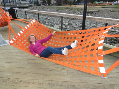 |
9/15/2016: Hammock
Position: 44°38.72'N, -63°34.07'W
From the museum we walked the harbor front boardwalk to the cruise ship terminal to see if we could get a good vantage for the ships leaving. Jennifer tried out the hammocks along the way.
|
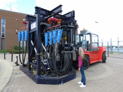 |
9/15/2016: Power Connections
Position: 44°38.47'N, -63°33.97'W
Now that's a shore power cord. One of the cruise ships had already left by the time we arrived and this is its shore power cord. We have a Glendinning to power our shore power cord in, whereas the cruise ships use a forklift.
|
 |
9/15/2016: Bicycle Repair
Position: 44°38.40'N, -63°33.98'W
Halifax is very bicycle friendly. This is a bicycle repair station, complete with air, tools and a support for the bike while working on it.
|
 |
9/15/2016: Garrison
Position: 44°38.40'N, -63°33.98'W
The Garrison craft beer brewery is right beside the cruise ship terminal and offers lots of souvenirs in its store.
|
 |
9/15/2016: Your Move
Position: 44°38.66'N, -63°34.22'W
We returned back toward town, planning to have dinner at the Red Stag pub. We loved their sign out front. Believe it or not, we went right, not left. We'll be back.
|
 |
9/15/2016: Alexander Keith's
Position: 44°38.66'N, -63°34.23'W
Right next to the Red Stag tavern is the Alexander Keith's brewery, established on this site in 1820 and one of the oldest breweries in Canada. We'd arrived just in time for the next tour, which is why we went right at the Red Stag sign. The tour took us through the brewery, with an explanation of the brewing process and the history of the Alexander Keith and his brewery, and of course samples of their various beers. The assistant brew master is in on the right talking to the group.
|
 |
9/15/2016: Ceilidh
Position: 44°38.66'N, -63°34.23'W
We finished the tour with a traditional Nova Scotia Gaelic gathering called a Ceilidh in the brewery's basement pub while enjoying a pint of the Keith's brew of our choice. A Ceilidh usually involves playing Gaelic folk music and dancing. We didn't do any dancing, but the singers were entertaining and we had a great time.
|
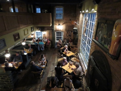 |
9/15/2016: Red Stag
Position: 44°38.66'N, -63°34.22'W
We finished the day with a great dinner at the Red Stag tavern adjacent to the Alexander Keith's brewery. Our table is by the window on the right.
|
 |
9/16/2016: Halifax Town Clock
Position: 44°38.86'N, -63°34.63'W
The Halifax Town Clock stands on a hillside west of the waterfront below the Halifax Citadel. The clock began keeping time in 1803 and is among the most well-known landmarks in the city.
|
 |
9/16/2016: Citadel
Position: 44°38.81'N, -63°34.80'W
We visited the historic Halifax Citadel National Historic Site today. The British military founded the town of Halifax in 1749 and built a series of forts on Citadel Hill to protect the city and naval station. The present-day Citadel, completed in 1856, is the fourth fort on the side and has been restored to the Victorian period.
|
 |
9/16/2016: Noon Gun
Position: 44°38.81'N, -63°34.80'W
We arrived at the Citdel in time for the traditional firing of the noon gun, a local tradition since 1857 and one of the oldest in the world. Each day (except for Christmas Day), gunners dressed in the 3rd Brigade Royal Artillery uniform of 1869 fire a cannon (a reproduction 12 pounder, smooth-bore muzzle loading gun used during the reign of King George III). This is a tribute to Halifax’s history as a major British military stronghold. The video https://youtu.be/0CYSgFSfHxM shows the tremendous boom and a big plume of smoke when the cannon fires, along with the changing of the guard and later one of the 78th Highlanders Pipe Band playing bagpipes.
|
 |
9/16/2016: Wooden Monkey
Position: 44°38.82'N, -63°34.53'W
We took a lunch break during our Citadel visit after we'd watched the Noon Gun. At the nearby Wooden Monkey pub we had an exceptional pizza lunch with, of course, local craft beer.
|
 |
9/16/2016: City View
Position: 44°38.82'N, -63°34.73'W
We spent the rest of the afternoon at the Citadel. This is the sweeping view of Halifax Harbour from the fort wall.
|
 |
9/16/2016: Military Museum
Position: 44°38.84'N, -63°34.82'W
The Citadel also contains an extensive military museum that details the conflicts the Canadian forces have been involved in over the years.
|
 |
9/16/2016: Trench
Position: 44°38.90'N, -63°34.85'W
Jennifer raising a decoy head from the World War II trench reconstruction at the Citadel Military Museum.
|
 |
9/16/2016: Unfiltered Brewing
Position: 44°39.25'N, -63°35.76'W
From the Citadel, we walked 1.5 miles northwest to the Halifax Forum. On our way we stopped for a drink in The Charm School Pub at Unfiltered Brewing. Their beer and cider were delicious, and we loved their domain name. While there we had a great conversation with outspoken co-owner Andrew Murphy, who is a professional photographer. Jennifer is looking through some of his impressive pictures while Andrew sips his beer.
|
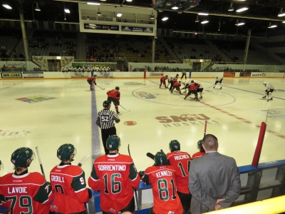 |
9/16/2016: Mooseheads
Position: 44°39.32'N, -63°36.25'W
As soon as we realized that we'd be in town when the Halifax Mooseheads Junior A ice hockey team was playing, we put it on our calendar. It's been ages since we watched a live hocky game—probably not since the Seattle Thunderbirds Junior A team moved out of downtown Seattle in 2009. We had an excellent evening at the forum. The pre-season game was general admission and we arrived early enough to get great seats right behind the Mooshead box.
|
 |
9/16/2016: Dunder Mifflin
Position: 44°39.32'N, -63°36.25'W
Fans of "The Office" television sitcom will recognize the name on this T-shirt. You can actually now buy a box of real Dunder Mifflin paper. The sitcom's fictional paper product company became a real brand in 2011, as a subsidiary of Staples Inc.
|
 |
9/16/2016: Mascot
Position: 44°39.32'N, -63°36.25'W
Jennifer and new friend at the Halifax Mooseheads ice hockey game.
|
 |
9/17/2016: Theodore Too
Position: 44°38.98'N, -63°34.16'W
On a dinghy tour through Halifax Harbour we passed Theodore Too returning from a tour of the "Big Harbor". Halifax Harbour is one of several that claim to be the second largest natural harbors in the world. Other contenders include Port Jackson at Sydney in Australia, Cork Harbour in Ireland, and Poole Harbour in the UK.
|
 |
9/17/2016: CFB Halifax
Position: 44°39.67'N, -63°34.84'W
CFB Halifax is the largest Canadian Forces Base (CFB) with respect to posted personnel and is home to Canada's Atlantic fleet. The base evolved from HMC Dockyard Halifax that the Canadian Government acquired from the Royal Navy following the 1906 withdrawal of British Military forces from Canada.
|
 |
9/17/2016: Halifax Shipyard
Position: 44°40.05'N, -63°35.46'W
The massive buildings at Halifax Shipyard. The yard can build new boats up to 120m long and repair ships up to Panamax size. Halifax Shipyard’s Assembly and Ultra Hall facility is 157ft (48 m) high at its highest point and a quarter mile (407 m) long, making it the largest single building for constructing ships in North America.
|
 |
9/17/2016: Atlantic Griffon
Position: 44°40.29'N, -63°35.86'W
The 4200-ton Platform Supply Vessels Atlantic Griffon and Atlantic Shrike at Halifax Shipyard. The two ships were built in Romania, disassembled and shipped to Halifax where they recently arrived and were reassembled. Presumably the customs duty payable on ship parts plus the disassembly and reassembly costs, is less than that for a complete ship, which we've read can run to 25%.
|
 |
9/17/2016: Generating Station
Position: 44°40.35'N, -63°35.98'W
A sailboat passing in front of the distinctive cooling towers at the Tufts Cove Generation Station on the east side of Halifax Harbor.
|
 |
9/17/2016: Earl Grey
Position: 44°40.83'N, -63°36.86'W
The Canadian Coast Guard vessel Earl Grey at Canadian Coast Guard Base Dartmouth. The base relocated about three years ago to north of the A. Murray MacKay bridge from a location close to downtown Dartmouth. The Earl Grey performs a variety of roles, including light ice-breaking and buoy tending.
|
 |
9/17/2016: Dartmouth Yacht Club
Position: 44°42.06'N, -63°36.62'W
The tender moored at the Dartmouth Yacht Club while we go to lunch. The yacht club members warned us that the area was an industrial park with not much to see, but we had a nice walk and enjoyed our lunch stop.
|
 |
9/17/2016: Old Port Pub
Position: 44°42.24'N, -63°36.72'W
We had a good lunch on the patio at the Old Port Pub about a ten-minute walk from the Dartmouth Yacht Club.
|
 |
9/17/2016: Katie Bella
Position: 44°42.79'N, -63°40.24'W
The wooden schooner Katie Bella was hand-built in Stewiacke, Nova Scotia, the first ship to be built along the Stewiacke River in living memory. Cousins Evan and Nick Densmore spent five years building the 24-metre wooden ship, which they tested along the Eastern Seaboard this winter.
|
 |
9/17/2016: Outflow
Position: 44°40.49'N, -63°35.71'W
The fierce outflow from the Tufts Cove Generation Station. The water temperature was 69F near the source, compared to 61F in the rest of Halifax Harbour.
|
 |
9/17/2016: Full Steam
Position: 44°39.80'N, -63°34.15'W
Full Steam is one of about fifteen Cape Horn ocean passage-capable steel trawlers ever made before the company went out of business. This one probably is a Cape Horn 58.
|
 |
9/17/2016: Kings Wharf
Position: 44°39.81'N, -63°33.90'W
Tied off at Kings Wharf to walk around Dartmouth.
|
 |
9/17/2016: Craig Blake
Position: 44°39.84'N, -63°34.23'W
Craig Blake coming into Dartmouth Ferry Terminal from Halifax.
|
 |
9/17/2016: Shubenacadie Canal
Position: 44°39.90'N, -63°33.86'W
Looking up the historic Shubenacadie Canal built to facilitate transportation between Halifax and the agricultural, timber, and coal producing areas of Northern Nova Scotia and the Annapolis Valley along the Bay of Fundy. The canal was completed in 1861 after several construction delays, but closed in 1871 due partly to the construction of a fixed railway bridge that severely impeded steamship traffic. Three of the nine locks have been restored to preserve their unique blend British and North American construction techniques, but only one is operational.
|
 |
9/17/2016: Celtic Corner
Position: 44°39.88'N, -63°34.11'W
An ultra-local craft brew on the rooftop deck at the Celtic Corner Public House in Dartmouth. Nine Locks brewery is about 2.5 miles away and named for the nine locks on the historic Shubenacadie Canal.
|
 |
9/17/2016: Survival Training
Position: 44°38.95'N, -63°33.06'W
Two life rafts mounted on hoists at the Survival Systems Training school. That must be exciting to be inside when they drop.
|
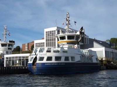 |
9/17/2016: Christopher Stannix
Position: 44°38.91'N, -63°32.97'W
The ferry Christopher Stannix at the Woodside Ferry Terminal on the terminus of the southern run between Dartmouth and Halifax.
|
 |
9/17/2016: Port of Halifax
Position: 44°37.97'N, -63°33.67'W
The top five imports by volume in the Port of Halifax are 1) Machinery and Equipment, 2) Clothing 3) Furniture 4) Manufactured Goods and 5) Metal (Iron and Steel). The top five exports are 1) Wood pulp, 2) Newsprint and Paper, 3) Seafood, 4) Machinery and Equipment, and 5) Vegetables. Note that four of the five exports are raw material rather than manufactured goods.
|
 |
9/17/2016: Axe Throw
Position: 44°38.64'N, -63°34.17'W
After returning from our dinghy tour, we walked out for dinner. That person really is throwing a long-handled axe at the Halifax Oktoberfest. The wall they're throwing the axes into is on the edge of the grounds with no safety area behind it. So if someone misses the wall, it could be a big problem for an unrealizing passerby.
|
 |
9/17/2016: Government House
Position: 44°38.53'N, -63°34.28'W
Government House is the official residence of the Lieutenant Governor of Nova Scotia, as well as that in Halifax of the Canadian monarch. The building was completed in 1805 and is a National Historic Site.
|
 |
9/17/2016: The Henry House
Position: 44°38.43'N, -63°34.23'W
Jennifer has been pining to visit the Granite brew pub in Halifax since first arriving into Nova Scotia two months ago. The Granite Brewery, established in Halifax in 1985, opened a Toronto brew pub in 1991 that was a favourite haunt of the IBM Toronto Lab compiler and database teams that we were worked on. James had actually been to the Granite brew pub in Halifax at The Henry House, a National Historic Site, but Jennifer hadn't. Unfortunately, the Granite has since moved its brewery away from The Henry House and dropped its brew pub license. But The Henry House still carries Granite on tap and their Best Bitter tastes as good as ever.
|
 |
9/18/2016: The Split Crow
Position: 44°38.96'N, -63°34.46'W
A sunny spot in the corner of the Split Crow pub. We had a good lunch there and have now tried most of the local craft beers. Halifax is a very cool town.
|
 |
9/18/2016: Davis Cup
Position: 44°38.89'N, -63°34.63'W
The first Davis Cup tennis match took place in 1900 between the USA and Great Britain and now is the world's largest annual team competition in sport, with 135 countries entered in 2016. Notable Davis Cup competitors include Jimmy Connors, Bjorn Borg, John McEnroe, Boris Becker, Andre Agassi, Pete Sampras and Roger Federer. We bought tickets for the final singles matches between Canada and Chile today. Pictured is Canada's Dennis Shapovalov on the right serving to Christian Garin. The level of play was excellent, with Shapovalov ranked 248th in the world and Garin 266th. Shapovalov won the match and Canada won the play-off round 5 to 0. Canadian Frank Dancevic defeated Chilean Gonzolo Lama in the next match, but Canada had already won the play-off at that point.
|
 |
9/18/2016: Bad Cable
Position: 44°38.85'N, -63°34.18'W
We took out what we thought was a faulty DSM250 and it tested out fine. The monitor wasn't at fault. A poorly-fabricated field-installable cable between the main bus and the DSM250 was causing the errors. That is two connection problems in the last six months. The other was a loose knurled connection between a tee fitting and the power lower inserter. With Spitfire inspecting, James is reassembling a locker in the stateroom after removing the DSM250. We needed to remove the hanging rail and some shelves in order to access the monitor in order to remove it. We're no longer using the DSM250, and instead are using the 19" N2kView display mounted above. We will need to figure out what to do with the mounting hole left behind.
|
 |
9/18/2016: Stubborn Goat
Position: 44°38.74'N, -63°34.47'W
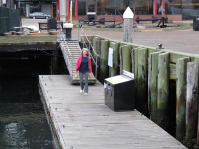
We had an excellent meal upstairs at the Stubborn Goat Gastro Pub.
|
 |
9/19/2016: Tim Hortons
Position: 44°38.85'N, -63°34.18'W
Jennifer returning with our daily Tim Hortons fix. The donut store is about a five-minute walk from our berth.
|
 |
9/19/2016: Finished Product
Position: 44°38.85'N, -63°34.18'W
We now have a bedside clock where the DSM250 used to be.
|
 |
9/19/2016: Antifreeze Leak
Position: 44°38.85'N, -63°34.18'W
We corrected an antifreeze leak at the top of turbocharger housing. Jennifer is plugging the hole in the turbo housing after we removed the connecting pipe lying on the rag. Cleaning up the pipe connections and putting Teflon tape on the NPT fitting at the turbo housing fixed the leak.
|
 |
9/19/2016: Fuel Filters
Position: 44°38.85'N, -63°34.18'W
We last changed the main engine primary fuel filter 414 hours and six months ago. We replace the filters when the vacuum gauge shows 5" of mercury, or we cross 1 year, or we pass 1,000 hours.
|
 |
9/19/2016: Rock Bottom
Position: 44°38.56'N, -63°34.76'W
A tasting flight of excellent craft beer at the Rock Bottom Brewery in the Dalhousie University district. From left to right are their Dark Mild, Baltic Porter, IPA, Oatmeal Stout, Raspberry Wheat, American Sour, Wheat and ESB. Stouts, porters or fruit-based beers generally don't appeal to us, but we liked every single beer in the selection. The food was delicious too.
|
 |
9/19/2016: Bluenose II
Position: 44°38.85'N, -63°34.18'W
The Bluenose II of Lunenburg arrived onto the museum docks today, displacing Theadore Too. The Bluenose II, launched in 1963, is a working replica of the famous Canadian Grand Banks fishing and racing schooner featured on the Canadian dime. The original Bluenose was launched in Lunenburg in 1921 and was the undefeated champion of the International Fisherman's Race for 18 years. Working commercially off Haiti, the ship struck a reef in 1946 and sank. Many of the people who had worked on the original vessel built the Bluenose II at the same shipyard in Lunenburg.
|
 |
9/19/2016: Seakids Six
Position: 44°38.85'N, -63°34.18'W
Nova Scotia residents Sebastien, Frederik and Yvan dropped by today with a copy of our guide, Cruising the Secret Coast, to sign. We didn't ever expect to see a copy of our guide on Canada's east coast. We had a great time showing them around Dirona and talking boats. These folks are super-knowledgable boaters who cruise extensively on Seakids Six, a boat they built themselves.
|
 |
9/19/2016: Wing Alignment
Position: 44°38.85'N, -63°34.18'W
We traced an intermittent small saltwater drip along the port side of the main engine up to the wing packless shaft seal (PSS). The shaft vibrates enough to cause a slight trickle at the shaft seal. A small flex in the shaft prevented the alignnment from being any more precise than 0.002". That's well within specifications and it's now very smooth without a leak.
|
 |
9/19/2016: Gahan House
Position: 44°39.02'N, -63°34.33'W
Having spent time with our visitors, we didn't finish the wing engine alingment job until 7pm. We went out for dinner at Gahan House brew pub. This was the only pub repeat visit we made, mainly because it was convenient for a late meal.
|
 |
9/20/2016: Norwegian Dawn
Position: 44°37.81'N, -63°33.49'W
The cruise ship Norwegian Dawn glowing through the fog as we depart Halifax Harbour.
|
 |
9/20/2016: Sambro Lighthouse
Position: 44°25.65'N, -63°33.03'W
We were planning to pass by Sambro Island to check out Sambro Lighthouse whose Fresnel lens we saw at the Maritime Museum in Halifax. The lighthouse was built in 1758 and is the oldest surviving lighthouse in North America. Since we could barely see the front of our boat in the thick fog, we didn't feel like navigating through the rock-strewn channel around the island when we wouldn't likely be able to see much anyway.
|
 |
9/20/2016: Peggy's Cove
Position: 44°29.28'N, -63°54.78'W
We continued on to Peggy's Cove, hoping the fog would lift. And luckily it did. This is the fishing village of Peggy's Cove, nestled along the sea.
|
 |
9/20/2016: Peggy's Point Lighthouse
Position: 44°29.35'N, -63°55.34'W
The lighthouse on Peggy's Point is one of the most accessible, well-known and photographed in Canada. The satellite imagery shows a huge parking lot that was full of buses and cars. And that's exactly how we found it when we came by.
|
 |
9/20/2016: Dirona
Position: 44°29.35'N, -63°55.34'W
Al on the Nordhavn Dreamers Yahoo group noticed our passing by on the Peggy's Cove Lighthouse webcam. Dirona is just visible to the right of the lighthouse.
|
 |
9/20/2016: Lunenburg
Position: 44°22.08'N, -64°18.17'W
Our first view to historic Lunenburg, the home of the Bluenose II. In the center of the picture is Nordhavn 68 Grace of Tides. To the right of it is the scalloper Atlantic Protector. We'll be going in just between them.
|
 |
9/20/2016: Alan Creaser
Position: 44°22.51'N, -64°18.52'W
We met Lunenburg resident Alan Creaser when he stopped by to say hello in Melbourne Australia. Alan owns the Old Fish Factory restaurant in Lunenburg and is Director of Operations for the Bluenose II. We let him know that we were on our way to Lunenburg and he came by to welcome us. It was great to see Alan again after all those months and miles.
|
 |
9/20/2016: Paul Johansen
Position: 44°22.51'N, -64°18.52'W
When we lived in Seattle we frequently anchored off the Paul Johansen in Port Madison on Bainbridge Island. And here it is, on the other side of the contenent, right beside us. A sailboat, home-ported in Seattle, replaced Grace of Tides beside us, so we had three Seattle boats on the dock in Lunenburg, Nova Scotia.
|
 |
9/20/2016: Atlantic Protector
Position: 44°22.51'N, -64°18.52'W
Our slip mate is the 134ft (41m), 1,090-ton scallop dragger Atlantic Protector.
|
 |
9/20/2016: Grace of Tides
Position: 44°22.51'N, -64°18.52'W
Nordhavn 68 Grace of Tides on the other side of the pier from where we are.
|
 |
9/20/2016: Chain Bag
Position: 44°22.53'N, -64°18.52'W
Scallopers drag a chain bag along the bottom to capture scallops. The chain bag is constructed of individual iron rings connected by smaller iron rings. In a building off the foot of our dock they were hand-crimping the iron rings for a new bag. Hand-crimping an entire bag would probably make you strong enough to be able to pick up a truck.
|
 |
9/20/2016: Dockside
Position: 44°22.58'N, -64°18.66'W
The view across the Lunenburg waterfront from the deck of the Dockside Lobster and Seafood restaurant where we stopped for a light snack.
|
 |
9/20/2016: UNESCO
Position: 44°22.60'N, -64°18.74'W
Lunenburg is packed with well-preserved Victoria-era buildings. In 1995, the town was designated as a UNESCO World Heritage Site, one of only two in North America. The designation was for Lunenburg's fine preservation of Old Town, for having the best surviving example of a British Colonial grid-pattern street layout, and for its authenticity as a working town.
|
 |
9/20/2016: Fawlty Towers
Position: 44°22.60'N, -64°18.60'W
We're big fans of John Cleese and the British TV comedy Fawlty Towers, so this sign caught our attention. We couldn't find anything in the area that appeared related to the sign though. Turns out it's an Airbnb room for rent in the building.
|
 |
9/20/2016: Memorial
Position: 44°22.56'N, -64°18.60'W
Lunenburg was settled in 1753 by German, French and Swiss farmers who turned to fishing because the land wasn't suitable for farming. The Lunenburg Fishermans's memorial is a sobering glimpse into the dangers of this occupation. Over 600 Lunenburg men were lost at on 150 ships, 40 of them with every man on board perishing in the cold North Atlantic. And this is just from 1890 to the present. 1926 and 1927 were particularly bad years, with 130 men lost in the famed August Gales when the fall storms came early and caught the fleet unprepared. Saddest of all are the groups of three, four, and five people with the same last name when brothers, fathers, and sons were all lost together.
|
 |
9/20/2016: Cape Sable
Position: 44°22.56'N, -64°18.75'W
The Cape Sable at the Fisheries Museum of the Atlantic. Built in Holland in 1962, the Cape Sable is a steel-hulled trawler that fished for National Sea Products Limited for twenty years and retired in 1982.
|
 |
9/20/2016: Sunset
Position: 44°22.51'N, -64°18.52'W
Lunenburg is famous for its beautiful sunsets that light up the harbor. We caught the sunset view with a traditional dory passing in front while dining at the Old Fish Factory restaurant.
|
 |
9/20/2016: Old Fish Factory
Position: 44°22.51'N, -64°18.52'W
We had a delicious meal, with lobster for Jennifer, at the Old Fish Factory restaurant along the Lunenburg waterfront.
|
 |
9/21/2016: Pearl Mist
Position: 44°22.51'N, -64°18.52'W
The pocket cruise ship Pearl Mist anchored off Lunenburg this morning and ferried passengers much of the morning.
|
 |
9/21/2016: 30 Amps
Position: 44°22.51'N, -64°18.52'W
Our first test of running in 30 amps 60 Hz worked perfectly. Before we left Seattle, running the boat on 30 amps was a real challenge—we'd always be popping the shore breaker with heavier 240V loads such as the dryer or the HVAC system. With the new power system we can run the entire boat, including HVAC, dryer and oven, on a 30-amp 120-volt circuit without problem.
|
 |
9/21/2016: Dory Shop
Position: 44°22.55'N, -64°18.43'W
Alan Creaser offered to take us on a walking tour of Lunenburg today. Alan was born and raised in Lunenburg and seemed to know pretty much everyone and everything that is happening there. Here we are inside the Dory Shop where classic wooden Grand Banks dories have been built for over a century.
|
 |
9/21/2016: Dories
Position: 44°22.52'N, -64°18.45'W
Grand Banks dories are strong, durable, and seaworthy. Another advantage is they can be stacked to save space on the decks of the fishing schooners where they originally were used.
|
 |
9/21/2016: Picton Castle
Position: 44°22.48'N, -64°18.44'W
The barque Picton Castle is a three-masted tall ship based in Lunenburg. The 179ft steel-hulled ship does deep-ocean sail training and long-distance education around the world and completed a sixth circumnavigation in 2015. The ship is incredibly self-sufficient to the point of carrying raw timber for the crew to rebuild the mast if necessary.
|
 |
9/21/2016: Arele
Position: 44°22.48'N, -64°18.22'W
We're pretty sure this yacht was with us at Charlestown Marina in Boston for a few days. It's hauled out in Lunenburg for bottom paint and other work. The name appears to be Arele, but we can't find mention of it anywhere.
|
 |
9/21/2016: Bluenose Shed
Position: 44°22.50'N, -64°18.19'W
Inside the Bluenose Shed, part of the historic Smith & Rhuland Shipyard building. Between 1900 and 1970, the yard built hundreds of ships. The most famous include the Bluenose in 1921, a replica of HMS Bounty built in 1960 for the movie Mutiny on the Bounty, the Bluenose II in 1963, and in 1970 the HMS Rose that appeared as the HMS Surprise in the movie Master and Commander. At it's height of production, Smith & Rhuland employed fifty full-time shipwrights and produced eight schooners a year. The Bluenose Shed is where the Bluenose II was built, and the ship later was rebuilt at this site in 2011 and 2012.
|
 |
9/21/2016: Knot Pub
Position: 44°22.70'N, -64°19.02'W
We had an excellent lunch, continuing the craft beer trend, at the Knot Pub just outside downtown Lunenburg.
|
 |
9/21/2016: Hillcrest Cemetery
Position: 44°22.72'N, -64°18.80'W
After lunch, we walked through the upper Old Town north of the waterfront. This is the historic Hillcrest Cemetery, with graves dating from the early 1800s
|
 |
9/21/2016: Lunenburg Academy
Position: 44°22.80'N, -64°18.79'W
The Lunenburg Academy, built in 1895, served as a public school for 117 years and is a National Historic Site.
|
 |
9/21/2016: House
Position: 44°22.77'N, -64°18.59'W
Brightly-painted and well-maintained traditional homes fill the streets of Lunenburg.
|
 |
9/21/2016: Settler's Memorial
Position: 44°22.66'N, -64°18.26'W
One of two memorials at the top of Blockhouse Hill Road dedicated to the memory of those who settled Lunenburg in 1753.
|
 |
9/21/2016: Reciprocal Tour
Position: 44°22.51'N, -64°18.52'W
The crew of a 134-ft scalloper in Lunenburg for maintenance work gave us a tour of their factory ship. Here the two shift captains, the cook and the shoreside production manager have come over to see Dirona. We were asked not to include boat and crew names.
|
 |
9/21/2016: Ironworks Distillery
Position: 44°22.56'N, -64°18.35'W
The local Ironworks distillery equipment looked similar to that in the St. Helena Distillery. Both were made in Germany.
|
 |
9/21/2016: Berlin Wall
Position: 44°22.58'N, -64°19.15'W
A piece of the Berlin Wall at the head of Lunenburg Harbour.
|
 |
9/21/2016: ABB Turbocharging
Position: 44°22.58'N, -64°19.16'W
We walked past the ABB Turbocharging shop near the head of the harbor. This facility services ABB turbochargers for all of Canada. The manager saw us peering in the door and kindly invited us in to see some of what they are working on. These are truly enormous turbochargers, with their smallest parts being considerably bigger than the turbocharger on Dirona.
|
 |
9/21/2016: Fire Engine
Position: 44°22.66'N, -64°18.98'W
As we walked past the Lunenburg Fire Department, we could see a 1200° fire equipment service truck parked in front on an E-One Pumper (1200° is the temperature at which a building is fully engulged by fire). We've never seen a modern pump truck open for service, so we stuck our heads in to have a look. They invited us in to watch final testing of the pump and water distribution system control panel. It's a very well-engineered design. One idea that we thought was really smart, but we're sure is standard on most fire trucks, is to have a power plug-in and air plug-in on the side of the truck. One of the problems with air-brake-equipped trucks is they won't move until they've pumped air, wasting 60 seconds where the truck could have been underway to save lives. With this approach they've instantly got air and can drive away with the air and power cords automatically releasing as they move.
|
 |
9/21/2016: Magnolia's Grill
Position: 44°22.57'N, -64°18.56'W
We had an excellent dinner on the back deck of Magnolia's Grill. In the distance, the shadow of Dirona's mast is visible on the blue hull of the Atlantic Protector moored beside us.
|
 |
9/21/2016: Paul Johansen
Position: 44°22.51'N, -64°18.52'W
Farley Blackman, the owner of the Paul Johansen, stopped by to chat, tour Dirona and he later brought us aboard his boat for a tour. It was great to finally get aboard the boat after having anchored nearby it in Port Madison near Seattle for years. The steel vessel was launched in 1970 for the Norwegian Society for Sea Rescue and looks incredibly strong. Farley is doing an extensive and very well throught-through interior and exterior refit of the vessel. This is one of the two Detroit Diesels that power the Paul Johansen
|