MV Dirona travel digest for Southwest Scotland 2017

|
Click the travel log icon on the left to see these locations on a map,
with the complete log of our cruise. On the map page, clicking on a camera or text icon will display a picture and/or log entry for that location, and clicking on the smaller icons along the route will display latitude, longitude and other navigation data for that location. And a live map of our current route and most recent log entries always is available at //mvdirona.com/maps/LocationCurrent.html. |
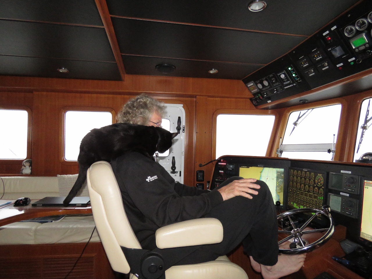 |
8/14/2017: Parrot
Position: 55°54.59'N, -4°55.50'W
Spitfire doing his pirate's parrot imitation. We're underway from Greenock to start our cruise of Scotland's west coast. We'll stop for a night near Tarbert, then enter the Crinan Canal tomorrow.
|
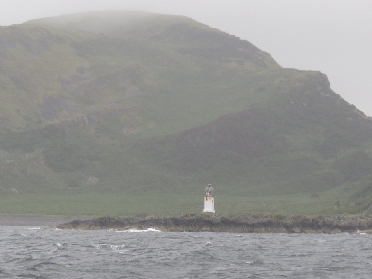 |
8/14/2017: Rubh'An Eun
Position: 55°43.78'N, -4°59.61'W
The Rubh'An Eun light on the south end of Bute Island on an overcast and rainy day.
|
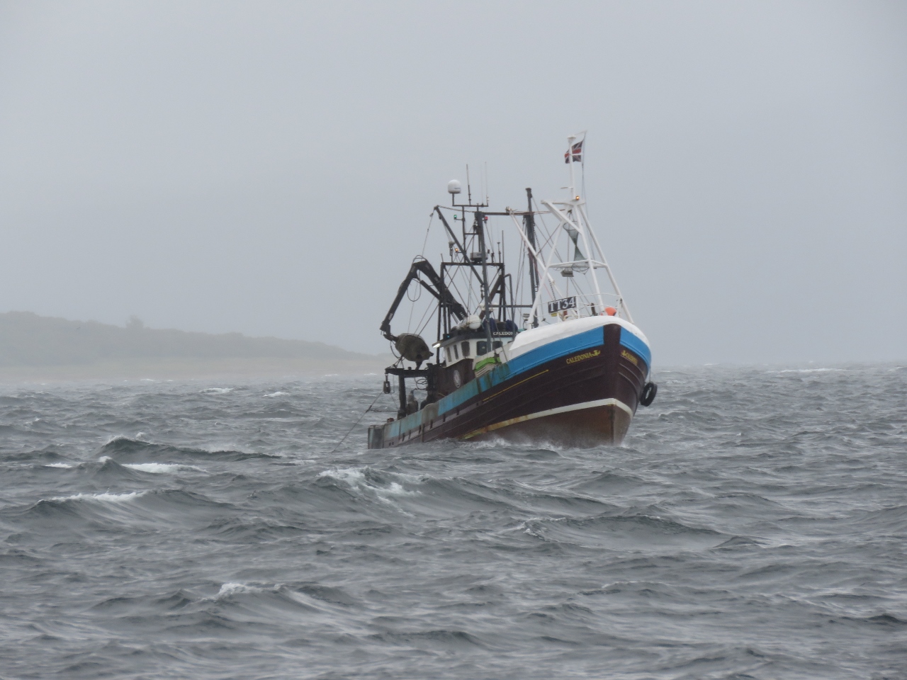 |
8/14/2017: Caledonia
Position: 55°47.35'N, -5°12.33'W
The fishing vessel Caledonia, with it's bow almost entirely out of the water, running against southerly waves in Bute Sound. Winds are blowing steady 25-30 from the south and the waves, while not very large, are close together. Conditions were a little better when we were heading south, before turning north into Bute Sound, but we were still pitching a bit.
|
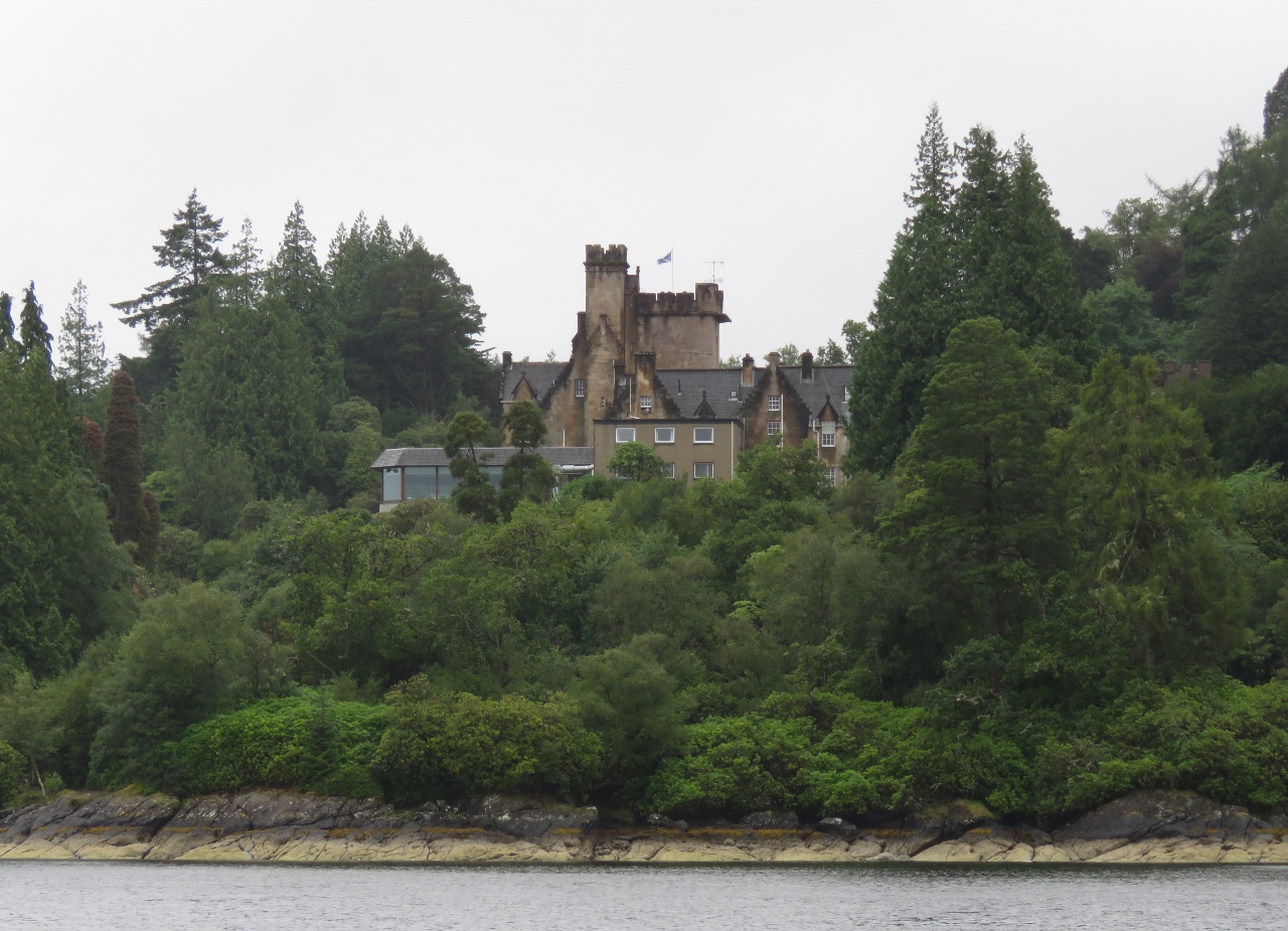 |
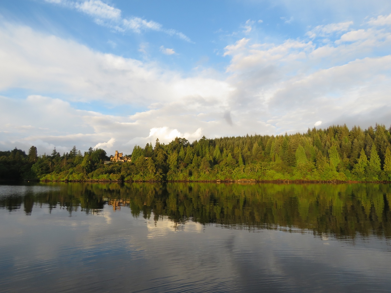
8/14/2017: Stonefield Castle
Position: 55°53.66'N, -5°24.82'W
We're anchored below Stonefield Castle north of Barmore Island. The castle dates back to 1837 and is now a hotel. At nearly 100ft, the anchorage is deep, but is one of the few offering southerly protection in the area. The anchor held well, and are enjoying the cove and being 'back in the wilds' again.
|
 |
8/15/2017: Morning Calm
Position: 55°53.64'N, -5°24.81'W
Yesterday's strong winds settled overnight and we woke up to a beautiful, calm anchorage.
|
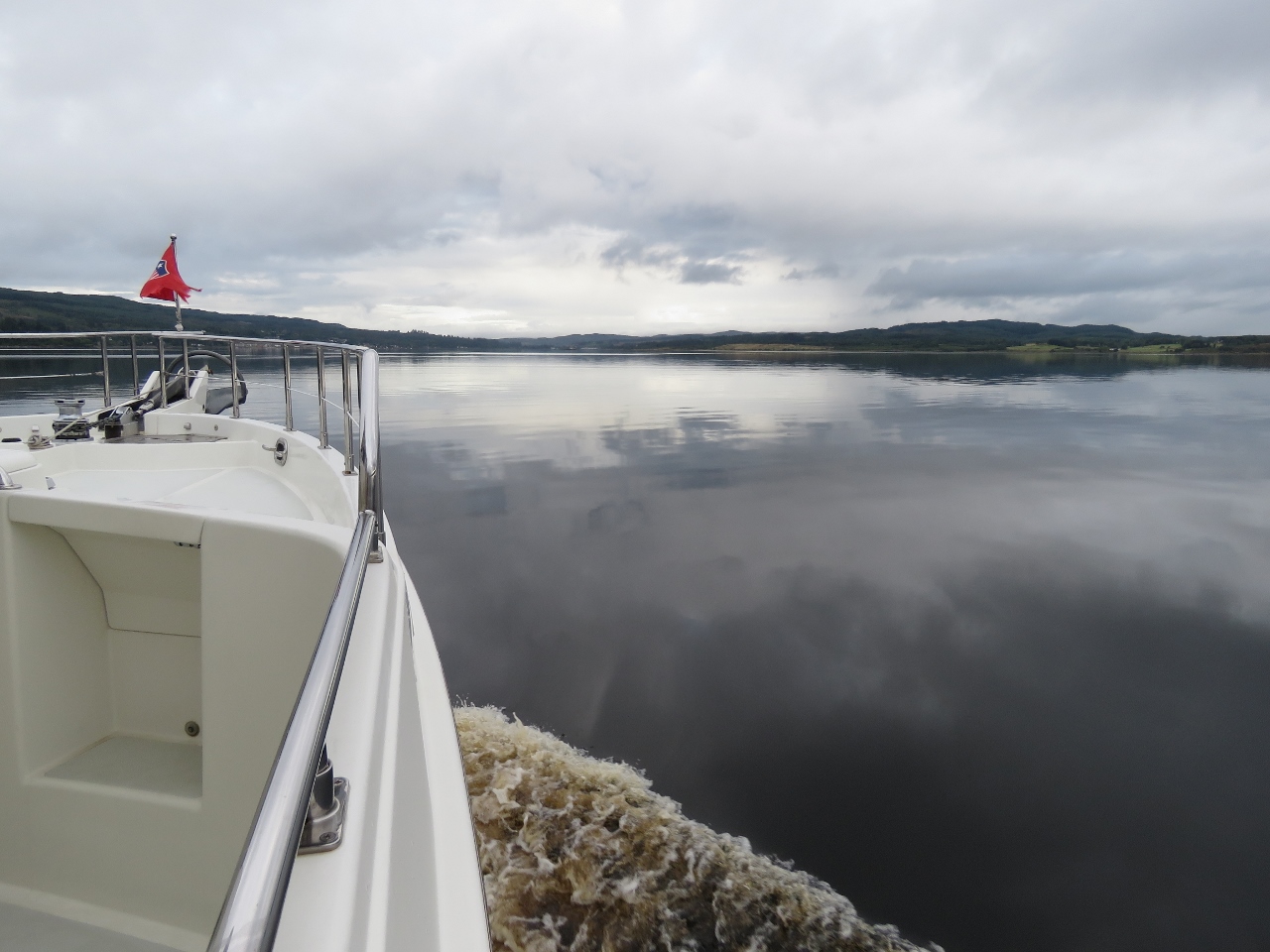 |
8/15/2017: Smooth Seas
Position: 55°59.26'N, -5°25.80'W
Easy cruising in smooth seas as we run north through Loch Fyne toward the Crinan Canal.
|
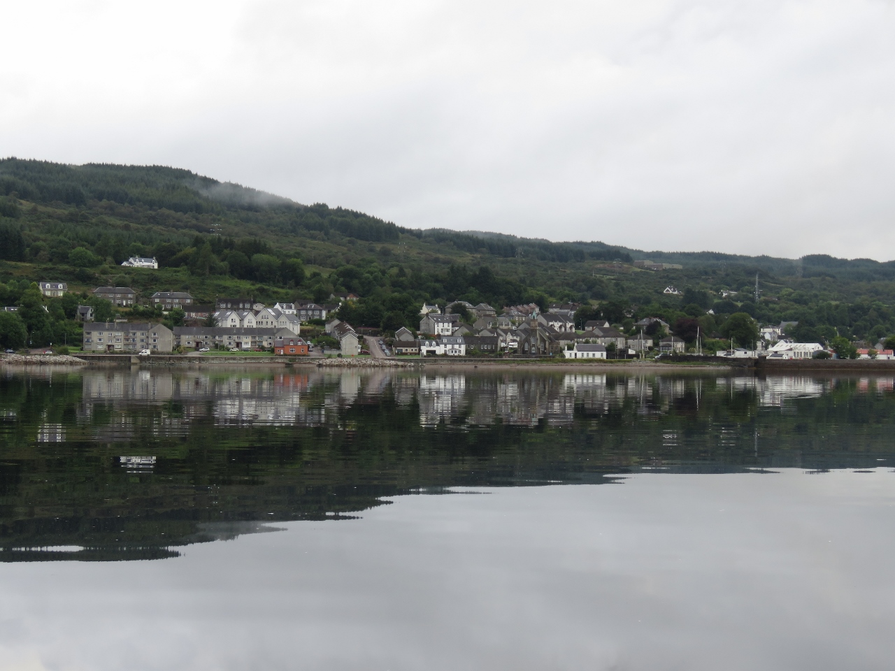 |
8/15/2017: Ardrishaig
Position: 56°0.51'N, -5°26.47'W
The village of Ardrishaig, population about 1,200, at the southern entrance to the Crinan Canal.
|
 |
8/15/2017: Breakwater
Position: 56°0.70'N, -5°26.49'W
The Ardrishaig breakwater protects the sea lock entry from big southerly winds and waves. We'd have welcomed it yesterday, but don't need it today.
|
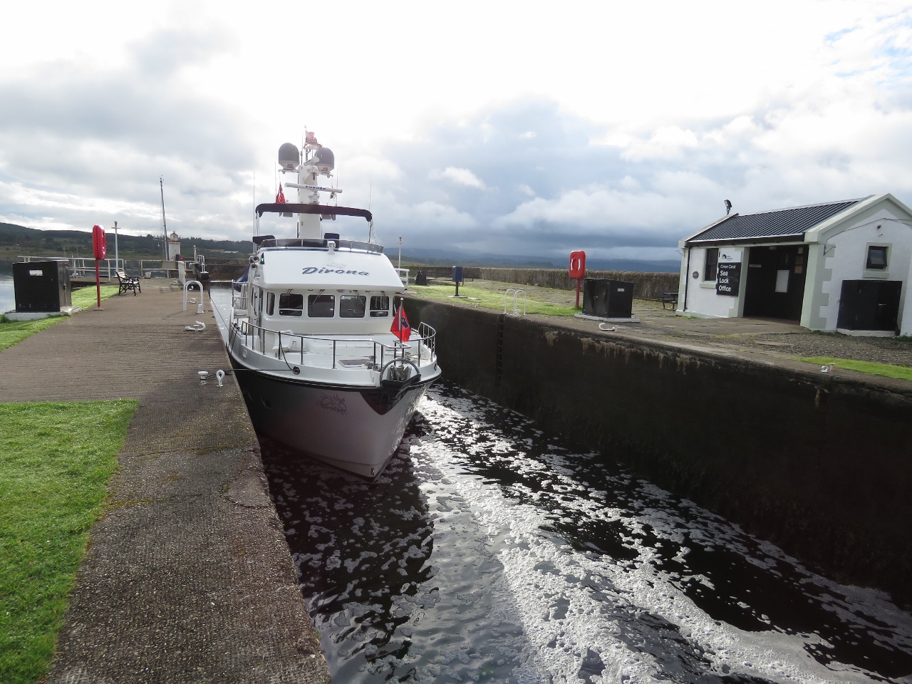 |
8/15/2017: Crinan Canal
Position: 56°0.73'N, -5°26.75'W
Tied off in the sea lock to enter the Crinan Canal. The canal was built between 1793 and 1801 through the neck of Kintyre Peninsula, allowing boats to pass from the Firth of Clyde to the Sound of Jura and avoid 80 miles of exposed, high-current waters around the Mull of Kintyre. We'd arrived about a half hour before the first locking at 8:30am, so tied off and took a walk around until the locks began operation.
|
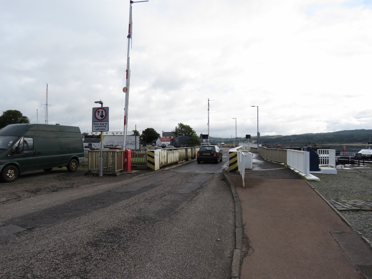 |
8/15/2017: Bridge
Position: 56°0.74'N, -5°26.79'W
The Ardrishaig Sea Lock Bridge crosses the canal just inside the sea lock, so we'll need it opened to proceed from the sea lock into the canal.
|
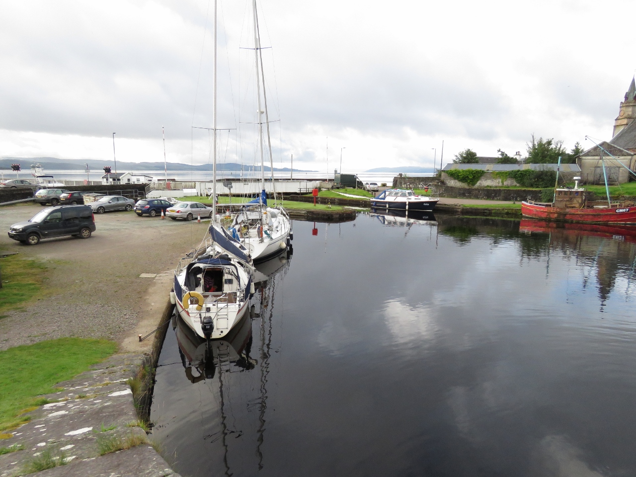 |
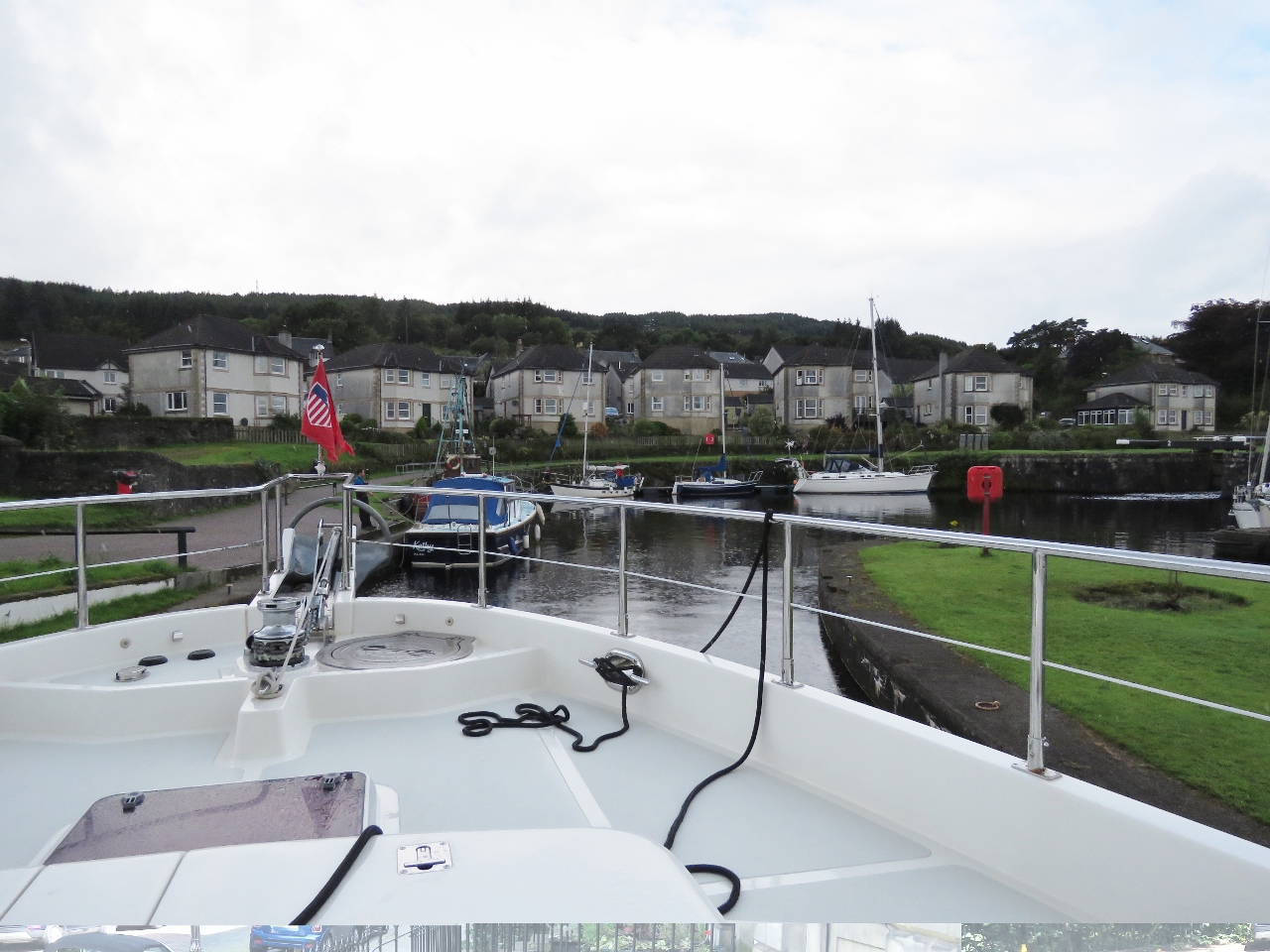
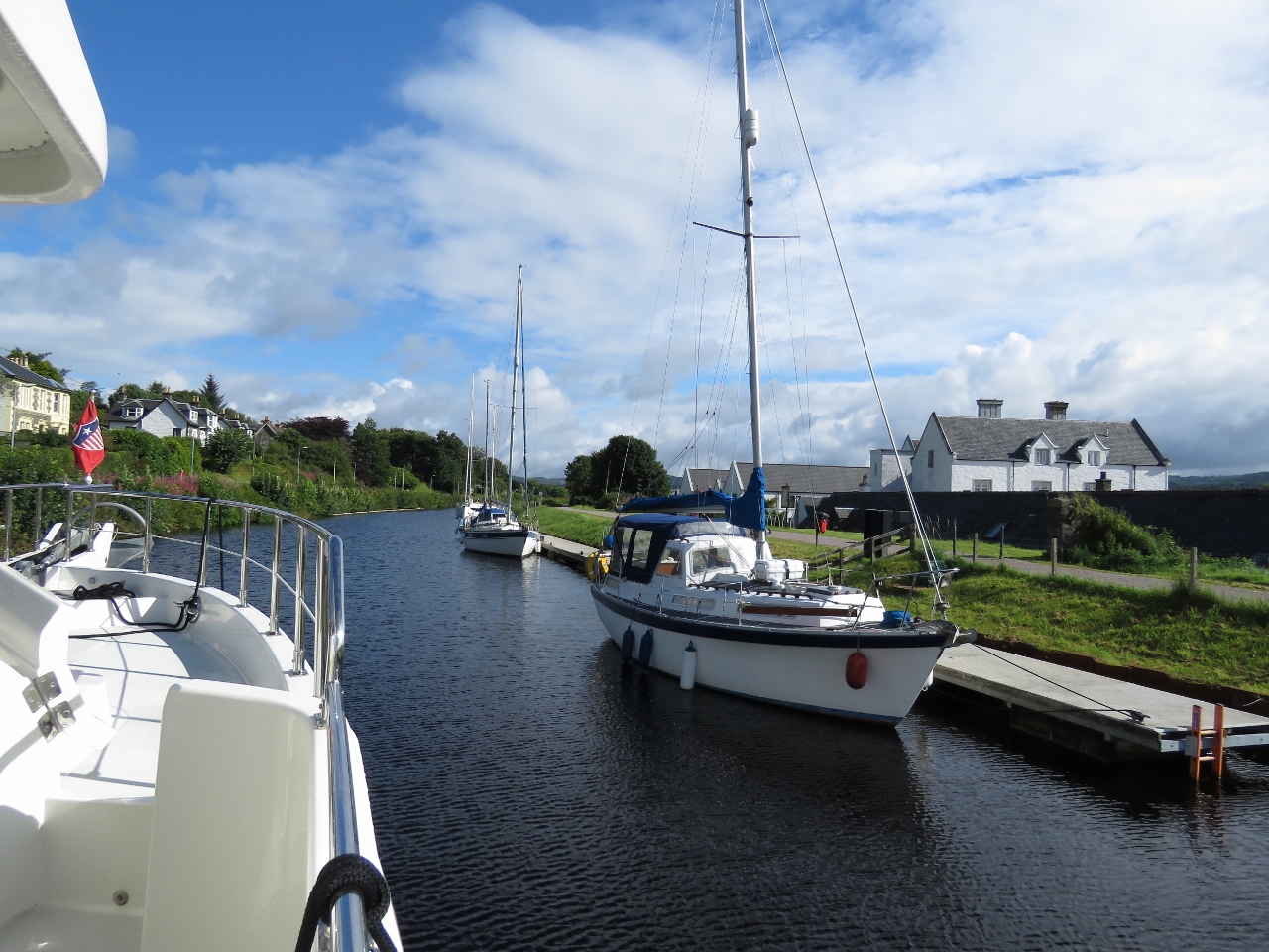
8/15/2017: Ardrishaig Basin
Position: 56°0.77'N, -5°26.83'W
A few boats moored around Ardrishaig Basin, just inside the sea lock and bridge.
|
 |
8/15/2017: Gate Closing
Position: 56°0.72'N, -5°26.76'W
Once the Scottish Canal staff arrived, we payed our transit fee of pound;12.15 per meter and they locked us through.
|
 |
8/15/2017: Bridge Opening
Position: 56°0.73'N, -5°26.79'W
Once the inside sea lock gate was open and we were ready to proceed, the canal staff opened the bridge beyond. They minimize the amount of time a bridge is open and only open them when a craft is ready to pass through.
|
 |
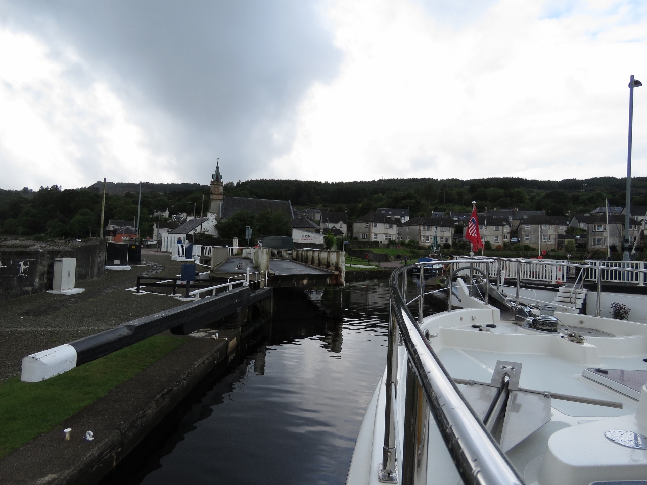
8/15/2017: Entering Basin
Position: 56°0.73'N, -5°26.81'W
We had to make a tight 90-degree turn to enter Ardrishaig Basin after the bridge. One of the canal staff is at the stern of the blue boat on our left, pulling it closer to shore to give us room to pass through.
|
 |
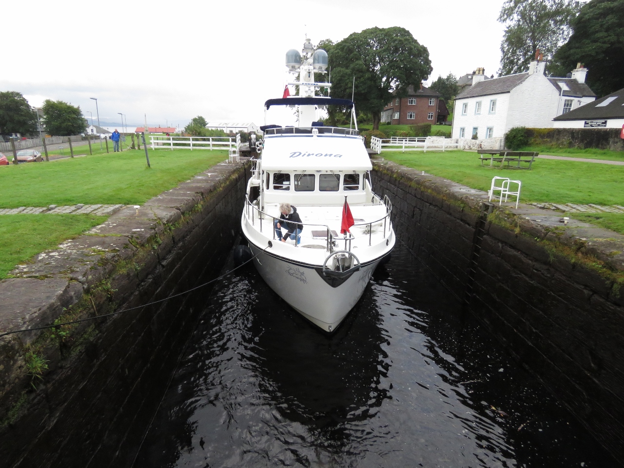
8/15/2017: Lock 2
Position: 56°0.76'N, -5°26.84'W
Entering lock 2. Dirona feels very large here.
|
 |
8/15/2017: Winding Sluice
Position: 56°0.77'N, -5°26.83'W
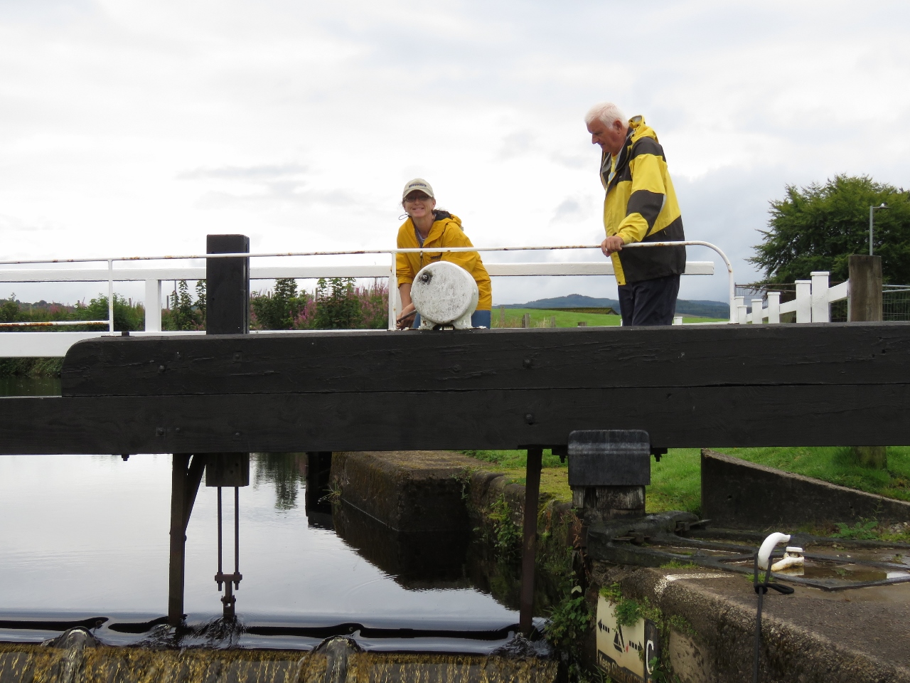
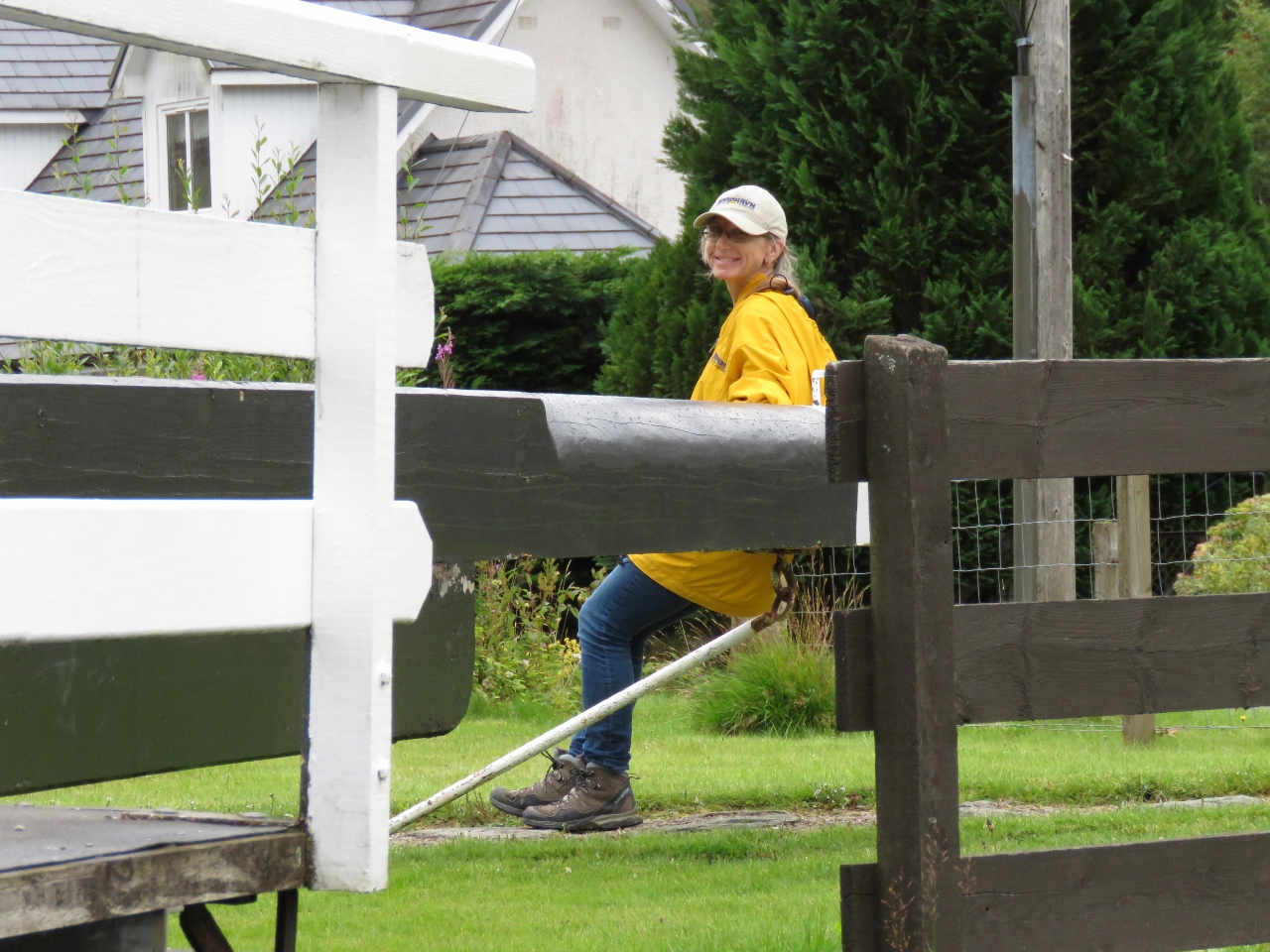
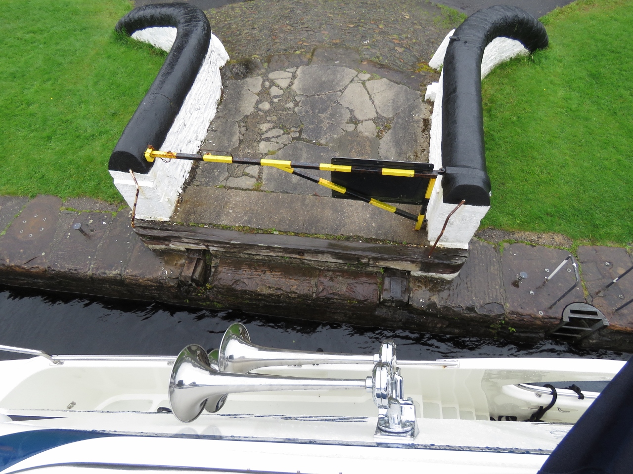
The bridges and sea locks are operated by canal staff, but most of the 14 inland locks are manually operated. Crew of boats passing through must open and close the gates and raise and lower the sluices to control the water level. Here Jennifer is winding open the sluice on the forward gate to fill the lock.
|
 |
8/15/2017: Lock 3
Position: 56°0.83'N, -5°26.86'W
Sailboat exiting lock 3. The inland locks are smaller than the sea lock.
|
 |
8/15/2017: Securing Line
Position: 56°0.86'N, -5°26.89'W
James securing the bow line after Jennifer had hooked them on-shore.
|
 |
8/15/2017: Closing Gate
Position: 56°0.86'N, -5°26.89'W
Jennifer closing the lock gate. The best way to do this is to use your back and legs to provide the power. The gates can take a little work to get started, but move reasonably well once free.
|
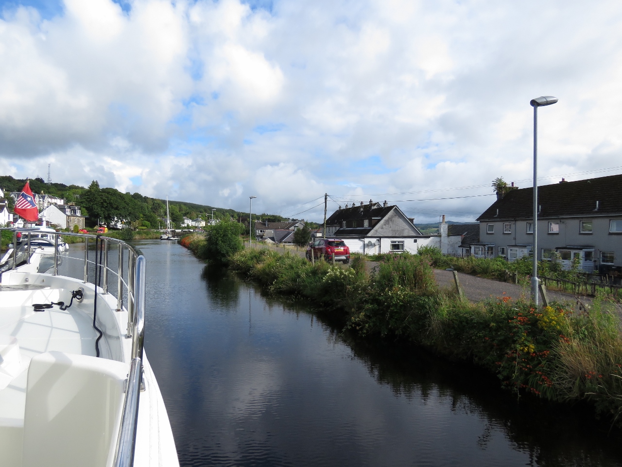 |
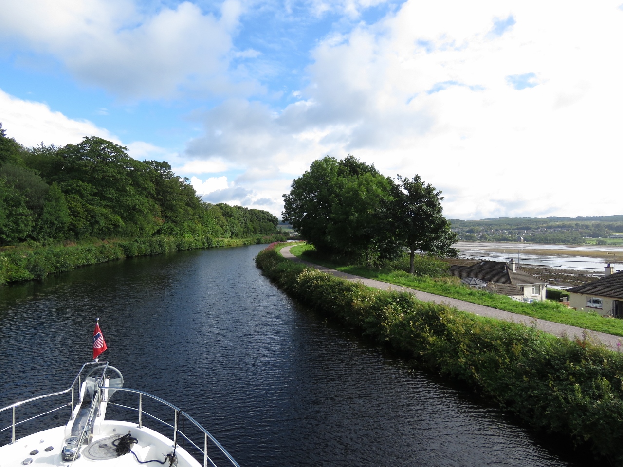
8/15/2017: Roadside
Position: 56°0.92'N, -5°26.93'W
Travelling alongside the road through the canal. We really enjoyed the transit. The scenery was beautiful and it was such an adventure to be running through such a narrow and shallow channel. We often see depths in the 8-ft range and occasionally in the 7-ft range.
|
 |
8/15/2017: Transit Jetty
Position: 56°1.08'N, -5°26.96'W
The transit fee includes four nights moorage within the canal in the basins at either end or at several transit jettys along the way. Several vessels were moored on the transit jetty just beyond lock 4.
|
 |
8/15/2017: Twenty's Plenty
Position: 56°1.25'N, -5°26.86'W
We got a chuckle out of this speed limit sign on a road visible from the canal.
|
 |
8/15/2017: Loch Gilp
Position: 56°1.65'N, -5°26.72'W
Loch Gilp, on the right, extends north from the Ardrishaig to the village of aptly-named Lochgilphead. We're near the head now and are 32 feet above sea level. The maximum speed limit in the canal is 4 knots, and we've been enjoying this leisurely cruise through the country-side.
|
 |
8/15/2017: Oakfield Bridge
Position: 56°2.12'N, -5°26.60'W
Approaching Oakfield Bridge at the village of Lochgilphead. The bridge opened as soon as we were close.
|
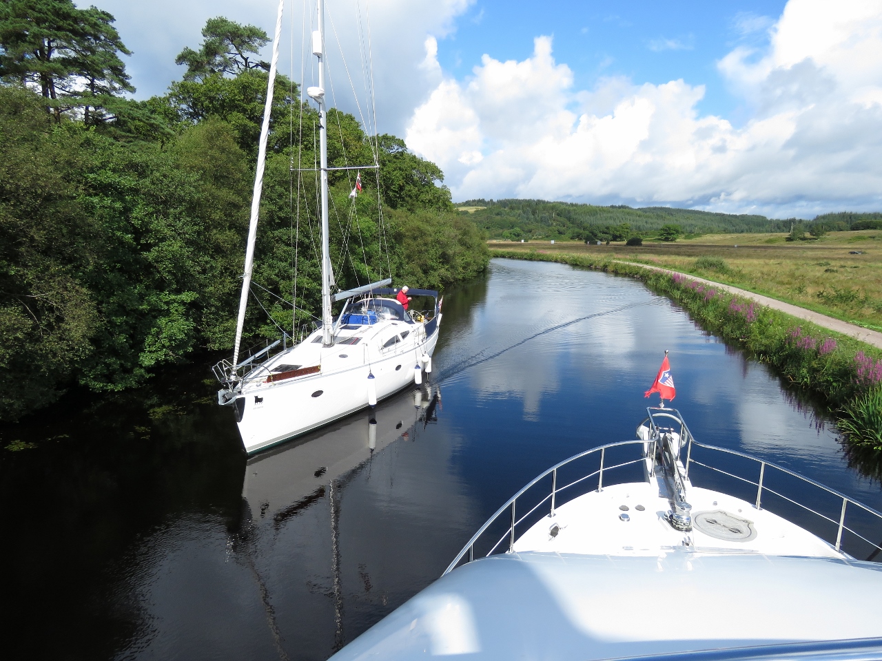 |
8/15/2017: Narrow
Position: 56°3.37'N, -5°27.70'W
Passing a sailboat as we near loch 5. We could see them coming on AIS, but couldn't actually see the boat around the blind corner until they were quite close.
|
 |
8/15/2017: Cairnbaan
Position: 56°3.64'N, -5°28.17'W
Moored for the night at Cairnbaan. So far we've passe through four locks and 3 bridges.
|
 |
8/15/2017: Lock 5
Position: 56°3.66'N, -5°28.30'W
Lock 5 is the first of ten locks that we'll pass through tomorrow.
|
 |
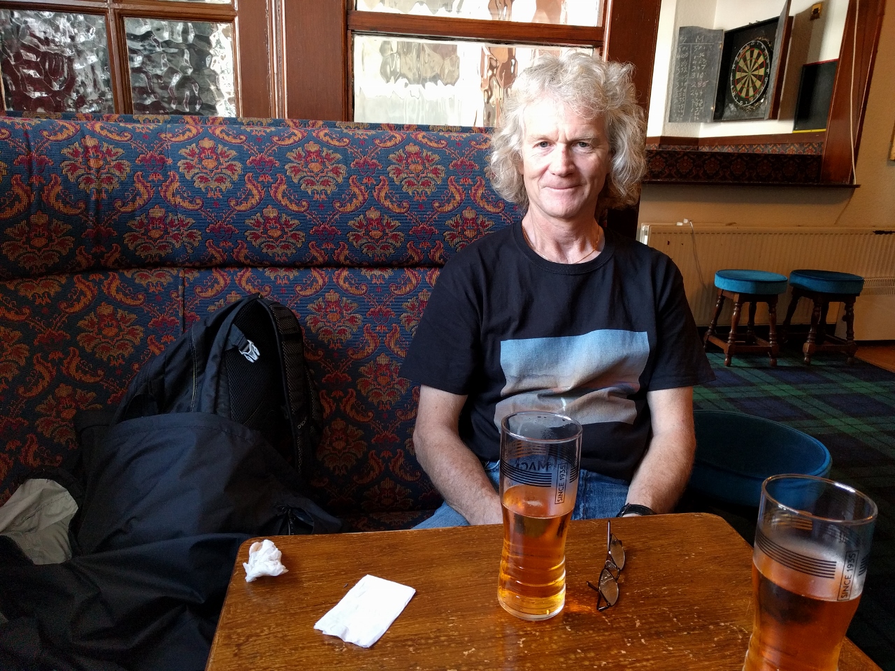
8/15/2017: Bar Lock 5
Position: 56°3.68'N, -5°28.32'W
A relaxing pint and lunch in the sun-room at Bar Lock 5 pub. Dirona is just visible near center in the background of the picture.
|
 |
8/15/2017: Moored
Position: 56°3.67'N, -5°28.33'W
Looking to our moorage from just outside Bar Lock 5. The canal is fairly narrow where Dirona is—there's just barely room for a boat to pass.
|
 |
8/15/2017: Level Control
Position: 56°3.18'N, -5°27.47'W
After lunch we walked south along the canal on a walkway that follows the original towpath where horses pulled unpowered craft through the canal. The walkway is popular with cyclists and pedestrians, and you can easily walk the whole nine-mile distance from end-to-end in a few hours. While walking, we passed this water level control. The pieces resting on the metal grates are dropped into the slot at left to control how much water escapes from the canal into the stream at right.
|
 |
8/15/2017: Lochgilphead
Position: 56°2.34'N, -5°25.95'W
Looking south down Argyll St, the main street in the village of Lochgilphead.
|
 |
8/15/2017: The Stag
Position: 56°2.28'N, -5°25.97'W
Magners Irish Cider at The Stag pub and hotel in Lochgilphead.
|
 |
8/15/2017: Ardrishaig Breakwater
Position: 56°2.21'N, -5°26.12'W
We covered less than four miles today by boat, and have walked almost halfway back to Ardrishaig. We can see the breakwater from the south end of Lochgilphead.
|
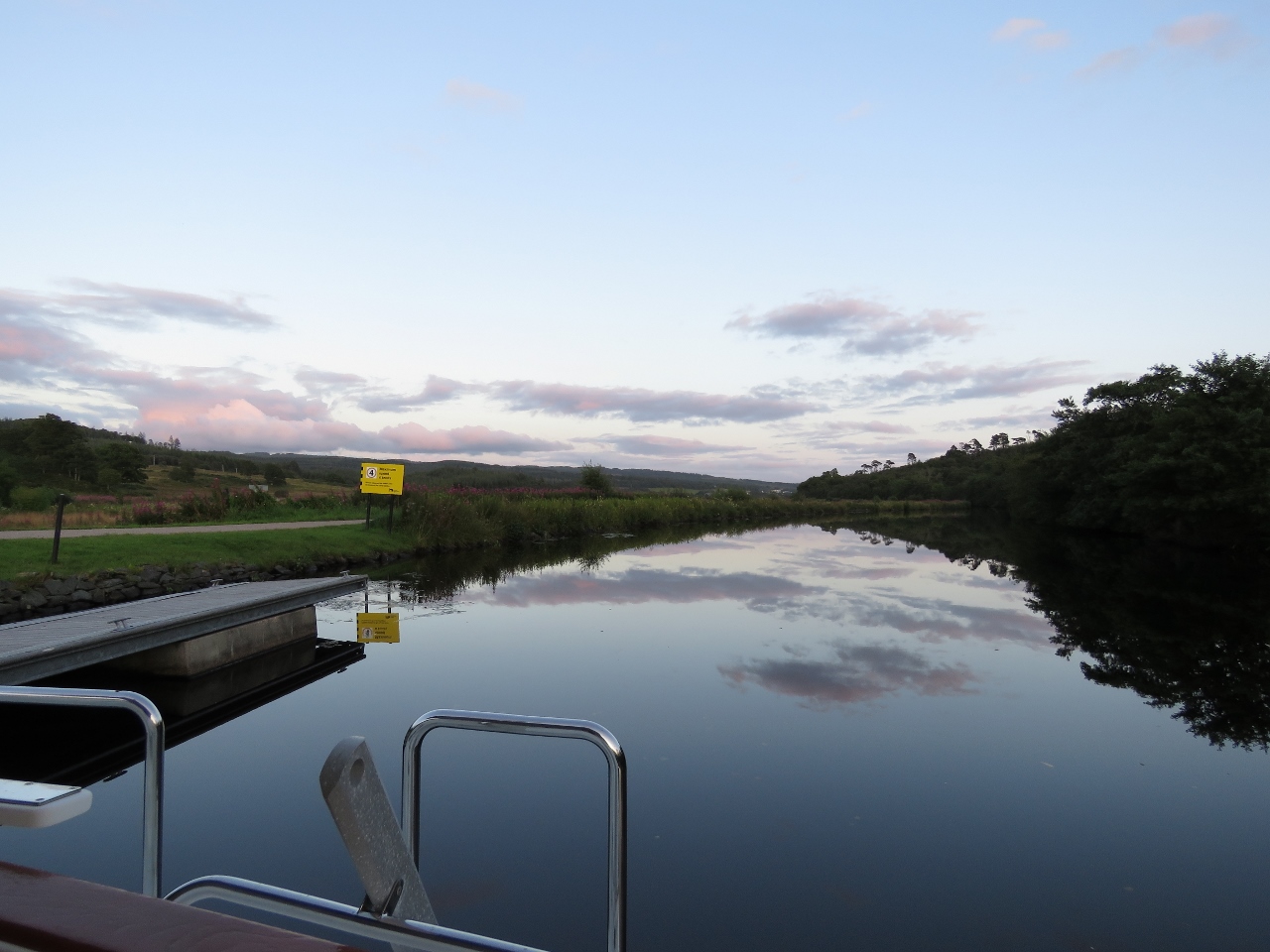 |
8/15/2017: Dusk
Position: 56°3.63'N, -5°28.17'W
Dusk on a lovely calm evening along the canal.
|
 |
8/16/2017: Lock 7
Position: 56°3.63'N, -5°28.75'W
Dirona passing through lock 7. This is our third lock today—we've already passed through locks 5 and 6.
|
 |
8/16/2017: Closing Gate
Position: 56°3.63'N, -5°28.91'W
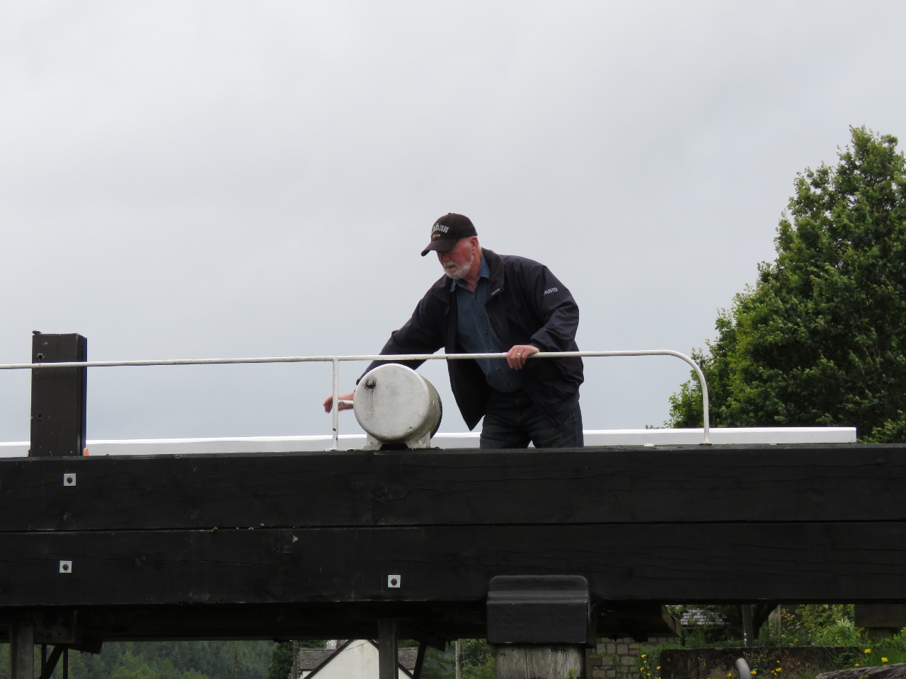
Jennifer closing the gate behind lock 8 once the boat is inside.
|
 |
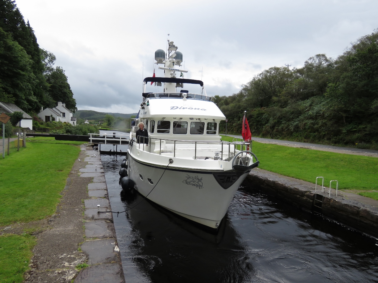
8/16/2017: Lock 8
Position: 56°3.63'N, -5°28.94'W
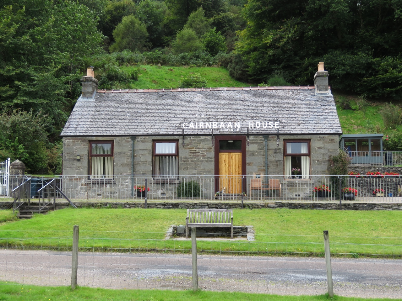
We passed many nice houses and cottages alone the canal, but Cairnbaan House at lock 8 was one of the most attractive. Once we exit lock 8, we'll be 64 feet above sea level, the highest point in the canal. For the rest of the locks we'll be locking downward. This is a little easier as the lock is less turbulent when draining than filling.
|
 |
8/16/2017: Assistance
Position: 56°3.63'N, -5°28.94'W
Sometimes people passing by stopped to help us with the locks. Tom helped us through both locks 7 and 8. He'd also been there when N57 Jura and N55 Odyssey passed through earlier this summer. Three has got to be a record for Nordhavns passing through in one season.
|
 |
8/16/2017: Lock 9
Position: 56°3.74'N, -5°29.91'W
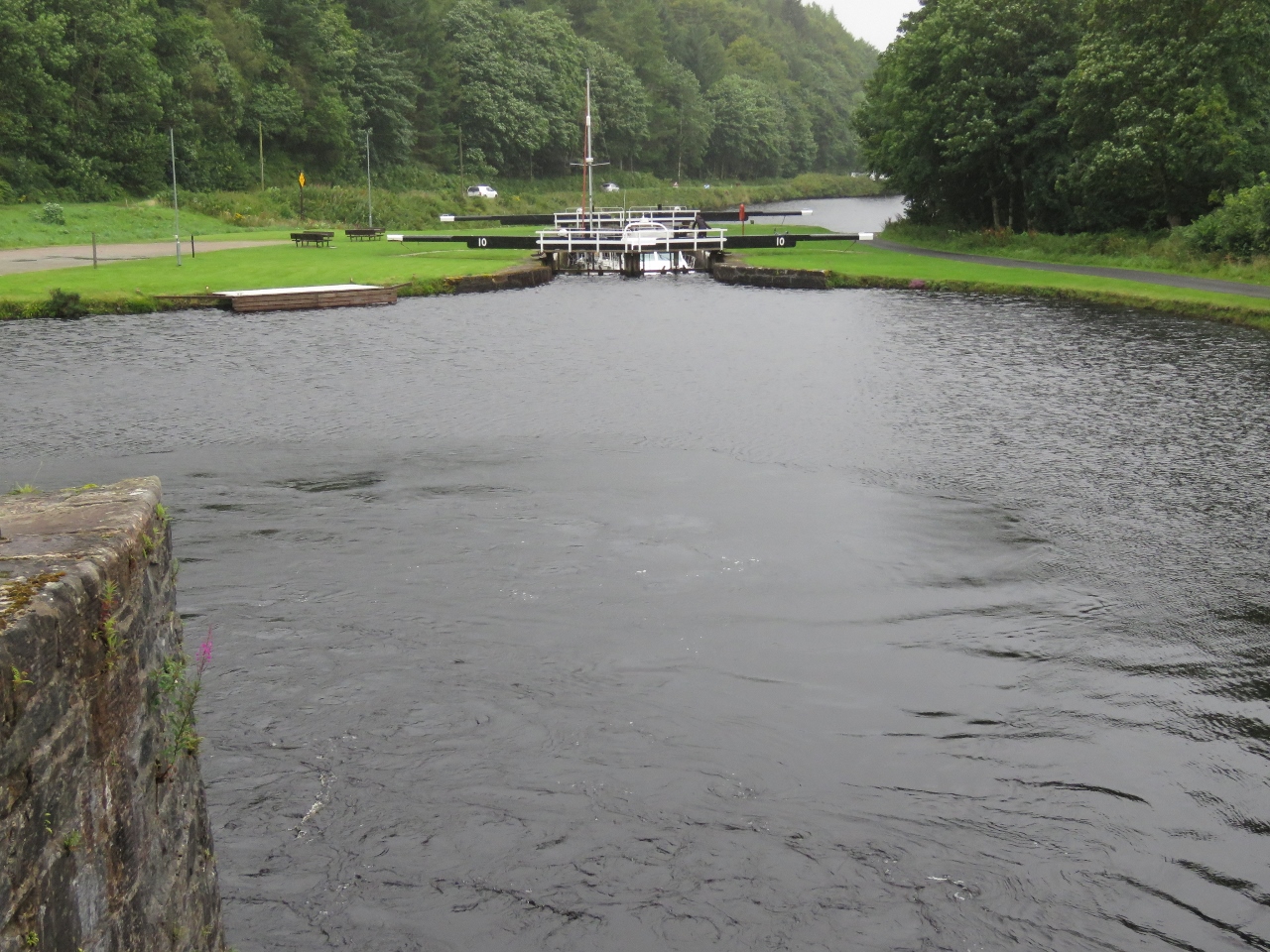
Looking from the north end of lock 9 to locks 10 and 11. The boats in lock 10 are coming towards us—we'll pass in the small basin ahead.
Locks 9 through 13 form a flight of locks very close together, as do locks 5 through 8. Through a flight, Jennifer stayed off the boat and walked between the locks to open and close the gates, wind the sluices and take the lines from James, who single-handed in and out of the locks. We were concerned that adjusting bow and stern lines to match the water level would be a challenge with only one person on board, but developed an approach of keeping both lines sufficiently loose to allow the locks to fully empty. The bow line basically isn't used at all, and we just gently tug forward on the stern line to keep the boat near the starboard side wall. As the lock empties, the boat slowly moves rearward. The bigger challenge was single-handing the boat in and out of the narrow locks. Someone joked that when locking through with two people, you have the choice of two jobs: work your butt off or be scared to death. |
 |
8/16/2017: Dunardy Bridge
Position: 56°3.83'N, -5°30.21'W
Dunardy Bridge runs right through the middle of lock 11.
|
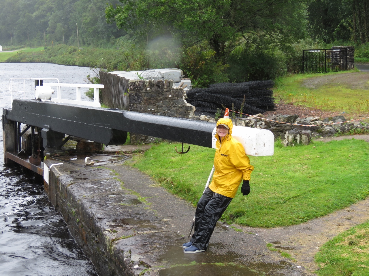 |
8/16/2017: Lock 11
Position: 56°3.83'N, -5°30.21'W
Closing the gate on lock 11. A heavy rain poured most of the day, but we were still having fun.
|
 |
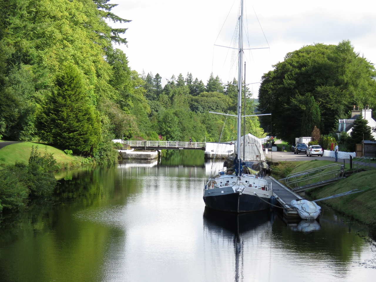
8/16/2017: Moored
Position: 56°4.49'N, -5°32.05'W
We were planning to run all the way to Crinan today and spend the night there, but we couldn't resist this beautiful single-boat mooring. And the canal has been such an enjoyable and unique experience that we didn't want to rush through.
|
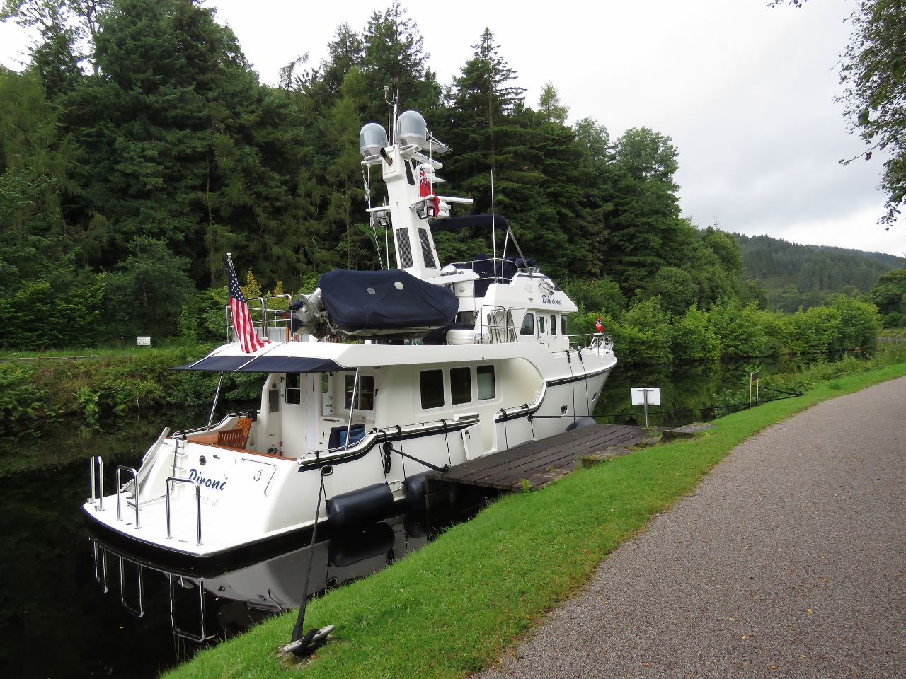 |
8/16/2017: Cleats
Position: 56°4.49'N, -5°32.05'W
We almost didn't stop because the dock is small, with only a single cleat. Then we noticed two strong cleats mounted on shore that would work perfectly.
|
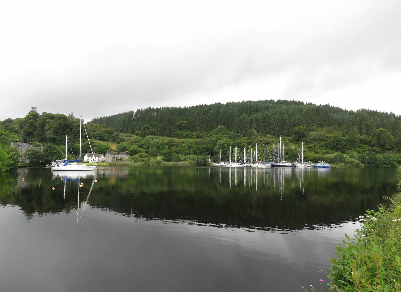 |
8/16/2017: Bellanoch Marina
Position: 56°4.60'N, -5°32.42'W
Private Bellanock Marina just up from our moorage.
|
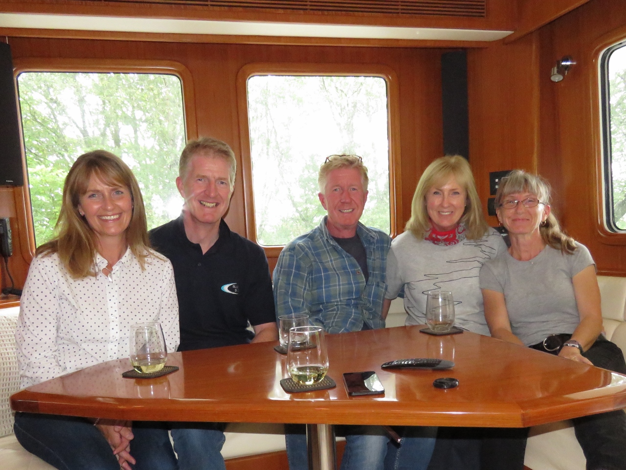 |
8/16/2017: Turners
Position: 56°4.49'N, -5°32.05'W
Gordon and Margaret Turner (beside Jennifer), owners of Nordhavn 63 Due North, live nearby and stopped by to say hello with Gordon's brother Alan and his wife Pauline. Gordon and Margaret have boated in the area for years and have given us lots of pointers on places to go and lent us some of the best cruising guides for the area. It was a fun visit.
|
 |
8/17/2017: Morning
Position: 56°4.49'N, -5°32.05'W
Another beautiful, calm morning along the Crinan Canal.
|
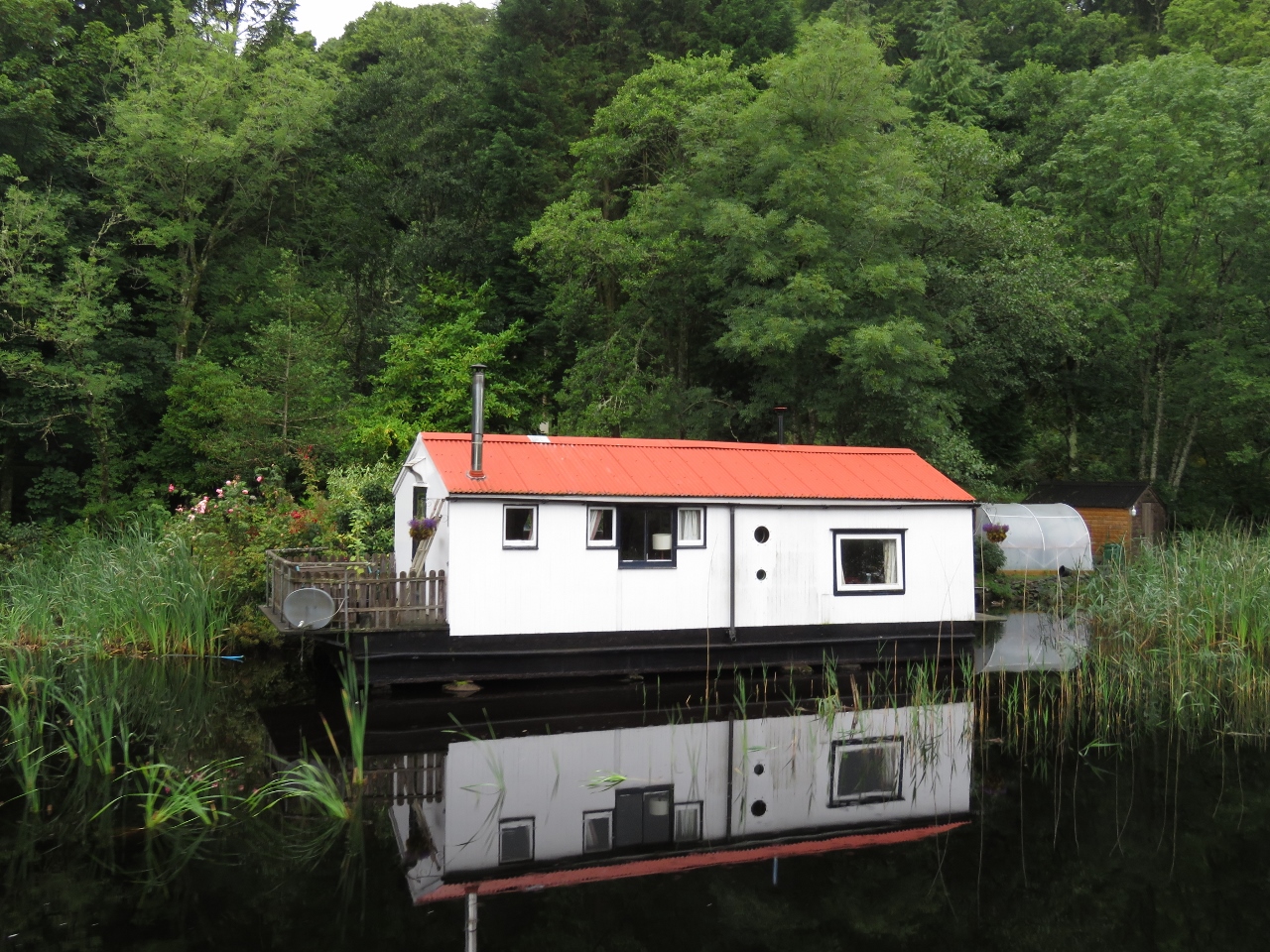 |
8/17/2017: Float Home
Position: 56°5.10'N, -5°32.94'W
This is the only floathome we saw along the canal.
|
 |
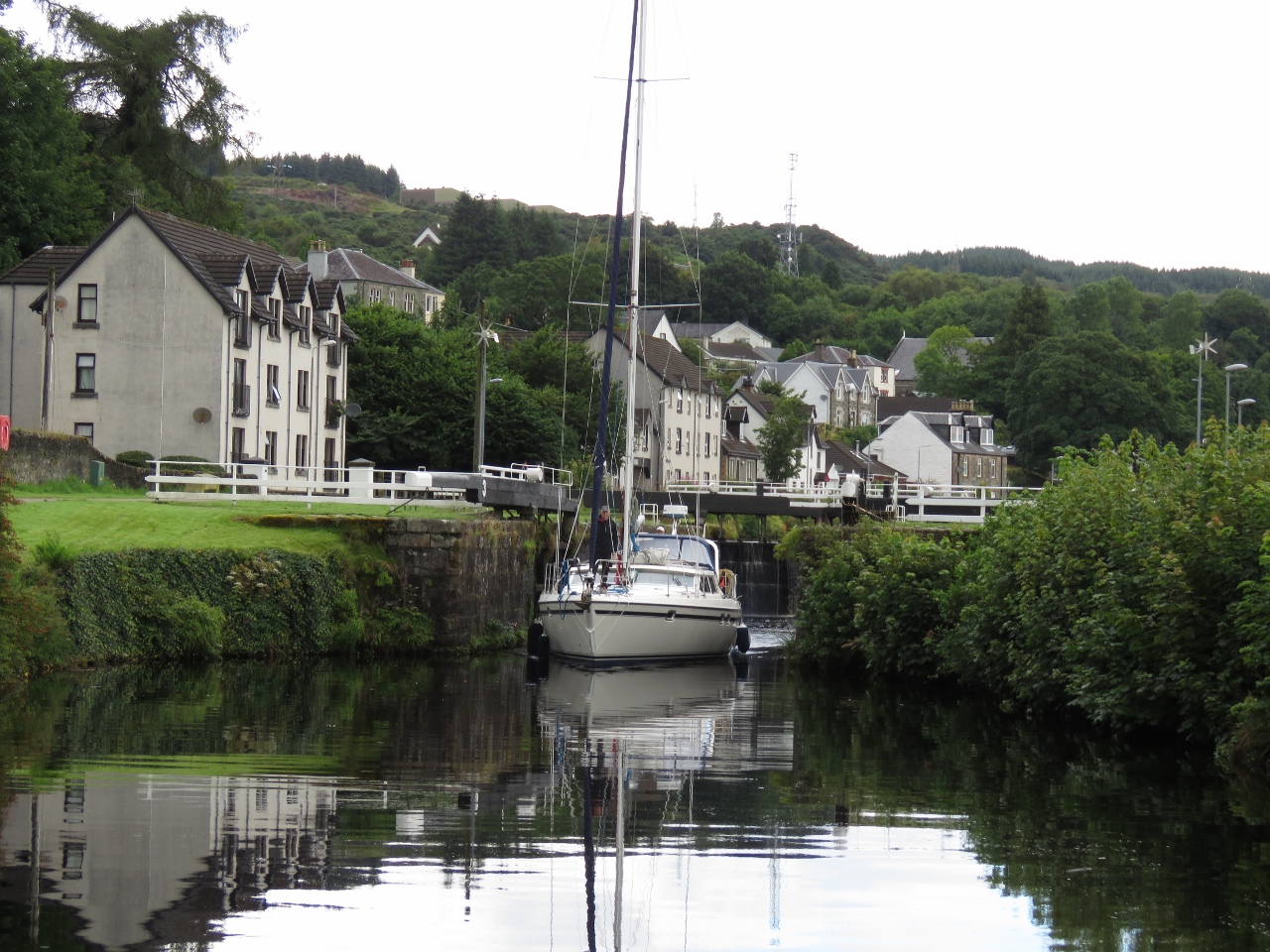
8/17/2017: Crinan Bridge
Position: 56°5.12'N, -5°32.91'W
Approaching Crinan Bridge, the last bridge we'll need opened on the canal. Despites the shallowness and the maximum 4-kt speed limit, we've so far we've had no trouble navigating the canal. Dirona is perfectly happy at 3-4 kts and we had no current to contend with. But this last section of the canal, between Bellanoch Marina and Crinan, is especially narrow and shallow and caused a surprisingly noticeable handling issue.
We've read of the "bank effect" in the past. This is the tendency for ship's stern to be pulled toward the nearest bank due to pressure differentials (Bernoulli's principle). This effect is important for commercial pilots to monitor when operating in narrow waterways. We've never felt the effect before and assumed it only applied to large ships in narrow channels. But the water displaced by Dirona is a large percentage of the Crinan Canal and it leads to weird handling at times. If you drift 2 to 3 feet over toward one bank, the stern will pull toward it and the bow will veer off heading the boat over to the opposite bank. The lower the speed the less the impact of this effect but, even as low as the 4-kt speed limit in the canal, we felt a pronounced bank effect that we have never before experienced. We initially thought we had a steering problem but it was just the bank effect where the bow tends to push off the bank and the stern tends to "suck" toward it. Another interesting (and related) anomaly when operating in narrow canals is the water rushes so fast from bow to stern that it drops 6 to 8 inches near the pilot house door. What appears to be happening is the passage of the boat through the still water requires the water in front of the boat to get to the stern but, since the boat fills much of the canal, we build up a several inch high plug in front of the boat and the water rushes from the bow to the stern of the boat far faster than we are actually travelling. |
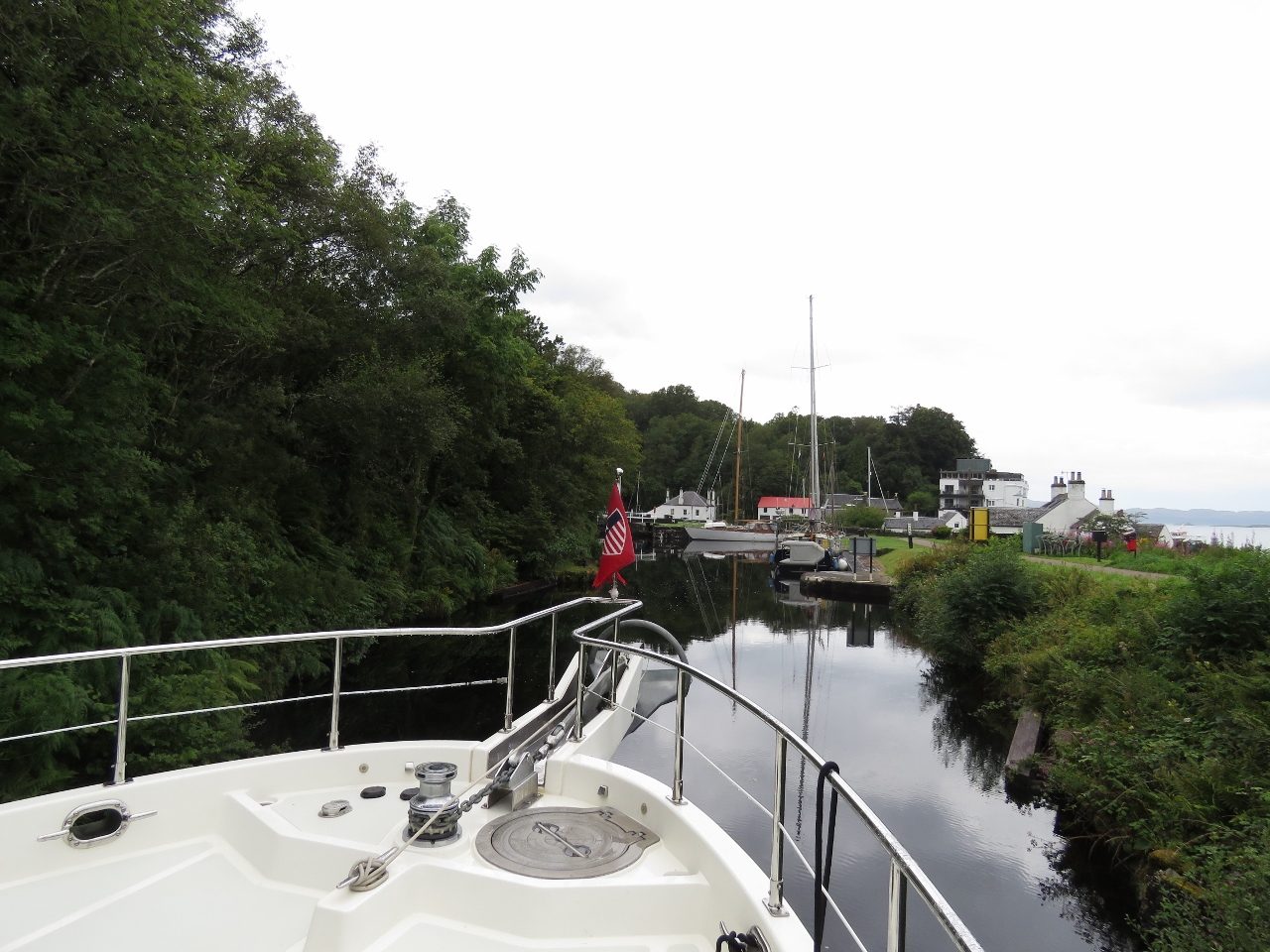 |
8/17/2017: Crinan
Position: 56°5.45'N, -5°33.24'W
Except in the locks, we rarely used the thrusters while transiting the canal. But the last turn at the Crinan end is tight enough that a gentle bit of bow thruster helps keep the boat central. We also noticed that a light touch of the thruster would quickly break the bank effect when it begins to suck the boat over. At these speeds the rudder doesn't have much water passing over it but the thrusters are particularly effective.
|
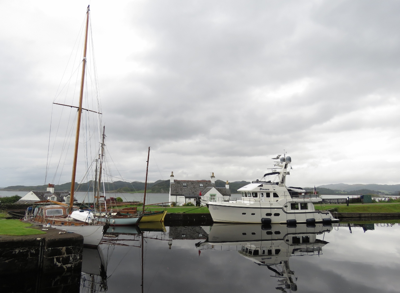 |
8/17/2017: Moored
Position: 56°5.43'N, -5°33.35'W
Moored for the night at Crinan. Moorage along the canal generally is on a first-come, first-served basis, but the Crinan Canal staff will monitor the progress of larger vessels to help ensure a smooth transit. The Crinan Bridge operator had called ahead to Crinan to let them know we were coming, and a berth was waiting for us above lock 14.
|
 |
8/17/2017: Lock 14
Position: 56°5.45'N, -5°33.29'W
Sailboat passing through lock 14 into Crinan Basin. We were expecting to moor in Crinan Basin and to pass through lock 14 today as well, but we were given a much better spot just outside the basin.
|
 |
8/17/2017: Crinan Basin
Position: 56°5.41'N, -5°33.38'W
Looking north across Crinan Basin. The sailboat that just passed through lock 14 is entering the sea lock at the far side of the basin. The large white building on the left is the Crinan Coffee Shop and the multi-story building at the far right is the Crinan Hotel.
|
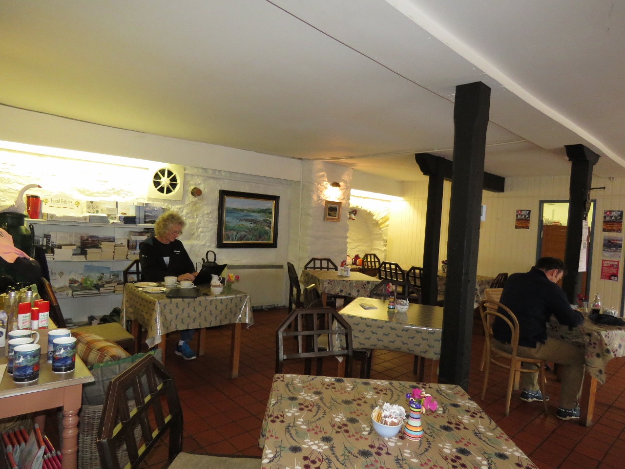 |
8/17/2017: WiFi
Position: 56°5.44'N, -5°33.41'W
We're using both Vodafone and O2 for cellular data connectivity, and were surprised to find no connectivity along most of the canal or in any of the towns. It's particularly surprising that we didn't have connectivity in Crinan, but did in the secluded part of the canal where we moored last night. To reduce our satellite data usage, we updated our devices using the Crinan Coffee Shop's WiFi over coffee and delicious shortbread. Another customer commented that we had a surprisingly large number of devices: two laptops, two tablets, and three phones.
|
 |
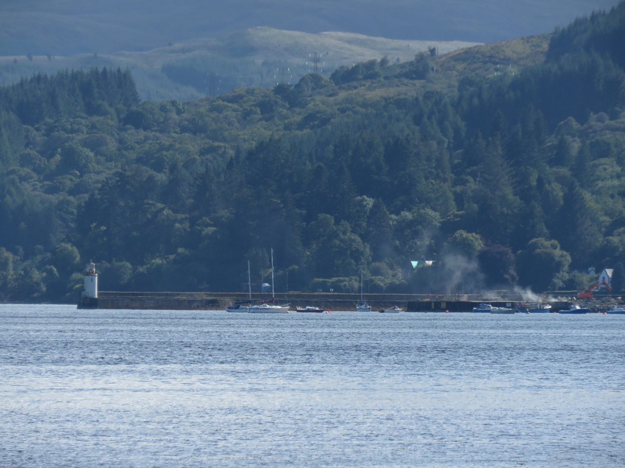
8/17/2017: Crinan Lighthouse
Position: 56°5.50'N, -5°33.51'W
The Crinan sea lock with the Crinan Lighthouse beyond.
|
 |
8/17/2017: Crinan Boatyard
Position: 56°5.48'N, -5°33.58'W
The Crinan Boatyard looked well-equipped, with a large multi-story indoor shed. This commercial boat was being winched up the marine ways as we walked past.
|
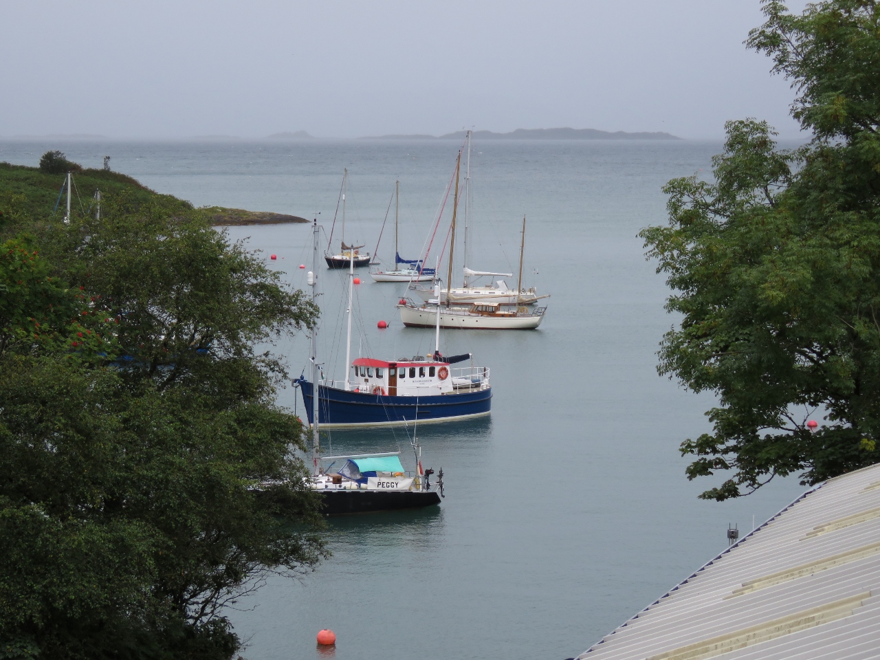 |
8/17/2017: Crinan Harbour
Position: 56°5.47'N, -5°33.61'W
Vessels moored in Crinan Harbour, outside the sea lock.
|
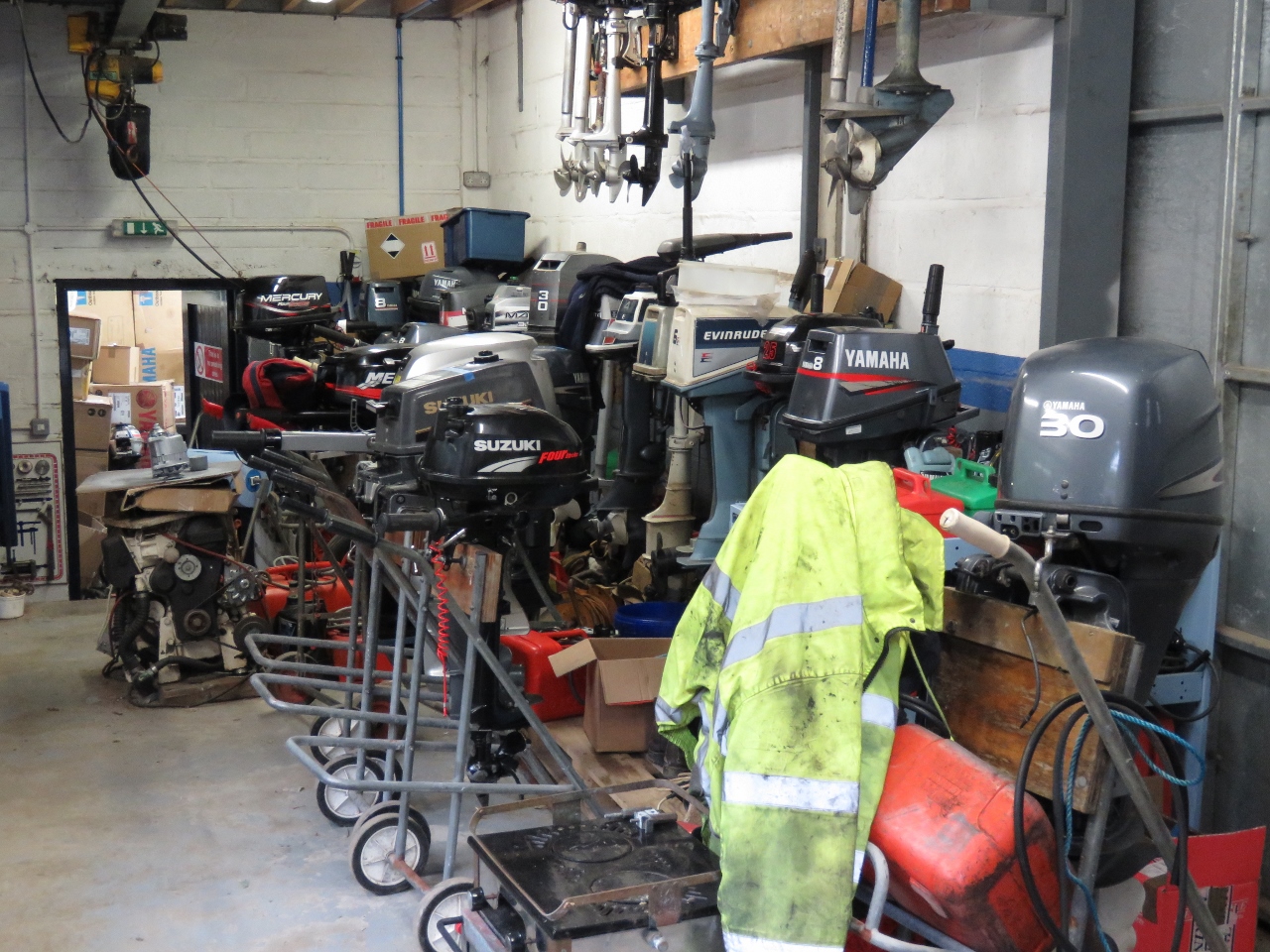 |
8/17/2017: Outboards
Position: 56°5.48'N, -5°33.67'W
A good dozen outboard engines of all vintages and makes in for service at Crinan Boatyard. We've noticed a bit of an anomaly around outboard engines with respect to the wealth of the area: old engines are more common in more well-off places, and fairly rare in less-well-off places, such as throughout the South Pacific.
If maintenance and repair skills are available, old engines are kept running for years. But these skills are less common in places like the South Pacific, so engines fail more quickly and typically are replaced with new ones. |
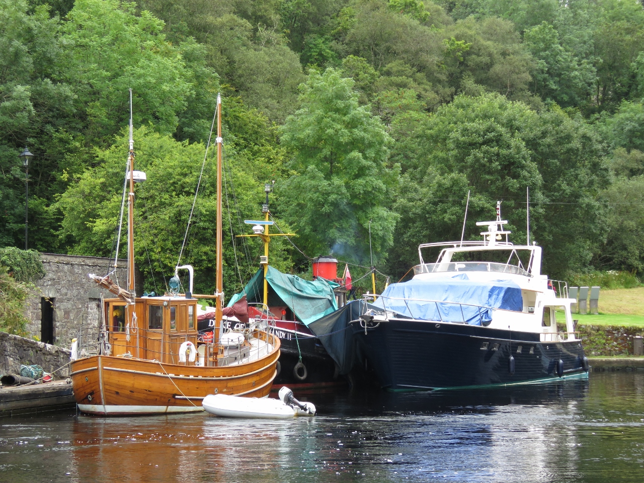 |
8/17/2017: Duke of Normandy
Position: 56°5.46'N, -5°33.29'W
The beautiful teak vessel Sgarbh, moored in front of the Duke of Normandy. Sgarbh (gaelic for cormorant) is a refitted commercial herring boat, built in 1947 on the River Clyde in Glasgow. The Duke of Normandy is one of the few remaining Clyde Puffers, coal-fired cargo ships built on mainly on the Firth and Clyde canal that once plied the Scottish coast.
|
 |
8/17/2017: Crinan Hotel
Position: 56°5.48'N, -5°33.43'W
A delicious seafood dinner at the Crinan Hotel.
|
 |
8/17/2017: Dusk
Position: 56°5.45'N, -5°33.29'W
After dinner at the Crinan Hotel, we enjoyed another calm evening for our last night on the canal.
|
 |
8/18/2017: Crinan Sea Lock
Position: 56°5.46'N, -5°33.39'W
In the sea lock preparing to exit the Crinan Canal after passing through lock 14. The Crinan Canal staff controls the gates and sluices hydraulically at bridge crossing and the sea locks at either end, including lock 14, so these last two locks are easier for us, and much faster, than the inner locks.
|
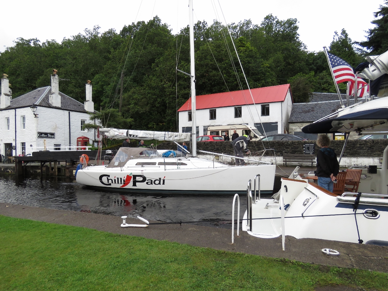 |
8/18/2017: Chilli Padi
Position: 56°5.46'N, -5°33.39'W
For the only time on the Crinan Canal, we shared a lock with another boat. We last saw Chili Padi at Lough Swilly Marina where we made our day trip to the Causeway Coast in Northern Ireland.
|
 |
8/18/2017: Crinan Canal Video
Position: 56°5.46'N, -5°33.39'W
Here's our video of our three-day trip through the Crinan Canal: Dirona through Scotland's Crinan Canal.
The Crinan Canal is a 9-mile, 15-lock passage between Ardrishaig and Crinan in Scotland. The canal came online in 1801 largely serving commercial traffic and allowing them to avoid the longer run around Kintyre Peninsula and the exposed and current-swept Mull of Kintyre. Today the lock system is used by recreational boaters either avoiding that same long run around the Mull of Kintyre or just wanting to experience the beauty of the canal. On Dirona, we have in the past transited large lock systems including the Columbia and Snake river locks but what makes the Crinan Canal special is the intimacy of the trip. It’s barely bigger than the boat, the Scottish countryside is beautiful, and the locks are all operated by hand. Boaters have to run the locks themselves including providing the "horsepower" to open and close the large wooden gates and actuate the sluice gates. It makes for a really fun trip and, with only two people on the boat, it’s surprisingly busy. As is often the case in Scotland, we had driving rain, bright sun, still conditions, and wind gusts to 30 kts. The rain and wind made things more challenging with Jennifer on shore operating the locks and James on the boat moving in and out of the locks and tending the lines. |
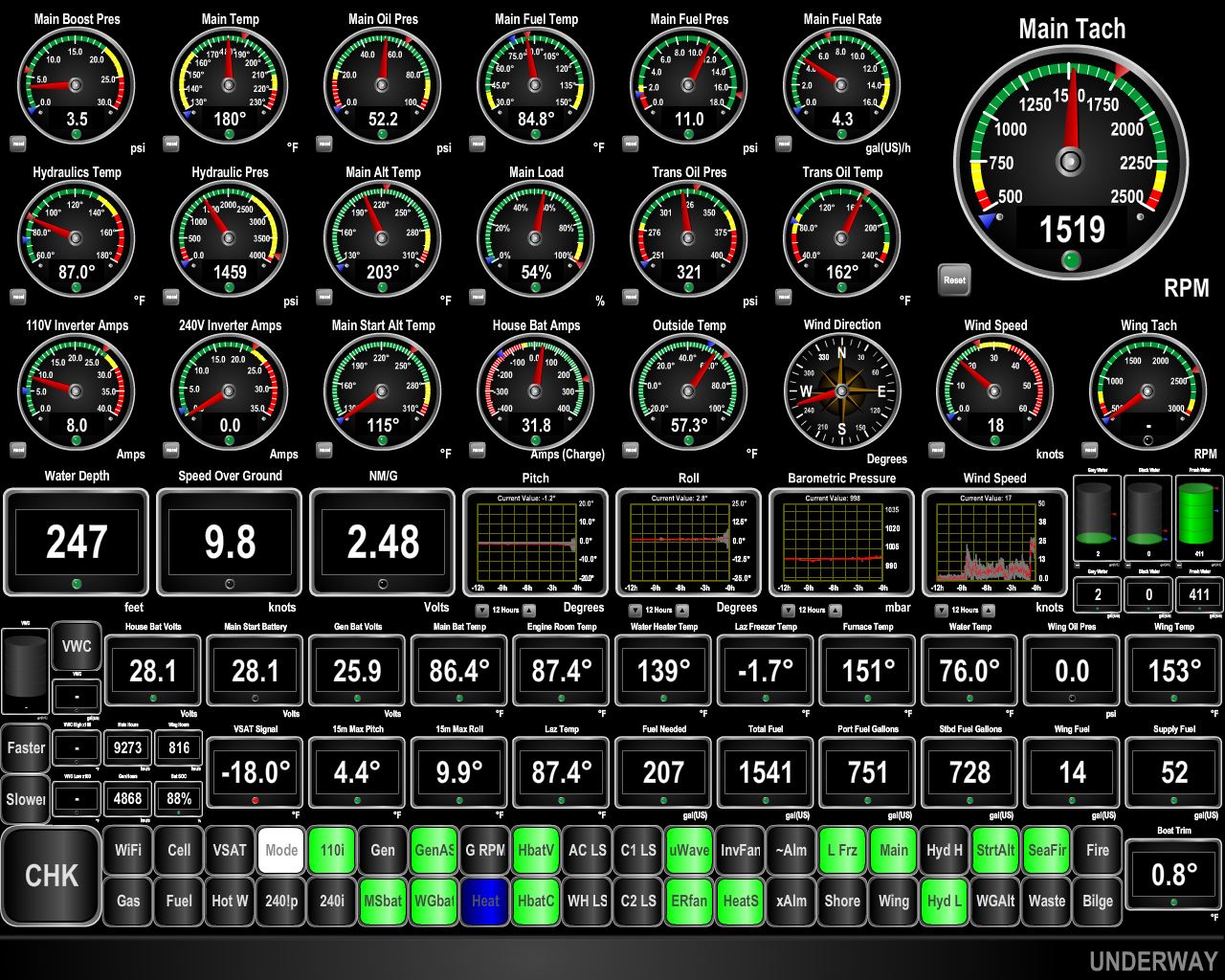 |
8/18/2017: 9.8 knots
Position: 56°7.41'N, -5°39.61'W
Currents run swiftly in the Sound of Jura. We're doing 9.8 knots at 1,500 RPM when normally we'd be doing about 7.5 kts at that RPM and the current isn't running very strongly right now. We're close to the famed Gulf of Corryvreckan, between Jura and Scarba Islands, where 8.5-knot spring currents generate dangerous whirlpools and overfalls. When a west-bound current meets and opposing large Atlantic swell, conditions make the passage nearly impassable.
Slack water at the gulf was early this morning, before the locks begin operation, or mid-afternoon, later than we'd prefer to pass through. So we'll continue north through the Sound of Luing to reach the Firth of Lorn. In larger tides, the Gulf of Corryvreckan is a tourist attraction. Hopefully we'll have a chance to see it in full force later in October after we pass south through the Caledonian Canal. |
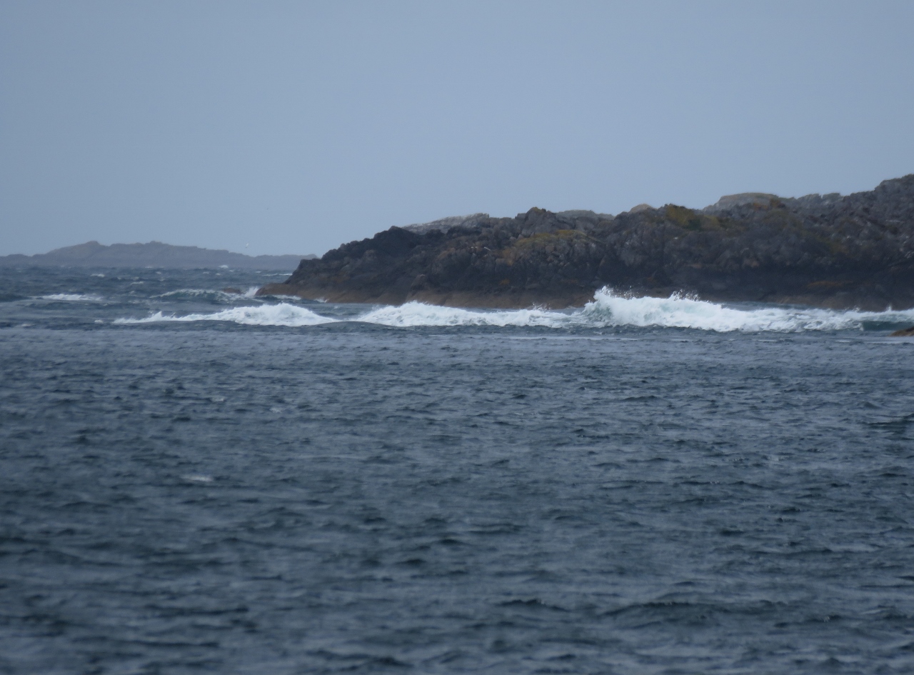 |
8/18/2017: Standing Waves
Position: 56°11.85'N, -5°40.11'W
Current-formed standing waves in the narrow passage between Lunga and Scarba Islands. Our charts are full of warnings about strong tidal currents in the area. We're riding the last half of a neap flood tide north, and still currents are extremely strong. It must be pretty exciting here during a large spring tide.
|
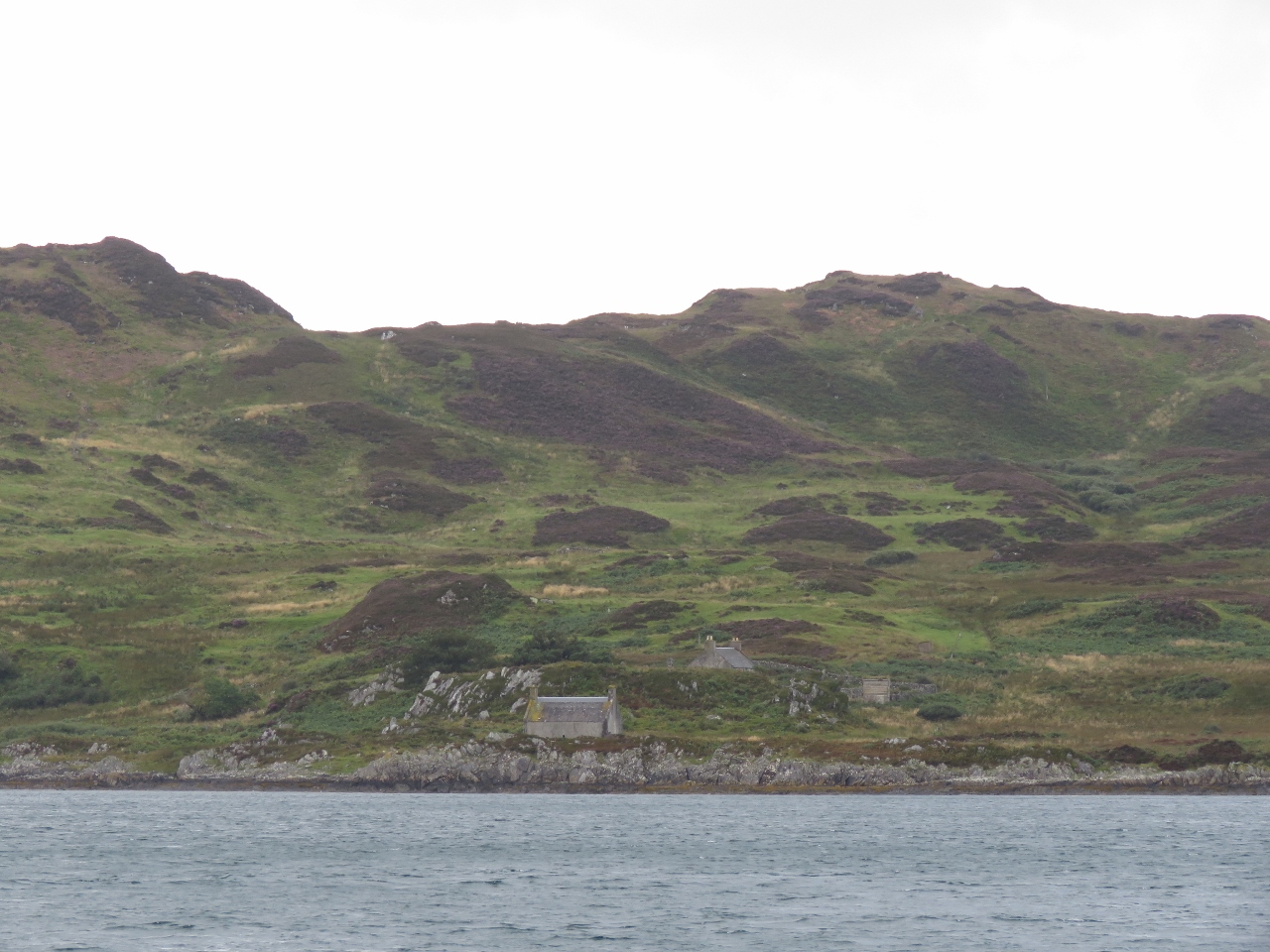 |
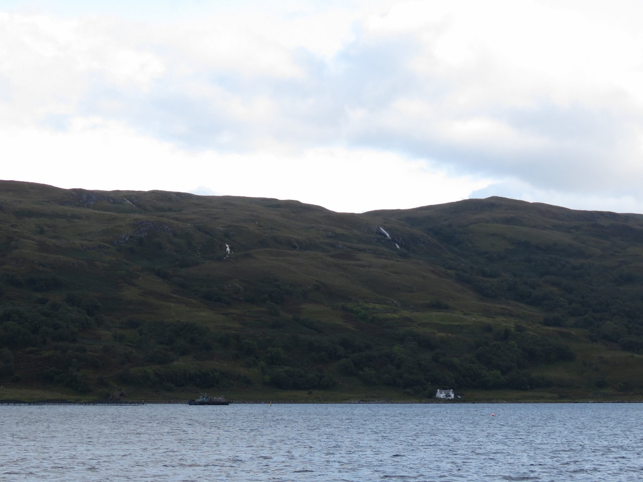
8/18/2017: Lunga Island
Position: 56°13.09'N, -5°40.60'W
Houses at the base of green hills looking east to Lunga Island.
|
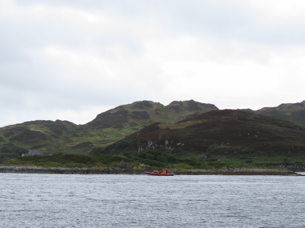 |
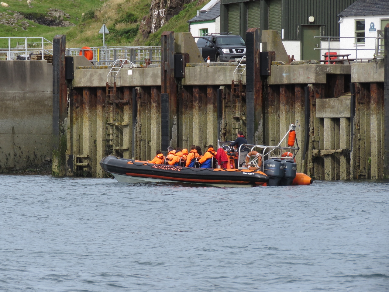
8/18/2017: Eilean Nan Ceann
Position: 56°13.44'N, -5°40.92'W
High speed RIB with a load of tourists on board off Eilean Nan Ceann (eilean means island in Gaelic). The boat was playing in the current between Lunga and Scarba Islands earlier.
|
 |
8/18/2017: Upwelling
Position: 56°13.54'N, -5°41.26'W
The current through the gap between Lunga and Scarba Islands is strong enough to produce upwellings well to the northeast.
|
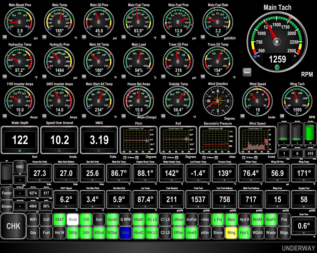 |
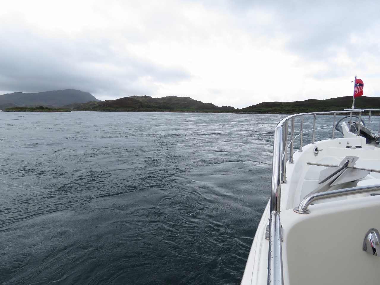
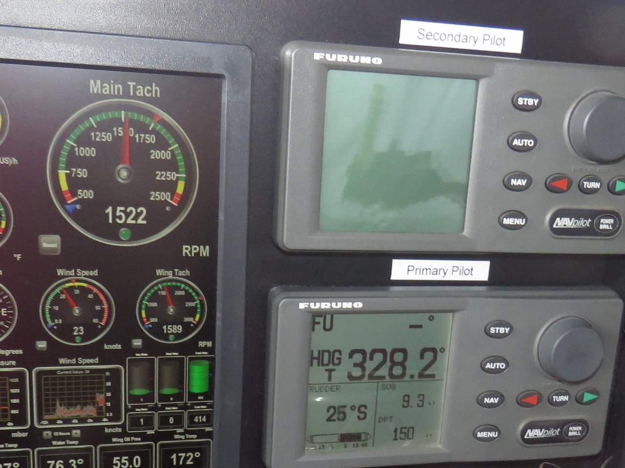
8/18/2017: 10.2 knots
Position: 56°13.98'N, -5°41.29'W
We're two hours before the end of a neap flood and still are doing 10.2 knots as we near the north end of Lunga Island. At 1259 RPM, we'd typically be doing 6.25 knots.
|
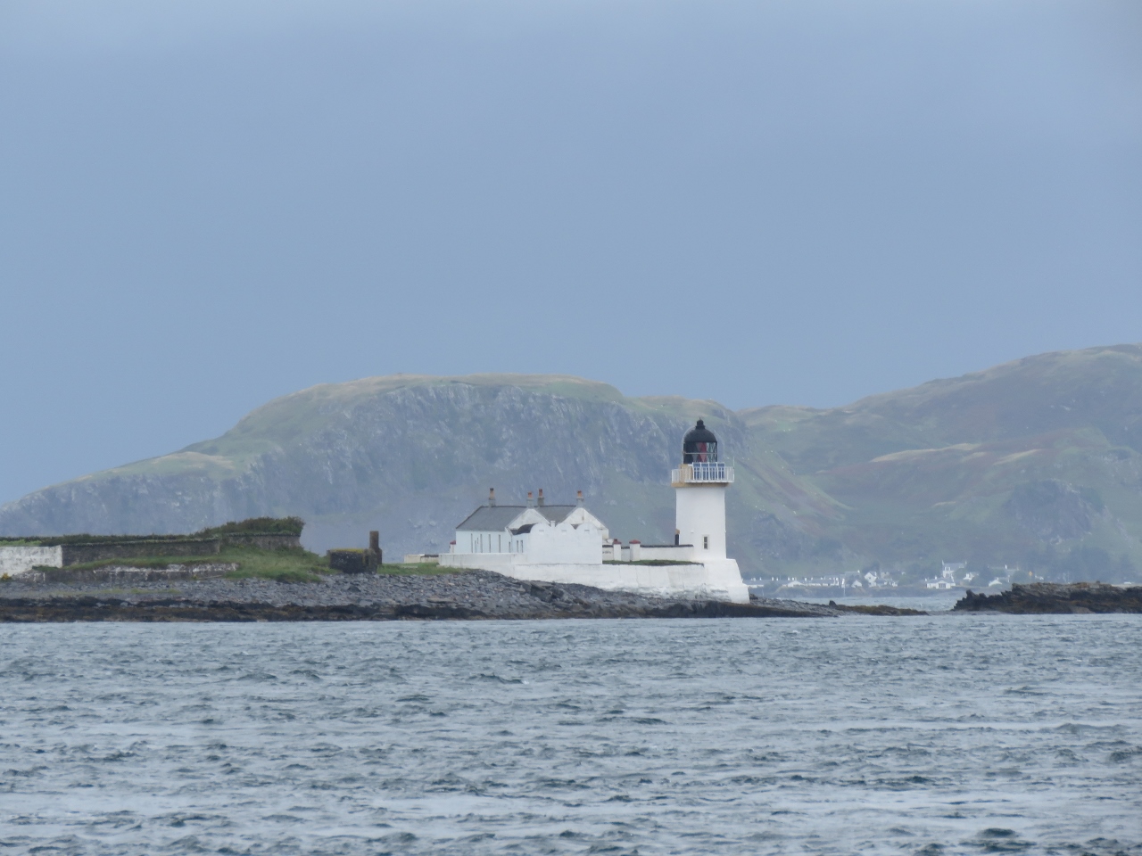 |
8/18/2017: Fladda Lighthouse
Position: 56°14.14'N, -5°41.29'W
The lighthouse on Fladda Island was built in 1860. The island originally had no grass or soil—the lighthouse keepers grew a garden using peat brought from Ireland.
|
 |
8/18/2017: Firth of Loin
Position: 56°14.14'N, -5°41.29'W
Looking north to the Firth of Loin as we exit the Sound of Luing. The current was running swiftly here, but with mostly laminar flow and no whirlpools or upwellings.
|
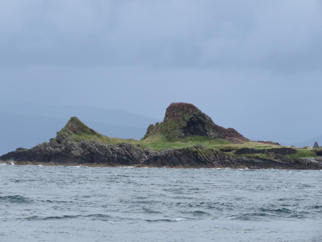 |
8/18/2017: Balnahua Island
Position: 56°14.62'N, -5°41.51'W
Looking north to dramatic formations on the west end of Balnahua Island as we exit the Sound of Luing.
|
 |
8/18/2017: 25 degrees
Position: 56°14.90'N, -5°41.69'W
We started to see upwelling and whirlpools just west of Balnahua Island. They weren't difficult to navigate through, but James did have to apply a fair bit of rudder on occasion. Here we're got 25 degrees of starboard turn in.
|
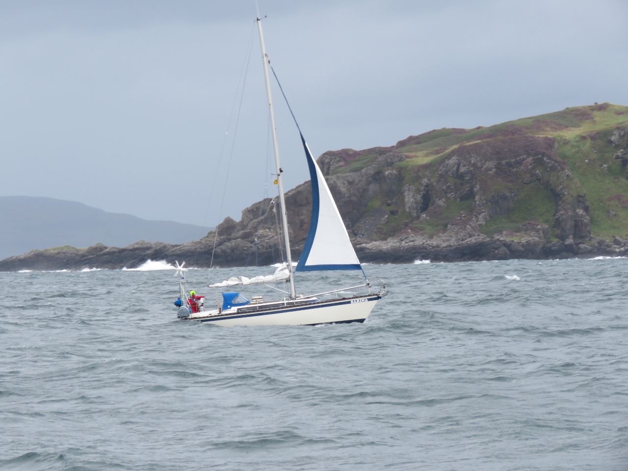 |
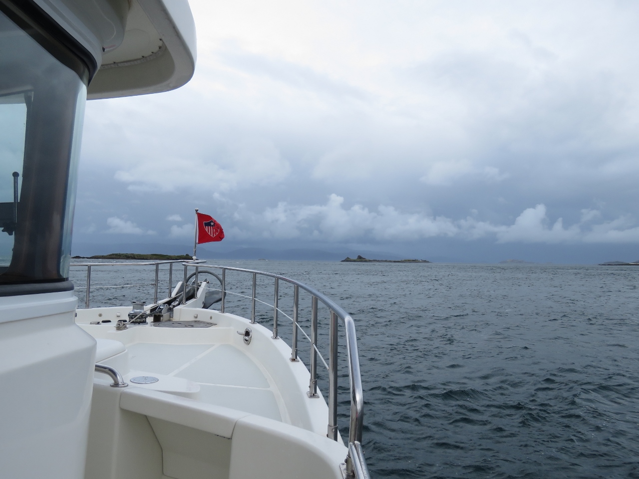
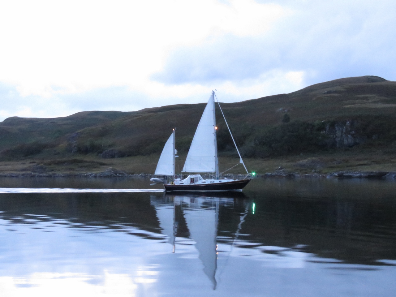
8/18/2017: Sarina
Position: 56°18.41'N, -5°41.66'W
Sailing vessel Sarina heading south off Insh Island with minimal sail. The winds are picking up now for a storm we expect will last a couple of days.
|
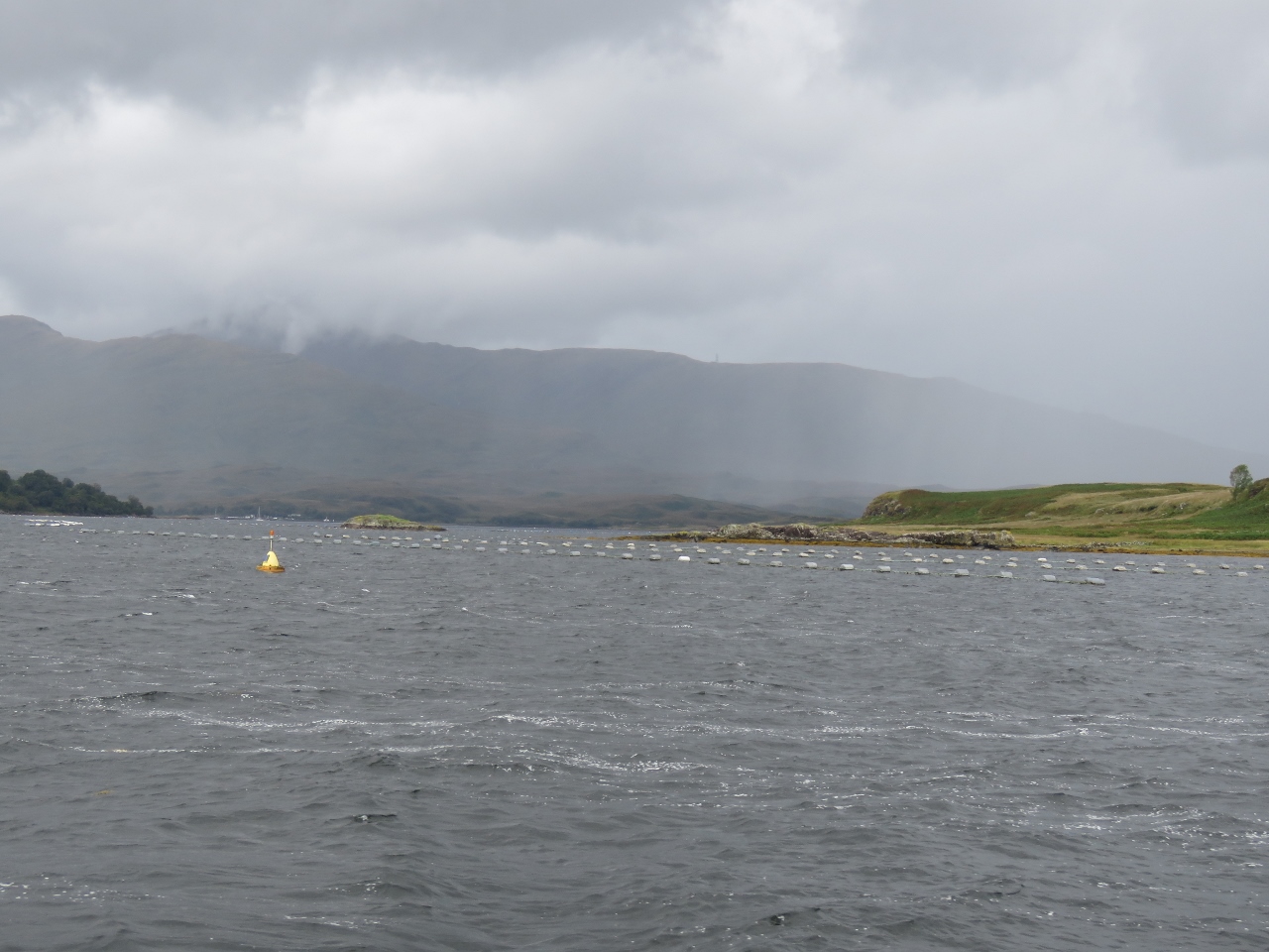 |
8/18/2017: Loch Spelve
Position: 56°23.16'N, -5°42.76'W
Aquaculture at the entrance to Loch Spelve. Our cruising guide described the entry as a little difficult, with shallows on each side, and 3.5-4 kt currents on spring tides. We'd arrived about three hours before high water slack and were expecting to encounter some current in the entrance. But the entry was straightforward with no obvious current on this neap exchange.
|
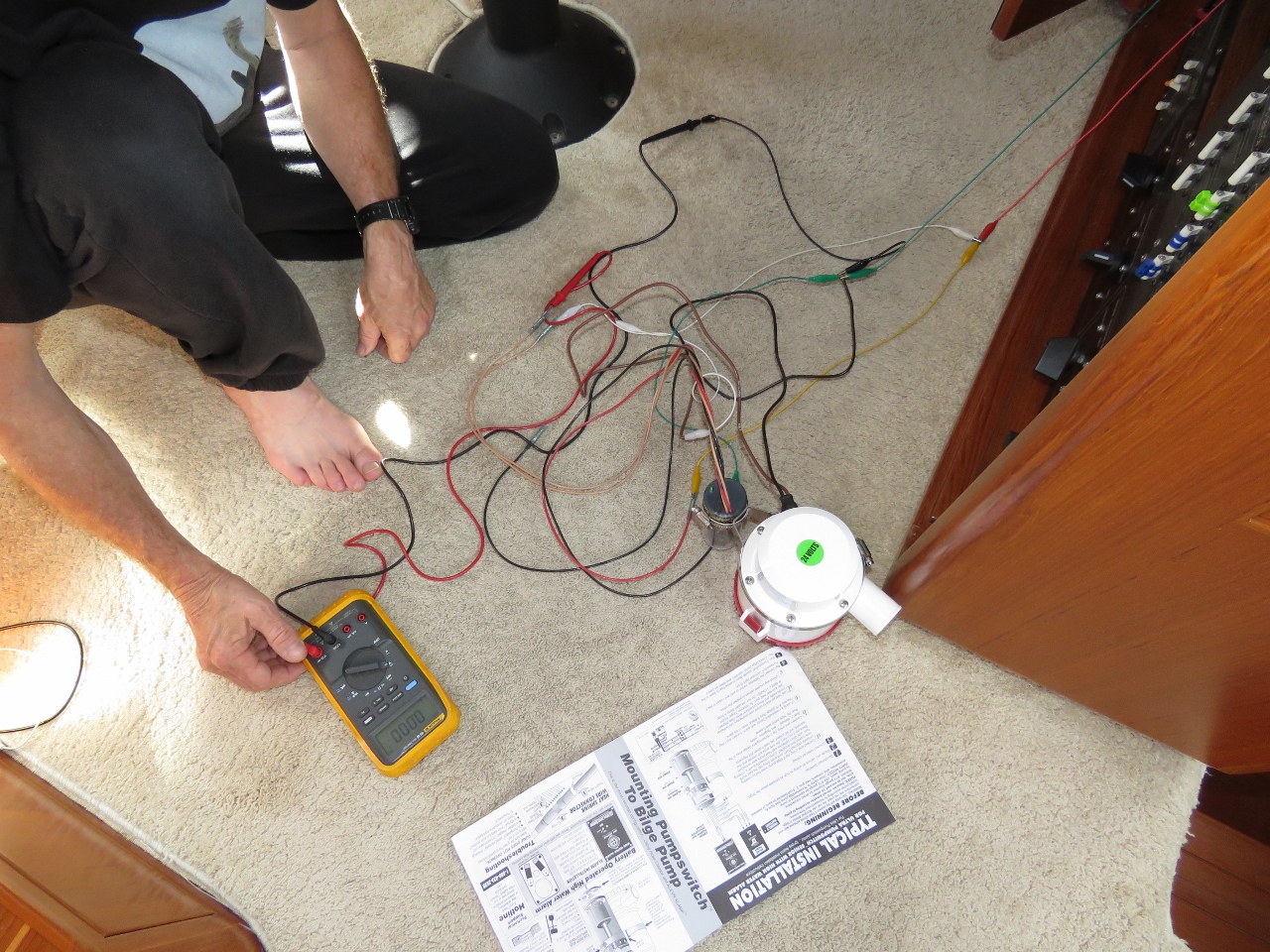 |
8/18/2017: Bilge Pump
Position: 56°23.10'N, -5°45.08'W
James completed the physical design and layout on the new primary bilge pump system. We have all the parts we need except a 2" male to 1.5" female PVC bushing. (We'd ordered the correct parts and picked them up in Seattle, but were sent .5" parts instead of 1.5").
|
 |
8/18/2017: Winds
Position: 56°23.06'N, -5°45.09'W
One of the reasons we stopped at Loch Spelve is we're expecting strong winds from the southwest through northwest and it's one of the few anchorages in the area with protection from all those directions. We tucked away against the west shore with plenty of rode out and enjoyed the storm as the winds came up.
|
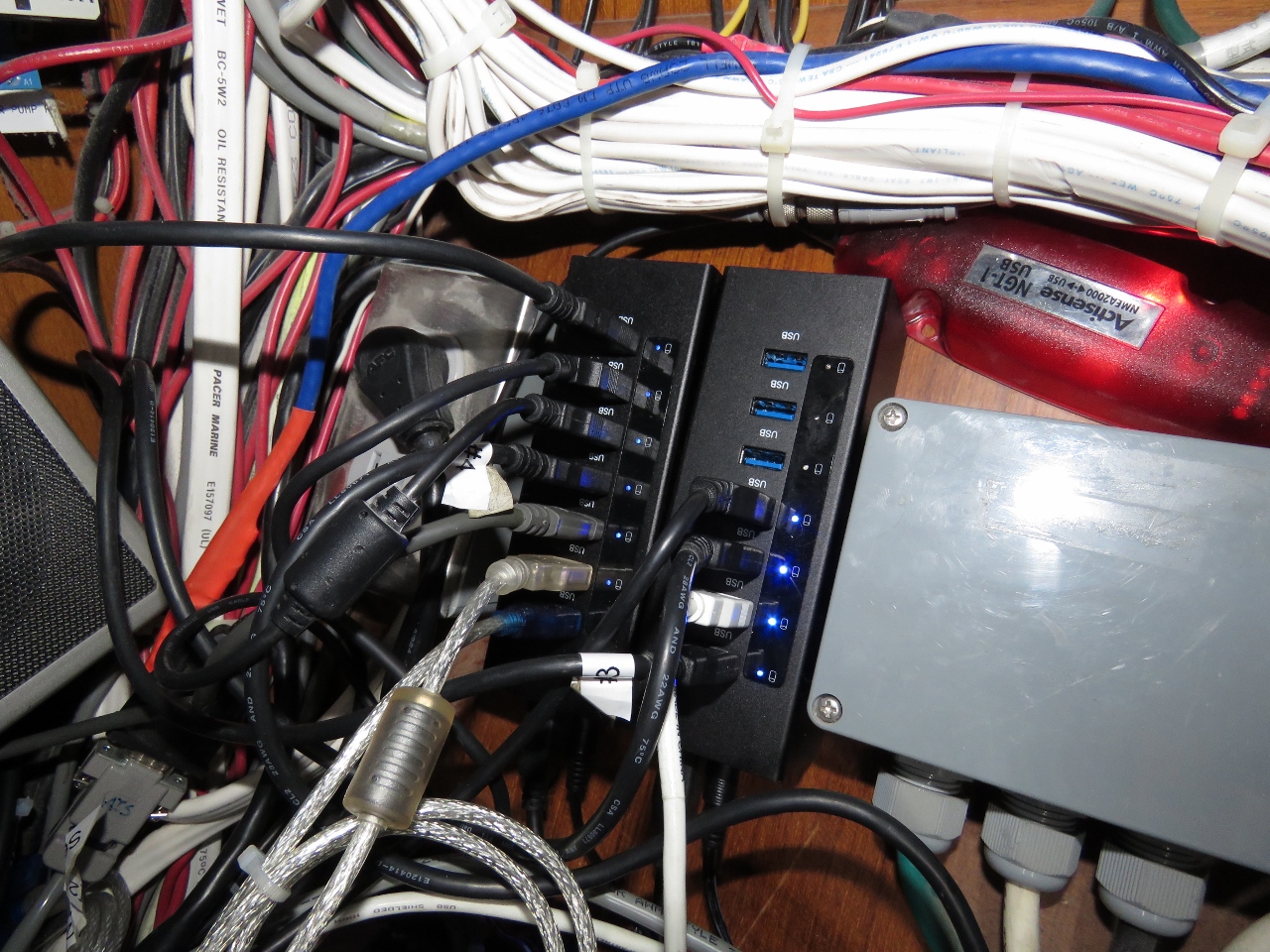 |
8/19/2017: USB Hubs
Position: 56°23.08'N, -5°45.08'W
Over the last few months, we have seen several instances of the nav computer locking up and have fixed several known hardware issues. Our nav computer is redundant and all navigation data is available on the Furuno MFD black-box, and we have a complete set of spares for all hardware components. But many of the control systems on Dirona, including the critical generator auto-start, are hosted only on the nav computer, so we really don't want it down. We're still seeing roughly weekly lockup issues, but the automatic reboot support we implemented in Newport RI mitigates the problem. However, we'd like to see it running without issue for many weeks at a time.
We drive a lot of connections through the computer via USB and one final possible hardware issue is the USB hubs. In Loch Spelve we upgraded the existing 14-port USB hub to two 7-port hubs we brought back from Seattle.The new hubs are all Gen 3 ports supporting Multiple Transaction Translators (MTT). Unlike the previous hub, these support all devices and none need to be directly connected to the nav computer. |
 |
8/19/2017: Wind
Position: 56°23.08'N, -5°45.08'W
As expected, the winds came up and have been gusting into the 40s for the past day. We expect calmer conditions tomorrow.
|
 |
8/19/2017: Waterfalls
Position: 56°23.07'N, -5°45.08'W
After a day of storms and rain, waterfalls are flowing across Loch Spelve from our anchorage.
|
 |
8/20/2017: Exiting
Position: 56°23.16'N, -5°42.39'W
Conditions have settled down and we exited Loch Spelve near high-water slack. We weren't the only boat with that idea.
|
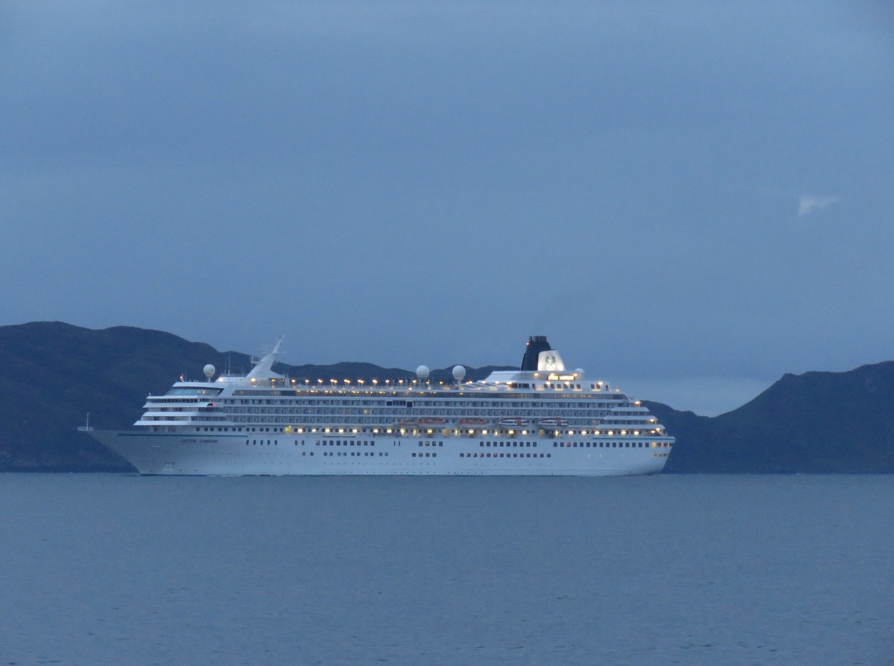 |
8/20/2017: Crystal Symphony
Position: 56°22.19'N, -5°41.09'W
The cruise ship Crystal Symphony heading north in the Firth of Loin.
|
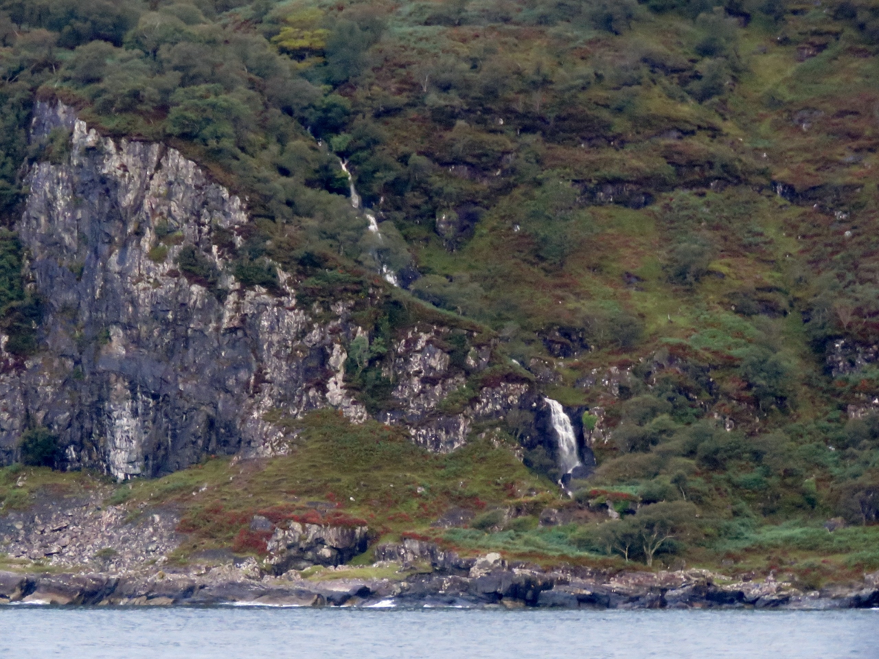 |
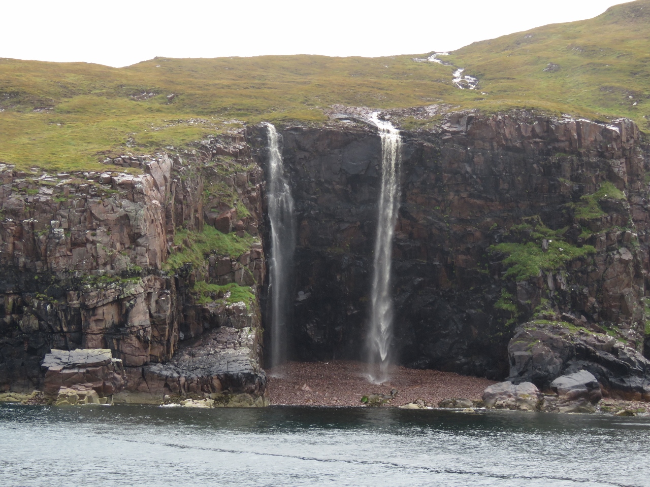
8/20/2017: Waterfall I
Position: 56°21.02'N, -5°42.95'W
The reward for the past few days of rain is spectacular waterfalls along the south of coast of Mull.
|
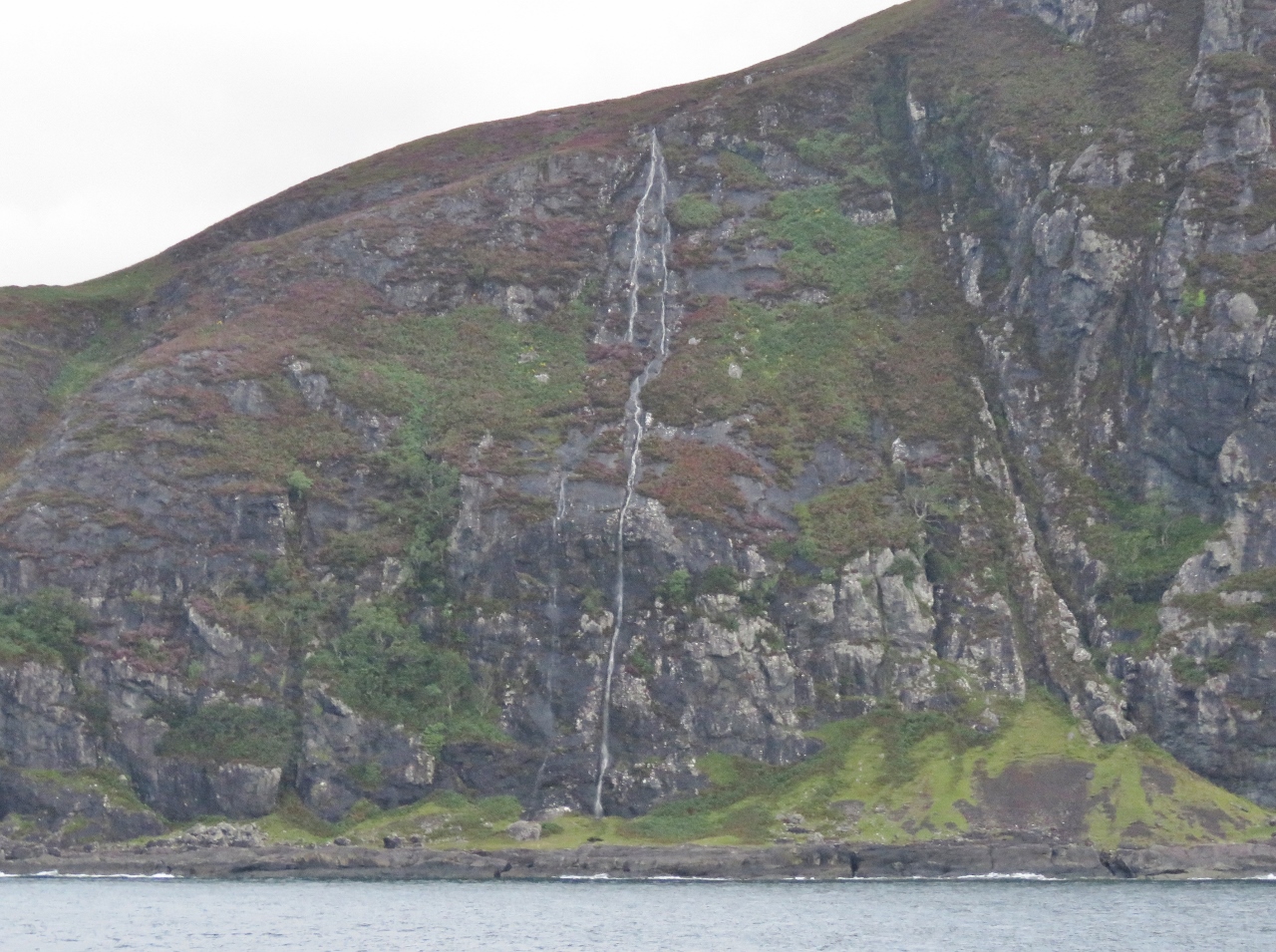 |
8/20/2017: Waterfall II
Position: 56°19.72'N, -5°45.67'W
Another dramatic Isle of Mull waterfall.
|
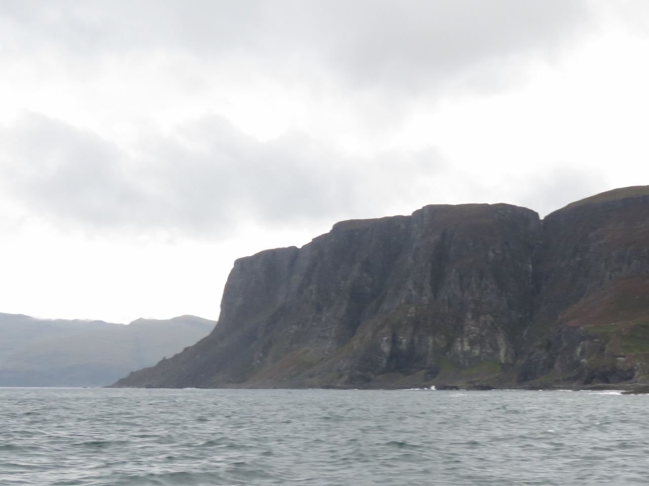 |
8/20/2017: Rubha na Faoilinn
Position: 56°18.25'N, -5°50.26'W
The bold headland of Rubha na Faoilinn just south of Loch Buie.
|
 |
8/20/2017: Waterfall III
Position: 56°18.53'N, -5°59.69'W
Another impressive waterfall, this one just south of Carsaig Bay.
|
 |
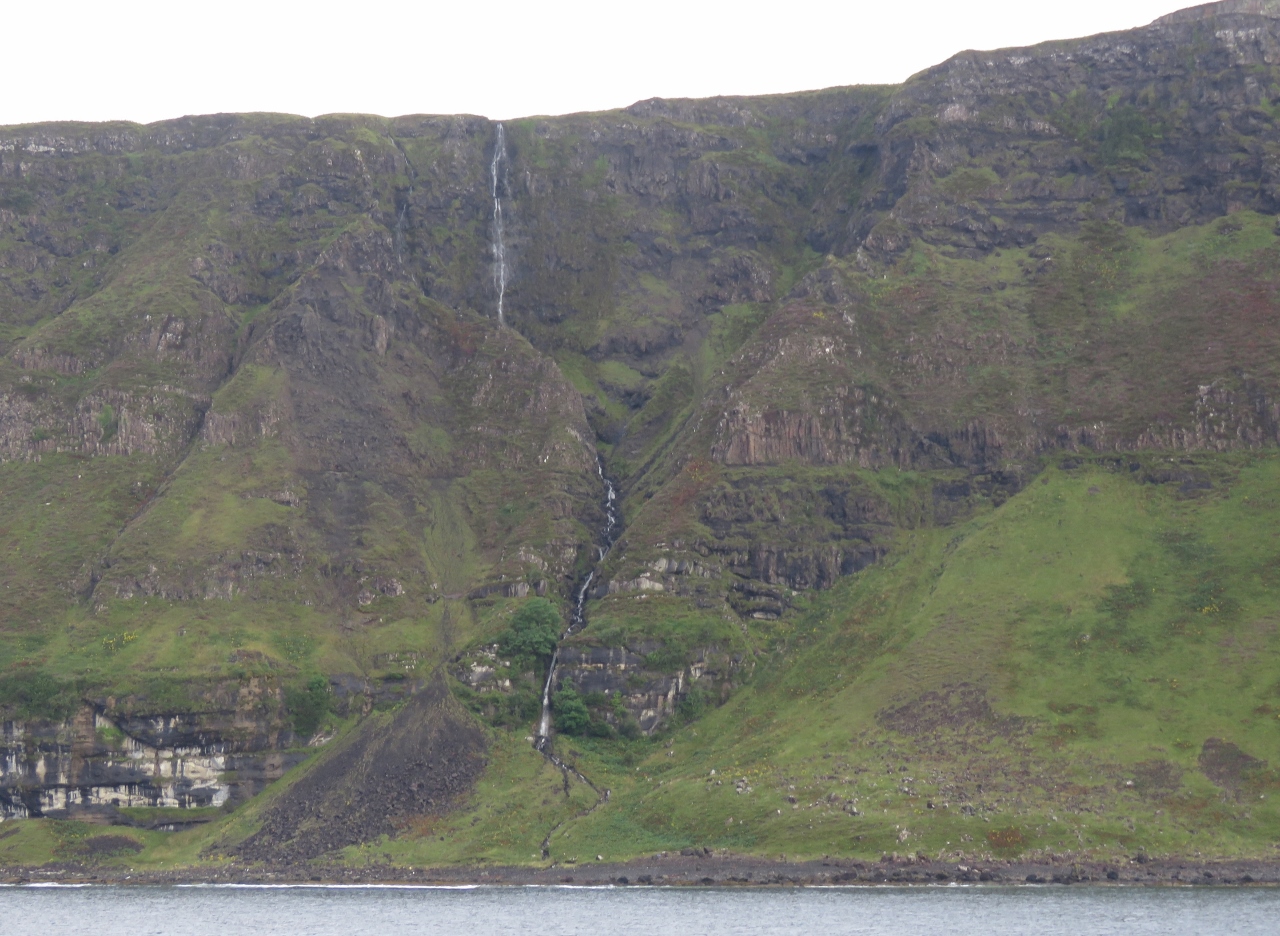
8/20/2017: Waterfall IV
Position: 56°18.32'N, -6°0.50'W
A three-level waterfall, also just south of Carsaig Bay.
|
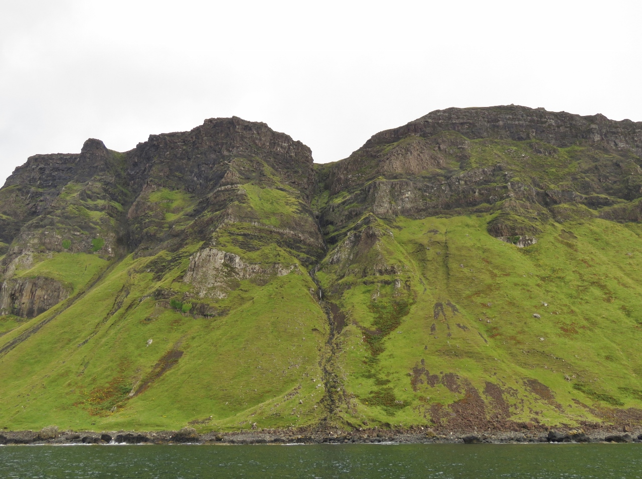 |
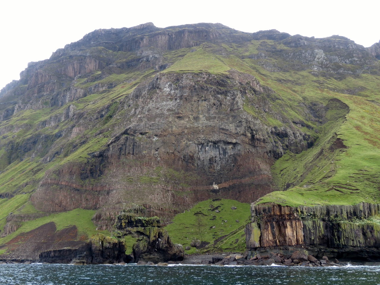
8/20/2017: Cliffs
Position: 56°17.79'N, -6°1.70'W
The shore between Carsaig Bay and Malcolm's Point along the south coast of Mull is particularly striking, with soaring cliffs atop steep grass-covered slopes. We didn't think anything could rival the spectacular scenery along Ireland's west coast, but Scotland is really impressing us.
|
 |
8/20/2017: Carsaig Arches
Position: 56°17.46'N, -6°3.23'W
The Carsaig Arches in front of 220m cliffs at Malcolm's Point. A somewhat oval-shaped arch is just above the waterline in the rock left of center, with green grass visible through it. A spire stands slightly to the left atop the arch roof.
|
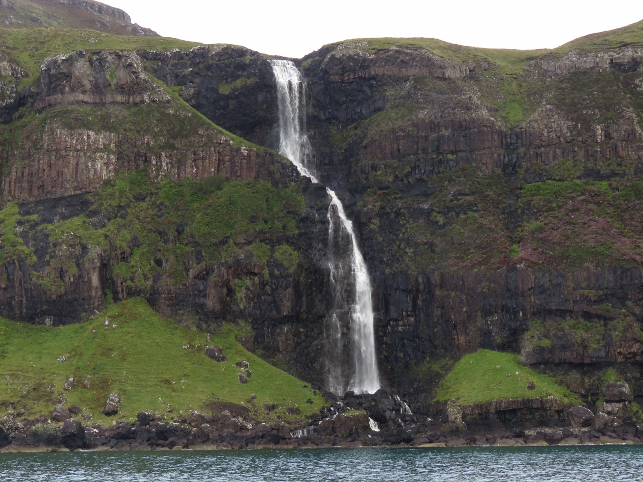 |
8/20/2017: Best Waterfall
Position: 56°17.96'N, -6°4.63'W
This waterfall just west of the Carsaig Arches was the most beautiful of the day. We were tempted to anchor there for breakfast.
|
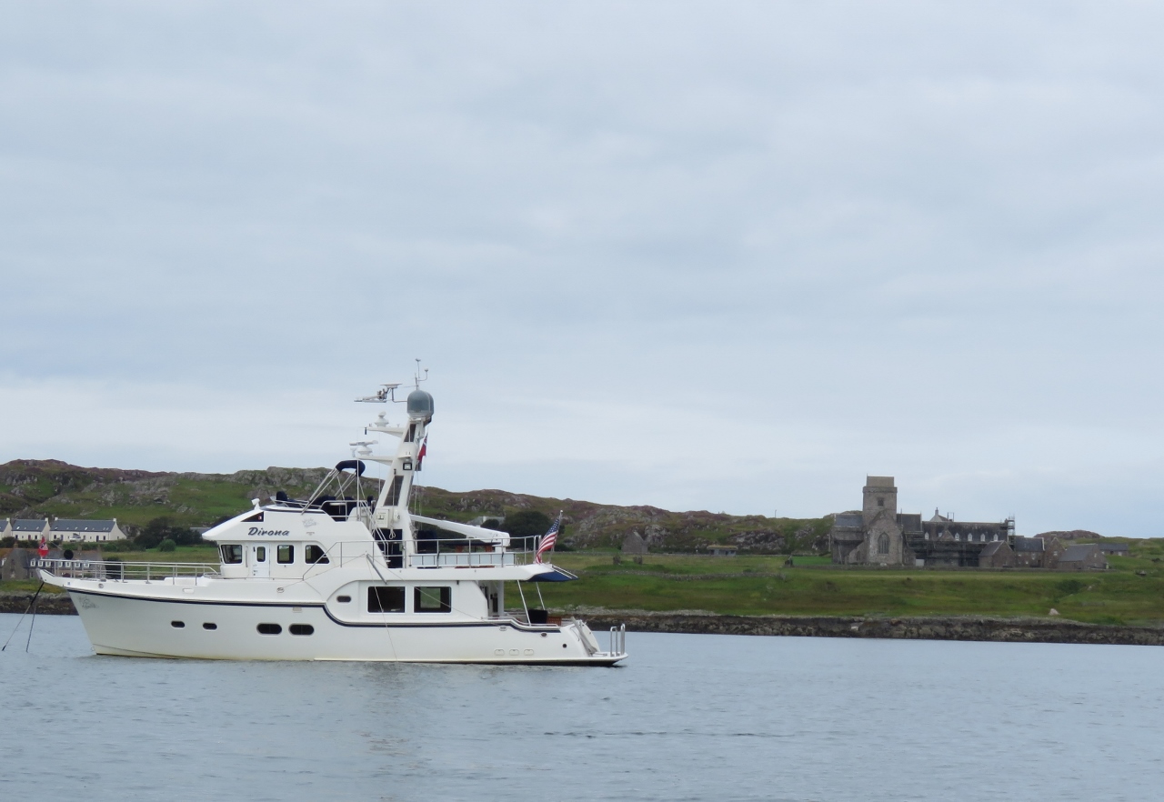 |
8/20/2017: Sound of Iona
Position: 56°19.98'N, -6°22.75'W
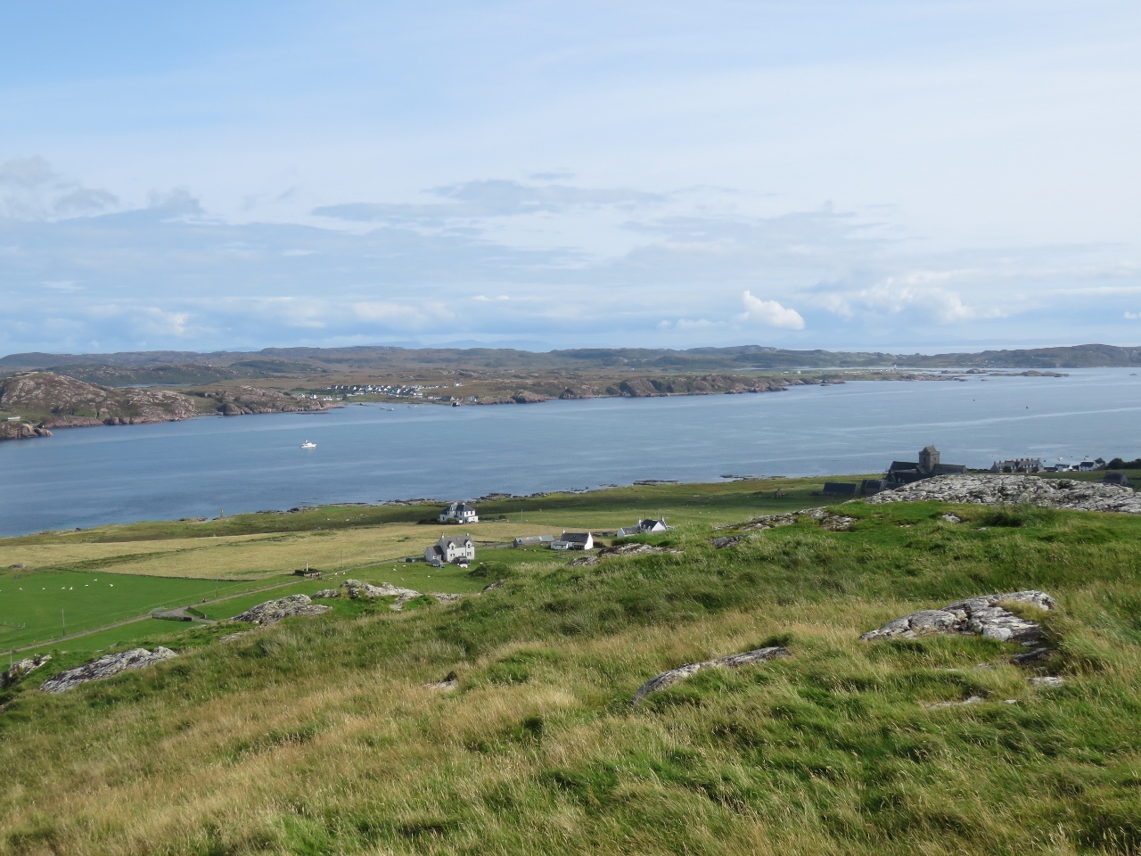
Anchored in the Sound of Iona with 13th-century Iona Abbey in the background.
|
 |
8/20/2017: Isle of Staffa
Position: 56°25.84'N, -6°20.54'W
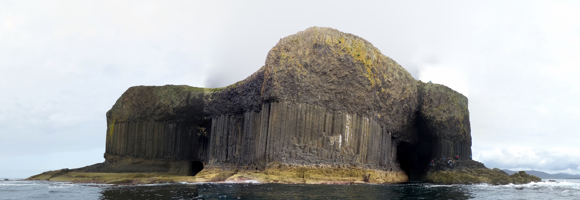
One of the reasons we'd stopped at Iona was to run the tender over to visit the remarkable Isle of Staffa, seven miles from Iona. Staffa has no sheltered anchorage, but the weather was so calm that we even might have anchored Dirona there. Taking the tender was faster and easier though.
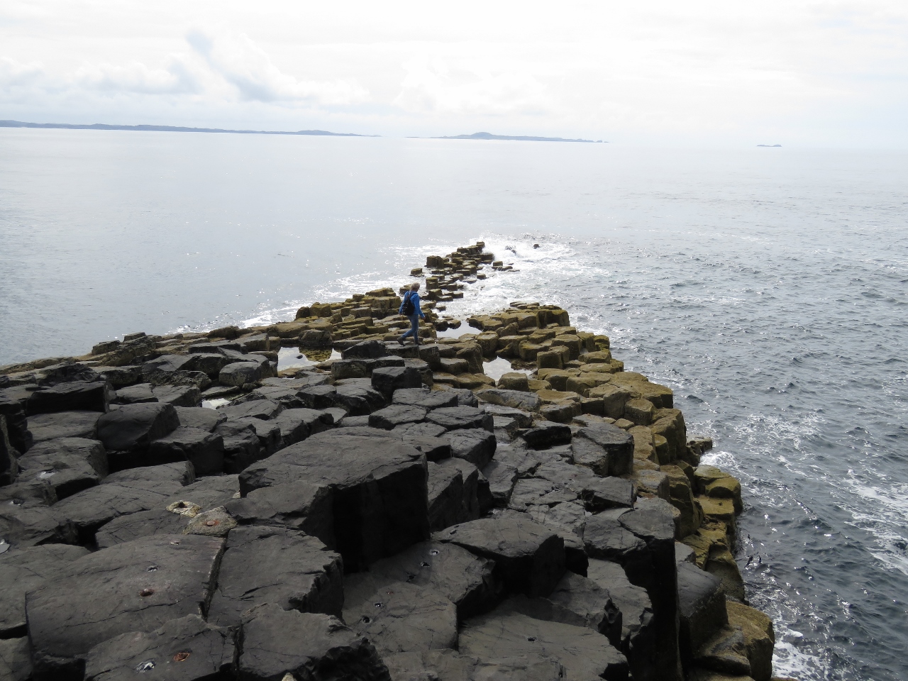
'Staffa' is norse for 'Pillar Island'—the cliffs around Staffa are composed of vertical, hexagonal basalt columns similar to those at the Giant's Causeway in Northern Ireland. The cliffs themselves are a sight, but an additional attraction is cathedral-like Fingal's Cave, visible on the right with people sitting outside (click image for a larger view). |
 |
8/20/2017: Landing
Position: 56°26.17'N, -6°20.29'W
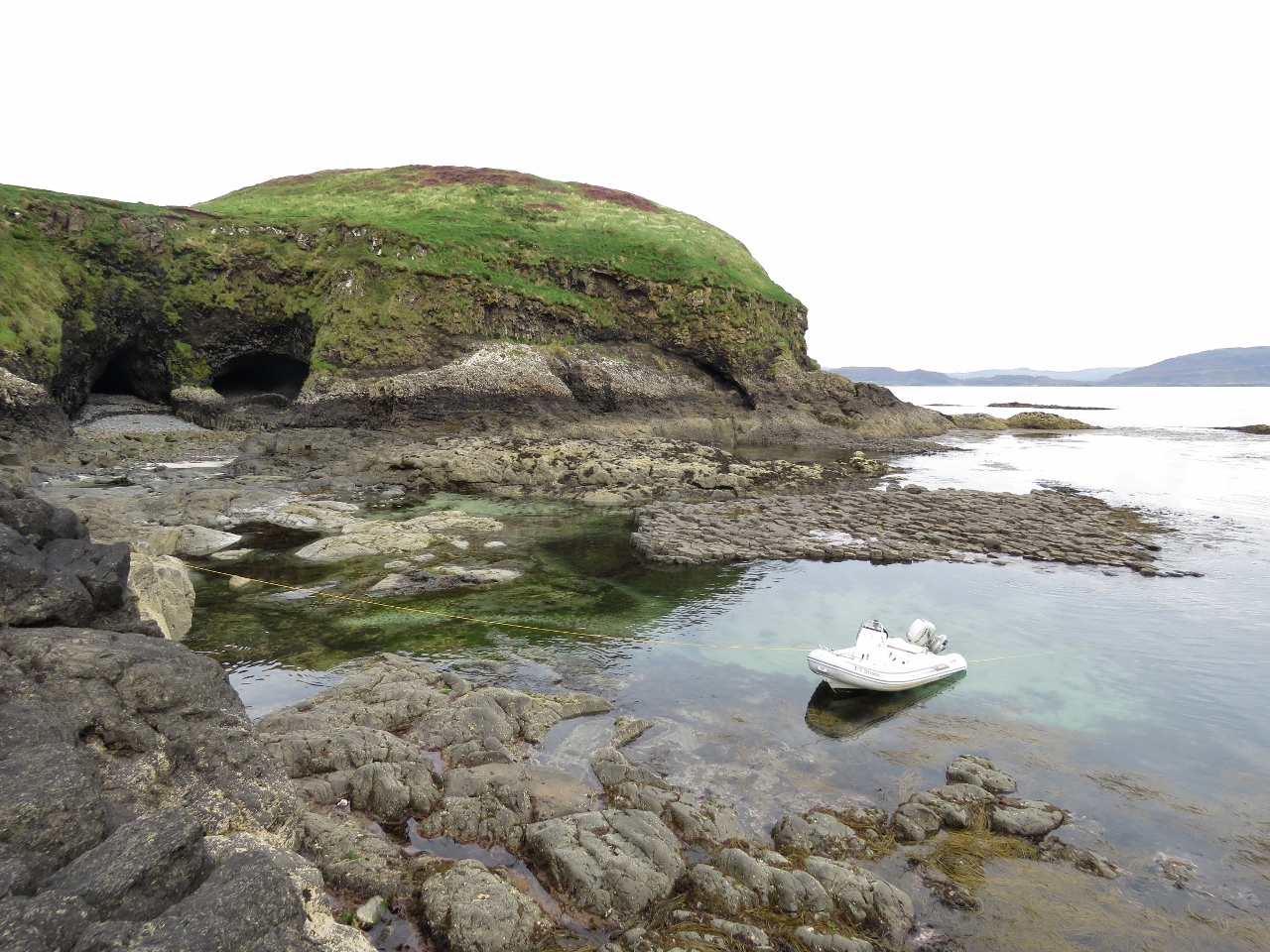
We landed the tender on the northeast side of the Isle of Staffa to go ashore.
|
 |
8/20/2017: Lunch
Position: 56°25.97'N, -6°20.38'W
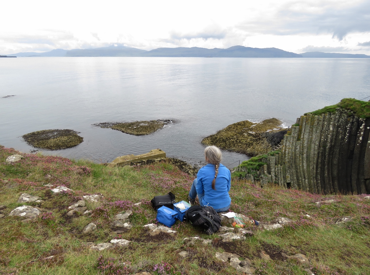
A picnic lunch overlooking the boat landing at the Isle of Staffa with the Isle of Mull in the background across the water. We'd considered landing the tender there, but couldn't find a safe spot that would be out of the way of the tour boats.
|
 |
8/20/2017: Staffa Tours
Position: 56°25.97'N, -6°20.38'W
Staffa Tours boat arriving through the narrow pass in the rocks to drop off a load of passengers at the landing. The boat in the background had just backed out after debarking its load of tourists. The Isle of Staffa can be a busy place.
|
 |
8/20/2017: The Causeway
Position: 56°25.91'N, -6°20.42'W
Walking down The Causeway toward Fingal's Cave. This was very much like Giant's Causeway.
|
 |
8/20/2017: Fingal's Cave
Position: 56°25.89'N, -6°20.47'W
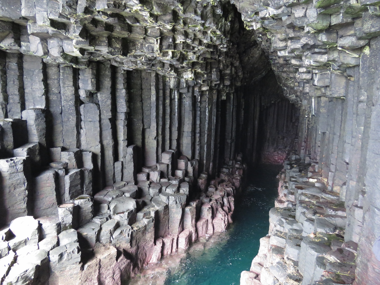
A walkway runs part of the way inside Fingal's Cave. This is looking to the head from about halfway inside.
|
 |
8/20/2017: Causeway Tip
Position: 56°25.87'N, -6°20.48'W
Looking southwest to The Causeway tip, with the the Isles of Mull and Iona visible in the distance.
|
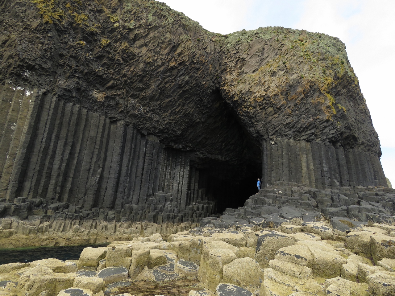 |
8/20/2017: Outside Cave
Position: 56°25.88'N, -6°20.47'W
Jennifer standing outside spectacular Fingal's Cave. It's late in the day and most of the tourists had left the cave area, so we had it all to ourselves.
|
 |
8/20/2017: Cave by Tender
Position: 56°25.88'N, -6°20.50'W
Before leaving Staffa, we ran the tender partway into Fingal's Cave. Even though conditions were calm, the water still surged into the cave so we backed in to ensure the swell didn't drive us in.
|
 |
8/20/2017: The Great Face
Position: 56°25.84'N, -6°20.55'W
A final look to the columns west of Fingal's Cave, collectively known as 'The Colonnade" or "The Great Face".
|
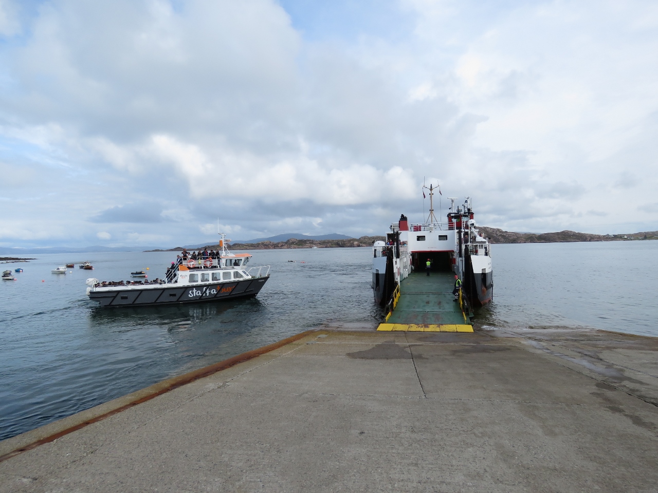 |
8/20/2017: Loch Bute
Position: 56°19.82'N, -6°23.49'W
Back at the Isle of Iona, the CalMac ferry Loch Bute was just departing for Fionnphort on the Isle of Mull, while a Staff Tours boat was arriving.
|
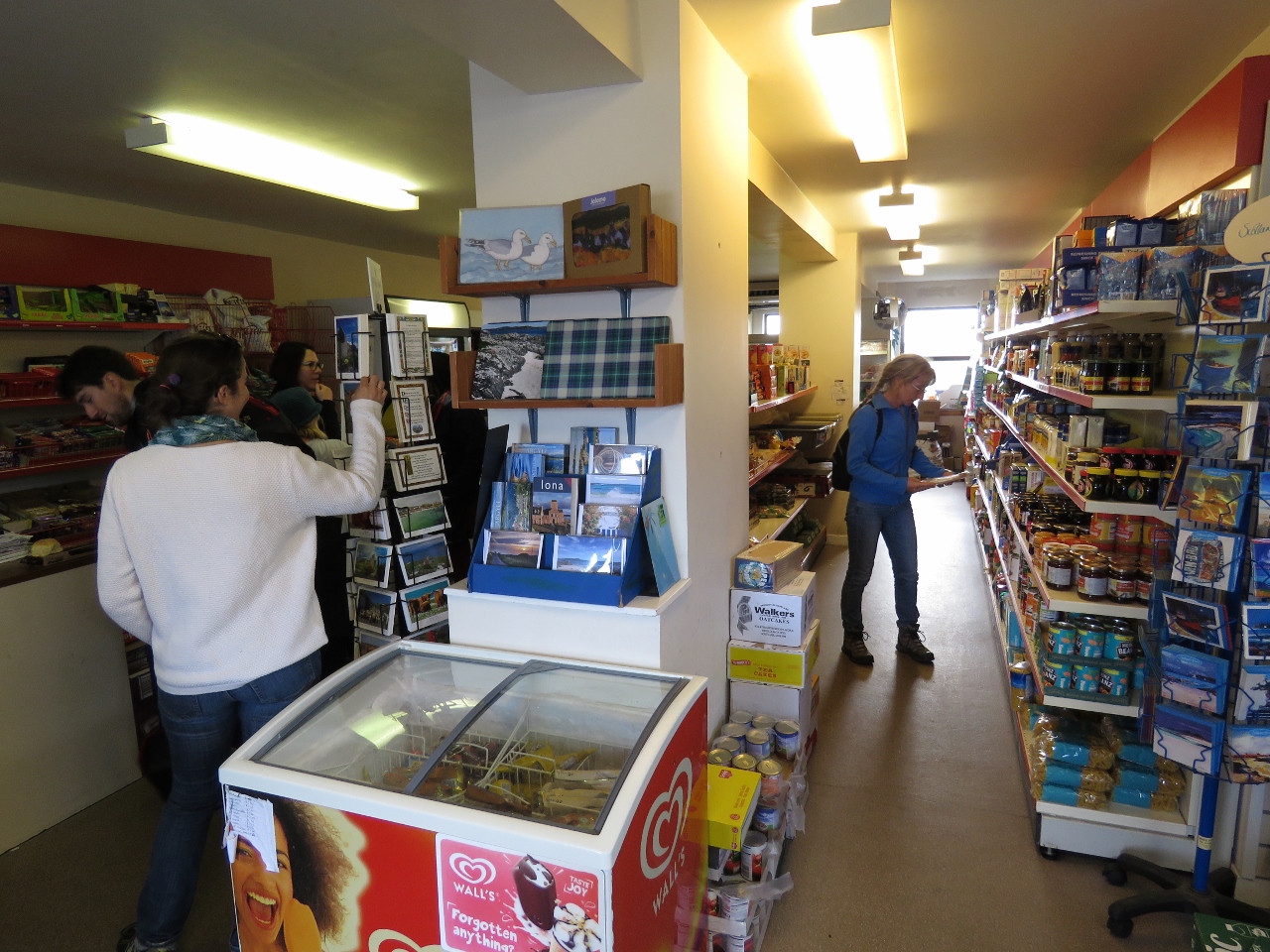 |
8/20/2017: Spar
Position: 56°19.84'N, -6°23.60'W
Walking past the grocery store, we remembered we'd forgotten to buy enough tortilla shells so picked some up on the way by.
|
 |
8/20/2017: The Low Door
Position: 56°20.06'N, -6°23.61'W
It's rare for Jennifer to find a door she has to stoop under, but The Low Door pub has one.
|
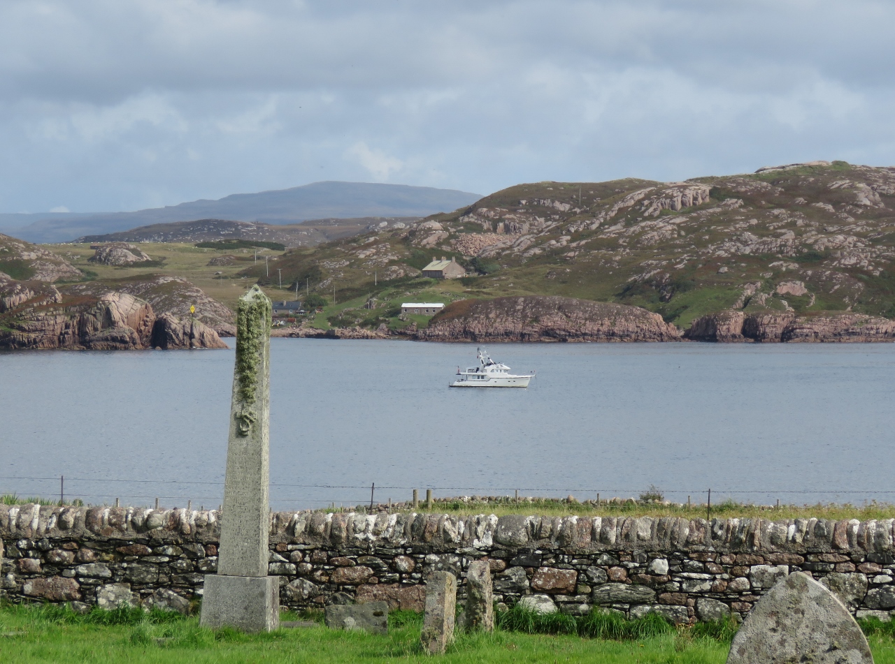 |
8/20/2017: At Anchor
Position: 56°20.08'N, -6°23.59'W
Dirona at anchor in the Sound of Iona, viewed across the graveyard adjacent to the Iona Monastery.
|
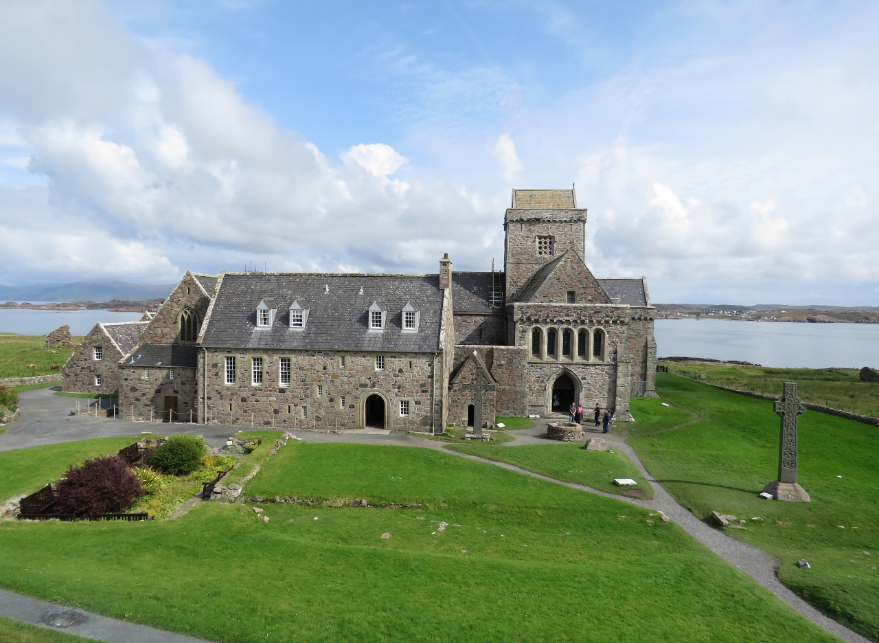 |
8/20/2017: Iona Abbey
Position: 56°20.10'N, -6°23.56'W
We spent an hour or so touring through Iona Abbey. Benedictine Monks lived, worked and worshipped at the abbey from about 1200 until the Protestant Reformation in 1560. Most of the abbey dates from that period, but there have been major restorations since.
|
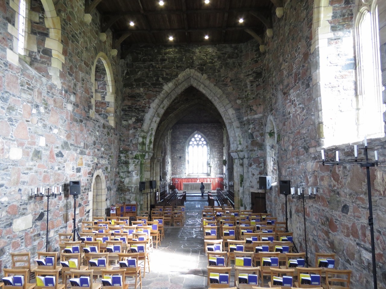 |
8/20/2017: Abbey Church
Position: 56°20.10'N, -6°23.56'W
The Abbey still is in use today and supports a flourishing spiritual community. The Abbey Church has hymn books in a number of different languages.
|
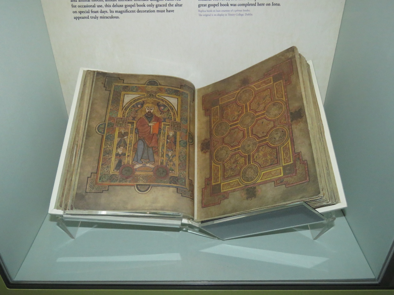 |
8/20/2017: Book of Kells
Position: 56°20.12'N, -6°23.46'W
A copy of The Book of Kells, a lavishly illustrated Gospel manuscript, on display at the Iona Abbey museum. St. Columba landed at Iona from Ireland in 563 and established a monastic community with a goal of Christianizing Scotland. The Book of Kells was transcribed at Iona and later taken to Ireland for safekeeping from 9th-century raiding Vikings.
|
 |
8/20/2017: Dun I
Position: 56°20.46'N, -6°23.79'W
The top of 328ft (100m) Dun I has sweeping 360 degree views. This is looking southeast across the Sound of Iona. Dirona is visible at anchor slightly left of center and the abbey is at the right.
|
 |
8/20/2017: Argyl Hotel
Position: 56°19.88'N, -6°23.54'W
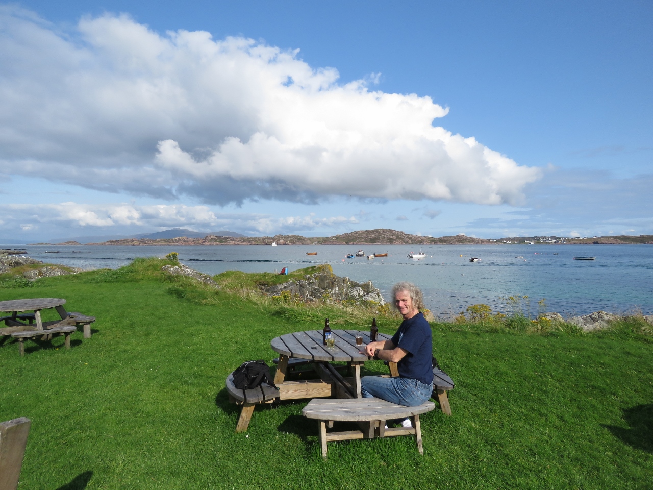
Refreshing local ciders on the lawn at the Argyl Hotel overlooking the Sound of Iona with Dirona visible as a white speck in the distance to the left of the moored boats. We'd had a long, but enjoyable day. The hotel was booked solid for dinner, so we instead had a great meal at the nearby Martyr's Bay restaurant overlooking the sound.
|
 |
8/20/2017: Current
Position: 56°19.94'N, -6°22.78'W
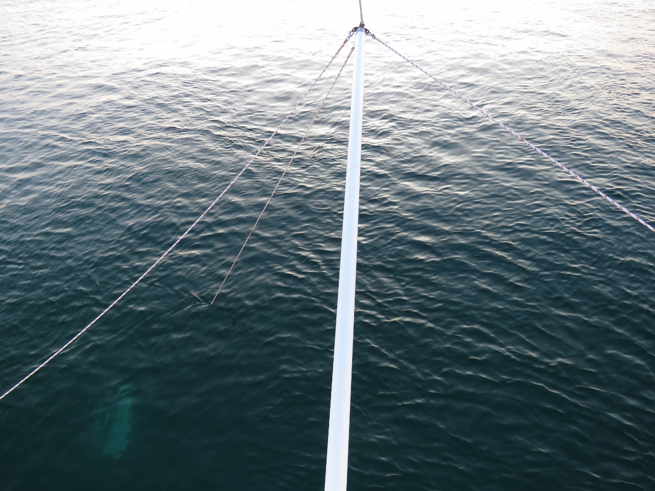
The Sound of Iona is exposed to Atlantic swell, so we put out the flopper stopper to reduce boat roll. The plate often was trailing well aft of the pole in the current that rushes through the sound. Fortunately the current was slack the next morning when we needed to retrieve it.
|
 |
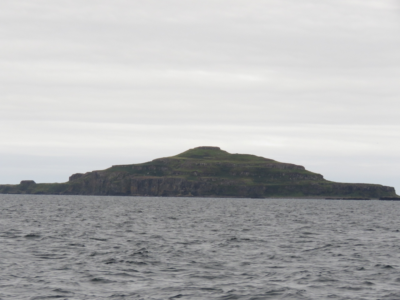
8/21/2017: The Carnburgs
Position: 56°30.60'N, -6°21.62'W
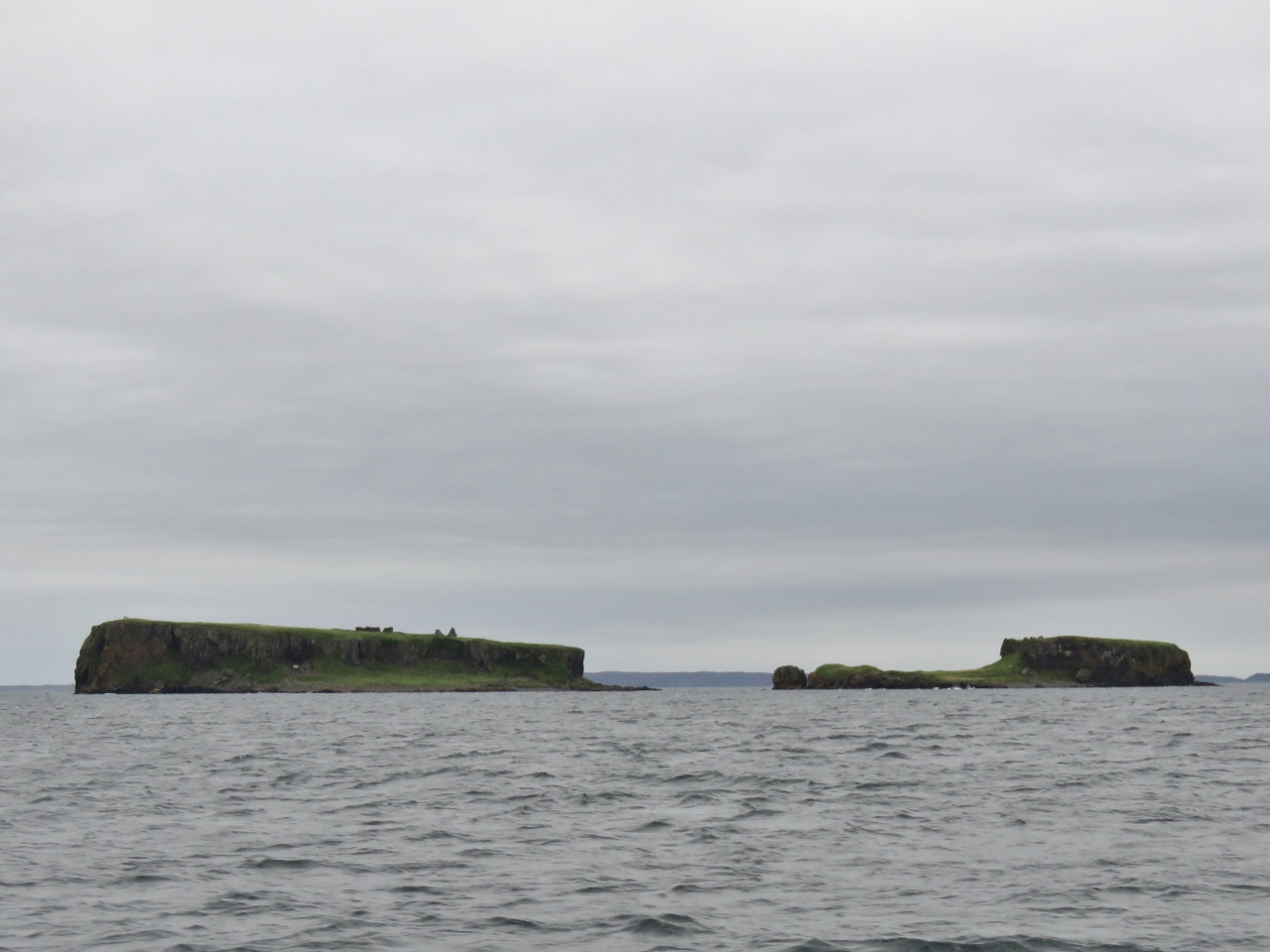
The islets of Carin na Burgh More and Cairn na Burdh Beag, nicknamed 'the Carnburgs', just north of Lunga Island in the Treshnish Isles. What looks like rocks on top of the islands are the ruins of Cairnburgh Castle that date from at least the 13th century. The castle is unusual because its defenses straddle both islands. The larger island, Carin na Burgh More on the left, contains a barrack block, chapel, courtyard and guard-house and Cairn na Burdh Beag on the right has another guard-house and a well.
|
 |
8/21/2017: Lunga
Position: 56°30.73'N, -6°21.61'W
Looking south to 100m Cruichan on the Ilse of Lunga, the largest of the Treshnish Isles.
|
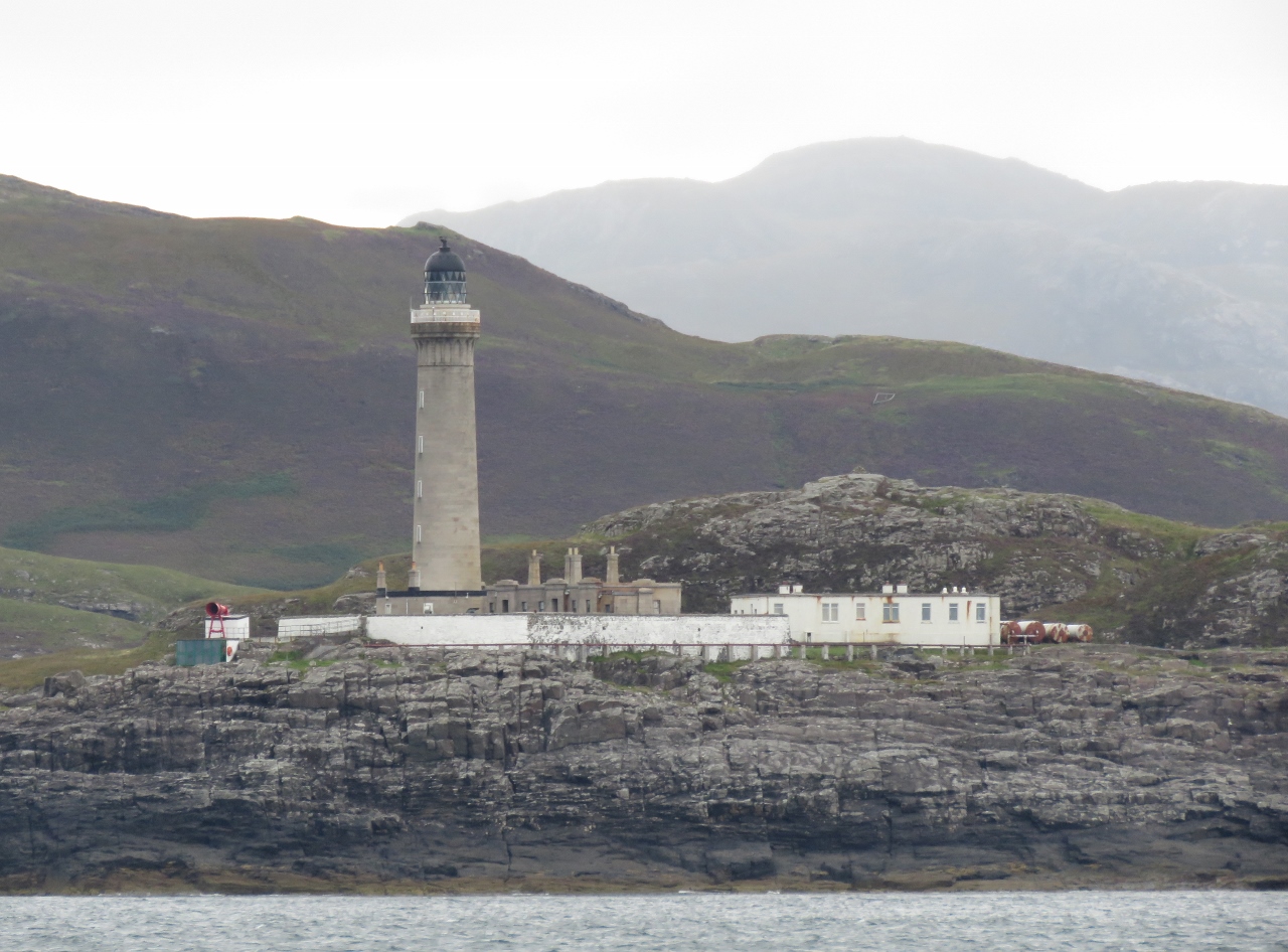 |
8/21/2017: Ardnamurchan Lighthouse
Position: 56°43.80'N, -6°15.01'W
Rounding Point Ardnamurchan, the most westerly point in mainland Britain. Currents can run 1.5kts around the point and heavy seas develop a good couple of miles off when the tide opposes a strong wind. We rounded in calm conditions and could approach quite close. The 36-meter-tall Ardnamurchan Lighthouse stands 55 metres above sea level. The light was built in 1949 from a design by Alan Stevenson, uncle of author Robert Louis Stevenson, whose family designed most of Scotland's lighthouses over a period of 150 years.
|
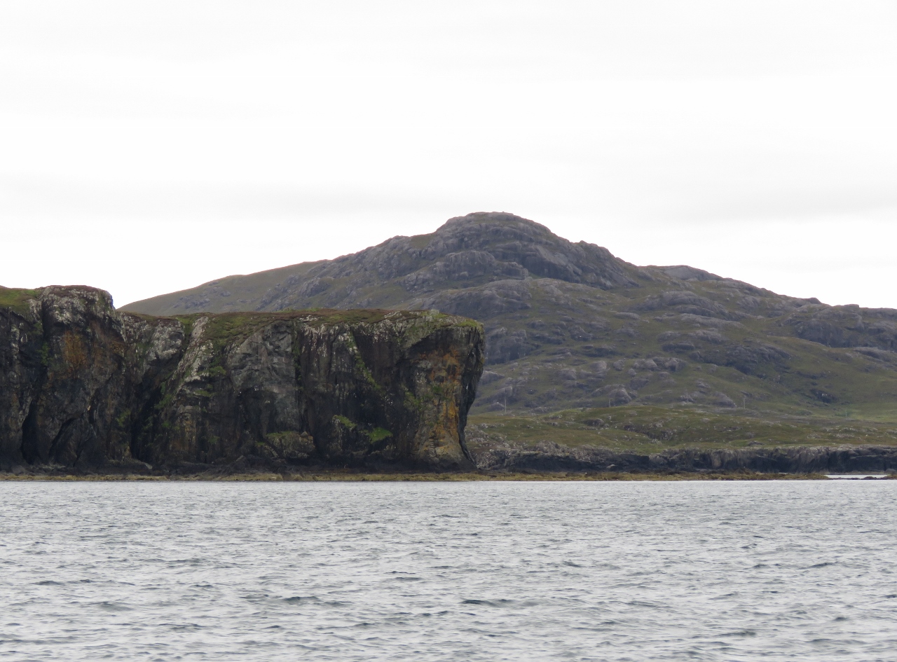 |
8/21/2017: Ardnamurchan Peninsula
Position: 56°46.12'N, -6°8.90'W
Looking south to Ardnamurchan Peninsula from northeast of Sanna Bay.
|
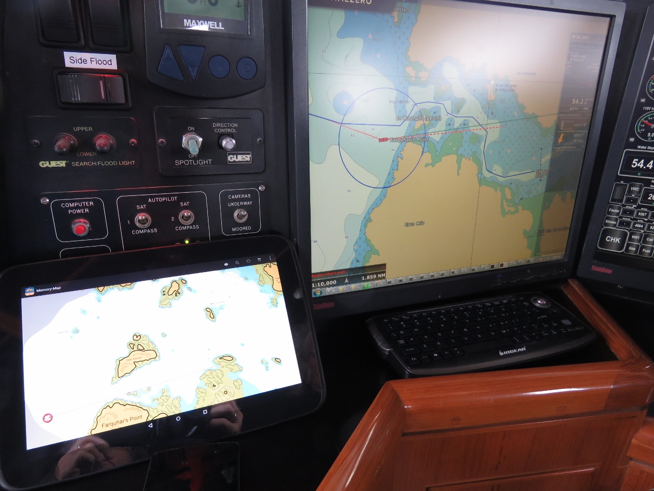 |
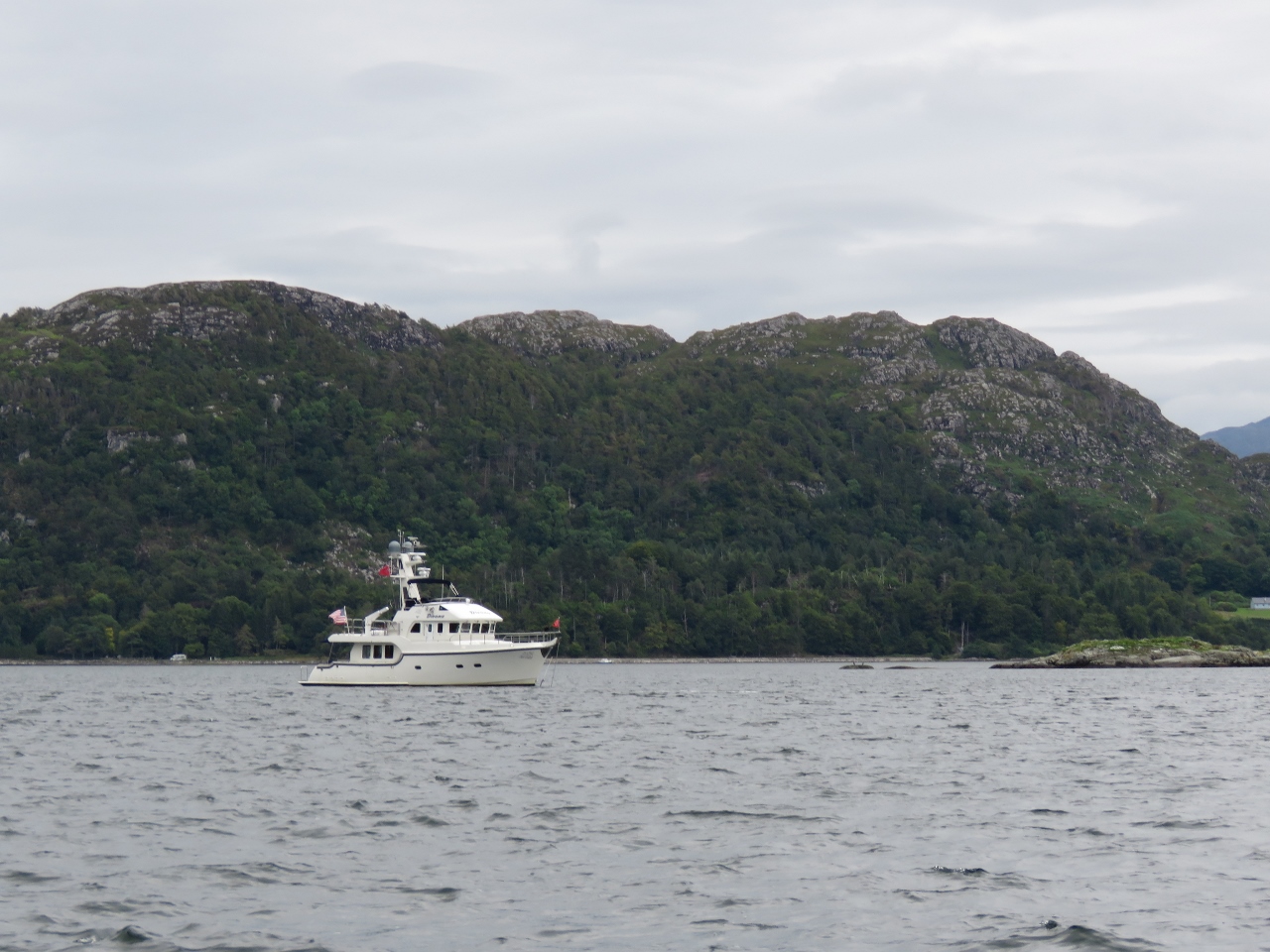
8/21/2017: Antares Charts
Position: 56°47.14'N, -5°53.37'W
The charts don't show good detail for many of the anchorages in Scotland, so we are augmenting them with Antares charts. These are unofficial, large-scale boating charts produced by boaters focusing on the West Coast of Scotland. The charts run on a variety of devices—we loaded them up on our tablet to display side-by-side with our Navionics charts.
|
 |
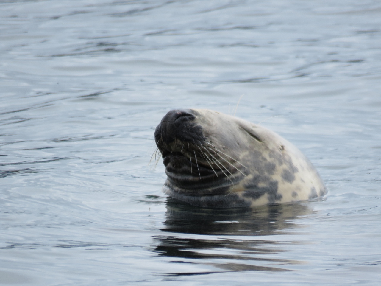
8/21/2017: Seals
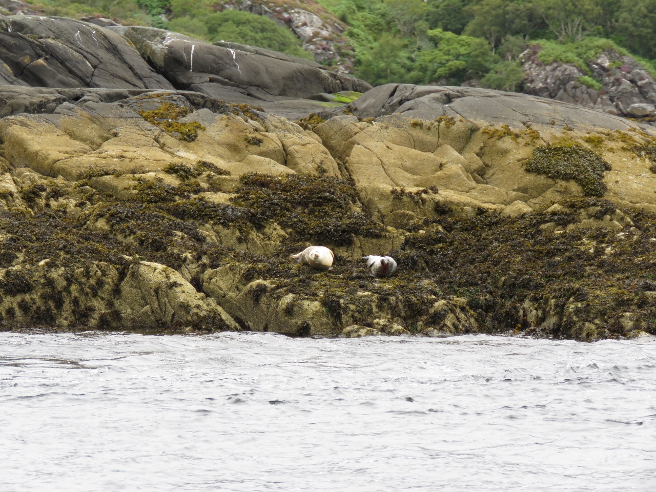
Position: 56°47.27'N, -5°52.55'W
Seals watching us enter Loch Moidart. Our initial plan was to head straight for the Outer Hebrides from Iona, but we were enjoying the scenery in the Inner Hebrides so much that we didn't want to rush through. So we'll spend a couple of more nights in the area.
|
 |
8/21/2017: Castle Tioram
Position: 56°47.14'N, -5°49.89'W
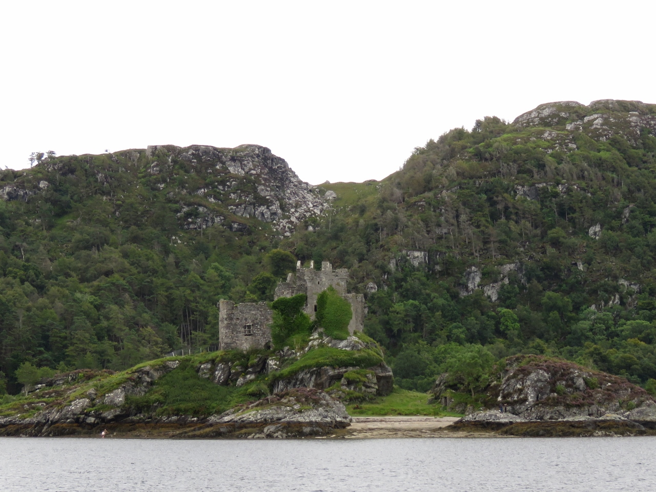
The ruins of Castle Tioram in Loch Moidart. The castle dates from the 14th-century and is the traditional seat of Clan MacDonald of Clan Ranald, a branch of Clan Donald.
|
 |
8/21/2017: Impenetrable
Position: 56°47.06'N, -5°49.75'W
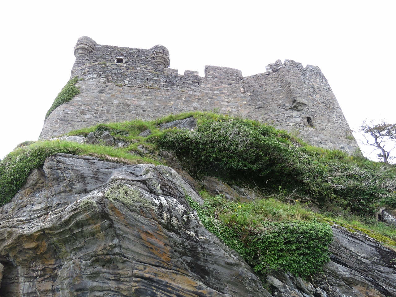
Looking up to Castle Tioram on a dinghy tour of the area. Castles are of course designed to be impenetrable and it certainly looked that way from this angle.
|
 |
8/21/2017: Inside
Position: 56°47.08'N, -5°49.73'W
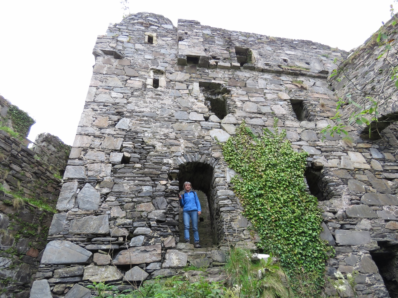
Castle Tioram doesn't look all this big from the outside, but is surprisingly large inside. The castle was torched during the 1715 Jacobite Uprising and has been unoccupied since.
|
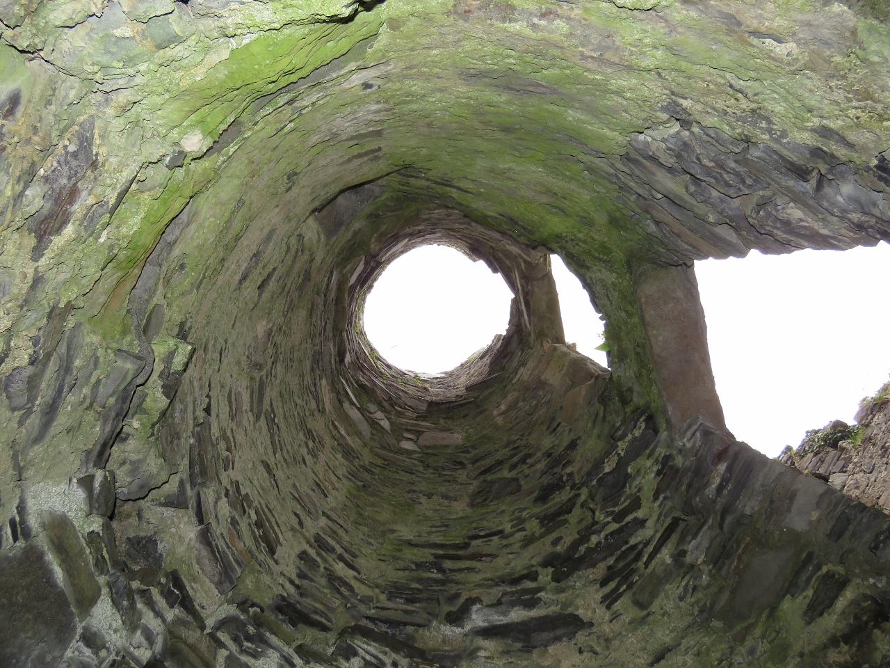 |
8/21/2017: Stairway
Position: 56°47.07'N, -5°49.73'W
Looking up through a stairwell in Castle Tioram.
|
 |
8/21/2017: Loch Moidart
Position: 56°47.09'N, -5°49.73'W
The view west through the south channel of Loch Moidart from Castle Tioram. Dirona is anchored way in the distance and is almost too small to see.
|
 |
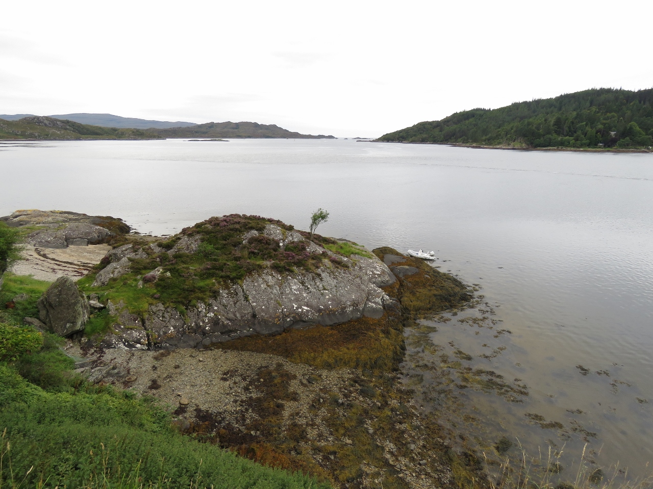
8/21/2017: South Channel
Position: 56°47.06'N, -5°49.71'W
Dirona anchored in the south channel of Loch Moidart, viewed from Castle Tioram.
|
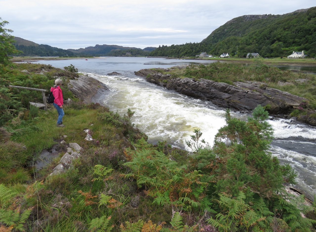 |
8/21/2017: Rapids
Position: 56°46.24'N, -5°49.91'W
Rapids where the River Shiel drains 17.5-mile-long Loch Shiel into Loch Moidart. Just to Jennifer's left is a small bridge that skirts the edge of the river.
|
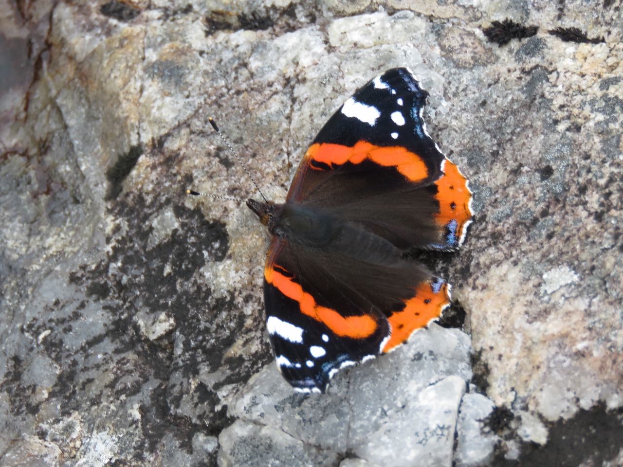 |
8/21/2017: Red Admiral
Position: 56°46.21'N, -5°49.94'W
A striking orange-and-black Red Admiral butterfly perched near the River Shiel.
|
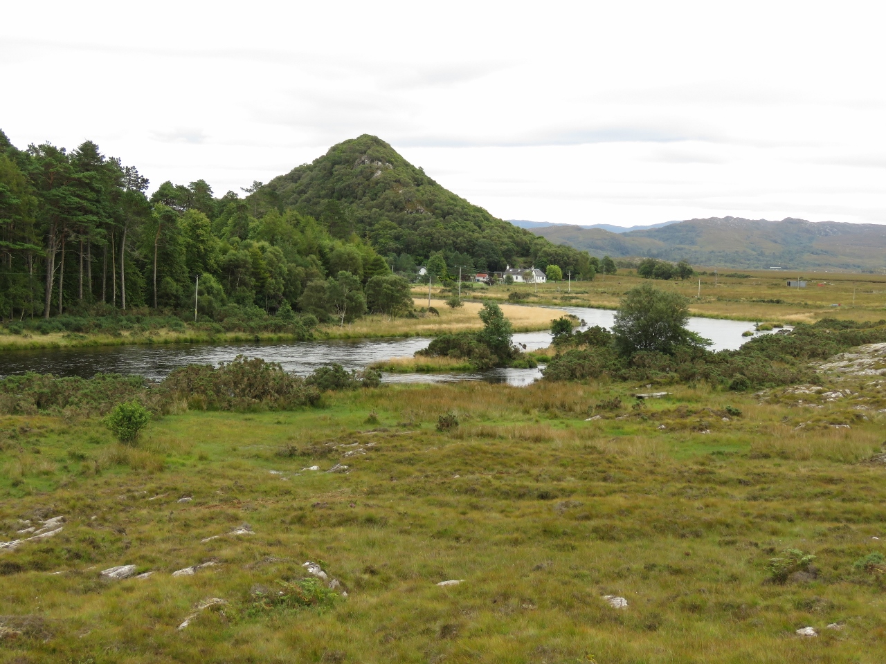 |
8/21/2017: The Torr
Position: 56°46.20'N, -5°49.95'W
The Torr rising above the village of Shielfoot along the River Shiel. The hill is the site of an ancient and unusual vitrified fort, whose walls have been subject to glass transition through heat. This process actually weakens the structure, and arch believe it may have been done as a ritual to close the fort at end of life, or following enemy capture to prevent further use. Over 70 vitrified forts have been discovered in Scotland, with more in western and northern Europe.
|
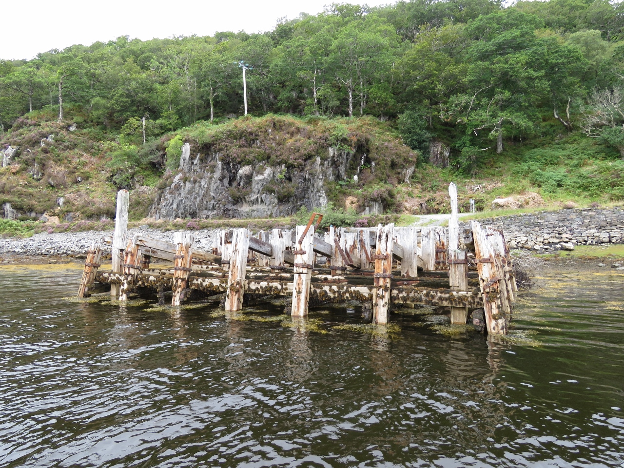 |
8/21/2017: Dock
Position: 56°47.35'N, -5°46.26'W
Dock ruins at the head of Loch Moidart.
|
 |
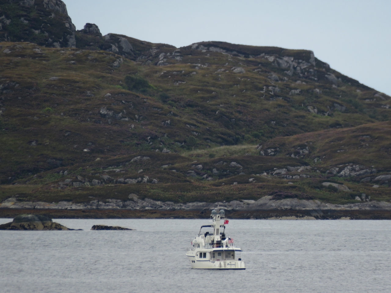
8/21/2017: Shona
Position: 56°48.51'N, -5°51.44'W
House tucked into the hills on Shona Island that splits Loch Moidart into two arms. J M Barrie leased the island in the 1920s for a secluded place to write the screenplay for Peter Pan.
|
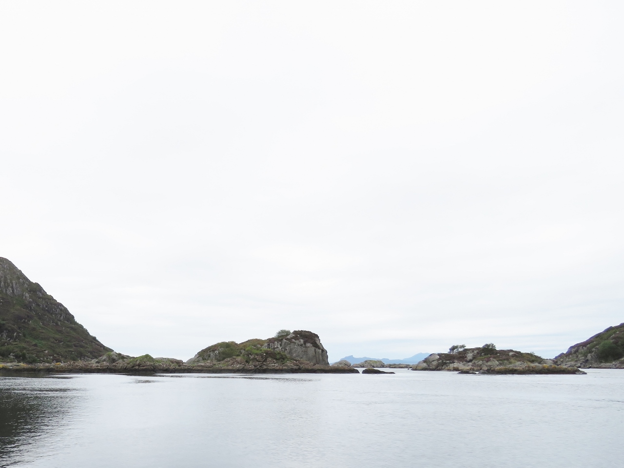 |
8/21/2017: Islets
Position: 56°48.42'N, -5°51.77'W
Looking to sea from the North Channel of Lock Moidart.
|
 |
8/21/2017: Back Home
Position: 56°47.03'N, -5°51.36'W
Back home at Dirona after a big tour by tender.
|
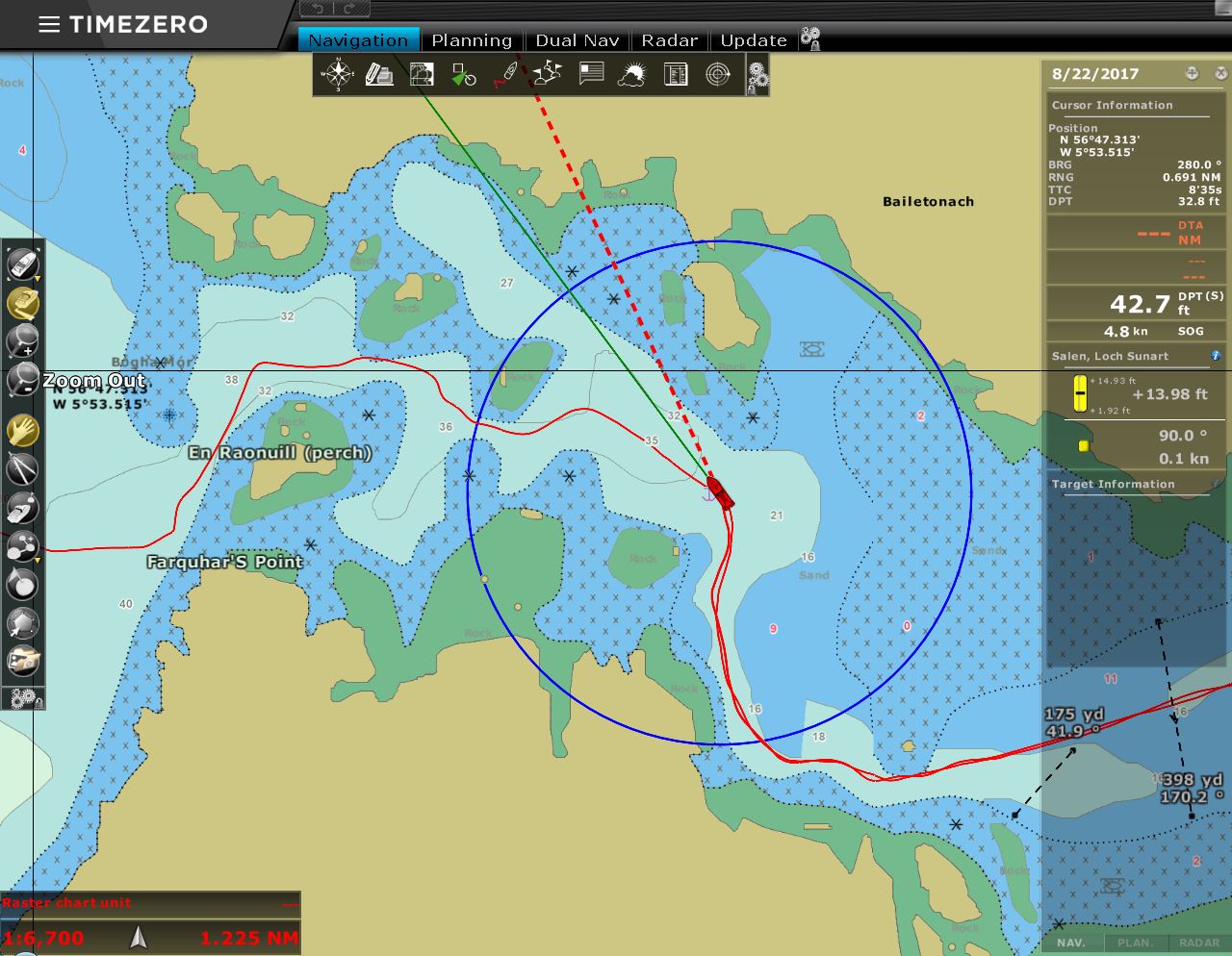 |
8/22/2017: Leaving Loch Moidart
Position: 56°47.09'N, -5°52.29'W
Following our track back out of Loch Moidart. The tide is higher than when we entered, so many of the visual cues to our position are underwater.
|
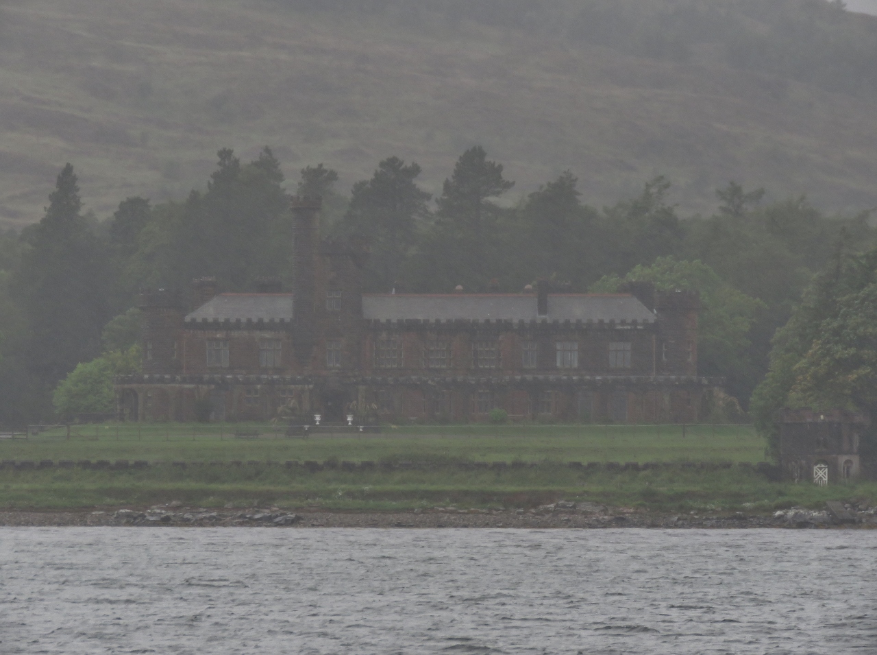 |
8/22/2017: Kinloch Castle
Position: 57°0.82'N, -6°16.16'W
In a heavy downpour, we made a pass in Dirona through Loch Scresort to check out Kinloch Castle. The castle was built at the turn of the 19th century as a residence for Lancashire textile tycoon Sir George Bullough.
|
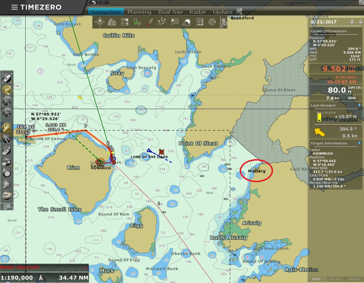 |
8/22/2017: Mallaig
Position: 57°1.06'N, -6°14.50'W
We're just west of Mallaig (circled in red), where we were at three weeks ago at the terminus of our West Highland Line train trip. This is the farthest north we've been in Scotland.
|
 |
8/22/2017: Waterfall
Position: 57°3.22'N, -6°22.57'W
The north coast of Rum Island has some great waterfalls, particularly after the heavy rain of the past few days.
|
 |
8/22/2017: Double Waterfall
Position: 57°3.00'N, -6°22.90'W
A striking double waterfall along the north coast of Rum Island.
|
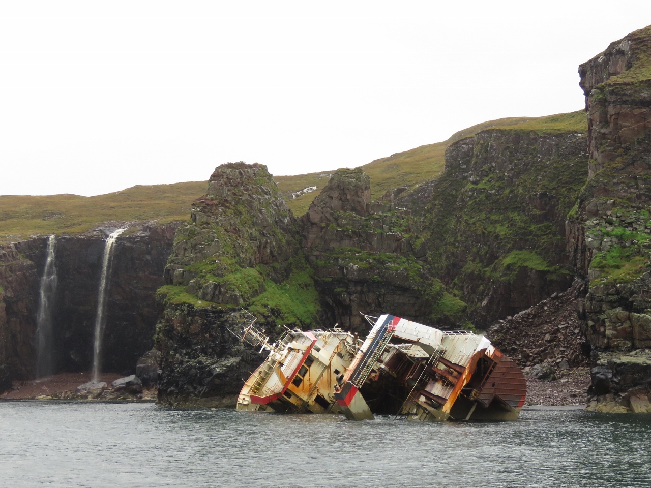 |
8/22/2017: Jack Abry II
Position: 57°2.96'N, -6°22.97'W
The fishing vessel Jack Abry II aground off Rum Island. The ship went aground in 40-knot winds in January of 2011. According to the Marine Accident Investigation Branch (MAIB) report "the skipper, who had been alone on watch in the wheelhouse, fell asleep and failed to make a course alteration. The wheelhouse watch alarm was not used, nor was best use made of the available navigational aids and crew." We've been longtime MAIB readers and stories like this encouraged us to install a wheelhouse watch alarm on Dirona. We consider it an important piece of safety equipment and rely on it heavily while on passage. We've since customized the original hardware.
|
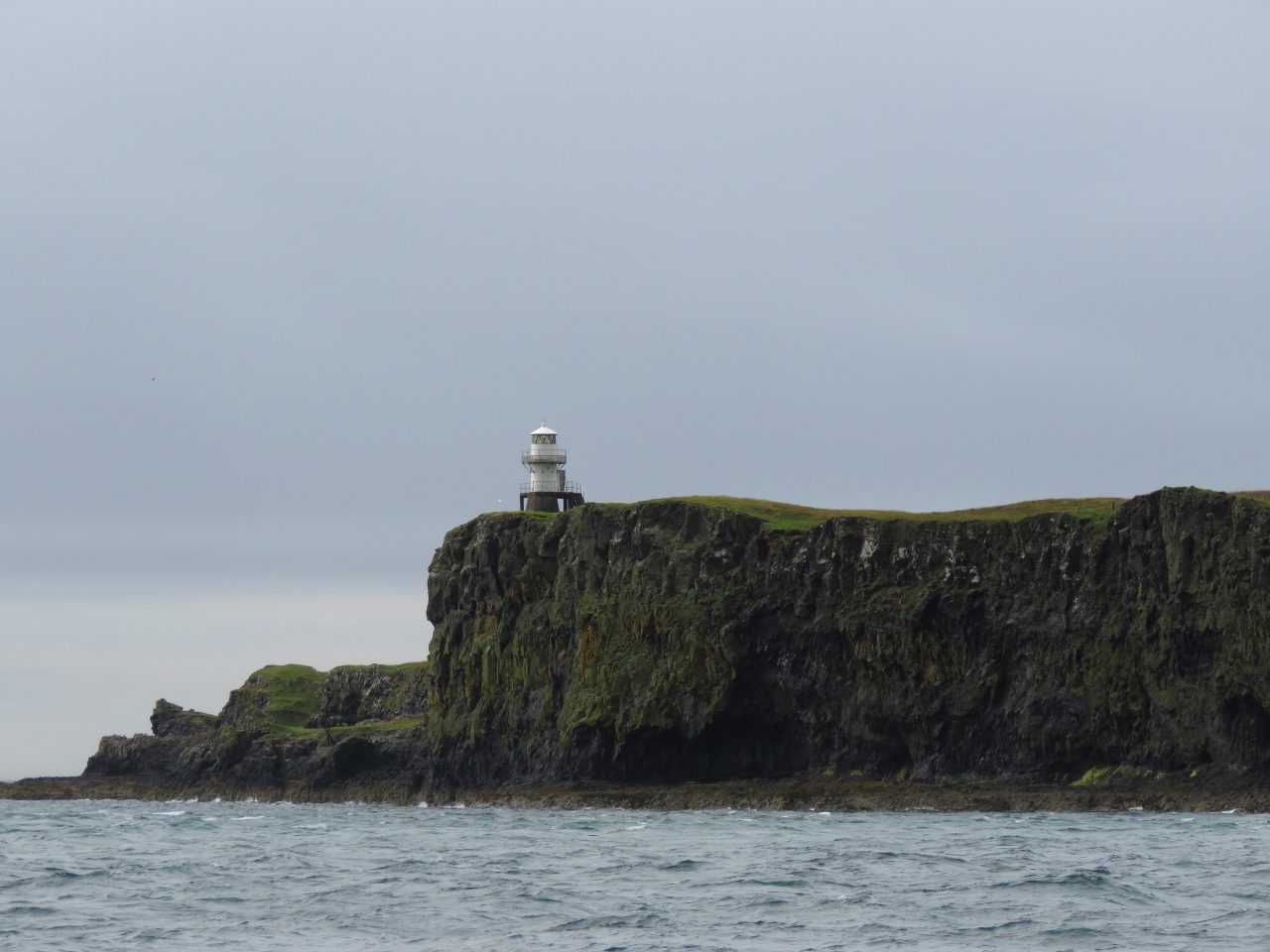 |
8/22/2017: Light
Position: 57°3.14'N, -6°27.57'W
Light on the eastern headland of Sanday Island, connected by bridge to Canna Island, as we near Canna Harbour.
|
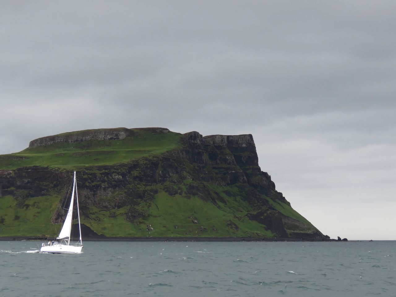 |
8/22/2017: Compromise II
Position: 57°3.22'N, -6°27.94'W
Compromise II sailing out of Canna Harbour with the soaring cliffs at the eastern end of Canna Island in the background.
|
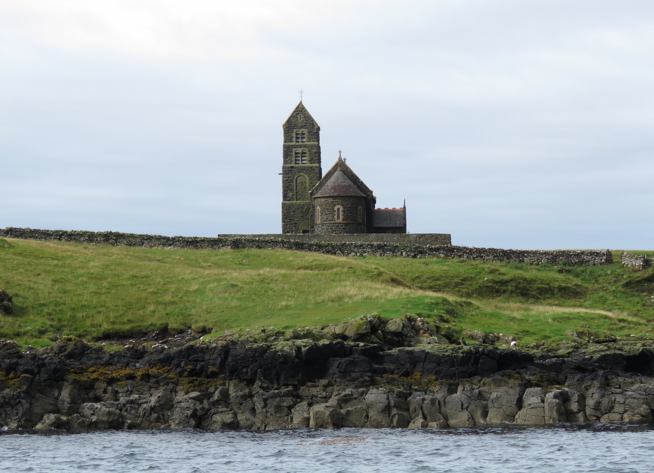 |
8/22/2017: St. Edward's
Position: 57°3.25'N, -6°29.41'W
St. Edward's Church on Canna Island was built in 1914. The church was converted to a Gaelic study center in 2001, but was never used.
|
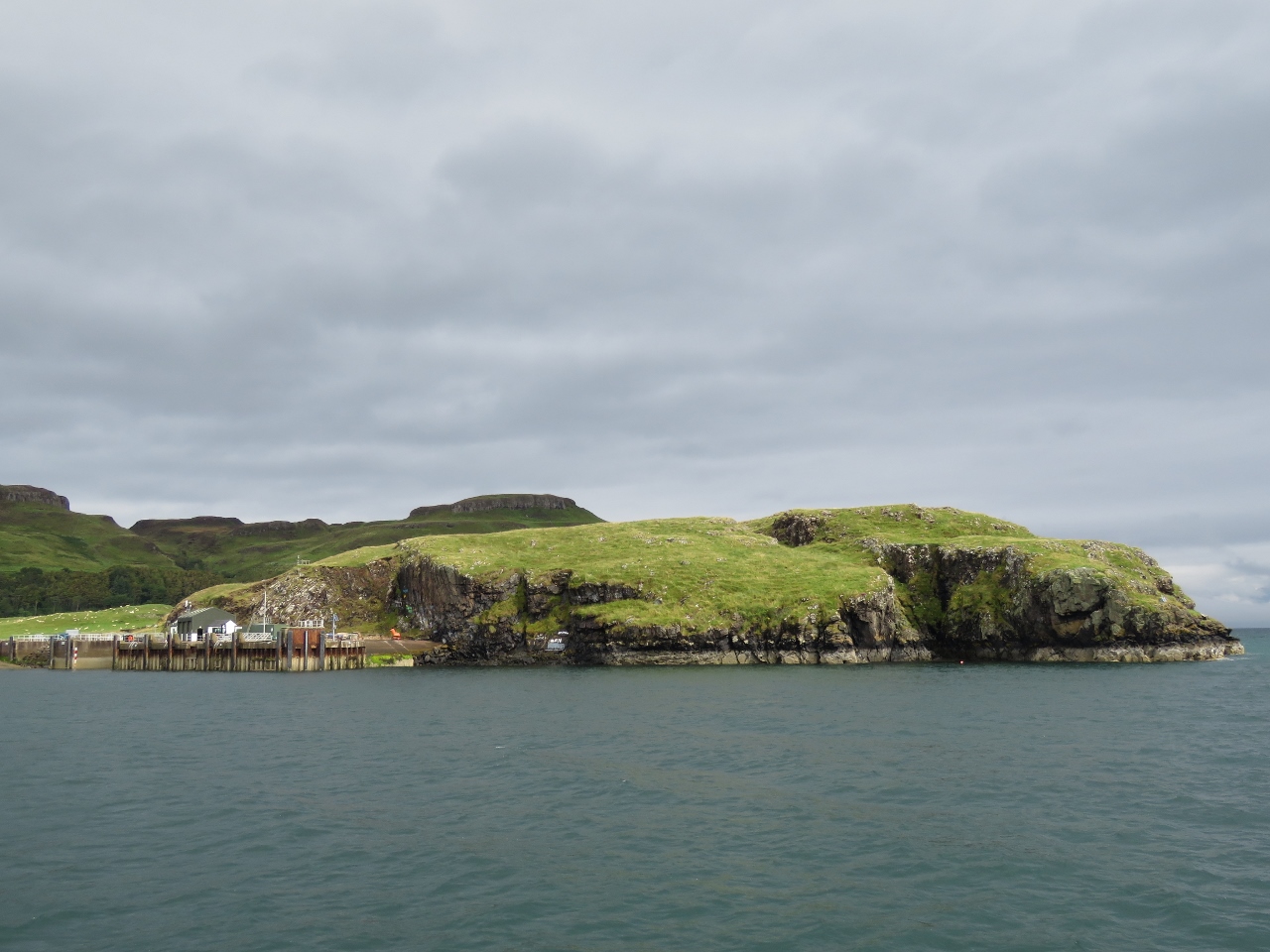 |
8/22/2017: Canna Island
Position: 57°3.25'N, -6°29.41'W
Looking north toward the pier with the hills of Canna Island as a backdrop.
|
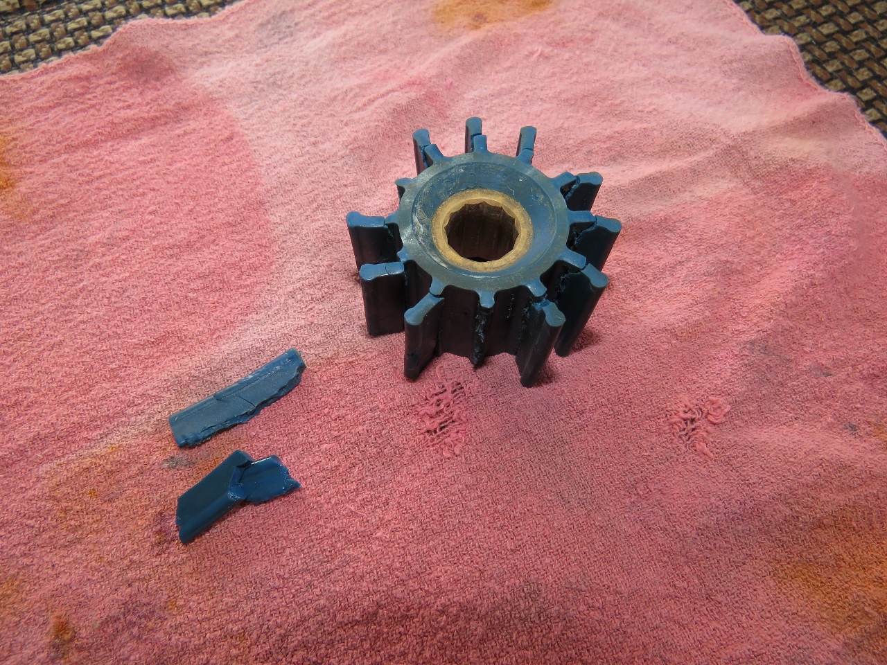 |
8/22/2017: Impeller
Position: 57°3.24'N, -6°29.42'W
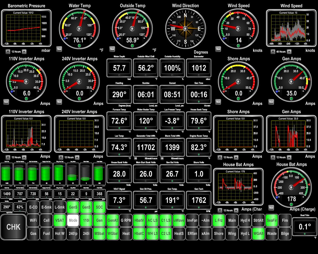
We received a Generator Fault email from our automation system: "Generator Fault (RPM=1744, Temp=>194F, Amps=41, Freq=58Hz, OilP=>57PSI, Volts=236V)." The high temperature indicated a possible cooling issue, so we inspected the impeller and found it had thrown two fins with several more ready to go.
|
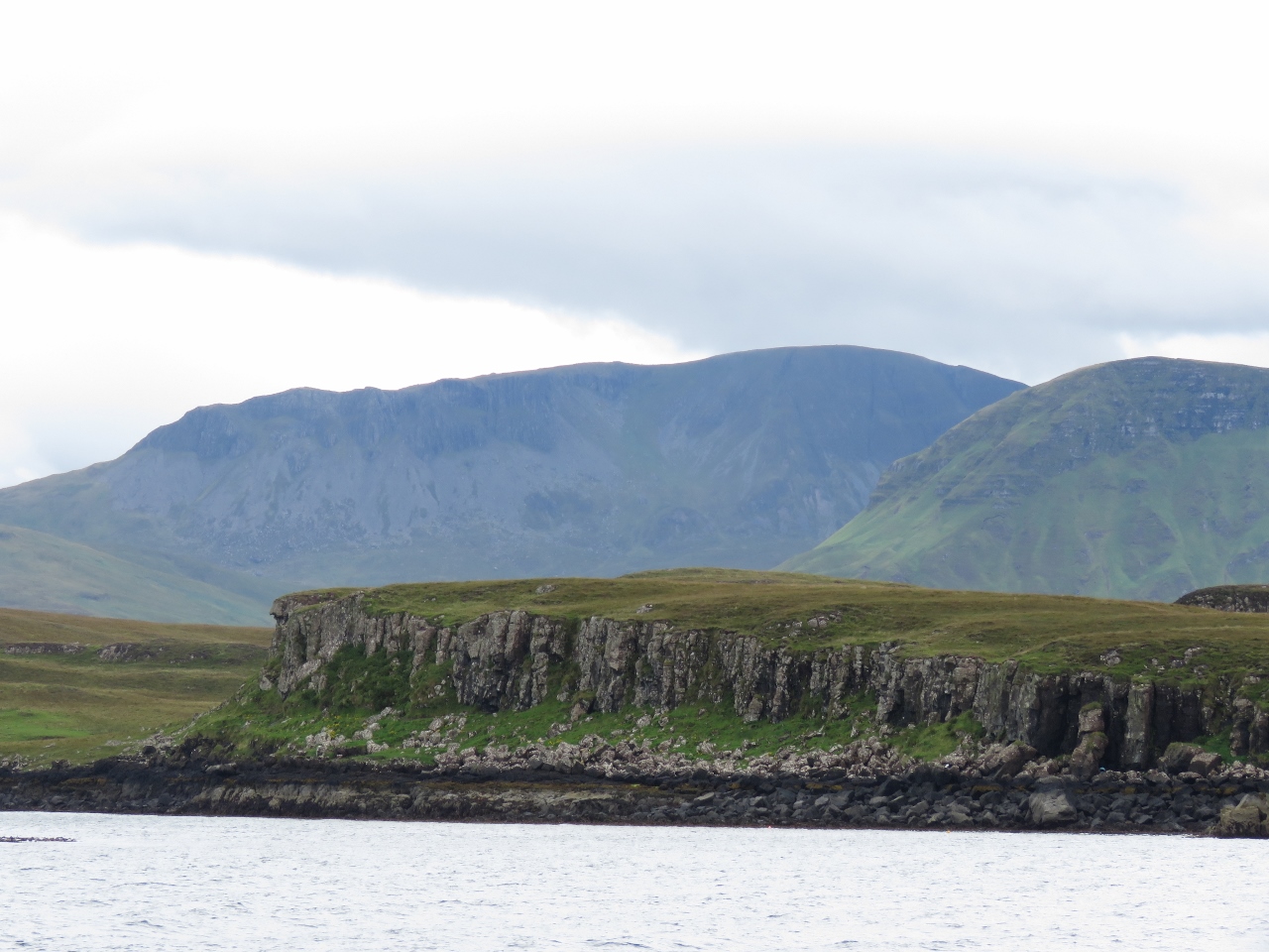 |
8/22/2017: Rum Island
Position: 57°3.24'N, -6°29.42'W
The view southeast from the anchorage over the cliffs on Sanday Island in the foreground to dramatic Rum Island in the background.
|
 |
8/22/2017: Water Heater Anode
Position: 57°3.24'N, -6°29.41'W
Steve Coleman reminded us to change the anode in our hot water heater anode, and a good thing he did. The old anode was in pretty rough shape.
|
 |
8/22/2017: Sleeping Seal
Position: 57°3.24'N, -6°29.42'W
This seal was sleeping within touching distance right off our stern.
|
 |
8/22/2017: Tour Boat
Position: 57°3.25'N, -6°29.42'W
While we were anchored at Canna Harbour, several tour boats like this one arrived and dropped off their passengers for a short time before they all set off for the next destination.
|
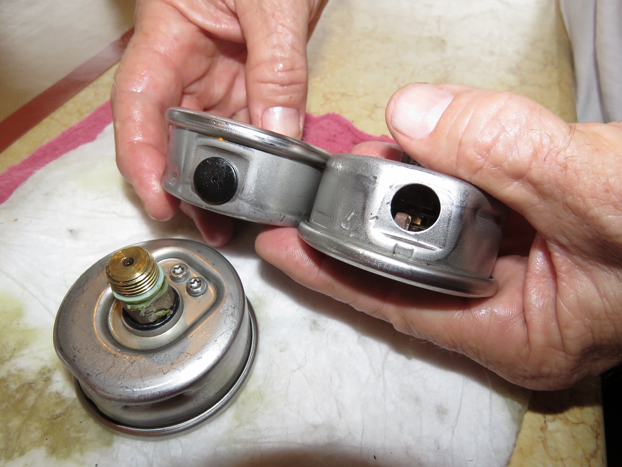 |
8/22/2017: Gauges
Position: 57°3.26'N, -6°29.42'W
Ernie Romeo of American Bow Thruster (ABT), the manufacturer of the hydraulic and stabilization systems on Dirona, reminded us of a design change they have recently made at ABT. In the past and when our boat was built, they used to install gauges at all major components so you could check for correct system operation at a glance. Now they install gauge ports that allow a gauge to be quickly installed without spilling oil to check pressures. This approach gets all the gauges out of the system and avoids a failure mode where the gauge fails and the hydraulic system drops its oil load through the gauge.
Our gauges have served well for 9,300 hours but we decided we would rather have one less failure point than the data they provide. It's probably a good thing we did. The beginning of the gauge failure has them eject the plug that retains the light oil that is used to dampen gauge movement and squirt oil out of the hole as hydraulic oil pressure leaks into the gauge. We had three gauges that blown off the oil retention cover and the one on the rear thrusters had sprayed out about a quarter of the oil. These appear close to being a service problem. We're glad to have them gone. |