 |
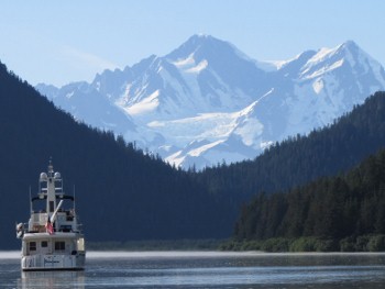
The scenery in Tarr
Inlet would be enough to warrant a visit--we were lucky to have yet another
clear day. |
 |
We rode up top much of the way, enjoying the views. We were starting to get
pretty excited when the Margerie Glacier popped into view. Bits of ice were
in the water along the way, but we could see a lot more in the waters near
the head. |
 |
As we neared, the ice pack became quite thick in parts. But fortunately
we found a reasonably clear path through. |
 |
Some of the pieces were quite large. Birds musn't have much sensitivity to
cold in their feet-we frequently saw them perched on the ice like this for
ages. |
 |
The nearer we approached, the more impressive the glacier looked. The face
was massive—extending 250' above the water—and the ice appeared thick and
hard. It's hard to believe this solid mass actually is moving at a rate of 6-8 feet per day. |
 |
Occasionally, a large piece would calve off and fall in with a splash. |
 |
The jagged edges in the top, left from pieces falling away, contrasted with
the thick, solid stripes of compressed soil and rock near the water line. |
 |
Some of the shapes and patterns left from the falling ice looked
surprisingly intricate and delicate. In places, holes had formed in the
pinnacles and we could see clear through to the other side. |
 |
The Safari Explorer, pictured here against Grand Pacific
Glacier, left about a half-hour after we arrived. 25-mile-long Grand
Pacific Glacier begins and ends the BC-Alaska border. It
starts at Mount Hay, on the BC-Alaska border, extends through BC,
then terminates at the head of Tarr Inlet, again at the BC-Alaska
border. If that glacier recedes much more, Glacier Bay will extend
into Canada. |
 |
With the place all to ourselves, we launched one of the kayaks to get shots
of Dirona in front of Margerie Glacier. The pictures highlight the
size of the glacier's face. |
 |
Paddling out in the ice was exhilarating—both beautiful and a little dangerous-feeling. The ice was constantly in
motion from falling pieces and a nearby river. I had to be cautious near
larger pieces, as they can rotate easily and tip the kayak. |
 |
Later, we took one of what was becoming our requisite "How close to an
iceberg can we bring the stern of the boat?" |
 |
A few hours after we arrived, the cruise ship Sea Princess appeared.
Passengers packed every railing. We all were lucky to be there on such a
clear and beautiful day. The ship made a slow pass behind us, close
enough that we could call back and forth with the passengers on deck. |
 |
The Sea Princess had communicated with us via VHF radio to let us
know their intentions. They seemed as interested in us as we were with them.
Some people might not like having the cruise ship there, but for us it was a
part of the adventure. And we'd been alone at the glacier for hours anyway. |

|
As the cruise ship made a slow pass along of the glacier's face, we drifted
back a bit and had lunch on the boat deck to enjoy the view. The day was so
warm that we were down to T-shirts. |
 |
A final shot of Margerie Glacier before we left later that afternoon. |
 |
Click for more pictures |


