MV Dirona travel digest for SC and Georgia 2017

|
Click the travel log icon on the left to see these locations on a map,
with the complete log of our cruise. On the map page, clicking on a camera or text icon will display a picture and/or log entry for that location, and clicking on the smaller icons along the route will display latitude, longitude and other navigation data for that location. And a live map of our current route and most recent log entries always is available at //mvdirona.com/maps/LocationCurrent.html. |
 |
1/20/2017: Leaving Charleston
Position: 32°46.57'N, -79°57.03'W
A last view to Charleston in the pre-dawn light. We're getting underway at 5:40am to make the 86nm run to Hilton Head Island so that we can arrive before dark. In a video of our exit at https://youtu.be/DmsuEMiUB6E, you can see us coming off the dock and turning south to head to sea. The current was ebbing about a knot as we left, so we were careful to pull off the dock a bit before getting the bow into the current which effectively will turn the boat. (The aft camera is setup to mimic a rear-view mirror, so the marina appears to be on our starboard side as we pass alongside, but its actually to port.) On the way out through the shipping channel, you can see birds playing in the beam of our new forward light.
|
 |
1/20/2017: Speed
Position: 32°43.75'N, -79°49.59'W
We're getting a strong push from the ebbing current and are making 9.7 knots. At 1750 RPM we'd expect 7.5kts in flat water. We're expecting good conditions for the entire run to Hilton Head Island, with light winds in the morning picking up only to 10-15kts in the afternoon.
|
 |
1/20/2017: Dawn
Position: 32°40.75'N, -79°49.46'W
A fishing vessel working the shallows off Morris Island at sunrise.
|
 |
1/20/2017: Harbor Town Lighthouse
Position: 32°8.35'N, -80°49.21'W
We had a nice, easy run to Hilton Head Island with reasonable conditions the whole way. The winds did pick up from the southwest as expected, but not more than 15 knots. This the iconic red-striped Harbor Town Lighthouse at the southwest corner of Hilton Head Island. The lighthouse was privately built in in 1969-1970 and is a private aid to navigation.
|
 |
1/20/2017: Leopard
Position: 32°8.87'N, -80°48.28'W
Sailing vessel Leopard on the docks with several large houses visible behind. The dock off the stern is damaged, likely from Hurricane Mathew last October.
|
 |
1/20/2017: Damage
Position: 32°9.06'N, -80°47.99'W
The National Weather Service recorded peak wind gusts at 88 mph 5-10 miles off Hilton Head Island On October 8th of last year during Hurricane Mathew. Palmetto Bay Marina, near where we will anchor, was completely destroyed. Many of the docks along the western shore of the island appeared damaged or destroyed, likely from that event. We also saw a number of houses under construction.
|
 |
1/20/2017: Mansion
Position: 32°10.13'N, -80°47.47'W
The Hilton Head Island area has many large mansions. We've not seen anything that looks like it would sell for less than about five million.
|
 |
1/20/2017: Router Status
Position: 32°10.56'N, -80°47.12'W
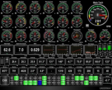
In addition to the Router Status app, we're saving the Wide-Area Network (WAN) status in our local telemetry database and have new indicator lights on our Maretron display to show the state of our three WANs. Green indicates the WAN is in use, blue means it is available, and black means it is unavailable. In this example, we're currently connecting through the cell phone, external WiFi is available and the VSAT is unavailable (shut down for testing).
|
 |
1/20/2017: Weather
Position: 32°10.56'N, -80°47.12'W
We plan to anchor off Hilton Head Island for a few days as a major low-pressure system passes through. This is what the weather will look like three days from now, where winds are expected to be 30-35 kts in the red areas.
|
 |
1/22/2017: Harbor River
Position: 32°10.55'N, -80°47.14'W
The Harbor River current runs a couple of knots in each direction as the tide changes. The chart plotter display of Dirona's position over the last few days shows how we're moving in the current.
|
 |
1/22/2017: Rain
Position: 32°10.58'N, -80°47.12'W
The weather system has arrived, bringing heavy rain and strong winds this morning.
|
 |
1/23/2017: Weather
Position: 32°10.58'N, -80°47.12'W
Yesterday's rain is over and the winds have settled somewhat, but the barometer has bottomed out at around 990. We'll see more big winds as the barometer starts to climb tomorrow.
|
 |
1/23/2017: Haig Point IV
Position: 32°10.58'N, -80°47.11'W
Haig Point IV is one of two ferries that run between Hilton Head Island and Daufuskie Island to the southwest. The ferries depart hourly between 6:30am and 11:30pm, with a couple of gaps around lunchtime, so we see a ferry pass by pretty much every half-hour. Their wake doesn't disturb our boat much and we enjoy watching them pass, particularly at night when they are all lit up. They're often empty and never carried more than a few passengers.
|
 |
1/23/2017: Palmetto Bay Marina
Position: 32°10.58'N, -80°47.11'W
Palmetto Bay Marina, to our east, was destroyed during Hurricane Mathew last year. From our anchorage we can see several boats high aground.
|
 |
1/24/2017: Weather
Position: 32°10.56'N, -80°47.11'W
The barometer is on the rise and the winds are forecast to pick up later today. The forecast calls for calm conditions tomorrow when we plan to make the 88-nm run to Brunswick, Georgia before the next system comes through later in the week.
|
 |
1/24/2017: Landing Craft
Position: 32°10.58'N, -80°47.12'W
The barge service from Hilton Head Island to Daufuskie Island looks a lot busier than the passenger ferries we've seen.
|
 |
1/24/2017: Dolphins
Position: 32°10.56'N, -80°47.13'W
A pair of dolphins surfacing while we enjoyed the sunset over drinks in the cockpit.
|
 |
1/24/2017: Dusk
Position: 32°10.56'N, -80°47.13'W
Dusk looking west from the anchorage. This was a great place to spend a few day
|
 |
1/25/2017: Calibogue Sound
Position: 32°7.55'N, -80°49.72'W
We got underway at 4am this morning to make the 88-nm run to Brunswick and arrive in time to fuel before 5pm. We have to cross a couple of shallower areas (less than 15ft at zero tide) in the darkness, so it's good to be near high tide. Unfortunately the tide still is incoming and we're fighting a 2-knot negative current as we exit Caliboque Sound. At 2,300 RPM we should be making 9 knots and we're only hitting 7.
|
 |
1/25/2017: Jessica Marie
Position: 32°2.54'N, -80°49.54'W
Fishing vessel Jessica Marie lit up at at 5:30am as we clear the shallows and approach Tybee Roads. With a 6.5ft tide, we didn't see anything less than 19ft.
|
 |
1/25/2017: Tybee Roads
Position: 32°2.54'N, -80°49.54'W
Tybee Roads, the entrance to Savannah, is among the busiest port entries we've ever encountered. Radio traffic has been constant since our 4am departure as ships negotiate passing arrangements in the narrow channel. Four vessels are in the immediate vicinity as we arrived at 5:30am and the CPA bar (Closest Point of Approach bar) of a fifth is visible at the bottom of the screen shot (all five are circled in red). The Ever Laden is a large container ship that we could see running the channel as we neared and that fifth vessel is another large ship that we passed partway through the channel.
|
 |
1/25/2017: Olivia
Position: 31°48.93'N, -80°51.69'W
The passenger vessel Olivia passing in front of the rising sun.
|
 |
1/25/2017: Calm
Position: 31°14.96'N, -81°10.91'W
We've got wonderfully calm conditions forecast for the entire 88nm run to Brunswick.
|
 |
1/25/2017: Traffic
Position: 31°5.81'N, -81°19.63'W
We entered on the south side of the channel to give the fishing vessel Lady Susie II room, then switched over to the north side to pass the dredger Stuyvesant.
|
 |
1/25/2017: Lady Susie II
Position: 31°5.81'N, -81°19.63'W
The fishing vessel Ladie Susie II with poles out in the entrance to St. Simons Sound.
|
 |
1/25/2017: Stuyvesant
Position: 31°5.94'N, -81°19.91'W
The dredger Stuyvesant working the south side of the entrance to St. Simons Sound. Shallows are close by on either side of the entry, so they must need to dredge all the time to keep the way navigable.
|
 |
1/25/2017: F J Torras Causeway
Position: 31°7.32'N, -81°22.27'W
The F J Torras Causeway (Back River) Bridge visible from a distance. We'll be passing under it to reach Brunswick Landing Marina.
|
 |
1/25/2017: Metal Shark
Position: 31°6.42'N, -81°26.09'W
The Brunswick Coast Guard in a great-looking Metal Shark Response Boat — Small. Unfortunately, they're coming for us, so we're going to get a much closer look.
|
 |
1/25/2017: Inspection
Position: 31°6.47'N, -81°26.00'W
Two Brunswick Coast Guard officers came aboard for a safety inspection. They were polite, competent and efficient and were on and off in less than 20 minutes. Spitfire, however, was not impressed.
We did slow down, but didn't have to even stop the boat and continued underway during the inspection. In the video of the boarding at https://youtu.be/sIqPMCM-9Y8 you can the coxswain expertly maneuvering the two moving boats close together to allow the officers to board through our side gate without touching Dirona. (The aft camera is setup to mimic a rear-view mirror, so the Coast Guard boat appears to be on our port side, but actually is to starboard.) |
 |
1/25/2017: Getting Closer
Position: 31°6.52'N, -81°27.85'W
The Brunswick Landing Marina is not far beyond the F J Torras Causeway Bridge. We're almost there.
|
 |
1/25/2017: Coast Guard
Position: 31°6.58'N, -81°28.02'W
Another Brunswick Coast Guard boat, this one a buoy tender.
|
 |
1/25/2017: Lifeboat
Position: 31°8.08'N, -81°29.68'W
An old lifeboat tethered along the East River.
|
 |
1/25/2017: Brunswick Landing
Position: 31°8.90'N, -81°29.95'W
Our first view to Brunswick Landing Marina.
|
 |
1/25/2017: Fueling
Position: 31°9.06'N, -81°30.01'W
Taking on 1,430 gallons of diesel at Brunswick Landing in our first fueling of the year. It seems amazing that we haven't fueled since four mouths ago at Southwest Harbor in Maine,
|
 |
1/25/2017: Tipsy McSways
Position: 31°8.90'N, -81°29.70'W
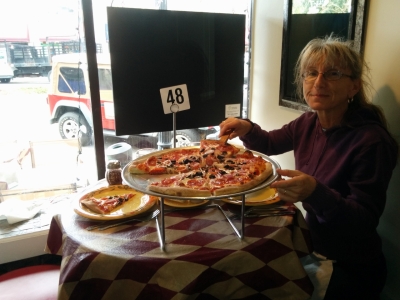
Tipsy McSways was packed when we arrived for dinner, but we were lucky and a corner window table just opened up. The restaurant has adopted a cat that sat on the table outside our window much of the evening.
|
 |
1/27/2017: Arte Pizza
Position: 31°9.00'N, -81°29.73'W
An excellent wood-fired pizza lunch at Arte Pizza in downtown Brunswick.
|
 |
1/27/2017: Chinatsu
Position: 31°9.39'N, -81°29.98'W
We're not the only Nordhavn at Brunswick Landing Marina. This is Nordhavn 55 Chinatsu.
|
 |
1/27/2017: Egret
Position: 31°9.46'N, -81°29.94'W
The third Nordhavn at Brunswick Landing Marina is the famous Nordhavn 46 Egret. Scott and Mary Flanders circumnavigated in this boat and documented their experiences in widely-read Voyage of Egret. We just missed meeting the new owners by a week.
|
 |
1/27/2017: Courtesy Bike
Position: 31°9.50'N, -81°29.94'W
The Brunswick Landing Marina has several free services, including a number of courtesy bicycles.
|
 |
1/27/2017: Winn Dixie
Position: 31°9.60'N, -81°28.74'W
A grocery shop via Uber to Winn Dixie. We not sure if we've ever been to a Winn Dixie, but we certainly recognize the name of Mark Martin's sponsor when he dominated the NASCAR Nationwide Series in the 1990s.
|
 |
1/27/2017: Brunswick Yacht Club
Position: 31°9.35'N, -81°29.94'W
Moorage at the marina includes membership in the Brunswick Yacht Club. There's a get-together every night where the marina offers free beer, and three times a week they hold a more formal version with beer and wine that's well-attended and a great time.
|
 |
1/29/2017: Basil Thai and Sushi
Position: 31°8.87'N, -81°29.70'W
An excellent meal and evening at Basil Thai and Sushi after a walk around town.
|
 |
1/30/2017: Sunset
Position: 31°9.30'N, -81°29.99'W
Sunset from the cockpit.
|
 |
1/31/2017: Pre-Dawn Departure
Position: 31°9.25'N, -81°30.00'W
We left Brunswick Landing shortly after 5am this morning to arrive at Cumberland Island with time to enjoy the afternoon there. The tide was low, not leaving enough room to turn around in the channel, so we backed out of our end berth and into the fairway behind us to turn around. This is the view down the East River just after we departed our berth. The video at youtu.be/cLm3TsVuG8A shows us pulling away from the dock and heading out to sea.
|
 |
1/31/2017: Prometheus Leader
Position: 31°7.67'N, -81°29.55'W
Shortly after we left the marina, the tugs Dorothy Moran and Ann Moran departed the dock and headed towards the F J Torras Causeway Bridge to meet the incoming 623ft (190m) RO/RO Prometheus Leader. At 1:10 into the video of our departure, one of the tugs can be seen leaving the dock in the distance on the left and crossing to the right. At 1:39 in the video, the lights of the Prometheus Leader come into view on the left as the ship passed under the F J Torras Causeway Bridge and crosses in front of us. And at 2:02 the Dorothy Moran is up against the ship's bow. After we passed under the F J Torras Causeway Bridge ourselves, we passed the 350ft (107m) dredger Stuyvesant that we saw on the way into Brunswick a week earlier.
|
 |
1/31/2017: Sunrise
Position: 31°5.64'N, -81°19.36'W
Sunrise as we're almost through the channel from St. Simons Sound.
|
 |
1/31/2017: St Marys Entrance
Position: 30°42.58'N, -81°25.40'W
St Marys Entrance is a deep and wide ship channel that is easy to transit. But like many east coast channels, it only stays that way with a lot of dredging. Here we are passing the 295ft (90m) dredger Bayport as we enter.
|
 |
1/31/2017: Coast Guard
Position: 30°42.74'N, -81°27.62'W
As we entered Cumberland Sound, we could see several Coast Guard vessels running at speed near the channel. It appeared they were practicing pursuit maneuvers where one boat would try to escape and the other would run it down.
|
 |
1/31/2017: Kings Bay
Position: 30°44.32'N, -81°29.03'W
The 16,000-acre Naval Submarine Base Kings Bay is the east coast home to the US Navy's Ohio-class nuclear submarines. The first Ohio-class submarines were based in the west coast counterpart in the Hood Canal at Bangor, Washington. We've passed by the Bangor base many time by boat. Inside these tall buildings 44ft (13.4m) Trident inter-continental ballistic missiles can be lifted vertically in and out of the submarines.
|
 |
1/31/2017: Dungeness Dock
Position: 30°45.27'N, -81°28.52'W
Ferries from nearby St. Marys typically land at Dungeness Dock to carry visitors to and from popular Cumberland Island National Seashore. But the dock is closed due to damage from Hurricane Mathew. The ramp at the right side of the picture should be attached to a floating dock, but is hanging into the water.
|
 |
1/31/2017: Lang's Marina
Position: 30°43.16'N, -81°33.15'W
We ran the tender up St. Marys River to the town of St. Marys for lunch. Here it is tied off on the dinghy dock at Lang's Marina.
|
 |
1/31/2017: Lunch
Position: 30°43.24'N, -81°33.12'W
This is the view from our table at Lang's Marina restaurant. We had great meal there.
|
 |
1/31/2017: Mavic Pro
Position: 30°43.21'N, -81°32.80'W
While walking through a park at the east end of St. Marys we heard a drone and went to check it out. In our limited experience with flying drones, they require a fair bit of attention to control and what really caught our attention here was the person with the controls had his back to the drone and wasn't even looking at it as the drone followed behind. It was a DJI Mavic Pro that had some really impressive features, including the ability to fold up into a small, portable package and a mode where you could set the drone to follow a certain object or person. We ordered one immediately.
|
 |
1/31/2017: St. Marys River
Position: 30°43.21'N, -81°32.74'W
Looking east across the St. Marys River. The border between Georgia and Florida runs along the river. We're standing in Georgia, but the land visible in the distance is in Florida.
|
 |
1/31/2017: Submarine Museum
Position: 30°43.23'N, -81°32.96'W
The St. Marys Submarine Museum is packed with submarine memorabilia and many excellent photographs.
|
 |
1/31/2017: Periscope
Position: 30°43.24'N, -81°32.95'W
The pride of the St. Marys Submarine Museum is a working submarine periscope. Jennifer could clearly see the dinghy moored at Lang's Marina at the west end of town.
|
 |
1/31/2017: Low Tide
Position: 30°43.15'N, -81°33.15'W
Good thing we paid attention to the tides and moored the tender on the outside of the float. Had we tied off on the inside, we would be aground on this wreck that was invisible at high tide.
|
 |
1/31/2017: Patrol
Position: 30°46.97'N, -81°29.45'W
From St. Marys, we ran the tender to the Kings Bay Submarine Base, but couldn't get very close. The Navy Patrol boat visible at the right of the picture made sure we kept our distance.
|
 |
1/31/2017: Submarine Building
Position: 30°47.28'N, -81°29.55'W
A long-lens close-up to one of the buildings where the 44ft (13.4m) Trident inter-continental ballistic missiles can be vertically lifted in and out of an Ohio-class submarine.
|
 |
1/31/2017: Sea Camp Dock
Position: 30°45.83'N, -81°28.29'W
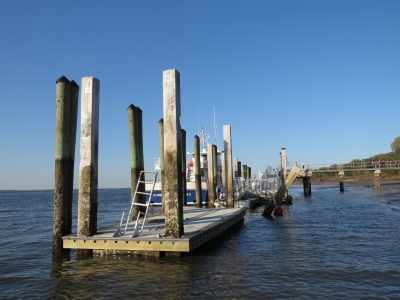
Sea Camp Dock on Cumberland Island is where pleasure craft operators usually can moor for access to the island. But the dock suffered damage in Hurricane Mathew and is temporarily the designated ferry dock, so no public access is allowed. The only dock where we can land a tender is miles to the north at Plum Orchard Dock.
|
 |
1/31/2017: Micro-Tender
Position: 30°45.37'N, -81°28.49'W
Mudflats extend a long way from the beach at low tide, making landing the larger tender a challenge. So we got out the micro-tender to go ashore at Cumberland Island tomorrow. With a 29-lb, 2.3HP motor, the whole package weights just over 60 lbs. We can easily carry it between us to to and from the water in places where the tide goes out a long way.
|
 |
1/31/2017: Sunset
Position: 30°45.38'N, -81°28.49'W
A beautiful sunset from the anchorage off Cumberland Island.
|
 |
2/1/2017: Cumberland Island
Position: 30°45.34'N, -81°28.38'W
Changing from rubber boots to hiking boots after landing the micro-tender ashore at Cumberland Island National Seashore. The accessible docks were all closed to the public due to storm damage from Hurricane Mathew. The extensive shallows would be difficult to manage in our large, 850-lb tender, so we ran the micro-tender ashore just north of Dungeness Dock and carried it up the beach. Cumberland Island is Georgia's southernmost barrier island and is a popular destination full of hiking trails and dramatic scenery.
|
 |
2/1/2017: Armadillo
Position: 30°45.16'N, -81°28.31'W
Shortly after landing, we saw an Armadillo rooting in the woods. This animal from the American West was introduced by man to Florida in the 1920s and slowly expanded its range as far north as South Carolina. Armadillo reached Cumberland Island in the 1970s, likely carried there by strong currents when attempting to cross a tidal creek.
|
 |
2/1/2017: Dungeness Road
Position: 30°45.13'N, -81°28.26'W
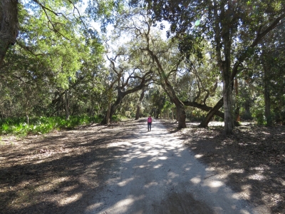
Walking tree-lined Dungeness Road where horse-drawn carriages once transported the rich and famous to the Carnegie Cumberland Island estate.
|
 |
2/1/2017: Dungeness Ruins
Position: 30°44.87'N, -81°28.28'W
Thomas M. Carnegie, the brother of steel magnate Andrew Carnegie, and his wife Lucy bought land on Cumberland Island in the 1880s. Here they constructed Dungeness, a 59-room Scottish castle complete with a pool and golf course. Forty smaller buildings were built to house mansion's 200 servants. Thomas died before construction was completed, but Lucy lived here with her children until the Great Depression. The mansion was left vacant, and eventually destroyed by fire in 1959.
|
 |
2/1/2017: Live Oaks
Position: 30°44.79'N, -81°28.02'W
Jennifer standing beside a huge Live Oak, the native tree of Georgia, in one of the island's many forests. The tree is so-named because it remains green and "live" throughout winter, while other oaks are dormant and leafless. Live Oak from Cumberland Island was used in the 1790s to build the USS Constitution, "Old Ironsides," that we toured while in Boston.
|
 |
2/1/2017: Wild Horses
Position: 30°44.74'N, -81°27.95'W
Horses were introduced to Cumberland Island as early as the 1700s and were managed as free-ranging livestock until the 1960s. They had become feral on the island by the time the park was established in 1972. The estimated population today is 125-150 animals.
|
 |
2/1/2017: Dungeness Trail
Position: 30°44.66'N, -81°27.74'W
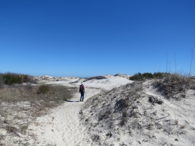
We took Dungeness Trail to Dungeness Beach. Here we are walking a wonderful boardwalk across a portion of the sand dunes. Jennifer loves boardwalks.
|
 |
2/1/2017: Dunes
Position: 30°44.70'N, -81°27.59'W
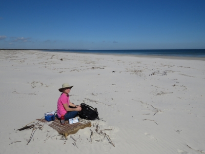
From the boardwalk we walked through sand dunes to reach the ocean.
|
 |
2/1/2017: Lunch
Position: 30°44.78'N, -81°27.50'W
A picnic lunch on Dungeness Beach with sweeping ocean views. Surprisingly little driftwood was along the beach, but we found a portion of an old shipping pallet to sit on.
|
 |
2/1/2017: Horseshoe Crab
Position: 30°44.90'N, -81°27.51'W
During lunch we could see several seagulls and birds of prey wheeling overhead farther along the beach. This is what they were after: a dead horseshoe crab that might have become stranded in the falling tide.
|
 |
2/1/2017: Beach
Position: 30°44.93'N, -81°27.50'W
Enjoying a walk along beautiful Dungeness Beach.
|
 |
2/1/2017: Sea Camp
Position: 30°45.85'N, -81°27.63'W
We left Dungeness Beach along the trail to Sea Camp dock, following another lovely boardwalk.
|
 |
2/1/2017: Picnic Table
Position: 30°45.84'N, -81°27.78'W
Enjoying a break at a picnic table in another Live Oak forest. Live Oaks are the dominant tree on Cumberland Island because they can stand more salt and wind spray than competing trees. You can clearly see which direction the prevailing winds blow from in this picture.
|
 |
2/1/2017: Rooting
Position: 30°45.51'N, -81°28.28'W
We saw several Armadillo on the island. This one was busy rooting for food and took no interest in us whatsoever.
|