MV Dirona travel digest for North to Arctic Circle, Norway 2018

|
Click the travel log icon on the left to see these locations on a map,
with the complete log of our cruise. On the map page, clicking on a camera or text icon will display a picture and/or log entry for that location, and clicking on the smaller icons along the route will display latitude, longitude and other navigation data for that location. And a live map of our current route and most recent log entries always is available at //mvdirona.com/maps/LocationCurrent.html. |
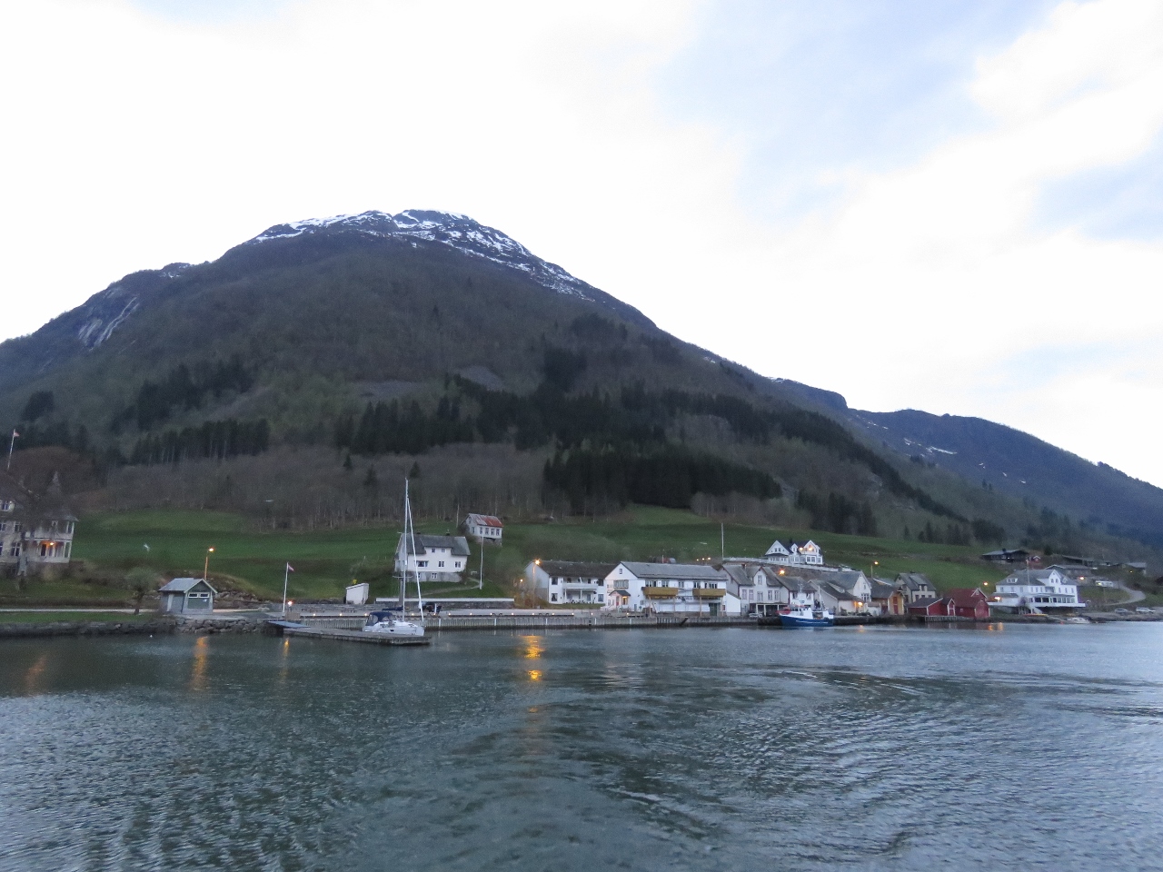 |
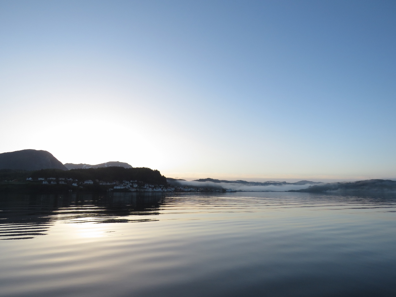
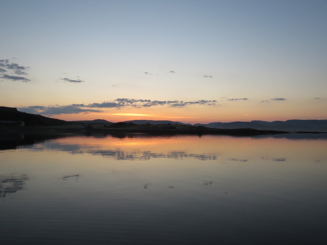
5/10/2018: Fjærland
Position: 61°24.25'N, 6°44.53'E
A last look to Fjærland as we depart just before 5am. Another pleasure craft arrived overnight and was on the dock when we got up.
|
 |
5/10/2018: Raw Water Pump
Position: 61°6.31'N, 5°37.88'E
The generator raw water pump was dripping saltwater at the shaft seal so we replaced it with a spare (pictured).
|
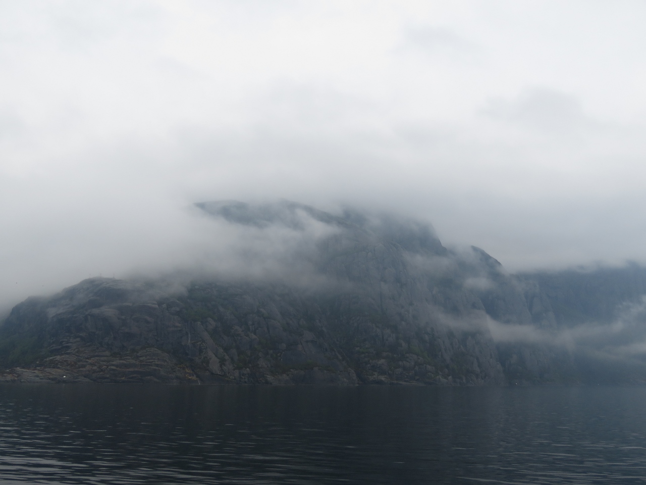 |
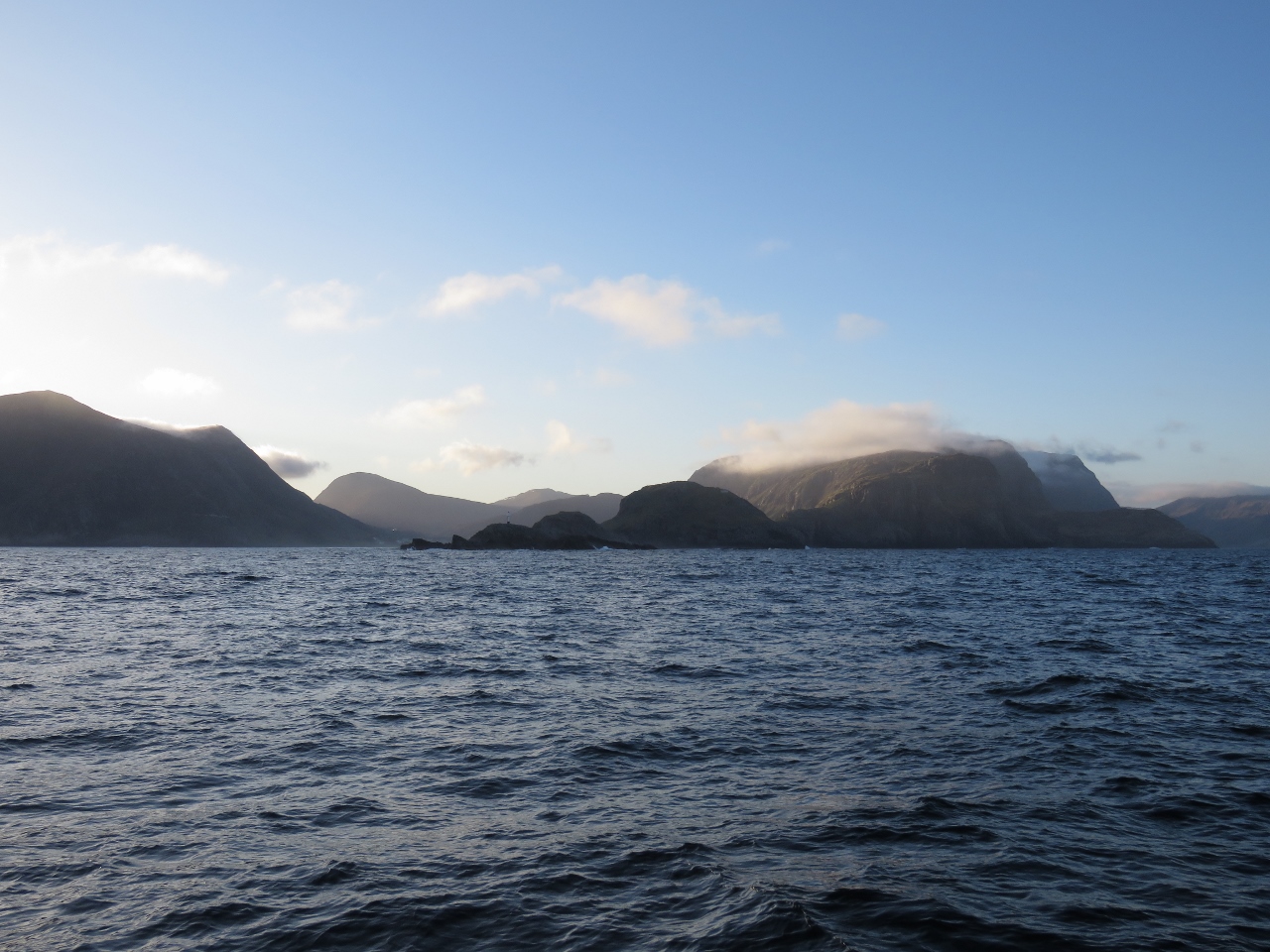
5/10/2018: Overcast
Position: 61°9.78'N, 5°4.31'E
Even in overcast conditions, the Norway scenery is dramatic.
|
 |
5/10/2018: Farthest North
Position: 61°16.84'N, 4°55.72'E
The green line in the chart represents the farthest north Dirona has ever been before arriving in Norway: 61°16' while in Prince William Sound, Alaska. We crossed above that line when we were in Fjærland, then passed back south of it again this morning. We just crossed north of it again and it won't be back south of the line for several months.
|
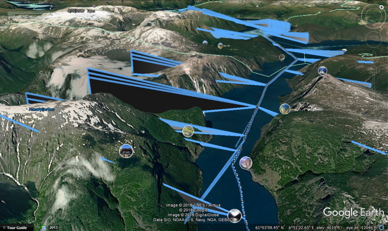 |
5/10/2018: KVH Coverage
Position: 61°18.32'N, 5°7.77'E
As we near the Arctic Circle the angle of elevation to the geosynchronous satellites used by KVH to deliver us internet access gets lower and lower in the sky. Aurlandsfjord has high mountains right near the water and we saw several outages that seemed unusual. We asked KVH about it, and with our permission they investigated our exact boat locations and path and sent us a super-interesting Google Earth plot of Dirona moving through the Aurlandsfjord. The plot is annotated with the satellites we were contacting, showing when we had coverage and when we had blockage.
In the screenshot, the blue-edged black triangles represent the beam of our satellite antenna. When they intersect with a mountain, our signal is blocked. Looking closely, it's amazing we were so frequently connected especially when you consider that the satellites are all directly above the earth's equator. One of the strengths of the KVH V7hts mini-VSAT system is that, even this far north, there are often multiple satellites available in different parts of the sky. There is often coverage in even very unlikely places like a predominately east/west Norwegian fjord. |
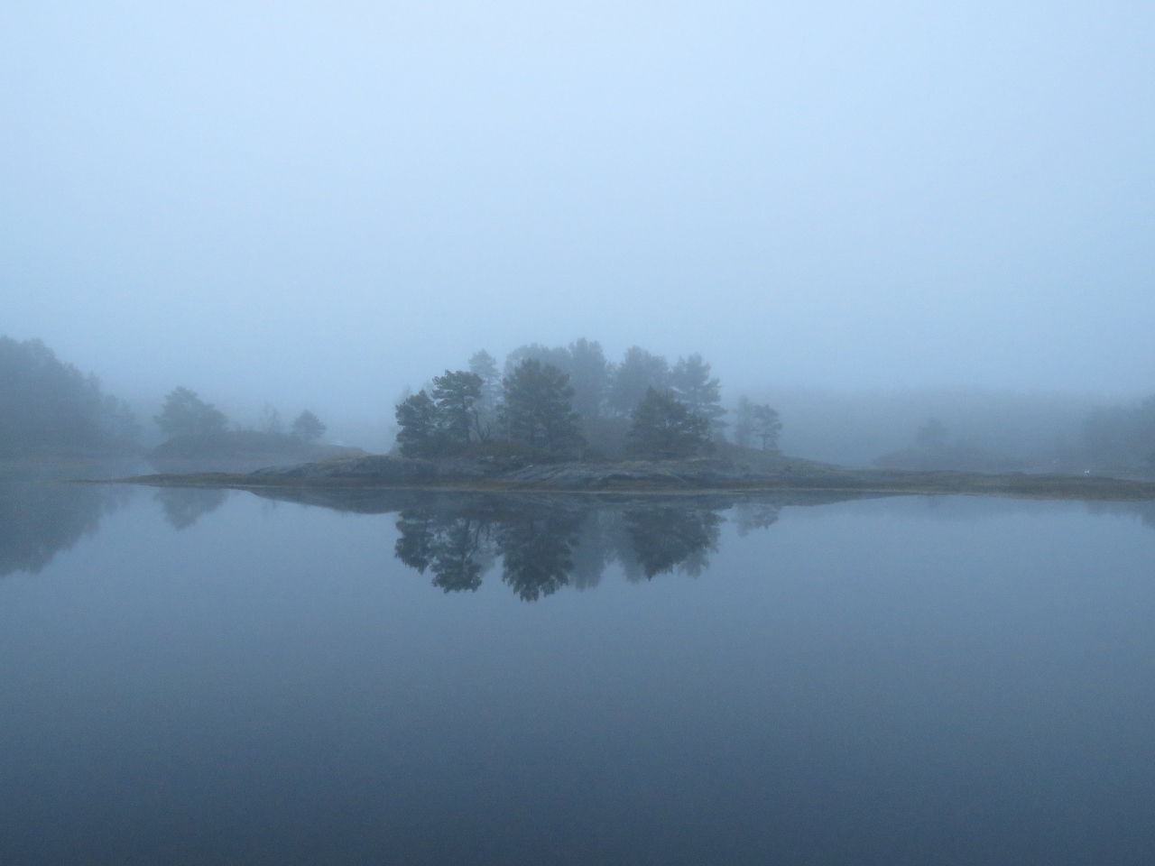 |
5/11/2018: Strokehavet
Position: 61°18.33'N, 5°7.74'E
We awoke to a misty morning after a peaceful night anchored in Strokehavet, a sheltered cove across Vilnesfjord from Askvoll.
|
 |
5/11/2018: Fog
Position: 61°19.24'N, 5°4.52'E
The mist at Strokehavet gave way to a thick fog just outside in Vilnesfjord.
|
 |
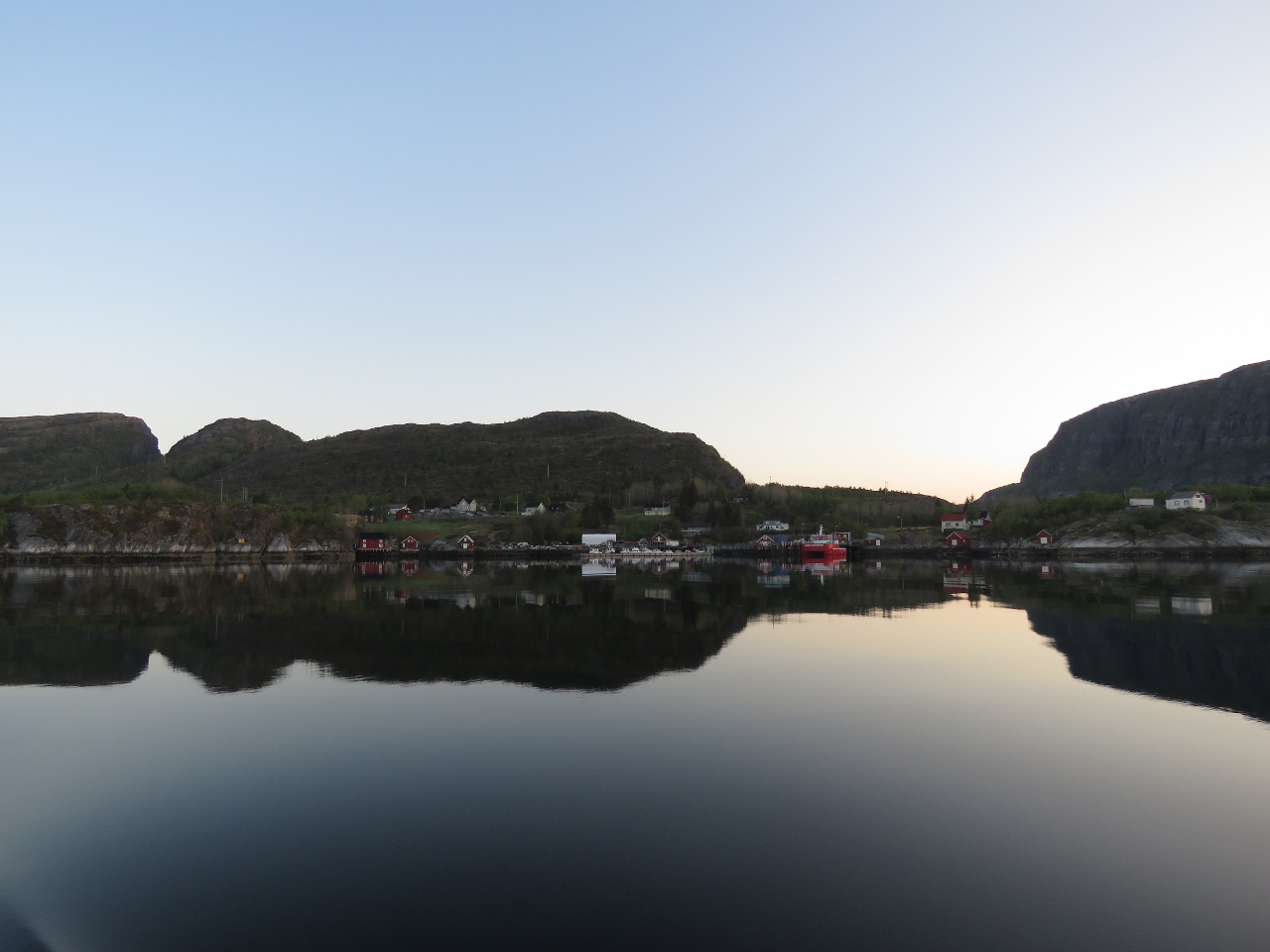
5/11/2018: Askvoll
Position: 61°20.71'N, 5°2.37'E
The fog lifted once we left Vilnesfjord and we got a nice view to the town of Askvoll in the morning light.
|
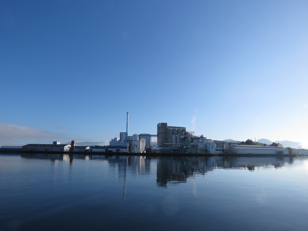 |
5/11/2018: Florø
Position: 61°34.97'N, 4°59.91'E
We passed through a narrow channel off the end of Florø's airport toward this large fish processing facility. Florø, with a population of 11,000, is Norway's westernmost town.
|
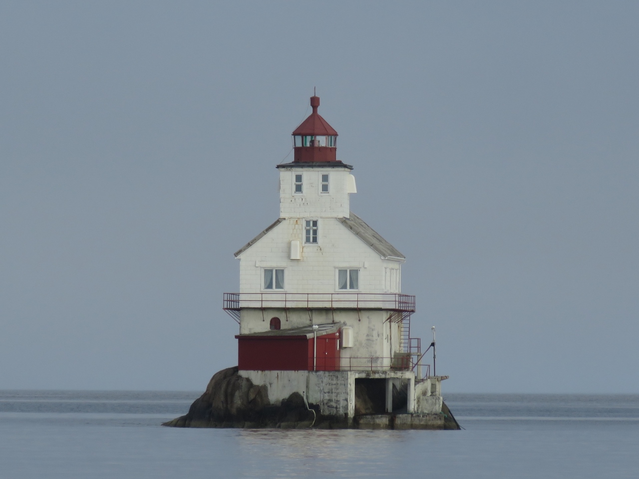 |
5/11/2018: Stabben Lighthouse
Position: 61°35.84'N, 4°57.72'E
Stabben Lighthouse near Florø, established in 1867, perched almost impossibly upon a minuscule 3,200 sq ft (300 sq m) islet.
|
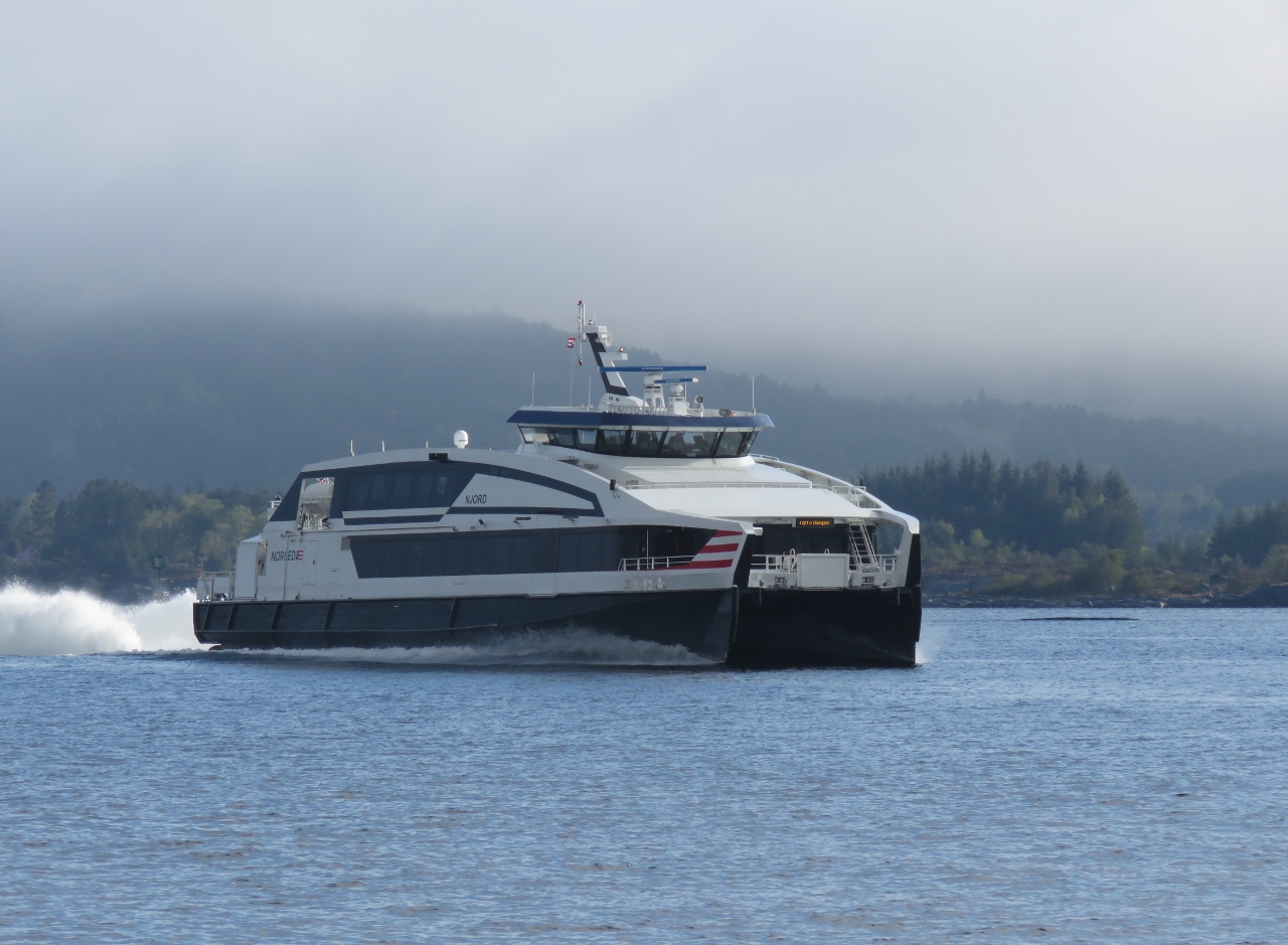 |
5/11/2018: Njord
Position: 61°38.04'N, 4°58.99'E
The fast ferry Njord making 32.5 knots en route to Bergen.
|
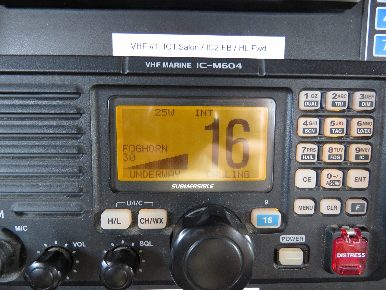 |
5/11/2018: Foghorn
Position: 61°42.70'N, 4°56.64'E
We're back in deep fog and are sounding the foghorn again. We replaced the foghorn loudhailer in Harlingen.
|
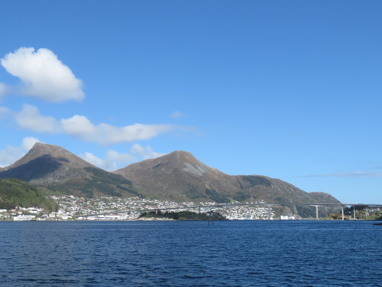 |
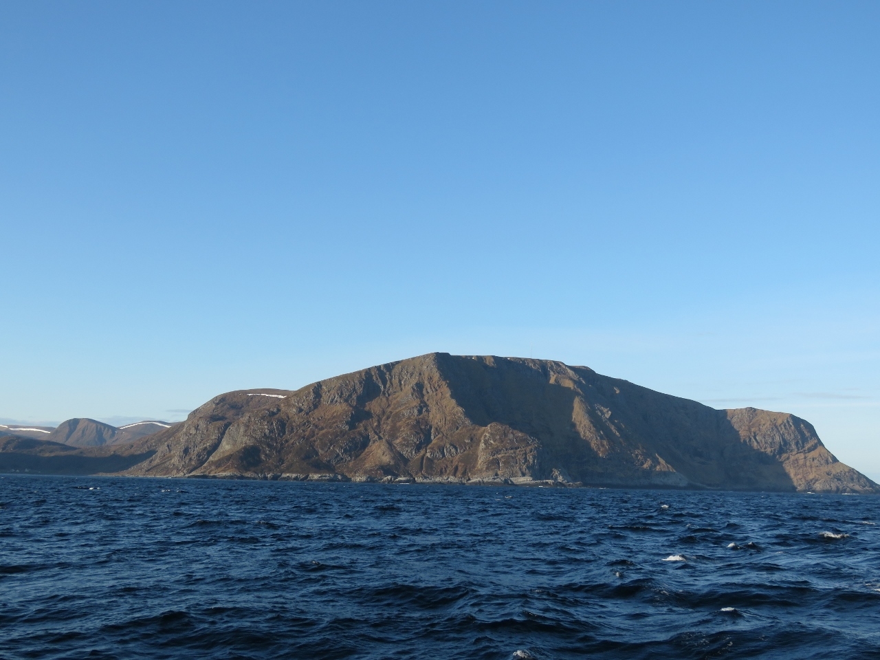
5/11/2018: Måløy
Position: 61°55.09'N, 5°7.23'E
Approaching the town of Måløy. The winds are forecast to come up this afternoon, but settle down overnight. So we'll anchor for the night in Deknepollen, with a view to Måløy, to stage for an offshore run past the Stad headland tomorrow morning. Stad is notorious for bad weather and rough conditions, so we want calm weather to round it.
|
 |
5/12/2018: Dawn
Position: 61°55.83'N, 5°8.11'E
We're up at 4am to take advantage of the calm weather to round Stad. It's a lovely calm dawn here in Deknepollen. The sun is just cresting the horizon, so we'd have to get up a little earlier to actually see the sunrise.
|
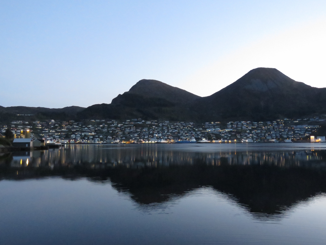 |
5/12/2018: Måløy
Position: 61°55.83'N, 5°8.11'E
Måløy glowing in the early morning light as we get underway.
|
 |
5/12/2018: Calm
Position: 62°1.50'N, 5°9.17'E
The wind is blowing 1.2 knots—perfect for rounding Stad.
|
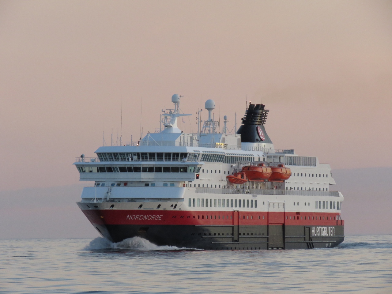 |
5/12/2018: Hurtigruten
Position: 62°1.50'N, 5°9.17'E
The Hurtigruten (meaning 'Express Route') is a system of coastal ferries, founded in 1893, that run between Bergen and Kirkenes in far northeastern Norway. The Nordnorge Hurtigruten was rounding Stad heading south as we approached.
|
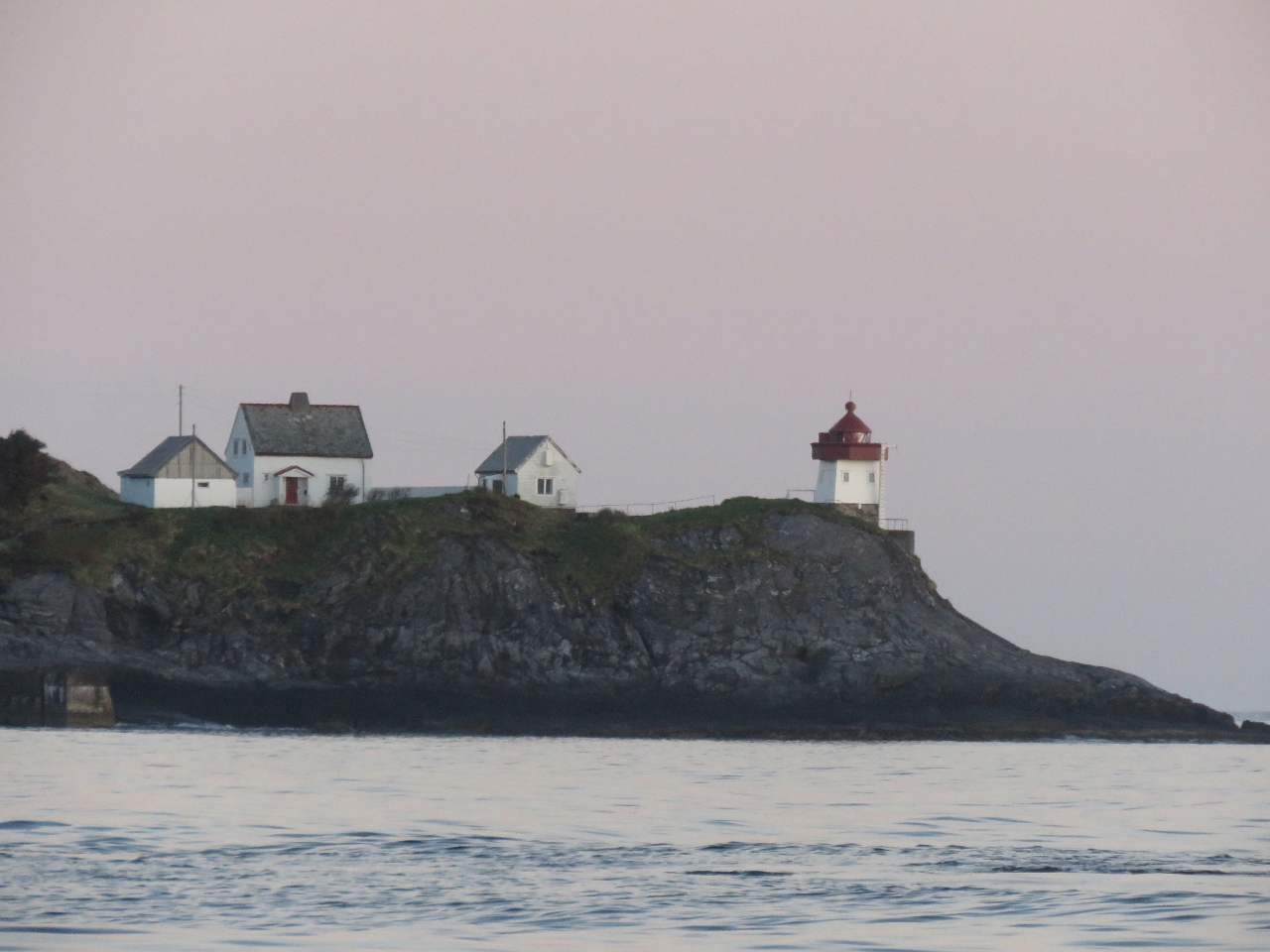 |
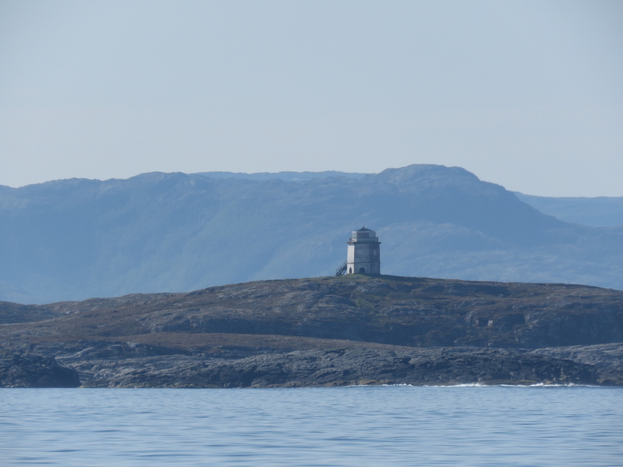
5/12/2018: Skongsneset Lighthouse
Position: 62°1.74'N, 5°9.06'E
The Skongsneset Lighthouse to our west.
|
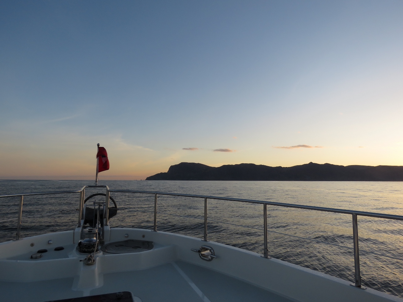 |
5/12/2018: Stad
Position: 62°3.28'N, 5°7.85'E
Stad, visible in the distance, is one of 24 areas the Norwegian Coastal Pilot lists as likely to have rough seas in certain wind and tide conditions. Stad itself is so notorious for dangerous conditions that an escort service is provided for small boats and funds have been approved to build a ship tunnel through the headland that will be large enough for the Hurtigruten ferries. Too bad the tunnel hasn't been built yet—that would certainly be a first for Dirona to pass through a tunnel.
|
 |
5/12/2018: Sunbeams
Position: 62°8.92'N, 5°3.75'E
Sunbeams shining through the southwest tip of Stad.
|
 |
5/12/2018: Partway
Position: 62°10.32'N, 5°3.66'E
Looking back to Stad partway around.
|
 |
5/12/2018: Around
Position: 62°13.59'N, 5°8.17'E
We're all the way around now. Conditions remained wonderfully calm the entire run.
|
 |
5/12/2018: Screw
Position: 62°59.35'N, 6°55.64'E
Since Dirona was delivered, we've heard something rolling around above the helm and haven't been able to find it. It's usually noticeable only in rough conditions and we haven't been motivated to open up the overhead panel to look for it then. Even though conditions are quite calm today, we could hear it, so we opened up the panel and finally found it: a large screw.
|
 |
5/12/2018: Langøysundet
Position: 63°3.22'N, 7°26.63'E
With a forecast for light winds the entire day, we continued offshore to pass another dangerous coastal area, Hustadivika. We returned inshore through Langøysundet in thick fog that just started to lift as we passed these fish boats.
|
 |
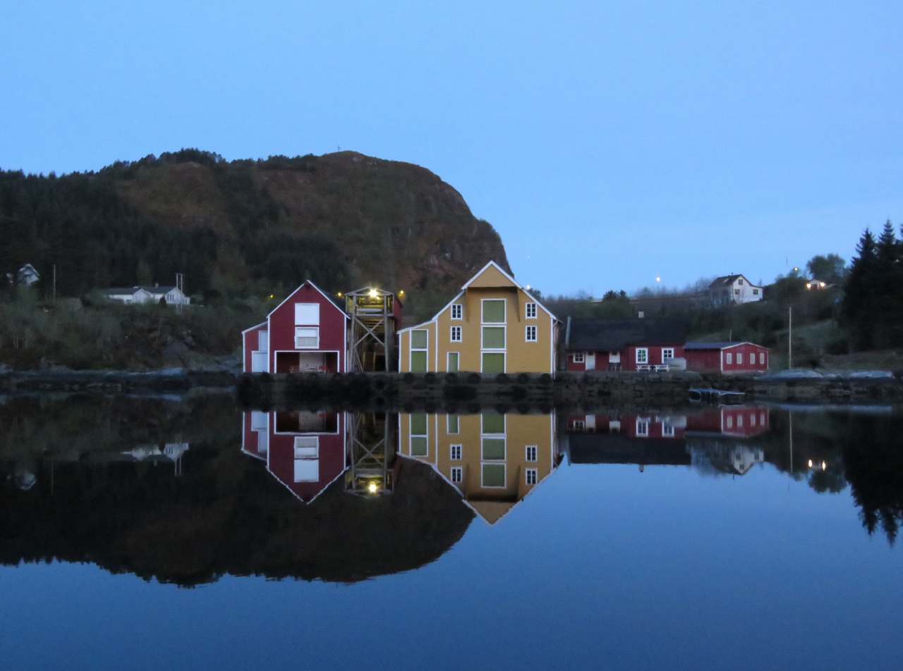
5/12/2018: Ellingvåagen
Position: 63°3.46'N, 7°28.70'E
We anchored for the night in tranquil Ellingvåagen, where some locals came over to chat.
|
 |
5/13/2018: Sunrise
Position: 63°3.46'N, 7°28.68'E
A beatuiful sunrise over the anchorage at Ellingvåagen. It's great to be able to get underway early and not have to work in the dark.
|
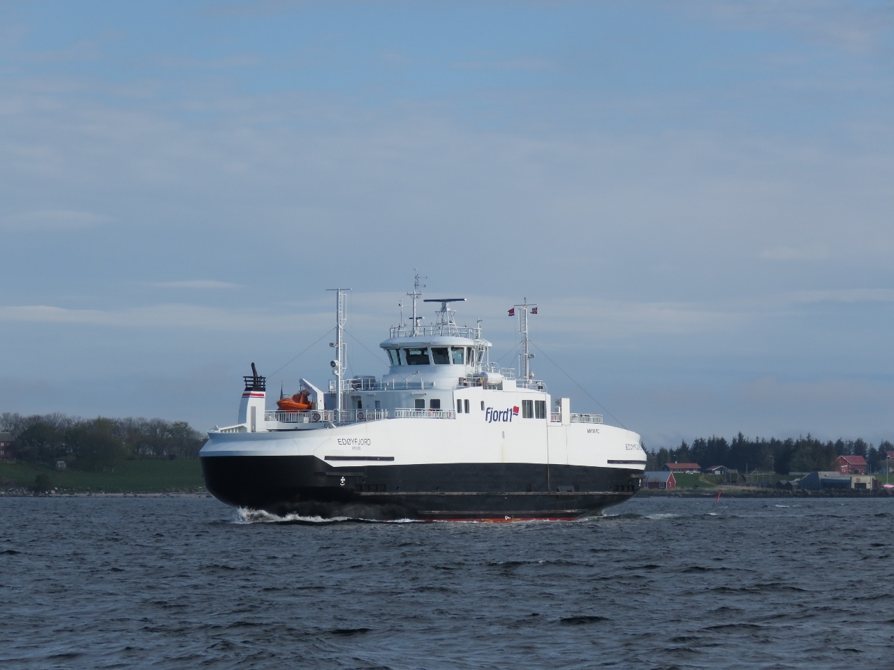 |
5/13/2018: Edøyfjord
Position: 63°16.48'N, 8°8.50'E
This ferry Edøyfjord serves the route between Edøya-Sandvika and Smøla.
|
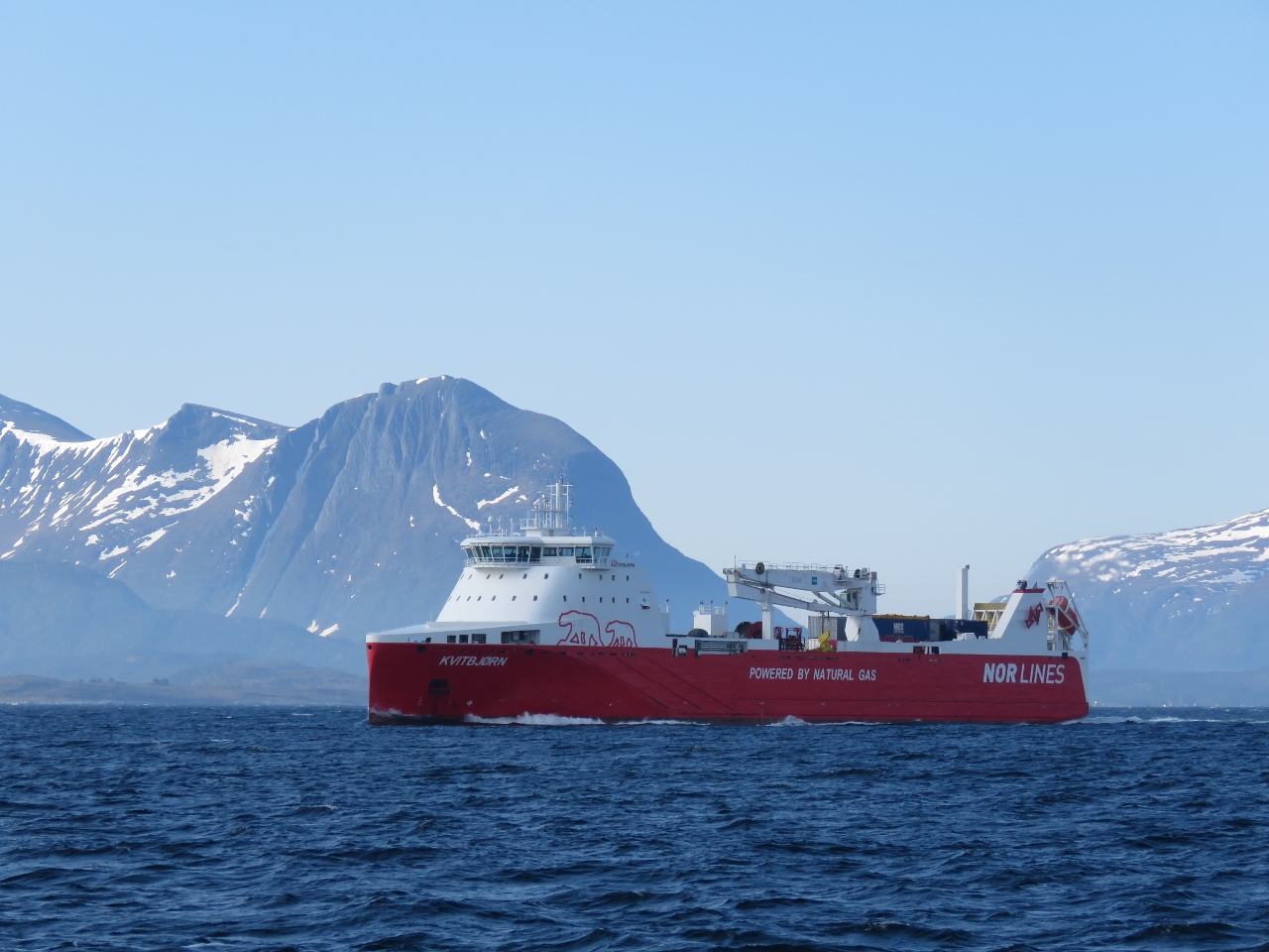 |
5/13/2018: Kvitbjørn
Position: 63°19.51'N, 8°16.57'E
We're seeing lots of traffic as we near Trondheim, Norway's third-largest city. This is the LNG-powered cargo vessel Kvitbjørn (translated as "White Bear"), launched in 2015.
|
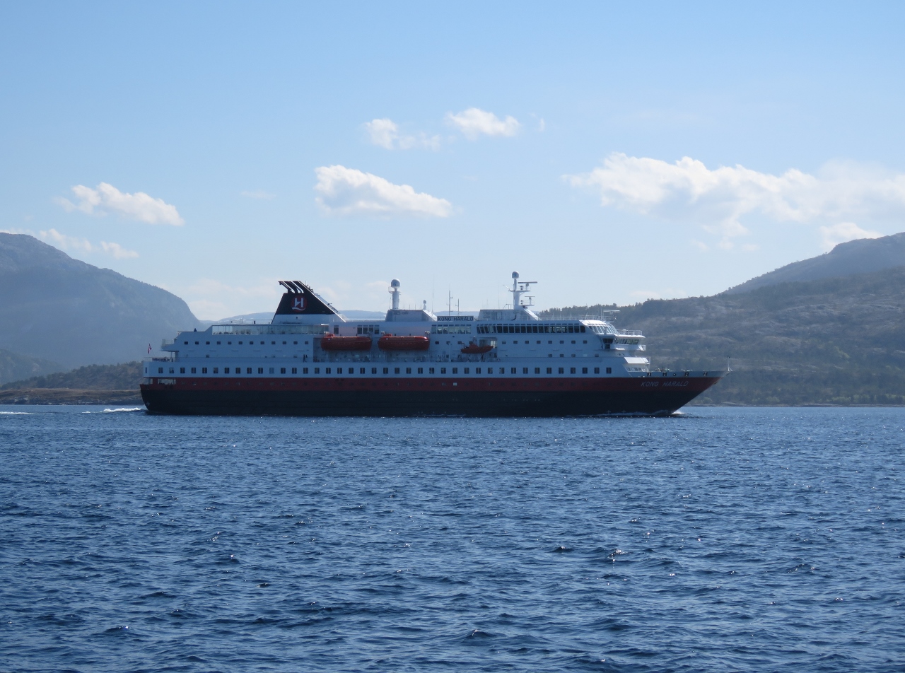 |
5/13/2018: Kong Harald
Position: 63°22.97'N, 8°30.35'E
The Hurtigruten ferry Kong Harald running south.
|
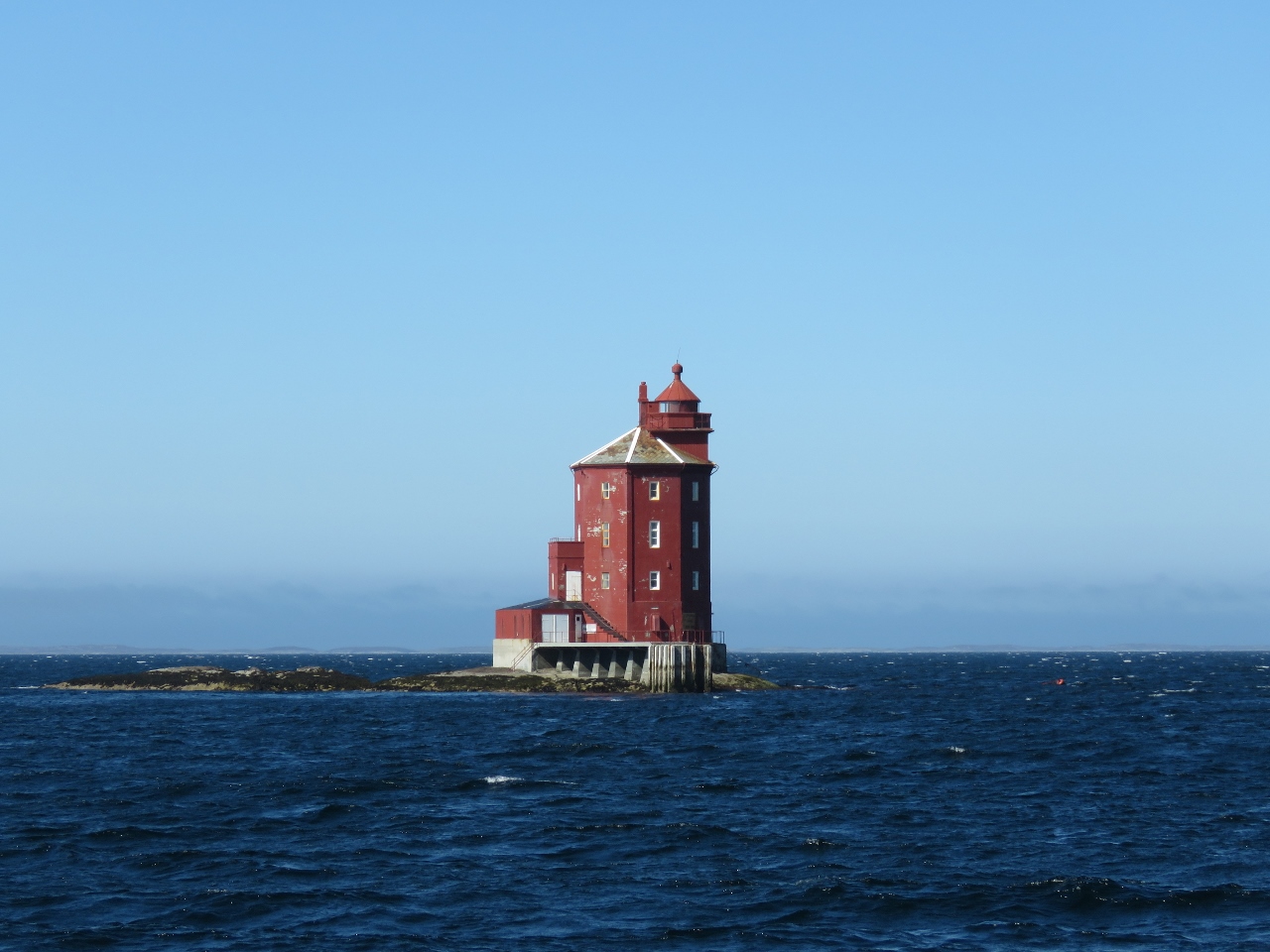 |
5/13/2018: Tjeungskjær
Position: 63°43.57'N, 9°32.11'E
Tjeungskjær, built in 1880, near the approach to Trondheim. The light is not lit between May 16 and July 21 every year due to the midnight sun
|
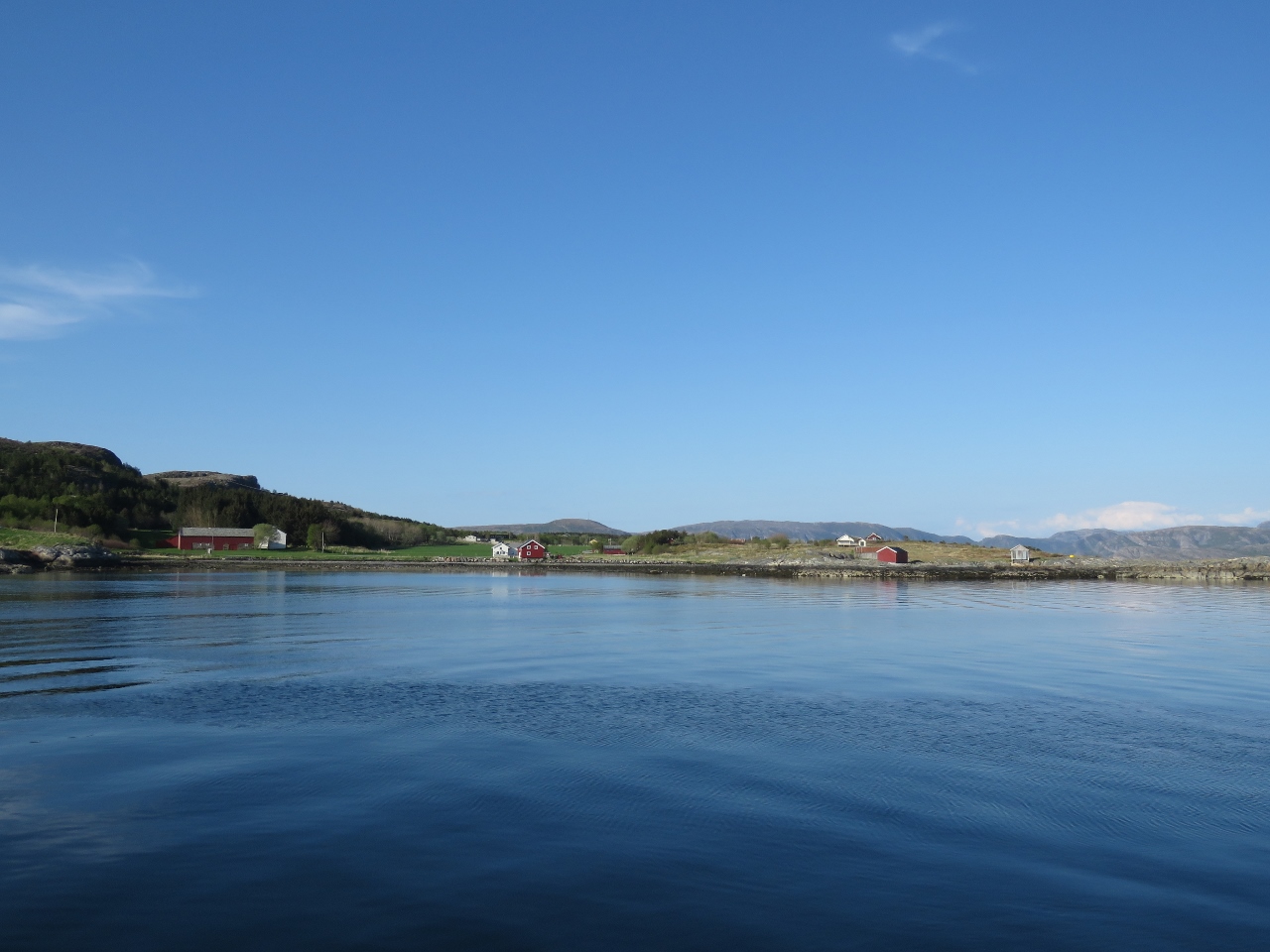 |
5/13/2018: Linesøya
Position: 64°0.11'N, 9°55.75'E
We anchored for the night in calm conditions off the south end of the island of Linesøya.
|
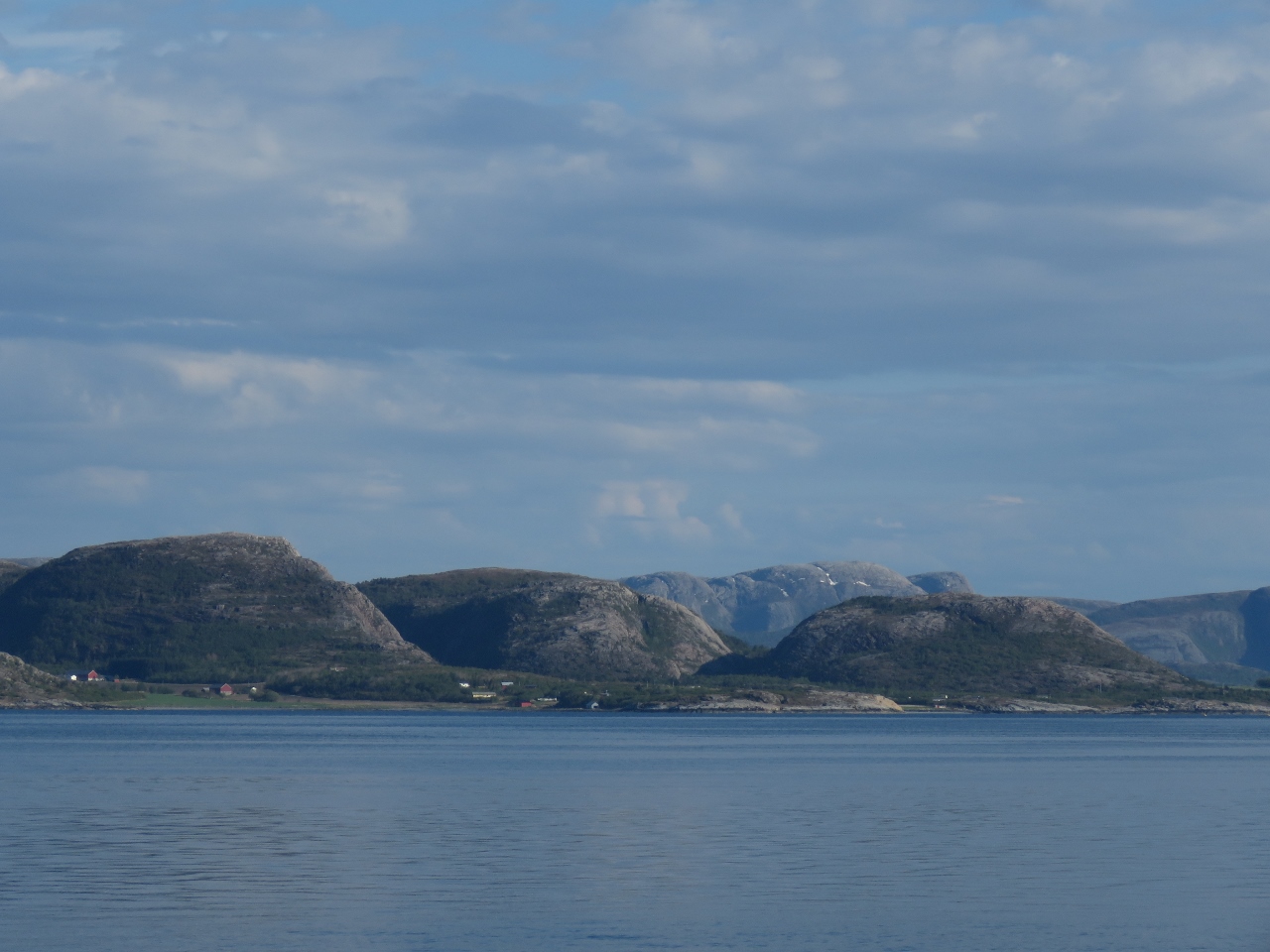 |
5/13/2018: Mainland
Position: 64°0.11'N, 9°55.75'E
The view southeast to the mainland mountains from the anchorage at Linesøya.
|
 |
5/14/2018: Sunrise
Position: 63°22.97'N, 8°30.35'E
A 4am sunrise from the anchorage at Linesøya.
|
 |
5/14/2018: Stokknes
Position: 64°2.90'N, 10°3.04'E
The village of Stokknes reflected into still waters in the early morning light.
|
 |
5/14/2018: Orca
Position: 64°15.01'N, 10°18.53'E
We were very excited to see a small pod of Orcas, including a baby, travelling north past the village of Bessaker.
|
 |
5/14/2018: Villa Lighthouse
Position: 64°34.38'N, 10°41.11'E
The old coal-fired lighthouse on the island of Villa was in operation from 1839 to 1890.
|
 |
5/14/2018: Gjeslingene Lighthouse
Position: 64°44.59'N, 11°0.12'E
The Gjeslingene Lighthouse south of Rørvik was established in 1877.
|
 |
5/14/2018: Modern Houses
Position: 64°50.48'N, 11°11.94'E
The town of Rørvik has some beautiful modern houses perched above the water.
|
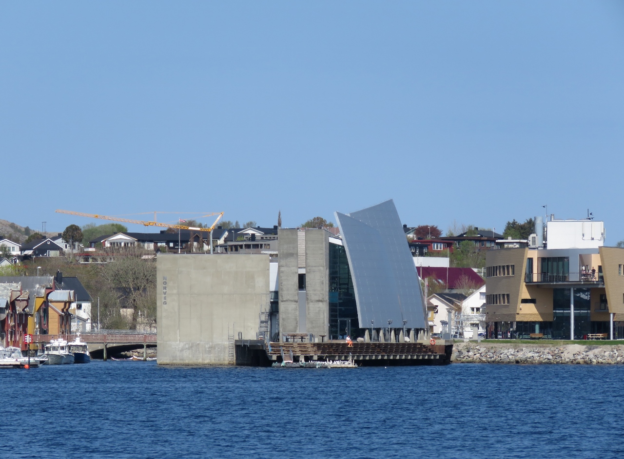 |
5/14/2018: NORVEG
Position: 64°51.35'N, 11°14.23'E
The sail-form roof structure of NORVEG, a cultural center and museum of coastal life that opened in 2004.
|
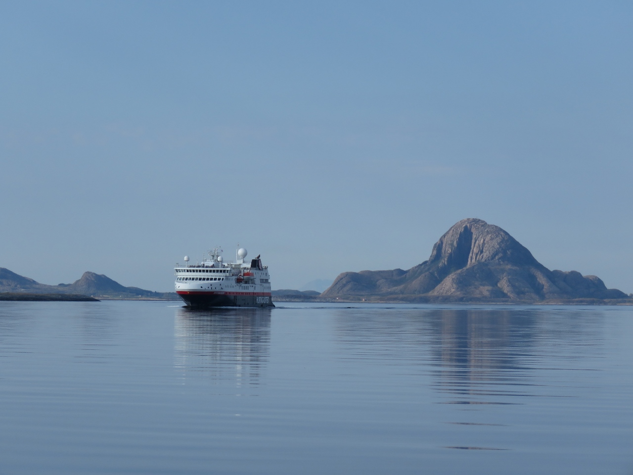 |
5/14/2018: Spitsbergen
Position: 65°19.90'N, 12°1.58'E
The Hurtigruten ferry Spitsbergen south of the island of Torget.
|
 |
5/14/2018: Torghatten
Position: 65°22.46'N, 12°1.84'E
Torghatten is a famous landmark in Norway due the hole through right through the mountain. We plan to hike through the hole tomorrow.
|
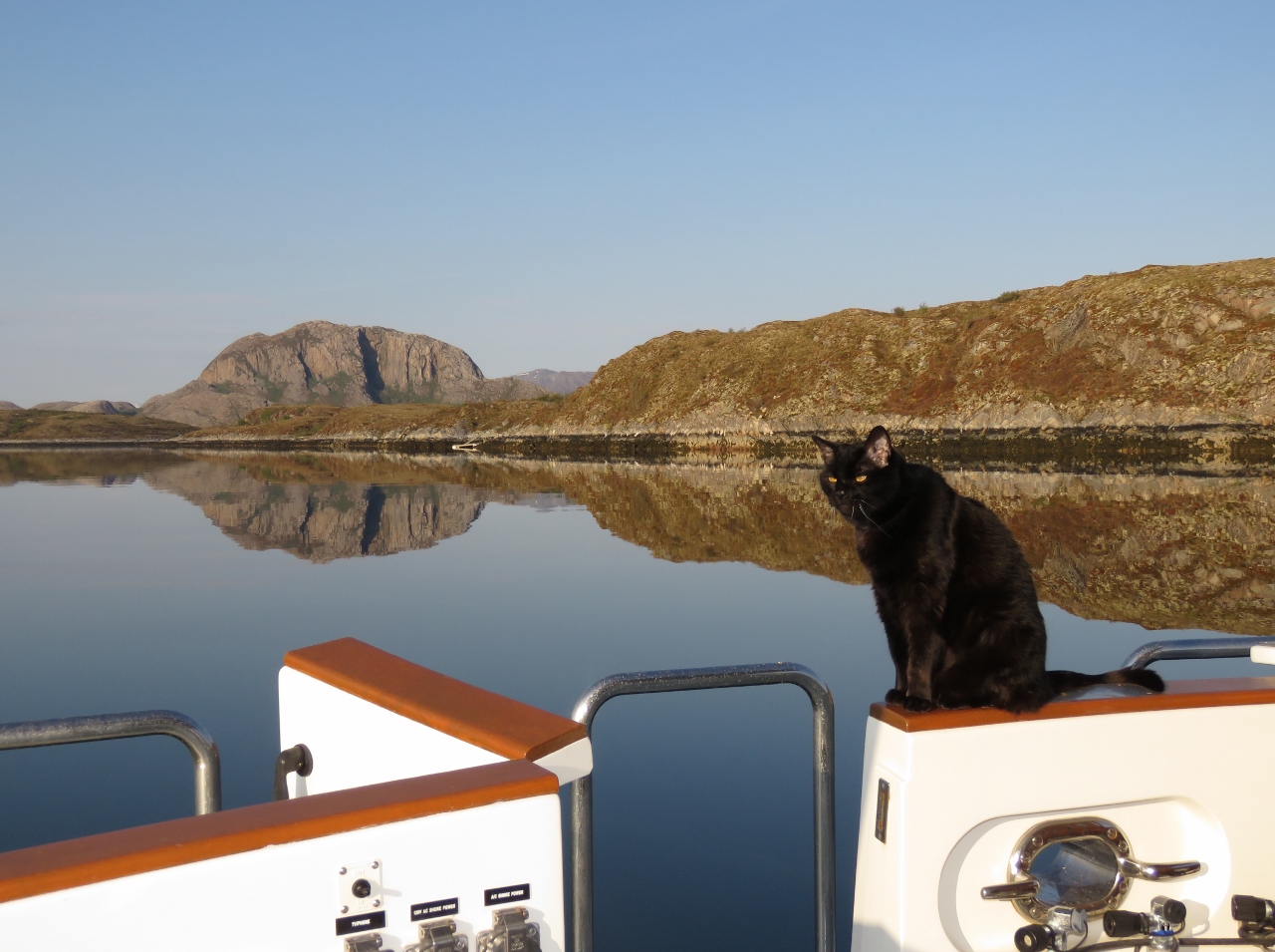 |
5/14/2018: Spitfire
Position: 65°22.96'N, 12°1.75'E
Spitfire enjoying the calm anchorage off the island of Torget with Torghatten visible in the distance.
|
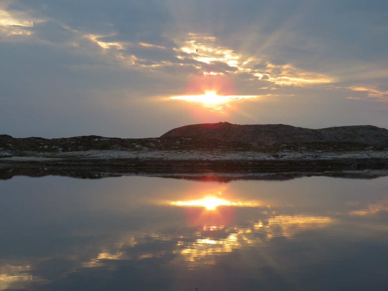 |
5/14/2018: Sunset
Position: 65°22.96'N, 12°1.75'E
9:23pm sunset off the island of Torget.
|
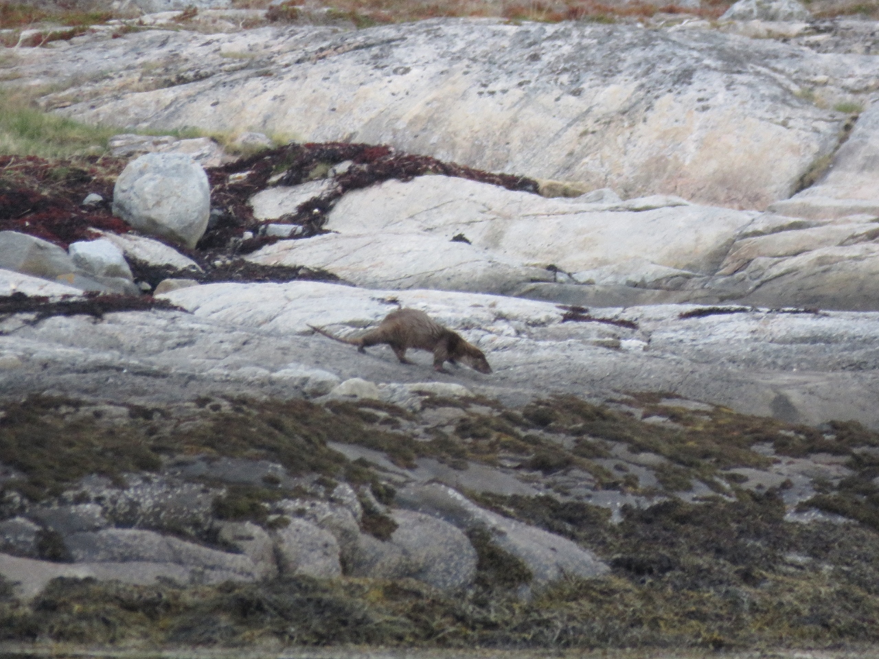 |
5/14/2018: Otter
Position: 65°22.96'N, 12°1.75'E
We think this is a Eurasion otter that we spotted on shore near our anchorage.
|
 |
5/15/2018: Blue Screen
Position: 63°22.97'N, 8°30.35'E
The nav computer locked up this morning and we got a blue screen when we tried to reboot it. The abridged version of the event is that the shorter member of the team accidentally renamed the wrong system folder two weeks ago when attempting to resolve a Windows Update issue. The problem didn't surface until the first reboot afterwards, which was this morning at 4am. It took us a day to get the system booting, troubleshoot the issue and fully recover, but we eventually were able to get the system back healthy again.
|
 |
5/15/2018: Sunset
Position: 65°22.94'N, 12°1.73'E
A beautiful sunset after a long and stressful day troubleshooting the navigation computer.
|
 |
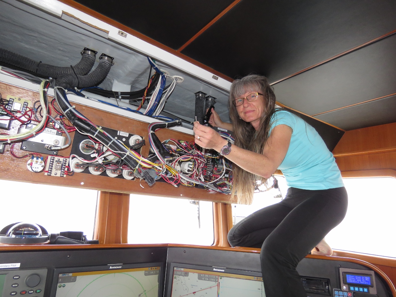
5/16/2018: Switch Box
Position: 65°22.95'N, 12°1.78'E
The monitor in the salon that repeats the four monitors in the pilot house wasn't getting signal this afternoon. Here James is investigating if it is a switchbox issue. We hope not, as that is something we don't have a spare for.
|
 |
5/16/2018: Monitor Failure
Position: 65°22.95'N, 12°1.78'E
We chased down the problem to a faulty monitor and replaced it. That's two monitor failures in the past five months—we guess they're coming due. But after 78,000 hours of continuous operation, it's hard to complain. We still have four more spares after this replacement, but we're conservative so are thinking of buying another one, which is easy to do at only $169 on Amazon.
|
 |
5/17/2018: Goal
Position: 65°22.47'N, 12°1.72'E
Our goal for the day is to climb to the window in Torghatten.
|
 |
5/17/2018: Tender
Position: 65°23.61'N, 12°6.19'E
Tying off the tender in a small cove near the base of Torghatten.
|
 |
5/17/2018: Trail Head
Position: 65°23.76'N, 12°5.83'E
At the trail head.
|
 |
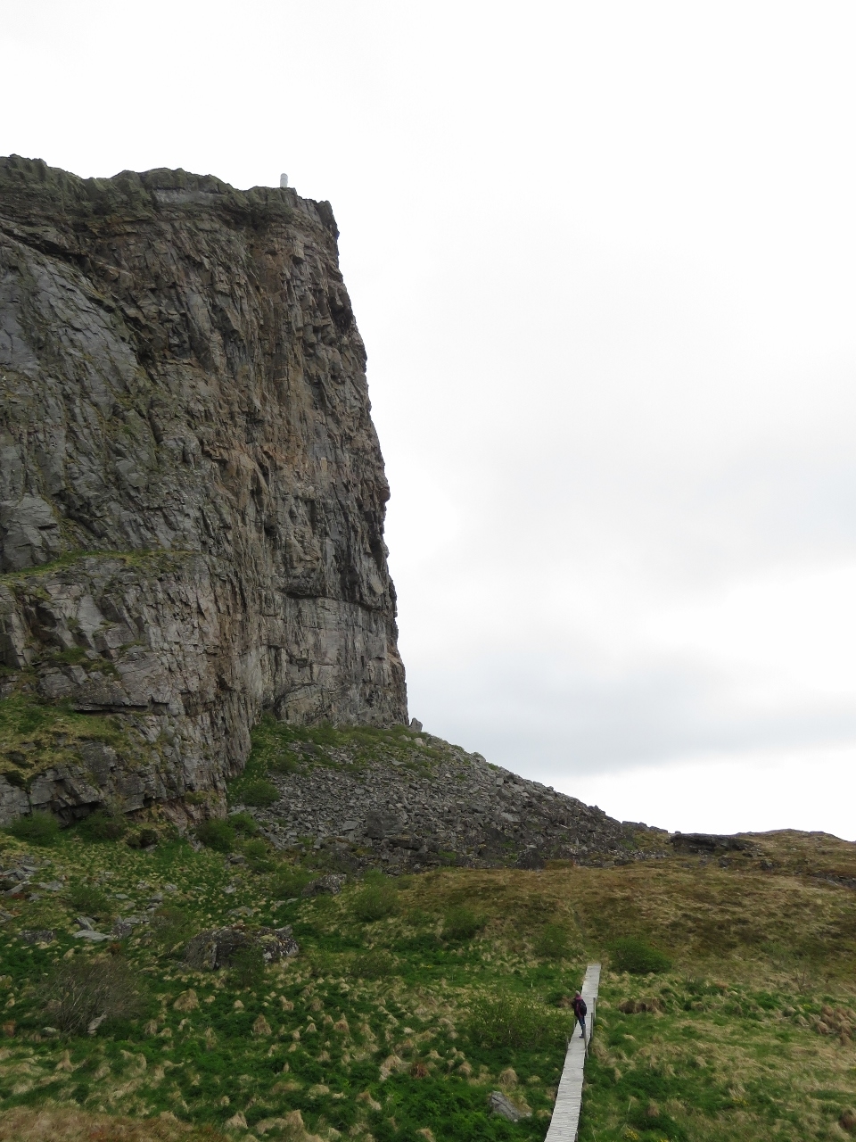
5/17/2018: Steps
Position: 65°23.91'N, 12°5.60'E
The hike to the window isn't very long—barely a half-hour. The trail is steep, but well-maintained, with stone steps near the window.
|
 |
5/17/2018: View from Steps
Position: 65°23.90'N, 12°5.58'E
The great view looking north from the top of the steps just before the window.
|
 |
5/17/2018: Window South
Position: 65°23.89'N, 12°5.55'E
Looking south through the window out to the islands where we're anchored.
|
 |
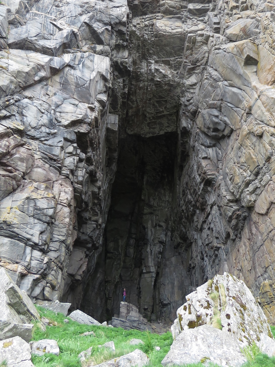
5/17/2018: Inside Window
Position: 65°23.91'N, 12°5.59'E
The window is actually a very large cavern that extends right through the mountain. Here Jennifer, at bottom left, is looking back up through the north side of the window from stairs that lead down to the cavern floor.
|
 |
5/17/2018: Window North
Position: 65°23.84'N, 12°5.32'E
The hike to the window is popular and at least a half-dozen others were here on this weekday morning early in the season. Two people arrived at the north end while we were in the cavern.
|
 |
5/17/2018: Lunch
Position: 65°23.84'N, 12°5.31'E
Lunch while enjoying the fabulous view south through the window. Dirona is a barely-visible white dot at the far right of the picture, directly above Jennifer's head (click image for a larger view).
|
 |
5/17/2018: Unknown
Position: 65°23.49'N, 12°4.86'E
We returned back through a track leading down to the valley from the south side of the window. En route we passed this small platform with an open-ended tube mounted on the side. It looked like the kind of stepladder used to pass over livestock fences in New Zealand, but no such fences were visible. We didn't come up with any theories as to its purpose.
|
 |
5/17/2018: Cove
Position: 65°23.41'N, 12°5.01'E
The trail leads alongside a shallow cove. The water in this part of Norway is quite clear—we often can see our anchor chain snaking way down into the water when dropping hook.
|
 |
5/17/2018: Summit Trail
Position: 65°23.57'N, 12°5.26'E
Rather than return to the tender, we took yet a third track to the summit of Torghatten. This is the view south partway along.
|
 |
5/17/2018: Climbing Chains
Position: 65°23.69'N, 12°5.32'E
The trail was steep, but well-marked and generally easy to follow with climbing chains in a steeper section near the top. We're above and slightly east of the window now. Dirona is the small white speck in the distance at center (click image for a larger view).
|
 |
5/17/2018: View East
Position: 65°23.71'N, 12°5.38'E
The view east across Torgfjorden as we near the summit of Torghatten. Our tender is moored, but not visible, in the little cove roughly at the center of the picture.
|
 |
5/17/2018: Brønnøysund
Position: 65°23.90'N, 12°5.47'E
A fabulous view looking north to the town of Brønnøysund from the summit of Torghatten at 968ft (295m).
|
 |
5/17/2018: Path Down
Position: 65°23.99'N, 12°5.52'E
We found an unmarked path down the north side that we hoped would join with the trail to the window, or at least end somewhere we could easily reach the tender. We could have just returned down the path we took up, but always prefer to take a different path if there is one.
|
 |
5/17/2018: Bird Feeders
Position: 65°24.17'N, 12°5.99'E
The unmarked trail down was well-trod and easy to follow. Near the base of Torghatten we passed a copse of trees with perhaps a dozen bird feeders of various designs strung from the branches. Fresh shells below indicated someone is filling them frequently.
|
 |
5/17/2018: Trail Head
Position: 65°23.94'N, 12°6.17'E
The well-trod path we were taking out didn't intersect with the trail to the window, but came out on the road close by at this large rock. If you were trying to take this trail on the way up, it would be hard to find the entrance.
|
 |
5/17/2018: Torghatten
Position: 65°23.15'N, 12°3.54'E
Looking back to Torghatten as we return to Dirona. We climbed from the other side of the window to this side, the over the right side of the mountain to the summit and returned back down along the north flank.
|
 |
5/18/2018: Vegtind
Position: 65°38.46'N, 12°7.42'E
The fast ferry Vegtind en route to the island of Vega.
|
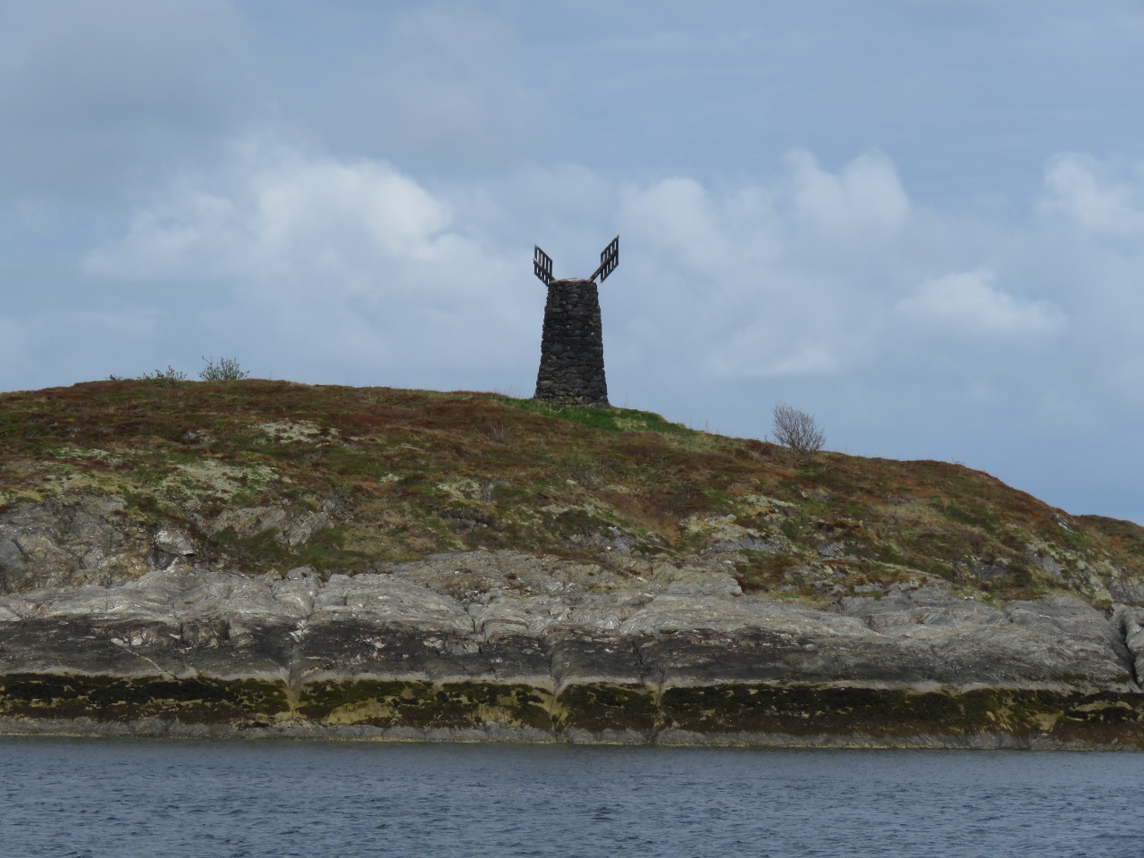 |
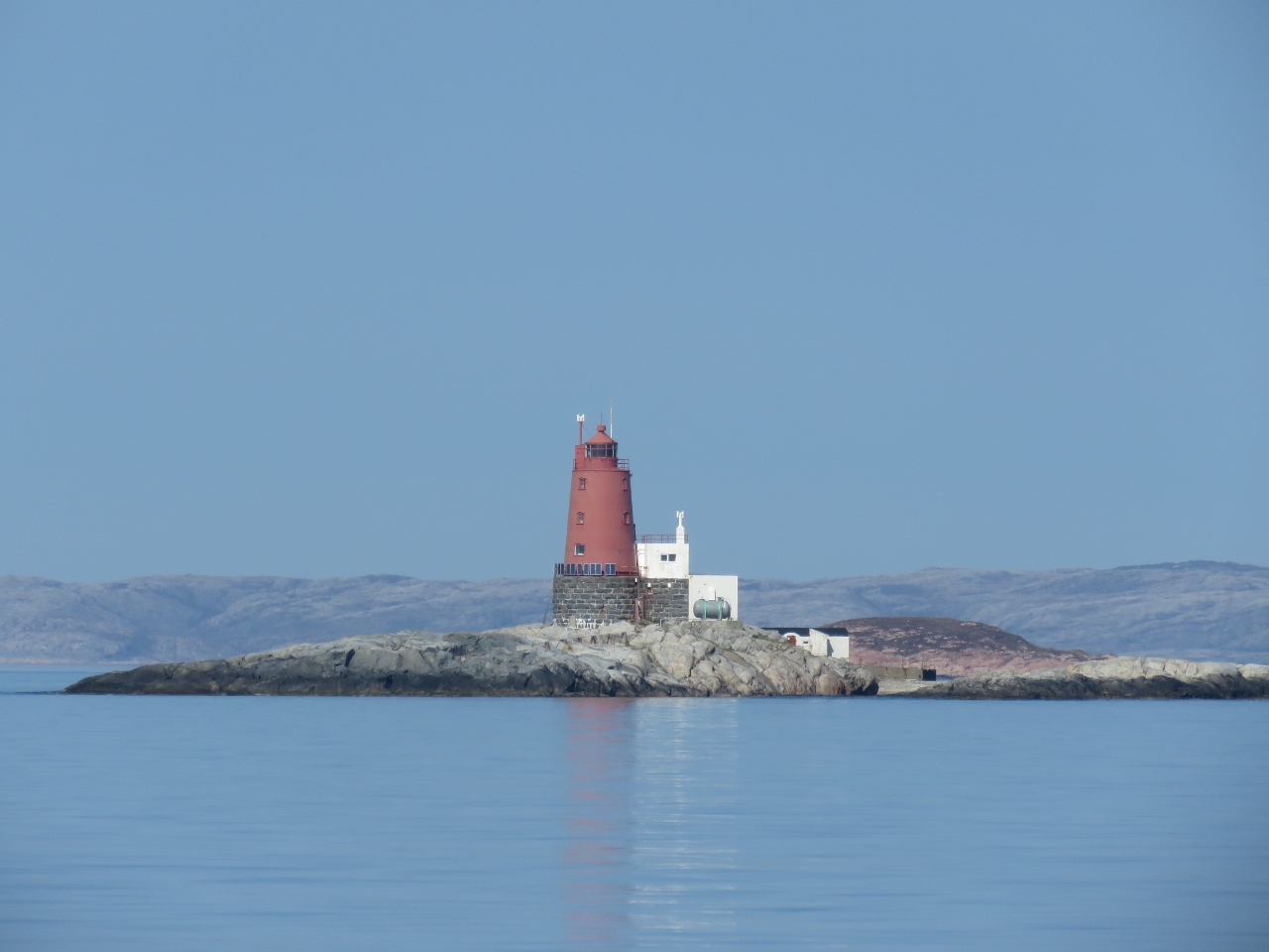
5/18/2018: Navaren
Position: 65°49.59'N, 12°10.61'E
Norway uses a wide variety of navigation markers cleverly designed to show the recommended path or paths through the countless coastal islets. Some markers have been in use since the Viking era. The topmark on this stone tower on Navaren island shows you can pass on either side of the island.
|
 |
5/18/2018: Mårøy
Position: 65°54.54'N, 12°11.60'E
The fast ferry Mårøy heading to Brasøya.
|
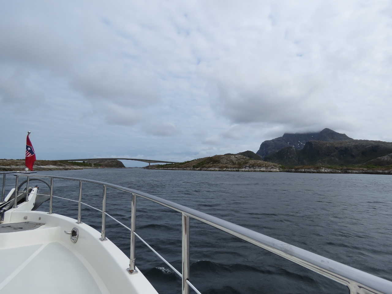 |
5/18/2018: Bridge
Position: 66°1.30'N, 12°17.55'E
About to pass under another bridge, this one connecting the islands of Øksningan and Nord-Herøy. When we cruised Scotland, we carried a copy of Hamish Haswell-Smith's The Scottish Islands. Hamish covers 168 individual Scottish islands and would likely consider Norway a real challenge to document with its countless islands. The only thing that might prevent complete overload is that he's rather strict in his interpretation of what is and what is not an island, where the moment an island gets a bridge, Hamish says it's no longer an island. And Norway has a lot of bridges.
|
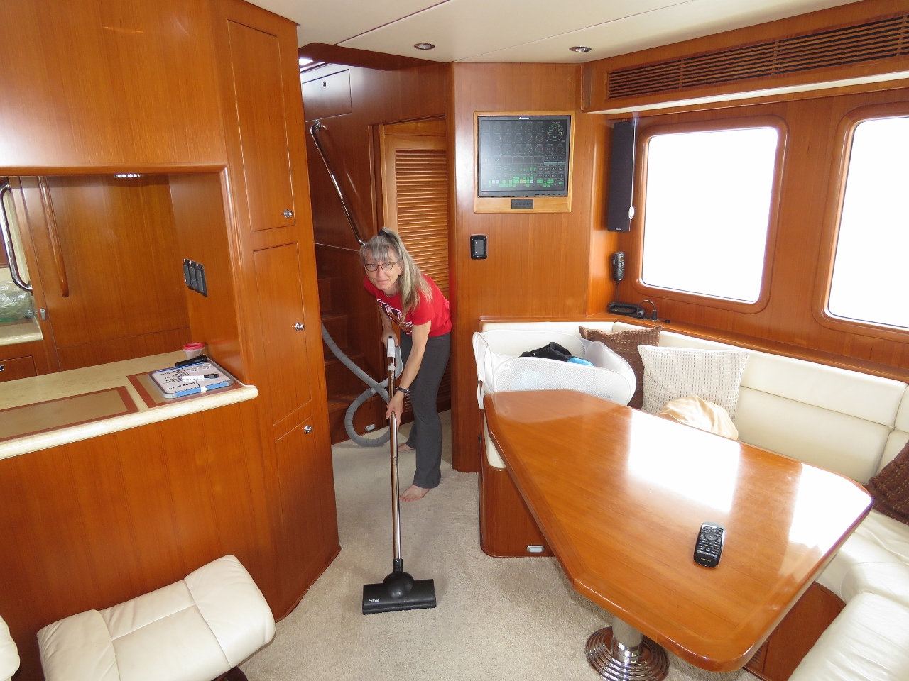 |
5/18/2018: Chores
Position: 66°3.42'N, 12°18.51'E
These long runs are ideal for getting chores done such as vacuuming, doing laundry and making water. We continue to love that 240V inverter. Otherwise we'd have to start the generator to do laundry and run the water maker.
|
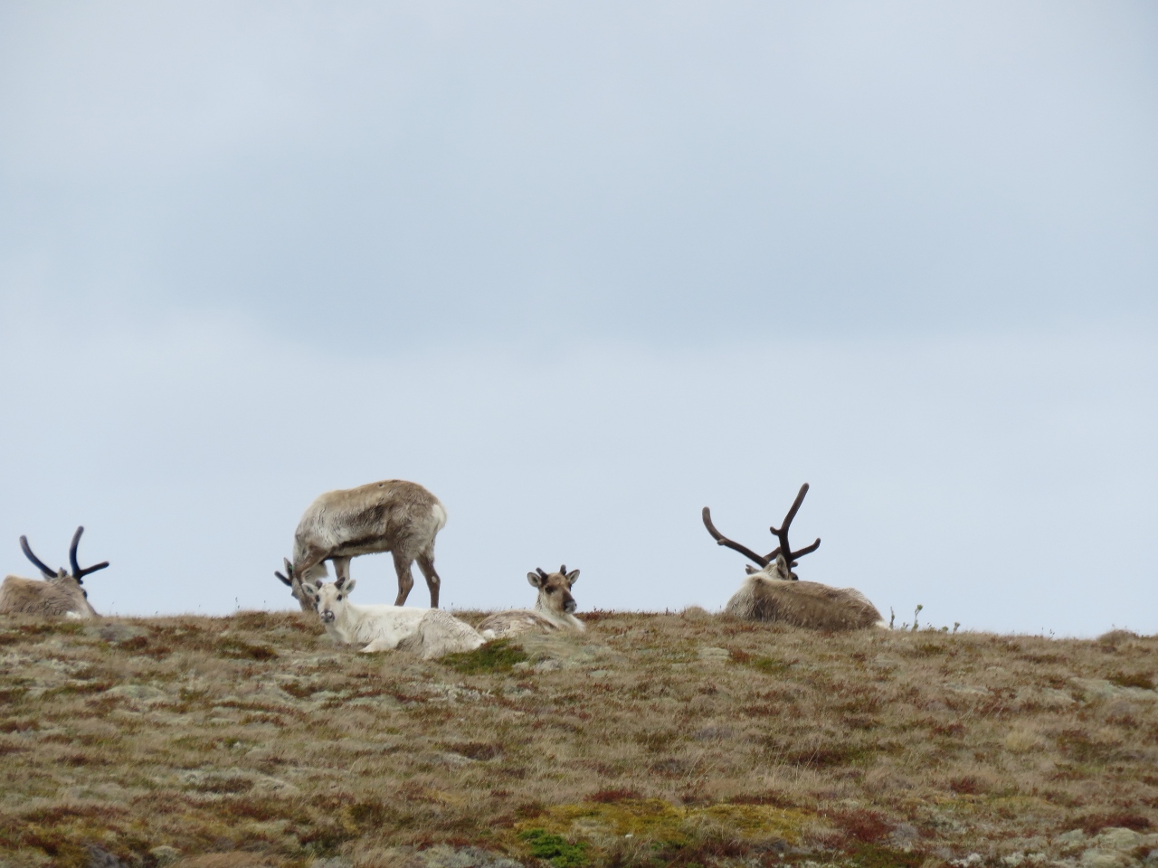 |
5/18/2018: Deer
Position: 66°8.77'N, 12°20.71'E
A small herd of deer on the island of Austøya.
|
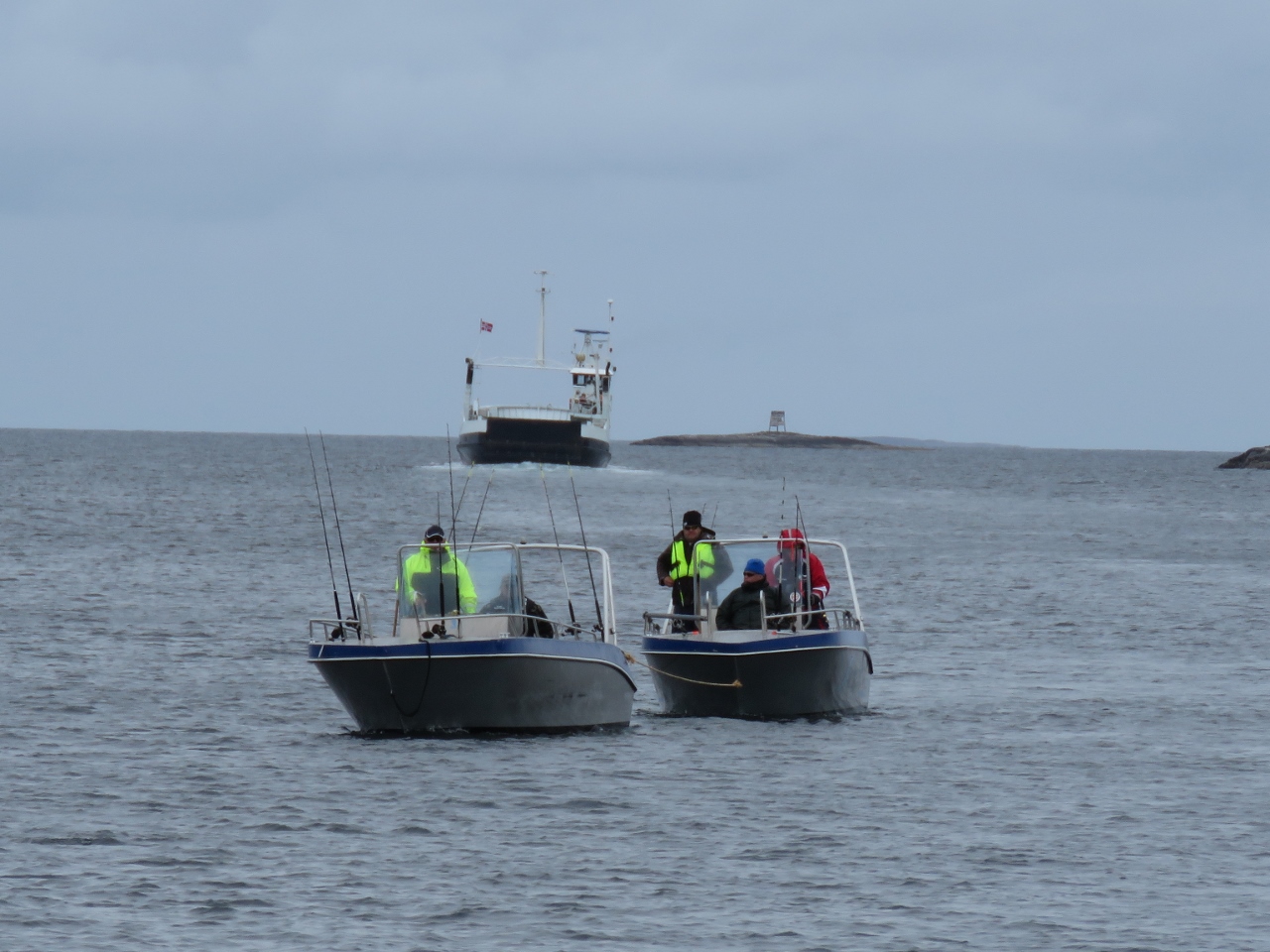 |
5/18/2018: Towing
Position: 66°10.00'N, 12°21.18'E
One fish boat towing another one. A fishing resort is nearby, so they likely don't have far to go.
|
 |
5/18/2018: Asvær Lighthouse
Position: 66°15.23'N, 12°22.03'E
The new (left) and old lighthouses on Asvær. The old lighthouse, built in 1876, was destroyed by a storm and replaced in 1917.
|
 |
5/18/2018: Lovund
Position: 66°17.01'N, 12°22.25'E
The prominent peak of Lovund about 6 miles to our north.
|
 |
5/18/2018: Helicopter
Position: 66°22.28'N, 12°22.73'E
Helicopter landing at Lovund as we arrive. The puffin colony on Lovund is one of the largest in the world and the puffins return to the island every year on the same day, April 16th. We were planning to anchor off to visit the colony, but couldn't find a place with suitable protection and swing room. We didn't feel like stopping in town on the dock, so continued on to Træna.
|
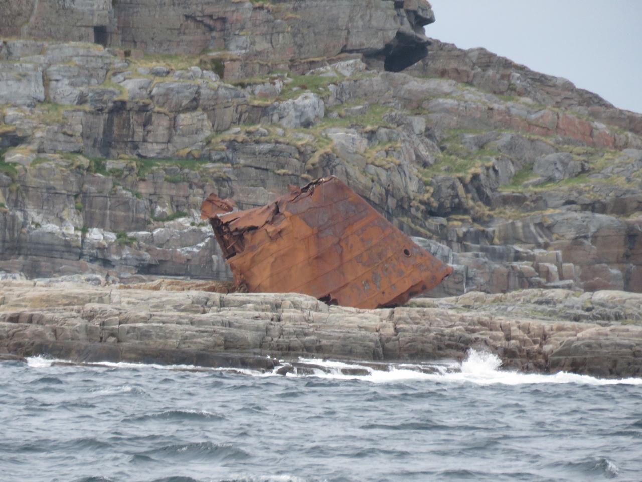 |
5/18/2018: Shipwreck
Position: 66°28.62'N, 12°5.97'E
The bow portion of a fair-sized ship on Skarvskjæet off the south side of the Træna archipelago. It must have taken substantial wave force to carry it up on shore.
|
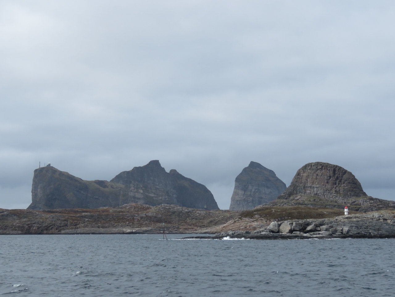 |
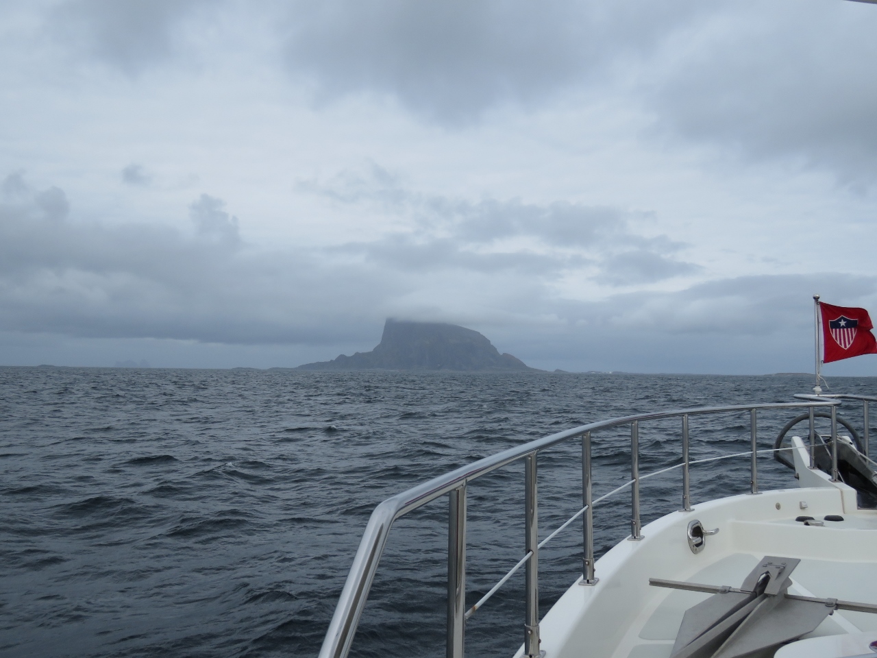
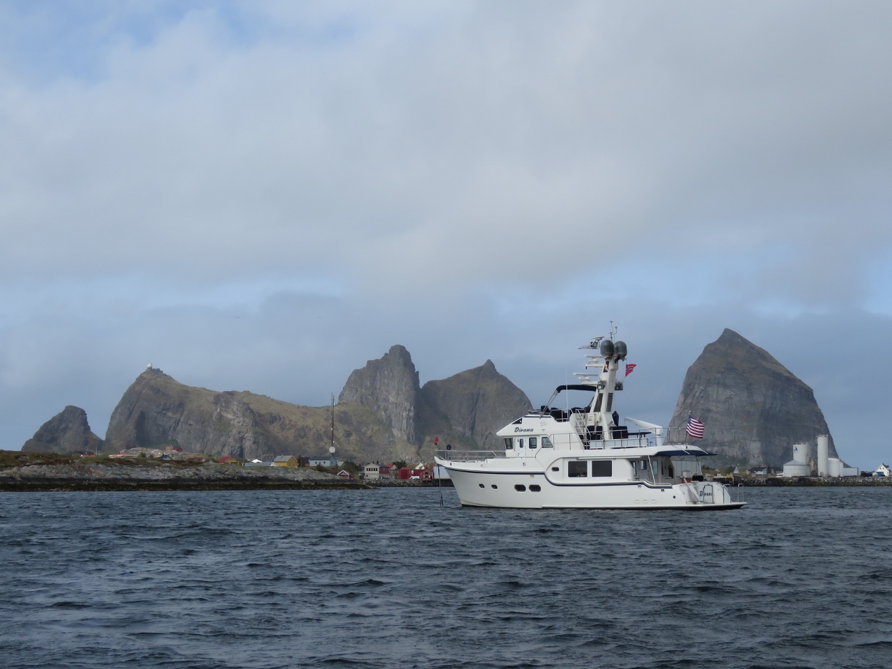
5/18/2018: Træna
Position: 66°28.80'N, 12°5.57'E
The islands of Hikelen in the foreground, with the dramatic peaks of Sanna behind, as we arrive into the Træna archipelago.
|
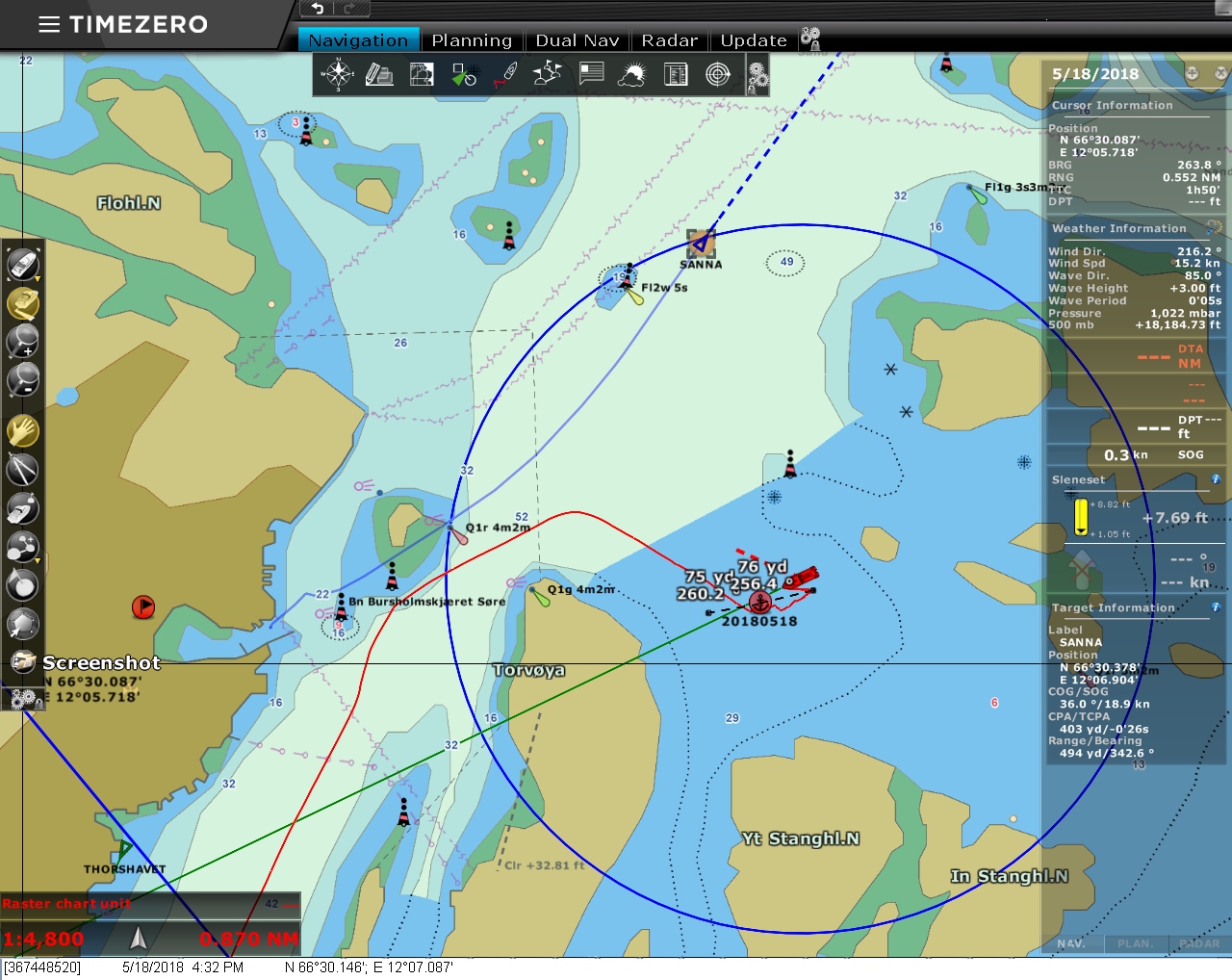 |
5/18/2018: Our Chart
Position: 66°30.15'N, 12°7.09'E
Our charts shows open water southeast of where we are anchored and an islet with a red light almost directly to our west.
|
 |
5/18/2018: Online Chart
Position: 66°30.15'N, 12°7.09'E
The newer online chart shows how much the area around us has changed. A breakwater has been built to our southwest, protecting our anchorage from ocean swell and a new breakwater has been installed to the northwest. What's even more surprising is the entire previously-marked island to our west has been removed.
|
 |
5/18/2018: Wing Impeller
Position: 66°30.14'N, 12°7.10'E
By coincidence, this is the third impellers of our three that we've changed in as many weeks. The hydrualics impeller needed changing the day we arrived into Norway and the generator impeller the next day. The wing impeller still looked perfect but it has been in use for nearly three years so we changed it.
|
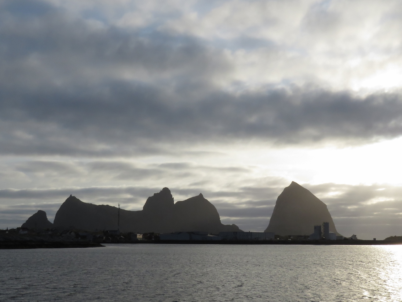 |
5/18/2018: Sanna
Position: 66°30.15'N, 12°7.08'E
The view from our anchorage to the dramatic peaks on the island of Sanna, back-lit in the evening sun.
|
 |
5/19/2018: At Anchor
Position: 66°30.13'N, 12°7.19'E
At anchor in the Træna Archipelago with the peaks of Sanna to our north. The white dome of a radar station that we plan to hike to this morning is just visible on Sanna's southern peak, Kjølen, on the left.
|
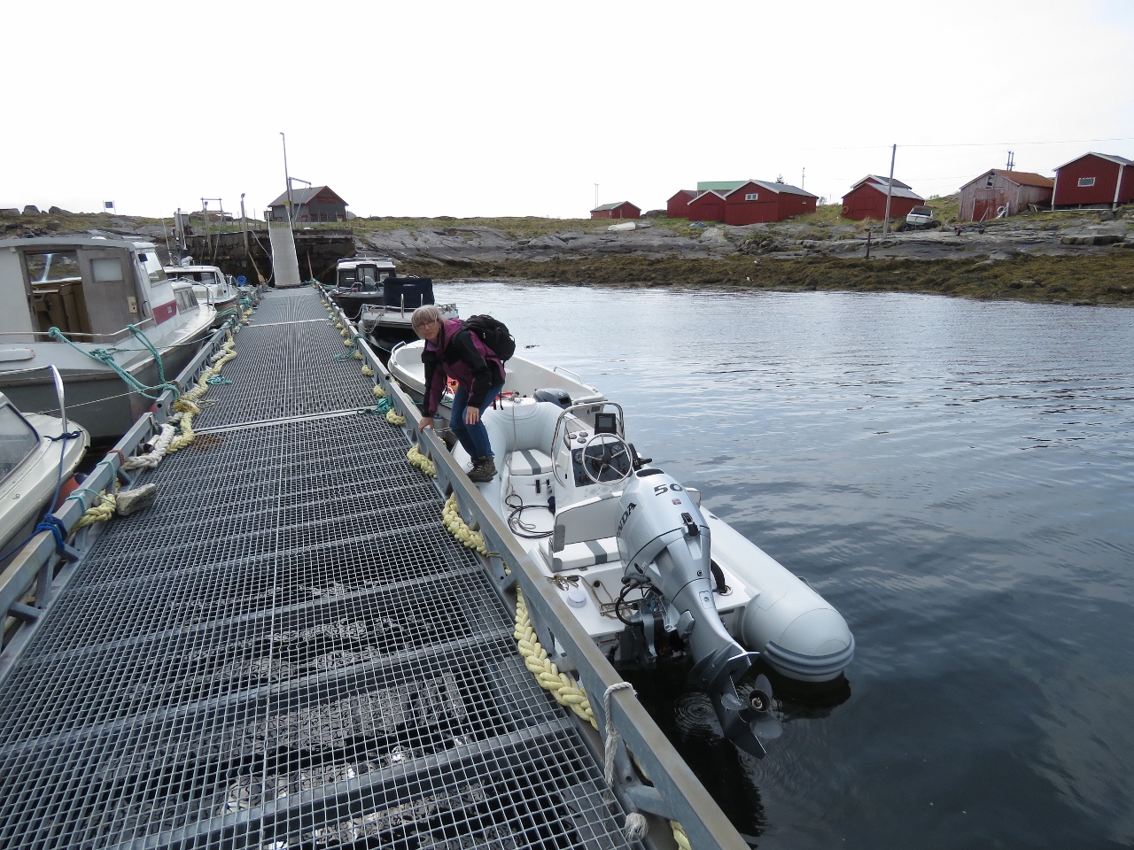 |
5/19/2018: Sanna Dock
Position: 66°30.42'N, 12°3.68'E
Landing the tender at the Sanna dock.
|
 |
5/19/2018: Sanna Village
Position: 66°30.39'N, 12°3.70'E
The tiny village of Sanna had a population of six in 2001.
|
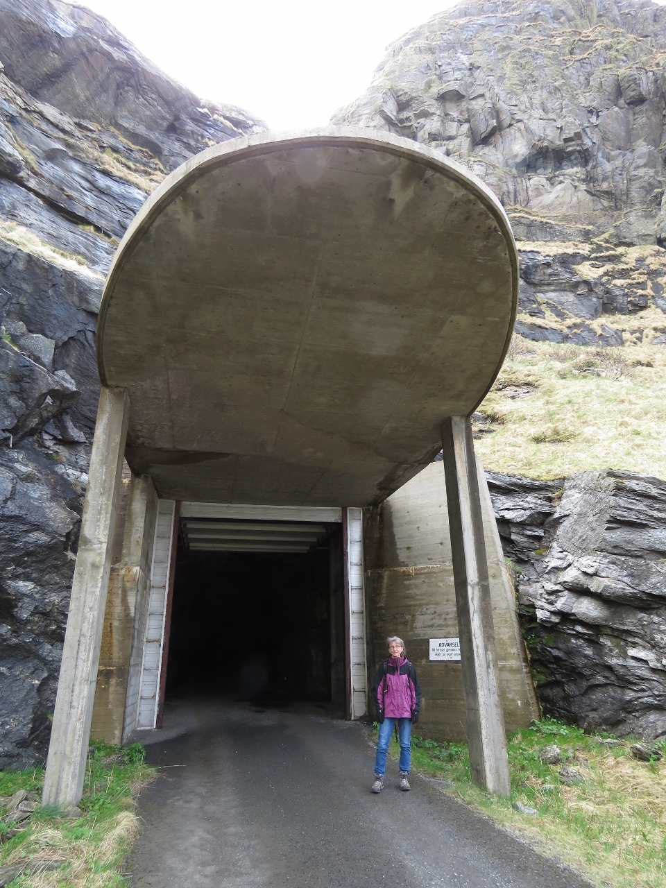 |
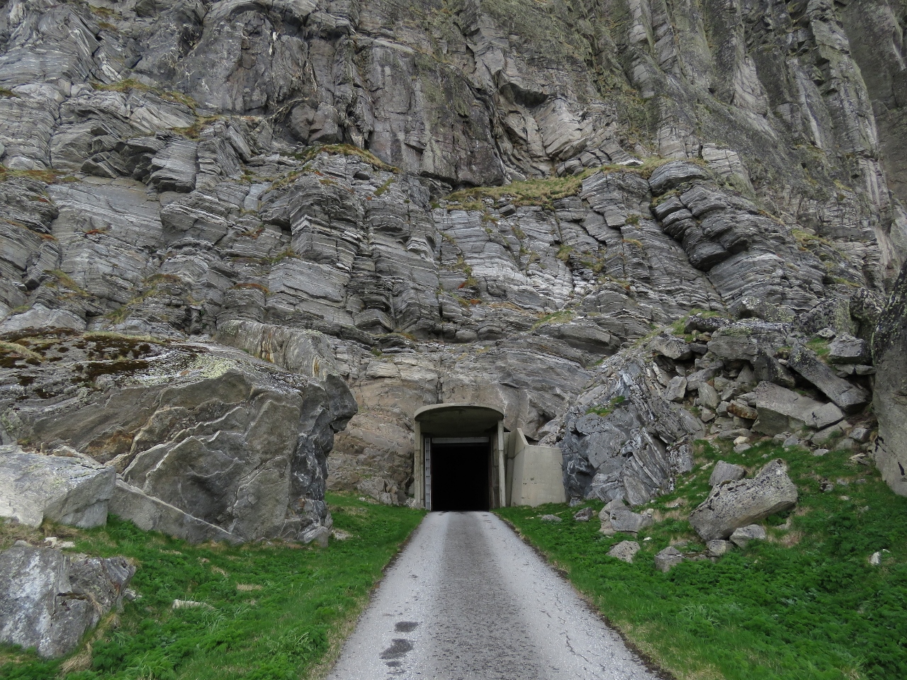
5/19/2018: Tunnel Entrance
Position: 66°30.52'N, 12°2.95'E
At the entrance to the (700m) truck-sized tunnel that leads up to the radar station atop Sanna's southern peak, Kjølen.
|
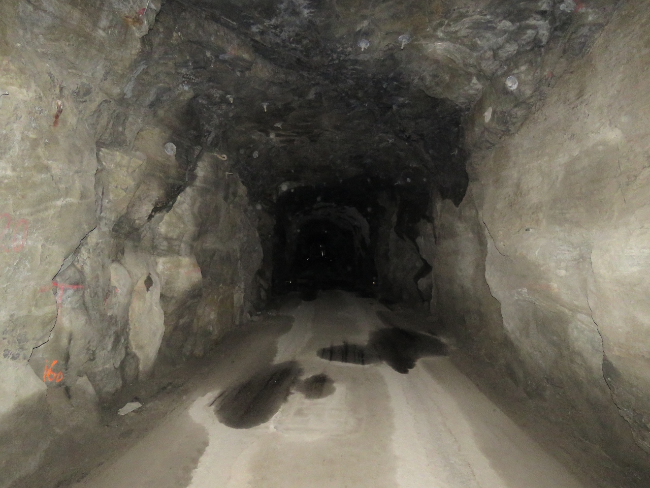 |
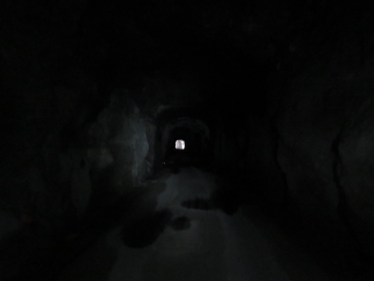
5/19/2018: Tunnel
Position: 66°30.45'N, 12°2.88'E
Partway through the tunnel. It's pitch black inside for most of the way, but reflectors on the walls help mark the way, if you brought a flashlight.
|
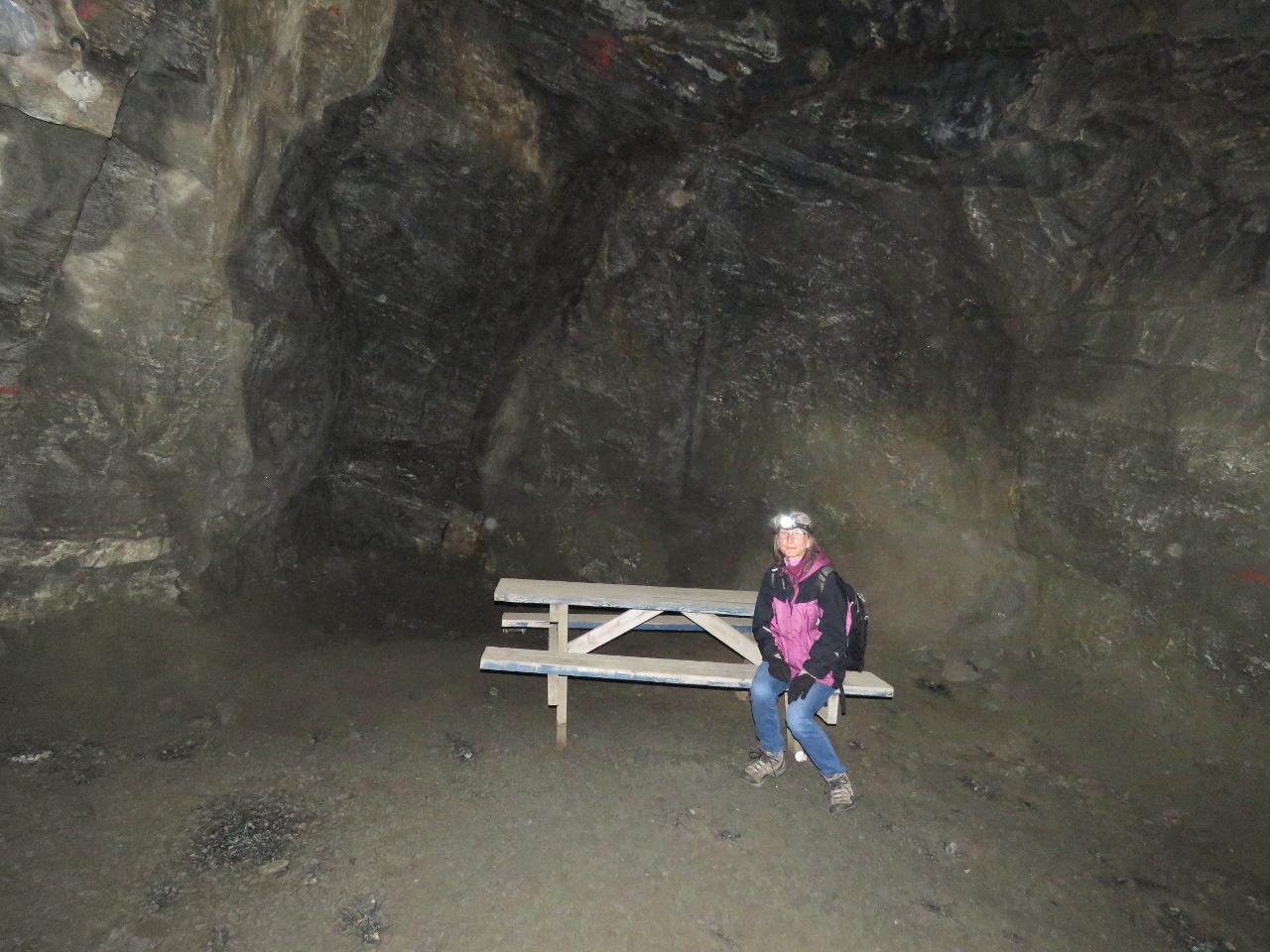 |
5/19/2018: Picnic Table
Position: 66°30.36'N, 12°2.75'E
The tunnel rises reasonably steeply, with a picnic table partway up for a break. Our headlamps are ideal for walking in the very dark tunnel.
|
 |
5/19/2018: Light
Position: 66°30.51'N, 12°2.95'E
The light at the end of the tunnel.
|
 |
5/19/2018: Tunnel Exit
Position: 66°30.26'N, 12°2.69'E
Looking back to tunnel exit—it was a fun and unique walk up.
|
 |
5/19/2018: Sanna View
Position: 66°30.25'N, 12°2.70'E
View to the Sanna village and dock from just outside the tunnel with a ferry arriving.
|
 |
5/19/2018: Radar Station
Position: 66°30.14'N, 12°2.76'E
This was originally a NATO radar station, and still has military signs not permitting photography near the fence.
|
 |
5/19/2018: Road
Position: 66°30.05'N, 12°2.66'E
Looking down the road back to the tunnel exit from just below the radar station.
|
 |
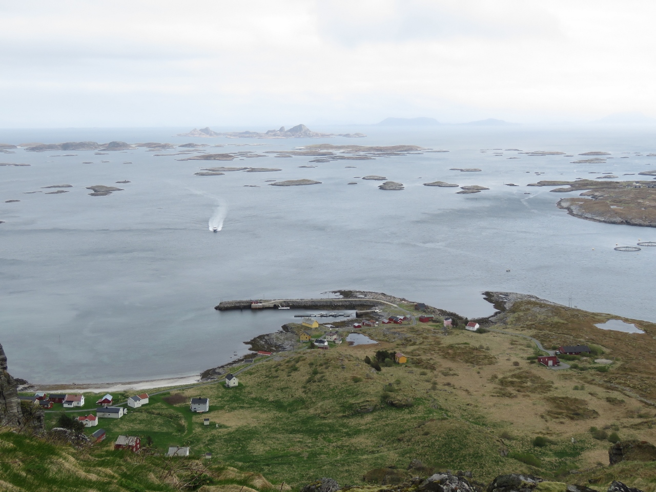
5/19/2018: Lunch
Position: 66°30.05'N, 12°2.66'E
Lunch below the radar station with an awesome view to Husøy.
|
 |
5/19/2018: Anchorage
Position: 66°30.05'N, 12°2.66'E
Close-up to the village on Husøy and our anchorage beyond.
|
 |
5/19/2018: Coastal Trail
Position: 66°30.53'N, 12°2.90'E
After returning back down the tunnel, we walked the coastal trail around the island.
|
 |
5/19/2018: Cliffs
Position: 66°30.30'N, 12°2.16'E
Looking up to the vertical cliffs along the west shore of Sanna.
|
 |
5/19/2018: Float
Position: 66°30.27'N, 12°2.15'E
Lots of debris had washed up in the coves on the west side of Sanna, including several large metal fishing floats.
|
 |
5/19/2018: Climbing Chains
Position: 66°30.26'N, 12°2.16'E
Climbing chains are strung along one portion of the trail to navigate around the head of a small bay.
|
 |
5/19/2018: Break
Position: 66°30.10'N, 12°2.24'E
Taking a break below fantastic cliffs along the southwest corner of Sanna.
|
 |
5/19/2018: Boardwalk
Position: 66°30.09'N, 12°2.34'E
Jennifer loves boardwalks. This one leads below Kjølen, the peak where the radar station is perched. Part of the facility is just visible on the peak above.
|
 |
5/19/2018: Kirkehelleren Cave
Position: 66°30.14'N, 12°3.20'E
Jennifer is barely visible perched atop a rock inside Kirkehelleren Cave on the south side of Sanna. This is one of the venues for the Træna Festival, a multi-day music concert held in July.
|
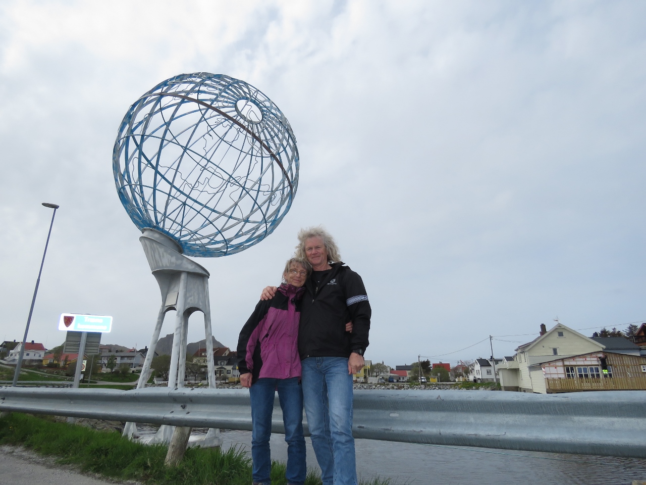 |
5/19/2018: Arctic Circle Monument
Position: 66°30.10'N, 12°6.11'E
At the Arctic Circle Monument on Husøy. We're less than four miles south of the Arctic Circle—our next anchorage will be north of it.
|
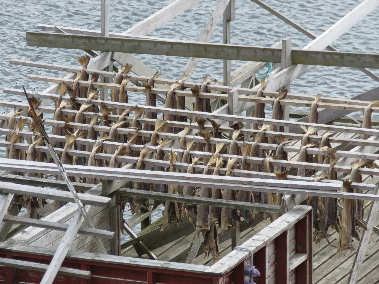 |
5/19/2018: Cod Drying
Position: 66°29.86'N, 12°5.41'E
Cod drying on racks. Dried cod is consumed locally and also is a major export.
|
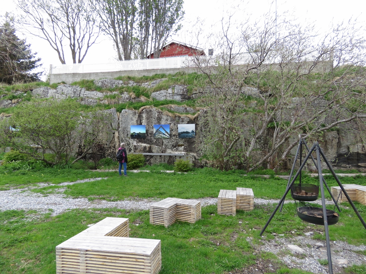 |
5/19/2018: Outdoor Gallery
Position: 66°30.06'N, 12°5.86'E
A beautiful outdoor gallery/park near the Træna visitor's centre.
|
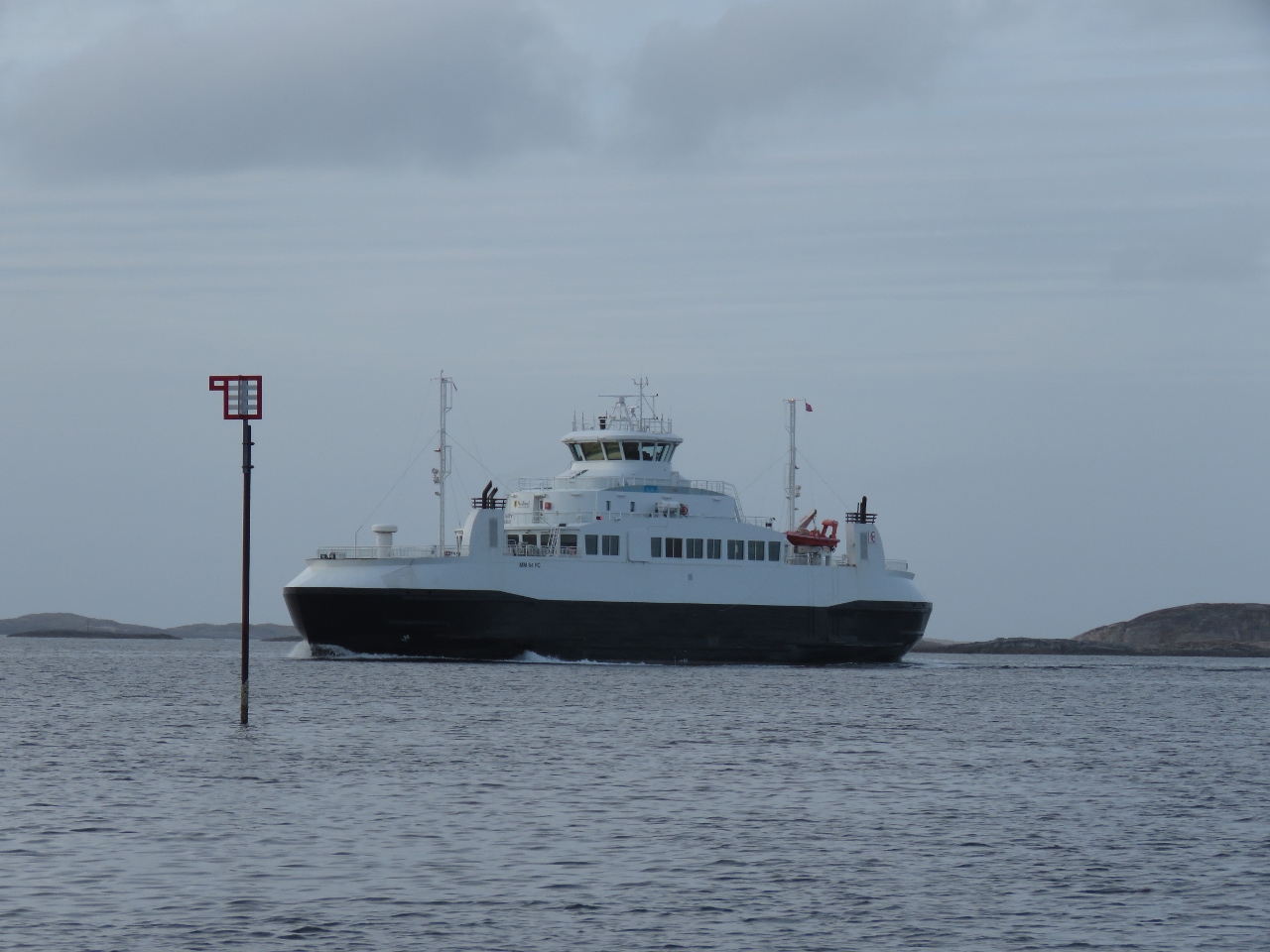 |
5/19/2018: Husoy
Position: 66°30.15'N, 12°7.08'E
The ferry Husøy arriving into, well, Husøy. We love anchorages with a view to ferry traffic. This one reminds us of Loch Maddy in Scotland's Outer Hebrides.
|
 |
5/20/2018: Sanna
Position: 66°30.16'N, 12°7.01'E
We can never get enough of the view to Sanna.
|
 |
5/20/2018: Wind
Position: 66°30.16'N, 12°7.05'E
We're expecting high winds for the next couple of days, so will stay put at Træna until conditions are calm enough for a passage to the Lofoten Islands. This is an excellent anchorage for the condtions—well-protected with good holding and plenty of swing room.
|
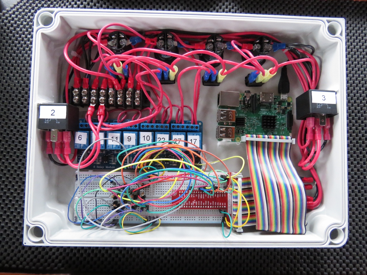 |
5/20/2018: Another Electrical Project
Position: 66°30.16'N, 12°7.04'E
In order to implement load shedding for the 2 Mastervolt chargers, back in Florida James cracked the Masterbus protocol (it's a CANbus variant). This has worked well for years but its seems a bit fragile in that the chargers won't accept Masterbus requests until fully powered up and we don't like writing to the onboard NVRAM storage on every shed or unshed of chargers. James decided to replace this system with a large contactor for each charger. It's simple, effective, and doesn't change the charger configuration on each off/on cycle. However, like a lot of things that are "simple" once installed, putting these contactors in place requires lots of wiring work and the control system has to have a means to control them.
James installed a Raspberry Pi to accept charger off and on commands. This by itself would be simple but, while there we also plan to add 8 channels of digital output and 16 channels of digital output for control projects in the Laz and Engine room area. Just to make sure this work doesn't get done anytime soon, the Pi will also control a contactor controlling a second shore power connection. This will allow us to run both chargers off a single shore power as usual or to run the second charger off a second shore power connection. We'll use this when only very low amperage shore power connections are available so we can use two connections of up to 16A each. So, for example, if there were two 8A connections we could have one each charger to safely give the boat 16A of power without phase syncing or unsafely combining two shore power connections with the risk of back feed. It'll take quite a few rain days before these projects are all up and running. |
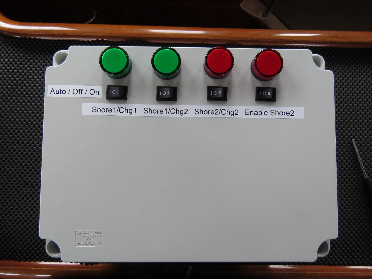 |
5/20/2018: Control Box
Position: 66°30.16'N, 12°7.06'E
The top of the new electrical junction box that allows the two chargers and the second shore power to be automatically controlled by the Raspberry Pi or manually controlled by the switches on the front. Whether automatically or manually controlled, the system is fully interlocked so that two shore power connections can't be inadvertently combined. The indicator lights show the switching system state
|
 |
5/21/2018: Fog
Position: 66°30.16'N, 12°7.05'E
The peaks of Sanna almost invisible in the fog. They eventually disappeared entirely.
|