MV Dirona travel digest for New England 2016

|
Click the travel log icon on the left to see these locations on a map,
with the complete log of our cruise. On the map page, clicking on a camera or text icon will display a picture and/or log entry for that location, and clicking on the smaller icons along the route will display latitude, longitude and other navigation data for that location. And a live map of our current route and most recent log entries always is available at //mvdirona.com/maps/LocationCurrent.html. |
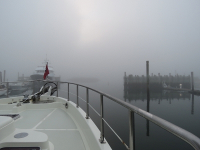 |
10/8/2016: Fog
Position: 44°16.44'N, -68°19.24'W
We departed Southwest Harbor this morning in a fog so thick we could barely see 100 yards in front of us.
|
 |
10/8/2016: Silver Fox
Position: 44°13.58'N, -68°17.21'W
We ran at 6 knots with our big LED's lit all around and the fog horn sounding. Dodging the moored boats and lobster traps in the thick fog was difficult, but the lobster boats were a real challenge. We could see them on radar, making frequent course changes and often running at over ten knots, but couldn't see them. We ended up much closer than we liked to Silver Fox, seen here passing behind us. We could see it on radar crossing our bow at over ten knots, fairly close. It then turned 190° and went back straight towards us. We sounded three blasts of the horn and stopped, and they passed just astern. We caught the image on our newly installed aft-view camera. The timestamp on the picture should read 07:34—we hadn't put the camera in the correct time zone yet.
|
 |
10/8/2016: Bass Harbor Bar
Position: 44°13.00'N, -68°20.67'W
We passed through Bass Harbor Bar with 18ft on a near-zero tide at Bass Harbor. You can see another lobster boat running at 9.7 knots in heavy fog just ahead and north of our route. Those lobster boats really move.
|
 |
10/8/2016: Lobster Boat
Position: 44°14.35'N, -68°34.95'W
The fog cleared and we finally could see all those lobster boats we'd been dodging.
|
 |
10/8/2016: Deer Isle Bridge
Position: 44°17.61'N, -68°41.27'W
Passing under the Deer Isle Bridge with a main span of 1,088ft (329m). The bridge was completed in 1939 and suffered wind stability issues similar to the Tacoma Narrows Bridge, aka "Galloping Gertie", that collapsed shortly after opening in 1940. The Deer Isle Bridge was subsequently reinforced with modification that included cable stays between the cables, tower and road deck.
|
 |
10/8/2016: Pumpkin Island
Position: 44°18.88'N, -68°43.97'W
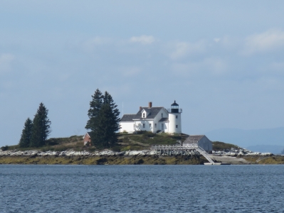
The light station at Pumpkin Island was built in 1854, discontinued in 1955 and now is privately owned.
|
 |
10/8/2016: Grace of Tides
Position: 44°25.44'N, -68°59.42'W
Nordhavn 68 Grace of Tides anchored off Belfast as we arrived.
|
 |
10/8/2016: Belfast
Position: 44°25.75'N, -69°0.24'W
Belfast dubs itself the "Biggest Little City in Maine". It also has one of the friendliest harbor staff we've met—they took excellent care of us during our visit.
|
 |
10/8/2016: Moored
Position: 44°25.75'N, -69°0.24'W
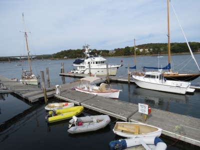
Moored at the Belfast City Landing in downtown Belfast. We loved this spot, with a view all along the waterway and into town.
|
 |
10/8/2016: Front Street Pub
Position: 44°25.71'N, -69°0.35'W
Belfast has a brewery and lots of pubs. Our first stop was a great lunch at the Front Street Pub. It was a little hard to believe that it was warm enough to eat outside in October in Maine, but the deck was packed and we took the last table.
|
 |
10/8/2016: Front Street Shipyard
Position: 44°25.72'N, -69°0.47'W
Belfast has an excellent harbour walk that leads right through the Front Street Shipyard. The newly-constructed yard is beautiful, with some impressive equipment, and was nearly full with quite large boats hauled out including this steel trawler Sunset V. The yard's Facebook page shows an wide array of large projects, ranging from new builds to replacing the pilot house windows on Nordhavn 96 MacGuffin.
|
 |
10/8/2016: Stabilizer Protection
Position: 44°25.72'N, -69°0.47'W
These deflectors for the stabilizers on Sunset V caught our attention. We just have the central deflector. The two extra would really help in keeping debris from getting in between the fin and the boat as the fins move. Having operated in heavy lobster-pot waters for the last few weeks, this sort of protection has become considerably more interesting.
|
 |
10/8/2016: 440-Ton Lift
Position: 44°25.74'N, -69°0.49'W
Front Street Shipyard has an incredible 440-ton travel lift. Inside the lift is the 85ft tug Fournier Tractor. The tug is propelled by two EMD 12-645-E2 engines and has Ulstein 900 Z-Drives with 86" propellers.
|
 |
10/8/2016: Gear
Position: 44°25.75'N, -69°0.50'W
The Fournier Tractor had leakd some water into the gear ooil and was in the yard to have the seals replaced. Here specialists from Louisiana are using a torch to heat up the prop shaft seal sleave to expand it for removal.
|
 |
10/8/2016: Sinbad
Position: 44°25.76'N, -69°0.49'W
Sinbad is another large steel trawler ready for haul-out at the Front Street Shipyard.
|
 |
10/8/2016: Belfast Harbour
Position: 44°25.95'N, -69°0.46'W
We walked the pedestrian bridge north of town for a view back down the harbor. If you look carefully, you can see three Nordhavns in this picture: N68 Grace of Tides, Dirona and N96 MacGuffin.
|
 |
10/8/2016: Bench
Position: 44°25.60'N, -69°0.37'W
Belfast is a lovely town with plenty of creative and quirky touches. This lobster seat is one of a wide variety of benches throughout the town.
|
 |
10/8/2016: Cars
Position: 44°25.55'N, -69°0.48'W
A vintage GTO in front of a new Dodge Charger with the historic Belfast town buildings in the background.
|
 |
10/8/2016: City Hall
Position: 44°25.55'N, -69°0.48'W
The majestic Belfast City Hall building, called Memorial Hall, was built in 1890 by civil war veterans to honor their fallen leader Colonel Thomas H. Marshall.
|
 |
10/8/2016: Computer
Position: 44°25.59'N, -69°0.50'W
We walked past a decommissioned gas station with old fuel pumps out front in the process of being taken apart. Here is the "computer" that calculates the total purchase cost based on fuel price and fuel pumped.
|
 |
10/8/2016: Three Tides
Position: 44°25.74'N, -69°0.33'W
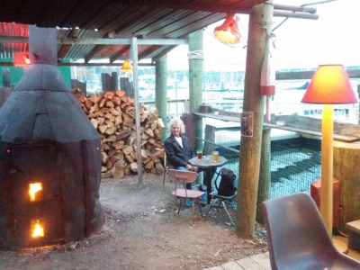
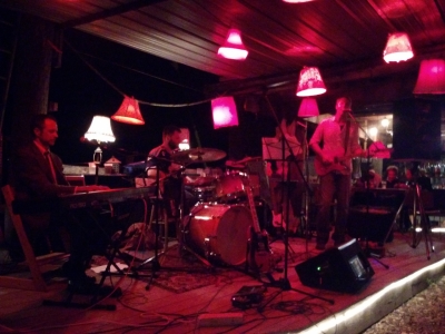
The Marshall Wharf Brewery in Belfast has the wildest pub called the Three Tides. Here we are sitting on a dirt floor right above the water next to a massive wood-furnace made from an inverted grain mixer. We loved it. Later that evening Jerry and Dee Fraelic from Nordhavn 68 Grace of Tides joined us and we had another great evening with them.
|
 |
10/8/2016: Band
Position: 44°25.74'N, -69°0.33'W
We didn't realize it, but a live band was playing that night at the Three Tides. We had a great time watching from stage-side. It's been ages since we've watched a live band—we used to see live music all the time when we lived in Toronto in particular.
|
 |
10/9/2016: HVAC
Position: 44°25.76'N, -69°0.23'W
The guest stateroom HVAC used to be the master stateroom HVAC until we swapped control boards after the compressor relay started to stutter occasionally. The fan relay has now stopped working entirely so it's time to replace it. Once the new control board was in, it's returned to working perfectly.
|
 |
10/9/2016: GamePass
Position: 44°25.76'N, -69°0.23'W
We haven't bothered setting up our KVH M7 satellite dish and getting a US service, partly because we've been busy and partly because the main reason we want access to broadcast TV is just to watch NFL football. In New Zealand and Australia, we discovered and enjoyed NFL GamePass, which gave access to live and on-demand games at low cost and in fact was free in New Zealand. Sadly, GamePass wasn't supported in the US. But for the first time this year, a limited form of GamePass is available in the US that gives on-demand access to all games at most 24 hours after airing at a cost of $99 for the season. We experimented tonight with their seven-day trail and were all in and happy to pay the full subscription.
|
 |
10/10/2016: Transportation Museum
Position: 44°3.98'N, -69°6.09'W
Matt Baker recommended we stop at the Owls Head Transportation Museum about 30 miles south of Belfast. It seemed unlikely to James that a world-class museum would be found out in Owls Head, but this one is exceptional. It has everything from bicycles to Michael Schumacher's Formula One Ferrari.
|
 |
10/10/2016: GE T58 TurboShaft
Position: 44°3.98'N, -69°6.09'W
The museum had a number of engines on display, ranging from early steam engines to modern helicopter engines. This is a GE T58 TurboShaft, used in the first jet helicopter in the US and also in the Sikorsky Sea King helicopter used to recover the Apollo astronauts. The engine was introduced in 1955 and was remarkable for it's time, weighing only 250 pounds and producing 1,050HP.
|
 |
10/10/2016: Raven
Position: 44°3.98'N, -69°6.09'W
Arthur Bentas of Chelmsford, Massachusetts took nine years to build the beautiful custom Raven from a 1939 Dodge chassis powered by a 6-cylinder L-head. Bentas won 25 awards with the Raven on the custom show circuit, including the coveted Best Custom award at the 1959 NHRA National Championship Custom Car Show in Detroit, Michigan. Bentas put the car into storage for nearly five decades and a new owner purchased it in 2007 and restored it. On the 50th anniversary of its NHRA National Championship Custom Car Show win, the Raven again placed first, this time in the Radical Custom Convertible class.
|
 |
10/10/2016: Progress
Position: 44°3.98'N, -69°6.09'W
The museum had several exhibits on flight, including a model of the Wright brother's Wright Flyer that in 1903 made the first powered flight with a pilot aboard. On the right of of the picture is a Gemini space capsule. It's amazing that mankind achieved powered flight and space travel in the same century. The Wright Flyer's engine produced 12HP, while the first stage of the Titan rocket that launched the Gemini into space produced 474,000 foot pounds of thrust.
|
 |
10/10/2016: Quest for Speed
Position: 44°3.98'N, -69°6.09'W
We spent a long time in the The "Quest for Speed" exhibit, featuring dozens of racing vehicles, including an "ex-Michael Schumacher Ferrari F2002 Formula 1 car, a 1907 Renault Vanderbilt Racer, a 1906 Stanley Vanderbilt Racer, Scramble racing legend Charlie Vincent’s International Six Day Trials gold medal winning 1964 Triumph motorcycle, a 1930 Bentley Speed Six, a 1929 JAP motorcycle a Fabulous Hudson Hornet".
|
 |
10/10/2016: Pocock Shell
Position: 44°3.96'N, -69°6.07'W
Hung on the wall is a rowing shell built in 1963 by legendary boat builder George Pocock of Seattle. It was a Pockock hull the US Olympic team rowed to victory in the 1936 Berlin Olympics. James was excited to see this boat after having read The Boys in the Boat detailing the Univerity of Washington rowing team's path to Olympic gold.
|
 |
10/10/2016: Rock Bottom
Position: 44°6.29'N, -69°6.56'W
Jennifer rarely makes it past a good brew pub. We had a great meal with excellent craft beer at the Rock Bottom Brewery in Rockland.
|
 |
10/10/2016: Windjammer Wharf
Position: 44°6.34'N, -69°6.44'W
Rockland is famous for its windjammer fleet. Most of the ships at the Windjammer Wharf were in the process of being winterized.
|
 |
10/10/2016: Grace of Tides
Position: 44°6.28'N, -69°6.22'W
Nordhavn 68 Grace of Tides at anchor in Rockland Harbor. We've been following close behind, and occasionally overlapping, since Lunenburg in Nova Scotia.
|
 |
10/10/2016: Docks
Position: 44°6.18'N, -69°6.34'W
We looked into staying at Rockland to drive to Bangor for Jennifer's upcoming surgery, but many of the marinas were either closed or had lifted enough of out their docks out that there was no space remaining. These are the docks at The Landings Restaurant and Marina.
|
 |
10/10/2016: Breakwater
Position: 44°6.89'N, -69°4.91'W
Walking the mile-long Rockland Breakwater to visit the lighthouse at the tip.
|
 |
10/10/2016: Lighthouse
Position: 44°6.25'N, -69°4.65'W
The Rockland Breakwater was built between 1881 and 1890 by the US Army Corps of Engineers to protect the harbor from severe winter storms. A beacon was placed on the end of the breakwater and moved during construction as the breakwater grew. The lighthouse was completed in 1902 to replace the beacon. The city of Rockland now owns the still-active light, and the US Coast Guard maintains it.
|
 |
10/10/2016: Rollie's
Position: 44°25.64'N, -69°0.35'W
Dinner at Rollie's Bar and Grill in Belfast. We watched a Red Sox playoff baseball game and enjoyed studying the New England sports memorabilia that covered every inch of every wall.
|
 |
10/11/2016: Cold
Position: 44°25.76'N, -69°0.23'W
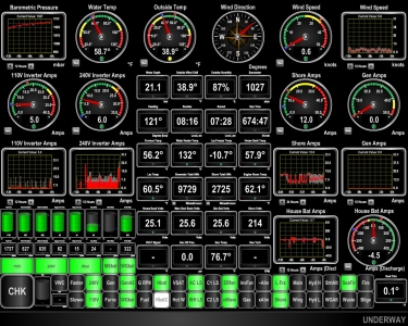
Each morning is a little chillier than the day before. The temperature was 38.9F (3.8C) when we woke up today.
|
 |
10/11/2016: Bullet
Position: 44°25.76'N, -69°0.23'W
Our Syrens WiFi station has been flaky recently, so we decided to test the Ubiquiti Bullet that we picked up as a backup a few months back. When plugged in, both it and the PoE inserter went up in smoke. We don't know if it was the PoE inserter or the Bullet that failed. And since the Bullet is a less-common no-more-than 24V device while most PoEs are much higher, its possible it was an incompatible inserter. We can't find a spec on what voltage the Syrens runs at, but the PoE inserter is no longer capable of producing anything so its hard to know if that was the fault or not. We put a spare PoE inserter back on the Syrens and it's operational. But we need a new Bullet.
|
 |
10/11/2016: ER Lights
Position: 44°25.76'N, -69°0.23'W
We replaced the engine room flourescent bulbs today. The spares we had were whiter and the engine room now is much brighter and whiter. We didn't notice the bulbs slowly fading over the years, but the new ones are much brighter.
|
 |
10/11/2016: Darbys
Position: 44°25.58'N, -69°0.44'W
Dinner at Darby's Restaurant and Pub in downtown Belfast.
|
 |
10/12/2016: Lifting Docks
Position: 44°25.76'N, -69°0.23'W
Docks coming out of the water for the winter at Belfast this morning. We're getting used to seeing this in Maine now. Those docks sure build up a lot of marine growth over the summer. And they don't smell that great either.
|
 |
10/12/2016: Penobscot Narrows Bridge
Position: 44°33.67'N, -68°48.25'W
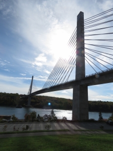
Jennifer is scheduled for surgery in Bangor early tomorrow morning to have that pin removed from her shoulder so we decided to make a day trip there and spend the night rather than getting up crazy early in the morning and drive there in the dark. On the way up, we stopped off to visit the Penobscot Narrows Bridge opened in 2007. 420ft up at the top of the closest tower is the Penobscot Narrows Observatory, the first bridge observation tower in the United States and the tallest public bridge observatory in the world.
|
 |
10/12/2016: Waldo Hancock Bridge
Position: 44°33.64'N, -68°48.22'W
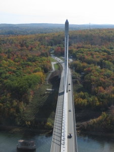
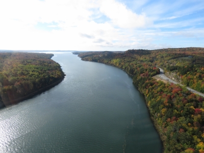
This is the view looking southeast across the river from the Penobscot Narrows Observatory. The footings from old the Waldo-Hancock Bridge are visible on the left. The Waldo-Hancock Bridge opened in 1931 with an 800ft span that was over twice as large as any other in Maine. In mid-2003 Maine Department of Transportation discovered severe corrosion in the supporting cables that required an emergency replacement of the bridge. The Penobscot Narrows Bridge was built in a record time of 42 months from conception to completion.
|
 |
10/12/2016: Penobscot River
Position: 44°33.64'N, -68°48.22'W
The view south down the Penobscot River from the Penobscot Narrows Observatory. In the distance are Sandy Point on the right and the junction with the Orland River on the left.
|
 |
10/12/2016: Fort from Bridge
Position: 44°33.64'N, -68°48.22'W
Looking north from the Penobscot Narrows Observatory. At the right of the picture on this side of the Penobscot River is Fort Knox, a 19th-century fortification and across the river is the Bucksport power plant and defunct paper mill.
|
 |
10/12/2016: Fort Knox
Position: 44°33.99'N, -68°48.14'W
Fort Knox was built in the late 1800s to protect the area from further British attack. Maine and British Canada had repeated border disputes in the late 18th and early 19th century and the area between the mouth of the Penobscot River and the lumber-rich town of Bangor were occupied by British during the American Revolutionary War and the War of 1812. Fort Knox never saw battle and became a National Historic Landmark in 1970, as a virtually intact example of a mid-19th century granite coastal fortification.
|
 |
10/12/2016: Cannon
Position: 44°33.88'N, -68°48.09'W
15-inch Rodman Cannon at "A" Battery at the south end of Fort Knox. "The gun was extremely powerful, but slow to maneuver. Twelve men were needed to load the cannon. They used a mechanical hoist to lift the 330 pound shell or 450 pound solid cannonball. Often, two men had to manage the rammer. The tube weight of the 15-inch Rodman is 50,000 pounds and the weight of the gunpowder charge was 60 pounds for a shell and 100 pounds for a solid cannonball. At a 20 degree elevation, the cannon could fire a solid cannonball 5,579 yards." (Fort Knox State Historic Site).
|
 |
10/12/2016: Fireside Inn
Position: 44°47.31'N, -68°46.67'W
We dropped the car off at our hotel, the Fireside Inn, to spend the afternoon exploring Bangor on foot.
|
 |
10/12/2016: Paul Bunyan
Position: 44°47.34'N, -68°46.66'W
Bangor claims to be the birthplace of Paul Bunyan, a giant lumberjack in American folklore. Akeley, Minnesota also make this claim and both towns have large statues of the legend. This is the 31-ft high Paul Bunyan statue near our hotel, "reputed to be the largest statue of Paul Bunyan in the world," according to its sign. Bangor native Stephen King brought the statue to life in his horror novel It.
|
 |
10/12/2016: Sea Dog Brewery
Position: 44°47.81'N, -68°46.19'W
We'd arranged a tour of the Sea Dog Brewery along the Penobscot River. Here General Manager Bert Follero is showing us through.
|
 |
10/12/2016: Head Brewer
Position: 44°47.81'N, -68°46.19'W
The Head Brewer at Sea Dog in Bangor.
|
 |
10/12/2016: Tasting Flight
Position: 44°47.81'N, -68°46.18'W
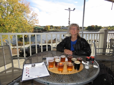
We had a great lunch at the Sea Dog pub on the balcony above Penobscot River, with a tasting flight of their excellent beers.
|
 |
10/12/2016: Stephen King
Position: 44°48.13'N, -68°47.08'W
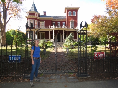
Outside novelist Stephen King's home in Bangor. Jennifer has been a huge Stephen King fan since first reading Salem's Lot back in 1980 and has enjoyed many of his books over the years, including reading the entire The Dark Tower series during watches while crossing the South Pacific.
|
 |
10/12/2016: Standpipe
Position: 44°48.46'N, -68°46.97'W
Stephen King's fictional town Derry in the the novel It and other stories is based on Bangor. The Thomas Hill Standpipe was the inspiration for the haunted and dangerous water tower in King's novel It, and King is said to have written much of the book on park bench at the tower base.
|
 |
10/12/2016: Leaves
Position: 44°48.40'N, -68°46.95'W
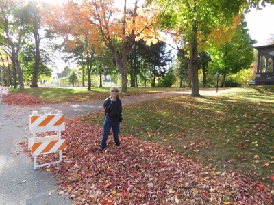
We've not seen a big pile of fall leaves for years. Jennifer couldn't resist wading through.
|
 |
10/12/2016: Standpipe Tour
Position: 44°48.46'N, -68°46.97'W
The Thomas Hill Standpipe is Bangor's oldest standpipe and a National Historic Landmark, and has been in use since its construction in 1897. The standpipe is open usually only four times per year for public tours and we happened to be in town on one of those days for the "Fall Colors Tour". A line-up of a nearly fifty people had formed before the doors opened at 3pm, along with a media van. Here we are climbing the stairs in the wooden building that encloses the standpipe, with the 1.75-million gallon riveted steel standpipe visible on the left.
|
 |
10/12/2016: View
Position: 44°48.45'N, -68°46.97'W
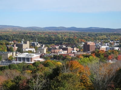
The fabulous view from the standpipe's promenade deck looking north. We believe the mountain range in the distance is the Longfellow Mountains, considered an extension of New Hampshire's White Mountains. We were lucky to be in Bangor not only on the one day this season that the standpipe was open for tours, but in such clear and beautiful weather.
|
 |
10/12/2016: Fall Colors
Position: 44°48.44'N, -68°46.98'W
This is why they call it the "Fall Colors" standpipe tour. The fall leaves viewed from the standpipe promenade were spectacular.
|
 |
10/12/2016: Crowds
Position: 44°48.44'N, -68°46.98'W
A continuous stream of people were arriving at the standpipe. Several hundred probably did the tour that day.
|
 |
10/12/2016: Kenduskeag Trail
Position: 44°48.31'N, -68°46.61'W
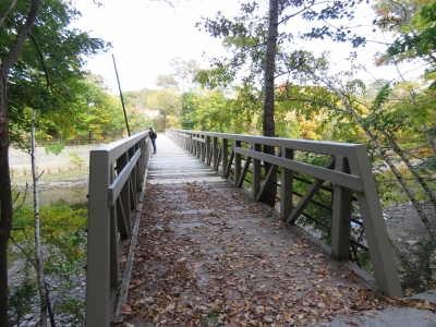
We walked a portion of the Kenduskeag Stream Trail to this footbridge, looking for a nice route back toward the Penobscot River, but the trail runs the other direction. The historic Morse Covered Bridge, built 1872, stood here until an arsonist destroyed it in 1983. The current footbridge across the Kenduskeag Stream stands on the footings of that original bridge. The Kenduskeag Stream is the one that the children dammed in Stephen King's novel It, and the novel's "Kissing Bridge" likely was based on the Morse Covered Bridge.
|
 |
10/12/2016: Free Internet
Position: 44°48.07'N, -68°46.26'W
We got a chuckle out of this "Free Slow Speed Internet" advertisement.
|
 |
10/12/2016: Masons Brewery
Position: 44°47.50'N, -68°46.18'W
Back downtown, we crossed the Penobscot River and walked to Mason's Brewery on opposite shore from Sea Dog Brewery.
|
 |
10/12/2016: Geaghan's
Position: 44°47.20'N, -68°46.66'W
Our final brewpub stop for the day at Geaghan's Pub and Craft Brewery adjacent to our hotel. This is their craft beer list.
|
 |
10/13/2016: Eastern Maine Medical Center
Position: 44°25.76'N, -69°0.23'W
An early-morning surgery at Eastern Maine Medical Center to finally get that pin removed. Bangor may seem a bit off the beaten path for surgery, but Dr. Jessica Aronovitz came highly recommended and did an excellent job. And Bangor ended up being quite convenient in being about an hour's drive from both Southwest Harbor and Belfast. So we could continue travelling south between the evaluation appointment and the surgery.
|
 |
10/13/2016: Pinless!
Position: 44°48.46'N, -68°45.10'W
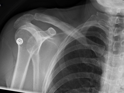
Jennifer is finally pinless! The surgical pin that has been holding her shoulder together for the last six months finally was removed this morning in Bangor, Maine. The collar bone break has healed well and the good news, at least from our perspective, is we never had to stop and let things heal. Great medical attention allowed us to continue the trip largely without change, and to continue almost like nothing had happened. We got to enjoy Newfoundland and Nova Scotia this summer and hike and explore without really being slowed down at all.
Thanks to Dr. Gus Gialamas of Seaview Orthopaedics, Dr. Veronica Diaz of Jupiter Hand to Shoulder, and Dr. Jessica Aronovitz of Eastern Maine Medical Center. Without their care and skill, this year wouldn't have been nearly as enjoyable as it was. Admittedly, it is very nice to have that pin gone :-) |
 |
10/13/2016: Mount Battie
Position: 44°13.39'N, -69°4.08'W
We weren't expecting Jennifer to be up for much today after her surgery, but she recovered so well in just a couple of hours that we decided to try a little sightseeing. This is the view to Camden from Mount Battie. The fall colors are really out now.
|
 |
10/13/2016: Megunticook River Falls
Position: 44°12.64'N, -69°3.86'W
Jennifer temporarily back in a sling in front of the Megunticook River Falls in Camden.
|
 |
10/13/2016: Drouthy Bear
Position: 44°12.49'N, -69°4.00'W
No beer for Jennifer today with the medication she is on after surgery, but she did get a lemonade on the patio at the Drouthy Bear pub in Camden.
|
 |
10/13/2016: Moorings
Position: 44°25.76'N, -69°0.23'W
Even some of the moorings in the harbor are being taken in for the winter in Belfast.
|
 |
10/14/2016: Ben Ellison
Position: 44°25.76'N, -69°0.23'W
Ben Ellison of panbo.com lives nearby in Camden and stopped by to visit. We had a great time with Ben talking marine electronics and boating in general.
|
 |
10/15/2016: Sea Smoke
Position: 44°25.73'N, -69°0.07'W
Sea smoke in Belfast Harbor with the temperature at freezing this morning.
|
 |
10/15/2016: Frost
Position: 44°22.47'N, -68°57.06'W
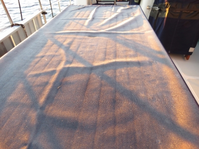
Our goal in working south down the coast has been to stay below the frost line. We failed today with frost covering the deck as we departed Belfast.
|
 |
10/15/2016: Fall Colors
Position: 44°21.99'N, -68°56.78'W
The fall colors are really out now, especially in the warm glow of the morning sun.
|
 |
10/15/2016: Owls Head Lighthouse
Position: 44°5.69'N, -69°2.11'W
The light station at Owls Head near Rockland, Maine was established in 1825 and current lighthouse built in 1852. The light still is an active aid to navigation using an 1856 fourth-order Fresnel lens.
|
 |
10/15/2016: Whitehead Light Station
Position: 43°58.46'N, -69°7.54'W
In 1803 Thomas Jefferson signed an authorization to construct a lightstation on Whitehead Island and a beacon has shined from the granite tower continually since then.
|
 |
10/15/2016: Ram Island Light
Position: 43°48.44'N, -69°36.58'W
The Ram Island light to our south has been operating since 1883 and was automated in 1965. A walkway connects the offshore light tower to the old keepers house ashore.
|
 |
10/15/2016: Burnt Island Light
Position: 43°49.68'N, -69°37.93'W
Maine has a lot of historic lighthouses. This is the Burnt Island Light that went into service in 1821. The stations was one of the last in Maine to be automated and destaffed in 1988.
|
 |
10/15/2016: Windlass Gear Oil
Position: 43°50.66'N, -69°38.13'W
James inside the anchor chain locker removing the windlass motor to change it's oil. This is due every three years. He also lubed the windlass top end.
|
 |
10/15/2016: Moon
Position: 43°50.66'N, -69°38.13'W
Moon rising over Boothbay Harbor with Our Lady Queen of Peace Church lit up on the left.
|
 |
10/16/2016: Hydraulic Zincs
Position: 43°50.67'N, -69°38.12'W
We changed the zincs in the hydraulic heat exchanger today. They were the best shape they've been in for a long time. We change them on a two-month schedule and normally they've eroded to nubs in that time. If they come out this good again, we'll change to a three-month cycle.
|
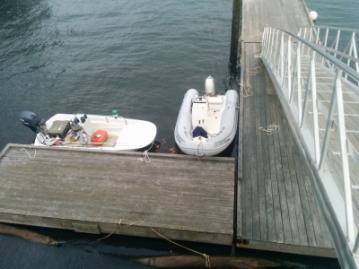 |
10/16/2016: Dinghy Dock
Position: 43°51.04'N, -69°37.71'W
Tied off at the Boothbay Harbour public dock. There's lots of room today, but we got the impression that there wouldn't be in the height of the season.
|
 |
10/16/2016: Boothbay Harbour
Position: 43°51.06'N, -69°37.64'W
Looking toward the water in Boothbay Harbour. It's pretty quiet tonight.
|
 |
10/16/2016: Closed
Position: 43°51.08'N, -69°37.65'W
A lot of the businesses in Boothbay Harbour are closed for the season. Definitely time to get further south.
|
 |
10/17/2016: Cuckolds Light
Position: 43°46.57'N, -69°38.86'W
The Cuckolds Lighthouse went into operation in 1892 and was automated in 1974. The Coast Guard deemed the lighthouse excess in 2004 it was at risk of being demolished. In 2006 a group of local citizens purchase the light and it has since become the Inn at Cuckolds light station where a lucky few can spend a night or a few on the island in the restored buildings.
|
 |
10/17/2016: Seguin Island Light
Position: 43°42.21'N, -69°44.84'W
The light station perched atop Sequin Island went into service in 1796. Goods were transported between the boathouse at sea level and the station via a long tramway.
|
 |
10/17/2016: Halfway Rock Light
Position: 43°38.99'N, -70°2.44'W
Halfway Rock is in the middle of Casco Bay, roughly midway between Cape Elizabeth and Cape Small. It isn't far from the light on Sequin Island, but locals began petitioning for a lighthouse here after several tragic shipwrecks on the rock. Nothing happened even in 1861 when the British bark Boadicea crashed into Halfway Rock and all aboard drowned. Funds finally were approved eight years later. A light on Halfway Rock went into operation in 1871 with a third-order Fresnel lens and the light was automated in 1874. The lighthouse and the ex-boathouse are all that remain as the rest of the structures have been carried away in storms, such as the Perfect Storm of 1991 documented in Sebastian Junger's book of the same name.
|
 |
10/17/2016: Fort Levett
Position: 43°38.89'N, -70°11.45'W
Lookout from Fort Levett high on the cliff at Cushing Island to our south as we approach Portland. Fort Levett was built in 1898 and went through several modernizations, including adding 16-inch gun batteries during World War II. The fort was decommissioned after the war and the property later sold to local residents.
|
 |
10/17/2016: Serenade of the Seas
Position: 43°38.86'N, -70°11.65'W
The 962 ft cruise ship Serenade of the Seas visible through Whitehead Passage.
|
 |
10/17/2016: Fort Gorges
Position: 43°39.46'N, -70°12.23'W
Fort Gorges to our west is built on Hog Island Ledge, but appears to be floating at high tide.
|
 |
10/17/2016: Spitfire
Position: 43°39.70'N, -70°12.26'W
Spitfire getting his first smell of Portland, Maine from our anchorage at the south end of Diamond Island Pass.
|
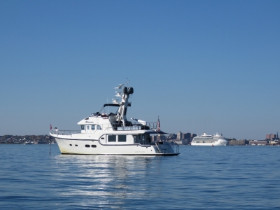 |
10/17/2016: At Anchor
Position: 43°39.67'N, -70°12.19'W
Looking across our anchorage in Diamond Island Pass to the cruise ship Serenade of the Seas. This was an excellent anchorage—we loved the views to the city and of the commercial traffic entering and leaving the harbor.
|
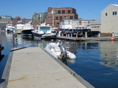 |
10/17/2016: DiMilo's
Position: 43°39.25'N, -70°15.02'W
We asked at the DiMilo's Marina fuel dock if there was a spot we could leave the tender for a few hours. They directed us here and said we could get the gate code from the marina office. The office, however, wanted $20 for 3 hours. We intended to be ashore a little bit longer, so we asked how long for 5 hours and they said $40. That seemed absolutely unreasonable for a day stop in a 12ft tender so we declined and left to find a more reasonable alternative than DiMilo's Marina.
|
 |
10/17/2016: King Tide
Position: 43°39.39'N, -70°15.07'W
We found another spot to leave the tender and set off to explore Portland. Today and tomorrow the full moon is bringing astronomically high tides, or "King Tides", that bring the water levels two inches above flood level. Jennifer is working past the cars along the flooded street near where we left the tender.
|
 |
10/17/2016: Ri Ra Irish Pub
Position: 43°39.43'N, -70°14.98'W
Lunch with local craft beer at Ri Ra Irish Pub overlooking the water.
|
 |
10/17/2016: Berlin Wall
Position: 43°39.34'N, -70°15.17'W
We recently saw a piece of the Berlin Wall in Lunenburg, Nova Scotia. And here's another in Portland.
|
 |
10/17/2016: Nets
Position: 43°39.19'N, -70°15.21'W
We spent some time watching fisherman repairing their nets on the docks.
|
 |
10/17/2016: Canning Machine
Position: 43°39.93'N, -70°15.42'W
Portland has lots of microbreweries. This is the impressive automatic canning machine at the Rising Tide Brewing Company. Flats of lidless cans are fed into an elevator not visible in the picture, then are brought down and filled, lids applied and the cans sprayed clean. Hundreds of cans were filled in the brief time we were there.
|
 |
10/17/2016: Rising Tide
Position: 43°39.93'N, -70°15.44'W
After an entertaining tour of the Rising Tide brewery, we tasted some of their excellent beer. The man seated on James' right was on our tour and coincidentally also is from the Seattle area.
|
 |
10/17/2016: Shipyard
Position: 43°39.68'N, -70°14.95'W
On our way back to town, we stopped at the Shipyard Brewing Company tasting room to sample their craft beer.
|
 |
10/17/2016: Gritty McDuff’s
Position: 43°39.36'N, -70°15.20'W
Dinner at Gritty McDuff’s Brew Pub overlooking downtown and the water. Gritty McDuff’s was established in 1988 and bills themselves as "Maine's Original Brew Pub."
|
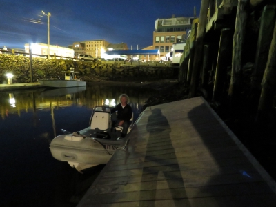 |
10/17/2016: Low Tide
Position: 43°39.34'N, -70°15.05'W
The other effect of the King Tide is an extreme low tide of -1.8ft. With a total tide drop of nearly 13ft, our tender was barely afloat. The dock that is now resting on the bottom was above the fixed dock height visible at the top of the frame.
|
 |
10/20/2016: Fore River
Position: 43°39.07'N, -70°18.00'W
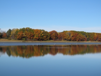
The fall colors reflected in the still waters of the Fore River west of downtown Portland.
|
 |
10/20/2016: Out of Water
Position: 43°39.50'N, -70°18.65'W
The tide was on the rise from a -1.l-ft low and we had trouble finding enough water in places. But we knew we couldn't get under this bridge at higher tides, so we were hoping to have enough to get through at low tide. Unfortunately a mid-tide seems to be the magic tide level to have enough water to pass through but not so much that the air draft restricts us.
|
 |
10/20/2016: Bug Light
Position: 43°39.28'N, -70°13.99'W
Bug Light at the end of the Portland Breakwater was built in 1875. Six decorative Corinthian columns hide seams joining the curved cast-iron plates that form the structure. The light was decommissioned in 1943, restored in 1989, and reactivated as a private beacon in 2002.
|
 |
10/20/2016: Liberty Ship Memorial
Position: 43°39.32'N, -70°13.58'W
This Liberty Ship Memorial in South Portland is the replica of a bow section of a World War II Liberty Ship. The memorial honors those who built Liberty ships nearby at the New England Shipbuilding Corporation.
|
 |
10/20/2016: Spring Point Ledge Light
Position: 43°38.97'N, -70°13.42'W
Spring Point Ledge Lighthouse was constructed in 1897 and is the only caisson-style light station in the United States that visitor can walk to.
|
 |
10/20/2016: Portland Head Light
Position: 43°37.34'N, -70°12.36'W
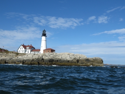
In 1787 George Washington directed the construction of the Portland Head Light that was completed in 1791. The light originally was lit with whale oil lamps. In 1855, a fourth-order Fresnel lens was installed that was later upgraded to a second-order. During the civil war the tower was raised twenty feet. After the Halfway Rock light was built, the Portland Head light was considered less important and in 1883 the much-deteriorated twenty-foot extension was removed and a new lantern and fourth-order Fresnel lens installed. The height and the second-order lens were restored in 1885 when mariners complained. The light is still an operating aid to navigation, lit with a 400-watt halogen bulb visible for 24 miles.
|
 |
10/20/2016: Ram Island Ledge Light
Position: 43°37.81'N, -70°11.31'W
The Ram Island Ledge light was built in 1905 and automated in 1959. To the left of the tower are the ruins of the iron landing pier built to facilitate the transfer of goods and people in rough weather.
|
 |
10/20/2016: Fort Gorges
Position: 43°39.78'N, -70°13.30'W
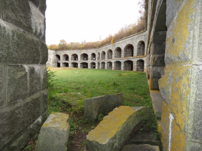
Fort Gorges was built on Hog Island Ledge between 1858 and 1864 and at high tide appears to float. No troops were ever stationed there and no battle fought—advancing military technology made the fort obsolete before it could be used. The fort is open to the public, but accessible only by private boat. We'd tried to land earlier in the day, but couldn't easily get close enough in the extreme low tide.
|
 |
10/20/2016: Sebago
Position: 43°39.54'N, -70°15.05'W
We had an excellent lunch at the Sebago Portland brewpub.
|
 |
10/20/2016: Fuel Gauge
Position: 43°39.67'N, -70°12.27'W
The fuel gauge in our tender failed while we were in Bras d'Or Lake, Nova Scotia earlier this year. We'd received a replacement while in Southwest Harbor and James set about installing it today. The original float in the lower part of the picture isn't really available as a part. What you need to do is buy the new part above and bend it to suit the tank.
|
 |
10/20/2016: New Float
Position: 43°39.67'N, -70°12.27'W
The new fuel level float bent to match the original.
|
 |
10/20/2016: New Fuel Gauge
Position: 43°39.68'N, -70°12.27'W
The new fuel gauge installed and working. It's great to have an accurate fuel reading again.
|
 |
10/21/2016: Fog
Position: 43°8.46'N, -70°35.25'W
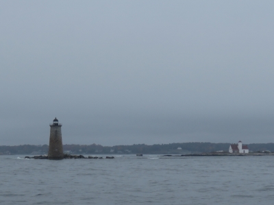
This was pretty much the view the entire run from Portland to Portsmouth.
|
 |
10/21/2016: Whaleback Light
Position: 43°3.30'N, -70°41.58'W
The light station has been active on the rocky outcrop south of Wood Island since 1820. The current lighthouse was built in 1872 and is listed in the National Register of Historic Places.
|
 |
10/21/2016: Breakwater
Position: 43°3.22'N, -70°42.76'W
Even in relatively calm conditions, waves are crashing into the breakwater off Fort Stark at the entrance to Little Harbor.
|
 |
10/22/2016: Barometer
Position: 43°3.43'N, -70°43.54'W
We've been tracking a big storm that will hit the area on the weekend. Over the past 48 hours, the barometer (top left) has fallen from 1025 to 988 millbars. That's 1.5mb/hour for two days straight. We got a big thunderstorm last night, with a NOAA flood warning for the area. The winds (rop right) picked up overnight from nothing to nearly 25 knots, then fell back down again this morning.
|
 |
10/22/2016: Calm Before Storm
Position: 43°3.43'N, -70°43.54'W
Conditions are extremely calm now, but that won't last long with a storm coming through today. This is the view from our new aft-facing video camera in our slip at Wentworth by the Sea Marina in Portsmouth, New Hampshire. The picture resolution is good enough that not only does it make good videos, but decent-quality still can be pulled from it as well. On the left you can clearly see a bird sitting on the pier end.
|
 |
10/22/2016: Peter and Laurie
Position: 43°3.43'N, -70°43.54'W
Peter and Laurie Hayden of Nordhavn 60 Tanglewood drove up from Gloucester, MA for a visit. It was great to finally meet them in person after so much email correspondence. We had an excellent time with them, first on Dirona and later over lunch at Salt restaurant in the resort adjacent to our marina.
|
 |
10/23/2016: Barometer
Position: 43°3.43'N, -70°43.54'W
The barometer bounced (top left) up after bottoming out at 984mb, and we saw big winds (top right) last night with gusts near 40 knots.
|
 |
10/23/2016: Stack leak
Position: 43°3.43'N, -70°43.54'W
Yesterday we noticed water trickling down the stack enclosure and collecting in the tray above the engine. We found pools of water in the stack base on either side of the stack enclosure installed in Florida. The thunderstorm the other night was the first really big rainfall since we installed the enclosure so likely it is preventing water from reaching the drain at the base of the stack. With time, patience and a lot of wiggling around, James can just barely fit inside the stack. Here he is ensuring the drains are adequate and sealing the stack enclosure around the edges with 5200. That's the easy part. James found pushing back out expands his chest and just about guarantees he doesn't move at all. "Are you just holding onto the can Homer?"
|
 |
10/23/2016: Phone Repair
Position: 43°3.43'N, -70°43.54'W
This spring Jennifer dropped her Nexus 5 cell phone and predictably the screen broke. James also had a Nexus 5, and a month or so later his phone spontaneously rebooted. It never came back, and even a factory reset wouldn't save it. The storage had failed, and short of changing the storage, that phone was not going to see use again. What do you do with a broken screen and good storage in one hand and a working screen with faulty storage in the other hand? This evening James decided to make a fully functioning phone from the working parts of each. Good as new.
|
 |
10/24/2016: Packages
Position: 43°3.43'N, -70°43.54'W
One of the reasons we stopped at Wentworth Marina for a few days is for another Amazon Prime fix. We seem to go through periods where we can go months at a time without any shopping and other times where we can't make it days.
|
 |
10/24/2016: Wheels
Position: 43°3.52'N, -70°43.43'W
We're really liking the Wentworth Marina. One of their many excellent features is a loaner car. The cars are only available for 90 minutes at a time in the height of the summer, but nobody else is using them here in the shoulder-season, so we often can have one for a good part of the day.
|
 |
10/24/2016: Portsmouth Brewery
Position: 43°4.67'N, -70°45.45'W
The self-explanatory sign outside the Portsmouth Brewery in downtown Portsmouth.
|
 |
10/24/2016: Lunch
Position: 43°4.67'N, -70°45.45'W
The Portsmouth Brewery pub is as appealing inside as out, with great beer and food.
|
 |
10/24/2016: Moran Towing
Position: 43°4.72'N, -70°45.43'W
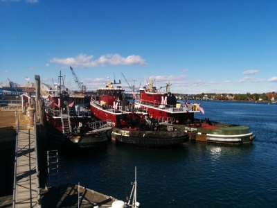
Moran Towing was established in 1860 and is the oldest and largest supplier of tugs on the U.S. east and Gulf coasts. Their tugboat dock is featured on the city's web cam.
|
 |
10/24/2016: Great Signs
Position: 43°4.73'N, -70°45.38'W
"Why drink pumpkin spice? When we have tequila?" We loved this sign outside Poco's Bow Street Cantina, one of Portsmouth's many waterfront restaurants.
|
 |
10/24/2016: Broomstick Fuel
Position: 43°4.73'N, -70°45.34'W
Another great sign in front of the adjacent River House restaurant.
|
 |
10/24/2016: Memorial Park
Position: 43°4.66'N, -70°45.20'W
The Portsmouth Veterans Memorial Park honors veterans and those who have died in war and conflicts throughout US history.
|
 |
10/24/2016: Memorial Bridge
Position: 43°4.64'N, -70°45.07'W
Looking across the Prescott Park Municipal docks to the Memorial Bridge, partly open for a sailboat to pass through. The bridge was built in 1923 and is dedicated to those who served in World War I.
|
 |
10/24/2016: Fish Boats
Position: 43°4.52'N, -70°44.99'W
Commercial fishing boats rafted along the Piscataqua River.
|
 |
10/24/2016: Pumpkins
Position: 43°4.23'N, -70°45.64'W
An incredible display of pumpkins for sale in front of the First Methodist United Church of Portsmouth.
|
 |
10/25/2016: Brrrr!
Position: 43°3.43'N, -70°43.54'W
Our goal has been to mainly stay south of the frost line, but we're close to missing on that today. The outside temperature (center top) is 41.6F (5.3C) this morning, with a wind chill (below temperature) of 34.6F (1.4C). Brrrr!
|
 |
10/25/2016: Deck Removal
Position: 43°3.48'N, -70°43.51'W
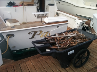
The teak deck is being replaced on one of the boats in the marina. This is the debris pile from just the cockpit.
|
 |
10/25/2016: Red Hook
Position: 43°5.18'N, -70°48.47'W
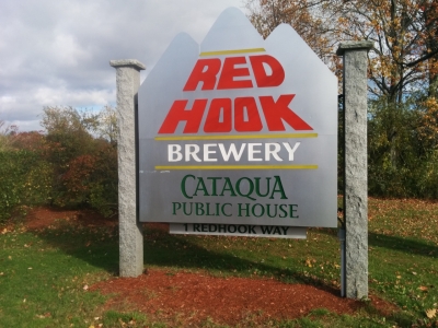
We've been many times to the Red Hook brewery and pub in Woodinville just outside Seattle. The brewery was founded in Seattle in 1981 and in 1996 opened the Portsmouth Brewery, to become the first craft brewery with bi-coastal locations. The Portsmouth brewery is built to mirror the Woodinville one, and looks identical near as we can tell, even down to the earthquake support structures that likely aren't even needed here.
|
 |
10/25/2016: USS Albacore
Position: 43°4.92'N, -70°46.05'W
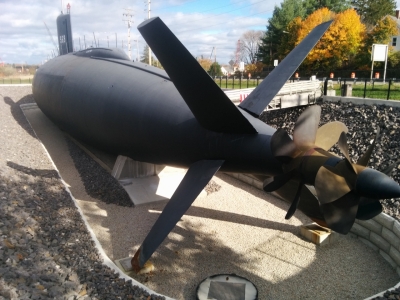
The Portsmouth Navy Yard, established in 1800, has a long shipbuilding tradition. The shipyard began building submarines during World War I, including the L-8, the first built by a US Navy yard. The yard produced seventy submarines during World War II, launching a record four in one day, and in the 1950s and 1960s built at least ten nuclear subs. In 1953, the yard built the research submarine USS Albacore for testing control systems, dive brakes, sonar equipment, escape mechanisms and other experimental approaches. Prior submarines had ship-shaped hulls and weren't particularly maneuverable underwater. Extensive hydrodynamic and wind tunnel testing with an emphasis on underwater speed and maneuverability led to the Albacore's revolutionary teardrop-shaped hull design that made her the fastest and most maneuverable submarine of the time and pioneered the American version of the teardrop-shaped hull form. In 1960, the ship went through the second of three major refits to install the pictured experimental, "X"-shaped tail for increased control. The Albacore was retired in 1972 to Philadelphia, and was returned to Portsmouth and installed in its current location as a public museum in 1985. Just the engineering challenge of installing a submarine of that size in front of the museum on dry ground is an interesting story. A temporary waterway was constructed, the Albacore floated in, then the waterway was pumped off.
|
 |
10/25/2016: Layout
Position: 43°4.94'N, -70°46.00'W
The Albacore had a crew of five officers and fifty enlisted men packed into a 205-ft keel jammed with equipment. We were able to tour pretty much everywhere on the ship except for the starboard engine room.
|
 |
10/25/2016: Prepare to Dive
Position: 43°4.94'N, -70°46.00'W
Jennifer preparing to dive. "Albacore pioneered the single control yoke for bow and stern planes and rudder. Thus, one person (the pilot) was able to perform the functions formerly done by three. By combining other functions, the number of crew members required to dive and operate the boat submerged was reduced from ten to three - the Conning Officer, a pilot and another crew member to operate the blow and vent and trim manifolds. Another Albacore first was the use of a single, multipurpose mast housing a number of antennas. Another Albacore first was the use of a single, multipurpose mast housing a number of antennas. She also carried a single experimental periscope that combined the functions of the thin attack scope and the large aperture search scope." (The Albacore Story)
|
 |
10/25/2016: Engine
Position: 43°4.94'N, -70°46.00'W
One of the General Motors EM 16-184A 16-cylinder, 2-cycle, radial diesel engines of 1,000HP each that charged Albacore's batteries. It's an unusual diesel engine in that there are four banks of four cylinders arranged in an 'X' configuration. Reports are they were as unreliable as they were unusual.
|
 |
10/25/2016: EM 16-184A
Position: 43°4.94'N, -70°46.00'W
This Old Machine Press picture shows an Electro-Motive-built 16-184A engine similar to the two installed in the Albacore. "The installed pancake diesel engines were a constant aggravation. They were a radical departure from the proven diesels used in earlier boats in that they were made of aluminum and ran at twice the speed of the earlier engines. They were under-powered to charge the ship's batteries and had a severe tendency to breakdown. But, they were the only engines available that would fit into the cramped space set aside for Albacore's engine rooms. It was a cannibalization of the 16 cast-off engines taken from the Tang class of submarines that kept Albacore's engines going for 19 years. When those parts were exhausted, Albacore's life was over." (The Albacore Story)
|
 |
10/25/2016: Machinery
Position: 43°4.94'N, -70°46.00'W
The Albacore's aft starboard machinery area. On either side of the steps near the center of the picture are the two General Electric motors that drive the twin counter-rotating props. These are double-armeture, 8,000-amps per armeture, 50-200RPM, 7,500HP electric motors. The two engines are inline with each other and drive two shafts that share the same center, where one shaft is hollow and contains the other shaft. We had a great time on the tour—it was unusual to have such complete access to a vessel.
|
 |
10/26/2016: Packages
Position: 43°3.43'N, -70°43.54'W
Jennifer bringing back a load of groceries and packages.
|
 |
10/27/2016: Spare
Position: 43°3.43'N, -70°43.54'W
We've been trying for ages to get to a spare steering rod end and spherical bearing and it finally arrived today. This is a part the nobody seems to keep in stock so it has to be ordered from the manufacturer which results in a fairly length delay.
|
 |
10/27/2016: Vent Covers
Position: 43°3.43'N, -70°43.54'W
Installing the covers on the engine room intakes. When we are at rest, the covers help keep the engine room a lot warmer.
|
 |
10/27/2016: Salt
Position: 43°3.59'N, -70°43.56'W
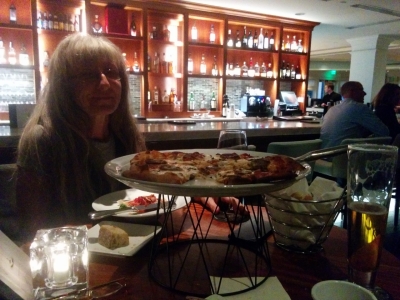
Dinner at Salt in the Marriott resort adjacent to the marina.
|
 |
10/28/2016: Stack Socket
Position: 43°3.43'N, -70°43.54'W
When we were investigating the water leak in the stack the other day, we noticed that this power socket wasn't sealed properly when installed, allowing water to leak into the stack. We also noticed one of the conductors was loose. James tightened up the conductor and coated the resealed the socket.
|
 |
10/29/2016: Voting
Position: 43°3.43'N, -70°43.54'W
Filling out our ballots for the 2016 US General Election. The ballot can be filled out online, but we still have to mail it in.
|
 |
10/29/2016: Flag
Position: 43°3.43'N, -70°43.54'W
Our US flag was ready for replacement when we arrived at Portsmouth and the two storms that just passed through shredded it. We saw gusts to 49 knots. The boat is covered with chunks of flag debris.
|
 |
10/29/2016: British Beer Company
Position: 43°3.43'N, -70°43.54'W
We had an excellent lunch at the British Beer Company in downtown Portsmouth after mailing in our ballots.
|
 |
10/29/2016: Rob Blake
Position: 43°3.43'N, -70°43.54'W
Rob Blake lives nearby and stopped by for a visit and a tour. He's been following our blog and Nordhavns in general for quite some time and knows a lot about them.
|
 |
10/30/2016: Sunrise
Position: 43°3.36'N, -70°42.99'W
Beautiful sunrise leaving Portsmouth this morning.
|
 |
10/30/2016: Cape Ann Light Station
Position: 42°41.06'N, -70°33.31'W
The twin towers of the Cape Ann Light station were built in 1861 and were the first station in the United States to mark a navigational hazard rather than a harbor entrance, and the last established under colonial rule. When the lightstation was built, technology didn't exist to produce a flashing light, so two towers were built to distinguish the lightstation from others nearby. The north light was discontinued in 1932 after revolving lens systems made it possible to produce a flash of a distinct frequency to distinguish the lights.
|
 |
10/30/2016: Eastern Point Lighthouse
Position: 42°33.95'N, -70°40.11'W
The first Eastern Point Lighthouse was erected in 1832. The current tower was built in 1880 and the keeper's house in 1879. The light was automated in 1985 and is still active.
|
 |
10/30/2016: Power Station
Position: 42°31.30'N, -70°52.14'W
The new Salem Harbor Power Station under construction replaces the power station on the right, in operation from the 1960s to 2014. The old coal-and-oil fed power station took over 16 hours to startup before generating any electricity. The new natural gas plant can reach nearly half it's output in 10 minutes and a full 674-megawatt capacity in under an hour.
|
 |
10/30/2016: Fame
Position: 42°31.20'N, -70°52.19'W
The schooner Fame, a replica of an 1812 privateer of the same name, out for a tour in Salem Harbor.
|
 |
10/30/2016: Pickering Wharf
Position: 42°31.19'N, -70°53.40'W
Salem apparently doesn't have a public dinghy dock, making visiting from anchor a bit of a challenge. But for $5 you can tie off at the Pickering Wharf Marina dinghy dock right downtown. This was cheaper than most of the car parking rates we saw.
|
 |
10/30/2016: Halloween
Position: 42°31.33'N, -70°53.11'W
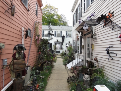
Salem was the center of the Witch Hysteria that led to 20 people being sentenced to death in 1692. In the intervening few centuries, Salem has become considerably more welcoming to witchcraft, goblins and the supernatural. In fact, their month-long Halloween celebration likely is the largest in the nation and includes a parade, costume balls, haunted house tours, live music, lots of decorations and of course, plenty of costumed revelers. The city is expecting 250,000 attendees over the course of the month.
|
 |
10/30/2016: Witch Museum
Position: 42°31.40'N, -70°53.44'W
The Salem Witch Museum tells the story of the 1692 Salem Witch Trials, where twenty innocent people were put to death for witchcraft.
|
 |
10/30/2016: No Parking
Position: 42°31.35'N, -70°53.93'W
We got a chuckle out of this no parking sign at a downtown church.
|
 |
10/30/2016: Crowds
Position: 42°31.19'N, -70°53.49'W
Many of Salem's downtown streets were blocked to traffic and thousands of people filled the roads and sidewalks. Every haunted house had a line-up of about fifty people out front.
|
 |
10/30/2016: Police
Position: 42°31.24'N, -70°53.35'W
With so many visitors filling the streets, lots of police were patrolling the area. Who'd have thought you could get paid for celebrating Halloween riding around on a Harley?
|
 |
10/31/2016: Finz
Position: 42°31.16'N, -70°53.32'W
We had an excellent meal at Finz along the waterfront to celebrate Jennifer's birthday. Like everywhere in town, every table was taken with costumes throughout.
|
 |
10/31/2016: Costumes
Position: 42°31.34'N, -70°53.46'W
After dinner we walked through the jam-packed streets to take in the festivities and the costumes.
|
 |
10/31/2016: Happy Birthday
Position: 42°31.38'N, -70°53.43'W
This is Jennifer's first time back in the U.S. for her birthday since 2012. Halloween isn't celebrated much in the places we've been to around the world, so it was especially fun to be in Salem for probably the biggest Halloween celebration in the country. We didn't get elaborate costumes this year, but we used to have regular Halloween costume parties at our houses in Seattle and Toronto. Here's a picture of us in 2007 with James wearing a homemade Greatest American Hero costume.
|
 |
10/31/2016: Fireworks
Position: 42°31.23'N, -70°52.02'W
An excellent fireworks display capped off the evening, and the month-long Salem Halloween celebration. We had a great view from Dirona anchored in the harbor.
|
 |
11/1/2016: Marblehead Light
Position: 42°30.37'N, -70°49.30'W
The original Marblehead Light was built in 1835 of brick and wood. By the end of the century the tower was in disrepair and was replaced in 1895 by a new skeletal tower made of iron.
|
 |
11/1/2016: Crossing Track
Position: 42°23.92'N, -70°45.78'W
We're just crossing our track from Boston to Newfoundland three months ago. The blue box on the chart to our west is the effluent discharge area for the Deer Island Treatment Plant.
|
 |
11/1/2016: Cape Cod Canal
Position: 41°46.64'N, -70°29.65'W
The video https://youtu.be/82pYJ5591J0 shows our southbound transit through the Cape Cod Canal with a 2-knot ebb current. Our northbound trip (https://youtu.be/WmvYcxMXLg4) earlier this year took us an hour at slack water. With the current in our favor, this trip took only 40 minutes and we had to slow down several times to avoid exceeding the 10mph canal speed limit.
|
 |
11/1/2016: Mayflower
Position: 41°41.31'N, -70°42.87'W
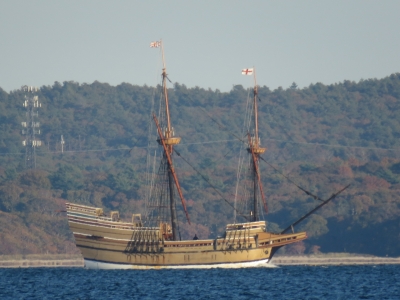
We anchored for the night in Sedge Cove with good protection from the southwest winds that were coming up. As we were exiting the Cape Cod Canal, we heard commercial boats on the radio asking if the Mayflower was passing through the canal. And soon after we'd anchored, there it was, being towed south to Mystic Seaport for a 30-month restoration. We were lucky to have seen it in Plymouth earlier this year.
|
 |
11/2/2016: Pitch
Position: 41°26.04'N, -71°11.43'W
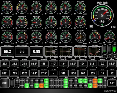
20-knot southwest winds are generating tight waves that is producing a fair bit of pitching motion (pitch graph is at center of 4th row).
|
 |
11/2/2016: Masts
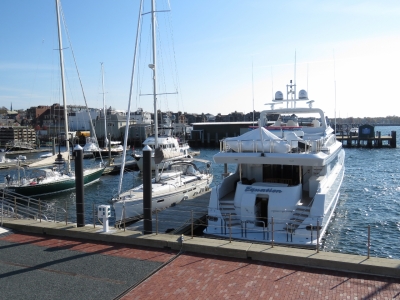
Position: 41°28.92'N, -71°19.88'W
A cluster of very large masts dominate the sky as we approach Newport, Rhode Island. The town bills itself as the "Sailing Capitol of the United States" and is where the America's Cup races where held from 1930 until Australia won the cup in 1983.
|
 |
11/2/2016: Newport Yachting Center
Position: 41°29.11'N, -71°19.03'W
Moored for a few nights at Newport Yachting Center. This is a fairly central place to explore Newport from.
|
 |
11/2/2016: Madeleine
Position: 41°29.20'N, -71°18.96'W
Even though it is late in the season, this is the sailing capitol of the US, so sailboat charters are still going out. The skipper of the Madeleine has a tight squeeze getting in and out of the berth.
|
 |
11/2/2016: Newport Shipyard
Position: 41°29.35'N, -71°19.32'W
A large number of yachts and super-yachts, the majority sailing vessels, were hauled out in the Newport Shipyard for repair. This photo shows all three of their Travelifts: a 70-ton, a 100-ton, and a 500-ton. Even their smallest could easily handle 55-ton Dirona.
|
 |
11/2/2016: Trinity Church
Position: 41°29.24'N, -71°18.78'W
Trinity Church was completed in 1726 and similar in design to Old North Church in Boston.
|
 |
11/3/2016: Chain Counter
Position: 41°29.08'N, -71°19.04'W
Our chain counter stopped working shortly after we changed the windlass gear oil. We were convinced the problem had to be related to that job, but it turned out to be just in independent failure and replacing the control unit fixed the problem.
|
 |
11/3/2016: The Black Pearl
Position: 41°29.18'N, -71°18.98'W
Lunch outdoors at the Black Pearl. The weather was a little cool, but still warm enough to sit outside.
|
 |
11/24/2016: Marble House
Position: 41°27.74'N, -71°18.38'W
During the Gilded Age around the turn of the 19th century, dozens of opulent stone mansions were built on and near Bellevue Avenue in Newport as "summer cottages" for the America's richest families. The fifty-room Marble House, built for Alva and William Kissam Vanderbilt at a cost of $11M ($285M in 2016 dollars), was among the first constructed.
|
 |
11/3/2016: KVH
Position: 41°31.30'N, -71°17.47'W
At a factory tour of one of our favourite companies, KVH, the supplier of our mini-VSAT satellite system. Read more ...
|
 |
11/4/2016: Interview
Position: 41°29.08'N, -71°19.04'W
Nancy Martineau and Chris Watson from KVH stopped by Dirona today to interview us on our experience with KVH and our impressions of the factory tour. We'll post a link to the interview when it is available.
|