MV Dirona travel digest for Southwest Harbor, Maine 2016

|
Click the travel log icon on the left to see these locations on a map,
with the complete log of our cruise. On the map page, clicking on a camera or text icon will display a picture and/or log entry for that location, and clicking on the smaller icons along the route will display latitude, longitude and other navigation data for that location. And a live map of our current route and most recent log entries always is available at //mvdirona.com/maps/LocationCurrent.html. |
 |
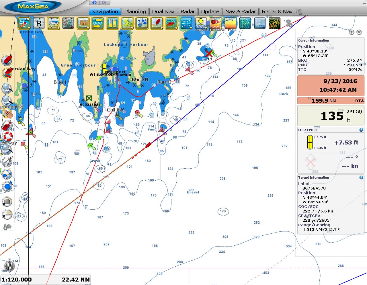
9/22/2016: En Route to Maine
Position: 44°13.20'N, -64°15.90'W
We're underway on a 225-mile overnight run to Southwest Harbor, Maine. We initially were planning to stay at least another night in Lunenburg, but the weather models showed a storm system arriving earlier than previously indicated with several more following, so we decided to leave this morning. We've got excellent conditions now, with calm seas and winds less than 15kts, and expect those conditions the duration of the run. We're running about 7 kts and aiming to arrive at Southwest Harbour in the afternoon to avoid navigating in the dark through the masses of lobster traps that we've been warned litter the Maine coast. This will have us rounding Cape Sable against a 2-kt ebb current, but with these light winds we expect calm conditions and just have to put up with the loss of speed and/or fuel economy.
|
 |
9/22/2016: Positive Current
Position: 43°48.77'N, -64°44.81'W
We're getting a nice push from a positive current and making nearly 8 kts at a fuel economy of 1.6nm/gallon. Conditions are wonderfully calm with winds less than five knots.
|
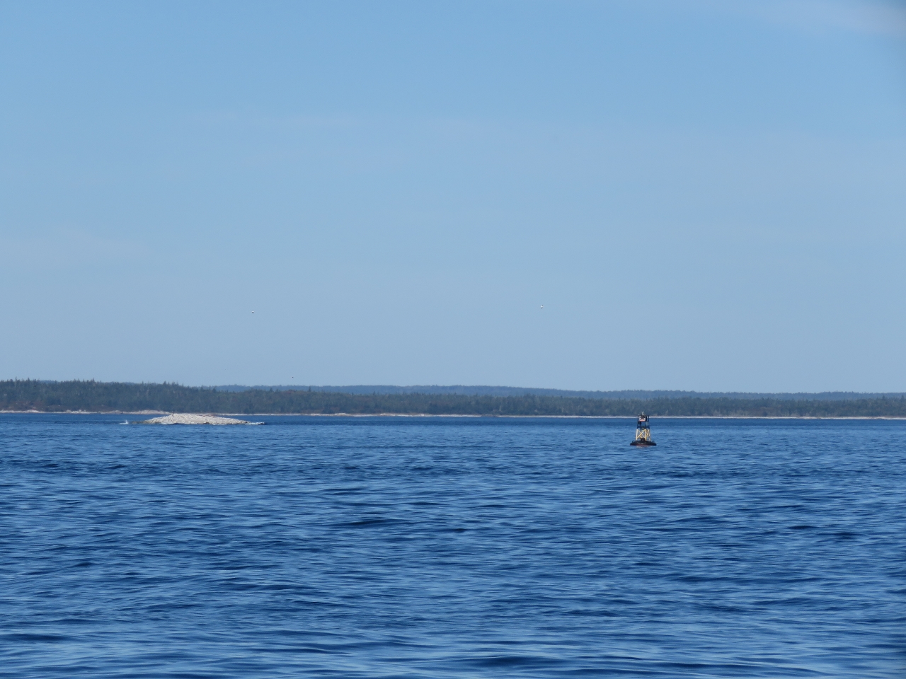 |
9/22/2016: Little Hope
Position: 43°48.04'N, -64°45.87'W
Little Hope Rock, barely showing above the surface at the left of the photo, looks like a real hazard.
|
 |
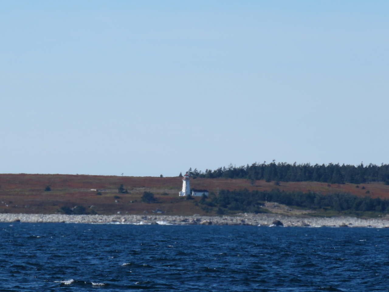
9/22/2016: Gull Rock
Position: 43°38.54'N, -65°1.48'W
The first light on tiny, bare Gull Rock to our west was completed in 1853. The current structure was built in 1955. The light is mounted atop a two-story square dwelling with reinforced concrete walls 17 inches (43cm) thick. The lighthouse was destaffed in 1987 and currently is at risk of collapse.
|
 |
9/22/2016: Lockeport
Position: 43°37.53'N, -65°3.27'W
We're just passing south of Lockeport, where we cleared into Canada over eight weeks ago.
|
 |
9/22/2016: Cape Negro Island
Position: 43°29.19'N, -65°18.75'W
Nova Scotia has over 150 lighthouses. This one is on Cape Negro island to our northwest.
|
 |
9/22/2016: The Salvages
Position: 43°27.48'N, -65°21.93'W
The Salvages are a line of rocks, about 1.5nm long, with hardly any exposed land. The combined light house and dwelling is build high above the rocks to protect it from pounding waves and is a conspicuous landmark miles away.
|
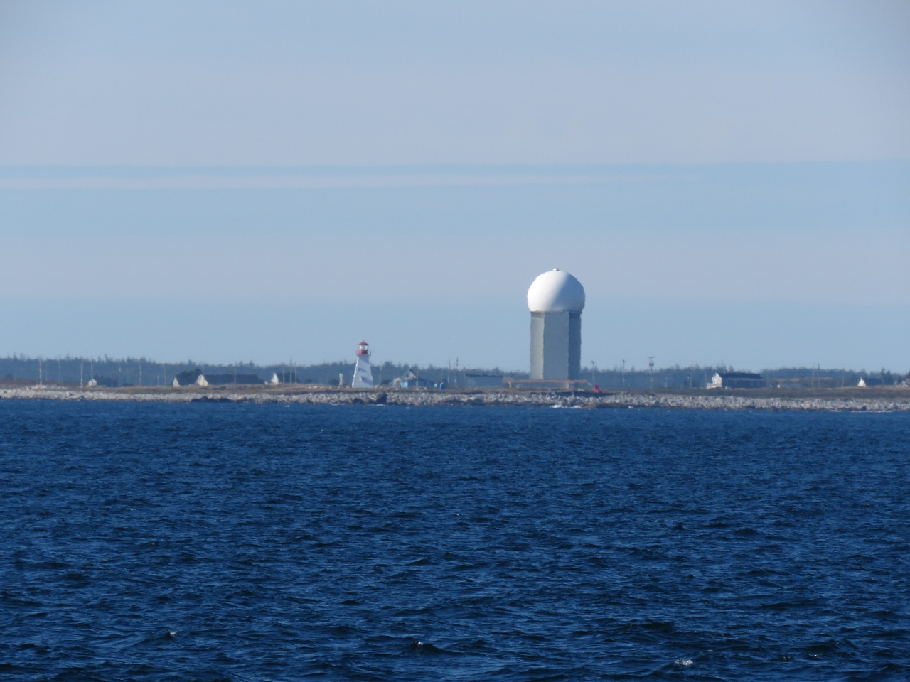 |
9/22/2016: CFS Barrington
Position: 43°25.20'N, -65°26.68'W
The radar tower at decommissioned Canadian Forces Base (CFS) Barrington. The station was built as part of the Pinetree Line in the 1950s to provide early warning of a Soviet attack during the Cold War. The radar tower dwarfs the 45ft Baccaro Point light house on the left.
|
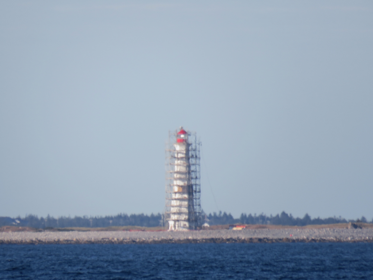 |
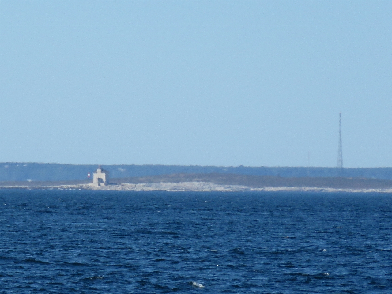
9/22/2016: Cape Sable
Position: 43°23.64'N, -65°30.31'W
The light at Cape Sable wrapped in scaffolding. The "Friends of the Cape Sable Lighthouse" society has an annual fund-raising event to restore the lighthouse and make it more accessible to the public. This is a nasty area where strong currents against big winds in shallow waters can generate dangerous conditions. The chart is full of warnings about tide rips. Conditions are so calm right now that we're able to pass through the area called Tail of the Rip with hardly any noticeable boat motion.
|
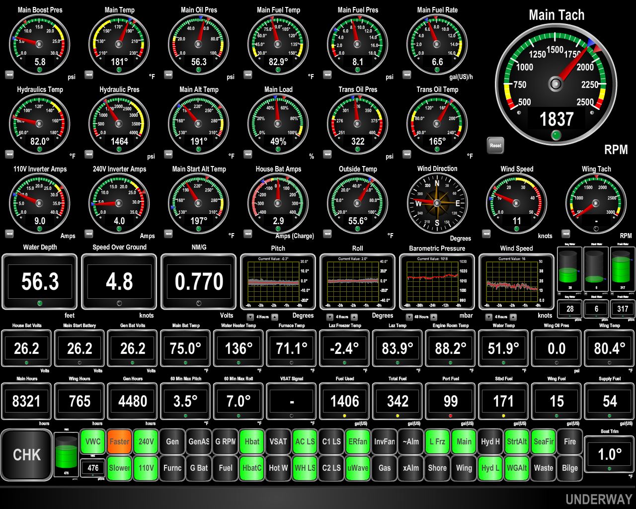 |
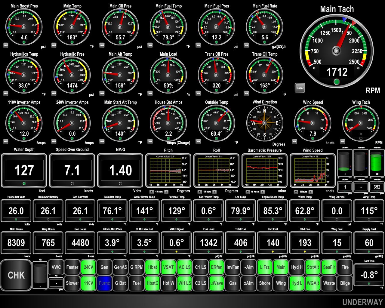
9/22/2016: Negative Current
Position: 43°21.29'N, -65°38.13'W
As expected, we're rounding Cape Sable at maximum ebb, with 2.3kts of current against us. We're making less than five knots at a fuel economy of 0.770 nm/g. At 1800 RPM in flat water, we'd be doing about 7.6 knots. We expect this to last about 3-4 hours until the current turns to flood. We're "driving to the lights" to reach Southwest Harbor in the afternoon, and the Maretron display is showing orange indicating we should speed up to meet our deadline. We expect to get a push from the current later, so rather than burn fuel needlessly to meet the speed goal, we'll just put up with the slow speed and expect to gain the time back later.
|
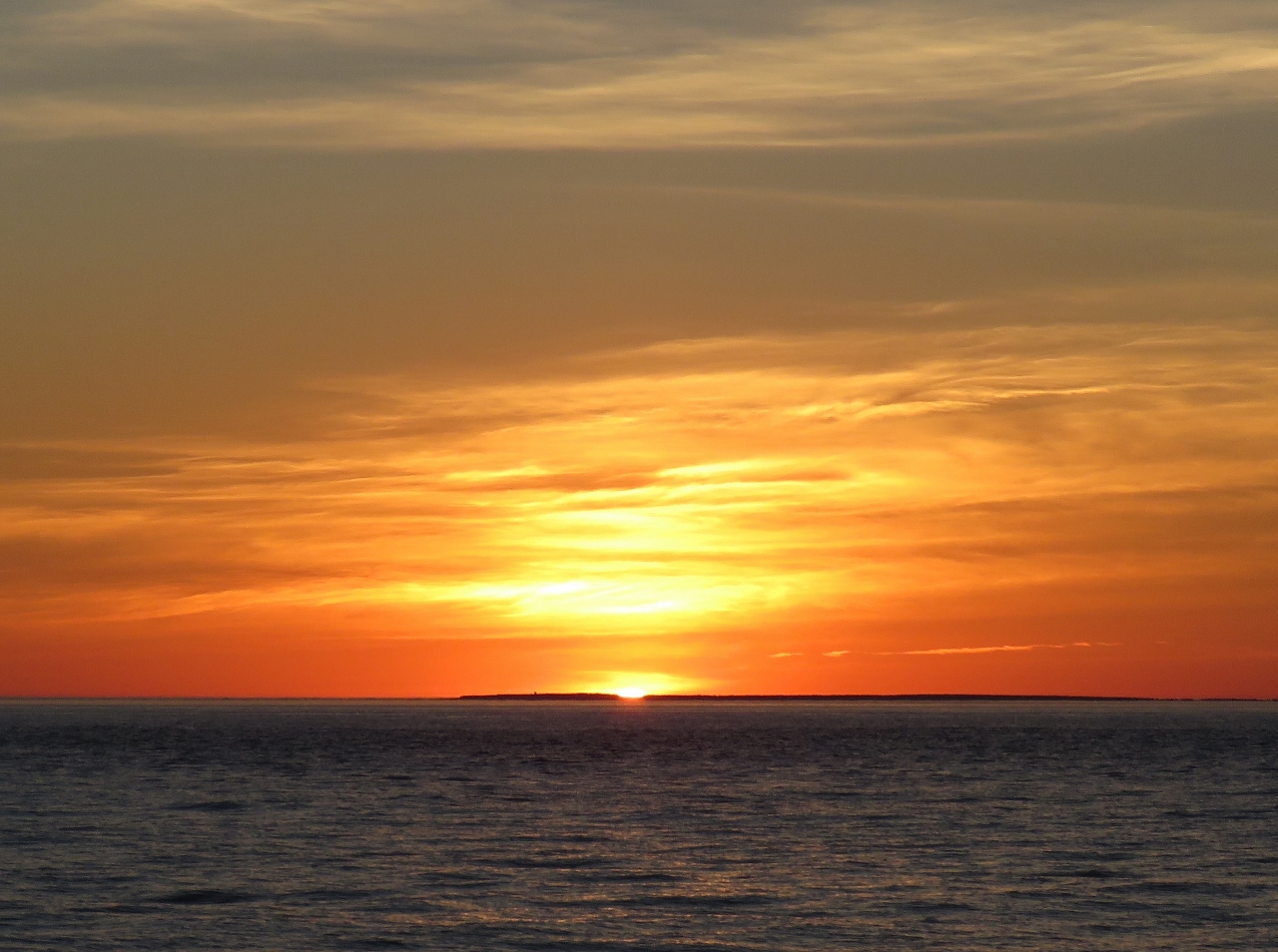 |
9/22/2016: Sunset
Position: 43°21.89'N, -65°41.84'W
Beautiful sunset at sea.
|
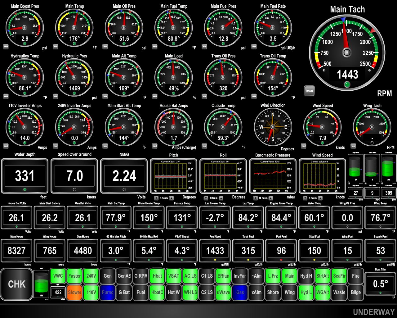 |
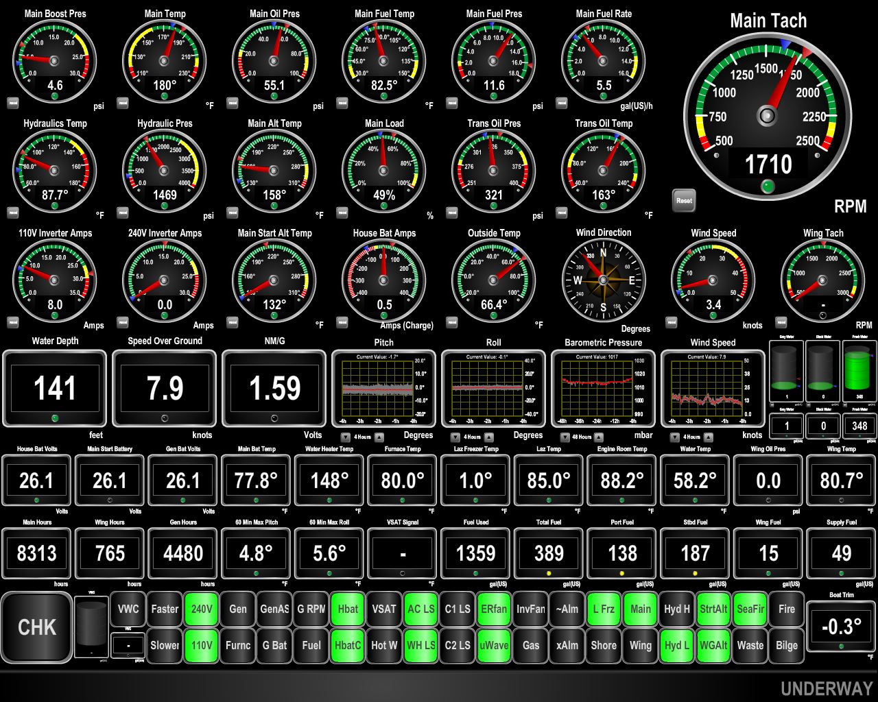
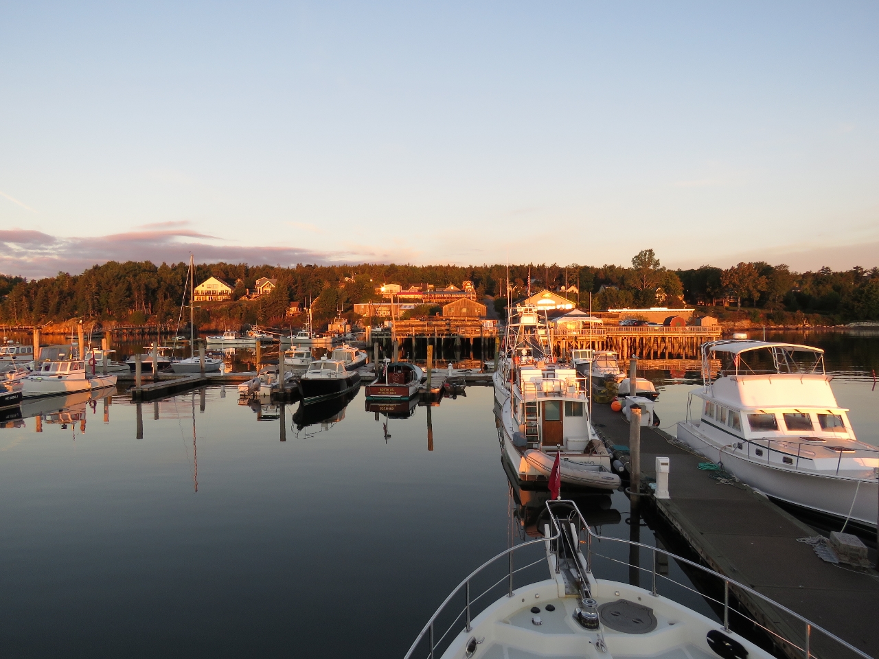
9/22/2016: Flood
Position: 43°34.54'N, -66°21.53'W
We've finally escaped the negative current and are getting a nice push again. The "driving to the lights" gauge now indicates we should slow down to meet our 2:30pm deadline. The fuel dock only has 6ft of water at low tide which is around 11am, so we need to arrive a bit later to have ample water. We're driving to schedule right now and aiming for the harbor entrance at 2:30 and the fuel dock shortly thereafter. We last fueled in Boston nearly 2 months and 290 engine hours back so we are running fairly light with 336 gallons left on board in all four tanks.
|
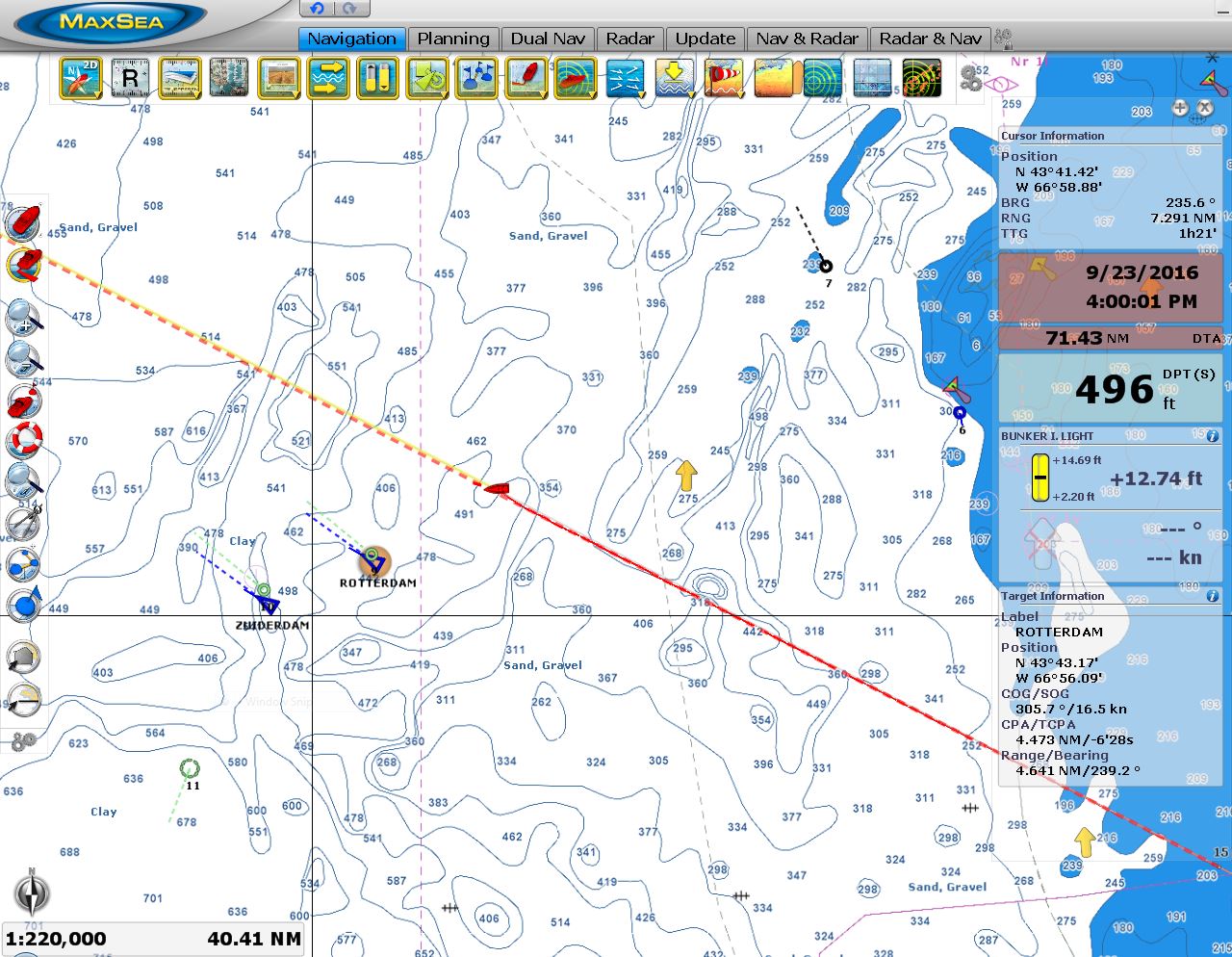 |
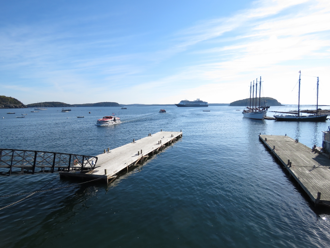
9/23/2016: Cruise Ships
Position: 43°45.54'N, -66°50.54'W
Around 2:30 this morning, the two cruise ships Zuiderdam and Rotterdam passed us about 4.5 miles away. Both ships were en route to Bar Harbour. It's going to be crowded there today for sure.
|
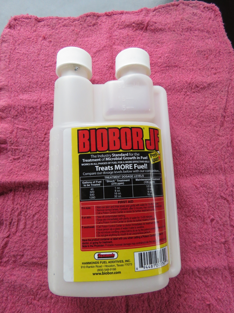 |
9/23/2016: Fuel Treatment
Position: 43°59.63'N, -67°28.24'W
We treated both fuel tanks with 8 oz Biobar JF each. We do this every six months. This is a good shock treatment since we always use the same 16 oz on each treatment, but there is currently only 215 gallons in the two tanks. We also replaced the fuel in wing engine day tank with treated fuel and drained the supply tank, refilled it with treated fuel, then pumped it back down to fifteen gallons and polished that fuel in the bottom of tank for thirty minutes.
|
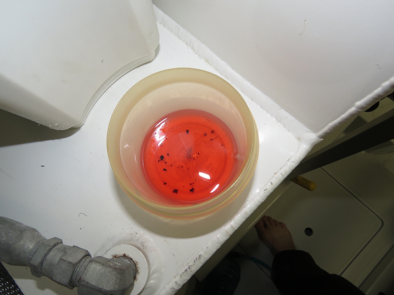 |
9/23/2016: Fuel Debris
Position: 44°12.63'N, -68°3.63'W
After having pumped off the bottom of all four tanks and completely changing the fuel in two of them, we took a sample in the bottom of the fuel transfer filter to check for water. As usual, no water was found, but there was a surprising amount of rust and debris.
|
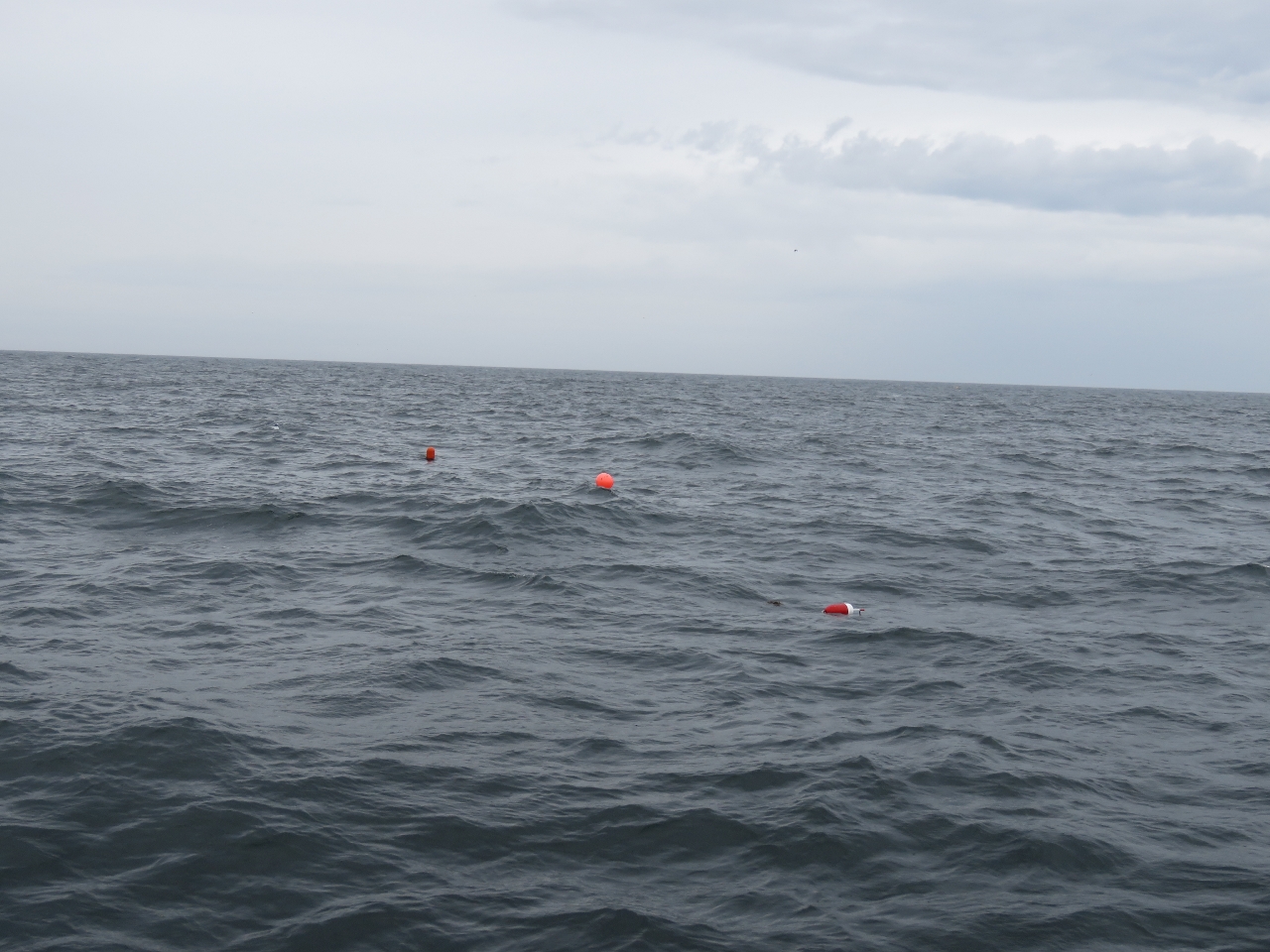 |
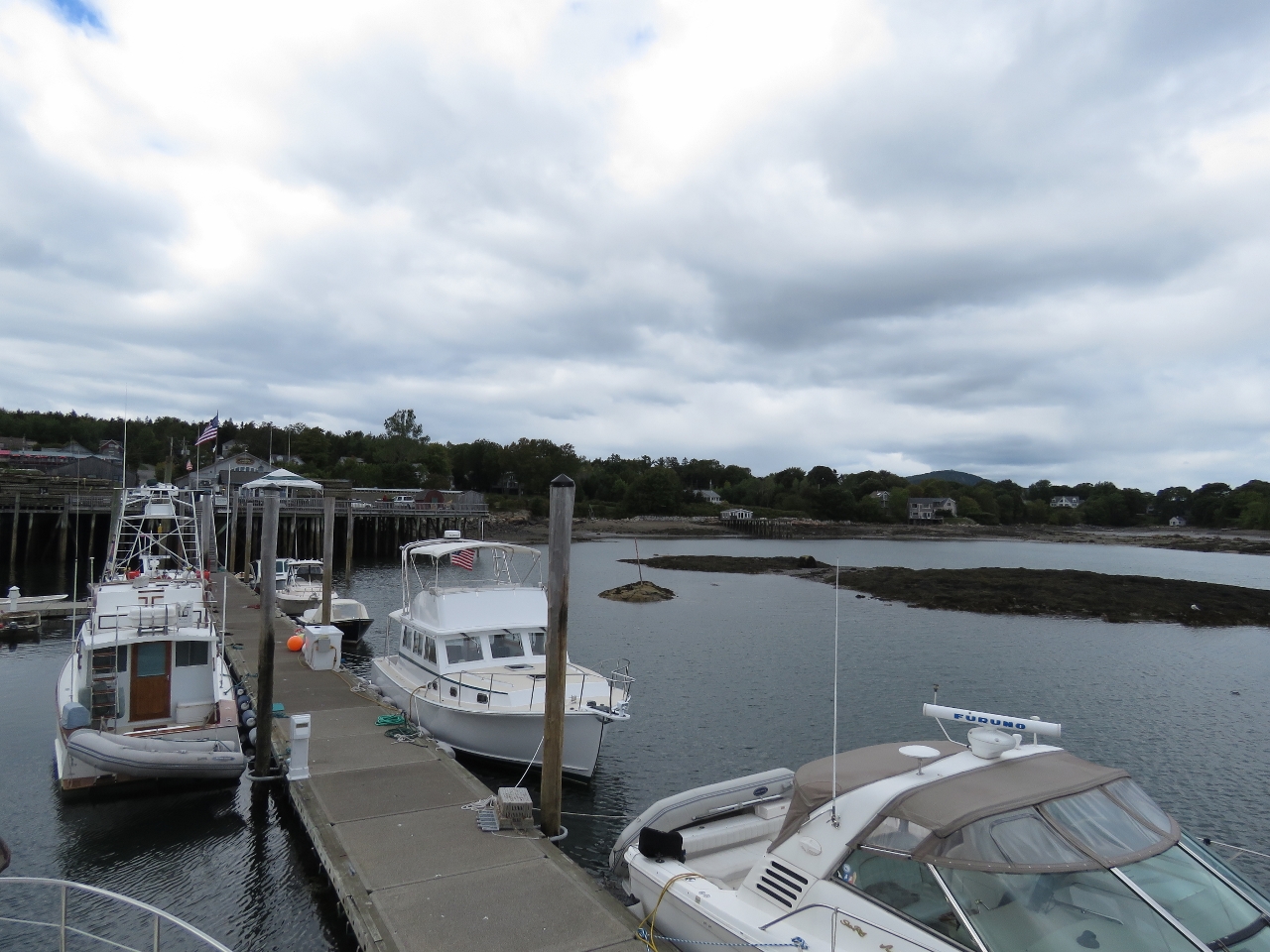
9/23/2016: Trap
Position: 44°7.54'N, -67°50.29'W
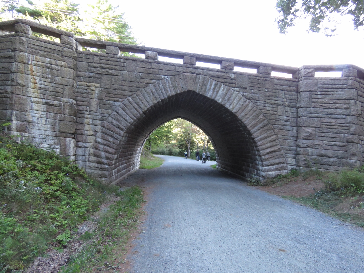
We saw our first lobster trap as we got into shallower water about 25 miles out of Southwest Harbor. The pots became more frequent the closer we got. Initially we had to steer around one every ten minutes or so, but as we neared the harbor we constantly were steering around pots. They weren't quite as thick as we were expecting—we'd heard stories of people having to push the traps out of the way they were so thick with no way to avoid them. But we definitely wouldn't want to approach or leave at night.
|
 |
9/23/2016: Clearing Through
Position: 44°8.93'N, -67°53.92'W
James on the phone with US Customs to clear us through. Before we left Lunenburg we'd filed a float plan using the Small Vessel Reporting System and were asked only a cursory few questions before being given clearance.
|
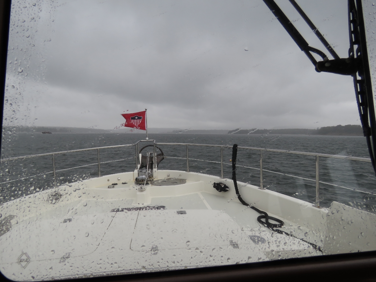 |
9/23/2016: Wind
Position: 44°16.22'N, -68°17.04'W
As we entered Southwest Harbor, the winds picked up to twenty knots with rain and poor visiblity making those lobster traps harder to see.
|
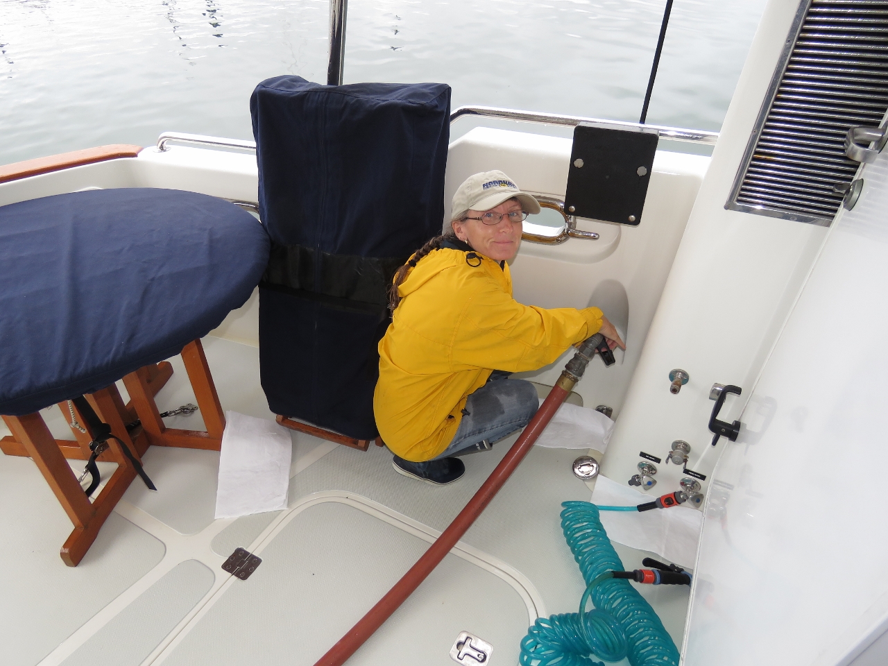 |
9/23/2016: Fueling
Position: 44°16.46'N, -68°19.38'W
We took on 1,490 gallons in our first fueling since Boston on July 31st.It's great that we can be out and running the generator or engine every day and still be able to go two months between fuelings. Admittedly, we were starting to get fairly low on fuel with only 262 gallons total on board. It gets uncomfortable when dropping down below 400 gallons but we remind ourselves that 400 gallons is nearly twice the fuel capacity of our first boat and is nearly one quarter of the capacity of this one. It's really not THAT low. And it's important that we be confident in our systems and have many redundant checks on fuel levels since, when crossing oceans, we will routine aim to finish the trip with only 10% reserve which is 175 gallons remaining. At the end of this run we had 262 gallons left so it's more than we would expect to have after a long run at sea.
We have 3 redundant checks: 1) the sight gauges on the side of the tanks showing fuel level, 2) the Maretron FPM100 fuel level sensors which are are primary measures, and 3) the engine ECU fuel consumed data point. Between them all, we have a lot of data and when we fill it's normal that our measures be within 2 to 3% and its usually closer to 0. Over time we have developed confidence in the system but we fully admit to there always being a chance we will get it wrong and it still has our attention when we are running at lower fuel levels. By the way, the savings in filling up in Maine rather than Nova Scotia was just over $3,000. Just this one trip paid for the cost of the fuel measuring sensors many times over. |
 |
9/23/2016: Packages
Position: 44°16.46'N, -68°19.38'W
We'd built up a good list of things to buy over the past two months and a lot of packages waiting for us when we arrived at Dysart's Marina. We actually didn't buy everything on our list, just the items we needed short-term. We'll get the rest at our next longer-term stop later this year.
|
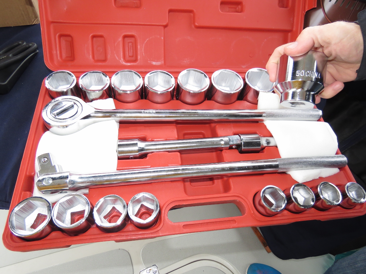 |
9/23/2016: Sockets
Position: 44°16.47'N, -68°19.30'W
One of the packages contained a set of 3/4-inch-drive sockets ranging from 19mm to 50mm. We've needed bigger sockets for several jobs over the past few months and will need some for replacing the engine mounts.
|
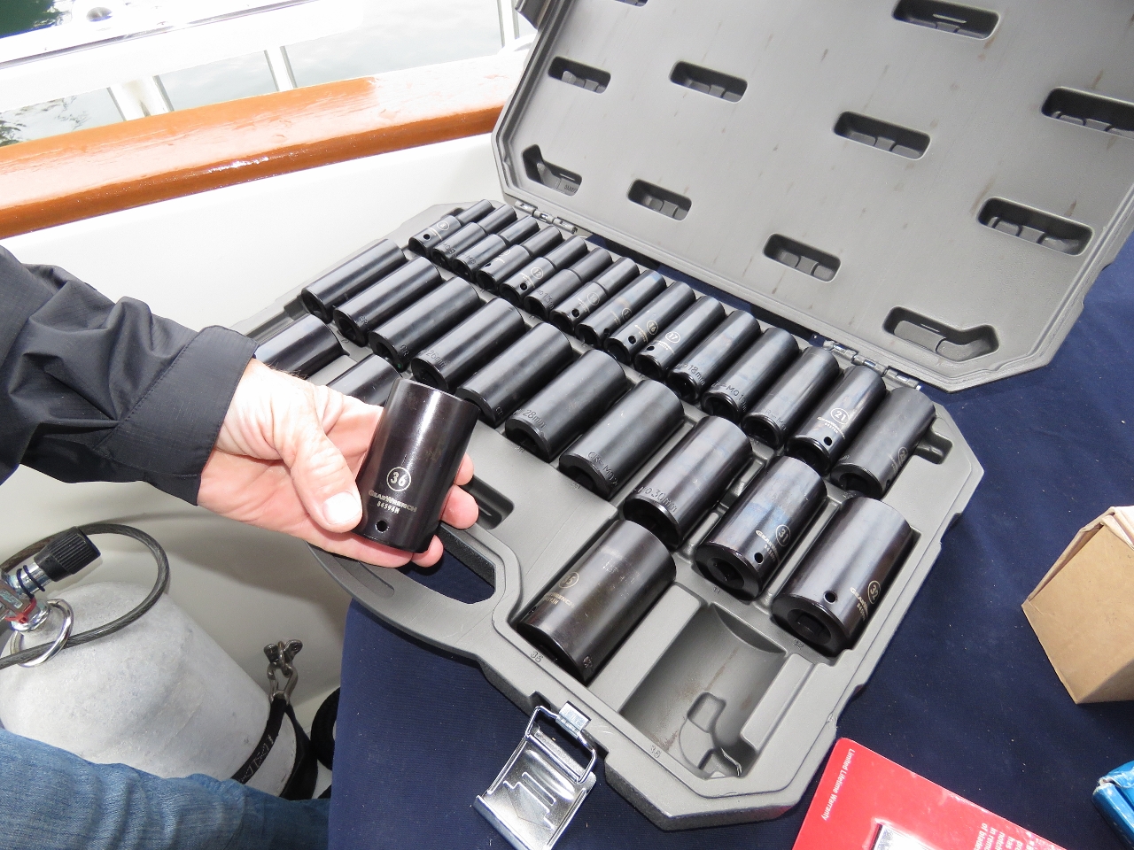 |
9/23/2016: More Sockets
Position: 44°16.47'N, -68°19.30'W
We also got a set of large 1/2-inch-drive deep sockets ranging from 8mm to 36mm.
|
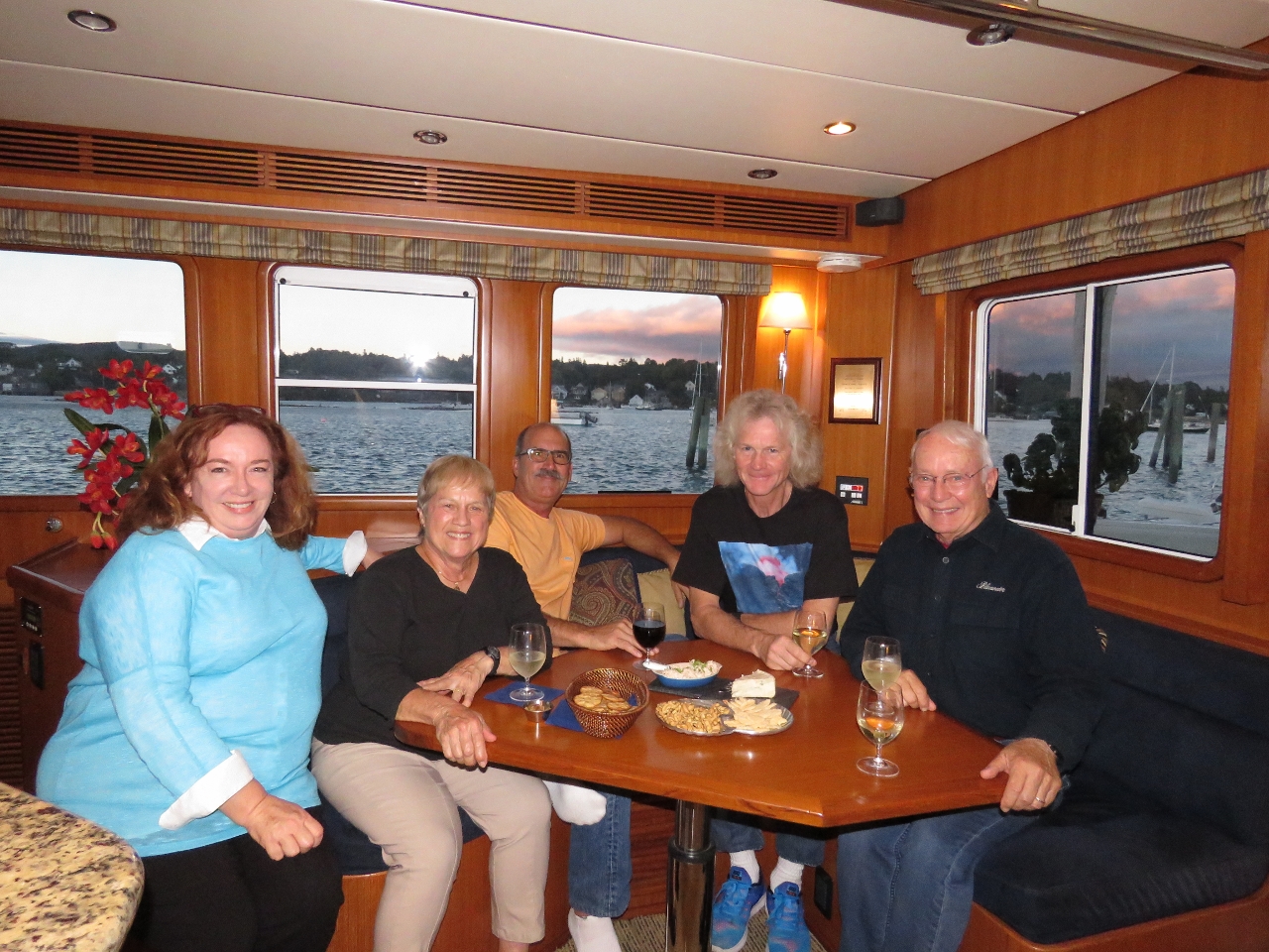 |
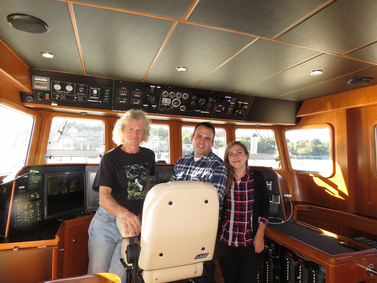
9/23/2016: Nordhavn Gathering
Position: 44°16.47'N, -68°19.30'W
We're moored right in front of Nordhavn 47 Bluewater and across from Nordhavn 68 Grace of Tides and all got together on Bluewater that evening. Milt and Judy Baker of Bluewater are wearing dark shirts and Dee and Jerry Fraelic of Grace of Tides are seated leftmost and center. It was great to meet Dee and Jerry, and to see Milt and Judy again—we last saw them back in 2011 when they dropped by to visit us on Dirona in Seattle.
|
 |
9/24/2016: Morning Sun
Position: 44°16.47'N, -68°19.30'W
The morning sun lighting up the shore above Dysart's Great Harbour Marina. The location is beautiful and we've very happy to be here. It's only been two months, but we were suffering from severe Amazon Prime withdrawal symptoms.
|
 |
9/25/2016: Thermal Switch
Position: 44°16.47'N, -68°19.30'W
Among the packages waiting for us was a new thermal fuse for our dryer that had failed while we were in Newfoundland. The thermal fuse is a safety feature required for US dryers to prevent the dryer from overheating. Unfortunately the fuse is not resettable and we didn’t have a spare. Steve Coleman had a great suggestion of replacing the fuse with a manually-resettable one so we don't have to replace the entire fuse if it trips again. On the left is the old fuse and on the right is our fancy new manually-resettable fuse. We left a small hole open in the back of the dryer panel after installing the new fuse and now we can just remove the panel at the back of the wet locker and press the button if the fuse ever trips again.
|
 |
9/25/2016: Low Tide
Position: 44°16.47'N, -68°19.30'W
The Gulf of Maine is home to the largest range in tidal ranges on the planet. In the Bay of Fundy, just north of the Maine coast, the tidal range is an astonishing 50 feet. The maximum tidal range in Maine is only about half that, and is about 13ft at nearby Bar Harbor. We've so far seen an 11.8ft range, with a high tide of 18.4ft and a low tide of 6.6ft on -0.1 and -0.2 low tides. That's exactly our draw, so we don't want any less than that. That does mean we'll need to move by October 14th when the low tide will hit -0.4 and then -1.4 by the 17th. We save all telemetry every five seconds to a database. That's all navigation equipment data, electrical data, weather system data, and the state of many switches throughout the boat, all saved to the database every five seconds and kept indefinitely. We love having that data. We'd only noticed a minimum depth of about 7.5ft in glancing at the Maretron display in passing, but a quick database query showed nearly a foot less than that.
|
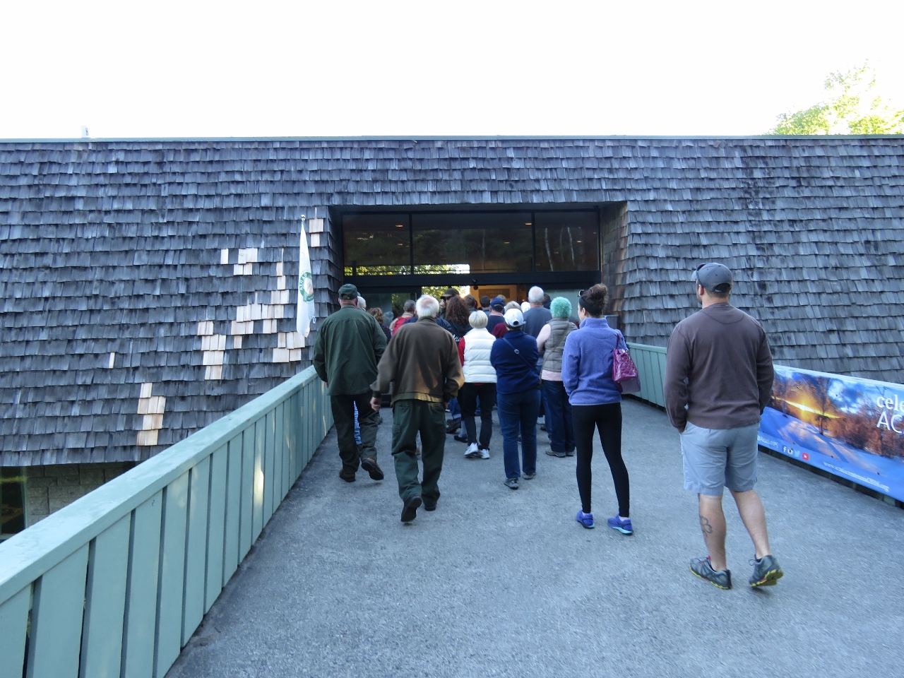 |
9/26/2016: Visitors Center
Position: 44°24.50'N, -68°14.76'W
The forecast for today was clear and calm, perfect for a day trip through Acadia National Park. After picking up a rental car, we drove straight to the main visitor center to pickup a park pass. We weren't the only ones to arrive just before they opened at 8:30am. Fortunately we were processed quickly and underway within fifteen minutes.
|
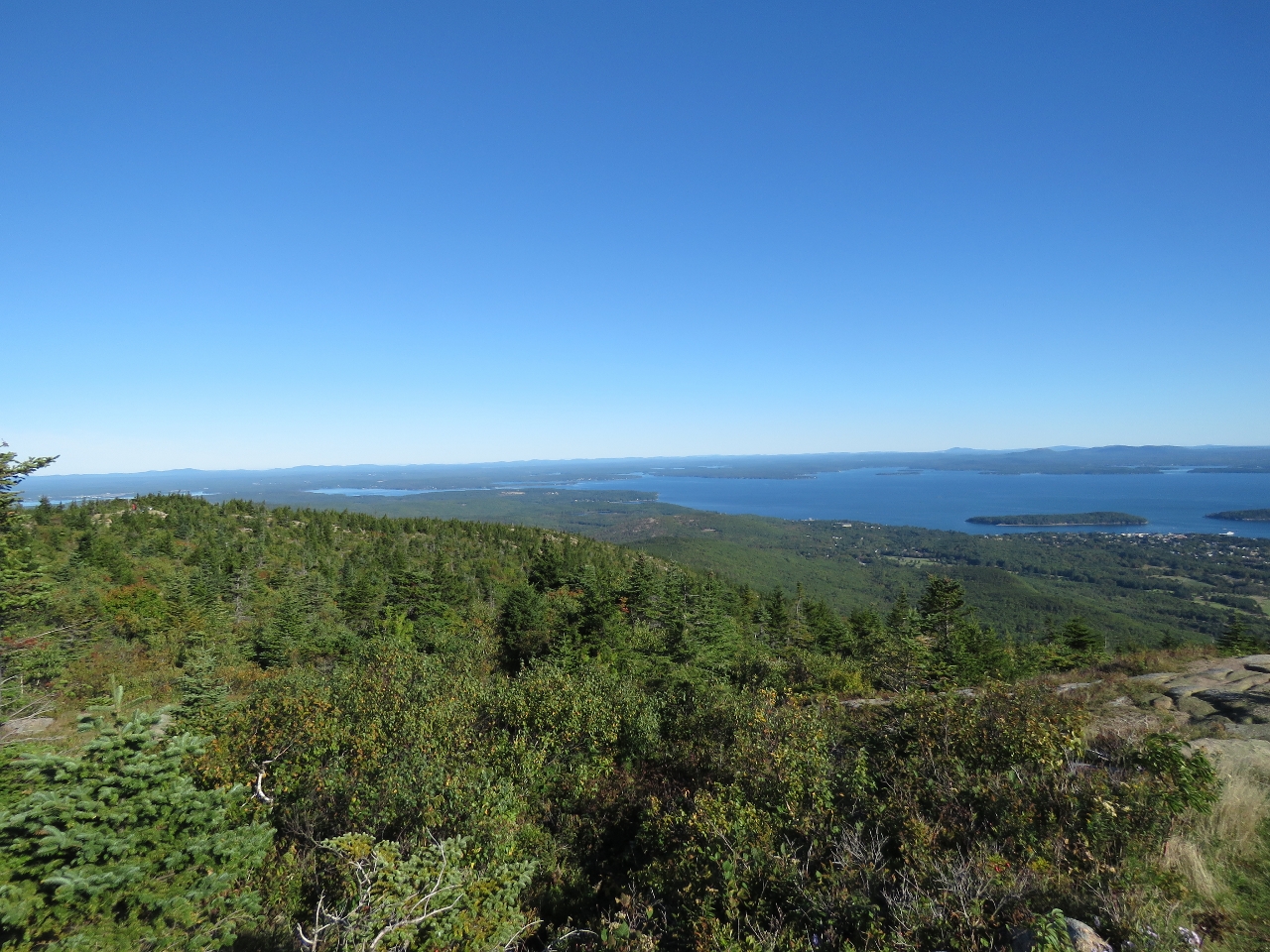 |
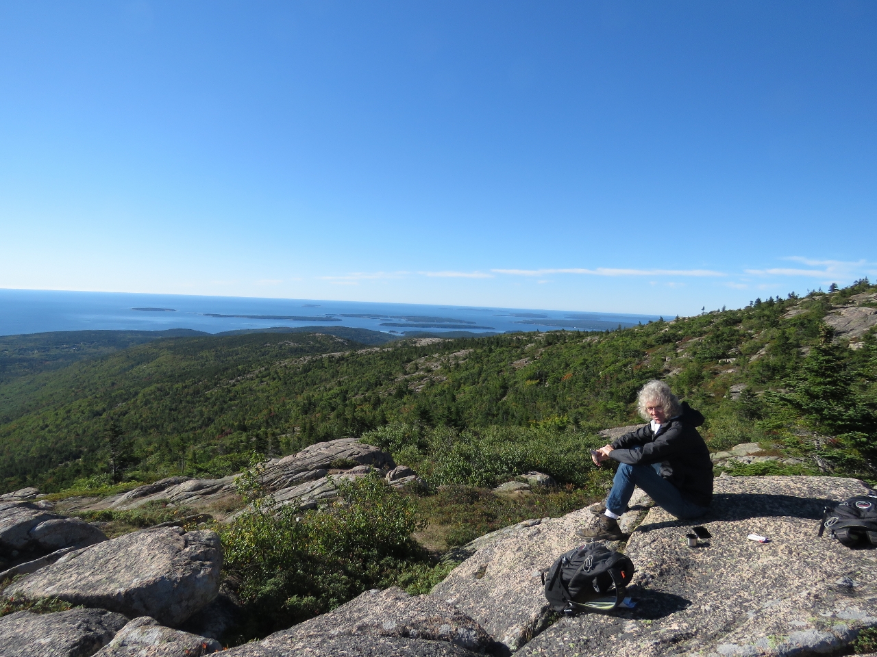
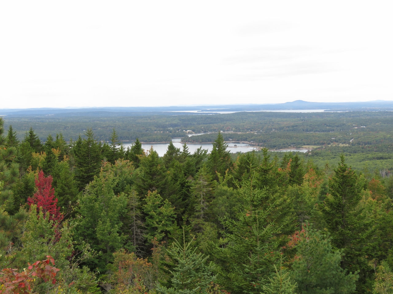
9/26/2016: Cadillac Mountain
Position: 44°21.19'N, -68°13.42'W
Our first stop in the park was a drive to the top of 1,527ft Cadillac Mountain for a spectacular 360° view of Mount Desert Island. This is view looking north, with the town of Bar Harbor visible on the right.
|
 |
9/26/2016: Breakfast
Position: 44°21.08'N, -68°13.42'W
We had a late breakfast along the eastern slope. The Cranberry Islets are in the distance to the south.
|
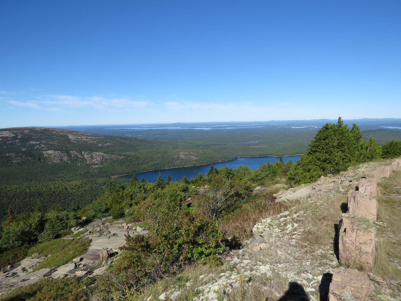 |
9/26/2016: Eagle Lake
Position: 44°20.93'N, -68°13.84'W
The view looking northwest across Eagle Lake as we descend from Cadillac Mountain. Mt Desert Narrows, between Mt Desert Island and the mainland, is visible in the distance.
|
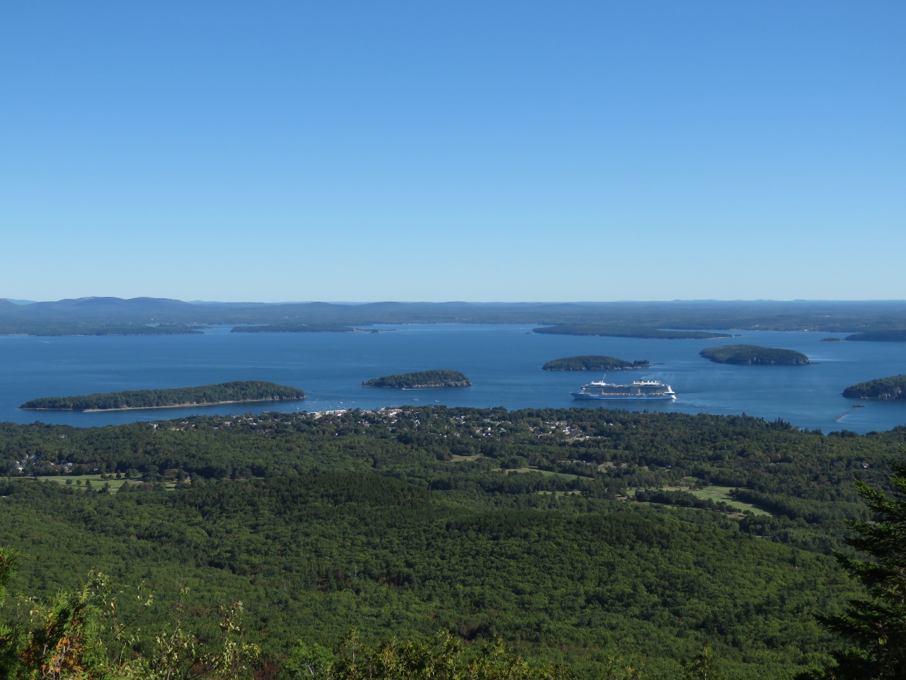 |
9/26/2016: Bar Harbor
Position: 44°21.35'N, -68°13.70'W
A view to Bar Harbor from the Cadillac Mountain road with the cruise ship Anthem of the Seas moored offshore. Bar Harbor is a popular cruise ship destination—two passed us overnight en route while we were underway for Maine.
|
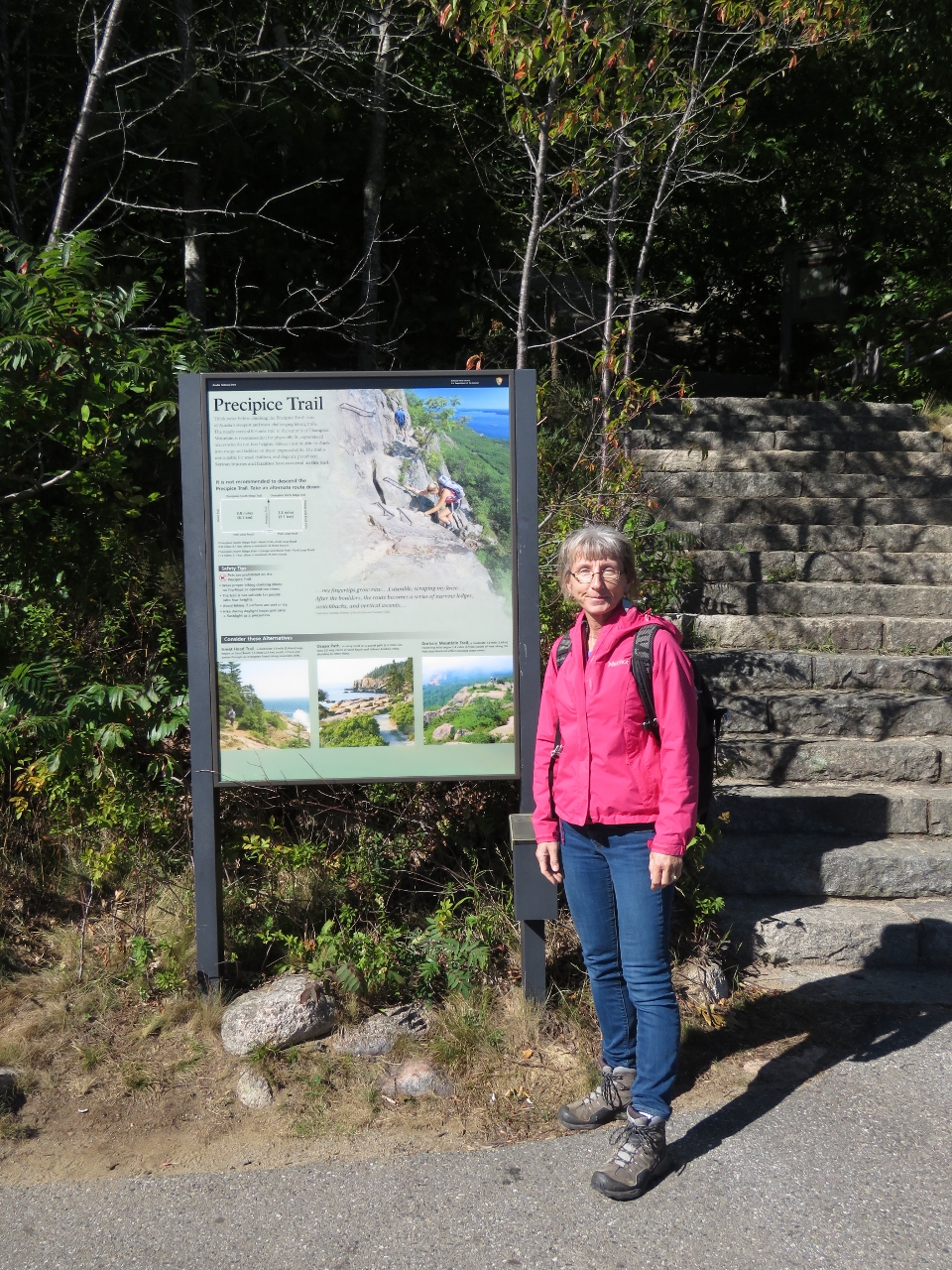 |
9/26/2016: Precipice Trailhead
Position: 44°20.97'N, -68°11.30'W
At the trailhead for the famous Precipice Trail that leads to the top of 1058ft Champlain Mountain. The near-vertical trail with climbing rungs and ladders throughout to help thorough the many steep sections. The trail is so steep, and has so much foot traffic, that the sign recommends following one of several alternate routes back down.
|
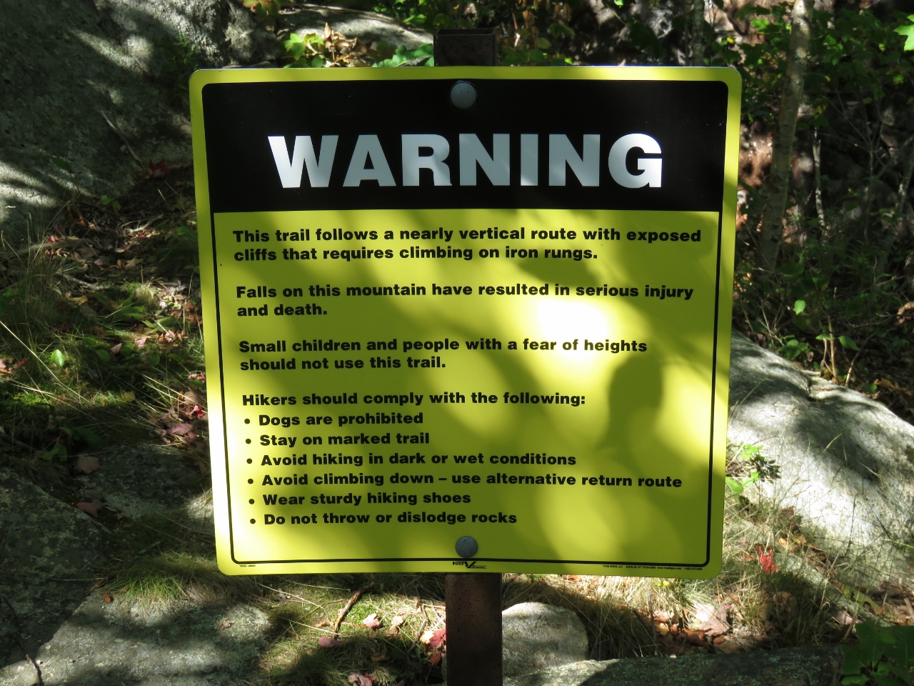 |
9/26/2016: Warning
Position: 44°20.96'N, -68°11.33'W
Several warning signs like this were along the Precipice Trail. The first two sentences read "This trail follows a nearly vertical route with exposed cliffs that require climbing on iron rungs. Falls on this mountain have resulted in serious injury and death." The trail wasn't that difficult—we've climbed worse in Newfoundland.
|
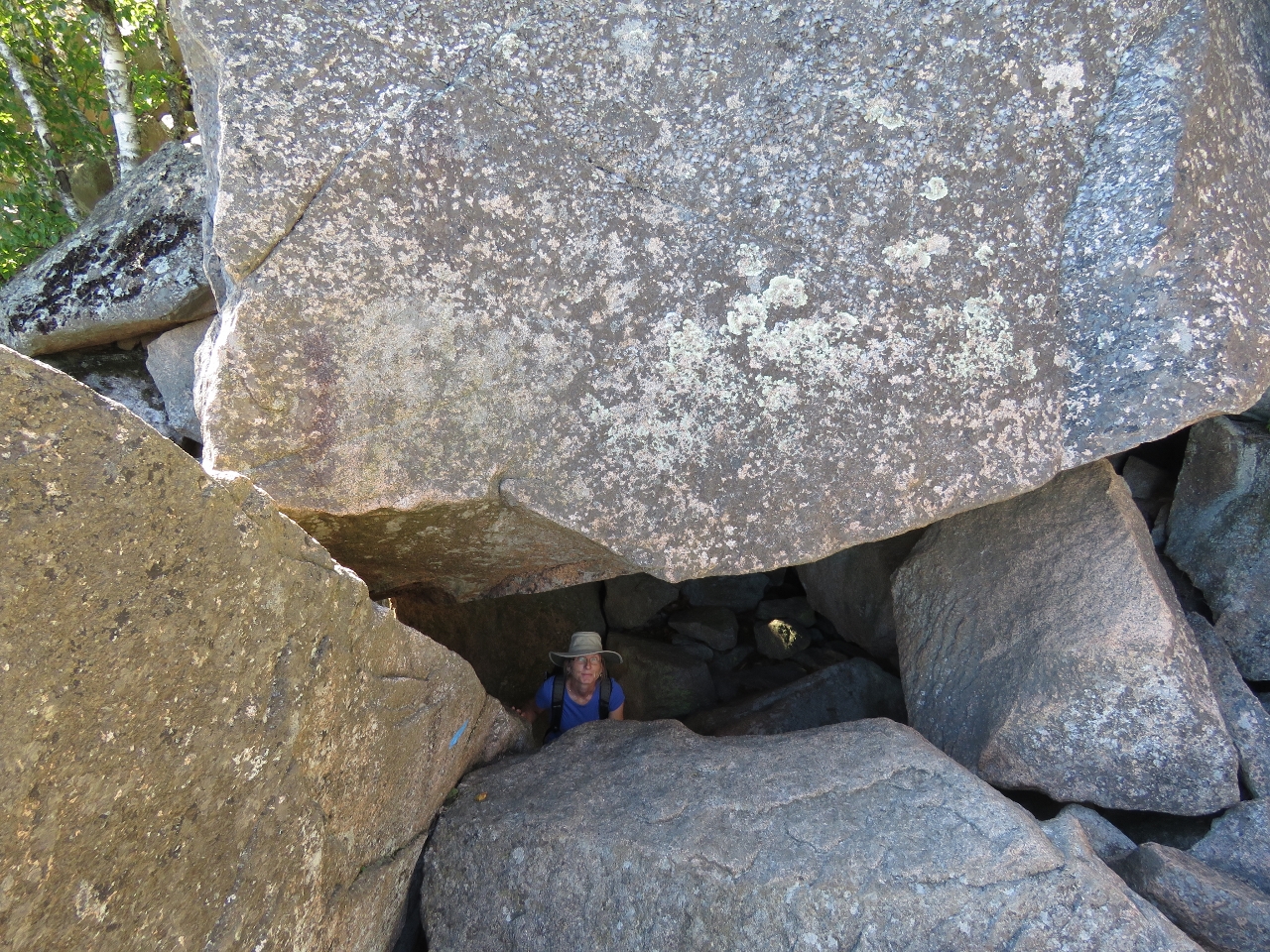 |
9/26/2016: Under the Rock
Position: 44°20.99'N, -68°11.41'W
At one point, the trail passes under this huge boulder.
|
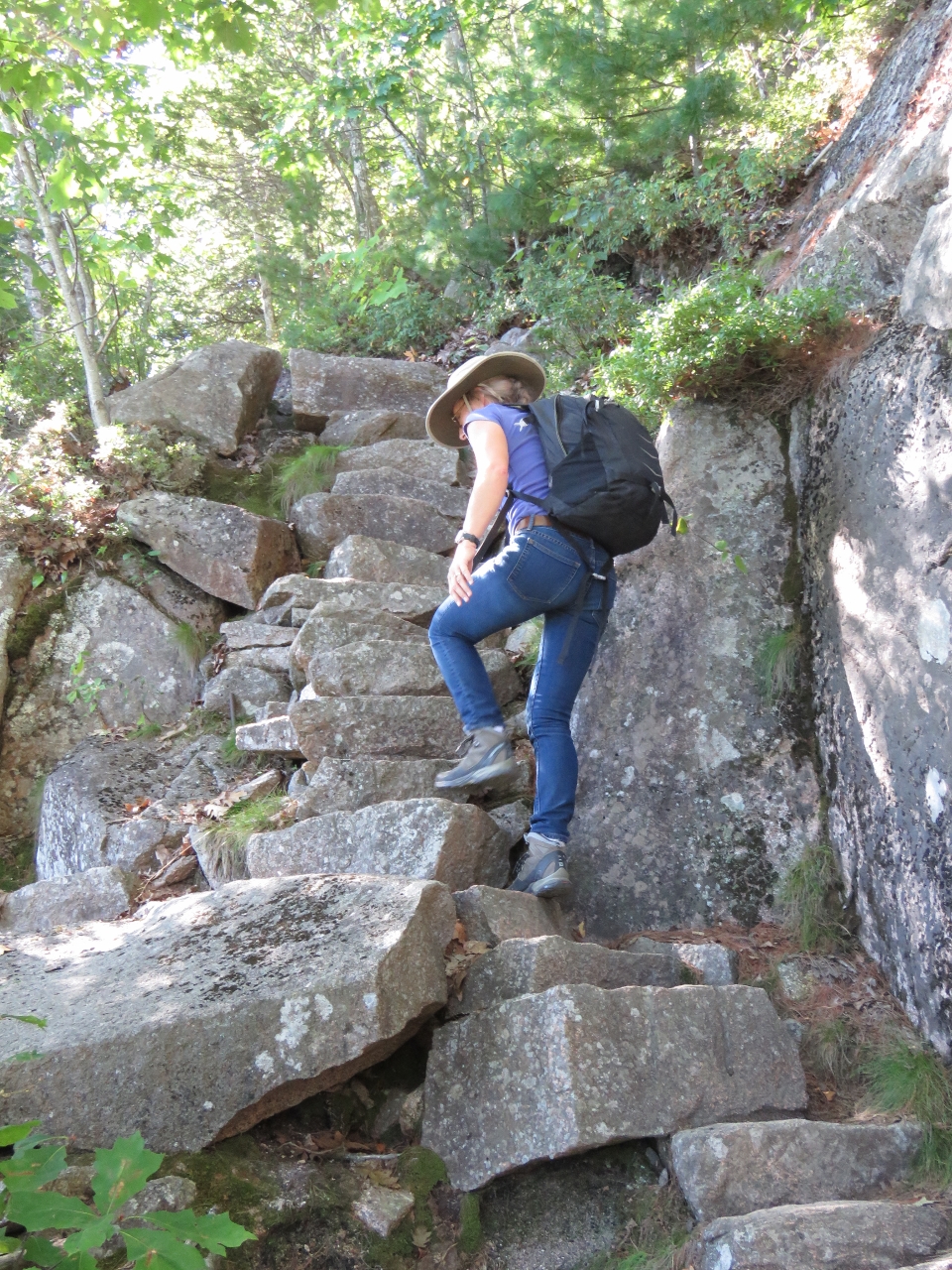 |
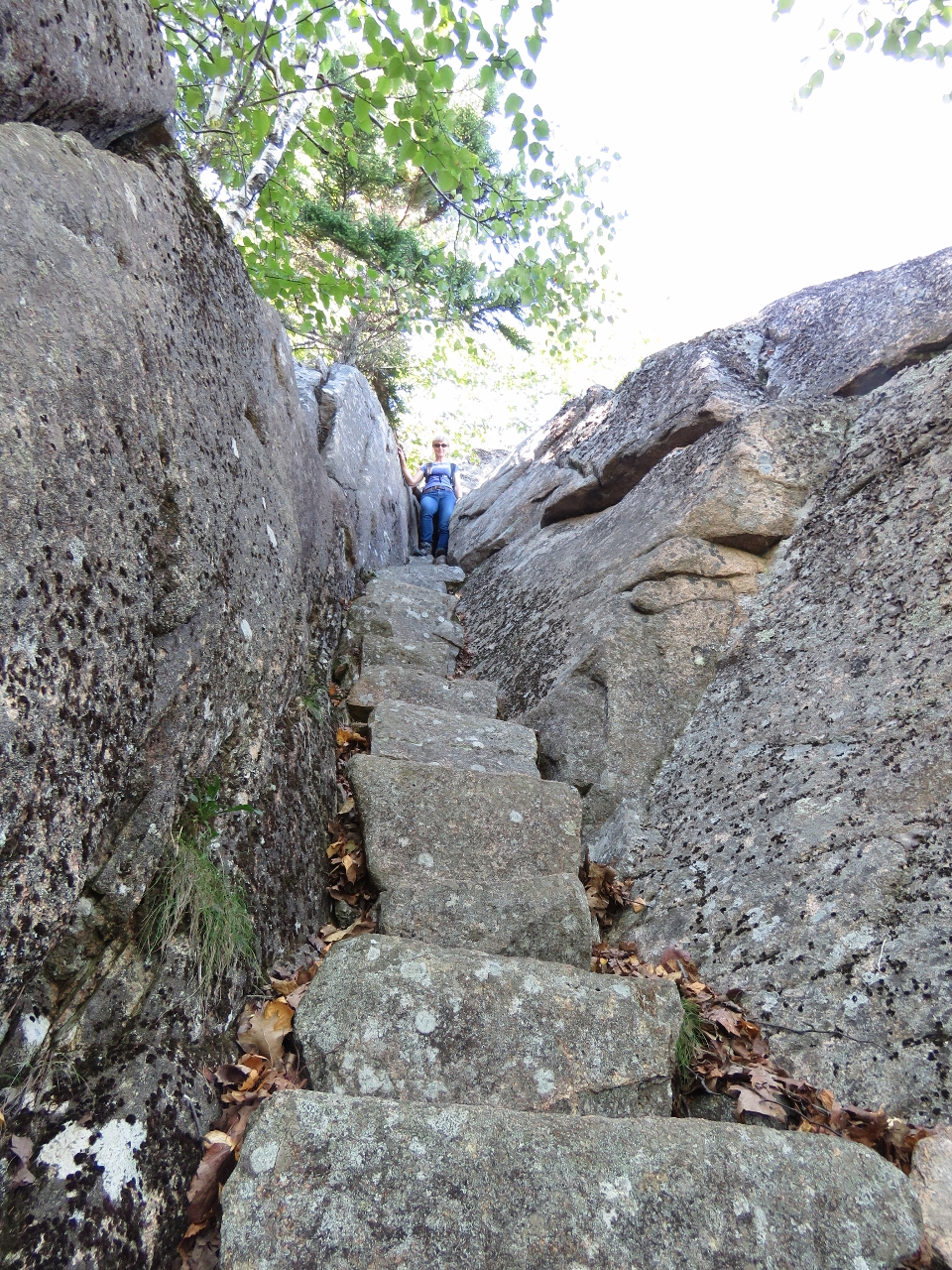
9/26/2016: Steps
Position: 44°21.00'N, -68°11.46'W
The Precipice Trail, like every trail we followed in Acadia, is incredibly well-built. Here Jennifer is climbing one of several beautifully-constructed stone staircases.
|
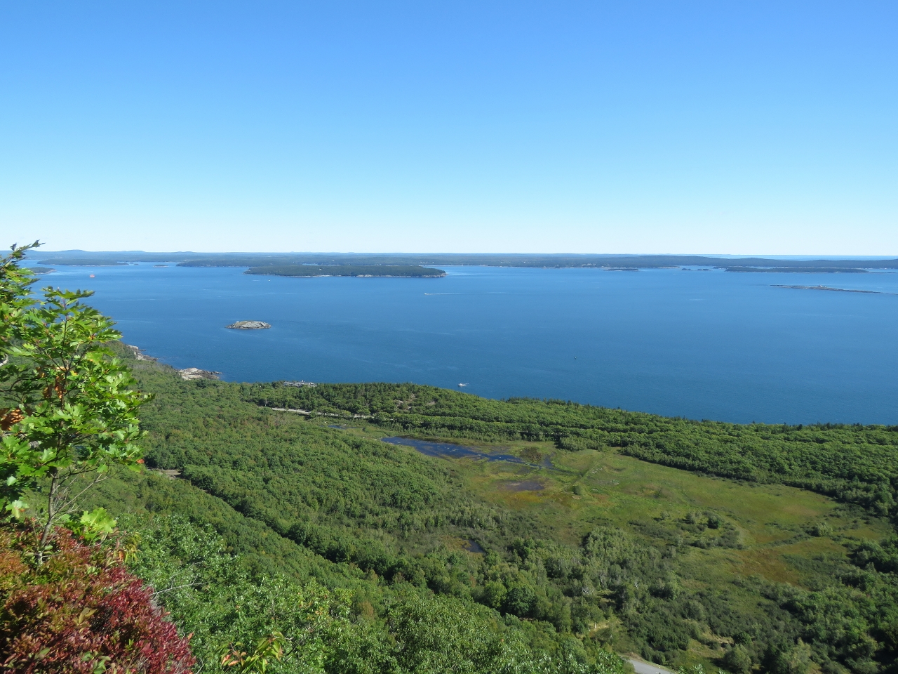 |
9/26/2016: View
Position: 44°20.98'N, -68°11.47'W
The fabulous view from partway up the Precipice Trail looking northeast toward Frenchman Bay and the eastern end of Mt. Desert Narrows.
|
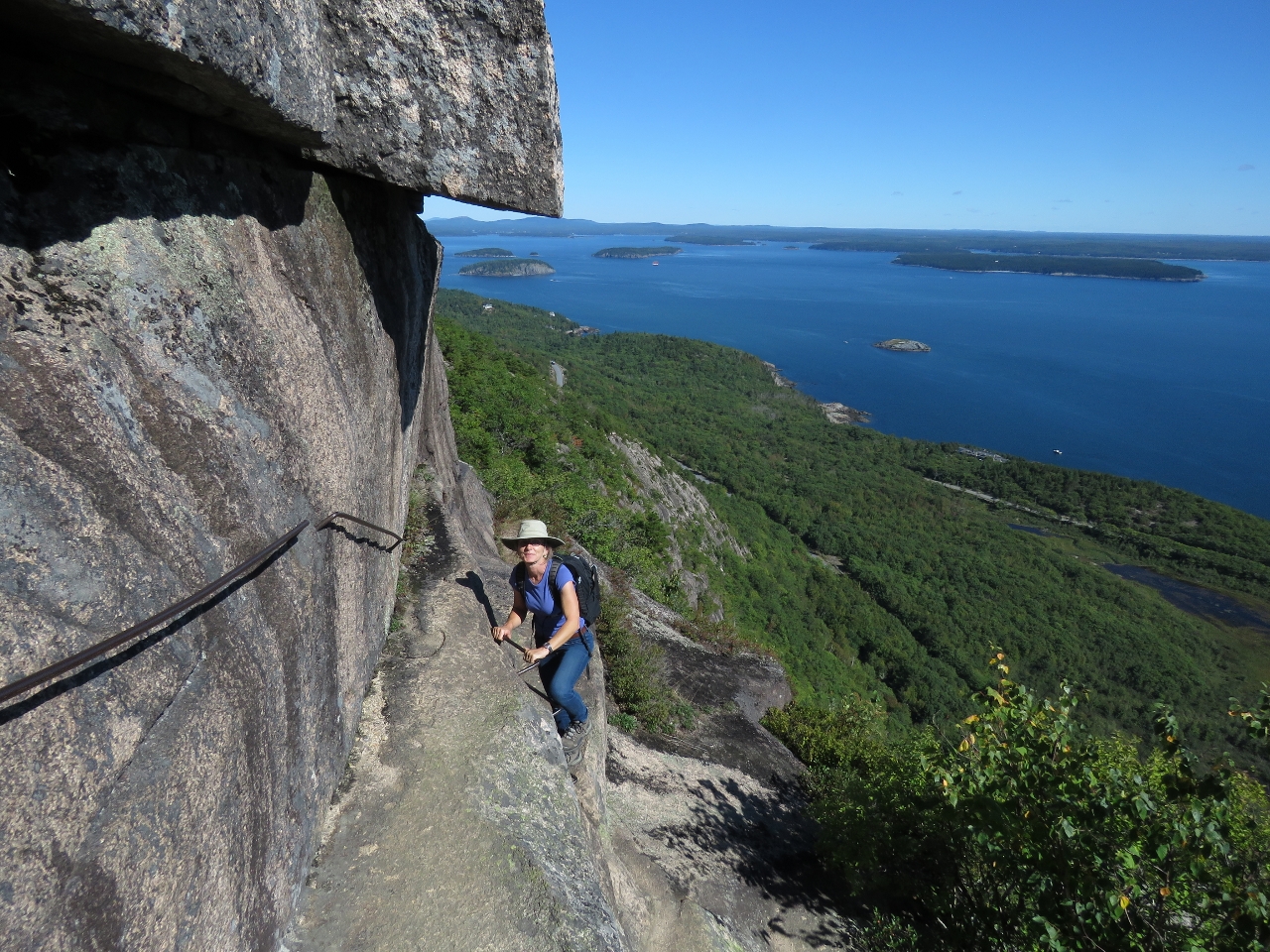 |
9/26/2016: Climbing the Edge
Position: 44°20.99'N, -68°11.49'W
If you have a fear of heights, this is not the trail for you. But it was a fun and exciting climb, with astonishing views along the way. Overall the trail wasn't as difficult as we were expecting. The dangerous portions always had handholds.
|
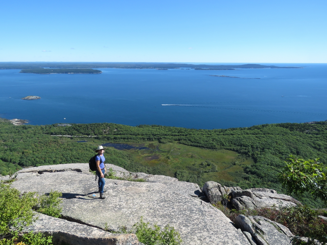 |
9/26/2016: Champlain Mountain
Position: 44°21.00'N, -68°11.53'W
The sweeping view east from the top of 1058ft Champlain Mountain.
|
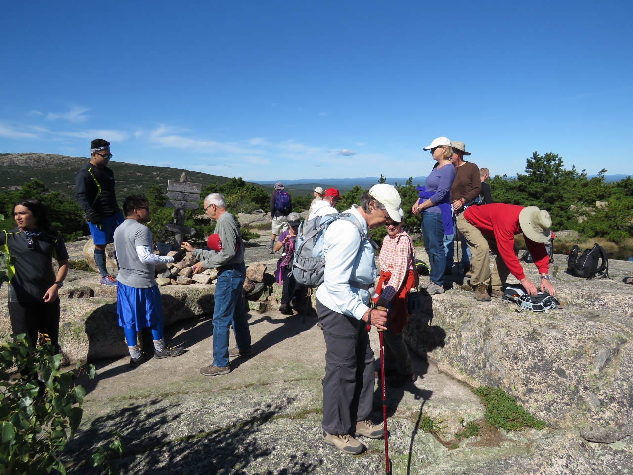 |
9/26/2016: Crowds
Position: 44°21.06'N, -68°11.63'W
Severals trails lead to the top of Champlain Mountain, so not all these people came up the Precipice Trail. But our trail was surprisingly busy given the relative difficulty and how late we were in the seasoon. The parking lot at the trailhead was full and we passed several groups on the way up.
|
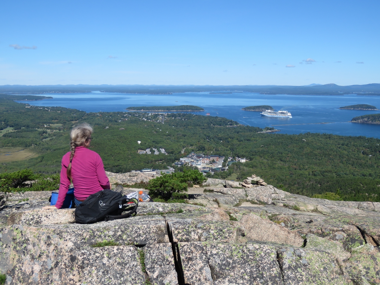 |
9/26/2016: Lunch
Position: 44°21.14'N, -68°11.65'W
Lunch with a view to Bar Harbor from the top of Champlain Mountain.
|
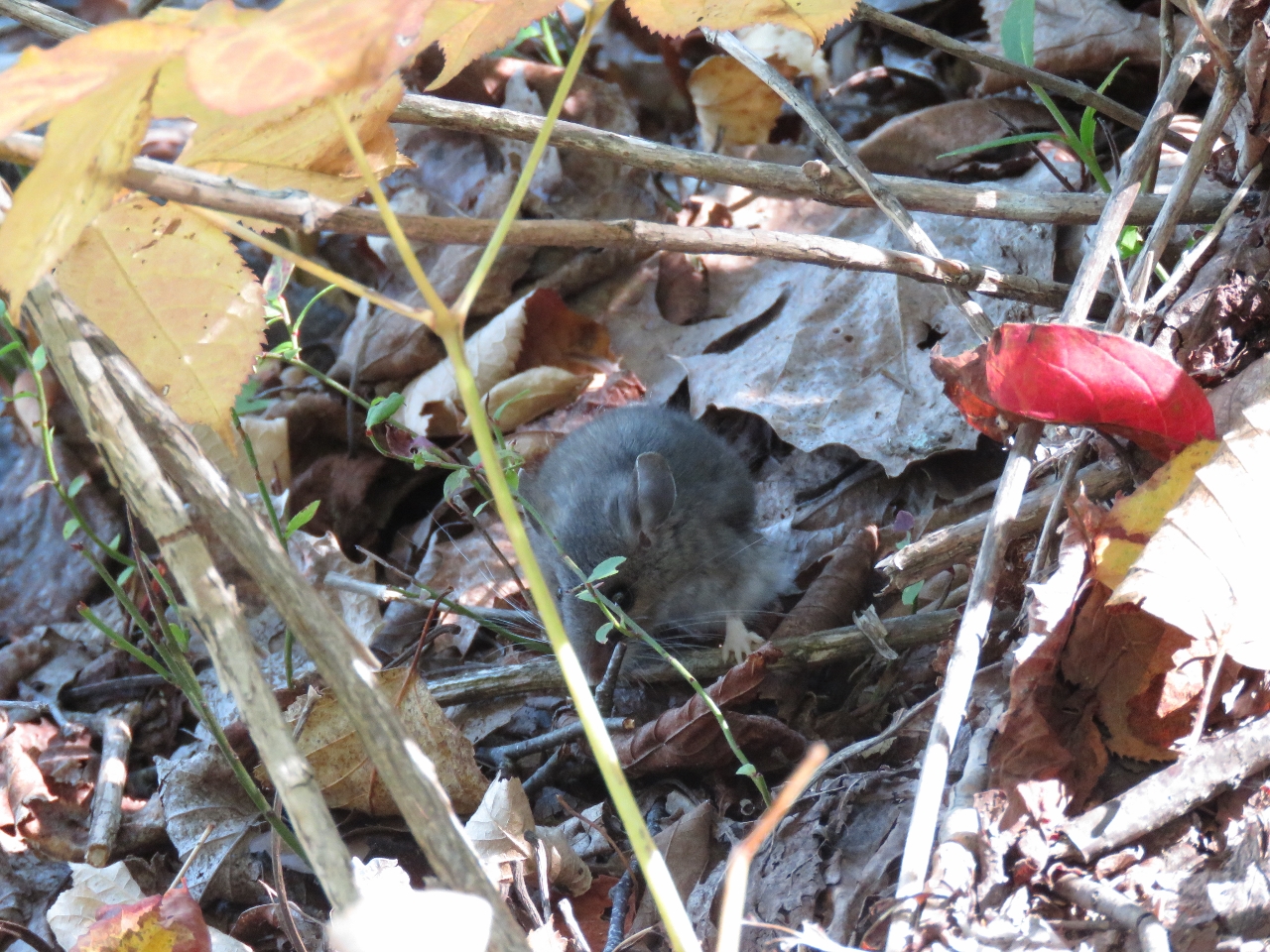 |
9/26/2016: Mouse
Position: 44°21.34'N, -68°11.45'W
We passed this tiny mouse on the Orange & Black trail back to the car.
|
 |
9/26/2016: Orange & Black Trail
Position: 44°21.32'N, -68°11.41'W
The Orange & Black goes up and down through several sets of granite stairs like this one. We were really impressed with the quality of the trail.
|
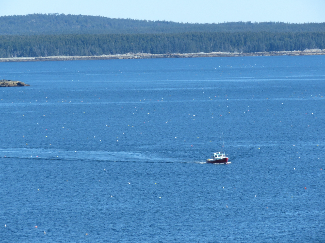 |
9/26/2016: Floats
Position: 44°20.39'N, -68°10.65'W
The view to sea from the Schooner Head Overlook. At first we thought all those dots in the water were birds, but they are lobster floats. Boating in Maine requires a fair amount of attention at the helm.
|
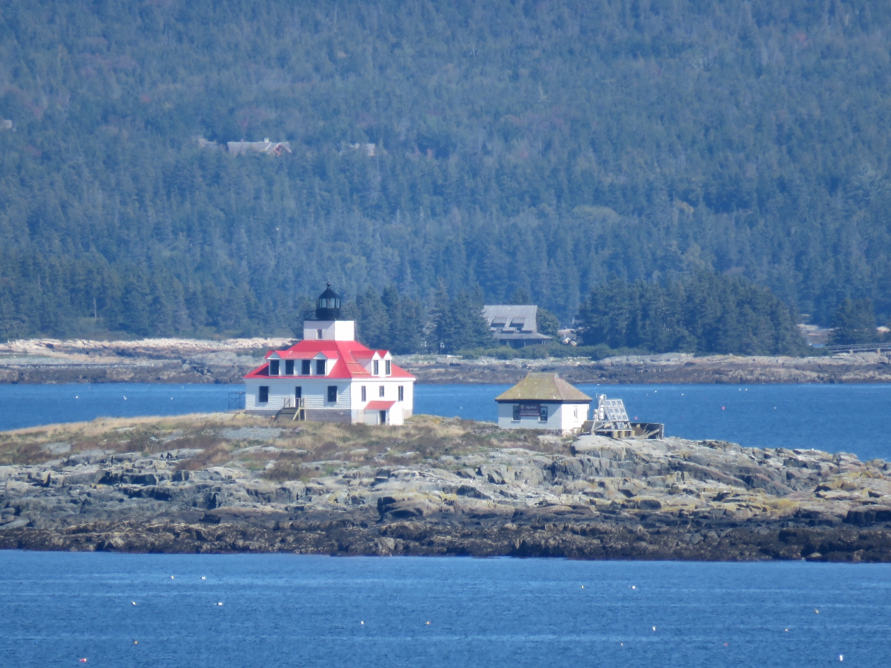 |
9/26/2016: Egg Rock Lighthouse
Position: 44°20.39'N, -68°10.65'W
A view to the Egg Rock Lighthouse from the Schooner Head Overlook. The light was first lit in 1875 and now is automated.
|
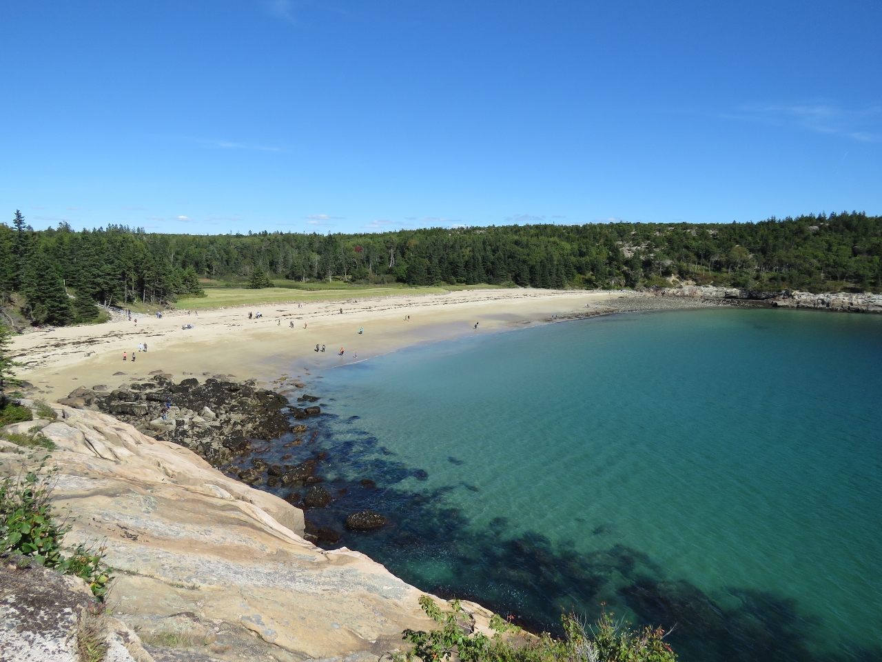 |
9/26/2016: Sand Beach
Position: 44°19.68'N, -68°11.07'W
Sand Beach, being one of the few beaches in the area, is exceedingly popular in the summer. The water is 60°F at best and too cold for most people to swim, but lots will go there to sun on the beach and finding parking in the summer is a real challenge. We viewed it from afar from a lookout along the Ocean Path trail.
|
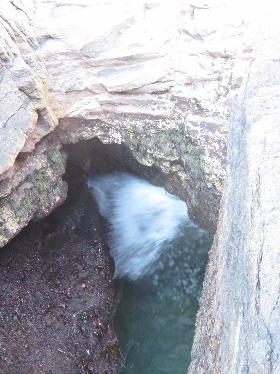 |
9/26/2016: Thunder Hole
Position: 44°19.24'N, -68°11.31'W
In big seas and storms, water surges into Thunder Hole and air trapped in a small cave at the head escapes with a thunderous boom. It was pretty tame in today's calm conditions. But that didn't stop the masses of people from checking it out. Thunder Hole is one of the most popular attractions in the park.
|
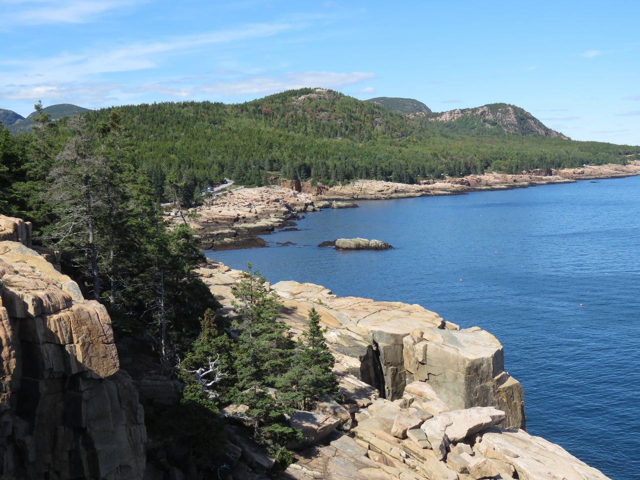 |
9/26/2016: Otter Cliffs
Position: 44°18.68'N, -68°11.35'W
Looking north along Otter Cliffs that rise vertically about 110ft above the sea. Sand Beach is just out of the picture on the right.
|
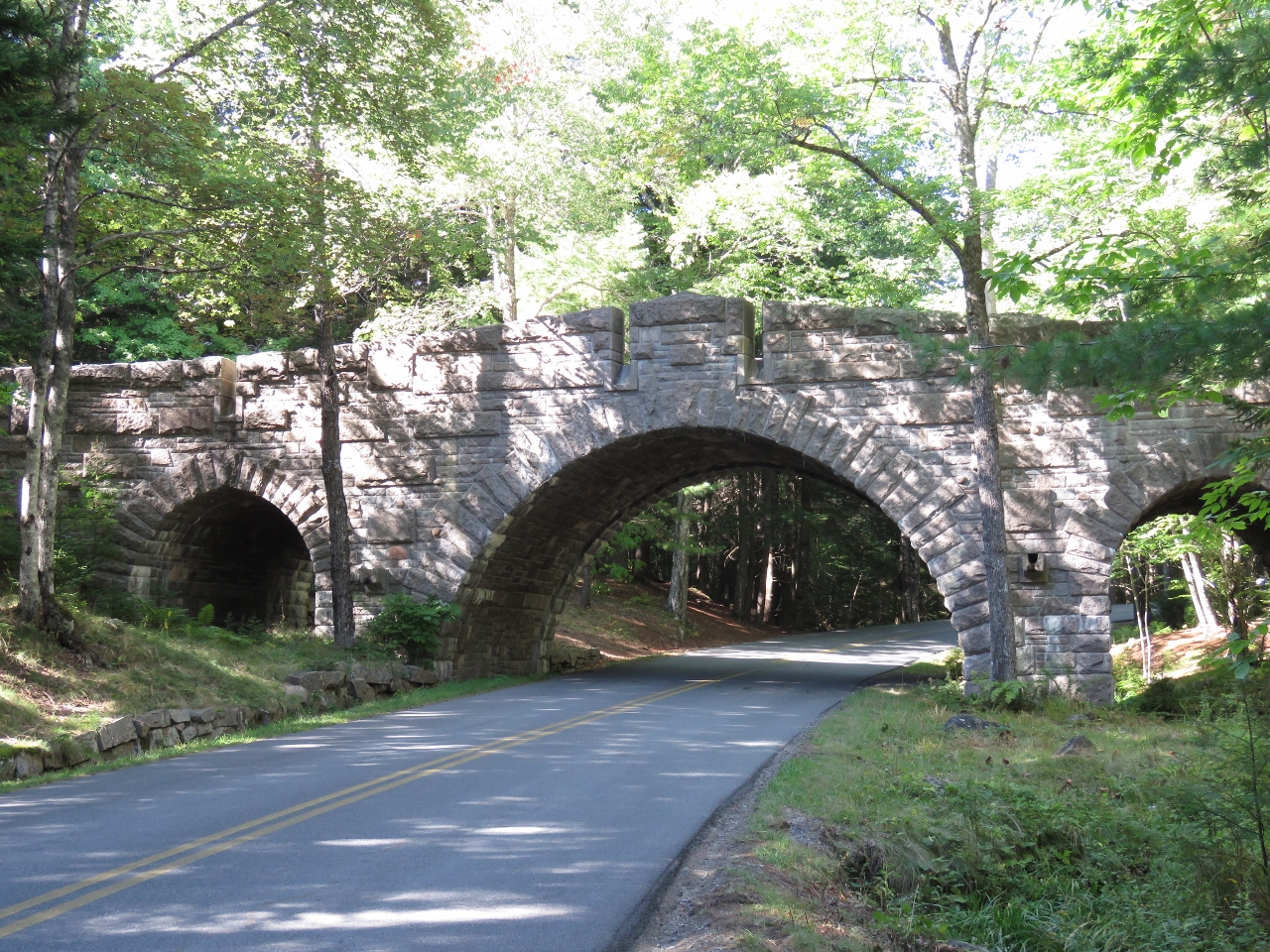 |
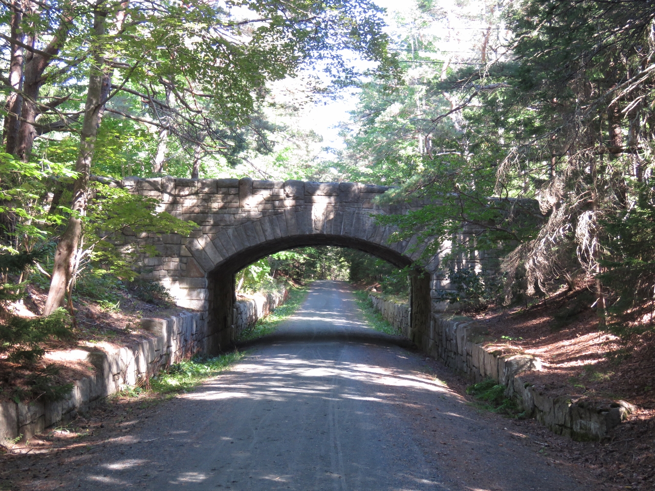
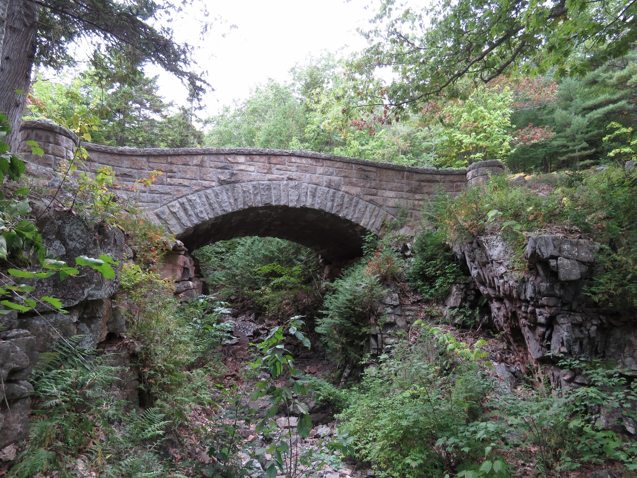
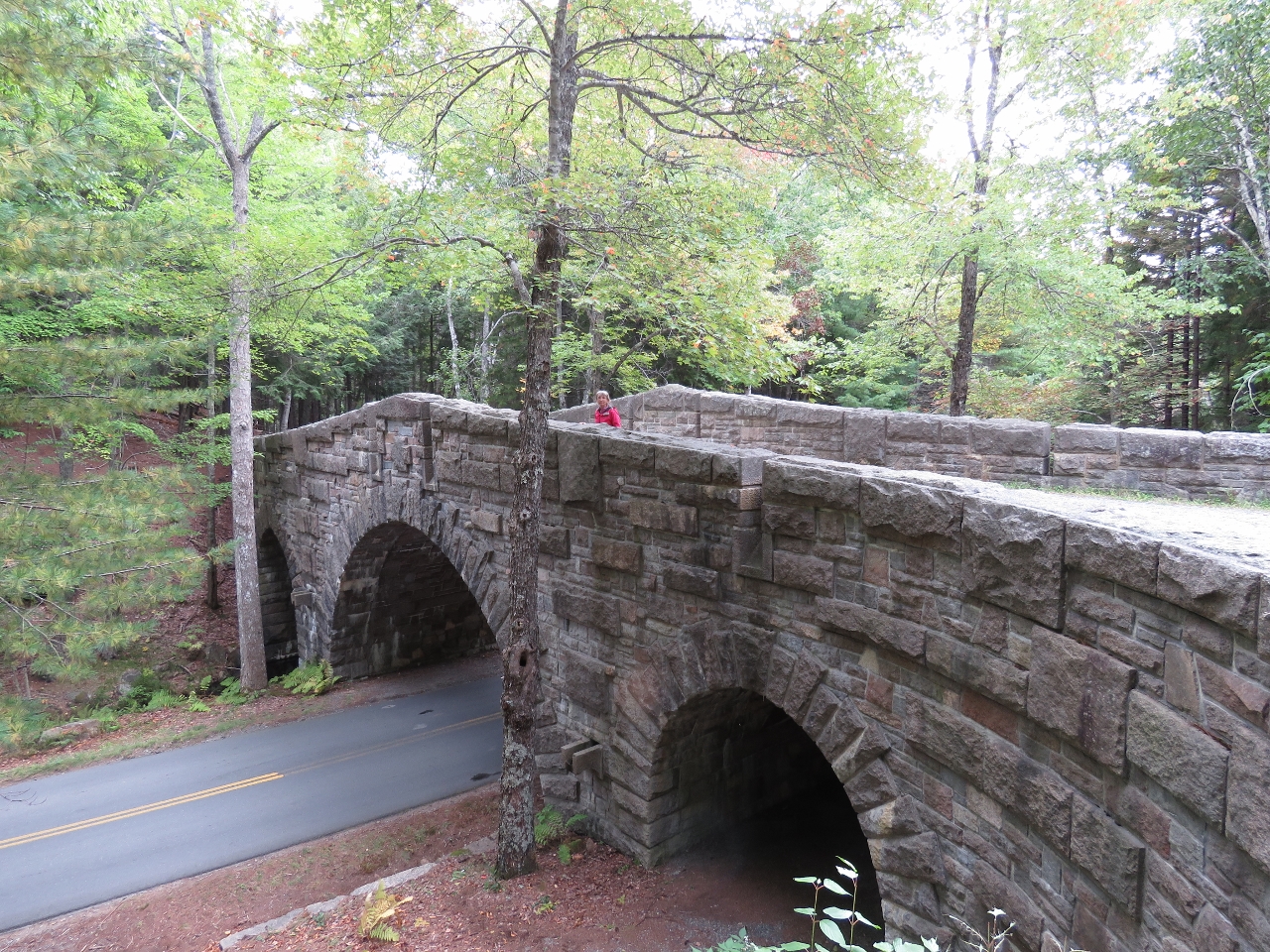
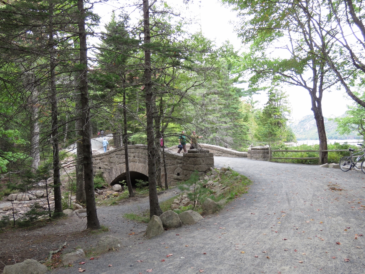
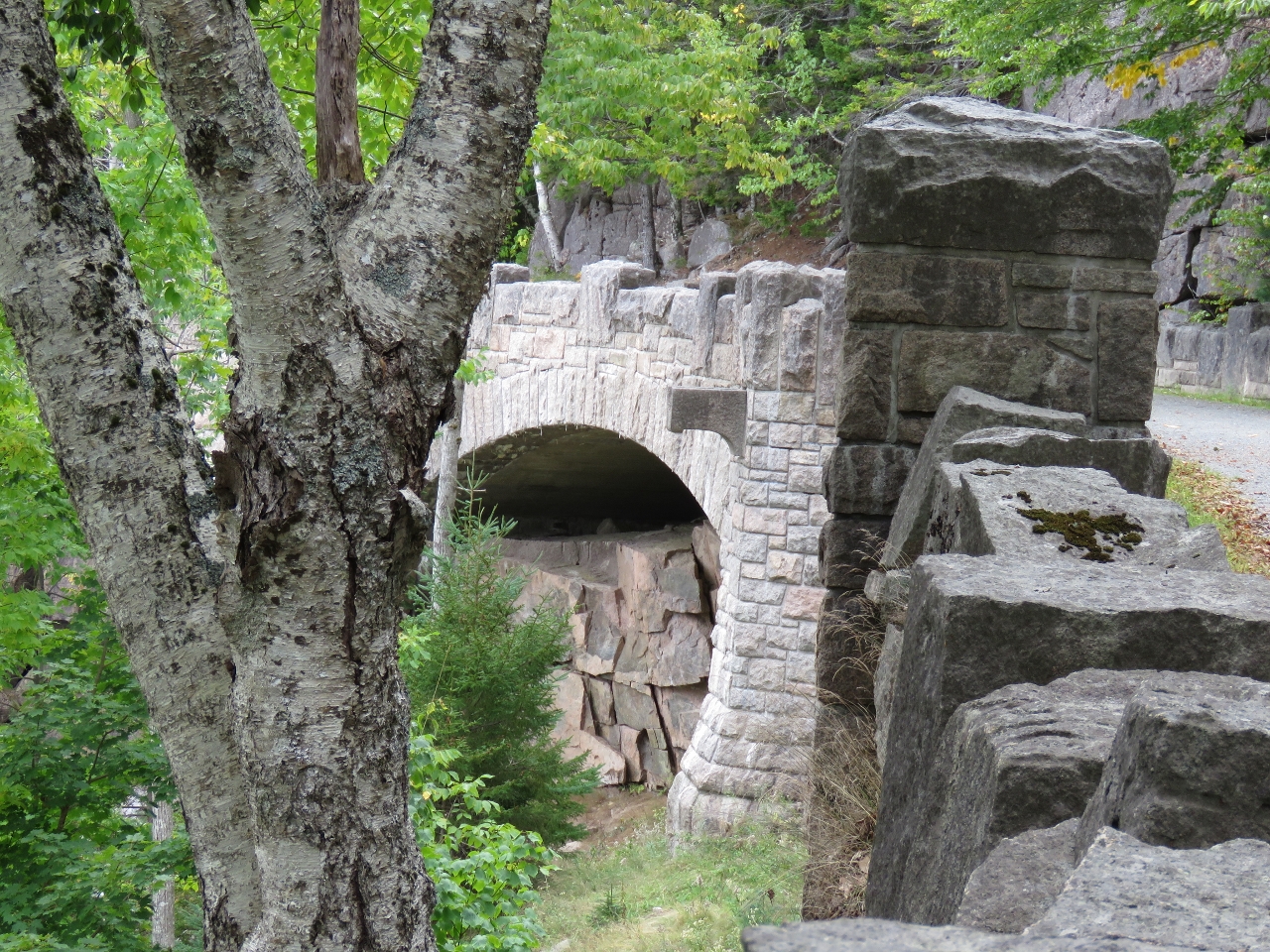
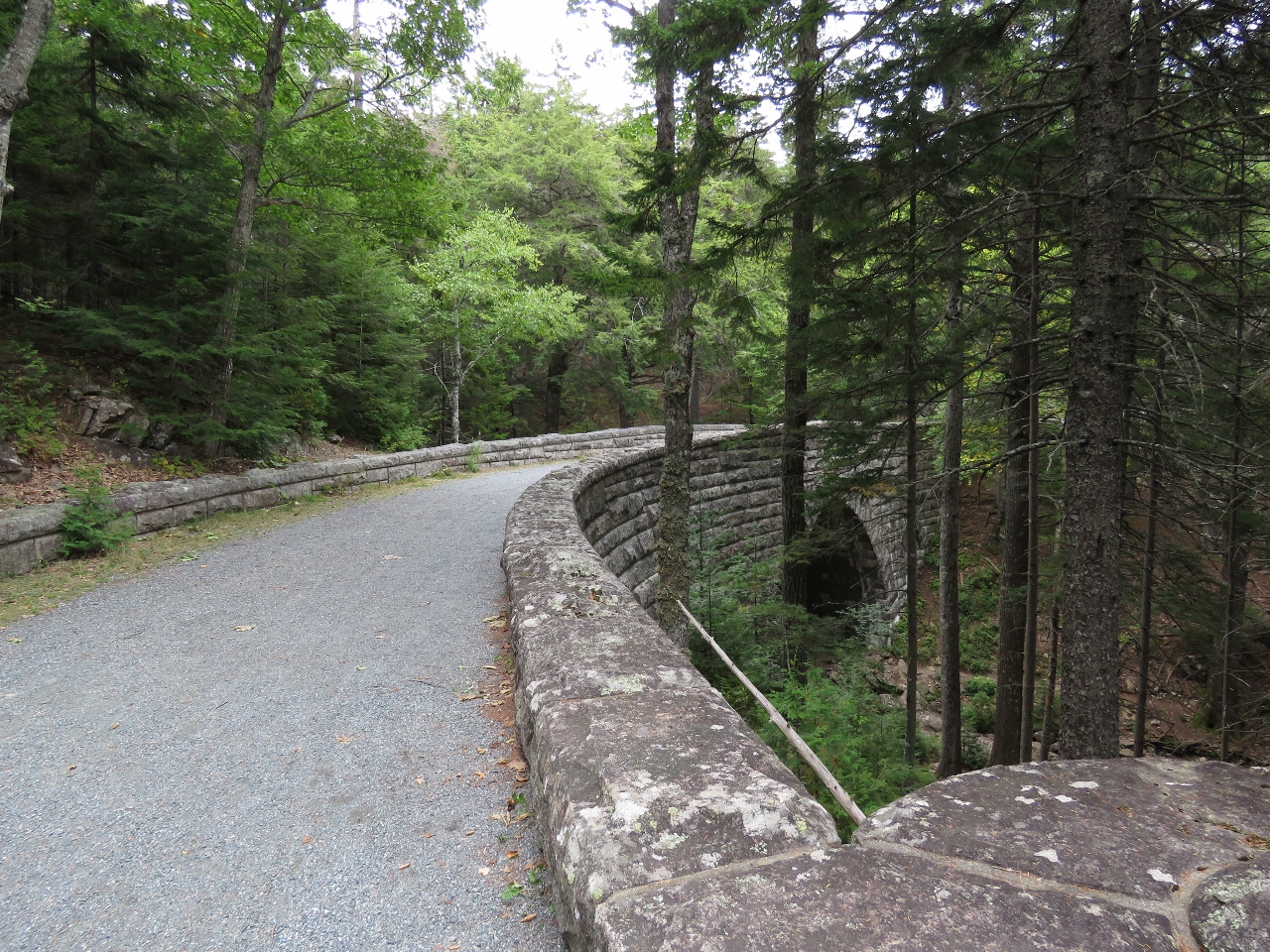
9/26/2016: Stanley Brook Bridge
Position: 44°18.62'N, -68°14.83'W
Between 1913 and 1940, millionaire philanthropist John D. Rockefeller Jr. built 45 miles of carriage trails on Mt. Desert Island. He also financed the construction of 16 stone bridges at gorge and stream crossings. The Stanley Brook Bridge, built in 1933, is the last of the sizteen constructed. The three arches allow traffic, a hiking trail, and the brook to travel underneath.
|
 |
9/26/2016: Jordan Pond Road Bridge
Position: 44°18.57'N, -68°14.74'W
Jordan Pond Road bridge was built in 1932 near the Stanley Brook Bridge and carries Jordan Pond Road over a carriage road.
|
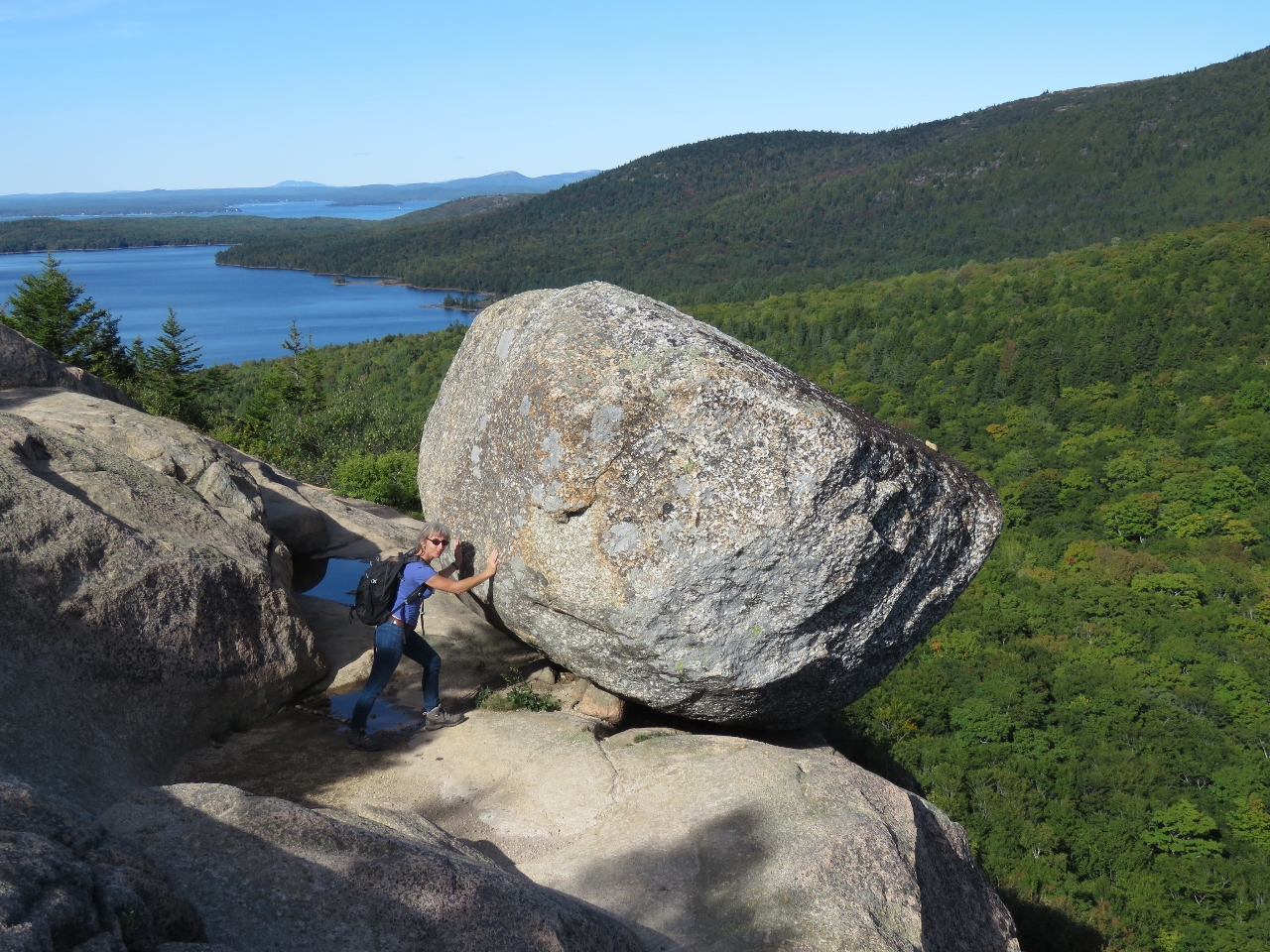 |
9/26/2016: Bubble Rock
Position: 44°20.37'N, -68°15.19'W
We walked the Bubble Rock Trail up to Bubble Rock, a glacial erratic deposited during the Ice Age. Despite Jennifer's best effort, she could not budge the 14-ton boulder. Eagle Lake, that we saw earlier this morning on the Cadillac Mountain road, is visible in the background.
|
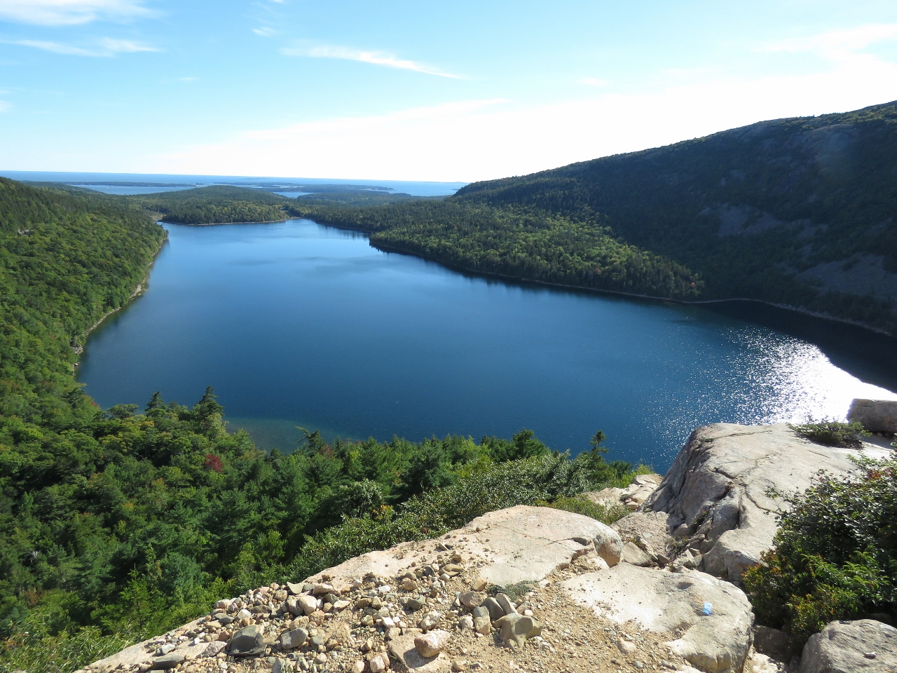 |
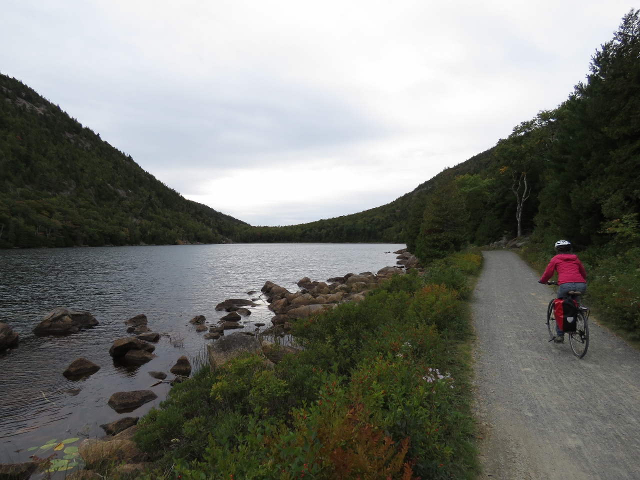
9/26/2016: Jordan Pond
Position: 44°20.26'N, -68°15.23'W
We returned to the parking lot along the South Bubble Track. This is the view looking north across Jordan Pond and out to sea. Acadia is incredibly beautiful—we can see why it is so popular.
|
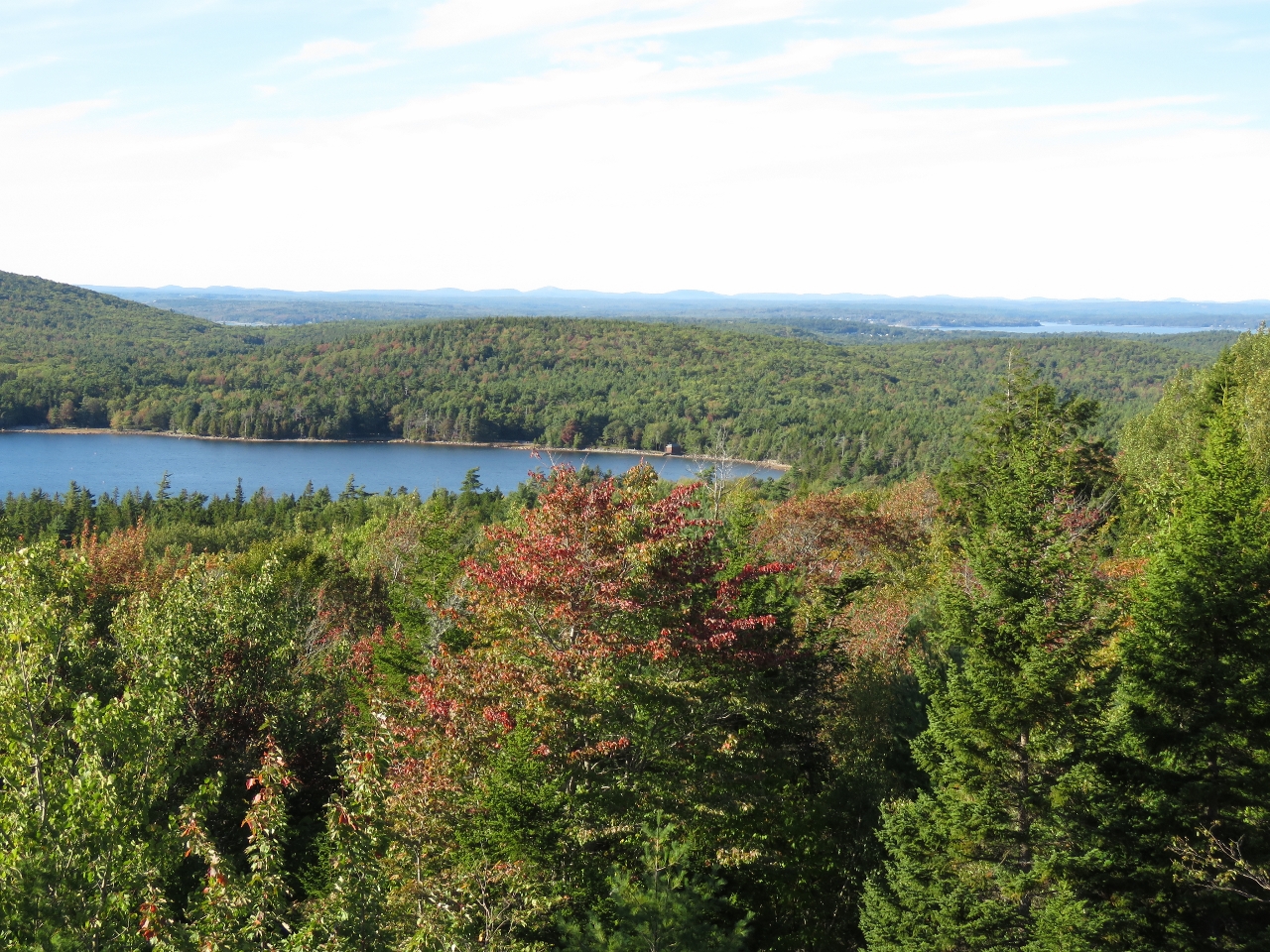 |
9/26/2016: Fall Colors
Position: 44°22.08'N, -68°14.37'W
An overlook to Eagle Lake with some fall colors just starting to show in the leaves.
|
 |
9/26/2016: Eagle Lake Bridge
Position: 44°22.67'N, -68°15.19'W
The graceful arch-shaped Eagle Lake Bridge was built in 1923 at the north shore of Eagle Lake. This and Jordan Pond Road bridge are the only two of the sixteen Rockefeller bridges built to carry car traffic over the carriage roads.
|
 |
9/27/2016: Upper Deck
Position: 44°16.49'N, -68°19.50'W
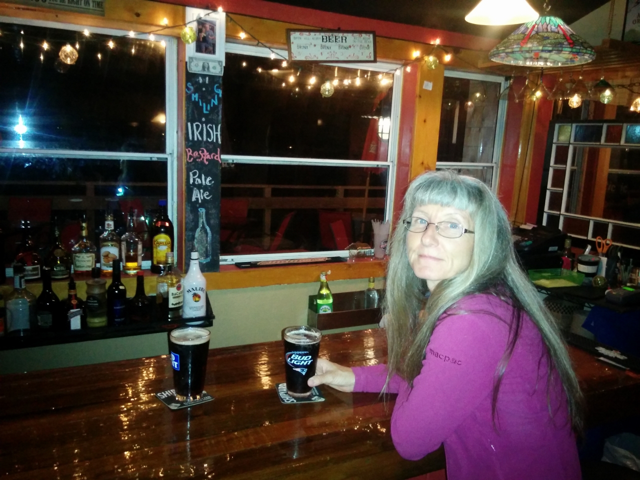
Dinner at the Upper Deck pub overlooking the marina with Real Ale, an English Brown Ale from Altantic Brewing Company of Bar Harbor.
|
 |
9/28/2016: Breakwater
Position: 44°16.47'N, -68°19.30'W
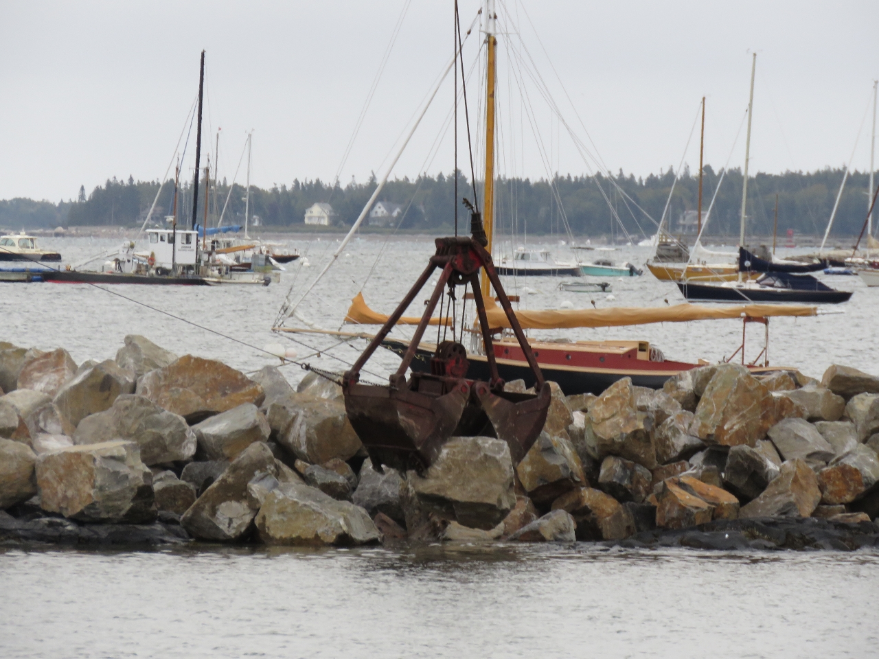
Dropping a rock into place in the new breakwater east of the marina.
|
 |
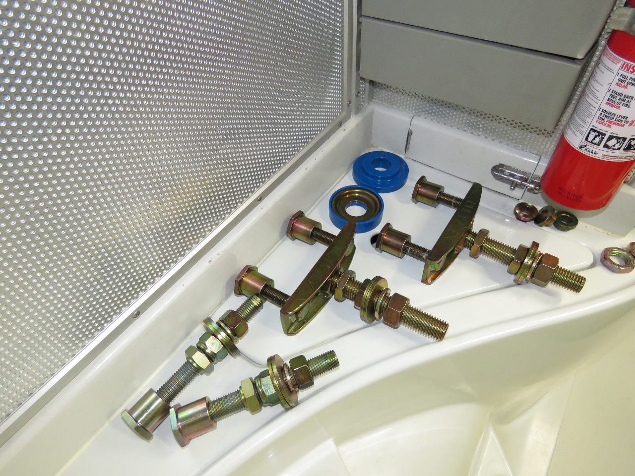
9/28/2016: Rear Engine Mount
Position: 44°16.47'N, -68°19.30'W
We attempted to change the engine mounts shortly after arriving at Bras d'Or Lake and found that we had the wrong parts. And the rear mounts could only be removed by cutting them off, so we needed some new parts there as well. These all arrived at Southwest Harbour shortly after we did. Here you can see the new mount bridge and stud held beside the old mounts that need to be replaced.
|
 |
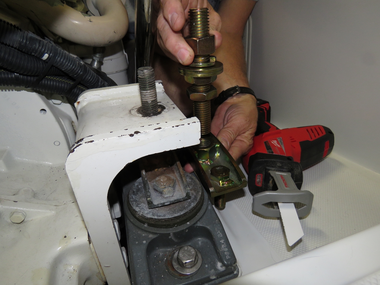
9/28/2016: Measuring
Position: 44°16.47'N, -68°19.30'W
The new bolts were slightly larger than the previous, so we measured to make sure they would fit into the hole through the engine support. Looks like they would.
|
 |
9/28/2016: Cutting
Position: 44°16.47'N, -68°19.30'W
It felt crazy to be cutting off the engine mount, but it was the only way those rear mounts were coming out.
|
 |
9/28/2016: Mount Cut
Position: 44°16.47'N, -68°19.30'W
One engine mount bolt, now in two pieces.
|
 |
9/28/2016: Crumbling
Position: 44°16.47'N, -68°19.30'W
The rear mounts weren't in quite as bad shape as the front mounts, but definitely in need of replacement. They had already started to disintegrate and drop chunks.
|
 |
9/28/2016: Sheared
Position: 44°16.47'N, -68°19.30'W
Once we had the mount off, we used one of our new jumbo sockets with an impact wrench to detach the inserts from the studs between the engine mount bridge and base. The insert is visible in the left side of the mount base. Unfortunately the inserts were effectively welded to the studs and all four sheared before coming free. So we'll need yet more parts from the manufacturer in Brisbane, Australia.
|
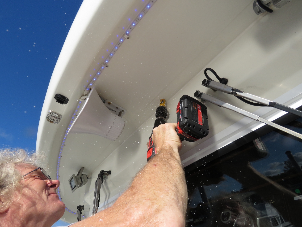 |
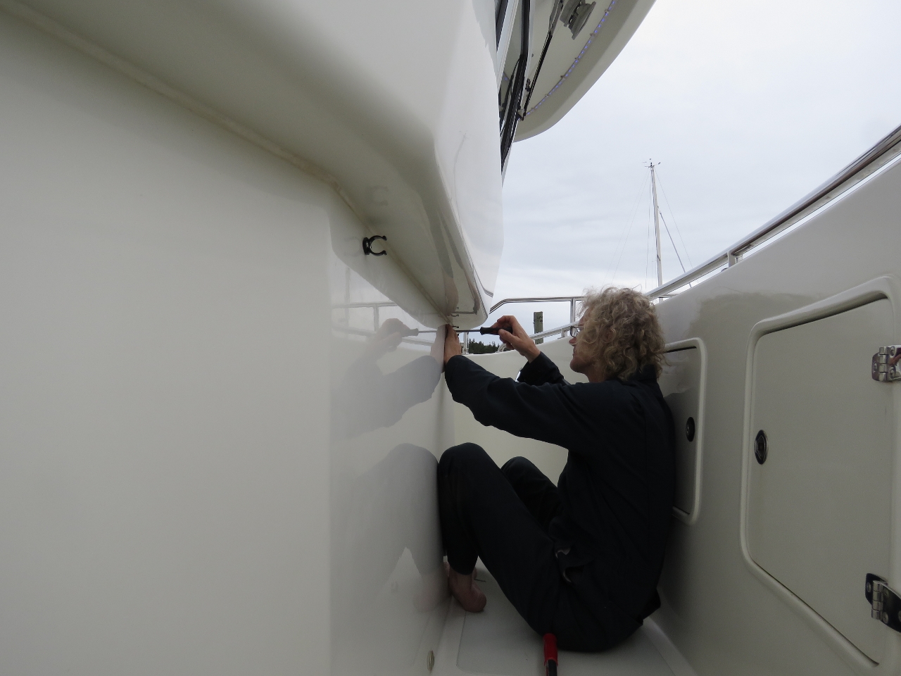
9/28/2016: Forward Camera
Position: 44°16.47'N, -68°19.30'W
Another of our packages shipped to Southwest Harbor contained two IP cameras. Here James is drilling a hole to mount a forward-looking camera just under the flybridge brow.
|
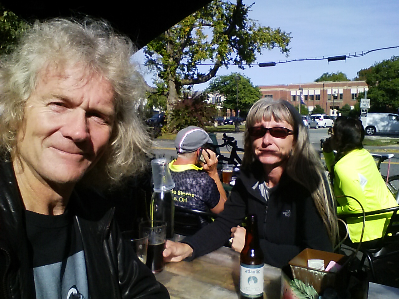 |
9/29/2016: Cafe 2
Position: 44°16.82'N, -68°19.57'W
A delicious lunch street-side at Cafe2 in downtown Southwest Harbor.
|
 |
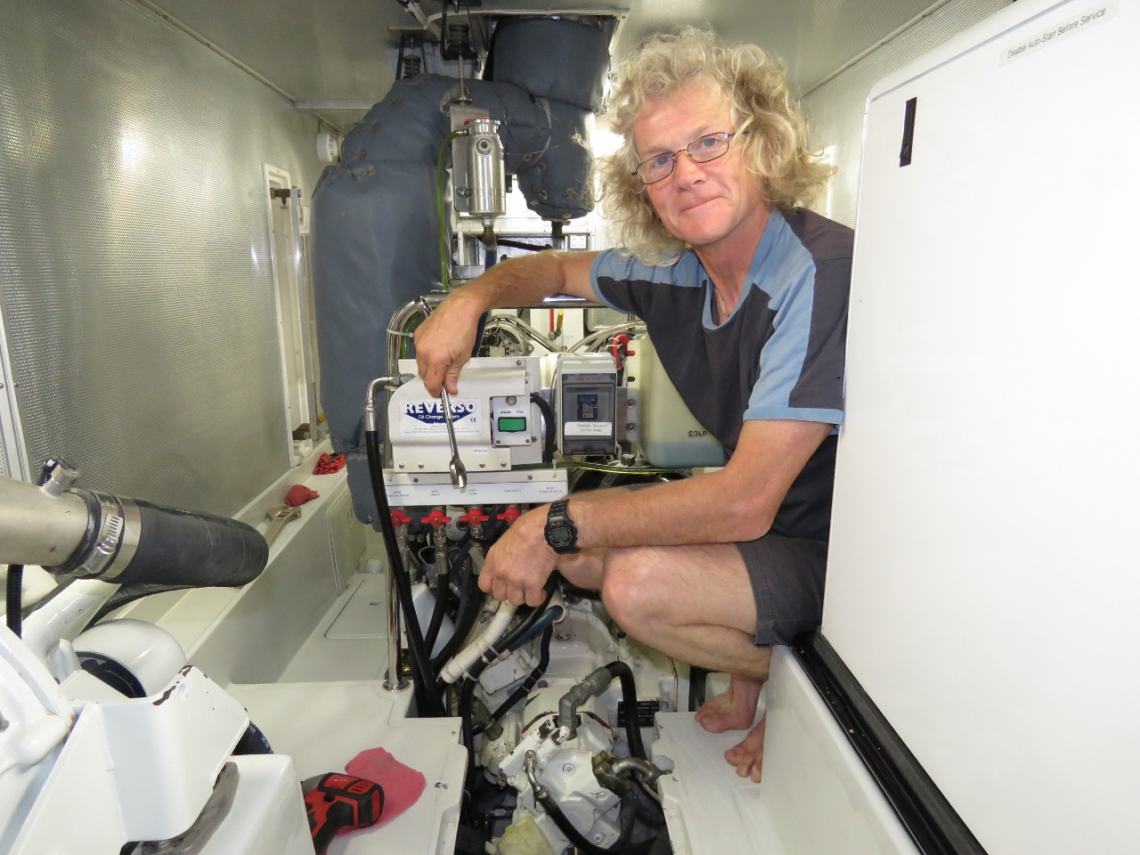
9/29/2016: Oil
Position: 44°16.47'N, -68°19.30'W
We picked up fifteen gallons of engine oil today from a nearby Napa auto parts store. We are now up to the full complement of engine oil we carry, enough for three main engine changes and two generator changes.
|
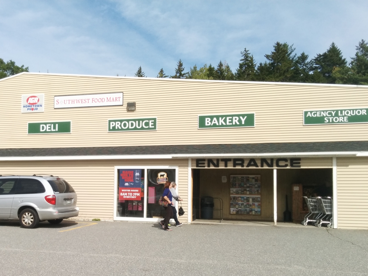 |
9/30/2016: Groceries
Position: 44°17.70'N, -68°19.71'W
A small reprovisioning trip for fresh produce at the local IGA.
|
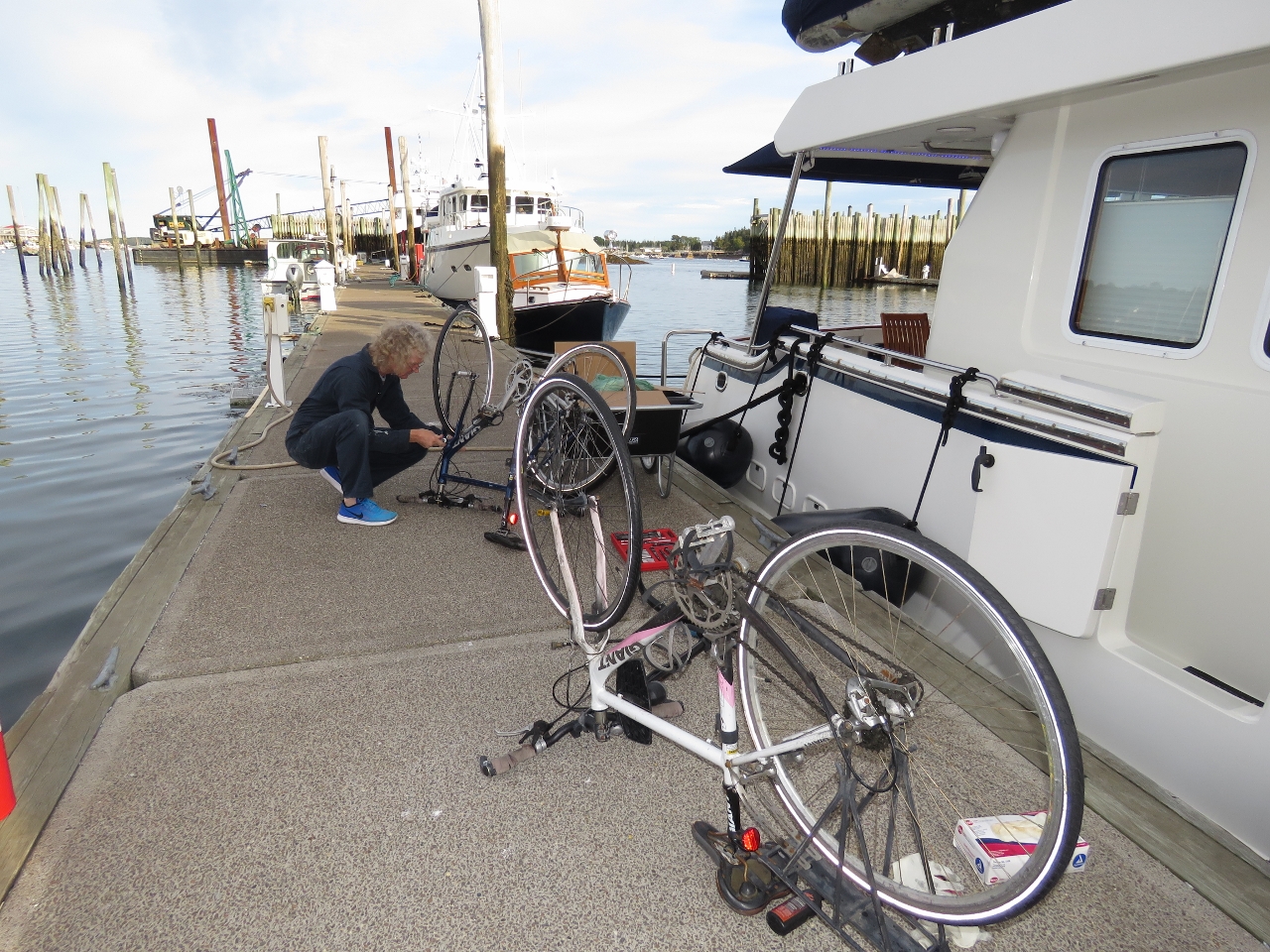 |
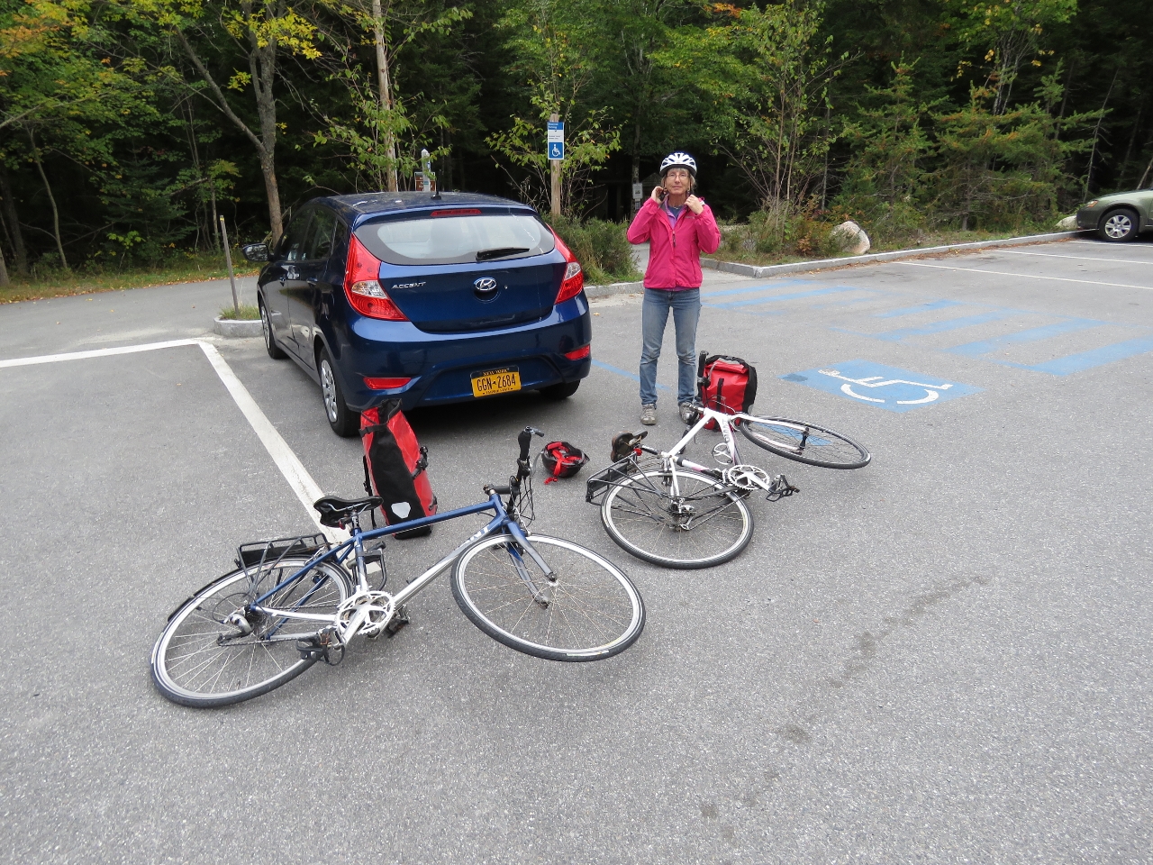
9/30/2016: Bicycles
Position: 44°16.47'N, -68°19.30'W
We brought the bikes down to get them ready for a bicycle trip through the Acadia carriage trails tomorrow. Those Giant FCR 2s have performed wonderfully and needed surprisingly little maintenance given they've travelled around the world on our flybdridge. We store them in a custom canvas cover and the only regular maintenance they've gotten is a heavy chain lubing every few months.
|
 |
9/30/2016: Upper Deck
Position: 44°16.49'N, -68°19.50'W
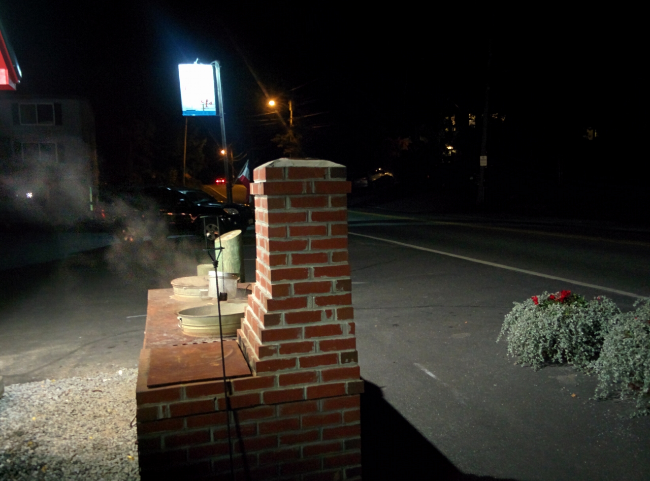
Fresh lobsters on the boil outside a road-side restaurant is a common sight when driving in Maine. The Upper Deck pub above the marina seems to always have pots going.
|
 |
10/1/2016: Carriage Roads
Position: 44°19.76'N, -68°17.58'W
We managed to fit both bikes into the car and drove to the Parkman Mountain trailhead to ride the Acadia National Park carriage roads. Between 1913 and 1940, millionaire philanthropist John D. Rockefeller Jr. built 45 miles of carriage roads on Mt. Desert Island that were closed to automobiles and remain that way today.
|
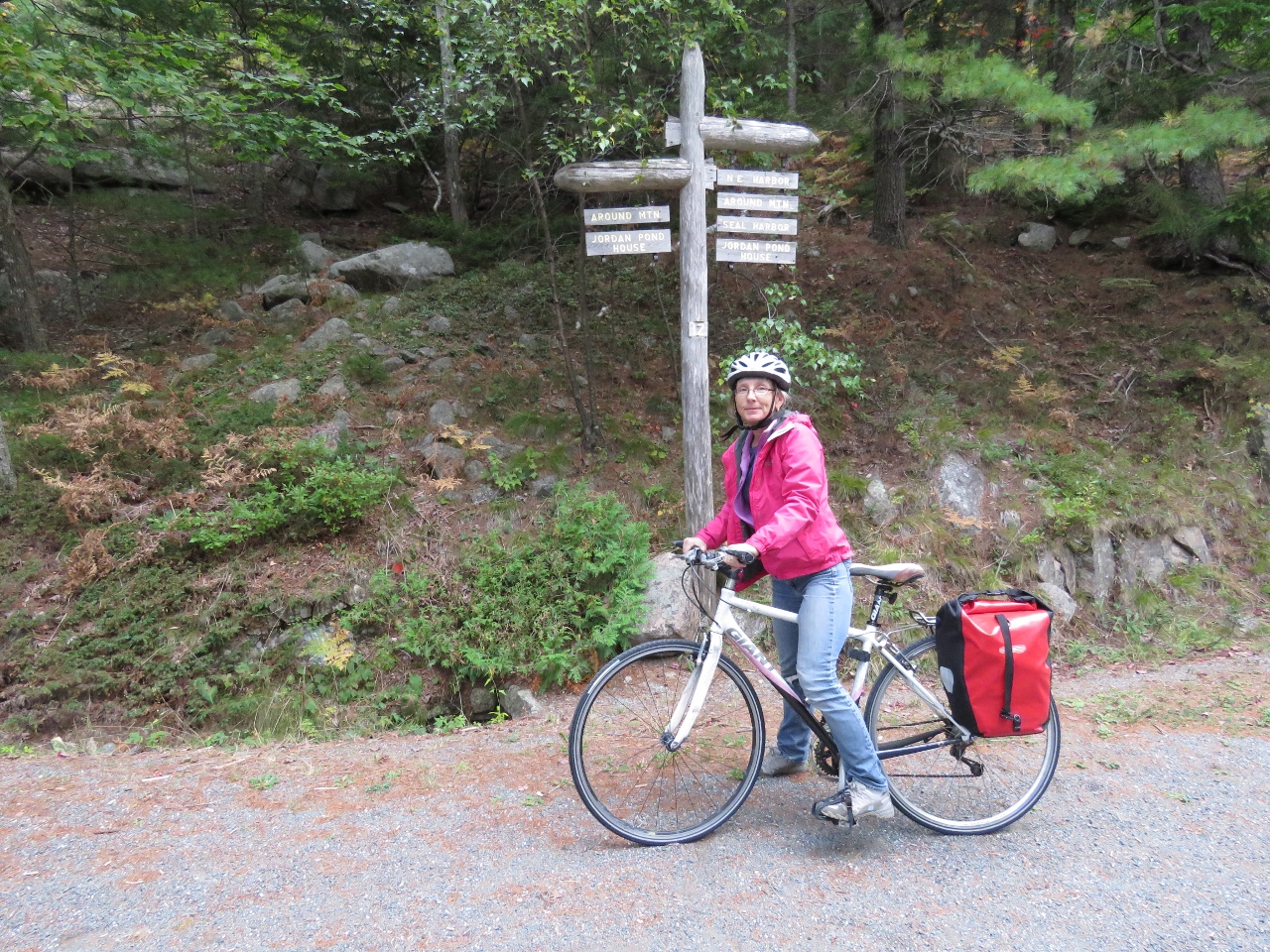 |
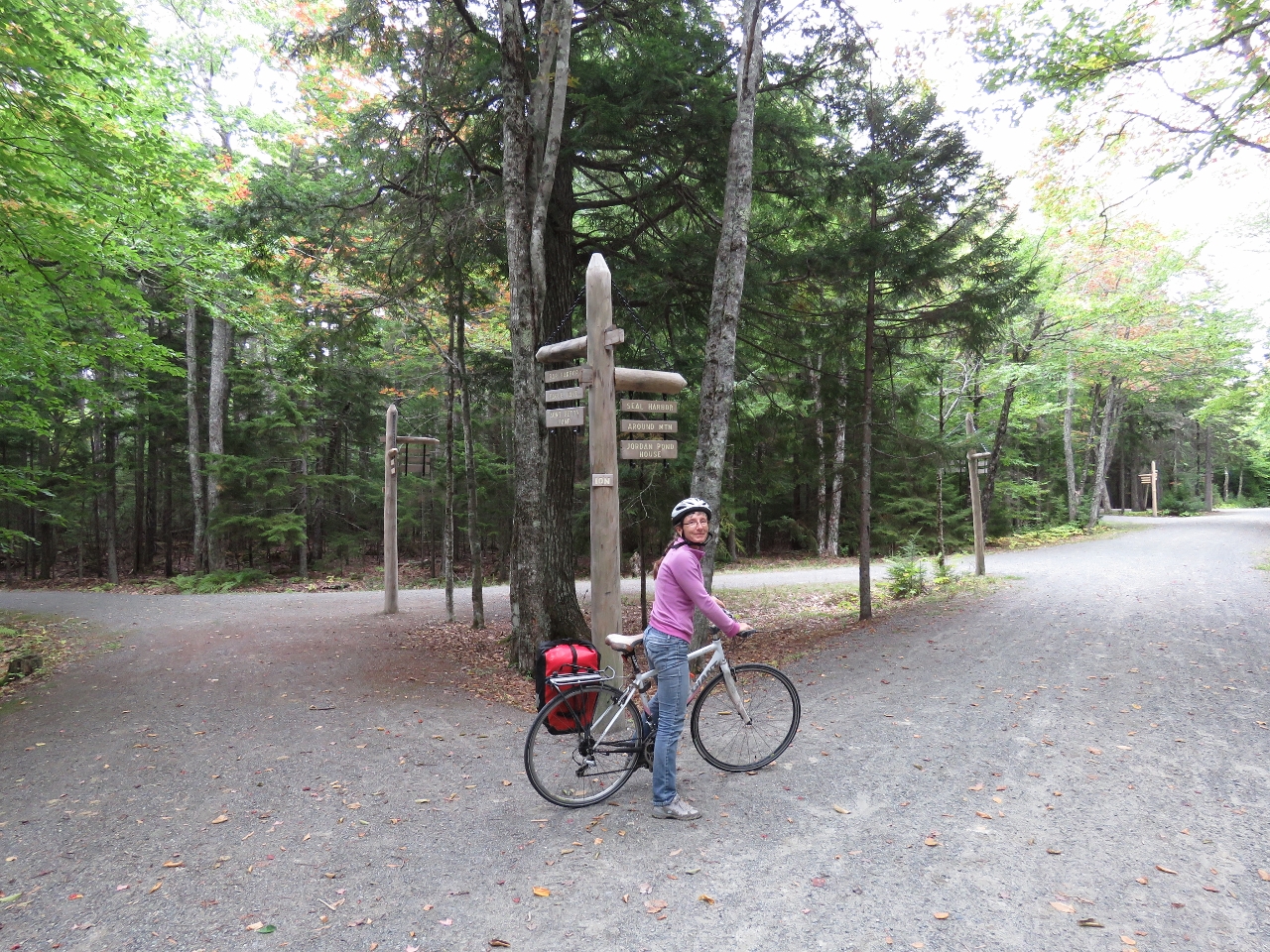
10/1/2016: Signpost 12
Position: 44°19.80'N, -68°17.40'W
The carriage road intersections have numbered signposts shown on trail maps. We're currently at signpost 12 and will take the Around Mountain Carriage Road north.
|
 |
10/1/2016: Breakfast
Position: 44°20.46'N, -68°17.35'W
We stopped for breakfast with a view west over Sargent Cove in Somes Sound.
|
 |
10/1/2016: Fall Colors
Position: 44°21.15'N, -68°16.72'W
We're starting to see more fall colors in the trees. This is looking west over Somes Sound.
|
 |
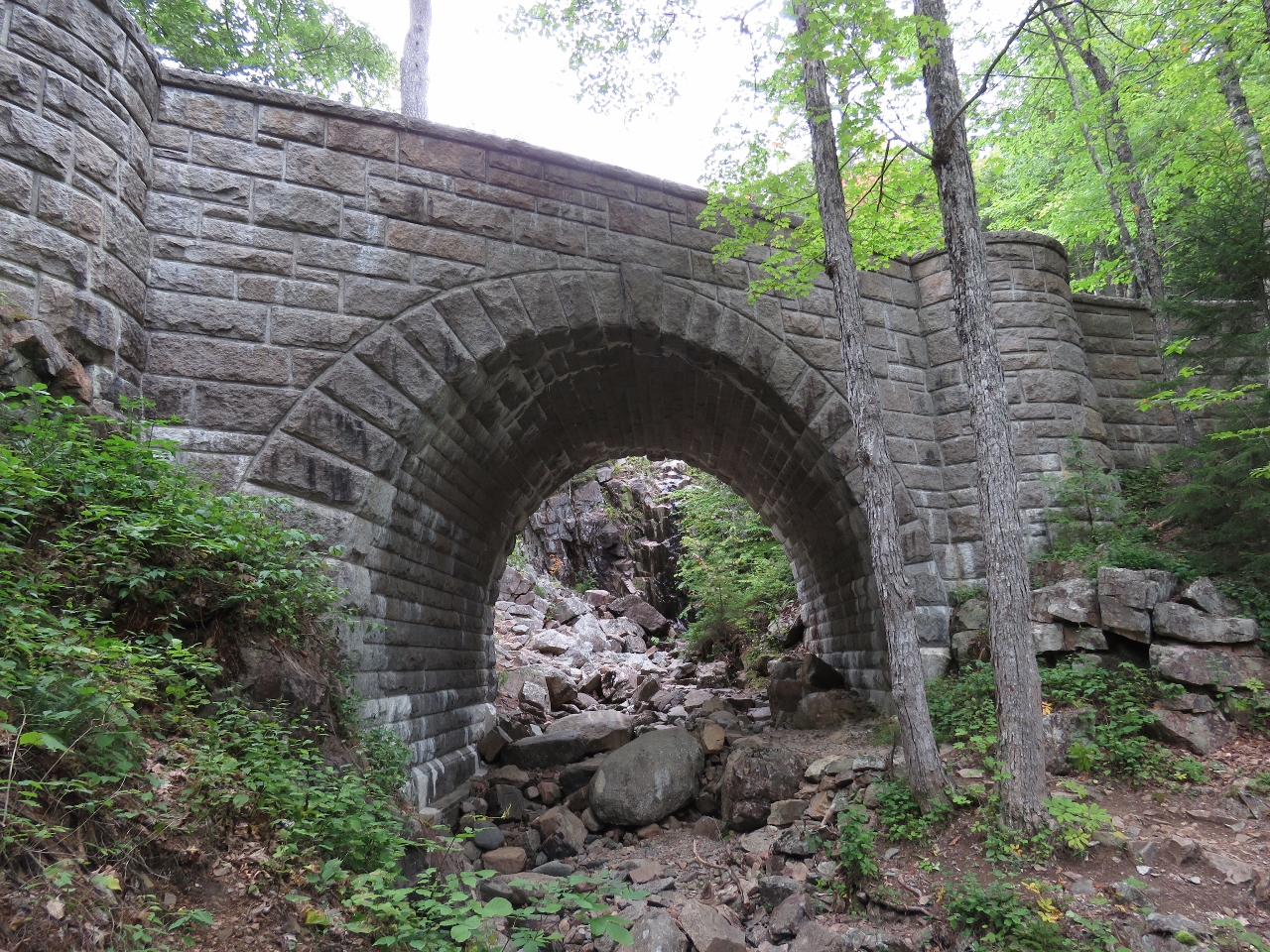
10/1/2016: Chasm Brook Bridge
Position: 44°21.20'N, -68°16.48'W
Besides building the carriage roads, Rockefeller also financed the construction of sixteen stone bridges at gorge and stream crossings. We'll see ten of them on our ride today. This is Chasm Brook Bridge, built in 1926, one of the more remote bridges in the carriage road system.
|
 |
10/1/2016: Signpost 10
Position: 44°21.11'N, -68°16.00'W
At Signpost 10 where we'll head east around the south end of Eagle Lake.
|
 |
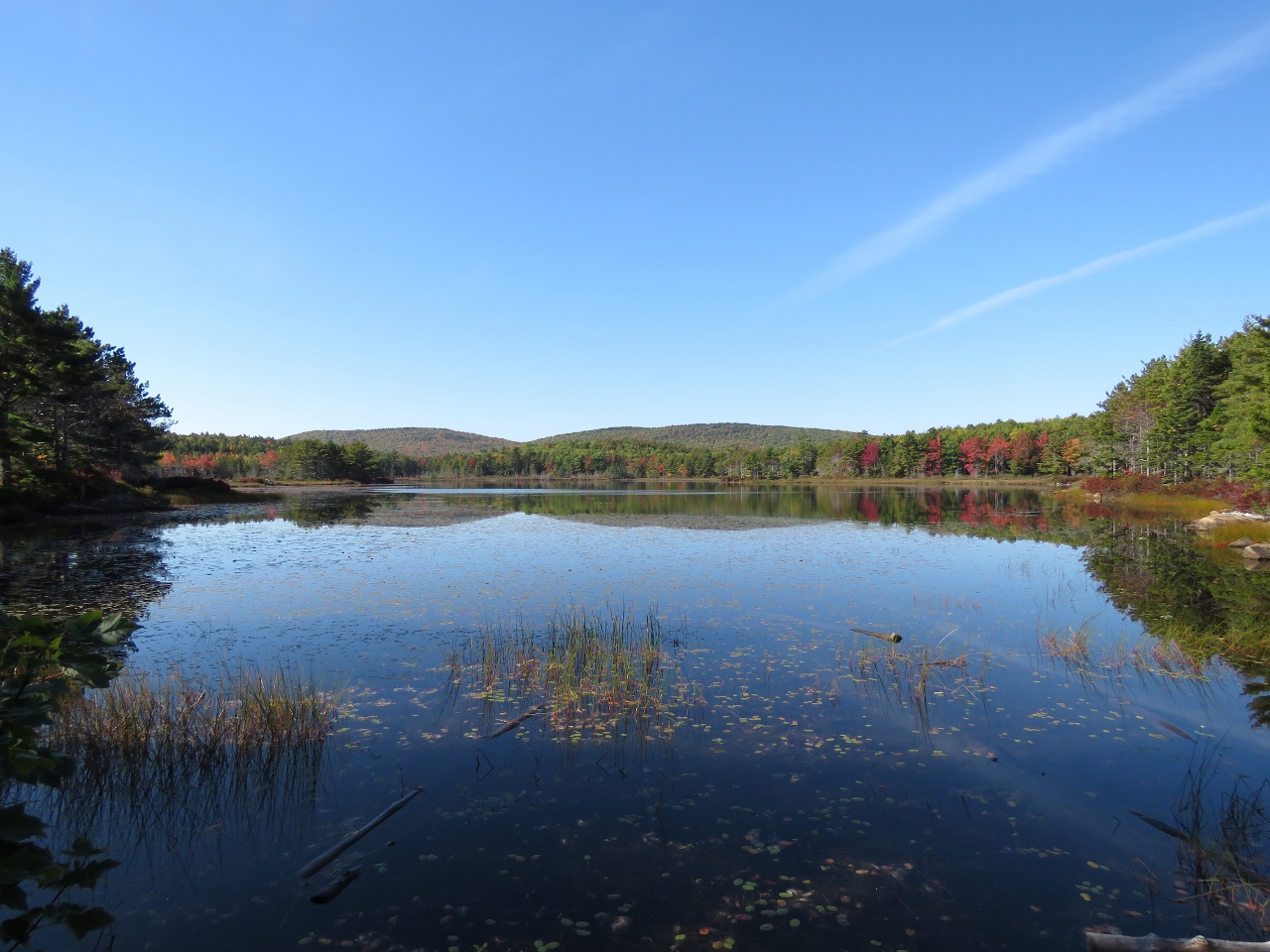
10/1/2016: Eagle Lake
Position: 44°21.21'N, -68°14.76'W
"Second Breakfast" looking north into Eagle Lake. This is the lake we saw from the Cadillac Mountain road during our previous trip to Acadia National Park.
|
 |
10/1/2016: Bubble Pond Bridge
Position: 44°20.94'N, -68°14.52'W
Bubble Pond Bridge was built in 1928 and carries the main carriage road over a minor spur toward Bubble Pond.
|
 |
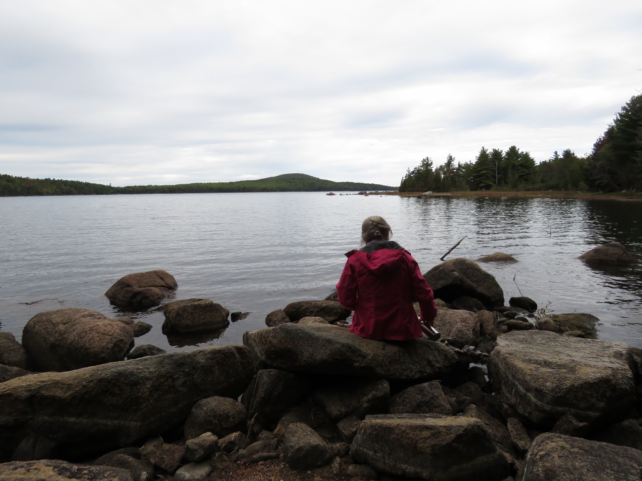
10/1/2016: Bubble Pond
Position: 44°20.55'N, -68°14.39'W
Riding south along the west shore of Bubble Pond. The carriage road system is simply wonderful. We're having a great time.
|
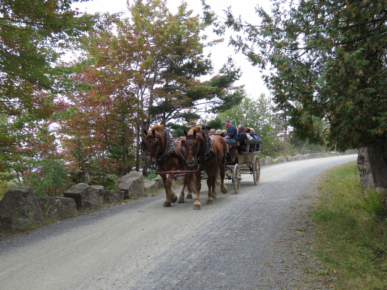 |
10/1/2016: Carriage
Position: 44°18.65'N, -68°13.62'W
The carriage roads originally were designed for horse-drawn carriages and still can be toured that way.
|
 |
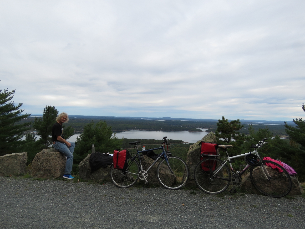
10/1/2016: Day Mountain
Position: 44°18.58'N, -68°13.93'W
Lunch with a view south to the Cranberry Island from the top of 583ft Day Mountain.
|
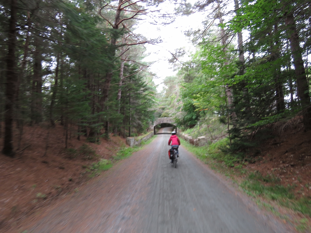 |
10/1/2016: Jordan Pond Road Bridge
Position: 44°18.58'N, -68°14.76'W
Heading under the Jordan Pond Road Bridge that we walked to on our previous trip.
|
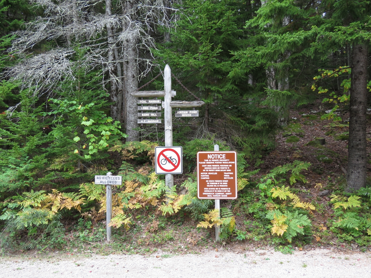 |
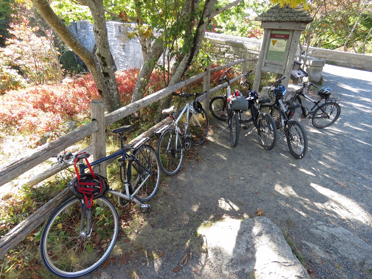
10/1/2016: No Bikes
Position: 44°18.62'N, -68°14.84'W
We never could find out why, but bicycles aren't allowed on the privately-owned carriage roads outside the park. From here we'll take the park loop road and rejoin the carriage road system at Jordon Pond.
|
 |
10/1/2016: Stanley Brook Bridge
Position: 44°18.62'N, -68°14.84'W
The Stanley Brook Bridge was built in 1933, the last of the sixteen Rockefeller carriage-road bridges constructed. The three arches allow traffic, a hiking trail, and the brook to travel underneath.
|
 |
10/1/2016: Gate Lodge
Position: 44°19.15'N, -68°15.14'W
The Jordon Pond Gate Lodge is one of two lodges that were built at entry points to the carriage road system to ensure that automobiles stayed off the carriage roads. The second is at Northeast Harbor opposite Somes Sound from Southwest Harbor.
|
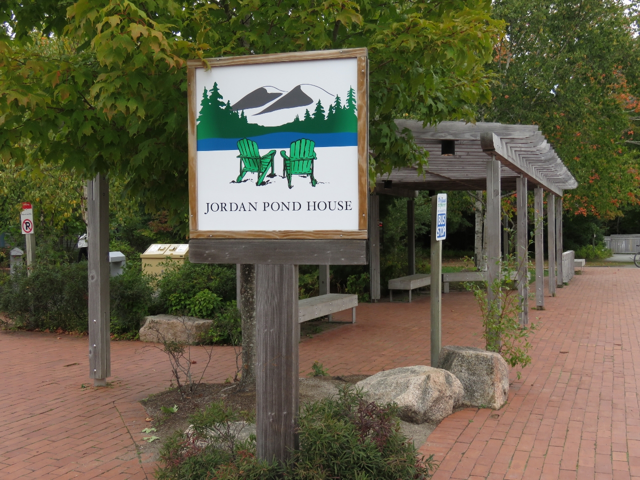 |
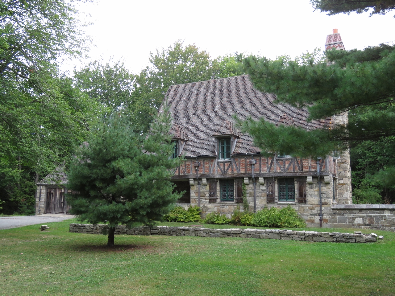
10/1/2016: Jordon Pond House
Position: 44°19.21'N, -68°15.20'W
The original Jordon Pond House opened in 1896 to serve refreshments to hungry park-goers. The restaurant is exceedingly popular in the summer, with tourists arriving by the car- and bus-load to partake in the house specialty, popovers with strawberry jam.
|
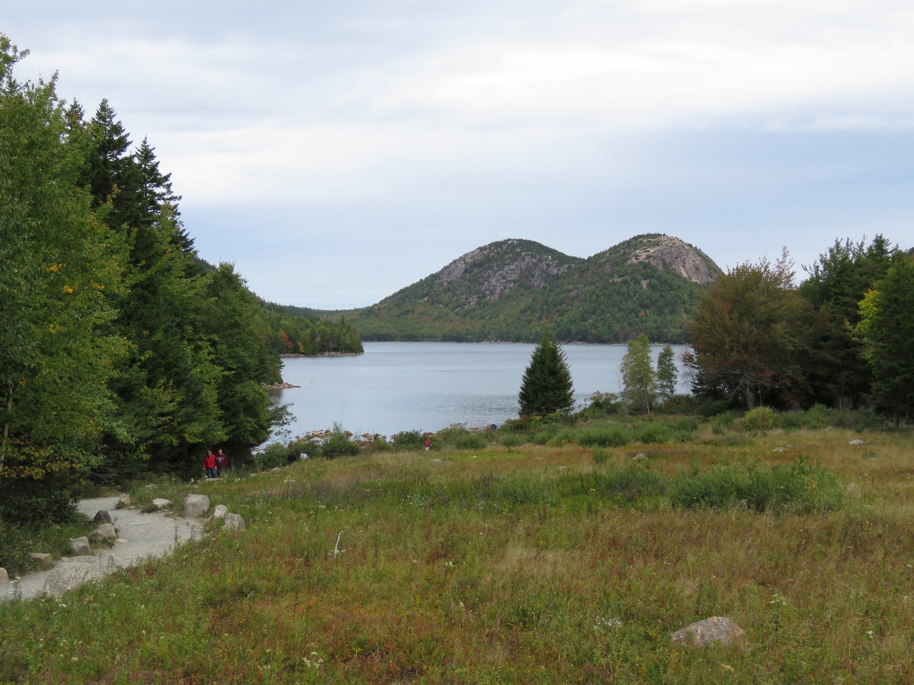 |
10/1/2016: Lake from Jordon Pond
Position: 44°19.26'N, -68°15.19'W
Besides the food, visitors come to Jordan Pond House to take in the view over Jordan Pond to the Bubbles. We climbed South Bubble on the right during our previous trip.
|
 |
10/1/2016: Jordon Pond Bridge
Position: 44°19.31'N, -68°15.28'W
The Jordon Pond Bridge was built in 1920 and leads from Jordan Pond House to the surrounding carriage roads.
|
 |
10/1/2016: West Branch Bridge
Position: 44°19.36'N, -68°15.53'W
The West Branch Bridge was built in 1931 and has a single narrow arch in a 115ft span.
|
 |
10/1/2016: Cliffside Bridge
Position: 44°18.97'N, -68°15.80'W
Cliffside Bridge was one of the last bridges constructed. Built in 1932, it carries the road past a steep section along the side of Penobscot Mountain. The bridge was built in the style of an English castle, with several platforms that provide sweeping views over the valley below.
|
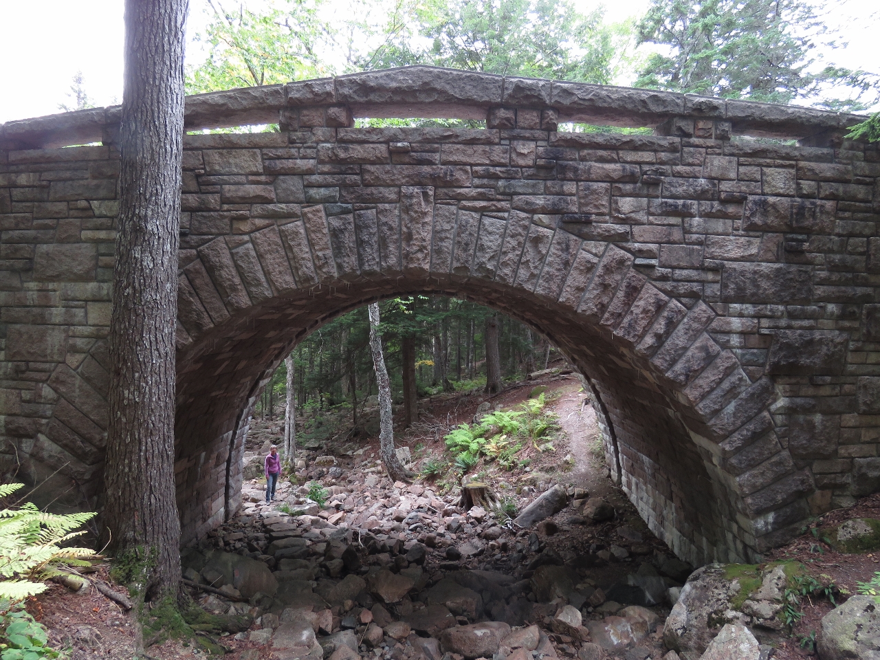 |
10/1/2016: Amphitheater Bridge
Position: 44°19.44'N, -68°16.19'W
Jennifer standing at the bottom of the stone steps that carry the Amphitheater Trail creekside under Amphitheater Bridge. This bridge was built in 1931.
|
 |
10/1/2016: Waterfall Bridge
Position: 44°19.89'N, -68°16.85'W
In the spring 40ft Hadlock Falls gush down the cliff beyond Waterfall Bridge. The falls framed by the bridge are one of Acadia's iconic photo opportunities. The falls are not much more than a trickle now in early October.
|
 |
10/1/2016: Hemlock Bridge
Position: 44°19.92'N, -68°16.95'W
Hemlock Bridge was built in 1924 and at 200ft long is one of the more expensive bridges built. It carries the road over Hadlock Brook. We're almost back to signpost 12 now.
|
 |
10/1/2016: Boat Hook
Position: 44°16.47'N, -68°19.30'W
We installed a boat hook in the Portuguese bridge. Having a boat hook forward saves the time of having to go to the stern to get the other one.
|
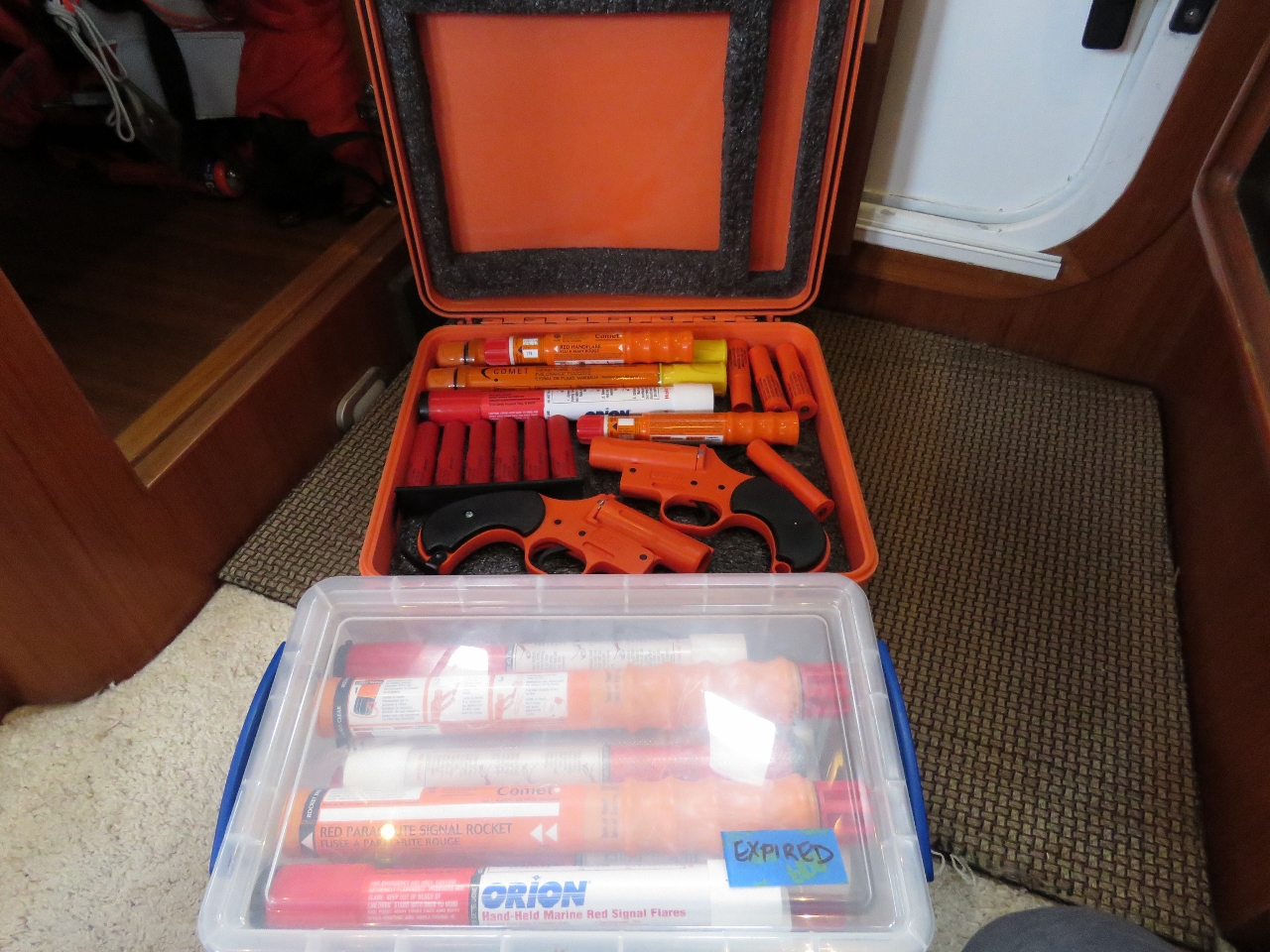 |
10/1/2016: Flares
Position: 44°16.47'N, -68°19.30'W
Some of our flares were nearing expiration, so we bought some replacements at the on-site West Marine store. We keep the current ones in the orange box and any expired ones in the clear plastic box in the front. We also have carry a set of current flares in the tender.
|
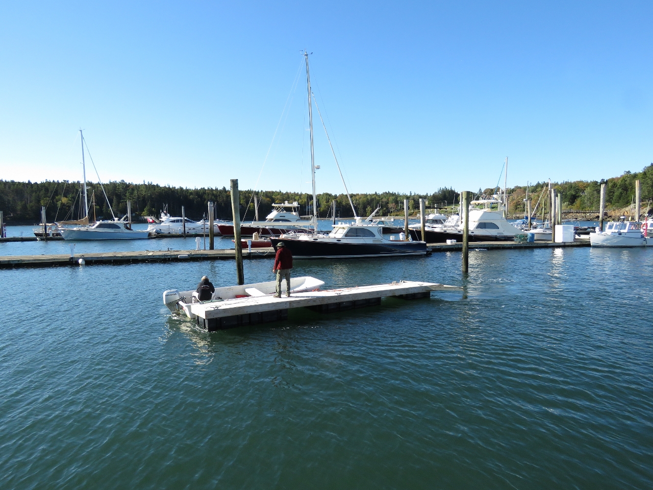 |
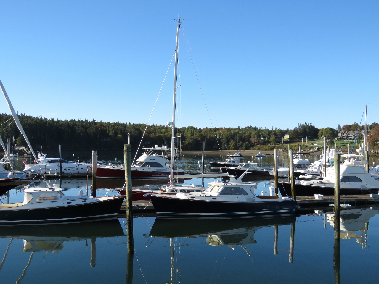
10/4/2016: Docks
Position: 44°48.90'N, -68°48.19'W
Many marinas in Maine remove some or all of their docks in the winter. Several places we'd contacted looking for dockage were either closed for the winter or had removed sufficient docks that they could no longer fit us in. Some of the Southwest Harbor docks were already out of the water when we arrived, and more were lifted out while we were here. Southwest Harbor does stay open all winter, but with much less dock space available.
|
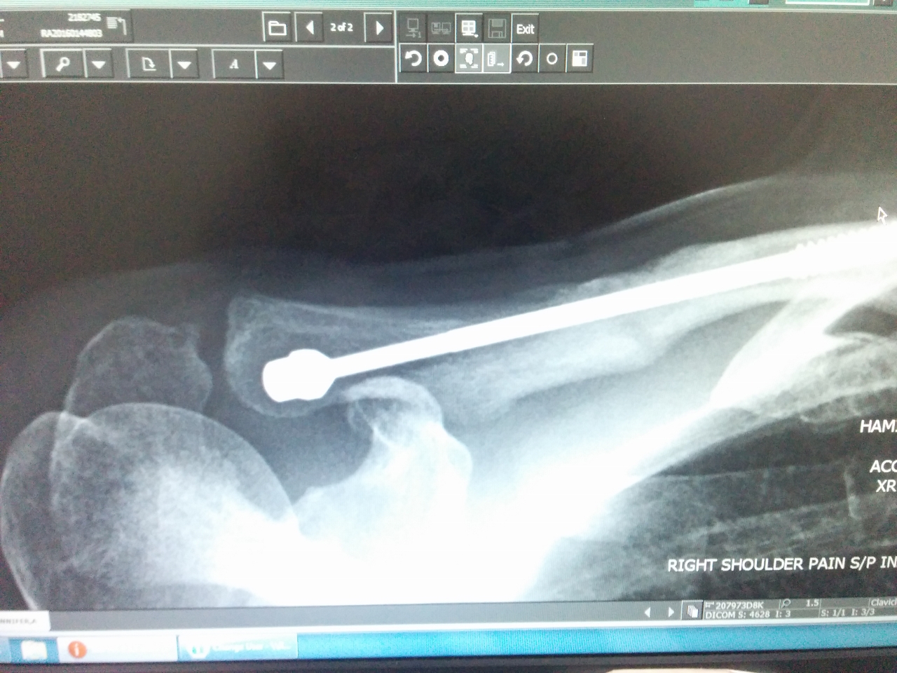 |
10/4/2016: Healed!
Position: 44°48.90'N, -68°48.19'W
Jennifer drove up to Bangor today to visit Dr. Aronowitz, an orthopedic surgeon recommended by her Florida surgeon, Dr. Diaz of Jupiter Hand to Shoulder. It's been eight months since the initial break and six months since the surgery to address the subsequent nerve issue. We were hoping to have the pin removed before leaving Florida, and tried again in Boston, but the bone hadn't healed sufficiently, even by the time we were leaving Boston. Within minutes of the new xrays being taken, Dr. Aronowitz had sent them to Dr. Diaz and they were texting each other to consult. Pretty impressive service. And they both agreed—the bone has healed sufficiently and the pin is ready to come out! Jennifer is scheduled for surgery in Bangor on October 13th.
|
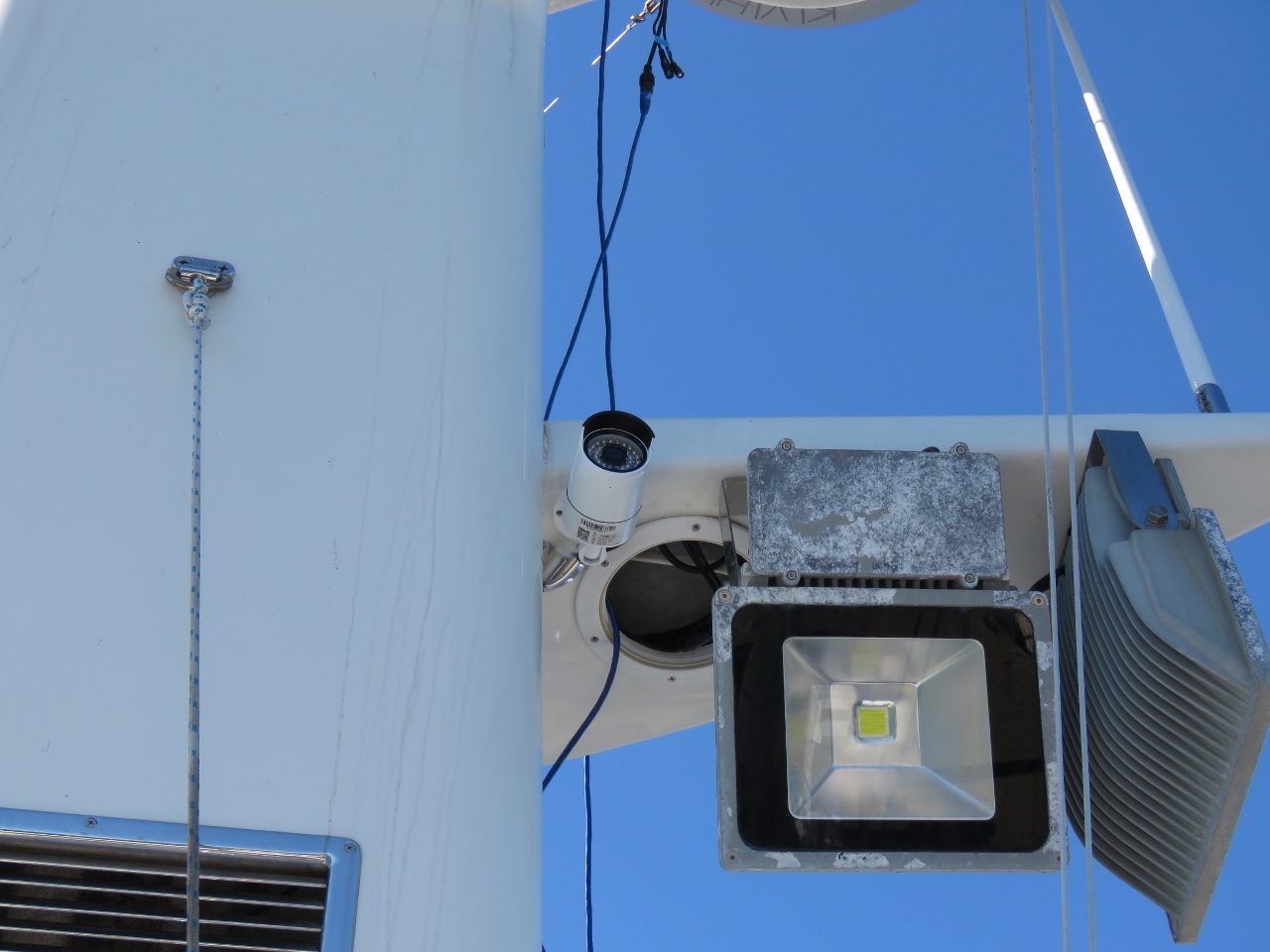 |
10/4/2016: Aft Camera
Position: 44°16.47'N, -68°19.30'W
While Jennifer was in Bangor, James was busy installing a aft-facing camera on the mast. You can see it just to the right of the stack.
|
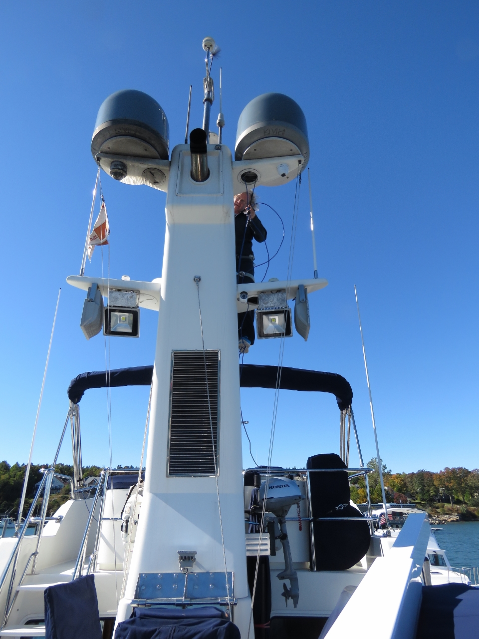 |
10/4/2016: Stack
Position: 44°16.47'N, -68°19.30'W
James up the stack, hooked on with a climbing harness, running wires for the new camera.
|
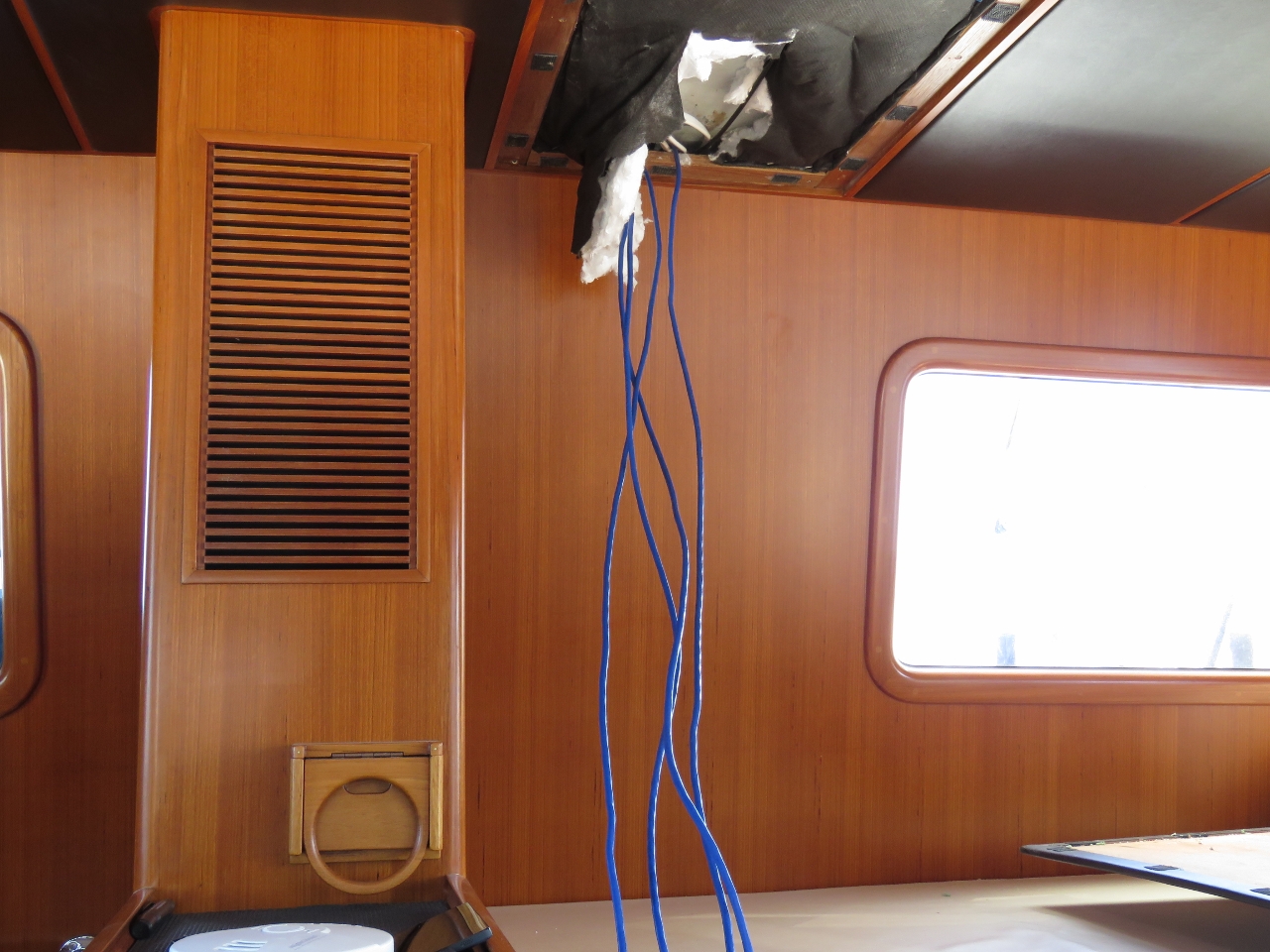 |
10/4/2016: Wire Run
Position: 44°16.47'N, -68°19.30'W
The wire run from the stack comes in through the pilot house ceiling and across to the area above the dash. We ran more wires than we needed to have some spares for future use. On most jobs the wire pull is by far the biggest part of the job, so a few spares always comes in handy.
|
 |
10/4/2016: Nate & Anastasia
Position: 44°16.46'N, -68°19.30'W
Nate and Anastasia dropped by for a visit and a tour of Dirona. They're blog readers who happened to be in the area, and arranged to meet us and see the boat.
|
 |
10/5/2016: Hinckley
Position: 44°16.47'N, -68°19.30'W
Southwest Harbor is full of beautiful Hinckley jet-drive boats. The yard where the Hinckley company was founded in 1928 is visible from our dock.
|
 |
10/5/2016: MountParts
Position: 44°16.47'N, -68°19.30'W
We finally got all the mount parts we needed and were able to change all four mounts. We'll blog the details.
|
 |
10/6/2016: Aligned
Position: 44°16.47'N, -68°19.30'W
Most of yesterday was spent replacing the engine mounts and a good chunk of today went to aligning the engine. Here is a happy James after the job is complete.
|
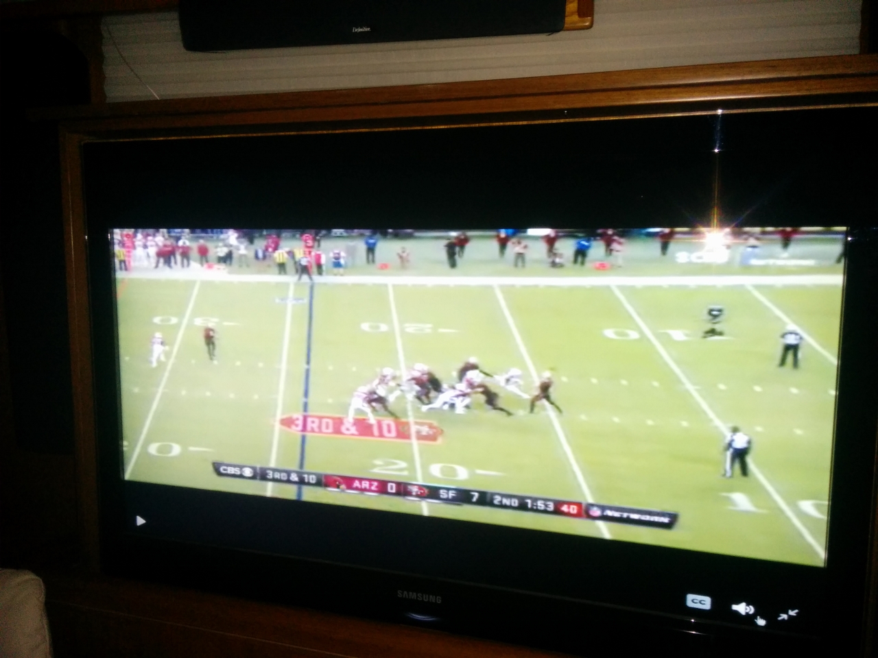 |
10/6/2016: TNF
Position: 44°16.47'N, -68°19.30'W
We haven't bothered getting a satellite TV service while in the US and have been experimenting with various ways to watch NFL football. Tonight we tried the Twitter live stream of Thursday Night Football and it worked great.
|
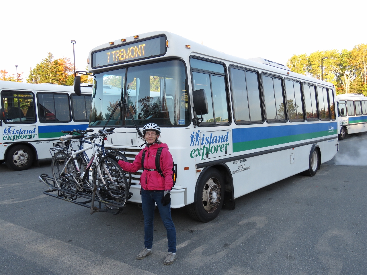 |
10/7/2016: Island Explorer
Position: 44°28.09'N, -68°22.43'W
We dropped off our rental car in Ellsworth this morning and biked back toward Southwest Harbor to the start of the Island Explorer line, a free bus service that covers Mt. Desert Island. Here we are with the bikes loaded and ready to head into Bar Harbor. This will be our third form of transportation for the day.
|
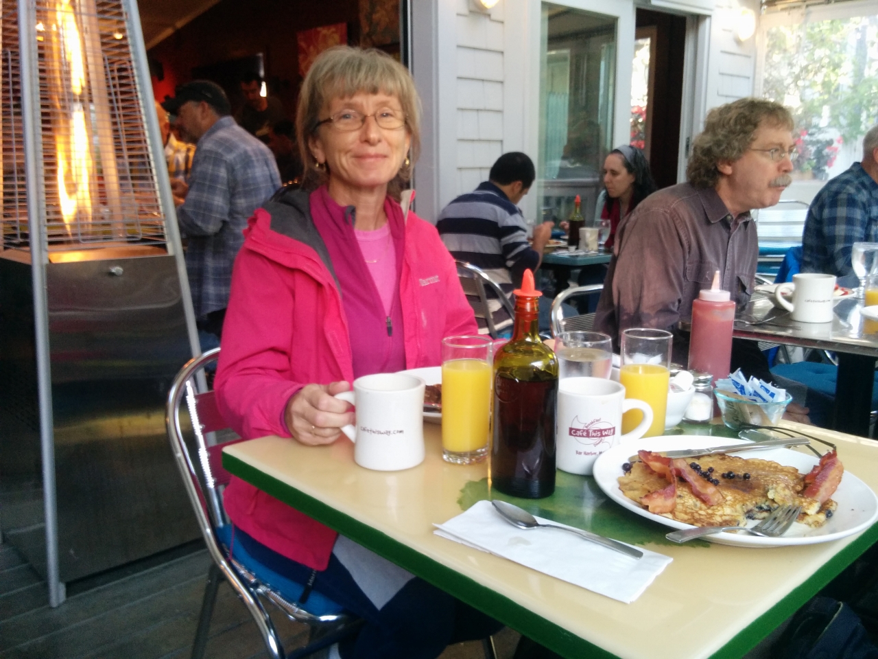 |
10/7/2016: Cafe This Way
Position: 44°23.22'N, -68°12.31'W
We had an exceptional breakfast on the heated deck at Lonely Planet-recommended Cafe This Way. James had their signature dish, blueberry pancakes. The restaurant is incredibly popular and was packed the entire time we were there.
|
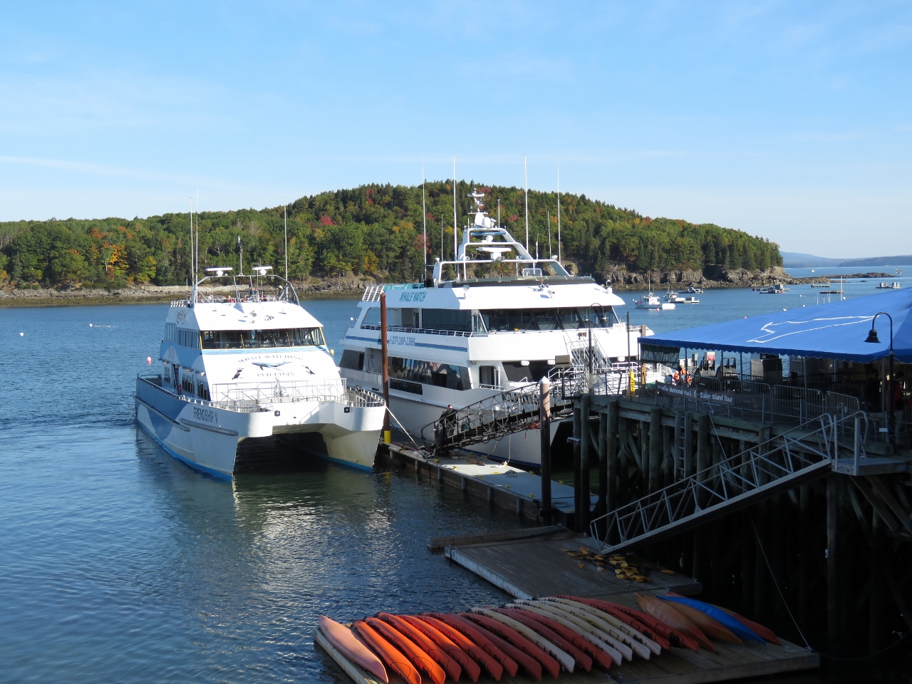 |
10/7/2016: Whale Watching Boats
Position: 44°23.47'N, -68°12.30'W
Two large whale-watching boats at the piers in Bar Harbor were getting ready to take out a load of passengers.
|
 |
10/7/2016: Rotterdam
Position: 44°23.52'N, -68°12.24'W
Tenders from the cruise ship Rotterdam, visible in the background, were ferrying passengers ashore all morning.
|
 |
10/7/2016: Floats
Position: 44°23.46'N, -68°12.37'W
Colorful floats on the wall of Stewman's Lobster Pound. Lobster fisherman paint their floats in unique, bright patterns and colors to distinguish them among the hundreds of floats that pack the water.
|
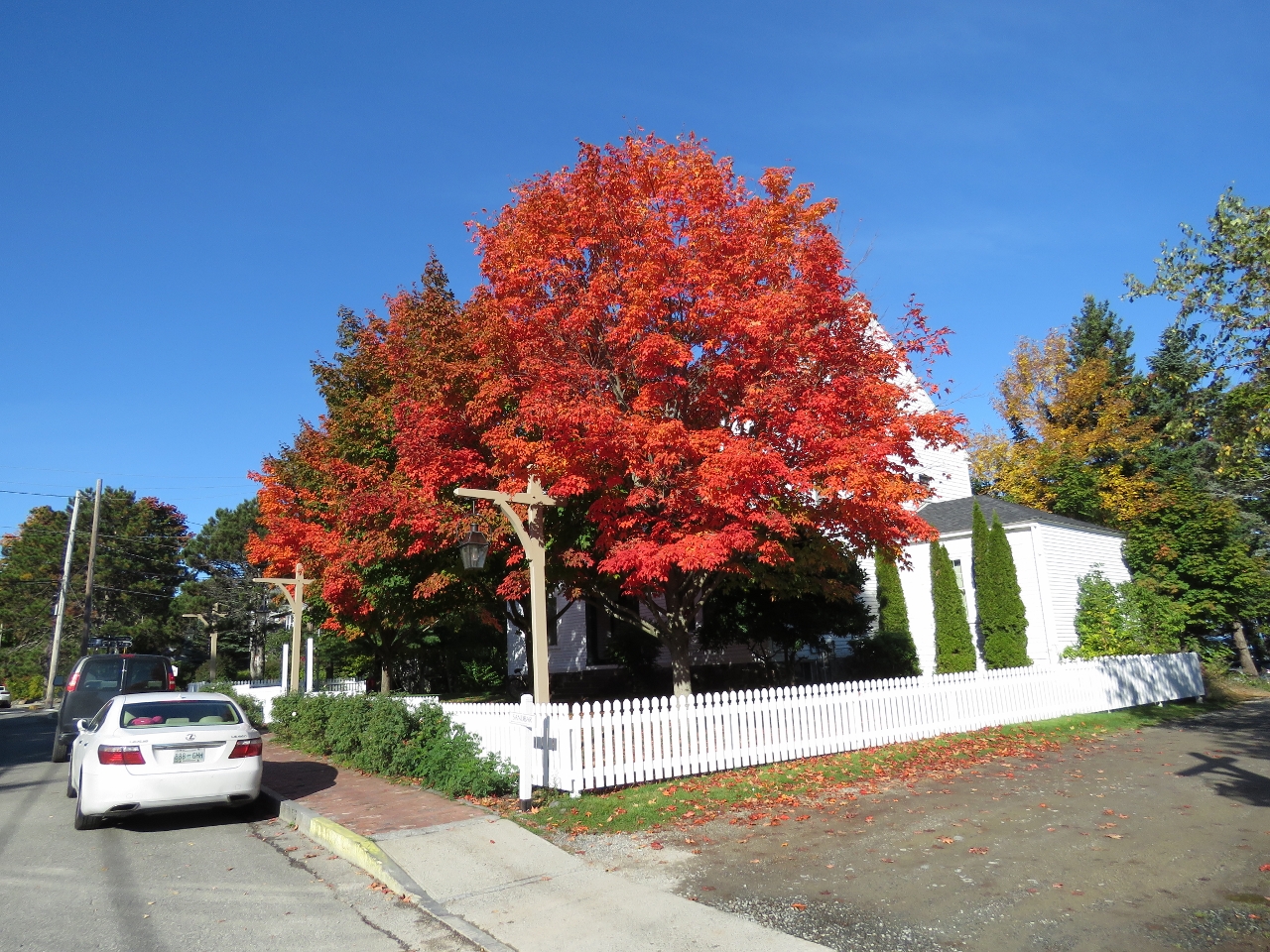 |
10/7/2016: Fall Colors
Position: 44°23.44'N, -68°12.58'W
The fall colors are really starting to show now.
|
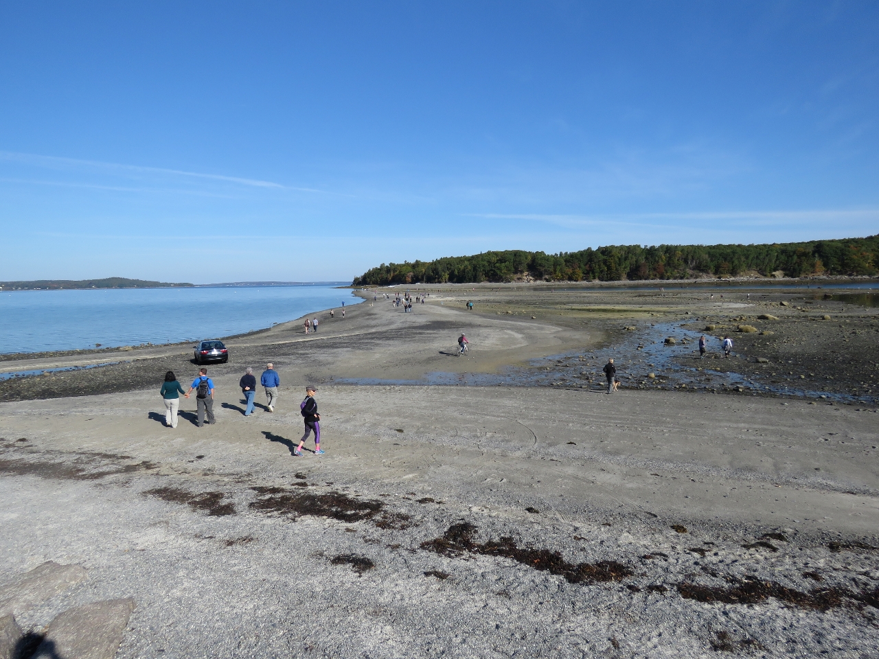 |
10/7/2016: Bar Island Trail
Position: 44°23.55'N, -68°12.61'W
At low tide, the popular Bar Island Trail emerges to connect Bar Island with Bar Harbor. Jennifer is biking about center of the photo. We didn't go all the way across as the way was a little difficult in soft sand for the bikes.
|
 |
10/7/2016: Duck Brook Road
Position: 44°23.65'N, -68°13.99'W
About a mile from Bar Harbor, Duck Brook Road connects to the most northern section of Rockefeller's Carriage Roads. Duck Brook Road isn't part of the Carriage Road system, but has been closed to vehicle traffic since a washout damaged the road several years ago, making it an excellent bike path.
|
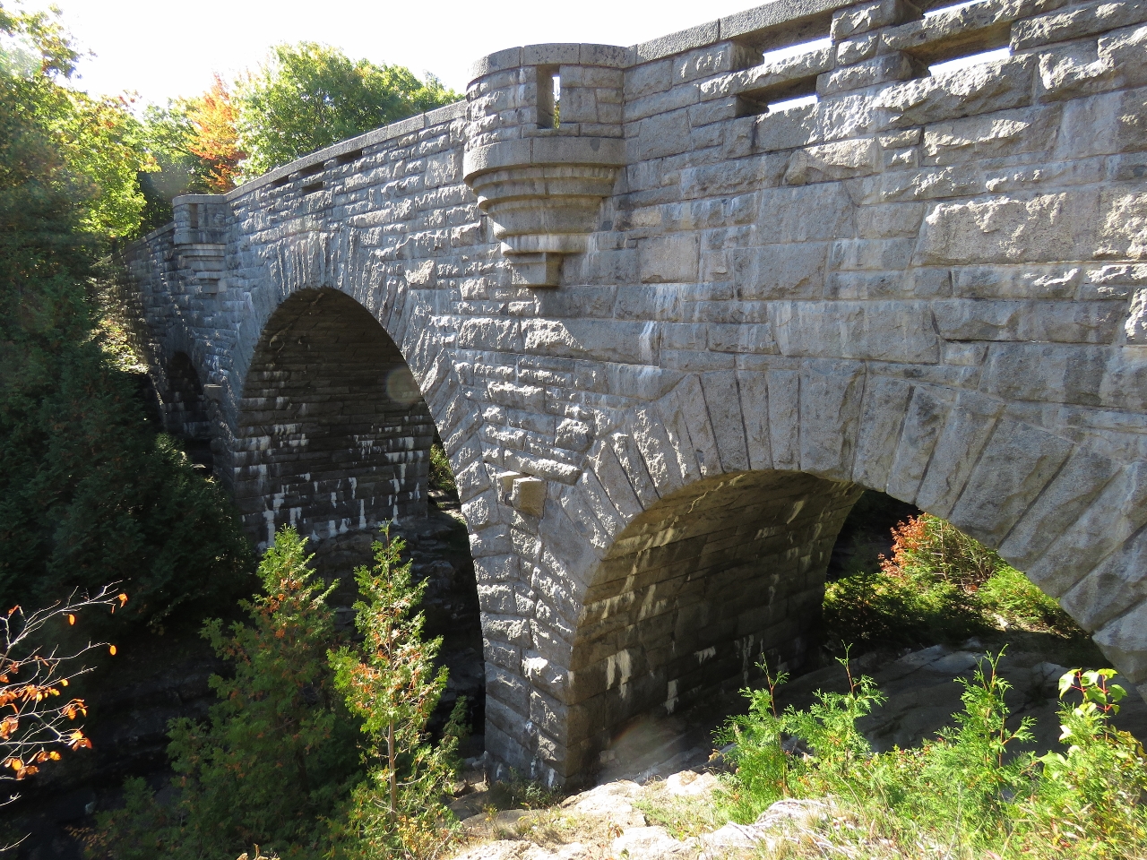 |
10/7/2016: Duck Pond Bridge
Position: 44°23.51'N, -68°14.15'W
Duck Pond Bridge was completed in 1929 and is the tallest and most expensive Carriage Road bridge. It's also the most ornate, with three arches and four viewing platforms. Stairs lead down to the creek below for a view back up to the bridge.
|
 |
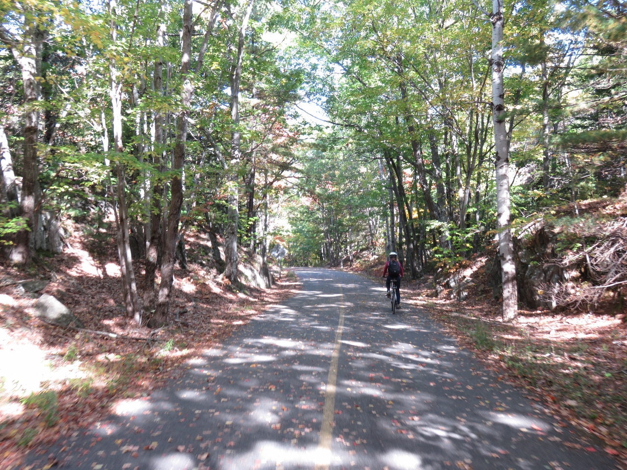
10/7/2016: Bicycles
Position: 44°23.52'N, -68°14.16'W
We're not the only ones enjoying the warm fall weather by bicycle on the carriage roads today.
|
 |
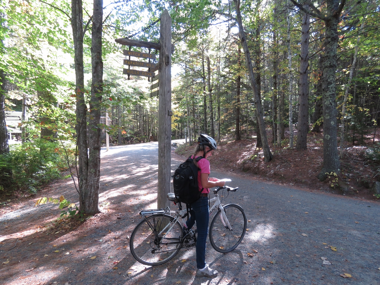
10/7/2016: Witch Hole Pond
Position: 44°24.13'N, -68°14.37'W
Looking southwest across the northern tip of beautiful Witch Hole Pond. The weather today is wonderfully sunny and calm.
|
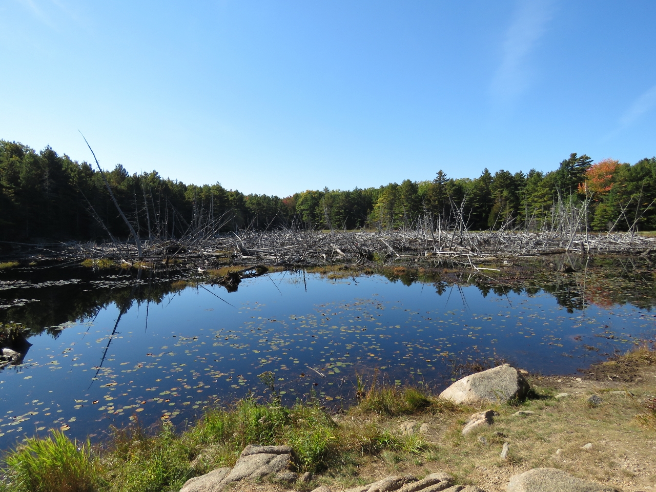 |
10/7/2016: Beavers Pond
Position: 44°23.69'N, -68°14.98'W
Snags and a beaver lodge in Beavers Pond.
|
 |
10/7/2016: Signpost Four
Position: 44°23.42'N, -68°15.01'W
At signpost four, deciding which way to go. We could go south around Brewer Mountain to the north end of Eagle Lake, but opted instead to run east back to Bar Harbor.
|
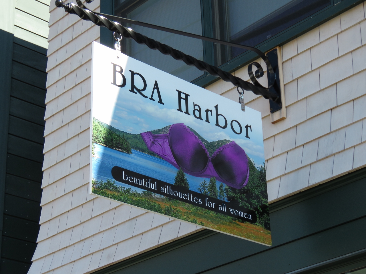 |
10/7/2016: BRA Harbor
Position: 44°23.30'N, -68°12.26'W
We loved the name of this lingerie store in downtown Bar Harbor.
|
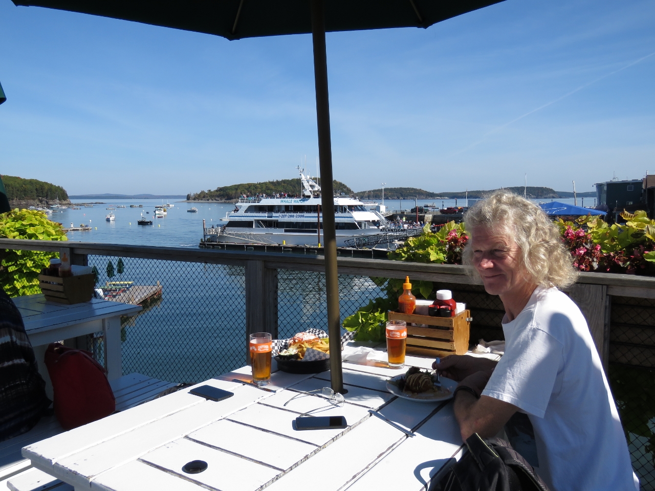 |
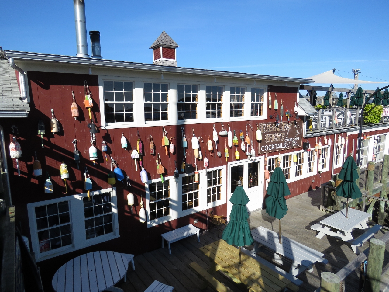
10/7/2016: Stewman's Lobster Pound
Position: 44°23.48'N, -68°12.36'W
We had a great seafood lunch on the upper deck overlooking the harbor at Stewman's Lobster Pound.
|
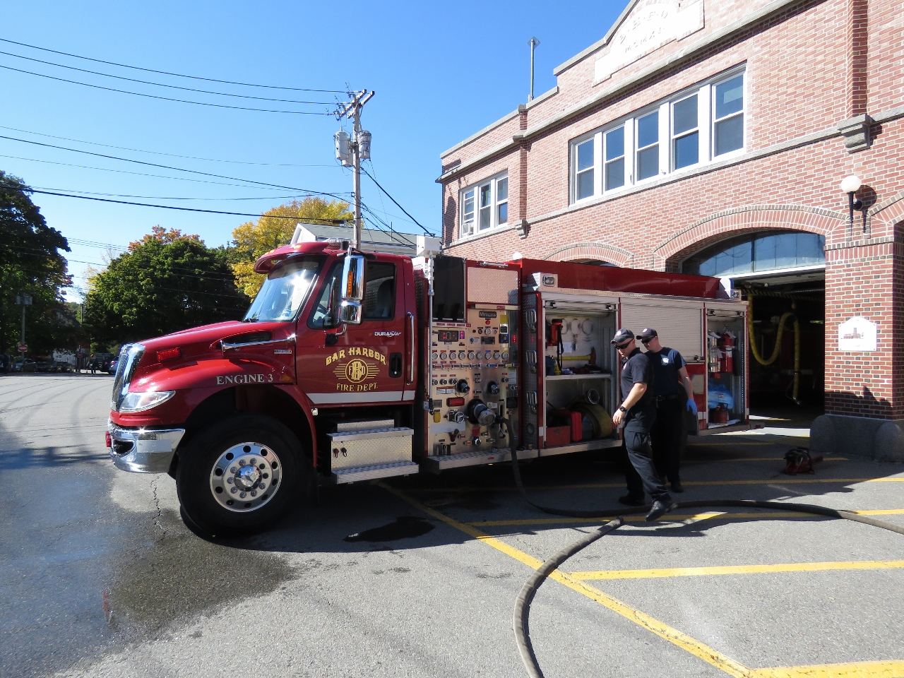 |
10/7/2016: Fire Department
Position: 44°16.47'N, -68°19.30'W
The Bar Harbor Fire department is across the road from the Island Explorer bus stop. While waiting for our bus back to Southwest Harbor we watched them perform a weekly system check on one of the their fire engines.
|