MV Dirona travel digest for Reunion to South Africa 2015

|
Click the travel log icon on the left to see these locations on a map,
with the complete log of our cruise. On the map page, clicking on a camera or text icon will display a picture and/or log entry for that location, and clicking on the smaller icons along the route will display latitude, longitude and other navigation data for that location. And a live map of our current route and most recent log entries always is available at //mvdirona.com/maps/LocationCurrent.html. |
 |
10/18/2015: En route to South Africa
Position: -20°56.22'S, 55°17.11'E
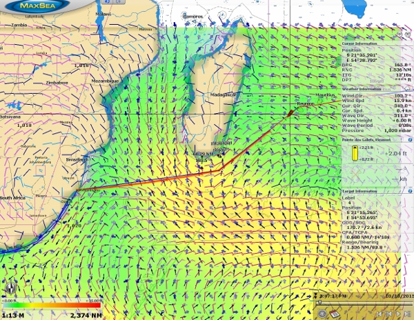
We got underway this morning on the 1,382nm eight-day run to Richards Bay, South Africa. The video at https://youtu.be/4qk000lbobU shows a visualization of our route in MaxSea through modelled weather conditions using downloaded GRIB data. The GRIB data includes model wind speed, barometric pressure, and wave height, period and direction. The green areas are 5-8′ seas, yellow is 9-11′, and orange is 12-17′ seas. The model shows 6-9′ seas for most of the route. The biggest concern for this passage is the last day as we close in on the South Africa coast where the southbound Agulhas Current can reach speeds of up to six knots. When this current meets the "southerly busters" that regularly bring strong southerly winds up the South Africa coast, huge and dangerous 20m seas can result. So we don't want to be anywhere near that coastline in a big southerly blow. We should arrive just after a system has passed through, and expect winds to be light or northerly. Weather data isn’t really accurate much beyond five days, so conditions could deteriorate, but so far it looks good and we'll be monitoring the models closely as we proceed.
|
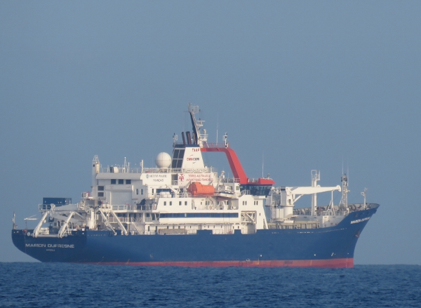 |
10/18/2015: Marion Dufresne
Position: -20°56.93'S, 55°15.57'E
The French oceanographic research vessl Marion Dufresne, that we'd toured a couple of weeks back, was standing off Reunion as we left.
|
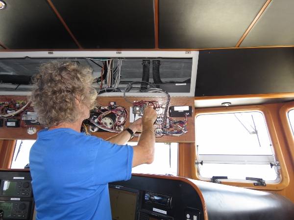 |
10/18/2015: Watch Commander
Position: -21°26.75'S, 54°37.36'E
We use a Watch Commander Pro watch alarm as a guard against the person on watch falling asleep. If the alarm isn't pushed within a preset time, the unit first flashes a light for 30 seconds, then emits a beep for 30 seconds, and then sounds an external alarm or siren. We consider it an important piece of safety equipment for longer passages. Ours has failed and won't turn off the alarm when the reset button is pushed. James already has a Rasberry Pi installed on the boat to monitor certain conditions such as the duration of the grey water pump being on. He programmed the Pi to detect when the Watch Commander is turned on and see when the reset switch is pressed. With those two inputs, he wrote a new, virtual Watch Commander. When reset, it runs for 8 minutes before showing a yellow light on the dash. If that's not reset in two minutes, we show a red light on the dash. If that's not reset in two minutes, a medium-volume alarm is sounded. And if that's not acted on in two minutes a "wake-the-dead" alarm is activated. Also shown on the dash is the number of seconds until the first audible alarm fires.
|
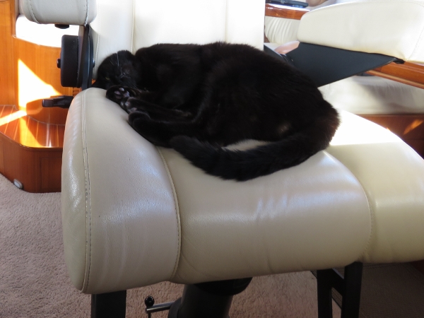 |
10/19/2015: Helm
Position: -23°30.53'S, 51°54.84'E
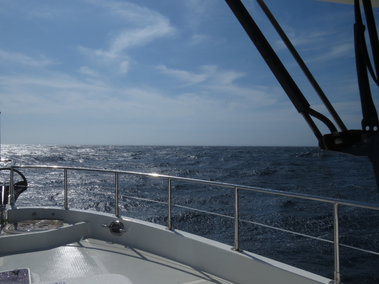
We definitely need a second helm seat. Spitfire has really taken to sleeping there, particularly when conditions are calm. We've had good weather on the run so far, with seas 8 feet or less on about a 9-second period on the port stern quarter, and winds generally around 15 knots.
|
 |
10/19/2015: Sunset
Position: -23°38.03'S, 51°46.27'E
We expect conditions to get even better than they have been so far, with the wind falling and the wave period increasing, until we round Madagascar. Then the waves will tighten slightly back to 8 feet on 8 seconds, but will be more on the stern so we'll roll less than now. And that high-pressure system we'll cross as we close on the South Africa coast looks to be diminishing slightly, so that's good news if it holds true.
|
 |
10/20/2015: Traffic
Position: -24°9.98'S, 51°0.86'E
Once we were about a half-day out of Reunion, we've pretty much seen constant commercial ship traffic with at least on ship showing up on AIS at all times. So it's definately not as lonely out here as it was on the Indian Ocean crossing. We've not yet had to divert course to avoid any traffic, but at least one overtaking ship on the same course diverted on the way by us. We've not seen any other pleasure craft traffic yet, but we know of at least four boats underway from Reunion that likely are on the same course: Traveler, La Medianoche, Vulcan Spirit and Minnie B.
|
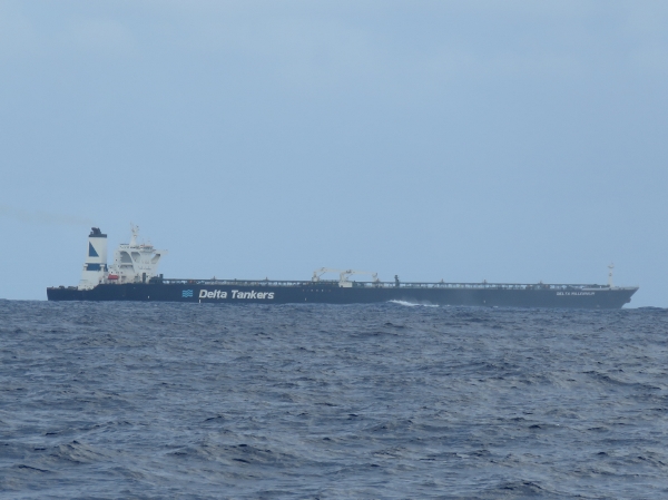 |
10/20/2015: Delta Millennium
Position: -24°36.75'S, 50°24.04'E
The massive tanker Delta Millennium passed about 2.5 miles away on a northbound course. The ship is almost 200 feet wide--roughly twice the width of Panamax and the cargo vessels that served Seattle.
|
 |
10/20/2015: Squalls
Position: -24°49.77'S, 50°6.08'E
We're passing through several storm systems, with accompanying heavy rain, that show up clearly on the radar. We've not really had any heavy run since leaving the northern Queensland coast almost six months ago.
|
 |
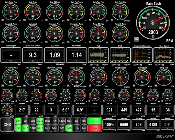
10/20/2015: Current
Position: -24°53.00'S, 50°1.62'E
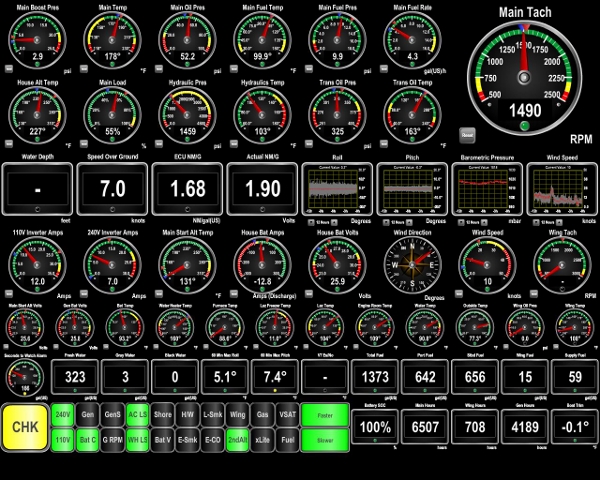
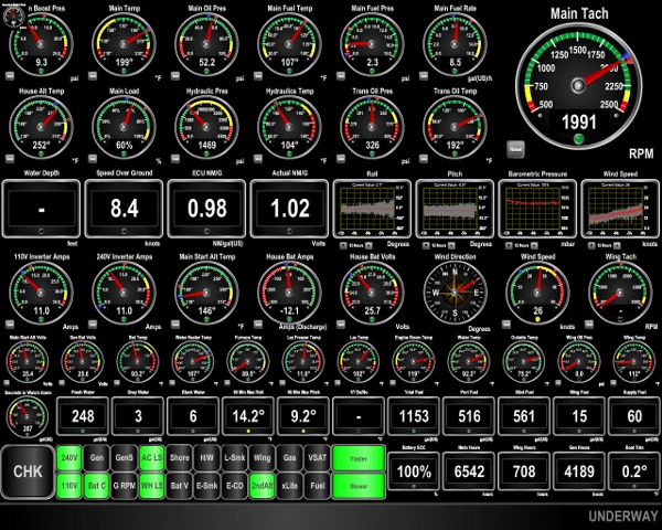
With a push from the current and fairly calm seas, we're humming along 7 kts at 1,500 RPM. The waves now are barely 6 feet on a 10-second period. 12 hours ago the current was light or slightly against, with larger and tighter waves, and 1,800 RPM was required to maintain the same speed. At the bottom left of the screen shot the yellow CHK light indicates our virtual Watch Commander (watch alarm) is over 8 minutes into its cycle, and the guage directly above it shows the number of seconds left. The two wider green rectangles at the bottom center of the screen indicate if we need to go faster or slower to arrive at Richards Bay on Monday the 26th at 7am. If we are going too slow to meet that deadline, the top rectangle will turn yellow, and if we are going too fast, the bottom rectangle will turn red. the same lights also support running to a specified fuel economy goal. On the way into Rodrigues from Australia, where we were most focused on fuel economy, the lights were setup to ensure we arrived with 200 gallons of reserve fuel.
|
 |
10/20/2015: Revolution
Position: -25°11.58'S, 49°35.62'E
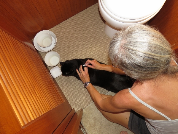
Since leaving the US, we've been dosing Spitfire monthly with Revolution following David LaVigne's recommendation in Where There Is No Pet Doctor. Revolution kills parasites such as heartworm and prevents fleas, ear mites and a number of intestinal parasites. We also carry Frontline to kill adult fleas and ticks should an infestation occur. And some countries require pets to be dosed with Frontline or equivalent prior to entry.
|
 |
10/21/2015: Minnie B
Position: -25°53.74'S, 48°34.65'E
We caught up with Minnie B around midnight--they'd left Reunion the day before we did, but were running slower in light winds. We were running on an identical course, likely because we are both using the waypoints recommended in Jimmy Cornell's World Cruising Routes. We altered course to pass about two miles to their south and chatted a bit on the radio.
|
 |
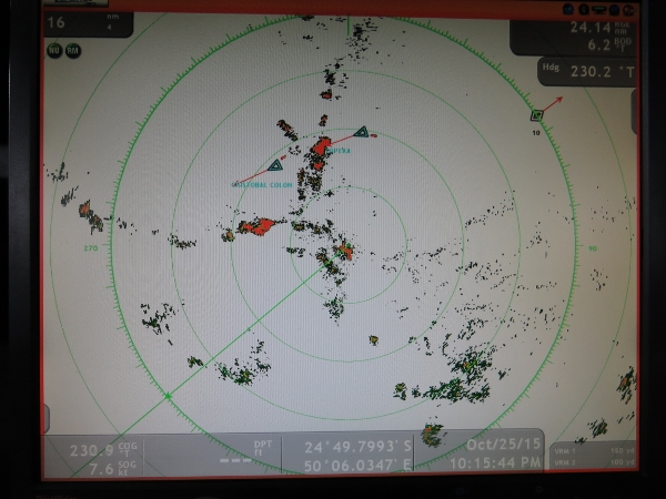
10/21/2015: Hsin Ming Sheng
Position: -26°2.73'S, 48°22.97'E
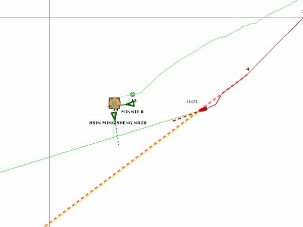
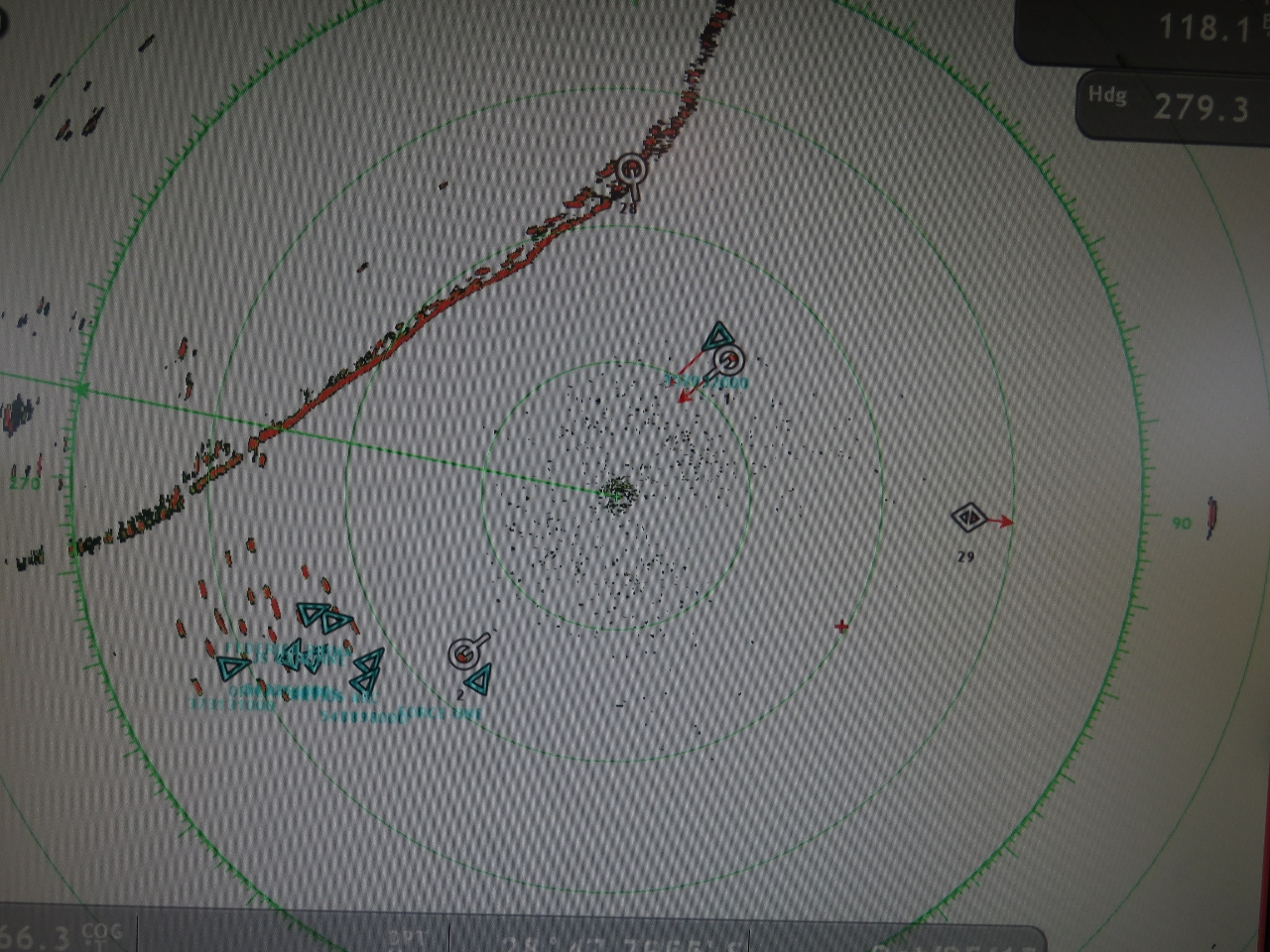
As we were approaching Minnie B, the fishing vessel Hsin Ming Sheng No28 was doing about 5 knots on an easterly course and would pass well to our north. As we neared Minnie B, the fishing vessel increased speed to 8 knots and changed to a southerly course that put us both on a near-collision course. So we both altered course to starboard to pass clear of it. The wavy green line is a target track that shows Minnie B's path--we were using it to determine the best side to pass them on as we initially approached. The green triangles are the AIS (Automtic Identification System) broadcasts from the two vessels, and the green circles are their ARPA (Automatic Radar Plotting Aid) targets tracked via the rader. Our radar always picks the targets up firstr, well ahead of AIS and visual. Smaller vessels usually show up at 8-10 miles and larger vessels beyond 20 miles. The AIS range is variable depending upon the class of the AIS device (A or B) and the height of the antenna. We usually see Class A boats 8-20 miles out and Class B boats 5-10 miles out.
|
 |
10/21/2015: Course change
Position: -26°31.65'S, 47°37.60'E
We initially were running a course recommended in Jimmy Cornell's World Cruising Routes to put us well offshore from the shallows, currents and unsettled weather off the southern tip of Madagascar. But conditions are so calm right now, with winds barely 15 knots and seas light, that we decided to alter course for Richards Bay a little earlier and save a few miles. This also will put us slightly north of the rest of the pleasure craft traffic so we're less likely to need to alter course again.
|
 |
10/21/2015: Speeding up
Position: -26°49.56'S, 45°58.12'E
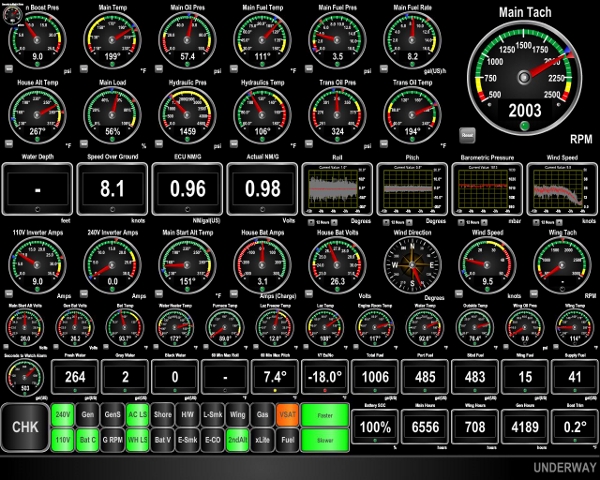
Today's GRIB weather data showed 20-knot southwesterly winds off Richards Bay starting early the morning we are scheduled to arrive and lasting for two days. We don't want to be crossing the southbound Agulhas Current in southerly winds, so we've increased speed to arrive in the night before. We're glad we filled the forward bladder in Rodrigues so we could run harder if necessary for exactly this possibility. We're starting to get a push from the South Equatorial Current, so fuel economy has been improving as we proceed. The winds have picked up to a steady 25 to 30 knots, and we're starting to roll up to nearly 15 degrees now (roll guage is near the center of the display to the right of the 1.02 nm/g readout). We weren't expecting the winds to be much over 20, but these conditions shouldn't last more than 24 hours.
|
 |
10/22/2015: Conditions
Position: -27°14.35'S, 43°47.90'E
The winds remained steady at 25 to 30 knots last night. The waves picked up to about 9 ft on 8 seconds, with some waves much larger and occasionally producing rolls up to 20 degrees. As expected, the winds have settled down now to below 10, the waves are down to about 6 feet, and boat roll is back below 10 degrees. This should last a day or two until we hit the high pressure system coming off South Africa. Then we expect another day of 8 feet on 8 seconds, but more on the beam, and after that a relatively smooth ride into Richards Bay.
|
 |
10/22/2015: Texas
Position: -27°21.87'S, 43°4.12'E
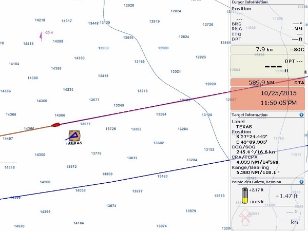
The 1,093 ft tanker Texas throws a radar signature as big as some storm systems. The ship is 197 ft wide--we could line four Dironas lengthwise across its beam. We're surprised that we're still on the shipping path--we would have expected the ships rounding Cape of Good Hope to be taking a more southwesterly course by now. Perhaps they are taking advantage of the South Equatorial and the Agulhas currents to improve fuel economy.
|
 |
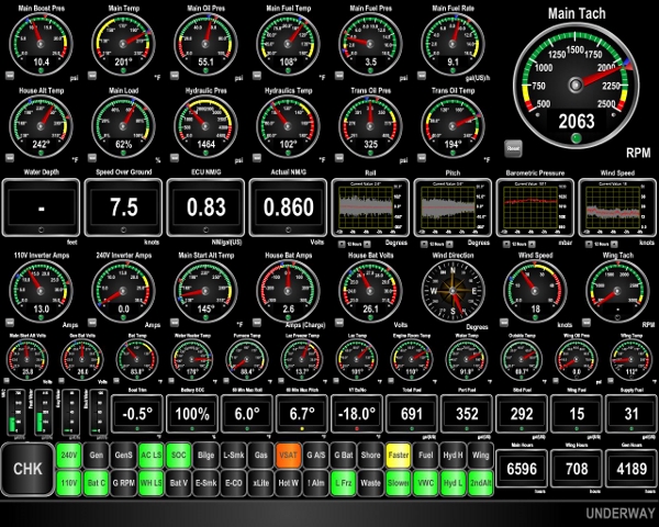
10/23/2015: 9.3 knots
Position: -27°35.16'S, 41°46.70'E
With a push from the South Equatorial Current we're smokin' at 9.3 kts and a fuel economy of 1.14 nm/gallon at 2,000 RPM. We'd normally only do about 8.4 kts at this RPM in flat water, and less in open ocean. So we're getting a good knot or two push from the current.
|
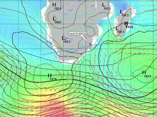 |
10/23/2015: Weather
Position: -27°48.65'S, 40°21.03'E
We normally find the GRIB data reasonably stable, but the weather systems off the South Africa coast are quite changeable. From the time we left Reunion up until four days ago, the GRIBS indicated that a high pressure system would pass through shortly before we arrived into Richards Bay, with light or northerly winds for several days as we crossed through the Agulhas Current. Three days ago the WW3 GRIB indicated two days of strong southwesterly winds starting early the morning we expected to arrive. The southbound Agulhas Current is one of the strongest in the world, and when opposing winds are blowing from the south, waves reportedly can reach 20m. So we increased speed to arrive 12 hours earlier to avoid the southerly winds. Yesterday those southerly winds disappeared from the WW3 GRIB, and today they are back with a somewhat shorter duration. The screen shot is of the GFS GRIB data in ViewFax for 8pm the evening we arrive. That weak low-pressure system between the two large high-pressure system seems to be what is causing the variablility. We'll be keeping a careful eye on it as we close in on the coast. Conditions right now are excellent, with winds less than 10 kts and a low swell. We expect conditions to deteriote today to about 8 ft on 8 seconds as we pass through the eastern-most of those two high-pressure systems this afternoon, then the period will increase to about 11 seconds for much of the rest of the run until we near coastal South Africa.
|
 |
10/24/2015: Conditions
Position: -28°11.11'S, 37°45.61'E
We passed through the northern edge of that high pressure system last night and conditions have settled back down now. The only thing that hasn't improved is our speed. We dropped down to just over 7 kts most of the night and the speed hasn't really recovered yet. We should start to see an improvement later today as the seas shift from southwesterly and more on the nose to southeasterly and more on the stern.
|
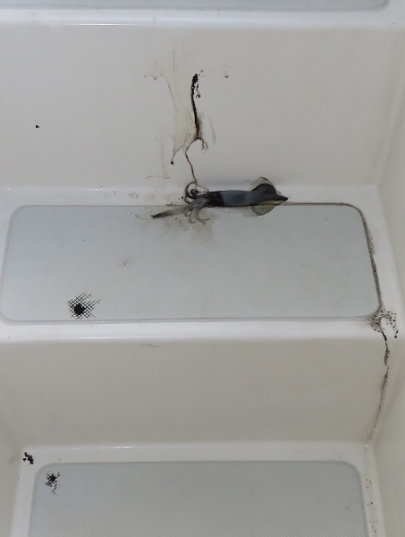 |
10/24/2015: Squidded again
Position: -28°15.43'S, 37°11.30'E
Another squid landed on deck overnight, spraying ink all over the step.
|
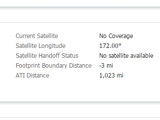 |
10/24/2015: KVH
Position: -28°15.94'S, 37°7.26'E
We're about 3 miles outside the coverage area of our KVH mini-VSAT satellite data system. We haven't been in range for almost two months since leaving coverage 900 miles off Australia. We're really looking forward to having that back--we sure miss being always connected.
|
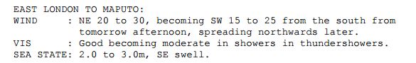 |
10/24/2015: Weather outlook
Position: -28°22.36'S, 36°16.32'E
We eventually got some of our speed back and are averaging close to 8 knots, but nothing close to the 9 knots we were seeing earlier. We've just got the latest South African coastal forecast, issued at 1pm, for the period from 11pm tonight to 11pm tomorrow. The forecast matches our GRIB data: 20-25 kts from the NE as we cross the Aghulhas Current and late in the evening, once we're well through, the winds will switch to 15 to 20 SW. We're definitely glad we sped up to get in Sunday evening as Monday morning is now looking pretty bad.
|
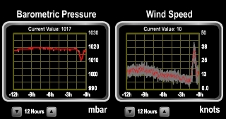 |
10/24/2015: 42 knots
Position: -28°24.00'S, 36°3.28'E
We just passed through a squall where in the space of minutes the winds shot up from less than 10 knots to 42 knots and the barometer fell 4 mbars. The seas went from calm and smooth to windstreaked and choppy. After about a half-hour, conditions started to settle down and within an hour were back to where they were before with calm seas and winds below 10.
|
 |
10/24/2015: Online!
Position: -28°25.51'S, 35°51.40'E
Our KVH mini-VSAT satellite data system is online! It's wonderful to see it back.
|
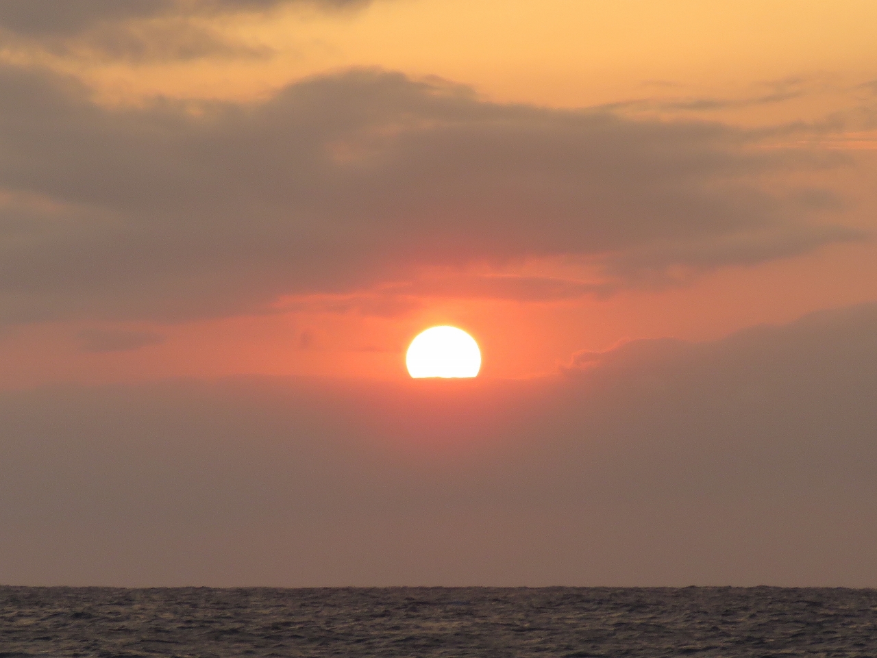 |
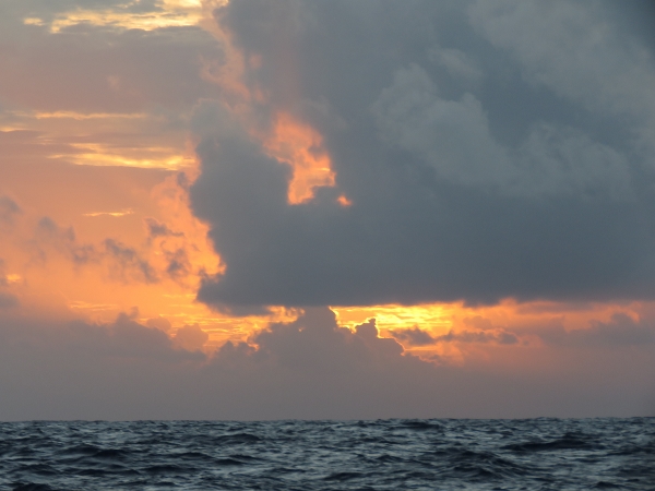
10/24/2015: Sunset
Position: -28°27.25'S, 35°36.99'E
We haven't had many great sunsets on this passage, but here's one.
|
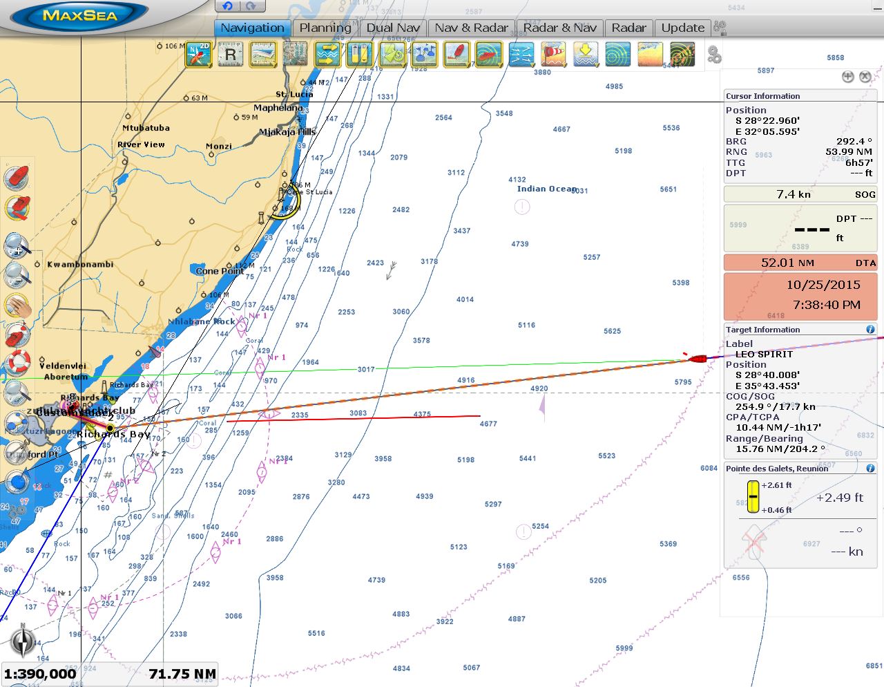 |
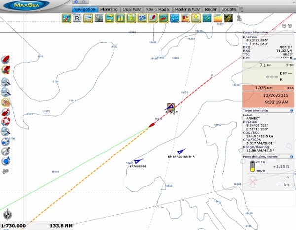
10/25/2015: 52 miles
Position: -28°43.84'S, 33°2.25'E
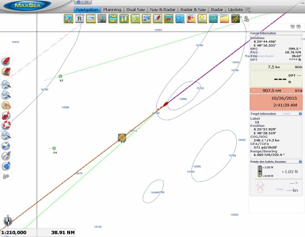
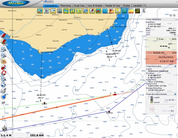
We're just 52 miles from our destination in Richards Bay now. As expected, the winds are blowing 20-25 from the NE and we're in 8 ft seas on about 8 seconds. The waves are on the stern starboard quarter, and max pitch and roll are 9 and 12 degrees respectively. We're making reasonable speed at just over 8 knots and should arrive just before sunset. That red horizontal line on the chart is roughly where the Agulhas Current runs--about 10-20 miles seaward of the 200m contour line. We'll be entering the current in about 2 hours and should be through it in 5 hours. From there it should be pretty smooth sailing as we enter the more sheltered port waters.
|
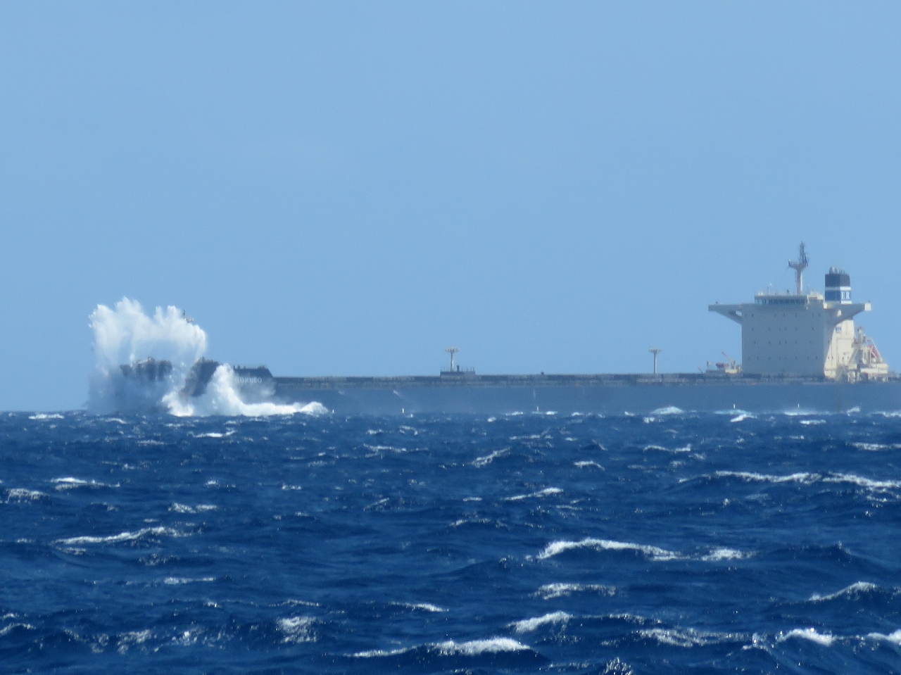 |
10/25/2015: E. R. Borneo
Position: -28°46.38'S, 32°37.70'E
The 958ft cargo ship E. R. Borneo en route to India was taking big waves over the bow as it worked into the seas. We're getting tossed around a bit in these seas, but at least they mostly are on our stern. We continue to make good speed and expect to arrive around 5pm this evening.
|
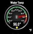 |
10/25/2015: 96 degrees
Position: -28°46.53'S, 32°36.29'E
The water temperature has increased 3 degrees to 96°F since we entered the Agulhas Current. We've never been in water this warm.
|
 |
10/25/2015: Land ho!
Position: -28°47.77'S, 32°24.27'E
We can just barely make out the South Africa coast about 16 miles away. We should be moored in a couple of hours.
|
 |
10/25/2015: Ships
Position: -28°47.81'S, 32°23.93'E
Richards Bay has the largest coal export facility in the world. As we near the port entrance, we're picking up lots of AIS and radar targets of ships moored just outside or underway.
|
 |
10/25/2015: Waves
Position: -28°48.71'S, 32°5.93'E
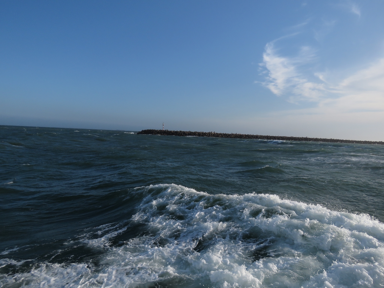
The winds continued to blow in the mid 20s from the NE, with the seas 8ft on 8-seconds on the stern as we neared the harbour entrance at Richards Bay. The waves got even tighter as we entered the narrower and shallower entry channel waters, then flattened out once we were inside the breakwater.
|
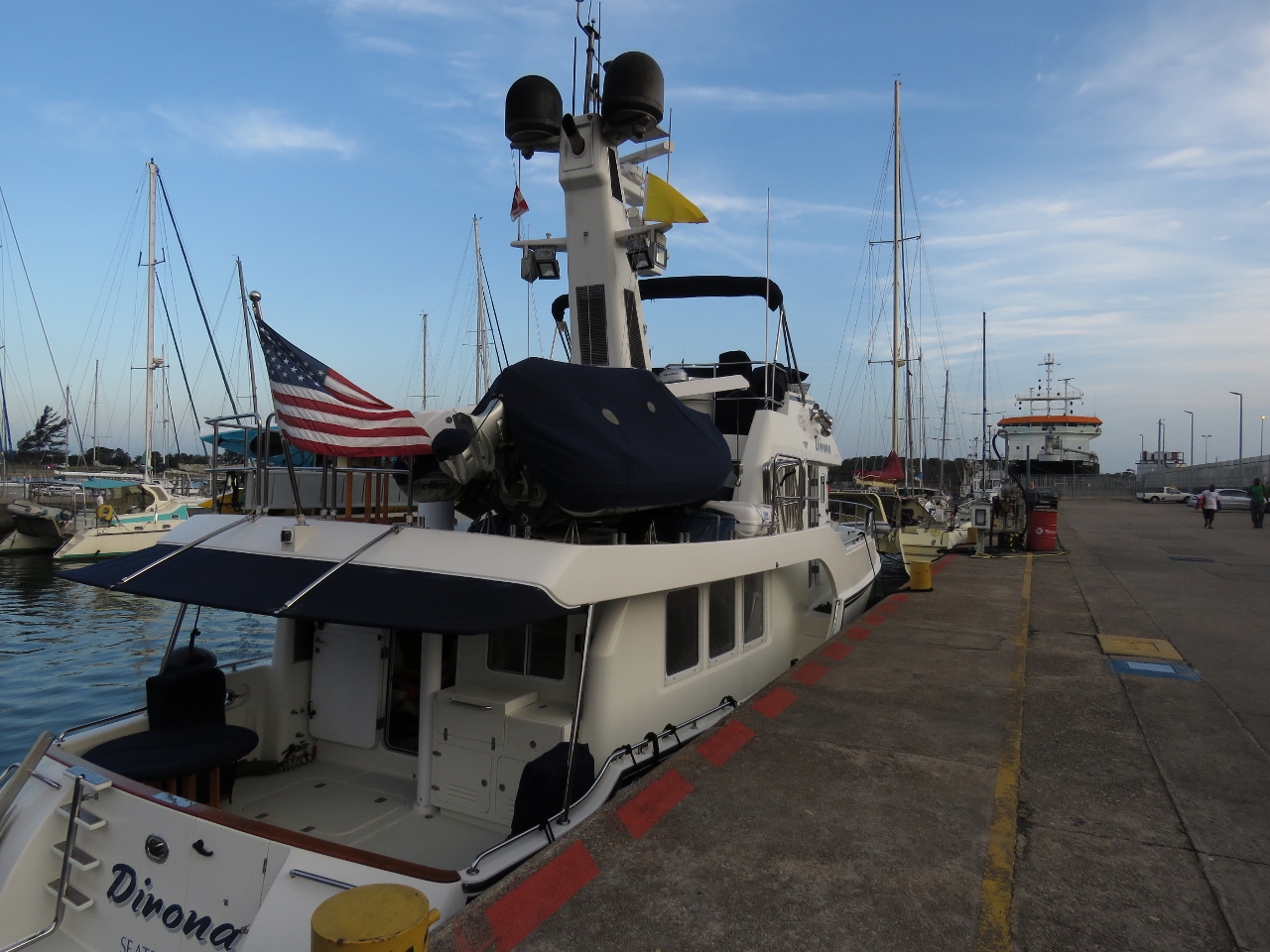 |
10/25/2015: International dock
Position: -28°47.66'S, 32°4.70'E
We landed on the international dock shortly before sunset to await clearance from customs and immigration. La Medianoche arrived earlier in the day and are moored in front of us. We were very happy to have the Indian Ocean crossing and the Agulhas Current behind us. We will have to face the current again when we head to Cape Town, but that is a problem for another day. For the next few weeks, we'll spend some time enjoying the sights in and around Richards Bay.
|