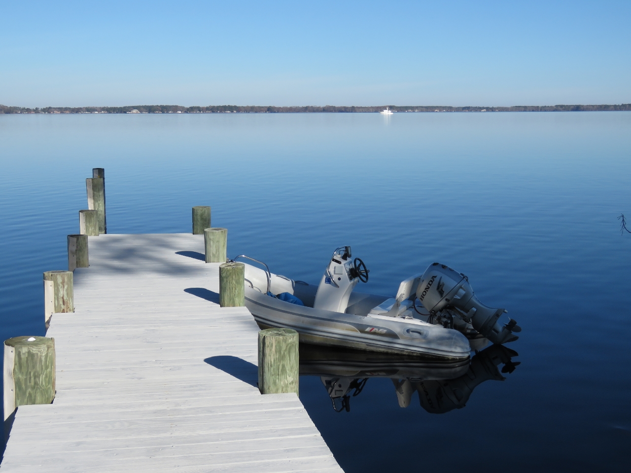
MV Dirona travel digest for ICW 2016

|
Click the travel log icon on the left to see these locations on a map,
with the complete log of our cruise. On the map page, clicking on a camera or text icon will display a picture and/or log entry for that location, and clicking on the smaller icons along the route will display latitude, longitude and other navigation data for that location. And a live map of our current route and most recent log entries always is available at //mvdirona.com/maps/LocationCurrent.html. |
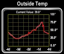 |
12/19/2016: Temperature Swing
Position: 36°50.65'N, -76°17.58'W
The temperature has mostly been in the mid 30s over the past week or so. Three days ago it fell to a low of 24°F and then yesterday soared to a high of 76°F then fell back down to 40°. Its back down to 40 this morning.
|
 |
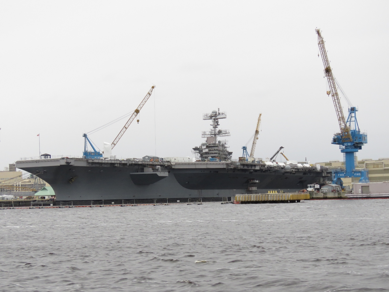
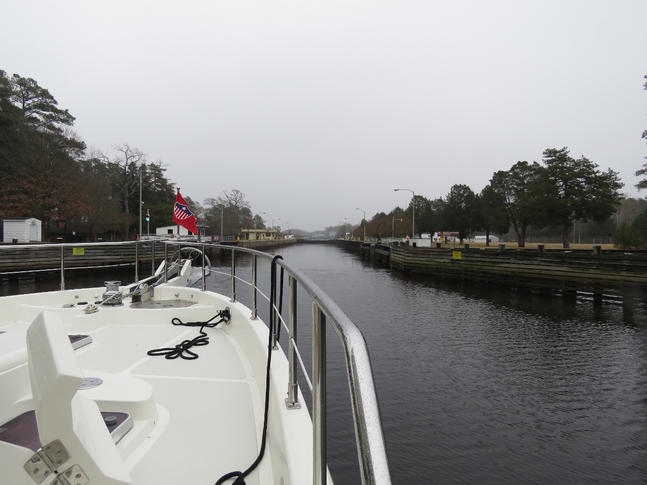
12/19/2016: Beltline Railroad Lift Bridge
Position: 36°48.75'N, -76°17.43'W
Except for a brief transit around the Palm Beach area, we’ve not traveled the Intracoastal Waterway (ICW) in Dirona. In our first leg along the ICW, we're heading 12 miles south to the town of Great Bridge. All but one of the bridges are either normally-open, as is the Beltline Railroad Lift Bridge, or has sufficient clearance for us to pass under when closed.
|
 |
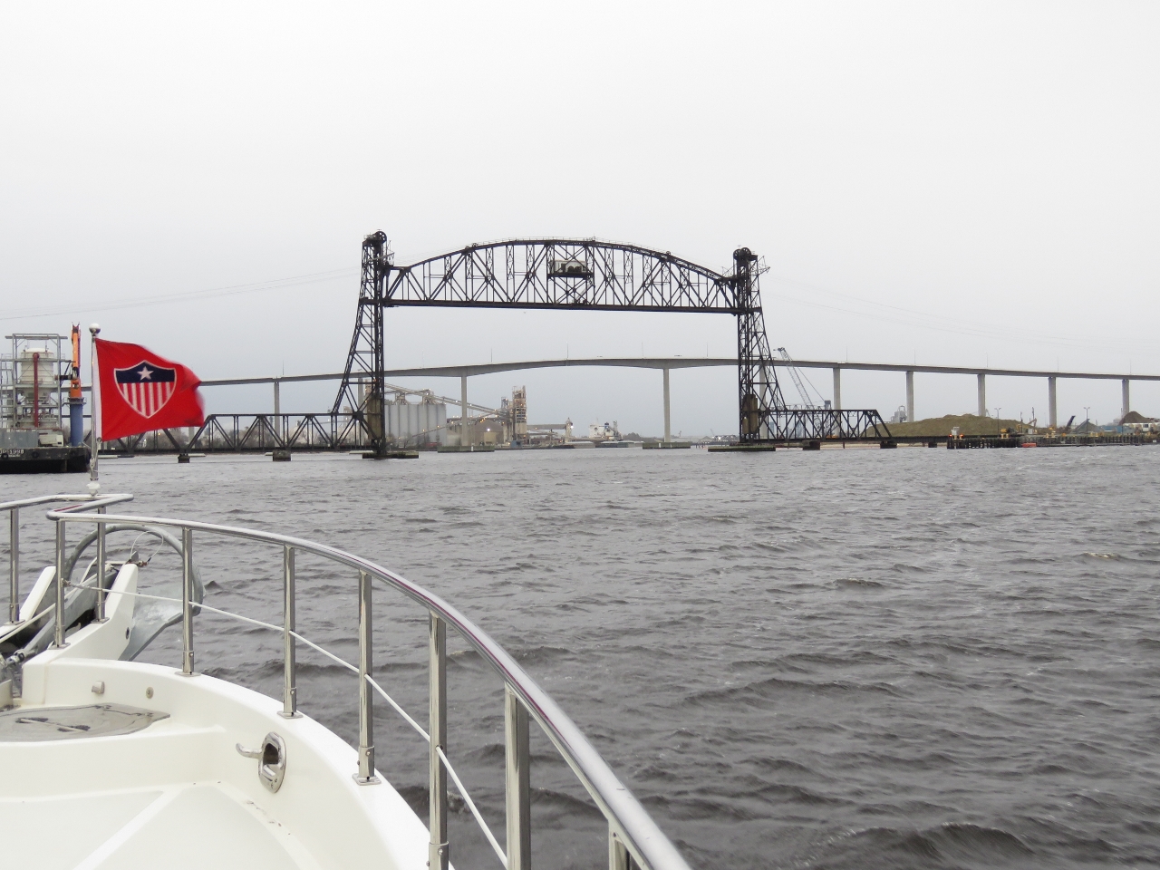
12/19/2016: Harry S. Truman
Position: 36°48.63'N, -76°17.43'W
We believe this is the Nimitz-class aircraft carrier Harry S. Truman at the Norfolk Naval Shipyard in Portsmouth, but we couldn't see any identifying name or number. The Harry S. Truman is scheduled to be in the yard there for maintenance for 10 months starting in August of this year.
|
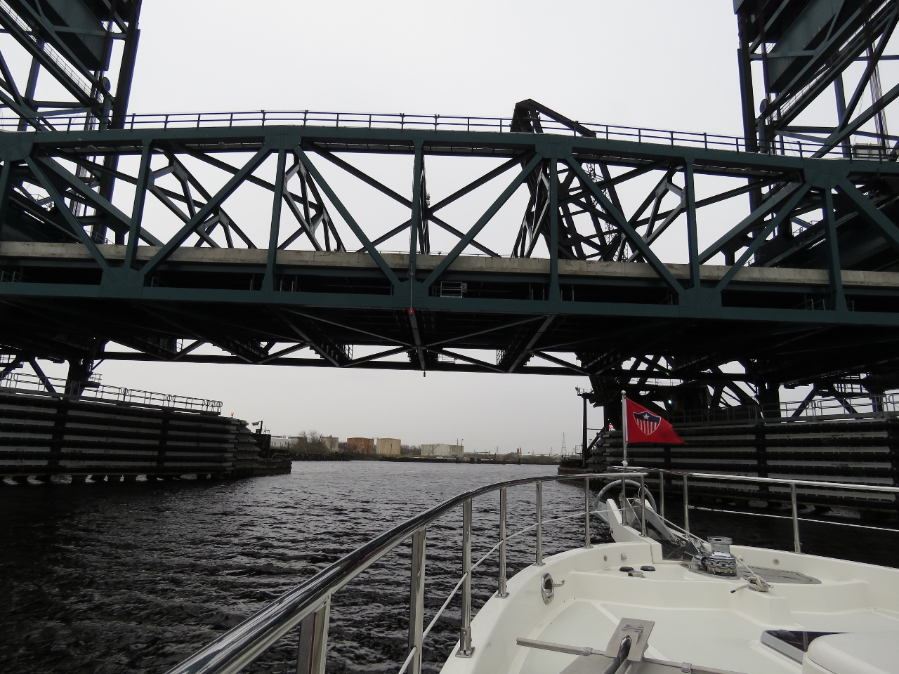 |
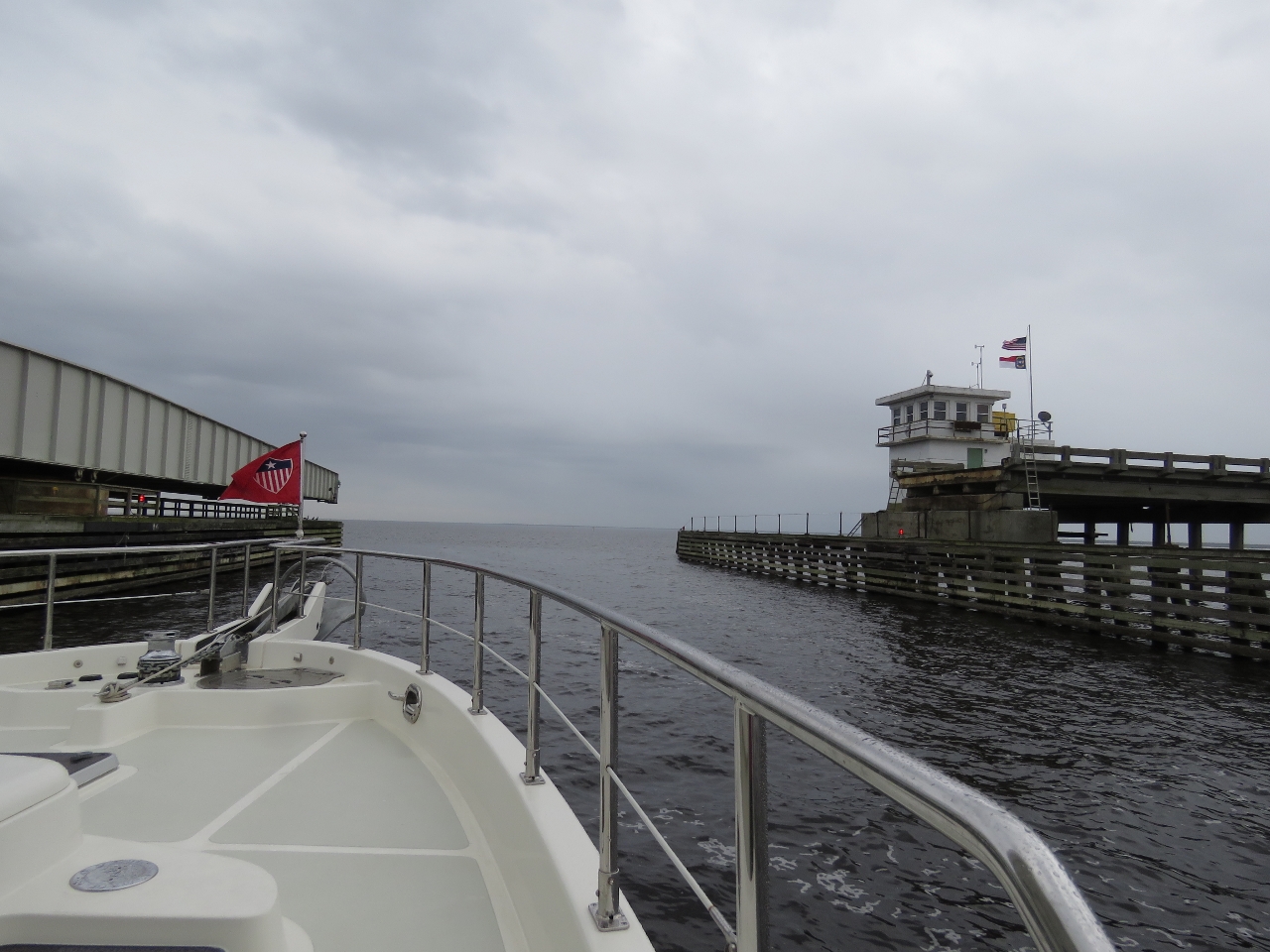
12/19/2016: Gilmerton Lift Bridge
Position: 36°46.28'N, -76°17.79'W
The fourth bridge we passed under, the Gilmerton Lift Bridge, had a minimum clearance of 35ft closed. This is only 5 ft above our 30-ft air draft, but good enough for us to pass.
|
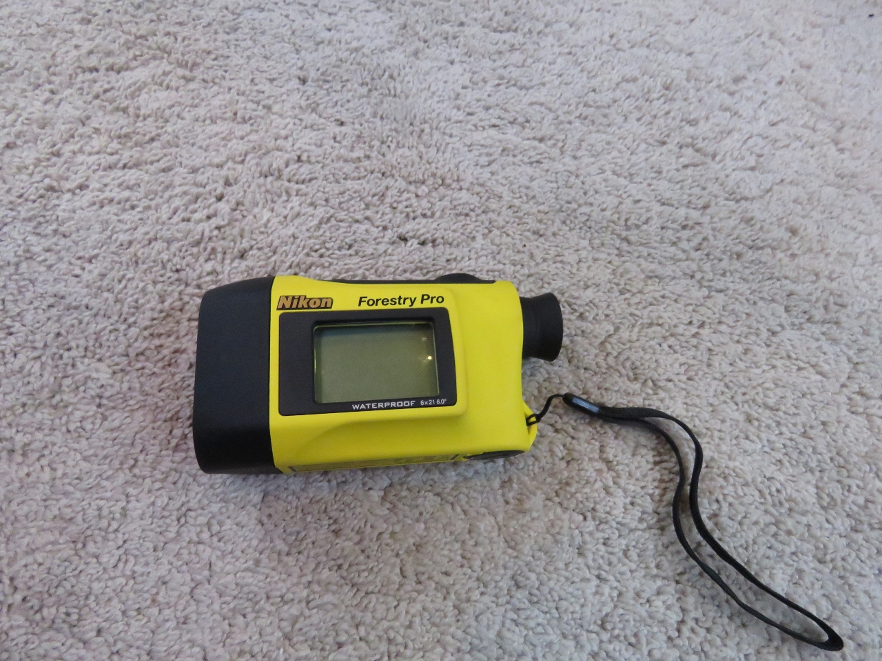 |
12/19/2016: Range Finder
Position: 36°46.18'N, -76°17.84'W
We use a Nikon Forestry Pro Laser Rangefinder. The device is easy to use and incredibly accurate. Well before we were committed to passing under, the gauge measured the Gilmerton Lift Bridge clearance at 36ft, which matched the tidal gauge at the bridge. Along the ICW the bridges clearances are well-marked, but we've found several places in the world where they're not marked at all and the gauge comes in quite handy.
|
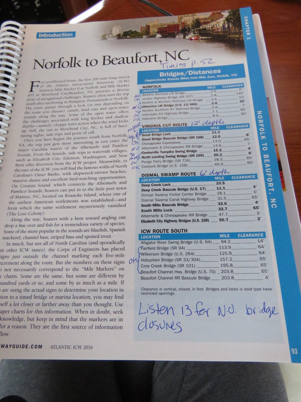 |
12/19/2016: Waterway Guide
Position: 36°45.96'N, -76°17.92'W
We've been using the Waterway Guide cruising guides along the east coast and have found them accurate and quite useful. This page shows all the bridge clearance between Portsmouth, VA and Beaufort, NC. A separate section in the guide provided detailed timing information for all the bridges along the ICW. This made it easy for us to plan our route and know which bridges we needed to have opened—only four in total. Three of the four open on a fixed schedule, so we need to time our arrival at them.
|
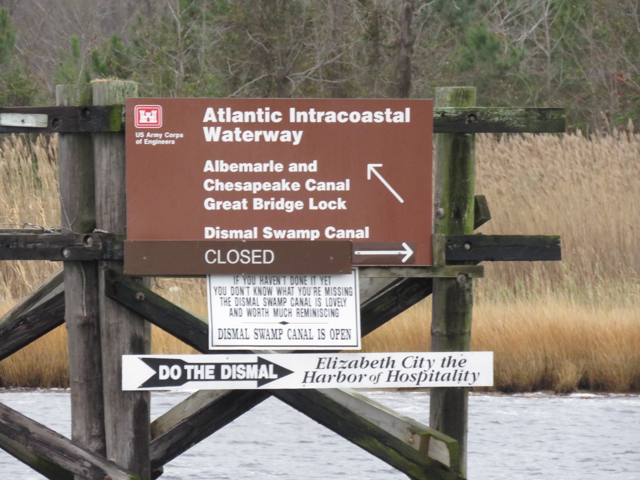 |
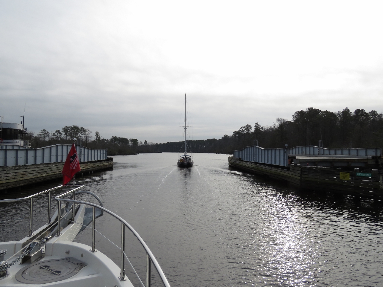
12/19/2016: Branch
Position: 36°45.15'N, -76°17.75'W
The ICW branches here into two routes. We're taking the Virginia Cut, which is charted at 12ft. The Dismal Swamp route is charted at 6ft and currently is closed, likely due to low water levels.
|
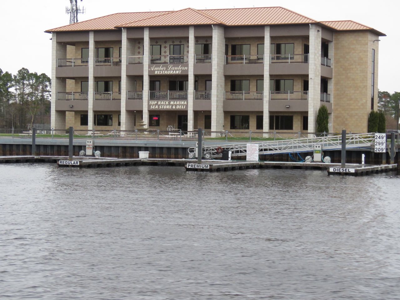 |
12/19/2016: Fuel
Position: 36°44.18'N, -76°17.68'W
This fuel dock had one finger pier for diesel, a second for regular gas and a third for premium gas.
|
 |
12/19/2016: Great Bridge Lock
Position: 36°43.41'N, -76°14.84'W
Waiting for the gates to open at the Great Bridge Lock. This is the only lock on the Virginia Cut route through the ICW (two locks are along the alternate Dismal Swamp route). All the locks we’ve passed through so far have been tide-level locks. The Great Bridge Lock instead separates the saltwater of the Elizabeth River from the freshwater of the Albemarle and Chesapeake Canal.
|
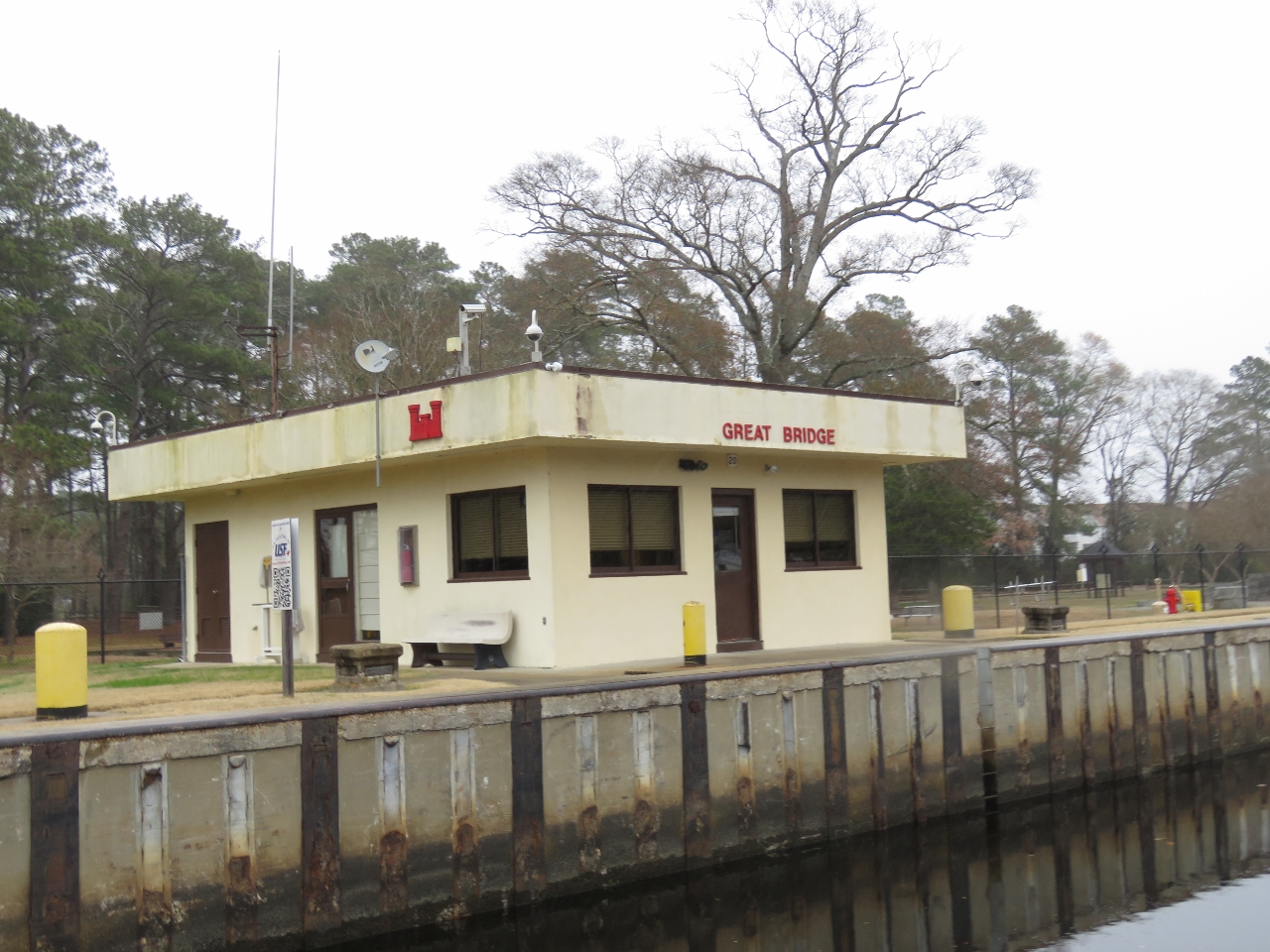 |
12/19/2016: Army Corps
Position: 36°43.40'N, -76°14.82'W
The Great Bridge Lock is another US Army Corp of Engineers facility.
|
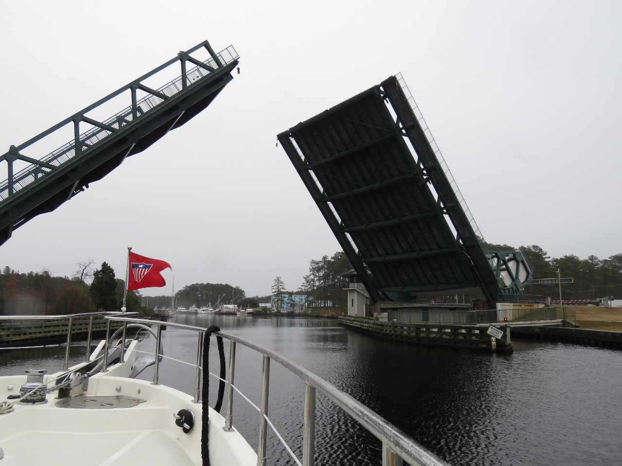 |
12/19/2016: Great Bridge Bascule Bridge
Position: 36°43.22'N, -76°14.28'W
The Great Bridge Bascule Bridge opens only on the hour and the lock coordinates its opening with bridge. We arrived at 9:40am and passed through the locks just before the 10am bridge opening.
|
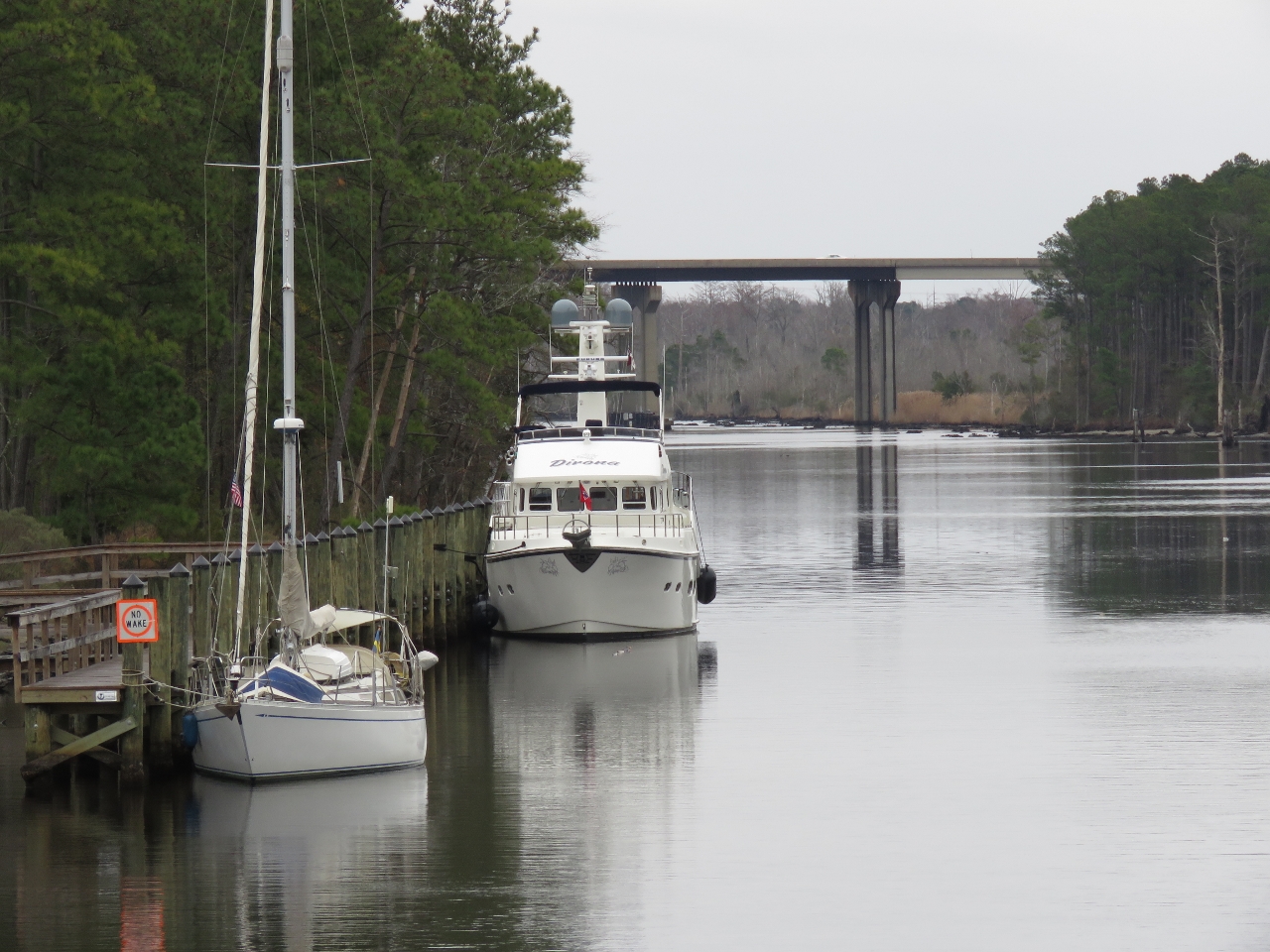 |
12/19/2016: Moored
Position: 36°43.22'N, -76°14.39'W
Moored for the night at the town of Great Bridge. A video of our complete transit between Norfolk and Great Bridge is at https://youtu.be/p-b0uPOkXt8.
|
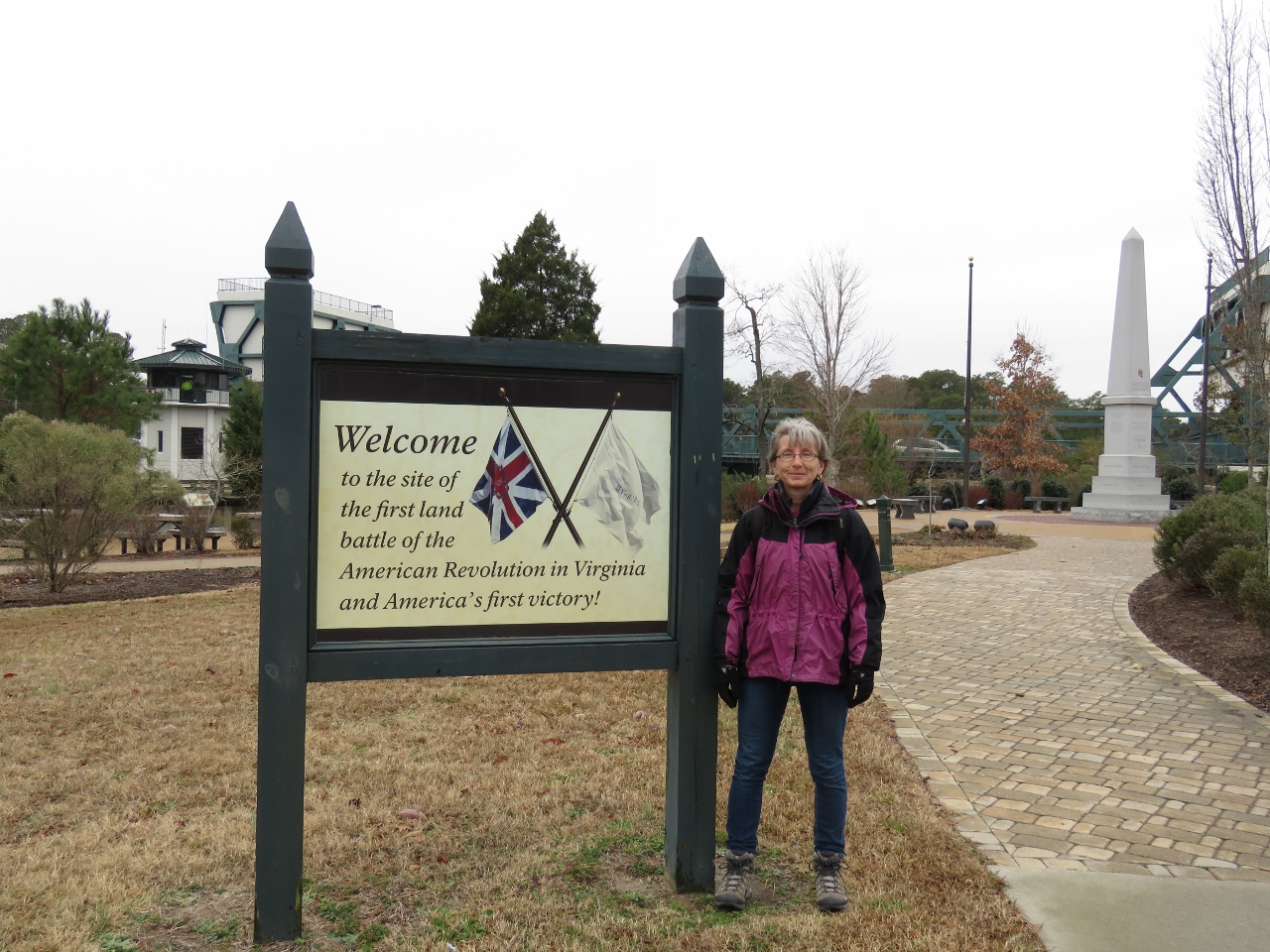 |
12/19/2016: Battlefield Park
Position: 36°43.30'N, -76°14.35'W
The Great Bridge Battlefield and Waterways Park commemorates the first American victory in the Revolutionary War. The defeat of the British here allowed the local militia to capture Norfolk and gain a naval base from which to attack the British.
|
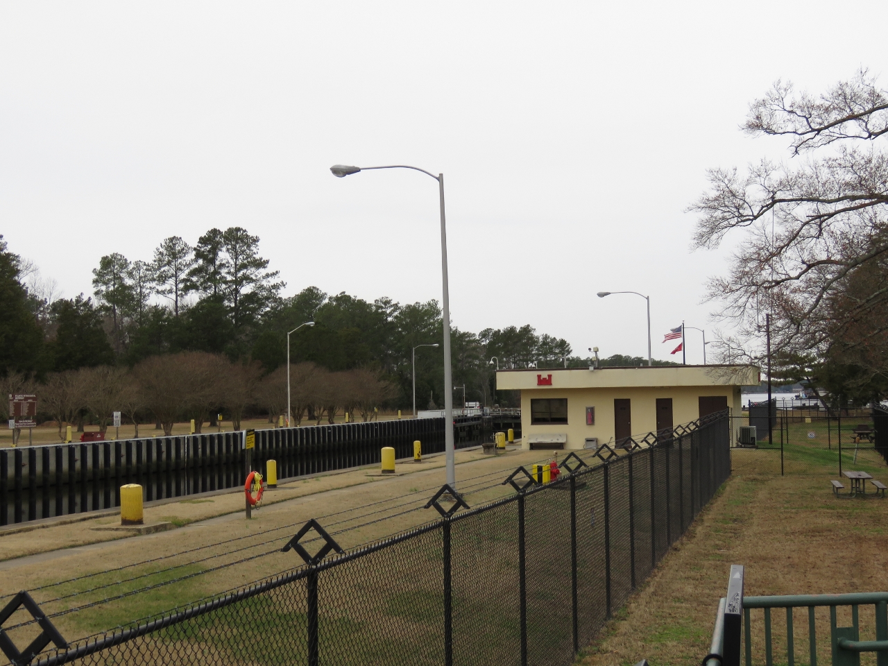 |
12/19/2016: Park
Position: 36°43.41'N, -76°14.76'W
A view to the Great Bridge Lock from the adjacent public park. Not many people were around in mid-December, but signs warned of traffic congestion and difficult parking or even turning around.
|
 |
12/19/2016: Kelly's Tavern
Position: 36°43.34'N, -76°14.53'W
We had a great lunch overlooking the Elizabeth River at Kelly's Tavern.
|
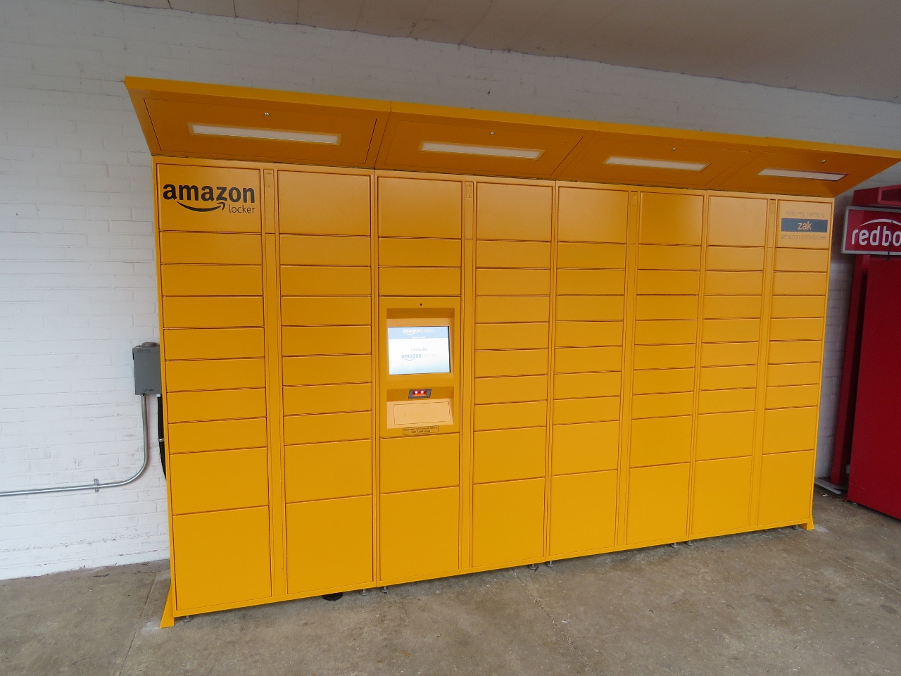 |
12/19/2016: Amazon Locker
Position: 36°42.89'N, -76°14.26'W
Our first sighting of an Amazon Locker, a self-service parcel delivery and return location.
|
 |
12/20/2016: Great Bridge
Position: 36°43.24'N, -76°14.24'W
A beautiful calm morning at Great Bridge. The Chesapeake Expressway Bridge, with a a 65ft clearance, is visible to our south.
|
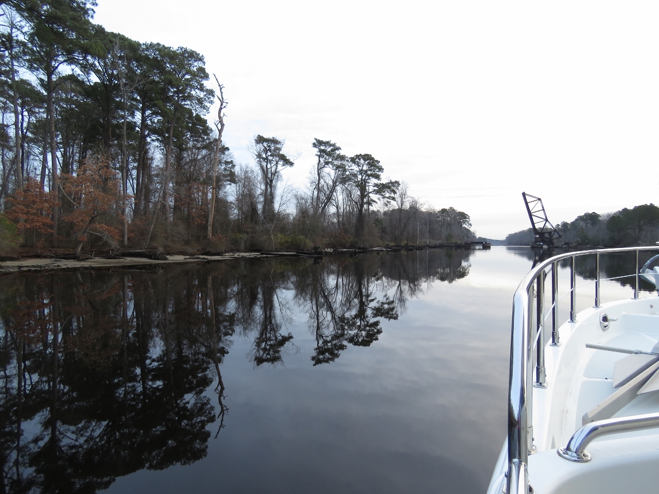 |
12/20/2016: Reflections
Position: 36°43.32'N, -76°12.72'W
In light winds and a protected channel, the trees reflect almost perfectly in the water surface. In the distance is the second bridge we'll pass through today, the normally-open Albermarle & Chesapeake Railroad Bridge.
|
 |
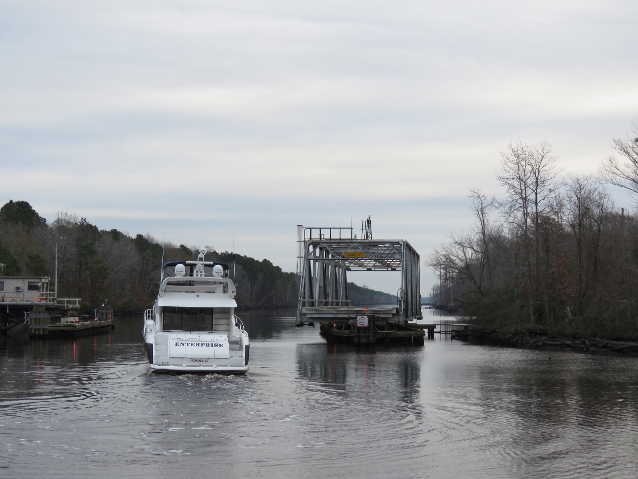
12/20/2016: Enterprise
Position: 36°43.35'N, -76°12.24'W
Enterprise passed through the Great Bridge Bascule Bridge shortly after we departed this morning and quickly caught up with us.
|
 |
12/20/2016: Centerville Turnpike Swing Bridge
Position: 36°43.42'N, -76°11.23'W
We caught back up with Enterprise watiting for an opening at the Centerville Turnpike Swing Bridge. The bridge opens on the half-hour, but the first opening is not until 8:30 in the morning on non-holiday weekdays.
|
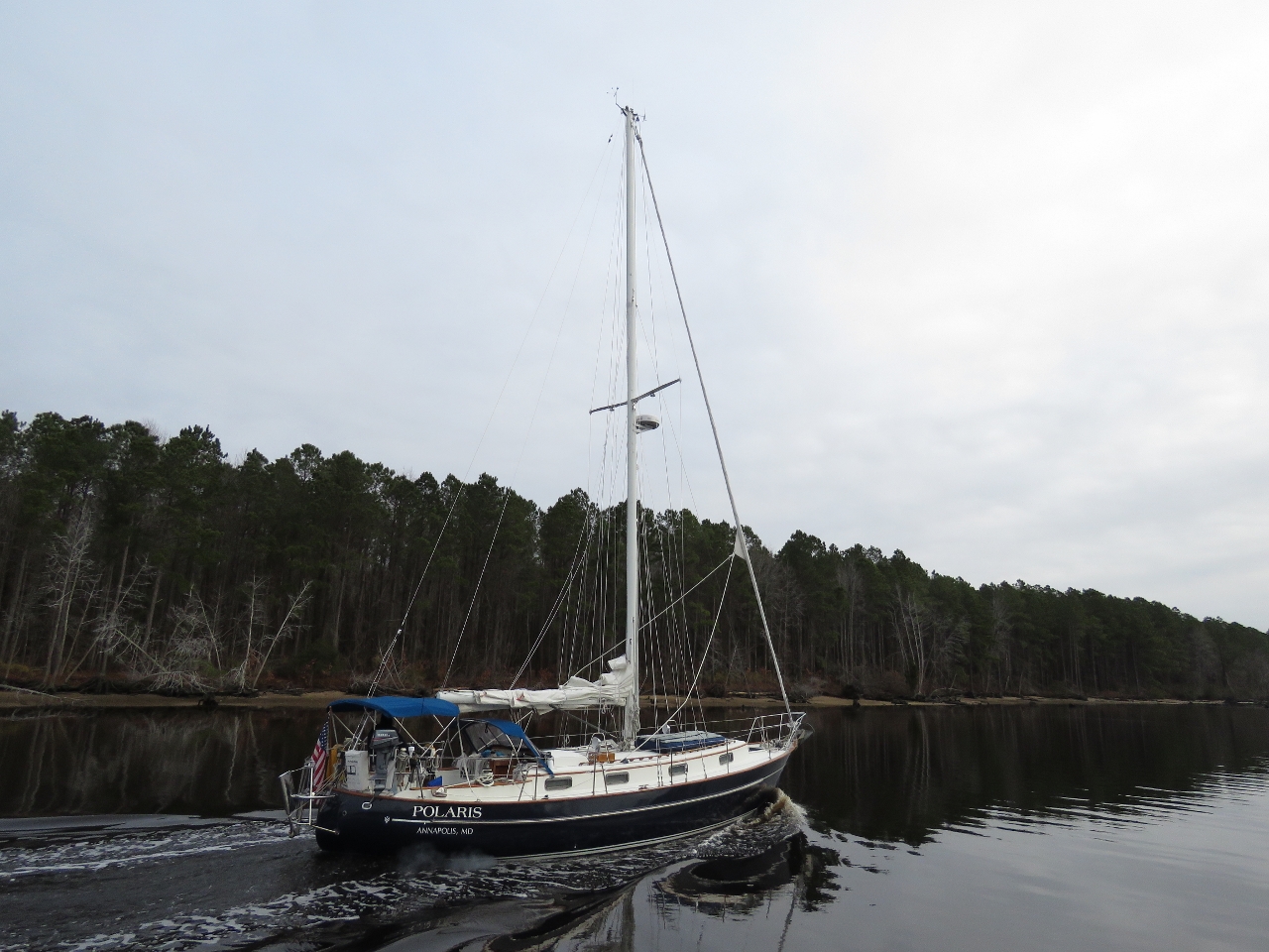 |
12/20/2016: Polaris
Position: 36°43.41'N, -76°8.24'W
Polaris was moored between the Great Bridge lock and the bridge overnight. They followed Enterprise through the Great Bridge Bascule Bridge opening and passed us about an hour later. We didn't see much other traffic for the rest of the day, except for a tug pushing a barge north.
|
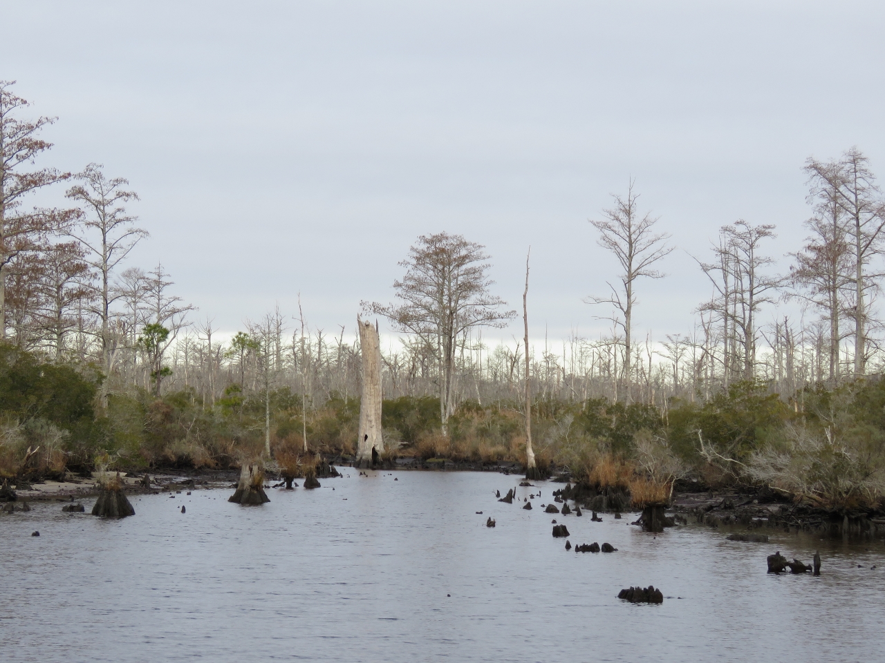 |
12/20/2016: Swamp
Position: 36°43.40'N, -76°6.68'W
We're definitely in swamp country.
|
 |
12/20/2016: North Landing Swing Bridge
Position: 36°43.06'N, -76°6.01'W
We caught up with Polaris at the North Landing Swing Bridge, also on a half-hour opening schedule. We have only one more bridges to pass today, but it has a 65ft clearance.
|
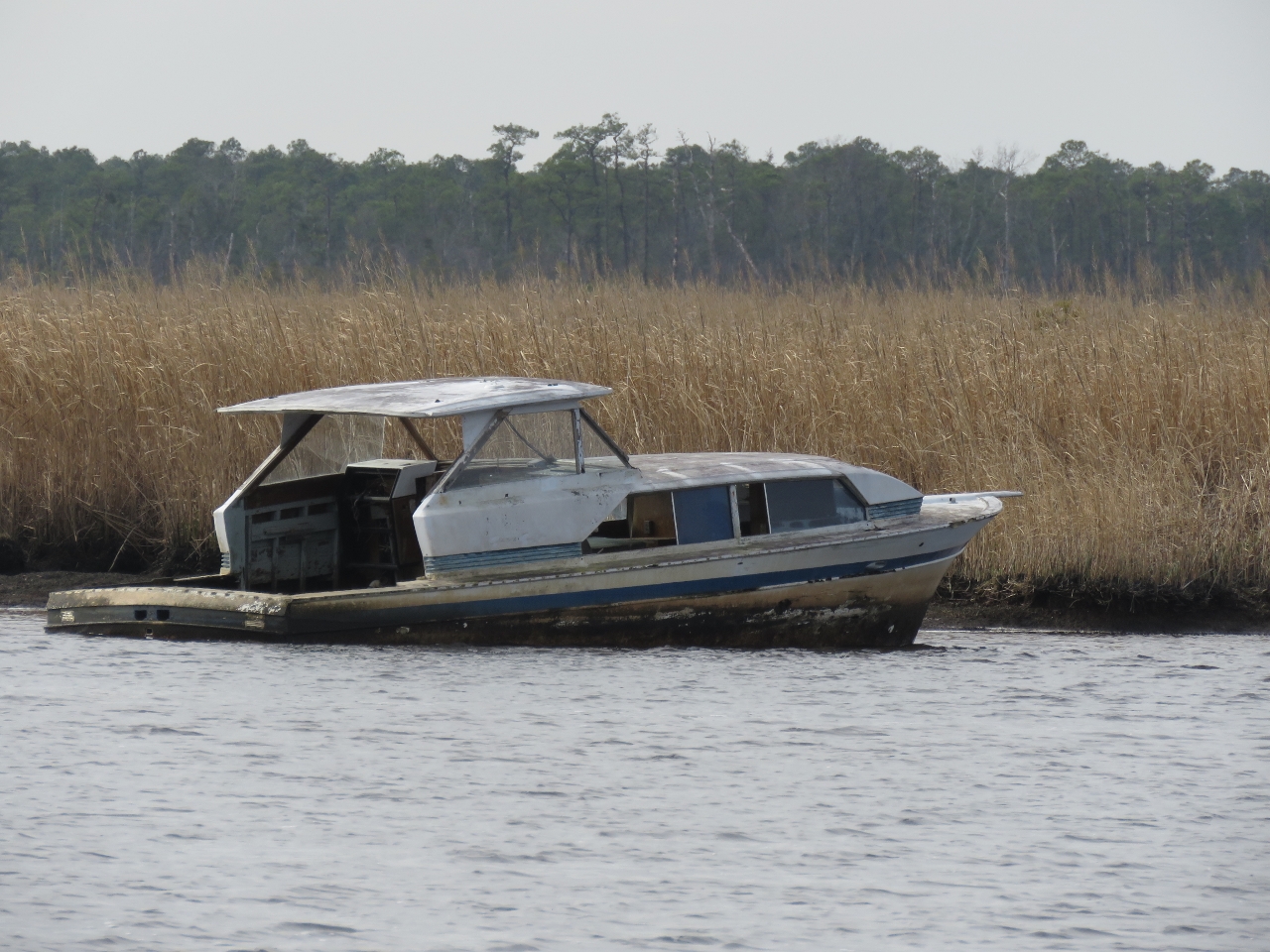 |
12/20/2016: Wreck
Position: 36°38.13'N, -76°3.13'W
A wreck alongside the channel just north of the Pungo Ferry Bridge.
|
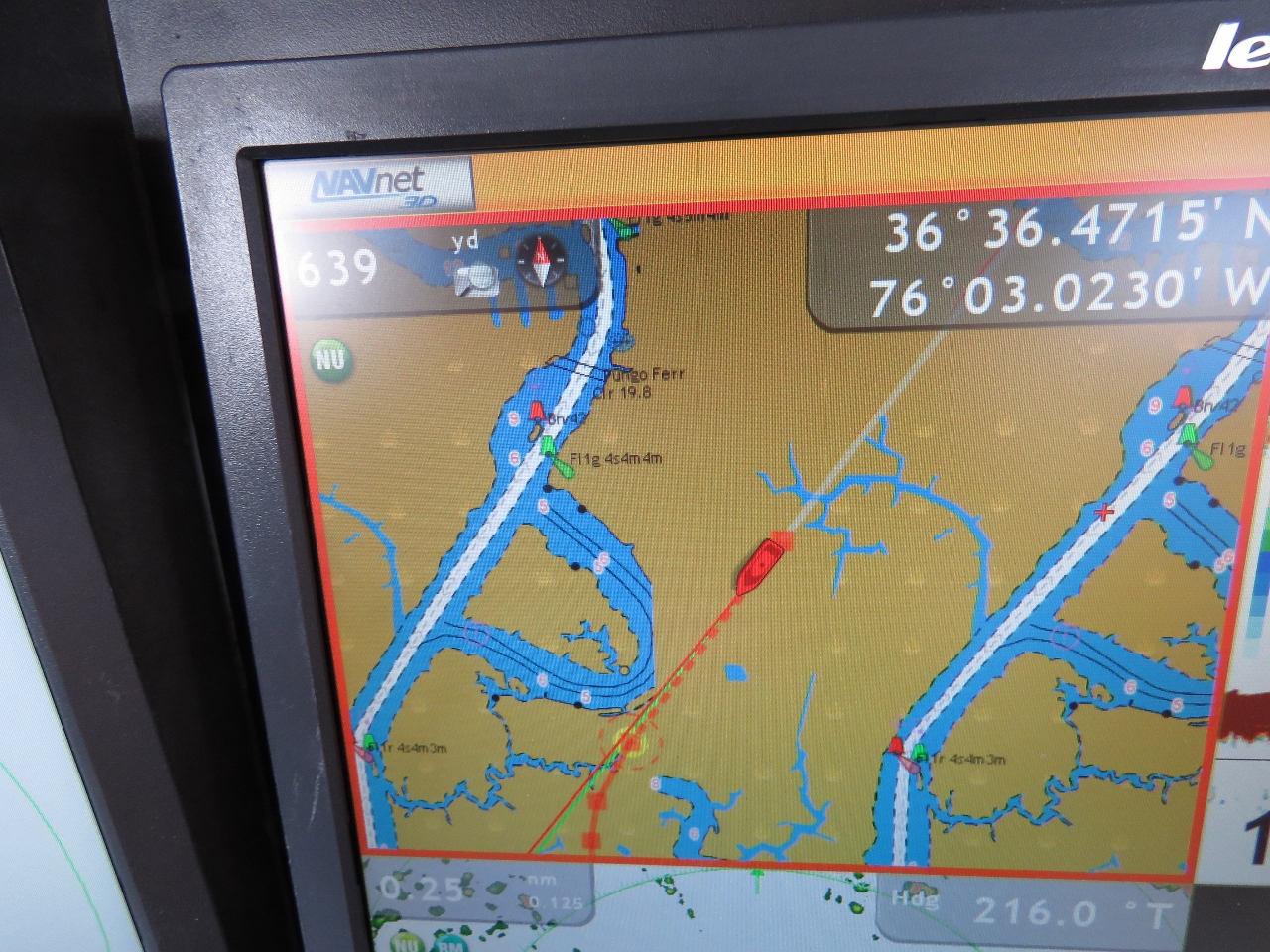 |
12/20/2016: Chartplotter Issue
Position: 36°36.39'N, -76°3.41'W
We've started seeing a strange charplotter issue if we zoom more than about two miles in on our NavNet 3D system. The charts are displayed two aside with our boat positioned in the middle. We're hoping this is just a local chart issue and will resolve itself when we leave the area.
|
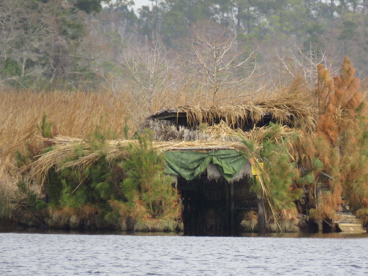 |
12/20/2016: Blind
Position: 36°35.63'N, -76°3.42'W
Waterfowl hunting is very popular here. This blind looks almost like a small cabin.
|
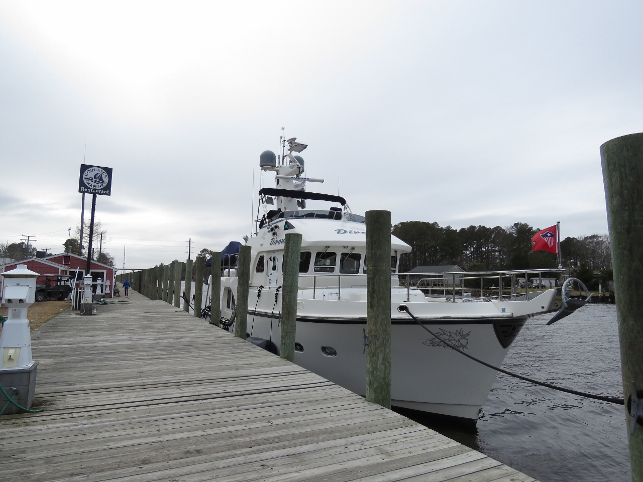 |
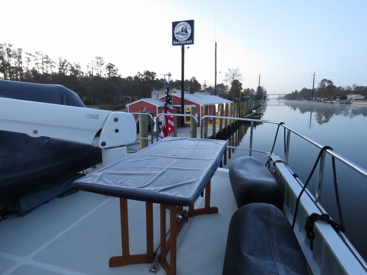
12/20/2016: Coinjock Marina
Position: 36°20.94'N, -75°56.92'W
We have stopped for the night at Coinjock Marina across the state line in North Carolina. The depths along this run generally were shallower than the previous day, particularly in Currituck Sound where shoaling and the persistent north winds we’ve had over the past few days can drop the water level by 2-3 ft.
The channel is charted at 12ft, but we typically saw 9-10ft through Currituck Sound and occasionally as low as 8.2ft. The winds also affect the current in North Carolina Cut where Coinjock Marina is. The tidal range is minimal, but the afternoon we arrived the current was running a half knot southbound and when we left the next morning it was running a knot northbound. Video highlights from today's run are at https://youtu.be/6HPSaY_uFO4. |
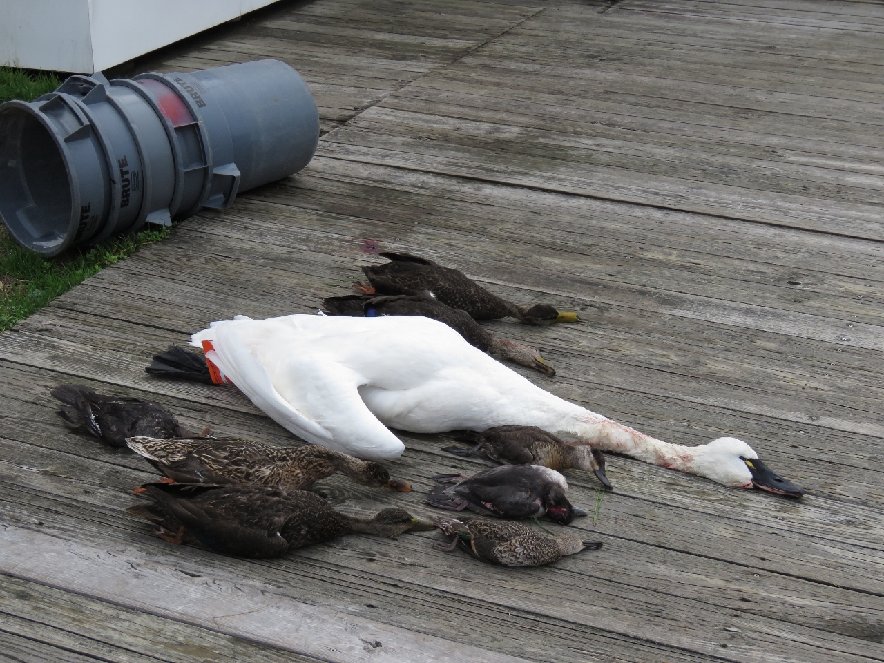 |
12/20/2016: Catch
Position: 36°20.94'N, -75°56.92'W
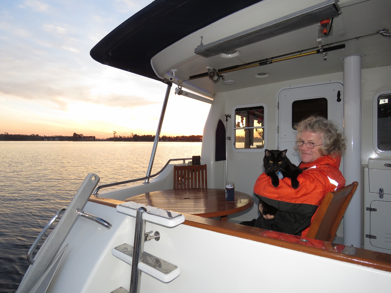
A few sets of waterfowl hunting catch were laid out along the dock at the marina. Several hunting dogs were running loose, so we were careful to keep our cat Spitfire confined inside the boat.
|
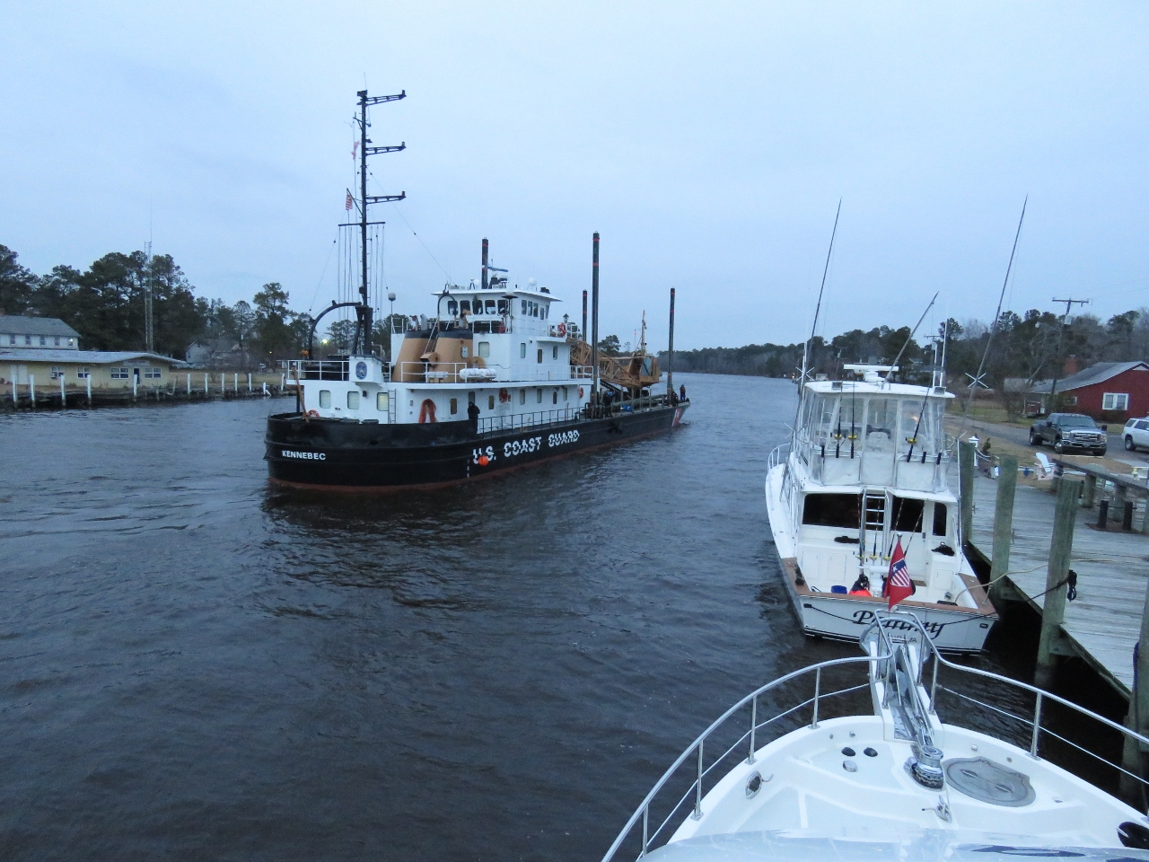 |
12/20/2016: USCGC Kennebec
Position: 36°20.94'N, -75°56.92'W
The USCG inland constructor tender Kennebec arrived this evening and tied off at the far north end of the dock. We're told they come in twice a year and the crew has dinner at the marina restaurant.
|
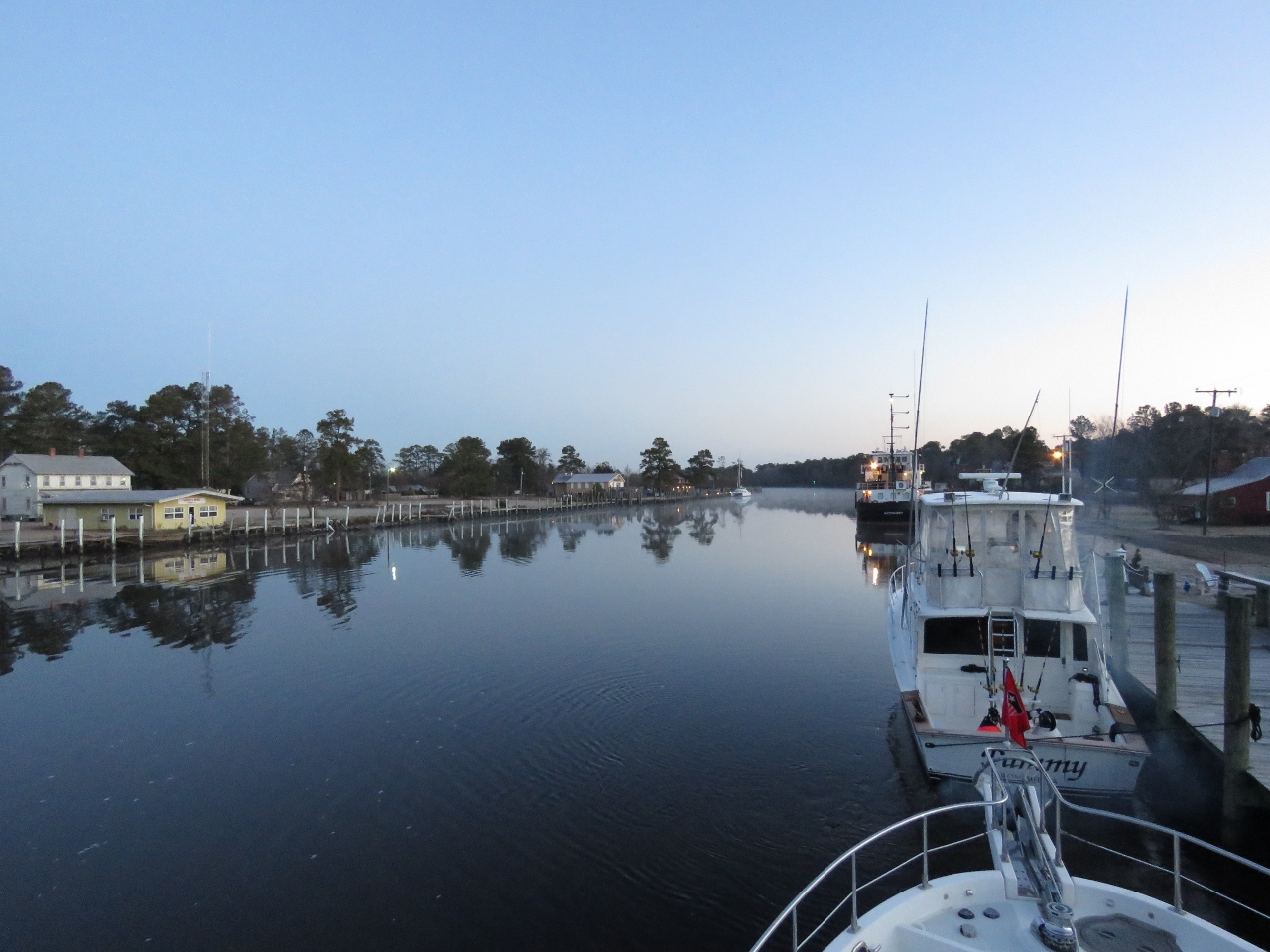 |
12/21/2016: Morning Calm
Position: 36°20.94'N, -75°56.92'W
Calm conditions looking north through the North Carolina Cut.
|
 |
12/21/2016: Frost
Position: 36°20.94'N, -75°56.92'W
We're heading south, but still aren't below the frost line. Most of the boat and the docks were covered with slippery frost this morning. We intended to cruise in higher latitudes, so had extra insulation added to the interior ceilings when Dirona was built. This seems to be working--a half-inch layer of ice had formed in the corner of the boat deck floor above the salon.
|
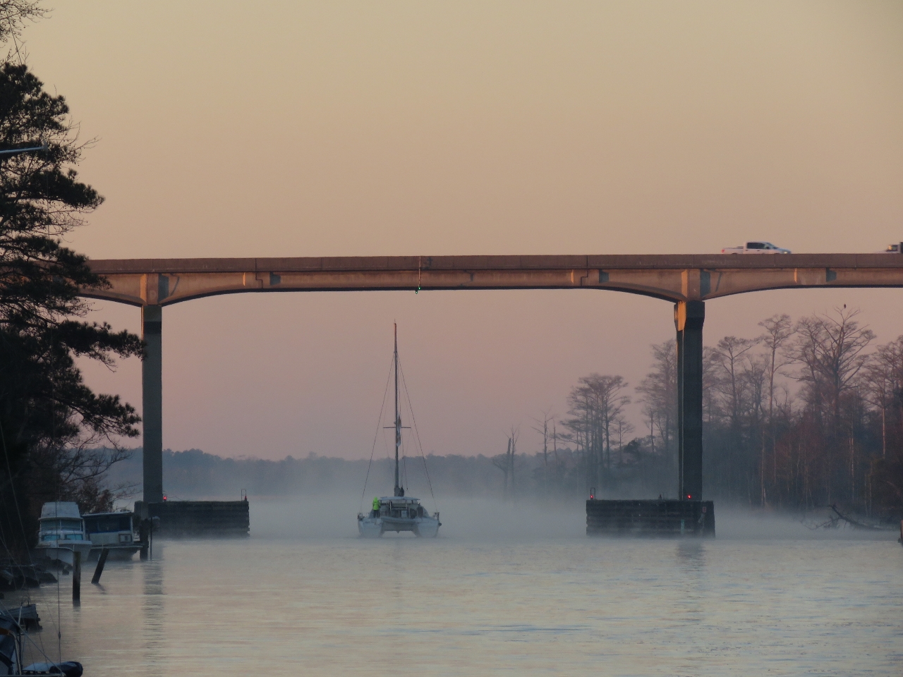 |
12/21/2016: Coinjock Bridge
Position: 36°20.94'N, -75°56.92'W
A catamaran heading south under 65ft Coinjock Bridge into sea smoke.
|
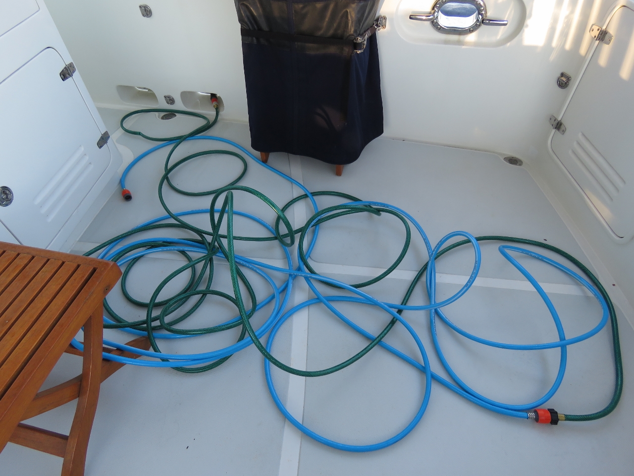 |
12/21/2016: Water
Position: 36°19.87'N, -75°57.64'W
The dockside water had been shut off for the winter, but we were able to get freshwater by running a hose to the restaurant building. We still had 300 gallons, so didn't need any water, but took the opportunity to do all our laundry and top off the tank.
|
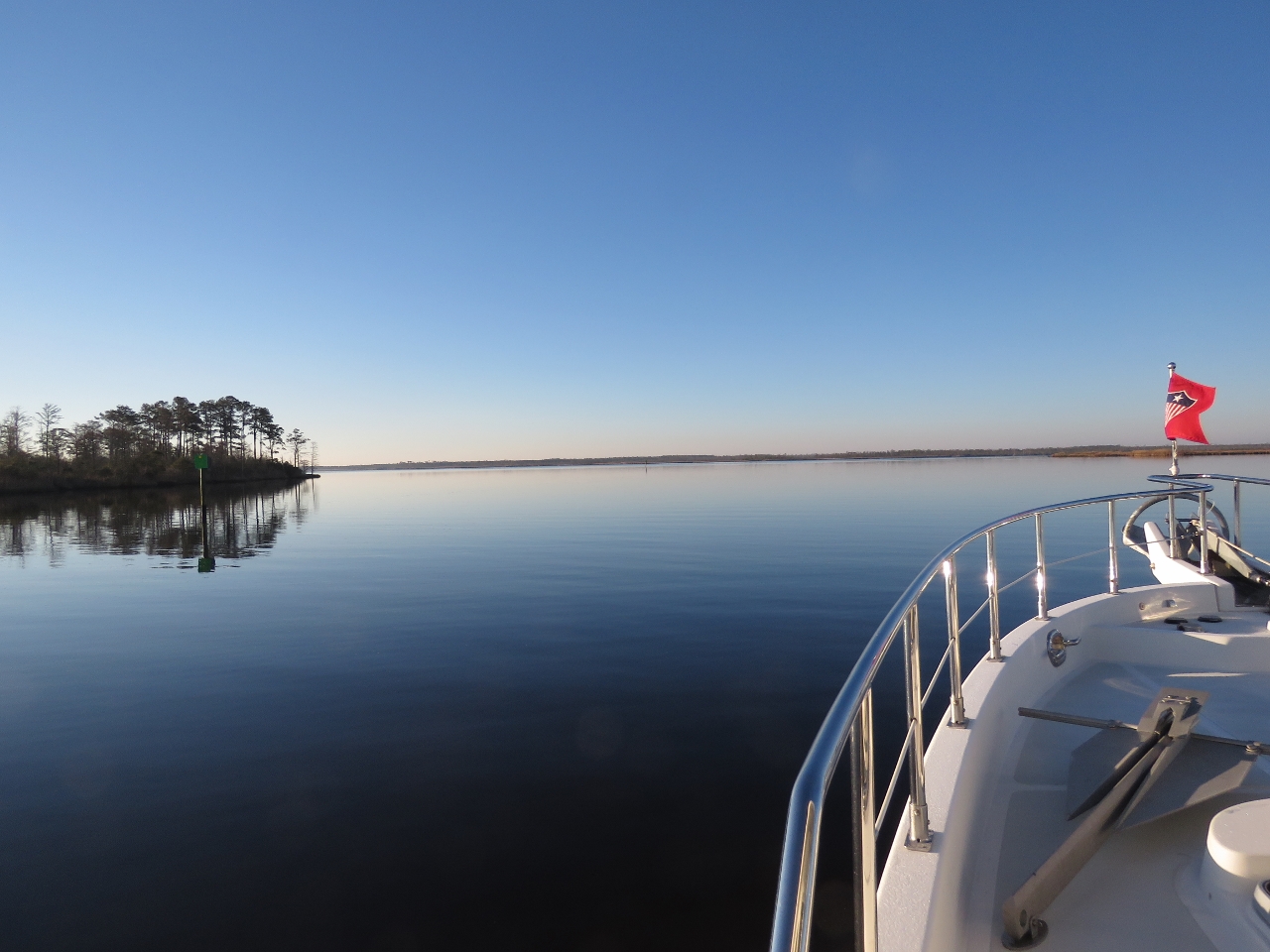 |
12/21/2016: Cruising
Position: 36°19.06'N, -75°58.24'W
Exiting the North Carolina Cut into North River on a wonderfully clear and calm morning.
|
 |
12/21/2016: Sleeping
Position: 36°8.67'N, -75°54.57'W
Spitfire loves the helm chair, but rarely pays attention to the course.
|
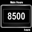 |
12/21/2016: 8500 Hours
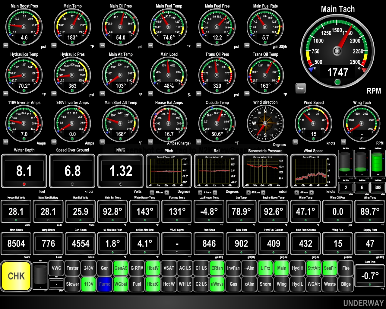
Position: 36°10.39'N, -76°0.74'W
Our John Deere 6068AFM75 just crossed 8,500 hours.
|
 |
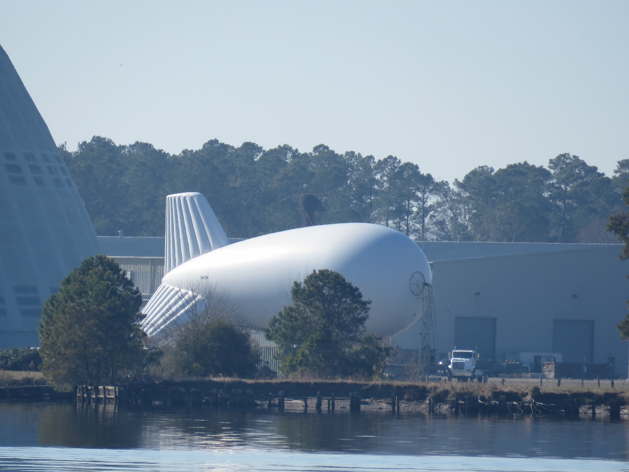
12/21/2016: TCOM
Position: 36°12.06'N, -76°3.58'W
As we ran up the Pasquotank River, we could see a blimp flying above the enormous hangar at the TCOM manufacturing facility. We'd already called to see if we could arrange a tour, but they were shutting down for the season tomorrow after a customer visit today.
|
 |
12/21/2016: Mud
Position: 36°14.41'N, -76°7.09'W
We plan to spend Christmas in Albermarle Sound this year. When we lived full-time in Seattle, we did a "Christmas Cruise" every year, sometimes as far north as the Broughtons in British Columbia. We always look for a nice anchorage for Christmas no matter where we are, but this is our first cold-weather Christmas Cruise since leaving Seattle. And last year we weren't even at anchor for Christmas, we were on passage from Cape Town to St. Helena.
Today we were planning to continue up the Pasquotank River to anchor Elizabeth City, but with such calm conditions decided to anchor off the TCOM facility instead. Here we're anchoring in just under 10ft and our big slow-moving prop is churning up the mud bottom. |
 |
12/21/2016: Blimp
Position: 36°14.39'N, -76°7.08'W
By the time we'd anchored the blimp had landed.
|
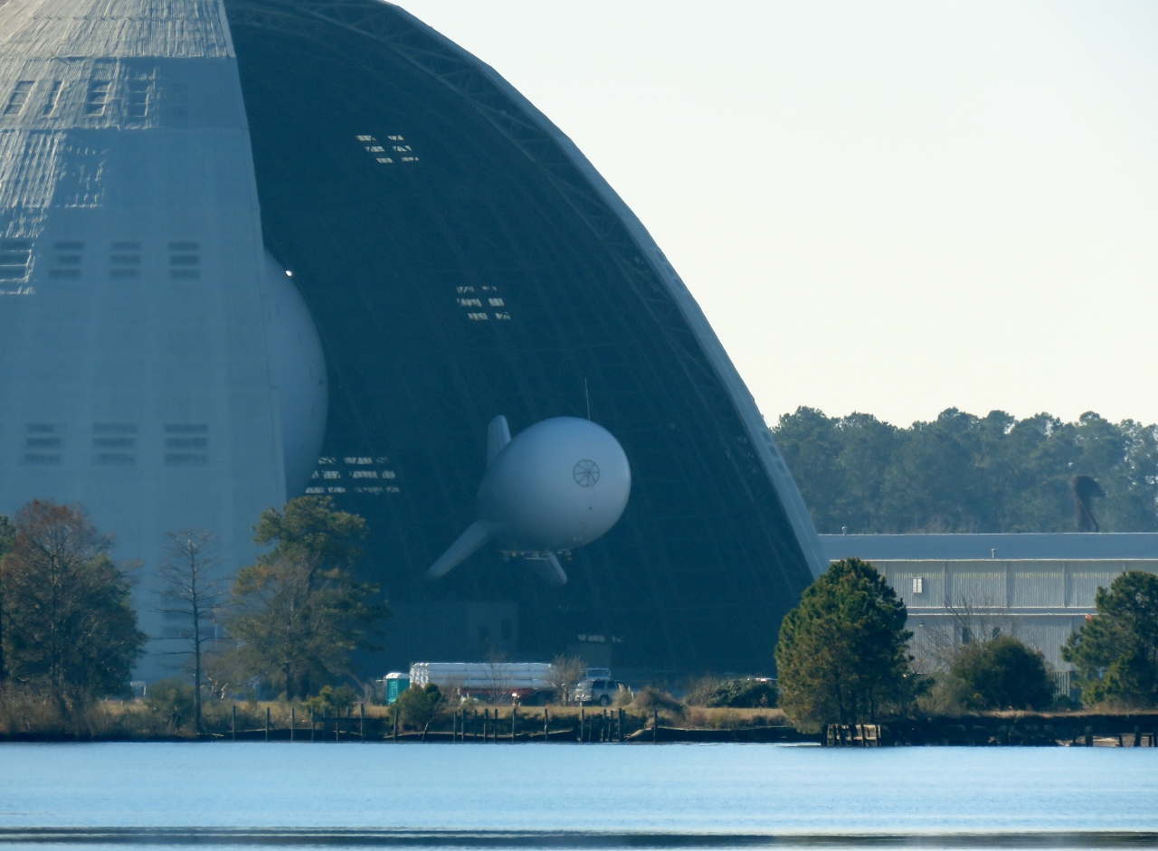 |
12/21/2016: Hangar
Position: 36°14.39'N, -76°7.07'W
Shortly after the blimp landed, the enormous hangar doors opened and the aircraft was transferred inside. The nose of a much larger blimp is just visible on the left inside the hangar.
|
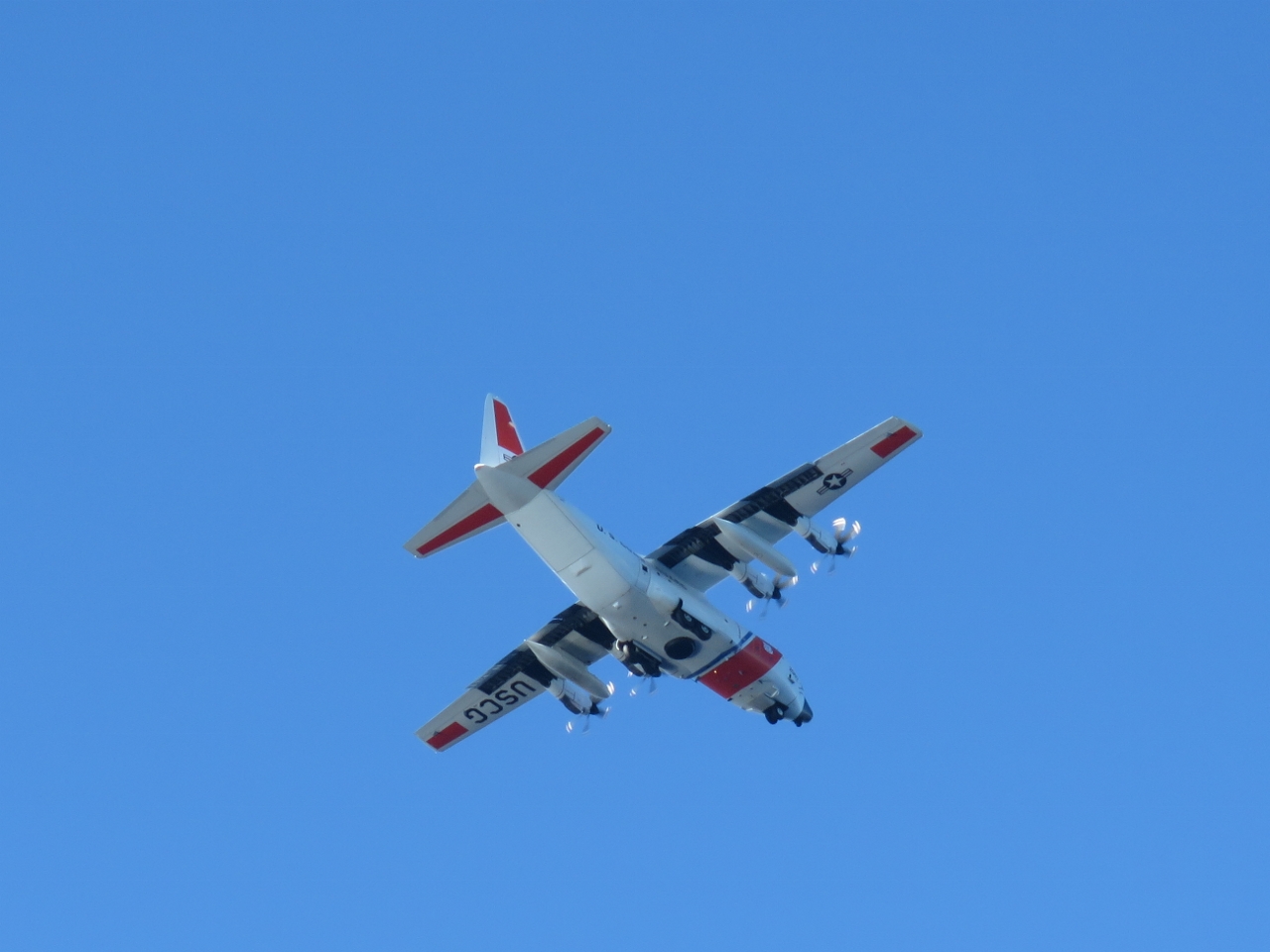 |
12/21/2016: CG Plane
Position: 36°14.39'N, -76°7.07'W
Our anchorage appeared to be on the flight path for the US Coast Guard Elizabeth City base. Several Coast Guard craft flew over and landed not far away.
|
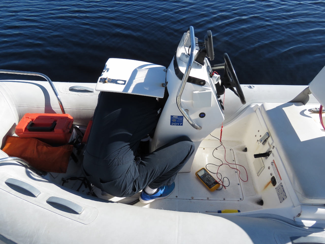 |
12/21/2016: Fuel Gauge
Position: 36°14.39'N, -76°7.07'W
Our new dinghy fuel gauge stopped working after only a couple of months. That didn't last very well. Fortunately it was just a connection problem, so James quickly had it back working again.
|
 |
12/21/2016: Freeze Damage
Position: 36°14.39'N, -76°7.09'W
A couple of our spray guns had frozen and cracked in the recent cold weather. We'll have to be more careful about keeping them drained until we're in a warmer climate. Fortunately that seems to be the extent of the damage.
|
 |
12/21/2016: Strainers
Position: 36°14.40'N, -76°7.09'W
The sea strainers were showing signs of growth, so James scrubbed them out today with a long-handled brush.
|
 |
12/21/2016: Anchorage
Position: 36°14.38'N, -76°7.08'W
The temperature is in the mid-50s, the sun is shining and the winds are calm. A perfect winter cruising day.
|
 |
12/21/2016: Dock
Position: 36°14.20'N, -76°7.77'W
We landed the tender at an unmarked dock near the TCOM facility to walk ashore for a closer look.
|
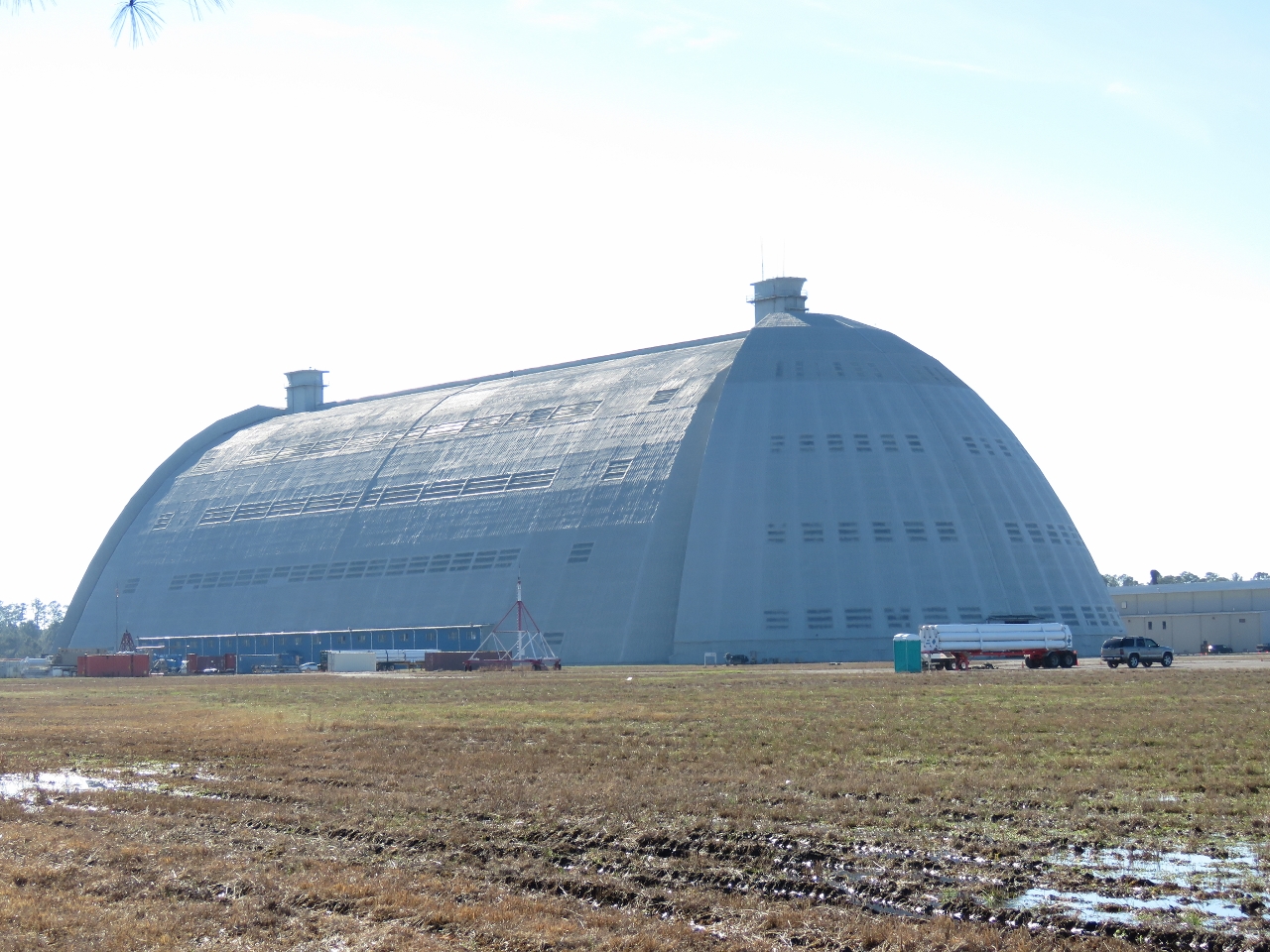 |
12/21/2016: Hangar Close Up
Position: 36°13.98'N, -76°7.83'W
A close-up view to the enormous TCOM hangar building. It is 300,000 square feet and can accommodate vehicles up to 150 feet in height.
|
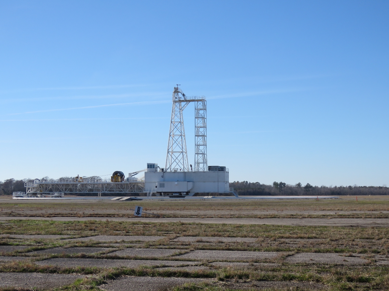 |
12/21/2016: Tower
Position: 36°13.96'N, -76°7.77'W
We're guessing this tower near the TCOM hangar is used to tether the blimps.
|
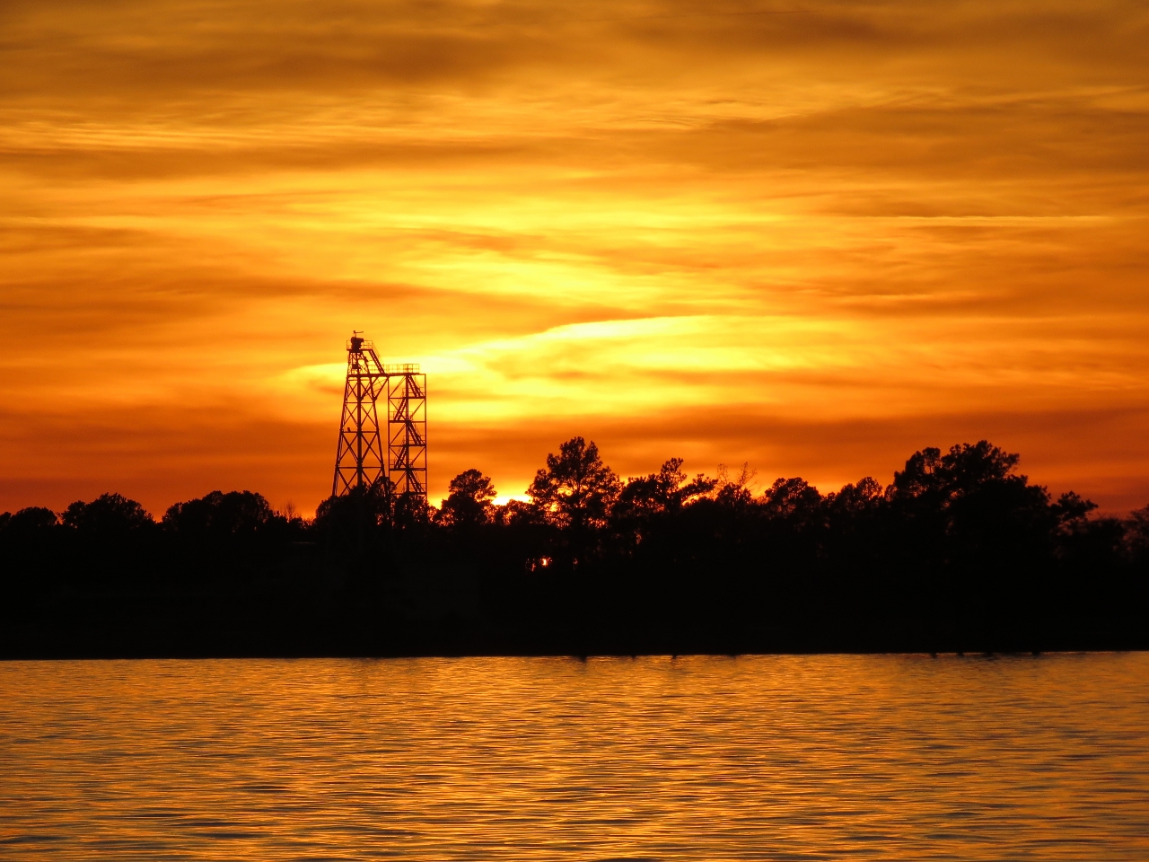 |
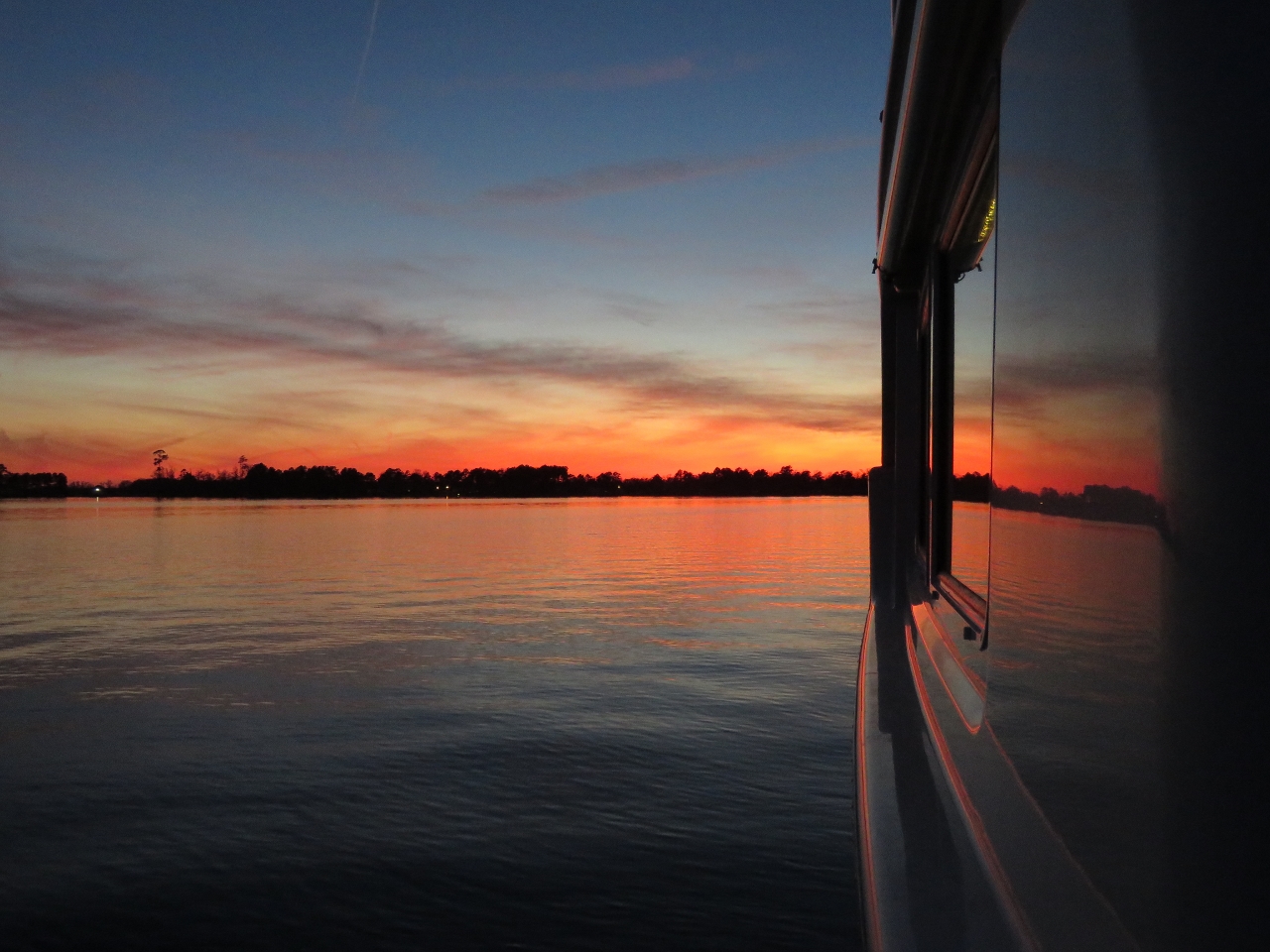
12/21/2016: Sunset
Position: 36°14.40'N, -76°7.09'W
We bundled up and had drinks on the back deck during a fabulous sunset over the TCOM facility.
|
 |
12/22/2016: Shallow
Position: 36°9.84'N, -76°14.39'W
The waters in Albermarle Sound are so shallow that our 10ft depth warning light is constantly triggered.
|
 |
12/22/2016: Bundled Up
Position: 36°10.32'N, -76°15.17'W
Bundled up on the back deck in our flotation suits to enjoy the sunset.
|
 |
12/22/2016: Sunset
Position: 36°10.32'N, -76°15.17'W
A beautiful sunset from the anchorage in Little River.
|
 |
12/23/2016: Albermarle Sound
Position: 36°3.08'N, -76°13.29'W
Strong winds blowing across the shallow waters of Albermarle Sound can generate conditions sufficiently rough that boaters can be stuck for several days waiting for good crossing conditions. The winds have mostly been light while we've been here, and the sound is smooth as we cross north to south.
|
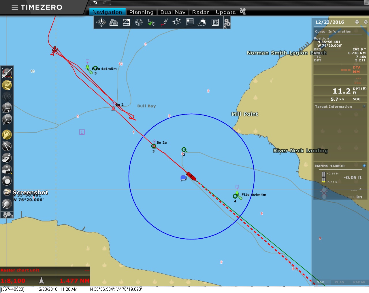 |
12/23/2016: Shallows
Position: 35°56.66'N, -76°19.27'W
On our first attempt to enter the channel at the mouth of the Scuppernog River, we couldn't find enough depth to get through running roughly center-channel between the red and green marks. We backed out, anchored temporarily, and surveyed by channel by tender finding 9 feet right up against the piles that mark the south edge of the channel (considerably off the charted channel).
|
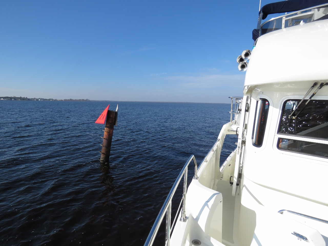 |
12/23/2016: Channel
Position: 35°56.57'N, -76°19.15'W
Running as close as we dared to the red channel markers, we passed through with a minimum depth of 8ft and reached the sheltered anchorage on the other side.
|
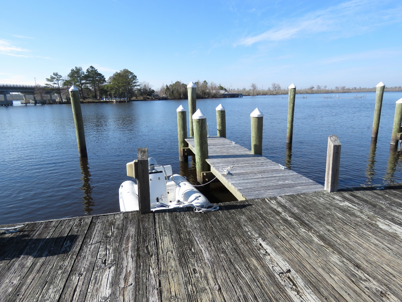 |
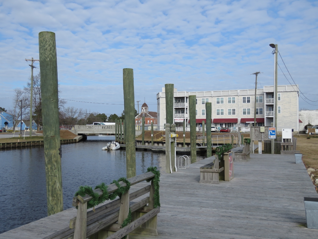
12/23/2016: Columbia
Position: 35°55.04'N, -76°15.26'W
The tender tied off at the Columbia town dock.
|
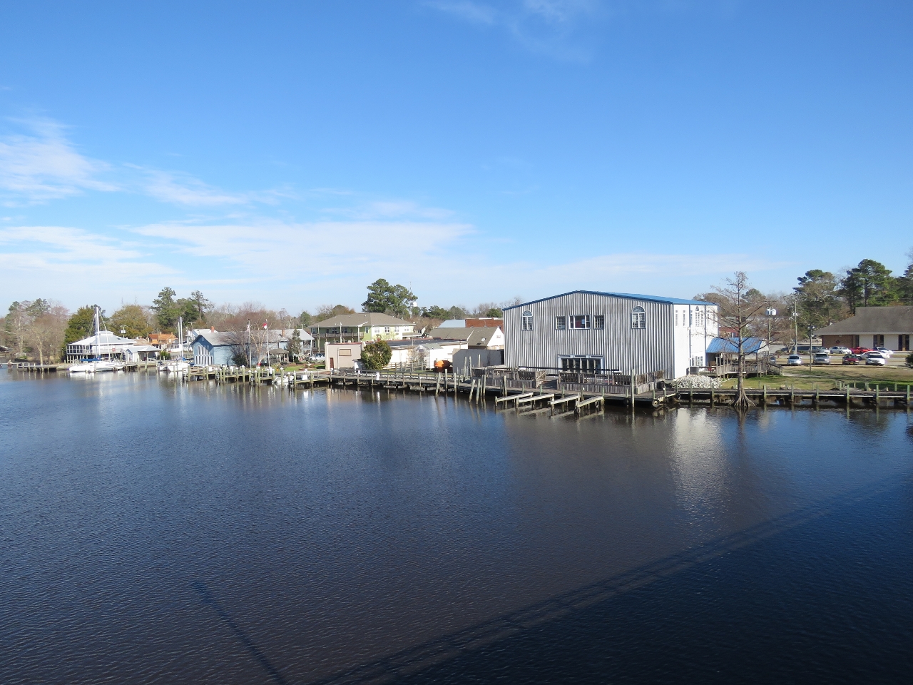 |
12/23/2016: Boardwalk
Position: 35°54.98'N, -76°15.25'W
Looking back to the Columbia from the Highway 64 bridge. A nice boardwalk runs the length of the waterfront. Our tender is tied off at the town dock on the left of the photo.
|
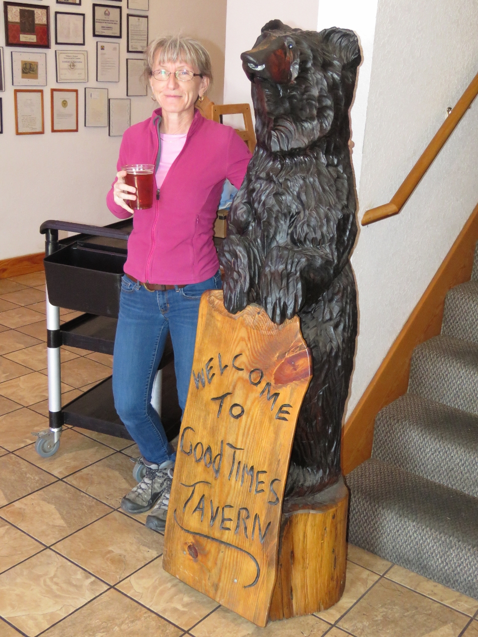 |
12/23/2016: Good Times Tavern
Position: 35°54.99'N, -76°15.15'W
We had a good lunch, with incredibly friendly and attentive service, at The Good Times Tavern in Columbia. The restaurant is large and popular—almost every table was taken when we arrived.
|
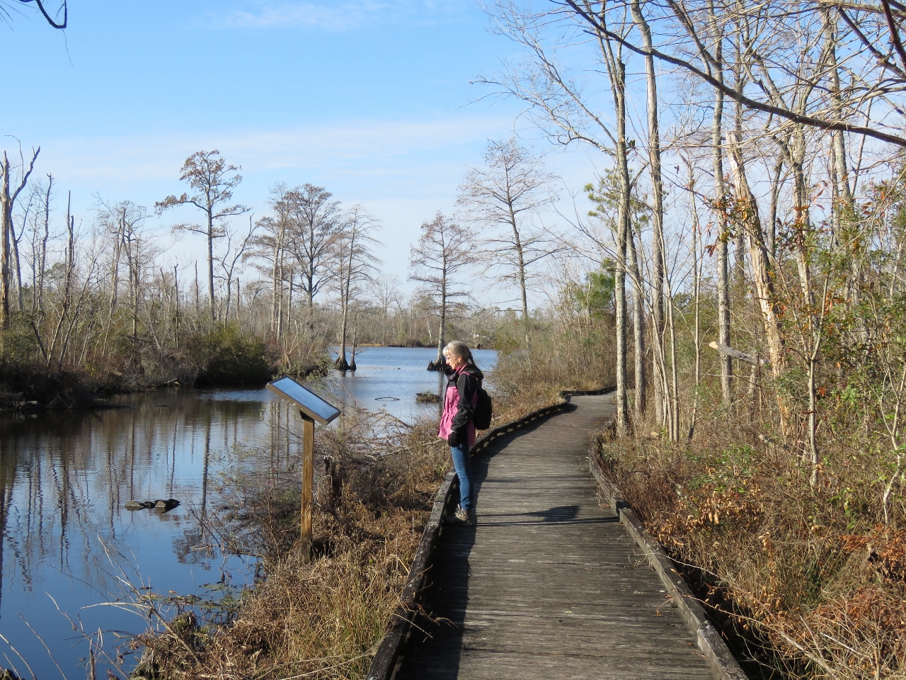 |
12/23/2016: Pocosin Lakes
Position: 35°54.84'N, -76°15.40'W
The headquarters for the Pocosin Lakes National Wildlife Refuge is in Columbia. They have an excellent boardwalk with many interpretive signs that runs along the Scuppernog River and one of it's tributaries.
|
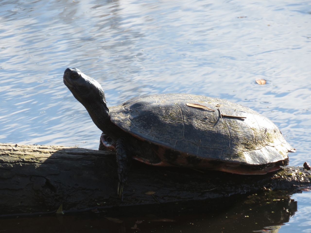 |
12/23/2016: Turtle
Position: 35°54.81'N, -76°15.36'W
A turtle sunning in the Pocosin Lakes National Wildlife Refuge.
|
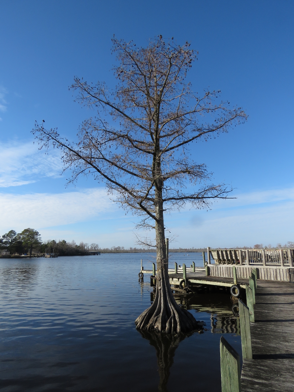 |
12/23/2016: Roots
Position: 35°55.01'N, -76°15.26'W
Trees like this, with roots in the river, grow all along the waterway.
|
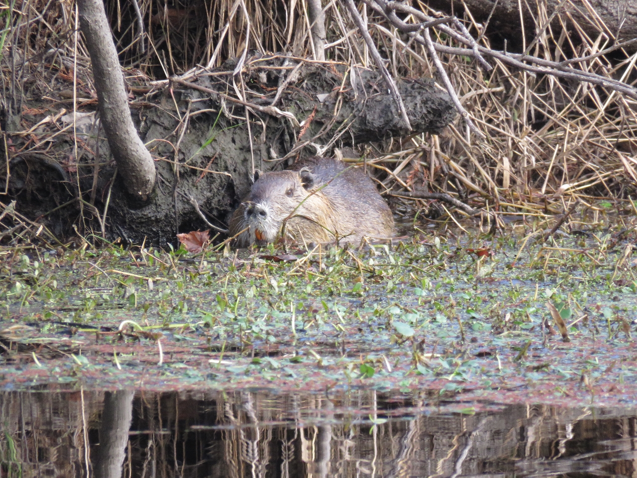 |
12/23/2016: Muskrat
Position: 35°53.95'N, -76°15.18'W
Muskrat along an arm of the Scuppernog River.
|
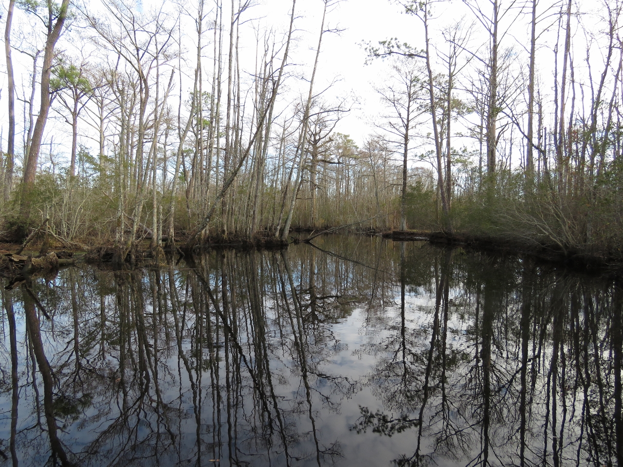 |
12/23/2016: River tour
Position: 35°53.49'N, -76°14.25'W
Swamp scene reflecting in still waters on our tender tour of the Scuppernog River. We took one of the smaller arms rather than the main river as it seemed more intimate and interesting.
|
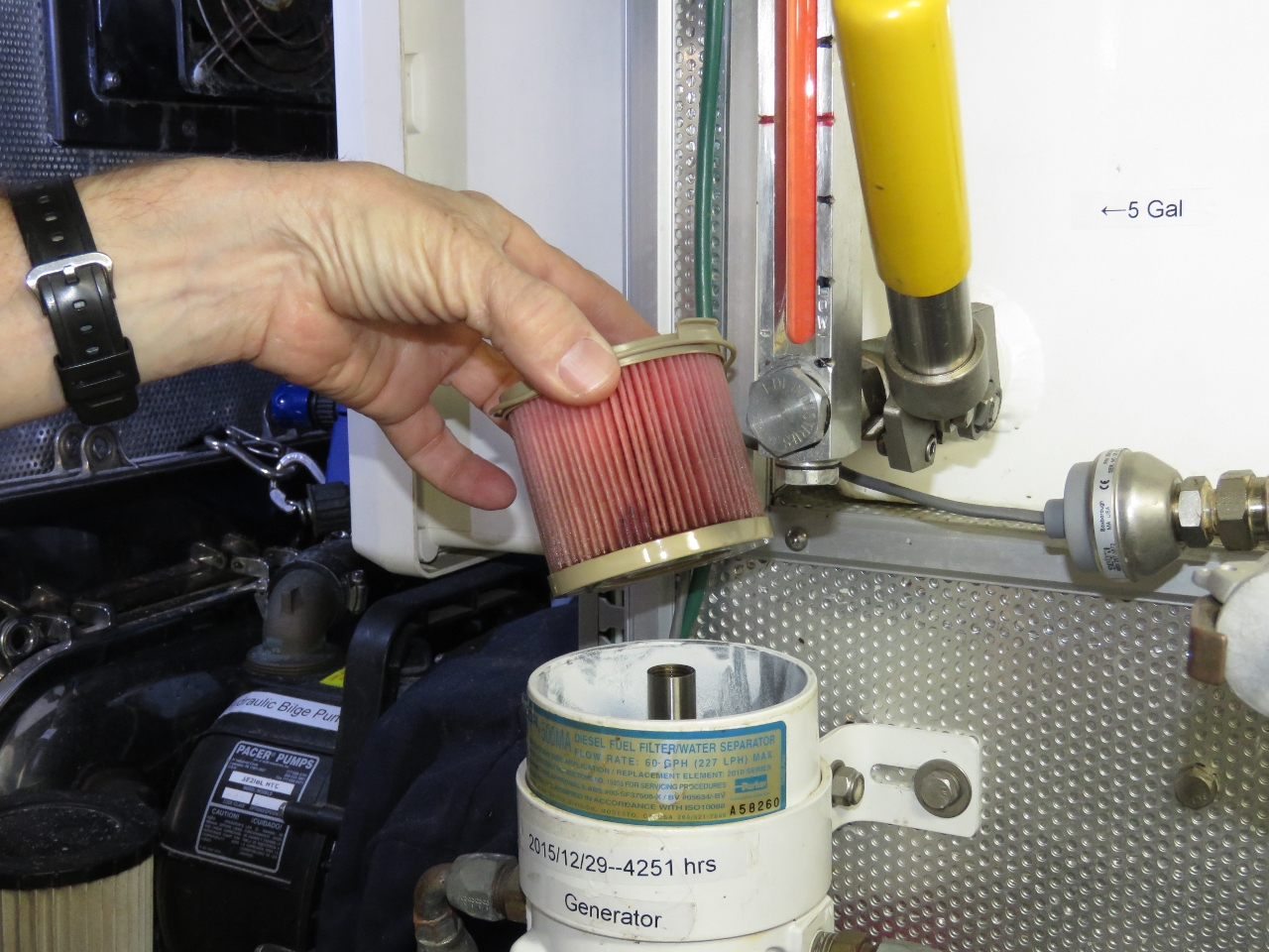 |
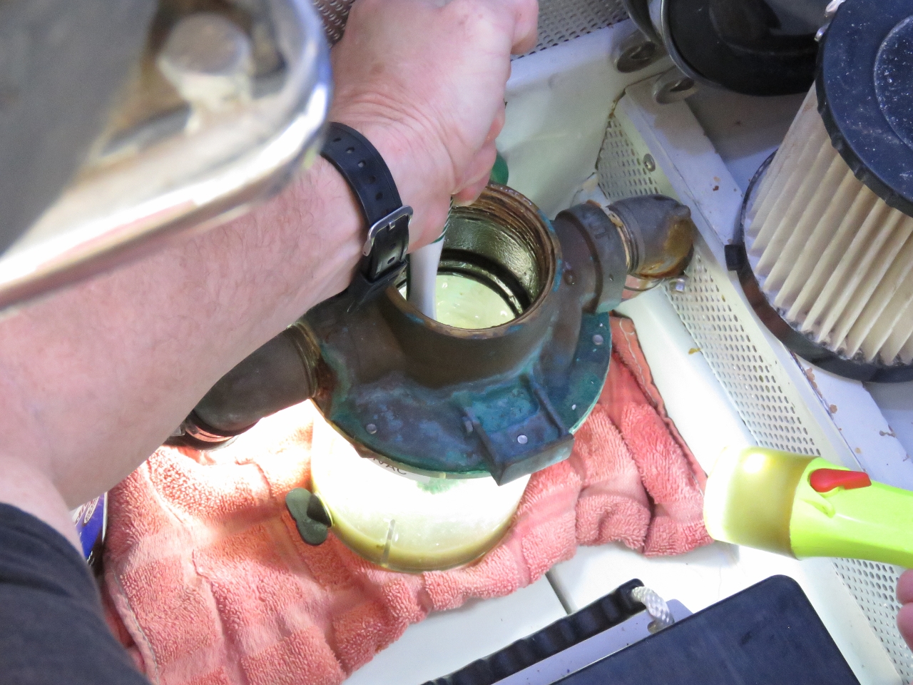
12/23/2016: Fuel Filter
Position: 35°55.99'N, -76°18.14'W
We last changed the generator fuel filter 12 months and 309 hours ago, so it was due for a change. Nice to see the filter in reasonable shape though.
|
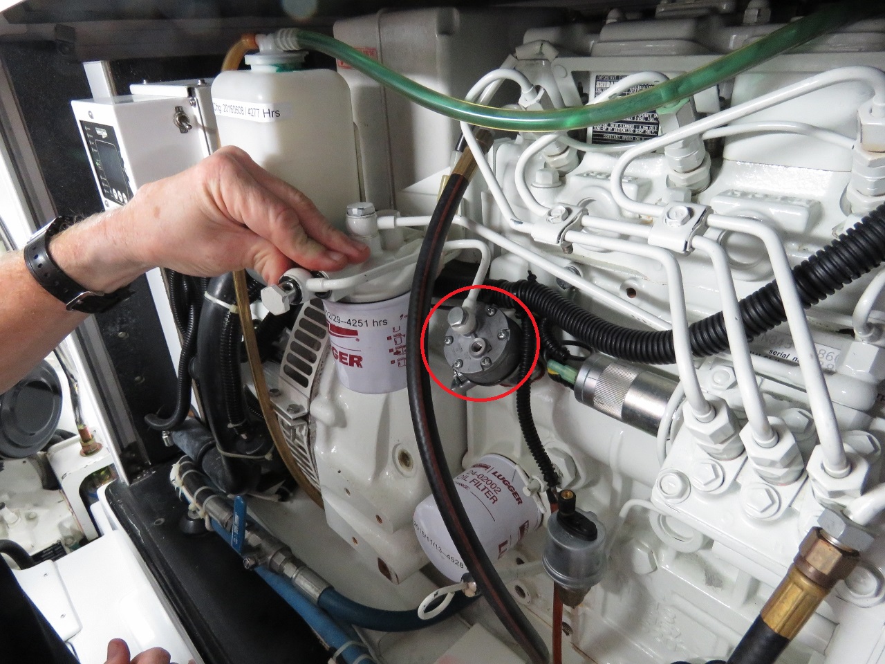 |
12/23/2016: Fuel Pump
Position: 35°55.99'N, -76°18.13'W
The generator fuel pump, circled in red was leaking a bit of oil, so we replaced it with a spare. In the picture, James is installing the fuel pump-to-fuel filter line and is just about to notice that it's on the wrong pump port.
|
 |
12/24/2016: Bridge
Position: 35°54.16'N, -76°0.46'W
Heading through the Alligator River Swing Bridge. This is the last of four bridges that we'll need to have opened on our run between Portsmouth, Virginia and Beaufort, NC. The bridge won't open in high winds of 35kts or more, which can be a nasty surprise to those who have clawed their way across Albermarle Sound in rough conditions and have no protected anchorages nearby to wait out the weather.
|
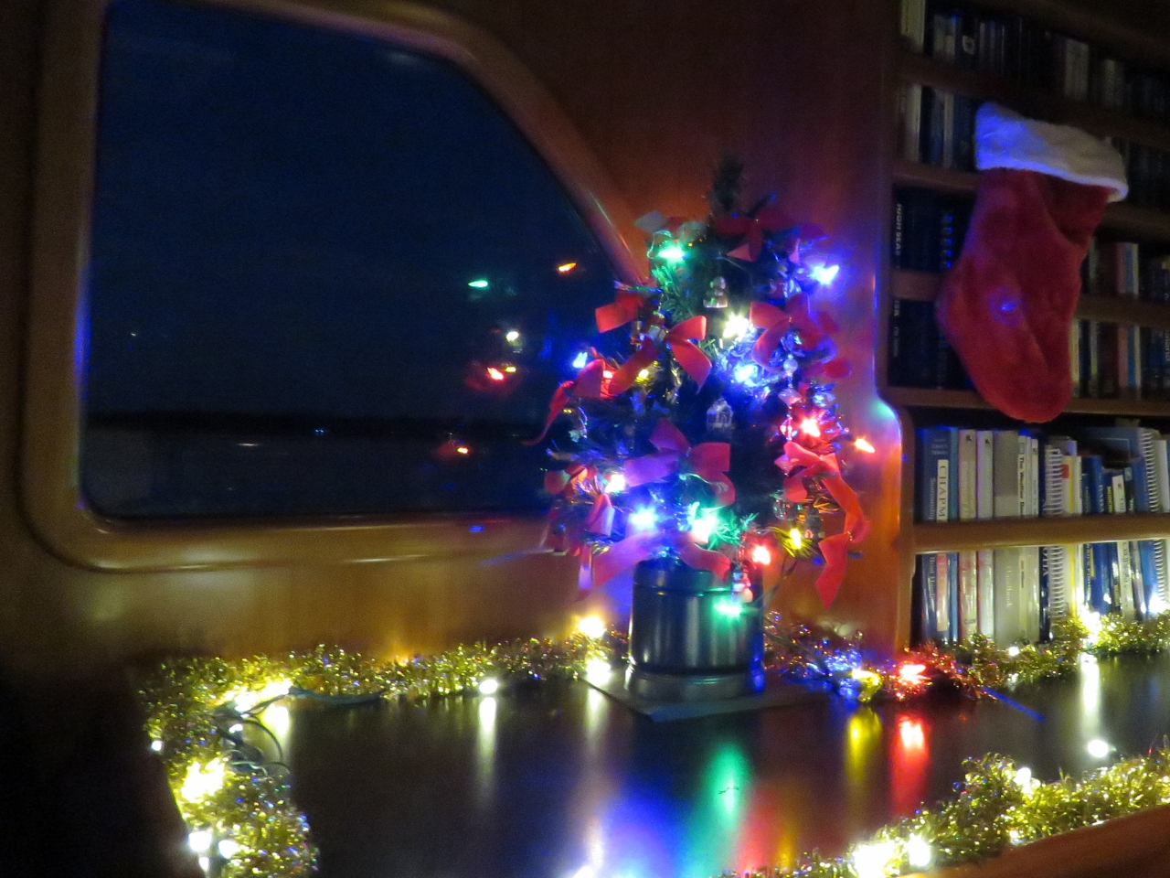 |
12/25/2016: Happy Holidays
Position: 36°10.32'N, -76°15.17'W
Wishing you all Happy Holidays and best wishes for the New Year.
|
 |
12/26/2016: Belhaven
Position: 35°31.95'N, -76°37.32'W
Anchored for the night off Belhaven shortly after passing through the Alligator River-Pungo River Canal. We had a calm and peaceful Boxing Day passage through the canal. En route we passed under two fixed bridges, the Fairfield and Wilkerson Bridges, both with 65ft of clearance, but didn’t see a single other boat en route. A video of our run is at https://youtu.be/BjiB_r6rl7o.
|
 |
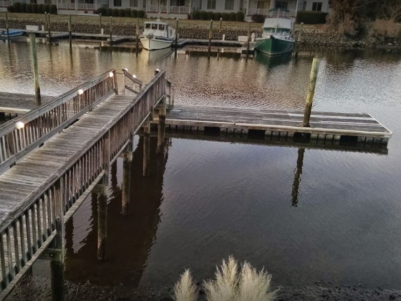
12/26/2016: Dinghy Dock
Position: 35°32.23'N, -76°37.35'W
The tender tied off at the dinghy dock in downtown Belhaven.
|
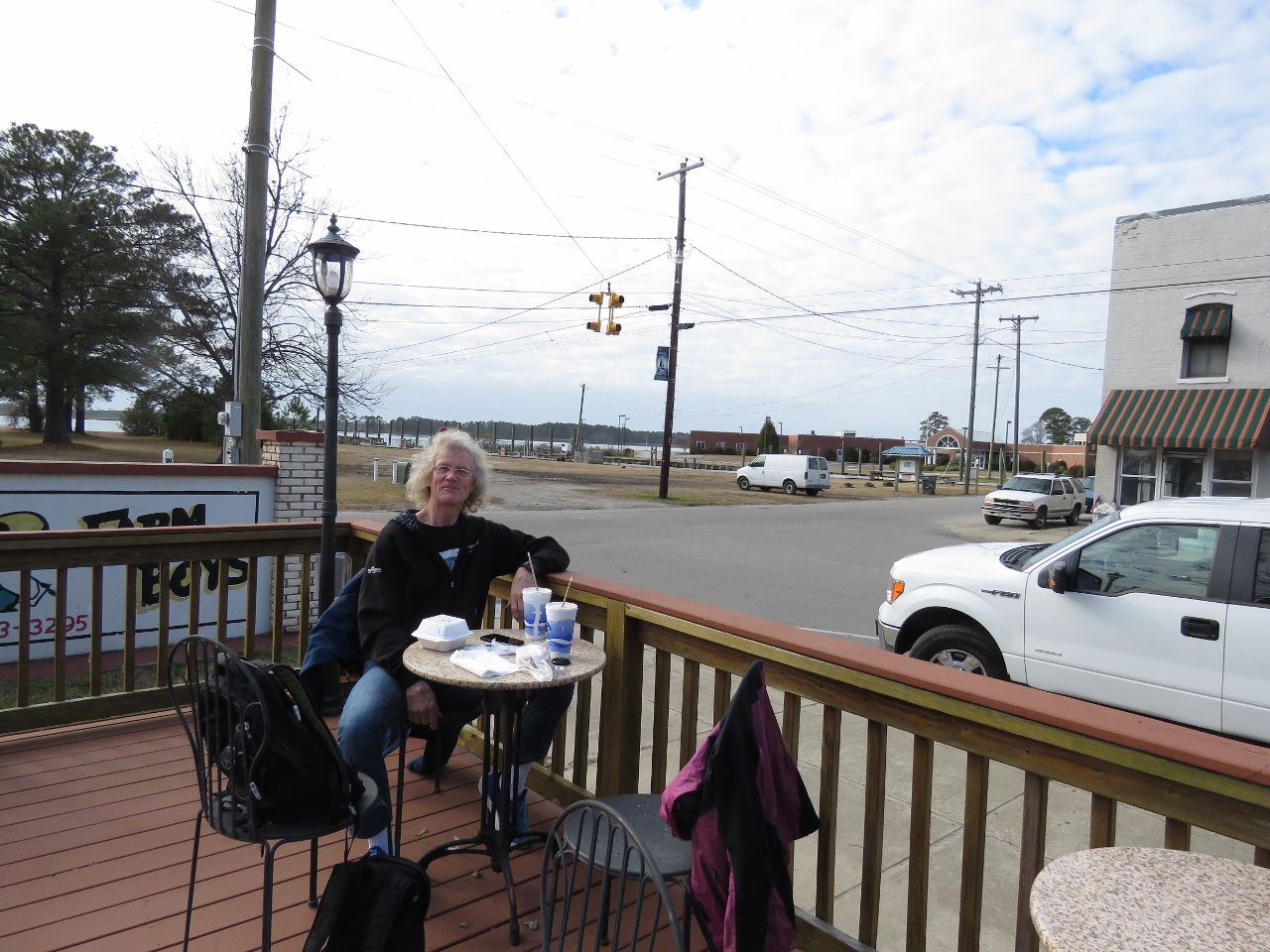 |
12/26/2016: Farm Boys
Position: 35°32.23'N, -76°37.29'W
A delicious lunch at popular Farm Boys on the Belhaven waterfront. People were lined up to place orders the entire time we were there. The weather had warmed up enough we could sit outside.
|
 |
12/26/2016: Fallen Tree
Position: 35°32.11'N, -76°36.85'W
During a walk around Belhaven we saw this big tree that had fallen on a house. That looks expensive to fix. And just getting the tree out of there will be challenge.
|
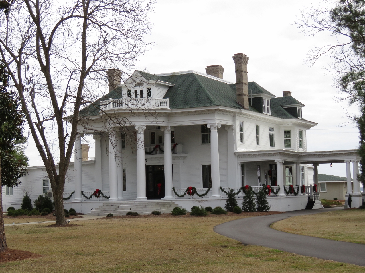 |
12/26/2016: River Forest Manor
Position: 35°32.02'N, -76°36.88'W
River Forest Manor along the Belhaven waterfront was completed in 1904 after five years of construction for John Aaron Wilkinson who was president of L. Roper Lumber Company and vice president of the Norfolk and Southern Railroad. The property now operates as the River Forest Manor & Marina and can be rented for events.
|
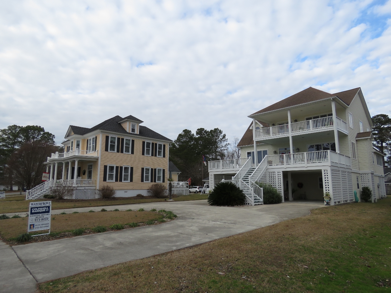 |
12/26/2016: Waterfront Homes
Position: 35°32.04'N, -76°37.07'W
All the houses we saw in Belhaven were raised, presumably to deal with frequent flooding.
|
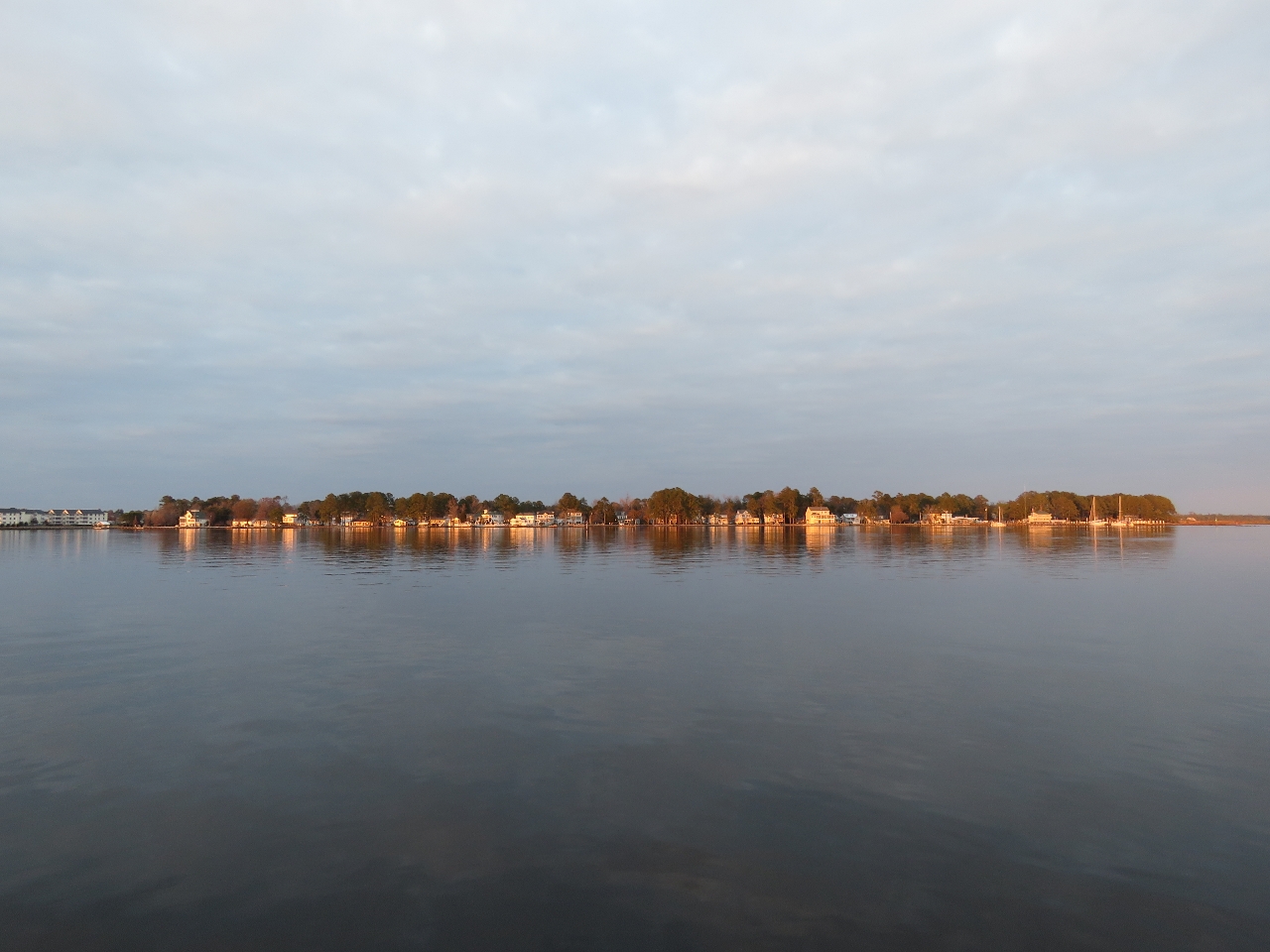 |
12/26/2016: Sunset
Position: 35°31.74'N, -76°37.19'W
The evening sun reflecting on Belhaven, viewed from the anchorage.
|
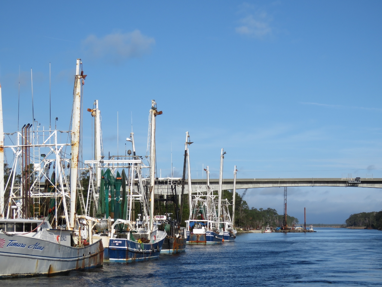 |
12/27/2016: Fishing Vessels
Position: 35°14.42'N, -76°35.39'W
Fishing vessels moored off Hobucken. These are the first large fishing vessels we've seen moored along the ICW. Likely they are here because the nearby Ocracoke Inlet gives reasonably direct access to sea.
|
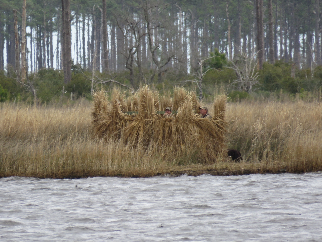 |
12/27/2016: Duck Blind
Position: 35°9.21'N, -76°35.41'W
We initially were planning to anchor for the night in Bonne Bay, but received a radio call that active shooters were in the duck blind to our east. The hunters were upset on our choice of anchorage and told us we were in their "kill zone".
|
 |
12/27/2016: Locals
Position: 35°10.59'N, -76°39.71'W
We instead anchored off the town of Vandemere. That evening some friendly locals came by to say hello.
|
 |
12/28/2016: Depth
Position: 34°50.96'N, -76°41.40'W
Dredged to 6+ feet wouldn't support our 6ft 7in draft. Nice diesel price of $2.09/gallon though.
|
 |
12/28/2016: Current
Position: 34°44.18'N, -76°41.05'W
We're starting to see some current in the water now. We haven't seen much since entering Chesapeake Bay. Current is one of the reasons we're going to run on the outside south of Beaufort, NC. Besides the shallower water with shoaling issues and the many bridges that would need to be opened, we'd also have increasing current to contend with.
|
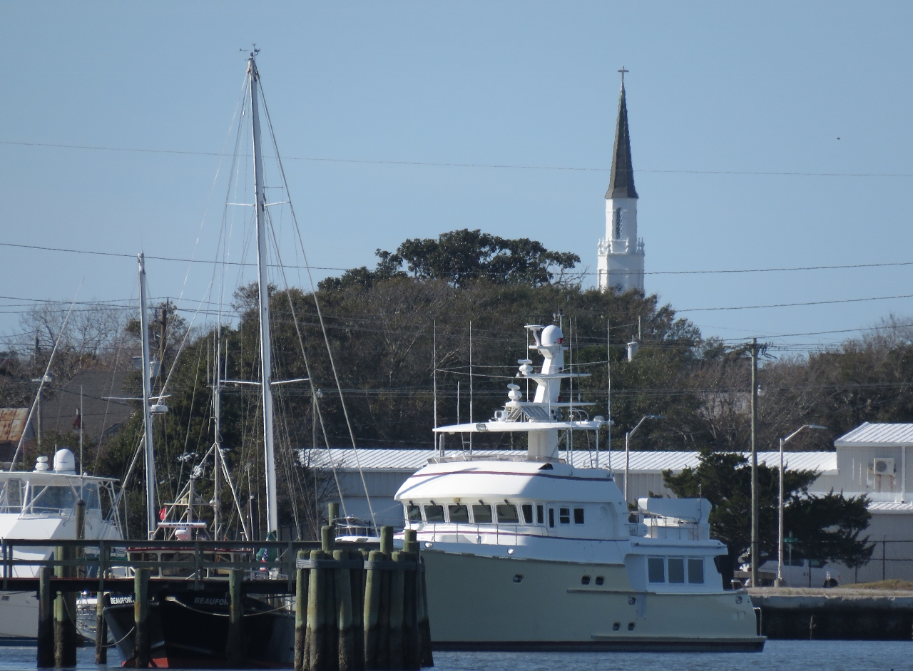 |
12/28/2016: Shear Madness
Position: 34°43.27'N, -76°41.62'W
We're pretty sure this is Nordhavn 72 Shear Madness at the Morehead City Yacht Basin, but couldn't see a name.
|
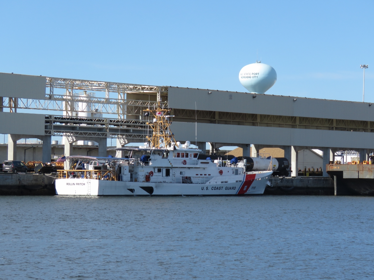 |
12/28/2016: Rollin Fitch
Position: 34°42.87'N, -76°41.58'W
US Coast Guard fast-response vessel Rollin Fitch on the dock at Morehead City. The 154ft vessel has a minimum top speed of 28 kts.
|
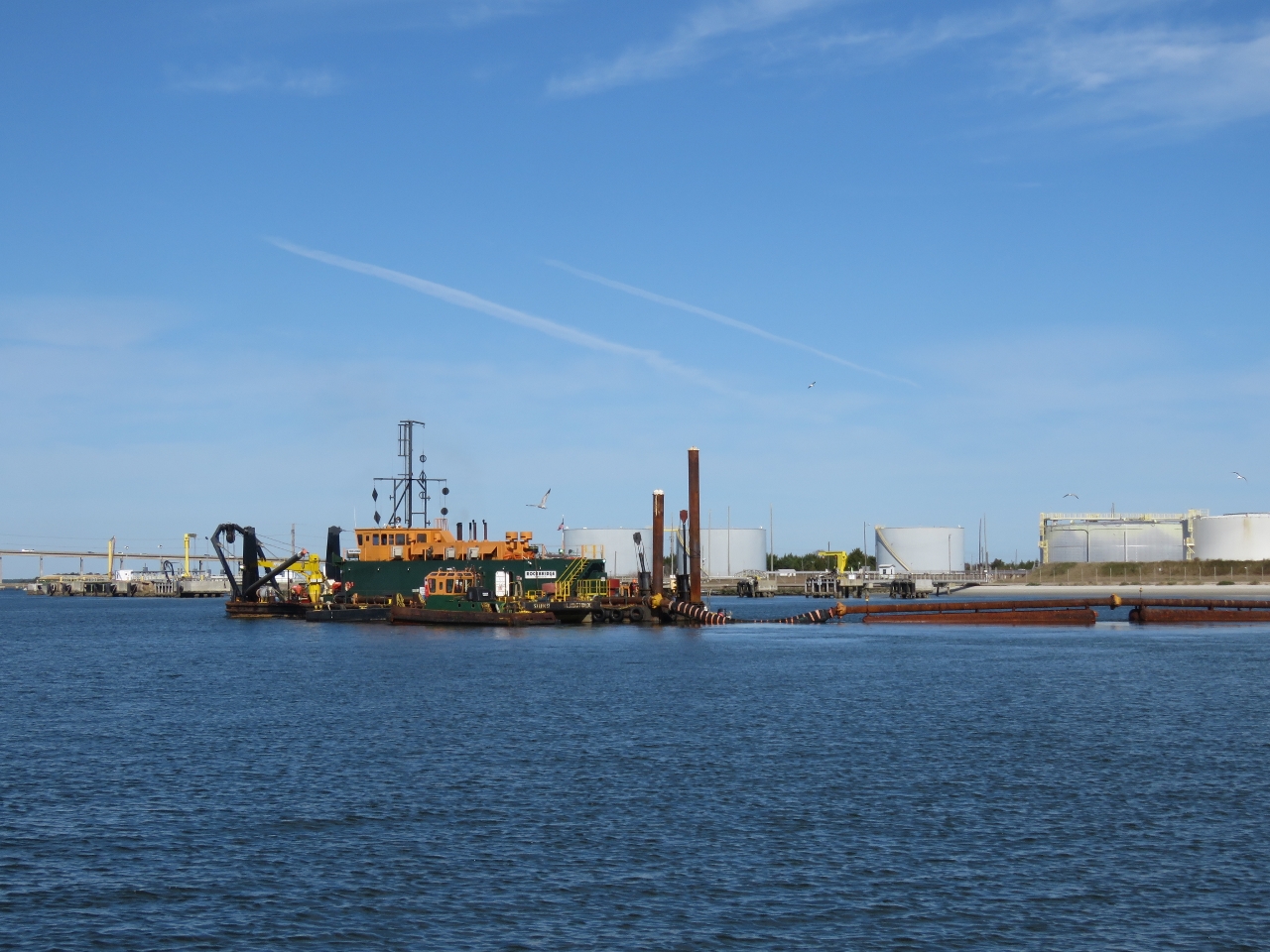 |
12/28/2016: Rockbridge
Position: 34°42.50'N, -76°41.38'W
The dredger Rockbridge working the channel as we pass. A long pipe runs from the dredger and under the channel to the other side to dispose of the dredged material. Video highlights of today's run from Vandemere are at https://youtu.be/YcRfiqMovqo.
|
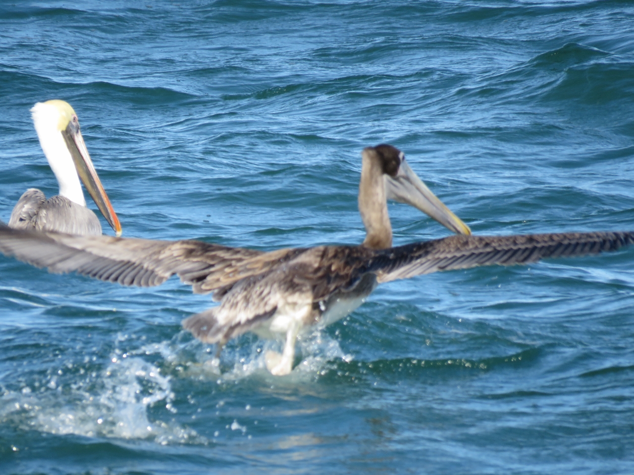 |
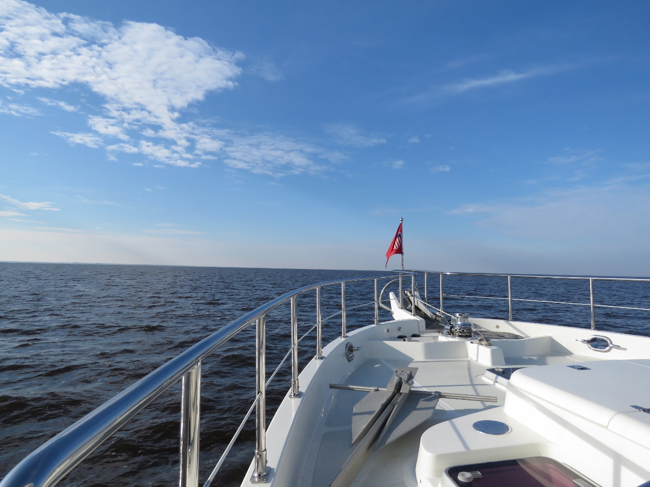
12/28/2016: Pelicans
Position: 34°38.69'N, -76°35.91'W
It's been a while since we've seen Pelicans. These ones are offshore between Beaufort Inlet and Cape Lookout.
|
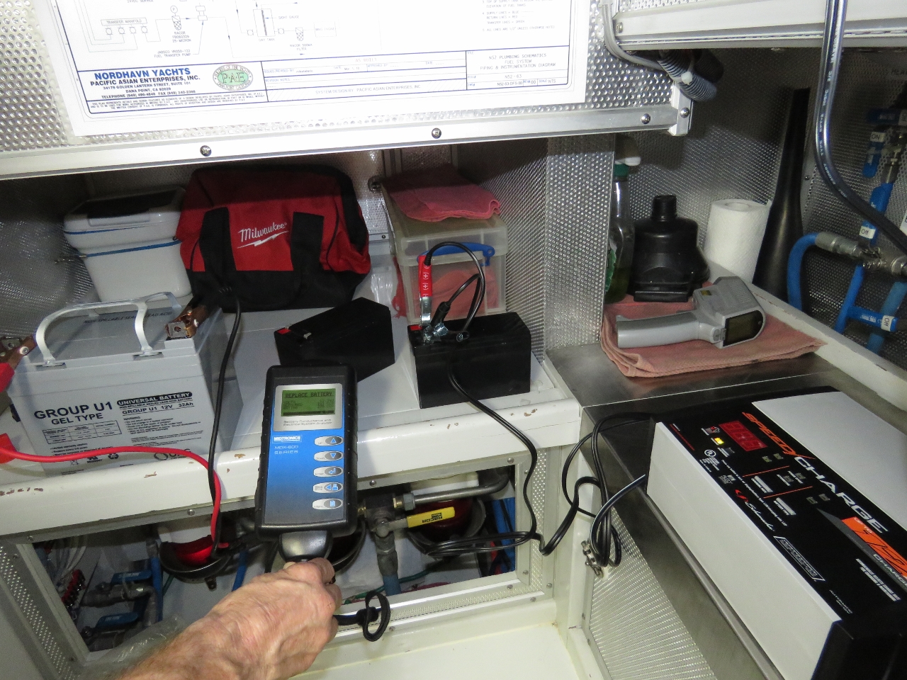 |
12/28/2016: Battery Testing
Position: 34°37.51'N, -76°32.91'W
Testing our tender and UPS batteries, both operational and backups. One unused tender battery tested bad and could not be recovered with charging. The primary nav system UPS battery tested bad, and both backups were fine.
|
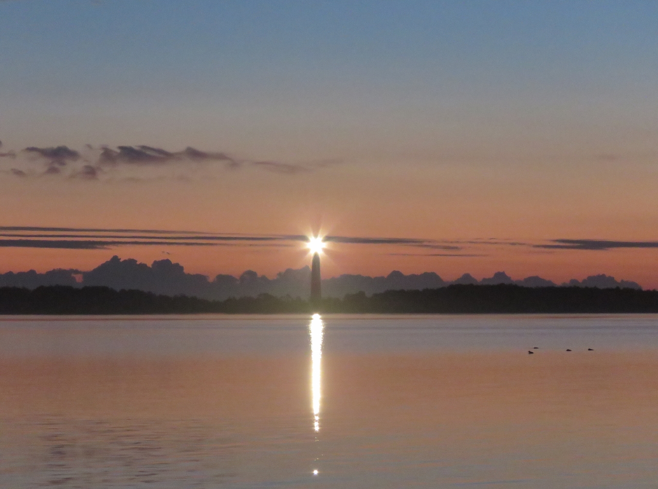 |
12/29/2016: Cape Lookout Light
Position: 34°37.53'N, -76°32.87'W
The Cape Lookout Light shining at dawn.
|
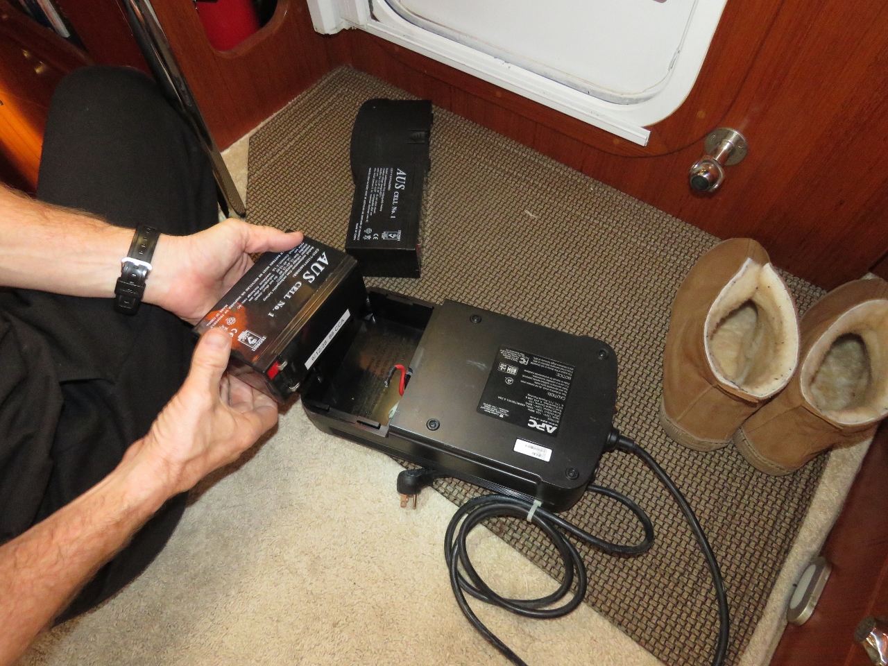 |
12/29/2016: UPS
Position: 34°37.54'N, -76°32.88'W
The nav computer UPS wouldn't hold the load for more than about 4 minutes. We tested the battery and it came up bad with only 31 Cold Cranking Amps (CCA) when it should have been 90. So we replaced it with a spare.
|
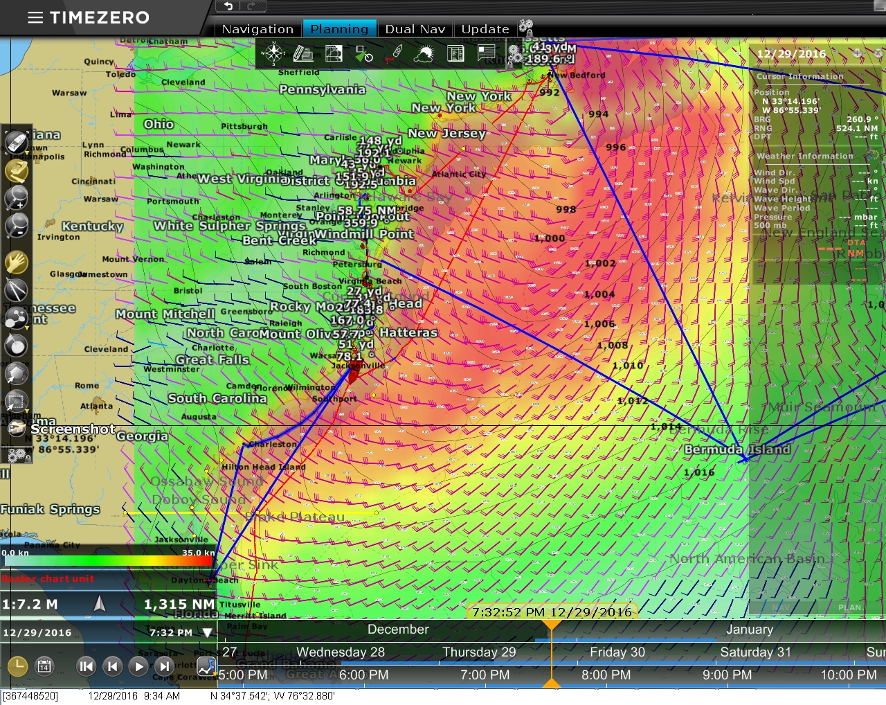 |
12/29/2016: Forecast
Position: 34°37.54'N, -76°32.88'W
South of here the ICW is shallower than the section we just ran from Portsmouth, Virginia and has more shoaling issues. So we'll be making a direct run offshore to our next stop, Charleston, South Carolina. A big weather system is predicted to pass through over the next few days, so we'll hang out at Cape Lookout until it clears.
|
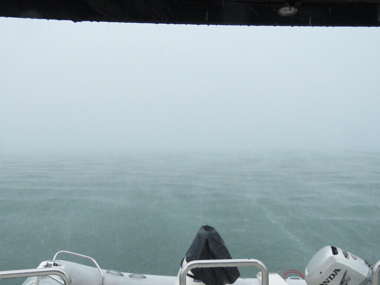 |
12/29/2016: Rain
Position: 34°37.51'N, -76°32.86'W
The leading edge of that weather system arrived this morning, bringing a torrential downpour.
|
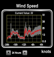 |
12/30/2016: Wind
Position: 34°37.50'N, -76°32.85'W
The winds picked up briefly during yesterday's squall and settled back down again. But last night the winds shot up from almost nothing to 38 knots and have stayed pretty steady in the 25-knot range since. The forecasts indicate conditions will settle down overnight tonight but pick up again in a couple of days, so we may run for Charleston tomorrow morning.
|
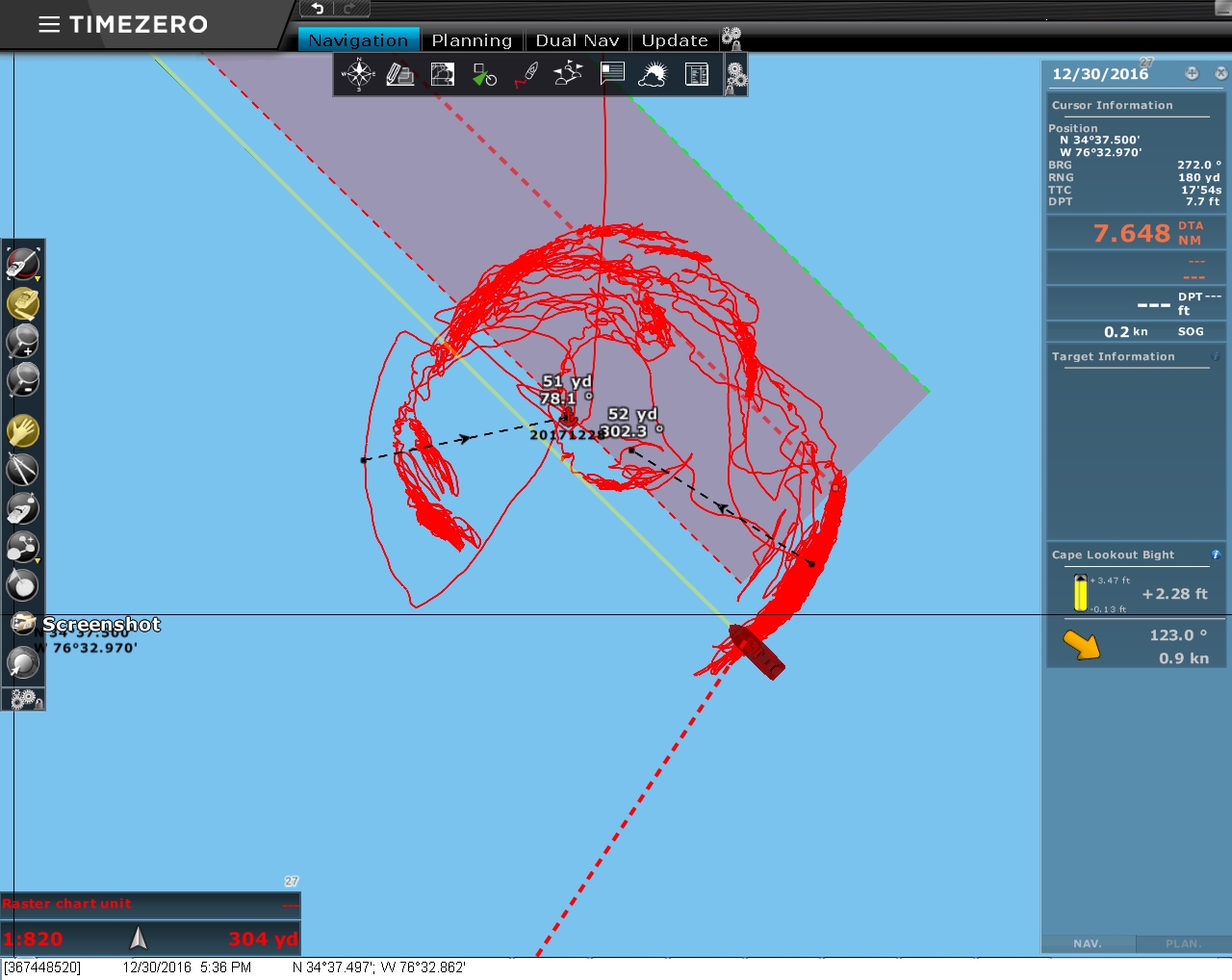 |
12/30/2016: Track
Position: 34°37.50'N, -76°32.86'W
Our track shows how Dirona has been shifting around in the anchorage as the storm passes through. The winds initially were from south to southeast and currently are from the northwest.
|