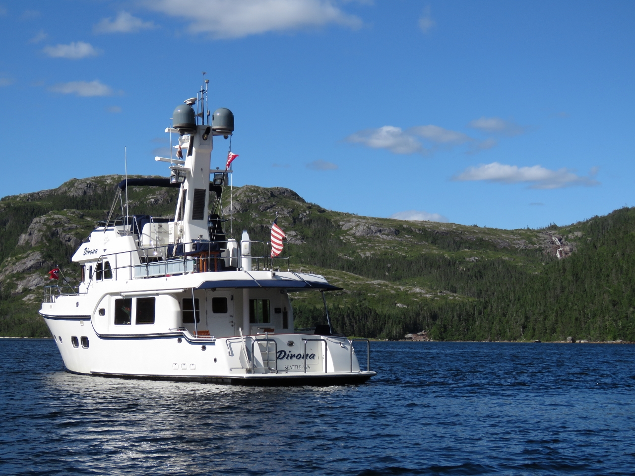
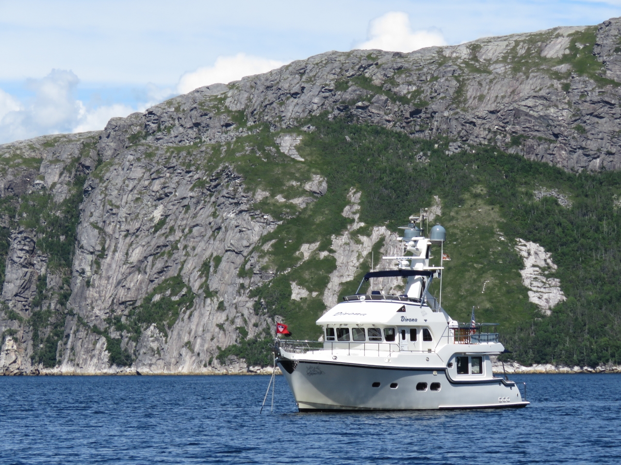
MV Dirona travel digest for Newfoundland 2016

|
Click the travel log icon on the left to see these locations on a map,
with the complete log of our cruise. On the map page, clicking on a camera or text icon will display a picture and/or log entry for that location, and clicking on the smaller icons along the route will display latitude, longitude and other navigation data for that location. And a live map of our current route and most recent log entries always is available at //mvdirona.com/maps/LocationCurrent.html. |
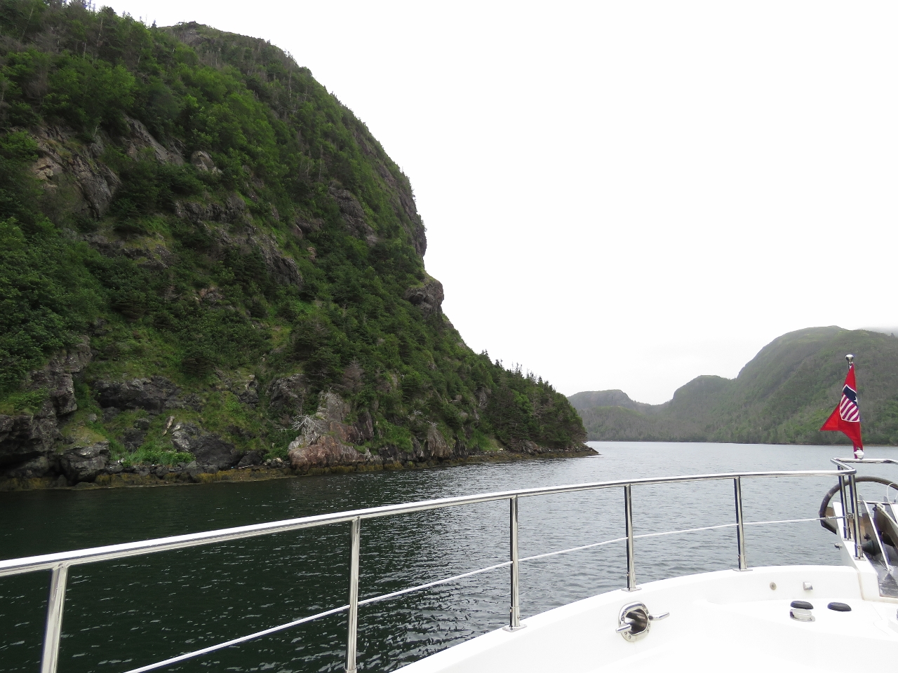 |
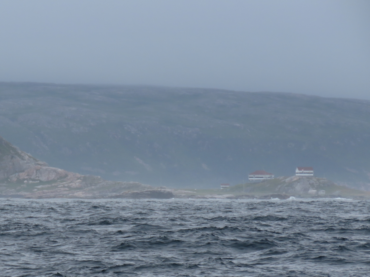
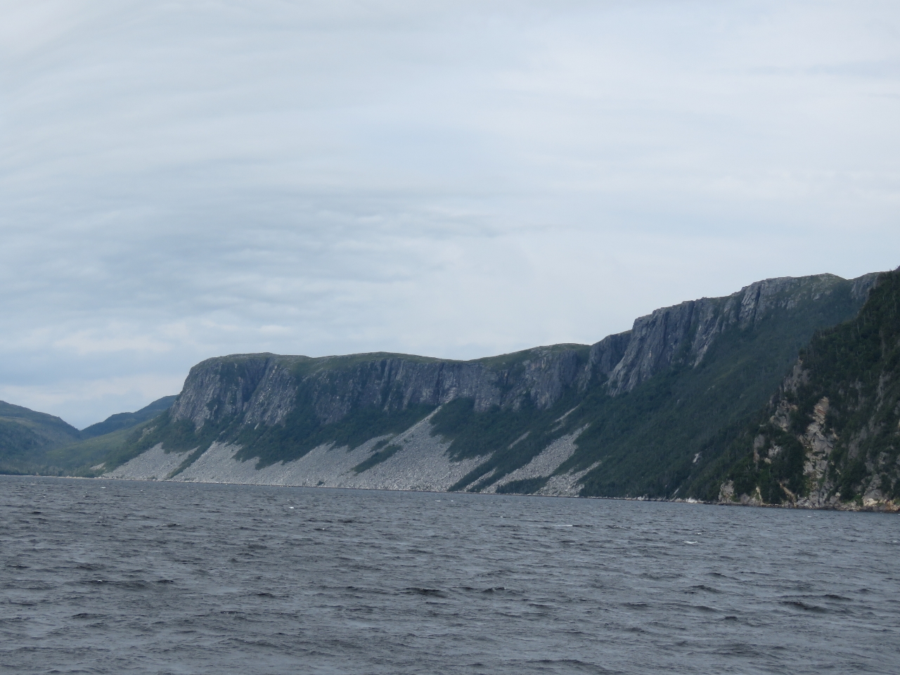
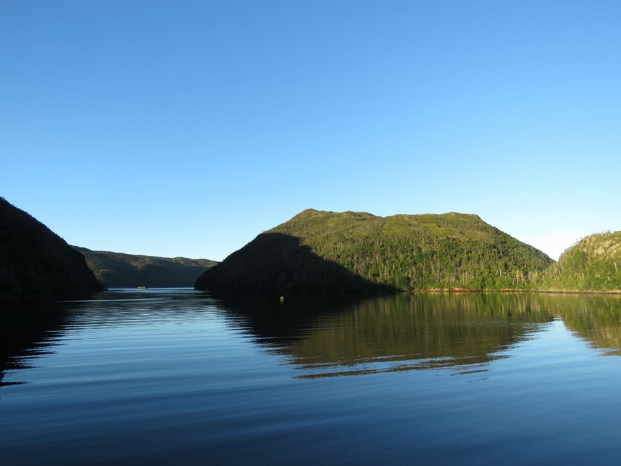
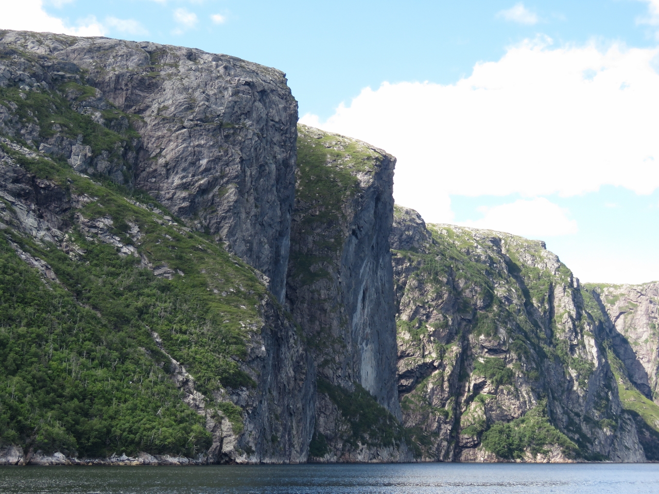
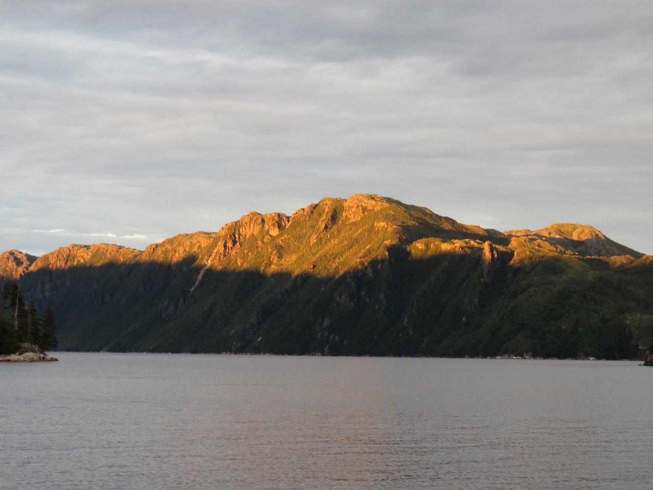
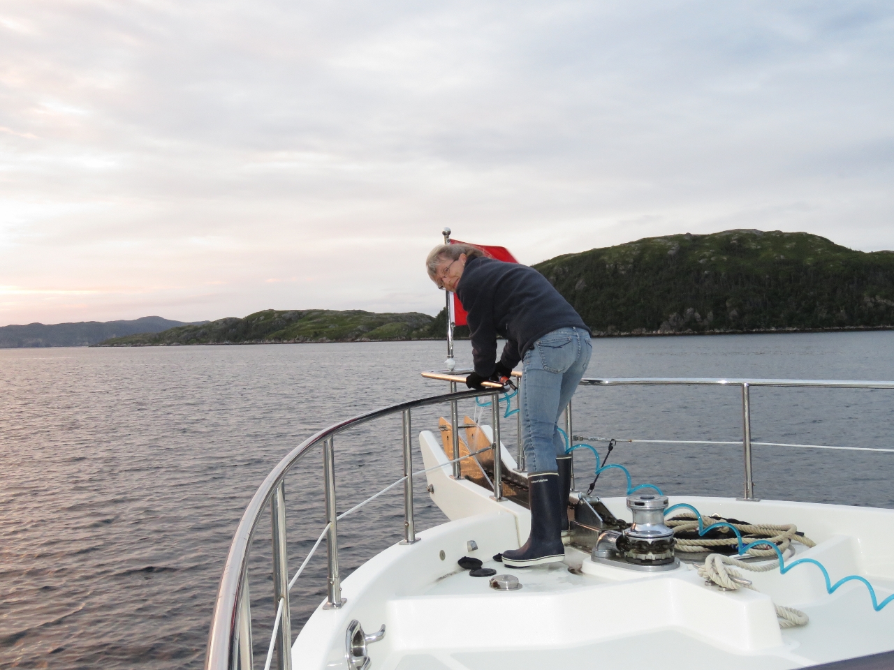
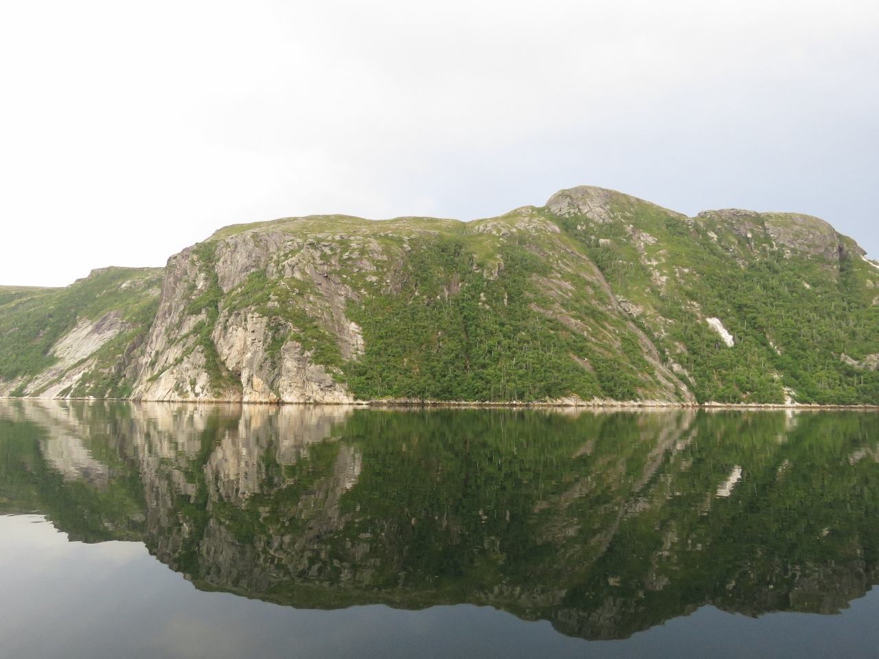
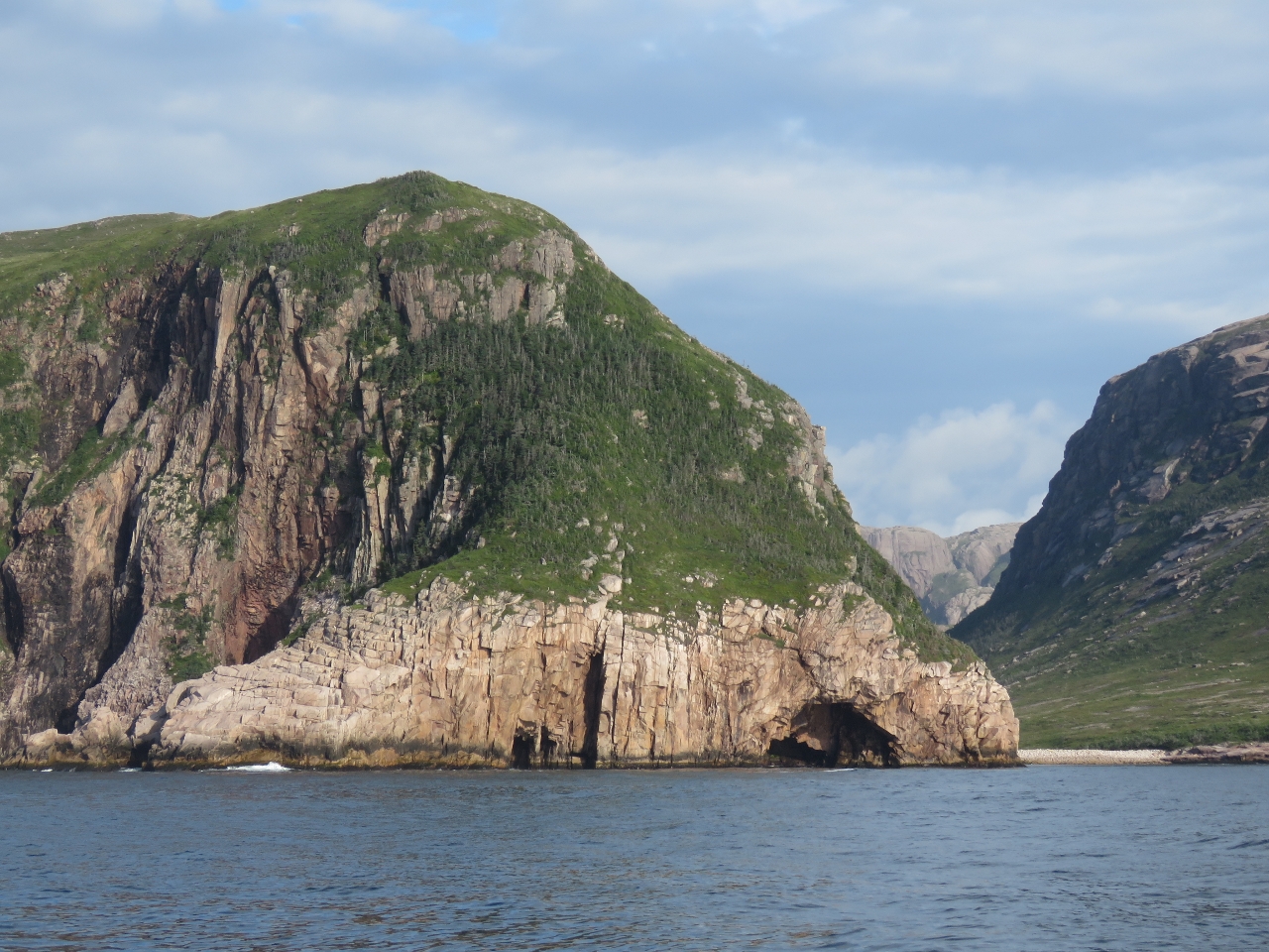
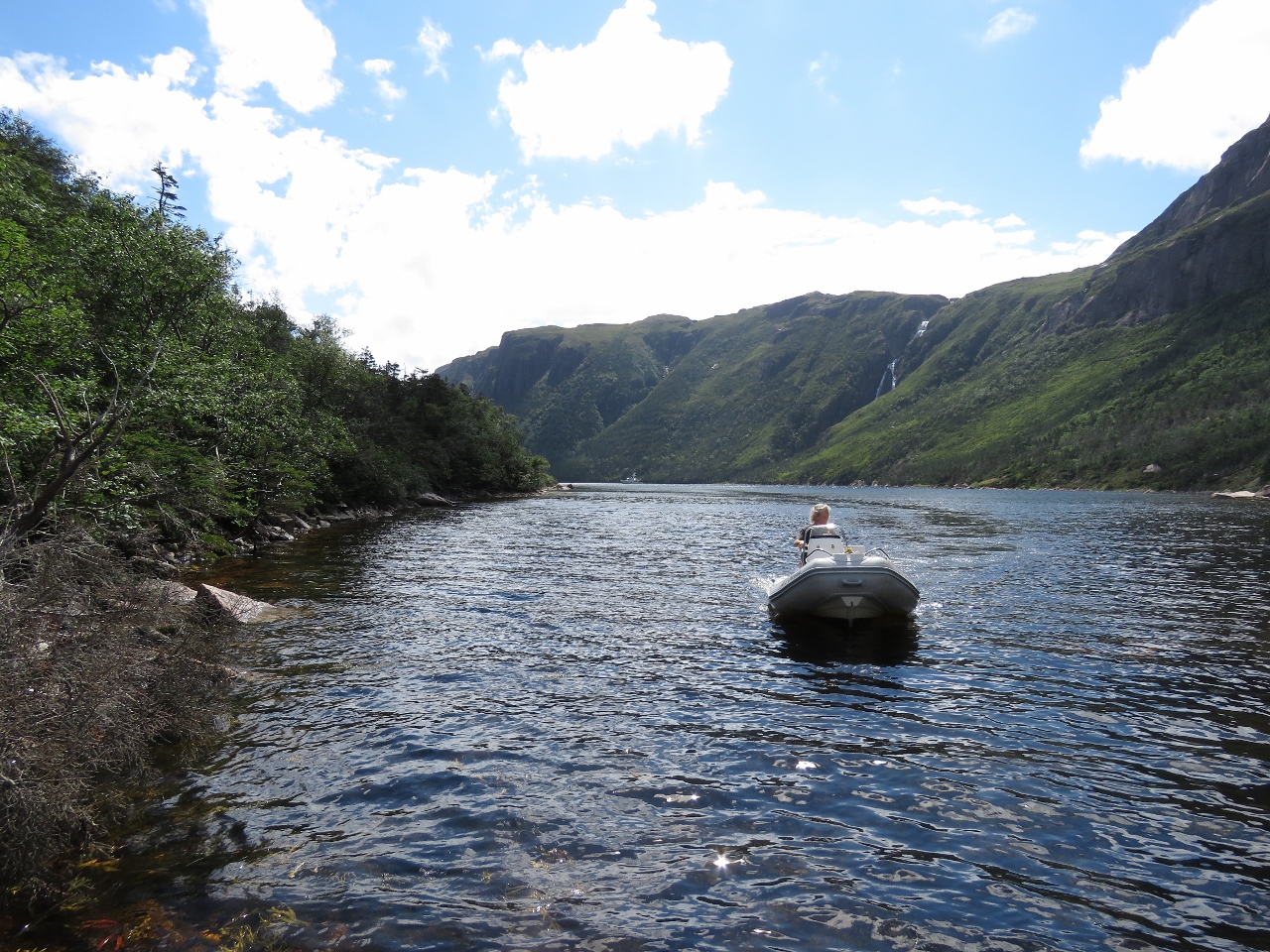
8/6/2016: First Narrows
Position: 47°34.12'N, -55°43.54'W
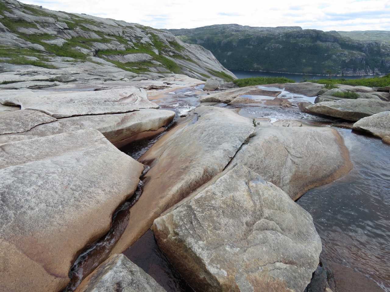
Hugging the west shore as we pass through the First Narrows at the head of Northeast Arm at the extreme north end of Harbour Breton. The day is a little overcast, but the scenery still is amazing in this area.
|
 |
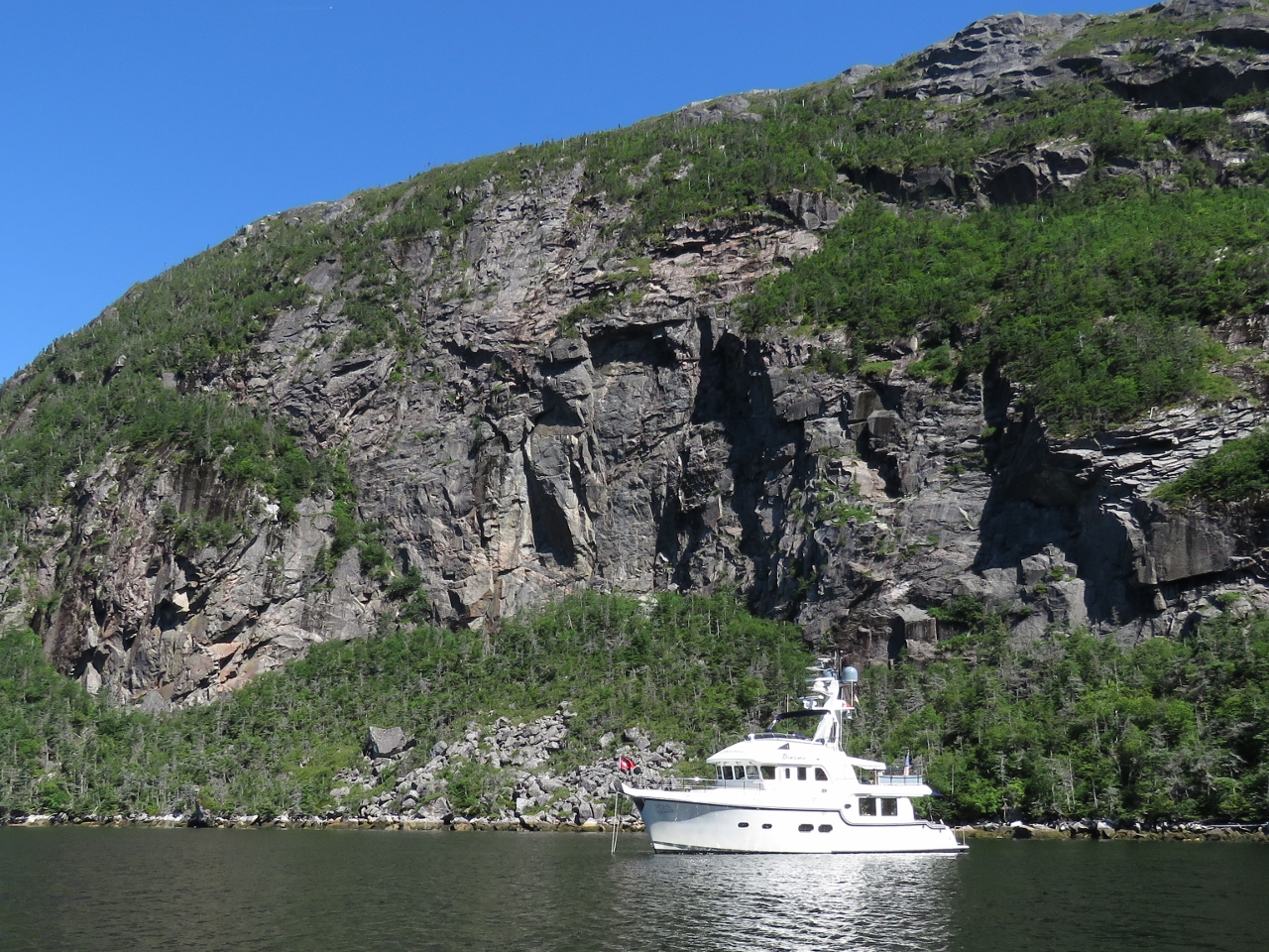
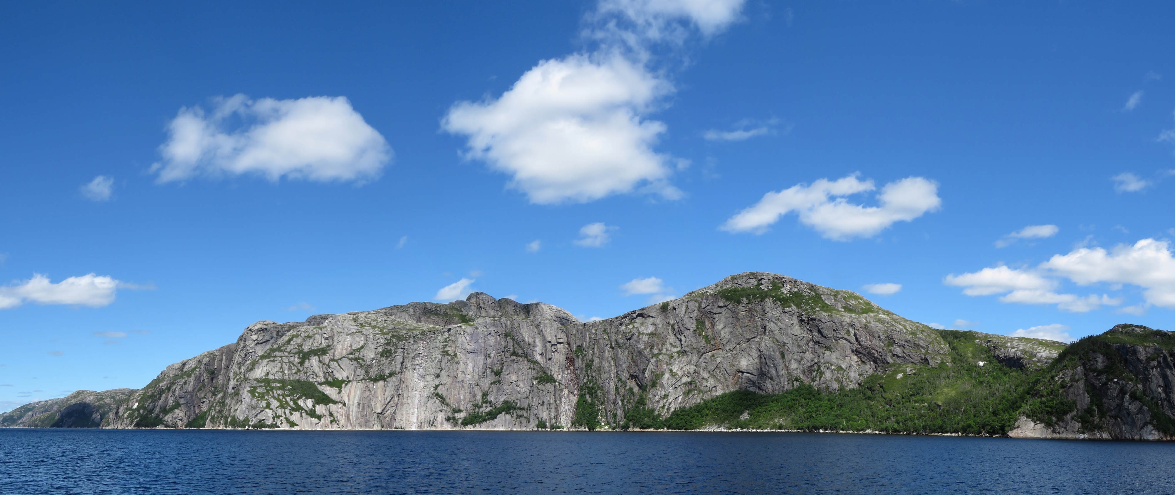
8/6/2016: Nancys Cove
Position: 47°34.97'N, -55°43.50'W
We passed through the Second Narrows and toured Baldens Cove at the head for a possible anchorage. But a dozen houses face the water and the bay felt rather wide open, so we returned back go Nancys Cove between the First and Second Narrows. Here we had total privacy beneath soaring cliffs.
|
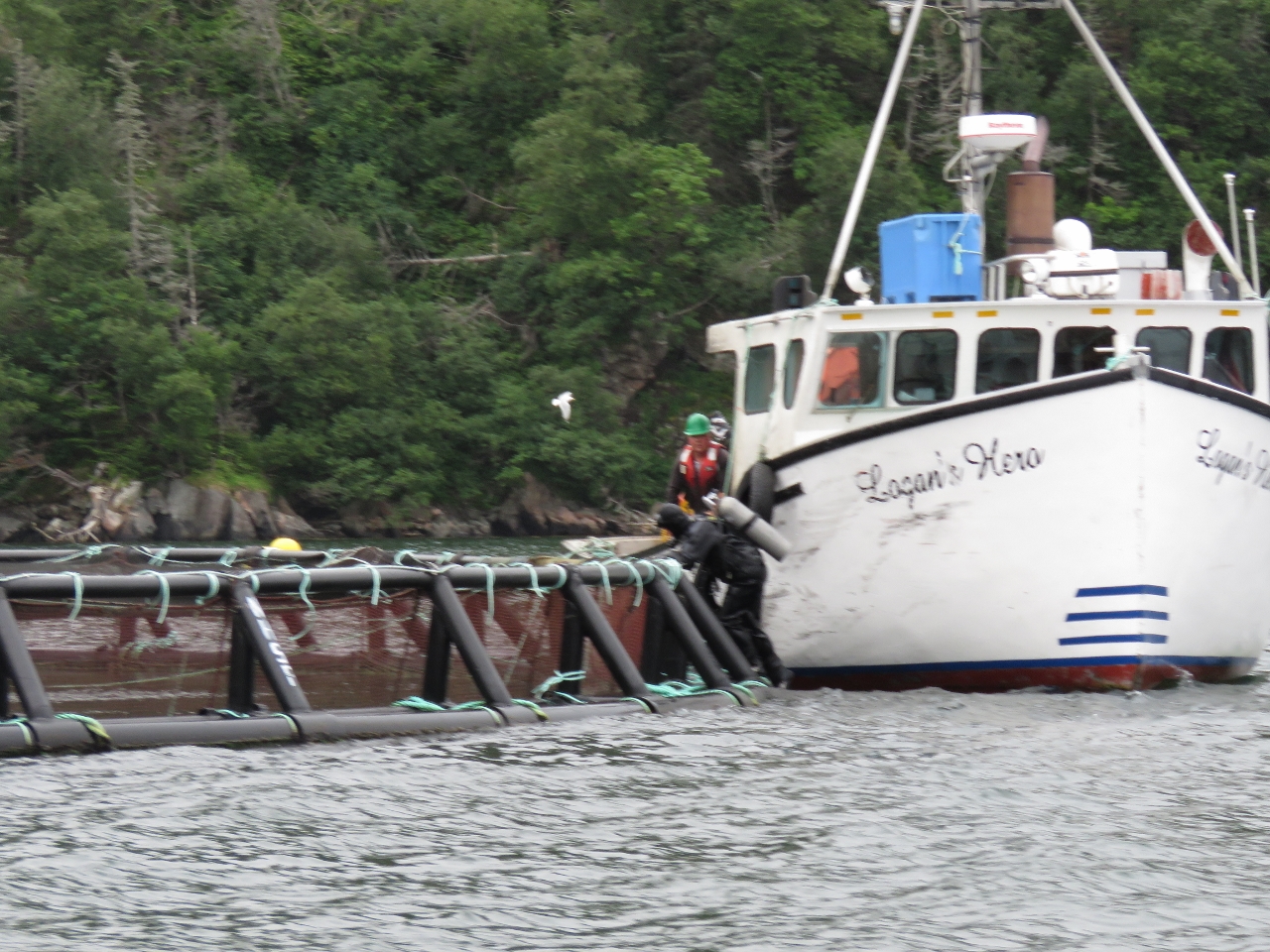 |
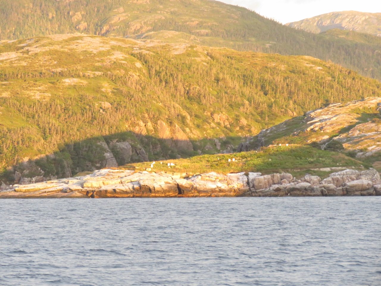
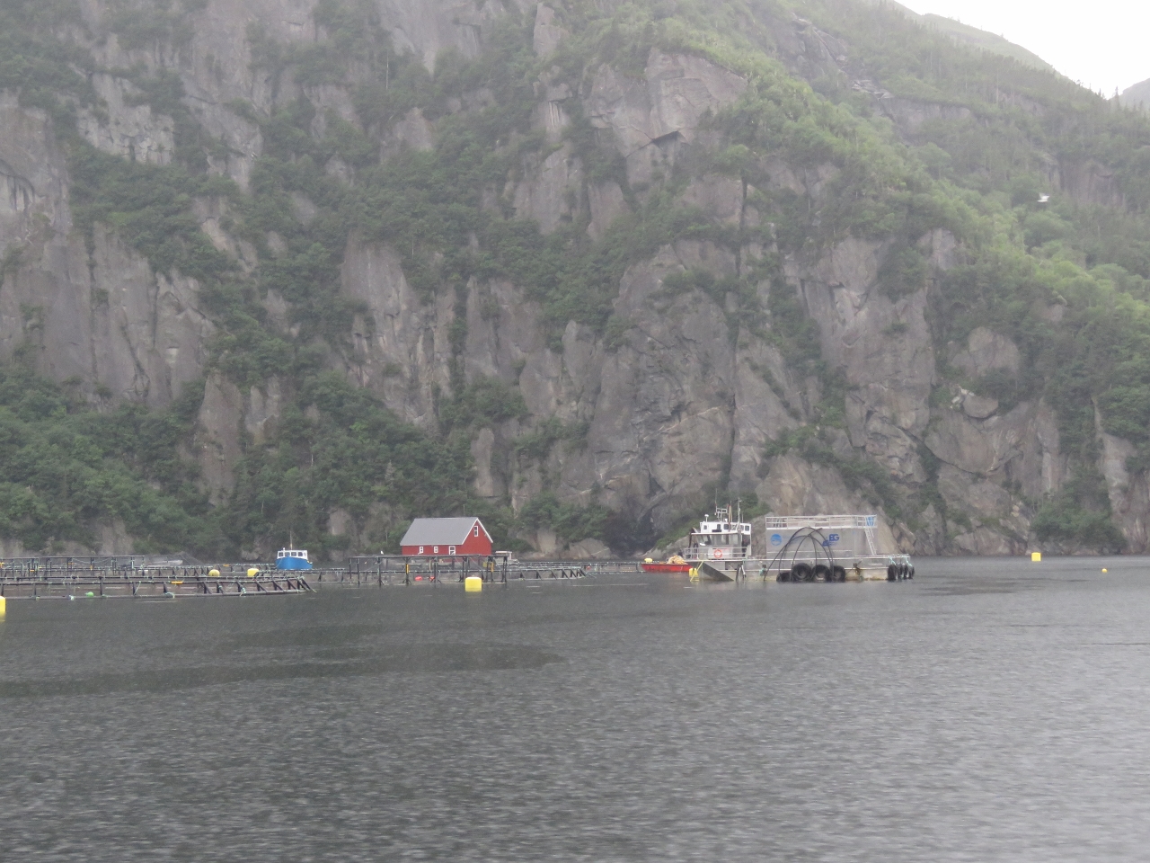
8/6/2016: NHSF
Position: 47°32.76'N, -55°45.01'W
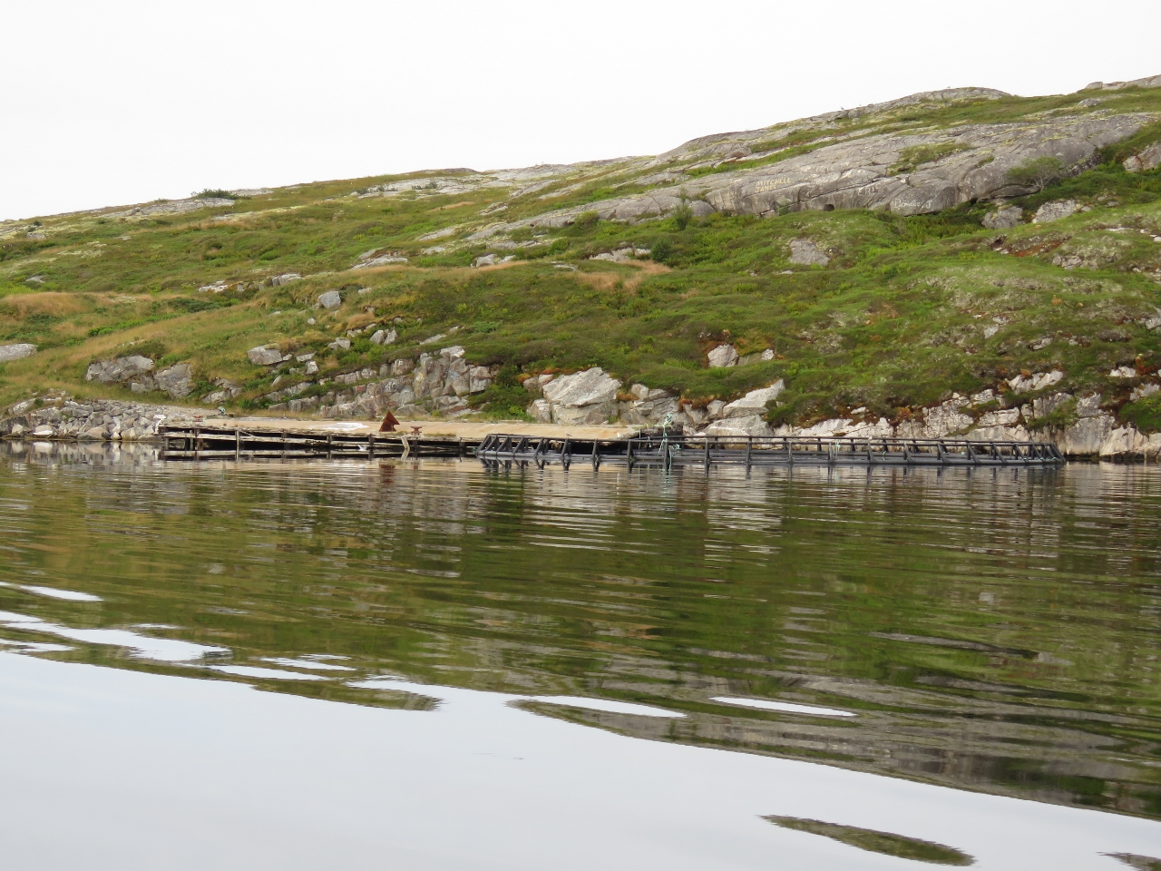
We toured Baldens Cove in the tender, looking for a place to climb up for a view, but couldn't find one, so continued south. We'd passed several fish farms on the way north and stopped to chat with the workers there as a couple of divers worked to install new nets in the pens. The pens are owned by New Brunswick-based Northern Harvest Sea Farms (NHSF) and look relatively new. Each pen has 40,000 salmon and there were 12-16 pens at each of the three farms in the area. That's over 1.5 million salmon.
|
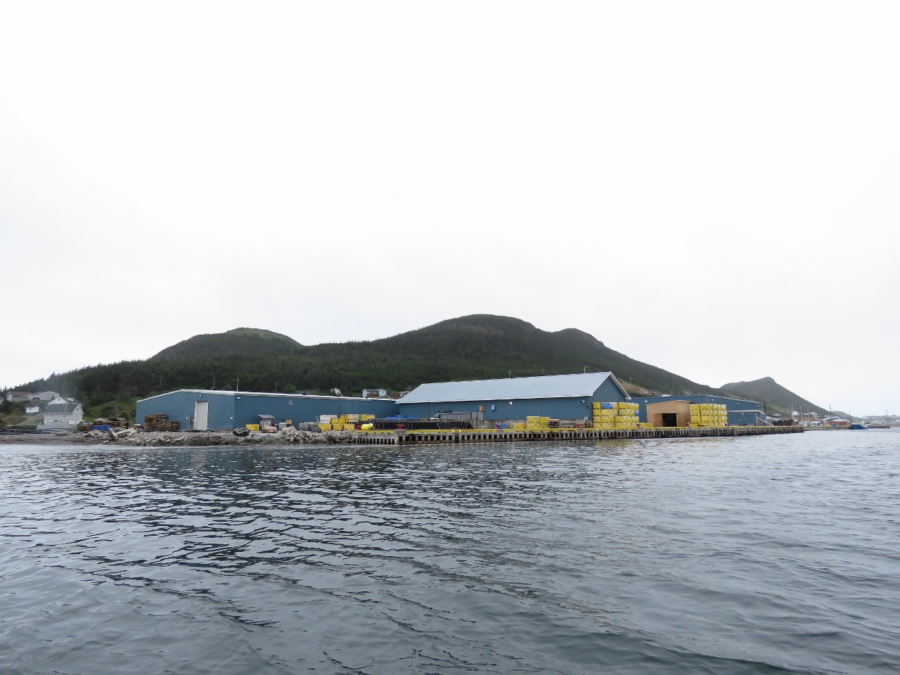 |
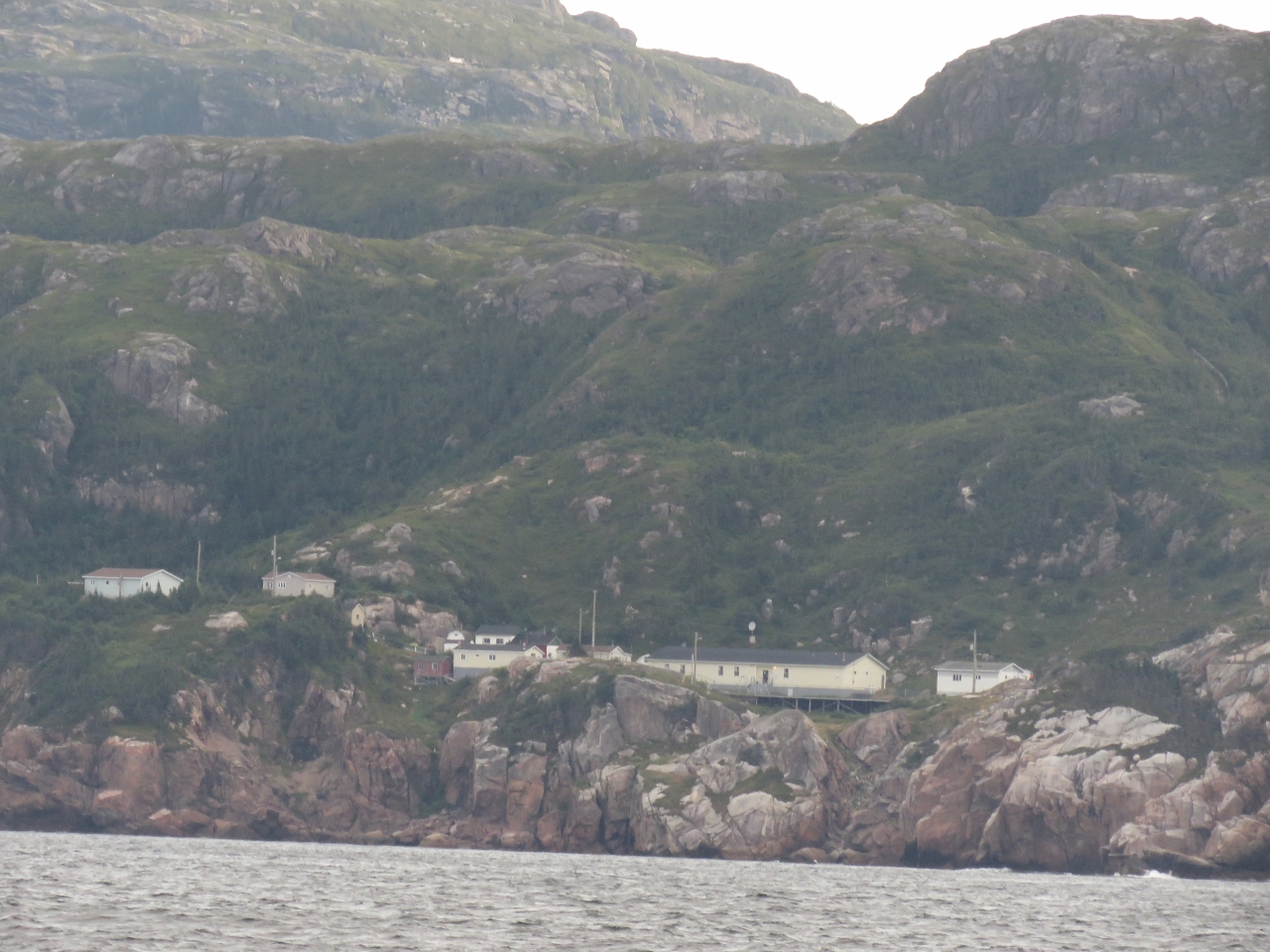
8/6/2016: Aquaculture
Position: 47°29.32'N, -55°47.75'W
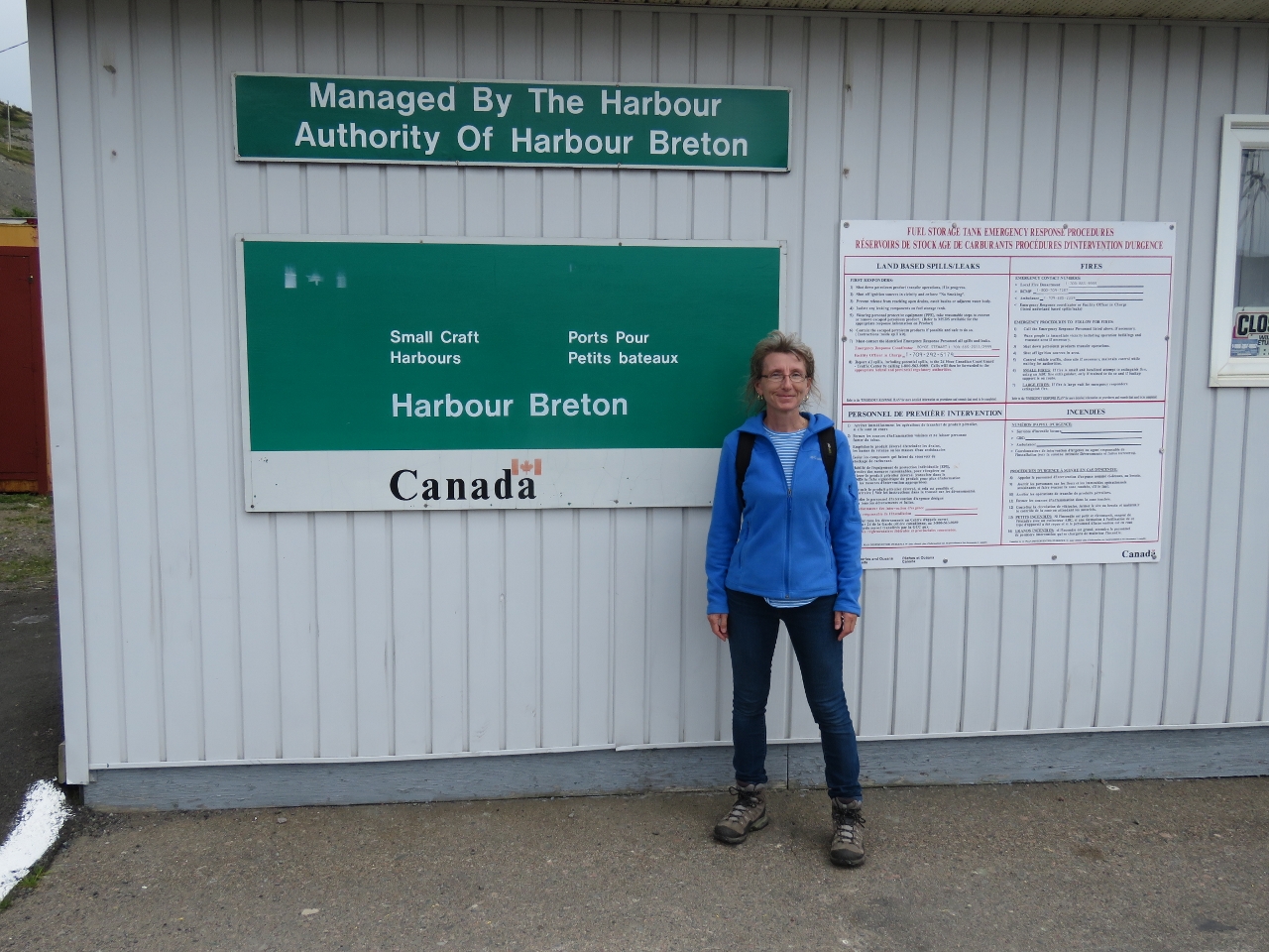
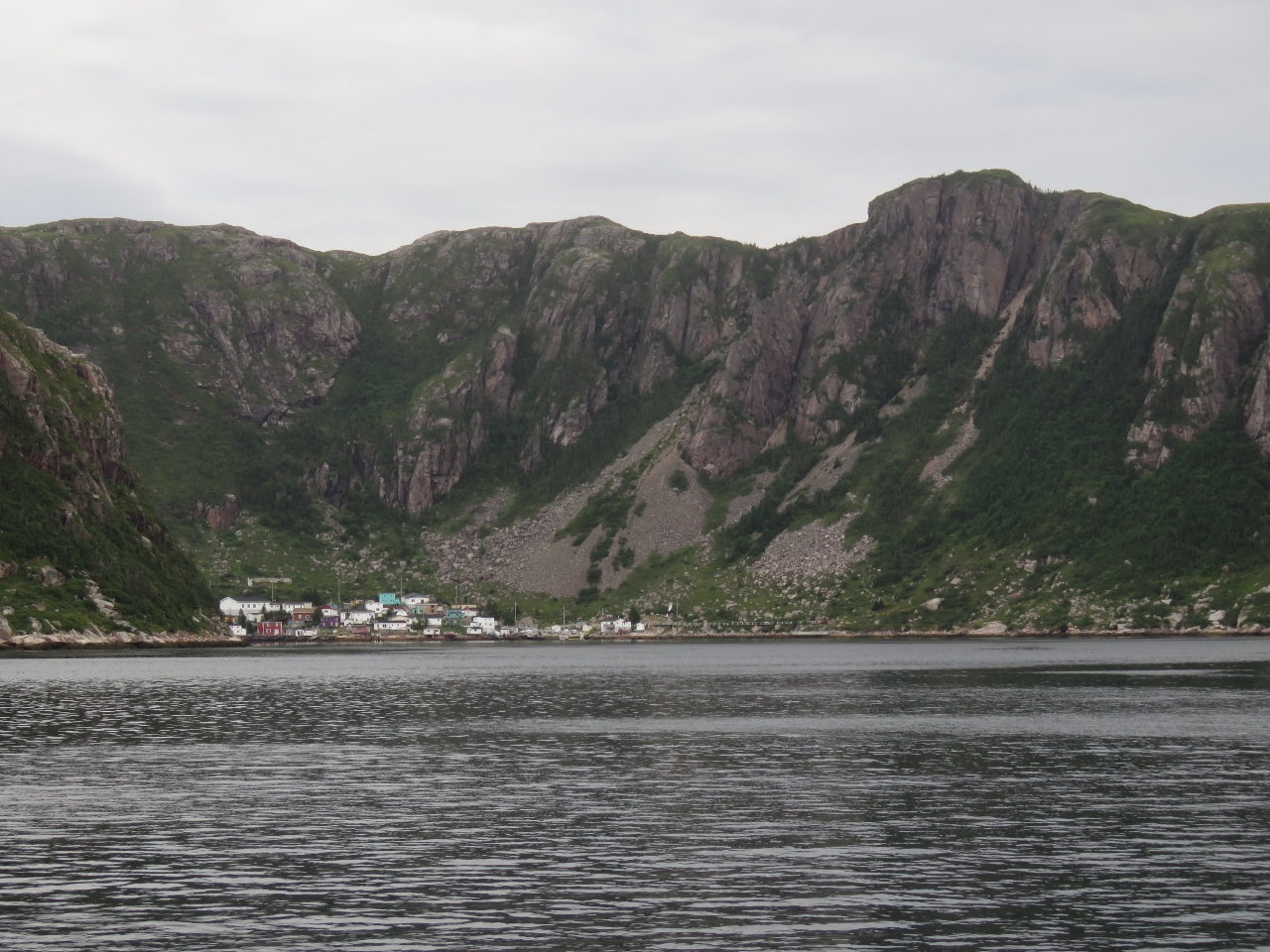
New buildings in support of the aquaculture industry at the town of Harbour Breton opposite last night's anchorage at Jersey Harbour. We stopped to chat with some locals who said the industry brought 100+ jobs to the area. That and the skippering jobs available for the offshore oil industry were bringing a lot of people back to Harbour Breton who had moved away. The town seemed to be thriving, with much new home construction. Great to see.
|
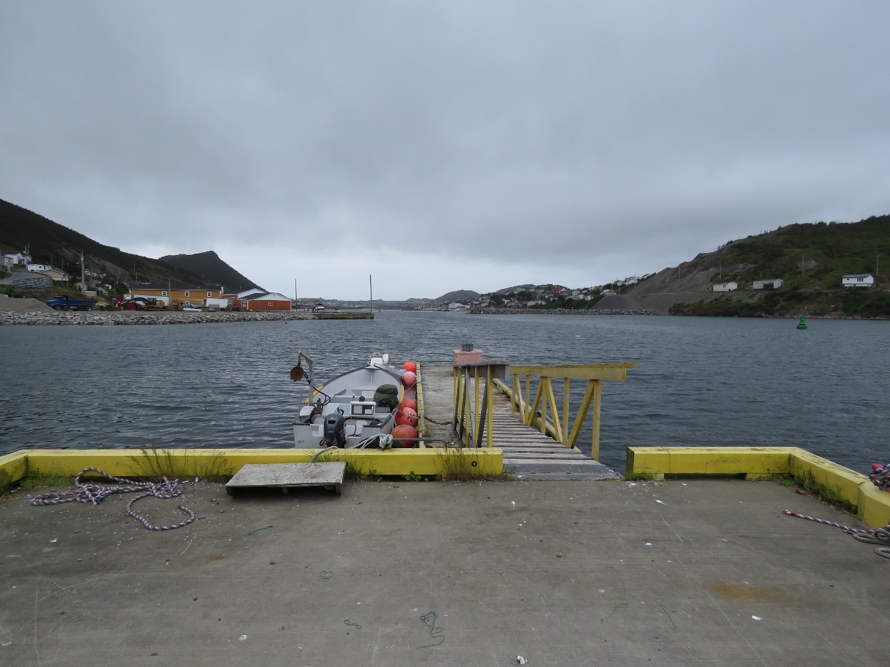 |
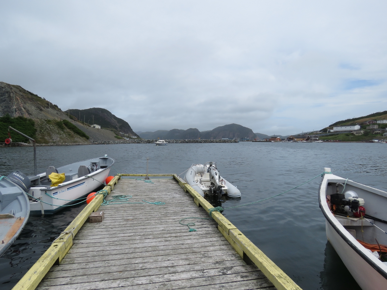
8/6/2016: Moored
Position: 47°28.90'N, -55°48.20'W
The locals we spoke with said we could tie off at the floating dock nearby so we could have a walk around. The console of our tender is visible just west of their boat.
|
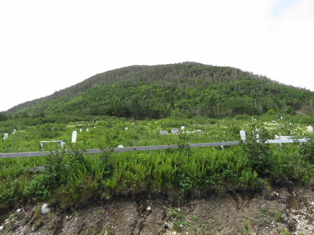 |
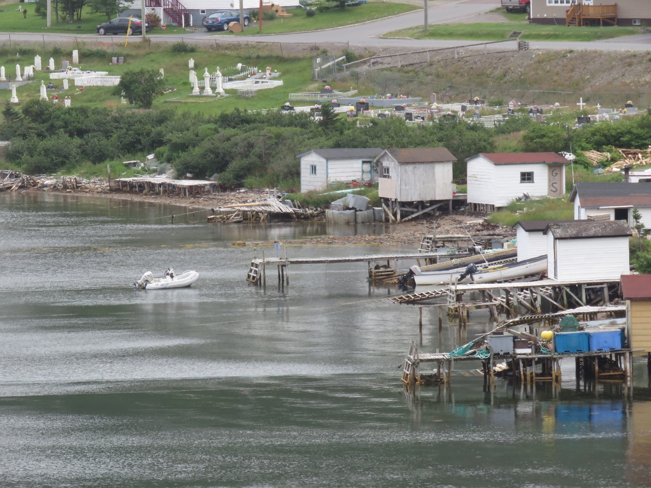
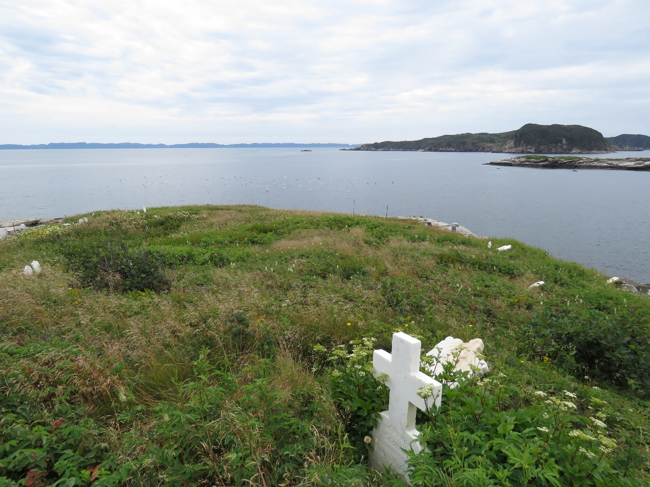
8/6/2016: Anglican Cemetery
Position: 47°28.73'N, -55°47.83'W
Harbour Breton has been a fishing port since the mid-1600s. In 1687, 36 French fisherman and a Roman Catholic chapel were here. The 1713 Treaty of Utrecht excluded the French from the south coast of Newfoundland, and the Church of England became established here as British settlers and fishers moved in. This Anglican Cemetery one of several cemeteries in town.
|
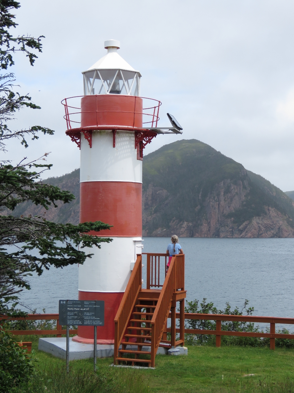 |
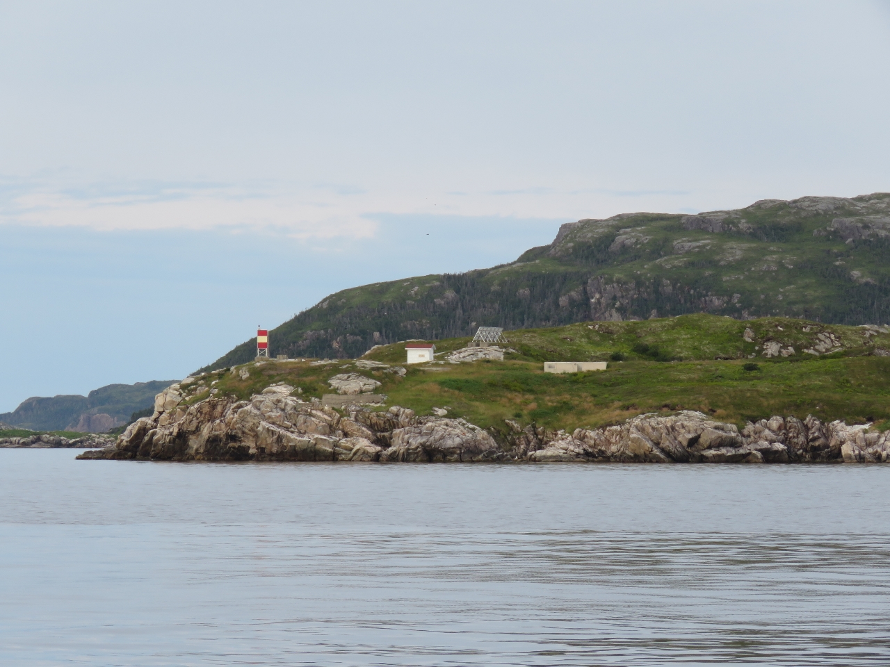
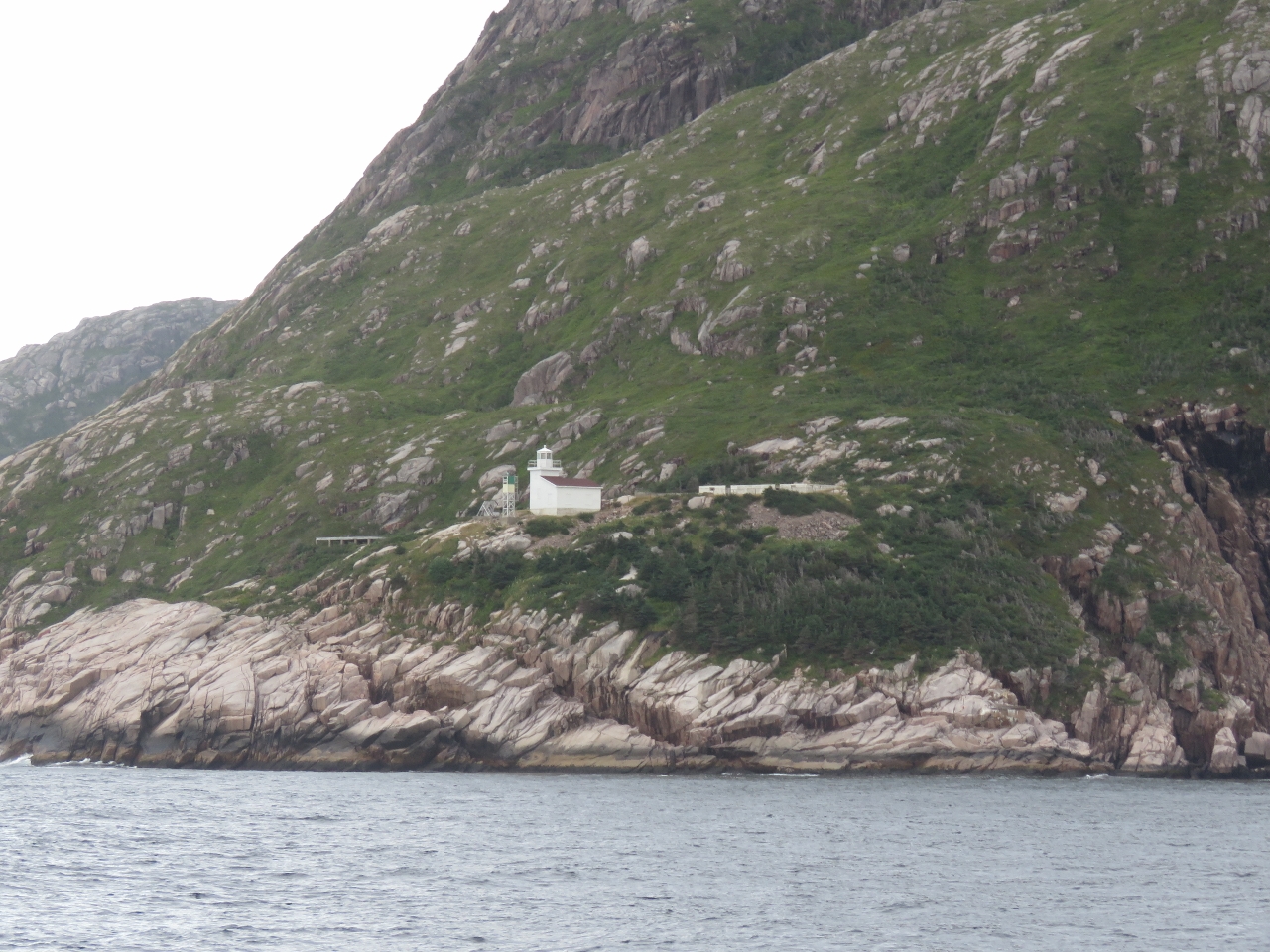
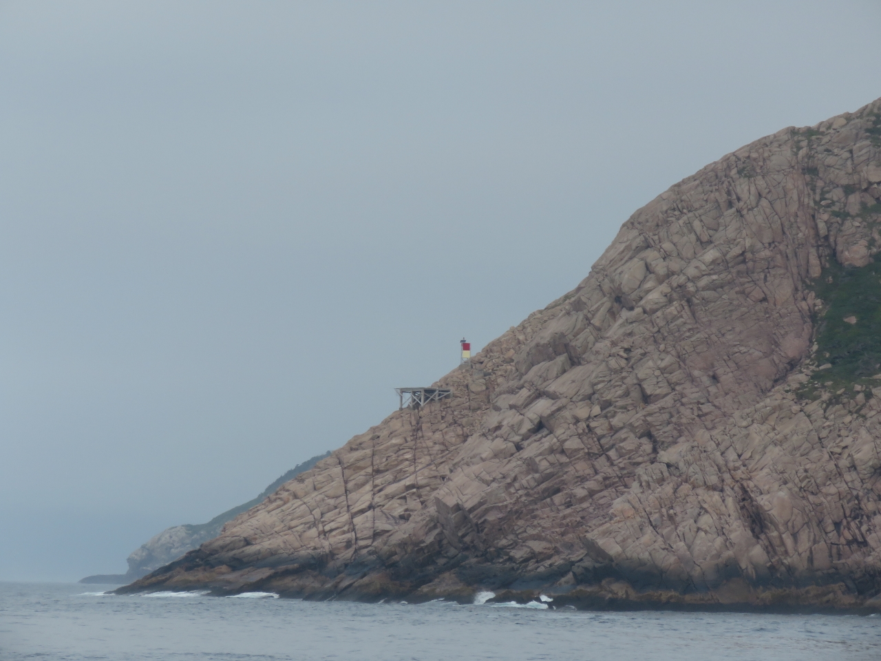
8/6/2016: Rocky Point Light
Position: 47°28.68'N, -55°47.65'W
The town has built a nice trail to the Rocky Point Light with several interpretive signs and a great viewing platform. The original light at Rocky Point was built in 1873, the first light on the South Coast.
|
 |
8/6/2016: Newman's Lookout
Position: 47°28.84'N, -55°48.07'W
Harbour Breton has a series of nine trails and points of interests. This is the view from Number 8, Newman's Lookout. The Newmans arrived in Harbour Breton in the 1790s and had a virtual monopoly on the South Coast fish trade. Their plantation was below the lookout that we're on.
|
 |
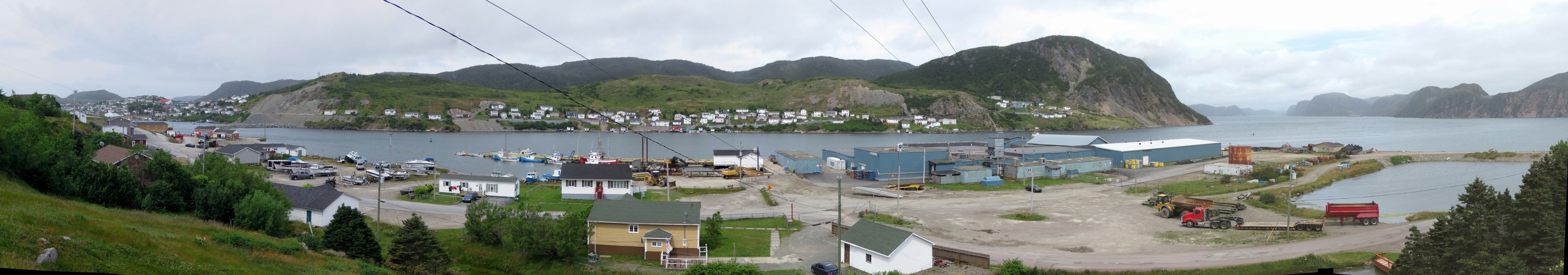
8/6/2016: Government Wharf
Position: 47°28.67'N, -55°48.73'W
We ran the tender over to the north shore and tied off at the floating dock there to explore the other side of town.
|
 |
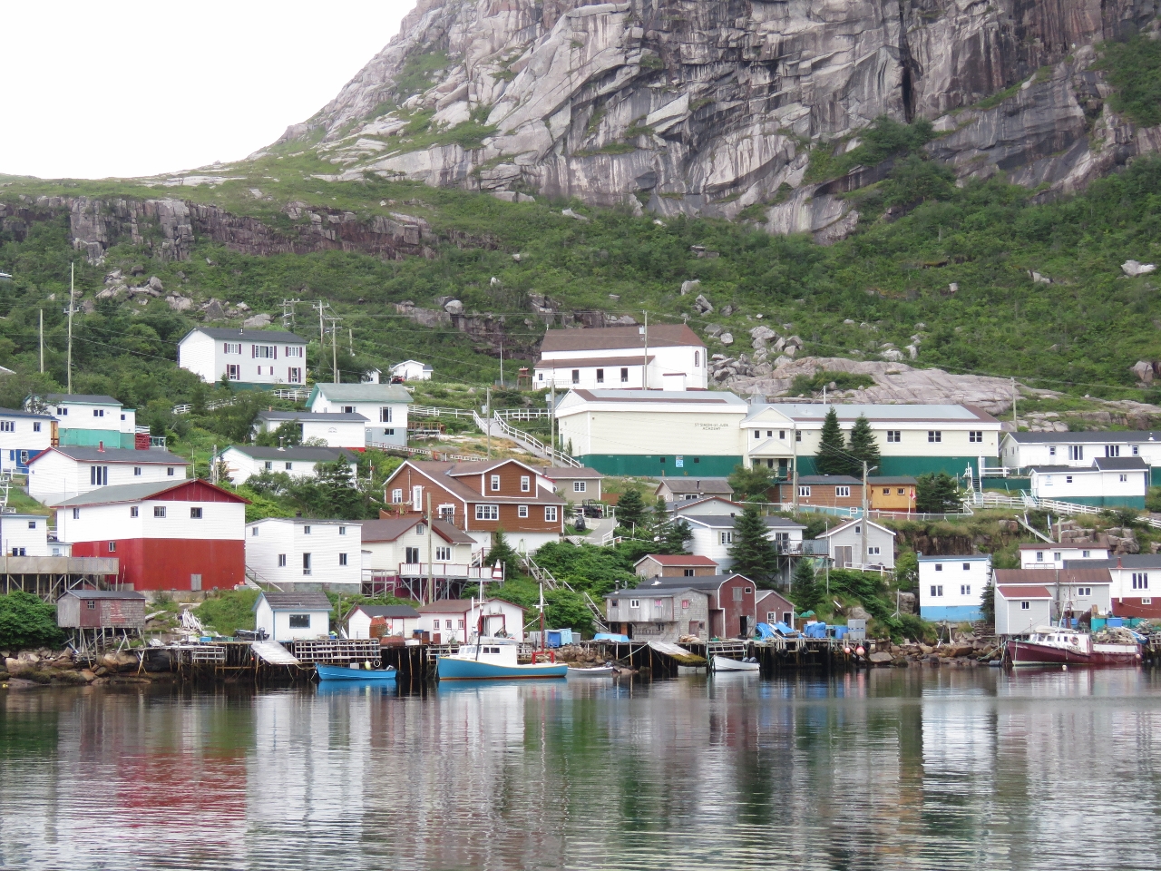
8/6/2016: Harbour Breton
Position: 47°28.77'N, -55°48.61'W
Happy to be at Harbour Breton and back exploring in Canada.
|
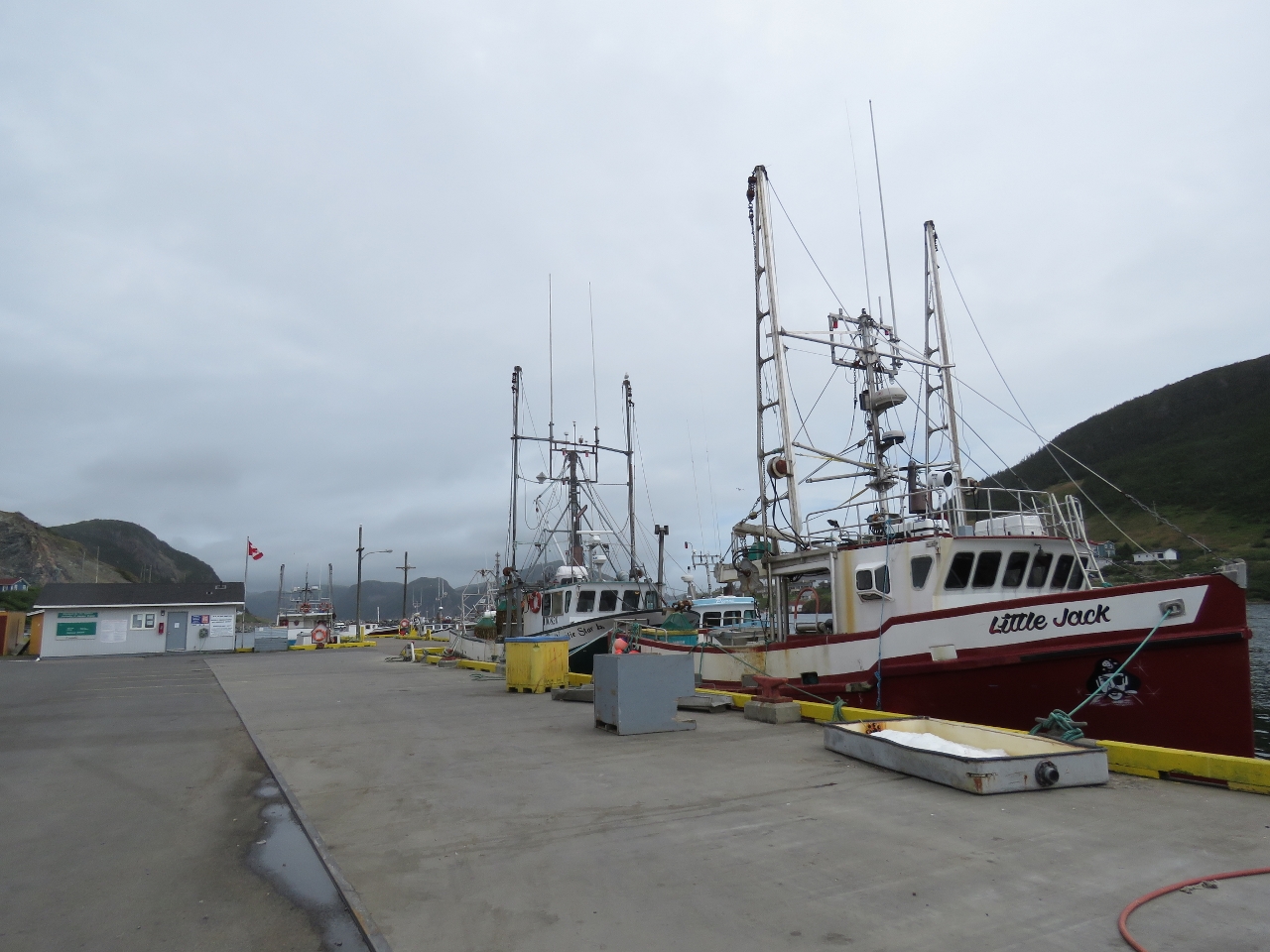 |
8/6/2016: Little Jack
Position: 47°28.75'N, -55°48.64'W
Little Jack was one of a couple of dozen fishing vessels moored to the Government Wharf at Harbour Breton. Many were much smaller and more simply rigged than Little Jack though.
|
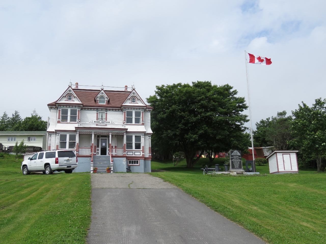 |
8/6/2016: Sunny Cottage
Position: 47°28.71'N, -55°48.74'W
Sunny Cottage was built in the early 1900s for local fish merchant John J. rose using the ornate Queen Anne architectural style. The house was designated as a Registered Heritage Structure in 1988.
|
 |
8/6/2016: Third Mooring
Position: 47°28.28'N, -55°49.46'W
The main commercial center for Harbour Breton is at the western head of the bay, but there are no public docks there. We asked a local if there was anywhere we might tie off to go ashore and he offered us a spot on the end if his pier.
|
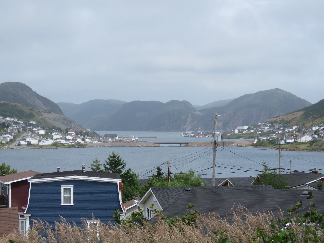 |
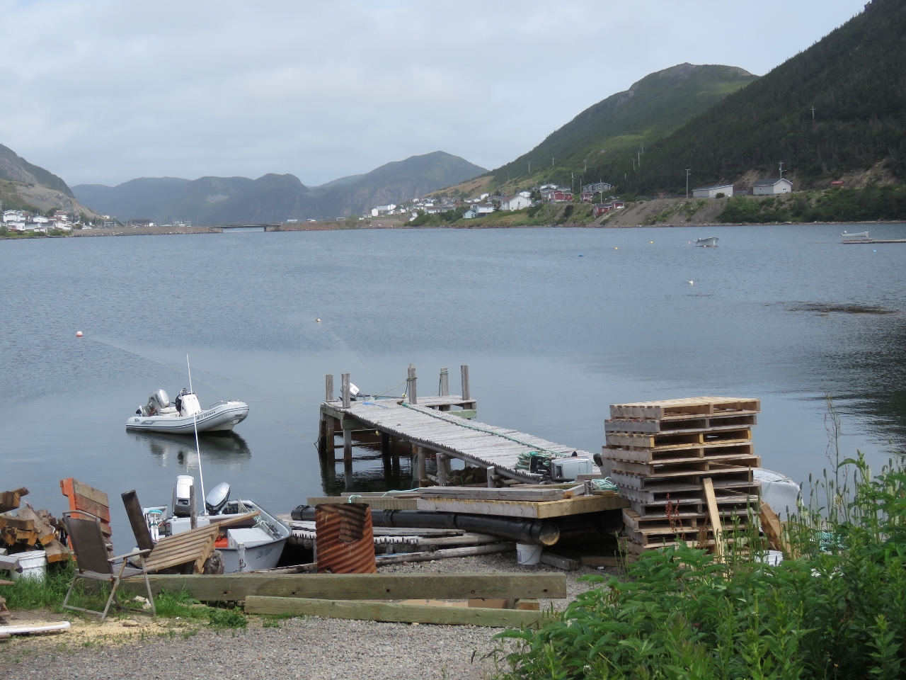
8/6/2016: Inner Harbour
Position: 47°28.26'N, -55°49.57'W
The view across the inner harbour, just above where the tender is moored, looking east toward the Government Dock (beyond the bridge). Jersey Harbour where we anchored last night is in the far distance.
|
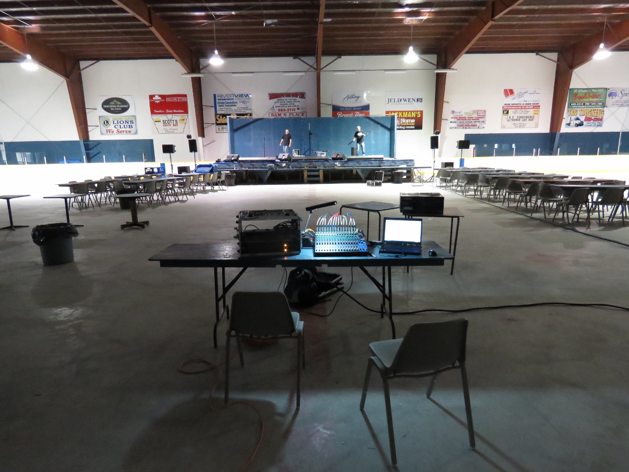 |
8/6/2016: Connaigre Arena
Position: 47°28.21'N, -55°49.76'W
We heard loud music coming from the Connaigre Arena up the hill, but no cars in the parking lot, with a trailer being unloaded at one side. Thinking it might be a band doing a sound check, we went inside to investigate. It was the sound engineers preparing for a live concert that evening.
|
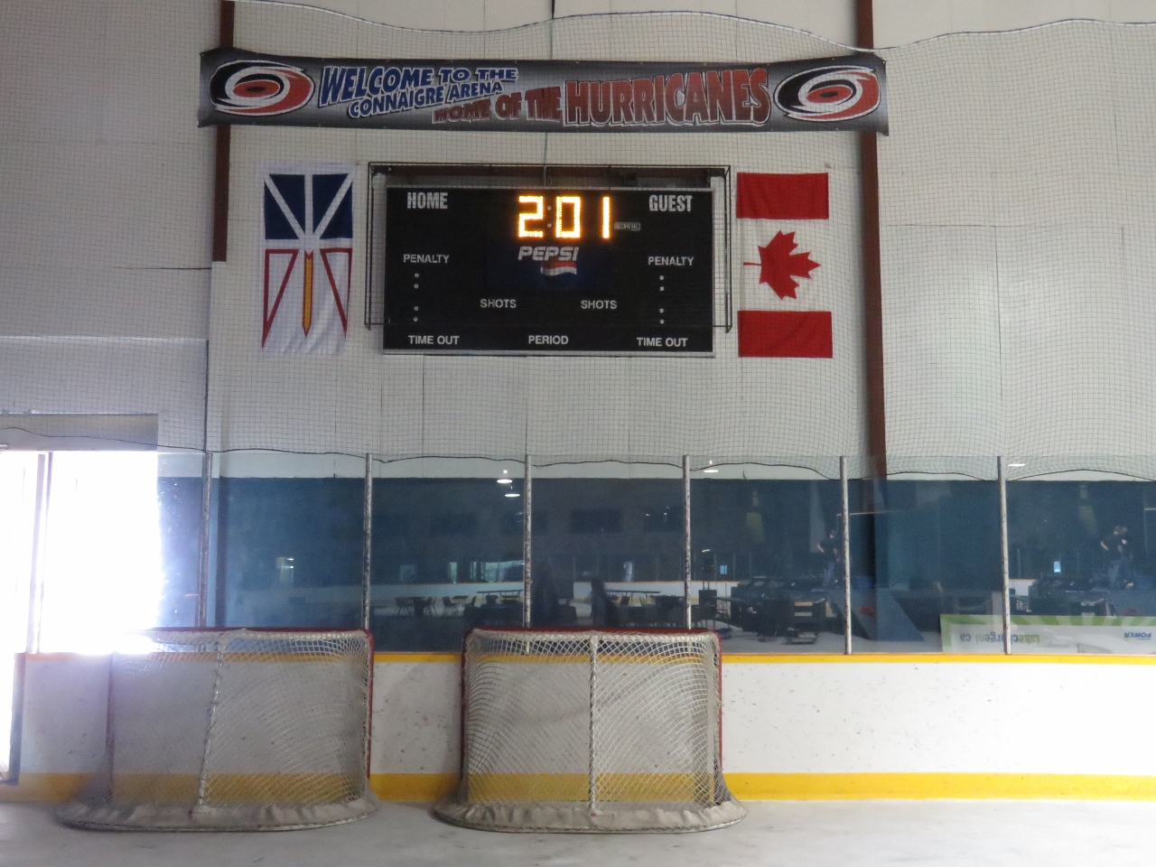 |
8/6/2016: Hurricanes
Position: 47°28.21'N, -55°49.76'W
Connaigre Arena is home to the Hurricanes minor hockey team. We've not seen an ice hockey game since the Seattle Thunderbirds, a major Junior A team, moved out of downtown Seattle in 2009. It would have been great to watch a game, but we're a little out of season.
|
 |
8/6/2016: Docks
Position: 47°28.34'N, -55°49.73'W
Looking south across the private docks at the head of the inner harbour. Another cemetery is visible in the distance. That's our tender in the middle of the picture.
|
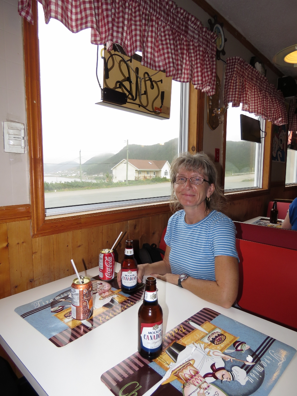 |
8/6/2016: Scott's
Position: 47°28.17'N, -55°49.65'W
We stopped for an good lunch at Scott's Snack Bar with a view to the harbour. We had a late lunch around 2:30, and the place was empty when we'd first walked past. But by the time we left the restaurant was half-full and lined up nearly out the door. We couldn't decide if people were having a late lunch or an early dinner, but there sure were a lot of them.
|
 |
8/6/2016: Pierce's Point Lookout
Position: 47°28.91'N, -55°48.65'W
Number 4 on the 9-count Harbour Breton points of interest list is Pierce's Point Lookout, and an easy walk from the Government Wharf on the north shore of town. The lookout has excellent views--this is looking east toward Jersey Harbor.
|
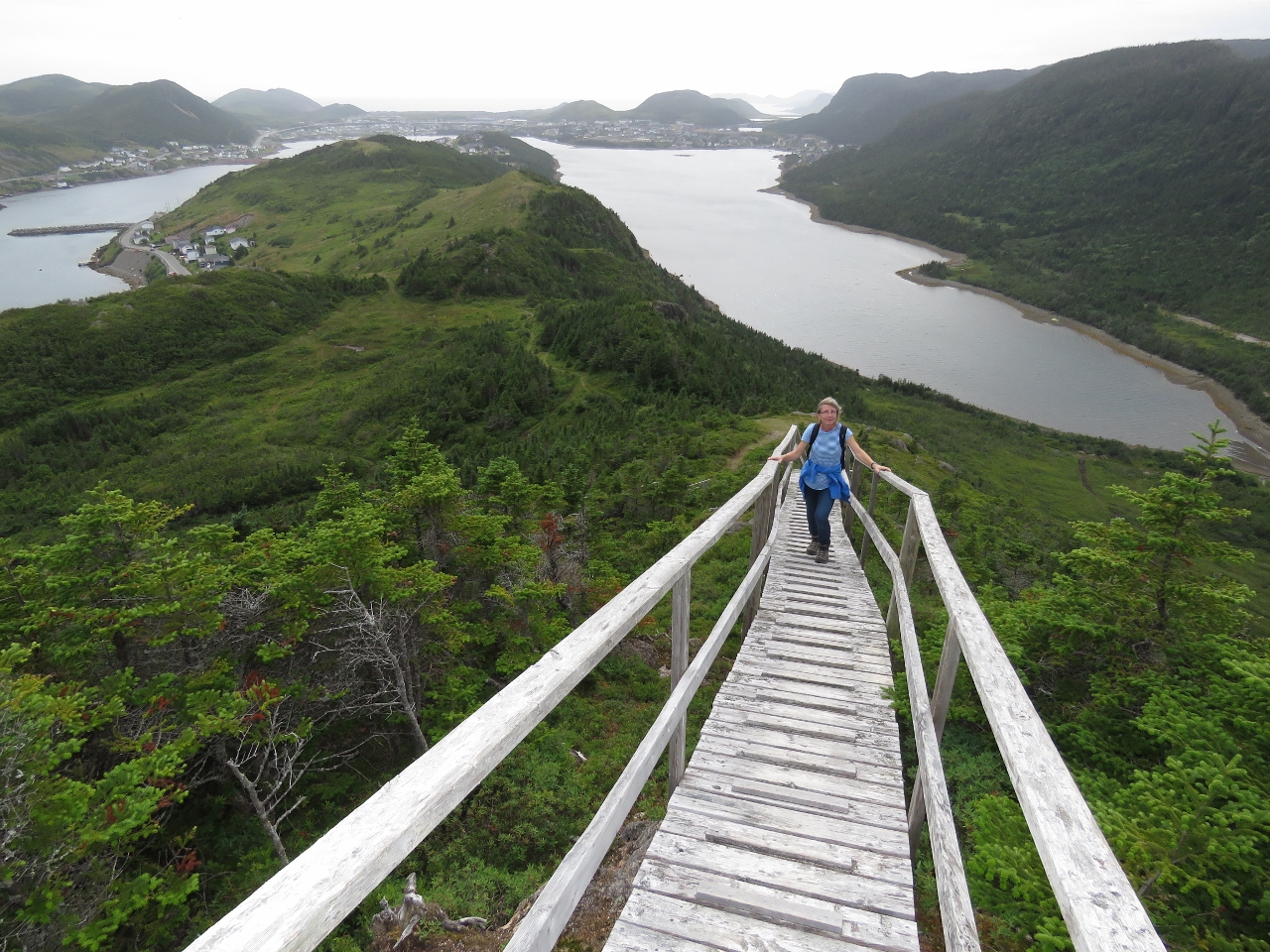 |
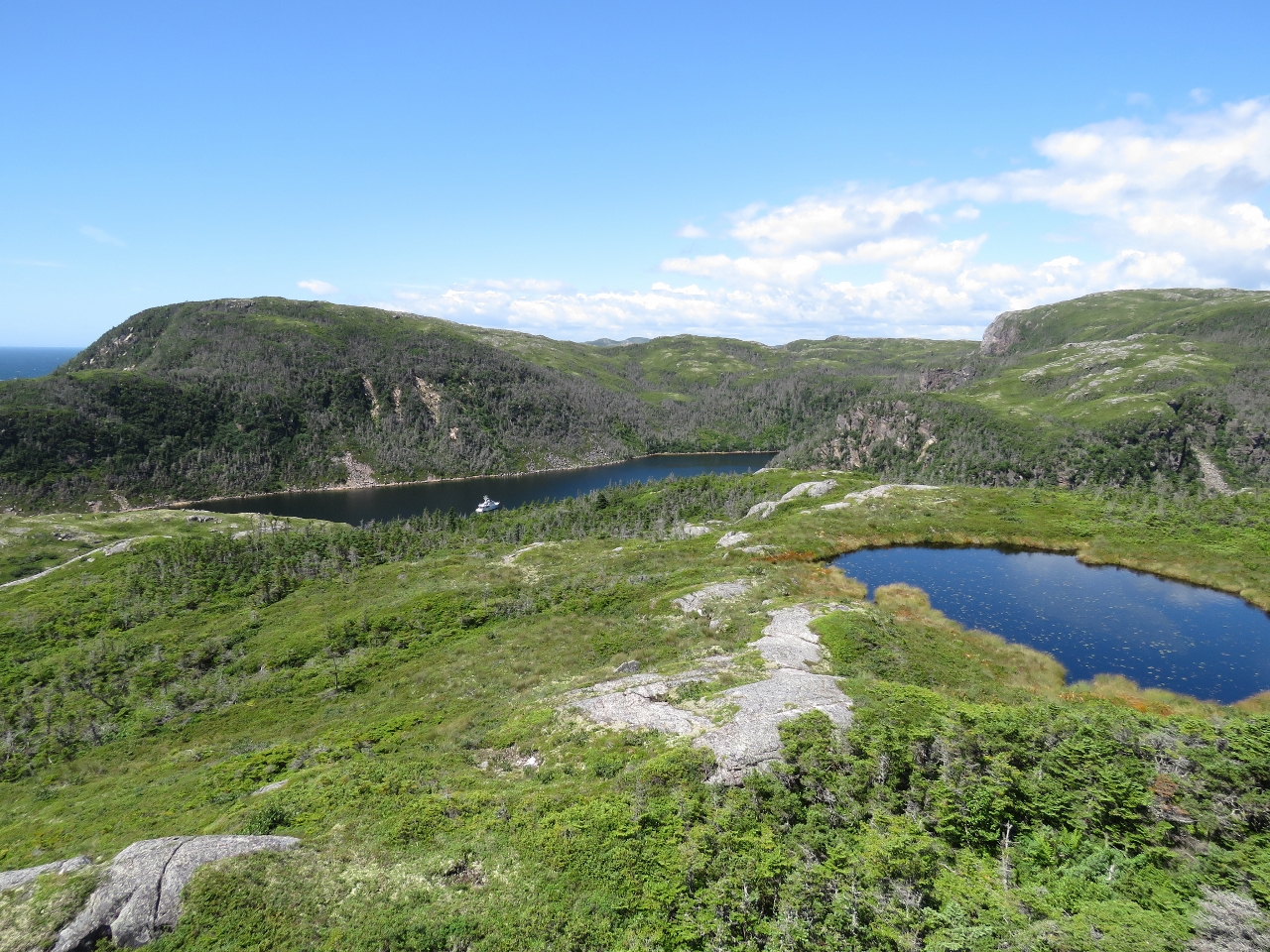
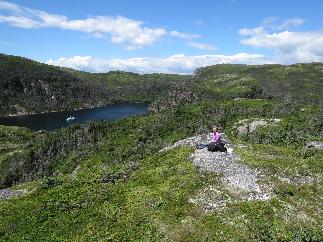
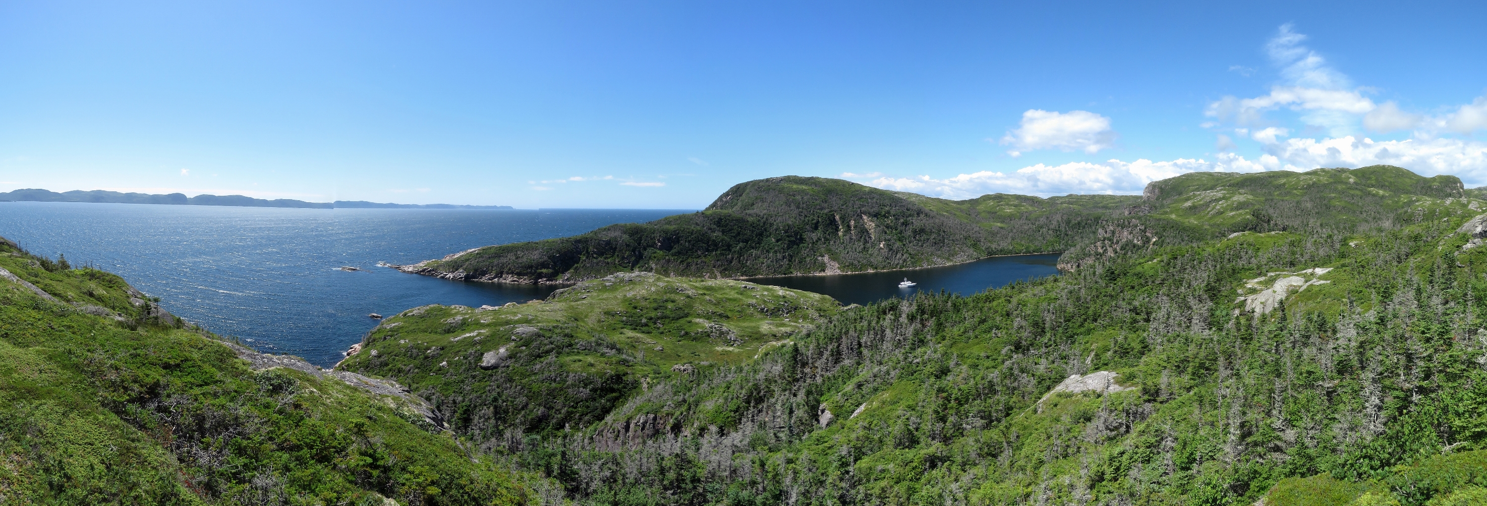
8/6/2016: Gun Hill Trail
Position: 47°29.27'N, -55°48.25'W
We could see the stairs and walkways of the Gun Hill Trail from lunch at the restaurant way on the other end of town and weren't planning to walk the trail as it looked to far for so late in the day. But from Pierce's Point Lookout, it looked enticingly near. The trail is steep, but beautifully-built and relatively easy to walk. And the views along the way are incredible.
|
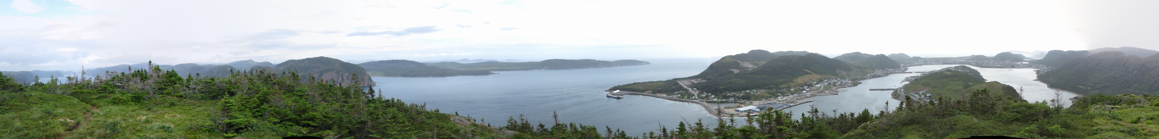 |
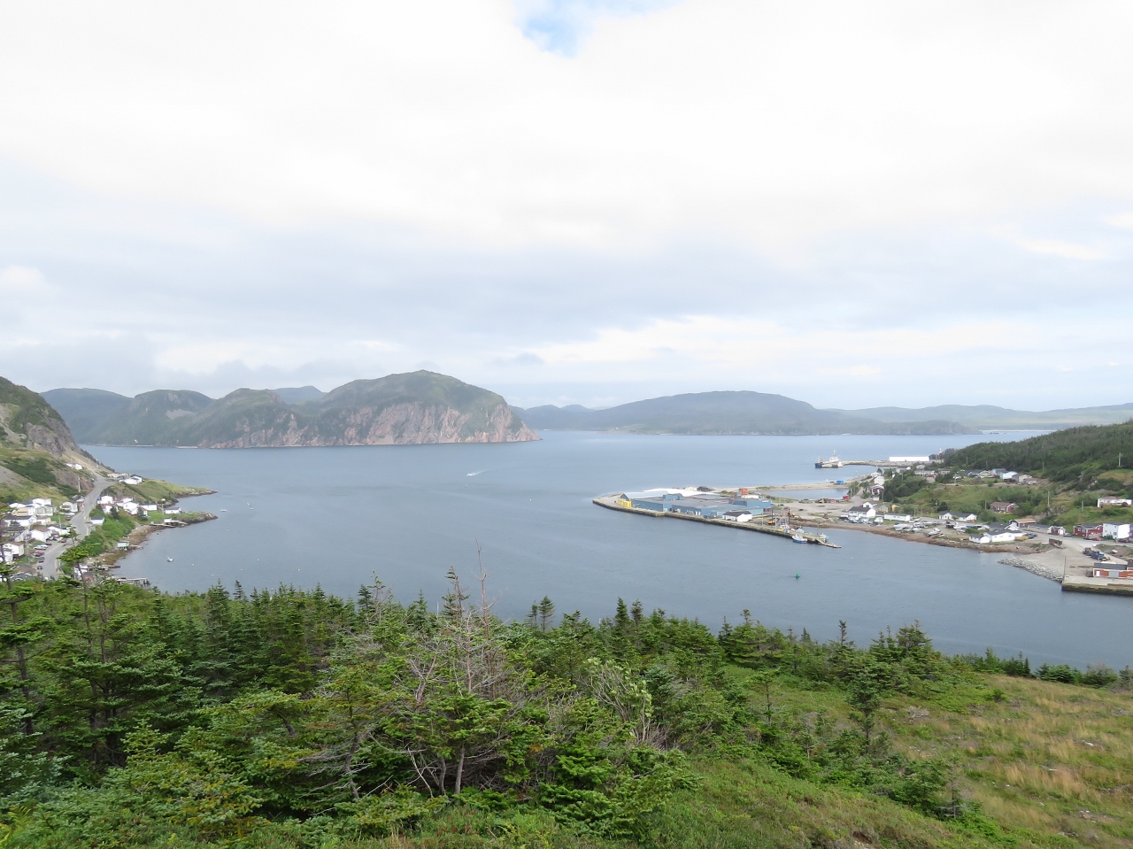
8/6/2016: Gun Hill Lookout
Position: 47°29.32'N, -55°48.05'W
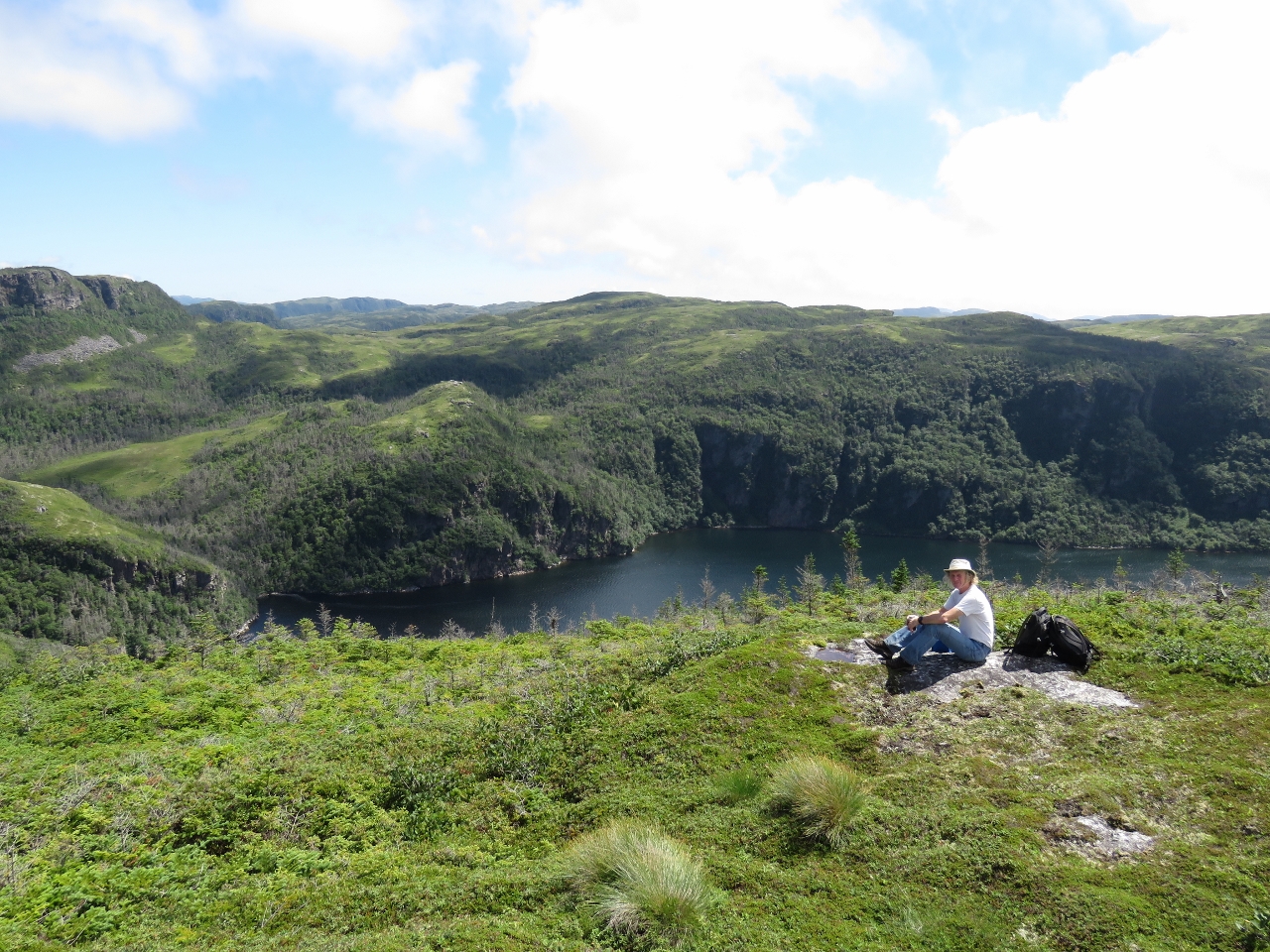
The 360-degree view from the top of the trail at Gun Hill Lookout, about 600ft above sea level. The extreme left of the photo is Northeast Arm where we are anchored at the head. Jersey Harbor where we anchored last night is roughly at the center of the photo, Rocky Point is slightly right of center, and the town of Harbour Breton extends to the right of the photo. The Government Wharf where our tender is tied off is behind the breakwater that extends partway across the waterway near the right of the photo.
|
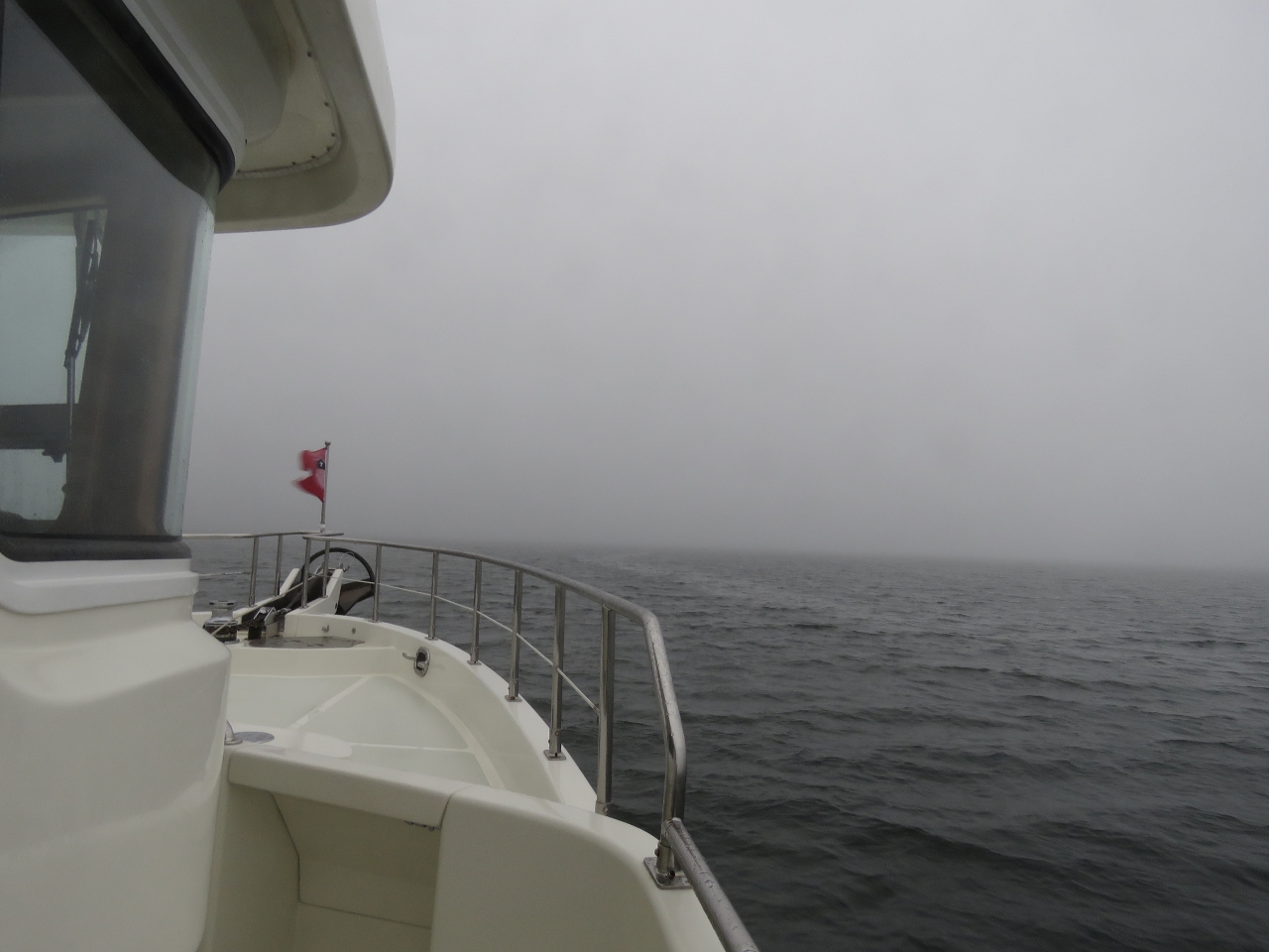 |
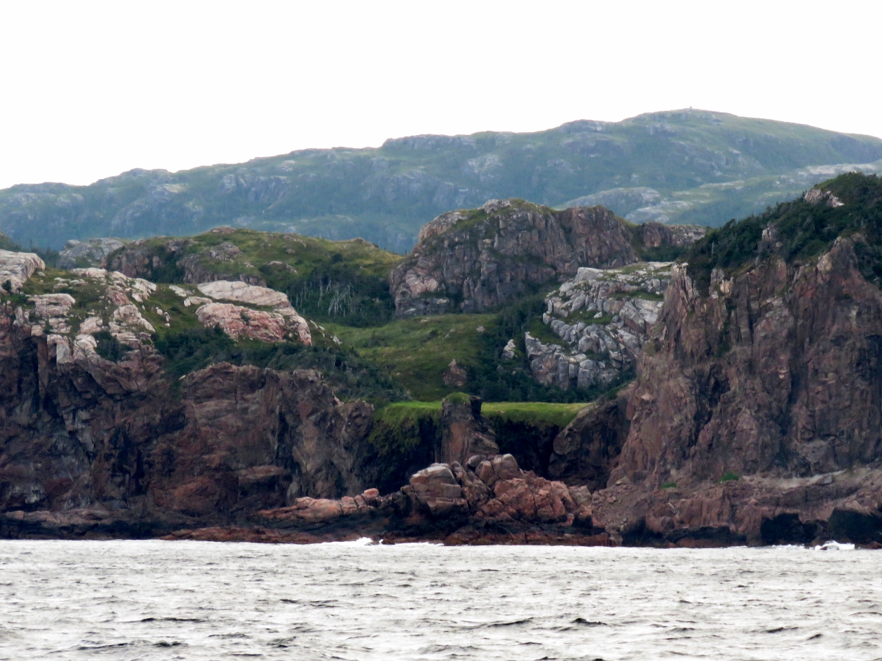
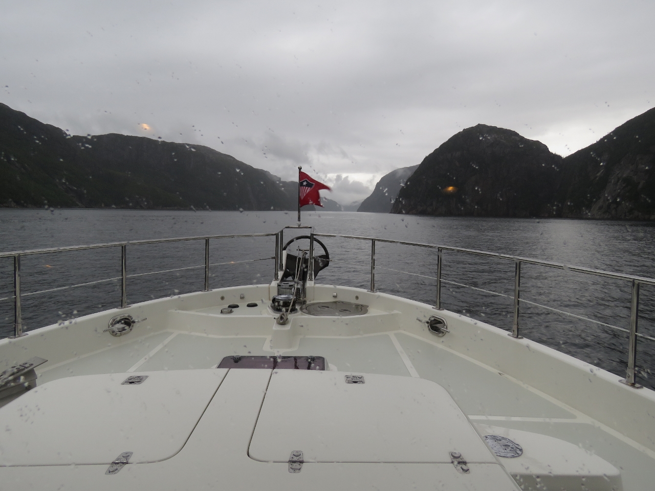
8/7/2016: Fog
Position: 47°31.91'N, -55°45.91'W
Underway in a heavy fog with the newly-installed loudhailer sounding a fog signal (one long blast every two minutes). We also turn on the forward and side-facing floodlights—our experience with fishing boats in British Columbia is that the floodlights punch through the fog and make a boat visible considerably earlier.
|
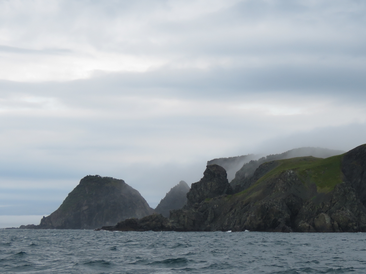 |
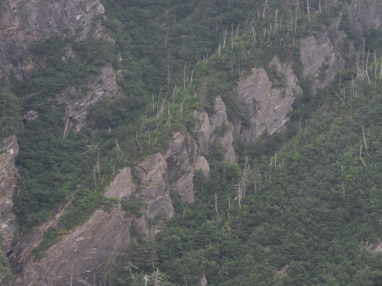
8/7/2016: Connaigre Head
Position: 47°25.92'N, -55°55.17'W
Fortunately the fog lifted as we neared Connaigre Head and we got a great view to the dramatic coast line there. It sure looks rugged and forbidding.
|
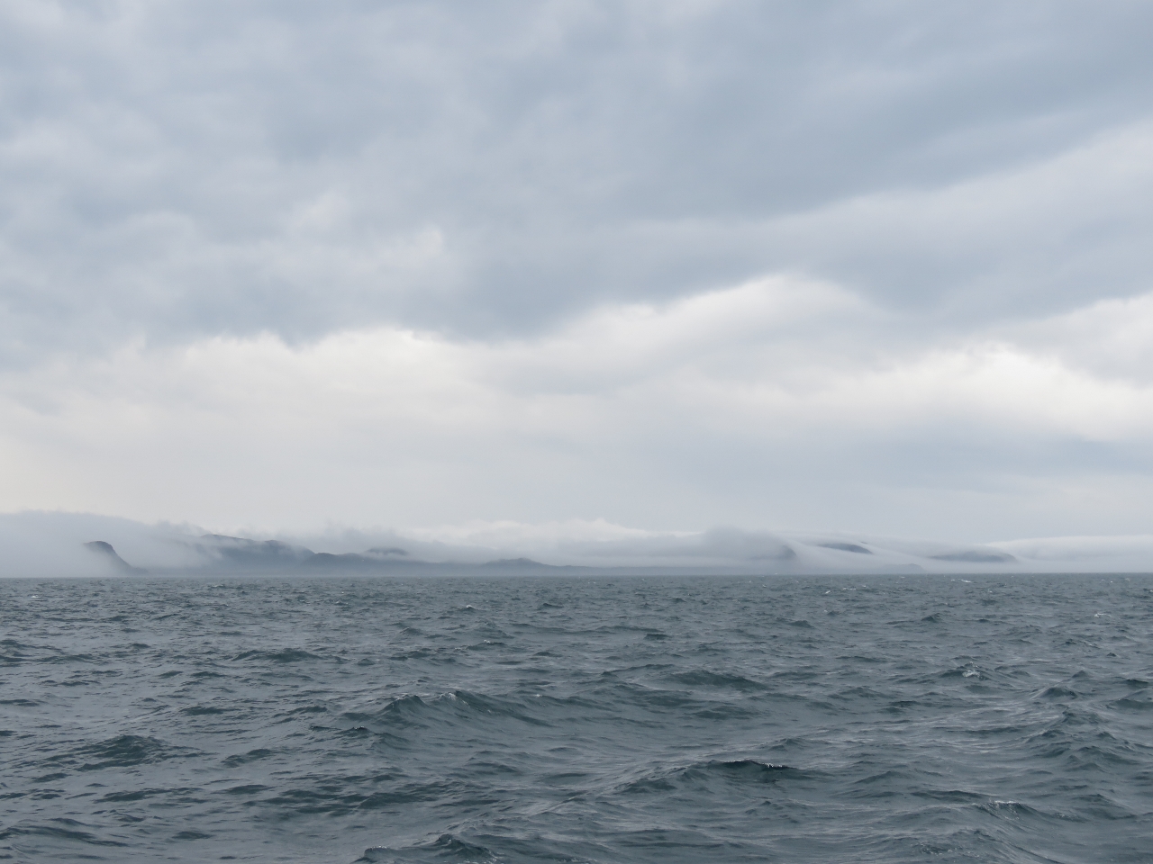 |
8/7/2016: Fog scape
Position: 47°25.93'N, -55°55.67'W
Looking behind us the fog looked beautiful against the cliffs.
|
 |
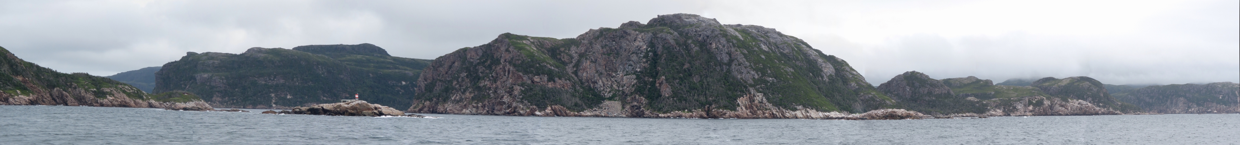
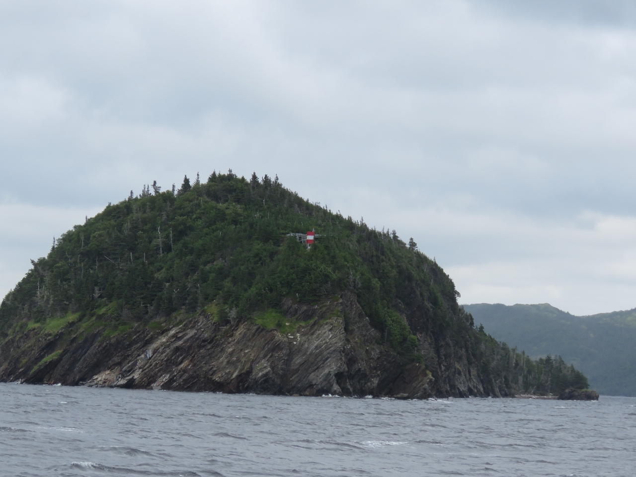
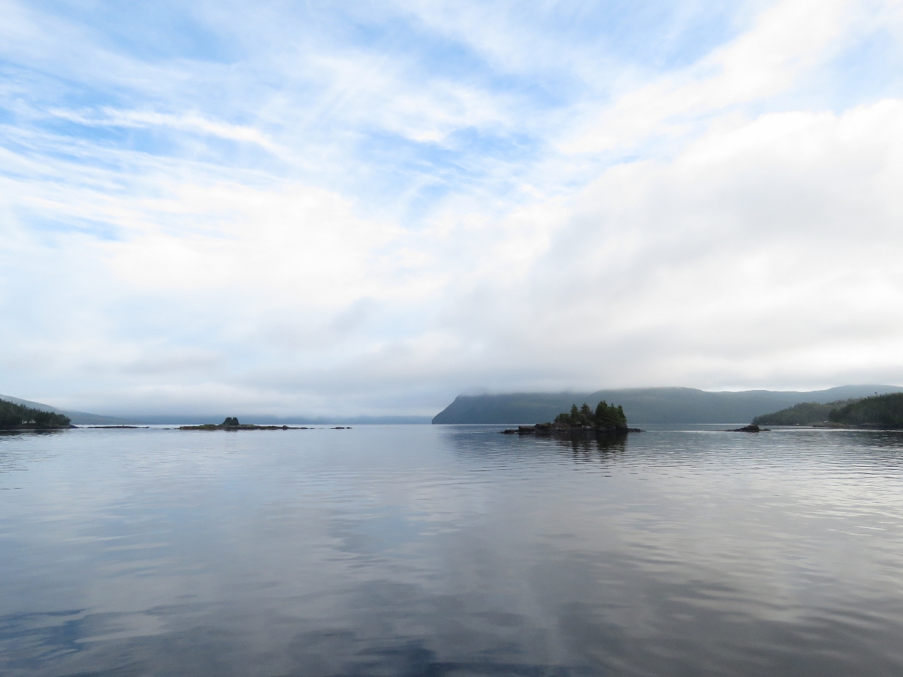
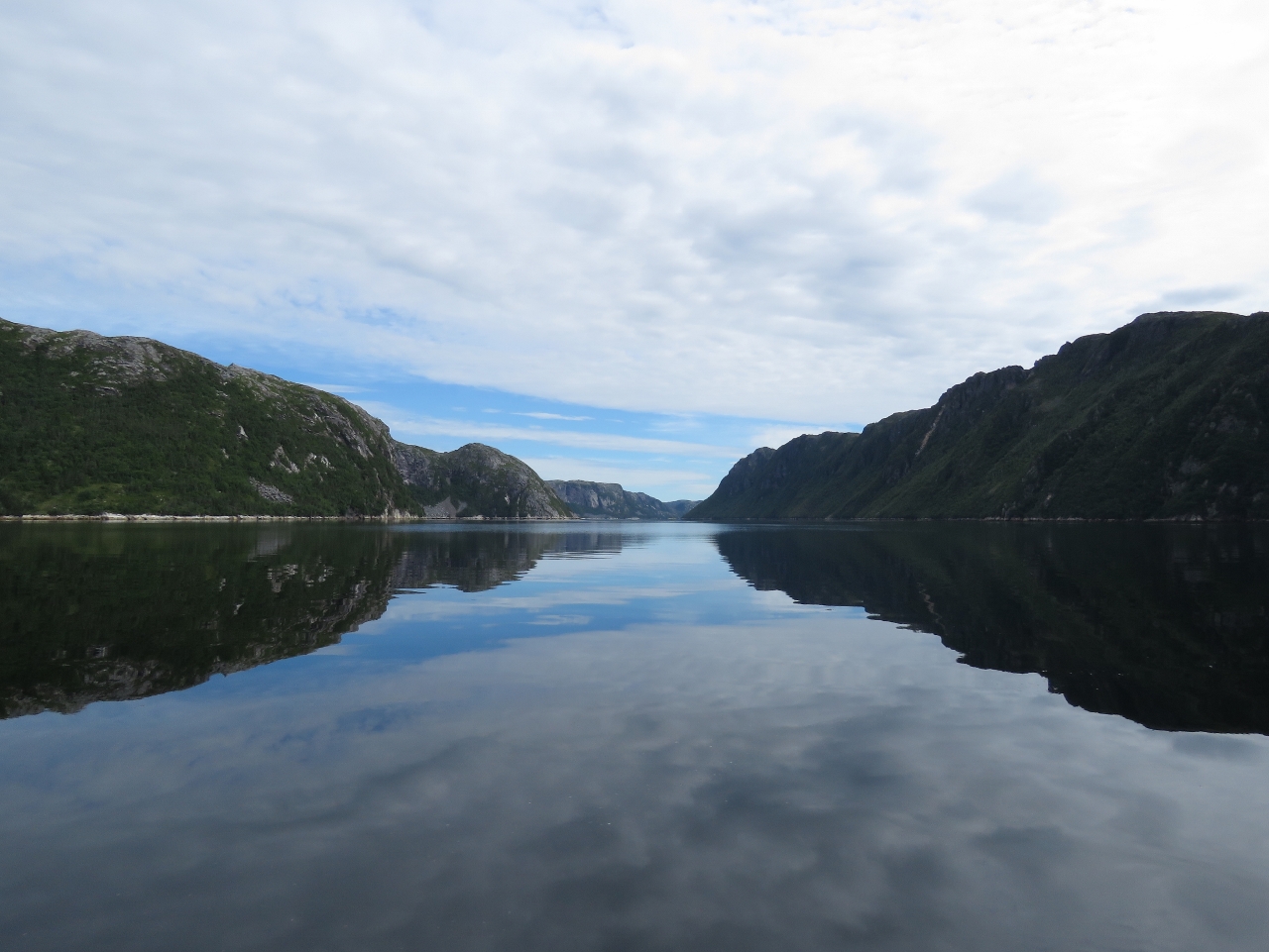
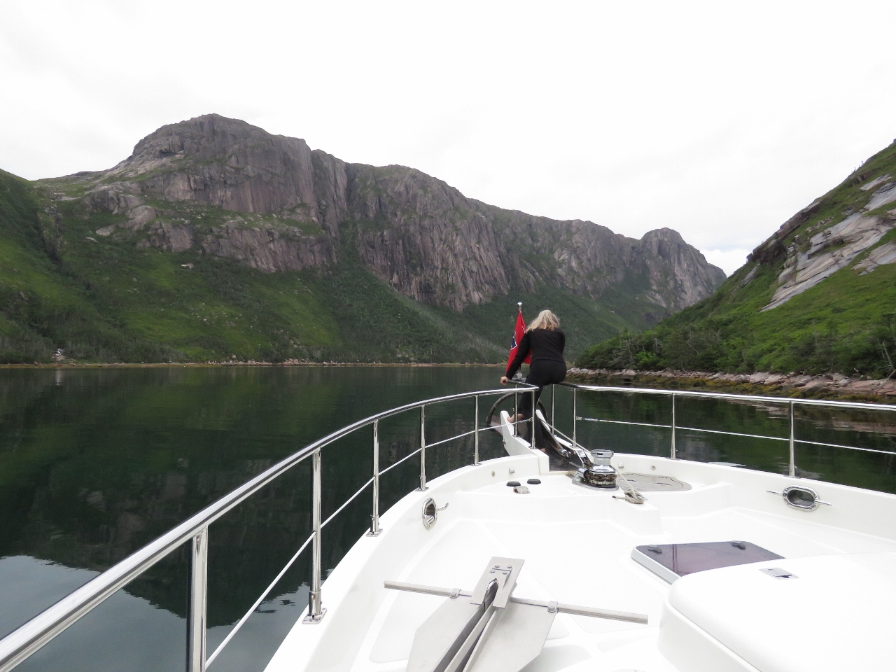
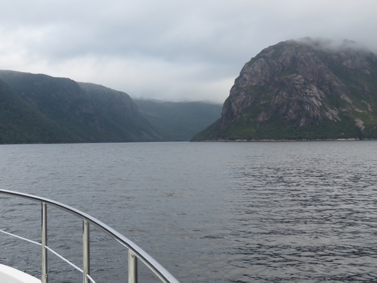
8/7/2016: Pass Island
Position: 47°28.93'N, -56°15.06'W
We went around the west side of Pass Island, but could have run east through Pass Island Tickle. Pass Island has long been a fishing base—Captain Cook noted fishermen there in 1763. The close-knit community in the island resisted resettlement until finally relocating in 1794. This is the light station at the southern tip of Pass Island. The original lighthouse there was built in 1879.
|
 |
8/7/2016: Tinker Rock
Position: 47°36.47'N, -56°3.44'W
The light on Tinker Rock, near the left of the photo, before a dramatic coastal seascape. We'll be passing just to the right of Tinker Rock to enter Bay d'Epoir where we'll cruise for a few days.
|
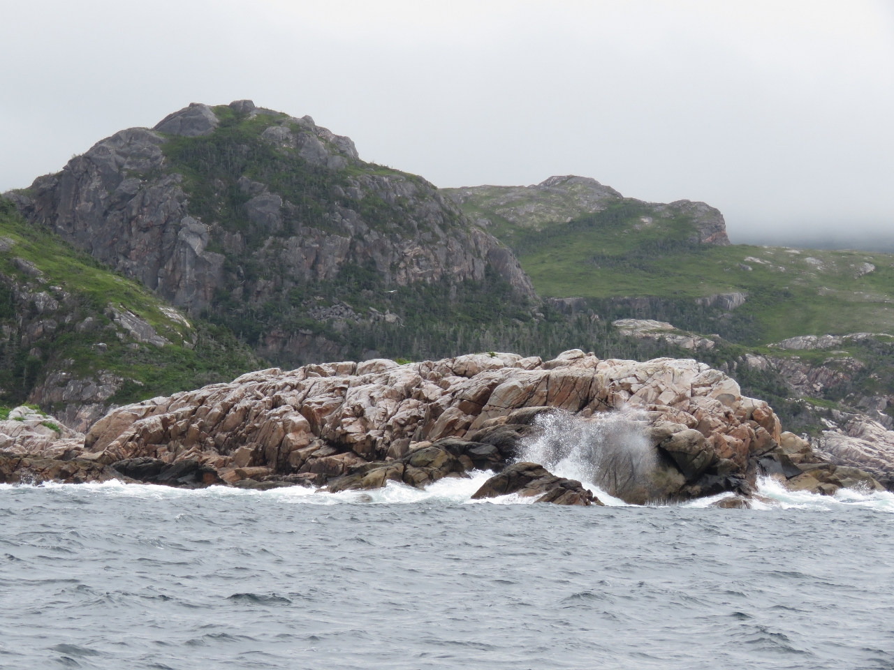 |
8/7/2016: Rugged
Position: 47°36.62'N, -56°3.17'W
Wave-swept rocks opposite Tinker Rock as we enter the channel.
|
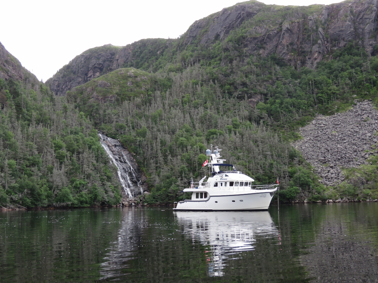 |
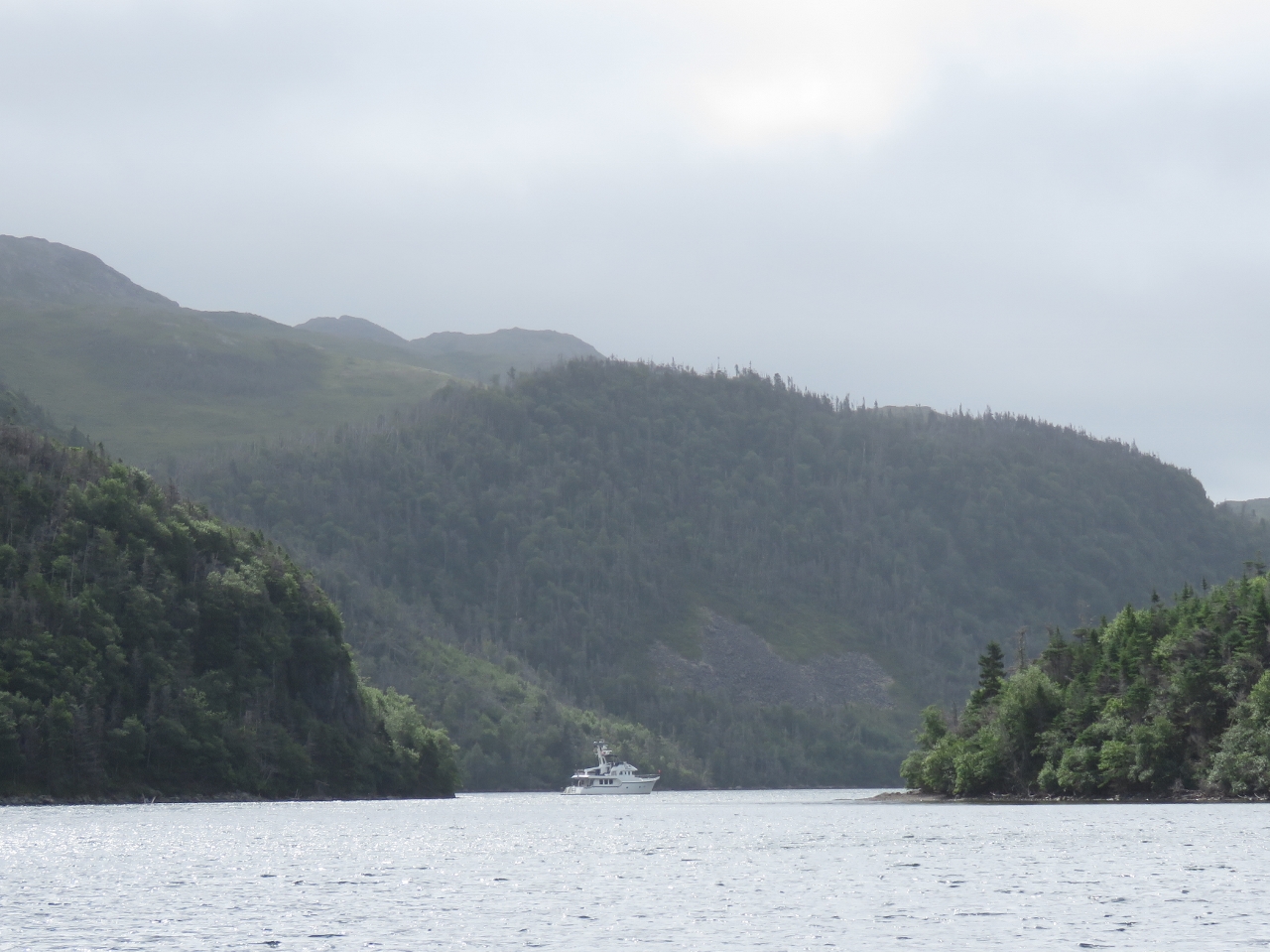
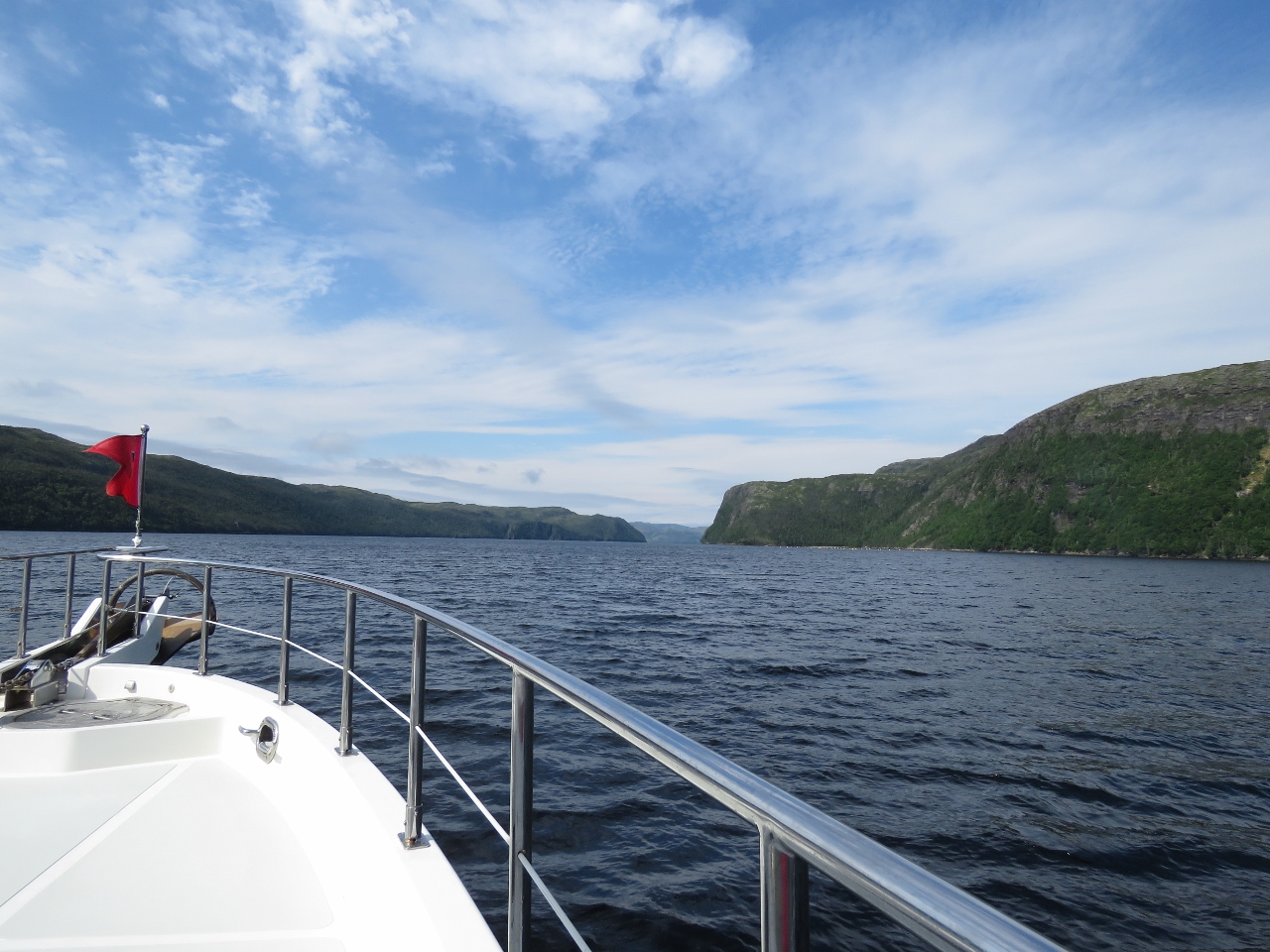
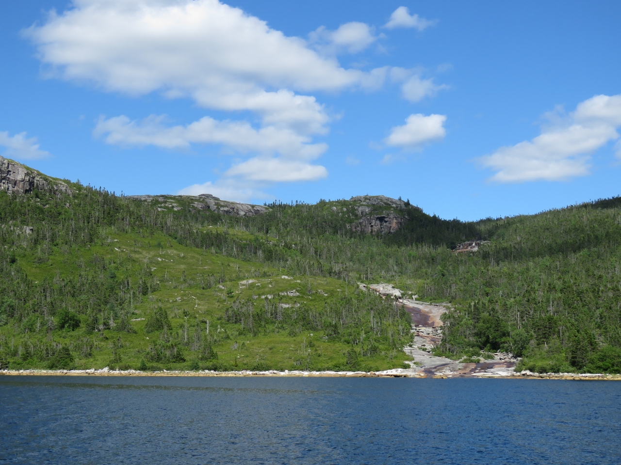
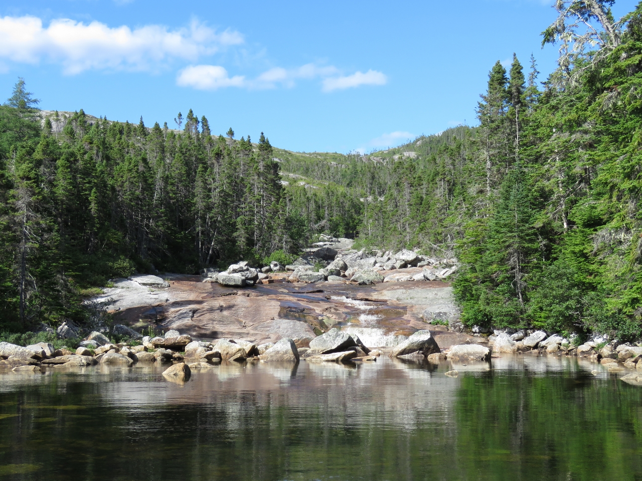
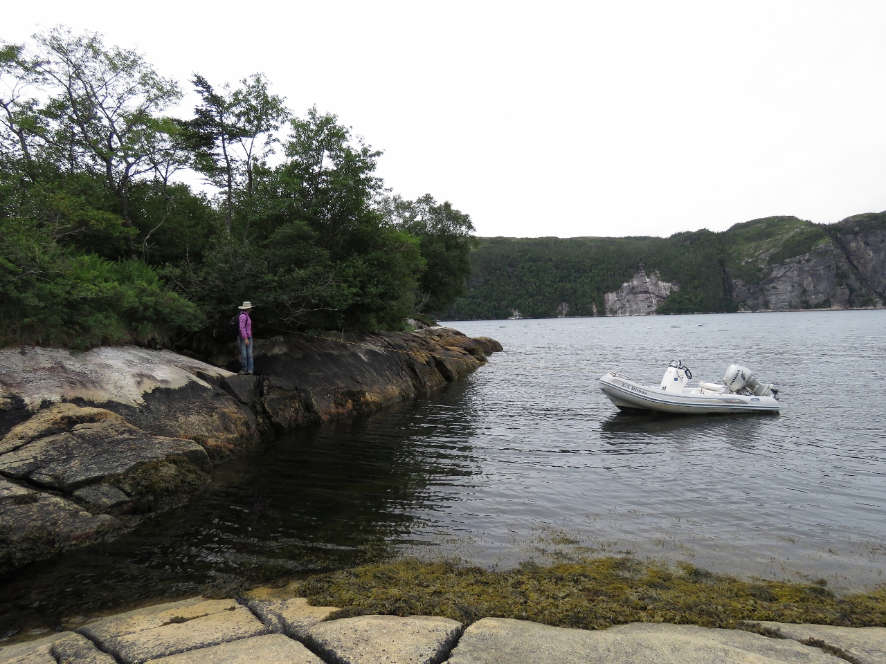
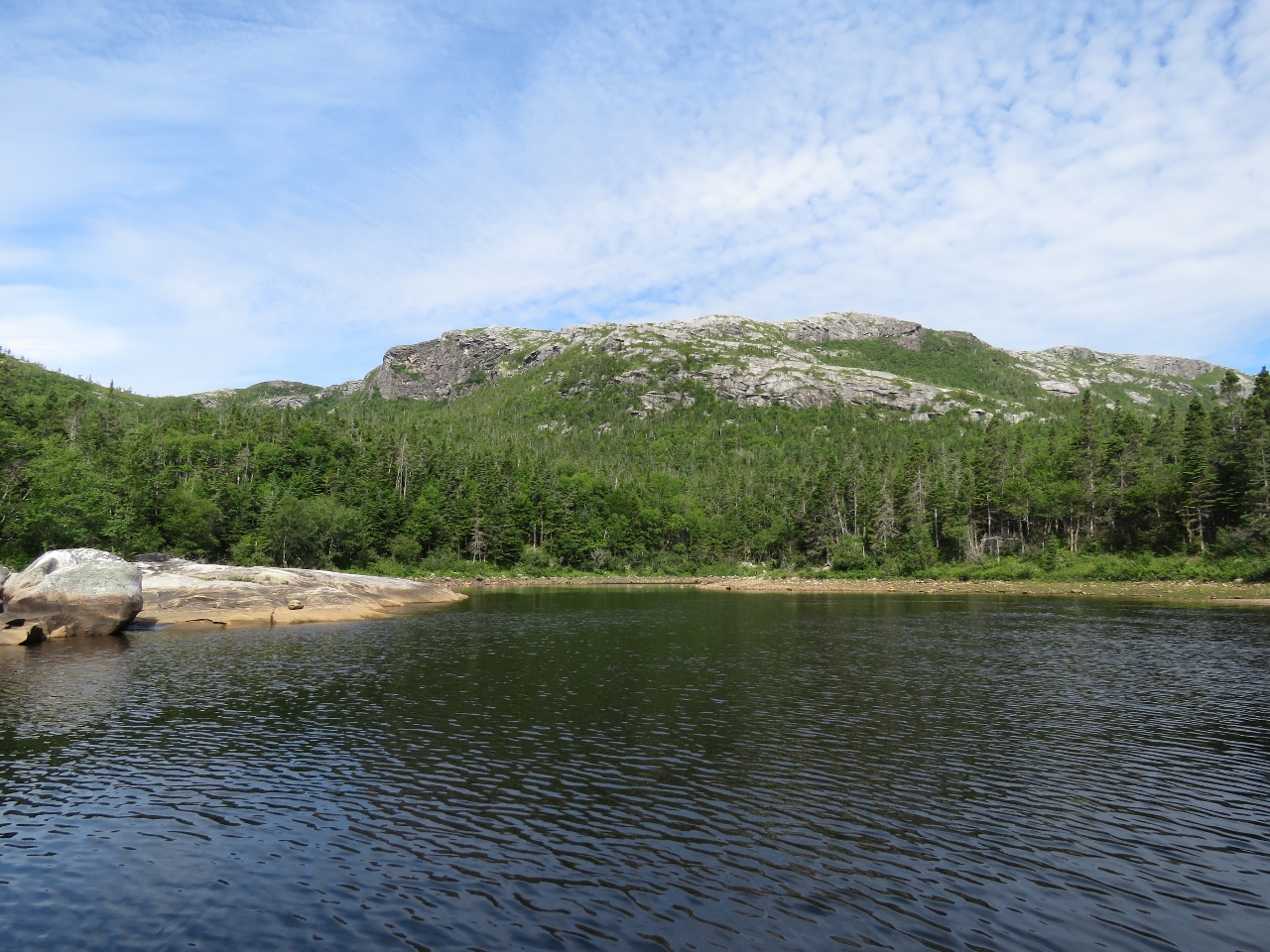
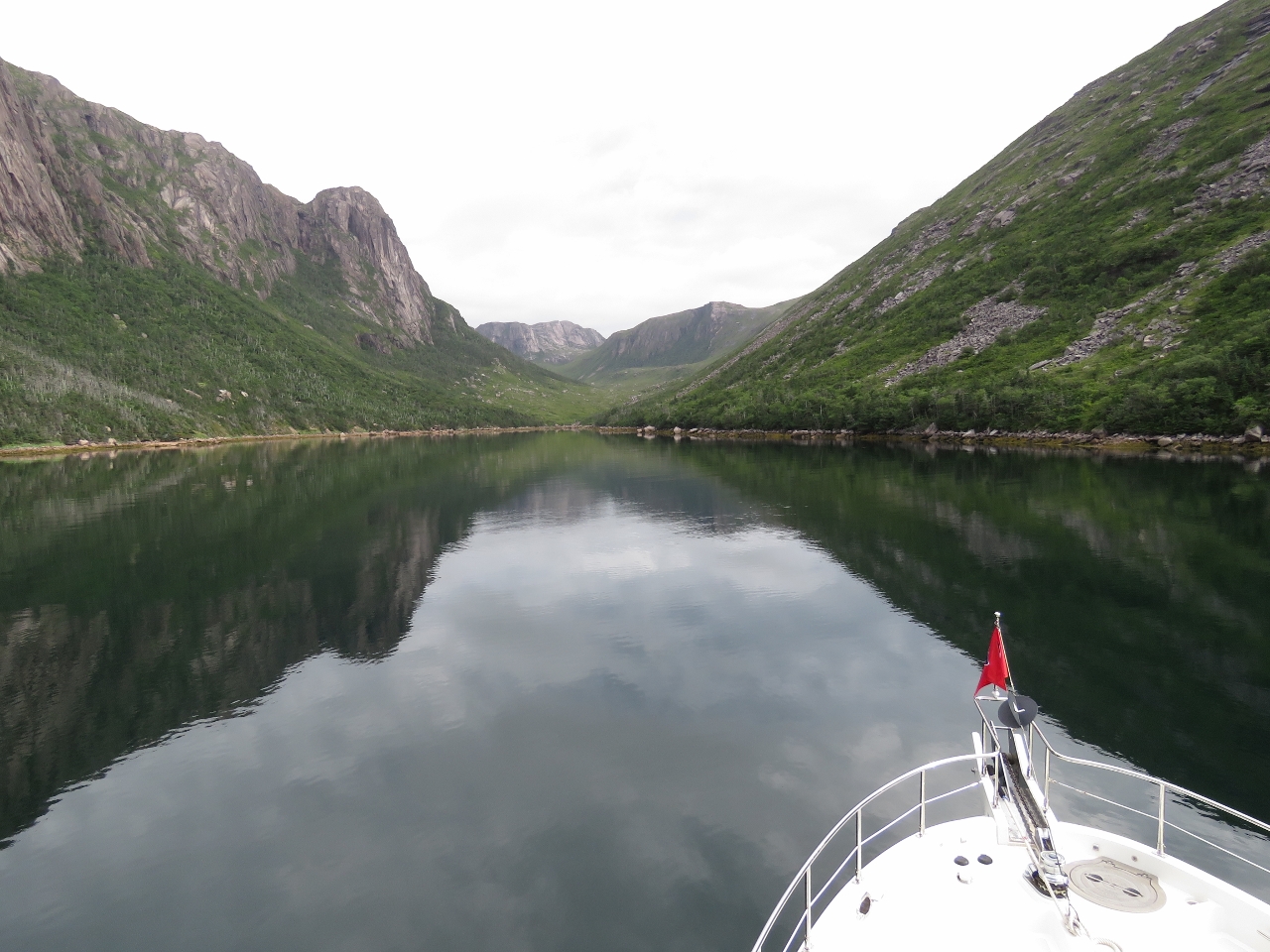
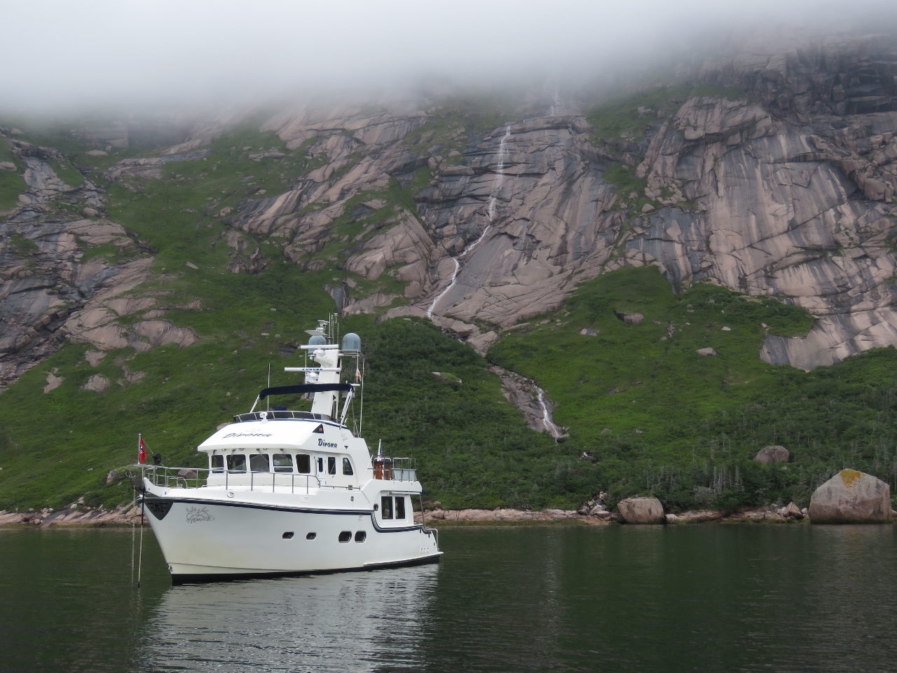
8/7/2016: Little Bay
Position: 47°37.98'N, -56°0.95'W
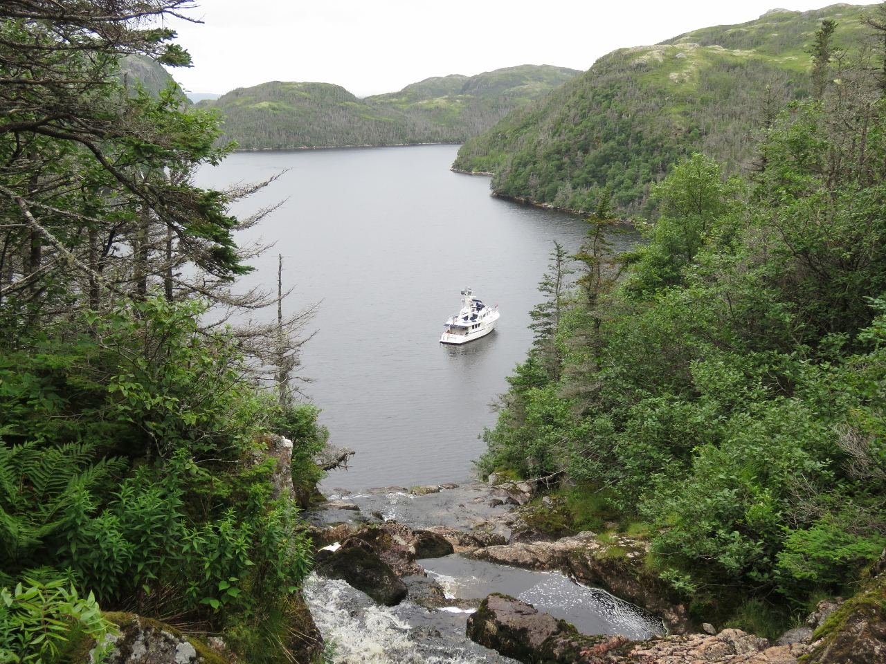
The chart shows aquaculture in Little Bay, but it was clear when we arrived. We anchored in front of a beautiful waterfall, surrounded by steep cliffs. In 100ft we had just barely enough room to put out 300ft of chain, but held well when we tested the set. And wow, what an amazing spot. We're sure loving the scenery here in Newfoundland. And it's wonderful to be out cruising again. It's been over a year since our last real cruising, through the Kimberley region of Western Australia last June.
|
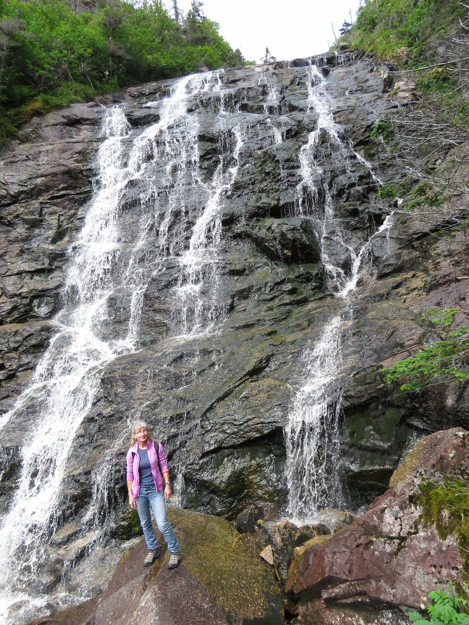 |
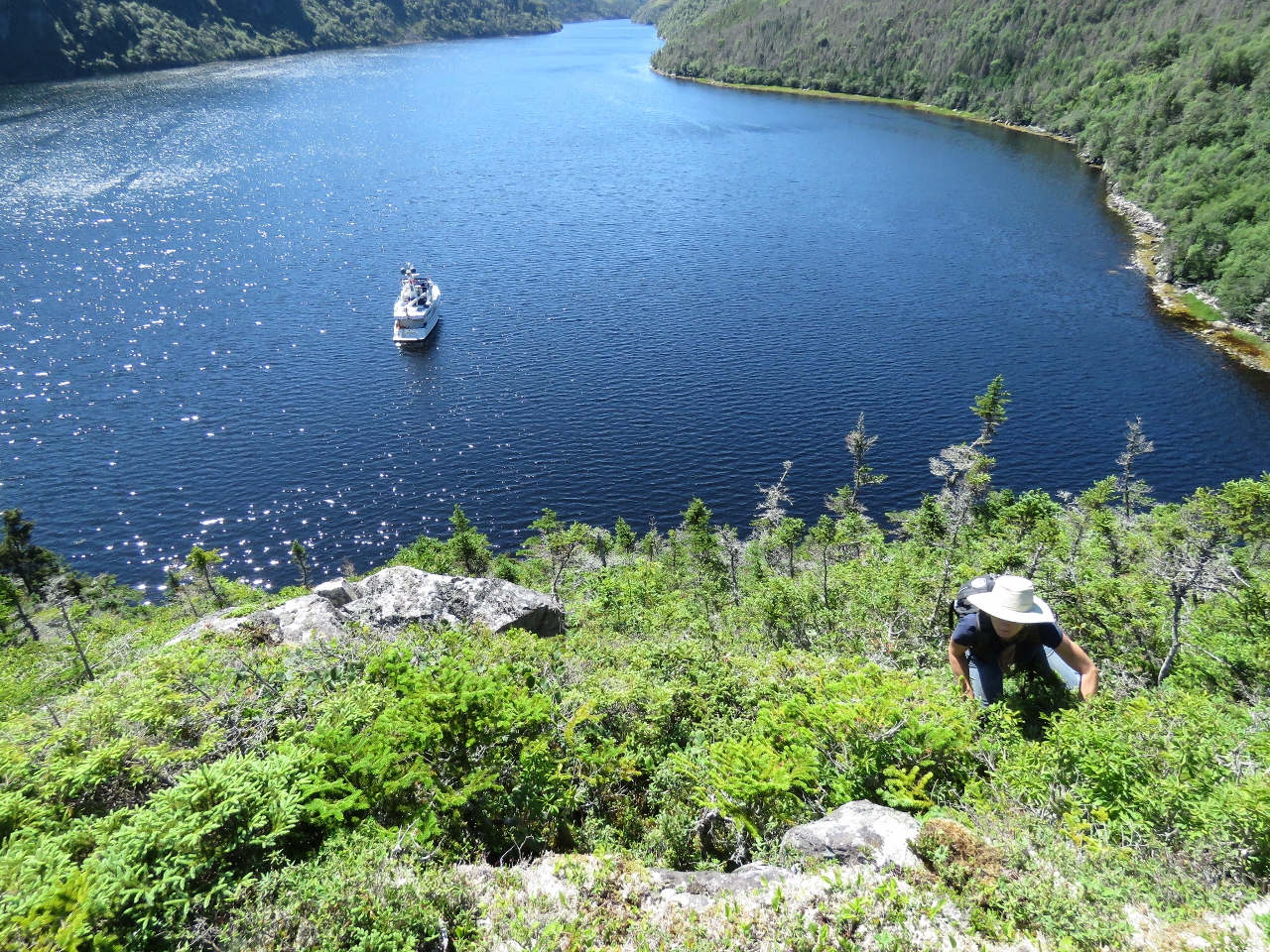
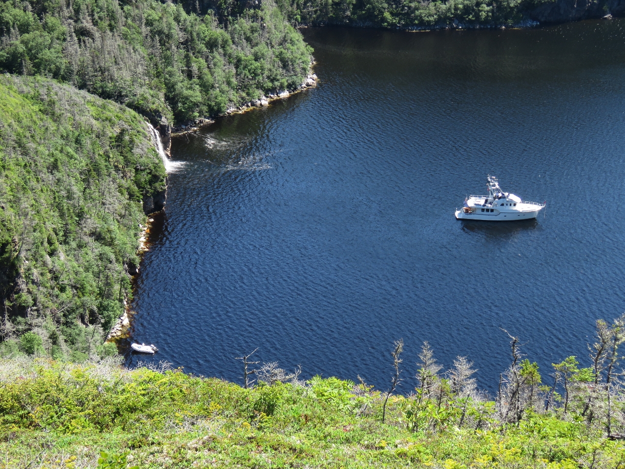
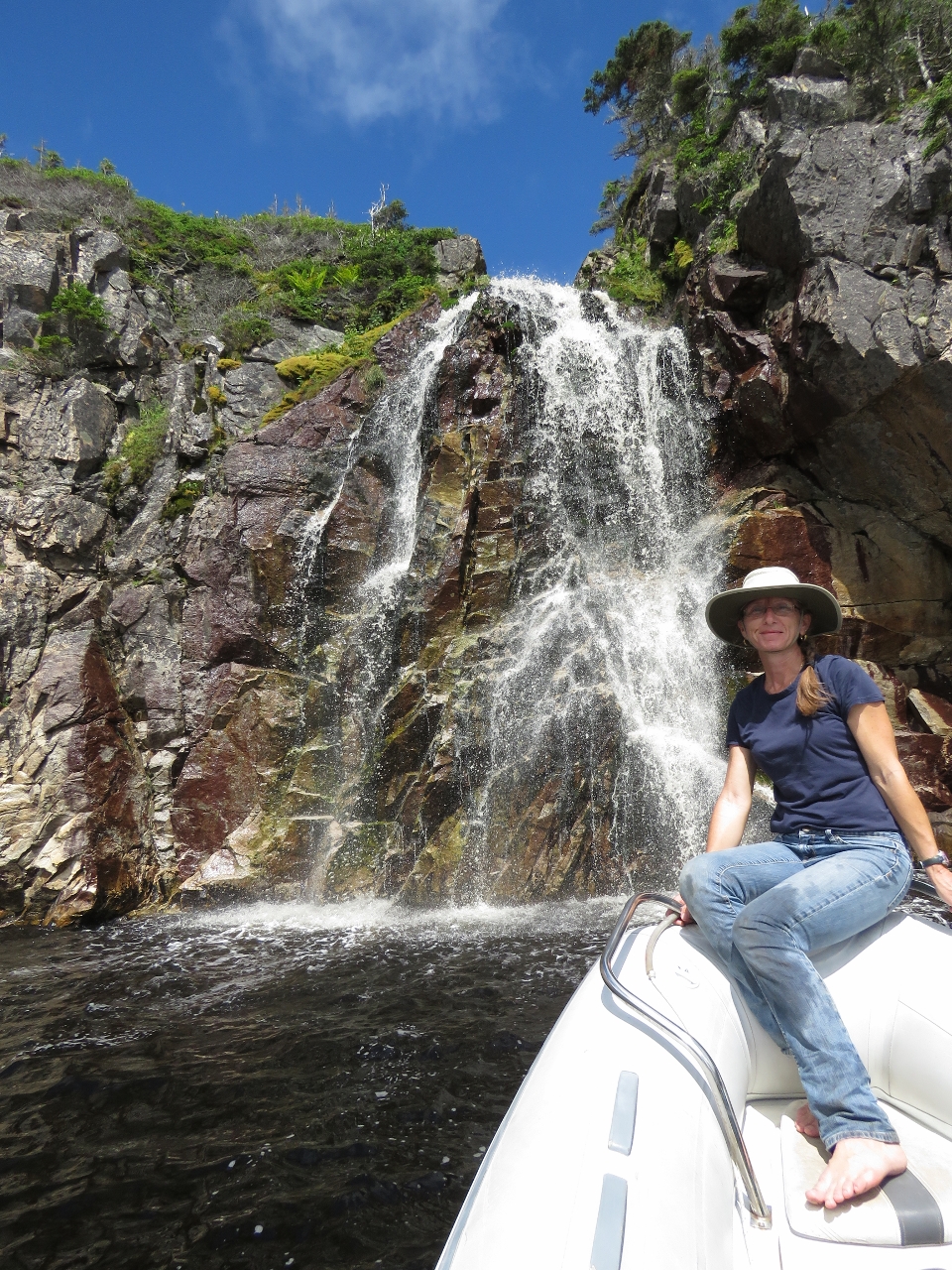
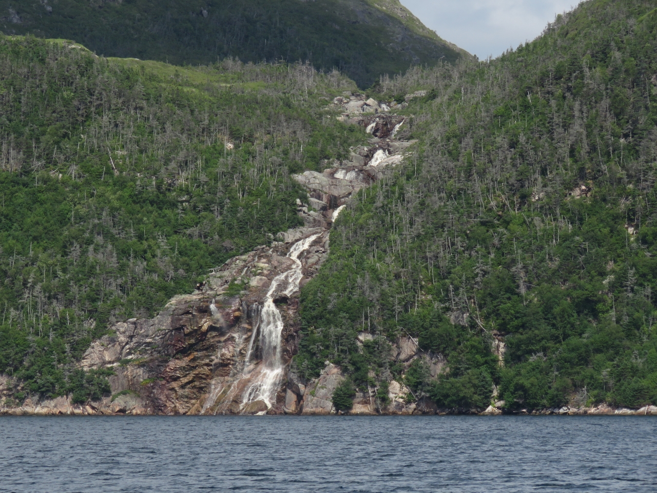
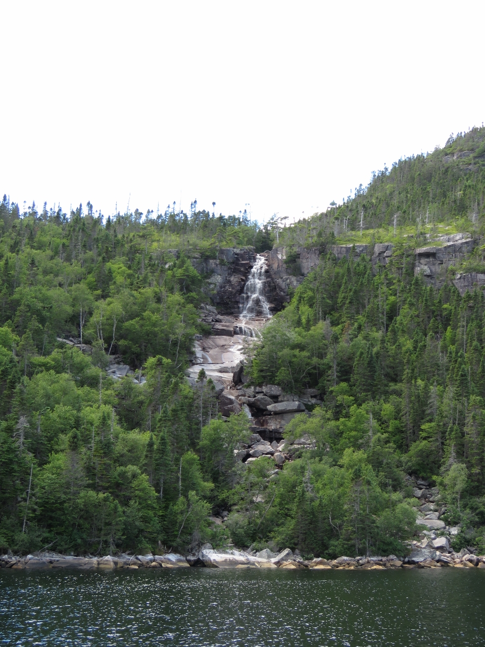
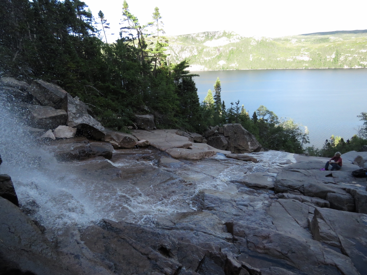
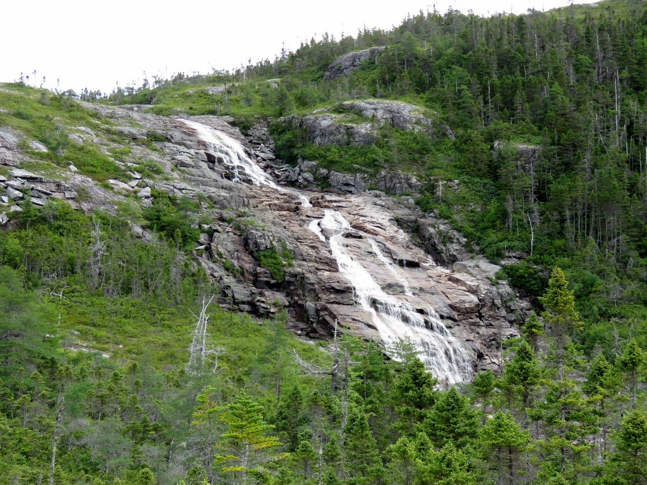
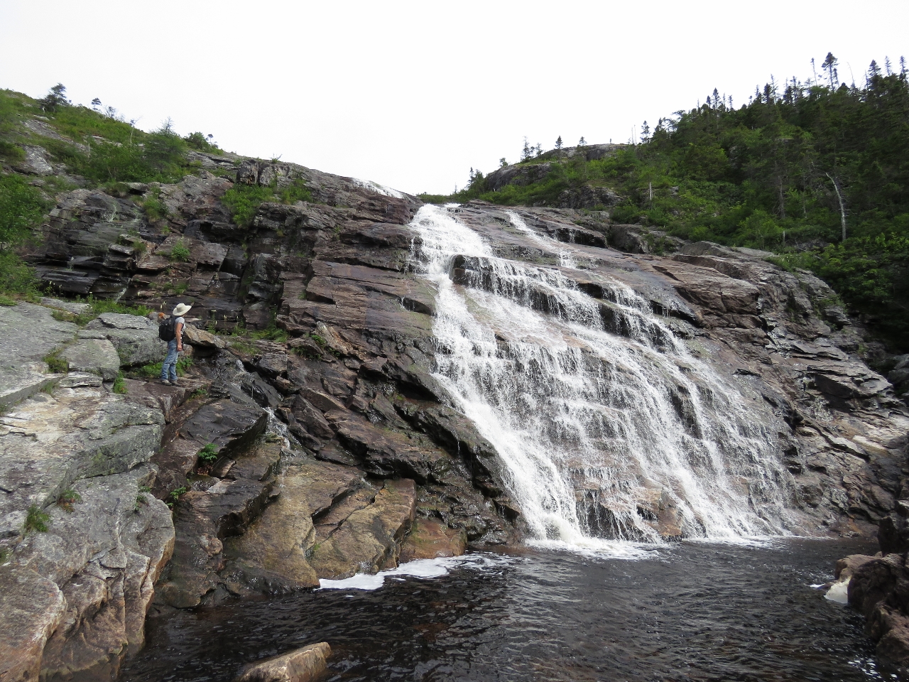
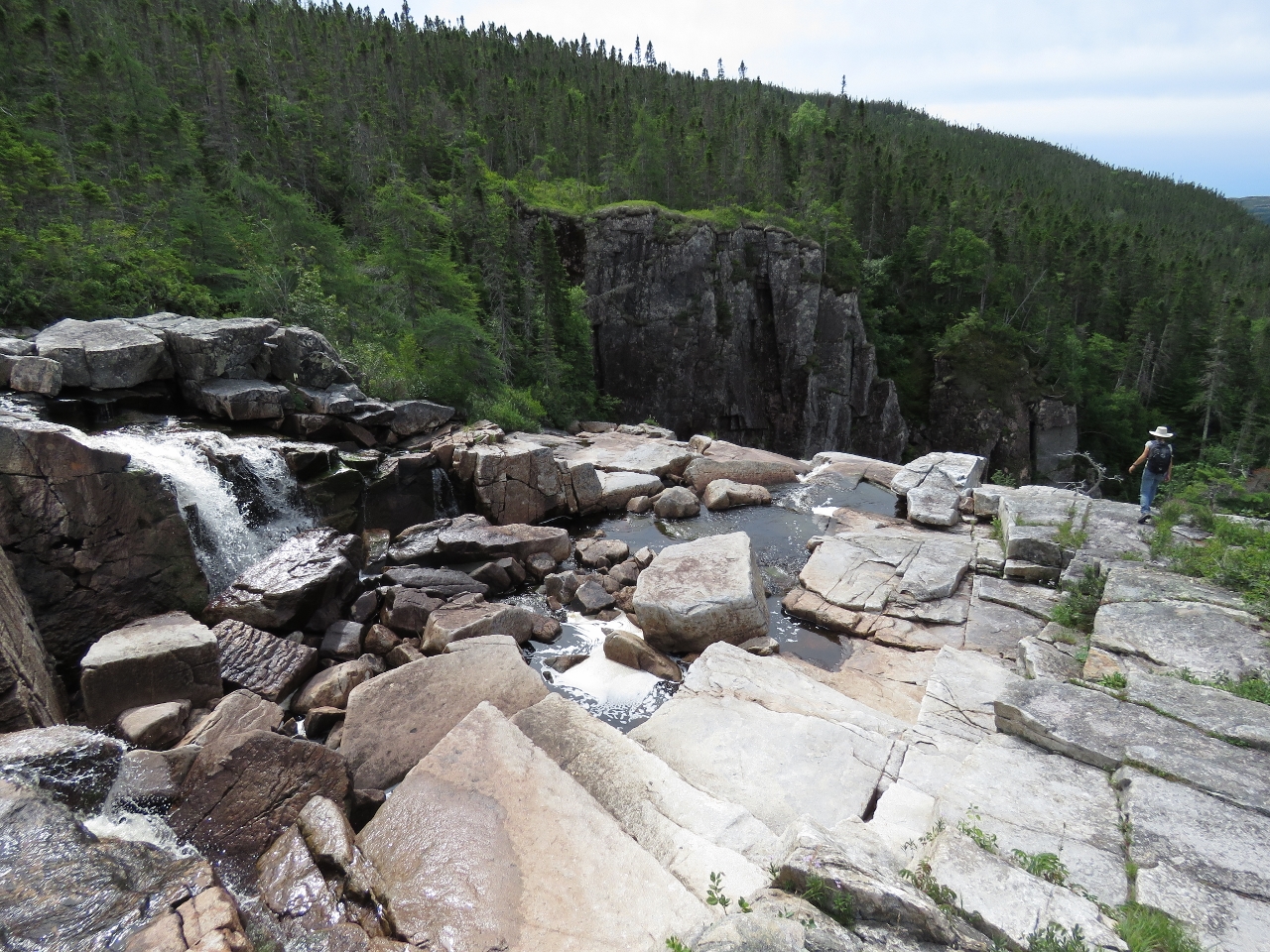
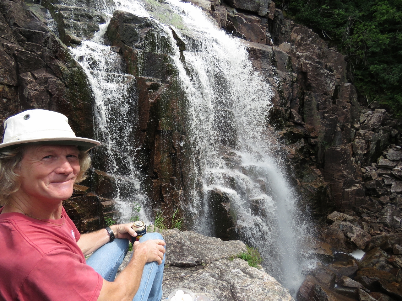
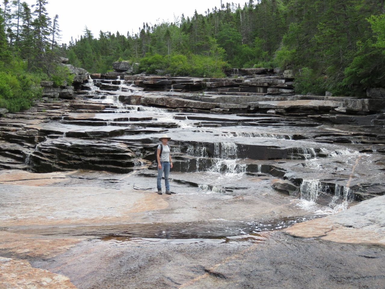
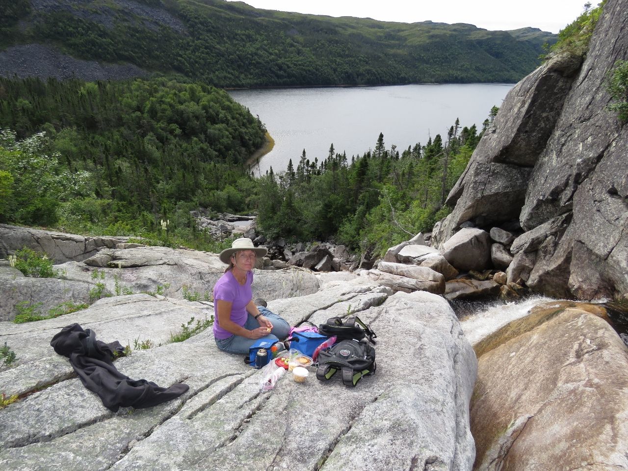
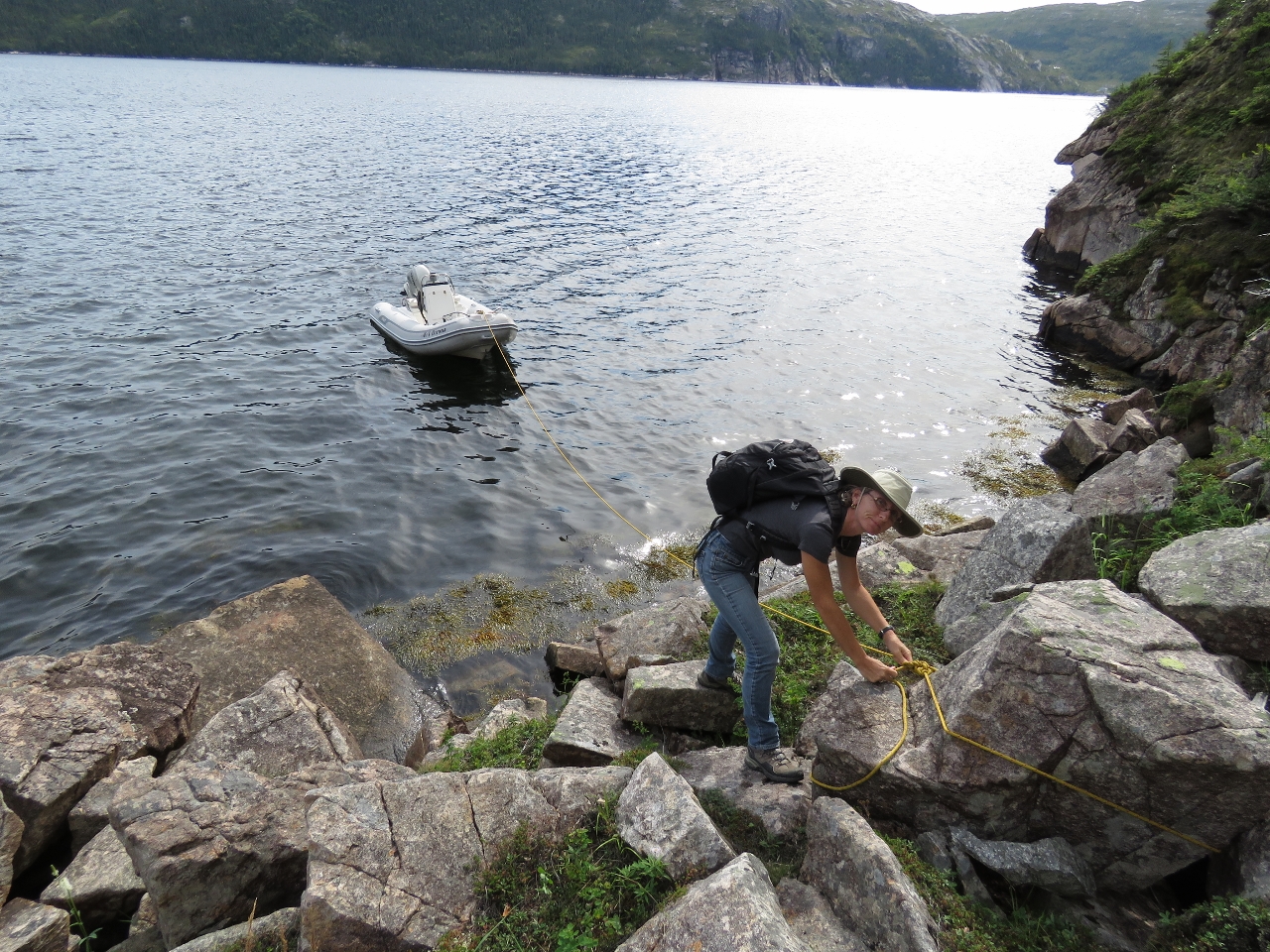
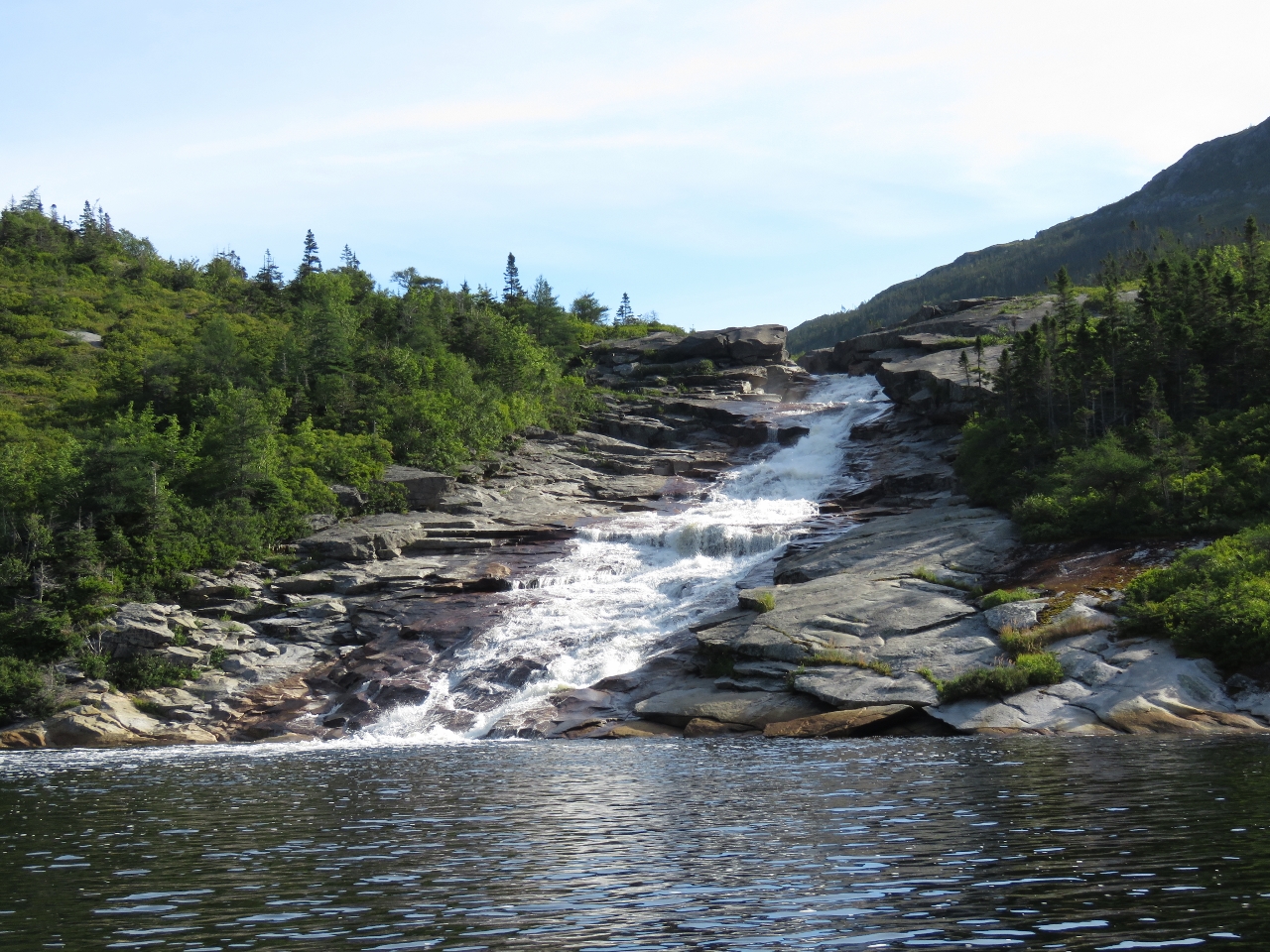
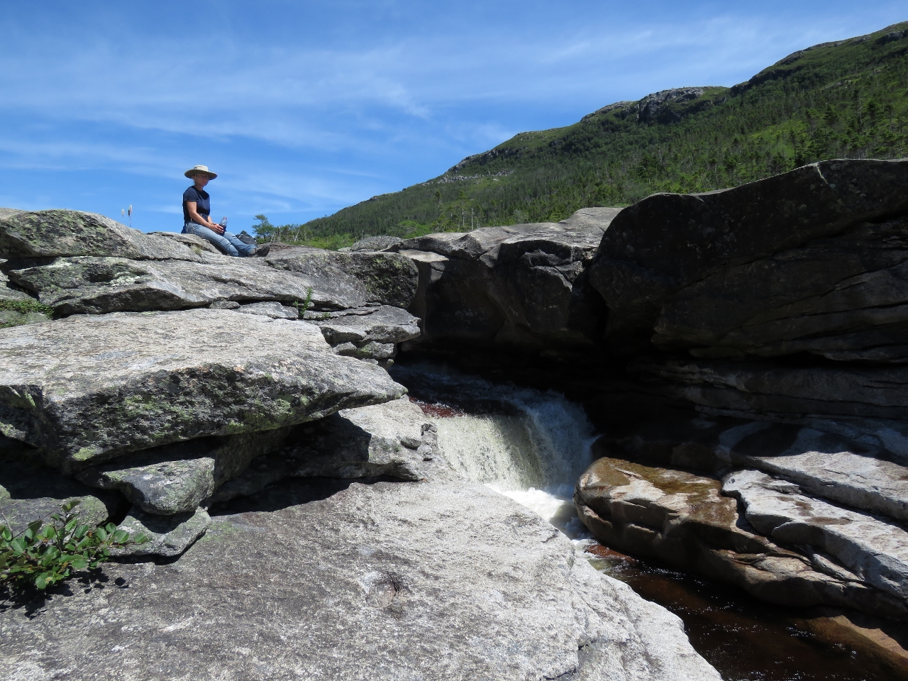
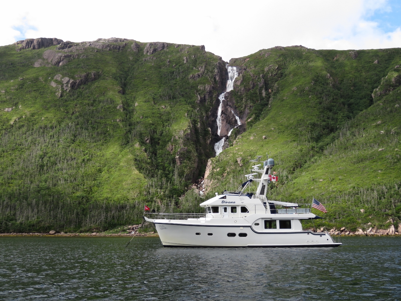
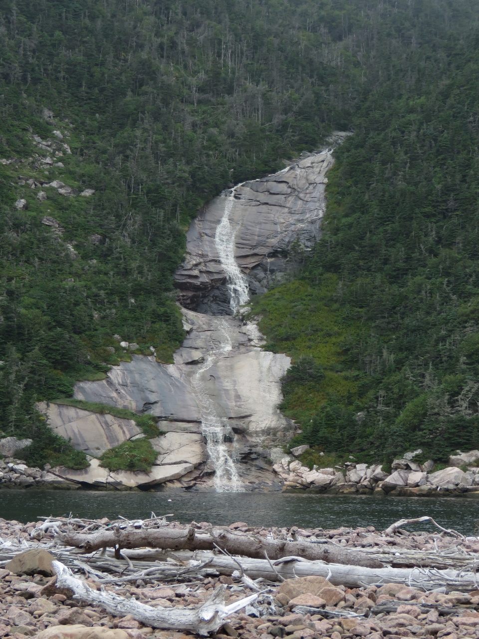
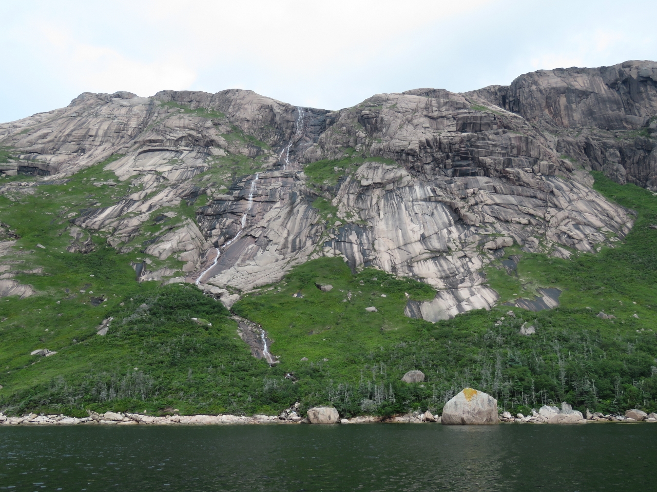
8/7/2016: Falls
Position: 47°38.05'N, -56°0.87'W
Our cruising guide, The Cruising Guide to Newfoundland by Pilot Press, mentioned a "nice climb" to the top of the falls, but with no more detail. We landed on the east side of the falls, which looked like the best place to climb from.
|
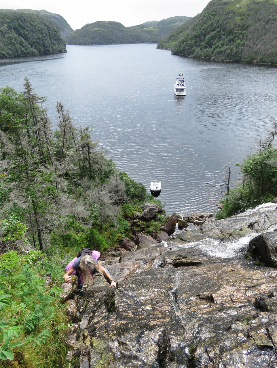 |
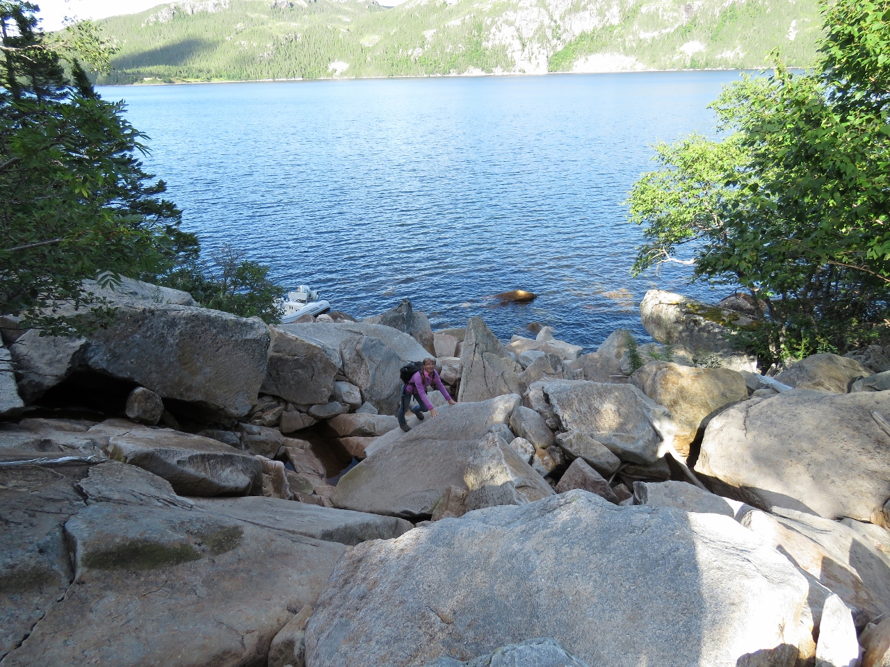
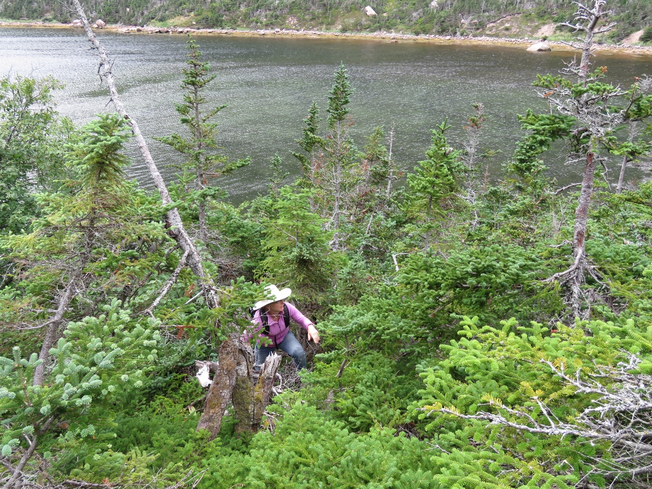
8/7/2016: Climbing
Position: 47°38.06'N, -56°0.86'W
"Nice" wasn't exactly the word that came to mind as we ascended the cliff. It's pretty steep. But the views are amazing. On the return, we stayed inside the tree line, which was just as steep and quite overgrown, but safer and easier overall. Along the way down, we did see evidence that others had taken a similar path.
|
 |
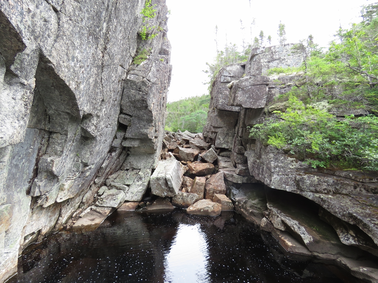
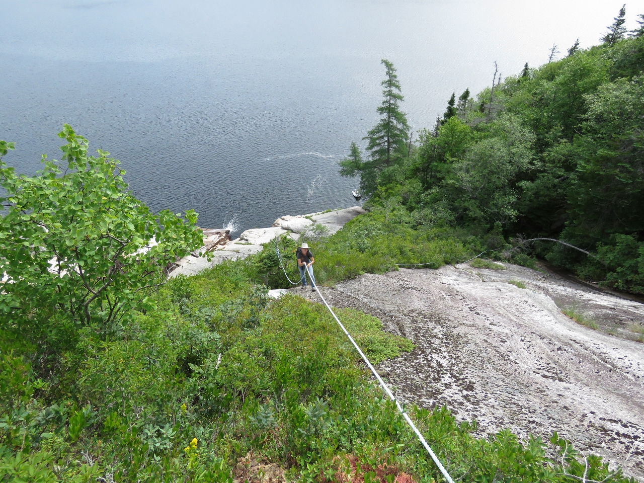
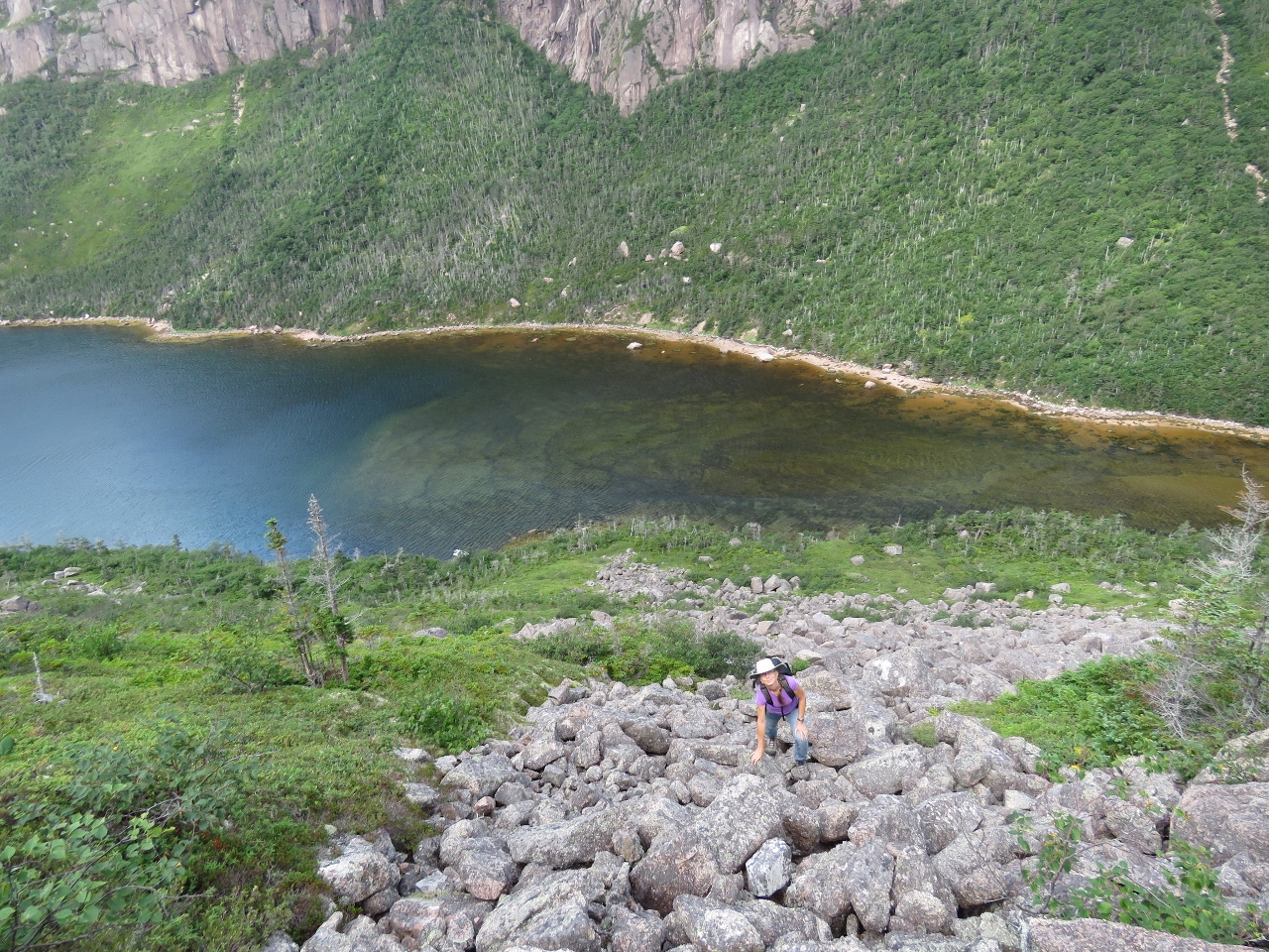
8/7/2016: Halfway
Position: 47°38.07'N, -56°0.86'W
About halfway up we reached a cliff on the east side and crossed over to continue along the west side of the falls where we picked up a faint trail. This is the view looking down near where we crossed the falls.
|
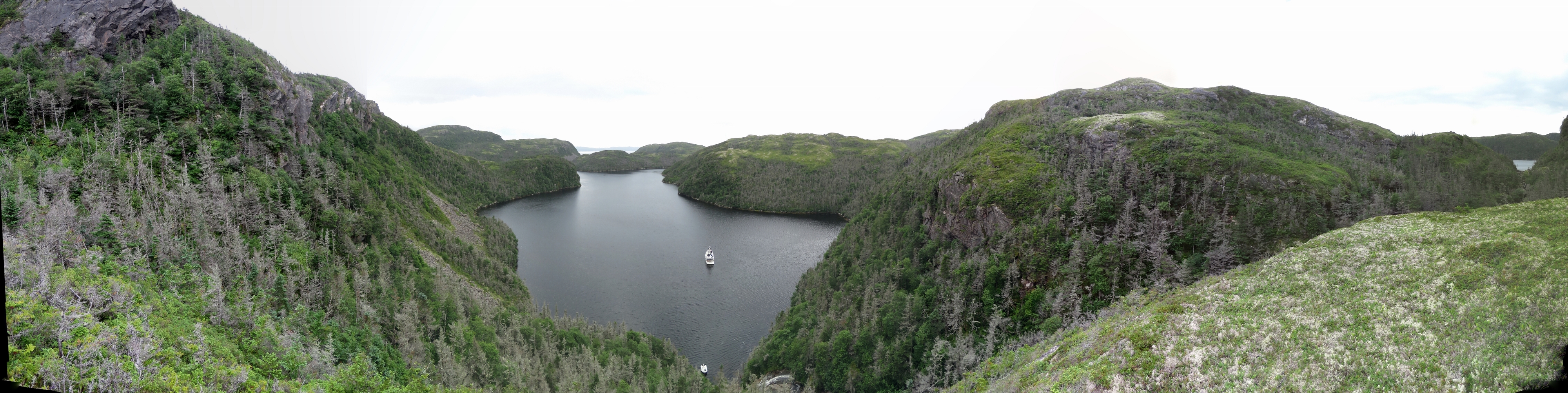 |
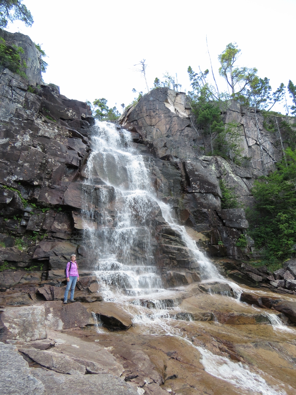
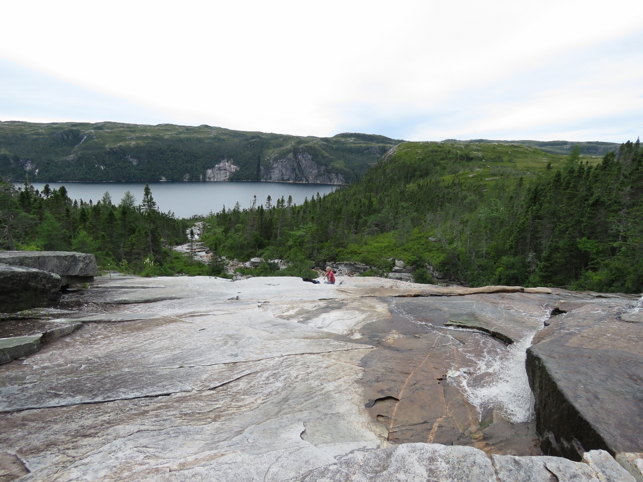
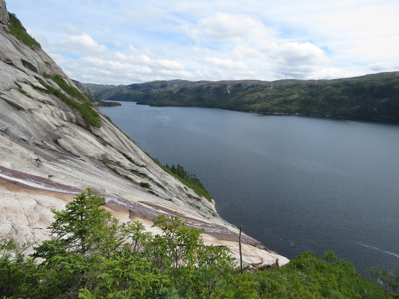
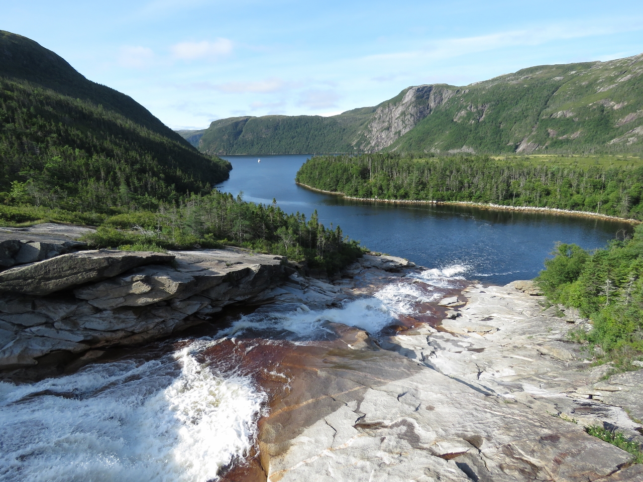
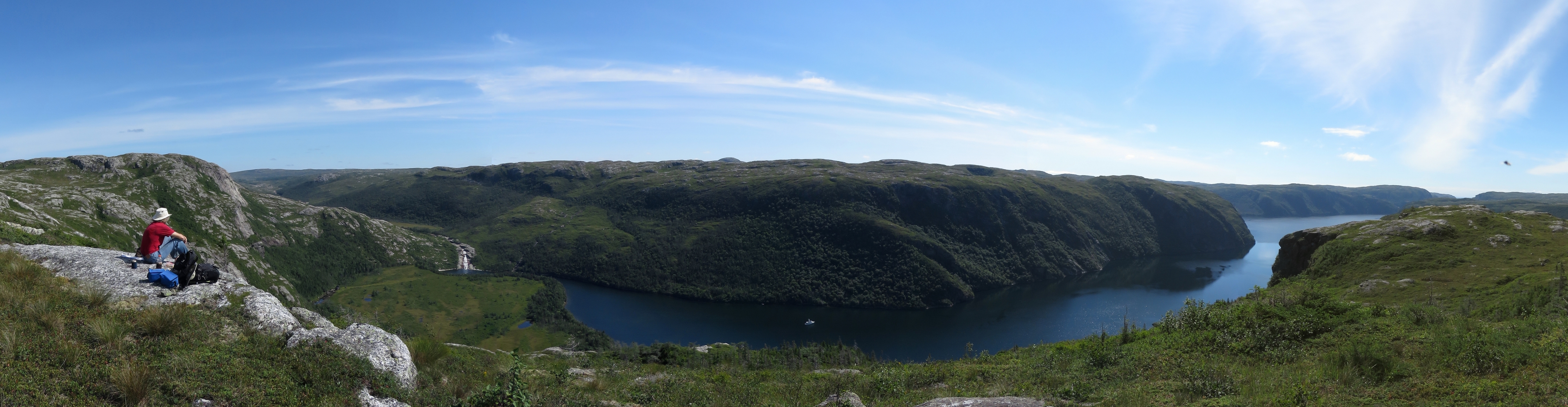
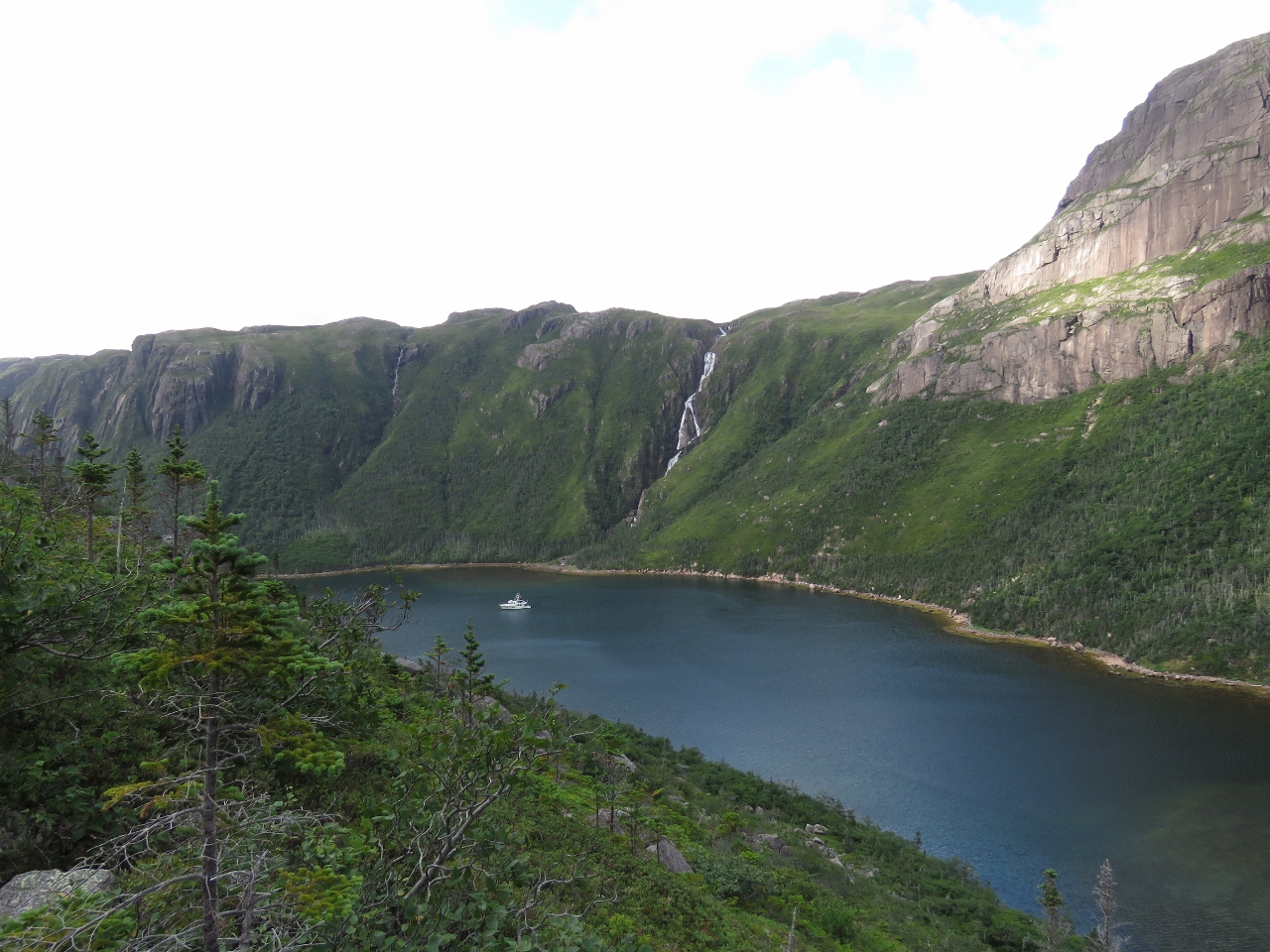
8/7/2016: View
Position: 47°38.09'N, -56°0.84'W
Once at the top of the fall, we crossed back over the east side walked up to a bluff above the falls for a sweeping view of the anchorage and area. To our north, at the far right of the panorama, is the lake that feeds the falls.
|
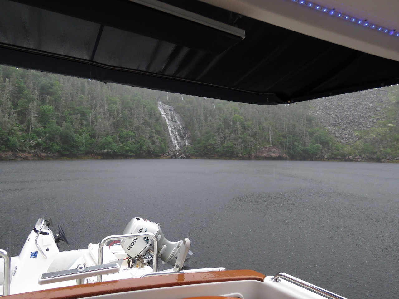 |
8/7/2016: Rain
Position: 47°38.00'N, -56°0.91'W
After returning from the climb up the falls, we toured the area a bit and spent some time watching a couple of river otters in the east arm. We made it back to Dirona just before a lengthy downpour that washed away all remnants of salt on our decks left from the run between Nova Scotia and Newfoundland. In the picture, you can see how hard it was raining.
|
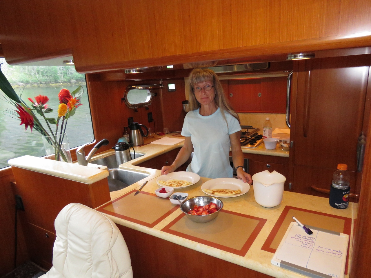 |
8/8/2016: Crepes
Position: 47°38.00'N, -56°0.92'W
Jennifer making crepes for breakfast.
|
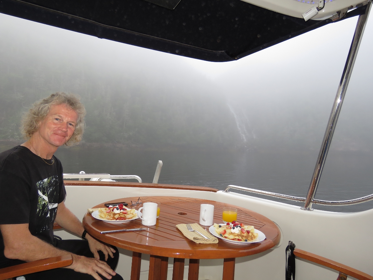 |
8/8/2016: Happy Birthday!
Position: 47°38.00'N, -56°0.92'W
A special breakfast of crepes with fresh berries and whipped cream to celebrate James' birthday today. You can see in the background that a reasonably thick fog has settled in the bay, with the waterfall just visible in the background even though it's fairly close.
|
 |
8/8/2016: Clear
Position: 47°38.00'N, -56°0.92'W
The fog lifted later this morning and the sun came out, so we got a few more shots of the waterfall from the tender. Little Bay has been a pretty spectacular anchorage.
|
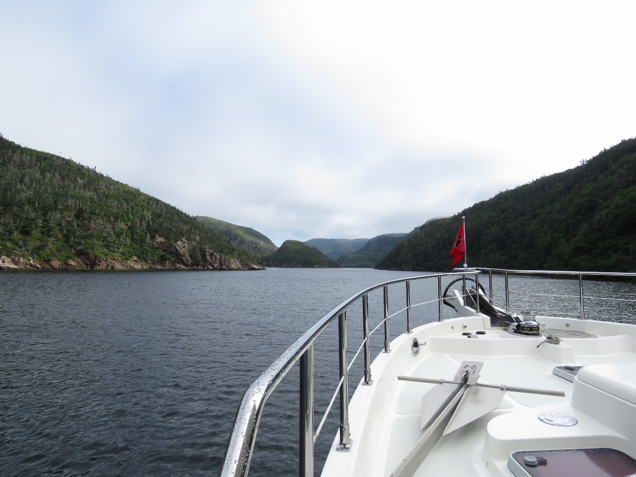 |
8/8/2016: Entering
Position: 47°37.56'N, -56°3.01'W
Looking north down mountainous Sam Hitches Harbour from the mouth as we enter.
|
 |
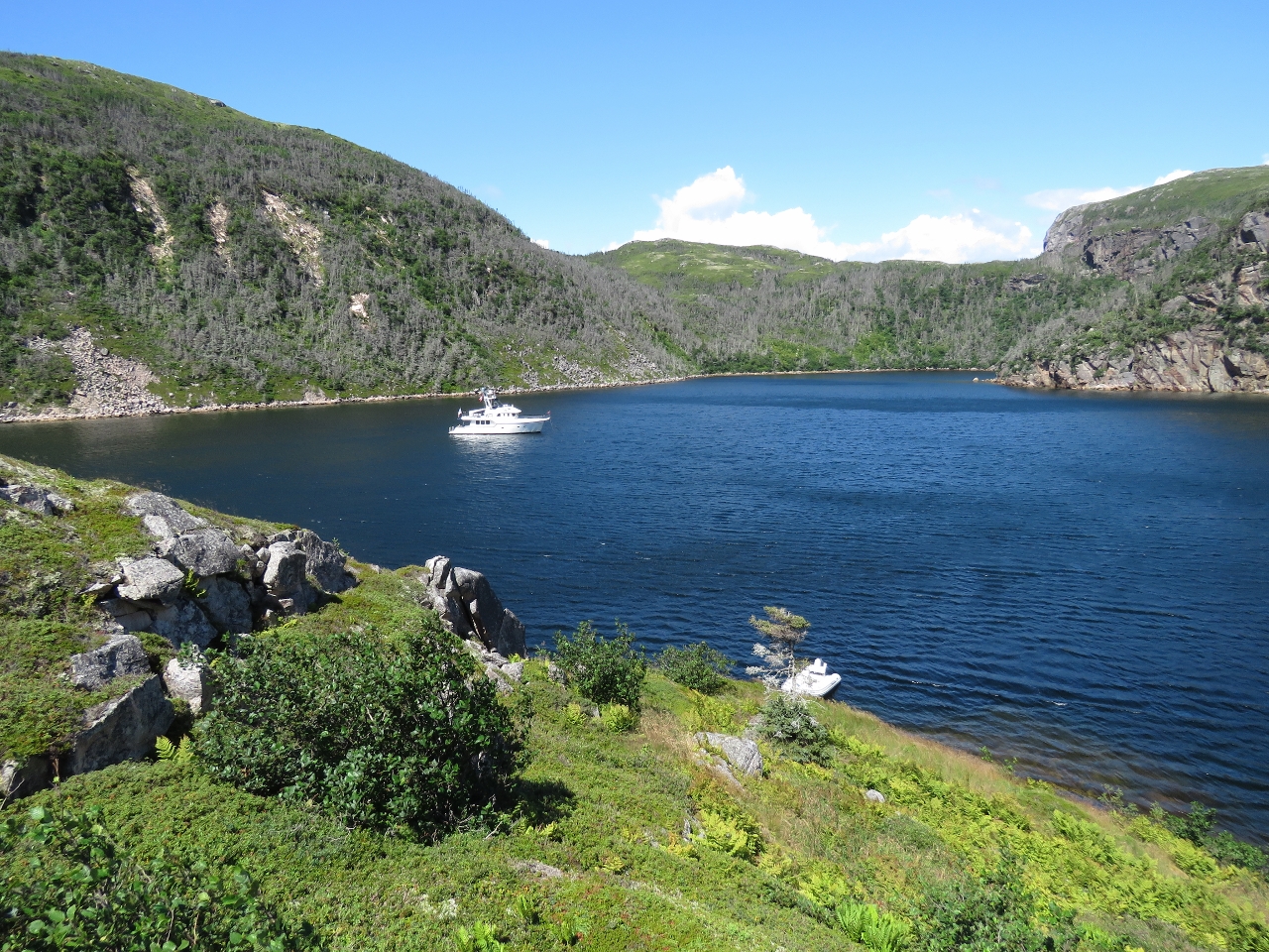
8/8/2016: Anchoring
Position: 47°38.79'N, -56°2.59'W
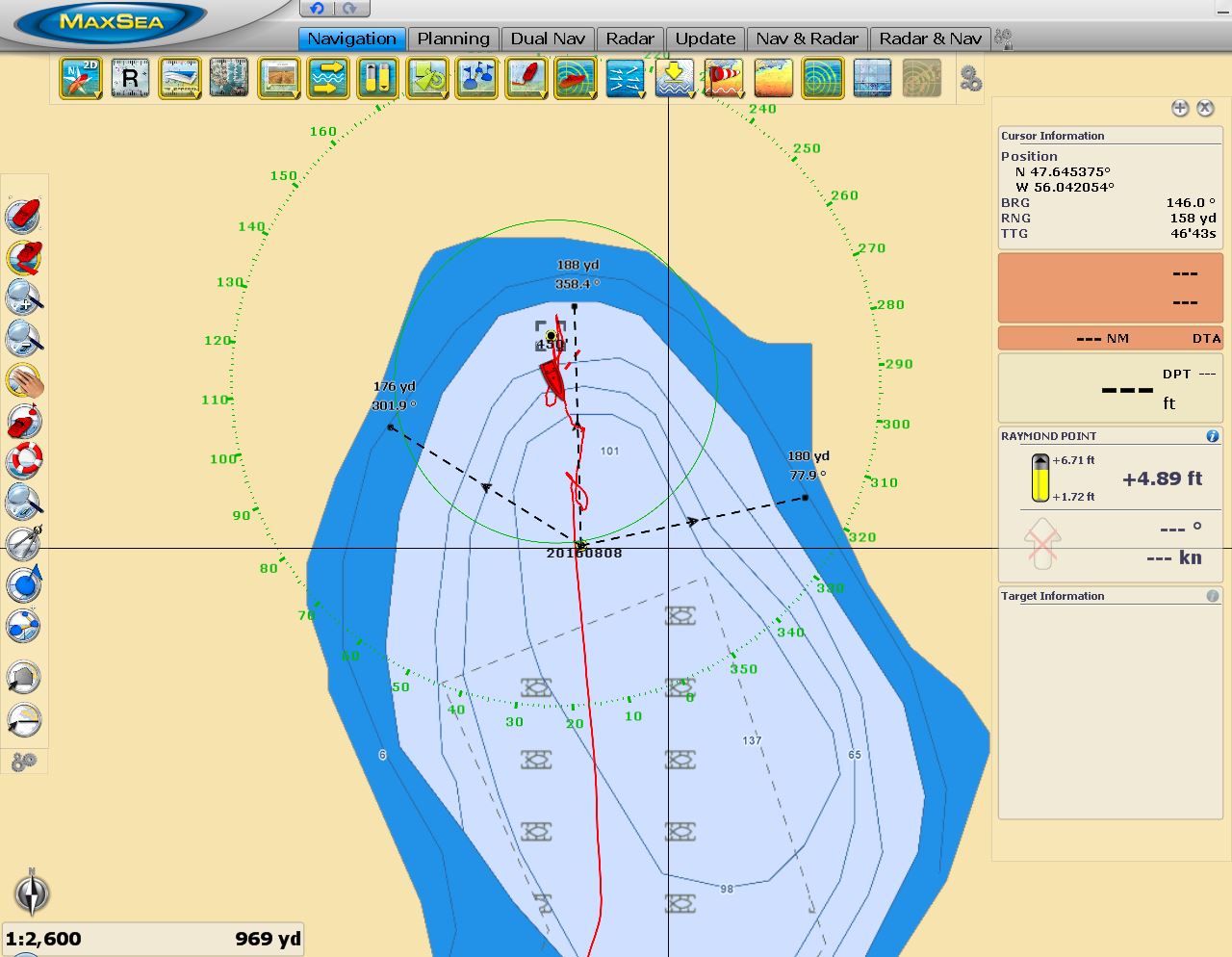
Sam Hitches Harbour is as beautiful as Little Bay, and also has a waterfall at the head. The water depth under the falls is 130ft though, even deeper than Little Harbour at 100ft. The swing diameter is 350 yards, which seems like a lot, but that would mean we had room to put out only 400ft of rode which is a scope of 3:1. We prefer 5:1 for a shallower angle of tension on the anchor should the winds come up, but the weight of that much chain will decrease the likelihood that the chain would pull taught, so we'll tolerate it if the holding is good. We measured carefully to determine the exact place to position the boat to have equal distance from all hazards. With 400ft of chain out we held well on testing the set at 1,300RPM.
|
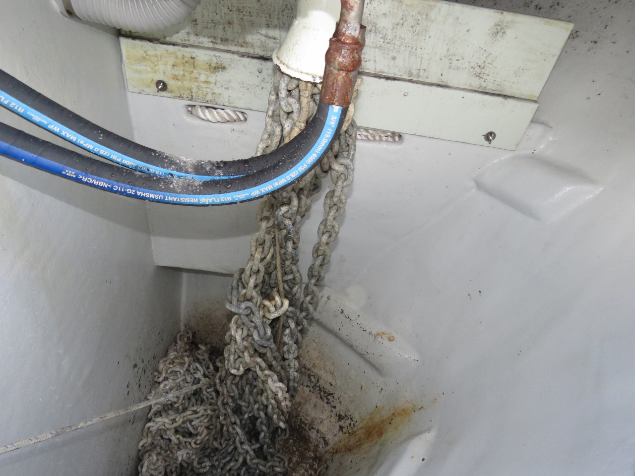 |
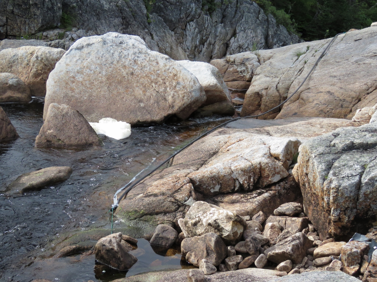
8/8/2016: Chain
Position: 47°38.77'N, -56°2.57'W
As we neared 400ft of chain out, we could hear the windlass struggling against chain tangles. We opened up the chain locker and saw the knot pictured. It seems almost impossible that we could ever be in rough enough water that the last 150ft of rode would actually have some full knots in it. In order for that to happen, all 500ft of chain (at 2lbs a foot that's 1,000 lbs) has to be lifting off the bottom of the locker as the boat moves in rough seas .
|
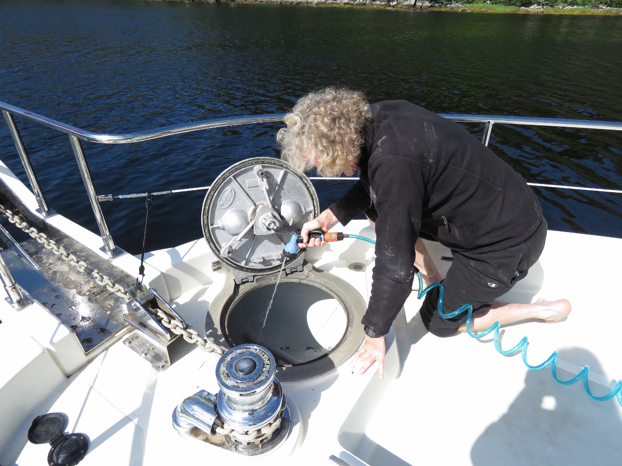 |
8/8/2016: Washdown
Position: 47°38.77'N, -56°2.57'W
We let out all the chain to untangle it then took the opportunity to hose down the anchor locker while it was empty. We haven't washed down the anchor locker since Alaska five years ago.
|
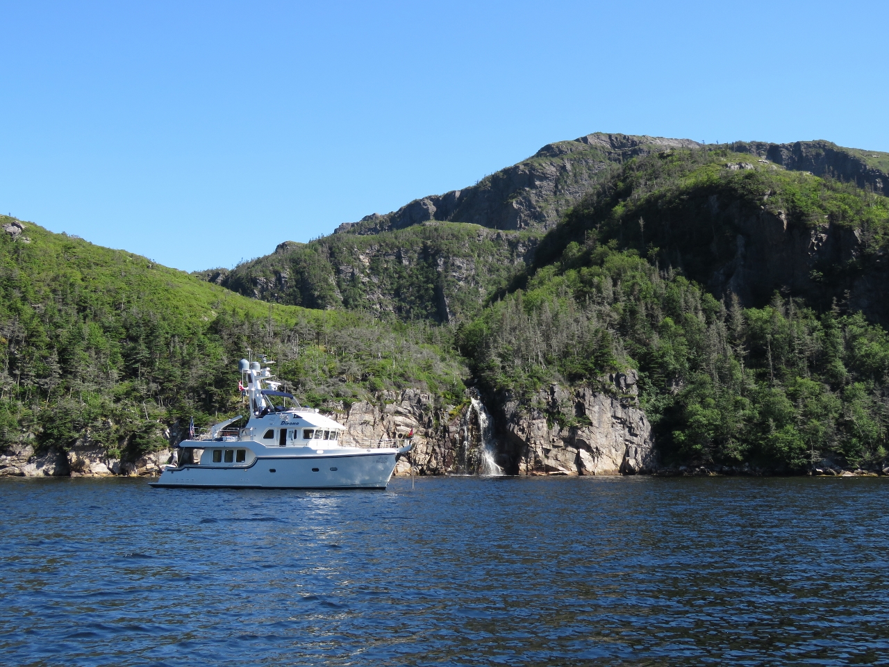 |
8/8/2016: Sam Hitches Harbour
Position: 47°38.79'N, -56°2.59'W
At anchor off the waterfall in beautiful Sam Hitches Harbour. Newfoundland is exactly our kind of cruising grounds: solitude with amazing natural scenery. Except for a few local-looking boats docked at Harbour Breton, we've not seen another cruising pleasure craft since we arrived in the province.
|
 |
8/8/2016: Door latch
Position: 47°38.79'N, -56°2.59'W
We were not able to get a replacement cockpit door latch before leaving Boston, but Justin at Nordhavn parts has two ready for us when we get back to civilization. We've been using a bungee cord to hold the door open, but this is inconvenient. So today James tried securing the two pieces with a hose clamp and gluing the whole mass together with 5-minute epoxy. So far, it's holding well and we have a working door latch again.
|
 |
8/8/2016: Climbing
Position: 47°38.84'N, -56°2.60'W
Looking for a place to climb to a view, we landed the tender about 150ft west of the falls, at the base of a cliff where the tree line was lowest. There we found a rough trail leading diagonally up towards the falls. We climbed straight up when the track continued more east and reached a low bluff above the anchorage. The view from hear already was pretty impressive.
|
 |
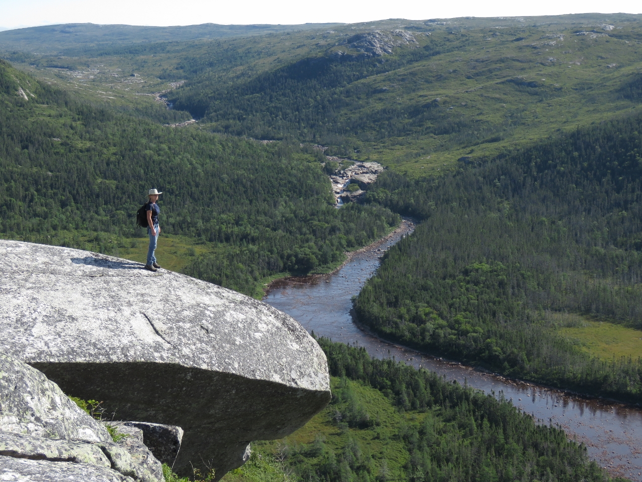
8/8/2016: Goal
Position: 47°38.88'N, -56°2.63'W
Our goal was the hilltop at the upper left of the photo. Much of the walking was relatively easy through open groundcover, but we had to push through thick trees in a few valleys along the way.
|
 |
8/8/2016: Halfway
Position: 47°38.84'N, -56°2.77'W
Halfway to the top we got a great view of the anchorage, the waterfall and even the tender.
|
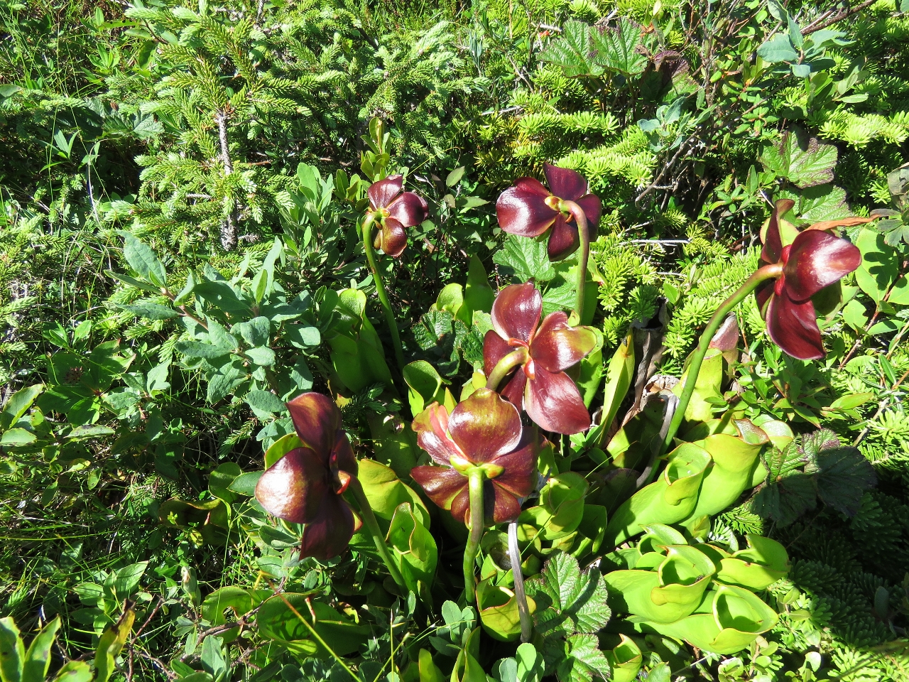 |
8/8/2016: Pitcher Plant
Position: 47°38.82'N, -56°2.85'W
Pitcher Plants, Newfoundland's official flower, grew in the open meadows along the way. The plant feeds on insects that drown in its water-filled lower cups.
|
 |
8/8/2016: Tinker Rock
Position: 47°38.77'N, -56°2.90'W
We've gained enough altitude that we can see Tinker Rock that we passed to enter Bay d'Epoir.
|
 |
8/8/2016: View
Position: 47°38.77'N, -56°2.89'W
We finally reached the hill we were aiming for, 500ft up. The view from there is amazing. At the left of the photo is the lake that feeds the waterfall we're anchored under.
|
 |
8/8/2016: Lakes
Position: 47°38.78'N, -56°2.99'W
The view looking west from the summit was pretty impressive too, with a series of lakes and more mountains in the distance.
|
 |
8/8/2016: Lunch
Position: 47°38.77'N, -56°2.91'W
Lunch with a view above the anchorage at Sam Hitches Harbour. Boy, we're loving Newfoundland.
|
 |
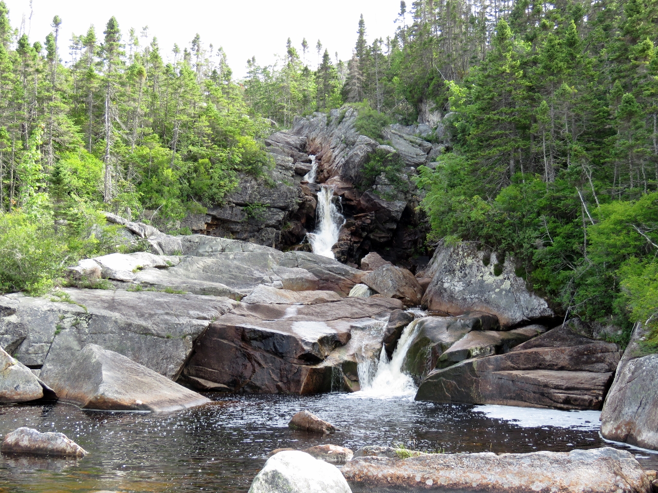
8/8/2016: Falls
Position: 47°38.81'N, -56°2.56'W
A close-up view of the falls after we returned back from our hike.
|
 |
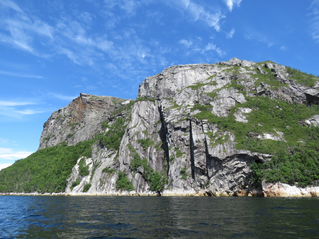
8/9/2016: Cliffs
Position: 47°37.36'N, -56°3.00'W
Looking east towards the outer cliffs as we exit Sam Hitches Harbour. The weather can change quickly here, but it looks like we'll get another clear and sunny day.
|
 |
8/9/2016: Entry
Position: 47°36.63'N, -56°0.23'W
Approaching the narrow entry to Round Harbour. The entrance is about 200ft wide and relatively easy. We saw a least depth of 24ft on a 3.2ft tide at Hermitage, with no obvious current.
|
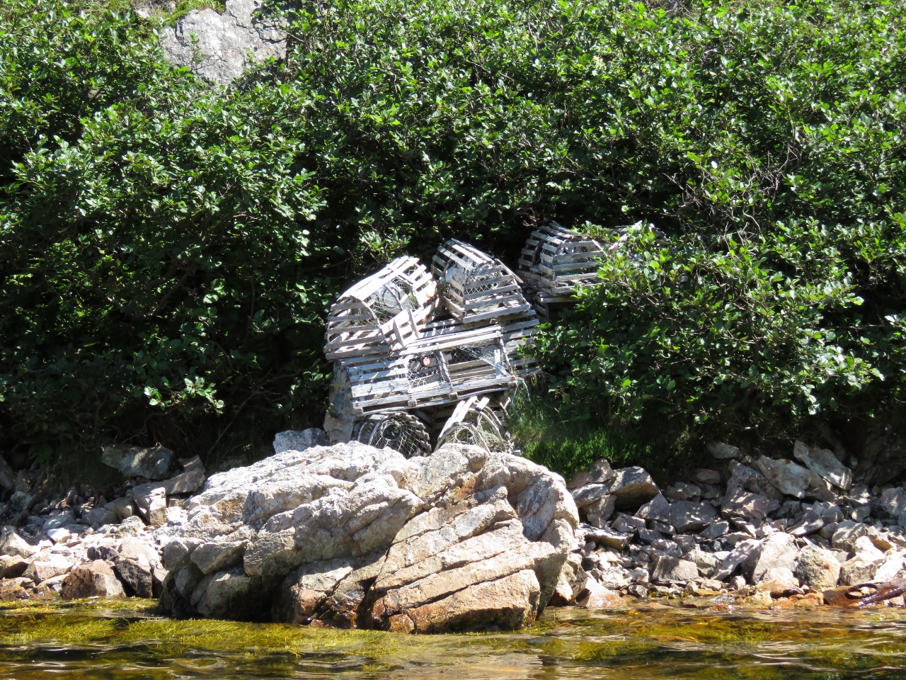 |
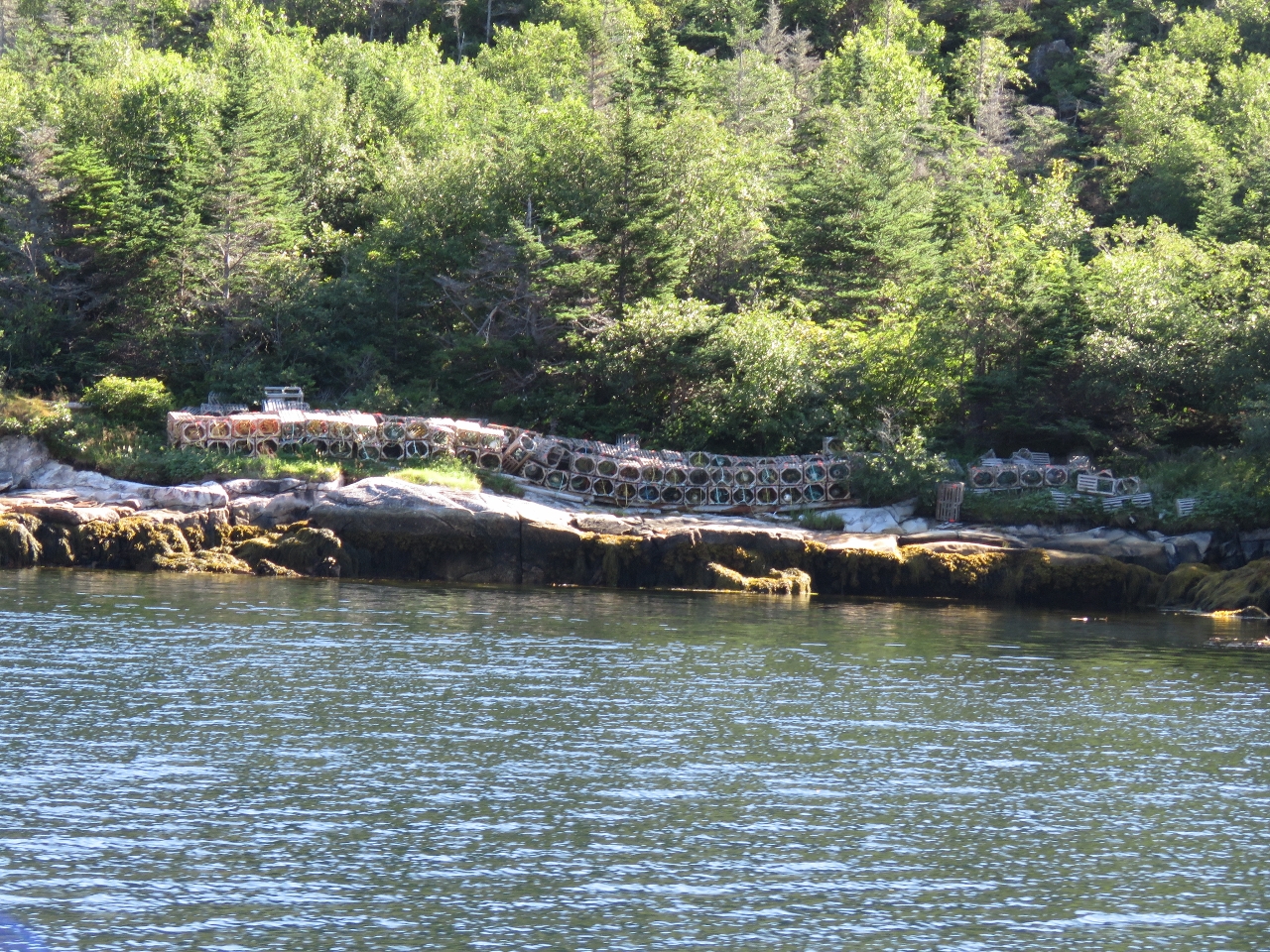
8/9/2016: Lobster traps
Position: 47°36.84'N, -56°0.28'W
Several sets of lobster traps were stored along shore inside the harbour.
|
 |
8/9/2016: Anchorage
Position: 47°36.83'N, -56°0.27'W
The view to the anchorage from ashore. We anchored in about 45' with room to swing in moderate holding over rock.
|
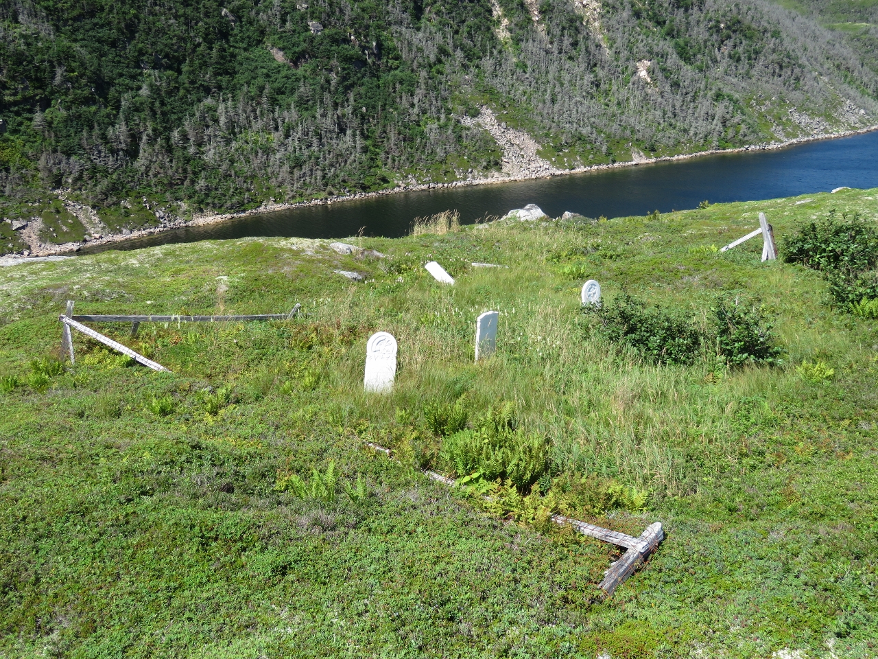 |
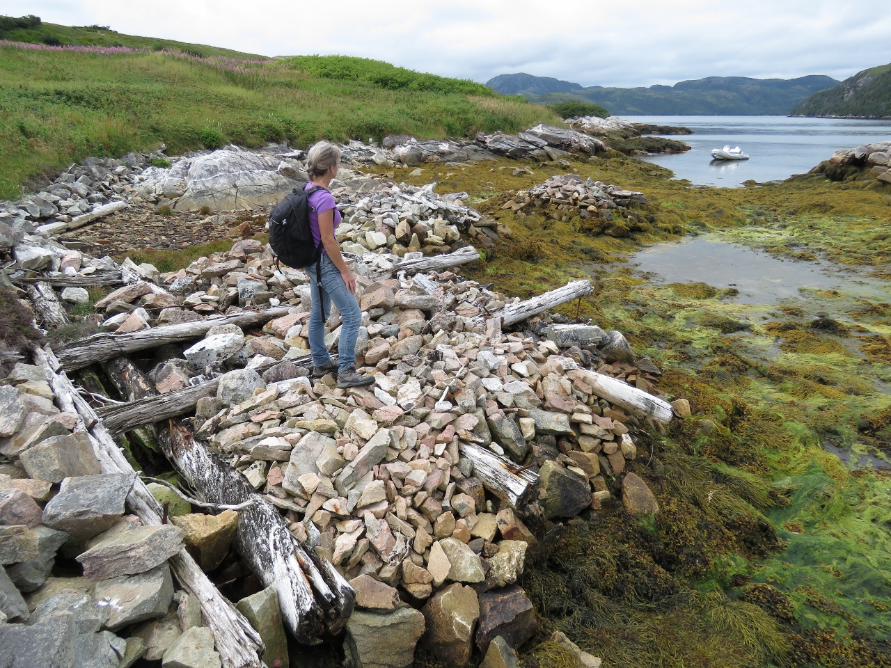
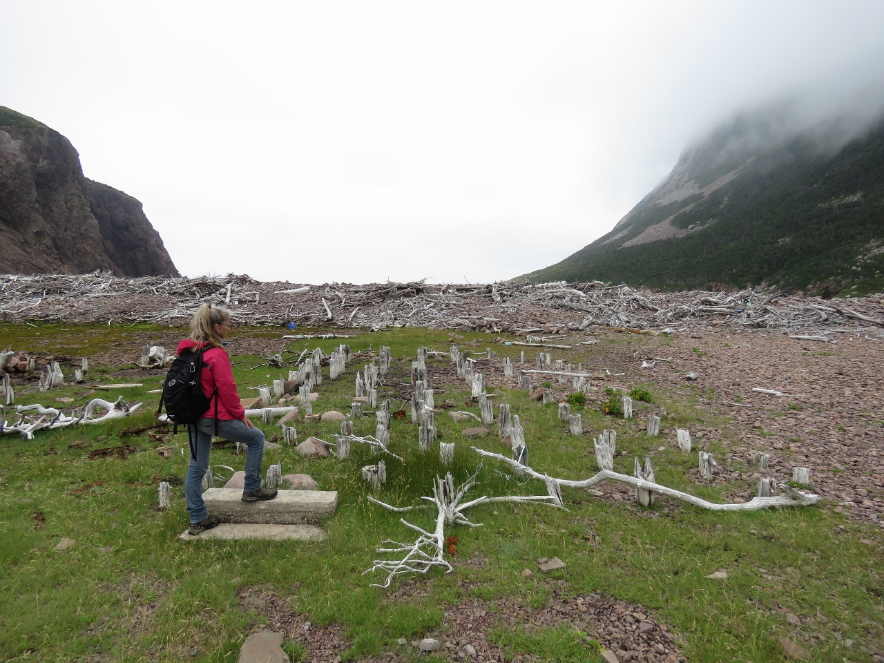
8/9/2016: Graveyard
Position: 47°36.77'N, -56°0.24'W
The small community at Round Harbour relocated in the 1960s. This graveyard and some house foundations are about the only remaining evidence of their presence.
|
 |
8/9/2016: Hermitage Bay
Position: 47°36.74'N, -56°0.23'W
Taking in the view south across Hermitage Bay from the hills above Round Harbour.
|
 |
8/9/2016: Pond
Position: 47°36.79'N, -56°0.00'W
By pushing through several clumps of thick brush, we found a way to the hilltop east of anchorage. From there we could see several lakes in the distance to the northeast and a nice pond with water lilies below us.
|
 |
8/9/2016: Lunch
Position: 47°36.80'N, -56°0.06'W
We worked east for a picnic spot with a better anchorage view.
|
 |
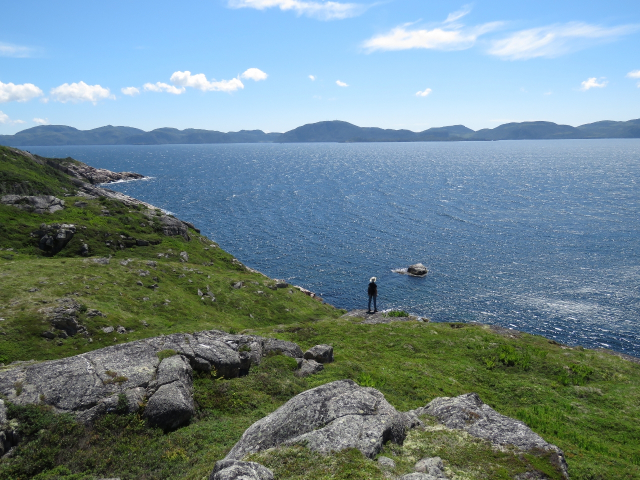
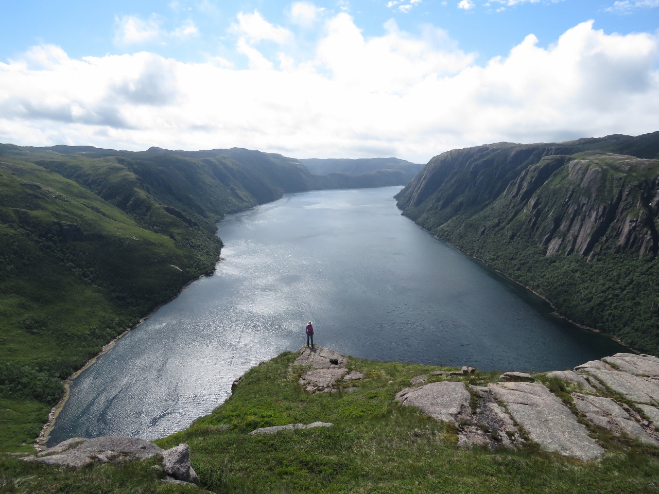
8/9/2016: View
Position: 47°36.79'N, -56°0.06'W
The view to Hermitage Harbour on the left and Round Harbour on the right from our lunch spot. We’re loving being back out cruising again and Newfoundland, with an abundance of hikes to incredible views, is exactly our kind of destination.
|
 |
8/10/2016: Morning calm
Position: 47°36.85'N, -56°0.36'W
A beautiful clear and calm morning, looking south to the Round Harbour entrance.
|
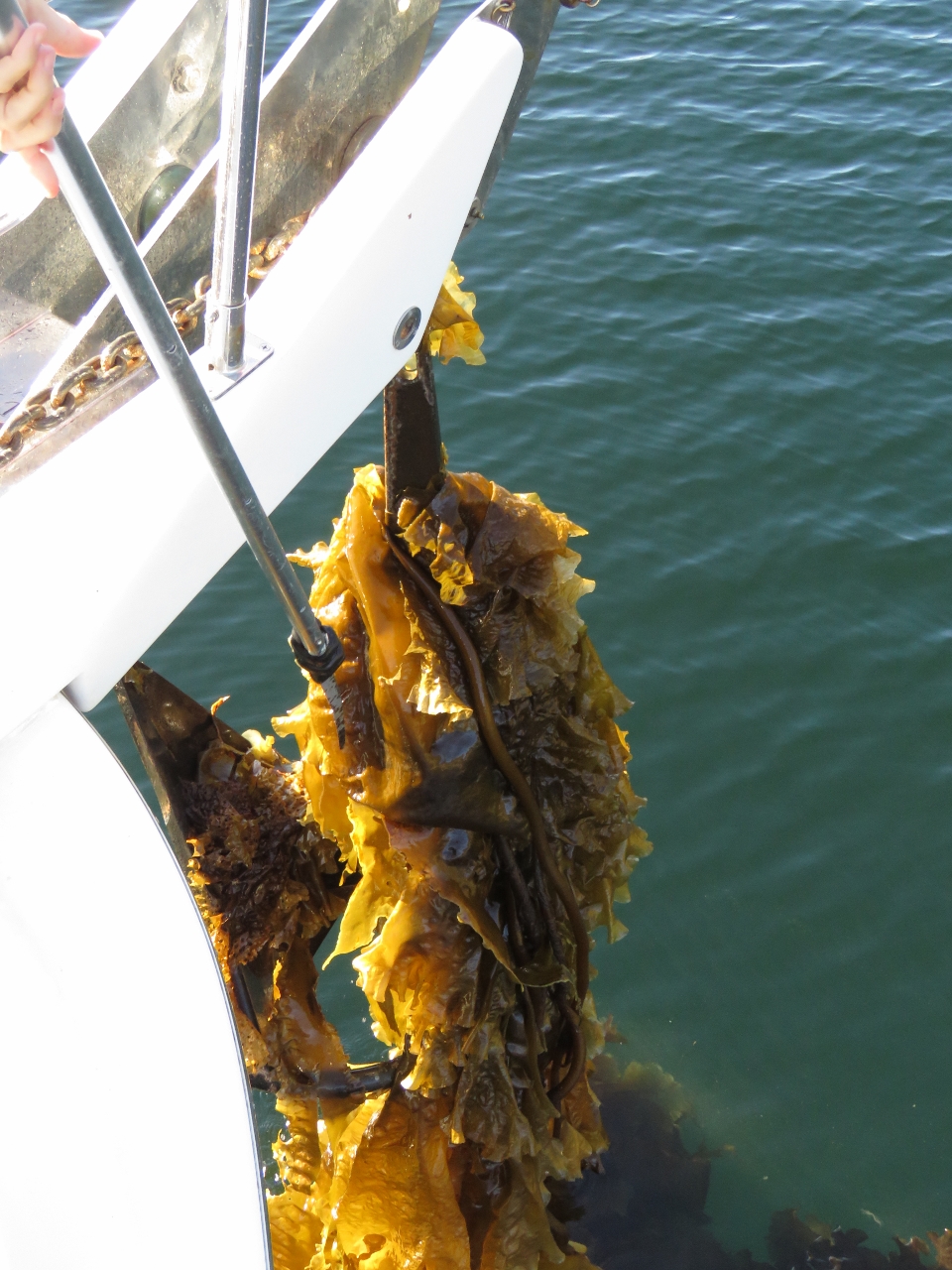 |
8/10/2016: Kelp
Position: 47°36.89'N, -56°0.37'W
Our anchor came up wrapped in a huge ball of kelp. A serrated knife attachment on our boat hook easily cuts it away.
|
 |
8/10/2016: Hermitage
Position: 47°36.06'N, -55°56.85'W
The town of Hermitage to our south is connected by road to Highway One.
|
 |
8/10/2016: Lobster pots
Position: 47°36.79'N, -55°56.17'W
Dozens of lobster pots stored ashore at Pink Bottom in Piccaire Harbour.
|
 |
8/10/2016: Narrows
Position: 47°37.13'N, -55°56.14'W
Looking back on the narrows into Northwest Arm at the head of Piccaire Harbour. The charts didn't give the minimum depth, but it looked shallow. We crept through at a half-knot with a bow watch and could see a shallow rock bar that looked about 10ft under the water about halfway in. We eased over it at a half-knot a and saw a minimum depth of 8ft on a 3ft tide at Hermitage, a little tight for our 6ft 7in draft. Fortunately the tidal ranges here are relatively small, so channels like this have little-to-no current compared to ones we're used to in British Columbia with its larger tidal exchanges.
|
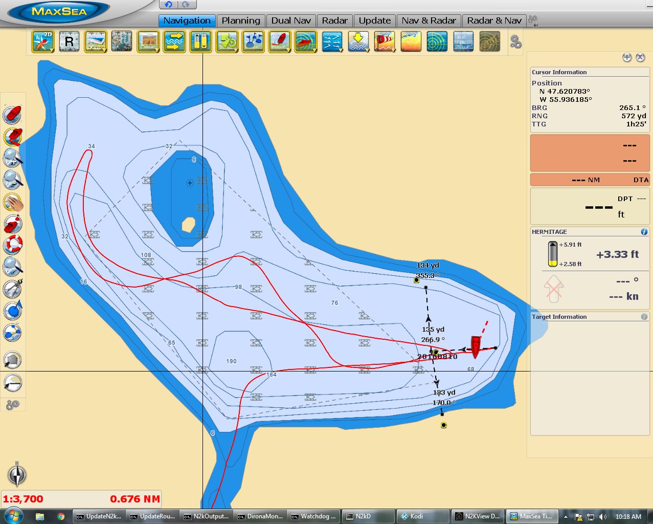 |
8/10/2016: Anchoring
Position: 47°37.27'N, -55°55.75'W
We toured throughout Northwest Arm and could only find sufficient swing room for the depth in the eastern end, but in 130ft. The charts were a fair bit off--the yellow-and-black marks indicate where the radar showed the actual shoreline. The three dividers we drew determine the central place to drop the anchor and also to indicate the maximum range we should swing. If we are concerned later that we might have dragged anchor, we can consult the dividers to check if we are beyond the range.
|
 |
8/10/2016: Northwest Arm
Position: 47°37.26'N, -55°55.77'W
Fortunately the only place in Northwest Arm we could find to drop hook also was the most scenic below a sheer cliff.
|
 |
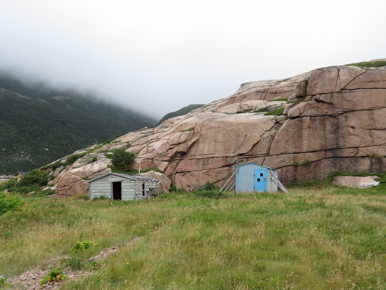
8/10/2016: Piccaire
Position: 47°36.70'N, -55°56.01'W
A modern cabin and dock at the site of the old settlement of Piccaire, another Newfoundland village that
|
 |
8/10/2016: Government Wharf
Position: 47°36.68'N, -55°56.02'W
In 1961, the Government Wharf at Piccaire was new and packed with skiffs. There's not much left of it now.
|
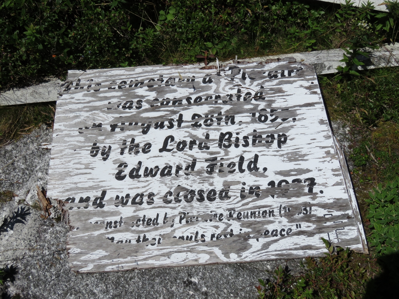 |
8/10/2016: Cemetery
Position: 47°36.67'N, -55°56.02'W
This sign at the Piccaire Cemetery indicates it was consecrated Auguste 28, 1855 and closed in what looks like 1977. The sign was constructed by the Piccaire (Resettlement) Reunion that in 1993 apparently drew over 300 people.
|
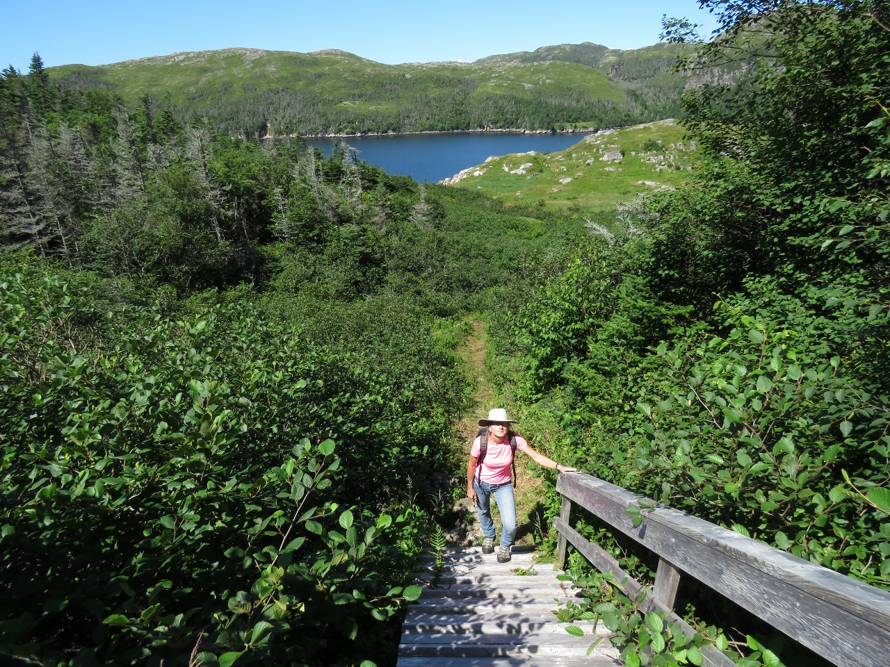 |
8/10/2016: Trail
Position: 47°36.58'N, -55°55.93'W
We'd read about a three-mile trail to the active town of Gaultois, but weren't sure what kind of shape it would be in. We were happy to find the trail had been freshly cleared and was one of the best trails we've walked in months.
|
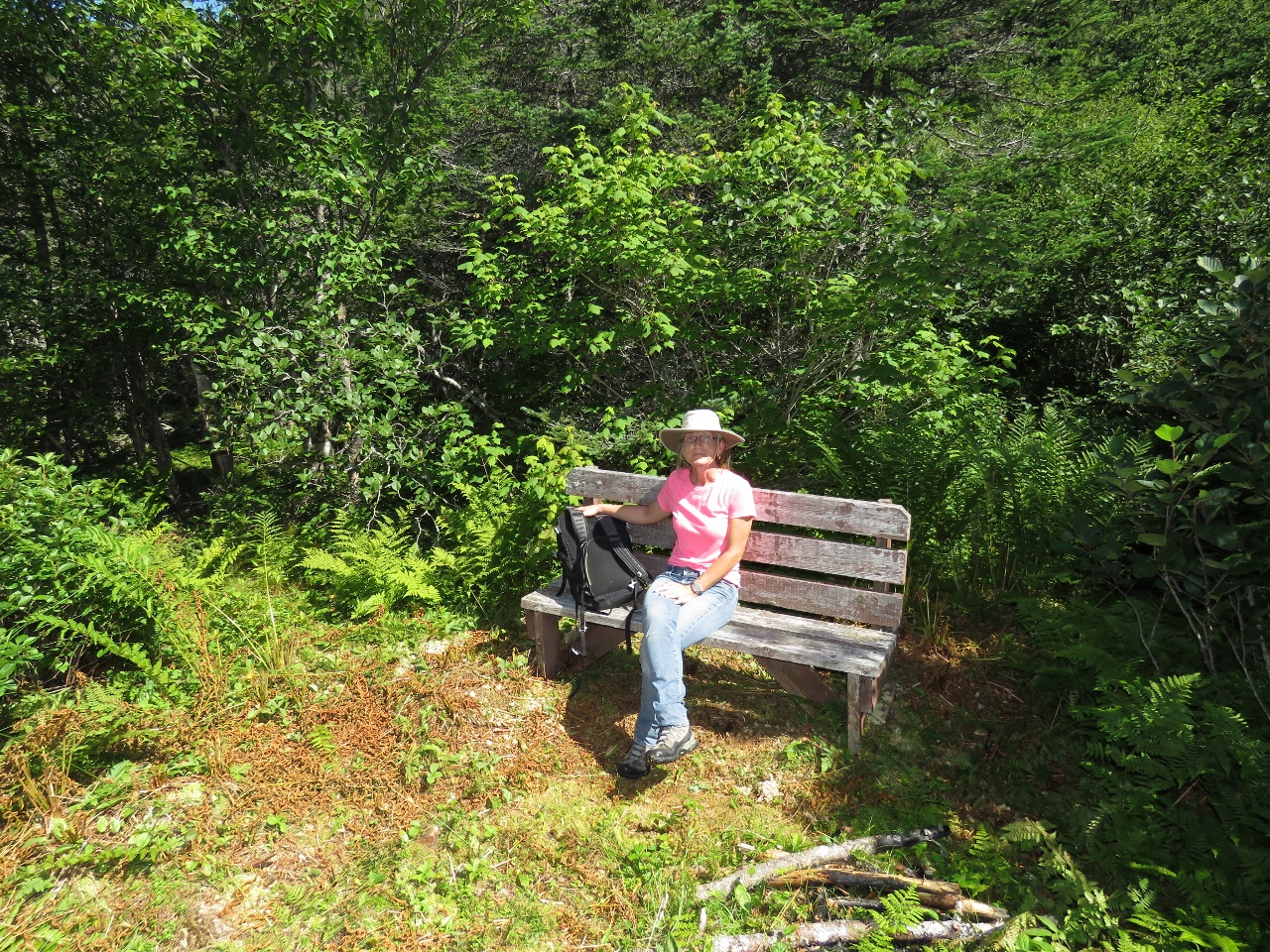 |
8/10/2016: Bench
Position: 47°36.55'N, -55°55.84'W
The trail was quite impressive, with a bench not far along.
|
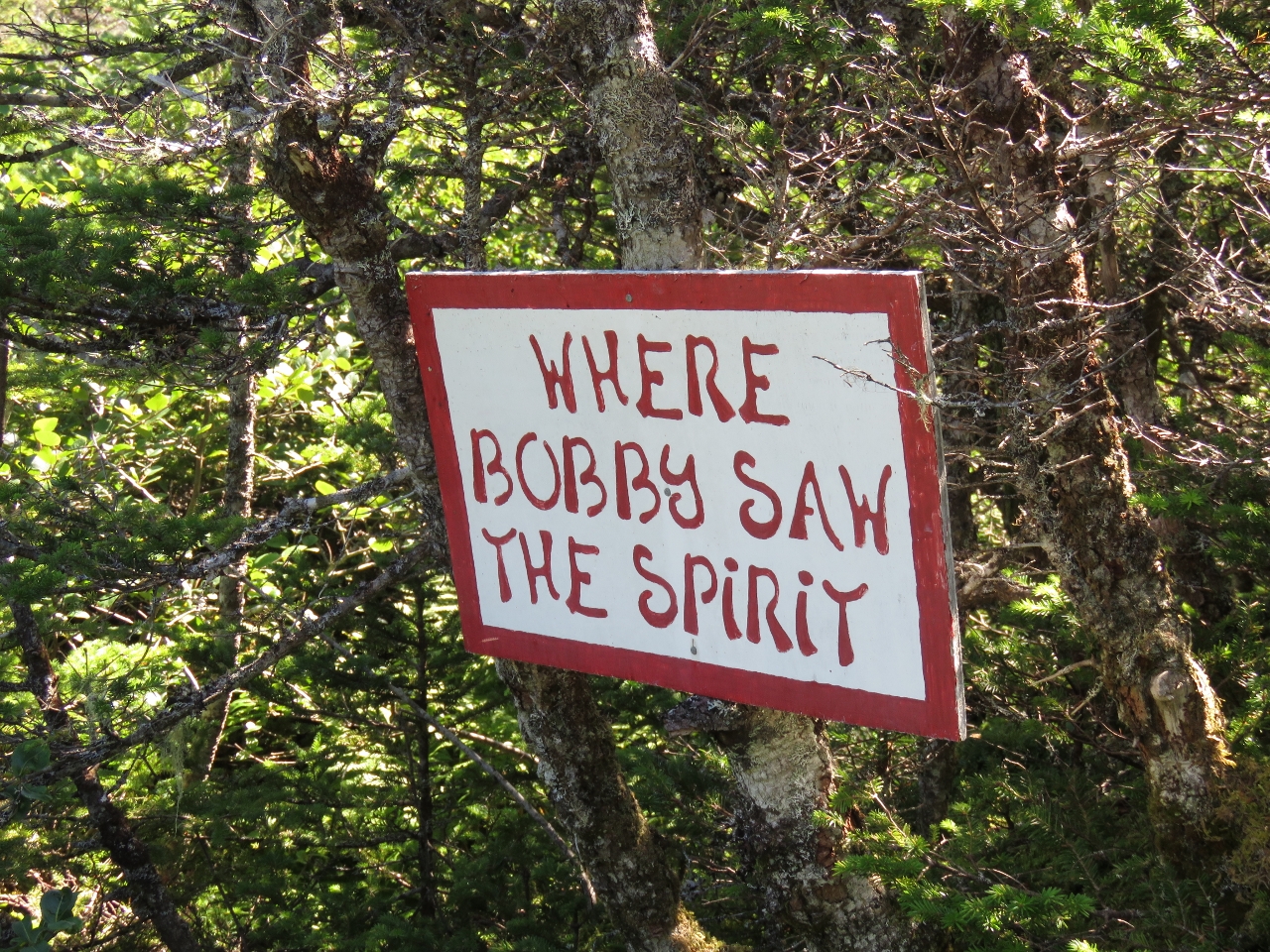 |
8/10/2016: Sign
Position: 47°36.53'N, -55°55.63'W
Several whimsical signs like this were along the trail, and also ones naming points along the way and giving the direction to Piccaire and Gaultois.
|
 |
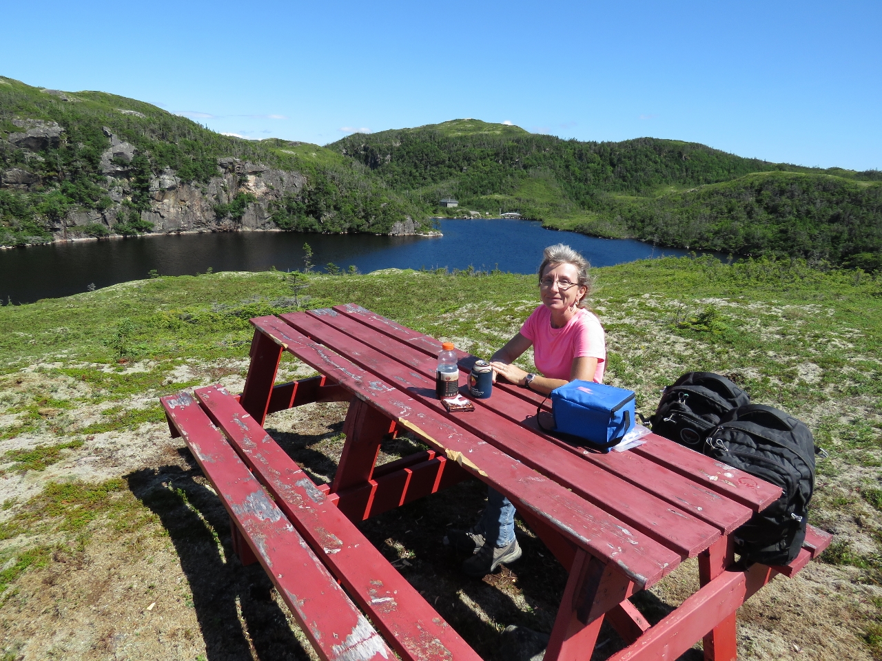
8/10/2016: Winter House Pond
Position: 47°36.63'N, -55°55.37'W
About a third of the way to Gaultois, we came across a picnic table overlooking a pond with a sign reading "Winter House Pond". It was such a perfect picnic spot we stopped there and had lunch.
|
 |
8/10/2016: Boulders
Position: 47°36.42'N, -55°54.91'W
Passing between large boulders on the trail between Piccaire and Gaultois.
|
 |
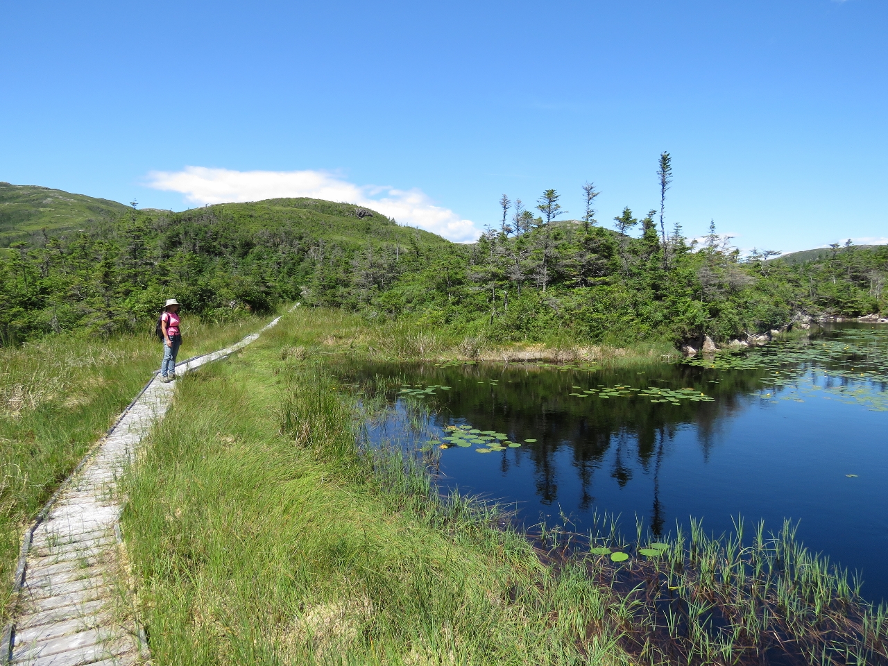
8/10/2016: Boardwalk
Position: 47°36.29'N, -55°54.64'W
At several places along the trail, boardwalks and walkways had been built over boggier areas.
|
 |
8/10/2016: Helicopter pad
Position: 47°36.32'N, -55°54.47'W
We passed what could only be a helicopter pad as we neared the town of Gaultois.
|
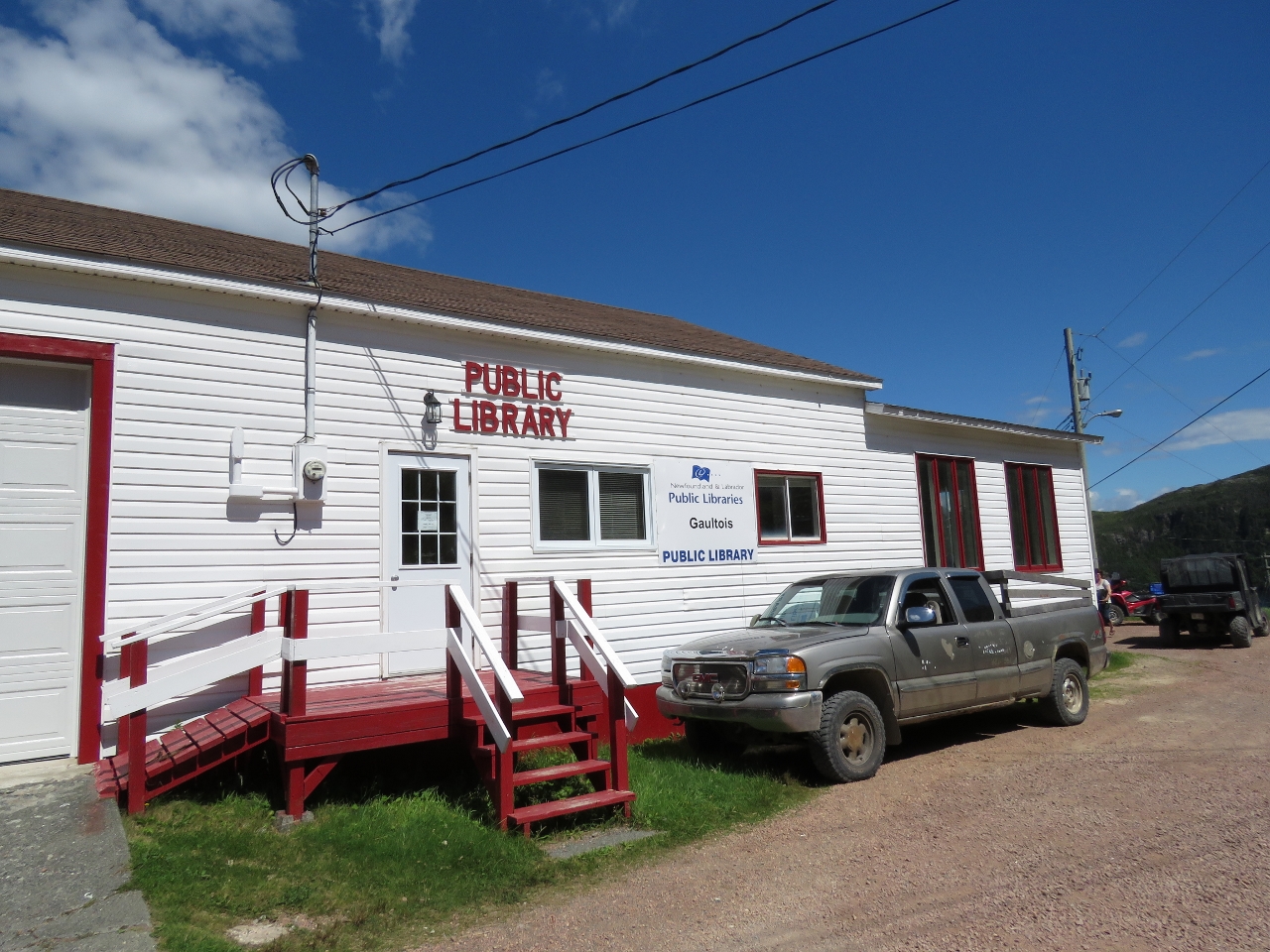 |
8/10/2016: Library
Position: 47°36.38'N, -55°54.41'W
The Gaultois Public Library on the outskirts of town.
|
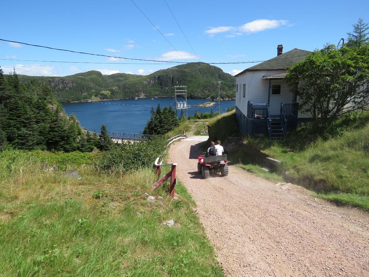 |
8/10/2016: ATV
Position: 47°36.38'N, -55°54.34'W
Except for the truck parked at the library, we didn't see any other vehicles other than ATVs and a motorcycle. Gaultois is accessible only by water or air and ATVs seem to be the way to get around here. This is looking down the hill from the library toward the harbour at Gaultois.
|
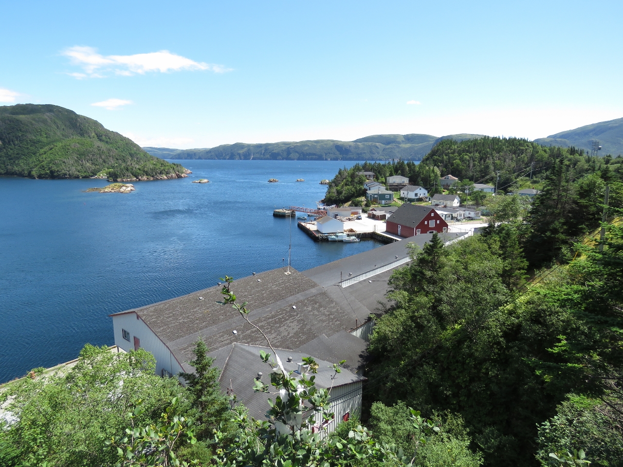 |
8/10/2016: Gaultois
Position: 47°36.41'N, -55°54.27'W
Looking southwest above the old Gaultois Fishplant toward the wharves. Gaultois is the only community on Long Island to have resisted the resettlement process.
|
 |
8/10/2016: Ramps
Position: 47°36.50'N, -55°54.29'W
Many of the houses have ramps behind for boats to be pulled up and out of the water. All the boats were very carefully secured with multiple lines, presumably because the winds here can be strong.
|
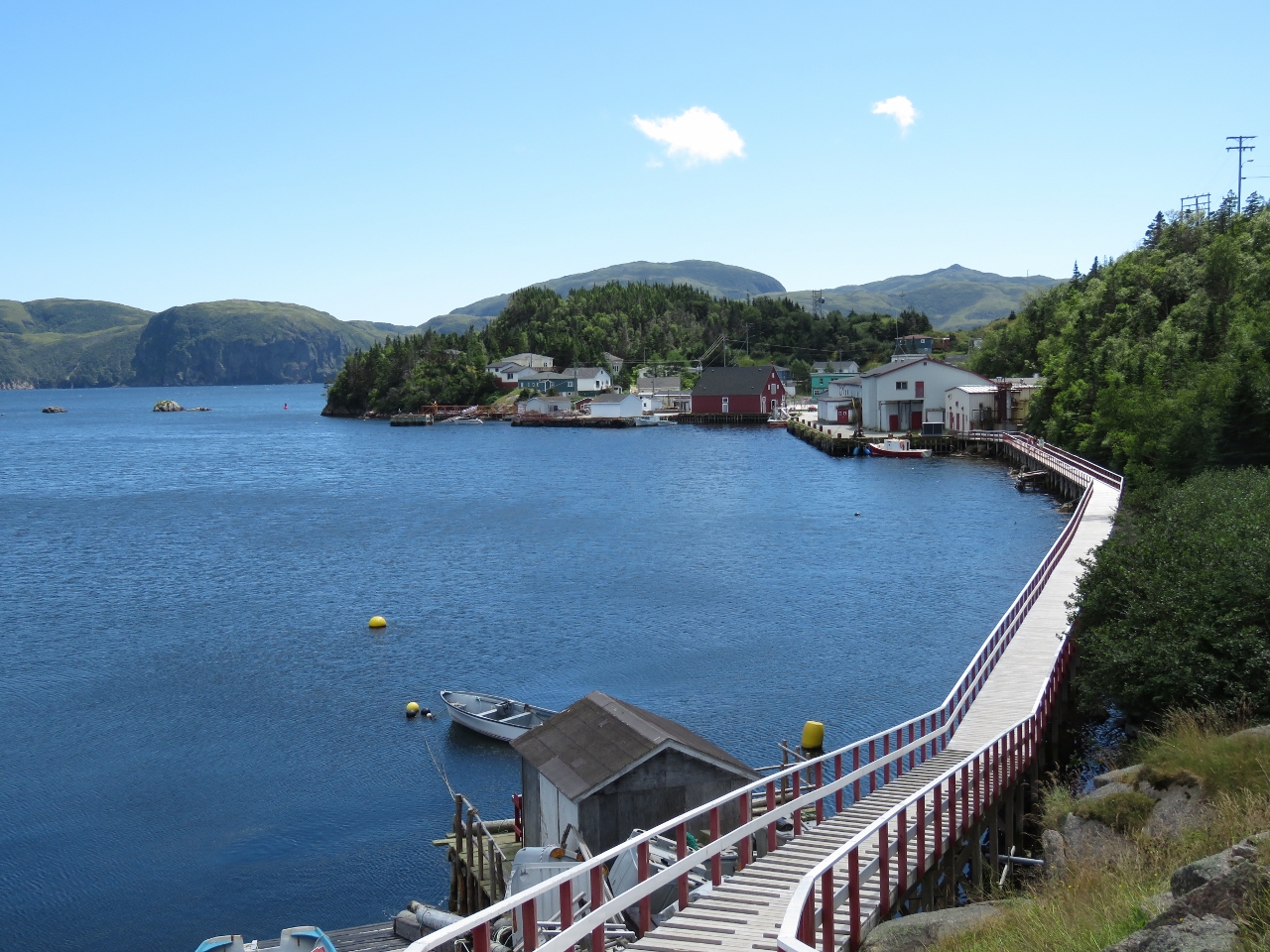 |
8/10/2016: Gaultois Boardwalk
Position: 47°36.55'N, -55°54.29'W
Looking south from the center of town along the boardwalk to leading to the wharves. The ferry from Hermitage lands at the wharves on the left.
|
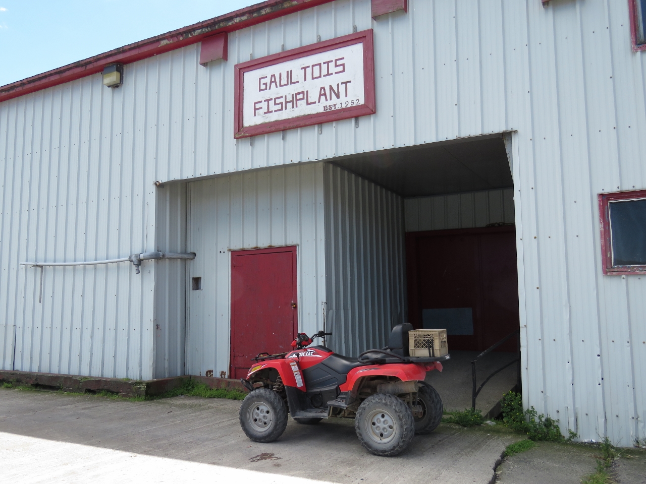 |
8/10/2016: Fishplant
Position: 47°36.43'N, -55°54.24'W
The Gaultois Fishplant was established in 1952 and officially closed in 2010.
|
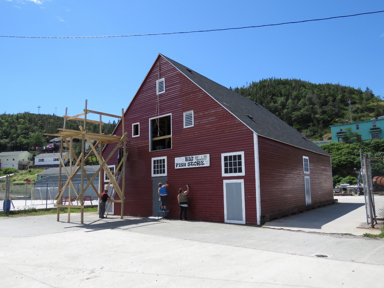 |
8/10/2016: Big Fish Store
Position: 47°36.39'N, -55°54.20'W
Locals were out repainting and repairing the "Big Fish Store", built in the 1800s.
|
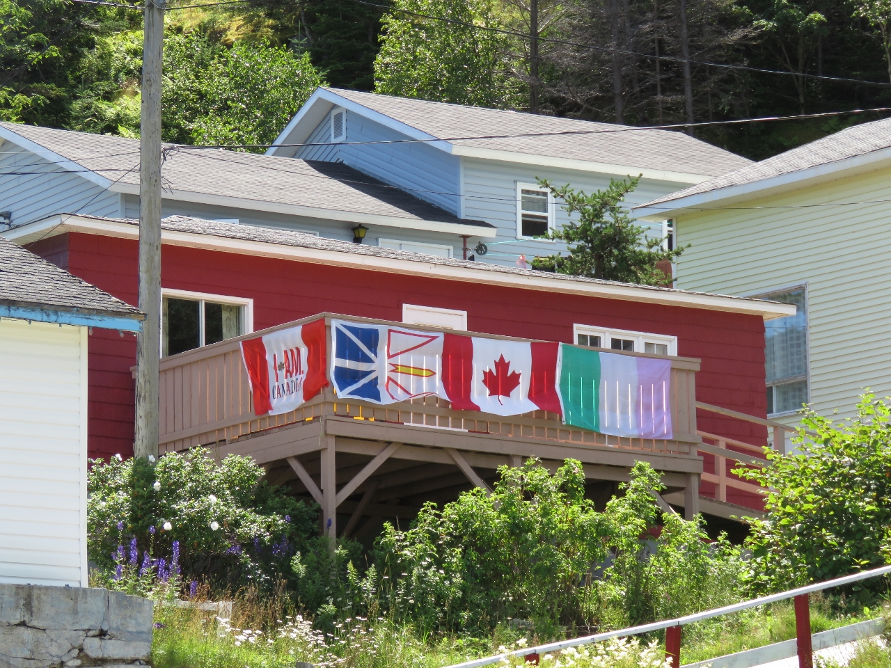 |
8/10/2016: Flags
Position: 47°36.35'N, -55°54.19'W
A great set of flags displayed at a Gaultois balcony. From left to right are a Molson Canadian flag from the advertising campaign that included the "I Am Canadian" rant; the Newfoundland and Labrador provincial flag; the Canadian flag; and the Newfoundland Tricolor, an unofficial flag popular in Newfoundland since the early 1900s.
|
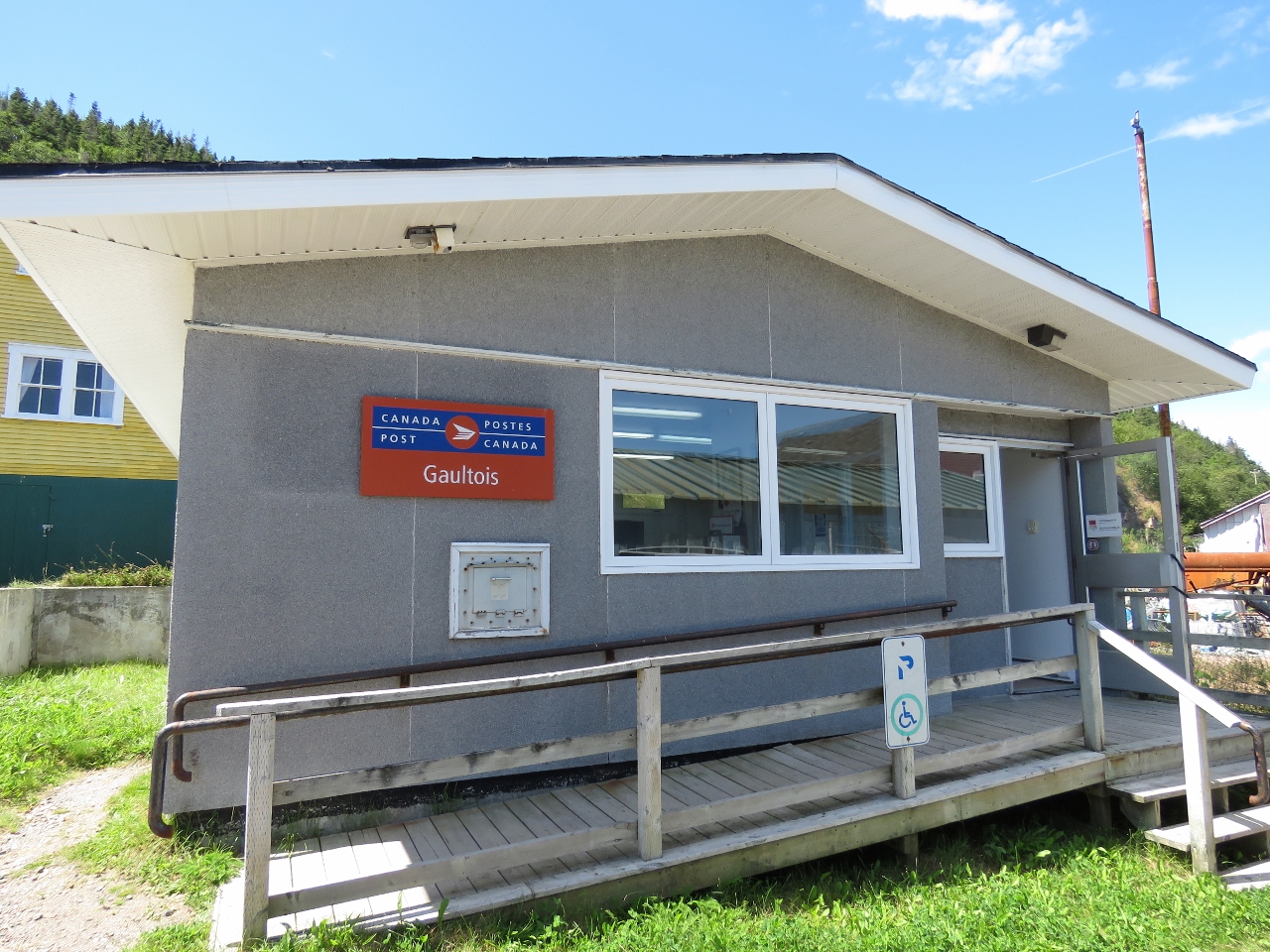 |
8/10/2016: Canada Post
Position: 47°36.36'N, -55°54.20'W
We haven't seen a Canada Post sign for a long time.
|
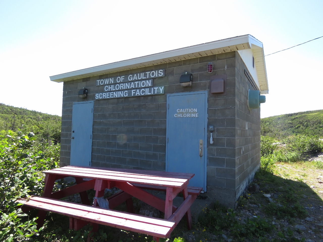 |
8/10/2016: Chlorination Facility
Position: 47°36.49'N, -55°54.73'W
On our way to Gaultois from Piccaire, we could see a hut across one of the lakes shortly before a fork in the trail where both paths led to Gaultois. We took the southern fork on the way there and from town followed the other fork. The hut we could see in the distance was the Gaultois water chlorination facility.
|
 |
8/10/2016: Black Duck Pond
Position: 47°36.47'N, -55°54.77'W
Another great boardwalk along the edge of Black Duck Pond.
|
 |
8/10/2016: The Lookout
Position: 47°36.48'N, -55°54.96'W
Having a break and enjoying the sweeping views at "The Lookout", about halfway between Gaultois and Piccaire.
|
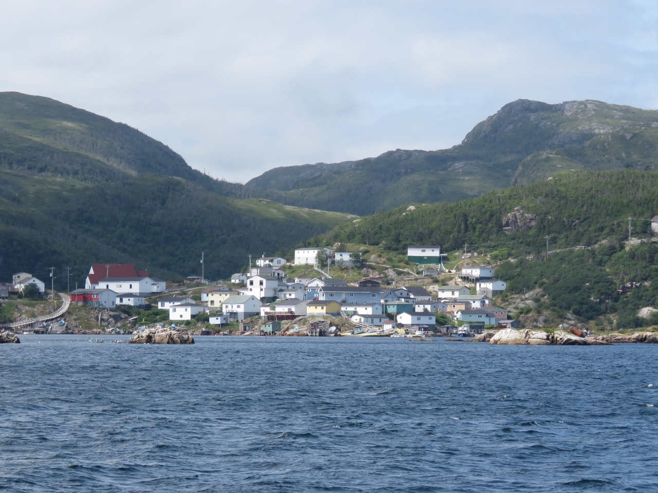 |
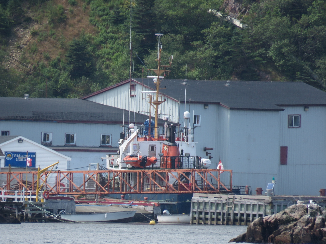
8/11/2016: Gaultois
Position: 47°36.14'N, -55°53.75'W
The view to Gaultois from sea as we approach Little Passage. The houses on the hill are the same ones we photographed yesterday looking across their boat ramps.
|
 |
8/11/2016: Terra Nova
Position: 47°36.14'N, -55°53.75'W
The Hermitage-Gaultois ferry MV Terra Nova docked at Gaultois. The ferry carries passengers and freight (no cars) between Hermitage and Gaultois several times a day, year-round.
|
 |
8/11/2016: Waterfall
Position: 47°37.39'N, -55°53.10'W
This waterfall on the east side of Little Passage looks like it can really flow a torrent in the wetter spring season.
|
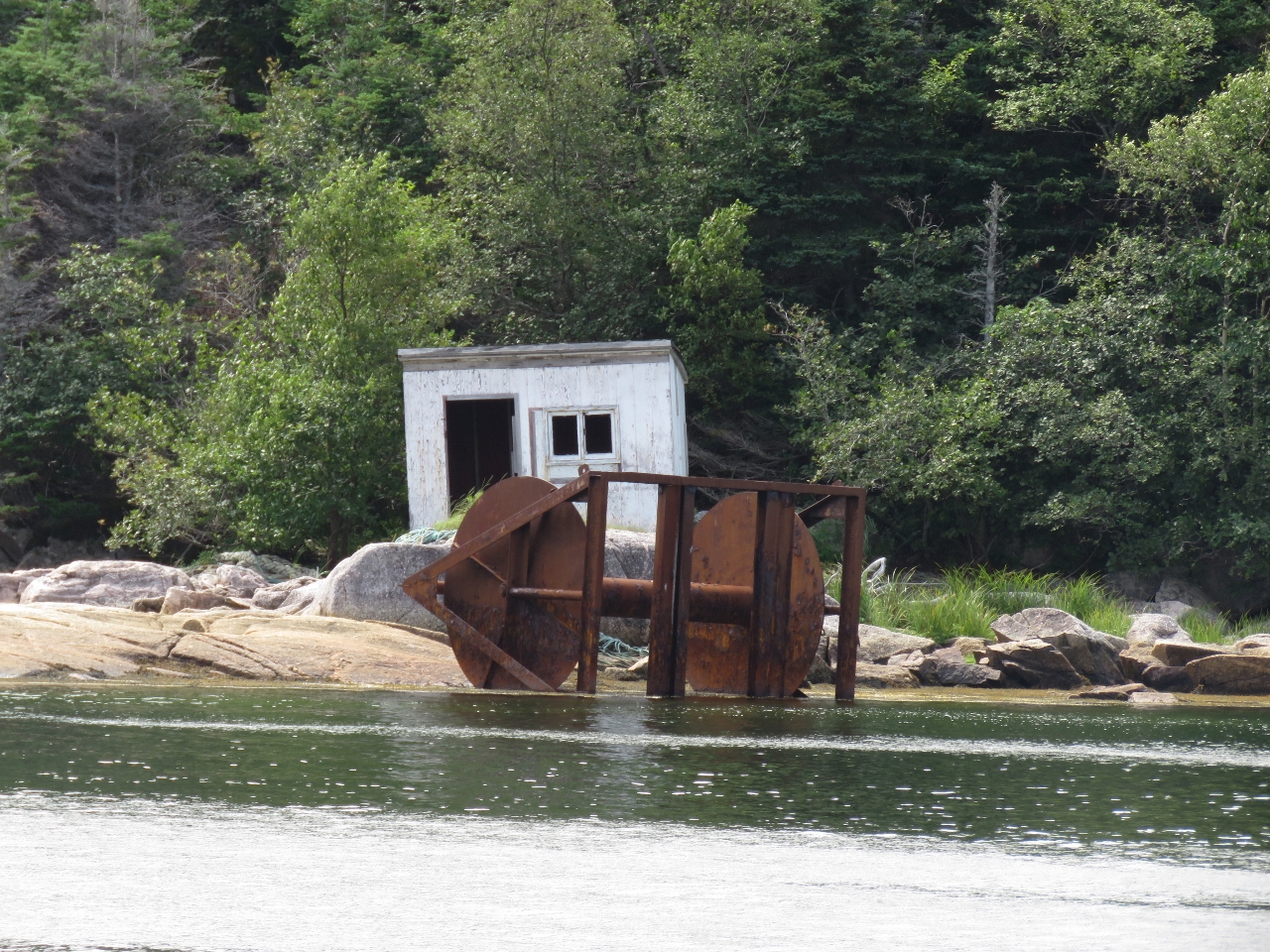 |
8/11/2016: L'Anse a Flamme
Position: 47°37.28'N, -55°53.55'W
A small shack behind what looks like the spool from a fishing trawler at south end of L'Anse a Flamme cove along Little Passage. Aquaculture filled the north end of the cove.
|
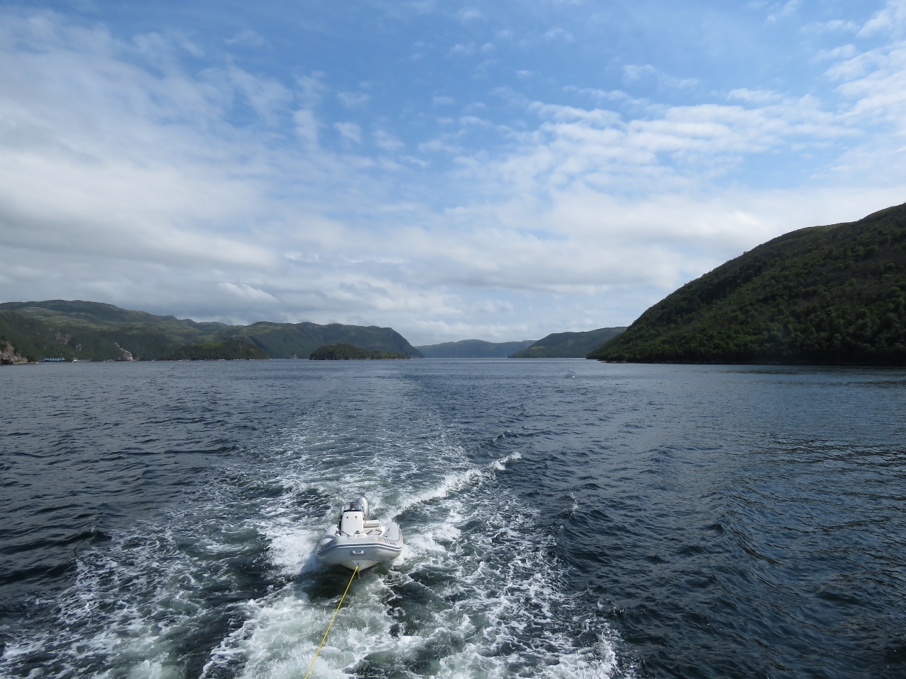 |
8/11/2016: Little Passage
Position: 47°37.99'N, -55°54.18'W
The view looking south into Little Passage as we near Seal Cove. We generally don't tow the tender, but have been in these sheltered waters to save a little time in transferring it back and forth from the boat deck.
|
 |
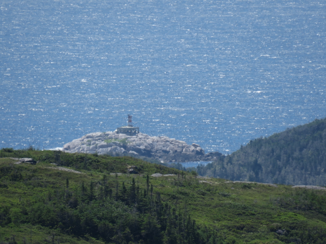
8/11/2016: Cape Mark
Position: 47°44.37'N, -55°52.46'W
The light on the end of Cape Mark. We were considering anchoring in Little Passage, but most of the coves were filled with aquaculture. We did check out Cold Harbour as a potential anchorage, but it felt rather open and not very appealing.
|
 |
8/12/2016: Jack Damp Cove
Position: 47°46.76'N, -55°49.49'W
We toured through Roti Bay looking for an anchorage, but as with Little Passage, most of the bay was filled with aquaculture. Strickland Cove along the southwest shore was open and could have worked, but didn't hold enough appeal. We continued around to the east side of Riches Island and found an beautiful anchorage at Jack Damp Cove with a view north over several islets and reasonable southwesterly wind and wave protection.
|
 |
8/12/2016: Lampidoes Passage
Position: 47°46.12'N, -55°53.66'W
Heading southwest through scenic Lampidoes Passage north of Bois Island.
|
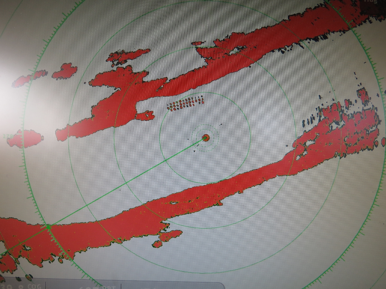 |
8/12/2016: Radar
Position: 47°45.93'N, -55°54.15'W
Modern radar is just amazing. Each buoy on the fish farm to our north is clearly visible on the display.
|
 |
8/12/2016: Relaxed
Position: 47°45.62'N, -55°56.11'W
Spitfire relaxing underway.
|
 |
8/12/2016: Bluffs
Position: 47°45.46'N, -55°57.95'W
The steep bluffs along the north shore of Lampidoes Passage have produced a lot of rock slides.
|
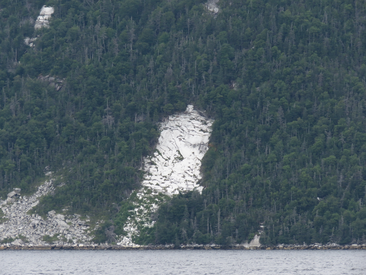 |
8/12/2016: White rock
Position: 47°44.88'N, -55°59.30'W
From a distance these white rock deposits, possibly marble, look just like snow.
|
 |
8/12/2016: Caves
Position: 47°41.63'N, -56°3.67'W
As we approach Goblin Head, the shoreline to our north is riddled with caves.
|
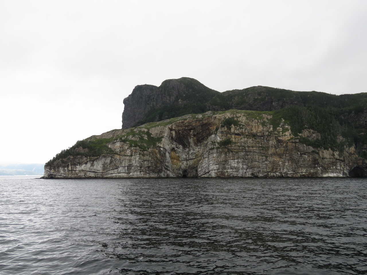 |
8/12/2016: Goblin Head
Position: 47°41.31'N, -56°6.69'W
Goblin Head soars several hundred feet straight up.
|
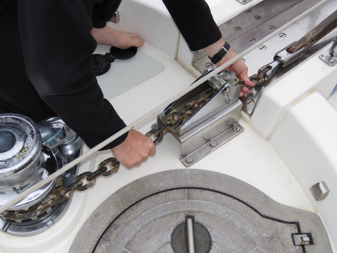 |
8/12/2016: Anchor chain
Position: 47°41.46'N, -56°7.24'W
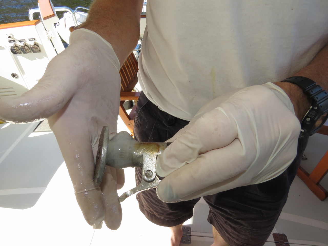
Our anchor chain had developed a twist in it, so James spun the twist out. He also lubricated the anchor swivel that connects the anchor to the chain so that it will spin more freely. We've used the same Ultra Swivel since getting the boat and have been quite happy with it.
|
 |
8/12/2016: Goblins
Position: 47°41.69'N, -56°7.40'W
We'd read that "The Goblins" were a series of cuts into the rock on the eastern side of Northern Arm. We couldn't see anything obvious, but perhaps this diagonal line of cuts in Goblin Head with a face-like appearance are them.
|
 |
8/12/2016: Line
Position: 47°43.15'N, -56°5.38'W
We considered anchoring along the north short of Little Harbour, but the depths there were much deeper than charted. We noticed two long lines a distance apart alongshore and guessed that someone ties their boat by the bow and stern, parallel to shore, to hide from big storms.
|
 |
8/13/2016: Middle Goblin Bay
Position: 47°43.21'N, -56°6.10'W
We ended up finding a great anchorage in Middle Goblin Bay. A mooring buoy had been installed near the entrance, but we still had just enough room to swing in 71ft with 225ft of rode out. This is much less scope (ratio of anchor rode deployed to depth) than we normally use, but the holding was excellent. Visibility worsened in the evening to where we could hardly see beyond the cove entrance, but was sunny and clear the next morning. The entrance to the cove, to our south, is at the left of the photo.
|
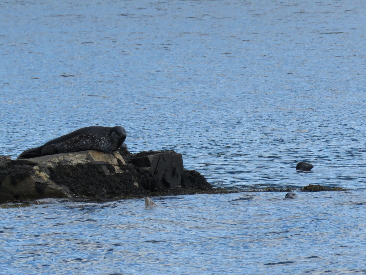 |
8/13/2016: Seals
Position: 47°42.61'N, -56°6.48'W
Seals apparently aren't very common in Newfoundland, so we felt lucky to see some on the rocks outside Middle Goblin Bay. The ones in the water looked quite small and likely were juveniles.
|
 |
8/13/2016: North Bay Head
Position: 47°44.12'N, -56°8.13'W
Imposing North Bay Head at the mouth of North Bay. The scenery here is incredible.
|
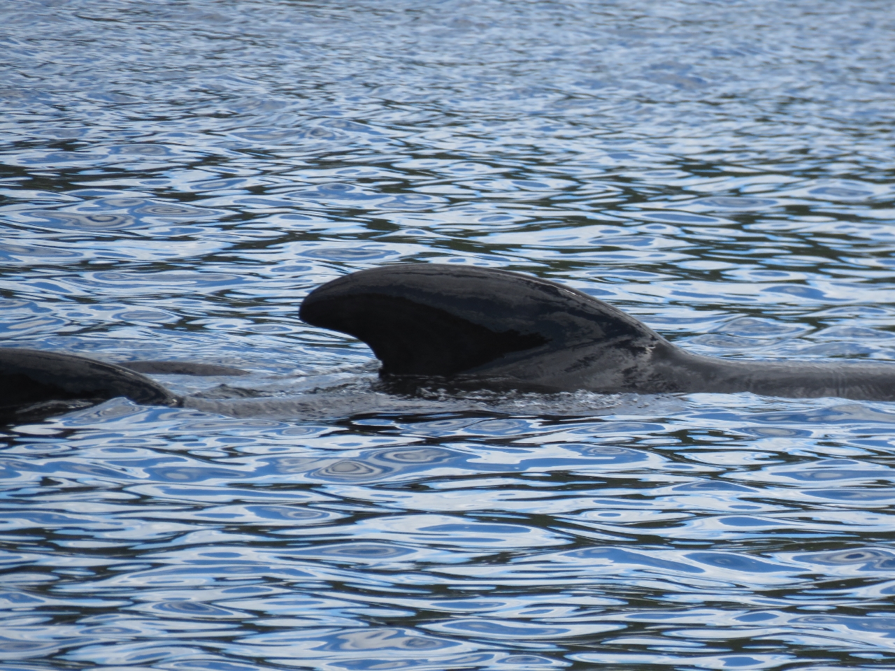 |
8/13/2016: Pilot Whales
Position: 47°44.51'N, -56°7.97'W
Near North Bay Head, we saw a pod of cetaceans of a variety we've not seen before. They acted like whales feeding, but were about the size of a large dolphin. We believe they are Long-finned pilot whales, common in Newfoundland and the northern Atlantic.
|
 |
8/13/2016: North Bay
Position: 47°45.17'N, -56°7.70'W
The amazing scenery looking up North Bay.
|
 |
8/13/2016: Cliffs
Position: 47°45.55'N, -56°7.74'W
Twin shear-faced cliffs soaring straight up from the water along the west shore of North Bay.
|
 |
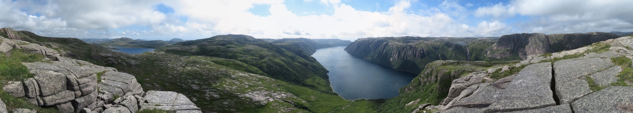
8/13/2016: Scenery
Position: 47°46.50'N, -56°8.05'W
The scenery is on such a large scale it's hard to capture in a single photograph. This is a panorama of the cliffs along the eastern shore of North Bay.
|
 |
8/13/2016: Waterfall I
Position: 47°50.56'N, -56°9.47'W
This waterfall spills over smooth rocks into the east shore north of Hughes Point near the head of North Bay. It looks like an easy climb.
|
 |
8/13/2016: Waterfall II
Position: 47°51.07'N, -56°10.10'W
A second, more dramatic waterfall, empties into the west shore near the head of North Bay. This one also looked climbable, although a little more difficult than the first.
|
 |
8/13/2016: Anchor
Position: 47°51.84'N, -56°9.90'W
At anchor behind Indian Point at the head of North Bay. Near the top of the hills at the right side of the photograph is a third waterfall.
|
 |
8/13/2016: Waterfall III
Position: 47°52.27'N, -56°9.76'W
Looking up from the bottom of the third waterfall that we could see the top of from the anchorage.
|
 |
8/13/2016: Climbing
Position: 47°51.14'N, -56°10.24'W
We'd arrived late in the afternoon and didn't have time for a long shore trip, so decided to make a short climb up the second waterfall.
|
 |
8/13/2016: Mid-level falls
Position: 47°51.13'N, -56°10.28'W
Partway up, the falls gushed out through an opening in the rocks and spilled over the ledge James is standing on. Beautiful!
|
 |
8/13/2016: Top
Position: 47°51.13'N, -56°10.32'W
The topmost section of the falls were the most impressive of all.
|
 |
8/13/2016: Break
Position: 47°51.13'N, -56°10.33'W
Taking a break to enjoy the falls. The view the other way is pretty spectacular as well.
|
 |
8/14/2016: Morning
Position: 47°51.85'N, -56°9.91'W
A beautiful calm morning at the head of North Bay.
|
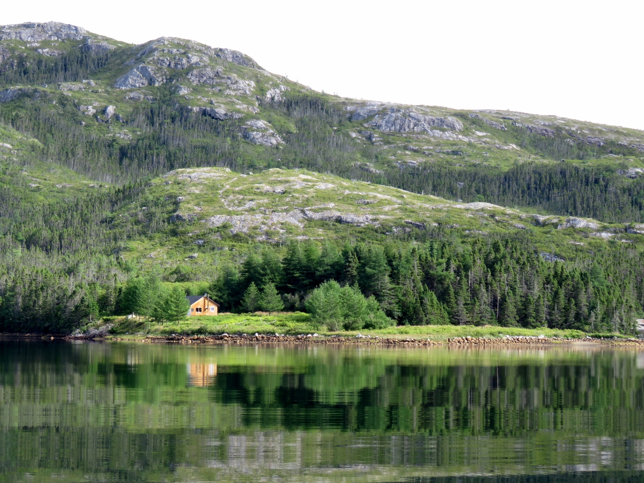 |
8/14/2016: Cabin
Position: 47°52.06'N, -56°9.90'W
A nice location for a cabin at Thomey Cove at the head of North Bay.
|
 |
8/14/2016: Waterfall III
Position: 47°52.31'N, -56°9.76'W
We landed the tender in Thomey Cove and began walking up to reach the top of the falls we could see from the anchorage. For the first half or so the going generally pretty easy over gently sloping rocks.
|
 |
8/14/2016: Cascades
Position: 47°52.35'N, -56°9.72'W
Multiple cascades about a quarter of the way up.
|
 |
8/14/2016: Water Supply
Position: 47°52.41'N, -56°9.69'W
About a third of the way up we found the top of the water supply hose for the cabin at Thomey Cove. The hose was secured to rocks, but wasn't actually in the flow, so presumably the water levels are quite low right now.
|
 |
8/14/2016: Goal
Position: 47°52.55'N, -56°9.59'W
We'd mostly been following the falls, but diverted into the woods to work around a cliff about two-thirds of the way up. We're getting closer to our goal though.
|
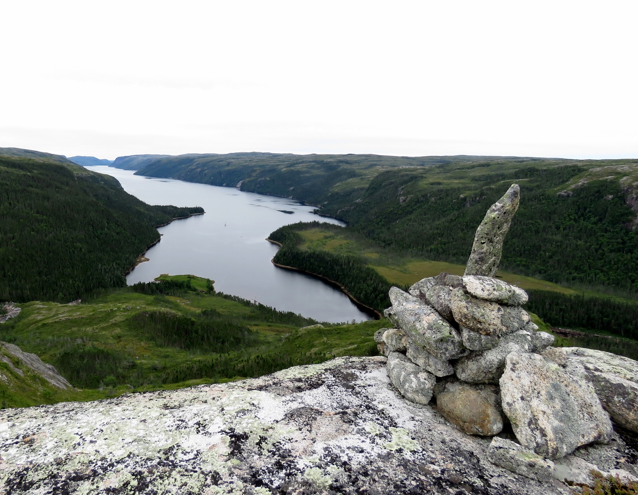 |
8/14/2016: Summit
Position: 47°52.71'N, -56°9.84'W
We cleared the woods relatively quickly, and decided to keep climbing northwest across mostly open ground to reach the peak above the anchorage. This is the view from 665ft up where someone had built a cairn. Dirona is visible as a small speck midway between the point that juts out from the left, and the right shore.
|
 |
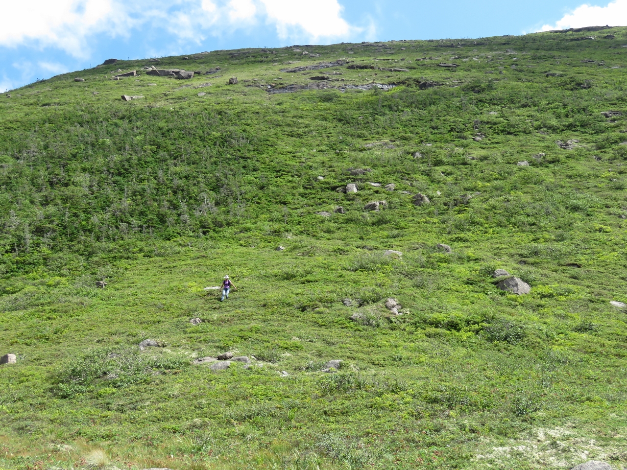
8/14/2016: Tundra
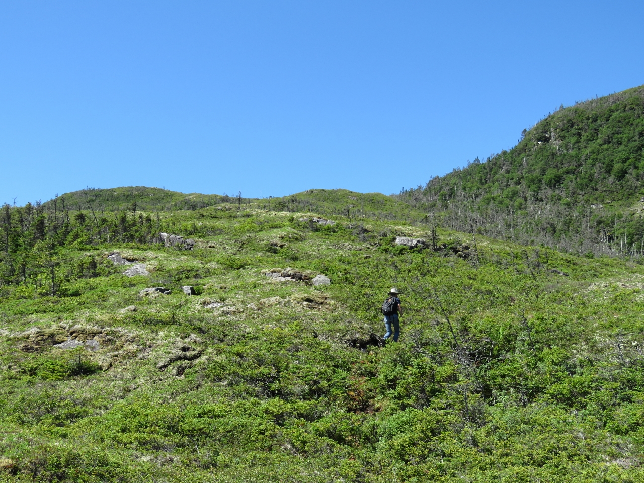
Position: 47°53.01'N, -56°9.92'W
We spent some time exploring the tundra around the summit. Not many trees grown up here--mostly undergrowth and small bushes. The terrain reminded us very much of Stewart Island in southern New Zealand, particularly the glacial erratics (glacial-carried rocks and boulders) littered across the landscape.
|
 |
8/14/2016: Top of the Falls
Position: 47°52.63'N, -56°9.53'W
After exploring the tundra, we worked our way back down to the top of the falls.
|
 |
8/14/2016: Heading Down
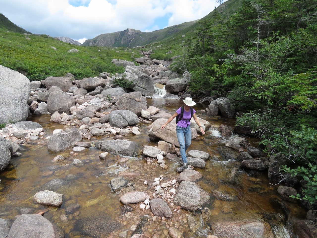
Position: 47°52.57'N, -56°9.56'W
We were able to work our way all the way back down to the base of the falls mostly following the rocks along the west side of the falls, with a few diversions into the woods. Here Jennifer is just about to disappear over the edge at a steeper, but still manageable section.
|
 |
8/14/2016: Lunch
Position: 47°52.52'N, -56°9.54'W
On our climb up we'd moved away the falls so missed this section where the water plunges over one hundred feet into a pool below. We couldn't imagine a better view for a picnic, so found a perch above the falls and enjoyed the show.
|
 |
8/14/2016: The Boat Who Wouldn't Float
Position: 47°52.32'N, -56°9.77'W
We arrived back from our hike to find the tender top-centered on a couple of rocks due to a little more tidal range at the end of the inlet than we'd expected. The Boat Who Wouldn't Float was penned by Bestselling Canadian author Farley Mowat while he lived about 75 miles to our west in Burgeo, Newfoundland. The book was an account of Mowat's misadventures aboard his sailboat The Happy Adventure that had all manner of equipment failures and sank regularly. While in Burgeo he also wrote the controversial A Whale for the Killing, about a fin whale that became trapped in a cove near the town and died from wounds inflicted by some locals.
|
 |
8/14/2016: Afloat
Position: 47°52.31'N, -56°9.78'W
We got lucky and James was just barely strong enough to wrestle the tender off the rocks.
|
 |
8/14/2016: Waterfall I
Position: 47°50.66'N, -56°9.28'W
It was just past noon when we returned from our hike, and it looked like an easy walk up the first waterfall we saw coming in yesterday, so we ran the tender over to check it out.
|
 |
8/14/2016: Shelves
Position: 47°50.82'N, -56°8.97'W
The hike up Waterfall I was quite easy over a generally smooth and gradually sloping rock surface. Partway up the even surface gave way to a series of small shelves with water spilling over each.
|
 |
8/14/2016: Top
Position: 47°50.87'N, -56°8.80'W
The easy going ended at this gorge, presumably before the lake that feeds the falls. We didn't climb further to investigate.
|
 |
8/14/2016: Second lunch
Position: 47°50.86'N, -56°8.82'W
In the spirit of the Hobbit's "Second Breakfast", we had "Second Lunch" at the top of the falls with a great view over the inlet.
|
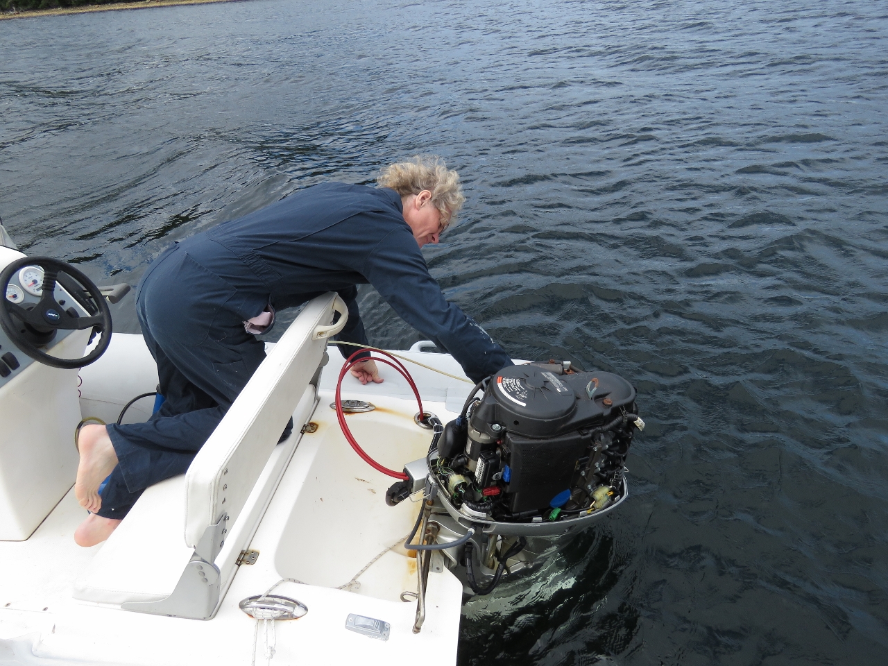 |
8/14/2016: Oil change
Position: 47°51.89'N, -56°9.92'W
The 40HP Honda on our main tender is due for it's annual oil and filter change.
|
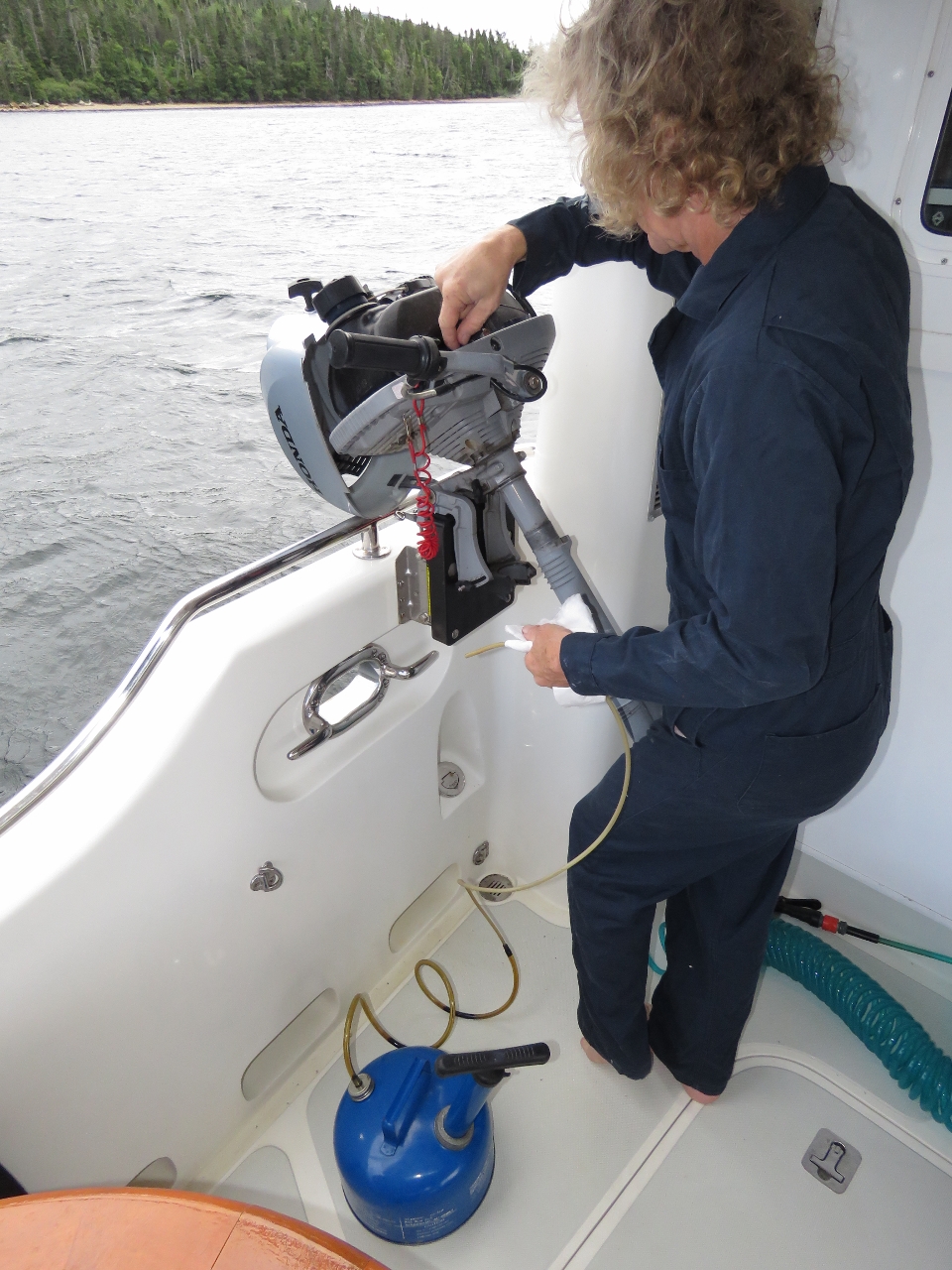 |
8/14/2016: Oil change II
Position: 47°51.89'N, -56°9.91'W
James also changed the oil in the 3.2HP micro-tender Honda, using the mount we'd installed in Florida. And he greased the fittings in both outboards.
|
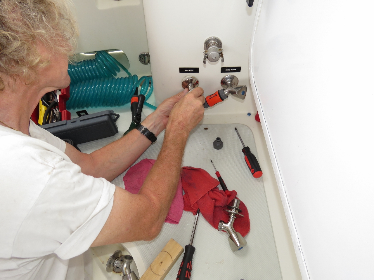 |
8/15/2016: Faucet
Position: 47°44.34'N, -56°6.99'W
Our raw water wash-down pump was cycling frequently. We chased it down to a leaking faucet in the cockpit bulkhead and replaced it with a spare.
|
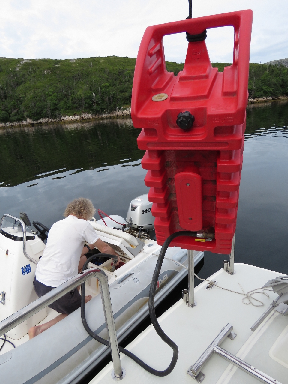 |
8/15/2016: Bunkering
Position: 47°44.34'N, -56°6.99'W
Filling up the tender from one of the 29-gallon fuel tanks we keep on the boat deck. We're glad we filled both in Boston—we're going through a lot of gasoline on this trip.
|
 |
8/15/2016: Raymond Islands
Position: 47°44.30'N, -56°6.99'W
The anchorage in the Raymond Islands caught our attention as we passed on the way up North Bay and we came directly here on the return trip. This is looking north toward the bluffs on the east side of the mouth of North Bay.
|
 |
8/15/2016: East Bay
Position: 47°44.87'N, -56°5.99'W
Heading up East Bay in the tender. The channel was quite scenic, with steep hills on either side.
|
 |
8/15/2016: Bow Watch
Position: 47°48.88'N, -56°0.09'W
Looking for rocks as we get into shallow water in the Salmon River.
|
 |
8/15/2016: End of the Road
Position: 47°49.21'N, -56°0.04'W
We got about a mile up the Salmon River before running out of water. We didn't see any salmon though.
|
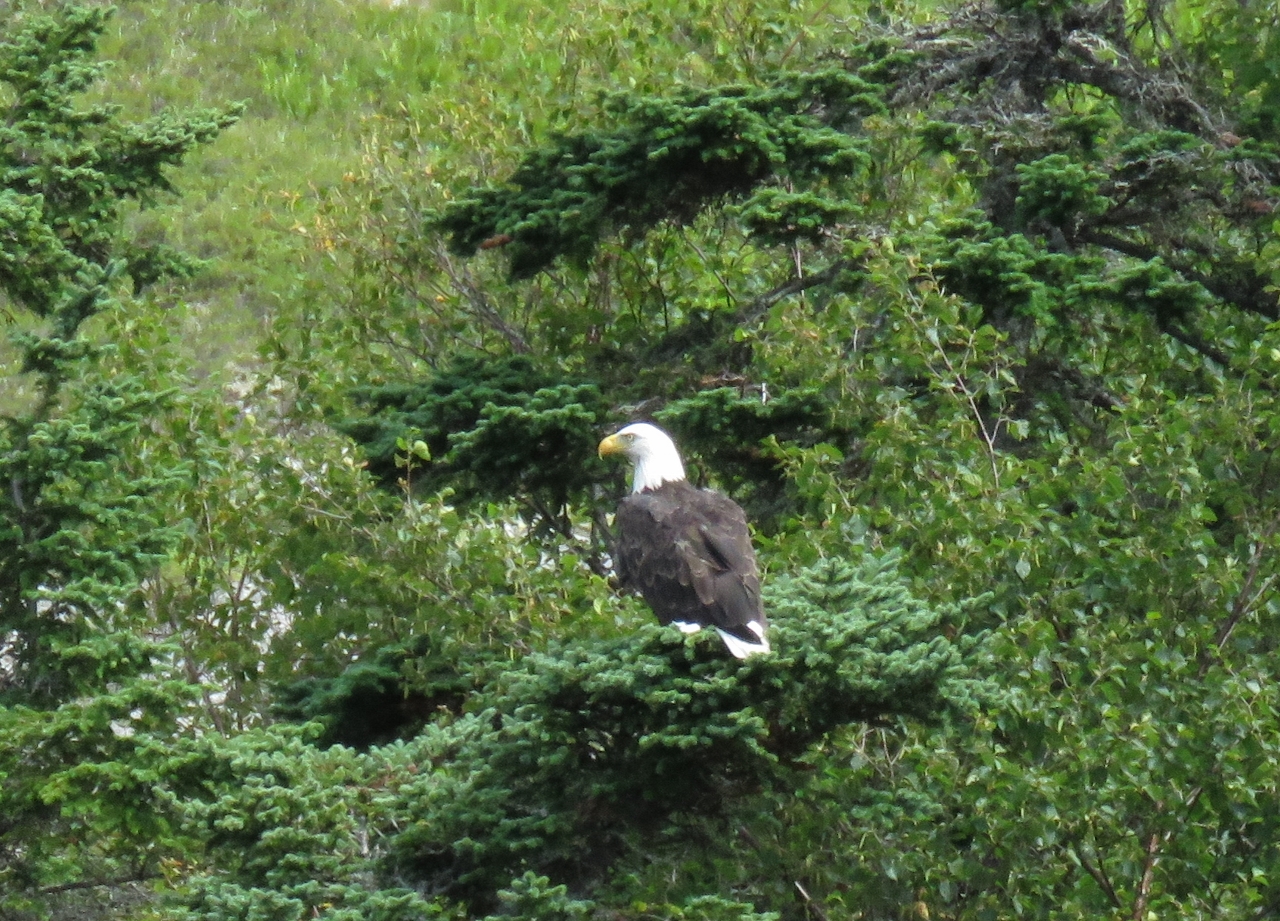 |
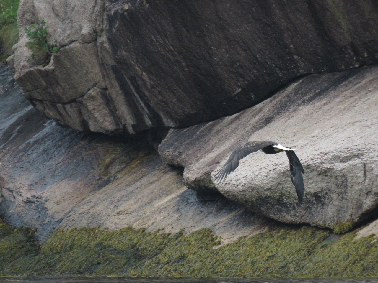
8/15/2016: Eagle
Position: 47°48.12'N, -56°1.05'W
We've seen only a few eagles while in Newfoundland. They look just as big as their Pacific counterparts.
|
 |
8/15/2016: Lunch
Position: 47°48.36'N, -56°1.14'W
We climbed up a small smooth-rock falls just south of the Salmon River mouth and had lunch beside the falls with a view to East Bay.
|
 |
8/15/2016: Boulders
Position: 47°48.49'N, -56°1.15'W
Above our lunch spot, the sloped, smooth rock face gave way to large boulders along relatively level ground.
|
 |
8/15/2016: Cliffs
Position: 47°47.01'N, -56°3.51'W
Newfoundland has no shortage of spectacular cliffs. These are outside Northwest Cove in East Bay.
|
 |
8/15/2016: Long Reach
Position: 47°44.68'N, -56°5.24'W
Cabin and dock in Long Reach along the south shore of East Bay. Most of the cabins we've seen here look well-built and maintained.
|
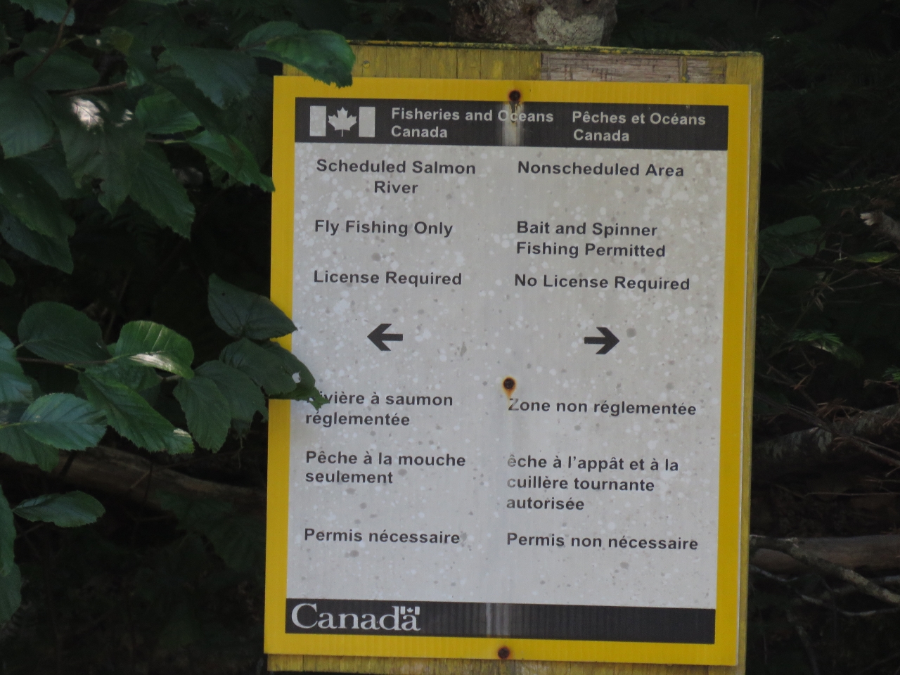 |
8/15/2016: Fishing
Position: 47°44.68'N, -56°5.07'W
We've seen a few signs like this in Newfoundland indicating that only licensed fly fishing is allowed upstream.
|
 |
8/15/2016: Climb
Position: 47°45.81'N, -56°7.28'W
We very much wanted to climb up for a view near the mouth of North Bay, but most places looked prohibitively steep. We found a reasonably place at a waterfall along the east shore and made a steep climb. The watereway was mostly open until about 350ft up, where this picture was taken. There the waterway was thick with trees, so we doubled back to work across the scrub to find a way up higher.
|
 |
8/15/2016: View
Position: 47°45.71'N, -56°7.17'W
We had to push through a couple of small clumps of trees, but made it to the bluffs and walked along open ground to a great view point 650ft above North Bay. We were pretty tired though--the climb was steep pretty much the entire way.
|
 |
8/15/2016: Panorama
Position: 47°45.71'N, -56°7.17'W
The sweeping view from our spot on the bluffs above North Bay. Dirona is barely visible as a small speck in the Raymond islands at the left, in the center is North Bay Head along the west side of the mouth of North Bay, and on the right is North Bay. The twin cliffs we photographed heading up North Bay are slightly right of center.
|
 |
8/15/2016: Sunset
Position: 47°44.36'N, -56°6.96'W
Sunset lighting up the hills above East Bay, viewed from our anchorage in the Raymond islands.
|
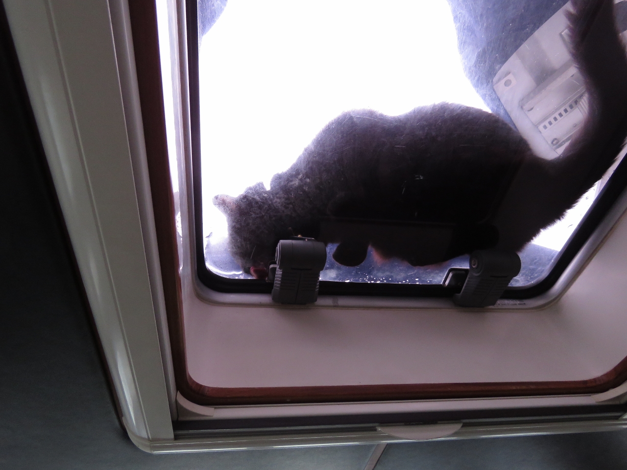 |
8/16/2016: Fresh Water
Position: 47°44.34'N, -56°6.97'W
After a rainfall, Spitfire loves to drink freshwater from on deck. Here he is drinking from the pilot house overhead hatch.
|
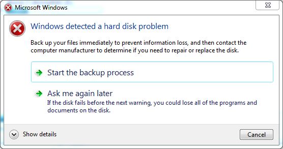 |
8/16/2016: Disk Failure
Position: 47°44.35'N, -56°6.98'W
The navigation computer displayed a warning this morning indicating that our hard disk was failing. The disk might still be OK, but it's been in the computer since 2012 and seen a lot of vibration and sea air, so we'll take the message seriously. The drive in question is not the operating system drive, just a data drive. We have a spare drive, so all we need to do is copy the data to the spare and swap drives. That should take about a day and we'll be up and running on the new drive—a little time-consuming and a bit of a hassle, but far from a show-stopper. We backup the system nightly to our Synology RAID file server, so data loss isn't a major concern.
|
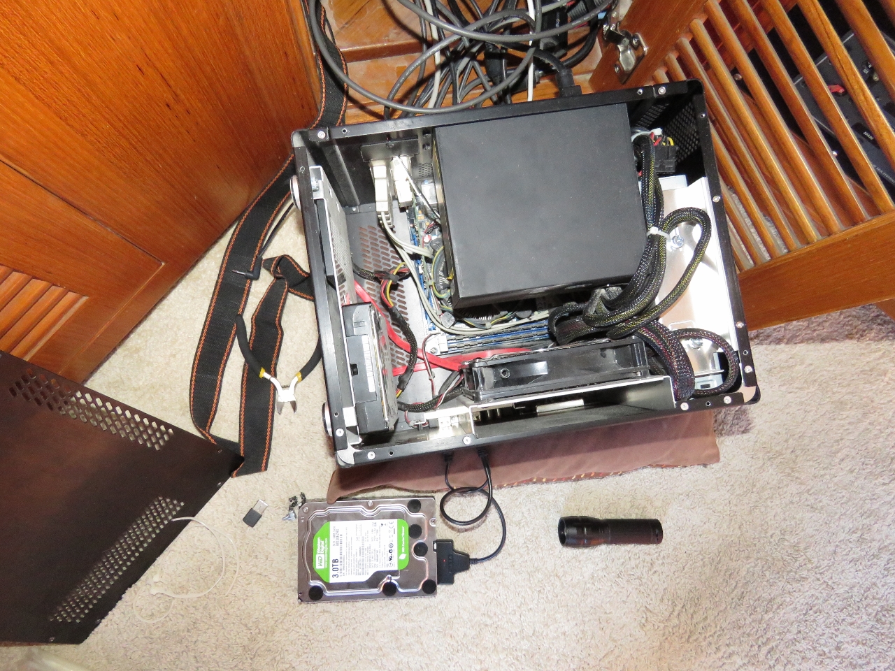 |
8/16/2016: Disk Copying
Position: 47°44.34'N, -56°6.97'W
To copy the data off the failing disk, we temporarily installed the spare as a fourth drive in the system and copied between them.
|
 |
8/16/2016: Raymond Islands
Position: 47°44.34'N, -56°6.96'W
The fabulous view from our anchorage in the Raymond islands. On the left is the mouth of North Bay, with the mouth of East Bay right of center. Yesterday afternoon we hiked into the hills just to the left of center.
|
 |
8/17/2016: Dawson Point
Position: 47°38.81'N, -56°8.30'W
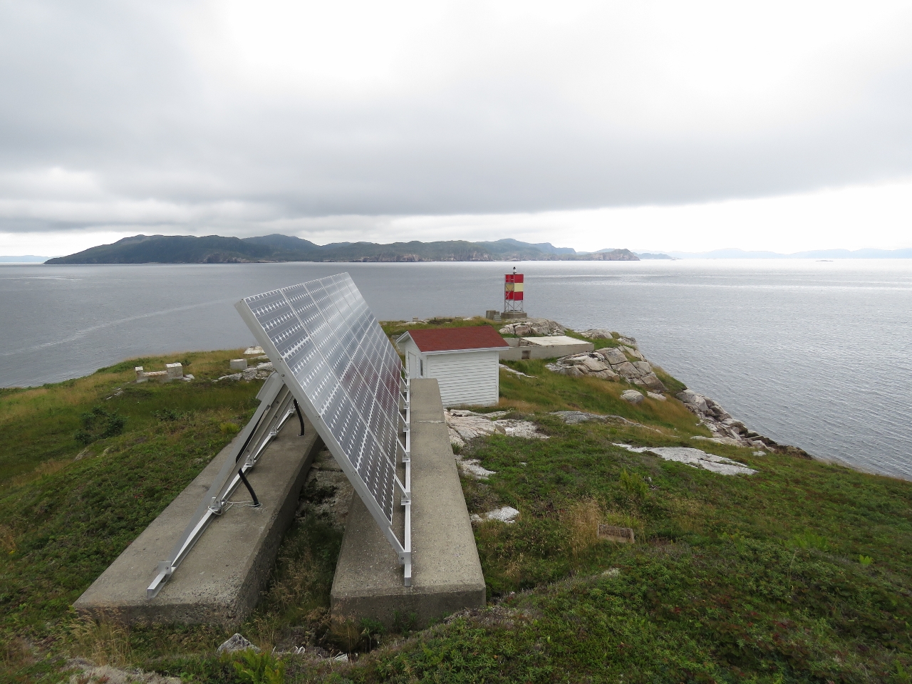
The original lighthouse on Dawson Point was built in 1916. As recently as 1990, the site contained a keeper's house and several utility buildings. Today the only structure besides the light tower is a small shed supporting a fog horn and a solar panel array.
|
 |
8/17/2016: Government Wharf
Position: 47°38.74'N, -56°9.48'W
An aquaculture pen tied off to the remains of the Government Wharf at Pushthrough, another resettled Newfoundland outport (a community accessible only by boat). The name Pushthrough derives from Pushthrough Gut, the narrow channel between the mainland and the off-lying island where the Dawson's Point light is located. The seas surge through this narrow channel, driven by tidal currents and southerly gales.
|
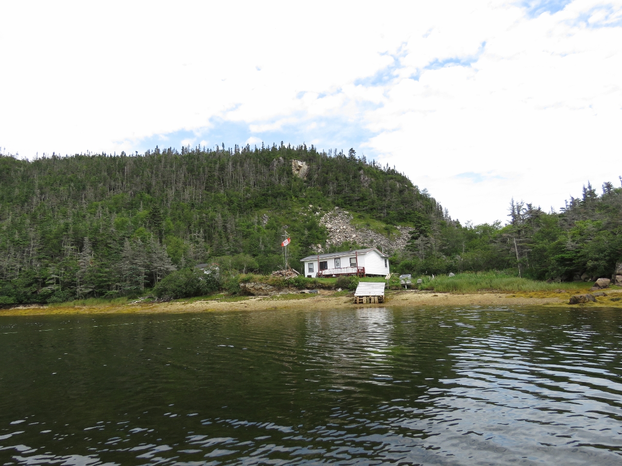 |
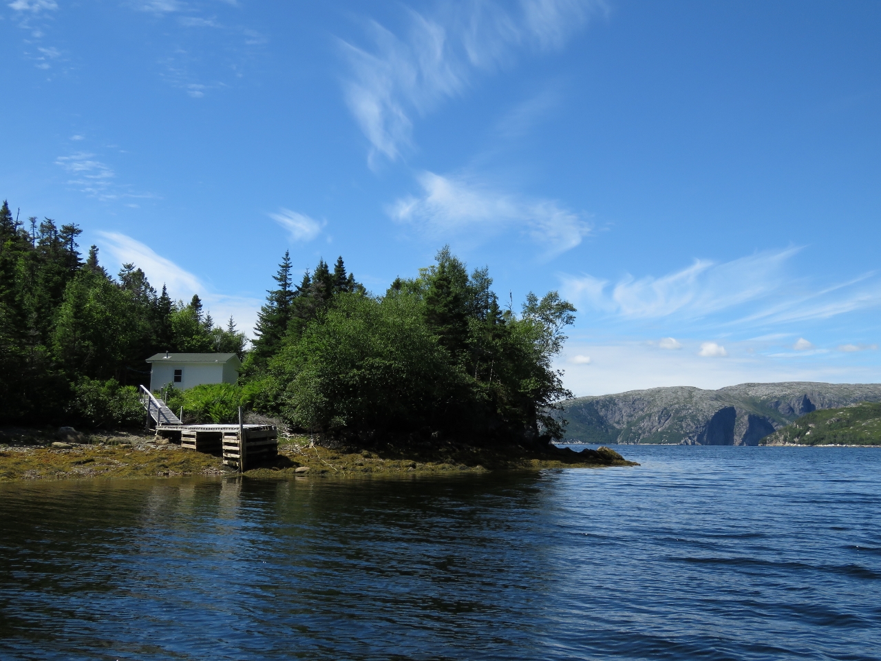
8/17/2016: Cabin
Position: 47°38.78'N, -56°10.86'W
Cabin ashore inside The Barasway, a small lagoon at the head of our anchorage in Great Jervis Harbour. Most of the cabins we've seen here are flying a Canadian flag of some sort (here it's the Molson Canadian flag from the advertising campaign that included the "I Am Canadian" rant). This is more national flags than we're used to seeing in our Canadian travels.
|
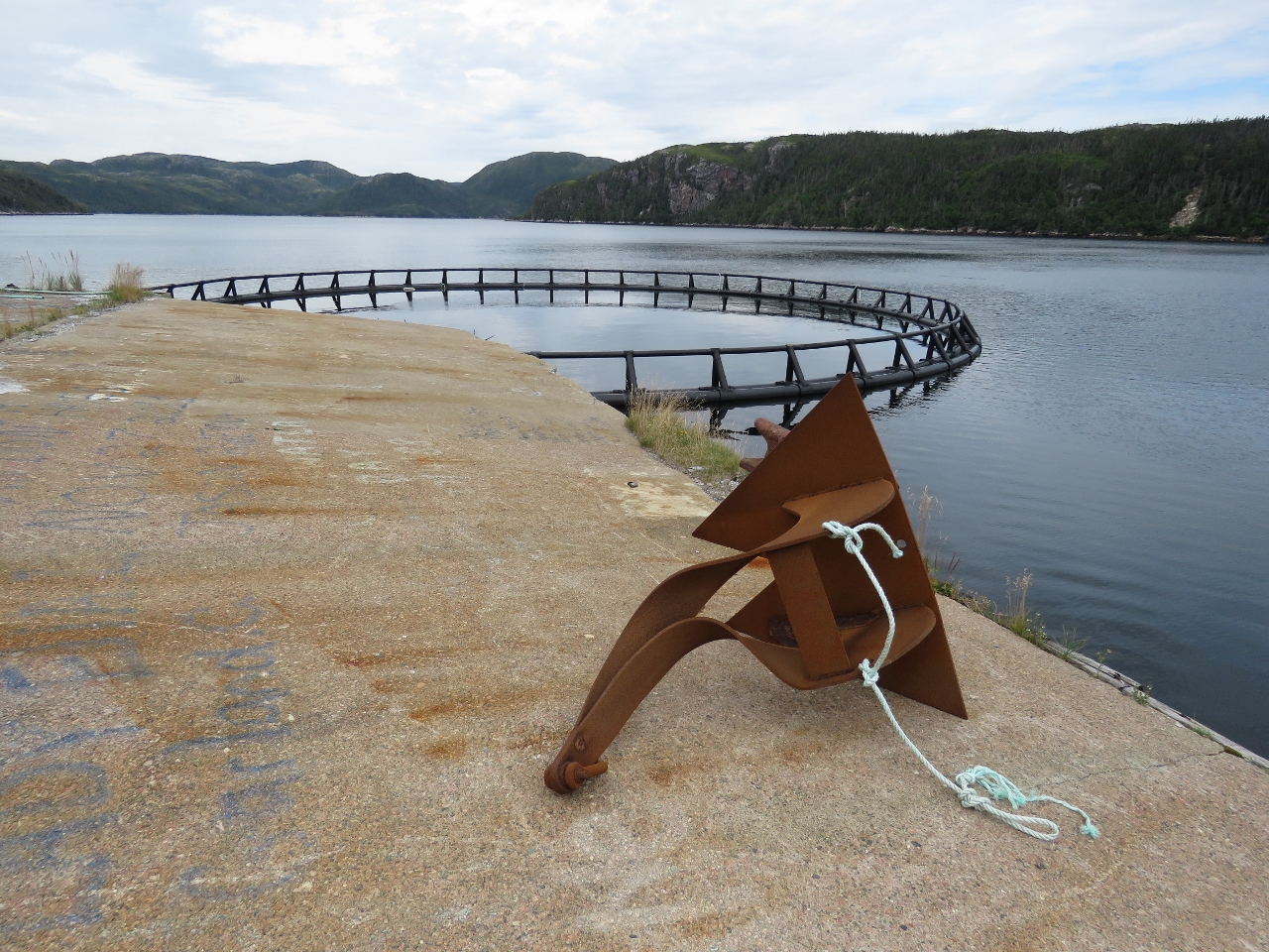 |
8/17/2016: Anchor
Position: 47°38.63'N, -56°9.56'W
We landed the tender at the old Pushthrough government wharf to walk ashore. This is an anchor used to moor the fish pens. If you look closely you can see that the shank is bent over almost ninety degrees. That must have been quite a storm.
|
 |
8/17/2016: Graveyard
Position: 47°38.50'N, -56°9.44'W
The Anglican graveyard on the hill above the abandoned community at Pushthrough. The first permanent settlers inhabited Pushthrough in 1812. The population reached 209 by 1884 and peaked at 247 in 1961. Between 1966 and 1968, a third of the 50 families relocated and the entire community resettled in 1969. Much has been written about the negative impacts of the resettlement program. Life in these outports, however, was not easy. At the time of resettlement in 1969, most men were employed away from Pushthrough, leaving their wives to run the households. Without electricity or running water, this was an arduous task. Water had to be transported twice daily from a well that might be 200-300 yards away. A wood-burning stove had to be fed constantly to boil water, cook meals and bake bread. Someone had to row out to chop and transport that wood. A bucket, emptied daily, served as a toilet. And all housework was done by hand—the weekly laundry usually took the entire day.
|
 |
8/17/2016: Wharf Ruins
Position: 47°38.63'N, -56°9.21'W
Getting across the Pushthrough Gut looked a little difficult, so we ran the tender around to walk to the light at Dawson Point. Jennifer is standing on the ruins of the wharf on the west side of the island. The two piles of rocks to the left were supported a pier extending out to sea.
|
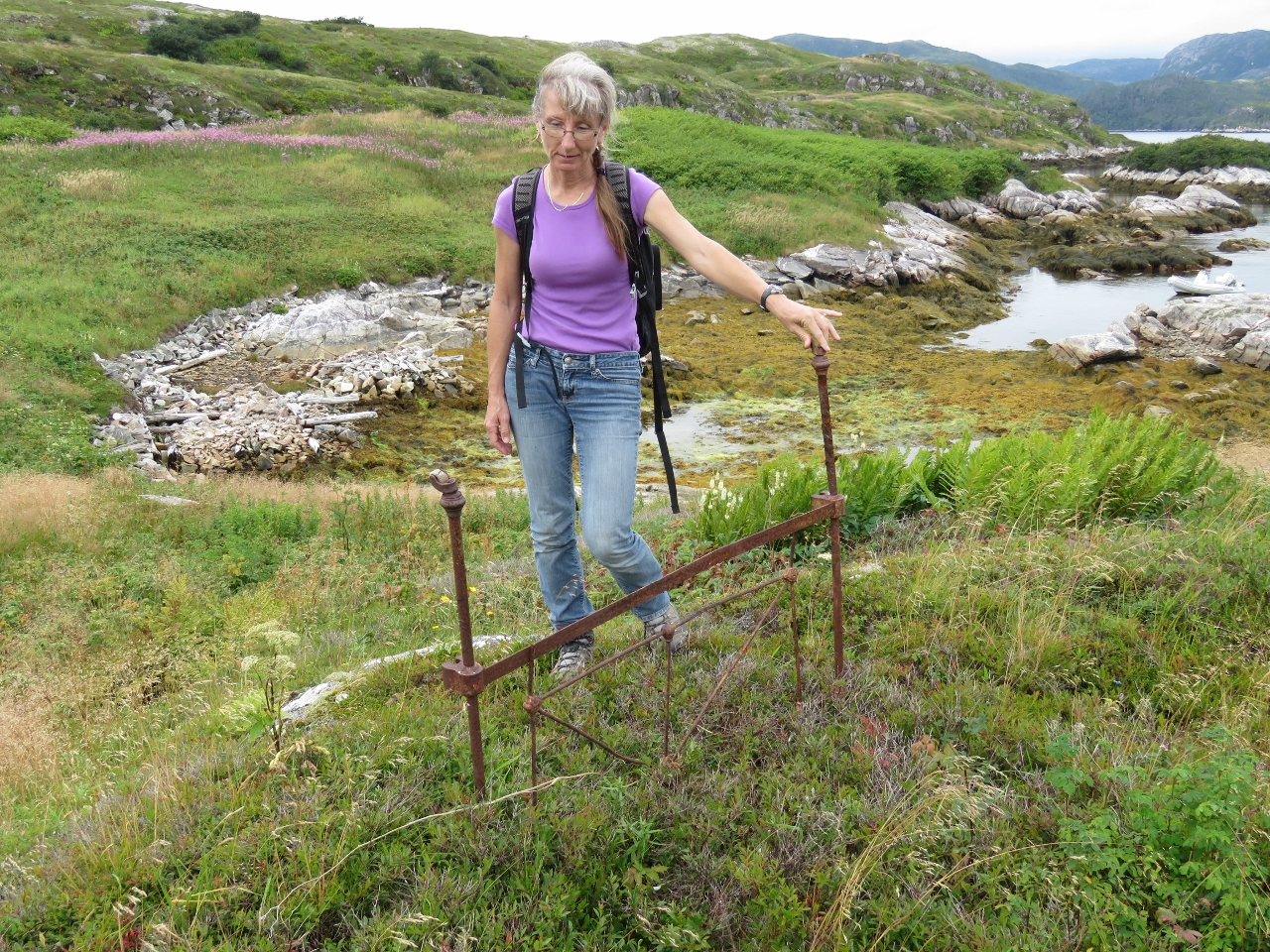 |
8/17/2016: Bedpost
Position: 47°38.63'N, -56°9.18'W
We found this rusted bedpost lying in the grass.
|
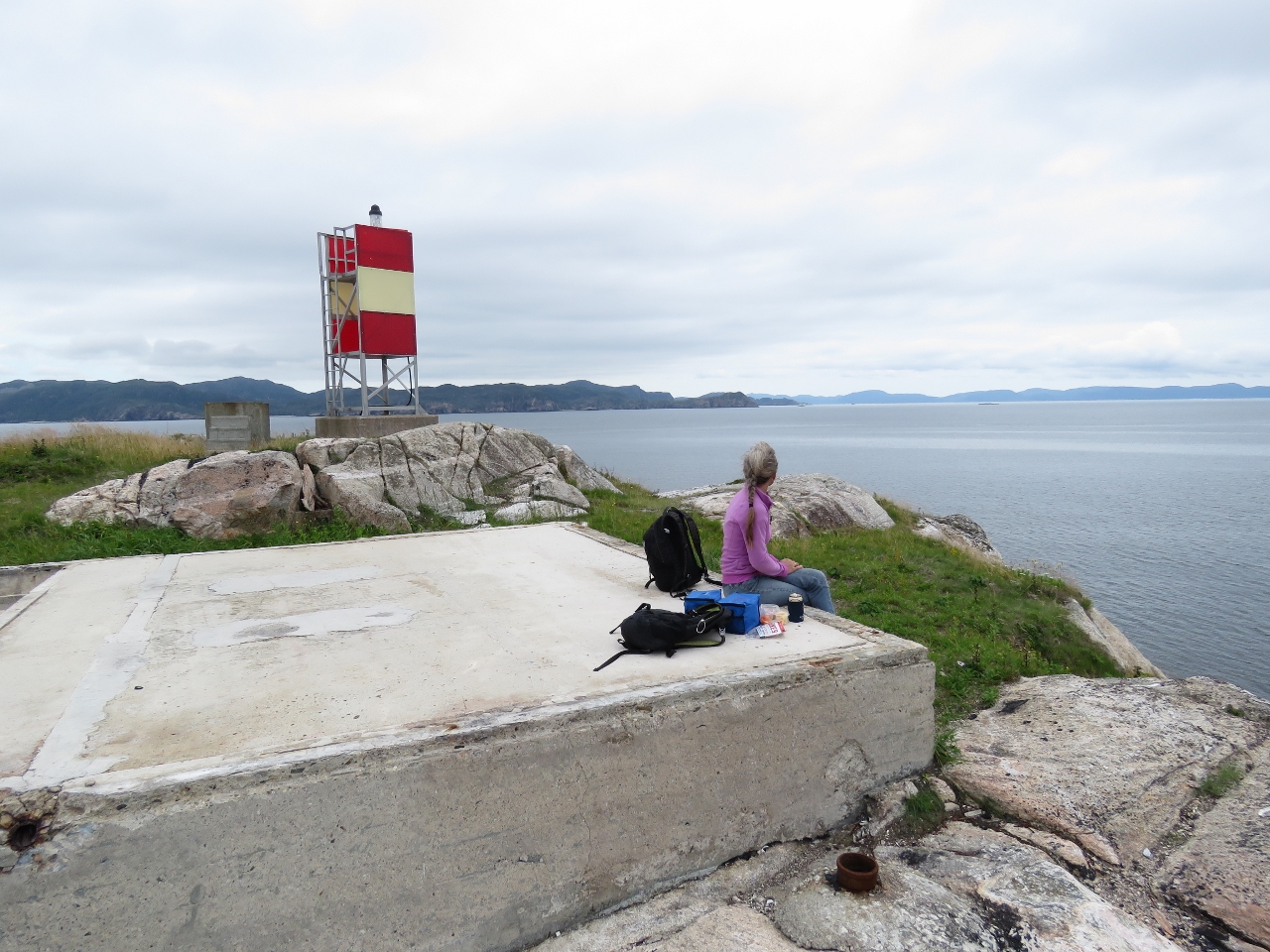 |
8/17/2016: Lunch
Position: 47°38.60'N, -56°8.97'W
Lunch at Dawsons Point. Jennifer is sitting on the foundation of one of the old structures before the light was automated.
|
 |
8/17/2016: Light station
Position: 47°38.60'N, -56°9.00'W
Looking past the solar panel and foghorn shed toward the southwest end of Long Island. Foundations from the old structures are visible on either side of the point.
|
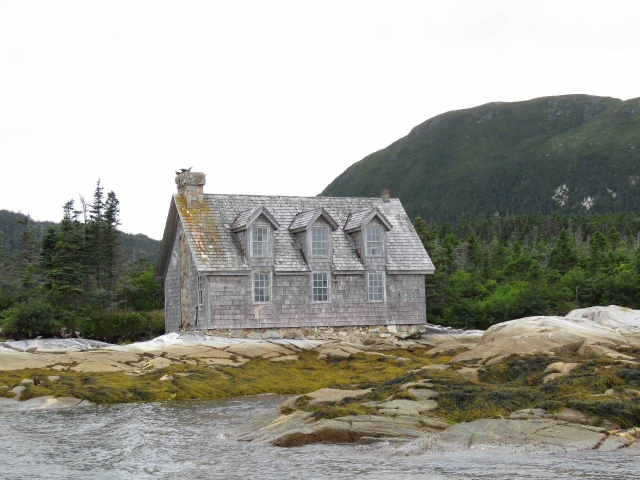 |
8/17/2016: Modern House
Position: 47°39.33'N, -56°10.10'W
We noticed this house in Great Jervis Bay before passing Great Jervis Island to reach our anchorage. From a distance, it appeared to be made of stone, but was shingle on closer inspection. The house was more elaborate and modern than most of the cabins we've seen in the area, but had several broken windows and appeared to be abandoned.
|
 |
8/17/2016: Traditional House
Position: 47°39.53'N, -56°9.91'W
A traditional, and seemingly long-abandoned house, at Shallop Cove.
|
 |
8/17/2017: Boot Files
Position: 47°38.79'N, -56°10.43'W
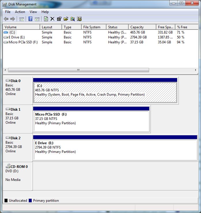
When we finished copying the data over to our spare disk and swapped the disks, the nav computer would no longer boot. Yikes! We put the original disks back in and after two attempts the system did boot up properly. We discovered that when we'd updgraded the nav computer to 64-bit Windows, we'd inadvertently installed the boot environment files on the data disk, and those files can't be simply copied across to the new disk. So without that original disk installed the system won't boot. Fixing that sounded non-trivial, but we found a Windows tool called bcdboot that easily fixed the problem. So now we are back up and running on the new drive. The Disk Management screen shot shows the proper setup. Our operating system is stored on Disk 0, which is also designated as System, indicating where the boot files are located. But before we ran bcdboot, Disk 2, our failing disk, was marked as System.
|
 |
8/18/2016: Brrr!
Position: 47°38.79'N, -56°10.43'W
We lef the anchorage early this morning. With the temperature barely 60F, Jennifer is wearing gloves while raising the anchor for the first time since perhaps Tasmania over eighteen months ago.
|
 |
8/18/2016: Graveyard
Position: 47°38.48'N, -56°8.65'W
The Pushthrough graveyard lit up in the morning sun.
|
 |
8/18/2016: Taylor Island
Position: 47°36.32'N, -56°12.77'W
The shoreline at the south end of Taylor Island is so varied and unusual-looking that it appears man-made.
|
 |
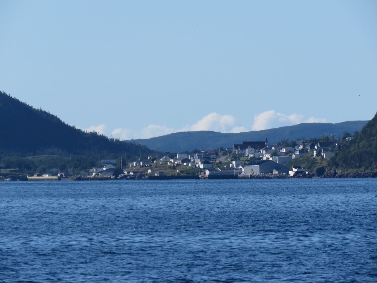
8/18/2016: McCallum
Position: 47°36.30'N, -56°13.89'W
The large cream-colored building is the McCallum elementary school. McCallum has a population of roughly 100 and, like Gaultois, is accessible only by boat or air and also is served from Hermitage by the ferry Terra Nova.
|
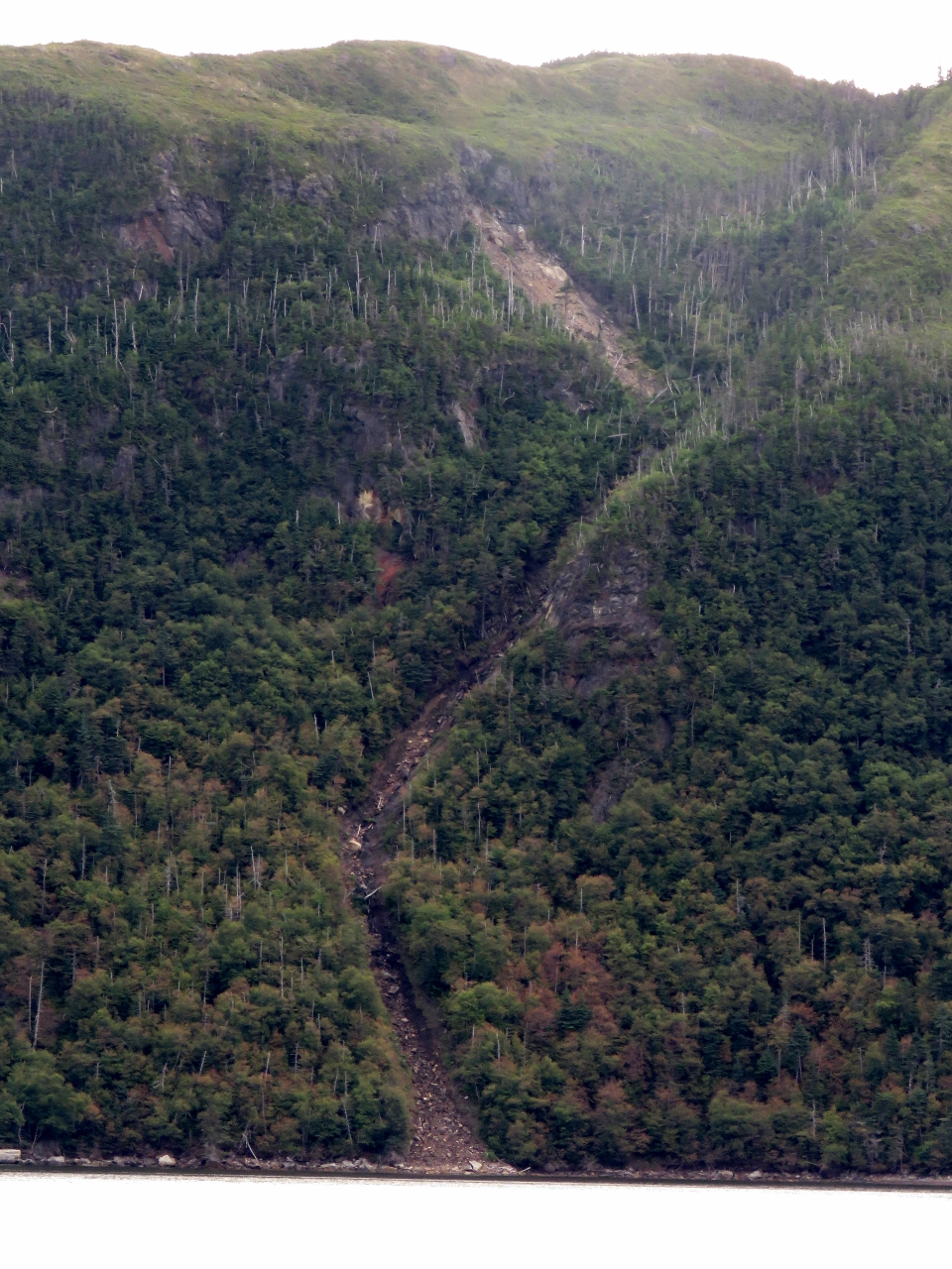 |
8/18/2016: Slide
Position: 47°39.74'N, -56°18.97'W
A massive slide along the shore of Facheux Harbour (pronounced Foo-she Bay). The slide is so wide and even it looks much like a power-line line path.
|
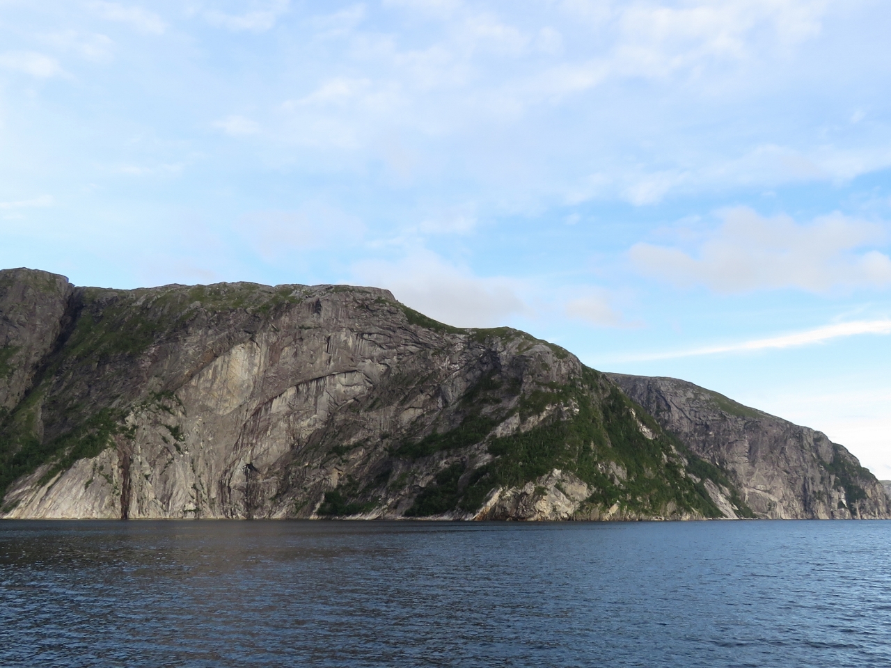 |
8/18/2016: Cliffs
Position: 47°42.30'N, -56°19.14'W
More stupendous Newfoundland cliffs north of Brent Cove in Facheux Harbour.
|
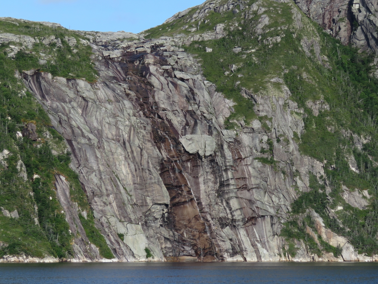 |
8/18/2016: Waterfall
Position: 47°44.36'N, -56°19.34'W
This waterfall near the head of Facheux Harbour spills down several hundred feet over a mostly smooth rock surface.
|
 |
8/18/2016: Facheux Harbour
Position: 47°45.87'N, -56°19.46'W
Facheux Harbour is the longest, at about ten miles, and deepest fjord on the south coast of Newfoundland. Surprisingly, a good anchorage is at the head in 45ft. You can also go a little farther and anchor in the cove north of Tickle Point.
|
 |
8/18/2016: Shoreline
Position: 47°45.14'N, -56°19.38'W
The shoreline around the head of Facheux Harbour is quite steep with no easy place to get ashore. After a survey of the area, we decided that the scrub to the left of this fall along the west shore looked the least difficult.
|
 |
8/18/2016: Ashore
Position: 47°45.30'N, -56°19.90'W
We secured the tender to a boulder, as no trees were close enough to the shoreline to tie off to, then set off up through the scrub.
|
 |
8/18/2016: Climbing Ropes
Position: 47°45.29'N, -56°19.96'W
A short distance up, we found a set of climbing ropes that took us up through the steepest sections. The climb still was challenging and tiring, but a lot easier than it would have been without the ropes.
|
 |
8/18/2016: Partway
Position: 47°45.29'N, -56°19.97'W
The view about 200ft up looking north across the falls to the anchorage. We were only about 10 minutes from the dinghy—we'd really gained altitude quickly. Dirona is barely visible as a white speck in the distance.
|
 |
8/18/2016: Summit
Position: 47°45.38'N, -56°20.02'W
The fabulous view from the summit looking to the head of Facheux Harbour on the left and down the waterway on the right.
|
 |
8/18/2016: River
Position: 47°45.34'N, -56°20.21'W
A long and winding river fed the falls with easy walking over smooth rocks and relatively flat terrain.
|
 |
8/18/2016: Speedboat
Position: 47°45.28'N, -56°20.02'W
While we anchored at the head of North Bay, some locals from Ramea, about 50 miles to the west, had stopped by to chat. They were just doing some sightseeing and heading for St. Albans at the northeast corner of Bay d'Epoir. This is the same group below us in Facheux Harbour, presumably on the return trip back to Ramea.
|
 |
8/18/2016: Sense Wire
Position: 47°45.86'N, -56°19.45'W
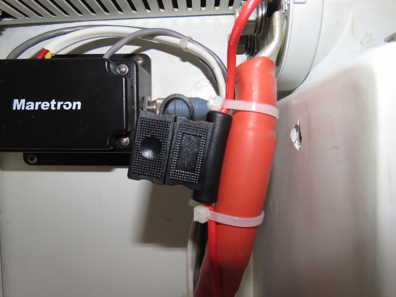
The alternator regulator sense wire is attached directly to the alternator output in most installations including both the house and start alternators on Dirona. A better solution is to sense charge voltage at the battery being charged since there will be some voltage loss in the wries between the alternator and the battery and the regulator will be incorrect by the voltage drop on that link. The easy answer is to just setup the regulator to account for the expected voltage drop. This sounds good but doesn't work well since the voltage drop at full charging is higher than the voltage drop at low charge rates. The best solution is to just run a sense wire to the start battery or as close as practical. Years ago we ran a sense wire back to the DC panel for the house alternator but, until now, we hadn't run a sense wire back for the start alternator regulations. Here we've attached the start alternator voltage regulator sense wire with it's own fuse at the DC panel which is inches from the battery emergency disconnect switch.
|
 |
8/18/2016: Wire Run
Position: 47°45.86'N, -56°19.45'W
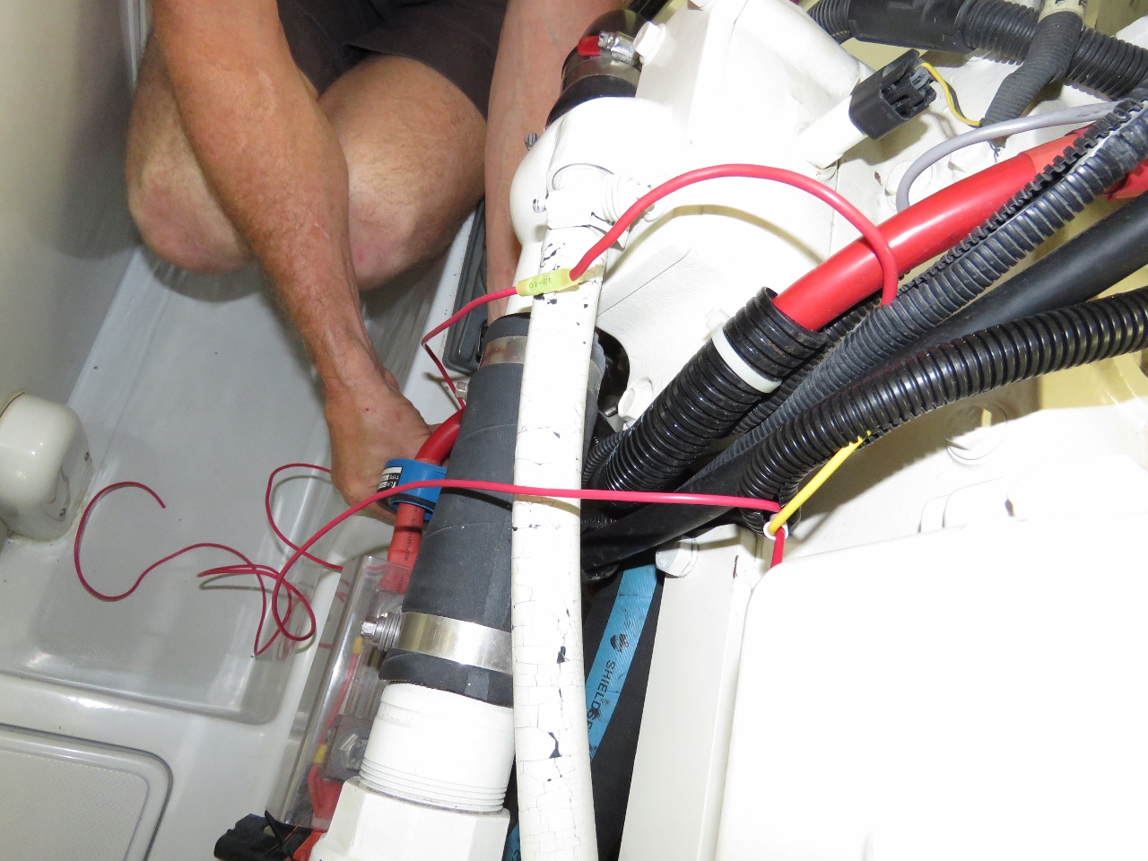
The only hard part of installing the start alternator voltage regulator sense work back at the DC Panel is running the wire from the regulator in front of the engine all the way to the back of the engine room, into the laz, under the floor in the laz to the DC Panel, and then up into the DC panel.
|
 |
8/19/2016: Morning
Position: 47°43.43'N, -56°19.22'W
Morning calm at the head of Facheux Harbour.
|
 |
8/19/2016: Hare Bay
Position: 47°37.60'N, -56°31.22'W
Even on an overcast and rainy day, the Newfoundland scenery is outstanding. This is the view from the pilot house as we head north through Hare Bay.
|
 |
8/19/2016: Aquaculture
Position: 47°39.72'N, -56°31.08'W
A major aquaculture operation in Hare Bay below the cliffs opposite Mare Cove. In addition to the pens, they had several large barges and landing craft, a number of smaller runabouts, and a two-story floating building.
|
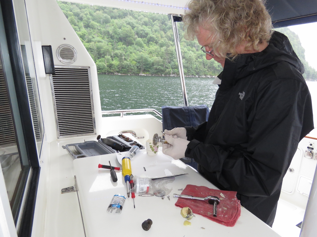 |
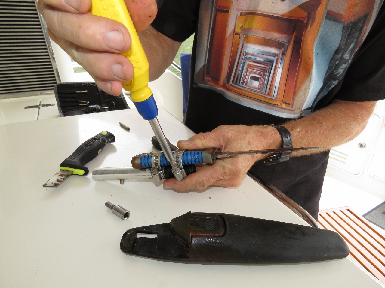
8/19/2016: Latch
Position: 47°42.88'N, -56°31.12'W
Justin at Nordhavn parts has a brand new latch waiting for us when we are back in a location where we can receive shipments. A couple of weeks ago James temporarily attached the old broken latch using 5-minute epoxy. It just refractured but since it really is nice having a boarding door latch so we decided to do an improved temporary repair. On this approach, the two parts are mechanically connected with a high quality hose clamp and then coated with two layers of 5 min epoxy. It's nice to have it back working again and this one looks pretty strong.
|
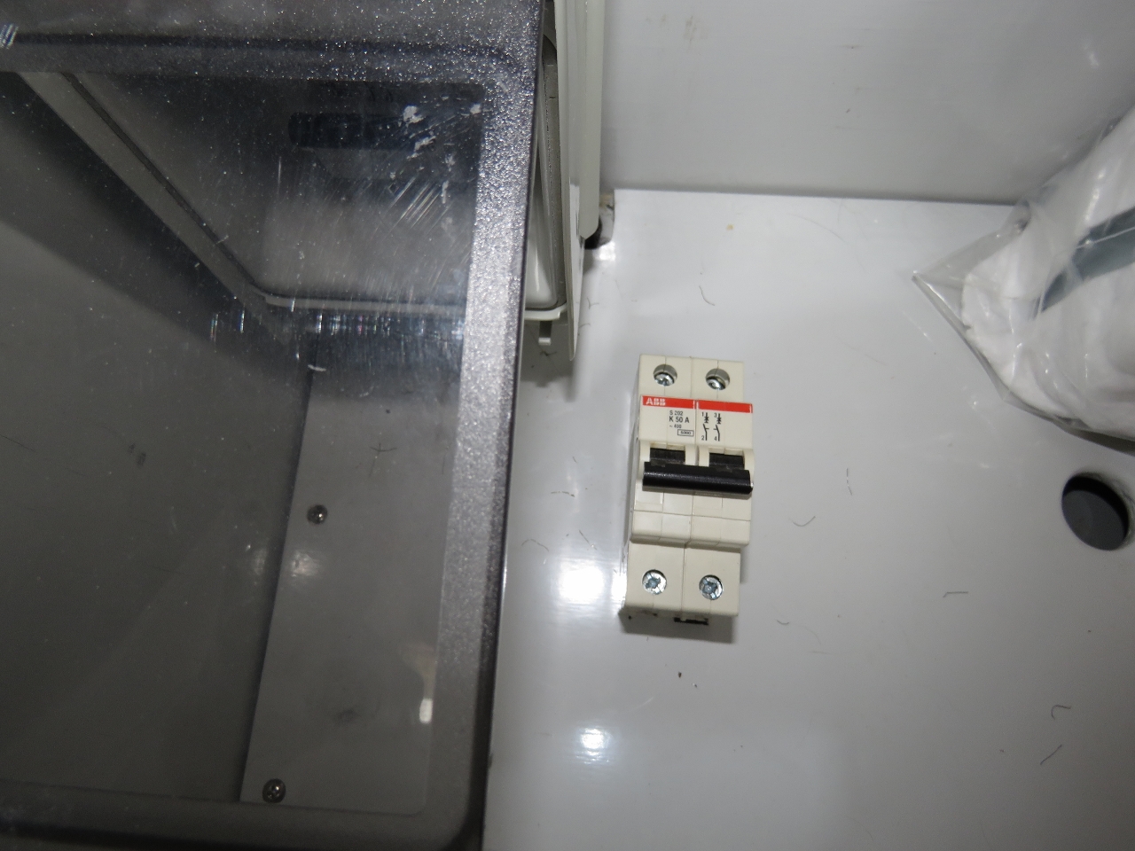 |
8/19/2016: Breaker
Position: 47°42.88'N, -56°31.12'W
Our electrical system, like most 60hz Nordhavns, gets it's 110V power by stepping down 240V rather than the more common split phase approach used in North American homes and most boats in this region. The Nordhavn design has the advantage of being inherently phase balanced but has the disadvantage of some efficiency loss through the step-down transformer. Another nice feature of this design is the boat can be powered by a 30A@110V cable and it will use the transformer to step up the 110V to get 240v. Because the transformer runs fairly warm, the breaker beside it has started to release early, so today we replaced it with a shiny new ABB S202 breaker.
|
 |
8/19/2016: Moose!
Position: 47°42.90'N, -56°31.12'W
In 1904, four New Brunswick moose were introduced to Newfoundland and today the iconic Newfoundland moose population is estimated at 140,0000 strong. We'd been told that we couldn't really say we'd been to Newfoundland without sighting a moose, but we'd not seen one yet. We'd seen moose dropping and moose tracks, but no moose. We have been up on the highest points in the area where we can see for miles in all directions with unbroken hills rolling off to the limits we can see, and yet, no moose. If we couldn't see any under those circumstances, we weren't sure where we would. It was looking like there was a good chance we would leave Newfoundland without having seen one. Then, as we were sitting outside in the cockpit after dinner tonight, Jennifer yelled "Moose!" and dove for the binoculars. It was true. Way up on the top of the cliffs looming straight above us were clearly a set of massive horns in outline, back-lit against the late evening sky. James went for the camera and we have now documented evidence of a very large and mature moose sighting. Our visit to Newfoundland now is official. The moose spent quite a while looking down on us so, if there is any credit for mutual sightings, we got that too :-). Moose dialog by Timothy Daleo: "I bet I am not going to see a Nordhavn this year...... look, a N52 down there!!! Is that a cat on deck?"
|
 |
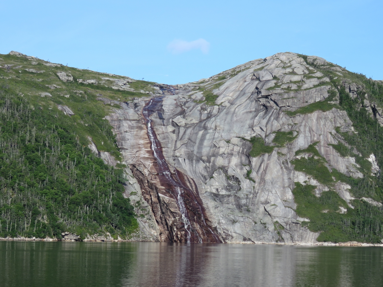
8/20/2016: Waterfall
Position: 47°43.19'N, -56°30.85'W
We could see the waterfall at the head of Morgan Arm from our anchorage, but when we got up close in the dinghy we found the flow was much more active than we'd realized.
|
 |
8/20/2016: Top of Falls
Position: 47°43.33'N, -56°30.74'W
Reaching the top of the falls was relatively easy over the smooth rock beside. The view from here already is pretty impressive.
|
 |
8/20/2016: Morgan River
Position: 47°43.73'N, -56°30.87'W
We worked north a bit to work around the steeper cliffs alongshore and got a fabulous view to the Morgan River as it winds and cascades down the valley and drains into the sea through the falls we climbed beside.
|
 |
8/20/2016: Morgan Arm
Position: 47°43.54'N, -56°31.21'W
We've been looking forward to visiting Morgan Arm since seeing a photo similar to this in our cruising guide over a month ago. We weren't disappointed. This is looking six miles down Morgan Arm to the Atlantic Ocean.
|
 |
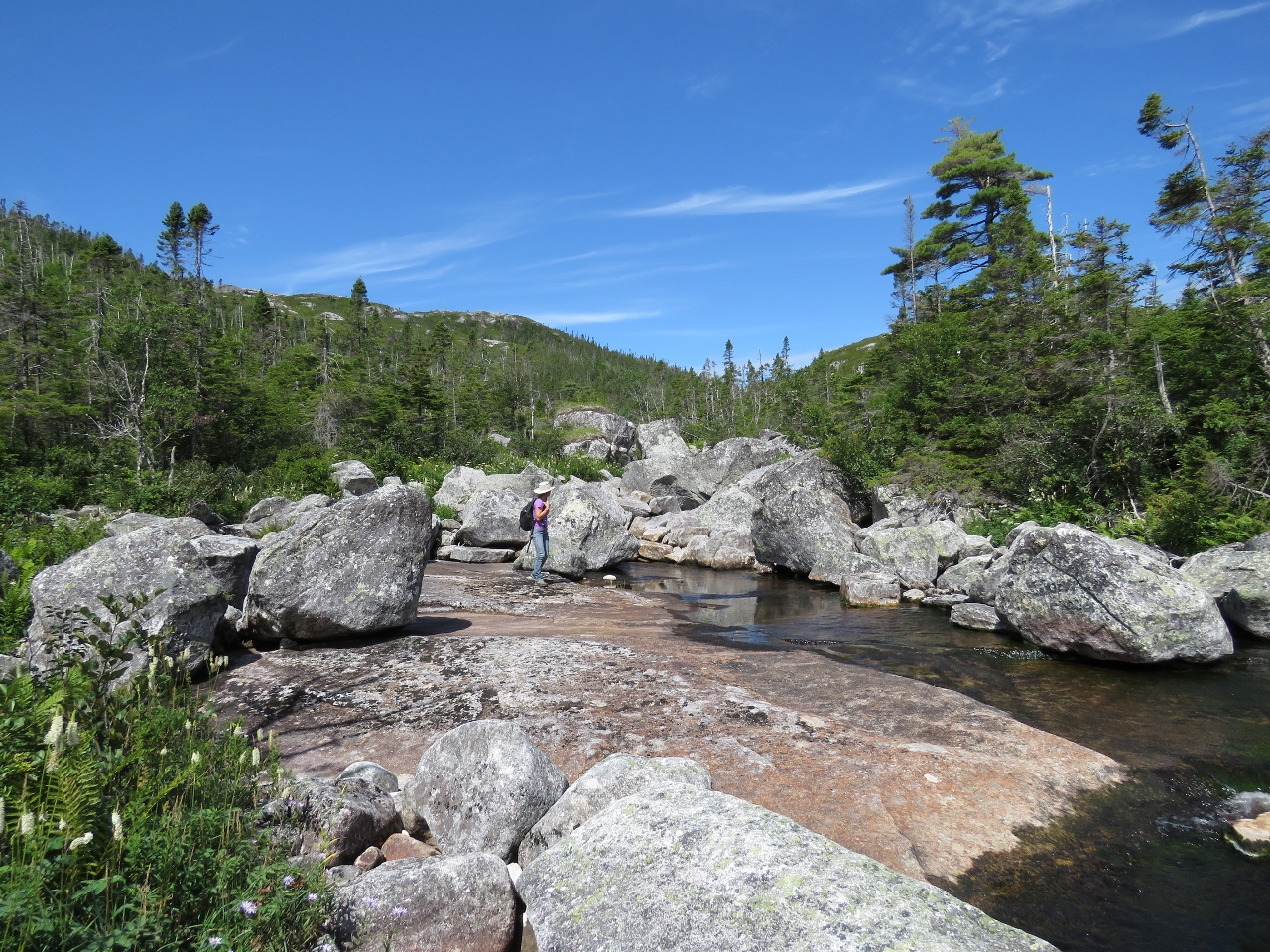
8/20/2016: Lunch
Position: 47°43.00'N, -56°31.75'W
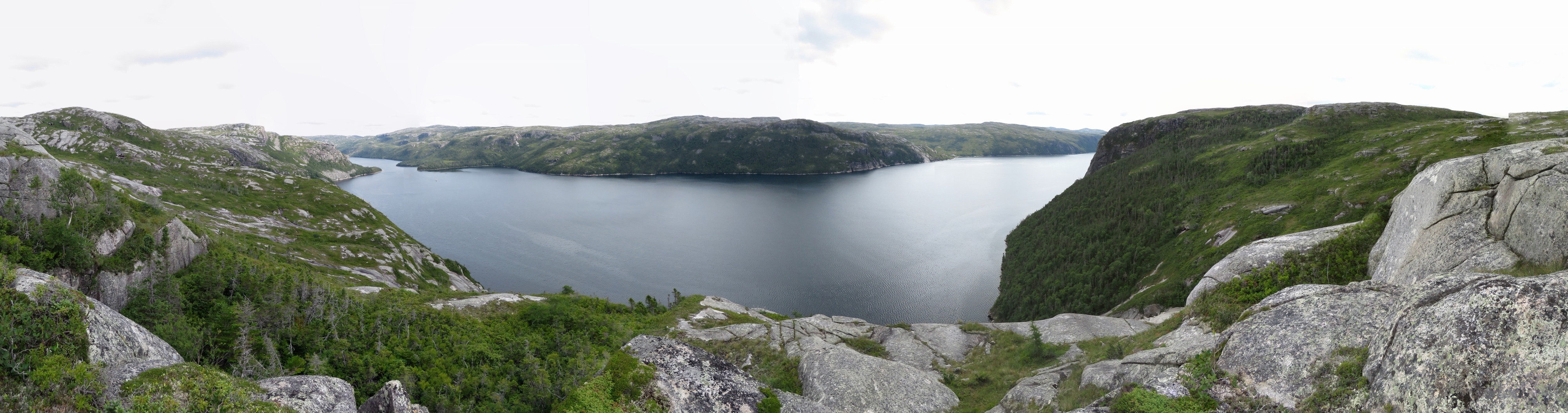
We continued hiking south inland, hoping to reach a vantage over the Northwest Arm of Hare Bay. But it was farther than we felt like going, so we worked back toward shore and found an awesome view perch 750ft up for lunch. In the panorama, the waterfall we climbed is to the right of James, Dirona is the white speck slightly left of center, and Southeast Bight at the junction of Northwest and Morgan arms is at the far right. (Click image for a larger view.)
|
 |
8/20/2016: Break
Position: 47°43.34'N, -56°30.71'W
Having a break at the falls on our way back down.
|
 |
8/20/2016: Hole
Position: 47°43.34'N, -56°30.71'W
This big hole underneath the water in the falls was similar to one we saw in the Kimberley, but the water flowed completely over it here.
|
 |
8/20/2016: Raven
Position: 47°42.68'N, -56°33.57'W
Raven, of Noank, CT anchored behind Sandy Point in Northwest Arm. This is the first cruising pleasure craft we've seen since arriving in Newfoundland over two weeks ago. Later that night we saw a second pleasure craft arrive from sea and head up Northwest Arm, presumably to the same anchorage.
|
 |
8/20/2016: Northwest Arm
Position: 47°43.06'N, -56°34.10'W
Beautiful scenery at the head of Northwest Arm. A substantial waterfall, not visible, spills down a cliff and cascades into the northwest corner of the basin.
|
 |
8/20/2016: Anchorage
Position: 47°42.42'N, -56°31.11'W
Another fabulous Newfoundland anchorage.
|
 |
8/21/2016: Devil Bay
Position: 47°36.64'N, -56°37.15'W
Looking past layers of dramatic cliffs as we enter Devil Bay.
|
 |
8/21/2016: Aquaculture
Position: 47°38.97'N, -56°37.41'W
What appears to be a sunk aquaculture pen midway along Devil Bay.
|
 |
8/21/2016: Anchoring
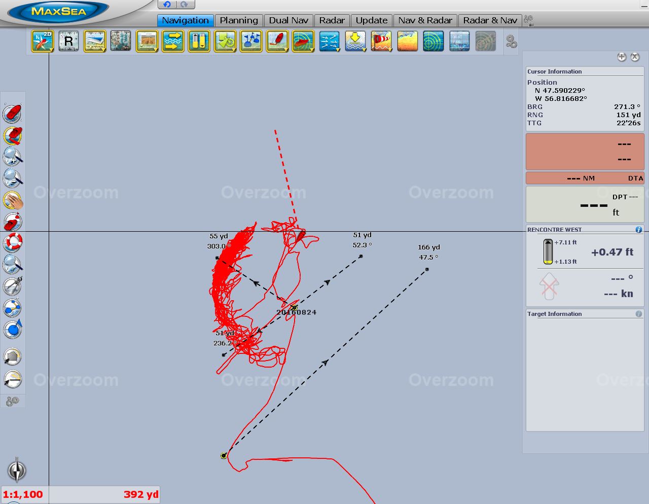
Position: 47°39.50'N, -56°38.00'W
At the head of Devil Bay, we marked the edge of a slope where the bottom evened out to consistent 50ft, then continued north and marked the edge of the anchorable depthts. From this we could determine if we had enough flat ground to anchor on. We don't like anchoring on a slope, as the anchor could get pulled down-slope and we might drag anchor. We then centered the boat up between the two marks and equidistant from the steep shores on either side using radar. You can see from the red radar overlay that the charts are a little off here. We had about a 525-ft swing diameter between the shores, enough room to put out 225ft of rode with good holding.
|
 |
8/21/2016: Paint prep
Position: 47°39.50'N, -56°37.99'W
The main engine engine torsional damper has an 8,000-hour service interval, and we installed a new one while in Boston. The part came unpainted, however, and would assuredly rust. So we prepped the area for painting today.
|
 |
8/21/2016: Painted
Position: 47°39.50'N, -56°37.99'W
The main engine torsional damper freshly painted.
|
 |
8/21/2016: Cliffs
Position: 47°39.50'N, -56°37.99'W
Mesa-like cliffs soared above our anchorage in Devils Bay. Incoming clouds spilled through the cracks and slide down-slope.
|
 |
8/22/2016: Devil Bay
Position: 47°39.51'N, -56°37.98'W
The clouds were just starting to obscure the tops of the cliffs when we got out in the tender to head ashore.
|
 |
8/22/2016: Tender
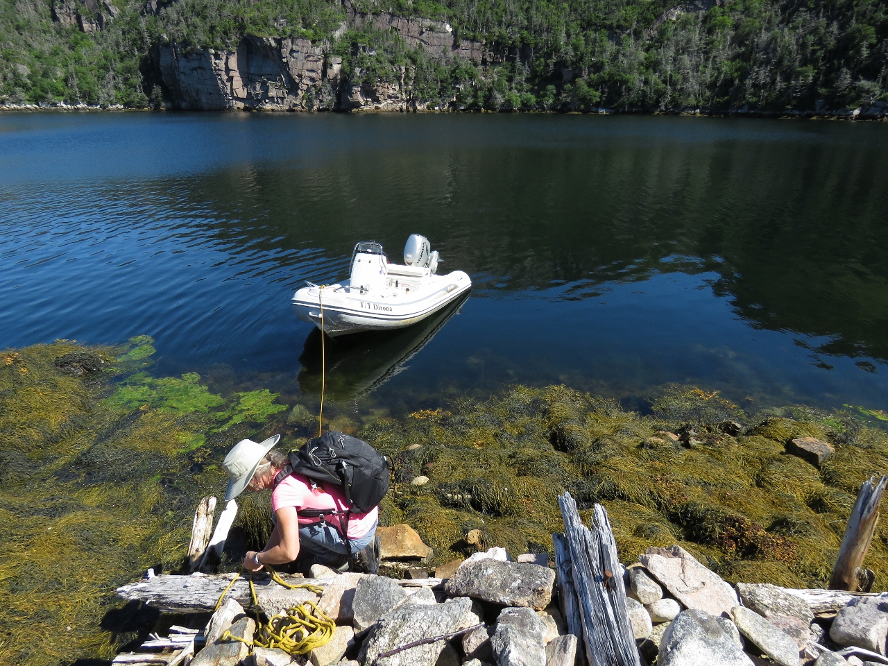
Position: 47°39.66'N, -56°38.01'W
Jennifer holding the tender close to shore against the pull of the Anchor Buddy, effectively a bungee-cord attached to an anchor, so James can jump ashore.
|
 |
8/22/2016: Rain
Position: 47°39.74'N, -56°37.96'W
The clouds were filling in quickly and we didn't get far ashore before rain began to fall, so we returned back to Dirona.
|
 |
8/22/2016: Fog
Position: 47°37.05'N, -56°37.30'W
The clouds continued to fill in right to the water surface and we left Devil Bay in a thick fog with our fog horn sounding.
|
 |
8/22/2016: Eagle
Position: 47°39.21'N, -56°42.48'W
Visibility was better at the head of Rencontre Bay and we were able to get a shot of this very wet-looking eagle through the rain.
|
 |
8/22/2016: Ideal Anchorage
Position: 47°39.09'N, -56°42.56'W
Everyone has different minimal requirements for an acceptable anchorage. For us, we want good holding, swing room for 5:1 scope, and connectivity for our satellite data system. The first two are pretty common, but needing to avoid particularly large mountains to the south is a bit unusual. We found two possible anchorages at the head of Rencontre Bay, but decided to head back to the mouth since the mountains to the south block satellite connectivity. Interestingly, with all the fiords we've been exploring, this is the only one where we've had reception trouble.
|
 |
8/22/2016: Monitoring Station
Position: 47°37.59'N, -56°42.14'W
A floating monitoring station of some sort near the elbow of Rencontre Bay. The diamond shape mounted on a post at the left is a radar reflector and below it is a solar panel.
|
 |
8/22/2016: Herringnet Cove
Position: 47°36.87'N, -56°42.29'W
In Herringnet Cove we found a third anchorage that had a flat bottom, good holding, sufficient swing room, and satellite connectivity. The top right cirular mark shows the edge of a cliff to deep water and the top left mark shows the edge of shallows, with 271 yards between them. The lower mark is where we dropped the anchor in 45ft, 89 yards from the shallows and the cliff, giving us room to put out 220ft of rode (89*3 less 50 for the boat length) for a 5:1 scope.
|
 |
8/22/2016: Dryer Thermal Fuse
Position: 47°36.88'N, -56°42.31'W
Our dryer stopped producing heat en route to Rencounter Bay. The drum would tumble, but there was no heat. Read more ...
|
 |
8/23/2016: Storm
Position: 47°36.88'N, -56°42.31'W
The barometer was 1005 four days ago, then climbed to 1020 over the following two days and fell back to 1005 overnight with southeast winds blowing 20 to 25 knots much of the night. This brought a gentle swell into the anchorage, but otherwise wasn't particularly noticable.
|
 |
8/23/2016: Rain
Position: 47°36.88'N, -56°42.31'W
We also got heavy rain overnight that continued this morning. Visibility hasn't improved much.
|
 |
8/23/2016: Waterfall
Position: 47°36.89'N, -56°42.26'W
By mid-morning the rain had stopped and the clearing skies revealed this multi-level waterfall gushing down the cliffs west of our anchorage.
|
 |
8/23/2016: Rencontre West
Position: 47°36.89'N, -56°42.21'W
Summer cabins east of our anchorage at Rencontre West, another resettled outport. The owner of the green cabin came over to say hello while he was out fishing yesterday afternoon. He had grown up in Rencontre West, moved away during the resettlement, and returned to build a cabin here when he retired. He'd heard our fog horn from shore when we motored past his cabin yesterday morning, but couldn't see the boat through the thick fog.
|
 |
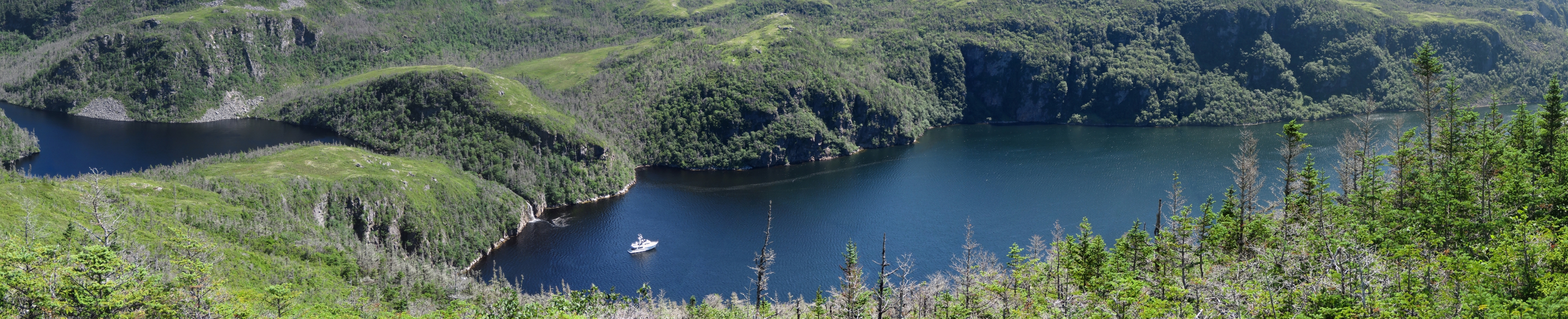
8/23/2016: Rencontre Bay
Position: 47°36.88'N, -56°42.21'W
The sun eventually broke through and we got a clear view to beautiful Rencontre Bay. On the left is the waterway continuing north towards the head, right of center is the channel to sea and on the far right are the cabins at Rencontre West. (Click image to enlarge.)
|
 |
8/24/2016: Morning
Position: 47°36.89'N, -56°42.22'W
The morning sun lighting up the cliffs at the head of Rencontre Bay.
|
 |
8/24/2016: Local
Position: 47°37.04'N, -56°41.63'W
The local we'd spoken with two days ago seeing us off as we exited Rencontre Bay.
|
 |
8/24/2016: Calm
Position: 47°37.08'N, -56°41.15'W
Calm conditions as we head to sea.
|
 |
8/24/2016: Cone
Position: 47°37.12'N, -56°40.41'W
Striking cone formation at the head of Little Bay between Rencontre and Devil bays.
|
 |
8/24/2016: Hares Ears Point
Position: 47°34.87'N, -56°38.46'W
A hole through through rock at aptly-named Hares Ears Point outside Rencontre Bay.
|
 |
8/24/2016: West Point Light
Position: 47°33.72'N, -56°43.33'W
Light and helicopter service pad perched on the cliff at West Point outside the village of Francois.
|
 |
8/24/2016: Francois Bay
Position: 47°34.11'N, -56°44.33'W
The outport of Francois strung below steep cliffs at the head of Francois Bay. A ferry serves the community once a week from Hermitage about 40 miles east near Gaultois, and six days a week from Burgeo about 40 miles west.
|
 |
8/24/2016: Francois
Position: 47°34.72'N, -56°44.55'W
Well-kept homes perched above fishing boats in the village of Francois, locally-pronounced "Franz-way". As at Gaultois, the preferred method of land transportation seems to be all-terrain vehicle. The large white building at the upper right with the green base is the St. Simon & St. Jude Academy covering kindergarten to Grade 12. Francois does have a dock for visiting yachts, but we're enjoying being out in the wilds too much so didn't feel like stopping.
|
 |
8/24/2016: Bagg Head
Position: 47°32.24'N, -56°46.53'W
Caves beneath rugged cliffs at Bagg Head as we near Aviron Bay. The scenery here in Newfoundland is absolutely amazing--we never tire of it.
|
 |
8/24/2016: Bow Watch
Position: 47°35.24'N, -56°48.73'W
Jennifer watching for hazards at the bow as we cross the bar before the inner basin at the head of Aviron Bay. The entry was relatively easy. At low tide, we saw a minimum depth of 16ft and the water was clear enough we could see bottom.
|
 |
8/24/2016: Anchorage
Position: 47°35.38'N, -56°48.91'W
The beautiful scenery looking north to the head of the inner basin at Aviron Bay from the anchorage.
|
 |
8/24/2016: Falls
Position: 47°35.42'N, -56°48.89'W
The view to the head of Aviron Bay is impressive, but the real draw of this anchorage are the spectacular falls that cascade and plunge into the basin from 1,000ft up.
|
 |
8/24/2016: Brush
Position: 47°35.61'N, -56°48.82'W
Shore access is difficult at Aviron Bay as the slopes are steep and heavily treed near the water. But we had to find a way to reach the top for an view around the area. Jennifer is just clearing a band of thick trees near shore.
|
 |
8/24/2016: Slide
Position: 47°35.63'N, -56°48.73'W
Above the near-shore trees we found a mostly clear, but very steep, route up rock slides.
|
 |
8/24/2016: Partway
Position: 47°35.63'N, -56°48.73'W
The view partway up at 235ft was already impressive.
|
 |
8/24/2016: Lunch
Position: 47°35.57'N, -56°48.56'W
We had our lunch at this fabulous perch 760ft up. Wow, what a view!
|
 |
8/24/2016: Aviron Bay
Position: 47°35.42'N, -56°48.51'W
After lunch we walked south along the hilltops. This is the view looking back down Aviron Bay the way we'd come earlier today.
|
 |
8/24/2016: Scat
Position: 47°35.53'N, -56°48.37'W
Judging by the berries, we think this is bear scat we saw up in the hills above Aviron Bay. Newfoundland does have black bears.
|
 |
8/24/2016: Very Top
Position: 47°35.57'N, -56°48.23'W
We continued climbing to a higher point in the nearby hills. This is the view from 1,050ft up. On the left are mountain lakes and at center is Aviron Bay. Our anchorage is out of the picture to the right. (Click to enlarge.)
|
 |
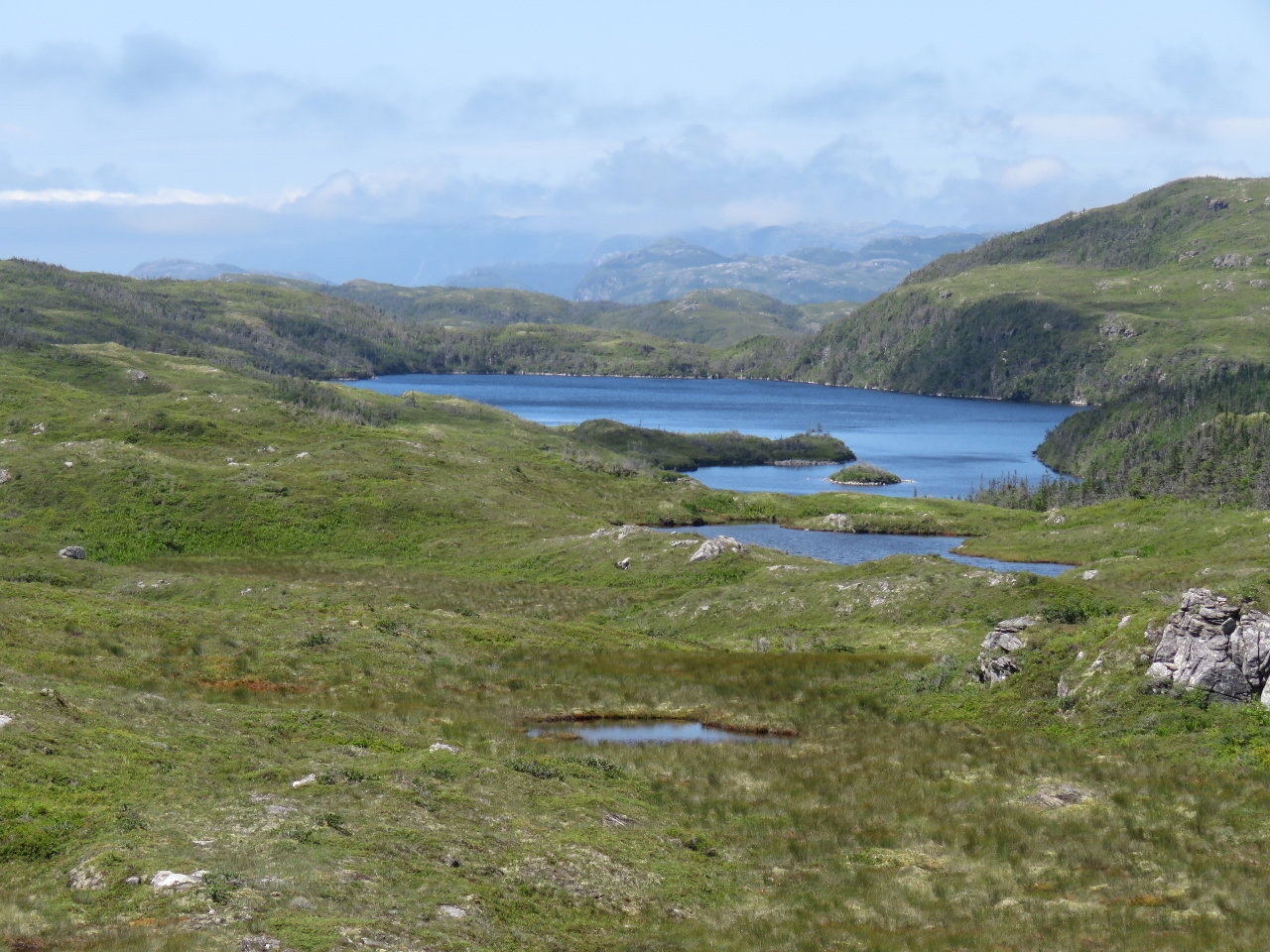
8/24/2016: Lakes
Position: 47°35.75'N, -56°48.05'W
The view 1,138ft up looking southeast across several large mountain lakes. The village of Francois is just beyond the farthest visible lake.
|
 |
8/24/2016: Descending
Position: 47°35.95'N, -56°48.66'W
Our ascent was quite steep, so we decided to try descending farther north and following the river back to the tender. The going was steep, but generally manageable and better than the route up. This is Jennifer at about 200ft above sea level.
|
 |
8/24/2016: River
Position: 47°35.80'N, -56°48.80'W
Jennifer jumping rocks on our way back down-river.
|
 |
8/24/2016: High Tide
Position: 47°35.71'N, -56°48.82'W
We'd tied the tender off near low tide around the farthest point visible in the distance on the left. We returned at high tide to find no easy land route back from the river mouth. James left Jennifer with both backpacks and made a run through the trees to reach the tender expediently. Here he is returning to retrieve Jennifer.
|
 |
8/24/2016: Gusts
Position: 47°35.41'N, -56°48.89'W
We'd read that the topography at the head of Aviron Bay can produce gusty winds. While the West Point Light was recording winds of 10-15 kts, we saw gusts to 39kts (anemometer at top right of screen shot).
|
 |
8/24/2016: Swing area
Position: 47°35.41'N, -56°48.89'W
When we first arrived at the anchorage, we nosed up to the shallows off the falls and placed the circular mark near the bottom of the screenshot at the limit of safe anchoring depth. The circular mark where the two lines intersect is where we dropped the anchor in 23ft. The red line shows our boat's movement at anchor—the arc-shape shows how the boat was pushed back during the big wind gusts. The 55-yard dividers we've drawn northwest and southwest from the anchor mark allow us to determine at a glance if the boat has moved beyond where we expect it to, indicating that the anchor might be dragging. The Rocna anchor is amazing. Having cruised all over the world, it has yet to slip after setting.
|
 |
8/25/2016: Wild Cove
Position: 47°31.81'N, -56°50.32'W
Weather-formed rock pillars in Wild Cove to our north.
|
 |
8/25/2016: Cape La Hune Light
Position: 47°31.44'N, -56°51.67'W
The navigation light and helicopter perched in the edge of a cliff at Cape La Hune.
|
 |
8/25/2016: La Hune Bay
Position: 47°36.53'N, -56°52.26'W
Steep hills at the head of La Hune Bay.
|
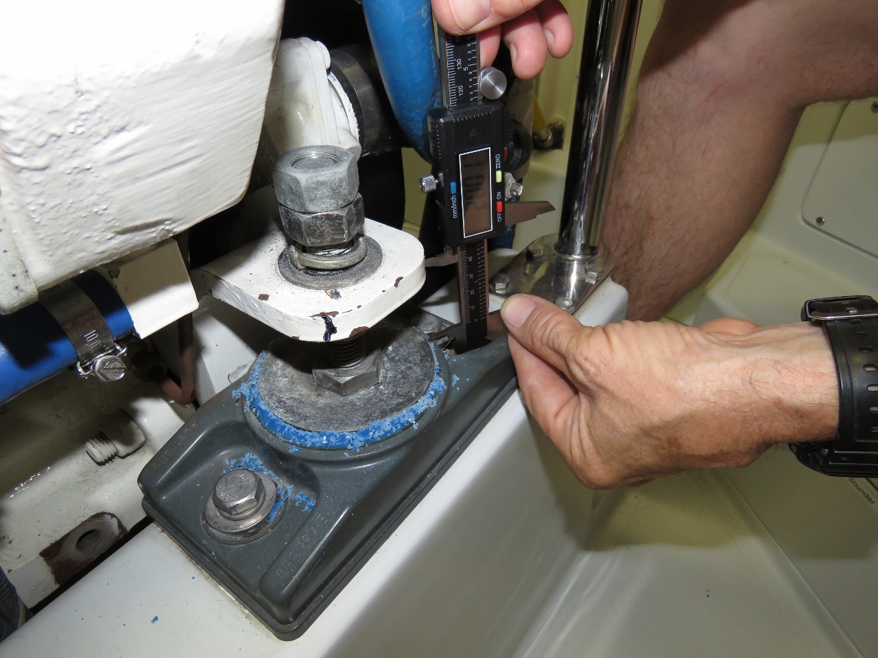 |
8/25/2016: Engine Mounts
Position: 47°38.04'N, -56°52.10'W
In Boston we noticed that our forward engine mounts were starting to deteriorate. We did purchase replacements, but expected the current ones to last for months yet. Suddenly, they've started to deteriorate badly and over the past couple of weeks the isolation material has been just crumbling away in a pile around the mount. This morning we picked up a fair bit of vibration in the drive line. Measuring the rear-mounts, we can see that the front mounts as they've crumbled away have allowed the engine to settle 0.250" inches. We will need to change the mounts fairly urgently and realign the drive line but, in the interim, we decided to lift the engine back the 0.250" that the mount has allowed the engine to fall.
|
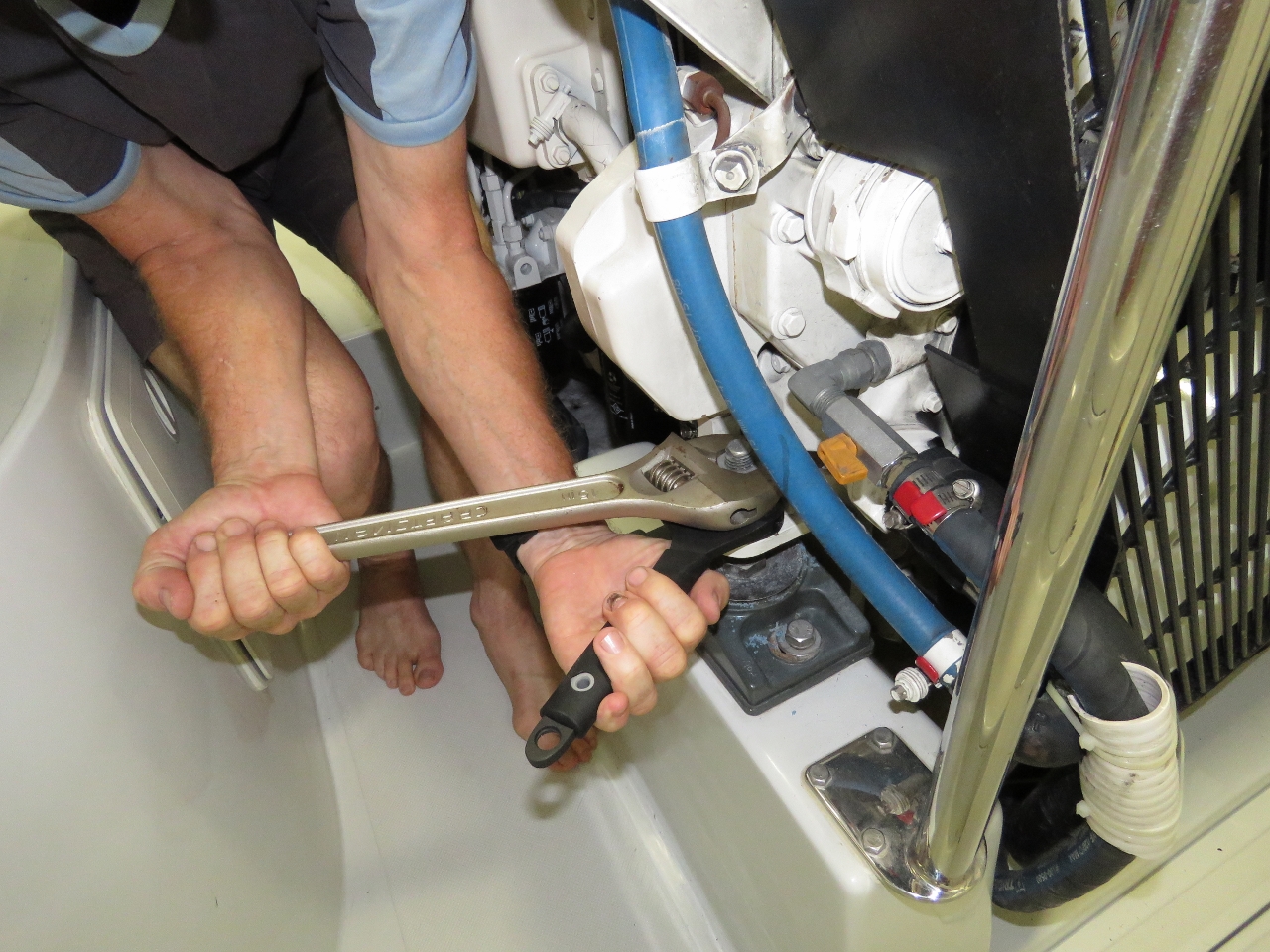 |
8/25/2016: Loosening
Position: 47°38.04'N, -56°52.09'W
Loosening the top bolts holding the engine support to the mounts so that we can adjust the engine up.
|
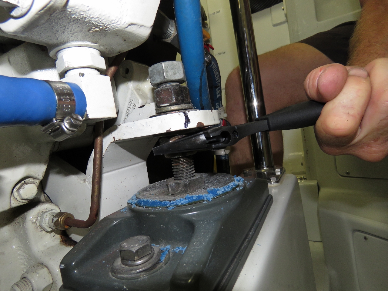 |
8/25/2016: Aligning
Position: 47°38.04'N, -56°52.10'W
Adjusting the engine up 0.250" and re-tightening the mounts. Amazingly, this highly primitive procedure eliminated the vibration. We will need to change the two front mounts very soon.
|
 |
8/25/2016: Deadman Cove
Position: 47°33.54'N, -56°51.08'W
The anchorage at the head of La Hune Bay was great, but here in Newfoundland, great doesn't cut it. Deadman Cove that we'd just gone past had a beautiful waterfall and we decided that's where we needed to be. So, after adjusting the engine mounts, we got back underway.
|
 |
8/25/2016: Caribou?
Position: 47°33.49'N, -56°51.28'W
This hoofed animal was eating kelp at the southern point off the anchorage. Its ears seem too small for a moose, so perhaps it is a caribou?
|
 |
8/25/2016: Eagle
Position: 47°34.00'N, -56°51.83'W
Several adult and juvenile eagles were at the cliffs along the west shore of La Hune Bay.
|
 |
8/25/2016: Cabins
Position: 47°33.23'N, -56°52.44'W
Cabins at the abandoned village of Cape La Hune opposite the anchorage.
|
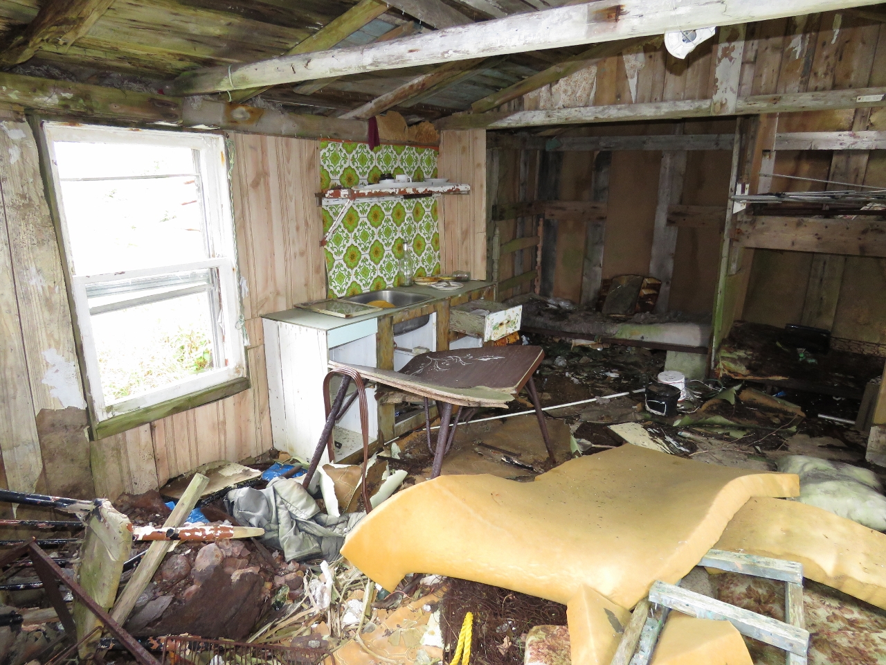 |
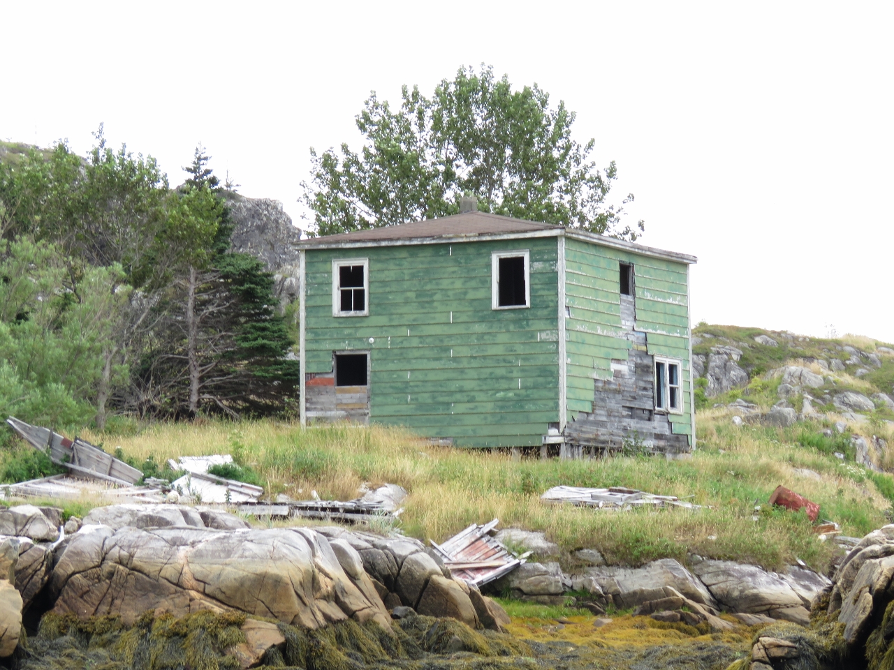
8/25/2016: Mess
Position: 47°33.22'N, -56°52.46'W
The interior of the leftmost of the two cabins was a real mess. It was hard to tell if weather, vandalism or hard-livin' was the cause.
|
 |
8/25/2016: Steps
Position: 47°33.24'N, -56°52.56'W
All that remained of several other houses at Cape La Hune were the pilings that once supported them and concrete steps leading up.
|
 |
8/25/2016: Mitchell Cove
Position: 47°33.25'N, -56°52.54'W
A large waterfall spilling into Mitchell Cove at the abandoned village of Cape La Hune.
|
 |
8/25/2016: Anchorage
Position: 47°33.55'N, -56°50.90'W
The cliffs on the opposite side of La Hune Bay from our anchorage were as impressive as the ones we'd anchored under.
|
 |
8/25/2016: Depth Sounder
Position: 47°33.57'N, -56°51.07'W
The dinghy depth sounder has continued to work well since James rewired it in St. Lucia to eliminate a corroded connection. It recently started having keyboard faults and sporadically beeping. It appears to be unrelated to the connection issue, but we think this depth sounder is close to needing replacement. We gave it one more try with contact cleaner on the printed circuit board and it actually is working again, but we don't expect it to have more than months or weeks to go.
|
 |
8/25/2016: Kelp Knife
Position: 47°33.57'N, -56°51.07'W
The knife we use on the end of our boat hook for cutting kelp away from the anchor broke. It's really handy to have, so we built a new attachment with a stronger knife.
|
 |
8/25/2016: Cliffs
Position: 47°33.57'N, -56°51.06'W
The clouds lifted later in the afternoon and we got to see the top of the cliffs above our anchorage at Deadman Cove.
|
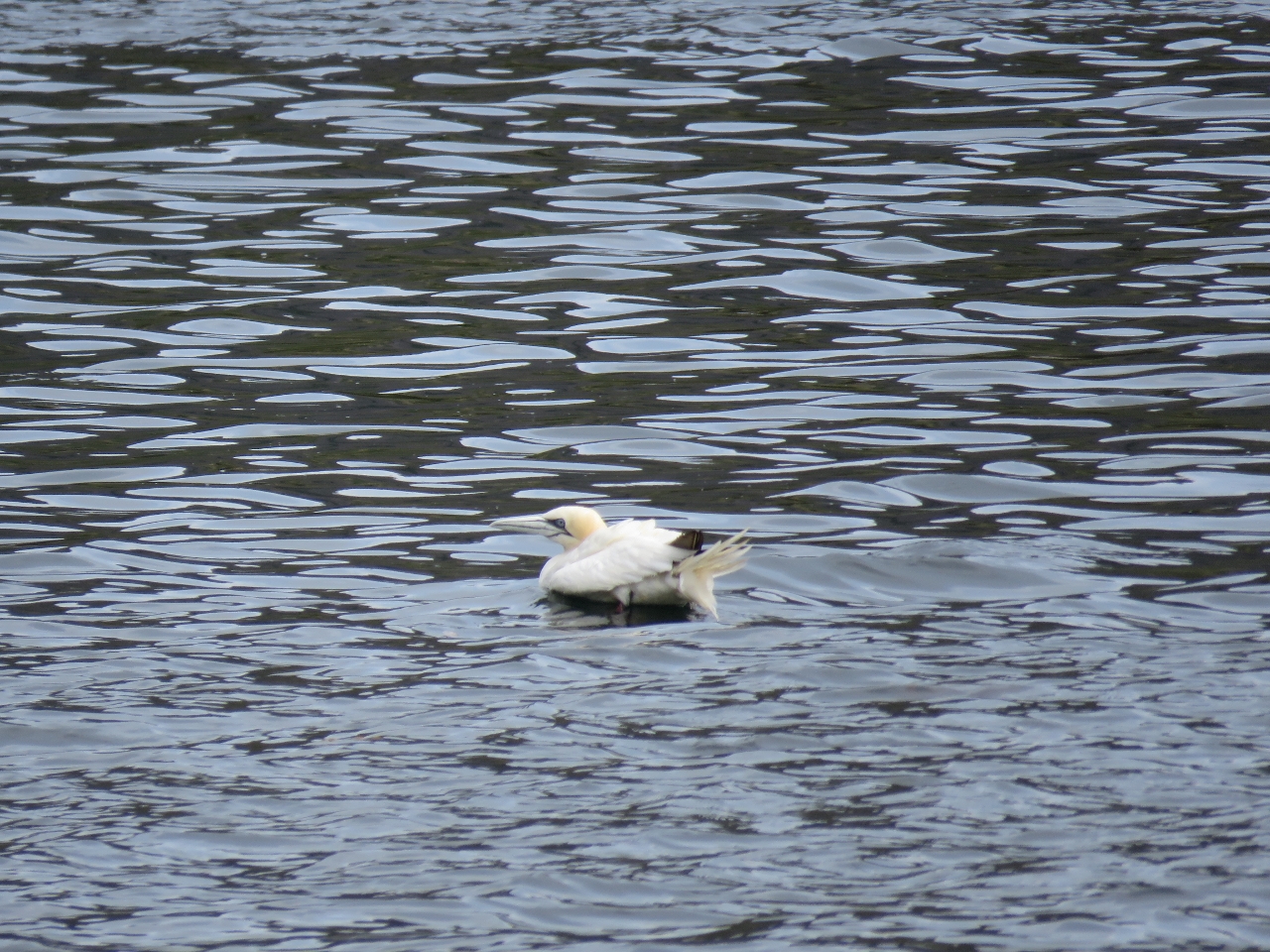 |
8/25/2016: Gannet
Position: 47°33.57'N, -56°51.05'W
A lone Northern Gannet swam in the anchorage for a couple of hours. These birds are the largest member of the Gannet family. One of the three major breeding colonies in North America is at Cape St. Mary's Ecological Reserve on the southeast coast of Newfoundland.
|
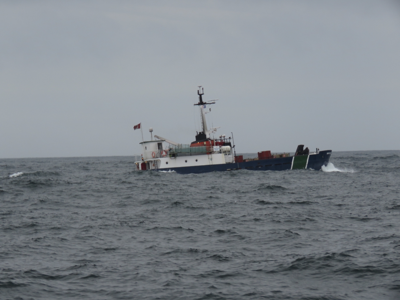 |
8/26/2016: Marine Voyager
Position: 47°33.55'N, -57°3.37'W
The ferry Marine Voyager rolling in 2-3m swell. With our stabilizers we weren't moving nearly as much, but it was pretty rough out there. The ferry passed us en route from Francois to Grey River.
|
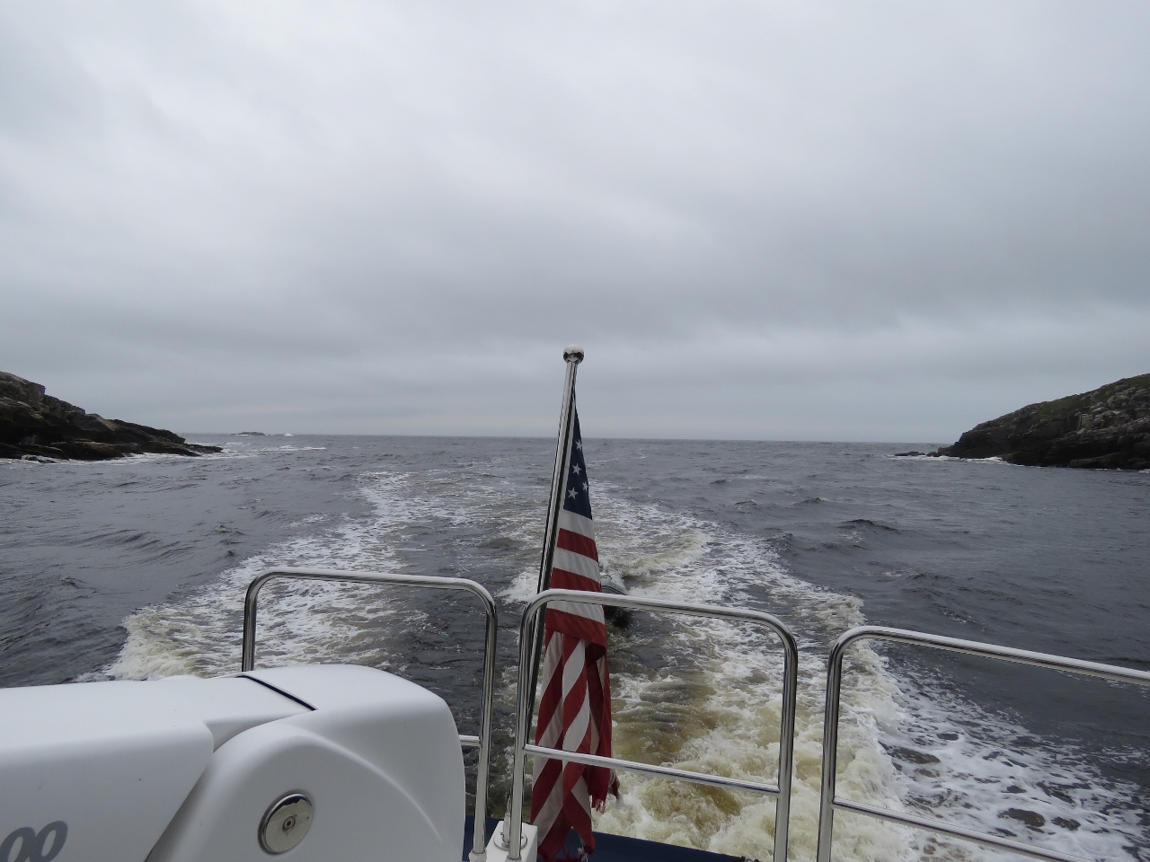 |
8/26/2016: Grey River
Position: 47°34.48'N, -57°6.70'W
Looking back after passing through the entrance to Grey River. The narrow entrance channel in the cliffs is only 450-ft wide (and feels much tighter) and hardly is visible until you are right up to it. We'd timed our entrance for low-water slack as an ebb current against wind and swell can generate steep and rough seas outside the entrance. We watched the ferry Marine Voyager go through ahead of us and followed a similar course. Even without any opposing current, in 2-3m swell the waves stacked up enough at the narrow opening that it wasn't an easy entrance.
|
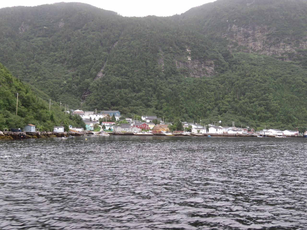 |
8/26/2016: Jerts Cove
Position: 47°35.17'N, -57°6.21'W
The outport of Jerts Cove strung alongshore beneath the mountains in Grey River.
|
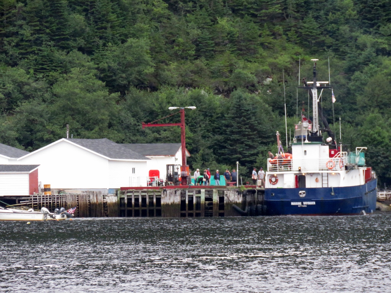 |
8/26/2016: Loading
Position: 47°35.05'N, -57°6.32'W
The ferry Marine Voyager had only preceded us into Grey River by about ten minutes, but already was on the dock and taking on passengers and freight. It left the dock shortly after we passed. We don't think it was even on the dock for ten minutes..
|
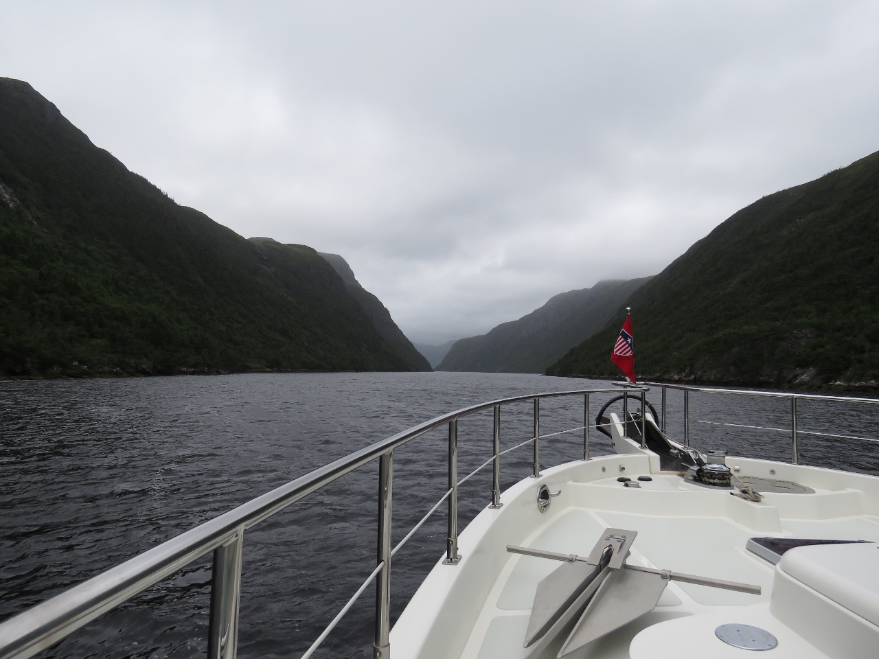 |
8/26/2016: Grey River
Position: 47°35.33'N, -57°5.65'W
Even on a rainy, overcast day the scenery in Grey River still is impressive.
|
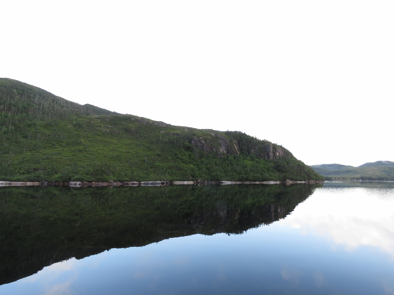 |
8/27/2016: Northwest Arm
Position: 47°39.03'N, -57°4.37'W
We checked out Northeast Arm, but decided on Northwest Arm for an anchorage as it seemed more sheltered and snug.
|
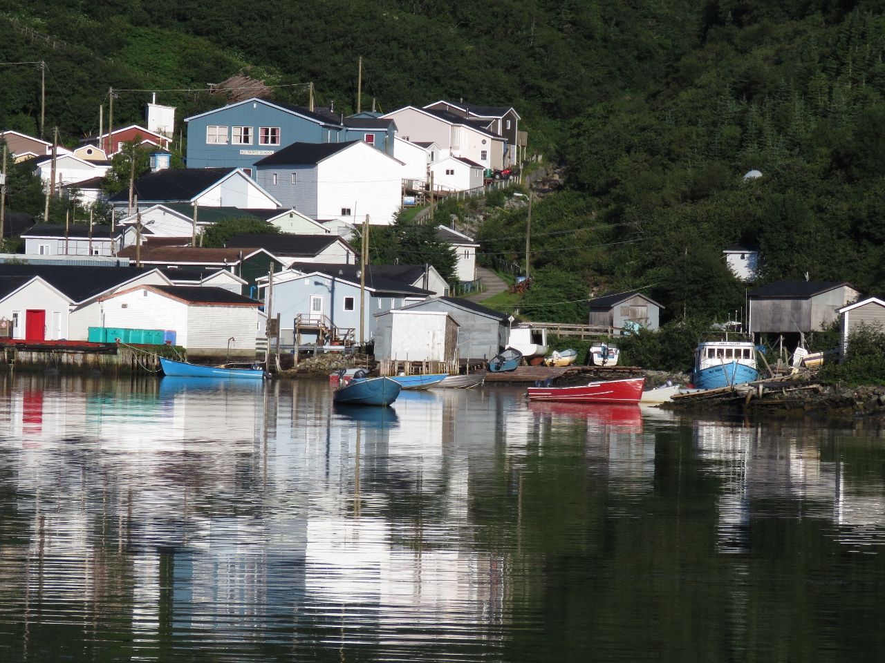 |
8/27/2016: Jerts Cove
Position: 47°35.29'N, -57°5.76'W
The morning sun lighting up boats moored off Jerts Cove as we exit Grey River.
|
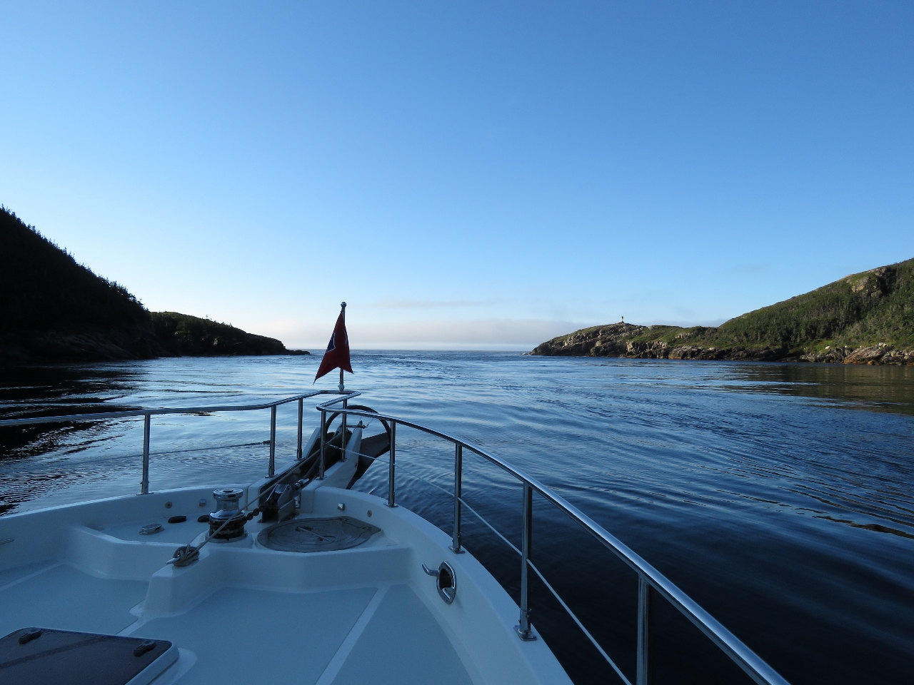 |
8/27/2016: Conditions
Position: 47°34.67'N, -57°6.74'W
Conditions were much calmer at the Grey River entry than yesterday, even with a slight ebb current working against the swell.
|
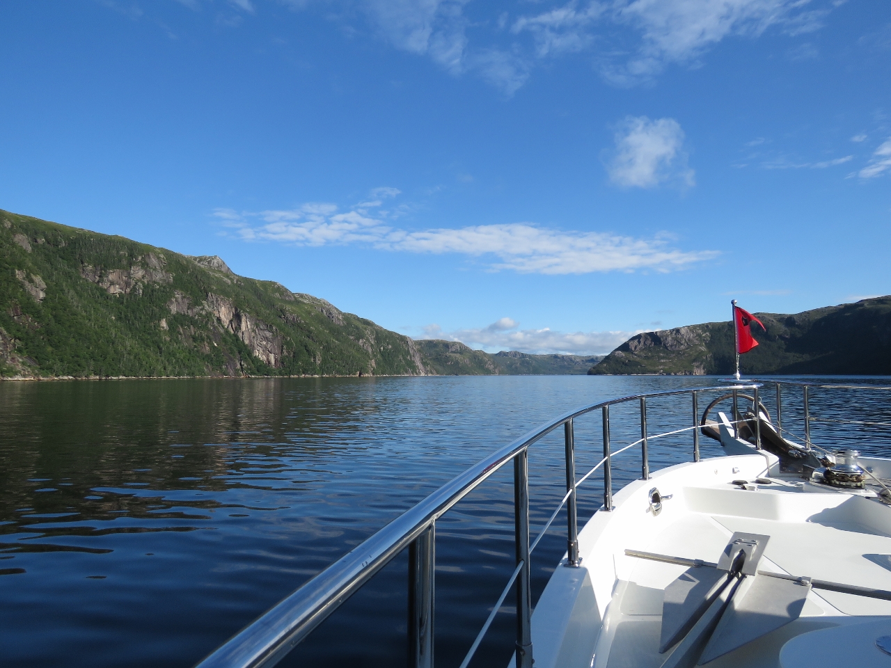 |
8/27/2016: Bay de Vieux
Position: 47°39.17'N, -57°10.71'W
Approaching the head of Bay de Vieux, another beautiful Newfoundland fjord.
|
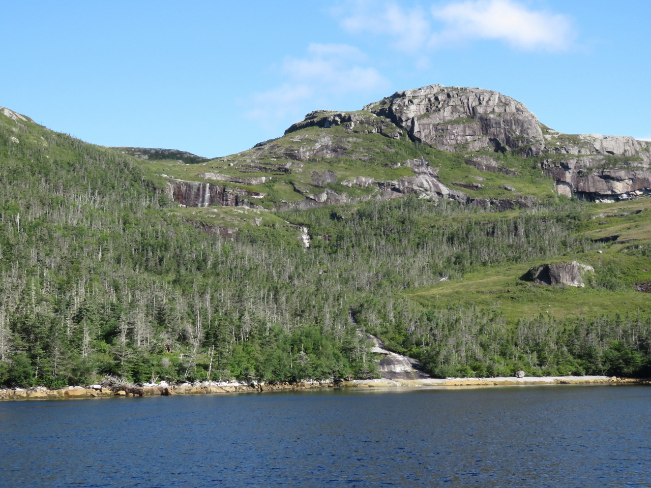 |
8/27/2016: Waterfall
Position: 47°41.80'N, -57°11.16'W
Bay de Vieux was full of impressive waterfalls. We anchored off this one at the head and could see at least two other major falls from the anchorage.
|
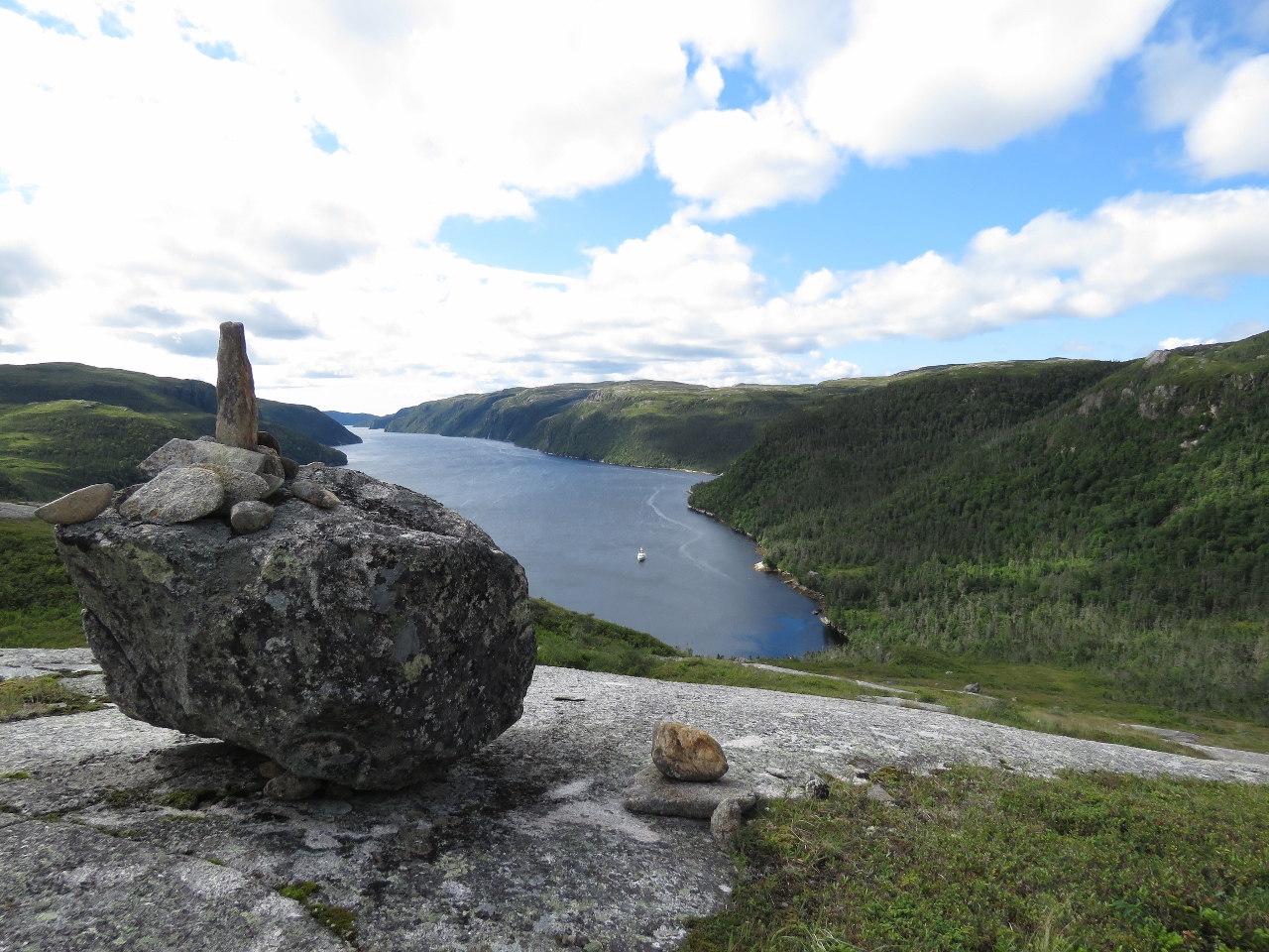 |
8/27/2016: Cairn
Position: 47°42.10'N, -57°11.06'W
We landed the tender east of the falls at the head and climbed up to the open fields and rocks above. This is looking back down from a cairn about 450ft up.
|
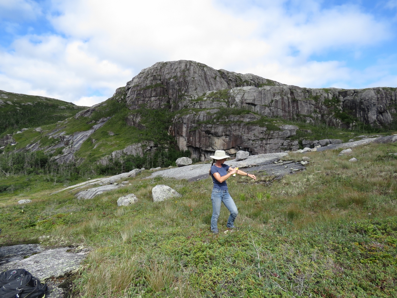 |
8/27/2016: Bugs
Position: 47°42.10'N, -57°11.06'W
Newfoundland is famous for fierce biting bugs. So far we've only had to douse ourselves with bug spray on about a third of our hikes, and today was one of them. We're using 3M Ultrathon for the first time on this trip and much prefer it to Deep Woods Off that we normally use. Ultrathon seems just as effective, isn't as sticky or smelly, and can sprays upside-down so you can easily spray legs etc.
|
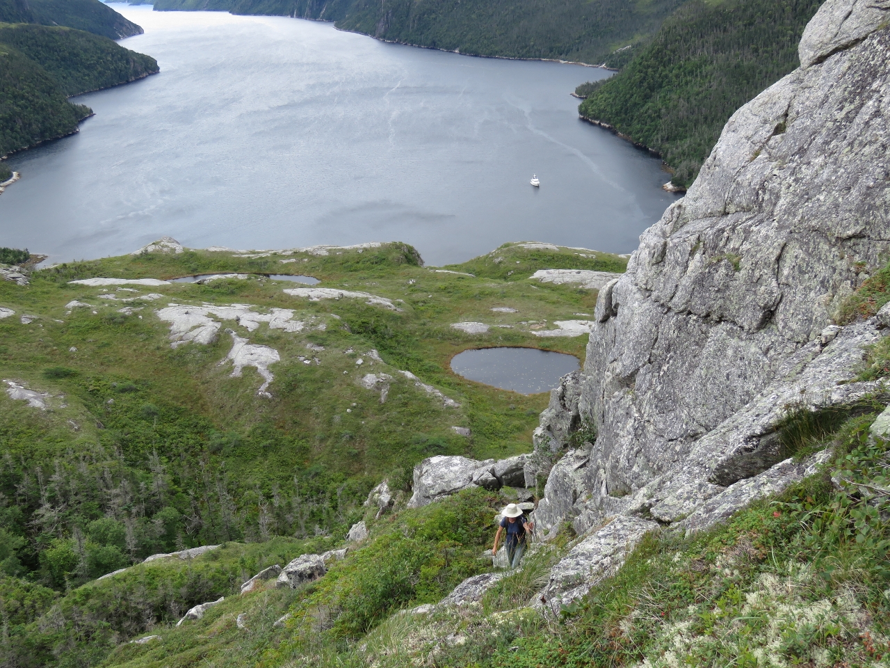 |
8/27/2016: Ravine
Position: 47°42.19'N, -57°10.98'W
After scouting several places for a way up, we eventually settled on a steep ravine that brought us up to 600ft up. On the return we came down close to the falls. The return route was shorter, not much easier, but probably a bit safer.
|
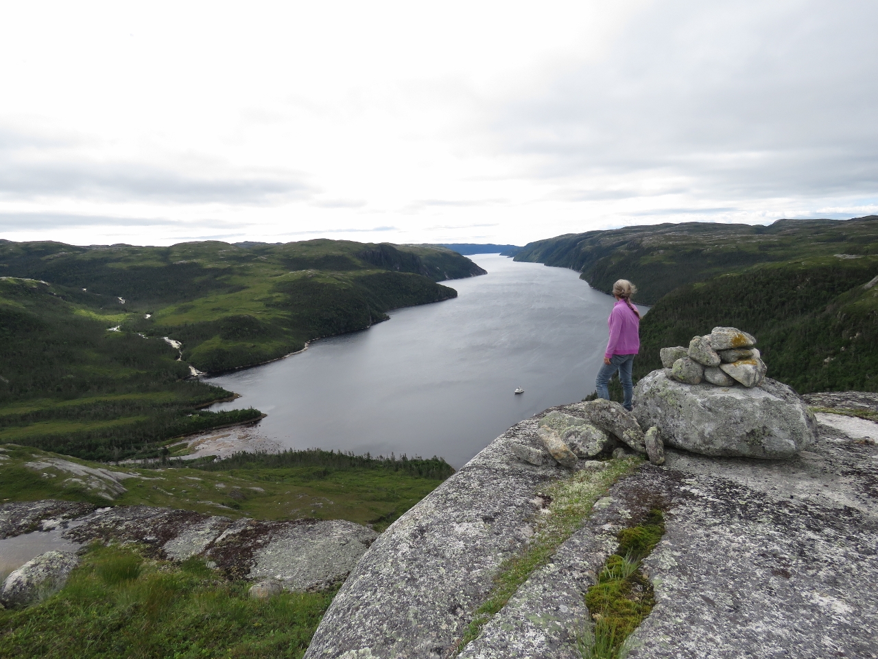 |
8/27/2016: Second Cairn
Position: 47°42.17'N, -57°11.22'W
The fabulous view from another cairn after we'd worked back to the cliff edge. Later that day we met the man who'd built the cairn.
|
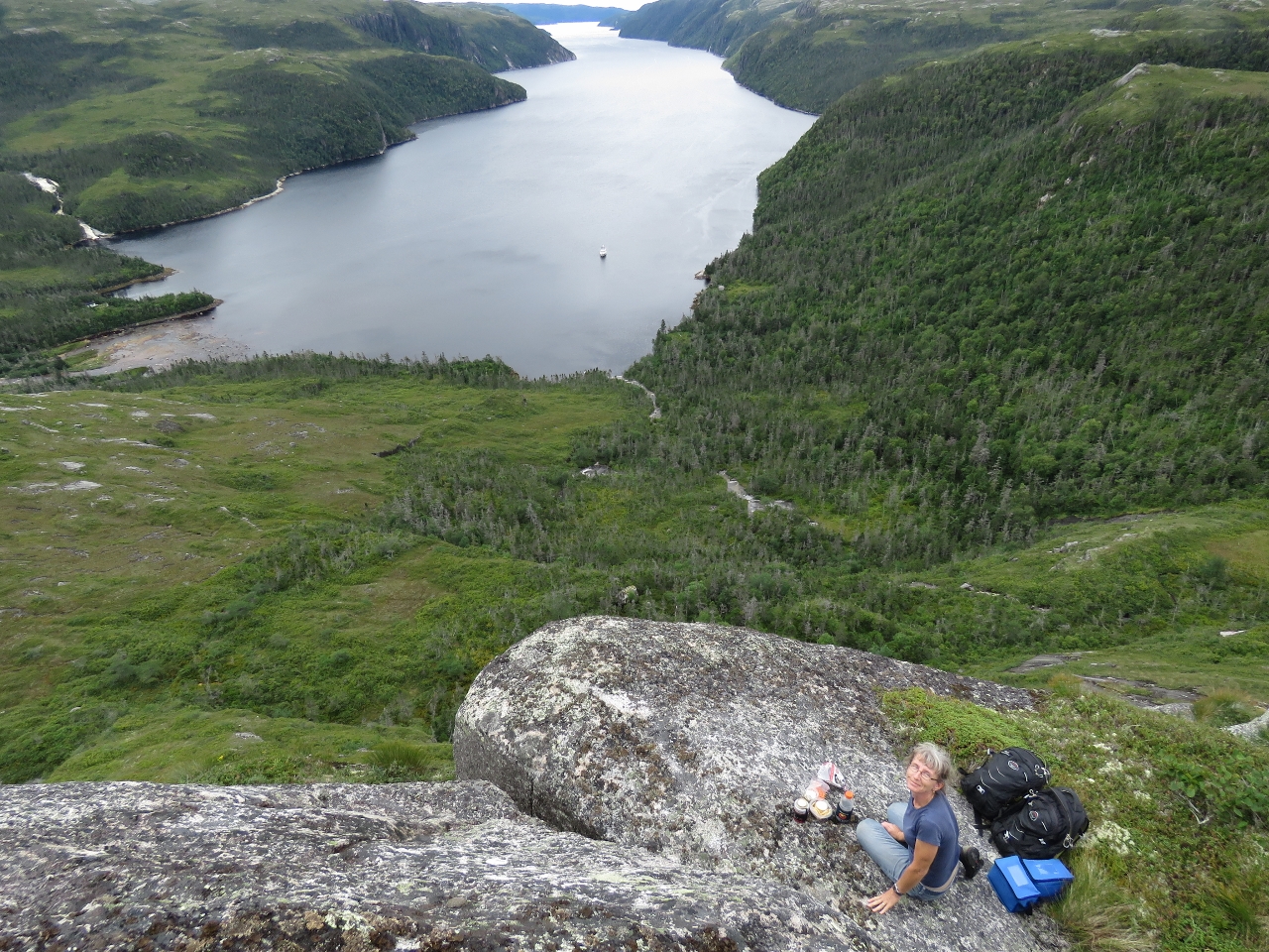 |
8/27/2016: Lunch
Position: 47°42.17'N, -57°11.23'W
Perched on the edge for lunch with a view to the anchorage and Bay de Vieux. At the top left of the photo is another gushing waterfall that also is visible from our anchorage.
|
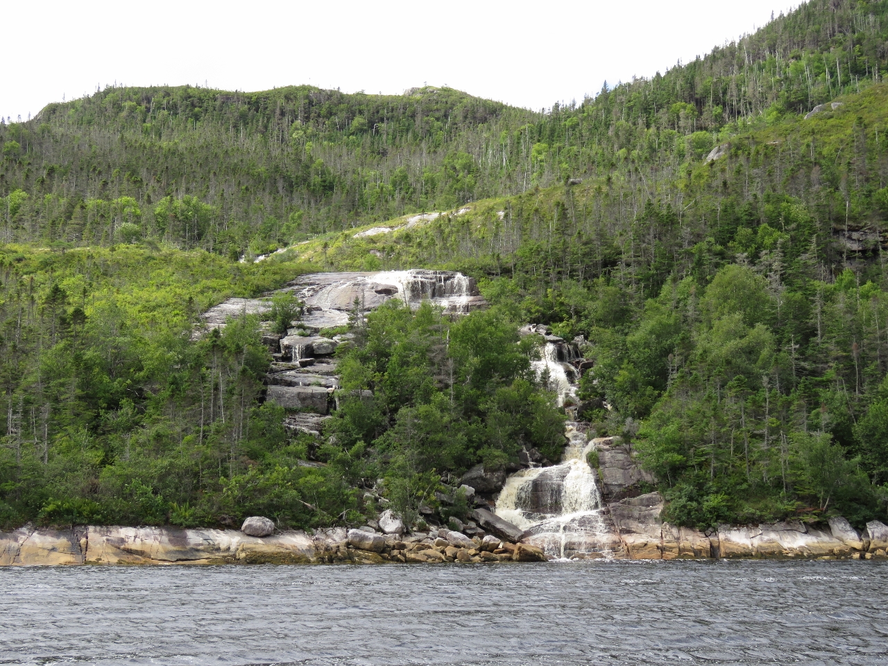 |
8/27/2016: Waterfall Tour
Position: 47°41.38'N, -57°11.38'W
After returning back down, we did a relaxing tour of Bay de Vieux by tender to check out the many waterfalls. This one is near the head on the west side.
|
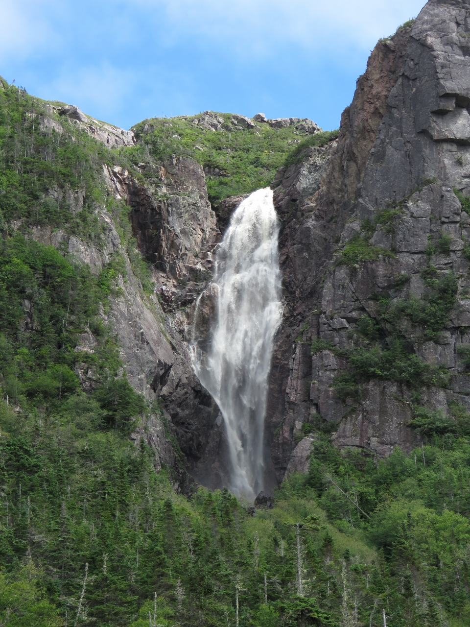 |
8/27/2016: Gusher
Position: 47°40.18'N, -57°10.44'W
This gusher plummets a couple of hundred feet down the cliff. We didn't notice it on the way in as it's tucked into a corner.
|
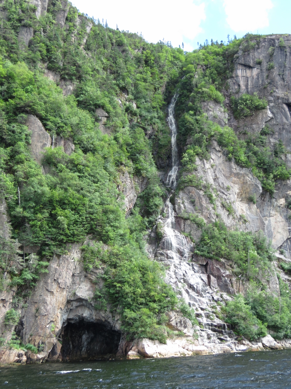 |
8/27/2016: Cave
Position: 47°39.49'N, -57°10.46'W
Cave beneath another waterfall.
|
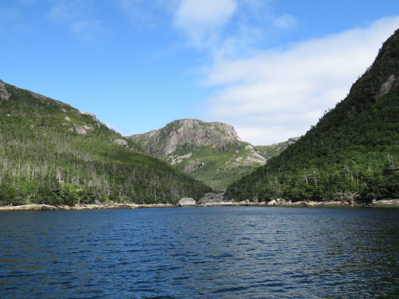 |
8/27/2016: The Nook
Position: 47°38.80'N, -57°9.48'W
Looking to the head of The Nook, a small bay halfway along the east shore of Bay de Vieux. Even thought its smaller and appears more sheltered on the chart than the head, the northerly winds really gusted through here. And it's much more open to southerly wind and swell as well.
|
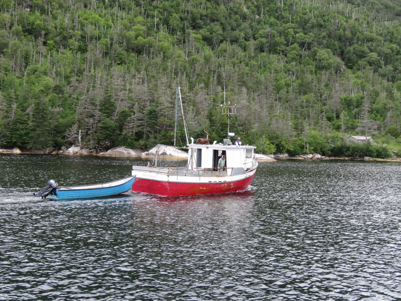 |
8/27/2016: Kristen & Shauna
Position: 47°41.80'N, -57°11.17'W
Early that evening a group of residents from Ramea, just south of Bay de Vieux, arrived in their boat Kristen & Shauna and took the mooring off a cabin at the head. They came over to chat later—one of them had built the cairn we saw at the very top of the mountain. They said there was a faint trail up along the left side of the falls, and possibly a climbing rope.
|
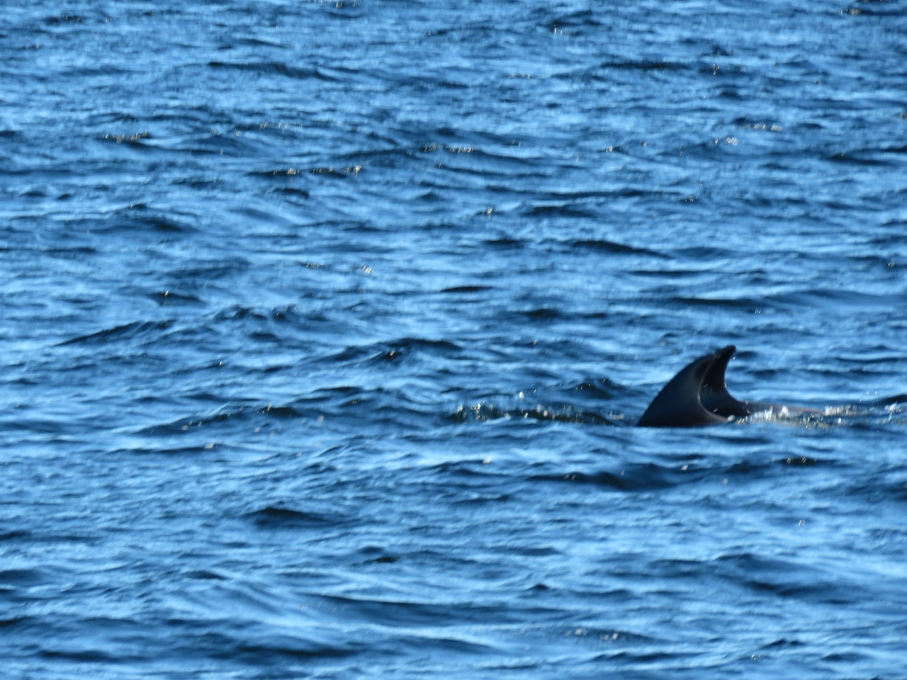 |
8/28/2016: Dolphins
Position: 47°34.34'N, -57°16.39'W
A group of dolphins were leaping and jumping completely out of the water as we approached the Ramea Islands, but became a little more subdued as we neared.
|
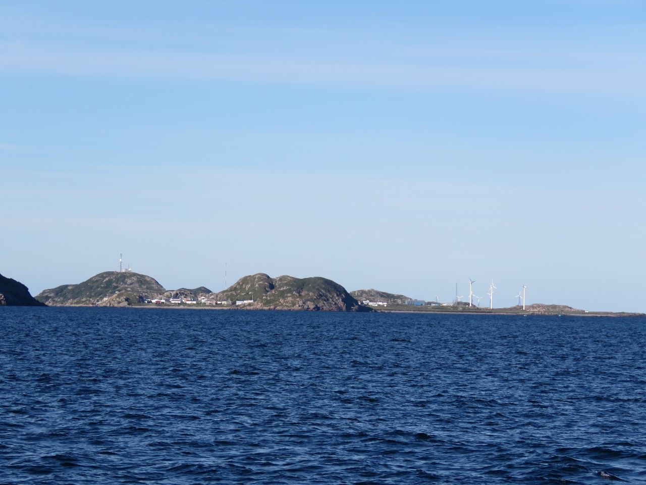 |
8/28/2016: Ramea Islands
Position: 47°32.83'N, -57°20.19'W
Looking south towards North West Island in the Ramea Islands. Several wind turbines are on the right side of the photo.
|
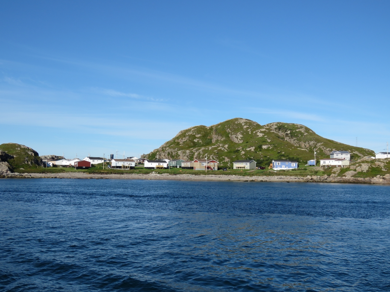 |
8/28/2016: North West Island
Position: 47°31.60'N, -57°22.53'W
We initially were planning to spend a couple more days in Newfoundland and visit White Bear Bay, but the forecast for our planned departure deteriorated this morning so we decided to take today's good forecast instead. We anchored briefly off the northern end of North West Island to secure our towed tender on the boat deck prior to the passage.
|
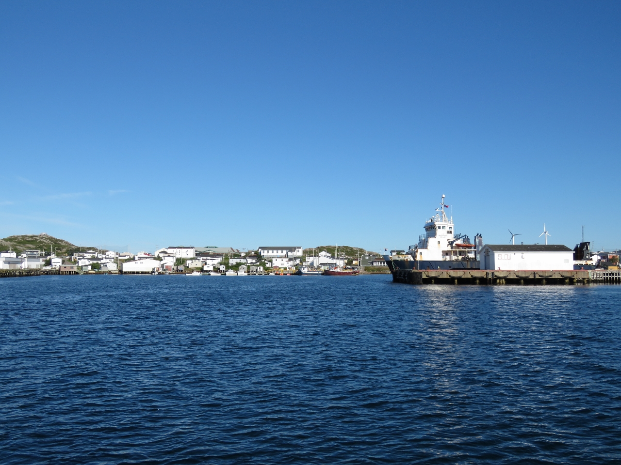 |
8/28/2016: Ship Cove
Position: 47°31.24'N, -57°23.02'W
MV Gallipoli moored at Ship Cove, the Ramea commercial harbour. The ferry runs between Grey River, Ramea and Burgeo and is the only car ferry we've seen so far serving a Newfoundland outport. Atop the hill at the left of the photo is a viewpoint with steps leading up to it. Northwest Island has several excellent walking trails and viewpoints. Had we not wanted to take advantage of the good forecast to make the run across Cabot Strait, we likely would have anchored off Muddy Harbour to the south of Ship Cove and spent at least a day here touring around.
|
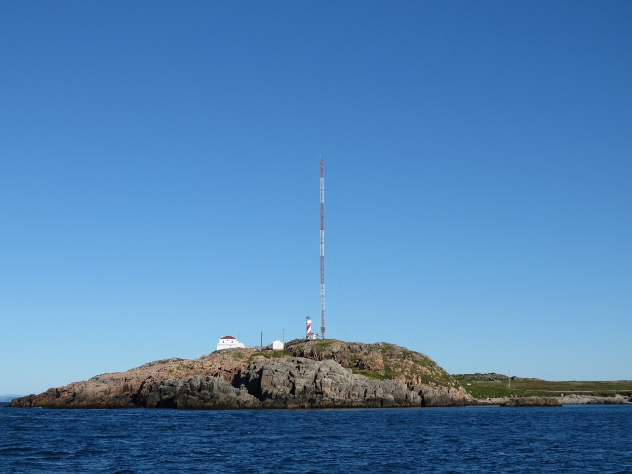 |
8/28/2016: Northwest Head
Position: 47°30.53'N, -57°24.31'W
The light on Northwest Head will be the last Newfoundland lighthouse we'll see on this trip. A web of thick cables secure the radio tower, indicative of the strong winds the area must see. The white line through the grass at the right of the photo is a boardwalk that leads from town to Northwest Head.
|