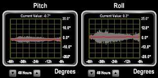
MV Dirona travel digest for Orkney Islands, Scotland 2017

|
Click the travel log icon on the left to see these locations on a map,
with the complete log of our cruise. On the map page, clicking on a camera or text icon will display a picture and/or log entry for that location, and clicking on the smaller icons along the route will display latitude, longitude and other navigation data for that location. And a live map of our current route and most recent log entries always is available at //mvdirona.com/maps/LocationCurrent.html. |
 |
9/18/2017: Calm
Position: 58°34.11'N, -6°3.05'W
Lovely calm conditions about ten miles northeast of the Butt of Lewis en route to the Orkney Islands. The seas and winds have been like this all day since leaving St. Kilda about twelve hour ago and we expect them to last until we arrive.
|
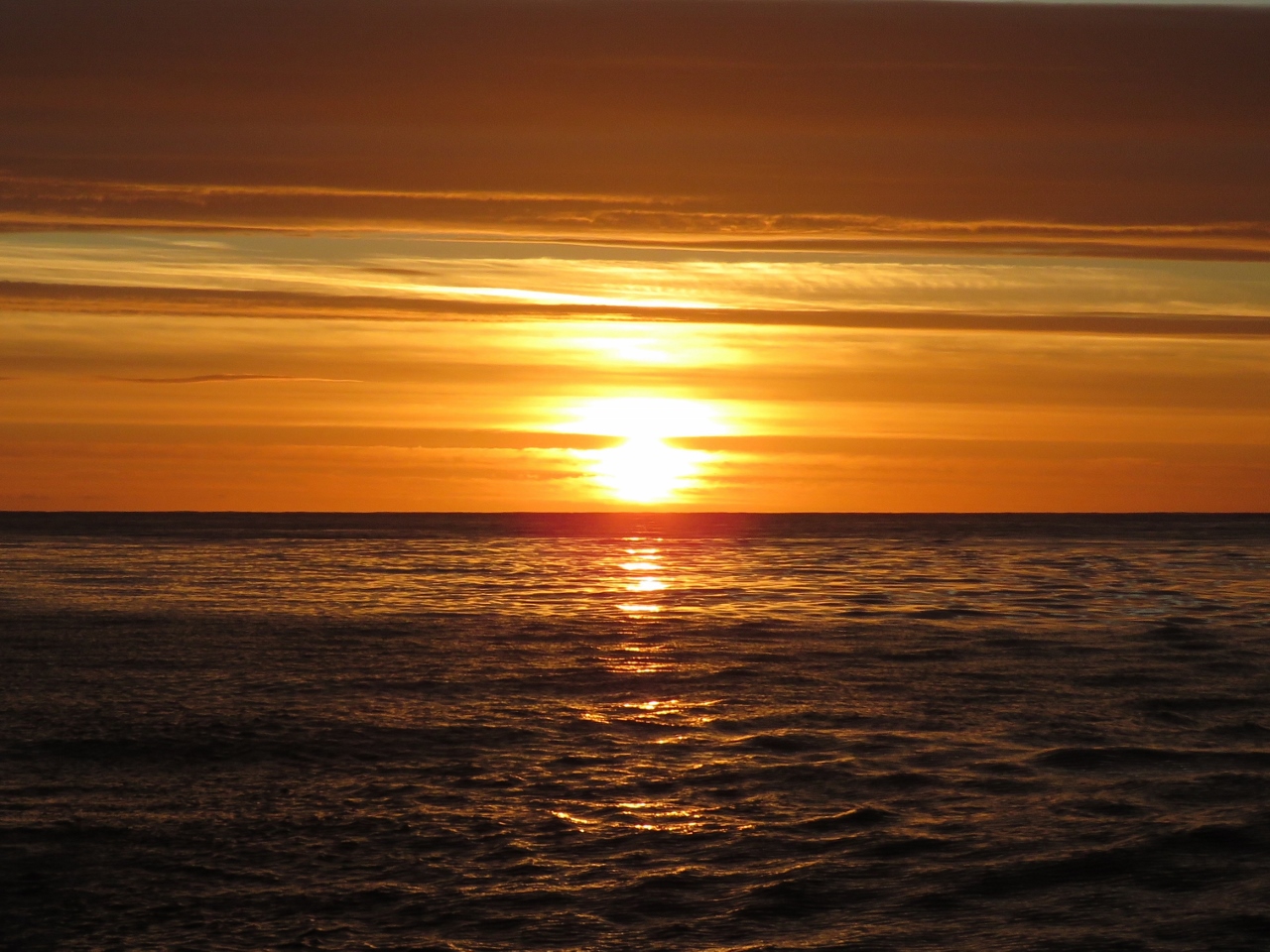 |
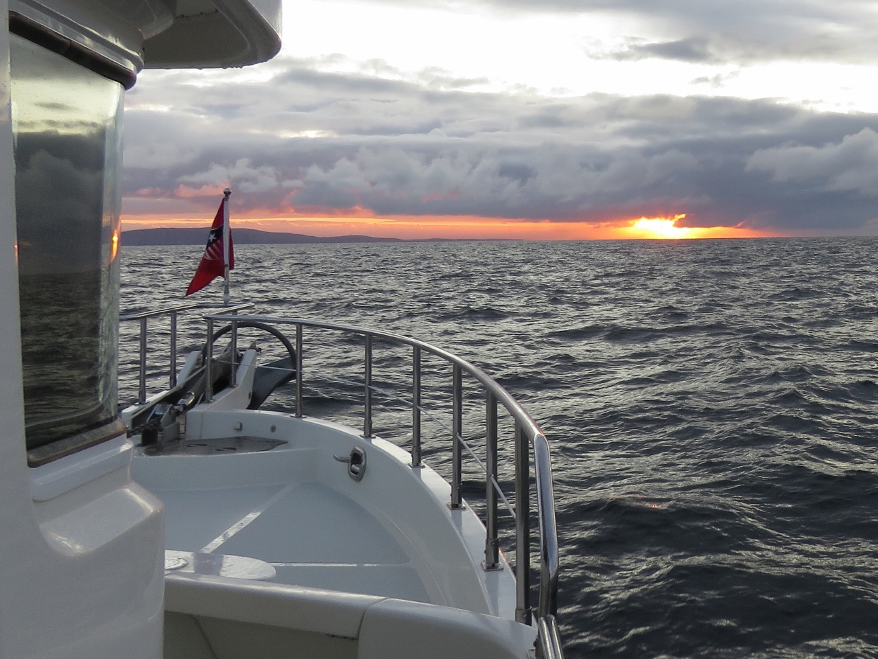
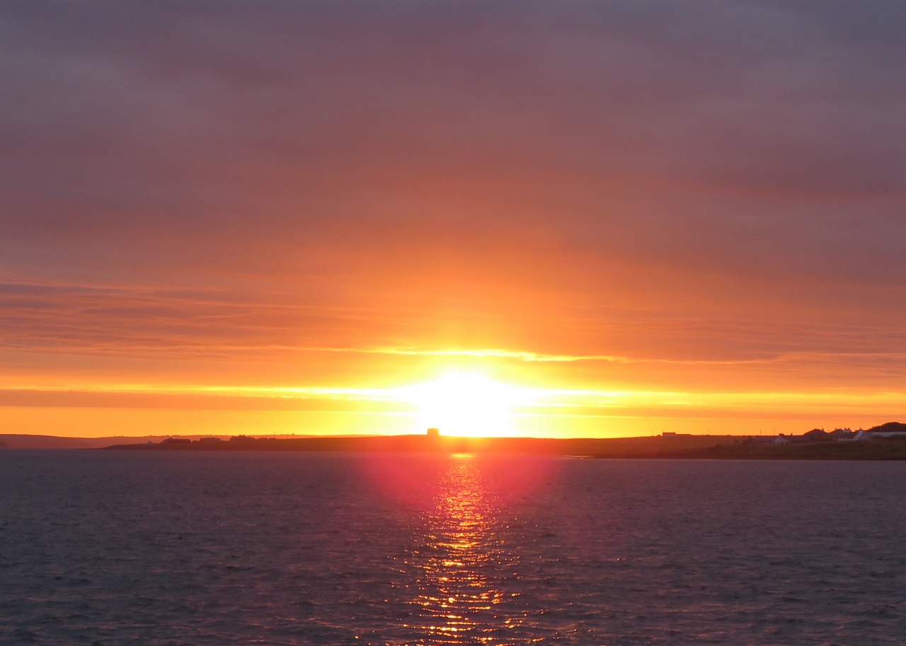
9/18/2017: Sunset
Position: 58°35.51'N, -5°47.44'W
Beautiful sunset about a third of the way between the Butt of Lewis and Cape Wrath.
|
 |
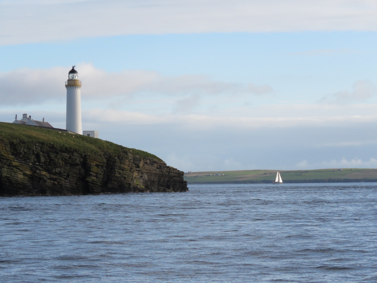
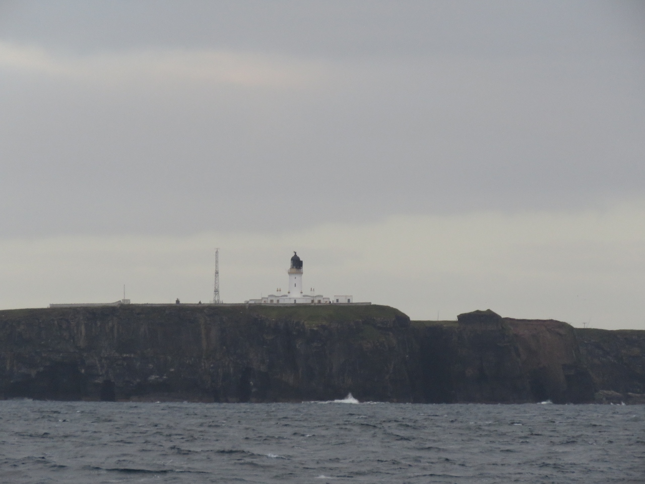
9/18/2017: Cape Wrath
Position: 58°39.61'N, -5°1.81'W
The Cape Wrath light visible about two miles to our south as we round the most north west point on mainland Scotland. The light was completed in 1828, one of the earliest in the country. The Ministry of Defense operates the Cape Wrath Gunnery Range in this area, but it wasn't in operation as we passed through.
|
 |
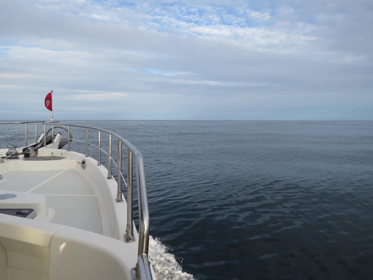
9/19/2017: Traffic
Position: 58°41.11'N, -4°36.66'W
Lots of traffic as we pass north of Loch Eriboll. The 459ft German air-defense frigate Sachsen and the 132ft Norwegian fish carrier Migdale both just passed us heading west, while the 554ft Liberian bulker Hannah just overtook us heading east and the 984ft cargo ship CMA CGM Moliere is approaching from the east.
|
 |
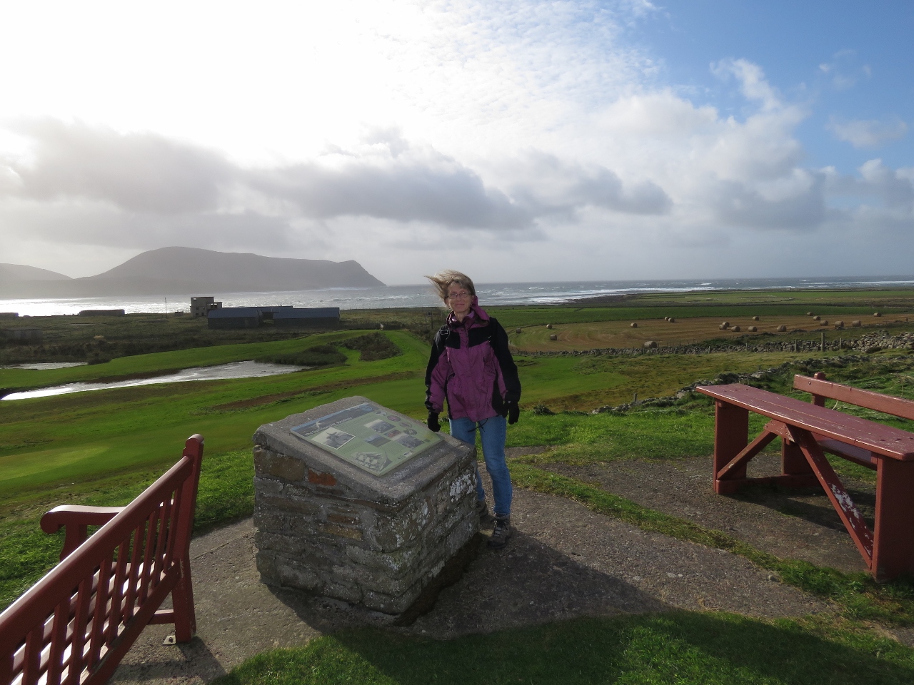
9/19/2017: Orkneys Ho!
Position: 58°44.86'N, -3°31.28'W
Sunrise with the Orkney Island of Hoy visible on the left in the distance.
|
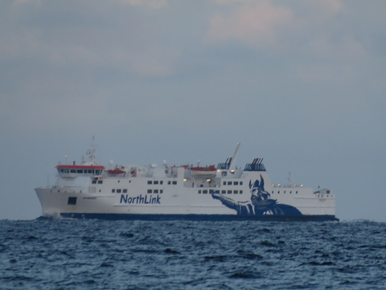 |
9/19/2017: Hamnavoe
Position: 58°45.16'N, -3°26.30'W
The 367ft North Link ferry Hamnavoe en route to Stromness in the Orkney Islands from Scrabster on the Scottish mainland. That crossing can be a rough one—the ferry looks strong and capable.
|
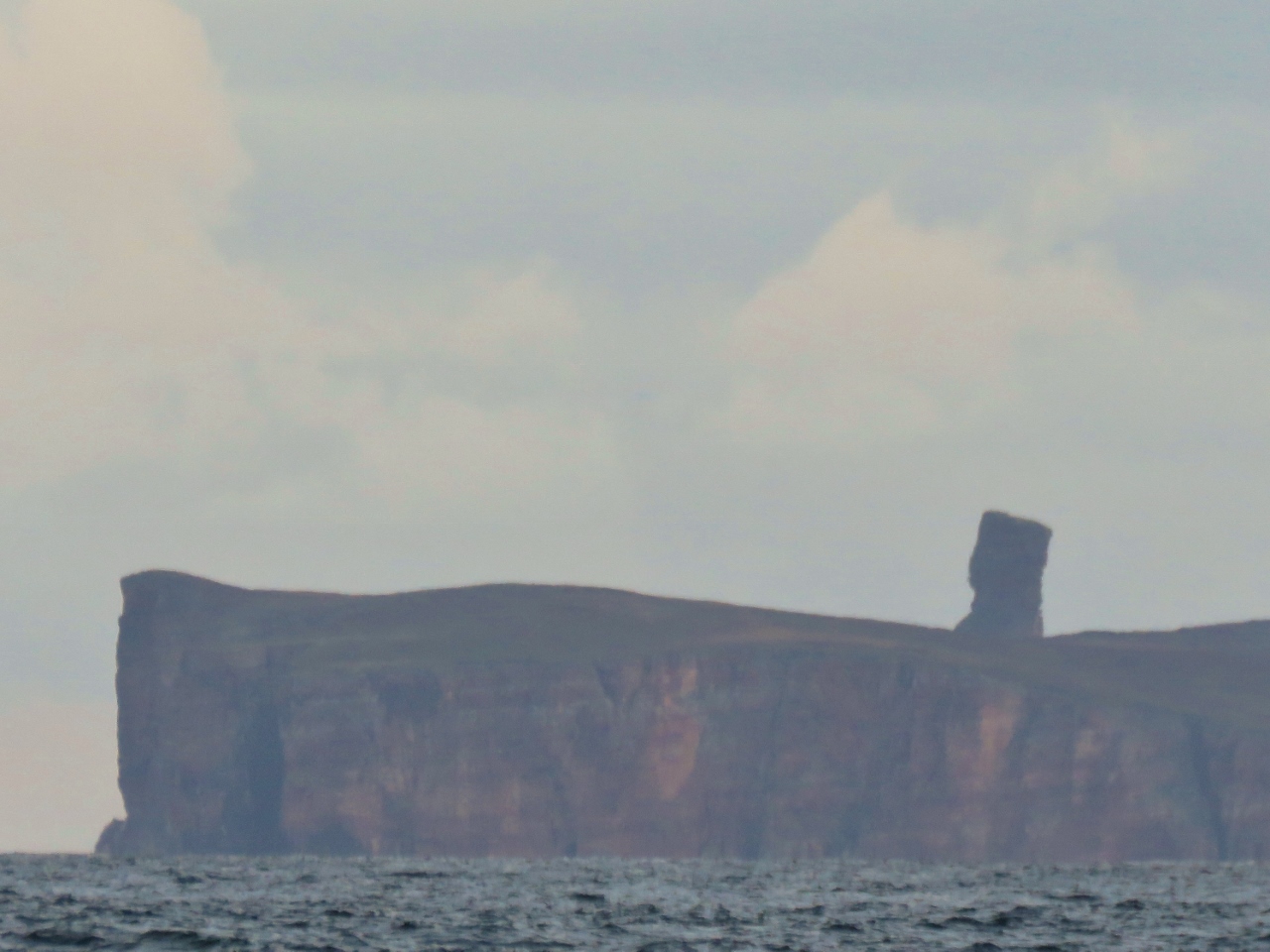 |
9/19/2017: Old Many of Hoy
Position: 58°45.17'N, -3°26.07'W
The 449ft (137m) sea stack Old Man of Hoy visible beyond 331ft (101m) Rora Head off the west coast of Hoy Island.
|
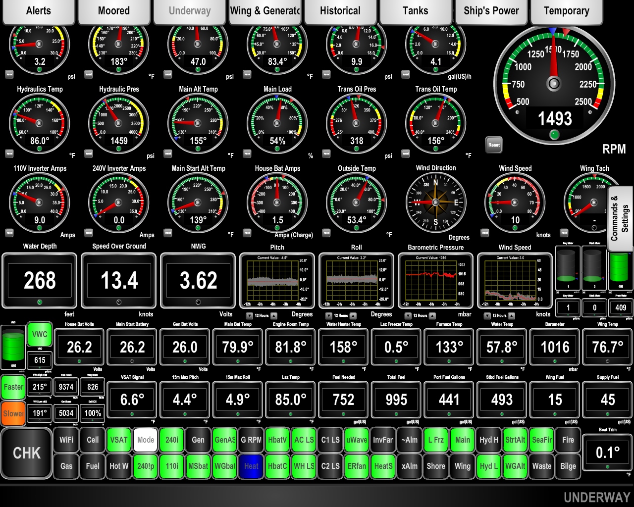 |
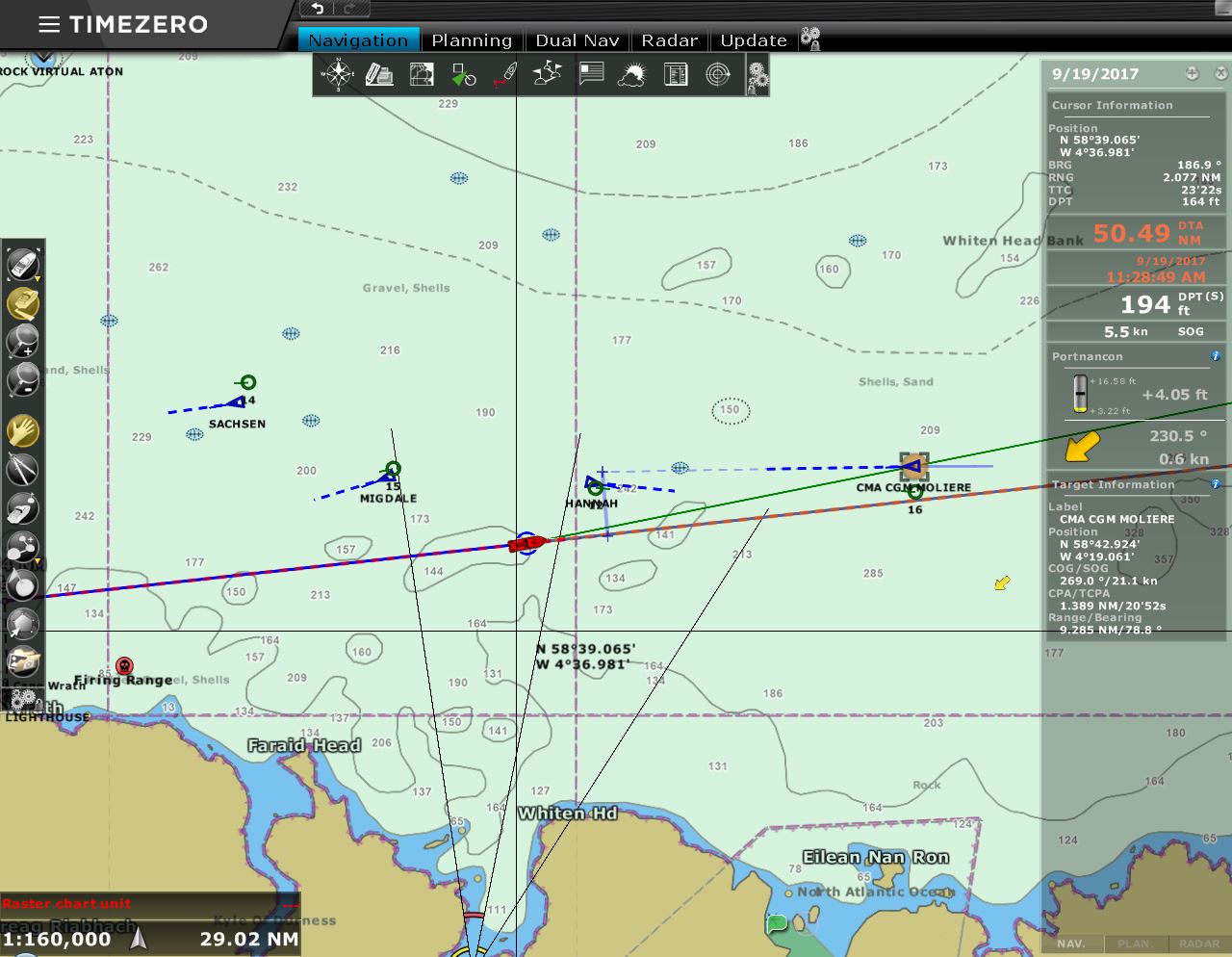
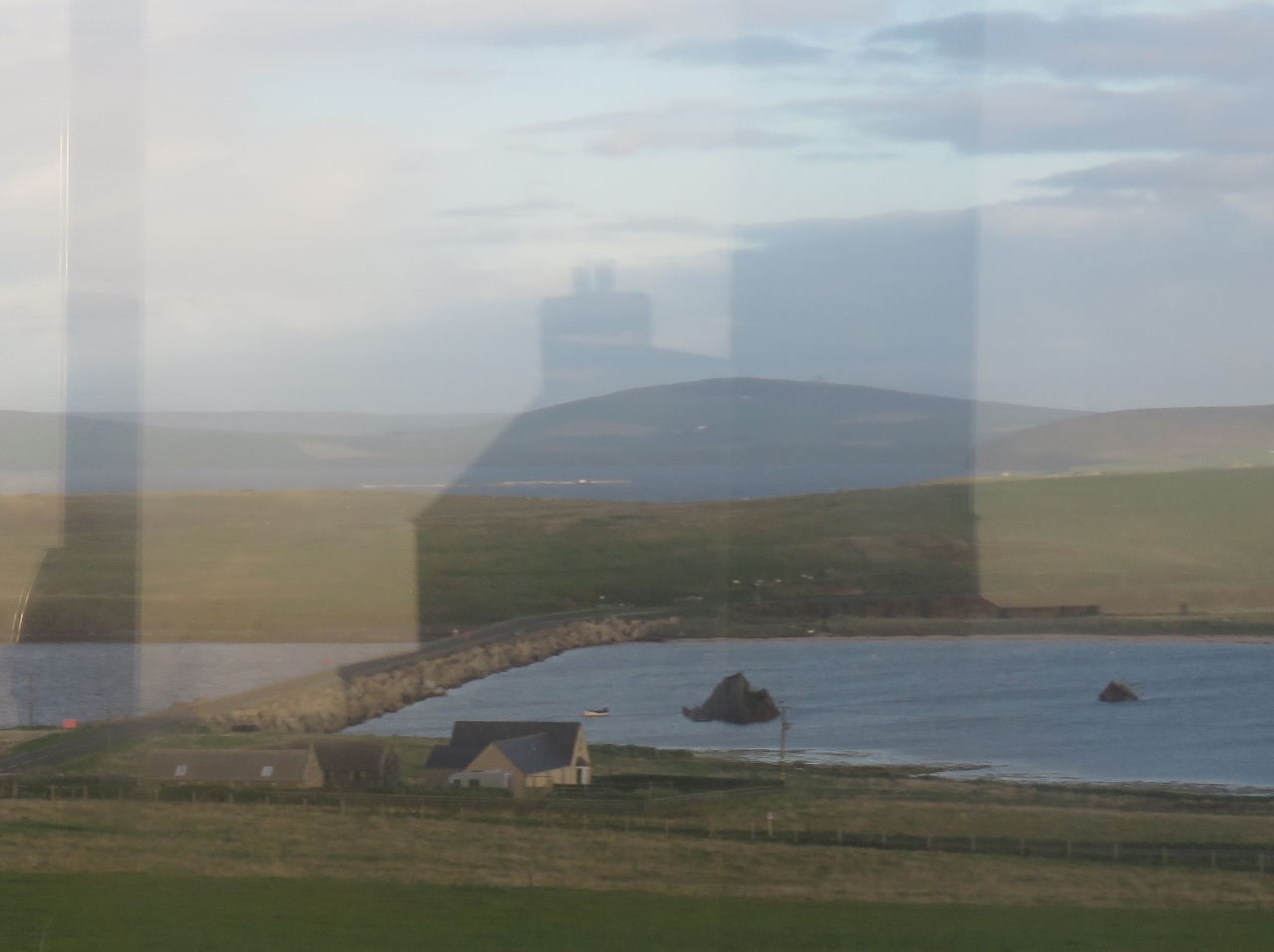
9/19/2017: 13.4 knots
Position: 58°45.64'N, -3°15.90'W
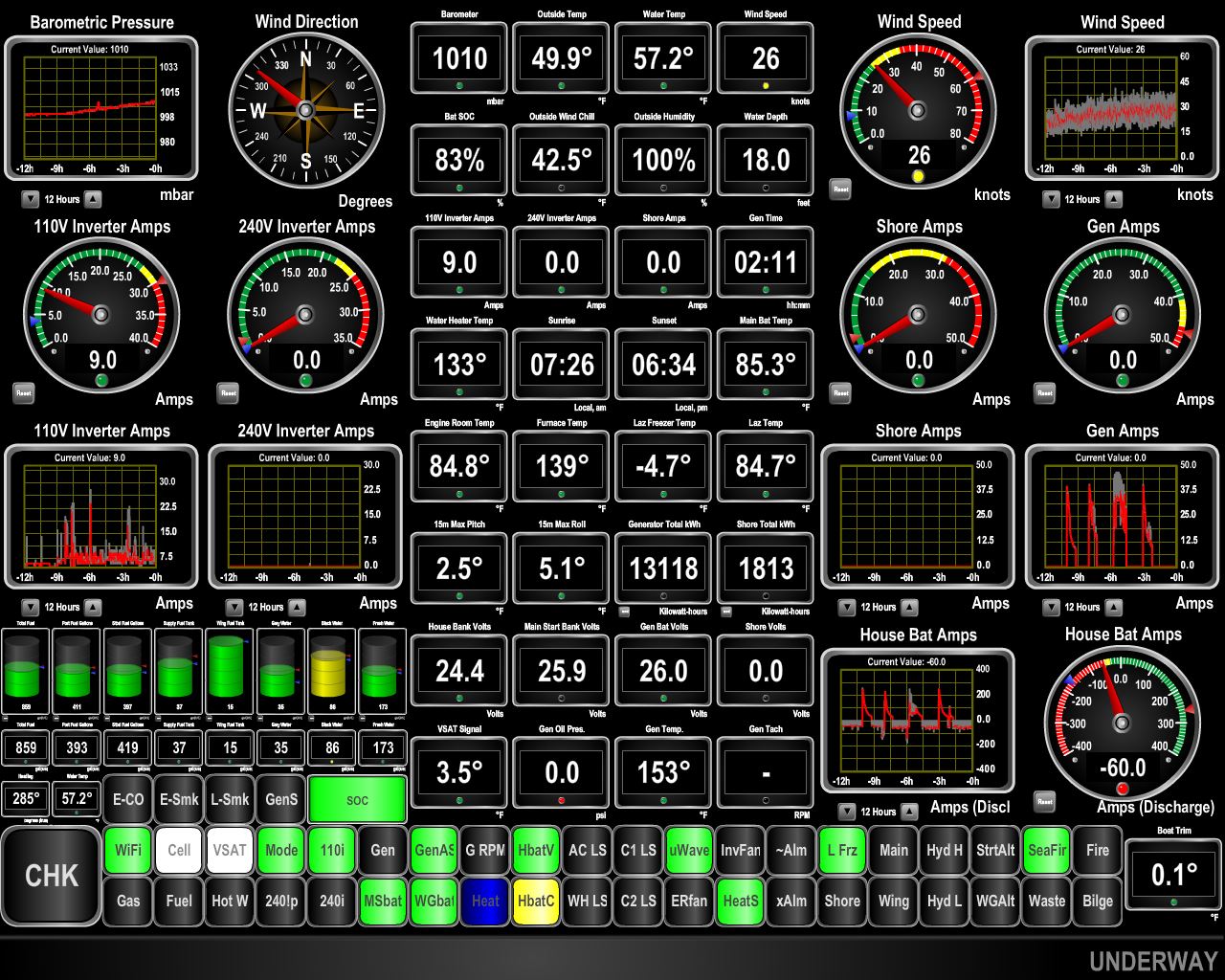
The currents around the Orkney Islands are among the swiftest in Great Britain. The charts show a recommend path for deep draft vessels with a warning that "due to possible tidal effects, vessels may need to steer noticeably different courses from those shown in order to maintain the recommended path". Currents in the Pentland Firth separating the islands from mainland Scotland can reach nine knots on spring tides and dangerous tide rips form on the west-bound current, particularly in an opposing wind. We've timed our arrival with the milder east-going current in calm conditions, so don't expect any rough water. We are getting quite a push though. We're doing 13.4 knots at 1500 RPM where normally we'd be doing about 7.5 knots.
|
 |
9/19/2017: Cantick Head
Position: 58°46.80'N, -3°8.45'W
The Cantick Head Lighthouse was a dramatic first view of the Orkneys for Jennifer who got up from her off-watch just as it came into view. The light has been in service since 1858.
|
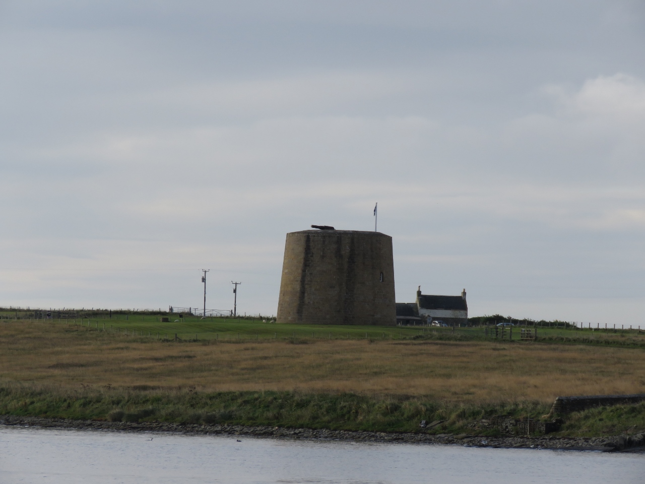 |
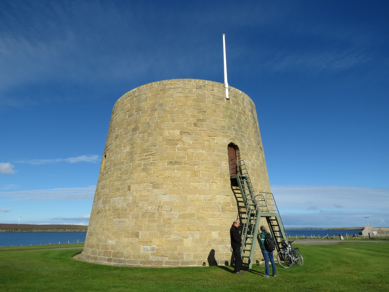
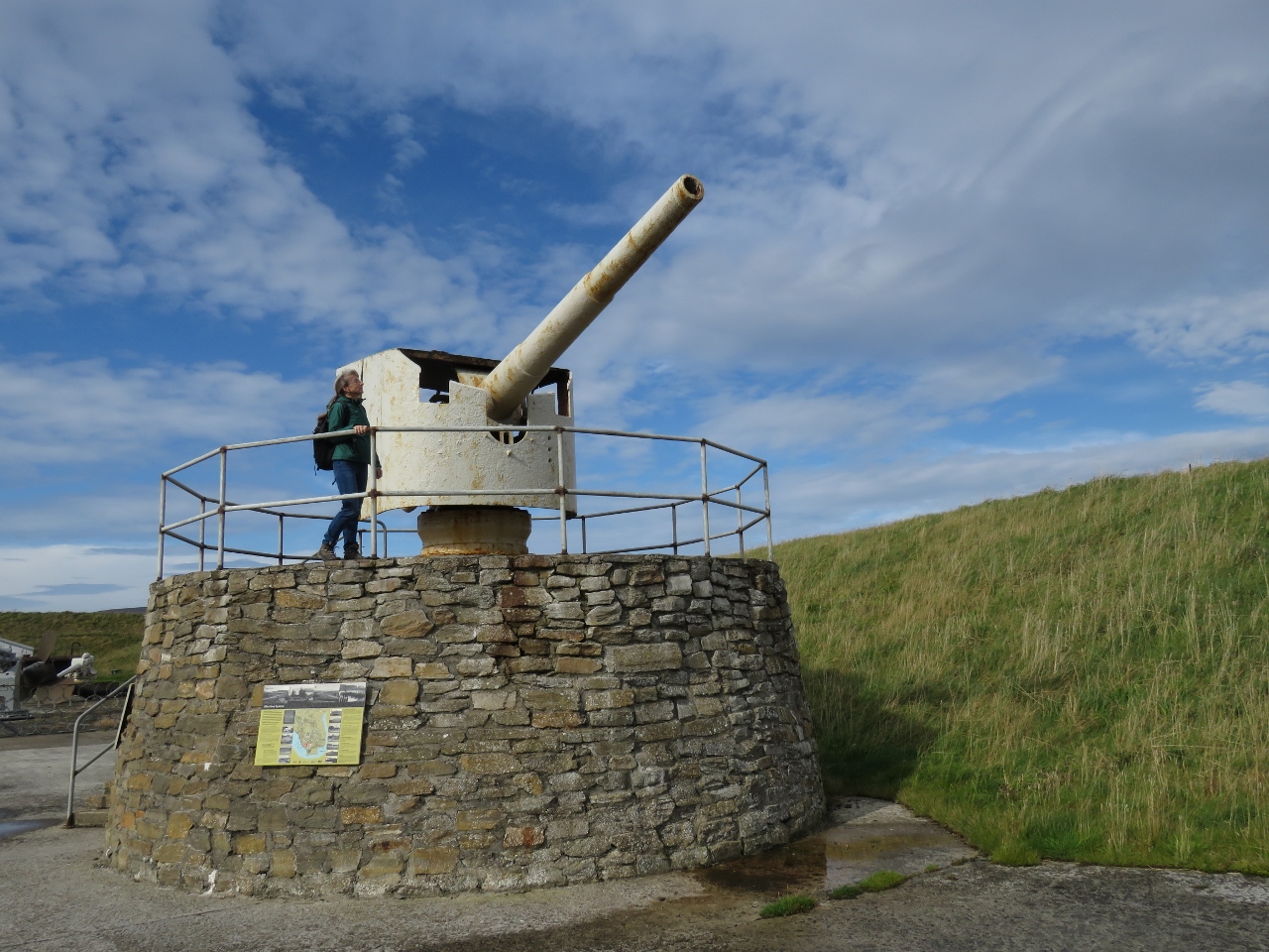
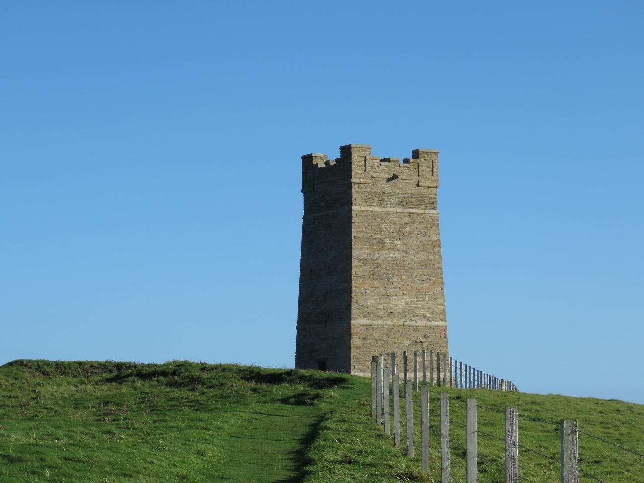
9/19/2017: Martello Tower
Position: 58°48.52'N, -3°8.43'W
Martello Tower with gun, built in the early 1800s to guard the entrance to Scapa Flow.
|
 |
9/19/2017: Long Hope
Position: 58°48.18'N, -3°11.81'W
At anchor in Long Hope with our anchor buoy, "Wilson", visible in the distance. The anchor buoy supports a trip line that allows the anchor to be retrieved by its crown rather than its shank, hopefully releasing it should the flukes be fouled in a cable or something similar. We deployed an anchor buoy a lot in the Pacific Northwest with its logging debris, but haven't used ours much since leaving that area. But we have read that the bottom in many Orkney anchorages is foul, so we're using one here.
|
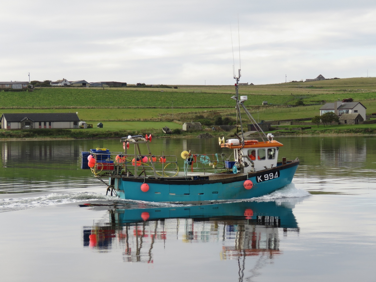 |
9/19/2017: Caspian
Position: 58°48.19'N, -3°11.84'W
The fishing vessel Caspian heading toward the village of Longhope.
|
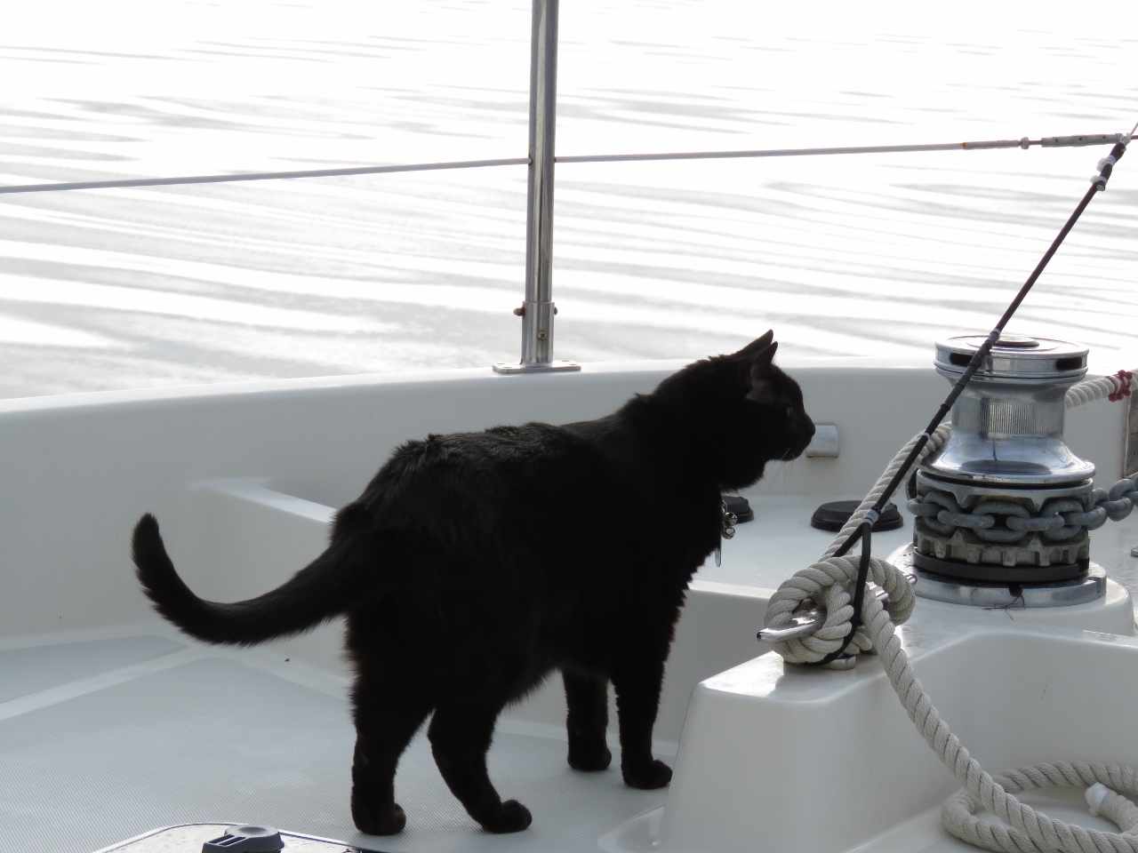 |
9/19/2017: First Smell
Position: 58°48.19'N, -3°11.84'W
Spitfire getting his first smell of the Orkney Islands.
|
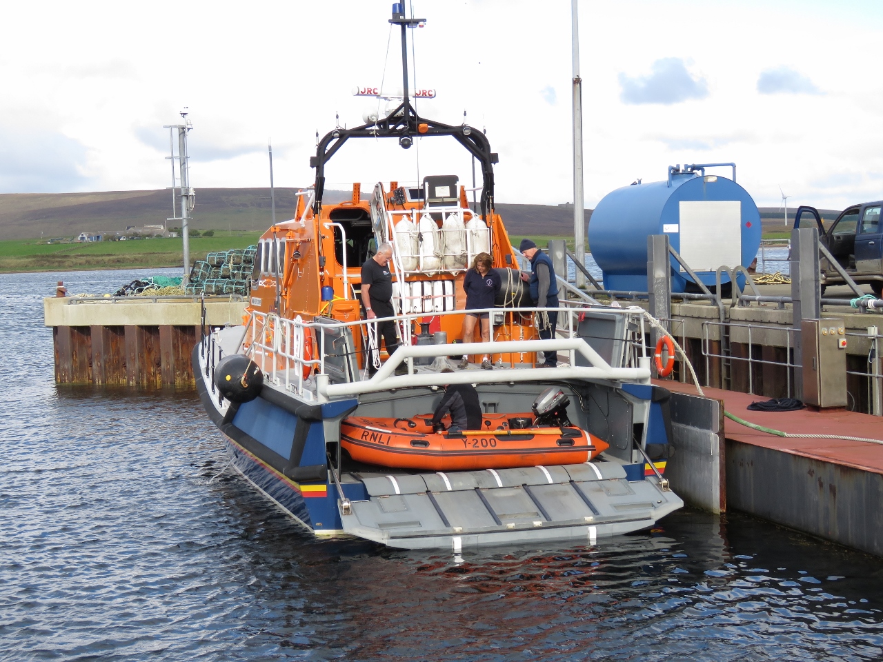 |
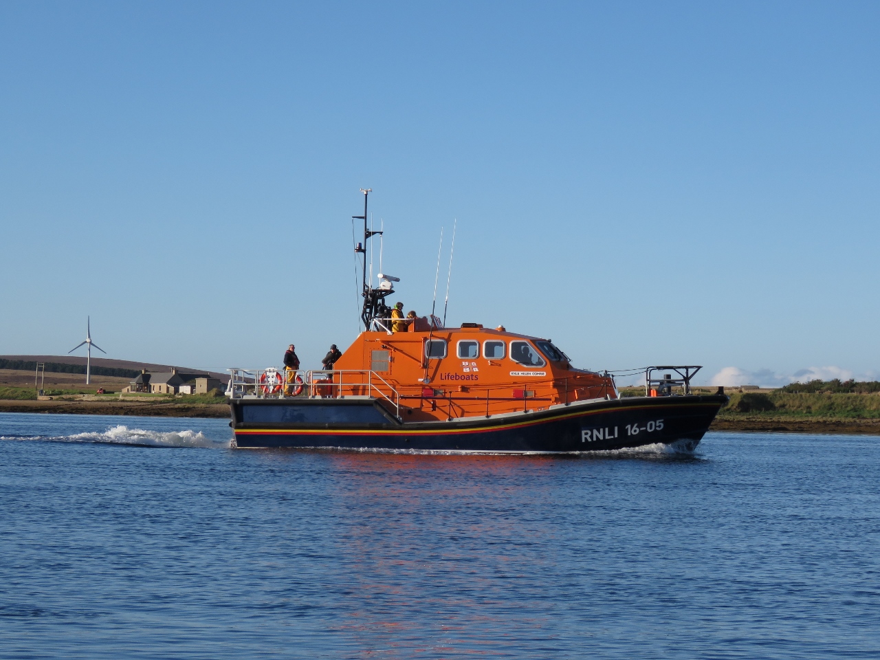
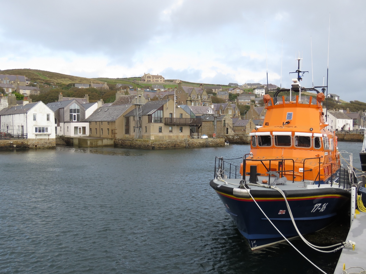
9/19/2017: Helen Comrie
Position: 58°48.06'N, -3°12.35'W
The RNLI lifeboat Helen Comrie at Longhope pier is one of three lifeboats stationed in the Orkney Islands. The other two are at Stromness and Kirkwall on the largest island, Mainland. The RNLI is an amazing life-saving group. They are supported by donations and most of those out there risking their lives doing maritime rescues are volunteers. The RNLI serves the UK and Ireland and they operate in some very difficult sea conditions. They take care of their crews and increase the chance of rescue without loss of life by using state-of-the-art equipment. The Helen Comrie is one of the more recent generations featuring the ability to launch and recover a rigid hull inflatible boat directly off the stern of the boat in even rough seas.
|
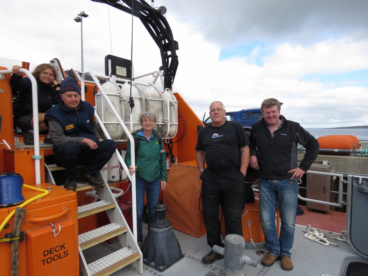 |
9/19/2017: On Board
Position: 58°48.06'N, -3°12.35'W
After chatting with the lifeboat crew for a few minutes, they invited us on board for a tour. From left to right are Dr. Christine Bradshaw, Jamie Wild, Colin Bates and coxswain Kevin Kirkpatrick.
|
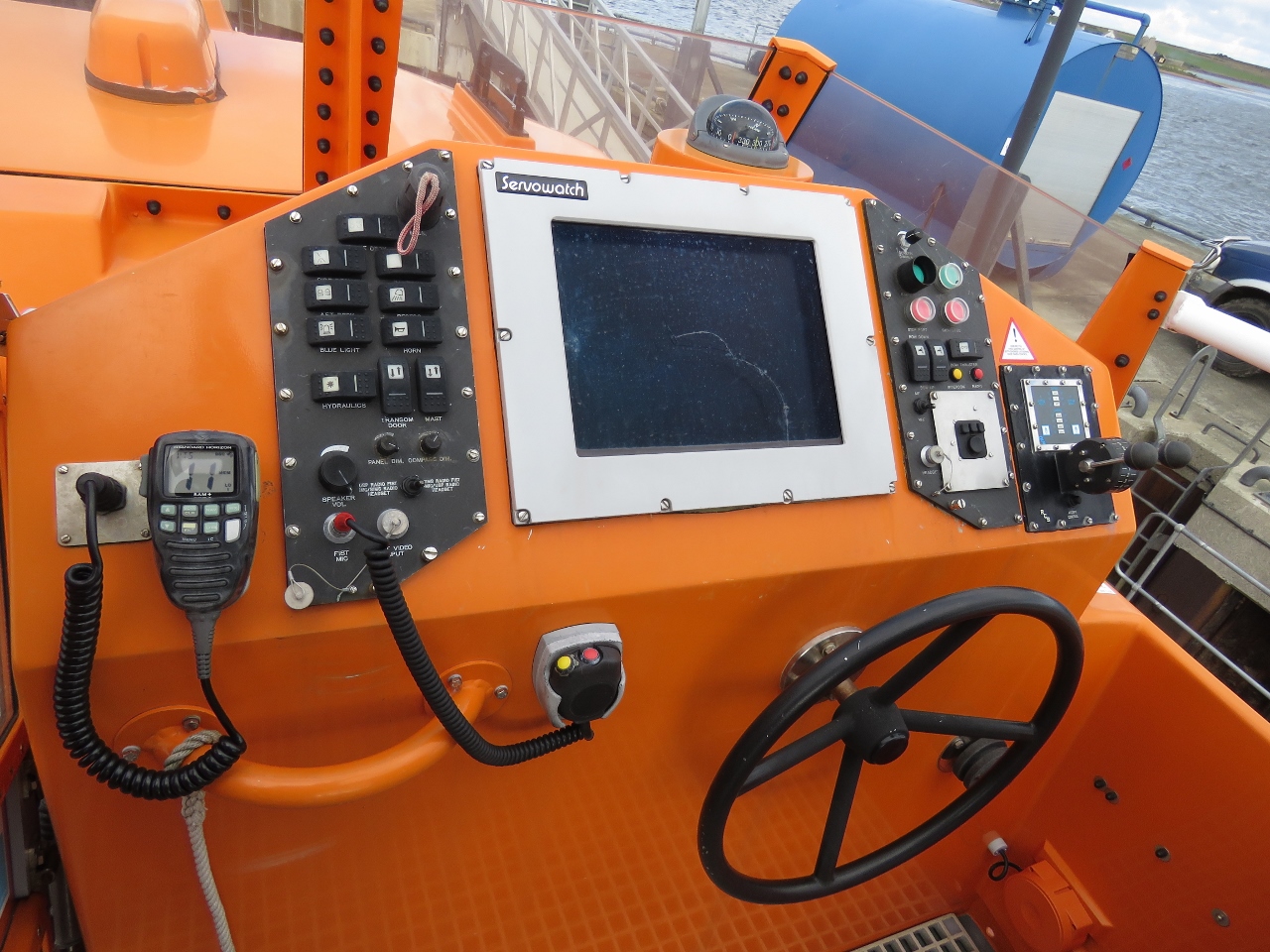 |
9/19/2017: Flybridge
Position: 58°48.06'N, -3°12.35'W
The flybridge, like all helm stations on the Helen Comrie, is well equipped
|
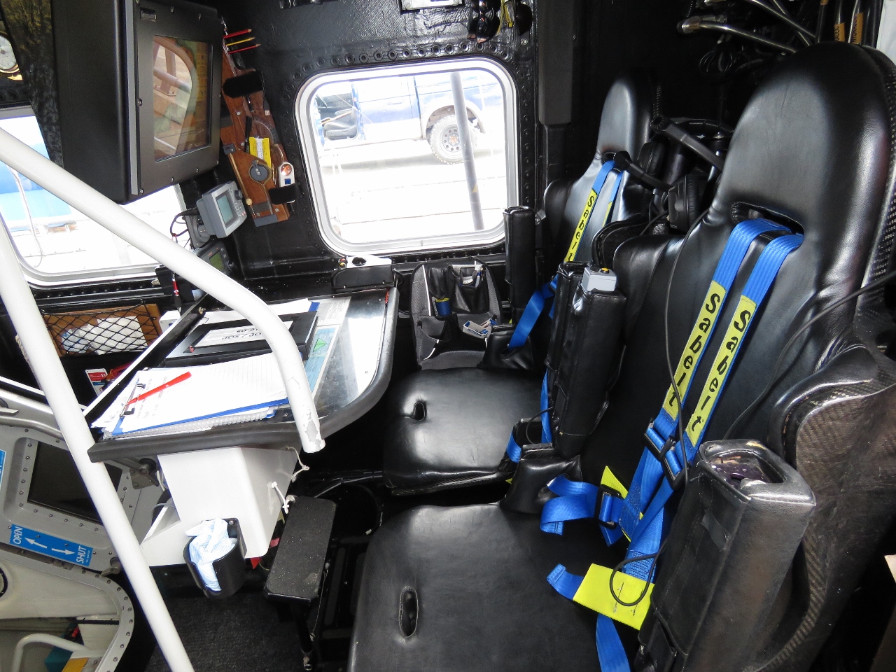 |
9/19/2017: Interior
Position: 58°48.06'N, -3°12.35'W
All seats inside the RNLI lifeboat are equiped with large multi-point seat belts. One of the most common causes of injury in boats operating in tough weather is falling or being hit by flying equipment or violent motion from the boat. Consequently all seating positions employ air suspended seats, large seat belts, and the boat is designed such that one operator can, without needing to shift seats, take over from another who might be incapacitated or busy doing something else. All critical equipment is accessable from multiple crew in different sitting positions without anyone needed to get up.
|
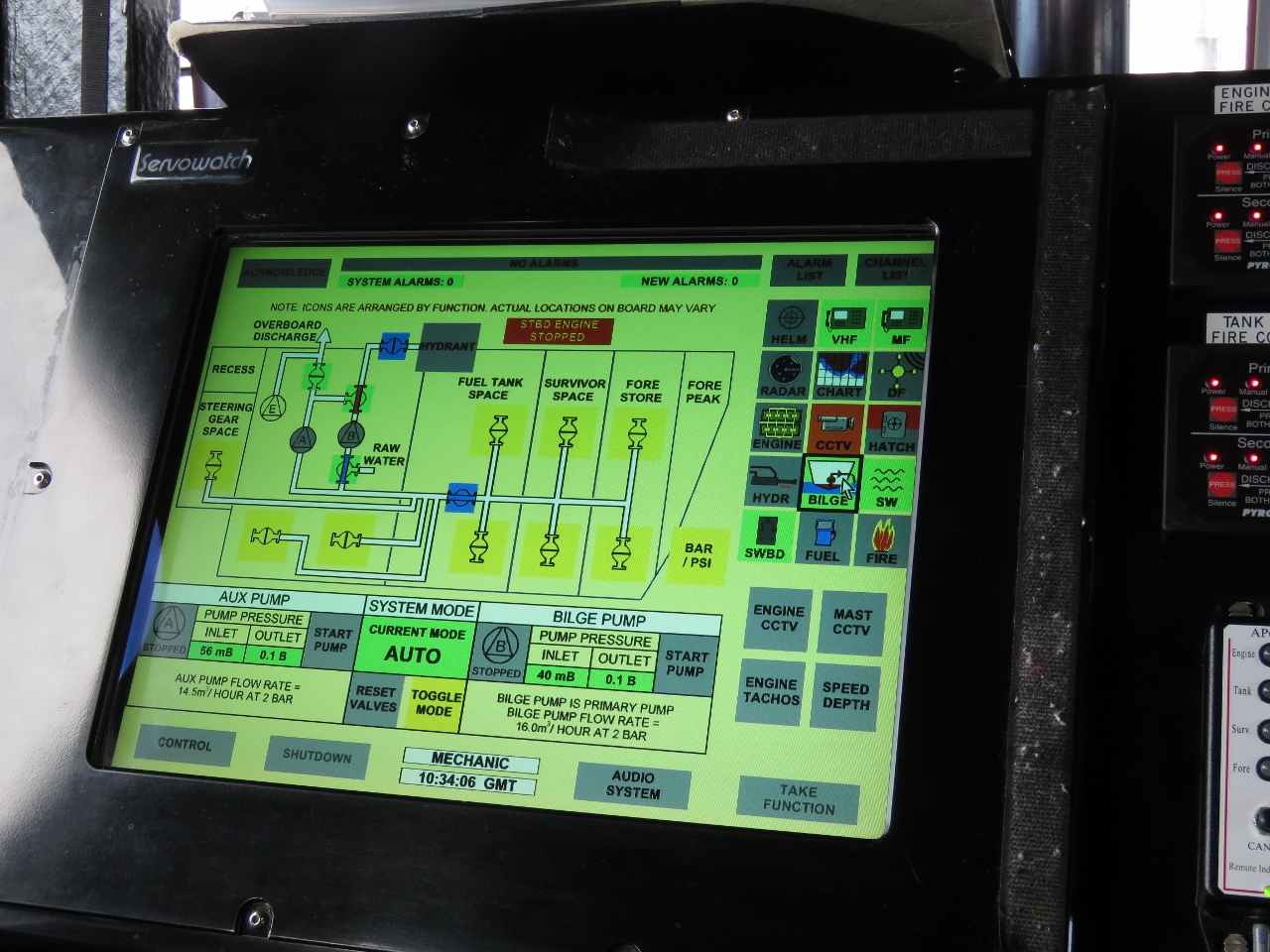 |
9/19/2017: Electronics
Position: 58°48.06'N, -3°12.35'W
The lifeboat has custom electronics that allow the crew to monitor and control all systems in the boat from multiple stations. This page allows them to control the on board dewatering systems.
|
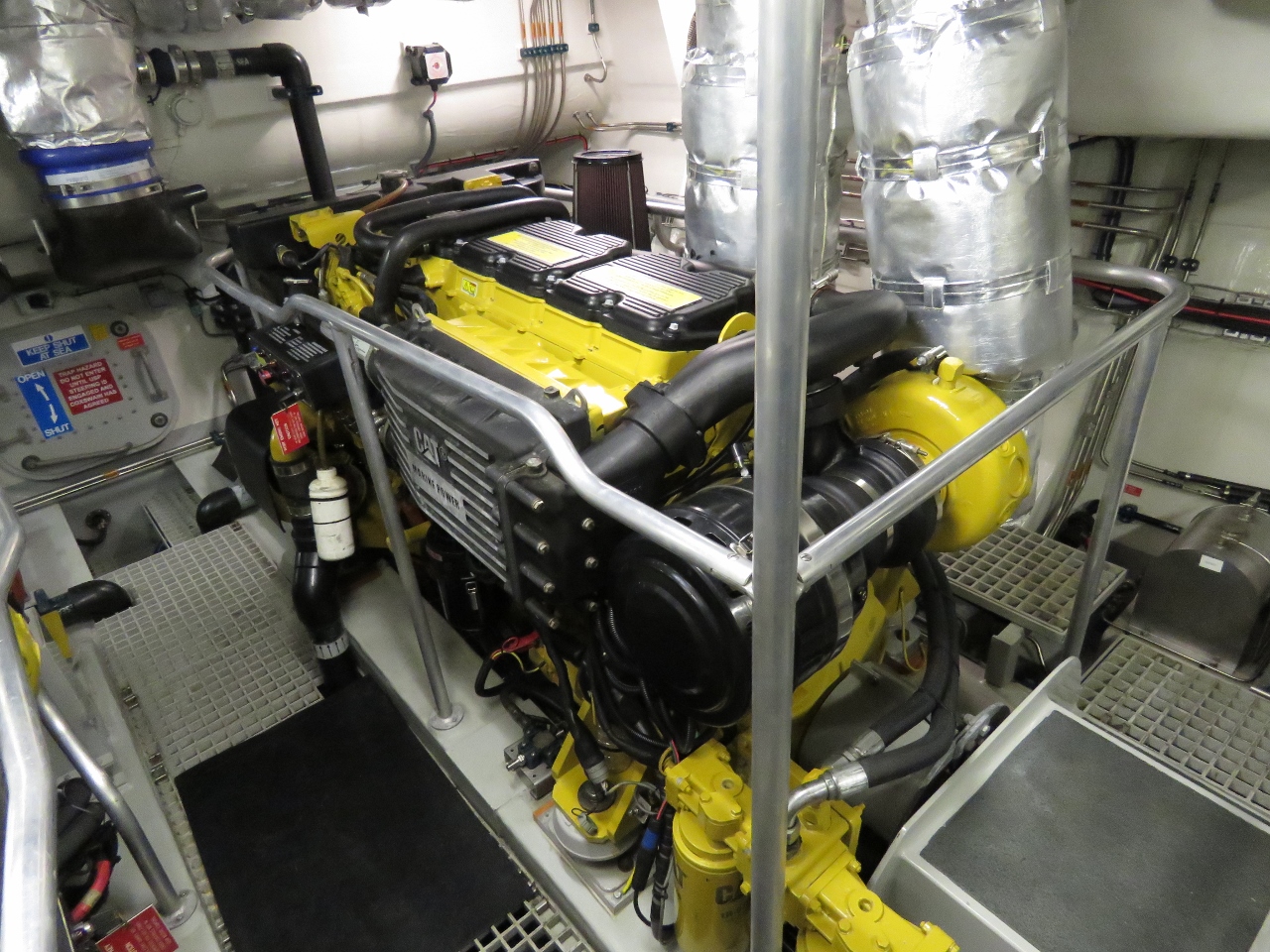 |
9/19/2017: Engine Room
Position: 58°48.06'N, -3°12.35'W
This 16 meter RNLI lifeboat went into service in 2006 and it is powered by two Caterpillar C18 engines producing 1,000 hp each driving fixed pitch 5 blade props and is able to run at 25 kts. The RNLI goal is to be able get a call and be able to be underway on average in only 10 min after they are called for. That's with each member of the crew at work, or at home, and even possibly asleep. They need to be able to drop what they are doing and get to the boat. The first crewman arriving starts the engines and powers up the control systems and, as the full crew complement arrives, they drop the lines and head to sea in what will be, more likely than not, rough conditions.
|
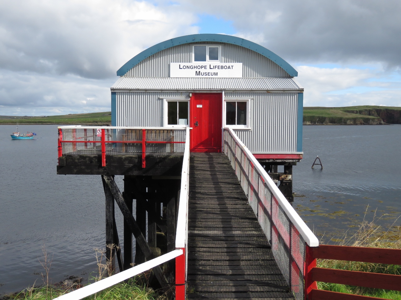 |
9/19/2017: Lifeboat Museum
Position: 58°46.77'N, -3°13.71'W
While touring the RNLI lifeboat Helen Comrie we'd asked the crew if they knew when the Longhope Lifeboat Museum would be open as we couldn't get through by phone to check the hours. Colin Bates offered to open it up for us and, even more amazing, personally drove us there. The museum is housed in the second Longhope Lifeboat Shed, built in 1906 on Aith Hope and in use until 1999. The original shed was built in 1874 a short distance to the northwest and was unique in that it had doors at both ends so the lifeboat could be launched south into Aith Hope or, if conditions were adverse, north into North Bay to exit via Scapa Flow. The current-generation shed is located on the pier where the Helen Comrie is moored.
|
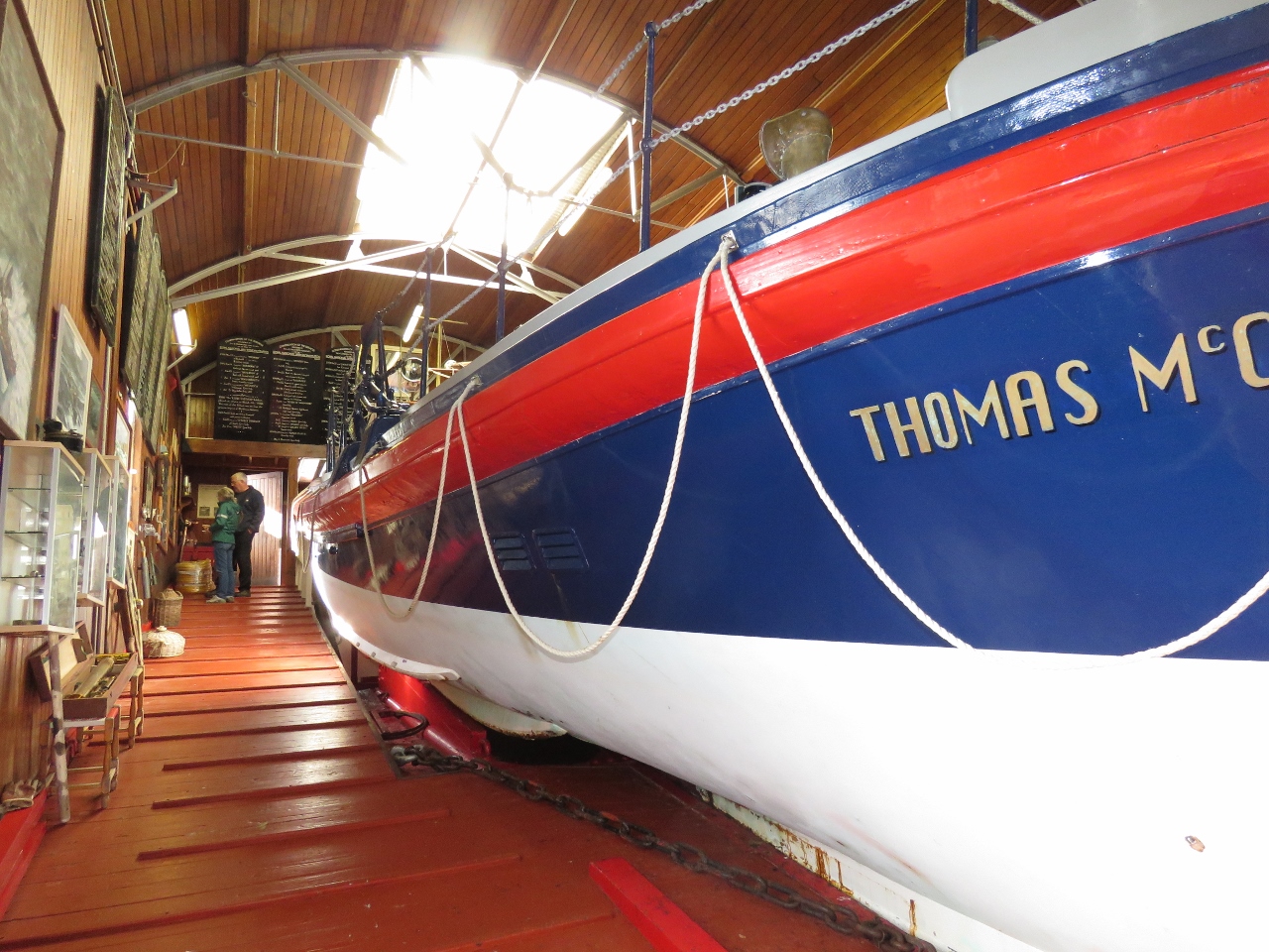 |
9/19/2017: Thomas McCunn
Position: 58°46.77'N, -3°13.69'W
The museum is packed with information about the Longhope Lifeboat Station and its history of daring rescues. We really enjoyed the visit and Colin did a great job of explaining and showing us everything. A feature exhibit is the Longhope lifeboat Thomas McCunn, in service from 1933 to 1962. The lifeboat still is operational and is launched several times a year for non-life-saving purposes.
|
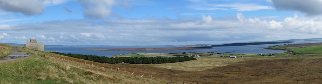 |
9/19/2017: Wee Fea
Position: 58°49.82'N, -3°13.61'W
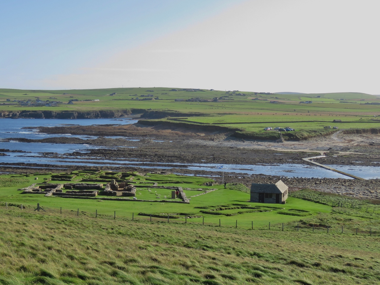
After visiting the Lifeboat Museum, Colin offered to drive us up Wee Fea for the views over Scapa Flow since it was such a nice day. That was very kind of him. The view certainly was impressive. Leftmost in the photo is the old World War II Naval Headquarters and Communications Center. Scapa Flow was the base for the British Fleet during the two World Wars. The point of land roughly central in the photo with the large storage tank is the former Royal Navy Base at Lyness, now the Scapa Flow Museum. Beyond that point is Fara Island and slightly to the right and beyond is Flotta Island, a major North Sea oil terminal, with massive oil storage tanks visible.
|
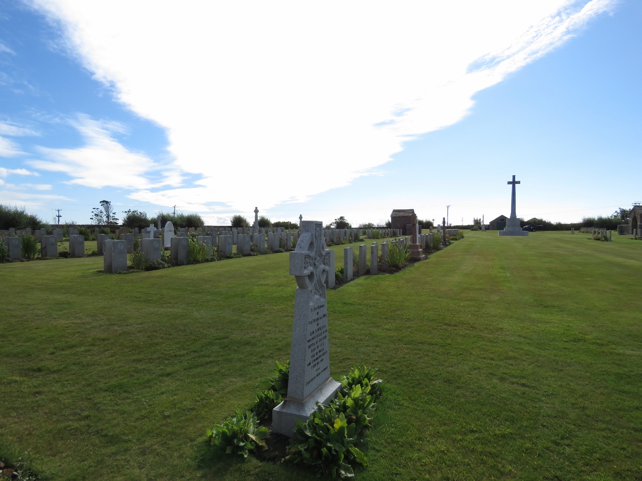 |
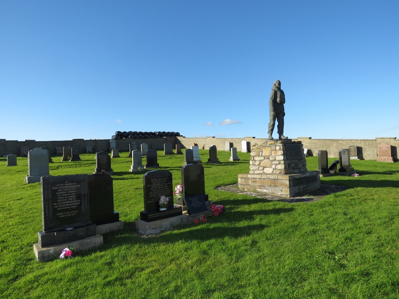
9/19/2017: Naval Cemetery
Position: 58°50.03'N, -3°12.60'W
We stopped off at the Lyness Naval Cemetery on the way back to Longhope. Many of the graves are from local tragedies where ships sank in and around Scapa Flow and the Orkney Islands.
|
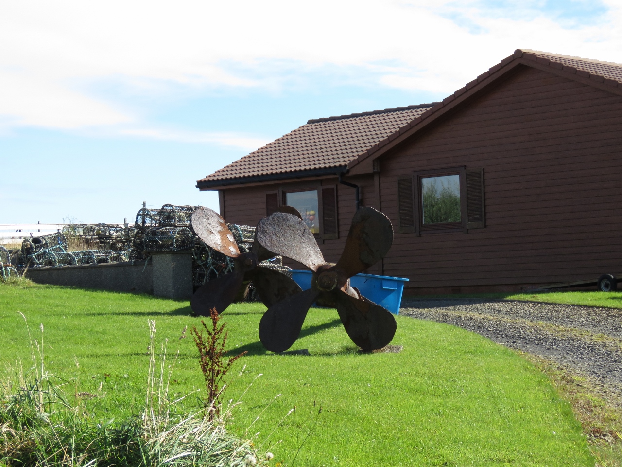 |
9/19/2017: Two-Screw View
Position: 58°47.31'N, -3°12.54'W
This house on a hill has two propellers out front and the owner calls it a "two-screw view"
|
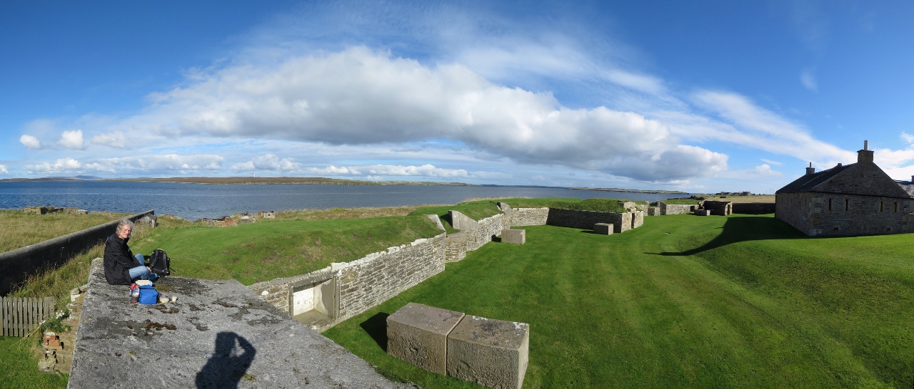 |
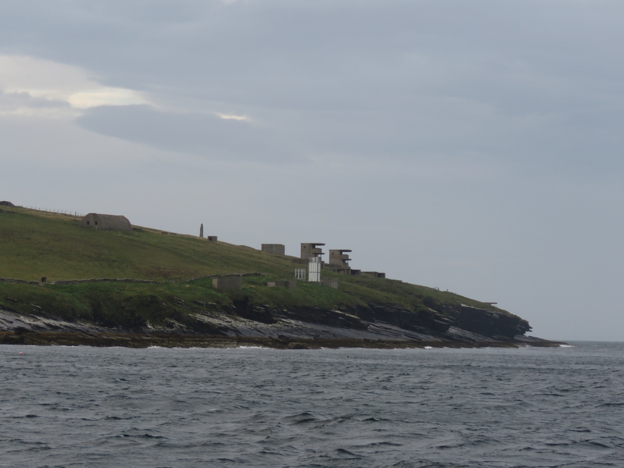
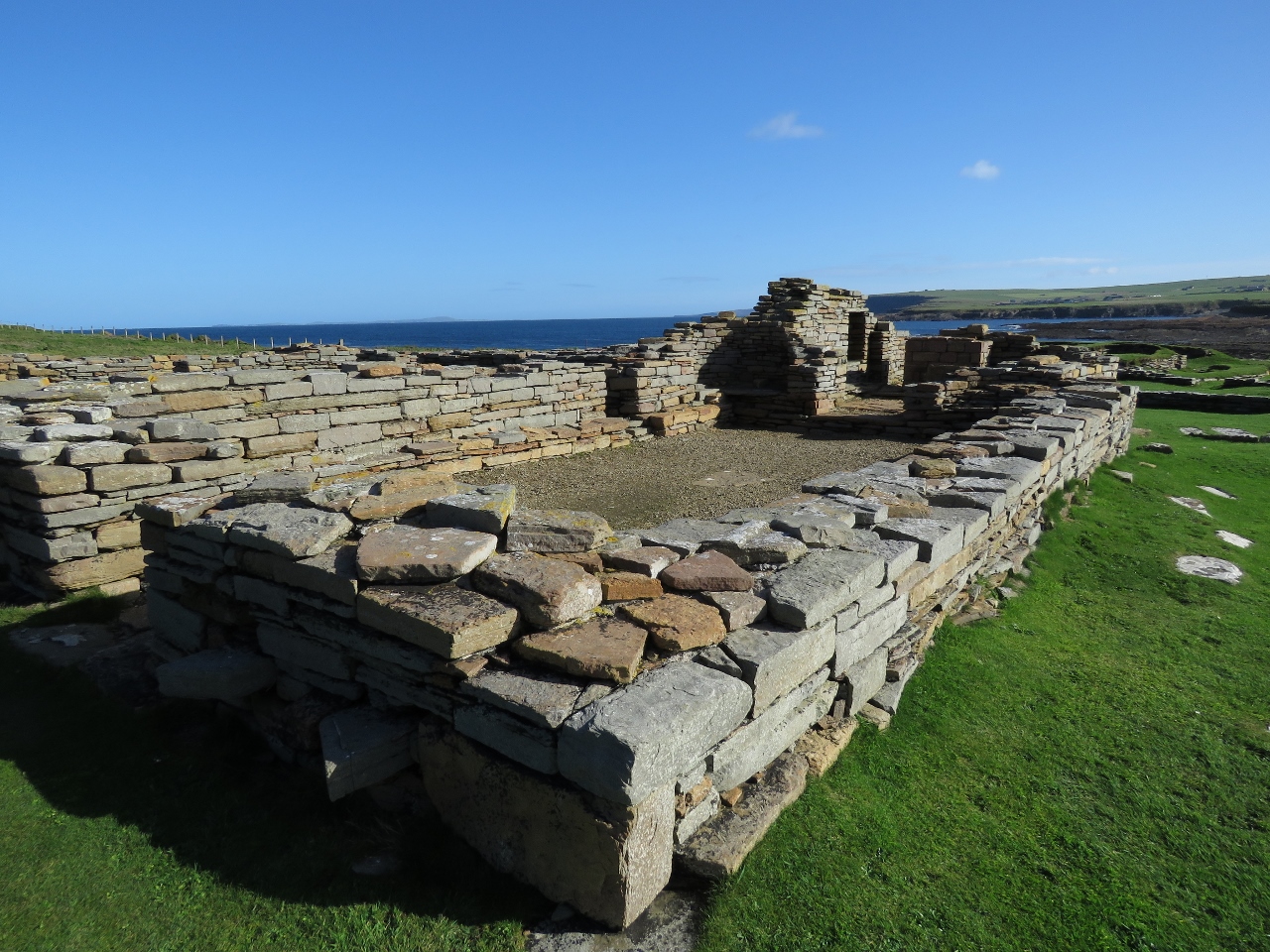
9/19/2017: Hackness Battery
Position: 58°48.35'N, -3°8.95'W
We'd brought the bikes ashore with a plan of cycling to the lifeboat museum and around the area. After Colin dropped us back off at Longhope, we biked out to the Hackness Battery and Martello Tower and had a picnic lunch overlooking Hoxa Sound before touring the site. The Hackness Battery was built in 1813 to protect the anchorage in Longhope Sound for merchant ships when Britain was at war with France and the United States.
|
 |
9/19/2017: Martello Tower
Position: 58°48.23'N, -3°8.81'W
A Martello Tower was added to the Hackness Battery fortifications in 1814, with a second across the sound. Martello Towers take their name from Martelle Point in Corsica, Italy where in 1794 two small cannons mounted on top of a round tower fended off an attack by two British warships with a combined firepower of 106 guns. The British were so impressed that they built over 100 such towers around the south and east coasts of England in the early 1800s when Napoleon was building an invasion fleet. Only one other Martello tower survives in Scotland, at Leith in Edinburgh.
The tower is elliptical, with the thickest part 14ft (4.25m) thick and facing the sea. The ground floor included barrack and ordnance stores, the first floor is the barrack room and was originally entered by a wooden ladder, and the gun was mounted on the roof. |
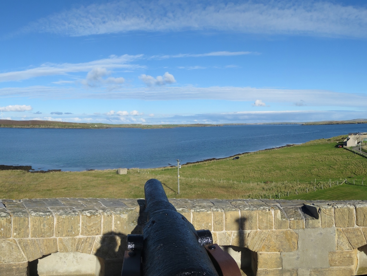 |
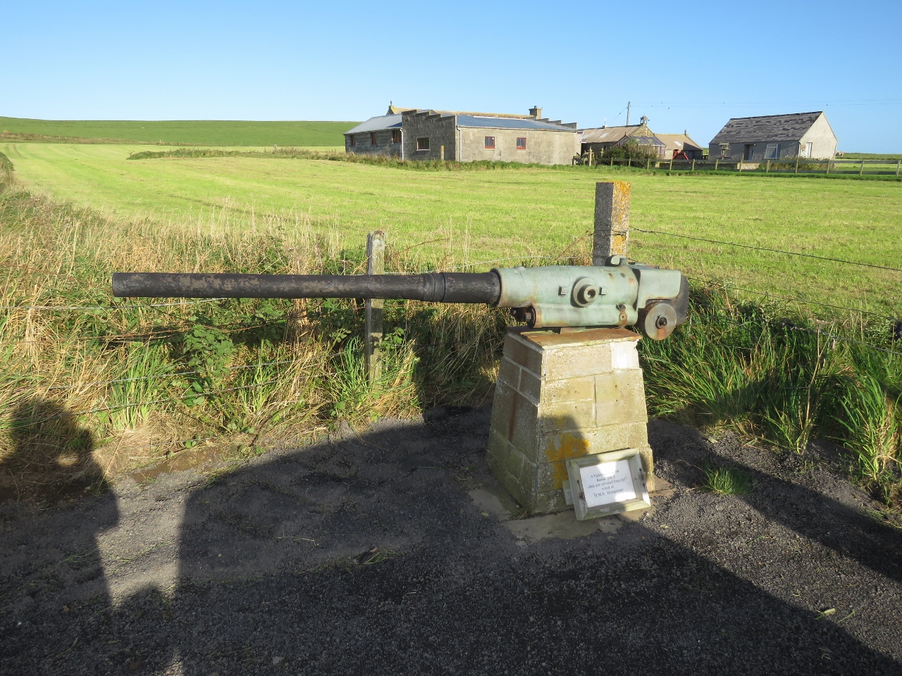
9/19/2017: Gun Emplacement
Position: 58°48.23'N, -3°8.81'W
The original gun in the Martello Tower was a 24-pounder that could fire a 24lb (10.9kg) shot 1.5 miles (2.4km). It later was replace by a 68-pounder that could had a shorter range of just over a mile (1.9km) but with a more devastating effect. The present gun is a 64-pounder of the same vintage.
|
 |
9/19/2017: Flotta Island
Position: 58°48.24'N, -3°8.81'W
World War II fortifications on Flotta Head across Hoxa Sound from the Martello Tower.
|
 |
9/19/2017: Lifeboat Memorial
Position: 58°47.30'N, -3°9.26'W
A memorial to the crew of the Longhope RNLI Lifeboat T.G.B.. On March 17th, 1969 the Longhope station suffered one of the worse losses in British lifeboat history when the T.G.B. responded to a Mayday call from the Liberian-registered cargo ship Irene that had been driven aground during a severe gale. A huge wave, estimated to be 100ft high, capsized the T.G.B., which was not self-righting. All eight crew were killed, including the coxswain and his two sons, and the 2nd coxswain and his two sons. Kevin Kirkpatrick, the current coxswain, lost his father, grandfather and uncle in that single event.
|
 |
9/19/2017: Dirona
Position: 58°47.91'N, -3°11.87'W
Dirona at anchor in Long Hope on our return back to the pier.
|
 |
9/19/2017: Lifeboat Underway
Position: 58°48.05'N, -3°12.29'W
When we arrived at the harbor, the Helen Comrie was about to get underway with a television crew on board. We dropped off the bikes on Dirona and went back out to watch the lifeboat maneuver in the bay.
|
 |
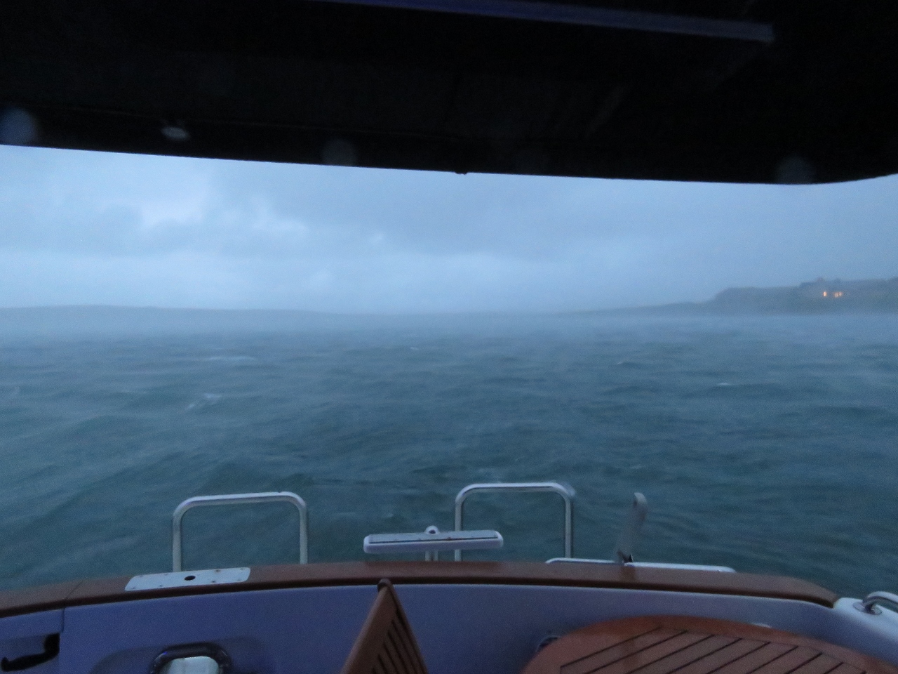
9/19/2017: Tender Tube
Position: 58°48.26'N, -3°10.96'W
We were underway in moderate seas at high speed and the boat was fully inflated when it suddenly tilted to the right. We looked down and the entire right side tube had just gone flat and, even more unusual, it was quickly vacuuming down to the shape of the fiberglass boat in which the tube was glued. Ironically, the Longhope lifeboat Helen Comrie was underway nearby with a film crew on board. We were hoping not to need their assistance and end up become part of the documentary. Read more ...
|
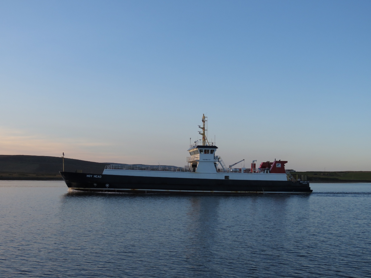 |
9/19/2017: Hoy Head
Position: 58°48.16'N, -3°11.81'W
The ferry Hoy Head arriving in the early evening. The vessel overnights at Longhope and during the day runs between Lyness, Flotta Island and Houton on Mainland.
|
 |
9/20/2017: Sunrise
Position: 58°48.18'N, -3°11.84'W
Beautiful sunrise over the Martello Tower.
|
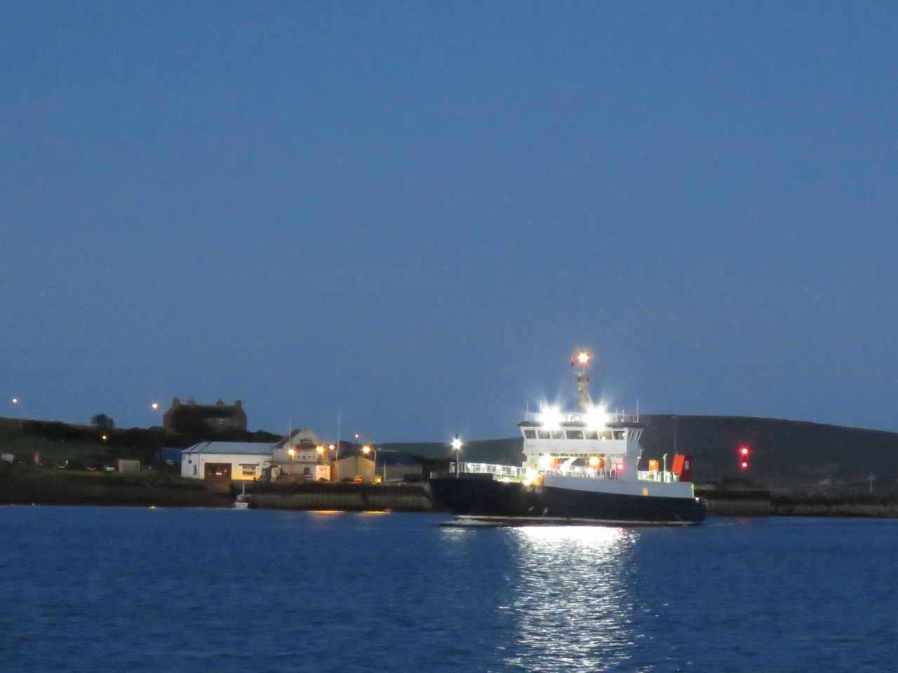 |
9/22/2017: Hoy Head
Position: 58°48.19'N, -3°11.81'W
The ferry Hoy Head underway from Longhope near dawn.
|
 |
9/22/2017: Tender
Position: 58°50.06'N, -3°11.44'W
Now that our tender was back to operational, we made a run over to Lyness to tour the Scapa Flow Museum. Due to the tender failure we were two days later than we'd originally planned, but we finally made it.
Scapa Flow, the large bay in the center of the Orkney Islands, was the base for the British Fleet during the two World Wars and the museum is housed in the former Royal Navy Base at Lyness. |
 |
9/22/2017: Lyness Pier
Position: 58°50.02'N, -3°11.43'W
The familiar ferry Hoy Head arrived at Lyness shortly after we did. We watched the master skillfully and gently dock with 20-knot winds pushing the vessel onto the pier.
|
 |
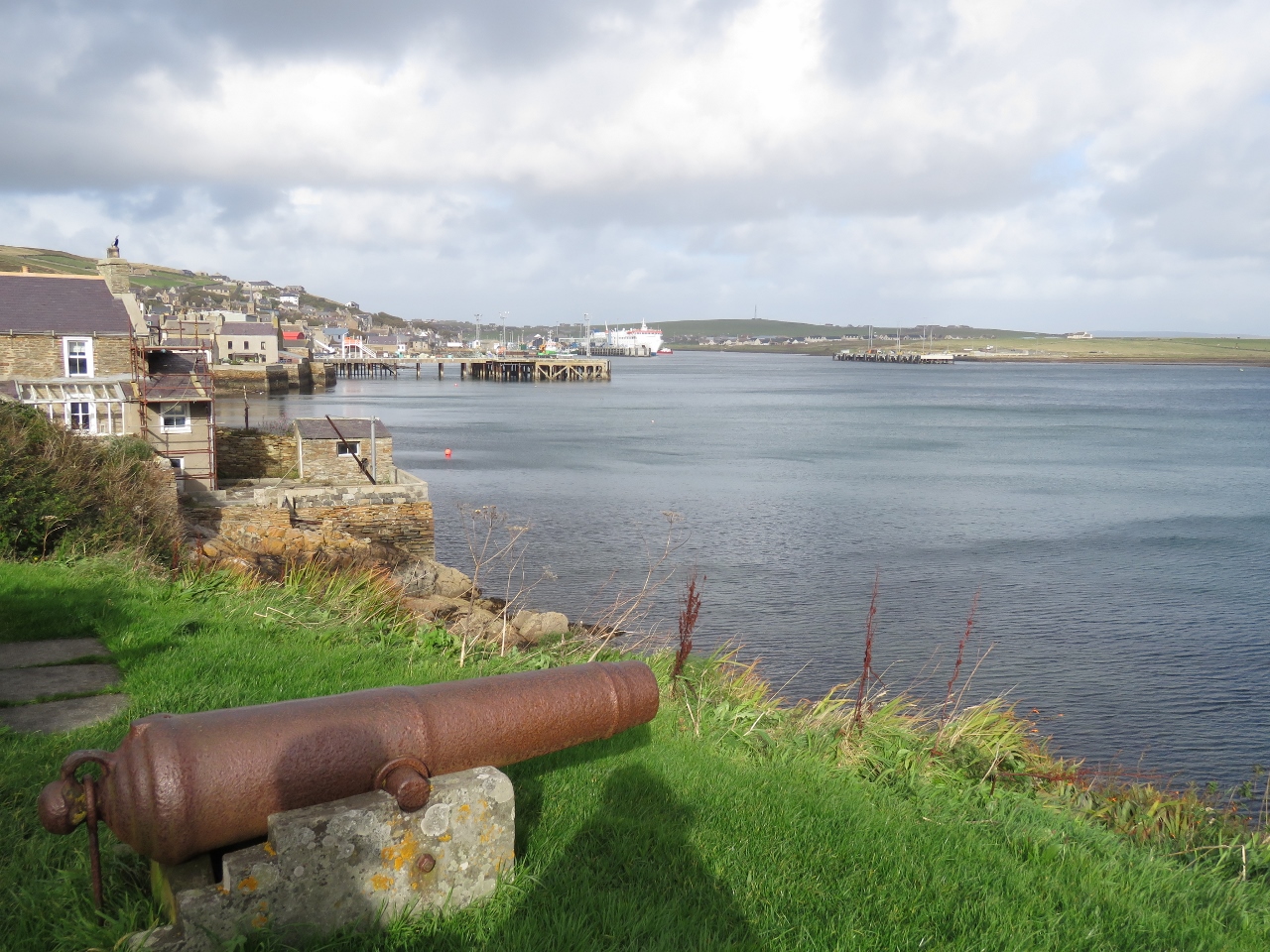
9/22/2017: Deck Gun
Position: 58°50.02'N, -3°11.70'W
The Scapa Flow Museum grounds are full of artifacts from the World Wars, such as this 150mm deck gun salvaged from the German mine-laying cruiser SMS Bremse. The ship arrived in Scapa Flow with the surrendered German naval fleet. 52 of the 74 ships later were later scuttled in the area. including the SMS Bremse.
|
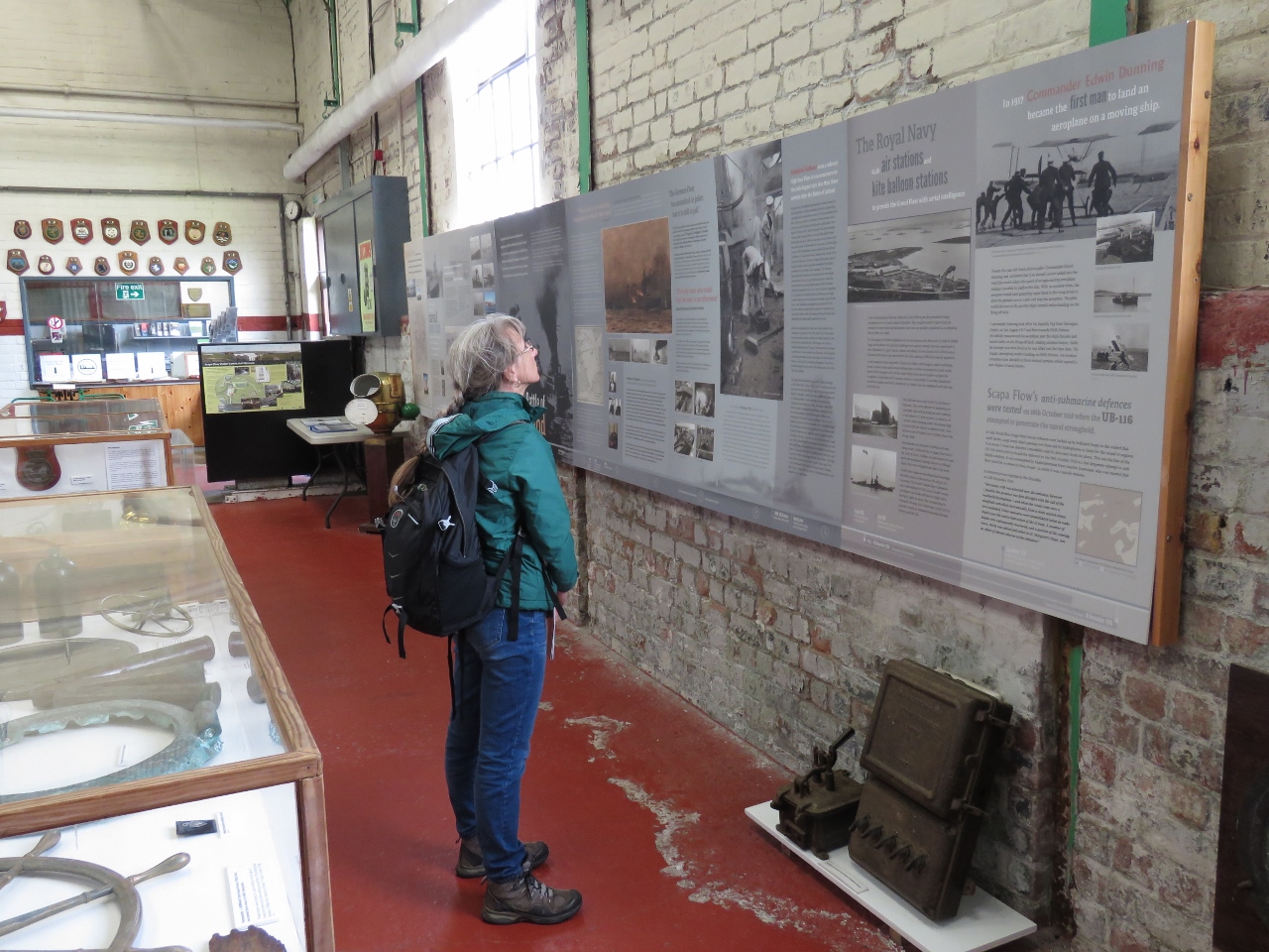 |
9/22/2017: Pumphouse
Position: 58°50.03'N, -3°11.81'W
The Scapa Flow Museum has detailed interpretive signs covering the history of the Scapa Flow area and it's use as a naval base, plus lots of memorabilia from the period.
|
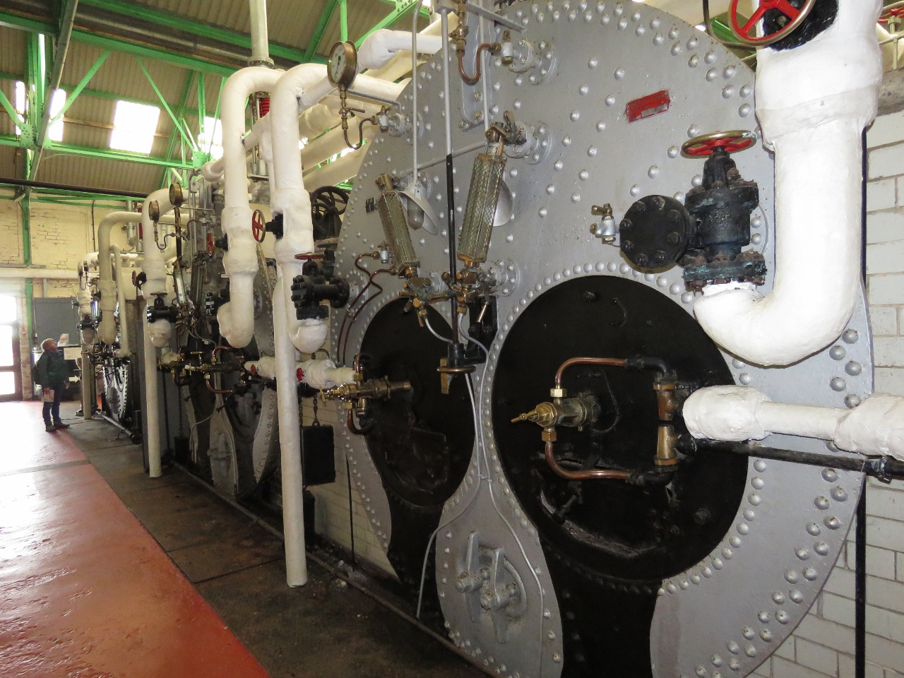 |
9/22/2017: Boilers
Position: 58°50.03'N, -3°11.81'W
The museum building is inside the former oil-pumping house used to off-load oil from incoming tankers into large above-ground storage tanks and to fuel ships from those tanks. These are the three original Lancashire boilers, built by Wilson’s of Glasgow, used to power the pumps. The boilers also heated the heavy oil to reduce the viscosity so that it could be pumped.
|
 |
9/22/2017: Pumps
Position: 58°50.03'N, -3°11.83'W
The pumphouse has six steam powered triple-expansion duplex Worthington pumps.
|
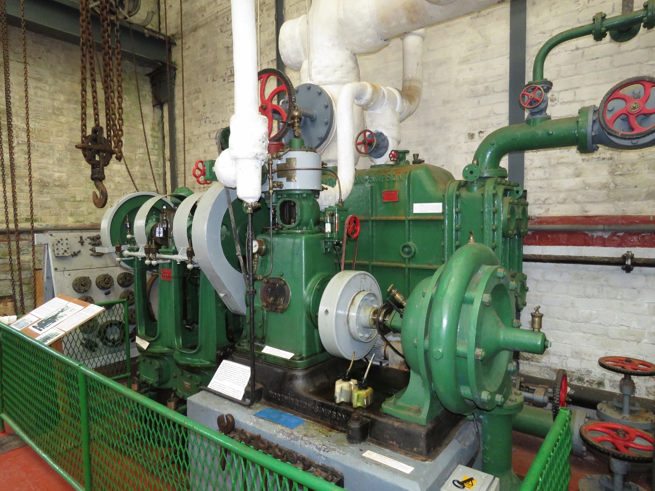 |
9/22/2017: Pump
Position: 58°50.03'N, -3°11.82'W
This steam engine drives two pumps. The one on the left pumps water from the water storage tank to the boiler under pressure. The pump on the right collects condensate water from the boiler and pumps it back into the water storage tank. Two of these steam-driven pumps are in the building, and this one has been setup as a display. It is powered by a small electric motor rather than steam but is otherwise operational so you can see the pump in action.
|
 |
9/22/2017: Oil Tank
Position: 58°50.01'N, -3°11.87'W
Jennifer about to enter the only surviving of twelve above-ground tanks that once held fuel oil for the fleet. This one has a 15,000 ton capacity. By 1943 six tanks buried underground at Wee Fea, capable of storing 100,000 tons of oil and diesel, replaced these above-ground tanks that were vulnerable to aircraft bombing. A second pumphouse built halfway up the hill was used to transfer fuel to and from the new tanks.
|
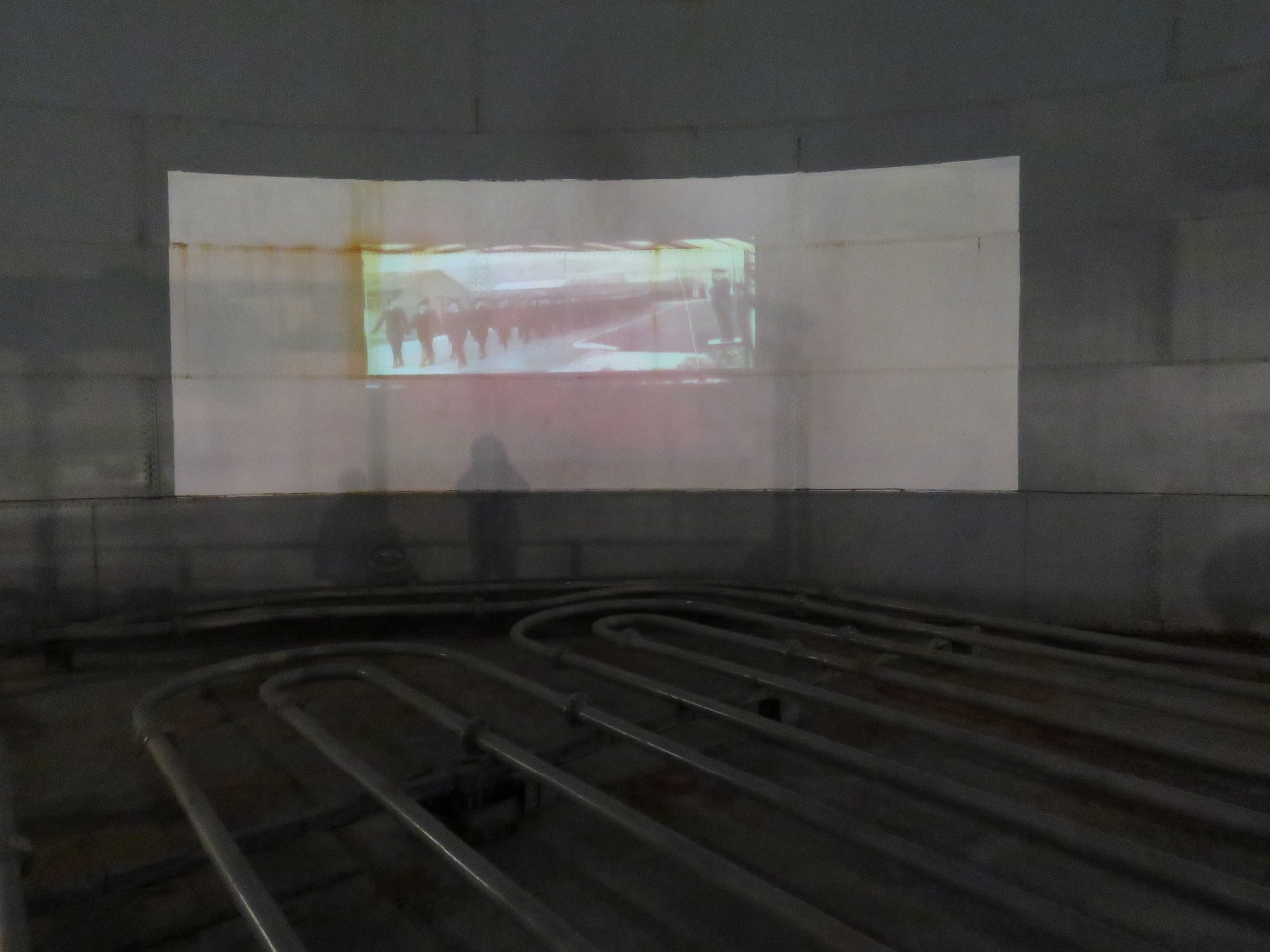 |
9/22/2017: Movie
Position: 58°50.01'N, -3°11.90'W
The inside of the fuel oil tank has been converted to a display area with historical movies projected onto the tank wall. The pipes visible along the bottom of the tank are used to heat the heavy oil to reduce the viscosity for pumping.
|
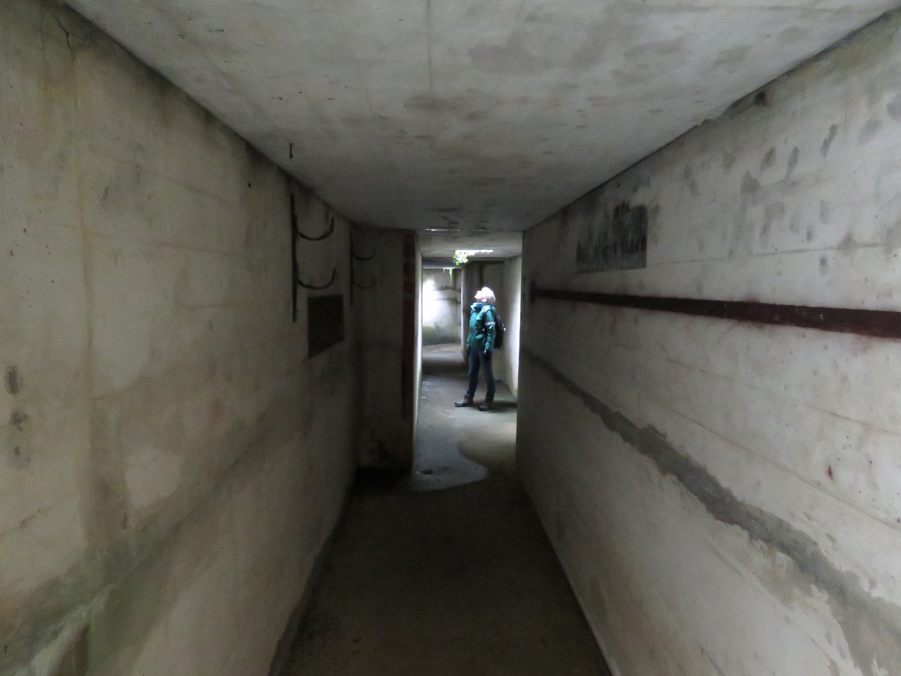 |
9/22/2017: Air-Raid Shelter
Position: 58°50.15'N, -3°11.76'W
Air raids were particularly common in the spring of 1940 and a large two-entrance air-raid shelter was built for base personnel. The main construction consists of concrete reinforcement and corrugated iron sheeting with earth piled over the top.
|
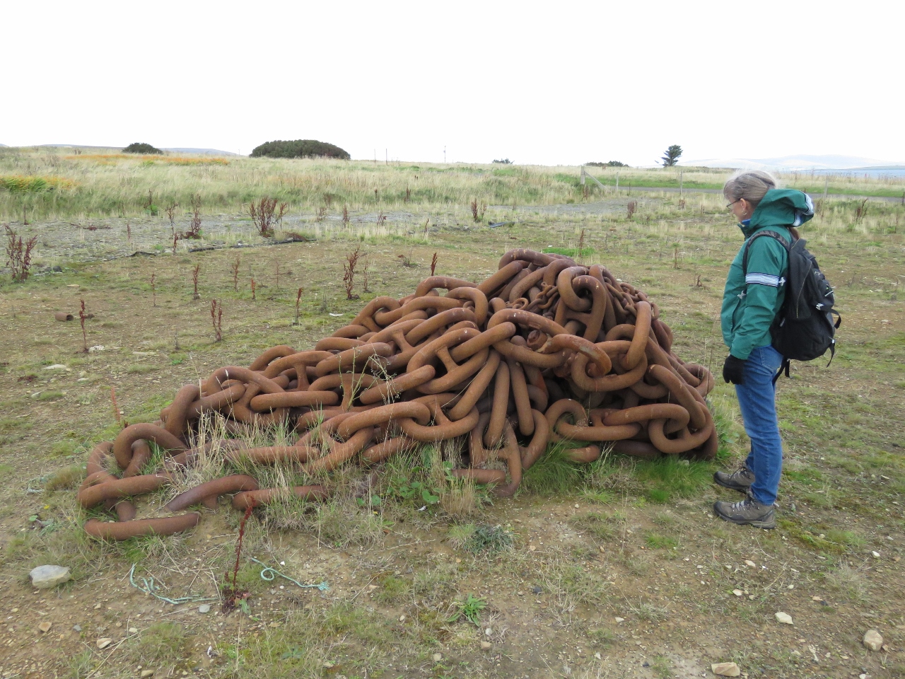 |
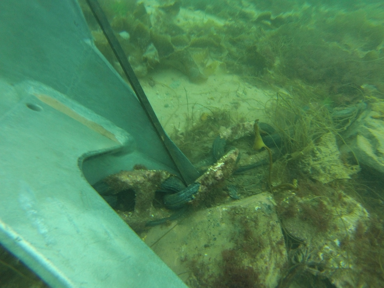
9/22/2017: Boom Chain
Position: 58°50.15'N, -3°11.73'W
A massive chain used as part of the defensive boom system to protect the anchorage during World War II. This is exactly the same sized chain our anchor got stuck in one of the links of a few days later in Widewall Bay.
|
 |
9/22/2017: Sea Snake
Position: 58°50.16'N, -3°11.46'W
A Pelamis Wave Energy Converter, known as a "Sea Snake", used to create electricity from the motion of surface waves. The device was decommissioned and sold to the Orkney Island Council for £1 after the developing company, Pelamis Wave Energy, went bankrupt.
|
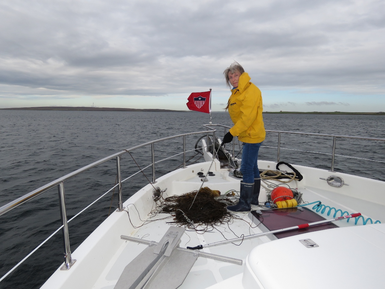 |
9/22/2017: Wilson
Position: 58°48.40'N, -3°11.02'W
We decided to move on to the next anchorage after returning from the Scapa Flow Museum. Wilson's anchor trip line came up tangled with a big mass of weeds. It was easier to just pull the whole mess on deck and deal with it there.
|
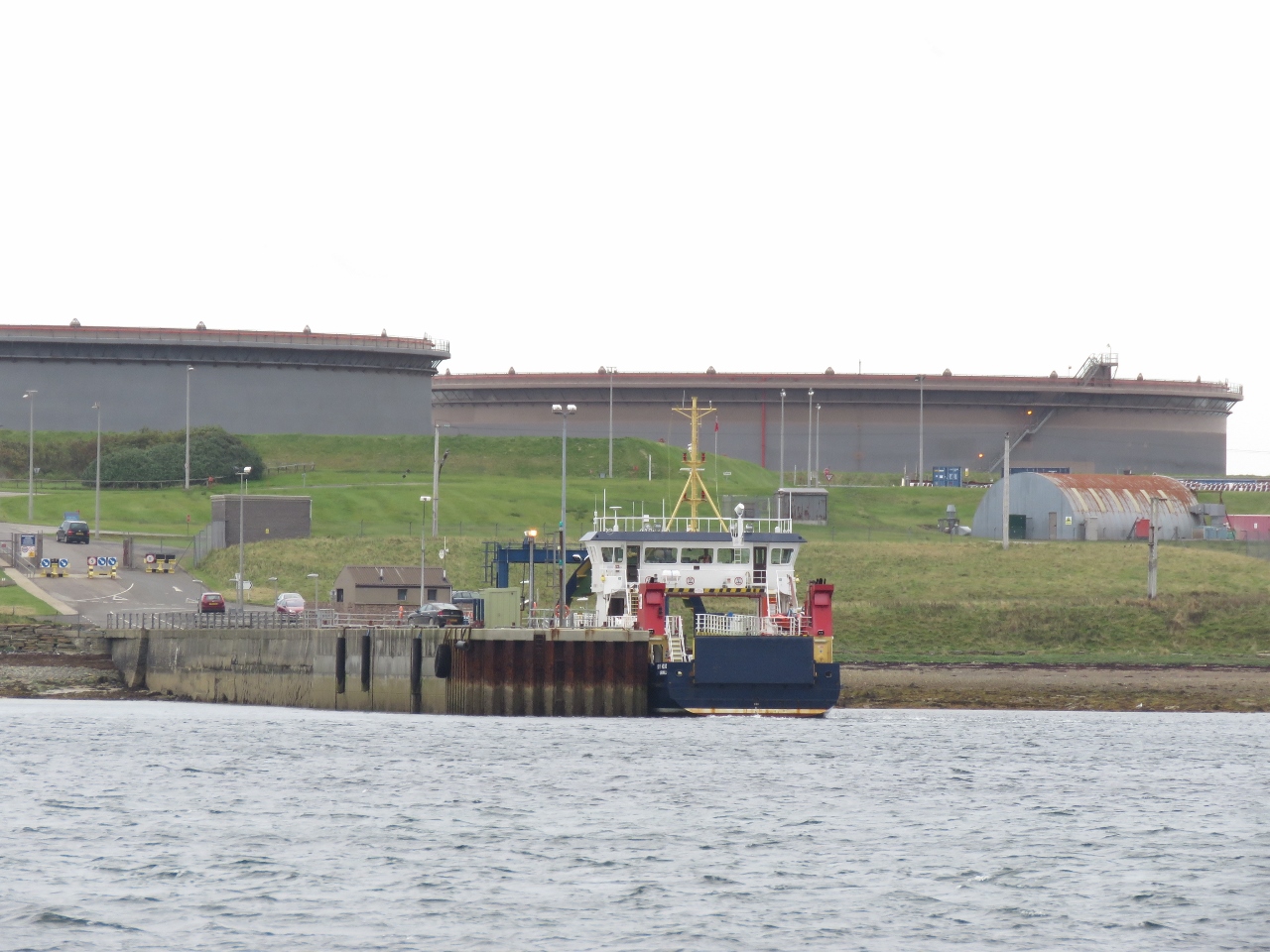 |
9/22/2017: Flotta Pier
Position: 58°50.33'N, -3°8.60'W
The ferry Hoy Head at the Flotta Island pier with the oil terminal in the background. The Flotta Island oil terminal was completed in 1974 and became the second largest in the UK. It is the landing point for the North Sea Piper and Claymore Oil fields and also is used to receive and transfer oil produced off the UK Atlantic coast.
|
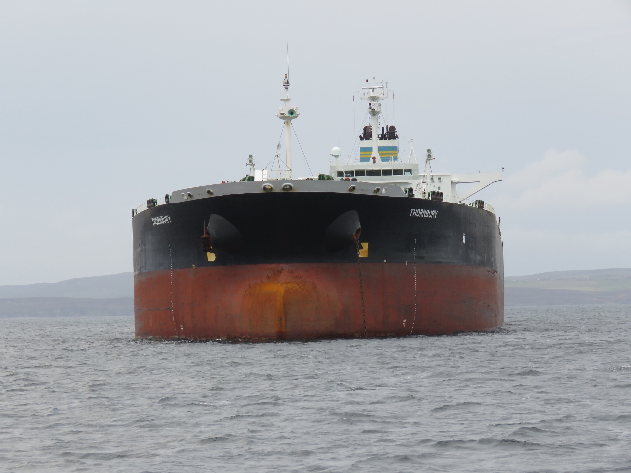 |
9/22/2017: Thornbury
Position: 58°52.39'N, -2°57.58'W
The oil tanker Thornbury is one of several anchored off Flotta Island. The vessel is incredibly beamy at 141ft (43m) wide, nearly three times the length of Dirona.
|
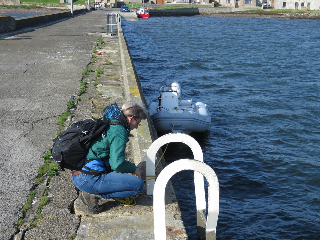 |
9/23/2017: St Marys Pier
Position: 58°53.70'N, -2°54.65'W
Tying the tender off at St. Mary's pier for a walk around the area.
|
 |
9/23/2017: Roof
Position: 58°53.77'N, -2°54.52'W
This roof is covered with nets weighted down with wooden beams, presumably to prevent the slate tiles from blowing away in heavy winds.
|
 |
9/23/2017: Dirona
Position: 58°53.76'N, -2°54.46'W
Dirona anchored at St. Mary's Bay, back lit in the afternoon sun.
|
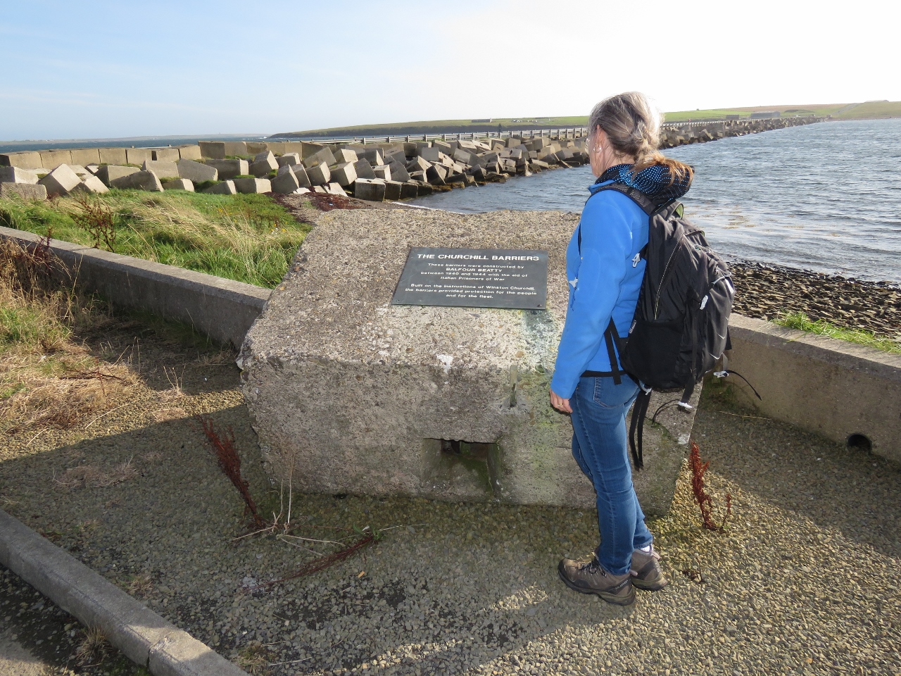 |
9/23/2017: Churchill Barriers
Position: 58°53.74'N, -2°53.91'W
Scapa Flow was the base for the British Naval fleet in the First and Second World Wars. In October of 1939, the German U-boat U-47 crept into the bay through Kirk Sound, just visible beyond the road on the left, and sunk the British battleship Royal Oak. To protect Scapa Flow, Winston Churchill, then First Lord of the Admiralty, ordered the construction of barriers across the eastern side of Scapa Flow.
66,000 locally cast concrete blocks, such as the one Jennifer is standing beside, were dropped onto a base of broken rock to block the channel and act as wave breaks. |
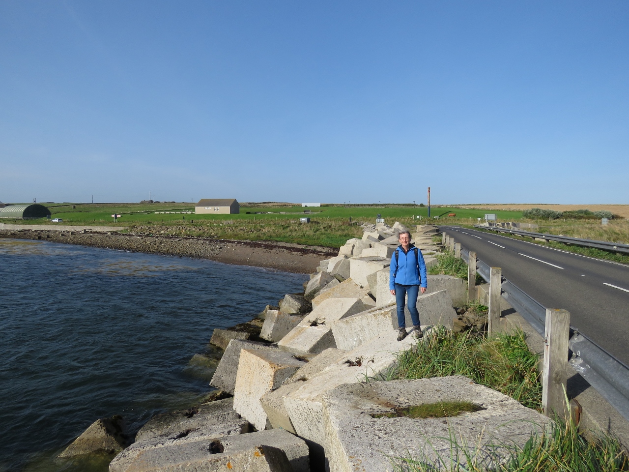 |
9/23/2017: Churchill Barrier 1
Position: 58°53.70'N, -2°53.83'W
Walking Churchill Barrier 1 across Kirk Sound between Mainland and Lamb Holm.
|
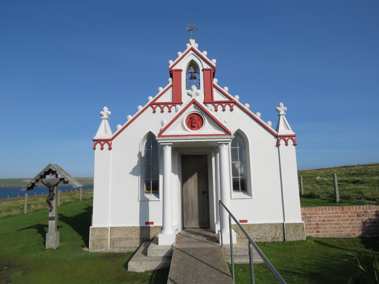 |
9/23/2017: Italian Chapel
Position: 58°53.39'N, -2°53.37'W
Over 1,300 Italian prisoners of war were brought in to work on the construction of the Churchill Barriers. Those interned on Lamb Holm were given permission to build a chapel using mainly materials on hand. They joined to half-cylindrical Nissen huts together and using concrete leftover from building the barriers, created a facade that hid the huts.
|
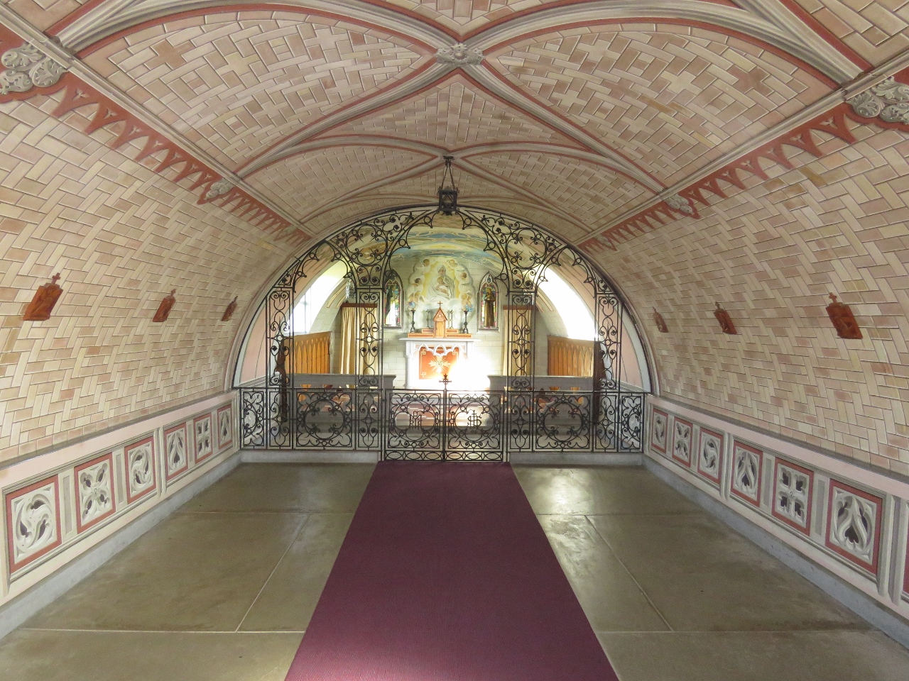 |
9/23/2017: Chapel Interior
Position: 58°53.39'N, -2°53.37'W
The interior walls and ceiling of the chapel were painted to look like stonework.
|
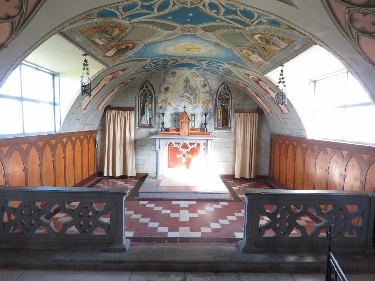 |
9/23/2017: Alter
Position: 58°53.39'N, -2°53.38'W
Artist Domenico Chiocchetti created most of the chapel interior, with help from fellow prisoners of war blacksmith Giuseppe Palumbi and cement worker Domenico Buttapasta. It is amazing what they were able to create with scavenged materials. Chiocchetti remained to complete the chapel after the prisoners were released shortly before the end of the war, and returned in 1960 to help with a restoration effort.
|
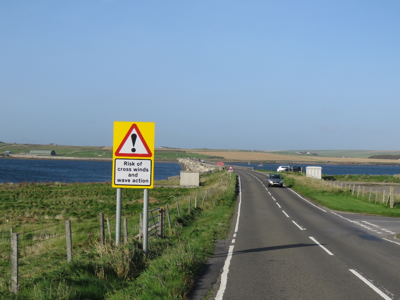 |
9/23/2017: Wind Warning
Position: 58°53.34'N, -2°53.73'W
The Churchill Barriers support causeways that sometimes are closed due to high winds and waves.
|
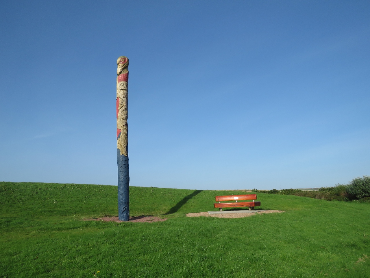 |
9/23/2017: Totem Pole
Position: 58°53.75'N, -2°53.85'W
Back on Mainland, opposite the north end of Churchill Barrier 1, we were amazed to find a Pacific Northwest totem pole. The pole was built as a joint effort between carvers from Canada's Squamish First Nation, Scotland, and members of the local community. Squamish is in southern British Columbia, not far from Vancouver.
|
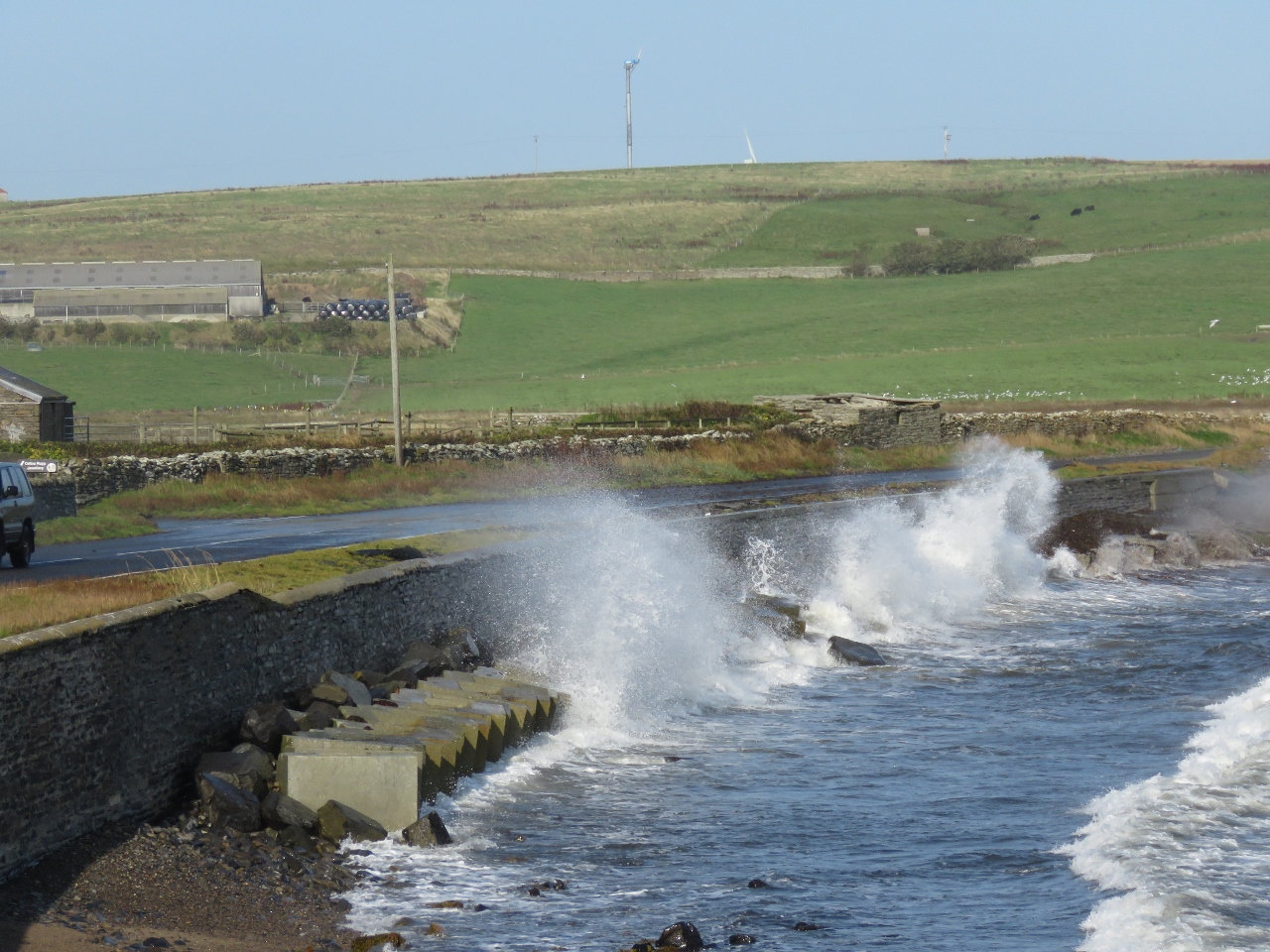 |
9/23/2017: Waves
Position: 58°53.90'N, -2°53.45'W
From the Italian Chapel we could see waves crashing over the road and walked down to see them. The winds weren't particularly high today, but waves constantly swept the road.
|
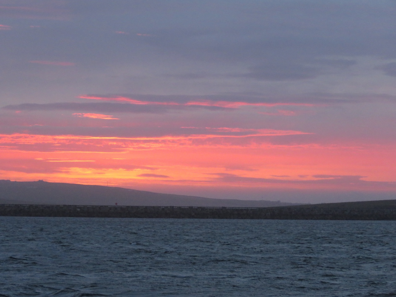 |
9/24/2017: Sunrise
Position: 58°53.51'N, -2°54.65'W
Sunrise viewed from the anchorage at St. Mary's Bay.
|
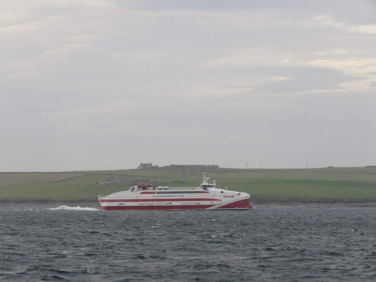 |
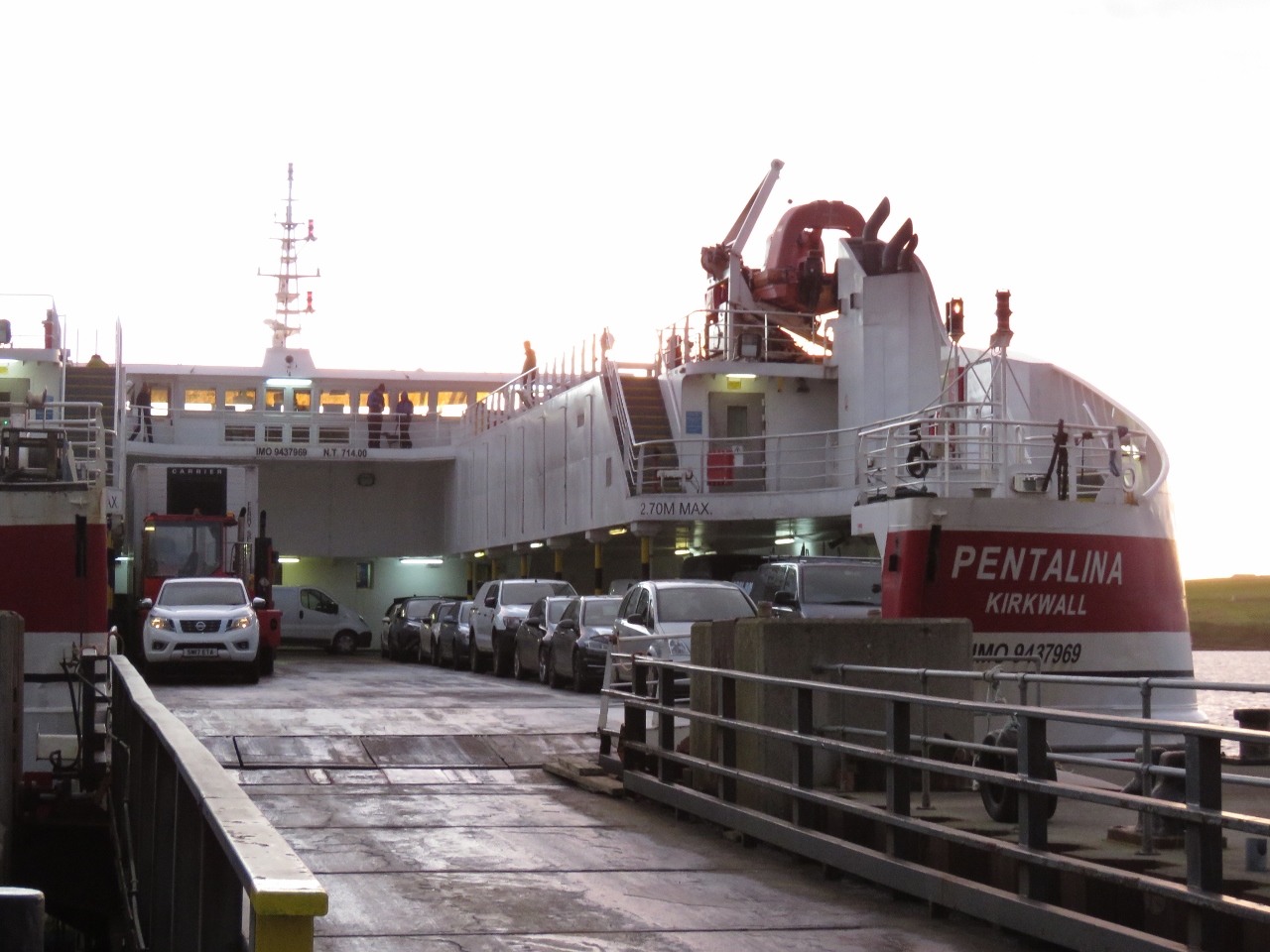
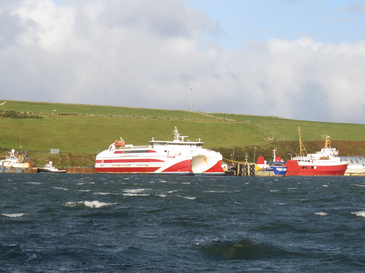
9/24/2017: Pentalina
Position: 58°50.72'N, -3°0.72'W
The fast ferry Pentalina en route from St. Margaret's Hope on South Ronaldsay to Gills Bay on the north coast of mainland Scotland.
|
 |
9/24/2017: Hoxa Head
Position: 58°49.65'N, -3°1.98'W
Extensive World War II fortifications on Hoxa Head on the western tip of South Ronaldsay Island overlooking Hoxa Sound.
|
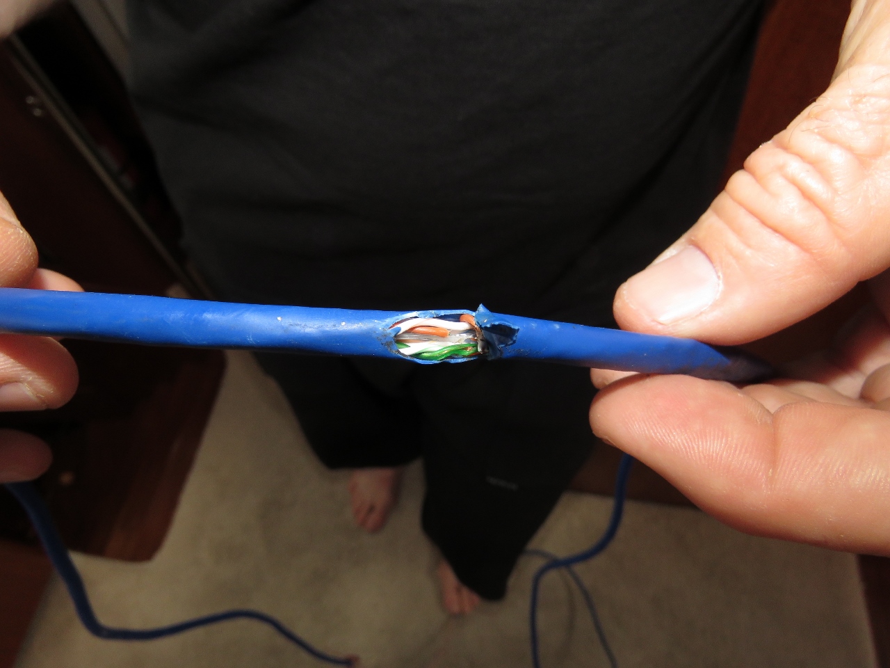 |
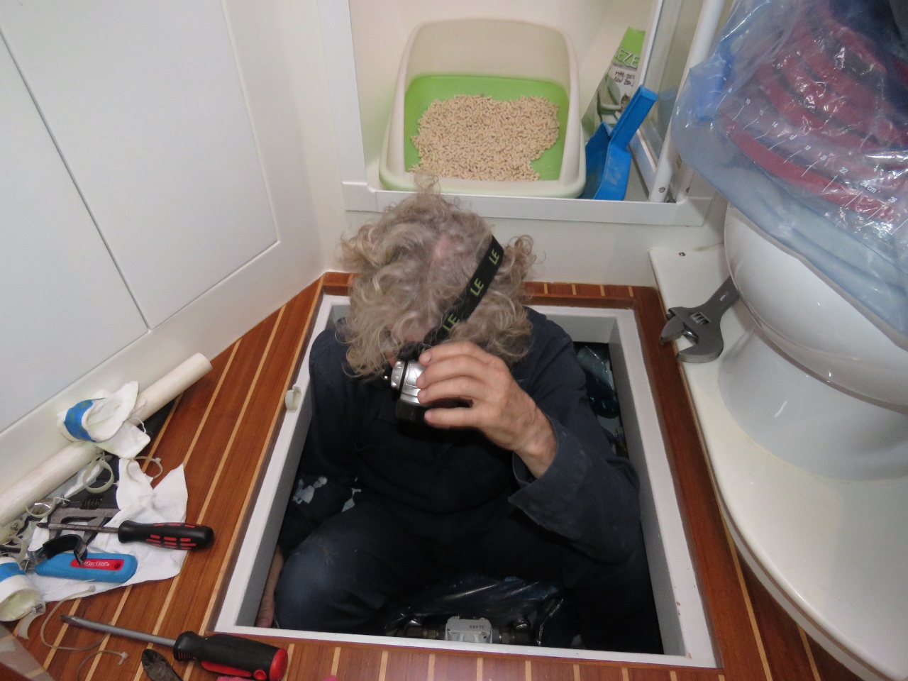
9/24/2017: Damaged Wire
Position: 58°48.84'N, -2°59.97'W
We found out why our KVH V7-IP satellite system was not getting heading data: the wire was broken. Looks like a tight pull on install had torn the insulation and broken the wire inside.
|
 |
9/26/2017: Anchor Ensnarled
Position: 58°48.84'N, -2°59.96'W
We had come to Widewall Bay as a jumping off point to round the west coasts of Hoy and Mainland and explore the northern Orkney Islands. But when we tried to raise the anchor we found it was caught on something. Read more ...
|
 |
9/26/2017: St. Margaret's Hope
Position: 58°49.92'N, -2°57.37'W
Currents are swift around the Orkney Islands, so we need to time our passages for the appropriate tide. By the time we'd freed our anchor, we'd missed our window to reach the northern islands. So instead we ran east to a nice anchorage at St. Margaret's Hope.
The ferry Pentalina arrived shortly after we did. We had anchored in a designated anchorage area according to the charts, but the master asked us if we could move farther into the bay as he would need more room to maneuver in the big winds that were predicted for the next few days. It isn't that big a deal for us to move, so we did. |
 |
9/27/2017: Wind
Position: 58°49.86'N, -2°57.40'W
This is a windy place. The winds have been blowing steady in the 20-30-kt range for the past four days and they've not really gotten started yet.
|
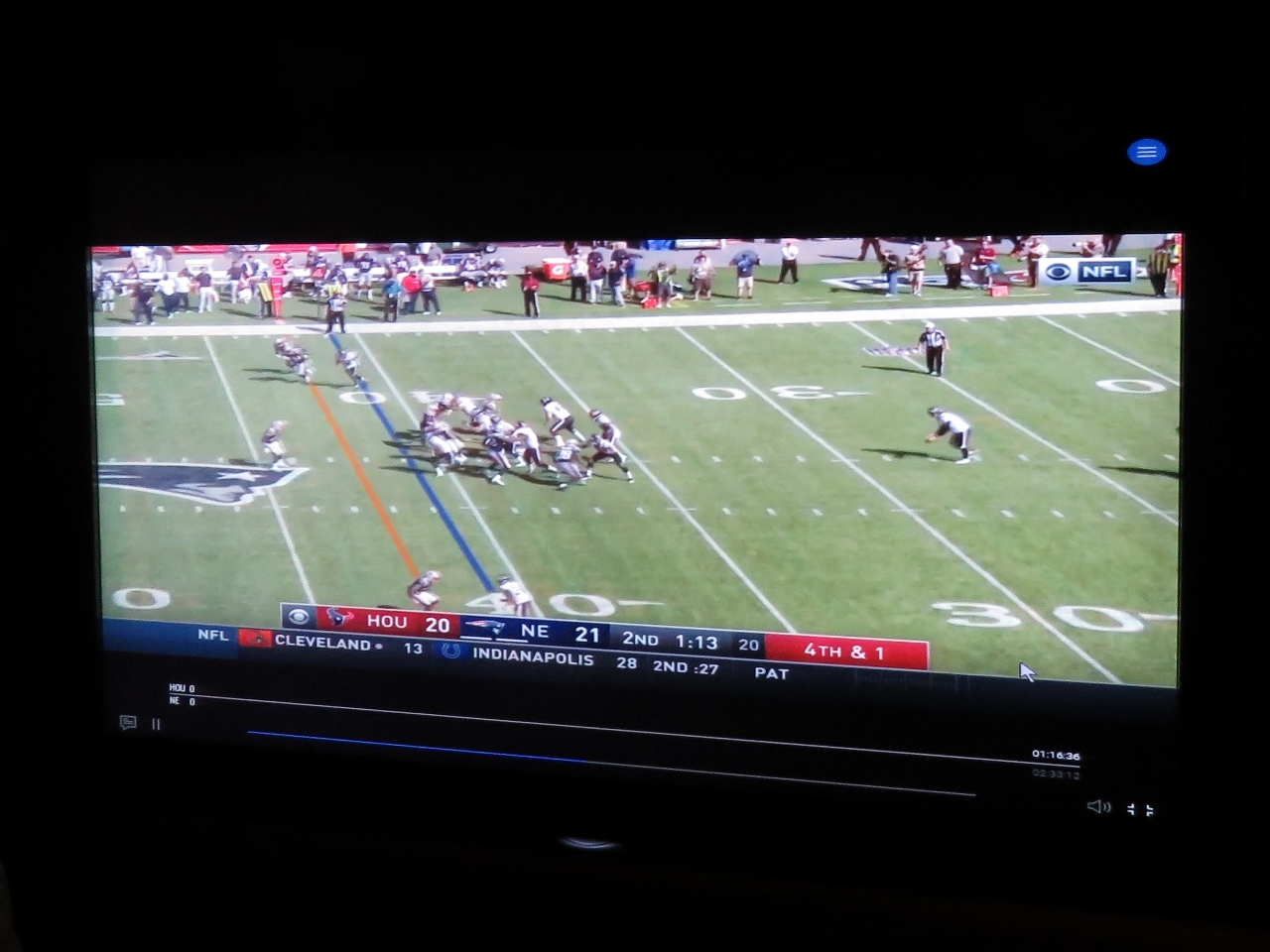 |
9/27/2017: Connectivity
Position: 58°49.85'N, -2°57.41'W
We've not had much luck with cellular data connectivity in Scotland, but it's excellent in St. Margaret's Hope. The signal is very directional though—we believe it is coming from the Flotta Island oil terminal rather than the village. Either way, it's good enough to watch a game on NFL Game Pass.
|
 |
9/28/2017: Spitfire
Position: 58°49.86'N, -2°57.38'W
Spitfire is enjoying the anchorage at St. Margaret's Hope as much as we are.
|
 |
9/29/2017: Wind
Position: 58°49.86'N, -2°57.39'W
Winds continue to blow 20-30kts with the barometer at 1006. We'll get a bit of a respite tomorrow though, before a deep low-pressure system comes through.
|
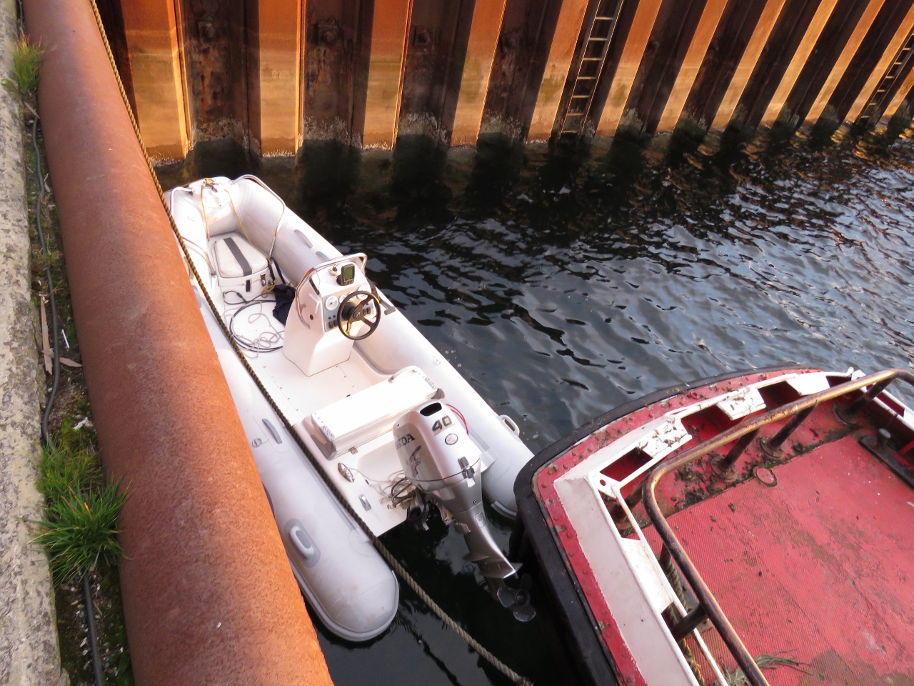 |
9/30/2017: Tender
Position: 58°49.92'N, -2°57.77'W
The tender tied off along the pier at St. Margaret's Hope for a tour of the "Heart of Neolithic Orkney" UNESCO World Heritage site on Mainland.
|
 |
9/30/2017: Pentalina
Position: 58°49.92'N, -2°57.77'W
We've been enjoying watching the ferry Pentalina depart and arrive three times a day since we arrived earlier in the week. It departed shortly after we landed ashore, so we had a chance to watch it leave.
|
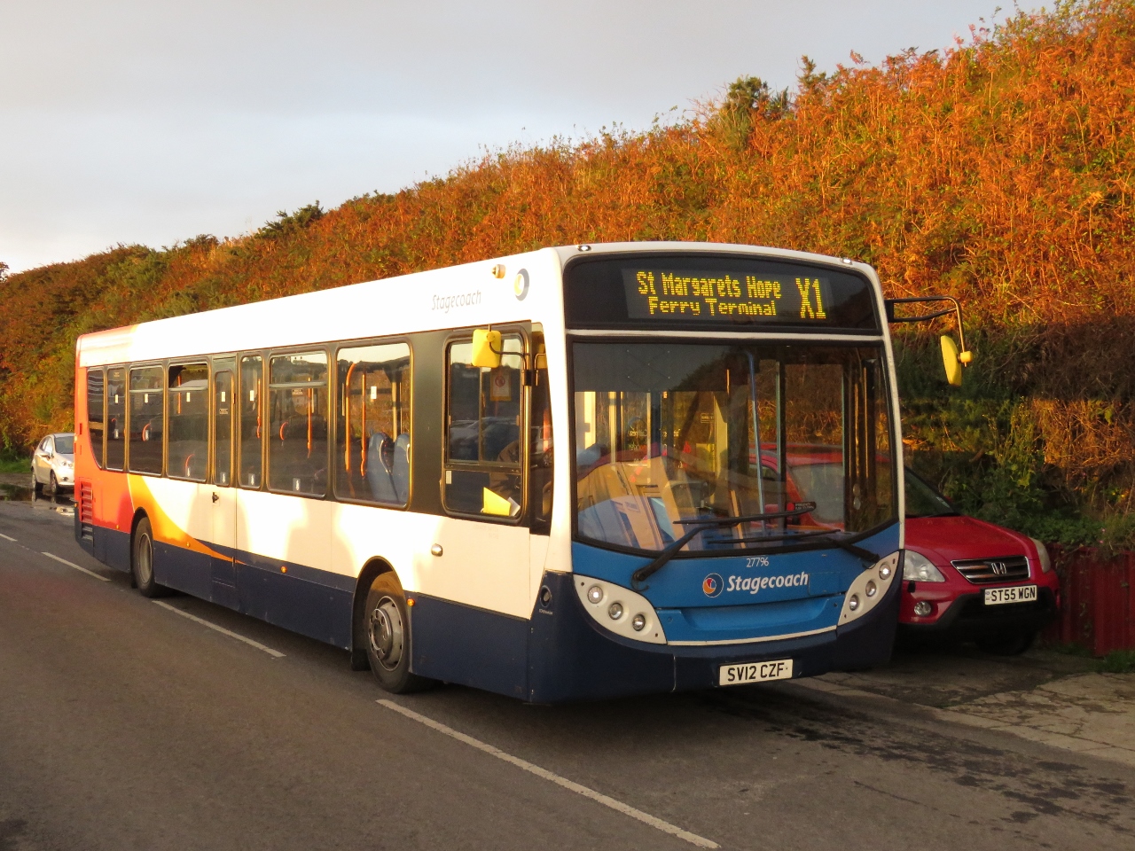 |
9/30/2017: Bus
Position: 58°49.91'N, -2°57.76'W
We'll be taking a half-hour bus ride to Kirkwall to start our Mainland tour. Mainland is the largest island in the Orkney Group.
|
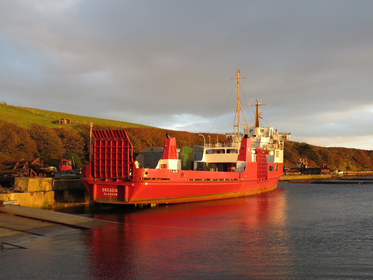 |
9/30/2017: Orcadia
Position: 58°49.92'N, -2°57.74'W
For former CalMac ferry Saturn, now Orcadia, docked at St. Margaret's Hope. The Pentland Ferry Company, that owns the Pentalina, had purchased the Saturn in 2015 for freight work and for working with the renewable energy sector around Orkney and the Pentland Firth. But the ship is now for sale.
|
 |
9/30/2017: St Margaret's Hope
Position: 58°49.63'N, -2°57.08'W
The anchorage at St. Margaret's Hope from the bus en route to Kirkwall. Our tender is just visible in the distance, rightmost of all the boats on the pier.
|
 |
9/30/2017: Churchill Barrier
Position: 58°51.77'N, -2°54.55'W
Churchill Barrier Number 3 looking north from the road above. On the right is one of several blockships the Navy sunk to partially block the entrance prior to the Churchill Barrier construction.
|
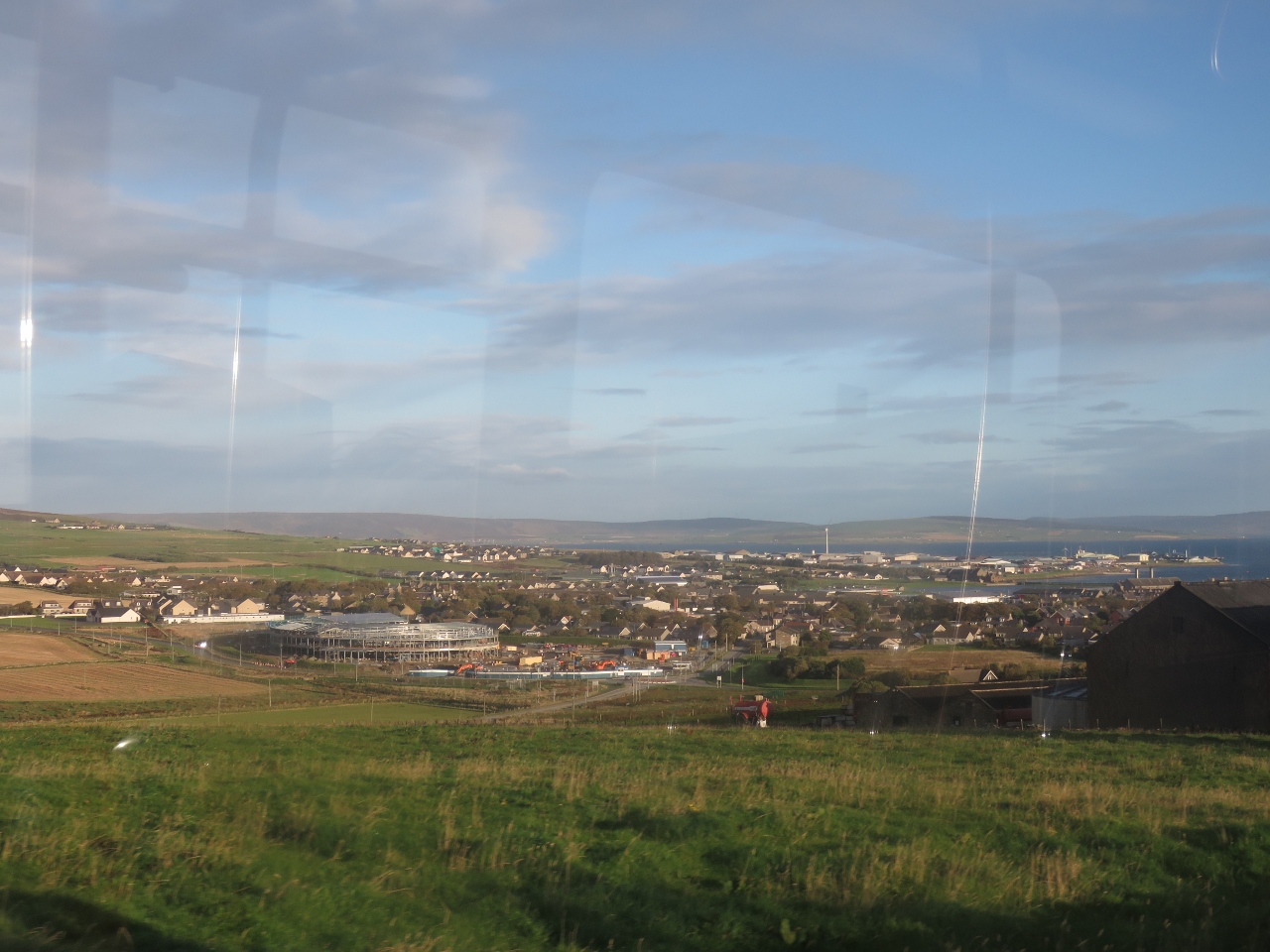 |
9/30/2017: Kirkwall
Position: 58°57.78'N, -2°57.52'W
View into Kirkwall as our bus arrives.
|
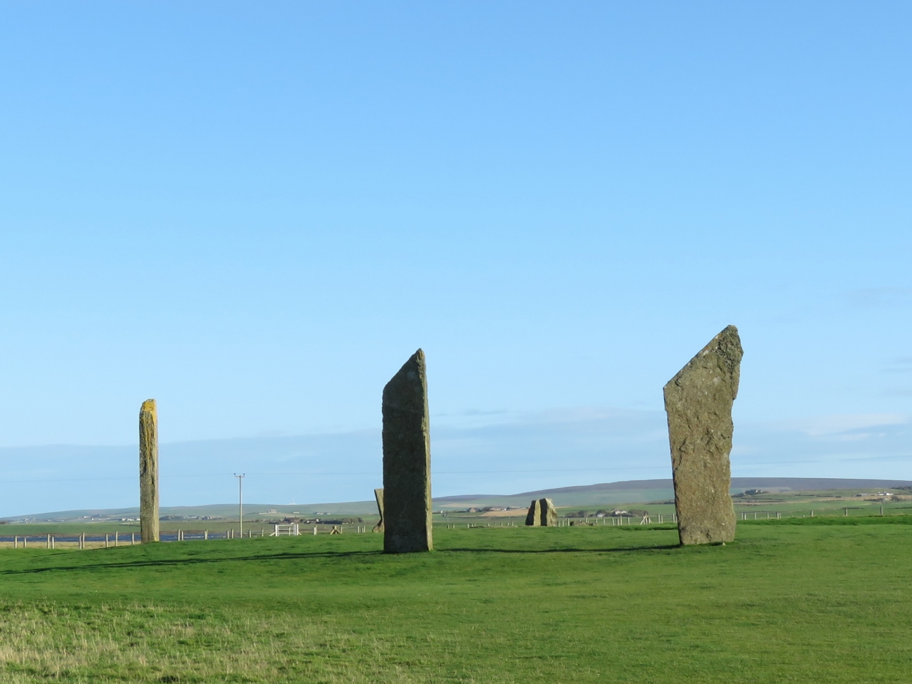 |
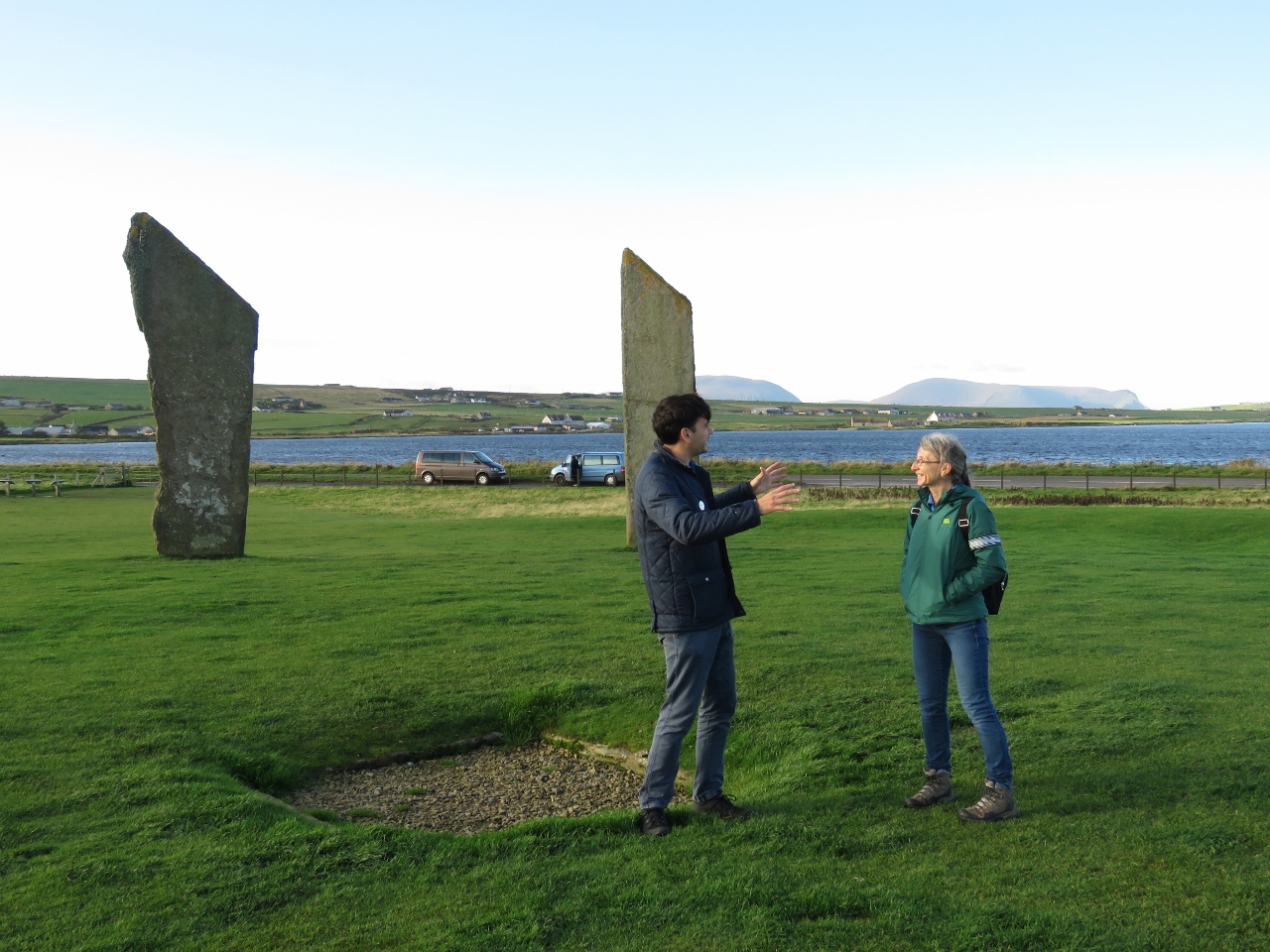
9/30/2017: Standing Stones of Stenness
Position: 58°59.61'N, -3°12.51'W
The Heart of Neolithic Orkney UNESCO World Heritage Site consists of four neolithic monuments dating to some 5,000 years ago. The Standing Stones of Stenness are one of the earliest stone circles in Britain. Only four of the original 11 or 12 stones still stand (archaeologists aren't sure on the original number of stones).
|
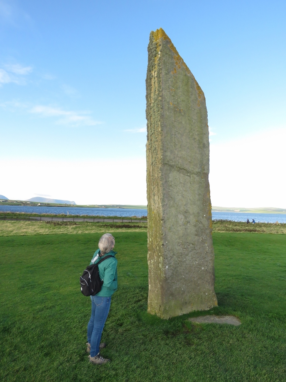 |
9/30/2017: Standing Stone
Position: 58°59.64'N, -3°12.49'W
Each stone is buried about 3 feet in the ground and the tallest stands about 16ft high.
|
 |
9/30/2017: Echo
Position: 58°59.64'N, -3°12.48'W
A large hearth was at the center of the circle. Our guide, Simon, demonstrated a curious echo property that occurs when standing at one specific corner. The hills visible in the distance are on the island of Hoy, where Longhope is.
|
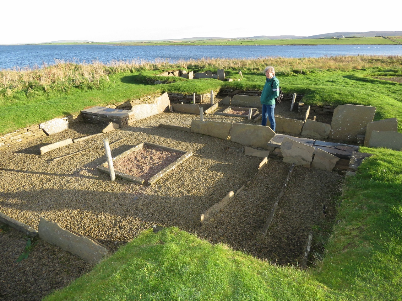 |
9/30/2017: Barnhouse Village
Position: 58°59.75'N, -3°12.41'W
In 1984, archaeologists discovered a village near the Stones of Stenness, also dating to about 5,000 years ago. It's possible the villagers erected the Stone of Stenness, or at least used them for ceremonial purposes.
|
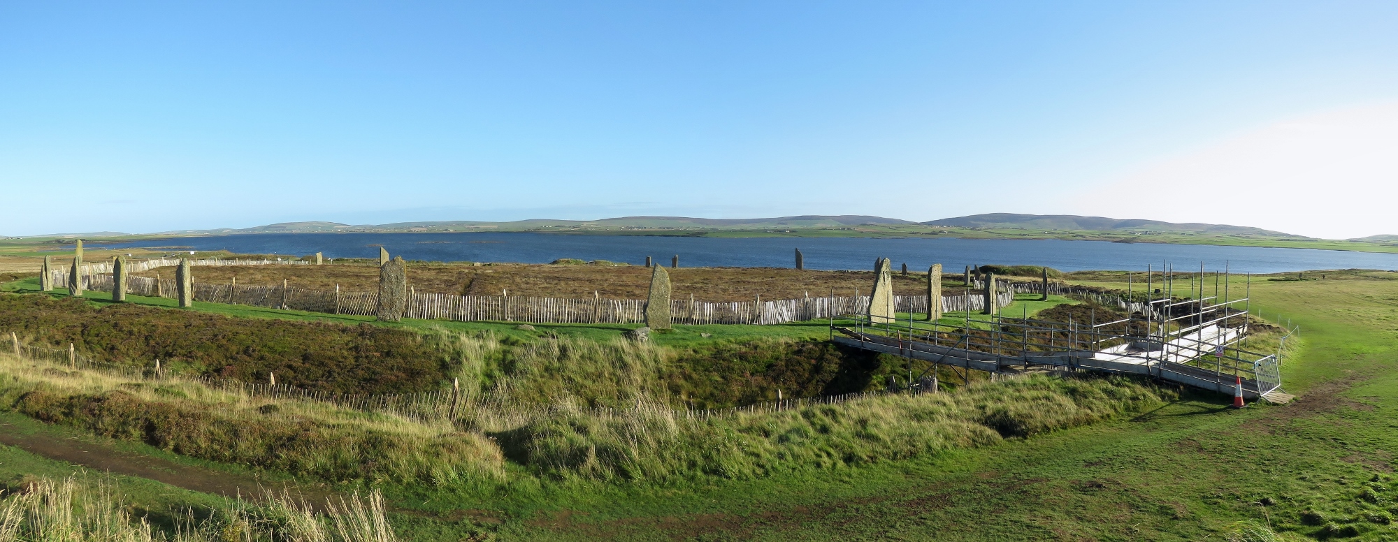 |
9/30/2017: Ring of Brodgar
Position: 59°0.05'N, -3°13.81'W
The Ring of Brodgar, also part of the Heart of Neolithic Orkney UNESCO World Heritage Site, is a stone ring built in a circle roughly 341ft (104m) wide. The interior has never been fully excavated, or scientifically dated, so the age remains uncertain. Archaeologists believe it was erected between 2500 BC and 2000 BC, making it among the last of the great Neolithic monuments built in the area.
|
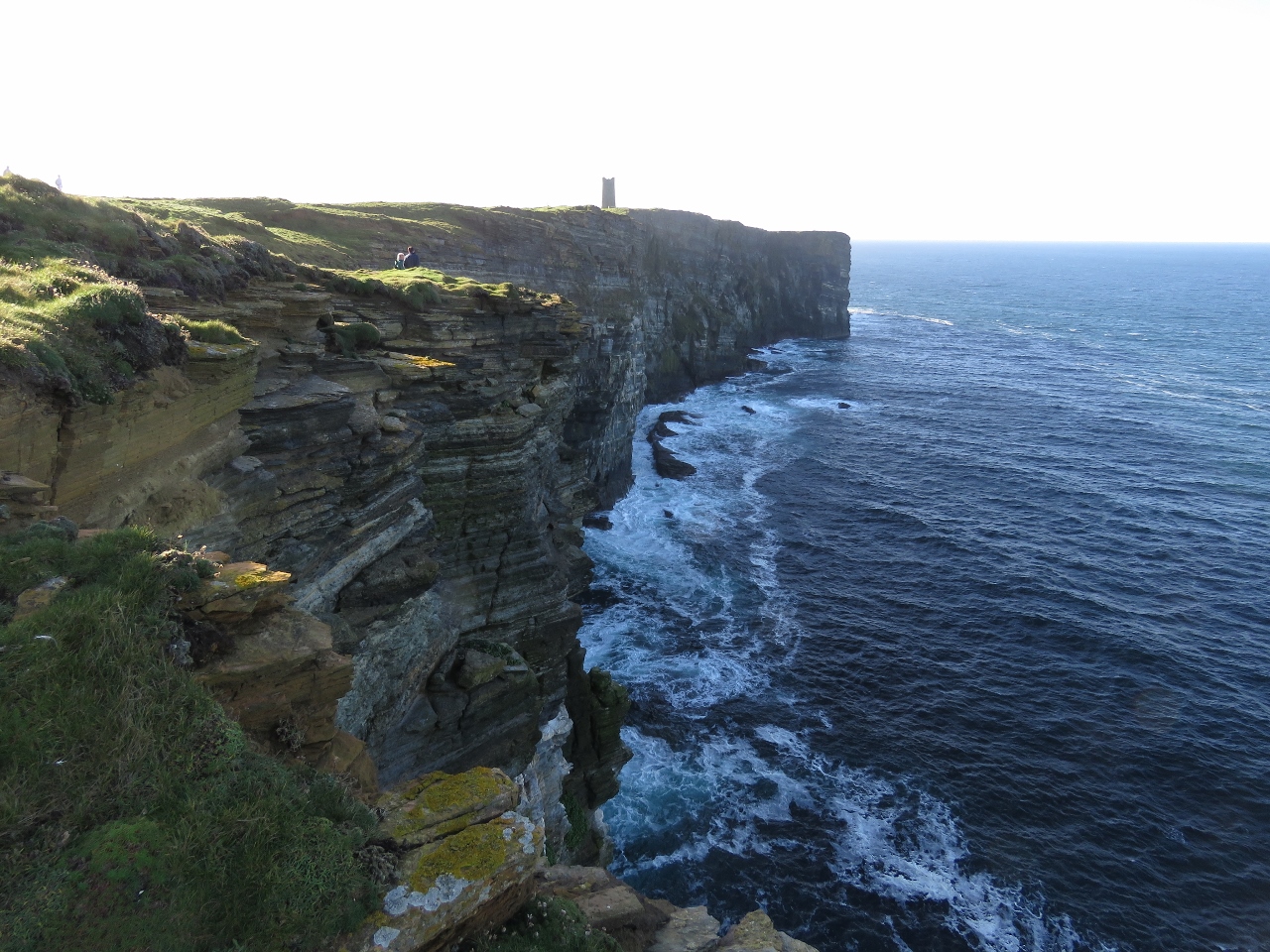 |
9/30/2017: Marwick Head
Position: 59°6.59'N, -3°20.98'W
Marwick Head wasn't on our list of places to visit on our tour, but our guide Simon Alvarez, thought we'd like it. He was right—the cliffs here are fabulous. Jennifer and Simon are just visible in the upper left of the picture, and the tall tower in the distance is the Kitchener Memorial.
|
 |
9/30/2017: Kitchener Memorial
Position: 59°6.31'N, -3°21.25'W
During the First World War, in June of 1916, the British warship HMS Hampshire was underway near Marwick Head during a gale and struck a mine laid by a German U-Boat. All but 12 of the 749 passengers and crew perished, including Earl Kitchener, Britain's Secretary of State for War. The Kitchener Memorial was unveiled in 1926.
|
 |
9/30/2017: Brough of Birsay
Position: 59°6.31'N, -3°21.32'W
The view north along the Marwick Head cliffs to our next stop in the distance, the Brough of Birsay with a lighthouse perched above the cliffs at Brough Head.
|
 |
9/30/2017: Gun
Position: 59°6.35'N, -3°20.49'W
This deck gun at the Kitchener Memorial parking lot was salvaged from the HMS Hampshire.
|
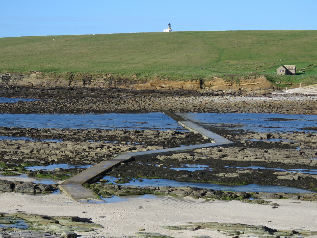 |
9/30/2017: Causeway
Position: 59°8.12'N, -3°19.51'W
The Brough of Birsay is connected to the mainland by a causeway, built to service the lighthouse, that is only accessible at low tide.
|
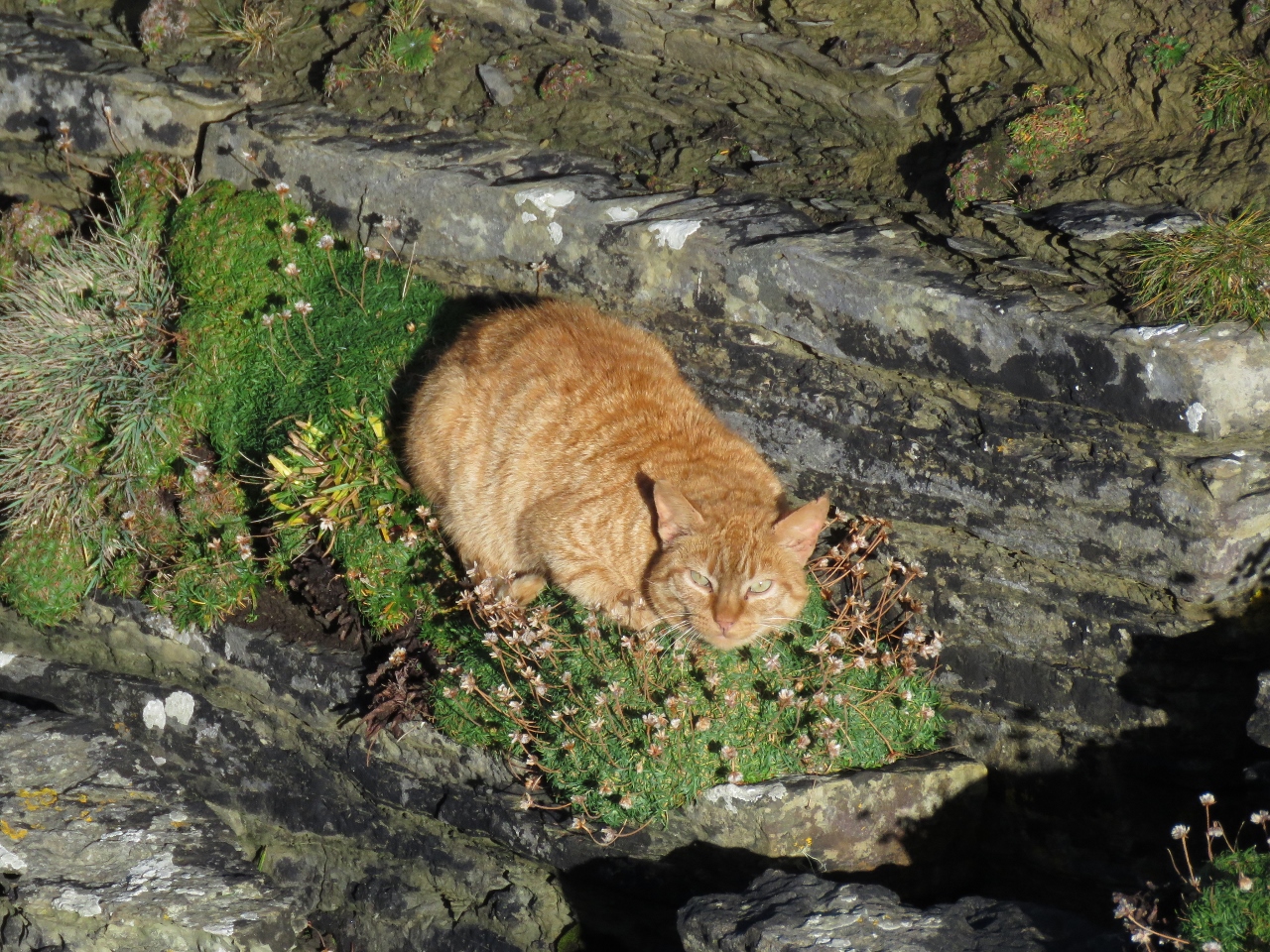 |
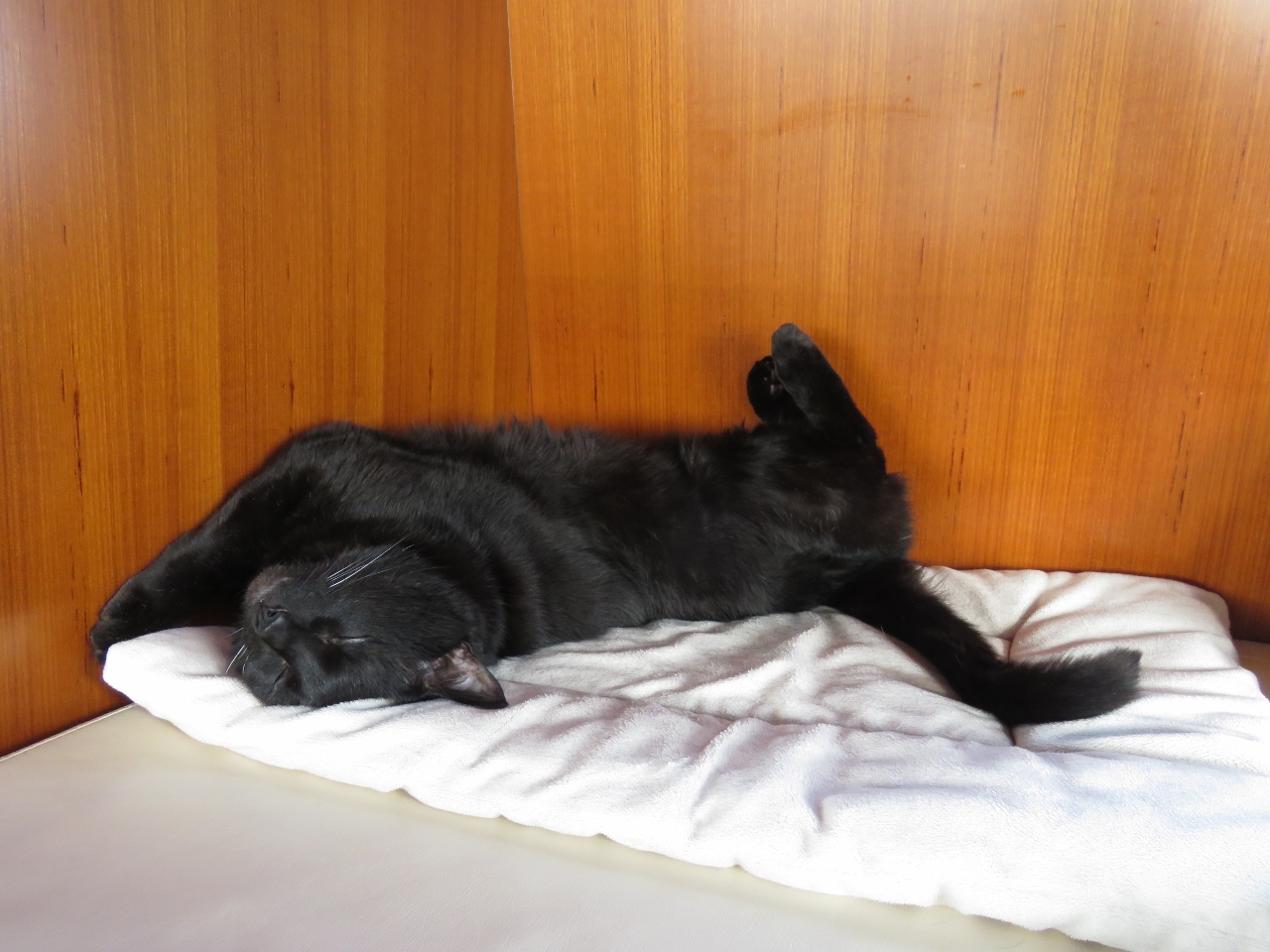
9/30/2017: Cat
Position: 59°8.26'N, -3°20.05'W
On our walk to the lighthouse, we came across this cat sunning on the cliff. This particular face is actually near-vertical, with just barely space for the cat on a little patch of grass. It kept a close eye on us, but otherwise didn't seem very concerned.
|
 |
9/30/2017: Brough Head
Position: 59°8.27'N, -3°20.21'W
The lighthouse at Brough Head was built in 1925, another Stevenson family design.
|
 |
9/30/2017: Ruins
Position: 59°8.19'N, -3°19.96'W
Centuries of habitation on the Brough of Birsay, starting with a Pict (Scotland's oldest indigenous people) fortress in the 6th and 7th centuries. Viking settled here in the 9th century and the visible ruins are from their village.
|
 |
9/30/2017: Monastery
Position: 59°8.19'N, -3°19.82'W
Ruins from the 12th century Viking monastery. This was the final phase of the Viking construction on the island.
|
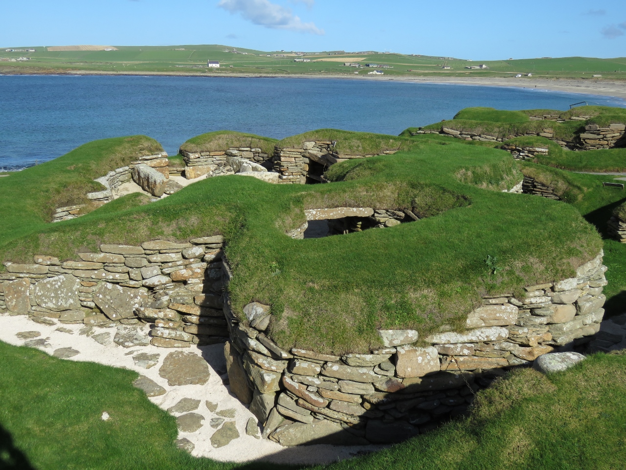 |
9/30/2017: Skara Brae
Position: 59°2.92'N, -3°20.52'W
In the winter of 1850, a severe storm stripped the earth from a beach and locals found the outline of a village. Skara Brae, it is called, is the third site of the four locations that comprise the Heart of Neolithic Orkney UNESCO World Heritage Site. The stone-built Neolithic settlement was occupied roughly between 3180 BC and 2500 BC, making it older than Stonehenge and Great Pyramids of Egypt. It is the most complete Neolithic village in Europe.
|
 |
9/30/2017: House
Position: 59°2.93'N, -3°20.50'W
The houses at Skara Brae had sleeping areas along the walls, a hearth in the middle and a dresser, all made of stone.
|
 |
9/30/2017: Yesnaby
Position: 59°1.48'N, -3°21.63'W
The dramatic cliffs at Yesnaby, just south of Skara Brae.
|
 |
9/30/2017: Orkney Travel
Position: 59°1.49'N, -3°21.53'W
We had a great day with Simon Alvarez of Orkney Travel. Simon knows the area and it's history well.
|
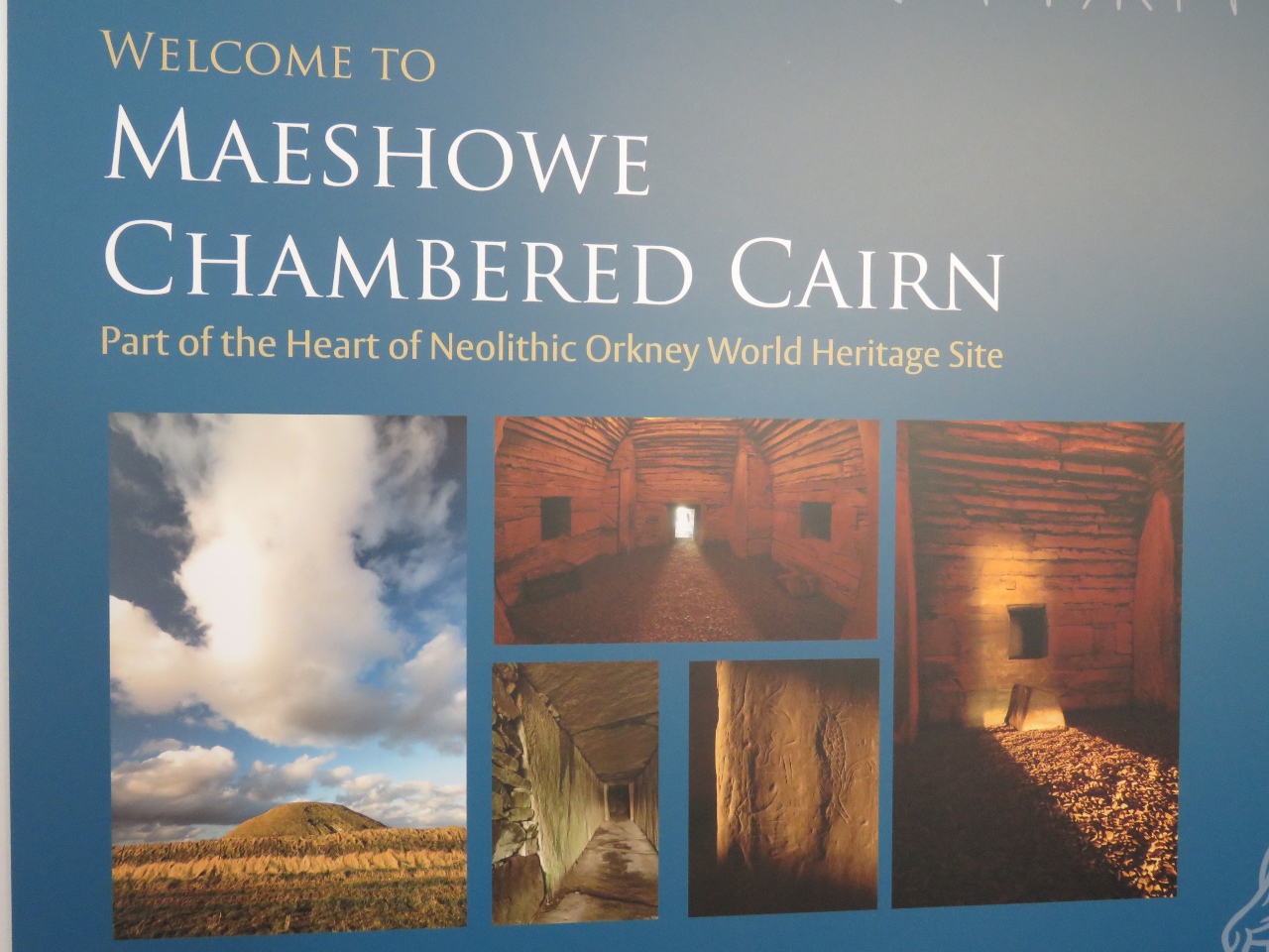 |
9/30/2017: Maeshowe
Position: 58°59.19'N, -3°12.51'W
The chambered tomb of Maeshowe was built around 2800 BC and is the fourth and final site in the Heart of Neolithic Orkney UNESCO World Heritage Site. Photographs aren't allowed inside the tomb, so we took a picture of this poster instead.
|
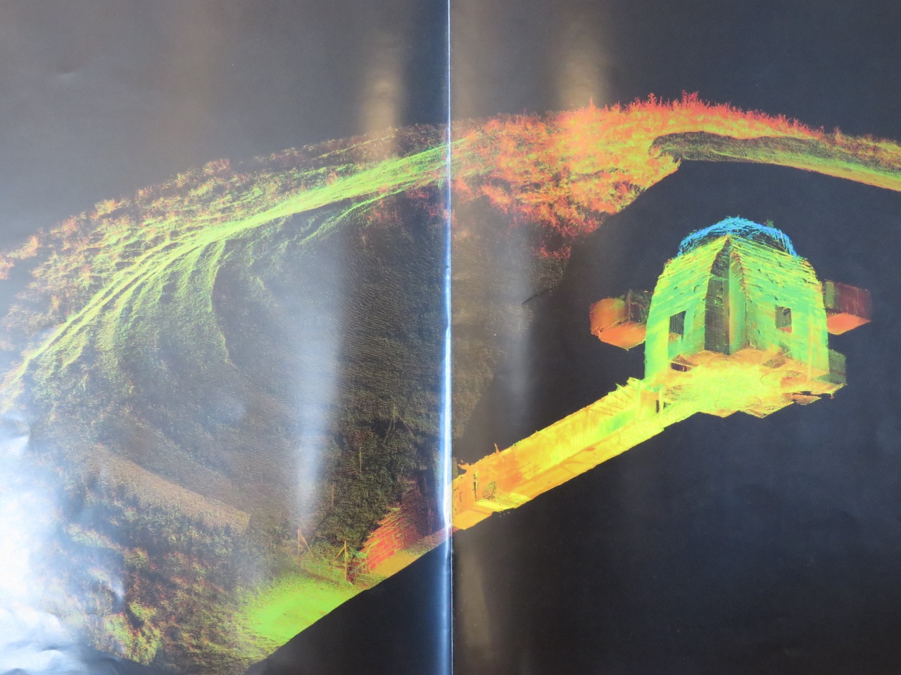 |
9/30/2017: Tomb
Position: 58°59.19'N, -3°12.51'W
Representation of the tomb at Maeshows inside a grass mound. The 36-foot (11m) entrance passage is oriented so that the winter solstice shines down the corridor and lights up the back of the tomb.
|
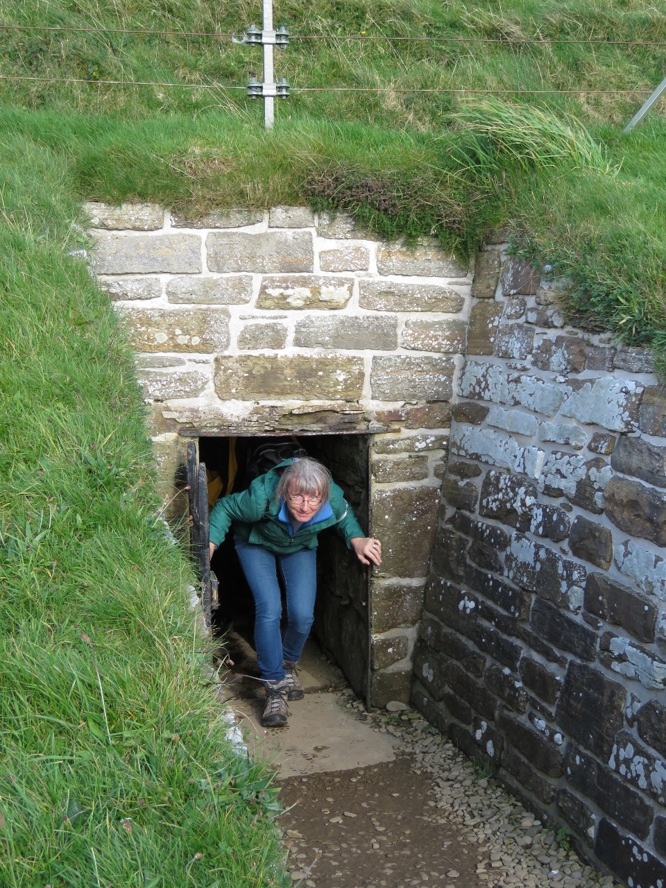 |
9/30/2017: Exiting Maeshowe
Position: 58°59.79'N, -3°11.31'W
Jennifer exiting Maeshowe. The entrance passage is less than three feet high, so even she had to crouch down to enter.
|
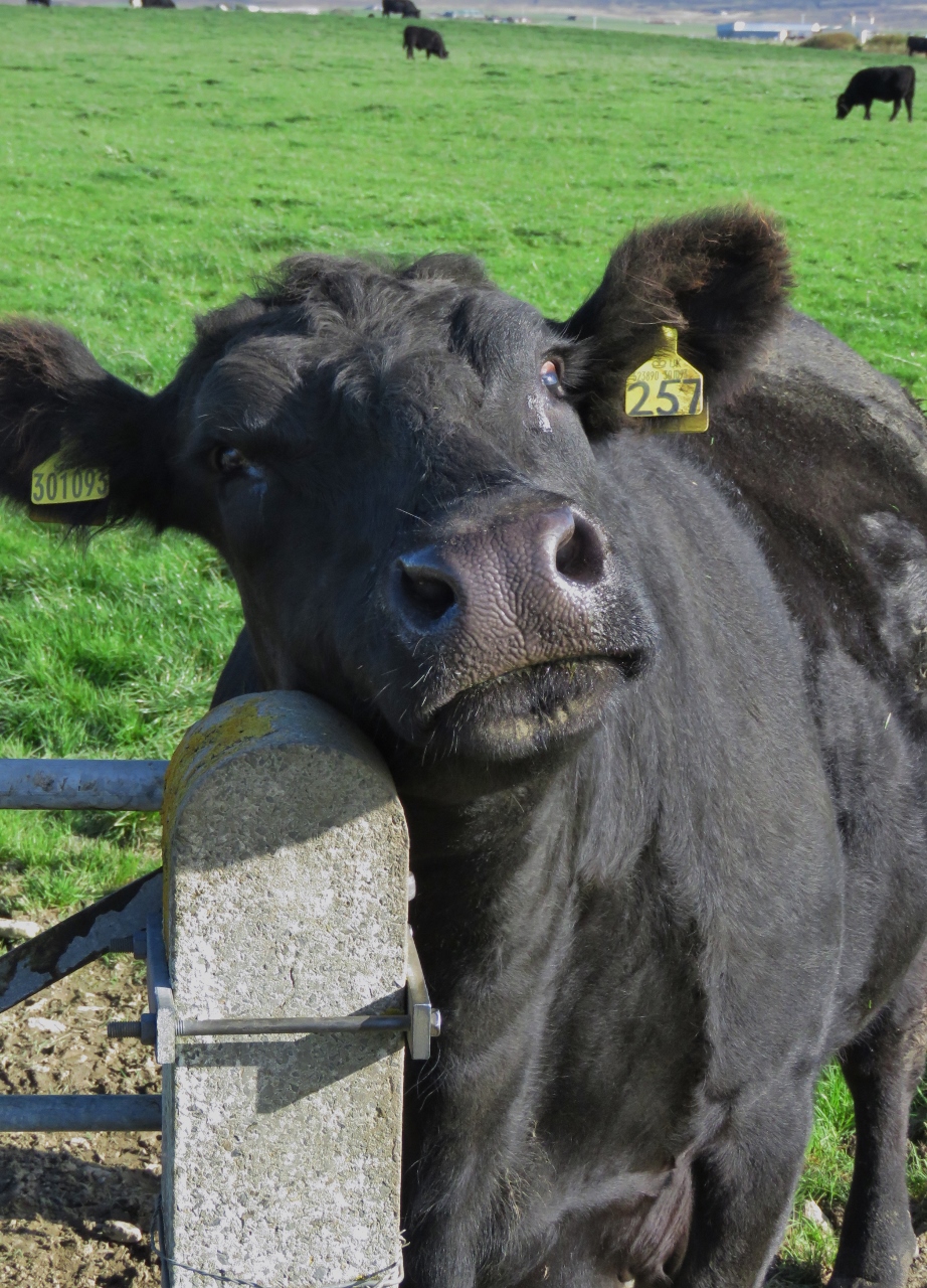 |
9/30/2017: Cow
Position: 58°59.77'N, -3°11.29'W
As we walked along a field back from Maeshowe, a cow came over the visit.
|
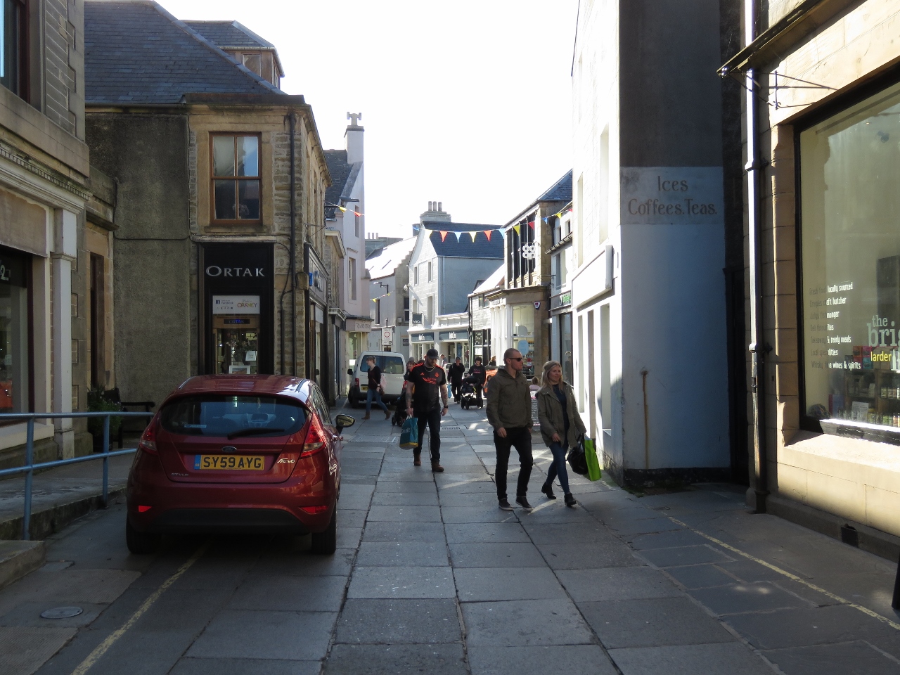 |
9/30/2017: Albert Street
Position: 58°59.03'N, -2°57.47'W
Simon dropped us back off in Kirkwall, the largest town in the Orkney Islands, where we spent a few hours before returning back to Dirona. This is looking down Albert Street.
|
 |
9/30/2017: BBC Radio Orkney
Position: 58°58.94'N, -2°57.64'W
Having listened to BBC for years, it seemed kind of cool to see the BBC Radio Orkney sign.
|
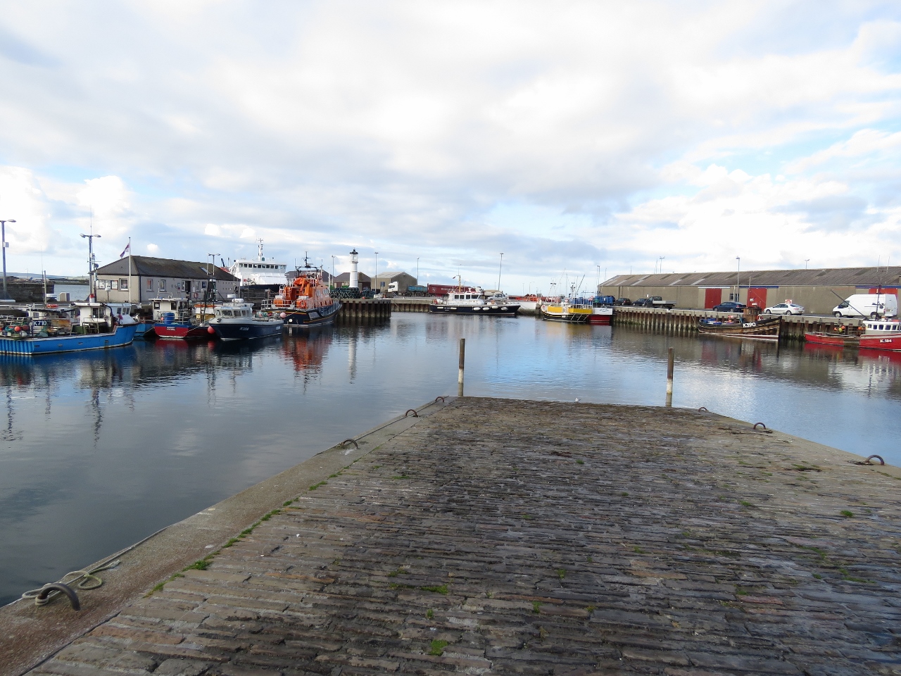 |
9/30/2017: Kirkwall Harbour
Position: 58°59.07'N, -2°57.58'W
The Kirkwall commercial harbor, with the RNLI lifeboat Margaret Foster. The station here is relatively new, and was established in 1972.
|
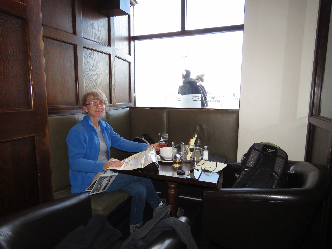 |
9/30/2017: Helgi's
Position: 58°59.07'N, -2°57.56'W
An excellent lunch with a view to Kirkwall Harbour at Helgi's.
|
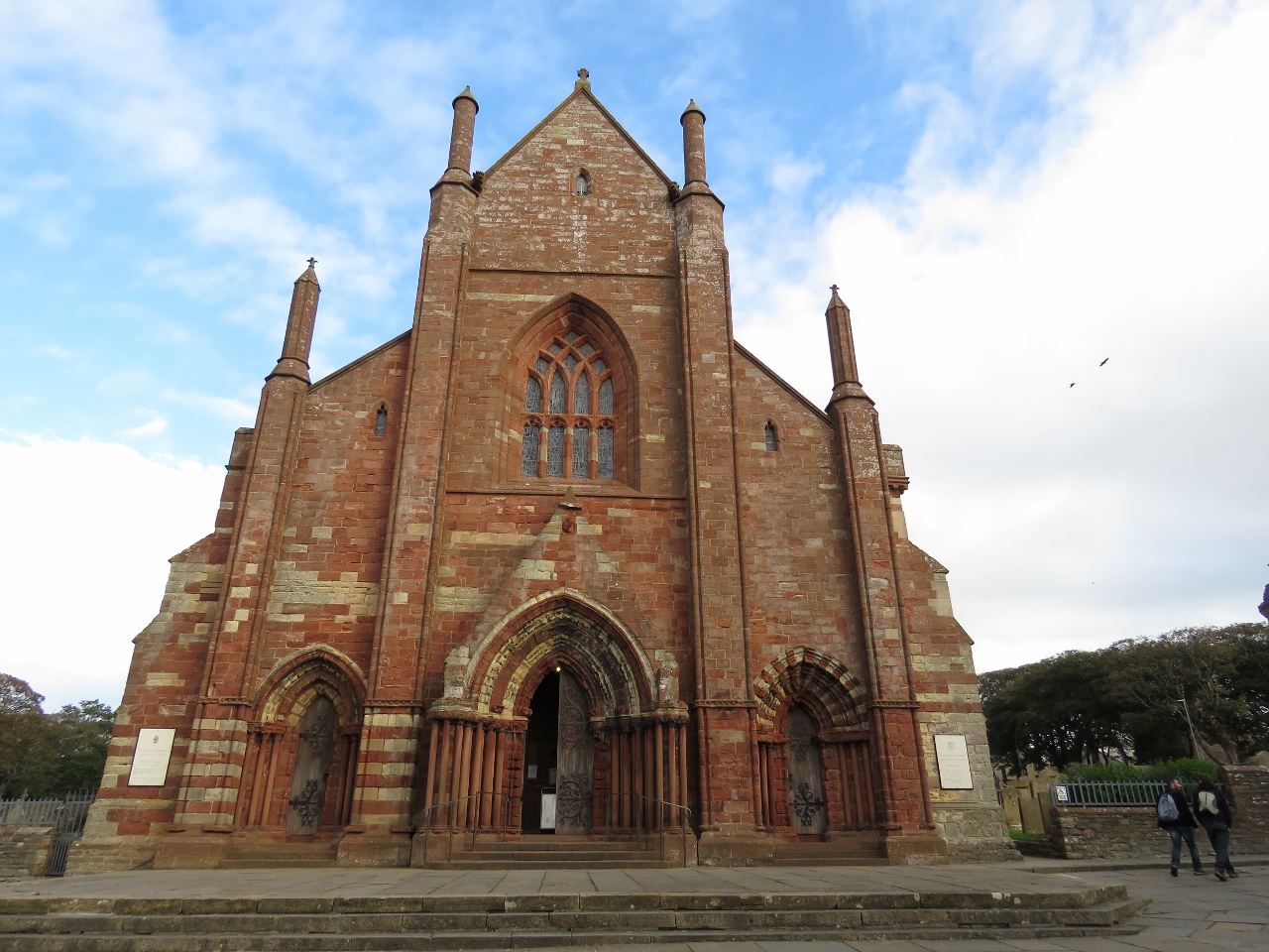 |
9/30/2017: St Magnus Cathedral
Position: 58°58.89'N, -2°57.63'W
After lunch, we toured around Kirkwall some more. This is St. Magnus Cathedral, founded in 1137.
|
 |
9/30/2017: Earl's Palace
Position: 58°58.83'N, -2°57.55'W
Patrick, Earl of Orkney, built Earl's Palace starting in 1607. Earl Patrick later was executed for treason and the castle fell into ruin in the 18th century.
|
 |
9/30/2017: Hallway
Position: 58°58.83'N, -2°57.55'W
Hallway inside Earl's Palace.
|
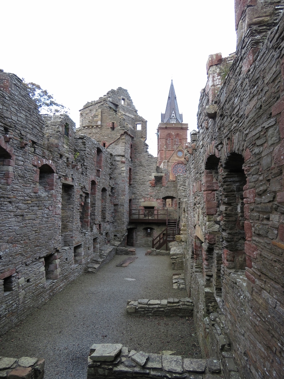 |
9/30/2017: Bishop's Palace
Position: 58°58.85'N, -2°57.59'W
Bishop's Palace was built in the 12th century at the same time as St. Magnus Cathedral, as the residence for the cathedral's first bishop. Historic Scotland has made both this and Earl's Palace surprisingly accessible. We could walk all the way to the top floor of the tower at the far end.
|
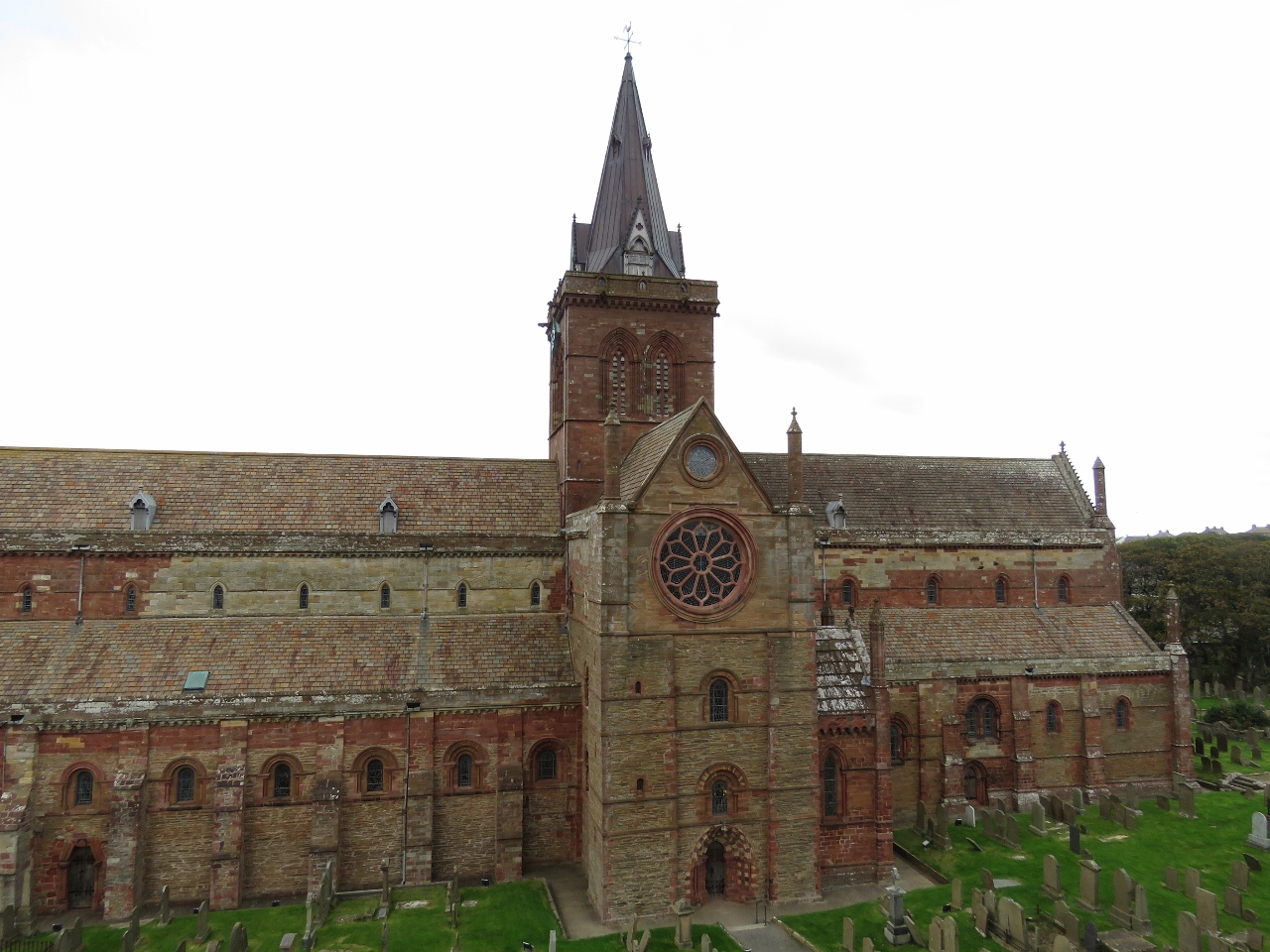 |
9/30/2017: Cathedral View
Position: 58°58.86'N, -2°57.59'W
View to St. Magnus Cathedral from the tower in Bishop's Palace.
|
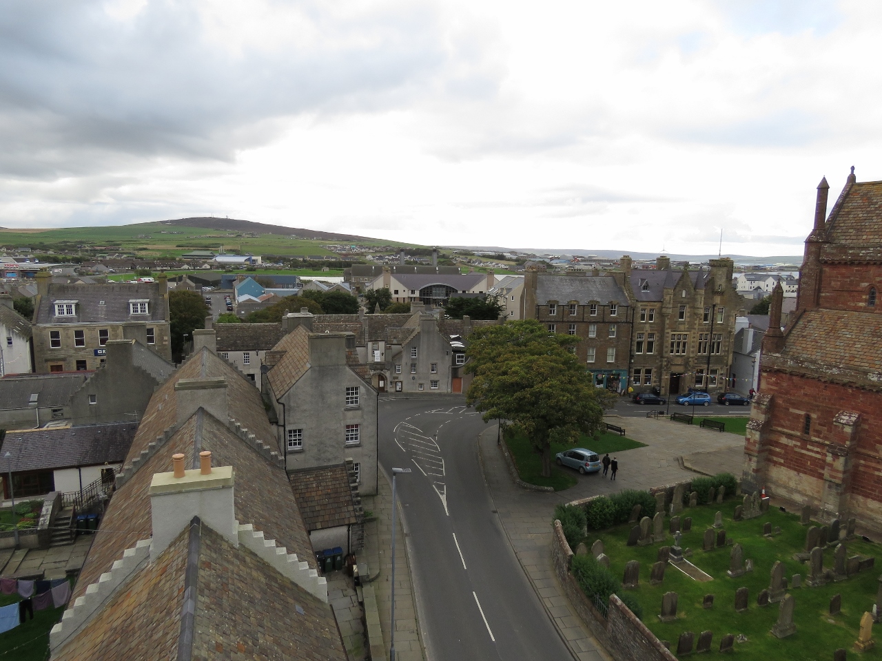 |
9/30/2017: Kirkwall View
Position: 58°58.86'N, -2°57.59'W
Looking across Kirkwall from the tower in Bishop's Palace.
|
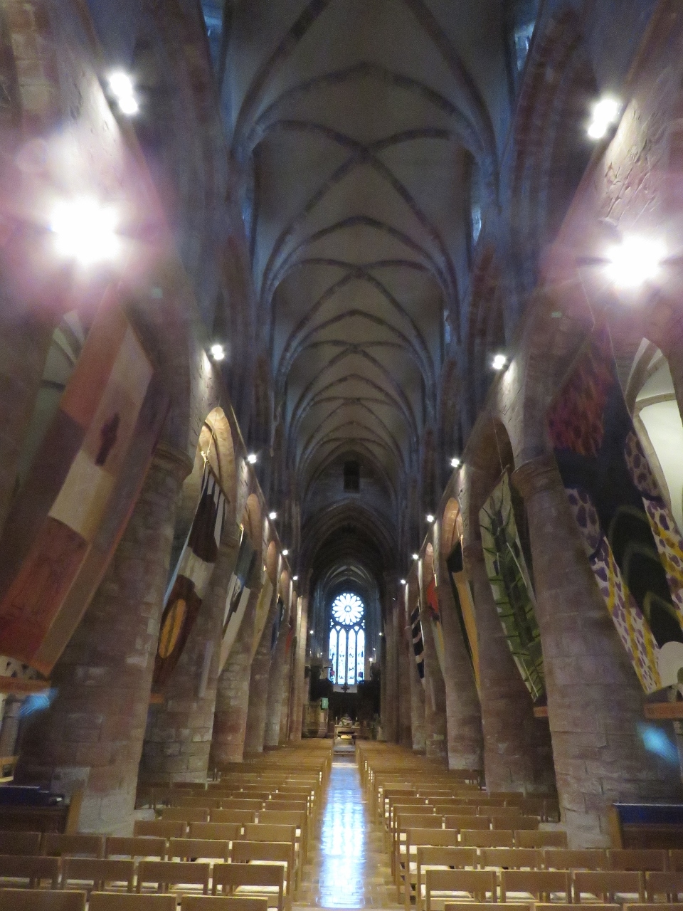 |
9/30/2017: Cathedral Interior
Position: 58°58.89'N, -2°57.62'W
The soaring interior of St. Magnus Cathedral.
|
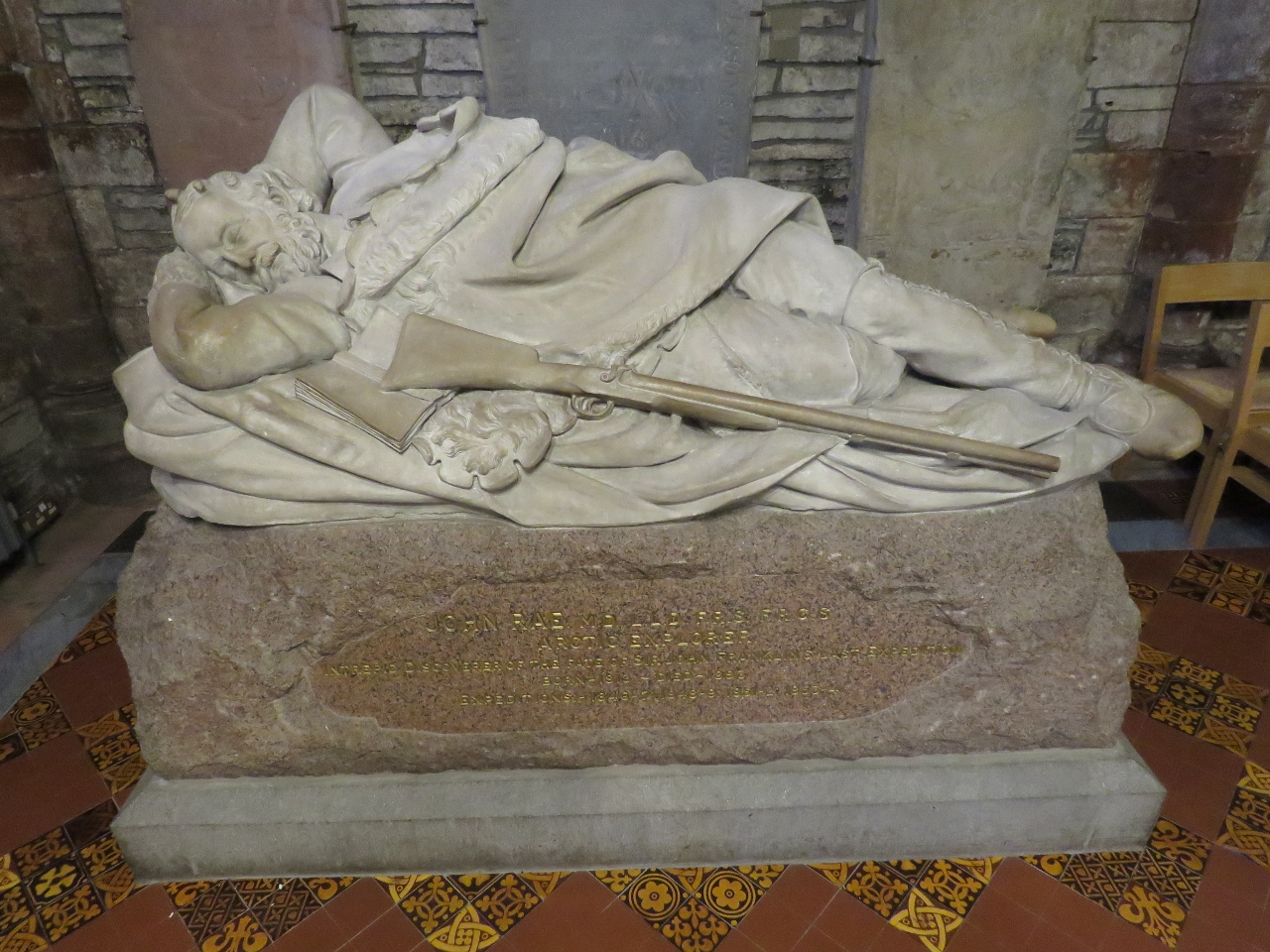 |
9/30/2017: John Rae
Position: 58°58.89'N, -2°57.59'W
Memorial to surgeon and Arctic explorer John Rae, who is buried in the graveyard at St. Magnus Cathedral. Rae was born in the Orkney Islands, worked for the Hudson's Bay Company and became an Arctic explorer, finding the final link in the Northwest Passage.
|
 |
10/1/2017: Major Storm
Position: 58°49.86'N, -2°57.39'W
A major low-pressure system will be passing through the area today and tomorrow, bringing winds as high as Force 10 (48-55 knots). The system arrived about six hours ago. Winds jumped from less than 15 knots to steadily in the 30s with frequent gusts into the 40s. The barometer has fallen from 998mb to 985mb. 2mb an hour is a pretty rapid descent.
|
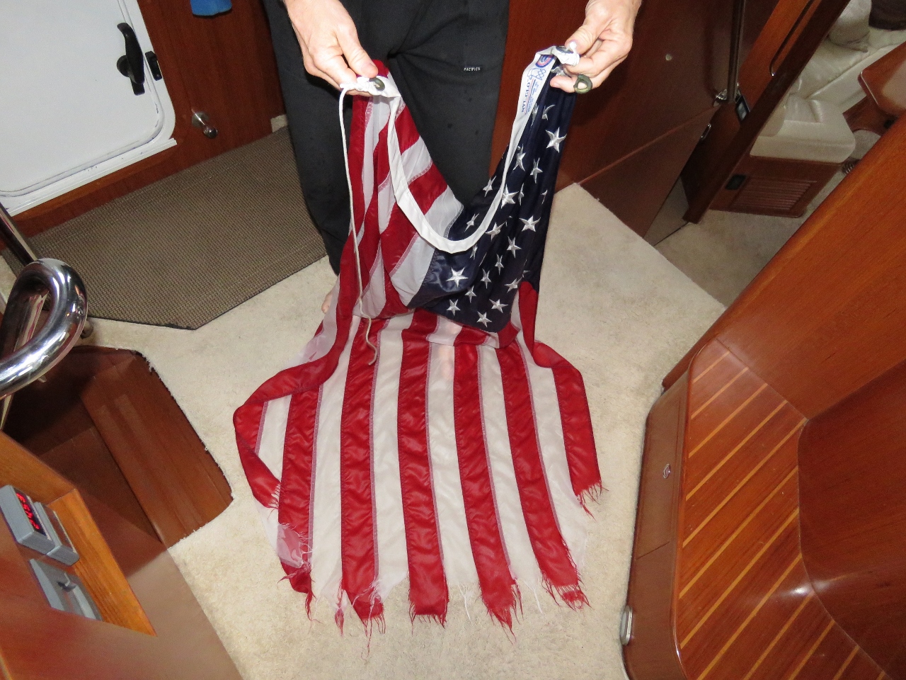 |
10/2/2017: Flag Shredded
Position: 58°49.85'N, -2°57.32'W
Our US ensign didn't do well in the storm.
|
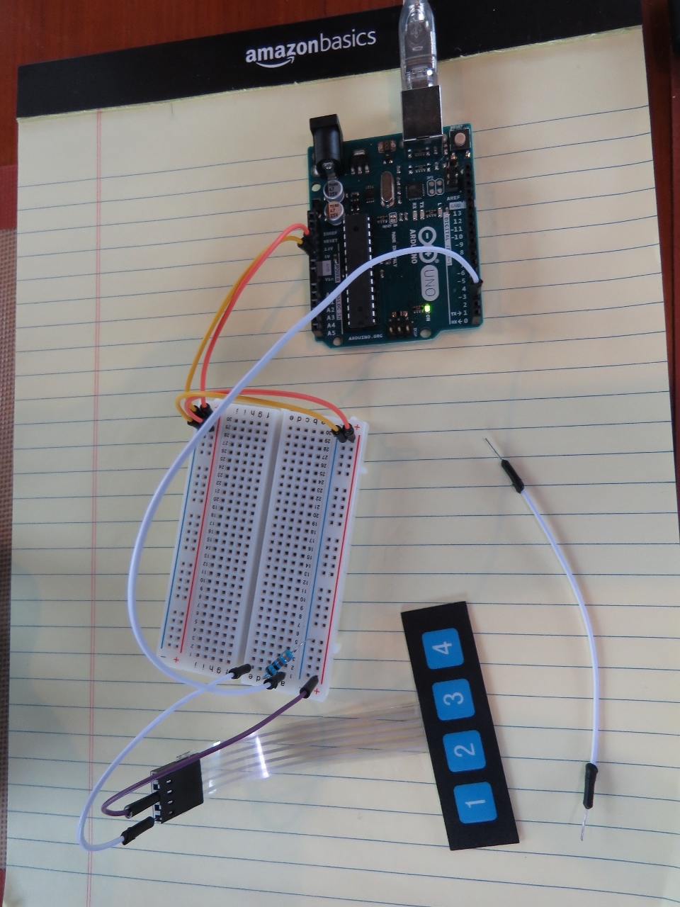 |
10/2/2017: Arduino
Position: 58°49.84'N, -2°57.32'W
We use three Raspberry Pis on board to implement 12 channels of digital output (ability to turn devices off and on) and around 30 channels of digital input (ability of know if a device is on or off). Another form of input that can be useful is analog input, the ability to read a continuouis variable like voltage. Two common choices are current from 4mA to 20mA and voltage from 0 to 5V. We have examples of both on Dirona.
Raspberry Pis do well measuring digital signals but don't have much support for reading analog signals so I picked up a $10 Arduino some time back to see if I could get it to easily read analog signals. It turns out the Arduino is super easy to program. It comes with a nice little cross-development environment that runs on Windows and allows you to write in C which which is compiled and downloaded to run on the Arduino. This program will now run whenever the Arduino is powered up or reset. I first got it reading 0 to 5v signals using the built in analog to digital converter than yields integers from 0 to 1023. Super simple. Here I've moved on to reading a 4 key keypad. This just required 4 channels of digital input with a pullup resister both of which are built into the Arduino (this is easy on the Pi as well). |
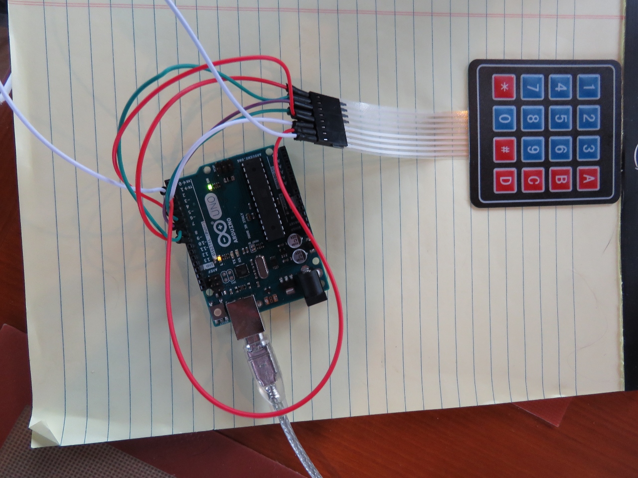 |
10/2/2017: Reading Matrix Keyboard
Position: 58°49.83'N, -2°57.32'W
Since the analog input problem was so simple with the Arduino, I still had a couple of hours to spare. I decided to get the Arduino reading a 4x4 matrix keyboard. This keyboard has 4 row lines and 4 column lines. When a key is pressed, say the top left hand corner key, then the row 1 line is connected to the column 1 line. The output I want is the digit that was just pressed. So if column 1 is connected to row 1, I want the Arduino to return "1". It's slightly more complex in that the keys have to be debounced as well but that's basically all there is to it. I spent a few minutes thinking of how to do this on an Arduino and decided to have a quick look to see what others have done. I found that Arduino has a library to do this, installed the library, and it was running in 5 min. Remarkably easy.
One of the primary problems when reading buttons is having the button responsive. If the program is busy doing something else for a few 10s of milliseconds, a key press can be missed. The Arduino is so inexpensive that you could chose to dedicate the Arduino to button processing alone and have the real work done elsewhere. |
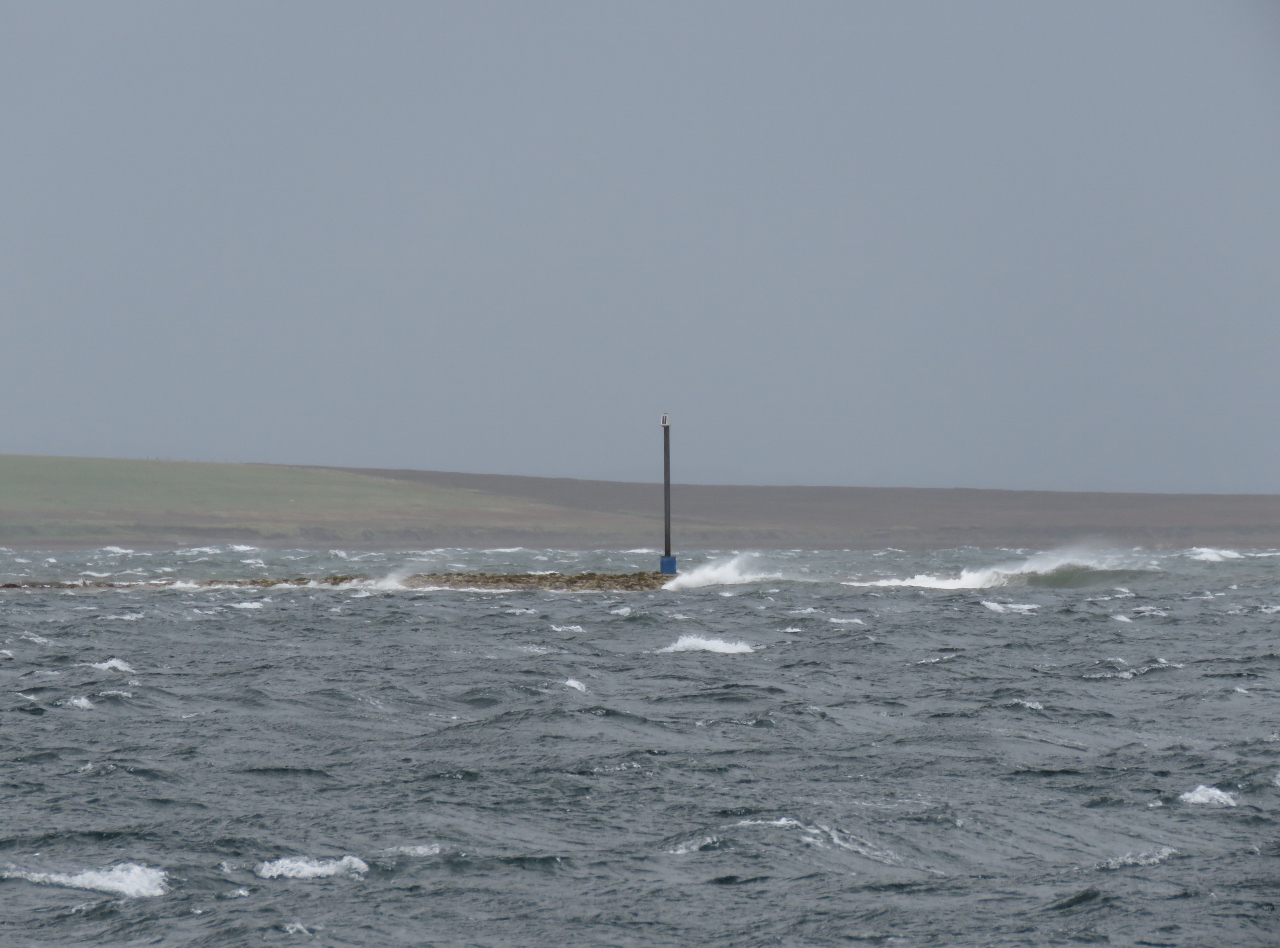 |
10/2/2017: Waves
Position: 58°49.83'N, -2°57.32'W
The winds have continued to blow strongly from the south. This is looking north towards Scapa Flow over the bar at the entrance to St. Margaret's Hope. Conditions don't look very appealling out there.
|
 |
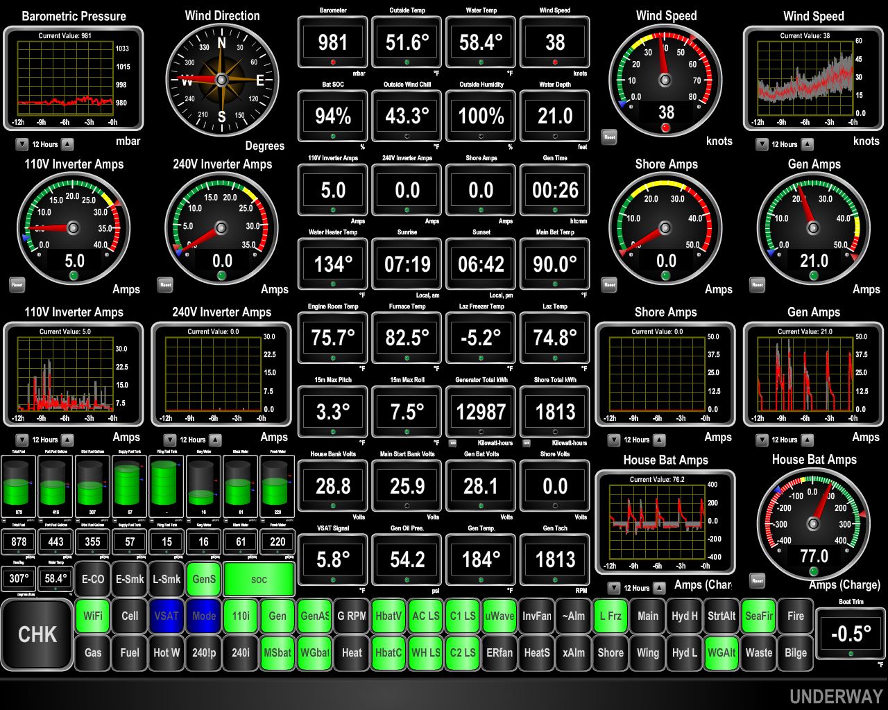
10/2/2017: Swing Arc
Position: 58°49.83'N, -2°57.32'W
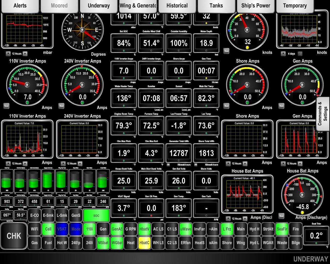
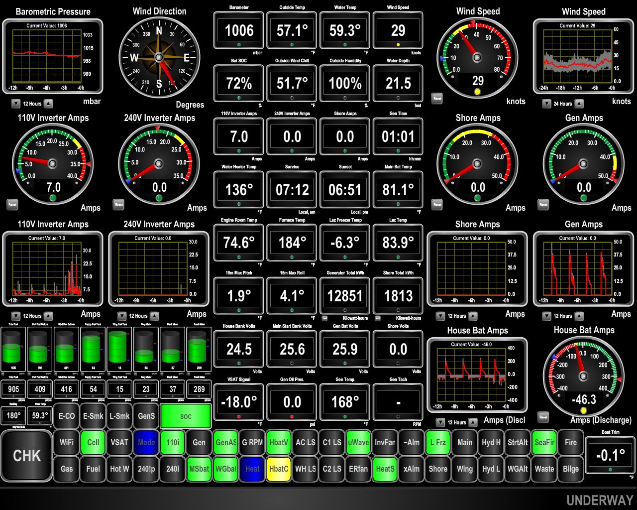
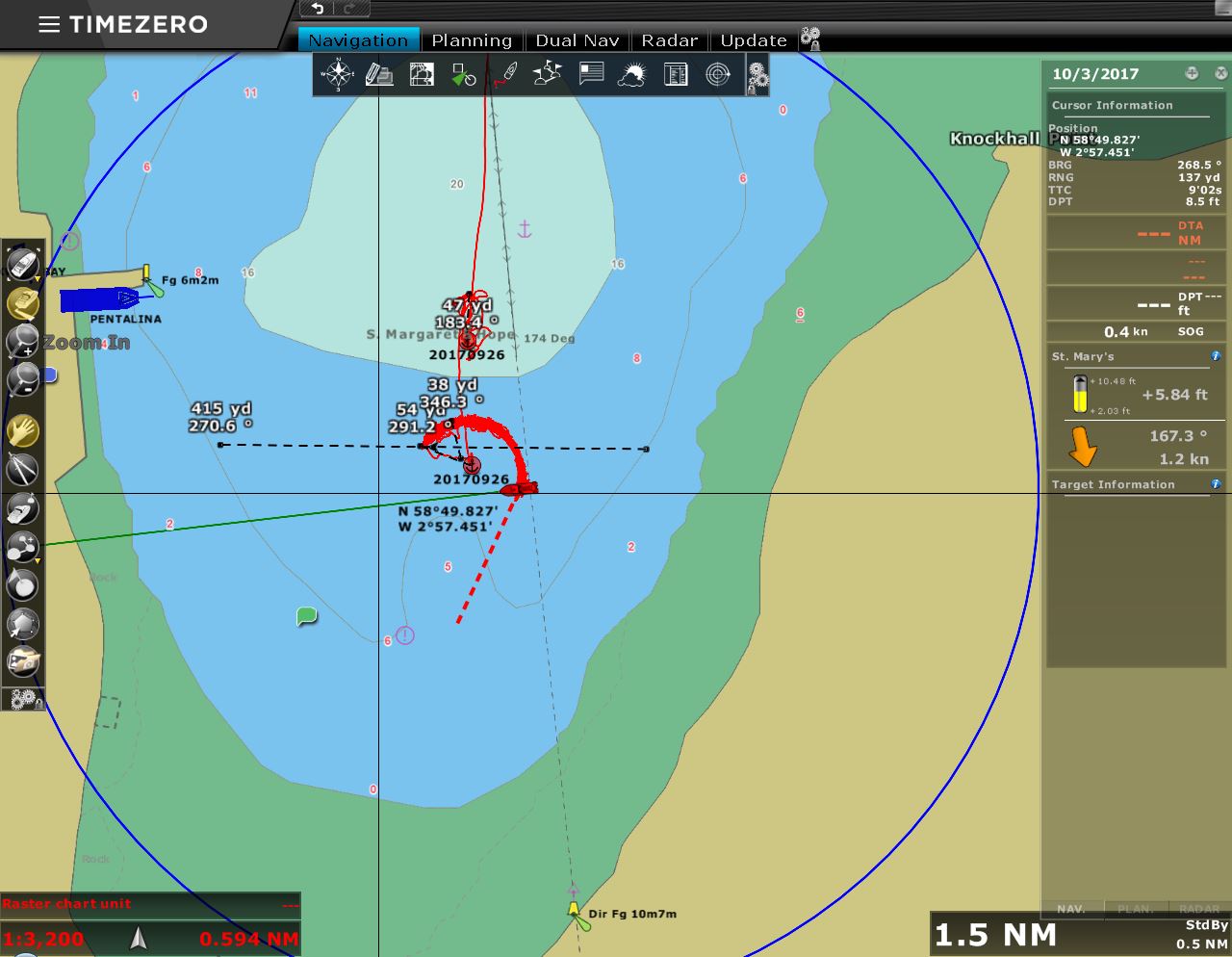
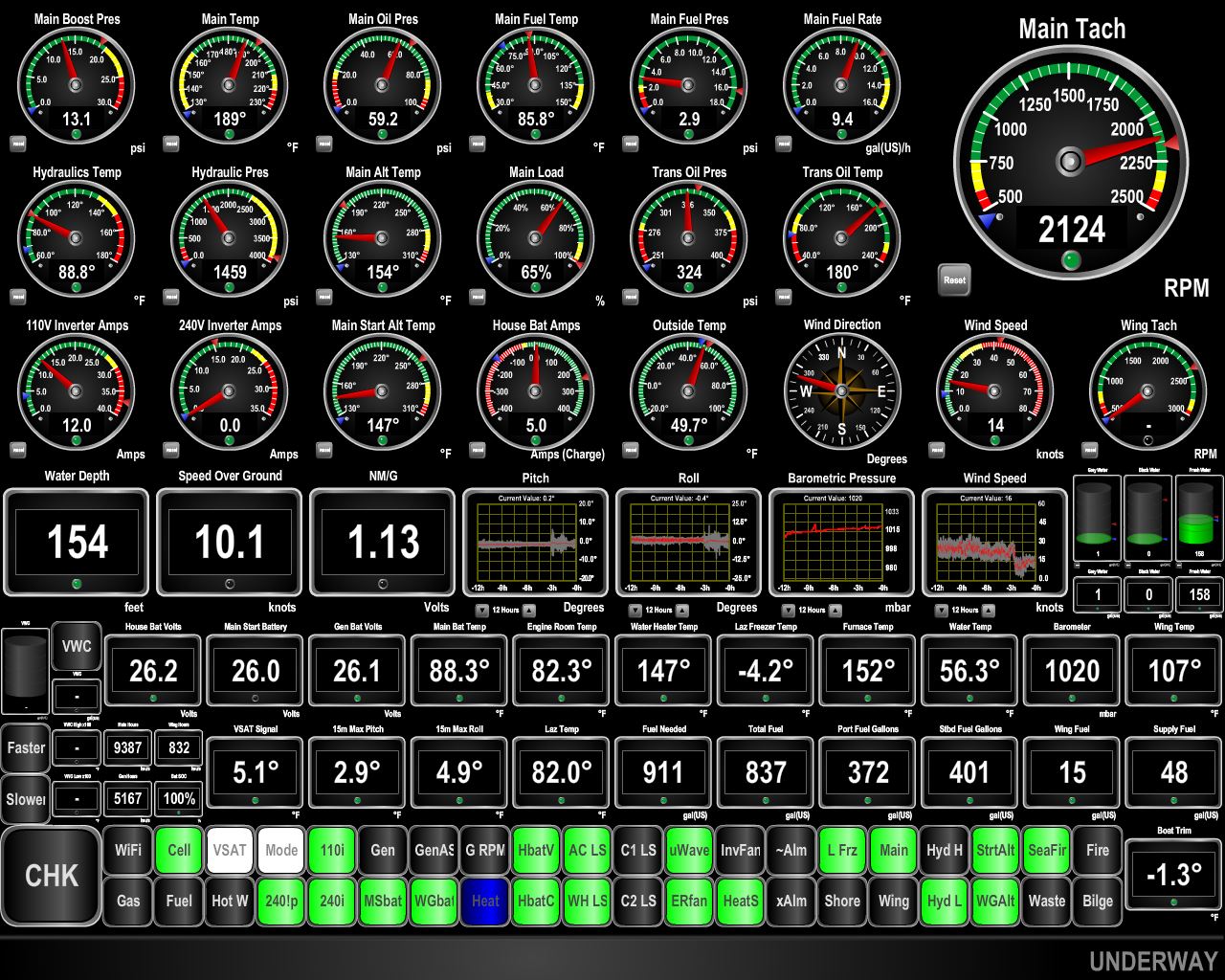
It's rare that our boat cuts such a perfect track but the winds have really been blowing and rarely below 30 kts to 35kts with gusts to as high as 52 kts. The bottom here is thick mud here so you can see from the nearly perfect circle cut by the boat track at anchor that the anchor has dug in nearly instantly and hasn't shift at all with the changing wind directions and with gusts of over 50 kts. The near perfect circle shows the anchor is not shifting at all.
Another surprising tidbit you can get from that GPS track trace is the anchor chain isn't fully pulled back in the 35 kts of steady wind we have been seeing. The winds sit at 30 to 35 kts pretty steadily and it's this consistent wind speed that is cutting the near perfect circle above. The big gusts force the boat back outside of the perfect circle and form solar flare-like patterns. You can tell the anchor isn't slipping since the boat returns to the 30 to 35 kt circle shortly after the gust dissipates. We only have 125' of rode and I would have guessed that much more than 20 to 25 kts would pull it up from the bottom but you can see here that even 35 kts doesn't fully lift the chain. |
 |
10/2/2017: Storm Continues
Position: 58°49.83'N, -2°57.32'W
By the afternoon of the storm's second day, the baromter has been bottomed out at 981 for hours and the winds have been steady in the high 30s with frequent gusts into the 40s and 50s.
|
 |
10/3/2017: Swing Area
Position: 58°49.83'N, -2°57.32'W
We're always surprised at the size of our swing area. The width of the anchorage here seems large at just over 400 yards. But we've only got 125 feet out and are taking up a fair bit of space. We often have more than 200ft out and that would swing us through a substantial portion of the entire anchorage.
|
 |
10/3/2017: Anchor Ball
Position: 58°49.83'N, -2°57.32'W
When at anchor, we display an anchor ball from the bow. It's been under so much stress in the winds that the line has nearly parted.
|
 |
10/3/2017: Pentalina
Position: 58°49.83'N, -2°57.32'W
Many of the Orkney Island ferry services are cancelled today due to the big storm. Pentalina stayed at dock for two runs.
|
 |
10/3/2017: Pressure Rising
Position: 58°49.84'N, -2°57.32'W
The winds settled down a bit yesterday, but are ramping back up as the barometer has soared from 980 to 1007 in 24 hours. We expect conditions to settle a bit over the next couple of days and then we should have a good weather window for the run to Inverness to pass through the Caledonian Canal.
|
 |
10/3/2017: Squall
Position: 58°49.85'N, -2°57.32'W
The occasional squall has passed through, bringing 40-knot winds and heavy for a few minutes.
|
 |
10/4/2017: Boat Motion
Position: 58°49.84'N, -2°57.32'W
The anchorage at St. Margaret's Hope is well-protected, but the wind waves have been growing in the storms and you can see Dirona is both pitching and rolling a bit.
|
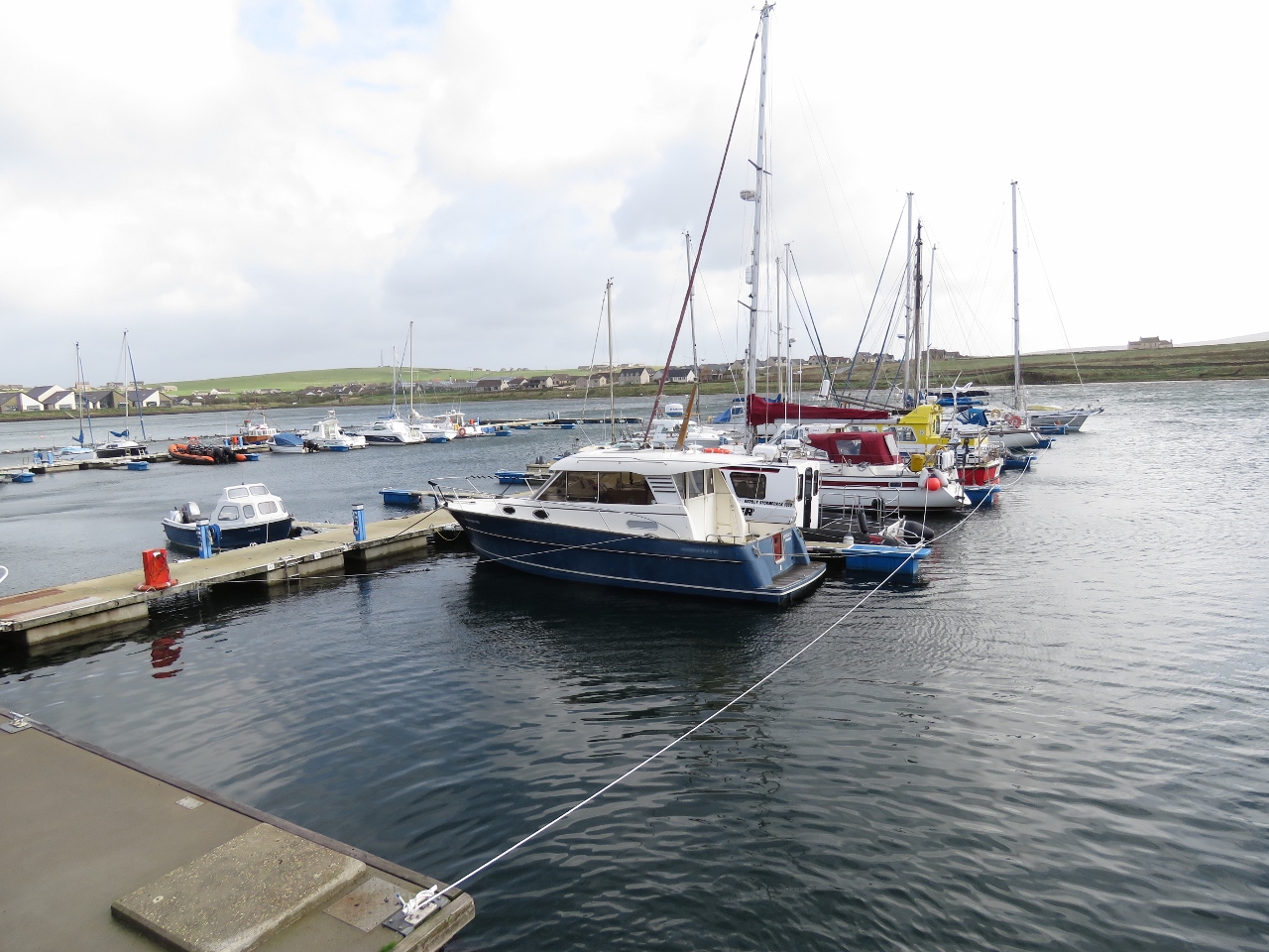 |
10/4/2017: Stromness Marina
Position: 58°57.86'N, -3°17.71'W
We took a bus into Stromness this morning. The hour-long ride runs directly from St. Margaret's Hope Ferry terminal to Stromness via Kirkwall.
This is the Stromness marina—the docks are all lashed together, presumably to secure them in the big winds as there are no pilings. We'd investigated coming here for the big storm, but we're not comfortable putting Dirona on a dock without pilings in big winds since seeing a storm destroy the docks in Richards Bay, South Africa. This one looks pretty shaky. |
 |
10/4/2017: Stromness Hotel
Position: 58°57.80'N, -3°17.85'W
The historic Stromness Hotel was established in 1901.
|
 |
10/4/2017: Karin
Position: 58°57.76'N, -3°17.80'W
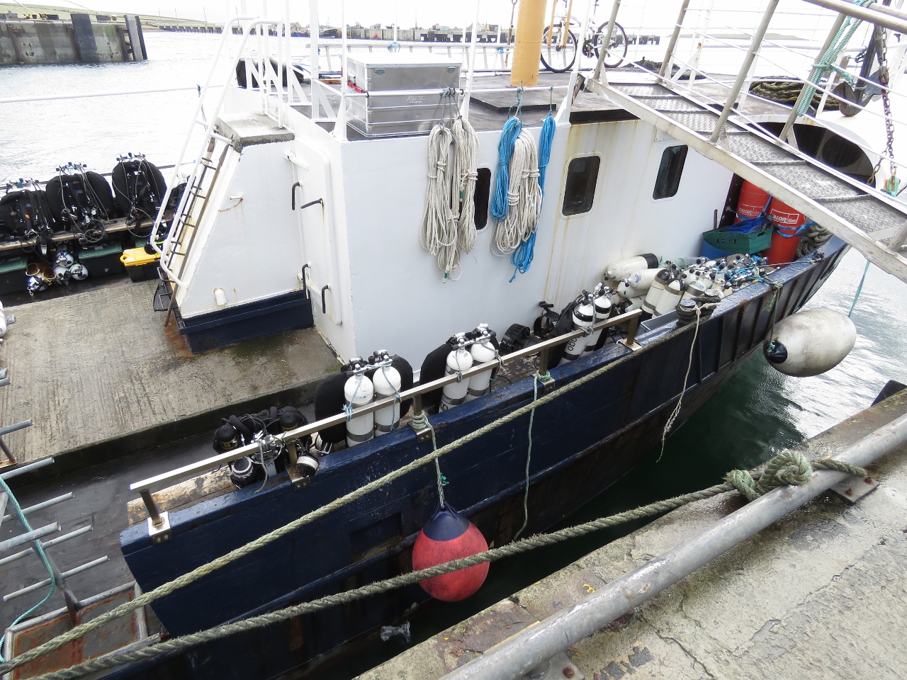
With all the submerged shipwrecks, Scapa Flow is a popular scuba diving locale. This dive boat, Karin, was full of double-tanked scuba setups. We also noticed that, rather than carry an air-compressor to fill the tanks, they carried several large canisters of compressed air. Several other dive boats in the harbor were similarly setup.
|
 |
10/4/2017: Hamnavoe
Position: 58°57.74'N, -3°17.81'W
The ferry Hamnavoe that we'd seen heading to Stromness when we'd first approached the Orkney Islands two weeks ago.
|
 |
10/4/2017: Lifeboat
Position: 58°57.71'N, -3°17.82'W
The Stromness RNLI Lifeboat Violet, Dorothy and Kathleen. We've now seen all three RNLI lifeboats in the Orkney Islands.
|
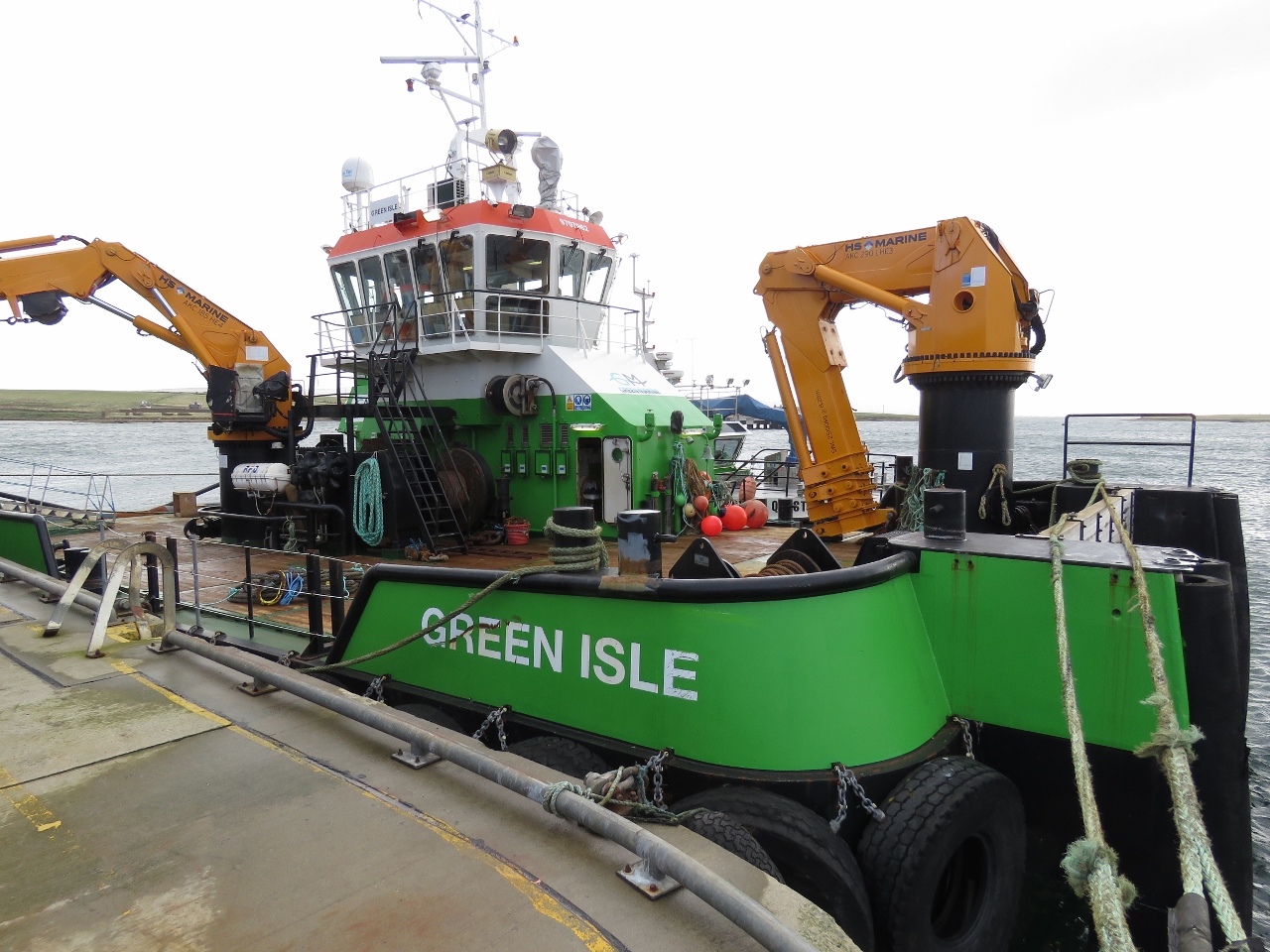 |
10/4/2017: Crane Envy
Position: 58°57.71'N, -3°17.83'W
We loved the cranes on Green Isle.
|
 |
10/4/2017: Dundas Street
Position: 58°57.67'N, -3°17.99'W
We really liked Stromness with it's narrow main street that looked little changed since the 18th century.
|
 |
10/4/2017: Ferry Inn
Position: 58°57.85'N, -3°17.83'W
We had an excellent lunch at the Ferry Inn in Stromness. We also had a great conversation about Norway, Alaska and scuba diving with the skipper of the dive boat Karin who was at the bar and had noticed us taking photos of his boat earlier in the day.
|
 |
10/4/2017: Sheep
Position: 58°57.79'N, -3°17.78'W
These sheep just arrived on a small transport boat and were craned ashore, then off-loaded into a waiting trailer.
|
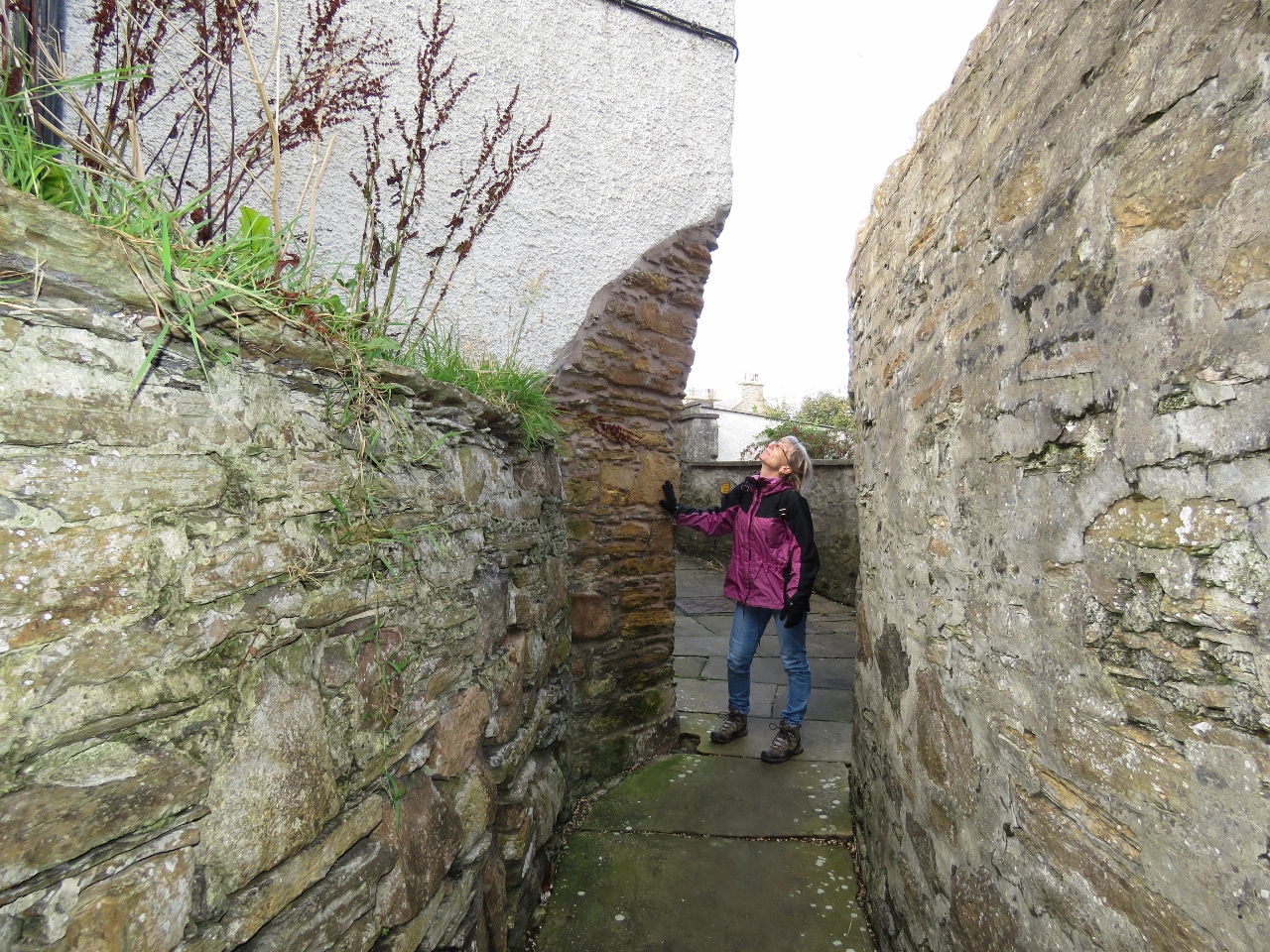 |
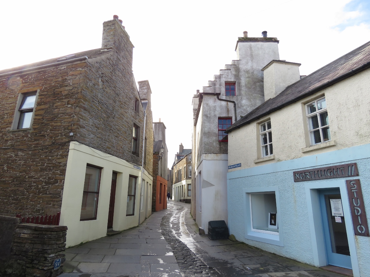
10/4/2017: Close
Position: 58°57.64'N, -3°18.00'W
Another reason we enjoyed Stromness is that the town is full of quirky closes (alleys) that wind up and down the hills between the houses. The place has real character.
|
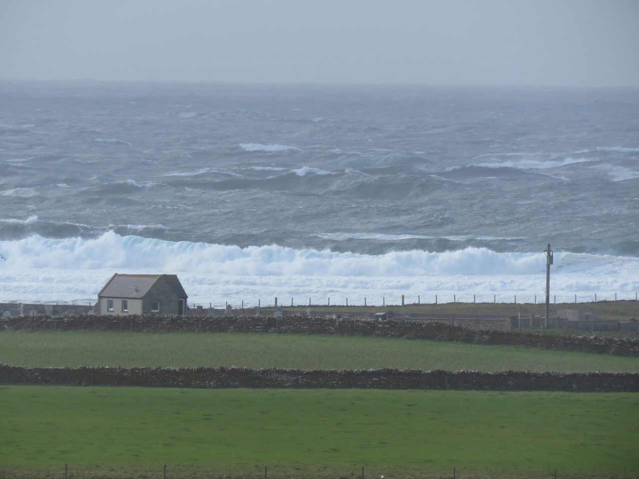 |
10/4/2017: Waves
Position: 58°57.48'N, -3°18.53'W
With big winds still blowing, we walked out to see the waves in Hoy Sound, between Hoy Island and the Orkney Mainland. Currents there are strong and can reach 8 knots on spring tides. When we arrived, the current was ebbing against the strong westerly winds and huge waves were rolling ashore.
|
 |
10/4/2017: Gun Viewpoint
Position: 58°57.28'N, -3°18.31'W
The fabulous view across Hoy Sound from the Gun Viewpoint, a former World War II gun emplacement. The winds were strong enough up here to push Jennifer into the stone structure.
|
 |
10/4/2017: Cannon
Position: 58°57.39'N, -3°18.05'W
A cannon mounted outside of town was said to have been salvaged from the American privateer Liberty in 1813 and was used to salute the Hudson's Bay Company ships. Stromness was a major provisioning stop for Hudson's Bay Company ships heading to and from Canada, and a major source of labour. By the late eighteenth century, three quarters of the company's Canadian workforce were from the Orkney Islands.
|
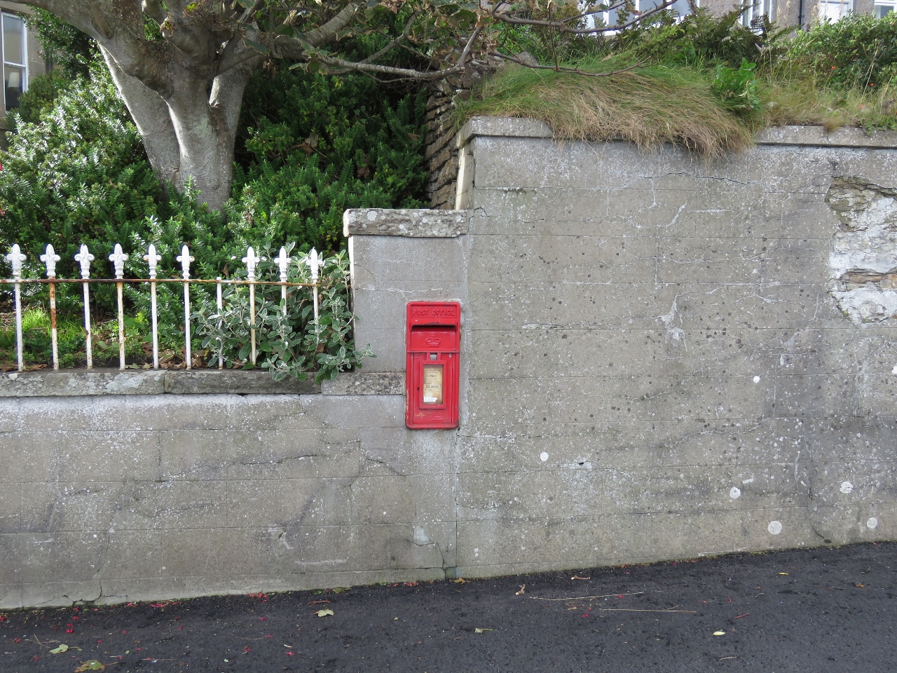 |
10/4/2017: Mailbox
Position: 58°57.37'N, -3°18.04'W
We often see Royal Mail mailboxes embedded in stone walls and even the sides of houses.
|
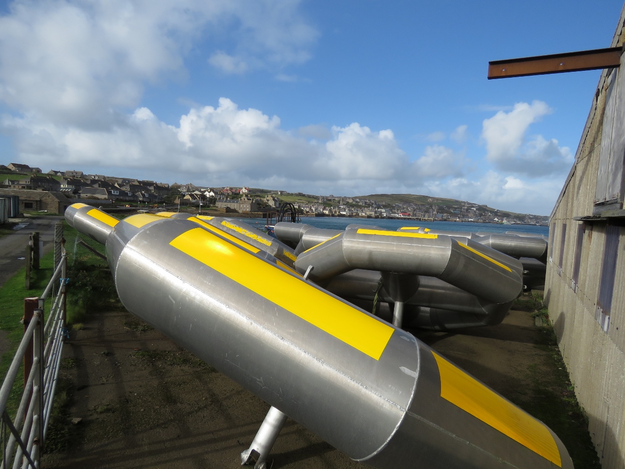 |
10/4/2017: Seatricity
Position: 58°57.18'N, -3°17.82'W
From town we could see these giant aluminum donuts at Point of Ness that looked somewhat like inflatable boats from a distance. They are the the first generation, Oceanus 1, of Seatricity's wave energy conversion technology. These were built in Stromness and deployed locally. Their second generation, Oceanus 2, is being tested off Cornwall.
|
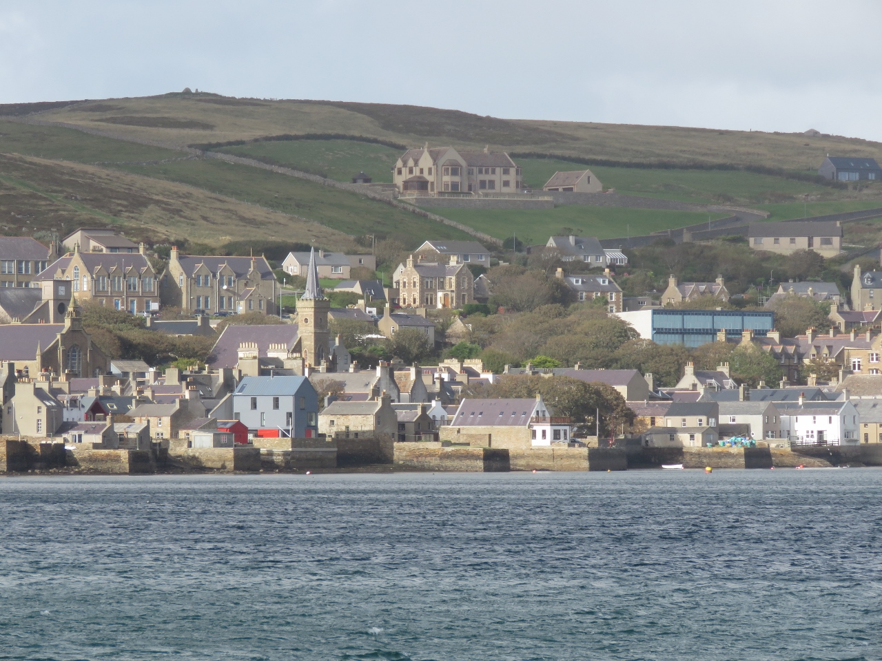 |
10/4/2017: Stromness
Position: 58°57.16'N, -3°17.67'W
View to Stromness from the Point of Ness.
|
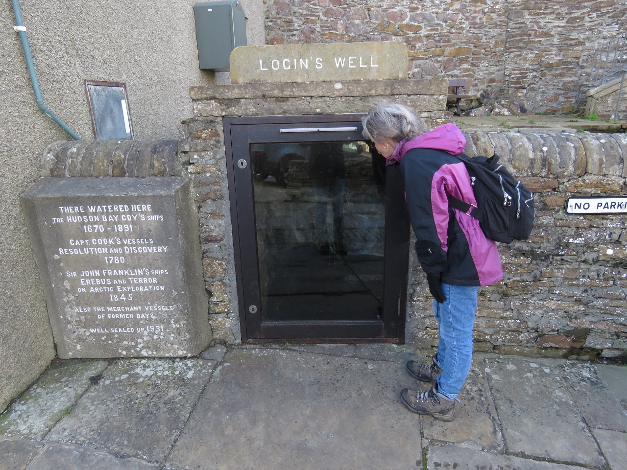 |
10/4/2017: Login's Well
Position: 58°57.43'N, -3°18.07'W
Hudson's Bay Company ships took on water from Login's Well from 1670 to 1891, as did Captain Cook's Resolution and Discovery in 1780 and Sir John Franklin's ships Erebus and Terror in 1845, prior to their doomed Arctic exploration.
|
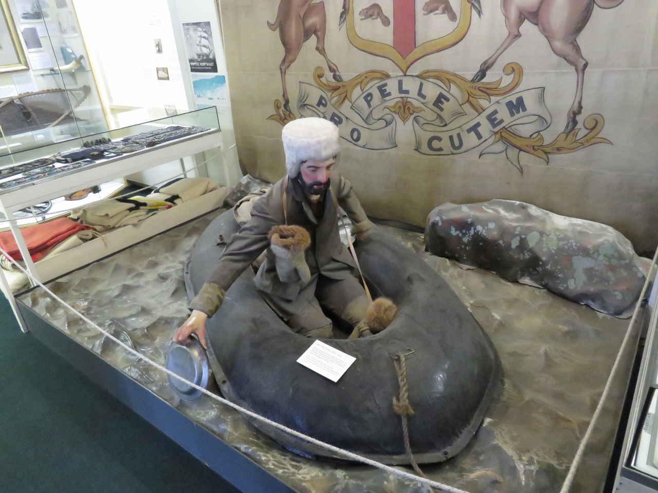 |
10/4/2017: John Rae
Position: 58°57.46'N, -3°18.08'W
The Stromness Museum is packed with memorabilia and displays on Stromness' rich history, with particular focus on Orkneyman John Rae, his involvement with the Hudson's Bay Company and subsequent Arctic explorations. Pictured is a recreation of Rae exploring the Arctic in a Halkett boat, a lightweight inflatable boat designed by Peter Halkett in the 1840s.
|
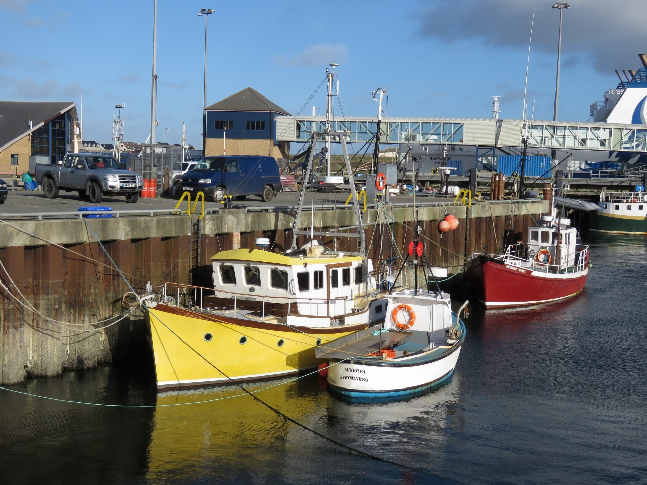 |
10/4/2017: Stromness Harbour
Position: 58°57.80'N, -3°17.84'W
Colorful fish boats in Stromness Harbour
|
 |
10/4/2017: 140 kilos
Position: 58°57.90'N, -3°17.75'W
The two of us weigh in at 140 kilos (308 lbs) on this truck scale at the Stromness ferry dock. Looks like this scale is making a little more money than it should.
|
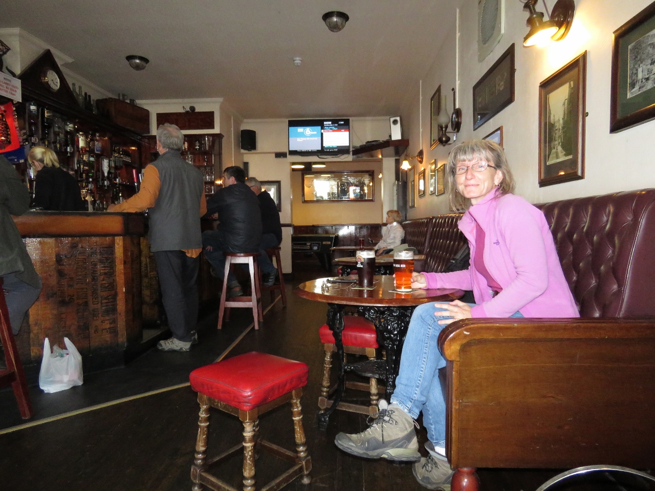 |
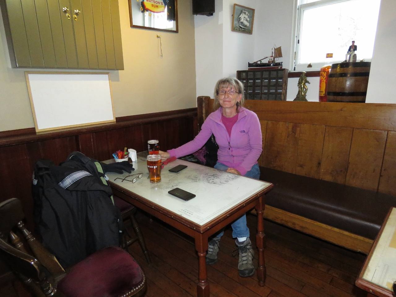
10/4/2017: Flattie Bar
Position: 58°57.80'N, -3°17.89'W
A pint at the Flattie Bar in the Stromness Hotel while we wait for our bus back to St. Margaret's Hope. We'd really enjoyed our time in Stromness.
|
 |
10/5/2017: Wind
Position: 58°49.82'N, -2°57.33'W
The winds still are blowing 25-30 kts, but are expected to settle down overnight to 20 knots by early morning and less than 10 by noon.
|
 |
10/5/2017: Hydraulic Hoses
Position: 58°49.82'N, -2°57.33'W
Sometimes a minor thing leads to a bigger job. The tender cover had come loose because the bungee cord securing it had parted. We keep a bulk bungee kit in the bilge under the guest stateroom head and when we retrieved it, noticed a bit of oil on the bag. We found some oil on a couple of the hydrualic hoses, but it wasn't clear where the oil was coming from. So we tightened all fittings in the area and cleaned off the oil. And we'll check them again soon to see if there's still a leak and from where.
|
 |
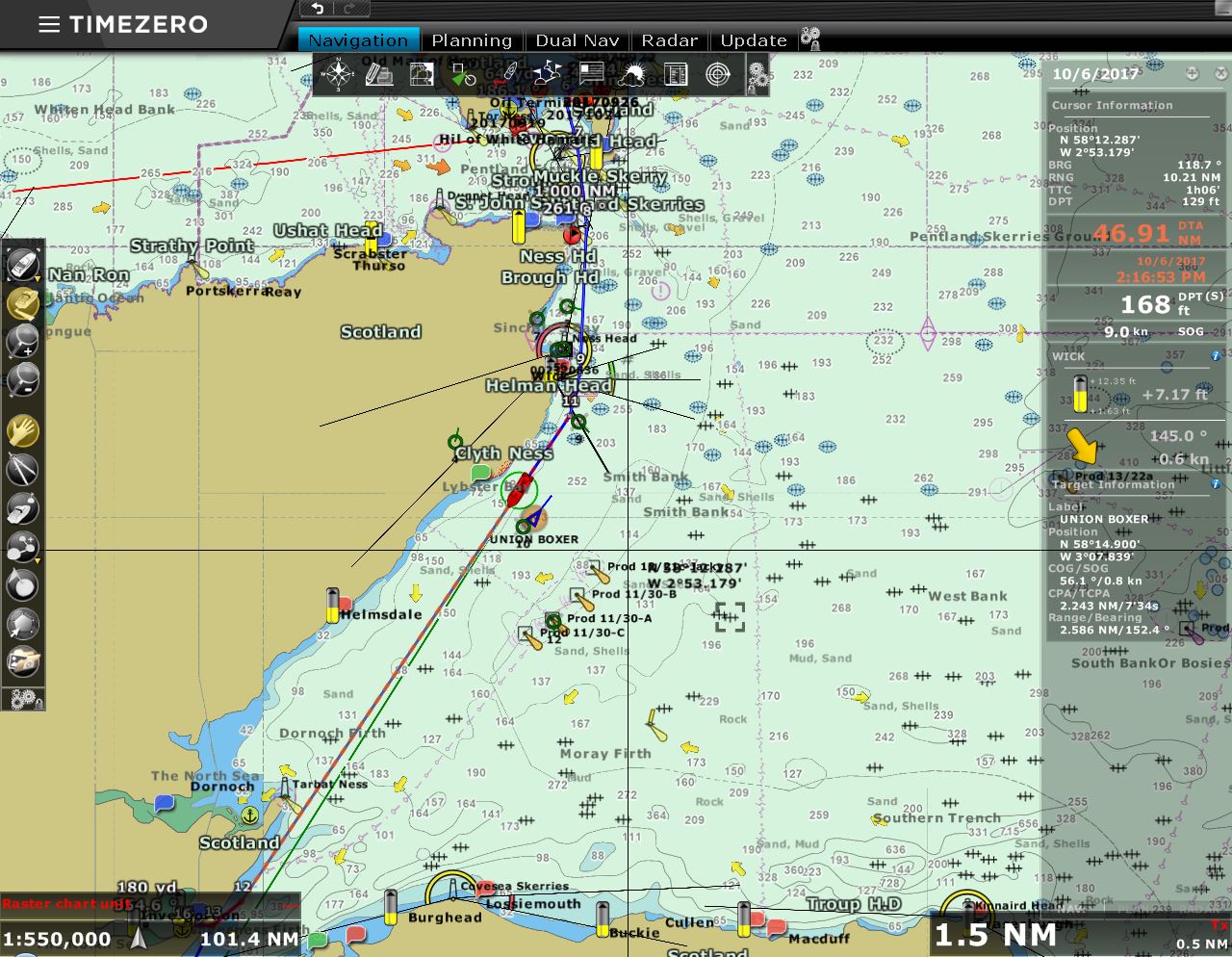
10/6/2017: Raising Anchor
Position: 58°49.85'N, -2°57.41'W
The winds have settled down to 20 knots from the northwest, as expected. Sunrise isn't until 7:30am, but we're leaving St. Margaret's Hope at 5am to catch the 6am slack water in the Pentland Firth and then ride the tide south.
|
 |
10/6/2017: 9.3 Knots
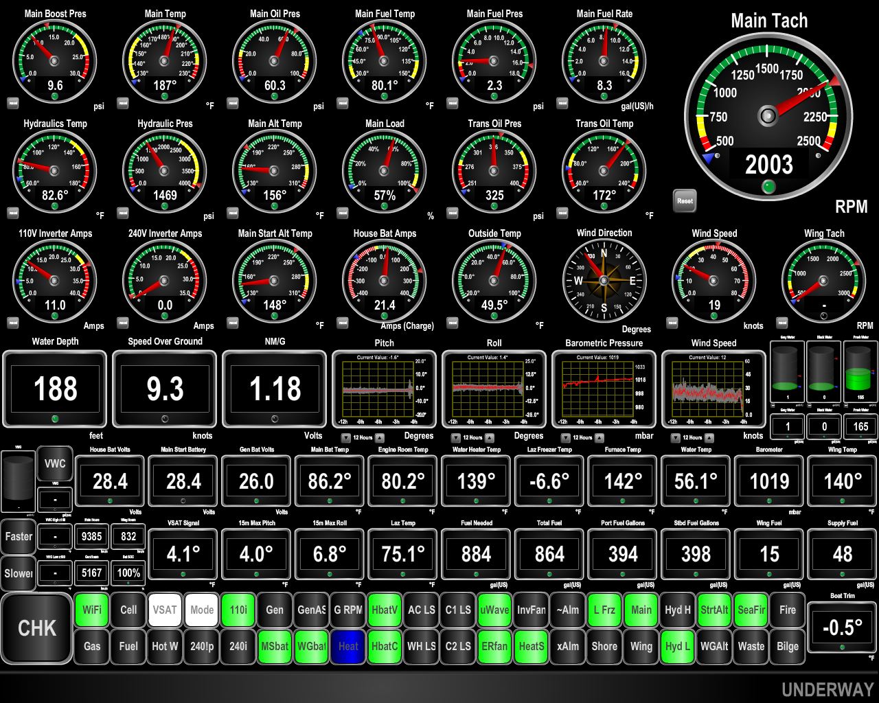
Position: 58°47.51'N, -3°2.24'W
We faced a little bit of adverse current as we exited Scapa Flow, but soon were in a positive flow and running at 9.3 knots. We were expecting this section of the run to be rather rough since the winds had been blowing so strongly from the west for the past few days, and had prepared the Dirona for heavy weather conditions. But we hardly took any spray over the bow and conditions were remarkably good. The only challenge was catching the right tidal conditions meant we needed to leave the anchorage and cross Pentland Firth in the dark.
|
 |
10/6/2017: Duncansby Head
Position: 58°38.19'N, -2°59.61'W
We're starting to see a little light as we pass Duncansby Head just past 7am. The light there is visible for 22 miles and we could see it clear across Pentland Firt as soon as we exited Scapa Flow.
|
 |
10/6/2017: Noss Head
Position: 58°29.56'N, -3°0.40'W
The Noss Head Lighthouse near Wick entered service in 1849.
|
 |
10/6/2017: 10.1 Knots
Position: 58°27.99'N, -3°0.52'W
We're getting an excellent push from the flooding current and are doing 10.1 knots as we pass Wick.
|
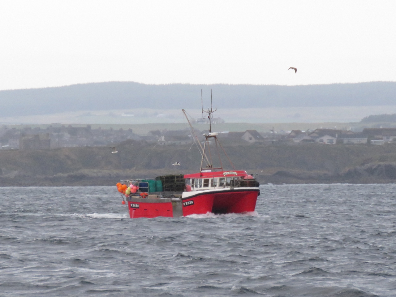 |
10/6/2017: Fish Boat
Position: 58°27.67'N, -3°0.57'W
The fish boat off Wick was a catamaran. That's an unusual hull choice for a fishing vessel, but it does have a lot of deck space for its length.
|
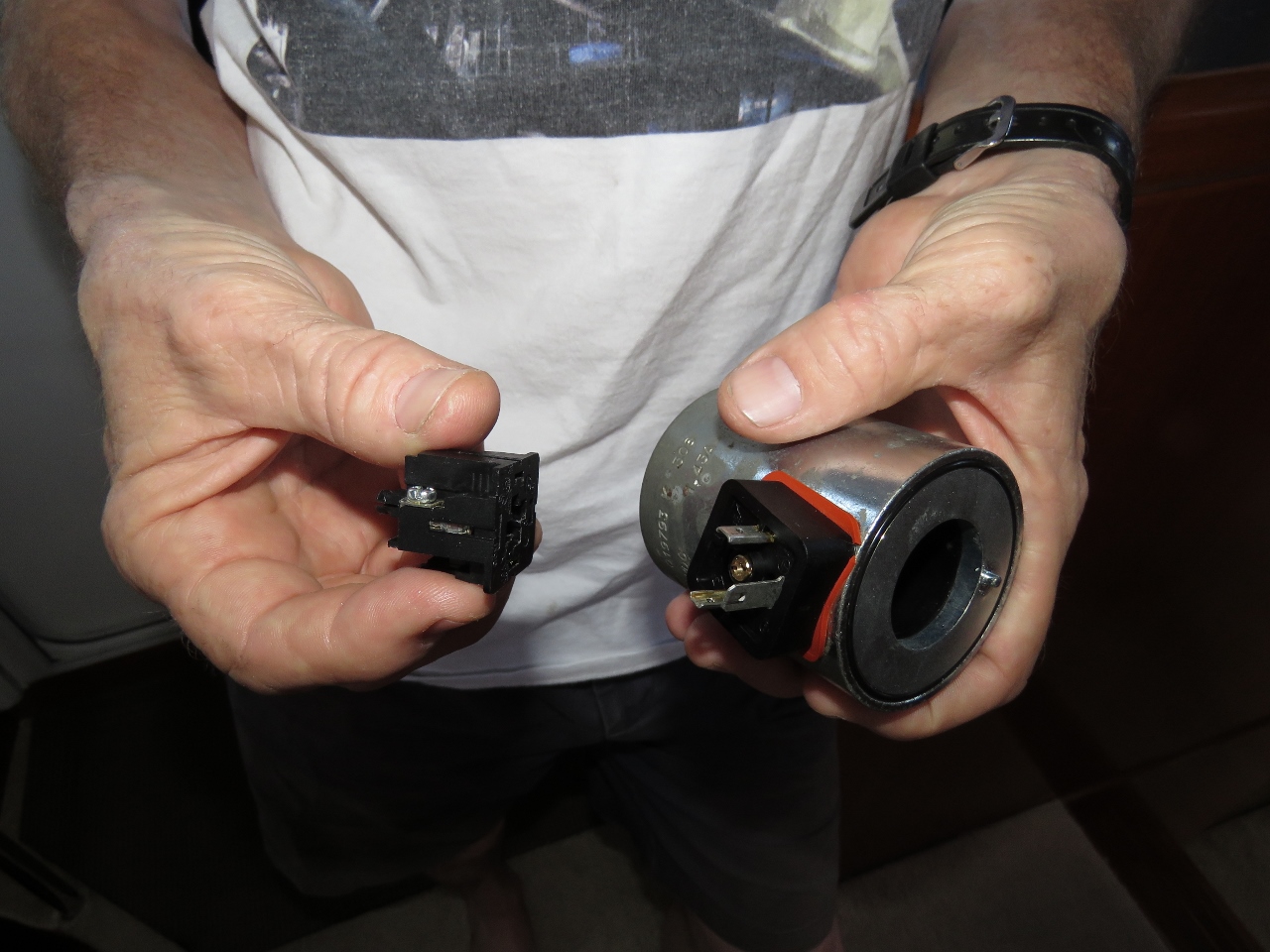 |
10/6/2017: Forward Thruster Issue
Position: 58°21.90'N, -3°4.05'W
In checking the thrusters a couple of days ago, the wires had been wiggled slightly and the forward left side thruster wasn't working. The cause is the wires are pulled too tight and putting tension on the connection. We reinstalled the wire properly in the socket and ensured it was not pulled tight.
|
 |
10/6/2017: Oil Field
Position: 58°17.13'N, -3°10.17'W
We're eight miles off the Beatrice Oil Field. The small three-platform field was discovered by Mesa Petroleum in 1976 and now is nearing end of life. The field was named for the wife of Mesa's founder, American businessman T. Boone Pickens.
|
 |
10/6/2017: Oil Rig
Position: 58°10.36'N, -3°18.86'W
One of the oil rigs in Beatrice Oil field.
|
 |
10/6/2017: Beatrice Wind Farm
Position: 58°17.51'N, -3°9.69'W
All those radar targets eight miles to our southeast likely are from the Beatrice Offshore Windfarm at the Beatrice Oil Field. Construction began on the 84-turbine wind farm earlier this year and it is expected to be fully operational in 2019.
|
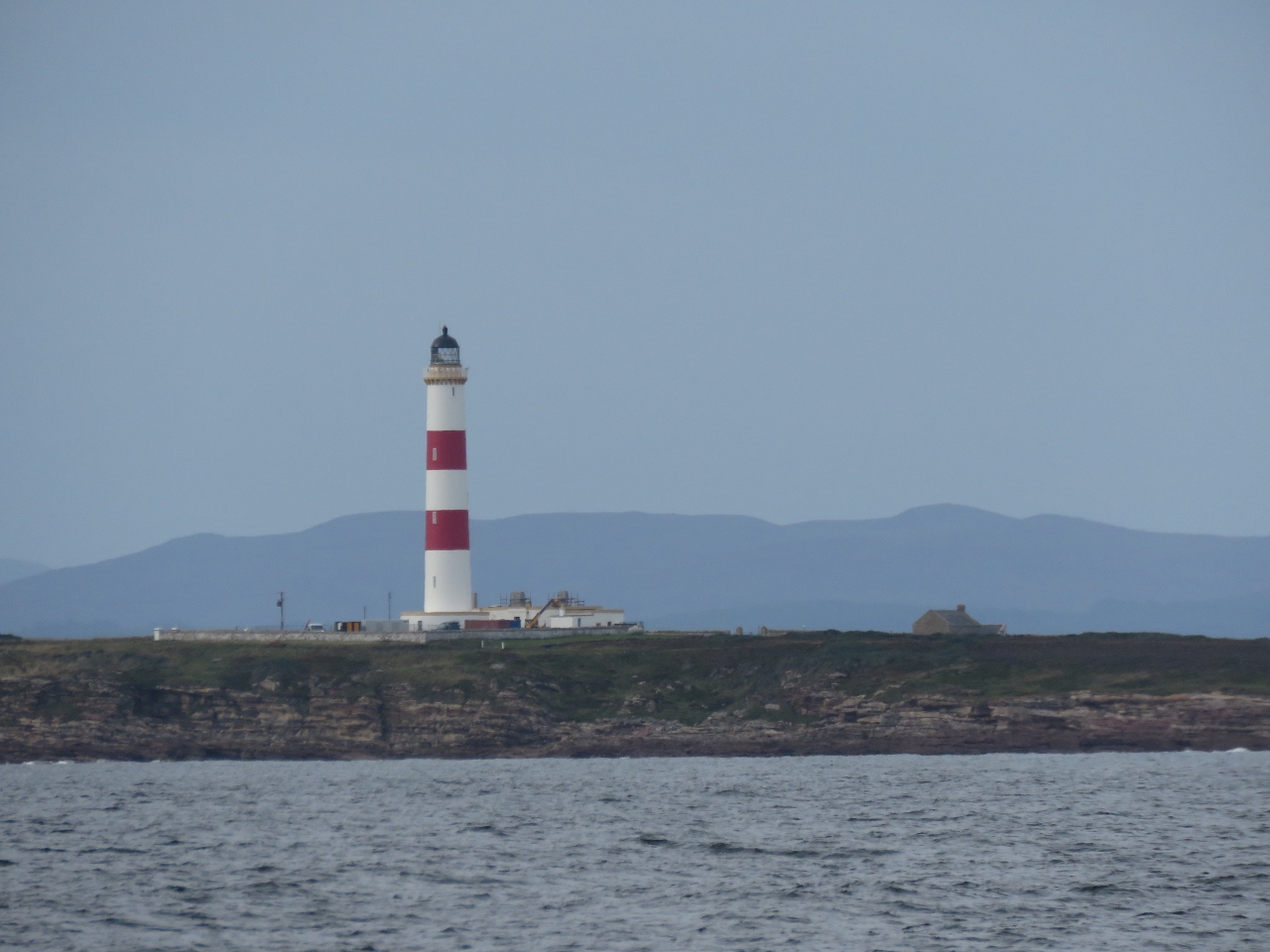 |
10/6/2017: Tarbat Ness
Position: 57°51.56'N, -3°42.82'W
The light on Tarbat Ness was completed in 1830 after 16 vessels were lost in a November 1826 storm. The lighthouse is another Stevenson family design, engineered by Robert Stevenson.
|
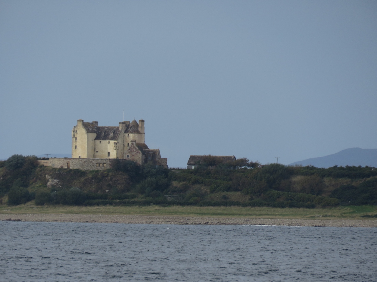 |
10/6/2017: Little Tarrel Castle
Position: 57°49.47'N, -3°45.47'W
Little Tarrel Castle originally was built in the mid 16th century.
|
 |
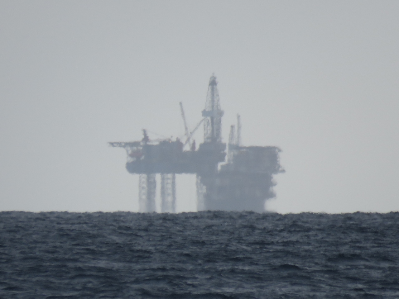
10/6/2017: Scottish Space Program
Position: 57°41.74'N, -3°56.67'W
When the structure visible beyond the rocks off North Sutor first came into view, Jennifer thought it looked like a rocket and launch pad. James joked that it must be part of the Scottish Space Program, but it's a jack-up oil rig.
|
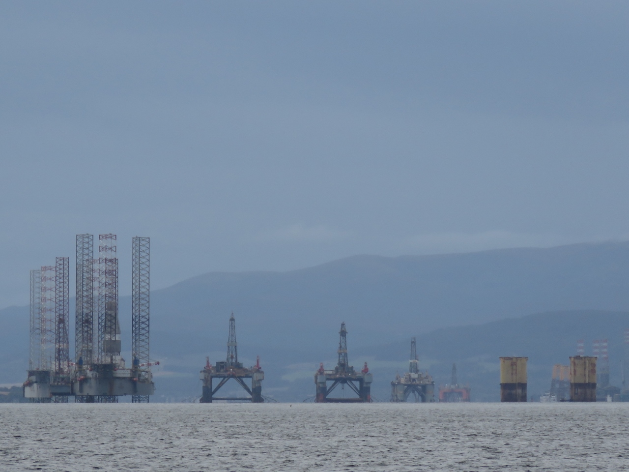 |
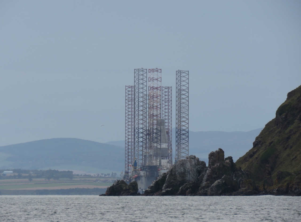
10/6/2017: Oil Rig Graveyard
Position: 57°41.46'N, -3°57.30'W
As we got a better view into Cromarty Firth, we could see more and more oil rigs inside. With oil prices declining over the past few years, many North Sea oil companies have reduced production and towed some rigs to the protected harbor at Cromarty Firth. Some have a skeleton crew on board to maintain the equipment, others have been shut down completely and a few have been disassembled for scrap. What a bizarre sight.
|
 |
10/6/2017: Deep Explorer
Position: 57°41.11'N, -4°1.12'W
The offshore oil supply vessel Deep Explorer in Cromarty Harbor. We were reminded very much of Dampier, that serves the fairly substantial oil and gas industry in that region of western Australia.
|
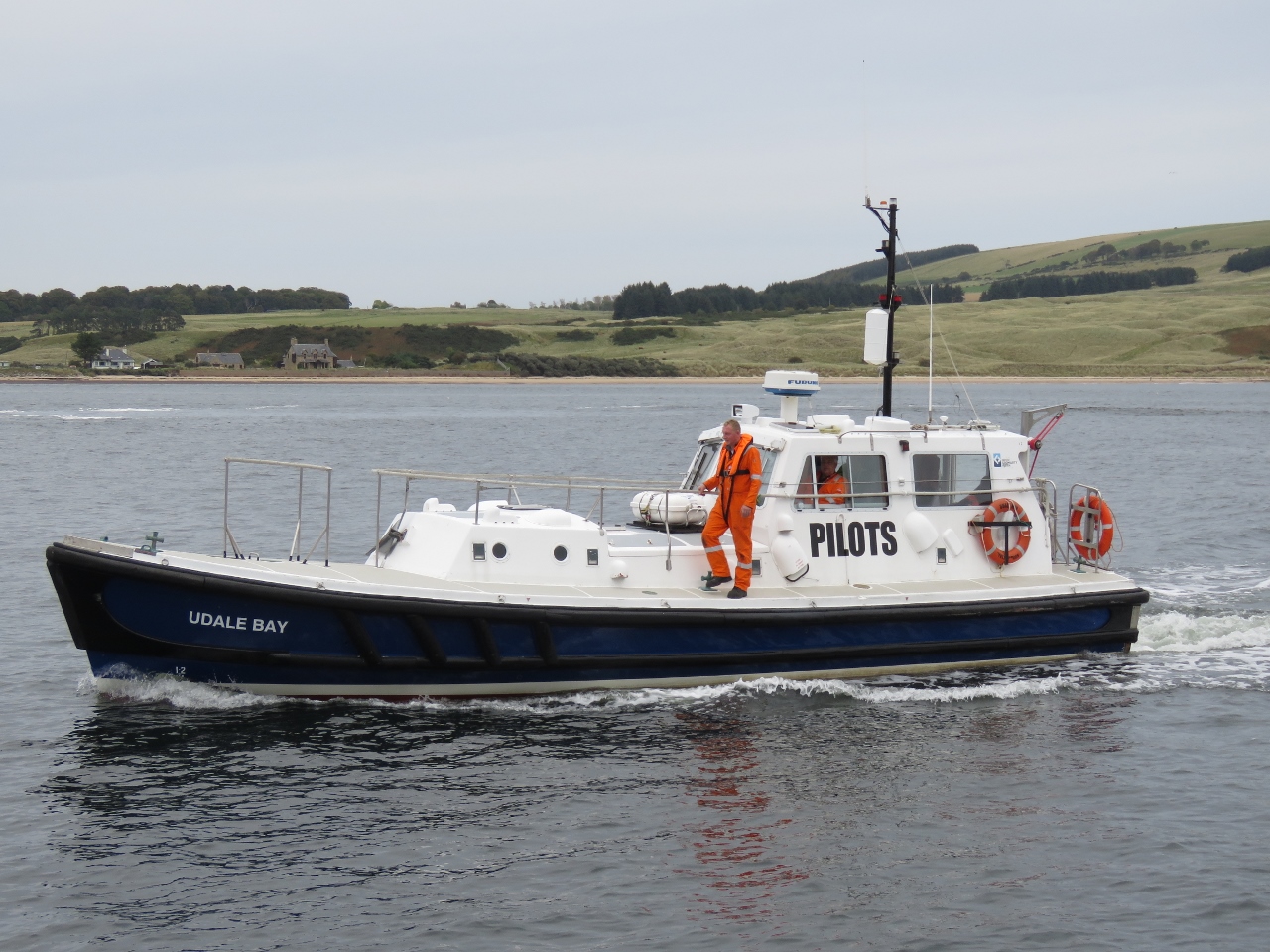 |
10/6/2017: Pilot
Position: 57°41.12'N, -4°1.30'W
As we entered the harbor, Cromarty Harbour Control radioed us to let us know that the Deep Explorer was about to get underway and to give it space, so we were well off to the far side. Then the pilot boat came over to make sure we knew. Then shortly before we anchored, Deep Explorer radioed us as well.
|
 |
10/6/2017: Current
Position: 57°41.08'N, -4°2.52'W
Strong tidal current is nearly pulling this buoy underwater. The current was quite strong where we anchored as well.
|
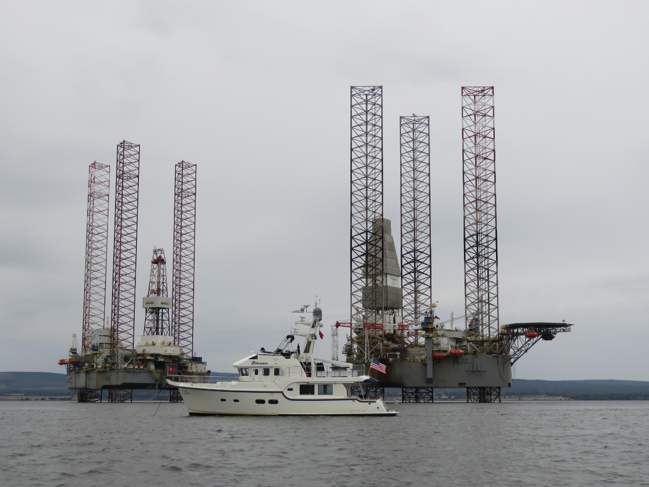 |
10/6/2017: Anchored
Position: 57°40.84'N, -4°2.93'W
Dirona anchored near the oil rigs in Cromarty Firth. We never thought we'd be anchored next to an oil rig, let alone several.
|
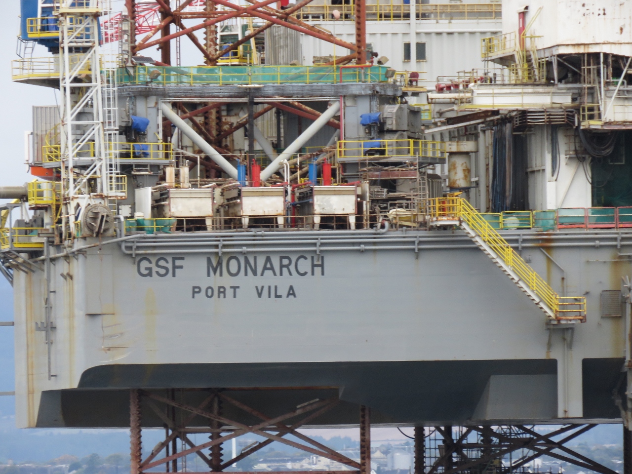 |
10/6/2017: Port Vila
Position: 57°40.99'N, -4°2.80'W
We were amused to see this rig registered in Port Vila, the capitol of Vanuatu. This was our last port of call before arriving in New Zealand in 2013 during out Pacific crossing.
|
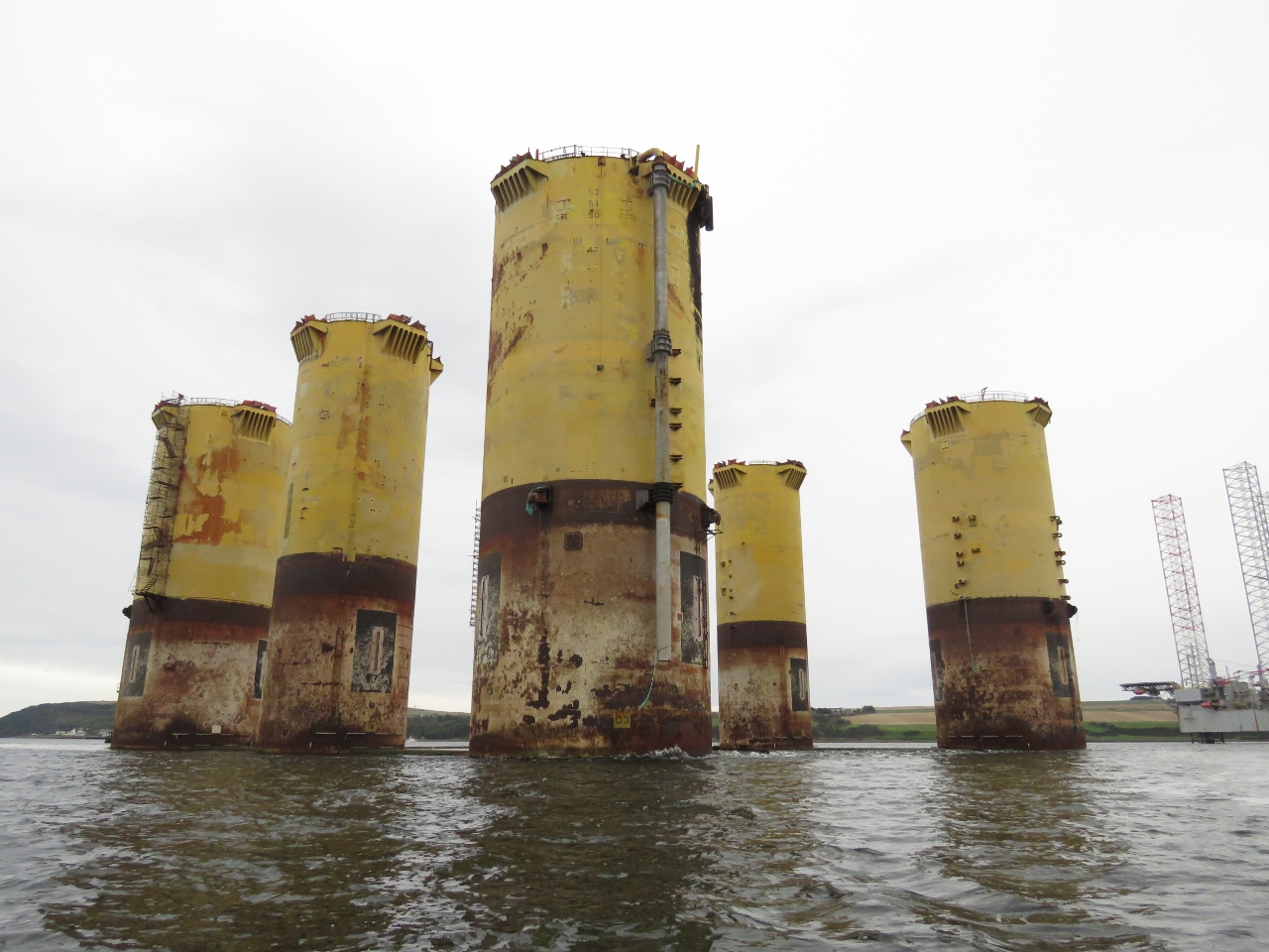 |
10/6/2017: Supports
Position: 57°41.31'N, -4°4.17'W
The only thing left of this rig was the supports. Presumably the rest has been disassembled for scrap.
|
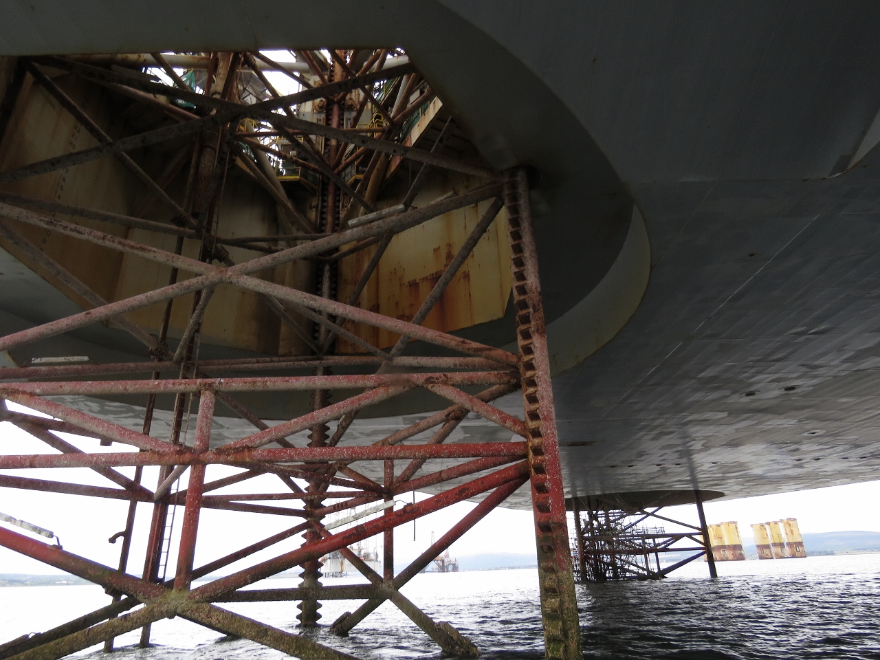 |
10/6/2017: Underneath
Position: 57°41.05'N, -4°3.29'W
Looking up into one of the rigs from underneath. They sure are massive.
|