MV Dirona travel digest for Greenock, Scotland 2017

|
Click the travel log icon on the left to see these locations on a map,
with the complete log of our cruise. On the map page, clicking on a camera or text icon will display a picture and/or log entry for that location, and clicking on the smaller icons along the route will display latitude, longitude and other navigation data for that location. And a live map of our current route and most recent log entries always is available at //mvdirona.com/maps/LocationCurrent.html. |
 |
7/13/2017: Tunnels
Position: 55°17.40'N, -6°13.39'W
We couldn't find anything about these man-made tunnels on the south shore of Rathlin Island west of the lighthouse landing. Possibly it was a quarry used in the lighthouse construction.
|
 |
7/13/2017: Boiler
Position: 55°18.01'N, -6°17.28'W
Ruins of a steam boiler at Bull Point on Rathlin Island. Likely it was used for kelp production (kelp was burned to obtain soda) prevalent on the island in the 19th century.
|
 |
7/13/2017: West Lighthouse
Position: 55°18.11'N, -6°17.16'W
Looking up to the West Lighthouse from below with a good view to all the reinforcement done along the cliffs to prevent erosion and rockfalls.
|
 |
7/13/2017: Sea Stacks
Position: 55°18.26'N, -6°16.83'W
The bird-filled sea stacks we saw yesterday from the West Light Seabird Centre.
|
 |
7/13/2017: Shipwreck
Position: 55°18.80'N, -6°15.31'W
One of the at least forty shipwrecks around Rathlin Island. A combination of strong currents and violent storms resulted in many wrecked and sunk vessels on and around the island.
|
 |
7/13/2017: 12.9 knots
Position: 55°18.82'N, -6°13.05'W
We'd timed our North Channel crossing with a flood tide to carry us across. Currents are particularly strong around Rathlin Island‐we were doing 12.6 knots at 2,000 RPM. We'd normally do about 8.4 knots at that RPM.
|
 |
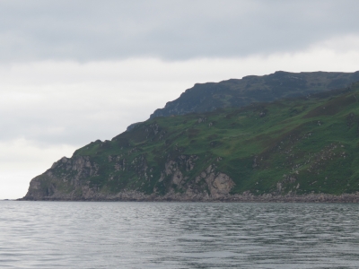
7/13/2017: East Lighthouse
Position: 55°18.20'N, -6°10.07'W
Looking up to the Rathlin Island East Lighthouse. Robert the Bruce is said to have hid out in a cave below the lighthouse following his defeat by the English at Perth in 1306 during his struggle for the Scottish crown.
|
 |
7/13/2017: Mull of Kintyre
Position: 55°16.84'N, -5°44.15'W
We've just rounded the Mull of Kintyre and entered Scotland. Paul McCartney's song, "Mull of Kintyre", was a tribute to this area where he lived and owns a farm. The song became the UK's all-time best-selling single, besting the Beatles "She Loves You".
|
 |
7/13/2017: Dunaverty Point
Position: 55°16.99'N, -5°39.15'W
RVs parked at Dunaverty Point with a great view to sea.
|
 |
7/13/2017: Seatours
Position: 55°17.92'N, -5°34.31'W
We weren't the typical quarry for this Mull of Kintyre Seatours eco-tourism boat out of nearby Campbeltown, but we certainly caught their attention.
|
 |
7/13/2017: Sanda Island
Position: 55°24.68'N, -5°7.03'W
The lighthouse on Sanda Island was built in 1850. The island is privately owned and has had a number of different owners over the years, including Jack Bruce who was a member of the rock group Cream with Eric Clapton and Ginger Baker.
|
 |
7/13/2017: Holy Island Lighthouse
Position: 55°30.48'N, -5°4.35'W
The lighthouse at the south end of Holy Island was built in 1877 and automated one hundred years later in 1977.
|
 |
7/13/2017: Holy Island
Position: 55°31.86'N, -5°7.30'W
Looking southeast to Holy Island from the anchorage at Lamlash. After an intensive fund-raising effort, Tibetan Buddhist monk Lama Yeshe Losa bought the island and built the Center for World Peace and Study.
|
 |
7/14/2017: Odyssey
Position: 55°31.91'N, -5°7.32'W
Nordhavn 55 Odyssey arrived into Cork, Ireland from the US a few weeks after we landed at Kinsale and cruised up the east coast while we were along the west (Odyssey's Journal). We'd been in touch with owners Don and Nancy Payzant, but weren't expecting to meet up since they were continuing north through Scotland to Norway while we were stopping in Glasgow for a few weeks. But somehow our paths crossed in Lamlash and we finally met in person. Odyssey is the only US-flagged vessel we’ve seen since arriving in Europe.
|
 |
7/14/2017: Tenders
Position: 55°32.08'N, -5°7.42'W
Don putting out a stern anchor with the Odyssey and Dirona tenders rafted together to keep them afloat off the pier. The pier dries at low tide, and we should have plenty of water before we return, but we decided to not take any chances.
|
 |
7/14/2017: Glenisle Bistro
Position: 55°32.03'N, -5°7.67'W
We had an excellent meal and a wonderful evening with Nordhavn 55 Odyssey owners Don and Nancy Payzant at the Glenisle Bistro.
|
 |
7/15/2017: Bute
Position: 55°52.31'N, -4°54.94'W
En route to Greenock, we passed the ferry Bute moored at Wemyss Bay after crossing from Rothesay.
|
 |
7/15/2017: MT Stuart
Position: 55°53.13'N, -4°54.55'W
The pilot boat MT Stuart guides boats along the River Clyde to the ports of Greenock and Glasgow.
|
 |
7/15/2017: Cloch Lighthouse
Position: 55°56.30'N, -4°53.10'W
The Cloch lighthouse was completed in 1797 with an oil lantern. In 1829 an Armand lamp (a brighter form of oil lamp) was installed, and around 1900 it was lit by acetylene. The light is fully automated now and lit with a lamp on a pole outside the lantern room.
|
 |
7/15/2017: Ferries
Position: 55°56.42'N, -4°53.05'W
Ferries crossing, likely on the run between Hunter's Quay, Dunoon and McInroy's Point, Gourock.
|
 |
7/15/2017: Amazon
Position: 55°56.96'N, -4°52.40'W
Amazon fulfillment center in Gourock.
|
 |
7/15/2017: Disney Magic
Position: 55°57.19'N, -4°45.29'W
The cruise ship Disney Magic at the Greenock docks is one of thirty-seven cruise ships scheduled to visit this year.
|
 |
7/15/2017: James Watt Dock
Position: 55°56.56'N, -4°43.46'W
It seems an awfully long time ago that we booked a berth at the James Watt Dock Marina while we were in Florida in February. It's hard to believe that we're actually here now. The marina is about six years old, and built in the old commercial docks used for offloading sugar.
Sugar refining started in Greenock in 1765 and by the end of the 1800s about 400 ships a year were transporting sugar from the Caribbean to be refined at one of Greenock's 14 sugar refineries. The last refinery closed in 1997. The building along the dock is known as "The Sugar Warehouse". |
 |
7/15/2017: Greenock
Position: 55°56.81'N, -4°45.27'W
A walking tour of Greenock on a soggy afternoon. No matter, we're happy to be here.
|
 |
7/15/2017: O2
Position: 55°56.94'N, -4°45.59'W
We stopped in the local mall to pickup a UK SIM card from O2. Our Vodafone SIM from Ireland generally will work fine throughout the EU, but we wanted to get a local SIM and phone number.
|
 |
7/15/2017: Wedding
Position: 55°56.86'N, -4°45.34'W
A hand-built Beauford convertible and matching an Asquith Mascot bus of Ashton Wedding Cars at a wedding in Greenock.
|
 |
7/16/2017: Odyssey
Position: 55°56.52'N, -4°43.49'W
Don and Nancy Payzant on Odyssey decided to stop off in Greenock for a few days to visit Glasgow, so we got a chance to spend a little more time with them. The boats look great moored bow-to-stern.
|
 |
7/16/2017: Queen St Station
Position: 55°51.73'N, -4°15.09'W
At the Queen St. train station on a day trip to Glasgow. We love train trips, but haven't been on one since Karunda Scenic Railway in Cairns, Australia.
|
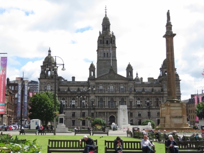 |
7/16/2017: George Square
Position: 55°51.68'N, -4°15.06'W
The Glasgow City Chambers in George Square. The square was laid out in 1781 and the City Chambers first stone was laid a century later in 1883. Queen Street train station was opened in 1842 at the northwest corner. Statues and monuments surround the square, dedicated to famous Scots such as Sir Walter Scott (the tall column on the right) and Robert Burns and royalty such as Queen Victoria.
|
 |
7/16/2017: Royal Exchange Square
Position: 55°51.61'N, -4°15.11'W
Looking west from Queen Street along Royal Exchange Square that dates from the late 1700's. The Glasgow Museum of Modern Art is on the left.
|
 |
7/16/2017: CityTree
Position: 55°51.63'N, -4°15.09'W
We saw a video about the CityTree a while back and saw one in Glasgow. The invention of Berlin-based Green City Solutions, the CityTree has the environmental benefit of 275 trees. But it isn't actually a tree at all, rather it's a moss culture.
|
 |
7/16/2017: La Vita
Position: 55°51.65'N, -4°15.10'W
An excellent pizza lunch on the second floor balcony at La Vita Pizzeria.
|
 |
7/16/2017: City Chambers
Position: 55°51.61'N, -4°14.87'W
Looking through the double arches on the other side of the City Chambers from George Square.
|
 |
7/16/2017: Trades Hall of Glasgow
Position: 55°51.55'N, -4°14.87'W
Looking down Garth Street to the Trades Hall of Glasgow, built in 1791-1794. Since it's completion the hall has housed The Trades House of Glasgow, established in 1605 and now a registered charity, that supports causes and individuals throughout the city.
|
 |
7/16/2017: Piper
Position: 55°51.55'N, -4°14.71'W
A piper welcoming guests to a Glasgow wedding.
|
 |
7/16/2017: Fellow Glasgow Residents
Position: 55°51.55'N, -4°14.64'W
Glasgow has some amazing murals. The Glasgow City Council has encourage street art to promote the city center, reduce the visual impact of land and building vacancies and attract visitors. This is called "Fellow Glasgow Residents" by Smug (Sam Bates) and depicts the wildlife in Glasgow's parks.
|
 |
7/16/2017: Babbity Bowster
Position: 55°51.52'N, -4°14.51'W
The patio at the Babbity Bowster looked like a great place to stop for a drink or a meal. And we loved the name.
|
 |
7/16/2017: St Mungo at High Street
Position: 55°51.66'N, -4°14.26'W
Another impressive mural by Smug (Sam Bates), this one depicts a modern-day St. Mungo who brought a robin back to life. St. Mungo is the founder and patron saint of the city of Glasgow.
|
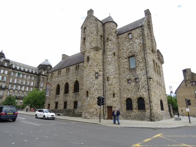 |
7/16/2017: Museum
Position: 55°51.74'N, -4°14.20'W
The St. Mungo Museum of Religious Life and Art in Cathedral Square. The building is of modern construction emulating the medieval style to blend in with the nearby Provand's Lordship House.
|
 |
7/16/2017: Livingstone
Position: 55°51.76'N, -4°14.20'W
A statue commemorating Scottish doctor, missionary and explorer David Livingstone (1813-73), with Glasgow Cathedral in the background. Livingstone is known for his exploits in Africa. After Livingstone had been incommunicado for several years while searching for the source of the Nile River, the New York Herald dispatched journalist and explorer Henry Morton Stanley to find him. Upon locating Livingstone, the only white person for hundreds of miles, Stanley issued the now-famous dry-humour greeting "Dr Livingstone, I presume?". The statue originally was erected in George Square in 1879, then moved to a different location Cathedral Square in 1960 and to it's present location a few yards away in 1990.
|
 |
7/16/2017: Glasgow Cathedral
Position: 55°51.78'N, -4°14.10'W
Inside impressive Glasgow Cathedral, one of the few cathedrals in Scotland to survive the 16th-century Protestant Reformation mobs nearly intact. The building is huge and seems to go on forever. Most of the structure dates from the 15th century and the stone stairs leading down to the tomb of St. Mungo seem to bear centuries of wear. The choir was practicing when we were there, giving a demonstration of the cathedral's wonderful acoustics.
|
 |
7/16/2017: Necropolis
Position: 55°51.78'N, -4°13.89'W
The Glasgow Necropolis opened in 1833 after an 1832 law change allowed burial for profit. Fifty thousand people are buried here, a few with monuments and some without headstones, as was typical for the period. Like many Victorian cemeteries, it is laid out like an informal park rather than a grid layout. For a time, most of Glasgow's prominent citizens were buried here. The hilltop site also has great views over the city.
|
 |
7/16/2017: Tolbooth Steeple
Position: 55°51.40'N, -4°14.64'W
Tolbooth Steeple was built in 1625-1627 as part of a larger building, the Tolbooth, housing the Town Clerk's office, the council city hall and the city prison. As the city expanded and moved westward, the Tolbooth was abandoned and later demolished, leaving only the tower.
|
 |
7/16/2017: Bubbles
Position: 55°51.46'N, -4°15.09'W
Street artist generating bubbles to the delight of the children at the pedestrian mall on Argyle Street.
|
 |
7/16/2017: Metropolitan Cathedral
Position: 55°51.31'N, -4°15.22'W
The Glasgow Metropolitan Cathedral was completed in 1816. This was the first Roman Catholic church built in Glasgow and construction was plagued by vandals hostile to the church. Restrictions on Catholic church design in the 1791 Relief Act meant the church could have no bell or steeple. This law was repealed in 1829.
|
 |
7/16/2017: River Clyde
Position: 55°51.34'N, -4°15.32'W
The Portland Street Suspension Bridge across the River Clyde. The river is a familiar entity to us, mostly from years of reading Marine Accident Investigation Branch (MAIB) reports such as the tragic sinking of the tug Flying Phantom on the river, with the loss of three lives.
|
 |
7/16/2017: Buchanan Street
Position: 55°51.53'N, -4°15.28'W
Glasgow has many pedestrian-only streets in the city center. It's a great city for walking.
|
 |
7/16/2017: All Bar One
Position: 55°51.68'N, -4°15.30'W
A refreshing pint of cider street-side at All Bar One after several hours of walking.
|
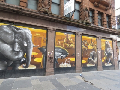 |
7/16/2017: Argyle Street Cafe
Position: 55°51.47'N, -4°15.05'W
Another Smug mural depicting a surprisingly lifelike cafe scene reminiscent of Richard Scarry books.
|
 |
7/16/2017: Rob Ha's
Position: 55°51.55'N, -4°14.88'W
A good meal at Rob Ha's pub near Merchant City before taking the train back home.
|
 |
7/16/2017: Virgin Trains
Position: 55°51.55'N, -4°15.45'W
We didn't know Virgin operated trains. When British Rail was privatized between 1994 and 1997, the Virgin Group created the Virgin Rail Group and successfully bid for two of the rail franchises.
|
 |
7/17/2017: Valve Adjustment
Position: 55°56.57'N, -4°43.56'W
James adjusting the valves on the generator. This is due every 1,000 hours and we now have 4,844 hours on the generator.
|
 |
7/17/2017: Pet Passport
Position: 55°56.55'N, -4°46.39'W
Dr. Colin Greer of Abbey Vet Group filling out Spitfire's EU Pet Passport using the USDA-endorsed EU Health Certificate we got in Newport, RI and the rabies vaccination certificate from Darwin, endorsed by the Australian Department of Agriculture. The Pet Passport will allow us to easily travel with Spitfire within the EU. Spitfire, hiding in his carry bag at right, continues to lead the pack in paperwork.
|
 |
7/17/2017: Sunset
Position: 55°56.57'N, -4°43.57'W
Sunset looking over N55 Odyssey toward the James Watt Dock marina entrance.
|
 |
7/18/2017: Tickets
Position: 55°56.57'N, -4°43.57'W
We've got a swack of tickets for a somewhat complex two-day train trip on the West Highland Line, voted the world's best train journey by Wanderlust Magazine. We'll be travelling through the scenic Scottish highlands and across the Glenfinnan Viaduct, featured in the Harry Potter movies. from nearby Cartsdyke station we'll take a tain to Glasgow Central Station, then transfer to Queen St. Station for Fort William. We'll change seats in Fort William on to Mallaig, the most beautiful part of the trip, then return to spend the night in Fort William. The next day we'll travel from Fort William to Crianlarich and transfer to the Oban line to visit the underground power station at the Falls of Cruachan. Finally, we'll travel return to Cartsdyke station via Glasgow. We have separate tickets for almost every leg and picked them up while we were in Glasgow over the weekend.
|
 |
7/18/2017: James Watt Dock
Position: 55°56.55'N, -4°43.47'W
We're lucky to have a beautiful sunny day for our trip through the West Highlands.
|
 |
7/18/2017: Cartsdyke Station
Position: 55°56.52'N, -4°43.89'W
At Cartsdyke station to take the train into Glasgow.
|
 |
7/18/2017: Departures
Position: 55°51.73'N, -4°15.07'W
At Queen St. Station, the departure platform isn't announced until about five minutes before the train leaves. Our train is third from the left, departing at 8:21am for Mallaig.
|
 |
7/18/2017: Forth and Clyde Canal
Position: 55°53.94'N, -4°19.41'W
The railway runs alongside the old Forth and Clyde Canal for a bit, visible at lower left. The 35-mile canal opened in 1790 between the River Clyde at Bowling and the River Carron at Grangemouth. The canal initially was successful, but fell into disuse as oceangoing vessels were built larger and could no longer pass through. The advent of rail also reduced traffic. The canal was closed in the 1960s, but reopened in the early 21st century. A narrowboat today can be run from Bowling, on the River Clyde about ten miles east of Greenock, east through the Falkirk Wheel and into the Union Canal and another 31 miles to Edinburgh.
|
 |
7/18/2017: River Clyde
Position: 55°56.29'N, -4°33.07'W
Looking south to a large navigation marker along the River Clyde. The river is navigable in Dirona until the Science Center just west of the Glasgow central core where several low fixed bridges block further progress. Plans are in place to build a new marina complex there.
|
 |
7/18/2017: Crossing
Position: 55°56.80'N, -4°34.44'W
Crossing the River Levern.
|
 |
7/18/2017: Greenock
Position: 55°58.53'N, -4°41.07'W
Cruise ships in Greenock to our southwest. James Watt Dock Marina where we are moored is just out of the picture on the left.
|
 |
7/18/2017: Loch Goil
Position: 56°11.27'N, -4°45.71'W
Drymsynie House Hotel on Loch Goil.
|
 |
7/18/2017: Coach
Position: 56°13.32'N, -4°41.91'W
Our coach on the West Highland Line.
|
 |
7/18/2017: Semaphore
Position: 56°18.37'N, -4°43.40'W
Most of the signalling on the West Highland Line is radio-controlled but the line around Fort William is still semaphore-controlled. The signs say "Obtain Token and Permission To Proceed".
|
 |
7/18/2017: Horseshoe Curve
Position: 56°29.13'N, -4°42.15'W
When the railway was built in the late 1800s, the builders couldn't afford to run a viaduct across the mouth of a broad valley. They instead created the famous 'horseshoe curve' where the line follows the foothills of the several mountains around the valley. We'll turn right and eastward, then curve left and northward to cross the viaduct visible in the center of the photo (click image for a larger view) and continue the curve westward along the left side of the picture and finally turn right again to continue north.
|
 |
7/18/2017: West Highland Way
Position: 56°29.96'N, -4°44.97'W
The West Highland Way is a popular hiking trail running 96 miles from Mingavie north of Glasgow to Fort William. We saw lots and lots of hikers en route.
|
 |
7/18/2017: Moor of Ranoch
Position: 56°39.11'N, -4°34.00'W
Passing through an area of bogs, streams and lakes called the Moor of Ranoch.
|
 |
7/18/2017: Corrour
Position: 56°45.85'N, -4°41.84'W
Corrour is one of the most remote train stations in Britain—the nearest road is a ten-mile walk along a hill track. The station was featured in the movie Trainspotting. You can see them walk past the semaphore signs in the going for a walk scene.
|
 |
7/18/2017: Loch Treig
Position: 56°47.61'N, -4°43.53'W
The train runs along beautiful Loch Treig for several miles.
|
 |
7/18/2017: Fort William Station
Position: 56°49.24'N, -5°6.35'W
At Fort William, the largest town on the West Highland Line.
|
 |
7/18/2017: Neptune's Staircase
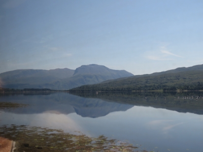
Position: 56°53.31'N, -4°43.53'W
Just outside Fort William we cross over the Caledonian Canal at Neptune's Staircase, the longest staircase lock in Britain. A series of eight locks carry boats up or down 64 feet. We'll be passing through southbound likely some time in October after cruising the west and north coast of Scotland and the Orkney Islands.
|
 |
7/18/2017: Ben Nevis
Position: 56°51.30'N, -5°13.93'W
Looking southeast across saltwater Loch Eil to Ben Nevis, the highest mountain in the British Isles at 4,411 ft (1,345 m) above sea level.
|
 |
7/18/2017: Glenfinnan Viaduct
Position: 56°52.57'N, -5°25.81'W
A highlight of the West Highland Line is passing over Glenfinnan Viaduct made famous in the Harry Potter films. Built in 1901, it was one of the first viaducts built of concrete.
|
 |
7/18/2017: Glenfinnan Station
Position: 56°52.34'N, -5°26.97'W
Glenfinnan Station has a museum and you can even spend the night in a converted rail car.
|
 |
7/18/2017: Loch Eilt
Position: 56°52.59'N, -5°34.95'W
Loch Eilt is one of the most picturesque lochs along the route, with many tree-covered islets.
|
 |
7/18/2017: Church of Our Lady of the Braes
Position: 56°52.94'N, -5°42.27'W
The Church of Our Lady of the Braes was featured in the film Local Hero.
|
 |
7/18/2017: Rapids
Position: 56°57.80'N, -5°48.94'W
Crossing a small rapid over the River Morar.
|
 |
7/18/2017: Mallaig
Position: 57°0.34'N, -5°49.80'W
The end of the line in Mallaig.
|
 |
7/18/2017: Mallaig Harbor
Position: 57°0.32'N, -5°49.72'W
It was nearly 2pm by the time we arrived in Mallaig, but we wanted stretched our legs a bit and check out the town before stopping for lunch. Mallaig has a busy commercial harbour with ferries and tour boats constantly arriving and departing.
|
 |
7/18/2017: Lunch
Position: 57°0.33'N, -5°49.71'W
An excellent lunch overlooking the harbor at The Fishmarket.
|
 |
7/18/2017: RNLI
Position: 57°0.36'N, -5°49.62'W
The Mallaig RNLI lifeboat.
|
 |
7/18/2017: Fishboats
Position: 57°0.37'N, -5°49.59'W
Fishboats rafted in the harbor.
|
 |
7/18/2017: Fish Feed
Position: 57°0.43'N, -5°49.73'W
This warehouse had bags and bags of fish feed for the local fish farms.
|
 |
7/18/2017: View
Position: 57°0.11'N, -5°49.71'W
After lunch we walked up to the top of a hill where a radio tower was mounted for sweeping views of the area. You can see one large ferry loading on the right and another arriving farther out.
|
 |
7/18/2017: Glenfinnan Monument
Position: 56°52.45'N, -5°26.28'W
On the return run to Fort William, we got a good view to the Glenfinnan Monument south of the tracks. The monument was erected in 1815 to commemorate Bonnie Prince Charlie raising his standard here in August 1745.
|
 |
7/18/2017: Viaduct From West
Position: 56°52.52'N, -5°26.10'W
The view to the Glenfinnan Viaduct from the west.
|
 |
7/18/2017: Loch Eil
Position: 56°50.58'N, -5°7.59'W
Beacon marking the entrance to the Caledonian Canal on saltwater Loch Eil.
|
 |
7/18/2017: Caledonian Canal
Position: 56°50.65'N, -5°5.81'W
Boats moored for the night at the bottom of Neptune's Staircase on the Caledonian Canal.
|
 |
7/18/2017: Duncansburgh MacIntosh Parish Church
Position: 56°49.18'N, -5°6.49'W
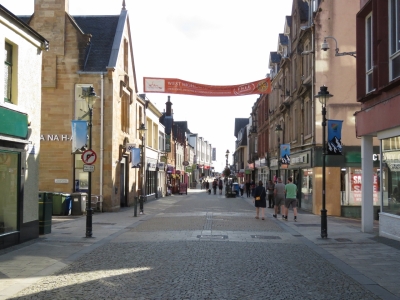
We checked in and dropped our bags off at the hotel then went for a walk around Fort William. Near our hotel is the Duncansburgh MacIntosh Parish Church, opened in 1882.
|
 |
7/18/2017: High Street
Position: 56°49.04'N, -5°6.73'W
High Street in Fort William had a great selection of bars and restaurants. This time of year, the town is busy with tourists, many who hiked the West Highland Way. We had a good meal overlooking the water at the Ben Nevis restaurant, then stopped in for an after-dinner drink at the Grog and Gruel.
|
 |
7/19/2017: Change of Plans
Position: 56°48.70'N, -4°43.03'W
We took the 7:44am train from Fort William with plans to visit the underground power station at the Falls of Cruachan. Unfortunately the train hit a boulder near the south end of Loch Trieg, punctured a fuel tank, and disabled the train. The train limped backward to the previous station at 5 miles per hour, were we would be bussed out.
|
 |
7/19/2017: Tulloch Station
Position: 56°53.04'N, -4°42.11'W
The train backed up at 5 miles per hour, stopping every ten minutes or so. It took about ten minutes to reach the south end of Loch Trieg this morning after passing Tulloch Station and nearly two hours to slowly limp backward to it. Surprisingly, ScotRail never made an announcement to explain where we were going or how we were getting there. Everyone just got off at the station when the train stopped.
|
 |
7/19/2017: Buses
Position: 56°53.06'N, -4°42.08'W
Buses were waiting for us at the station. We eventually asked someone what the plan was and were told the buses would take us to Fort William and perhaps Glasgow, but no still no announcement was made.
|
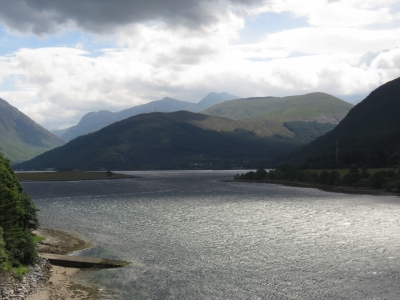 |
7/19/2017: Loch Leven
Position: 56°41.36'N, -5°10.94'W
Crossing the bridge over Loch Leven south of Fort William. The bus didn't stop in Fort William, which was a surprise to a couple of passengers who wanted to get off there. The driver let them out, but they had to walk several miles back into town. We still had no idea where we were going and eventually asked the driver, who told us we'd be going straight to Glasgow with a brief stop at Crianlarich. One person got very upset at the train station, but otherwise all the passengers seemed to just take the whole thing in stride and didn't seem bothered by the lack of information. We did get a refund for all of today's train tickets.
|
 |
7/19/2017: Scenery
Position: 56°39.93'N, -5°2.23'W
The road follows a different route from the the train track, so we got some different views of the mountain scenery on the bus trip back.
|
 |
7/19/2017: Aonach Eagach
Position: 56°40.16'N, -5°0.09'W
The Aonach Eagach ridge extends for 6 miles.
|
 |
7/19/2017: Tyndrum Inn
Position: 56°26.00'N, -4°42.39'W
The Tyndrum Inn near Tyndrum station.
|
 |
7/19/2017: Lunch
Position: 55°51.66'N, -4°15.15'W
After arriving back into Glasgow, we treated ourselves to a fabulous late lunch/early dinner at the Atlantic Brasserie to make up for our lost day.
|
 |
7/19/2017: The Lighthouse
Position: 55°51.58'N, -4°15.29'W
We'd wanted to visit The Lighthouse on our first trip to Glasgow, but it had closed for the day by the time we got there, so we took the opportunity to visit today instead. Renowned Scottish artist and architect Charles Rennie Mackintosh designed The Lighthouse in 1893 as the striking new headquarters for the Glasgow Herald. It was the first building Mackintosh designed and now houses Scotland's Center for Architecture and Design.
|
 |
7/19/2017: Rooftop View
Position: 55°51.59'N, -4°15.33'W
The top floor of The Lighthouse is an open-air balcony with a 360-degree rooftop view of the city. Typically a viewpoint like that will be caged or glassed in--it was wonderful to be just out there in the open and feel that you could almost reach out and touch the surrounding buildings.
|
 |
7/19/2017: Museum
Position: 55°51.59'N, -4°15.34'W
After the balcony, we spent some time in a small museum detailing Mackintosh' life and work.
|
 |
7/19/2017: Toilets
Position: 55°51.59'N, -4°15.34'W
We loved the toilet signs in the Center for Architecture and Design, with all the figures looking a little desperate to find the loo.
|
 |
7/19/2017: Lower Observation Deck
Position: 55°51.58'N, -4°15.33'W
A modern observation deck gave a slightly different view to the city. This is looking back up the the open-air balcony (on the left) that we were on earlier.
|
 |
7/19/2017: Crew
Position: 55°51.58'N, -4°15.33'W
A documentary crew was at the observation deck taking footage. One of them was from Canada and had even gone to the University of Victoria where James and I met. Small world.
|
 |
7/19/2017: The James Watt
Position: 55°56.80'N, -4°45.21'W
We stopped for a cider at the James Watt pub in Greenock before returning home. The day hadn't gone according to plan, but we had a great time anyway.
|
 |
7/20/2017: Odyssey
Position: 55°56.57'N, -4°43.56'W
Nordhavn 55 Odyssey leaving James Watt Dock Marina. They're heading through the Scottish canals and on to Norway this summer, so we're not sure when our paths might cross again.
|
 |
7/20/2017: Backing In
Position: 55°56.57'N, -4°43.57'W
Shortly after Odyssey, the 257ft (78m) superyacht Amaryllis arrived at James Watt Dock. They spun the boat around and we thought at first they were going to dock against the pier outside the marina, but they instead backed in through the entry and onto the dock. It looked pretty tight.
|
 |
7/20/2017: Pilot
Position: 55°56.57'N, -4°43.56'W
Pilot departing after bringing Amaryllis onto the dock.
|
 |
7/20/2017: Rabbit
Position: 55°56.71'N, -4°43.61'W
A rabbit in the grass while we were taking a short walk around the marina area.
|
 |
7/20/2017: Serco Marine
Position: 55°56.75'N, -4°43.59'W
Serco Marine (previously Serco Denholm) employs over 50,000 people world-wide and operates nearly 120 support vessels ranging from 100 to 25,000 tons for the UK and Royal Australian Navy, plus International Nuclear Services. Serco has been supporting the Royal Navy since taking over from the Royal Maritime Auxiliary Service (RMAS) in 1996. The 304ft (92m) SD Northern River, towering over the other vessels in the picture, is their largest ship.
|
 |
7/20/2017: Amaryllis
Position: 55°56.68'N, -4°43.77'W
A view to superyacht Amaryllis at James Watt Dock Marina.
|
 |
7/20/2017: AET
Position: 55°56.64'N, -4°43.55'W
Three very nice AET Transport Services trucks were parked just outside of Serco Marine, waiting to drop off a delivery to them tomorrow morning. We chatted with the drivers for a bit and they gave us a tour of one of the trucks.
|
 |
7/21/2017: Tesco
Position: 55°56.57'N, -4°43.56'W
We placed an order with Tesco to deliver an order of non-perishable groceries before we return to Seattle for a couple of weeks. We'll be leaving on our cruise of the west and north coast of Scotland soon after we return, so want to get started early on stocking up.
|
 |
7/21/2017: Chalet
Position: 55°50.99'N, -4°33.23'W
Spitfire checking out the view what the Lochermill Boarding Cattery calls his "chalet", where he'll be for two weeks while we return to Seattle. We hate leaving the little feller behind, but he's in as nice a place as we could imagine. His chalet has an indoor and an outdoor section with places to tuck away and shelves to sit on for a view. Lochermill even had his name on the door when we arrived to drop him off.
|
 |
7/23/2017: Virginia Inn
Position: 47°36.67'N, -122°20.56'W
A pint at our favorite seat at the Virginia Inn with a view down Virginia Street to Pike Place Market and the water traffic in Elliott Bay.
|
 |
7/23/2017: Noi Thai
Position: 47°36.40'N, -122°20.34'W
We came across this great patio at Noi Thai and stopped in for a delicious lunch.
|
 |
7/23/2017: Bell Harbor Marina
Position: 47°36.63'N, -122°20.92'W
Our home port at Bell Harbor Marina in downtown Seattle. Dirona was moored at the end of the pier in the foreground on the left, where that large white powerboat is.
|
 |
7/23/2017: Potatoes
Position: 47°36.63'N, -122°20.93'W
Potatoes ready to load onto the cruise ship Norwegian Pearl moored at Pier 66 adjacent to Bell Harbor Marina. We used to love watching the cruise ships arrive at 6am each Friday, Saturday and Sunday morning and depart at 4pm that afternoon.
|
 |
7/23/2017: Paddy Coyne's
Position: 47°36.86'N, -122°21.28'W
We stopped off at Paddy Coyne's Irish Bar on pier 70 for a relaxing beer on their outside deck with a view to Elliott Bay. James hadn't been in Paddy Coyne's for years, but owner remembered him and came by to say hello.
|
 |
7/23/2017: Car Fire
Position: 47°36.97'N, -122°21.20'W
Firefighters were putting out a big car fire on Western Avenue as we walked past. There wasn't much left of the vehicle.
|
 |
7/23/2017: Belltown Pizza
Position: 47°36.88'N, -122°20.90'W
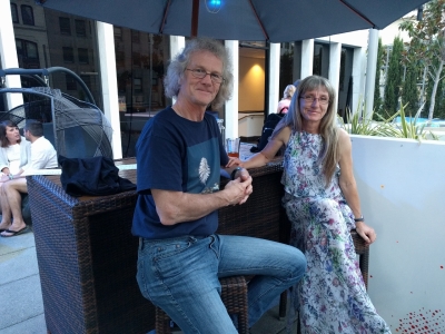
Dinner on the patio at Belltown Pizza, another one of our favorite Seattle haunts. The summer weather in Seattle is wonderful.
|
 |
7/24/2017: Boxes
Position: 47°36.22'N, -122°20.12'W
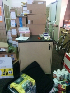
We have a UPS box that any surface mail goes to. And whenever we return to the US, we pre-order whatever parts we need and bring them back in our luggage. We picked up 187 pounds of gear from our UPS box today, and another 20 pounds arrived the following week.
|
 |
7/28/2017: Frolik
Position: 47°36.61'N, -122°20.14'W
Enjoying a drink on the rooftop patio at Frolik in downtown Seattle.
|
 |
7/28/2017: Skyline
Position: 47°36.61'N, -122°20.14'W
The amazing Seattle skyline view from the rooftop patio at Frolik.
|
 |
7/29/2017: Pier 66
Position: 55°56.58'N, -4°43.56'W
We took an early morning Victoria Clipper ferry to visit family in Victoria. A cruise ship had just pulled into Pier 66 at about 6:30 this morning.
|
 |
7/29/2017: Inner Harbor
Position: 48°25.54'N, -123°22.54'W
Looking southeast toward the head of busy Victoria Inner Harbour on a walk to have lunch at Spinnakers brew pub.
|
 |
7/30/2017: Dungeness Spit
Position: 48°12.98'N, -123°3.09'W
We returned to Seattle that afternoon on Kenmore Air. This is the view to Dungeness Spit, just east of Port Angeles, WA. We've enjoyed many anchorages at Dungeness Spit, with it's great view to the shipping traffic in the Strait of Juan de Fuca.
|
 |
7/30/2017: Mount Rainier
Position: 47°47.82'N, -122°28.31'W
View to Mount Rainier with Seattle in the foreground.
|
 |
7/30/2017: Lake Union
Position: 47°37.43'N, -122°19.99'W
Looking across downtown Seattle toward Lake Union where somehow our pilot will find a place to land among all those boats. Seattle seems to be perpetually under construction with new office and condominium buildings.
|
 |
7/30/2017: Chandlers
Position: 47°37.69'N, -122°20.04'W
We arrived at Chandler's Crab House on Lake Union just early enough to get a good seat on their patio. All the tables were filled within a half-hour of our arrival.
|
 |
7/30/2017: Crane
Position: 47°36.97'N, -122°19.90'W
We had a front-row view from our hotel room to workers where self-raising a crane, something we'd never seen before in action. The video at Tower crane #2 rises higher shows a time-lapse video of the entire process.
|
 |
7/30/2017: Elliott Bay
Position: 47°36.59'N, -122°20.62'W
Looking south along the Alaskan Way Viaduct from Victor Steinbrueck park. The Seahawks football and Mariners baseball stadiums are the curved-roof structures in the distance on the left, the Port of Seattle is right of the Seattle Great Wheel, and the Seattle Aquarium is in front of the wheel.
|
 |
7/30/2017: Rob Higgins
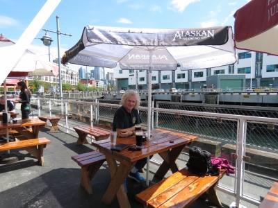
Position: 47°36.64'N, -122°20.89'W
Rob Higgins, president of Robinson helicopter leasing company Higgins Leasing, stopped by Seattle for a visit. We had a great evening talking boats and helicopters on the deck at Anthony's Pier 66 restaurant overlooking Bell Harbor Marina.
|
 |
8/1/2017: Latte Art
Position: 47°36.77'N, -122°20.20'W
The flower in our latte from Cherry Street Coffee is impressive, but we're still partial to the shamrock in our Guinness.
|
 |
8/4/2017: Dim Sum
Position: 47°36.75'N, -122°20.11'W
A Dim Sum "factory" at incredibly popular Din Tai Fung in Pacific Place Mall.
|
 |
8/4/2017: J Mahoney's
Position: 47°40.92'N, -122°7.39'W
An evening with longtime friends at J Mahoney's Irish Pub in Redmond. We all worked at the IBM Toronto software lab together in the 1990s, then later all moved to Microsoft in Seattle. It was great to catch up. And the pub had Kilkenny on tap—we only found it once in Ireland.
|
 |
8/5/2017: La Cocina Oaxaquena
Position: 47°36.92'N, -122°19.68'W
A late and relaxing lunch on the patio at La Cocina Oaxaquena Mexican restaurant in Capitol Hill, Seattle.
|
 |
8/6/2017: Leaving Seattle
Position: 47°36.97'N, -122°19.90'W
Heading to the airport at just past 6am this morning with our four suitcases stuffed full of spares with a total weight of just over 250 pounds. That was a load to cart around. Fortunately everthing arrived back at Dirona unscathed.
|
 |
8/6/2017: Liberty Bell
Position: 39°52.52'N, -75°14.94'W
A Liberty Bell made entirely of lego, complete with a crack, at the Philadelphia Airport.
|
 |
8/7/2017: Out With the Old
Position: 55°56.57'N, -4°43.56'W
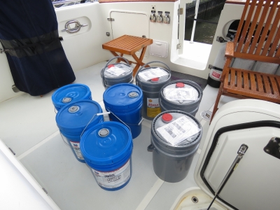
Four 20-liter four pails of oil that we'd ordered to the marina were waiting for us when we returned from Seattle. We stowed the new oil and swapped out the blue buckets full of waste oil for recycling.
|
 |
8/7/2017: Back Home
Position: 55°56.57'N, -4°43.56'W
We picked up Spitfire as soon as the Lochermill Cattery was open this morning. He had a good stay at "The Resort", but was very happy to be back home with his people. We sure missed him.
|
 |
8/7/2017: Fuel Trucks
Position: 55°56.57'N, -4°43.57'W
Two of the four trucks that arrived this afternoon to fuel superyacht Amaryllis moored behind us. Each truck at capacity carries 40,000 liters (10,500 gallons).
|
 |
8/7/2017: James Watt Dock
Position: 55°56.75'N, -4°44.15'W
Looking back to James Watt Dock marina on an evening walk. Dirona is hidden behind superyacht Amaryllis, visible on the right below the big blue crane.
|
 |
8/8/2017: Waverley Station
Position: 55°57.11'N, -3°11.35'W
At Waverley Station in Edinburgh on a 2-night trip to Edinburgh. The entire trip from Greenock to Edinburgh took only 2 and a bit hours by train, including a station change in Glasgow.
|
 |
8/8/2017: Carrubber's Close
Position: 55°57.03'N, -3°11.22'W
Walking up Carrubber's Close in the original Old Town district of Edinburgh. Old Town is full of narrow, steep closes (Scottish for alley) running between multi-storey buildings.
|
 |
8/8/2017: Tron Kirk
Position: 55°57.01'N, -3°11.25'W
Tron Kirk was dedicated in 1641 and operated as a church for 300 years. After standing empty for nearly 50 years, a small market now operates inside.
|
 |
8/8/2017: Fringe Festival
Position: 55°57.01'N, -3°11.25'W
August is festival season in Edinburgh and the streets are packed. The sign up the street is for the Edinburgh Fringe Festival, started in 1947 and currently the world's largest arts festival. In 2016, the festival featured 50,266 performances of 3,269 shows in 294 venues over 26 days in August.
|
 |
8/8/2017: Scott Monument
Position: 55°57.17'N, -3°11.52'W
The 200ft Scott Monument in the New Town district was completed in 1844 and is the largest monument in the world dedicated to Scottish author Sir Walter Scott. 297 stairs lead to the top for fabulous views of Old Town and New Town.
|
 |
8/8/2017: St. Andrew Square
Position: 55°57.29'N, -3°11.56'W
St. Andrew Square was built in the late 1700s as part of the New Town development of Edinburgh. The Melville Monument was constructed in 1823 to honor Henry Dundas, the first Viscount of Melville. Dundas was a key player in the Scottish Enlightenment, a period of great intellectual and scientic achievement in Scotland during the the 18th and early 19th centuries.
|
 |
8/8/2017: New Town
Position: 55°57.43'N, -3°11.79'W
The planned development of New Town was created in the late 1700s across a valley from the original Old Town. The district is among the finest examples of Georgian architecture and town planning in the world.
|
 |
8/8/2017: The Cumberland
Position: 55°57.54'N, -3°11.84'W
A delicious lunch on the patio at the Cumberland Bar in New Town.
|
 |
8/8/2017: Dundas House
Position: 55°57.24'N, -3°11.51'W
Originally built as a mansion for Sir Lawrence Dundas in 1772-1774, the impressive Dundas House on St. Andrew Square has been the head office of the Bank of Scotland since 1825. The building facade is featured on the current issue of their bank notes. In most countries we've visited, bank notes are issued by a single central authority. But in the United Kingdom, multiple banks can issue notes that don't have UK-wide acceptance. Bank of Ireland notes issued in Northern Ireland, for example, are not legal tender in England, although some vendors might accept them. And several venues in Scotland would not accept Isle of Man notes. We've since learned that the Ilse of Man is not actually a part of the UK at all, but is a self-governing crown dependency.
|
 |
8/8/2017: Hub
Position: 55°57.09'N, -3°10.99'W
Jennifer using the self-checkin for our room at The Hub in Old Town Edinburgh. The Hub is a modern but no-frills hotel that worked out very well for our stay.
|
 |
8/8/2017: Thomson's Land
Position: 55°57.08'N, -3°10.84'W
The University of Edinburgh's Thomson's Land estate with the Salisbury Crags in the background.
|
 |
8/8/2017: Canongate Tolbooth
Position: 55°57.08'N, -3°10.80'W
The tower of Canongate Tolbooth ('tolbooth' means center of administration) was built in 1591. The clock shown was added in 1884, suspended over the street on wrought iron brackets.
|
 |
8/8/2017: New Parliament
Position: 55°57.16'N, -3°10.47'W
Following a 1997 Scottish vote in favor of a devolved Parliament, the Scottish Parliament met in 1999 for the first time in 300 years. Their controversial new Parliament Building at the east end of Old Town is an eclectic collection of concrete and wood in seemingly random placement that is at odds with surrounding architecture. But from our perspective, it seems to work.
|
 |
8/8/2017: World Press Photo Exhibit
Position: 55°57.13'N, -3°10.48'W
The striking Debating Center in the Scottish Parliament building was unfortunately closed for maintenance, but we did spend some time viewing the often-sobering images in the World Press Photo Exhibit inside the Main Hall.
|
 |
8/8/2017: Firth of Forth
Position: 55°56.64'N, -3°9.72'W
View to the Firth of Forth, connecting Edinburgh to the North Sea, from the top of 823ft (251m) Arthur's Seat in Holyrood Park.
|
 |
8/8/2017: Saint Anthony's Chapel
Position: 55°56.64'N, -3°9.72'W
The ruins of Saint Anthony's Chapel viewed from Arthur's Seat. The chapel is thought to be built in the 1300s, but little is know about its history.
|
 |
8/8/2017: Cruise Ship
Position: 55°56.64'N, -3°9.73'W
Cruise ship anchored in the Firth of Forth of Edinburgh.
|
 |
8/8/2017: Salisbury Crags
Position: 55°56.70'N, -3°10.31'W
Looking north across Salisbury Crags at Holyrood Park with Edinburgh Castle in the distance at the far left.
|
 |
8/8/2017: Edinburgh Castle
Position: 55°56.75'N, -3°10.45'W
View to Edinburgh Castle from the Salisbury Crags. The stadium directly to the left of the castle is where the acclaimed Edinburgh Military Tattoo performs. We have tickets for tomorrow night.
|
 |
8/8/2017: View
Position: 55°56.79'N, -3°10.46'W
The panoramic view from the Salisbury Crags with Edinburgh Castle roughly at enter and the Firth of Forth on the right. Old Town extends right from the castle and New Town is in the distance to the left of the treed area at the right of the picture.
|
 |
8/8/2017: Palace of Holyroodhouse
Position: 55°56.94'N, -3°10.29'W
The Palace of Holyroodhouse, at left, the Royal Family's official residence in Scotland. Mary, Queen of Scots, lived here in the 16th century. In the foreground is an exhibit of 70 Ferraris, celebrating the company's 70th anniversary.
|
 |
8/8/2017: Parliament from Above
Position: 55°56.94'N, -3°10.29'W
A view to the modern Scottish Parliament buildings from above.
|
 |
8/8/2017: LaFerrari Aperta
Position: 55°57.06'N, -3°10.30'W
We checked out the Ferarri Exhibit after hiking through Holyrood Park. The cars mostly were modern and spectacular, particularly this LaFerrari Aperta, Ferrari's latest limited-edition special series model built for the 70th anniversary. The car uses hybrid technology coupling a 788HP V12 with a 160 HP electric motor for a total output of over 946 HP with a maximum speed of over 217mph (350km/h).
|
 |
8/8/2017: Ferrari Parade
Position: 55°57.04'N, -3°10.33'W
At 6pm, the Ferrari Exhibit set off on a parade through town, with plenty of engine revving. The followed roughly the route we were walking to dinner and the streets were so busy that we mostly outpaced the cars. It's not often that we outrun Ferraris.
|
 |
8/8/2017: The Outsider
Position: 55°56.88'N, -3°11.51'W
An excellent meal at the Outsider Restaurant in Old Town. Happy Birthday James!
|
 |
8/8/2017: Tour Buses
Position: 55°56.85'N, -3°11.38'W
Tour buses, all labelled 'Tattoo' lined the streets as we walked back after dinner.
|
 |
8/8/2017: Queue
Position: 55°56.87'N, -3°11.26'W
A queue for a Fringe Festival event. The steets were still quite busy in the early evening.
|
 |
8/8/2017: The World's End
Position: 55°57.04'N, -3°11.06'W
A drink at the World's End Pub to finish the evening. In the 16th century, Edinburgh was a walled city and the people of Edinburgh felt the world outside the city was no longer theirs. The pub sits where the old city gates were, hence the name.
|
 |
8/9/2017: Queue
Position: 55°57.05'N, -3°11.48'W
We stopped in at the ticket office this morning to pickup tonight's Edinburgh Tattoo tickets that we'd ordered back in February while in Florida. The Edinburgh Tattoo is incredibly popular and ticket-buyers already were lined up before the office opened. Over 200,000 people see the Tattoo live each year, and it has sold out in advance for the past decade. Fortunately we didn't have to stand in that queue to pickup our tickets.
|
 |
8/9/2017: Street Performer
Position: 55°56.93'N, -3°11.78'W
Street performer outside Edinburgh Castle, getting ready for his day.
|
 |
8/9/2017: Police
Position: 55°56.93'N, -3°11.80'W
These well-armed, but friendly, military police officers just posed for a photograph outside Edinburgh Castle.
|
 |
8/9/2017: Jet
Position: 55°56.93'N, -3°11.81'W
Full scale model of a Royal Navy Lockheed Martin F35 Lightning II jet fighter strung above the entrance to Edinburgh Castle.
|
 |
8/9/2017: Edinburgh Castle
Position: 55°56.91'N, -3°11.86'W
Edinburgh Castle is among Scotland's most popular tourist destinations. We'd pre-purchased our tickets, but still had to stand in this long queue to enter. A royal castle has been here since at least the 12th century, and the castle was a royal residence until the 17th century when it was re-purposed as military barracks.
|
 |
8/9/2017: New Town
Position: 55°56.95'N, -3°12.03'W
Perched high on Castle Rock, Edinburgh Castle has excellent views to the surrounding area. This is looking southwest across the New Town district from the battlements.
|
 |
8/9/2017: St. Mary's Cathedral
Position: 55°56.93'N, -3°12.12'W
St. Mary's Episcopal Cathedral, built in New Town in the late 19th century, viewed from Edinburgh Castle.
|
 |
8/9/2017: St. Cuthbert's
Position: 55°56.93'N, -3°12.08'W
St. Cuthbert's chapel in West Princes Street Gardens, viewed from Edinburgh Castle. The chapel was dedicated in 1894, but a chapel to St. Cuthbert stood on this site in 850, making the current chapel the oldest building in Edinburgh by foundation.
|
 |
8/9/2017: Foog's Gate
Position: 55°56.91'N, -3°12.01'W
Passing through Foog's Gate, the original castle gate into the upper ward.
|
 |
8/9/2017: Great Hall
Position: 55°56.89'N, -3°12.00'W
The Great Hall in Edinburgh Castle was built before the death of King James IV in 1513 and served as the main hall for state assembly in the castle. Arms and coats of armor ring the room.
|
 |
8/9/2017: Honours of Scotland
Position: 55°56.91'N, -3°11.97'W
The Honours of Scotland (Scottish Crown Jewels) are on display at the castle, but seeing them required standing in a long queue, so we passed.
|
 |
8/9/2017: Esplanade
Position: 55°56.92'N, -3°11.99'W
Looking down a cannon across the Castle Esplanade to the Edinburgh Tattoo grandstand.
|
 |
8/9/2017: Mons Meg
Position: 55°56.93'N, -3°12.01'W
Mons Meg, a massive siege gun, was built in 1449 at Mons (in what is now Belgium). Mons Meg is one of the largest cannons in the world, with a 20-inch (510mm) calibre (barrel diameter).
|
 |
8/9/2017: Dog Cemetery
Position: 55°56.91'N, -3°12.01'W
This cemetery for soldiers' dogs at Edinburgh Castle is one of only two in Scotland for the companions of the castle's commanding officers.
|
 |
8/9/2017: Crowds
Position: 55°56.93'N, -3°11.75'W
The streets were quite literally packed as we left Edinburgh Castle around noon.
|
 |
8/9/2017: Plumbing
Position: 55°57.05'N, -3°11.46'W
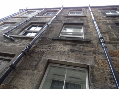
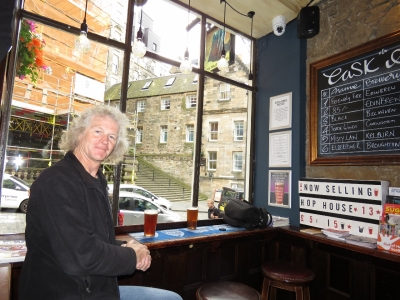
All the buildings in the area have plumbing pipes running down the outside. The buildings were constructed before indoor plumbing and so it was retrofitted later on the outside walls.
|
 |
8/9/2017: Malt Shovel
Position: 55°57.04'N, -3°11.45'W
Excellent burgers with a street-side view at the Malt Shovel Inn.
|
 |
8/9/2017: Princes Street Gardens
Position: 55°57.10'N, -3°11.72'W
After lunch we walked north across Princes Street Gardens to New Town. The gardens were created from a drained bog in the early 19th century.
|
 |
8/9/2017: Castle Rock
Position: 55°56.97'N, -3°12.19'W
Looking up to Edinburgh Castle, perched on Castle Rock, from Princes Street Gardens.
|
 |
8/9/2017: St. John's Episcopal Church
Position: 55°57.01'N, -3°12.41'W
The soaring and beautiful interior of St. John's Episcopal Church, dedicated in 1818, at Princes Street and Lothian Road.
|
 |
8/9/2017: Bute House
Position: 55°57.14'N, -3°12.48'W
Charlotte Square, at the west end of New Town, has some of the finest examples of Georgian architecture in the world. Bute House, Number 6 along the north side, is the official residence of Scotland's first minister, the equivalent of 10 Downing Street in London.
|
 |
8/9/2017: George Street
Position: 55°57.15'N, -3°12.24'W
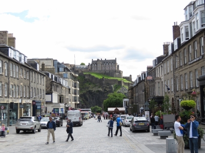
Much of George Street was closed for the festival season, and many of the restaurants had set up popular temporary patios along the street.
|
 |
8/9/2017: Castle Street
Position: 55°57.15'N, -3°12.20'W
Looking south along Castle Street to Edinburgh Castle, which dominates the city skyline.
|
 |
8/9/2017: Calton Hill
Position: 55°57.29'N, -3°11.05'W
We continue walking west through New Town to take the best views in the city from Calton Hill. This is looking back across New Town from Old Observatory House with Edinburgh Castle in the distance on the left. At the near left is a monument to Dugald Steward, an 18th-century philosopher and mathematician whose lectures at the University of Edinburgh popularized the Scottish Enlightenment. The buildings on the right contain some of Edinburgh's many rooftop gardens, complete with grass.
|
 |
8/9/2017: Arthur's Seat
Position: 55°57.26'N, -3°10.95'W
Arthur's Seat, that we climbed yesterday, viewed from Calton Hill. The Palace of Holyrood House is at the far left and the new Scottish Parliament is just to its the right.
|
 |
8/9/2017: Nelson Monument
Position: 55°57.26'N, -3°10.95'W
View north across the Calton Hill from the top of the Nelson Monument with the Firth of Forth in the distance. The Nelson Monument was built to commemorate Admiral Lord Nelson's victory at Trafalgar in 1805. On the left is the City Observatory, built in 1818 following the design of the ancient Greek Temple of the Winds in Athens. At right is the National Monument, an early 1800s attempt to replicate the Parthenon in Athens to honor Scots who died in the Napoleonic Wars. Funding ran out after only 12 columns were completed.
|
 |
8/9/2017: Path
Position: 55°57.19'N, -3°10.78'W
A nice wooded path, that appeared to be an old road, led down the steep bank from Regent Rd to Calton Rd.
|
 |
8/9/2017: Ondine
Position: 55°56.94'N, -3°11.55'W
We had an excellent seafood meal at Ondine before the tattoo.
|
 |
8/9/2017: Tattoo Crowds
Position: 55°56.93'N, -3°11.76'W
Castlehill street below the castle was packed with Tattoo attendees. Plenty of security personnel were on hand, but they seemed mainly for crowd control. Bag inspections and other security checks weren't nearly as strict as what we've experienced in the US at events such as football games.
|
 |
8/9/2017: Edinburgh Tattoo
Position: 55°56.93'N, -3°11.81'W
A tattoo is marching, exercises and other entertainment displays performed by military personnel to music, such as a marching band. This is generally not our preferred form of entertainment, but we had a fabulous time at the Edinburgh Tattoo and really enjoyed the show. Troupes from around the world put on an excellent performances and the castle made a dramatic backdrop to the disolays. And because we'd bought our tickets back in February, we had excellent seats.
|
 |
8/9/2017: France
Position: 55°56.93'N, -3°11.81'W
The Fanfare Band of the 9th French Marine Infantry Brigade takes the stage through the castle gates amid a fiery light display.
|
 |
8/9/2017: Fireworks
Position: 55°56.93'N, -3°11.81'W
A dramatic fireworks display near the end of the Tattoo with Edinburgh Castle aglow in the background. When we started attending music concerts, people held up lit cigarette lighters to show approval and request an encore. Now they hold up cell phones.
|
 |
8/10/2017: Falkirk Wheel
Position: 55°59.99'N, -3°50.47'W
The Falkirk Wheel was completed in 2002 to connect the restored Union and Forth & Clyde Canals, replacing 11 locks that once covered the 115ft difference in level. The wheel is a unique rotating boat lift that raises and lowers vessels between the two canals. Falkirk is essentially on the route between Edinburgh and Greenock, so we stopped off to see the wheel and other nearby attractions.
|
 |
8/10/2017: Union Canal
Position: 55°59.74'N, -3°50.41'W
A short walk through the through Roughtcastle Tunnel brought us to the end of the Union Canal that runs 31-miles to Edinburgh. The canal opened in 1822 to transport coal and other minerals to the capital, but railroads soon eclipsed the canal and it was closed to commercial traffic in 1933 and completely in 1965. The canal was re-opened in 2001 as canals became popular for leisure purposes.
|
 |
8/10/2017: Narrowboat
Position: 55°59.74'N, -3°50.38'W
When we arrived, a narrowboat was passing through the final Union Canal lock before reaching the wheel. We were particularly interested in the locking through process as we'd be doing the same thing along the Crinan Canal in a week or so.
|
 |
8/10/2017: Little Weaver
Position: 55°59.77'N, -3°50.46'W
On board the narrowboat were Graham and Jennifer Barton, and their adult children Bruce and Kathryn, all from New Zealand. Noting our interest, they asked if we'd like to ride down on the wheel with them. They didn't have to ask twice. :)
|
 |
8/10/2017: Roughtcastle Tunnel
Position: 55°59.92'N, -3°50.49'W
Heading through Roughcastle Tunnel in the narrowboat with the Falkirk Wheel in the distance. The maximum air draft for a boat on the Union canal is 9ft 10 in (3m).
|
 |
8/10/2017: Top of the Wheel
Position: 55°59.97'N, -3°50.49'W
About to enter the top of the Falkirk Wheel.
|
 |
8/10/2017: At the Helm
Position: 56°0.02'N, -3°50.50'W
Jennifer at the helm of the narrowboat as we prepare to descend.
|
 |
8/10/2017: Descending
Position: 56°0.03'N, -3°50.49'W
Halfway down on the Falkirk Wheel. We're super-excited to be riding the wheel and it was very generous of the Bartons to invite is aboard.
|
 |
8/10/2017: Wheel in Action
Position: 56°0.06'N, -3°50.53'W
After our descent, we stopped to watch the tour boats go up and down, one per side. The tour boats are fully-enclosed with eight seats across. Riding down with the Bartons, we were able to step outside, enjoy the views, and take pictures from all angles.
|
 |
8/10/2017: Kelpies
Position: 56°1.05'N, -3°45.34'W
We took a taxi to nearby Stirling Castle and stopped off to see the Kelpies along the way. These two 30m-high stainless steel horse heads are named after the mythical Scottish water-horse and commemorate the working horses that once pulled barges through the canals.
|
 |
8/10/2017: Wallace Monument
Position: 56°7.39'N, -3°56.76'W
The National Wallace Monument, viewed from the grounds of Stirling Castle. The monument was completed in 1869 to commemorate Sir William Wallace, the hero of Scotland's 13th-century bid for independence, who was depicted in the movie Braveheart. The memorial stands on the summit of Abbey Craig with views across the Forth Valley, including to Stirling Bridge where Wallace successfully stood against the invading English in 1297.
|
 |
8/10/2017: Stirling Castle
Position: 56°7.41'N, -3°56.85'W
A fortress has stood on Castle Hill above Stirling since prehistoric times. Stirling Castle overlooks the Forth Valley, where the Stirling River forms a natural barrier between the Scottish Highlands and Lowlands. In most places the river is too deep to fjord. But it's shallower, and passage is possible, at the village of Stirling. Those who control Stirling Castle control movement between the Highlands and the Lowlands, resulting in the long-held adage that "to hold Stirling is to hold Scotland".
This model inside Stirling Castle shows the current castle, one of the largest in Scotland, dating from the 14th-16th centuries. The castle and its walls have been extended and renovated several times over the centuries. The current entry, where we came through, is at the far left. |
 |
8/10/2017: Royal Palace
Position: 56°7.41'N, -3°56.82'W
The Royal Palace at Stirling Castle, viewed from Queen Anne Garden, was built by King James V in the early 1500s. Covered with unique carved stonework and built to impress his new French bride and European heads of state, the palace is considered one of the most architecturally impressive buildings in Scotland.
|
 |
8/10/2017: Carvings
Position: 56°7.40'N, -3°56.82'W
A closer view to some of the unique carvings on the outside of the Royal Palace.
|
 |
8/10/2017: Grand Battery
Position: 56°7.43'N, -3°56.81'W
The view north across the Forth Valley from the Stirling Castle Grand Battery. The Wallace Monument is visible atop Abbey Craig at center in the distance.
|
 |
8/10/2017: Great Hall
Position: 56°7.43'N, -3°56.85'W
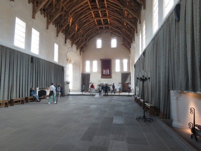
The Great Hall was built by James IV in the late 1400s. The hammerbeam roof shown here was removed in 1800 when the hall was subdivided for barracks, and later restored in 1999.
|
 |
8/10/2017: Unicorn
Position: 56°7.44'N, -3°56.91'W
A statue of a unicorn, Scotland's national animal, atop the Great Hall. In Scottish heraldry the unicorn often is depicted in chains because it was considered a dangerous animal.
|
 |
8/10/2017: Tapestries
Position: 56°7.41'N, -3°56.88'W
The inside of the Royal Palace at Stirling Castle has been restored to its 1540s state, when Mary Queen of Scots lived there as a child. Strung on the walls in the Queen's Presence Chamber are handwoven recreations of the four "Hunt of the Unicorn" tapestries, made in the on-site tapestry studio.
|
 |
8/10/2017: No 2 Baker Street
Position: 56°7.13'N, -3°56.32'W
A tasting flight of local brews street-side at the pub No 2 Baker Street in the village of Stirling.
|
 |
8/10/2017: Stirling Station
Position: 56°7.19'N, -3°56.12'W
At Stirling Station for the train back to Greenock.
|
 |
8/12/2017: Fending Off
Position: 55°56.57'N, -4°43.57'W
This boat bounced off several boats on both sides of the marina as they attempted to exit, the crew frantically fending off and shifting fenders between sides. It took nearly thirty minutes to find the marina exit. This is why we always put fenders on our exposed side, even if another boat won't be moored beside us.
|
 |
8/12/2017: Tesco
Position: 55°56.15'N, -4°41.75'W
At the well-stocked Tesco in Port Glasgow to stock up on meats and produce before our cruise to the Hebrides and the Orkneys.
|