MV Dirona travel digest for Midwest Coast Ireland 2017

|
Click the travel log icon on the left to see these locations on a map,
with the complete log of our cruise. On the map page, clicking on a camera or text icon will display a picture and/or log entry for that location, and clicking on the smaller icons along the route will display latitude, longitude and other navigation data for that location. And a live map of our current route and most recent log entries always is available at //mvdirona.com/maps/LocationCurrent.html. |
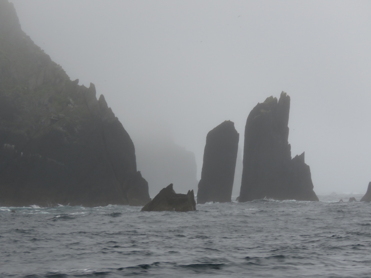 |
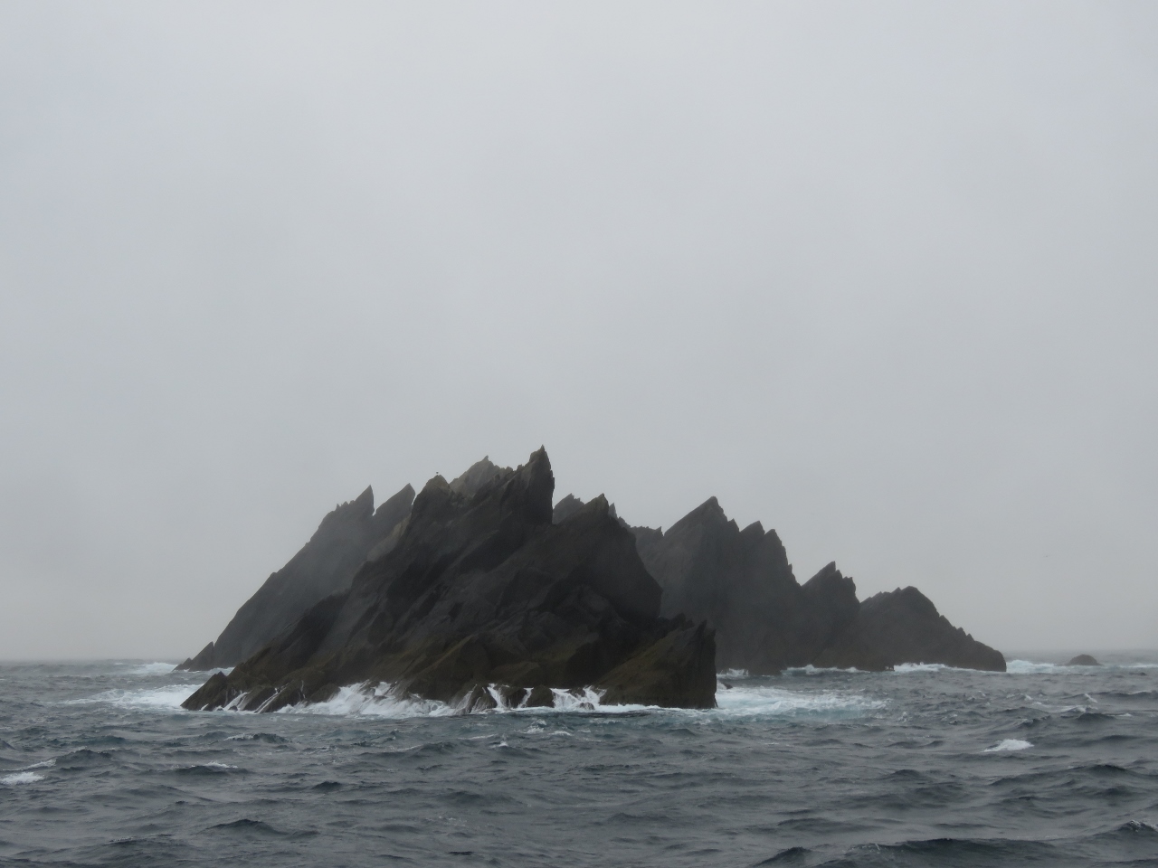
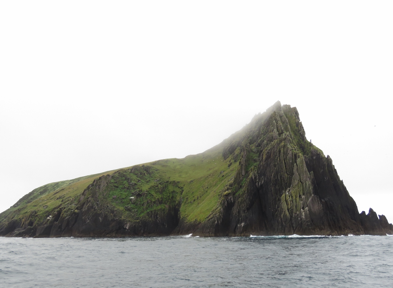
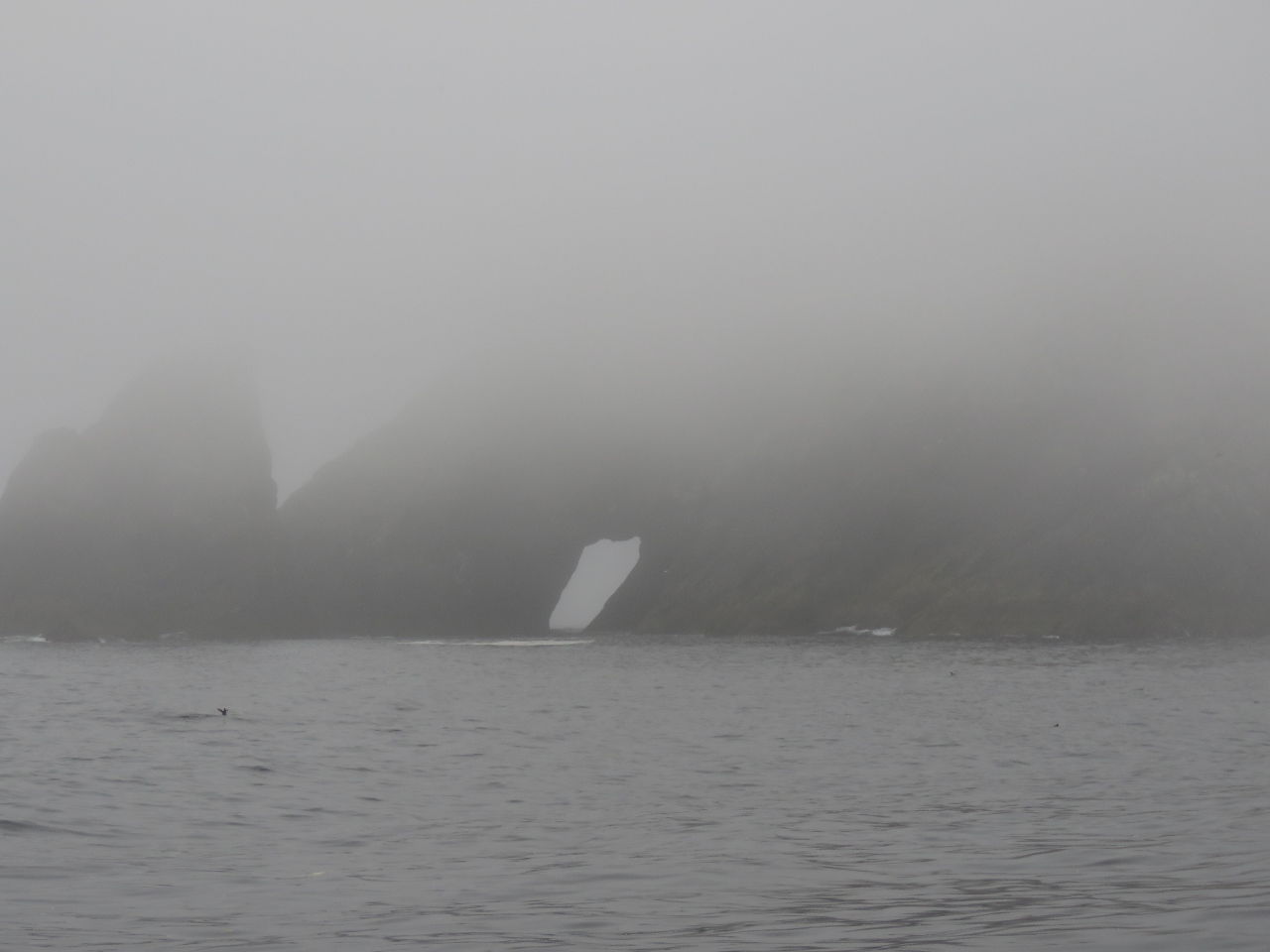
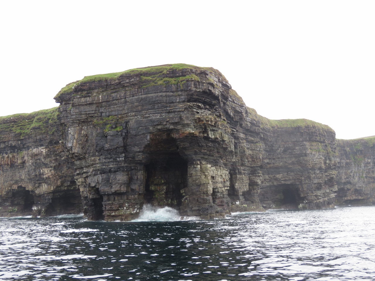
6/24/2017: Inishnabro
Position: 52°3.91'N, -10°36.04'W
We woke up to a thick fog and almost skipped the Blasket Islands on our way north as we didn't expect to see much. But even in such poor visibility, the formations off Inishnabro Island were spectacular.
|
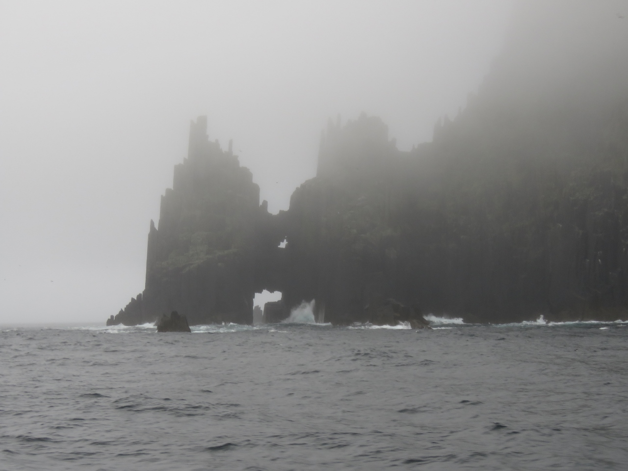 |
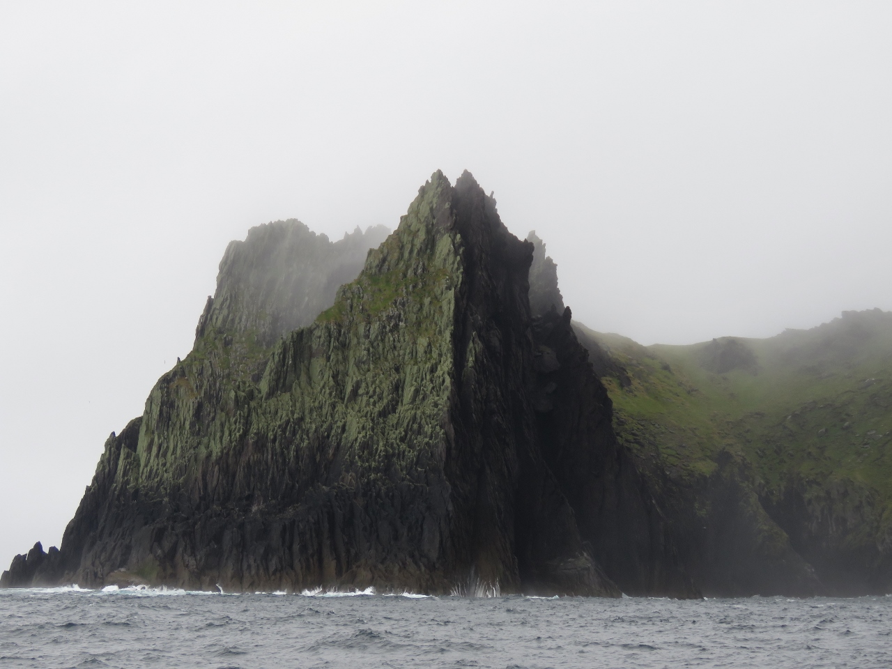
6/24/2017: Seascape
Position: 52°3.94'N, -10°36.56'W
Looking back through multiple sea arches and castellated cliffs at the north end of Inishnabro Island. The fog actually added to the drama of the scene.
|
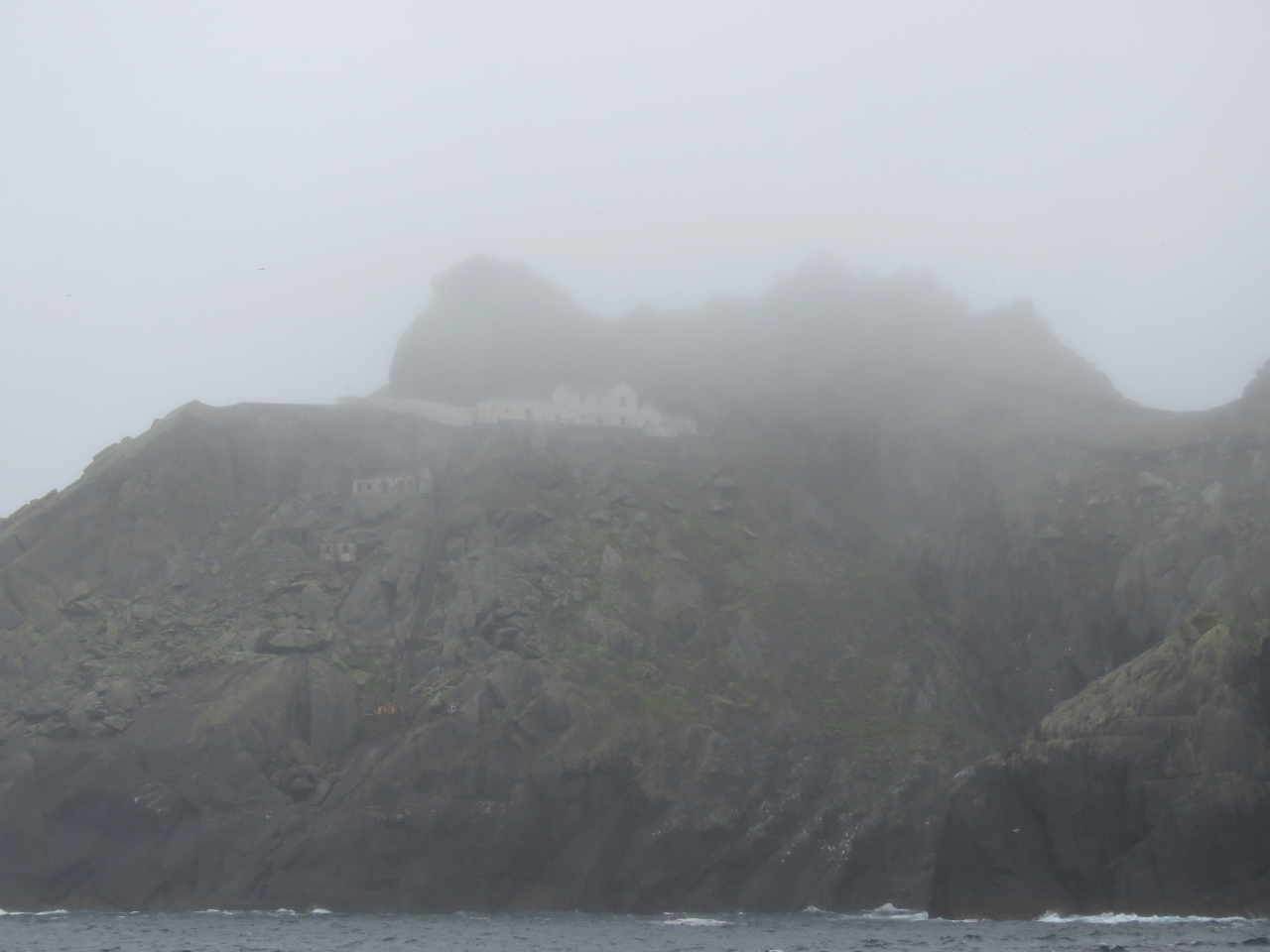 |
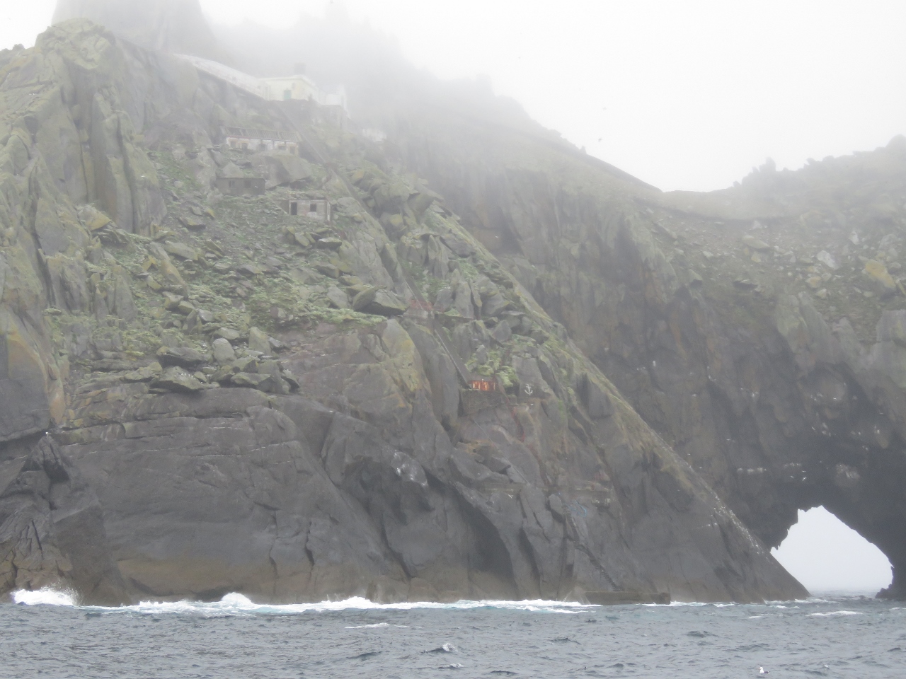
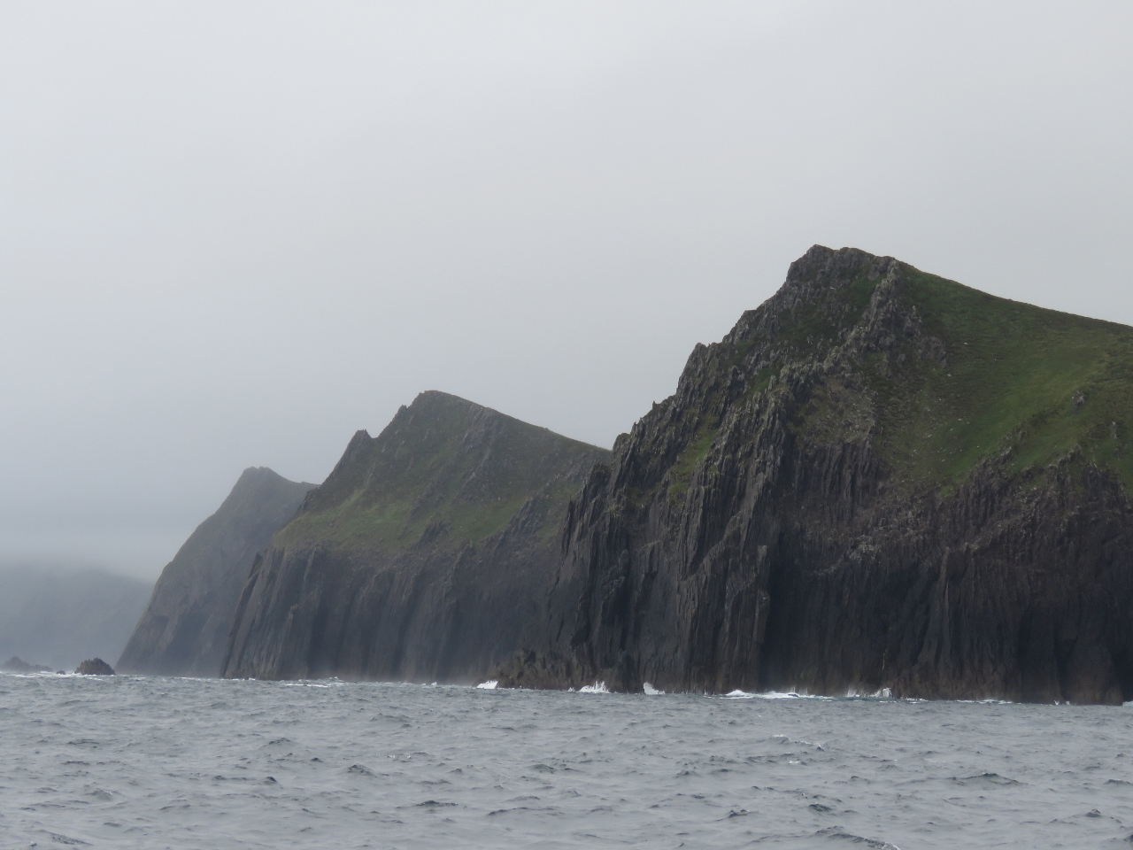
6/24/2017: Tearaght Lighthouse
Position: 52°4.21'N, -10°39.23'W
The fog slowly lifted as we continued through the island group and we could just make out the lighthouse perched on the top of Tearaght Island. It sure takes some impressive engineering to build lighthouses on these remote and rugged islands.
|
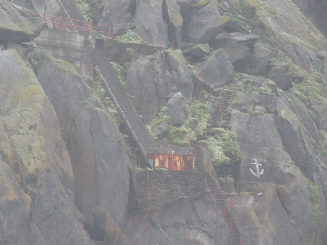 |
6/24/2017: Stairs
Position: 52°4.34'N, -10°39.68'W
Below the lighthouse are several buildings and stairs leading down to a landing near the water.
|
 |
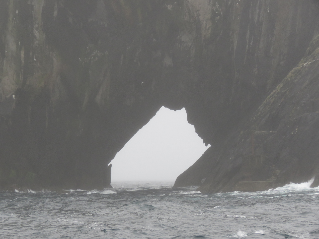
6/24/2017: Tunnel
Position: 52°4.34'N, -10°39.68'W
As we continue west along Tearaght Island, perhaps the most dramatic feature of the island came into view: a tunnel all the way through to the other side.
|
 |
6/24/2017: Hazards
Position: 52°4.43'N, -10°39.84'W
Rocks like these lurk just below the surface, so care is required when navigating the area.
|
 |
6/24/2017: Tunnel from North
Position: 52°4.72'N, -10°39.39'W
Looking south through the tunnel on Tearaght Island.
|
 |
6/24/2017: Landing
Position: 52°4.72'N, -10°39.55'W
Just off the tunnel on the right is another landing for the lighthouse. Both landings look like they'd be pretty challenging in even the smallest swell.
|
 |
6/24/2017: Inishtooskert
Position: 52°7.96'N, -10°35.30'W
The fog kept lifting and we got a great view to the sheer cliffs along the north shore of Inishtooskert Island.
|
 |
6/24/2017: Slope
Position: 52°8.38'N, -10°34.42'W
A grassy green slope behind the cliffs on Inishtooskert Island.
|
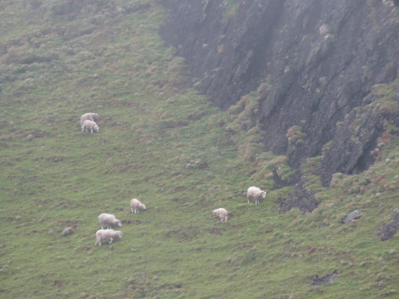 |
6/24/2017: Sheep
Position: 52°8.37'N, -10°34.31'W
We were surprised to see sheep grazing on Inishtooskert Island. The island once was inhabited and now mainly sheep and seabirds live here, in particular the largest colony of European storm-petrels in Ireland.
|
 |
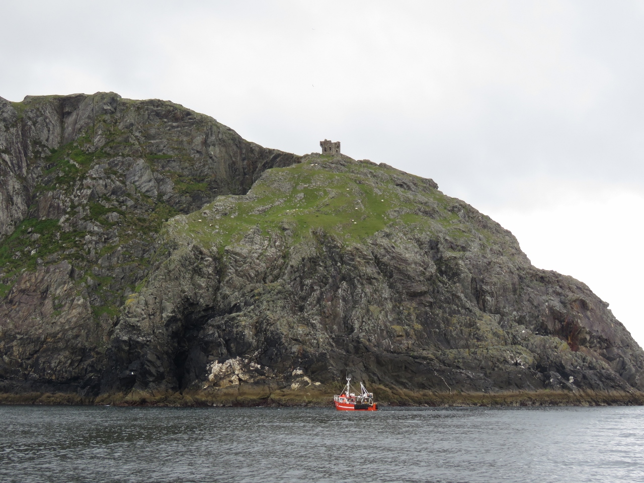
6/24/2017: Loop Head
Position: 52°32.30'N, -9°59.48'W
Ireland has no shortage of lighthouses on dramatic seascapes. This is Dermot and Grania's Rock standing just offshore from Loop Head. A light has been lit on Loop Head since 1670. The current building was completed in 1854 and the light was automated in 1991.
|
 |
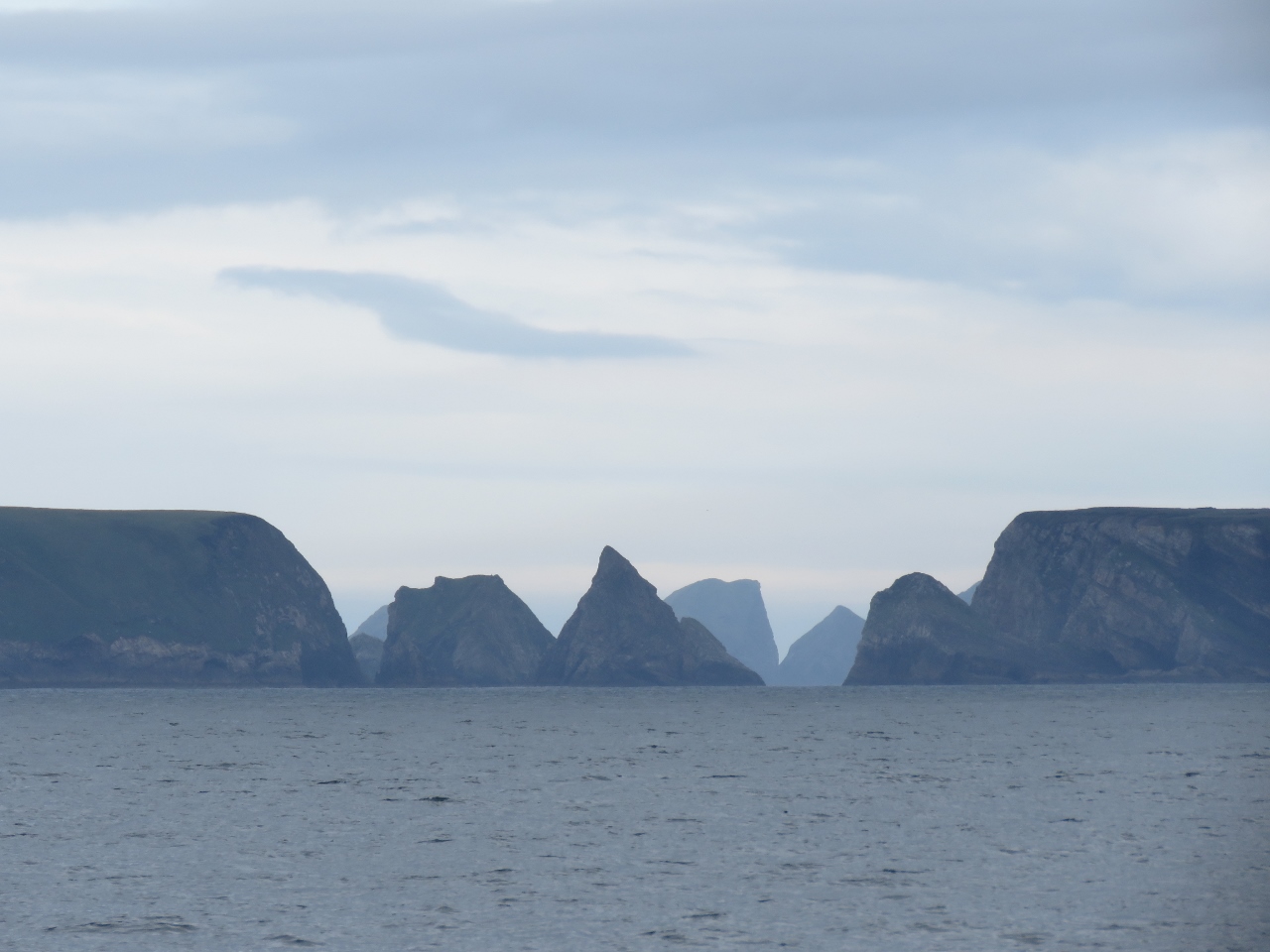
6/24/2017: Three Sisters
Position: 52°11.60'N, -10°27.05'W
The Three Sisters cliffs just north of Sybil Point have surprisingly similar sheer slopes and cliff-top formations.
|
 |
6/24/2017: Approaching Cliffs of Moher
Position: 52°56.56'N, -9°29.59'W
We're nearing the Cliffs of Moher, one of Ireland's most well-known coastal features. We've been looking forward to seeing them from the water for a while.
|
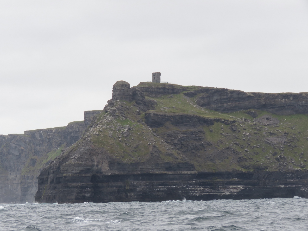 |
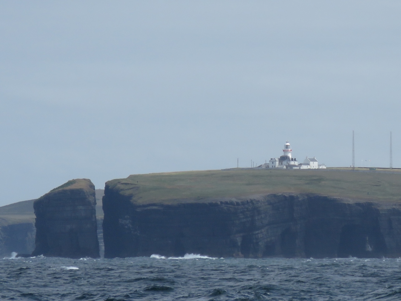
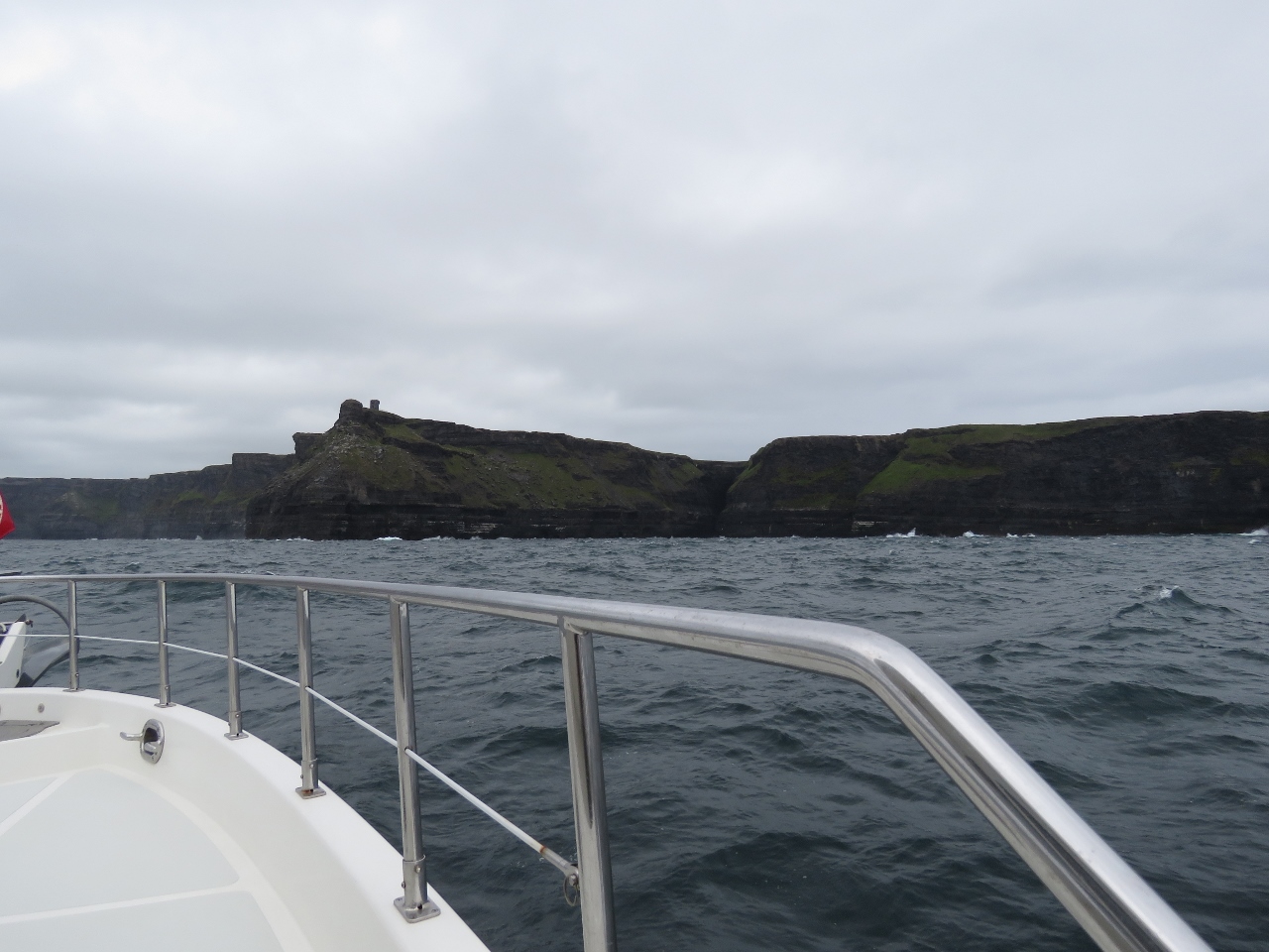
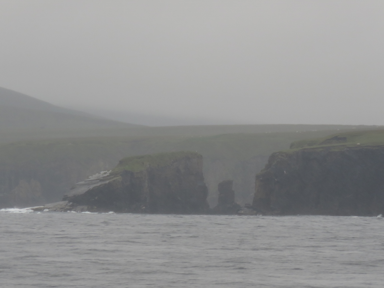
6/24/2017: Hags Head Signal Tower
Position: 52°56.85'N, -9°28.88'W
The Hags Head signal tower, one of the 81 signal towers built along the Irish coast during the Napoleonic era. What looks like a small tower slightly lower on the point is a circular rock formation.
|
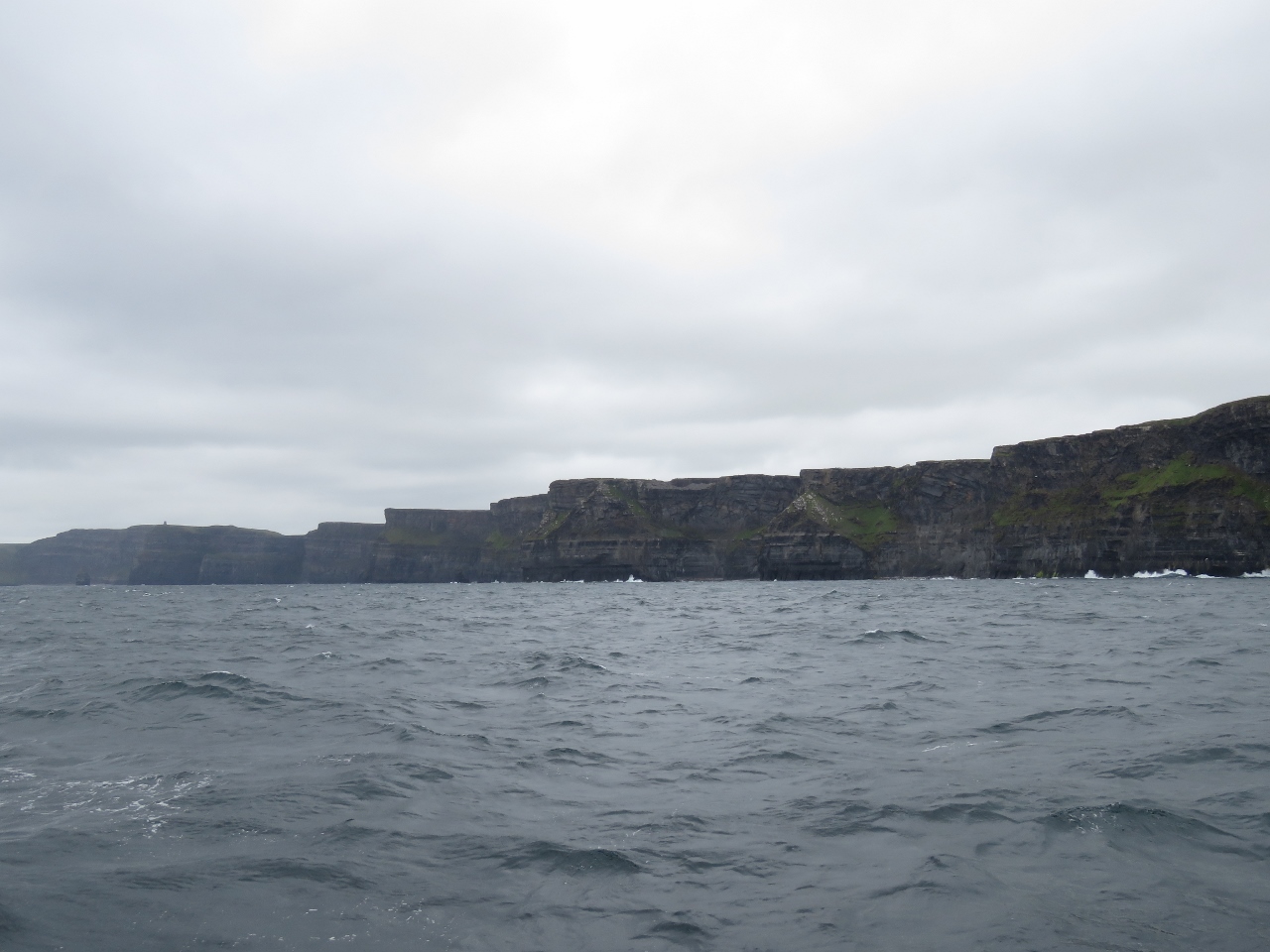 |
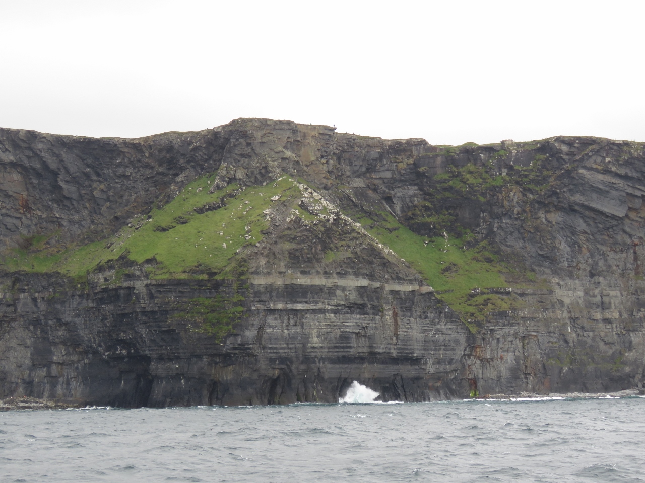
6/24/2017: Cliffs of Moher
Position: 52°57.08'N, -9°28.41'W
The 600ft sheer Cliffs of Moher stretching out for five miles before us. Capturing their size and scale in a photograph is a real challenge.
|
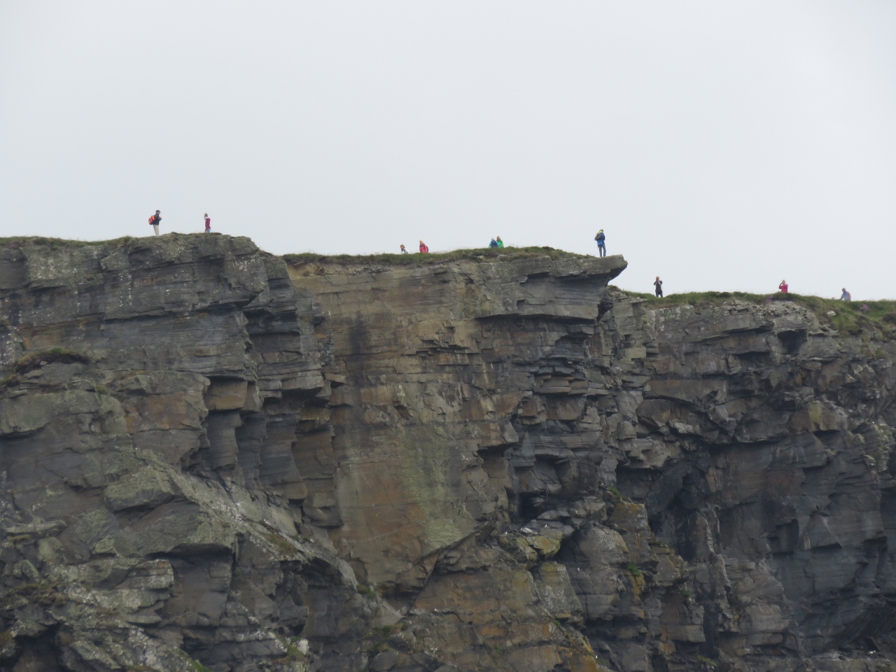 |
6/24/2017: People
Position: 52°57.44'N, -9°27.78'W
The Cliffs of Moher are a popular tourist destination—many people were out taking in the view. We wondered if the person near the tip of the overhand knew how far out they were.
|
 |
6/24/2017: Cliffs
Position: 52°57.44'N, -9°27.78'W
The cliffs were fabulous—we felt very lucky to have such calm conditions where we could approach reasonably closely. The small specks of people at the top of the cliffs give an idea of the scale.
|
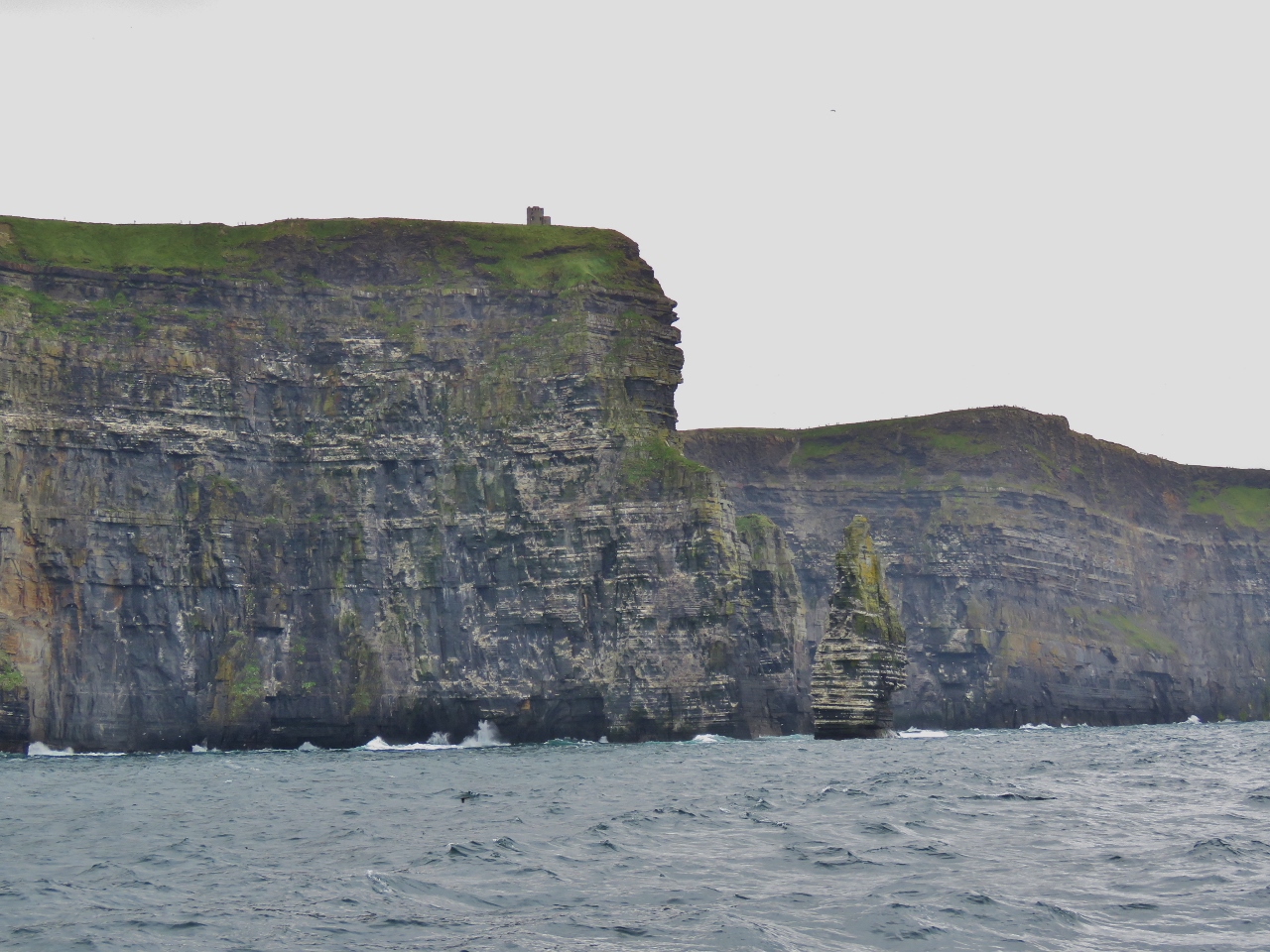 |
6/24/2017: Branaunmore Sea Stack
Position: 52°58.69'N, -9°26.32'W
Looking south past Branaunmore Sea Stack to the Cliffs of Moher, with O'Briens Tower at the top of the cliffs. Sir Cornelius O`Brien built the tower in 1835 as a tourist observation platform.
|
 |
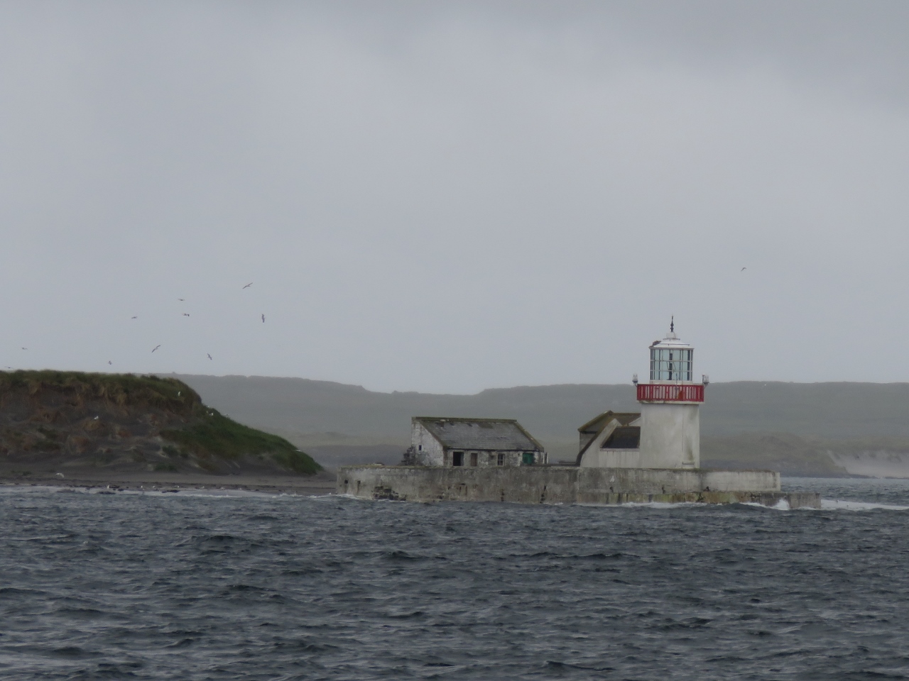
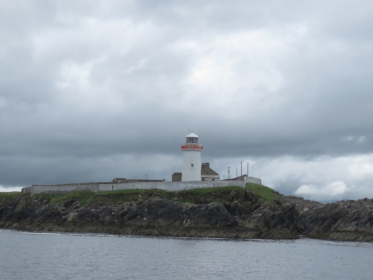
6/24/2017: Fardurris Point Light
Position: 53°2.18'N, -9°31.31'W
The Fardurris Point Light on Innisheer Island in the Aran Islands.
|
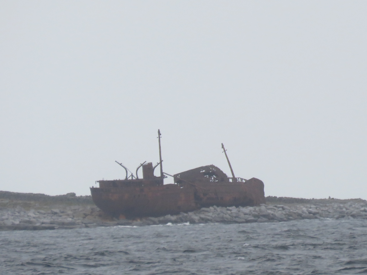 |
6/24/2017: MV Plassy
Position: 53°2.28'N, -9°31.46'W
The MV Plassy was a steam-trawler launched in 1940. In 1960, the ship went aground in a severe storm on Finnis Rock off Inisheer Island and the entire crew was rescued with a breeches buoy. A few weeks later, a second storm washed the ship off the rock and onto Inisheer Island and features in the opening credits of the British television show Father Ted.
|
 |
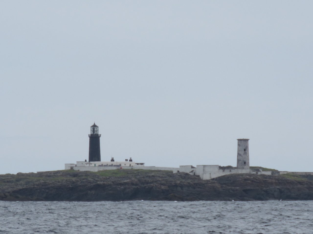
6/24/2017: Straw Island Light
Position: 53°7.33'N, -9°37.61'W
The Straw Island Lighthouse at the entrance to Killeany Bay on Inishmore Island in the Aran Islands.
|
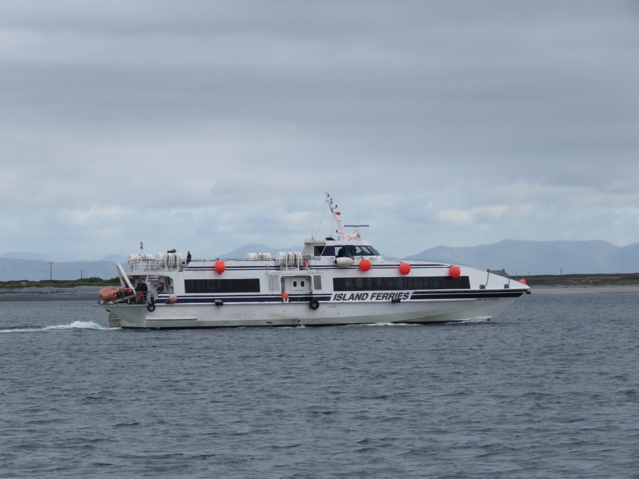 |
6/25/2017: Island Ferries
Position: 53°6.85'N, -9°39.75'W
We'd had a long day, covering just over 100 miles, and had a relaxing meal in the comfortable anchorage at Killeany Bay. The island is a popular tourist destination with frequent ferries from Galway on the mainland.
|
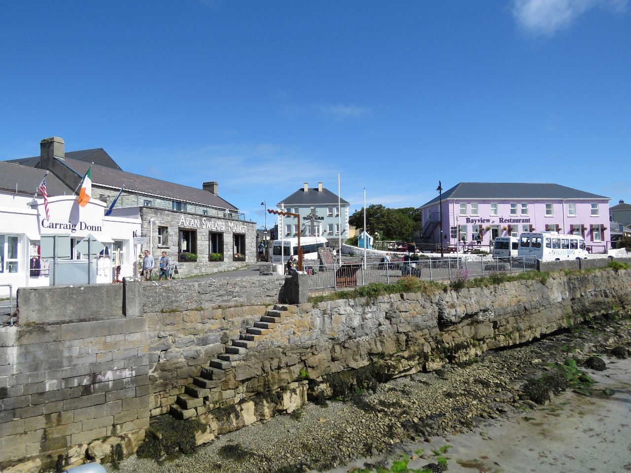 |
6/25/2017: Kilronan
Position: 53°7.13'N, -9°40.16'W
Kilronan, on Killeany Harbour, is the main village on Inishmore Island. On the left is a sweater market, one of several we saw sweaters on the island. Aran sweaters, with their distinctive knit patterns, are popular worldwide. Fortunately there is another set of stairs off deeper water where we can land the tender to bring our bikes ashore.
|
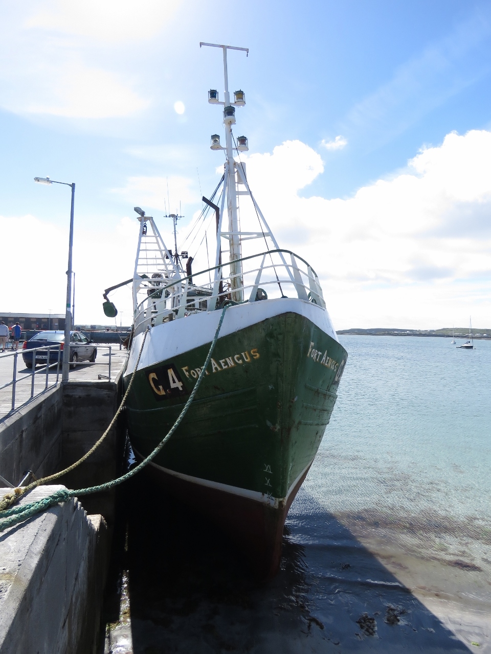 |
6/25/2017: Fort Aengus
Position: 53°7.13'N, -9°40.16'W
The fishing vessel Fort Aengus high and dry on a tide grid at the Kilronan dock.
|
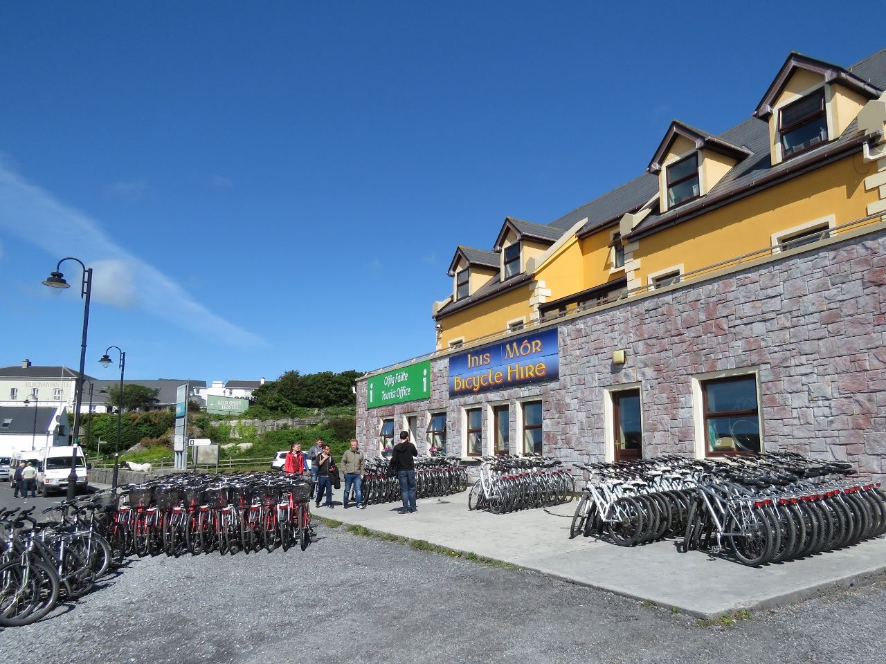 |
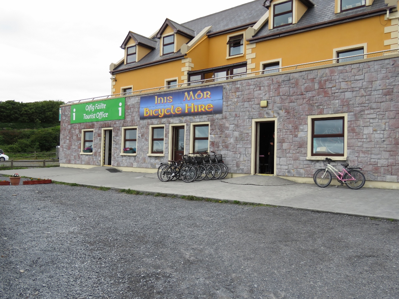
6/25/2017: Bicycle Hire
Position: 53°7.20'N, -9°40.01'W
Bicycle rentals are popular on Inishmore Island. We saw several rental places with this many bikes. We were there in late June, a little early in the tourist season, and assumed they must be on hand for the high season.
|
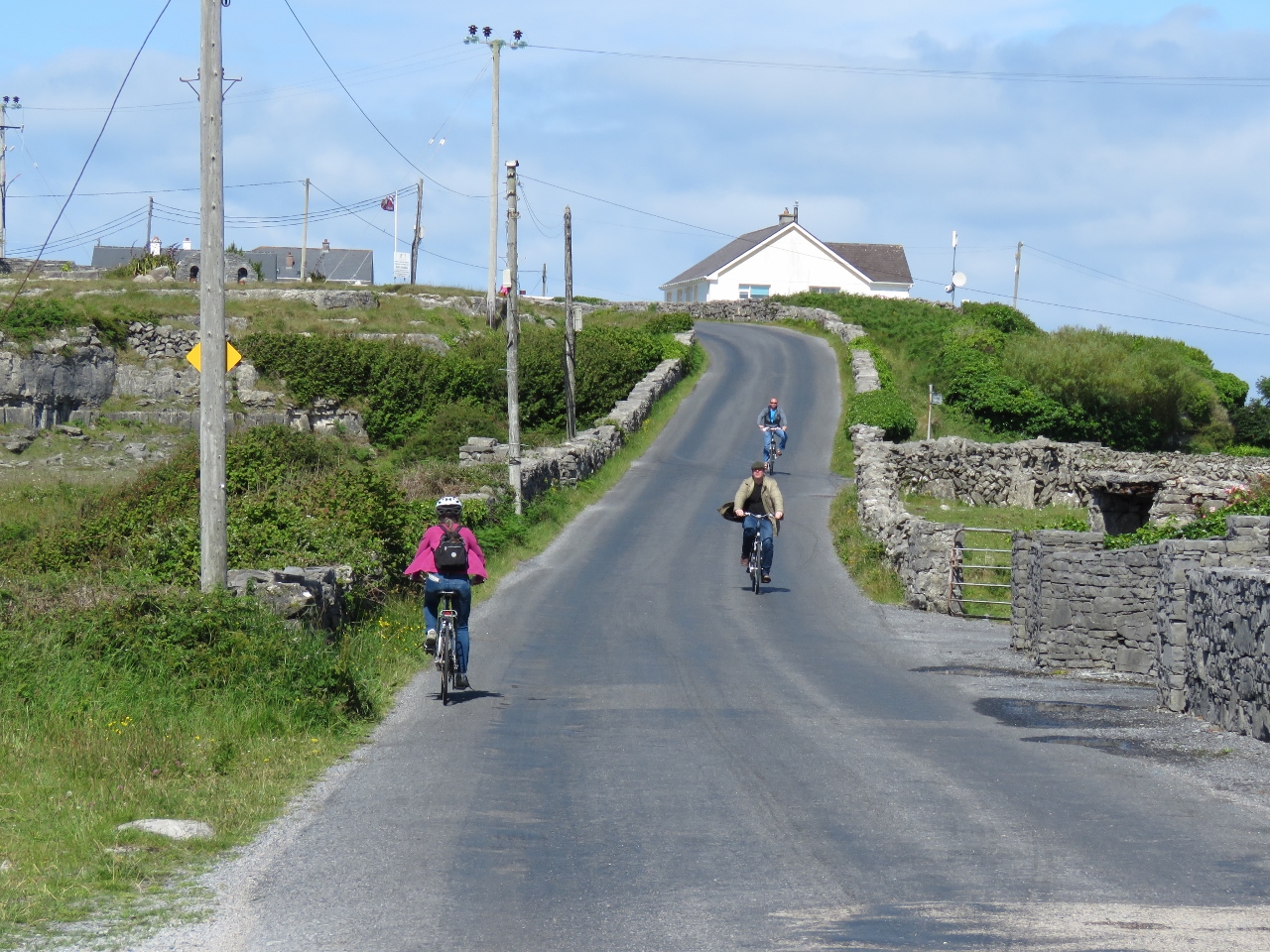 |
6/25/2017: On the Road
Position: 53°7.72'N, -9°41.09'W
Biking on Inishmore Island.
|
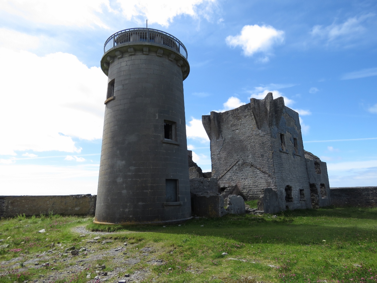 |
6/25/2017: Towers
Position: 53°7.64'N, -9°42.14'W
Our first stop was another of the 81 Napoleonic signal tower and the island's first lighthouse. The light went into service in 1818, but was discontinued in 1857 and replaced by newer lights because it was too high and didn't cover the north or south sound entrances.
|
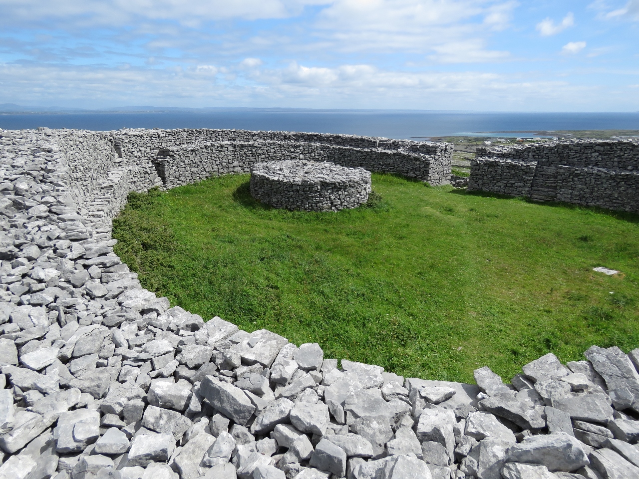 |
6/25/2017: Dun Eochla
Position: 53°7.62'N, -9°42.00'W
A short walk from the towers is Dun Eochla, a restored stone ring fort likely built sometime between 500 and 800 AD. Dun means "fort of a king or chieftain" in Irish.
|
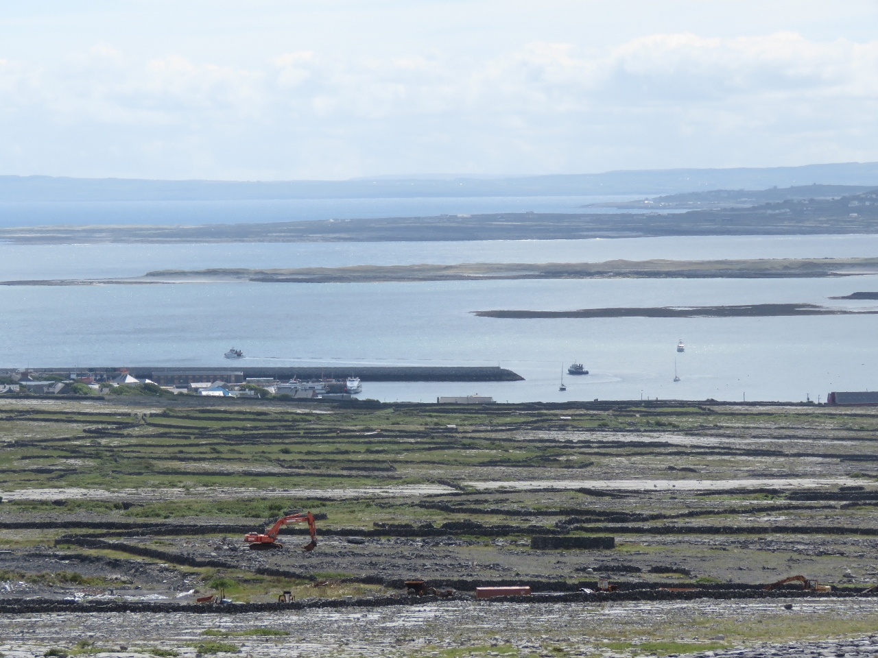 |
6/25/2017: Killeany Bay
Position: 53°7.61'N, -9°41.99'W
Dun Eochla has a fantastic 360-degree view. This is looking east to Killeany Bay—Dirona is the rightmost and furthest boat at anchor.
|
 |
6/25/2017: Camouflage
Position: 53°7.62'N, -9°41.98'W
What looks like an ancient edifice visible from Dun Eochla is actually a modern construction designed to disguise a large water reservoir.
|
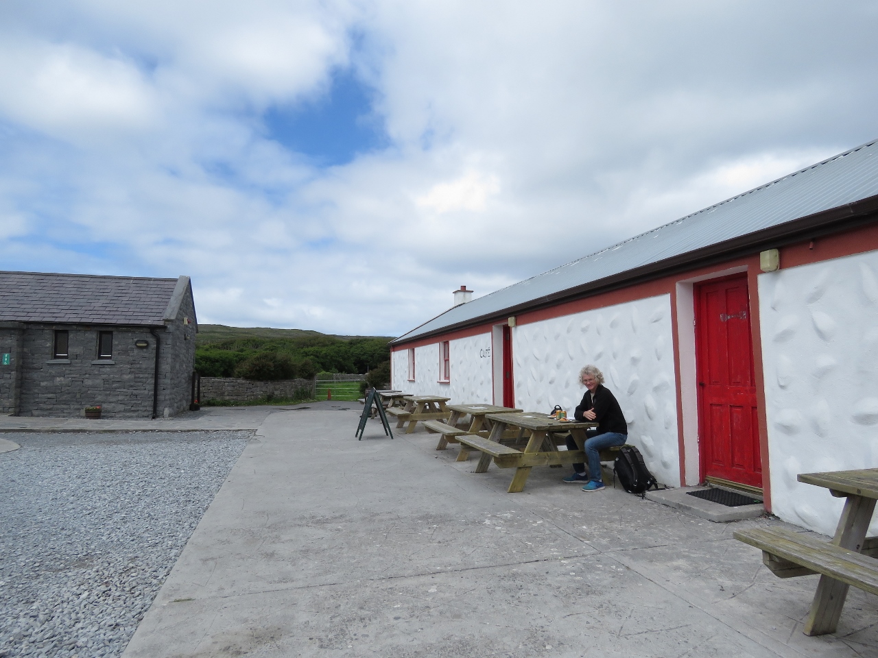 |
6/25/2017: Snack
Position: 53°7.80'N, -9°45.43'W
Enjoying a snack at the Dun Aonghasa visitor center. The fort and surrounding cliffs are the major tourist attraction on the island.
|
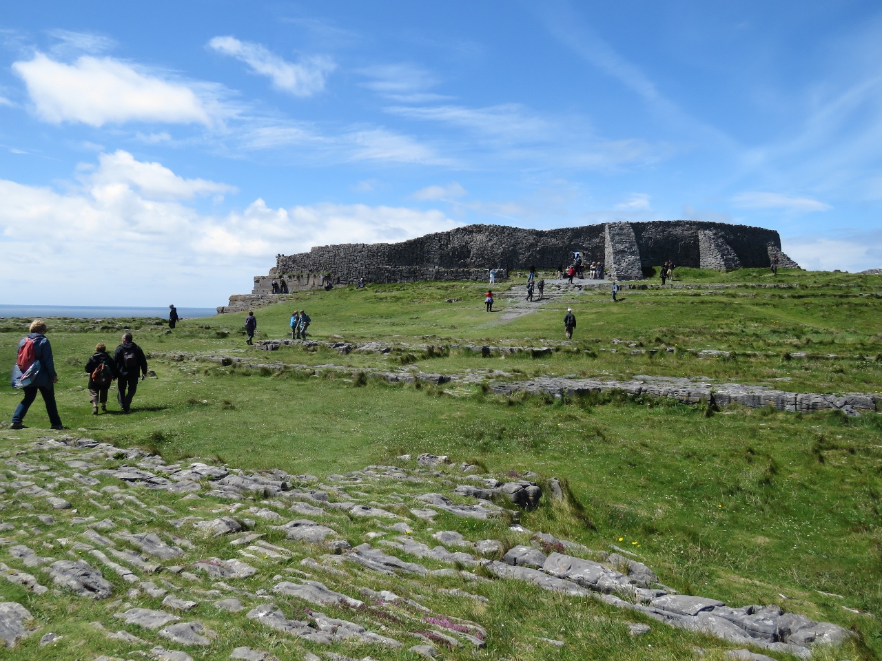 |
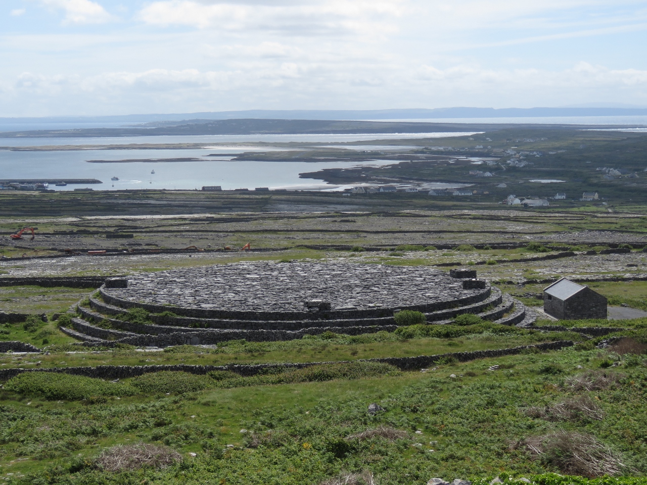
6/25/2017: Dun Aonghasa
Position: 53°7.51'N, -9°45.95'W
Dun Aonghasa is a dramatic semi-circular fort built right to the edge of 300-foot cliffs , a point of dominance that must have intimidated potential attackers. The fort likely was built in three phases from around 500 BC through 500 AD. The fort encloses 14 acres behind three defensive walls. The site is popular—a steady stream of visitors were arriving the entire time we were there.
|
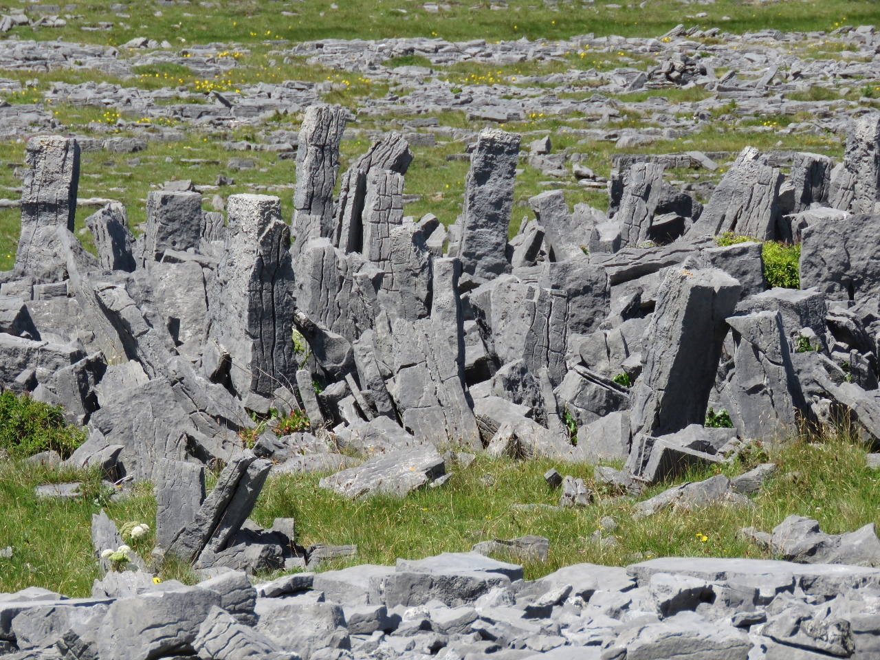 |
6/25/2017: Chevaux de Frise
Position: 53°7.55'N, -9°46.02'W
Surrounding Dun Aonghasa has one of the best examples of chevaux de frise in Europe. This is a medieval defense system consisting of closely-space upright stakes or stones designed to thwart an attack on horseback and commonly used where stony terrain made digging a ditch too difficult.
|
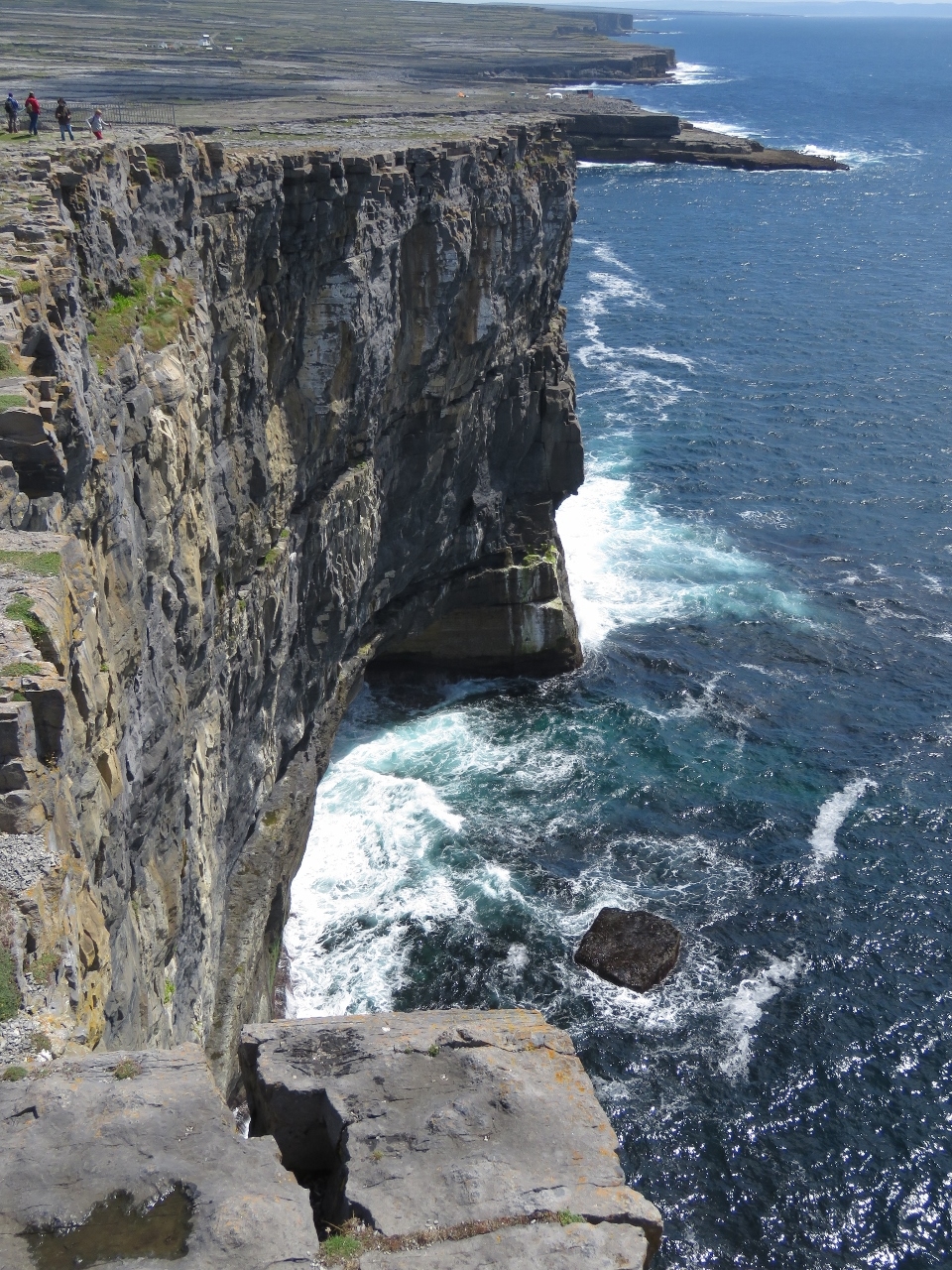 |
6/25/2017: Cliffs
Position: 53°7.51'N, -9°46.01'W
Besides the fort itself, a major draw of Dun Aonghasa is the dramatic cliff views. This is looking south from just outside the fort wall.
|
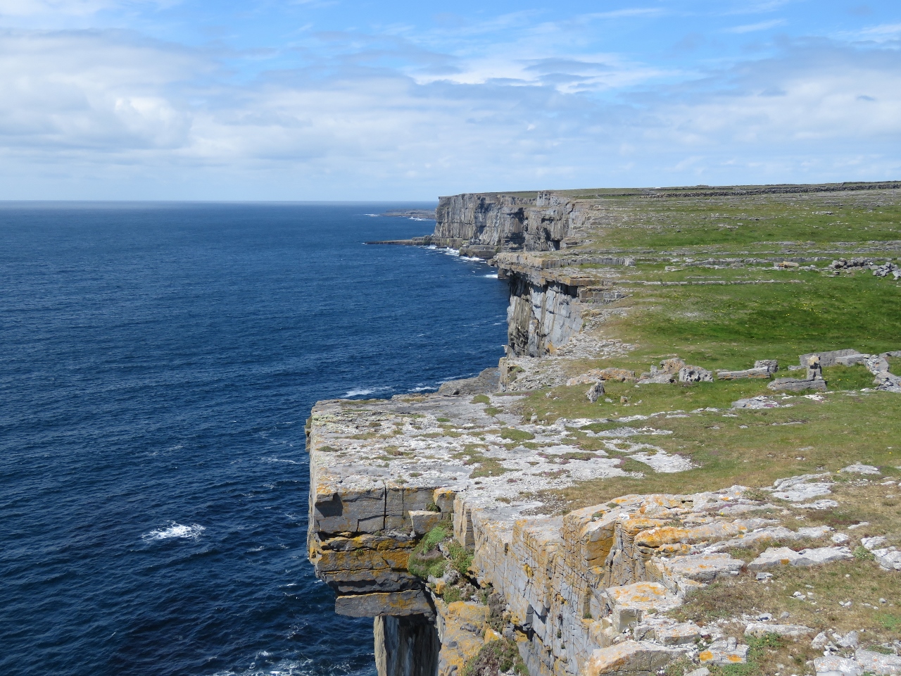 |
6/25/2017: View North
Position: 53°7.52'N, -9°46.04'W
The cliffs looking north from Dun Aonghasa.
|
 |
6/25/2017: Cliff Diving
Position: 53°7.51'N, -9°45.94'W
The Red Bull Cliff Diving Championship had finished up yesterday and, with no road to the dive site, a helicopter was ferrying gear back to the main road. RBCD Ireland 2017 shows some great footage of the top three men's and women's dives.
|
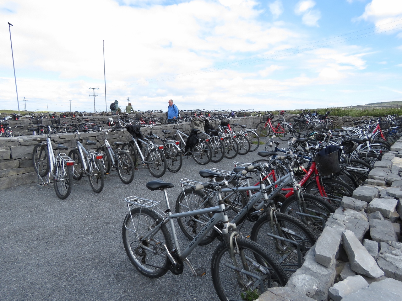 |
6/25/2017: Busy
Position: 53°7.85'N, -9°45.44'W
We'd left our bikes in the large and completely empty bicycle parking area at Dun Aonghasa and returned to find the lot almost full of bikes.
|
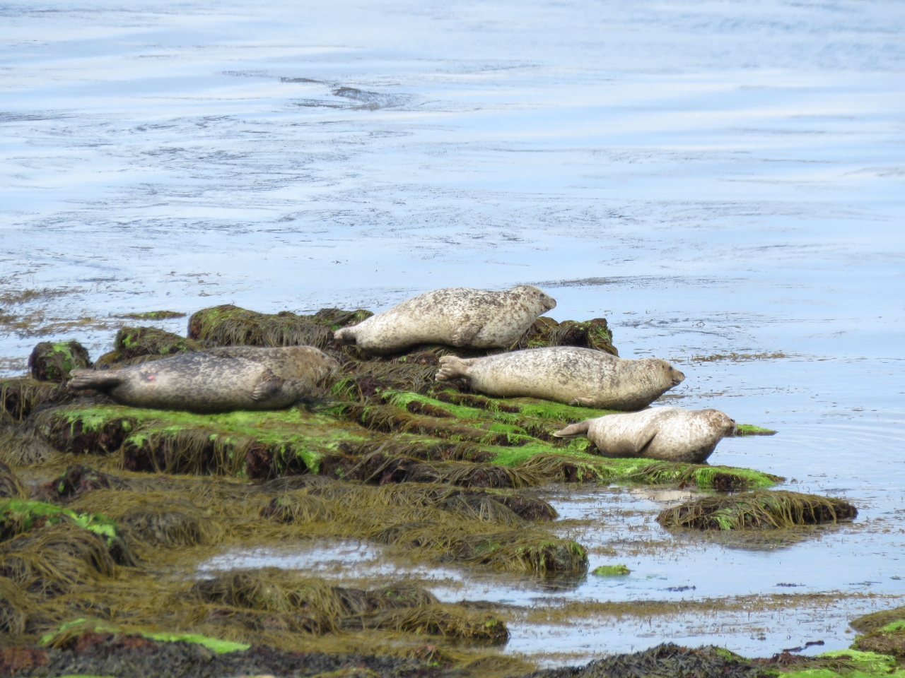 |
6/25/2017: Seals
Position: 53°8.26'N, -9°42.74'W
We returned along the north shore, where several seals were basking in the sun.
|
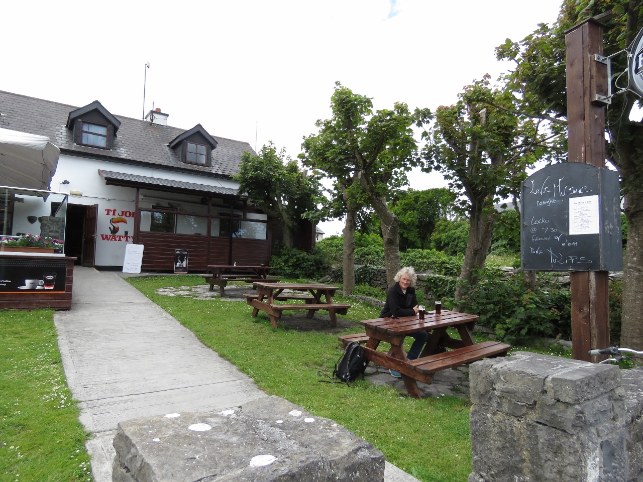 |
6/25/2017: Ti Joe Wattys
Position: 53°7.44'N, -9°40.24'W
A great meal of local crab claws at Ti Joe Wattys. Ti means "house of" in Irish.
|
 |
6/25/2017: Bicycles Hired
Position: 53°7.17'N, -9°39.94'W
Almost every bicycle in that huge lot we saw this morning had been hired out when we returned. We didn't see many cyclists on the way out to Dun Aonghasa, but saw lots on the way back.
|
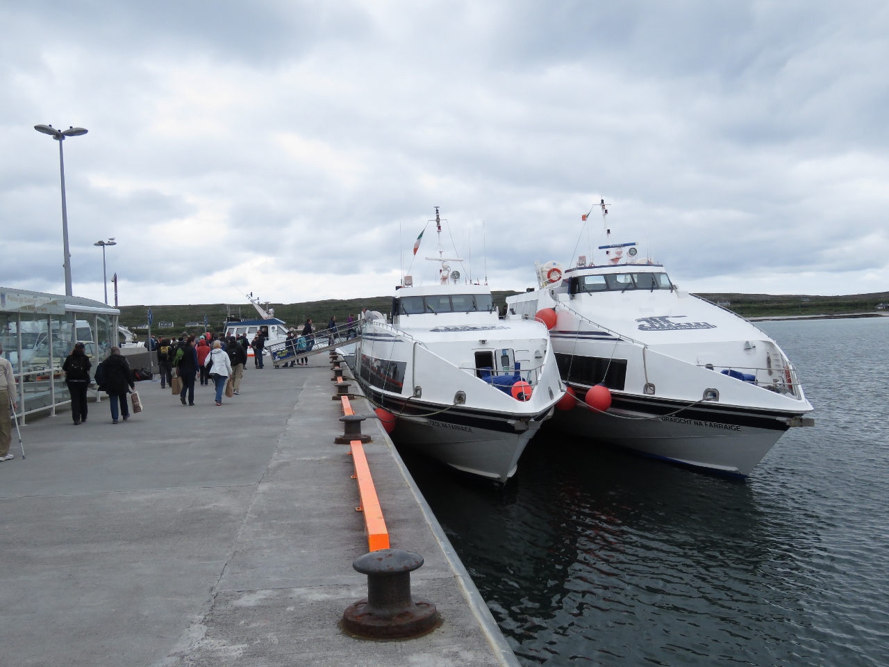 |
6/25/2017: Ferries
Position: 53°7.10'N, -9°40.00'W
The docks at Kilronan are busy with ferries coming and going between the mainland and the other islands.
|
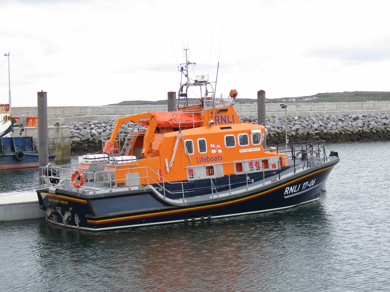 |
6/25/2017: RNLI
Position: 53°7.13'N, -9°39.84'W
Most ports we've visited in Ireland have one of these capable RNLI (Royal National Lifeboat Institution) lifeboats, and we've posted several pictures. UK residents Micheal and Frances Crofts, who own Nordhavn 40 Coracle, gave us some background on the service: "I'm glad to see pictures of our lifeboats popping up here. Your are in Lifeboat Country while coastal cruising in the the UK, the Republic of Ireland, the Channel Islands and the Isle of Man and you'll see many RNLI (Royal National Lifeboat Institution) boats of all shapes and sizes providing cover right around our coasts. All crews and support staff are volunteers except that the big boats usually have a salaried full-time mechanic. The RNLI receives no government funding whatsoever—its money comes from members (including Frances and me!) and legacies. And they don’t charge for salvage. If they tow you to safety it’s all part of the free service."
|
 |
6/25/2017: Dirona
Position: 53°6.53'N, -9°40.12'W
Dirona at anchor in Killeany Bay, viewed from the south shore.
|
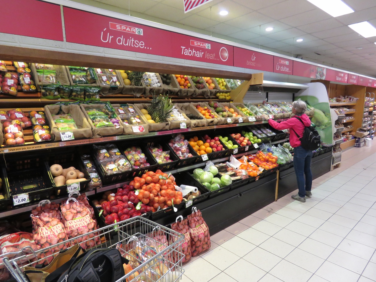 |
6/25/2017: Spar
Position: 53°7.20'N, -9°40.15'W
We stopped off to pickup some fresh fruit at the local Spar grocery store before returning back to Dirona.
|
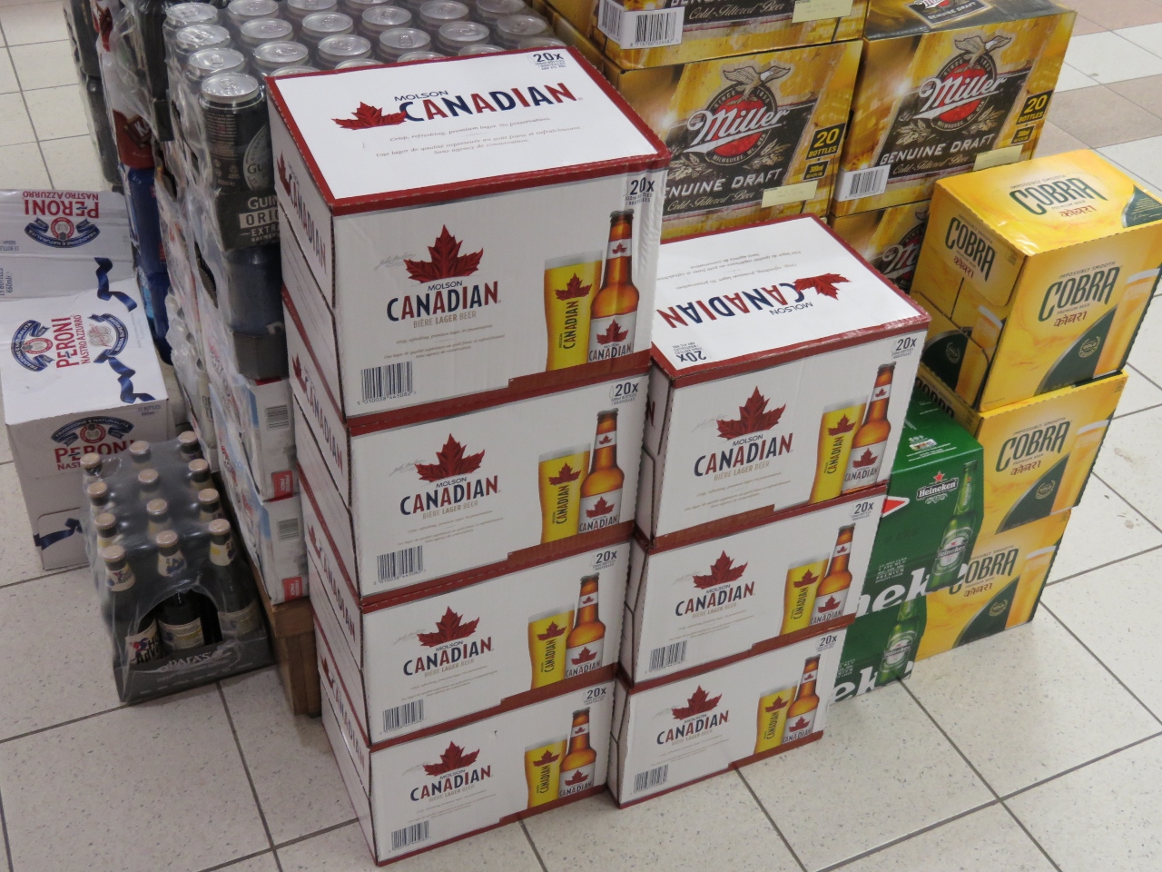 |
6/25/2017: Molson Canadian
Position: 53°7.20'N, -9°40.15'W
We were amused to see Molson Canadian beer featured in the imports section of the Kilronan grocery store.
|
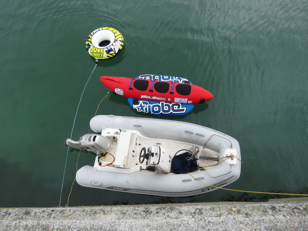 |
6/25/2017: Tender
Position: 53°7.14'N, -9°40.15'W
Our tender had a couple of friends alongside when we returned back.
|
 |
6/26/2017: Syne Head
Position: 53°22.74'N, -10°14.51'W
The twin lighthouses at Syne Head were built around 1830. As at Skellig Michael and several other locations on the coast, two lighthouse were built to distinguish them from other nearby lights, as the ability to differentiate by flash characteristics was limited. And also as at Skellig Michael, the cost of maintaining and manning two lights was high and all the secondary lights were retired between 1865 and 1903.
|
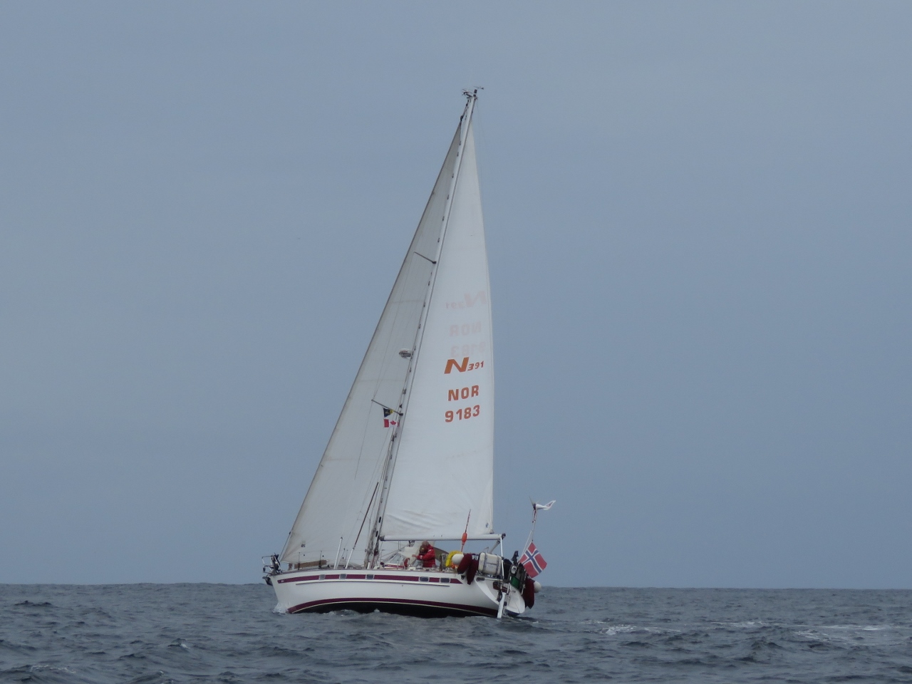 |
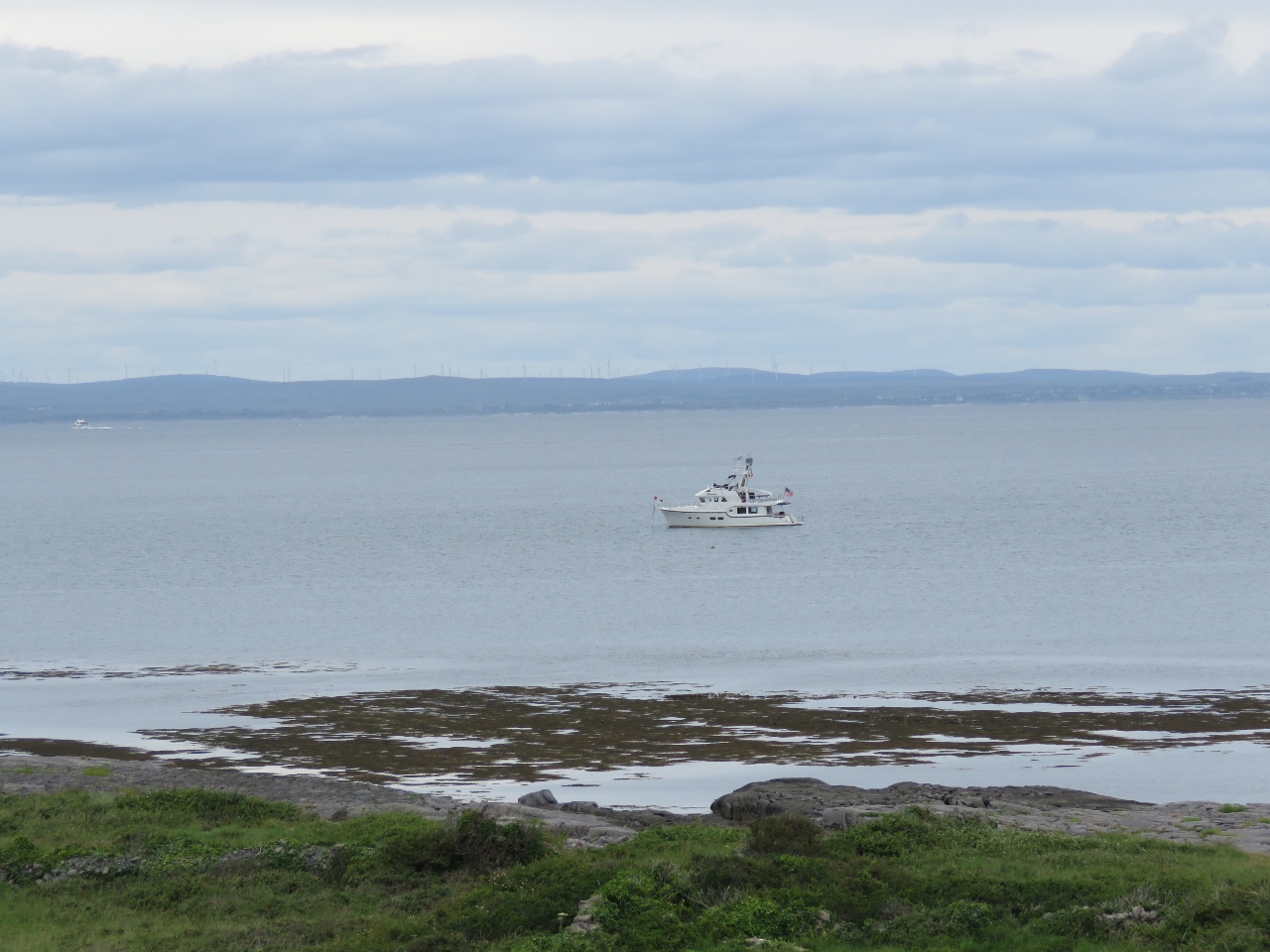
6/26/2017: Pleasure Craft
Position: 53°32.63'N, -10°16.72'W
This Norwegian-flagged sailboat is one of the few pleasure craft we'd seen underway as we've cruised the Irish west coast.
|
 |
6/26/2017: Inishbofin
Position: 53°36.40'N, -10°13.39'W
Approaching the narrow entrance to the harbor Inishbofin Island. We run very close to the starboard-side rocks where the white pillar stands.
|
 |
6/26/2017: Star Fort
Position: 53°36.70'N, -10°13.20'W
The ruins of a star fort at the anchorage on Inishbofin Island, built by Oliver Cromwell's troops in 1655. Inishbofin is a popular anchorage for those cruising the west coast of Ireland. We enjoyed the setting, but found the anchorage a little tight and exposed. The holding was poor further in, so we ended up anchoring near the exposed entrance channel. The island shore to our north was reinforced with massive wave-protection walls, indicating conditions can get quite rough here in a southerly blow.
|
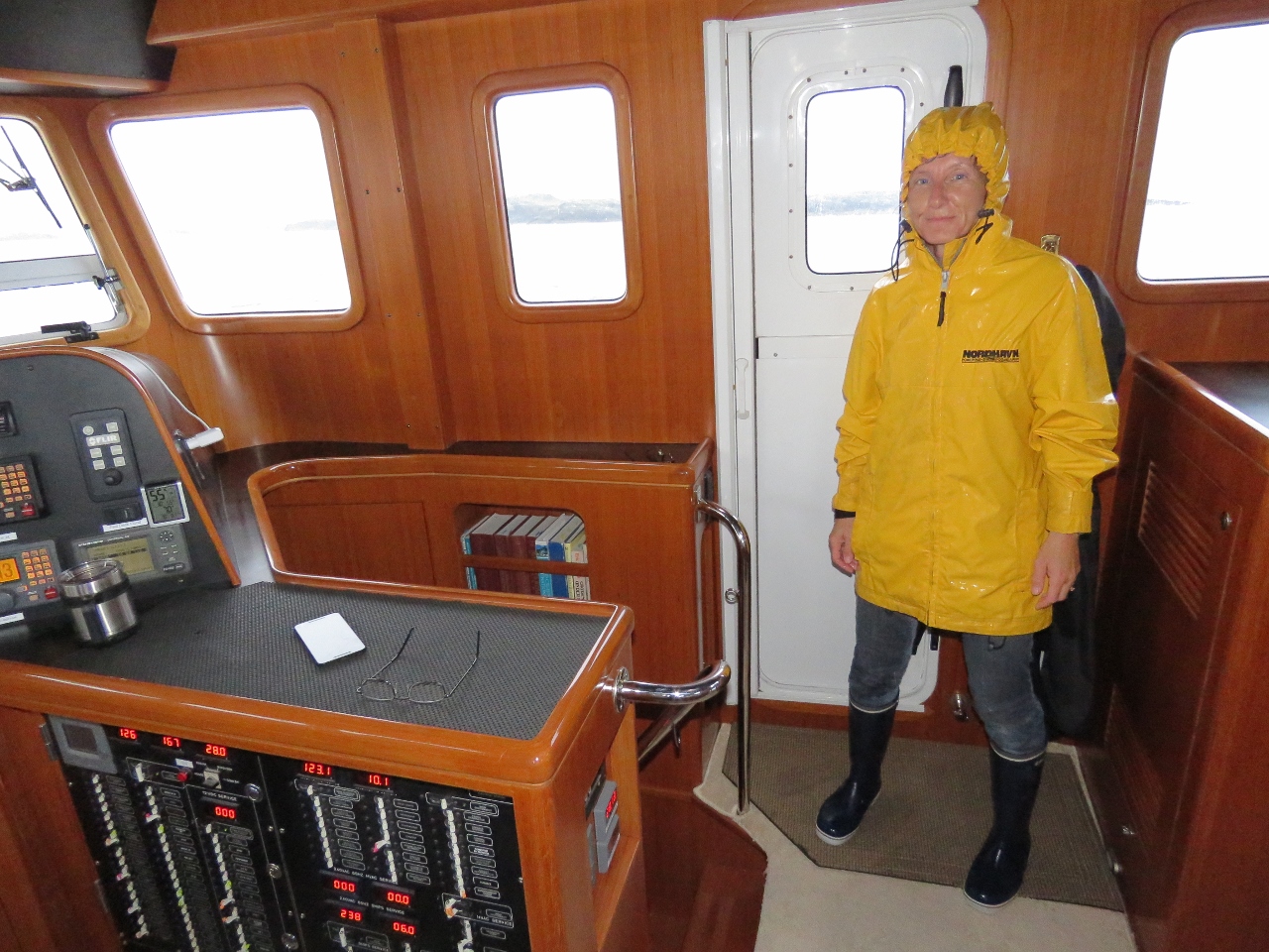 |
6/27/2017: Rain
Position: 53°36.02'N, -10°14.99'W
Rain was pouring down this morning as we left the anchorage at Inishbofin Island. Jennifer was drenched after spraying off the anchor while we raised it.
|
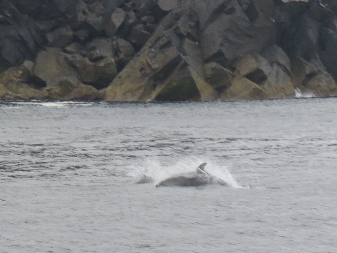 |
6/27/2017: Dolphins
Position: 53°58.77'N, -10°15.83'W
A small group of dolphins swam around us as we rounded the northwest tip of Achill Island.
|
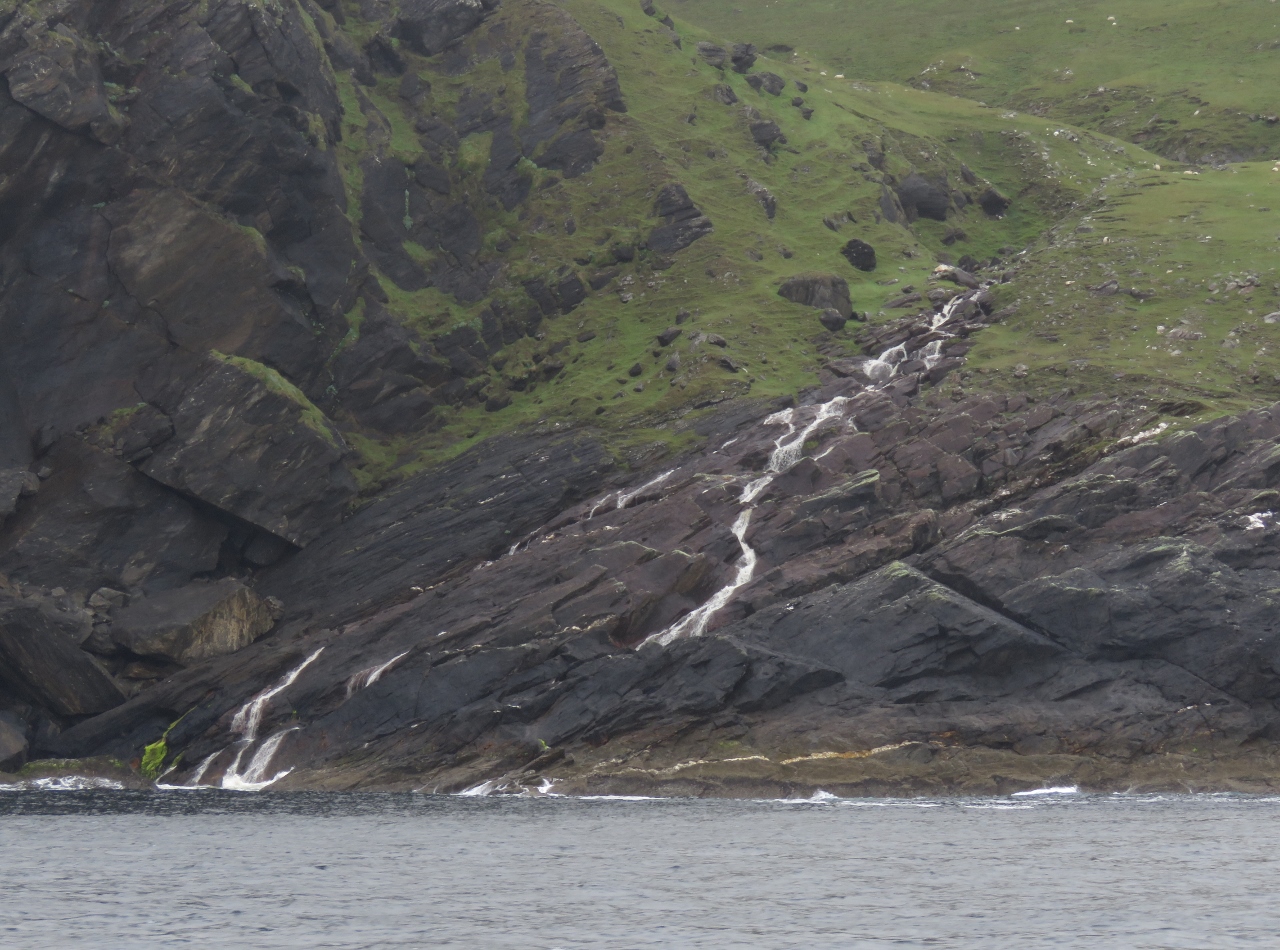 |
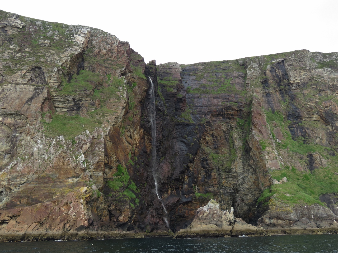
6/27/2017: Waterfall
Position: 53°59.10'N, -10°13.56'W
We'd not seen many waterfalls so far in Ireland, but north shore of Achill Island more than made up for that. With the heavy rain overnight, an endless number spilled and gushed down the cliffs.
|
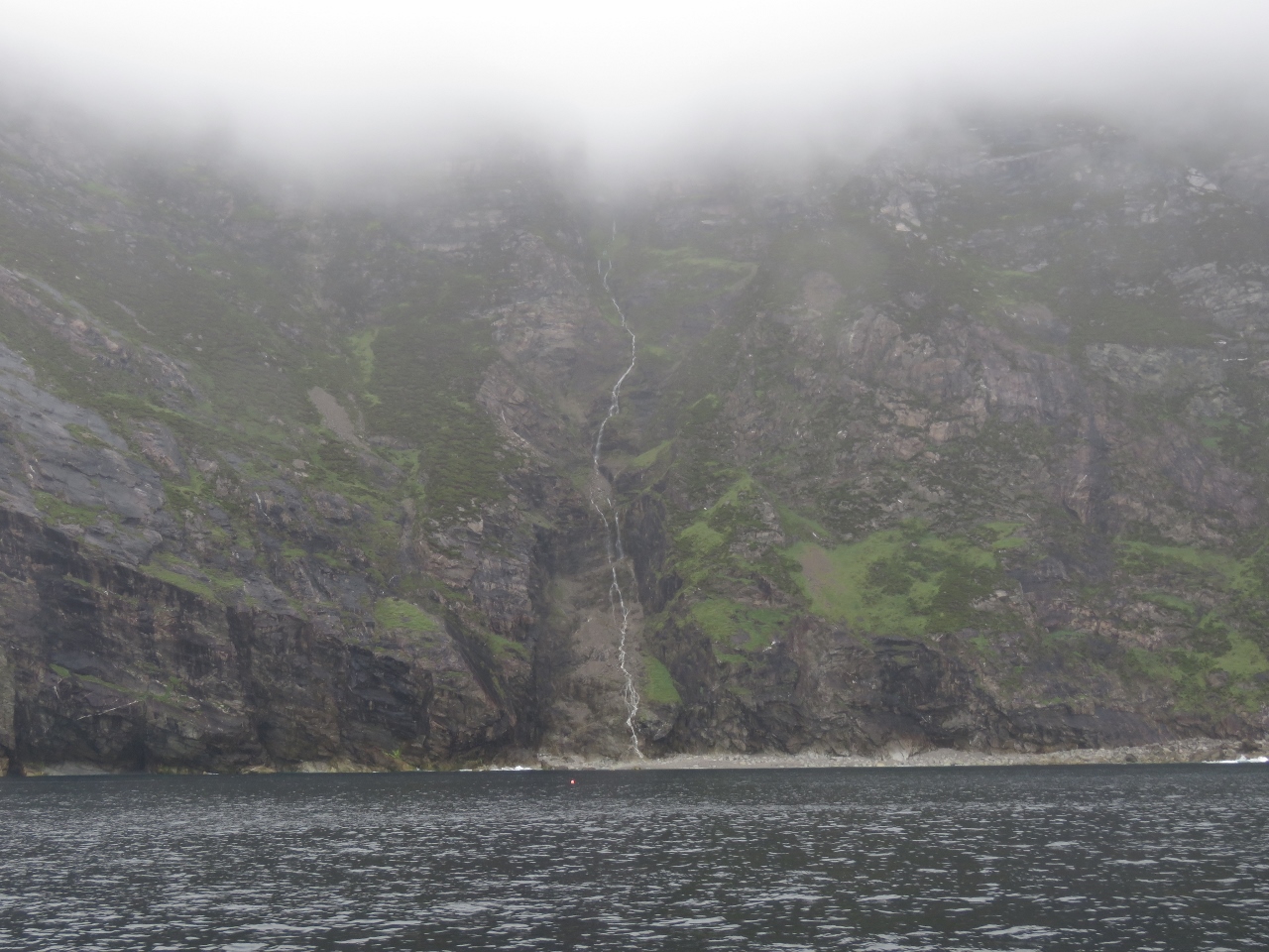 |
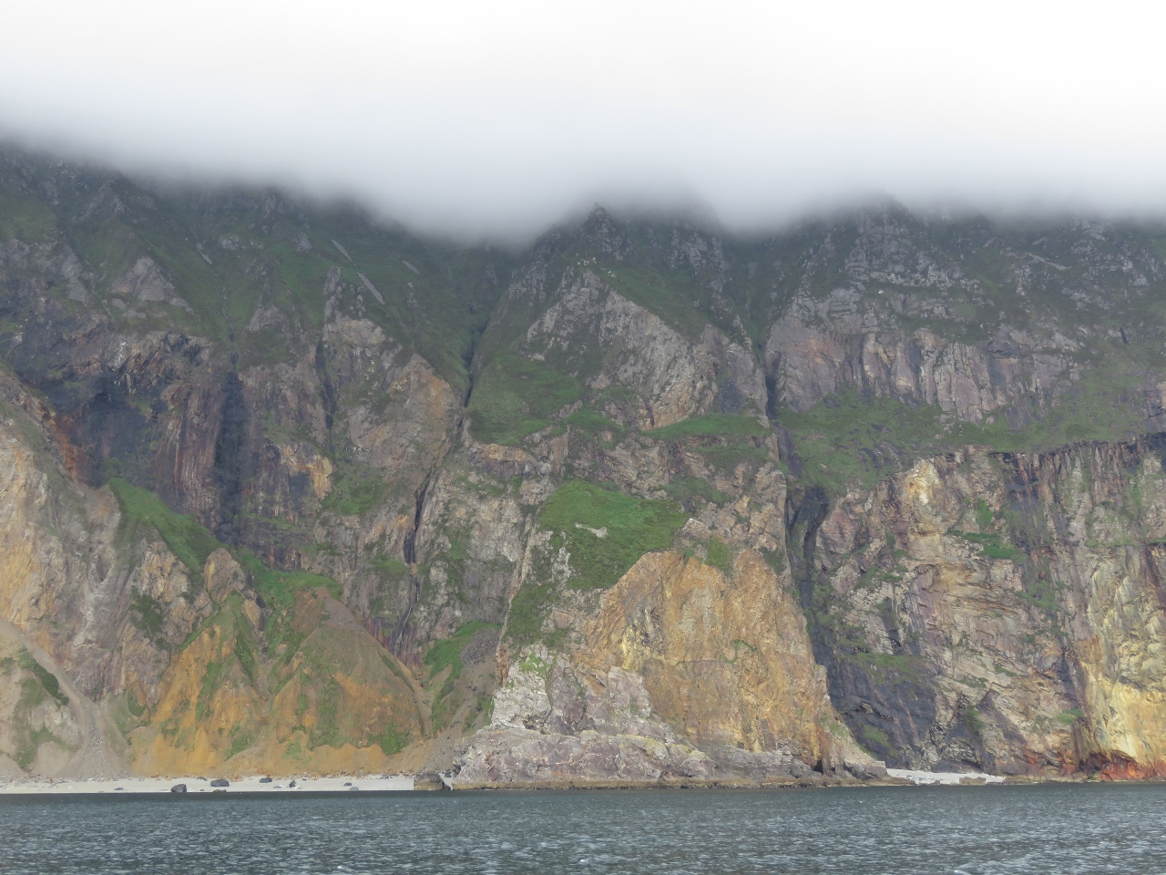
6/27/2017: Cliffs of Croaghaun
Position: 53°59.94'N, -10°11.75'W
At 2,168ft (661m), the Cliffs of Croaghaun are Ireland's highest sea cliffs. We couldn't see the tops in today's overcast conditions, but the scenery still was impressive, especially with all those waterfalls.
|
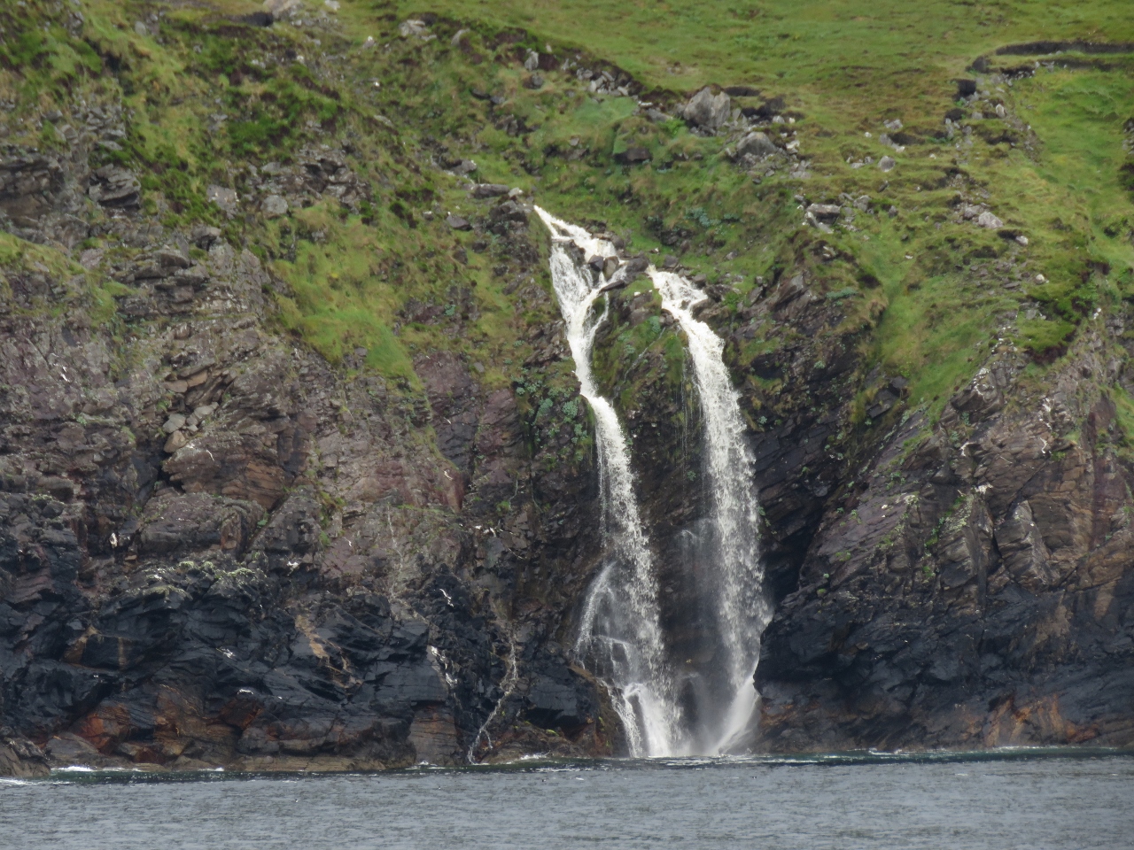 |
6/27/2017: Waterfall III
Position: 54°0.74'N, -10°9.93'W
Perhaps the best of all the waterfalls was around the corner from the cliffs, an active fall that split at the top and gushed over the cliffs.
|
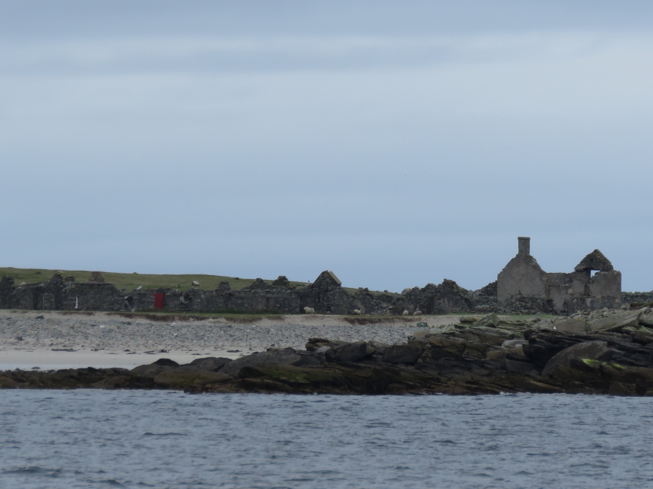 |
6/27/2017: Inishkeas
Position: 54°6.63'N, -10°11.74'W
The Inishkea Islands, although remote and exposed, have been inhabited on and off since Neolithic times and were most recently repopulated in the 18th century. The people there did relatively well during the 1845-1849 potato famine, as the blight did not spread offshore and they could make a living off the sea. But in October of 1927, ten fishermen were killed when in an intense 976 mb low pressure system suddenly swept the area. The tiny community never recovered from the loss and the the island was evacuated in the 1930s. A few summer cottages have been built on the island, but the abandoned homes and buildings dominate the scene.
|
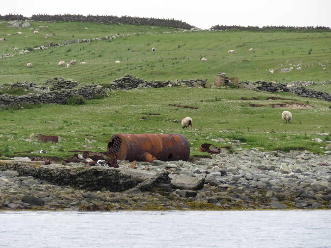 |
6/27/2017: Whaling Station
Position: 54°7.28'N, -10°11.73'W
Ruins from a short-lived, early 20th-century whale processing plant on Rusheen Island in the Inishkeas.
|
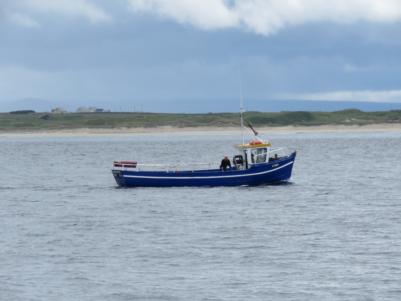 |
6/27/2017: Fishboat
Position: 54°7.57'N, -10°10.51'W
A local fishboat working off the Inishkeas.
|
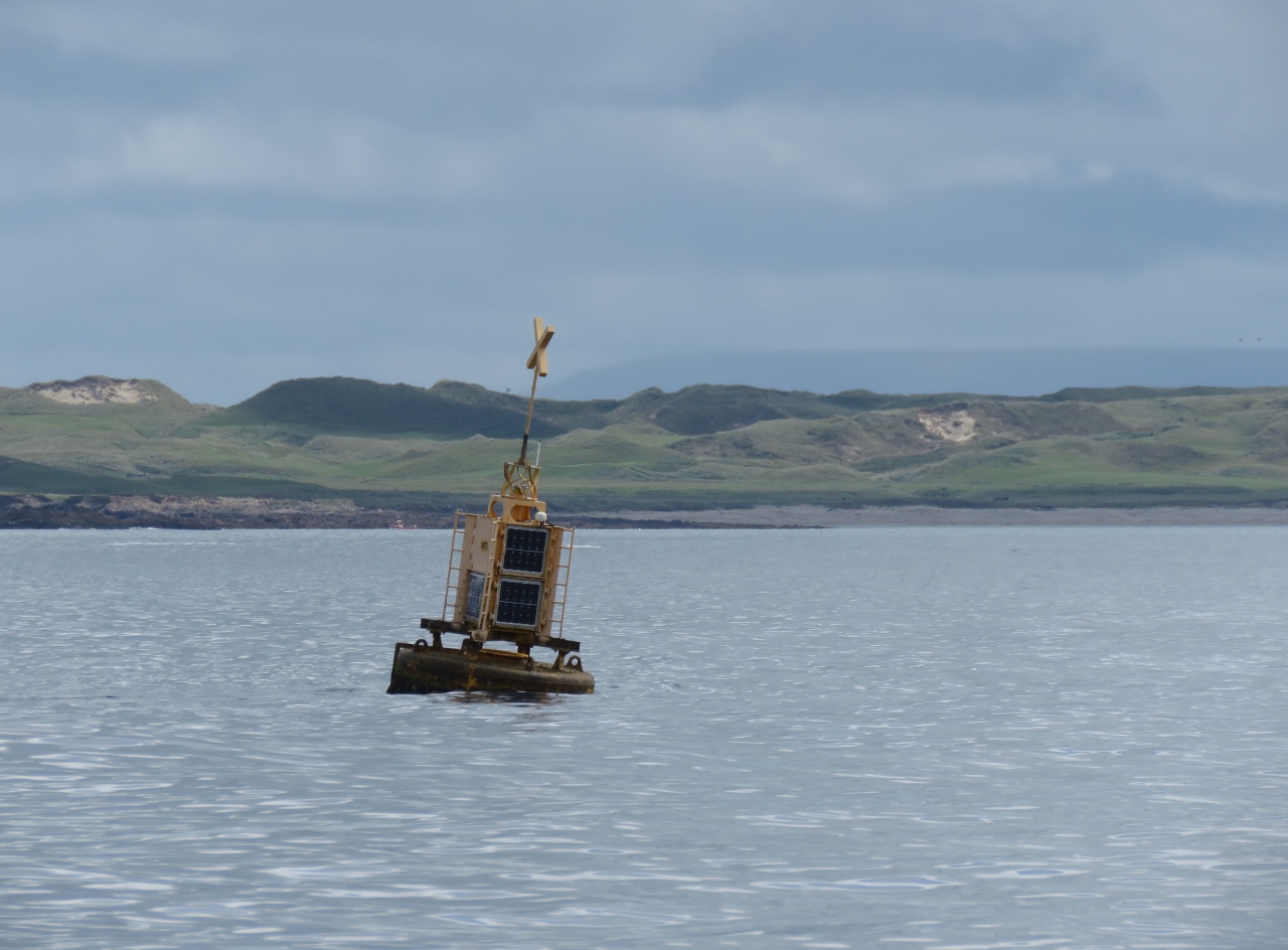 |
6/27/2017: WT1
Position: 54°13.86'N, -10°9.05'W
Some of the biggest seas around the Irish coast occur here where the edge of the Continental Shelf is barely thirty miles offshore. Wave energy testing is done in the area and we're guessing this buoy's AIS name of "WT1" stands for "Wave Test 1" or something similar.
|
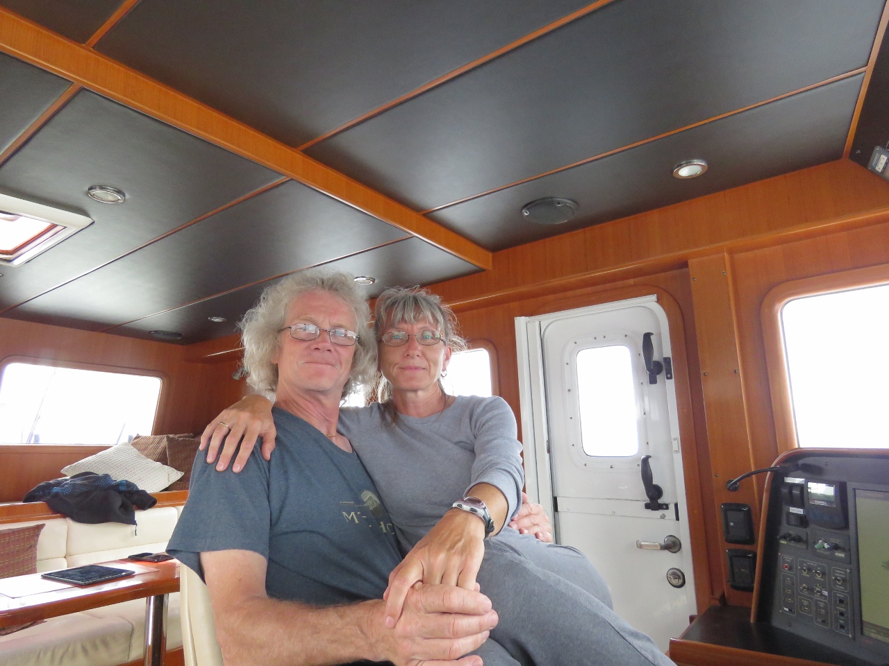 |
6/27/2017: At the Helm
Position: 54°16.28'N, -10°5.23'W
Sometimes only one helm chair is just fine.
|
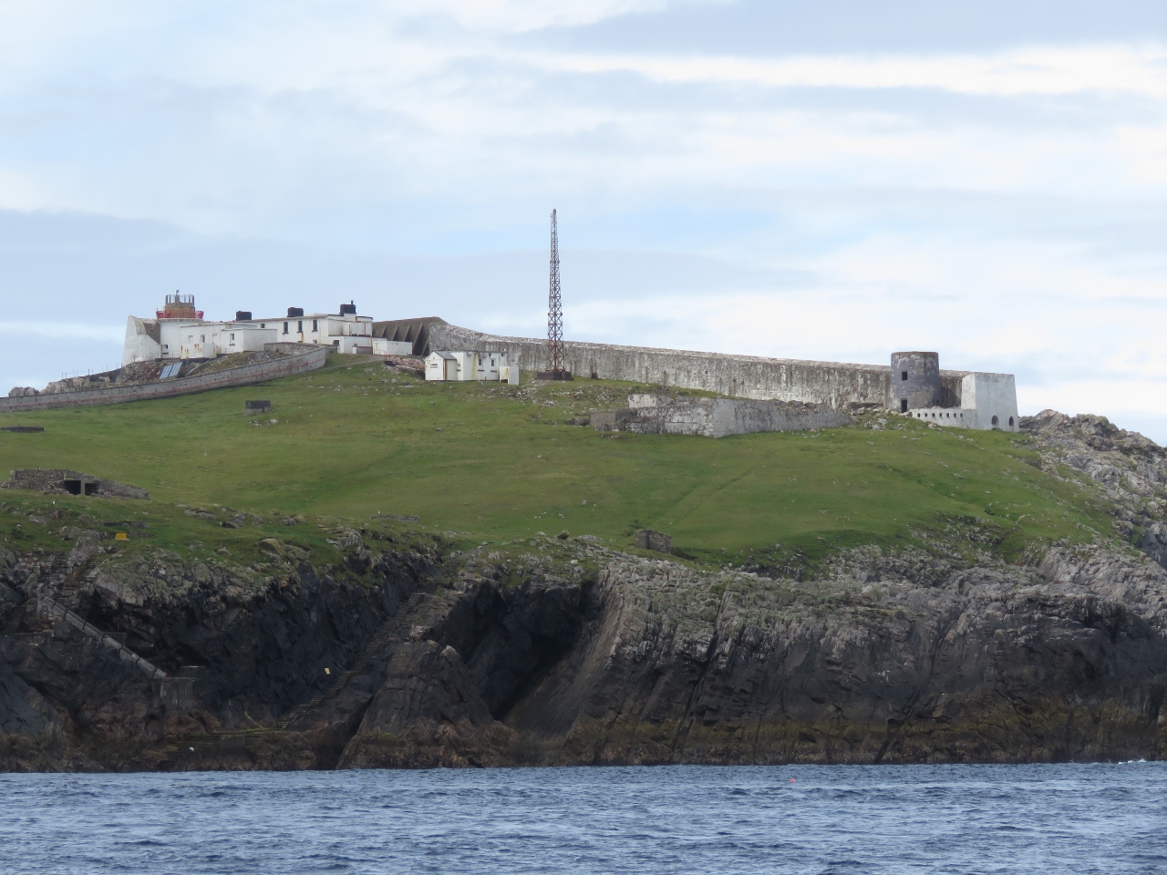 |
6/27/2017: Eagle Island
Position: 54°16.88'N, -10°4.68'W
The light station on Eagle Island looks more like a fortress with that big wall to seaward and the light barely peeking above it. The walls are needed to protect the station from Ireland's biggest seas. The west tower is 200ft (60m) above sea level, but a wave nearly destroyed it during construction in the 1830s. Severe weather also damaged the station in 1850, 1861, 1894, 1936, 1987 and 1988. The east tower took on so much seawater in the 1861 storm that the keepers had to drill holes in the door to drain the water and relieve the pressure in order to gain access.
|
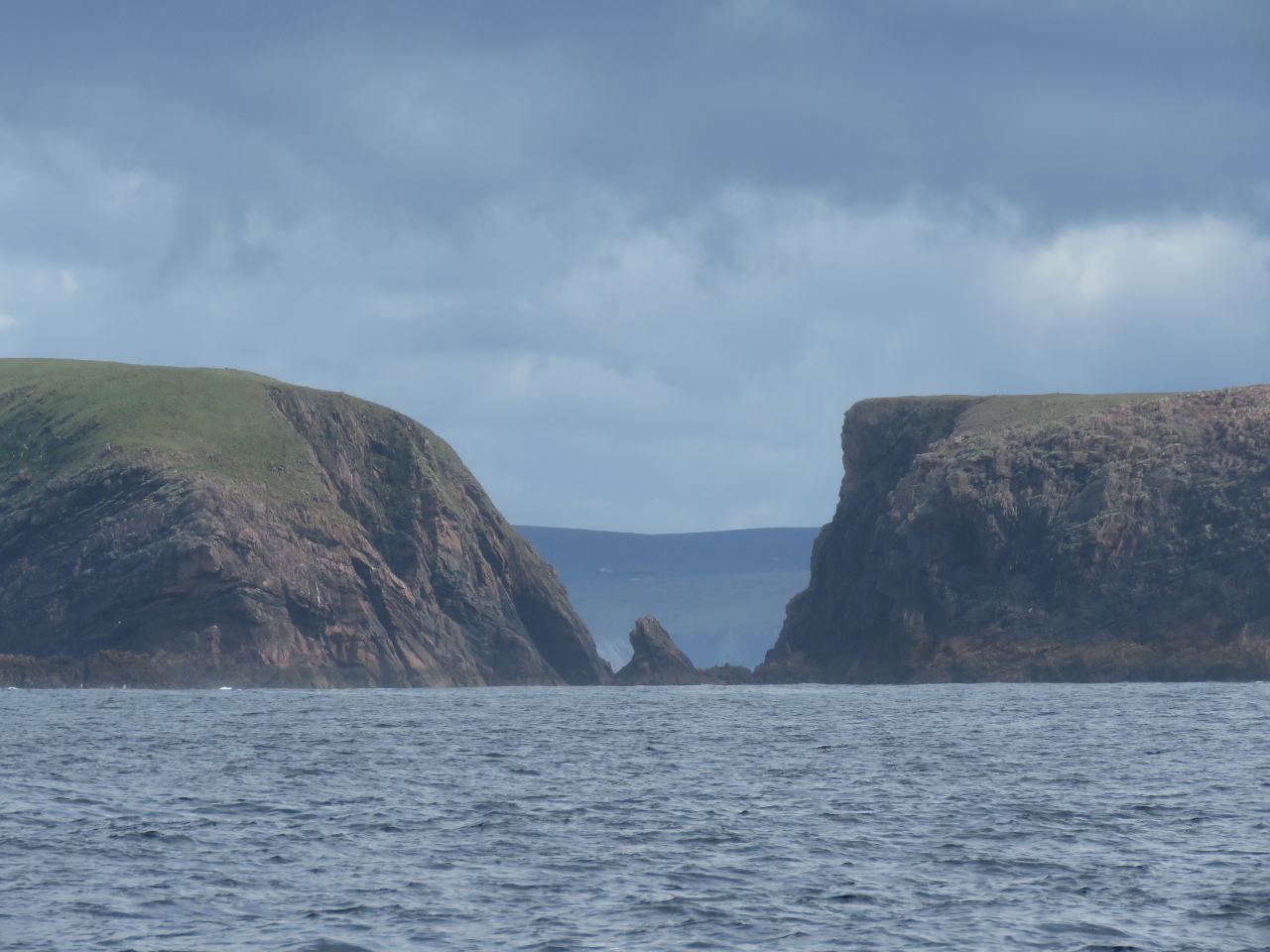 |
6/27/2017: Erris Head
Position: 54°18.25'N, -10°1.83'W
Dramatic seascape looking through the gap between Illandavuck Island (left) and the mainland at Erris Head.
|
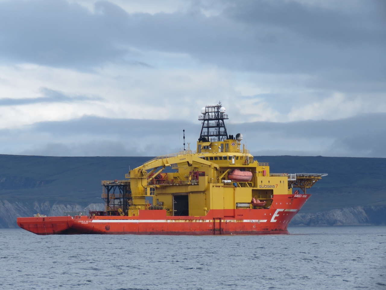 |
6/27/2017: Subsea Viking
Position: 54°17.99'N, -9°56.43'W
The Corrib gas field lies about 30 miles offshore and our charts show many pipelines running from there to the mainland through Broad Haven Bay. So we weren't surprised to see a large offshore supply vessel, the Subsea Viking, in the bay. The ship was holding station and we guessed it was laying pipe, something that has been a major controversy for the area.
|
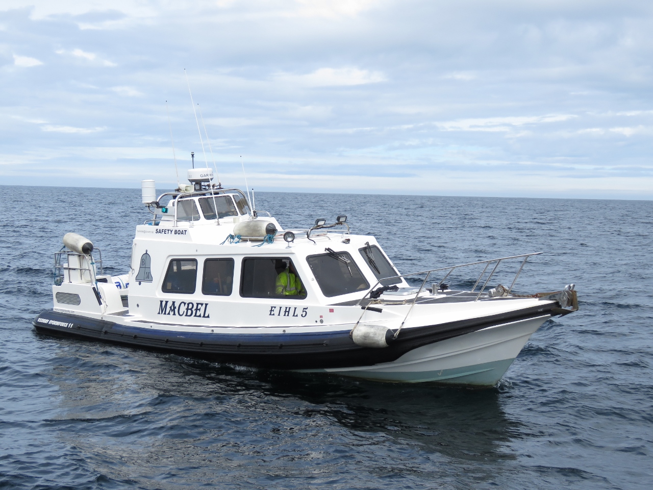 |
6/27/2017: Safety Boat
Position: 54°17.96'N, -9°56.35'W
As we continued across Broad Haven Bay to our intended anchorage off Ballyglass, a small boat ran directly toward us at high speed. We felt there was risk of collision so we sounded the standard danger signal of five blasts on the horn. The vessel pulled in beside us and ironically was labelled "Safety Boat". It turns out that the Subsea Viking was doing hydrographic survey work and they requested 500m of clearance. That message would have been better delivered by radio.
|
 |
6/27/2017: Kid Island
Position: 54°17.20'N, -9°55.76'W
Looking north from Broad Haven Bay through the gap between Kid Island (left) and the mainland, with the Stags of Broad Haven visible in the distance through the gap. We can't wait to check them out tomorrow.
|
 |
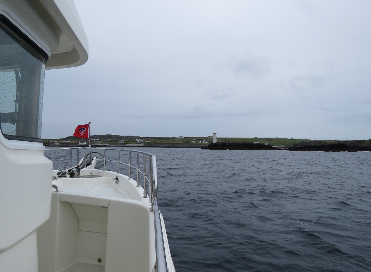
6/27/2017: Broad Haven Light
Position: 54°16.19'N, -9°53.13'W
The Broad Haven light station on Gubacashel Point.
|
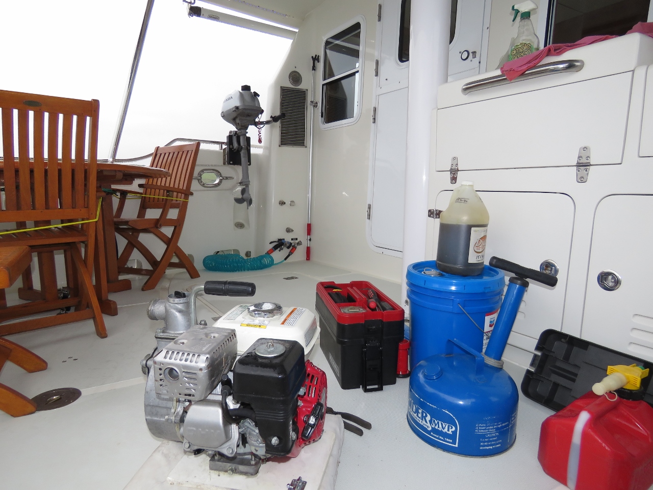 |
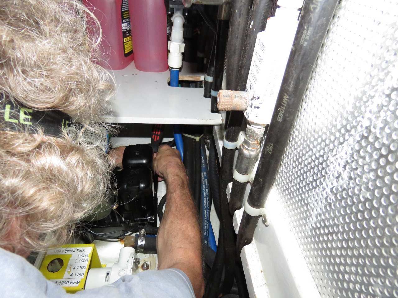
6/27/2017: Annual Maintenance
Position: 54°15.54'N, -9°53.35'W
Time for the annual maintenance on all our auxiliary gas engines, which all happen to be Hondas. James replaced the fuel in the crash pump and the 2.1HP Honda, oiled and tested the crash pump, and on the 40HP Honda changed the oil and fuel filters and greased the tender steering and outboard.
|
 |
6/27/2017: Clear Sky
Position: 54°15.51'N, -9°53.35'W
The view north from our anchorage off Ballyglass. We quite enjoyed the spot, particularly as the day continued to clear.
|
 |
6/27/2017: RNLI
Position: 54°15.51'N, -9°53.35'W
The Ballyglass RNLI (Royal National Lifeboat Institution) boat moored to our south.
|
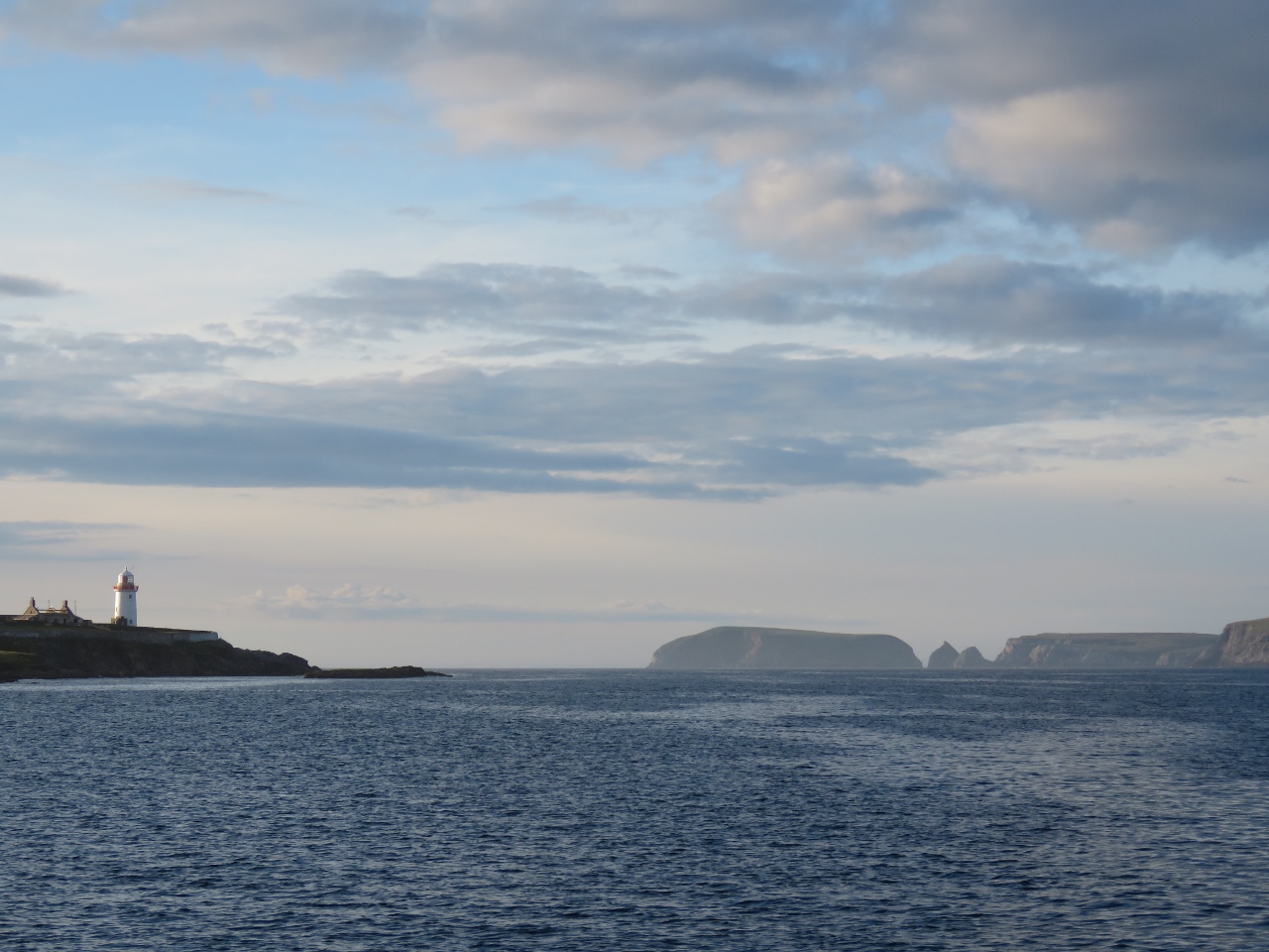 |
6/27/2017: View North
Position: 54°15.51'N, -9°53.35'W
Looking north from the anchorage past the light at Gubacashel Point and across Broad Haven Bay.
|
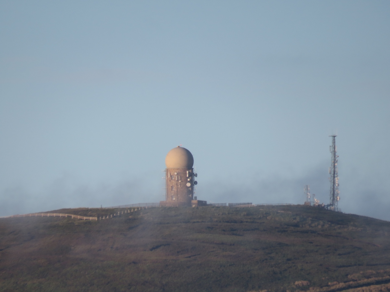 |
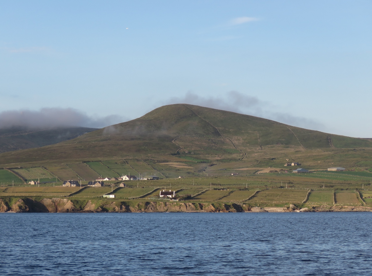
6/27/2017: Radar Station
Position: 54°15.51'N, -9°53.35'W
The skies eventually cleared completely of clouds to reveal this Irish Aviation Authority radar station on Caubeen Mountain. The station was hidden in the clouds earlier.
|
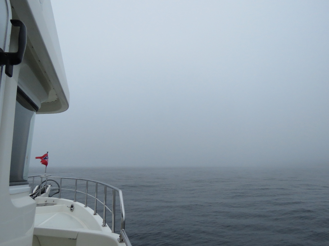 |
6/28/2017: Fog
Position: 54°19.54'N, -9°52.90'W
We'd been looking forward taking in the cliffs and dramatic seascape along the coast east of Broad Haven Bay, but were disappointed to wake up to a fog so thick we could barely see the bow of the boat. The weather changes here quickly, so we decided to stick with our original plan and follow the north Mayo coast before running northeast across Donegal Bay to Teelin.
|
 |
6/28/2017: The Stags
Position: 54°21.87'N, -9°47.85'W
The weather hadn't improved at all when we reached the Stags of Broadhaven. The tops were hidden in the mist, but we could at least make out the tunnel that runs clear through one of the islets.
|
 |
6/28/2017: Belderg Harbour
Position: 54°19.60'N, -9°31.88'W
Visibility was improving as we neared Belderg Harbour and we were starting to see why our cruising guide recommended touring this coastline.
|
 |
6/28/2017: Conaghra Point
Position: 54°19.47'N, -9°28.91'W
Sea arch just east of Conaghra Point
|
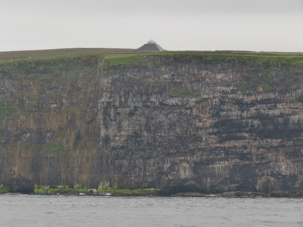 |
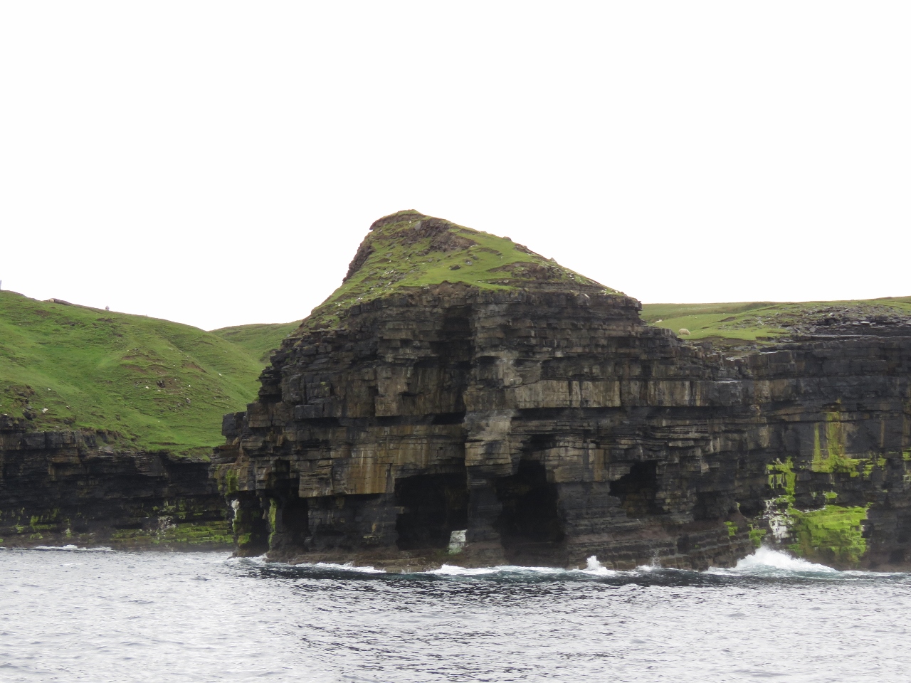
6/28/2017: Ceide Fields
Position: 54°19.08'N, -9°27.28'W
Covering several square miles, the Ceide Fields are the largest Stone Age site and the oldest known collection of agricultural fields in the world. The pyramid-shaped building atop the cliff is the Ceide Fields visitor center.
|
 |
6/28/2017: Arches
Position: 54°18.75'N, -9°27.01'W
Just east of the Ceide Fields, this headland is punctuated with sea arches and caves.
|
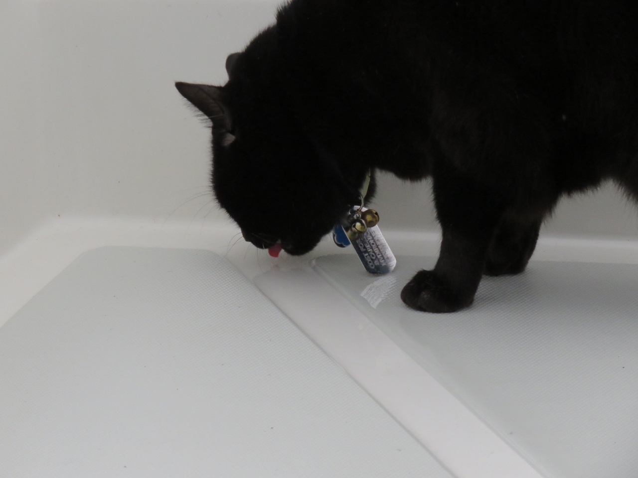 |
6/28/2017: Spring Water
Position: 54°18.79'N, -9°26.73'W
Spitfire loves fresh "spring" water and is always out lapping it up on deck after a rainfall. Often he doesn't wait for the rain to stop and gets soaked, but doesn't seem to mind.
|
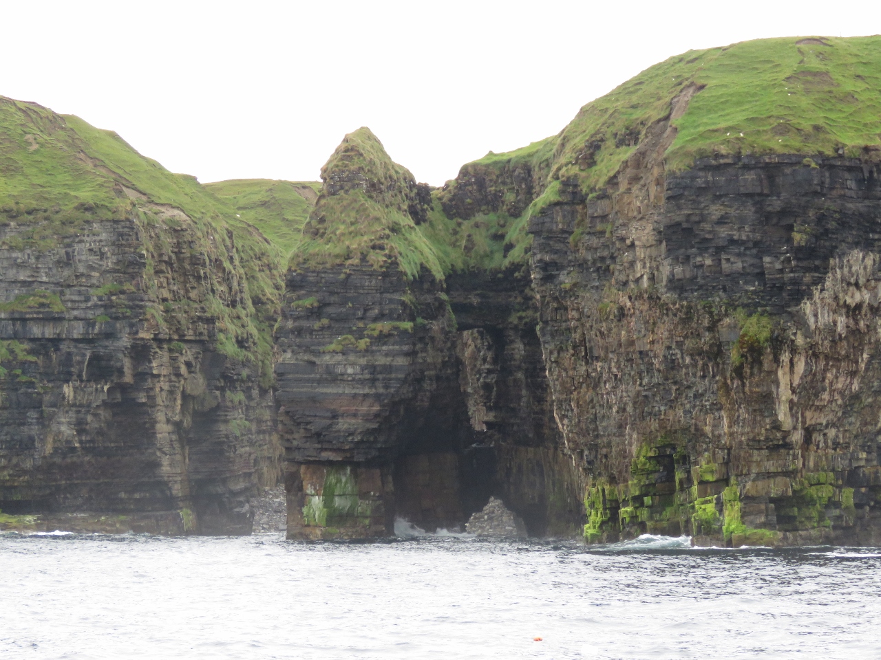 |
6/28/2017: Spire and Arch
Position: 54°18.79'N, -9°26.62'W
The coast east of Ceide Fields is especially dramatic. To the right of this spire is a hole clear through the cliff with a sea arch below.
|
 |
6/28/2017: Tunnel
Position: 54°18.74'N, -9°26.45'W
This headland is so riddled with arches and tunnels that we could see clear through to the other side.
|
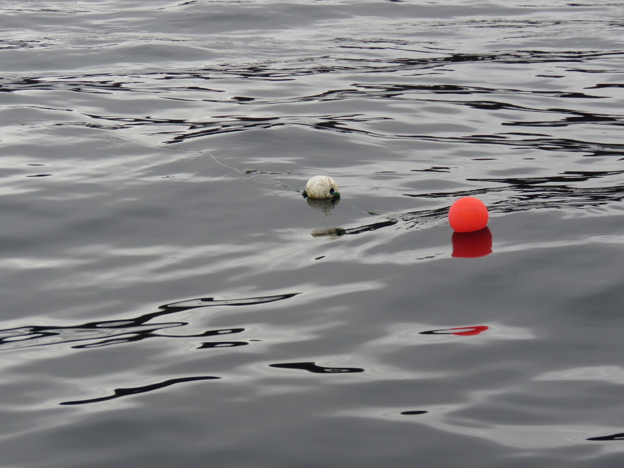 |
6/28/2017: Floating Line
Position: 54°18.87'N, -9°25.88'W
We give fishing floats a wide berth. Partly we don't want to damage fishing gear and partly we don't want them to get tangled in our stabilizers or props and potentially disable the boat. This particular fisherman is using floating line and has put down 50-100ft more line than needed for the depth (the line barely is visible streaming off to the left of the buoy). The combination of excess line, it floating, and strong current allowed us to catch one.
We first heard a thumping noise and stopped the boat. We then tried hard astern to back out of whatever we had caught. Up popped a few bits of line and a buoy. It appears the Spur Cutters actually do work. In our previous boat we would have had to use SCUBA gear to clear the snagged line. Here the problem was dealt with in minutes with no vibration or fouled gear. We really hate to see the line cut, but long runs of floating line trailing out in the current can be incredibly difficult to see. |
 |
6/28/2017: Downpatrick Head
Position: 54°19.44'N, -9°21.35'W
The dramatic Doonbristy sea stack off Downpatrick Head. What an incredibly beautiful coastline.
|
 |
6/28/2017: Leahan Mountain
Position: 54°39.11'N, -8°45.68'W
From Downpatrick Head, we crossed Donegal Bay towards Teelin. 1,400ft (427m) Leahan Mountain rises nearly straight up from the sea on the north side of Donegal Bay.
|
 |
6/28/2017: Cliffs
Position: 54°39.03'N, -8°45.00'W
Looking east along the shoreline from Leahan Mountain. The cliffs of Slieve League are barely visible, disappearing into the clouds, in the distance.
|
 |
6/28/2017: Waterfall
Position: 54°38.90'N, -8°44.17'W
The Irish west coast seems to have an endless variety of incredible scenery.
|
 |
6/28/2017: Slieve League
Position: 54°38.27'N, -8°42.40'W
Many people feel the Slieve League cliffs are more spectacular than the better-known Cliffs of Moher. They certainly are higher at 1,952ft (595m) compared to the 656ft (200m) Cliffs of Moher. The Slieve League cliffs definitely are an impressive sight, even if we couldn't see the tops for the clouds.
|
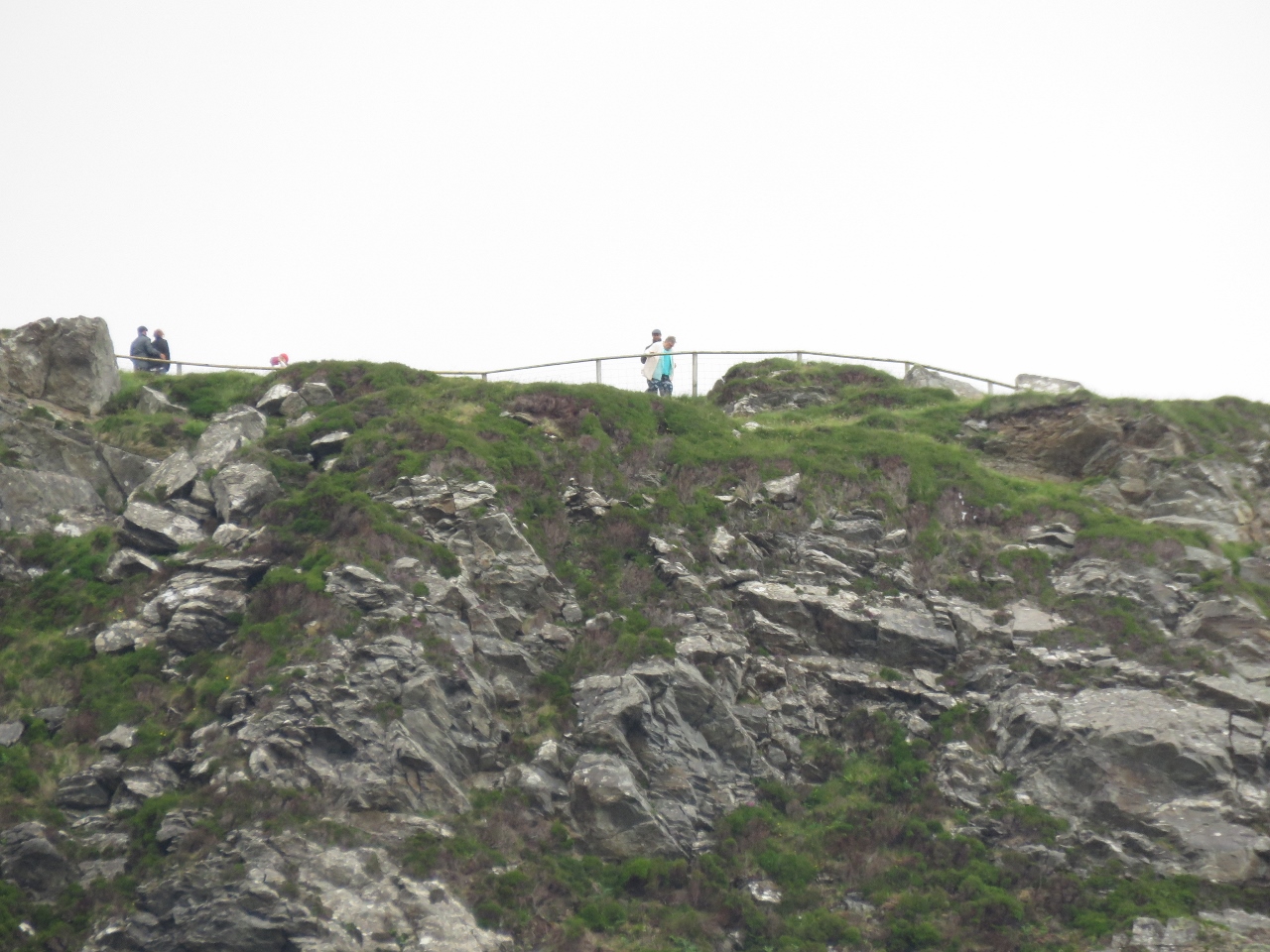 |
6/28/2017: Viewpoint
Position: 54°37.93'N, -8°41.43'W
Despite the poor weather, the Slieve League viewpoint had a lot of visitors.
|
 |
6/28/2017: Carigan Head
Position: 54°37.21'N, -8°41.30'W
Fishboat working below the Napoleanic signal tower on Carigan Head.
|
 |
6/28/2017: Bilge Pump
Position: 54°37.56'N, -8°37.89'W
On our North Atlantic crossing, we ran into an issue where the main bilge pump was pumping water but it was falling behind. We opened the pump up and found the rivet that hold the pump output valve together had failed due to corrosion. The pump was pumping fine but the output was less than it should have been.
Once we changed the valve, the pump was again keeping up with the problem. It's a bit of a fragile design in that these valves can fail any time. This afternoon, after anchoring for the night at Teelin Habour, James cleaned the engine room and again noticed pump output is poor. It was exactly the same problem as before where the pump was pumping fine but just seemed "slow". |
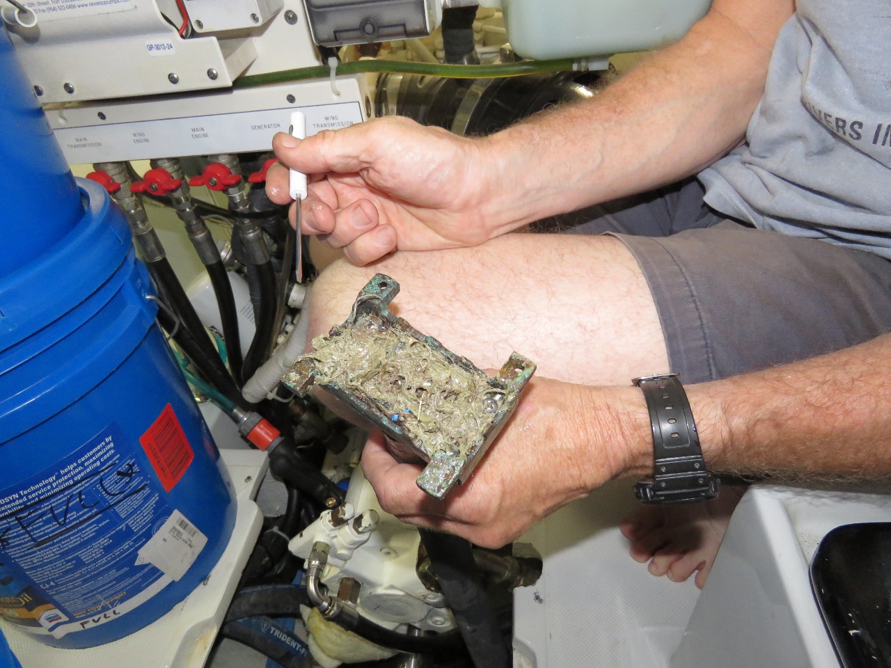 |
6/28/2017: Clogged
Position: 54°37.56'N, -8°37.89'W
James took the pump apart expecting to see another valve problem but it was fine. The strainer was clear and unplugged so we ended up thinking we might have been wrong about the pump output being lower than normal. It turns out that, in addition to the strainer higher up in the hose system, there is a course strainer at bottom of the bilge and it had become partially plugged with debris.
We suspect that while we were taking on so much water (Alarms at 1:15am), build debris, hair, etc. was washed down into the bilge. This is yet another way for this pump to end up producing far less volume. There just seem to be far to many ways for that pump to not be there when we need it. We plan to supplement it with a more reliable and far higher volume pump as soon as possible. |
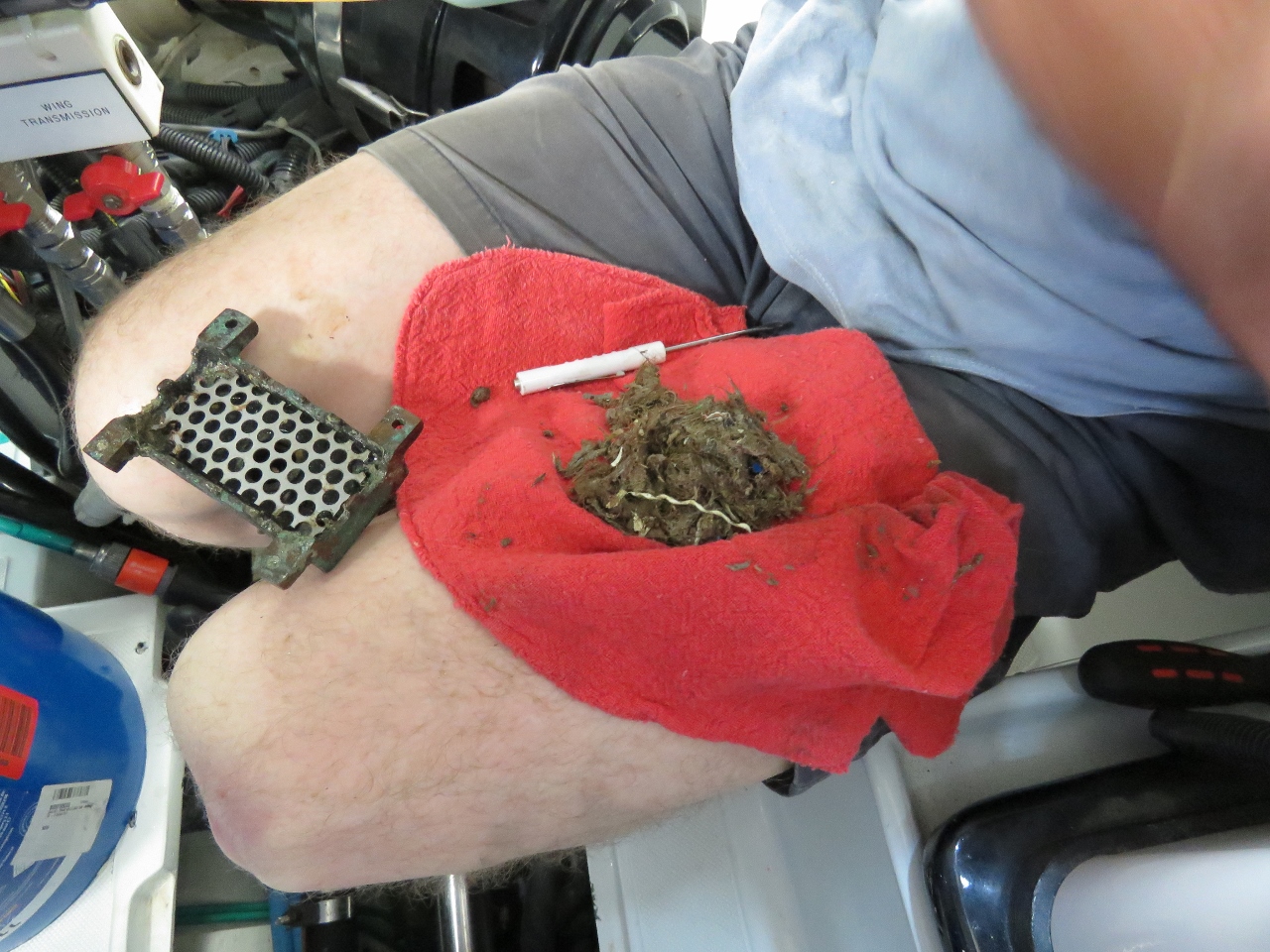 |
6/28/2017: Debris
Position: 54°37.56'N, -8°37.89'W
It turns out if you fill the bilge area of an eight-year-old boat with water and it gets viguoursly sloshed around by the storm, you can catch quite a bit of debris in what we thought was a pretty clean boat. We will move to a bilge pump system that can pump water and debris in far higher quantities and is much more reliable.
|
 |
6/28/2017: Fishery Patrol
Position: 54°37.56'N, -8°37.89'W
A capable-looking Fishery Patrol boat at Teelin Harbour.
|
 |
6/28/2017: Ominous Cloud
Position: 54°37.56'N, -8°37.88'W
We'll stay in Teelin Harbour for a few days while a system passes through. This rather ominous-looking cloud might be the start of that system.
|
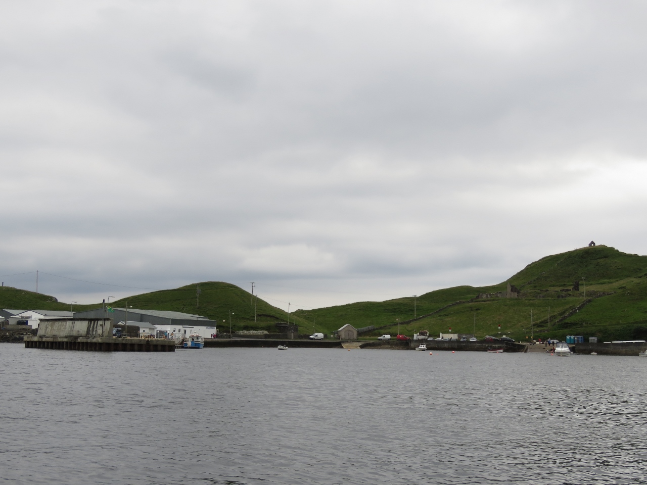 |
6/28/2017: Teelin
Position: 54°37.56'N, -8°37.89'W
Looking south to the docks in Teelin Harbour. Note the high wall protecting the docks from southerly weather—the harbour is exposed in that direction. We are expecting strong northerly winds over the next few days, so should have good shelter here.
|
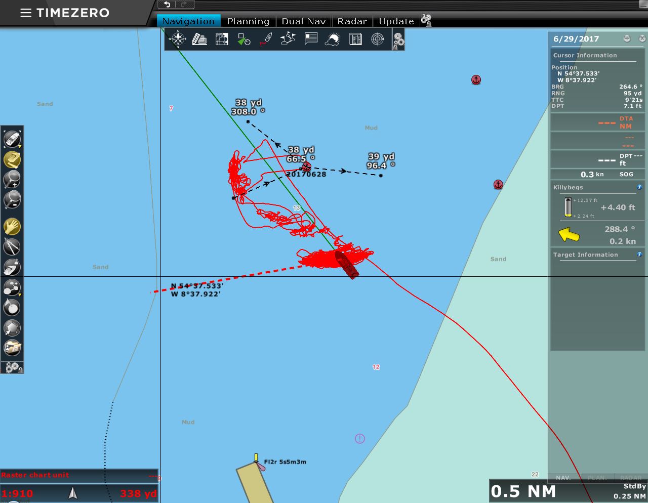 |
6/29/2017: Boat Position
Position: 54°37.54'N, -8°37.85'W
You can see from the chartplotter screen shot that when we initially anchored, the boat mostly was sitting west of and not far from where we dropped the hook. As the winds came up from the north, we were pushed directly south of the anchor and much further from it.
|
 |
6/30/2017: Wind
Position: 54°37.54'N, -8°37.83'W
About 36 hours ago, the morning after we arrived in Teelin, the winds picked up from the north as expected. Since then we've been seeing steady 20-knot northerly winds with gusts into the 40s.
|
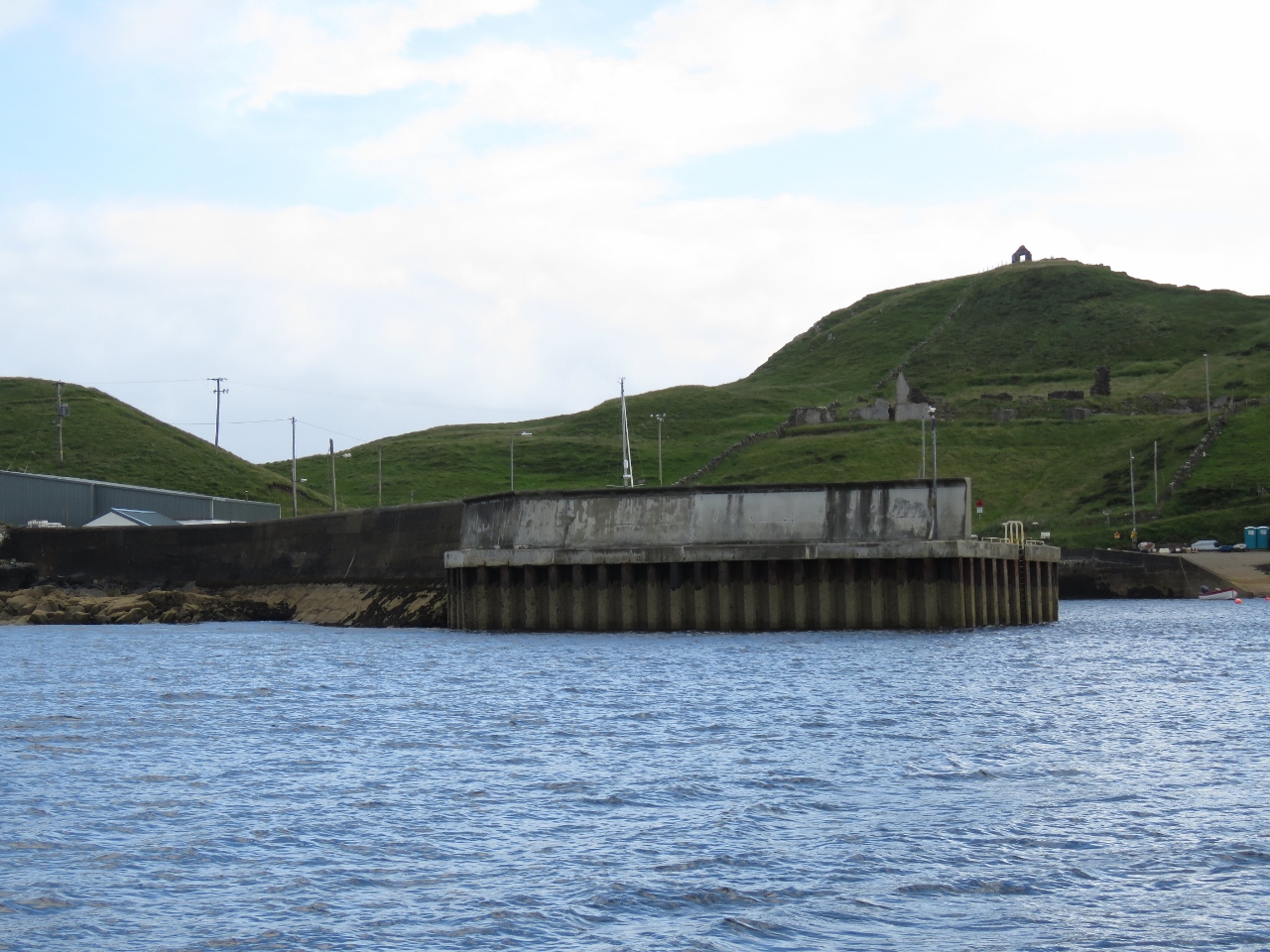 |
7/1/2017: Wall
Position: 54°37.55'N, -8°37.82'W
With the winds pushing us south, we're getting a better view to that wall protecting the dock at Teelin Harbour. Needing a wall that big means conditions must get pretty nasty here in a southerly blow.
|
 |
7/1/2017: Lunch
Position: 54°37.55'N, -8°37.81'W
The winds are still up, but with little fetch conditions are reasonably calm in our anchorage and the cockpit is sheltered enough to have lunch on deck.
|