MV Dirona travel digest for Southwest Coast Ireland 2017

|
Click the travel log icon on the left to see these locations on a map,
with the complete log of our cruise. On the map page, clicking on a camera or text icon will display a picture and/or log entry for that location, and clicking on the smaller icons along the route will display latitude, longitude and other navigation data for that location. And a live map of our current route and most recent log entries always is available at //mvdirona.com/maps/LocationCurrent.html. |
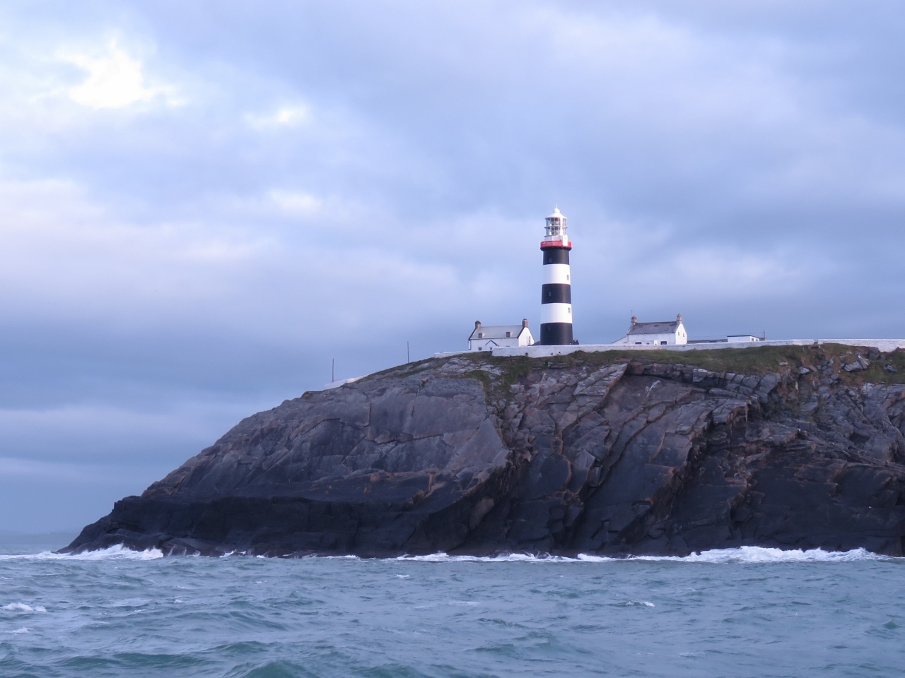 |
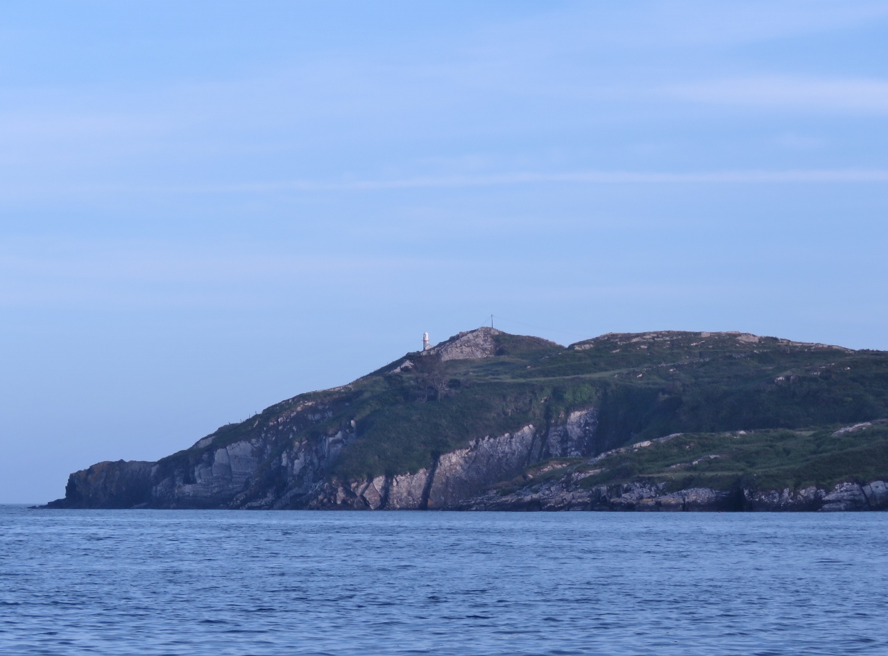
6/12/2017: Old Head
Position: 51°36.19'N, -8°31.58'W
We finally dragged ourselves out of Kinsale to start our cruise of the Irish west coast. In reasonably settled conditions, we ran near the Old Head of Kinsale for a close-up view to the light.
|
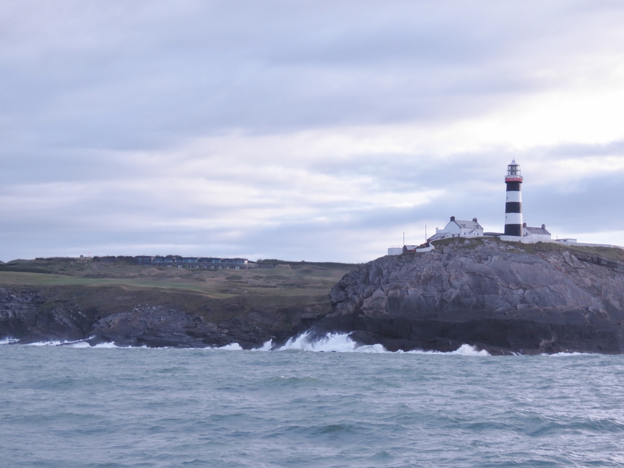 |
6/12/2017: Clubhouse
Position: 51°35.95'N, -8°32.34'W
The Old Head Golf Links clubhouse, built into the cliffs on the head, has sweeping views to sea. The clubhouse is pretty much invisible from the north—we couldn't see any evidence of it from the Signal Tower.
|
 |
6/12/2017: Seven Heads
Position: 51°33.97'N, -8°41.41'W
The Seven Head signal tower, one of the 81 signal towers built along the Irish coast during the Napoleonic era.
|
 |
6/12/2017: Running on the Wing
Position: 51°32.57'N, -8°48.53'W
The main engine has started to signal the 1347.7 code indicating difference between actual and called for fuel pressure in the high pressure common rail, so we have started the wing engine to drive the boat and will be bringing the main engine down. If you look carefully you'll see that the engine room temperature is way hotter than it should be and the fuel temperature is unusually high at 133F. Four problems all at once.
The engine room temperature high is a failed relay. 110F is fine, so we'll just do the easy change of the relay when we arrive. The engine fuel and hydraulic oil temperatures both being high are almost certainly a failed impeller in the hydraulic cooling system since flow from that pump cools both fuel and the hydraulics systems. The max hydraulic system temperature is 160F for the first alarm and the max fuel temperature is 212F so neither is urgent and we'll change the Jabsco cooling pump impeller when we get in. The only interesting issue is the 1347.7 code and alarm the main engine is producing. It's more urgent, so we'll shut down the engine and do the first level of diagnostics, change all the fuel filters. We should have that done in 45 min or so and we'll see if we can get the main engine back on line. |
 |
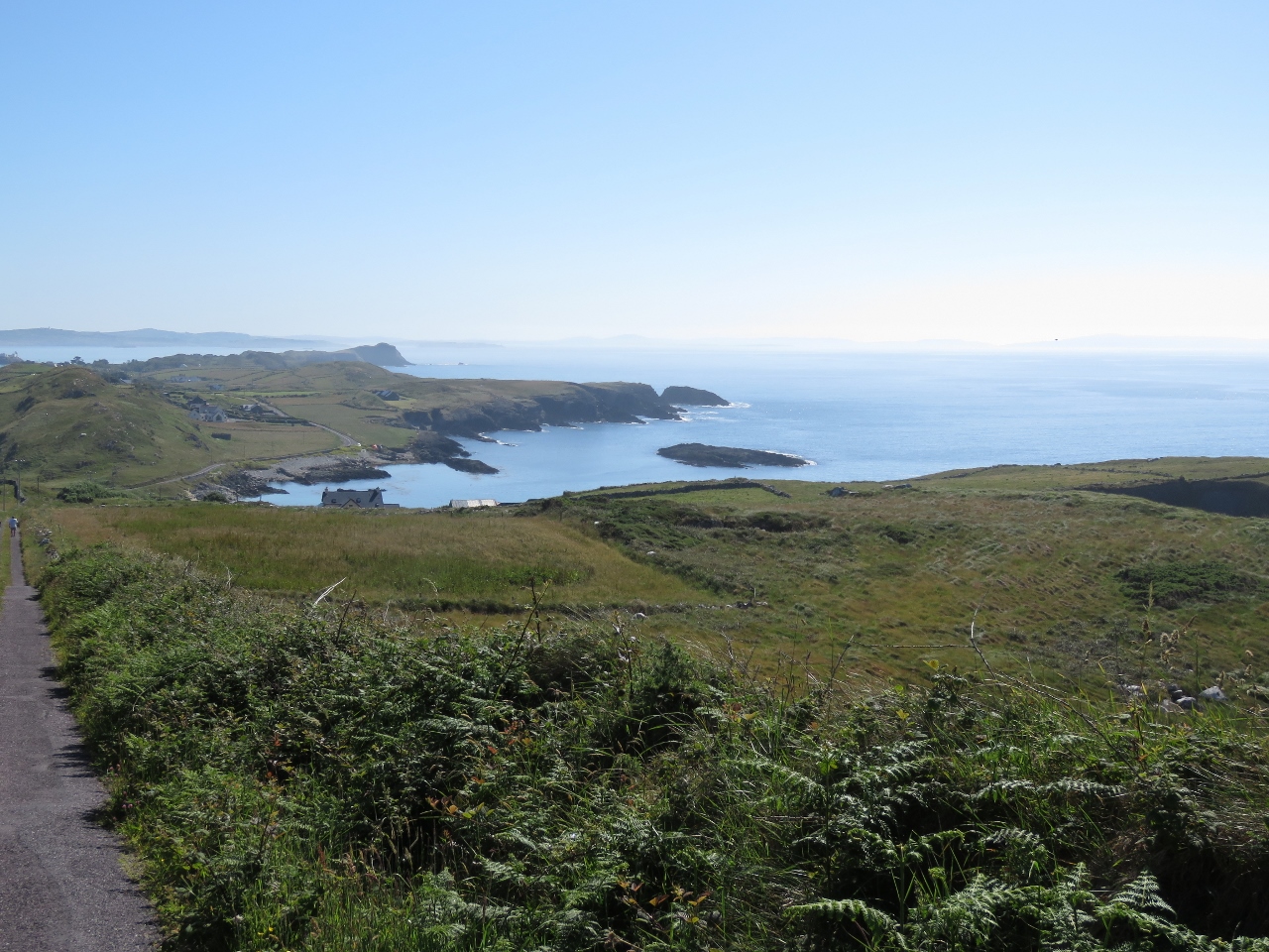
6/12/2017: Sandscove
Position: 51°31.70'N, -8°53.02'W
Dramatic cliffs at Sandscove just east of Galley Head.
|
 |
6/12/2017: Changing Fuel Filters
Position: 51°31.68'N, -8°53.18'W
The main engine has just started producing a 1347.7 code and alarm signaling that the actual high pressure common rail pressure is more than 750PSI different from the called for pressure. The first level of investigation is to bring down the main engine and change all three fuel filters. We are continuing on the wing engine as we make this change.
|
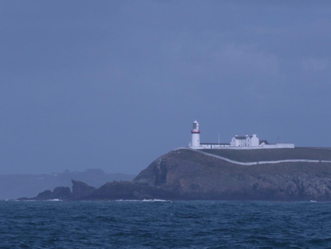 |
6/12/2017: Galley Head
Position: 51°31.37'N, -8°54.72'W
When first constructed in 1875, the Galley Head lighthouse could be seen from 16nm away and was the most powerful in the world. The light was barely visible in the overcast morning as we approached Kinsale on our crossing.
|
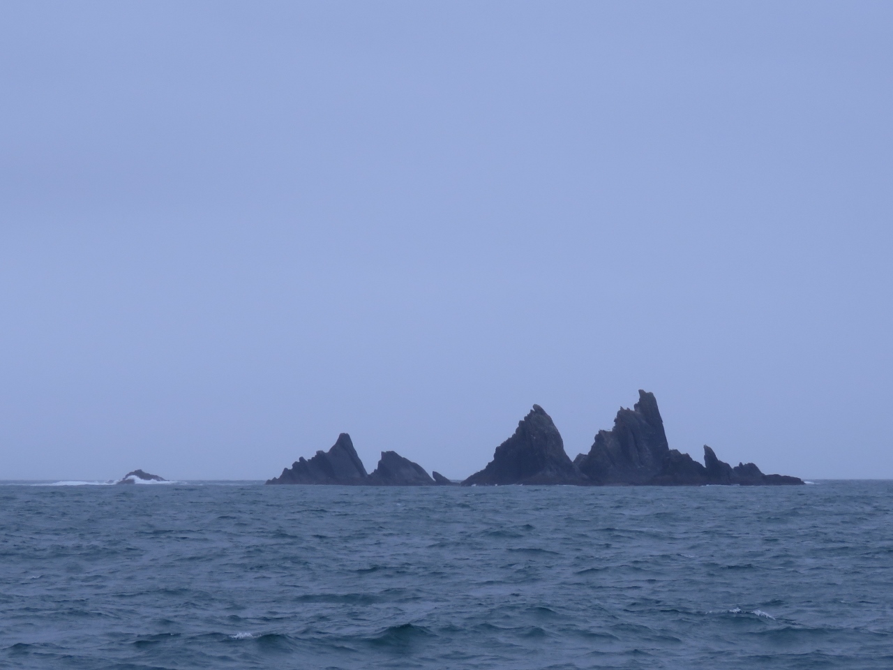 |
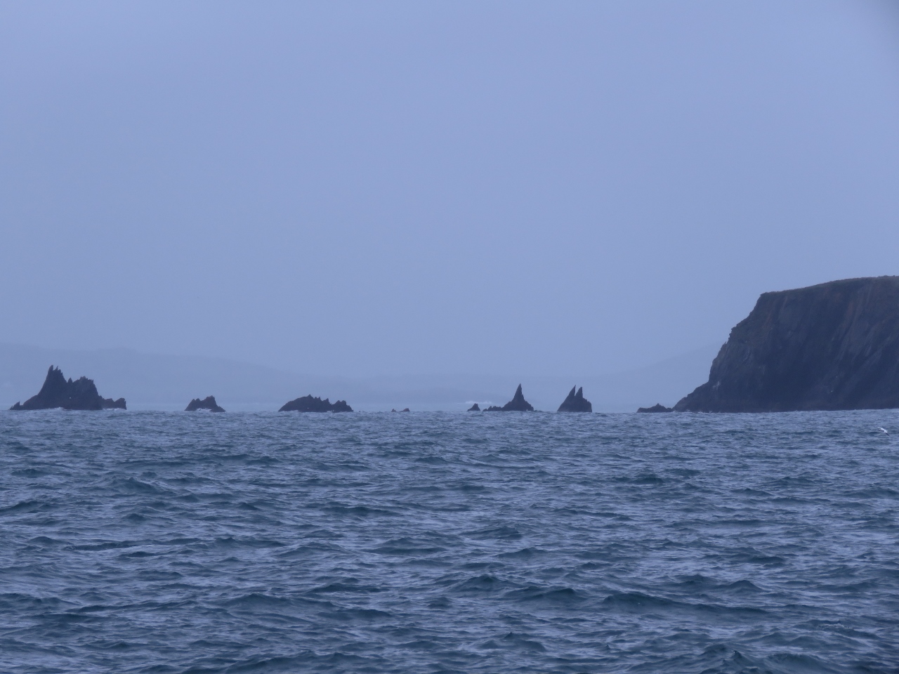
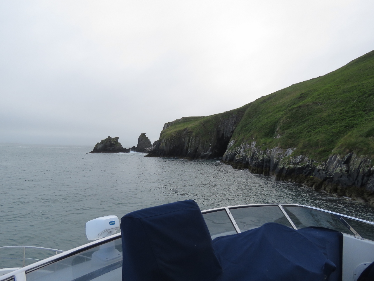
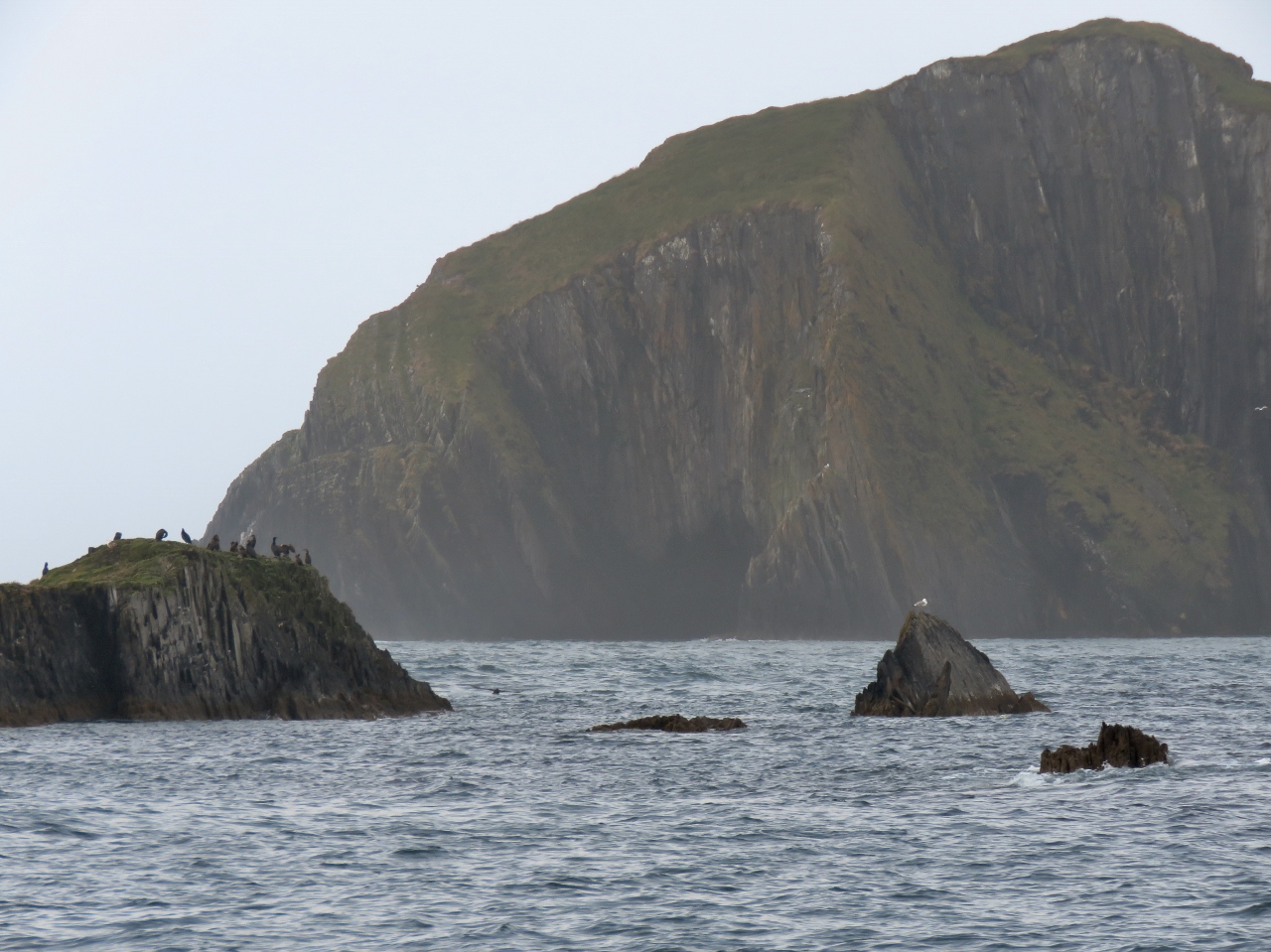
6/12/2017: The Stags
Position: 51°28.64'N, -9°12.18'W
The Stags look menacing from a distance and even more so close-up.
|
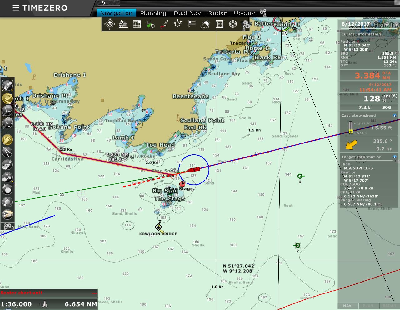 |
6/12/2017: Kowloon Bridge
Position: 51°28.56'N, -9°12.72'W
Just south of The Stags is a buoy and an AIS target marking the shipwreck of the 965-ft (294 m) bulker Kowloon Bridge. In November of 1986, the bulk cargo carrier sustained deck damage during a rough Atlantic crossing from Quebec, Canada and sheltered in Bantry Bay north of The Stags.
Before repairs could be undertaken, a storm came up, blowing Force 10 to 12 (48 to over 64 knots) winds directly into the harbor. The anchor chain parted and the captain spent several hours attempting to keep the ship on position. But without a pilot and in an unfamiliar harbour on a lee shore, the captain eventually gave up and sought open water. As the storm continued, the ship lost steerage that night and the captain issued a Mayday. Two RAF helicopters from Cornwall rescued all 27 on board. The Kowloon Bridge eventually went aground on The Stags. Bunker oil from the ship leaked out and caused extensive damage to the nearby fishing grounds and the eco-tourism industry. |
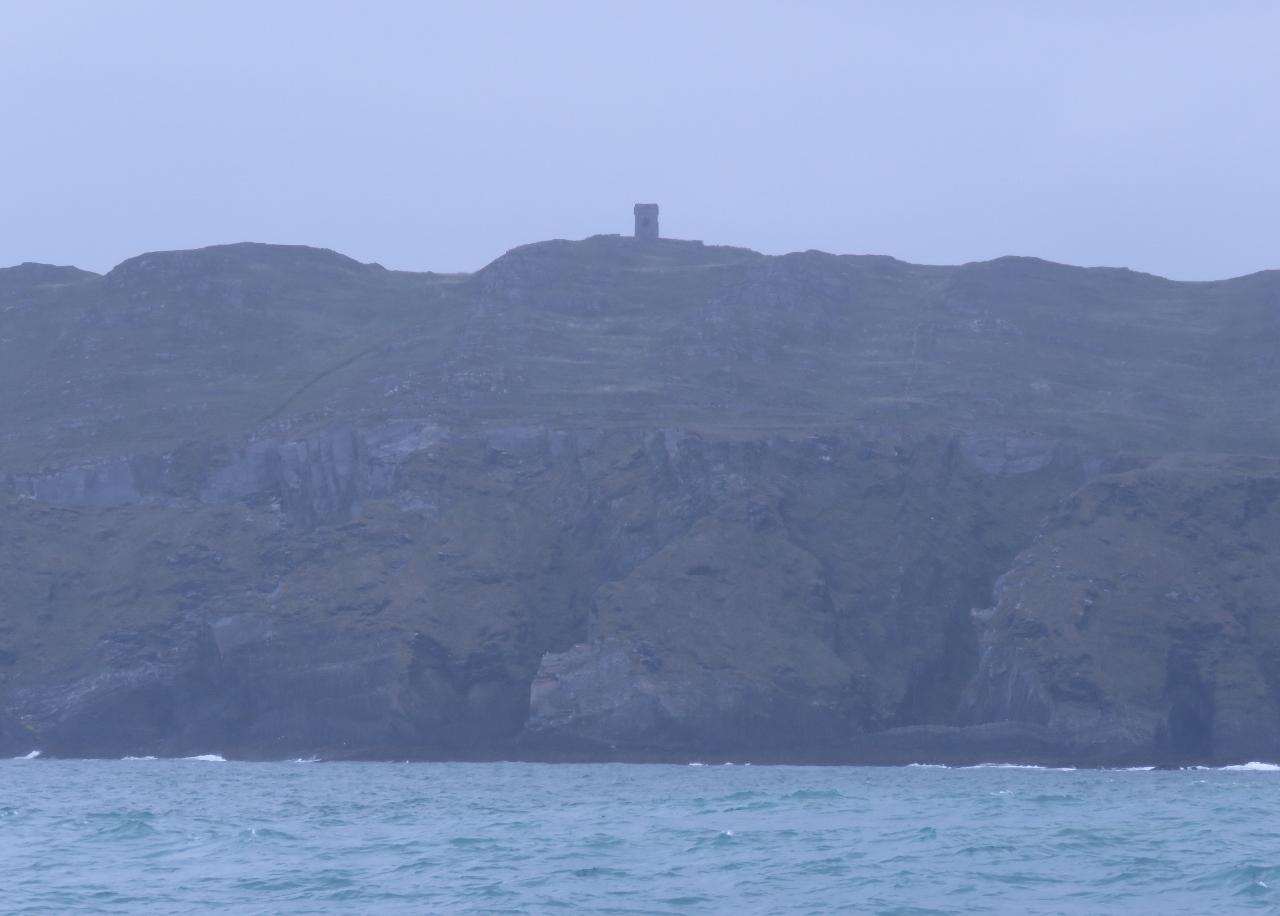 |
6/12/2017: Kedge Point
Position: 51°27.44'N, -9°20.55'W
The Kedge Point signal tower above Baltimore, one of the 81 signal towers built along the Irish coast during the Napoleonic era.
|
 |
6/12/2017: Carrigatrough
Position: 51°27.57'N, -9°21.61'W
A boat can apparently pass north of Kedge Island between these rocks and Spain Point on the mainland through a 50m channel called Carrigatrough. You'd want pretty settled conditions to try it though.
|
 |
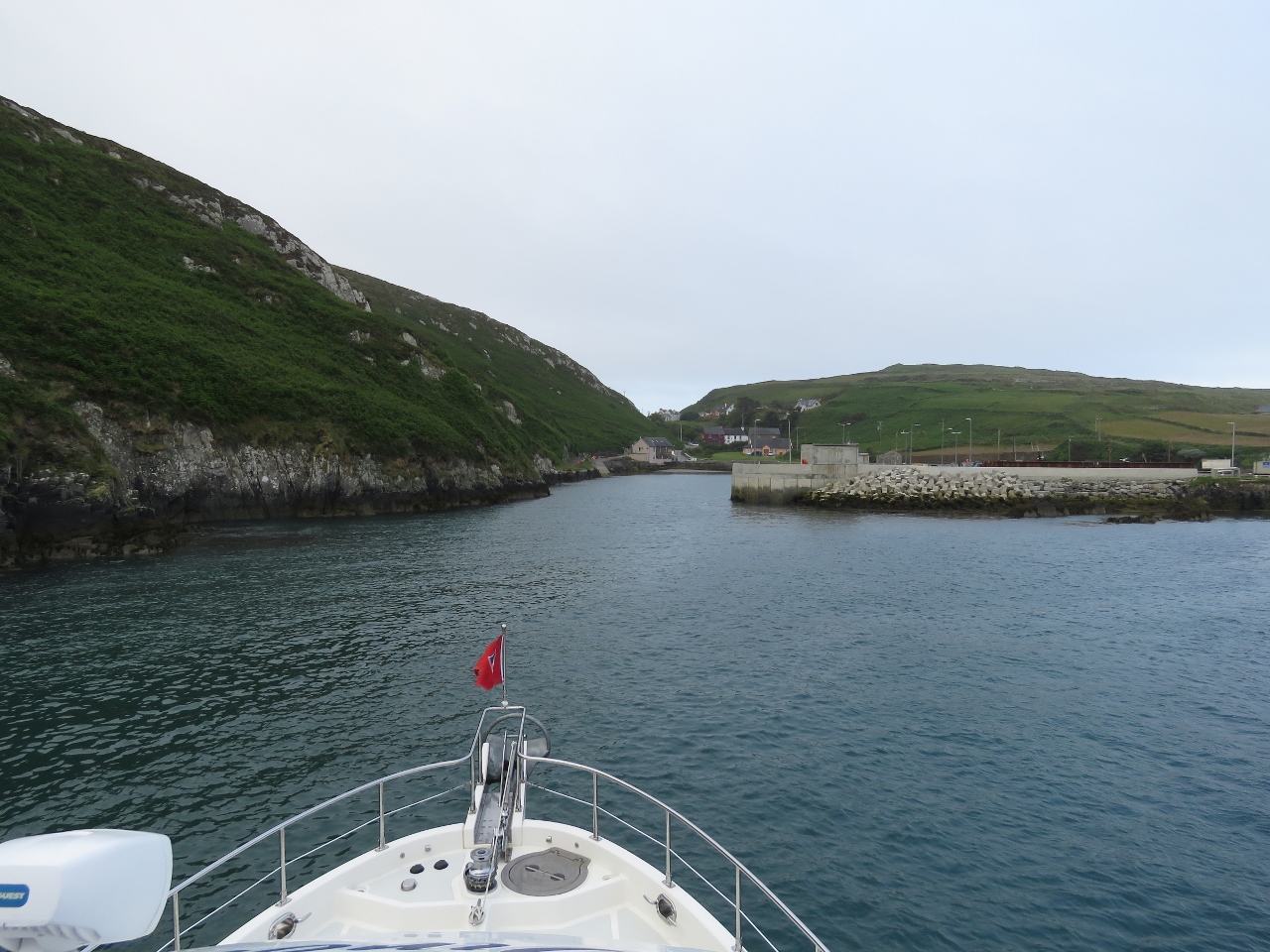
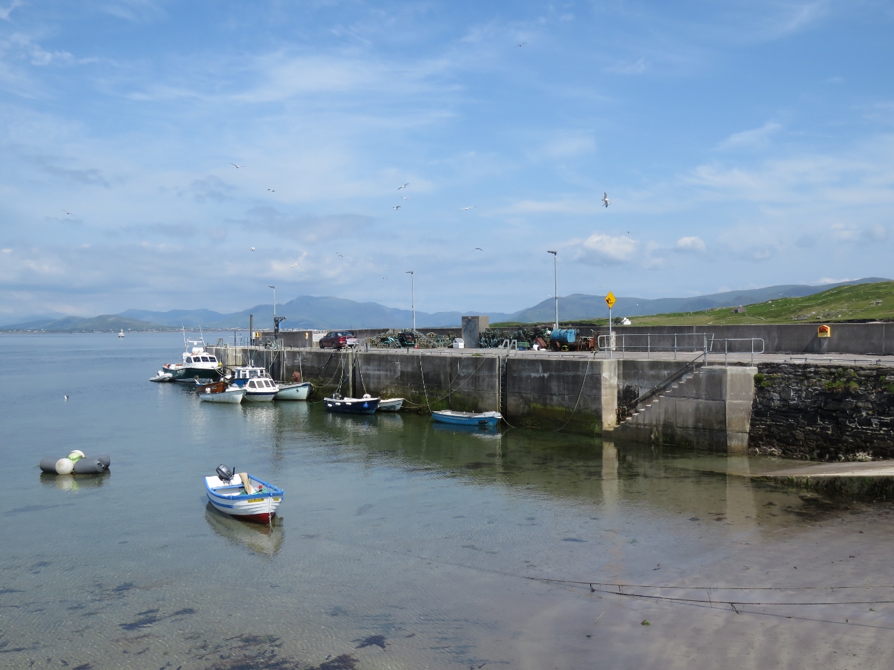
6/12/2017: Baltimore Harbour
Position: 51°27.99'N, -9°22.75'W
Baltimore Harbour is a Point of Entry into Ireland and a common first landing for boats arriving from the Azores, the Caribbean and the US. The conspicuous beacon Lot's Wife at the harbour entrance must be as welcome a sight as the Old Head of Kinsale was on our crossing.
|
 |
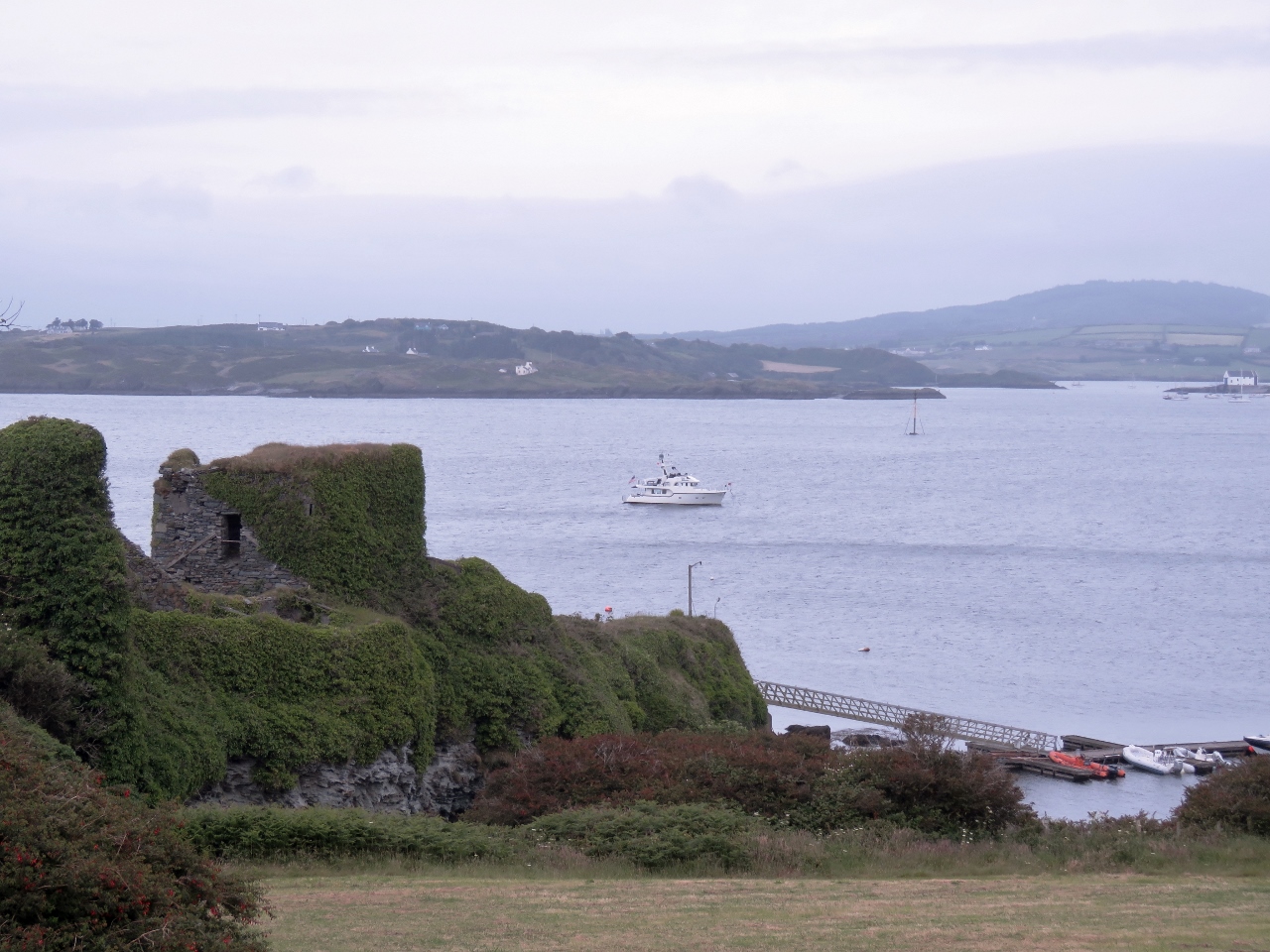
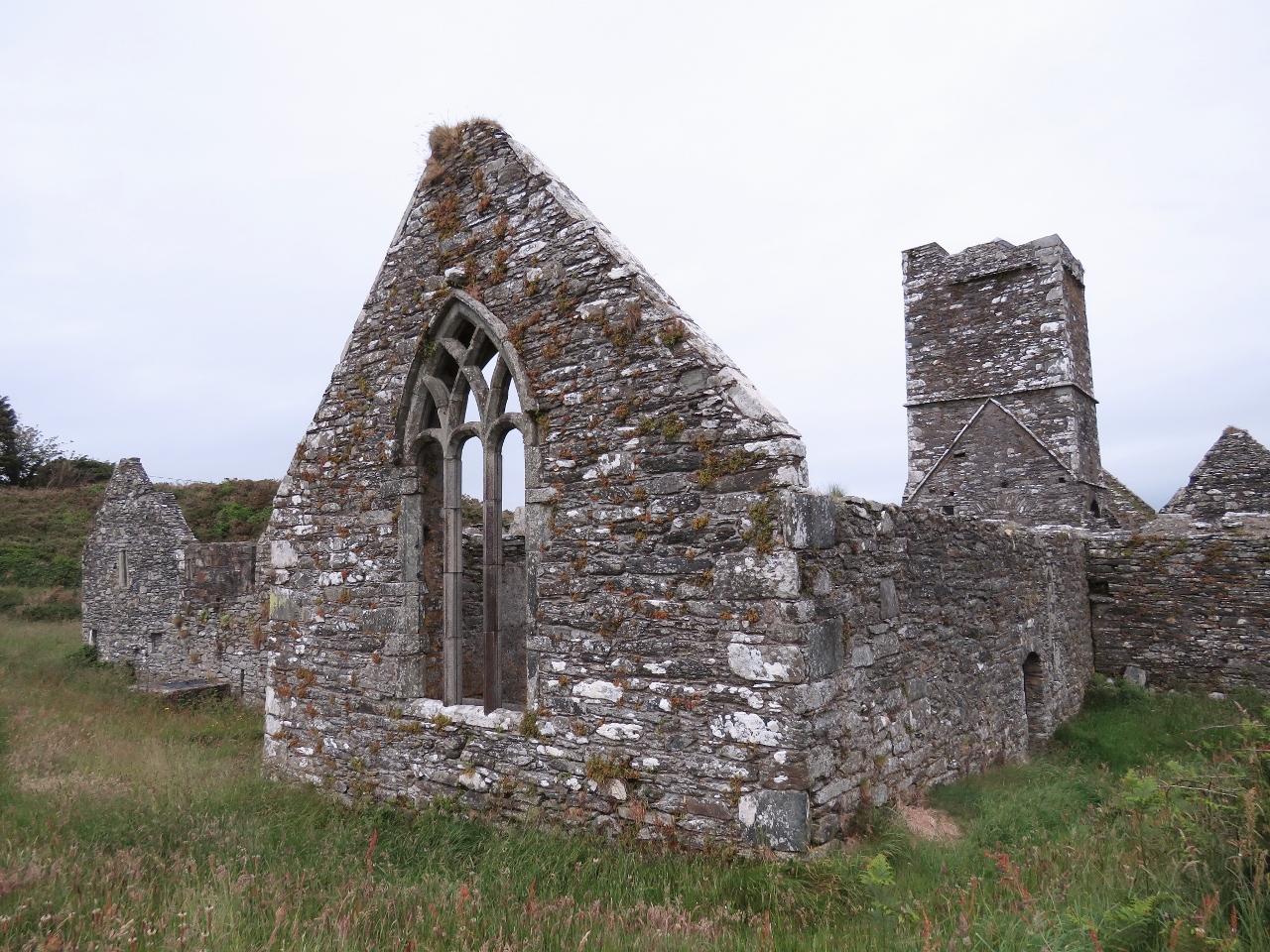
6/12/2017: Sherkin Island
Position: 51°28.82'N, -9°23.74'W
The ruins of a fifteenth-century abbey above the public wharf at Sherkin Island, viewed from our anchorage off the island's east shore.
|
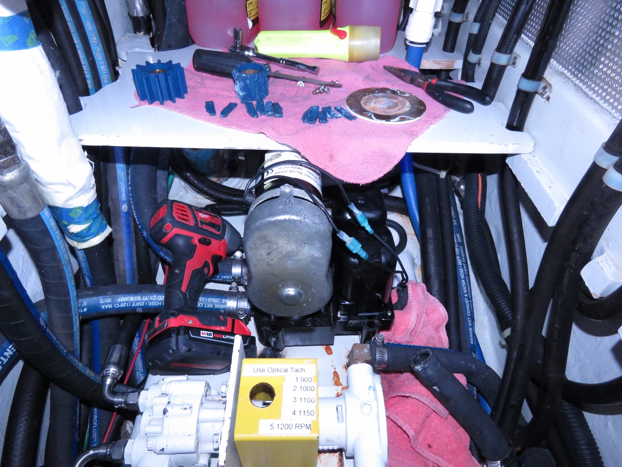 |
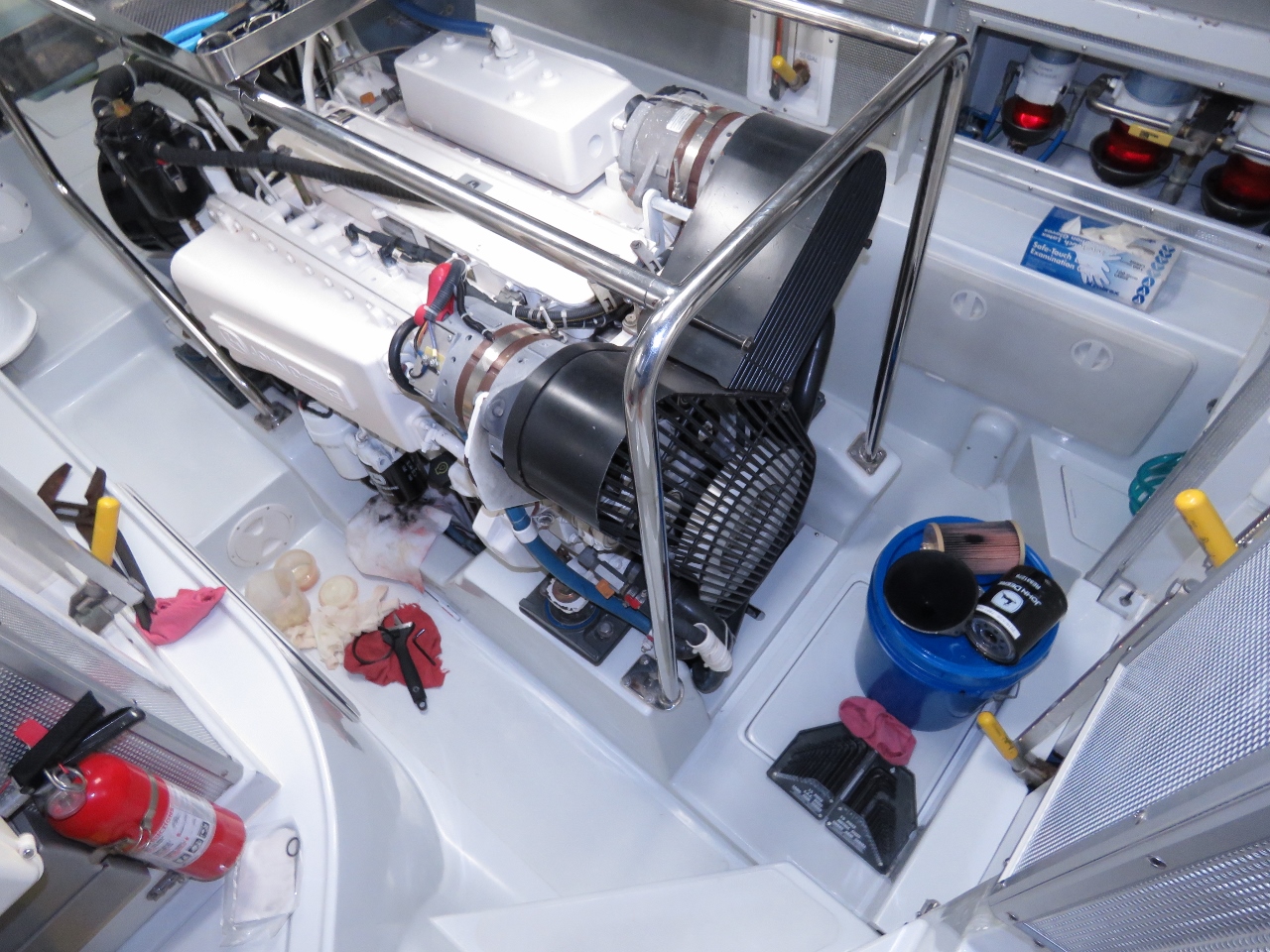
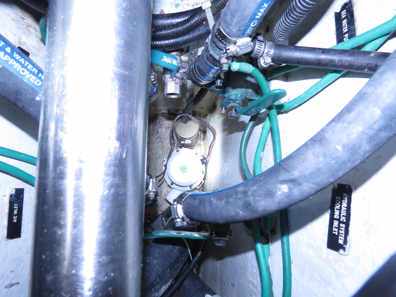
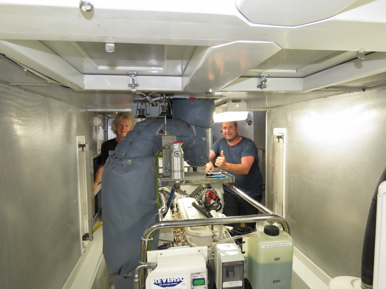
6/12/2017: Impeller
Position: 51°28.82'N, -9°23.75'W
The hydraulic cooling system impeller failed shortly after getting underway today but the seawater is sufficiently cool the system never got up over 119F where the first alarm isn't until 160F. The main engine fuel system is cooled by the same pump and the fuel temperature climbed up to 140F as we anchored but, again, not even close to the Deere limit of 212F.
The hydraulic cooling system impeller is actually very easy to change with most of the time being moving the entire new engine, hydraulic, and steering oil storage out of the way to be able to lift the floor to get access to the hydraulic cooling pump visible at the bottom of the photo. All that is easy but what can be truly nasty is chasing lost impeller fins. If fins break off, then you need to carefully inventory them and keep searching in the system until they are found. In this case the pump ran for quite a while before elevated temperatures indicated the failure so we lost some fins. In fact, we lost all but one which is unusual for Globe impellers. More than once on the generator which uses the same type of pump, we've needed to drain the coolant from the generator to recover fins from the heat exchanger. In this case we think what happened is the pump lost 3 or 4 fins and they lodged in the outlet pipe and plugged up the system which stopped the cooling water flow, and then most of the rest of the fins failed in short order. We found 1 fin on the impeller, 6 in the pump body, 4 at the first 90 degree fitting in the system, and 1 using a wet/dry vacuum on the outlet hose. The important thing is all 12 are accounted for. Once that's done, it's a snap to get the system back together and tested. |
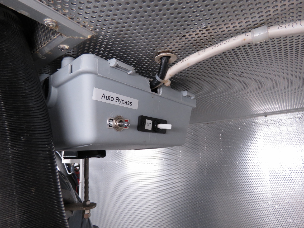 |
6/12/2017: Override Switch
Position: 51°28.82'N, -9°23.75'W
The control relay that manages the engine room fans failed. It's an easy change but seeing it fault reminded us that all control systems should have emergency overide switches. When this switch is actuated the fans runs independent of relay or control system state.
|
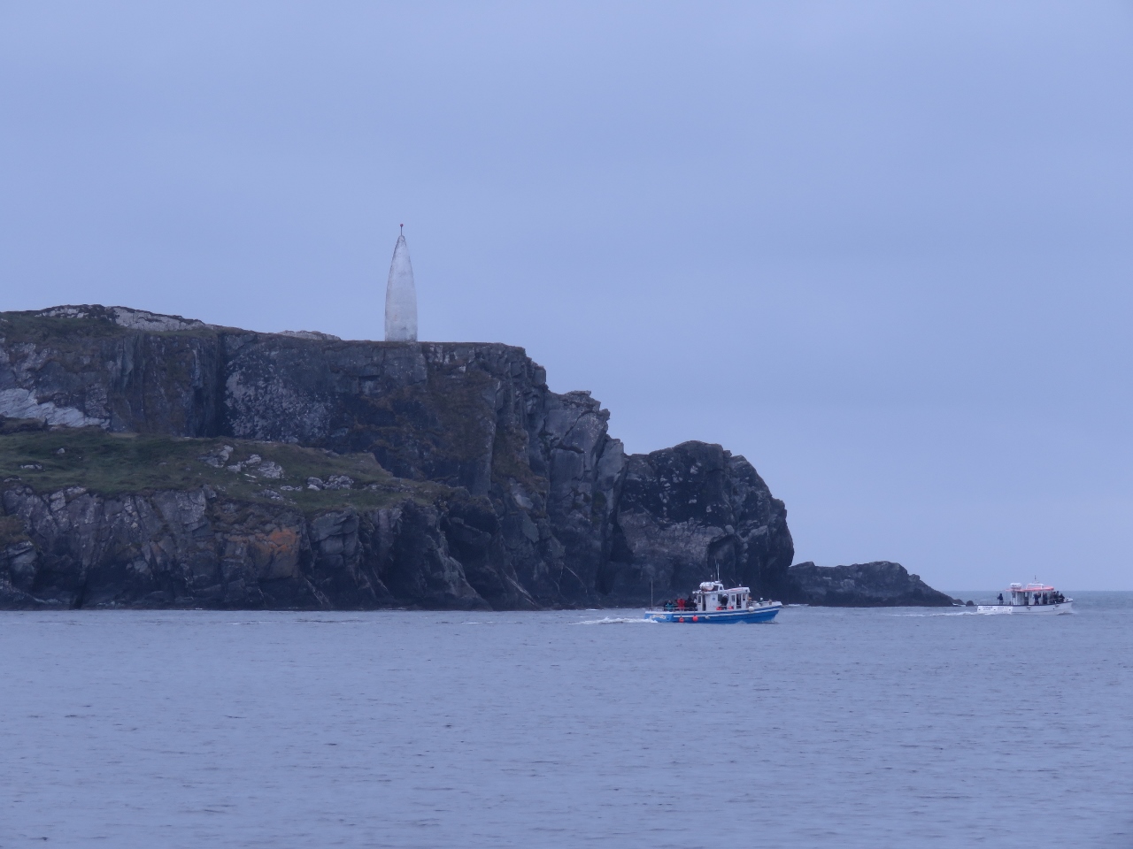 |
6/13/2017: Fishing Vessels
Position: 51°28.82'N, -9°23.76'W
Two commercial fishing boats passing under Lot's Wife at the entrance to Baltimore Harbour. The harbour scenery is fantastic.
|
 |
6/13/2017: Bilge Pump
Position: 51°28.82'N, -9°23.76'W
This morning we investigated how we might mount a high-volume bilge pump in the main bilge. We used our spare Rule 3700, and getting it past the prop shaft and thru-hulls was very tight. Two hose clamps had to be moved, but it does fit. We'll go with a second Rule 3700 as our new high-water bilge pump, mounted just above the bottom of the main bilge where the spare temporarily sits.
|
 |
6/13/2017: Sailboats
Position: 51°28.83'N, -9°23.77'W
Baltimore Harbour is a busy sailing port—local and international vessels have been coming and going the entire time we've been here.
|
 |
6/13/2017: Spitfire
Position: 51°28.83'N, -9°23.76'W
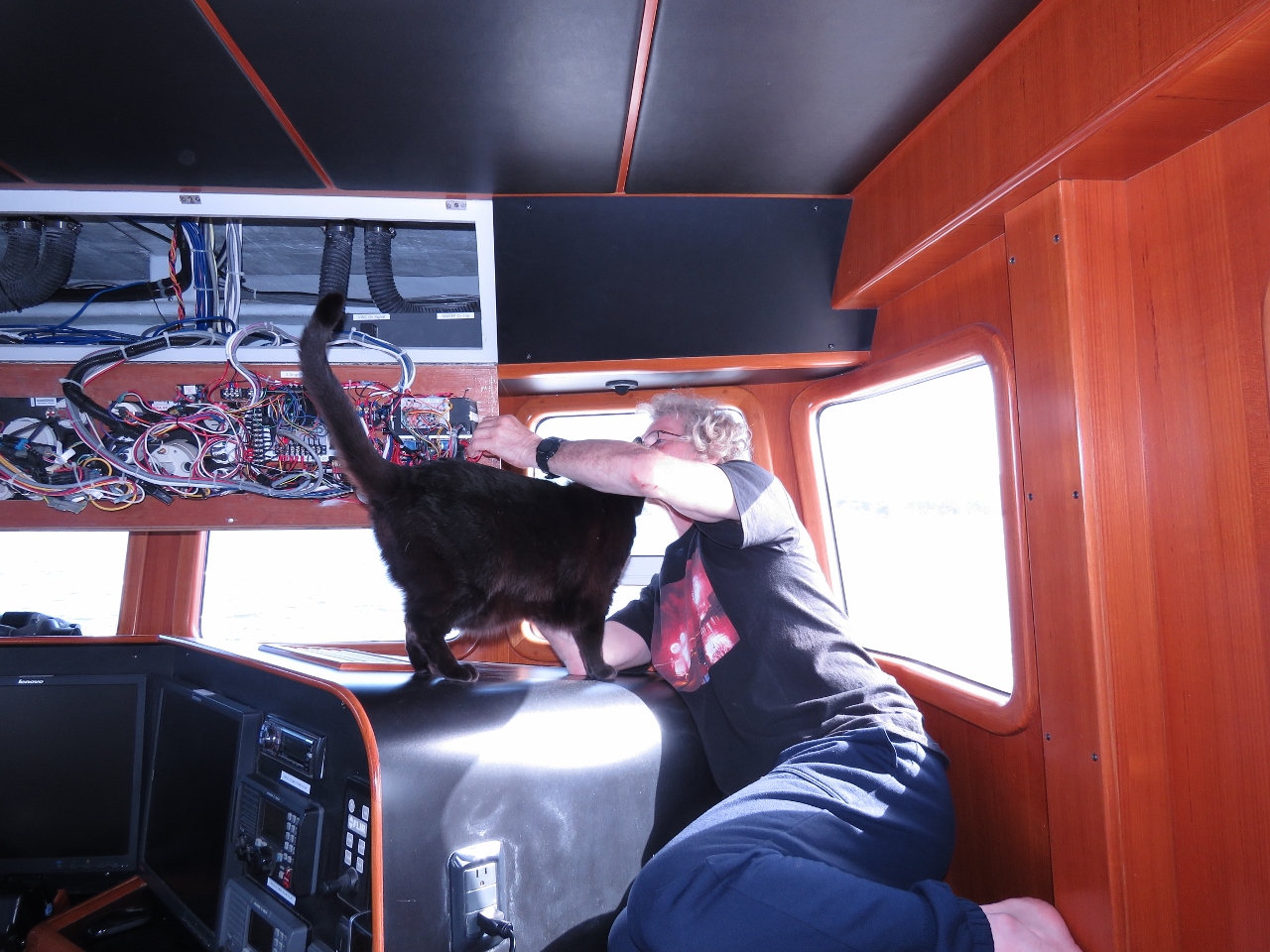
James installing a load shed relay to temporarily shut down our diesel furnace and circulation pump when our 120V inverter is reaching maximum output. This and other shed relays allows us to largely ignore the capacity limit on our inverter. The load shed system just automatically temporarily shuts down non-essential loads during short power draw peaks and then turns them back on when the peak passes. The relays are control by a Raspberry Pi. This Pi has around 20 digital inputs to detect bilge pump cycles, wast pump cycles, furnace on, virtual watch commander on, virtual watch commander reset, etc. It also supports 8 channels of digital output used to turn devices off and on. One of the output channels is used to drive the furnace load shedding relay.
Whenever a seldom-visited part of the boat is opened up, Spitfire has to "inspect". |
 |
6/13/2017: Baltimore
Position: 51°28.83'N, -9°23.77'W
The view to the town of Baltimore from our anchorage.
|
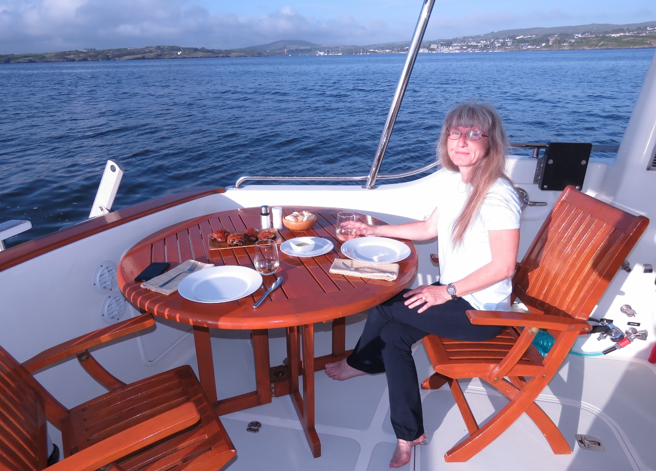 |
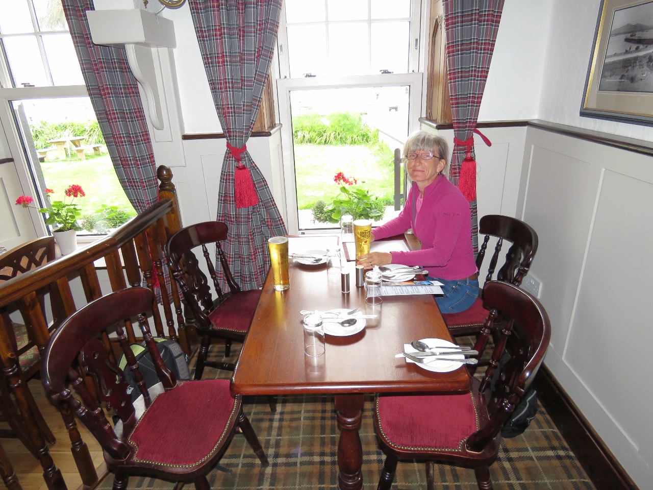
6/13/2017: Dinner
Position: 51°28.83'N, -9°23.77'W
Grilled Peri-Peri chicken on the back deck. It's wonderful to be out at anchor again. The last time our anchor was down was in early February in St. Augustine Florida, alhough that feels a lot longer than only four months ago.
|
 |
6/13/2017: Lighthouse
Position: 51°28.82'N, -9°23.77'W
The lighthouse on Sherkin Island, on the south side of the entrance to Baltimore Harbour, viewed from our anchorage in the early evening. This sure is a beautiful anchorage.
|
 |
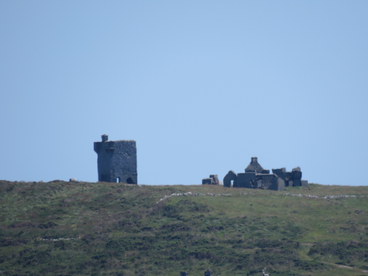
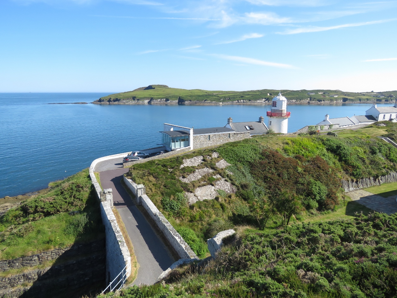
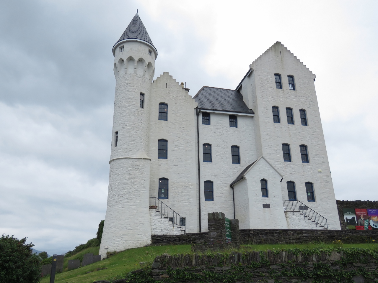
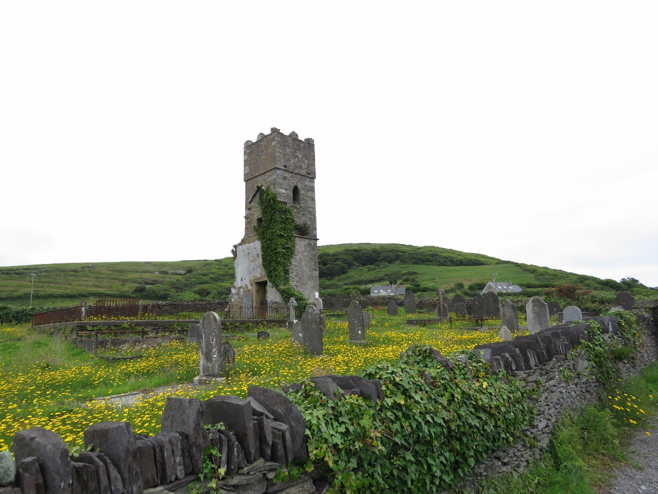
6/14/2017: Dun na Long Castle
Position: 51°28.71'N, -9°24.05'W
Our first Irish castle. Dun na Long Castle on Sherkin Island, built sometime before the 1500s, overlooks the entrance to Baltimore Harbour. The castle, owned by the Irish O’ Driscoll clan, was badly damaged in a 1537 retaliatory attack on Sherkin Island by Anglo-Normans. It was restored in 1655 and now is part of the Islander's Rest Bar and Restaurant property.
|
 |
6/14/2017: Beacon Point
Position: 51°28.70'N, -9°24.10'W
The view to Beacon Point from the road leaving the Islander's Rest property.
|
 |
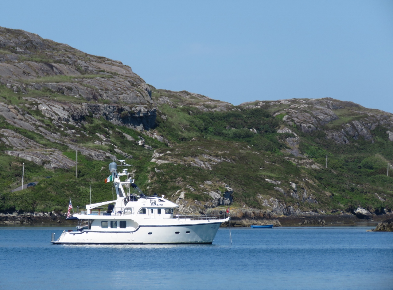
6/14/2017: Dirona
Position: 51°28.66'N, -9°24.12'W
The first of what we expect will be many pictures of Dirona near an Irish castle. Our tender is just visible tied off third from the left on the Islander's Rest pontoon.
|
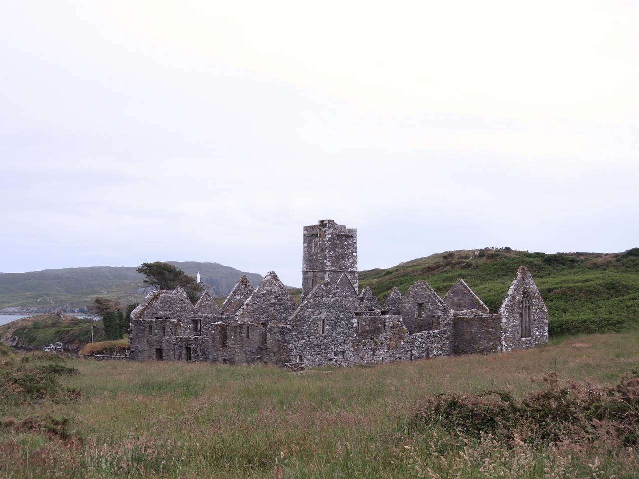 |
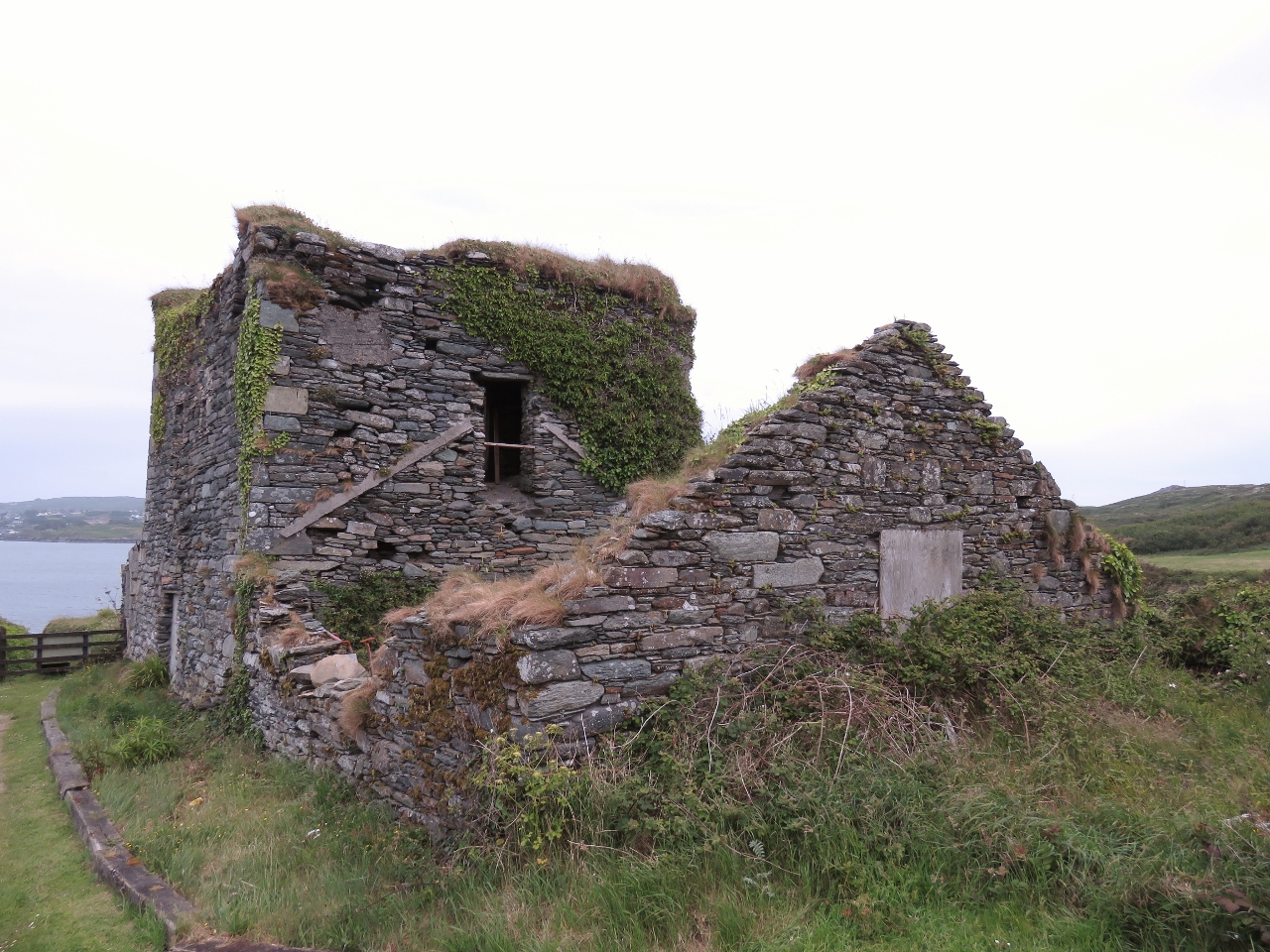
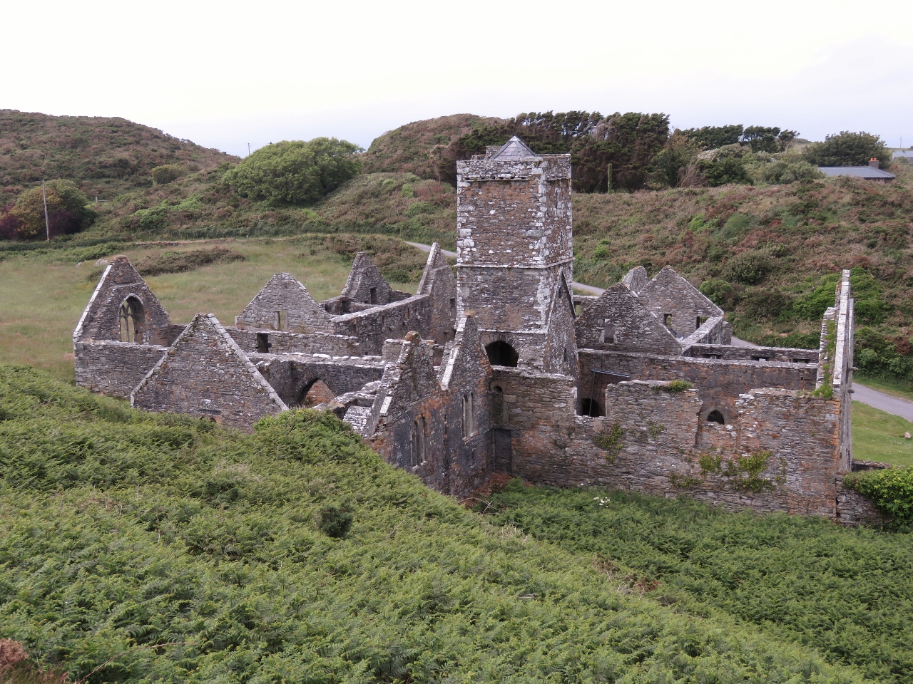
6/14/2017: Friary
Position: 51°28.59'N, -9°24.07'W
A friary was established on Sherkin Island in 1460 by Fineen O’ Driscoll, chieftain of the area. The friary also was badly damaged in the 1537 attack on Sherkin Island.
|
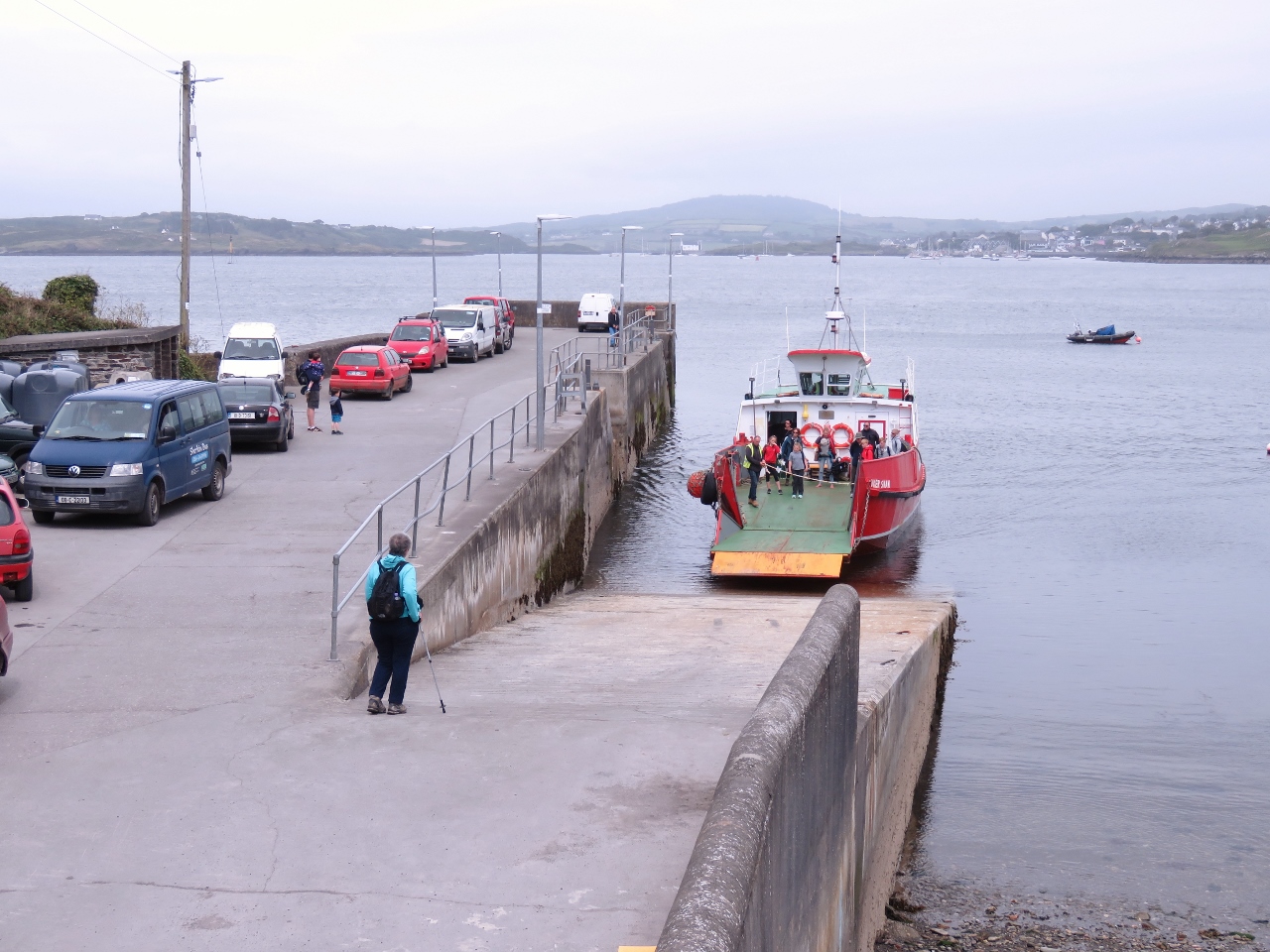 |
6/14/2017: Ferry
Position: 51°28.59'N, -9°23.98'W
We've been seeing the ferry run regularly between Baltimore Harbour and Sherkin Island. Here the ferry is landing at Sherkin Island with a load to disembark and another load to embark.
|
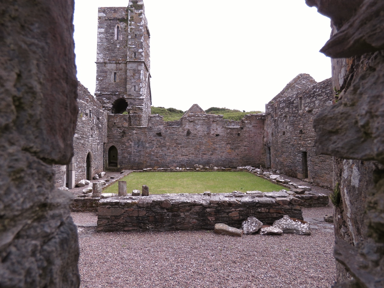 |
6/14/2017: Friary Interior
Position: 51°28.58'N, -9°24.01'W
A view to the friary interior.
|
 |
6/14/2017: Graveyard
Position: 51°28.56'N, -9°24.02'W
A sign outside the graveyard warns that "Grave digging is a dangerous activity ... and Authorities accept no liability for any injuries caused by grave digging, including those engaged in voluntary grave digging." We were wondering how someone would find themselves grave digging involuntarily. Perhaps "the drink" would drive them to it. :)
|
 |
6/14/2017: Window
Position: 51°28.56'N, -9°24.02'W
This window at the back of the friary likely contained a stained-glass windows.
|
 |
6/14/2017: Abbey from Above
Position: 51°28.54'N, -9°23.99'W
We were trying to find a way to reach the lighthouse, so climbed above the friary looking for a route. It looked pretty challenging, so we bailed, but did get a nice view.
|
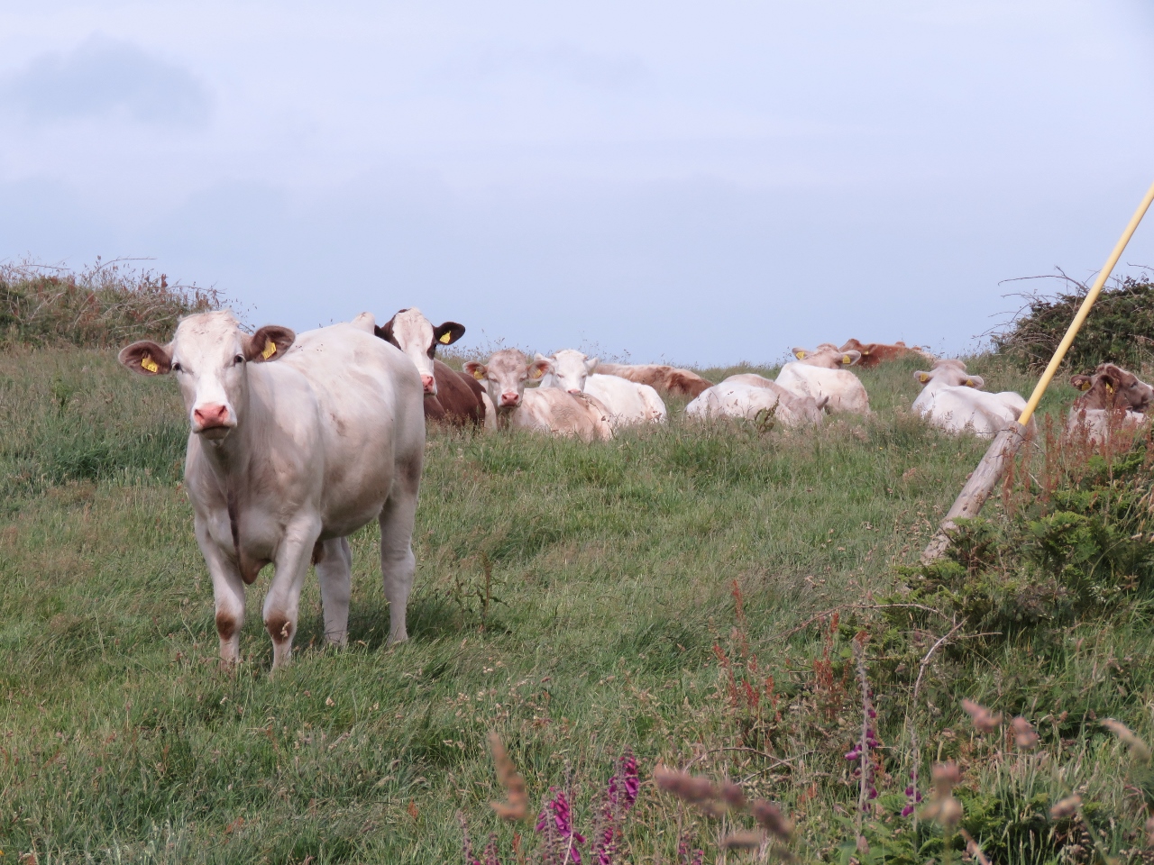 |
6/14/2017: Bulls
Position: 51°28.35'N, -9°23.76'W
To reach the lighthouse, we eventually followed a path through what we thought was a cow field, but turned out to be a bull field. The animals are surprisingly nimble on the steep slopes—we saw hoof marks everywhere. The bulls were not at all frightened of us, and one even snorted and started walking toward us. A little more excitement than we bargained for.
|
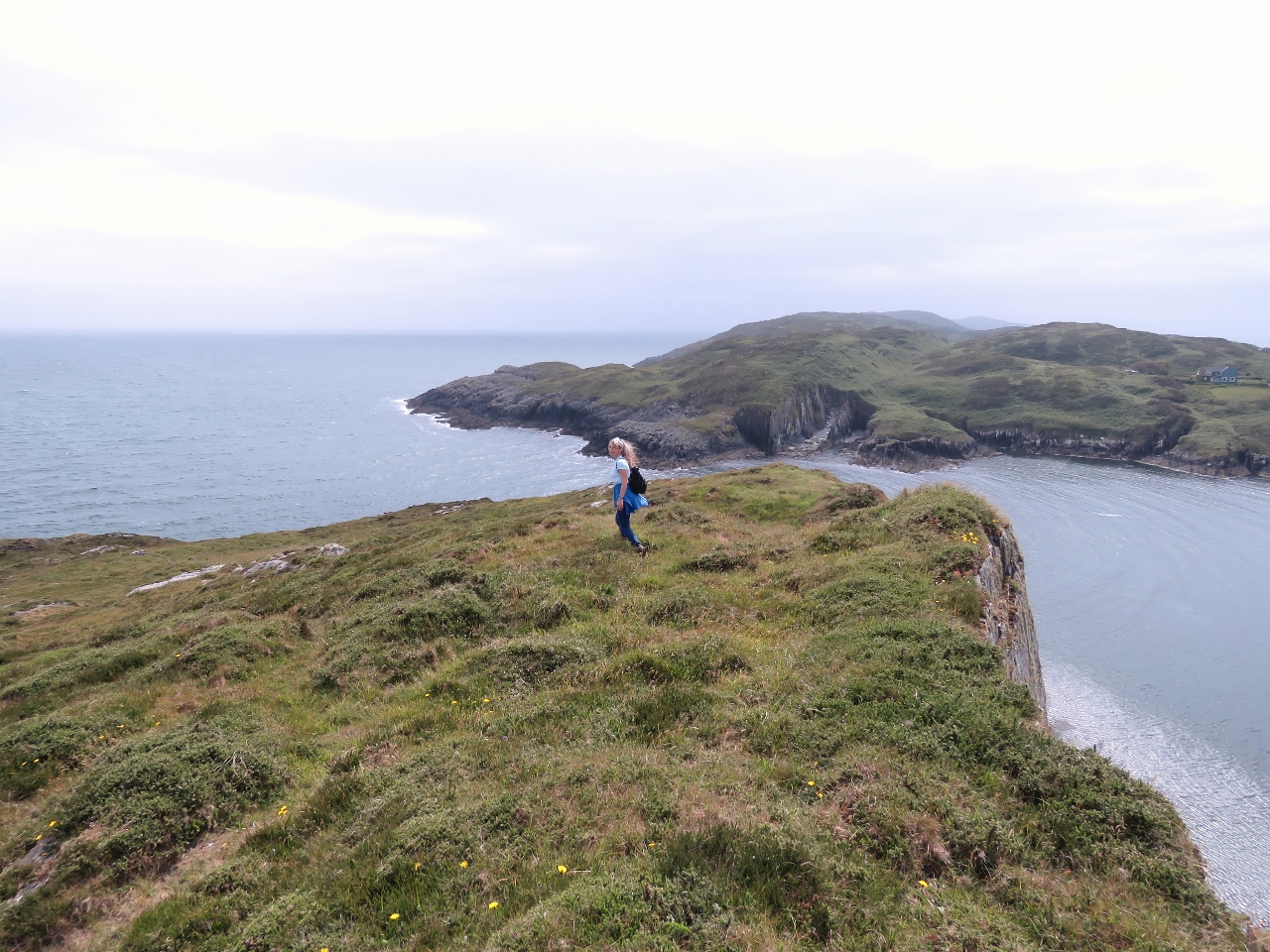 |
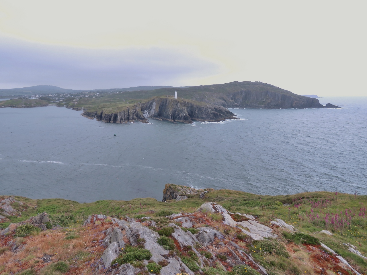
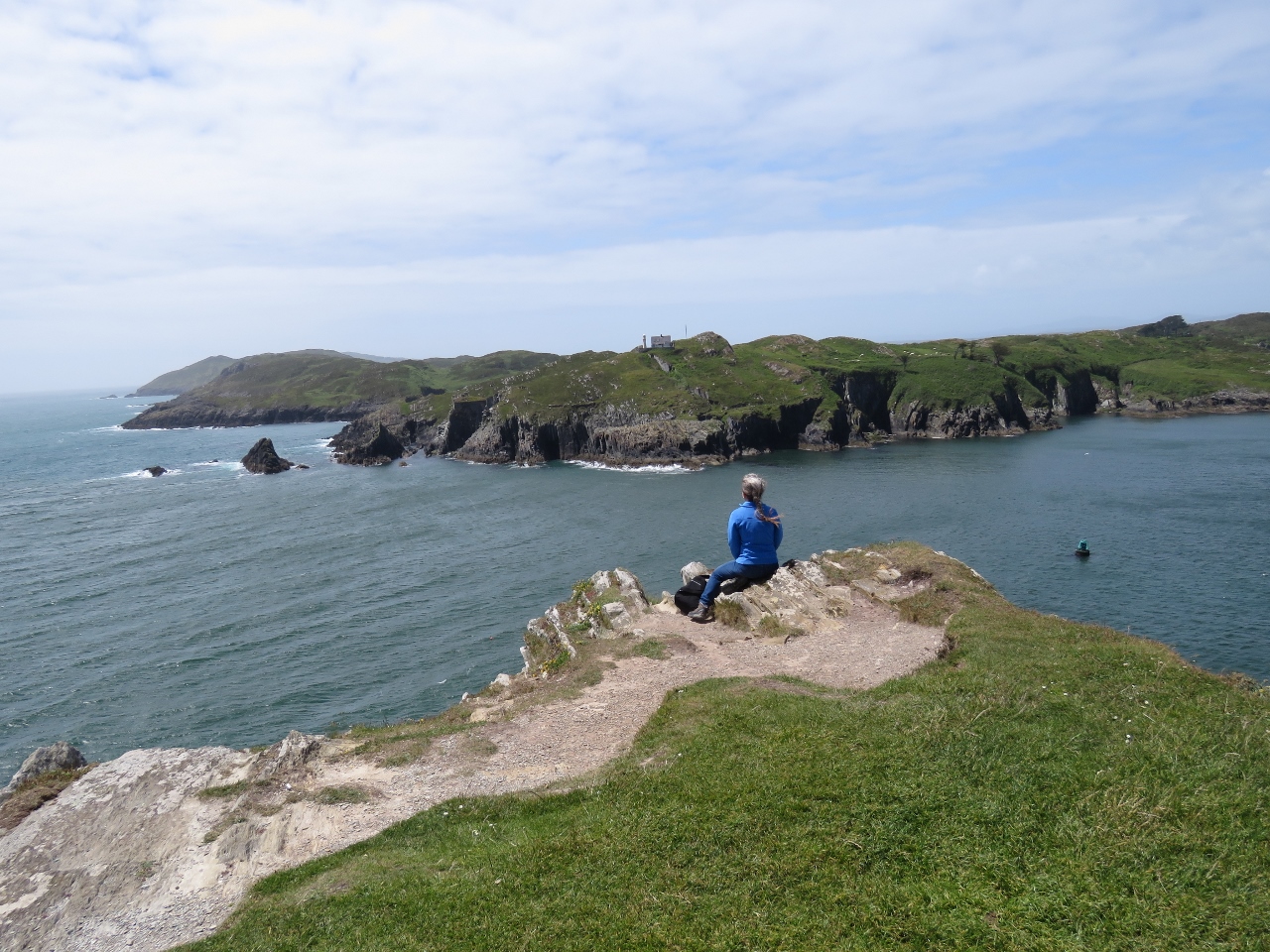
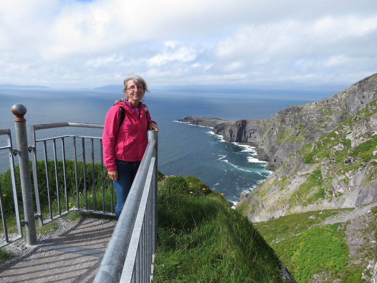
6/14/2017: Barrack Point
Position: 51°28.33'N, -9°23.77'W
Jennifer taking in the view south to sea from Barrack Point.
|
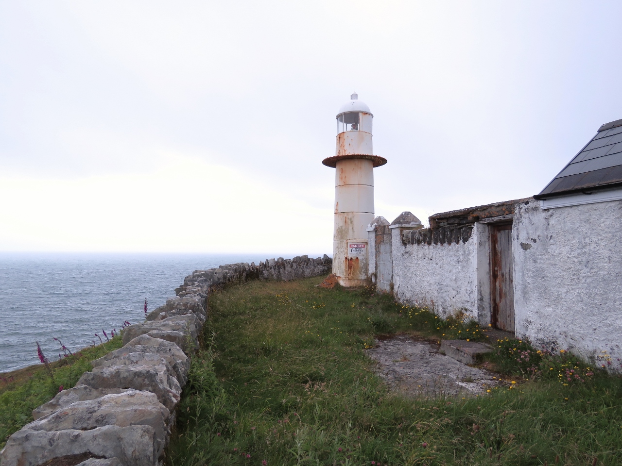 |
6/14/2017: Lighthouse
Position: 51°28.37'N, -9°23.68'W
The light and house on Barrack Point. The light is automated and the house sealed up against trespassers.
|
 |
6/14/2017: Beacon
Position: 51°28.37'N, -9°23.68'W
The Beacon across the entry channel is a popular destination. We always see people out there.
|
 |
6/14/2017: Entry Channel
Position: 51°28.38'N, -9°23.69'W
The view across the Baltimore Channel entry channel to the beacon on the other side as we depart Barrack Point.
|
 |
6/14/2017: Horseshoe Loop
Position: 51°28.27'N, -9°24.19'W
Sherkin Island is several well-marked and nice trails. We picked up the shorter Horseshoe Loop on our return from Barrack Point. This is the view across Horseshoe Bay to the light and house on Barrack Point.
|
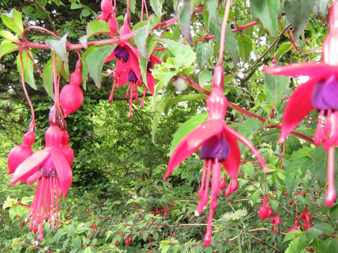 |
6/14/2017: Fuchsia
Position: 51°28.24'N, -9°24.55'W
Beautiful fuchsia grow wild throughout the Horseshoe Loop.
|
 |
6/14/2017: Tractor
Position: 51°28.28'N, -9°24.55'W
The Horseshoe Loop joins several other trails along a shore-side road. We followed a tractor that had to pull off to allow oncoming traffic.
|
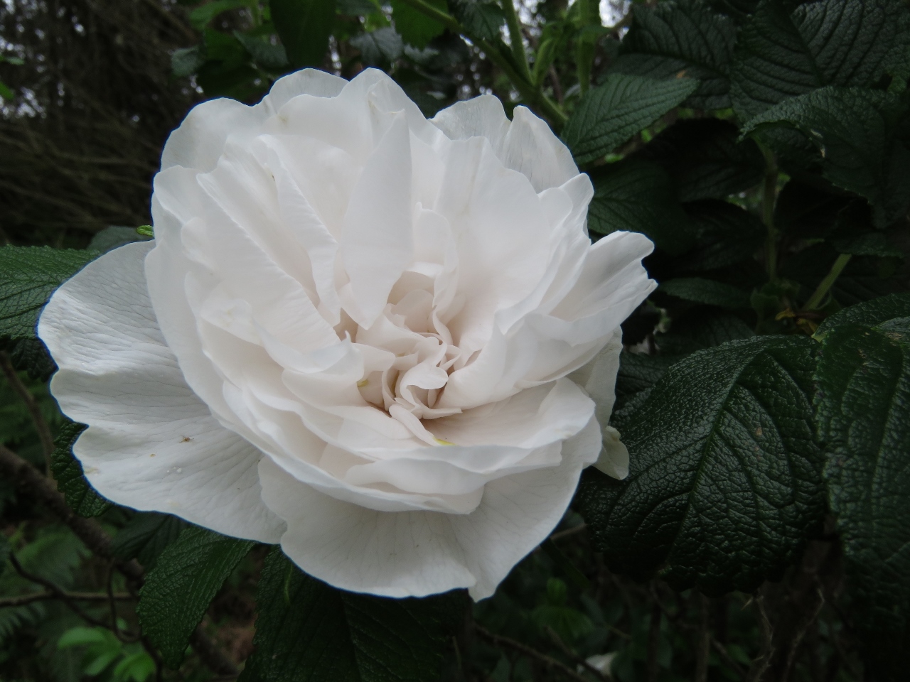 |
6/14/2017: Rose
Position: 51°28.32'N, -9°24.49'W
Wild roses growing along the side of the road.
|
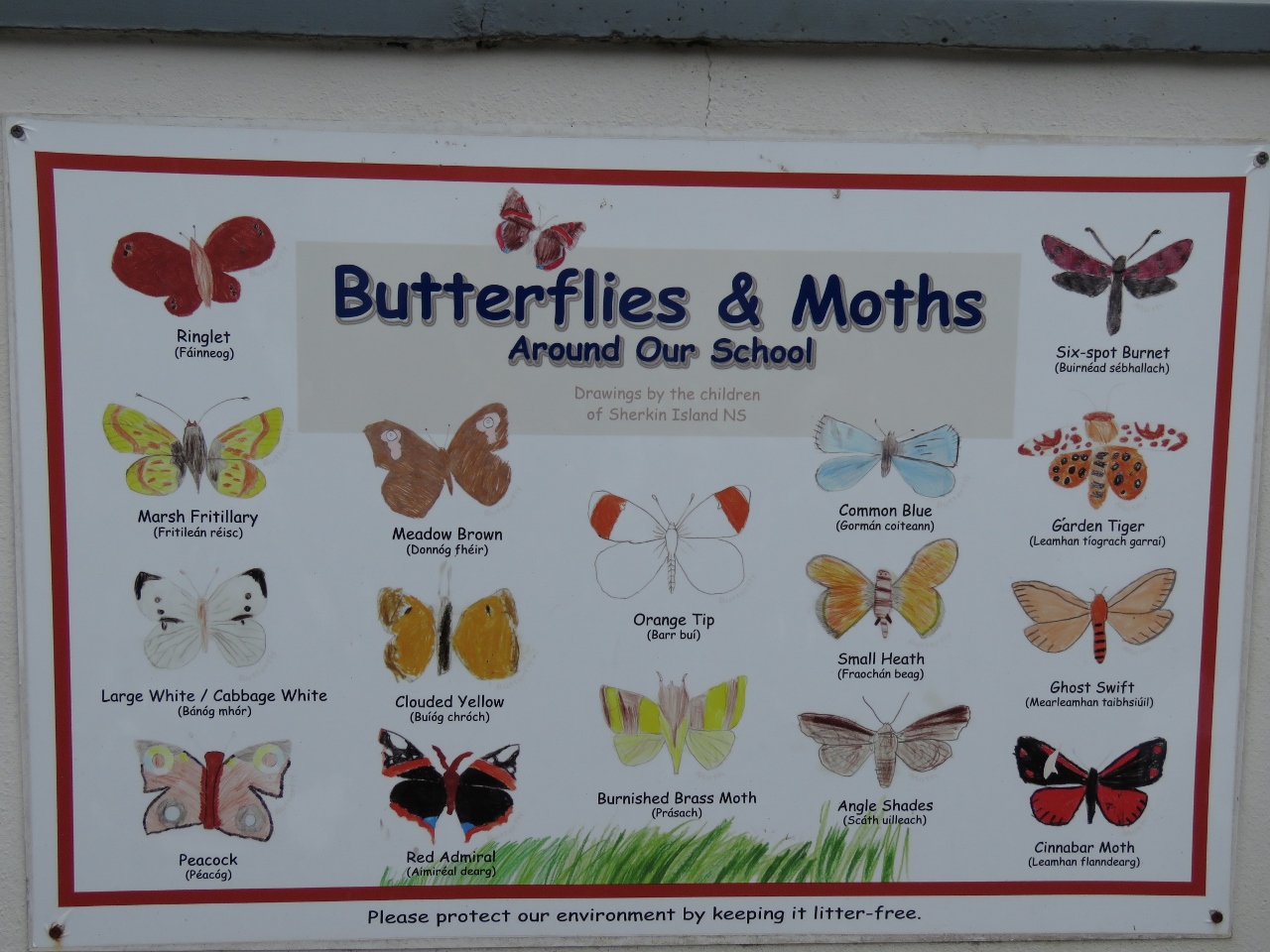 |
6/14/2017: Butterflies
Position: 51°28.38'N, -9°24.42'W
Outside the Sherkin Island National School are several posters with drawings the schoolchildren have made of the local wildlife.
|
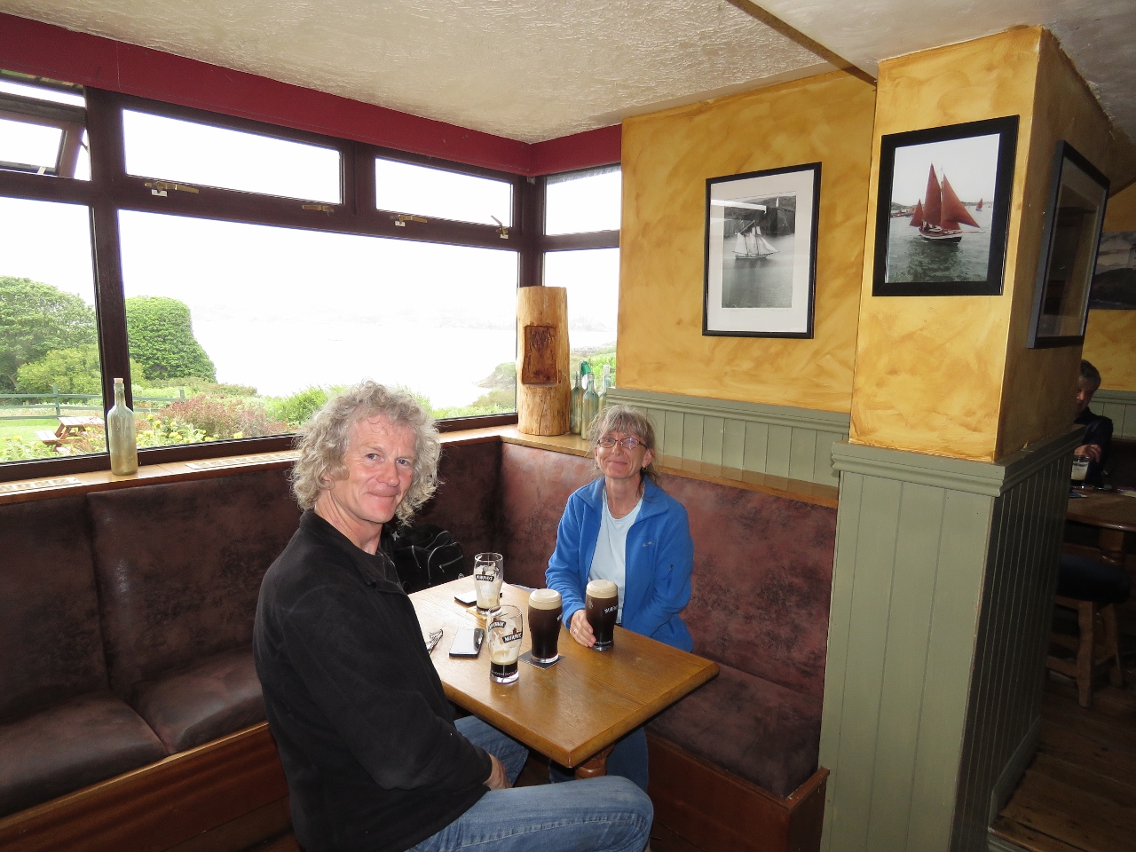 |
6/14/2017: Islander's Rest
Position: 51°28.70'N, -9°24.12'W
We finished the day with Murphy's and dinner at the Islander's Rest Pub with a great view over the harbour. Amazingly, the bar tender knows the owner of the Fastnet Pub that we frequented in Newport.
|
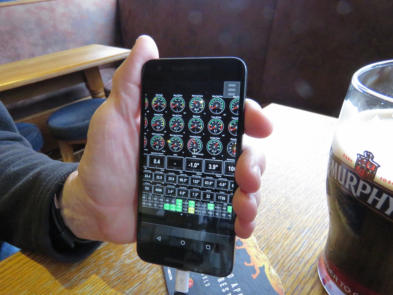 |
6/14/2017: Remote Maretron
Position: 51°28.70'N, -9°24.10'W
We'd been out for much longer than expected, which shows the importance of generator autostart to protect the batteries. So while we were having dinner we checked on the battery levels to make sure they were ok. It's amazing to be able to see every data point on our comprehensive Maretron N2KView display no matter where we are.
|
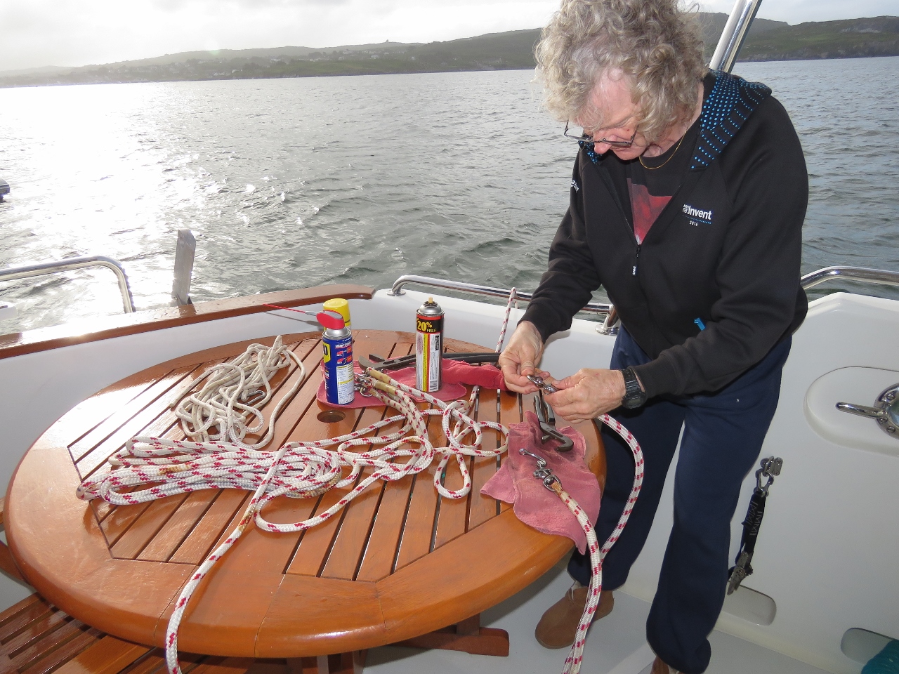 |
6/15/2017: Flopper Stopper
Position: 51°28.82'N, -9°23.74'W
The winds came up from the south yesterday, bringing waves and swell in through the entrance channel. With our bow to the waves, we were perfectly comfortable in our heavy boat. But overnight the winds switched to the southwest, putting is beam-to the swell with rolls over 13 degrees.
We decided to put out the flopper-stopper this morning to get a better sleep tonight, but found that several of the attachments had siezed up from sea water and lack of use. We've always stored them in one of the cockpit lockers and never had any trouble all through the Southern Hemisphere, so perhaps this was another casualty of the North Atlantic crossing. With liberal application of penetrating oil and patience, we got everything working again and then had the flopper-stopper deployed in minutes. We'll keep the rigging in the dry flybridge brow going forward. |
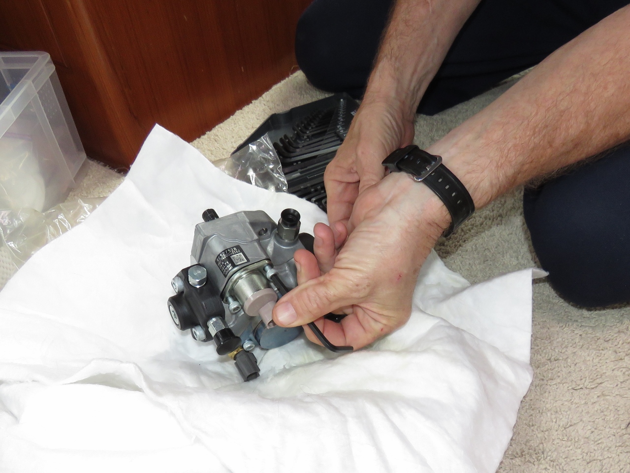 |
6/15/2017: Suction Control Valve
Position: 51°28.81'N, -9°23.73'W
James removed the suction control valve from our spare fuel pump to see if a new one would fix our 1347.7 code the main engine started signaling on our way to Sherkin Island. The engine is (thankfully) no longer constantly producing 1347.7 codes so we have it back in use. It's a relief to have more time to figure this issue out but, the bad news is the problem is still there and it going to be challenging to figure out the cause.
It now only produces a 1347.7 code rarely when lifting or dropping anchor and will never code under any condition underway at any engine load. Between coding all the time and the improved situation now, we have changed the SCV, corrected a fuel cooling sea water flow, and fixed a control system problem that had the engine room running hotter. We would love to have the problem of figuring out which of these three changes is the cause of the problem. It's easy to put the old SCV back, shut off the fuel cooler, or raise the ER temperature. We will try all three but strongly suspect that it's just fluke and it's actually none of the three conditions we changed. When chasing intermittent issues that rarely happen, it's frustrating not having access to the engine manufacturer diagnostic software. The condition is highly unlikely to occur if we pay to have a technician on the boat and, when we see it, we don't have access to the detailed information available from the diagnostic software. Hopefully some marine engine manufacturer will realize that it could be a competitive advantage and certainly would improve customer satisfaction to have this information available to operators using the engines in secluded places where service personal are often not readily available. |
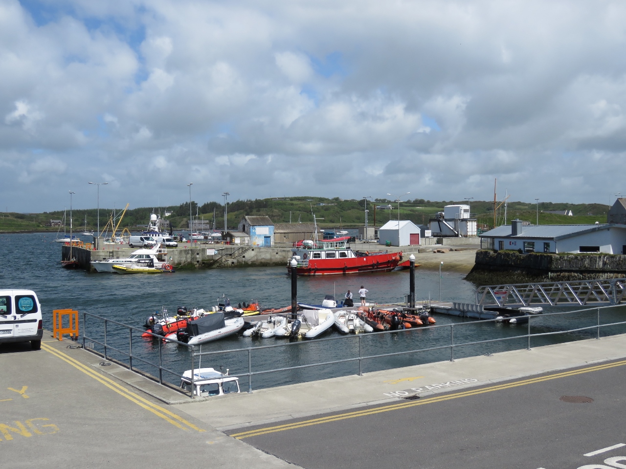 |
6/15/2017: Dinghy Dock
Position: 51°28.94'N, -9°22.46'W
Moored on the dinghy dock in Baltimore Harbour.
|
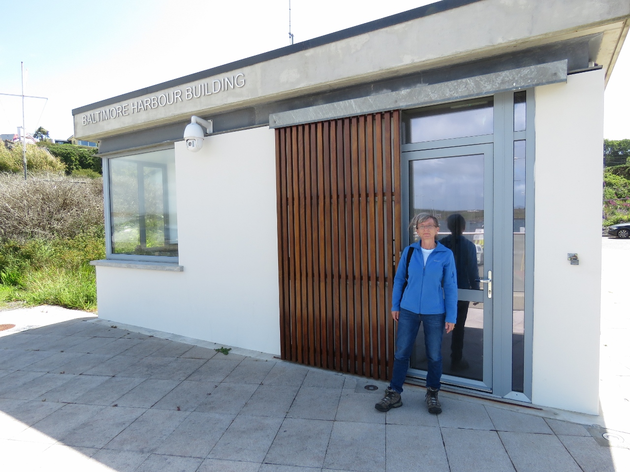 |
6/15/2017: Baltimore Harbour Building
Position: 51°28.95'N, -9°22.47'W
Baltimore Harbour charges a fee of €2 for the dinghy. Unfortunately, they didn't tell us that the gate code to return to the dock is different from the one used to exit. So when we returned to the dinghy, we couldn't get back through the gate. James climbed over to let Jennifer in.
|
 |
6/15/2017: Dun na Sead Castle
Position: 51°29.00'N, -9°22.39'W
Some form of castle or fortified house has stood on this hill above Baltimore since the early 1200s. The latest, Dun na Sead Castle, fell into disuses in the 1700s and also was owned by the O’Driscolls clan who owned Dun na Long Castle on Sherkin Island.
|
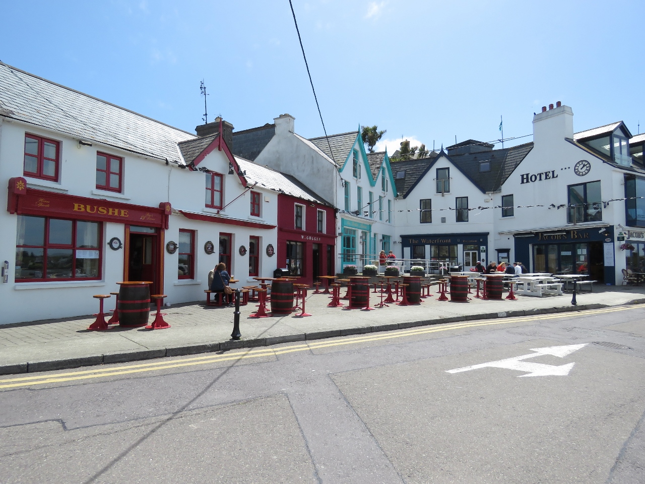 |
6/15/2017: Bushe
Position: 51°29.00'N, -9°22.39'W
We were expecting Baltimore to have more of a commercial fishing town feel, but it was an attractive town with several water-view restaurants and pubs. We had an excellent lunch on the deck at Bushe pub.
|
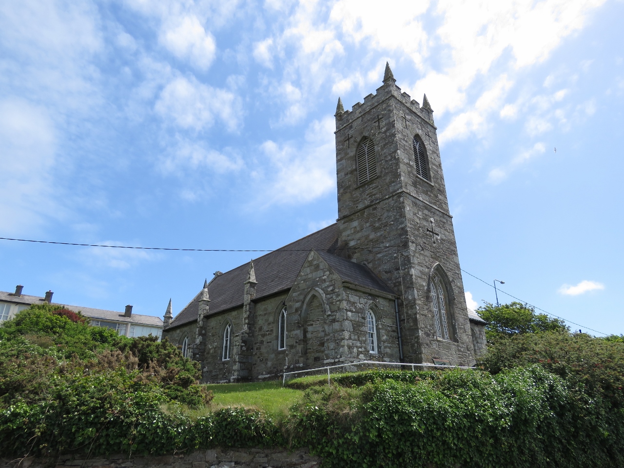 |
6/15/2017: St. Matthew's
Position: 51°28.94'N, -9°22.42'W
St. Matthew's Church of Ireland is relatively new for the area, being built in 1810.
|
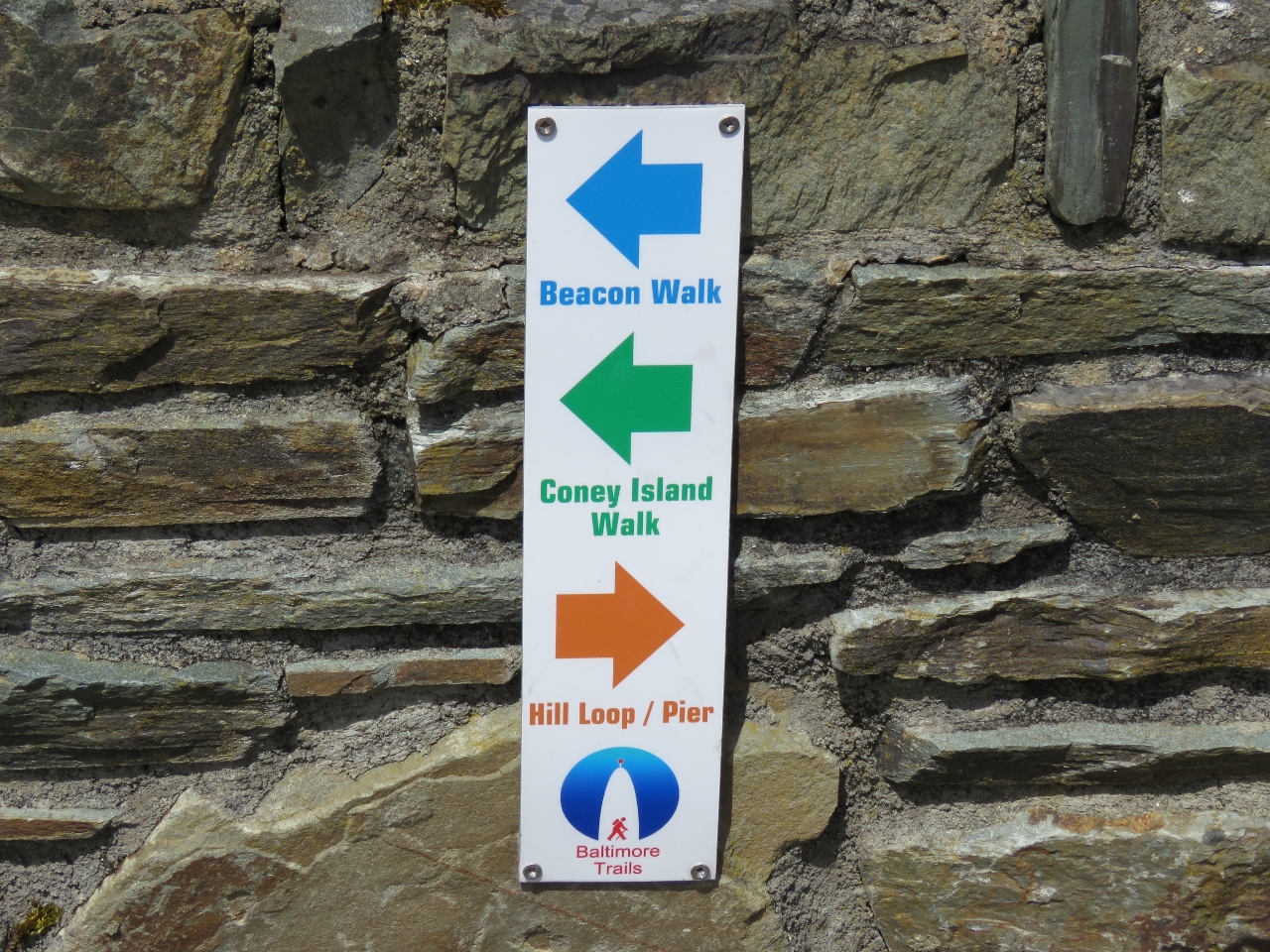 |
6/15/2017: Trails
Position: 51°28.78'N, -9°22.57'W
Several well-marked trails run in the Baltimore area. We are on the Beacon Walk to Beacon Point.
|
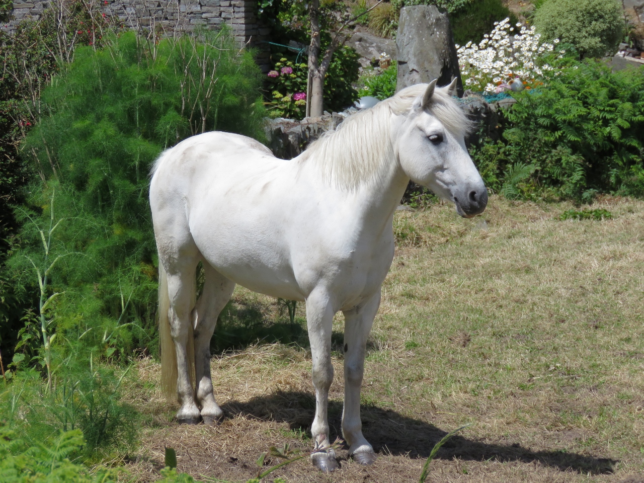 |
6/15/2017: Pony
Position: 51°28.73'N, -9°22.82'W
A beautiful white pony stood near the roadside, seemingly posing for pictures.
|
 |
6/15/2017: Goal
Position: 51°28.61'N, -9°22.87'W
There's our goal. We expected it would be further, but the Beacon is only a 20-minute walk from town.
|
 |
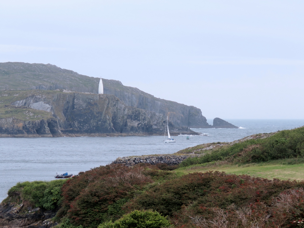
6/15/2017: Beacon
Position: 51°28.44'N, -9°23.24'W
The fabulous coastal view southwest from just behind the beacon.
|
 |
6/15/2017: Harbour Entry
Position: 51°28.42'N, -9°23.27'W
Jennifer enjoying the view across the harbor entry toward the lighthouse we visited yesterday.
|
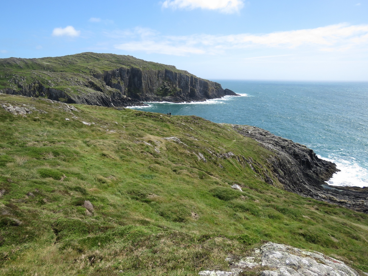 |
6/15/2017: Cliffs
Position: 51°28.43'N, -9°23.24'W
The cliffs east of Beacon Point. We're sure loving the scenery in Ireland—and these aren't even close to the most impressive cliffs.
|
 |
6/15/2017: Second Trail
Position: 51°28.61'N, -9°22.76'W
We followed a trail parallel to Beacon Road and up into the hills hoping to reach the cliffs east of the point. This is looking southwest back to the beacon from that trail.
|
 |
6/15/2017: Signal Tower
Position: 51°28.53'N, -9°22.34'W
We couldn't find a way to reach the cliffs through the private property surrounding it, but did get a good view to the Kedge Point Signal Tower we'd passed en route to Baltimore Harbour.
|
 |
6/15/2017: Stairs to Nowhere
Position: 51°28.56'N, -9°22.36'W
This house along the road had a staircase leading to a non-opening window. Perhaps it was a door at one point.
|
 |
6/15/2017: Rolf's
Position: 51°28.77'N, -9°22.16'W
The buildings and grounds of Rolf's Country House were simply beautiful. We would have loved to have stopped for a pint on their patio, but the restaurant wasn't yet open for the day.
|
 |
6/15/2017: Commercial Dock
Position: 51°29.04'N, -9°22.46'W
We returned into town along the commercial waterfront, where several capable-looking vessels were moored. This looks like one of the ferries that runs to Sherkin Island.
|
 |
6/15/2017: Baltimore
Position: 51°29.01'N, -9°22.44'W
Looking up to the town of Baltimore across a waterfront park.
|
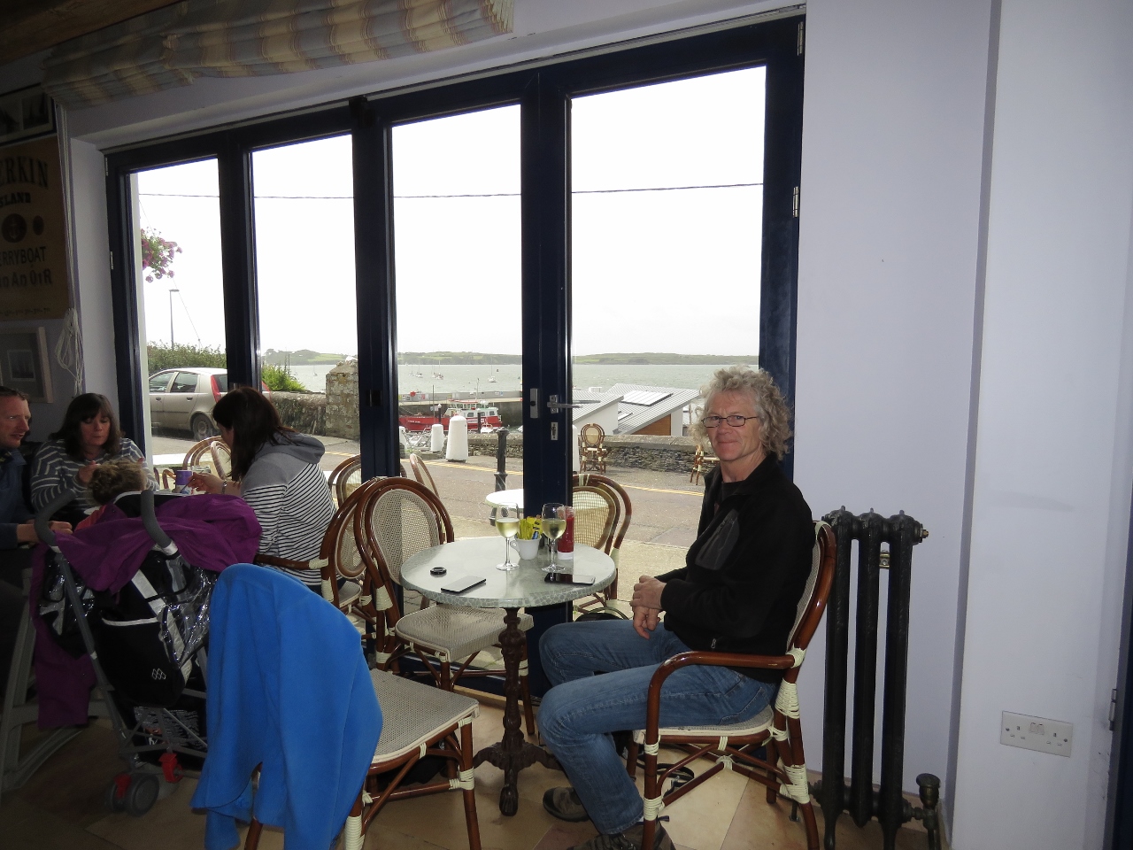 |
6/15/2017: Jacob's Bar
Position: 51°28.98'N, -9°22.39'W
We stopped off at Jacob's Bar for a glass of wine and with a waterfront view before returning back to Dirona.
|
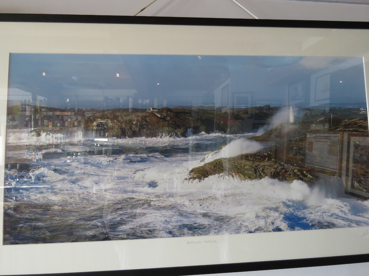 |
6/15/2017: Storm
Position: 51°28.98'N, -9°22.39'W
This picture at Jacob's Bar shows the entrance to Baltimore Harbour during a major storm, with spray hitting the beacon high up on the cliff. We'd not want to be anywhere near those conditions in Dirona.
That was one of the many appeals of Kinsale as a landfall on our Atlantic crossing: the big winds typically comes from the southwest so if we did make landfall during bad weather, we'd likely be in the lee of the Old Head well before we entered the harbor. |
 |
6/16/2017: North Channel
Position: 51°29.32'N, -9°23.76'W
We exited Baltimore Harbour through North Channel. It looked a little difficult on the chart, and our cruising guide gave a lengthy and complex description on how to transit, but it turned out to be pretty straightforward with plenty of width and depth.
|
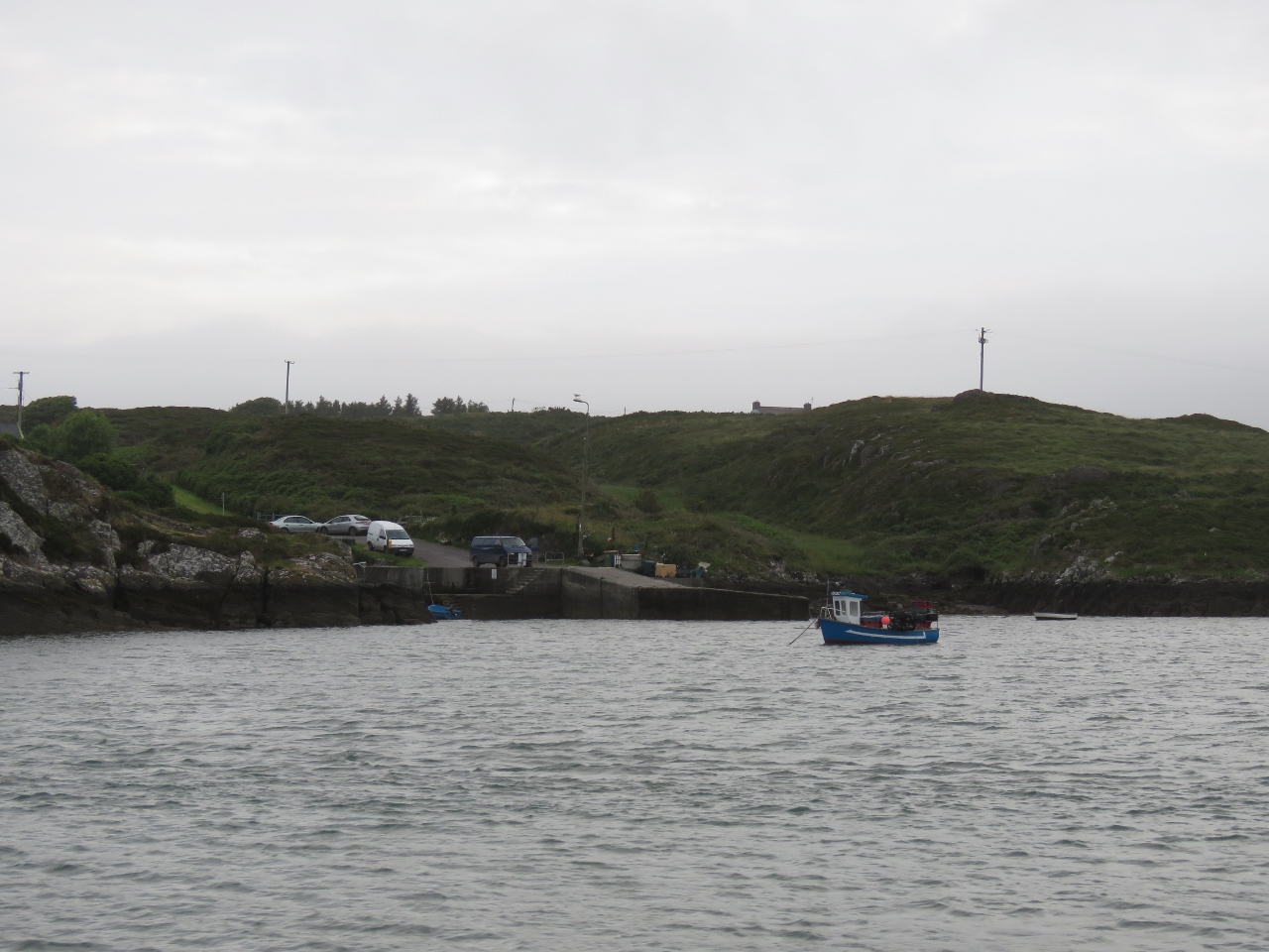 |
6/16/2017: Graiguefrehane
Position: 51°29.76'N, -9°24.40'W
A few fishing boats were moored off the wharf at Graiguefrehane.
|
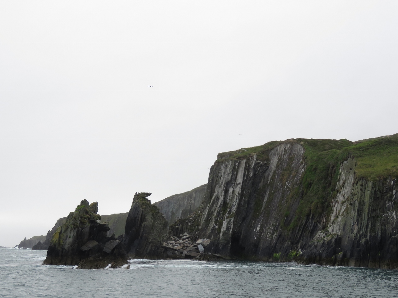 |
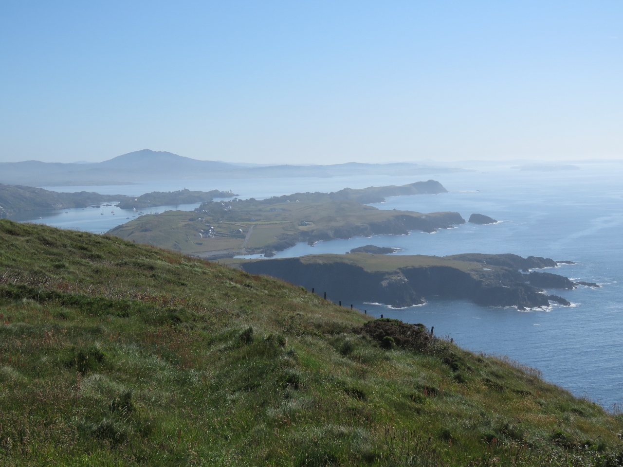
6/16/2017: Cape Clear Island
Position: 51°26.54'N, -9°30.21'W
Looking northeast along the dramatic coast off Cape Clear Island near North Harbour.
|
 |
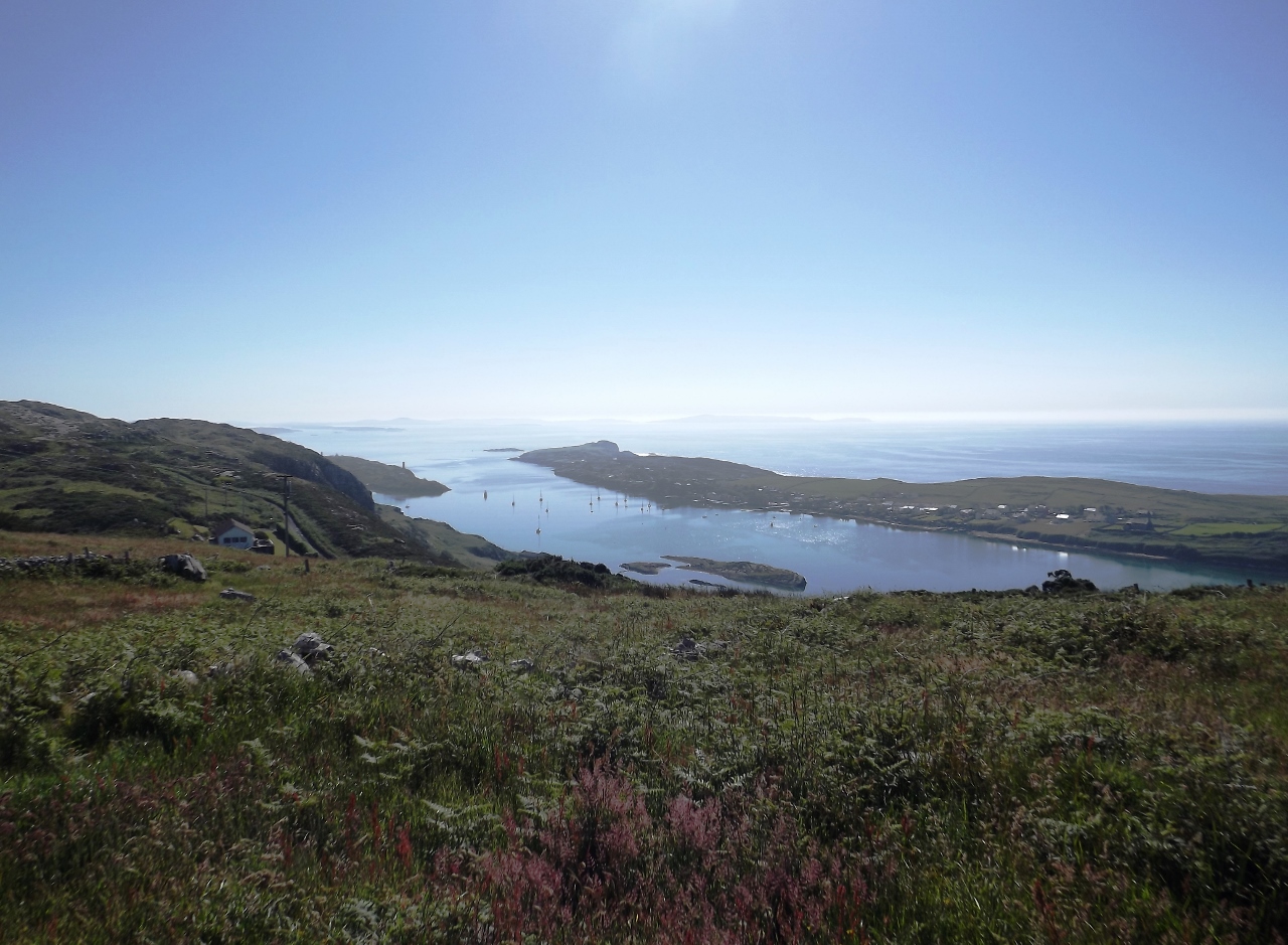
6/16/2017: North Harbour
Position: 51°26.54'N, -9°30.21'W
We nosed in to checkout tiny North Harbour on Cape Clear Island, but didn't get very far in before the charted depth was lower than we were comfortable in. You can see how small and tight the harbour is in the satellite imagery. A ferry runs here from Baltimore.
|
 |
6/16/2017: Tight
Position: 51°26.49'N, -9°30.22'W
We were right up against the cliffs entering and leaving North Harbour. The ferry ride in and out of the harbour must be exciting in big seas.
|
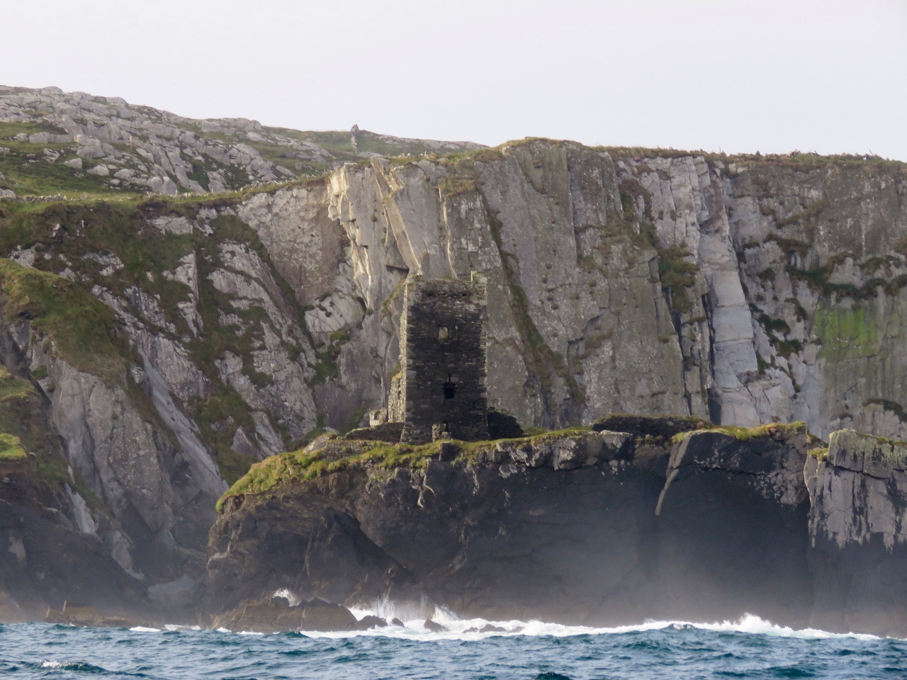 |
6/16/2017: Dun An Oir Castle
Position: 51°26.55'N, -9°30.86'W
14th-century Dun An Oir Castle, perched on a cliff just south of North Harbor, was another O'Driscoll holding. The castle took heavy cannon fire in the 16th century.
|
 |
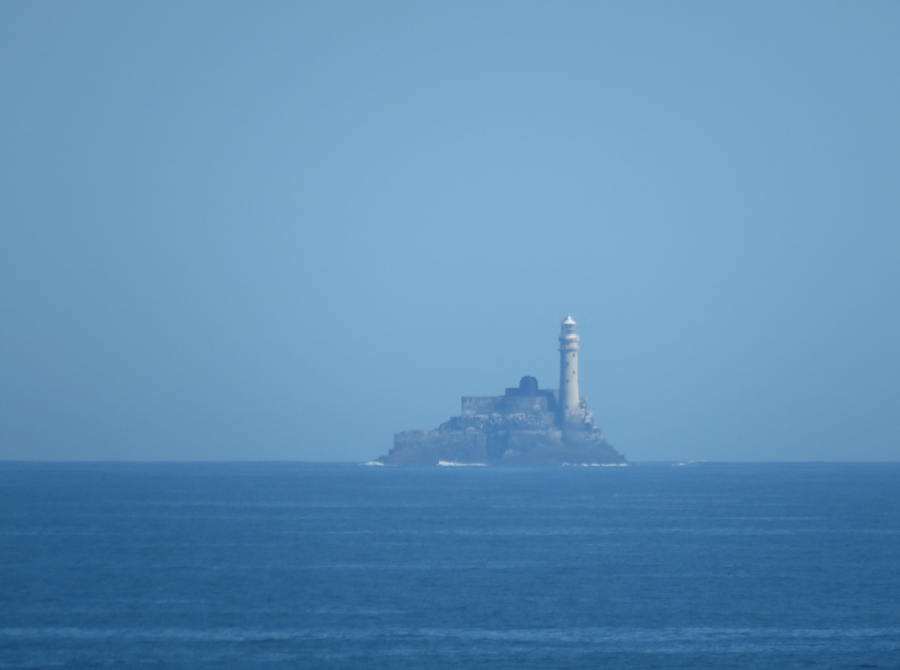
6/16/2017: Fastnet-to-Fastnet
Position: 51°24.81'N, -9°34.08'W
Fastnet Light, clearly visible about two miles ahead. It was dark when we passed a few miles south of the light on our 2,800nm Fastnet-to-Fastnet North Atlantic crossing from Newport, RI to Kinsale, Ireland. We were thrilled to see the light's bright flash illuminating the sky every five seconds, and really wanted to see the light up close in daylight.
|
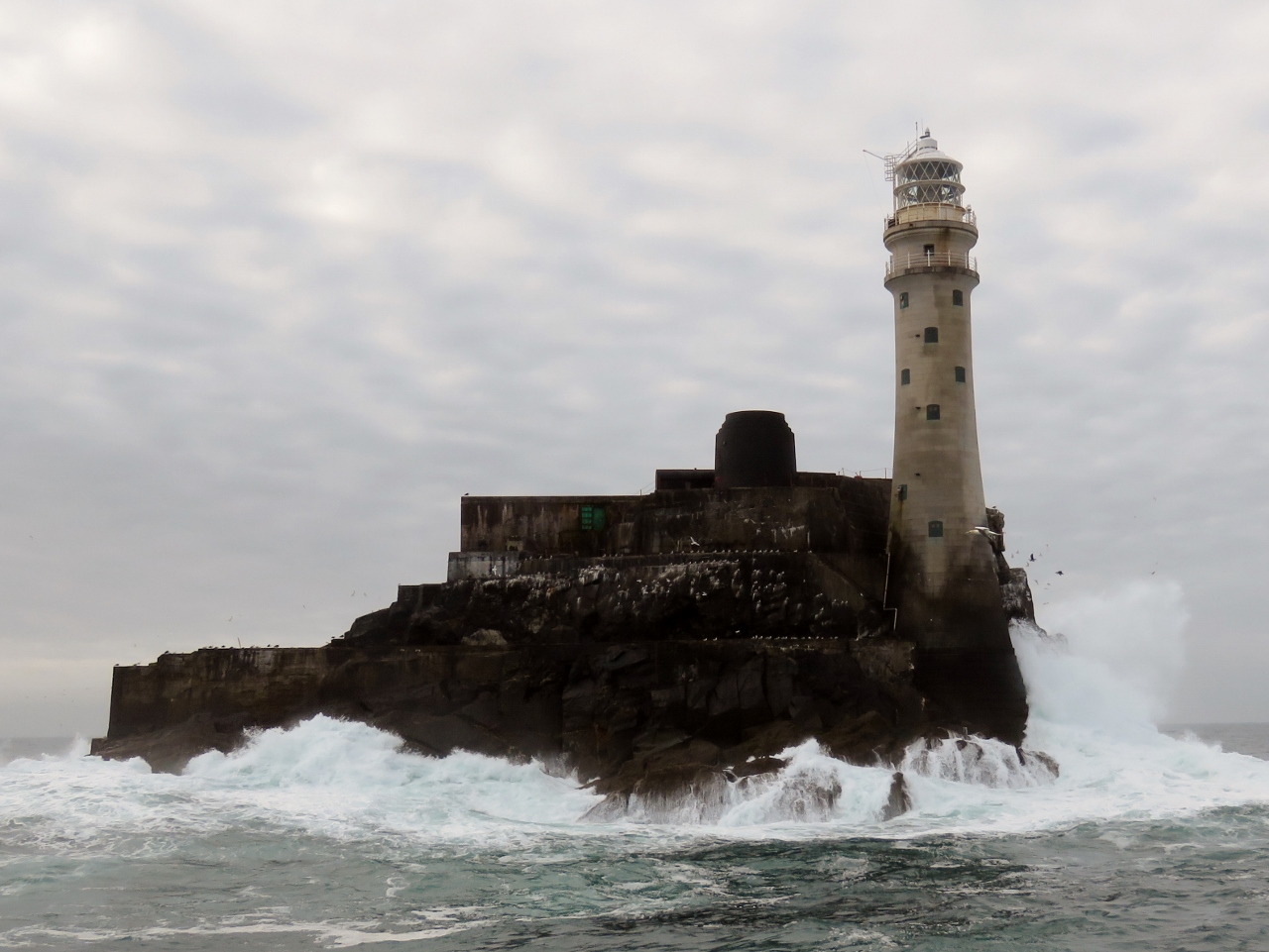 |
6/16/2017: Fastnet Rock
Position: 51°23.44'N, -9°36.21'W
Fastnet Rock is the most southern point in Ireland and the light on it is known world-wide, partly because it is the turn-around point of the classic ocean sailing race of the same name. Read more ...
|
 |
6/16/2017: Streek Head
Position: 51°28.45'N, -9°41.45'W
The soaring cliffs of Streek Head on the south side of the entrance to Crookhaven Harbour.
|
 |
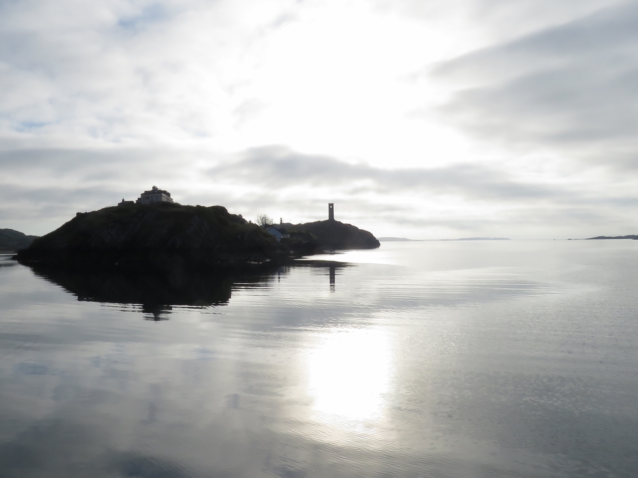
6/16/2017: Crookhaven Lighthouse
Position: 51°28.45'N, -9°42.22'W
The Crookhaven Lighthouse dates to 1843 and has been converted to guest accommodations. At the far right is a dramatic modern cottage with floor-to-ceiling glass walls and sweeping views. Not a bad place to stay.
|
 |
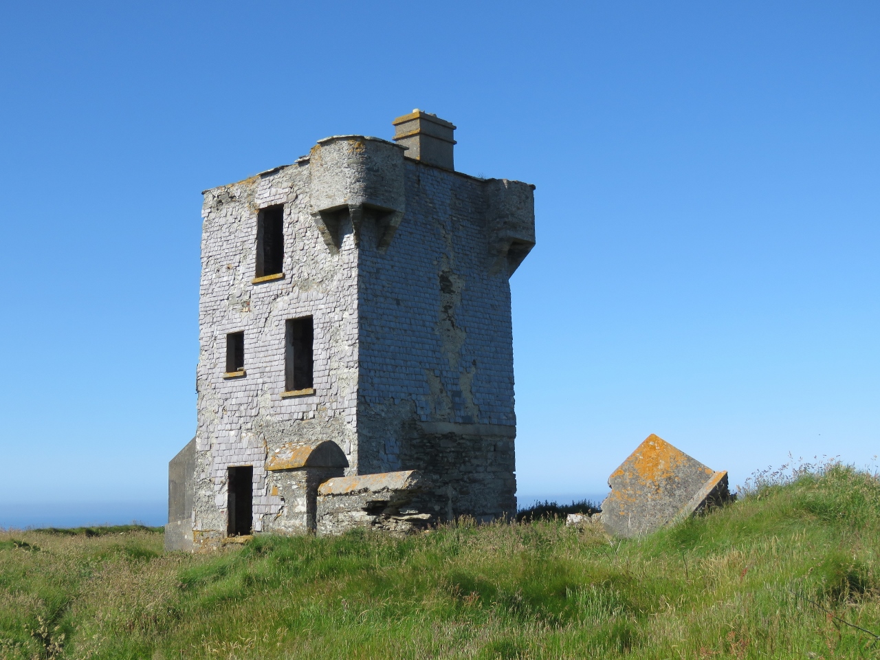
6/16/2017: Watchtower
Position: 51°28.45'N, -9°42.22'W
An old watchtower overlooking the harbour entrance.
|
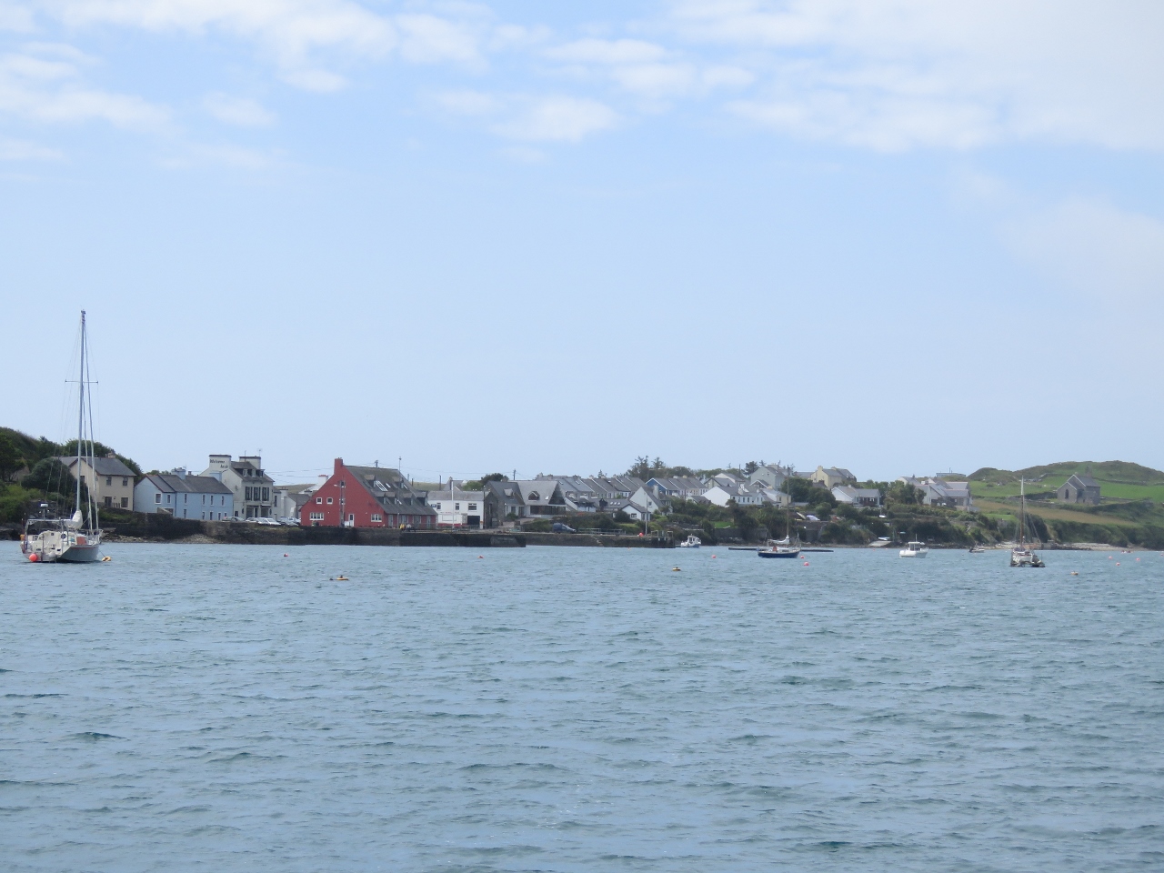 |
6/16/2017: Crookhaven
Position: 51°28.34'N, -9°43.29'W
Much of the Crookhaven Harbour is filled with moorings, but there was plenty of room to anchor at the east end. This is the view to Crookhaven village from our anchorage.
|
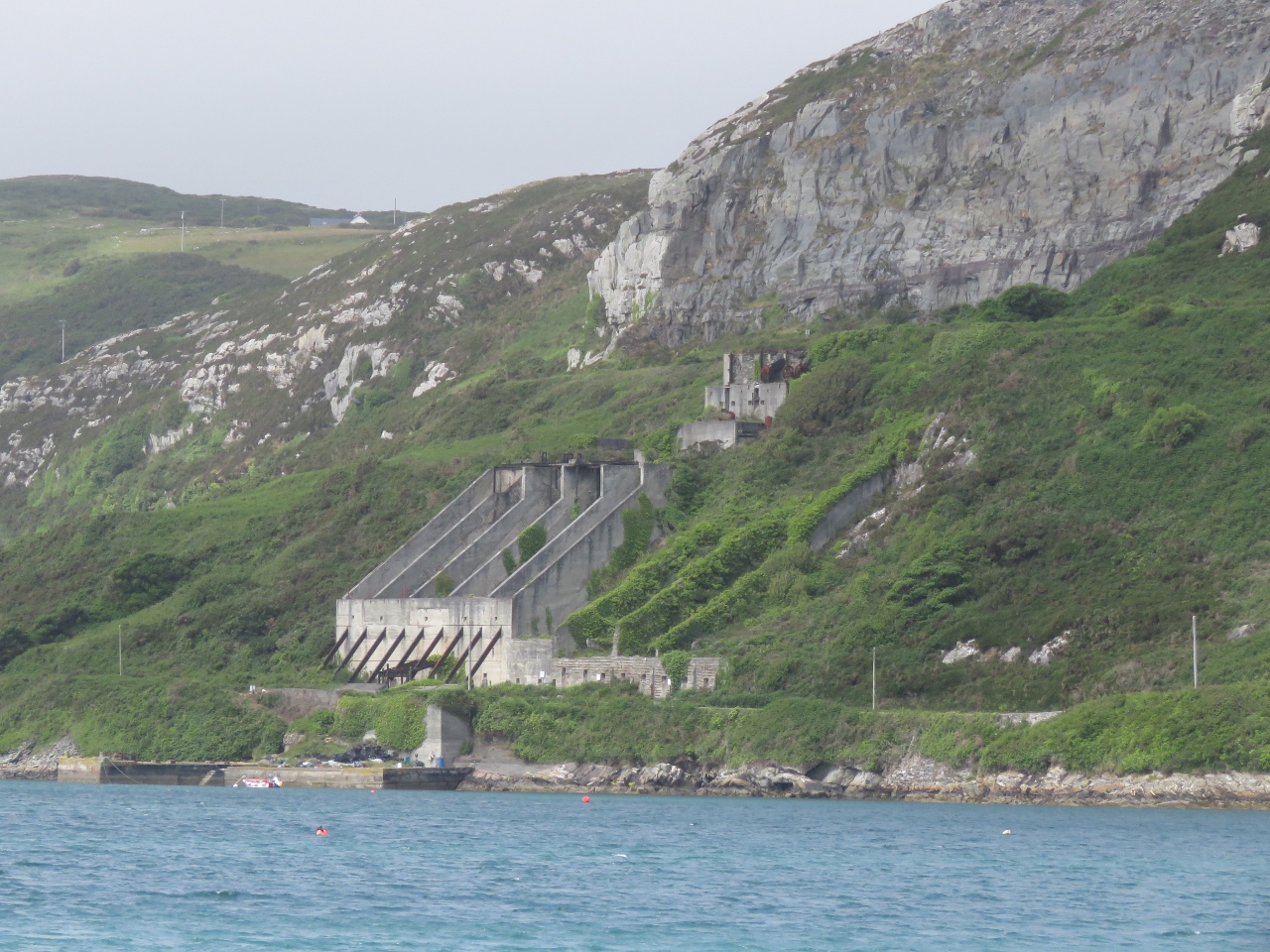 |
6/16/2017: Quarry
Position: 51°28.34'N, -9°43.29'W
The Roadstone Quarry along the north shore of Crookhaven Harbour supplied gravel for Welsh roads until the the 1930s.
|
 |
6/16/2017: Second Watchtower
Position: 51°28.35'N, -9°43.29'W
A second watchtower visible from the anchorage.
|
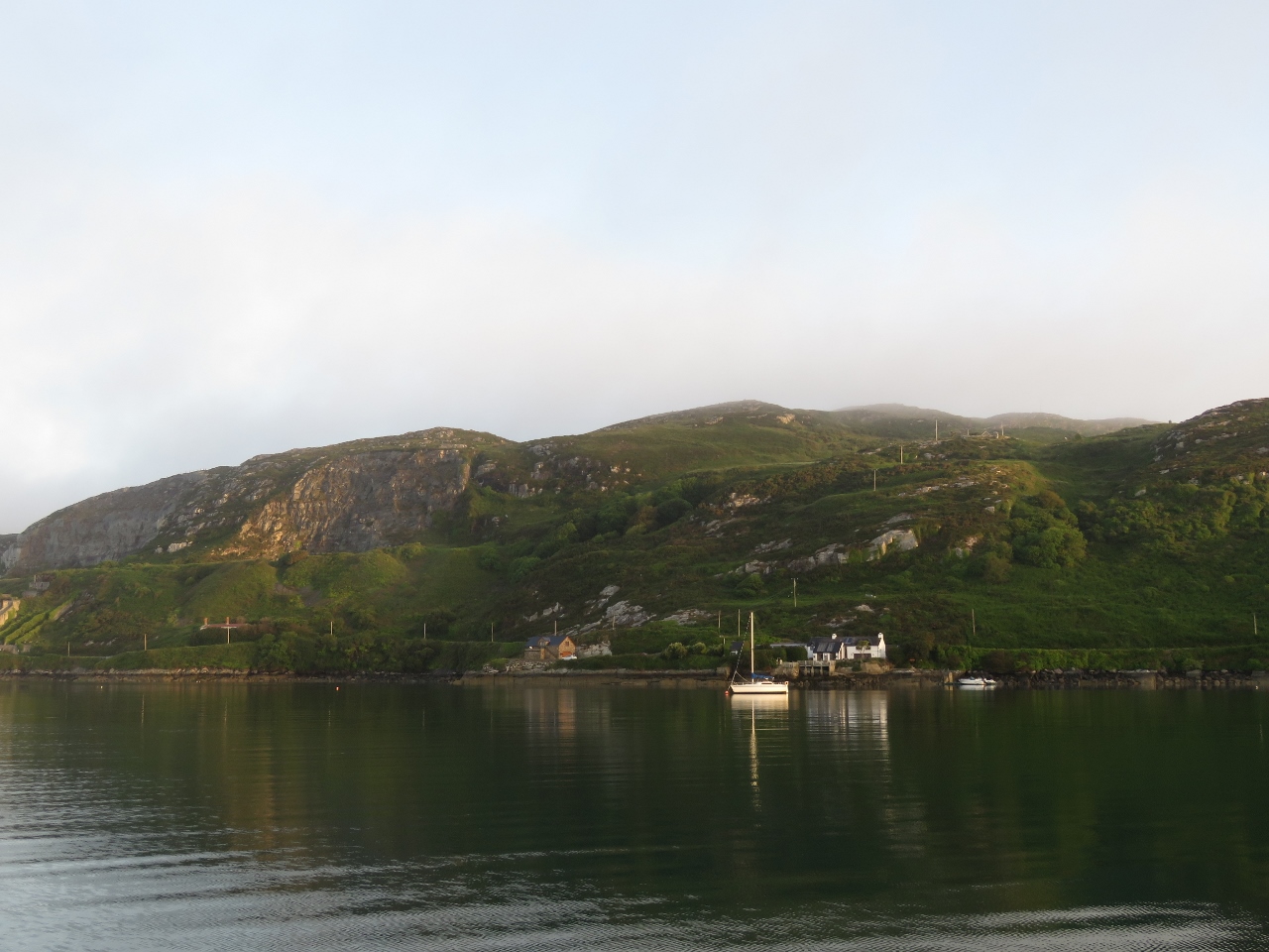 |
6/17/2017: Morning Light
Position: 51°28.34'N, -9°43.29'W
We'd heard Crookhaven was a good anchorage but not how beautiful it was. We were reminded of Newfoundland, Canada or Stewart Island, New Zealand.
|
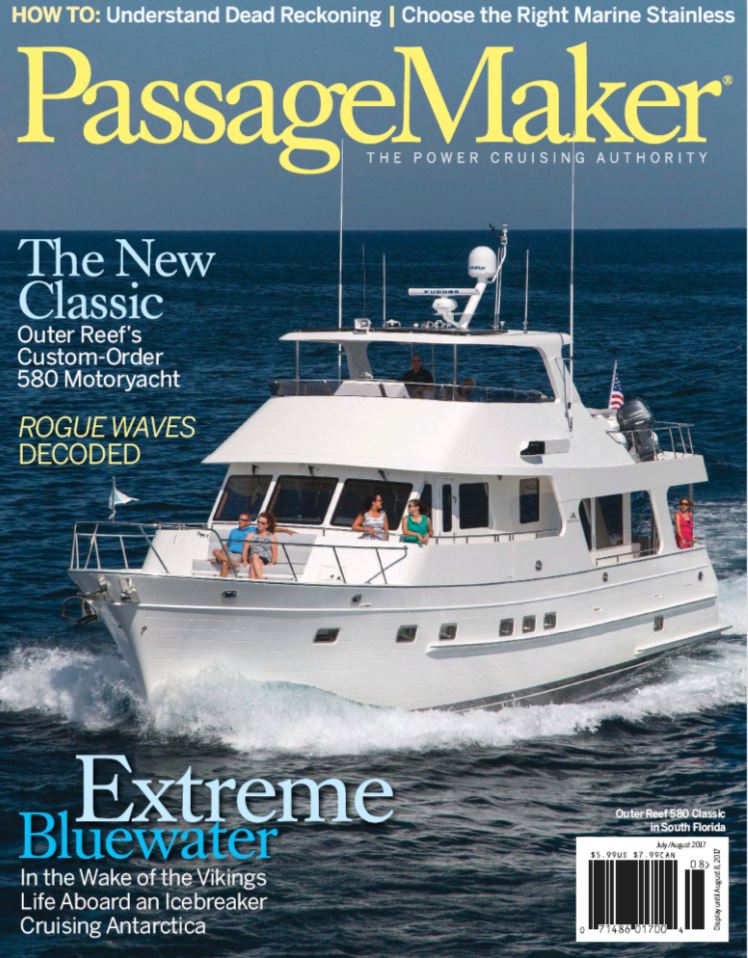 |
6/17/2017: PassageMaker
Position: 51°28.35'N, -9°43.30'W
The July/August ssue of PassageMaker Magazine is now available, with the final article in our three-part series on cruising the world under power. The first article covered planning and various aspects of being underway; the second article describes how we made the logistic complexities fade into the background so we could enjoy the trip; and this final installment covers how we rigged Dirona for the trip.
The published articles are available online: |
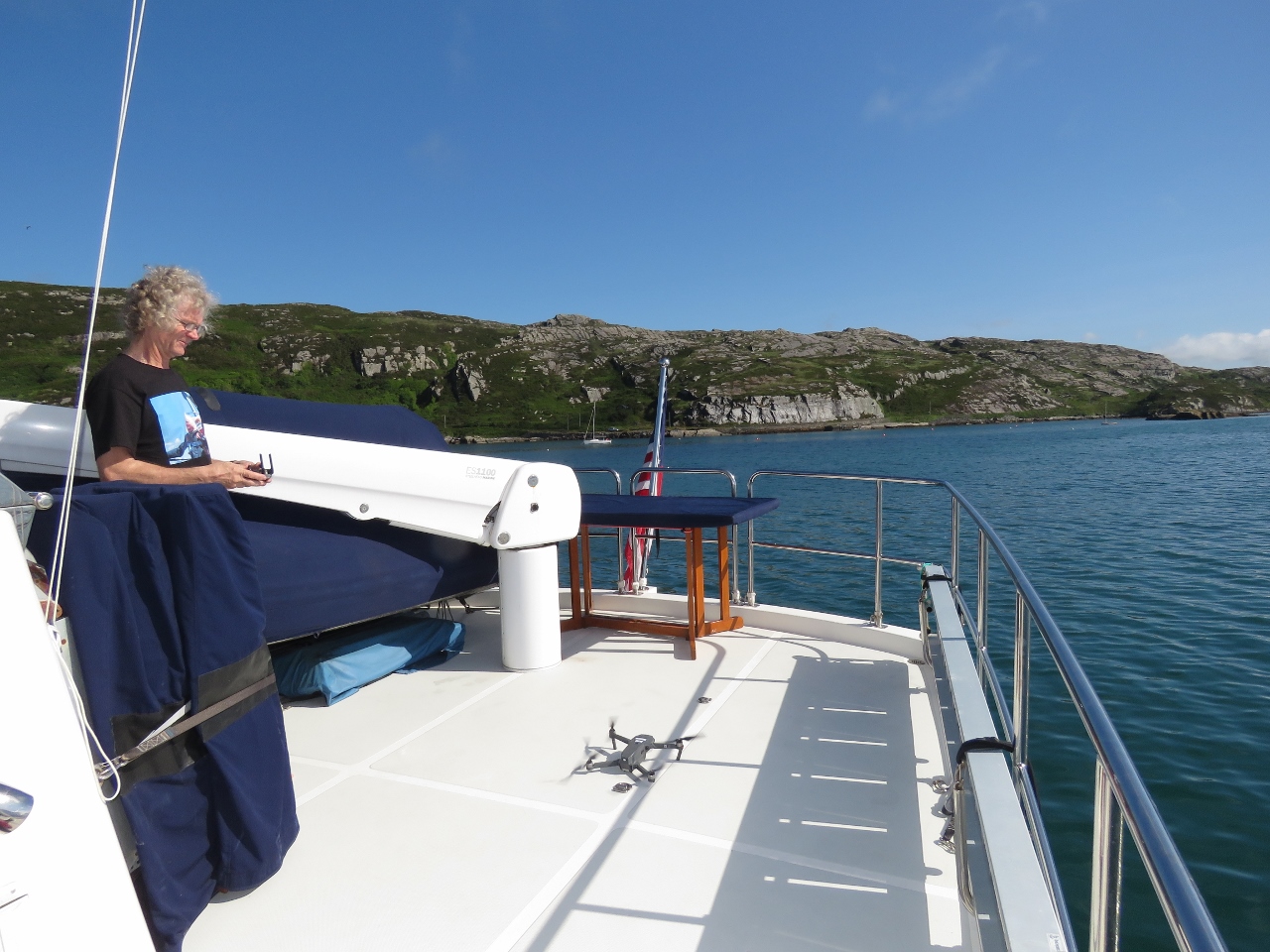 |
6/17/2017: Drone
Position: 51°28.35'N, -9°43.30'W
This morning we made our first drone flight from a moving platform, with the boat slowly drifting at anchor. We shifted the boat deck table aft to make a larger landing area, but found it easier to take off from the table rather than the deck.
|
 |
6/17/2017: Crookhaven Harbour
Position: 51°28.35'N, -9°43.30'W
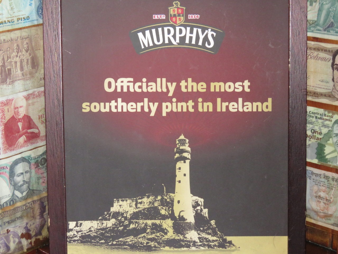
Crookhaven Harbour is one of the nicest anchorages in southwestern Ireland. We spent three nights there and visited Brow Head, Mizen Head, and of course stopped at the famous O’Sullivans to enjoy “The most southerly pint in Ireland”.
The video Crookhaven, Ireland From The Air shows aerial footage of Dirona and the harbour. |
 |
6/17/2017: Ciaran and Jim O'Meara
Position: 51°28.35'N, -9°43.30'W
Friendly Crookhaven residents Ciaran and Jim O'Meara stopped by to say hello and give us some recommendations on local attractions.
|
 |
6/18/2017: Morning Light
Position: 51°28.34'N, -9°43.32'W
One of the two watchtowers in Crookhaven Harbour back-lit in the morning sun.
|
 |
6/18/2017: Bicycles
Position: 51°28.34'N, -9°43.32'W
We stow our bicycles under a custom canvas cover on the flybridge. To bring them ashore from an anchorage, we secure the bikes in the tender on the boat deck and launch them all together. The whole process of getting the bikes ready to go and in the tender, and everything ready for shore launch, takes less than ten minutes.
|
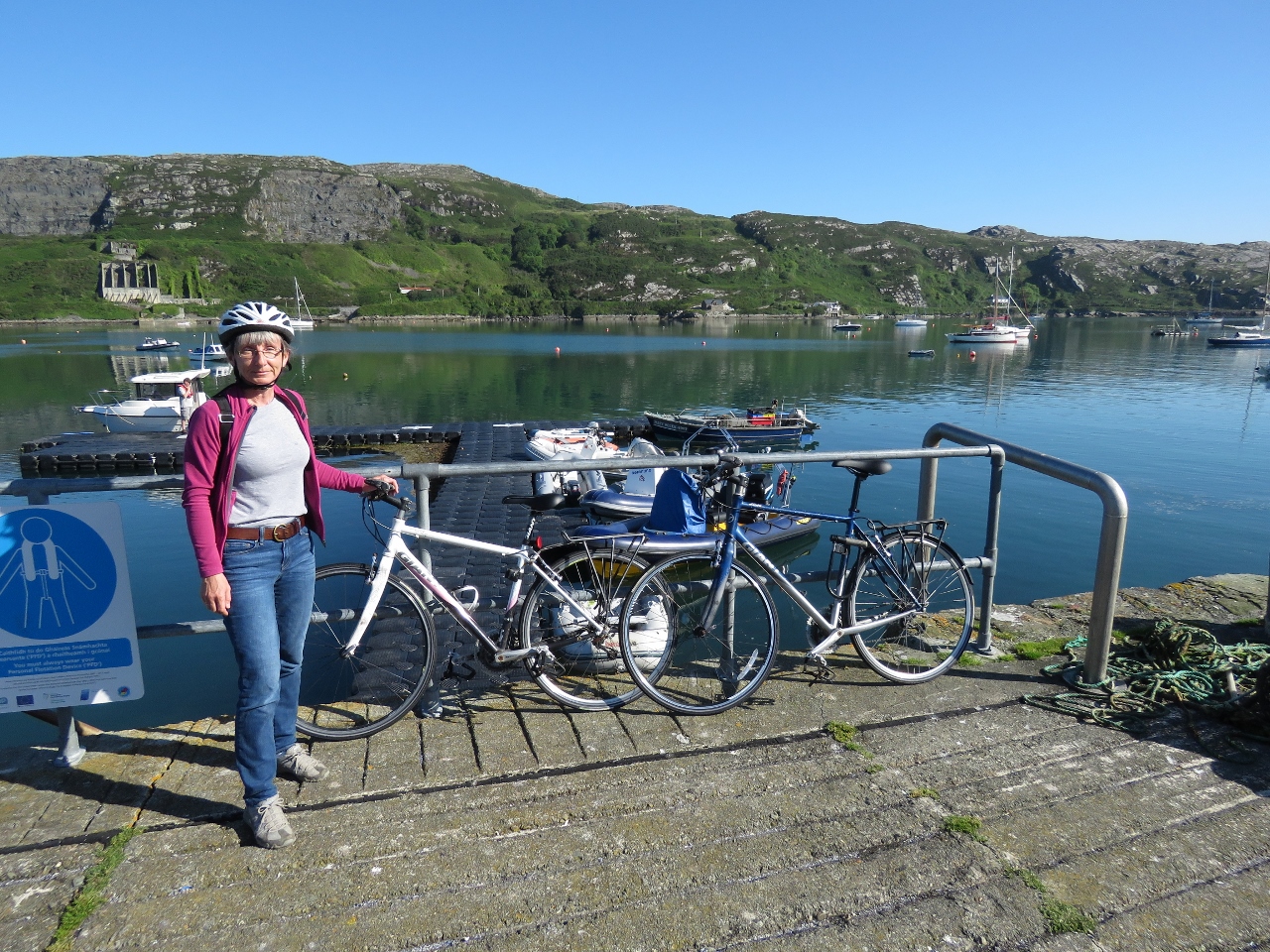 |
6/18/2017: Landed
Position: 51°28.16'N, -9°43.56'W
Crookhaven has a convenient floating dinghy pontoon with stairs at the head. We dropped the bikes off near the head to carry up the stairs, and secured the tender farther out (you can just see it above the top guardrail).
|
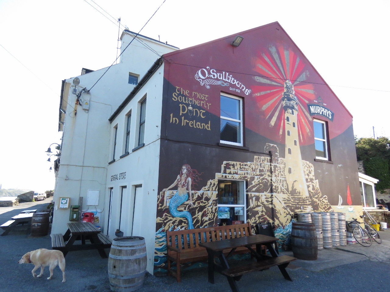 |
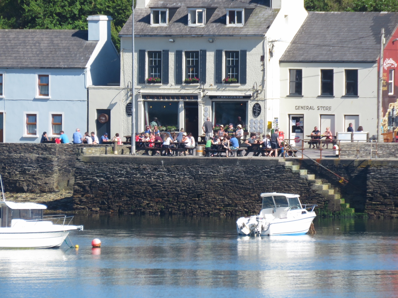
6/18/2017: O'Sullivans
Position: 51°28.15'N, -9°43.56'W
It's too early in the day to enjoy "the most southerly pint in Ireland" at O'Sullivans, but we'll definitely be back.
|
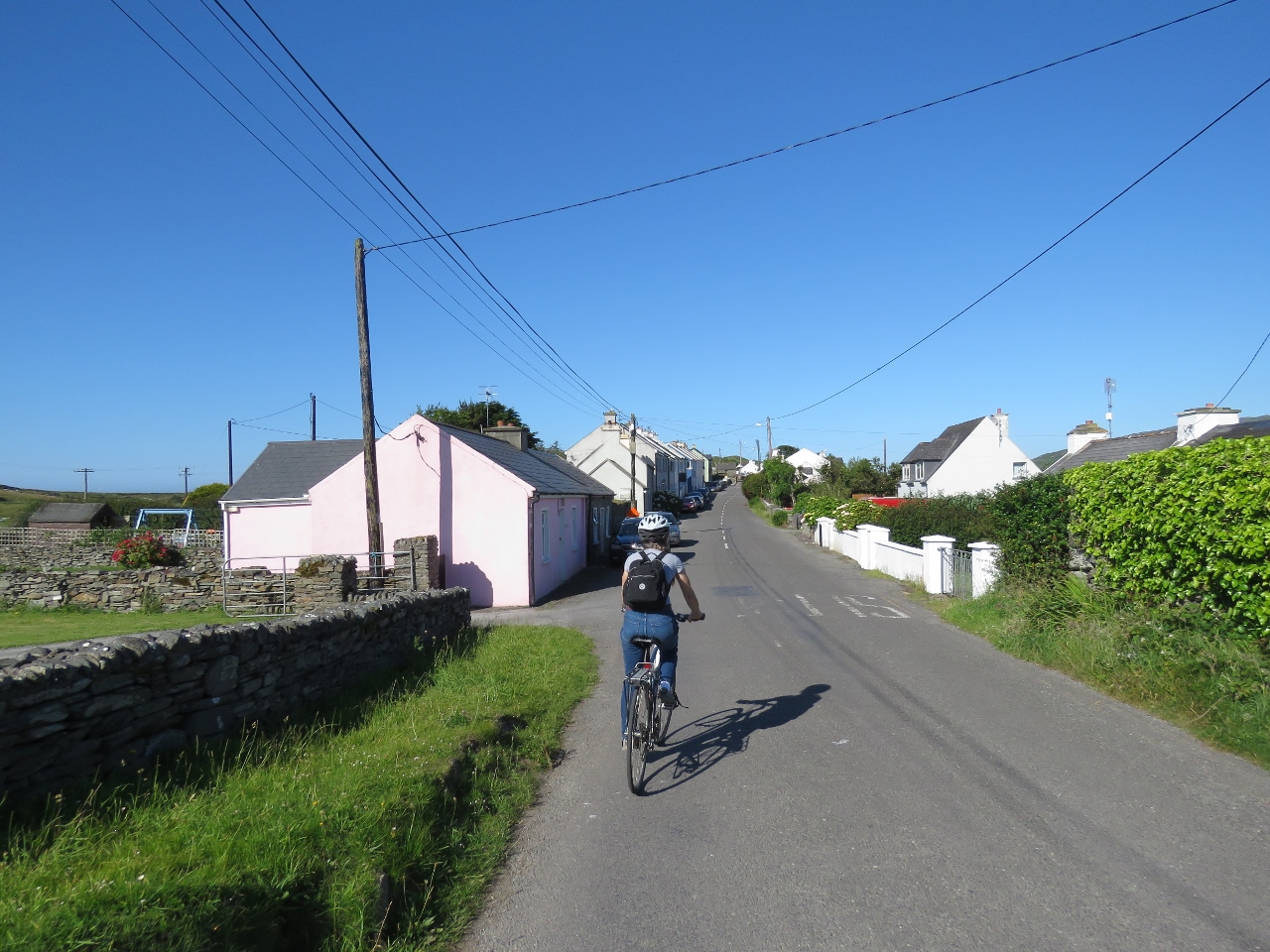 |
6/18/2017: En Route
Position: 51°28.16'N, -9°43.49'W
Setting off on the bikes through the village of Crookhaven.
|
 |
6/18/2017: Galley Cove from East
Position: 51°27.54'N, -9°45.13'W
Our first stop on today's bicycle tour is Brow Head. The road climbs quickly to 354ft above sea level, making for a tiring climb. But the reward is some fabulous views, particularly on this clear and sunny day.
|
 |
6/18/2017: Summit View
Position: 51°27.28'N, -9°45.55'W
We can see for miles from the summit of Brow Head on this clear day. This is looking slightly northeast—we couldn't determine the mountain visible in the distance.
|
 |
6/18/2017: Crookhaven Harbour
Position: 51°27.27'N, -9°45.56'W
Looking down to Crookhaven Harbour from Brow Head.
|
 |
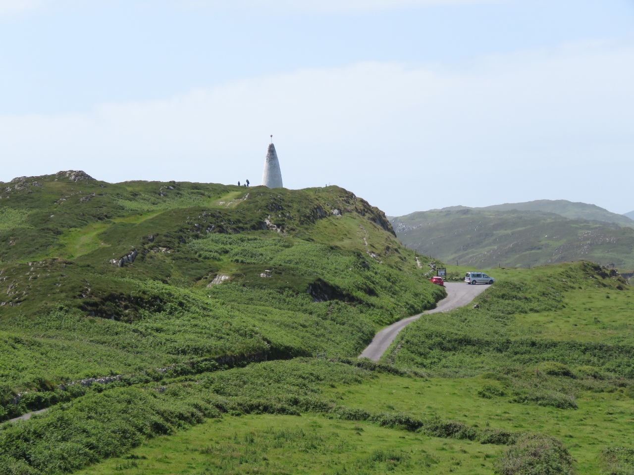
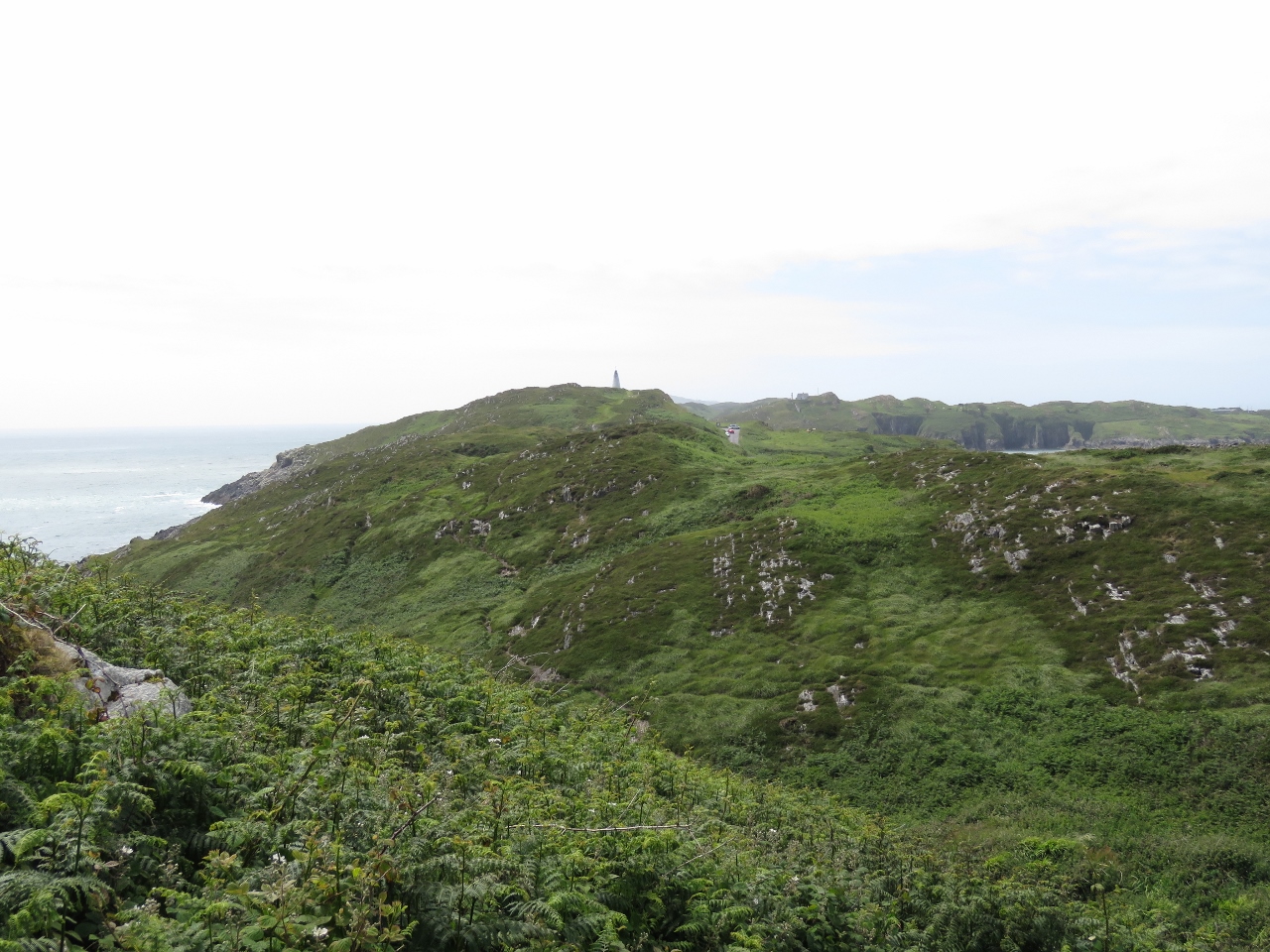
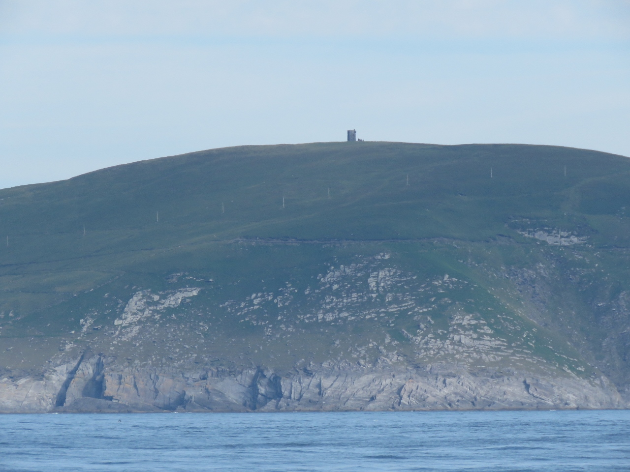
6/18/2017: Signal Tower
Position: 51°27.33'N, -9°45.52'W
The signal tower on Brow Head was one of the 81 signal towers built along the Irish coast during the Napoleonic era to give early warning of a French invasion.
|
 |
6/18/2017: Brow Head
Position: 51°27.25'N, -9°45.57'W
A century after the Napoleonic-era signal tower was built, The Marconi Wireless Telegraph company installed telegraphic equipment on Fastnet Rock and a station on Brow Head. Passing ships signaled the Fastnet Lighthouse and the keepers relayed the message wirelessly to Brow Head for transmission to the final recipient. And a century after that, Brow Head was one of the filming locations for Star Wars Episode VIII.
The old signal tower can be seen for miles, and ruins of Marconi's station are visible at the head, including the four square blocks that make up the radio tower base near where we are standing. We couldn't find any evidence of the Star Wars set though. The video Brow Head: From Napoleon to Marconi to Skywalker was shot from the air above Brow Head looking down on the dramatic stone structures on the cliff edge. |
 |
6/18/2017: Road
Position: 51°27.44'N, -9°45.32'W
Looking down the road leading back to sea level from Brow Head. The road was suprisingly busy for early in the morning—we passed three people on the way up and another two on the way down.
|
|
|
6/18/2017: High Above
Position: 51°27.27'N, -9°45.56'W
Ciaran O'Meara sent us this photo of Crookhaven Harbour taken from their house. What a fabulous view they have.
|
 |
6/18/2017: Crookhaven Head
Position: 51°27.64'N, -9°44.86'W
From Brow Head, we continued around Crookhaven Harbour toward Mizen Head. This is looking northeast across the sandy beach at the head of Crookhaven Harbour.
|
 |
6/18/2017: Dirona
Position: 51°27.64'N, -9°44.86'W
The view to our anchorage from the head of Crookhaven Harbour.
|
 |
6/18/2017: Beach
Position: 51°27.87'N, -9°45.45'W
People were just starting to arrive at this beach along Barleycove on the Atlantic side.
|
 |
6/18/2017: Barleycove
Position: 51°28.02'N, -9°46.89'W
We cycled around Barleycove and up above on the other side for a sweeping view back. The sand dunes behind Barleycove Beach are visible on the left and the Brow Head signal tower is visible on the right.
|
 |
6/18/2017: Boardwalk
Position: 51°27.99'N, -9°46.88'W
A boardwalk leads from the parking lot across sand dunes and a stream to popular Barleycove Beach. We've never associated Ireland with beaches, but we've seen several nice ones today.
|
 |
6/18/2017: View to Brow Head
Position: 51°27.40'N, -9°47.82'W
Looking southeast from above Barleycove to the signal tower on Brow Head.
|
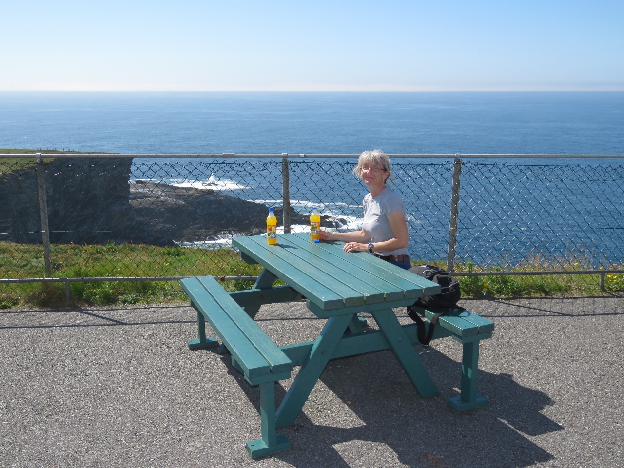 |
6/18/2017: Break
Position: 51°27.10'N, -9°48.66'W
A quick beverage break overlooking the sea at the Mizen Head Signal Station visitor center. The station was built in 1909 to sound a fog signal warning ships away from the dangerous headland.
|
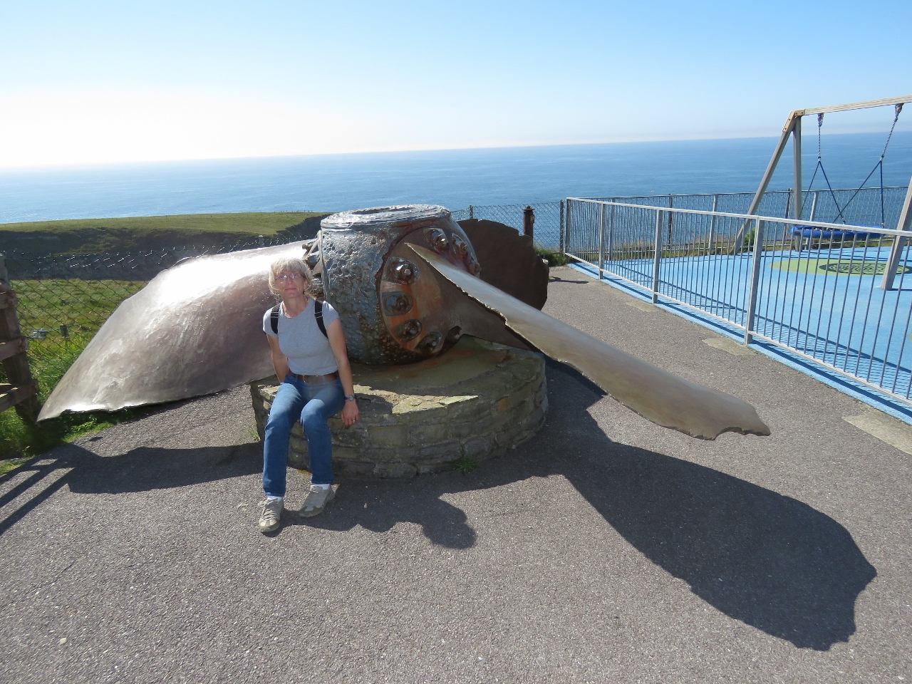 |
6/18/2017: Irada
Position: 51°27.10'N, -9°48.63'W
The propeller from the British steamship Irada that struck the rocks off Mizen Head in December of 1908. The navigator had been unable to establish their position after several days of heavy seas and blinding fog when the ship went aground. Six on board perished and the remaining sixty-three were rescued by workmen building the fog signal station.
|
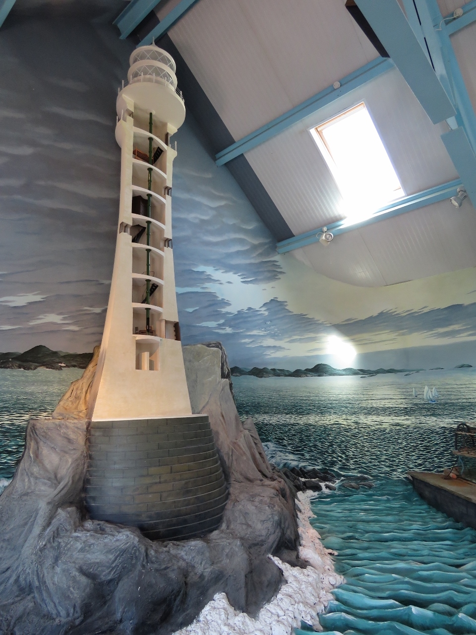 |
6/18/2017: Fastnet Lighthouse
Position: 51°27.09'N, -9°48.67'W
The Mizen Head visitor center has several interesting displays detailing the construction of the Fastnet Lighthouse.
|
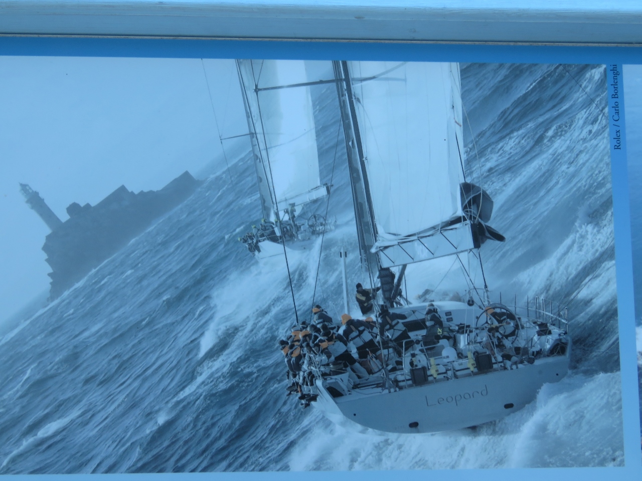 |
6/18/2017: Rounding Fastnet
Position: 51°27.09'N, -9°48.67'W
A striking photograph in the museum showing super-maxis raceboats Rambler and Leopard three seconds apart as they round Fastnet Rock during the 2007 Fastnet Race. (This Rambler is a predecessor to the Rambler we watched in the 2014 Sydney Hobart race.) The start of the 2007 Fastnet race had been postponed by 25 hours due to a severe weather warning, the first time in the race's 83-year history. Even with the delay, gale force winds and extreme seas forced over three-quarters of the boats to retire. Despite difficult sea conditions, Leopard took advantage of the high winds and won in 44 hours 18 min, taking almost 9 hours off the previous record set in 1999.
|
 |
6/18/2017: Storm
Position: 51°27.09'N, -9°48.67'W
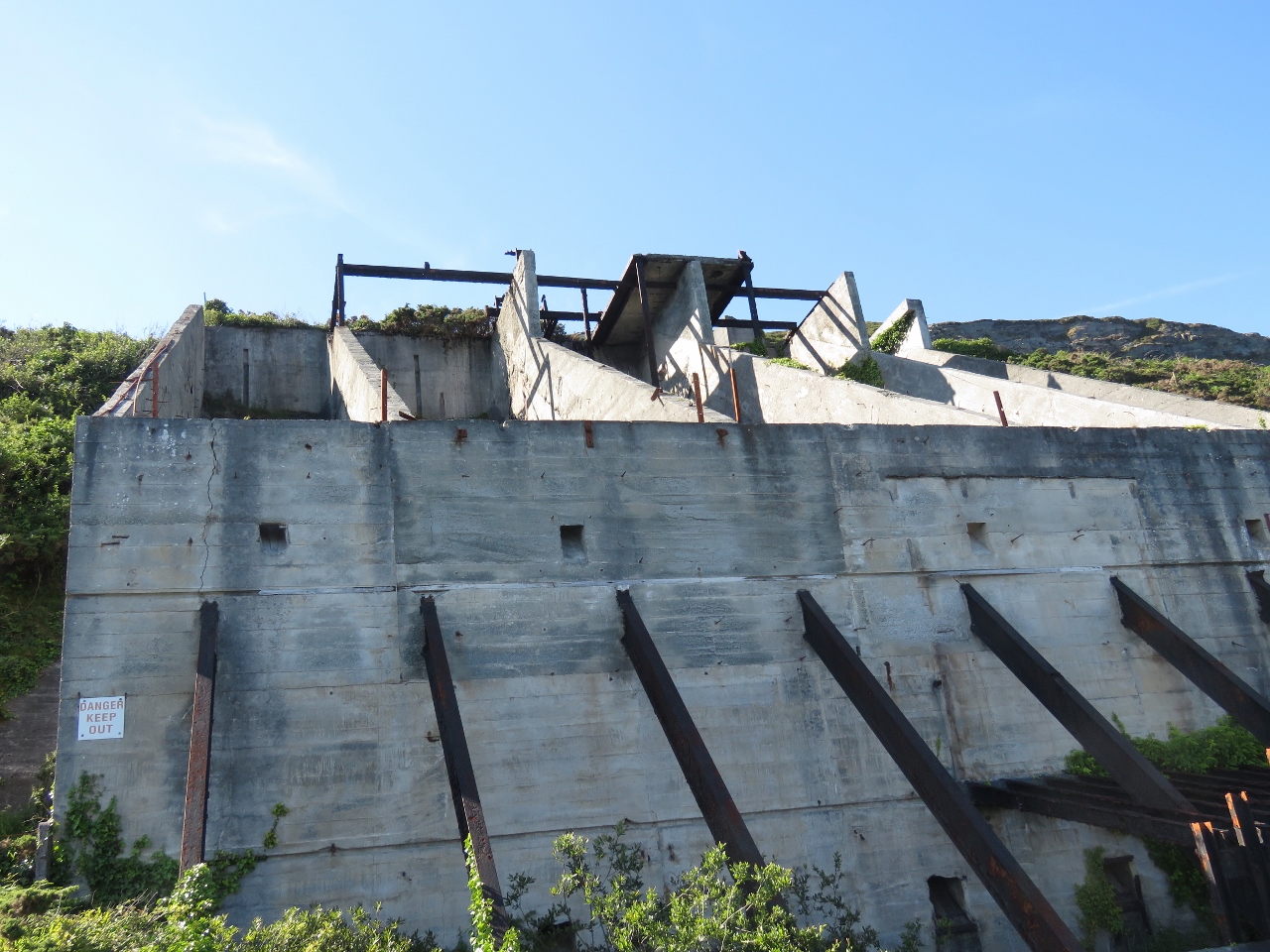
Another photograph in the museum shows spray well above the signal station from waves crashing into Mizen Head. The Mizen Head light (hidden by the station on the seaward side) is 180ft (50m) above sea level, so the waves must be huge to send spray that high.
|
 |
6/18/2017: Visitors Center
Position: 51°27.09'N, -9°48.67'W
A model of the visitors center in their museum. The signal station sits on the tip of the peninsula (far left), cutoff from the mainland by a deep chasm, with a bridge spanning the gap. Visitors can cross the bridge and gaze down into the sea far below, then tour the station perched on the cliff edge. Our video Mizen Head Signal Station and Lighthouse shows the spectacular cliff and seascape views from several of the lookouts shows in the model.
|
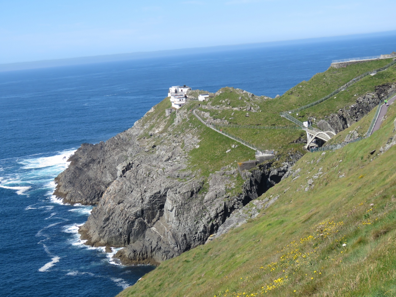 |
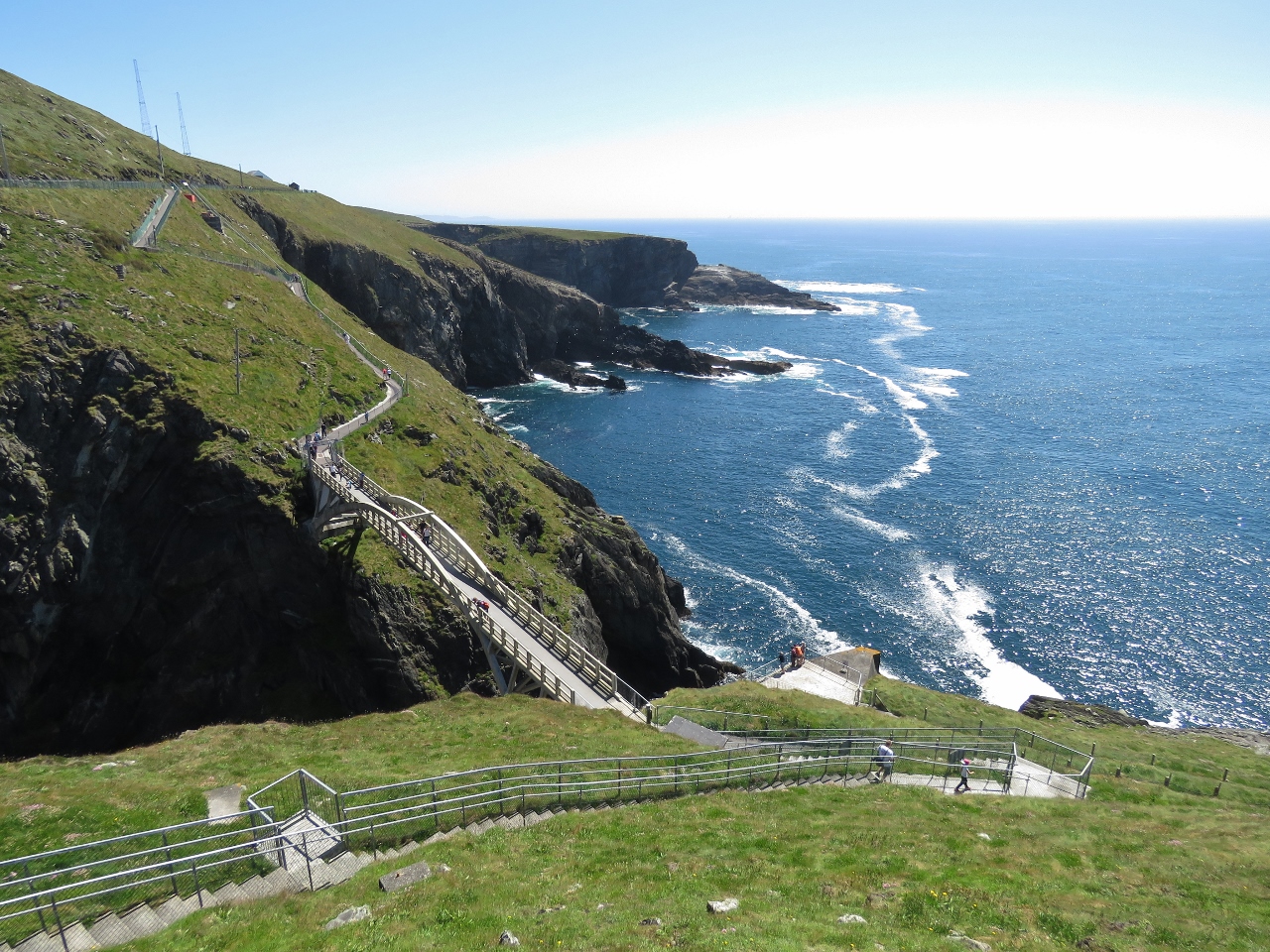
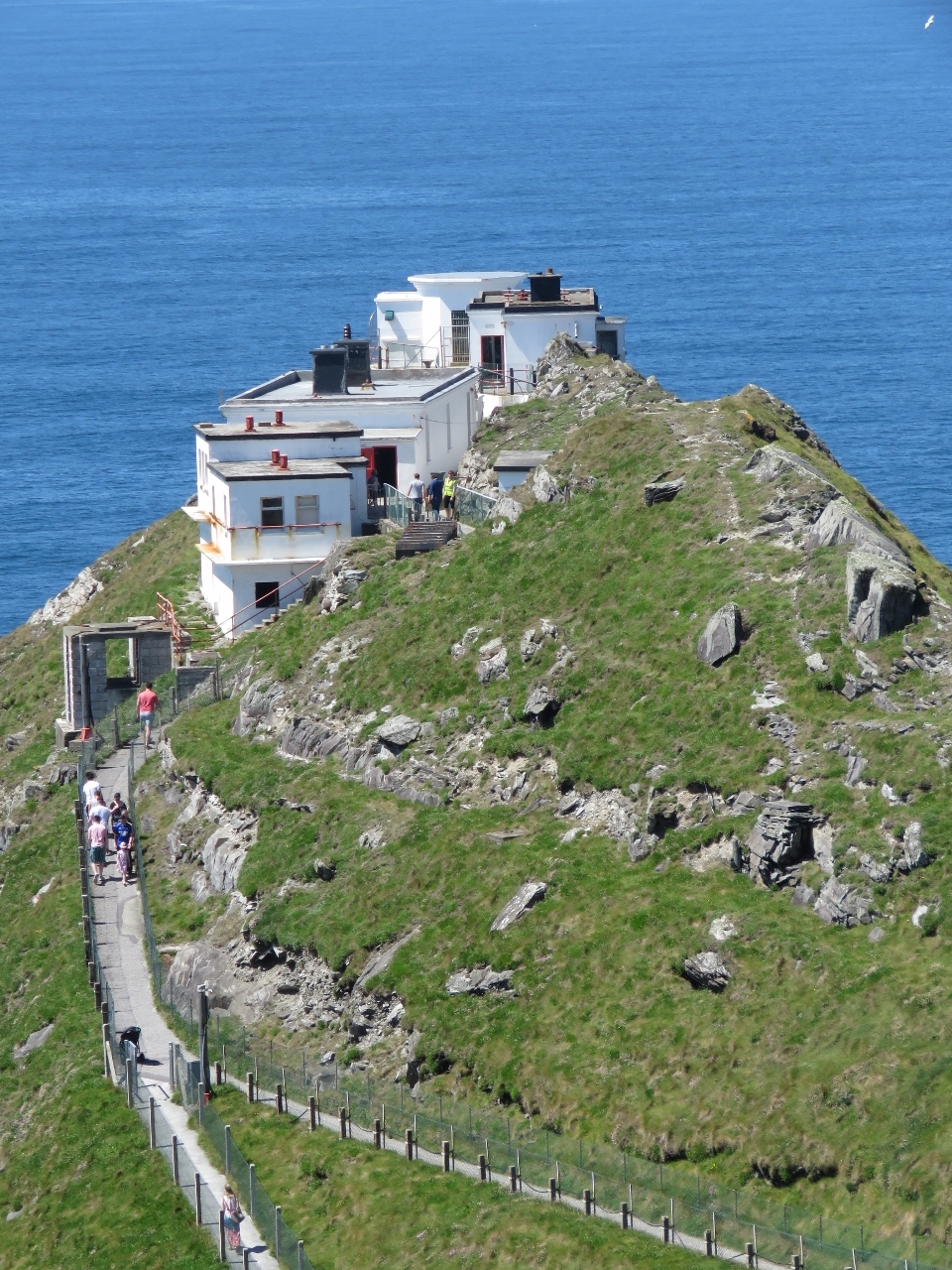
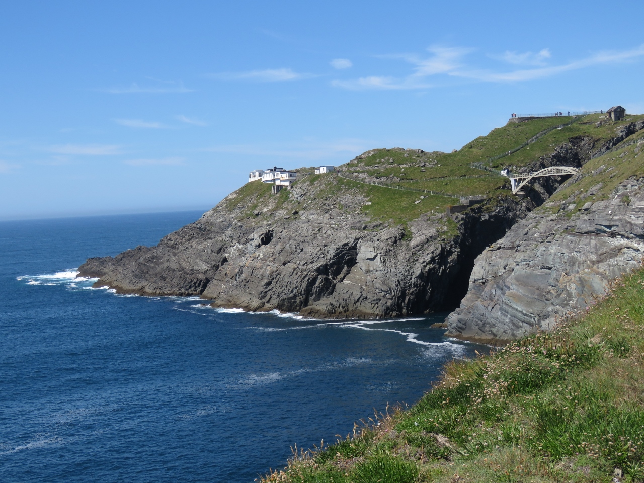
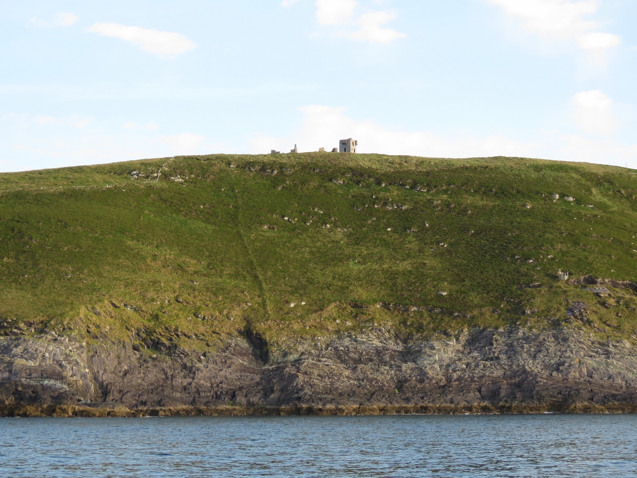
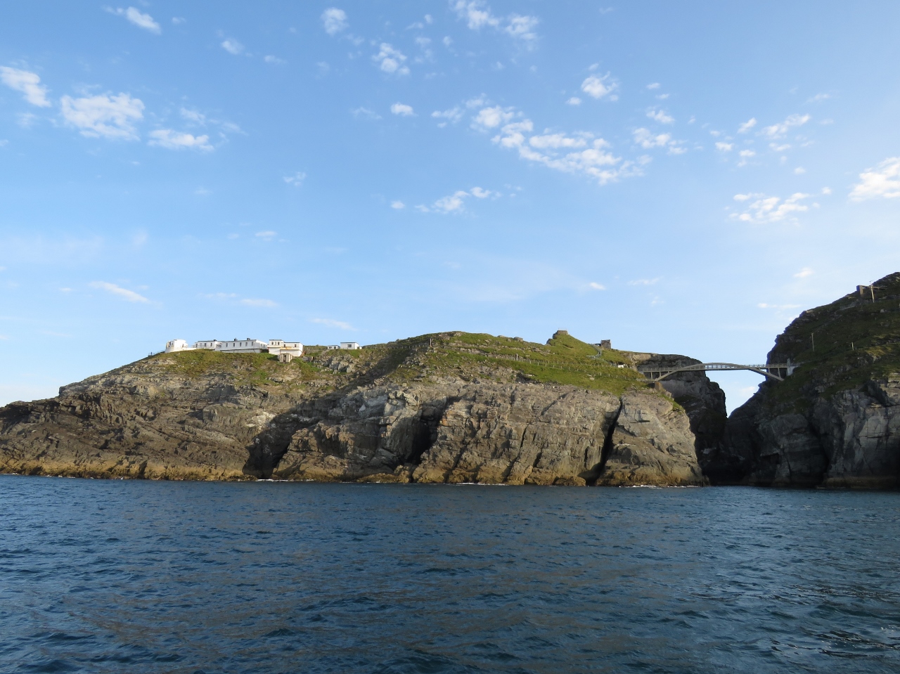
6/18/2017: Mizen Head
Position: 51°27.09'N, -9°48.69'W
The signal station perched on the cliff edge at Mizen Head with the pedestrian bridge visible on the right.
|
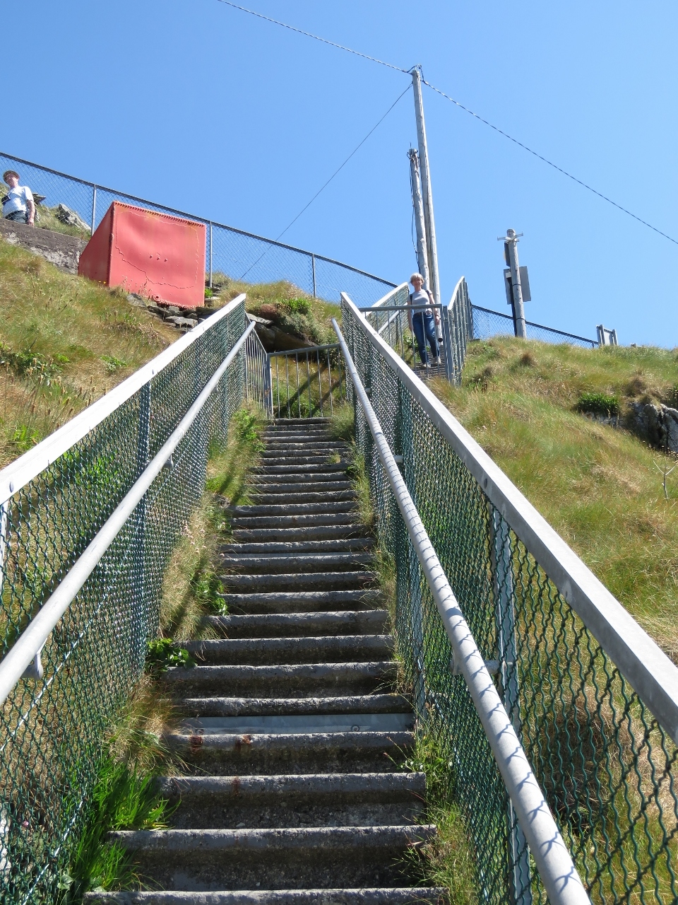 |
6/18/2017: 99 Steps
Position: 51°27.08'N, -9°48.82'W
Jennifer descending the original 99 steps used the access the station.
|
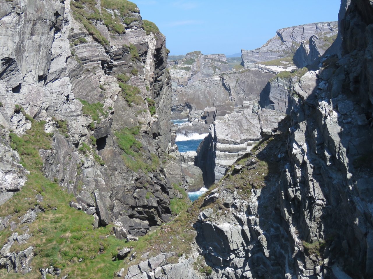 |
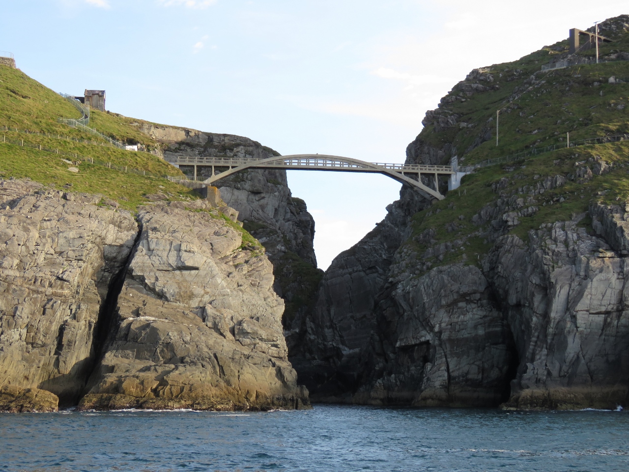
6/18/2017: View from Bridge
Position: 51°27.06'N, -9°48.96'W
North of Mizen Head, cliffs divide the shore into multiple small bays, viewed here from the pedestrian bridge.
|
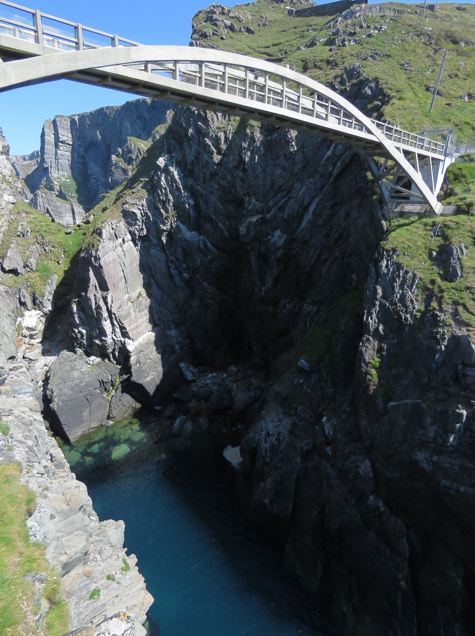 |
6/18/2017: Footbridge
Position: 51°27.05'N, -9°49.03'W
One of the paths leads to a lookout directly below the bridge.
|
 |
6/18/2017: Marconi
Position: 51°27.03'N, -9°49.07'W
Guglielmo Marconi lived and worked in Crookhaven from 1901 to 1914, installing wireless telegraph equipment at a number of nearby locations, including Fastnet Rock, Brow Head and Mizen Head. Some of the original Marconi Wireless equipment is on display at the signal station.
|
 |
6/18/2017: Breakers
Position: 51°27.01'N, -9°49.18'W
Even on a relatively calm day, the shores around Mizen Head look treacherous.
|
 |
6/18/2017: View North
Position: 51°27.07'N, -9°49.04'W
The fabulous view north from one of the lookouts. This is the same seascape we could see from the bridge.
|
 |
6/18/2017: Gully
Position: 51°27.09'N, -9°49.07'W
Looking way down into a gully north of the signal station.
|
 |
6/18/2017: View East
Position: 51°27.07'N, -9°49.06'W
The view northeast across the pedestrian bridge. The scenery here is just amazing.
|
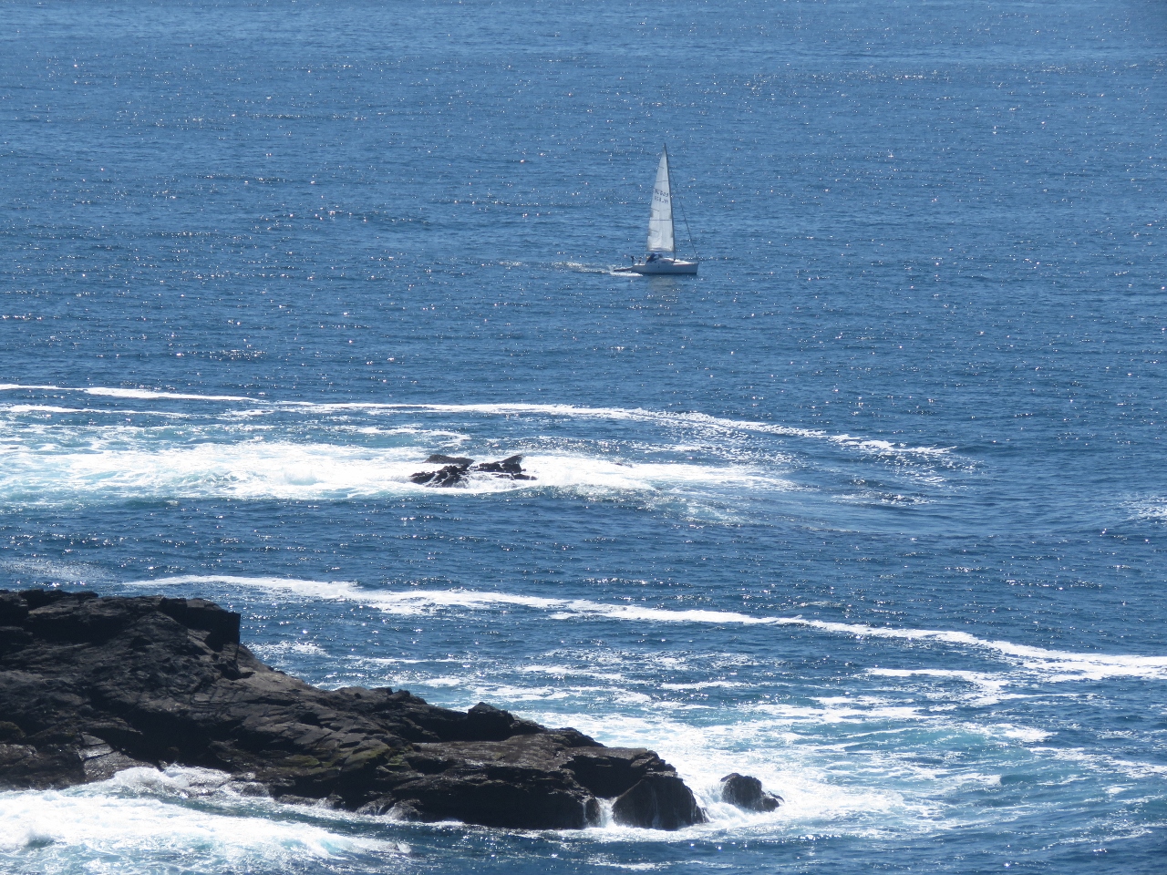 |
6/18/2017: Sailboat
Position: 51°27.08'N, -9°48.92'W
A sailboat about to round Mizen Head.
|
 |
6/18/2017: Signal Station
Position: 51°27.08'N, -9°48.93'W
The signal station complex.
|
 |
6/18/2017: Looking Back
Position: 51°27.04'N, -9°48.71'W
Another path leads almost down to sea level to a viewing point across from a sea arch. This is the view from that path back to Mizen Head, the signal station and the pedestrian bridge.
|
 |
6/18/2017: Sea Arch
Position: 51°27.02'N, -9°48.72'W
The sea arch below the visitor's center museum.
|
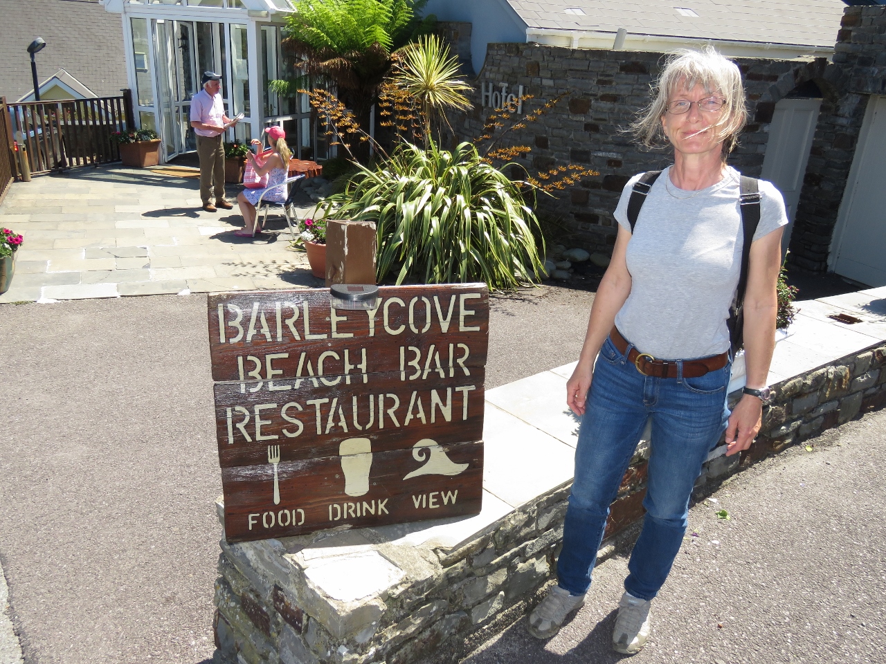 |
6/18/2017: Three Out Of Three
Position: 51°28.19'N, -9°46.87'W
We were planning to return to Crookhaven for lunch at O'Sullivans, but this sign for the Barleycove Beach Bar met all our requirements.
|
 |
6/18/2017: Lunch
Position: 51°28.17'N, -9°46.86'W
And what a view it was. We had an excellent meal overlooking Barleycove Beach.
|
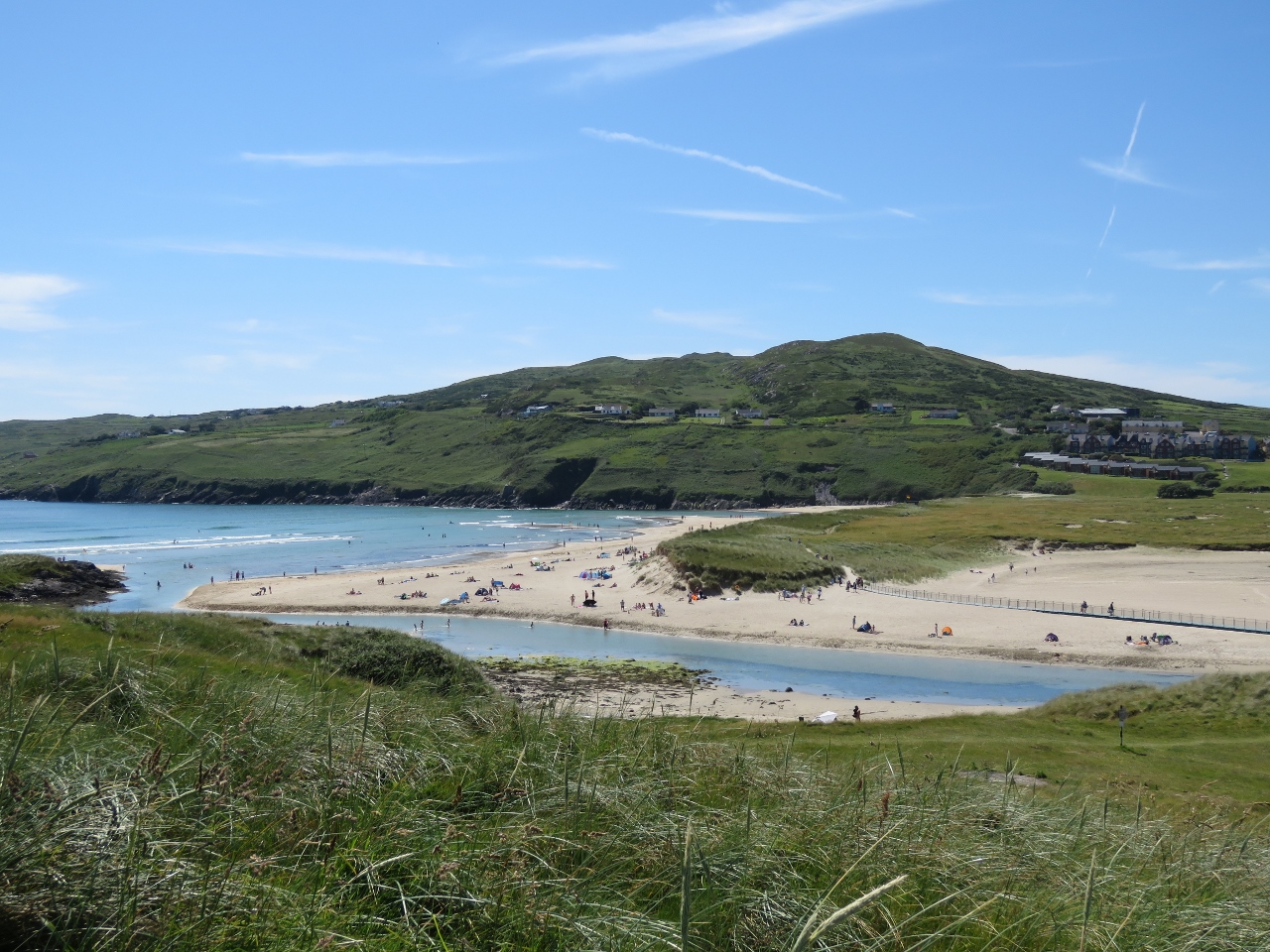 |
6/18/2017: Beachgoers
Position: 51°28.31'N, -9°46.07'W
Barleycove Beach was busy when we returned, and the parking lot completely full.
|
 |
6/18/2017: Murphys
Position: 51°28.17'N, -9°43.47'W
After lunch, we biked back to Crookhaven and stopped in at O'Sullivans, home of "the most southerly pint in Ireland".
|
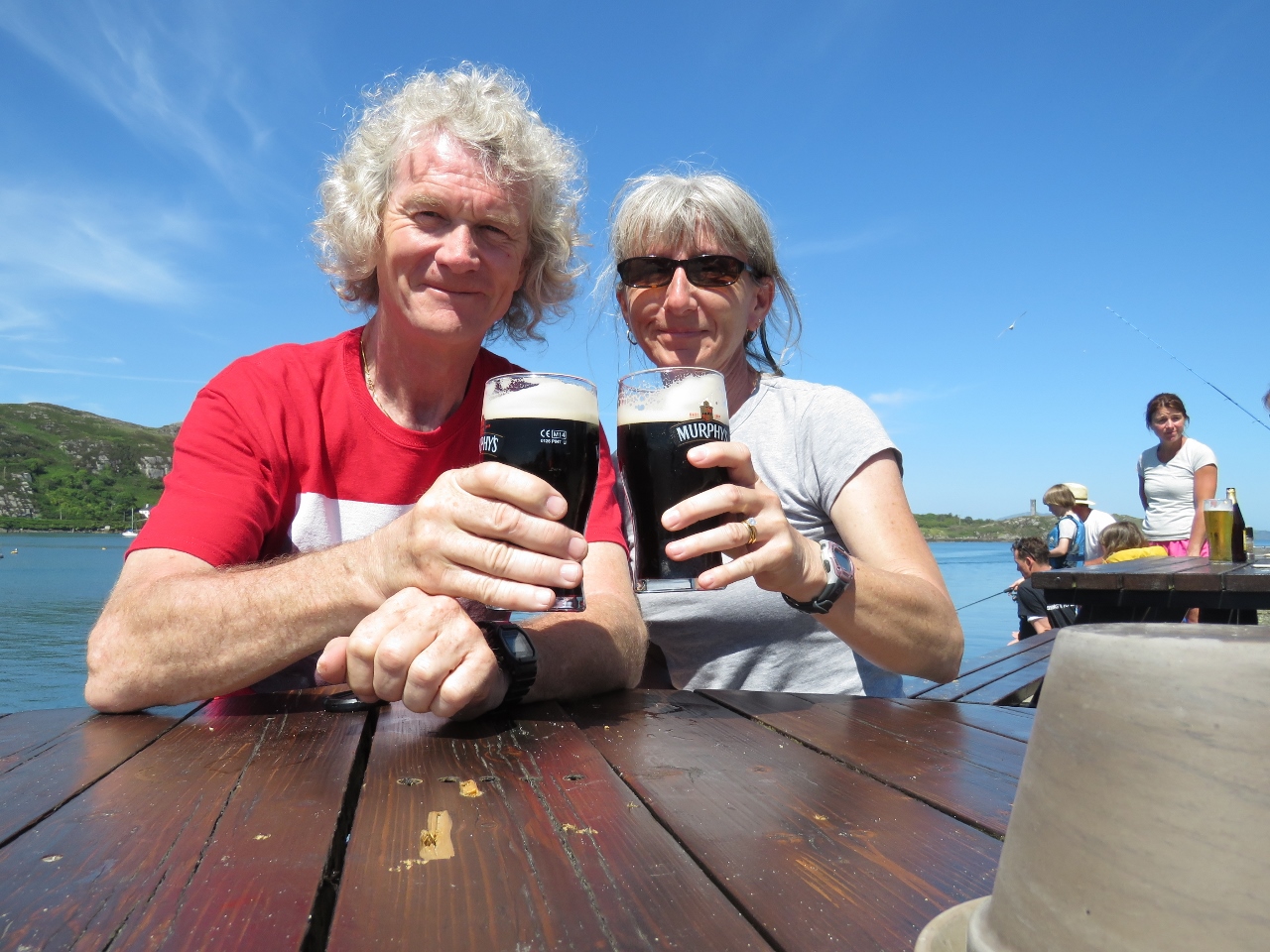 |
6/18/2017: Cheers
Position: 51°28.17'N, -9°43.49'W
Enjoying a pint on the deck at O'Sullivans.
|
 |
6/18/2017: At Anchor
Position: 51°28.17'N, -9°43.49'W
The view to the anchorage from the deck at O'Sullivans.
|
 |
6/18/2017: Crookhaven Lighthouse
Position: 51°28.20'N, -9°42.99'W
After our stop at O'Sullivans, we continued our bike ride as far as we could go on the road running northeast behind the town. This is the view to the Crookhaven Lighthouse from that side.
|
 |
6/18/2017: Watchtower
Position: 51°27.98'N, -9°44.71'W
Looking across Crookhaven Harbour from the west shore to the watchtower above our anchorage.
|
 |
6/18/2017: O'Sullivans
Position: 51°28.28'N, -9°44.23'W
O'Sullivans from the other side of the bay. The deck was packed on this warm and sunny Sunday afternoon.
|
 |
6/18/2017: Quarry
Position: 51°28.28'N, -9°44.23'W
Looking up to the Roadstone Quarry along the north shore of Crookhaven Harbour. The quarry was a source of gravel for Welsh tarred gravel roads until the 1930s.
|
 |
6/18/2017: Harbour Entry
Position: 51°28.64'N, -9°42.25'W
Crookhaven Lighthouse at the entrance to Crookhaven Harbour. The modern rental cottage on the left looks pretty spectacular close up.
|
 |
6/18/2017: Fastnet Rock
Position: 51°28.63'N, -9°42.26'W
Fastnet Rock, six miles away, was clearly visible in today's sunny weather.
|
 |
6/19/2017: Arch
Position: 51°28.49'N, -9°41.53'W
A sea arch on Streek Head at the entrance to Crookhaven Harbour aglow in the morning sun.
|
 |
6/19/2017: Brow Head
Position: 51°26.96'N, -9°45.05'W
Looking up to the Brow Head signal tower high above.
|
 |
6/19/2017: Mizen Head
Position: 51°26.89'N, -9°48.96'W
The Mizen Head Signal Station coming into sight. We enjoyed the view from the water even more after visiting yesterday.
|
 |
6/19/2017: Bridge
Position: 51°26.93'N, -9°48.97'W
The spectacular footbridge to the Mizen Head Signal Station.
|
 |
6/19/2017: Fishing Vessel
Position: 51°32.55'N, -10°9.96'W
We haven't seen many boats underway, commercial or pleasure, since leaving Kinsale. We do see a lot of floats in the water though.
|
 |
6/19/2017: Dursey Island
Position: 51°32.50'N, -10°9.77'W
The signal tower on Dursey Island, one of the 81 signal towers built along the Irish coast during the Napoleonic era.
|
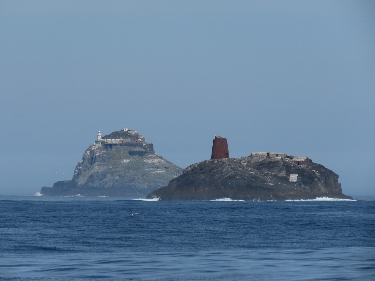 |
6/19/2017: Calf and Bull
Position: 51°33.48'N, -10°13.20'W
The Calf (foreground) and The Bull a few miles offshore from Dursey Island. The metal structure on The Calf is the remains of the cast-iron lighthouse that was installed in 1866, similar to the original Fastnet Rock Lighthouse. Shore dwellings for the keepers and their families were on the mainland at the south end of Dursey Sound.
In November of 1881, a violent storm snapped the tower off its base, sweeping lantern and all into the sea. Fortunately none of the six men on the island at the time were in the tower, but they weren't rescued for two weeks. A replacement lighthouse, visible on The Bull, was completed in 1889. |
 |
6/19/2017: Wing
Position: 51°33.95'N, -10°14.60'W
We start the wing whenever we are in close quarter, such as now when we are nosing up close to the islands. If something happens to the main, we don't want to be scrambling to start the wing, possibly find it won't start, or not getting it started and in gear quickly enough.
|
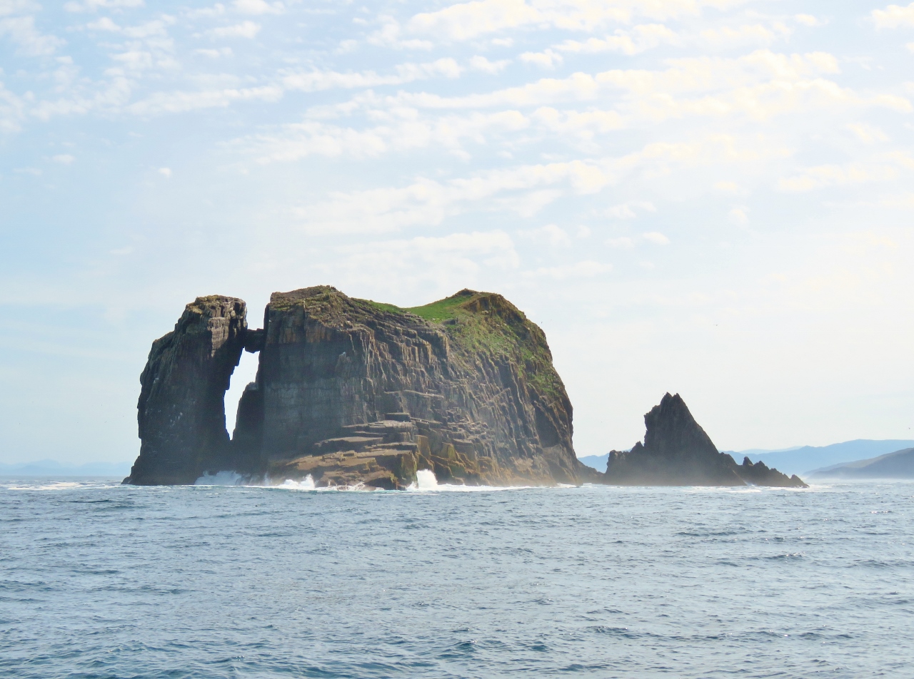 |
6/19/2017: The Cow
Position: 51°34.99'N, -10°16.79'W
A boulder wedged between The Cow and an off-lying spire. The seascape of the Irish west coast sure is dramatic. We're loving it.
|
 |
6/19/2017: The Bull
Position: 51°35.28'N, -10°17.33'W
Constructing a lighthouse on a steep island such as The Bull is a real challenge. Before construction began, a party of miners were landed who climbed the rock to excavate level sites for the buildings. They dragged a light spar with them and found a site 110ft up suitable for mounting a crane. Using the light spar, they lifted two heavier spars that were installed as cranes and used these to land provisions, tools, winches and materials for the lighthouse construction.
|
 |
6/19/2017: Light
Position: 51°35.28'N, -10°17.33'W
The original light on The Bull, at left, was later replaced by an all-around quartz halogen light mounted on a platform at the summit of the island.
|
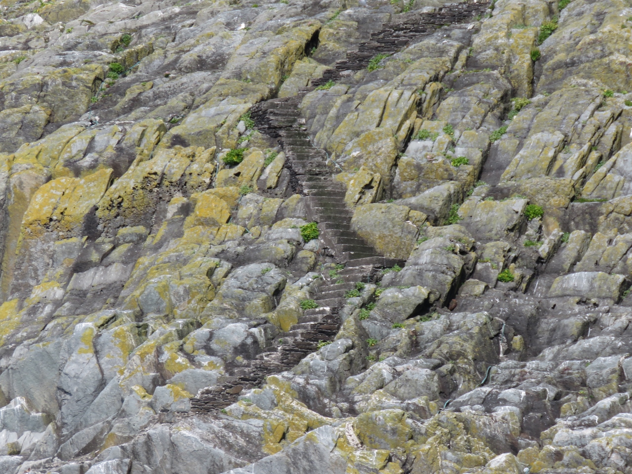 |
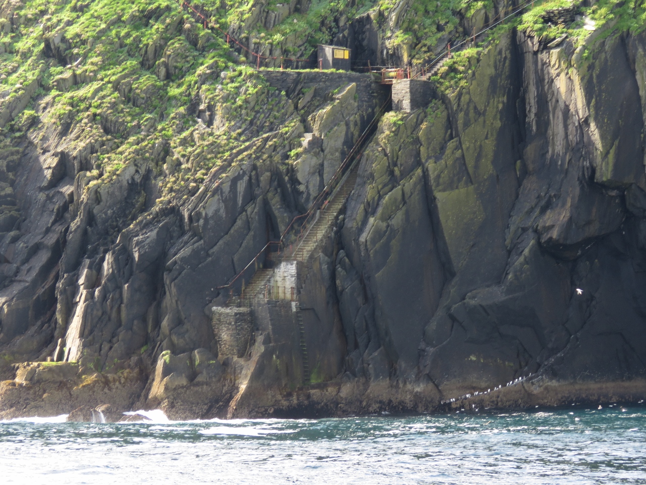
6/19/2017: Steps
Position: 51°35.47'N, -10°17.87'W
Some of the more than 300 steps that were cut out of the side of the rock to access the lighthouse from the boat landing site.
|
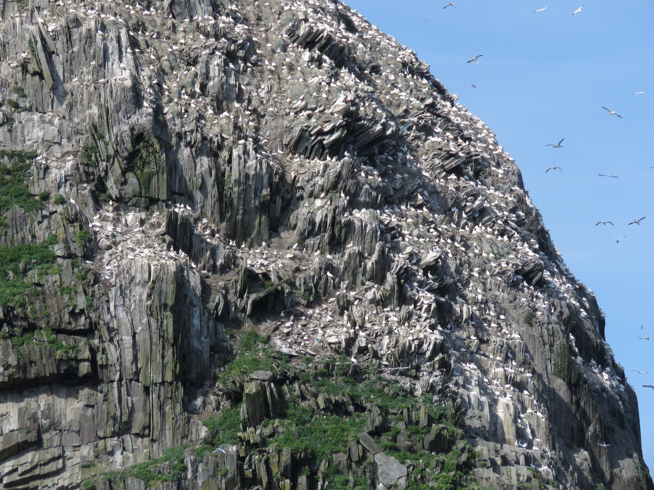 |
6/19/2017: Gannets
Position: 51°35.64'N, -10°17.87'W
The Bull's increasing gannet colony have taken over one of the island's two helicopter pads, so the lighthouse authority can only use the other.
|
 |
6/19/2017: Cliff Buildings
Position: 51°35.58'N, -10°17.84'W
More buildings, built into the cliff face, came into view as we came around the east side of the island.
|
 |
6/19/2017: Buildings close-up
Position: 51°35.70'N, -10°17.95'W
The buildings, tucked into the most weather-protected side of the island, might have been dwelling for the keepers. On the left of the building, stairs lead up to the lighthouse and down to the water.
|
 |
6/19/2017: Landing
Position: 51°35.68'N, -10°17.92'W
Stairs below the cliff building lead down to the water, with a ladder for low-tide access. That must have been an exciting landing in a big swell.
|
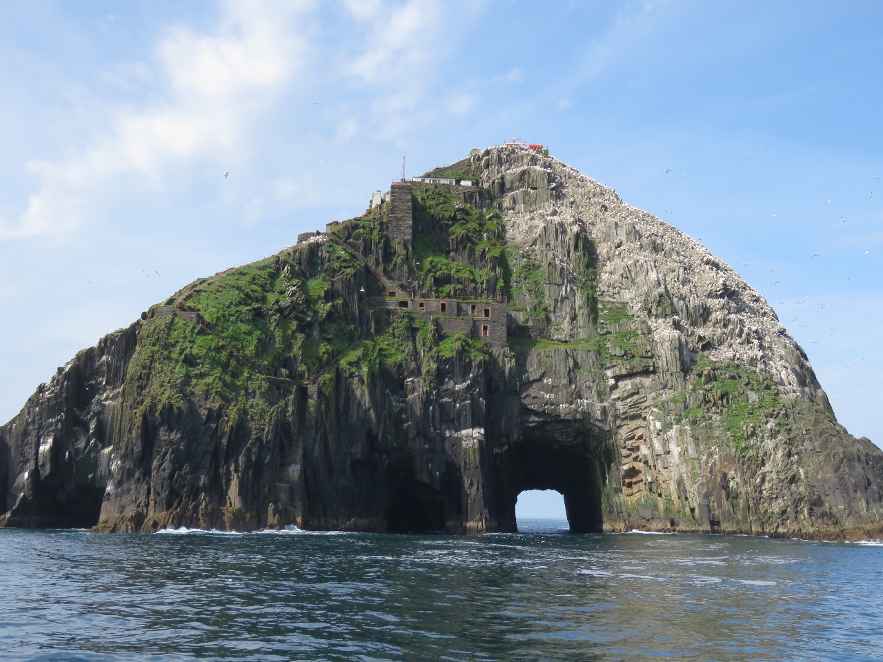 |
6/19/2017: Tunnel
Position: 51°35.63'N, -10°17.85'W
Perhaps the most remarkable aspect of The Bull came into view as we continued around east side: a natural tunnel clear through the rock.
|
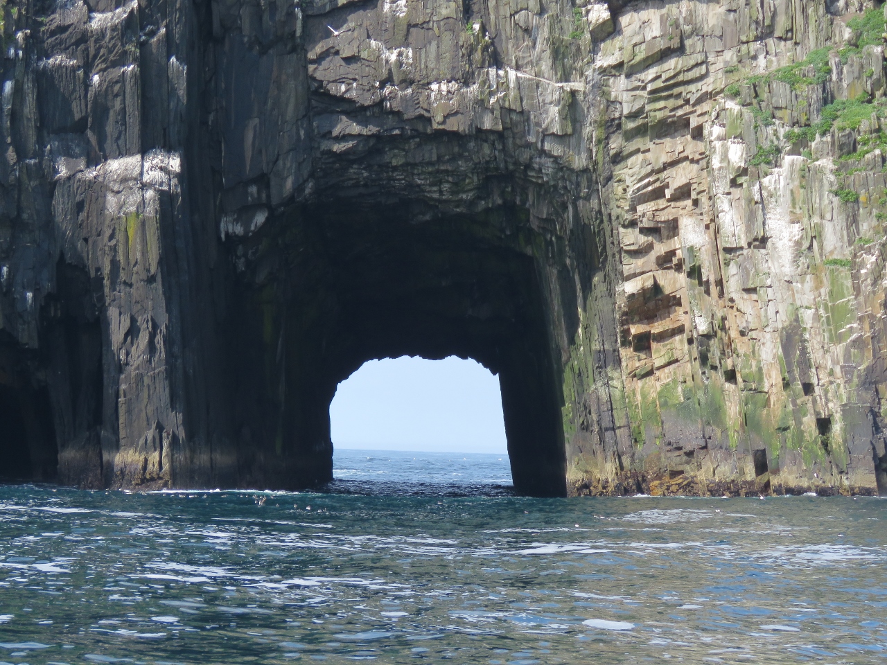 |
6/19/2017: Tunnel Closeup
Position: 51°35.63'N, -10°17.85'W
You can take a small boat through the tunnel on calm days such as today. We were tempted to anchor temporarily and try it, but sanity prevailed.
|
 |
6/19/2017: West Side
Position: 51°35.37'N, -10°18.38'W
Looking through the tunnel from the west side of The Bull, with the new and old lights visible above one of the helicopter pads. What an incredible sight.
|
 |
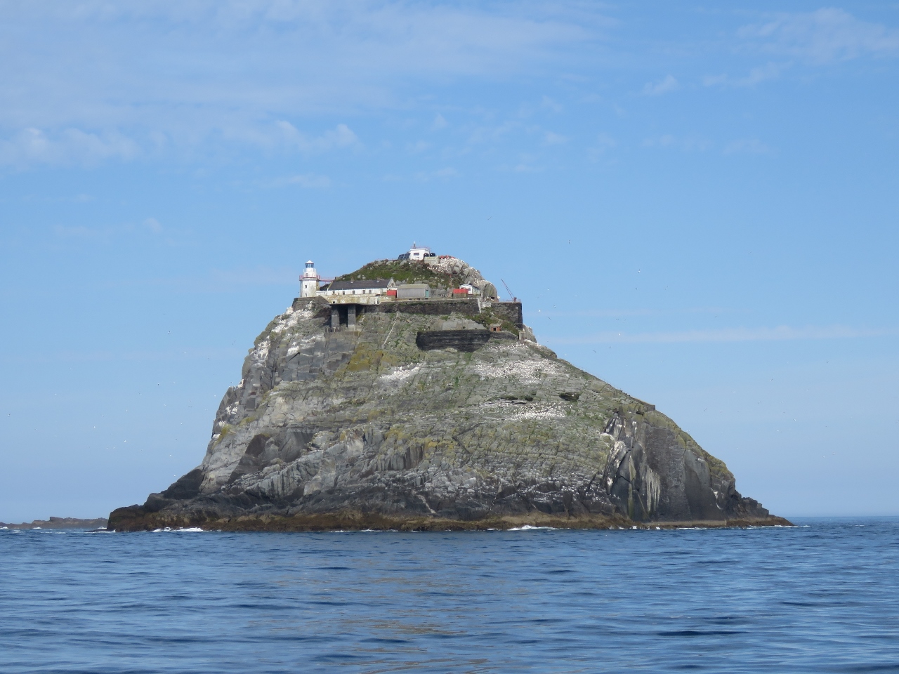
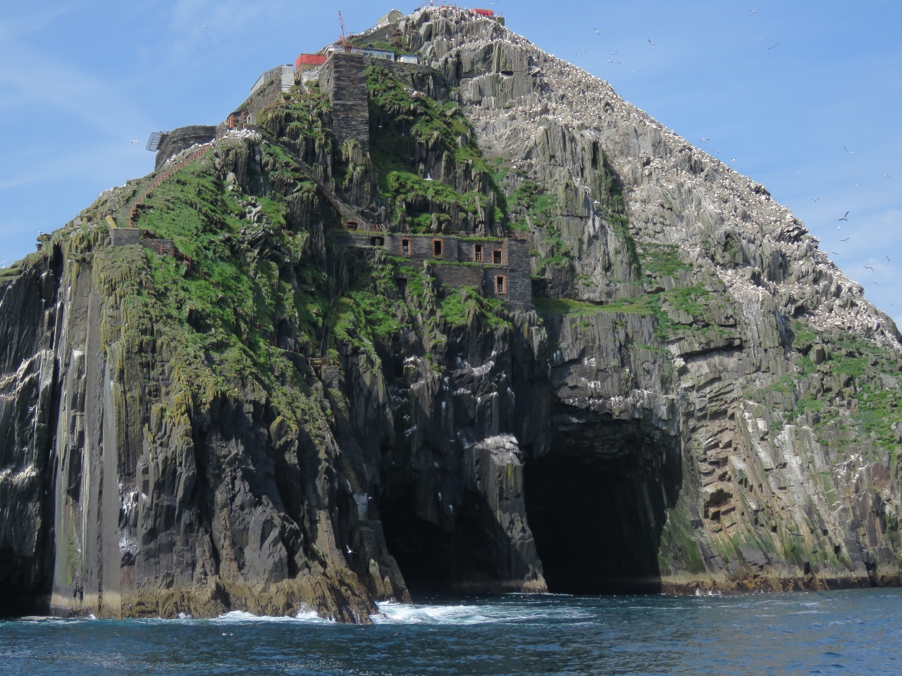
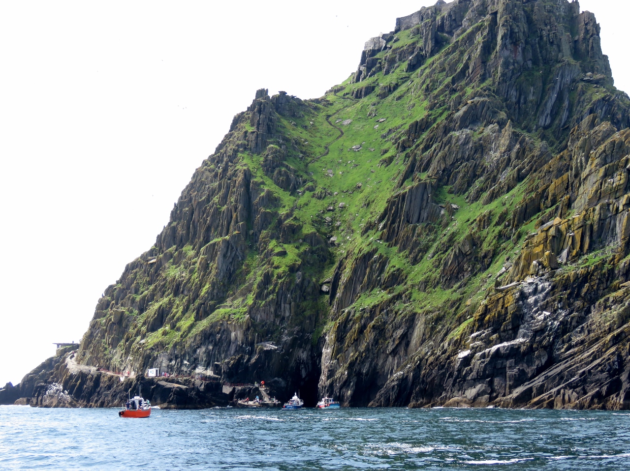
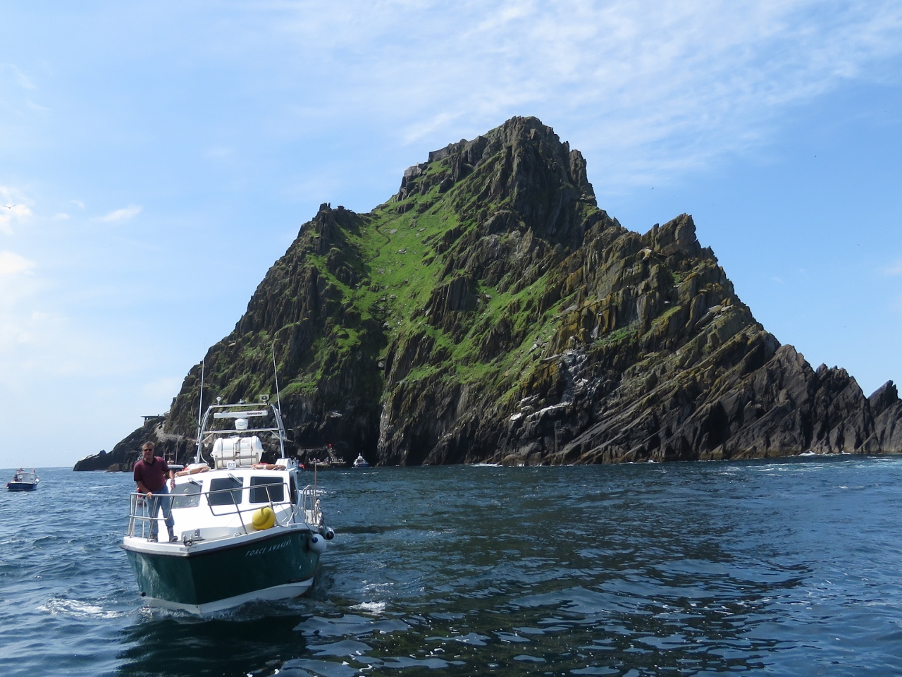
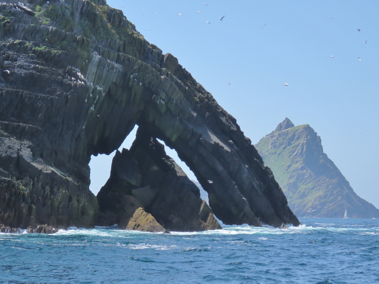
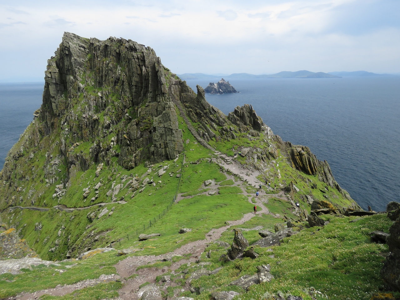
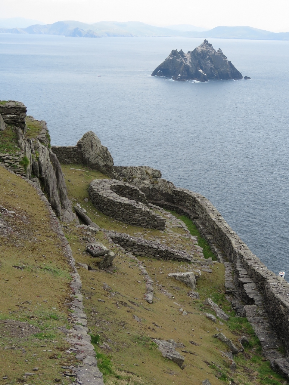
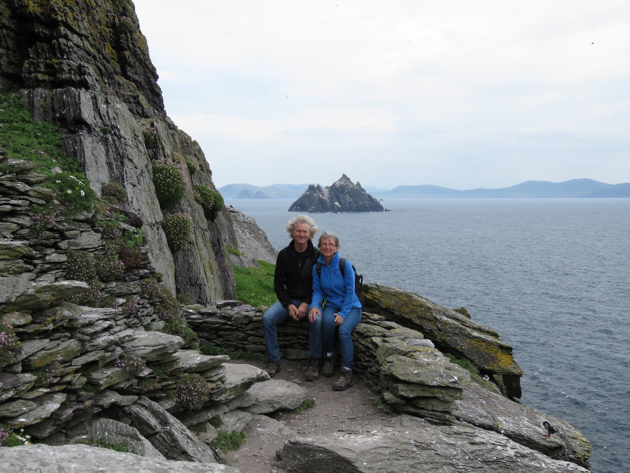
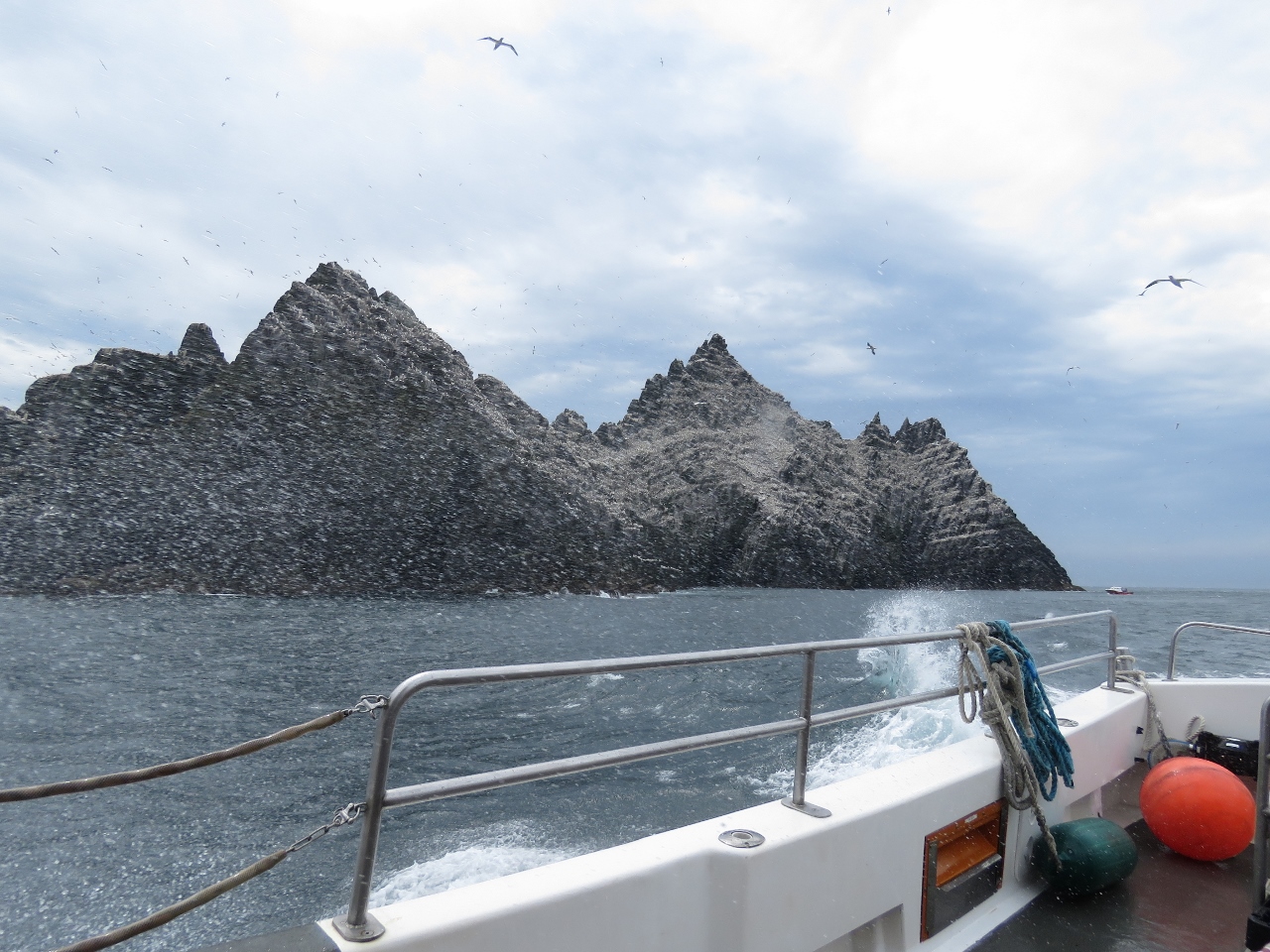
6/19/2017: Skellig Michael
Position: 51°45.93'N, -10°31.68'W
14nm north of The Bull are two offshore island known as The Skelligs. The larger of the two, Skellig Micheal, was designated a UNESCO World Heritage Site in 1996 and was recently used as a filming site for the final scene of Star Wars: The Force Awakens.
Small boats make the hour or two run from mainland Ireland to bring visitors out to tour the island. When we arrived, perhaps a dozen boats were standing offshore while their passengers visited ashore. |
 |
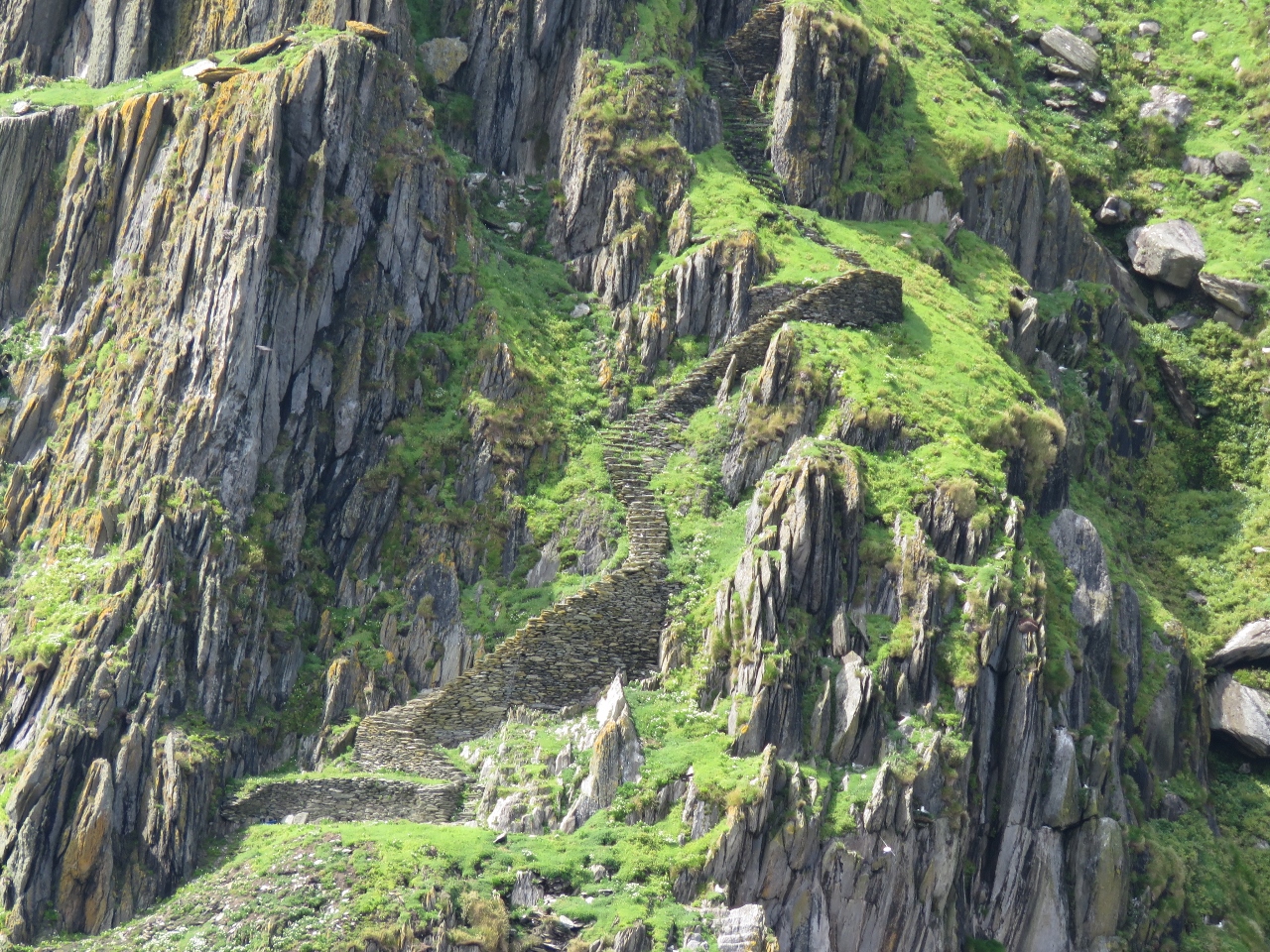
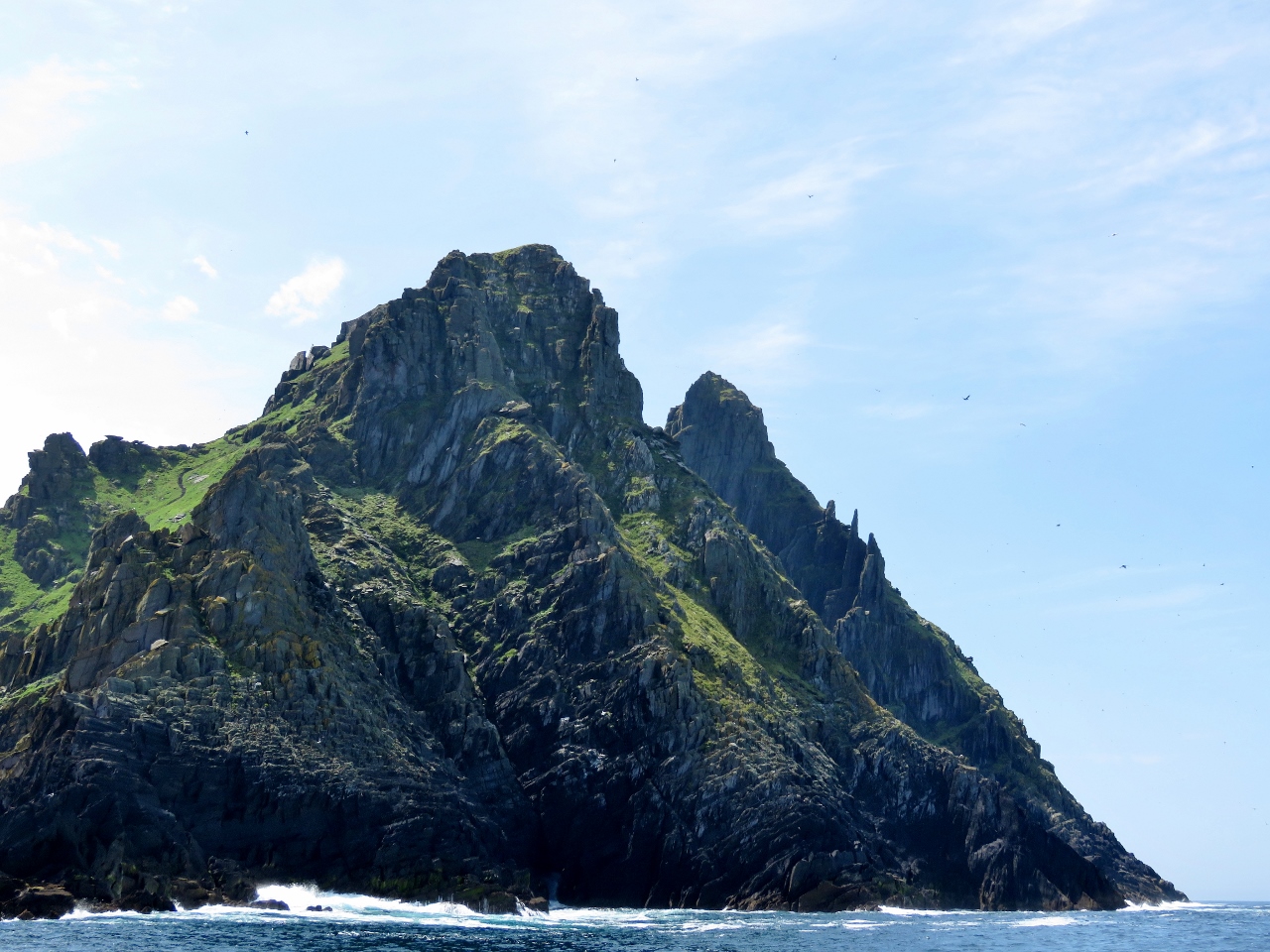
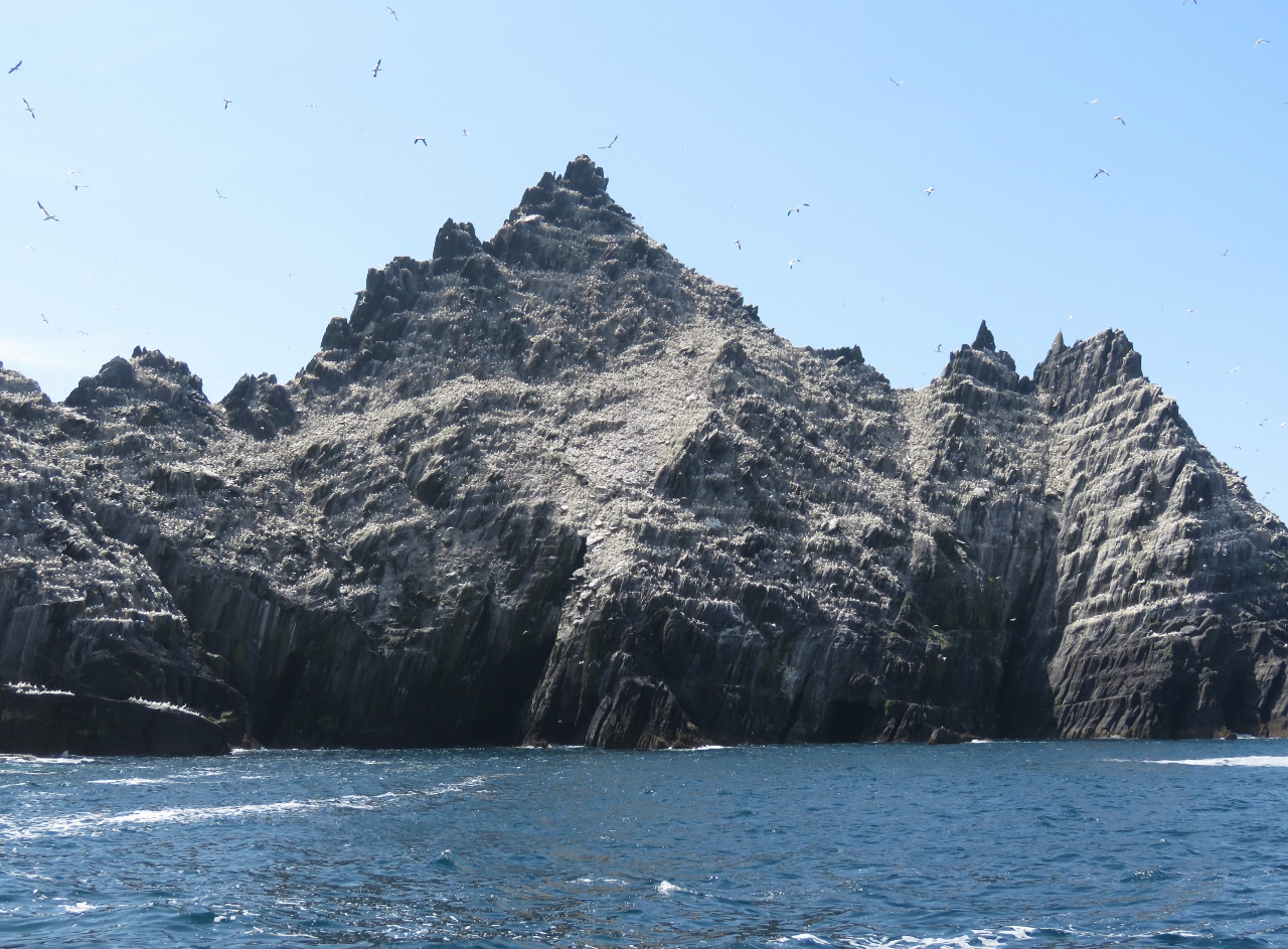
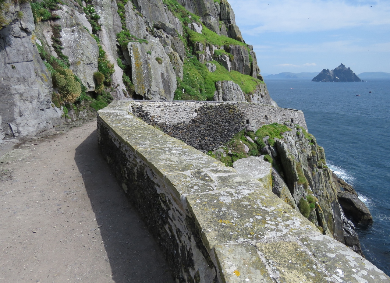
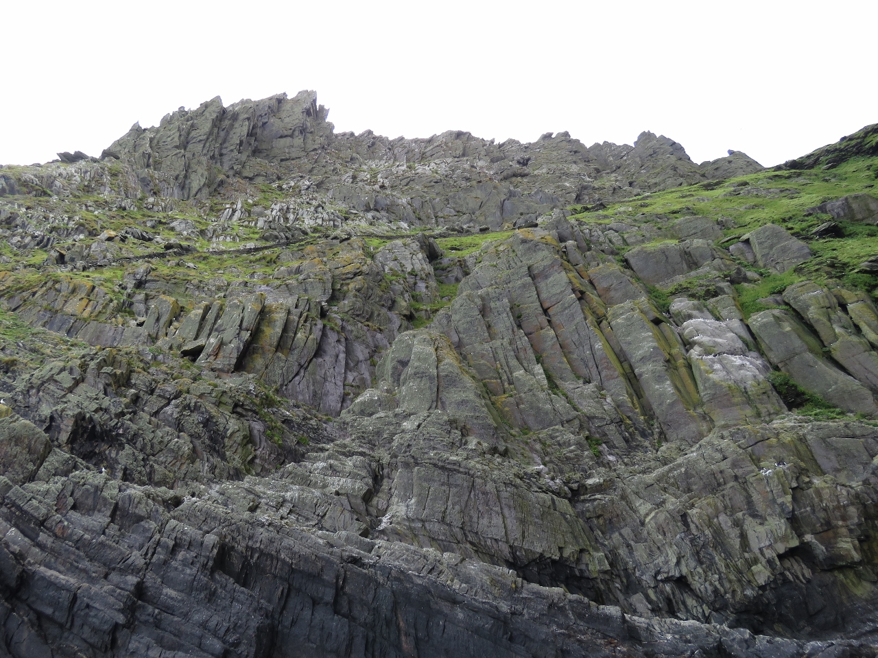
6/19/2017: North Peak
Position: 51°46.24'N, -10°32.07'W
Skellig Micheal was made a UNESCO World Heritage site because of the island's well-preserved monastic ruins. Sometime in the 6th-8th centuries, Christian monks landed on the island and over the centuries built a monastery with beehive huts and a chapel high atop the island's peaks, and extensive steps to reach them from several sides of the island.
Centuries later, two lighthouses were built on the island's west side. The road leading from the bottom right of the picture up and to the left was built, along with a boat landing, to access the lighthouse. |
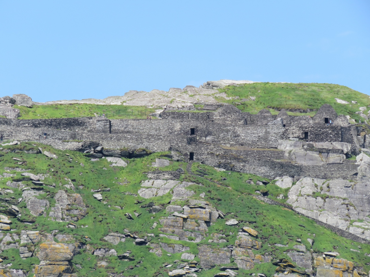 |
6/19/2017: Monastery
Position: 51°45.93'N, -10°31.68'W
A close-up to the monastery and beehive huts atop the north peak of Skellig Michael.
|
 |
6/19/2017: Busy
Position: 51°46.49'N, -10°32.01'W
Skellig Michael is a popular destination, even more so since the Star Wars filming. Small boats were constantly at the landing to pick up and drop off passengers, or to take in the view.
|
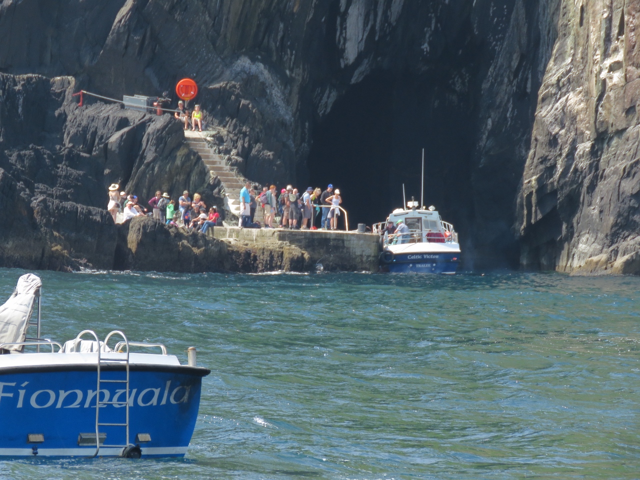 |
6/19/2017: Landing
Position: 51°46.44'N, -10°31.99'W
Conditions were calm today, but in high surge landing at Skellig Michael can be rough and difficult, similar to St. Helena.
|
 |
6/19/2017: East Steps
Position: 51°46.33'N, -10°32.05'W
Portions of steps the monks constructed along the east shore above the boat landing.
|
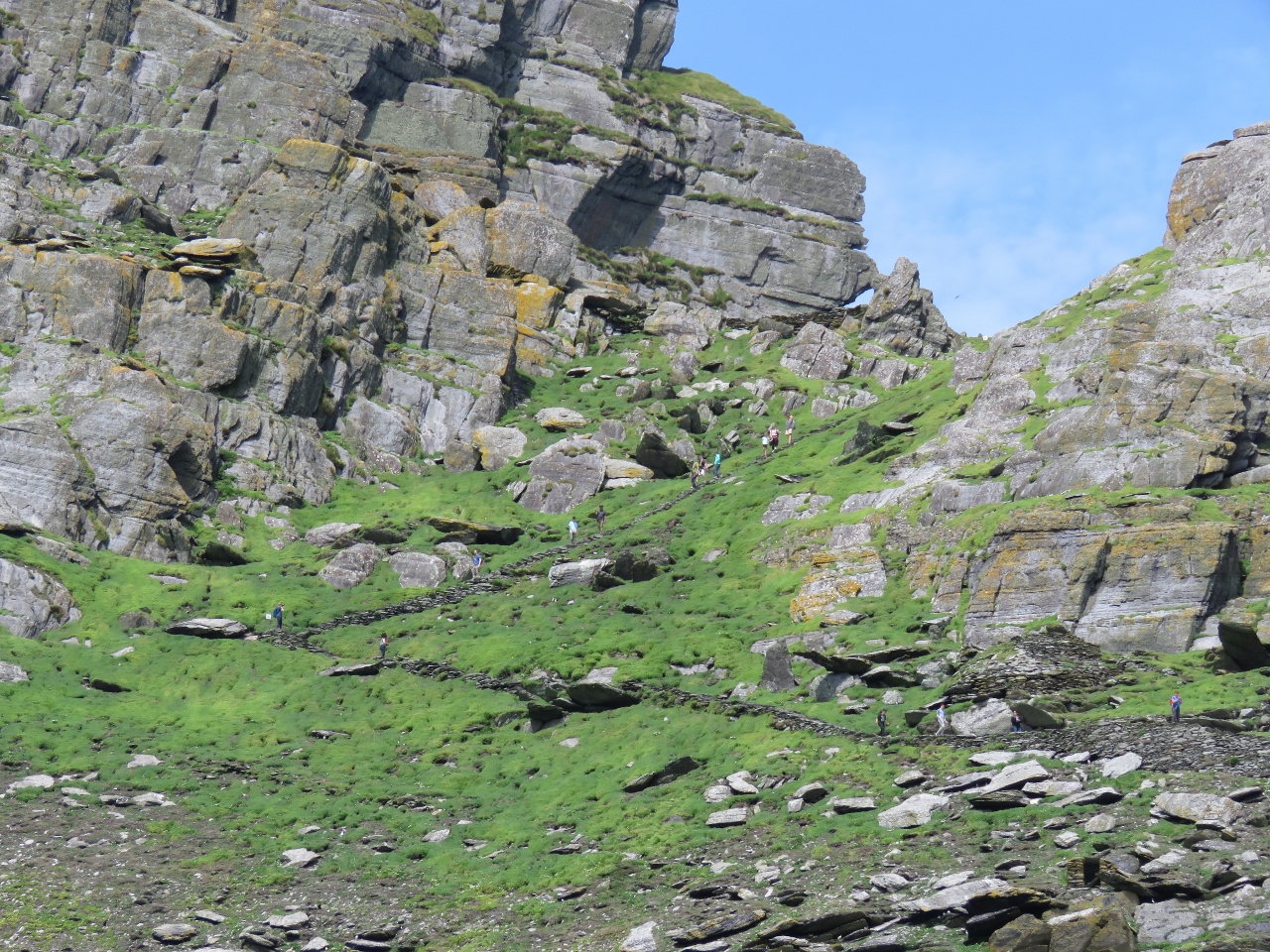 |
6/19/2017: Saddle
Position: 51°46.08'N, -10°32.32'W
Over 600 steps lead from the lighthouse road up the saddle to the monastery. A steady stream of visitors were working up and down the cliff.
|
 |
6/19/2017: Force Awakens
Position: 51°46.49'N, -10°32.04'W
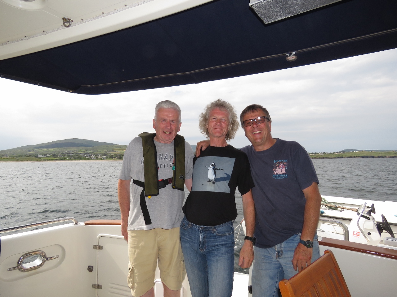
The only official way to land at Skellig Michael is through one of the 15 licensed small boat operators, who are allowed to land only once a day with at most 12 passengers, limiting to 180 the maximum number of visitors per day. Trips sell out weeks in advance, but they do have cancellations. A few days earlier, we were able to book a trip for tomorrow on the Force Awakens. Derek Noble (on the bow) and Brendan Walsh (at the helm), came over to say hello as we viewed the island.
|
 |
6/19/2017: North Shore
Position: 51°46.54'N, -10°32.06'W
The island's north shore appears even more rugged than the south, with dramatic spires reaching skyward.
|
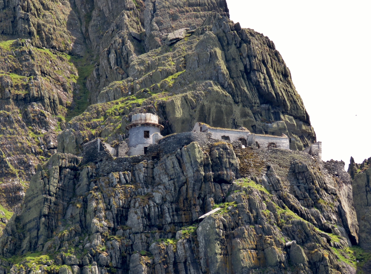 |
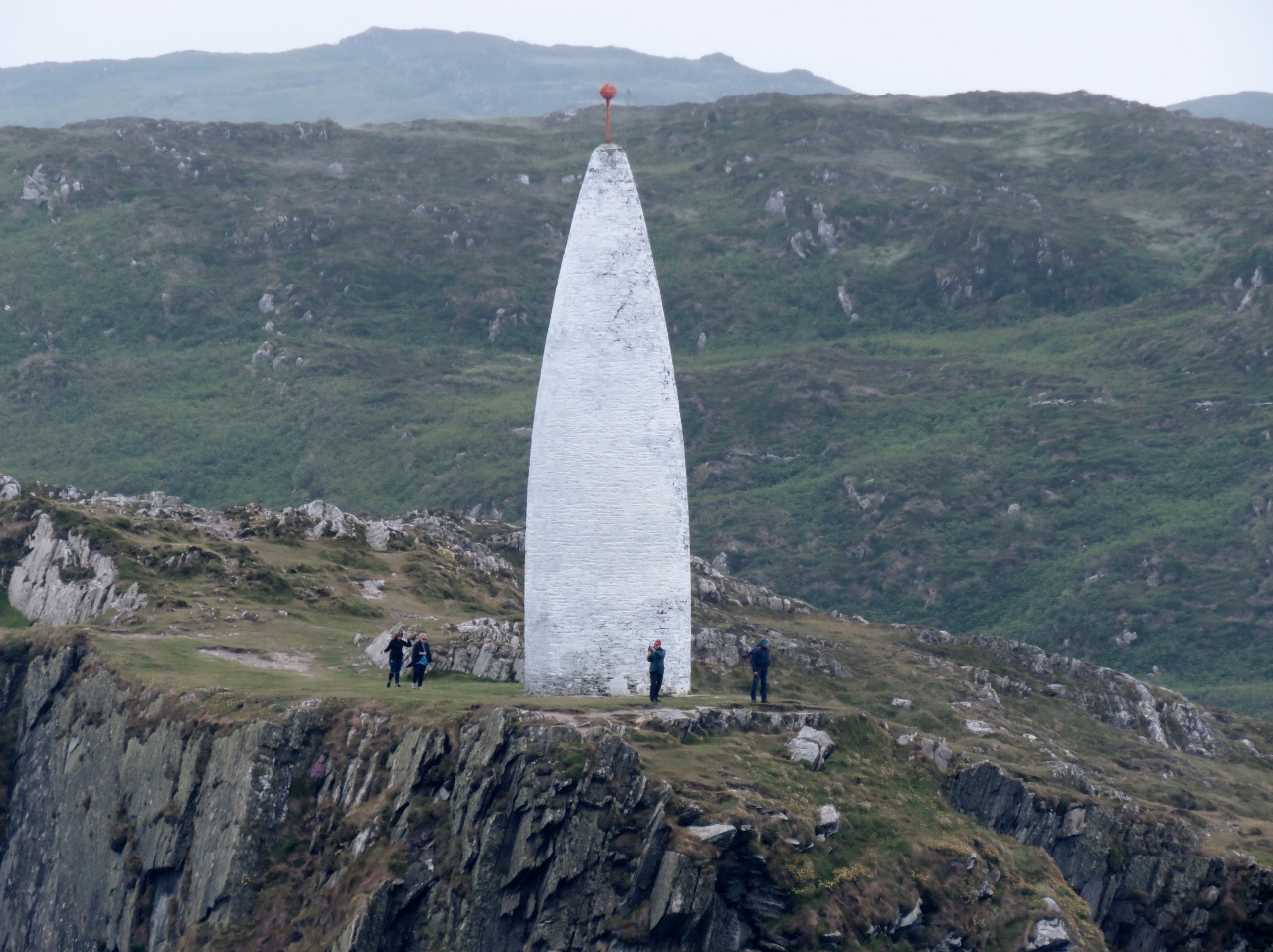
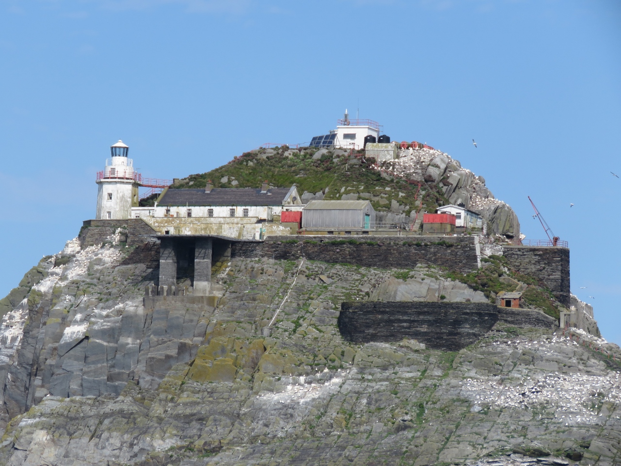
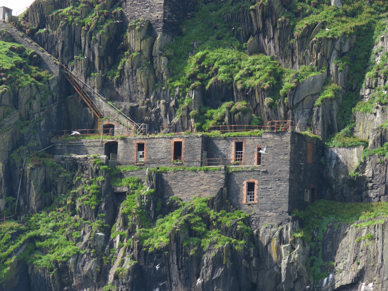
6/19/2017: Upper Station
Position: 51°46.18'N, -10°33.02'W
In 1821, construction began on two lighthouse stations on Skellig Micheal's west cliffs. Two lights were built to distinguish them from nearby lights at Loop Head to the north and Cape Clear Island to the south. The upper light, pictured, is 372ft above the water and was discontinued in 1870.
|
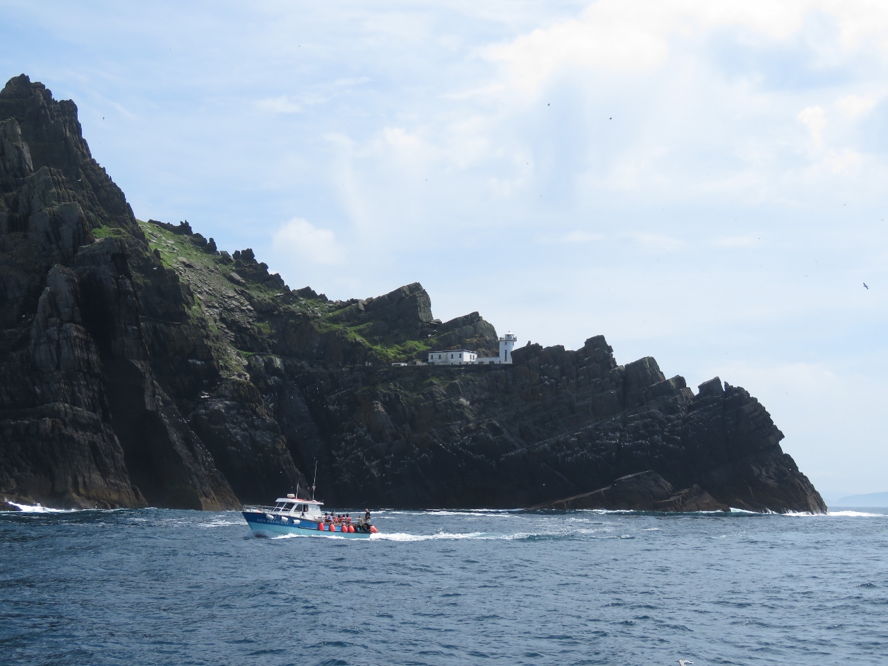 |
6/19/2017: Lower Station
Position: 51°46.11'N, -10°32.91'W
The lower light is 175ft above the water and was automated in 1987. The upper light is to the left, just out of the picture.
|
 |
6/19/2017: Lower Lighthouse
Position: 51°46.01'N, -10°32.50'W
The lower light perched above sheer cliffs on the northwest corner of Skellig Michael.
|
 |
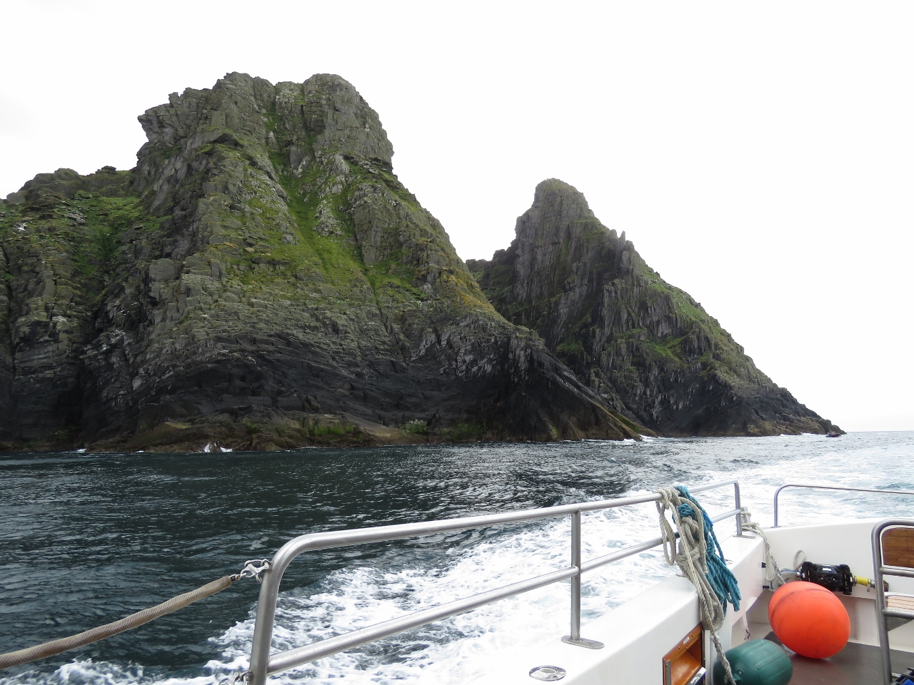
6/19/2017: Little Skellig
Position: 51°46.93'N, -10°30.92'W
Little Skellig is a smaller version of Skellig Michael, and equally dramatic-looking.
|
 |
6/19/2017: Arch
Position: 51°47.05'N, -10°30.41'W
Arch at the west end of Little Skellig, with Skellig Michael in the background.
|
 |
6/19/2017: Gannets
Position: 51°47.07'N, -10°30.27'W
What looks like snow on Little Skellig is in fact thousands and thousands of gannets.
|
 |
6/19/2017: Second Arch
Position: 51°46.72'N, -10°30.76'W
A second arch along the eastern tip of Little Skellig.
|
 |
6/19/2017: David Walsh
Position: 51°48.87'N, -10°15.81'W
We'd made our booking on Force Awakens through Ballinskelligs resident David Walsh. David was incredibly friendly and helpful—he offered us the use of their heavy-duty winter mooring for Force Awakens, advised us on where to anchor in Ballinskelligs Bay, called to offer assistance when he saw us arriving, and later came out to say hello. We feel spoiled already.
|
 |
6/19/2017: Pier
Position: 51°48.66'N, -10°16.47'W
Our tender tied off to Force Awakens at the Ballinskelligs Pier.
|
 |
6/19/2017: Coast Guard
Position: 51°48.64'N, -10°16.46'W
In the early 1800s, the British set up Coast Guard stations around the Kerry coast to thwart smuggling and illegal distilling. Most of the stations were destroyed during the War of Independence, fought between 1919 and 1921—the local IRA burned down the station at Ballinskelligs. The rationale was that they might be used as barracks for British soldiers.
|
 |
6/19/2017: Abbey
Position: 51°48.95'N, -10°16.28'W
In the 12th century, the monks retreated from Skellig Michael to an abbey they built at Ballinskelligs. These are the ruins, currently being renovated and preserved.
|
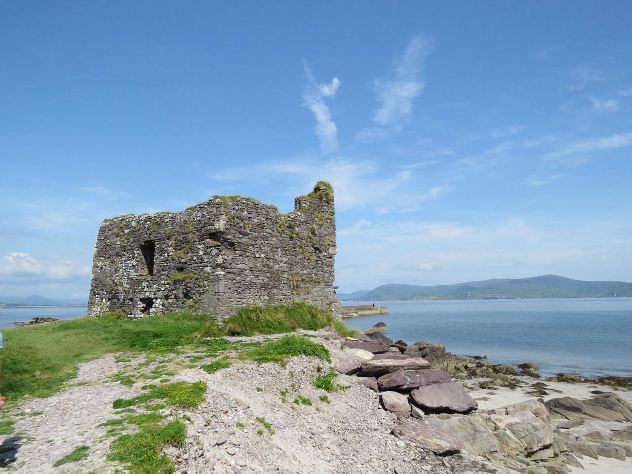 |
6/19/2017: McCarthy Mor Tower
Position: 51°49.20'N, -10°16.22'W
The tower on a sandy isthmus at Ballinskelligs Bay dates to perhaps the 16th century and is thought to be a stronghold of the McCarthy clan who were 16-century Irish chieftains.
|
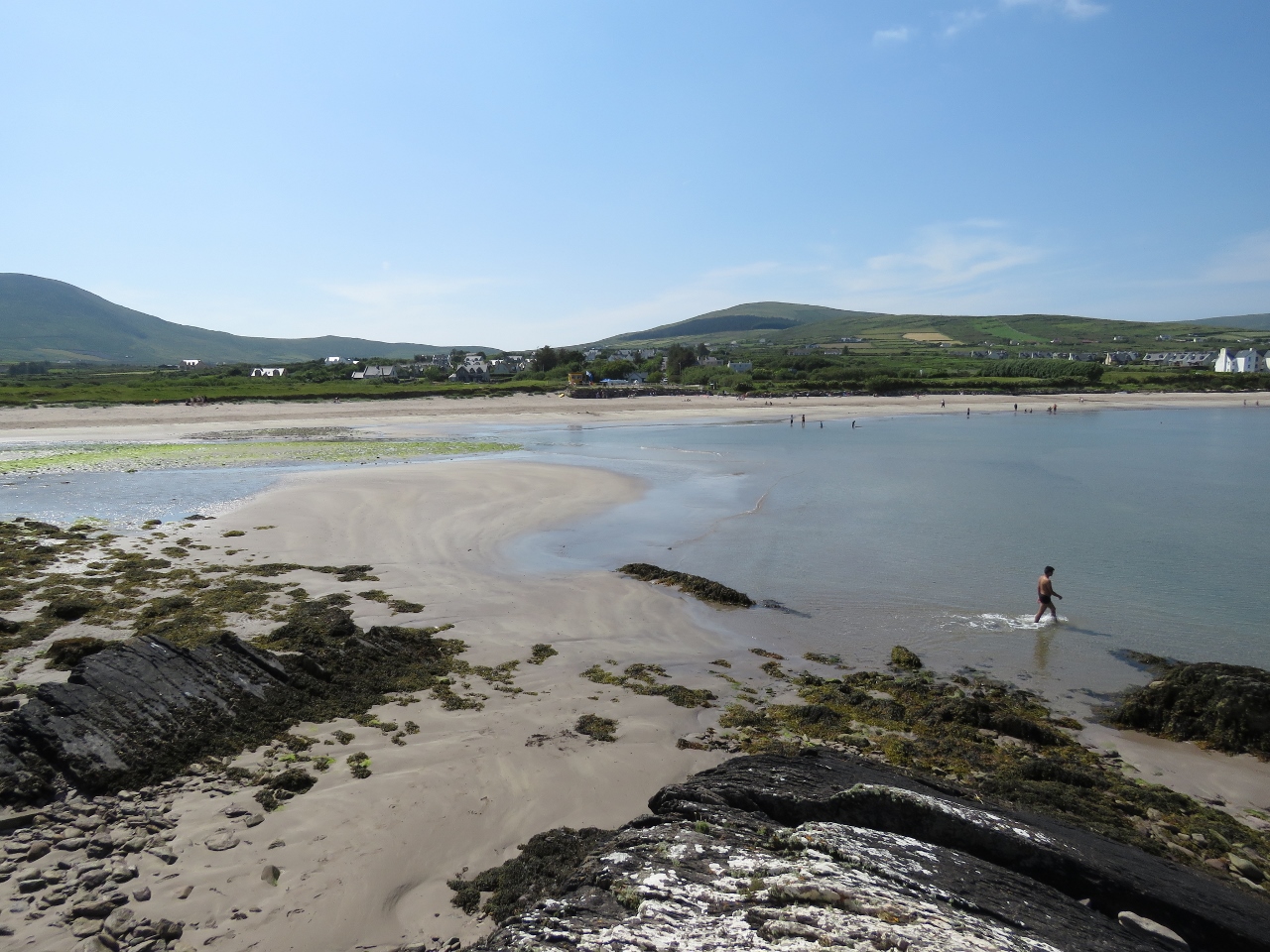 |
6/19/2017: Beach
Position: 51°49.21'N, -10°16.22'W
Lots of people were out enjoying the beautiful beach at Ballinskelligs.
|
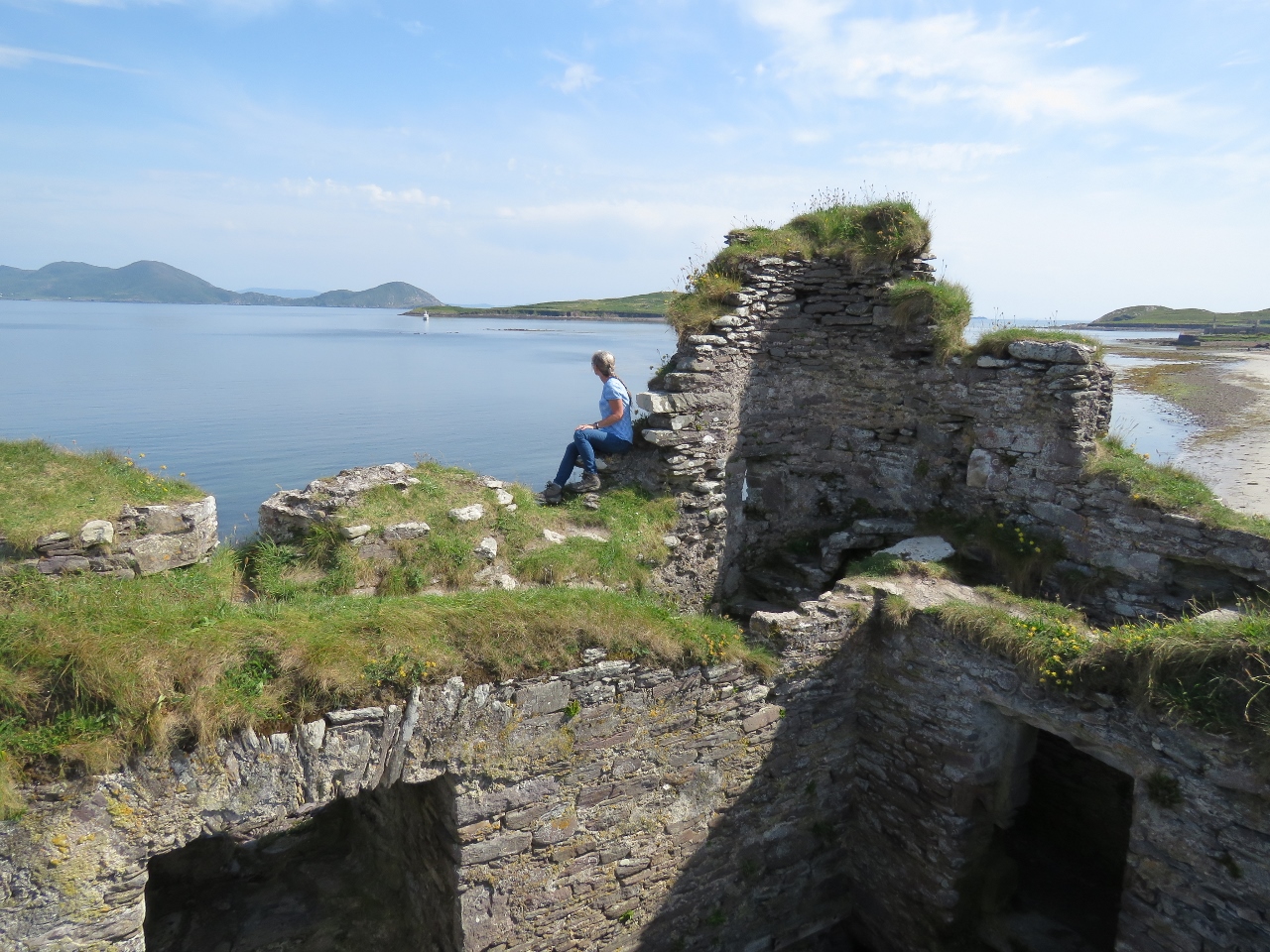 |
6/19/2017: Ballinskelligs Bay
Position: 51°49.20'N, -10°16.22'W
Jennifer taking in the view to the anchorage in Ballinskelligs Bay from the top of McCarthy Mor Tower.
|
 |
6/19/2017: Bridge
Position: 51°49.11'N, -10°16.37'W
We walked back from the castle along the isthmus and crossed over a footbridge over a small stream. This is the view looking northeast with McCarthy Mor Tower in the distance.
|
 |
6/19/2017: Dirona
Position: 51°49.24'N, -10°16.37'W
Dirona at anchor in Ballinskelligs Bay. We sure have been enjoying some nice weather these past few days.
|
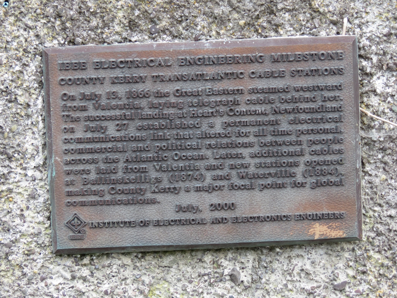 |
6/19/2017: Telegraph Cable
Position: 51°49.49'N, -10°16.37'W
The Atlantic Telegraph Company in 1858 completed the first transatlantic cable between Newfoundland and Valentia Island, Ireland, to our north. A competing company, Direct United States Cable Company, built a station at Ballinskelligs in 1874 and the following year completed a cable route to the US via Nova Scotia. The cable station operated in Ballinskelligs until 1923. This plague commemorating the area's cable stations is outside the still-standing Ballinskelligs Station superintendent's house.
|
 |
6/19/2017: Cable O'Leary's
Position: 51°49.51'N, -10°16.31'W
We had an excellent meal overlooking the bay on the patio at Cable O'Leary's pub. The cable company superintendent had given Ballinskelligs resident Donncha 'Cable' O'Leary the nickname 'Cable' after he risked his life to prevent the loss of a cable in deep water off Ballinskelligs Beach. 'Cable' later achieved local fame by resisting eviction by the local landlord, an act that encouraged others in the area to resist landlordism and demand better living conditions.
|
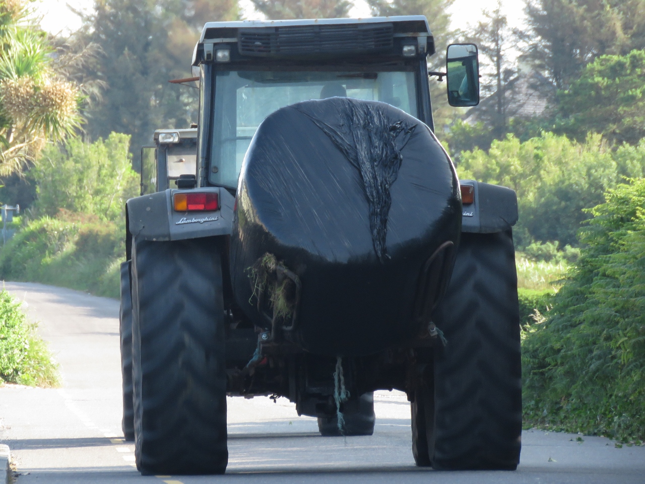 |
6/19/2017: Lamborghini
Position: 51°49.48'N, -10°16.36'W
When we left Cable O'Leary's this tractor was running outside and the driver appeared shortly after from inside the pub then set off down the road. We were amused to see it was a Lamborghini tractor, our first Lamborghini sighting in Ireland.
|
 |
6/20/2017: Spoiled
Position: 51°48.87'N, -10°15.87'W
We were planning to run the tender to the Ballinskelligs Pier this morning for our trip to Skellig Michael, but David called and offered to pick us up instead. We're definitely feeling spoiled.
|
 |
6/20/2017: Boarding
Position: 51°48.68'N, -10°16.39'W
Boarding Force Awakens at the Ballinskelligs Pier.
|
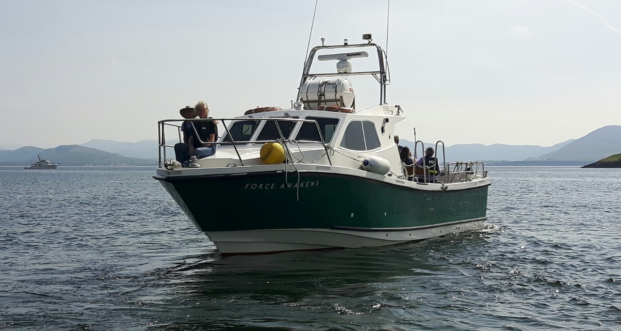 |
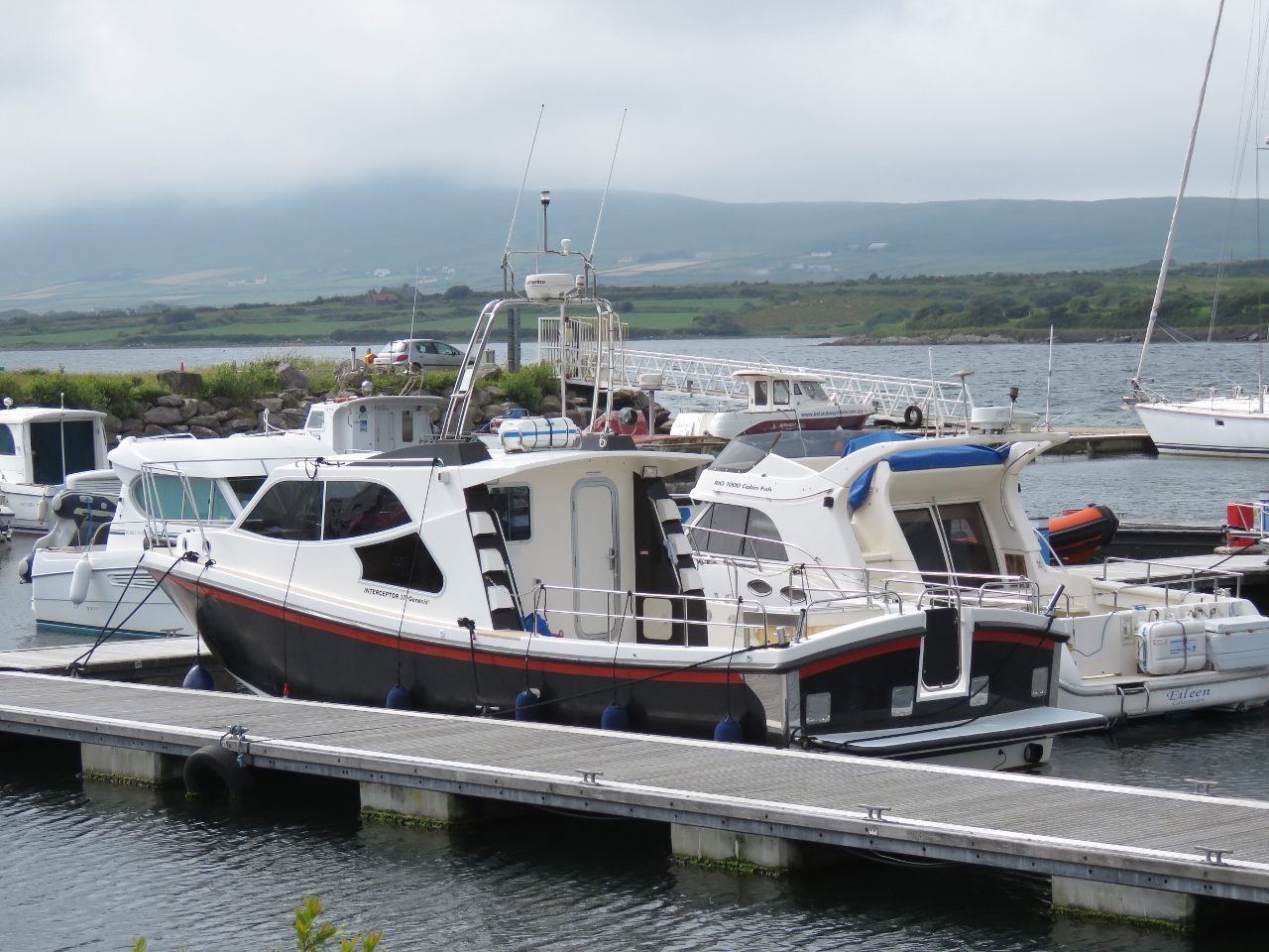
6/20/2017: Force Awakens
Position: 51°47.38'N, -10°18.76'W
David took this picture of us riding on the bow of Force Awakens. The boat is a Genesis 37 Interceptor by Safehaven Marine of Cork, Ireland, who specialize in strong and capable fiberglass for applications such as pilot vessels and patrol boats. Besides being one of the nicest boats in the fleet of 15 vessels licensed to land at Skellig Michael, Force Awakens has a feature most don't have: a head. This is important as Skellig Micheal has no bathroom facilities and the round trip from the mainland can take can take six hours or more.
|
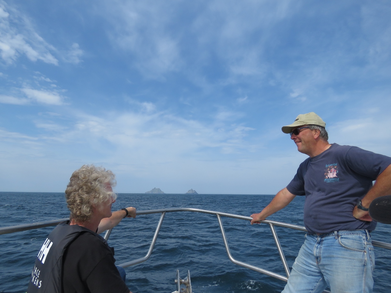 |
6/20/2017: Calm
Position: 51°46.79'N, -10°25.09'W
Conditions, as we know, can be rough out in the open Atlantic but the seas were so calm today we were able to ride on the bow the entire way. That's Skellig Michael and Little Skellig in the distance.
|
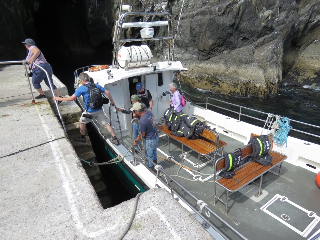 |
6/20/2017: Landing
Position: 51°46.37'N, -10°32.20'W
Passengers disembark at Skellig Michael on the landing built for the lighthouse. Landing can be rough and difficult in heavy swell, similar to St. Helena, but we had an easy time of it in today's calm conditions.
|
 |
6/20/2017: Lighthouse Road
Position: 51°46.27'N, -10°32.26'W
Looking back to Little Skellig from the lighthouse road.
|
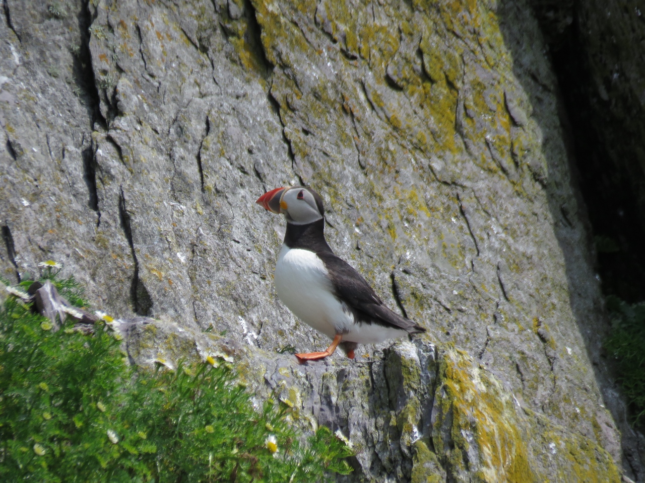 |
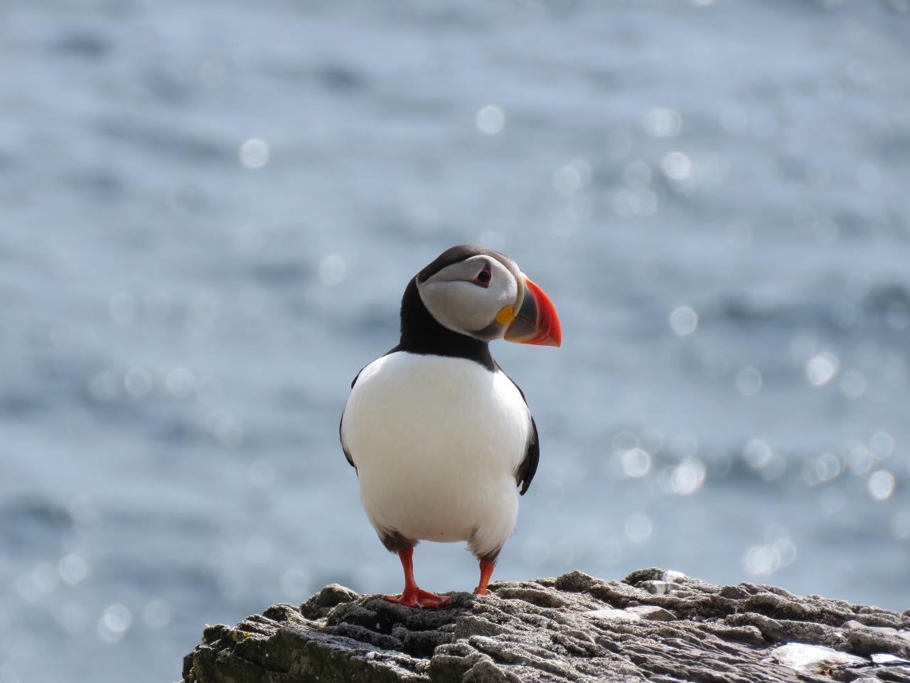
6/20/2017: Puffin!
Position: 51°46.20'N, -10°32.32'W
We love puffins, but haven't seen one in the wild since Brooks Peninsula off the west coast of Vancouver Island in British Columbia, Canada.
|
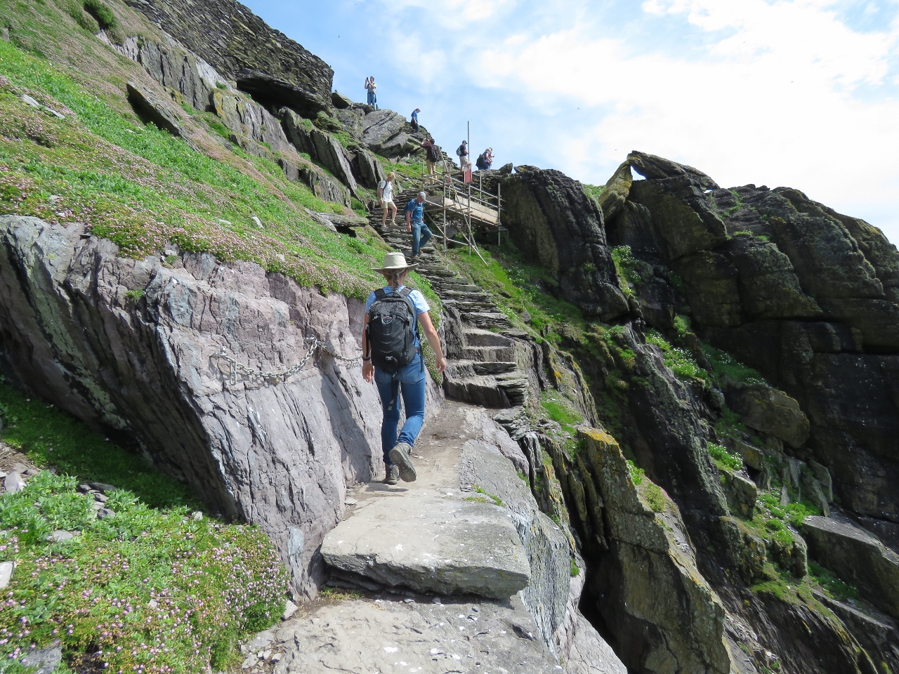 |
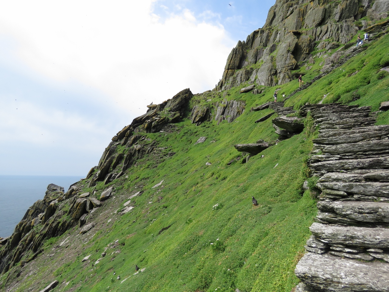
6/20/2017: Ledge
Position: 51°46.21'N, -10°32.34'W
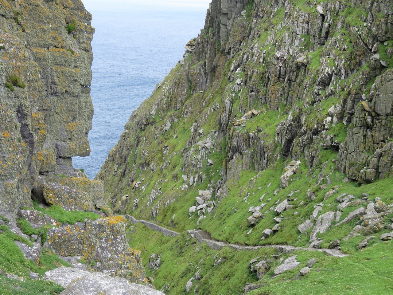
From the lighthouse road, we ascended up the to the saddle on the monk's steps. Partway along is a ledge with a sheer drop to one side where chains have been added for a handhold. Despite all the warnings about the difficulty of the ascent, we didn't have any trouble. The Precipice Climb in Acadia National Park was harder and even that wasn't a big deal.
|
 |
6/20/2017: Second Puffin
Position: 51°46.21'N, -10°32.33'W
We were worried we might not see any today, as we'd not seen any yesterday, but they are everywhere on Skellig Micheal.
|
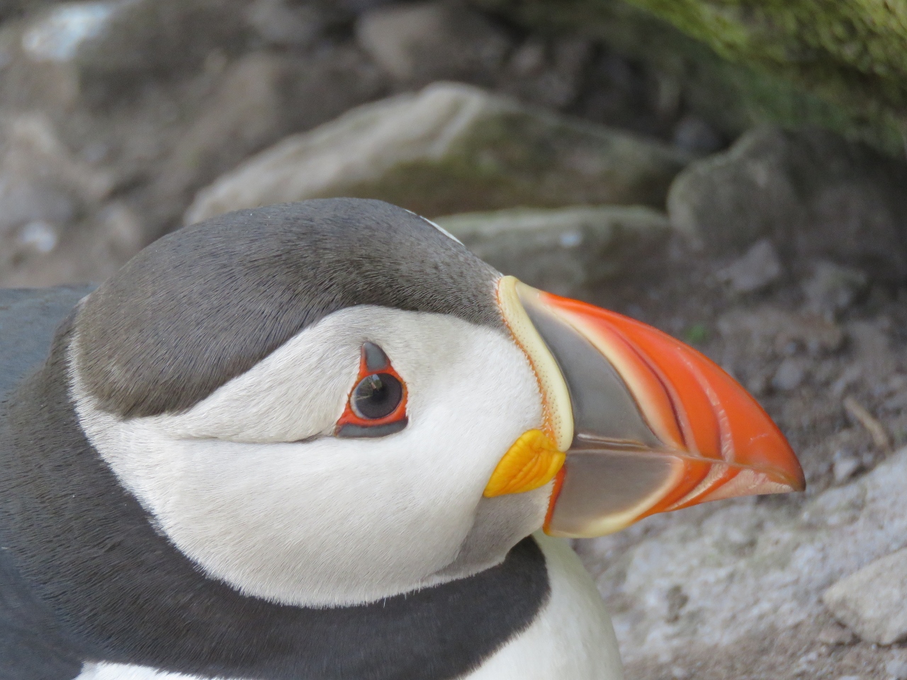 |
6/20/2017: Another Puffin
Position: 51°46.21'N, -10°32.33'W
You can never see too many puffins.
|
 |
6/20/2017: Steps
Position: 51°46.22'N, -10°32.39'W
The steps lead up and up along the steep slopes.
|
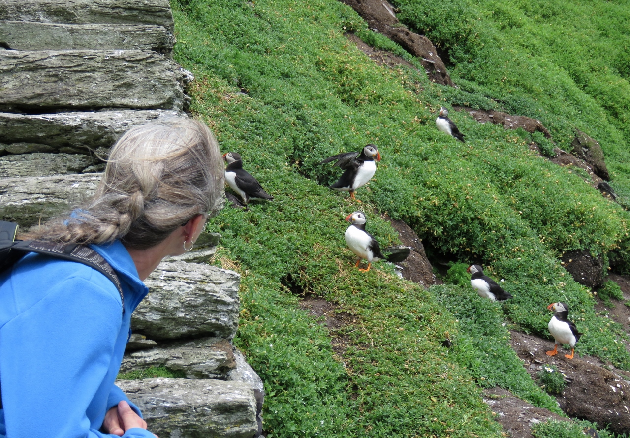 |
6/20/2017: Puffins on Slope
Position: 51°46.22'N, -10°32.42'W
The puffins seemed used to people and would approach reasonably closely. We sure loved watching them.
|
 |
6/20/2017: Rockscape
Position: 51°46.25'N, -10°32.41'W
The dramatic rockscape as we near the saddle between the two peaks.
|
 |
6/20/2017: Saddle
Position: 51°46.25'N, -10°32.41'W
Looking up to the south peak from the saddle.
|
 |
6/20/2017: Boats
Position: 51°46.26'N, -10°32.40'W
All the tour boats remain just offshore while their passengers visit the island.
|
 |
6/20/2017: Helicopter Pad
Position: 51°46.27'N, -10°32.39'W
The helicopter pad far below us. If you're afraid of heights, this isn't a great place to visit.
|
 |
6/20/2017: West View
Position: 51°46.24'N, -10°32.47'W
Looking down to the western cliffs from the base of the South Peak.
|
 |
6/20/2017: North Peak
Position: 51°46.24'N, -10°32.46'W
The view from the South Peak to the leading up to the monastery on the North Peak, with Little Skellig in the background and steps heading down along the north cliffs.
|
 |
6/20/2017: North Steps
Position: 51°46.24'N, -10°32.47'W
Closer view to the steps leading down the north side of the island from the saddle.
|
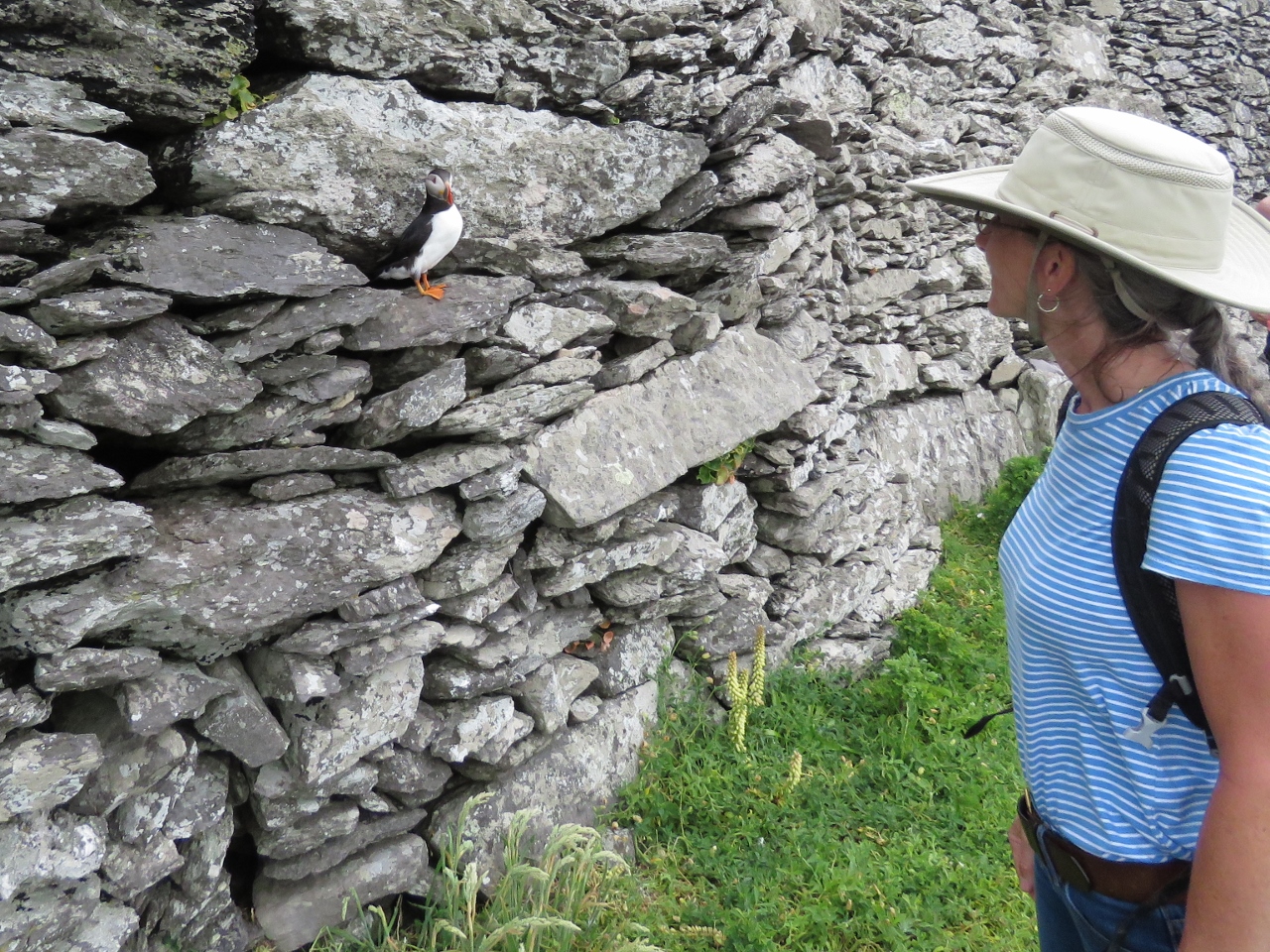 |
6/20/2017: Puffin on Wall
Position: 51°46.30'N, -10°32.36'W
This little guy popped out of the wall as we walked past.
|
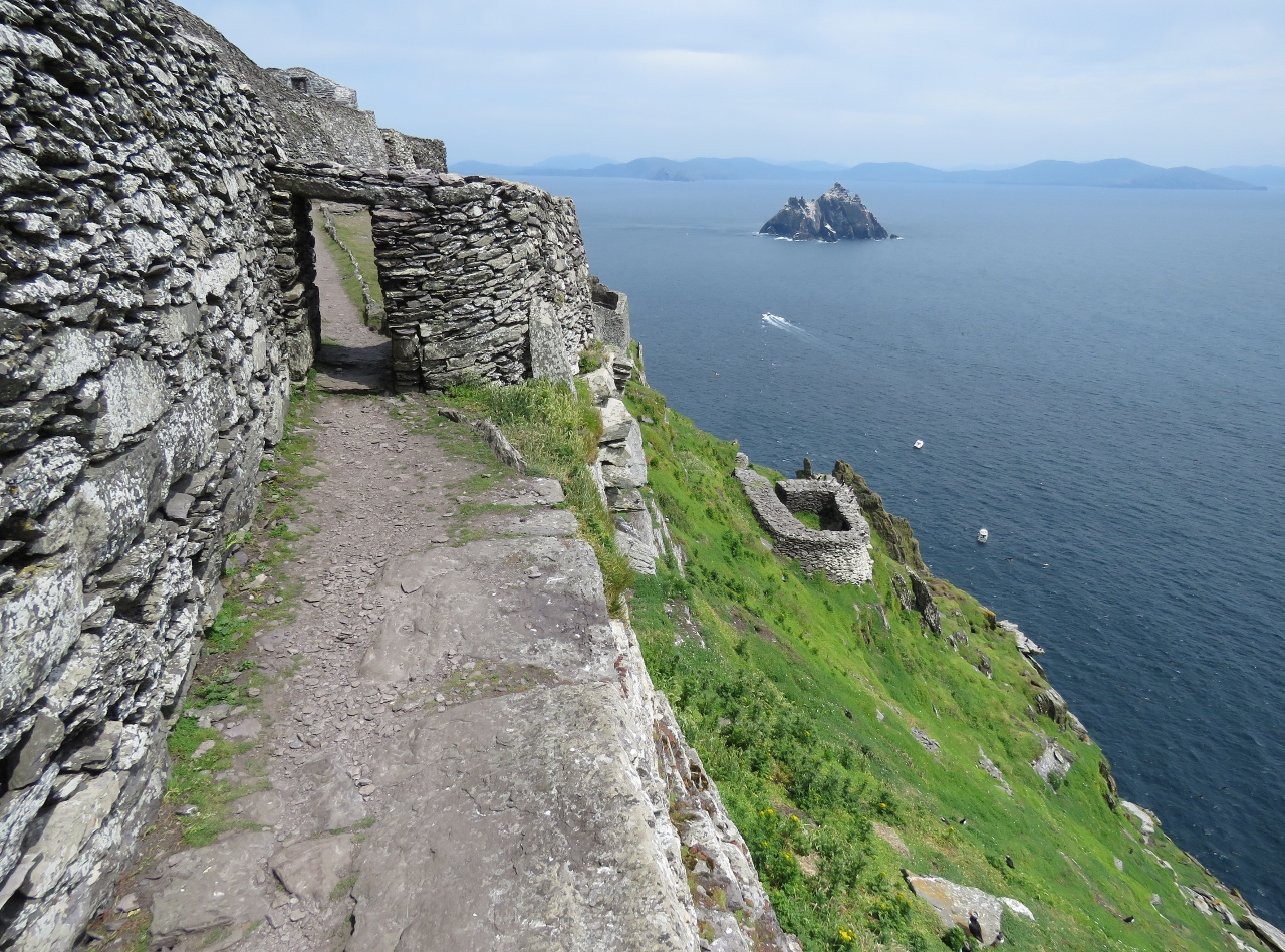 |
6/20/2017: Entrance
Position: 51°46.30'N, -10°32.36'W
The entrance to the monastery with Little Skellig in the distance.
|
 |
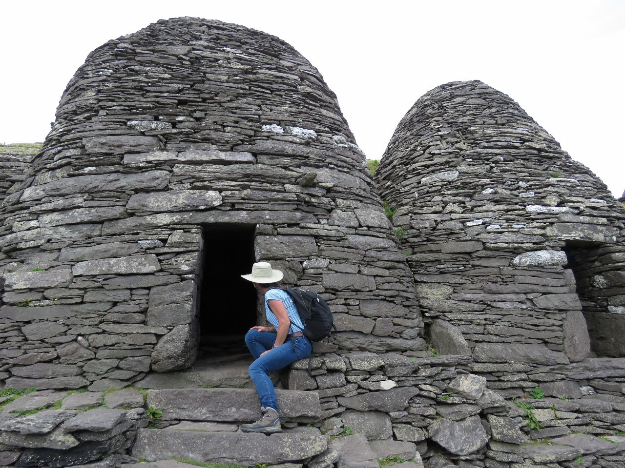
6/20/2017: Doorway
Position: 51°46.31'N, -10°32.34'W
Those monks must have been very short, or they banged their heads a lot.
|
 |
6/20/2017: Lower Garden
Position: 51°46.31'N, -10°32.34'W
The island had no level ground, so the monks excavated terraces for gardens and the monastery. This is the lower garden.
|
 |
6/20/2017: Upper Garden
Position: 51°46.31'N, -10°32.35'W
The Upper Garden at the main level of the monastery.
|
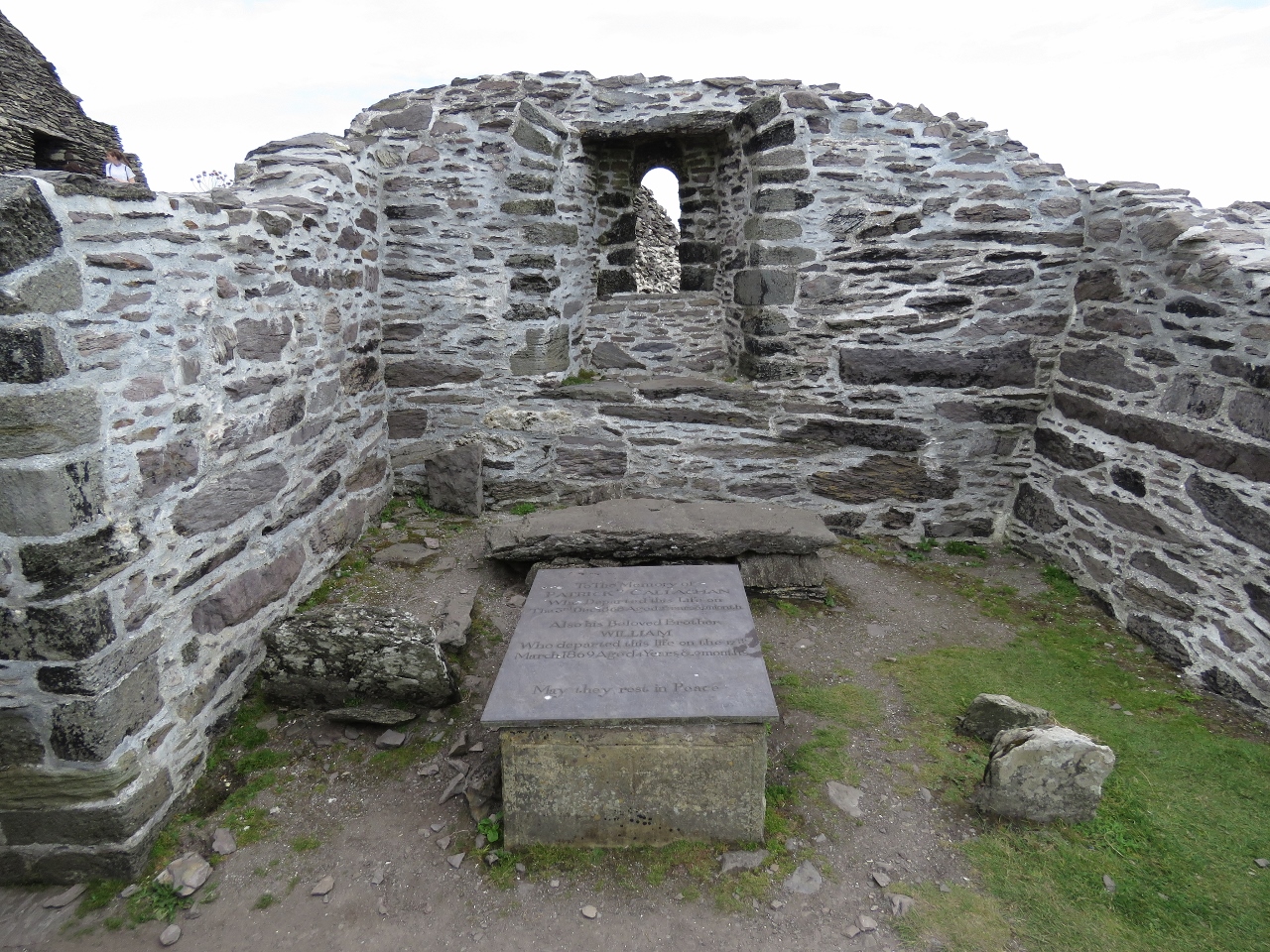 |
6/20/2017: Church
Position: 51°46.32'N, -10°32.33'W
Saint Michael’s Church is the only mortared structure in the monastery. It was probably built in the 11th century and remodelled in the 12th century. On the ground in front is a memorial to a lightkeeper's sons, who died on the island 1868 and 1869 at ages 2 and 4.
|
 |
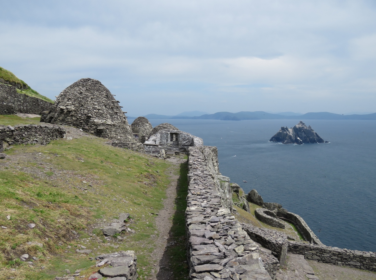
6/20/2017: Beehive Huts
Position: 51°46.32'N, -10°32.33'W
The monks built several beehive huts for shelter. Likely the smaller ones in the foreground were residences and the larger one a communal structure.
|
 |
6/20/2017: Cell B and C
Position: 51°46.32'N, -10°32.33'W
Jennifer looking into Cells B and C. It's remarkable that these have stood for centuries in such a storm-swept island. The monks did build the terraces to channel the wind over the monastery, but it's still amazing.
|
 |
6/20/2017: Graveyard
Position: 51°46.33'N, -10°32.32'W
The monk's graveyard at the east end of the monastery.
|
 |
6/20/2017: Terrace
Position: 51°46.33'N, -10°32.33'W
Looking to Little Skellig across Cell F with the graveyard on the right.
|
 |
6/20/2017: Last Puffins
Position: 51°46.22'N, -10°32.43'W
A final view of the puffins as we return back to the landing.
|
 |
6/20/2017: Corner
Position: 51°46.22'N, -10°32.36'W
It's a long drop down if you miss that sign at the corner.
|
 |
6/20/2017: Coming Down
Position: 51°46.22'N, -10°32.33'W
Returning back down the steps.
|
 |
6/20/2017: Great Day
Position: 51°46.21'N, -10°32.33'W
Skellig Michael is among the most remarkable places we've ever visits—were lucky to have an opportunity to visit. Spectacular Skellig Michael shows video footage from our tour of this unique and beautiful location.
|
 |
6/20/2017: North Cliffs
Position: 51°46.32'N, -10°32.47'W
After picking up his passengers, helmsman Brendan Walsh took us in for a close-up to the north cliffs.
|
 |
6/20/2017: Last View
Position: 51°46.55'N, -10°32.24'W
Our last view to Skellig Michael before we return to Ballinskelligs.
|
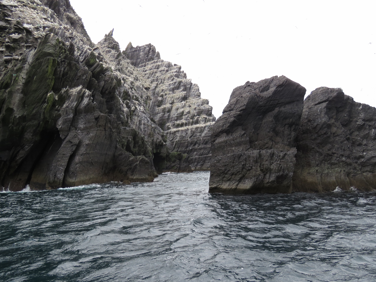 |
6/20/2017: Tight
Position: 51°46.95'N, -10°30.43'W
Brendan took Force Awakens through this narrow gap between the rocks and Little Skellig. It looks as tight as it was—an impressive job at the helm.
|
 |
6/20/2017: Spray
Position: 51°47.02'N, -10°30.20'W
The winds had picked up a little on the return trip, so we got a fair bit of spray as we pass the lee of Little Skellig.
|
 |
6/20/2017: At the Helm
Position: 51°47.65'N, -10°17.42'W
James at the helm of Force Awakens on the return trip.
|
 |
6/20/2017: Brendan and Derek
Position: 51°48.88'N, -10°15.85'W
Brendan Walsh (left) and Derek Noble of Force Awakens stopped by for a visit on Dirona after we returned to Ballinskelligs. It was truly a memorable day.
|
 |
6/21/2017: Valentia Radio
Position: 51°56.29'N, -10°20.16'W
In the early 1900s, Guglielmo Marconi built a wireless radio station at Crookhaven that in 1914 was transferred to Wireless Point on Valentia Island. During the mid 1920s, in the days of Morse Code, Valentia Radio handled more traffic than any other UK radio station. In 1999, it was one of the last stations to discontinue Morse service.
|
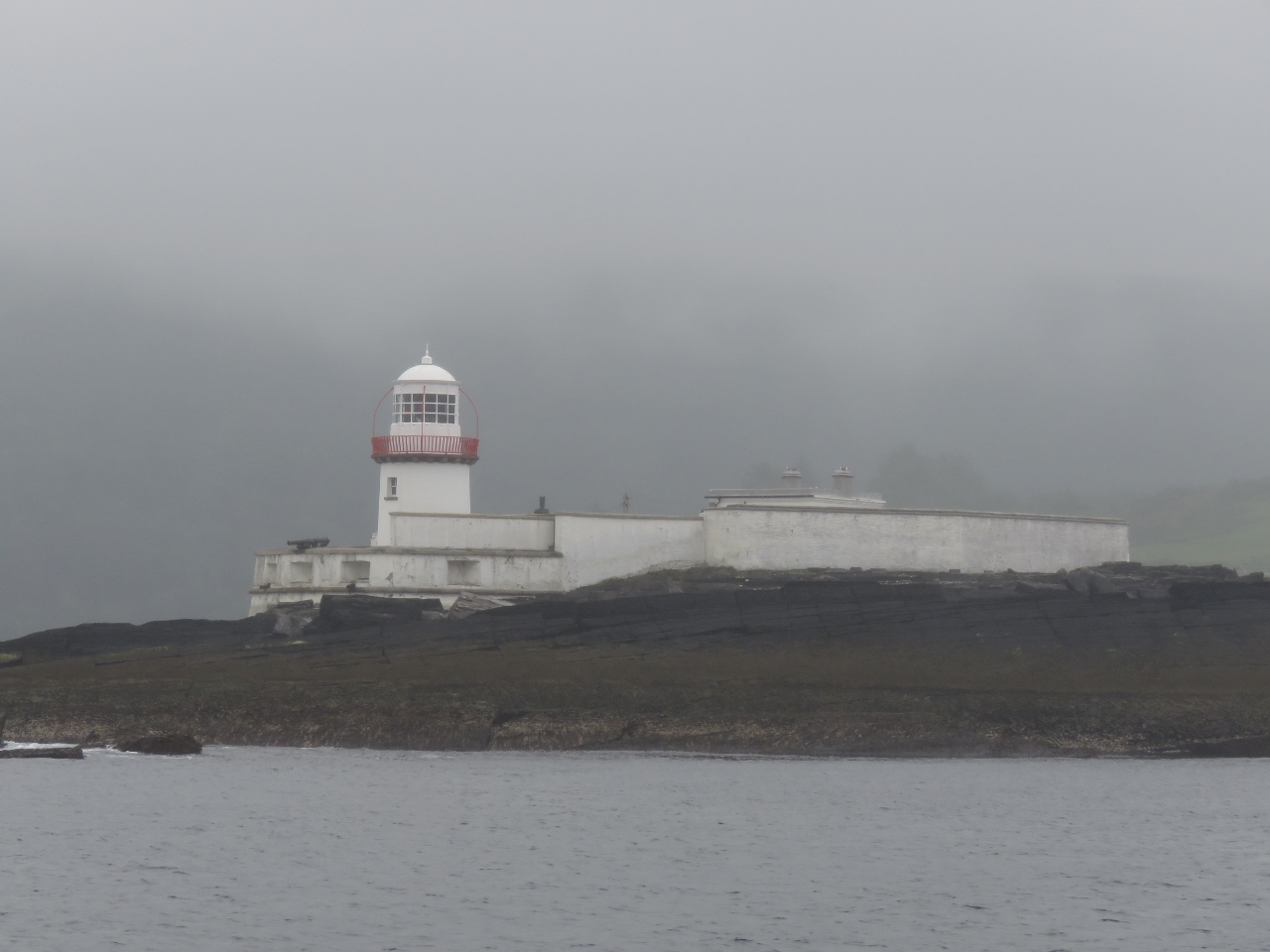 |
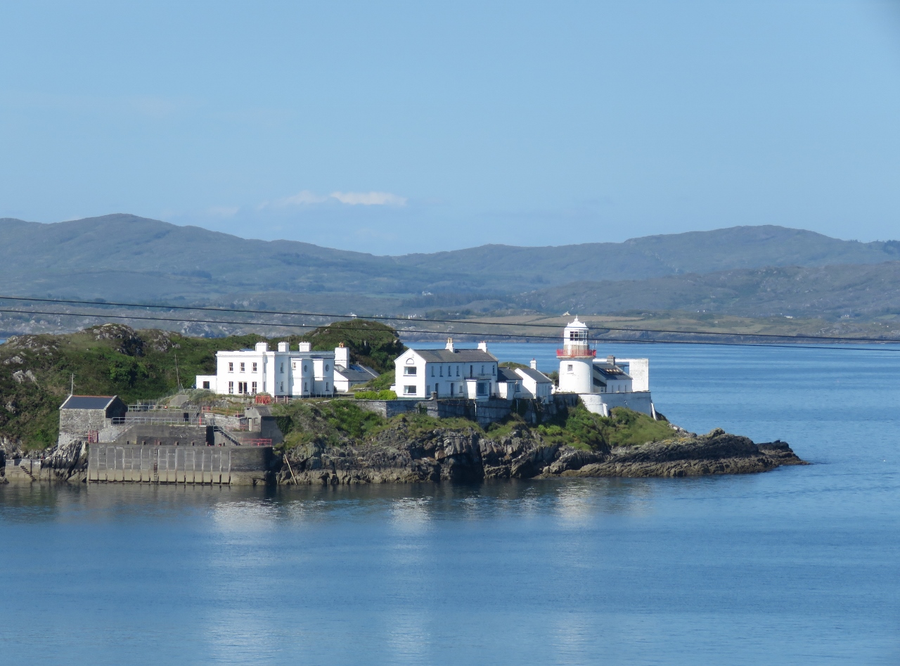
6/21/2017: Valentia Lighthouse
Position: 51°56.15'N, -10°19.20'W
The Valentia Lighthouse was first lit in 1841 and automated in 1947. Conditions were overcast, but calm as we arrived, nothing like the seascape showing a storm at http://www.valentiaisland.ie/explore-valentia/lighthouse/.
|
 |
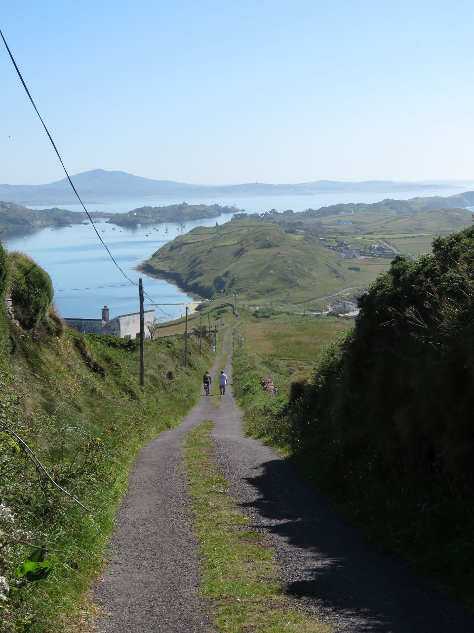
6/21/2017: Tender
Position: 51°55.72'N, -10°16.64'W
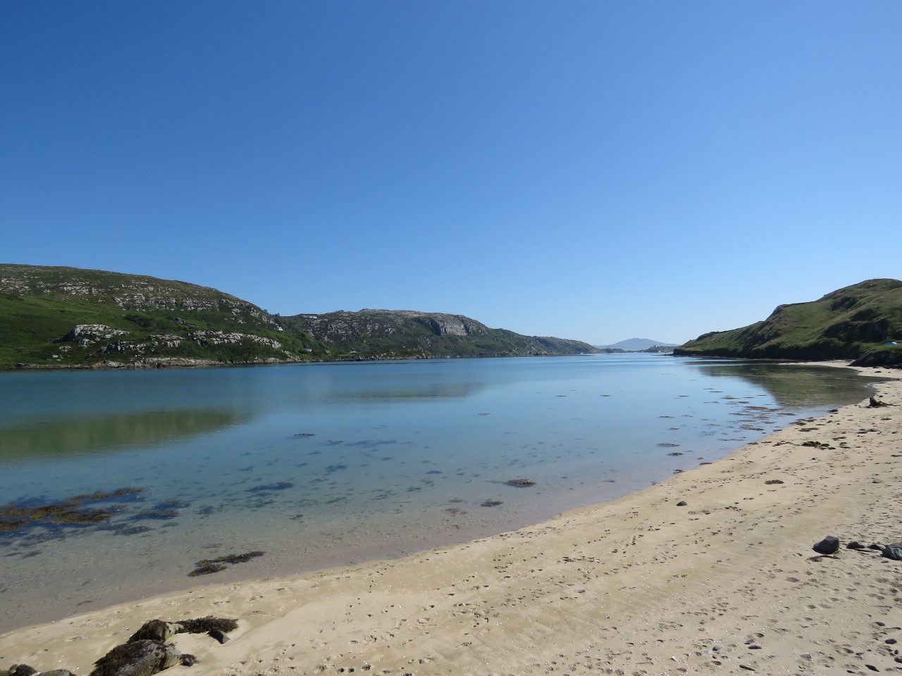
We anchored off Begenish Island then ran the tender over to the pier at Reenard Point for a bicycle tour of the Cahersiveen area.
|
 |
6/21/2017: Ferry
Position: 51°55.74'N, -10°16.65'W
The ferry from Valentia Island arriving at Reenard Point.
|
 |
6/21/2017: The Fertha
Position: 51°56.79'N, -10°13.55'W
Our first stop was in the village of Cahersiveen for a great lunch at The Fertha, named for the river that flow along the town.
|
 |
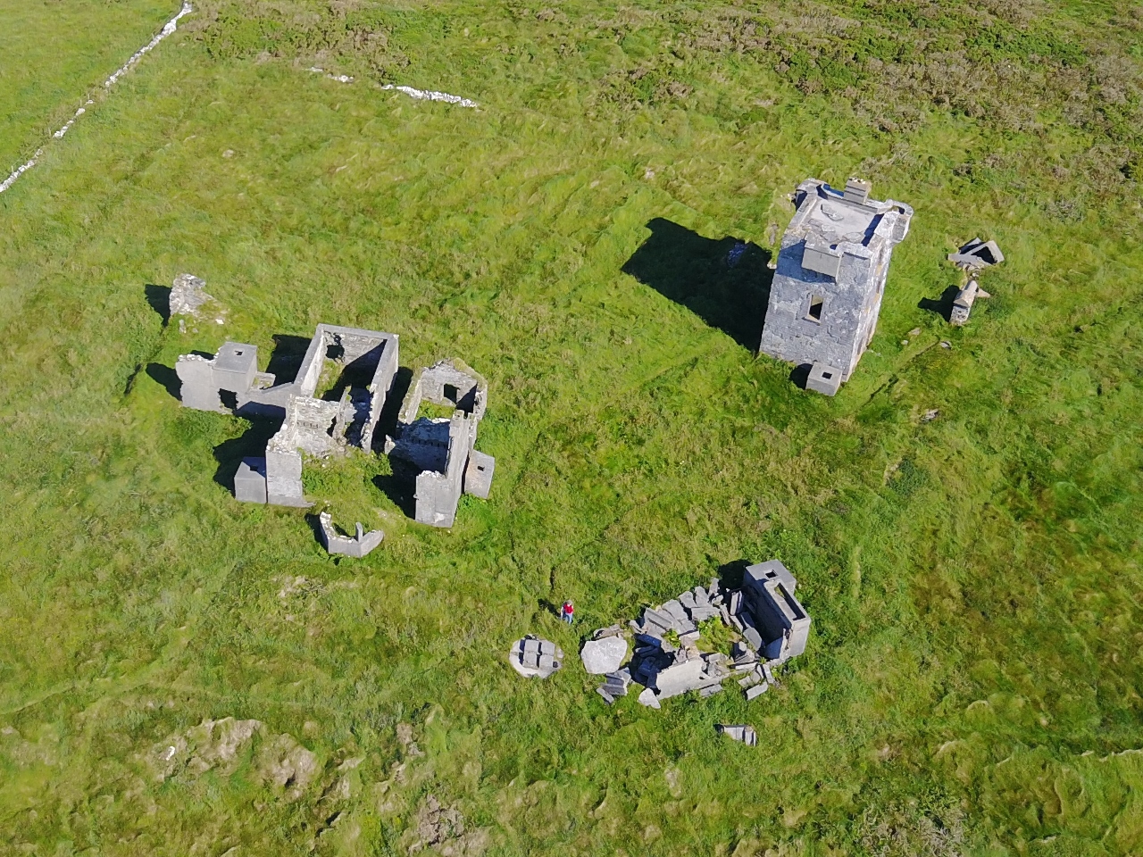
6/21/2017: Old Barracks
Position: 51°56.99'N, -10°13.50'W
In 1858, the first transatlantic cable was laid between Heart's Content, Newfoundland and Valentia Island, Ireland. The Royal Irish Constabulary barracks were built in Cahersiveen an imposing structure to protect the Irish end of the cable. The Bavarian building style, unusual for the area, generated a story that the building plans were mixed up with ones for the Punjab in India. But it's probably not true, as the the designer hired for the barracks favoured the Bavarian style. The building was burnt down in 1921 during the Irish Civil War, but later reconstructed and now houses a museum.
|
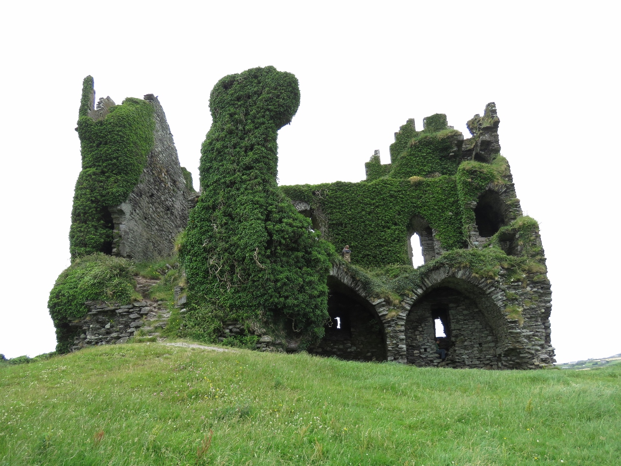 |
6/21/2017: Ballycarbery Castle
Position: 51°56.93'N, -10°15.51'W
The MacCarthey Mores built Ballycarbery Castle in the 16th century on the site of previous 14th-century building. In 1652, Oliver Cromwell's troops attacked the castle with cannons and destroyed the back wall of the castle. Local farmers later removed many of the fallen stones for building material, but much of the front and side walls still stand, and you can walk inside and up to the second level.
|
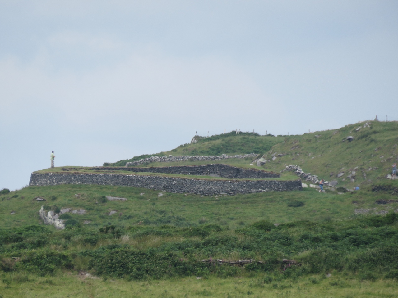 |
6/21/2017: Leacanabuile
Position: 51°56.93'N, -10°15.53'W
The view to our next stop, Leacanabuile ring fort, from Ballycarbery Castle.
|
 |
6/21/2017: Inside Leacanabuile
Position: 51°57.49'N, -10°15.70'W
Leacanabuile ring fort was built in the 9th century and was the protected homestead of a wealthy farmer. The circular enclosing wall is over 9ft thick and was built by erecting two strong walls, one within the other, and filling the gap with smaller stones. Inside are the remains of a round house and an attached square house.
|
 |
6/21/2017: Cahergal
Position: 51°57.49'N, -10°15.70'W
The view to our next stop, Cahergal ring fort, from nearby Leacanabuile ring fort.
|
 |
6/21/2017: Inside Cahergal
Position: 51°57.35'N, -10°15.48'W
Cahergal ring fort is larger and more impressive than Leacanabuile and likely built in 10th century, (stone forts are difficult to date). The main wall, including the terraces and several flights of steps of steps was recently reconstructed, but much of the rest stands from the 10th century, including the remains of a large circular dry-stone building.
|
 |
6/21/2017: Top of the Rock
Position: 51°57.76'N, -10°15.25'W
Our final stop on the bicycle tour was the "Top of the Rock" viewing platform. The village of Cahersiveen, where we had lunch, is at the left side of the photo. The Fertha River runs from Cahersiveen to Valentia Harbour, about center in the photo, with Valentia Island in the distance. is hidden behind Begenish Island, roughly in the center of the picture. Doulus Head on the mainland is to the right of center, and Cooncrome Harbour is on the right.
|
 |
6/21/2017: Ballycarbery Castle From Rock
Position: 51°57.71'N, -10°15.31'W
The view to Ballycarbery Castle from "Top of the Rock".
|
 |
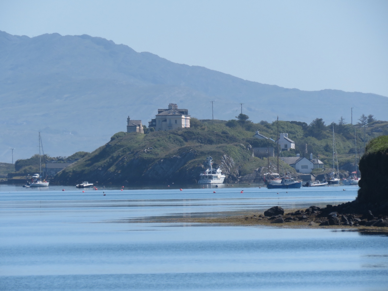
6/21/2017: Marina
Position: 51°56.84'N, -10°13.97'W
On our way back to Dirona, we checked out the marina at Cahersiveen. This is another Safehaven Marine Genesis 37 Interceptor, similar to Force Awakens that took us to Skellig Michael.
|
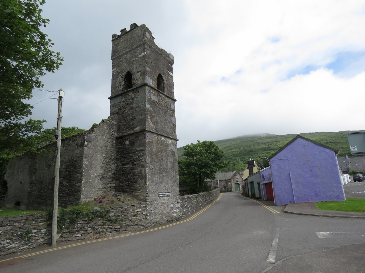 |
6/21/2017: Holy Cross Abbey
Position: 51°56.81'N, -10°13.71'W
The ruins of the Holy Cross Abbey in Cahersiveen. The church is interesting in that it doesn't have a steeple. From 1695 to 1820, Irish law aimed at bolstering Protestantism and restricting Catholicism prohibited Catholic churches from having a steeple or bell.
|
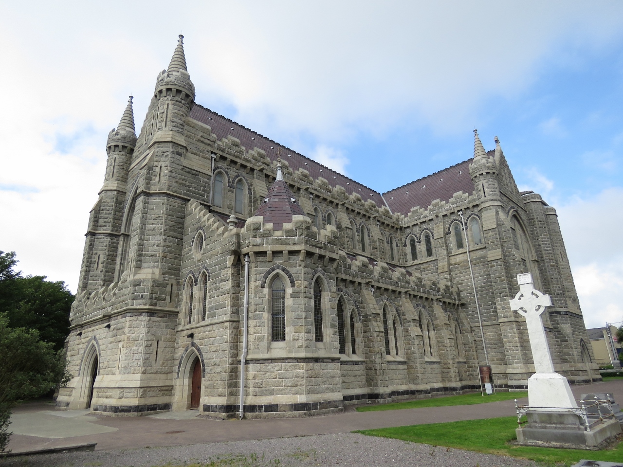 |
6/21/2017: Memorial Church
Position: 51°56.81'N, -10°13.50'W
The imposing Daniel O'Connell Memorial Church in Cahersiveen. Daniel O'Connell was a 19th-century Irish politician who pushed for the removal of restrictions on Catholicism in the United Kingdom, and for the repeal of the Act of Union that joined Ireland with Great Britain. The Daniel O'Connell Memorial Church is the only church in Ireland named after a layman.
|
 |
6/22/2017: Amphibious
Position: 51°56.09'N, -10°17.54'W
From the anchorage, we noticed this amphibious vehicle had driven ashore on Begenish Island and offloaded a group for a picnic.
|
 |
6/22/2017: Hotel Valentia
Position: 51°55.57'N, -10°17.29'W
We had a good lunch with a view to the harbour at the Royal Hotel Valentia before setting off on a bike ride around the island.
|
 |
6/22/2017: Knightstown
Position: 51°55.53'N, -10°17.49'W
The village of Knightstown was built in the 1840's according to a grid pattern plan laid out by Alexander Nimmo, and is one of the few planned villages in Ireland. The Dwelling House, and the Royal Hotel Valentia where we had lunch, date from that period.
|
 |
6/22/2017: Church of Ireland
Position: 51°55.46'N, -10°18.40'W
The ruins of an 18th-century Church of Ireland and graveyard a short distance outside Knightstown.
|
 |
6/22/2017: Valentia Lighthouse
Position: 51°55.45'N, -10°19.88'W
We made a steep climb up to the Valentia Island Slate Quarry with great views to the Valentia Lighthouse and harbour. The channel on the right is the one we passed through yesterday to reach our anchorage.
|
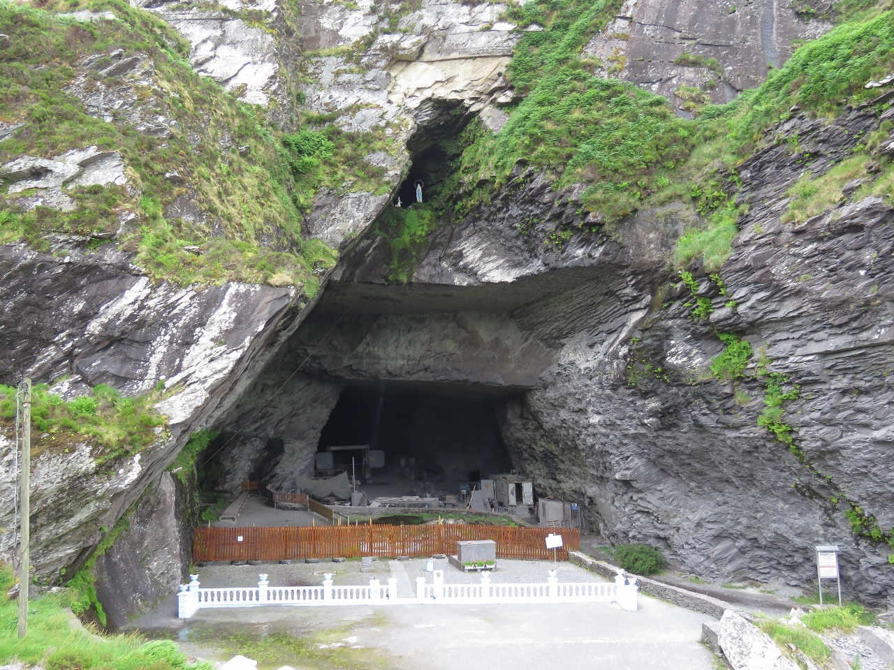 |
6/22/2017: Slate Quarry
Position: 51°55.49'N, -10°20.54'W
The high-quality slate produced in the Valentia Island Slate Quarry was used in the Paris Opera House, London's Houses of Parliament and many billiard tables, including one made for the Duke of Wellington & Queen Victoria. High above the quarry entrance are statues of Our Lady & Bernadette—a yearly communion mass is held in the fenced area in front of the quarry entrance.
|
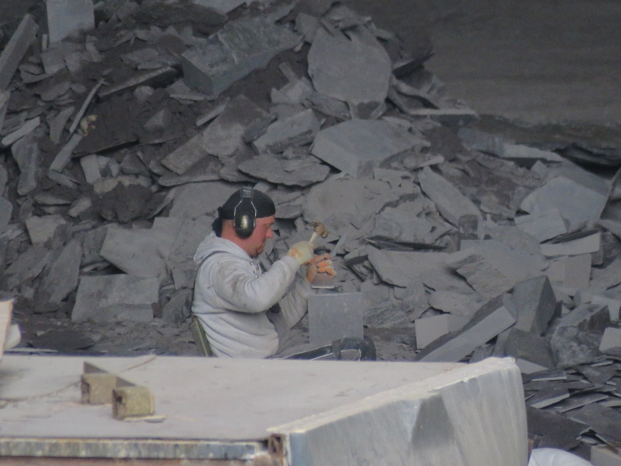 |
6/22/2017: Making Tiles
Position: 51°55.49'N, -10°20.54'W
We could see a worker inside the quarry and were surprised to see him making slates by hand.
|
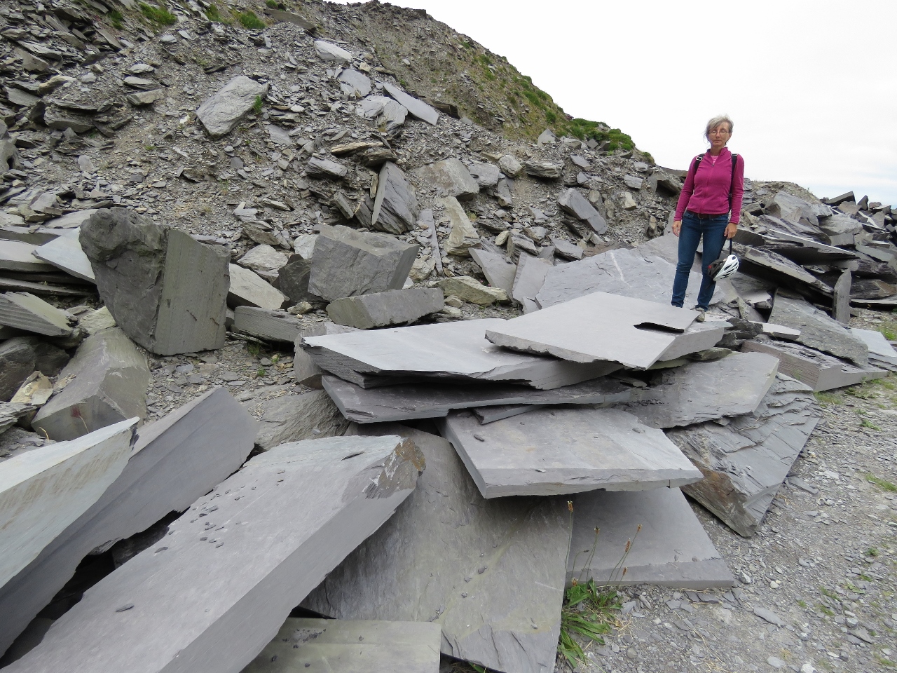 |
6/22/2017: Slate
Position: 51°55.55'N, -10°20.53'W
Big piles of discarded slate outside the quarry.
|
 |
6/22/2017: Portmagee Channel
Position: 51°55.34'N, -10°20.73'W
After the quarry, we made another steep climb to Geokaun Mountain. The 360-degree view was incredible. This is looking southwest to Portmagee Channel and the village of Portmagee on the mainland, with a bridge connecting to Valentia Island on the right.
|
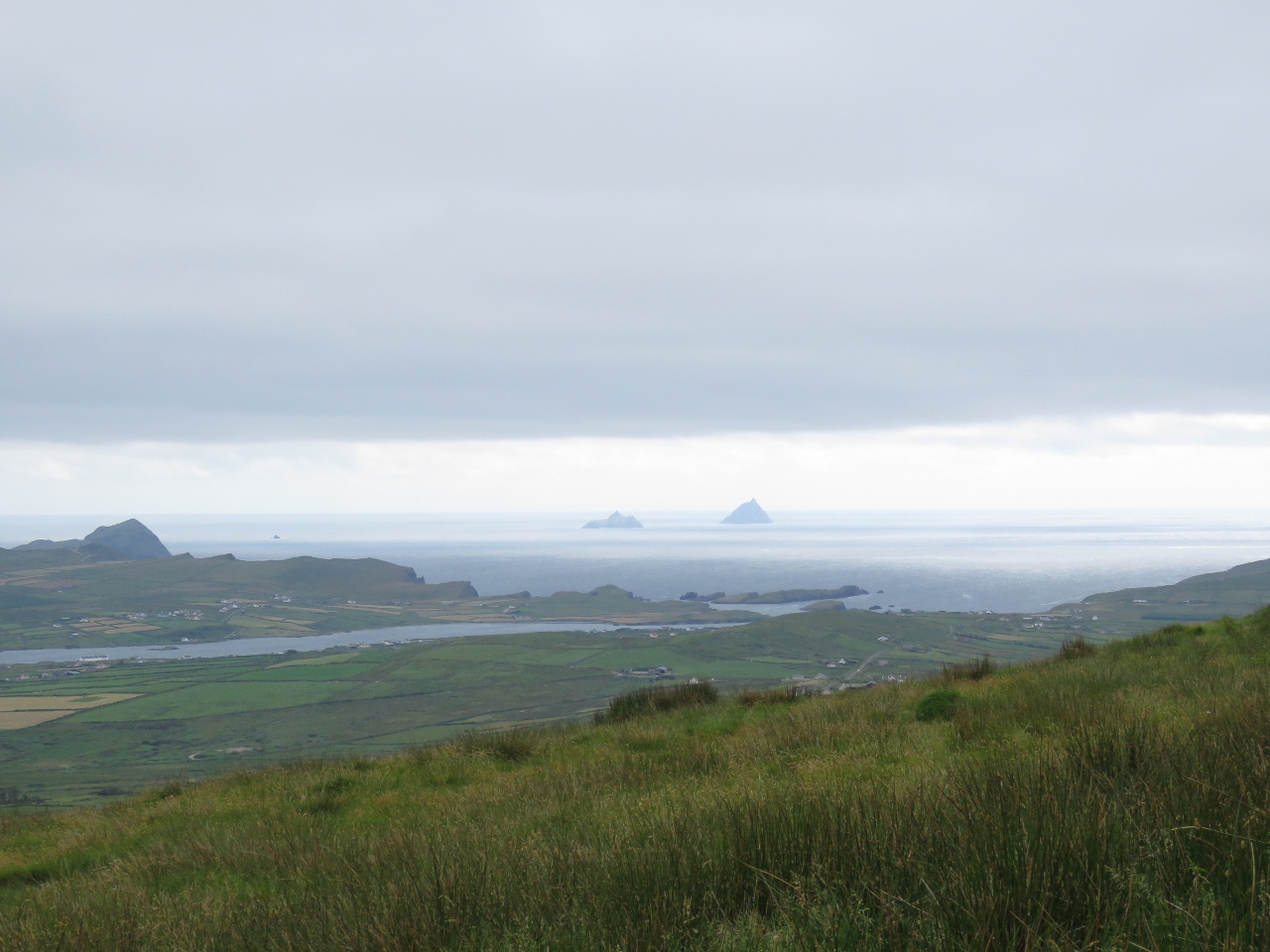 |
6/22/2017: Skelligs
Position: 51°55.34'N, -10°20.73'W
The view to sea beyond Portmagee Channel to The Skelligs from Geokaun Mountain.
|
 |
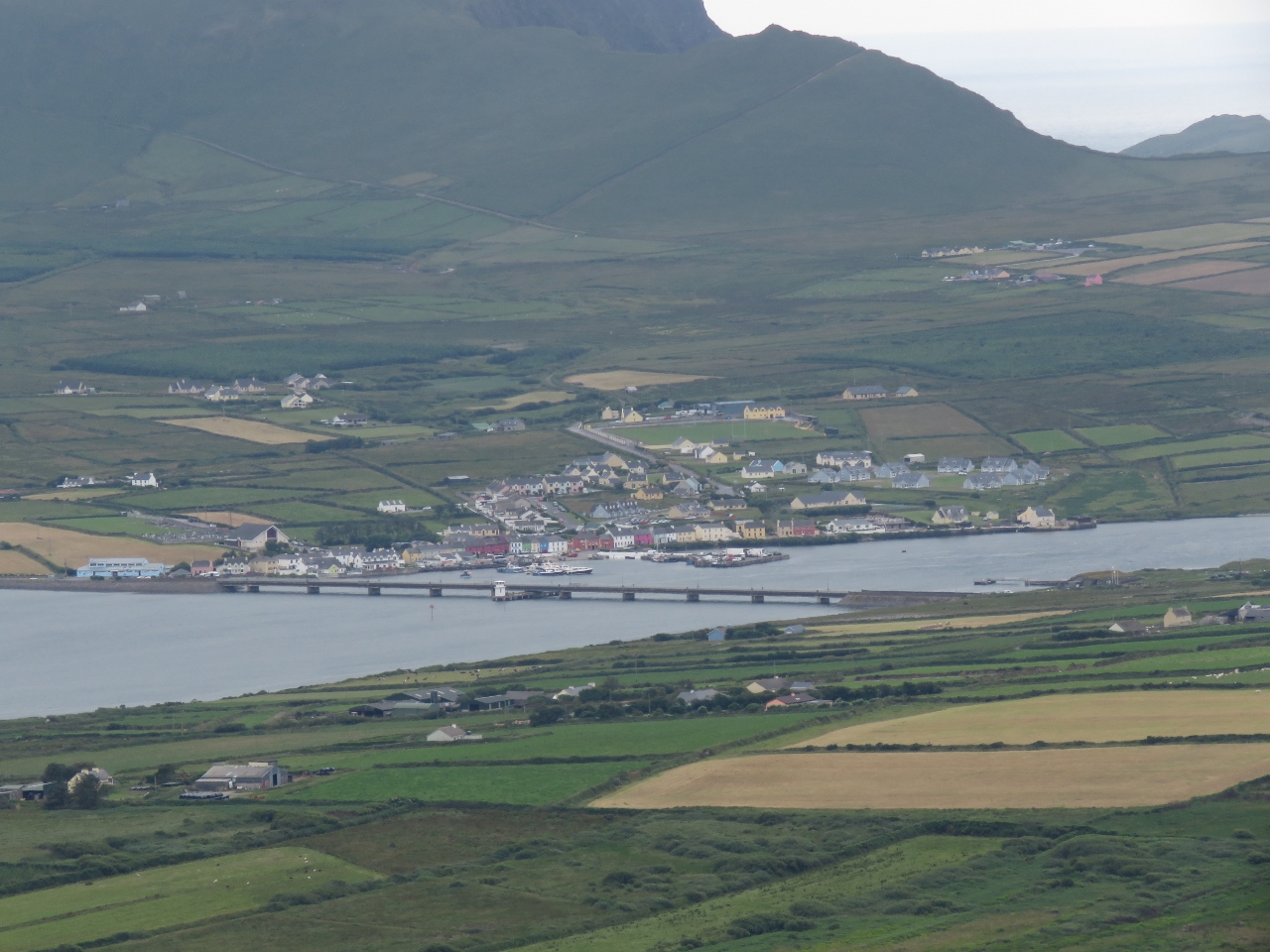
6/22/2017: Cahersiveen
Position: 51°55.34'N, -10°20.73'W
Looking northeast to Cahersiveen from Geokaun Mountain. The Old Barracks are visible slightly right of center and the Cahersiveen Marina is at the center of the picture.
|
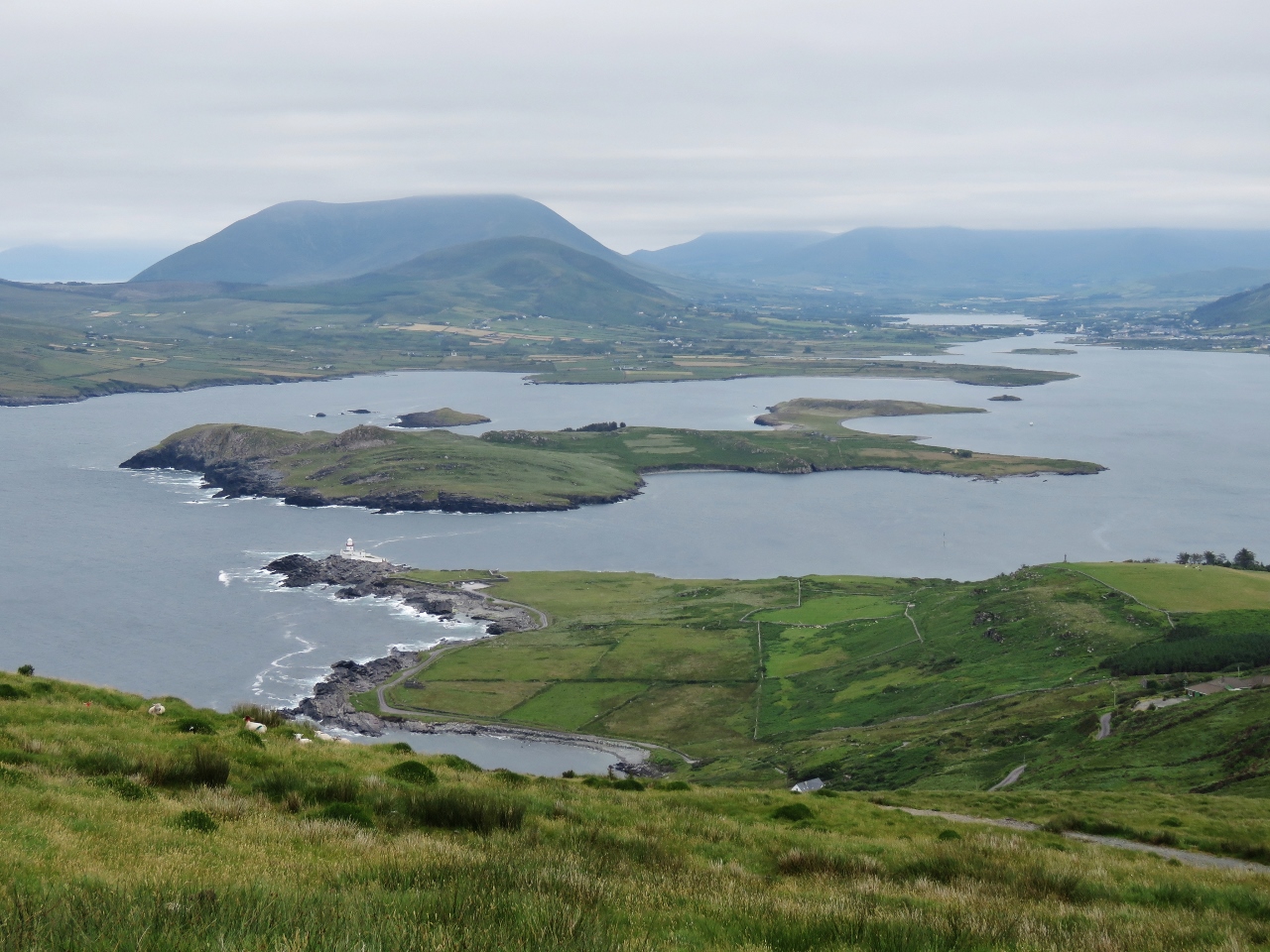 |
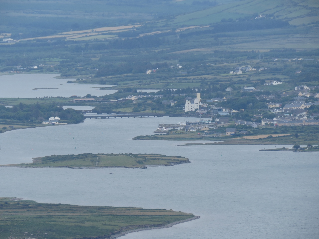
6/22/2017: Valentia Harbour
Position: 51°55.34'N, -10°20.73'W
Valentia Harbour, viewed from Geokaun Mountain. Valentia Lighthouse is at the left of the photo and Cahersiveen is at the far right in the distance. Dirona is a small speck in the right third
|
 |
6/22/2017: Fogher Cliffs
Position: 51°55.29'N, -10°21.22'W
Ireland seems to have no shortage of dramatic cliffs. This is the Fogher Cliffs viewing deck at Geokaun Mountain.
|
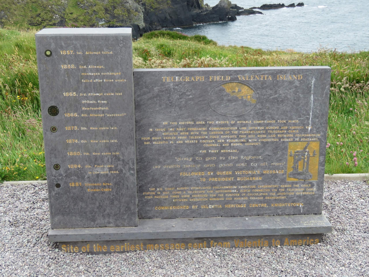 |
6/22/2017: Telegraph Field
Position: 51°53.59'N, -10°23.42'W
In 1866, the first transatlantic telegraph cable was completed between Newfoundland and here at Telegraph Field on Valentia Island. Prior to the cable, messages between Europe and North America were sent by sea and took two weeks, or more, to reach their destination.
|
 |
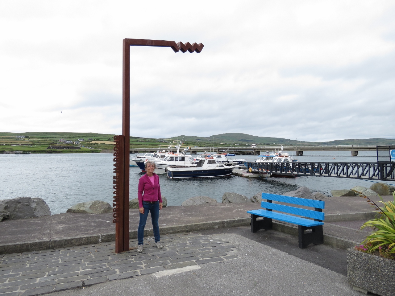
6/22/2017: Portmagee Harbour
Position: 51°53.23'N, -10°21.85'W
Portmagee Harbour, with the town's colorfully-painted buildings behind. The majority of boats that provide tours to Skellig Michael leave from here.
|
 |
6/22/2017: Wild Atlantic Way
Position: 51°53.16'N, -10°21.95'W
The "Wild Atlantic Way" is a successful marketing campaign to promote tourism along Ireland's West Coast. We frequently see these metal signs that mark highlights along the route.
|
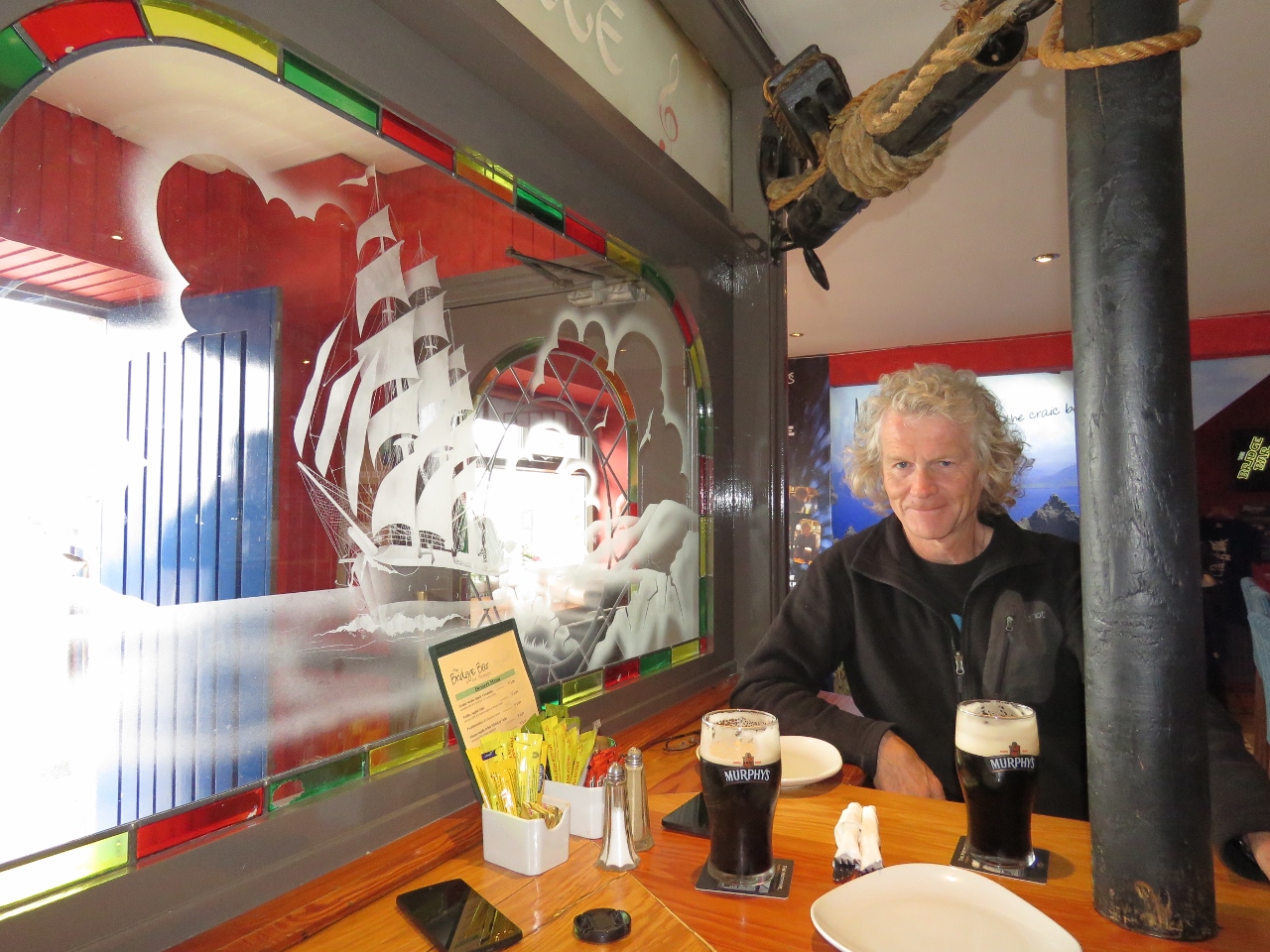 |
6/22/2017: Bridges
Position: 51°53.15'N, -10°21.94'W
An excellent meal at Bridges restaurant and pub in Portmagee. During the filming of Star Wars: The Force Awakens, the film crew and actors stayed in and around Portmagee. The bar is full of Star Wars memorabilia, including a video of Mark Hamill (who plays Luke Skywalker), taking the "The Force Perfect Pint" challenge in trying to pour a perfect pint of Guinness.
|
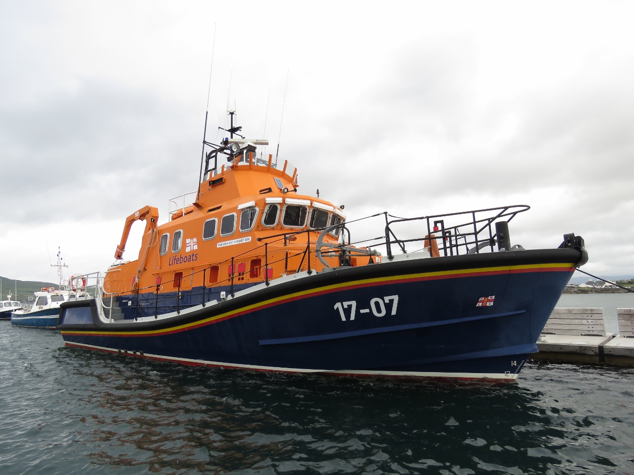 |
6/22/2017: Lifeboat
Position: 51°55.63'N, -10°17.02'W
We know Ireland sees some serious weather and these lifeboats, common along the coast, are designed to handle these storms.
|
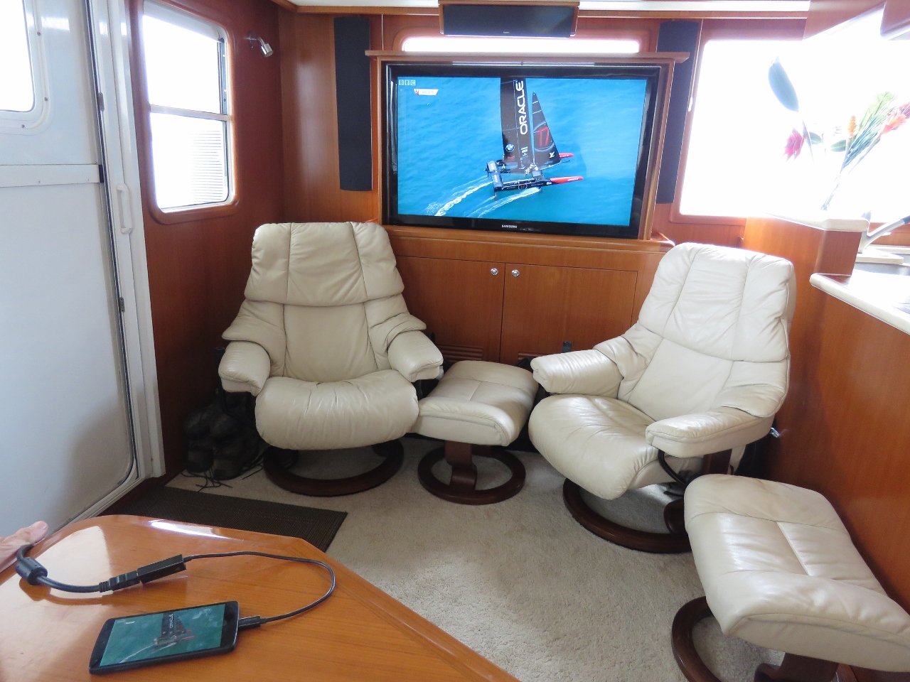 |
6/23/2017: Americas Cup
Position: 51°56.10'N, -10°17.54'W
We've been unsuccessful at finding a way to watch any of the America's Cup coverage and finally found a way today through a phone app that we mirrored to our TV. After meeting Tom Slingsby and several other team members at Team Oracle USA Foiling Camp in Australia, we were pretty disappointed to see them lose.
|