MV Dirona travel digest for London 2018

|
Click the travel log icon on the left to see these locations on a map,
with the complete log of our cruise. On the map page, clicking on a camera or text icon will display a picture and/or log entry for that location, and clicking on the smaller icons along the route will display latitude, longitude and other navigation data for that location. And a live map of our current route and most recent log entries always is available at //mvdirona.com/maps/LocationCurrent.html. |
 |
2/8/2018: Rampion Windfarm
Position: 50°37.27'N, 0°23.32'W
We passed the Rampion Windfarm around 11pm. Construction began in 2015 and the facility is expected to come online this year with a target capacity of 400 MW. The windfarm is massive, the largest we've seen, at six miles across. Our charts don't show the windfarm because it's so new, but it's pretty hard to miss, even at night. The towers are super visible on radar, plus they're well-lit and the farm has two virtual AIS targets at the northwest and southwest corners.
|
 |
2/8/2018: Roll
Position: 50°37.26'N, 0°23.12'W
Winds have been steady in the high twenties for the past four hours and we're taking big waves on the beam. We just took our biggest roll of the run at 24.7° The boat is doing fine, but you really have to be careful moving around.
|
 |
2/9/2018: Prime Meridian
Position: 50°38.54'N, 0°0.19'E
We just crossed the Prime Meridian, and we'll cross back again when we near London. We haven't seen an east latitude since we crossed the Prime Meridian two years ago en route to St. Helena from Cape Town.
|
 |
2/9/2018: Traffic
Position: 50°39.37'N, 0°14.10'E
There's a lot of traffic in the English Channel to our south as we round Beachy Head. We're running north of the traffic lanes, shown in purple, to keep a good two miles away from other ships. The blue crosses at the end of the blue lines show where the CPA (closest point of approach) between us and each ship will be given current speed and course. It's a new feature of our chartplotter, TimeZero, that we find really useful.
|
 |
2/9/2018: Cliffs of Dover
Position: 51°7.96'N, 1°24.13'E
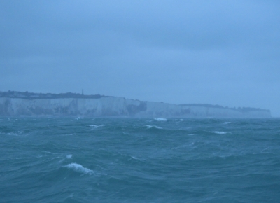
The South Foreland lighthouse barely visible on the White Cliffs of Dover about a mile away on an overcast morning. The light went into service in 1843 and was deactivated in 1988.
|
 |
2/9/2018: Seas
Position: 51°11.07'N, 1°26.05'E
The heavy seas continued all night. We were hoping they'd settle down as we turned into Trinity Bay and put the winds more behind us, but it's still pretty rough out there.
|
 |
2/9/2018: North Foreland
Position: 51°21.97'N, 1°28.01'E
The North Foreland lighthouse, built in 1691 above the cliffs at Broadstairs, is a twin to the South Foreland lighthouse at Dover.
|
 |
2/9/2018: Kentish Flats
Position: 51°28.87'N, 1°8.21'E
The Kentish Flats Windfarm is one of four windfarms in the Thames Estuary. The first phase was completed in 2005, with a capacity of 90 MW from 30 Vestas V90-3MW wind turbines. In 2015, 15 Vestas V112-3.3MW we added, increasing total capacity to 140 MW.
|
 |
2/9/2018: Red Sands Forts
Position: 51°28.94'N, 0°59.54'E
The Red Sands Forts were one of armed tower fort groups built along the Thames and Mersey River estuaries to defend the UK from German air attacks during World War II. We'd initially planned to divert to Queensbourough for the night, as we didn't expect to arrive at the Thames estuary until late afternoon. But we made excellent time overnight and arrived by ten in the morning. We decided we could reach London by dusk, and continued up the Thames.
|
 |
2/9/2018: Norsky
Position: 51°28.91'N, 0°57.45'E
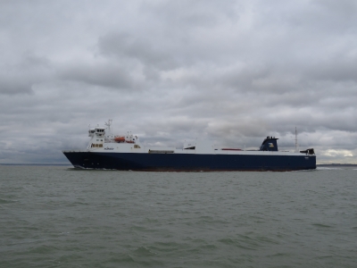
We're seeing plenty of ship traffic as we enter the Thames River. This is the 590ft (180m) RO-RO Norsky heading to sea.
|
 |
2/9/2018: BW Jaguar
Position: 51°30.29'N, 0°33.14'E
The 600ft (183m) oil tanker BW Jaguar moored at Canvey Island.
|
 |
2/9/2018: Sertao
Position: 51°27.05'N, 0°23.61'E
The 744 (277m) drill ship Sertao is capable of drilling to depths of 40,000 ft (12,000m) in water depths of up to 10,000 ft (3,000m).
|
 |
2/9/2018: QE II Bridge
Position: 51°28.05'N, 0°15.24'E
We just passed under the Queen Elizabeth II Bridge, completed in 1991 as part of the Dartford-Thurrock River Crossing. The crossing, that includes two tunnels, is the only fixed crossing of the Thames and carries a daily average of over 130,000 vehicles. When we passed at 3:40pm, the bridge already looked plugged solid with truck traffic.
|
 |
2/9/2018: Littlebrook Power Station
Position: 51°28.13'N, 0°15.03'E
The Littlebrook D Power Station is the last of four oil and coal-fired power stations built just west of the Queen Elizabeth II bridge. The oil-fired station first operated in 1981 and ceased operating in 2015 due to the EU Large Combustion Plant Directive aimed at reducing with air pollutants from the combustion of fossil fuels.
|
 |
2/9/2018: Riverside Resource Recovery
Position: 51°30.67'N, 0°9.15'E
The massive Riverside Resource Recovery waste incinerator burns garbage to produce electricity.
|
 |
2/9/2018: Crossness Sewage Treatment Works
Position: 51°30.74'N, 0°8.89'E
The Crossness Sewage Treatment Works is one of the largest in Europe. The modern sludge-powered generator went into operation in 1998 and can produce up to 6 MW of energy, three-quarters of the plant's requirements.
|
 |
2/9/2018: London!
Position: 51°30.93'N, 0°8.17'E
The London skyline coming into view as we round the bend at Thamesmead. We're so excited to actually be here.
|
 |
2/9/2018: Construction
Position: 51°29.85'N, 0°4.04'E
We're seeing lot of construction along the river as we near London. The economy seems to be booming.
|
 |
2/9/2018: Tidal Barrier
Position: 51°29.82'N, 0°3.23'E
The Thames Tidal Control Barrier visible in the distance. The barrier prevents flooding of the Greater London due to high tides and storm surges. Vessels intending to pass through must radio in advance for permission and instructions from London VTS (Vessel Traffic Service). Green arrows on the piers indicate the spans open for passage. We'd been assigned span E, the rightmost of the two open spans.
|
 |
2/9/2018: Control Center
Position: 51°29.84'N, 0°2.19'E
The control center monitors all traffic passing through the barrier.
|
 |
2/9/2018: Passing Through
Position: 51°29.84'N, 0°2.19'E
Dirona passing through the Thames Tidal Control Barrier.
|
 |
2/9/2018: Rotating Gate
Position: 51°29.84'N, 0°2.19'E
The Thames Tidal Control Barrier has semi-circular gates that lies on the river bottom and rotate into place when needed.
|
 |
2/9/2018: Cable Car
Position: 51°30.07'N, 0°0.88'E
A cable car crossing the Thames opened in 2015 and carries passengers for a distance of 3,600ft (1,100 m) at a maximum elevation of 300ft (90m) above the river. It's definitely in our to-do list while visiting London.
|
 |
2/9/2018: O2 Arena
Position: 51°30.42'N, 0°0.14'E
The O2 Arena can hold 20,000 people, the second highest seating capacity in the UK. The arena is named after it's primary sponsor, the telecommunications company O2.
|
 |
2/9/2018: Greenwich
Position: 51°29.15'N, 0°0.52'W
The magnificent Old Royal Navy College buildings at Greenwich are part of Maritime Greenwich, a UNESCO World Heritage Site. The buildings initially were erected in 1692 as the Royal Hospital for Seamen at Greenwich. In 1873, they were converted to a training facility for the Royal Navy, who occupied the site until 1998. Part of the The University of Greenwich now occupies part of the site.
|
 |
2/9/2018: Sunset
Position: 51°29.15'N, 0°0.52'W
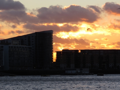
A striking sunset as we near London. The light is fading, but we're close now.
|
 |
2/9/2018: Tower Bridge
Position: 51°30.21'N, 0°3.98'W
We've arrived and are docked along the River Thames for the night with a view to Tower Bridge. Wow!
|
 |
2/9/2018: Moored
Position: 51°30.21'N, 0°3.99'W
Our ultimate destination is St. Katharine Docks, but the it's behind a lock and the next opening is tomorrow morning. So we stopped for the night at the Hermitage Community Moorings. We're so excited to be here.
|
 |
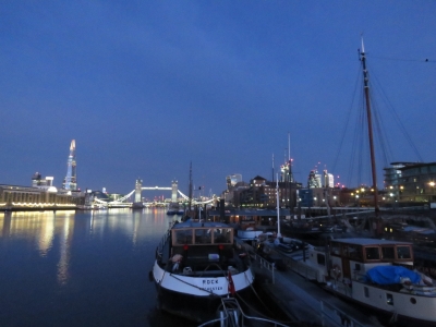
2/9/2018: River Thames
Position: 51°30.23'N, 0°3.88'W
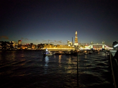
Looking across the River Thames with our berth at the left end of the Hermitage Community Moorings in the foreground and Tower Bridge visible on the right. Left of the bridge is The Shard, a 1,017 ft (310 m ) skyscraper complete in 2012. The observation deck atop the tower is also on our London to-do list.
|
 |
2/9/2018: Town of Ramsgate
Position: 51°30.22'N, 0°3.74'W
Dinner at our first London pub, the Town of Ramsgate along the Thames. It's awesome to be here.
|
 |
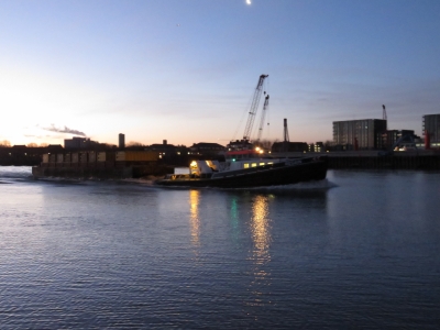
2/10/2018: Dawn
Position: 51°30.21'N, 0°3.98'W
The spectacular dawn view to Tower Bridge and the Shard from the Hermitage Community Moorings. We can't believe we're actually here. Most of the other boats on the moorings are pre-1965 ex commercial barges converted to liveaboard use. They're pretty appealing-looking.
|
 |
2/10/2018: Wake
Position: 51°30.20'N, 0°3.98'W
The River Thames is busy with traffic that generates rather large wakes. The wake from this tug and barge rebounded off the shore and back to the other side several times. We were expecting we'd really toss in the wash, but it wasn't that big a deal.
|
 |
2/10/2018: Tower Bridge
Position: 51°30.21'N, 0°3.98'W
We'd never get tired of the view to Tower Bridge.
|
 |
2/10/2018: Sunrise
Position: 51°30.21'N, 0°3.98'W
Our first London sunrise, looking downriver.
|
 |
2/10/2018: Fenders
Position: 51°30.21'N, 0°3.98'W
The Hermitage Community Moorings are effectively a large commercial wharf with big tires for fenders. Because the moorings are exposed to wakes from commercial traffic, they recommend big fenders and strong lines, and discourage smaller boats from mooring here. Interestingly, the manager guessed Dirona's 55-ton weight almost exactly, based on how little the wakes moved us. Most people guess about half that weight.
|
 |
2/10/2018: Entering Lock
Position: 51°30.36'N, 0°4.34'W
The lock at St. Katharine Docks is open only from 2 hours before high water to 1.5 hours after, between 8am and 6pm in the winter. We were booked in at the 8am opening and headed over once they were ready for us. Here the riverside bridge has been lifted to allow us to enter the locks.
|
 |
2/10/2018: In the Lock
Position: 51°30.37'N, 0°4.33'W
James waving from Dirona in the St. Katharine Docks lock with the River Thames beyond the closed lock bridge.
|
 |
2/10/2018: Gate Dropping
Position: 51°30.37'N, 0°4.33'W
The lock gate dropping once the water level in the lock has equalized with the marina inside. We only had to go up a couple of feet.
|
 |
2/10/2018: Bridge Lifting
Position: 51°30.37'N, 0°4.33'W
The interior lock bridge lifting to allow us to pass through.
|
 |
2/10/2018: Gate Lifting
Position: 51°30.40'N, 0°4.30'W
The lock gate lifting back into position once we've passed through into the marina.
|
 |
2/10/2018: Boat Wash
Position: 51°30.40'N, 0°4.30'W
We were really salty from the run to London, plus quite dirty from the yard, so we gave Dirona a good scrub.
Update: We're not the only Nordhavn here—that's Nordhavn 55 Shogun in front of us. |
 |
2/10/2018: First Smell
Position: 51°30.40'N, 0°4.30'W
Spitfire getting his first smell of London. He's pretty much fully recovered from his surgery in Hamble a couple of weeks ago, but it will be a while longer before his butt fur grows back after shaving for surgery.
|
 |
2/10/2018: Dishwasher
Position: 51°30.40'N, 0°4.30'W
Our dishwasher leaked today. We found the lower gasket needs replacing the soap dispenser is leaking slightly and jamming up. Here James has the cover off the door with the new gasket to the left of the old gasket and the replacement soap dispenser on the right. These are examples of spares that aren't mission-critical to have, but a non-functional dishwasher is inconvenient and you aren't going to find GE apartment dishwasher parts in most areas of the world.
|
 |
2/10/2018: St. Katharine Docks
Position: 51°30.40'N, 0°4.28'W
Our beautiful new temporary home at St. Katharine Docks in downtown London. The top of 30 St Mary Axe, aka "The Gherkin", is the center of the three buildings visible in the distance, directly above our brow.
|
 |
2/11/2018: Dishwasher
Position: 51°30.40'N, 0°4.30'W
We didn't start working on the dishwasher until late yesterday, so finished it off this morning. Replacing the dishwasher lower gasket is a challenge as it's barely held on with a light crimp. We've replaced it once before and glued it in and are doing the same thing again. Here we have the entire door off and James has just applied 5-minute epoxy to secure the gasket to the door.
|
 |
2/11/2018: St. Katharine Docks
Position: 51°30.42'N, 0°4.25'W
The view looking southwest across St. Katharine Docks to our berth with Nordhavn 55 Shogun in front. Over a decade ago, we read a magazine article about a couple who moored their boat at St. Katharine Docks over the winter and it captivated us—we've been wanting to come ever since. It's amazing that we're actually here.
|
 |
2/11/2018: Restaurants
Position: 51°30.43'N, 0°4.27'W
The St. Katharine Docks area is full of restaurants. Even on a cold day, people are out enjoying the sunshine on the patio.
|
 |
2/11/2018: Libertijn of Alphen
Position: 51°30.48'N, 0°4.19'W
Several beautifully-renovated barges are moored inside St. Katharine Docks. With their large interior space they appear to make wonderful liveaboard boats. Libertijn of Alphen is a Dutch barge built in 1910 to haul cargo. The interior looks fabulous.
|
 |
2/11/2018: Timepiece Sculpture
Position: 51°30.37'N, 0°4.35'W
The dramatic "Timepiece Sculpture" outside St. Katharine Docks, with Tower Bridge in the background. It is an 'upper' equinoctial dial that shows the time only while the sun is north of the equator.
|
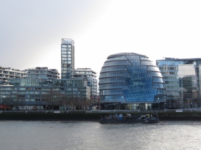 |
2/11/2018: City Hall
Position: 51°30.44'N, 0°4.65'W
London's striking egg-shaped City Hall, on the south shore of the River Thames, was completed in 2002. The building has a 500-meter helical walkway inside that ascends the buildings ten floors.
|
 |
2/11/2018: Tower of London
Position: 51°30.54'N, 0°4.68'W
Looking across the Tower of London, adjacent to St. Katherine Docks. It's also on our list to visit.
|
 |
2/11/2018: Tower Bridge House
Position: 51°30.52'N, 0°4.44'W
London has an endless number of striking buildings. Tower Bridge House, completed in 2004, has a column-free interior with the west side (pictured) designed as a window with views into the atrium and out to the Tower of London.
|
 |
2/11/2018: Crossing Tower Bridge
Position: 51°30.38'N, 0°4.50'W
We're super excited to actually be crossing Tower Bridge over the Thames River.
|
 |
2/11/2018: City View
Position: 51°30.32'N, 0°4.54'W
The view to downtown London from Tower Bridge. The building on the left is 20 Fenchurch St., aka "The Walkie-Talkie", and rightmost is 30 St Mary Axe, aka "The Gherkin",
|
 |
2/11/2018: Tower Bridge
Position: 51°30.32'N, 0°4.75'W
Looking back to Tower Bridge from the south side of the River Thames near City Hall.
|
 |
2/11/2018: Hays Galleria
Position: 51°30.37'N, 0°4.99'W
The Hays Galleria was originally a brewhouse in the 1600s. In the 1800s it was converted to a tea wharf that at one point handled 80% of the dry produce coming into the city. Visible in the center is The Navigators, a massive kinetic sculpture that reflects the property's nautical heritage.
|
 |
2/11/2018: London Bridge
Position: 51°30.41'N, 0°5.20'W
Another famous landmark: London Bridge. This is the site of the terrorist attack last year where a van struck pedestrians and the occupants attacked people with knives.
|
 |
2/11/2018: River Thames
Position: 51°30.53'N, 0°5.23'W
Looking down the River Thames to Tower Bridge from London Bridge—it's a busy waterway.
|
 |
2/11/2018: The Monument
Position: 51°30.61'N, 0°5.21'W
The 202 ft (62 m) tall Monument to the Great Fire of London, aka The Monument, has a viewing platform on top.
|
 |
2/11/2018: Old and New
Position: 51°30.65'N, 0°5.05'W
London is a fabulous mix of old and new buildings. This is 20 Fenchurch St., aka "The Walkie-Talkie", towering above older buildings.
|
 |
2/11/2018: All Bar One
Position: 51°30.57'N, 0°4.75'W
We stopped for a pint at All Bar One just northwest of the Tower of London. Visible through the window on the opposite side of the road is All Hallows By the Tower founded in 650AD. It's the oldest church in London and predates the Tower of London by 300 years.
|
 |
2/11/2018: 10 Trinity Square
Position: 51°30.58'N, 0°4.65'W
The grand 10 Trinity Square was completed in 1922 as the headquarters for the Port of London Authority. It now houses a hotel and private apartments. In the foreground is the Tower Hill Memorial to the almost 24,000 merchant sailors who died in both world wars and have no known grave.
|
 |
2/11/2018: Dickens Inn
Position: 51°30.41'N, 0°4.22'W
We finished the evening with dinner at the Dickens Inn at St. Katharine Docks. This is the view from their balcony to our berth, with Tower Bridge visible in the background on the left. What an incredible place to be.
|
 |
2/12/2018: Dawn
Position: 51°30.40'N, 0°4.30'W
A clear, calm dawn from our berth at St. Katharine Docks. We're really enjoying it here.
|
 |
2/12/2018: London Bridge Station
Position: 51°30.33'N, 0°5.06'W
Passing through London Bridge Station en route to take in the view from The Shard. The station opened in 1836 and is one of the oldest in the world, but you couldn't tell from looking it. A near decade-long renovation was completed in 2017 and it looks brand new. The station is the fourth-busiest in London, with over 50 million passengers a year.
|
 |
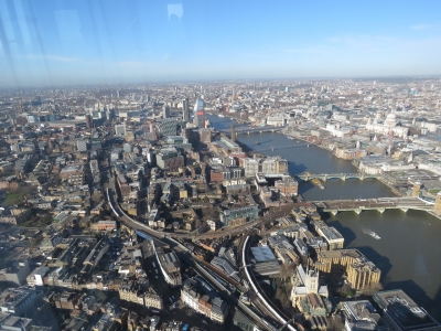
2/12/2018: View From the Shard
Position: 51°30.27'N, 0°5.19'W
The fabulous view north to downtown London from the viewing platform 800 ft (244m) above the street at the top of The Shard. London Bridge is leftmost, with Tower Bridge at the far right. The Tower of London is just left of Tower Bridge and St. Katharine Docks is a little to the right, beyond Tower Bridge. The warship moored in the river is the World War II ship HMS Belfast, another visit on our to-do list.
|
 |
2/12/2018: View West
Position: 51°30.27'N, 0°5.19'W
The view west up the Thames from the Shard. The London Eye and the Houses of Parliament are visible in the distance where the river bends.
|
 |
2/12/2018: Hermitage Moorings
Position: 51°30.27'N, 0°5.19'W
Hermitage Moorings, just east of Tower Bridge, viewed from The Shard. You can just see the spot at the far right end where we moored on our first night in London.
|
 |
2/12/2018: St. Katharine Docks
Position: 51°30.27'N, 0°5.19'W
We can't quite see Dirona in this view to St. Katharine Docks from The Shard. We're moored behind the brown buildings at the bottom of the picture.
|
 |
2/12/2018: Tower of London
Position: 51°30.27'N, 0°5.19'W
The Tower of London from The Shard.
|
 |
2/12/2018: Platforms
Position: 51°30.27'N, 0°5.19'W
Looking down onto the multiple train platforms at London Bridge Station. A lot of trains came and went in the short time we were atop The Shard.
|
 |
2/12/2018: St. Paul's Cathedral
Position: 51°30.27'N, 0°5.20'W
St. Paul's Cathedral, on the north side of the Thames and west of the London Bridge, was designed by famous London architect Christopher Wren and opened in 1711. The cathedral dome is the 2nd largest in the world and weighs 65,000 tons.
|
 |
2/12/2018: London Eye
Position: 51°30.27'N, 0°5.19'W
The London Eye Ferris Wheel viewed from The Shard, with the Houses of Parliament at the right.
|
 |
2/12/2018: Bus
Position: 51°30.68'N, 0°5.30'W
We picked up an Oyster transit card at London Bridge station and are using it on our first London transit trip, on a single-level bus.
|
 |
2/12/2018: St. Paul's
Position: 51°30.80'N, 0°5.84'W
We got off the bus near St. Paul's Cathedral on our way to the London Visitor Center. The cathedral is on our to-do list, but not today.
|
 |
2/12/2018: Visitor Center
Position: 51°30.79'N, 0°5.92'W
Heading into the London Visitor Center to pickup some maps and brochures.
|
 |
2/12/2018: Viaduct Tavern
Position: 51°30.97'N, 0°6.11'W
The Viaduct Tavern looks like a great place to stop for a pint, but we've got an errand to run first.
|
 |
2/12/2018: The Fence
Position: 51°31.21'N, 0°6.23'W
We dropped off a package at Fedex in Clerkenwell, then stopped in at The Fence gastropub near Farringdon Station for an excellent lunch. After lunch, we returned to St. Katharine Docks following a Lonely Planet-recommended "Taste of the City Walk" that would take us through London old and new.
|
 |
2/12/2018: Smithfield Market
Position: 51°31.18'N, 0°6.10'W
Colorful Victorian arches at Smithfield Market, London's last surviving meat market dating back 800 years. It's the largest wholesale meat market in the UK and one of the largest in Europe. The market supplies inner City butchers, shops and restaurants with quality fresh meat and was empty when we passed on a Monday afternoon—the operating hours are weekdays between 2am and 10am.
|
 |
2/12/2018: St. Bartholomew-The-Great
Position: 51°31.12'N, 0°5.97'W
St. Bartholomew-The-Great dates from 1123 and is one of the most ancient churches in London.
|
 |
2/12/2018: Roman Wall
Position: 51°31.01'N, 0°5.73'W
Ruins of the Roman Wall that enclosed the ancient City of London starting around 200AD. It was one of the largest construction projects in Roman Britain.
|
 |
2/12/2018: Barbican
Position: 51°31.11'N, 0°5.61'W
Looking west across the lake at Barbican estate from the highwalks between the apartment buildings there. More Roman Wall ruins are on the left and St. Giles Cripplegate church is on the right.
|
 |
2/12/2018: Tower of St. Alban
Position: 51°30.99'N, 0°5.64'W
This tower is all that remains of a Christopher Wren-designed church that was destroyed in World War II bombing.
|
 |
2/12/2018: Guildhall
Position: 51°30.94'N, 0°5.54'W
The striking courtyard at 15th century Guildhall, home to the municipal government of the City of London.
|
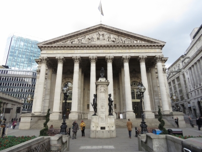 |
2/12/2018: Royal Exchange
Position: 51°30.82'N, 0°5.29'W
The grand and imposing Royal Exchange was opened by Queen Elizabeth I in 1570.
|
 |
2/12/2018: Interior
Position: 51°30.82'N, 0°5.24'W
The Royal Exchange building no longer functions as a financial institution and has been wonderfully converted to contain stores and restaurants.
|
 |
2/12/2018: Jamaica Wine House
Position: 51°30.79'N, 0°5.15'W
We found ourselves in this lovely alley, home of Jamaica Wine House, and couldn't resists stopping in for a quick glass of wine.
|
 |
2/12/2018: Leadenhall Market
Position: 51°30.76'N, 0°5.01'W
Beautiful Victorian-era Leadenhall Market was the setting for Diagon Alley in Harry Potter and the Philosopher's Stone.
|
 |
2/12/2018: Lloyd's
Position: 51°30.80'N, 0°4.89'W
Moving firmly into the 20th-century, we took in the dramatic post-modern Lloyd's of London headquarters, with its exposed stainless steel ducting, vents and staircases.
|
 |
2/12/2018: Crane
Position: 51°30.81'N, 0°4.88'W
There's lots of construction happening in downtown London. We were intrigued in how a crane was mounted to the outside of this curved glass building.
|
 |
2/12/2018: Parking
Position: 51°30.81'N, 0°4.88'W
Even for scooters, parking is dear in downtown London. We watched this man make several attempts to leave before he could extract his scooter from between the other two.
|
 |
2/12/2018: Gherkin
Position: 51°30.87'N, 0°4.87'W
At the base of 30 St Mary Axe, aka "The Gherkin", that we can see from our berth.
|
 |
2/12/2018: Apple Tree
Position: 51°30.90'N, 0°4.91'W
The sculpture "Apple Tree Boy Apple Tree Girl" with The Gherkin visible in the background.
|
 |
2/13/2018: Spare Spitfire
Position: 51°30.40'N, 0°4.30'W
We found another spare Spitfire underneath the pilot house settee when inventoring some parts.
|
 |
2/13/2018: Inflatable Fender
Position: 51°30.40'N, 0°4.30'W
After two of our ProStock inflatable fenders failed in Dublin, we've been considering replacement options. Spending $250 on a fender that only lasts three years doesn't feel like good value, and we have at least one more that is showing the same material flaw, so we decided to try another brand that is half the price. The EasyStore 42x132cm inflatable fender we ordered from Marinescene two days ago arrived today.
|
 |
2/13/2018: Fender in Place
Position: 51°30.40'N, 0°4.30'W
The EastStore fender doesn't seem quite as durable as the ProStock fender behind it, but looks reasonable. And at nearly half the price, it only has to last two years to be better value.
|
 |
2/13/2018: Racor CCV
Position: 51°30.40'N, 0°4.30'W
I’ve never been happy with the RACOR CCV (Closed Crankcase Ventilation) system on our Deere engine so I decided to dig in and learn more. Read more ...
|
 |
2/13/2018: Andrea Molinaroli
Position: 51°30.40'N, 0°4.30'W
London resident and blog reader Andrea Molinaroli dropped by for a visit with a delicious bottle of Fuligni Rosso di Montalcino 'Ginestreto'.
|
 |
2/14/2018: O-Ring
Position: 51°30.40'N, 0°4.28'W
James noticed our oil filter was wet with oil today. A quick check showed the filter housing was leaking at an O-Ring Boss fitting. He removed it and found the O-ring was as hard as a rock and split as it was removed. He Replaced the O-Ring and, in under 5 minutes, it's back running without a leak. It's nice having the right spares.
|
 |
2/14/2018: Valentine's Day
Position: 51°30.40'N, 0°4.48'W
Celebrating Valentine's Day with an excellent meal at Strada Italian restaurant at the St. Katharine Docks complex.
|
 |
2/15/2018: Yeoman
Position: 51°30.49'N, 0°4.69'W
On a Yeoman-led tour of the Tower of London, right next to St. Katharine Docks where we are moored. We'd always thought the Tower of London was just that, a tower. But it's actually a castle with 22 towers in total. The one-hour tour gave us a good overview and helped us know where we wanted to spend the rest of our time at the tower.
|
 |
2/15/2018: White Tower
Position: 51°30.48'N, 0°4.60'W
The Tower of London originated with the White Tower, dating from the 11th century when William the Conquerer began building a castle here. By the 13th century, two walls and a moat had been added as fortification.
|
 |
2/15/2018: Royal Armouries
Position: 51°30.48'N, 0°4.56'W
The White Tower is home to an impressive collection of royal armour spanning 500 years. In addition to these breastplates are complete suits of armour for past monarchs and even armour for their horses.
|
 |
2/15/2018: St. John's Chapel
Position: 51°30.48'N, 0°4.56'W
St. John's Chapel in the White Tower dates from 1080 and is the oldest surviving part of the Tower of London complex.
|
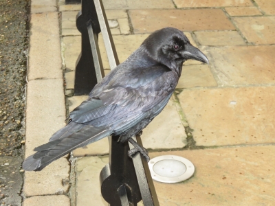 |
2/15/2018: Raven
Position: 51°30.51'N, 0°4.55'W
One of the Tower's famous Ravens. According to legend, if the ravens leave the tower will fall. So they're kept well-fed and happy.
|
 |
2/15/2018: Crown Jewels
Position: 51°30.50'N, 0°4.55'W
The Tower of London is where the Crown Jewels are kept. Pictures aren't allowed, but the jewels were impressive, particularly the 530-carat Star of Africa diamond atop the Sovereign's Sceptre.
|
 |
2/15/2018: Medieval Palace
Position: 51°30.45'N, 0°4.60'W
In the early 13th century a palace was built just inside the tower's south wall that became the royal residence for England's medieval monarchs. This is a recreation of the bedchamber of Edward I (1272-1307).
|
 |
2/15/2018: Tower Bridge
Position: 51°30.45'N, 0°4.58'W
A great view to Tower Bridge from the south wall in the Tower of London.
|
 |
2/15/2018: Tube
Position: 51°30.60'N, 0°4.59'W
Taking our first ride on "The Tube", London's underground train system, from Tower Hill station. The tube map on the wall above the door shows how extensive the system is.
|
 |
2/15/2018: 3D Printing
Position: 51°31.33'N, 0°6.55'W
Back in the Clerkenwell district, we stopped to watch a 3D printer at The 3D Printing Store.
|
 |
2/15/2018: FedEx
Position: 51°31.32'N, 0°6.65'W
We returned to Fedex in the Clerkenwell district to send another package to North America.
|
 |
2/15/2018: Benito's Hat
Position: 51°31.21'N, 0°6.10'W
We stopped in for an excellent margharita at Benito's Hat on our way back to St. Kathararine Docks. We loved their ceiling lights made of upturned buckest.
|
 |
2/15/2018: Holborn Viaduct
Position: 51°31.00'N, 0°6.31'W
Looking back to the Holborn Viaduct from Farringdon Street after we'd crossed it. The bridge was built in the mid-1800s and is ornately painted and decorated with statues and crests.
|
 |
2/16/2018: Latch
Position: 51°30.40'N, 0°4.28'W
The latch on our upper pantry failed this morning, so we're replacing it with a spare.
|
 |
2/16/2018: Parts Box
Position: 51°30.40'N, 0°4.28'W
One of our boxes of bolts and screws took a tumble during the yard visit and broke. The replacement box we bought on amazon.co.uk arrived today, so we're transferring the pieces.
|
 |
2/16/2018: World Food Market
Position: 51°30.40'N, 0°4.28'W
Every Friday, vendors setup stalls at St. Katharine Docks selling delicious street food from all over the world.
|
 |
2/16/2018: Dave & Kaye Poulsen
Position: 51°30.40'N, 0°4.28'W
Dave and Kaye Poulsen of Nordhavn 4749 Segue II were in London and stopped by for a visit. They have extensively cruised Europe, but now keep their boat in Sidney, B.C., Canada near to where our previous boat now is moored.
|
 |
2/17/2018: Tower Gateway
Position: 51°30.65'N, 0°4.38'W
At Tower Gateway DLR (overground train) station to take a train for the first leg of our trip to Greenwich.
|
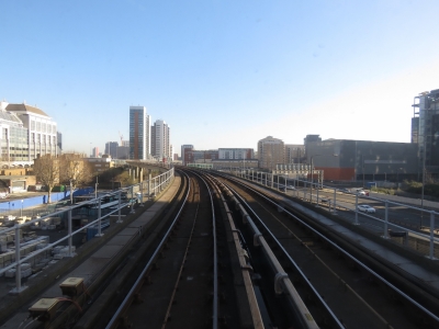 |
2/17/2018: En Route
Position: 51°30.57'N, 0°0.10'W
We got a seat right at the front of the train with a great view. This was taken just past East India station.
|
 |
2/17/2018: Cable Car
Position: 51°30.20'N, 0°0.77'E
The next leg of our Greenwich trip was on the Air Emirates Cable Car across the River Thames that we'd passed under when arriving in London. This is the fabulous view looking upstream toward the O2 Pavilion on Greenwich Peninsula with the towers of Canard Wharf beyond. The St. Katharine Docks area where we are moored is not visible, but is directly beyond the Canary Wharf buildings.
|
 |
2/17/2018: Tidal Barrier
Position: 51°29.99'N, 0°0.51'E
The Thames Tidal Control Barrier viewed from the cable car as we cross the Thames.
|
 |
2/17/2018: The O2
Position: 51°30.12'N, 0°0.26'E
The huge O2 Arena is a prominent landmark on the tip of Greenwich Peninsula.
|
 |
2/17/2018: Amplifiers
Position: 51°30.24'N, 0°0.19'E
We spent some time walking around the O2 Arena. The complex is massive, with dozens of restaurants and stores and plenty of O2 advertisements. This display full of retro guitar amplifiers caught our attention.
|
 |
2/17/2018: On the Bus
Position: 51°29.08'N, 0°0.17'E
Riding in the top level of a bus from the tip of the Greenwich Peninsula into Greenwich. This is our third form of transportation today, and we're not done yet.
|
 |
2/17/2018: Royal Naval College
Position: 51°28.92'N, 0°0.40'W
We saw the beautiful Old Royal Naval College buildings as we first arrived into London and now get a chance to see them in more detail. The campus was designed by acclaimed British architect Christopher Wren and constructed in the late 1600s. The buildings on the right now are part of the University of Greenwich.
|
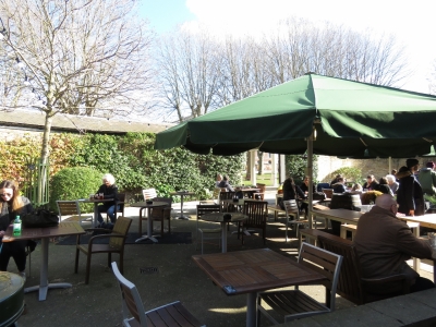 |
2/17/2018: Lunch
Position: 51°28.98'N, 0°0.48'W
We had an excellent lunch at The Old Brewery in Greenwich, home to Meantime Brewing. This is a new brewery built on the site of an old one that dated to 1717. In mid-February it was warm enough to eat outside on the patio.
|
 |
2/17/2018: Royal Observatory Greenwich
Position: 51°28.67'N, 0°0.07'W
At the famed Royal Observatory in Greenwich, the location of the Prime Meridian and where the term Greenwich Mean Time derives. The building is another Christopher Wren design, built in 1675.
|
 |
2/17/2018: Prime Meridian
Position: 51°28.67'N, 0°0.08'W
Getting a picture taking with one foot on either side of the Prime Meridian is exceedingly popular here. Here's Jennifer with one foot on the eastern hemisphere and the other in the west.
|
 |
2/17/2018: View
Position: 51°28.68'N, 0°0.09'W
The amazing view from the Royal Observatory across Greenwich, the Thames and to London. The Old Royal Naval College buildings are slightly left of center, with the Canary Wharf towers beyond. St. Katharine's Wharf is in the distance at the far left. You can just make out the buildings nearby, such as the Walkie Talkie. (Click the image for a larger view.)
|
 |
2/17/2018: Time Ball
Position: 51°28.68'N, 0°0.10'W
The Time Ball atop the Royal Observatory drops at 1pm every day. Historically this was to allow people to synchronize their clocks to GMT.
|
 |
2/17/2018: Harrison Clock
Position: 51°28.68'N, 0°0.11'W
The Royal Observatory has an excellent museum detailing the search for an accurate means of calculating longitude at sea. The problem was so important to solve for safety at sea that the 1714 Longitude Act offered a prize of up to £20,000 (nearly £3M today) to anyone who could solve it. This is one of several timepieces on display designed and built by Thomas Harrison who invented the first marine chronometer and eventually won the prize.
|
 |
2/17/2018: Miss Britain III
Position: 51°28.85'N, 0°0.32'W
The Miss Britain III, the first boat to top 100mph in open water, at the National Maritime Museum in Greenwich.
|
 |
2/17/2018: Land Rover BAR
Position: 51°28.88'N, 0°0.33'W
A great picture of the Land Rover BAR team as part of an exhibition about their bid for the 2017 America's Cup.
|
 |
2/17/2018: Cutty Sark
Position: 51°28.95'N, 0°0.56'W
The Cutty Sark was the last of the great 19th-century tea clippers that sailed between England and China. The ship has been suspended such that you can walk above decks, below decks and even beneath the keel.
|
 |
2/17/2018: Chapel
Position: 51°29.01'N, 0°0.28'W
From the Cutty Sark, we walked back through the Old Royal Naval College campus. This is the striking Chapel of St. Peter and St. Paul in Queen Mary Court.
|
 |
2/17/2018: Trafalgar Tavern
Position: 51°29.08'N, 0°0.28'W
We had hoped to stop in for a pint at the Trafalgar Tavern, but it was jam packed with not a seat available.
|
 |
2/17/2018: Water Gate
Position: 51°29.04'N, 0°0.37'W
Looking to the Old Royal Navel College campus through Water Gate, with the River Thames behind us.
|
 |
2/17/2018: Boat Ride
Position: 51°29.19'N, 0°1.23'W
We were planning to take a Thames Clipper back before dinner, but it was lined up with a 45-minute wait. So we opted for dinner in Greenwich and tried again later. By 7pm there were no lines so we could hop right on. The boats can reach speeds of at least 25 knots and really move through the water. After travelling up the Thames at 7 knots in Dirona, it was a real eye-opener.
|
 |
2/17/2018: Tower Bridge
Position: 51°30.45'N, 0°4.68'W
Looking back to Tower Bridge after disembarking the Thames Clipper at Tower Pier.
|
 |
2/18/2018: Scott Bailey
Position: 51°30.39'N, 0°4.28'W
London resident Scott Bailey stopped by for a visit and a tour of Dirona. We had a great evening with Scott, who has been giving us loads of excellent advice on things to do in London and how to get around.
|
 |
2/19/2018: Circle Line
Position: 51°30.60'N, 0°4.58'W
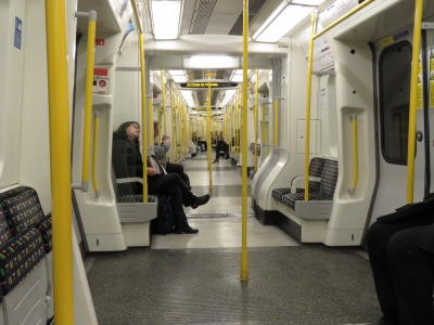
On an early morning run of the London Underground Circle Line en route to St. Pancras station to take a train to Paris. Not many people are riding the Tube at 6:30am. The trains are at least eight cars long and all interconnected. When the track is reasonably straight you can see almost from one end to the other.
|
 |
2/19/2018: Eurostar
Position: 51°31.84'N, 0°7.52'W
At the Eurostar train terminal in St. Pancras station to check in for our trip to Paris.
|
 |
2/19/2018: 127 mph
Position: 51°30.28'N, 0°12.61'E
We're not nearly running at the train's top speed of 186mph, but 127mph seems pretty fast. We're about to cross under the River Thames and our path into London. We don't often pass under Dirona's path—the couple of times we can think of are in Norfolk, Virginia when we took the car tunnel to Hampton to visit the Virgina Air and Space Museum and in Boston, MA heading to the airport in the tunnel under Boston Harbor.
|
 |
2/19/2018: Medway Viaduct
Position: 51°22.46'N, 0°28.10'E
Looking southwest along the River Medway as we cross the train portion of the Medway Viaduct, built specifically for the new high-speed line to the Channel Tunnel.
|
 |
2/19/2018: Channel Tunnel
Position: 51°1.33'N, 1°25.30'E
Us 40 meters below the English Channel staring out into the near-dark tunnel. Even though the Channel Tunnel has been around for years, it feels pretty wild to us to be actually in a train underneath the English Channel. We've always called it "The Chunnel" but have learned that's a more of an American abbreviation. Most people here call it the Channel Tunnel.
|
 |
2/19/2018: Vehicle Carriers
Position: 50°55.19'N, 1°47.41'E
About 20 minutes after we left the UK, we were across the Channel and in France. This is a vehicle carrier train at the France side of the tunnel. Only trains run through the Channel Tunnel, so you either take a passenger train like we are, or drive onto a vehicle carrier.
|
 |
2/19/2018: France
Position: 50°45.56'N, 2°32.67'E
Our first view to the French countryside (position approximate).
|
 |
2/19/2018: 182 mph
Position: 50°44.19'N, 2°37.47'E
We're smoking along at close to the maximum 186mph speed. We'll soon be in Paris.
|
 |
2/19/2018: Gard du Nord
Position: 48°52.84'N, 2°21.25'E
Jennifer posing with our ride at the Paris train station Gard du Nord. The train was scheduled to take 2 hours and 22 minutes, but we had a 20-minute delay shortly before Paris, so the total ride was closer to 3 hours. We'd already cleared through into France at the Eurostar station in London and could just walk off the train and into Paris.
|
 |
2/19/2018: Eiffel Tower
Position: 48°51.37'N, 2°17.59'E
We'd booked a hotel near the Eiffel Tower, so went straight there to check in. We then grabbed a quick lunch and headed straight for the tower. This is the view from just outside our hotel. It seems kind of amazing that we got up this morning, did some work on the boat and we're now standing near the Eiffel Tower.
|
 |
2/19/2018: Underneath
Position: 48°51.48'N, 2°17.68'E
Looking up into the Eiffel Tower from underneath.
|
 |
2/19/2018: Crowds
Position: 48°51.49'N, 2°17.63'E
The Eiffel Tower is, of course, an exceedingly popular tourist destination. We'd bought our tickets online a couple of months back and some days already were sold out around when we'd be there even though we're well in the off-season. The crowds were a little thick entering, but we didn't have to wait too long.
|
 |
2/19/2018: Looking Up
Position: 48°51.51'N, 2°17.67'E
Looking up from the second level to the top—that's a lot of rivets. It's lucky that this structure still stands. The tower was built with a temporary 20-year permit for the 1900 World Expo and would have been dismantled if not for the advent of radio. The tower's height made it an ideal and vital transmission point. Hitler later had actually ordered that the tower be demolished, along with much of the city, during the 1940 German occupation of Paris. Fortunately General Dietrich von Choltitz, the military governor of Paris, disobeyed the order.
|
 |
2/19/2018: Jardins du Trocadero
Position: 48°51.50'N, 2°17.65'E
We're only at the second level of the tower, but already the views are impressive. This is looking north across the Pont d'lena to the Jardins du Trocadero.
|
 |
2/19/2018: Statue of Liberty
Position: 48°51.49'N, 2°17.66'E
Looking west from the second level along the Seine to the Status of Liberty, a quarter-scale replica of the one in New York. The American community in Paris gave the statue to the Paris in 1889 to commemorate the centennial of the French Revolution.
|
 |
2/19/2018: Seine
Position: 48°51.50'N, 2°17.67'E
The view is even better from the top of the tower even in today's overcast conditions. This is looking east along the Seine. The large grassy area on the right is the Quai Branly Museum.
|
 |
2/19/2018: Military School
Position: 48°51.50'N, 2°17.68'E
Looking southwest across Champs de Mars to the Paris Military School.
|
 |
2/19/2018: Kathy Hearn & Dave Gillies
Position: 48°51.50'N, 2°17.67'E
With our friends Kathy Hearn and Dave Gillies at the top of the Eiffel Tower. We've known Kathy and Dave since the late 1980s when we all worked together at the IBM Toronto Lab. They were planning a trip to Paris when we would be in London, so we arranged to meet up there. We've not seen them since we left Seattle—it was wonderful to get together and catch up. And Paris is such an awesome place to meet.
|
 |
2/19/2018: Flooding
Position: 48°51.57'N, 2°17.59'E
The Seine reached near-peak levels recently, resulting in extensive flooding. All boat traffic along the river is suspended and the train along the river was out of service for a period. The waters are receding, but the levels still are high. Those posts sticking out of the water are part of the boarding ramp for the Batobus river bus. We were planning to take it during our visit, but that's not going to happen on this visit.
|
 |
2/19/2018: Avenue de New York
Position: 48°51.64'N, 2°17.50'E
Enjoying Paris on the Avenue de New York.
|
 |
2/19/2018: Palais de Chaillot
Position: 48°51.74'N, 2°17.34'E
The east wing of the Palais de Chaillot, facing the Jardins du Trocadero that we saw from the Eiffel Tower. The palace was built built for the 1937 Paris Exposition, replacing a previous palace that stood there. Only three years later the iconic 1940 World War II pictures were taken here, of Hitler celebrating the taking of Paris with the Eiffel Tower in the background.
|
 |
2/19/2018: Arc de Triomphe
Position: 48°52.38'N, 2°17.74'E
At the Arc de Triomphe, along the Champs-Élysées, with the crazy traffic of downtown Paris circling. There are no obvious lanes and cars dart, honk, and weave through the entire area, presumabely with a goal, but not much organization. Fortunately a pedestrian underpass will take us across to the monument.
Napoleon commissioned the Arc de Triomphe in 1810 to celebrate his victory in the 1805 Battle of Austerlitz, but it wasn't completed until 1836 under the reign of King Louis-Philippe. |
 |
2/19/2018: Stairs
Position: 48°52.44'N, 2°17.71'E
Climbing the spiral staircase to the top of the Arc de Triomphe.
|
 |
2/19/2018: Terrace
Position: 48°52.43'N, 2°17.71'E
Even with today's overcast weather, the views from the Arc de Triomphe terrace are impressive. The street on the left is Avenue de Friedland and on the right is Champs-Élysées. The Big Wheel, lit in purple, is just visible in the distance along Champs-Élysées (click image for larger view).
|
 |
2/19/2018: Champs-Élysées
Position: 48°52.35'N, 2°17.98'E
Looking back along Champs-Élysées with the Arc de Triomphe in the background. Paris is beautiful in the evening, especially with the lights reflecting in the wet pavement.
|
 |
2/19/2018: Palais de l'Élysée
Position: 48°52.25'N, 2°19.02'E
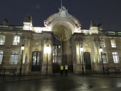
The Palais de l'Élysée, built in 1772, is the official residence of the French President. Security is high everywhere in Paris. We frequently saw guards carrying machine guns, often with their fingers actually resting on the trigger. Security doesn't look particularly heavy in this picture, but armed guards are everywhere. Pedestrians can walk freely along the opposite side of the street, but can't approach the entrance. And cars can only enter the blocked road after passing a sentry inspection.
|
 |
2/19/2018: L'église de la Madeleine
Position: 48°52.11'N, 2°19.40'E
Looking north along Rue Royal to L'église de la Madeleine, completed in 1842.
|
 |
2/19/2018: Ladurée
Position: 48°52.11'N, 2°19.40'E
Macaroons on display at Ladurée on Rue Royal, a Paris fixture since 1862.
|
 |
2/19/2018: Colonne Vendóme
Position: 48°52.02'N, 2°19.77'E
Colonne Vendóme at Place Vendóme. The column, with a statue of Napoleon on top, was completed in 1810 to celebrate the Emperor's 1805 victory at Austerlitz (as was the Arc de Triomphe).
|
 |
2/19/2018: Palais Garnier
Position: 48°52.21'N, 2°19.96'E
The Palais Garnier was completed in 1875 to house the Paris Opera and is the setting for Gaston Leroux's 1910 novel The Phantom of the Opera.
|
 |
2/19/2018: Tower at Night
Position: 48°51.31'N, 2°17.55'E
The Eiffel Tower glowing through the mist, seen from our room at the Hotel Mercure. The room worked out well and we loved seeing the tower at the start and end of each day in Paris.
|
 |
2/20/2018: First View
Position: 51°30.40'N, 0°4.28'W
The first Eiffel Tower view of the day from our hotel window.
|
 |
2/20/2018: Breakfast
Position: 48°51.29'N, 2°17.71'E
An exceptional crepe breakfast street-side at Le Petit Suffren. We've loving Paris.
|
 |
2/20/2018: Eiffel Tower
Position: 48°51.35'N, 2°17.89'E
We can't get enough of the Eiffel Tower. This is looking northwest across Champ de Mars as we set out on a walk toward Notre-Dame.
|
 |
2/20/2018: Flooding
Position: 48°51.77'N, 2°18.40'E
Sidewalk and road awash from the Seine flooding. It will be a while before the river level is back to normal.
|
 |
2/20/2018: Les Invilades
Position: 48°51.77'N, 2°18.86'E
The Les Invilades complex includes several French military history museums and the church where Napoleon Bonaparte is entombed.
|
 |
2/20/2018: Pont Alexandre III
Position: 48°51.77'N, 2°18.86'E
Looking across the ornately-decorated Pont Alexandre III to the Petit Palais. The bridge was completed in 1900 and is named after Tsar Alexander III. The Petit Palais was built for the 1900 Paris World Expo, held barely a decade after the 1889 World Expo that introduced the Eiffel Tower, and now houses the City of Paris Museum of Fine Arts.
|
 |
2/20/2018: Musée d'Orsay
Position: 48°51.62'N, 2°19.64'E
The Gare d'Orsay is a Beaux-Arts railway station completed in 1900. It is now home to the the Musée d'Orsay featuring 19th- and 20th-century European art.
|
 |
2/20/2018: Crowds
Position: 48°51.63'N, 2°19.55'E
The long lines outside the Musée d'Orsay on this cold February day, even for pre-purchased tickets, did not bode well for our planned visit to the Louvre tomorrow. For us, few things are worth standing in line for hours.
|
 |
2/20/2018: Construction
Position: 48°51.48'N, 2°20.12'E
Construction and renovation is common in Paris. Several times we've seen semi-permanent multi-floor structures erected, such as on the left, with walkways over to the building being worked on.
|
 |
2/20/2018: Pont des Arts
Position: 48°51.47'N, 2°20.23'E
Looking north to the Palais du Louvre from the famous Pont des Arts bridge, completed in 1804 and the first metal bridge in Paris. The sides of the bridge are panelled with glass to discourage the placement of "love locks" where couples place a name-inscribed padlock on the bridge and throw the key in the river as a romantic gesture. In 2014, some of the bridge panels were at risk of collapse from the weight of the estimated 700,000 locks in place.
|
 |
2/20/2018: Pont Neuf
Position: 48°51.40'N, 2°20.44'E
Looking west from Pont Neuf toward Pont des Arts with the Palais du Louvre beyond. Pont Neuf, completed in 1607, is the oldest standing bridge in Paris. The bridge crosses the Seine via that Île de la Cité, the island where Paris was founded around 250BC and that was the city center in medieval times.
|
 |
2/20/2018: Love Locks
Position: 48°51.42'N, 2°20.46'E
The city may have discouraged love locks on Pont des Arts, but not at Square du Vert-Galant. A statue of Henry IV of France is visible above railings encrusted with locks. Love locks are a nuisance in most large cities—some have erected structures specifically to support the locks, such as Moscow's Padlock Tree Park.
|
 |
2/20/2018: Le Bar du Caveau
Position: 48°51.40'N, 2°20.54'E
Enjoying a glass of Cótes du Rhóne at Le Bar du Caveau on Île de la Cité overlooking Place Dauphine. Henry IV created the square in 1607, the second in his project of creating public squares, and named it for his son the Dauphin of France.
|
 |
2/20/2018: Palais de Justice
Position: 48°51.31'N, 2°20.79'E
Ornate gates outside the Palais de Justice on Île de la Cité. The buildings were formerly the residence of French kings between the 6th and 14th centuries. Marie Antoinette was imprisoned here before her execution.
|
 |
2/20/2018: Notre-Dame
Position: 48°51.21'N, 2°20.92'E
Outside the famous Notre-Dame Cathedral, one of the largest and most well-known Catholic churches in the world. It was completed in 1345 after nearly two hundred years of construction.
|
 |
2/20/2018: Nave
Position: 48°51.18'N, 2°20.99'E
Looking down the fabulous nave toward the alter inside Notre-Dame Cathedral. Surprisingly, there weren't any line-ups to enter, just the bag and security check that is common to all Paris attractions.
|
 |
2/20/2018: Treasury
Position: 48°51.15'N, 2°21.01'E
The Notre-Dame Cathedral treasury contains artifacts used for religious ceremonies and gifts from royalty and other supporters of the church. In the center is Hunting of the Holy Crown of Thorns made in 1862 with gold, silver bronze gold, diamonds, and precious stones.
|
 |
2/20/2018: Flying Buttresses
Position: 48°51.08'N, 2°21.08'E
The flying buttresses of Notre-Dame viewed from across the Seine.
|
 |
2/20/2018: Bakery
Position: 48°51.00'N, 2°20.95'E
Delicious-looking bread on display on Boulevard Saint-Germain.
|
 |
2/20/2018: Square René Viviani
Position: 48°51.14'N, 2°20.84'E
At Square René Viviani just south of Notre-Dame. The locust tree pictured was planted in 1601 and is the oldest living tree in the city. We didn't actually check for a heartbeat.
|
 |
2/20/2018: Shakespeare and Co
Position: 48°51.16'N, 2°20.83'E
In 1919, American Sylvia Beach opened Shakespeare and Co, an English-language bookshop that became a meeting place for writers such as Ernest Hemingway, James Joyce and Ezra Pound. It was Beach who first published James Joyce's' controversial work Ulysses in 1922. Beach's original store closed permanently during the German occupation of Paris, but American George Whitman opened a new Shakespeare and Co in 1951 that still operates today.
|
 |
2/20/2018: Rue de la Harpe
Position: 48°51.15'N, 2°20.68'E
Cafe-lined Rue de la Harpe.
|
 |
2/20/2018: Place de la Sorbonne
Position: 48°50.91'N, 2°20.51'E
Looking across Place de la Sorbonne to Chapel of Sainte Ursule, completed in 1642. The buildings around the square were home to the former University of Paris, commonly known as Sorbonne based on its location.
|
 |
2/20/2018: Luxembourg Palace
Position: 48°50.77'N, 2°20.27'E
Paris has a seemingly endless number of palaces. This is Luxembourg Palace, built in the 1600s as the royal residence for Louis XIII's mother.
|
 |
2/20/2018: Twizy
Position: 48°50.62'N, 2°20.25'E
A tiny Renault Twizy parked on Avenue de l'Observatoire. The two-seater electric car is classified as a heavy quadricycle and can reach speeds of 62mph (100kph).
|
 |
2/20/2018: Fontaine de l'Observatoire
Position: 48°50.44'N, 2°20.20'E
Fontaine de l'Observatoire, dedicated in 1874, in Jardin Marco Polo with Luxembourg Palace visible in the distance.
|
 |
2/20/2018: Cheese
Position: 48°50.50'N, 2°19.68'E
A amazing array of cheeses for sale at Beillevaire on Rue Delambre.
|
 |
2/20/2018: Le Trait d'Union
Position: 48°50.81'N, 2°19.60'E
We had an excellent meal at Le Trait d'Union. Every meal we've had in Paris has been amazing. It's funny, we've never been big fans of French food, but we suspect it's the Americanized version of French food that doesn't appeal to us.
|
 |
2/20/2018: Last View
Position: 48°51.30'N, 2°17.54'E
The final Eiffel Tower view of the day from our hotel window.
|
 |
2/21/2018: Eiffel Tower
Position: 48°51.30'N, 2°17.55'E
We're returning to London today, so will be our last Eiffel Tower view from our hotel window.
|
 |
2/21/2018: Louvre
Position: 48°51.68'N, 2°20.09'E
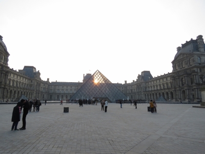
The sun rising over the glass pyramid at the entry to the Louvre museum. The museum is inside the former Louvre Palace, originally built as a fortress in the 12th century and the main residence for French Kings starting in the 1500s. The Louvre is the world's largest art museum with roughly 38,000 objects contained in a 782,910 square foot (72,735 square metres) facility.
This picture was taken over an hour before the museum's 10am opening time and line-ups had already formed at the entrance. We had breakfast nearby then joined the queue about 15 minutes before our 10:30am ticket entry. We expected to wait at least a half-hour, but were inside within 10-15 minutes. |
 |
2/21/2018: Winged Victory of Samothrace
Position: 48°51.61'N, 2°20.17'E
The Winged Victory of Samothrace dates from the 2nd century BC and has been on display at the Louvre since 1884. It is one of the great surviving masterpieces from the Greco-Roman era.
|
 |
2/21/2018: Mona Lisa
Position: 48°51.61'N, 2°20.12'E
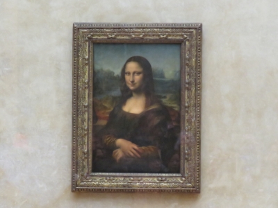
You can't visit the the Louvre for the first time without viewing one of it's most famous treasure: the Mona Lisa.
|
 |
2/21/2018: Crowds
Position: 48°51.61'N, 2°20.12'E
We of course weren't the only ones wanting to view the Mona Lisa. The painting was impressive, but was smaller than we expected.
|
 |
2/21/2018: Wedding Feast at Cana
Position: 48°51.61'N, 2°20.12'E
The Wedding Feast at Cana, painted by Paolo Veronese in 1563. The painting is huge at 12.2x32.6ft (6.77x9.94m).
|
 |
2/21/2018: Coronation of Napoleon
Position: 48°51.61'N, 2°20.15'E
We aren't generally huge art fans, but the Louvre's painting collection was amazing, particularly some of the larger formats. This is the 20.34x32ft (6.21x9.79) Coronation of Napoleon, completed by Jacques-Louis David in 1807.
|
 |
2/21/2018: Apollo Gallery
Position: 48°51.61'N, 2°20.18'E
The spectacular high painted ceilings of the Apollo Gallery at the Louvre. This was Louis XIV's first Royal Gallery.
|
 |
2/21/2018: The Mummy
Position: 48°51.64'N, 2°20.39'E
Jennifer has long been interested in Ancient Egypt and was keen to visit the Louvre's extensive collection. One of the more popular item's in the Louvre's Ancient Egypt collection is this incredibly well-preserved mummy of a man from Ptolemaic Period (305 BC-30 BC).
|
 |
2/21/2018: Venus de Milo
Position: 48°51.62'N, 2°20.26'E
The Venus de Milo statue, dating from 101 BC, is another famous item in the Louvre's collection. Over the course of several hours, we'd made a quick pass through most of the museum's galleries, but it would take many, many more visits to really take it all in. We really enjoyed our visit and were impressed with the breadth and depth of the displays.
|
 |
2/21/2018: Jardin des Tuileries
Position: 48°51.74'N, 2°19.85'E
Looking west across Jardin des Tuileries to the Big Wheel after exiting the Louvre
|
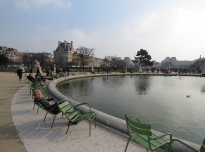 |
2/21/2018: Fountain
Position: 48°51.78'N, 2°19.73'E
Jennifer enjoying one of the many deck chairs that ring a fountain in the Jardin des Tuileries, with the Louvre Palace visible in the distance.
|
 |
2/21/2018: Big Wheel
Position: 48°51.92'N, 2°19.33'E
Paris' Big Wheel has stood here since 1993, but will be removed this summer. To protect the area's historic visual appearance, city councillors recently voted against renewing the operating license.
|
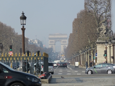 |
2/21/2018: Champs-Élysées
Position: 48°51.93'N, 2°19.32'E
Looking down Champs-Élysées to the Arc de Triomphe from the western edge of Jardin des Tuileries.
|
 |
2/21/2018: Luxor Obelisk
Position: 48°51.93'N, 2°19.32'E
Luxor Obelisk in Place de la Concorde. The 75-ft (23m) 3,000-year-old Ancient Egyptian obelisk was given to France by the ruler of Egypt in the early 1800s.
|
 |
2/21/2018: Maxim's
Position: 48°52.07'N, 2°19.35'E
The renowned Maxim's of Paris restaurant opened in 1893 and became a socializing place for the rich and famous in the early 1900s.
|
 |
2/21/2018: Comptoir du Faubourg
Position: 48°52.24'N, 2°19.28'E
We had our final delicious Paris meal at Comptoir du Faubourg on Rue Royale before walking to the train station.
|
 |
2/21/2018: Avenue Gabriel
Position: 48°52.05'N, 2°19.13'E
The security is extremely high along Avenue Gabriel, site of the US Embassy. Armed guard monitor the tented green structure at the entrance, with more armed guards around the perimeter and patrolling the area.
|
 |
2/21/2018: Petit Palais
Position: 48°51.93'N, 2°18.84'E
The Petit Palais, built for the 1900 Paris World Expo, now houses Paris' Museum of Fine Arts.
|
 |
2/21/2018: Palais Garnier
Position: 48°52.29'N, 2°19.95'E
The Palais Garnier, home of the Paris Opera, that we first saw on the evening of our first night here.
|
 |
2/21/2018: Saint-Vincent-de-Paul
Position: 48°52.68'N, 2°21.12'E
The Church of Saint-Vincent-de-Paul was built between 1822-1824 on the site where St. Vincent de Paul lived and worked in the 17th century.
|
 |
2/21/2018: Gard du Nord
Position: 48°52.79'N, 2°21.28'E
The ornate Gard du Nord train station first opened in 1864.
|
 |
2/21/2018: Main Hall
Position: 48°52.82'N, 2°21.31'E
Overlooking the main hall in Gard Du Nord.
|
 |
2/21/2018: Lighterman
Position: 51°32.13'N, 0°7.47'W
We finished the day with an excellent meal at The Lighterman gastropub near King's Cross station back in London. Our table overlooked Regents Canal and a small community of liveaboard canal boats.
|
 |
2/22/2018: L'escale Wine Bar
Position: 51°30.43'N, 0°4.28'W
Enjoying an exceptional bottle of wine and the charcuterie and cheese tray at L'escale Wine Bar, with a view to Dirona (left) moored at St. Katharine Docks.
|
 |
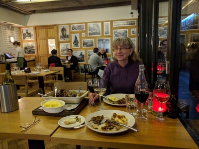
2/23/2018: Throttle
Position: 51°30.39'N, 0°4.28'W
Back in January we installed autostart on the main engine (Two Generators When You Only Have One). This gives us another layer of defense to protect our batteries. If our generator ever fails (it hasn't), the main engine will be automatically started by the control systems and it acts as a 9kw generator backing up our Northern Lights M843NW3.3 12kw generator.
This install went well, but the Dynagen TG410 throttle signal was not recognized by our Deere 6068AFM75 main engine. It's not really a challenge to change this but you do need a Deere technician with Service Advisor to make the change. We had that small engine control unit configuration change made and it worked great. The engine is now fully under control system authority if the generator fails. But, as with all jobs, there is always at least one surprise or additional complexity. In this case, the Deere signals alarm when the analog throttle control signal is not available. The TG410 throttle signal, if present, dominates so the TG410 has full control when the main is operating as a generator but, of course, it still needs to be a main engine so needs an analog throttle control signal for the normal case. When operating as a generator, the helm control is not active and so the analog control signal is not available and the Deere alarms. Everything works perfectly in main engine mode and in generator mode but the alarm in generator mode is annoying even if it will rarely happen. Here James is figuring out the ZF ClearCommand 9000 so the control system can turn it on, "take control" at the PH helm, and avoid the extraneous "missing analog throttle signal" alarm. We've tested simulated generator failure. If it's not charging, the control system shuts it down properly, raises RPM, warms up the engine, and applies the load. When the batteries are charged, it's shut back down. |
 |
2/23/2018: Tom's Kitchen
Position: 51°30.49'N, 0°4.36'W
Sharing the delicious Seven Hour Confit Herdwick Lamb at Tom's Kitchen in St. Katharine Docks.
|
 |
2/24/2018: Barge
Position: 51°30.40'N, 0°4.28'W
A custom barge with an unusual superstructure leaving St. Katharine Docks.
|
 |
2/24/2018: High Idle
Position: 51°30.40'N, 0°4.28'W
Our Deere 6068AFM75 comes with a factory idle setting of 600 RPM. On Dirona we want more power available to the hydraulics at idle so we use 800 RPM as low idle. At that speed, it still shifts smoothly, runs smoother, and when used with the wing gives full hydraulic output. When the engine is cold, we raise the idle to 900 RPM during warmup for smoother operation. Peter Hayden (http://www.mvtanglewood.com/) pointed out the ZF Clear Command 9000 has a fast idle setting. By setting E6 to 18 (any number between 0 and 20), with one touch at the helm control we can move the idle up to 900 RPM. Again with one touch at the helm control it’ll revert back down to the normal idle of 800 RPM.
|
 |
2/25/2018: Polyform Fenders
Position: 51°30.40'N, 0°4.28'W
Our two new Polyform fenders from Boat Fenders Direct arrived today, part of our third approach to a fendering strategy. Read more ...
|
 |
2/25/2018: Nordhavns
Position: 51°30.41'N, 0°4.24'W
Three Nordhavns are at St. Katharine Docks now. When we arrived, N55 Shogun was berthed temporarily where Dirona currently is. We moved forward when Shogun moved back to its regular berth at the far right of the photo. And N68 Vesper arrived while we were in Paris. We last saw Vesper at Hamble Point near Southampton, but haven't seen owners Bob and Kathy Valleau since Stornoway in the Outer Hebrides.
|
 |
2/25/2018: Prospect of Whitby
Position: 51°30.43'N, 0°3.07'W
The beautiful bar at the Prospect of Whitby, London's oldest riverside pub dating from 1520.
|
 |
2/25/2018: Captain Kidd
Position: 51°30.21'N, 0°3.47'W
On the walk back from the Prospect of Whitby we stopped in at the Captain Kidd pub, themed after the famous pirate who was executed nearby in 1701
|
 |
2/26/2018: Snow
Position: 51°30.40'N, 0°4.24'W
Snow started falling around 8am this morning and by 9:30 was starting to build up on the boats and the walkways. St. Katharine Docks looks beautiful with a dusting of snow.
|
 |
2/26/2018: Spitfire
Position: 51°30.40'N, 0°4.28'W
Spitfire out on the boat deck eating snow. He eventually gets annoyed by constantly having to shake the snow off his paws, but otherwise quite likes being out in it.
|
 |
2/26/2018: Buckingham Palace
Position: 51°30.10'N, 0°8.45'W
At Buckingham Palace about an hour before the Changing of the Guard Ceremony. The crowds already are building on this February morning, despite near-freezing temperatures. It must be crazy busy in the height of summer.
|
 |
2/26/2018: St. James' Palace
Position: 51°30.28'N, 0°8.23'W
The off-watch Queen's Guard soldiers, wearing their grey winter coats, in Friary Court at St. James's Palace a few blocks from Buckingham Palace. The guards work in two-hour shifts, with those off-watch stationed here.
|
 |
2/26/2018: Pipers
Position: 51°30.28'N, 0°8.23'W
Pipers leading the off-watch Queen's guard soldiers from Friary Court at St. James's Palace to Buckingham Palace.
|
 |
2/26/2018: Guard
Position: 51°30.28'N, 0°8.23'W
The off-watch Queen's Guard soldiers following the pipers from Friary Court to Buckingham Palace where they will join the on-watch group. In the Changing of the Guard Ceremony, the entire group of Old Guards will swap with another group of New Guards who will subsequently share 2-hour watches.
|
 |
2/26/2018: Queen's Life Guard
Position: 51°30.16'N, 0°8.29'W
As we followed the off-watch Queen's Guard down The Mall to Buckingham Palace, we passed a group of the Queen's Life Guard (on horseback). They were en route to their own Changing of the Guard ceremony at Horse Guards, the official entrance to St James's and Buckingham palaces.
|
 |
2/26/2018: Changing of the Guard
Position: 51°30.12'N, 0°8.51'W
The New Guards in the Changing of the Guard Ceremony at Buckingham Palace. On the right is a marching band that led the New Guards to Buckingham Palace from nearby Wellington Barracks.
|
 |
2/26/2018: Crowds
Position: 51°30.12'N, 0°8.51'W
Crowds against the fence watching the Changing of the Guard Ceremony at Buckingham Palace. The little guy with the British-flag toque and the polar bear is pretty cute.
|
 |
2/26/2018: St. James's Park
Position: 51°30.06'N, 0°8.37'W
Looking east across St. James's Park from Spur Road with a dusting of snow in the foreground. In the distance is Horse Guards, the official entrance to St James's and Buckingham palaces (click image for a larger view).
|
 |
2/26/2018: Victoria Memorial
Position: 51°30.02'N, 0°8.33'W
Looking north along Spur Road to the Victoria Memorial at the end of The Mall between Horse Guards and Buckingham Palace.
|
 |
2/26/2018: Wellington Barracks
Position: 51°30.03'N, 0°8.34'W
Once the Changing of the Guard Ceremony at Buckingham Palace is complete, the entire group of Old Guards followed a marching band along Spur Road to nearby Wellington Barracks. At the next Changing of the Guard two days from now, another New Guard group will form at Wellington Barracks before marching to Buckingham Palace to replace the current guard group.
|
 |
2/26/2018: Big Ben
Position: 51°30.06'N, 0°7.57'W
Big Ben clad in scaffolding as part of a four-year renovation. We can't see the tower, or hear its bells that have chimed regularly for over 150 years. For the safety of the workers, the bell will not ring during the renovation.
|
 |
2/26/2018: St. Stephen's Tavern
Position: 51°30.06'N, 0°7.54'W
We had a great meal under the ornate high ceiling of St. Stephen's Tavern, originally built in 1873.
|
 |
2/26/2018: Churchill War Rooms
Position: 51°30.13'N, 0°7.75'W
During World War II, Winston Churchill and his staff largely directed the war through an underground command center in Westminster that included living quarters and a BBC radio broadcasting station. The bunker complex remained largely intact following the war and now has been converted into a fascinating and excellent museum. We very much enjoyed our visit.
|
 |
2/26/2018: Horse Guards Parade
Position: 51°30.23'N, 0°7.71'W
Looking across Horse Guards Parade, the parade ground of Horse Guards, the official entrance to St James's and Buckingham palaces. The southeast corner of the parade abuts with the back entrance to 10 Downing Street, the Prime Minister's residence.
|
 |
2/26/2018: Life Guard
Position: 51°30.29'N, 0°7.60'W
A member of the Queen's Life Guard on duty at Horse Guards.
|
 |
2/26/2018: Downing Street
Position: 51°30.20'N, 0°7.58'W
Downing Street is double-gated and heavily guarded, so we can't get anywhere close to see the door of number 10. But we did get a glimpse down the street as a car passed through.
|
 |
2/26/2018: Old War Office Building
Position: 51°30.28'N, 0°7.60'W
The War Office administered the British Army between 1857 and 1964 and was housed in this purpose-built complex starting in 1906. In 1964 its functions were transferred to the Ministry of Defense, who took over the complex, calling it the Old War Office Building.
|
 |
2/26/2018: Trafalgar Square
Position: 51°30.43'N, 0°7.66'W
Nelson's Column, a statue of Admiral Horatio Nelson mounted high up on a pedestal in Trafalgar Square. Nelson was an acclaimed Royal Navy officer who was killed in 1805 at the Battle of Trafalgar.
|
 |
2/26/2018: Horse Guards
Position: 51°30.43'N, 0°7.67'W
The east side of Horse Guards. Beyond is The Mall that leads past St. James's Palace to Buckingham Palace.
|
 |
2/26/2018: Canada House
Position: 51°30.46'N, 0°7.83'W
Canada House on Trafalgar Square has housed the Canadian High Commission since 1925. Diplomatic missions between Commonwealth Nations generally are called High Commissions rather than embassies.
|
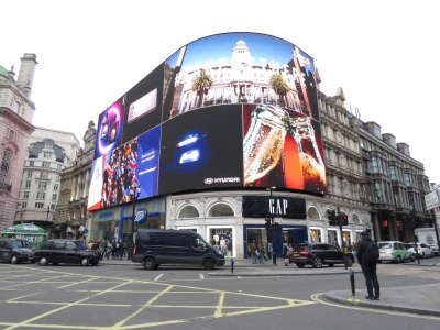 |
2/26/2018: Piccadilly Circus
Position: 51°30.60'N, 0°8.08'W
The famous video displays at Piccadilly Circus.
|
 |
2/26/2018: Regent St.
Position: 51°30.60'N, 0°8.12'W
Looking down the major shopping venue of Regent Street from Piccadilly Circus. If you want to spend a lot of money on clothes and accessories, this is the place to be.
|
 |
2/26/2018: All Souls Langham Place
Position: 51°31.06'N, 0°8.59'W
All Souls Langham Place was consecrated in 1824. BBC often broadcasts from the building, as it is very near BBC Broadcasting House.
|
 |
2/26/2018: Dr. Sharma
Position: 51°31.08'N, 0°8.82'W
A brief interruption to the days' fun to have a complete eye exam with Dr. Sharma at London Opthalmology Center.
|
 |
2/26/2018: Regent's Park
Position: 51°31.51'N, 0°8.91'W
Bundled up at the south end of 410-acre Regent's Park, one of the Royal Parks of London. It was getting dark, so we just passed through a small section en route to dinner.
|
 |
2/26/2018: Sunset
Position: 51°31.57'N, 0°9.44'W
Sunset over Boating Lake in Regent's Park.
|
 |
2/26/2018: The Volunteer
Position: 51°31.44'N, 0°9.50'W
A great meal at The Volunteer pub on Baker Street to finish off the day.
|
 |
2/26/2018: 221B Baker St
Position: 51°31.42'N, 0°9.49'W
Sherlock Holmes fans will recognize 221B Baker Street as the London address of Sir Arthur Conan Doyle's famous fictional detective. Although the Sherlock Holmes Museum bears 221B with city's permission, we're actually standing at 239 Baker Street.
|
 |
2/27/2018: 29.7F
Position: 51°30.40'N, 0°4.28'W
We're expecting unusually cold temperatures with snow this week. This morning's temperature already is below freezing at 29.7°F (-1.3°C) and we're just getting started.
|
 |
2/27/2018: Dusting of Snow
Position: 51°30.39'N, 0°4.28'W
Evening at St. Katharine Docks with a light dusting of snow.
|
 |
2/28/2018: 28.3F
Position: 51°30.40'N, 0°4.28'W
We're down to 28.3°F (-2.1°C) this morning and have colder weather and lots more snow coming.
|
 |
2/28/2018: Snow
Position: 51°30.40'N, 0°4.28'W
We got a few inches of snow last night—the marina looks beautiful this morning.
|
 |
2/28/2018: Spitfire
Position: 51°30.40'N, 0°4.28'W
Spitfire out eating snow with his paw and enjoying running all over the snowy boat.
|
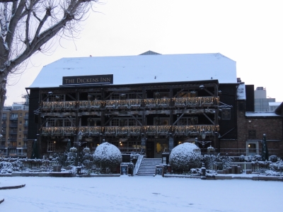 |
2/28/2018: Dickens Inn
Position: 51°30.40'N, 0°4.27'W
Everything looks beautiful in the snow, but the Dickens Inn really stands out.
|
 |
2/28/2018: Conquestor
Position: 51°30.40'N, 0°4.28'W
The fuel barge Conquestor arrives regularly to fuel the marina boats.
|
 |
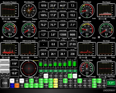
2/28/2018: Andrew Bate
Position: 51°30.40'N, 0°4.28'W
Naples, Florida resident Andrew Bate was in London on business and dropped by for a visit and a tour of Dirona.
|
 |
2/28/2018: 25.8F
Position: 51°30.40'N, 0°4.28'W
The temperature dropped even further to 25.8°F (-3.4°C) this morning. This is unusually cold for London.
|
 |
3/1/2018: Pressure Meter
Position: 51°31.22'N, 0°5.96'W
While riding the tube to King's Cross station, we noticed each carriage has a pressure gauge mounted on the wall. Watching this guage you can see the braking pressure applied by the train operator. It's fun to watch as we go in and out of stations and through switches.
|
 |
3/1/2018: Platform 9 3/4
Position: 51°31.92'N, 0°7.45'W
The Harry Potter store at Platform 9 3/4 in King's Cross station. In JK Rowling's Harry Potter books, aspiring wizards catch the Hogwarts Express by dashing through a brick wall between Platform 9 and 10 at King's Cross Station, called Platform 9 3/4. Next to the store is a recreation of that wall, with a luggage cart embedded partway through.
|
 |
3/1/2018: St. Pancras
Position: 51°31.84'N, 0°7.51'W
The beautifully-restored interior of St. Pancras train station, adjacent to King's Cross station. The station first went into service in 1868 and was renovated in the late 20th century as the terminus for the Channel Tunnel Rail Link. This is where we took boarded our train to Paris.
|
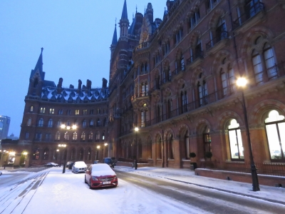 |
3/1/2018: Snowy St. Pancras
Position: 51°31.81'N, 0°7.51'W
A snowy St. Pancras exterior. We were at King's Cross to catch a train north to Leeds and then to the take the scenic Settle-Carlisle train trip. But our train from London was cancelled due to the weather, so we took a few photos and returned back to Dirona.
|
 |
3/1/2018: Ham Radio
Position: 51°30.40'N, 0°4.28'W
A few months back, when entering the lock in Liverpool, we were asked to Monitor channel 37A also called M1 in the UK. We have 6 VHF radios on board from leading suppliers such as ICOM anbd Standard Horizon. Each radio has three modes to support US, Canada, and International but none of these options support either M1 or 37A. We managed OK without having the ability to listen to the lock attendant on that channel but it would be been nice to have it available. This is the first time we have ever encountered a VHF channel used anywhere in the world that we can't listen to. It turns out that this channel is unique to the UK market and radios sold into this market have it added but radios sold into most other markets don't have the support. Annoying, but the solution was easy: buy another VHF radio. Still with so many VHF radios on board, it seems crazy to have to buy another.
Blog reader Andrew Dickenson had a great suggestion: purchase a ham radio that can be programmed to any VHF channel available in the world. The FCC restricts transmissions on Ham radios but unlicensed operators can use them to receive. Going with the Ham radio has the advantage of solving the problem here in the UK but it'll also solve it everywhere else in the world if we end up finding other channels we can't pick up. Even better, it's much cheaper than a VHF radio. For $34.99 we picked up a Baofeng UV-5R+ from Amazon. James spent a bit of time learning to program the radio but it can now pick up every marine VHF he could find in reasonably extensive searching for marine frequencies used anywhere in the world. |
 |
3/1/2018: Baofeng UV-5R+
Position: 51°30.40'N, 0°4.28'W
After programming our new Ham radio to be able to be able receive all world-wide marine channels, we configured it to use text based channel names rather than the default frequency. This makes it an easy and quick-to-use option for monitoring VHF radios. Here we are monitoring channel 16 and the UK M1 channel. The radio can switch between two channels with a single button press or monitor both for activity. Since the entire list of world-wide marine VHF channels doesn't completely fill the 127 channel storage locations, it can also monitor unlicensed communication channel in what ever jurisdiction we happen to be operating (e.g. FRS, MURS, LPD433, GMRS, Freenet, KDR44, PMR446, or SimpleUK). Overall, the Baofeng UV-5R+ is a pretty impressive little package for only $35.00.
|
 |
3/1/2018: Captain Kidd
Position: 51°30.21'N, 0°3.49'W
We didn't notice the hangman's noose just above the entrance to the Captain Kidd last time we were here.
|
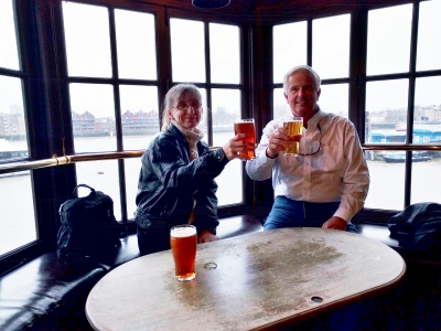 |
3/1/2018: Andrew Bate
Position: 51°30.20'N, 0°3.48'W
Sharing a pint with Andrew Bate riverside at the Captain Kidd pub. Andrew has spent a ton of time around high-end yachts and boats in general—we had a great time sharing stories and experiences.
|
 |
3/2/2018: London City Dentists
Position: 51°30.71'N, 0°4.65'W
At London City Dentists for a regular checkup and teeth cleaning—Dr. Holness there does excellent work. We handle some medical appointments when we're back in the US, but prefer not to defer everything until then. London has great services available.
|
 |
3/2/2018: Specsavers
Position: 51°31.02'N, 0°4.84'W
At Specsavers to order some new glasses. Jennifer's current pair came from Specsavers in Brisbane, Australia when we were there in 2014.
|
 |
3/2/2018: Central Line
Position: 51°31.10'N, 0°4.91'W
Riding the Central Line underground from Liverpool Station to Hatton Garden. The carriages on the Cetnral Line are much narrower than those on the District and Circle lines that we often use.
|
 |
3/2/2018: Staple Inn
Position: 51°31.09'N, 0°6.66'W
The Tudor-style Staple Inn dates from 1585 and caught our eye as an interesting architecture for downtown London. Staple is a medieval term referring to a system of trade and taxation—the Staple Inn was originally a wool staple where wool was weighed and taxed.
|
 |
3/2/2018: Ye Olde Mitre
Position: 51°31.10'N, 0°6.45'W
Ye Olde Mitre, built in 1546, dates from even earlier than the Staple Inn. It's a wonderful pub tucked away on a small alley off Hatton Garden.
|
 |
3/2/2018: Hirschfelds
Position: 51°31.16'N, 0°6.50'W
At Hirschfelds on Hatton Garden to repair some jewelry. They did an excellent job at a very reasonable price.
|
 |
3/2/2018: 33 Holborn
Position: 51°31.08'N, 0°6.50'W
The dramatic glass atrium at 33 Holborn, one of London's many striking buildings.
|
 |
3/2/2018: Bob and Kathy Valleau
Position: 51°30.73'N, 0°5.01'W
An excellent evening with Bob and Kathy Valleau of Nordhavn 68 Vesper over a delicious meal at Giorgios Italian Restaurant in Leadenhall Market. We'd not seen Bob and Kathy since departing Stornoway in the Outer Hebrides last September. It was great to spend time together and catch up on our various travels.
|
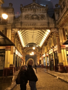 |
3/2/2018: Leadenhall Market
Position: 51°30.74'N, 0°5.02'W
Kathy Valleau of Vesper snapped this picture as we left Giorgios Italian Restaurant through Leadenhall Market.
|
 |
3/6/2018: Stratford Station
Position: 51°32.54'N, 0°0.16'W
We took the tube to Stratford to do some shopping at Westfield Stratford City. Stratford Station is massive with at least 17 platforms serving the London Underground and Overground systems, the Docklands Light Rail (DLR), the TfL commuter rail and the National Rail. What's particularly amazing is there's a second train station on the other side of the shopping center, Stratford International.
|
 |
3/6/2018: Westfield Stratford City
Position: 51°32.55'N, 0°0.18'W
Westfield Stratford City is the third largest shopping mall in the UK and one of the largest in Europe. It opened in 2011 and appears to be thriving, unlike many US malls. On a Tuesday morning in early March, shoppers already were arriving just past opening time and it was crowded by noon.
We've seen a lot of Westfield malls in our travels. Westfield Group was founded in Australia in 1960 and at its peak had one of the largest shopping mall portfolios in the world, with 103 malls worldwide and investment interests exceeding A$63 billion. The company has since separated into two groups, one that handles the Australian and New Zealand Westfield properties and the other that manages international operations. |
 |
3/6/2018: Nespresso
Position: 51°32.55'N, 0°0.18'W
This artistic display at the Nespresso store in Westfield Stratford City caught our eye.
|
 |
3/6/2018: Apple Store
Position: 51°32.62'N, 0°0.39'W
The Apple store in Westfield Stratford City was packed, with a line-up outside to get in. That's pretty amazing for mid-afternoon on a Tuesday in early March.
|
 |
3/6/2018: The Cow
Position: 51°32.53'N, 0°0.50'W
We took a break from shopping with a pint at The Cow. From our table we could see the 2012 Summer Olympics Stadium, now home to West Ham United Football Club.
|
 |
3/6/2018: Loot
Position: 51°32.61'N, 0°0.33'W
Jennifer with our loot for the day. We'd built up a big shopping list in the past few months.
|
 |
3/6/2018: L'escale Wine Bar
Position: 51°30.43'N, 0°4.28'W
Enjoying another excellent bottle of wine over dinner at one of our favourite haunts in St. Katharine Docks: L'escale Wine Bar. Dirona is just visible behind us.
|
 |
3/8/2018: Unplugged
Position: 51°30.40'N, 0°4.26'W
We moved the boat today to another berth. Shortly after unplugging, we got this automated mail from the marina indicating our power was unplugged. It's a rare marina that tracks and alerts on power outages at a boat.
|
 |
3/8/2018: Shad Thames
Position: 51°30.24'N, 0°4.50'W
Looking down Shad Thames, directly opposite St. Katharine Docks across the Thames. The building on the left is Butler's Wharf, built as a warehouse in the late 1800s and now converted to apartments, shops and restaurants.
|
 |
3/8/2018: Cantina del Ponte
Position: 51°30.21'N, 0°4.38'W
An excellent meal at Cantina del Ponte Italian restaurant in Butler's Wharf overlooking the Thames.
|
 |
3/8/2018: Tower Bridge
Position: 51°30.24'N, 0°4.44'W
A great view to Tower Bridge from the Thames side of Butler's Wharf.
|
 |
3/8/2018: The Lock
Position: 51°30.37'N, 0°4.33'W
This plaque on the wall at St. Katharine Docks explaining how the locks work gets a lot of attention from people passing by.
|
 |
3/11/2018: High Water Alarm
Position: 51°30.40'N, 0°4.26'W
Our bilge high water alarm was triggering spuriously. We found that the Maretron sensor will trigger if any high density object comes within 1/4-inch of the detector side. So James mounted it on the Rule 3700 bilge pump hose so it is at the right level and nothing will enter the trigger zone (other than bilge water).
|
 |
3/11/2018: Condensation
Position: 51°30.40'N, 0°4.26'W
We traced the source of a freshwater leak into the bilge to condensation on the HVAC strainer due to the low 40°F saltwater temperature in the marina. Warmer engine room air condenses out when it hits the strainer and cools. We wrapped an insulating rag around each pipe.
|
 |
3/13/2018: Draft House
Position: 51°30.17'N, 0°4.62'W
Enjoying a tasting flight at the Draft House Tower Bridge.
|
 |
3/13/2018: HMS Belfast
Position: 51°30.38'N, 0°4.82'W
The HMS Belfast was launched in 1938 from the same shipyard as the Titanic: Harland and Wolff in Belfast where we visited last fall. The ship saw action in World War II, including firing some of the first shots on D-Day, and was part of the United Nations naval forces during the Korean War. In 1971, the retired ship was brought to London and moored along the Thames by Tower Bridge as a floating museum.
|
 |
3/13/2018: Engine Room
Position: 51°30.38'N, 0°4.85'W
Much of the HMS Belfast is open to the public, including large parts of the engine room. The ship could achieve speeds of 32 knots powered by 4 oil-fired boilers and 4 steam turbines.
|
 |
3/13/2018: Shell Room
Position: 51°30.38'N, 0°4.85'W
Belfast's armament include twelve six-inch guns in four triple-gun turrets. These are replicas of the six-inch shells in the shell room below one of the gun turrets.
|
 |
3/13/2018: Bow
Position: 51°30.40'N, 0°4.95'W
On the bow of the HMS Belfast looking toward two of the triple-gun turrets, with the ship's bridge and superstructure beyond. Tower Bridge is just visible on the left beyond the ship.
|
 |
3/13/2018: Bridge
Position: 51°30.39'N, 0°4.91'W
Jennifer taking in the view from the Navigating Officers chair at the spartan bridge.
|
 |
3/13/2018: Tower of London
Position: 51°30.40'N, 0°4.92'W
A great view from the HMS Belfast to the Tower of London, lit up in the afternoon sun.
|
 |
3/14/2018: Pump-Out
Position: 51°30.40'N, 0°4.26'W
St. Katharine Docks has an in-place pump-out service for most of the berths.
|
 |
3/15/2018: London Cat Clinic
Position: 51°29.74'N, 0°4.37'W
Dr. Jeremy Campbell of London Cat Clinic giving Spitfire a health exam prior to a 3-year rabies vaccination. Spitfire's last rabies vaccination was done in Darwin, Australia.
|
 |
3/15/2018: Crutched Friar
Position: 51°30.68'N, 0°4.73'W
We had a great lunch at the Crutched Friar. The place was empty when we arrived shortly past noon, but by 1pm it was packed to standing-room only with local business people.
|
 |
3/15/2018: Thames
Position: 51°30.24'N, 0°3.95'W
Dusk overlooking Hermitage Moorings where we stopped for our first night in London. We continued from here to River View restaurant, where we had an excellent meal with a view to Canary Wharf.
|
 |
3/16/2018: The Drift
Position: 51°30.98'N, 0°4.85'W
We had a wonderful lunch on the balcony at Drift Restaurant overlooking their bar after picking up our new eyeglasses at nearby Specsavers.
|
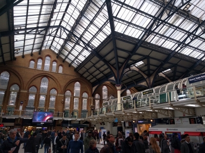 |
3/16/2018: Liverpool Station
Position: 51°31.07'N, 0°4.95'W
The vaulted glass ceiling in Liverpool Station where we took the tube to Hatton Garden to pickup Jennifer's repaired jewelry.
|
 |
3/16/2018: Jinjja BBQ
Position: 51°31.19'N, 0°6.56'W
Even though we'd just had lunch and weren't hungry, out mouths were watering at the delicious smells of the street food along Leather Lane one block off Hatton Garden.
|
 |
3/17/2018: Water Maker Remote
Position: 51°30.40'N, 0°4.26'W
The water maker has been spuriously turning itself on without warning, so we have started to keeping it powered down. We still flush the system weekly but today when we powered it up for the weekly flush, the remote panel didn't work. We tried flushing directly from the water maker and it worked well, so we knew we had a remote panel problem. What we found was the CANbus wire that runs between the water maker and the remote panel has gotten stiff over the years and there is now quite a bit of force pushing the connection laterally. Once that is relaxed and the connector fully inserted, everything is back to working correctly without spontaneous operation. James is pointing to the connector in the picture.
|
 |
3/17/2018: Actuator Change
Position: 51°30.40'N, 0°4.26'W
ABT recommends that the stabilizer actuators are changed every 2,000 hours. Since even a failed actuator doesn't negatively impact the operation of the other side, I usually change them only once they start showing any sign of age. Their lifetimes seem to range from 2,500 hours to well over 6,000 hours. This one was last changed on our run from St. Helena to Barbados back in 2016 and has been in service for 3,209 hours. It has just begun to leak and so it's time to make the change. Here James has the cover off the fin position sensor but the sensor is still in place. Once the sensor is off, the top plate is removed revealing the actuator. It's a fairly easy two-hour procedure to change if all goes well.
|
 |
3/17/2018: Tight Quarters
Position: 51°30.40'N, 0°4.26'W
On Dirona, the port side fin is behind the primary fuel filter and under the fuel tank extension, making it more difficult to access than the other fin. However, the fuel tank extension gives the N52 200 more gallons of fuel on each side over the N47 which I love so I shouldn't complain about the slightly tighter service access. At the dock, changing even the port side fin is a fairly easy job. The last time I did it was in equatorial conditions, in a hot engine room, with the engine roaring behind me so this one was quick and easy.
|
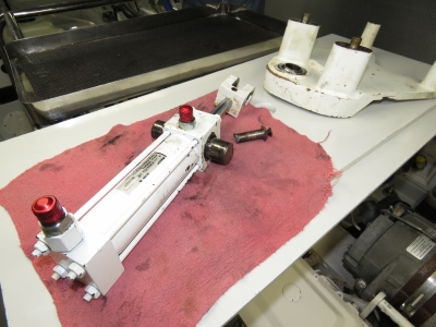 |
3/17/2018: Old Actuator
Position: 51°30.40'N, 0°4.26'W
This is the old fin actuator that was just removed. Note how small the hydraulic ram is. Most of the lift of a hydraulic fin is delivered directly into the fin shaft and bearings so it takes very little force to move the fins. Our hydraulic system normally operates at 3,800 PSI but only needs 1,500 PSI to drive the fins even with this very small hydraulic ram. They just don't take much force which is good because fin force is overhead that eventually costs fuel economy and range. It's nice to not to have to give up material range in order to enjoy a stabilized boat.
|
 |
3/17/2018: Aaron & Jacob Kagon
Position: 51°30.40'N, 0°4.26'W
Aaron Kagon (left) and his brother Jacob were in London and came by to tour Dirona. Aaron is studying naval architecture in Southampton—we met briefly when he was visiting Nordhavn Europe. He's spent a lot of time around Nordhavns and knows the boats well.
|
 |
3/18/2018: Cat Litter
Position: 51°30.40'N, 0°4.26'W
This is why we use Tidy Cats Breeze and not regular cat litter—it makes a real mess and tracks everywhere. Spitfire had developed diarrhea from the antibiotics he had to take after his surgery, so we'd switched litters temporarily to conserve our supply of Tidy Cats Breeze pellets. Twice a day it looks like this—we'll be back to the normal system the very moment we can.
|
 |
3/18/2018: Snow
Position: 51°30.40'N, 0°4.26'W
The snow we had in early March had all melted and the weather was warming up. But we had another temperature drop with more snow overnight. This didn't last long, nor cause nearly the disruption to the transportation system as the earlier weather did.
|
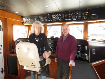 |
3/20/2018: Michael Crofts
Position: 51°30.40'N, 0°4.26'W
Michael Crofts, of Nordhavn 40 Coracle, dropped by for a visit. We've corresponded a lot over the years, so it was great to finally meet in person.
|
 |
3/20/2018: Sky Garden
Position: 51°30.67'N, 0°5.02'W
The fabulous view looking south from Sky Garden, a public space at the top of the "Walkie Talkie". The room jutting out at upper left is Darwin Brasserie, where we have dinner reservations.
|
 |
3/20/2018: Terrace
Position: 51°30.66'N, 0°5.01'W
|
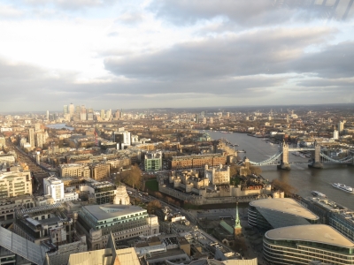 |
3/20/2018: Thames
Position: 51°30.67'N, 0°5.01'W
The view east down the Thames from Sky Garden. The Tower of London and St. Katharine Docks are roughly center, left of Tower Bridge. The high rises of Canary Wharf are visible in the distance.
|
 |
3/20/2018: Dirona
Position: 51°30.66'N, 0°5.01'W
Dirona moored in St. Katharine Docks viewed from Sky Garden.
|
 |
3/20/2018: High Rises
Position: 51°30.67'N, 0°5.02'W
Top-of-the building view from Sky Garden.
|
 |
3/20/2018: Darwin Brasserie
Position: 51°30.67'N, 0°5.01'W
Our awesome window table at Darwin Brasserie. The food was excellent, but it wouldn't have mattered with that incredible view.
|
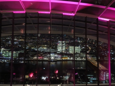 |
3/20/2018: Night View
Position: 51°30.67'N, 0°5.01'W
We'd arrived shortly before sunset and this was the view from our table as we finished our meal. Wow!
|
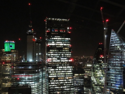 |
3/20/2018: High rises at night
Position: 51°30.67'N, 0°5.02'W
After dinner we made another pass through Sky Garden to take in the views at night. The high rises look beautiful all lit up.
|
 |
3/20/2018: City Garden Bar
Position: 51°30.67'N, 0°5.02'W
Looking west across the City Garden Bar at night with Darwin Brasserie visible at the top right corner. We had a fabulous evening and were glad to have gone.
|
 |
3/20/2018: Running Club
Position: 51°30.48'N, 0°4.75'W
As we returned home, one of London's many running clubs was out exercising by the Tower of London. There were perhaps 200 people and they all looked to be having a great time.
|
 |
3/21/2018: Richard Murray
Position: 51°30.75'N, 0°4.90'W
Inside the Lloyd's of London building with Richard Murray, aka "Muzz", who invited us for a tour of the striking building. Muzz is a Lloyd's Insurance Broker with Bannerman Rendell and a friend of Andrew Bate, who introduced us.
Behind us is a portrait of Admiral Lord Nelson and some of The Nelson Collection. Lloyd's association with Admiral Lord Nelson goes back to the Battle of the Nile in 1778 when a Lloyd's committee raised £38,000 (about £3.7M today) to help the wounded and bereaved. The company has since amassed a large collection of Nelson artefacts and memorabilia. |
 |
3/21/2018: Old Library
Position: 51°30.75'N, 0°4.90'W
The 1986 Lloyd's building is modern, but is full of history. It was constructed on the site of their 1928 space, with several of the original parts preserved. This is the beautiful Old Library, where portraits of previous Lloyd's chairmen ring the walls. The room was preserved at its original location and the modern building built around it.
|
 |
3/21/2018: Atrium
Position: 51°30.75'N, 0°4.90'W
The light-filled multi-floor atrium is the centerpiece of the Lloyd's building.
|
 |
3/21/2018: The Rostrum
Position: 51°30.75'N, 0°4.90'W
At the Rostrum with the Lutine Bell. The bell was salvaged from the HMS Lutine, lost in 1799 carrying £1M in gold. Traditionally the bell was rung to mark news of an overdue ship, once to indicate a lost vessel and twice on a safe return, so that all brokers and underwriters learned the news simultaneously. More recently it is rung only for ceremony and mourning.
|
 |
3/21/2018: The Room
Position: 51°30.75'N, 0°4.90'W
Lloyd's operates as a market place where insurance brokers bring risks, in person, to underwriters who evaluate, price and accept the risks at their 'boxes'. The name derives from Edward Lloyd, who in the 1600s began renting out spaces he called boxes in his coffee shop. The boxes are located in a huge central underwriting space known traditionally as "The Room".
|
 |
3/21/2018: The Adam Room
Position: 51°30.74'N, 0°4.94'W
When the Lloyd's 1928 building grew too small, another was built across the street in 1958. The Adam Room, built in the late 1700s for the Earl of Shelbourne, was purchased at auction and transferred piece-by-piece to that new building. By the 1970s, Lloyd's needed yet more space and the Adam Room was again transferred piece-by-piece to the newest building.
|
 |
3/21/2018: Model
Position: 51°30.78'N, 0°4.96'W
The Lloyd's of London building is a masterpiece of modern architecture. This model shows its Bowellism style, where interior space is maximized by placing the building services, such as ducts, sewage pipes and elevators, on the exterior.
|
 |
3/21/2018: The Room in the 1940s
Position: 51°30.78'N, 0°4.96'W
A painting showing "The Room" in the 1940s with the Rostrum and the Lutine Bell prominent.
|
 |
3/21/2018: Navigators
Position: 51°30.82'N, 0°4.95'W
The Navigators insurance boxes at Lloyd's. We used to have an umbrella policy with them until they got out of that market. At the time, they were one of the few who would write an umbrella policy without having an underlying home or auto liability policy.
|
 |
3/21/2018: Loss Book
Position: 51°30.82'N, 0°4.95'W
The Loss Book, with details of lost ships, has been in use since 1774. Entries still are written in hand using traditional quill and ink. Loss books dating back to 1775 are stored in the Guildhall Library.
|
 |
3/21/2018: David Cox
Position: 51°30.75'N, 0°4.94'W
Muzz not only showed us through the Lloyd's building but also took us to lunch at the historic George and Vulture, a Leadenhall pub dating to 1748, and for wine and cheese with some of his friends at Cheese at Leadenhall. At the end of the work day, we stopped at the private bar inside Cox Claims Group. Chairman David Cox, pictured with us, races cars all over the world and has participated in such major events as the Bathurst 1000 in Australia. We had an absolutely fabulous time meeting David and some of the Cox Claims Group team.
|
 |
3/22/2018: Laust Sondergaard
Position: 51°30.40'N, 0°4.26'W
Laust Sondergaard, owner of Nordhavn 75 l'Adagio, was in town on business and stopped by for a visit. Laust lived aboard a previous boat at St. Katharine Docks for a decade when he worked in London. l'Adagio is currently for sale and the sales team has put together an astounding 3D model of the boat.
|
 |
3/23/2018: Gloriana
Position: 51°30.40'N, 0°4.26'W
The royal barge Gloriana departing her home port of St. Katharine Docks. The 90-foot (27m) vessel is powered by 18 oarsmen and/or two electric inboard engines, and can carry an additional 34 passengers and crew. Designed after the Lord Mayor of London's boat in the 1800s, it is built of wood using traditional methods.
|
 |
3/24/2018: 4x20 LCD Output
Position: 51°30.40'N, 0°4.26'W
James has interfaced a 4-line 20-character LCD to be driven by a Raspberry Pi. The display is interfaced to the Pi using the I2c (Inter-Integrated Circuit) protocol. If the output lines are longer than 20 characters, the system repeatedly scrolls the longer lines. The output can be changed at any time and the screen can be turned off using the 1x4 matrix keyboard. If new text is sent to the Pi, then it'll display those lines instead. With the 4-key keyboard, the system can display different outputs at user request. For example, we could have one key request the display of all boat temperature sensor readings and another key could request the fuel tank levels be shown. At this point, we don't have a direct application for the display but suspect a small display will come in handy somewhere on Dirona.
|
 |
3/25/2018: Tesco
Position: 51°30.40'N, 0°4.26'W
Tesco delivering a load of groceries—one of several orders we'll place as we stock up for our Norway trip.
|
 |
3/26/2018: Vesper
Position: 51°30.40'N, 0°4.26'W
Nordhavn 68 Vesper underway to depart London. We had a great time with owners Bob and Kathy Valleau as neighbours over the past month. Hopefully our paths will cross again soon.
|
 |
3/26/2018: Busy Lock
Position: 51°30.40'N, 0°4.32'W
We've only ever seen one boat in the St. Katharine Dock lock. Today there were two other boats with Vesper and if the fuel barge was ready to leave it would have been in there as well. It must get very crowded at the height of the summer season.
|
 |
3/27/2018: Construction
Position: 51°30.43'N, 0°4.38'W
The footbridge across the channel between the central and west basins at St. Katharine Docks has been removed for renovation since we arrived. A construction crew, working off a barge, has been putting the bridge back in place this week.
|
 |
3/27/2018: Hyundai
Position: 51°32.63'N, 0°0.34'W
Back at Westfield Stratford City for another day of shopping. The mall is the third largest in the UK and even has an entire car dealership inside.
|
 |
3/27/2018: Joe Delucci's
Position: 51°32.65'N, 0°0.48'W
We got a kick out of these scooter seats at Joe Delucci's.
|
 |
3/27/2018: Hawkin's Bazaar
Position: 51°32.64'N, 0°0.49'W
Hawkin's Bazaar in Westfield Stratford City carries unusual products and gifts for every occasion. This one certainly qualifies as unusual.
|
 |
3/27/2018: WaterWorks River
Position: 51°32.42'N, 0°0.74'W
Looking west along WaterWorks River between Westfield Stratford City and Olympic Stadium. The river runs through an artificial channel cut in 1743 to supply a reservoir for Saynes Mill in Stratford. It forms part of the Bow Back Rivers system that allow navigation between Hertford Castle Wier, about 20 miles north of London, into the River Thames via Limehouse Basin a short distance downriver from St. Katharine Docks.
|
 |
3/27/2018: Olympic Stadium
Position: 51°32.42'N, 0°0.74'W
The 2012 Summer Olympics Stadium, now home to West Ham United Football Club.
|
 |
3/27/2018: Aquatics Center
Position: 51°32.41'N, 0°0.75'W
The London Aquatics Center was built for the 2012 Summer Olympics and has 2 160ft (50m) swimming pools and an 82ft (25m) diving pool.
|
 |
3/27/2018: ArcelorMittal Orbit
Position: 51°32.35'N, 0°0.80'W
The striking 375-ft (114.5m) ArcelorMittal Orbit sculpture is the tallest in the UK and was built for the 2012 Olympics. You can ride an elevator to the top for sweeping views, and return down the same way or via a spiral staircase. The more adventurous can whisk down in 40 seconds through the 583ft (178m) slide, the world's longest, or by freefall abseil.
|
 |
3/27/2018: Tower Bridge Moorings
Position: 51°30.16'N, 0°4.26'W
Tower Bridge Moorings, near Butler's Wharf on the south bank of the Thames, with Canary Wharf in the distance on the left. Several dozen barges rafted together are home to a community of more than 100 people with an award-winning communal garden running throughout the walkways.
|
 |
3/27/2018: Low Tide
Position: 51°30.14'N, 0°4.26'W
Low tide looking south into St. Saviours Dock basin. Not surprisingly, nearby advertisements for the expensive apartments on either side show the waterway at high tide.
|
 |
3/28/2018: Fouled
Position: 51°30.40'N, 0°4.26'W
The marina has been placing lines, marked by fenders, to moor boats for an upcoming event. One of the fenders is visible off the port side of Yarona and another is just visible off the starboard stern of the forward boat (click image for a larger view). We've heard the marina warn departing boats of the fenders earlier this week, but neither crew seemed aware of the lines in the water and the forward boat got hung up on one of the lines. The big puff of smoke is from them trying to wrest free. They eventually tied off on the far side of the basin to clear the mechanical systems Yarona continued out through the lock.
|
 |
3/28/2018: Ping Pong
Position: 51°30.50'N, 0°4.39'W
A great meal at Ping Pong Dim Sum restaurant at St. Katharine Docks.
|
 |
3/29/2018: 4x20 LCD Output
Position: 51°30.40'N, 0°4.26'W
Earlier this week James interfaced a 4-line 20-character LCD and 1x4 matrix keyboard to be driven by a Raspberry Pi. Yesterday he installed the LCD and keyboard into the case from a USB disk drive and mounted the unit on the pilot house dash where it is readable throughout the pilot house. We're using it display the four most recent alarms and warnings from our automation systems. We use Maretron N2kView to display most boat system status alarms, indicators and warnings, but there is no provision to display arbitrary text messages.
|
 |
3/29/2018: Boat Wash
Position: 51°30.40'N, 0°4.26'W
We're absolutely loving St. Katharine Docks and have already extended our stay twice. The only downside is the boat gets dirty rather quickly, as we are in downtown London. But more regular boat washes is a small price to pay for such a fabulous loctation.
|
 |
3/29/2018: Neil Russell
Position: 51°30.40'N, 0°4.26'W
Neil Russell of Nordhavn Europe was in London and stopped by Dirona to say hi.
|
 |
3/30/2018: Video Crew
Position: 51°30.40'N, 0°4.26'W
A video crew was out filming at St. Katharine Docks this morning.
|
 |
3/30/2018: Lock
Position: 51°30.40'N, 0°4.32'W
A full lock at St. Katharine Docks as the Windsor Yacht Club arrives from an all-day cruise. Their club is located about 22 miles upriver from here as the crow flies, but probably close to double that in the winding Thames.
|
 |
3/31/2018: Windsor Yacht Club
Position: 51°30.40'N, 0°4.26'W
The Windsor Yacht Club settled in for the Easter Weekend. St. Katharine Docks has been working on setting up their area for the past few weeks—it's one of the reasons we moved to another berth earlier this month and why the fender-marked lines that a boat fouled on were strung in the basin. it looks like a great spot for a rendezvous, with a covered social area to moor the boats around.
|
 |
3/31/2018: Tower Bridge
Position: 51°30.28'N, 0°4.55'W
While walking to our new-favourite pub, The Draft House, we barely made it across Tower Bridge before it opened to allow a tour boat to pass under. We've not seen the Tower Bridge opened before—traffic sure backs up in a hurry.
|
 |
4/1/2018: Dave and Debbie Campbell
Position: 51°30.40'N, 0°4.26'W
UK residents Dave and Debbie Campbell stopped by for a visit and a tour of Dirona. Dave is in the backup generator business, so we had a great discussion on backup power as well as boats.
|
 |
4/2/2018: NMEA 2000 Down
Position: 51°30.40'N, 0°4.26'W
We woke up late last night to the sound of the main engine starting. Earlier in the day we'd inadvertently turned off the breaker to our 12V navigation system battery, which had discharged, bringing down the NMEA 2000 bus that relies on 12V power. This effectively blinds our control systems on the information it needs to make decisions. When the control system can't determine the battery voltage levels, it starts the generator, since we would rather run the generator too much than discharge the house batteries. The generator was unable to start due to the NMEA2000 system being down, so the control system went to the emergency backup system and started the main engine.
It's nice to see the control systems working properly in the face of adversity, but we should have noticed that the 12V navigation system was discharging. Most of the boat is 24V but there are a few 12V-only components in our navigation and control systems that run off this bus. It's little-used, but very important, so certainly should have been monitored. On a closely related point, the 12V battery has been in place in the more than eight years since the boat was new and likely needs replacement. |
 |
4/2/2018: 12V Battery
Position: 51°30.40'N, 0°4.26'W
The navigation system has a dedicated 12V battery that is only used for the few components that are unavailable in 24V variants. Almost all DC powered equipment on Dirona runs on 24V so the 12V bus is easy to ignore. But the 12V system powers some very important components, including NMEA2000. After the deep discharge the 12V system was just accidentally taken through, we tested the battery and it's capacity has diminished to only 136 CCA, so it's past time we replaced it. We have a battery on order, will add testing our 12V battery to our annual battery test, and will put voltage monitoring on the 12V system.
|
 |
4/2/2018: Voltage Monitoring
Position: 51°30.40'N, 0°4.26'W
Our accidental discharge of the 12V navigation system bus reminded us we need to monitor it just as we monitor our 24 volt DC system and the 120V and 240V AC systems on Dirona. Here James has a resistive voltage divider taking 0 to 16V down to 0 to 5V to be detected by an Arduino. It's working but producing voltage levels that vary +/-0.5V around the actual voltage level so he's changing the Arduino program to sample the voltage twice a second and to average the last 50 readings when producing a voltage level.
It's now producing fairly stable voltage readings so he'll next get the Arduino attached to one of the already-deployed Raspberry Pis so the data can be relayed back to the control system. In this case, it's important that the 12V system monitoring and alarms not be NMEA2000 devices since the NMEA2000 system is fed by the same 12V bus. |
 |
4/2/2018: IPG100
Position: 51°30.40'N, 0°4.26'W
Once we got the NMEA2000 bus back up, we still weren’t getting data to our N2kView display. The Maretron IPG100 appeared to have not survived the deep discharge of the 12V system and, when the NMEA2000 bus voltage levels went low, the IPG100 failed. We have a spare, so last night we just changed the IPG100 so all control systems and reporting is quickly back to operational. The failed device is clearly operating but with firmware corruption so it should be possible to recover it.
Here James has the IPG100 on a stand-alone NMEA2000 network in an effort to recover the device. This often works but it appears that this IPG100 is not going to be recoverable so we'll have to get another spare. We find the Maretron equipment relatively cost-effective and so we have a spare of everything. If any problems come up, having spares makes problem determination super-easy: try a new one and have the answer in seconds instead of after hours of investigation. Having spares makes the problems easy to find and quick to correct. |
 |
4/2/2018: HTTP Secure
Position: 51°30.40'N, 0°4.26'W
We've just finished upgrading our site to HTTP Secure (HTTPS) and while we were at it upgraded to the new AWS Linux 2. The HTTP upgrade involved a lot of site-wide changes to remove references to http—let us know if you see any broken links or other issues.
|
 |
4/2/2018: Bravas Tapas
Position: 51°30.45'N, 0°4.28'W
The crispy piquillo-wrapped prawns at Bravas Tapas in St. Katharine Docks tasted as good as they looked.
|
 |
4/3/2018: City Electrical Factors
Position: 51°31.31'N, 0°4.41'W
At City Electrical Factors, about a half-hour walk from St. Katharine Docks, to pickup some electrical supplies.
|
 |
4/3/2018: Ely's Yard
Position: 51°31.27'N, 0°4.41'W
Street art visible above the brick wall at Ely's Yard, an old service yard that now is a street market. Not visible behind the wall is a famous piece of London street art: Banksy's Pink Car
|
 |
4/3/2018: Water Poet
Position: 51°31.28'N, 0°4.68'W
We had a great lunch on the fabulous heated patio at The Water Poet, one of several restaurants that Richard Murray recommended.
|
 |
4/3/2018: Christ Church Spitalfields
Position: 51°31.15'N, 0°4.47'W
Christ Church Spitalfields was built in the early 1700s. After decades of neglect, the church was recently beautifully restored to its pre-1850s splendour.
|
 |
4/3/2018: Spitalfields Market
Position: 51°31.16'N, 0°4.47'W
Spitalfields Market started in 1638, was covered in the late 19th century and modernized in 2006. The market is full of small vendors selling wares ranging from jewelery to fresh vegetables with a healthy mix of food stalls and restaurants.
|
 |
4/3/2018: Tre Rote
Position: 51°31.19'N, 0°4.52'W
One of the many quirky food stalls at Spitalfields market is Tre Rote, Italian pasta served from a Piaggo Ape 400 Classic three-wheeler van. Ape is Italian for bee, a reference to work-ethic. The smallest engine configuration from that manufacturer drives the micro-truck with only 1.8HP.
|
 |
4/3/2018: Sud Italia
Position: 51°31.19'N, 0°4.52'W
Delicious-looking pizzas cooking in the oven at Sud Italia, another food truck at Spitalfields Market.
|
 |
4/3/2018: Woodin's Shades
Position: 51°31.10'N, 0°4.78'W
London has an endless number of excellent-looking pubs and great pub signs. This one at Woodin's Shades caught our eye.
|
 |
4/3/2018: Liverpool Station
Position: 51°31.06'N, 0°4.86'W
We returned home on the tube from dramatic Liverpool Station.
|
 |
4/5/2018: Wing Off Too Long
Position: 51°30.40'N, 0°4.26'W
Earlier today the automation system put on the wing engine indicator light (red at bottom right) since it's been three weeks since the wing was last run. We like to run the engines at least every three weeks to keep them well oiled and condensation free.
|
 |
4/5/2018: LCD
Position: 51°30.32'N, 0°3.45'W
We're really liking our new LCD that shows the four most recent alarms and warnings from our automation systems. When the wing indicator light went red, a quick glance showed what the issue was: "Wing Off Too Long"
|
 |
4/5/2018: RS Components
Position: 51°30.40'N, 0°4.26'W
We got the electrical box and some other parts at City Electrical Factors but they didn’t have the Schneider 20A 240V contactors with 24VDC control, so we picked them up from RS Components. We’ve ordered from RS Components twice now this week and both times the order arrived the next day with everything we wanted. They seems to have a vast stock and work super-efficiently to get orders out. These 24V LED indicator lights are only £2.86 each.
|
 |
4/5/2018: The Shard
Position: 51°30.32'N, 0°3.64'W
A great view to The Shard looking west along Trench St. in Wapping. We'd had another good meal at the River View restaurant and walked back through the residential areas in Wapping.
|
 |
4/5/2018: Flag Rugby
Position: 51°30.31'N, 0°3.71'W
Co-ed flag rugby at John Orwell Sports Center in Wapping with The Shard in the background.
|
 |
4/5/2018: Hermitage Basin
Position: 51°30.36'N, 0°3.99'W
Looking through the Rope Circle sculpture to Hermitage Basin with with omnipresent Shard visible on the right. The basin was built in the early 1800s to create a second entrance from the Thames to Shadwell Basin near the Prospect of Whitby pub. The foreground brick building visible through Rope Circle is the old pumphouse used to control the level in the basin.
|
 |
4/5/2018: Ornamental Canal
Position: 51°30.36'N, 0°3.98'W
Ornamental Canal once led from the Thames via Hermitage Basin to Shadwell Basin, near the Prospect of Whitby pub. But the locks at either end of Hermitage Basin have been removed and now the aptly-named canal provides a lovely public walkway through Wapping.
|
 |
4/6/2018: Spare Spitfire
Position: 51°30.40'N, 0°4.26'W
We found yet another "spare Spitfire" in the locker behind the salon settee.
|
 |
4/7/2018: Twin Shore Power
Position: 51°30.40'N, 0°4.26'W
One of the things we really like about our more flexible power system is it allows us to run on shore power connections that deliver less than our peak power requirements. We easily can run on a 16A/240V connection for example with the house power draw peaking around 25A while we draw only 16A from shore. As long as our average draw is less than the shore power available, we keep up fine and never need to run the generator at dock.
Liverpool was the first place where we found running on a 16A service an inconvenience. When the temperatures drop down to the low 40F or into the 30s, our average power requirement rises and eventually will exceed the 16A available from shore at many marinas. When this happens the batteries begin a slow but steady discharge. The easy solutions are to heat a smaller part of the house, heat them less, or just switch over to the diesel heat. The latter solution of just using the diesel heating system works great, but is slightly more expensive than using shore power to heat. When it's cold, we usually just switch over to diesel heat and continue to run well on 16A power when more isn't available. Two issues have caused us to look for a shore related solution: 1) we've been told that some docks in Norway have only 8A service and there is no way we can run on 8A, and 2) we plan to spend 4 months next winter in Amsterdam and the marina we are looking at has only a 16A service. We like to be toasty so, over the course of 4 months, that will end up consuming a lot of fuel. So we're investigating solutions that will allow us to use 2x 8A when only an 8A service is available or 2x 16A when it's cold and we don't want to run the diesel furnace at the dock. The obvious answer is to combine the two low-amperage connections since they are phase-aligned. But there many reasons why this is unsafe and not allowed by most, if not all, local electrical codes. A better solution, that is safe, is to split our charging system supply bus in two where one shore power connection feeds one 100A charger and then we add a second shore power connection to feed the second 100A charger. Each charger can consume around 13A allowing the boat to effectively run as though it had a single 32A connection. And, if at a dock with only an 8A service, the two chargers' output can be adjusted downward through the user interface to only draw 8A so we can still have 16A for use on the boat. Using this approach we can run on almost any shore power configuration no matter how small. In this project, we will allow the second charger to be taken off the shore power bus and moved to shore power #2 and we are also centralizing some existing control system logic already installed on Dirona in the same control box. We'll cover the details in a subsequent blog entry. |
 |
4/7/2018: Bilge Pump Switch
Position: 51°30.40'N, 0°4.26'W
As part of the follow-up to dealing with our water ingress issue in the North Atlantic, we'd installed a switch in the engine room to control the hydraulic bilge pump. This worked well, but we'd found it was easy to accidentally bump the switch and turn the pump on. So today we replaced it with a flush-mounted switch that is as easy to operate, more robust, and much less likely to be accidentally bumped on.
|
 |
4/9/2018: Near Miss
Position: 51°30.40'N, 0°4.26'W
A barge entered the central basin from the lock this morning, heading towards the east basin (where the apartment buildlings are in the background). The barge caught our attention because it was swinging widely off course and the operator appeared to be adding more left helm in response, which only made it worse. It crossed near our bow and collided with the boat two berths over. We're still a little shook at how close we were to having serious damage a week before getting underway for Norway.
|
 |
4/9/2018: Draft House
Position: 51°30.18'N, 0°4.62'W
Enjoying wings and cask-conditioned beer from the rotating selection at the Draft House across Tower Bridge from St. Katharine Docks.
|
 |
4/10/2018: Voltage Sensing
Position: 51°30.40'N, 0°4.26'W
The 24V-to-12V converter that powers the 12V navigation system bus was inadvertently shut off a few days back and we didn't notice as the backup battery on that bus discharged. It's important that lead-acid batteries not be discharged below 50% and we have monitors and alarms on just about every possible problem on Dirona but somehow had missed this one.
Today James built a voltage sensor using a PCF8591 analog-to-digital converter. This A-to-D converter attaches to the Pi on the I2C (Inter-Integrated Circuit) bus that is also used by that Pi to control the 4x20 LCD display. I2C devices are easy to use, requiring only 4 wires (voltage, ground, and 2 signals), and all I2C devices can use the same 4 wires so it doesn't consume any additional Pi GPIO pin resources. The PCF8591 detects voltage between 0 and 5V and converts it to a digital number between 0 and 255 that can be easily read by the Pi. We have a resistive voltage divider that takes a 0-25V range and produces a 0-5V range directly readable by the PCF8591. We now have a voltage sensor on the 12V navigation system power bus and set red indicator lights, send email, and sound alarms on low voltage levels. Using these electrical components allowed the problem to be solved for well under $10. Of course, that's ignoring that his time might be worth something :-). He ended up going with this design over the Arduino design which worked equally well because this one a little simpler and more extensible. It also happens to cost less, although that really isn't that much of a goal. |
 |
4/10/2018: The Minories
Position: 51°30.63'N, 0°4.50'W
We've walked past The Minories pub several times, but haven't stopped in. The pub is built into the arches beneath the Fenchurch Street viaduct—the rumble of trains passing above adds to the atmosphere.
|
 |
4/10/2018: Liverpool vs Man City
Position: 51°30.68'N, 0°4.48'W
The Minories pub was packed for the Liverpool verses Manchester City Champions League quarter-final match. It was an incredibly exciting game, with Liverpool taking the win despite Manchester City dominating for the first half. Note the brick arches in the ceiling.
|
 |
4/10/2018: St. Katharine Docks at Night
Position: 51°30.42'N, 0°4.34'W
One of our last views to Dirona moored at St. Katharine Docks before we head off to Norway in a few days. It's a moist and misty evening, just barely short of rain.
|
 |
4/11/2018: 12V Battery
Position: 51°30.40'N, 0°4.26'W
Our replacement 12-volt battery arrived today. Nordhavn Europe ordered it for us—they were able to get us a good price and quick delivery to arrive before we leave early next week.
|
 |
4/11/2018: Dave Smith
Position: 51°30.40'N, 0°4.26'W
Dave Smith, owner of Nordhavn 43#43, was in London and stopped by for a visit. It's been fun having more visitors than usual, with London being both a popular travel destination and a hub for Europe.
|
 |
4/12/2018: AB 12VST
Position: 51°30.40'N, 0°4.26'W
Our new AB 12VST tender has just arrived in at Boot Akkrum in Akkrum, Netherlands. We'll be picking it up in Harlingen, Netherlands en our way to Norway.
Our current tender is 9 years old (1 year older than Dirona) and has 550 hours on it. We were hoping to get it to last 10 years and it got close but the full seam blowout in Scotland while underway convinced us the current boat is starting to show it's age. We really want a safe and reliable tender when boating in secluded regions of Norway as planned for this summer. It's a bit unusual to purchase a tender from the Netherlands when boating in Scotland on the knowledge that we will be passing through the Netherlands in a few months, but the boat looks great and we're really looking forward to taking delivery. |
 |
4/12/2018: Philip Ljubic
Position: 51°30.40'N, 0°4.26'W
Blog reader Philip Ljubic stopped by to say hello and came aboard for a tour of Dirona. He's originally from Australia, but lives in London now.
|
 |
4/12/2018: Helen and Gus Wilson
Position: 51°30.40'N, 0°4.26'W
Former Texas residents Helen and Gus Wilson have been wintering at St. Katharine Docks for a decade, have vast experience cruising in this area, and have been giving us great advice on visiting London and the surrounding area. They stopped by for a visit, and some more helpful advice, before we left for Norway.
|
 |
4/13/2018: Tesco
Position: 51°30.40'N, 0°4.26'W
A final Tesco grocery delivery before we leave the UK for the Netherlands this weekend.
|
 |
4/13/2018: 12V Battery
Position: 51°30.40'N, 0°4.26'W
We replaced the 12V battery today. Getting the old one out and the new one in was a bit tricky with some pipes in the way, but James managed to slide them in and out on end.
|
 |
4/13/2018: Floor
Position: 51°30.40'N, 0°4.26'W
The battery could have been a lot more difficult to replace had it been more built in. Luckily the floor above it is designed to be removed.
|
 |
4/13/2018: Corner
Position: 51°30.40'N, 0°4.26'W
The corner of the bed also is designed to be removed. Had this and the floor been permanent, replacing that 12V battery would have been a major job. Instead it took perhaps 20 minutes including cleanup.
This is one of the ways that Nordhavns really are different. You can't tell from the outside, and you wouldn't really notice in the first few months of ownership, but the boats are designed to allow efficient service. Here, seven screws can be undone and the entire corner of the bed above the battery can be removed. |
 |
4/13/2018: Produce
Position: 51°30.41'N, 0°4.04'W
We brought the folding cart over to nearby Waitrose to stock up on fresh produce before we depart.
The brown grocery bags are Earthtote Reusable Bags from reuseit.com. We love them. We can pack them right to the top, they can handle very heavy loads and they last super-well. We've never had to replace one yet. When transferring groceries to the boat (and sometimes to the dinghy first), it's much more convenient to have a few large sturdy bags than many smaller ones that might rip and risk dropping items in the water. |
 |
4/13/2018: Steven Gee
Position: 51°30.43'N, 0°4.28'W
We had a great evening at L'escale Wine Bar and later on Dirona with Nordhavn 55 Shogun owner Steven Gee, who keeps his boat at St. Katharine Docks. He's also in the techonolgoy industry so we have a lot in common beside boating.
|