MV Dirona travel digest for Boston 2016

|
Click the travel log icon on the left to see these locations on a map,
with the complete log of our cruise. On the map page, clicking on a camera or text icon will display a picture and/or log entry for that location, and clicking on the smaller icons along the route will display latitude, longitude and other navigation data for that location. And a live map of our current route and most recent log entries always is available at //mvdirona.com/maps/LocationCurrent.html. |
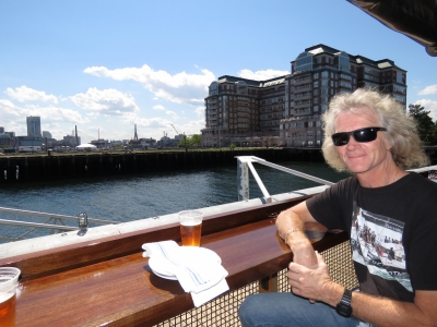 |
6/17/2016: Pier 6
Position: 42°22.38'N, -71°3.01'W
Drinks and a light snack on the patio at Pier 6 with a view to downtown Boston.
|
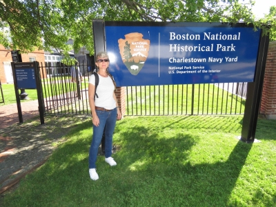 |
6/17/2016: Charlestown Navy Yard
Position: 42°22.46'N, -71°3.31'W
The Charlestown Navy Yard National Historic Park is a few minute's walk from our marina.
|
 |
6/17/2016: USS Constitution
Position: 42°22.41'N, -71°3.36'W
The USS Constitution, launched in 1797, is the oldest commissioned warship afloat in the world today. The ship never lost a battle at sea and earned the nickname "Old Ironsides" after British cannon shots bounced off her thick hull and an American sailor reportedly exclaimed that "her sizes are made of iron!". She currnetly is in dry dock for extensive renovations.
|
 |
6/17/2016: Support
Position: 42°22.39'N, -71°3.32'W
The row of pillars unpainted pillars below decks provide temporary support while the ship is out of the water. With all the boat's weight resting only on the keel and no water to provide additional pressure from the outside, the ship will tend to spread out and the decks close up on each other.
|
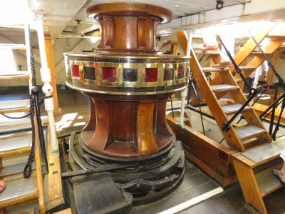 |
6/17/2016: Capstan
Position: 42°22.39'N, -71°3.32'W
A person-sized capstan for managing the rigging.
|
 |
6/17/2016: Spitfire
Position: 42°22.39'N, -71°3.32'W
Each of the cannon ports bore the name of the gun that was placed there. This one is called "Spitfire".
|
 |
6/17/2016: Captains
Position: 42°22.39'N, -71°3.32'W
The list of USS Constitution captains starts with Samuel Nicholson from 1797 to 1799.
|
 |
6/17/2016: Signing
Position: 42°22.42'N, -71°3.34'W
Jennifer signing one of the ship's copper hull plates in the USS Constitution Museum. Now we'll both have our signatures on active US Navy war ships.
|
 |
6/17/2016: Model
Position: 42°22.43'N, -71°3.31'W
The USS Constitution Museum had several excellent displays detailing the ship's history and life aboard, along with a number of impressive scale models.
|
 |
6/17/2016: Cannons
Position: 42°22.38'N, -71°3.37'W
Cannons from the USS Constitution lined on shore during the restoration. Spitfire must be in there somewhere.
|
 |
6/17/2016: Cassin Young
Position: 42°22.31'N, -71°3.25'W
World War II destroyer USS Cassin Young was closed for the day by the time we arrived.
|
 |
6/17/2016: Constitution Marina
Position: 42°22.22'N, -71°3.60'W
Looking across Constitution Marina at the mouth of the Charles River.
|
 |
6/18/2016: Traffic
Position: 42°22.52'N, -71°2.90'W
The Charlestown Marina gives us "ringside" viewing to the large ship traffic coming and going from the bulk petroleum storage facility along the Chelsea River.
|
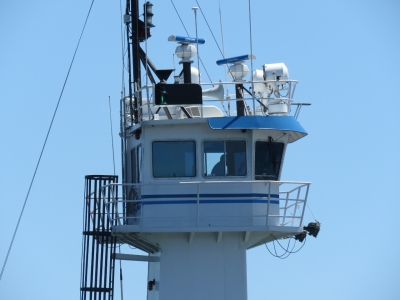 |
6/18/2016: Bridge
Position: 42°22.52'N, -71°2.90'W
The bridge of the articulating tug barge passing by outside the marina. It's way up there to see over the barge in front.
|
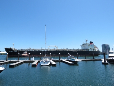 |
6/18/2016: Atlantic Star
Position: 42°22.52'N, -71°2.90'W
We thought the barge looked pretty big for the channel outside the marina until the 183x32m Atlantic Star came through. We've even seen two ships of this size pass here.
|
 |
6/18/2016: Navy Yard Bistro
Position: 42°22.51'N, -71°3.30'W
An exceptional meal along the pedestrian promenade at the Navy Yard Bistro, a short walk from Charlestown Marina. We'll definitely be back.
|
 |
6/19/2016: Spitfire
Position: 42°22.52'N, -71°2.90'W
It looks like Spitfire forget he had his tongue out.
|
 |
6/19/2016: Zincs
Position: 42°22.52'N, -71°2.90'W
We get incredible zinc life. As long as we're not around marinas they can last over two years, except for the pictured hydrualic cooling system zincs which need regular changing every two months.
|
 |
6/19/2016: Iver Progress
Position: 42°22.52'N, -71°2.90'W
The 184x27m tanker Iver Progress heading out to sea after passing in front of the marina.
|
 |
6/19/2016: Curse of the Dry Bilge
Position: 42°22.52'N, -71°2.90'W
The "problem" with a dry bilge is that very tiny leaks are super-noticeable. After enjoying a bone-dry bilge for about 12 hours, we noticed a very minor diesel leak that left a 6-inch residue trace in the forward bilge. We traced it to a tiny imperfection in the weld at the bottom of the supply tank where the fuel is seeping out through an air bubble. It's such a tiny hole that for years it was sealed off by paint but now is just barely allowing diesel to pass. We sanded off the paint around the area and viewed through a mirror you can see the air bubble in the weld where the stick points.
|
 |
6/19/2016: Raspberry Pi
Position: 42°22.52'N, -71°2.90'W
Our Raspberry Pi failed this afternoon. All those orange and red lights on the Maretron display at the left of the picture are due to the missing Pi. We use it to control 120V load shedding and active cooling, support the virtual watch commander, parallel the wing/gen start batteries into the house system, override the automation system and emergency alarm, and indicate the state of various equipment such as the bilge or waste pumps, generator auto-start, and the fire suppression system. We have a backup for the Pi, but replacing it is non-trivial. The wiring to the old one has to be transferred to the new. That alone is a big job, but the new one (a Pi 3 Model B) won't read the SD card from the old one (a Pi 2 Model B) so we had to re-install all the software from scratch. At that point, it's a big job. We finally finished about 11pm.
|
 |
6/19/2016: Tank repair
Position: 42°22.52'N, -71°2.90'W
We discovered a pin hole leak in a supply tank weld where an impurity or a bubble in the weld just allows a slight seep of diesel. The leak is so small that it's been sealed since new by just the coat of paint on the tank. We repaired it by cleaning the surface down to shiny aluminum, applying two thin coats of JB-Weld, sanding smooth and applying a thin layer of clear 5-min epoxy. Our bilge is back to 100% dry again.
|
 |
6/20/2016: KVH
Position: 42°22.52'N, -71°2.90'W
Our primary satellite system failed during the trip up to Boston. The KVH V7 support team diagnosed the problem as one of a bad cable, failed modem, or an LNB (linear noise block). To get the system operational quickly, they sent a modem and a LNB. The modem is, by far, the easiest to install so James put it in and the system immediately returned to operation. We average more than $100/day in communications costs when the primary system is down, so it's nice to have it back on line.
|
 |
6/20/2016: Polishing
Position: 42°22.52'N, -71°2.90'W
Jennifer polishing the stainless. It was looking a bit rough from the off shore run up here where saltwater spray had baked on in the hot sun.
|
 |
6/20/2016: Navy Yard Bistro
Position: 42°22.52'N, -71°3.29'W
Another excellent meal at the Navy Yard Bistro. We knew we'd be back.
|
 |
6/20/2016: Moon
Position: 42°22.52'N, -71°2.89'W
Full moon over East Boston.
|
 |
6/20/2016: Tools
Position: 42°22.52'N, -71°2.89'W
James checking out the new Milwaukee cordless drill, driver, and impact wrench set.
|
 |
6/21/2016: Pressure tester
Position: 42°22.52'N, -71°2.90'W
In the last engine room check, James noticed the generator coolant overflow bottle was nearly overflowing. He pulled off the coolant cap and found the coolant level was low. As a precaution, he pressure tested the cooling system and found it actually was leaking down, but there was no coolant outside the engine. Generally that is not good news so we kept digging. The generator coolant "leak" ended up being an unusual problem: the pressure tester was leaking at the pressure gauge. We fixed the leak in the pressure tester, re-tested and confirmed the generator is sealed up tight. The cause of the coolant not returning to the engine as it cools down was just a bad coolant cap or leaking overflow bottle tube. He replaced both and it's all back to working normally.
|
 |
6/21/2016: Radiator cap
Position: 42°22.52'N, -71°2.90'W
James using a Dremel to clean off some flaking paint on the generator radiator cap sealing surface.
|
 |
6/21/2016: Overflow hose
Position: 42°22.52'N, -71°2.90'W
While changing the coolant overflow hose on the generator, James also replaced the same hose on the main since it's showing some signs of heat and age damage.
|
 |
6/21/2016: Crowds
Position: 42°20.87'N, -71°5.87'W
Following the crowds into historic Fenway Park to take in a Boston Red Sox baseball game. Built in 1912, Fenway Park is the oldest park in Major League Baseball.
|
 |
6/21/2016: Landsdowne St
Position: 42°20.84'N, -71°5.90'W
Looking down Landsdown Street behind the outfield. The stadium actually extends over the road.
|
 |
6/21/2016: Green Monster
Position: 42°20.76'N, -71°5.83'W
The 37'2" "Green Monster" left field wall at Fenway Park. Designed to hide the field from external viewers and reduce easy home runs to left field, the wall was part of the original park construction and is the highest in Major League Baseball.
|
 |
6/21/2016: Scoreboard
Position: 42°20.75'N, -71°5.83'W
The scoreboard embedded in the wall still is updated by hand. Home game and American League scores are updated from behind the wall, and National League scores from the front of the wall. In the picture, the score keeper is returning back behind the wall through a door after updating the National league scores between innings.
|
 |
6/21/2016: Pitch
Position: 42°20.76'N, -71°5.83'W
In this pitch from Red Sox Clay Buchholz to White Sox catcher Dioner Navarro the ball is just barely visible as a white streak between the third-to-home base line and the left end of the visitor's dugout.
|
 |
6/21/2016: Strike
Position: 42°20.76'N, -71°5.83'W
White Sox designated hitter Avisail Garcia swings through a pitch.
|
 |
6/21/2016: 7th Inning Stretch
Position: 42°20.76'N, -71°5.83'W
After the first half of the seventh inning, the grounds keepers cleaned the field while the fans stretched to the tune of the traditional "7th inning stretch" song, "Take Me Out to the Ball Game"
|
 |
6/21/2016: Fenway
Position: 42°20.76'N, -71°5.83'W
The view from our seats. The Red Sox didn't win, but we had a super-fun evening.
|
 |
6/22/2016: PostNet
Position: 42°21.50'N, -71°3.26'W
At PostNet to return the failed satellite data modem and unused LNB to KVH and to mail another small package.
|
 |
6/22/2016: Architecture
Position: 42°21.47'N, -71°3.33'W
A mix of old and new building looking up at the corner of Kilby and Exchange streets.
|
 |
6/22/2016: Old State House
Position: 42°21.57'N, -71°3.41'W
The Old State House, built in 1713, housed the colony's government. A number of key events in the American Revolution occurred here, including the first public reading of the Declaration of Independence from the State House's balcony in 1776.
|
 |
6/22/2016: Charlie Card
Position: 42°21.55'N, -71°3.20'W
Picking up a Boston Transit "Charlie Card" to use on the transit system.
|
 |
6/22/2016: Granary Tavern
Position: 42°21.53'N, -71°3.15'W
Downtown Boston has a lot of excellent-looking pubs and restaurants.
|
 |
6/22/2016: Zodiac Heads
Position: 42°21.54'N, -71°3.11'W
The Circle of Animals/Zodiac Heads is the first public sculpture project by internationally acclaimed Chinese contemporary artist Ai Weiwei. The bronze animal heads represent the twelve signs of the Chinese zodiac and is here on the Rose Kennedy Greenway as part of a multi-year global tour.
|
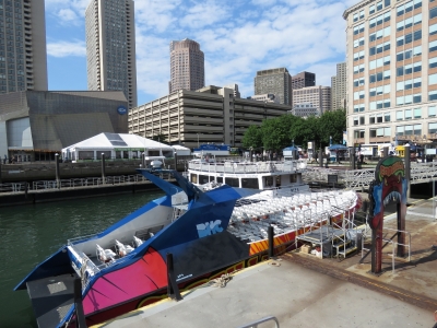 |
6/22/2016: Codzilla
Position: 42°21.60'N, -71°2.99'W
The high-speed tourist boat Codzilla, that we saw when first entering Boston Harbor, moored at the Boston Harbor Cruises dock.
|
 |
6/22/2016: Chart House
Position: 42°21.60'N, -71°2.99'W
Another appealing lunch possibility.
|
 |
6/22/2016: India Wharf
Position: 42°21.54'N, -71°2.99'W
Looking into Boston Harbor across India Wharf. The now-demolished original wharf, built in 1803, was once one of the largest commercial wharves in the port of Boston.
|
 |
6/22/2016: New England Aquarium
Position: 42°21.54'N, -71°2.89'W
On the ground floor at the New England Aquarium. The view is looking across the penguin exhibit to the 4-story, 200,000-gallon Giant Ocean Tank that anchors the aquarium. A wrap-around ramp leads up and around the tank to the exhibits on other floors, with viewing windows into the tank all along the walkway.
|
 |
6/22/2016: African Penguin
Position: 42°21.54'N, -71°2.89'W
An African Penguin at the New England Aquarium. Also called the Jackass Penguin due to their donkey-like braying sound, these are the same species of penguin at the Stoney Point Penguin Colony we visited in the wild in South Africa.
|
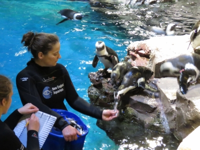 |
6/22/2016: Feeding
Position: 42°21.54'N, -71°2.89'W
We'd arrived during penguin feeding time at the zoo. The keepers carefully record what each penguin has eaten and ensure they all get some fish.
|
 |
6/22/2016: Little Blue Penguin
Position: 42°21.54'N, -71°2.89'W
Little Blue Penguins waiting for food. We saw a couple of these in Steward Island, New Zealand.
|
 |
6/22/2016: Southern Rockhopper
Position: 42°21.54'N, -71°2.89'W
The Southern Rockhopper penguin breeds on rugged, rocky islands located in the sub-Antarctic and south temperate regions of the Indian and South Atlantic Oceans. They look similar to the Fiordland Crested Penguin we saw in Fiordland.
|
 |
6/22/2016: Pacific Reef
Position: 42°21.54'N, -71°2.89'W
The Pacific Reef tank reminded us of the 600-gallon reef tank we kept at our old house in Seattle. We even had a giant clam in about the same location.
|
 |
6/22/2016: Giant Ocean Tank
Position: 42°21.54'N, -71°2.89'W
Looking through one of the viewing windows into the Giant Ocean Tank as we walked between levels. The tank is spectacular and packed with more than a thousand animals. They're all well-fed so the larger animals don't usually prey on the smaller ones.
|
 |
6/22/2016: Myrtle
Position: 42°21.54'N, -71°2.89'W
The star of the Giant Ocean Tank is Myrtle, a giant green sea turtle that weighs over 500 pounds and is estimated to be 80 years old.
|
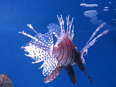 |
6/22/2016: Lionfish
Position: 42°21.54'N, -71°2.89'W
A spectacular, but venomous Lionfish.
|
 |
6/22/2016: Mangrove
Position: 42°21.54'N, -71°2.89'W
The mangrove exhibit looked much like the mangrove forests we saw in Australia.
|
 |
6/22/2016: Octopus
Position: 42°21.54'N, -71°2.89'W
This tiny red octopus was one of three in a tank. Strung from the tanks were small glass vessels for the octopus to tuck into.
|
 |
6/22/2016: Anaconda
Position: 42°21.54'N, -71°2.89'W
Anacondas are the largest snakes in the world, growing to 30 feet long and weighing more than 500 pounds. They can eat mammals that weigh up to about 150 pounds. They wrap around their prey and squeeze, tightening each time the animal exhales until it can't take another breath, then they swallow it whole.
|
 |
6/22/2016: Wineglass Bay
Position: 42°21.54'N, -71°2.89'W
This placard describing Australia's temperate reefs featured beautiful and rugged Wineglass Bay, our first Tasmanian anchorage.
|
 |
6/22/2016: Top
Position: 42°21.54'N, -71°2.89'W
Looking across the top of the Giant Ocean Tank where you can look down into the reef.
|
 |
6/22/2016: Harbor View Cafe
Position: 42°21.55'N, -71°2.92'W
A quick snack at the aquarium's Harbor View Cafe overlooking India Wharf.
|
 |
6/22/2016: Behind the Scenes
Position: 42°21.55'N, -71°2.97'W
Lorna, our guide on a Behind the Scenes tour of the aquarium, describing how the jelly fish are bred.
|
 |
6/22/2016: Tanks
Position: 42°21.55'N, -71°2.96'W
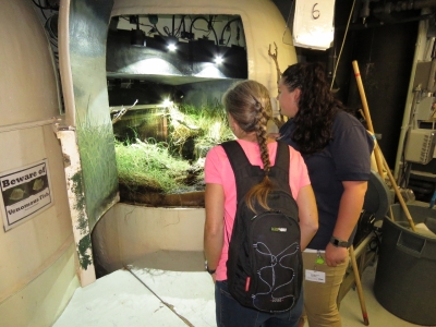
The aquarium galleries are built with service floors a half level above the viewing galleries so that the tops of the tanks are accessible roughly at waist level. On the right is one of the exhibit tanks and on the left are breeding, research or holding tanks.
|
 |
6/22/2016: Exhibit
Position: 42°21.55'N, -71°2.96'W
Each time Lorna opened one of the doors, we briefly became part of the exhibit for those looking into the tank from the other side.
|
 |
6/22/2016: Looking down
Position: 42°21.56'N, -71°2.94'W
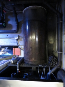
One of the few open tanks we saw from behind. Many exhibits have to be carefully closed and sometimes sealed so their occupants don't escape. Octopus are particularly adept escape-artists and can fit through anything the size of their beak or larger.
|
 |
6/22/2016: Skimmer
Position: 42°21.56'N, -71°2.94'W
We had a big protein skimmer (a type of water filtration) on our reef tank in Seattle, but this is even larger.
|
 |
6/22/2016: Equipment
Position: 42°21.55'N, -71°2.94'W
An incredible assortment of equipment is behind the aquarium galleries.
|
 |
6/22/2016: Legal Seafood
Position: 42°21.55'N, -71°3.05'W
An excellent lunch at Legal Seafood opposite the aquarium.
|
 |
6/22/2016: IMAX
Position: 42°21.54'N, -71°3.04'W
After lunch, we took in a couple of IMAX films: Secret Ocean and Galapagos. We'd sure love to visit the Galapagos one day--the animal life is just incredible.
|
 |
6/22/2016: Cider
Position: 42°21.55'N, -71°3.02'W
Having a cider at a temporary bar along the harbor walk beside the aquarium before going back in to see the rest of the exhibits. Fish viewing is thirsty business.
|
 |
6/22/2016: Olympic Coast
Position: 42°21.55'N, -71°2.99'W
This temperate Olympic Coast exhibit contained many anemones and creatures that we used to see while diving around the Seattle area.
|
 |
6/22/2016: Pacific Sea Nettles
Position: 42°21.56'N, -71°2.98'W
The maroon tentacles of the striking Pacific Sea Nettle can grow to 15ft long.
|
 |
6/22/2016: Japanese Sea Nettle
Position: 42°21.56'N, -71°2.98'W
Delicate-looking Japanese Sea Nettles.
|
 |
6/22/2016: South American Sea Nettle
Position: 42°21.57'N, -71°2.98'W
Beautiful South American Sea Nettles. The New England aquarium has a wide assortment of jelly fish on exhibit.
|
 |
6/22/2016: Flat Earth
Position: 42°21.64'N, -71°2.86'W
Nordhavn 50 Flat Earth on a mooring off downtown Boston.
|
 |
6/22/2016: Jupiter
Position: 42°21.63'N, -71°2.88'W
Nordhavn 60 Jupiter at the Boston Waterboat Marina.
|
 |
6/22/2016: Chopin
Position: 42°21.63'N, -71°2.88'W
The Nordhavn 60 we saw while coming into Boston. We couldn't read the name before—its Chopin.
|
 |
6/22/2016: Joe's
Position: 42°21.70'N, -71°3.05'W
We saw several good potential spots for lunch or dinner as we walked along the harborfront back to Dirona.
|
 |
6/22/2016: Battery Wharf
Position: 42°22.01'N, -71°3.11'W
Battery Wharf was named for the gun battery there in the 1640s. Now it's home to a luxury hotel and residential development.
|
 |
6/22/2016: Coast Guard
Position: 42°22.03'N, -71°3.15'W
The US Coast Guard Base Boston includes the site of Edmund Hartt’s Boston shipyard where the USS Constitution was built between 1795 and 1797.
|
 |
6/22/2016: Charles River
Position: 42°22.13'N, -71°3.58'W
The view looking northeast from the Charlestown Bridge down the Charlestown River. Constitution Marina in on the left.
|
 |
6/22/2016: Visitor Center
Position: 42°22.39'N, -71°3.41'W
The Charlestown Navy Yard Visitor Center was closed for the day when we first visited, so we stopped in on our way back to Dirona.
|
 |
6/23/2016: Printer
Position: 42°22.52'N, -71°2.90'W
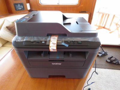
A printer with scanning capability has turned out to be a critical piece of equipment on our journey. We're often needed to print out, sign and return via email forms and documents for country entry and exit formalities and a variety of other reasons. Our printer's scanner was malfunctioning, and its replacement arrived today.
|
 |
6/23/2016: Christian and Annjea
Position: 42°22.52'N, -71°2.90'W
We had a great visit with Boston residents Annjea and Christian Cormier. We had lots of questions for Annjea, who is a Chemical Response Officer with the US Coast Guard.
|
 |
6/24/2016: Bungee
Position: 42°22.52'N, -71°2.90'W
Our chain stopper, when flipped down, hooks between the chain links to prevent it from deploying. We need to hold the stopper up to let out chain, and we lost the bungee we were using. We couldn't find a similar replacement with stainless steel hooks so made a new one from bulk bungee parts.
|
 |
6/24/2016: Aquarius Leader
Position: 42°22.52'N, -71°2.90'W
The 193x32m Aquarius Leader dominates the waterway as it passes by Charlestown Marina.
|
 |
6/24/2016: Warren Tavern
Position: 42°22.46'N, -71°3.78'W
Warren Tavern in Charlestown, established in 1780, is the oldest tavern in Massachusetts. Notable patrons included national heroes Paul Revere, George Washington and Benjamin Franklin.
|
 |
6/24/2016: Figs
Position: 42°22.41'N, -71°3.74'W
Long Trail Limbo IPA in a window seat at Todd English's Figs in Charlestown.
|
 |
6/24/2016: Red Sox Pizza
Position: 42°22.40'N, -71°3.74'W
An exceptional "Red Sox" Pizza at Figs.
|
 |
6/25/2016: Aerial Tour
Position: 42°42.21'N, -71°10.43'W
Our friend Frank Eigler happened to be in town on vacation with his family in their Piper Aztec airplane. It was great to see Frank, it was fun to see his airplane, and we even got a chance to do an aerial tour of Boston. We started in Lawrence, MA, then flew east to follow the coast south to Boston and along the Charles River and over Charlestown Marina before returning back to Lawrence. James even tried his hand at the stick for a bit. A video of some of the more interesting parts of the trip over Boston Harbor and Logan airport, including our take-off and landing, is at https://youtu.be/egmEyvUvcqk.
|
 |
6/25/2016: BBQ
Position: 42°22.54'N, -71°2.99'W
At the Charlestown Marina opening of the season barbecue.
|
 |
6/25/2016: Frank and Juimiin
Position: 42°22.52'N, -71°2.90'W
Frank Eigler, Juimiin Hong and their two boys came over to visit later in the afternoon. We used to work with Frank at the IBM Toronto Software Lab in the 1990s and haven't seen him and Juimiin since they visited us in Seattle in 2002. And we'd never met their boys. It was great to catch up after all those years.
|
 |
6/26/2016: Lock replacement
Position: 42°22.52'N, -71°2.90'W
We added keyed hasp locks to the three dinghy storage areas. These low-cost locks are chromed steel rather than stainless, so only survive a year or two. But, even with the frequency of replacement, so far they are the most cost-effective we've found.
|
 |
6/26/2016: Spare battery
Position: 42°22.52'N, -71°2.90'W
We often travel great distances in the tender and sometimes there's no-one for many miles around us. So we choose to carry a spare battery in case there's a failure of the primary, someone accidentally leaves the lights on, or the bilge pump runs indefinitely. The spare just clips on with alligator clips. The old clips had rusted out, so we replaced them.
|
 |
6/26/2016: Hole saw
Position: 42°22.52'N, -71°2.90'W
When the dinghy is not in use, we disconnect the power to prevent the battery from draining down. The tender should be able to be left nearly-indefinately, without battery leakdown, but there is risk that some electrical device will be left on or the system will have a small voltage leak. And if either happens, the battery can be depleted. We've forgotten to disconnect the power a few times, so we decided to install an LED voltage display to make it obvious when the dinghy still is powered.
|
 |
6/26/2016: Voltage display
Position: 42°22.52'N, -71°2.90'W
The LED voltage display has two values. One is that it shows current voltage levels so it's easy to spot issues early and the other is that it's bright and can be seen from a long distance away so we can easily to spot whne the power has been left on.
|
 |
6/26/2016: Dirona
Position: 42°22.51'N, -71°2.90'W
Looking back to our berth at the start of a dinghy trip around the harbor.
|
 |
6/26/2016: Mystic Marine Fuel
Position: 42°22.81'N, -71°3.00'W
Boats constantly were arriving and departing the Mystic Marine Fuel dock on this Sunday afternoon.
|
 |
6/26/2016: Mystic Generating Station
Position: 42°23.30'N, -71°3.89'W
The Mystic Generating Station can produce 2,002 megawatts, the highest full-load output of any in the state. The station mostly runs on natural gas, but can also run on petroleum.
|
 |
6/26/2016: DeLauri Pump Station
Position: 42°23.44'N, -71°4.34'W
The 365-ft 1.5-megawatt turbine at the Massachusetts Water Resources Authority (MWRA) DeLauri Pump station.
|
 |
6/26/2016: Amelia Earhart Dam
Position: 42°23.64'N, -71°4.52'W
The locks at the Amelia Earhart Dam on the Mystic River. The dam and locks were built in 1966 and the dam named for the famous aviator, Amelia Earhart, who moved to Boston in her late 20s.
|
 |
6/26/2016: Malden Bridge
Position: 42°23.39'N, -71°4.35'W
The Malden Bridge between Sommerville and Everett opening to allow a SeaTow vessel and tow to pass through. The first bridge here, built in 1917, was a Strauss Overhead counterweight trunnion bascule bridge that was replaced in 1963 with the current parallel double leaf bascule bridge.
|
 |
6/26/2016: Admiral's Hill Marina
Position: 42°23.53'N, -71°3.02'W
Admiral's Hill Marina at the head of Island End River. The approach and dockside depth is only 6ft—too shallow for Dirona's 6'7" draft.
|
 |
6/26/2016: Chelsea Yacht Club
Position: 42°23.12'N, -71°2.76'W
The Chelsea Yacht Club, underneath the Tobin Memorial Bridge, was organized in 1886.
|
 |
6/26/2016: Pearl Street Bridge
Position: 42°23.08'N, -71°2.56'W
The Pearl Street Bridge over the Charles River. Boston has an abundance of bridges and tunnels.
|
 |
6/26/2016: Sunoco Logistics
Position: 42°23.06'N, -71°1.67'W
The Sunoco Logistics Terminal in Chelsea is one of several bulk petroleum storage facilities along the Chelsea River and supplies jet fuel to nearby Logan International Airport.
|
 |
6/26/2016: Chelsea Street Bridge
Position: 42°23.16'N, -71°1.40'W
The Chelsea Street Bridge was completed in 2012 at a cost of $125M, replacing the old bascule bridge.
|
 |
6/26/2016: East Boston Steam Pump Station
Position: 42°23.26'N, -71°1.25'W
The historic East Boston Steam Pump Station, built in 1894, was one of three Boston Metropolitan Sewerage System pumping stations built at the time. The Massachusetts Water Resources Authority facility turned the property over to the Division of Capital Asset Management in 2002.
|
 |
6/26/2016: Great Eastern
Position: 42°23.81'N, -71°0.85'W
We saw the 600x91ft Great Eastern pass by the marina earlier today. It must have been a tight fit through the Pearl Street Bridge, with less than half a boat's width on either side.
|
 |
6/26/2016: Freedom
Position: 42°21.75'N, -71°2.82'W
The 229ft superyacht Freedom moored at the Boston Yacht Haven. We assumed that the ship was here for the Fourth of July celebrations, but it was gone a day or so later.
|
 |
6/26/2016: Aspen Alternative
Position: 42°21.66'N, -71°2.84'W
The 165ft superyacht Aspen Alternative is available for charter for a mere $185,000 per week, plus expenses.
|
 |
6/26/2016: Long Wharf
Position: 42°21.61'N, -71°2.82'W
Historic Long Wharf on the right, with downtown Boston in the background.
|
 |
6/26/2016: Coast Guard
Position: 42°22.22'N, -71°3.10'W
US Coast Guard Base Boston.
|
 |
6/26/2016: Boston Garden
Position: 42°22.10'N, -71°3.60'W
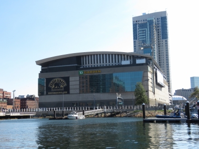
The TD Garden, nicknamed the Boston Garden, home of the Boston Bruins NHL team and the Boston Celtics NBA team. The arena was completed in 1995, replacing the original Boston Garden that first opened in 1928. We were hoping we might catch a game there, but the Bruins season was over by the time we arrived and the Celtics haven't started playing yet.
|
 |
6/26/2016: Converse
Position: 42°22.10'N, -71°3.60'W
The Converse Factory Store near the Boston Garden. You can design your own shoes there, but it takes about four weeks to get them.
|
 |
6/26/2016: Police
Position: 42°22.10'N, -71°3.60'W
The Massachusetts State Police has a huge marine station under the Charlestown Bridge.
|
 |
6/26/2016: Gridley Dam
Position: 42°22.11'N, -71°3.60'W
The Gridley Dam on the Charles River was named after General Washington's first army engineer Col. Richard Gridley. The dam controls the surface level of the Charles River basin and upstream tributaries. It looked a little crazy in there, with the boats fending off each other and the walls.
|
 |
6/26/2016: Duck
Position: 42°22.24'N, -71°3.40'W
"Duck" rides are very popular in Boston. Ducks are amphibious road and sea-going vehicles, originally designed for troop and supply delivery in World War II. They now are part of tour fleets used in many cities throughout the world. We see them everywhere, often passing alongside our marina. The nearly 80-year-old technology is getting more expensive to maintain and could be improved upon from a usability and servicability perspective. Picture is a modern version of the original World War II vehicle. Boston also has a fleet of real Ducks used in the tourist trade.
|
 |
6/27/2016: Manometer
Position: 42°22.52'N, -71°2.90'W
Our main engine now has more than 8,000 hours, so increased oil leaks are more or less expected. But up until recently it has leaked almost nothing and the change to leaking more happened quite quickly, so decided to dig deeper. Oil seepage can be caused by loosening bolts, tired/old gaskets and seals, and excess crankcase pressure. The Deere specification indicates that crankcase pressures of up to 2 inches of water column are acceptable. The challenge in measuring the pressure is that the engine doesn't have a dipstick tube and instead uses a combined oil fill cap and dipstick tube, so it's not immediately obvious how to adapt the 1/4" hose from a manometer to seal onto the engine in order to read the crankcase pressure. We ended up using a short section of silicone hose that seals inside the oil fill port and a wood through hull plug in the end with the adapter for the manometer threaded into the hose. It wasn't beautiful but it seals fine and that's all that matters. We got an interesting result. There was a fairly constant 2.3 to 2.4 inches of water pressure at all engine speeds. This is above the Deere spec, so something isn't right.
|
 |
6/27/2016: Filter
Position: 42°22.52'N, -71°2.90'W
We measured the engine crankcase pressure and found that it was over the Deere specifications of no more than 2" of water under load. There are three explanations why a crankcase might have excess pressure: 1) the exhaust gas recirculation system is blocked or not operating correctly (allowing pressure to build), 2) leaking turbocharger oil seals (leaking compressed air into the turbo lubricating oil drain back), or 3) excess leakage past the engine piston rings (essentially a worn out engine). The first option is the cheapest and easiest to address, so we tried it first. We changed the Racor Airsep filter (oil/vapor separator) and checked for any other possible blockages in the exhaust gas recirculation system. Great news. The crankcase pressure went back to a nice low number indicating the engine continues to be in excellent condition. We measured 0.15" at idle, 0.00" at 1,500, and -0.20" at 2,000 RPM. The oil seepage is now addressed and the engine is clearly in good condition with good turbo seals and piston rings that aren't even starting to show wear. It's a great engine.
|
 |
6/27/2016: Ferry
Position: 42°22.35'N, -71°3.18'W
Purchasing ferry tickets ($3.25 each, one way) for a quick trip across the harbor from the Charlestown Navy Yard to Long Wharf.
|
 |
6/27/2016: Rookie
Position: 42°22.35'N, -71°3.18'W
Our ride, the Boston Harbor Cruises' ferry Rookie.
|
 |
6/27/2016: Bollard
Position: 42°22.34'N, -71°3.16'W
The ferries dock by using one spring line and powering against it. In this case the bollard had been completely torn off the dock. Ocasionally the ferry operators might be a bit aggressive, but this looks like weak construction.
|
 |
6/27/2016: Long Wharf
Position: 42°21.56'N, -71°3.00'W
Arriving into Long Wharf in downtown Boston. The area is busy, with tour boats and ferries constantly coming and going. The Charlestown Navy Yard ferries dock at the very end of Long Wharf, sideways to all the rest of the boats. It takes good timing and a light touch to get in there between the large whale-watching boats and the high-speed Codzilla. The video at https://youtu.be/L_l5-TRYtNI shows the ferry captains skillfully getting the boats in and out of tight quarters.
|
 |
6/27/2016: Bostonia Public House
Position: 42°21.54'N, -71°3.29'W
An excellent meal on the patio at Bostonia Public House. Their salt-and-pepper wings are exceptional.
|
 |
6/27/2016: Renovation
Position: 42°21.53'N, -71°3.30'W
Boston has done an excellent job of maintaining it's historical feel. Its common to see building fronts like this save while a more modern structure is put in behind.
|
 |
6/27/2016: Rowe's Wharf
Position: 42°21.39'N, -71°3.05'W
Looking through the archway of the Boston Harbor Hotel toward Rowe's Wharf.
|
 |
6/27/2016: Tea Party Museum
Position: 42°21.12'N, -71°3.08'W
The Tea Party Museum provides a 1.5hr guided tour that re-enacts many of the events leading up to the Boston Revolution. We were tight for time and it looked kind of commercial, so we decided to do the self-guided version.
|
 |
6/27/2016: Downtown
Position: 42°21.13'N, -71°3.00'W
Looking north across Fort Point Channel to downtown Boston.
|
 |
6/27/2016: Barking Crab
Position: 42°21.25'N, -71°2.90'W
The colorful and popular Barking Crab restaurant overlooks Fort Point Channel.
|
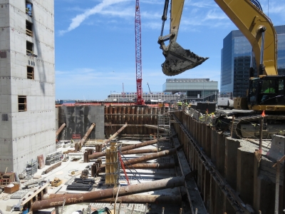 |
6/27/2016: Construction
Position: 42°21.25'N, -71°2.71'W
The Seaport area across Fort Point Channel from downtown Boston seemed almost entirely under construction. We've never seen so many new buildings going up in one small area.
|
 |
6/27/2016: Fan Pier
Position: 42°21.20'N, -71°2.66'W
Looking southwest across Fan Pier Marina to to the dramatic Institute of Contemporary Art building.
|
 |
6/27/2016: Suffolk Dental
Position: 42°21.34'N, -71°3.48'W
Not high on most tourists' list when visiting Boston, but high on ours, has been to get a few medical appointments taken care of while we are here. We were really impressed with Dr. Hsu at Suffolk Dental for excellent quality of service and attention to detail.
|
 |
6/27/2016: Downtown Crossing
Position: 42°21.36'N, -71°3.71'W
The Downtown Crossing shopping district near Suffolk Dental is packed with shops, restaurants, street vendors, and people.
|
 |
6/27/2016: Boston South Station
Position: 42°21.15'N, -71°3.32'W
Trains at busy Boston South Station run all over the country. Several were departing for Washington DC while we were there.
|
 |
6/27/2016: Federal Reserve
Position: 42°21.11'N, -71°3.17'W
This parking lot exit caught our attention. The barrier drops when a car approaches, then comes back up in place once it has passed through, preventing a vehicle from rushing the building from the street. We wondered what would require so much security and so walked around front to find it was the Federal Reserve Bank of Boston.
|
 |
6/27/2016: Chart House
Position: 42°21.61'N, -71°2.98'W
Dinner on the patio at the Chart House restaurant on Long Wharf.
|
 |
6/27/2016: Ride home
Position: 42°21.56'N, -71°3.00'W
Rookie, our ride home, arriving into Long Wharf.
|
 |
6/27/2016: Spitfire
Position: 42°22.52'N, -71°2.90'W
In addition to investigating any open locker, Spitfire also loves to explore cardboard boxes.
|
 |
6/28/2016: Boston Creme
Position: 42°22.52'N, -71°2.90'W
Boston Creme donuts for breakfast from Boston-based Dunkin' Donuts.
|
 |
6/28/2016: Zipcar
Position: 42°22.31'N, -71°3.59'W
We used Zipcar quite a bit in Seattle, but haven't found any convenient locations anywhere else. Charlestown, however, has several nearby Zipcar lots. Jennifer took one out for a routine doctors appointment this morning at the Newton-Wellesley Hospital, about a half-hour drive from the marina.
|
 |
6/28/2016: Pump-out
Position: 42°22.52'N, -71°2.90'W
While Jennifer was out, James got our blackwater tanks pumped out, a complementary service at Charlestown Marina.
|
 |
6/28/2016: Xray
Position: 42°18.99'N, -71°14.66'W
High on Jennifer's "Top Ten Things to do in Boston" list is getting that clavicle pin removed. Unfortunately the bone hasn't yet healed well enough. The pin is slightly annoying and we have been in a rush to have it behind us, but it's healing slower than expected so it'll be a while yet. In the end, having full control of the hand and arm back is the key point and the pin is inconvenient but not really a blocker for anything we plan.
|
 |
6/28/2016: Jupiter
Position: 42°21.61'N, -71°2.98'W
An excellent evening over dinner at the Chart House with Eric and Meg Roach, after a tour of their unusually well thought-out Nordhavn 60 Jupiter.
|
 |
6/29/2016: Pumping Station
Position: 42°20.94'N, -70°57.51'W
The historic Steam Pumping Station at the Deer Island Treatment Plant where we will start our tour of the facility. Prior to the construction of the treatment plant, Deer Island housed one of several sewage pumping stations that since the 1800s simply pumped raw sewage the sea, giving Boston Harbor a reputation as one of the dirtiest in the country.
|
 |
6/29/2016: Relief map
Position: 42°20.94'N, -70°57.50'W
This 1:14,000 relief map inside the pumping station shows Boston in astonishing detail, down to every tree, and was created for the 1900 Paris Exposition. At the time, Deer Island (labelled in the center of the map) still was an island. A 1938 hurricane filled in the land between Winthrop and the island.
|
 |
6/29/2016: Pump
Position: 42°20.94'N, -70°57.50'W
One of the old multi-stage steam pumps used to pump raw sewage to sea before the treatment plant came online.
|
 |
6/29/2016: Tour
Position: 42°20.94'N, -70°57.50'W
Today the Deer Island Treatment Plant is the second largest sewage treatment plant in the country, treating 350 million gallons per day with a peak capacity of 1,310 million gallons per day. The $3.8B plant is the centerpiece in the successful Boston Harbour cleanup effort. The tour of the plant started with an overview of the treatment process and a history of the island. Our guide is a plant engineer who is incredibly knowledgeable and enthusiastic about all aspects of operation.
|
 |
6/29/2016: Wind Turbine
Position: 42°20.91'N, -70°57.47'W
These two 600kW wind turbines are 190 ft tall and generate over 2M kWh per year. Deer Island currently generates 20% of its electricity, with on-site renewable energy supplying over half of the the plant's energy usage. As large as these turbines are, in the wind turbine world they're actually fairly small. The allowable turbine height is limited due to the nearness of nearby Logan Airport.
|
 |
6/29/2016: Primary clarifiers
Position: 42°20.90'N, -70°57.46'W
Outside one of the 48 primary clarifiers. Each clarifier is 186 feet long by 41 feet wide by 24 feet deep. Raw sewage first flows through grit chambers that remove grit for disposal in an off-island landfill and then into the primary treatment clarifiers where gravity separates sludge and scum from the wastewater. This step removes about half of the pollutants brought to the plant in typical wastewater.
|
 |
6/29/2016: Digesters
Position: 42°20.91'N, -70°57.47'W
The egg-shaped digesters at Deer Island are distinctive landmarks on entering Boston Harbor. We sure noticed them on our way into the harbor. Sludge separated from wastewater in primary and secondary treatment is pumped into the digesters, where the fluid is maintained at 98°F. Microorganisms naturally present in the sludge break it down into methane gas, carbon dioxide, solid organic byproducts, and water. The methane gas by-product is used to fuel a steam boiler that produces heat and electricity for the plant. The remaining sludge, which is 94% water, is piped off site, dewatered and turned into fertilizer pellets.
|
 |
6/29/2016: Towers
Position: 42°20.88'N, -70°57.41'W
Two of several air scrubbers around the facility, used to remove odors and volatile organic compounds from treatment process off-gases. For a sewage treatment plant, the place was surprisingly clean-smelling.
|
 |
6/29/2016: Under the Digesters
Position: 42°20.87'N, -70°57.37'W
Much of the facility is underground. We'd just walked through airport terminal-sized hallways with huge pipes running throughout and stood beneath one of the massive digesters, then exited between the digesters. (Photographs aren't allowed inside the facility, so we only have pictures from the outside.) The egg shape is more expensive to build, but helps prevent concentrated build-up at the top and bottom of the digesters.
|
 |
6/29/2016: Gravity thickeners
Position: 42°20.88'N, -70°57.26'W
Sludge and scum from primary treatment are thickened in gravity thickeners prior to transfer to the egg-shaped digesters.
|
 |
6/29/2016: Tower
Position: 42°20.95'N, -70°57.27'W
Another air scrubbing tower near the eastern end of the plant. Many of the plants buildings are new, but look historic as part of a requirement to blend in with the historic pumping station.
|
 |
6/29/2016: Cryogenic Plant
Position: 42°20.99'N, -70°57.26'W
Over one hundred tons of pure oxygen are manufactured each day at Deer Island's cryogenic plant to support the biological treatment process.
|
 |
6/29/2016: Disinfection Basin
Position: 42°21.15'N, -70°57.39'W
We walked over the secondary reactors, one of the few places where an odor was apparent, and over to one of two 4-million gallon 500-ft long disinfection basins at the northeast corner of the plant. Here wastewater is disinfected with sodium hypochlorite to kill bacteria. Sodium bisulfite is then added to dechlorinate the water, at which point the effluent is ready to be discharged.
|
 |
6/29/2016: Diffuser
Position: 42°21.15'N, -70°57.38'W
A 9.5-mile 24-foot-diameter outfall tunnel transports effluent from the disinfection basins into 100-foot deep waters of Massachusetts Bay where it is discharged through more than 50 individual diffusers such as the one pictured. Each diffuser has eight small ports, so that rapid and thorough mixing into surrounding water is achieved.
|
 |
6/29/2016: Lunch
Position: 42°21.29'N, -70°58.10'W
Lunch overlooking Boston Harbor and Logan Airport following our tour.
|
 |
6/29/2016: Winthrop
Position: 42°22.00'N, -70°58.34'W
We made a brief stop at the harbor in Winthrop on our way home for a good view of the landing path into Boston's Logan Airport.
|
 |
6/29/2016: JetBlue
Position: 42°22.00'N, -70°58.34'W
A JetBlue fight landing at Logan Airport.
|
 |
6/29/2016: Warren Tavern
Position: 42°22.45'N, -71°3.79'W
We'd taken a Zipcar to Deer Island and the drop-off point was close to historic Warren Tavern so we stopped in for a drink on the way home.
|
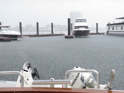 |
6/29/2016: Rain
Position: 42°22.52'N, -71°2.90'W
We got home in time to avoid a soaking in a major downpour.
|
 |
6/30/2016: Boston Yacht Haven
Position: 42°21.70'N, -71°2.93'W
Our tender moored at a temporary slip in the Boston Yacht Haven for a few hours while we spend some time downtown.
|
 |
6/30/2016: Bostonia Public House
Position: 42°21.53'N, -71°3.28'W
We stopped in for another order of the delicious salt-and-pepper wings at the Bostonia Public House.
|
 |
6/30/2016: Quincy Market
Position: 42°21.60'N, -71°3.25'W
Quincy Market, built in 1824-1826, is a National Historic Landmark that one of the largest market complexes built in the US in the early 1900s. The market was largely used as a produce and foodstuff shopping center, and now mostly contains fast-food stalls and restaurants.
|
 |
6/30/2016: Juggler
Position: 42°21.60'N, -71°3.25'W
The area around Quincy Market is a popular venue for street performers. This juggler was doing an impressive job of juggling five balls.
|
 |
6/30/2016: Cheers
Position: 42°21.59'N, -71°3.33'W
The Cheers restaurant west of downtown Boston inspired the Hollywood television show of the same name. Completing the loop, the Quincy Market Cheers location later was built to replicate the Hollywood set.
|
 |
6/30/2016: Faneuil Hall
Position: 42°21.63'N, -71°3.40'W
Faneuil Hall has been a marketplace and meeting hall since it's construction in the 1740s. Samuel Adams and several others spoke here advocating independence from Great Britain. The hall now is part of Boston National Historic Park and houses the park's main visitor center.
|
 |
6/30/2016: Public Market
Position: 42°21.70'N, -71°3.45'W
Northwest of Quincy Market, the upscale Boston Public Market has locally sourced groceries and specialty agricultural products.
|
 |
6/30/2016: Bell in Hand
Position: 42°21.68'N, -71°3.42'W
The Bell in Hand Tavern bills itself as America's oldest tavern with a first pour in 1795.
|
 |
6/30/2016: Union Oyster House
Position: 42°21.68'N, -71°3.42'W
The Union Oyster House is the oldest restaurant in the country that has been continuously running since it opened in 1826. Famous patrons include the Kennedy clan and American statesman Daniel Webster.
|
 |
7/1/2016: BW GDF Suez Boston
Position: 42°22.52'N, -71°2.90'W
The 908ft x 142ft BW GDF Suez Boston towering over the Charlestown Marina as it exits Boston Harbor. This video, shot from the bridge of the ship, shows the ship entering the harbor on an earlier trip: at https://www.youtube.com/watch?v=Dq3pUUQSQ4c. Rather than passing staight under the Tobin MemorialBridge, the ship turns before the bridge then backs under the bridge and onto the Distrigas terminal adjacent to the Mystic Power Generationg Station.
|
 |
7/1/2016: Downtown
Position: 42°21.91'N, -71°2.82'W
Approaching downtown Boston on the ferry from Charlestown Navy Yard to Long Wharf.
|
 |
7/1/2016: Mesa Verde
Position: 42°21.59'N, -71°2.70'W
The amphibious warfare ship USS Mesa Verde arriving with a fireboat escort for the 35th annual Boston Harborfest, a four-day celebration of the city's history and harbor. The 684-ft ship is designed to deliver a fully equipped battalion of up to 800 Marines.
|
 |
7/1/2016: Sanctuary
Position: 42°21.56'N, -71°3.01'W
We took the ferry over the Long Wharf and will soon be getting onto the whale-watching boat Sanctuary, one of several in the fleet of whale-watching boats that are a joint venture with Boston Harbor Cruises and the New England Aquarium. We'll be heading to Stellwagen Bank, an 842-square-mile federally protected marine sanctuary about 25 miles east of Boston (about a one-hour run in the nearly 35-knot catamaran). Stellwagen Bank is a 19-mile plateau about 100 feet below the surface, compared to the surrounding waters that are 300 to 600 feet deep. The steep sides of the plateau cause deep-water currents to rise up, carrying nutrients to the surface that feed the local ecosystem.
|
 |
7/1/2016: Harbor Seals
Position: 42°21.57'N, -71°3.00'W
While waiting for our whale-watching trip to board, we watched the Atlantic Harbor Seals swimming in the 42,000-gallon tank outside the New England Aquarium.
|
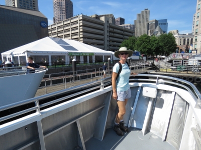 |
7/1/2016: Bow
Position: 42°21.57'N, -71°3.01'W
We boarded last to board, but still snagged the prime viewing spot on the bow. There's no seats at this location, but the view of the whales is unbeatable.
|
 |
7/1/2016: Harborfest
Position: 42°21.58'N, -71°2.87'W
Musicians doing a sound-check for the Harborfest music concert on Long Wharf.
|
 |
7/1/2016: World Trade Center
Position: 42°21.24'N, -71°2.04'W
Boston's World Trade Center, decorated with the flags of all the countries that the city trades with.
|
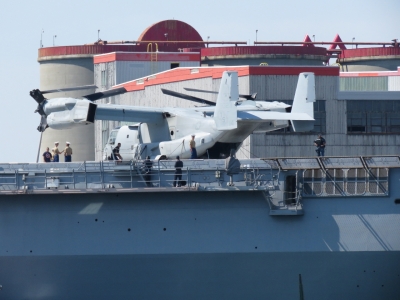 |
7/1/2016: V-22 Osprey
Position: 42°21.00'N, -71°1.37'W
A Bell Boeing V-22 Osprey tilt rotor aircraft on the deck of the amphibious warfare ship USS Mesa Verde.
|
 |
7/1/2016: Humpbacks
Position: 42°13.89'N, -70°14.76'W
We spent more than an hour beside two groups of whales, one of which included a baby. The whales were magnificent--we could have stayed for hours. The video https://youtu.be/hyliaIWbwyc shows our trip out to the Stellwagen Bank and highlights from the sightings.
|
 |
7/1/2016: Granary Tavern
Position: 42°21.52'N, -71°3.12'W
Delicious fish tacos for lunch street-side at the Granary Tavern.
|
 |
7/1/2016: Lisa and Greg
Position: 42°22.52'N, -71°2.90'W
Boston-based airline employees Lisa and Greg Moore stopped by for a visit. They also have a home and boat in Seattle, where they cruise much of the territory we did in the Pacific Northwest. We had a fun evening discussing boating and flying, first on Dirona and later over dinner at the Navy Yard Bistro.
|
 |
7/2/2016: Welcome Center
Position: 42°21.61'N, -71°3.15'W
At the Boston Harbor Islands Welcome Center to check-in for our trip to Boston Light on Little Brewster Island.
|
 |
7/2/2016: Columbia Point
Position: 42°21.53'N, -71°2.91'W
Our ride to Little Brewster Island, the MIT research vessel Columbia Point.
|
 |
7/2/2016: Boston Fish Pier
Position: 42°21.16'N, -71°2.01'W
Boston Fish Pier in south Boston is the oldest continuously operated fish pier in the country.
|
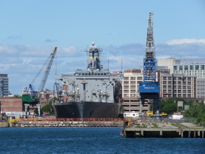 |
7/2/2016: Leroy Grumman
Position: 42°20.74'N, -71°1.11'W
The USNS Leroy Grumman in dry dock at Boston Ship Repair.
|
 |
7/2/2016: Boat ride
Position: 42°20.04'N, -70°57.86'W
Today was a perfect day to visit the light. The weather has generally been sunny and warm most of the time we've been in Boston.
|
 |
7/2/2016: Little Brewster Island
Position: 42°19.67'N, -70°53.63'W
Boston Light on Little Brewster Island is a National Historic Landmark. Its the oldest working light station in the country and the only one still actively staffed by the US Coast Guard.
|
 |
7/2/2016: Sally Snowman
Position: 42°19.68'N, -70°53.50'W
The current lighthouse keeper, Sally Snowman, is the 70th keeper and the first female. wearing Revolutionary-era clothes she makes herself, Sally gave us an overview of the station and explained the various parts of the lighthouse before we went inside.
|
 |
7/2/2016: Museum
Position: 42°19.68'N, -70°53.41'W
A small museum is in the bottom of the lighthouse, containing an number of historical artifacts. This fifth-order Fresnel lens was used as a harbor light and is about 21 inches tall, compared to the 81-inch second-order Fresnel lens in Boston Light. The lighthouse we visited in Deal Island north of Tasmania had a first-order Fresnel lens that stood 102 inches high.
|
 |
7/2/2016: Lighthouse
Position: 42°19.68'N, -70°53.41'W
Boston light is the oldest active station in the country, but the second oldest working lighthouse. Sandy Hook Light in New Jersey is the oldest lighthouse, in operation since 1764, but it doesn't have an active station. Boston Light is celebrating its 300th anniversary this year. The first lighthouse, constructed in 1716, was destroyed by the British forces as they withdrew in 1776. The current lighthouse was built in 1783 and raised to its current height of 98ft in 1856. The light is visible for 27 miles on a clear night.
|
 |
7/2/2016: Steps
Position: 42°19.68'N, -70°53.41'W
Climbing the 76 steps up the lighthouse tower.
|
 |
7/2/2016: Hatch
Position: 42°19.68'N, -70°53.41'W
Through the hatch into the gear room.
|
 |
7/2/2016: Fresnel lens
Position: 42°19.68'N, -70°53.41'W
Looking up into the second-order Fresnel at the top of Boston Light from the gear room. The multi-part Fresnel lens design allows for a thinner, lighter lens compared to a conventional design. And the complex arrangement of glass is simply beautiful.
|
 |
7/2/2016: Ladder
Position: 42°19.68'N, -70°53.41'W
Up the ladder to the lantern room.
|
 |
7/2/2016: Top
Position: 42°19.68'N, -70°53.40'W
And finally at the top.
|
 |
7/2/2016: View
Position: 42°19.68'N, -70°53.40'W
Looking across the second-order Fresnel lens at the top of Boston Light to the keeper's house with Boston visible in the distance.
|
 |
7/2/2016: Snack
Position: 42°19.68'N, -70°53.42'W
Climbers went up in four groups of 8-9, so we had some time to relax and enjoy the island while the other groups visited the light.
|
 |
7/2/2016: Boston Light
Position: 42°19.67'N, -70°53.49'W
We had an excellent visit to Boston Light and Little Brewster Island. It was a real highlight of our Boston trip.
|
 |
7/2/2016: Tap Trailhouse
Position: 42°21.67'N, -71°3.41'W
After our Boston Light trip, we had an excellent lunch street-side at the Tap Trailhouse.
|
 |
7/2/2016: Crowd
Position: 42°21.57'N, -71°3.47'W
A huge crowd outside Faneuil Hall watching a street performer.
|
 |
7/2/2016: Freedom Trail
Position: 42°21.32'N, -71°3.83'W
At the start of the Freedom Trail, a 2.5-mile route that leads past sixteen sites that were significant to Revolutionary Boston.
|
 |
7/2/2016: Tours
Position: 42°21.33'N, -71°3.82'W
Guides dressed in 18th century costumes play the role of Boston citizens at the forefront of the Revolutionary War and take visitors on a tour of the Freedom Trail.
|
 |
7/2/2016: Boston Common
Position: 42°21.44'N, -71°3.82'W
The Freedom Trail starts at Boston Common, the nation's oldest public park dating from the 1630s. The British Army camped here during the occupation of Boston that started in 1768, tensions from which led up to the Revolutionary War. The trail is marked with double-red bricks, so is easy to follow.
|
 |
7/2/2016: State House
Position: 42°21.45'N, -71°3.82'W
The Massachusetts State House was completed in 1798 and is one of the oldest buildings on the area. The dome was once made of wood and overlaid with copper by Paul Revere. In 1874, the dome was covered with 23-karat gold leaf. The land for the state house originally was John Hancock's cow pasture.
|
 |
7/2/2016: Park Street Church
Position: 42°21.40'N, -71°3.72'W
The Park Street Church was founded in 1809 and the 217-foot steeple once was the first landmark travelers saw when approaching Boston. The hymn "America" was first sung here on July 4, 1831 and William Lloyd Garrison gave his first antislavery speech here in 1829.
|
 |
7/2/2016: Granary Burying Ground
Position: 42°21.46'N, -71°3.72'W
Some of the nation's most notable citizens are buried at the Granary Burying Ground. This is Paul Revere's grave.
|
 |
7/2/2016: John Hancock
Position: 42°21.45'N, -71°3.73'W
Obelisk marking John Hancock's tomb at the Granary Burying Ground.
|
 |
7/2/2016: Samuel Adams
Position: 42°21.44'N, -71°3.68'W
Samuel Adams' grave site at the Granary Burying Ground.
|
 |
7/2/2016: King's Chapel
Position: 42°21.47'N, -71°3.61'W
King's Chapel was founded in 1686 and houses the oldest American pulpit in continuous use. It's bell was forged in England but cracked in 1814 and was recast and rehung by Paul Revere in 1816 and still rings today to summon people to worship.
|
 |
7/2/2016: King's Chapel Burying Ground
Position: 42°21.51'N, -71°3.62'W
King's Chapel Burying Ground is the oldest in Boston proper. Massachusetts's first governor, John Winthrop, is buried here, as is Mary Chilton, the first woman to step off the Mayflower.
|
 |
7/2/2016: Old City Hall
Position: 42°21.46'N, -71°3.58'W
Boston's Old City Hall was built in the French Empire Style and completed in 1865. It stands along the Freedom Trail route, but at only 150 years old is a little new to be an actual site on the trail.
|
 |
7/2/2016: Benjamin Franklin
Position: 42°21.46'N, -71°3.58'W
A statue of Benjamin Franklin (the statue is missing) sits at the site of America's first public school where Benjamin Franklin once attended.
|
 |
7/2/2016: Old Corner Bookstore
Position: 42°21.44'N, -71°3.55'W
The Old Corner Bookstore was built as an apothecary shop and home in 1718 and became the center of American book publishing in the 1800s when Boston was the country's literary mecca. Ticknor and Fields from here published the works of Henry David Thoreau, Louisa May Alcott, Ralph Waldo Emerson and Mark Twain, and the magazine Atlantic Monthly.
|
 |
7/2/2016: Old South Meeting House
Position: 42°21.41'N, -71°3.54'W
The Old South Meeting House was the largest building on colonial Boston and the meeting place where colonists gathered to challenge British rule, protesting the tea tax and the Boston Massacre. Samuel Adams launched the Boston Tea Party here in December of 1773 with the decree "No Tax on Tea!"
|
 |
7/2/2016: Old State House
Position: 42°21.49'N, -71°3.47'W
The Old State House was built in 1773 and was the seat of the colonial and state governments. In 1776, the Declaration of Independence was first read to the people of Boston from the Old State House balcony.
|
 |
7/2/2016: Boston Massacre
Position: 42°21.55'N, -71°3.43'W
In 1770, British forces opened fire on an angry mob of colonists who were upset over the British occupation. Five in the crowd were killed. Paul Revere's widely distributed illustration of the event stirred up anti-British sentiment in the colonies.
|
 |
7/2/2016: Faneuil Hall
Position: 42°21.58'N, -71°3.39'W
A statue of Samuel Adams outside Faneuil Hall, one of the nation's first public meeting houses. In the Great Hall on the second floor Bostonians protested the taxation policies of the British Empire and set the doctrine of "no taxation without representation".
|
 |
7/2/2016: Haymarket
Position: 42°21.71'N, -71°3.41'W
Fresh-produce sellers have been bringing goods to the Haymarket outdoor market since the 1830s. It's not an offical Freedom Trail site, but the brick walkway runs right through it.
|
 |
7/2/2016: Villa Francesca
Position: 42°21.80'N, -71°3.26'W
The Freedom Trail led through North Boston, which is packed with excellent-looking restaurants such as Restorante Villa Francesca.
|
 |
7/2/2016: Paul Revere House
Position: 42°21.82'N, -71°3.21'W
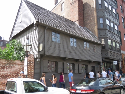
Built in 1680, Paul Revere house is the oldest structure in downtown Boston. Paul Revere purchased the house in 1770 and lived here when he made his famous messenger ride on the night of April 18-19, 1775.
|
 |
7/2/2016: Fife
Position: 42°21.95'N, -71°3.23'W
Fife lessons outside Old North Church.
|
 |
7/2/2016: Old North Church
Position: 42°21.99'N, -71°3.28'W
On April 18, 1775 church sexton Robert Newman hung two lanterns in the steeple of Old North Church to warn Charlestown patriots that British soldiers were advancing by sea. Following Paul Revere's plan, one lantern in the steeple meant the British were advancing and were coming by land, two meant they were coming by sea. This was a backup plan in case Paul Revere and another rider were not able to ride to warn the rebellion leaders, Sam Adams and John Hancock.
|
 |
7/2/2016: Copp's Hill Burying Ground
Position: 42°22.03'N, -71°3.38'W
The British used Copp's Hill Burying Ground as a vantage point to train their cannons on Charlestown during the battle of Bunker Hill. This gravestone of patriot Daniel Malcolm is riddled with bullet holes from vengeful British soldiers.
|
 |
7/2/2016: Bunker Hill Monument
Position: 42°22.56'N, -71°3.66'W
The 221-foot granite obelisk marks the site of the first major battle of the American Revolution at Bunker Hill.
|
 |
7/2/2016: 294 steps
Position: 42°22.58'N, -71°3.65'W
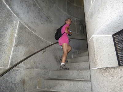
Climbing the 294 steps to the top of the Bunker Hill Monument.
|
 |
7/2/2016: Boston Harbor
Position: 42°22.56'N, -71°3.56'W
The incredible view to Boston Harbor from the top of the 221-foot Bunker Hill Monument. The Charlestown Navy Yard is in the foreground and the Charlestown Marina where Dirona is moored is visible on the left.
|
 |
7/2/2016: Trail's End
Position: 42°22.59'N, -71°3.63'W
Standing at Bunker Hill at the end of the Freedom Trail.
|
 |
7/2/2016: Warrens
Position: 42°22.46'N, -71°3.78'W
A refreshing cider at an appropriate venue after our Freedom Trail walk: historic Warrens tavern. Established in 1780, Warren Tavern is oldest tavern in Massachusetts. Notable patrons included national heroes Paul Revere, George Washington and Benjamin Franklin.
|
 |
7/2/2016: Submarine
Position: 42°21.83'N, -71°2.40'W
Since we'd had such a slow day after touring Boston Light and walking the Freedom Trail :), we took the dinghy out for a quick harbor tour. This is Sub Sea Research's submarine perched on an East Boston wharf. The underwater exploration company specializes in shipwreck recovery. Sub Sea currently is working on the recovery of the SS Port Nicholson, a British ship sunk in World War II off the coast of Maine with a cargo of platinum bars valued at three to four billion dollars.
|
 |
7/2/2016: Harbor Fuels
Position: 42°21.69'N, -71°2.18'W
A New England Aquarium Whale Watch boat fueling at Harbor Fuels at the Boston Harbor Shipyard and Marina.
|
 |
7/2/2016: Nantucket
Position: 42°21.65'N, -71°2.12'W
The lightship Nantucket/LV-112 moored at the Boston Harbor Shipyard and Marina. It is the largest and most expensive lightship ever built in the US, likely due to the British White Ship line funding the construction after ramming and sinking the predecessor in thick fog. The ship now is a National Historic Site and a museum.
|
 |
7/2/2016: Institute of Contemporary Art
Position: 42°21.23'N, -71°2.56'W
Another view to the dramatic Institute of Contemporary Art building above Fan Pier Marina in Seaport.
|
 |
7/2/2016: Condos
Position: 42°21.34'N, -71°2.70'W
Beautiful waterfront condos in Seaport.
|
 |
7/2/2016: Courthouse
Position: 42°21.32'N, -71°2.83'W
The dramatic John Joseph Moakley United States Courthouse was completed in 1999 at a cost of $170 million and has won many design awards.
|
 |
7/2/2016: Freedom
Position: 42°21.32'N, -71°2.97'W
The tour boat Freedom heading out from Rowe's Wharf with a load of passengers.
|
 |
7/2/2016: Concert
Position: 42°21.58'N, -71°2.83'W
The Harborfest music concert on Long Wharf in full swing.
|
 |
7/2/2016: John S. Damrell
Position: 42°21.59'N, -71°2.71'W
The Boston Fire Department's vessel John S. Damrell has five water cannons capable of shooting about 13,000 gallons of water per minute at a distance of 450 feet, and can travel at 35 knots. The ship is named for a former department chief who battled Boston’s Great Fire of 1872.
|
 |
7/2/2016: Bonne Vie
Position: 42°21.65'N, -71°2.89'W
Nordhavn 6202 Bonne Vie joined Nordhavn 60 Jupiter at Boston Waterboat Marina. Bonne Vie was once owned by author/singer Jimmy Buffett and called Continental Drifter.
|
 |
7/2/2016: Crowds
Position: 42°21.67'N, -71°3.04'W
Crowds at Columbus Park taking in another Harborfest concert and staking their spot for the evening's fireworks display.
|
 |
7/2/2016: Fireworks
Position: 42°22.52'N, -71°2.90'W
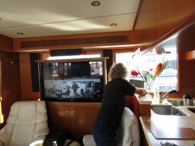
From our boat deck in Charlestown Marina we had an excellent view to the impressive July 2nd Harborfest Fireworks display.
|
 |
7/3/2016: TV Antenna
Position: 42°22.52'N, -71°2.90'W
Testing out the new digital HD TV antenna. We could use our satellite dish, but the services available are fairly expensive for how little TV we watch. The antenna seems to work well and brings in a clear, crisp picture.
|
 |
7/4/2016: Hoist
Position: 42°22.52'N, -71°2.90'W
One of the supports for the 250-pound isolation transformer under the pilothouse settee broke off and the unit was sitting at an angle (we suspect this may have occurred during the 69° roll). James devised a hoist using a 2-by-4 and a ratchet strap to raise the transformer above level so we could fabricate a new mount and lower it back down.
|
 |
7/4/2016: Base
Position: 42°22.52'N, -71°2.90'W
Attaching the new transformer mount from the stateroom below it.
|
 |
7/4/2016: Secure
Position: 42°22.52'N, -71°2.90'W
Now that the transformer is returned to securely mounted and level, we put one extra level of protection in by screwing the panels in above it so the transformer can't twist and damage the mounts even in the unlikely event of another severe rollover.
|
 |
7/4/2016: John Bosden
Position: 42°22.52'N, -71°2.90'W
UK-based commercial pilot John Bosden had missed us by a couple of days in Cape Town, Barbados and St. Lucia, but managed to catch up with us Boston. We hope to be visiting his home country in Dirona in a year or two.
|
 |
7/4/2016: Lock
Position: 42°22.10'N, -71°3.69'W
In the lock to pass through the Gridley Dam on the Charles River.
|
 |
7/4/2016: Charles River Bridge
Position: 42°22.14'N, -71°3.93'W
Passing under the Charles River Bridge that carries commuter rail.
|
 |
7/4/2016: Craigie Bridge
Position: 42°22.04'N, -71°4.15'W
The original lock for the Charles River was located just beyond the Craigie Bridge that we're about to pass under. The dam and lock were relocated further east in the late 1970s because the older dam, built in 1912, could not keep sea water out and a layer of salt water had accumulated at the bottom of the fresh water basin, contributing to pollution and fish migration problems. The former lock, visible in the distance, is kept open to allows water and small boats to pass freely. The Museum of Science was built on the old dam and adjacent piers.
|
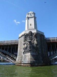 |
7/4/2016: Longfellow Bridge
Position: 42°21.67'N, -71°4.58'W
The ornate piers of the Longfellow Bridge, completed in 1906, are sculpted to represent the brows of Viking ships reflecting a purported voyage up the Charles River by Viking Leif Eriksson around 1000 AD. The bridge is named after Henry Wadsworth Longfellow whose poem "The Bridge" was about it's predecessor, West Boston Bridge.
|
 |
7/4/2016: Anchorage
Position: 42°21.53'N, -71°5.04'W
Hundreds of boats were at anchor along the Charles River, with a constant stream of new arrivals, to watch the July 4th fireworks that would be launched just upriver.
|
 |
7/4/2016: Riverside Boat Club
Position: 42°21.50'N, -71°6.99'W
The Riverside Boat Club has one of roughly twenty boathouses on the Charles River. In 1869, when the Boat Club was established, rowing was fast becoming America's most popular spectator sport. The spectator appeal has since waned somewhat. :)
|
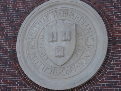 |
7/4/2016: John W. Weeks Bridge
Position: 42°22.12'N, -71°7.12'W
Harvard University seal on the John W. Weeks Bridge that connects Harvard Business School's newer Allston campus and the Business School's former home, Harvard's traditional campus in Cambridge. The Latin motto "VERITAS" ("Verity" or "Truth") is at the center.
|
 |
7/4/2016: Weld Boathouse
Position: 42°22.16'N, -71°7.43'W
The Weld Boathouse, built in 1906, is the home of Harvard's women's rowing team.
|
 |
7/4/2016: Newell Boathouse
Position: 42°22.24'N, -71°7.52'W
Newell Boathouse was built in 1900 and is the home of the Harvard men's rowing team.
|
 |
7/4/2016: Metal Shark
Position: 42°21.34'N, -71°4.85'W
We're always on the lookout for Metal Shark boats and spotted one here belonging to the State Police. An incredible number and variety of law enforcement vessels were out patrolling the waters, including Coast Guard, various fire and police departments, and the National Park Service Environmental Police. There was easily ten times as many enforcement vessels for a quarter of the pleasure craft as compared to the Poulsbo, WA fireworks display we watched in 2011.
|
 |
7/4/2016: Flag
Position: 42°21.36'N, -71°2.90'W
A huge American flag at Rowe's Wharf in Boston Harbor after we'd returned back out through the lock.
|
 |
7/4/2016: Tea Party
Position: 42°21.15'N, -71°3.10'W
Tour attendees at the Boston Tea Party Ships and Museum re-enacting the famous act of protest against Britain's tax on tea. In December of 1773, the Sons of Liberty boarded the ships of the East India Company and threw an entire shipment of tea into the sea.
|
 |
7/4/2016: Pyr 2014
Position: 42°20.98'N, -71°3.16'W
This floating pyramid, called "Pyr 2014" is a project of the Fort Point Arts Community. Built by designer Don Eyles, the pyramid is made of polystyrene to resemble the cobblestones that live beneath the now-paved Boston streets.
|
 |
7/4/2016: World Shaving Headquarters
Position: 42°20.80'N, -71°3.31'W
The Gillette World Shaving Headquarters building along Fort Point Channel in South Boston. Gillette blades have been made in Boston since 1905. While the company has expanded production globally, they continue to manufacture their best blades here.
|
 |
7/4/2016: Fireworks
Position: 42°22.40'N, -71°2.98'W
The July 4th Fireworks display over the Charles River was spectacular: https://youtu.be/ndr2turtzJk. We couldn't see the display from the marina, so we ran the tender just around the corner for a great view. This might be the last year for Boston's July 4th fireworks, one of the nation’s signature Independence Day celebrations. 77-year-old businessman and philanthropist David Mugar is stepping down after privately funding the event for 43 years.
|
 |
7/5/2016: Fenders
Position: 42°22.52'N, -71°2.90'W
The set of Prostock Marine inflatable fenders we bought while we were in Australia has worked out very well compared to the Aere they replaced. The Prostock fenders have taken serious abuse in the swells in Rodrigues, Reunion, St. Helena and Barbados without a hint of a seam leak anywhere. At the time, Prostock didn't have anything to replace what we call Aere "sausages" fenders: 72-inch long by 12-inch diameter fenders that work well in narrow slips or against pilings. We could really have used longer, narrower fenders in the tight piling-lined slip at Soverel Harbour Marina in Palm Beach and learned that Prostock now produces them. Our 4 new Prostock "sausages" (60-inch long by 12-inch diameter) just arrived and look great.
|
 |
7/5/2016: Regina Pizzeria
Position: 42°21.92'N, -71°3.42'W
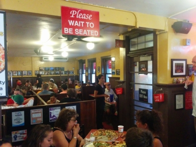
Boston-native Ronald Hellmann recommended Regina Pizzeria, about a half-hour walk from our marina. Founded in 1926, it's the oldest pizza house in New England. We arrived silly early at 5:25 and still had to wait 20 minutes for a table. Now that's popular.
|
 |
7/5/2016: Bar seat
Position: 42°21.92'N, -71°3.41'W
We got a great spot at the bar beside the window at Regina Pizzeria and had an exceptional evening talking to the staff and patrons around us.
|
 |
7/5/2016: Pizza oven
Position: 42°21.92'N, -71°3.41'W
The original pizza oven from 1926 at Regina Pizzeria.
|
 |
7/5/2016: Seating
Position: 42°21.92'N, -71°3.41'W
Every seat in the small restaurant was packed the entire time we were there, with a constant line-up outside.
|
 |
7/5/2016: Mmmm ... pizza
Position: 42°21.92'N, -71°3.41'W
The pizza was fantastic paired with a delicious bottle of Primitivo Salento. We like big reds and the Primitivo grape is genetically the same as the California Zinfandel.
|
 |
7/5/2016: Bumper
Position: 42°21.99'N, -71°3.45'W
The streets around North Boston are really narrow. This car had parked slightly off the curb and had been hit twice over the weekend. One hit tore off the entire bumper. Parking seems pretty damage-prone in Boston--many cars have Bumper Bullys to protect them from scratches and dents.
|
 |
7/5/2016: Prince Street
Position: 42°21.96'N, -71°3.40'W
The damaged car was at the bottom of Prince Street at the right of the photo. Those streets sure are narrow.
|
 |
7/5/2016: Hobbit door
Position: 42°21.96'N, -71°3.40'W
Height-challenged Jennifer rarely sees a door she'd have to duck to get through. We saw many like this on the hilly North Boston streets.
|
 |
7/6/2016: Skyline
Position: 42°22.52'N, -71°2.90'W
Enjoying the Boston skyline after a relaxing dinner on the boat deck. We're really enjoying our stay at Charlestown Marina.
|
 |
7/7/2016: Cape Cod Canal
Position: 41°46.42'N, -70°29.98'W
On our way to visit Cape Cod National Seashore, we stopped off at the east entrance to the Cape Cod Canal where we'd passed through a month earlier en route to Boston. The current, visible in the water surface, was flooding at 3.5 knots near the edge where we were standing.
|
 |
7/7/2016: Station Cape Cod Canal
Position: 41°46.29'N, -70°29.97'W
The US Coast Guard Station at Cape Cod Canal was built in the 1930s in the Colonial Revival style following the demolition of the original buildings when the canal was widened.
|
 |
7/7/2016: Cape Cod National Seashore
Position: 41°50.27'N, -69°58.46'W
We stopped off at the Cape Cod National Seashore to pickup some visitor guides, walk a trail, and add another park sign photograph to our collection
|
 |
7/7/2016: Nauset Marsh Trail
Position: 41°50.03'N, -69°58.13'W
Walking the Nauset Marsh Trail along Salt Pond adjacent to the visitor center. Salt Pond is a "kettle pond" formed when the glaciers receded, leaving chunks of ice that melted and created depressions in the earth. When the water table began to rise at Cape Cod, "kettle ponds" began to appear. Salt Pond initially was a freshwater kettle, but the ocean eventually broke through and formed a narrow channel connecting it to Nauset Marsh.
|
 |
7/7/2016: Nauset Light Beach
Position: 41°51.50'N, -69°57.08'W
The Nauset Light Beach a few miles north of the visitor center was full of people with a constant stream arriving. The group going down the stairs looked ready for a full day equipped with beach chairs and umbrellas, shade shelters, coolers, and a spike ball game.
|
 |
7/7/2016: Erosion
Position: 41°51.50'N, -69°57.09'W
The Cape Cod ocean shore is constantly eroding at a rate of about 3ft per year. At the upper left of the photo are the ruins of a fence that has slid down the slope.
|
 |
7/7/2016: Transatlantic cable
Position: 41°51.54'N, -69°57.13'W
In 1879, one of the first transatlantic cables between America and Europe was completed here, part of an telegraph cable boom in the second half of the 18th century. The 3,000-mile cable reached depths of 15,000 feet and routed from here to Newfoundland then across to France.
|
 |
7/7/2016: Nauset Light
Position: 41°51.61'N, -69°57.18'W
Nauset Light originally was erected in Chatham, Cape Cod to the south in 1877. The light was dismantled in 1923 and reassembled in the current area about 275 feet from the edge of the bluff. By 1993, the Coast Guard deemed the light obsolete and scheduled it to be dismantled. The Nauset Light Preservation Society raised funds to save the light and in 1996 moved it to higher ground, as 70 years of erosion at 3ft per year would have put the light about 100-ft from the cliff edge.
|
 |
7/7/2016: Marconi Station
Position: 41°54.86'N, -69°58.31'W
Ruins of Marconi's historic South Wellfleet Wireless Station where in 1903 he completed the first two-way transoceanic message and the first wireless telegram between America and Europe. Four 210-ft wooden towers supported a massive antenna in the shape of an inverted pyramid whose whirling spark-gap rotor could be hear 4 miles downwind.
|
 |
7/7/2016: Spark Gap
Position: 41°54.30'N, -69°58.74'W
The Cape Cod National Seashore Park Headquarters building, near the Marconi station site, had a scale model of the original station and this working spark gap model. The scale model was initially on display at the station site, but the land had eroded to the point where it was only 32 feet from the cliff edge, so it was moved here.
|
 |
7/7/2016: Bearberry Hill
Position: 42°0.17'N, -70°1.53'W
The view to sea over Ballston Beach from south Bearberry Hill along the Pamet Area Trails. The 100-ft gap in the dune didn't exist until a 1991 storm breached the dune, carrying sand and saltwater inland.
|
 |
7/7/2016: Boghouse
Position: 42°0.18'N, -70°1.76'W
As Cape Cod's fishing industry declined in the 1800s, falling sugar priced contributed to a new demand for cranberries and commercial bogs were carved into wetlands throughout the Cape. This cranberry boghouse along the Pamet Area Trails dates from that period.
|
 |
7/7/2016: WayDownTown
Position: 42°3.04'N, -70°11.21'W
We continued north to Provincetown at the northern tip of Cape Cod. Traffic crawls along the narrow one-way street through town, so we parked our Zipcar at the first lot we found and continued on foot to check out the town and find a place for lunch. Provincetown has a lot of restaurants. We eventually settled on the WayDownTown bistro for a delicious seafood meal with a beach view.
|
 |
7/7/2016: Guest houses
Position: 42°2.87'N, -70°11.39'W
Provincetown is full of guest houses in the traditional Cape Cod style, with not a chain motel in sight.
|
 |
7/7/2016: Crowds
Position: 42°2.87'N, -70°11.39'W
Provincetown has a winter population of less than 3,000, but the summer population can reach 60,000. The streets, shops, cafes and restaurants were packed.
|
 |
7/7/2016: Pilgrim Monument
Position: 42°3.13'N, -70°11.33'W
After lunch we walked up the hill to the 253-ft Pilgrim Monument, the tallest all-granite structure in the country. The Monument was built in 1907 to commemorate the first landing of the Mayflower Pilgrims in the New World at Provincetown on November 21, 1620. The Pilgrims later settled in Plymouth, where the soil was better for farming.
|
 |
7/7/2016: Going up
Position: 42°3.03'N, -70°11.37'W
116 steps and 60 ramps lead the top of the Pilgrim Monument. Jennifer is looking back down from near the top.
|
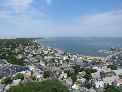 |
7/7/2016: View
Position: 42°3.11'N, -70°11.36'W
The view from the top of the monument was amazing. This is looking east toward the Provincetown waterfront, with the commercial pier and the Provincetown Marina at the right of the photo.
|
 |
7/7/2016: Museum
Position: 42°3.15'N, -70°11.36'W
A detailed diorama in the Provincetown Museum of the Mayflower that carried the Pilgrims to the New World. The museum is at the base of the Pilgrim Monument and has excellent exhibits detailing the town's history and influences from the arrival of the Pilgrims in 1620, through the commercial whaling period that made Provincetown one of the richest in the country, to the later influx of literary notables such as playwrights Tennessee Williams and Eugene O'Neill, authors Norman Mailer, Jack Kerouac, and Kurt Vonnegut, former US Poet Laureate Stanley Kunitz, and Pulitzer Prize-winning poet Mary Oliver.
|
 |
7/7/2016: Life-Saving Station
Position: 42°4.79'N, -70°12.98'W
The Old Harbor Life-Saving Station was built in Chatham in 1897, one of an eventual 13 that covered Cape Cod's eastern shore to save shipwreck victims. Before the Cape Cod canal was built, all traffic had to go around treacherous Cape Cod where over 3,000 ships have wrecked. The stations were located five to eight miles apart and the beaches between monitored for shipwrecks during the day from watchtowers and patrolled on foot at night or in poor visibility. The Old Harbor Life-Saving station was decommissioned in 1944 and in 1977 the National Parks Service moved it to the current location north of Provincetown due to severe erosion at the original site. It is now a museum with much of the original furnishings and equipment intact. This is one of the original life-saving boats, with a cork life jacket hanging alongside.
|
 |
7/7/2016: Shipwrecks
Position: 42°4.80'N, -70°13.00'W
This map on the wall at the Life-Saving Station shows the astonishing number of shipwrecks that occurred along the Cape Cod coast and illustrates why the Life-Saving Stations were needed.
|
 |
7/7/2016: Province Lands Visitor Center
Position: 42°4.44'N, -70°12.31'W
The Province Lands Visitor Center has an 2nd-floor observation deck with a 360-degree view of the area. This is looking south to the Pilgrim Monument in Provincetown.
|
 |
7/7/2016: Highland Light
Position: 42°2.36'N, -70°3.72'W
Our final stop in a very long day was Highland Lightstation. The original light here was built in 1798, the first ever on Cape Cod. The current brick lighthouse was built in 1857.
|
 |
7/7/2016: Climbing
Position: 42°2.35'N, -70°3.72'W
Climbing the steps to the top of the Highland Light.
|
 |
7/7/2016: Old site
Position: 42°2.36'N, -70°3.72'W
The view from the top of the lighthouse to its 1857 original site, roughly at the end of the path in the distance. In 1996 an incredible feat of engineering moved the 430-ton structure 450 feet back from the eroding cliff.
|
 |
7/7/2016: Fueling
Position: 41°56.17'N, -70°1.29'W
Filling up the Zipcar before we return home.
|
 |
7/7/2016: Navy Yard Bistro
Position: 42°22.52'N, -71°3.28'W
After dropping of our car, we finished the day with another excellent meal at the Navy Yard Bistro.
|
 |
7/8/2016: Coast Guard
Position: 42°22.52'N, -71°2.90'W
A Coast Guard patrol made a slow pass by Charlestown Marina this morning and closely inspected the outermost boats. We wondered what they were up to.
|
 |
7/8/2016: BW GDF Suez Everett
Position: 42°22.52'N, -71°2.90'W
Shortly after the Coast Guard inspected the marina, a whole flotilla of enforcement vessels passed by including police, fire department and more Coast Guard vessels. And a few minutes later we learned why. The 908x142ft BW GDF Suez Everett was passing by bound for the Distrigas terminal adjacent to the Mystic Power Generationg Station. Laden with LNG, these ships effectively are giant bombs and appealing terrorist targets, so they get a major security escort when navigating the harbor. A helicopter also was patrolling overhead and police sharpshooters apparently are stationed on rooftops.
|
 |
7/8/2016: Tobin Memorial Bridge
Position: 42°22.52'N, -71°2.90'W
The BW GDF Suez Everett turned around east of Tobin Memorial Bridge and backed under, the same way BW GDF Suez Boston did in this video shot from the ship's bridge: https://www.youtube.com/watch?v=Dq3pUUQSQ4c. It sure looks tight. The bridge is closed to traffic for security reasons when LNG ships are passing under due to the explosive risk of such large quantities of LNG.
|
 |
7/11/2016: Boston Medical Center
Position: 42°20.12'N, -71°4.47'W
At Boston Medical Center for more routine medical tests. Boston sure is an excellent place for us to catch up on all things medical.
|
 |
7/12/2016: Charlestown Vet
Position: 42°22.89'N, -71°4.68'W
Spitfire also is due for routine medical work. Here Dr. Alexander, with Ryan assisting, is giving him a health exam, followed by vaccination injections. Spitfire never likes the process, but always aces the tests.
|
 |
7/12/2016: Number 93
Position: 42°22.51'N, -71°3.36'W
On the Number 93 bus from Charlestown to downtown Boston for an appointment and to run some errands. The bus ride downtown is barely 15 minutes.
|
 |
7/12/2016: Suffolk Dental
Position: 42°21.39'N, -71°3.71'W
Today was Jennifer's turn for a routine visit to Suffolk Dental. We're both really impressed with the quality and thoroughness of the care that Dr. Hsu and his staff provide.
|
 |
7/12/2016: G A Chapman Co
Position: 42°21.36'N, -71°3.58'W
At G A Chapman Co in the Diamond Building in downtown Boston to have some rings resized. On a floor full of diamond retailers, George has a small shop packed with equipment. The whole building felt a bit like stepping back into the 1950s.
|
 |
7/13/2016: Tavern at the End of the World
Position: 42°22.93'N, -71°4.76'W
A quick lunch at the Irish pub "Tavern at the End of the World" after stopping by nearby Charlestown Vet. The pub is so named because there wasn't much out here when they opened about a decade ago. Sadly, they did not have Jennifer's favorite Irish beer, Kilkenny, on tap. Kilkenny is surprisingly common in British Columbia where we've spent a lot of our cruising time, but harder to find in the US.
|
 |
7/13/2016: Sullivan Station
Position: 42°23.04'N, -71°4.59'W
Taking "The 'T'" subway downtown from Sullivan Square Station near Charlestown Vet. Boston has excellent public transportation.
|
 |
7/13/2016: Cut-Splice
Position: 42°22.39'N, -71°3.15'W
Jennifer getting her annual haircut--the last one was a year ago in Darwin. Vildan at Cut-Splice in the Charlestown Navy Yard did an excellent job.
|
 |
7/14/2016: Shoe Repair
Position: 42°21.53'N, -71°3.78'W
At Beacon Hill Shoe Repair to pickup a repaired shoe. Boston has been a great place to knock off everything on our to-do list, from routine medical to minor repairs.
|
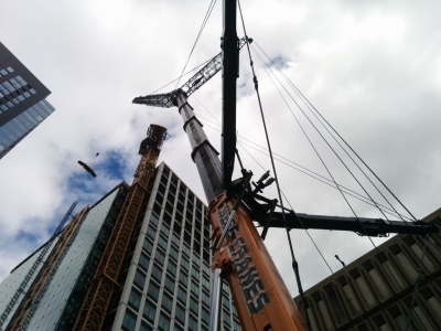 |
7/16/2016: Grove GMK7550
Position: 47°36.97'N, -122°20.02'W
James is temporarily back in Seattle for work and Jennifer has been visiting on weekends. Near our hotel, we spent a ridiculous amount of time today watching the Grove GMK7550 crane on the right disassemble the construction crane way up high on the left. The Grove GMK7550 is the flagship of the Grove crane fleet, with a 550-ton lift capacity. It's a real beast.
|
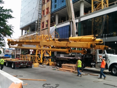 |
7/16/2016: Boom
Position: 47°36.97'N, -122°20.02'W
The boom from the construction crane being lifted onto a truck by a small crane after the Grove GMK7550 lowered it from the building-top. The Grove GMK7550 operator had an incredibly light touch and was able to move huge pieces of equipment like this in very tight quarters over long distances with hardly a twitch of the load.
|
 |
7/16/2016: Edgewater
Position: 47°36.74'N, -122°21.16'W
At the Edgewater Hotel waterfront bar to watch the cruise ship Norwegian Jewel depart Seattle for Alaska. The ships come so close to the bar as they leave you can practically touch them.
|
 |
7/16/2016: Bell Harbor Marina
Position: 47°36.61'N, -122°20.76'W
Our home port in Seattle, Bell Harbor Marina. Two Nordhavns were there this weekend, a 43 at the center of the photo and a 47 at the right.
|
 |
7/17/2016: Bainbridge Island
Position: 47°37.34'N, -122°30.53'W
Arriving into Winslow on Bainbridge Island by ferry from downtown Seattle. We've haven't been to Winslow for ages, so we took a quick day-trip over to enjoy some sunny weather there.
|
 |
7/17/2016: Herban Legends
Position: 47°36.73'N, -122°20.89'W
Shortly after we left Seattle in 2012, Washington passed an initiative to allow recreational marijuana use. After decades of marijuana being illegal, it sure seems strange to see signs like this.
|
 |
7/18/2016: Outdoors
Position: 42°22.52'N, -71°2.90'W
Spitfire enjoying some outside time after Jennifer returns home from a weekend in Seattle. Spit got really sick one time after we boarded him in Australia, so we decided not to take the risk on boarding him after that, particularly given he's 13 now. Spit is fine for a 2-3 days alone on the boat, so Jennifer has been flying out to Seattle on weekends to visit James so that we can keep Spitfire on Dirona and not have to board him.
|
 |
7/19/2016: Iris Leader
Position: 42°22.52'N, -71°2.90'W
NYK's 652-ft car carrier Iris Leader towering over the boats in Charlestown Marina. A week earlier, the newly-built ship made its first US port of call at Jacksonville, FL. This also was the first ship to arrive at Jacksonville after passing through the newly expanded Panama Canal locks. Panamax, which refers to the maximum size of ships that can pass through the original locks is 965ft long by 106ft wide by 41.2ft deep. New Panamax, the maximum size allowed through the expanded locks, is 1,200ft long by 161ft wide by 50ft deep. The 111-ft wide Iris Leader is New Panamax and can only pass through the expanded locks. The ship is 15 feet wider than previous NYK ships with an additional car-carrying capacity of 1,500 cars.
|
 |
7/23/2016: Virginia Inn
Position: 47°36.66'N, -122°20.56'W
A drink at our favourite seat in the Virginia Inn, at 1st and Virginia, with a view to Elliott Bay.
|
 |
7/23/2016: International Fountain
Position: 47°37.35'N, -122°21.12'W
We took a walk through Seattle Center and paused to watch children (and adults) playing in the water at International Fountain. The fountain was built with Seattle Center for the 1962 World's Fair, and was restored and expanded in 1995.
|
 |
7/24/2016: Anthony's Pier 66
Position: 47°36.64'N, -122°20.90'W
Enjoying the views to Mt. Rainier and Elliott Bay at Anthony's Pier 66 restaurant before Jennifer leaves to fly back to Boston. The bar, above our old home port at Bell Harbor Marina, is one of our favourites.
|
 |
7/27/2016: Paper garbage
Position: 42°22.52'N, -71°2.90'W
Jennifer scanned in the remainder of the hardcopy manuals that we couldn't find online and produced a large pile of paper garbage.
|
 |
7/28/2016: Shopping
Position: 42°22.52'N, -71°3.95'W
At Whole Foods in Charlestown with a ZipCar to stock up for the big trip to Newfoundland and Nova Scotia.
|
 |
7/28/2016: Stop & Shop
Position: 42°23.48'N, -71°5.12'W
A final shopping run to Stop & Shop for fresh produce before we leave Boston.
|
 |
7/29/2016: Hydraulic fluid leak
Position: 42°22.52'N, -71°2.90'W
James returned to Boston this morning after three weeks back at work in Seattle. On inspecting the engine room prior to our departure for Canada tomorrow, he found a hydraulic fluid leak that he chased to somewhere aft of the engine on the starboard side. Here he has removed the oil we store aft of the generator to inspect the hoses there.
|
 |
7/30/2016: Leak source
Position: 42°22.52'N, -71°2.90'W
The source of the hyraulic fluid leak is this o-ring, circled in red. Hydraulic pressure has partially forced it out, likely due to hardening, through main engine hydraulic one-way valve where it joins the junction block.
|
 |
7/30/2016: Damaged o-ring
Position: 42°22.52'N, -71°2.90'W
A close-up to the damaged o-ring--it's really chewed up.
|
 |
7/30/2016: O-ring replacement
Position: 42°22.52'N, -71°2.90'W
Looking for a matching o-ring to replace the damaged one from one of four boxes of spare o-rings that we carry. We found the right size and that stopped the leak.
|
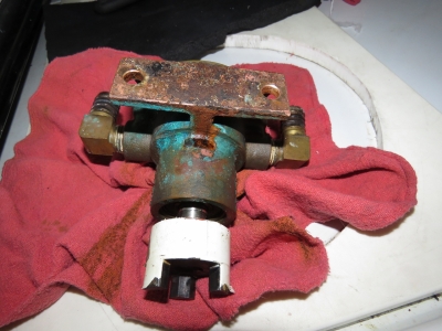 |
7/30/2016: Water pump
Position: 42°22.52'N, -71°2.90'W
When servicing the hydraulic leak, we also noticed a saltwater leak and found that the raw-water cooling pump for the hydrualic system had just started to leak saltwater from the shaft seal. We replaced this pump in Vanuatu in the fall of 2013, so they seem to go about three years or 3-4 thousand hours. We replaced it with a spare and we're back to no leaks again.
|