MV Dirona travel digest for Cape Town to St. Helena 2015

|
Click the travel log icon on the left to see these locations on a map,
with the complete log of our cruise. On the map page, clicking on a camera or text icon will display a picture and/or log entry for that location, and clicking on the smaller icons along the route will display latitude, longitude and other navigation data for that location. And a live map of our current route and most recent log entries always is available at //mvdirona.com/maps/LocationCurrent.html. |
 |
12/23/2015: Bladders
Position: -33°54.54'S, 18°25.13'E
Today we plan to clear out of South Africa, take on fuel, and set off on the 1,700nm run to St. Helena. We'll be filling all three bladders (960 gallons total) in Cape Town. This is the first time we've used the bladders to save money rather than make distance. Fuel in Cape Town costs USD $2.85/gallon ($0.75/L) whereas it's USD $6.89/gallon ($1.82/L) in St. Helena. We'll save nearly USD $4,000 by filling the bladders in Cape Town and only taking on in St. Helena what we burned to get there.
|
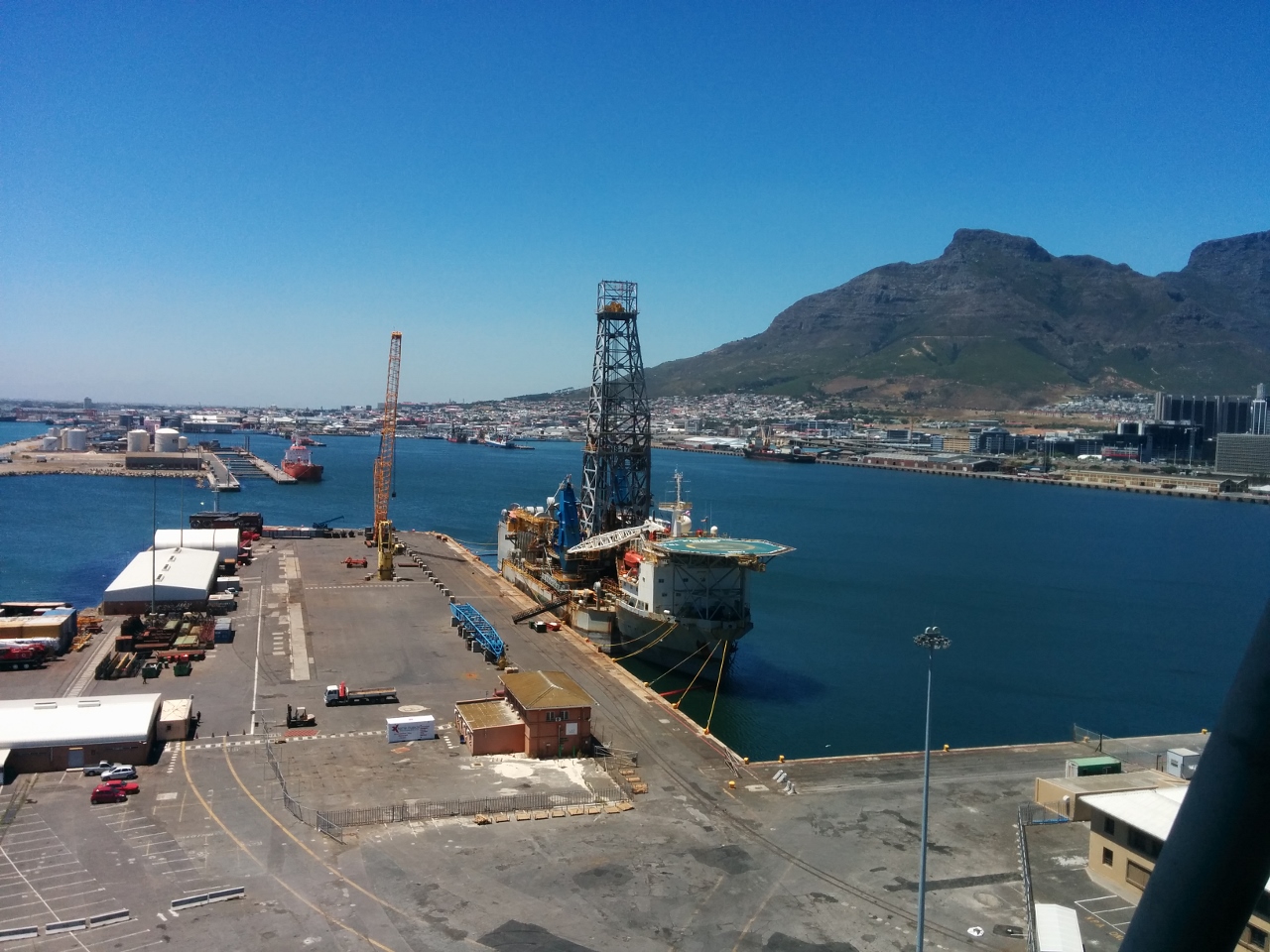 |
12/23/2015: Harbour master
Position: -33°54.28'S, 18°25.80'E
In Cape Town, you check out by visiting Customs and Immigration in person. The V&A Waterfront, however, is not an official customs entry/exit point, so the boat must be moved to the Royal Cape Yacht club in order to clear out. The Royal Cape is full and we're too heavy for their docks even if there were space. The standard practice, we're told, is that the V&A Waterfront Marina requests a letter from the Royal Cape Yacht Club indicating that they cannot accommodate us. We took this letter to immigration, but they insisted on a letter from the Harbour Master in order to approve our checking out from V&A. So we walked up to the Harbour Master's office and got our letter. The one upside of that hassle was the incredible view from the Harbour Master's office.
|
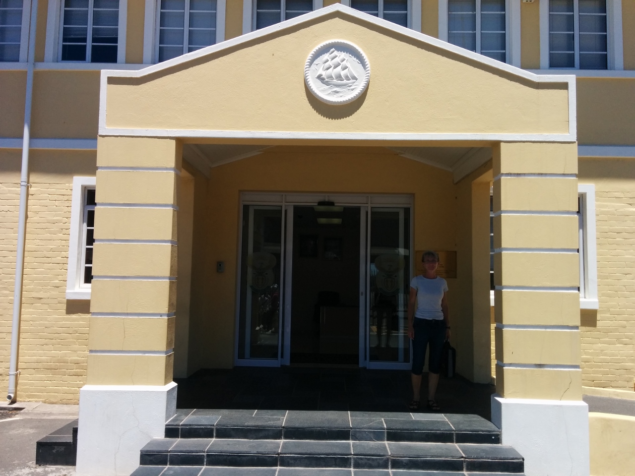 |
12/23/2015: Cleared out
Position: -33°54.66'S, 18°25.56'E
We're finally cleared out. Once we had the letter from the Harbour Master, the rest of the clearance process went quickly.
|
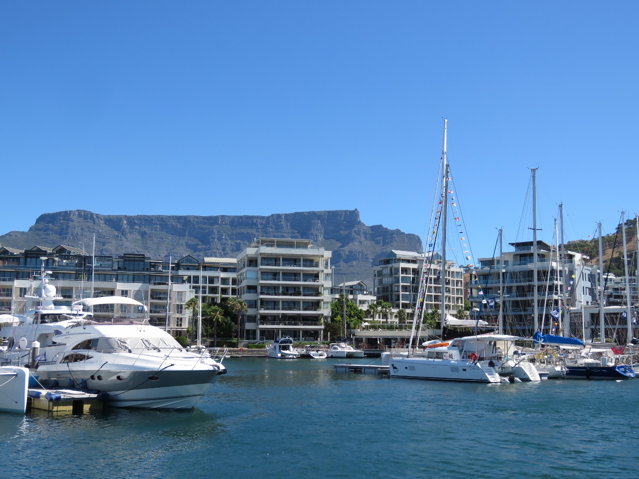 |
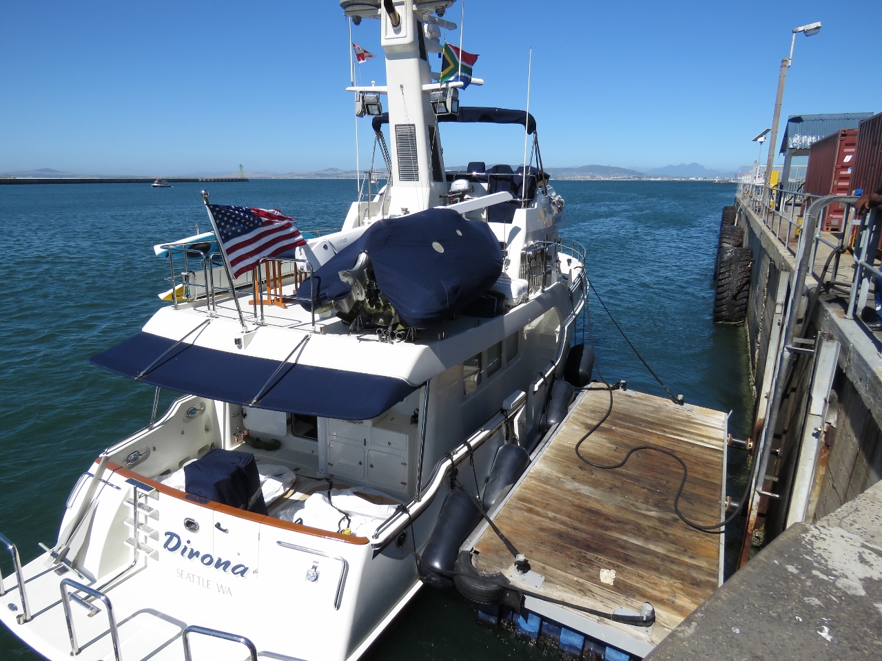
12/23/2015: Last view
Position: -33°54.49'S, 18°25.14'E
Our last view to the V&A Waterfront. Our berth was the empty one in front of the catamaran at the right of the photo.
|
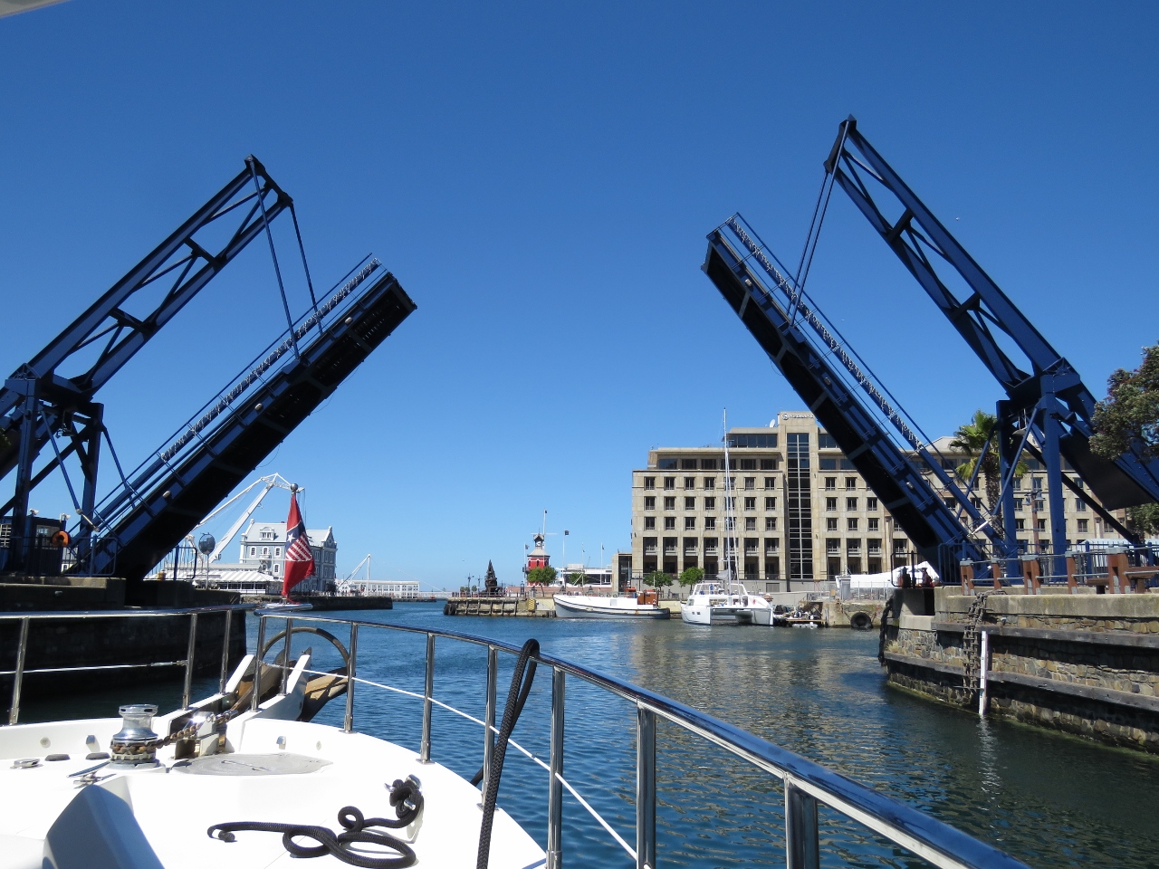 |
12/23/2015: Bascule Bridge
Position: -33°54.44'S, 18°25.22'E
Heading out under the Bascule Bridge.
|
 |
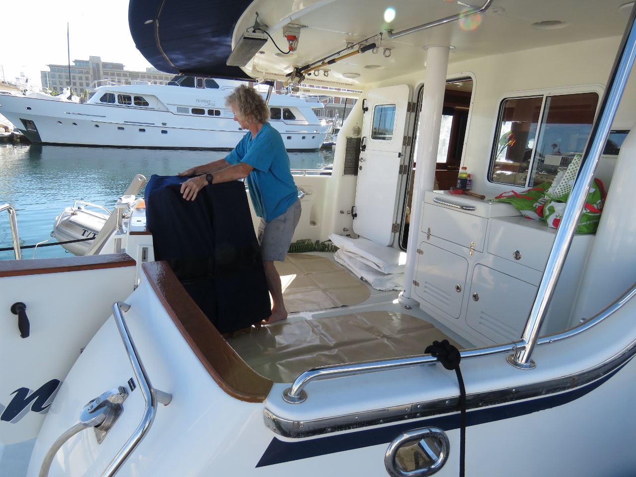
12/23/2015: Bunker Point
Position: -33°54.19'S, 18°25.67'E
On the dock at the All Shipping/3BP fuel station at Bunker Point, just inside the entrance to Cape Town Harbour. You can see the fuel hose snaking to the bow where James is filling the forward bladder.
|
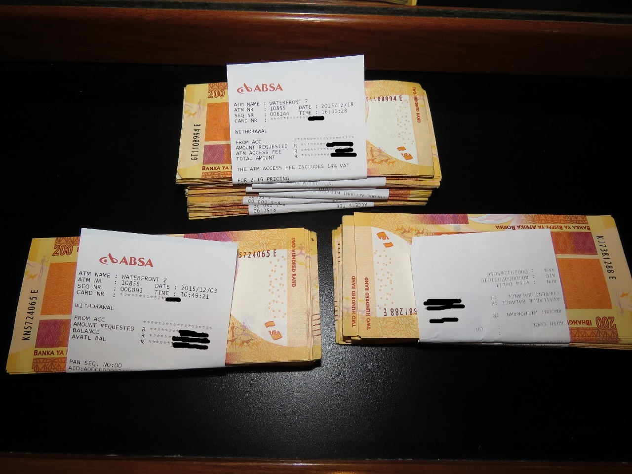 |
12/23/2015: 80,000 Rand
Position: -33°54.19'S, 18°25.67'E
The fuel dock accepts payment only in cash or electronic funds transfer. It takes ten days to wire money to South Africa, and we prefer the flexibility of paying when we fuel rather than well before. So we've been raiding the local ATMs to build in up 80,000 in South African Rand (about USD $5,250) that we've kept in our on-board safe.
|
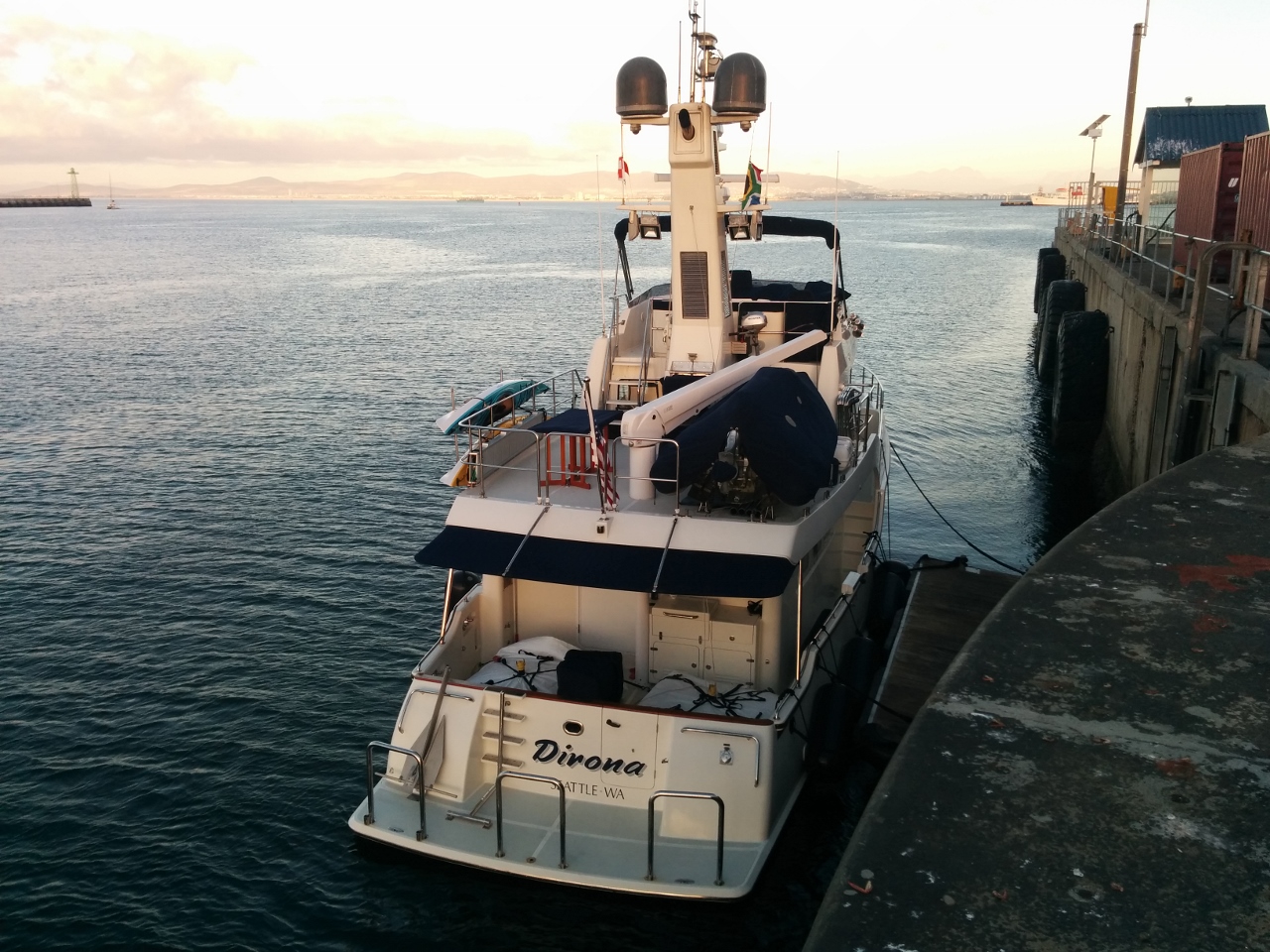 |
12/23/2015: Fully fueled
Position: -33°54.19'S, 18°25.67'E
We finished fueling and were ready to get underway around 7:20pm. With 2,707 gallons of fuel on board Dirona is really low in the water.
|
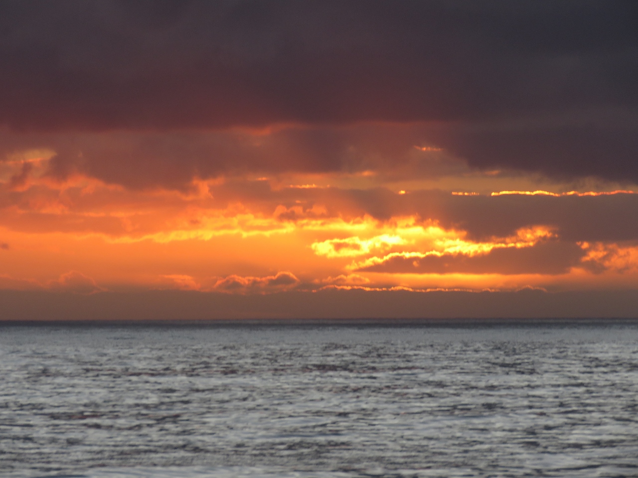 |
12/23/2015: Sunset
Position: -33°52.64'S, 18°24.49'E
We were just in time to enjoy a fabulous Cape Town sunset as we left the harbour. We expect reasonably calm conditions of about 7 feet on 8 seconds until tomorrow morning, when the waves will pick up to about 9 feet on 8 seconds, then both height and period will increase to about 12 feet on 10 seconds later in the day. 12 foot waves aren't as bad as they sound. We focus much more on wave period than wave height. 12ft seas on 12 seconds has way less of a negative impact on boat comfort than 6-9ft seas on 7 seconds. Large swell on a long period involves lots of up and down but really doesn't make the boat at all uncomfortable.
|
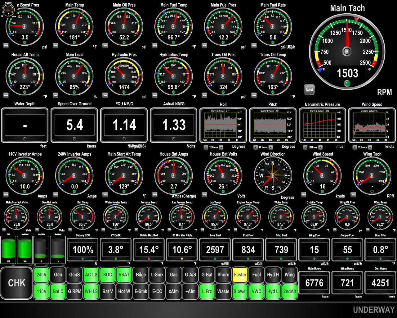 |
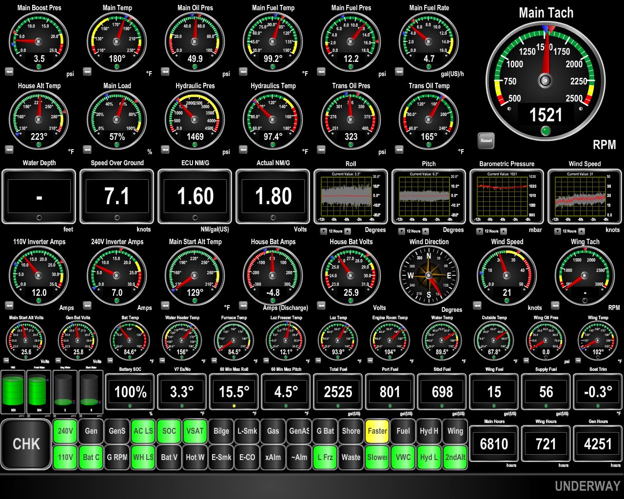
12/24/2015: Conditions
Position: -32°59.49'S, 16°50.74'E
We're into the expected 9ft waves on 8 seconds coming from just forward of the beam. Pitch and roll have increased substantially since this morning. The graphs in the third row just right of center show pitch and roll for the past 12 hours, and the gauges in the center of the third row from the bottom show max roll (15.4 degrees) and max pitch (10.6) for the past 60 minutes. (Click the image for a larger view.)
|
 |
12/24/2015: Evening conditions
Position: -32°33.39'S, 16°5.00'E
Conditions have improved somewhat--the waves are now about 11 feet on 9 seconds and more on the beam than forward of the beam. Pitch is down to 8 degrees, but roll has increased with the wave height.
|
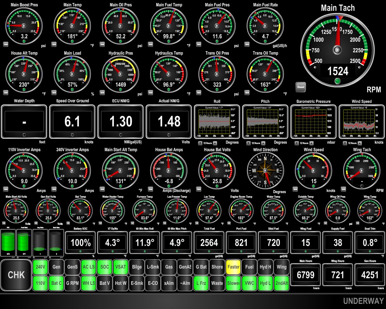 |
12/25/2015: Merry Christmas
Position: -31°50.51'S, 14°52.11'E
Our Christmas present has been improved sea conditions. We're now in about 12 feet on 10 seconds. Max roll over the last 60 minutes is 11.9 degrees and max pitch is 4.9 degrees.
|
 |
12/25/2015: Conditions
Position: -31°49.72'S, 14°50.82'E
Conditions have remained good, but we are expecting them to deteriorate for about 12 hours as we pass through the edge of a high pressure system off Namibia. The current weather models indicate that the rest of the run should be in light swell or long wave periods.
|
 |
12/25/2015: Benguela Current
Position: -31°8.71'S, 13°44.11'E
We hit some negative current not far out of Cape Town, but now are getting an excellent push from the Benguela Current that runs northward along the west coast of Africa. We have been running slower than we usually do to explore fuel economy at very low power levels. Our interest in doing this is driven by our considering a direct run from St. Helena to the Caribbean. This 3,650 nautical mile run is at the very limit of Dirona's range. Generally, we have no experience at these speeds, so we are probing the upper end of the speed we would need to run at to ensure we have the fuel economy we need to actually complete the trip.
|
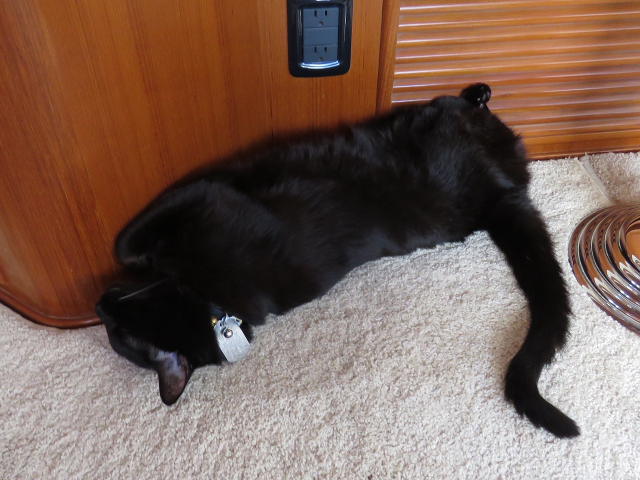 |
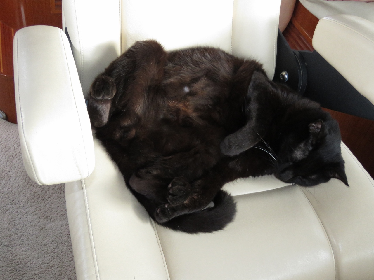
12/26/2015: Chillin'
Position: -30°4.44'S, 12°1.69'E
Spitfire is very much enjoying the calmer conditions. When it's too rough, he braces himself against the wall with his paws straight out to limit motion. But now he can just sleep however he wants. Today it's upside down with his hind legs spread.
|
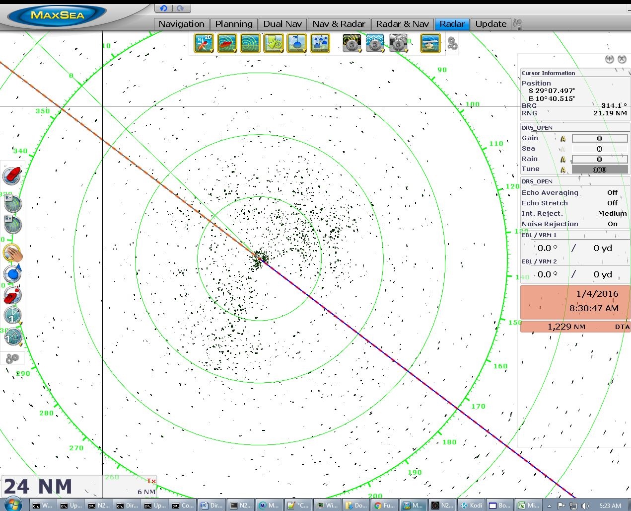 |
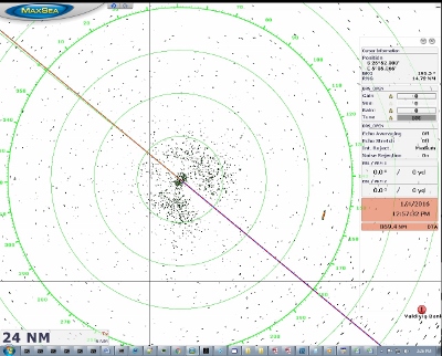
12/27/2015: Radar
Position: -29°22.34'S, 10°57.96'E
The radar display has been empty like this since we got about a day out of Cape Town. We've not seen another ship since the 24th.
|
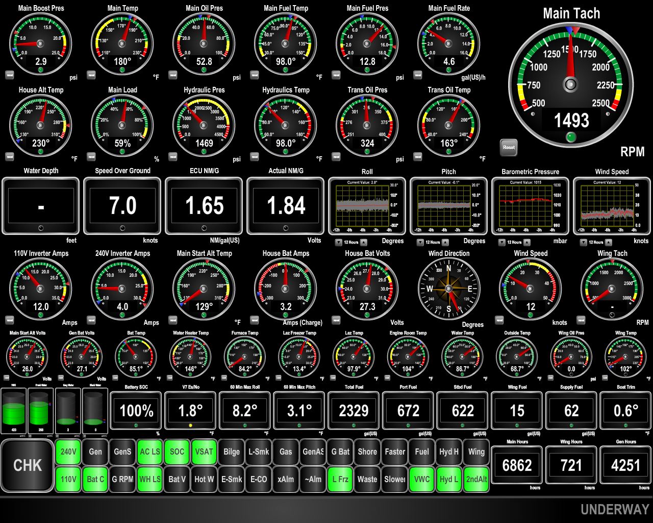 |
12/28/2015: Speed
Position: -28°3.13'S, 9°0.74'E
We continue to make excellent speed and fuel economy with help from the Benguela Current. And conditions remain wonderfully calm. Over the last hour, the max roll and pitch had been 8.2 and 3.1 degrees respectively.
|
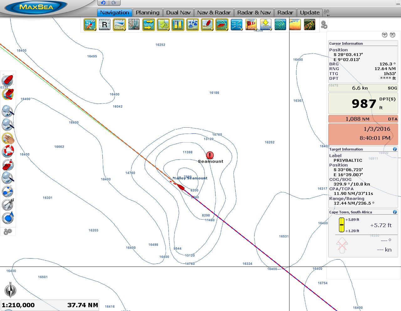 |
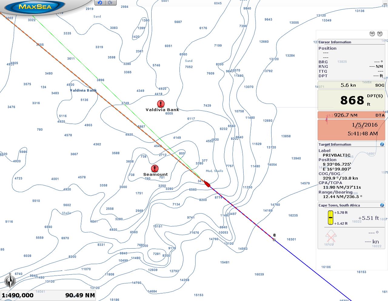
12/28/2015: Malloy Seamount
Position: -27°55.97'S, 8°50.57'E
We're passing over the Malloy Seamount now, where depths plummet from 16,000ft to 7,500ft in only a few miles. Several seamounts are on the route between Cape Town and St. Helena. We've highlighted their locations on the chartplotter because sea conditions there can be dangerous in rough conditions and they are also likely locations for fishing vessels, so we want to be extra vigilant.
|
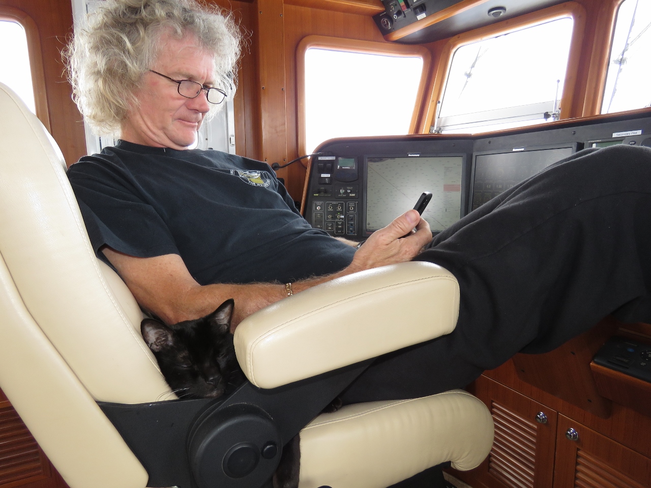 |
12/28/2015: At the helm
Position: -27°30.37'S, 8°14.34'E
Spitfire and James sharing the helm chair. Spitfire has really taken to sleeping there and seems perfectly happy with James squished up against him.
|
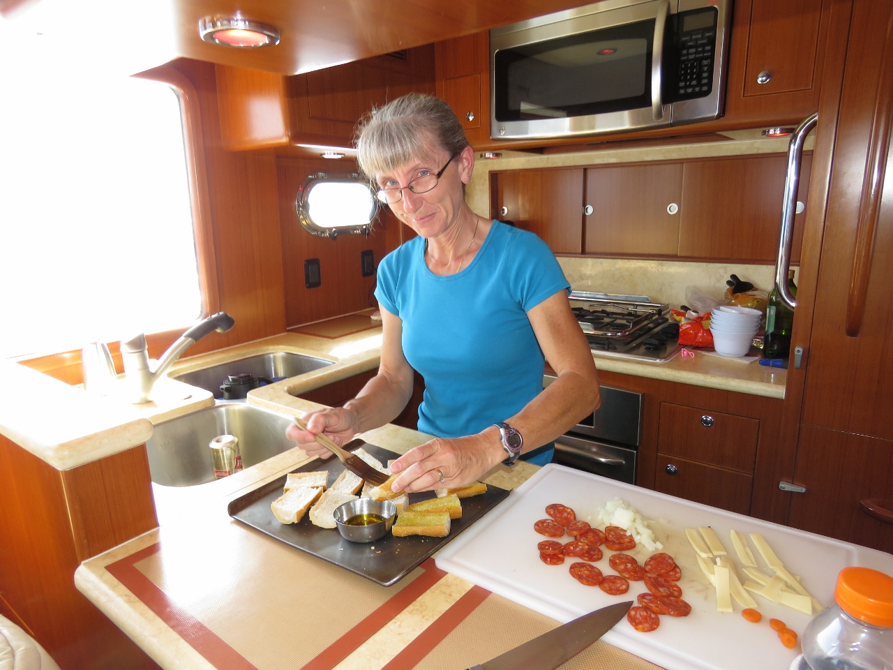 |
12/28/2015: Polynesian Pizza
Position: -27°2.89'S, 7°35.59'E
Jennifer making what we call "Polynesian Pizza" for dinner. We first started making this dish in the Marquesas, with the abundant baguettes there.
|
 |
12/29/2015: Below 1,000
Position: -26°34.49'S, 6°55.72'E
We're less than 1,000 miles out of St. Helena now. The weather forecasts still look excellent and conditions remain calm with light swell.
|
 |
12/29/2015: Valdivia Bank
Position: -26°14.90'S, 6°29.07'E
We're crossing through Valdivia Bank now, where depths drop from 16,000ft to under 800ft. Freak breaking waves have been reported here, possibly a combination of the sudden shallow water and strong winds against the Benguela current. The wind was SE 15-20, with no perceptable change in sea conditions, as we passed through the bank.
|
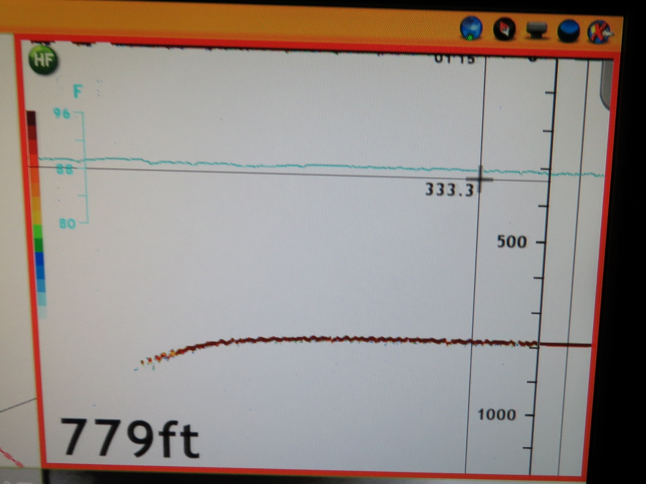 |
12/29/2015: Seamount
Position: -26°9.02'S, 6°21.20'E
After not producing a sounding for days, our depthsounder is clearly showing the seamount that rises to within 800ft of the surface.
|
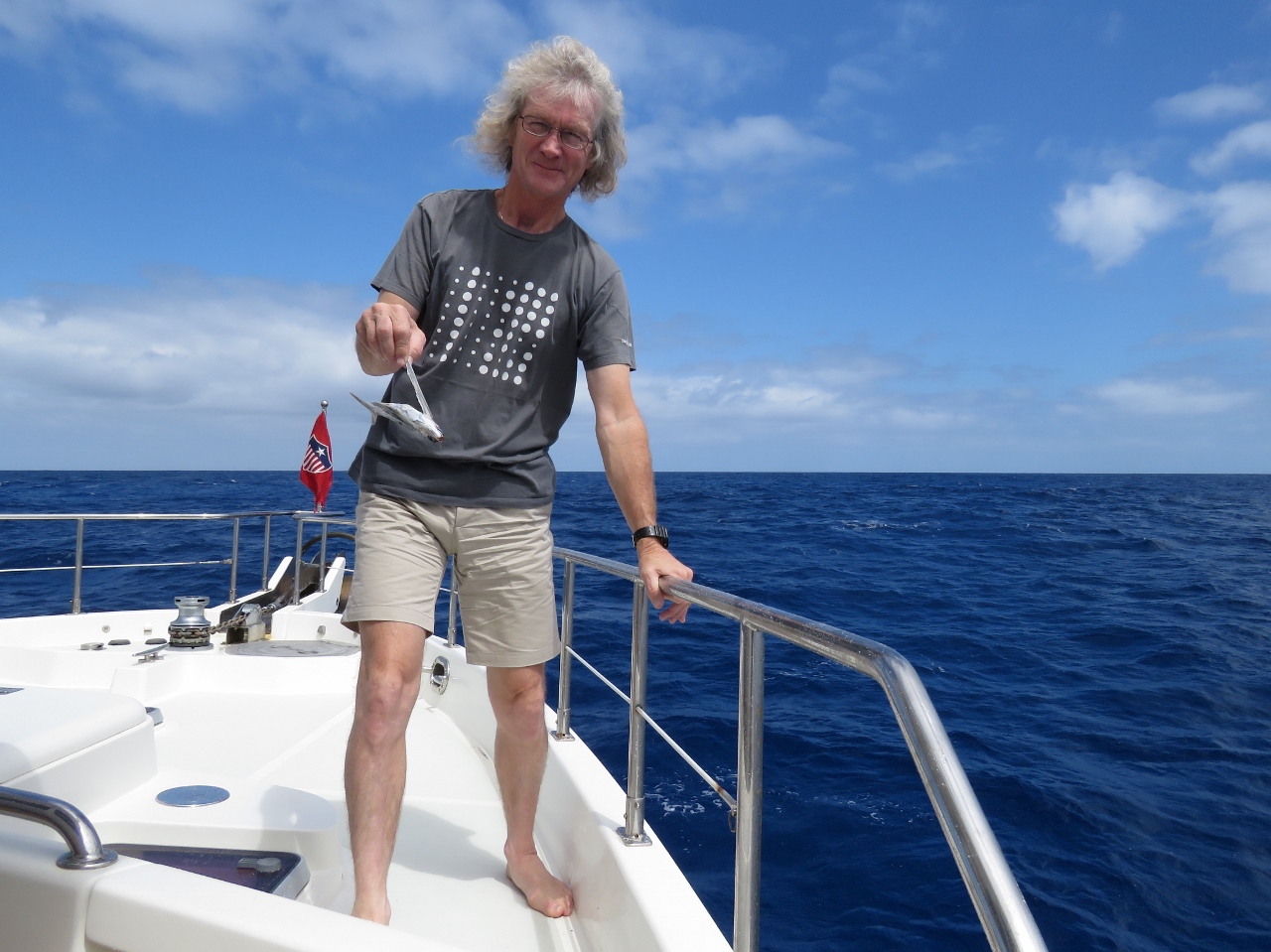 |
12/29/2015: Flying fish
Position: -25°49.52'S, 5°55.17'E
This flying fish is the first sea life we've seen since leaving Cape Town. Save for the occasional sea bird, we've not seen much life of any kind for days.
|
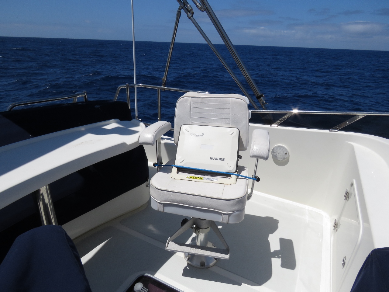 |
12/29/2015: BGAN
Position: -25°47.72'S, 5°52.78'E
Last night we passed outside the coverage area of our always-on KVH mini-VSAT satellite data system. Connectivity was suprisingly good right up until we left the coverage area. We'll be connecting only briefly a few times a day via Immarsat BGAN until we re-enter KVH mini-VSAT coverage near the Brazilian coast en route to Barbados.
|
 |
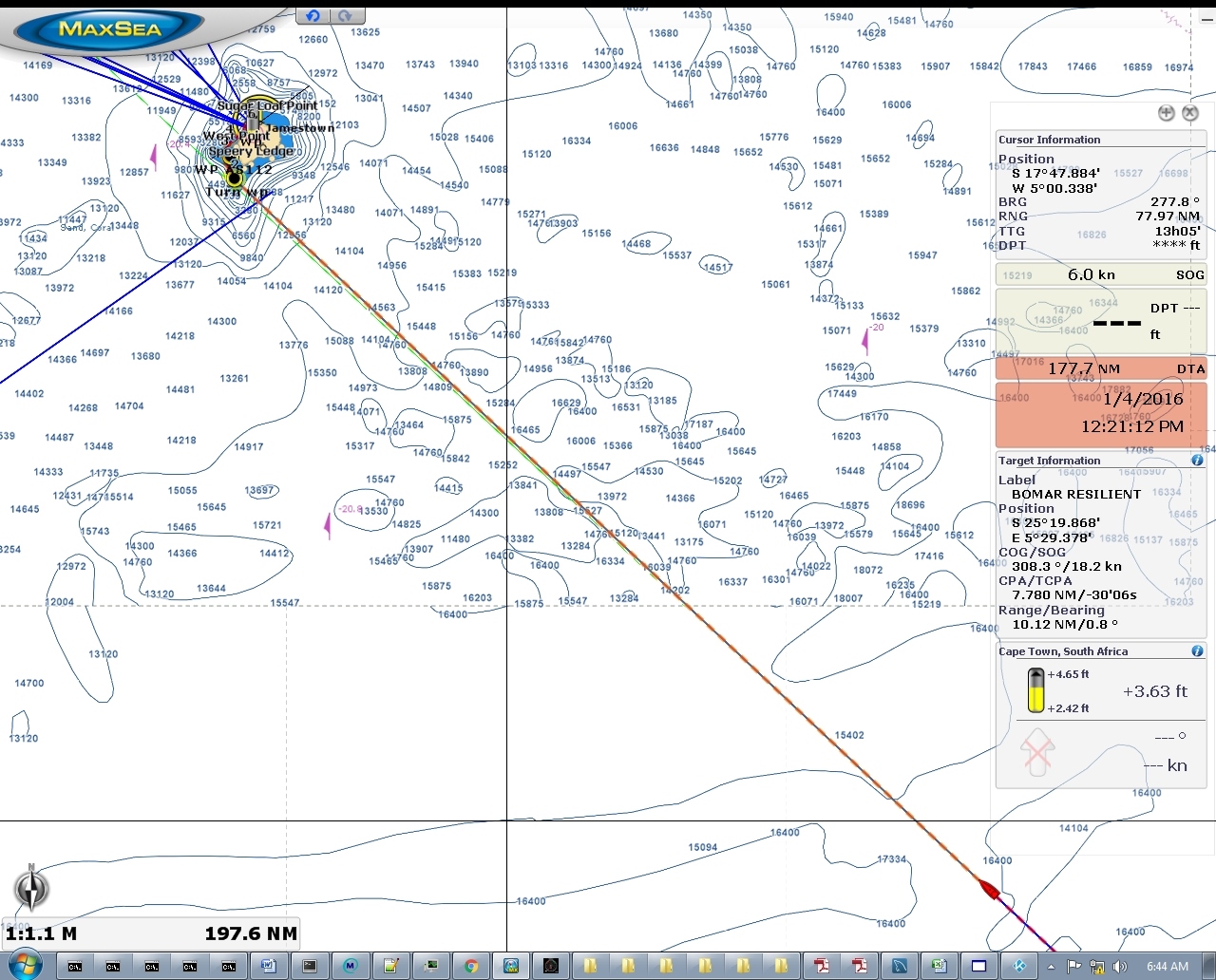
12/29/2015: Ship
Position: -25°38.17'S, 5°40.05'E
We picked up a ship on radar over 24nm behind us, running roughly on the same course and closing quickly. We guessed it might be the RMS St. Helena that supplies St. Helena and Ascension Island via Cape Town, or perhaps a cruise ship en route to Brazil from Cape Town via St. Helena. We sure love our Furuno 25kW radar--it picks up targets at amazing distances.
|
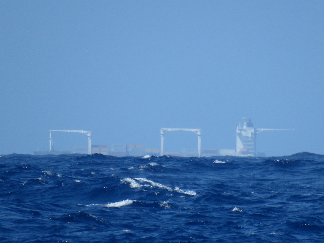 |
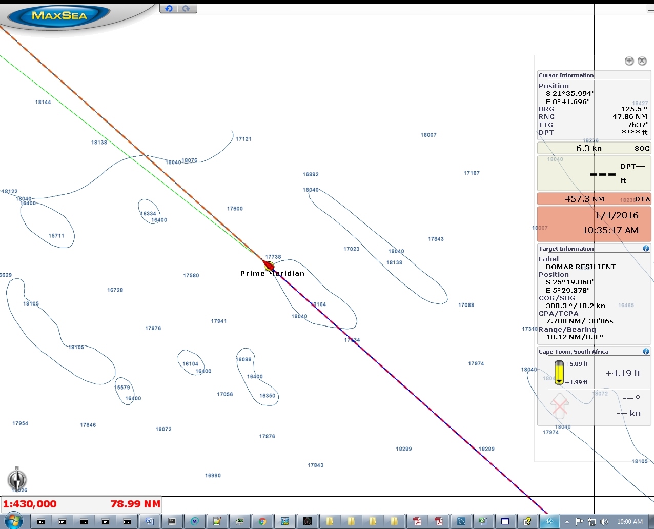
12/29/2015: Bomar Resilient
Position: -25°31.85'S, 5°31.62'E
The ship behind us turned out to be the Bomar Resilient en route to New York City. It passed about seven miles to our north.
|
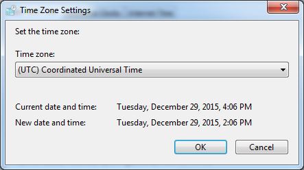 |
12/29/2015: GMT
Position: -25°31.72'S, 5°31.46'E
We just switched our clocks back two hours to the St. Helena timezone: Greenwich Mean Time.
|
 |
12/30/2015: Conditions
Position: -24°7.62'S, 3°41.24'E
Conditions remain excellent, with winds below 10 knots and the waves about 5 feet on 7 seconds. And sea conditions are forecast to improve to below 4 feet on 8 seconds as we near St. Helena. On this leg, our goal is to show that we comfortably can hit the 1.5nm/gal that we need in order go successfully complete the planned 3,650nm of the next leg to Barbados. All good so far.
|
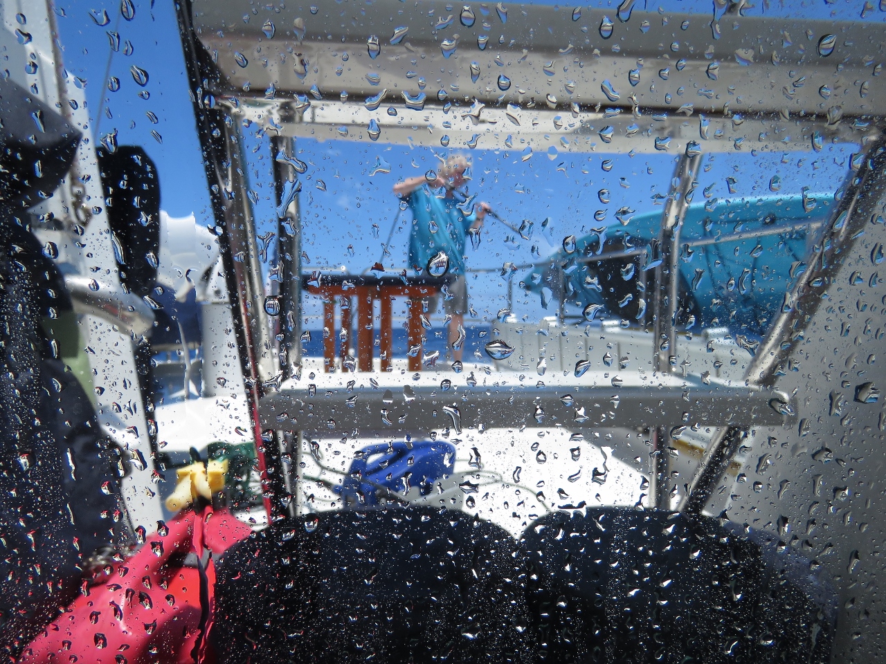 |
12/30/2015: Boat wash
Position: -24°5.80'S, 3°38.94'E
The boat was a little dirty from our last few days in Cape Town and lots of salt spray from the first two days underway, so James gave the boat a quick powerwash today. Its so much nicer to be able to walk around outside and not get return covered in salt.
|
 |
12/30/2015: Relaxed
Position: -23°49.53'S, 3°18.37'E
Everyone is enjoying the settled weather, especially Spitfire.
|
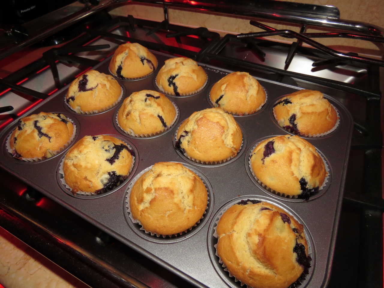 |
12/31/2015: Muffins
Position: -23°3.28'S, 2°20.13'E
Fresh-baked blueberry muffins for breakfast.
|
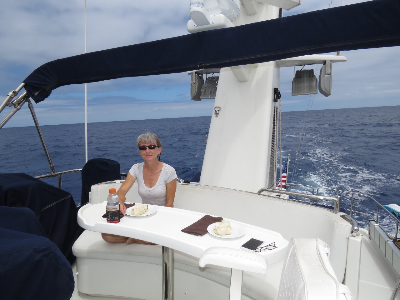 |
12/31/2015: Lunch
Position: -22°26.43'S, 1°33.96'E
With the boat clean and conditions so calm, we had lunch on the flybridge and lingered for a few hours after.
|
 |
12/31/2015: New Year's Eve
Position: -22°8.13'S, 1°11.83'E
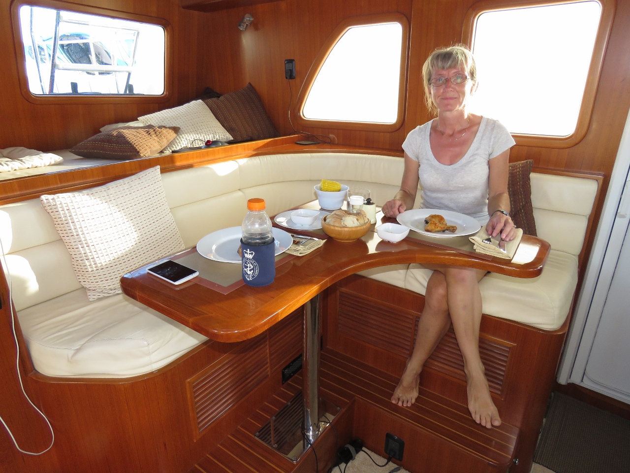
Roast peri-peri chicken for a special New Year's Eve dinner.
|
 |
12/31/2016: Happy New Year
Position: -22°4.43'S, 1°7.38'E
The last sunset of 2015. Happy New Year.
|
 |
1/1/2016: Prime Meridian
Position: -21°8.19'S, 0°0.17'W
We just crossed the Prime Meridian and transitioned from the eastern to the western hemisphere.
|
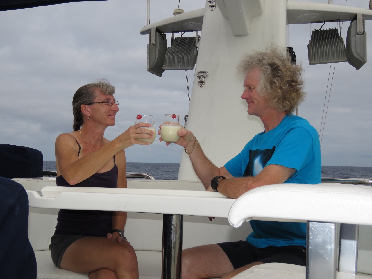 |
1/1/2016: Celebrate
Position: -20°32.69'S, 0°42.56'W
Virgin pina coladas before dinner to celebrate crossing the Prime Meridian and returning to the western hemisphere after two and a half years away. We crossed from west to east on the passage to Fiji in July of 2013.
|
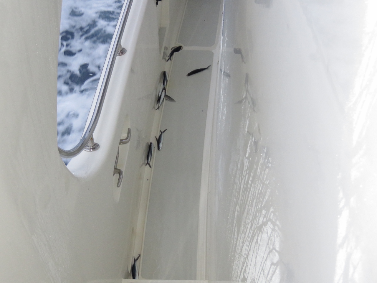 |
1/2/2016: Flying fish
Position: -19°38.57'S, -1°45.45'W
The boat was literally covered in flying fish this morning. We found at least 20 on deck.
|
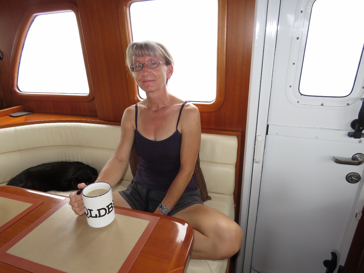 |
1/2/2016: Morning coffee
Position: -19°18.08'S, -2°9.01'W
Jennifer enjoying a morning coffee in our big, new coffee mug courtesy of the Amazon QLDB team.
|
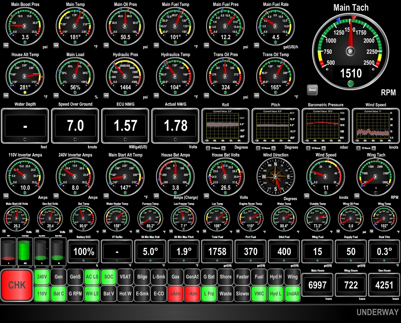 |
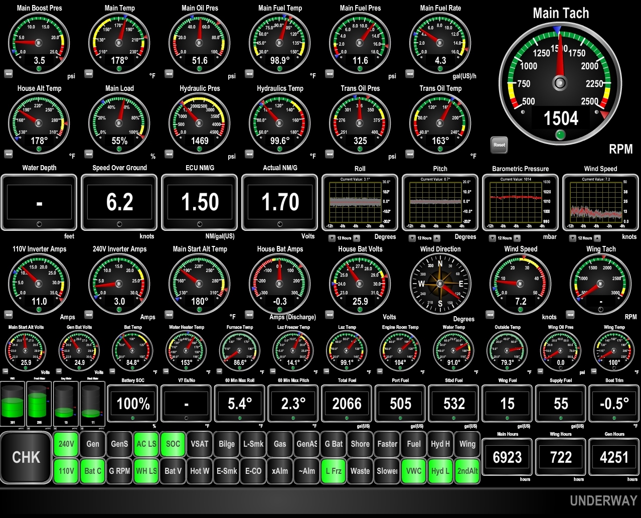
1/2/2016: Conditions
Position: -18°51.09'S, -2°39.93'W
Conditions have improved slightly as expected, and are just wonderful. Seas are below five feet, with winds around 10 knots, and pitch and roll are barely noticeable. The speed and fuel economy have been somewhat variable, but are great right now as we're making 7 knots at 1.78 nm/gallon. ((The check light and external alarm lights are on due to underway maintenance.)
|
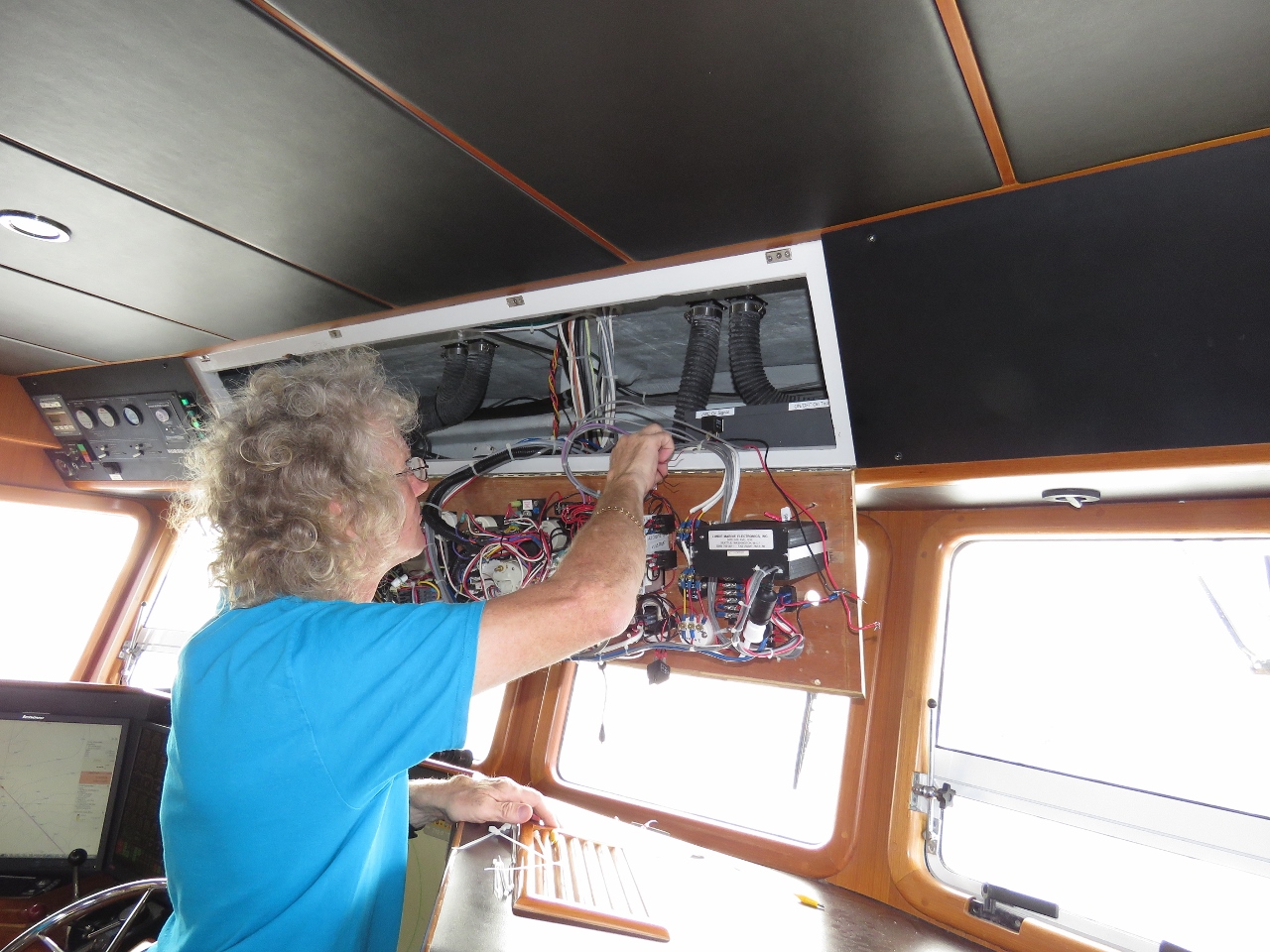 |
1/2/2016: Start alternator
Position: -18°48.24'S, -2°43.20'W
James is making the change to take the start alternator parallel circuit from semi-automatic to full programmatic control with a manual switch override.
|
 |
1/2/2016: 7,000 hours
Position: -18°41.03'S, -2°51.46'W
We just hit 7,000 hours on the main engine. It's hard to believe our "new" boat has 7,000 hours on it.
|
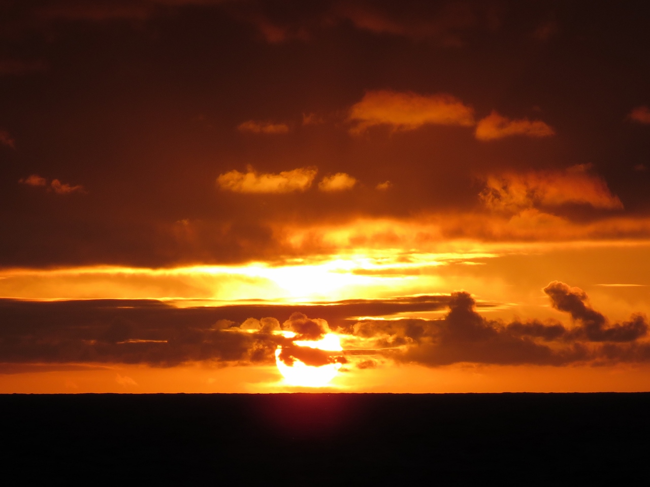 |
1/2/2016: Sunset
Position: -18°40.96'S, -2°51.54'W
.
|
 |
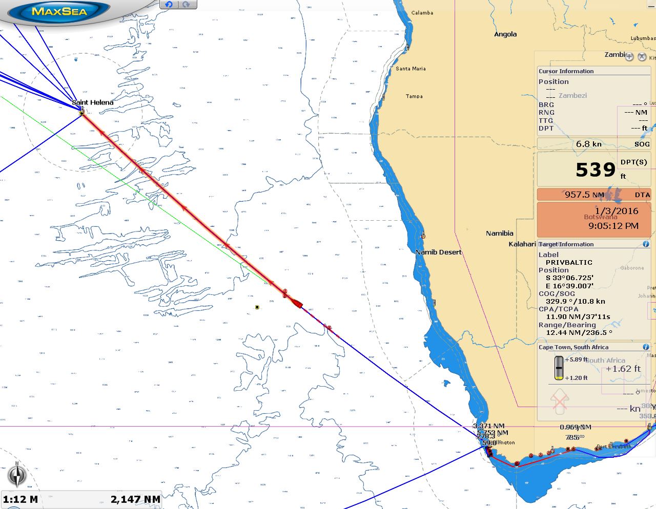
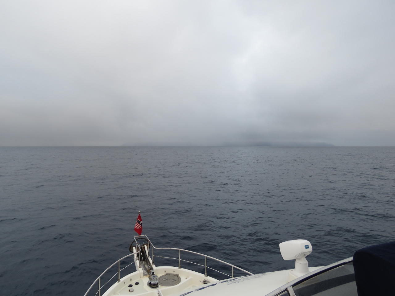
1/3/2016: Below 200
Position: -17°58.80'S, -3°39.23'W
We're less than 200 miles out of St. Helena now and can see the island and the boat together on the chartplotter.
|
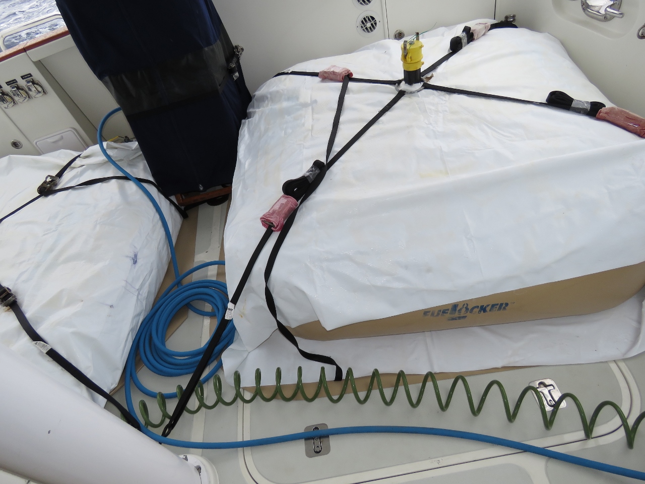 |
1/3/2016: Bladders
Position: -17°29.78'S, -4°11.38'W
We're in the process of draining the cockpit bladders. The port bladder still is full, but the starboard bladder now is partially empty. The blue hose attaches to a fitting on the starboard bladder near the cockpit door and snakes across the floor to the bulkhead fitting. (See Fuel for the Crossing for details of our fuel transfer process.)
|
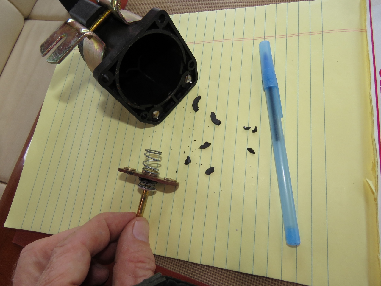 |
1/3/2016: Relay failure
Position: -17°21.27'S, -4°20.81'W
Our start alternator parallel relay, despite being the "biggest, smokin'est" 24v relay on the market, failed today. We don't have a spare, so James took it apart to see if he could fix it. The connector plate slide (in James' hand) had melted slightly, causing the relay to jam on, and the insulator broke up at the connector slide plate. Both issues are heat-related. James did manage to rebuild it and get it operational again, but we really need a new one.
|
 |
1/3/2016: Storage
Position: -17°15.69'S, -4°26.96'W
We got a muffin fan out of storage under the pilot house settee to cool the start alternator relay when in use. Whenever we open up a storage area, Spitfire is in there instantly. He knows our storage areas better than we do.
|
 |
1/3/2016: Bladders drained
Position: -16°43.56'S, -5°2.41'W
Both bladders are drained and we're back to nearly full tanks again.
|
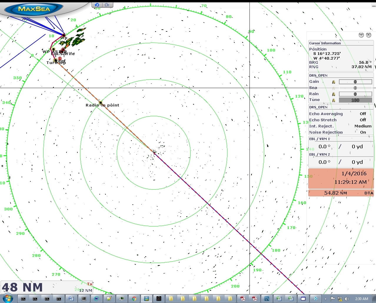 |
1/4/2016: Radar
Position: -16°34.15'S, -5°12.79'W
We're less than fifty miles out of St. Helena now and the island is showing up clearly on the radar.
|
 |
1/4/2016: Land Ho!
Position: -16°9.46'S, -5°39.94'W
We can just barely make out St. Helena about 15 miles away.
|
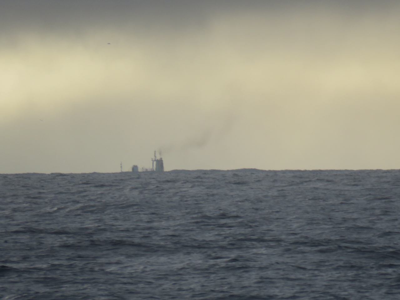 |
1/4/2016: RMS.
Position: -16°6.89'S, -5°42.77'W
The RMS St Helena, known localy as just "the RMS", is arriving this morning from Cape Town as well. They're doing 14 knots, so made the trip in less than half our time. The ship actually left St. Helena the day we left Cape Town and has been there and back in the time we travelled here.
|
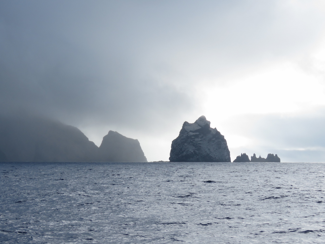 |
1/4/2016: Speery Island
Position: -16°1.88'S, -5°47.14'W
Looking east to Speery Island on St. Helena's ruggerd southern coast.
|
 |
1/4/2016: Egg Island
Position: -15°57.92'S, -5°46.97'W
The small grey island on the right is Egg Island and on either side of the central peak are Swanley and Old Woman's Valley. We were disappointed that the island was so shrouded in clouds and we might not get a view of the dramatic shoreline, but the visibiliy is improving as we approach.
|
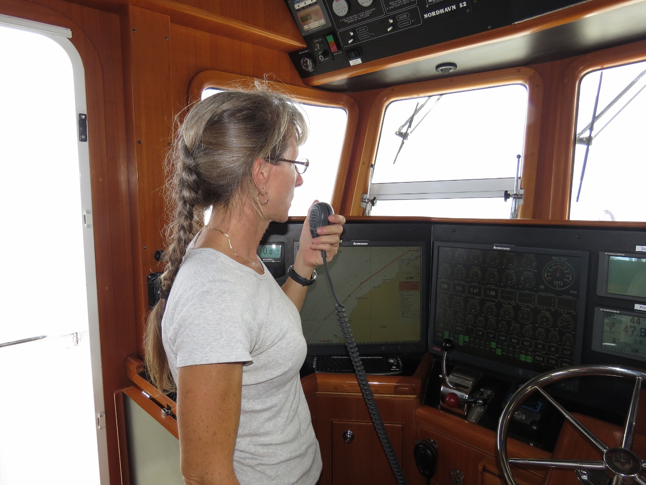 |
1/4/2016: Harbour Master
Position: -15°56.88'S, -5°45.92'W
We called Radio St. Helena when we were within 20 miles of arriving then later called the Harbour Master for a buoy assignment as we neared Jamestown.
|
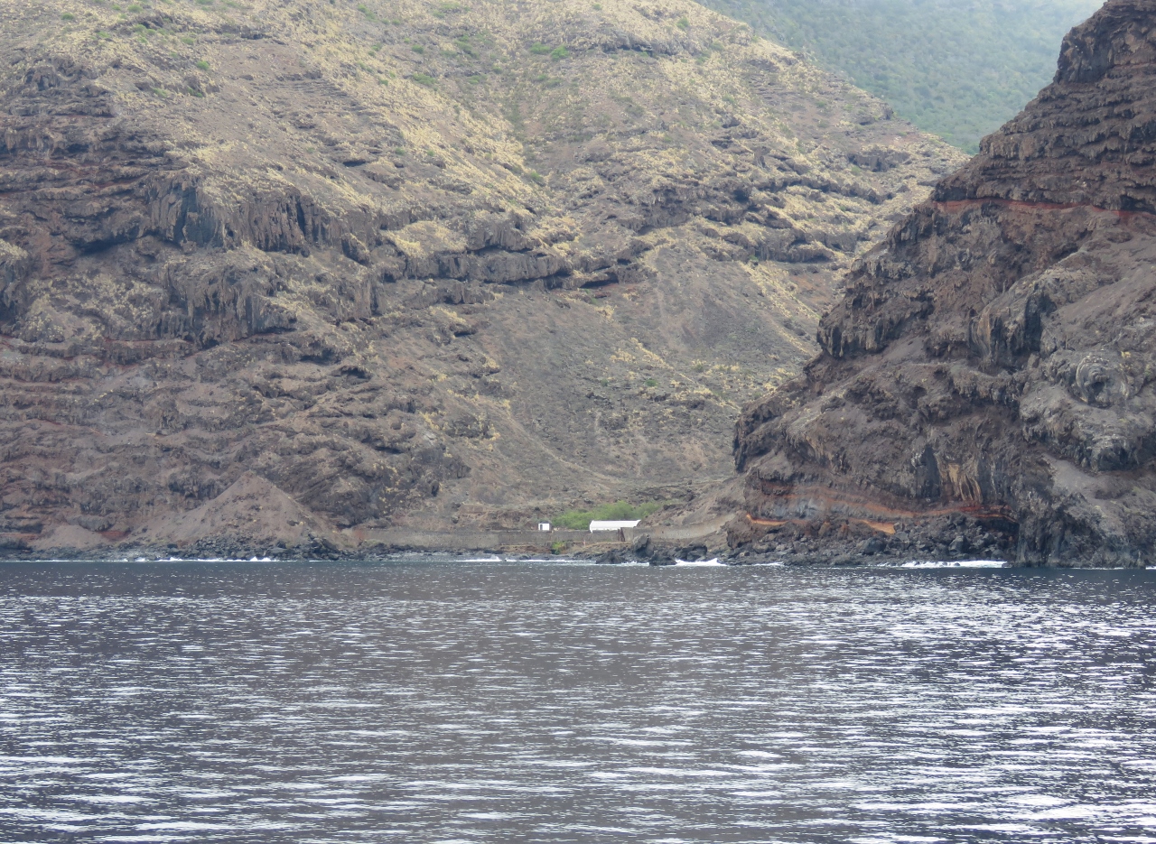 |
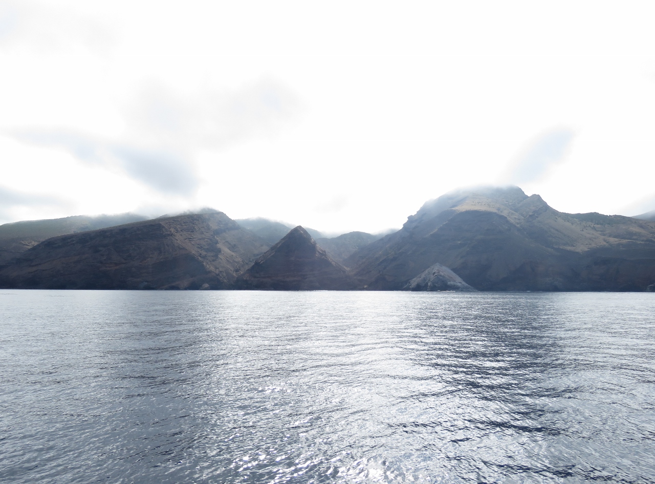
1/4/2016: Quarantine Station
Position: -15°56.13'S, -5°44.96'W
The old Quarantine Station in Lemon Valley.
|
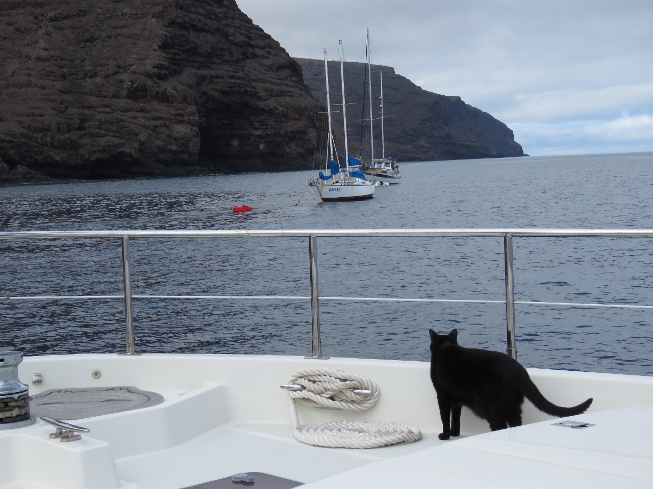 |
1/4/2016: Moored
Position: -15°55.49'S, -5°43.51'W
Spitfire inspecting our mooring. He's always concerned when he can see other boats nearby. We normally don't use a buoy, as most seem to be rated for 20 tons, but the new moorings at St. Helena can handle 50 tons.
|
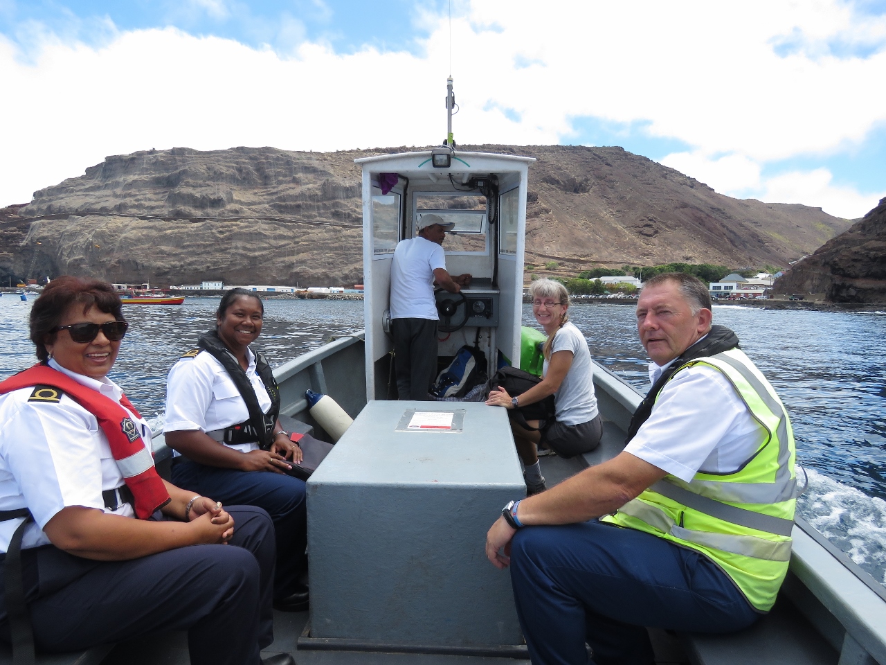 |
1/4/2016: Ferry
Position: -15°55.37'S, -5°43.27'W
Customs (left) and the Harbour Master came out on the harbour ferry to clear us through. We had to wait an hour or so while they cleared the RMS through, but they were fast and efficient once on board. We then rode back them on the ferry into Jamestown.
|
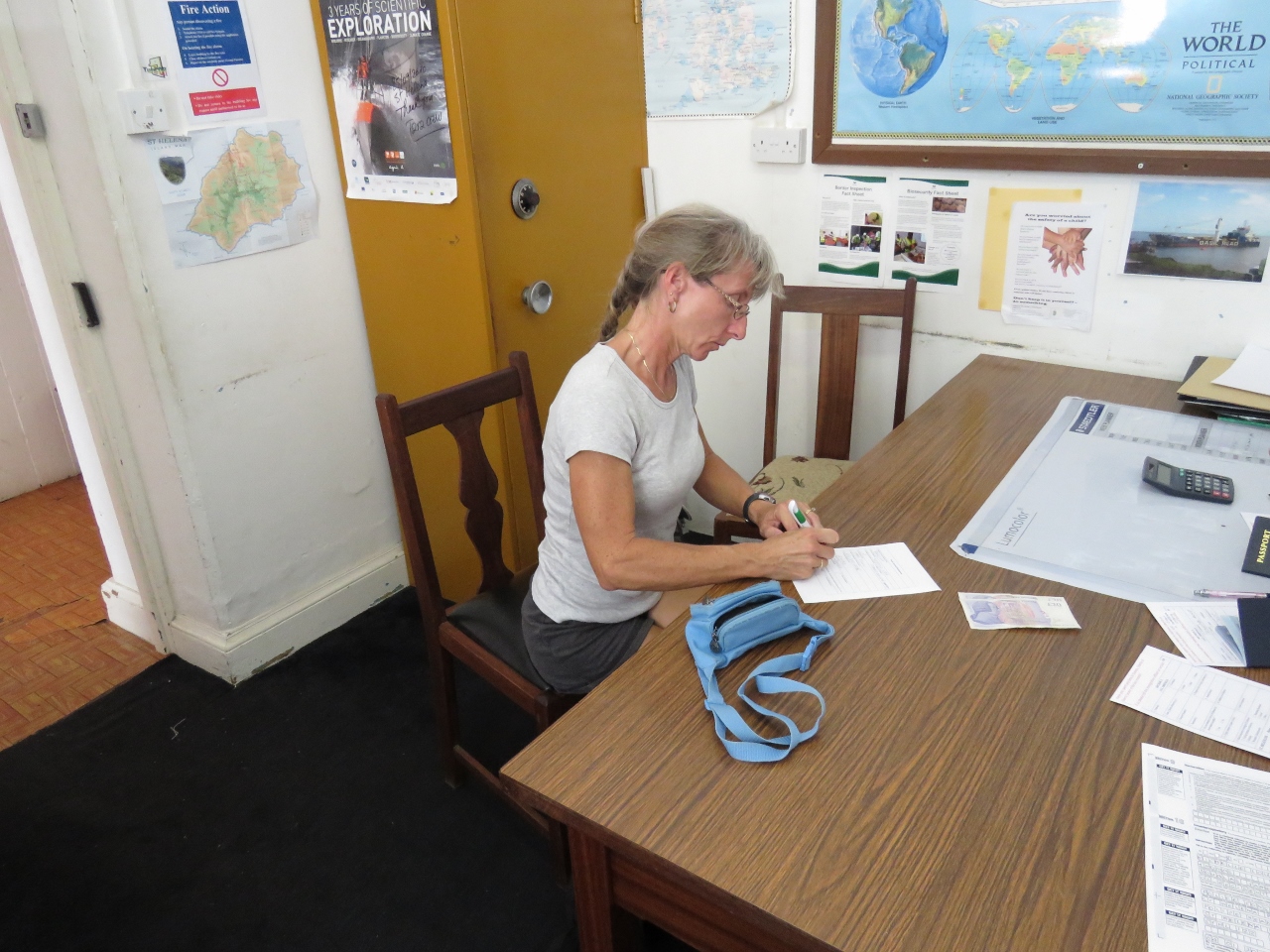 |
1/4/2016: Immigration
Position: -15°55.52'S, -5°43.10'W
Once ashore, we went to the local police station to clear immigration. As with Customs, this was an efficient process with little paperwork.
|