MV Dirona travel digest for Vanuatu 2013

|
Click the travel log icon on the left to see these locations on a map,
with the complete log of our cruise. On the map page, clicking on a camera or text icon will display a picture and/or log entry for that location, and clicking on the smaller icons along the route will display latitude, longitude and other navigation data for that location. And a live map of our current route and most recent log entries always is available at //mvdirona.com/maps/LocationCurrent.html. |
 |
9/2/2013: At sea
Position: -18°2.83'S, 176°47.15'E
The roll gauge shows the transition to sea from inside Fiji's barrier reef. Winds are in the mid-twentys, higher then expected, with perhaps 6-8-foot seas on the stern quarter at 8 or so seconds apart. A little more boat motion than we'd like, but tolerable.
|
.jpg) |
9/3/2013: 370 miles out
Position: -18°21.41'S, 175°49.12'E
We're 370 miles out of Vanuatu and expect to arrive in about 48 hours. Conditions have settled down to match GRIB predictions of 15-knot winds with 6' seas on 9 seconds, for a much smoother ride.
|
.jpg) |
9/3/2013: BGAN
Position: -18°36.16'S, 175°1.89'E
Our BGAN satellite terminal temporarily secured to the upper helm chair. The antenna must be aimed towards the satellite--depending on where we are, we typically can find a place to mount it while underway without having to steer it. At anchor, we usually need to manually steer the terminal to keep it aimed to account for boat motion, but underway we're directionally stable enough on auto-pilot that we don't have to.
|
 |
9/3/2013: Boat motion
Position: -18°46.16'S, 174°26.71'E
Boat roll is reducing as conditions continue to settle. We're now at a comfortable 6-7' seas on 9-10 seconds.
|
.jpg) |
9/3/2013: Squall
Position: -18°52.08'S, 174°5.13'E
Squall approaching, visible on the radar.
|
.jpg) |
9/4/2013: Sunrise
Position: -19°14.14'S, 172°53.06'E
Conditions remain good--we should be in Vanuatu by tomorrow morning and just miss the weather system that's going to hit on Thursday.
|
.jpg) |
9/4/2013: Breakfast
Position: -19°16.25'S, 172°46.53'E
Fresh-backed cinnamon buns for breakfast.
|
.jpg) |
9/4/2013: Spitfire
Position: -19°34.02'S, 171°34.96'E
When boat motion is minimal, Spitfire often sleeps on the floor, but with his feet against a solid surface to minimize his movement.
|
.jpg) |
9/4/2013: Sunset
Position: -19°36.24'S, 171°28.80'E
Conditions still good with 15 kt SE winds and the seas at about 6' on 10 seconds.
|
.jpg) |
9/4/2013: Roll
Position: -19°45.95'S, 170°56.04'E
Boat roll has steadily decreased as conditions improved.
|
.jpg) |
9/5/2013: Forty-five miles out
Position: -19°56.91'S, 170°20.29'E
We're about 45 miles out from out entry port at the island of Aneityum (pronounced a-night-chum).
|
.jpg) |
9/5/2013: Aneityum on radar
Position: -19°58.68'S, 170°13.18'E
Aneityum now is visible on radar about 25 miles out. The rest of the radar images are waves and squalls.
|
.jpg) |
9/5/2013: Land ho
Position: -20°1.95'S, 170°2.48'E
We're now in sight of Aneityum and should land in a few hours. The winds are starting to pick up now and are blowing steady in the mid 20s from the SSE, so looks like we just beat the weather.
|
.jpg) |
9/5/2013: Rainbow
Position: -20°5.52'S, 169°51.50'E
Rainbow as we cross along north side of Aneityum.
|
.jpg) |
9/5/2013: Clearing through
Position: -20°14.23'S, 169°46.62'E
Shortly after we'd anchored with our quarantine flag flying, the police skiff arrived. At left is the policeman representing customs and immigration, center is quarantine and at right is the boatsman. The clearance process was efficient--we'd prefilled the clearance paperwork and had only a few small forms to fill on arrival--and were cleared through in about a half-hour.
|
.jpg) |
9/5/2013: Analgawhat
Position: -20°14.63'S, 169°46.11'E
Looking north to the village of Analgawhat. The village population is about 300, with a total island population of around 900.
|
.jpg) |
9/5/2013: Mystery Island
Position: -20°14.63'S, 169°46.11'E
We'd moved the boat closer to Mystery Island for better wave protection--that predicted storm definately had arrived.
|
.jpg) |
9/5/2013: Fuel filter
Position: -20°14.63'S, 169°46.11'E
We have two off-engine fuel filters that we can switch between with a valve when the engine is running, and today we changed the filter the one we were using. The filter had 6 PSI of pressure and we usually change it when the pressure reaches around 5-7 PSI. We found the filter very black, so we may have some fuel contamination. The filter ran for 424 hours so, if there is an issue, it's not yet a big problem.
|
.jpg) |
9/5/2013: Hydraulics pump
Position: -20°14.63'S, 169°46.11'E
We've been seeing higher-than-normal temperatures and lower-than-normal water flow in the hydraulics cooling system. On investigating, we found the water pump impeller had all blades in place, but each one was 80% detatched. Then we found the pump was leaking slightly and the seal retainer had partly rusted away. The impeller clearly needed replacing. But since the pump is a mission-critical part, we decided to change it, and keep the old one for emergencies.
|
.jpg) |
9/5/2013: Sunset
Position: -20°14.63'S, 169°46.11'E
Our first Vanuatu sunset.
|
 |
9/6/2013: Atovaquone/Proguanil
Position: -20°14.63'S, 169°46.11'E
Vanuatu has a low-to-moderate malaria risk, according to the Centers for Disease Control. The risk is lower in the south where we are though. We'll of course try to avoid a mosquito bite in the first place, but are taking an antimalarial just in case.
|
 |
9/6/2013: Transmission pressure sensor
Position: -20°14.63'S, 169°46.11'E
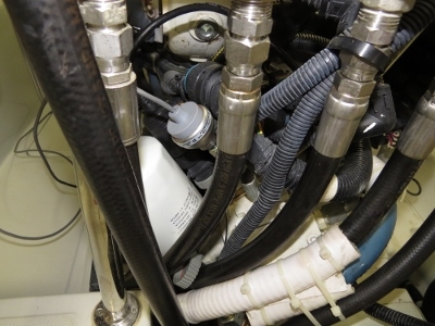
The main engine transmission pressure sensor has been faulting once every 9 to 12 months since installed. We replaced it with Setra product instead.
|
 |
9/6/2013: Dinghy
Position: -20°14.63'S, 169°46.11'E
Replacing the dinghy trim tab gas struts. The dinghy was not getting up on plane quickly because both struts had failed due to water ingress damaging the strut seals.
|
 |
9/6/2013: Gas tank repair
Position: -20°14.63'S, 169°46.11'E
We resealed the valve-to-container and hose-to-valve fittings in both boat-deck gasoline storage tanks. Gasoline, or some gasoline additives, appear to break down the Teflon tape used as sealant.
|
 |
9/6/2013: Floating rocks
Position: -20°14.63'S, 169°46.11'E
Floating volcanic rocks that washed up onto the swim platform.
|
 |
9/6/2013: Village path
Position: -20°14.63'S, 169°46.11'E
We landed ashore to walk around a bit. Several villages are strung along shore, connected by a foot path.
|
 |
9/6/2013: Traditional dwelling
Position: -20°14.63'S, 169°46.11'E
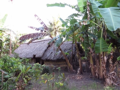
Some more modern construction techniques were in use. But many of the buildings, particularly the homes, were in the traditional style. As in French Polynesia, all the yards and pathways were well-kept, and many with nice gardens.
|
 |
9/6/2013: Oven
Position: -20°14.63'S, 169°46.11'E
Each village had what looked like a community area--this one had a stone oven.
|
 |
9/6/2013: Baby goat
Position: -20°14.63'S, 169°46.11'E
One of two baby goats with mama. We saw a lot of chickens and dogs too.
|
 |
9/6/2013: Church ruins
Position: -20°14.63'S, 169°46.11'E
Runis of the 1000-person church that Presbyterian missionary Rev. John Geddie built in the mid-1800s. Before European diseases decimated the population, 3,500 people lived on the island.
|
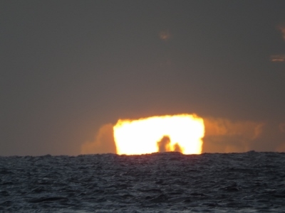 |
9/6/2013: Sunset
Position: -20°14.63'S, 169°46.11'E
.
|
 |
9/7/2013: Jetty
Position: -20°14.65'S, 169°46.08'E
Tied off to the jetty at Mystery Island, with Aneityum Island visible in the background. The water is a wonderful shade of torquoise. The jetty is for cruise ships that regularly arrive and bring hundreds of tourists to Mystery Island for the day.
|
 |
9/7/2013: Buoys
Position: -20°14.65'S, 169°46.08'E
When the cruise ship comes in, the locals install temporary navigation buoys to mark the safe path to the jetty. The buoys aren't permanently placed because storms would take them out.
|
 |
9/7/2013: Mystery Island
Position: -20°14.64'S, 169°46.08'E
Several informational signs had been installed around the island for the cruise ship passengers.
|
 |
9/7/2013: Cannibal Soup
Position: -20°14.64'S, 169°46.08'E
Who's for dinner? :) Cannibalism was common in Vanuatu until relatively recently--the last officially recorded incident was in 1969. And to quote Marten Troost from Getting Stoned with Savages, "It seemed to me that if people were still officially gnawing at human limbs in 1969, it was more than possible that, since then, there had been some off-the-books cannibalism going on in Vanuatu".
|
 |
9/7/2013: Market Place
Position: -20°14.64'S, 169°46.08'E
The Mystery Island Market Place is huge, with room for several dozen vendors. When the cruise ship comes in, locals fill these stall to ply their wares to the passengers.
|
 |
9/7/2013: Mystery Island Airport
Position: -20°14.64'S, 169°46.08'E
A small grass runway on the island servers Aneityum. A plane had arrived shortly after we landed.
|
 |
9/7/2013: "Local" products
Position: -20°14.64'S, 169°46.08'E
Weaved goods arriving by plane. We'd heard that much of the "local product" sold at the Market Place was imported from China. :)
|
 |
9/7/2013: Trails
Position: -20°14.64'S, 169°46.08'E
Well-tended walking trails circled and crossed the island. Overall, the cruise-ship infrastructure was quite tastefully done.
|
 |
9/7/2013: Marine protected area
Position: -20°14.65'S, 169°46.07'E
Mystery Island is a marine protected area--no fishing or removal of any sea life is allowed.
|
 |
9/7/2013: South reef
Position: -20°14.65'S, 169°46.08'E
Looking out across the southern reef.
|
 |
9/7/2013: Sunset
Position: -20°14.64'S, 169°46.08'E
Another beautiful Analgawhat sunset.
|
 |
9/8/2013: Pacific Dawn
Position: -20°14.65'S, 169°46.07'E
P&O Lines cruise ship Pacific Dawn arriving this morning.
|
 |
9/8/2013: When 450 yards of swing room seems snug
Position: -20°14.66'S, 169°46.08'E
Pacific Dawn anchored about 450 yards away. That's a lot of swing room, but the 800-foot ship will consume much of it.
|
 |
9/8/2013: Strong winds and abrasion
Position: -20°14.65'S, 169°46.07'E
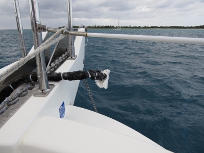
The remains of our snubber after it parted. (A snubber is a line between the anchor chain and the boat, to take strain off the windlass, give the rode some elasticity, and isolate the boat somewhat from the noise of chain scraping across rock on the bottom.) With the big winds we've been having, the snubber was under enourmous loads. In addition, we think because the boat was moving around a lot, the loose loop of the chain was chafing against the snubber line for days in a row. Our spare is now in use, with longer anti-chafe in place where the snubber line might rub against the chain.
|
 |
9/8/2013: Dinghy chock shims
Position: -20°14.65'S, 169°46.07'E
The forward removable chocks that support the dinghy on the boat deck were slightly loose, and creaked in heavy seas. So we created 1/2" wide by 5" long aluminum shims to snug them up.
|
 |
9/8/2013: Spotlight failure
Position: -20°14.65'S, 169°46.07'E
The bow spotlight failed--apparently you can only take saltwater pounding into a spotlight for 3-4 years. We found rust in the circuit-board and the relay that turns the light on had so much resistance the light barely glowed. James wired in a workaround for an off-circuit-board relay and it's back to working perfectly.
|
 |
9/8/2013: Returning home
Position: -20°14.65'S, 169°46.07'E
Villagers returning home from Mystery Island after the cruise ship departed. The nav marker is one of the several temporary ones put out for the cruise ship.
|
 |
9/8/2013: Sunset
Position: -20°14.65'S, 169°46.07'E
.
|
 |
9/9/2013: Nav system rewire
Position: -20°14.65'S, 169°46.07'E
Most autopilots have NAV mode, which essentially asks the pilot to steer to a plotted route rather than just in a specific direction. It's particularly useful in cross-currents and strong winds, or when travelling longer distances. NAV mode has not worked on our system since day one, and we finally got it working today. In the picture, you can see the jumper cables while we were testing a temporary fix that we've since wired in permanently.
|
 |
9/10/2013: Carnival Spirit
Position: -20°14.65'S, 169°46.07'E
The second cruise cruise ship this week, Carnival Spirit, arrived this morning. Like the Pacific Dawn, they sent one boat ashore with just crew first. But intead of running passengers ashore after, they left. Perhaps the weather was too rough? The Pacific Pearl arrived the next day, making that three cruise ships in one week.
|
 |
9/11/2013: Fishing float
Position: -20°11.60'S, 169°42.78'E
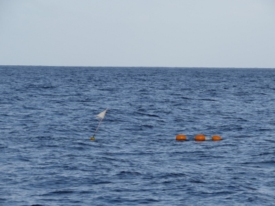
A flagged float offshore as we headed north to Tanna Island. We'd enjoyed the five nights anchored at Analgawhat--we'd been busy in preparing to leave Fiji, and will be busy again before running to New Zealand near the end of September. It was nice not to have anything pressing to do, and to just take our time catching up on work and boat projects, and relaxing.
|
 |
9/11/2013: 2,500 generator hours
Position: -20°8.33'S, 169°42.11'E
We just crossed 2,500 hours on the generator. And earlier this month we crossed 3,500 hours on the main engine.
|
 |
9/11/2013: Yasur Volcano
Position: -19°37.56'S, 169°33.55'E
Smoke visible from Yasur Volcano as we approach Tanna Island.
|
 |
9/11/2013: Approaching Port Resolution
Position: -19°30.69'S, 169°30.66'E
Nearing the entrance to the anchorage at Port Resolution.
|
 |
9/11/2013: Rock formations
Position: -19°31.30'S, 169°29.81'E
Complex weather-carved rock formations off the east shore of the anchorage mouth.
|
 |
9/11/2013: Charts
Position: -19°31.64'S, 169°29.60'E
The charts for Analgawhat were reasonable, but for Port Resolution aren't confidence-inspiring. That green area our red route line crosses is charted as reef, but actually is hazard-free. We've been using the Rocket Guide for Cruising Vanuatu--which includes satellite imagery and waypoints--and have found it most helpful, and accurate.
|
 |
9/11/2013: Ashore
Position: -19°31.64'S, 169°29.60'E
Our micro-tender beached with the locals' outrigger canoes.
|
 |
9/11/2013: Port Resolution Yacht Club
Position: -19°31.64'S, 169°29.60'E
The village at Port Resolution maintains quite a nice facility for visitors, including cabins and a clubhouse with seating for a couple of dozen. Jennifer is wearing jeans for the first time we think since leaving San Francisco. We'll be visiting Yasur Volcano this afternoon/evening and it can get cold up the mountain at night.
|
 |
9/11/2013: Port Resolution anchorage
Position: -19°31.64'S, 169°29.60'E
View to anchorage from the yacht club grounds--Dirona is anchored left of the other boats in the middle distance. Two other boats were there when we arrived, and six others were anchored by the time we left Port Resolution. The anchorage has plenty of room for at least a dozen boats though--much more space than we expected.
|
 |
9/11/2013: Primary school
Position: -19°31.64'S, 169°29.60'E
We had some time before our truck left for the volcano, so we walked to the village. This is the village primary school--several dozen kids were playing soccer in the field behind.
|
 |
9/11/2013: Rush hour
Position: -19°31.64'S, 169°29.60'E
Locals walking along the road towards the village.
|
 |
9/11/2013: Giant Banyan
Position: -19°31.64'S, 169°29.60'E
Tanna Island is known for its giant banyan trees (nabangas). We saw some much larger than this one.
|
 |
9/11/2013: On the road
Position: -19°31.64'S, 169°29.60'E
Riding in the back of a pickup truck with the people from the other two anchored boats for the half-hour ride up to the volcano.
|
 |
9/11/2013: Exciting ride
Position: -19°31.64'S, 169°29.60'E
The ride to the volcano was an adventure in itself. The road was narrow, bumpy and steep, with sections nearly washed away in places.
|
 |
9/11/2013: At the volcano
Position: -19°31.64'S, 169°29.60'E
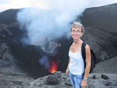
At the path leading up Yasur Volcano, with smoke belching from the volcano in the background. As we approached, we also could see debris frequently tossed high in the air.
|
 |
9/11/2013: Crater's edge
Position: -19°31.64'S, 169°29.60'E
Standing at the edge of Yasur Volcano, above the northern of its two calderas. Both calderas erupted often as we were there, tossing up large globules of bright orange molten lava. Yasur is the world's most accessible active volcano--its hard to imagine being much closer to one and living to tell about it. Its amazing standing on the edge of a caldera of molten lava that every minute or so explodes and shoots lava hundreds of feet over your head. We thought seeing the lava flows close-up on the Big Island in Hawaii was impressive, but this completely topped it.
|
.web.jpg) |
9/11/2013: Fireworks
Position: -19°31.64'S, 169°29.60'E
As night fell, the erupting volcano became an incredible fireworks display. We'll post more pictures and video when we get better connectivity.
|
 |
9/12/2013: Flopper-stopper repair
Position: -19°31.64'S, 169°29.60'E
One of the four chains supporting the flopper-stopper plate parted. We replaced it with a length cut from the old dinghy anchor chain and it's working great now. We're anchored in about eleven feet, and think the plate might have hit bottom and possibly snagged. As a temporary measure, we installed anti-chafe at the half-way point on the line and and doubled the long flopper line. We'll get a shorter one made to use when annchored in under twenty feet of water. The longer line is easier to launch and recover, but won't work as well in shallow anchorages, so we'll use both.
|
 |
9/13/2013: Sunrise
Position: -19°31.64'S, 169°29.62'E
Sunrise as we depart Port Resolution. It's about a seven-hour run to our next anchorage, so we wanted to get an early start.
|
 |
9/13/2013: Mount Yasur
Position: -19°31.64'S, 169°29.62'E
Smoke belching from Mount Yasur as we travel along the east side of Tanna Island.
|
 |
9/13/2013: Dillon's Bay
Position: -18°49.68'S, 169°0.42'E
The more typical anchorage at Dillon's Bay is slightly farther north off the village at the Williams River mouth, but we found a more appealing spot off a small sand beach with steep cliffs and interesting rock formations. The winds were light the entire time we were there--conditions were so calm we didn't even consider the flopper-stopper.
|
 |
9/13/2013: Visitors
Position: -18°49.68'S, 169°0.42'E
Soon after we'd anchored, a skiff arrived from the village. Several groups stopped by to say hello and chat the few days we were anchored--everyone was extremely friendly and welcoming.
|
 |
9/13/2013: Starter replacement
Position: -18°49.68'S, 169°0.42'E
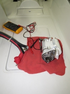
We replaced the starter on the wing engine this afternoon. The wing wouldn't start as we came into the anchorage--we use it to help power our hydraulic anchor winch. Generating hydraulic pressure and positioning the boat on just the main engine was slightly more difficult, but generally it went fine. The old starter was seriously overheated to the point of filling the engine room with smoke in the summer of 2011 when the engine hydro-locked up in Prince William Sound. We're happy it lasted as long as it did. We've since configured the Wavenet engine control and monitoring system to not continue trying to start if the engine won't turn, which protects the starter from overheating.
|
 |
9/14/2013: Reefs
Position: -18°49.68'S, 169°0.42'E
Touring around shore near our anchorage. The visibility here is excellent--we can clearly see the reefs 45 feet below our anchored boat.
|
.web.jpg) |
9/14/2013: Diving
Position: -18°49.68'S, 169°0.42'E
After checking out possible dive sites, near where we were anchored seemed among the best. So we dove right off the boat. The topography was quite interesting, with lots of healthy coral.
|
.web.jpg) |
9/14/2013: Gap
Position: -18°49.68'S, 169°0.42'E
One of several swim-through gaps we encountered. Overall it was an excellent dive.
|
 |
9/15/2013: Williams River
Position: -18°49.68'S, 169°0.42'E
At high tide we could run the dinghy over the river bar and into the Williams River (the bar depth at low tide was less than three feet). The village is strung out along the shore.
|
 |
9/15/2013: Swimmers
Position: -18°49.68'S, 169°0.42'E
Today was a Sunday and a number of the village children were out swimming in the river.
|
 |
9/15/2013: Village girls
Position: -18°49.68'S, 169°0.42'E
These two girls followed us along the shore, sprinting where shrubbery blocked their view and walking casually past when out in the open.
|
 |
9/15/2013: End of the road
Position: -18°49.68'S, 169°0.42'E
We got about a half kilometer up the river. With our kayaks or the micro-tender, we could have portaged up to the next level, but wouldn't have been able to get far until the next set of rapids.
|
 |
9/15/2013: Fresh fruit
Position: -18°49.68'S, 169°0.42'E
One of the villagers paddled out to the boat with a load of fresh produce. Among our purchases was delicious papaya and lemons.
|
 |
9/15/2013: Margaritas
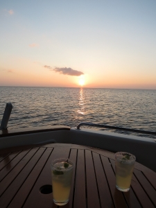
Position: -18°49.68'S, 169°0.42'E
Margaritas at sunset.
|
 |
9/16/2013: Follow-up lever
Position: -18°49.68'S, 169°0.42'E
A follow-up lever is used at the helm to request a specific rudder angle. For boats so equipped, it's easier and faster than turning the wheel. Our follow-up levers had an installation issue where they were unable to command more than 3/4 of full rudder travel, which reduces maneuverability in close quarters and docking situations. Here James is investigating the cause of the problem. We ended up solving it by modifiying the follow-up levers to swing farther to the left and right.
|
 |
9/16/2013: Sunset
Position: -18°49.68'S, 169°0.42'E
Spitfire enjoying the sunset.
|
 |
9/17/2013: Underway
Position: -18°37.49'S, 169°0.94'E
We had an easy run to Ponomias Bay in sunny and calm weather.
|
 |
9/17/2013: Ponomias Bay
Position: -18°37.82'S, 169°2.78'E
Looking west from our anchorage at Ponomias Bay. A local from the village beyond the cliff paddled out to say hello shortly after we'd anchored.
|
 |
9/17/2013: Chart
Position: -18°37.82'S, 169°2.78'E
The chart were good at Dillon's Bay, but pretty bad here. According to the chart, we're on land.
|
 |
9/17/2013: Creek
Position: -18°37.82'S, 169°2.78'E
Walking the creek at the head of the anchorage. Our micro-tender is by the tree in the distance along the left bank.
|
 |
9/17/2013: Hike
Position: -18°37.82'S, 169°2.78'E
Dozens of trails crisscrossed the area. We followed one north of the creek that was reasonably well-trod and climbed up steeply, hoping for a view down into the anchorage. We couldn't get near our cove, or the water even, but did get some nice views across the island.
|
 |
9/17/2013: Ruins
Position: -18°37.82'S, 169°2.78'E
Back near the creek, we found several areas that once were enclosed with barbed-wire fences that had partly fallen down. Probably the ruins of early European loggers or missionaries.
|
 |
9/17/2013: Oranges
Position: -18°37.82'S, 169°2.78'E
Orange and lemon trees growing north of the creek.
|
 |
9/17/2013: Grave
Position: -18°37.82'S, 169°2.78'E
Grave near the other ruins. We couldn't make out the writing.
|
 |
9/17/2013: Beach
Position: -18°37.82'S, 169°2.78'E
Taking a break after our hike.
|
 |
9/17/2013: Runnning the creek
Position: -18°37.82'S, 169°2.78'E
At high tide, we were able to work the micro-tender through the creek opening and a short way inside.
|
 |
9/17/2013: Down the creek
Position: -18°37.82'S, 169°2.78'E
View back down the creek to the anchorage.
|
 |
9/17/2013: Sunset
Position: -18°37.82'S, 169°2.78'E
.
|
 |
9/18/2013: 3600 hours
Position: -18°27.26'S, 168°53.03'E
Just hit 3,600 hours on the main engine.
|
 |
9/18/2013: Pango Point
Position: -17°46.86'S, 168°14.86'E
Navigation light on Pango Point on Efate Island as we approach Port Vila. We left at 4:40 this morning for the nine-hour run so we could arrive in good light.
|
 |
9/18/2013: Paray Bay
Position: -17°44.48'S, 168°18.77'E
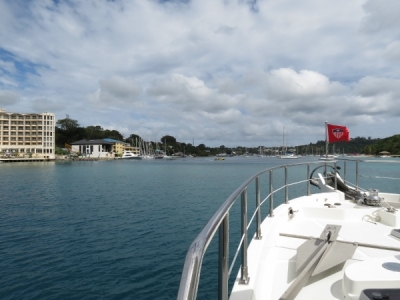
Entering Paray Bay in Port Vila Bay. We ran through the bay to look for anchorage, but ended up liking best the first spot we saw on the way.
|
 |
9/18/2013: Ships aground
Position: -17°44.77'S, 168°18.75'E
Two boats aground, one nearly sunk, on Iririki Island.
|
 |
9/18/2013: Port Vila customs
Position: -17°45.42'S, 168°18.04'E
When we checked in at Aneityum, we were given a cruising permit for the southern Vanuatu islands and Efate Island. The cruising permit must be handed it to Port Vila customs when we arrive. Should we leave Efeta Island to continue cruising in Vanuatu, we would need to get a new cruising permit for the next set of islands that we would visit up to the next customs check-in point.
|
 |
9/18/2013: Dinghy dock
Position: -17°44.64'S, 168°18.83'E
Our tender tied off at the Yachting World Marina dinghy dock. Busy place.
|
 |
9/18/2013: Cellular data
Position: -17°44.56'S, 168°18.87'E
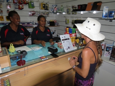
Buying a Digicel cellular data SIM card in Port Vila. They carried microSIMs at the store, so didn't need to use a "cutter" as in Fiji. Our Digicel account that we'd setup in Fiji worked in Vanuatu, but of course our Fiji SIM card didn't
|
 |
9/18/2013: Waterfront bar and grill
Position: -17°44.60'S, 168°18.83'E
Vanuatu Tusker beer at the Waterfront Bar and Grill.
|
 |
9/19/2013: Kourion
Position: -17°44.44'S, 168°18.67'E
The ship Kourion in Port Vila Bay.
|
 |
9/19/2013: Market
Position: -17°44.41'S, 168°18.85'E
The Port Vila market at around 6pm at night. It appears that everyone is staying the night.
|
 |
9/19/2013: Crystals
Position: -17°44.53'S, 168°18.85'E
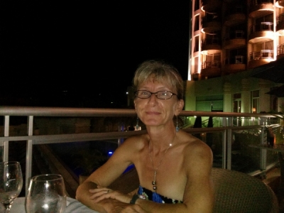
After walking around town a bit, we had a great dinner overlooking the bay at Crystals restaurant in the Grand Hotel.
|
 |
9/20/2013: V7 repair
Position: -17°44.44'S, 168°18.67'E
After five months out of KVH V7 territory, we're finally back. The bad news is that the V7 stopped working in the interim. We've tried swapping cables and here we're replacing the Low Noise Block (LNB) that KVH had shipped to Port Vila, but that didn't resolve the issue. The current diagnosis from KVH is that we need a new modem, an expensive part that we won't be able to have shipped to us until New Zealand.
|
 |
9/21/2013: Morning
Position: -17°44.44'S, 168°18.67'E
Calm morning in Port Vila Bay.
|
 |
9/21/2013: Capsize
Position: -17°44.44'S, 168°18.67'E
Lots of small boats buzz around the harbor. This couple on a small sailing cat spent a little time getting themselves righted, but eventually were underway.
|
 |
9/21/2013: Iririki Island Resort
Position: -17°44.60'S, 168°18.71'E
We landed the tender at the Iririki Island Resort dock to head in for dinner.
|
 |
9/21/2013: City lights
Position: -17°44.54'S, 168°18.62'E
Overlooking our anchorage from the deck of the Bali Hai Bar at the Iririki Resort. Dirona is center of the picture with the blue lights.
|
 |
9/21/2013: Fire dancers
Position: -17°44.54'S, 168°18.62'E
The resort had a pretty impressive fire dancer show shortly after sundown.
|
 |
9/21/2013: Watermark Restaurant
Position: -17°44.68'S, 168°18.67'E
After drinks, we had an excellent meal with a view over the bay at the Watermark Restaurant
|