MV Dirona travel digest for Cruising Prince William Sound Summer 2011

|
Click the travel log icon on the left to see these locations on a map,
with the complete log of our cruise. On the map page, clicking on a camera or text icon will display a picture and/or log entry for that location, and clicking on the smaller icons along the route will display latitude, longitude and other navigation data for that location. And a live map of our current route and most recent log entries always is available at //mvdirona.com/maps/LocationCurrent.html. |
.jpg) |
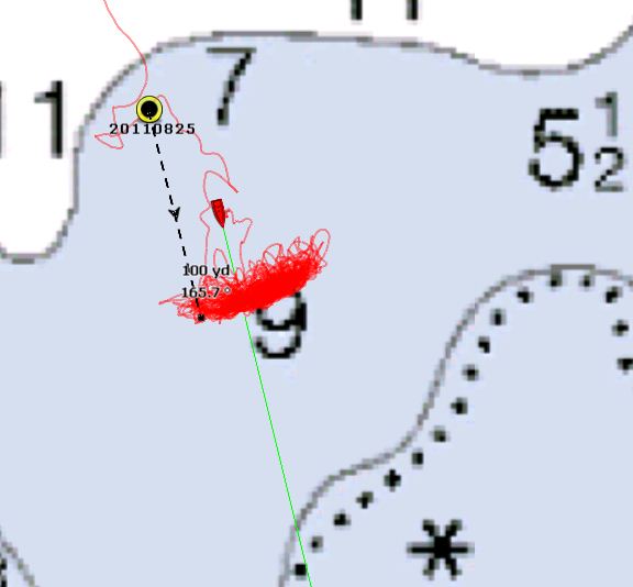
8/25/2011: Mallard Bay
Position: 60°17.49'N, -147°48.75'W
Old steam boiler in Drier Bay. We were planning to overnight in Barnes Cove, but were surprised to find a sailboat had beat us to it. We've hardly seen any pleasure craft the entire trip. The anchorage looked beautiful, but with 40-knot winds predicted for the night, we wanted plenty of swing room and didn't want to worry about another boat dragging onto us, so we kept the line moving. Northeast Cove also looked appealing, but swing room was limited and we dragged slightly on the first set. We found what we wanted in Mallard Bay--good holding and plenty of room for 5:1 scope or more. The wind howled all night, with gusts over 40, sending 2-3' waves into the anchorage. But we couldn't tell unless we went outside--the boat was quiet and solid. We did wear quite a path on the chart plotter though. |
_(448x600).jpg) |
8/25/2011: Old Chenega Village
Position: 60°16.81'N, -148°4.64'W
Ruins of the schoolhouse at Old Chenega Village visible through the trees. The village was abandoned after thirteen people, a third of the residents, died in the great 1964 Alaska earthquake. The sea level dropped more than 100 feet, then a 70-foot wave swept away much of village. |
_(600x444).jpg) |
8/25/2011: Princeton Retreat, Nassau Fiord
Position: 60°16.58'N, -148°20.82'W
We anchored for breakfast opposite Chenega Glacier. The glacier is massive--over a mile wide. Enough large pieces were dropping in the water to generate frequent large swells that gently rocked our boat at anchor, nearly two miles away from the glacier. Reaching the anchorage was relatively easy, but the rising tide had compressed the ice and leaving took more time and care. |
_(600x450).jpg) |
8/24/2011: Ewan Bay
Position: 60°24.03'N, -148°9.47'W
Anchored off the reversing tidal rapids at the head of Ewan Bay. We had lunch on the flybridge overlooking the rapids. Then we went on a 22nm dinghy tour of the area, first to Chenega Lagoon and then through Jackpot Bay. Chanega Lagoon would make a good anchorage, and Jackpot Bay is huge, with several nice spots. At the head of Chenega Lagoon, a black bear splashing in the creek appeared to be frolicking. When it came up with a salmon, we realized it was fishing. |
_(600x449).jpg)
.jpg) |
8/23/2011: Granite Bay
Position: 60°25.88'N, -148°1.10'W
We went "out for breakfast" after overnighting at Granite Bay and had our meal overlooking Granite Lake. The area is complex and interesting for dinghy exploration. We'd seen lots of bear scat when we were out walking, and saw a small black bear in one of the coves while we out exploring later in the dinghy. Bears are surprisingly nimble--this one crossed a cliff with only a small crack for purchase. |
_(600x383).jpg)
.jpg) |
8/23/2011: Port Nellie Juan Cannery
Position: 60°33.00'N, -148°9.95'W
Ruins of the Port Nellie Juan Cannery in McClure Bay. We toured the bay, but didn't go ashore, en route from Nellies Rest to Granite Bay. A tsunami from the great 1964 Alaska earthquake destroyed the cannery and killed the three caretakers on site. According to Lethcoe, the wave tossed one of the cannery barges 50 yards up into the woods on nearby Mink Island. |
.jpg) |
8/22/2011: Nellies Rest
Position: 60°28.43'N, -148°19.23'W
Nellie Juan Glacier, a three-mile dinghy run from the anchorage, towers over James in the dinghy. Unlike most glaciers we've seen, the front was deeply saw-toothed and several massive pieces had fallen away. Nellies Rest is a lovely anchorage. Multi-level bluffs front a sheer cliff, with cloud wisps drifting between them. As has frequently been the case on this trip, the entry was easier than the chart implied. We're used to 20,000-scale charts, and so something that looks tight on an 80,000 scale chart isn't nearly as bad as we expect. |
_(600x451).jpg) |
8/21/2011: Carrs Cove
Position: 60°44.56'N, -148°14.98'W
The HSC Chenega heading to Whittier through Wells Passage. In the background several seiners are working the south end of Esther Island. The rain finally stopped, and we spent the morning viewing the glaciers in Blackstone Bay, then anchored for the night in Carrs Cove at the north end of Culross Passage. The bluffs above the anchorage had good views south down Culross Passage and north across Wells Passage to Barry Glacier in Barry Arm. |
.jpg) |
8/20/2011: Beloir Glacier, Blackstone Bay
Position: 60°39.47'N, -148°40.50'W
We're now anchored for the night off Beloir Glacier where the glacier and adjacent lacy waterfall descend from 2,000 feet. The "small" boat shown in the photo is actually the 100' tour boat Emerald Sea. |
_(450x600).jpg) |
8/20/2011: Northland Glacier, Blackstone Bay
Position: 60°39.93'N, -148°41.72'W
After breakfast, we left Surprise Cove for Blackstone Bay. An impressive number of glaciers are there, along with some spectacular waterfalls. We anchored for lunch at Blackstone and Northland glaciers, where a dramatic fall plummets hundreds of feet. |
.jpg) |
8/20/2011: Surprise Cove Marine State Park
Position: 60°45.58'N, -148°23.51'W
We had the last of the Seattle strawberries for breakfast at Surprise Cove State Marine Park. The SubZero has a reputation as a power hog, but keeps food extremely well, especially combined with our Secret Coast food preservation techniques. Strawberries lasting nearly four weeks is impressive. |
.jpg) |
8/19/2011: Three Finger Cove
Position: 60°39.00'N, -148°20.64'W
Steady rain has continued and the barometer has fallen from 1010 to 984 in 24 hours--we've got big winds coming. We set well into the middle arm of Three Finger Cove--a lovely and cosy-feeling spot. Armed with rainsuits and Bean boots, we walked the Three Fingers Trail. Despite the rain and gusty winds, it was an enjoyable walk on a well-maintained trail through generally open meadows and past several small lakes. |
.jpg) |
8/18/2011: Granite Bay
Position: 60°55.29'N, -147°24.56'W
A thick fog filled Port Valdez when we left this morning, with visibility less than 500 feet. The dramatic shoreline of snug Granite Bay makes it an ideal anchorage for the downpour that replaced the fog. The more rain we get, the better the waterfalls. |
.jpg) |
8/17/2011: Valdez Small Boat Harbor
Position: 61°7.58'N, -146°20.52'W
We just took on 1,466 gallons of diesel at the commercial dock in Valdez. We're now moored at the Small Boat Harbor for the night, and will spend the rest of the day exploring Valdez. |
.jpg) |
8/16/2011: Beartrap Bay
Position: 60°44.79'N, -145°59.34'W
Lunch along the creek at the head of Beartrap Bay. Spawning salmon packed the waterway and the cries from hundreds of foraging seagulls had a jungle-like quality, as if mackaws and monkeys filled the nearby trees. We kept a good lookout--this was prime bear territory. As we write this, we're anchored below steep, snow-capped peaks, within view of a multi-level, several-hundred-foot waterfall. |
_(600x450).jpg) |
8/15/2011: Sheep Bay
Position: 60°41.43'N, -145°57.87'W
The crew of fishing vessel Keta of Cordova pulls in their net after a set in Sheep Bay. They set the net parallel and close to the shore, then the seiner released their end, hooked to a buoy about 50 feet from shore, and moved about a quarter mile away along the shore. The caption guided the vessel along the shoreline while two men on the bow slapped the water with plungers attached to long poles. They were herding fish towards the opening in the net between the buoy and the shore. The skiff meanwhile had maneuvered the other end along shore and back to the seiner. Once both net ends were back with the seiner, they tightened the purse and brought in a load of fish. |
.jpg) |
8/14/2011: Jade Harbor
Position: 60°58.29'N, -146°58.63'W
House-sized icebergs aground on Columbia Glacier's early 1980's moraine. This morning, we had considered a run to the head of Columbia Bay to view the glacier, but the bay was filled with ice across to Glacier Island. With the tide negative and rising, we didn't want to be trapped as the ice moved towards the head. |
.jpg) |
8/13/2011: Growler Bay
Position: 60°52.54'N, -147°7.95'W
A two-hour climb brought us to the 1,654' peak at the south end of Glacier Island, with astonishing views in all directions. Dirona was anchored far below us in Growler Bay, with Columbia Glacier visible sixteen miles beyond. |
.jpg) |
8/12/2011: The Cow Pens
Position: 61°2.63'N, -147°32.03'W
The warm, sunny weather has continued. Today we cruised slowly up Unakwik Inlet to Meares Glacier (pictured). Ice filled the inlet starting several miles away, but we were able to work our way through the bergy bits. Meares is one of the few advancing glaciers in the area, and is calving actively. We watched several huge chunks plummet into the water, generating big waves that crashed ashore. |
_(450x600).jpg) |
8/11/2011: Cascade Bay
Position: 60°55.03'N, -147°48.20'W
A soft, warm, easy anchorage after the rugged beauty and glacial-cooled temperatures in Harriman and College fiords. But not one without dramatic scenery. After a quick hike to the top of the falls, we're having a glass of wine on deck with the roar of the cascade behind. |
.jpg) |
8/10/2011: Harriman Glacier
Position: 60°58.45'N, -148°24.78'W
Wow, what a spot. We're anchored in 150', on 485' of chain, off Harriman Glacier. We wanted to be extra careful, so we set the anchor at 1,200 RPM (45 HP) for several minutes. Not a twitch. Now we get to sit, relax, and enjoy the scenery. |
.jpg) |
8/9/2011: Doran Strait
Position: 61°4.93'N, -148°11.51'W
We've stopped for the night at the mouth of Harriman Fiord. Glaciers surround us: to the north Cascade, Barry and Coxe glaciers, to the west Cararact and Surprise glaciers. And we can see part of Harriman Glacier and the 8,000' mountains beyond. |
_(443x600).jpg) |
8/8/2011: Wellesley Cove
Position: 61°11.01'N, -147°51.68'W
Wellesley Glacier dwarfs Dirona anchored in front. We're here after spending the day at Harvard Glacier up College Fiord. The weather mostly has been overcast and rainy, but cleared for a few hours at the glacier, enough that we could eat lunch on the flybridge in just T-shirts. We awoke the next morning to the wild sight of the glacier filling both stateroom portholes. |
.jpg) |
8/7/2011: Bettles Lagoon
Position: 60°57.64'N, -148°18.63'W
Sheltered Bettles Lagoon is a small basin with big scenery. High above us to the east, a waterfall tumbles down a 1,500' slope. The west view, however, is the standout: Bettles Glacier and flanking 4,000- and 5,000-foot, snow-capped mountains. Read more ... |
.jpg) |
8/6/2011: Shoestring Cove
Position: 60°51.83'N, -147°58.68'W
Entering Shoestring Cove isn't as difficult as the chart suggests. We went all the way to the head and anchored beneath 1,000'-2,000' ebony slopes ribboned with rain waterfalls. |
.jpg) |
8/5/2011: Disk Cove
Position: 60°29.47'N, -147°39.72'W
|
.jpg) |
8/4/2011: Constantine Harbor
Position: 60°21.05'N, -146°38.51'W
Sea otters everywhere, sheer cliffs, beautiful secluded anchorage. The anchor is down, the engine is off--time to relax.
|