MV Dirona travel digest for Marlborough Sounds and Nelson, New Zealand 2014

|
Click the travel log icon on the left to see these locations on a map,
with the complete log of our cruise. On the map page, clicking on a camera or text icon will display a picture and/or log entry for that location, and clicking on the smaller icons along the route will display latitude, longitude and other navigation data for that location. And a live map of our current route and most recent log entries always is available at //mvdirona.com/maps/LocationCurrent.html. |
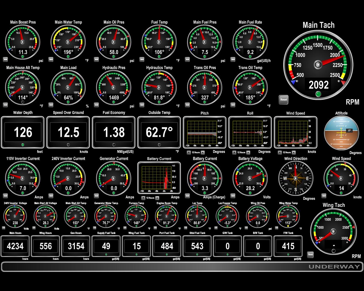 |
4/19/2014: 12.5 knots
Position: -41°21.93'S, 174°38.94'E
We left Chaffer's Marina about an hour before high tide at Wellington. The current was running at a good four knots with us as we rounded Sinclair Head, and we were making 12.6 knots when we'd normally be doing closer to 9 knots at that RPM. Winds were less than 10 knots with us as well, and conditions were calm. But this area has a nasty reputation for tidal rips when big winds blow against the current.
|
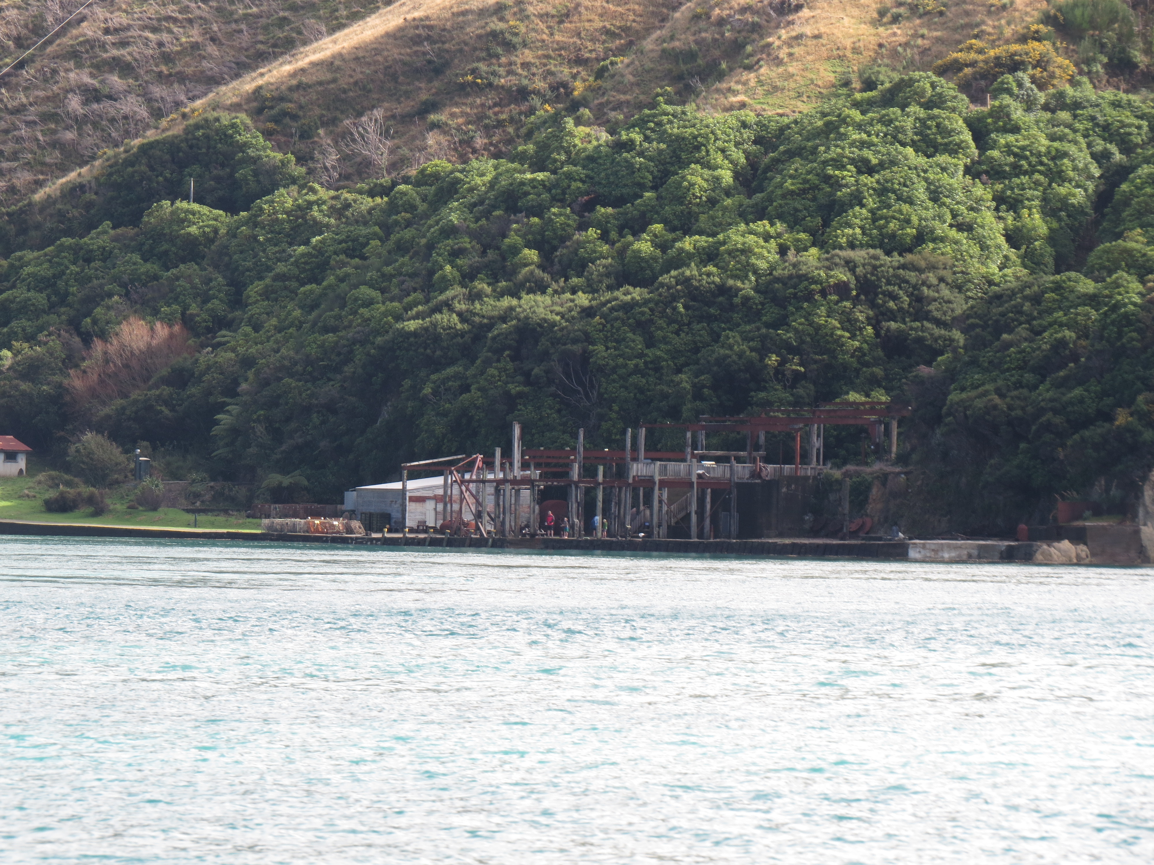 |
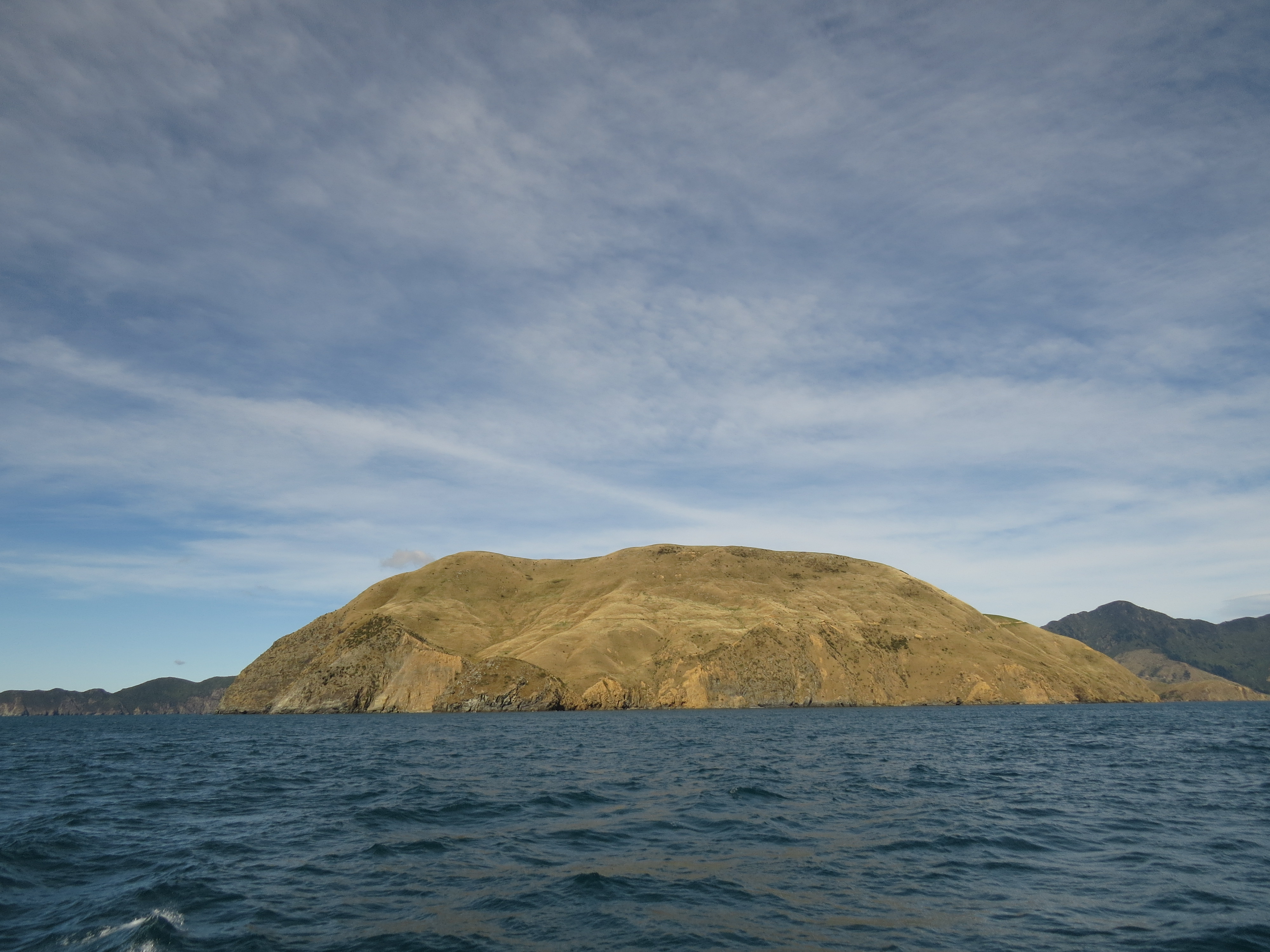
4/19/2014: Perano Whaling Station
Position: -41°12.66'S, 174°18.42'E
Skeletal ruins of the processing plant for an early 19th-century whaling station at Fisherman's Bay.
|
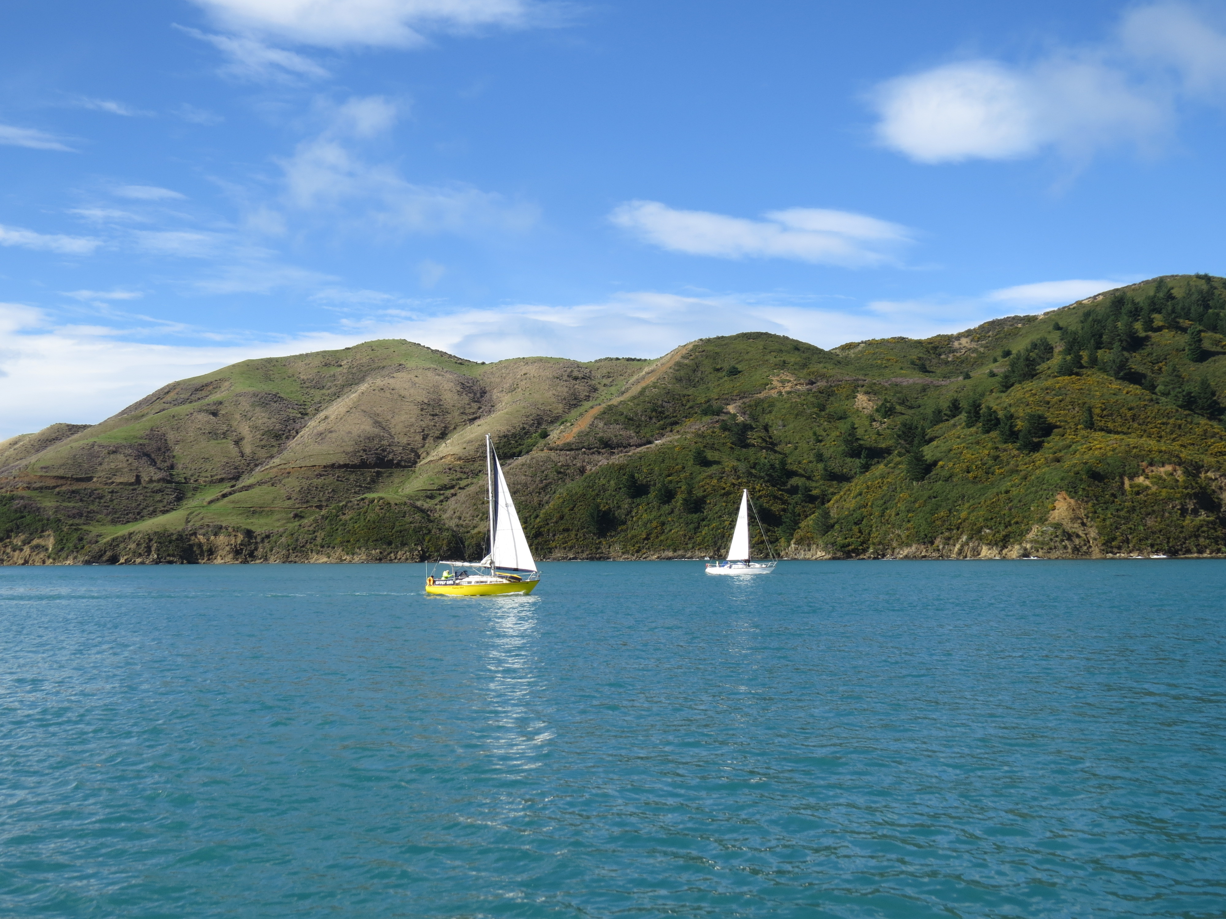 |
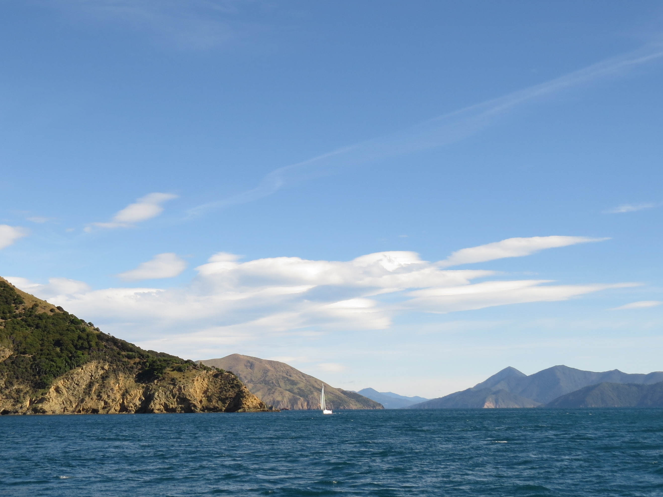
4/19/2014: Traffic
Position: -41°13.06'S, 174°17.47'E
At least a dozen other pleasure craft entered Tory Channel about the same time we did. We'd had some major storms the past few days, and it seemed like everyone had the same idea as when to cross. As with the last time we entered Marlborough Sounds, conditions were wonderfully calm and sunny inside.
|
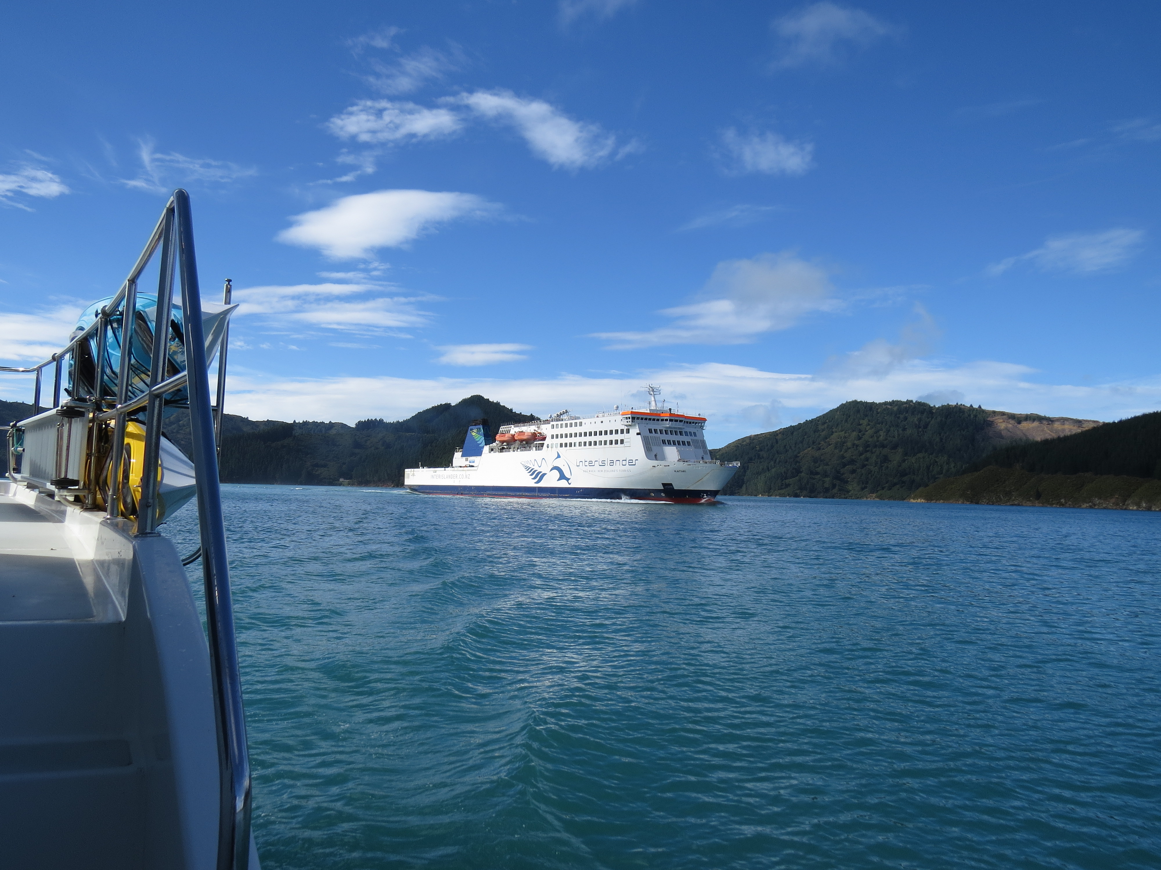 |
4/19/2014: Kaitaki
Position: -41°14.33'S, 174°14.82'E
Waiting for the Kaitaki to pass before turning south into Oyster Bay.
|
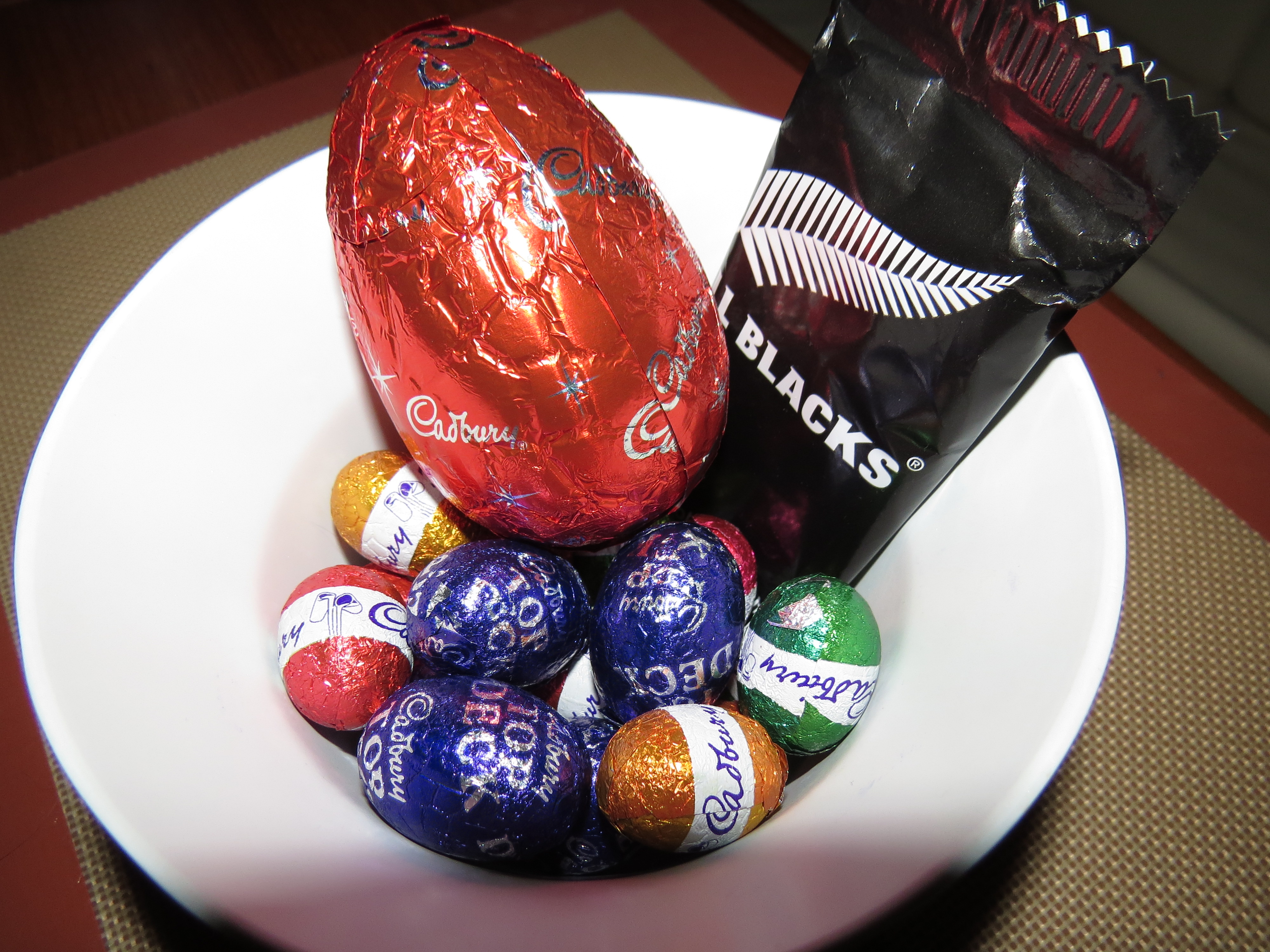 |
4/20/2014: Easter Sunday
Position: -41°15.01'S, 174°15.55'E
The loot from an Easter Egg hunt (not everything made it to the bowl).
|
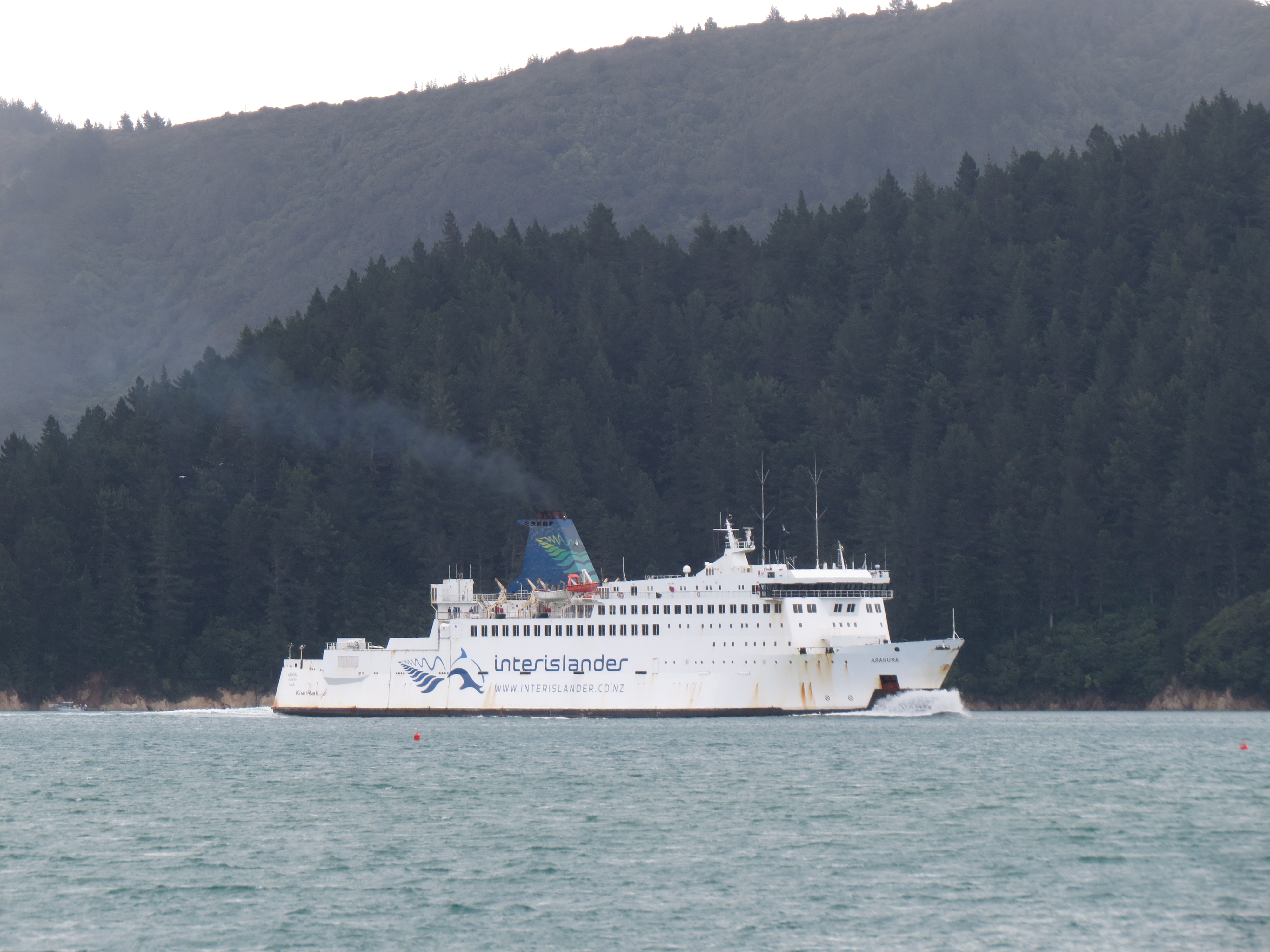 |
4/20/2014: Arahura
Position: -41°15.00'S, 174°15.55'E
We enjoyed the anchorage in Oyster Bay--particularly the view to the traffic out in Tory Channel.
|
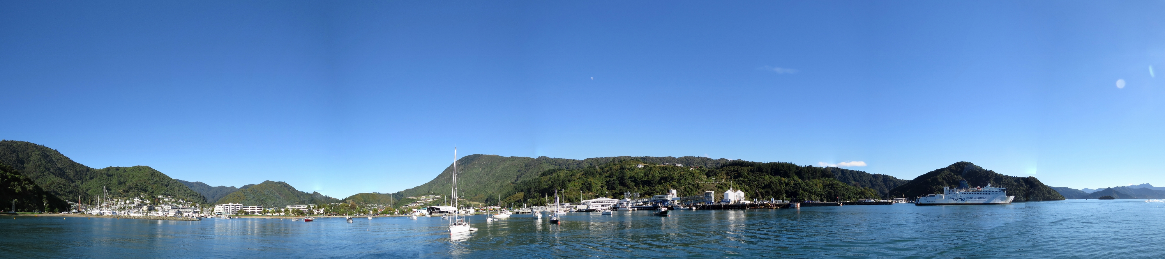 |
4/21/2014: Picton
Position: -41°17.11'S, 174°0.55'E
A panoramic view of Picton Harbor. Anchoring isn't allowed off the town, so after a pass through, we crossed over Lochmara Bay to anchor instead, and ran the dinghy the four miles dinghy into town.
|
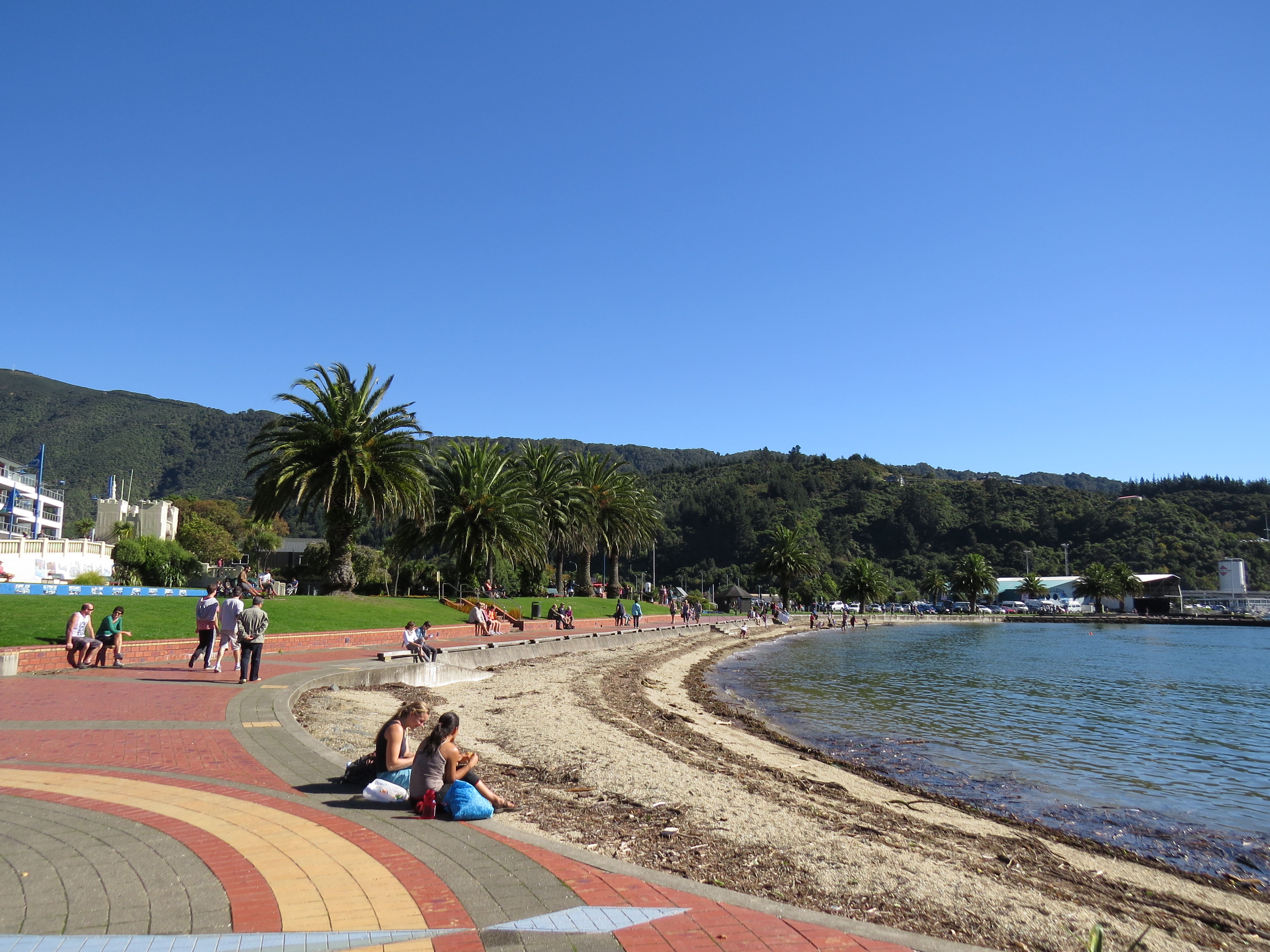 |
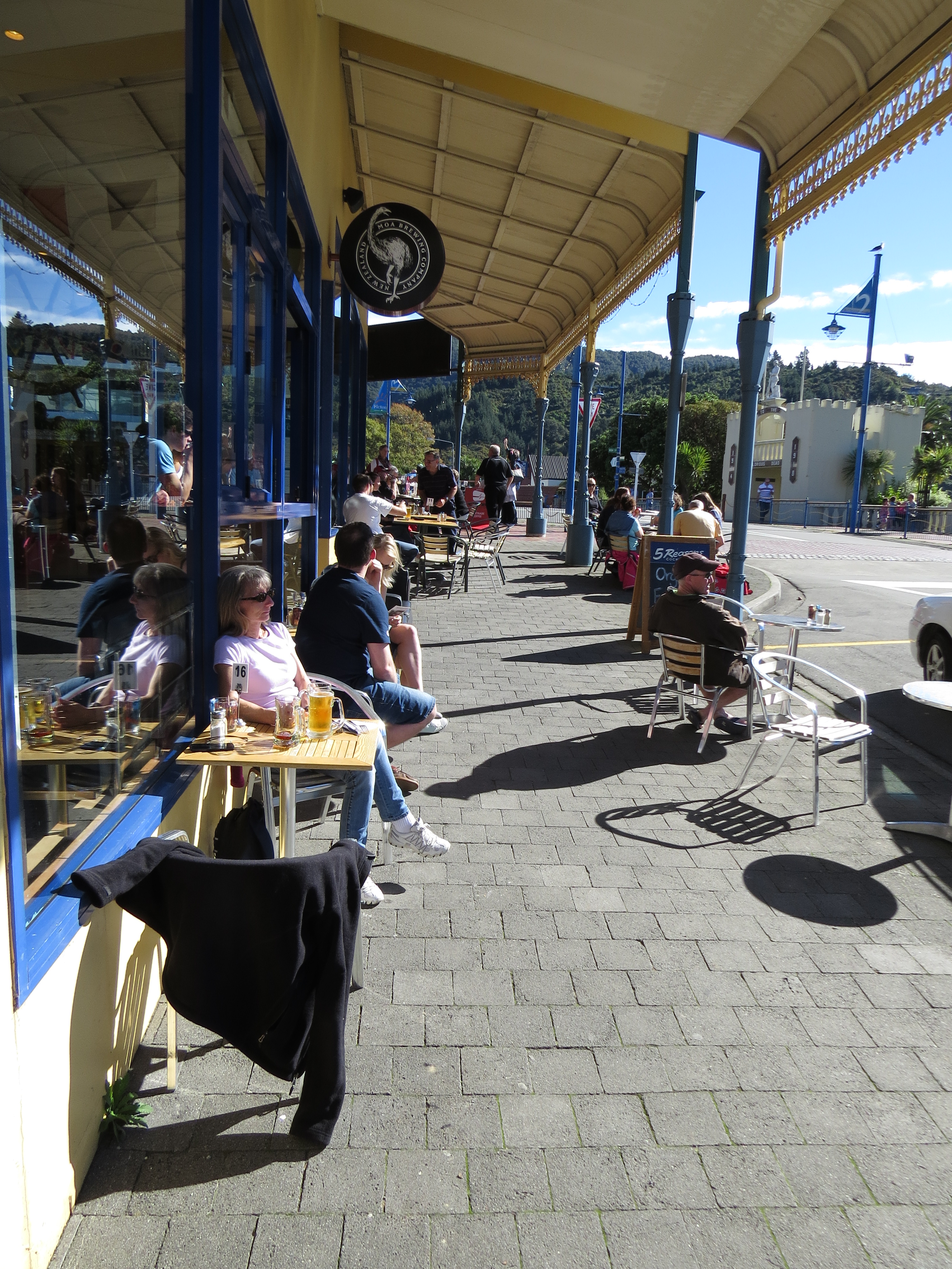
4/21/2014: Picton waterfront
Position: -41°17.29'S, 174°0.48'E
Picton is a tidy town with an excellent waterfront that was quite busy on this sunny and warm Easter Monday.
|
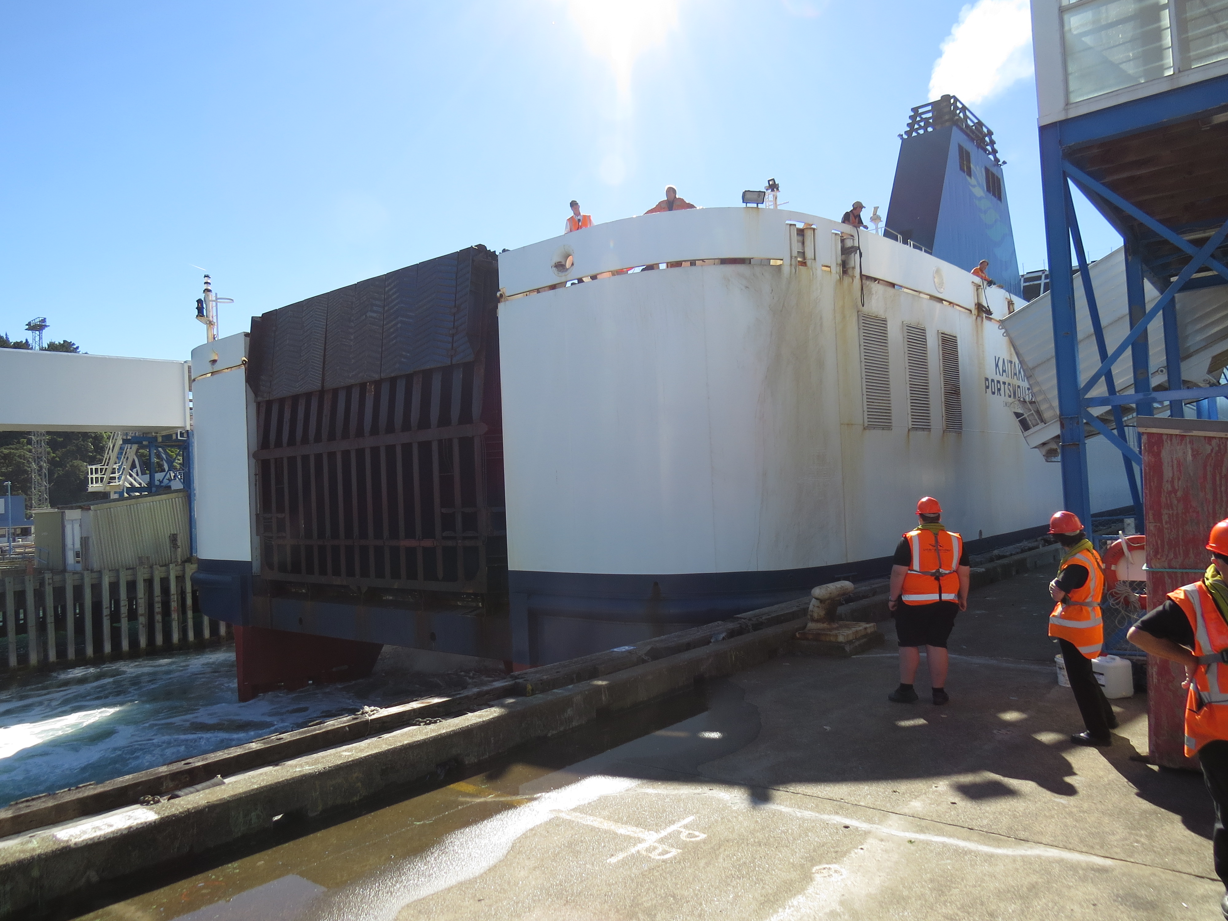 |
4/21/2014: Kaitaki
Position: -41°17.10'S, 174°0.35'E
Watching the Kaitaki backing into the berth, churning up the water behind.
|
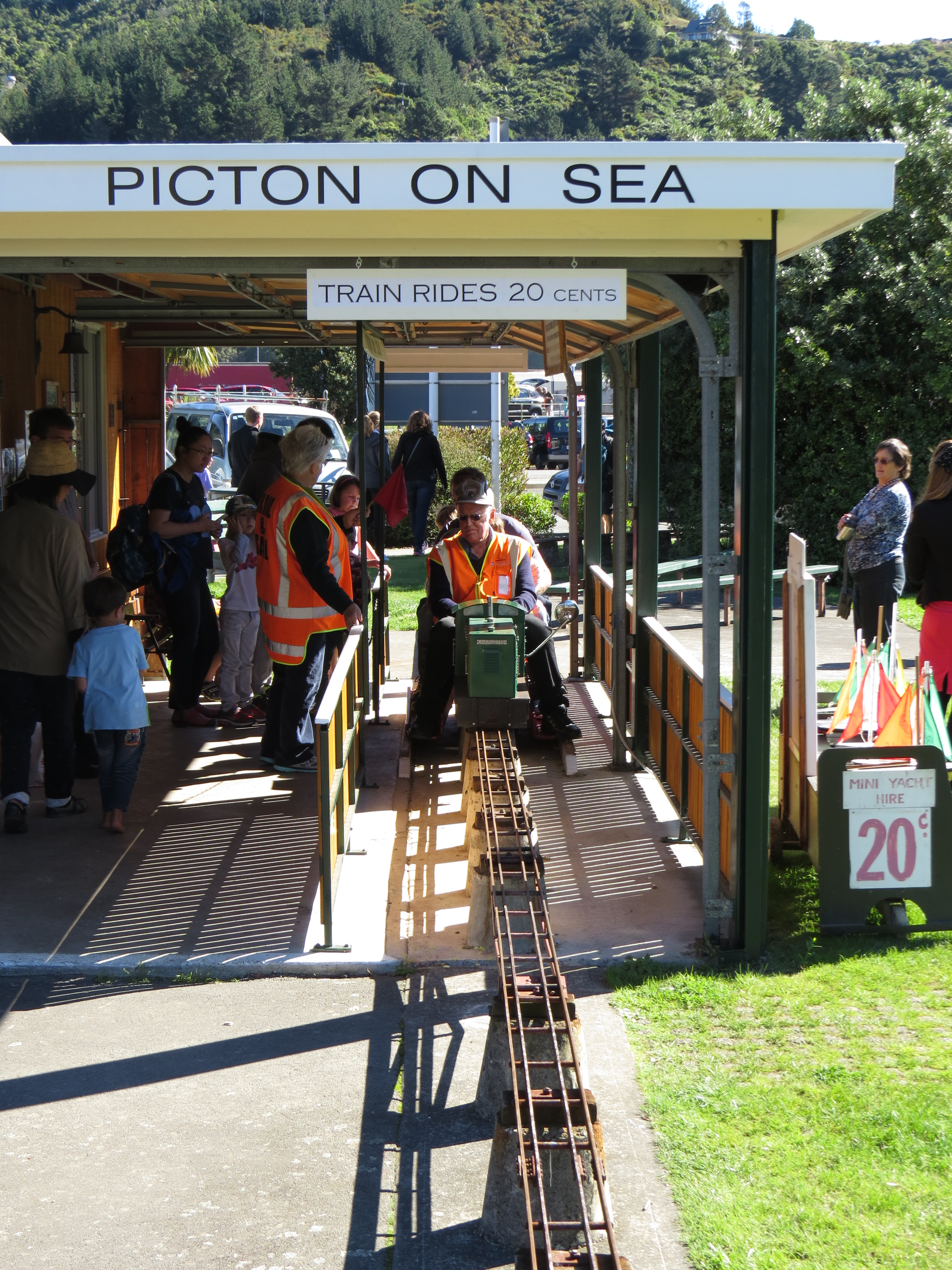 |
4/21/2014: Train rides
Position: -41°17.27'S, 174°0.35'E
The small model train that ran around a park near the waterfront was popular today.
|
 |
4/21/2014: Moa Brewing Company
Position: -41°17.33'S, 174°0.44'E
Lunch with a water view at Moa Brewing Company.
|
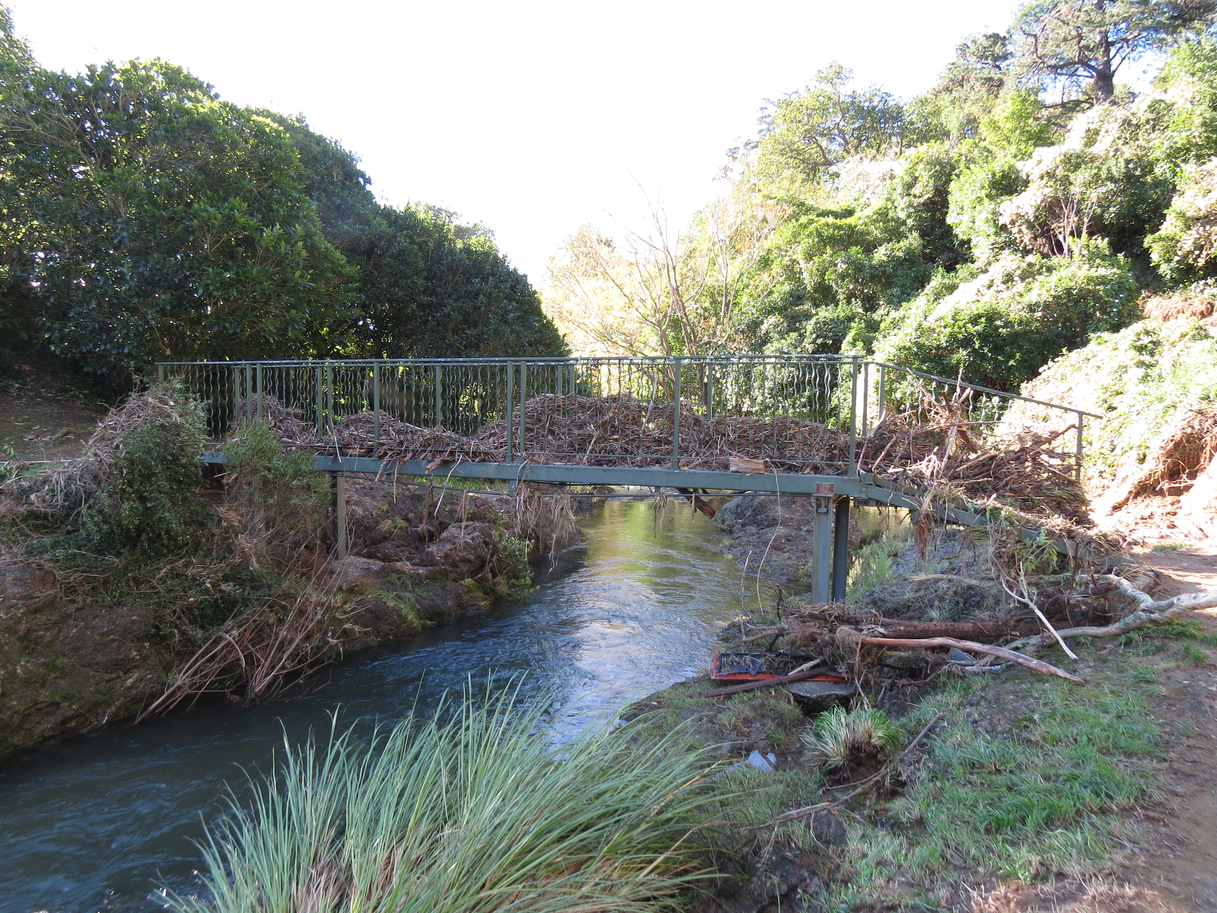 |
4/21/2014: Waitohi Stream
Position: -41°17.85'S, 174°0.35'E
We walked south along the Waitohi Stream towards the Tirohanga Track. All along we saw signs that the creek had recently risen well beyond it's banks, particularly this bridge packed with debris.
|
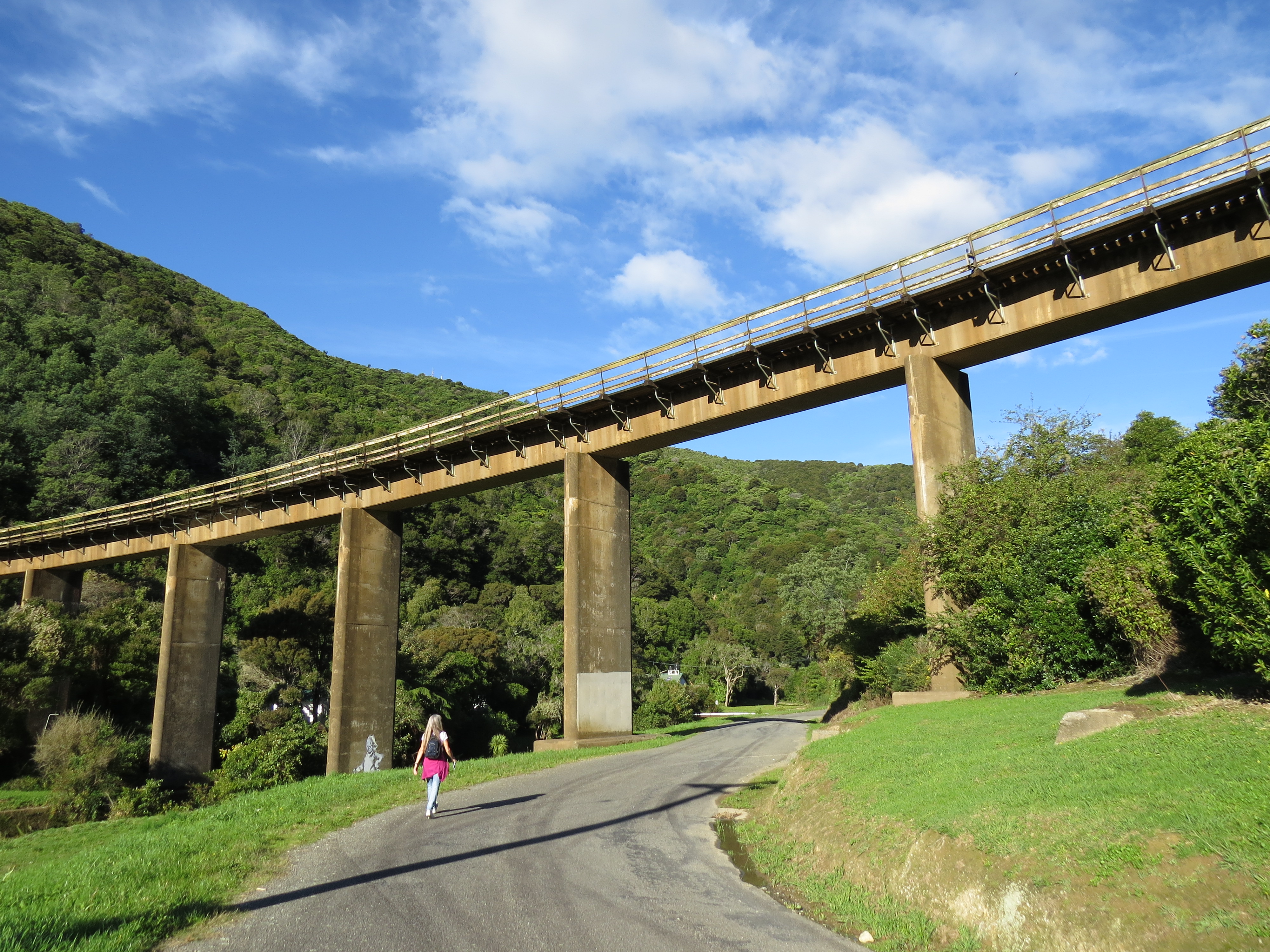 |
4/21/2014: Railway bridge
Position: -41°17.97'S, 174°0.29'E
Passing under a railway bridge along Garden Terrace near the start of the Tirohanga Track
|
 |
4/21/2014: Tirohanga Track
Position: -41°18.08'S, 174°0.56'E
Looking back from along the Tirohanga Track to the railway bridge we'd just passed under.
|
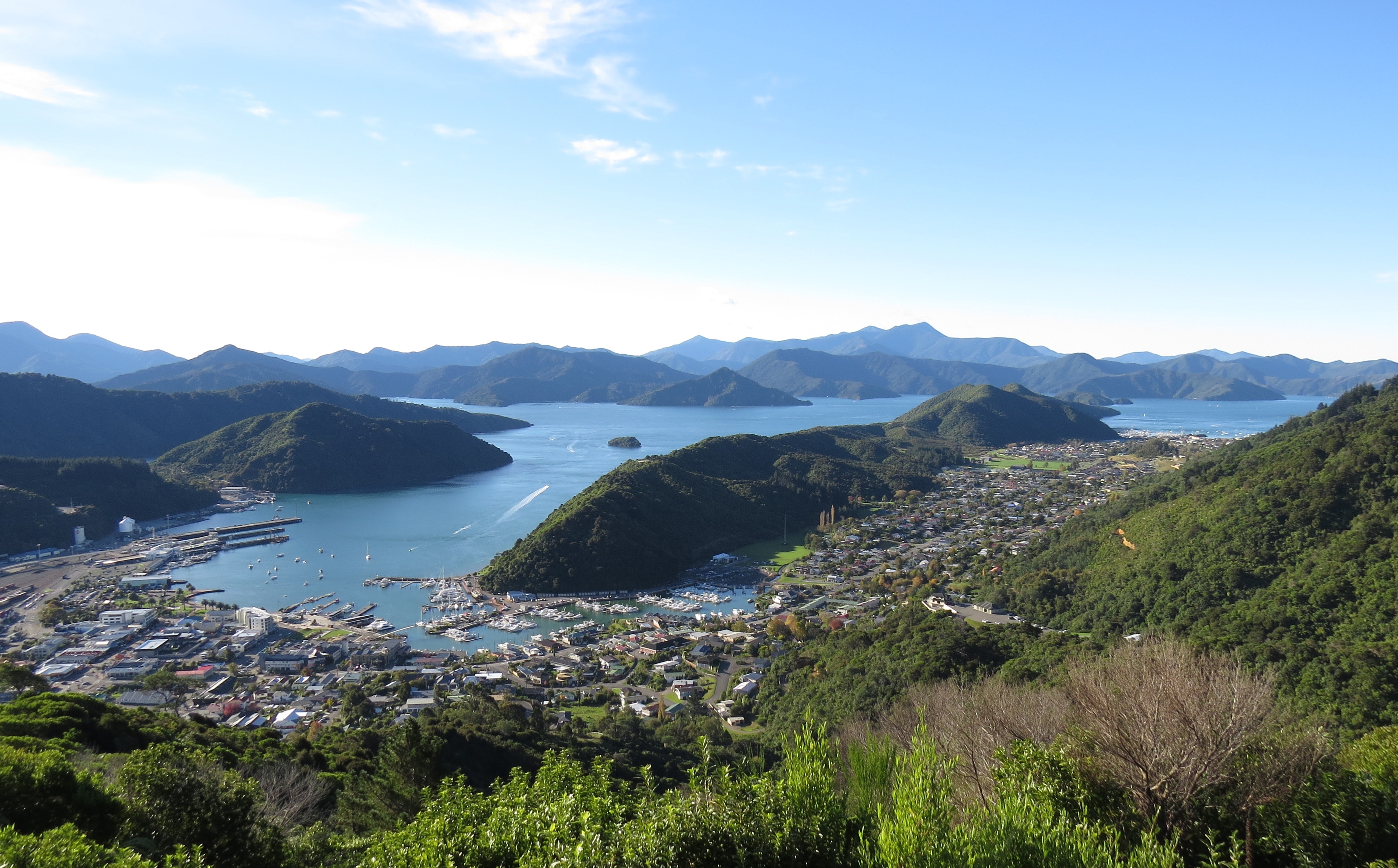 |
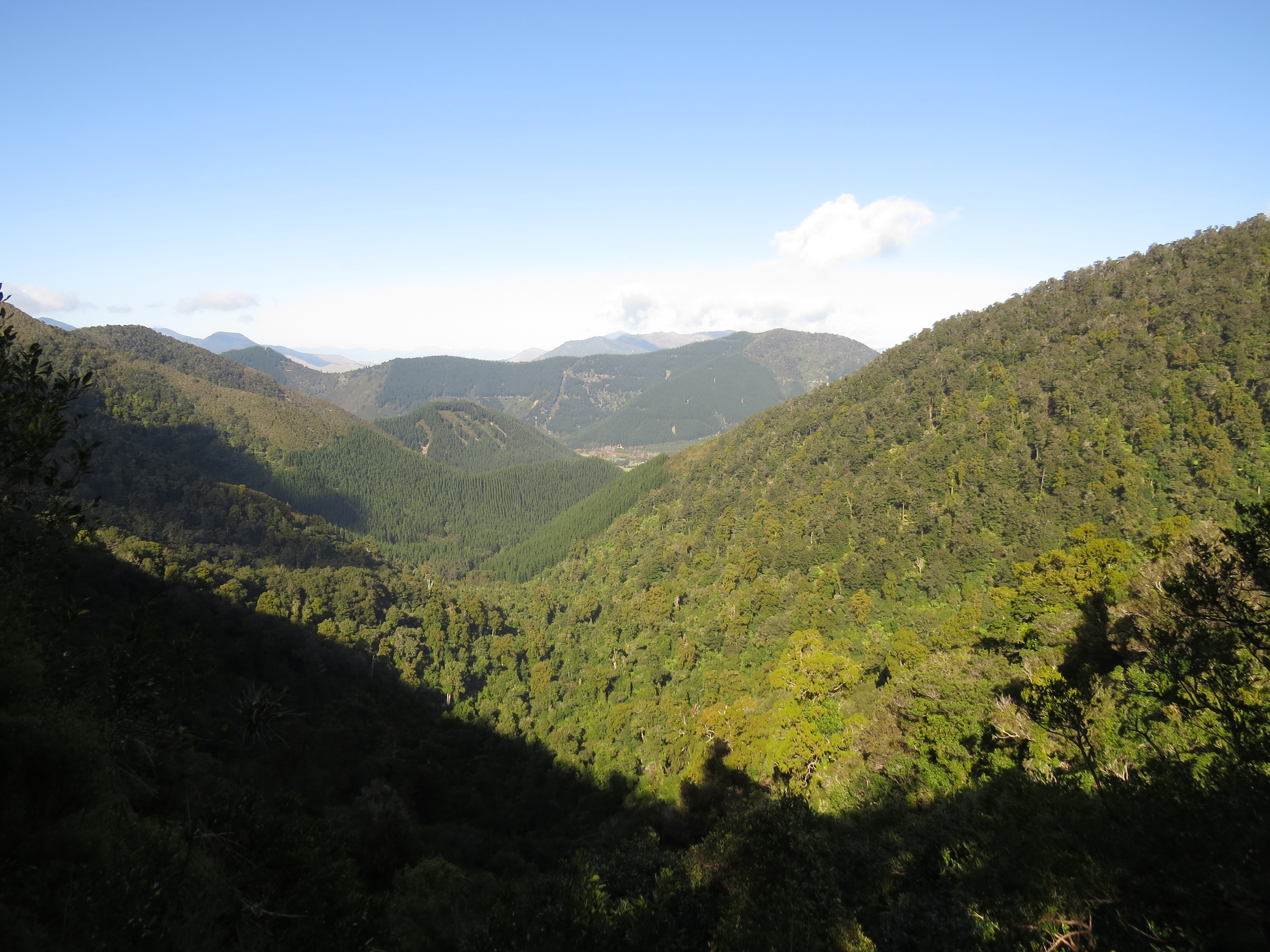
4/21/2014: Hilltop view point
Position: -41°17.90'S, 174°0.65'E
The hilltop view on Tirohanga Track the was amazing. We could see Picton Harbor below us, northeast to Waikawa Bay, and north to Dirona just barely visible as a white spec in Lochmara Bay.
|
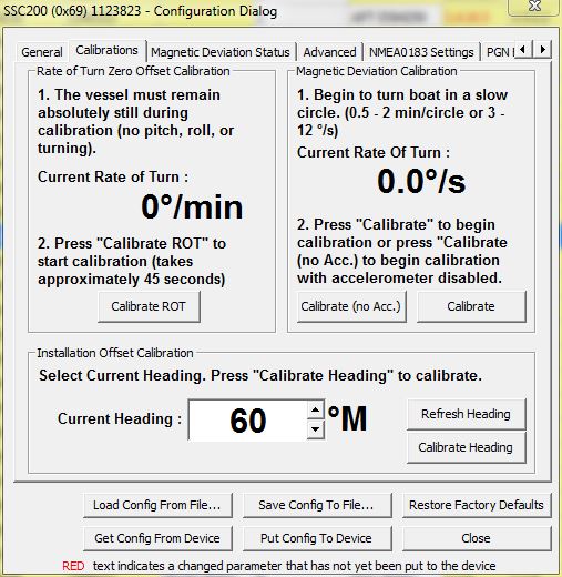 |
4/22/2014: Compass calibration
Position: -41°9.89'S, 174°11.20'E
Calibrating our new Maretron SSC200 solid state compass. The calibration requires a stop for 45 seconds with no pitch, turn or roll motion, followed by several slow turns. To keep the boat still, we anchored in Mint Bay and secured the stern to a mooring there.
|
 |
4/22/2014: Queen Charlotte Track
Position: -41°6.37'S, 174°13.81'E
View down into our anchorage at Schoolhouse Bay from the Queen Charlotte Track. Dirona is just visible at the bottom right corner of the bay. At a fast pace, we reached the 882-foot summit viewpoint in about a half-hour.
|
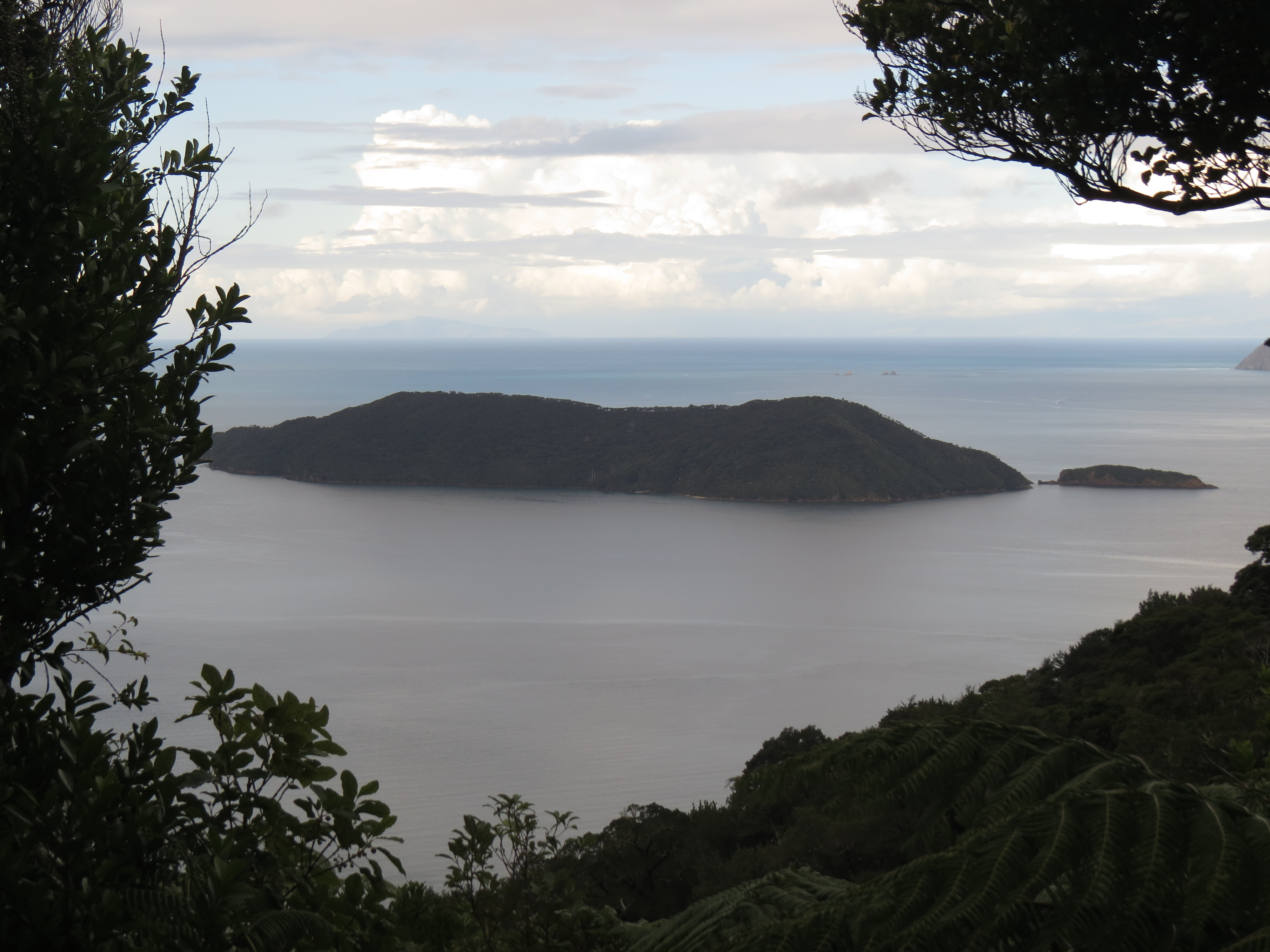 |
4/22/2014: Motuara Island
Position: -41°6.37'S, 174°13.81'E
Looking east from the summit viewpoint to Motuara Island.
|
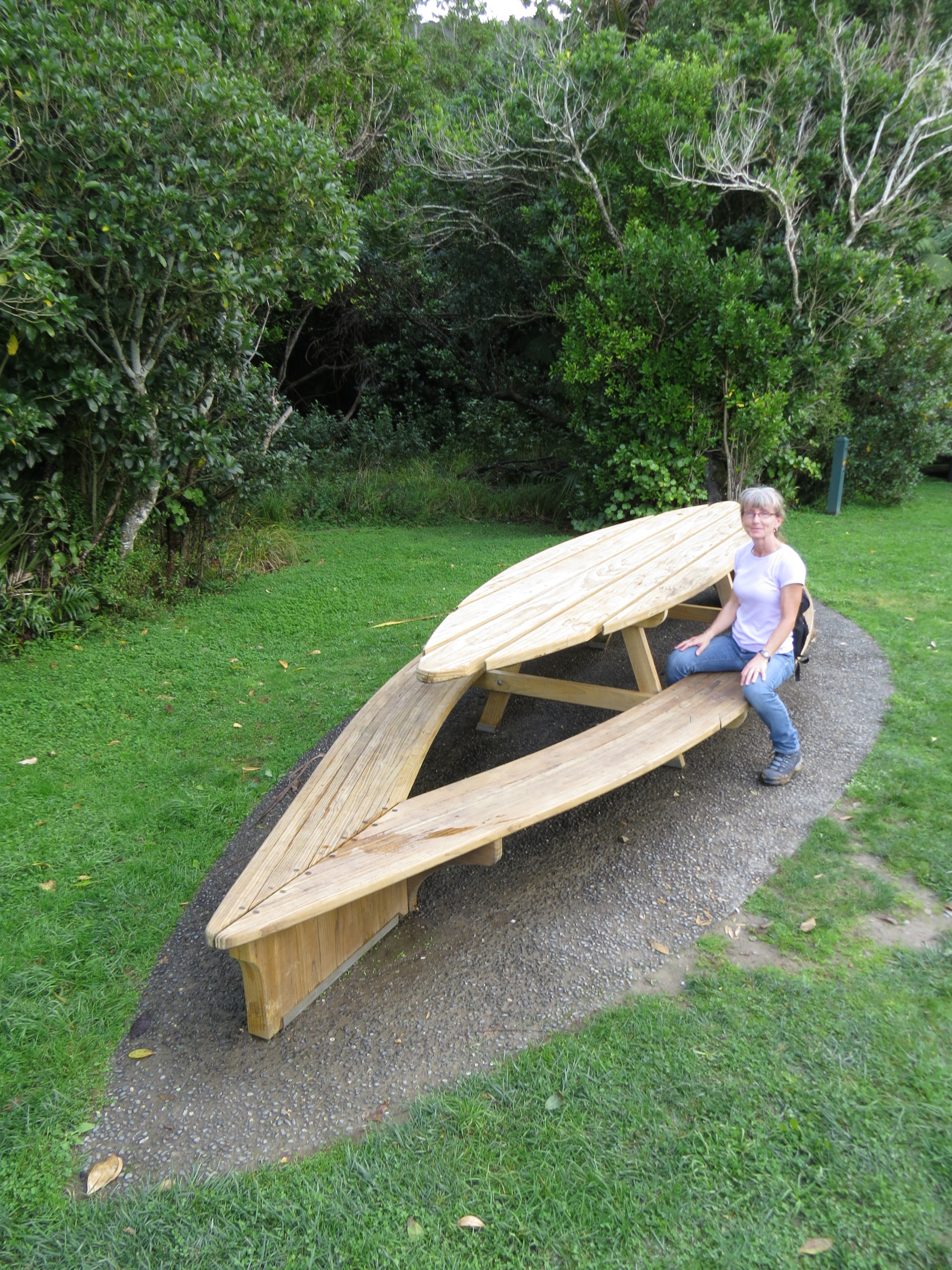 |
4/22/2014: Picnic table
Position: -41°5.65'S, 174°14.05'E
The park at Ship Cove had a lovely beach and the most beautiful picnic tables we've ever seen.
|
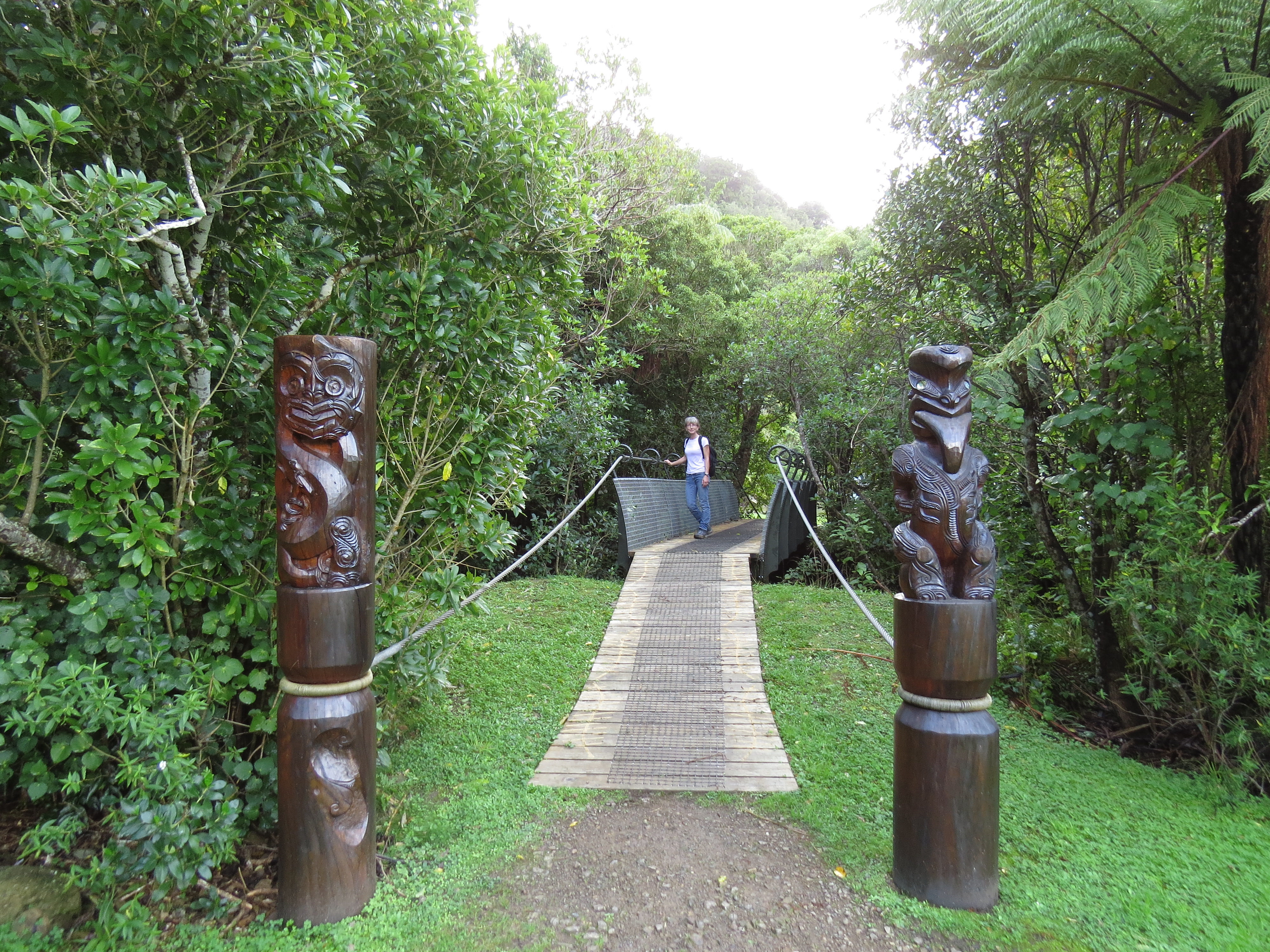 |
4/22/2014: Carvings
Position: -41°5.65'S, 174°14.05'E
Several impressive carvings were at the park--the whole place was amazingly well-done.
|
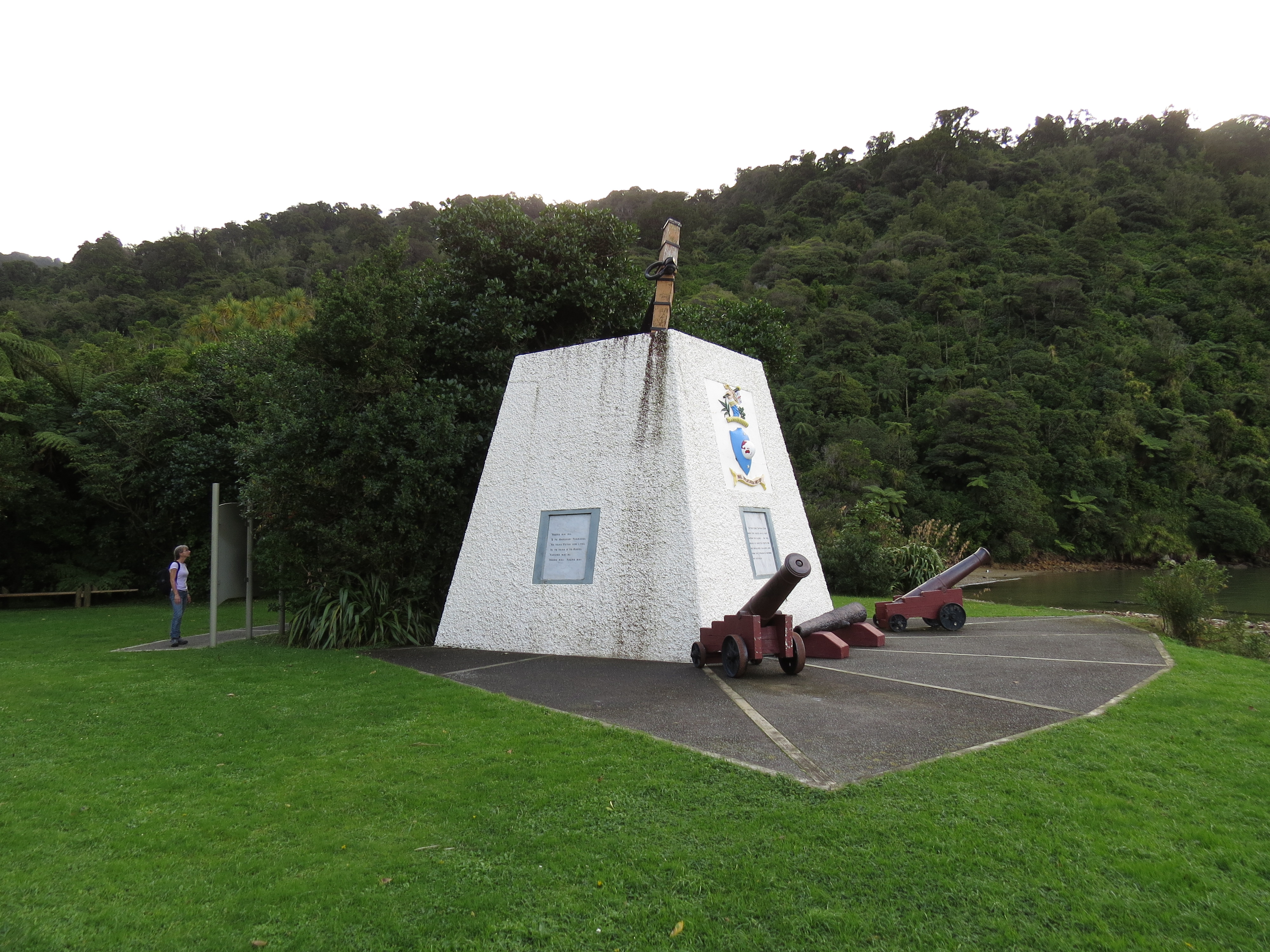 |
4/22/2014: Captain Cook's Monument
Position: -41°5.65'S, 174°14.05'E
Monument commemorating Captain Cook's five visits to Ship Cove between 1770 and 1777.
|
 |
4/23/2014: Dawn
Position: -41°6.85'S, 174°13.27'E
Dawn at Schoolhouse Bay. The anchorage was calm and sheltered--we dropped hook in about 70', but likely could have gotten shallower water closer to shore.
|
 |
4/23/2014: Anchorage view
Position: -41°5.78'S, 174°16.37'E
We anchored off the isthmus at the south end of Motuara Island and ran the dinghy around to the substantial tourist boat dock along the southwest corner. This is looking down into the anchorage from the island track.
|
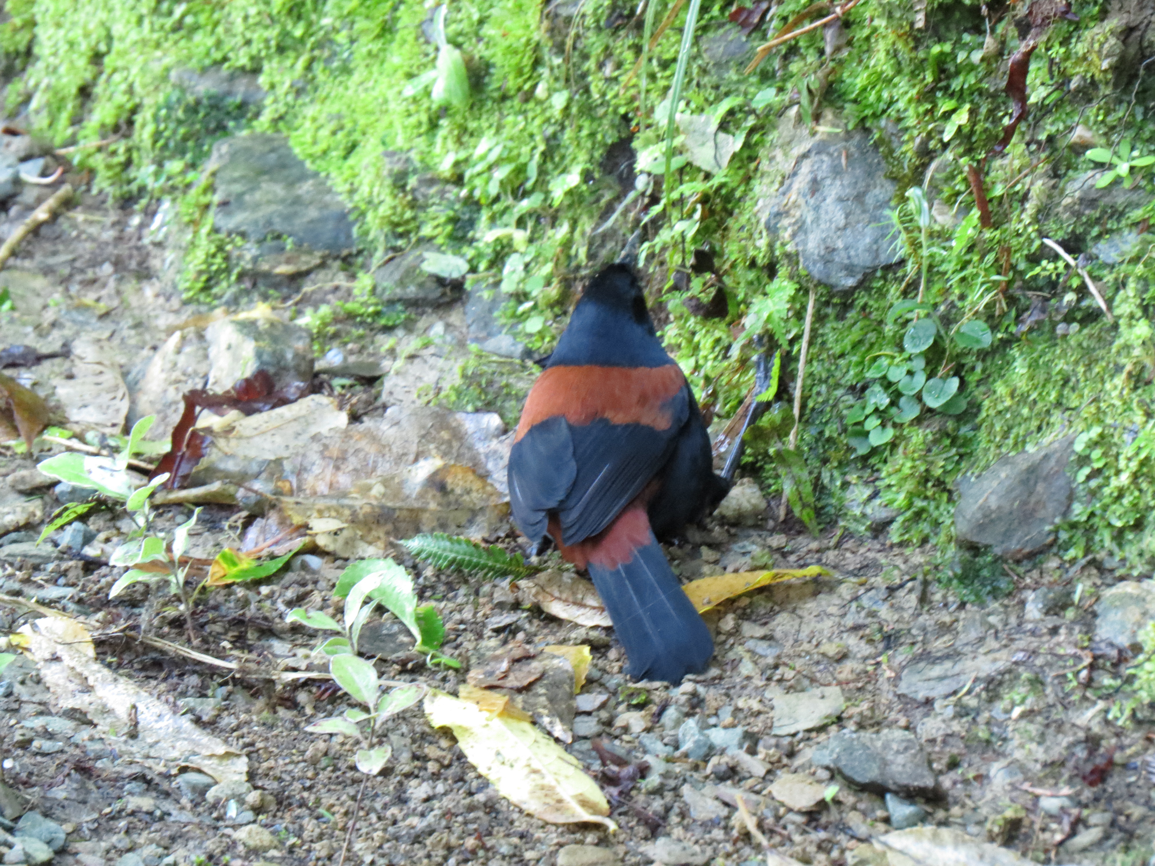 |
4/23/2014: Saddleback
Position: -41°5.78'S, 174°16.40'E
Motuara Island is a wildlife sanctuary and bird calls filled the air. We were lucky to see a rare South Island Saddleback along the trail.
|
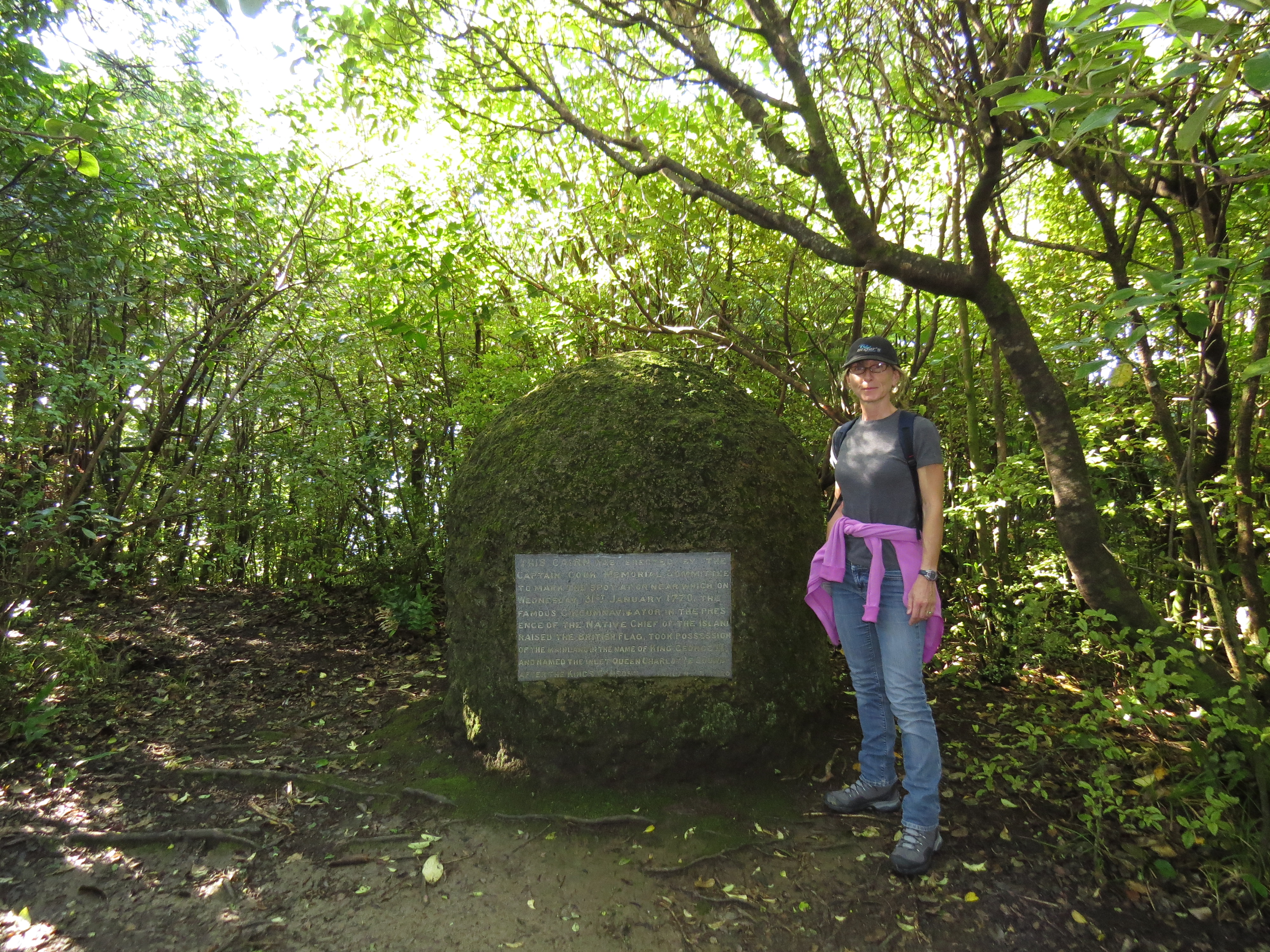 |
4/23/2014: Cook's Cairn
Position: -41°5.73'S, 174°16.43'E
A cairn marking where Captain Cook raised the British flag on Motuara Island January 31st, 1770.
|
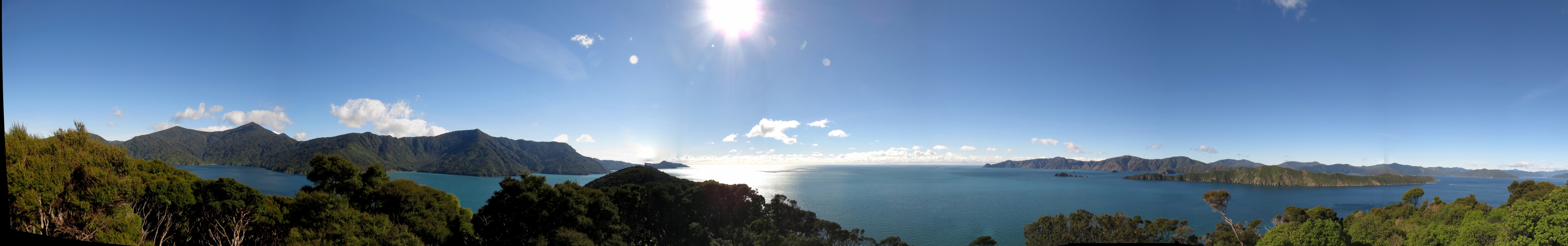 |
4/23/2014: View
Position: -41°5.73'S, 174°16.43'E
The view from a raised platform at the end of the track. The panorama is looking west, north and east, from left to right. On the left is Ship Cove, where we hiked to yesterday, and at the right is Long Island, east of Motuara Island.
|
 |
4/23/2014: Guards Bay
Position: -40°57.67'S, 174°9.09'E
The view to the bluffs above Guards Bay that we'd hiked up shortly before our trip to Fiordland. We were initially thinking of overnighting at Motuara Island, but the winds were supposed to be strong for the next several days, with rough seas. So we decided to get around Cape Jackson and into Pelorus Sound before conditions deteriorated.
|
 |
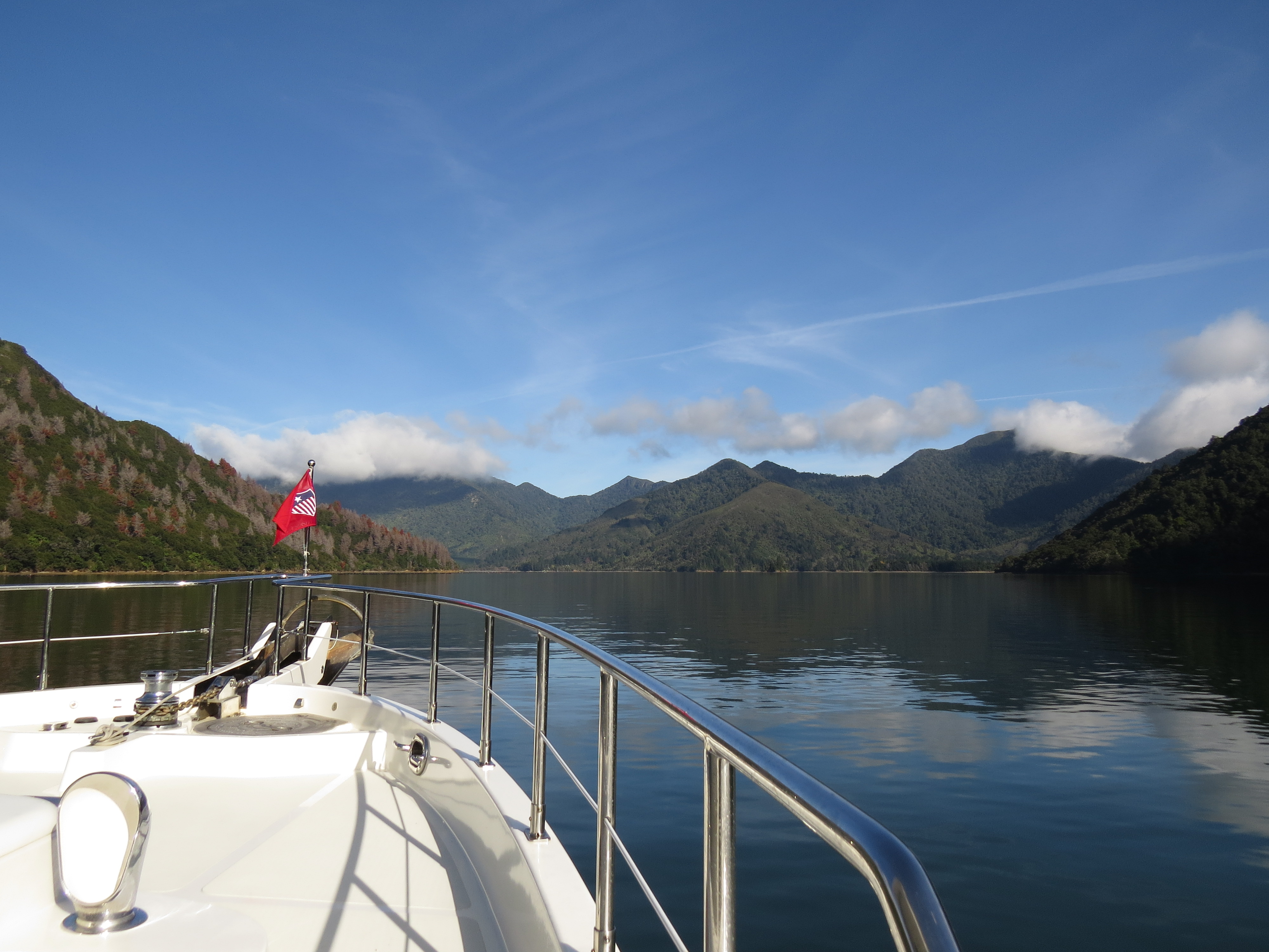
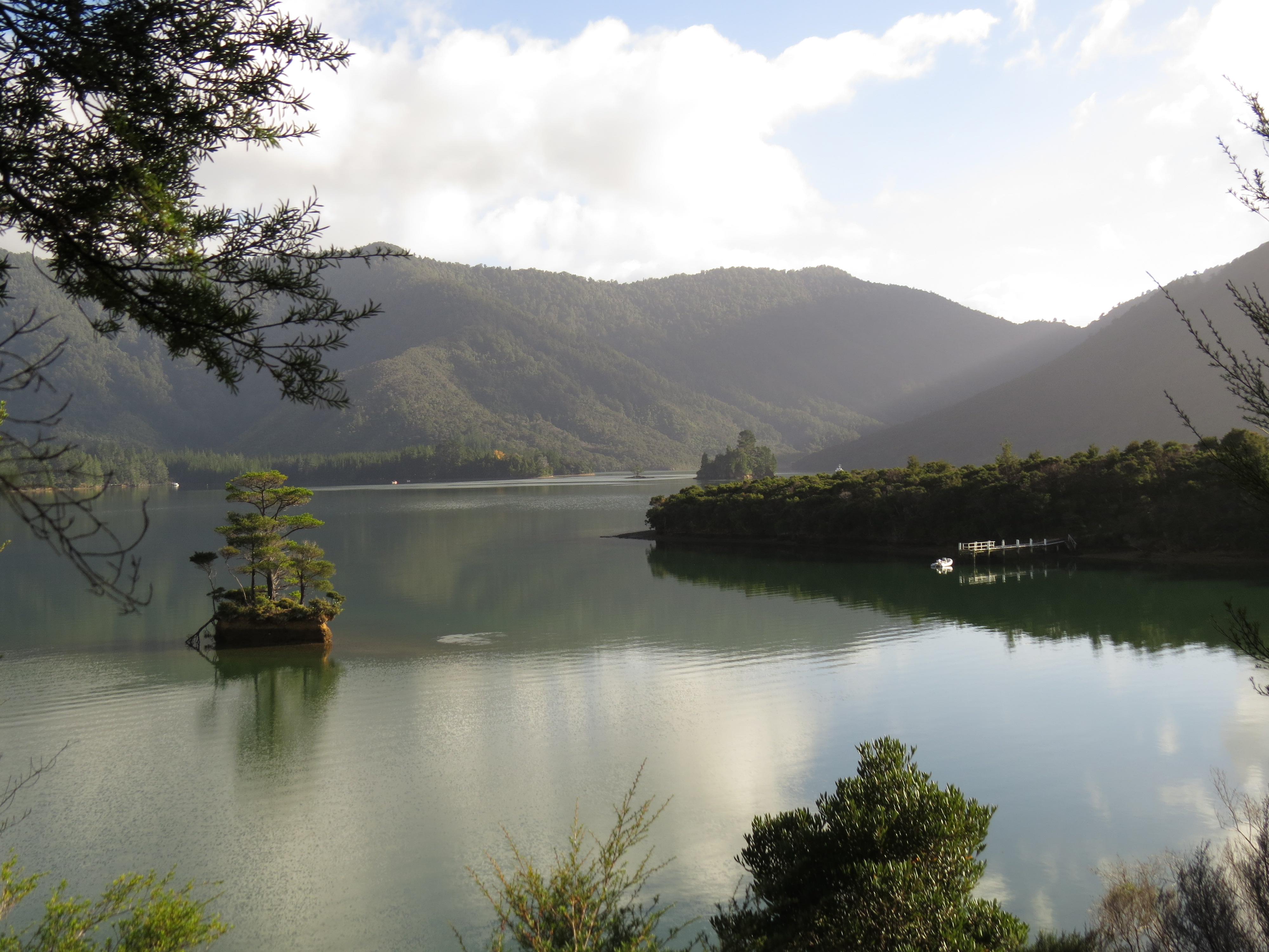
4/23/2014: Pelorus Sound
Position: -40°56.14'S, 174°4.89'E
Our first view to Pelorous Sound, where we'll spend the next week or so.
|
 |
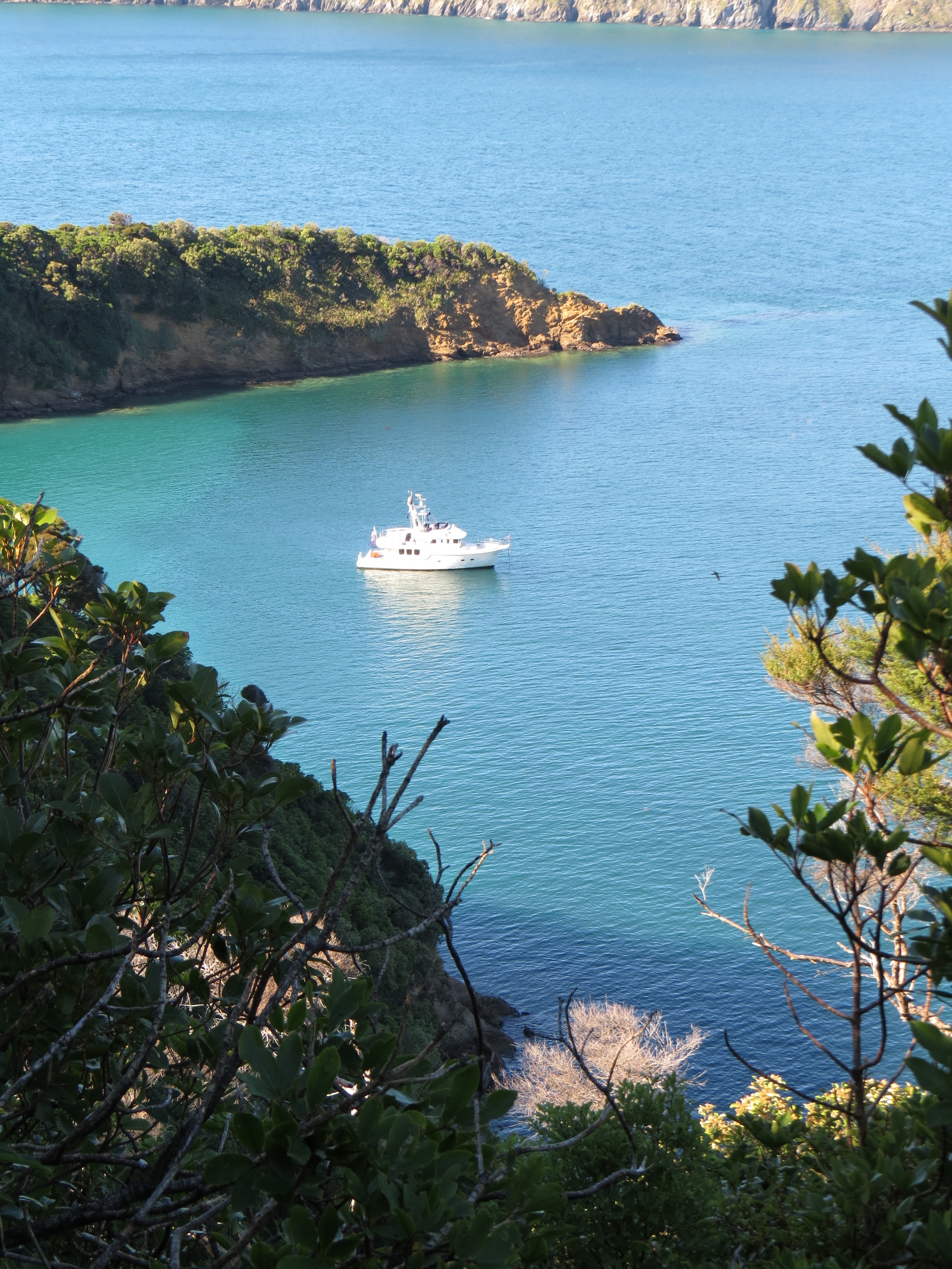
4/23/2014: Homestead Bay
Position: -40°55.60'S, 173°57.86'E
Looking southwest to the head of the anchorage at Homestead Bay. The bay is deep--we dropped hook in about 90'. Three boats arrived a little later and used the several moorings along the east shore.
|
 |
4/23/2014: Chain counter
Position: -40°55.60'S, 173°57.86'E
Our chain counter, that measures how much chain is out, stopped reading a couple of days ago. Here James is inspecting the magnet that the chain counter sensor uses to detect windlass revolutions. The magnet looked fine, with no signs of rust, so it appears the sensor needs replacing.
|
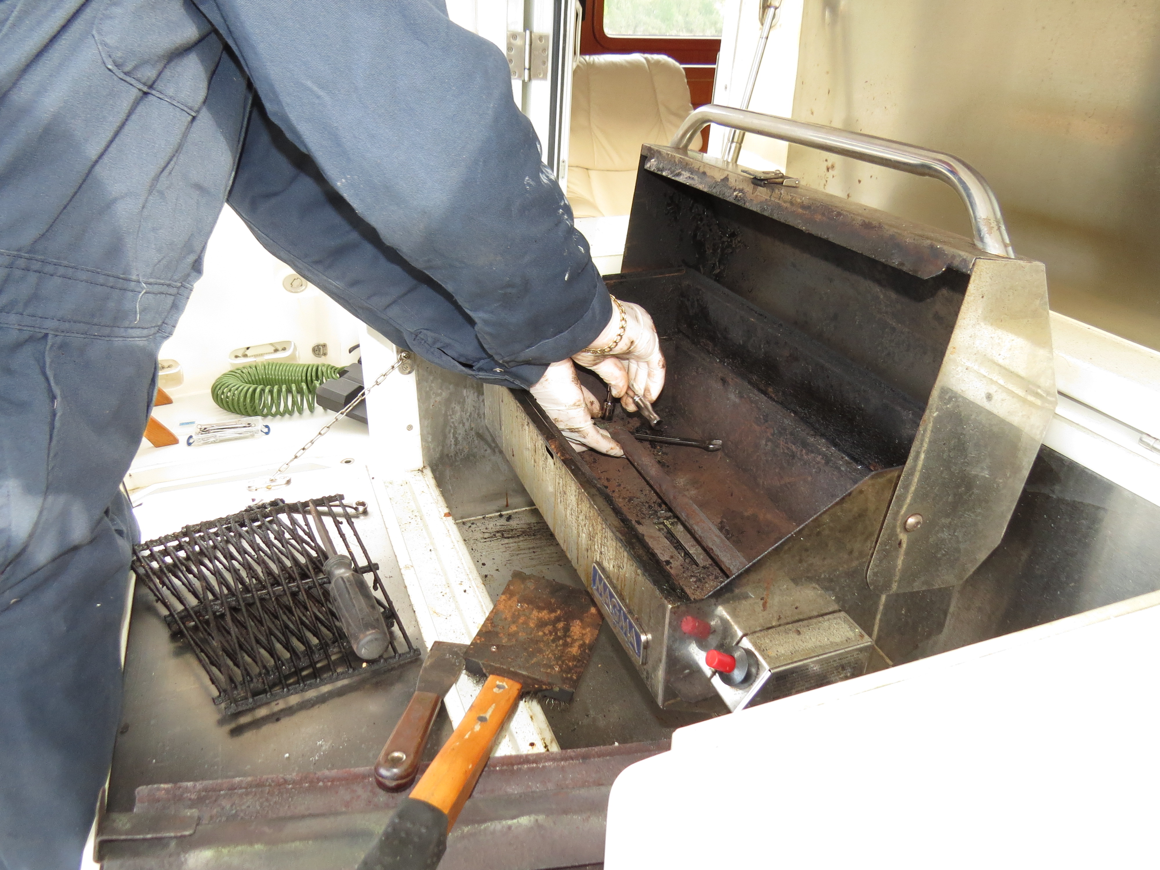 |
4/23/2014: Barbecue maintenance
Position: -40°55.60'S, 173°57.86'E
The barbecue was starting to have trouble heating properly, so we took it apart and cleaned it up and now it's working great again.
|
 |
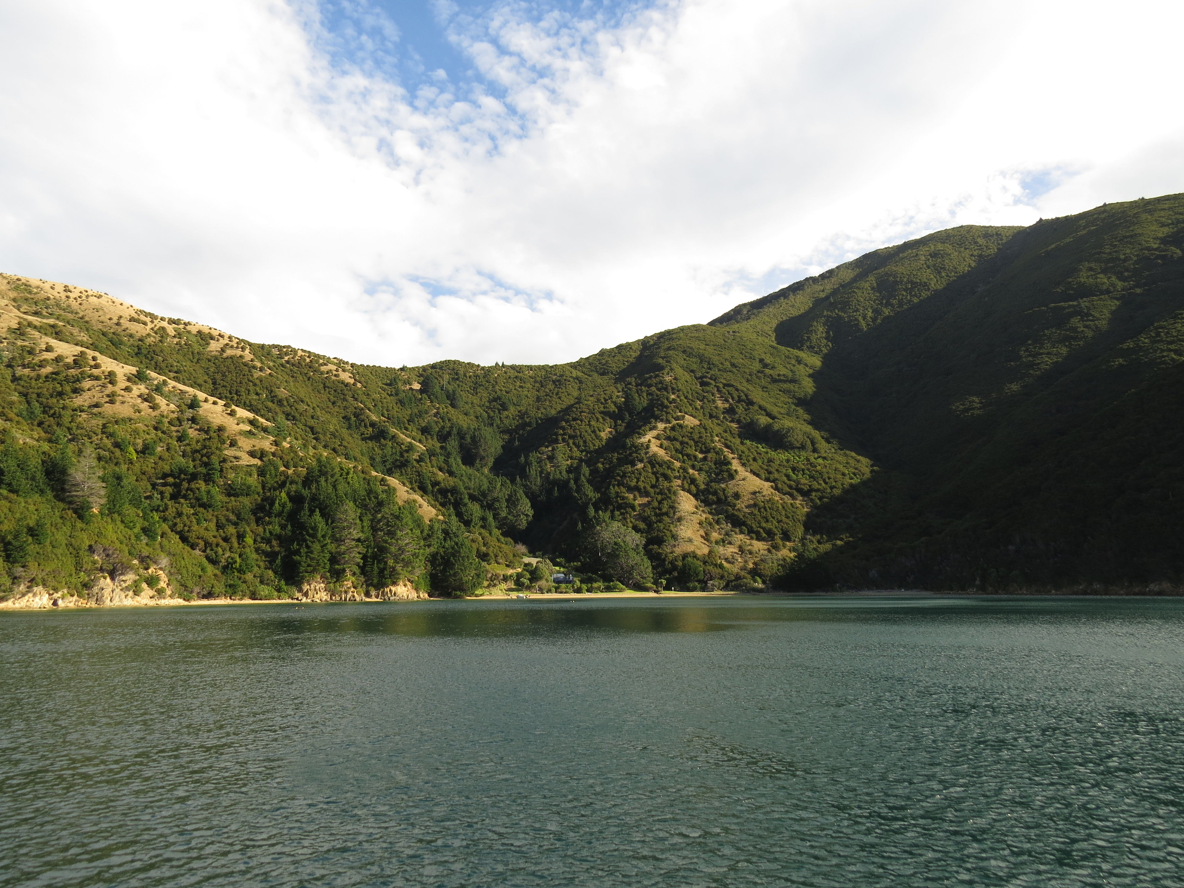
4/24/2014: Nydia Bay
Position: -41°9.32'S, 173°49.14'E
Entering Nydia Bay, where we plan to anchor for a couple of nights and perhaps hike the Nydia Track.
|
 |
4/24/2014: SC30s
Position: -41°9.44'S, 173°47.30'E
What's worse than than one bad SC30? Two bad SC30s. What are the odds?
|
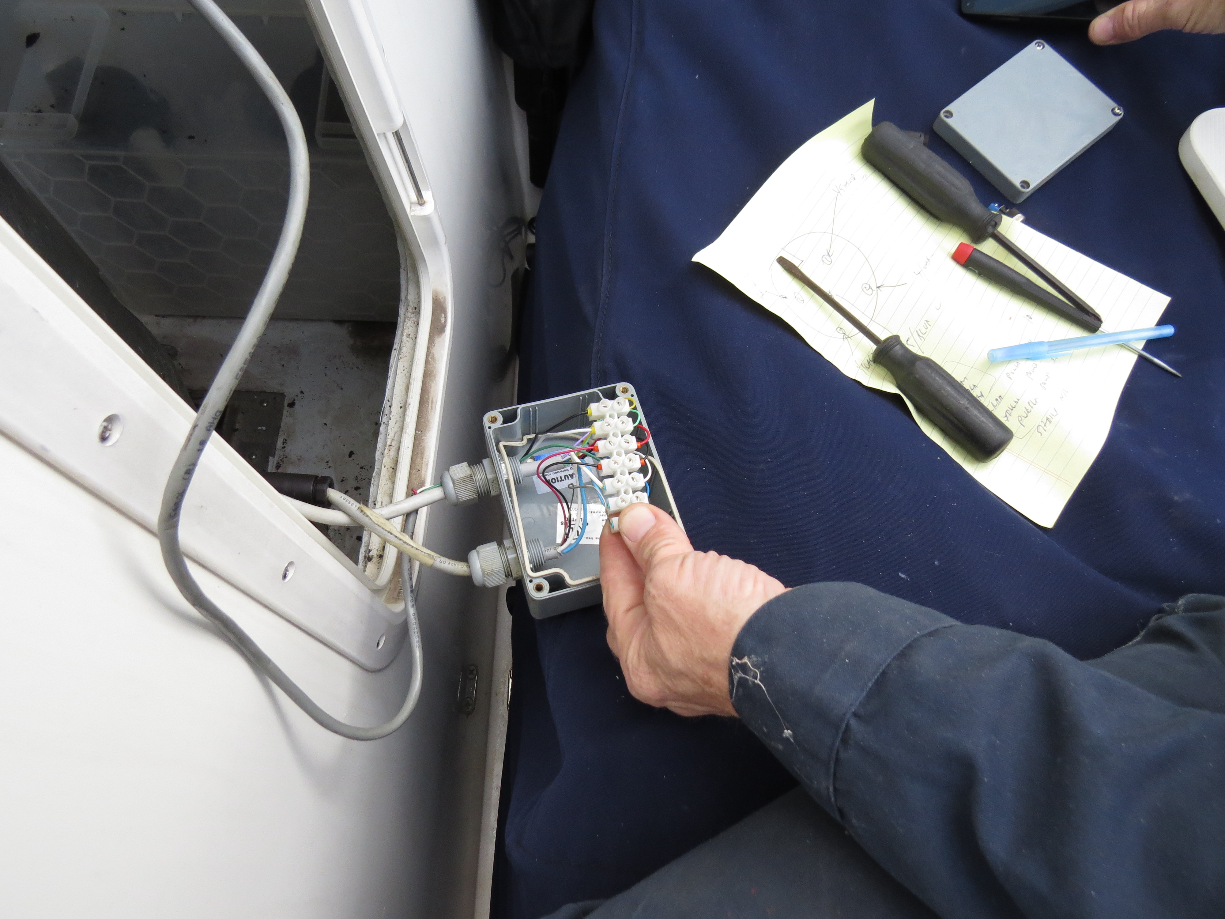 |
4/24/2014: SC30 power
Position: -41°9.44'S, 173°47.30'E
The SC30 was remotely powered via this junction box inside the stack, but this is optional. We decided to remove the remote power and instead just run it off NMEA 2000 power since we have plenty and it makes the system simpler. We also removed the junction box so all there is now at the base of the stack are three NMEA 2000 tees and a terminator.
|
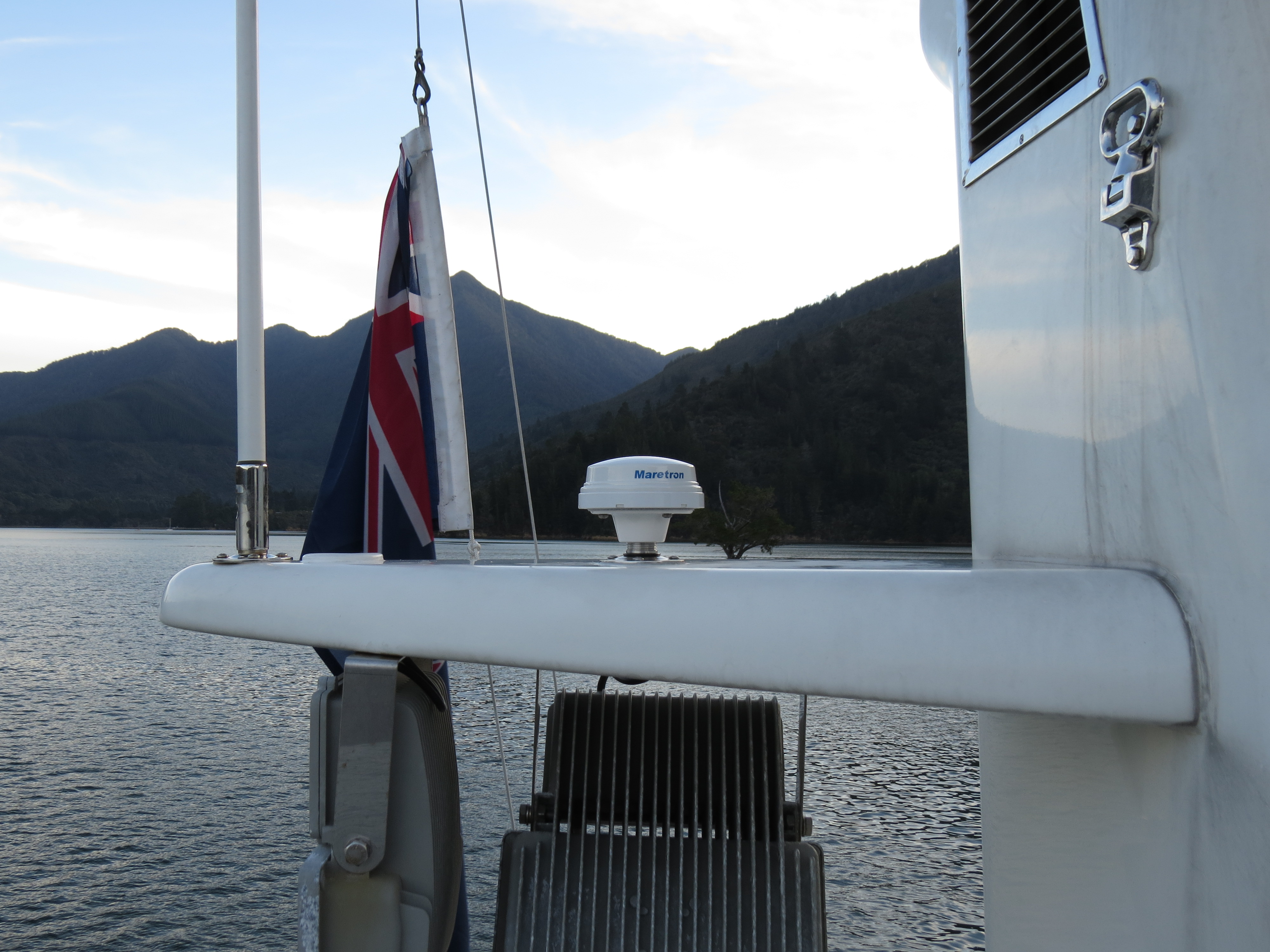 |
4/24/2014: GPS200
Position: -41°9.44'S, 173°47.30'E
The new Maretron GPS200 installed on the starboard side of lower stack wing. The combination of SSC200 and GPS200 now 100% backs up the SC30 with perhaps a tiny loss of precision, but nothing noticeable. This makes it far easier to operate through an SC30 fault without issue.
|
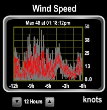 |
4/25/2014: Big winds
Position: -41°9.44'S, 173°47.30'E
A front passed through today, bringing big winds to the anchorage. We saw gusts to 48 knots.
|
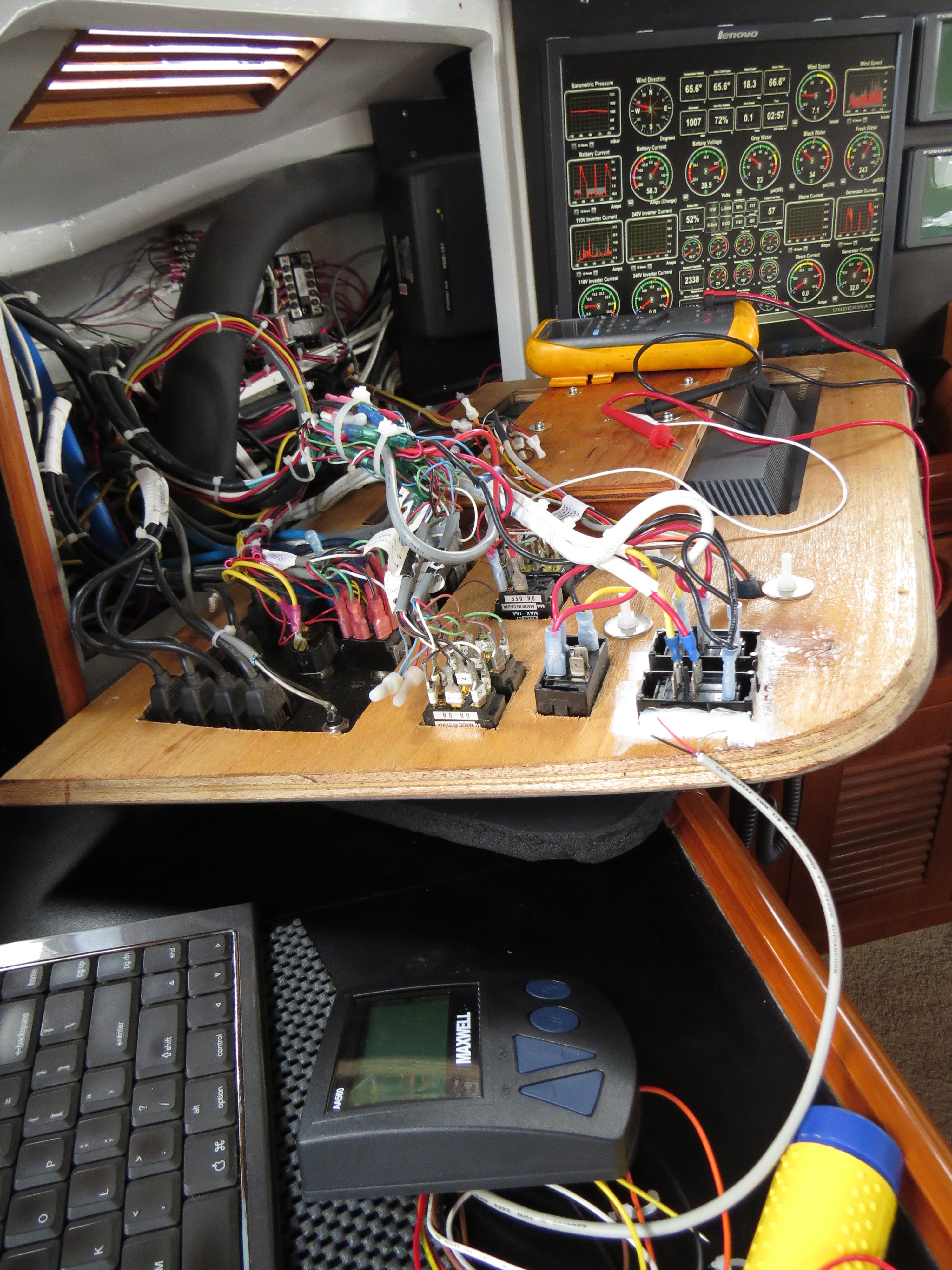 |
4/25/2014: Chain counter console
Position: -41°9.44'S, 173°47.30'E
We'd previously investigated the chain counter issue by checking that the magnet wasn't rusted. The magnet was fine, so now we're digging deeper into the problem. We temporarily wired in a spare console (right of the keyboard) and that didn't solve the problem, so we will replace the sensor.
|
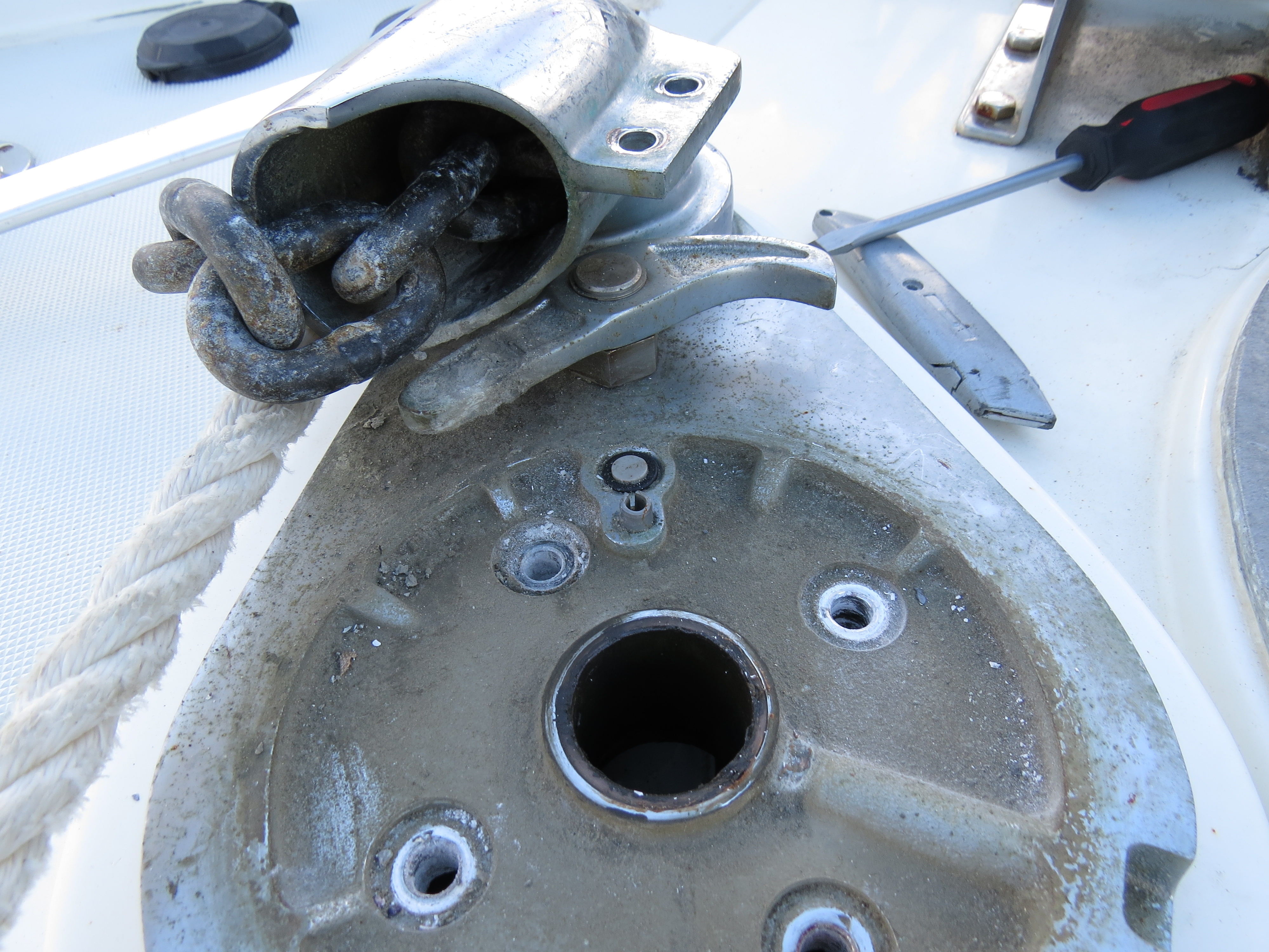 |
4/25/2014: Chain counter sensor
Position: -41°9.44'S, 173°47.30'E
The chain counter sensor, mounted in the windlass deckplate at 12 o'clock, needs replacing.
|
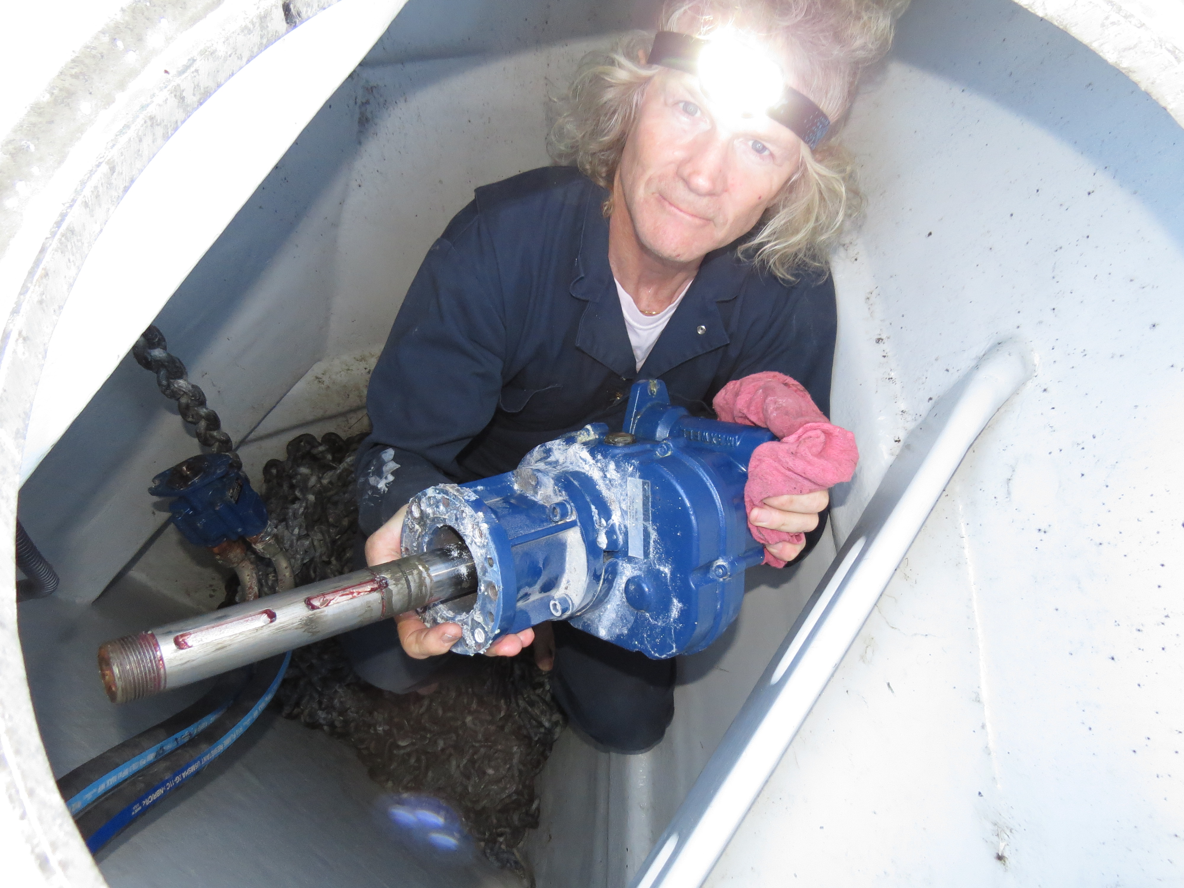 |
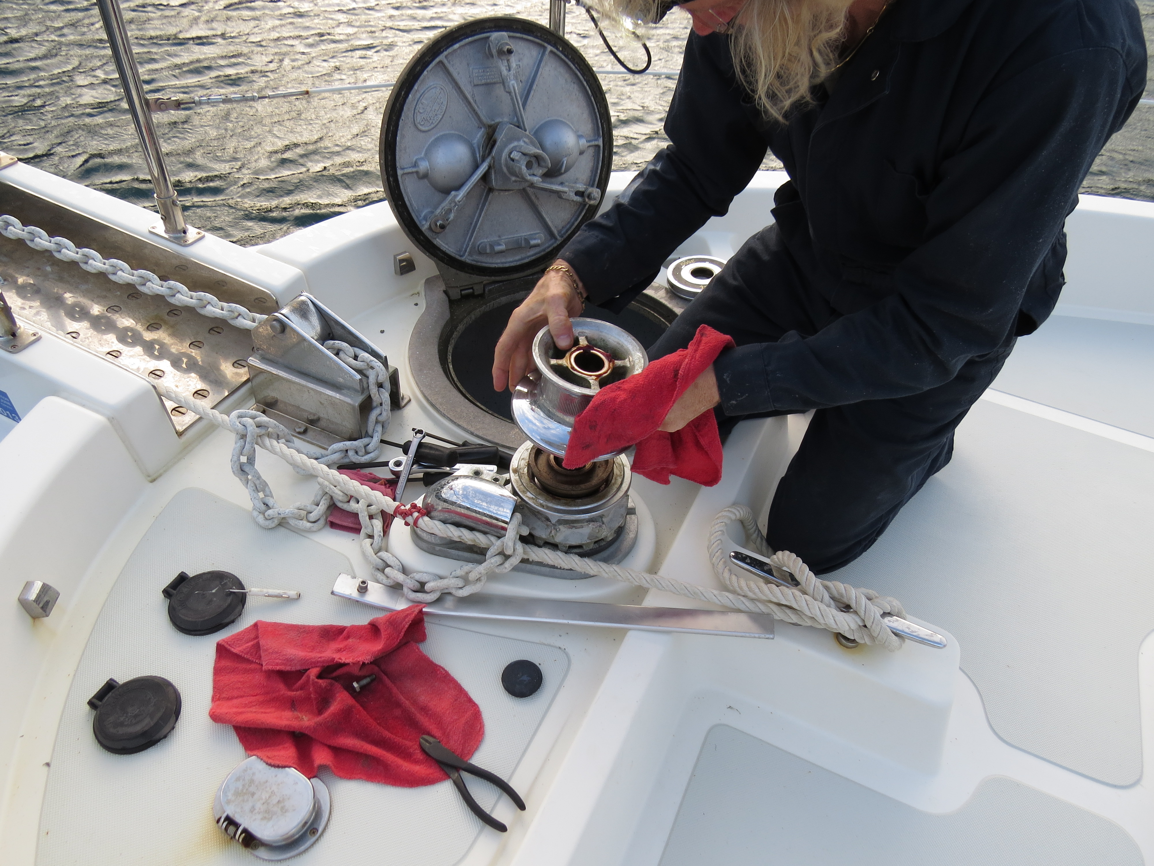
4/25/2014: Windlass gearbox
Position: -41°9.44'S, 173°47.30'E
To replace the chain counter sensor, we need to disassemble the top half of the windlass to expose the sensor, and then remove the motor and gearbox to access the sensor wire. In the picture, James is inside the anchor locker, holding the fairly hefty gearbox.
|
 |
4/26/2014: Nydia Lodge Dock
Position: -41°10.18'S, 173°47.54'E
Looking back to the dinghy moored at the Department of Conservation's Nydia Lodge dock. In the full-res image, Dirona is just visible on the other side of the point. We'd looked for a landing father south, but couldn't find anything with sufficient depth.
|
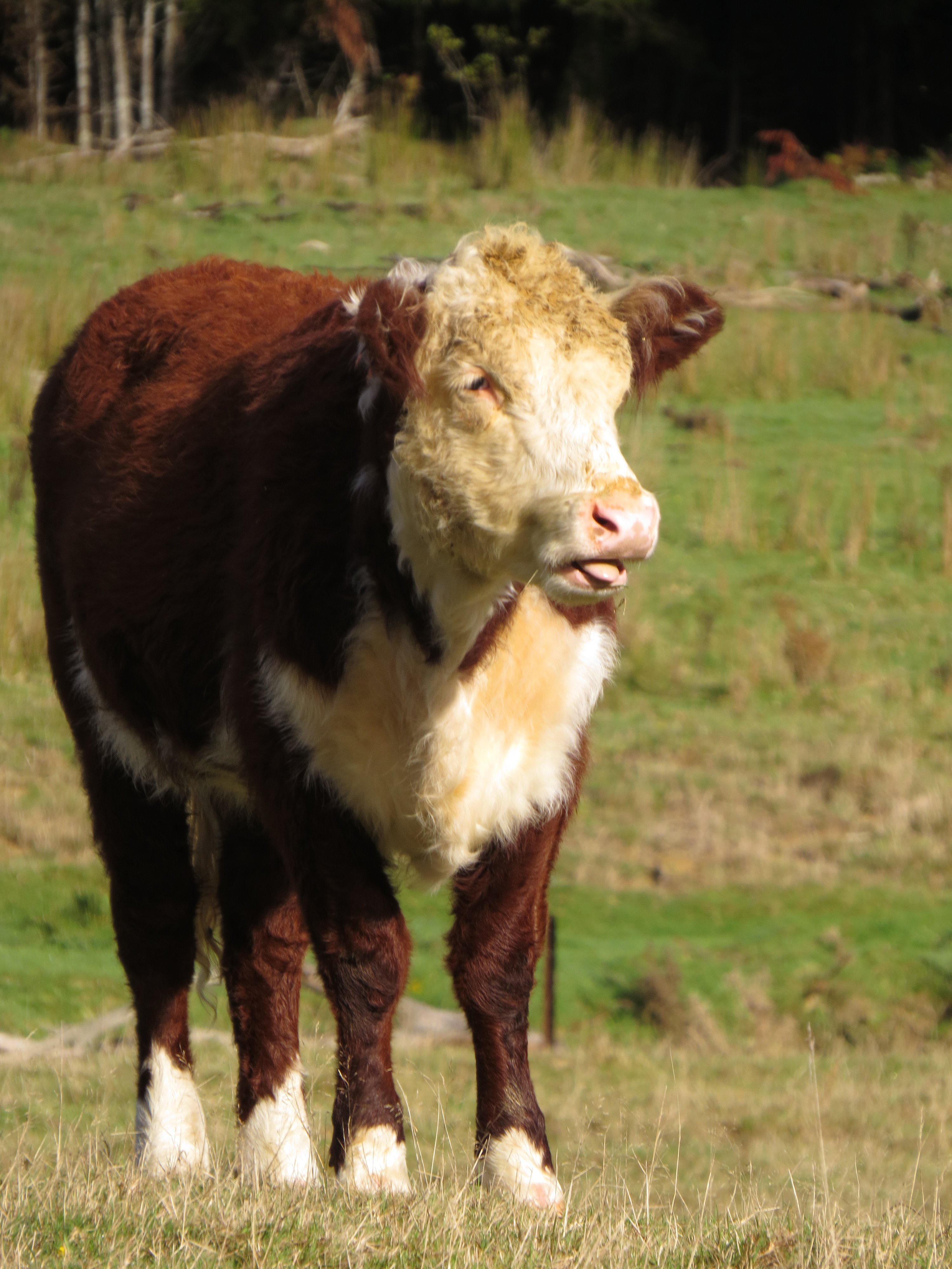 |
4/26/2014: Calf
Position: -41°10.80'S, 173°46.95'E
We followed the track along the east shore of Nydia Bay, then through pastures filled with cows and several pretty cute calves.
|
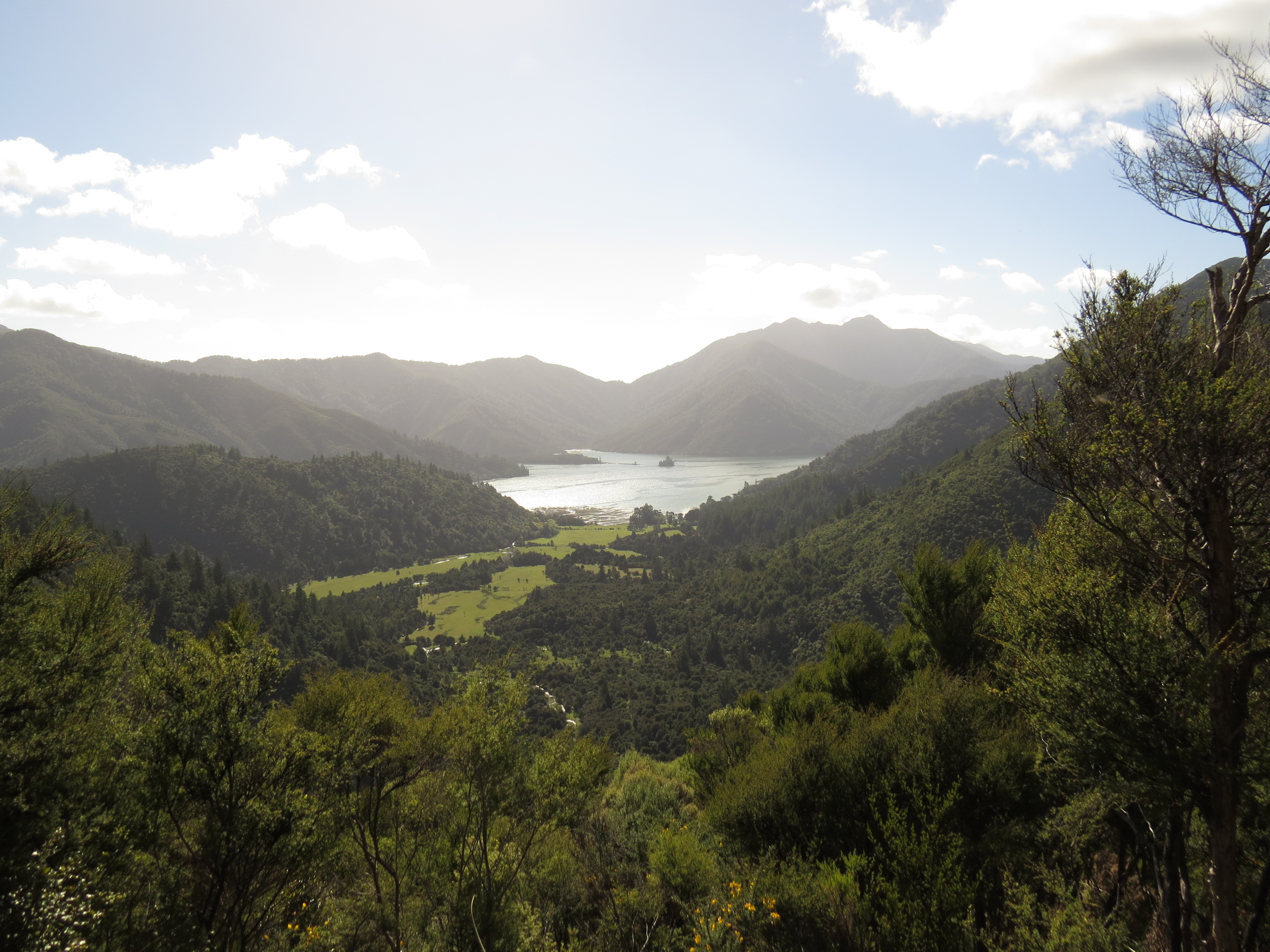 |
4/26/2014: View to Nydia Bay
Position: -41°11.89'S, 173°47.01'E
From the pasture, the trail climbed steadily into the hills, with excellent views back Nydia Bay.
|
 |
4/26/2014: Kaiuma Saddle
Position: -41°12.13'S, 173°47.23'E
The view south from Kaiuma Saddle was amazing in this clear day.
|
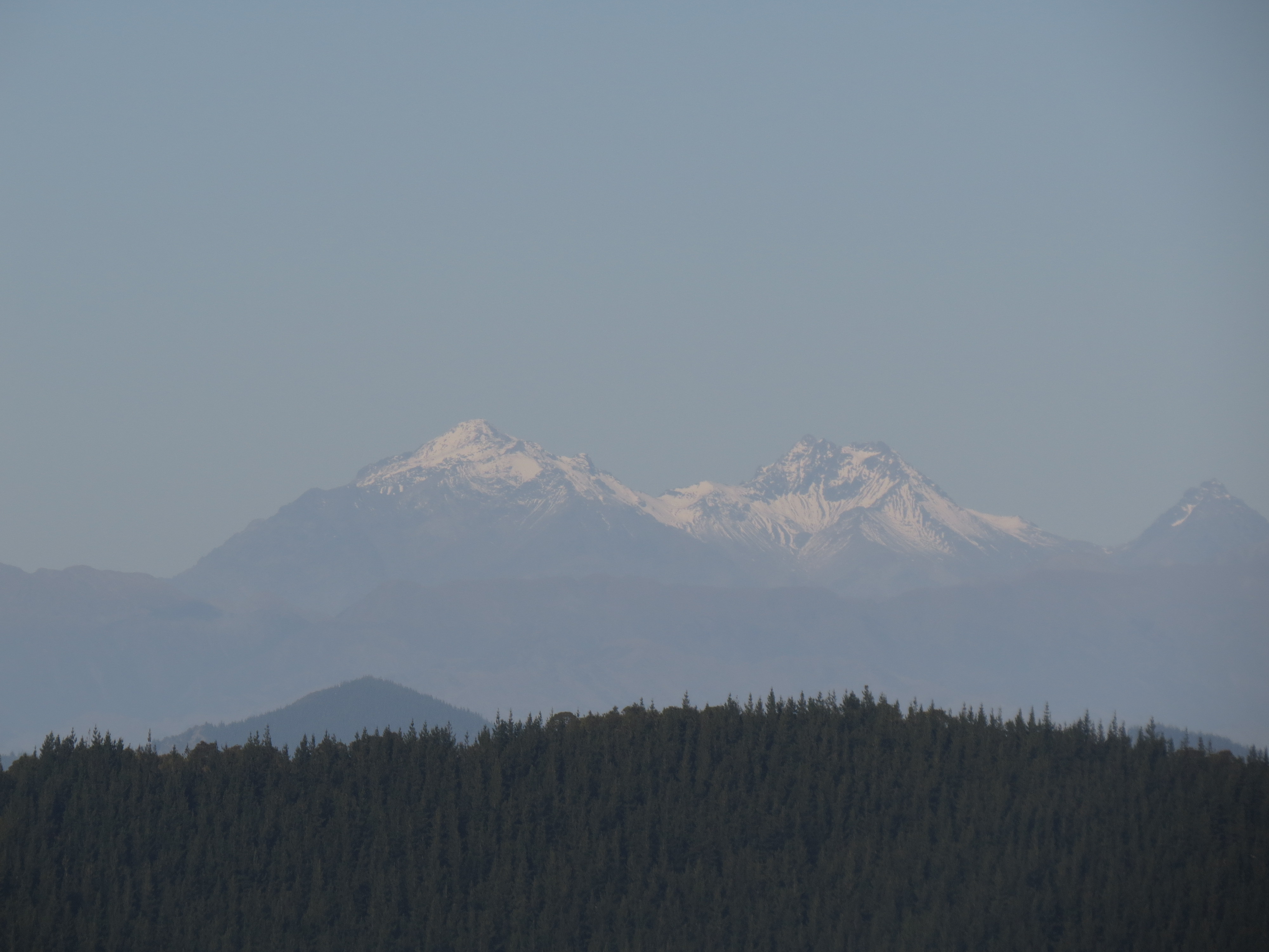 |
4/26/2014: Tapuae-o-Uenuku
Position: -41°12.13'S, 173°47.25'E
Close-up of 2,885m Tapuae-o-Uenuku mountain, 50 miles to our south in the Inland Kaikoura Range.
|
 |
4/26/2014: Ridge
Position: -41°12.13'S, 173°47.24'E
From Kaiuma Saddle, we left the track and followed the ridge up, hoping for some even better views. The ridge was very narrow--this tree had roots on both sides.
|
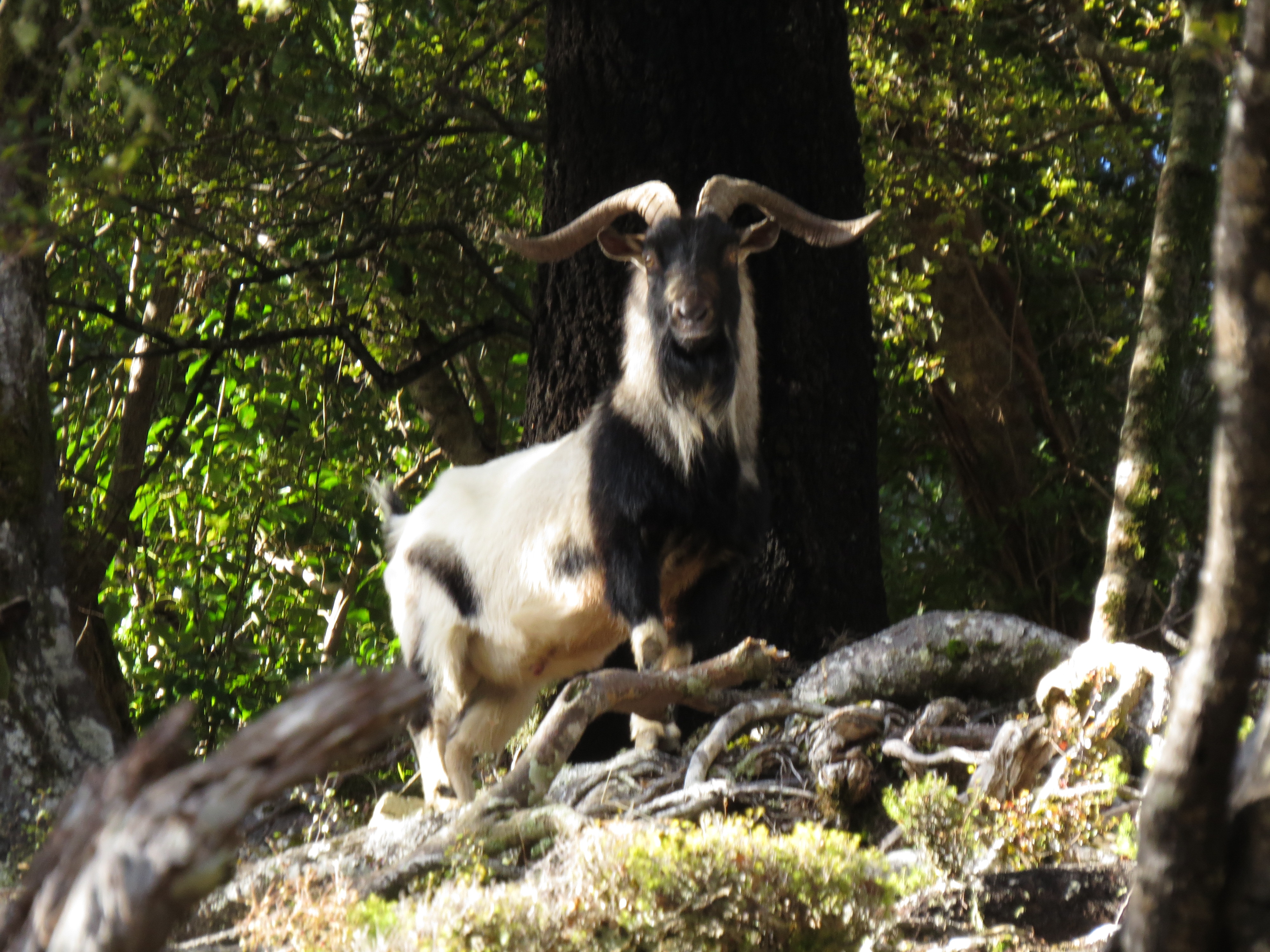 |
4/26/2014: Mountain goat
Position: -41°12.15'S, 173°47.34'E
This mountain goat stood it's ground and huffed at us, and only grudgingly moved away as we approached. We gave it a wide berth.
|
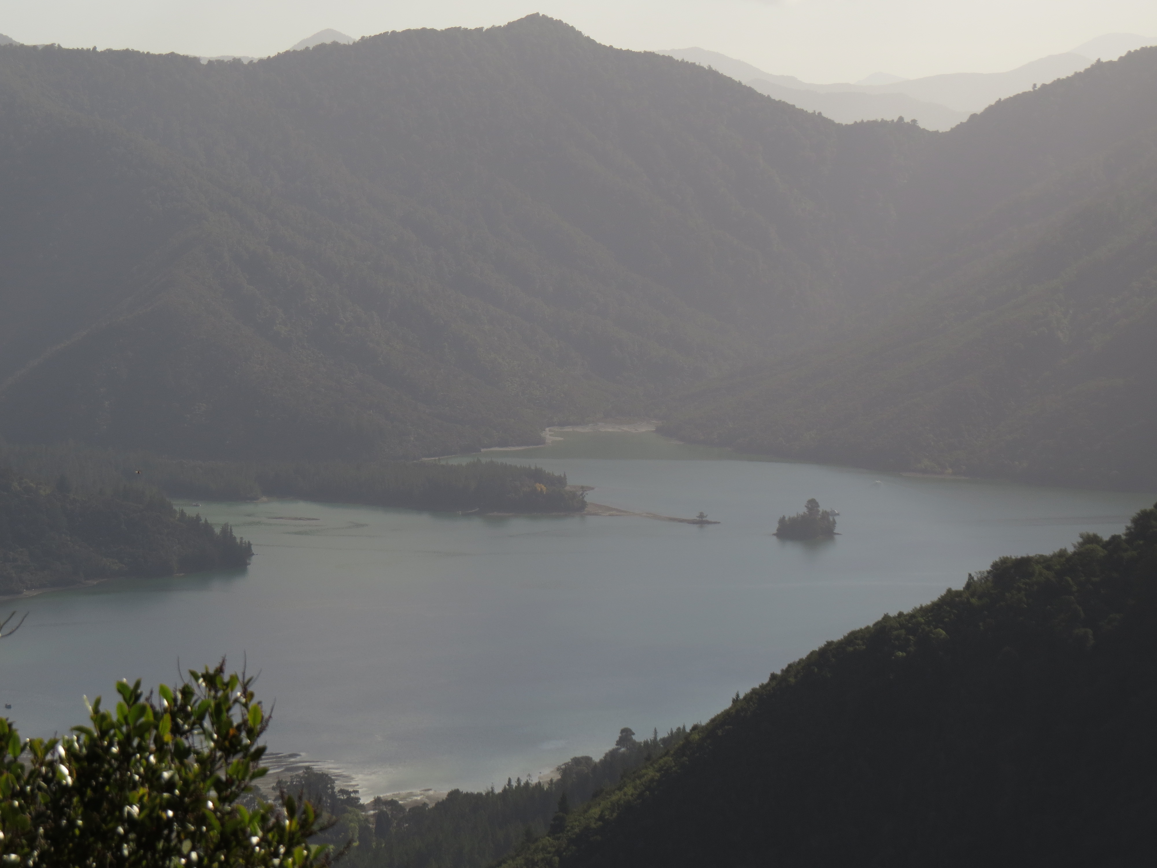 |
4/26/2014: Lunch view
Position: -41°12.19'S, 173°47.47'E
We found a good view spot and continued further up the ridge, but couldn't find anything better, so returned back here for lunch. In the high-res image Dirona is just barely visible beyond the small islet near the right of the photo.
|
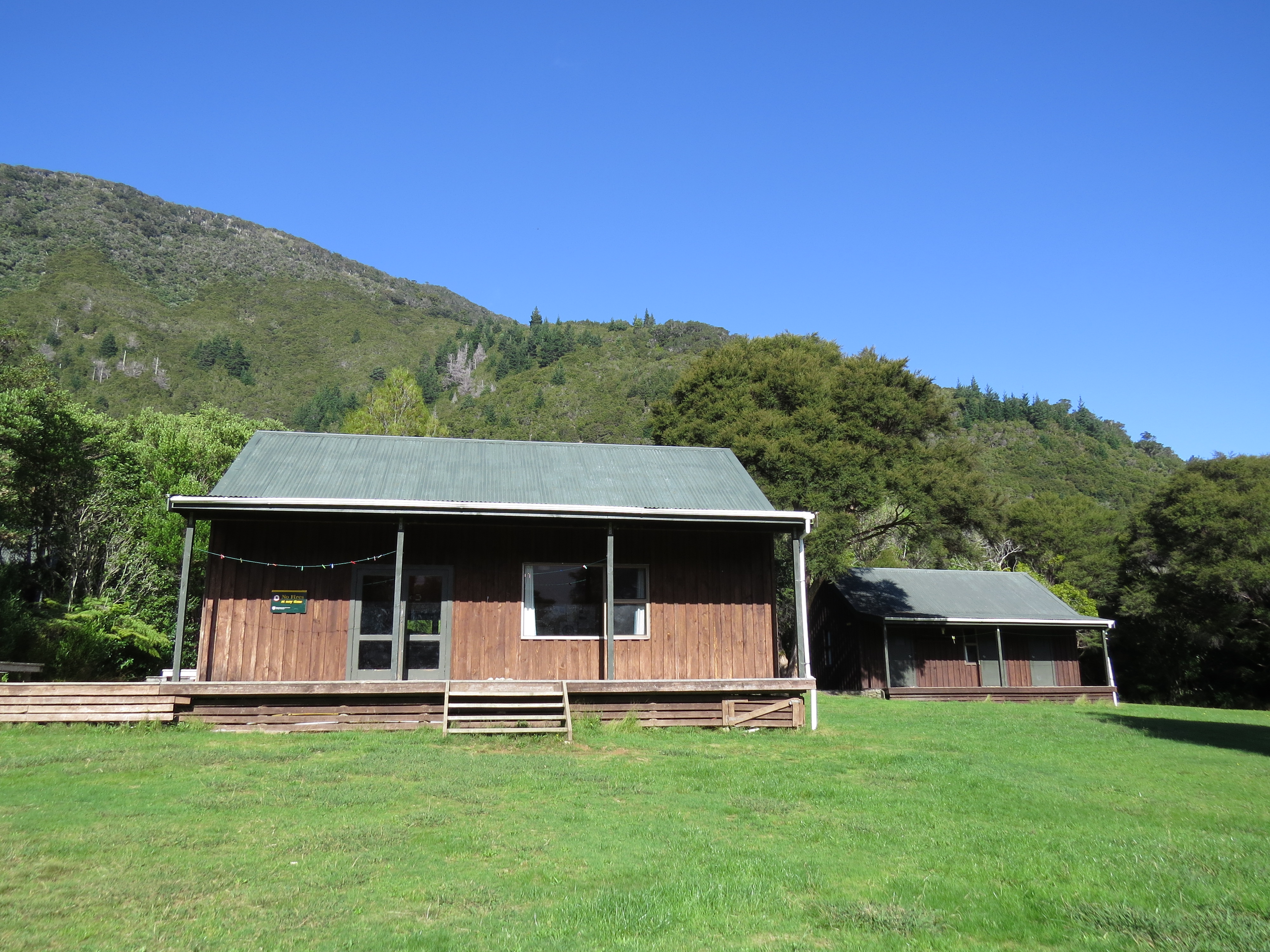 |
4/26/2014: Nydia Lodge
Position: -41°10.04'S, 173°47.62'E
Two of the several buildings that make up the Department of Conservation's 50-person Nydia Lodge complex. As with all DOC sites we've seen so far, the facility and grounds were impressively built and maintained.
|
 |
4/26/2014: Nydia Bay wharf
Position: -41°10.08'S, 173°46.67'E
After returning from the hike, we ran the dinghy across the bay and tied off at the Nydia Bay community wharf to walk around for a bit. The Nydia track runs from south from Tennyson Inlet, past this wharf and along the head of Nydia Bay where we joined it.
|
 |
4/26/2014: Creek
Position: -41°10.23'S, 173°46.59'E
Looking west at low-tide across a creek outflow at the head of Nydia Bay.
|
 |
4/26/2014: Floodlight
Position: -41°9.44'S, 173°47.30'E
Our starboard floodlight had stopped working, but began working as James opened it up. The light continued to operate after wiggling all the wires, so perhaps the issue was due to water intrusion in the past--the light is starting to look a bit rough in the electronics area from weather. We couldn't find any other issues but expect we'll have to change it sometime in the future. We sealed up the electronics area with silicone sealant to maximize it's remaining life.
|
 |
4/26/2014: Nydia Bay
Position: -41°9.44'S, 173°47.30'E
View to the head of Nydia Bay from Dirona. This was an excellent anchorage--good shelter and great views.
|
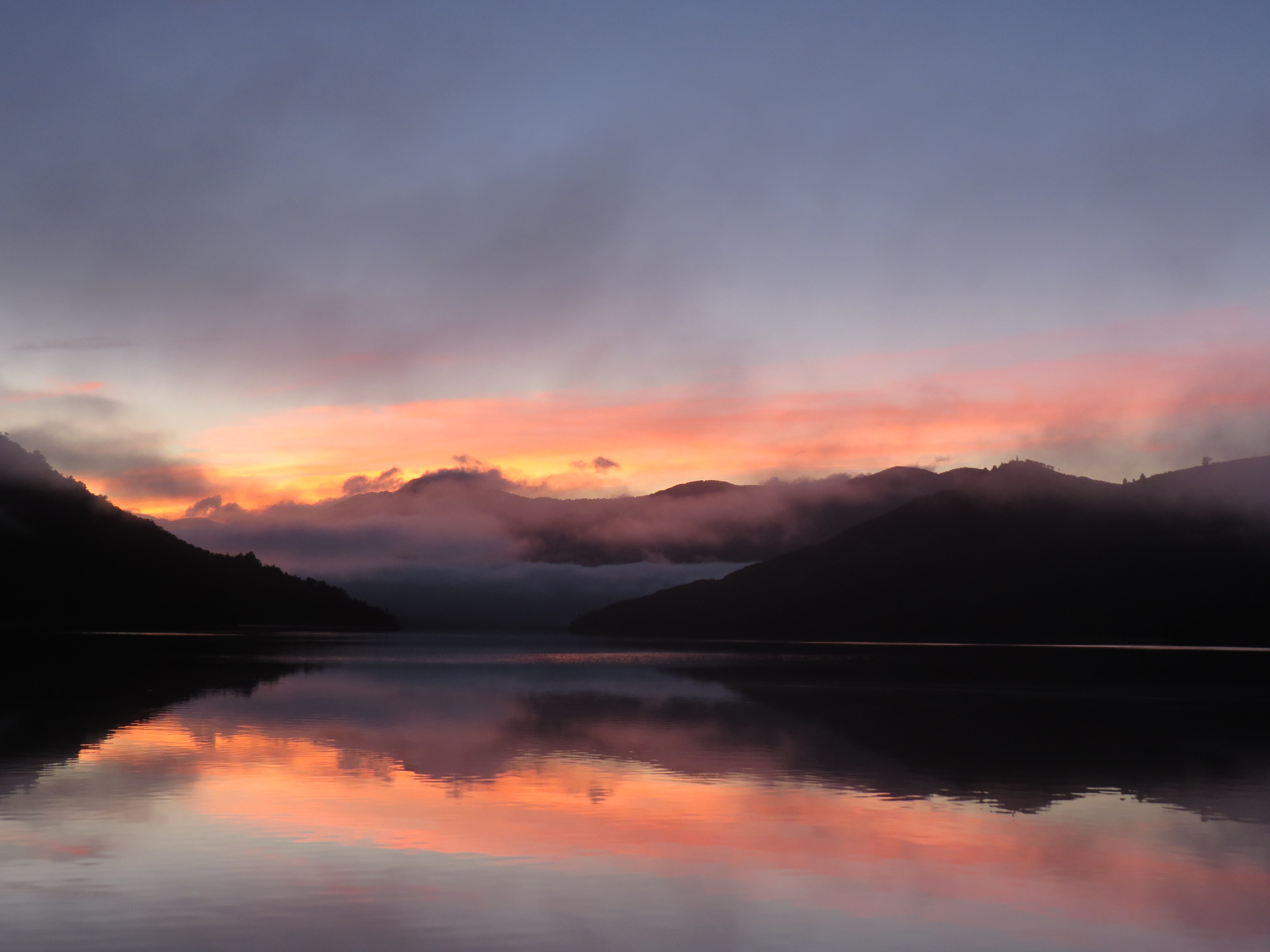 |
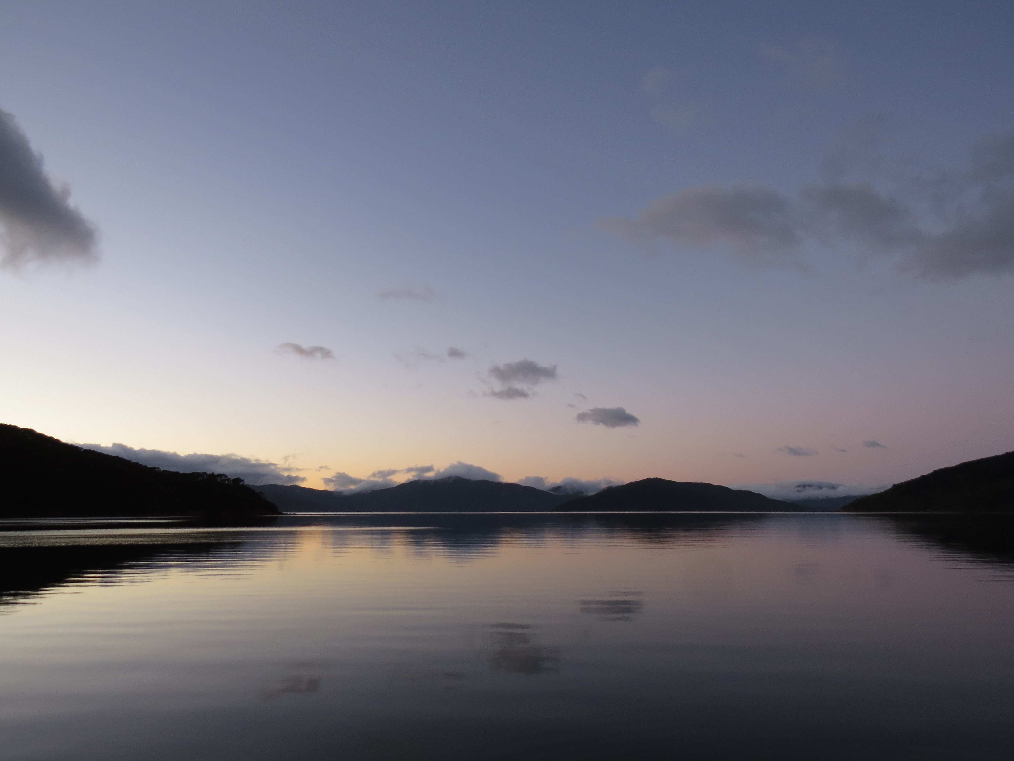
4/27/2014: Sunrise
Position: -41°9.44'S, 173°47.30'E
Sunrise from the anchorage in Nydia Bay.
|
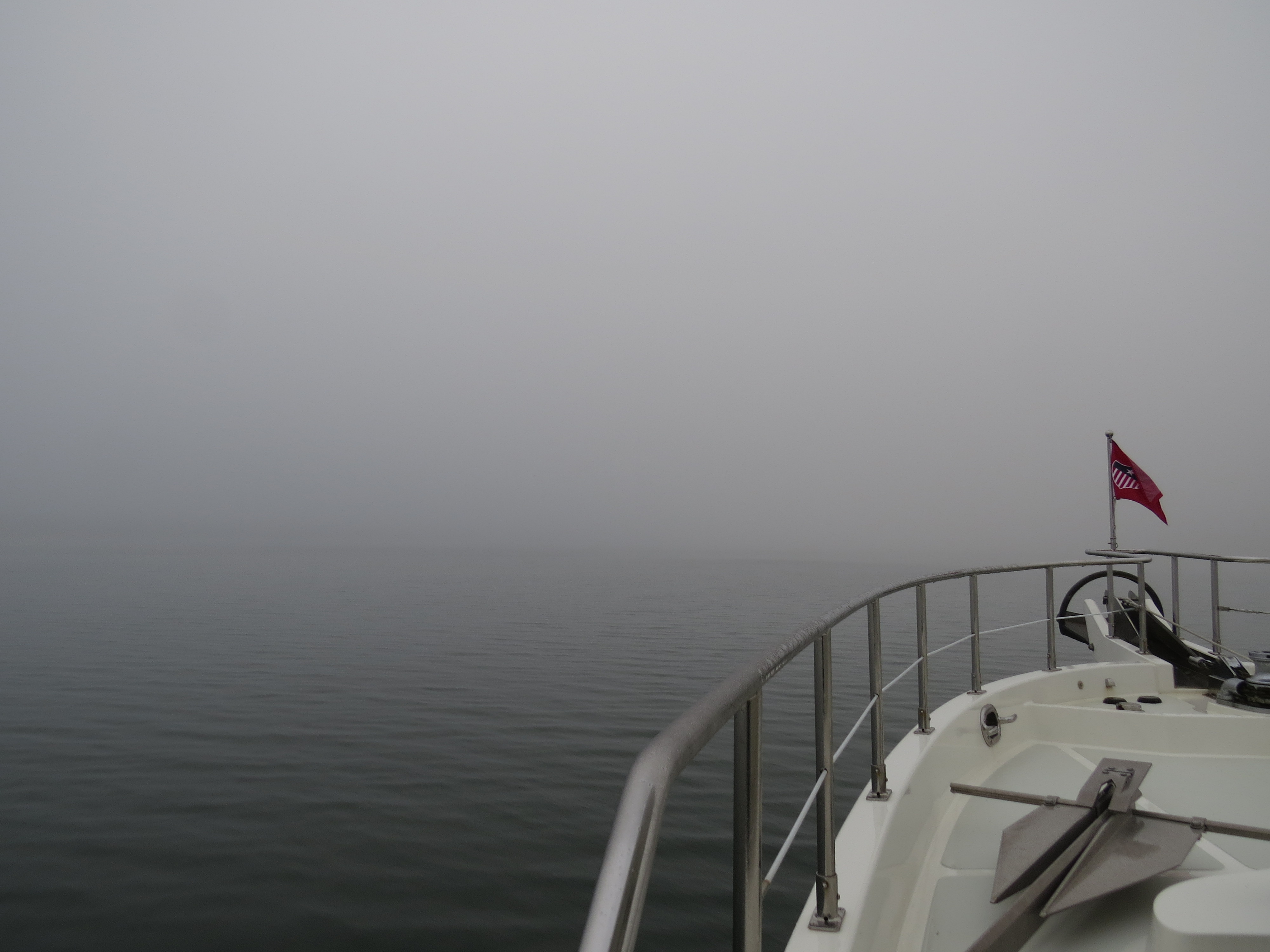 |
4/27/2014: Fog
Position: -41°10.86'S, 173°52.14'E
Thick fog in Hikapu Reach, en route to Mahua Sound.
|
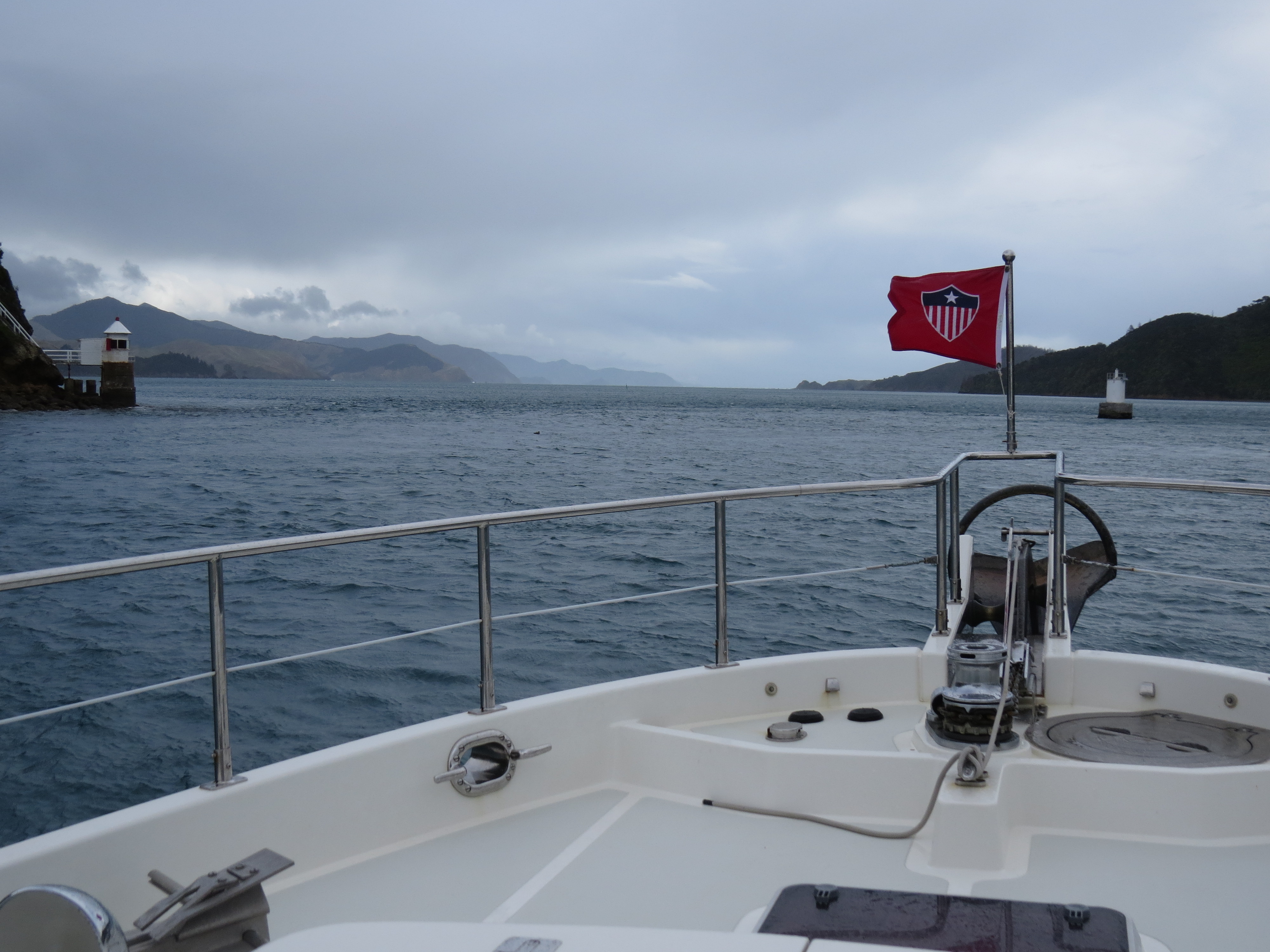 |
4/28/2014: French Pass
Position: -40°55.29'S, 173°50.40'E
Approaching the French Pass narrows. This is one of only two tidal current stations in all of New Zealand. The other is a short distance away at Tory Channel on the eastern edge of Marlborough Sounds. We went through near predicted slack water and exprerienced little to no current.
|
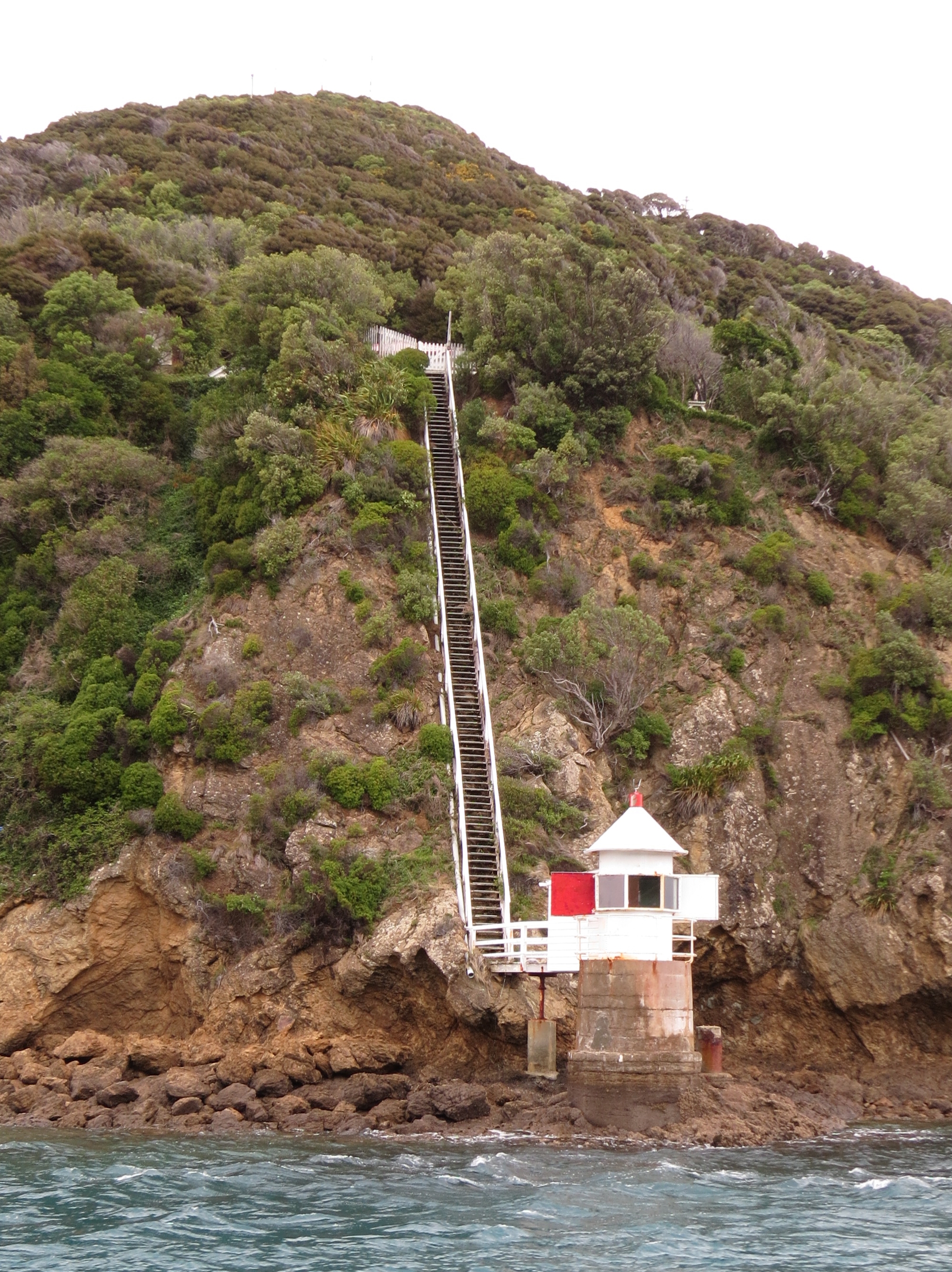 |
4/28/2014: Channel Point light
Position: -40°55.33'S, 173°50.29'E
Long staircase down to the Channel Point light on the south side of the narrows.
|
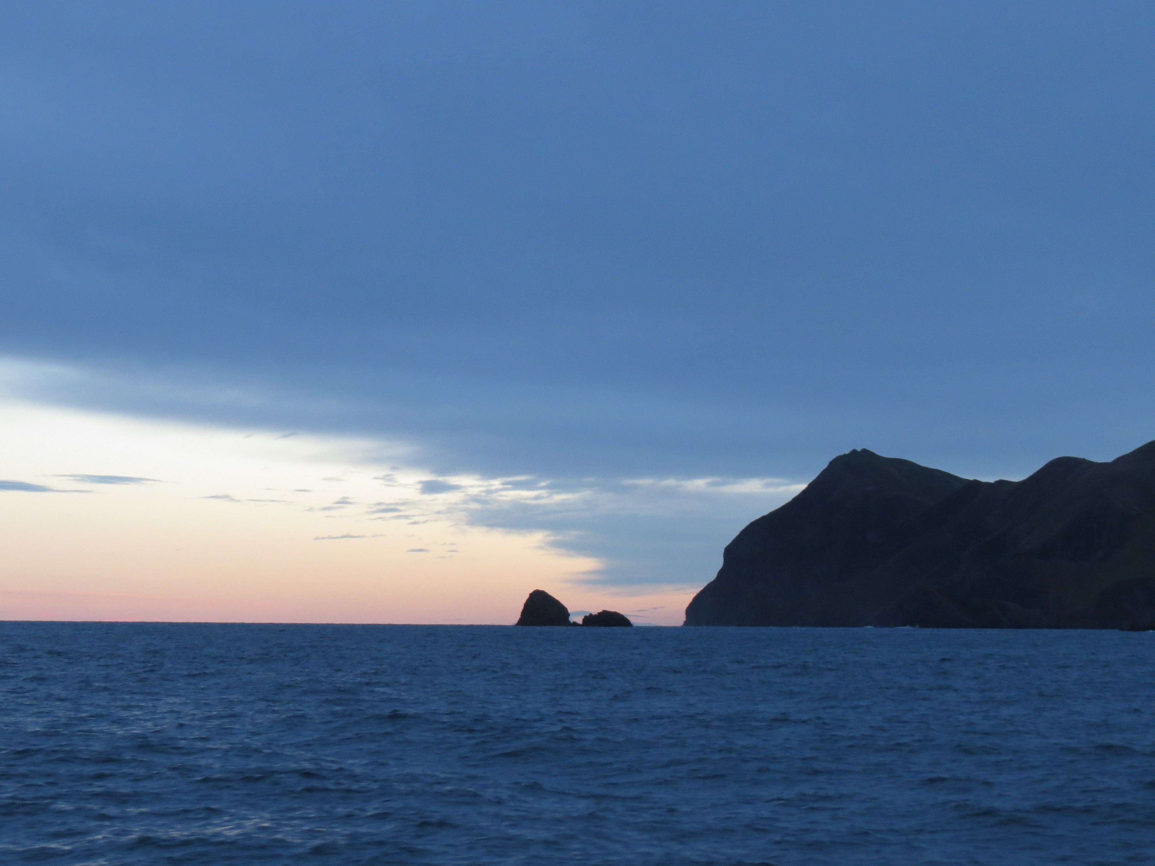 |
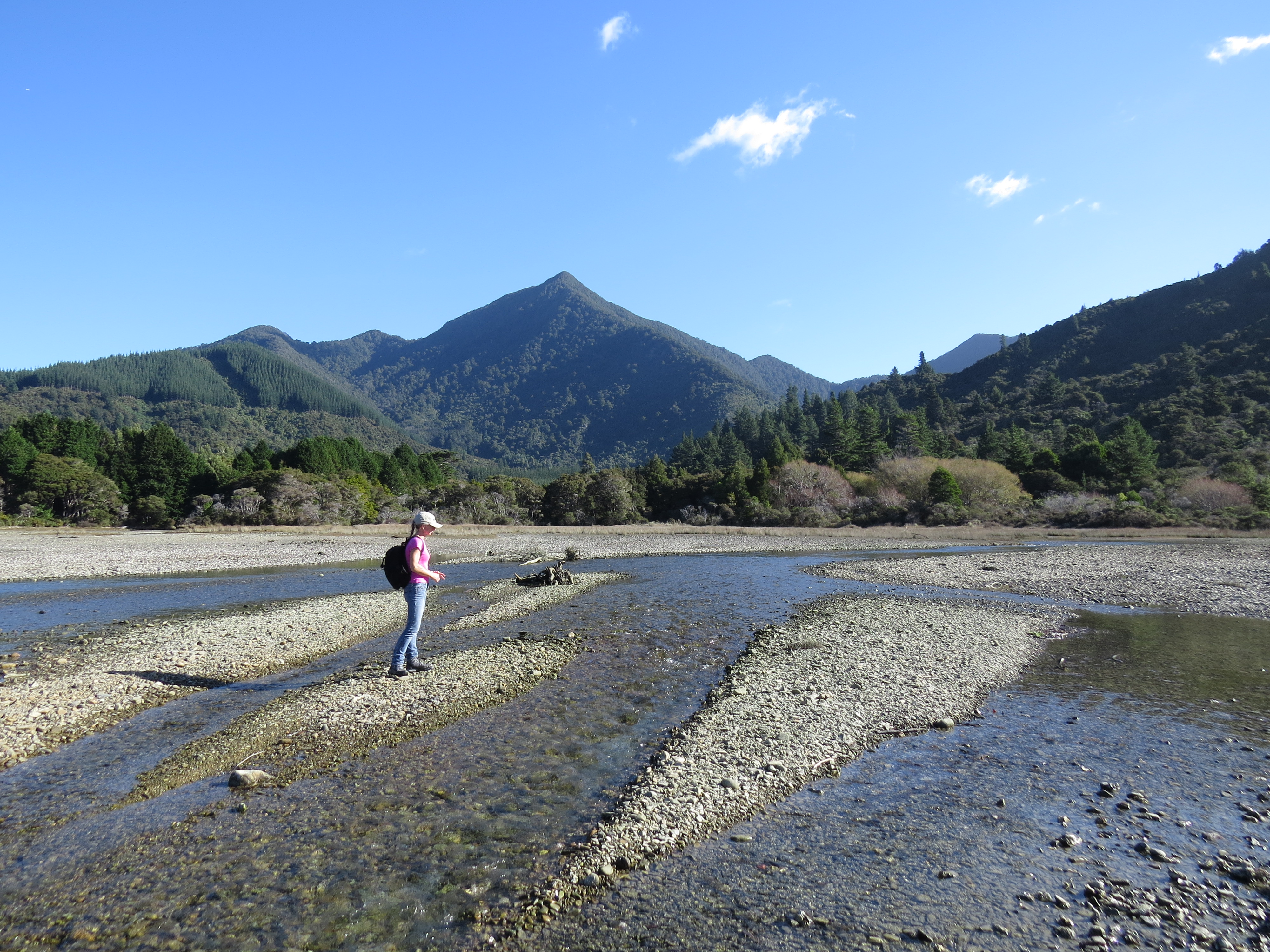
4/29/2014: Okarewa Point
Position: -40°54.19'S, 173°46.05'E
We were initially planning to run straight to Nelson, but conditions in Tasman Bay were quite rough with gusts nearing 50 knots. This would slow us down enough that we couldn't make Nelson before dark. So we ducked into Opotiki Bay for the night. We had excellent protection from the northerly winds there, and continued to Nelson this morning in much calmer conditions.
|
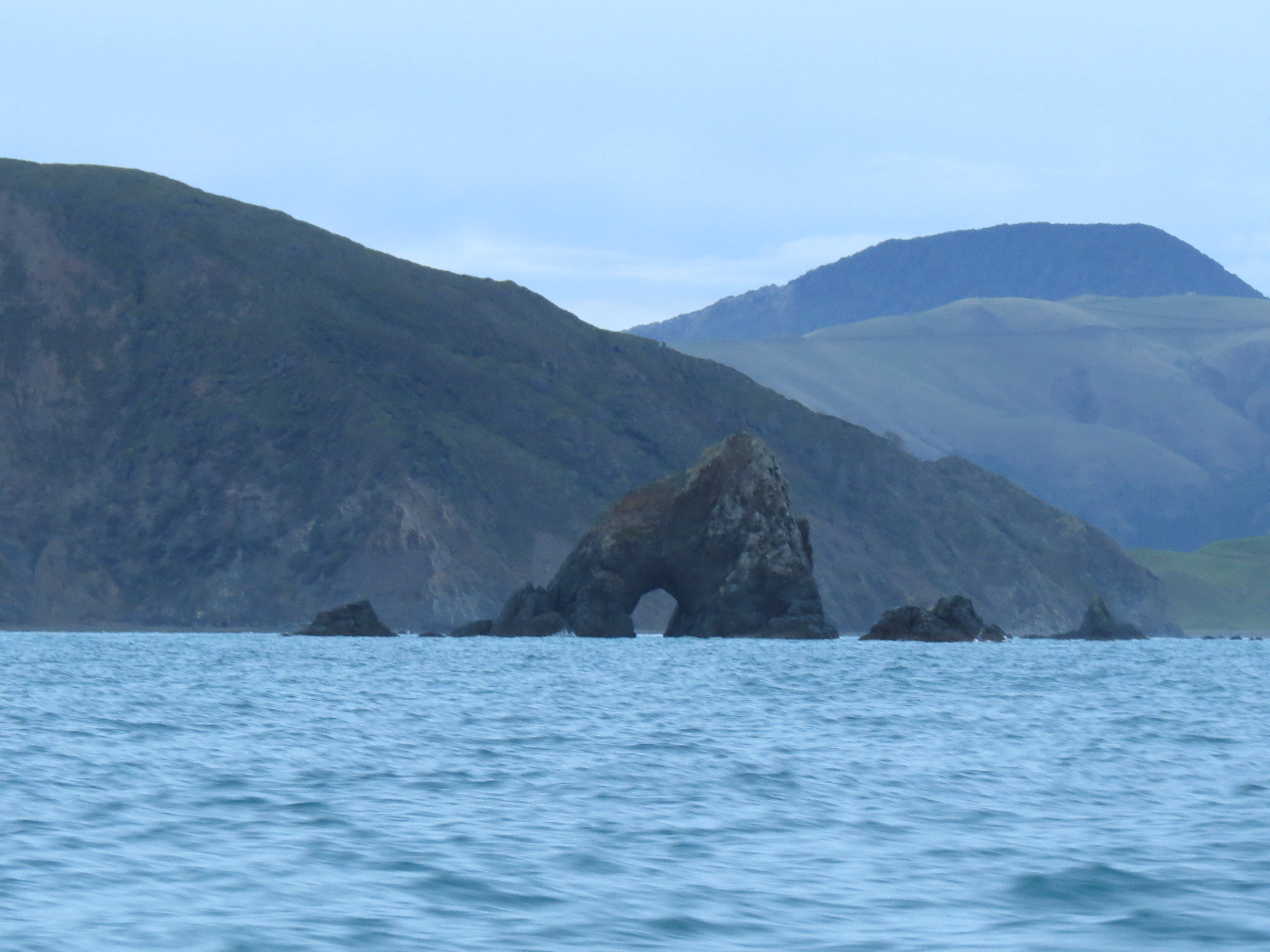 |
4/29/2014: Paddock Rocks
Position: -40°54.53'S, 173°45.13'E
One of several sea arches in weathern-worn Paddock Rocks, at the southern end of Manuhakapakapa.
|
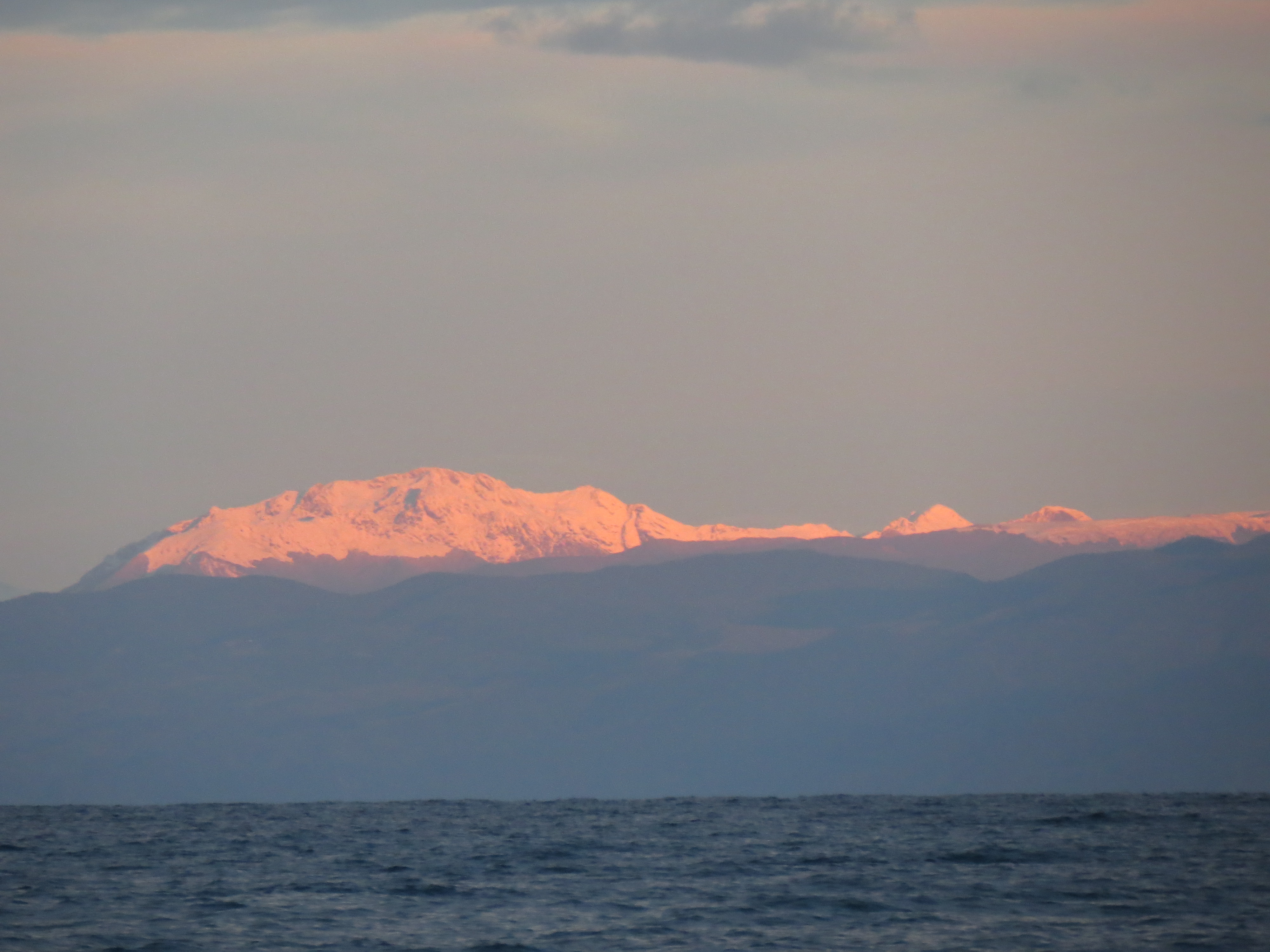 |
4/29/2014: Arthur Range
Position: -40°55.05'S, 173°44.32'E
The snow-covered Arthur Range aglow in the morning sun.
|
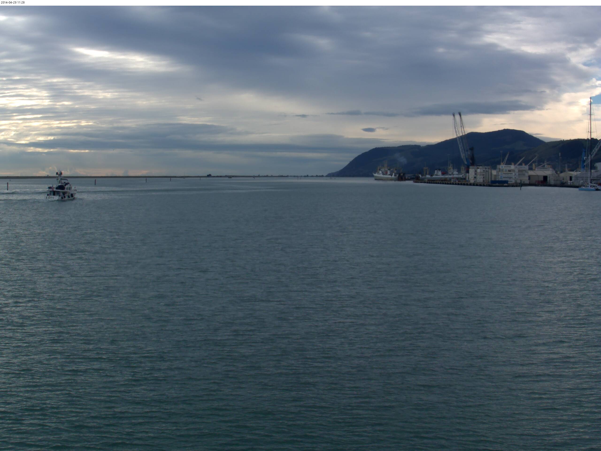 |
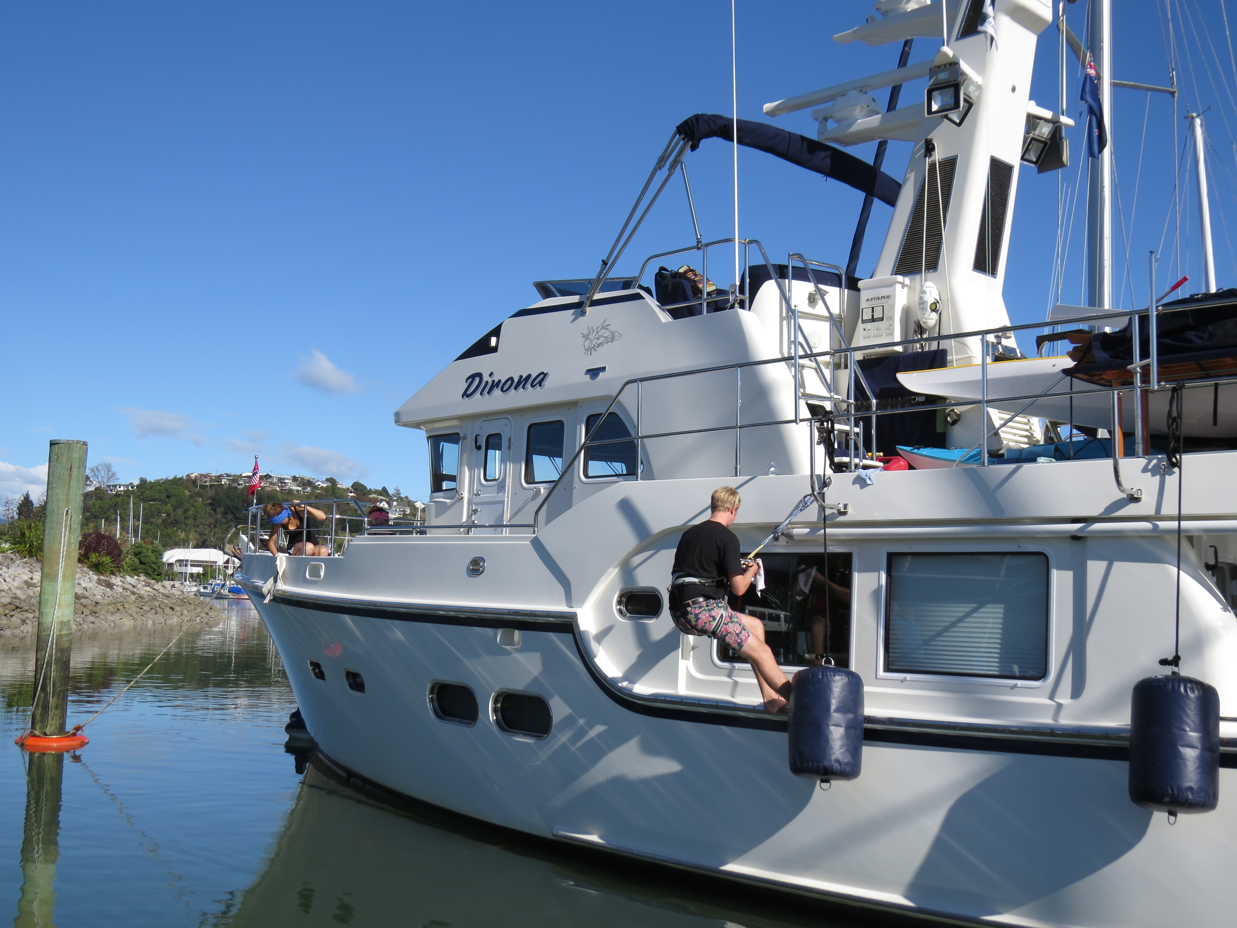
4/29/2014: Entering Port Nelson
Position: -41°15.66'S, 173°16.06'E
Sam Carpenter, in Seattle, found us on the Port Nelson web cam and posted some images of our arrival here.
|
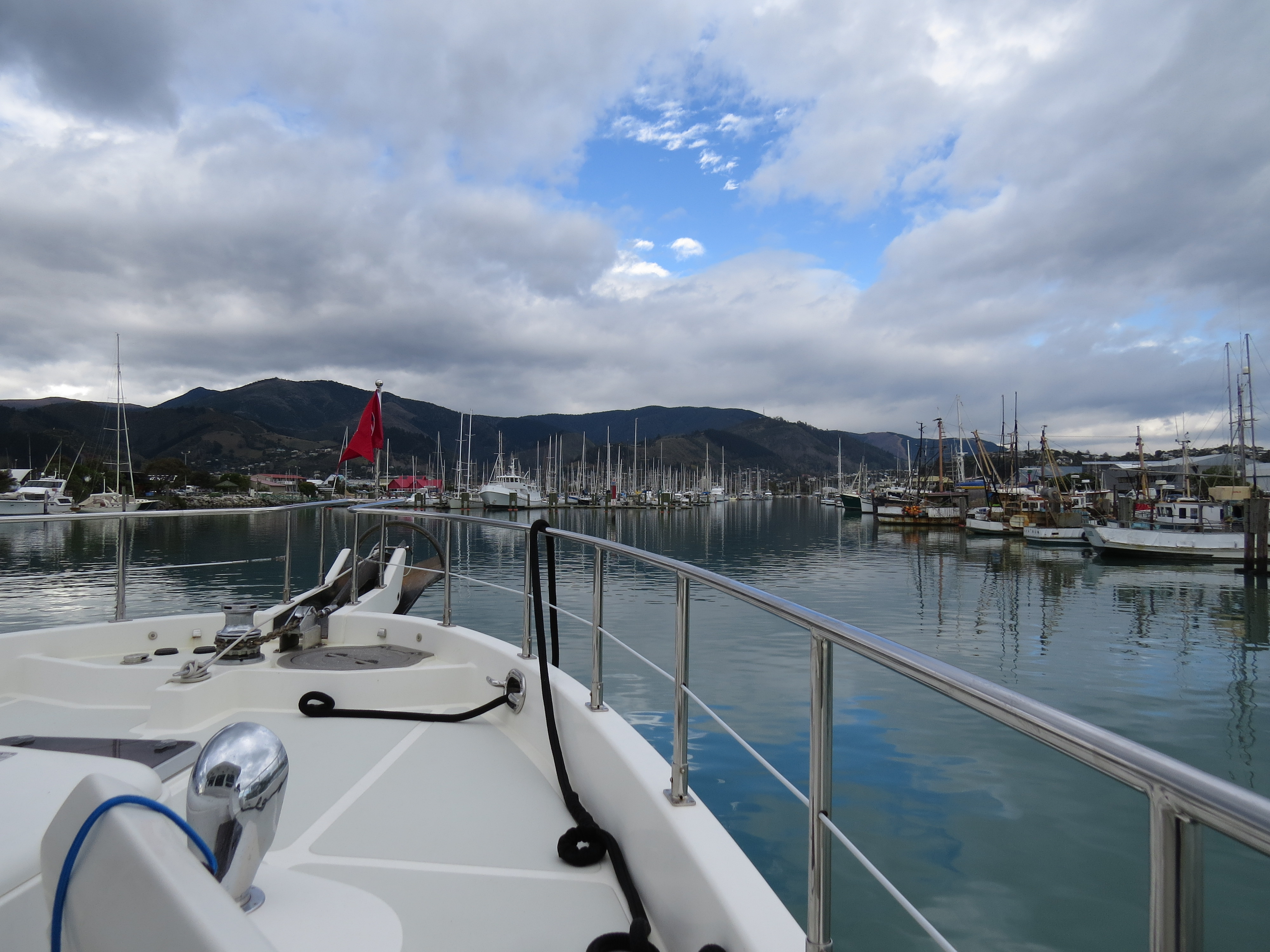 |
4/29/2014: Fairway
Position: -41°15.32'S, 173°16.83'E
Running south in the fairway towards our berth at Nelson Marina.
|
 |
4/29/2014: Berthed
Position: -41°15.74'S, 173°16.88'E
Berthed at our new temporary home at the Nelson Marina. The facility is quite nice, and we've got an excellent slip with a view over to the Maitai River estuary.
|
 |
4/29/2014: Nelson Marina
Position: -41°15.82'S, 173°16.84'E
View over the southern portion of the Nelson Marina. The buildings in the background are a variety of marine chandleries, where we knocked off most of the items on our shopping list.
|
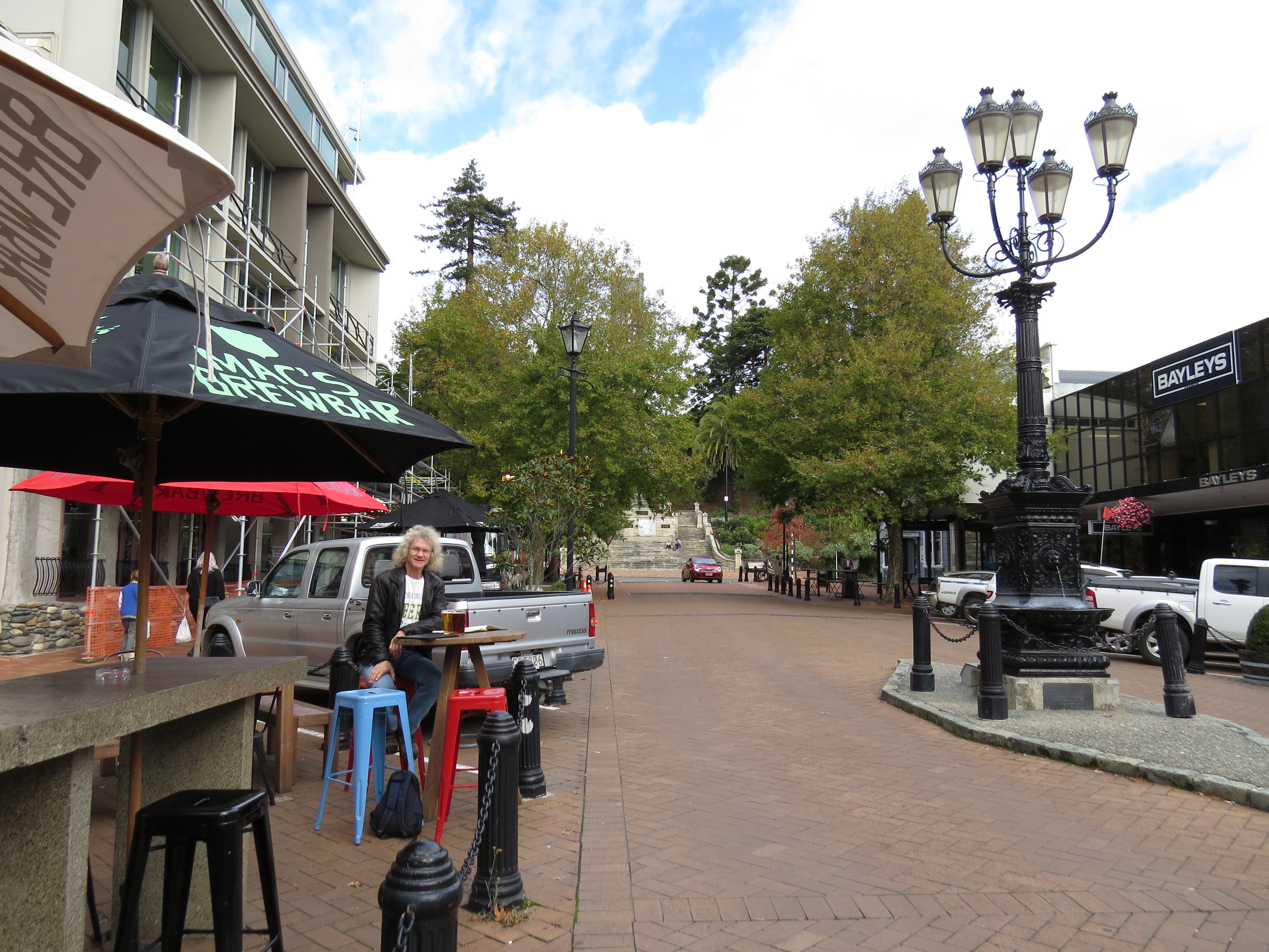 |
4/29/2014: Vic
Position: -41°16.48'S, 173°17.04'E
A late lunch streetside at Vic, another Mac's brewbar. Pedestrian-friendly downtown Nelson is about a 15-minute walk from the marina, with plenty of shops and restaurants.
|
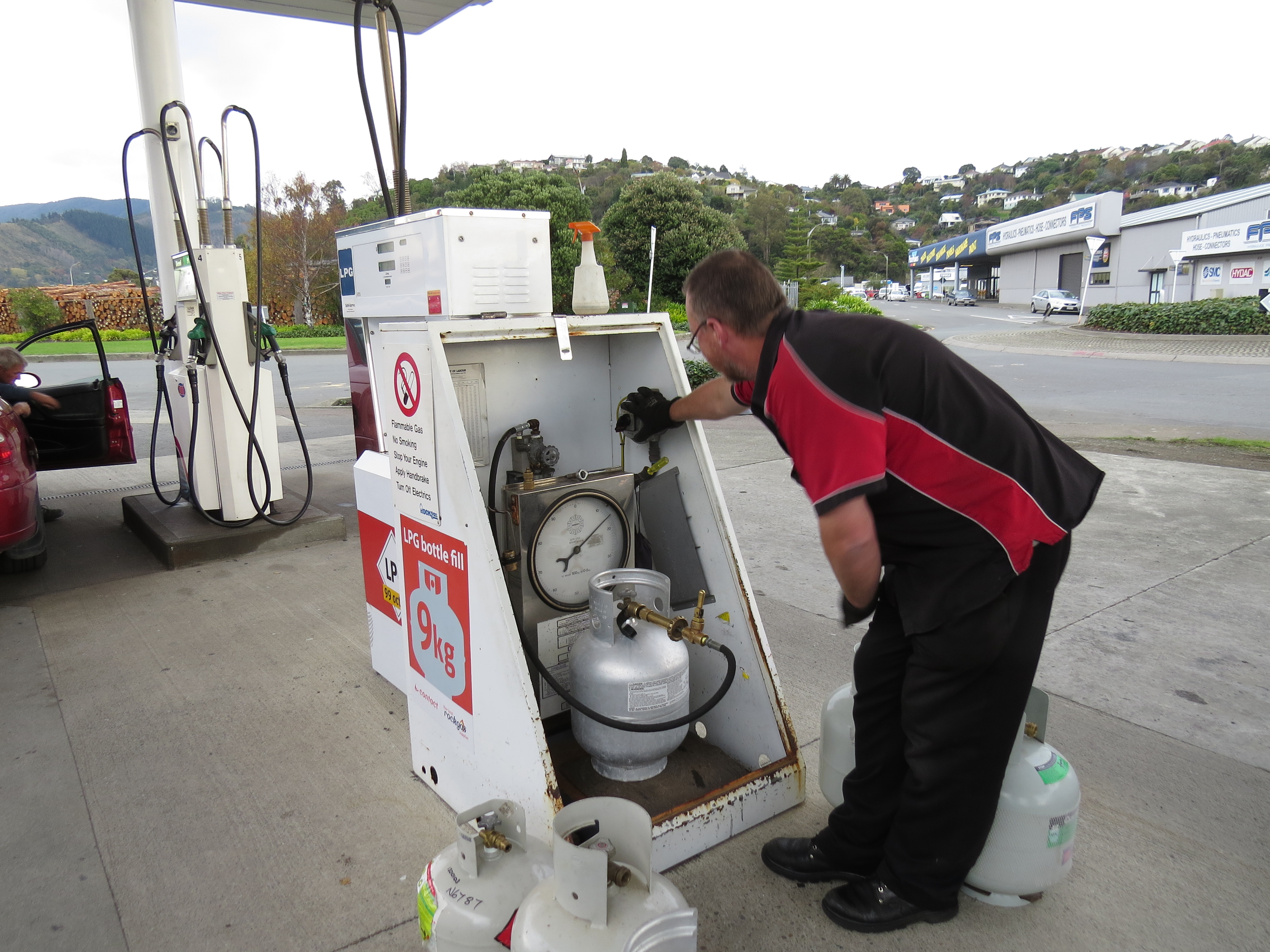 |
4/29/2014: Propane fill
Position: -41°15.91'S, 173°16.67'E
We'd recently swapped out two of our four propane tanks, and needed the empties filled. Due to differences in fittings worldwide, we were expecting to have a difficult time filling them outside the US, and carried parts to make fill adapters. But the New Zealand fittings are nearly identical to those in the US--so long as the tanks were less than ten years old, the station attendant could fill them with just an adapter on their hose. So we're now filled with way less hassle than we were expecting--the attendant did think it odd how excited we were over such a mundane event.
|
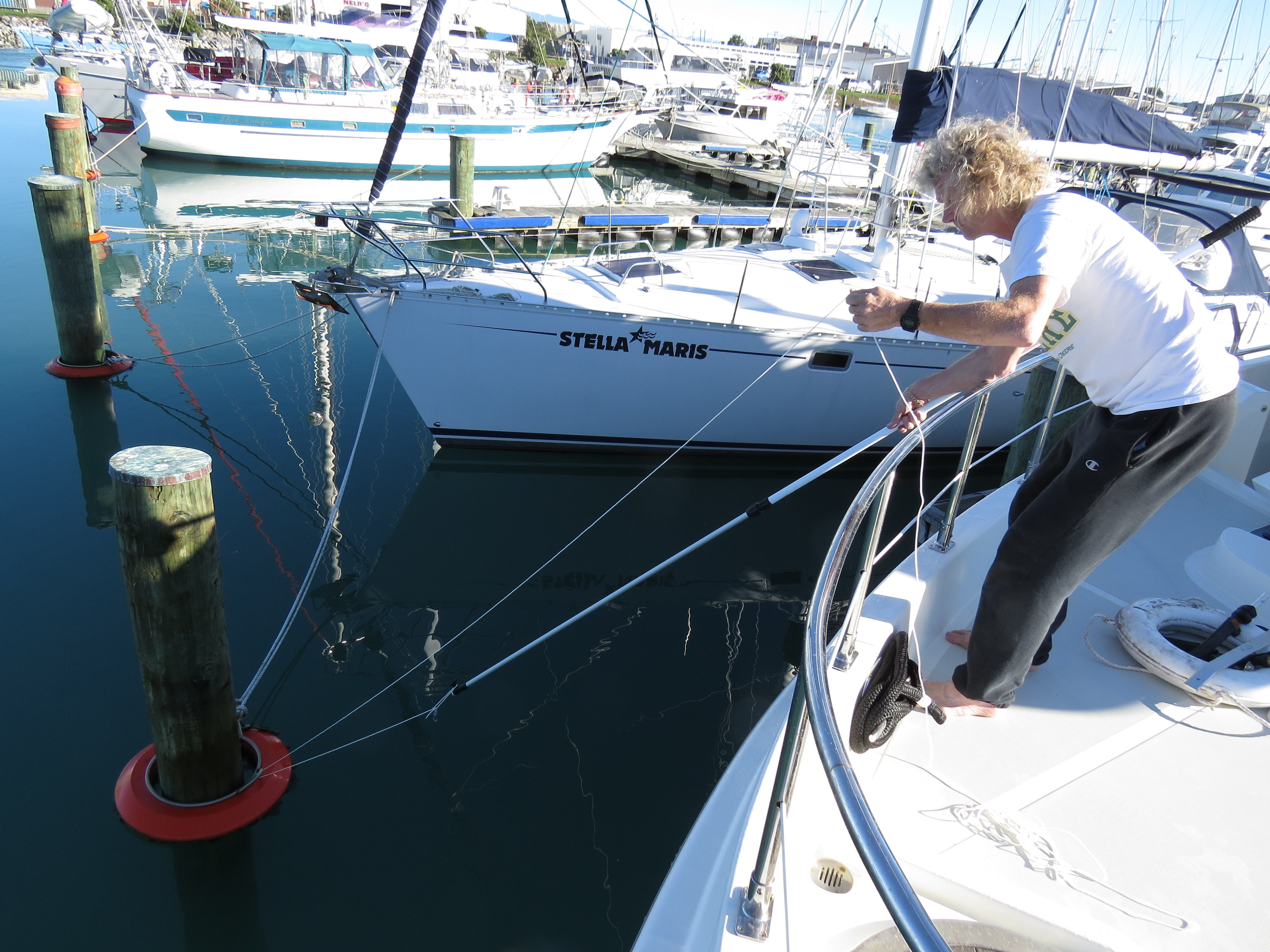 |
4/30/2014: Messenger
Position: -41°15.74'S, 173°16.88'E
Most slips in New Zealand have pilings on at least one side, with mooring rings, to help keep boats from bouncing against the dock in the swell. Boats often are tied up without any fenders on the dock side, using the opposite side rings to keep them off the dock. The problem with the rings is that it takes help to get a line to them unless you pick up the ring as you come in, and if you don't double back the line, you have a similar problem leaving. In Auckland, we used the micro-tender to run lines to the mooring ring and back to the boat. In Nelson, we devised a more efficient solution using a messenger line. With the boat hook, we passed a fishing weight attached to a light messenger line through the mooring ring eye, then pulled the weight and line back up to the boat. Then we tied a 1-inch, 75-foot mooring line to the messenger line, and pulled the large line through the ring and back to the boat.
|
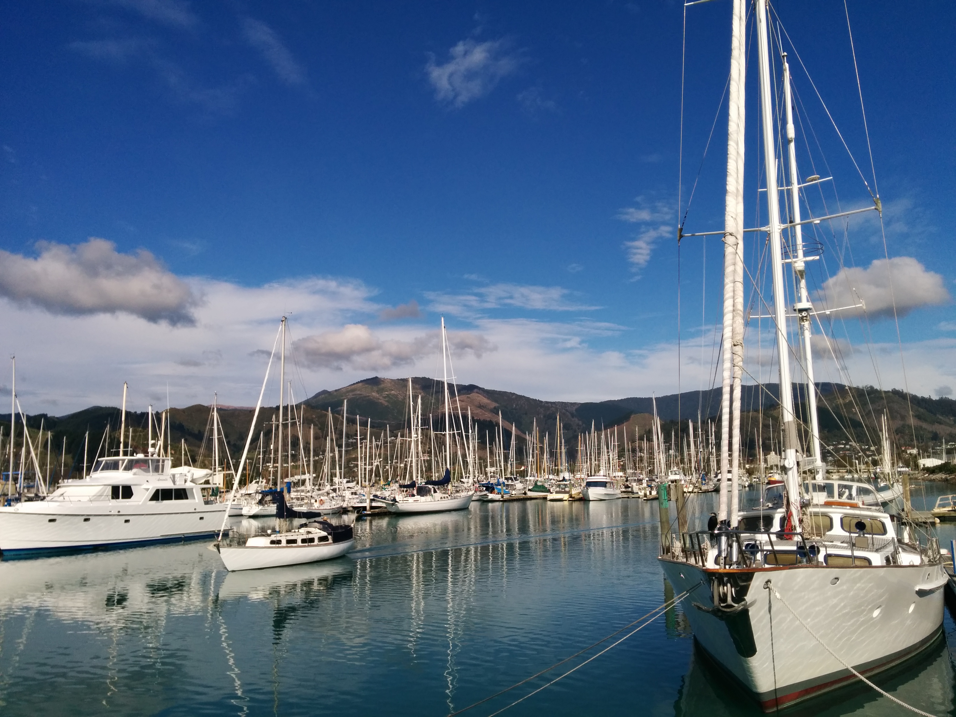 |
5/2/2014: Nelson Marina
Position: -41°15.53'S, 173°16.84'E
Looking across the Nelson Marina from the pier on the west side. The weather so far has been clear and sunny every day.
|
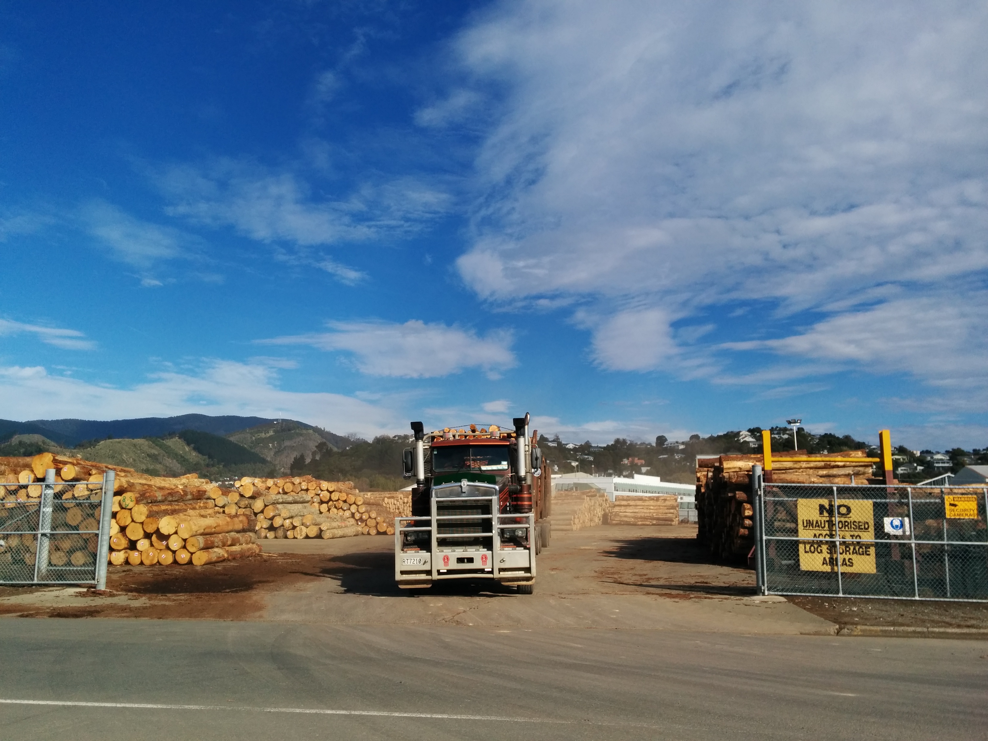 |
5/2/2014: Logging truck
Position: -41°15.65'S, 173°16.63'E
Logging truck leaving one of the smaller of several log storage yards around the port. Timber is a big industry on the South Island.
|
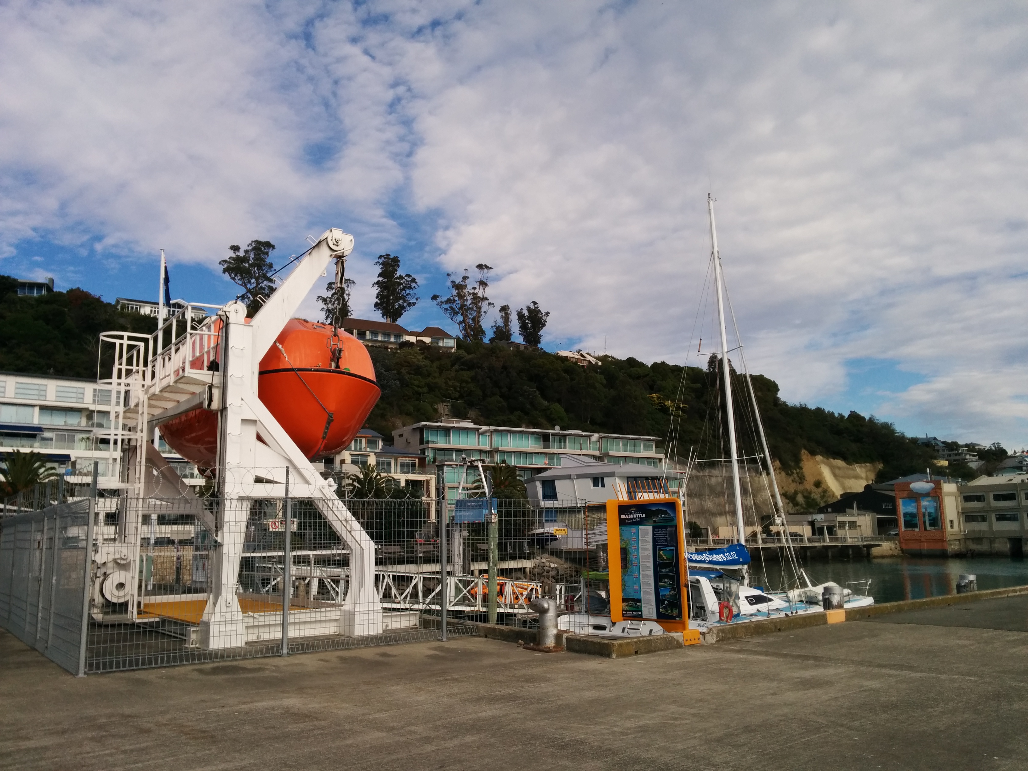 |
5/2/2014: Nelson Maritime School
Position: -41°15.79'S, 173°16.14'E
Nelson has a major maritime school--this is for their lifeboat training.
|
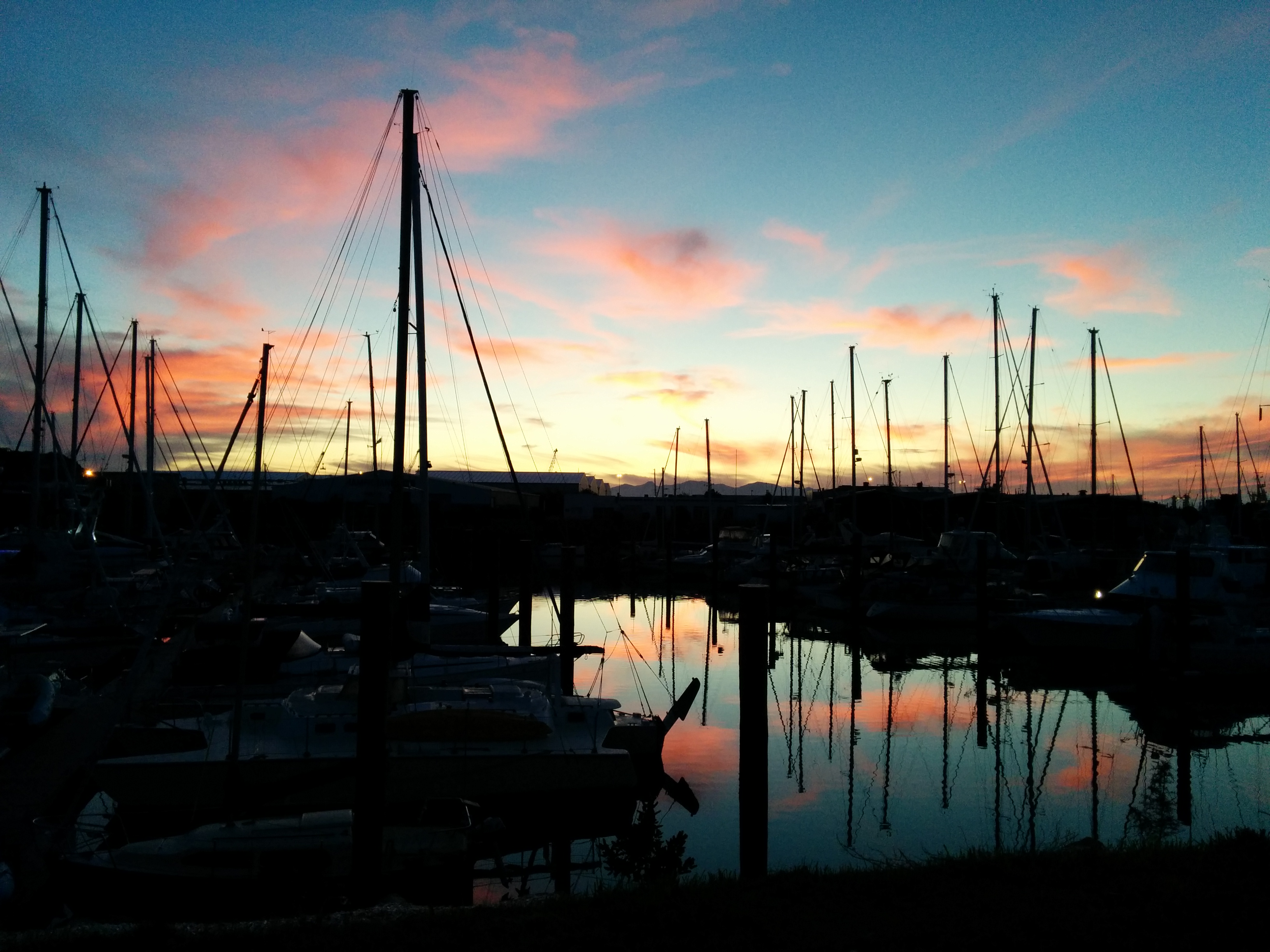 |
5/3/2014: Sunset
Position: -41°15.73'S, 173°16.94'E
Sunset looking west across the marine.
|
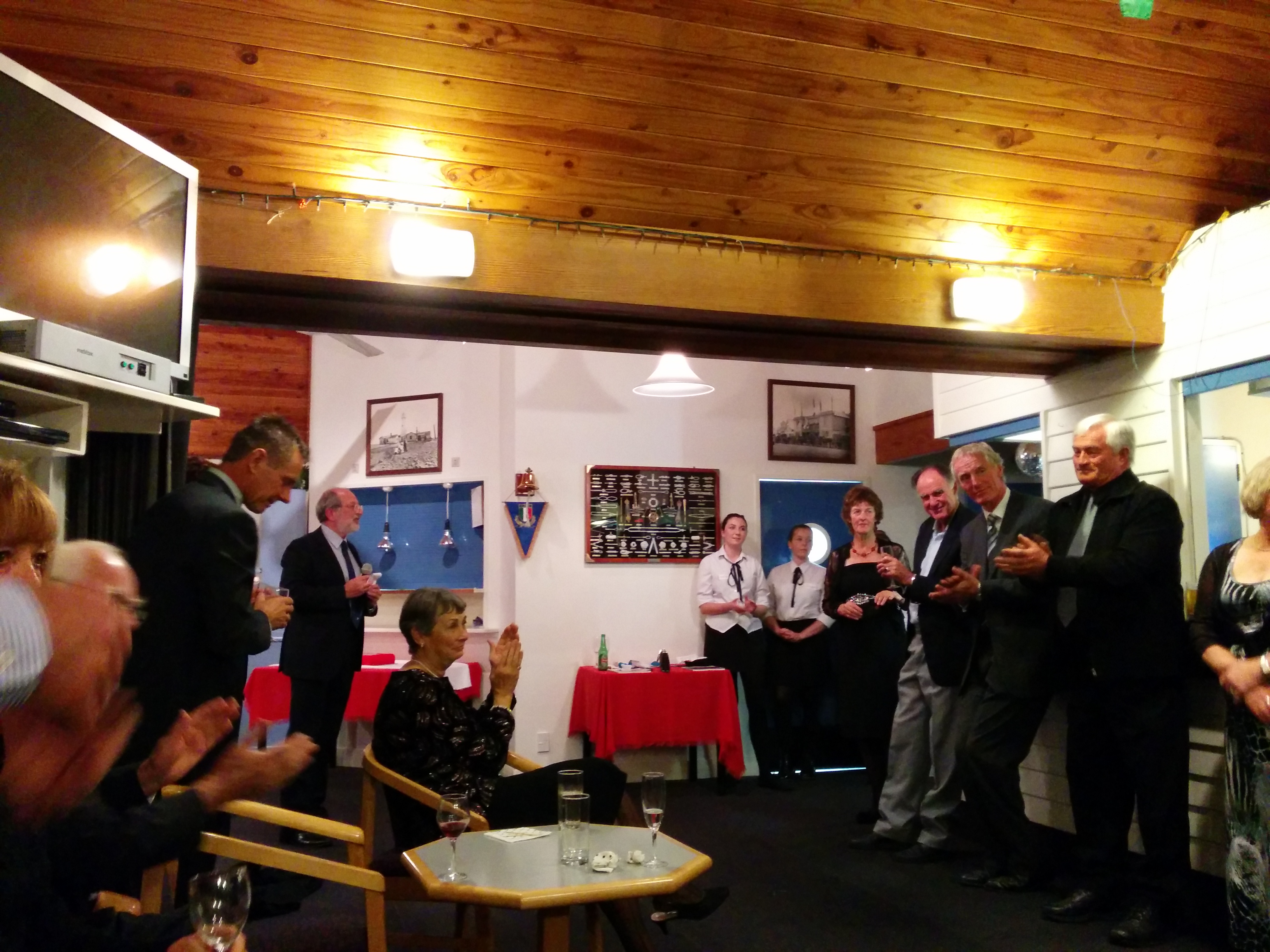 |
5/3/2014: Tasman Bay Cruising Club
Position: -41°15.55'S, 173°16.96'E
At the Tasman Bay Cruising Club's Commodore's Cocktail Party. They were celebrating the 25th anniversary of their red-sided clubhouse, known affectionately as the "Red Shed."
|
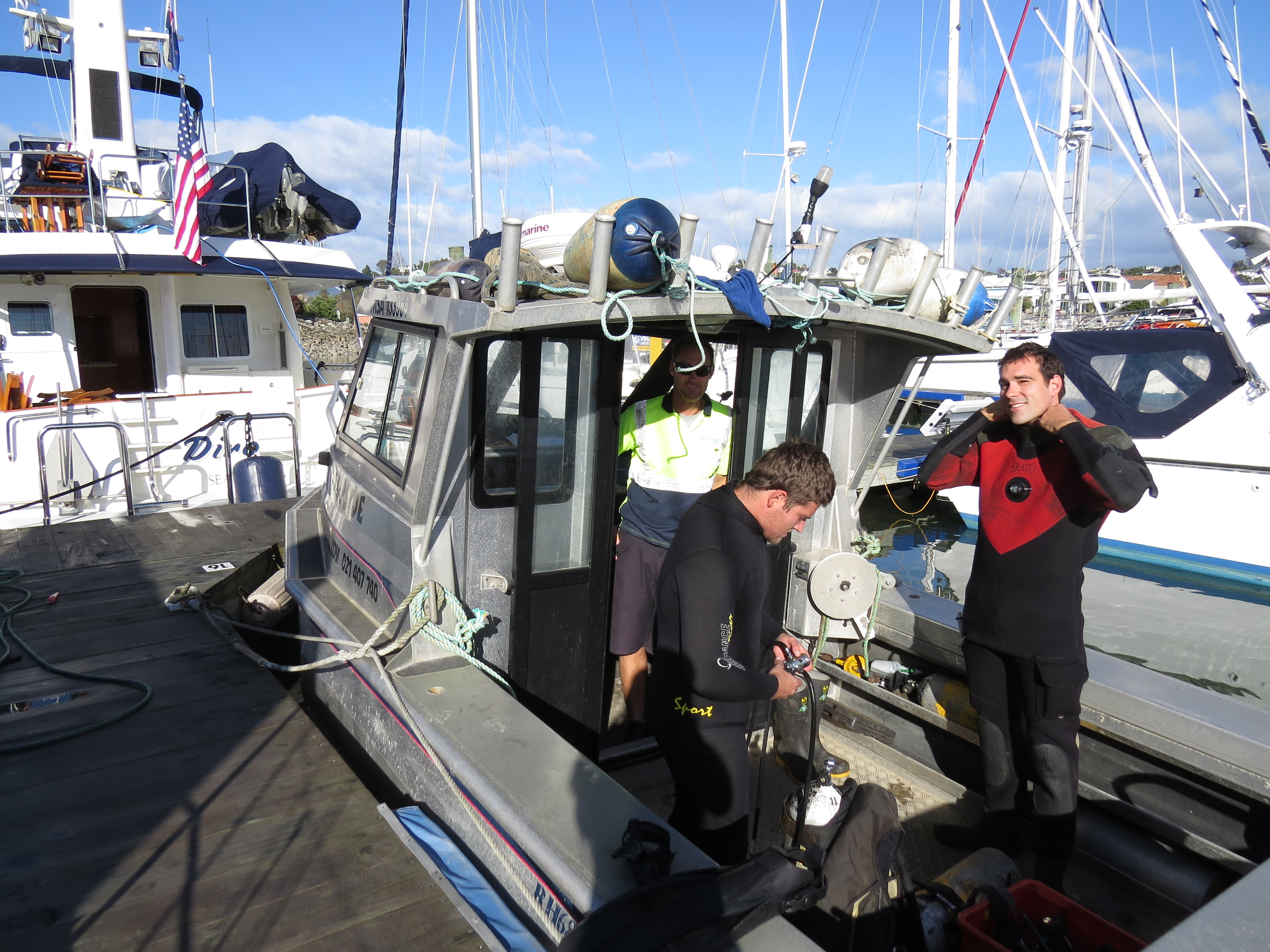 |
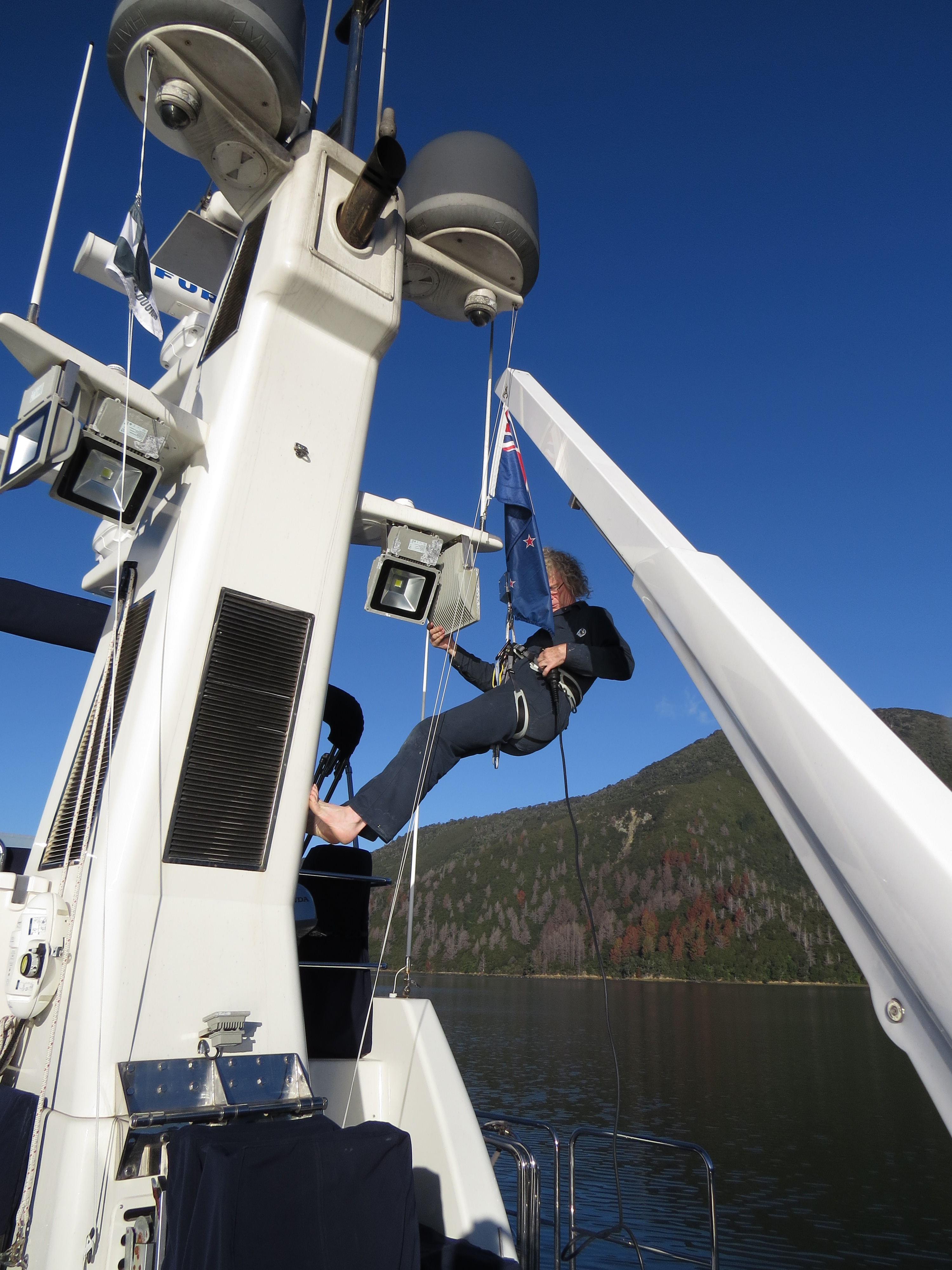
5/6/2014: Diving Services
Position: -41°15.74'S, 173°16.88'E
We hired Diving Services to clean the hull before departing for Brisbane. As with New Zealand, Australia is very concerned about the biofouling risks from international arrivals.
|
 |
5/6/2014: Detail
Position: -41°15.74'S, 173°16.88'E
Yacht Services New Zealand gave the boat a thorough waxing. We were a little overdue since the previous detail in Fiji.
|
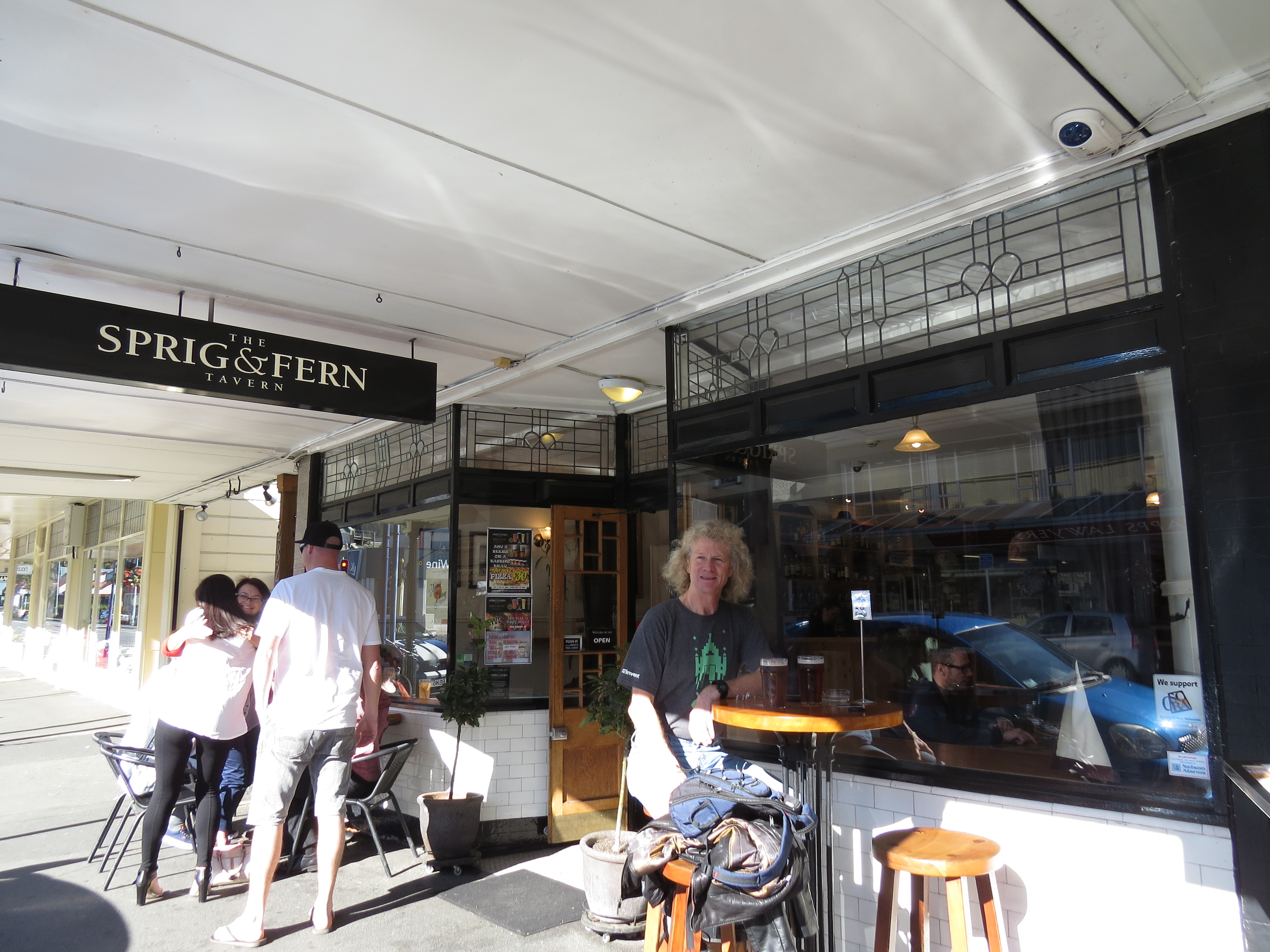 |
5/11/2014: Sprig & Fern
Position: -41°16.47'S, 173°17.23'E
Nelson bills itself as the craft brewing capital of New Zealand. James just arrived back from the US, and we had a homecoming lunch at one of the Sprig & Fern Brewery pubs.
|