MV Dirona travel digest for South Island and Wellington, New Zealand 2014

|
Click the travel log icon on the left to see these locations on a map,
with the complete log of our cruise. On the map page, clicking on a camera or text icon will display a picture and/or log entry for that location, and clicking on the smaller icons along the route will display latitude, longitude and other navigation data for that location. And a live map of our current route and most recent log entries always is available at //mvdirona.com/maps/LocationCurrent.html. |
 |
3/29/2014: Dog Island
Position: -46°44.42'S, 168°25.49'E
The 46 meter-high light on Dog Island to our north can be seen from 19 miles away. We left Port William this morning before dawn and could clearly see the light flashing 17 miles away.
|
 |
3/29/2014: Duncan Bay
Position: -46°43.17'S, 168°46.29'E
We altered course to avoid the bulker Duncan Bay approaching from behind. In this overtaking situation we are the stand-on vessel, but the Duncan Bay showed no sign of respecting that.
|
 |
3/29/2014: Surfers
Position: -46°39.49'S, 169°6.46'E
Definately a commentary on the anchorage when it is full of surfers. Conditions were reasonably calm and the swell was falling, so we opted to anchor in Porpoise Bay on our way to Dunedin. Boat motion was pretty severe at anchor though--even with the flopper-stopper out. But it wasn't intolerable, and we really wanted to visit.
|
 |
3/29/2014: Hector's dolphin
Position: -46°39.49'S, 169°6.47'E
The Hector's dolphin grows to at most 1.5 meters and is among the world's smallest and rarest marine dolphin. Their population is only about 7,000 and only in New Zealand inshore waters. One of the reasons we stopped in Porpoise Bay was to possibly see one. We weren't disappointed--we sawy many. They were quite curious and frequently swam up to the boat. The dolphins also surfaced quite closely as we took the micro-tender ashore--very exciting although a little unnerving in that rather unstable craft.
|
 |
3/29/2014: Reef
Position: -46°39.68'S, 169°6.45'E
The seascape around the bay was dramatic. This is looking east over the reef along the southern part of Porpoise Bay as waves crash ashore.
|
 |
3/29/2014: South Head
Position: -46°39.79'S, 169°6.35'E
We'd come mostly for the wildlife and the fossillised forest in Curio Bay--the beautiful seascape was an unexpected bonus. We spent ages watching the ocean crash into shore.
|
 |
3/29/2014: Curio Bay
Position: -46°39.71'S, 169°6.25'E
Looking west across Curio Bay, a prime spotting grounds for rare yellow-penguins. The birds leave their nests early in the morning to fish, returning late in the afternoon. We were there around 4pm, hoping for a sighting. But according to a DOC sign, the best time to see them was between 7pm and 9pm. We didn't want to wait that long, or launch and run the tender back in the dark.
|
 |
3/29/2014: Fossillised wood
Position: -46°39.71'S, 169°5.89'E
180 millions years ago, the coastal forest at Curio Bay was repeatedly buried in volcanic debris. Over time, the wood turned to rock and over the last 10,000 years the coastline has eroded, exposing the fossillised wood. Today it is one of the most extensive and least disturbed Jurassic forests in the world.
|
 |
3/29/2014: Porpoise Bay
Position: -46°39.49'S, 169°6.46'E
The anchorage reminded us of Beveridge Reef: pretty "out there", and the wave protection changed with the tide as the reef become more or less exposed. And we were anchored in similarly shallow water. But here we could use the flopper-stopper with the new alternate shorter line we had made in Whangarei. We were planning to stay the night, but the run to Dunedin was about 14 hours and we'd have to wait until tomorrow afternoon to leave to avoid arriving in Dunedin after dark. So we decided to keep the line moving.
|
 |
3/30/2014: Roll
Position: -46°22.34'S, 170°1.45'E
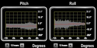
We left the anchorage eight hours ago. Pitch has increased slightly, but roll has reduced notably over the anchorage. It's pretty unusual to have better roll conditions at sea than the anchorage. Conditions overall were wonderfully calm for the run to Dunedin. We experimented again with short-run watch schedules--this time we tried James on watch from 8pm to 12:30am, then again from 6:30 am to 8:00 am. That worked out well--we both got close to six hours sleep and weren't tired at all the following day.
|
 |
3/30/2014: Fairway beacon
Position: -45°44.96'S, 170°43.54'E
The last bit of the run, all through James' second watch, was through thick fog. We couldn't see this beacon in the entrance fairway until we were within 200 meters. Boat traffic was pretty heavy too, with a number of fish boats leaving Dunedin and heading right towards us.
|
 |
3/30/2014: Heyward Point
Position: -45°45.09'S, 170°42.10'E
The entrance into Dunedin is quite narrow and with all traffic about, we didn't feel safe entering in such thick fog. And even the pilots weren't moving the big ships due to poor visiblity. Plus we wanted to enjoy the scenery on the way in. So we anchored off Heyward Point, had a nice breakfast on the back deck, and continued with the fog had cleared a couple of hours later. This was a beautiful place to stop, and the waters were quite calm.
|
 |
3/30/2014: Spirit of Shanghai
Position: -45°45.08'S, 170°42.09'E
Spirit of Shangahi leaving Dunedin. We definately didn't want to be navigating around ships like this in tight quarters with 200-meter visibility.
|
 |
3/30/2014: Taiaroa Head
Position: -45°45.94'S, 170°43.37'E
The light on Taiaroa Head as we enter the fairway.
|
 |
3/30/2014: Harbour Control
Position: -45°46.20'S, 170°43.33'E
Otaga Harbour control perched way up on the hill with excellent visibility to approaching traffic. They'd radiod us on James' second watch as we approached in the fog asking about conditions and visibility--they couldn't see anything through any of their cameras.
|
 |
3/30/2014: Fort Taiaroa
Position: -45°46.62'S, 170°43.25'E
Ruins of Fort Taiaroa, built in the 1880s.
|
 |
3/30/2014: Otago Harbour
Position: -45°47.55'S, 170°40.75'E
The run through Otago Harbour was beautiful, with rolling green hills on both sides.
|
 |
3/30/2014: Port of Otago
Position: -45°48.48'S, 170°37.86'E
Cranes at the Port of Otago. It appears to be a fairly substantial port.
|
 |
3/30/2014: Wood
Position: -45°48.71'S, 170°37.86'E
Rows and rows of wood were alongshore, ready for transport.
|
 |
3/30/2014: Duncan Bay
Position: -45°52.45'S, 170°31.88'E
The Duncan Bay, that had passed us yesterday morning, ended up arriving only shortly before we did. The ship was anchored not too far from we were at Heyward Point, waiting for a pilot when the fog lifted.
|
 |
3/30/2014: Welcome
Position: -45°52.62'S, 170°31.14'E
.
|
 |
3/30/2014: Town Basin
Position: -45°52.85'S, 170°30.41'E
Moored in the tiny Town Basin, at the extreme head of Otaga Harbour. We were lucky to get a spot--the marina has only seven berths. The only other option would have been at Port Chalmers, about six miles out of town. We're moored to a fixed wharf with long spring lines to handle the tidal exchange. And we're using our fender boards for the first time. We'd built them in Honolulu using schedule 80 PVC pipe according to the design here. That site also had a good discussion of rigging spring lines for a fixed dock.
|
 |
3/30/2014: Dunedin train station
Position: -45°52.55'S, 170°30.49'E
Crossing over the tracks at the Dunedin train station. The train visible runs the Taieri Gorge tour that we'll be taking tomorrow.
|
 |
3/30/2014: The Jury Room
Position: -45°52.51'S, 170°30.39'E
Celebrating our arrival into Dunedin with pints at the Jury Room. Jennifer is trying a Speights Distinction Ale--it was excellent.
|
 |
3/30/2014: The Octagon
Position: -45°52.46'S, 170°30.26'E
We continued up the street and popped out at the Octagan near the center of town, where at least a dozen restaurants and cafes, all with outdoor seating, ring the road. We had been so long without any choices we were practically running into each other trying to take it all in.
|
 |
3/30/2014: The Craic
Position: -45°52.46'S, 170°30.22'E
We settled on dinner at The Craic Irish pub. The food was excellent, as were the pints of Kilkenney.
|
 |
3/30/2014: Steamer Basin
Position: -45°52.79'S, 170°30.38'E
Photographer Paul Le Comte was out taking evening shots and we chatted with him when he was on the wharf beside Dirona. He later sent us some amazing photographs he took that night of the Steamer Basin, as the area at the head of the habour is known. More of his excellent work is here.
|
 |
3/30/2014: Dirona at Steamer Basin
Position: -45°52.79'S, 170°30.38'E
Another beautiful Paul Le Comte photograph, this one towards the Town Basin. Dirona's blue lights are visible in the distance.
|
 |
3/30/2014: Taieri Gorge Railway
Position: -45°52.52'S, 170°30.55'E
At the station, ready for our train trip through the Taieri Gorge in a restored train car. The first 13km section of the run will be through the Main Trunk Line for the southern island, then we'll switch over to an historic railway for the remaining 45km.
|
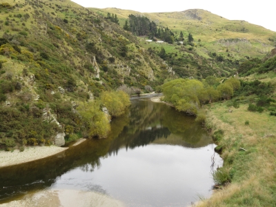 |
3/30/2014: Taieri River
Position: -45°43.19'S, 170°21.15'E
.
|
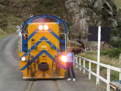 |
3/30/2014: Bridge crossing
Position: -45°43.03'S, 170°20.78'E
At Hindon, the train stopped so we could all disembark and walk across the bridge to watch the train cross.
|
 |
3/30/2014: The Notches
Position: -45°40.16'S, 170°17.52'E
Passing through four deep gulleys collectively called the Notches.
|
 |
3/30/2014: Viaduct
Position: -45°39.98'S, 170°17.36'E
We crossed a number of bridges and viaducts en route, including earlier on the trip the 197-meter Wingatui Viaduct. At 34 meters above sea level the Wingatui Viaduct is one of the largest wrought iron structures in the southern hemisphere.
|
 |
3/30/2014: Tunnel
Position: -45°39.95'S, 170°17.21'E
We passed through a number of tunnels. The train barely had space to pass--you had to be careful to keep your hands inside.
|
 |
3/30/2014: The Reefs
Position: -45°38.11'S, 170°13.34'E
The view across the Taieri River to the Rock and Pillar Range.
|
 |
3/30/2014: Pukerangi
Position: -45°38.08'S, 170°12.73'E
The end of the trip at Pukerangi, 250 meters above sea level.
|
 |
3/30/2014: Switching ends
Position: -45°38.08'S, 170°12.73'E
The locomotive switched ends here for the return trip.
|
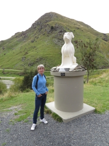 |
3/30/2014: Hindon Station
Position: -45°42.71'S, 170°20.40'E
We stopped briefly in Hindon on the return trip. This statue is dedicated to Susan, a Collie Sheep Dog
|
 |
3/31/2014: Dunedin Station
Position: -45°52.49'S, 170°30.50'E
The Dunedin Station, opened in 1906, is one of New Zealand's most photographed buildings.
|
 |
3/31/2014: Taieri Gorge Video
Position: -45°38.08'S, 170°12.73'E
Here is video footage of various parts of the trip. We had such a good time that we've booked a trip for the coastal run in a few days.
|
 |
3/31/2014: Ratbags
Position: -45°52.44'S, 170°30.26'E
A delicious pizza lunch with Dunedin-brewed Emerson's Bookbinder ale.
|
 |
3/31/2014: Speight's Brewery
Position: -45°52.60'S, 170°30.00'E
That evening, we went on a tour of the Speight's Brewery, on the original site where it was founded in the late 1800s.
|
 |
3/31/2014: Tasting hops
Position: -45°52.60'S, 170°30.00'E
Hops give beer its essential bitterness and aroma--the flavour is quite apparent when you taste it. Speight' uses hops grown in Nelson.
|
 |
3/31/2014: Kettles
Position: -45°52.60'S, 170°30.00'E
Old kettles in use until quite recently.
|
 |
3/31/2014: Malt grist
Position: -45°52.60'S, 170°30.00'E
Malt after it has been crushed to a powder in the background machines.
|
 |
3/31/2014: New equipment
Position: -45°52.60'S, 170°30.00'E
The brewery just recently completed a multi-million-dollar upgrade. This new stainless-steel equipment came online in the past few weeks.
|
 |
3/31/2014: Tasting room
Position: -45°52.60'S, 170°30.00'E
The tour ends in the tasting room, where we could sample as much as we liked.
|
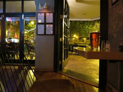 |
3/31/2014: Mac's
Position: -45°52.47'S, 170°30.25'E
Evening pints on the Octagon at Mac's, whose brewpub we'd visited in Wellington.
|
 |
4/1/2014: 20-amp cable
Position: -45°52.85'S, 170°30.41'E
To plug into shore in Dunedin, we need one more adapter. We picked up a 20-amp end at Corys, a nearby electrical store, and built a new adapter with it.
|
 |
4/2/2014: Baldwin Street
Position: -45°51.03'S, 170°32.15'E
Baldwin Street is in the Guiness Book of World record's as steepest street in the world. The gradient at the steepest section is 1 in 2.86, with an average grade from top to bottom of 1 in 3.41. We rode our bikes to the bottom, but didn't even consider trying to ride up.
|
 |
4/2/2014: Top of Baldwin
Position: -45°51.01'S, 170°32.21'E
Baldwin Street is a big tourist draw--perhaps fifty people were there in the half-hour or so we visited.
|
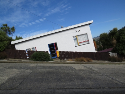 |
4/2/2014: Angle
Position: -45°51.03'S, 170°32.15'E
We took this picture at an angle so that the road was parallel to the horizon.
|
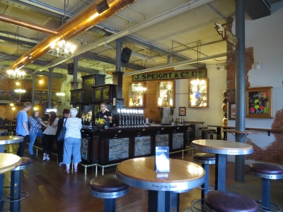 |
4/2/2014: Lunch
Position: -45°52.61'S, 170°30.02'E
Lunch at Speight's Ale House back in downtown Dunedin. Our bike ride to Baldwin Street was through the Otago University campus and district, but surprisingly we didn't find an appealing lunch stop there.
|
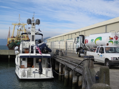 |
4/2/2014: Fueling
Position: -45°52.85'S, 170°30.41'E
Taking on a load of diesel from RD Petroleum. We were down to only 250 gallons after the big run through Fiordland and Stewart Island.
|
 |
4/3/2014: Pacific view
Position: -45°54.20'S, 170°31.94'E
View to the Pacific from the top of Tahuna Road west to Black Head. We'd set out on a bicycle trip, eventually to Tunnel Beach, along the Pacific shore.
|
 |
4/3/2014: St. Clair Beach
Position: -45°54.74'S, 170°29.33'E
The promenade at St. Clair beach was popular on this sunny day.
|
 |
4/3/2014: Lunch
Position: -45°54.70'S, 170°29.41'E
Several restaurants are alongshore here. We snagged a corner table with great beach views.
|
 |
4/3/2014: Climb
Position: -45°54.75'S, 170°28.92'E
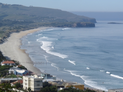
The road up from St. Clair to Tunnel Beach was so steep we had to walk the bikes up. But that steepness came with a reward of an amazing view back across the beach we just were on.
|
 |
4/3/2014: Otago Harbour
Position: -45°54.63'S, 170°28.97'E
View to Otago Harbour from the hill.
|
 |
4/3/2014: Arch
Position: -45°55.24'S, 170°27.27'E
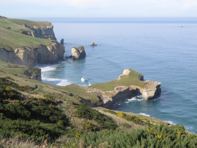
We had a little more elevation gain, then the rest of the ride was pretty easy to the trail head, where a 1km track leads down to Tunnel Beach. The scenery was quite dramatic--this it the view partway down the track to an arch on the point below.
|
 |
4/3/2014: Cliff
Position: -45°55.22'S, 170°27.50'E
A group were perched on the cliff just west of the arch.
|
 |
4/3/2014: Tunnel Beach
Position: -45°55.27'S, 170°27.53'E
Mist-filled Tunnel Beach. If you look closely in the higher-resolution image, you can see two people perched on the rocks beachside.
|
 |
4/3/2014: Tunnel
Position: -45°55.26'S, 170°27.52'E
A tunnel through the cliffs leads down to the beach. The local story is that one of Dunedin's 19th-century gold barons built the tunnel to give his sweetheart a private place to sunbathe.
|
 |
4/3/2014: Beach view
Position: -45°55.25'S, 170°27.53'E
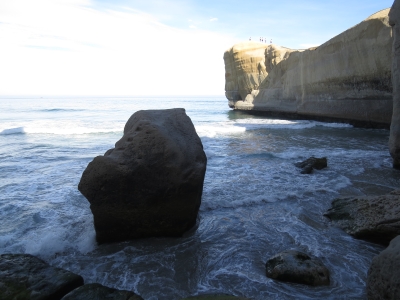
Looking out to sea from the beach. The seascape was beautiful here--what a wild place.
|
 |
4/3/2014: Pacific view
Position: -45°54.20'S, 170°31.94'E
View to the Pacific from the top of Tahuna Road west to Black Head. We'd set out on a bicycle trip, eventually to Tunnel Beach, along the Pacific shore.
|
 |
4/3/2014: St. Clair Beach
Position: -45°54.74'S, 170°29.33'E
The promenade at St. Clair beach was popular on this sunny day.
|
 |
4/3/2014: Lunch
Position: -45°54.70'S, 170°29.41'E
Several restaurants are alongshore here. We snagged a corner table with great beach views.
|
 |
4/3/2014: Climb
Position: -45°54.75'S, 170°28.92'E
The road up from St. Clair to Tunnel Beach was so steep we had to walk the bikes up. But that steepness came with a reward of an amazing view back across the beach we just were on.
|
 |
4/3/2014: Otago Harbour
Position: -45°54.63'S, 170°28.97'E
View to Otago Harbour from the hill.
|
 |
4/3/2014: Arch
Position: -45°55.24'S, 170°27.27'E
We had a little more elevation gain, then the rest of the ride was pretty easy to the trail head, where a 1km track leads down to Tunnel Beach. The scenery was quite dramatic--this it the view partway down the track to an arch on the point below.
|
 |
4/3/2014: Cliff
Position: -45°55.22'S, 170°27.50'E
A group were perched on the cliff just west of the arch.
|
 |
4/3/2014: Tunnel Beach
Position: -45°55.27'S, 170°27.53'E
Mist-filled Tunnel Beach. If you look closely in the higher-resolution image, you can see two people perched on the rocks beachside.
|
 |
4/3/2014: Tunnel
Position: -45°55.26'S, 170°27.52'E
A tunnel through the cliffs leads down to the beach. The local story is that one of Dunedin's 19th-century gold barons built the tunnel to give his sweetheart a private place to sunbathe.
|
 |
4/3/2014: Beach view
Position: -45°55.25'S, 170°27.53'E
Looking out to sea from the beach. The seascape was beautiful here--what a wild place.
|
 |
4/3/2014: Dunedin Station
Position: -45°52.53'S, 170°30.52'E
We're back at Dunedin Station for another train ride--this one up the Pacific coast. The station interior is more impressive than the exterior, with Royal Doulton mosaic tile floors and stained glass windows.
|
 |
4/3/2014: Careys Bay
Position: -45°48.36'S, 170°37.25'E
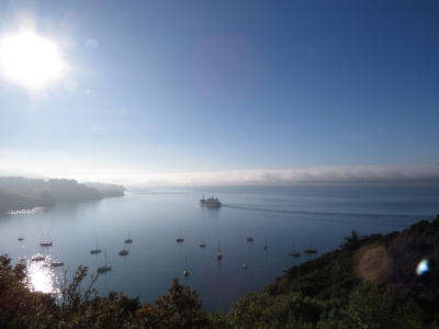
View across Careys Bay at Port Chalmers to ship heading out to sea. Port Chalmers is one of New Zealand's busiest ports, and also is a cruise ship terminal.
|
 |
4/3/2014: Blueskin Bay
Position: -45°44.81'S, 170°34.67'E
Crossing a small bridge along the edge of Blueskin Bay.
|
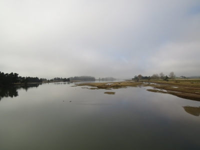 |
4/3/2014: Waikouaiti River
Position: -45°37.45'S, 170°38.63'E
The Waikouaiti River estuary. We'd unfortunately had pretty thick fog through most of the ocean views, but we still got some nice views close-up.
|
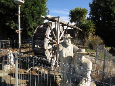 |
4/3/2014: Palmerston
Position: -45°29.16'S, 170°42.89'E
The train stopped in Palmerston for about forty minutes, and we took a walk around. This display commemorates Palmerston's gold-rush days.
|
 |
4/3/2014: Back of the train
Position: -45°30.31'S, 170°42.01'E
The fog lifted and we returned the entire way outside at the very back of the train.
|
 |
4/3/2014: Tracks
Position: -45°36.28'S, 170°39.97'E
Looking back on the tracks as we speed along.
|
 |
4/4/2014: Mihiwaka Tunnel
Position: -45°46.51'S, 170°37.22'E
Inside the Mihiwaka Tunnel, New Zealand's 10th largest at 1323 meters.
|
 |
4/4/2014: Deborah Bay
Position: -45°47.83'S, 170°37.12'E
The view down to Deborah Bay, just north of Port Chalmers. We again missed the ocean views in thick fog, but still very much enjoyed the trip.
|
 |
4/4/2014: Bishop Place
Position: -45°52.50'S, 170°29.90'E
After returning from the train ride, we walked up into the hills west of the Octagon. This is the view looking from Bishop Place looking across the Speight's Brewery to the harbour.
|
 |
4/4/2014: Pinafores
Position: -45°52.54'S, 170°29.80'E
Young school girls in pinafores at St. Joseph's Cathedral School.
|
 |
4/4/2014: Duke of Wellington
Position: -45°52.69'S, 170°30.20'E
We've walked past the Duke of Wellington a half-dozen times, and finally stopped in for a drink. The pub likely was once a bank and has been beautifully restored with chandeliers and complex gilding.
|
 |
4/4/2014: Fashion week
Position: -45°52.53'S, 170°30.52'E
All week, workers have been setting up for the iD Dunedin Fashion Week. The catwalk, running the length of the Dunedin Station platform, is among the longest in the world. As we returned home from dinner, one of the security guards invited us to "have a wee look" at the show in progress.
|
 |
4/5/2014: Catch-A-bus
Position: -45°30.43'S, 170°7.17'E
At Middlemarch with our bikes en route to Waipiata on the Otago Central Rail Trail. Catch-A-Bus picked us up from the boat this morning. We'll cycle the 50km from Waipiata to Middlemarch, and they'll drive us back home from there. The total cost was less than NZ$200--a great deal. You also can rent bikes in Middlemarch.
|
 |
4/5/2014: Otago Central Rail Trail
Position: -45°11.03'S, 170°9.65'E
Ready to start our ride. Rain is pouring today, but we don't mind--we've done our share of rain biking when commuting in Seattle, so we're well-prepared.
|
 |
4/5/2014: Railway art
Position: -45°11.03'S, 170°9.66'E
Whimsical metal art, built from railroad parts, were common along the route.
|
 |
4/5/2014: Taieri River
Position: -45°11.31'S, 170°10.67'E
Crossing the Taieri River.
|
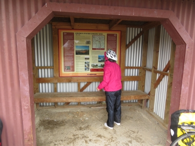 |
4/5/2014: Kokonga
Position: -45°12.57'S, 170°15.15'E
Ganger's shed at Kokonga, 10.5km from Waipiata. Information panels and displays are all along the trail, detailing the areas history, geology and geography.
|
 |
4/5/2014: Prices Creek Viaduct
Position: -45°16.45'S, 170°16.45'E
At 91m long and 32m high, this was one of the larger bridges we crossed.
|
 |
4/5/2014: Prices Creek Tunnel
Position: -45°16.76'S, 170°16.75'E
Entering the 151m Prices Creek (Hyde) Tunnel, one of three tunnels on the trail, but the only one we passed though.
|
 |
4/5/2014: Tunnel interior
Position: -45°16.76'S, 170°16.75'E
The tunnel walls were hand-build with brick and stone.
|
 |
4/5/2014: Hyde
Position: -45°17.90'S, 170°15.44'E
We stopped for a quick beer and fries at Hyde, 24km from Waipiata.
|
 |
4/5/2014: Mud
Position: -45°19.73'S, 170°14.60'E
Rain continued to fall and the trail was quite muddy--Jennifer had a big mud streak all the way up her back. But we were having a great time.
|
 |
4/5/2014: Gorge
Position: -45°20.96'S, 170°14.19'E
This area of the trail was through dramatic rock-studded gorges.
|
 |
4/5/2014: Rock and Pillar Station
Position: -45°24.09'S, 170°11.53'E
Only 15km left to reach Middlemarch. And the rain finally has let up.
|
 |
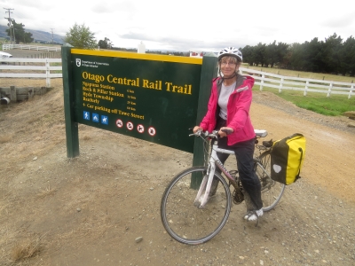
4/5/2014: Ngapuna
Position: -45°27.35'S, 170°9.24'E
6.2km from Middlemarch. We enjoyed all of the ride, but it definately was a lot nicer now that conditions had improved.
|
 |
4/5/2014: Middlemarch
Position: -45°30.17'S, 170°7.56'E
End of the road at Middlemarch, 50km and 6 hours from Waipiata.
|
 |
4/5/2014: Other kind of bikes
Position: -45°30.41'S, 170°7.40'E
A large motorbike rally was taking place over the weekend. We'd actually seen quite a few groups on the trail, but nowhere close to the number of motorcycles we saw in Middlemarch.
|
 |
4/5/2014: Quench
Position: -45°30.39'S, 170°7.40'E
Beer and warmth at Quench Cafe and Bar.
|
 |
4/6/2014: Passing the Corio Bay
Position: -45°48.43'S, 170°37.90'E
We contacted Otago Harbour Control to notify them of our intentions to leave. They said the Curio Bay was inbound, but there was room to pass. We radioed the Curio Bay for passing instructions as we left the dock and they said "pass port to port" and then changed it to "do not enter the channel -- you can wait for us to pass at the LNG terminal." They later said "I can see you now and you are pretty small so com'on through port to port." Neither the Corio Bay nor Harbor Control thought the pass was unusual or notable. But it was closer than we were expecting, mostly because they were leaving room for their tug escort on their starboard side. It was actually three boats wide with the forward tractor tug escort, the Corio Bay, and us in a fairly narrow channel.
|
 |
4/6/2014: MarineTraffic.com
Position: -45°48.43'S, 170°37.90'E
Jacques Vuye noticed this picture posted to MarineTraffic.com of Dirona passing the Corio Bay. Jennifer is visible just outside the pilothouse door shooting the pictures for the video.
|
 |
4/6/2014: Aquastat fixes
Position: -44°59.40'S, 171°39.37'E
James setup a test system and resolved two issue with the aquastat, both involving the low-limit switch. When the boiler is below the low-limit setting, the boiler comes on even when heat is not called for. This is to maintain a minimum boiler temp and prevent corrosion in the boiler. This is nice, but it prevents efficient use of the furnace for very low temp freeze protection. We want to be able to leave the furnace on when the boat is unoccupied and have the boiler only come on if the temp drops below the min thermostat setting of 41F. The second issue is the aquastat only brings on the circulation pump if the boiler is above the low limit. The logic here is "why circulate if the water is cold?". This doesn't work for our application, however, because we may be heating the water using the engine with the boiler shut down.
|
 |
4/6/2014: Calm seas
Position: -44°52.40'S, 171°47.93'E
We had wonderfully calm conditions on the run to Akaroa. The winds were less than ten knots, with minimal pitch and roll.
|
 |
4/7/2014: Akaroa Head
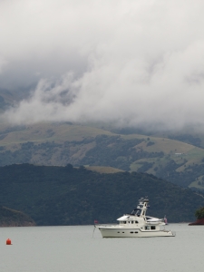
Position: -43°53.43'S, 172°57.70'E
Arch and light at Akaroa Head. Dramatic sheer cliffs line both sides of the Akaroa Harbour entry channel.
|
 |
4/7/2014: Akaroa Harbour
Position: -43°48.56'S, 172°57.95'E
View to the anchorage in Akaroa Harbour from Stanley Park. It was nice to just motor in, drop the hook and be settled right away.
|
 |
4/7/2014: Akaroa Head Lighthouse
Position: -43°48.76'S, 172°57.40'E
The old Akaroa Head Lighthouse was moved here after an automated light replaced it.
|
 |
4/8/2014: Dinghy landing
Position: -43°48.55'S, 172°57.63'E
We're using the Anchor Buddy to moor the dinghy frequently now, since first doing so at Oban.
|
 |
4/8/2014: L'Hotel
Position: -43°48.54'S, 172°57.74'E
We had a great lunch at L'Hotel. The restaurant had a heated deck with a full harbor view. Akaroa has French heritage, with street names such as Rue Benoit. Several excellent restaurants are there, many along the water. We had another good meal yesterday at Bully Hayes.
|
 |
4/8/2014: Lights
Position: -43°48.38'S, 172°57.58'E
The Akaroa evening lights. The harbour is wonderfully calm and sheltered.
|
 |
4/9/2014: Dolphins
Position: -43°30.90'S, 173°21.13'E
We passed a huge pod of several dozen Dolphins, leaping and splashing as the chased our bow.
|
 |
4/9/2014: Wind increasing
Position: -42°37.15'S, 173°58.83'E
The conditions have been extremely calm, but the winds have started to pick up. The forecast is for 30-knot winds in Cook Strait today, but the wind and swell will be with us, so we don't expect the sea to be very rough.
|
 |
4/10/2014: Cook Strait
Position: -41°36.52'S, 174°40.71'E
The winds continued to climb and were gusting into the 40s as we crossed Cook Strait. The waves were about 12 feet on about 6-8 seconds, but they were behind us, so boat motion generally wasn't too bad.
|
 |
4/10/2014: Pencarrow Head
Position: -41°21.60'S, 174°50.35'E
Substantial waves were in the channel of Pencarrow Head. We radioed Wellington Harbour Control to notify them of our arrival and they reported that conditions in Cook Strait were moderate. We'd not like to see rough conditions if those were moderate.
|
 |
4/10/2014: Refueling
Position: -41°17.41'S, 174°47.14'E
Walking one of the deck tanks to a local petrol station for a gasoline fill. We're berthed once again at Chaffer's Marina, right downtown.
|
 |
4/11/2014: Pennant
Position: -41°17.41'S, 174°47.14'E
Time to replace the Nordhavn pennant we've been flying since Seattle. They are strong, but the trip into Wellington was the end of it. The flag is ribboned, the 3mm rope holding it failed and the snap clips were almost worn through.
|
 |
4/11/2014: Pallet
Position: -41°17.41'S, 174°47.14'E
We shipped spares and supplies from Seattle to Wellington via sea freight. A forklift operator working at a nearby contruction site saw we had a pallet to move and sprung into action to help.
|
 |
4/11/2014: Boxes
Position: -41°17.41'S, 174°47.14'E
A boater's Christmas: 28 cubic feet of spares and supplies, weighing a total of 330 pounds, arrived for Dirona.
|
 |
4/11/2014: Unpacked
Position: -41°17.41'S, 174°47.14'E
Some of the pallet contents after we'd upacked the boxes. The shipment included an upgraded heat-exchanger for the hydruaulics system, a spare 190-amp main engine alternator, a replacement Furuno SC30 satellite compass, a flywheel puller, Maretron parts, and various other supplies consumed over the last eight months. We also shipped several product or brands unattainable in New Zealand or Australia: Goof-off, varnish, cat litter and a 120-volt, 60Hz electric kettle. We have some work ahead of us getting all this stowed.
|
 |
4/11/2014: Calm night
Position: -41°17.37'S, 174°46.95'E
Rain fell all day yesterday and today, but cleared by evening. This is looking across the harbour towards downtown.
|
 |
4/11/2014: Molly Malone's
Position: -41°17.54'S, 174°46.75'E
Watching the Super Rugby match at Molley Malone's Irish pub.
|
 |
4/11/2014: Courtney Place
Position: -41°17.60'S, 174°46.89'E
The sidewalk seating at the bars along Courtney Place was packed as we walked home after the game. Wellington really hops on a Friday night.
|
 |
4/12/2014: Replacing the SC30
Position: -41°17.41'S, 174°47.14'E
James up the mast replacing the Furuno SC30 satellite compass with the replacement we just received.
|
 |
4/12/2014: Amazon Fresh
Position: -41°17.41'S, 174°47.14'E
Amazon Fresh in New Zealand. Well, not really, but we do love the dozens of bright green Amazon Fresh grocery bags they left with us from our weekly Seattle deliveries. The bags are big and strong--we use them for shopping and for stowing all manner of goods and parts.
|
 |
4/12/2014: Dash apart
Position: -41°17.41'S, 174°47.14'E
The dash apart to install a Maretron IPG100 internet protocol gateway that came in our shipment. We also made some improvements to our on-board Wifi system and fixed some USB port issues.
|
 |
4/13/2014: Santa Regina
Position: -41°17.41'S, 174°47.14'E
Strait Shipping's Santa Regina towers over the marina as it exits the harbour.
|
 |
4/13/2014: Vent covers
Position: -41°17.41'S, 174°47.14'E
We put covers over the engine vents to keep the engine room warmer, and nicer to work in, if the engine or generator hasn't run for a while. This is the first time we've used the covers since Seattle.
|
 |
4/13/2014: Birdwatching
Position: -41°17.41'S, 174°47.14'E
Spitfire, chattering and flicking his tail, watches seagulls landing on the piling just off the port bow.
|
 |
4/14/2014: Harbour view
Position: -41°17.15'S, 174°46.76'E
Looking towards the marina from Queens Wharf.
|
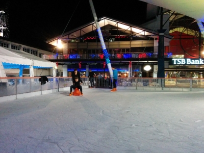 |
4/14/2014: Rink
Position: -41°17.06'S, 174°46.70'E
Ice skating rink at Queens Wharf.
|
 |
4/18/2014: Chaffer's panorama
Position: -41°17.41'S, 174°47.13'E
Panoramic view from our berth at Chaffer's marina.
|
 |
4/15/2014: Blog post: Wellington
Position: -41°17.41'S, 174°47.13'E
After a three-month circumnavigation of New Zealand's South Island,
we're back in Wellington. We first visited here in January, after spending a
few weeks in the Hauraki Gulf Marine Park. On our first visit ... Read more.
|
 |
4/18/2014: Chaffer's panorama
Position: -41°17.41'S, 174°47.13'E
Panoramic view from our berth at Chaffer's marina.
|
 |
4/18/2014: New pennant
Position: -41°17.41'S, 174°47.13'E
We replaced the destroyed Nordhavn pennant with one that arrived with our shipment.
|
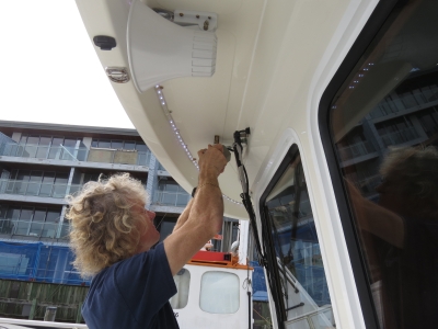 |
4/18/2014: Spotlight supports
Position: -41°17.41'S, 174°47.13'E
In Whangarei we'd had stainless steel brackets made to replace the rusting ones for our outdoor LED lights. We'd already replaced those on the stack, here James is doing the forward spotlights.
|
 |
4/18/2014: Tramway
Position: -41°17.55'S, 174°48.16'E
The day was sunny and warm, so we set off on a bike ride around the harbour shore. Many homes in Wellington are built up steep cliffs with no road access, so the owners build personal tramways to transfer between garage and house. We'd seen this one in a video of Wellington's tramways at the cable car museum.
|
 |
4/18/2014: Wind vane
Position: -41°18.47'S, 174°47.90'E
This massive sculpture is a working wind vane, one of many wonderful wind-based creations along the Meridian Wind Sculpture Walkway.
|
 |
4/18/2014: "Wellington Blown Away" sign
Position: -41°18.91'S, 174°48.62'E
Wellington nickname is "Windy Welly" due to the frequency of gale-force winds that barrel through. Wellington's windiest year saw 233 days with winds over gale-force. The average wind speed at the Wellington airport is 29km/h, compared with Chicago, also a city with a reputation for big winds, at a mere 18km/h. And the highest wind speed recorded in Wellington was 248km/h. The "Wellington Blown Away" sign celebrates that reputation.
|
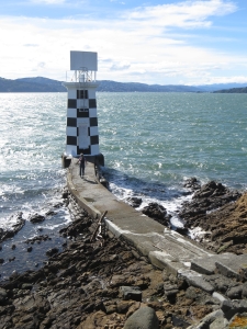 |
4/18/2014: Point Halswell Light
Position: -41°17.05'S, 174°49.56'E
Light on the tip of Point Halswell. The walkway there is barely walkable with the waves splashing over in relatively calm conditions. It wouldn't take much bigger waves to making reaching the light impossible without risking getting soaked or swept away.
|
 |
4/18/2014: Wellington view
Position: -41°17.05'S, 174°49.56'E
View back to Wellington from Point Halswell.
|
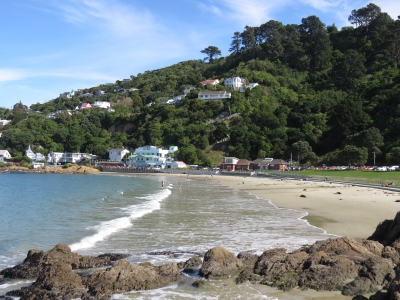 |
4/18/2014: Scorching Bay
Position: -41°17.80'S, 174°50.10'E
The sand beach at Scorching Bay was popular on this Good Friday holiday.
|
 |
4/18/2014: Windsurfer
Position: -41°18.96'S, 174°49.66'E
This windsurfer frequently worked right up to shore, with the kite way inland over the beach.
|
 |
4/18/2014: Benoit Trail
Position: -41°19.76'S, 174°49.99'E
We climbed to the top of Benoit Trail for excellent view. This is looking southeast across Breaker Bay and the entrance channel to Wellington Harbour.
|
 |
4/18/2014: Chaffers Passage
Position: -41°19.76'S, 174°50.00'E
Looking southwest across Chaffers Passage to Palmer Head.
|
 |
4/18/2014: Mount Victoria Tunnel
Position: -41°18.25'S, 174°47.49'E
Entering Mount Victoria Tunnel to return back to downtown Wellington.
|
 |
4/18/2014: Inside the tunnel
Position: -41°18.21'S, 174°47.36'E
We're glad there was a bicycle track inside Mount Victoria Tunnel--there's no room on the road below.
|
 |
4/18/2014: Duke Carvell's
Position: -41°17.63'S, 174°46.55'E
After the 20-mile ride, well-earned pints at Duke Carvell's.
|