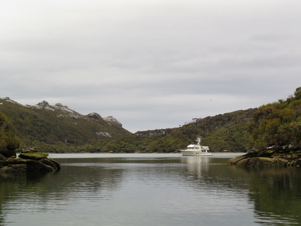
MV Dirona travel digest for Stewart Island, New Zealand 2014

|
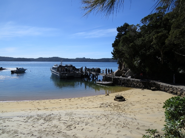
Click the travel log icon on the left to see these locations on a map,
with the complete log of our cruise. On the map page, clicking on a camera or text icon will display a picture and/or log entry for that location, and clicking on the smaller icons along the route will display latitude, longitude and other navigation data for that location. And a live map of our current route and most recent log entries always is available at //mvdirona.com/maps/LocationCurrent.html. |
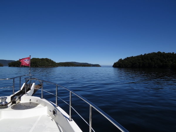 |
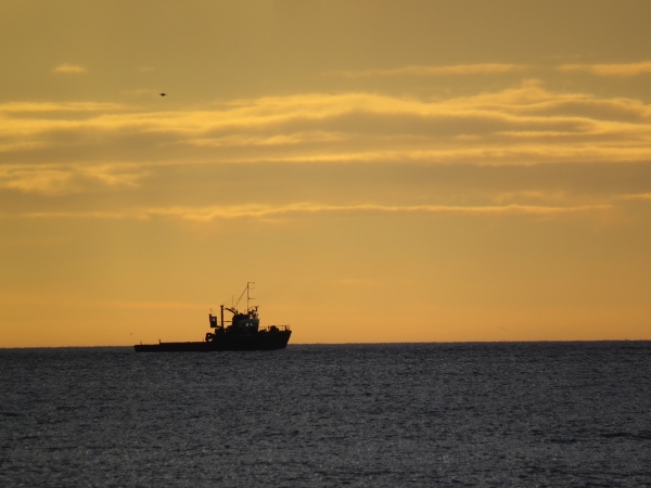
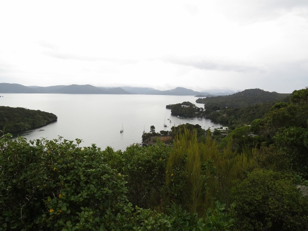
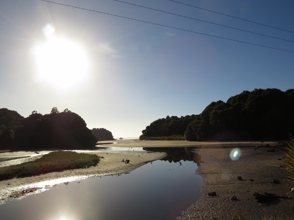
3/5/2014: En route to Stewart Island
Position: -46°3.59'S, 166°41.67'E
The sunny weather is back and we've got a high-pressure system in place for the 100-mile run from Preservation Inlet to Stewart Island. We're expecting 6-7 foot seas on an 11-second period with 15 knots wind. Should be a nice, easy overnight run.
|
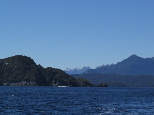 |
3/5/2014: Last view to Fiordland
Position: -46°5.70'S, 166°37.34'E
Looking back to Fiordland for a final time as we exit Preservation Inlet.
|
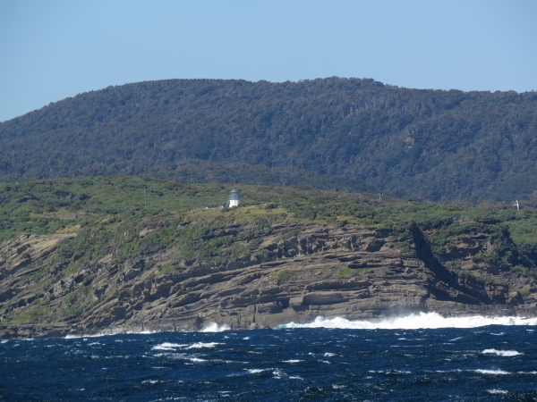 |
3/5/2014: Puysegur Point Light
Position: -46°9.15'S, 166°35.01'E
Conditions are rather rough as we pass the light at Puyseger Point. We're in 25-30 knot winds on the bow in tight 6-8' seas. Hopefully the seas will improve when we get to deeper water. We're in less than 200 feet now.
|
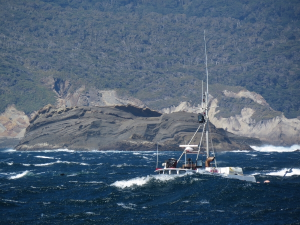 |
3/5/2014: Santa Rosa
Position: -46°10.14'S, 166°35.54'E
Fishing vessel Santa Rosa disappearing between the waves--gives you a feel for how big they are. They're going with the wind and waves, so should be having a more comfortable ride.
|
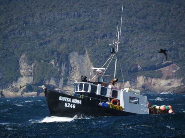 |
3/5/2014: Santa Rosa again
Position: -46°10.14'S, 166°35.54'E
The rest of Santa Rosa as it crests a wave.
|
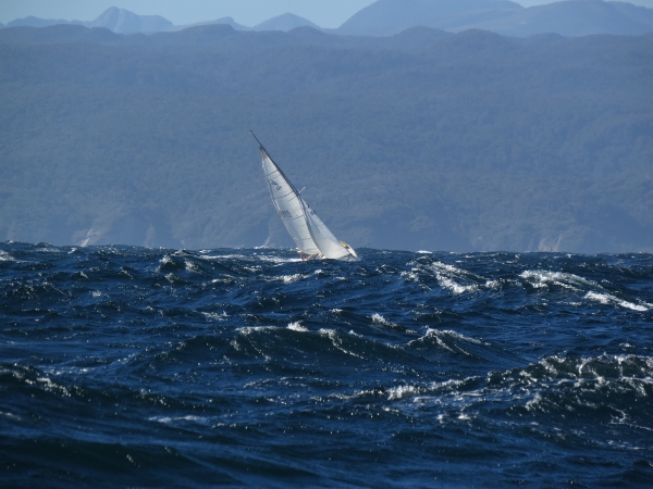 |
3/5/2014: Leaving the South Island
Position: -46°16.63'S, 166°38.64'E
Sailboat tacking up Foveaux Strait with the South Island receding behind us.
|
 |
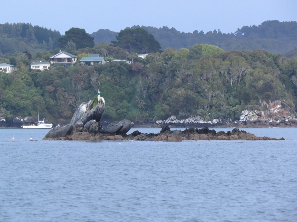
3/5/2014: Solander Island
Position: -46°30.22'S, 166°45.09'E
Solander Island (left) and Little Solander Island to port.
|
 |
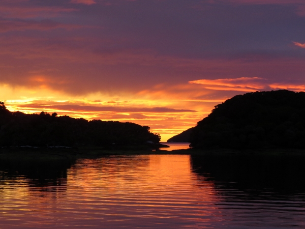
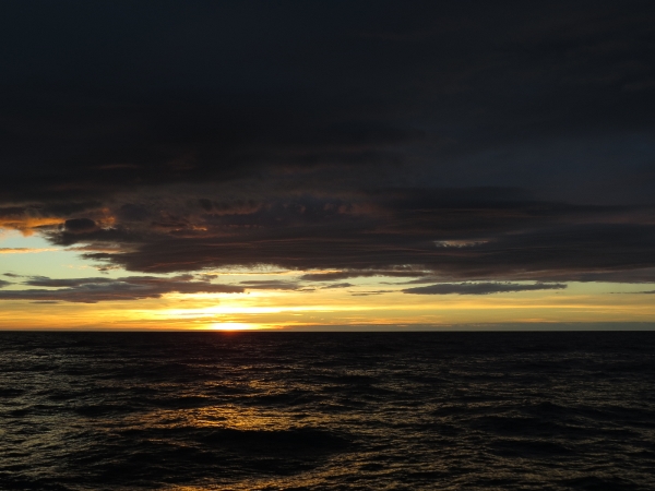
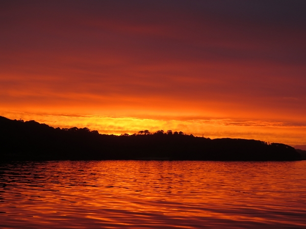
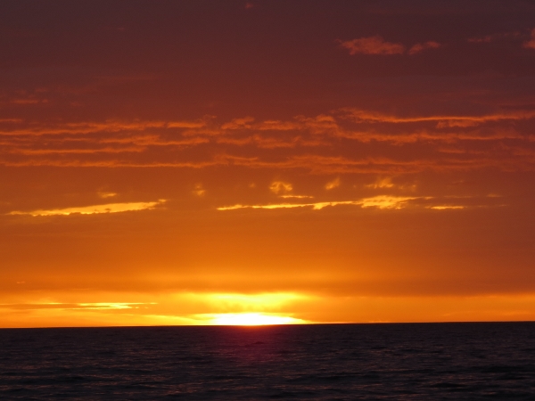
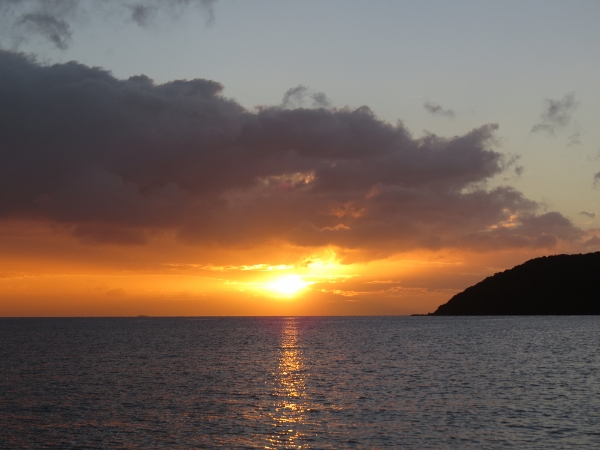
3/5/2014: Sunset
Position: -46°35.79'S, 166°47.76'E
Hard to beat sunsets at sea--we haven't had a such a nice sunset since we left for Fiordland. For just the one night, we're trying a different watch system of six hours each. James has the 6pm to midnight shift.
|
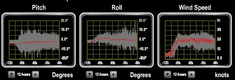 |
3/6/2014: Rough waters
Position: -46°54.74'S, 167°0.69'E
Winds have been blowing steady 25-30 knots for the past 8 hours, with 6-8' seas on 6-8 seconds. Initially the winds and waves were on the bow, and the boat was pitching a fair bit. About 4 hours again, the wind and waves switched to more easterly, reducing pitch and increasing roll. Not that big a deal, just lots of boat motion, and nothing like the 7 feet on 11 seconds we were expecting. So far, our 6-hour shift experiment has not been very successful. Jennifer slept poorly on her off-watch and James was exhausted at the end of his shift. We might try again with calmer seas.
|
 |
3/6/2014: Settling down
Position: -47°3.48'S, 167°6.65'E
The winds dropped to below 10 almost instantly about an hour ago and conditions have improved dramatically. Pitch and roll are greatly reduced and we're now in reasonably calm seas. Much better.
|
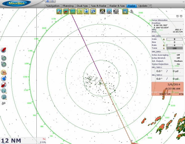 |
3/6/2014: Land ho!
Position: -47°6.65'S, 167°8.82'E
Stewart Island showing up on the radar about ten miles out.
|
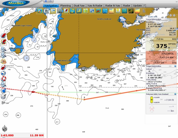 |
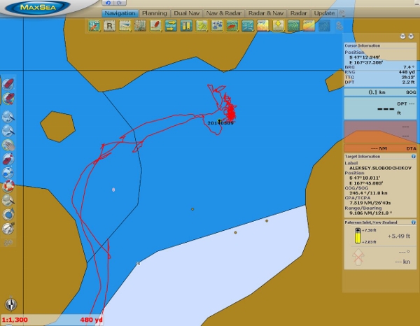
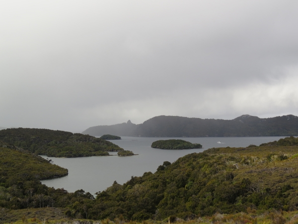
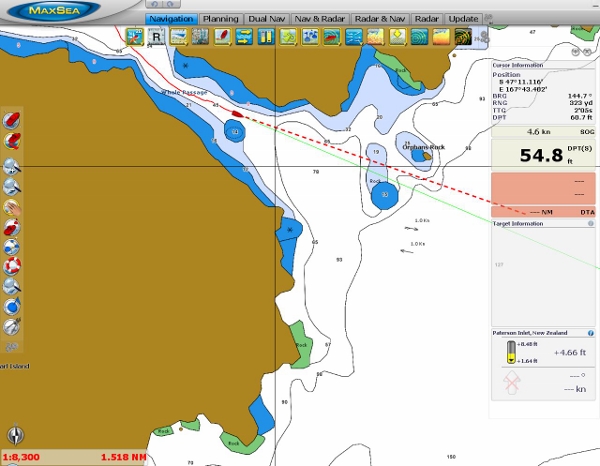
3/6/2014: Southwest Cape
Position: -47°18.71'S, 167°25.22'E
Southwest Cape, to our northeast, is one of the five great capes and the first that we've rounded. The other four are Southwest Cape, Tasmania; Cape Leeuwin, southwest Australia; Cape of Good Hope, Africa and Cape Horn, Chile. We'd timed our arrival at Port Pegasus for 7:30am, to arrive at high water slack with plenty of light to enter. The current would be flooding as we approached, in the same direction as the wind and swell--current against swell can apparently be quite exciting here. The flood current was carrying us in so fast, however, that we had to slow down a few times to avoid entering Port Pegasus in the dark. And the course we were steering to (the green line) was constantly aimed well north of our next waypoint--the strong current flooding south along the west coast of Stewart Island was setting us off course.
|
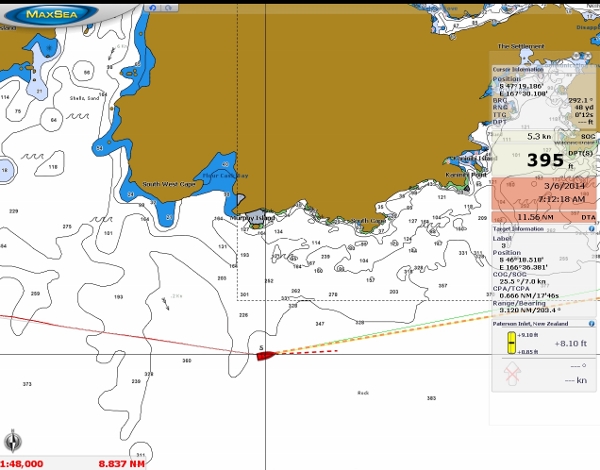 |
3/6/2014: Farthest south
Position: -47°19.19'S, 167°30.21'E
At 47 degrees 2 minutes, we're the farthest south we will be in Dirona for a very long time. Of the five great capes, only Cape Horn is farther south at nearly 56 degrees latitude.
|
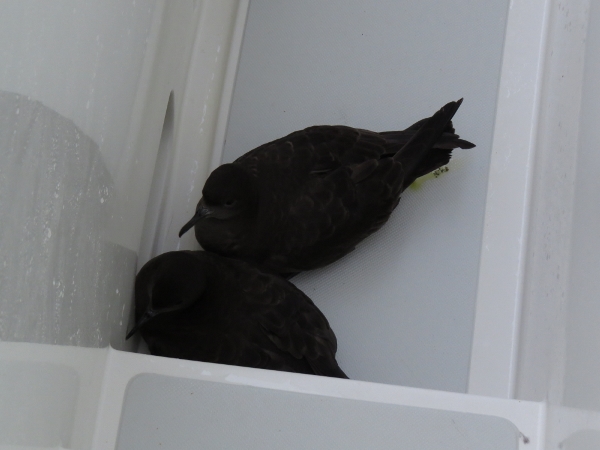 |
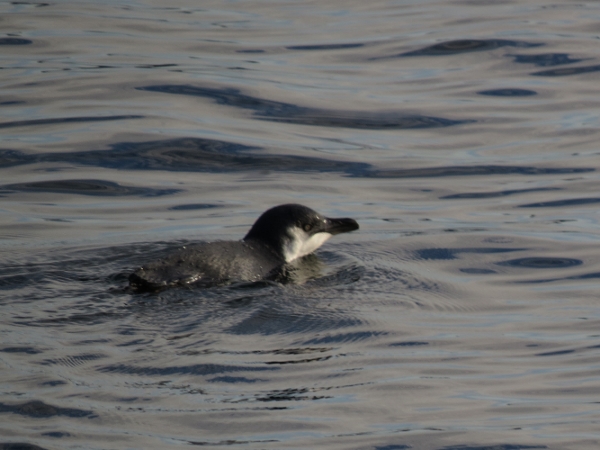
3/6/2014: Stowaways
Position: -47°14.20'S, 167°37.54'E
We found these two Shearwaters tucked against the wall in the starboard walkway as we were preparing to anchor. We don't know how long they were there, but they had zero interest in leaving. We opened the side door and herded them towards it, and they grudgingly jumped ship.
|
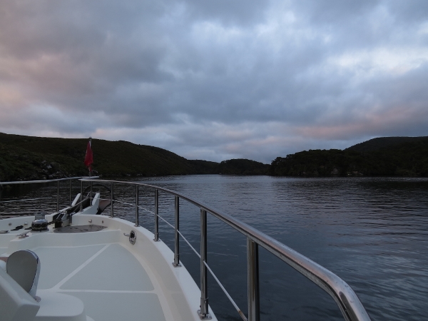 |
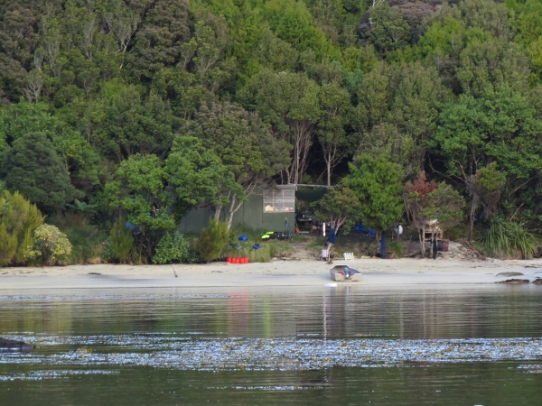
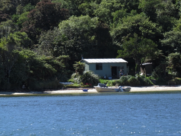
3/6/2014: Disappointment Cove
Position: -47°14.20'S, 167°37.54'E
Entering Disappointment Cove cove just after sunrise. The last few hours of the run were in excellent conditions, but we were both pretty tired when we arrived and happy to be here.
|
 |
3/6/2014: At anchor
Position: -47°14.63'S, 167°37.25'E
At anchor in 25' in Disappointment Cove. The cove was a little tight, but quite appealing. We were able to just fit with sufficient swing room for 5:1 rode with excdellent holding. Spitfire loved this anchorage--terns and other birds swooped and called the entire time we were there.
|
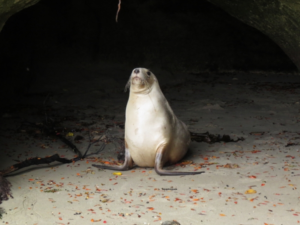 |
3/6/2014: Sea lion
Position: -47°12.83'S, 167°36.92'E
We set out for a quick dinghy tour of the area and landed at a point south of Evening Cove where we found this sea lion just inside a cave alongshore. The New Zealand, or Hooker, sea lion is the rarest in the world, critically endangered, and New Zealand's only endemic sea lion. Most are found at the Auckland Islands and Campbell Island well to our south, and only a few are at Stewart Island. We were lucky to see one.
|
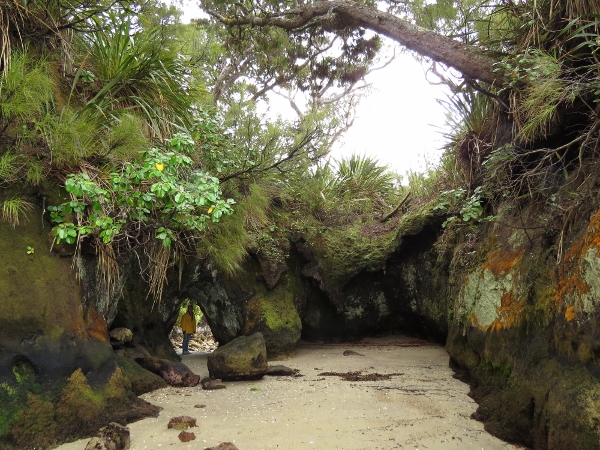 |
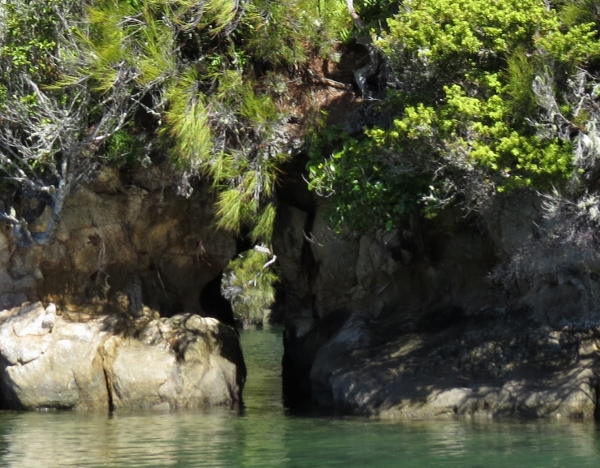
3/6/2014: Tunnel
Position: -47°12.82'S, 167°36.93'E
A tunnel led from one side of the point to the other. It's only accessible at low tide--at high tide it's underwater.
|
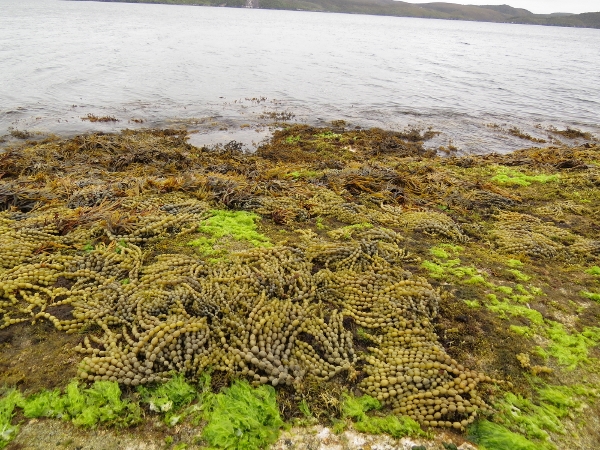 |
3/6/2014: Seaweed
Position: -47°12.82'S, 167°37.00'E
Seaweed that grows in small necklac-like linked balls covered the walls and sea floor exposed at low tide, mixed with a vibrant green seaweed. In our few hours here, we're starting to see why people rave about Stewart Island. It's beautiful and wild here, with no signs of civilization. It feels much like the Hakai Luxvbalis Conservancy Area on the northern British Columbia coast.
|
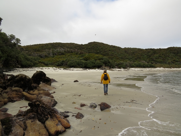 |
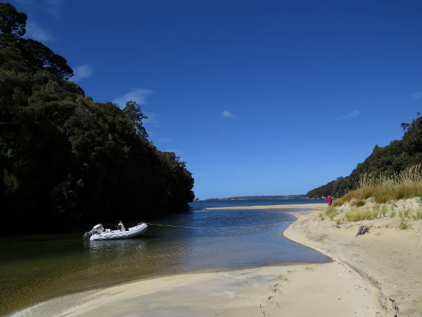
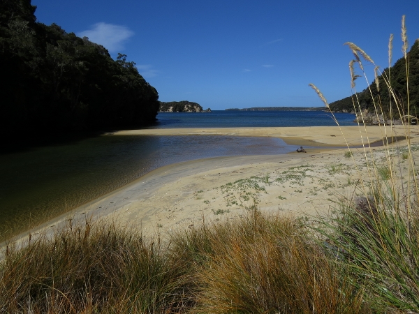
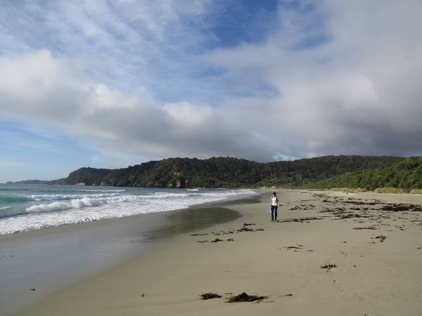
3/6/2014: Broad Bay
Position: -47°14.81'S, 167°36.97'E
We landed the dinghy at the head of the anchorage and hiked a well-trod trail to the beach at Broad Bay. The trail forked not far from the Broad Bay--each fork leads to a separate beach that are joined only at lower tides. Both beaches were beautiful, but we liked the northern one the best.
|
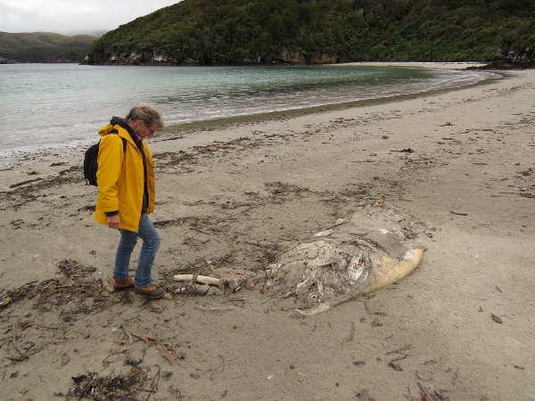 |
3/6/2014: Carcass
Position: -47°14.87'S, 167°37.05'E
A large carcass had washed up on the beach--it looked like a seal or a sea lion.
|
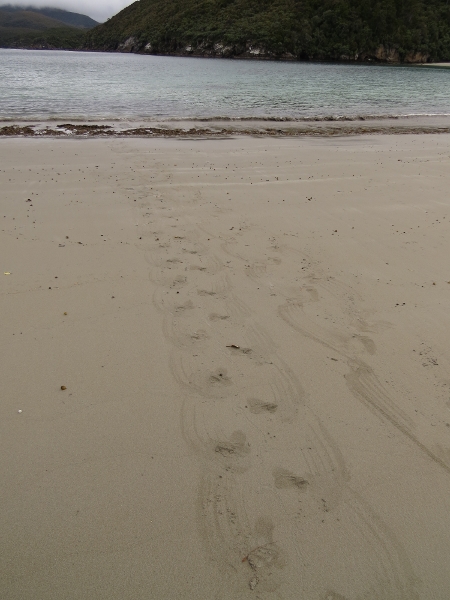 |
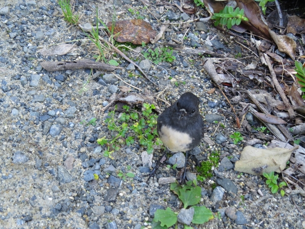
3/6/2014: Penguin tracks
Position: -47°14.89'S, 167°37.06'E
Yellow-eyed penguins, among the rarest penguin species in the world, are commonly sighted at the beach here. They live in the woods behind the beach and leave at dawn to fish, returning in the late afternoon. These are the tracks they leave heading out to sea.
|
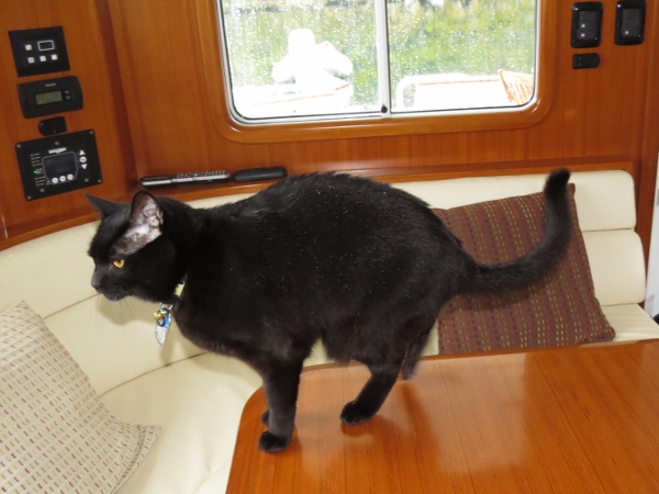 |
3/7/2014: In from the rain
Position: -47°14.63'S, 167°37.25'E
Spitfire back inside after sitting out on the bow in the rain. If you look closely, his fur is covered in water.
|
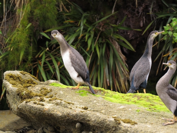 |
3/7/2014: Shags
Position: -47°14.08'S, 167°33.33'E
Curious pied shags ashore in the islets at the head of the anchorage.
|
 |
3/7/2014: Sylvan Cove
Position: -47°14.08'S, 167°33.33'E
At anchor in 26' in Sylvan Cove, viewed looking east through the islets at the head.
|
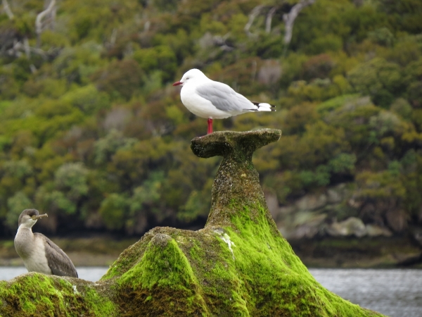 |
3/7/2014: Red-billed gull
Position: -47°14.06'S, 167°33.44'E
Red-billed gull atop an unusual rock formation.
|
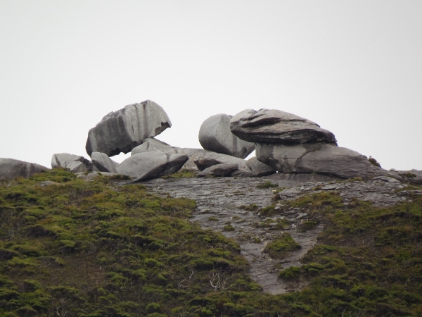 |
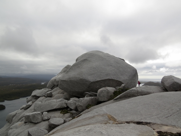
3/7/2014: Boulders
Position: -47°14.08'S, 167°33.51'E
Large boulders like this are perched on the hills surrounding the anchorage. They are massive, but look as if placed there intentionally.
|
 |
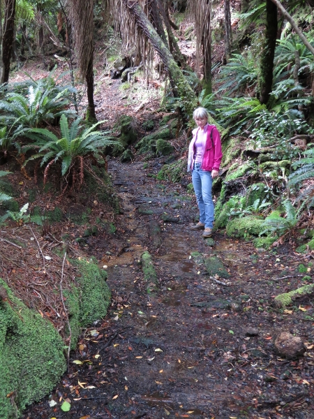
3/7/2014: Track
Position: -47°13.63'S, 167°33.71'E
We landed the dinghy at a small stream outlet in the northeast corner of the bay, hoping to find a way up into the hilltops north of the anchorage where . We followed the east side of the creek eventually crossing to the west side, and came into an open field where we picked up a well-trod trail. (Position approximate.)
|
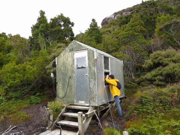 |
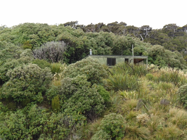
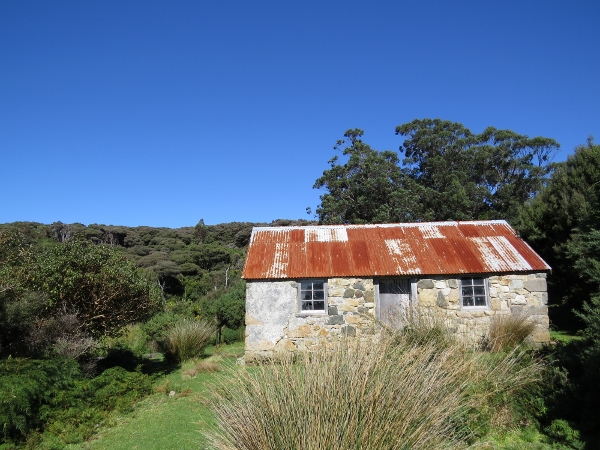
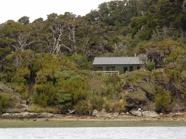
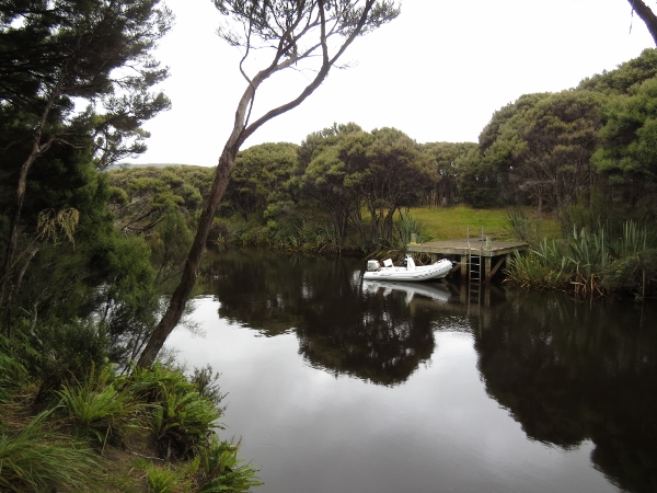
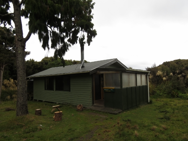
3/7/2014: DOC hut
Position: -47°13.58'S, 167°33.64'E
Not far along the trail, we came across this DOC (New Zealand Department of Conservation) hut. Guywires secured the hut at all four corners, an indication of the wind strength here. Peering through the windows, we could see it was well-stocked with provisions and was designed for DOC rather than public use.
|
 |
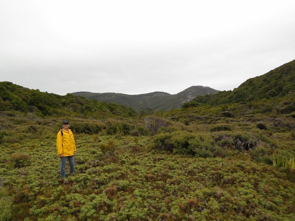
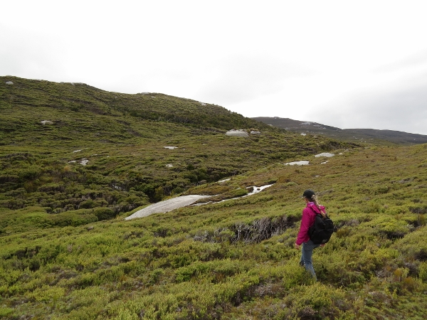
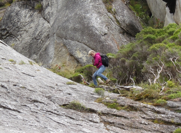
3/7/2014: At the top
Position: -47°13.14'S, 167°33.09'E
The track continued north and then curved west and up into the hilltops. The track was relatively easy to walk, but steep. We got pretty warm on the way up with all that exercise and had shed most of our layers by the time we reached the top.
|
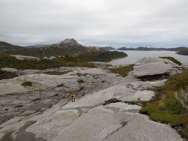 |
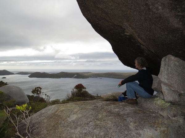
3/7/2014: View east
Position: -47°13.40'S, 167°33.20'E
Looking east across the South Arm of Port Pegasus. South Passage, where we entered two mornings ago, is at the far right. 230-meter Bald Cone, south of Shipbuilder's Cove, is the peak on the left. And to the right of Bald Cone, in the distance, is Pegasus Passage into the North Arm of Port Pegasus.
|
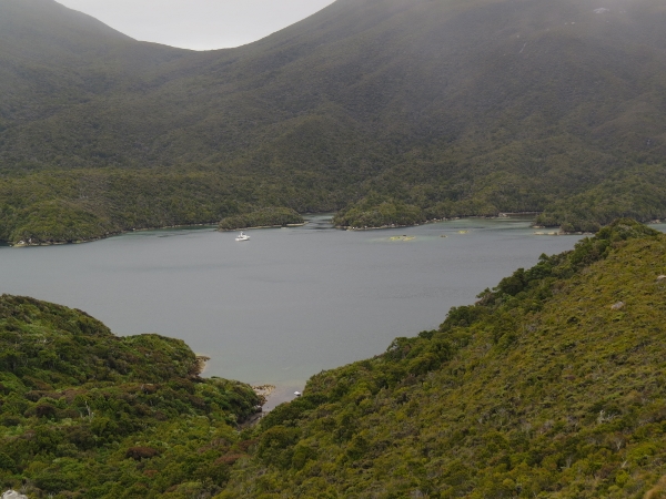 |
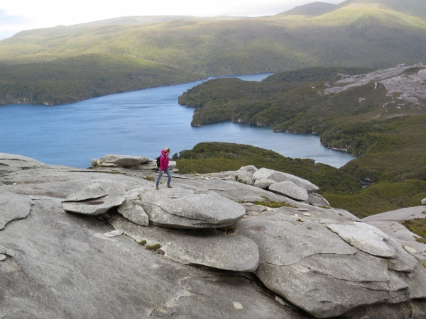
3/7/2014: Anchorage view
Position: -47°13.40'S, 167°33.20'E
View south into our anchorage at Sylvan Cove. Our dinghy also is visible at the bottom of the picture.
|
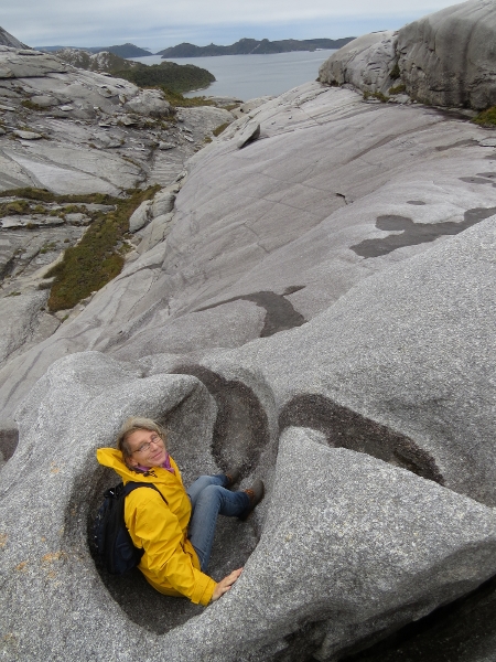 |
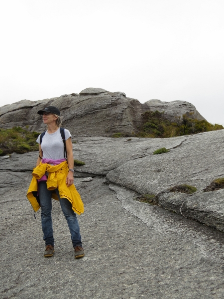
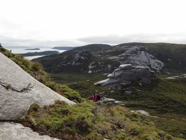
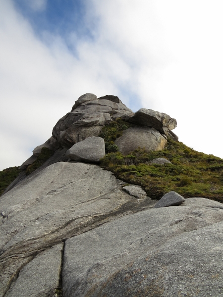
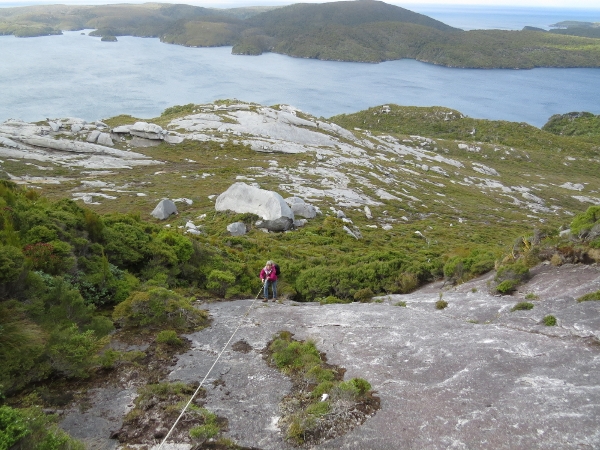
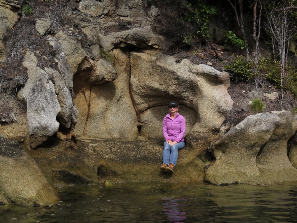
3/7/2014: Bowl
Position: -47°13.40'S, 167°33.20'E
Wild-looking weather-carved rock formations are everywhere on the hilltop. We absolutely loved it up here. We didn't think anything could compete with Fiordland, but Stewart Island is getting close.
|
 |
3/7/2014: Balancing act
Position: -47°13.40'S, 167°33.20'E
The weather erodes the tops and bottoms of the rocks, leaving some precariously balanced like those we saw from the anchorage earlier.
|
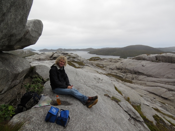 |
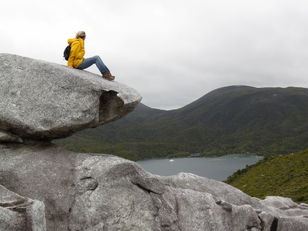
3/7/2014: Lunch
Position: -47°13.40'S, 167°33.20'E
Lunch among the rock formations. What an amazing place to be.
|
 |
3/7/2014: Milestone celebration
Position: -47°14.63'S, 167°37.25'E
A special dinner of Peppercorn-Crusted Beef Tenderloin to celebrate rounding Southwest Cape and reaching 47 degrees, 2 minutes south, the most southern point Dirona will see for a long while.
|
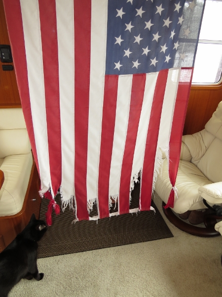 |
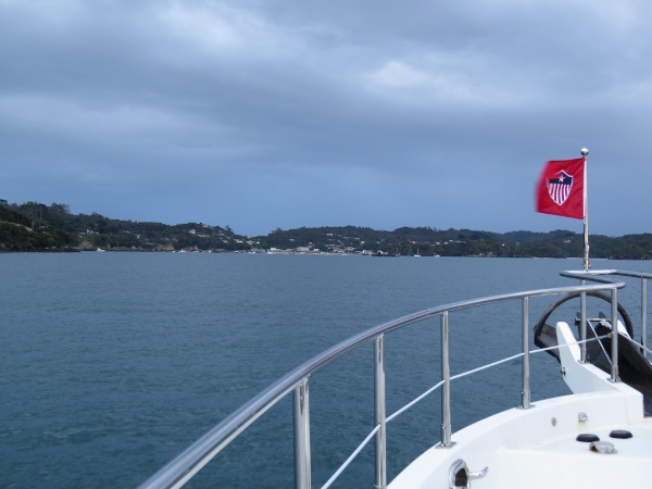
3/8/2014: Flag replacement
Position: -47°11.84'S, 167°38.60'E
Our American flag was getting pretty tattered, and we'd planned to wait until we'd left the deep Southern Ocean and its storms before replacing it. But it started getting much worse, so we replaced it today.
|
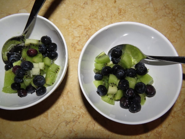 |
3/9/2014: Kiwifruit
Position: -47°11.84'S, 167°38.60'E
The last of the Wellington kiwifruit and blueberries. It's now been seven weeks since we last were in a grocery store.
|
 |
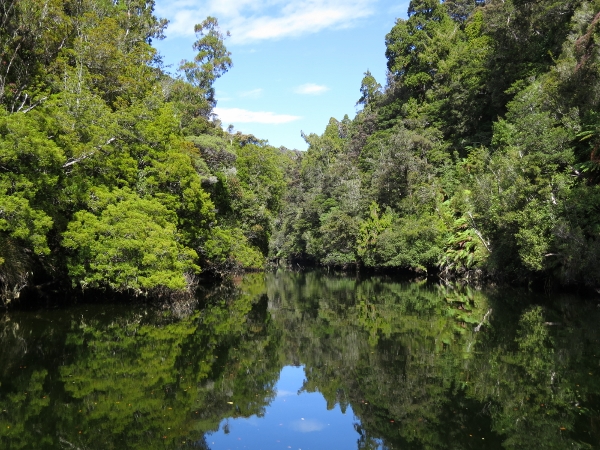
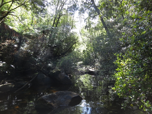
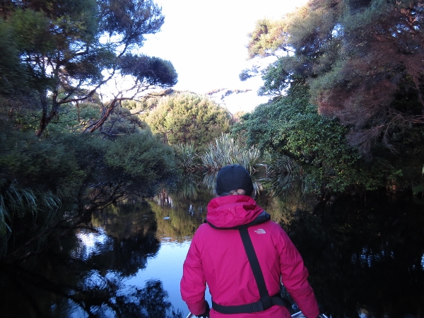
3/9/2014: Seal Creek
Position: -47°11.77'S, 167°36.54'E
At high tide, we ran the dinghy into Seal Creek to explore--it's much larger than apparent on the chart. This is looking west to Gog and Magog, where we hope to hike to at some point. Our cruising guide indicates a three-hour walk is from Evening Cove, and a two-hour walk from the head of Seal Creek. But Seal Creek is tide-constrained and pretty much dries at low tide. We did see a buoy marking what we presume was a trailhead near the head, but the trail ran straight into thick brush and didn't look very inviting. (Position approximate).
|
 |
3/9/2014: Seal
Position: -47°11.79'S, 167°36.06'E
Probably not too surprising for a seal to be in Seal Creek. (Position approximate).
|
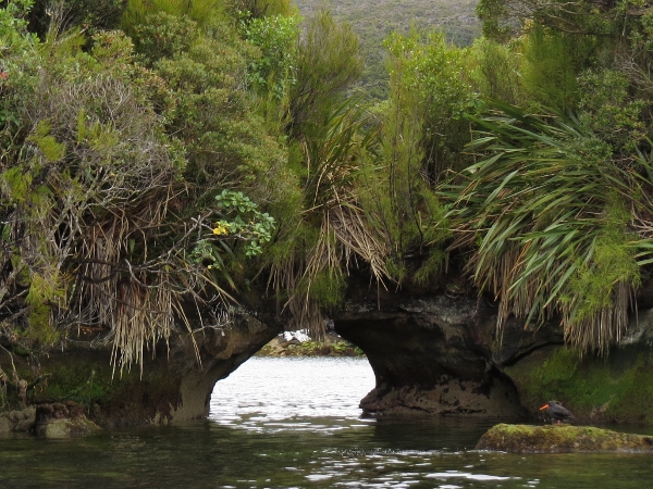 |
3/9/2014: Arch
Position: -47°11.74'S, 167°38.29'E
Oystercatcher and arch near the mount of the creek. Our cruising guide indicates that some boats anchor here, and depths are reasonable here, but swing room would be tight.
|
 |
3/9/2014: Hunter's hut
Position: -47°12.00'S, 167°38.28'E
The topographic maps show a hunters hut in this bay. We can't see the hut from the water, but can see plenty of evidence of people ashore.
|
 |
3/9/2014: Evening Cove
Position: -47°12.28'S, 167°37.68'E
We gingerly entered the inner basin at the East Arm of Evening Cove. The minimum depth on entry and inside was about 13' mid-tide--you can see the stops and starts on our route as we tried to find deeper water. The swing room wasn't sufficient and the wind was gusting to 20 knots, so we just stopped for lunch and came back out to anchor for the night. We carry 2 spools, each holding 600' of 3/8" 12-strand Spectra for stern-tying, so we could have run a line ashore to restrict our swing and stayed in the basin. But we generally prefer to swing free on our ground tackle, particularly in windy conditions.
|
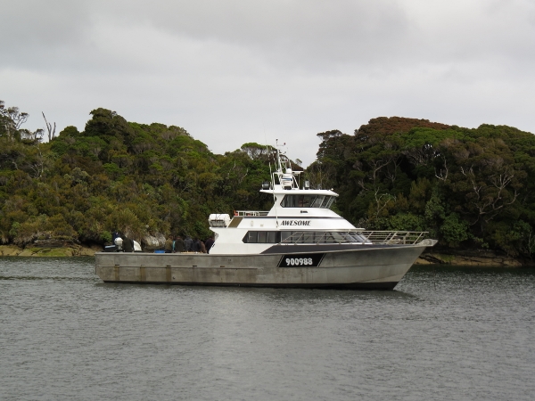 |
3/9/2014: Awesome
Position: -47°12.48'S, 167°37.49'E
The charter boat Awesome anchored nearby for a few hours, we think just to clean some fish, then left for Shipbuilder's Cove for the night.
|
 |
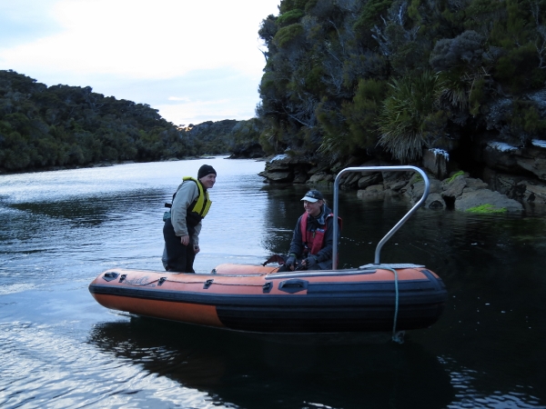
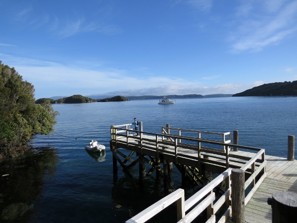
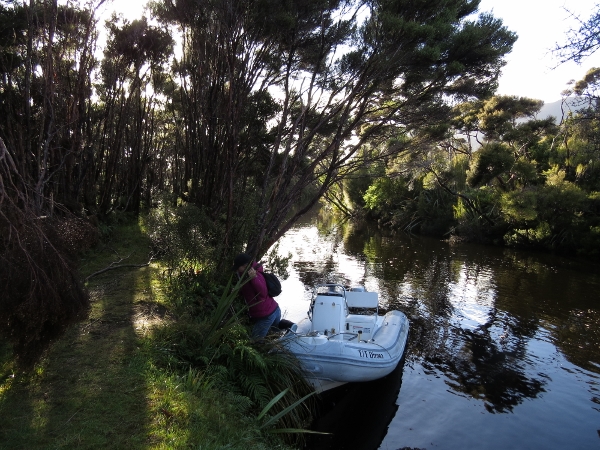
3/10/2014: Trailhead
Position: -47°12.37'S, 167°36.97'E
Tying off the dinghy at the trailhead for the track to the Fraser Peaks, with the Anchor Buddy keeping it in deeper water. We expect to be gone for a good eight hours, and want to find the tender floating when we return on a much lower tide.
|
 |
3/10/2014: Evening Cove
Position: -47°12.28'S, 167°36.62'E
View back to Evening Cove from a high-point on the track. Dirona is anchored just out of view at the left of the photo. (Position approximate).
|
 |
3/10/2014: Fraser Peaks
Position: -47°12.28'S, 167°36.62'E
Our destination at the Fraser Peaks look a long way off to the northwest. 407-meter Gog is the peak on the left. We plan to ascend 282-meter Magog, second from the left. (Position approximate).
|
 |
3/10/2014: Bald Cone
Position: -47°12.28'S, 167°36.62'E
Looking south across Shipbuilders Cove to Bald Cone. So far the track was reasonably easy to follow, and cairns such as this one marked the way where it wasn't. (Position approximate).
|
 |
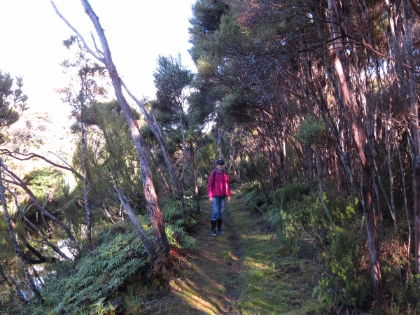
3/10/2014: Creek crossing
Position: -47°11.86'S, 167°35.51'E
We lost the trail not far from the cairns and made our way to just west of the head of Seal Creek where the Mana Cruising Club track sketch indicated we'd need to cross. We found a good crossing point just west of where a small creek drains over the embankment into the east-west-running creek. A few blazes were across the creek to the west, where we picked up the track for a bit. But we lost the track completely after several forks in some impenetrable brush that seemed to extend for miles. We ended up working northwest through taller trees to the base of Magog and climbing right up the side from there. From the top, we scouted a better route back to avoid the brush, and followed a ridge that ran in a southwest direction from the Scotsman rock formation at the base of Magog. We continued on the ridge to the upper right of the photo, descended a short distance through some brush and a copse of trees and a little more brush, then were back in open ground again below the circular rock at the upper center of the photo. From there, we worked down to the same creek crossing. This was a much easier route than anything we found on the way up: mostly open ground with little brush. We also found a good marked track back to the cairns running southeast from the creek crossing and across the flats, rather than farther west along a ridge where the track sketch indicated. (Position approximate).
|
 |
3/10/2014: Ascending Magog
Position: -47°11.38'S, 167°34.44'E
Jennifer ascending from the trees up onto the southeastern bluff of Magog. The Scotsman rock formation is in at the center of the picture and Easy Harbour is at the upper left. We were hoping to intersect the summit track on the way up, but didn't find it until we'd reached the bluff. The track didn't appear useful for a descent, so we came down instead along an open rock face at the southwest corner and then through reasonably open trees and out to the Scotsman. This worked out well and made for a quick descent. We then crossed over the flats and picked up our ridge to return back out. (Position approximate).
|
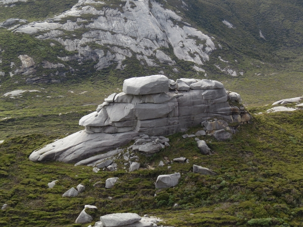 |
3/10/2014: Scotsman
Position: -47°11.36'S, 167°34.39'E
The Hielanman or "Scotchman's Bonnet" formation east of Magog.
|
 |
3/10/2014: Summit
Position: -47°11.36'S, 167°34.39'E
Looking up to the summit of Magog from the southeastern bluff.
|
 |
3/10/2014: Ascending the summit
Position: -47°11.34'S, 167°34.61'E
We followed the track around to the west to reach the northwest corner of Magog where we could ascend to the summit. That's Gog in the background on the left, an unnamed mountain of the Fraser Range at center, and Mokitit/Little Moggy Island in the distance to the right.
|
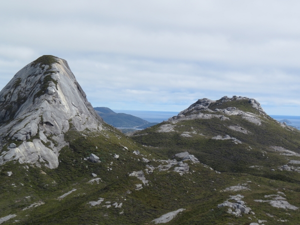 |
3/10/2014: Gog
Position: -47°11.34'S, 167°34.61'E
Close-up of 407-meter Gog and the 352-meter unnamed peak to the right.
|
 |
3/10/2014: Seal Creek
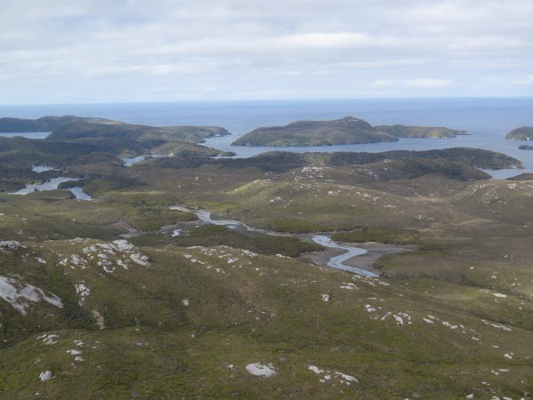
Position: -47°11.33'S, 167°34.48'E
Looking southwest to Seal Creek from the summit. The tide level is about 1.2 meters right now--not far from low tide. If the tides were right, it would seem possible to bring a shallow-draft, portable tender to the head of the Seal Creek on a mid-tide and work directly up to the ridge we came back out on, returning back out six hours later on roughly the same tide-level. This would cut a good hour each way from the route.
|
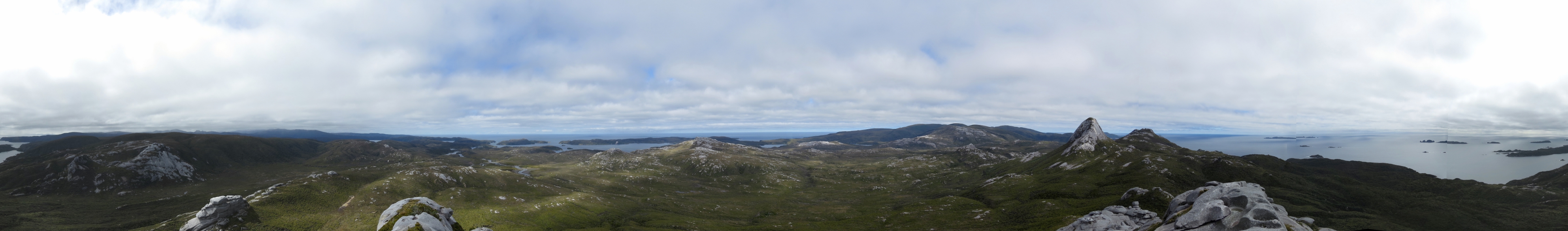 |
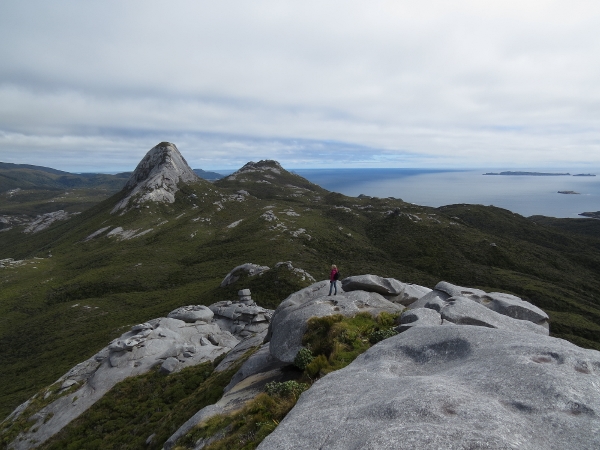
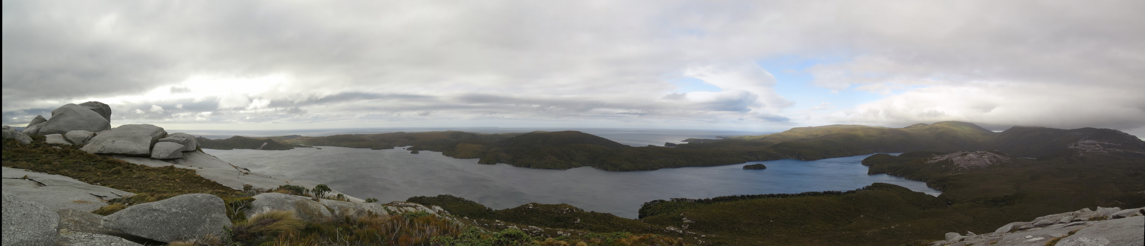
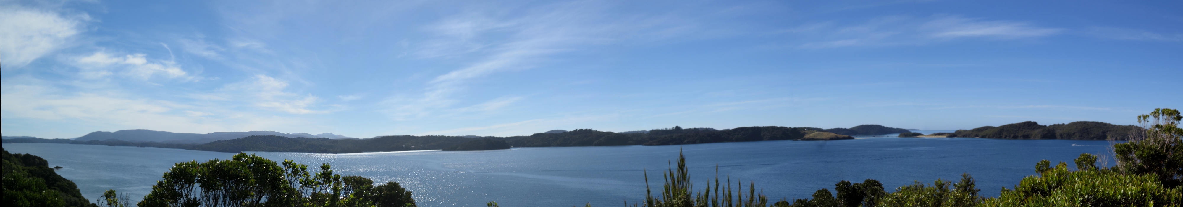
3/10/2014: Panorama
Position: -47°11.33'S, 167°34.48'E
Panorama of the view from the 282-meter summit of Magog. From left to right is the head of Easy Harbour; the Hielanman or "Scotchman's Bonnet" formation; Seal Creek; Pegasus Cove, South Arm; Bald Cone; Gog and the unnamed Fraser Peak, and the mouth of Easy Harbour on the far right. (Click the image for a standalone view in the browser.)
|
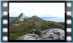 |
3/10/2014: Magog summit video
Position: -47°11.33'S, 167°34.48'E
The video starts with a closeup of 407-m Gog to the southwest, then pans westward across South Arm, Port Pegasus and Seal Creek. Next is a closeup of the Heilanman formation to the north and the sailboat Superted V anchored in Easy Harbour to the northwest before the view returns back to Gog.
|
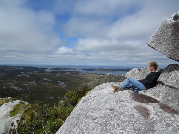 |
3/10/2014: Lunch
Position: -47°11.33'S, 167°34.48'E
Lunch with a view, looking east from the summit across Seal Creek to Pegasus Cove, South Arm.
|
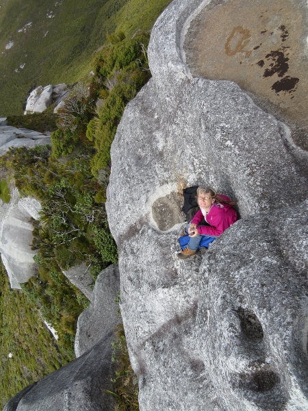 |
3/10/2014: Lunch perch
Position: -47°11.33'S, 167°34.48'E
Our lunch spot was right on the edge--it was a long way down from there.
|
 |
3/10/2014: Dinghy
Position: -47°12.37'S, 167°36.97'E
We arrived back at the dinghy from the summit in about 2.5 hours, compared to at least 3 hours going in. The tide was much lower, but the Anchor Buddy did its job and kept the dinghy floating in deeper water--our blue anchor is visible in the distance underwater. We've started using two anchor buddies in tandem, to allow a greater anchoring distance from shore.
|
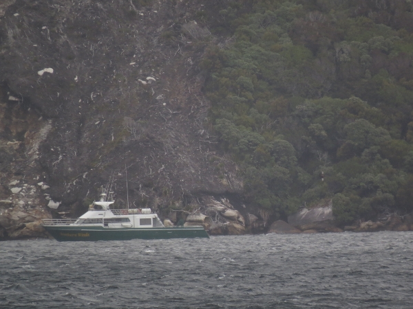 |
3/11/2014: Southern Winds
Position: -47°13.79'S, 167°35.16'E
The Department of Conservation vessel Southern Winds, that we saw at Deep Cove in Doubtful Sound, has been here for a few days.
|
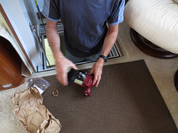 |
3/11/2014: Furnace pump
Position: -47°13.79'S, 167°35.16'E
The diesel boiler circulation pump failed to come on last night, so we got out the spare, expecting to replace it. But we also wanted to use it as a reference because the one in use is installed in a difficult-to-access location. From the manual with the spare, it appears that the pump can get stuck if it hasn't been run for a while or the speed is set to low. We did have the speed on low and moving it to high did start the pump. So we ended up not replacing it after all. We later learned that was just a fluke, and a the real problem was an intermittently failing relay in the aquastat.
|
 |
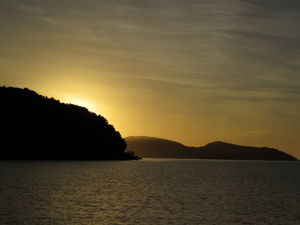
3/12/2014: Sunrise
Position: -47°13.79'S, 167°35.16'E
Sunrise looking northeast towards Noble Island. The Mana Club cruising guide wasn't very positive about the anchorage at what they called "Billy's Cove", particularly in strong winds. But we had no problem in 40-knot northwest winds. The boat certainly moved around at anchor, but we held well and there the fetch was small with the shore so close in that direction.
|
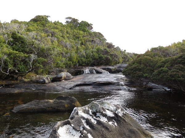 |
3/12/2014: Waterfall
Position: -47°13.58'S, 167°35.13'E
Small waterfall at the end of the western arm off the head of Billy's Bay.
|
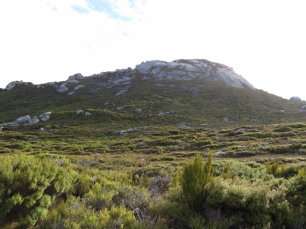 |
3/12/2014: Bald Cone
Position: -47°13.62'S, 167°35.57'E
Looking north to Bald Cone from partway along the track to the summit. The track was easy to follow until this open section, and then it was pretty obvious where we needed to get to. (Position approximate).
|
 |
3/12/2014: Rock formations
Position: -47°13.45'S, 167°36.05'E
Looking northeast across weather-worn rock formations into Port Pegasus. (Position approximate).
|
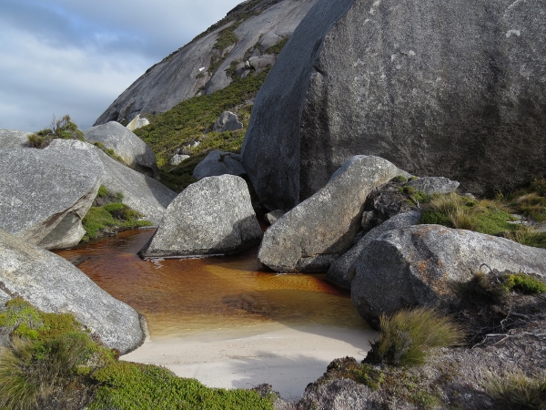 |
3/12/2014: Pond
Position: -47°13.42'S, 167°35.98'E
This tranquil beach and pond at the base of a massive rock seemed quite out of place. The trail to the summit led up a ravine from here.
|
 |
3/12/2014: Climbing
Position: -47°13.33'S, 167°35.92'E
From the pond, the track led steeply up. Near the summit was an open rock face with climbing ropes. (Position approximate).
|
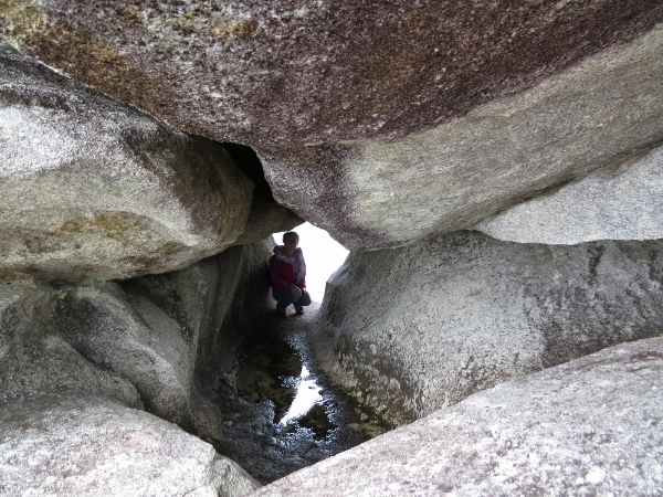 |
3/12/2014: Tunnel
Position: -47°13.34'S, 167°35.89'E
The weather-formed tunnel wrapped around an equal distance to the right of the picture as well.
|
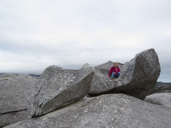 |
3/12/2014: Rock seat
Position: -47°13.34'S, 167°35.84'E
The combination of soft stone and extreme weather on these peaks produces wild rock formations. (Position approximate).
|
 |
3/12/2014: Billy's Cove
Position: -47°13.34'S, 167°35.69'E
Looking southeast towards our anchorage at Billy's Cove. Dirona is anchored just out of sight behind the tree-covered hill to Jennifer's right. 40-knot winds were forecast for today, and the gusts on top of Bald Cone were so strong we could barely stand up against them.
|
 |
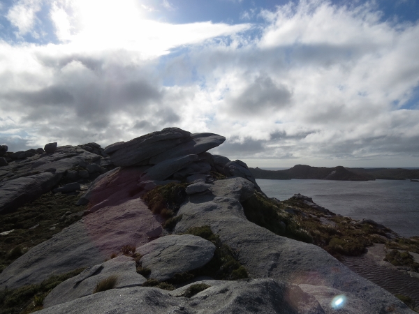
3/12/2014: Summit panorama
Position: -47°13.32'S, 167°35.79'E
Panorama view south from the summit of Bald Cone across North Arm, Port Pegasus. (Click the image for a larger view.)
|
 |
3/12/2014: Bald Cone summit video
Position: -47°13.32'S, 167°35.79'E
In the video you can see and hear the strong wind. The mountain close-up at the end of the video is of 282-meter Magog, where we climbed the other day. (We've also just posted a Magog summit video. We'll upload to YouTube when we have better connectivity.)
|
 |
3/12/2014: Shipbuilder's Cove
Position: -47°13.32'S, 167°35.79'E
The view northeast, with the head of Shipbuilder's Cove at the bottom left.
|
 |
3/12/2014: Lunch
Position: -47°13.34'S, 167°35.89'E
Lunch with a view east over Noble Island and out to sea. We're sitting under the same rock that forms the tunnel Jennifer was sitting inside earlier.
|
 |
3/12/2014: Rappelling
Position: -47°13.34'S, 167°35.93'E
Going down is a lot easier and faster than going up.
|
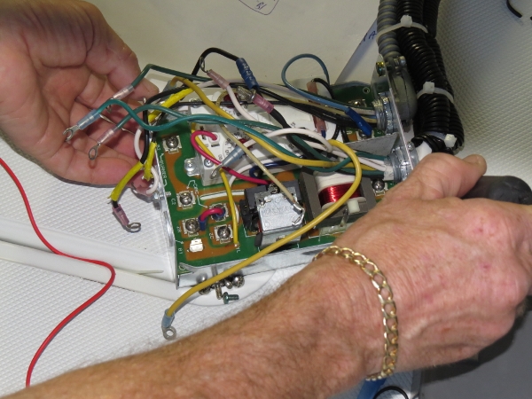 |
3/12/2014: Furnace aquastat
Position: -47°12.73'S, 167°36.37'E
The furnace pump problem turned out to not be a pump fault, but rather an intermittently failing relay in the aquastat. We replaced it with a spare and the furnace once again is running perfectly.
|
 |
3/12/2014: Shipbuilder's Cove Anchorage
Position: -47°12.73'S, 167°36.37'E
At anchor in Shipbuilder's Cove. We were initially thinking of anchoring in the large basin to the west, but this cove amongst several islets looked appealing and we had just enough room to swing. Strong northwest winds kept the boat near the rode limit to the southwest, but the anchorage waters were calm. And we had an excellent view to Bald Cone that we'd hiked up earlier today.
|
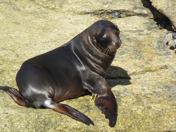 |
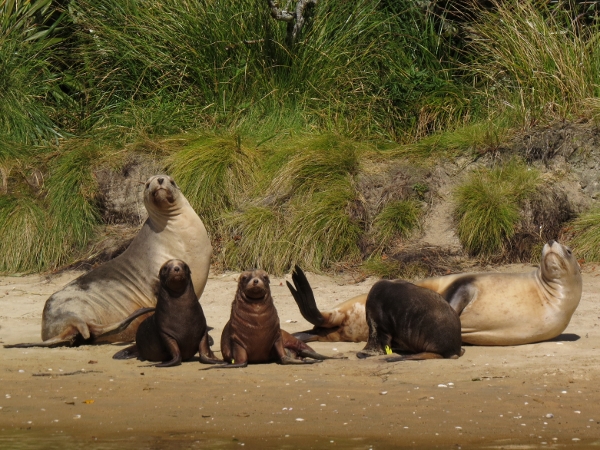
3/12/2014: Sea lion pup
Position: -47°12.79'S, 167°36.28'E
We could hear sea lions ashore on the islets to the west, so went over in the dinghy to investigate. Several tagged pups were ashore or playing in the water.
|
 |
3/13/2014: Sunrise
Position: -47°12.74'S, 167°36.36'E
.
|
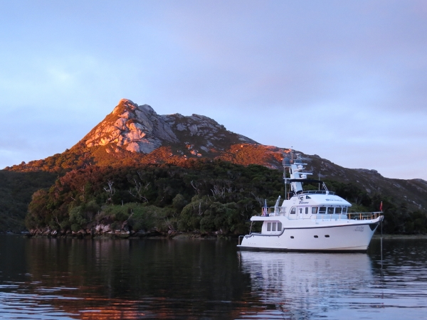 |
3/13/2014: Morning sun
Position: -47°12.73'S, 167°36.37'E
The morning sun lighting up Bald Cone.
|
 |
3/13/2014: Sea lions
Position: -47°12.77'S, 167°36.28'E
The sea lions were up and playing near where we saw them yesterday. They mostly seemed unafraid of us, if not a little curious.
|
 |
3/13/2014: Department of Conservation
Position: -47°12.70'S, 167°36.28'E
Department of Conservation workers from Southern Winds out tagging sea lions. We'd seen their work on the pups last night.
|
 |
3/13/2014: Hunters Hut
Position: -47°11.91'S, 167°40.17'E
The North Pegasus Hunter's Hut just back from a beach along the north shore of Pegasus Passage.
|
 |
3/13/2014: Entering Smuggler's Cove
Position: -47°10.01'S, 167°40.25'E
We anchored for the night at Albion Inlet in the North Arm of Pegasus Cove. At the head of the anchorage is tiny Smuggler's Cove, with an entrance so narrow that you can't even see it until you're right up close. The dinghy barely made it through.
|
 |
3/13/2014: Smuggler's Cove
Position: -47°10.01'S, 167°40.25'E
Inside tiny Smuggler's Cove. Rain was falling when we went inside and the sun was shining a few minutes later when we returned back it. We felt as if we'd passed through a time warp.
|
 |
3/13/2014: More sea lions
Position: -47°9.98'S, 167°39.76'E
A group of two females and three pups were on the beach at the mouth of Basin Creek, with two more pups in the water nearby. Each female has only one pup, so the the extra pups' mothers likely were out feeding. The New Zealand sea lion may be rare, but we sure are seeing a lot of them. According to the DOC tagging crew we'd spoken to earlier today, about fifty breeding females and twenty-five pups currently are on Stewart Island. The males won't be nearby this time of year, because breeding season is over.
|
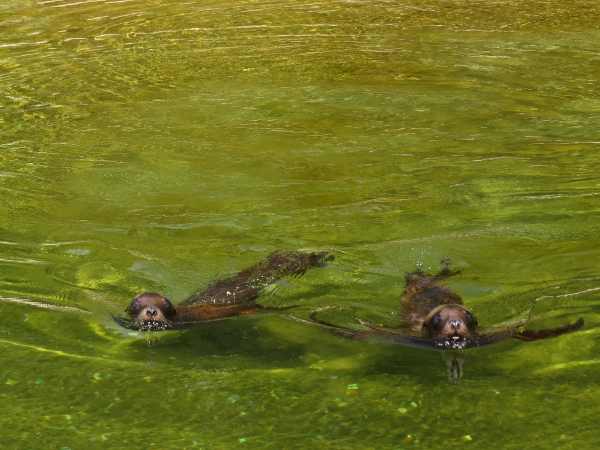 |
3/13/2014: Curious
Position: -47°9.98'S, 167°39.76'E
These two pups swam very close to us, then seemed to lose their nerve and hightailed it back to the beach.
|
 |
3/13/2014: Basin Creek
Position: -47°9.98'S, 167°39.62'E
Calm waters in Basin Creek. We couldn't get much farther up, despite the 2.3m high tide--large boulders and a small rapids blocked the way.
|
 |
3/13/2014: East arm
Position: -47°9.56'S, 167°40.03'E
We got quite a ways up the unnamed creek east of Basin Creek. But we needed the high tide, as depths were barely 2-3 feet through sections. (Position approximate.)
|
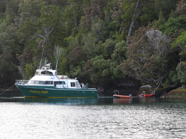 |
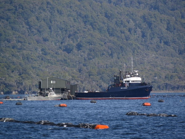
3/13/2014: Southern Winds
Position: -47°10.09'S, 167°40.35'E
The DOC vessel Southern Winds arrived later in the evening and stern-tied into the northeast shore. We'd anchored to swing within 50 feet of shore, and unfortunately the shore just got 100 feet closer, so we moved off to the south a bit. Not a big deal--when we anchor with those tolerances, we're always prepared to move should another boat arrive. And it wasn't their fault--we'd anchored in 60 feet on 300 feet of rode and the wind was blowing us south, so there appeared to be plenty of room. But the radar doesn't lie. And when we lifted anchor, we came awfully close to them--enough so that we were worried our anchors might be fouled.
|
 |
3/15/2014: Sunrise
Position: -47°10.21'S, 167°40.36'E
We've been getting some amazing sunrises recently.
|
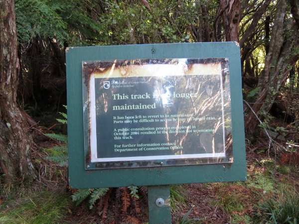 |
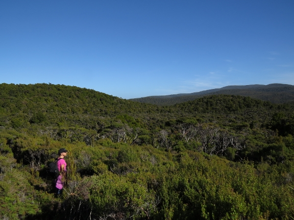
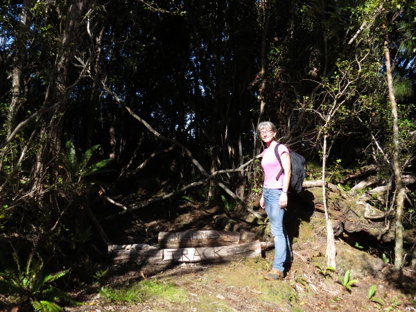
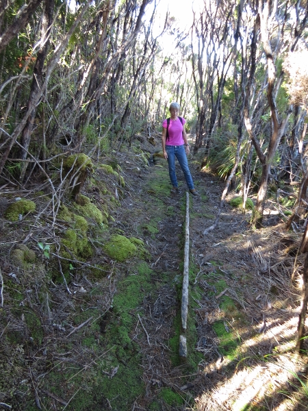
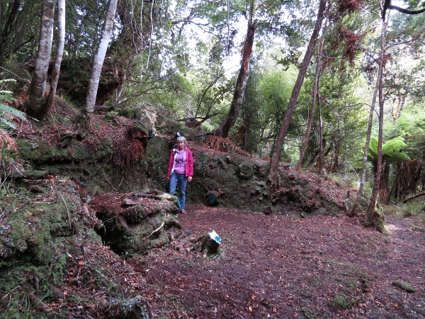
3/15/2014: Tin Range Track
Position: -47°9.25'S, 167°42.17'E
The weather was excellent for a hike along the Tin Range Track. A DOC sign at the trailhead indicated the track no longer was maintained. But it was well-trod and very easy to follow for the most part, although steep and muddy in parts.
|
 |
3/15/2014: Ruins
Position: -47°9.24'S, 167°42.17'E
In the late 1800s, a hotel and store were built in this location to support a tin mining industry. This brick chimney base is about all that remains.
|
 |
3/15/2014: View
Position: -47°8.48'S, 167°43.37'E
Taking in the view from the trail. The trail looks densely overgrown, but actually was mostly quite clear. (Position approximate).
|
 |
3/15/2014: Intersection
Position: -47°8.23'S, 167°44.10'E
The initial part of the track follows an old surveyors route, then joins up with on old horse-drawn tramway that ran up into the Tin Range. This is the intersection with the tramway that runs down to Diprose Bay. DOC volunteers apparently are clearing the old tramway--the route looked quite good. (Position approximate).
|
 |
3/15/2014: Tramway
Position: -47°7.83'S, 167°44.21'E
Most of the tramway rails were made of wood. (Position approximate).
|
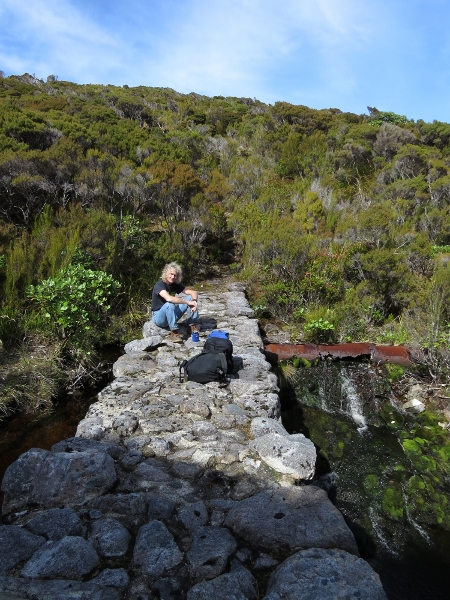 |
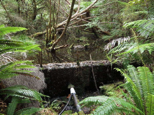
3/15/2014: Stone dam
Position: -47°7.56'S, 167°44.68'E
Lunch on a stone dam across the north branch of McArthurs Creek. The dam was built in 1915 to supply the hydraulic sluicing operation farther downstream. Water was carried through the breached 18" pipe to the right. (Position approximate).
|
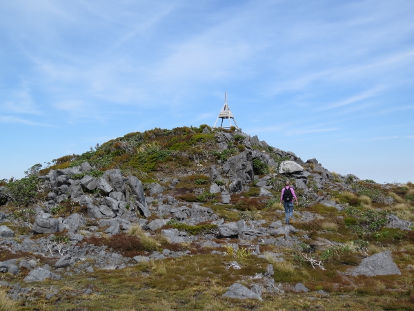 |
3/15/2014: Summit
Position: -47°8.24'S, 167°44.90'E
Nearing the 504-meter summit. (Position approximate).
|
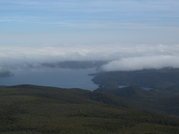 |
3/15/2014: North Arm view
Position: -47°8.24'S, 167°44.90'E
The view into the north arm of Port Pegasus. Dirona is anchored near the right of the photo, out of sight behind a hill. (Position approximate).
|
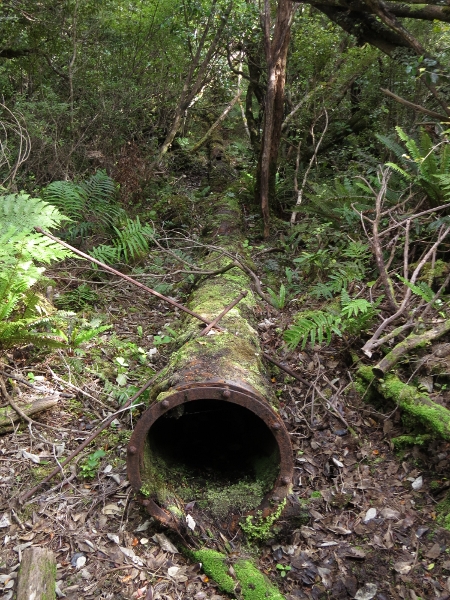 |
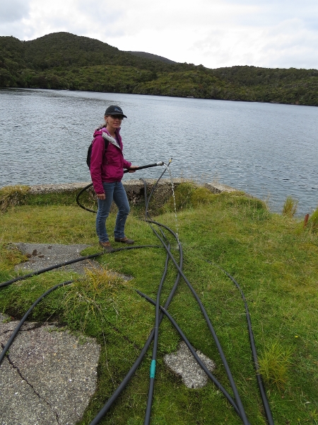
3/15/2014: Water pipe
Position: -47°8.26'S, 167°44.11'E
On the way back down, we followed the tramway a bit from the intersection with the track we'd come up on. This water pipe once connected to the one at the dam where we'd had lunch. (Position approximate).
|
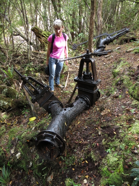 |
3/15/2014: Valves
Position: -47°8.26'S, 167°44.01'E
Two screw-gate valves at the end of the main pipeline. In the background is a hydraulic sluicing monitor. We found these southeast of, and not far from, the intersection of the surveyers trail and the tramway. A blaze just before the intersection marked a rough spur track that led east off the surveyor's track to a clearing and short distance down into the gulley. (Position approximate).
|
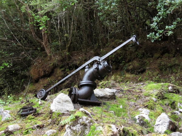 |
3/15/2014: Sluicing monitor
Position: -47°8.27'S, 167°43.99'E
Another sluicing monitor was a short distance away. Someone, certainly DOC, has recently painted these artifacts with a with a tar-like substance, presumably to help preseve them.
|
 |
3/15/2014: Sluice gulley
Position: -47°8.27'S, 167°43.99'E
Looking south down the main hydrualic sluice gulley for the 1912-1917 tin mining operations. The slatted metal structure in the foreground is a riffle, or baffle, used to trap tin ore when a slurry washes across it.
|
 |
3/15/2014: Deer
Position: -47°9.35'S, 167°42.02'E
Southern Winds was in the anchorage briefly, we expect to collect volunteers who were clearing the tramway trail, and was leaving as we returned back to Dirona. Sea lions may be endangered here, but deer don't seem to be.
|
 |
3/16/2014: Aurora Charters
Position: -47°9.35'S, 167°42.02'E
This Aurora Charters catamaran dropped off a load of people, presumably hunters, at the Tin Range Track trailhead. If this is a common occurence its no wonder the trail is so well-trod.
|
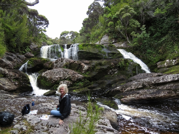 |
3/16/2014: Belltopper Falls
Position: -47°9.06'S, 167°41.79'E
Lunch at Belltopper Falls at the head of the anchorage. We've recently started creating a personal track, shown on the map in light blue, via a phone-based GPS app.
|
 |
3/16/2014: Pelton Wheel
Position: -47°9.11'S, 167°41.86'E
A pelton wheel (water impulse turbine) installed for a late-1800s fish freezing operation.
|
 |
3/16/2014: Foundation
Position: -47°9.28'S, 167°41.91'E
As with the hotel across the bay, not much is left of the old fish freezing station, just the foundation.
|
 |
3/16/2014: Dam
Position: -47°9.27'S, 167°41.86'E
A small, rusted pipe runs from this old dam to the fresh freezing station. More recently, a hose has been grafted on the side.
|
 |
3/16/2014: Freshwater hose
Position: -47°9.28'S, 167°41.91'E
The other end of the hose we saw at the dam provides a steady supply of freshwater.
|
 |
3/16/2014: Blacksmith
Position: -47°9.38'S, 167°42.62'E
The tin mining tramway we'd followed yesterday began at Diprose Bay. This is where a blacksmith's shop was located. The square structure Jennifer is looking at likely was a forge.
|
 |
3/16/2014: Tramway
Position: -47°9.35'S, 167°42.69'E
We walked a bit along the tramway. The way was wide, clear and easier than the track we'd followed yesterday. Being a horse-drawn tramway, the route also wouldn't be as steep as the other trail, so overall this likely is a better route up. The only downside is dinghy access--Diprose Bay dries at the trailhead. The trailhead also wasn't marked. The DOC sea lion researchers from Southern Wind had suggested we take this route, as volunteers were clearing it, and we'd come looking for the trailhead here yesterday. But we coudln't find anything obvious, so had given up and followed the route described in the Mana Cruising Club guidebook.
|
 |
3/17/2014: Whale Passage
Position: -47°10.96'S, 167°43.18'E
We exited Port Pegasus through Whale Passage to run to Lords River before the winds came up later today. The way was wide and clear, but felt pretty tight in the pre-dawn darkness.
|
 |
3/17/2014: Sunrise
Position: -47°11.19'S, 167°53.78'E
The sun rose about two hours after we left the anchorage.
|
 |
3/17/2014: Current
Position: -47°10.69'S, 167°56.19'E
We ran against a strong counter-current most of the way. At 1250 RPM we would normally do about 6 knots in flat water, but barely were making 4 knots.
|
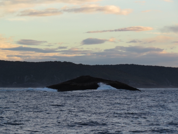 |
3/17/2014: Black Rock
Position: -47°10.45'S, 167°57.20'E
Aptly-named Black Rock.
|
 |
3/17/2014: Seat
Position: -47°6.58'S, 168°6.82'E
We anchored at the mouth of Cooey Bay and set out on a dinghy tour. This stone formation ashore looked like a large seat.
|
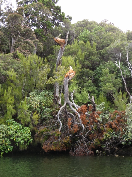 |
3/17/2014: Big winds
Position: -47°6.55'S, 168°6.79'E
We've seen several trees snapped off like this around Stewart Island, evidence of the "Furious Forties" winds that howl through here.
|
 |
3/17/2014: Hunter
Position: -47°4.72'S, 168°3.40'E
We'd gone a fair distance up the Lords River and were surprised to see another boat coming down. It was a hunter staying in a hut farther upstream--a charter boat out of Bluff had dropped them off here.
|
 |
3/17/2014: Falls
Position: -47°4.39'S, 168°2.87'E
A couple of hours before a 2.4m high tide at Oban, we were able to run the dinghy all the way up to a small falls for lunch. The guidebook didn't mention the falls, so they were a nice surprise.
|
 |
3/17/2014: Falls video
Position: -47°4.39'S, 168°2.87'E
This video begins looking down the falls, then pans west and north to above the falls, then east and south to end looking down the falls again.
|
 |
3/17/2014: Hunters hut
Position: -47°6.37'S, 168°7.80'E
The Lords River estuary is a popular hunting desination--several hunters huts were in the area. This one is ashore above Cooey Bay.
|
 |
3/17/2014: Sunset
Position: -47°6.47'S, 168°7.57'E
Sunset from the anchorage.
|
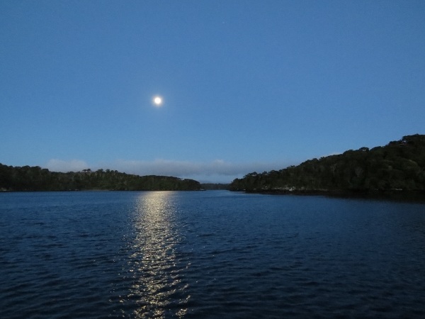 |
3/18/2014: Moonset
Position: -47°6.47'S, 168°7.57'E
.
|
 |
3/18/2014: Salty Beach
Position: -47°3.67'S, 168°10.52'E
We anchored off beautiful Salty Beach for the night. A little swell reached the anchorage, but not enough that we put out the flopper-stopper.
|
 |
3/18/2014: Hut
Position: -47°3.05'S, 168°10.52'E
We'd seen several skiffs coming and going from the Port Adventure Hunters Hut.
|
 |
3/18/2014: Arch
Position: -47°4.00'S, 168°9.21'E
Arch through a small islet in Oyster Bay.
|
 |
3/18/2014: Lagoon
Position: -47°3.58'S, 168°9.80'E
At high tide, we had barely enough depth to run the dinghy into the small lagoon at the head of Abrahams Bosom.
|
 |
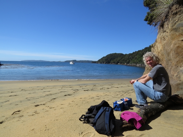
3/18/2014: Lunch
Position: -47°3.59'S, 168°9.79'E
We'd definately found our lunch spot here--it was incredibly beautiful. Stewart Island really is amazing. James is just barely visible behind the grass at the bottom right of the picture.
|
 |
3/18/2014: Superted V
Position: -47°3.59'S, 168°9.79'E
Matt and Jean Findlay's Superted V was anchored in Abrahams Bosom. This was the boat in our Magog video, anchored in Easy Harbor. They came over to say hello and chat a bit.
|
 |
3/18/2014: Falls
Position: -47°3.56'S, 168°9.70'E
The small falls at the head of the lagoon often are used as a freshwater source.
|
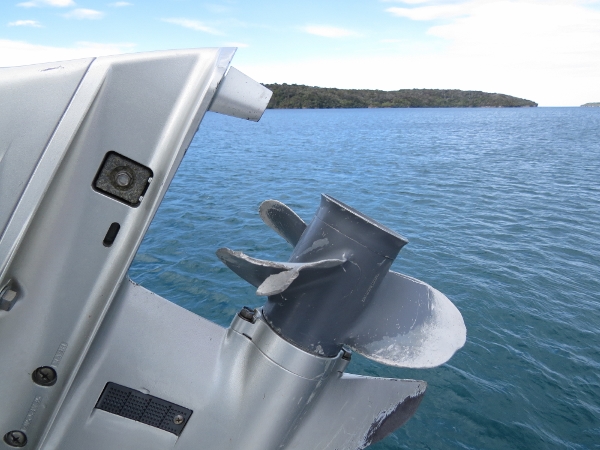 |
3/18/2014: Dinghy prop
Position: -47°3.67'S, 168°10.52'E
We usually don't ground our dinghy more than once or twice a day, and when we do, it's typically not all that hard. Today was an exception.
|
 |
3/19/2014: Sunrise
Position: -46°58.17'S, 168°13.60'E
Sunrise en route to Oban.
|
 |
3/19/2014: Ackers Point
Position: -46°53.64'S, 168°10.75'E
The light on Ackers Point as we round the corner for Halfmoon Bay.
|
 |
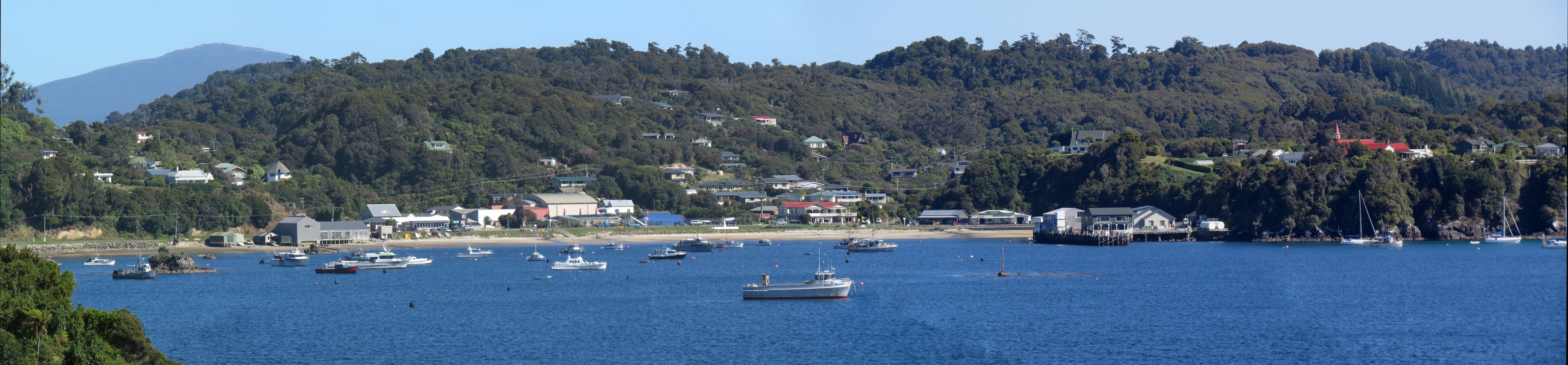
3/19/2014: Oban
Position: -46°53.57'S, 168°9.39'E
Approaching Oban, the first town we've visited since leaving Wellington eight weeks ago.
|
 |
3/19/2014: Big Rock
Position: -46°53.70'S, 168°8.89'E
The large rock int he middle of Halfmoon Bay seems appropriately named.
|
 |
3/19/2014: Morning light
Position: -46°53.71'S, 168°8.22'E
Commercial boat to our east at the mouth of Halfmoon Bay.
|
 |
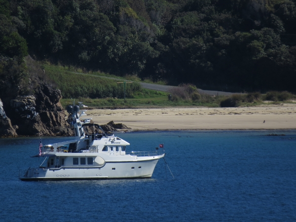
3/19/2014: Argo
Position: -46°53.57'S, 168°8.14'E
Charter boat Argo underway.
|
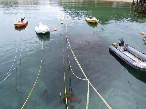 |
3/19/2014: Dinghy mooring
Position: -46°53.84'S, 168°7.81'E
West of the main dock were several bouys with clothesline-like lines for mooring tenders, presumably to prevent the vessels from drifting under the dock. We followed suit and used the Anchor Buddy to moor ours.
|
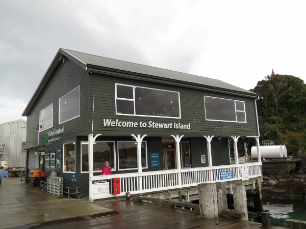 |
3/19/2014: Welcome
Position: -46°53.83'S, 168°7.84'E
We weren't, of course, just arriving on Stewart Island. But it did feel more official landing in town.
|
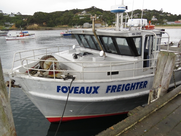 |
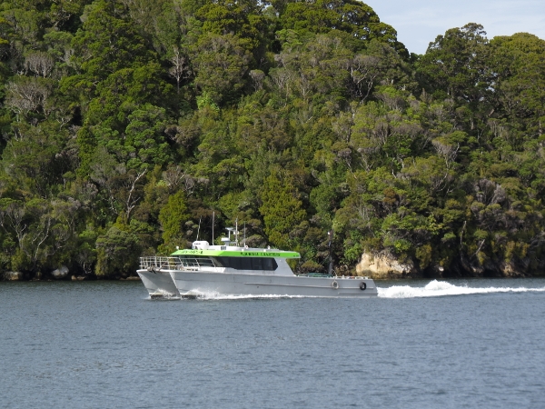
3/19/2014: Foveaux Freighter
Position: -46°53.83'S, 168°7.87'E
The Foveaux Freighter at the Oban Dock. They were loading empty gasoline containers back on the boat for refilling in Bluff.
|
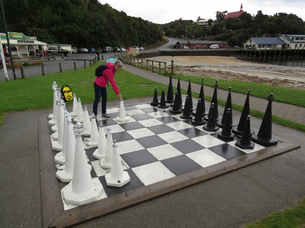 |
3/19/2014: Chess board
Position: -46°53.88'S, 168°7.71'E
Large chess board on the waterfont. The pieces were made from painted pylons and easy to move. The grocery store is on the left, and the wharf is just out of the picture on the right.
|
 |
3/19/2014: Oban waterfront
Position: -46°53.90'S, 168°7.73'E
Looking out to sea from the Oban waterfront. The town is neat and tidy with wonderful ocean views. It felt strange to see so many houses and buildings after eight weeks away.
|
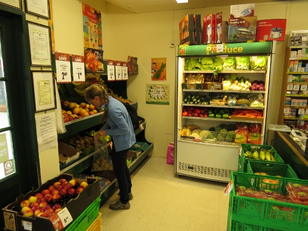 |
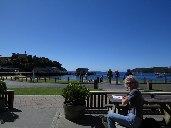
3/19/2014: Groceries
Position: -46°53.86'S, 168°7.70'E
We've not purchased any groceries since January 21st in Wellington--over eight weeks ago. We actually didn't need much, but did stock up on fresh fruit and vegetables. The store was small, but incredibly well-stocked. They also carried delicious fresh Stewart Island blue cod. Normally in a town like this everyone catches their own and the local store wouldn't sell any fresh fish, but the rental-cottage tourist population is so high that it is a popular item.
|
 |
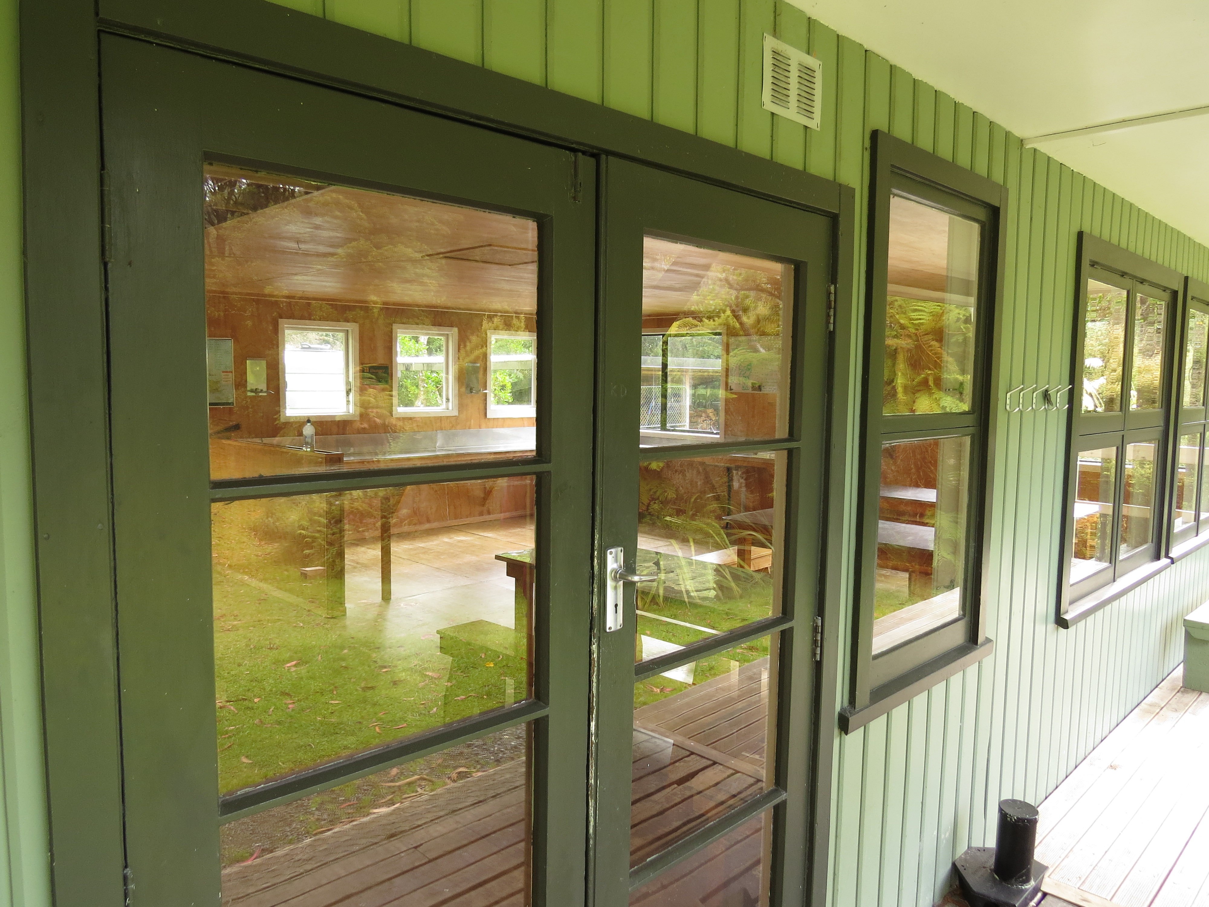
3/19/2014: Rakiura National Park Visitors Center
Position: -46°53.89'S, 168°7.58'E
After stowing our groceries on board, we returned to Oban to tour around. Our first stop was the Department of Conservancy's excellent Rakiura National Park Visitors Center. The Rakiura National Park is New Zealand's newest and most southern park, and includes New Zealand's most southern Great Walks, the 32km Rakiura Track, and several longer ones, plus some excellent day walks. Tramping is hugely popular on Stewart Island--everywhere we saw people dressed for the tracks,often carrying large backpacks.
|
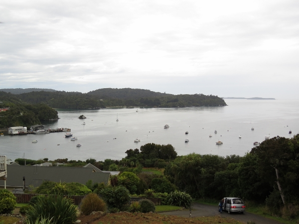 |
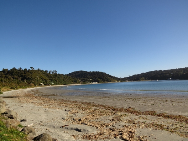
3/19/2014: Halfmoon Bay
Position: -46°54.07'S, 168°7.78'E
Looking across Halfmoon Bay from one of the roads at the east end of town. Dirona is anchored farthest away at the top of the picture.
|
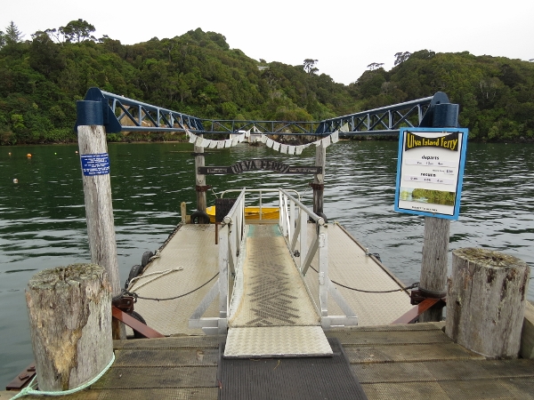 |
3/19/2014: Golden Bay
Position: -46°54.25'S, 168°7.30'E
We walked up and over to Golden Bay, where the ferry leaves for Ulva Island.
|
 |
3/19/2014: Thule Bay
Position: -46°54.16'S, 168°7.46'E
Thule Bay, next to Golden Bay, looking west from the Observation Rock viewing area.
|
 |
3/19/2014: Kaka
Position: -46°54.15'S, 168°7.48'E
A Kaka, a native New Zealand parrot, in the trees above the Observation Rock track. The bird was quite comfortable around us, and seemed tempted to land on an outstretched arm.
|
 |
3/20/2014: Sunrise
Position: -46°53.57'S, 168°8.14'E
Halfmoon Bay has beautiful sunrises. Due to the swell that enters the bay, pleasure craft don't normally overnight at Oban and instead run around the corner to Paterson Inlet. But we just put out the flopper-stopper and spent an enjoyable three nights here. It was our first time using the flopper-stopper since getting the chains replaced in Whangarei.
|
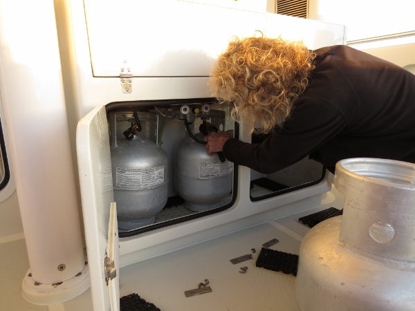 |
3/21/2014: Propane
Position: -46°53.57'S, 168°8.14'E
The two propane tanks on the left are hooked up to the propane system with a valve to switch between them. Both are now empty, so we are swapping in the two spares. One spare is stowed to the right of the other two, the forth is in the aft port cockpit locker. Each tank lasts about six months--we've only gone through two since leaving Hawaii a year ago. We use propane for the barbecue and the stovetop, but the oven is electric.
|
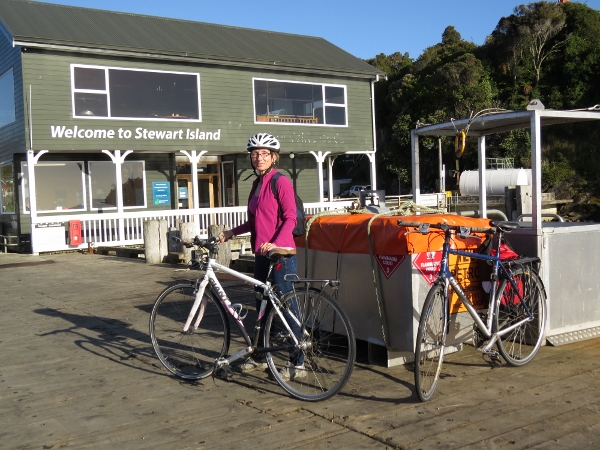 |
3/21/2014: Bike tour
Position: -46°53.83'S, 168°7.84'E
Ready for a bike tour of Oban and area.
|
 |
3/21/2014: Mill Creek
Position: -46°53.62'S, 168°7.53'E
The view down Mill Creek across Bathing Beach to Dirona at anchor in the distance.
|
 |
3/21/2014: Horseshoe Bay
Position: -46°52.87'S, 168°7.76'E
Looking north across Horseshoe Bay. It looks like a pretty nice place to anchor.
|
 |
3/21/2014: Lee Bay
Position: -46°51.77'S, 168°7.39'E
Walking the wide sand beach at Lee Bay with Peters Point in the distance.
|
 |
3/21/2014: The Aanchorstone
Position: -46°51.80'S, 168°7.36'E
Chain link sculupture at the entry to the the Rakiura National Park, where the Rakiura Track starts. The sculpture was commissioned for the forming of the park.
|
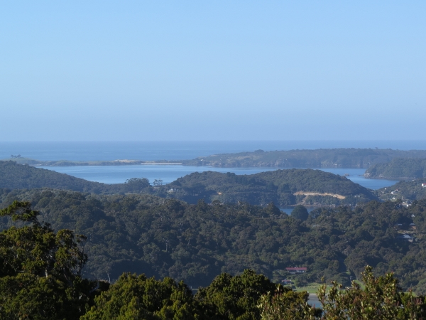 |
3/21/2014: Garden Mound Track
Position: -46°52.11'S, 168°7.12'E
The view south across Horseshoe Bay, Halfmoon Bay and Paterson Inlet from a lookout along the Garden Mound Track.
|
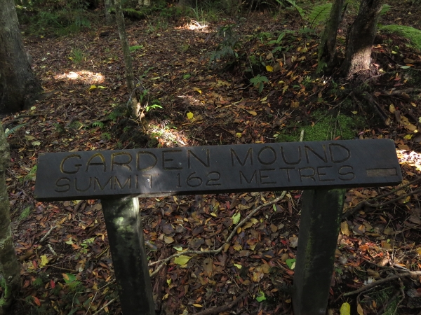 |
3/21/2014: Summit
Position: -46°52.09'S, 168°7.07'E
We were hoping for a view east from the 162-meter summit, but this was the most interesting shot. Overall, the walk probably was not worth the effort, although it did take only 15 minutes to reach the top.
|
 |
3/21/2014: Telephone
Position: -46°53.09'S, 168°8.05'E
Old telephone and book roadside.
|
 |
3/21/2014: Bragg Bay
Position: -46°53.33'S, 168°8.31'E
Looking south across Bragg Bay, one of several lovely sand beaches bordering Halfmoon Bay.
|
 |
3/21/2014: Whaling relics
Position: -46°53.91'S, 168°8.74'E
Relics from the whaling era at Leask Bay.
|
 |
3/21/2014: Fisherman Point
Position: -46°53.69'S, 168°9.55'E
Taking in the view from Fisherman Point on the track to Acker's Point. The track was excellent--well-maintained with great views along the way. We quite enjoyed it.
|
 |
3/21/2014: Ackers Point
Position: -46°52.21'S, 168°7.60'E
Interpretive signs at Ackers Point describe the birdlife and the history of the light there (out of the photo behind Jennifer).
|
 |
3/21/2014: Acker's Stone House
Position: -46°53.79'S, 168°9.18'E
Lewis Acker's stone house, built around 1836, is the oldest European building on Stewart Island.
|
 |
3/21/2014: Halfmoon Bay
Position: -46°53.80'S, 168°8.90'E
Panorama of Halfmoon Bay from road back into Oban.
|
 |
3/21/2014: Anchorage
Position: -46°53.80'S, 168°8.90'E
View to the anchorage, just to the right of the previous panorama.
|
 |
3/21/2014: Lunch
Position: -46°53.88'S, 168°7.70'E
A delicous seafood meal with a view at the South Sea Hotel pub.
|
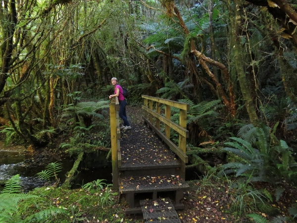 |
3/21/2014: Fern Gully Track
Position: -46°53.57'S, 168°6.21'E
After lunch, we continued our bicycle exploration west of town. We locked our bikes at the Fern Gully Track and walked down to reach the closest two bridges.
|
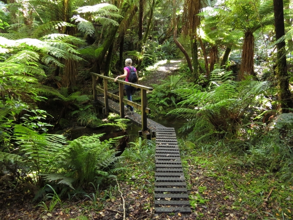 |
3/21/2014: Second bridge
Position: -46°53.59'S, 168°6.08'E
The second bridge from the start of the Fern Gully Track.
|
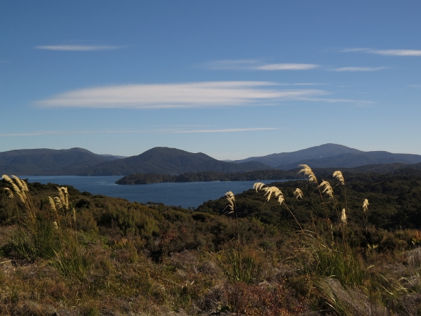 |
3/21/2014: Airstrip
Position: -46°54.06'S, 168°5.85'E
The view to Paterson Inlet from the end of the Stewart Island airstrip.
|
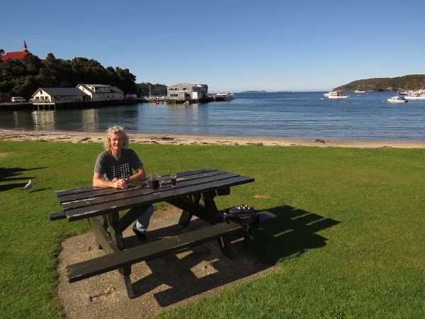 |
3/21/2014: Thirsty
Position: -46°53.89'S, 168°7.71'E
We got thirsty after our second bike ride, and couldn't make it past the pub. The patio was full this time, so we took our beer across the road to the park as the locals did.
|
 |
3/22/2014: Penguin
Position: -46°55.68'S, 168°8.58'E
Little Blue Penguin, the smallest penguin worldwide, swimming off Ulva Island.
|
 |
3/22/2014: Shags
Position: -46°56.17'S, 168°8.31'E
The trees around the The Snuggery, a bay along the south side of Ulva Island, were filled with nesting Pied Shags.
|
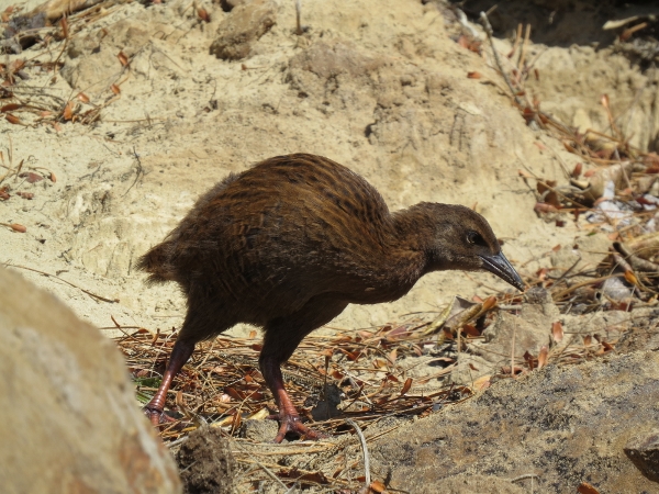 |
3/22/2014: Weka
Position: -46°55.81'S, 168°8.01'E
After circumnavigating Ulva Island by dinghy, we landed on the beach at our anchorage. This Weka was foraging in the shore nearby. We initially thought it was a Kiwi, as they are similar-looking birds, but the Kiwi's beak is longer.
|
 |
3/22/2014: Lunch
Position: -46°55.75'S, 168°7.97'E
Lunch on the beach.
|
 |
3/22/2014: Tracks
Position: -46°55.73'S, 168°7.73'E
The Ulva Island tracks are excellent. We went ashore only for a brief visit and ended up walking every track.
|
 |
3/22/2014: Tomtit
Position: -46°55.81'S, 168°7.29'E
Ulva Island has an amazing diversity of birdlife--the air is full of their calls.
|
 |
3/22/2014: Southern Express
Position: -46°55.55'S, 168°7.85'E
Real Journey's Southern Express at the Ulva Island dock.
|
 |
3/22/2014: Flagstaff Point
Position: -46°55.54'S, 168°7.90'E
The view north into Paterson Inlet from Flagstaff Point.
|
 |
3/22/2014: Small beach
Position: -46°56.23'S, 168°7.74'E
A rough but marked track led across the island to a small cove on the other side. There wasn't much to see there though.
|
 |
3/23/2014: Glory Cove Scenic Reserve
Position: -46°58.34'S, 168°10.24'E
Tied off at the Glory Cove Scenic Reserve to walk the track to Ocean Beach.
|
 |
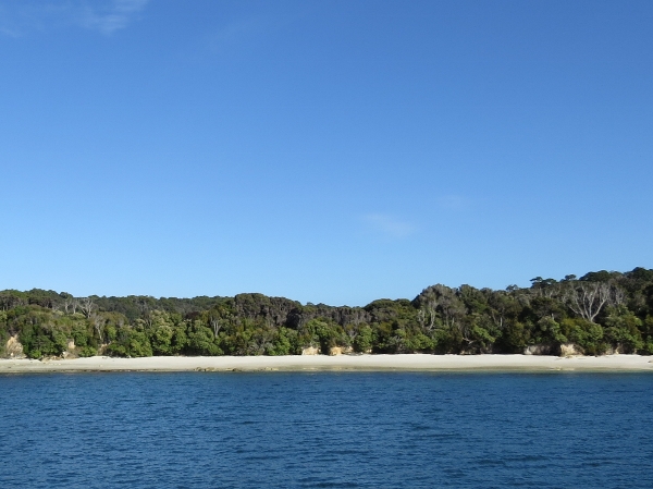
3/23/2014: Ocean Beach
Position: -46°58.16'S, 168°10.65'E
Ocean Beach reminded us of the Oregon Coast--wild and rugged with surf rolling in over a wide sand beach.
|
 |
3/23/2014: Aquaculture
Position: -46°58.46'S, 168°7.60'E
Mussel farms fill Big Glory Cove.
|
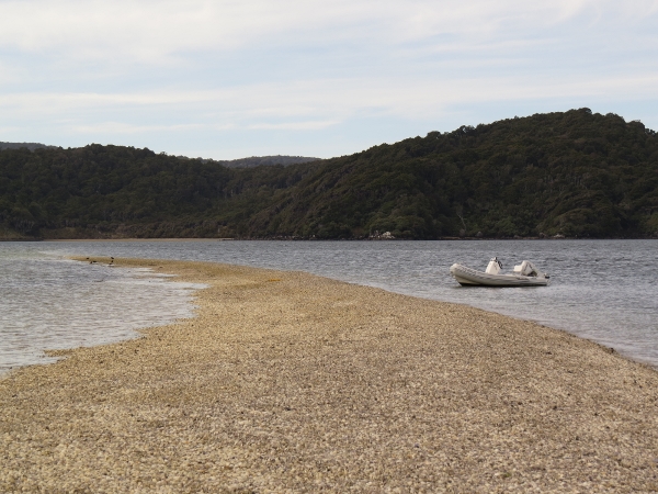 |
3/23/2014: Sandspit
Position: -46°54.05'S, 168°0.53'E
This sandspit looked like pebbles, but actually was thousands of small clam shells. We'd worked towards the head of North Arm and found an excellent anchorage just north of Sawdust Bay in about 15 feet, with good protection from the northerly winds that were blowing.
|
 |
3/23/2014: North Arm Hut
Position: -46°52.90'S, 168°0.94'E
The North Arm hut is the westernmos on the Rakiura Track. A short distance north is the intersection with the 125km North West Circuit is a short distance north.
|
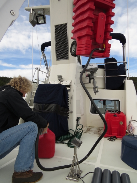 |
3/23/2014: Refueling
Position: -46°53.49'S, 168°0.92'E
Filling the smaller gas tank to transfer to the dingy. We used to just lower the entire deck tank by crane to the dinghy, but find it easier to just walk the jerry can down.
|
 |
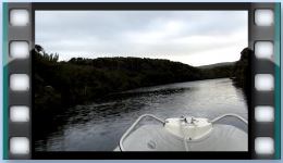
3/24/2014: Freshwater river
Position: -46°53.99'S, 167°58.06'E
At high tide, we set off to explore the Freshwater River, hoping to reach the Freshwater Hut along the North West Circuit track. We had trouble locating the way in, as the personal track shows, but we eventually found a route through with a good 4 feet of water. Boat traffic apparently can be heavy here--lots of trampers are transferred by boat to and fron the track.
|
 |
3/24/2014: Running upriver
Position: -46°52.73'S, 167°56.15'E
Once past the estuary, the river was deep and reasonably wide. The tide was falling, so we ran fast to reach the hut and avoid being stranded.
|
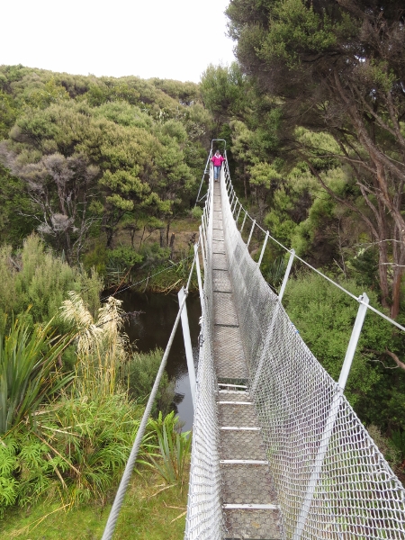 |
3/24/2014: Bridge
Position: -46°52.10'S, 167°55.16'E
Swing bridge across the Freshwater River.
|
 |
3/24/2014: Dock
Position: -46°52.10'S, 167°55.16'E
As with pretty much everying DOC builds, the dock at the Freshwater Hut was substantial.
|
 |
3/24/2014: Freshwater Hut
Position: -46°52.10'S, 167°55.16'E
Another addition to our hut photo colleciton.
|
 |
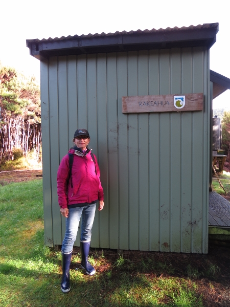
3/25/2014: Rakeahua River
Position: -46°58.69'S, 167°53.87'E
On a sunny and still, but cold morning, we ran at high tide into the Rakeahua River. We had an easier time finding an entry compared to the Freshwater River, but we still were tide-constrained with only 3-4 feet, and couldn't stay long.
|
 |
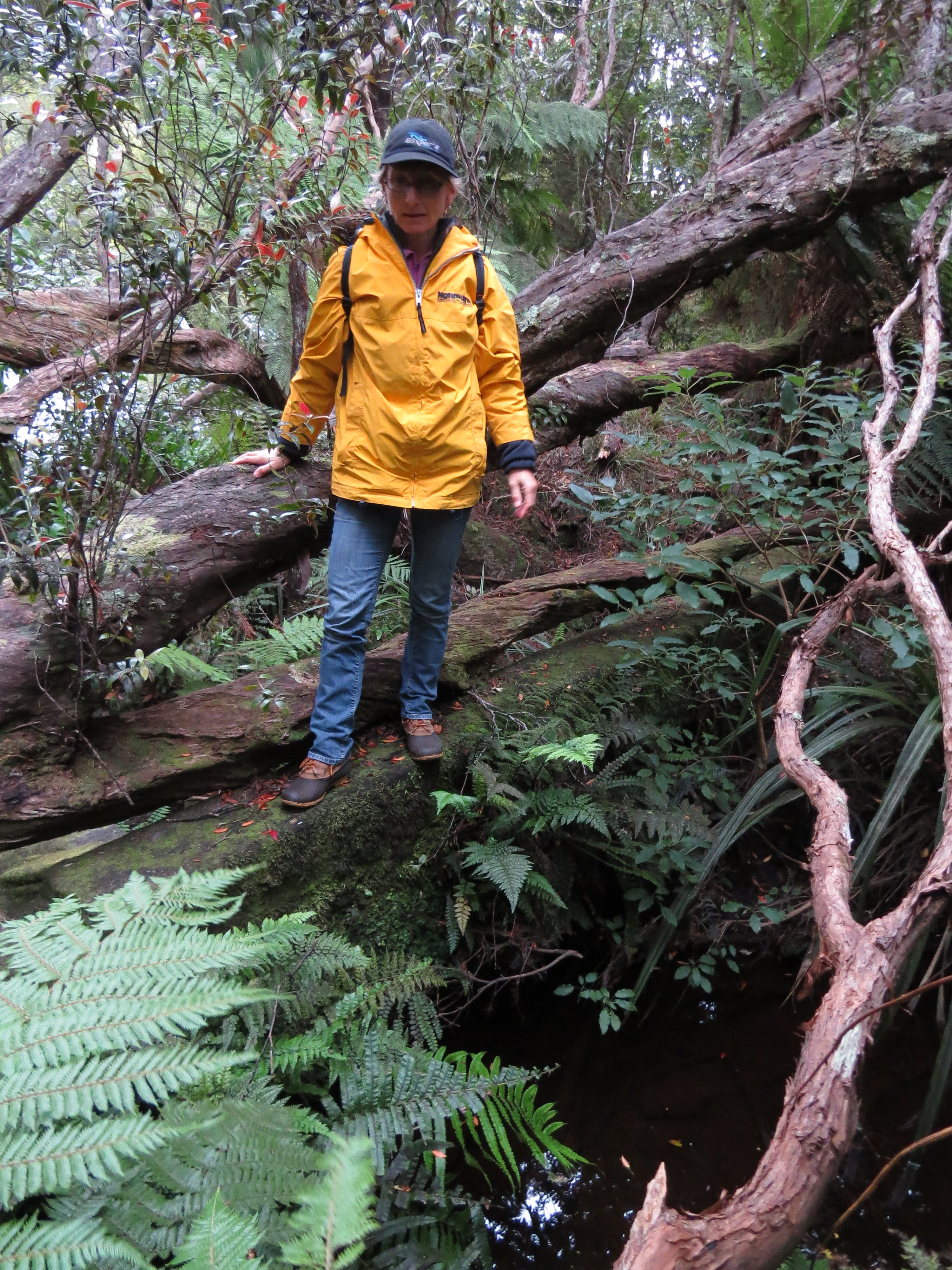
3/25/2014: Narrow
Position: -46°59.01'S, 167°53.22'E
The waterway started out quite wide, but soon narrowed. The depths were fine though. The river was really beautiful, especially in such calm and clear conditions.
|
 |
3/25/2014: Running the river
Position: -46°59.06'S, 167°53.22'E
We ran as fast as we dared to ensure we woulnd't be trapped by the falling tide.
|
 |
3/25/2014: End of the road
Position: -46°59.08'S, 167°52.89'E
The river eventually got too narrow and blocked for us to continue, but we'd gone much farther than we'd expected.
|
 |
3/25/2014: Dinhgy landing
Position: -46°58.98'S, 167°52.97'E
We landed the dinghy just down from where we'd been stopped--we could see an obvious trail there.
|
 |
3/25/2014: Southern Circuit Track
Position: -46°58.98'S, 167°53.04'E
Our first time on the Southern Circuit Track.
|
 |
3/25/2014: Rakeahua Landing
Position: -46°58.97'S, 167°53.13'E
A short distance down the track, we came to the Rakeahua Landing. There was no dock here as along the Freshwater River, but it looked well-used.
|
 |
3/25/2014: Rakeahua Hut
Position: -46°58.93'S, 167°52.86'E
We walked a short distance back the other way from where we'd left the dinghy to reach the Rakeahua Hut.
|
 |
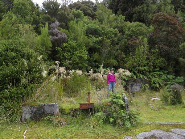
3/27/2014: Dam
Position: -46°54.11'S, 168°2.77'E
We landed the dinghy at the head of Kidney Fern Arm to check out an historic dam that showed on the topographic maps. The dam is difficult to see with all the growth, but Jennifer is standing on the old concrete structure.
|
 |
3/27/2014: Rakiura Track
Position: -46°54.11'S, 168°2.77'E
On a small bridge crossing the creek along the Rakiura Track. The quality of the tracks here continues to impress us.
|
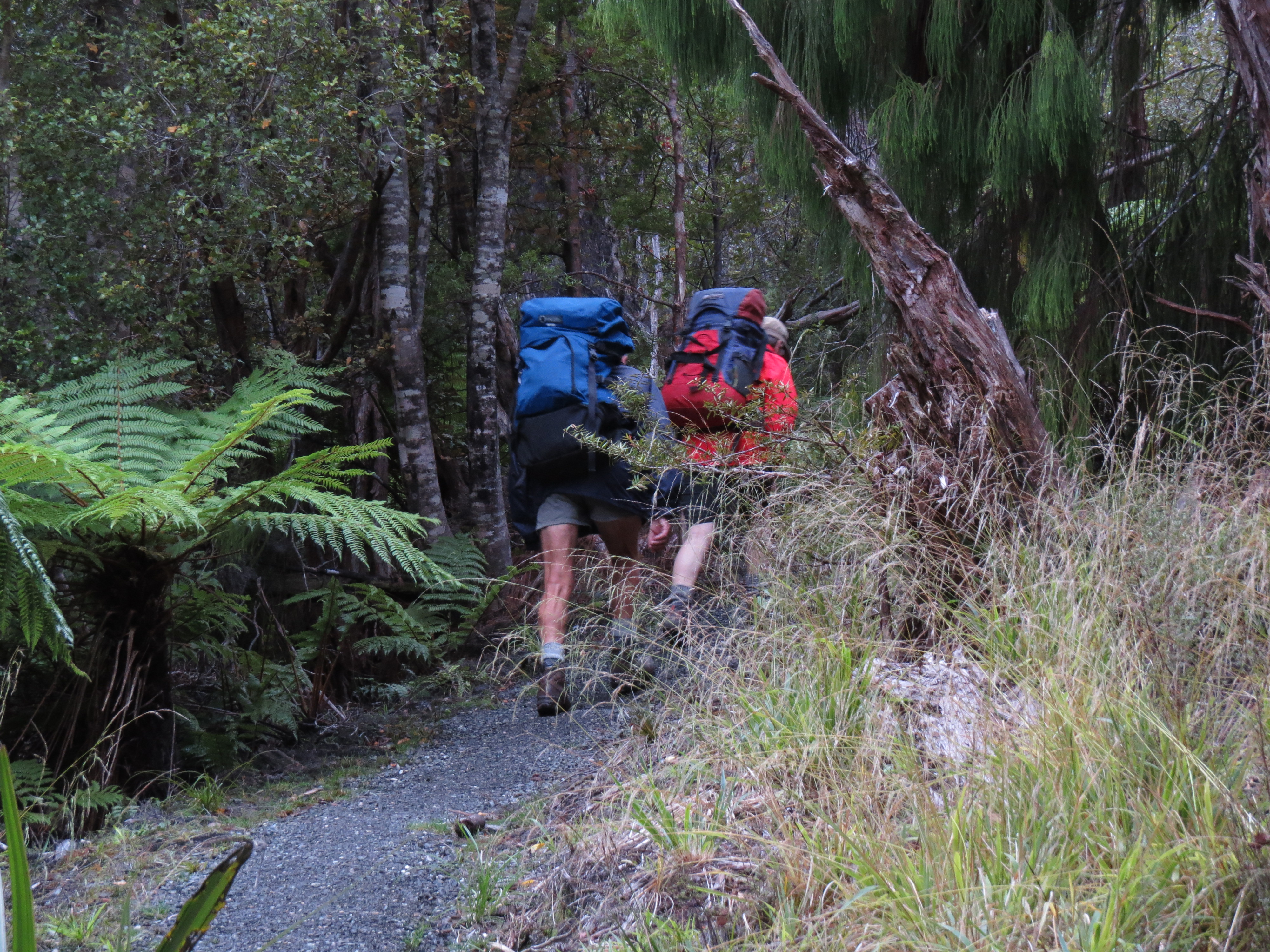 |
3/27/2014: Trampers
Position: -46°54.11'S, 168°2.77'E
Well-equipped trampers heading east along the Rakiura Track.
|
 |
3/27/2014: Landing
Position: -46°53.78'S, 168°3.87'E
We next landed at the head of Kaipipi Bay where we'd read about a nice bridge that crossed a creek along the Rakiura Track there. We found a pretty obvious landing spot with stairs leading down to the water.
|
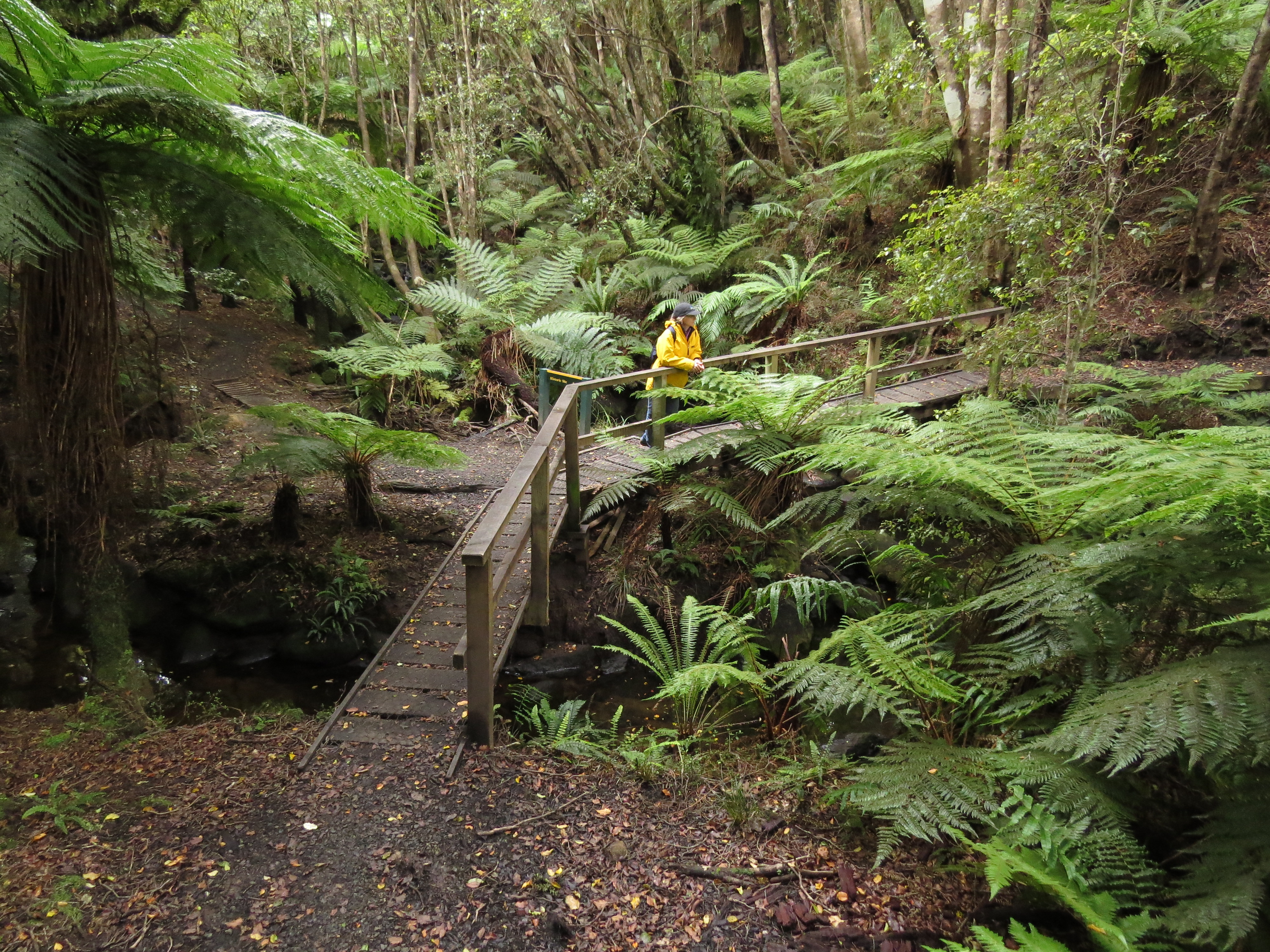 |
3/27/2014: Bridge
Position: -46°53.77'S, 168°3.85'E
And it was a nice bridge.
|
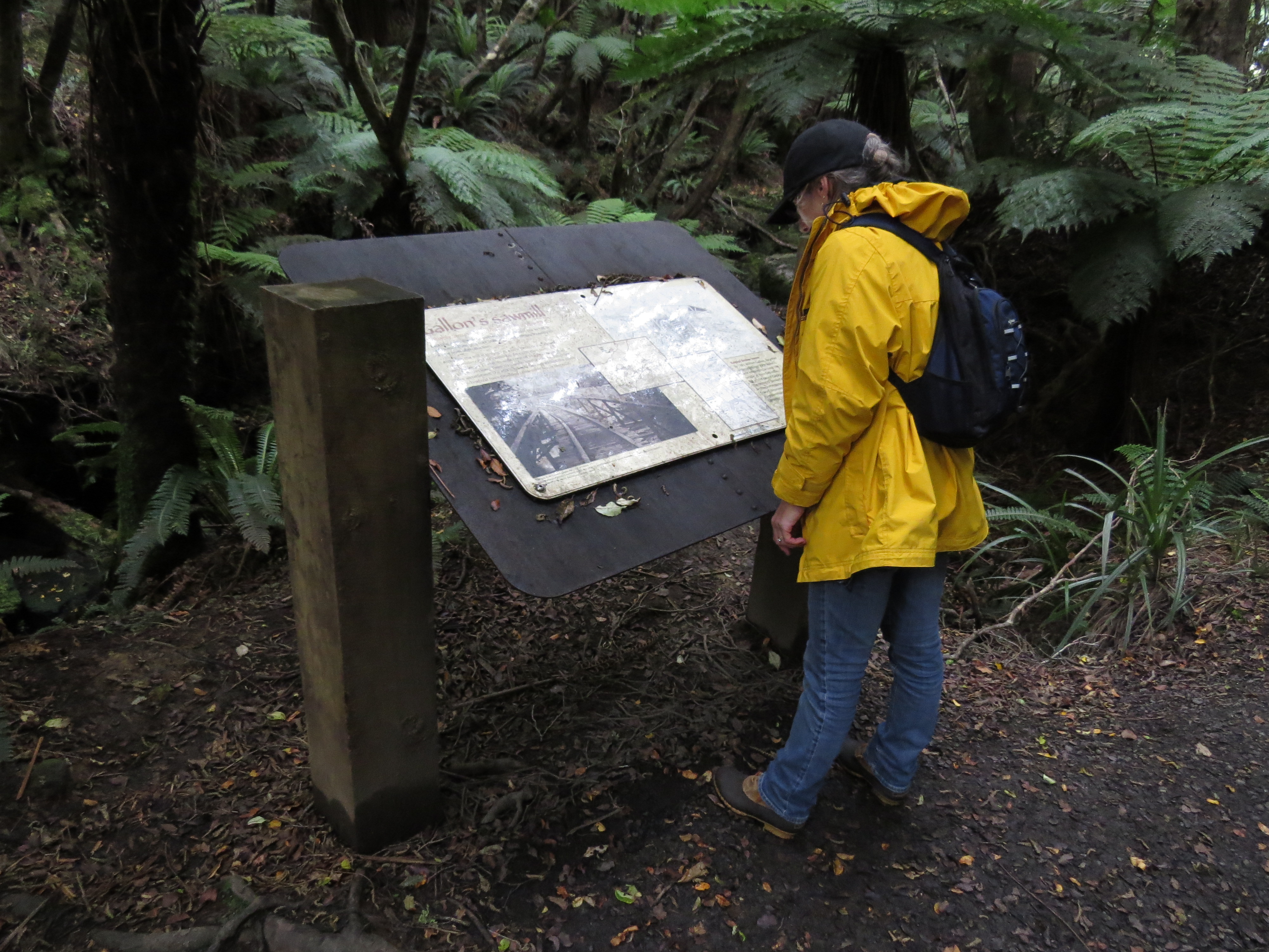 |
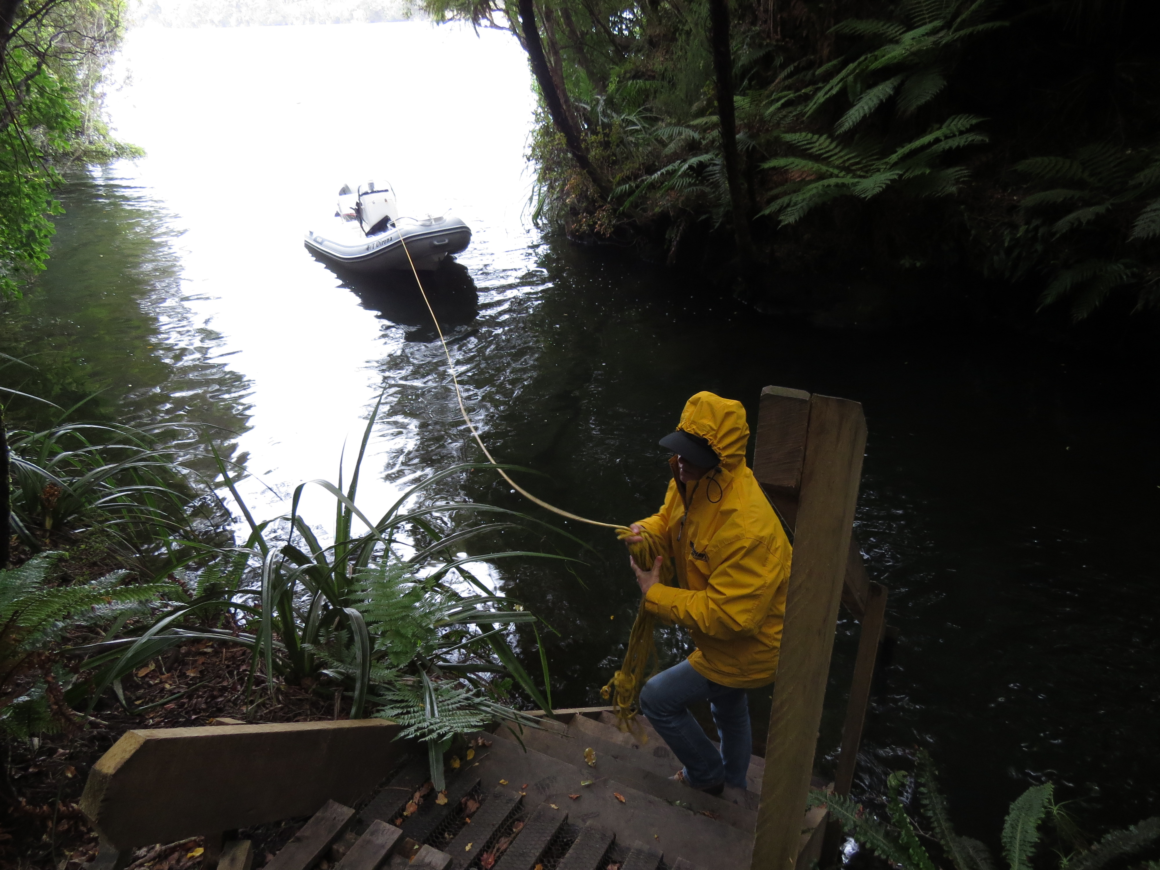
3/27/2014: Gallon's sawmill
Position: -46°53.76'S, 168°3.86'E
Near the bridge was an interpretive sign describing Gallon's sawmill that operated on the creek here a century ago. We walked north a bit looking for ruins, but couldn't find anything obvious.
|
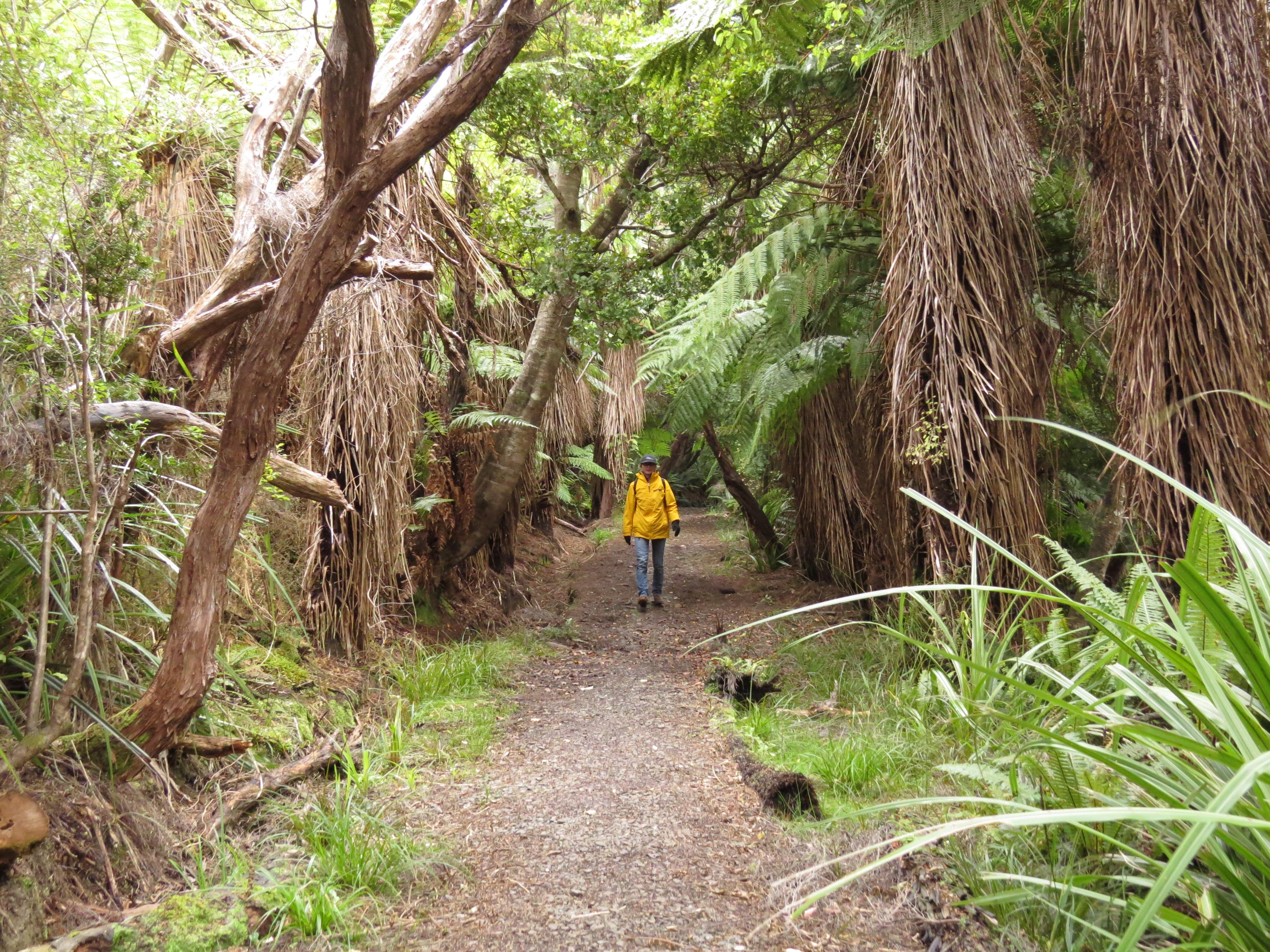 |
3/27/2014: Road to Oban
Position: -46°53.89'S, 168°4.28'E
Walking the century-old road to Oban, now part of the Rakiura Track.
|
 |
3/27/2014: Whaling station
Position: -46°54.75'S, 168°2.92'E
Ruins from a substantial whaling stating that operated in Prices Inlet. The ships worked the Antarctic and were refit and repaired here.
|
 |
3/27/2014: Boiler
Position: -46°54.75'S, 168°2.92'E
Steam boiler just offshore. It used to be up where the building foundations were--not sure how it ended up in the water.
|
 |
3/27/2014: Manager's house
Position: -46°54.72'S, 168°2.98'E
Not much is left of the whaling station manager's house but these steps.
|
 |
3/27/2014: Millars Beach
Position: -46°54.90'S, 168°3.34'E
Most people land at Millars Beach and walk to the whaling station from there. This is the dock where tour boats land to put visitors ashore.
|
 |
3/27/2014: Slipway
Position: -46°54.75'S, 168°2.91'E
Remains of the whaling station's slipway.
|
 |
3/27/2014: Props
Position: -46°54.74'S, 168°2.89'E
Huge propellers, damaged by the Antarctic ice, were discarded along the beach. Most had been heavily patched and some had large bends in them. We know how that goes.
|
 |
3/28/2014: Port William
Position: -46°50.19'S, 168°5.08'E
At anchor in Port William. This turned out to be an excellent anchorage with no swell.
|
 |
3/28/2014: Port William Hut
Position: -46°50.15'S, 168°5.23'E
Our last Stewart Island hut was a pretty impressive one.
|
 |
3/28/2014: Log haulers
Position: -46°50.71'S, 168°4.12'E
One of the reasons we'd come to Port William was to walk into see the old log haulers along the Rakiura Track.
|
 |
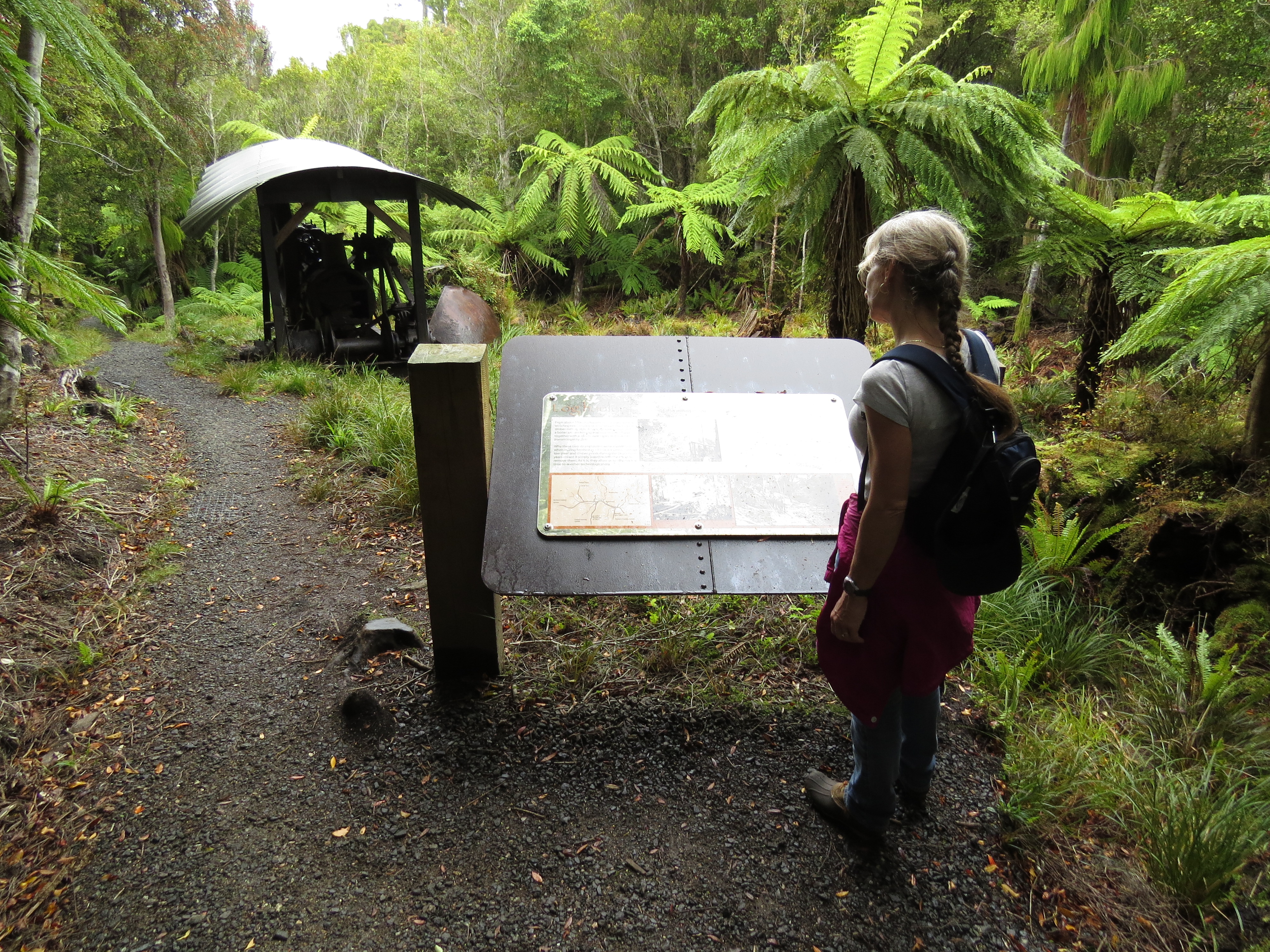
3/28/2014: Interpretive sign
Position: -46°50.71'S, 168°4.12'E
Two log haulers were on site--the interpretive sign explained how they worked. The McAllister hauler is visible beyond the sign, and Johnston hauler is out of the shot to the left of the picture.
|
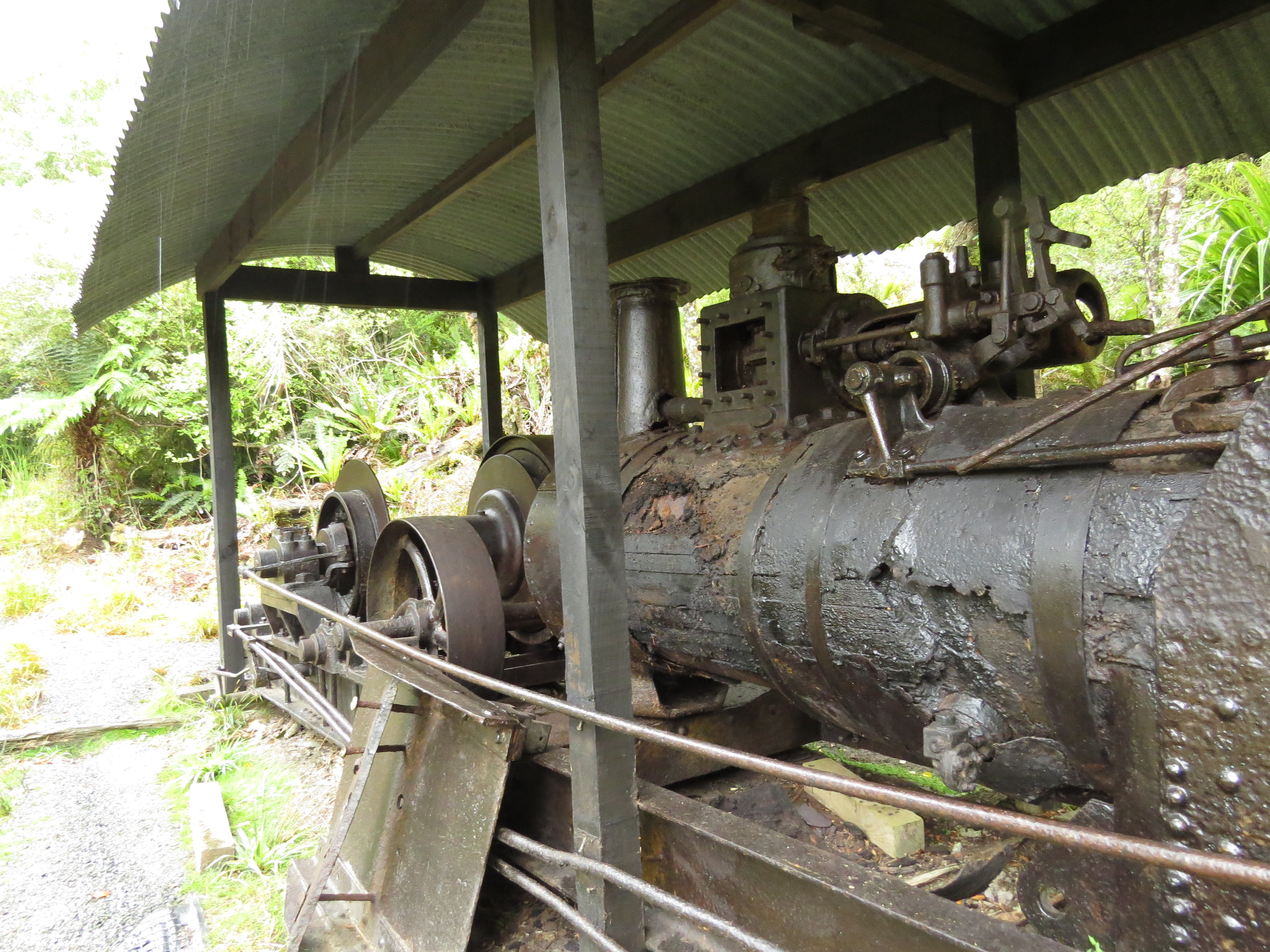 |
3/28/2014: Johnston hauler
Position: -46°50.71'S, 168°4.12'E
The Johnston hauler dragged logs from the logging grounds to the hauler site.
|
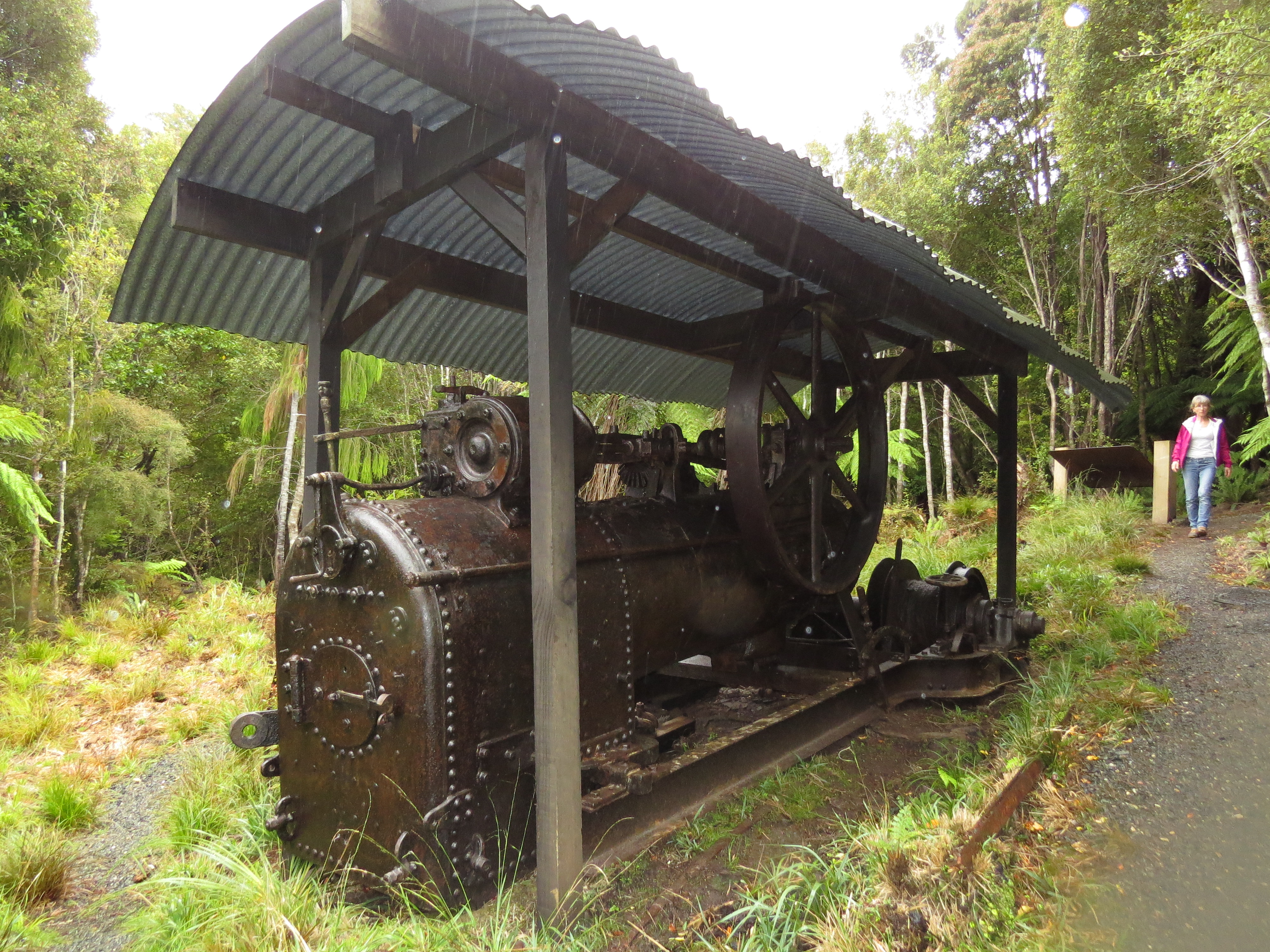 |
3/28/2014: McAllister hauler
Position: -46°50.71'S, 168°4.12'E
The McAllister hauler lowered logs from the hauler site down a tramway to the sawmill at Maori beach.
|
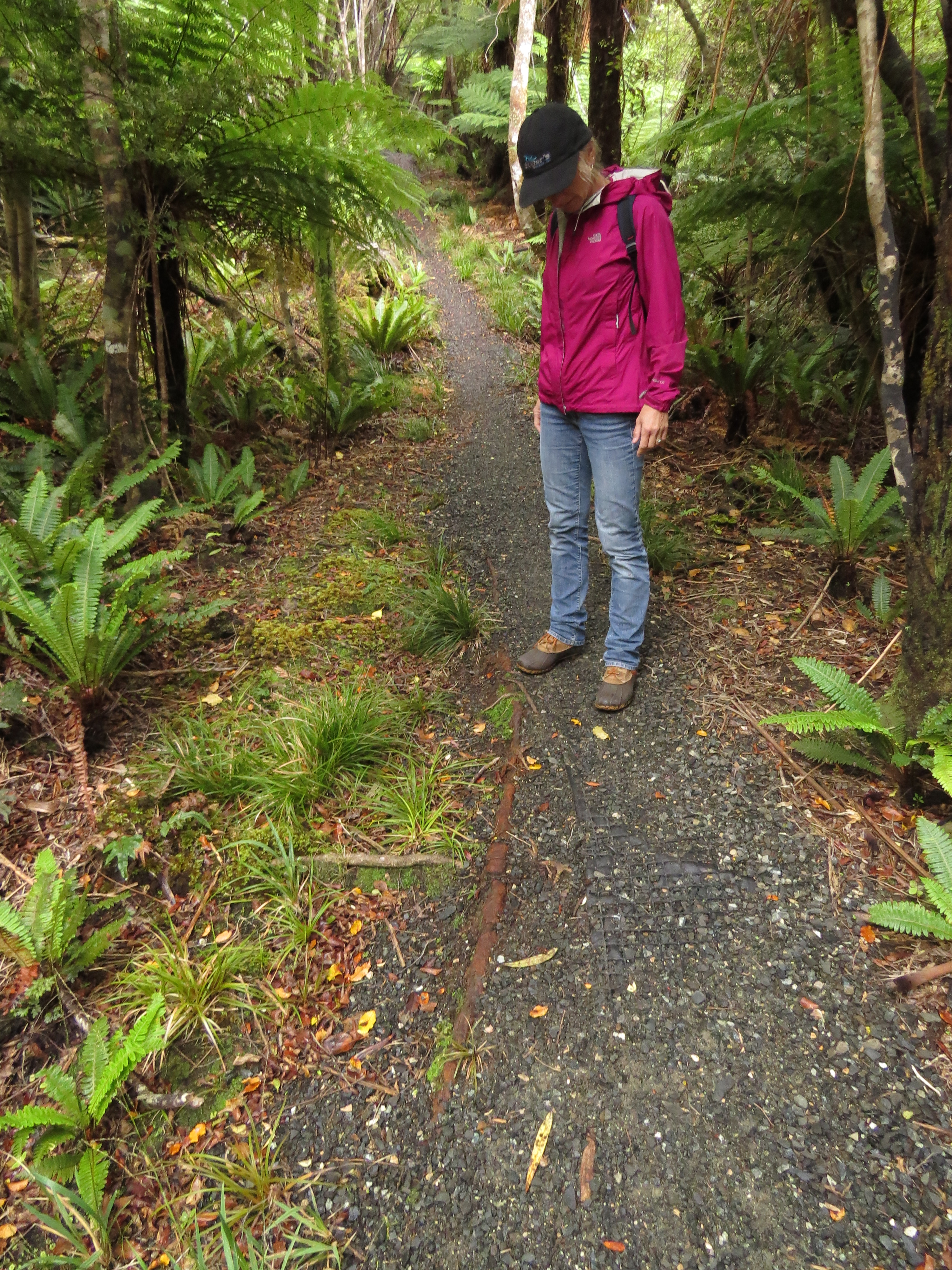 |
3/28/2014: Tramway
Position: -46°50.91'S, 168°4.06'E
We walked the track towards the North Arm hut for a bit, along the old logging tramway route towards Maori beach. Bits of the metal rail were visible along the route.
|
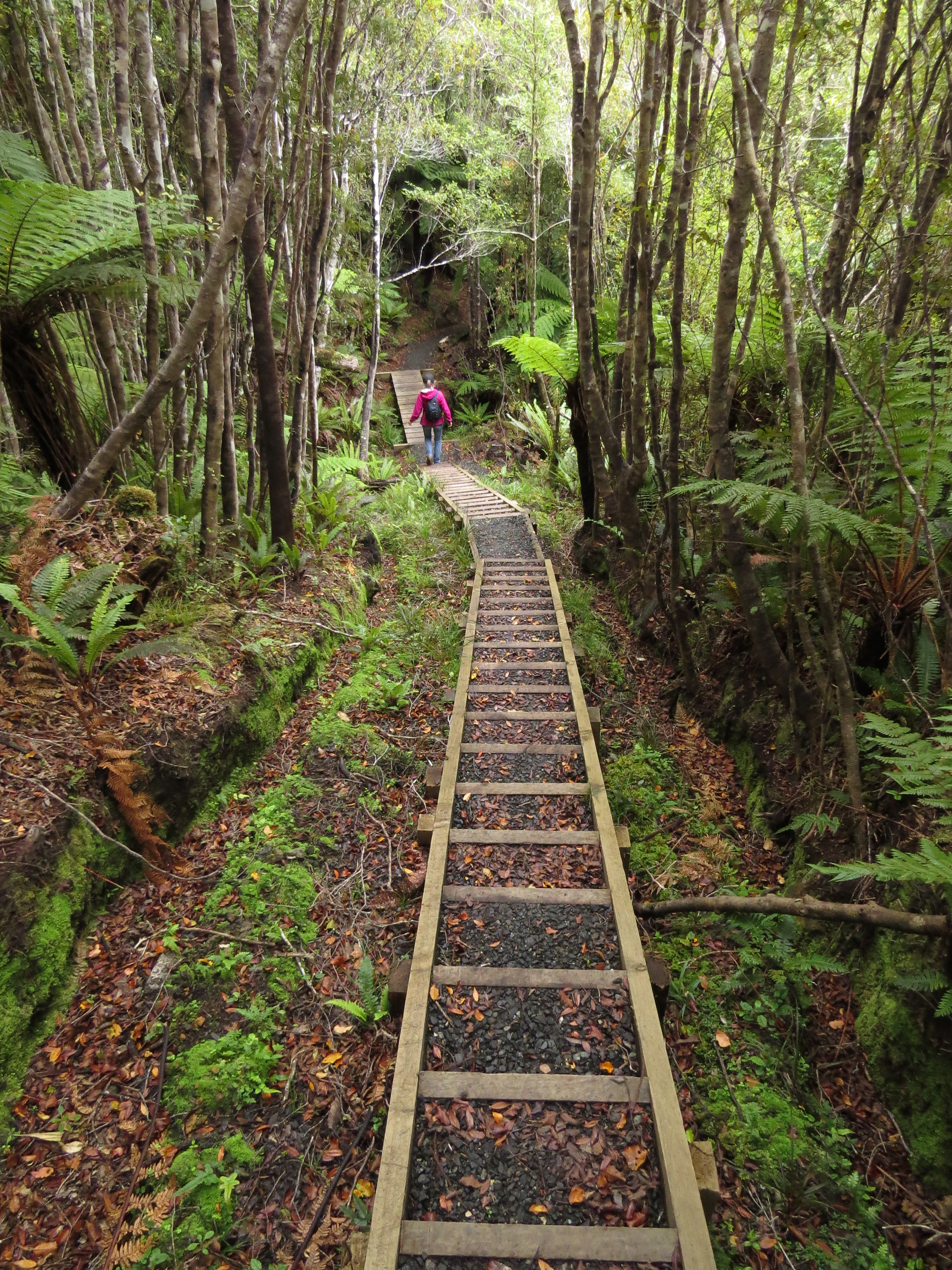 |
3/28/2014: Stairs
Position: -46°50.91'S, 168°4.06'E
We descended through several long flights of stairs like this one. The track had recently been rerouted to run past the log haulers, and looked quite new.
|
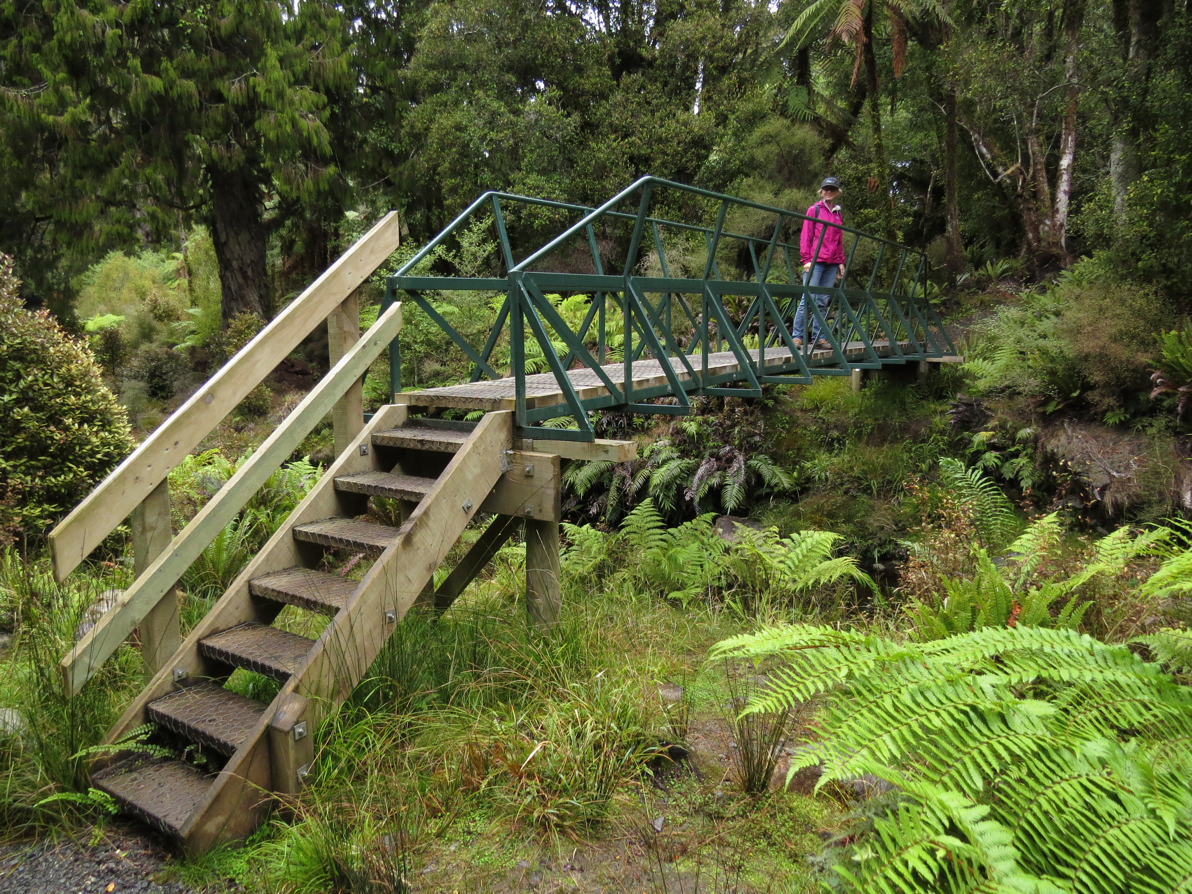 |
3/28/2014: Bridge
Position: -46°51.02'S, 168°4.04'E
Sturdy bridge across a small creek.
|
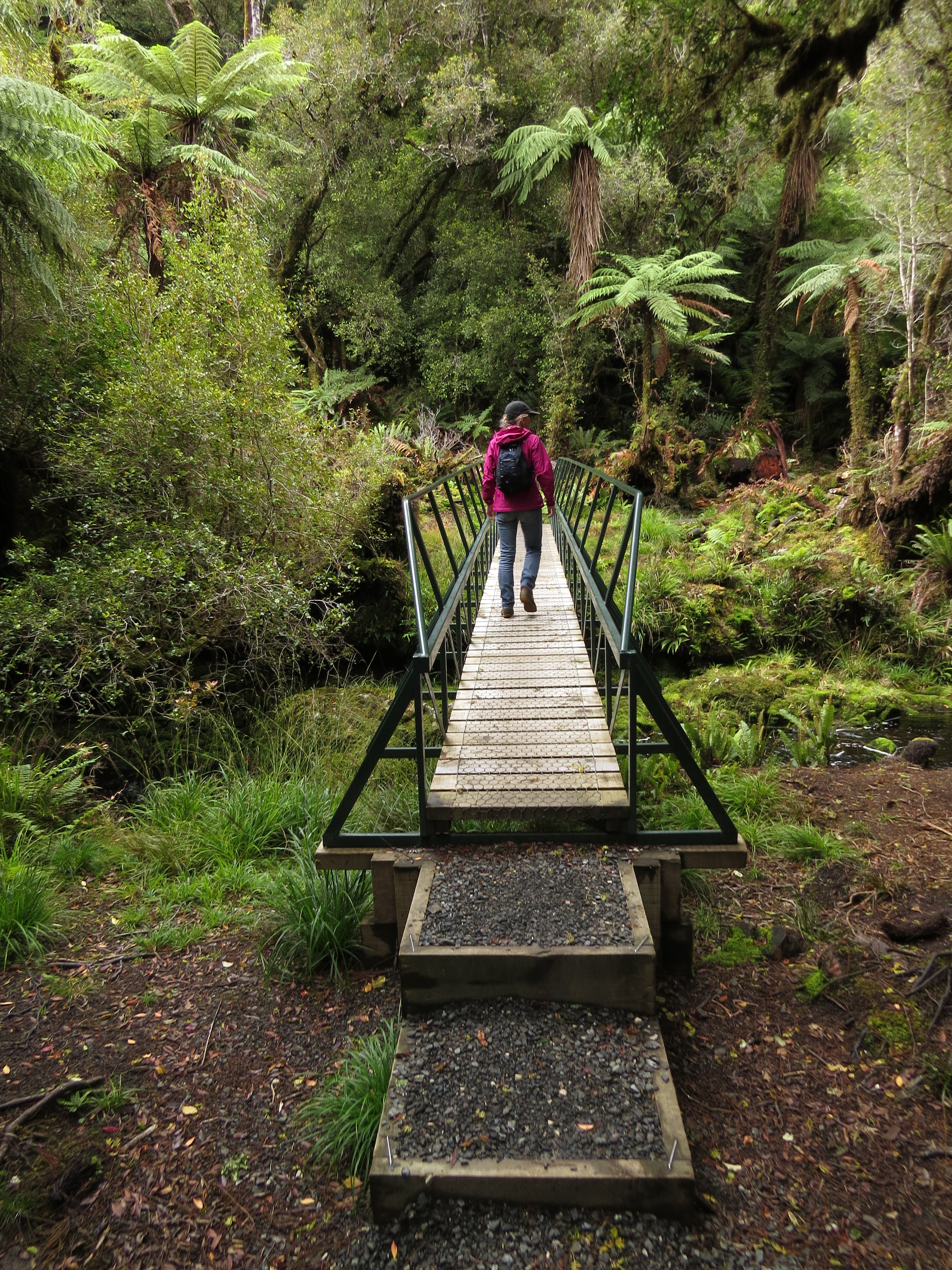 |
3/28/2014: Second bridge
Position: -46°51.28'S, 168°3.25'E
A second bridge not far from where we turned to head back. We were hoping to find the old track before the reroute and follow it to see the swing bridge at Maori Beach, but we couldn't find anything obvious enough to follow.
|