MV Dirona travel digest for Coromandel to Marlborough, New Zealand 2014

|
Click the travel log icon on the left to see these locations on a map,
with the complete log of our cruise. On the map page, clicking on a camera or text icon will display a picture and/or log entry for that location, and clicking on the smaller icons along the route will display latitude, longitude and other navigation data for that location. And a live map of our current route and most recent log entries always is available at //mvdirona.com/maps/LocationCurrent.html. |
 |
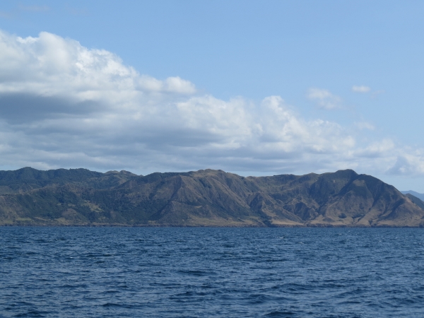
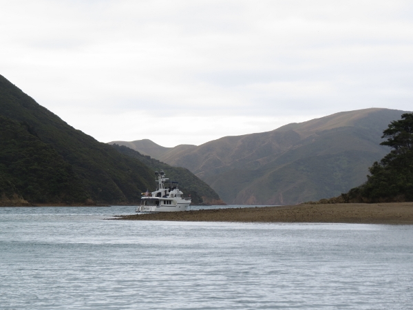
1/13/2014: Passage Rock
Position: -36°51.17'S, 175°7.70'E
Passage Rock looking south as we approach Waiheke Channel.
|
 |
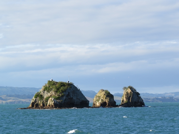
1/13/2014: The Pinnacles
Position: -36°27.47'S, 175°24.92'E
The dramatic Pinnacles off the tip of Coromandel Peninsula.
|
 |
1/13/2014: Huruhi Harbour
Position: -36°36.49'S, 175°46.74'E
We were considering anchoring at Huruhi Harbor, but the inner bay looked crowded and northwest wind waves were rolling into the outer bay. And even without that, we didn't find the anchorage particularly appealing.
|
 |
1/13/2014: Bumper Cove
Position: -36°38.53'S, 175°46.88'E
Beautiful sand beach at the head of Bumper Cove. The south end of Great Mercury Island is known for its beaches and clear water, reminiscent of the South Pacific. We might have anchored here, but the winds were expected to pick up from the southwest to 35 knots.
|
 |
1/13/2014: Peachgrove Bay
Position: -36°38.70'S, 175°48.93'E
Peachgrove Bay was quite crowded.
|
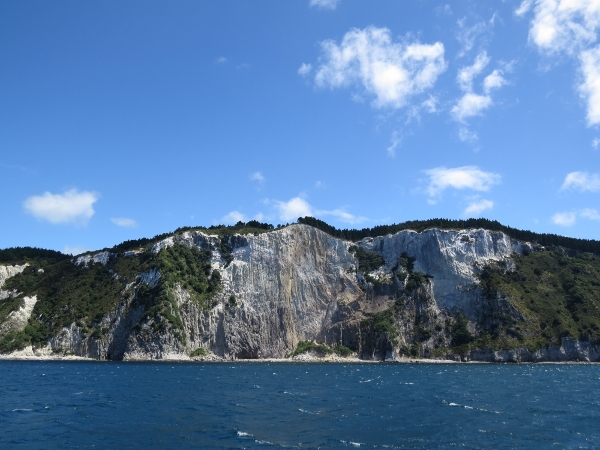 |
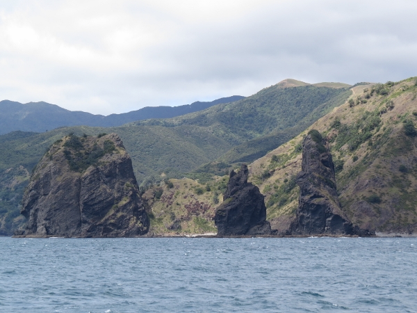
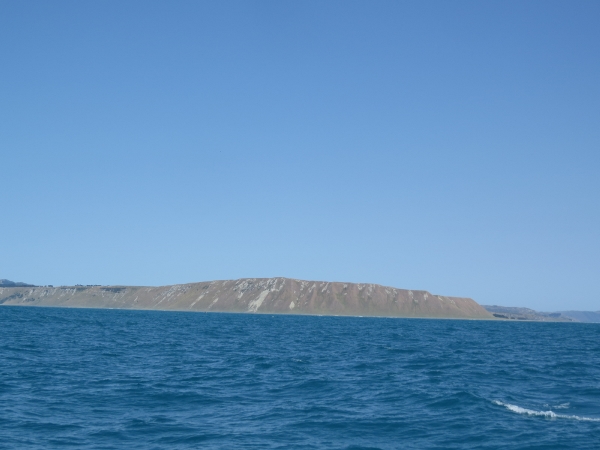
1/13/2014: White cliffs
Position: -36°36.54'S, 175°48.98'E
People who have seen both say Mercury Island's soaring white cliffs are whiter than those at Dover.
|
 |
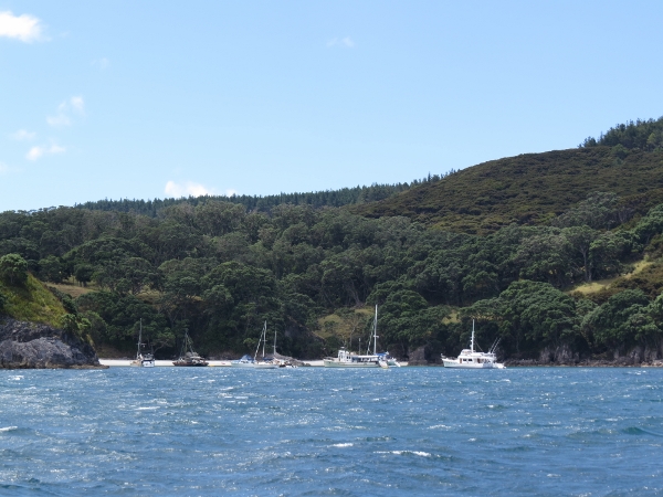
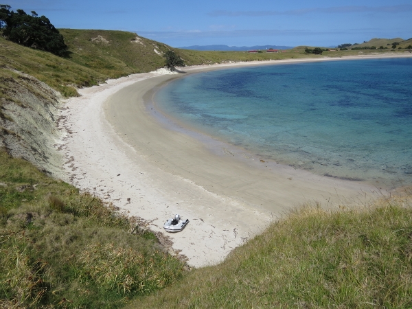
1/13/2014: Coralie Bay
Position: -36°36.23'S, 175°47.68'E
At anchor "The Mercs" at Coralie Bay. This is by far the best anchorage on Great Mercury Island--dramatic cliffs are on either side of us at the entrance, and lovely beaches ringing the interior.
|
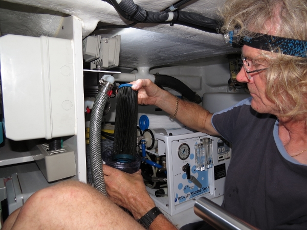 |
1/14/2014: Watermaker maintenance
Position: -36°36.23'S, 175°47.68'E
We had a saltwater leak in front of the engine, apparently coming from a crevice inside the hull. After many hours of investigation, we found a box-shaped fiberglass stiffening section that runs nearly the length of the hull. The water in front of the engine was coming from the far back corner of the lazarette through this box section. The source wasn't an external leak at all--it was the watermaker, which was due for service anyway. We needed to change the prefilter (shown) and carbon filter, grease the bearings and change the oil in the high-pressure pump, and backflush the media filter. So we did all that while addressing the leaks.
|
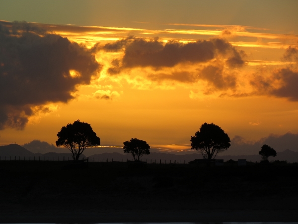 |
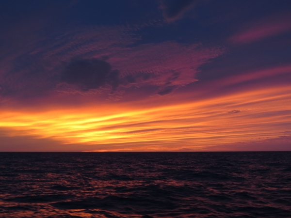
1/14/2014: Sunset
Position: -36°36.23'S, 175°47.68'E
Dramatic sunset looking over the isthmus at the head of the Coralie Bay.
|
 |
1/13/2014: Ashore
Position: -36°36.42'S, 175°47.73'E
The micro-tender ashore on one of the fine beaches in Coralie Bay.
|
 |
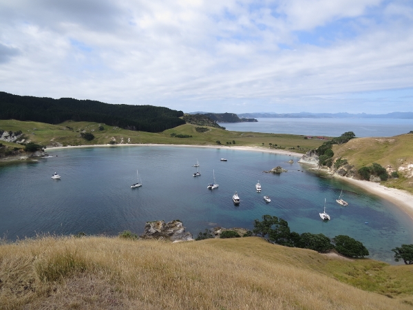
1/15/2014: Anchorage view
Position: -36°36.26'S, 175°47.81'E
Looking north across the anchorage. When we arrived two nights ago, only three other boats were at anchor, all near the north beach. But the winds came up to 30 knots from the southwest yesterday and several of the boats in Peachgrove Bay moved to Coralie Bay.
|
 |
1/15/2014: Mainland
Position: -36°36.26'S, 175°47.81'E
View to the mainland looking across the isthmus at the head of Coralie Bay.
|
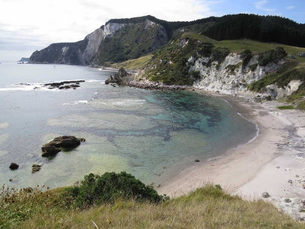 |
1/15/2014: Te Koru Bay
Position: -36°36.26'S, 175°47.81'E
Te Koru Bay, directly south of Coralie Bay, with those beautiful white cliffs in the background.
|
 |
1/15/2014: Bluff view
Position: -36°35.99'S, 175°47.62'E
View southwest from the bluffs at the north entrance to the anchorage. Dirona is at the far left.
|
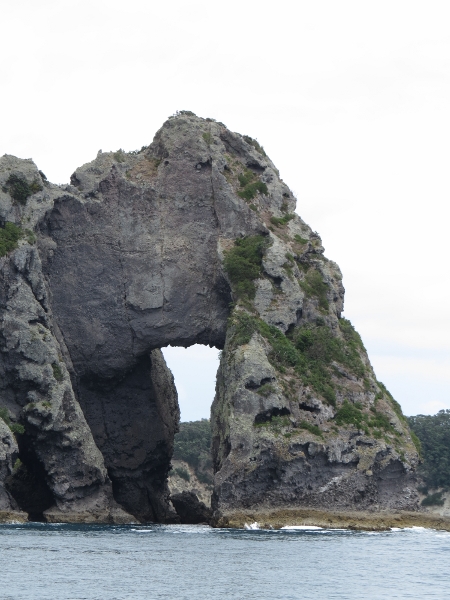 |
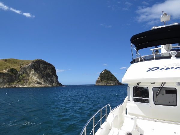
1/15/2014: Motukoruenga Island
Position: -36°43.97'S, 175°51.10'E
Sea arch looking west to Motukoruenga Island, likely the namesake for the channel we're passing through: Hole in the Wall.
|
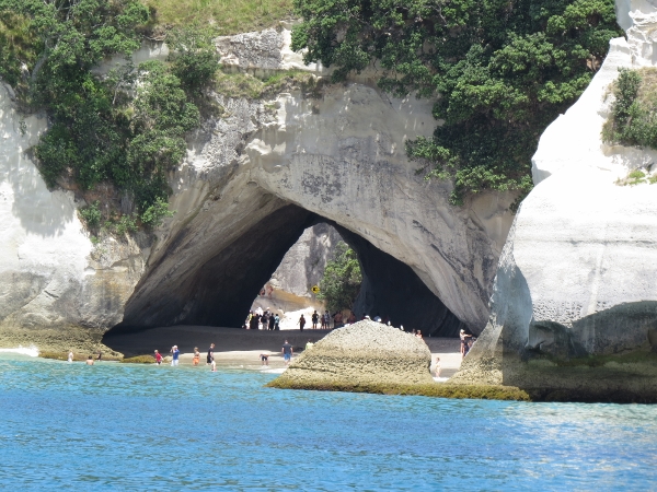 |
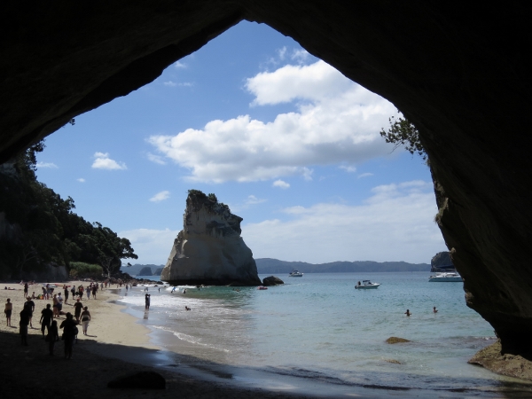
1/15/2014: Cathedral Cove
Position: -36°49.47'S, 175°47.36'E
The dramatic shore-accessible sea arch at Cathedral Cove is a popular destination.
|
 |
1/15/2014: Water taxi
Position: -36°49.65'S, 175°47.36'E
There's no road directly to the cove, so here's how many of the visitors arrive. The water taxi anchors off, then backs down, lifts the motor, and lets the waves carry it backwards to shore. The pull of the anchor rode keeps the boat from broaching (turning sideways and flipping over) in the waves. Once close enough, crew hold the stern in place and help people on and off while the vessel bounces in the surf. Then they kedge off (use the anchor to pull the boat offshore) until the water is deep enough for the motor again. Having just landed a dingyy in that surf ourselves, we know how difficult it is, so there's a lot of risk in this operation. But we watched them doing it time after time without mistake.
|
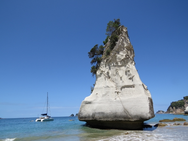 |
1/15/2014: SV Sophie
Position: -36°49.62'S, 175°47.35'E
The catamaran next to the spire is SV Sophie of Seattle, owned by James and Jenna Utzschneider. The two James know each other from Microsoft. It seems kind of unlikley that two people who worked together for years and kept their boats in the same marina (Elliott Bay) could end up anchored together off the same rock in New Zealand.
|
 |
1/15/2014: Through the arch
Position: -36°49.73'S, 175°47.43'E
View north through the arch to Cathedral Cove. Dirona is the leftmost of the three boats visible.
|
 |
1/15/2014: Poikeke Island
Position: -36°49.14'S, 175°47.75'E
We were considering anchoring for the night off this sea arch at Poikeke Island, but it felt a little exposed to the northeast swell. So we continued to Cooks Bay and found a calm and sheltered spot there.
|
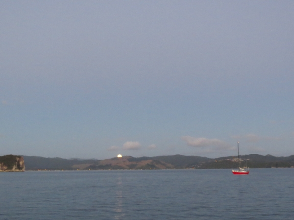 |
1/16/2014: Cooks Bay
Position: -36°49.80'S, 175°45.17'E
Moonset at Cooks Bay.
|
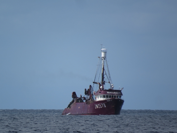 |
1/16/2014: Matariki II
Position: -37°5.91'S, 176°3.18'E
The fishing vessel Matariki II working in the Bay of Plenty.
|
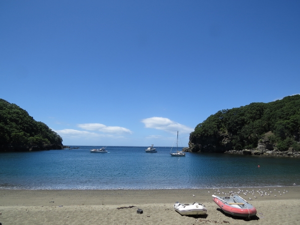 |
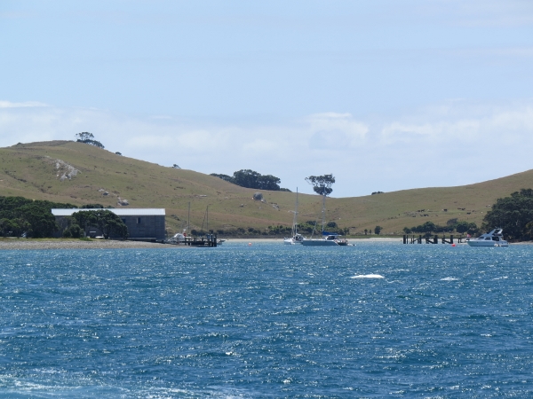
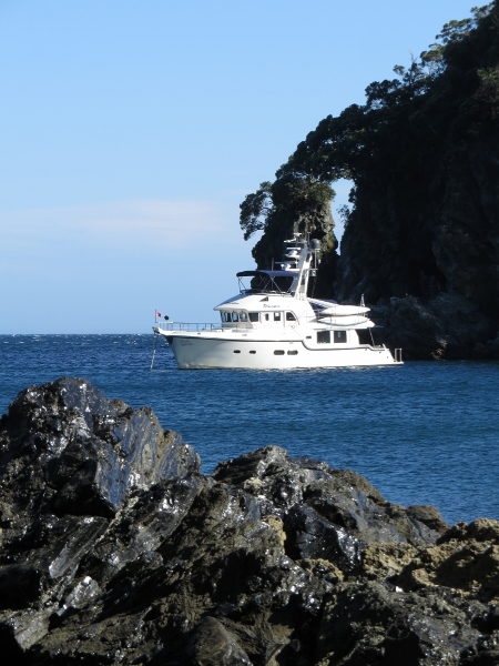
1/16/2014: Mayor Island
Position: -37°18.34'S, 176°15.40'E
Anchored at lovely South East Bay on Mayor Island. The charts, even the new BSB rasters that New Zealand recently released in unencrypted form, don't show any detail for the bay. But it is larger than it looks on the chart and relatively hazard-free.
|
 |
1/16/2014: Quarantine
Position: -37°18.34'S, 176°15.40'E
Mayor Island is pest-free and has its own quarantine to stay that way--any gear brought ashore is subject to inspection. They didn't check us, but we've heard that other boaters have been.
|
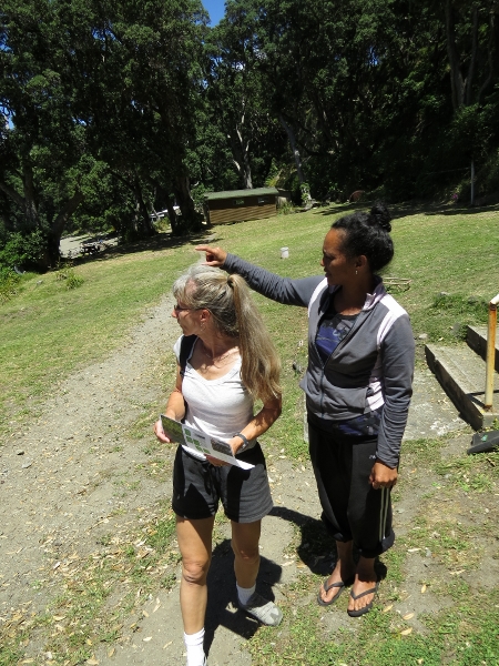 |
1/16/2014: Directions
Position: -37°18.34'S, 176°15.40'E
Getting directions and a map from the island's host. She also collected our $5 landing fee.
|
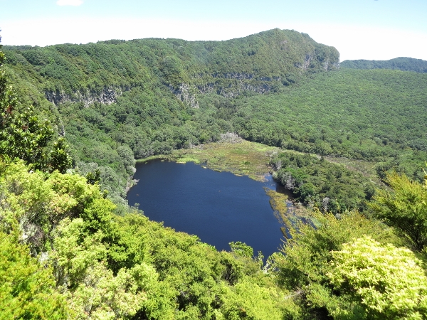 |
1/16/2014: Lake Paritu
Position: -37°17.42'S, 176°16.18'E
View into Lake Paritu. We're hiking along the rim of the crater that takes up much of Mayor Island.
|
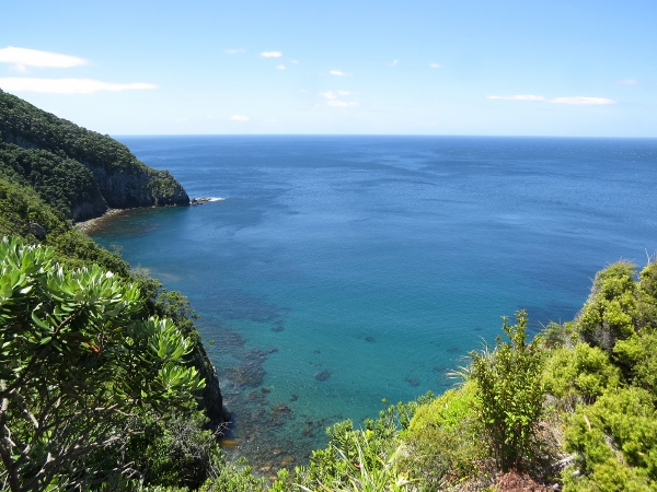 |
1/16/2014: Taratimi Bay
Position: -37°17.10'S, 176°16.35'E
Lookout across Taratimi Bay.
|
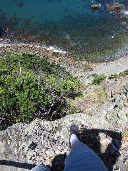 |
1/16/2014: On the edge
Position: -37°17.10'S, 176°16.35'E
The shore is incredibly steep here--it just drops hundreds of feet straight down.
|
 |
1/16/2014: Obsidian
Position: -37°17.10'S, 176°16.35'E
The island is full of obsidian--volcanic glass. Apparently it is bad luck to remove it from the island: those who have in the past have been sending pieces back by helicopter in the hopes of improving their lot.
|
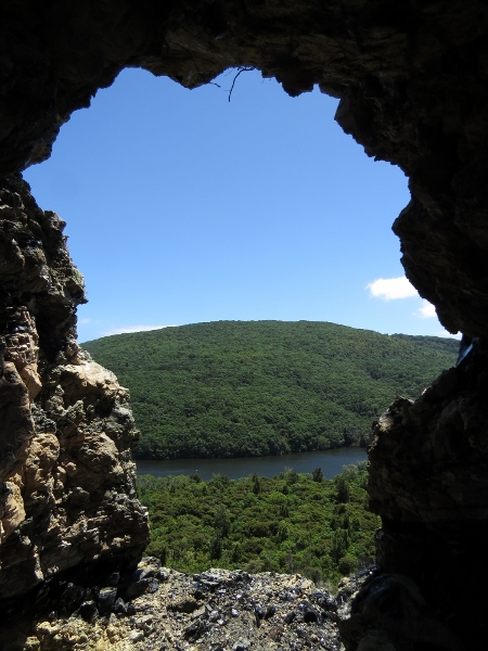 |
1/16/2014: Lake Aroarotamahine
Position: -37°17.10'S, 176°16.35'E
Looking to Lake Aroarotamahine through an arch. Obsidian streaked both sides of the arch.
|
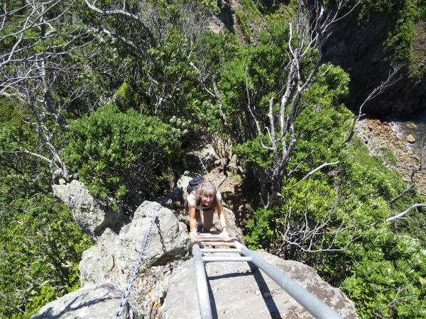 |
1/16/2014: Devil's Staircase
Position: -37°17.10'S, 176°16.35'E
The way down into the crater included climbing chains and eventually a ladder where it was too steep for chains even. This section is called Devil's Staircase.
|
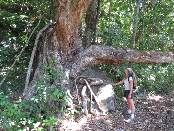 |
1/16/2014: Tree
Position: -37°17.40'S, 176°15.98'E
Massive root system of a tree along the path inside the crater (position approximate).
|
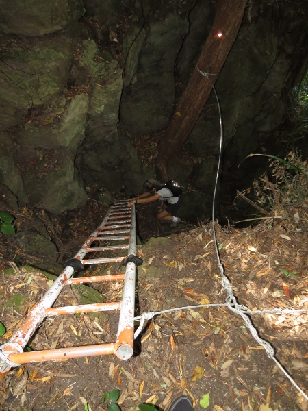 |
1/16/2014: Ruru Pass
Position: -37°17.64'S, 176°15.71'E
Ladder climb following a steep ascent at Ruru Pass to reach back up to the crater rim.
|
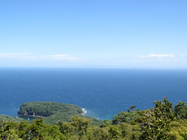 |
1/16/2014: Summit view
Position: -37°17.58'S, 176°15.36'E
Looking west across the Bay of Plenty from the summit.
|
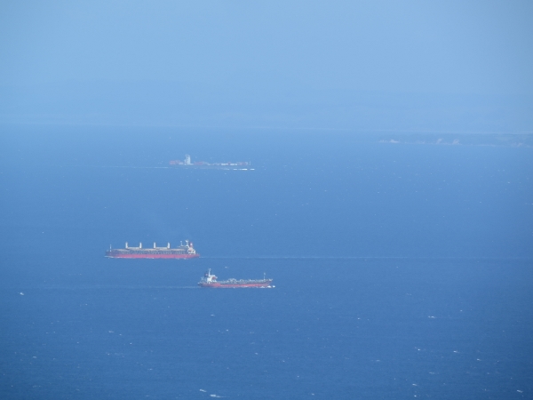 |
1/16/2014: Ships
Position: -37°17.58'S, 176°15.36'E
The area has heavy shipping traffic--from the anchorage we've seen several large ships pass.
|
 |
1/16/2014: Lookout
Position: -37°18.58'S, 176°15.32'E
We returned back to South East Bay and followed a track to tip of Panui Peninsula for another good view into the Bay of Plenty.
|
 |
1/16/2014: Anchorage
Position: -37°18.31'S, 176°15.49'E
View to the anchorage from the northeast corner of the beach. The seascape behind the boat includes pillars and arches.
|
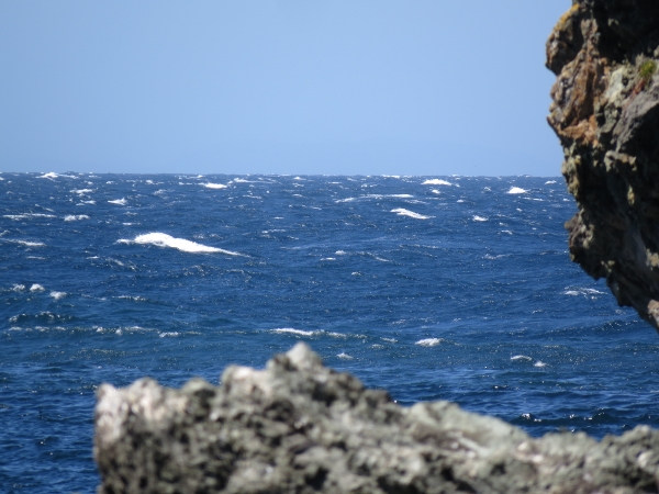 |
1/17/2014: Gale
Position: -37°18.41'S, 176°15.53'E
35-knot westerly winds, with gusts to 40, have been blowing across the Bay of Plenty the last couple of nights and whitecaps are sweeping across just outside the anchorage. Conditions are pretty calm where we are, although we are getting some wind. But we're being blown east--the winds must hit the east shore and swirl back.
|
 |
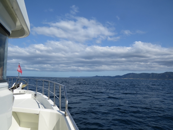
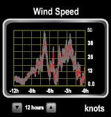
1/18/2014: Between gales
Position: -37°19.07'S, 176°22.88'E
Between storm systems we're making the 450-mile, 2-night run to Wellington, at the southern top of the North Island. The past two day's gale force winds in the Bay of Plenty have settled down, but winds currently are blowing 35 knots on the North Island's southeast coast, with 25-foot seas. The image is of MaxSea's GRIB display. The bluer the color, the smaller the waves and the redder, the higher the waves. Conditions are expected to calm considerably, however, by the time we reach there. We might see 10' seas on 10 seconds as we round East Cape, at the island's eastern extremity, but that should be the worst of it.
|
 |
1/18/2014: Sunrise
Position: -37°19.17'S, 176°24.18'E
Conditions so far are excellent--calm seas with winds around 12 knots.
|
 |
1/18/2014: White Island
Position: -37°22.67'S, 177°13.91'E
Looking south to White Island. The vocalno there still is active and tour boats visit frequently.
|
 |
1/18/2014: Lottin Point
Position: -37°28.70'S, 178°11.98'E
Rugged shoreline at Lottin Point. The coast along this route is not very hospitable. The first reasonbly sheltere stop is a ways south of East Cape at Gisborne.
|
 |
1/18/2014: East Cape
Position: -37°28.75'S, 178°12.16'E
East Cape coming into view from a distance. Reminds is a bit of Brooks Peninsula on the west coast of Vancouver Island, British Columbia.
|
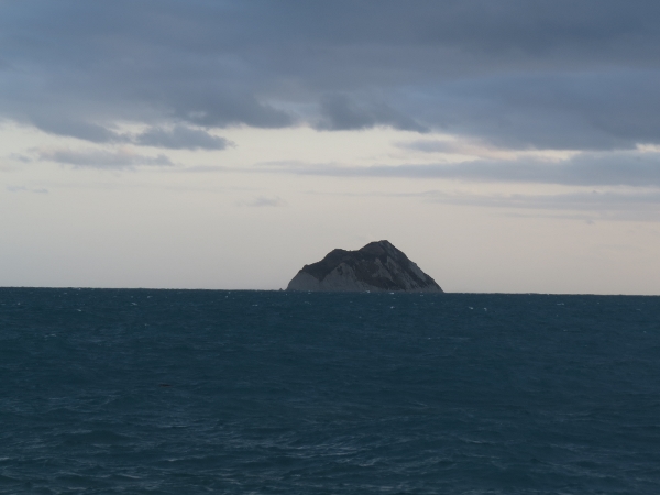 |
1/18/2014: East Island
Position: -37°39.03'S, 178°35.04'E
East Island off the tip of East Cape. This reminds us of Solander Island off Brooks Peninsula. Conditions have been execllent so far, but are beginning the deteriorate as we round East Cape. Winds are up to 20 knots and the seas are 8-10 feet on 6-8 seconds. Makes for an uncomfortale ride, so we slowed down a bit to reduce boat motion.
|
 |
1/19/2014: Pitch
Position: -38°21.62'S, 178°29.78'E
Boat has been pitching a fair bit around East Cape, but finally starting to settle down.
|
 |
1/19/2014: Sunrise
Position: -38°36.26'S, 178°20.68'E
Conditions at sunrise are even calmer that yesterday morning. The wind is below 10 knots and we're on a slow southerly swell.
|
 |
1/19/2014: Table Cape
Position: -39°6.91'S, 178°3.50'E
Steep bluffs on Mahia Peninsula at Table Cape. Forecast calls for 40 knot winds today on southeast coast (Castlepoint). But the winds should subside by tomorrow morning, so hopefully we won't see much as we won't get into the area until around midnight this evening.
|
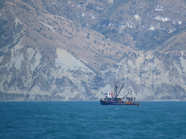 |
1/19/2014: Fishing vessel
Position: -39°10.29'S, 178°1.69'E
Fishing vessel working off Mahai Peninsula. We've seen a lot more commercial fishing boats in the past week or so than the past three months.
|
 |
1/19/2014: Sunset
Position: -40°15.52'S, 177°10.82'E
Conditions remained calm the entire day. Castlepoint (southeast coast) forecast has worsened from 40 knots northwesterlies to now 45 knots today. The wind speed is still less than 15 knots here though. Swell is getting a little bigger from the south now, perhaps residual from those big winds farther south. Hopefully they will have settled down by the time we reach the area.
|
 |
1/20/2014: 50 knots
Position: -41°2.91'S, 176°24.45'E
We didn't quite miss that 45-knot gale. Near Cape Kidnappers at the southern end of Hawke Bay, winds picked up to steady high 30's, often in the 40s, with gustst over 50 knots. Seas were 10-12 feet on 5-6 seconds, mostly on the beam. The stabilizers did their job, but still quite a bit of boat motion, making sleeping difficult. Conditions have improved considerably now--winds are down to around 10 knots and the seas have settle to 2-3 feet.
|
 |
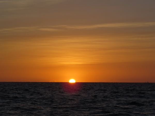
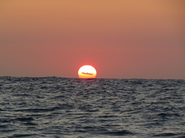
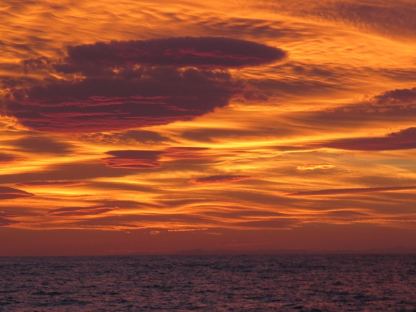
1/20/2014: Sunrise
Position: -41°1.03'S, 176°26.60'E
We've been getting some beautiful sunrises and sunsets on this run.
|
 |
1/20/2014: Rocky Point
Position: -41°38.37'S, 175°18.70'E
Light on aptly-named Rocky Point as we round Cape Palliser for Cook Strait.
|
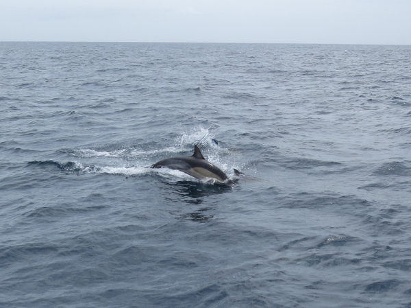 |
1/20/2014: Dolphins
Position: -41°34.67'S, 175°7.40'E
Perhaps two dozen dolphins followed us into Cook Strait, leaping and swimming in our bow wake.
|
 |
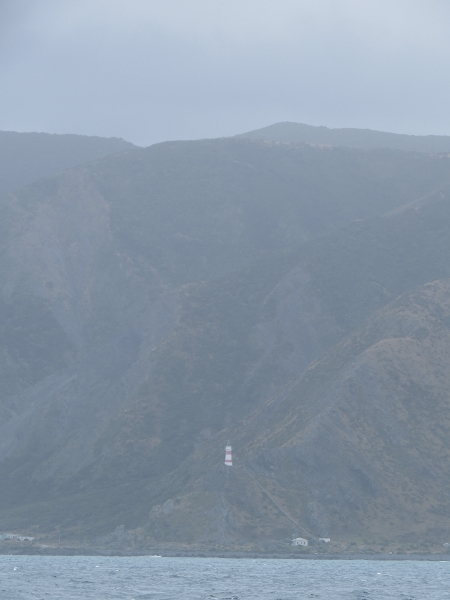
1/20/2014: Pencarrow Head
Position: -41°22.01'S, 174°50.60'E
Old (top) and new lights on Pencarrow Head at the east entrance to Wellington Harbour.
|
 |
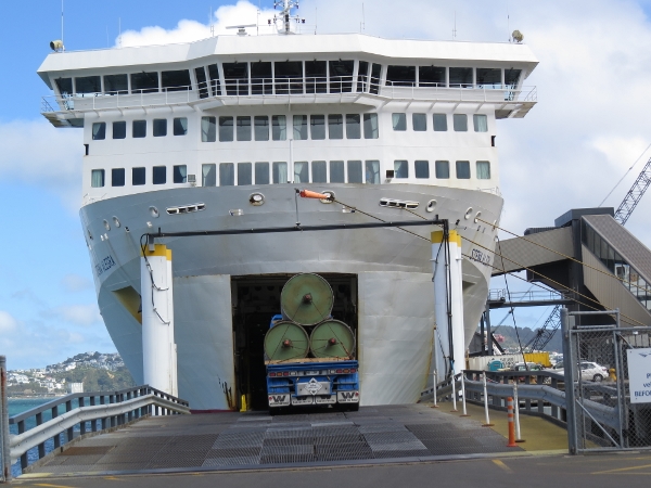
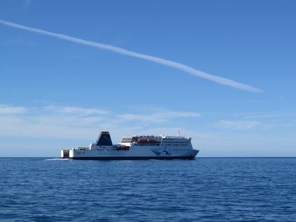
1/20/2014: Traffic
Position: -41°22.01'S, 174°50.60'E
Leaving Wellington Harbour as we arrvied was the Stena Alegra, one of the ferries that runs across Cook Strait to Picton. Seas can be very rough there--the ship looks built for weather.
|
 |
1/20/2014: Tractor tug
Position: -41°17.17'S, 174°48.04'E
Wellington is a busy commercial harbour. We saw four powerful tractor tugs like this one, moored at the port.
|
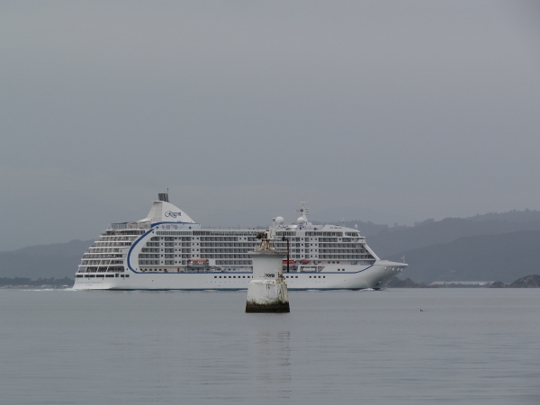 |
1/20/2014: Seven Seas Voyager
Position: -41°17.17'S, 174°48.04'E
Regent cruiseship Seven Seas Voyager leaving port. The ship passed us on it's way down from Napier to Wellington.
|
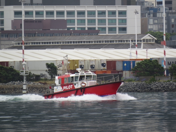 |
1/20/2014: Pilot boat
Position: -41°17.17'S, 174°48.04'E
Pilot boat heading out to pick up the harbour pilot from Seven Seas Voyager.
|
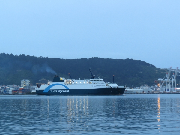 |
1/20/2014: Santa Regina
Position: -41°17.17'S, 174°48.04'E
Strait Shipping's Santa Regina, setting off for Picton across Cook Strait. Like the Stena Alegra we saw when entering the harbour, it looks built for serious weather.
|
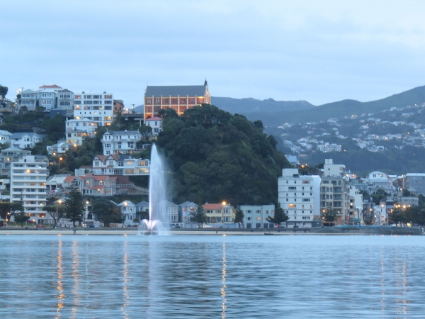 |
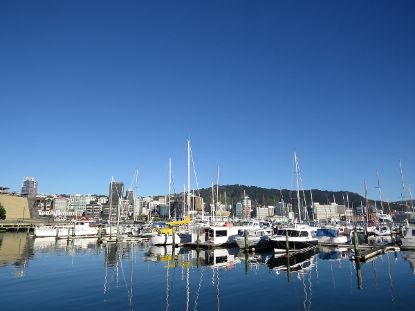
1/20/2014: Carter Fountain
Position: -41°17.17'S, 174°48.04'E
View to Carter Fountain and Wellington from our anchorage in Oriental Bay. This was an awesome anchorage--the city lights surrounded us at night and we loved watching the commercial traffic. And over cellular we were able to watch the Seahawks beat San Francisco to make it to the Superbowl.
|
|
1/21/2014: Fueling
Position: -41°17.42'S, 174°47.06'E
We called Chaffers marina and arranged a berth for a few days, and picked up 3,530L of diesel on our way in. Their fuel dock only carries diesel, so we wheeled one of our to a nearby petrol station and filled it there.
|
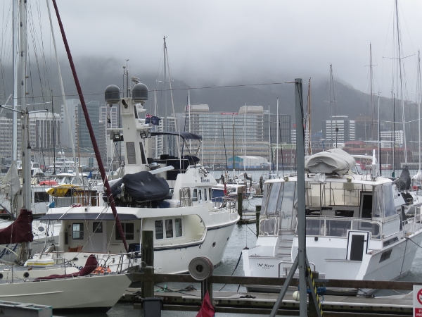 |
1/21/2014: Chaffers Marina
Position: -41°17.41'S, 174°47.11'E
Berthed at Chaffers Marina with a view to downtown Wellington.
|
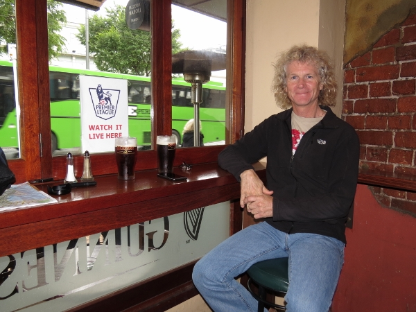 |
1/21/2014: Kitty O'Shea's
Position: -41°17.62'S, 174°46.94'E
We did some provisioning at a large grocery store across the street from the marina, then had lunch streetside at Kitty O'Shea's Irish Pub.
|
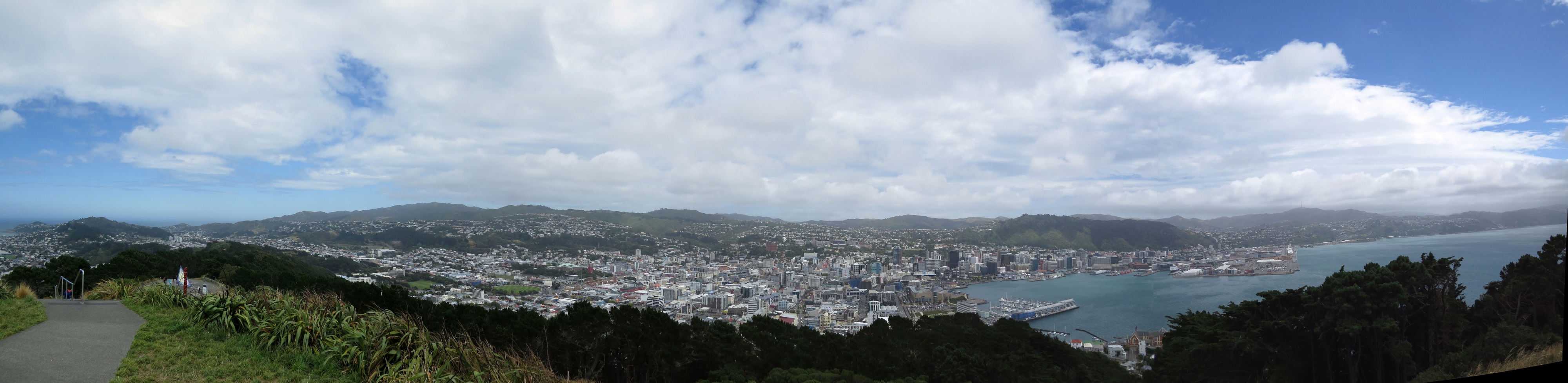 |
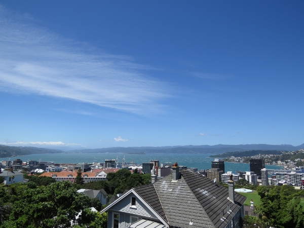
1/22/2014: Mount Victoria
Position: -41°17.77'S, 174°47.66'E
We took the bikes up to 196m Mount Victoria for a 360-degree view to Wellington and the surrounding area. (Click the picture for a larger image.)
|
 |
1/22/2014: North winds
Position: -41°17.39'S, 174°47.39'E
Oriental Bay was such a nice anchorage, you'd expect it to be packed with moored boats. This is why it's empty: northerly winds, and Wellington has lots of wind, sweep across the harbour, making the anchorage pretty unappealing.
|
 |
1/22/2014: Stena Alegra
Position: -41°15.87'S, 174°47.24'E
We biked down to the port and watched vehicles loading onto the Stena Alegra, the ferry that was exiting Wellington Harbour as we arrived.
|
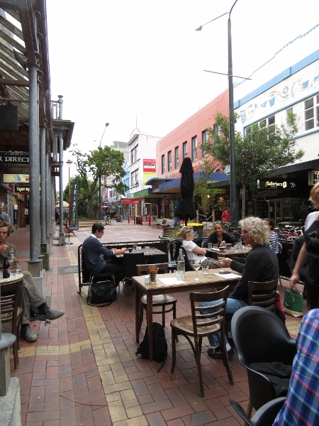 |
1/22/2014: Drinks on Cuba St
Position: -41°17.51'S, 174°46.59'E
A glass of wine at one of the numerous restaurant patios on eclectic Cuba Street.
|
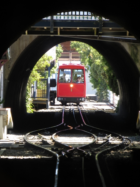 |
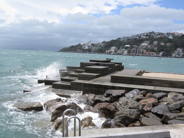
1/23/2014: Cable car
Position: -41°17.11'S, 174°46.16'E
Riding the Wellington Cable Car. Wellington is so steep that expanding the city was difficult. The cable car was installed in the early 1900s to encourage residency up the hill in Kelburn. Victoria University is up there as well.
|
 |
1/23/2014: View
Position: -41°17.12'S, 174°46.04'E
The view west across Wellington Harbour from the top of the cable car run.
|
 |
1/23/2014: Sundail of Human Involvement
Position: -41°17.12'S, 174°46.04'E
This unusual sundail is part of Carter Observatory at the top of the cable car run. If someone stands on the elipse at the point for the current date with their back to the sun and arms up, their shadow will tell the time. And it works--we were there at 2:30.
|
 |
1/24/2014: Sunny and calm
Position: -41°17.41'S, 174°47.11'E
We'll be crossing Cook Strait today, a body of water notorious for rough and dangerous conditions--those ferries aren't built like tanks for nothing. But we've got great weather for the crossing, so don't exepct any problem.
|
 |
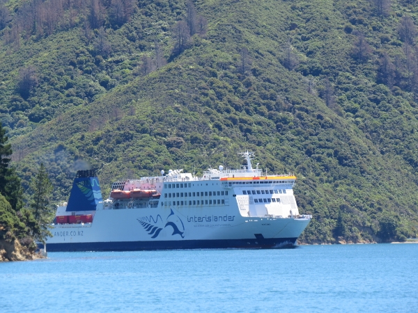
1/24/2014: Kaitaki
Position: -41°21.28'S, 174°49.83'E
Interislander's Kaitaki heading into Cook Strait for Picton.
|
 |
1/24/2014: Karori Rip
Position: -41°21.92'S, 174°39.30'E
The Karori Rip extends between Sinclair Head and Cape Terawhiti and can be dangerous for small craft, particularly in strong winds against current. Its easy to see why--we're transiting close to slack water on a neap (small) tide and still have picked up two knots in the current.
|
 |
1/24/2014: Tory Channel
Position: -41°12.74'S, 174°19.17'E
Tory Channel is a high-current, limited-visibility channel. The area is a controlled navigation zone--only one ship greater than 350 gross tonnage is allowed through the channel at a time. We entered about two hours before high water at nearby Picton on a neap (small) tide. The current was running about two knots with us, but was easy to navigate through.
|
 |
1/24/2014: Marlborough Sounds
Position: -41°12.62'S, 174°18.77'E
We're now in the Marlborough Sounds--a complex cruising area comprised of twisting channels, mountainous scenery and countless anchorages. And what amazing weather we have for it. We'll only be stopping here briefly, however, as we pass through on our way to Fiordland via the South island west coast. We'll explore more thouroughly when we return back up the east coast.
|
 |
1/24/2014: Lunch
Position: -41°14.76'S, 174°12.69'E
A brief lunch stop in Erie Bay.
|
 |
1/24/2014: Traffic
Position: -41°14.76'S, 174°12.69'E
Interislander's Kaitaki, that we saw earlier this morning leaving Wellington, now returning from Picton through Tory Channel.
|
 |
1/24/2014: Pope Bay
Position: -41°10.84'S, 174°9.79'E
We stopped for the night off the sunlit bluffs at Pope Bay, anchored in about 80'. The anchorage had excellent north wind shelter and a great view south south to the intersection of Tory Channel and Queen Charlotte Strait where the large ferries passed.
|
 |
1/25/2014: Morning calm
Position: -41°10.85'S, 174°9.80'E
Looking west across the anchorage in the morning sun.
|
 |
1/25/2014: Queen Charlotte Sound
Position: -41°6.16'S, 174°15.73'E
The complex waterways of Queen Charlotte Sound remind us of, well, Queen Charlotte Sound.
|
 |
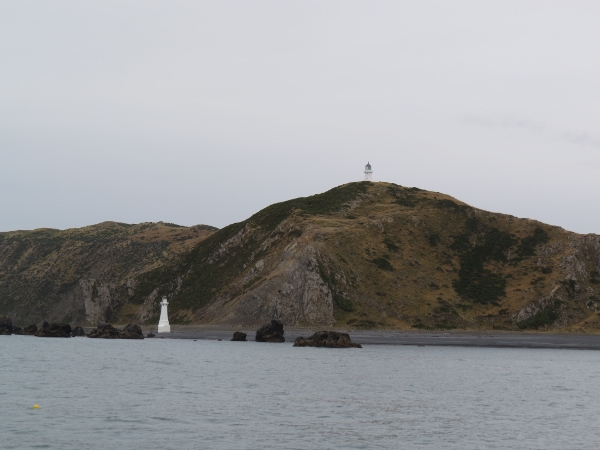
1/25/2014: Cape Jackson
Position: -40°58.73'S, 174°19.26'E
Looking back to Cape Jackson as we round it. That isolated offshore light isn't the extent of the cape--Walker Rocks lie over a half mile farther out.
|
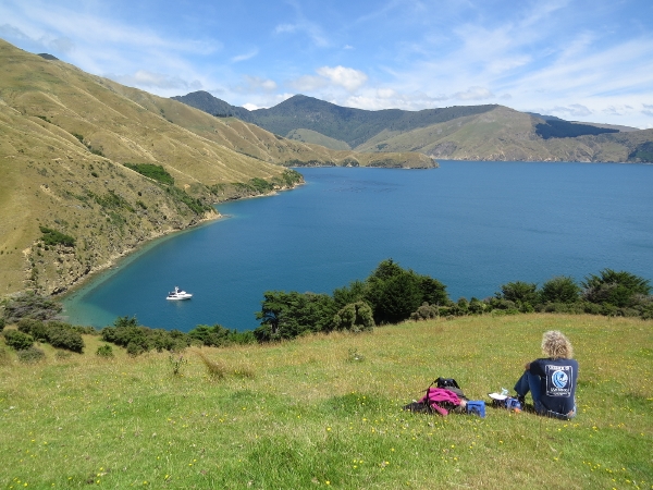 |
1/25/2014: Guards Bay
Position: -40°58.86'S, 174°9.71'E
We found an excellent anchorage in Guards Bay in about 80' and climbed up the bluff for lunch with a view.
|
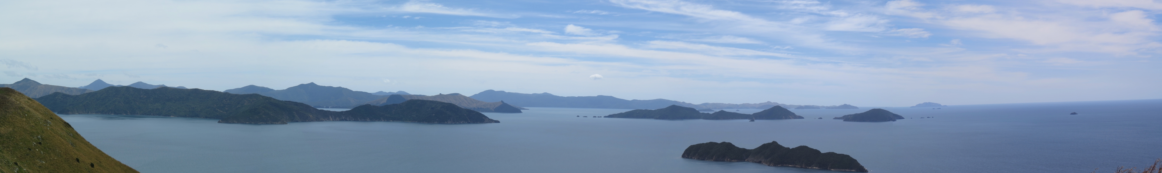 |
1/25/2014: Chetwood Islands
Position: -40°58.42'S, 174°9.65'E
The views from the ridge above our anchorage were amazing. This panorama is looking north across Titi Island to the Chetwood Islands. (Click the picture for a larger image.)
|
 |
1/25/2014: Pelorus Sound
Position: -40°58.58'S, 174°9.10'E
Looking northwest to Pelorus Sound.
|
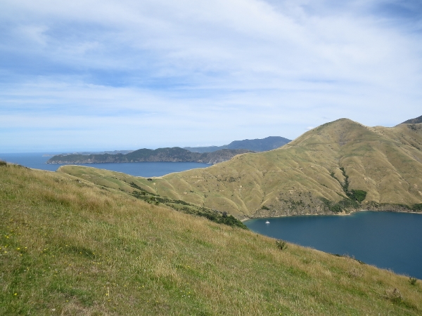 |
1/25/2014: Anchorage view
Position: -40°58.58'S, 174°9.10'E
The view southeast into the anchorage with Cape Jackson, that we'd rounded earlier today, barely visible in the distance.
|
 |
1/26/2014: Sea caves
Position: -40°45.59'S, 174°0.87'E
Sea caves on the northeast coast of Wakaterepapanui Island as we approach the northern tip of D'Urville Island.
|
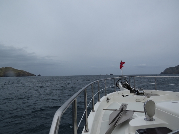 |
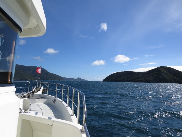
1/26/2014: Stephens Passage
Position: -40°42.79'S, 173°58.82'E
Approaching Stephens Passage between D'Urville and Stephens islands. The channel is narrow and has signficant current--the adjacent bay names are telling: Hells Gate and Bishops Cauldron. Bessels above 500 tonnes are not even allowed to transit this passage without permission from the Harbourmaster. Conditions are calm as we approach, but a 40-knot gale is in the forecast, so we'll be happy to be through.
|
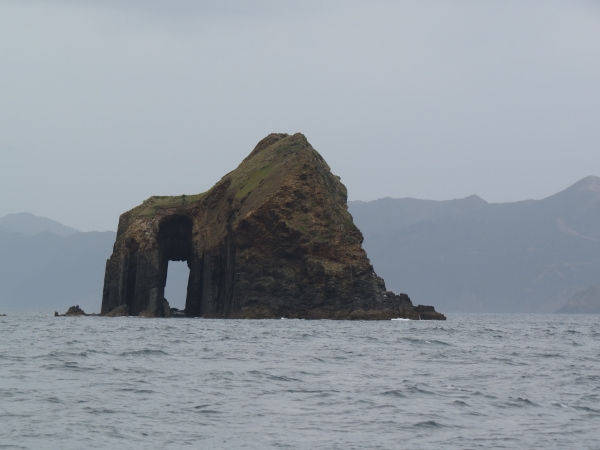 |
1/26/2014: Sea arch
Position: -40°41.17'S, 173°57.64'E
Huge sea arch on Te Wakaapani as we exit Stephens Passage.
|
 |
1/26/2014: Latitude
Position: -40°46.63'S, 173°54.07'E
Fishing vessel Latitude in Port Hardy. We're finding a lot of the names here are familiar to us--captains Cook and Vancouver seemed to practice name re-use. We know Port Hardy as a harbour and community at the north end of Vancouver Island, B.C..
|
 |
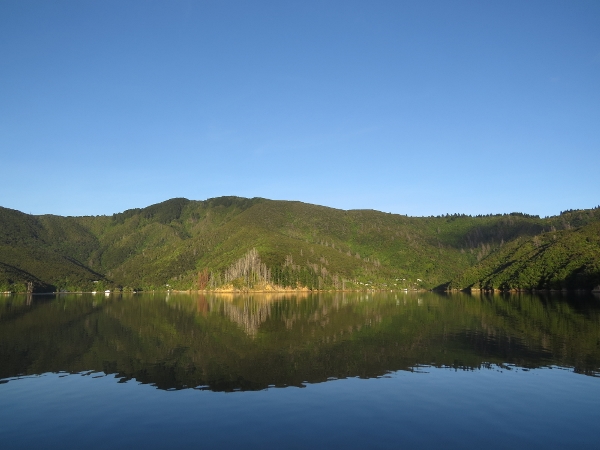
1/26/2014: Wells Bay
Position: -40°47.90'S, 173°54.24'E
Anchored in Wells Bay off the confluence of three creeks. The charts weren't very accurate here--according to them we're anchored on land. But the setting was beautiful, and while we did see some big gusts, this was a good place to be anchored through the gale.
|