MV Dirona travel digest for Gold Coast to Bundaberg 2014

|
Click the travel log icon on the left to see these locations on a map,
with the complete log of our cruise. On the map page, clicking on a camera or text icon will display a picture and/or log entry for that location, and clicking on the smaller icons along the route will display latitude, longitude and other navigation data for that location. And a live map of our current route and most recent log entries always is available at //mvdirona.com/maps/LocationCurrent.html. |
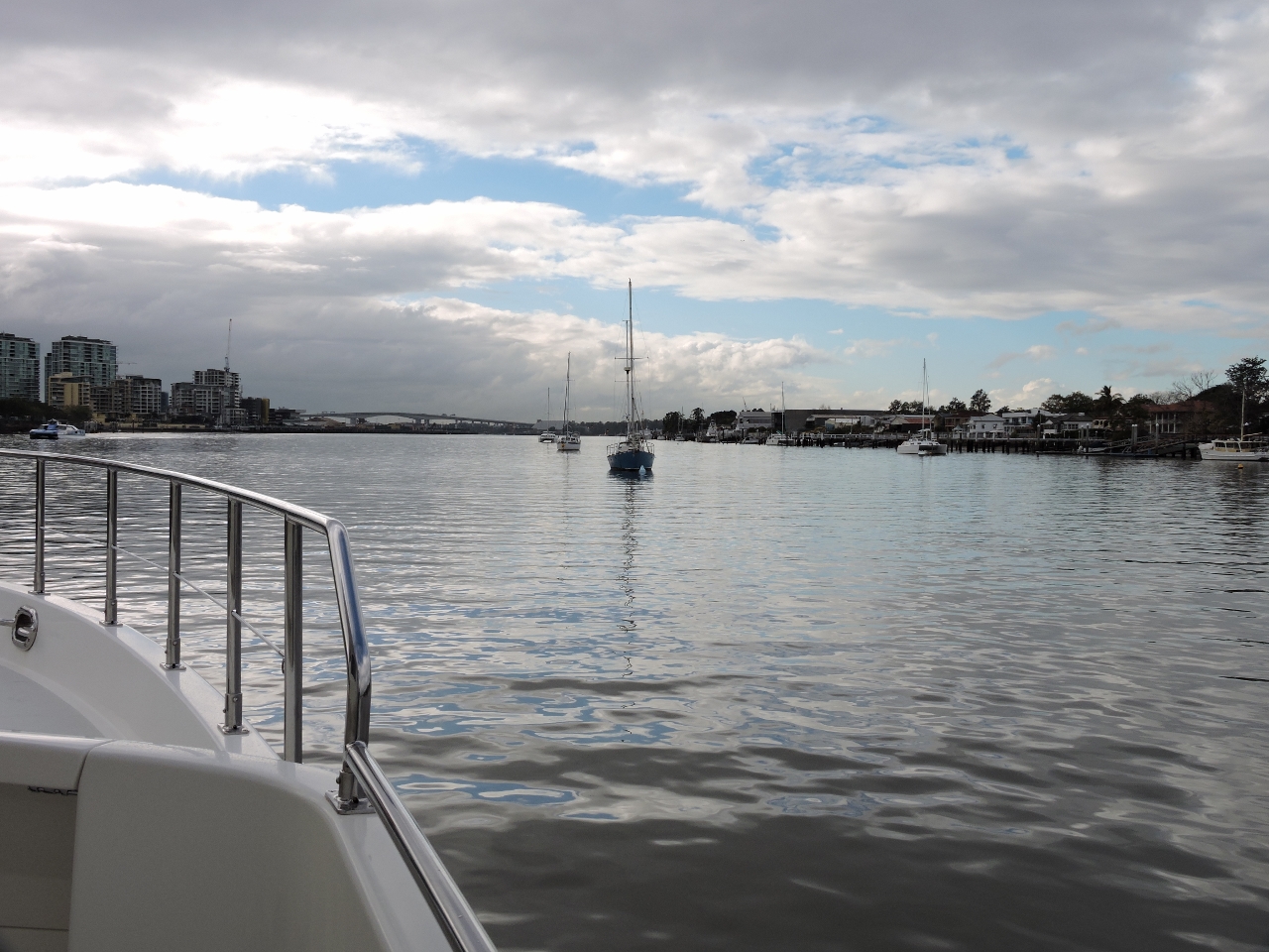 |
8/15/2014: Gateway Bridge
Position: -27°26.49'S, 153°3.05'E
Approaching the Gateway Bridge as we depart Brisbane for the Gold Coast. Navigating the river sure is a lot easier in daylight than the upriver night run we did on arrival.
|
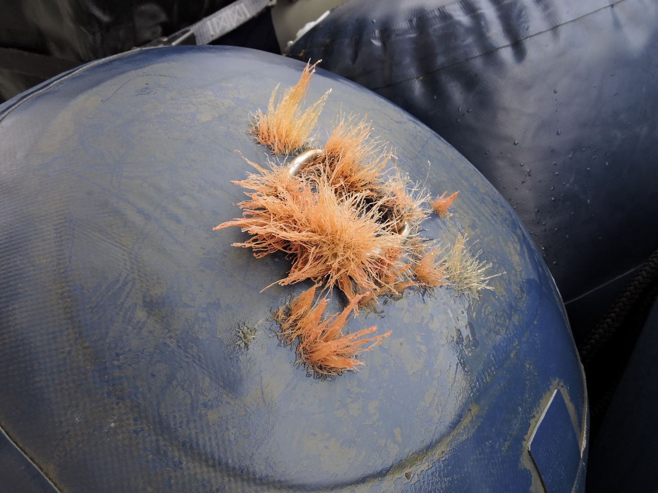 |
8/15/2014: Growth
Position: -27°26.53'S, 153°3.84'E
After three months, the amount of growth on our fenders where they touched the water does not bode well for the boat hull. We definitely have a bottom-cleaning in our future.
|
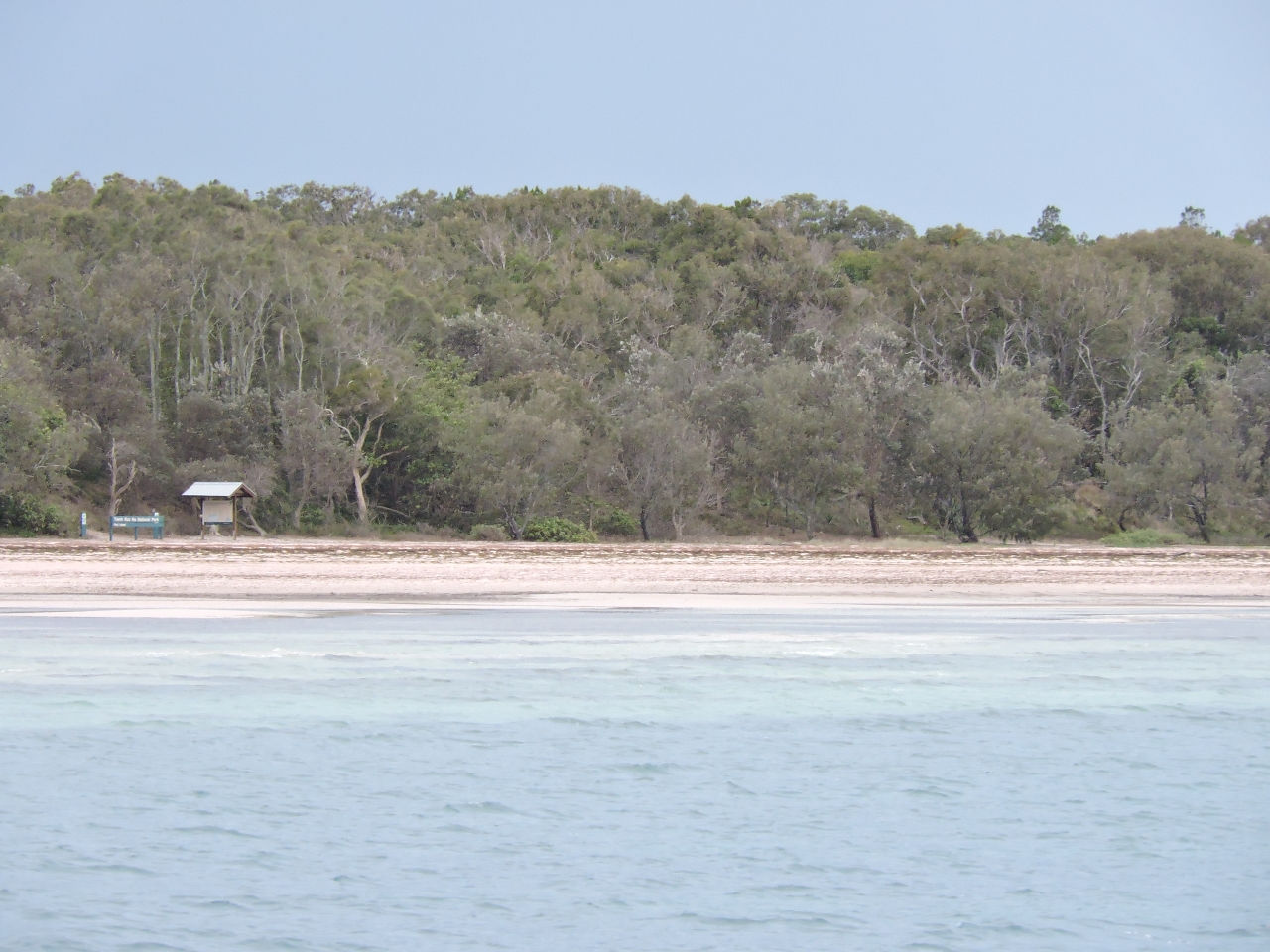 |
8/15/2014: Peel Island
Position: -27°30.30'S, 153°21.62'E
Looking across the beach at Horseshoe Bay on Peel Island. This is the first time our anchor has been down since Opotiki Bay in the Marlborough Sounds in late April. It's great to be back out again. This particular anchorage is extremely popular in the summer, but only one other boat is here in the winter with us. Winds initially were from the southeast, generating a fair bit of chop into the anchorage, but settled down in the evening. At night we could see the lights of the mainland and Stradbroke Island in the distance.
|
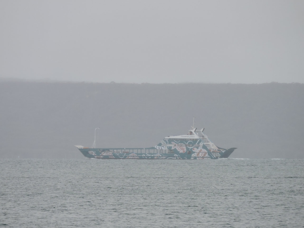 |
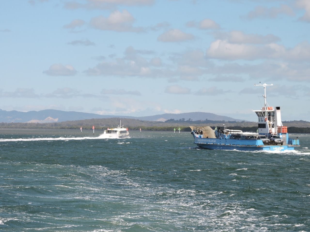
8/15/2014: Minjerribah
Position: -27°30.30'S, 153°21.62'E
Stradbroke Ferries Minjerribah underway to Stradbroke Island. A constant stream of vessels ran back and forth to "Straddie" while we were anchored at Horseshoe Bay. We've always loved anchorages where we can see ferry traffic in the distance, particularly at night.
|
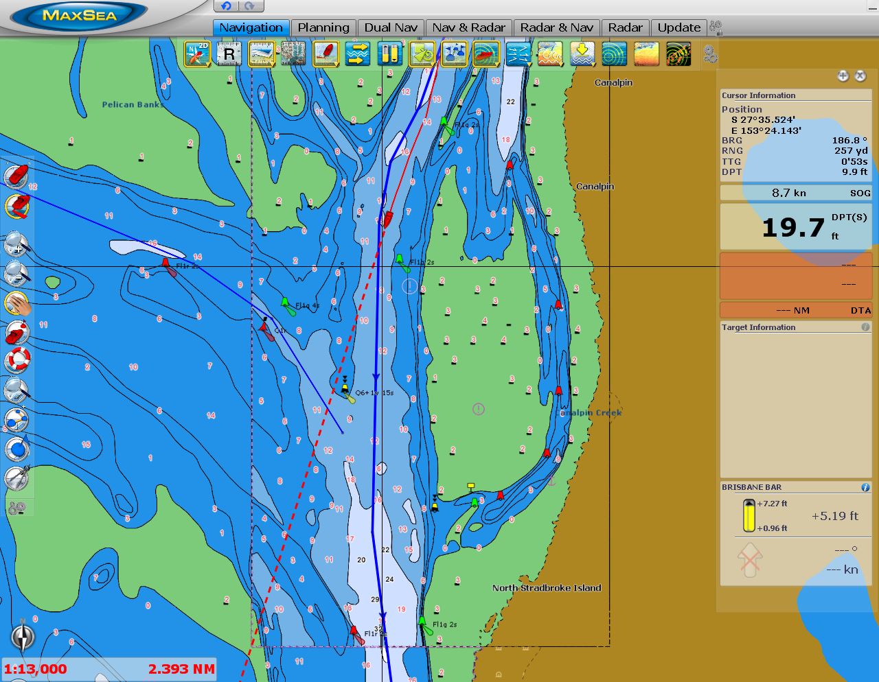 |
8/16/2014: Pelican Banks
Position: -27°35.36'S, 153°24.17'E
Passing the Pelican Banks at the south end of Moreton Bay en route south to the Gold Coast. We'll spend a few days in this area before running north to the Great Barrier Reef. The shallow and complex waters here well-marked, but the sandbars do shift and navigation is best done on a rising tide.
|
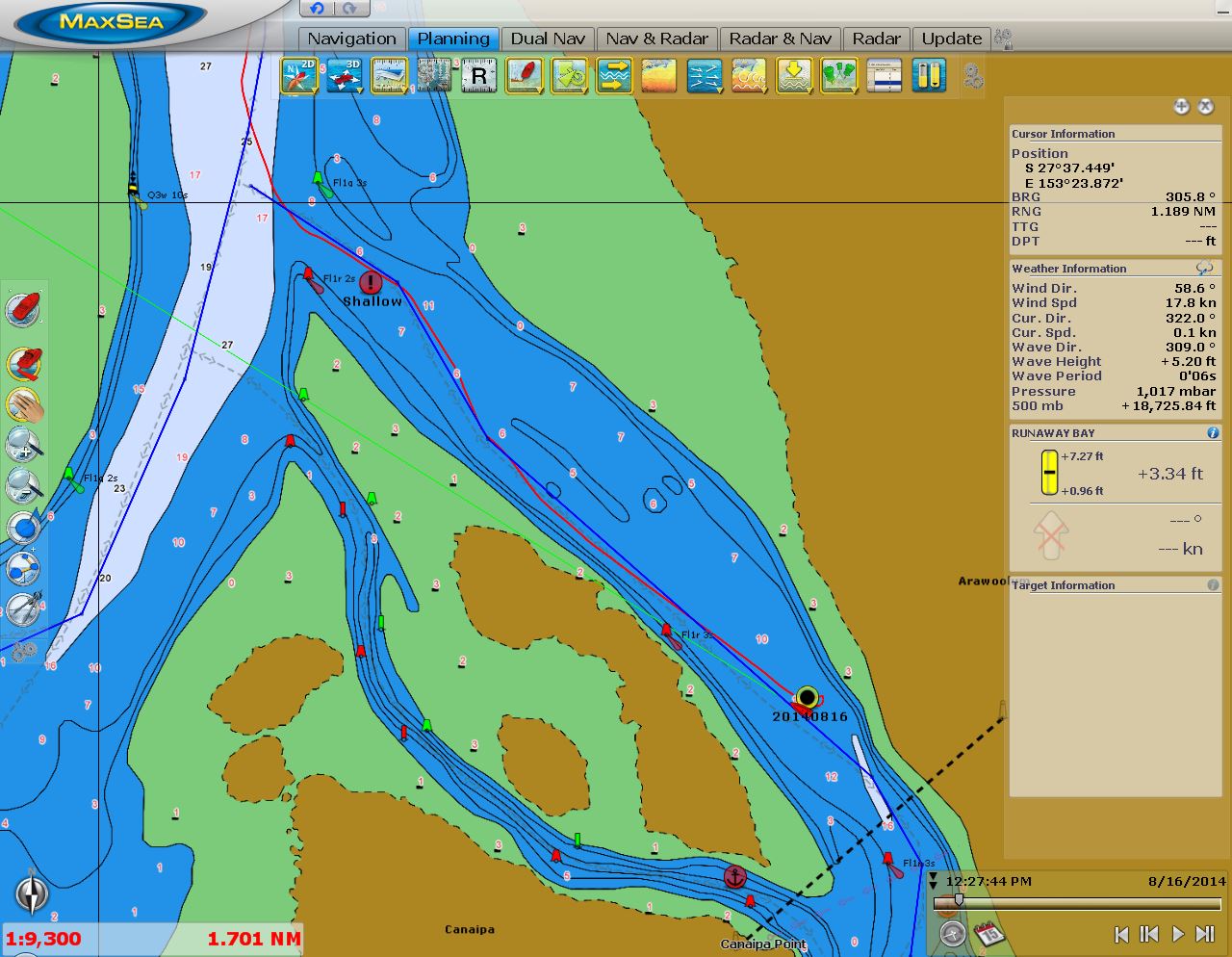 |
8/16/2014: Canaipa Point
Position: -27°38.15'S, 153°24.96'E
We stopped for the night off Canaipa Point at the north end of Canaipa Passage. With a tide height of about 5 feet, the least depth was 11-12'--about expected for the 6' soundings. We anchored in about 15' at zero tide.
|
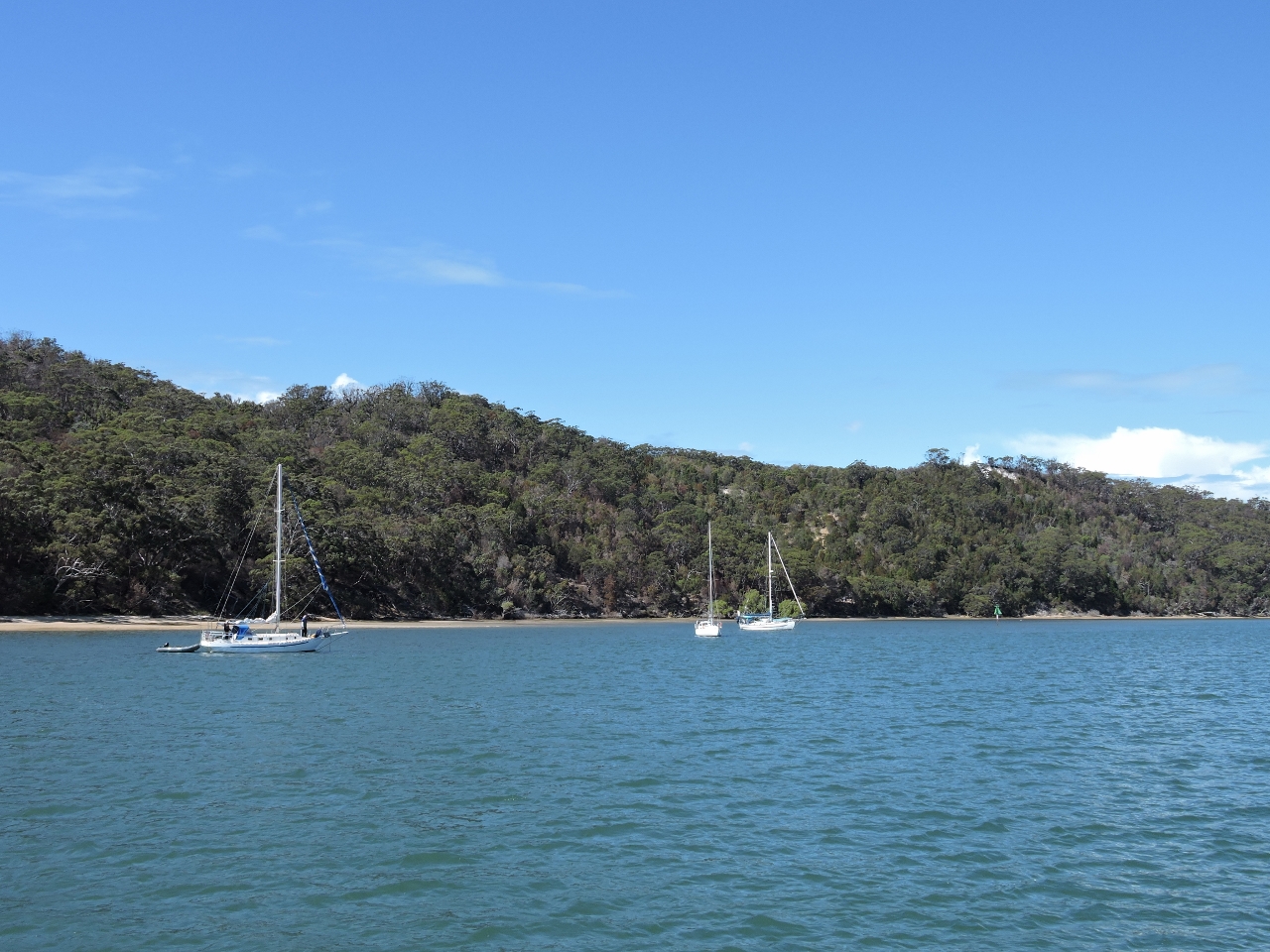 |
8/17/2014: Canaipa Point Anchorage
Position: -27°38.26'S, 153°25.05'E
The anchorage at Canaipa Point felt secluded and peaceful compared to the more busy areas nearby. We'd anchored a little north of the main anchorage, pictured, but even there were only three other boats were there.
|
|
8/17/2014: Canaipa Passage
Position: -27°38.74'S, 153°24.78'E
We planned to run south through scenic Canaipa Passage, but couldn't find enough water, so turned back to take the Main Channel instead.
|
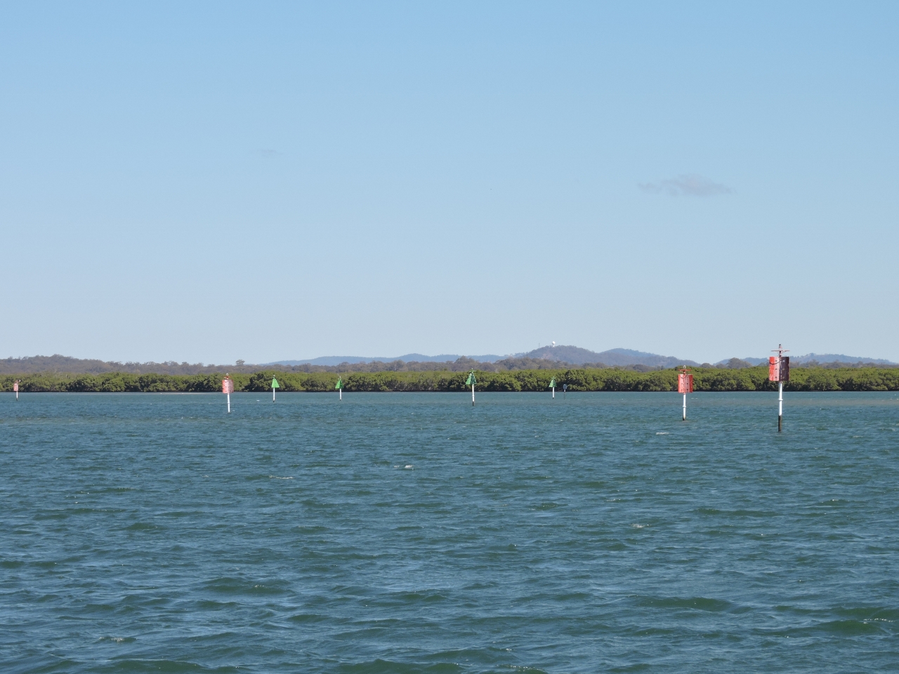 |
8/17/2014: Karragarra Ws
Position: -27°38.36'S, 153°21.31'E
A forest of beacons marks Karragarra Ws, the narrow and winding passage where the Main Channel runs between Long and Garden islands.
|
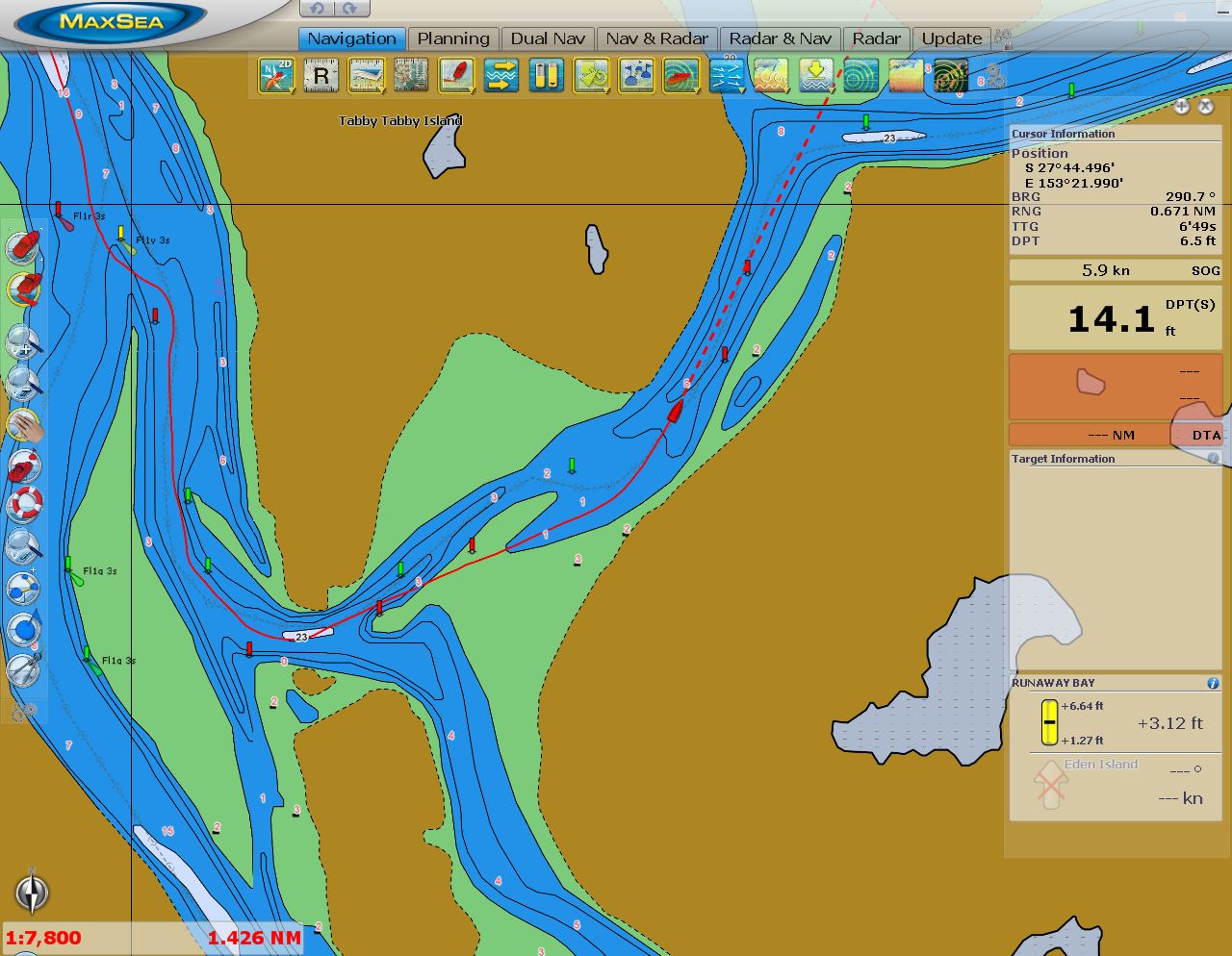 |
8/17/2014: Older chart
Position: -27°44.80'S, 153°22.65'E
Frequent chart notes warn that the banks in the area change constantly and the beacons moved accordingly. Our C-Map charts have served us well during the entire trip through the South Pacific, but were not even close with these rapidly changing sandbars.
|
 |
8/17/2014: Newer chart
Position: -27°44.74'S, 153°22.70'E
The charts that came with a Navionics tablet app appear closer to correct than our slightly older C-Map charts. But even with these, the marked channel was "way on shore" more than once as we proceeded through. Even with three feet of tide, many sections offered less than eight feet of water, so we'll take all the data we can get.
|
 |
8/17/2014: Mangroves
Position: -27°44.36'S, 153°23.70'E
The waterways wind through dense mangrove forests reminiscent of the Florida Everglades.
|
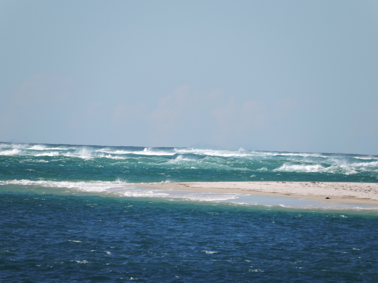 |
8/17/2014: Jumpinpin Bar
Position: -27°44.64'S, 153°25.79'E
The charts note that "Jumpinpin Bar is constantly shifting and dangerous. Crossing should not be attempted without local knowledge." Even without that warning, the current surf state makes it look fairly unappealing.
|
 |
8/17/2014: Jumpinpin Anchorage
Position: -27°44.83'S, 153°26.25'E
We anchored for the night just south of Jumpbinpin Bar, with a view east to the extensive sandbars on South Stradbroke Island.
|
 |
8/17/2014: Ocean view
Position: -27°45.08'S, 153°26.65'E
We took a picnic ashore and crossed the sandbar for lunch with an ocean view. Big westerly winds were blowing the tops off the waves as they rolled ashore.
|
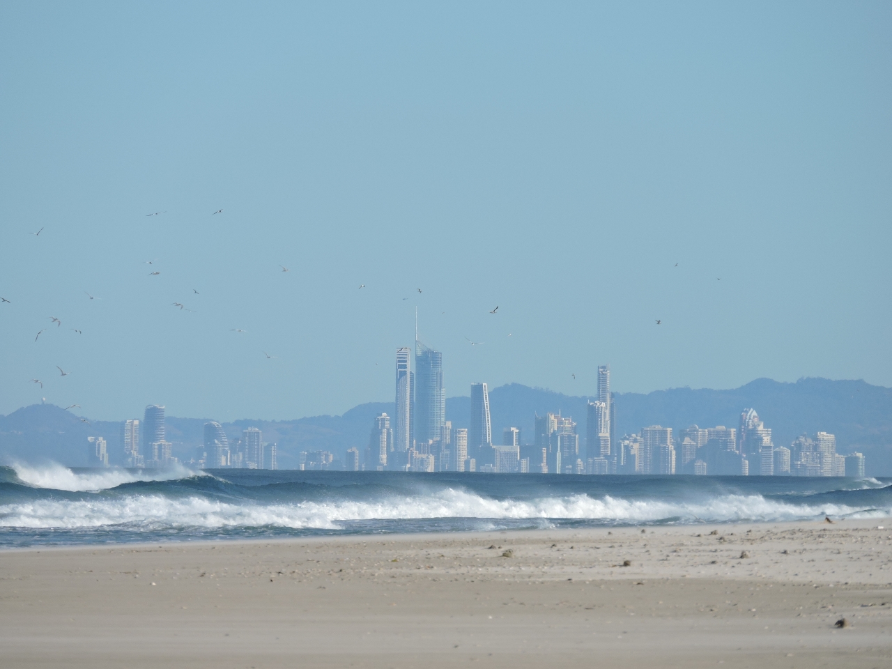 |
8/17/2014: Surfers Paradise
Position: -27°44.85'S, 153°26.96'E
Looking south to the high-rise towers of Surfers Paradise.
|
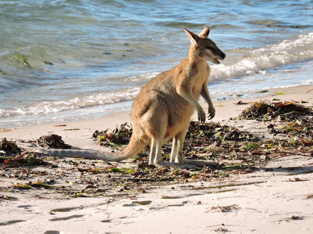 |
8/17/2014: Wallaby
Position: -27°45.20'S, 153°26.35'E
One of the several wallabies we saw ashore--our first sighting!
|
 |
8/18/2014: Current
Position: -27°44.84'S, 153°26.21'E
In the combination of big westerly winds and strong current, the boat is pulling at an unusual sideways angle to the anchor.
|
 |
8/18/2014: Mansions
Position: -27°52.14'S, 153°24.78'E
The City of the Gold Coast name comes from an early nickname for the area where only the rich could afford vacation homes here. The modern mansions on Sovereign and Ephraim Islands certainly reflect that heritage.
|
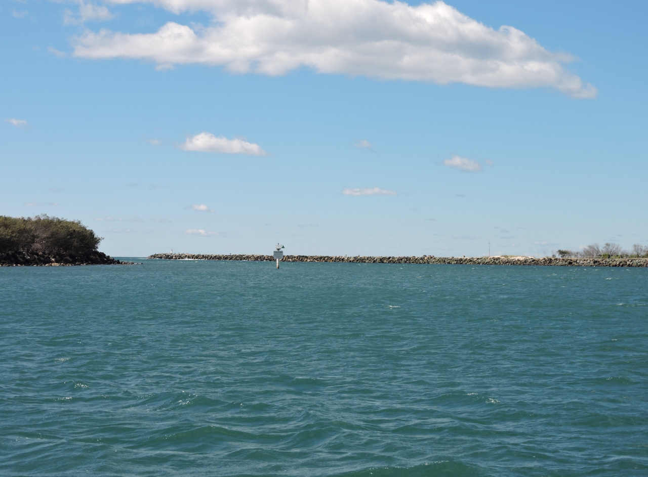 |
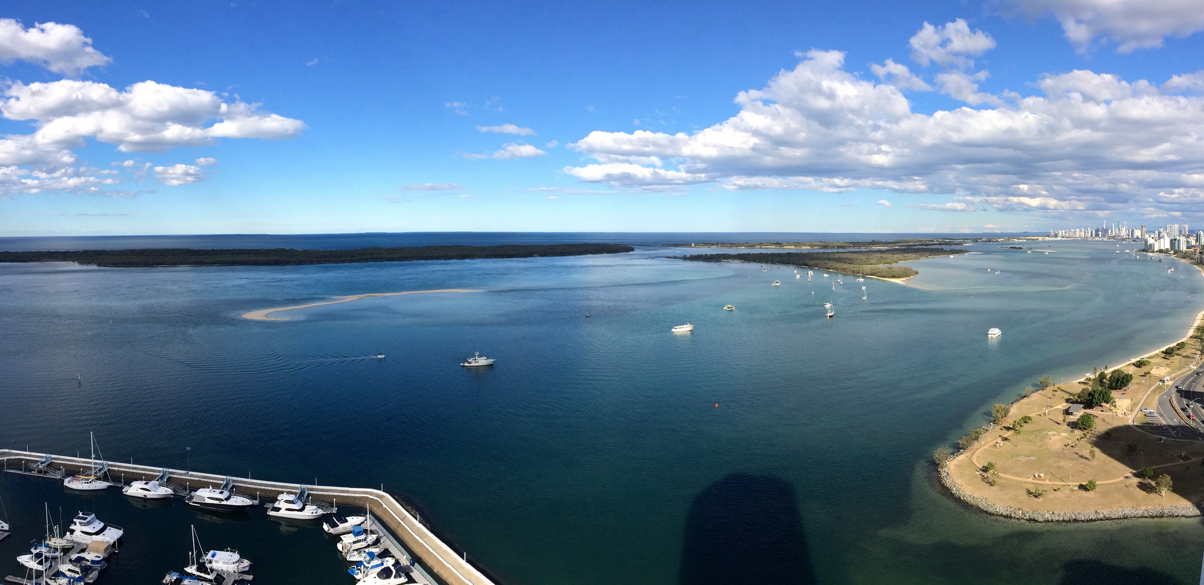
8/18/2014: Gold Coast Seaway
Position: -27°55.86'S, 153°25.20'E
The Gold Coast Seaway is the area's southern entrance. Transiting generally is straightforward, although breaking waves can form when spring ebb currents meet opposing swell.
|
|
8/18/2014: Marine Stadium
Position: -27°56.81'S, 153°25.43'E
We considered anchoring in or near Marine Stadium, the basin just south of the Seaway, but the area was crowded with limited swing room. Anchoring isn't allowed farther south near the marinas, although we might have gotten a slip or picked up a mooring. We instead found an ideal anchorage north of Windbreak island, with an excellent city view and plenty of swing room.
|
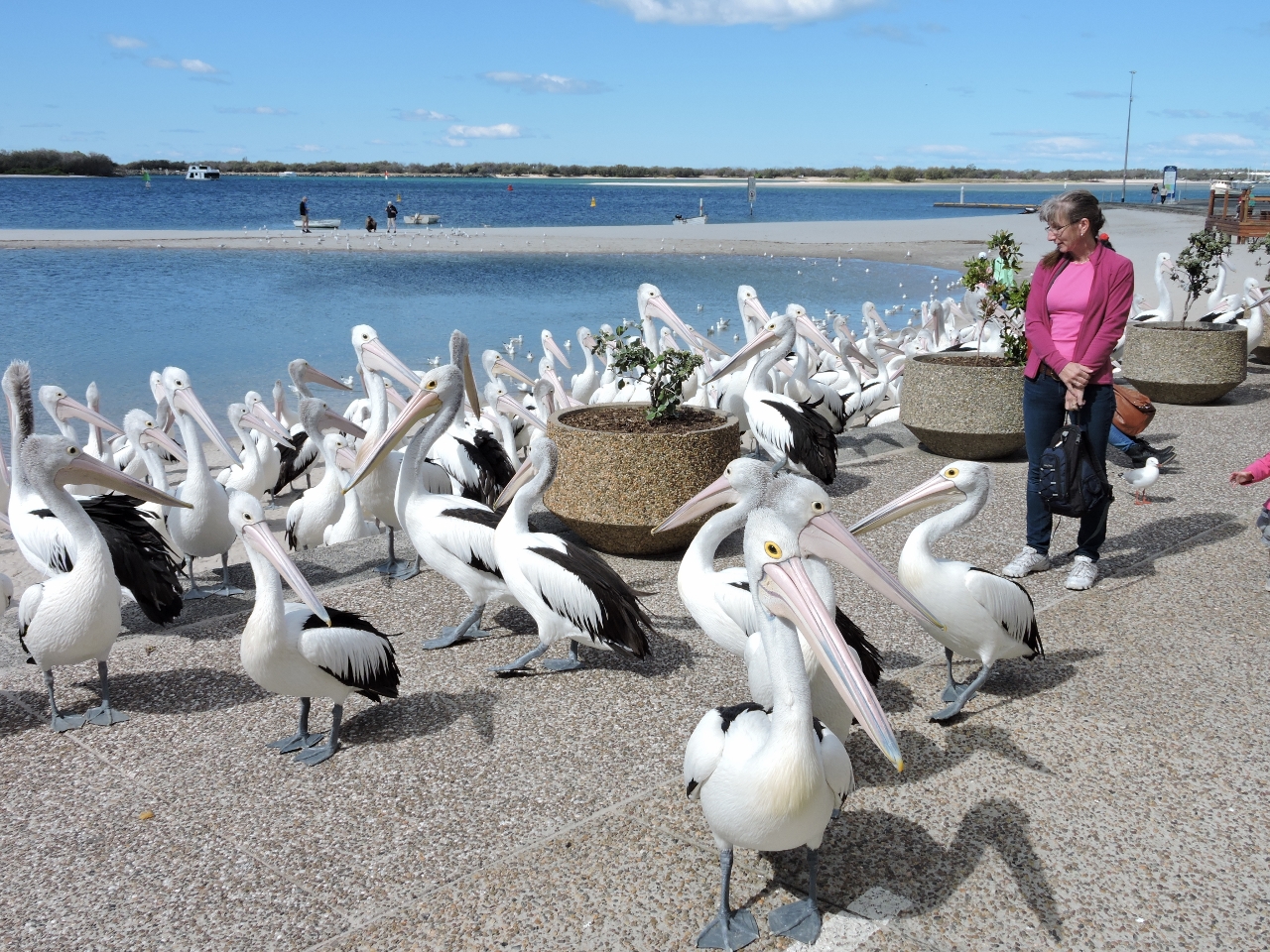 |
8/18/2014: Pelicans
Position: -27°56.47'S, 153°24.53'E
Pelicans looking for a handout off Harley Park. They all left once the lunch crowd had dispersed.
|
 |
8/18/2014: The Grand Hotel
Position: -27°56.51'S, 153°24.52'E
We had an excellent lunch on the deck at the Grand Hotel.
|
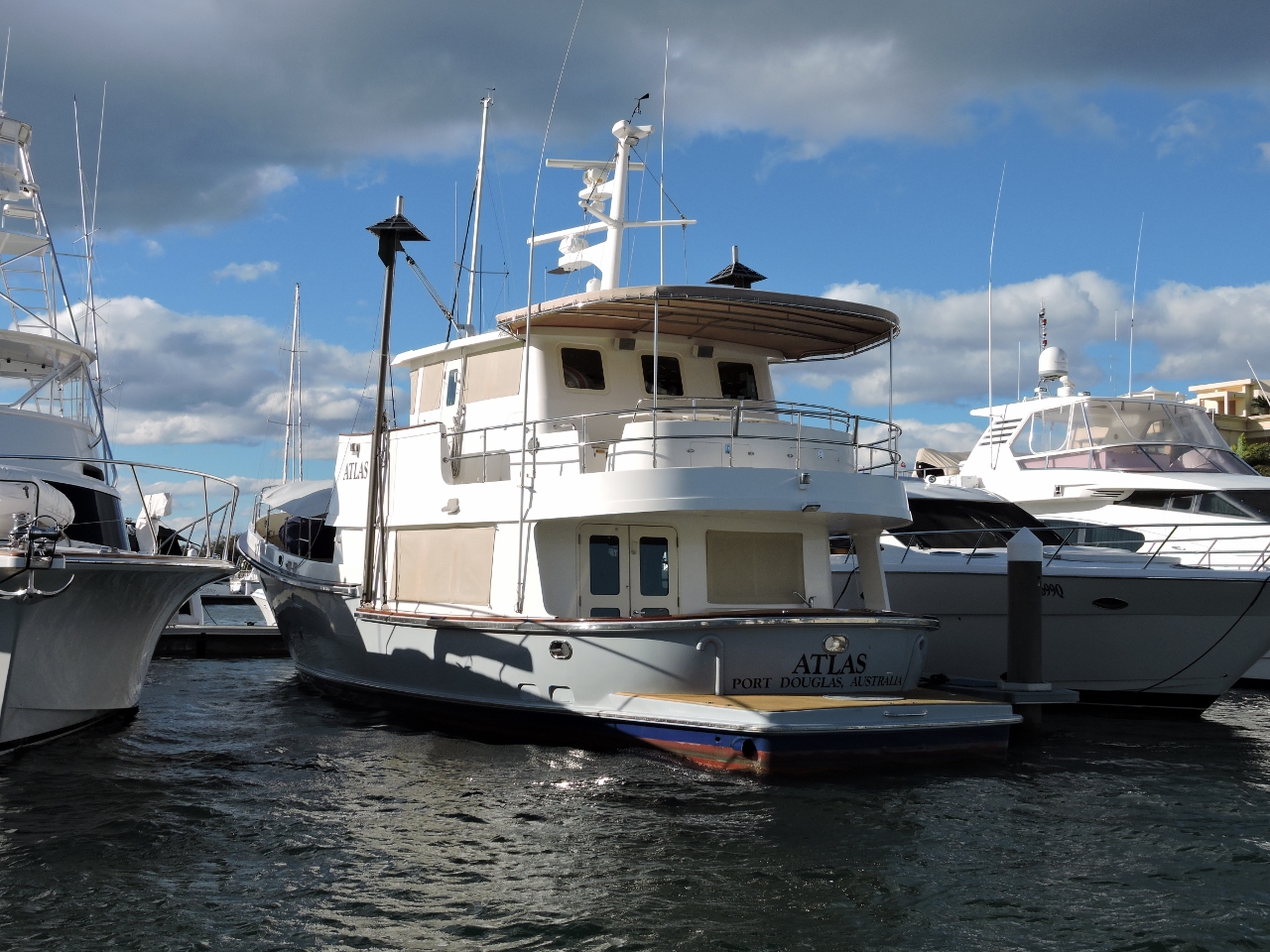 |
8/18/2014: Atlas
Position: -27°58.06'S, 153°25.48'E
Nordhavn 62 Atlas moored at Palazzo Versace Marina.
|
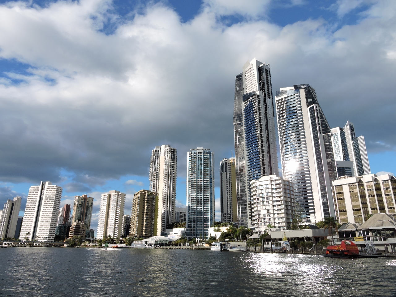 |
8/18/2014: Surfers Paradise
Position: -28°0.12'S, 153°25.46'E
A close-up view to the high-rise towers of Surfers Paradise on our dinghy tour of the waterway.
|
 |
8/19/2014: Sunrise
Position: -27°55.50'S, 153°24.53'E
.
|
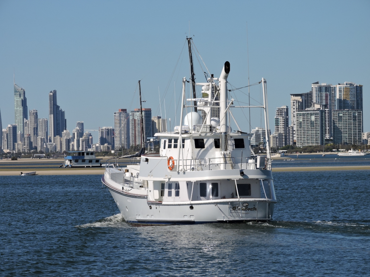 |
8/19/2014: Celebrate
Position: -27°55.50'S, 153°24.53'E
David Newnham gave us a tour of Nordhavn 6212 Celebrate, an incredibly well-maintained boat that you'd guess would be one of the newest 62s rather than the early model that it is.
|
 |
8/19/2014: The Broadwater
Position: -27°55.44'S, 153°24.33'E
The stretch of the Gold Coast waterway along southwest Stradbroke Island is called The Broadwater. Rick MacClure and Dianne Boston, owners of Nordhavn 6056 Last Samurai, sent us this picture looking south across the Broadwater from their condo balcony. Without knowing it, we'd ended up anchoring directly below their building (Dirona is the leftmost moored boat).
|
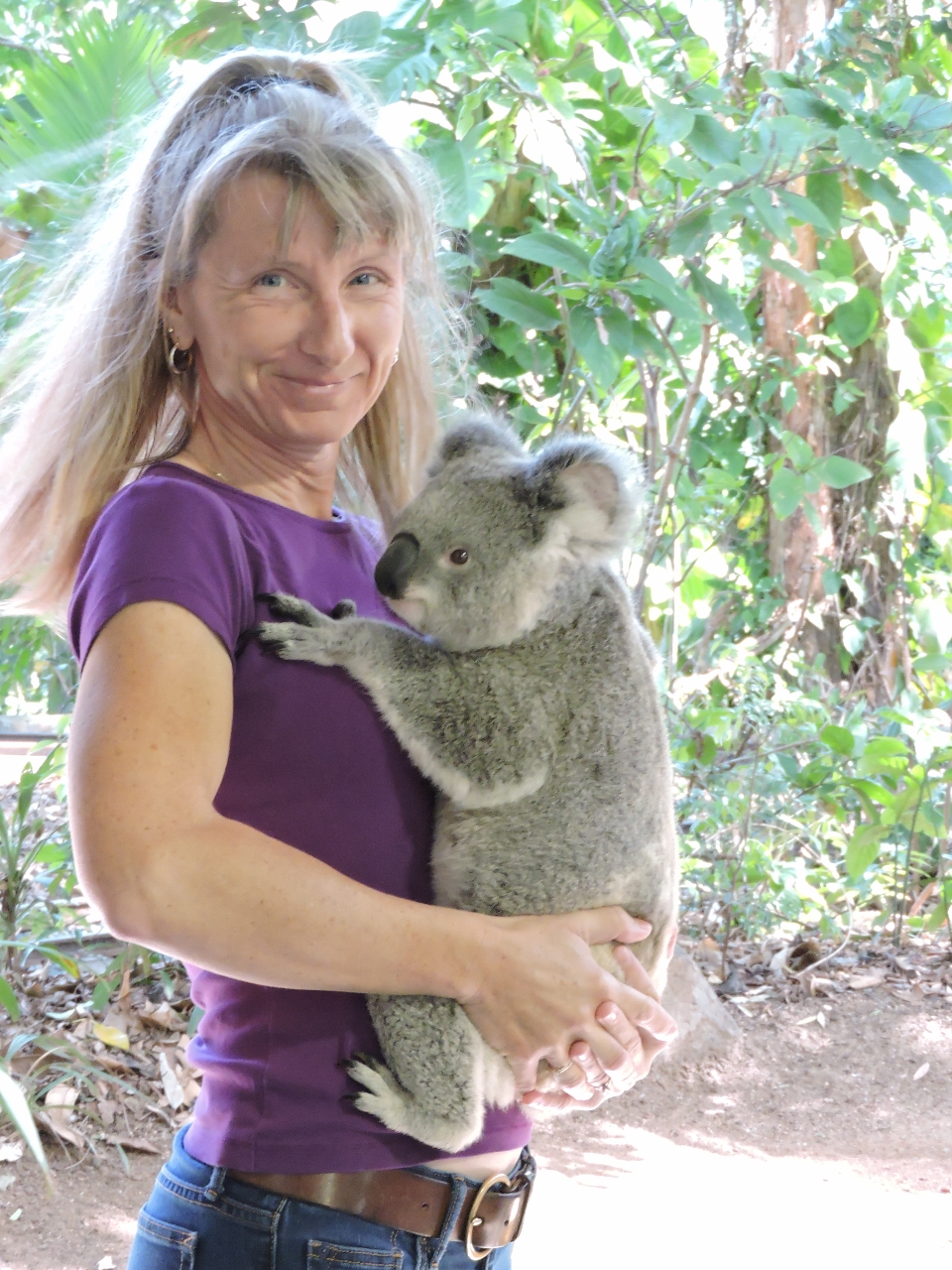 |
8/20/2014: Koala cuddle
Position: -28°8.17'S, 153°29.30'E
Rick and Dianne took us to the Currumbin Wildlife Sanctuary to view some native Australian wildlife. Those Koalas sure are cute.
|
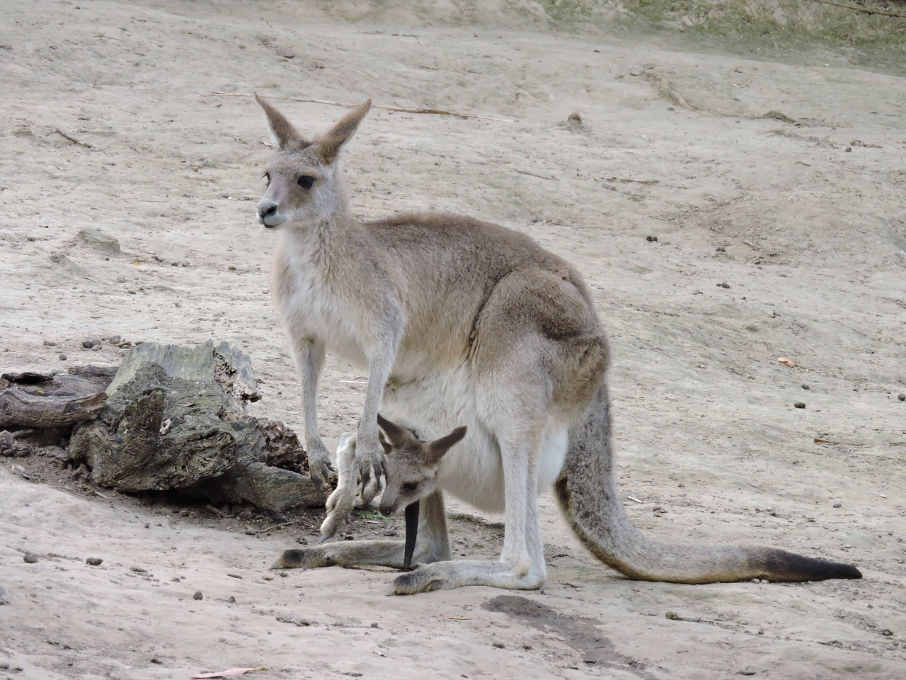 |
8/20/2014: Joey
Position: -28°8.18'S, 153°29.08'E
A joey (young kangaroo) in its mother's pouch.
|
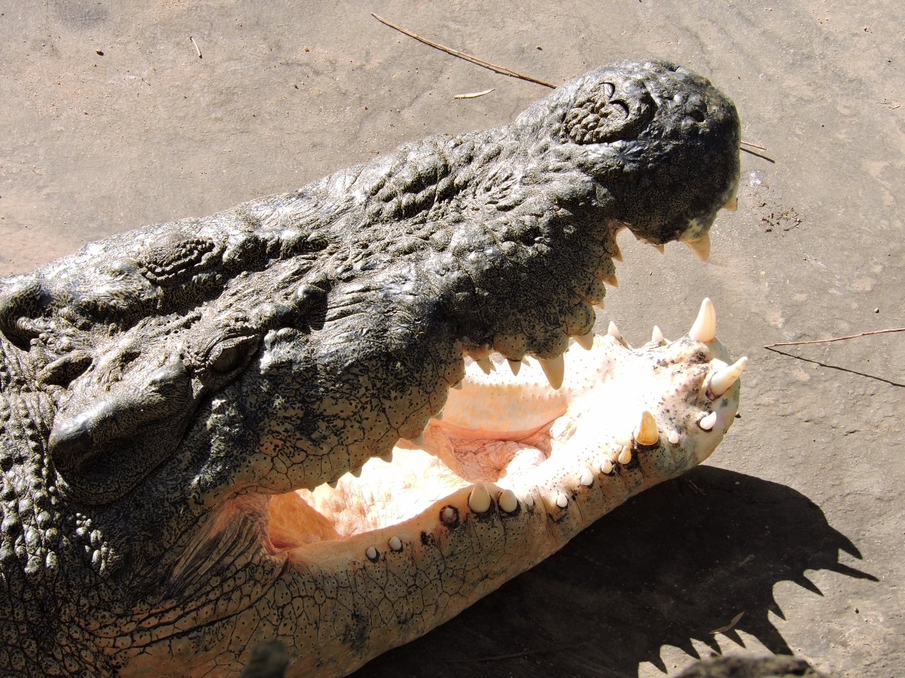 |
8/20/2014: Saltwater crocodile
Position: -28°8.19'S, 153°29.02'E
Saltwater crocodiles are prevalent around rivers in northern Australia, making water-based activities decidedly less safe. The males can reach 22 feet long and weigh up to 4,400 pounds--this male's mouth was at least 2 feet long.
|
 |
8/20/2014: Tree kangaroo
Position: -28°8.12'S, 153°29.04'E
The tree kangaroo has beautiful markings.
|
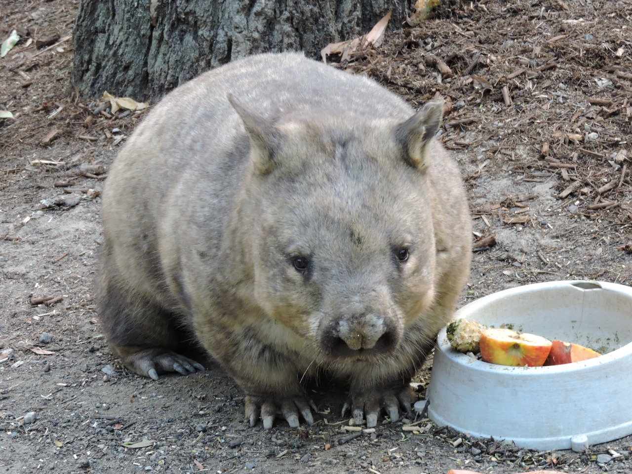 |
8/20/2014: Wombat
Position: -28°8.29'S, 153°29.10'E
Looking a bit like a cross between a pig and a giant hamster, the wombat is found only in Australia.
|
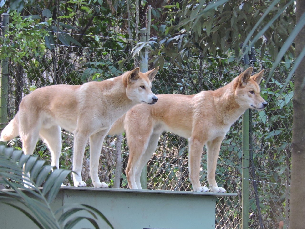 |
8/20/2014: Dingoes
Position: -28°8.30'S, 153°29.06'E
Dingoes are wild dogs found mostly in Australia. They are good-looking animals, but apparently can be quite fierce and will attack humans.
|
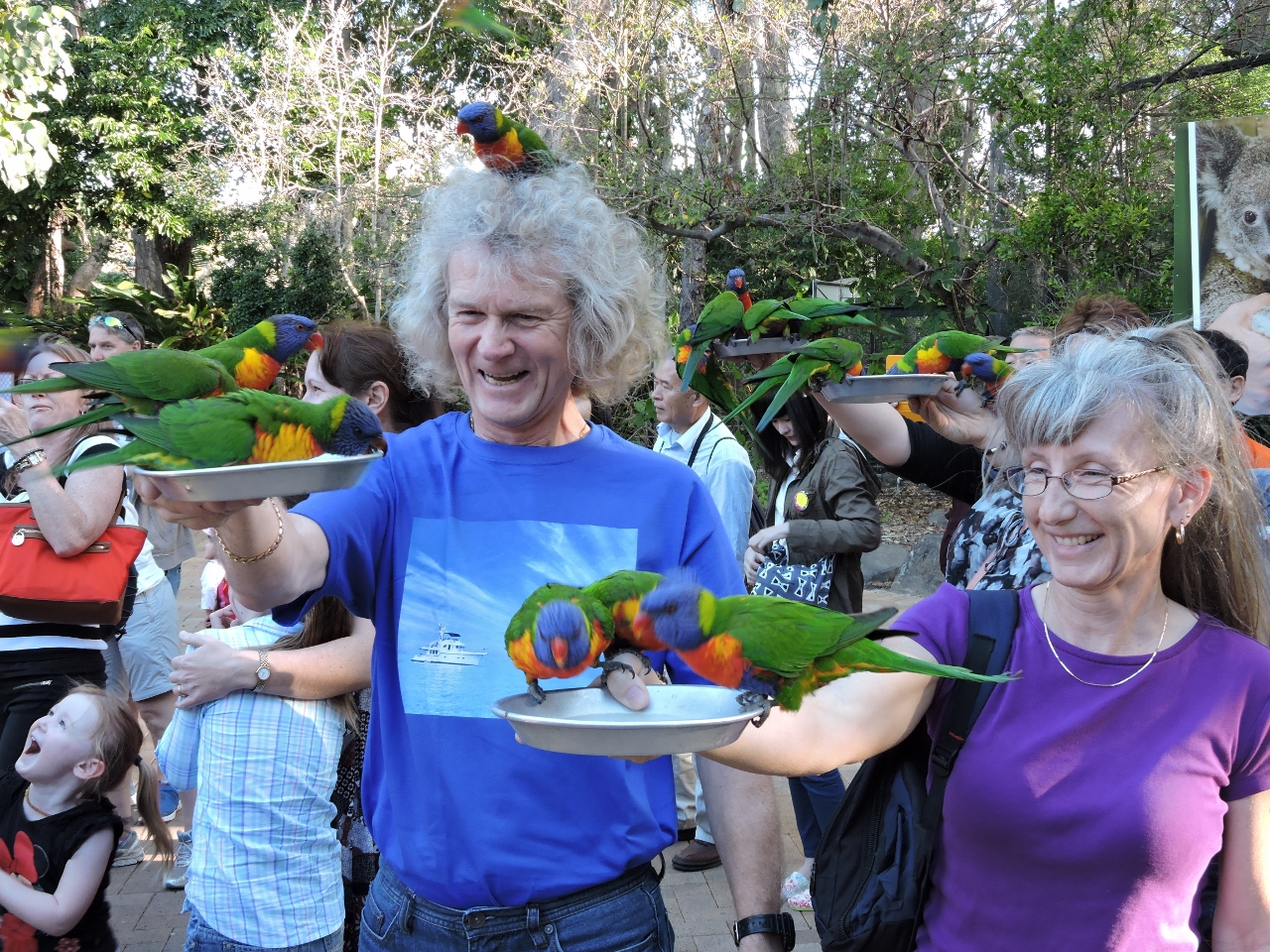 |
8/20/2014: Lorikeet feeding
Position: -28°8.15'S, 153°29.29'E
The Rainbow Lorikeet feeding was grand finale of the visit. Twice a day, these parrots descend en masse to feed from plates of proffered Wombaroo Milk. We had a fabulous time at the wildlife sanctuary--thanks so much Rick and Dianne!
|
 |
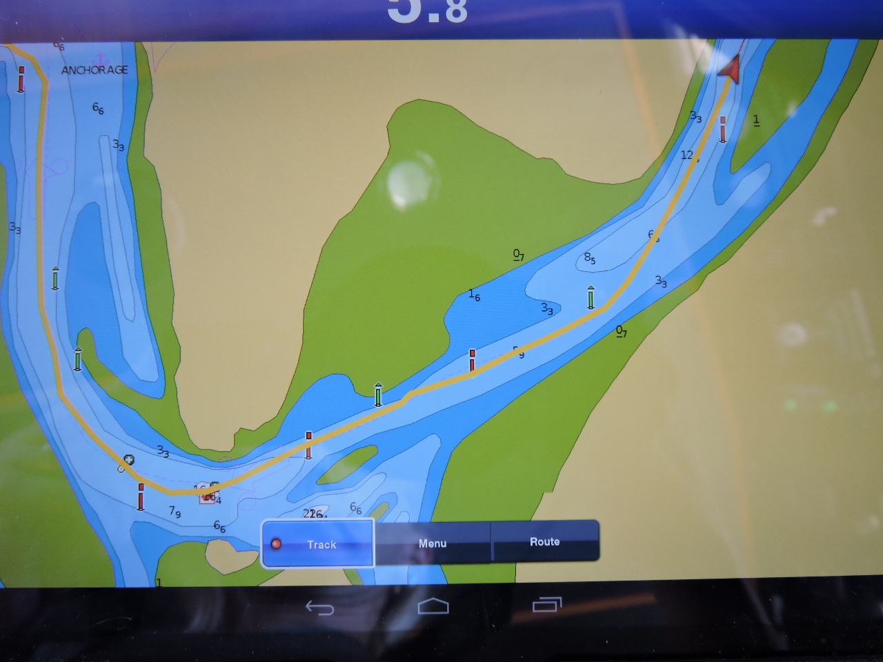
8/21/2014: Karragarra Ws
Position: -27°38.35'S, 153°21.36'E
Two ferries entering the Karragarra Ws, the narrow and winding passage where the Main Channel runs between Long and Garden islands. A third northbound boat was behind us, with another ferry heading southbound. Busy area.
|
|
8/21/2014: Blaksley Anchorage
Position: -27°34.56'S, 153°24.49'E
We considered anchoring at Blaksley Anchorage, or Price Anchorage a little farther south, but both appeared rather exposed to the the big southerly winds we were getting.
|
|
8/21/2014: Myora
Position: -27°28.17'S, 153°24.94'E
We anchored for the night off Rainbow Channel at Myora. The anchorage had reasonable southerly wind protection, and felt remote and secluded compared to the busier area to the south around Dunwich.
|
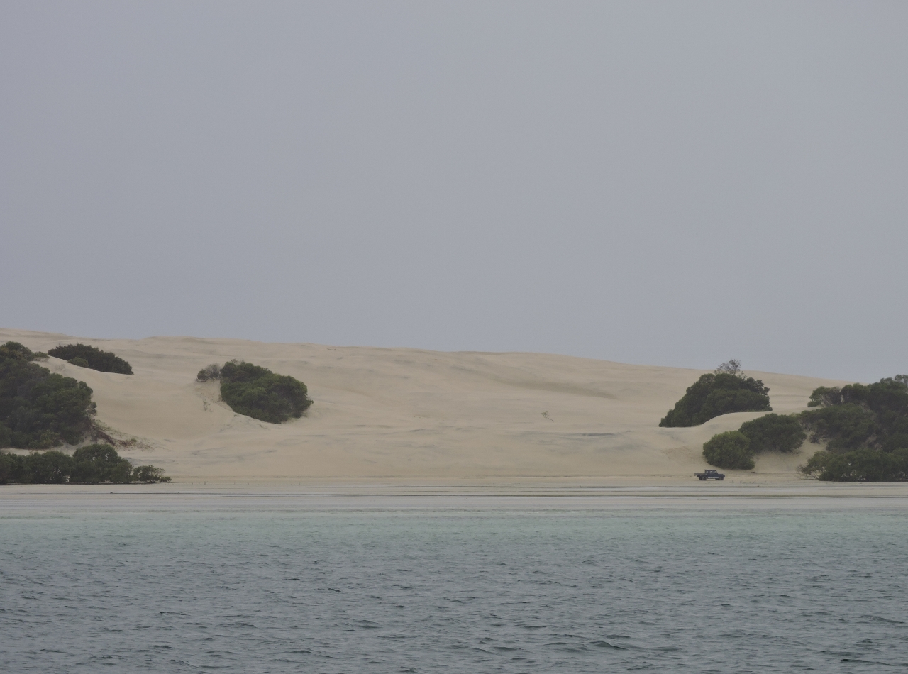 |
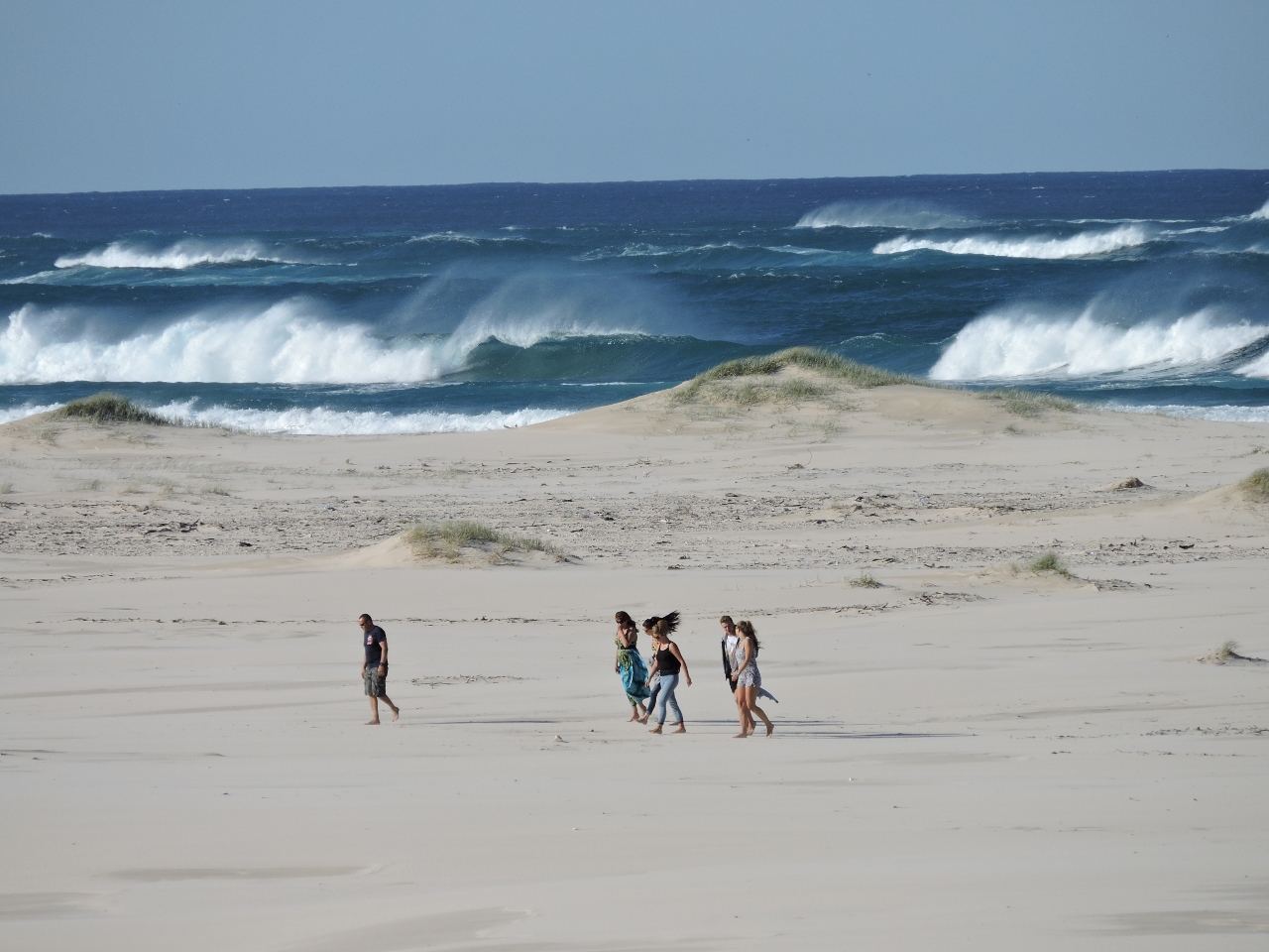
8/22/2014: The Sandhills
Position: -27°17.72'S, 153°23.76'E
A truck running along the beach below "Little" Sand Hills. Just to the north is "Big" Sand Hills--both are obvious from the air.
|
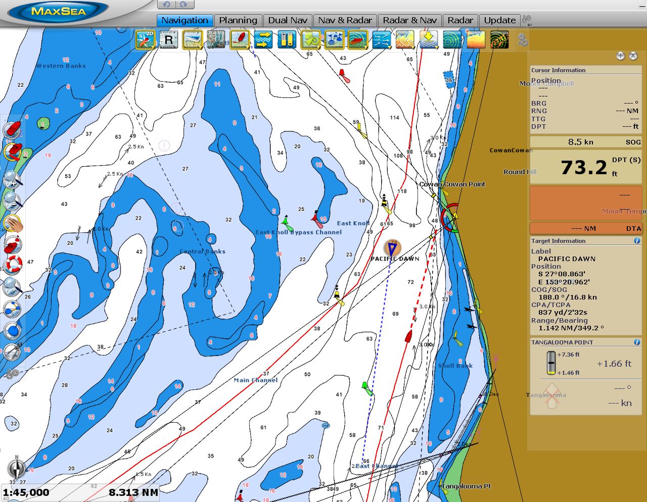 |
8/23/2014: Pacific Dawn
Position: -27°10.04'S, 153°21.19'E
The winds were forecast to be 25 knots, worsening to 35+ knots over the next three days. We didn't feel like waiting for the system to pass, so we decided to get the trip up the Sunshine Coast to Fraser Island done in the current conditions. We left at 1:30am to ensure we arrived at the Wide Bay Bar in the afternoon with good light and on a flooding tide. In the picture, we are working out of thethe well-lit, but shallow, Moreton Bay past the 811-foot cruise ship Pacific Dawn.
|
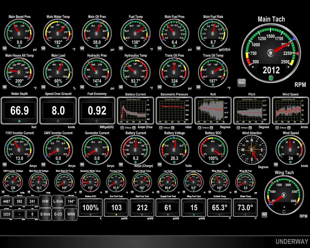 |
8/23/2014: Conditions
Position: -26°12.85'S, 153°14.33'E
We're making great time at 8 kts or more (click image to enlarge), but the weather system arrived earlier than forecast and we're already seeing steady winds over 30kts. The seas are on our stern quarter--not too large, but quite steep--with some rolling the boat as far over as 25 degrees. We were leaned over far enough that the full hydrualic reservoir for the stabilizers briefly signalled low as the fluid tilted away from the sensor.
|
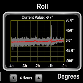 |
8/23/2014: 69.1 degrees
Position: -25°47.61'S, 153°7.65'E
The Tin Can Bay Coast Guard had given us current waypoints for crossing the Wide Bay Bar, since the sand shoals change over time. An hour before reaching the bar, we phoned them to ask about crossing conditions. They said that nobody had been through today, so they didn't have current data, but the fact that nobody had been through is a bit of a clue. They commented it must be rough out here and speculated that crossing might be easier than staying out. As we approached the bar, conditions looked pretty tough, with monstrous breaking waves only 50 feet away on the right and only 50 feet away on the left. Conditions in front of us looked difficult, but passable. We're not sure if it was bad timing or bad luck, but the next wave approaching Dirona from the rear was breaking all the way across the bar and rapidly closing on our stern. The wave crashed into the upper decks of Dirona and turned us sideways as it forced us to the bottom of the wave, rolling the boat over 69.1 degrees (the narrow line in the roll gauge screenshot). Dirona has never been heeled over beyond 30 degrees even in the worst conditions. The next wave also was breaking all the way across the bar and also crashed down onto Dirona, and several alarms were going off. It's likely we'd already seen the worst of what the boar could offer, and could have proceeded through, but we just weren't comfortable about doing that. We brought the bow around to face the next wave and exited the bar through three more breaking waves. The waves we saw on exit probably were of similar size to the one that rolled us, but directly into the waves felt stable and fairly safe. Read more ....
|
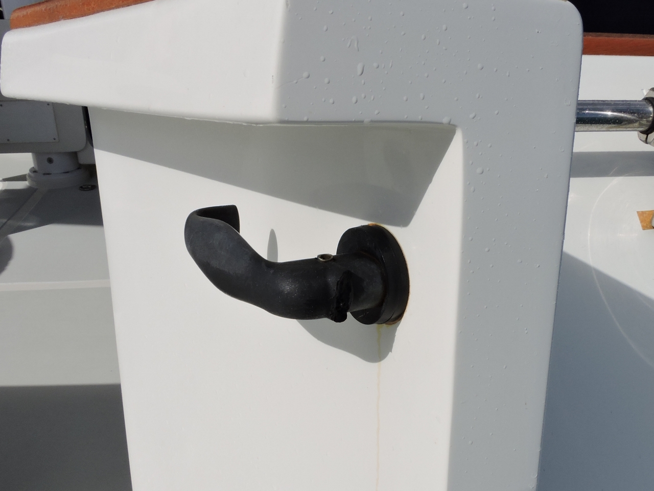 |
8/23/2014: Damage
Position: -25°56.18'S, 153°9.97'E
We took some damage from the knockdown. The boat was over on its starboard side when the breaking wave falling from above Dirona landed with incredible force. It broke a dinghy hold-down trailer strap, rated for multiple tons of force, bent the barrel-bolt securing the door from the Portuguese bridge to the bow, and blew open the cockpit door, sheering of the latch (pictured).
|
 |
8/24/2014: Double Island Point
Position: -25°56.18'S, 153°9.97'E
Since we couldn't cross the bar, our choices at that point were to continue north outside Fraser Island, a run of over 100 miles to the first possible anchorage, or stop for the night behind Double Island Point. In Cruising the Coral Coast, Alan Lucas comments that the headland "promises security but little to no comfort under its lee during southeast weather". We didn't feel like taking on the longer run, so opted for Double Island Point. Winds were 30-40 knots in the anchorage, with rare gusts to 50. There wasn't much fetch, but it was fairly rough. We both had a good sleep, but the snubber didn't far so well during the night, parting under the heavy loads.
|
|
8/24/2014: Wide Bay Bar
Position: -25°47.66'S, 153°7.88'E
It was still rough, but much better than the previous afternoon, so we took another look at the bar at high tide this morning. Conditions clearly were better, but seas were still breaking across the entire bar. Crossing under those conditions didn't seem worth it, so we ran up the east side and around the north end of Fraser Island.
|
 |
8/25/2014: Coongut Point
Position: -25°9.95'S, 153°3.02'E
We ran 18 hours around the north end of Fraser Island and Breaksea Spit, then south to anchor at Coongut Point, arriving just after 1 am. The anchorage was easy to enter in the dark and was so nice and wonderfully calm that we stayed for two nights off the wide sand beach there.
|
 |
8/26/2014: North White Cliffs
Position: -25°24.24'S, 153°0.75'E
Anchored for the night off North White Cliffs. Winds were from the SSW and the anchorage was calm. Fraser Island is the largest sand island in the world, and there's plenty of sand everywhere--cliffs of it even. Ashore to the left of the boat is a large steam boiler, one of several ruins from the area's logging days.
|
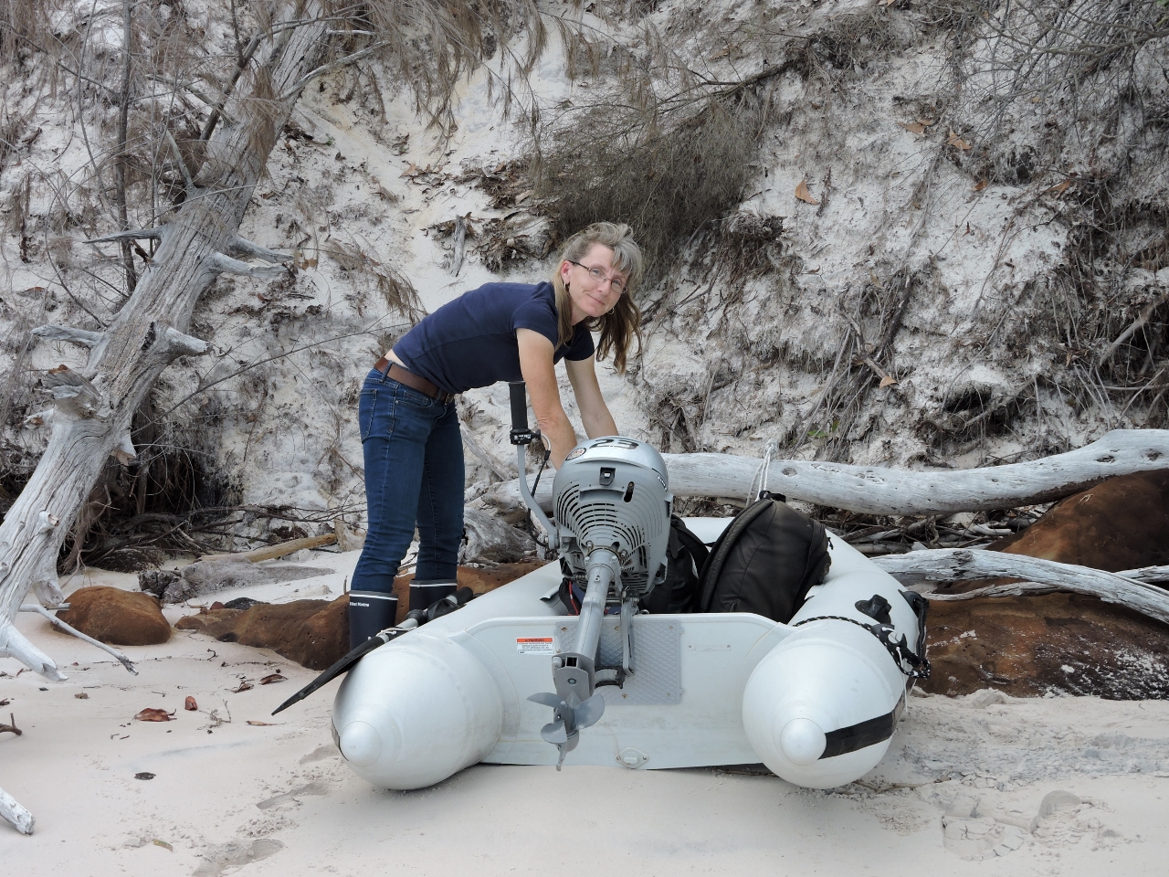 |
8/26/2014: Ashore
Position: -25°24.34'S, 153°0.81'E
With shallows extending a long way off, landing here definitely was small-dingy territory. We rode in with rubber boots so we could step out into the water and carry the boat ashore, then changed over to hiking boots.
|
 |
8/26/2014: Lunch
Position: -25°24.44'S, 153°0.77'E
We had a picnic lunch ashore with a view to the anchorage. We're at the beginning of a spur trail that lead inland to the Fraser Island Great Walk, but that was farther than we felt like walking.
|
 |
8/26/2014: Cliff view
Position: -25°24.32'S, 153°0.85'E
The track along the cliff tops had excellent water views.
|
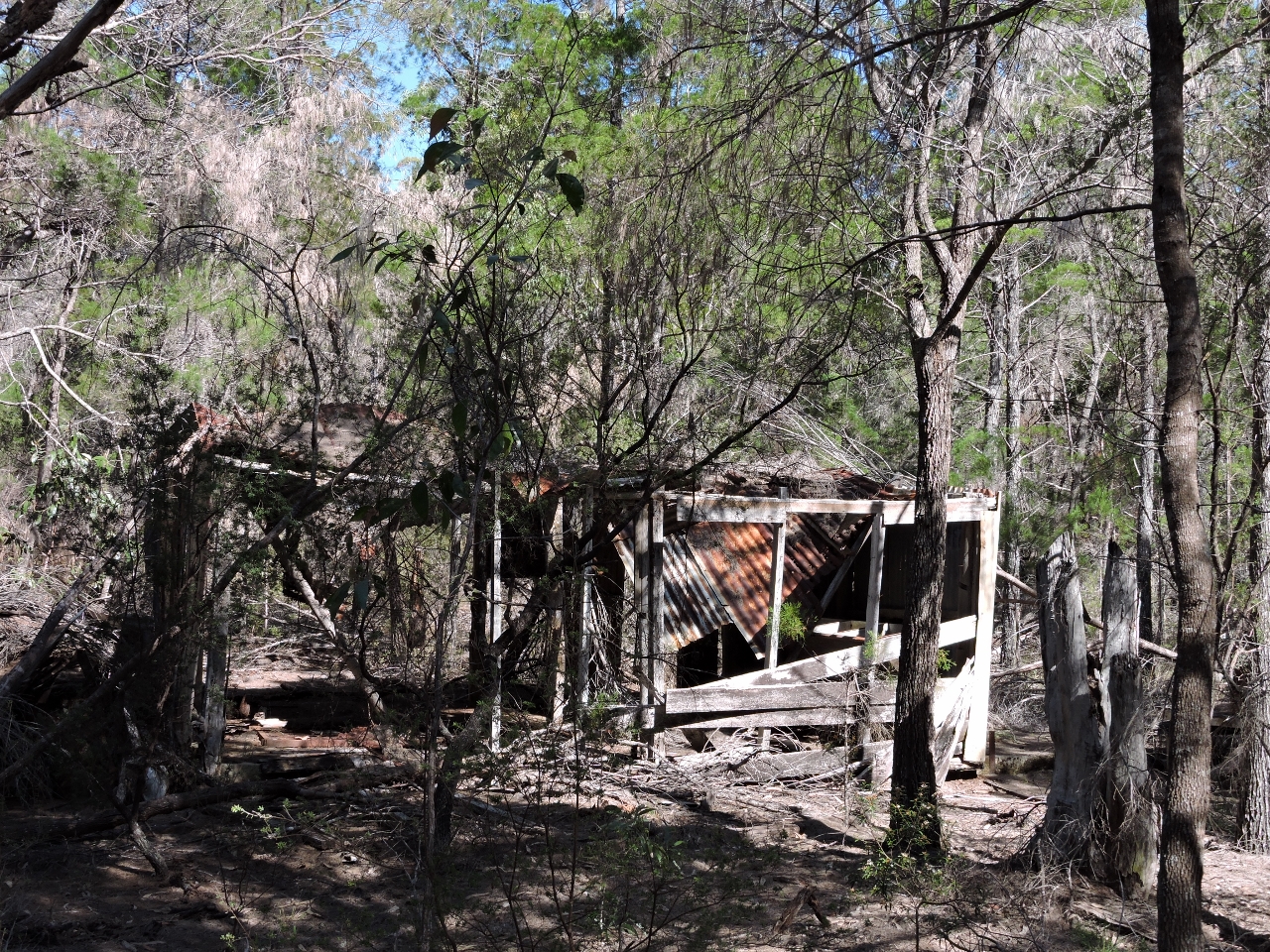 |
8/26/2014: Commando school
Position: -25°24.28'S, 153°0.95'E
Ruins of the Fraser Commando School, an Australian World War II Special Operations training school.
|
 |
8/26/2014: The Jetty
Position: -25°23.38'S, 153°1.73'E
The track ended at the Kingfisher Resort complex, where we had a beer at the The Jetty bar overlooking the water and the resort pier.
|
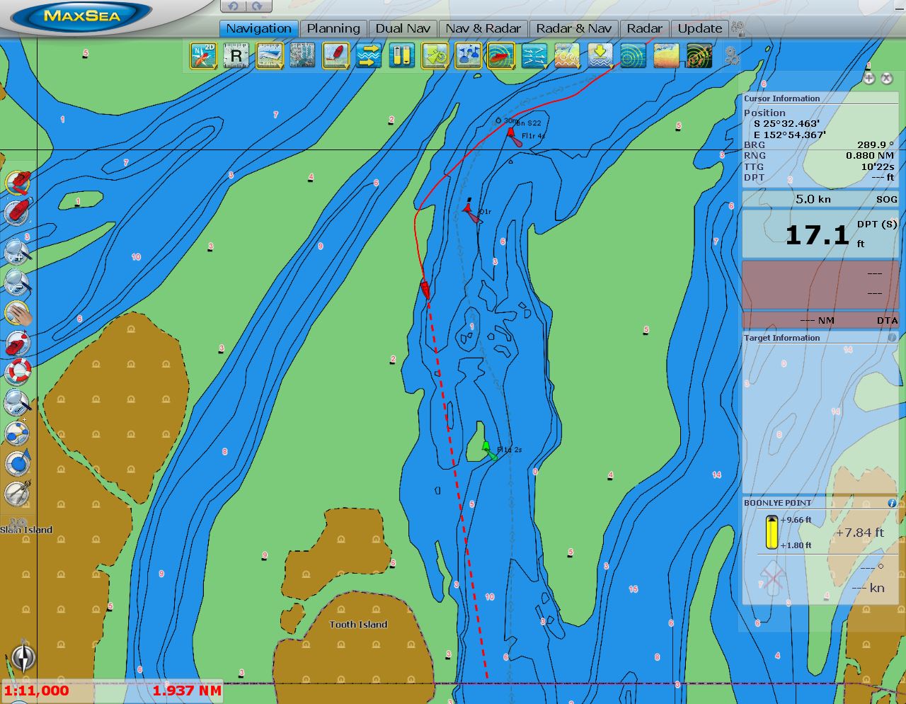 |
8/27/2014: On the reef
Position: -25°32.74'S, 152°55.28'E
We have two set of charts, both quite new: Navionics and C-Map. As at the Gold Coast, both are very different from each other, and neither reflected the current track: on both sets of charts we were more than 100' up onto the reef. The beacons are quite accurate, however, and show how the sandbars have completely changed since those charts were made. The minimum depths in the strait are in 3-5’ range, so deep draft boats need some tide. But the whole strait is quite passable under the right conditions. We came through on an 8’ tide at Boonlye Point and saw a least depth of 12’ with a very brief blip to 10'.
|
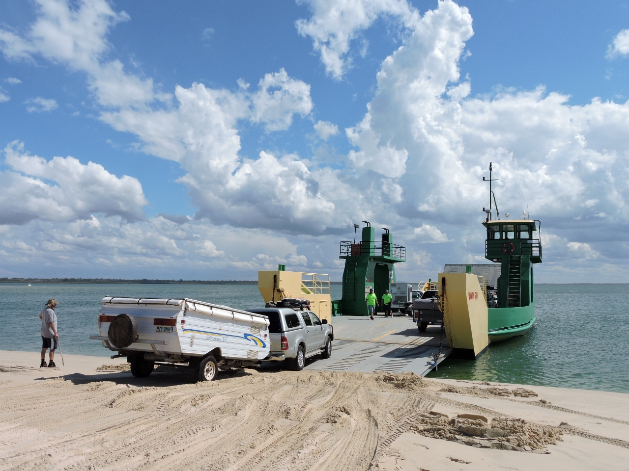 |
8/27/2014: Ferry
Position: -25°48.50'S, 153°2.71'E
The ferry Manta Ray runs continuously back and forth between Inskip Peninsula and Fraser Island all day, carrying a constant stream of vehicles back and forth. We were amazed at the traffic. And a second ferry ran on the weekend.
|
 |
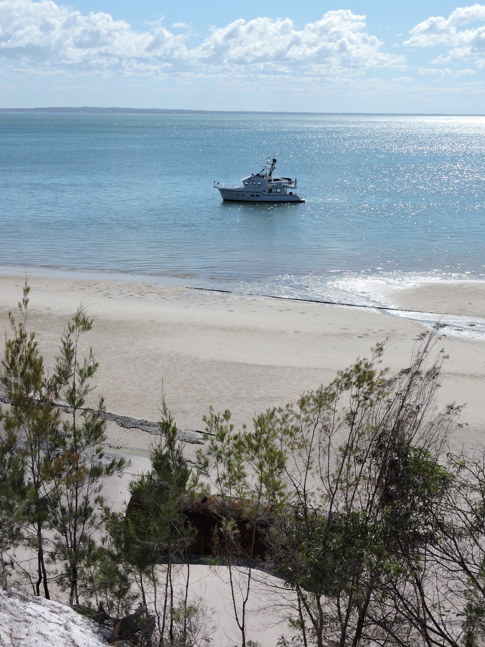
8/27/2014: Anchorage view
Position: -25°48.54'S, 153°2.66'E
We initially were thinking of anchoring inside Pelican Bay, farther east, but found this spot off a sand spit too appealing to leave.
|
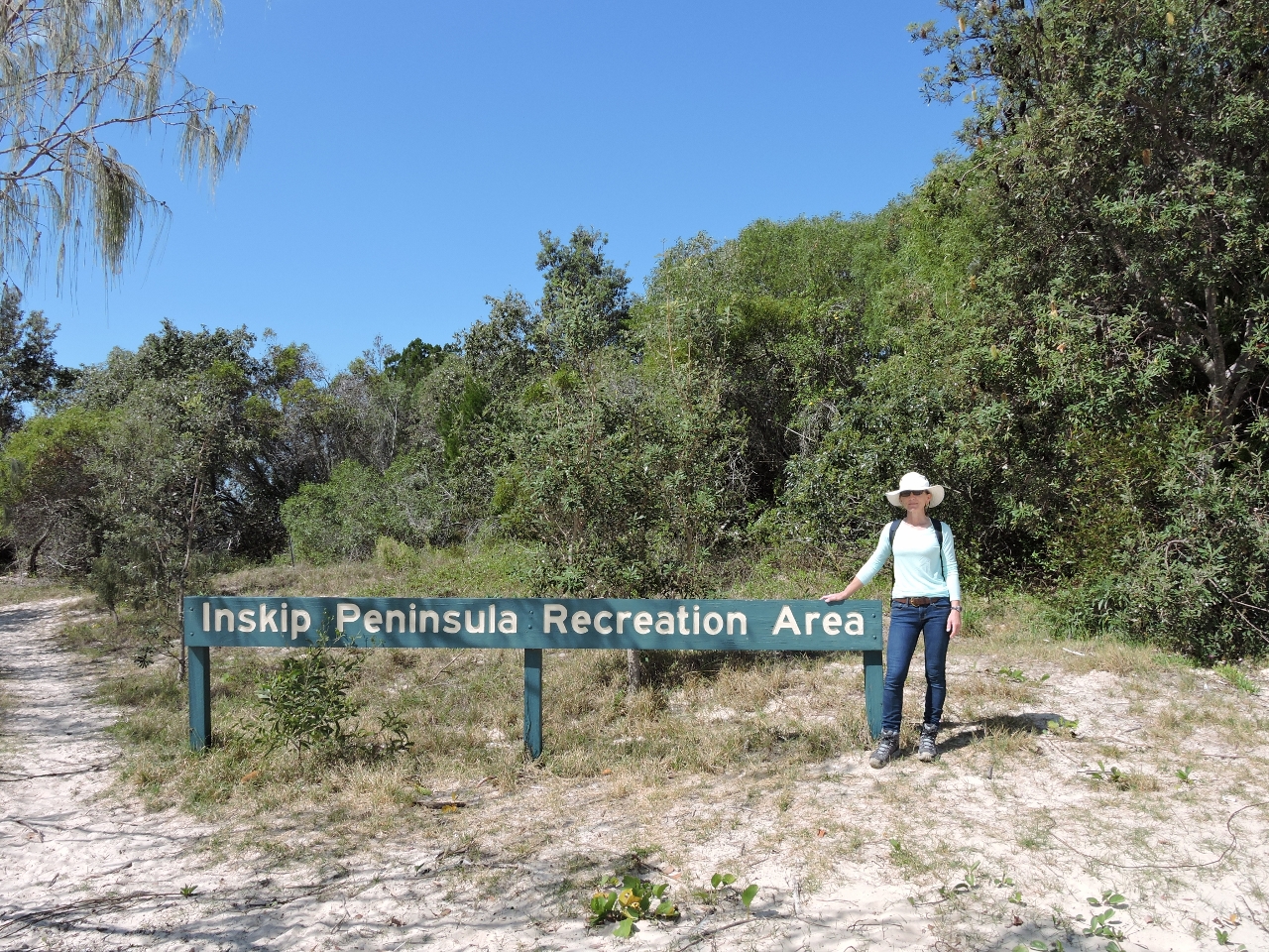 |
8/27/2014: Inskip Peninsula Recreation Area
Position: -25°48.53'S, 153°2.84'E
Inskip Peninsula is a popular recreation area, with good fishing, beautiful beaches and coastal camping--campgrounds run the length of the peninsula. And it's the southernmost access point to Fraser Island.
|
 |
8/27/2014: Beach
Position: -25°48.50'S, 153°3.14'E
Looking north along the wide sandy beach that edged Inskip Peninsula. Note the tire tracks in the sand--the beach is a designated road.
|
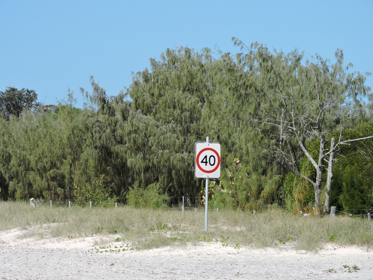 |
8/27/2014: Speed limit
Position: -25°48.54'S, 153°3.42'E
A speed limit sign for a beach seemed a little odd, but it is a road.
|
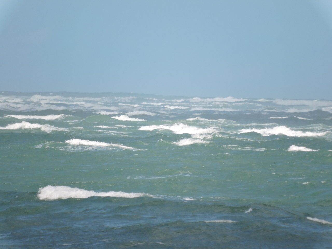 |
8/27/2014: Wide Bay Bar
Position: -25°48.75'S, 153°4.25'E
The Wide Bay Bar still looked pretty rough, even in the calmer weather we've been seeing since we were out there.
|
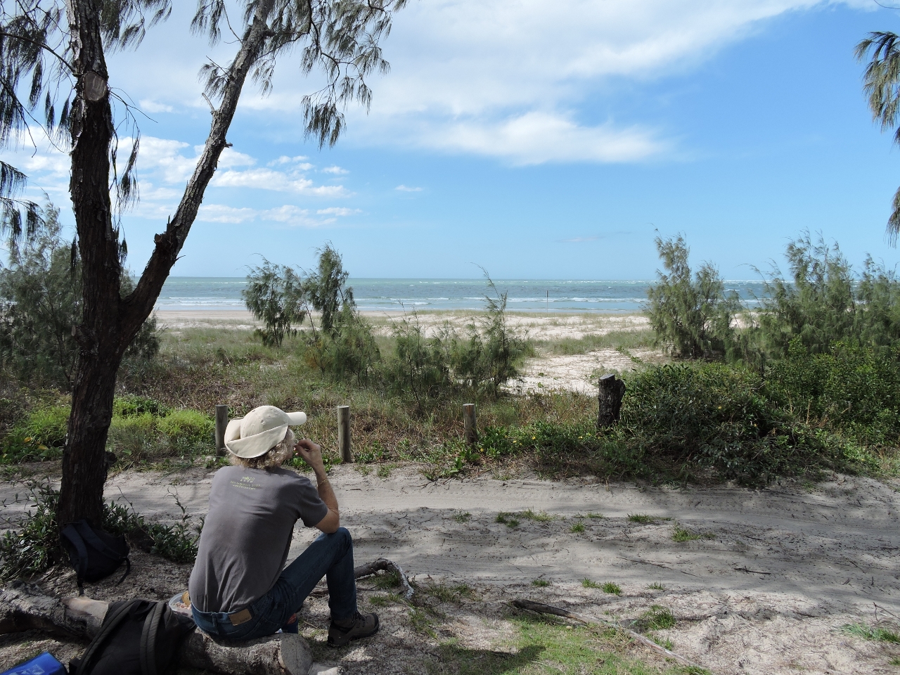 |
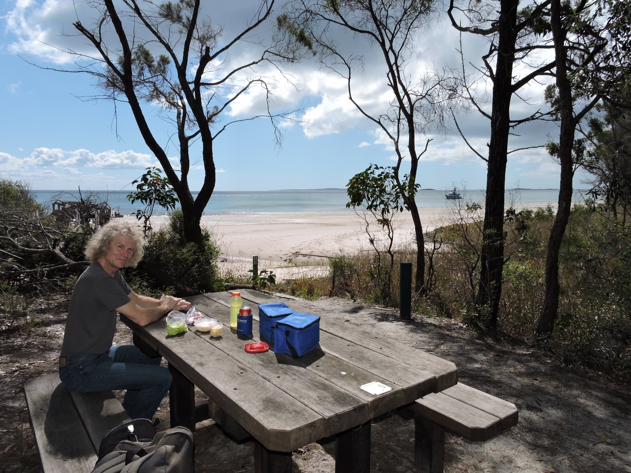
8/27/2014: Lunch
Position: -25°48.77'S, 153°4.23'E
We had a picnic lunch with a view to the bar.
|
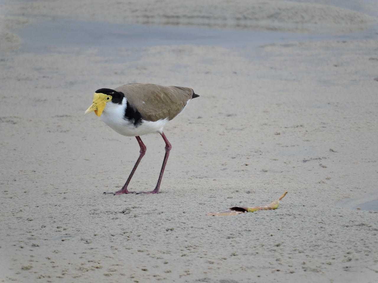 |
8/27/2014: Spur-winged Plover
Position: -25°48.64'S, 153°3.25'E
Spur-winged plovers have yellow spurs on their wings (not visible in our photo) to fight off intruders.
|
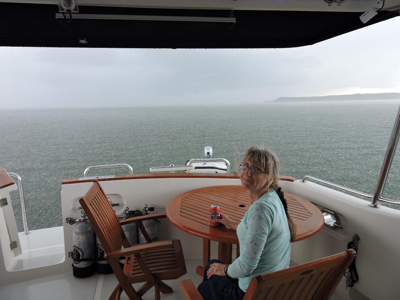 |
8/27/2014: Squall
Position: -25°48.71'S, 153°2.35'E
We just made it back to Dirona before this 20-minute downpour came through. We haven't seen so much rain in such a short period for at least a decade.
|
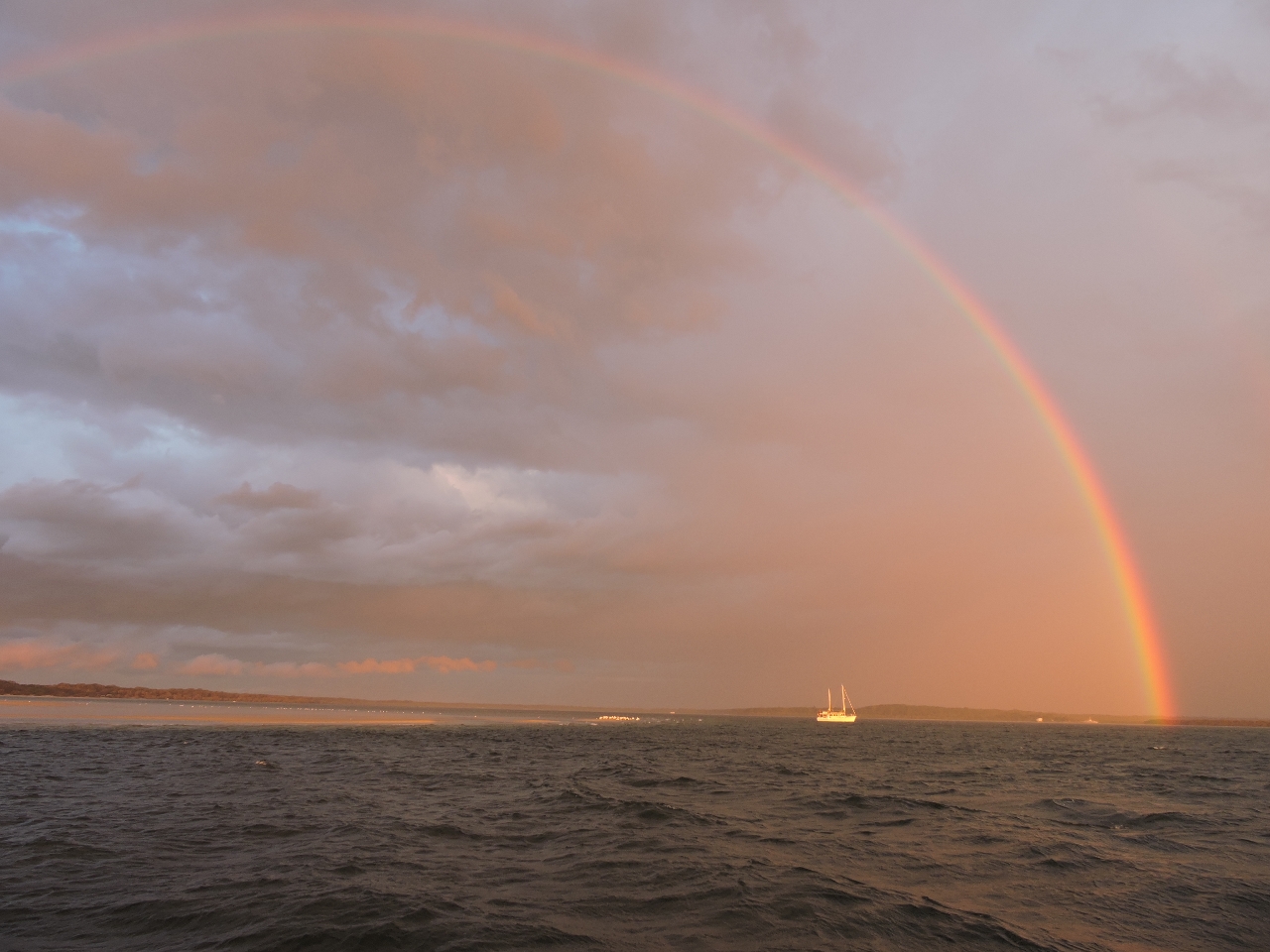 |
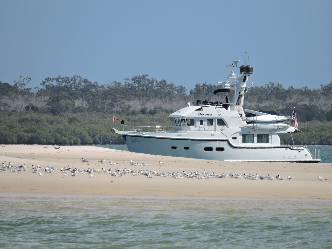
8/27/2014: Rainbow
Position: -25°48.71'S, 153°2.35'E
Rainbow over the peninsula. The boat under the rainbow is MV Tidahapah--we met owner Benn Hardie while at Dockside Marina in Brisbane.
|
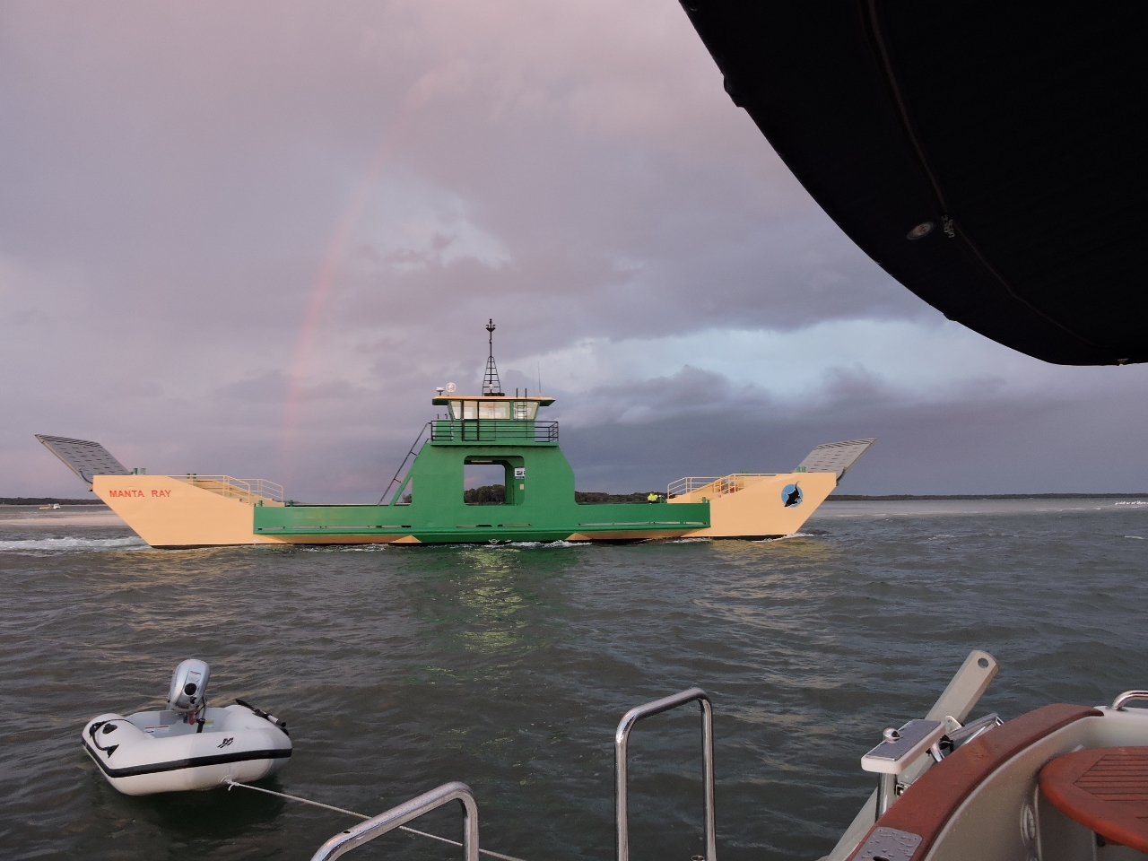 |
8/27/2014: Manta Ray
Position: -25°48.71'S, 153°2.35'E
The ferry Manta Ray returning to port for the night, running just between us and the sandbar.
|
 |
8/29/2014: Pialba
Position: -25°16.43'S, 152°51.21'E
We stopped for the night in the shallows off Pialba. With light southerly winds, the anchorage was sheltered and calm.
|
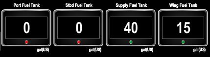 |
8/30/2014: Running on fumes
Position: -24°47.87'S, 152°29.09'E
We're down to only 55 total gallons of diesel on board, and of that, only 40 gallons outside of the wing tank. We've been working the tanks down so that we can calibrate the new fuel level sensors when we fill in Bundaberg.
|
 |
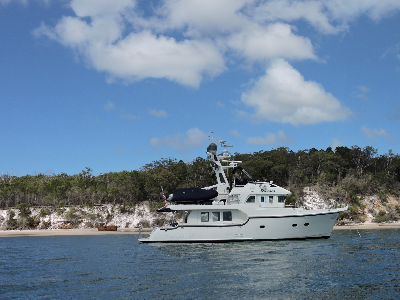
8/30/2014: Burnett River
Position: -24°45.27'S, 152°24.20'E
Running the marked channel into the Burnett River towards Bundaberg.
|
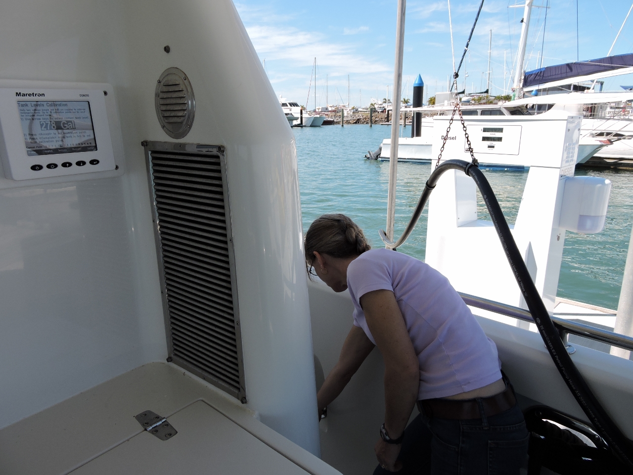 |
8/30/2014: Calibrating
Position: -24°45.65'S, 152°23.20'E
Jennifer is fueling while James is entering the calibration points. We used the Maretron DSM250 at the left of the photo to calibrate the starboard tank and a DSM150 in the galley to calibrate the port tank, switching sides at regular intervals. Port Bundaberg has excellent diesel prices--good thing, as we took on 1,658 gallons.
|
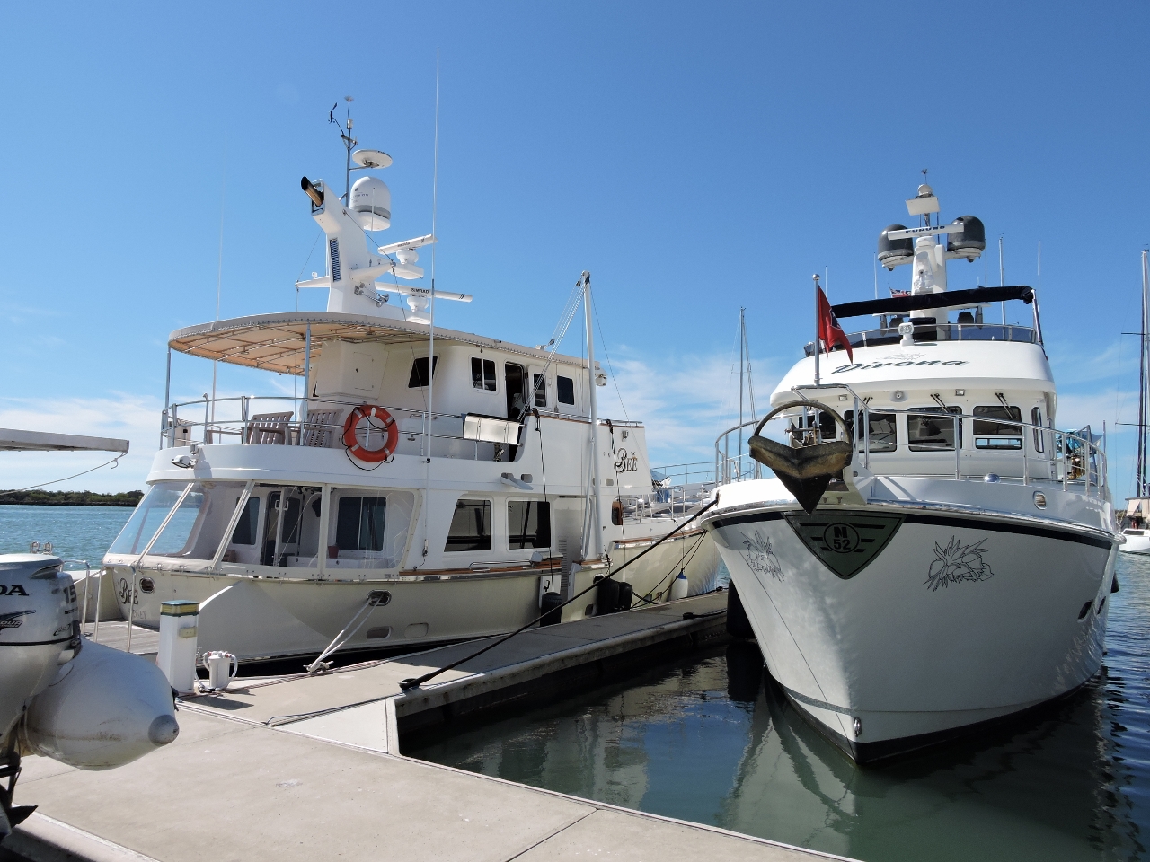 |
8/30/2014: Bee
Position: -24°45.63'S, 152°23.26'E
Moored at Port Bundaberg next to Nordhavn 6236 Bee, ex-Windflight. We first met owners Rowley & Bernadette Errington at the 2012 Trawlerfest in Anacortes Washington--it was great to see them again and catch up.
|
 |
8/31/2014: Shalom markets
Position: -24°53.68'S, 152°20.37'E
The marina runs a courtesy bus to the Sunday-only Shalom market just outside Bundaberg, where we picked up a good supply of farm-fresh fruits and vegetables.
|
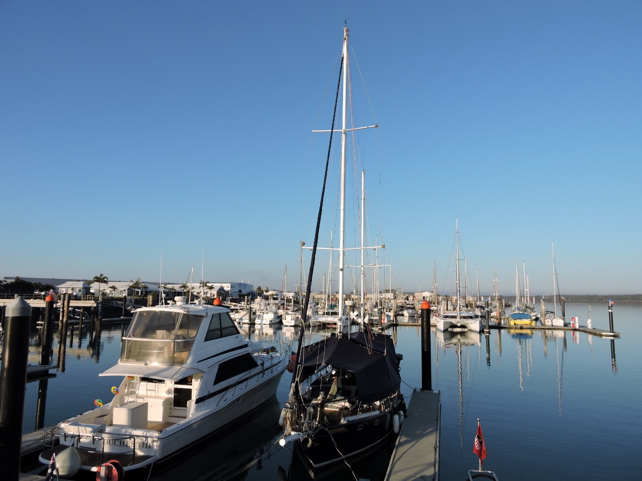 |
9/1/2014: Morning calm
Position: -24°45.63'S, 152°23.26'E
The marina at Port Bundaberg is beautiful and clean, and fairly sheltered even when it's blowing hard offshore.
|
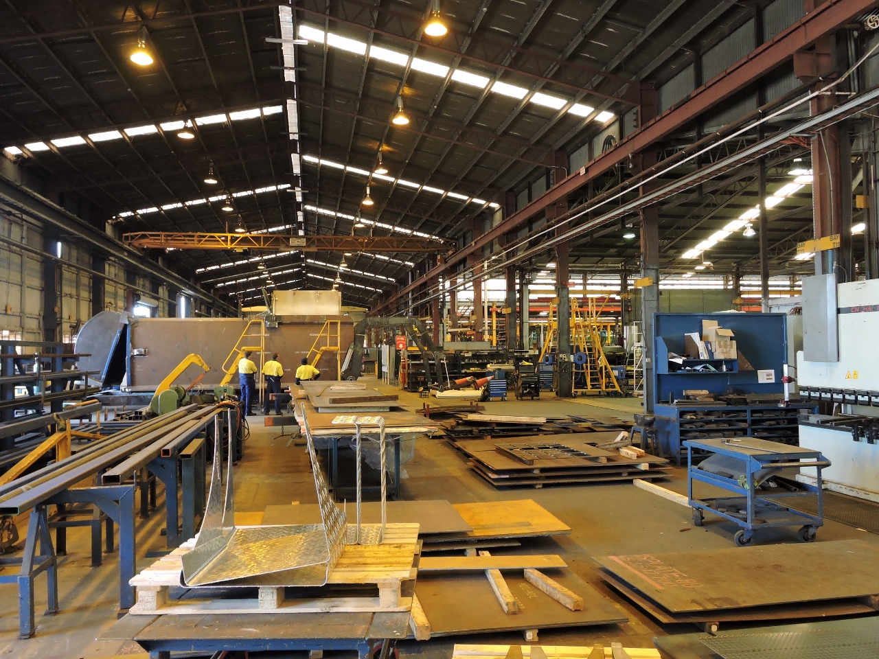 |
9/1/2014: Superior Pak factory tour
Position: -24°51.66'S, 152°19.03'E
Rowley & Bernadette own Superior Pak, Australia's largest waste-equipment manufacturer, specializing in garbage trucks. We love all things mechanical, and this was a goldmine. It's amazing how much innovation goes into fast, efficient and safe pickup of residential waste.
|
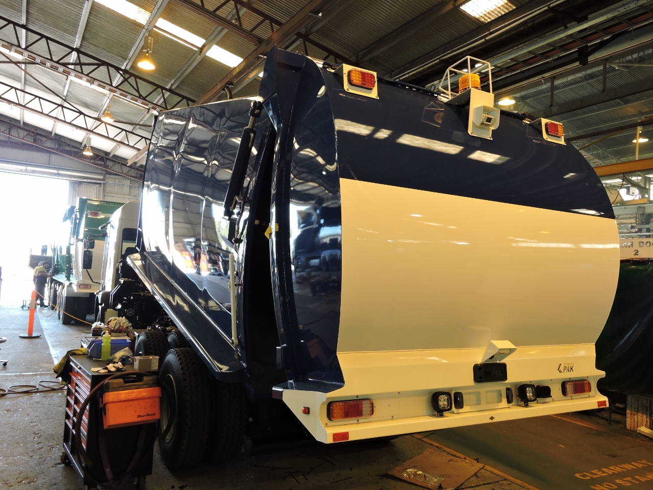 |
9/1/2014: Nearly-finished product
Position: -24°51.66'S, 152°19.03'E
Superior Pak offers many different trucks designs tailored to the needs of specific customers. But the focus is on maximizing the load capacity through careful design and material selection, and maximizing throughput, mostly achieved through worker friendly layout and high-speed hydraulics.
|
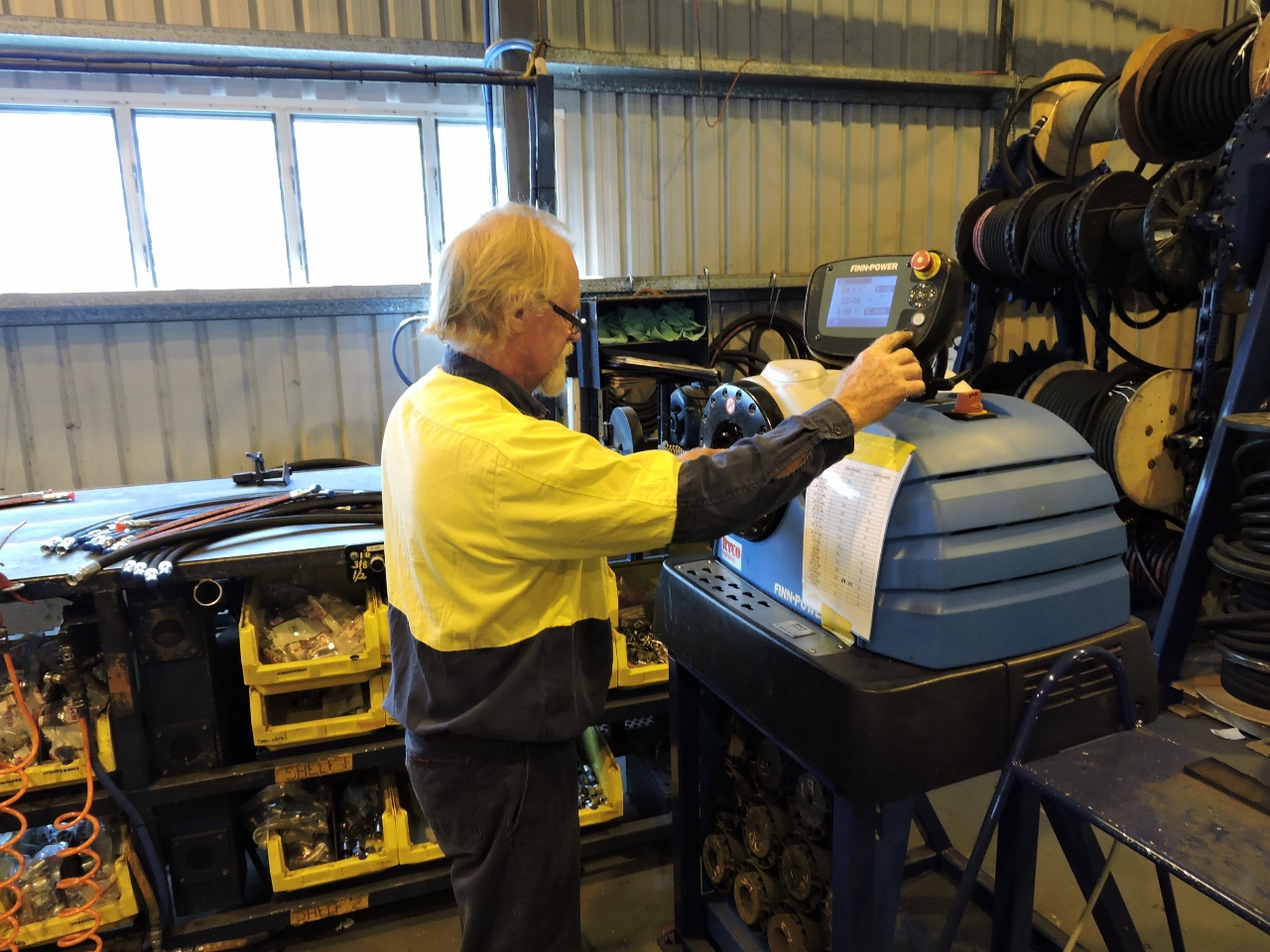 |
9/1/2014: Hydraulics
Position: -24°51.66'S, 152°19.03'E
Looking beneath the surface of these trucks, you'll find hydraulics systems as complex as some of the largest yachts, and we recognized many of the parts. Superior Pak builds their own hoses using this awesome Finn-Power hose crimper. While we watched, the operator crimped a complete hose in seconds.
|
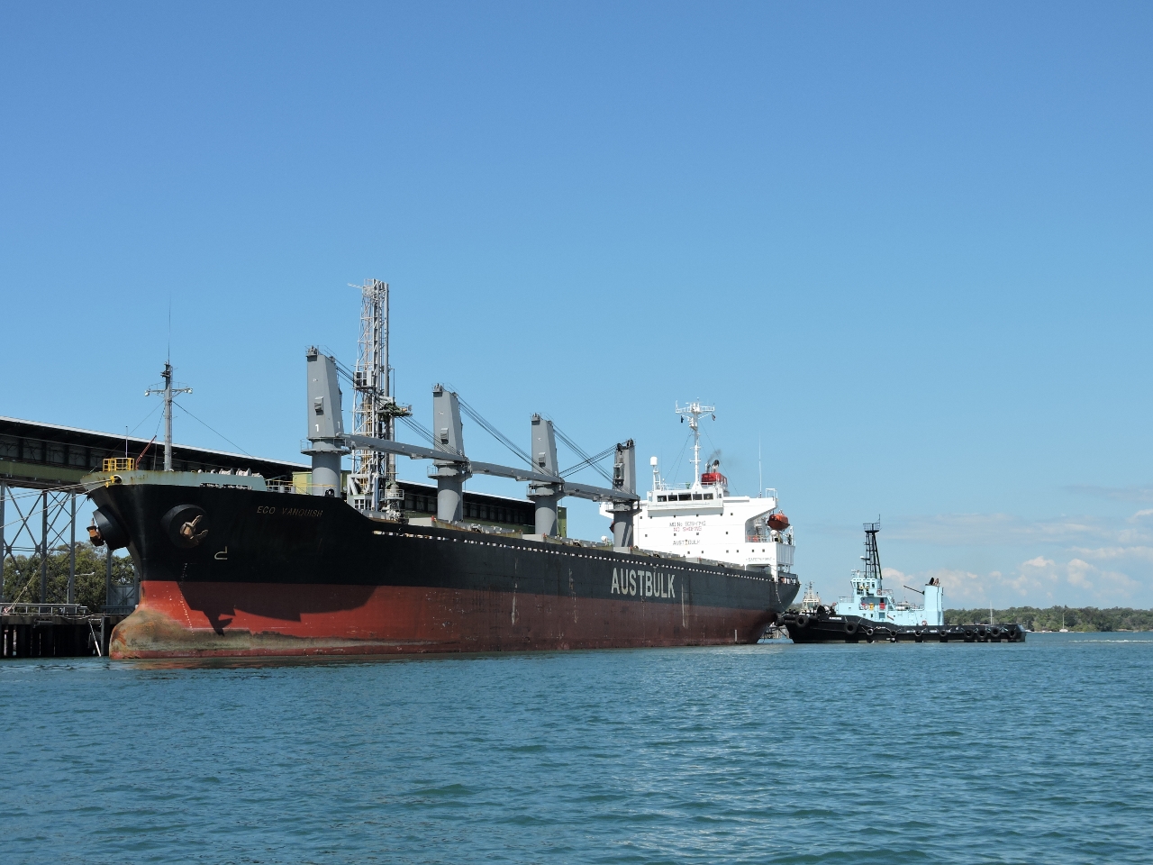 |
9/1/2014: Eco Vanquish
Position: -24°46.26'S, 152°22.84'E
The city of Bundaberg is easily accessible from the marina via the river by dinghy. We liked it so much we went two days in a row. The bulker Eco Vanquish was taking on a load of sugar, Bundaberg's major export, at the dock just south of the marina as we passed.
|
 |
9/1/2014: New jetty
Position: -24°51.80'S, 152°21.17'E
We landed at the new public jetty, recently replaced after flooding carried off the original.
|
 |
9/1/2014: The Spinnaker
Position: -24°51.76'S, 152°21.36'E
The Spinnaker has a great deck overlooking the Burnett River, with excellent food.
|
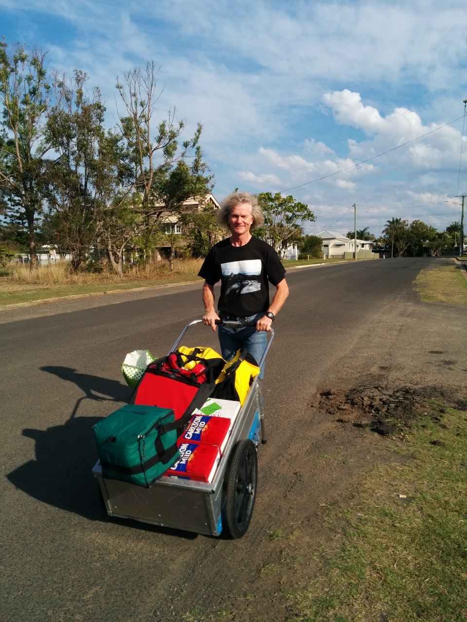 |
9/2/2014: Provisioning
Position: -24°52.21'S, 152°21.32'E
We brought our cart by dinghy back to Bundaberg and walked it in to the local Woolworths for groceries and Dan Murphy's for wine and beer. That cart was a great purchase--we've used it throughout the trip, and here we're easily moving about 150 pounds of provisions.
|
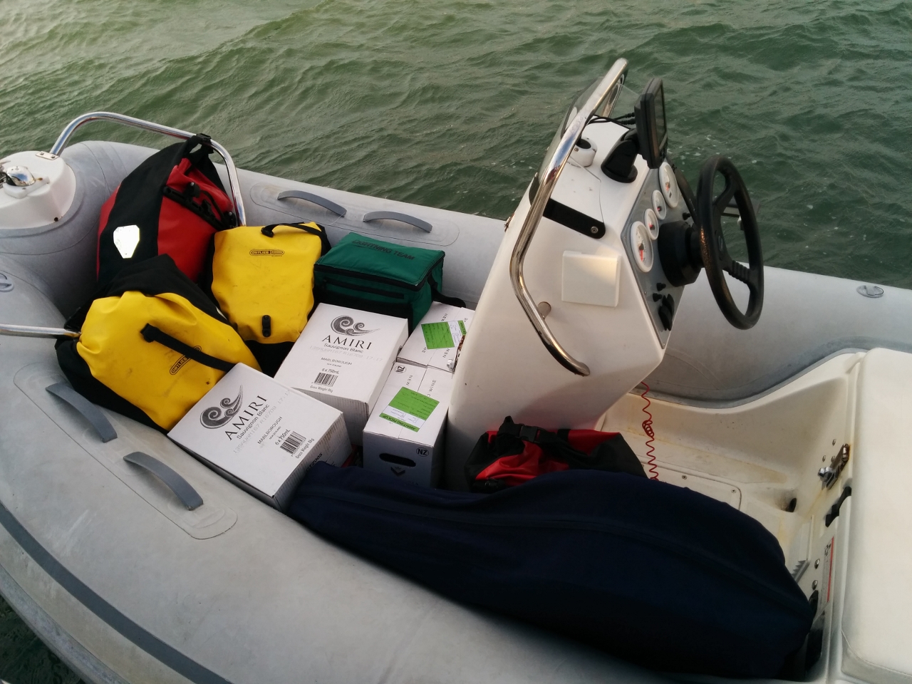 |
9/2/2014: Dinghy load
Position: -24°51.77'S, 152°21.19'E
The cart contents nearly filled the dinghy. The cart itself is in the foreground, folded back up and stowed in its canvas bag.
|
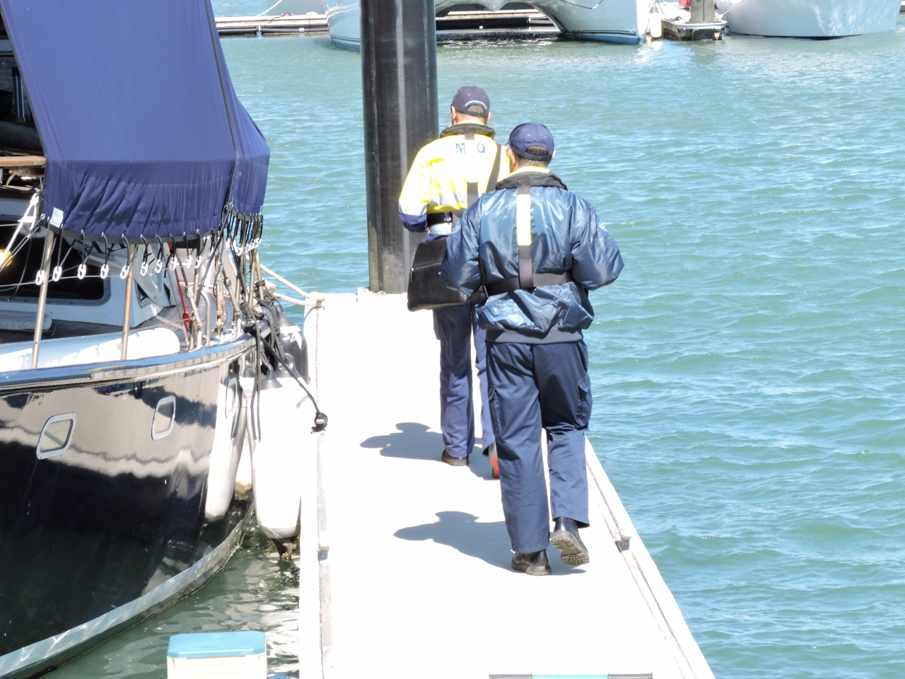 |
9/3/2014: Inspection
Position: -24°45.63'S, 152°23.26'E
Maritime Safety Queensland walking the docks to inspect for marine pollution violations.
|