MV Dirona travel digest for Kimberley South to North 2015

|
Click the travel log icon on the left to see these locations on a map,
with the complete log of our cruise. On the map page, clicking on a camera or text icon will display a picture and/or log entry for that location, and clicking on the smaller icons along the route will display latitude, longitude and other navigation data for that location. And a live map of our current route and most recent log entries always is available at //mvdirona.com/maps/LocationCurrent.html. |
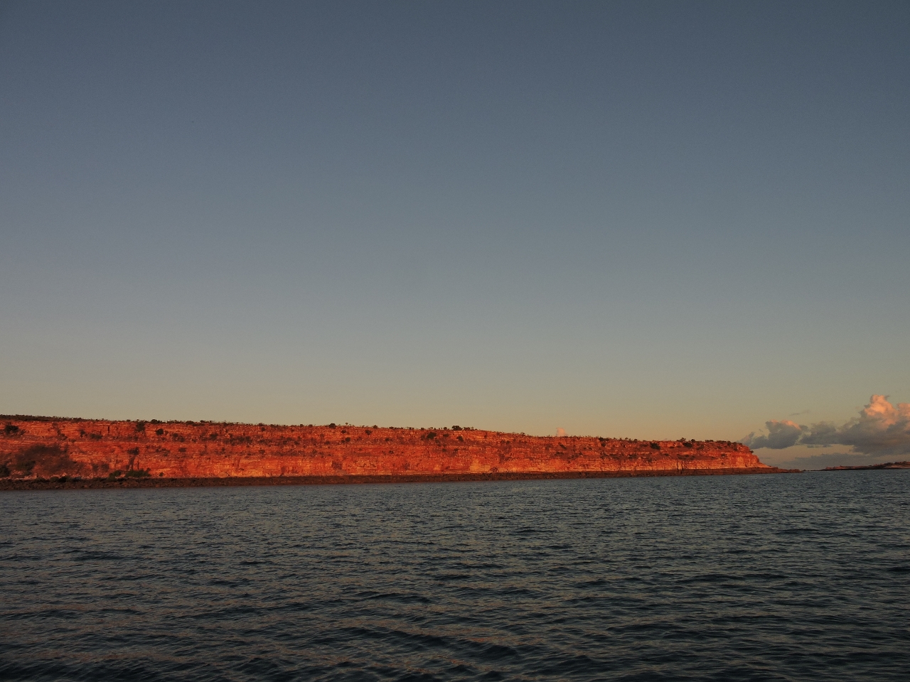 |
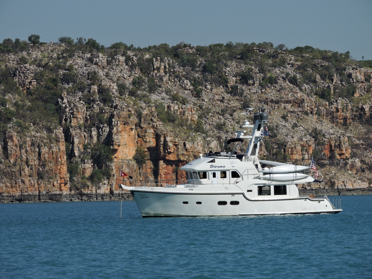
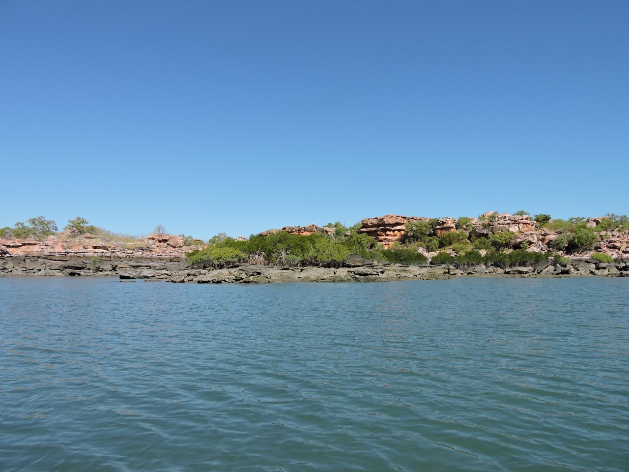
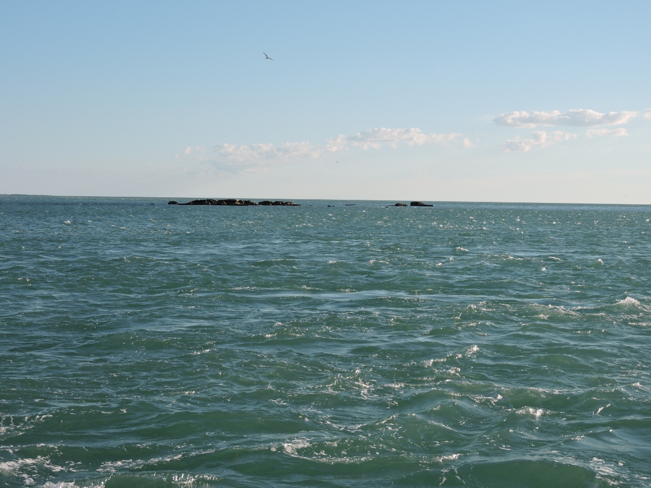
6/23/2015: Wilson Point
Position: -15°32.51'S, 124°25.95'E
After a pretty big day of visiting Montgomery Reef and Langgi, we found sheltered anchored for the night at Wilson Point. These are the bluffs behind the anchorage in the early morning light.
|
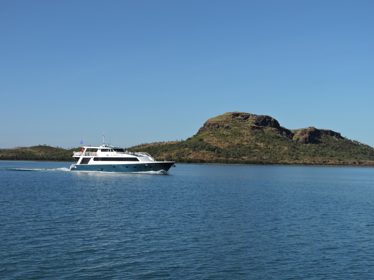 |
6/23/2015: Lady M
Position: -15°29.62'S, 124°36.19'E
The charter boat Lady M, that we last saw entering the King George River, was leaving Camden Harbour as we arrived.
|
 |
6/23/2015: Shallows
Position: -15°29.70'S, 124°36.24'E
We twice had to divert course after encountering uncharted 8ft shallows en route to Camden Harbour.
|
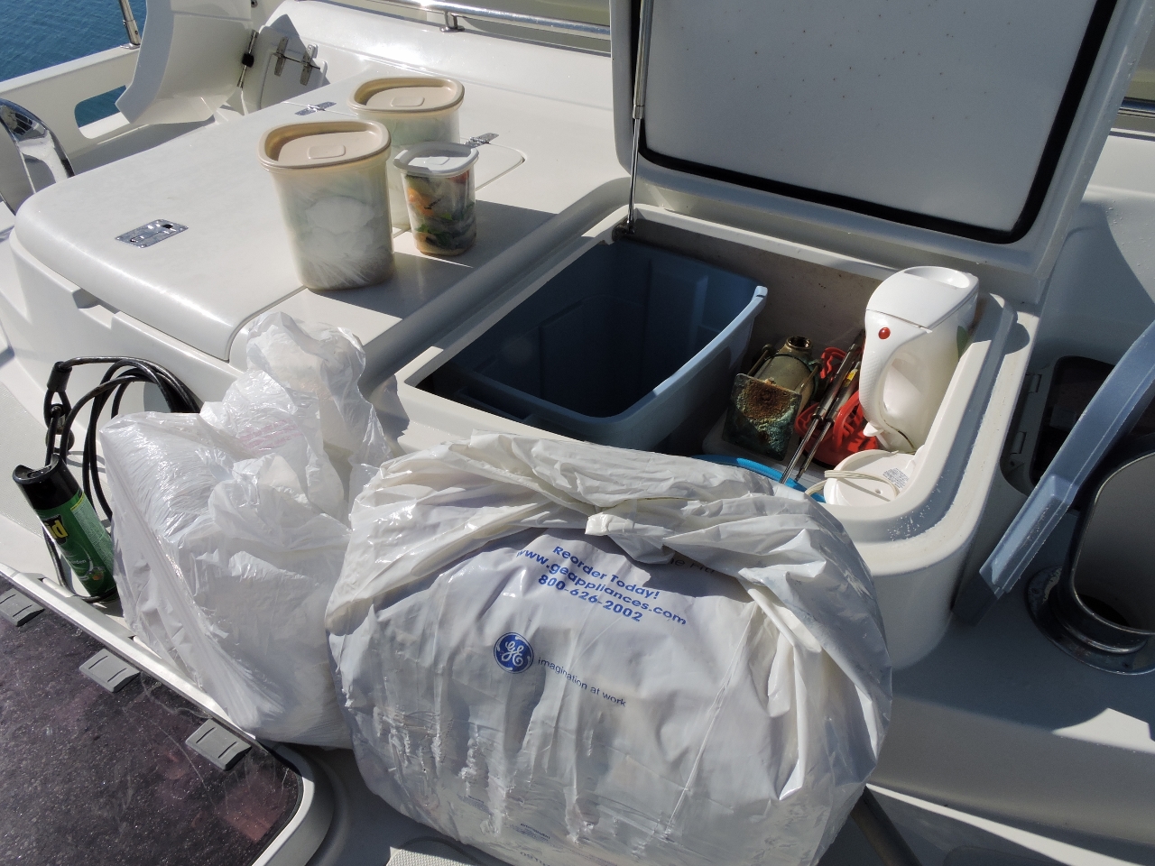 |
6/23/2015: Garbage day
Position: -15°29.73'S, 124°37.16'E
Today we removed the bag from the galley trash compactor and stowed it inside a plastic bin in one of the bow lockers. We mainly put plastics and anything else not recyclable or biodegradable in the trash compactor, and don't put anything in there that can smell. The smaller of the three plastic containers on the left contains smelly foodstuff garbage that we keep sealed under the galley sink. When we transfer the trash compactor bag forward, we also empty the smelly garbage into it. We can go at least three weeks without emptying the compactor, and can stow two of its cubes forward, allowing us to go at least two months without getting rid of any garbage.
|
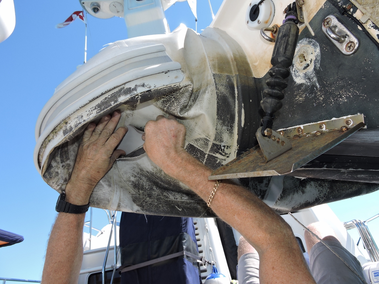 |
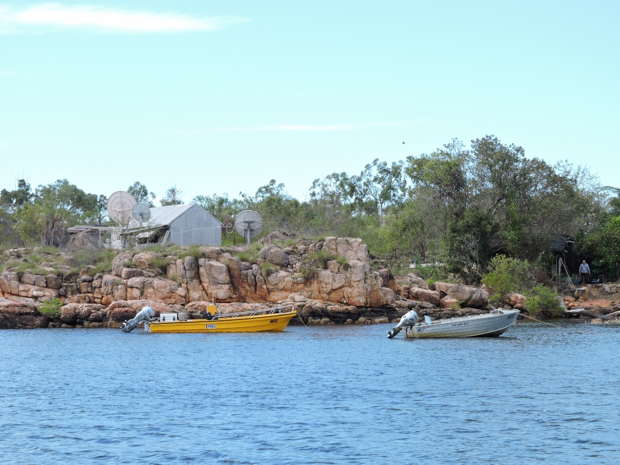
6/23/2015: Pontoon repair
Position: -15°29.73'S, 124°37.17'E
No--a crocodile didn't bite our tender. The reinforcing pieces at the rear of the pontoons had starting to peel away, and we also fixed a small leak in the same area. We have heard stories of crocodiles biting inflatable tenders though, and have been careful to lift ours up every night to minimize the risk. Several people recommended we get a "tinnie" (aluminum tender) to visit the Kimberley, but that wasn't really an option for us. So, as they say at the Saturday night stock car races, "Ya run what ya brung".
|
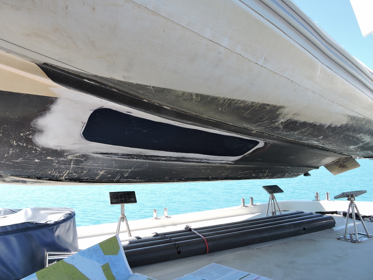 |
6/23/2015: Hull repair
Position: -15°29.73'S, 124°37.17'E
The other day we noticed a fair-sized crack in the dinghy hull around where it sat on the chocks. This turned out to be a crack about 30 inches long that we fixed along with the pontoon repair. The tender is made of hypalon, but we had a lot of PVC on hand for repairing our discarded Aeres inflatable fenders, so used it to patch the leak. Since it wouldn't be contacting any of the hypalon, this should be fine. So far the patch is holding well.
|
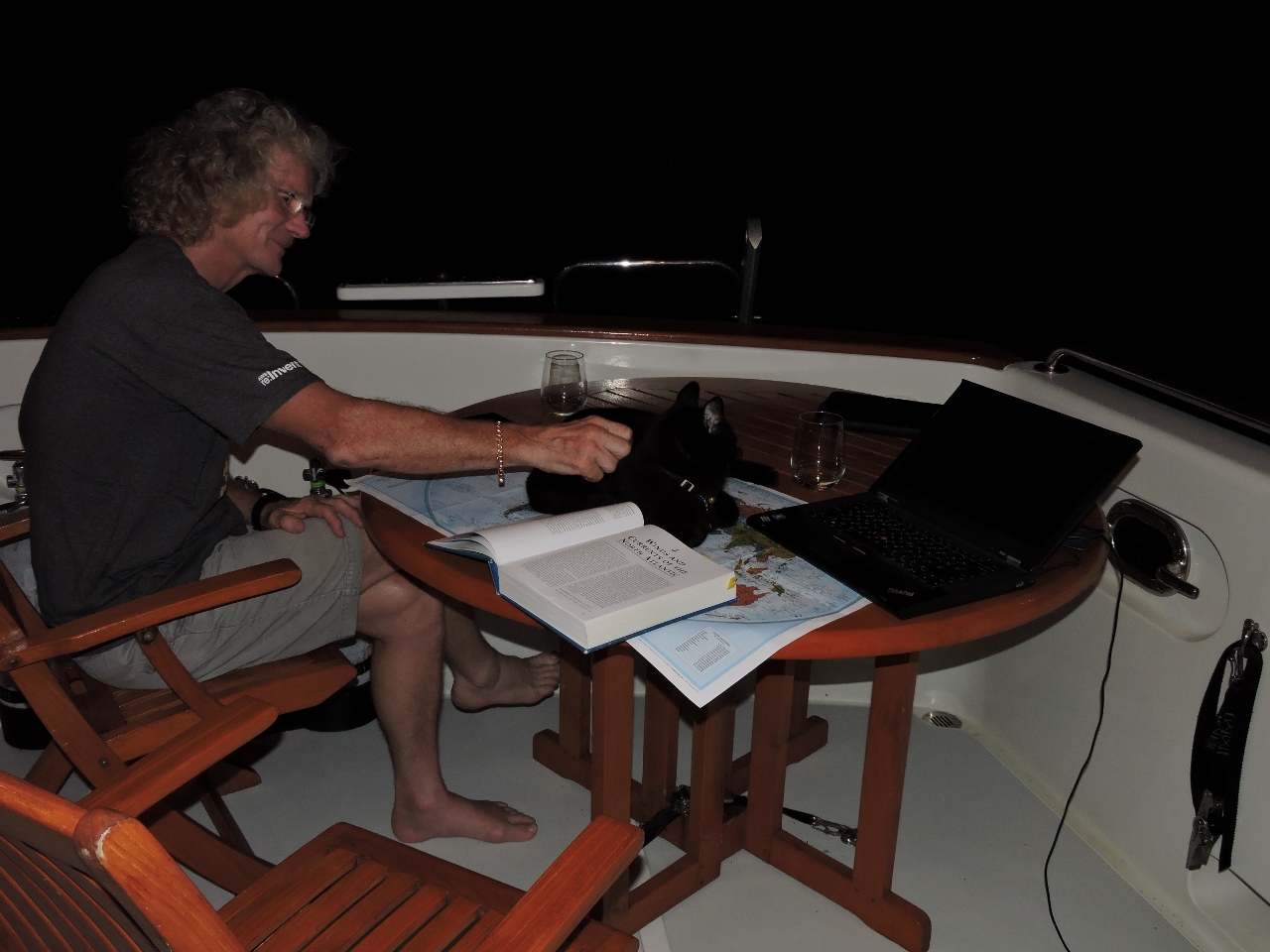 |
6/23/2015: Trip planning
Position: -15°29.72'S, 124°37.18'E
Spitfire helping out with some long-range trip planning.
|
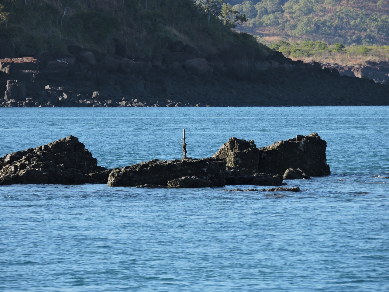 |
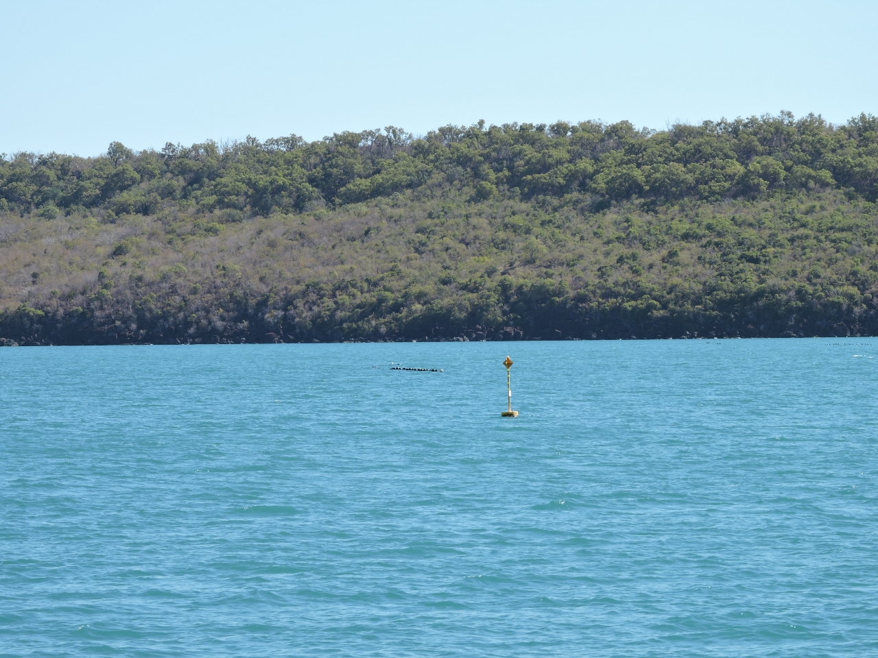
6/24/2015: Rogers Strait
Position: -15°27.61'S, 124°36.79'E
Rogers Strait, like much of the Kimberley, is unsurveyed. In addition to a careful watch, we're navigating using satellite imagery and recommended routes from Western Australia Cruising. We passed through this area while running south. Coming north on a 15-foot lower tide, you can see this reef to our east, near if not under, where we passed before.
|
 |
6/24/2015: Mirrool
Position: -15°18.61'S, 124°46.37'E
Mirrool, that we last saw in the Mitchell River two weeks ago, was at anchor in Hanover Bay Inlet when we arrived. Surprisingly, Mirrool is the only pleasure craft we've seen during that period--we've only seen four pleasure craft in the nearly four weeks since leaving Darwin. Charter boats seem to far outnumber pleasure craft here.
|
 |
6/24/2015: Hanover Bay Inlet
Position: -15°19.17'S, 124°46.14'E
Coming into the anchorage at Hanover Bay Inlet. Last time we anchored on the east shore, so this time we'll anchor on the other side.
|
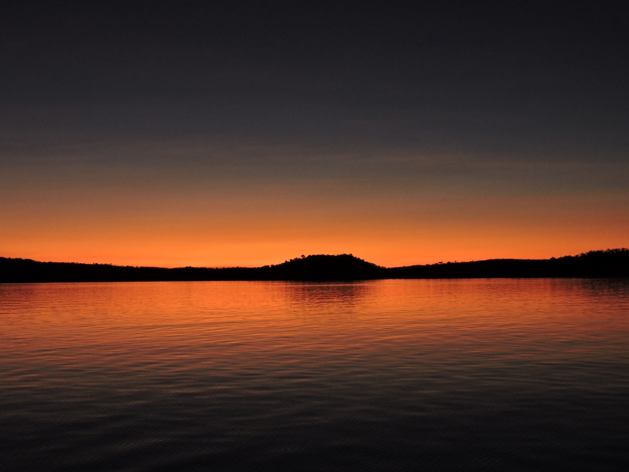 |
6/25/2015: Sunrise
Position: -15°19.21'S, 124°45.92'E
Sunrise from the anchorage.
|
 |
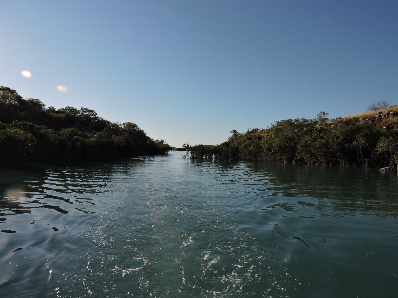
6/25/2015: Mangroves
Position: -15°18.51'S, 124°47.27'E
We toured the area by dinghy on a rising tide and were able to work a fair ways up this drying inlet. It sure seems odd to be floating even with the treetops.
|
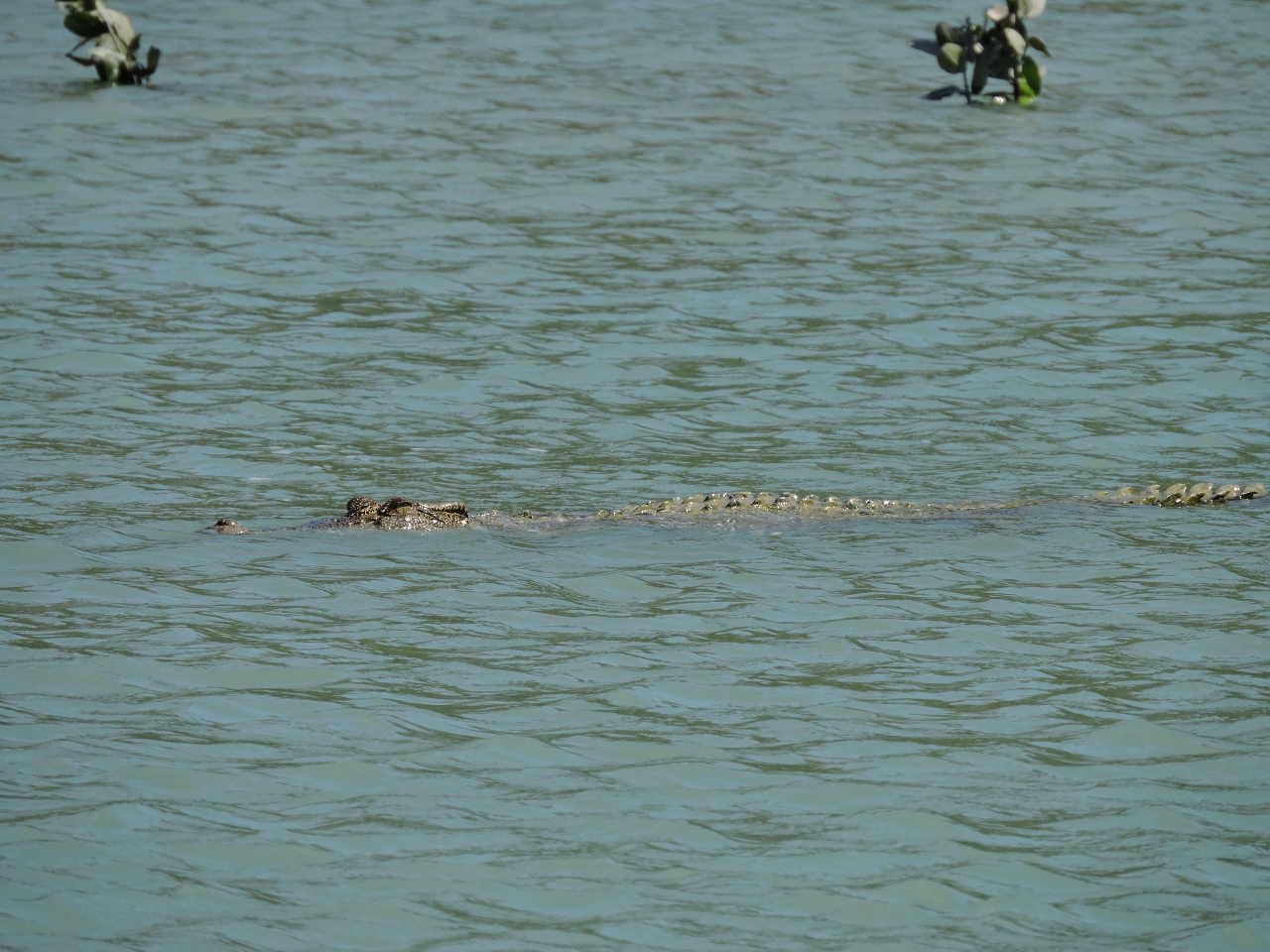 |
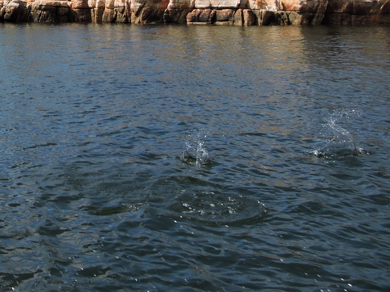
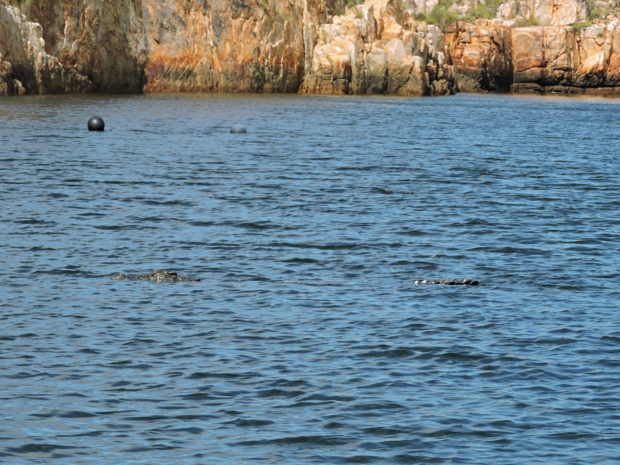
6/25/2015: Croc or rock?
Position: -15°20.29'S, 124°46.46'E
Croc. We'd gone up the narrow gorge across from our anchorage, and nearby also saw a large shark working the shallows and chasing a small stingray.
|
 |
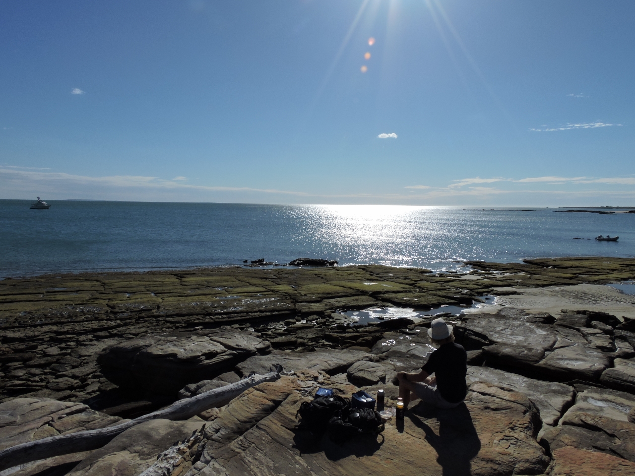
6/25/2015: Lunch
Position: -15°19.89'S, 124°46.33'E
The tide was still too low for us to go much farther upstream, so we returned downstream for lunch perched on a rock above the gorge. After lunch we did get a little farther, but rocks blocked the way and we were a little nervous about that croc we'd seen earlier. People keep warning us how tasty the crocs find Rigid Hull Inflatable craft.
|
 |
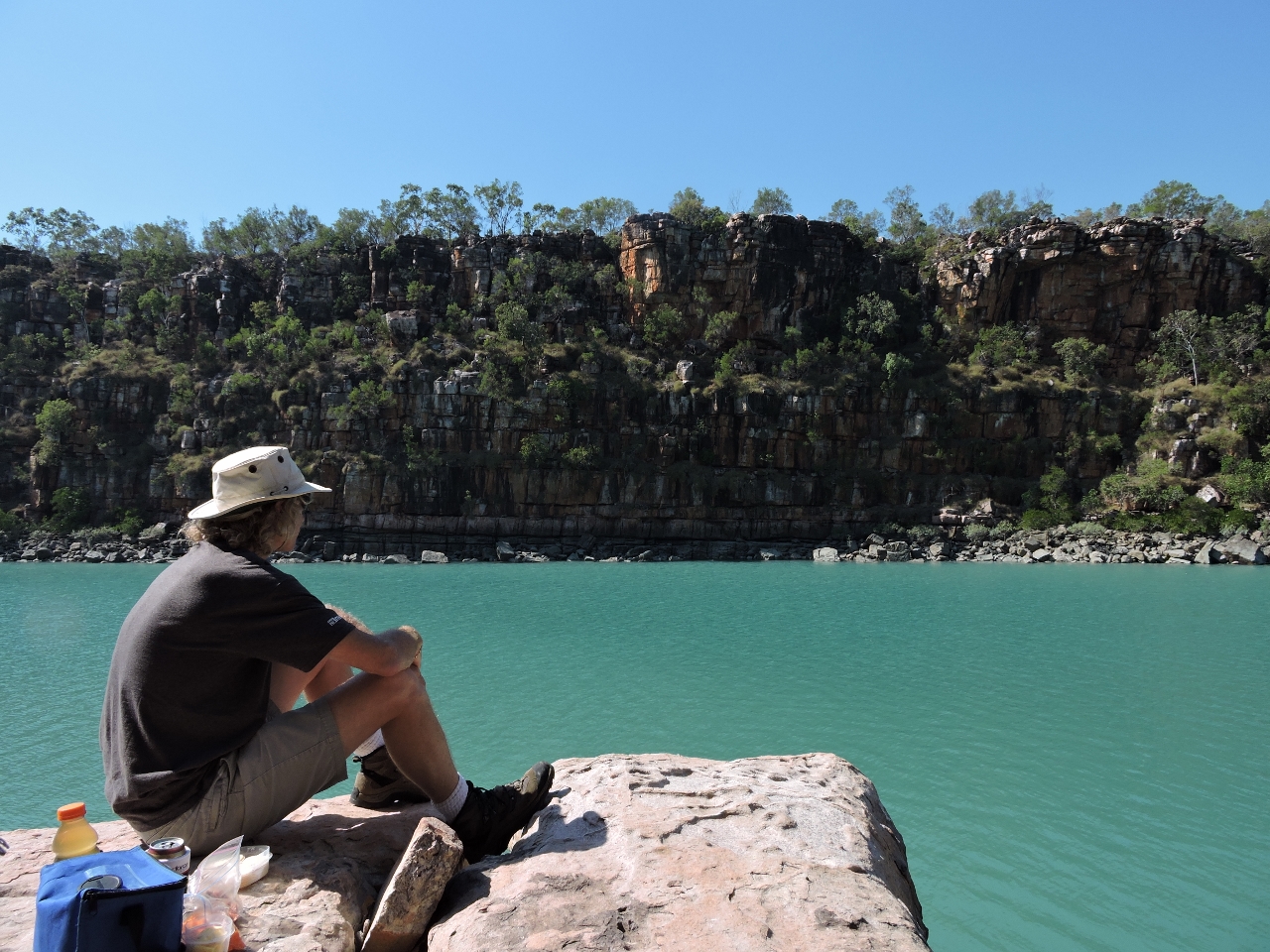
6/25/2015: Lunch view
Position: -15°19.89'S, 124°46.33'E
The view looking up the gorge from our lunch perch.
|
 |
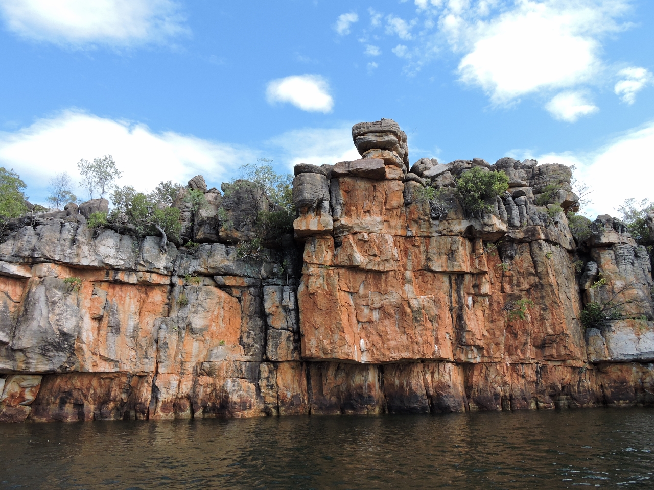
6/25/2015: At anchor
Position: -15°19.10'S, 124°45.92'E
Anchored below the striking cliffs in Hanover Bay Inlet.
|
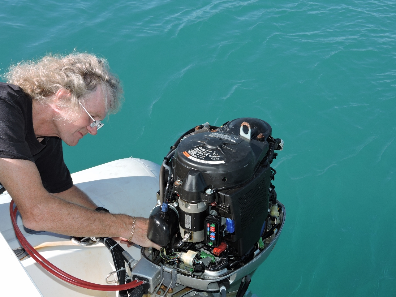 |
6/26/2015: Neutral switch
Position: -14°58.40'S, 125°14.42'E
The neutral safety switch on main tender motor jammed in non-neutral position, preventing the motor from starting. The switch should be replaced but we don’t have a spare, so James bent it back in place, reshaped it, and lubricated it. It now is working well.
|
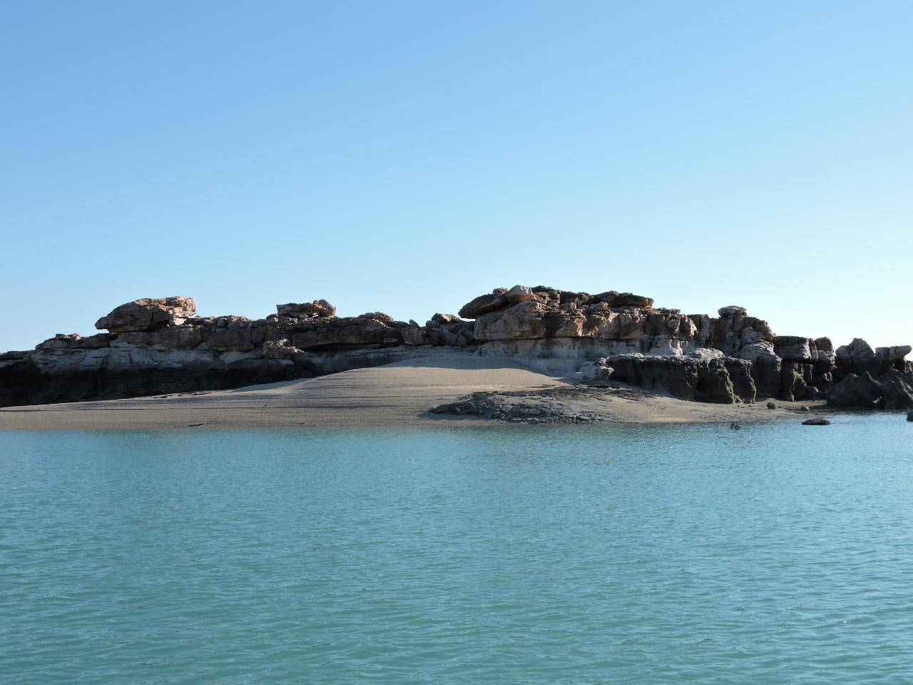 |
6/26/2015: Islet
Position: -14°57.97'S, 125°14.86'E
We'd anchored for the night along the west shore of Murrara Island, with excellent SE wind protection and attractive scenery. This islet not far from the anchorage had a nice sandy beach and complex rock formations.
|
 |
6/26/2015: Murrara Island
Position: -14°58.66'S, 125°15.19'E
At high tide, we could pass all the way through this channel along the north shore of Murrara Island and out into Prince Frederick Harbour.
|
 |
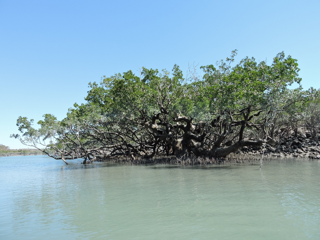
6/26/2015: Mangroves
Position: -14°58.72'S, 125°14.66'E
The evening sun lighting up the mangroves near the anchorage.
|
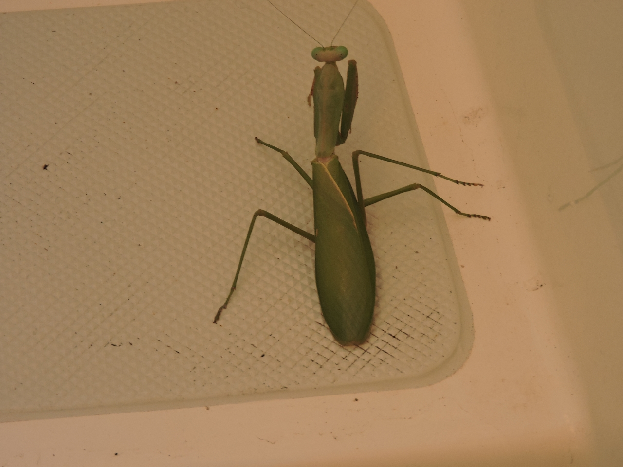 |
6/26/2015: Praying mantis
Position: -14°58.40'S, 125°14.42'E
We found this Praying Mantis on board when we returned from our dinghy run. Australia sure has a wide variety of creatures. This one at least is not deadly.
|
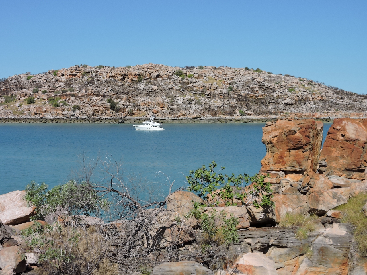 |
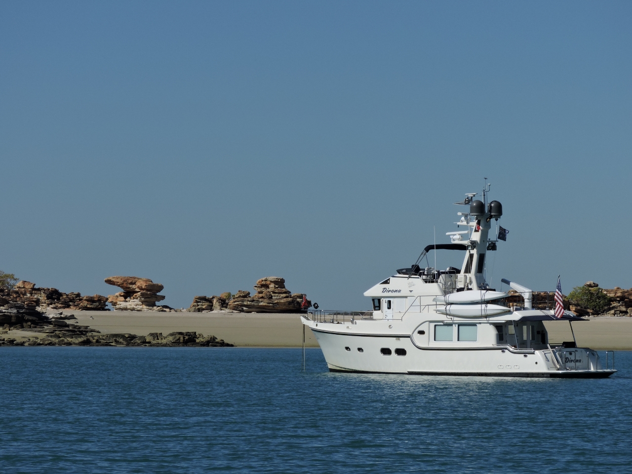
6/27/2015: Shelter Bay
Position: -14°25.25'S, 125°15.05'E
At anchor in protected and beautiful Shelter Bay. When we first saw Rick MacClure's photo of Nordhavn 55 Skie at Shelter Bay in the Nordhavn 2012 calender, we couldn't imagine being in such a wild-looking place. And here we are.
|
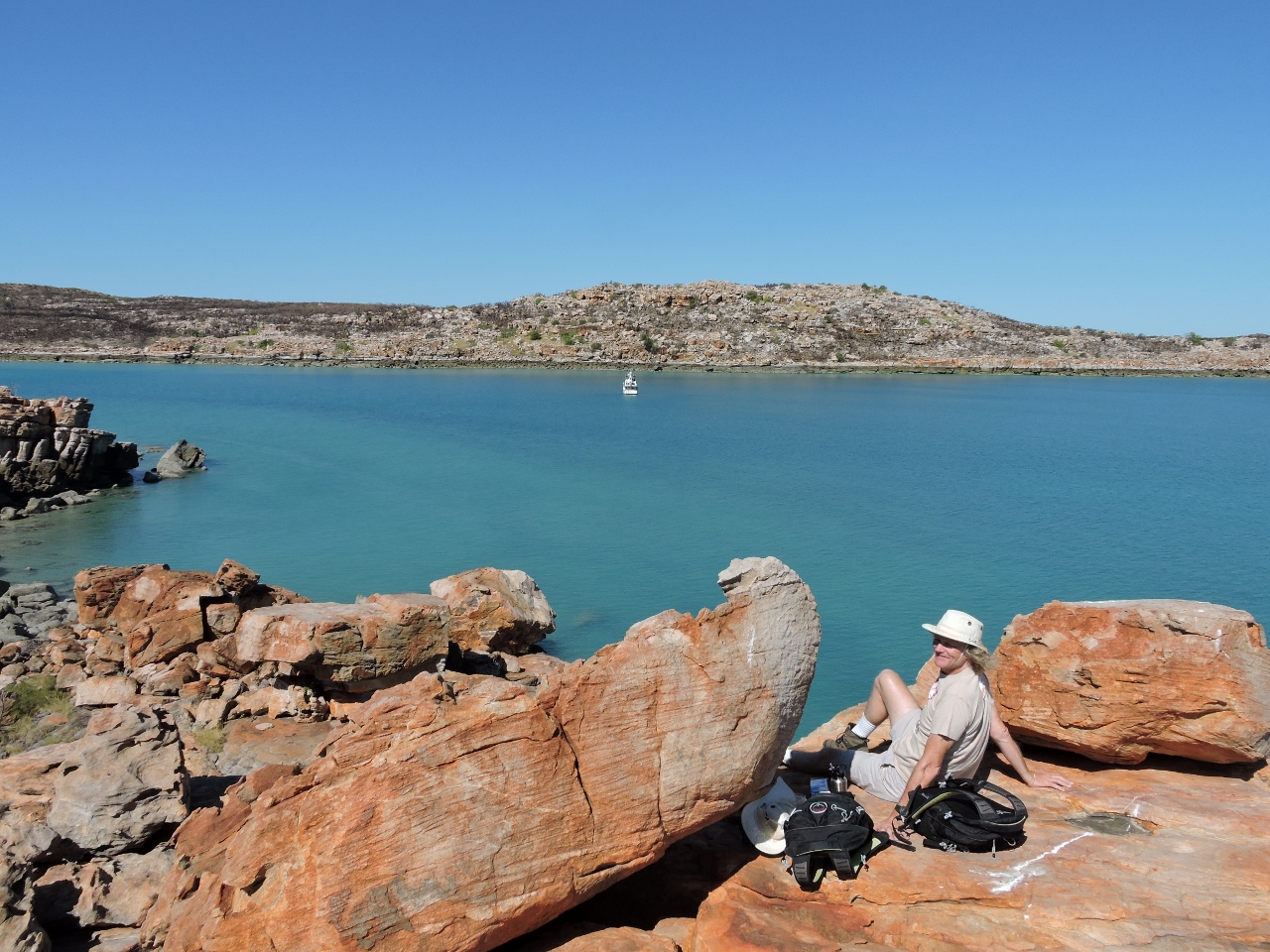 |
6/27/2015: Lunch
Position: -14°25.25'S, 125°15.02'E
Lunch overlooking the anchorage at Shelter Bay.
|
 |
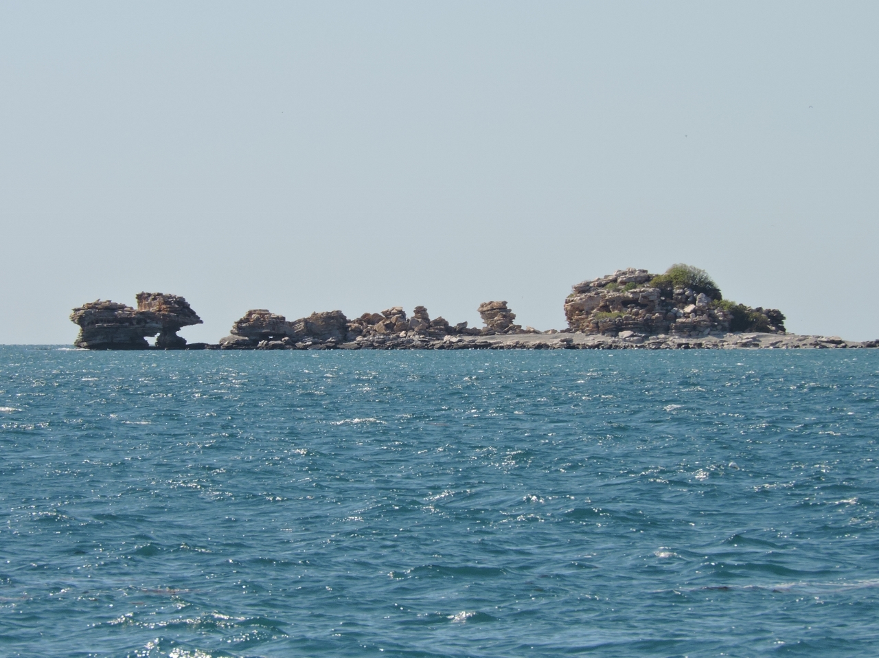
6/27/2015: Arch
Position: -14°26.31'S, 125°14.38'E
This massive sea arch is along the southeast corner of Gaimard Island.
|
 |
6/28/2015: Swifts Bay
Position: -14°31.95'S, 125°33.19'E
In light winds, we anchored in the circular basin in the southeast corner of Swifts Bay. To our east complex rock formations stood above a steep beach.
|
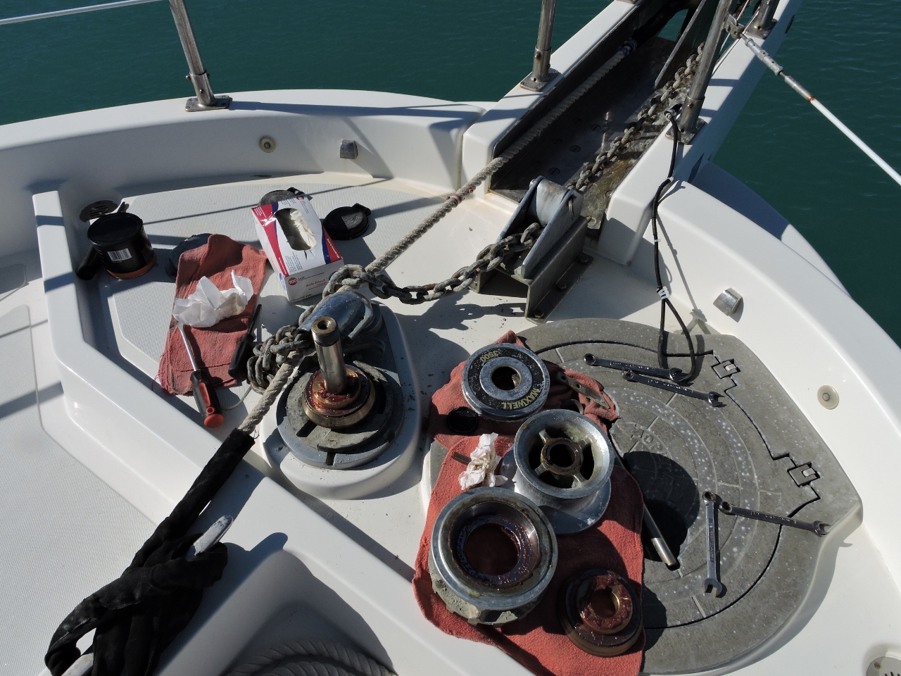 |
6/28/2015: Winch Maintenance
Position: -14°31.93'S, 125°33.26'E
Time for the annual cleaning and greasing of the winch top end.
|
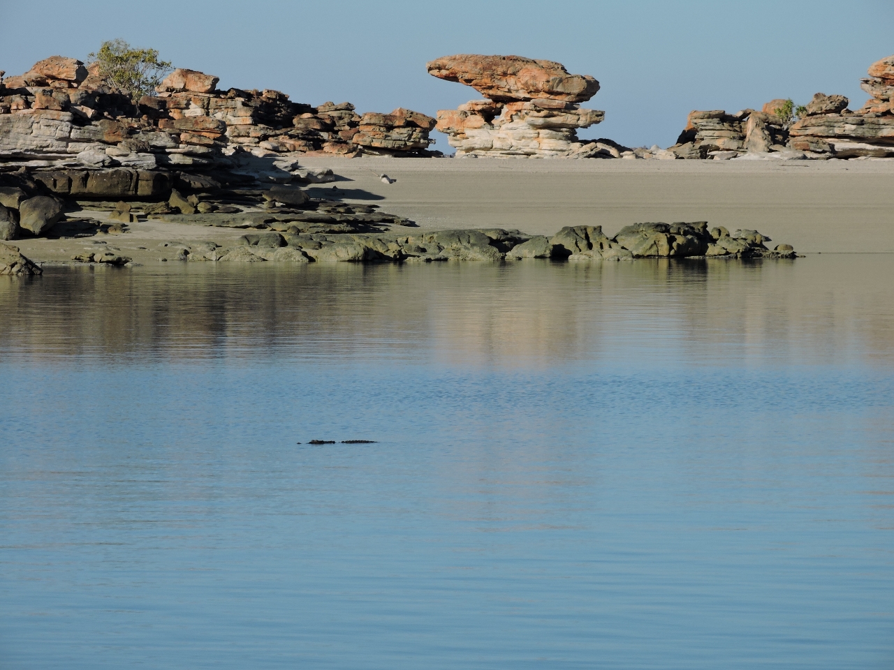 |
6/28/2015: Croc or rock?
Position: -14°31.93'S, 125°33.26'E
As the tide fell, we noticed a rock show up that wasn't on the chart. And then the rock moved. Not a rock, a croc.
|
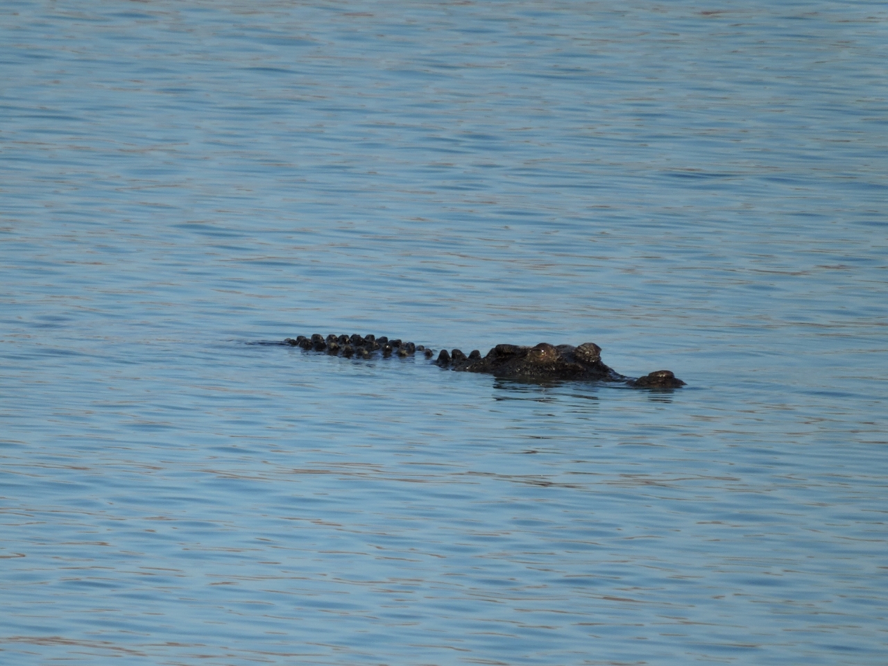 |
6/28/2015: Croc
Position: -14°31.93'S, 125°33.26'E
This large crocodile we'd initially thought was a rock spent an hour or so circling the boat. We felt uncomfortably like prey.
|
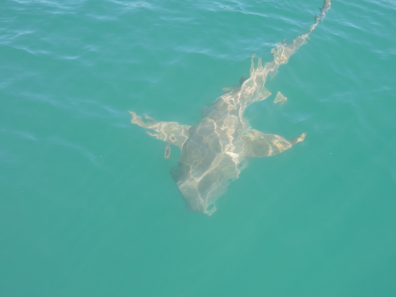 |
6/29/2015: Shark
Position: -14°31.93'S, 125°33.26'E
Besides the croc, a Tawny Nurse shark arrived looking for a meal.
|
 |
6/29/2015: Swifts Bay
Position: -14°33.58'S, 125°35.25'E
Extensive rock paintings are in the southern reaches of Swifts Bay, but the tide was too low and falling for us to reach them. But we had a good tour of the bay.
|
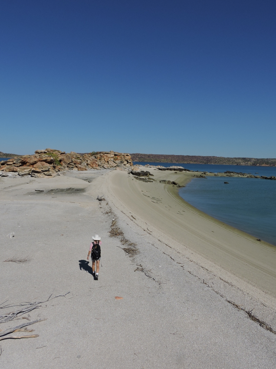 |
6/29/2015: Beach
Position: -14°31.90'S, 125°33.47'E
Walking ashore in the steep beach near the anchorage. From a distance we'd thought it was a sand beach, but it turned out to be millions and millions of small shells.
|
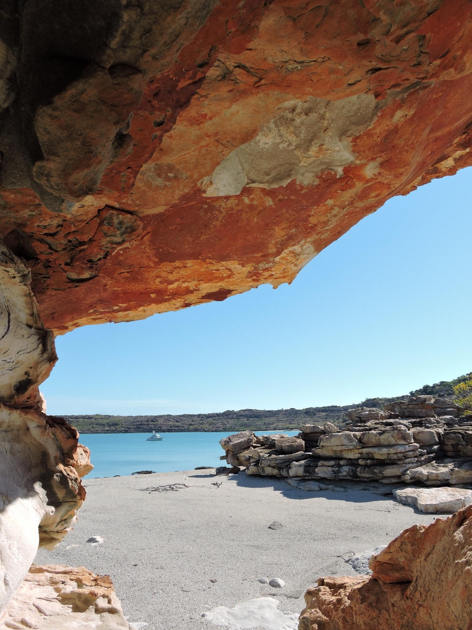 |
6/29/2015: Frame
Position: -14°31.90'S, 125°33.48'E
Looking out to the anchorage through the complex rock formations ashore.
|
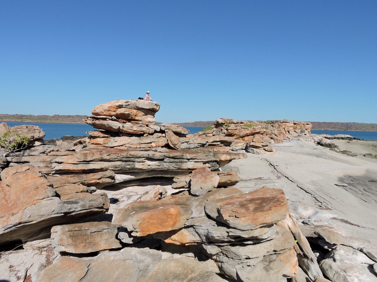 |
6/29/2015: Perch
Position: -14°31.91'S, 125°33.48'E
Jennifer perched above the beach on one of the larger rock formations.
|
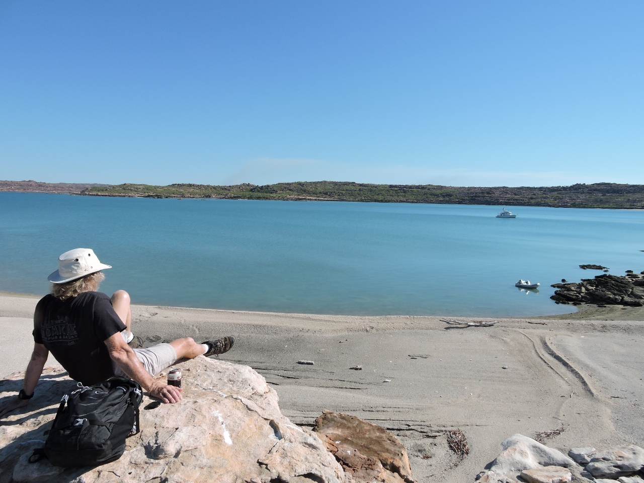 |
6/29/2015: Beer
Position: -14°31.91'S, 125°33.48'E
Relaxing with a beer overlooking the anchorage.
|
 |
6/30/2015: Mushroom Rocks
Position: -14°8.63'S, 125°44.92'E
Looking east to Mushroom Rocks west of Larontaine Island en route to Parry Harbour.
|
|
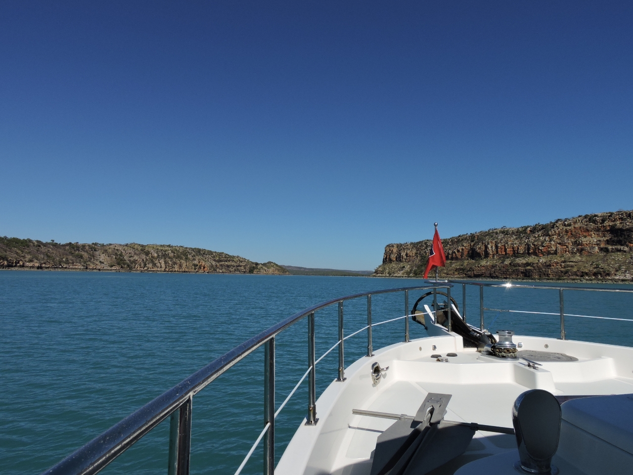
6/30/2015: Parry Harbour
Position: -13°59.06'S, 126°5.02'E
We anchored for the night at the mouth of the small eastern arm of Parry Harbour. We couldn't get as far in as we'd hoped due to shallows, but the southeast wind protection here still was reasonable.
|
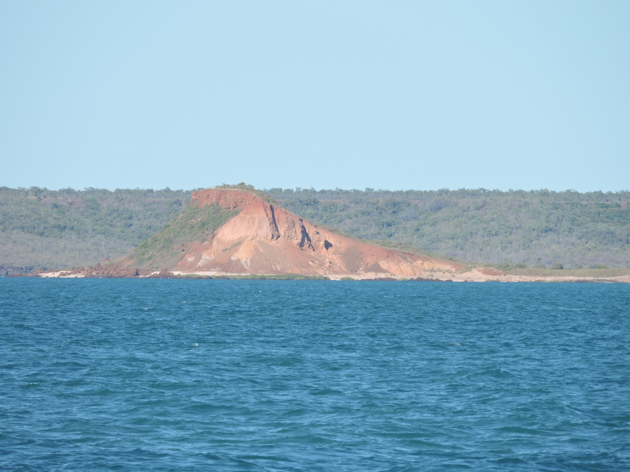 |
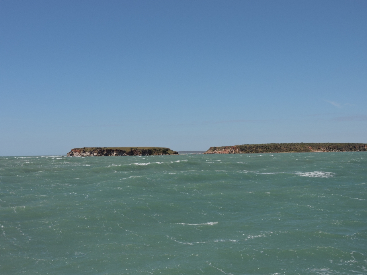
7/1/2015: Red Island
Position: -13°51.91'S, 126°7.81'E
Red Island to our south as we round Cape Bougainville.
|
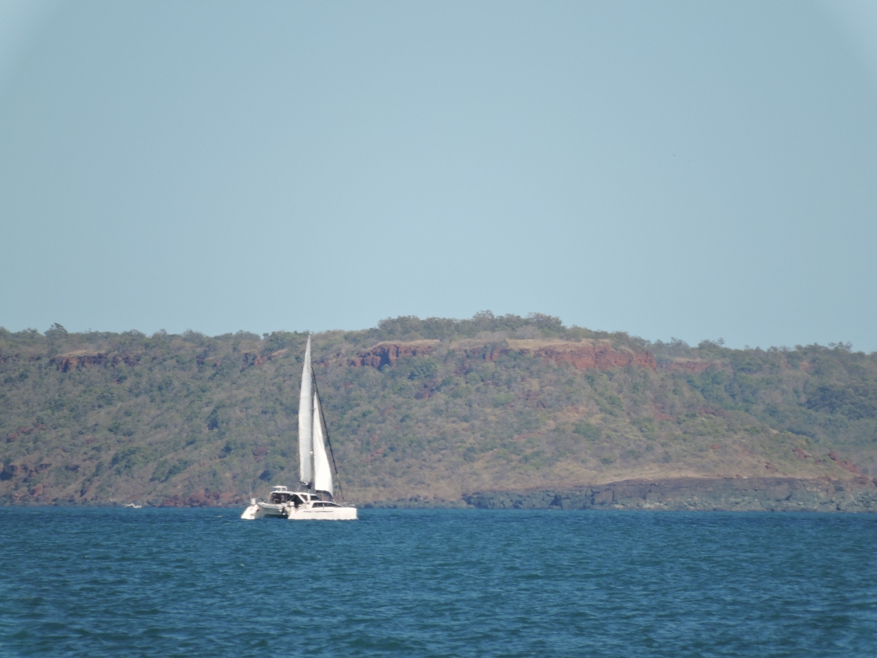 |
7/1/2015: Catamaran
Position: -13°54.23'S, 126°10.99'E
Our fifth, and what would be our last, pleasure boat sighting since leaving Darwin nearly five weeks previously.
|
 |
7/1/2015: Aquaculture
Position: -13°59.83'S, 126°12.39'E
The charts for many parts of the Kimberley are covered with aquaculture symbols, but we've hardly seen any. Freshwater Bay was a notable exception. Much of the bay is full of aquaculture, marked with these radar beacons.
|
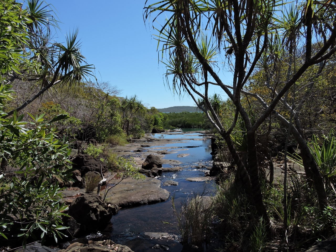 |
7/1/2015: Freshwater Bay
Position: -14°1.09'S, 126°11.11'E
We'd read that Freshwater Bay was among the best anchorages in the Kimberley. It was pleasant enough, but it couldn't compare to many of the places we've been in the area. It did have a nice series of pools and small waterfalls up a creek off the anchorage. This photo was taken looking back downstream towards the anchorage. You can't really see it in the picture, but the top of Dirona's mast is just visible through the trees directly behind the dinghy.
|
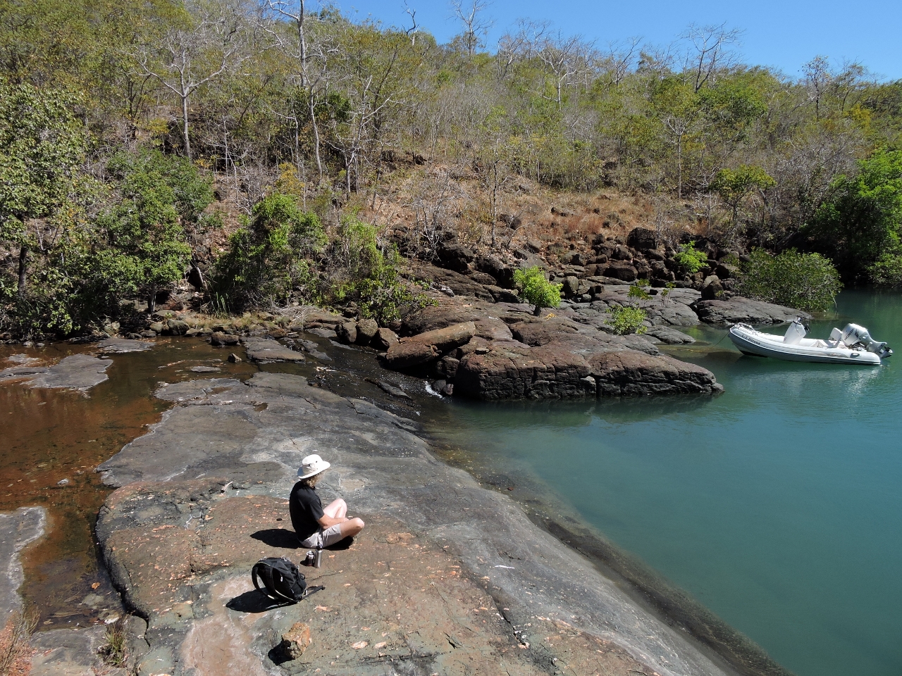 |
7/1/2015: Lunch
Position: -14°1.05'S, 126°11.10'E
Lunch overlooking the junction of freshwater and salt.
|
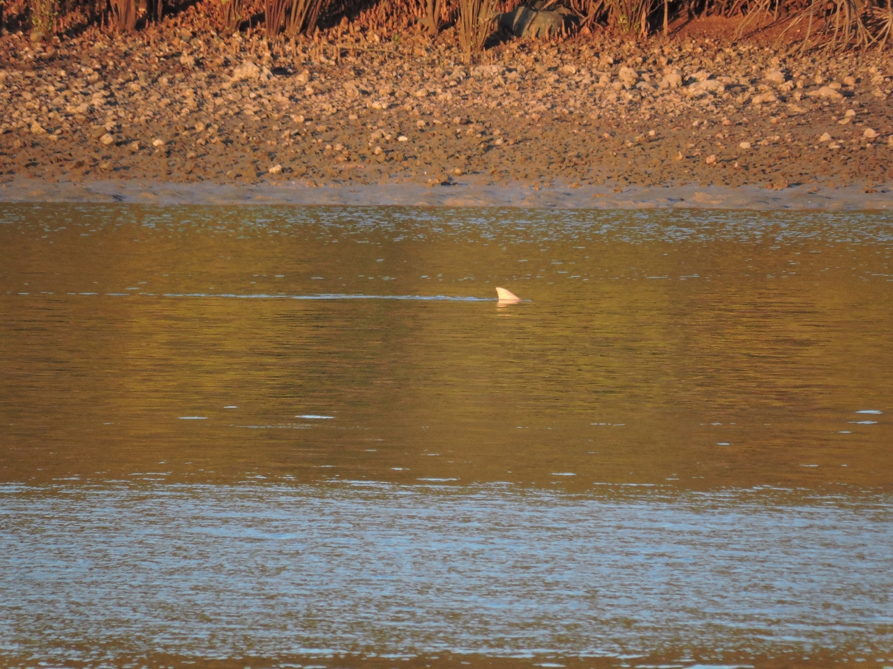 |
7/1/2015: Shark
Position: -14°0.78'S, 126°10.91'E
A shark hunting in the shallows near sunset.
|
 |
7/2/2015: Middle Rock
Position: -13°58.31'S, 126°20.82'E
The channel between Middle Rock and Mary Island was wide and deep, but Middle Rock to our north still looked rather ominous.
|
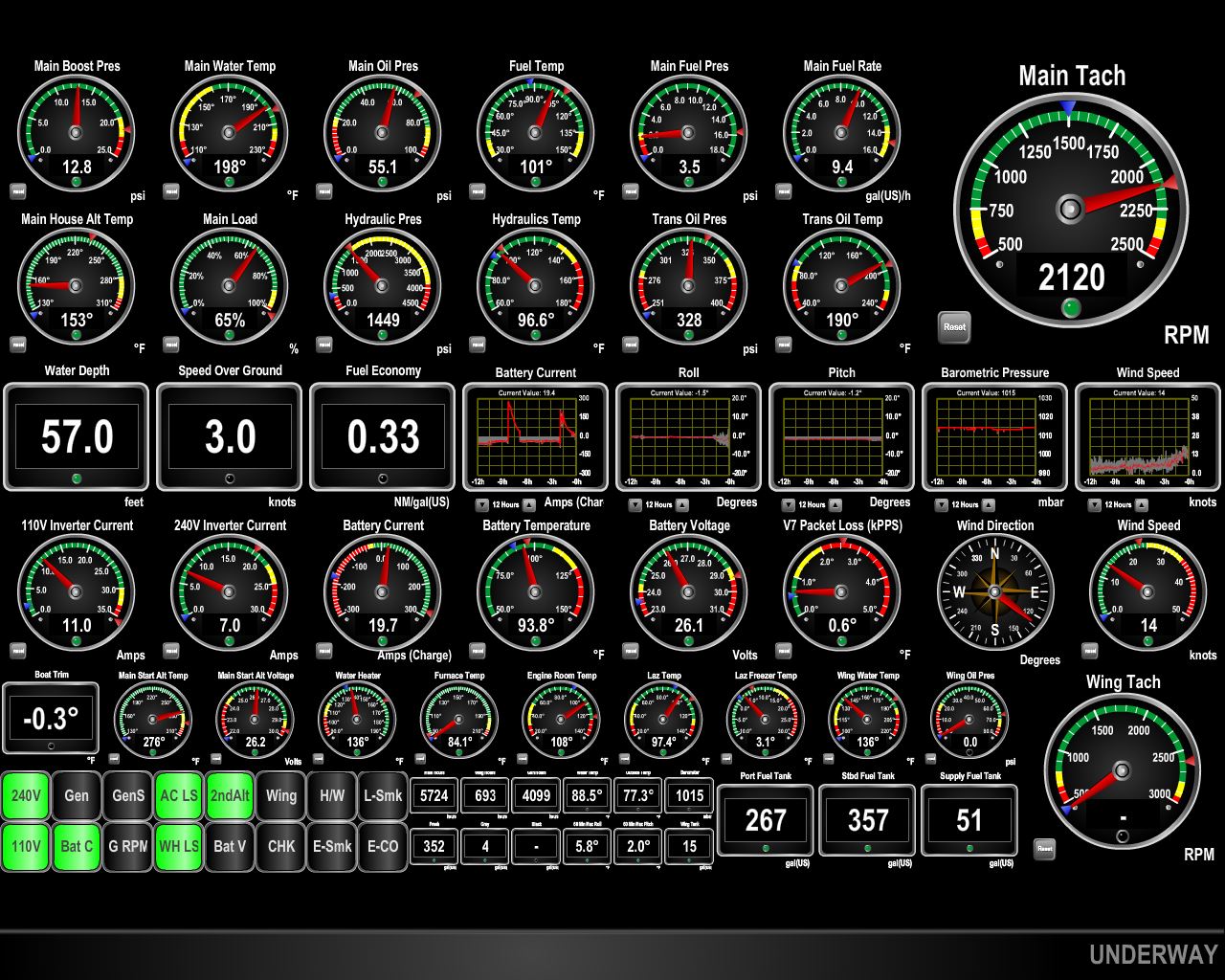 |
7/2/2015: Current
Position: -13°58.29'S, 126°20.86'E
We were about a third of the way into a 15ft rising exchange and the current was running swiftly against us. At 2100RPM we'd normally be doing about 8.7 knots, but we're only making 3 knots, with a terrible fuel economy of 0.33 miles per gallon. Now there's a strong current.
|
 |
7/2/2015: Drysdale River
Position: -14°1.37'S, 126°56.31'E
The Drysdale River has several miles of sandbars to negotiate, so we anchored at the mouth and ran the tender in. The gorges at the head weren't as tall as in some of the other rivers, but were equally scenic.
|
 |
7/2/2015: Fish
Position: -14°1.37'S, 126°56.31'E
Fish were jumping everywhere near the river head. They were leaping so far out of the water that they were splashing us as we went past.
|
 |
7/2/2015: Fishing camp
Position: -14°1.47'S, 126°56.34'E
At the head is a small fishing camp. No wonder with all those fish there. The man at the bottom right of the photo called us over and warned us that the crocodiles really go after inflatable tenders and that he was tired of rescuing people.
|
 |
7/2/2015: Croc or rock?
Position: -14°1.31'S, 126°56.30'E
Croc. A really, really big one. It's head is on the left and part of it's tail is on the right. We saw a couple this size near the head and they seemed a little too interested in us. That combined with the warning from man at the fishing camp discouraged us from going ashore. We didn't even want to slow the tender down. So we got our pictures and headed back downriver.
|
 |
7/2/2015: Lunch
Position: -13°54.36'S, 126°48.26'E
After returning downriver, we had lunch on the rocks overlooking the anchorage. Dirona is at the far left of the picture and the tender is on the far right. This was a great place to spend the night, with good southeast wind protection. Depths were around 6ft on a zero tide at Napier Broome Bay.
|
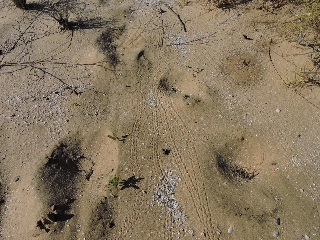 |
7/2/2015: Crab tracks
Position: -13°54.34'S, 126°48.29'E
Thousands of hermit crabs lived on the beach off the anchorage, leaving trails that looked like miniature tire tracks.
|
 |
7/2/2015: Tidal creek
Position: -13°54.15'S, 126°48.28'E
A lovely tidal creek drains through the beach at low tide.
|
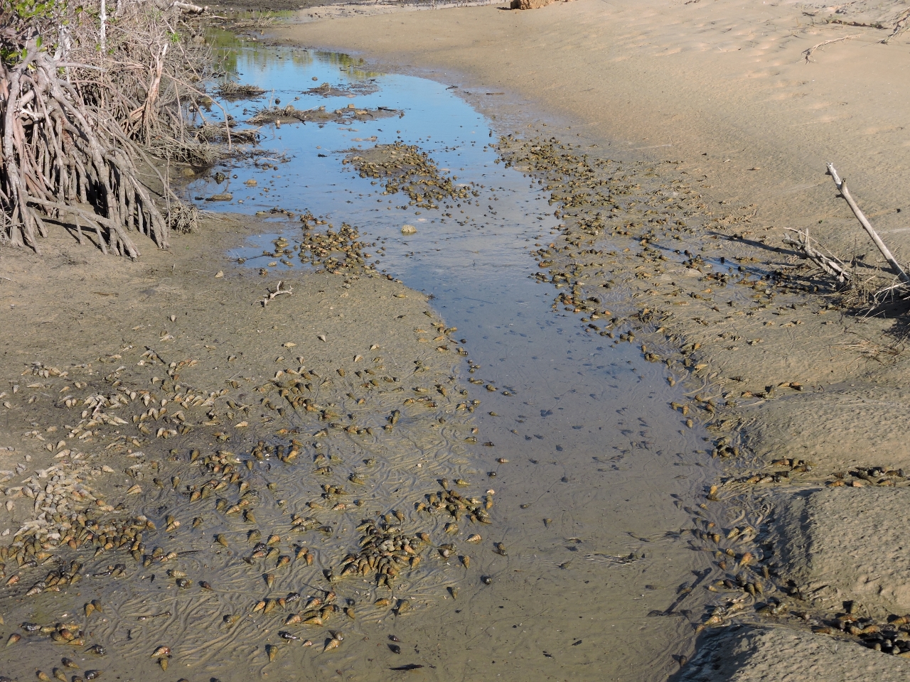 |
7/2/2015: Snails
Position: -13°54.17'S, 126°48.30'E
At high tide, this estuary fills with saltwater. With only about 6ft of tide, the estuary had mostly drained, uncovering the tiny snails that inhabit the bottom.
|
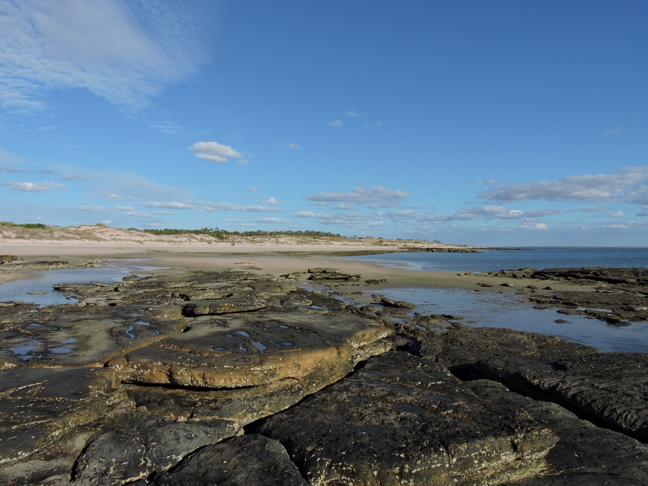 |
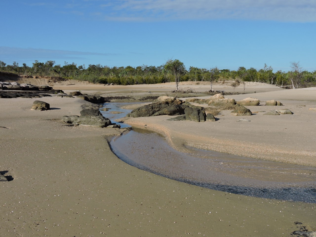
7/2/2015: Beach
Position: -13°54.14'S, 126°48.23'E
Our main reason for stopping here was to visit the Drysdale River, but the beach off the anchorage turned out to be as interesting and scenic as the river.
|
 |
7/3/2015: Jim's Bay
Position: -13°45.66'S, 126°59.46'E
Winds were predicted to blow 20 knots from the southeast, but as we rounded Cape Londonerry, we were seeing steady 30 knots with gusts near 40. The seas were 6-10ft on perhaps 6 seconds, and right on the bow. We tried seeking shelter in what our cruising guide called Jim's Bay, but only the outer part of the bay had the depth to float the boat and it was fairly rough out there with the swell passing between the mainland and the island that provided the only protection.
|
|
7/3/2015: Butterfly Bay
Position: -13°49.16'S, 127°2.09'E
We also considered anchoring in what the cruising guide called Butterfly Bay. We were able to work further into the bay than at , but conditions were surprisingly much worse. We barely had sufficient anchoring depth and with little wind protection, strong southeast winds kept us beam-to a significant swell. We also encountered tight 12-15ft seas off the south entrance to the bay. So we decided to keep moving knowing we had a nice, sheltered anchorage in Koolama Bay at the entrance to the King George River.
|
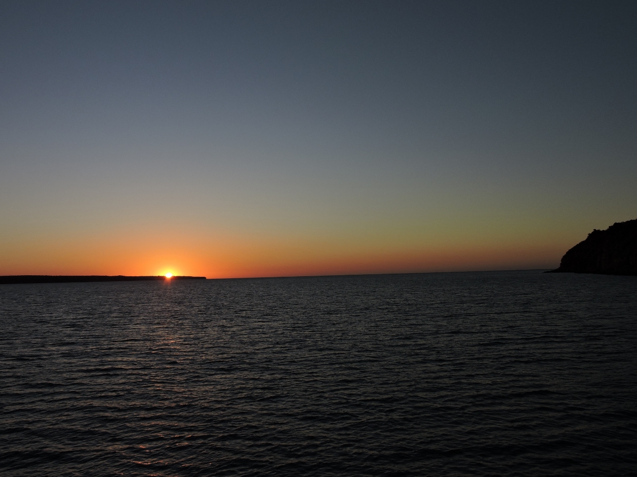 |
7/3/2015: Koolama Bay
Position: -13°56.08'S, 127°19.74'E
We enjoyed the sunset in sheltered waters at Koolama Bay.
|