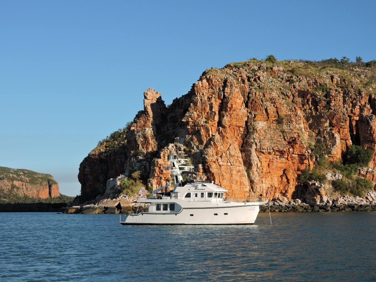
MV Dirona travel digest for South Kimberley 2015

|
Click the travel log icon on the left to see these locations on a map,
with the complete log of our cruise. On the map page, clicking on a camera or text icon will display a picture and/or log entry for that location, and clicking on the smaller icons along the route will display latitude, longitude and other navigation data for that location. And a live map of our current route and most recent log entries always is available at //mvdirona.com/maps/LocationCurrent.html. |
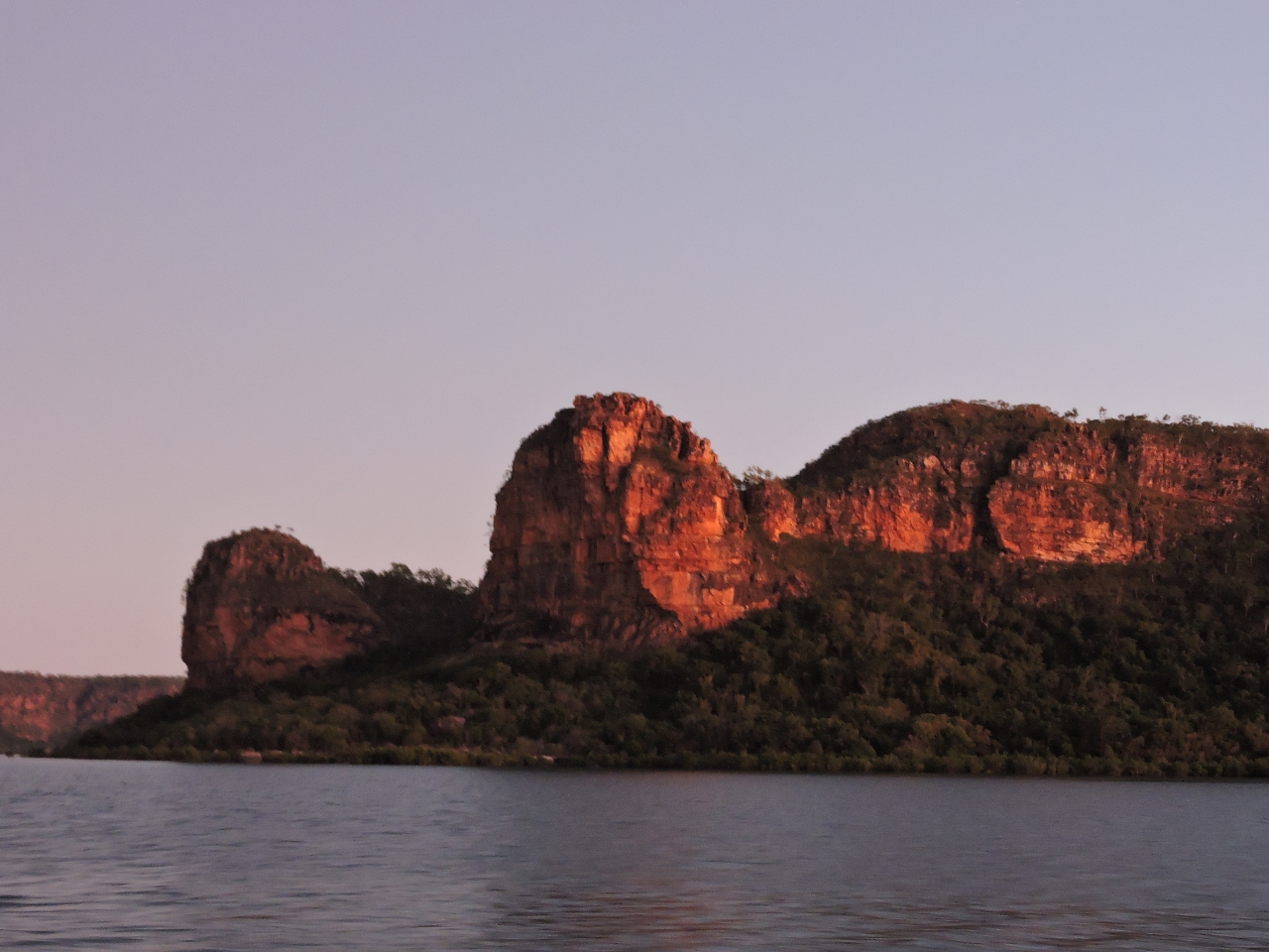 |
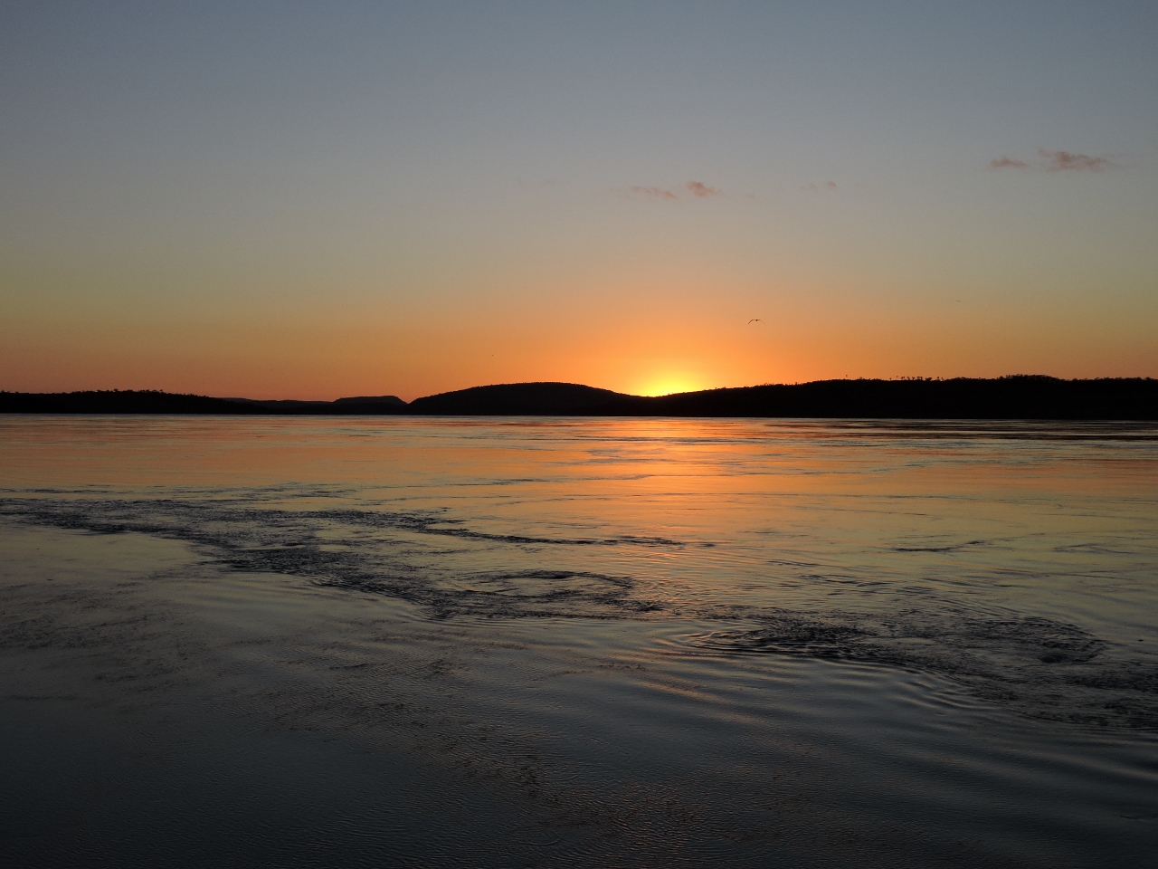
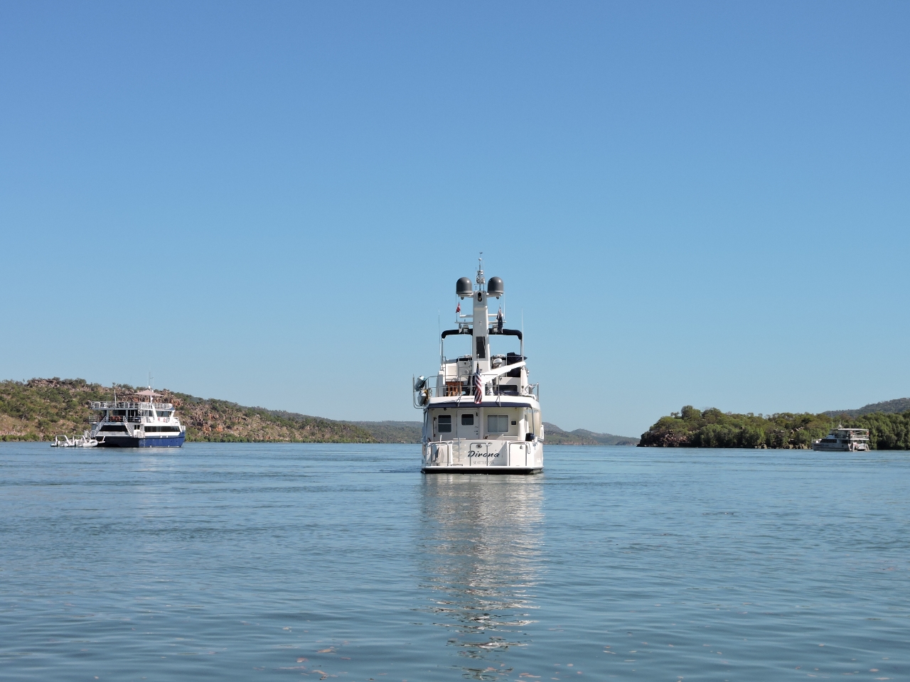
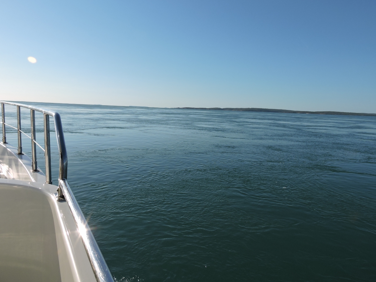
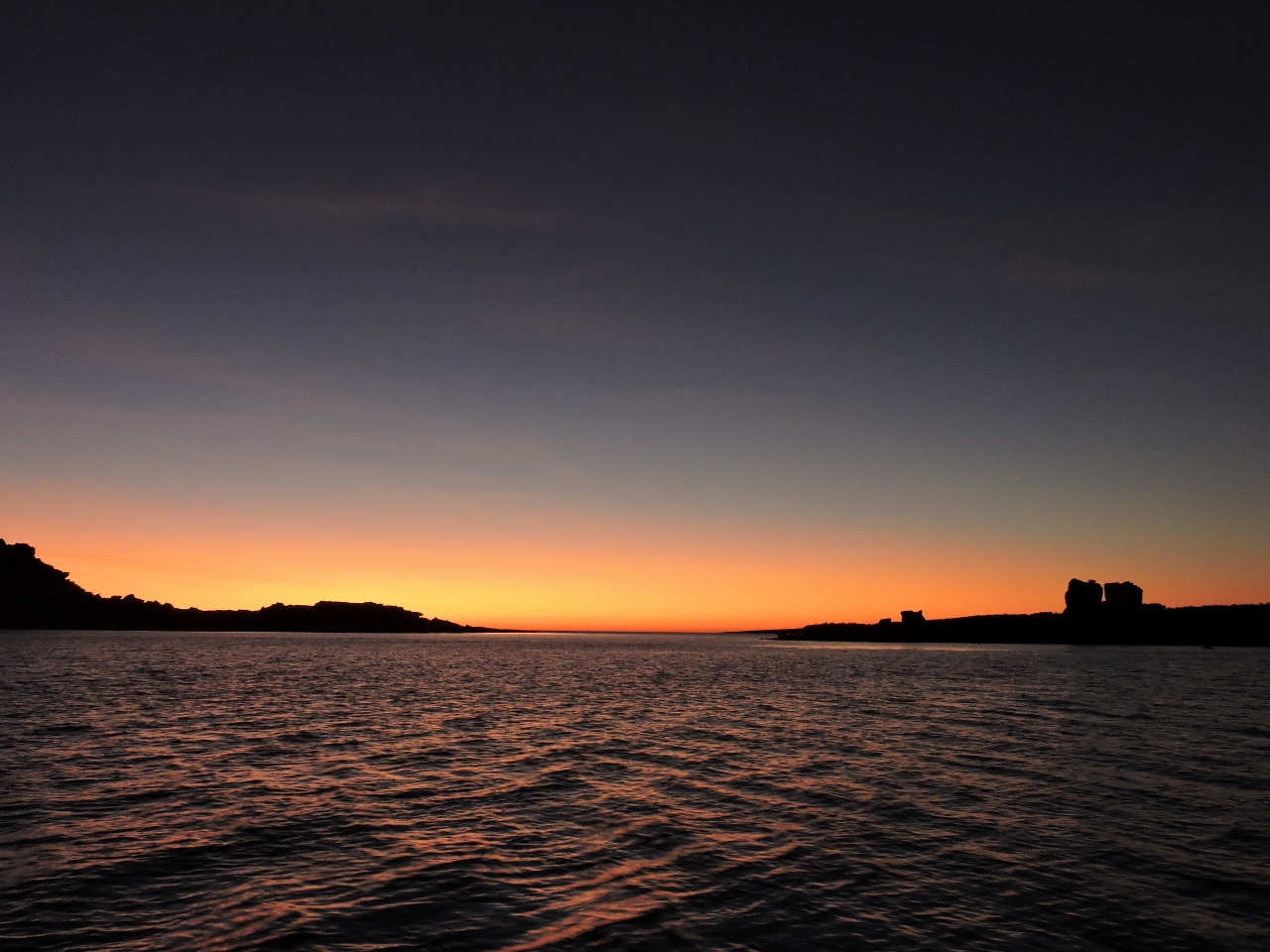
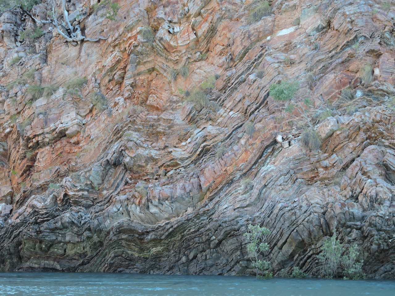
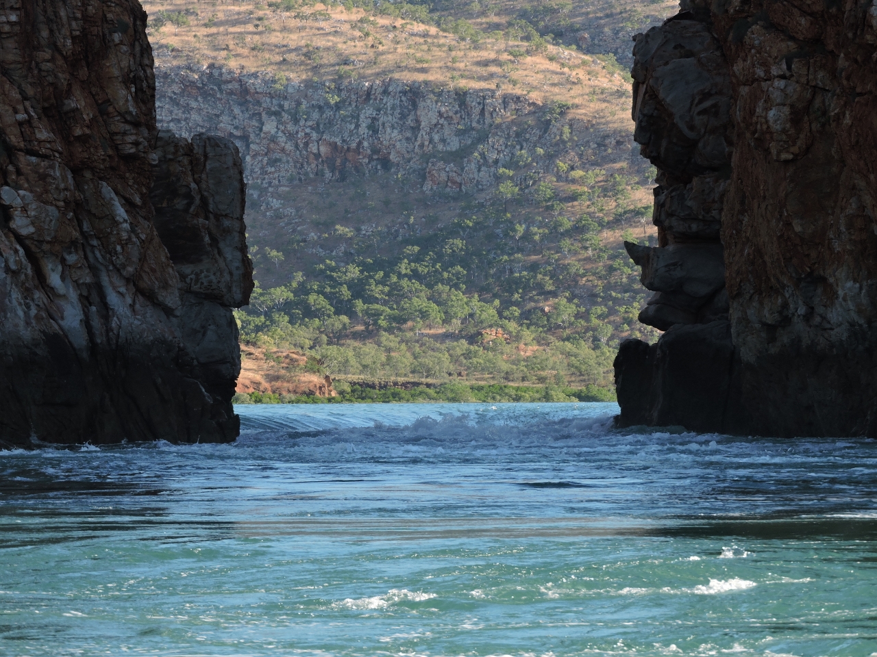
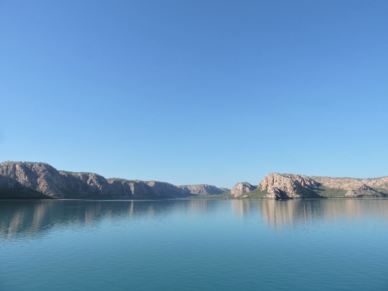
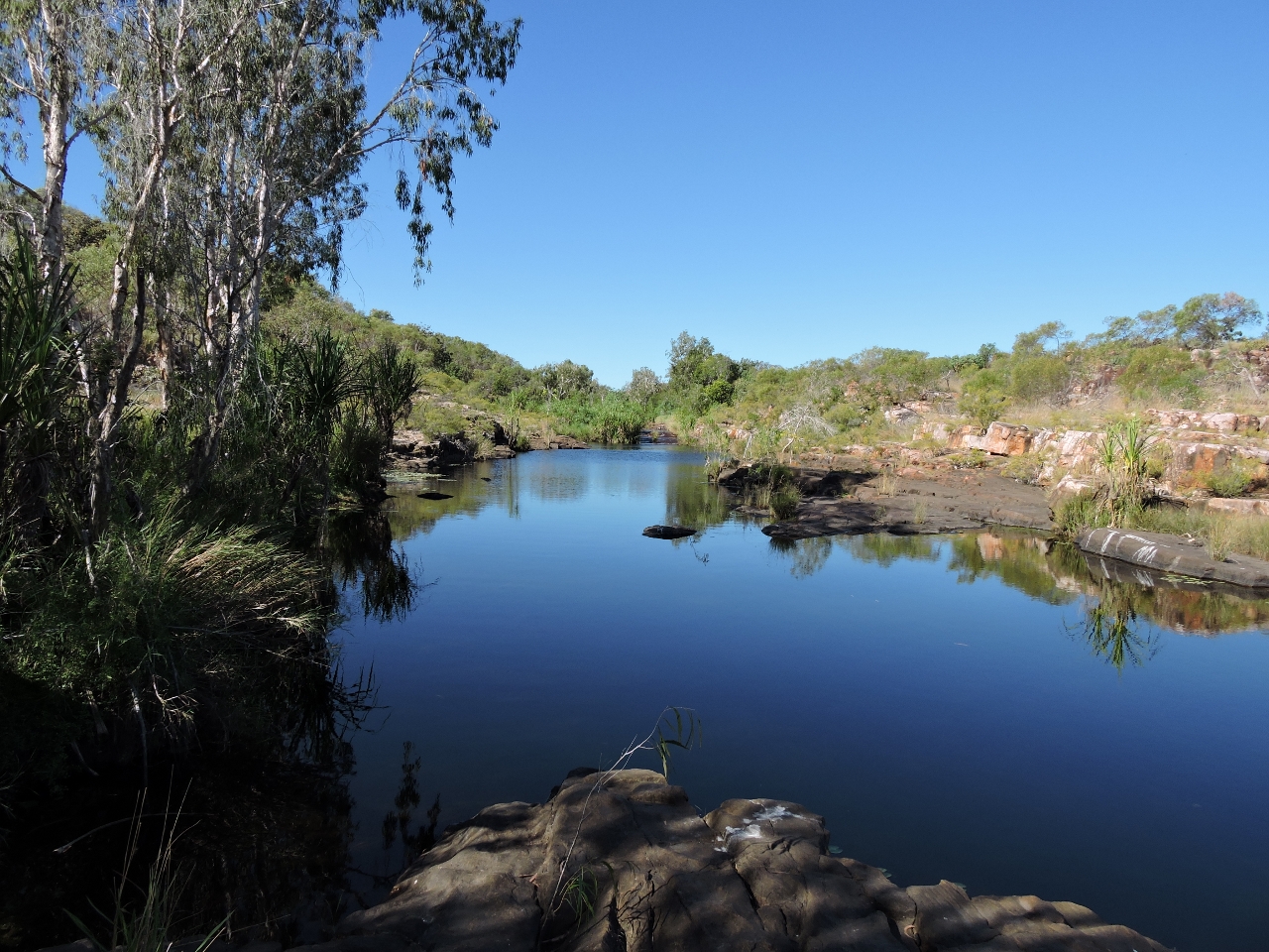
6/12/2015: Bluffs
Position: -15°2.29'S, 125°23.58'E
Another view to the dramatic double bluffs at the Hunter River mouth.
|
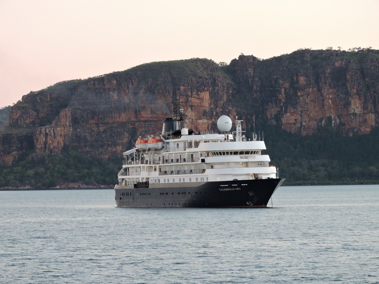 |
6/12/2015: Caledonian Sky
Position: -15°1.94'S, 125°21.07'E
The 297 ft (90.6m) cruise ship Caledonian Sky was at anchor off Naturalists Island as we passed through Prince Frederick Harbour this morning.
|
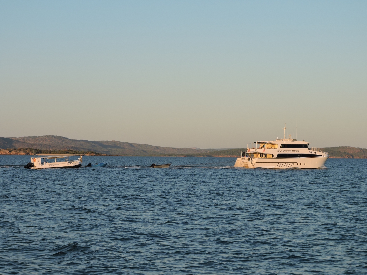 |
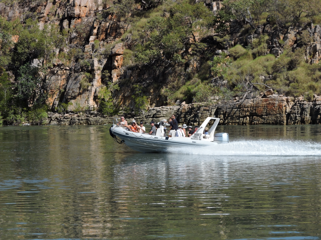
6/12/2015: Odyssey
Position: -15°1.48'S, 125°19.01'E
Odyssey was leaving the area around the same time we were and radioed to chat. Last night we watched the superyacht Triple Seven arrive after sunset and anchor in Porosus Creek. Traffic is much higher here than in the King George or Berkeley River areas.
|
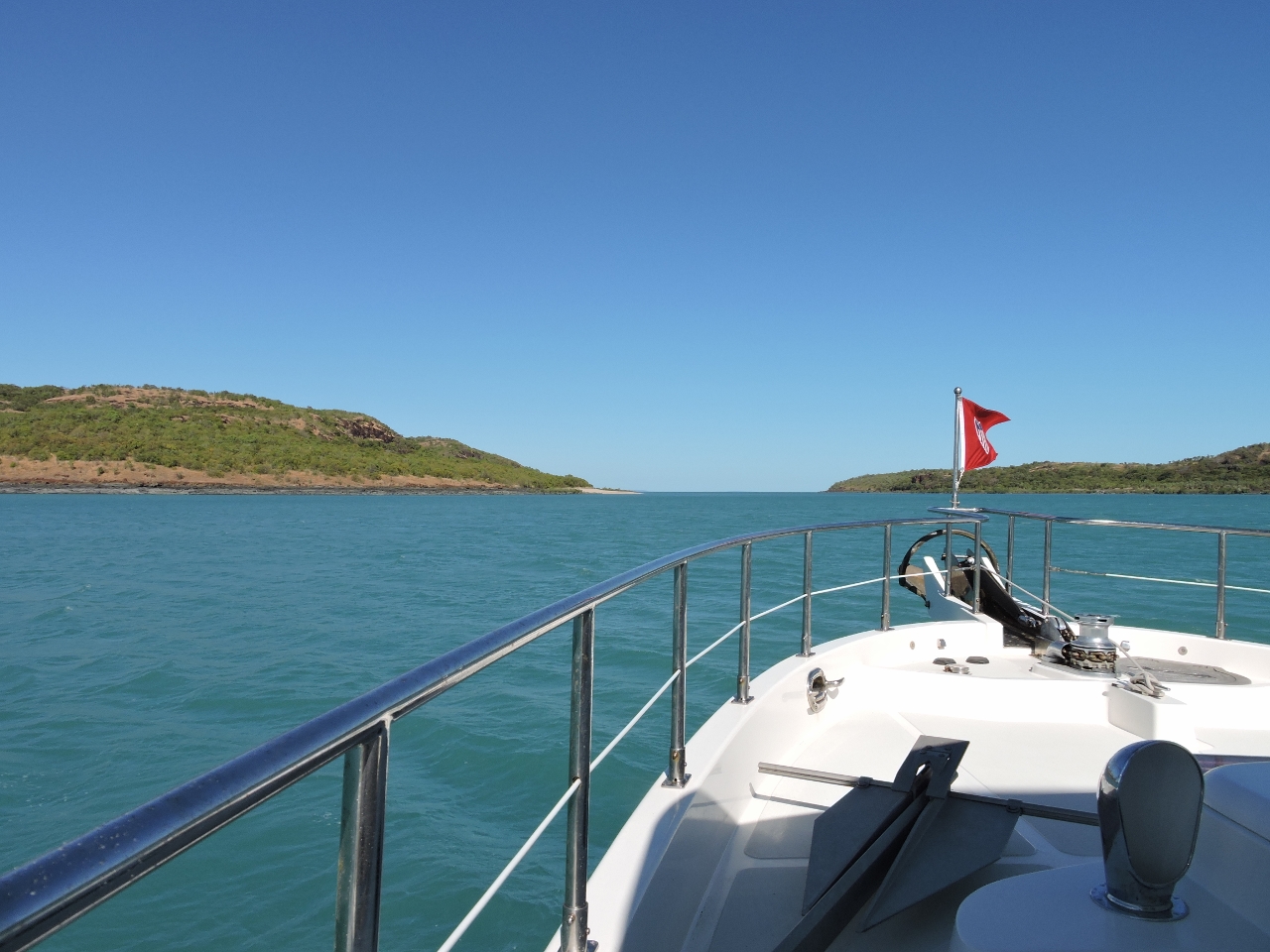 |
6/12/2015: Coronation Islands
Position: -15°2.25'S, 124°57.61'E
The Western Australian Cruising guide indicated a deep-water channel through the unsurveyed waters between Coronation and Gray Islands. With about 5ft of water at half-tide on a 10ft (3.1m) exchange at Maret Island, we saw 50ft approaching the channel and 35ft coming out the south side with no obvious current.
|
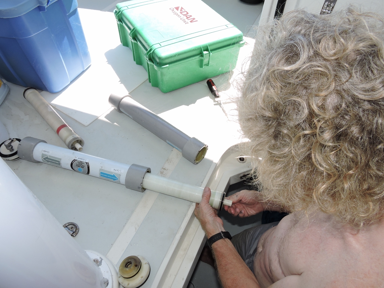 |
6/12/2015: Membranes
Position: -15°9.97'S, 124°49.25'E
We cleaned the water maker membranes a couple of months back, and the water quality improved to the low 600 PPM. That's perfectly workable, but getting to the high end of what's acceptable. It slowly worsened from 600 to 800 PPM. After it hit 800, over the course of a few days it went up to 900, and then over 1,000 to 1,200 which really isn't usable in other than an emergency. So we needed to change the membranes. Four years ago in Seattle we bought a second water maker for its parts, which included three new membranes in their cylinders. We pickled these membranes inside the cylinders, sealed them up, and stored them on board in a cool location. We later learned that the membranes aren't supposed to last more than a year. But we've got them, so might as well try them. James started the job while we were underway to the Prince Regent River. Getting the old cylinders apart was incredibly difficult, but not as hard as getting them back together. But about four hours later, the new membranes are in place and we're making water at 290 PPM.
|
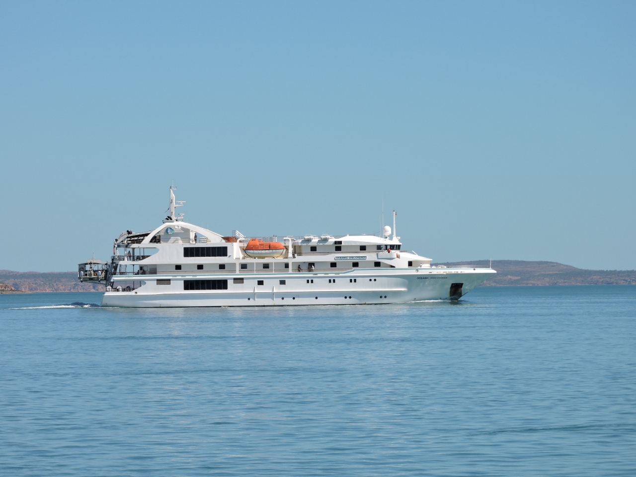 |
6/12/2015: Oceanic Discoverer
Position: -15°12.42'S, 124°50.46'E
The mini cruise ship Oceanic Discoverer was leaving the Prince Regent River mouth as we arrived.
|
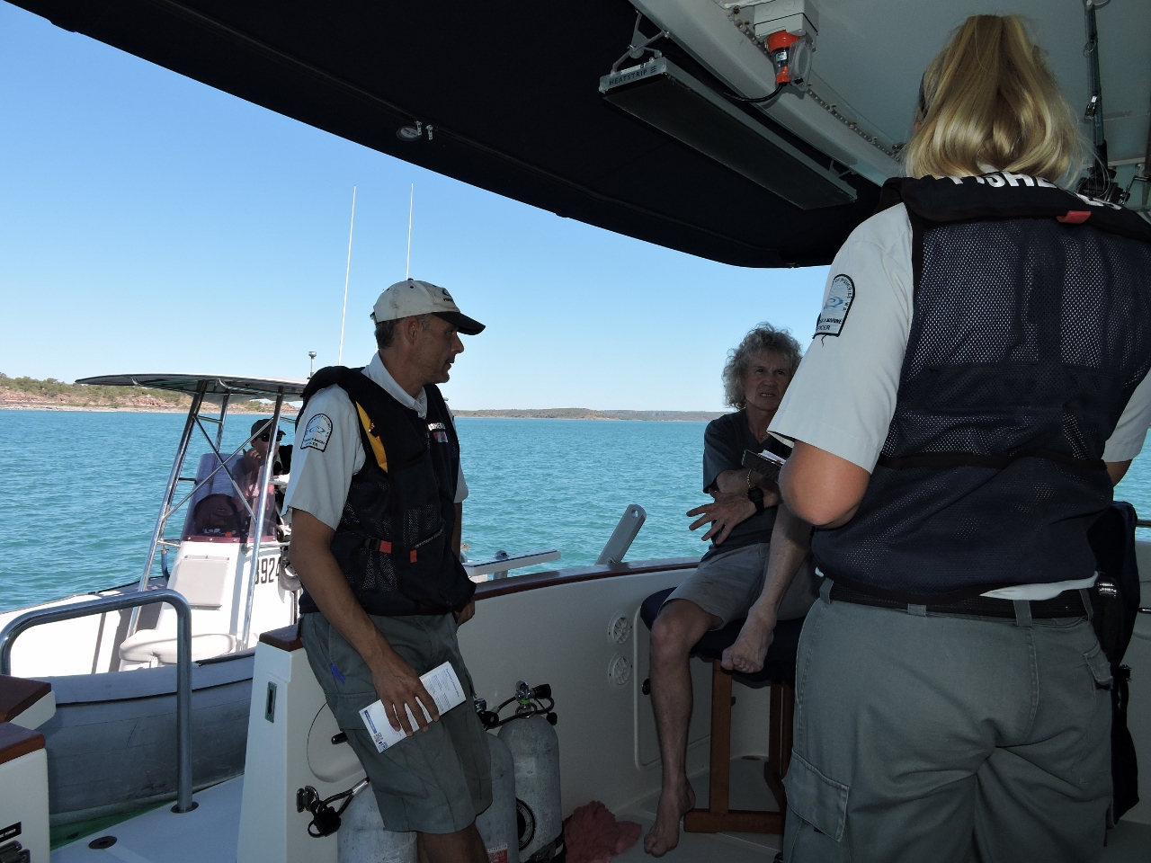 |
6/12/2015: Fisheries
Position: -15°14.78'S, 124°52.42'E
We'd anchored for the night just north of Whirlpool Point to await favourable tides to enter the Prince Regent River tomorrow morning. Shortly after we arrived, Western Australia Department of Fisheries stopped by for a friendly visit. They checked our freezer for illegal catch and dropped off a brochure explaining the rules. One of them had boarded a Nordhavn the previous year, likely a 47, and could describe the interior layout before even stepping inside.
|
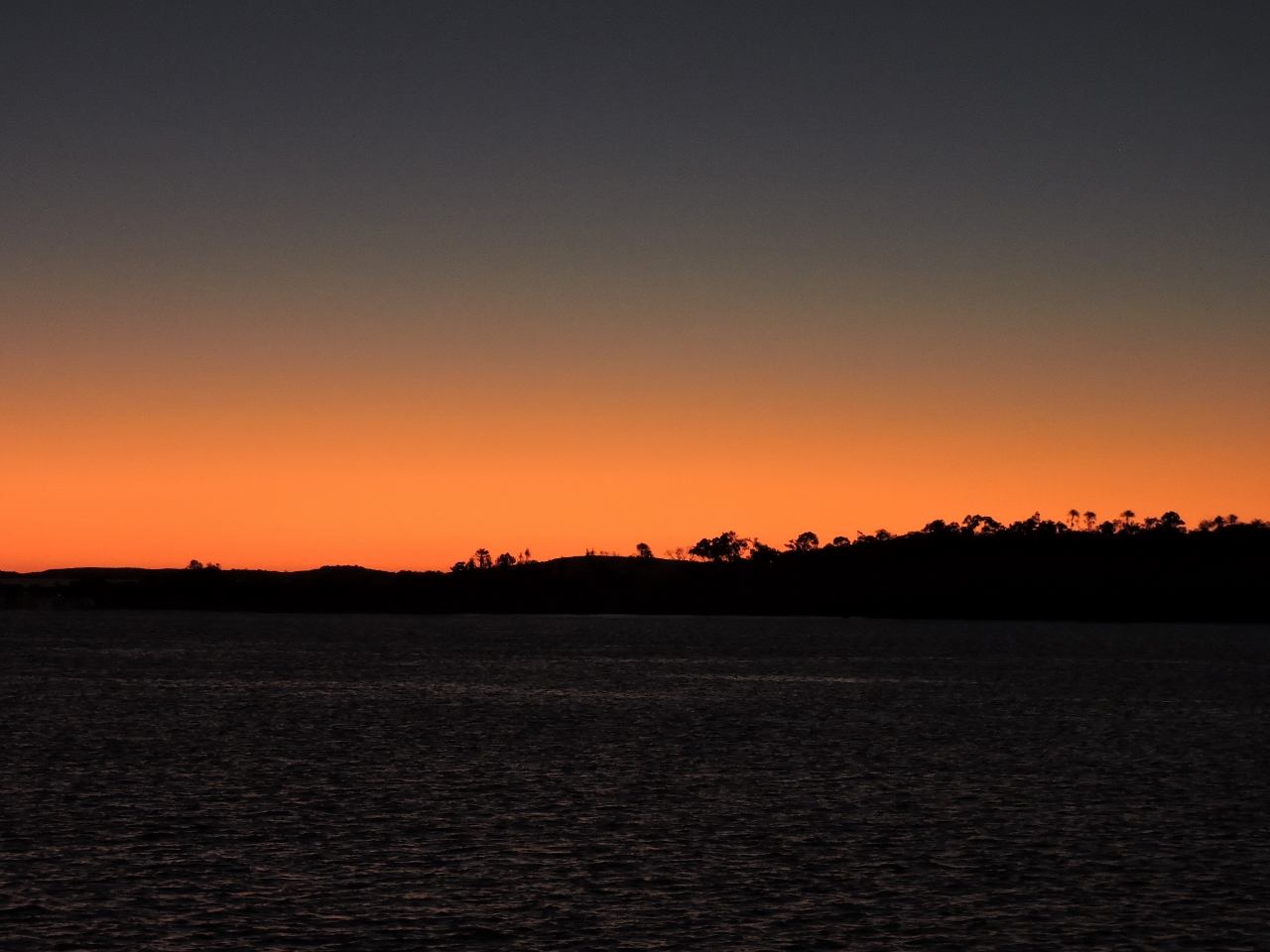 |
6/12/2015: Sunset
Position: -15°14.78'S, 124°52.42'E
We quite liked the anchorage north of Whirlpool Point, particularly the beautiful sunset.
|
 |
6/13/2015: Whirlpool Point
Position: -15°16.22'S, 124°52.58'E
Whirlpool Point at sunrise. Upwellings and whirlpools were everywhere, but were easy to navigate through. We were 90 minutes before a 11.1ft (8.07m) high tide at White Island on a 6:22 15ft exchange. If it weren't for lack of light, we could have come through much earlier.
|
 |
6/13/2015: Strong Tide Point
Position: -15°21.45'S, 124°54.97'E
We passed Strong Tide Point one hour before high water. The waterway was wide and deep with little to no turbulence. We're coming through on a relatively small 11.1ft exchange. You get a sense from the feature names around here though that the water can really flow on the larger 30ft exchanges.
|
 |
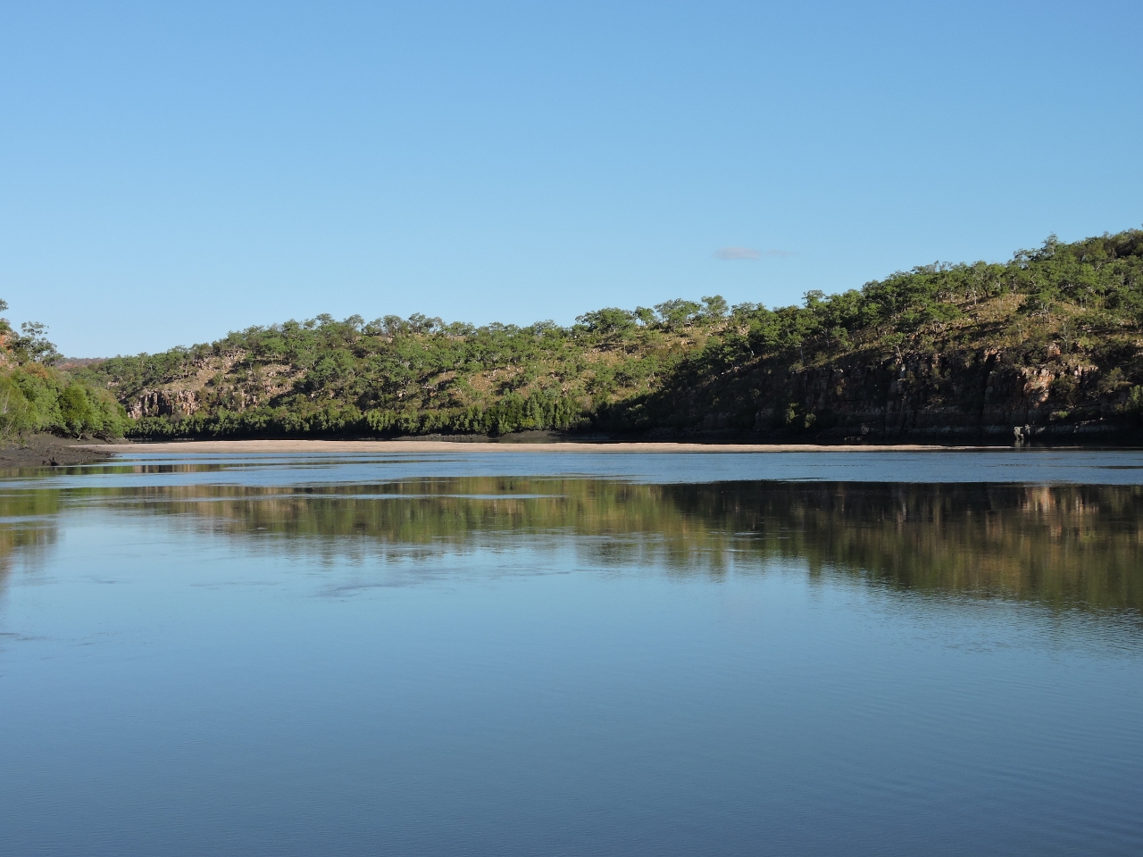
6/13/2015: River mouth
Position: -15°27.95'S, 125°5.96'E
Looking upriver from the Prince Regent River mouth. Conditions across Saint George Basin and into the river have been wonderfully calm.
|
 |
6/13/2015: Up river
Position: -15°34.36'S, 125°14.22'E
We had considered stopping at either Purulba Creek or Camp Creek, but were making such good time that we decided to keep going and see if we could reach King Cascade Falls today.
|
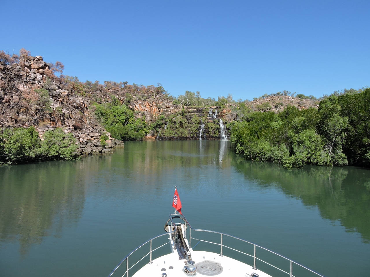 |
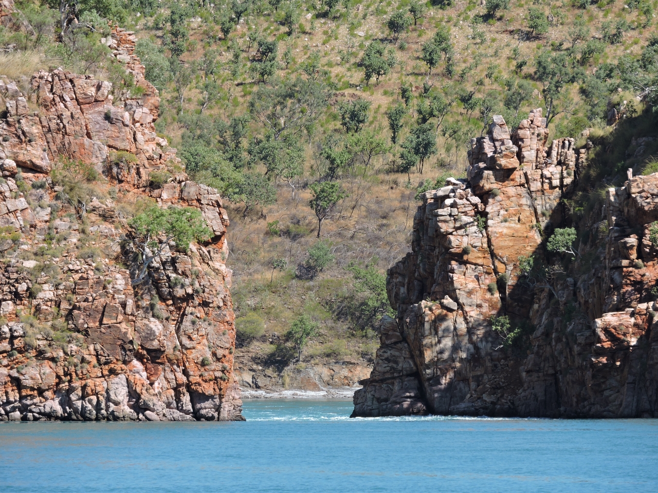
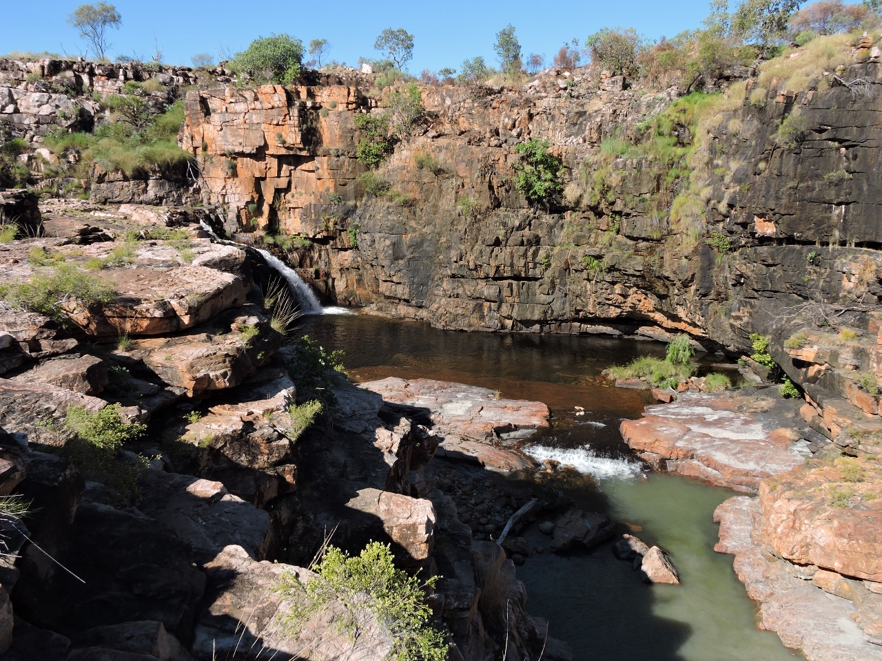
6/13/2015: Approaching the falls
Position: -15°37.26'S, 125°18.37'E
King Cascade Falls are the main draw for visitors to the Prince Regent River. The falls are inside a small, shallow basin, with a narrow entrance. Even on this small exchange, the tidal river current is strong, and the boat is moving quickly sideways as we diagonally enter the basin.
|
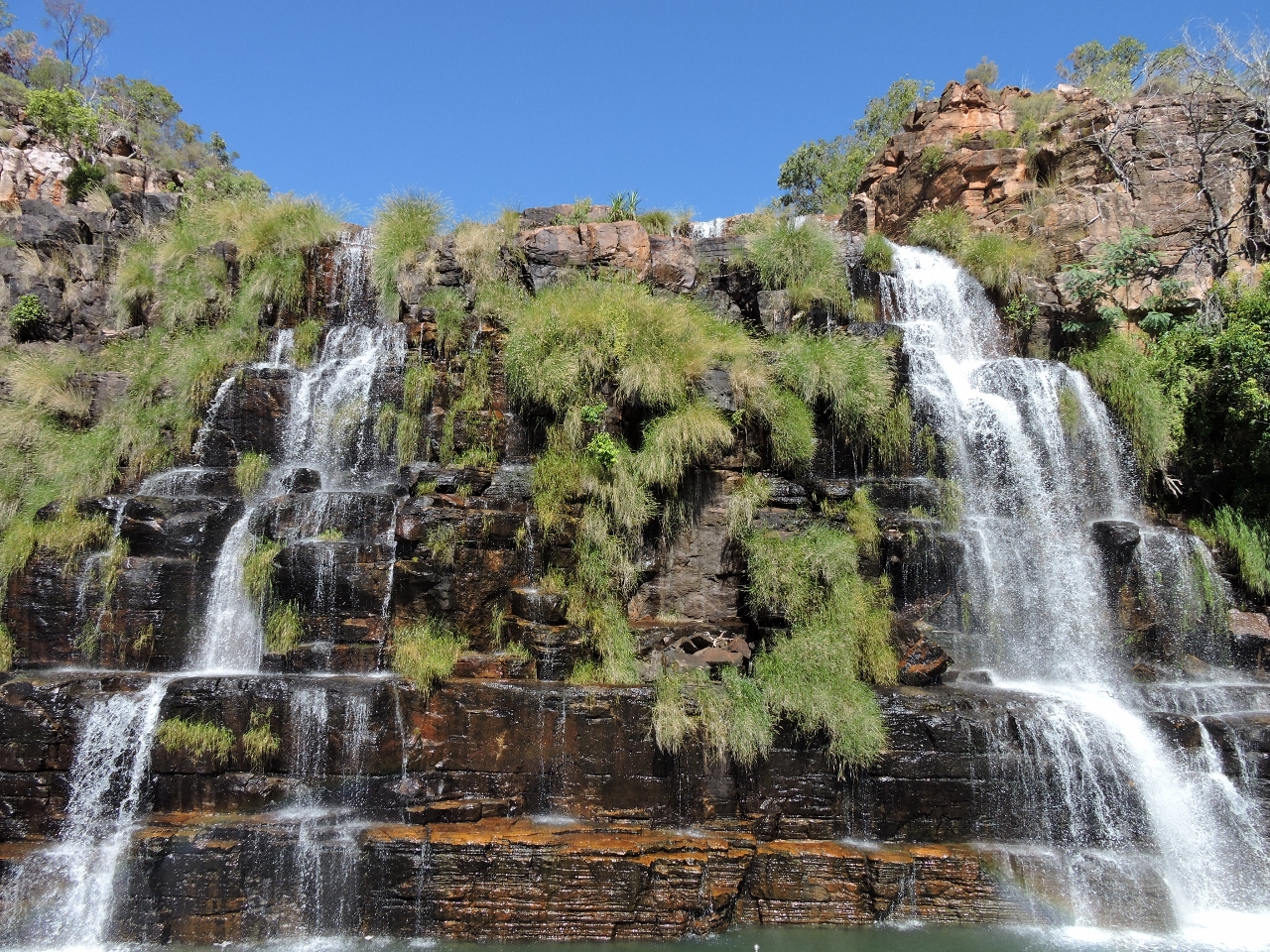 |
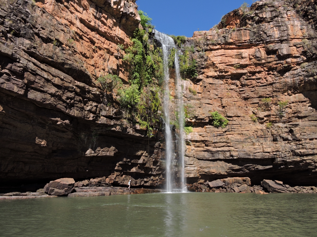
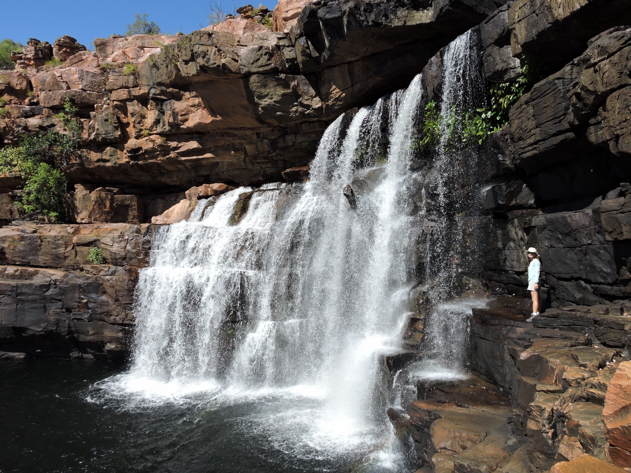
6/13/2015: King Cascade Falls
Position: -15°37.34'S, 125°18.30'E
The King Cascade Falls tumble down across a rock face in multiple arms.
|
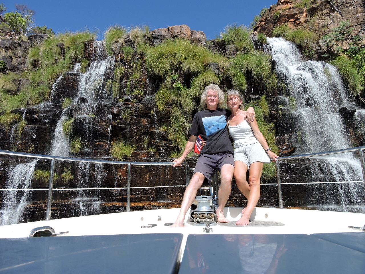 |
6/13/2015: At the falls
Position: -15°37.34'S, 125°18.30'E
There wasn't much water motion inside the basin, so we could bring the boat up close and keep it in position for a picture of use both in front of the falls.
|
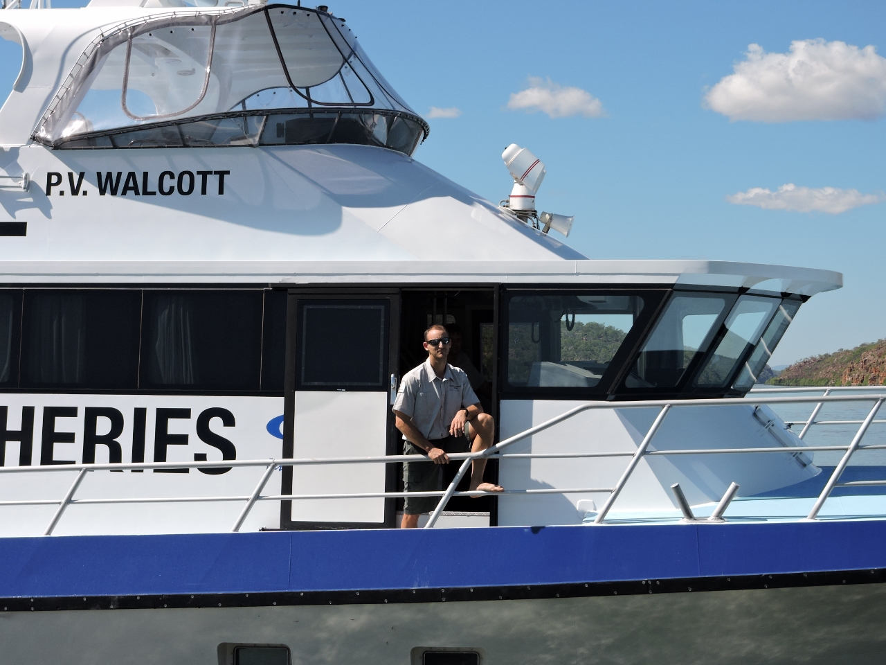 |
6/13/2015: PV Walcott
Position: -15°37.18'S, 125°18.39'E
The Department of Fisheries patrol boat PV Walcott followed us upriver and stood outside the basin while we went inside to check out the falls. The tender they'd visited us on yesterday had passed us heading upriver earlier today. It was inspecting a Barramundi fishing operation working at the river head, and the the PV Walcott was here to pick them up.
|
 |
6/13/2015: The most awful place
Position: -15°36.56'S, 125°17.85'E
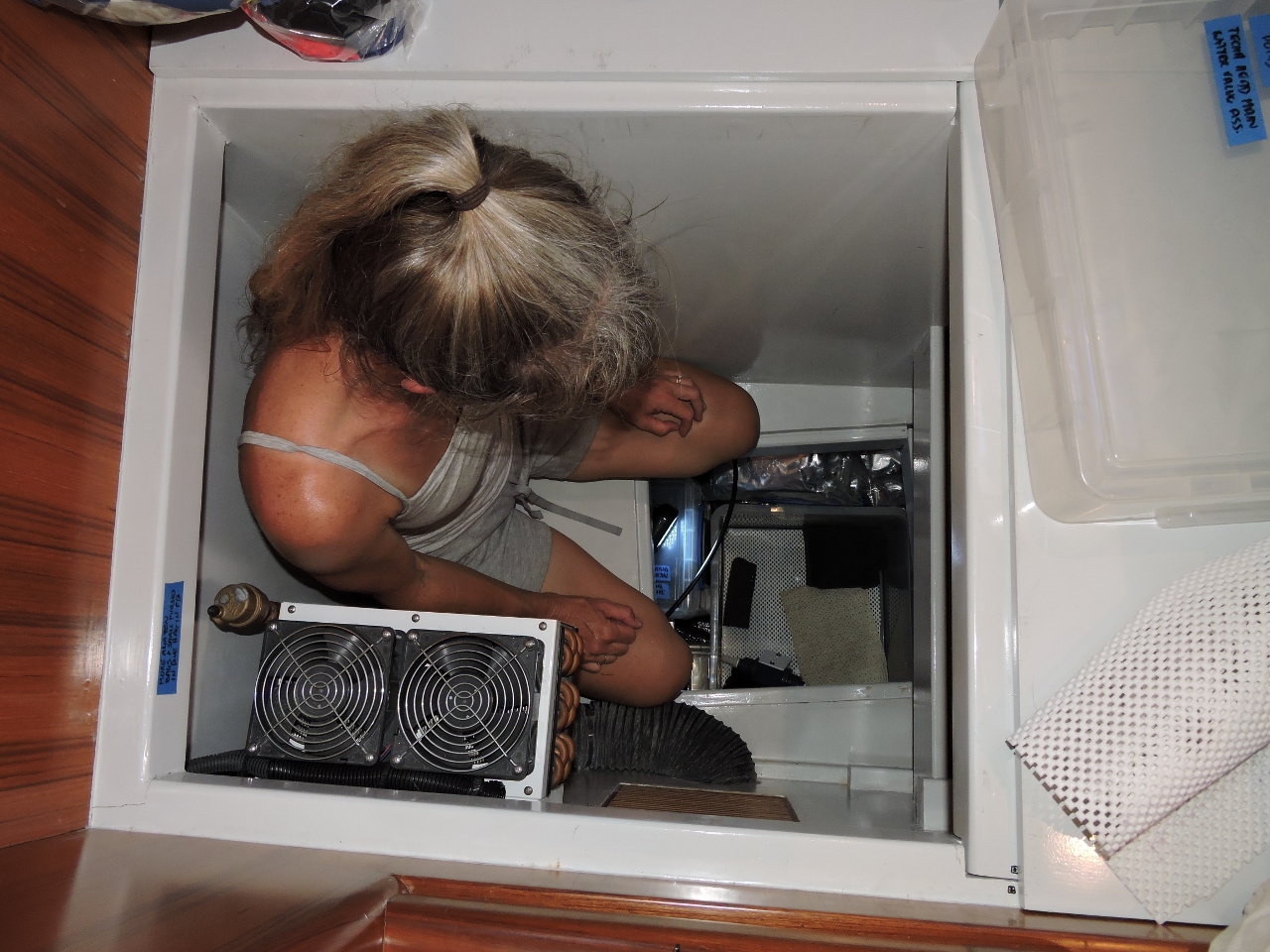
We carry a lot of spares on board. The ones that we expect to rarely, if ever, use are stored in what Jennifer calls "the most awful place": underneath a subfloor under the guest stateroom berth. To access it, you have to fold the bed over, then completely empty the storage area that Jennifer is sitting inside, and then lift the sub-floor out to access the bins below. Today our oil-change pump failed, and that's where the spare was.
|
 |
6/13/2015: Low tide
Position: -15°36.56'S, 125°17.85'E
We anchored just downriver from the King Cascade Falls. Sandbars are on either side and we cannot move in either direction except near higher tides. This is the sandbar extending across the river towards the basin where the falls are.
|
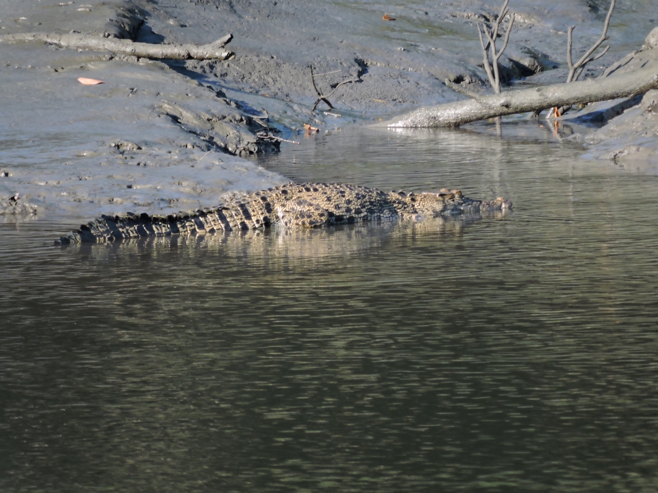 |
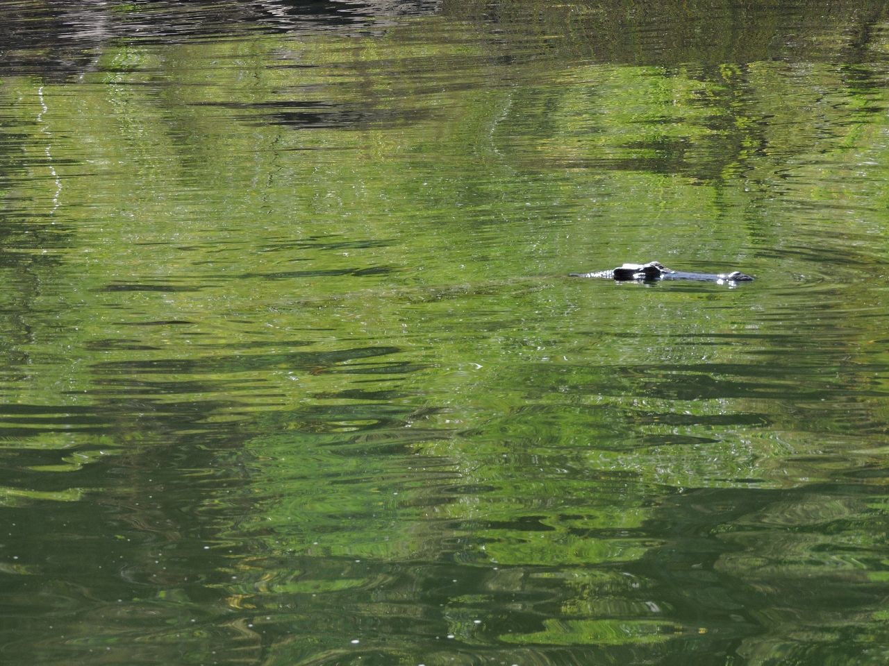
6/13/2015: Croc
Position: -15°36.56'S, 125°17.85'E
This big crocodile was sunning in the mud near our anchorage.
|
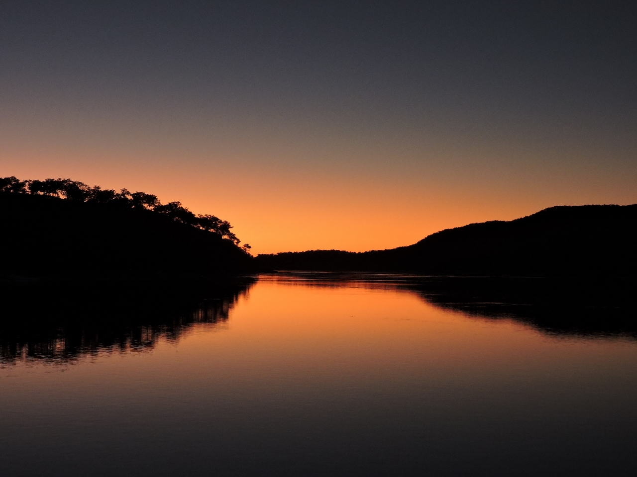 |
6/13/2015: Sunset
Position: -15°36.56'S, 125°17.85'E
Sunset looking downriver from the flybridge.
|
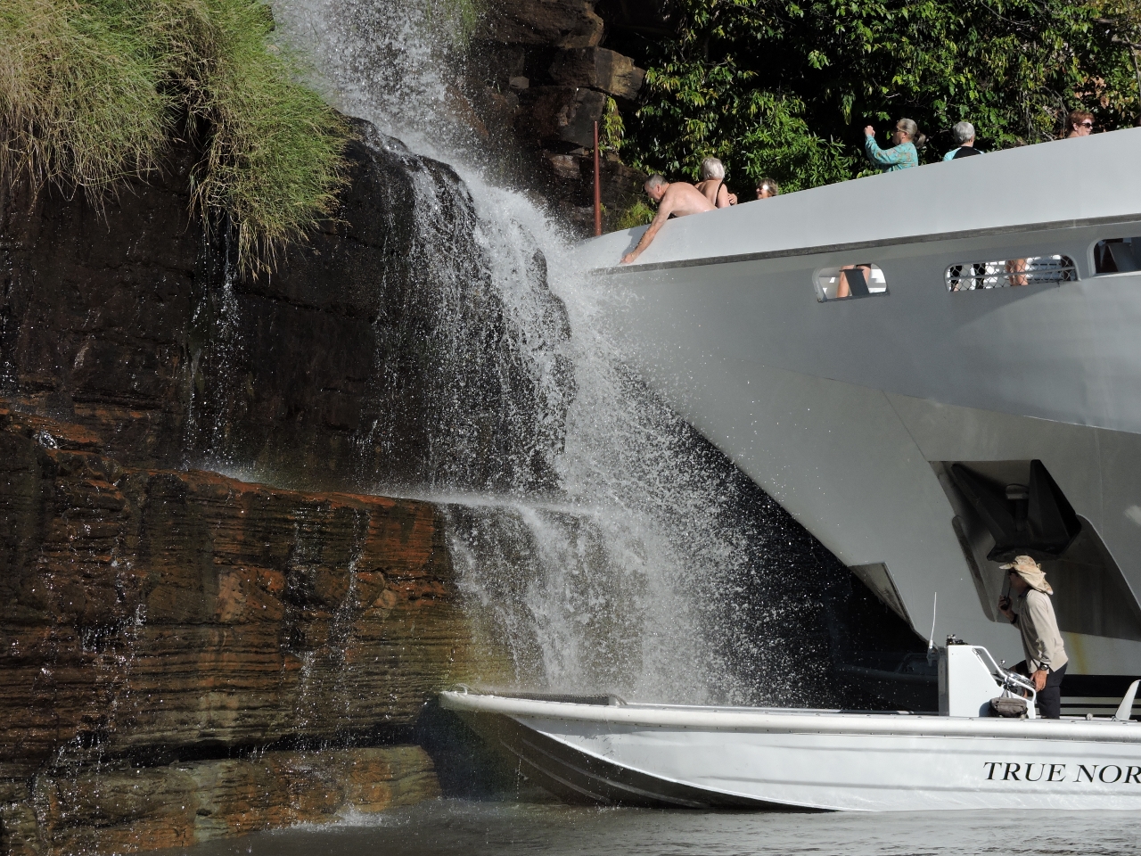 |
6/14/2015: True North
Position: -15°37.35'S, 125°18.31'E
The 164ft (50m) ship True North arrived this morning. Just as they did at the King George River, the captain put the bow right into the falls. The video https://youtu.be/t1DyCnJwHLw (0:20) shows the big boat inching in towards the rocks underneath the falls.
|
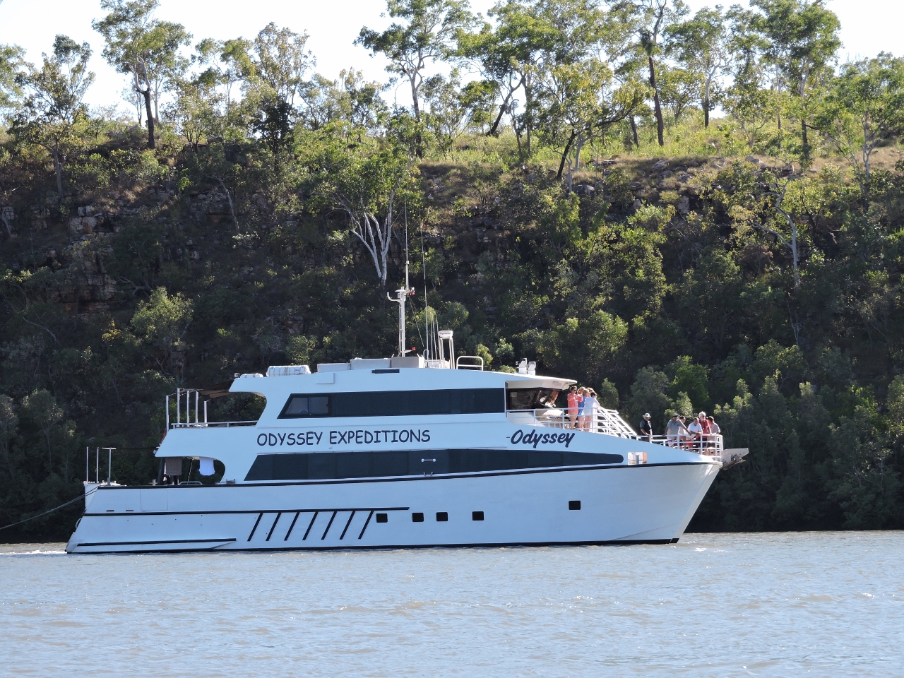 |
6/14/2015: Odyssey
Position: -15°37.27'S, 125°18.46'E
The charter boat Odyssey, that we'd last seen at the Hunter River, also arrived this morning. Both boats later moved downriver to Camp Creek for the night.
|
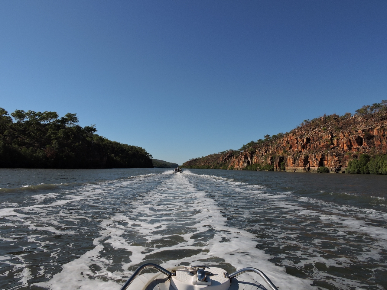 |
6/14/2015: Heading upriver
Position: -15°37.80'S, 125°19.38'E
One of the True North tenders was heading upriver to the falls at what they called "The Amphitheatre". They invited us to follow along since it could be a little difficult to locate.
|
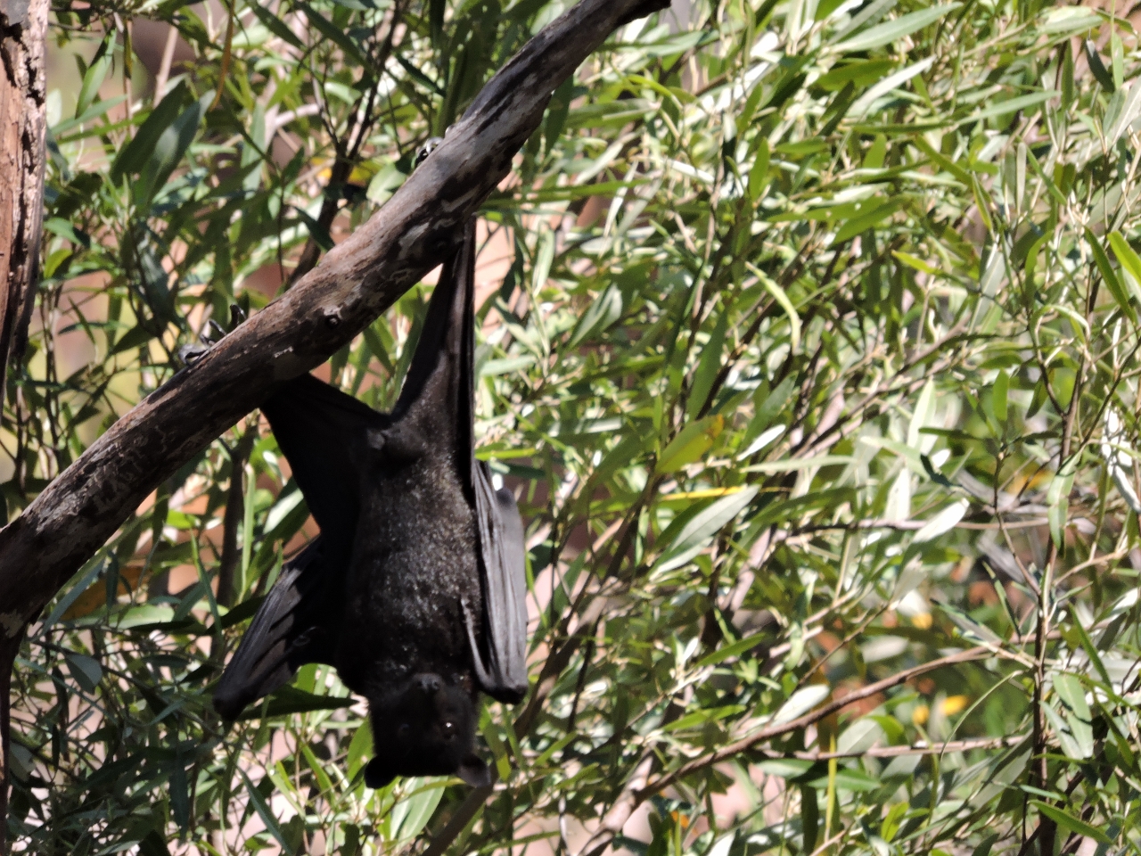 |
6/14/2015: Flying fox
Position: -15°39.65'S, 125°22.06'E
Thousands of Flying Foxes (fruit bats) were in the trees at the mouth of the creek leading to the Amphitheatre. The video https://youtu.be/6pDo8qKlGZY (1:01) shows the entrance to Amphitheatre and then some closeups of the bats in the trees. Their loud squawking was audible a long way off.
|
 |
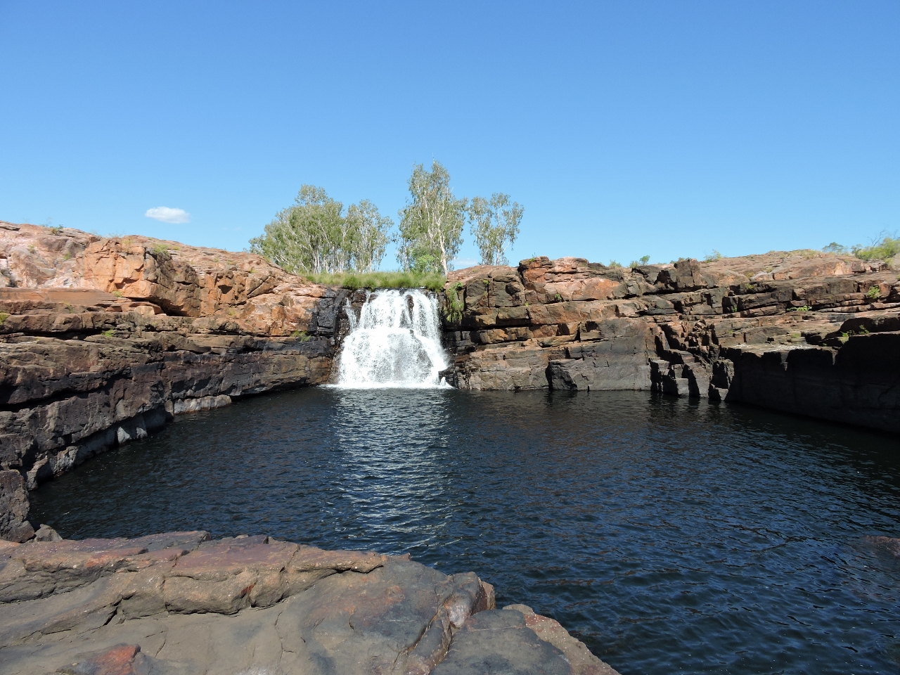
6/14/2015: Amphitheatre
Position: -15°39.91'S, 125°22.03'E
It turns out the Amphitheatre was another name for Cathedral Falls that we'd already planned to visit. We didn't have quite enough water to get over the rock bar at the entrance, but got a good view from outside the basin. We left to explore upriver, planning to return back when there was more water so we could enter.
|
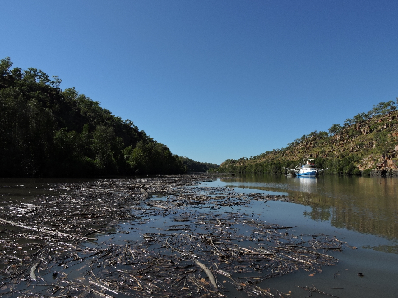 |
6/14/2015: Debris
Position: -15°40.15'S, 125°22.83'E
A fair bit of wood debris is in the Prince Regent River, particularly upstream of the King Cascade Falls. We've not seen much of anything in the water since leaving the Pacific Northwest and this is the closest we've come to the log jams we see there. The boat anchored along the river is the Barramundi fishing operation that the Department of Fisheries was inspecting yesterday.
|
 |
6/14/2015: Rapids
Position: -15°41.06'S, 125°24.21'E
This small rapids flowing upriver would be impassable at low tide. Working against them to return downstream would be difficult too. But we're near a 28ft (8.58m) high tide at White Island, which puts us a couple of hours before high tide here. So we'll have more water soon and shouldn't have any problem getting back through them. That's the plan anyway.
|
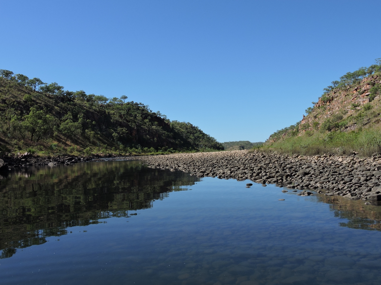 |
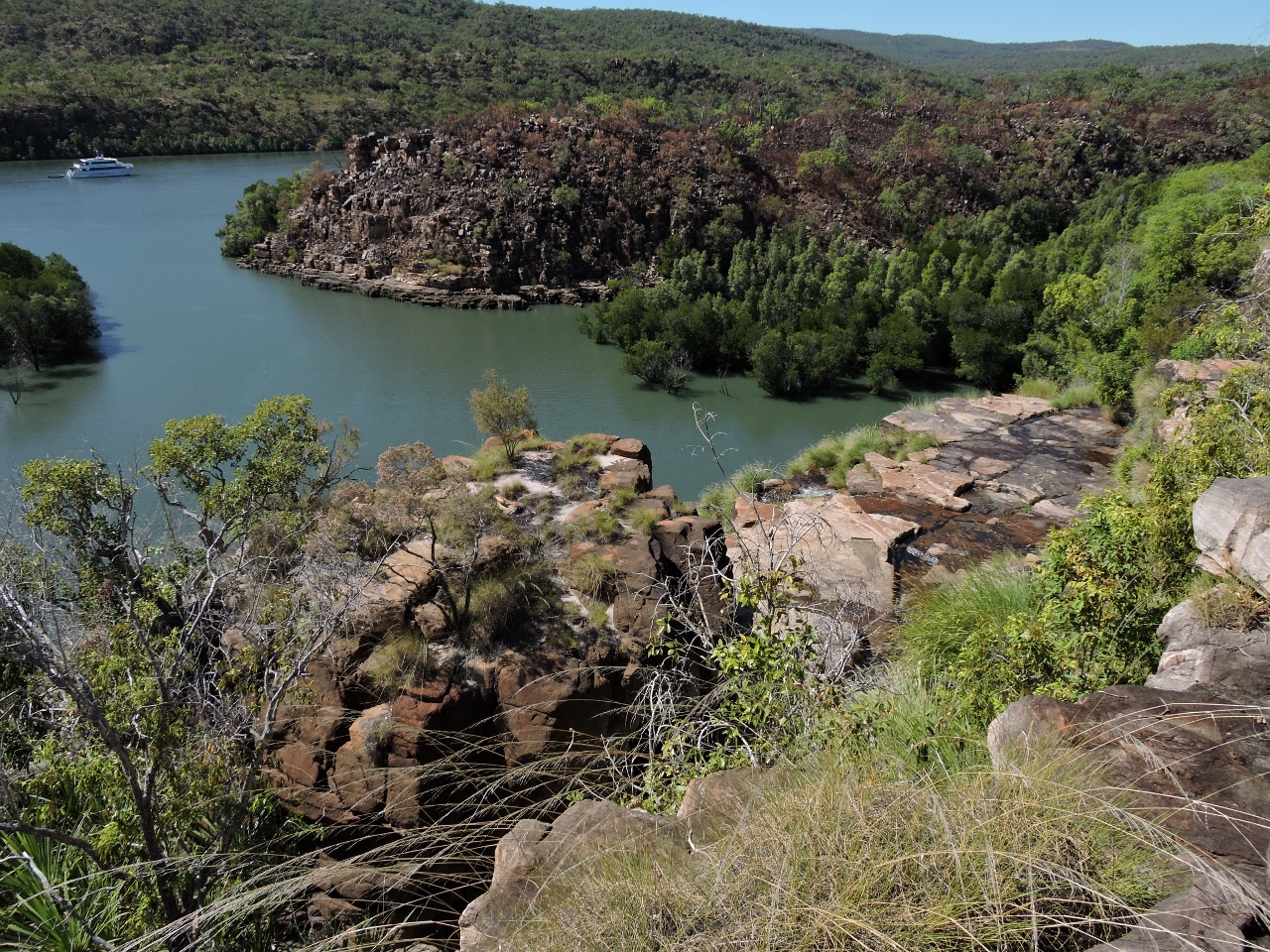
6/14/2015: End of the road
Position: -15°41.81'S, 125°25.34'E
We got a half mile beyond the first rapids before finding the end of the navigable waterway. With a clear sky and dead calm winds, the reflections off the river were beautiful.
|
 |
6/14/2015: Croc or rock?
Position: -15°41.78'S, 125°25.29'E
Croc.
|
 |
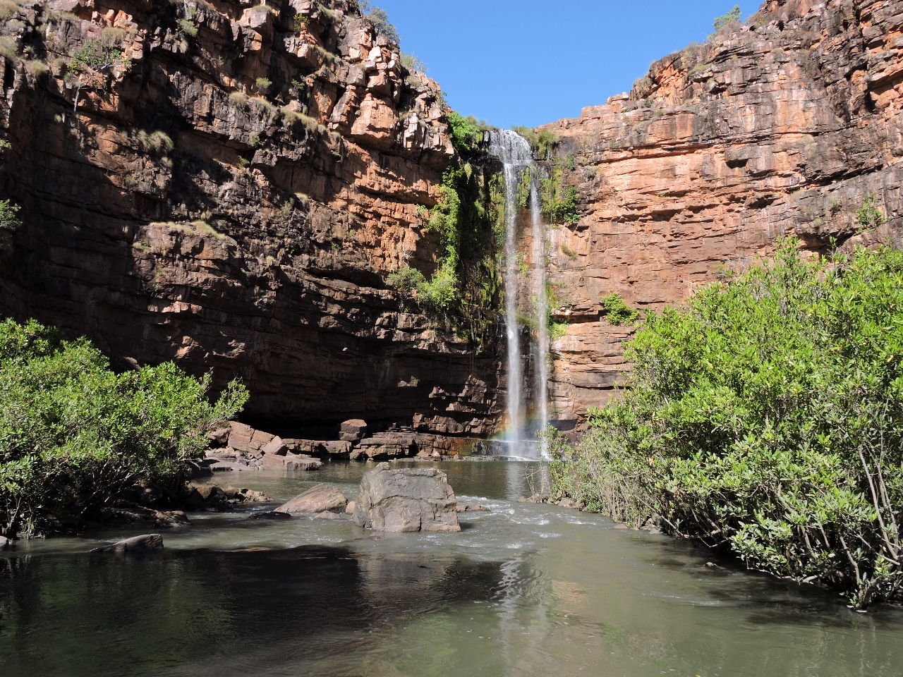
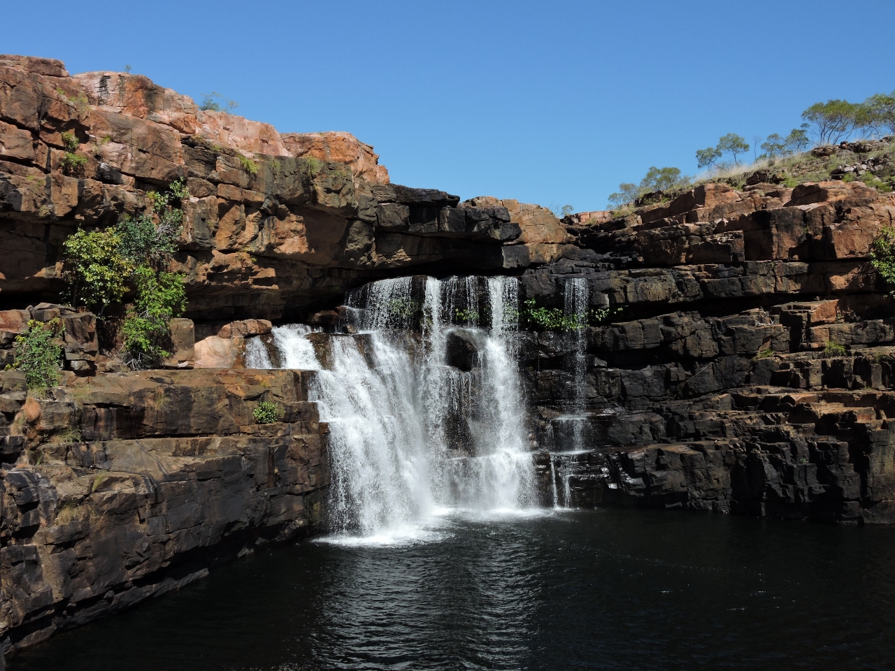
6/14/2015: Under the falls
Position: -15°39.98'S, 125°22.03'E
We returned back down river to the Amphitheatre about 90 minutes after high tide at White Island and were able to cross the rock bar into the basin. The falls are huge--Jennifer is just visible at the base on the left.
|
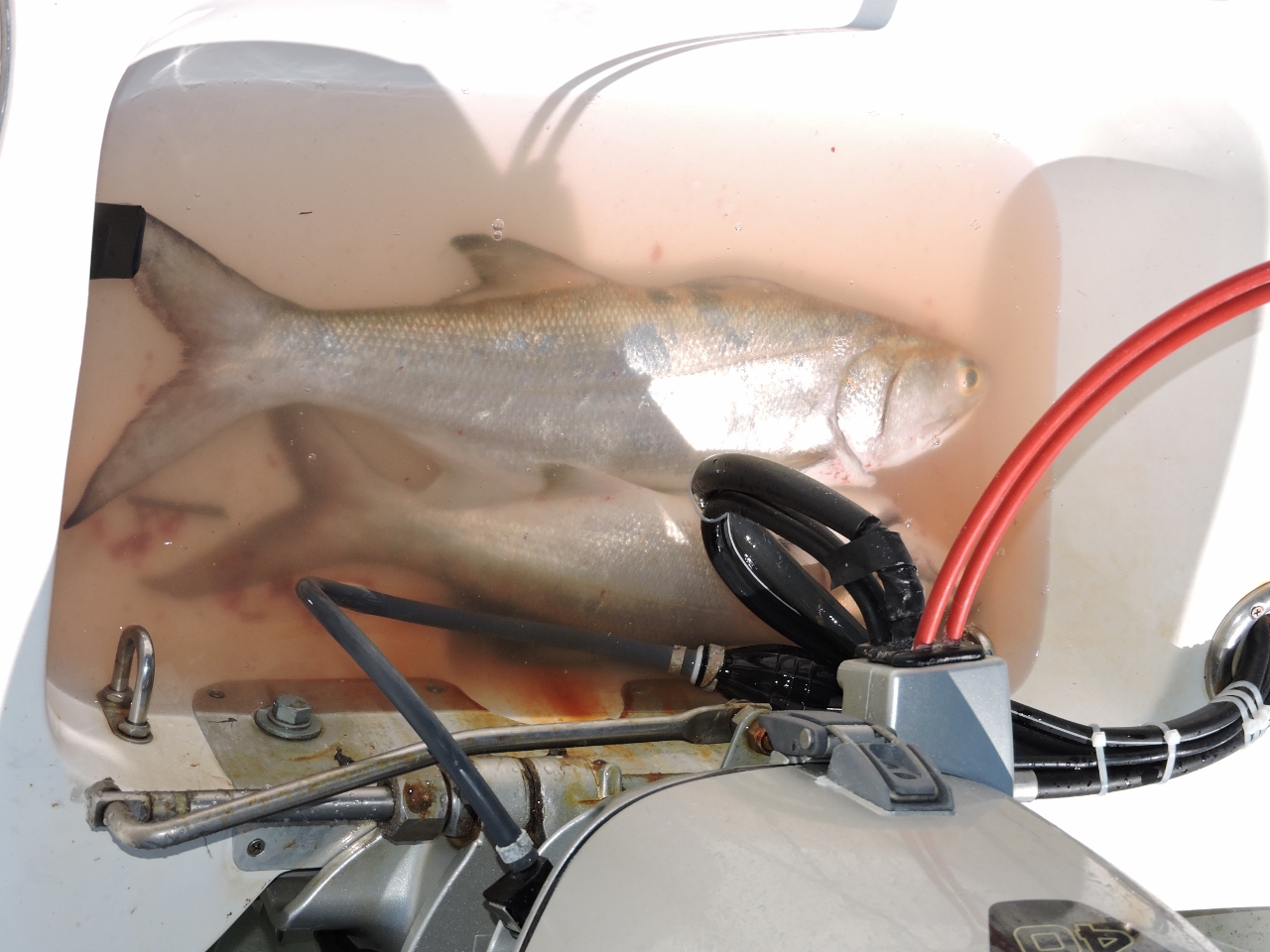 |
6/14/2015: Salmon
Position: -15°36.56'S, 125°17.85'E
One of the True North tenders was also at the falls and offered us a couple of delicious salmon from their catch. We didn't have anywhere to store them, so built a well behind the dinghy seat to keep them until we got back to Dirona. After cleaning and storing them, we headed back out to the falls.
|
 |
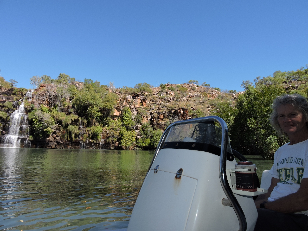
6/14/2015: Above the falls
Position: -15°37.36'S, 125°18.28'E
With the last of the high tide, we walked the trail from the west side of the basin to the top of King Cascade Falls. We went a little far west and north on the way up, but found the trail closer to the water on the way back. This is the view looking out to Odyssey moored in the river just outside the basin.
|
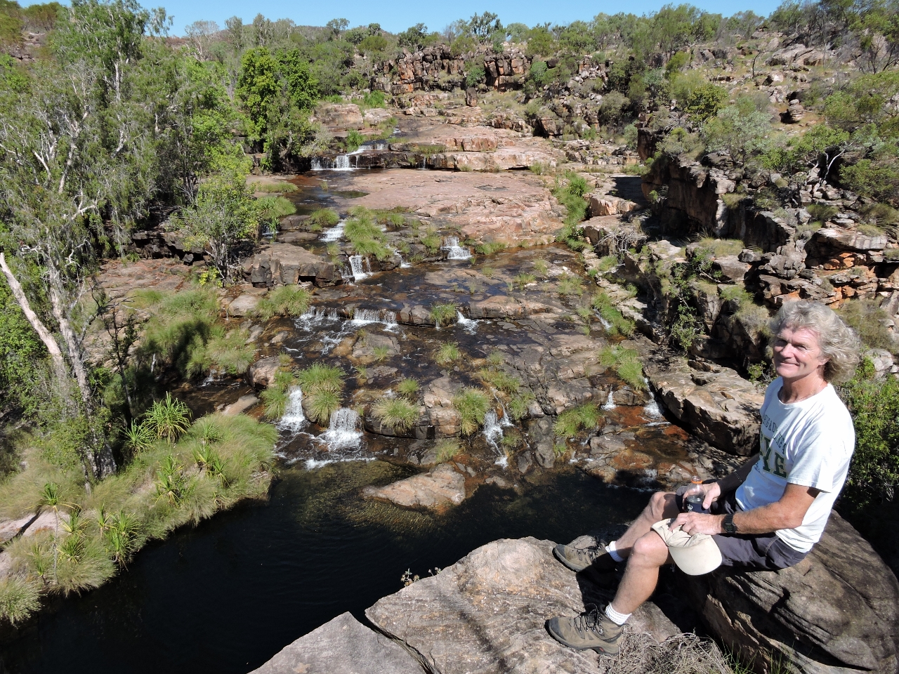 |
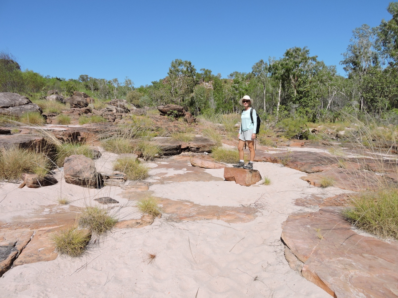
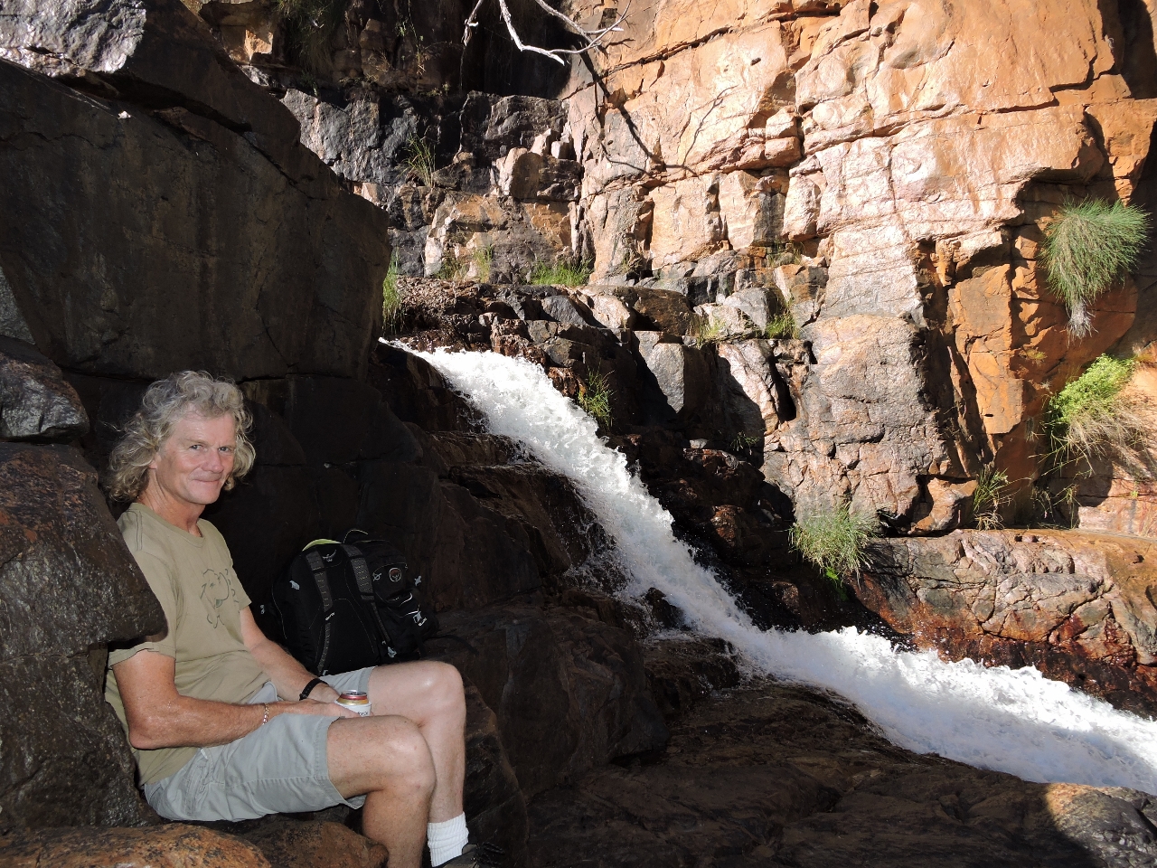
6/14/2015: Smimming hole
Position: -15°37.39'S, 125°18.22'E
Below James in the photo is a popular swimming pool just upriver from the King Cascade Falls. A group from Odyssey was returning from a swim as we arrived. We instead climbed up higher to take in the view from above the pool.
|
 |
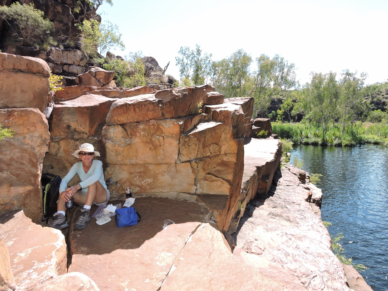
6/14/2015: Lunch
Position: -15°37.30'S, 125°18.29'E
The tide was falling and we were a little nervous about stranding the dinghy, so we returned back down the track for lunch in the shade opposite the falls.
|
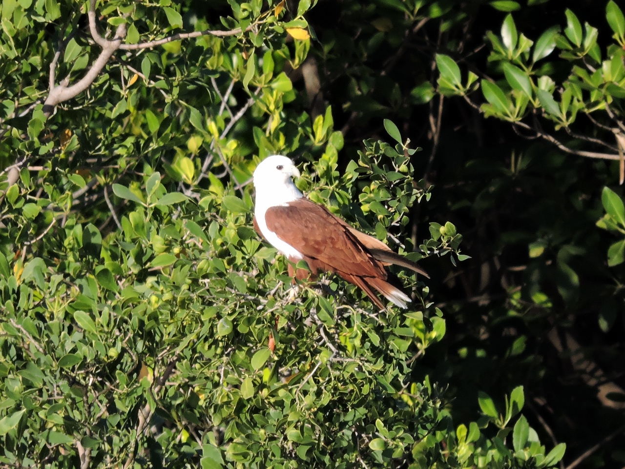 |
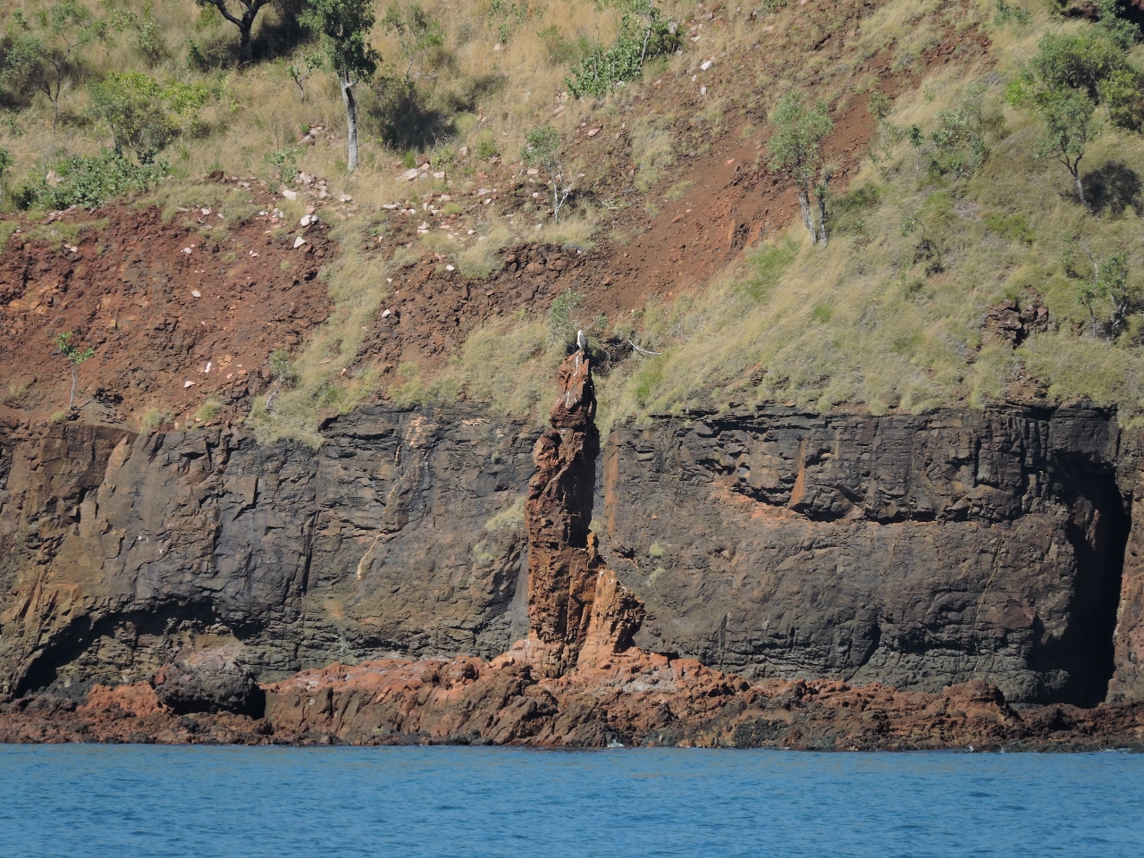
6/14/2015: Eagle
Position: -15°36.56'S, 125°17.85'E
One of the beautiful eagles that frequent the Kimberley, perched in the trees near our anchorage.
|
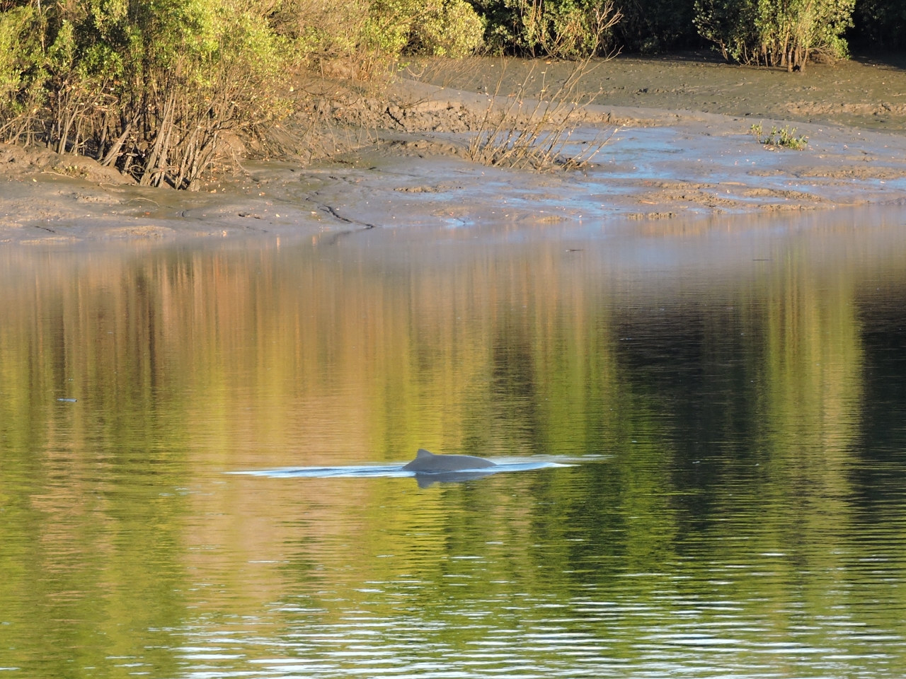 |
6/15/2015: Dolphin
Position: -15°36.56'S, 125°17.85'E
A dolphin swam past this morning. We're surprised the crocodiles don't get them.
|
 |
6/15/2015: Discovery One
Position: -15°36.56'S, 125°17.85'E
Two high-speed tenders from the charter boat Discovery One zoomed past to visit the King Cascade falls.
|
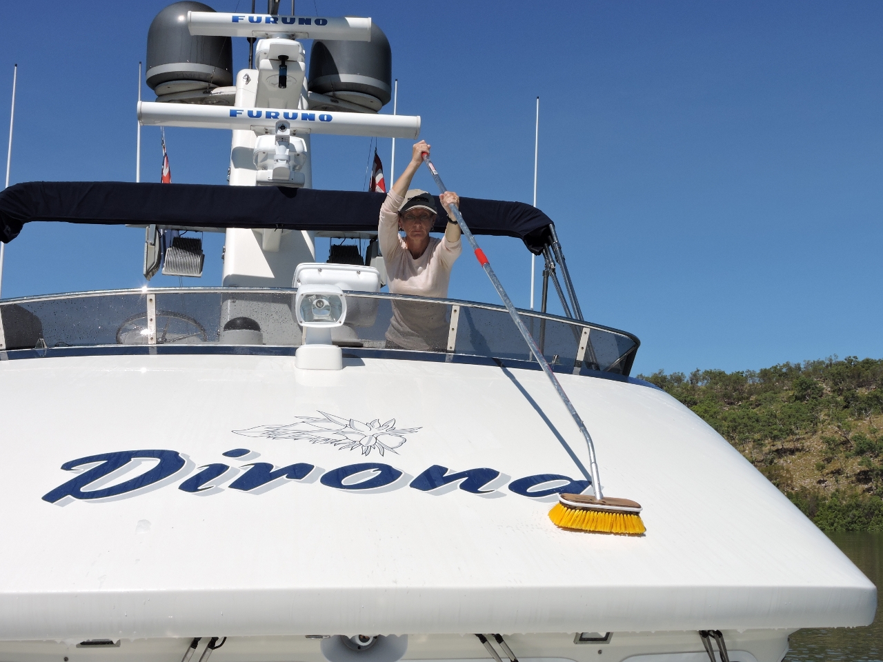 |
6/15/2015: Boat wash
Position: -15°36.56'S, 125°17.85'E
The boat has been coated in salt since crossing the Gulf of Carpentaria three weeks ago, so we finally broke down and gave it a wash. We'd rather not use watermaker water for this purpose, and normally we'd have had at least one squall to rinse the salt away. But we've hardly had a cloud in the sky, let alone a drop of rain, since leaving Cape York. I guess that's why they call it the dry season.
|
|
6/15/2015: Detour
Position: -15°35.23'S, 125°16.52'E
When the tide was high enough to navigate, we moved downriver to anchor for the night at Camp Creek. On our way upriver, we'd seen about 14ft of water in this section, just east of the two islands, where two creeks enter the river on opposite sides. This was about 2 hours after a 26.5ft (8.07m) high tide at White Island on a 17ft exchange to low. Our cruising guide was missing the map for this section of the river, so we were working by feel and had favoured the southern shore. The coming up behind us had instead made an abrupt course change to closely follow the north shore and recommended this route to us when we chatted later that day. We followed this route on our way out and saw a minimum of 21ft about three hours after a 29.8ft (9.08m) high tide at White Island on a 6:30 24 ft (7.3m) exchange to low. Much better.
|
 |
6/15/2015: Kimberley Explorer
Position: -15°32.47'S, 125°12.22'E
The charter boat Kimberley Explorer was exiting Camp Creek as we arrived. It had dropped of a group of campers up-creek and only the skipper was overnighting with the boat.
|
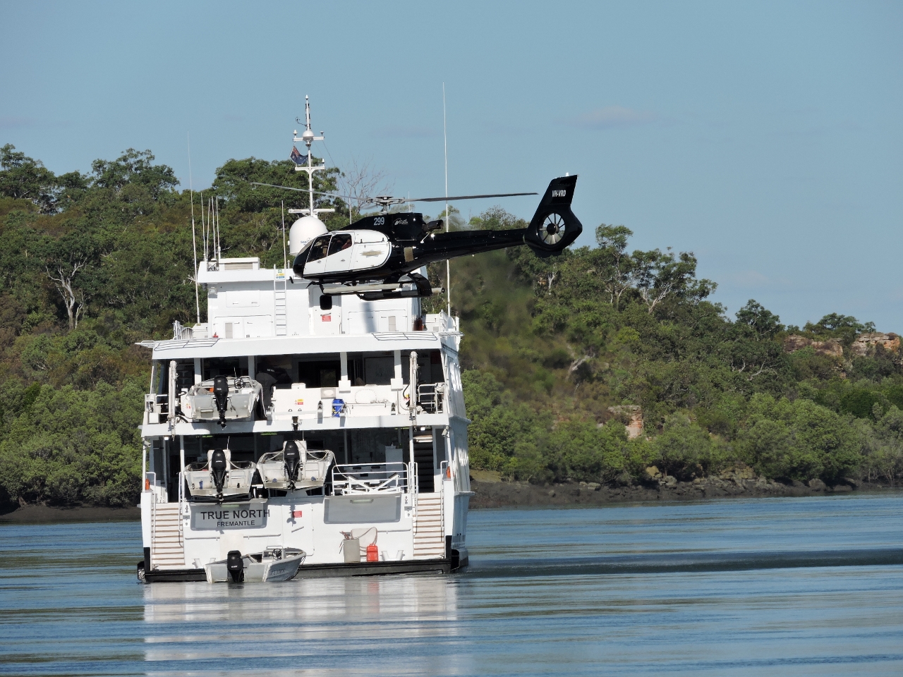 |
6/15/2015: Helicopter
Position: -15°32.47'S, 125°12.22'E
The video https://youtu.be/-YKOEPEeqiY (0:24) shows the helicopter pilot landing on True North while the ship was underway and making pretty good speed. That must take some skill.
|
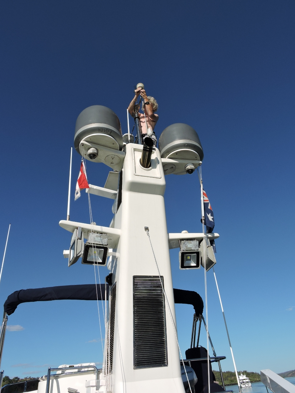 |
6/15/2015: Weather station
Position: -15°32.47'S, 125°12.22'E
Our weather station recently started reading erratically, so James climbed the stack to replace it.
|
 |
6/16/2015: At anchor
Position: -15°32.52'S, 125°12.33'E
At anchor off Camp Creek with Discovery One on the left and Kimberley Explorer on the right.
|
 |
6/16/2015: Rockbar
Position: -15°35.26'S, 125°11.06'E
At the tidal rockbar along Camp Creek.
|
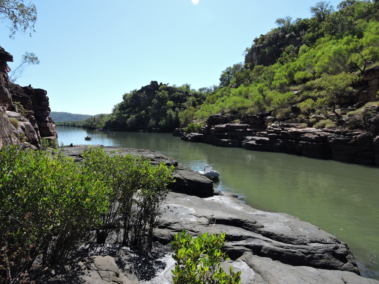 |
6/16/2015: Landing
Position: -15°35.21'S, 125°11.07'E
We landed the tender a little south of the rockbar and tied to a tree above the high water line. Two tenders from Kimberley Explorer already were anchored off, just visible farther down the creek in the distance.
|
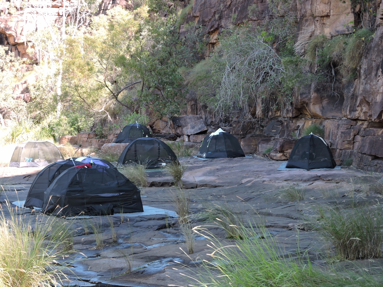 |
6/16/2015: Camp
Position: -15°35.29'S, 125°11.00'E
The group from Kimberley Explorer were camped just beyond the rockbar. Nice camp site.
|
 |
6/16/2015: Beach
Position: -15°35.36'S, 125°11.00'E
We walked along the west shore for a bit, but didn't see much of interest, so came back and crossed the creek to the beach we could see on the other side.
|
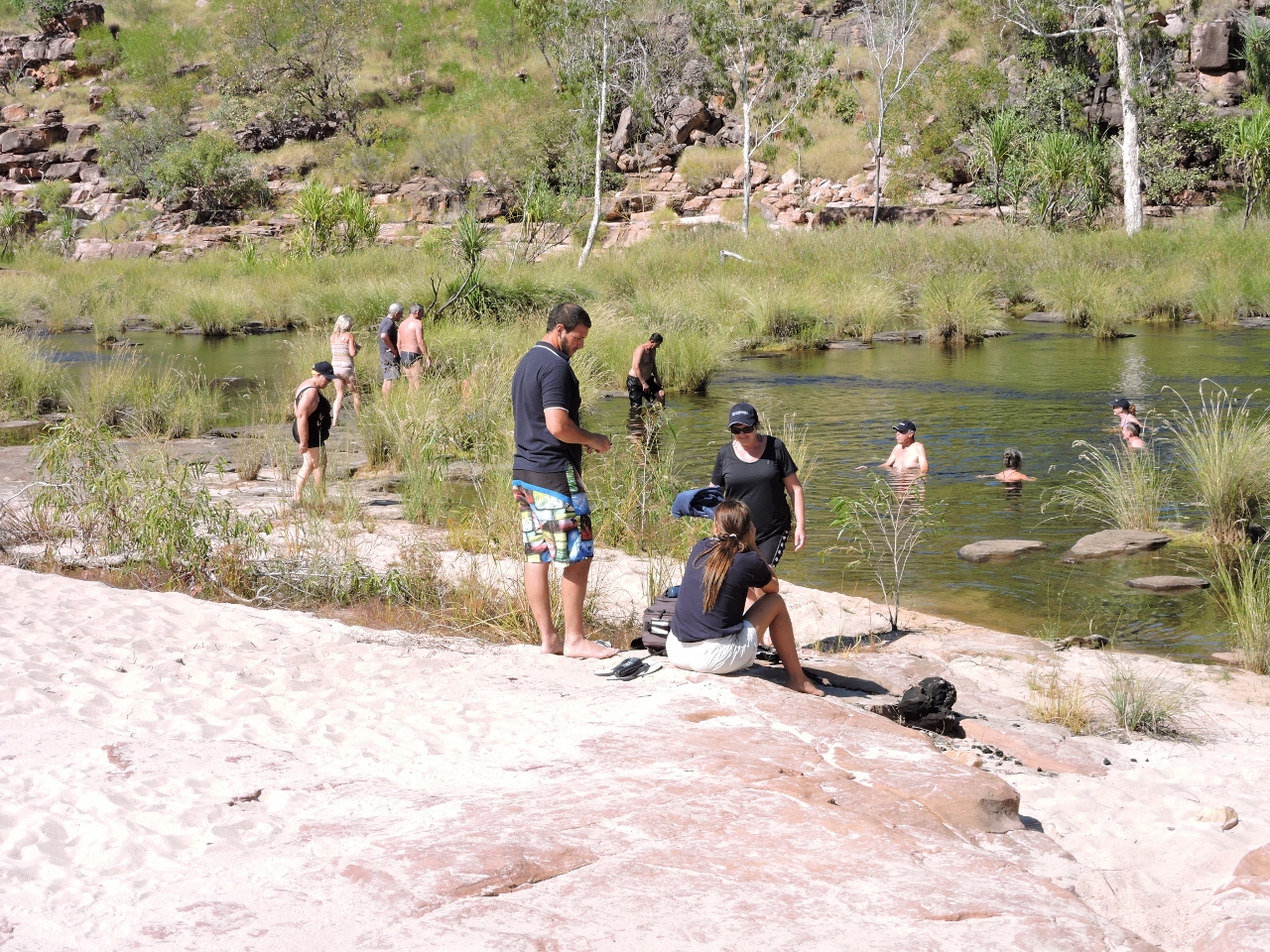 |
6/16/2015: Swimming
Position: -15°35.39'S, 125°11.00'E
A group from Discovery One having a freshwater dip. Someone from Kimberley Explorer camp had told us they'd seen a crocodile upstream, and the lagoon was awfully close to connecting with saltwater at high tide to be safe from crocodiles, but nobody seemed very concerned. We did notice that none of the guides were swimming though. :)
|
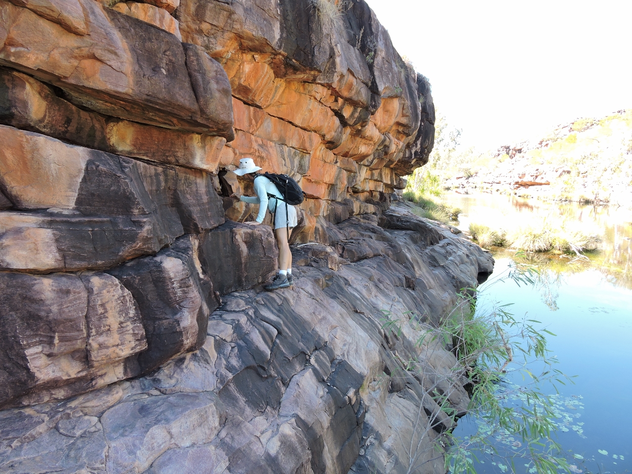 |
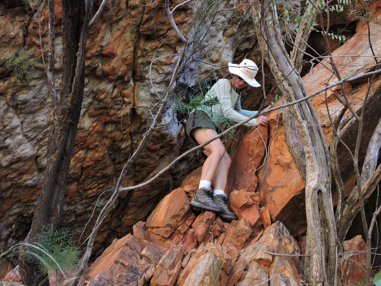
6/16/2015: Rock wall
Position: -15°35.41'S, 125°11.06'E
Climbing along the rock wall to reach the falls farther upstream.
|
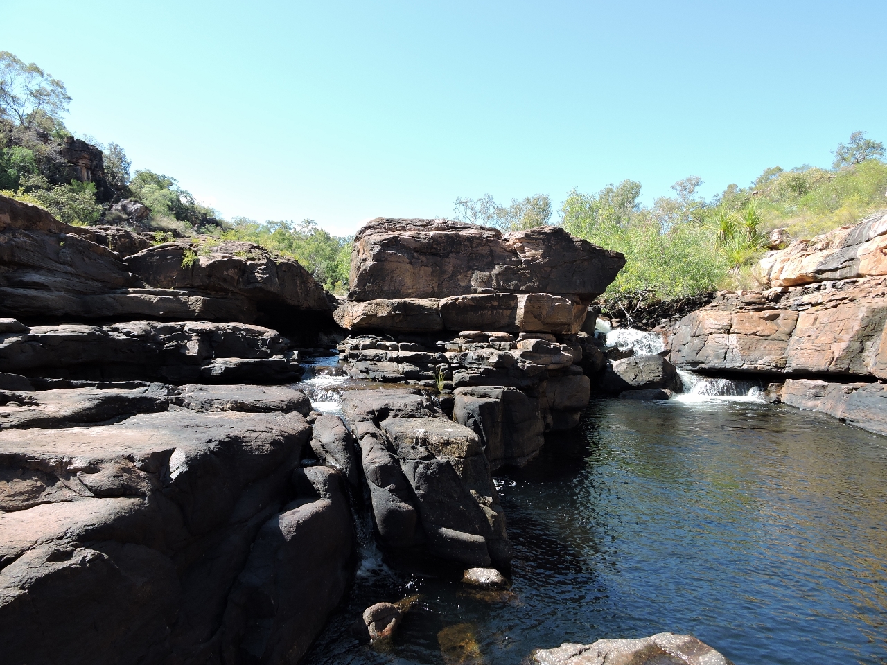 |
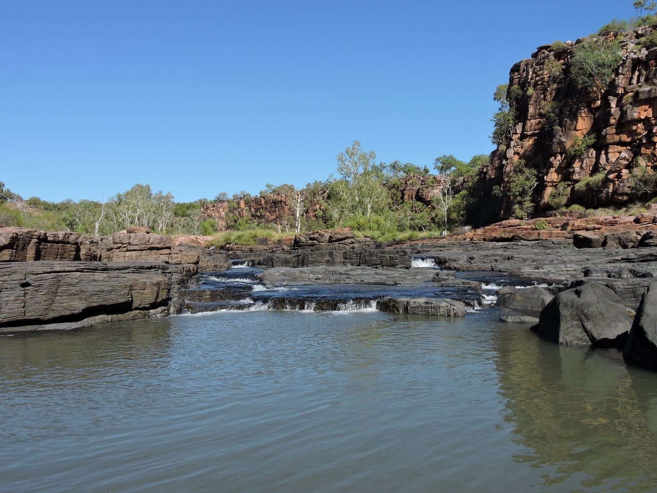
6/16/2015: Cascade
Position: -15°35.46'S, 125°11.21'E
We stopped for a quick break at a small cascade.
|
 |
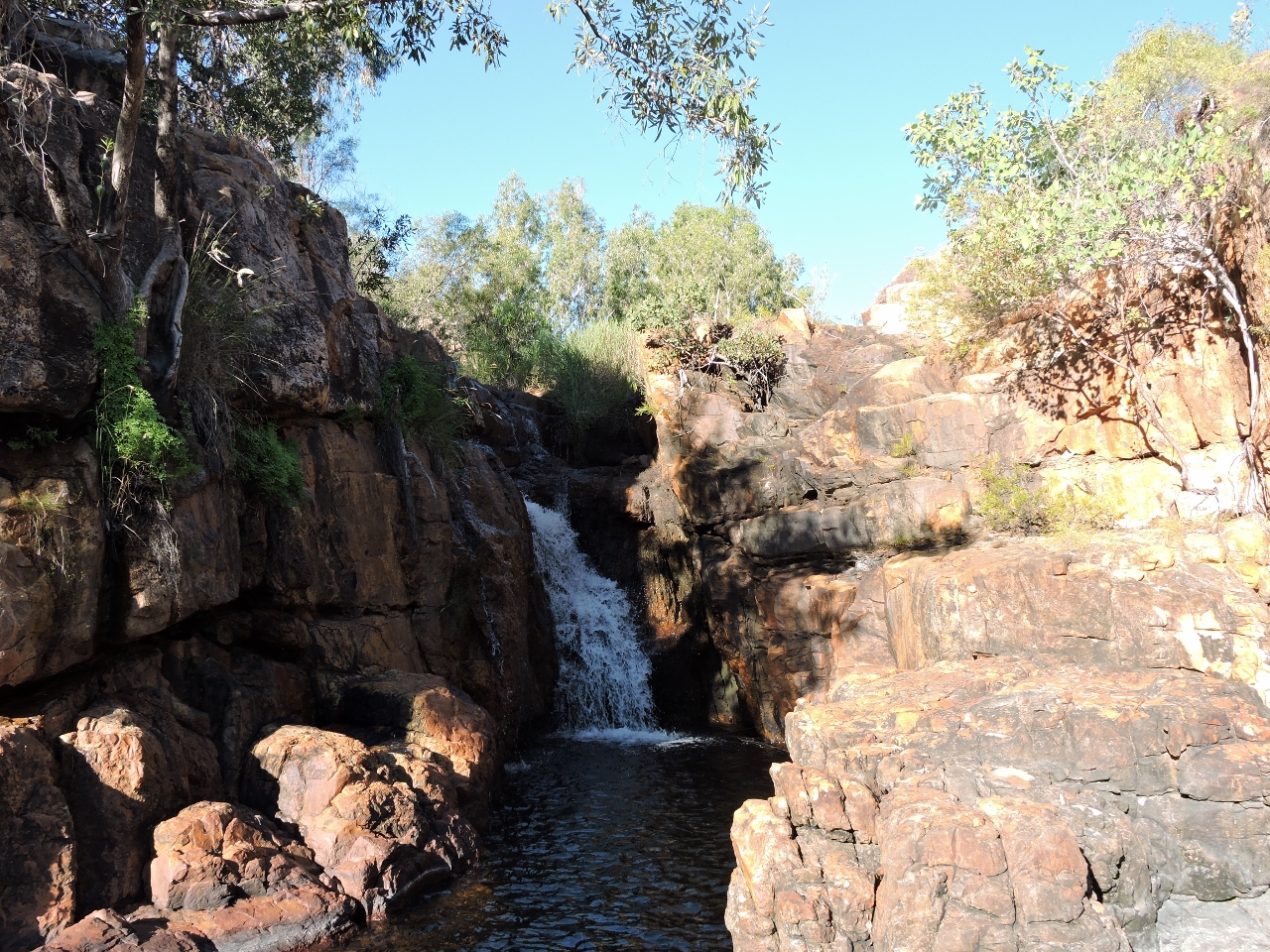
6/16/2015: First falls
Position: -15°35.54'S, 125°11.32'E
A half-hour walk from the swimmers brought us to these impressive falls.
|
 |
6/16/2015: Second falls
Position: -15°35.57'S, 125°11.30'E
A second set of falls are a quick climb above the first.
|
 |
6/16/2015: Beside the falls
Position: -15°35.55'S, 125°11.29'E
From the second falls, we climbed down to the other side of the first falls.
|
 |
6/16/2015: Lunch
Position: -15°35.54'S, 125°11.29'E
Lunch in the shade with a view to the first falls. It's really hot here.
|
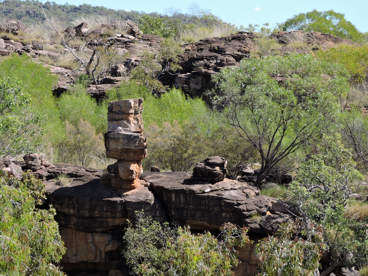 |
6/16/2015: Balancing rocks
Position: -15°35.61'S, 125°11.24'E
The rock formations here are wild. These look carefully placed one atop the other.
|
 |
6/16/2015: High tide
Position: -15°35.22'S, 125°11.06'E
We'd tied the tender off a long way below the high water line, and three hours later our line was barely above the water. No croc though. The tidal ranges here sure are huge. Today's exchange is 30ft.
|
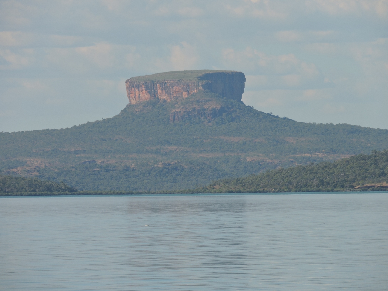 |
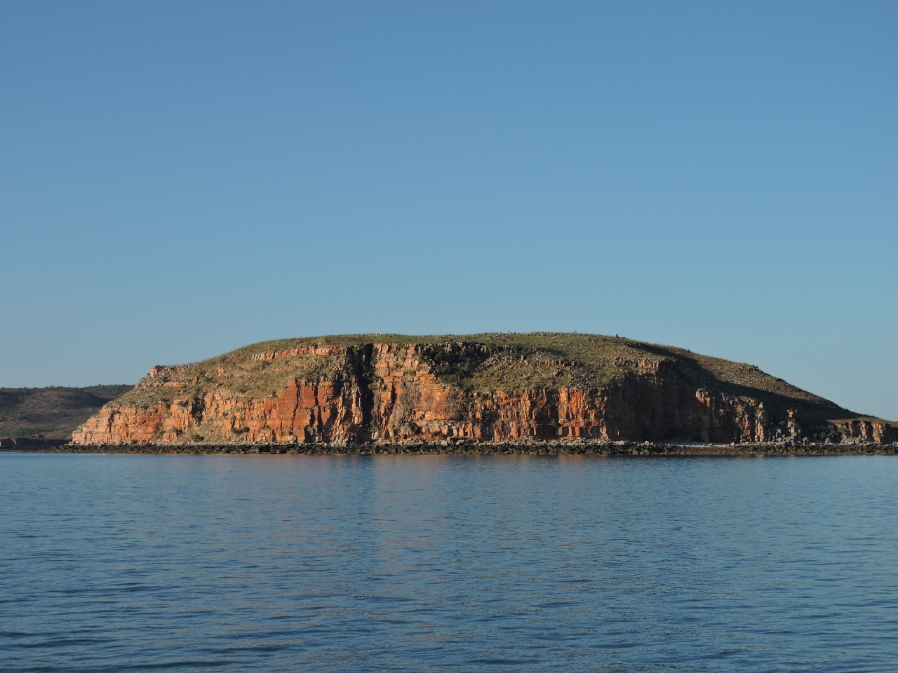
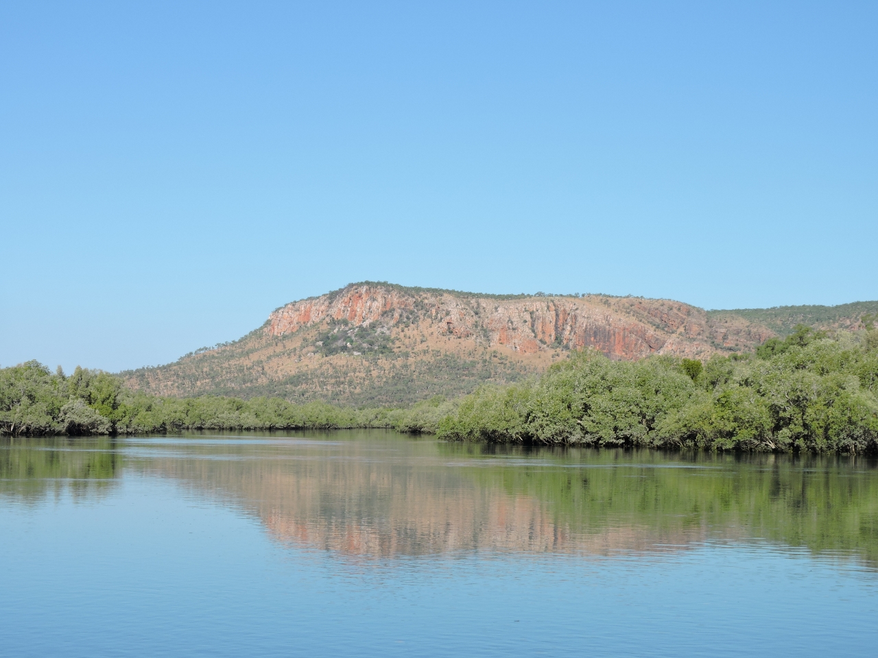
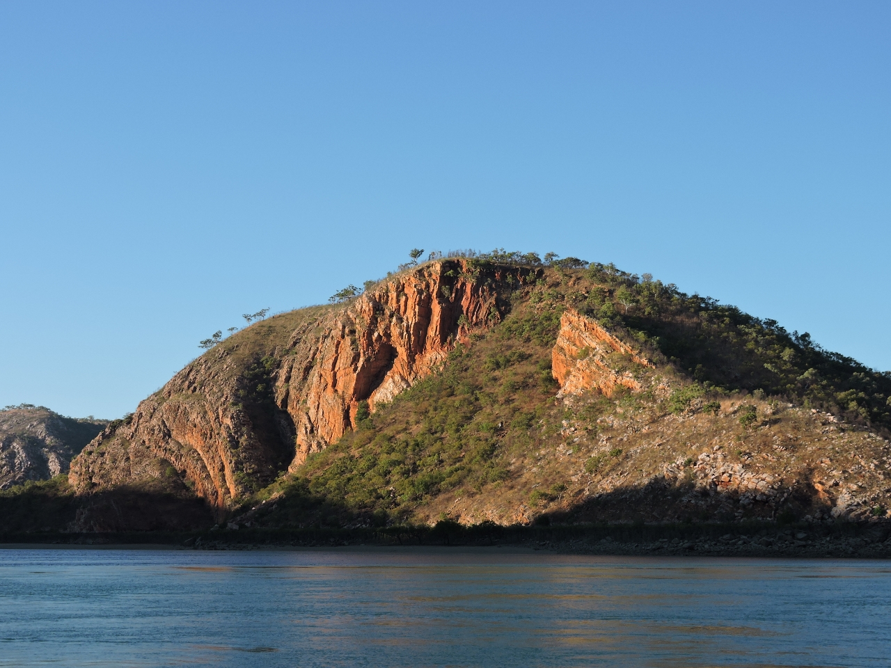
6/16/2015: Mt. Trafalgar
Position: -15°22.95'S, 124°57.63'E
Dramatic 1,270ft (387m) Mt. Trafalger seen from Saint George Basin as we exited the Prince Regent River.
|
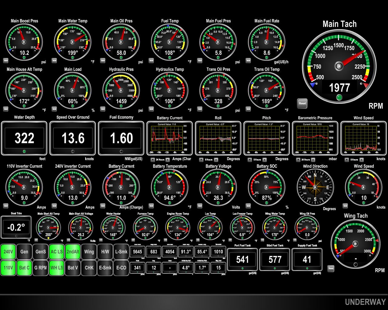 |
6/16/2015: Current
Position: -15°15.51'S, 124°51.88'E
We passed through Strong Tide Point 2.5 hours before a 4.49ft (3.37m) low tide at White Island, on a 6:29 26.5ft (8.09m) exchange. The ebb current was running at several knots, but the flow was mostly laminar. The current increased as we progressed north and we were doing 13.6kts at 1977RPM, when normally we'd be doing about 8.3kts.
|
 |
6/16/2015: Upwellings
Position: -15°13.65'S, 124°50.52'E
We did see plenty of upwellings and whirlpools beyond Strong Tide Point and well outside the entry, but they weren't difficult or dangerous.
|
 |
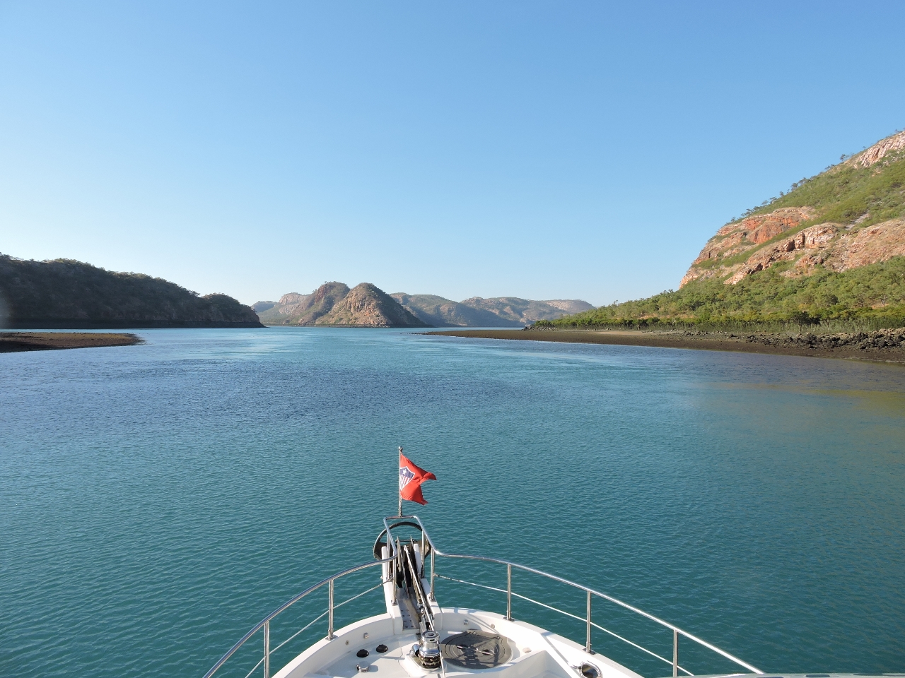
6/17/2015: Hanover Bay Inlet
Position: -15°18.89'S, 124°46.48'E
After exiting the Prince Regent River, we made a quick run around the corner to Hanover Bay Inlet for the night. We arrived just in time to enjoy dusk from the flybridge. This is the view at dawn the next morning, looking west to the cliffs across the inlet. Anchored below is the charter boat Discover One, who preceded us out of the Prince Regent River.
|
 |
6/17/2015: Port George IV
Position: -15°14.54'S, 124°40.74'E
We passed through Port George IV and Rogers Strait on a 21-ft tide at White Island about 3 hours before a 31.2ft high tide on a 25ft 6-hour exchange. The current was running a couple of knots, with some upwellings around Umbanganan Island, but they weren't difficult. The scenery all through this route was impressive, starting with High Bluff as we entered Port George IV.
|
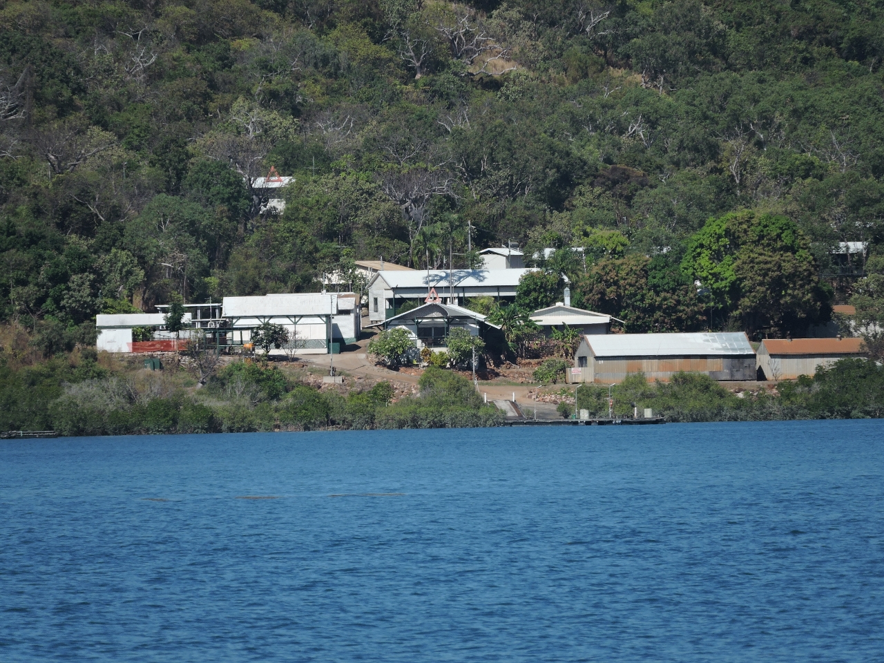 |
6/17/2015: Resort
Position: -15°28.09'S, 124°31.68'E
An old pearl farm in Kuri Bay was recently transformed into a luxury resort. Although the chart showed the area littered with aquaculture, we saw little evidence of it the entire way through Port George IV and out into Camden Sound.
|
 |
6/17/2015: Needle Rock
Position: -15°28.04'S, 124°29.60'E
Distinctive Needle Rock at the South Entrance to Brecknock Harbour.
|
 |
6/17/2015: Claret Islands
Position: -15°41.59'S, 124°23.19'E
We checked out Deception Bay to the north as a possible anchorage, but it felt too big and open. Conditions were calm, so we continued south and instead found an excellent anchorage tucked in behind the Claret Islands. The sunset over the islets was fabulous.
|
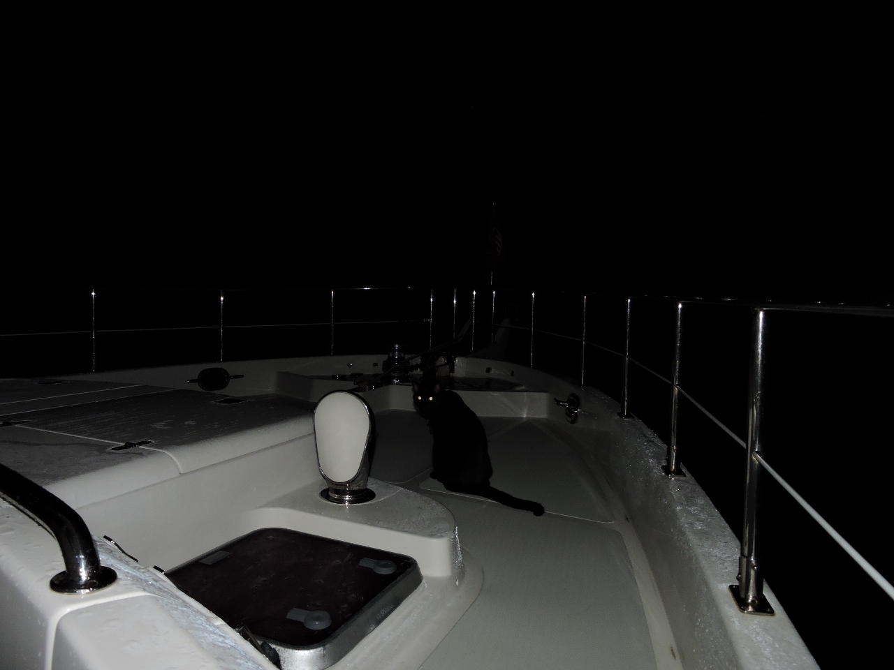 |
6/18/2015: Bow watch
Position: -15°43.24'S, 124°19.74'E
Spitfire helping out with a bow watch as we leave Claret Islands before sunrise on the 62-mile run to Horizontal Falls. We want to arrive near high water, which is just past noon.
|
 |
6/18/2015: Talbot Bay
Position: -16°19.15'S, 123°54.61'E
Talbot Bay was much more scenic and dramatic than we were expecting. This is looking south towards Horizontal Falls. To give an idea of the scale, the small white speck visible in the distance to the right of Slug Island is the 297 ft (90.6m) cruise ship Caledonian Sky.
|
 |
6/18/2015: Horizontal Falls
Position: -16°22.38'S, 123°57.85'E
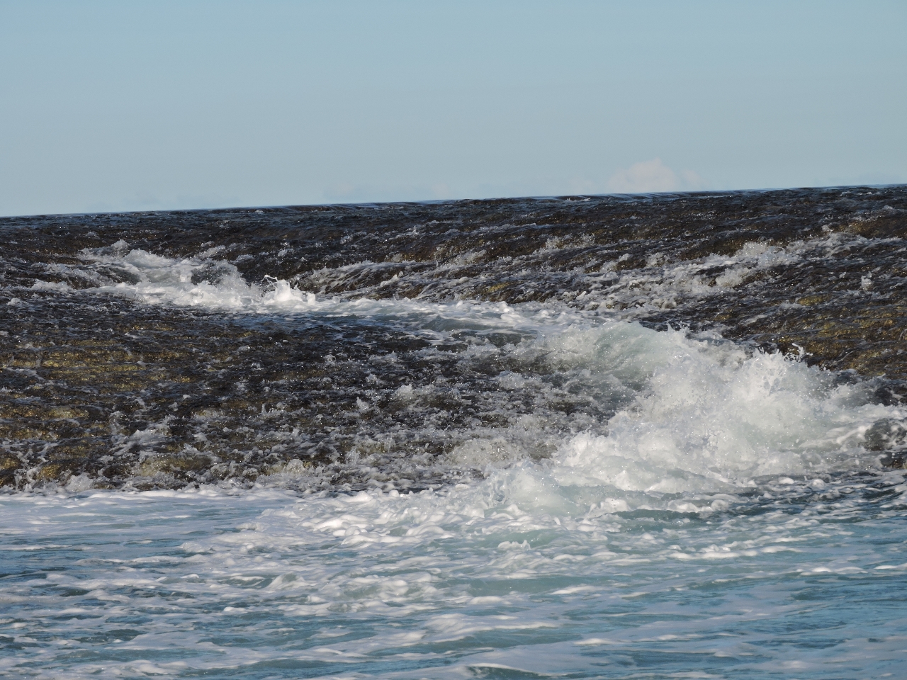
Looking from Dirona to the first of the two Horizontal Falls, two narrow gorges about 300m apart that connect two saltwater basins. As the tide goes up and down outside in Talbot Bay, water can't flow in or out of the basins fast enough to keep up. The result is extreme tidal currents and waterfalls sometimes several meters high on large tidal exchanges. Here's a picture of what the flow can look like.
|
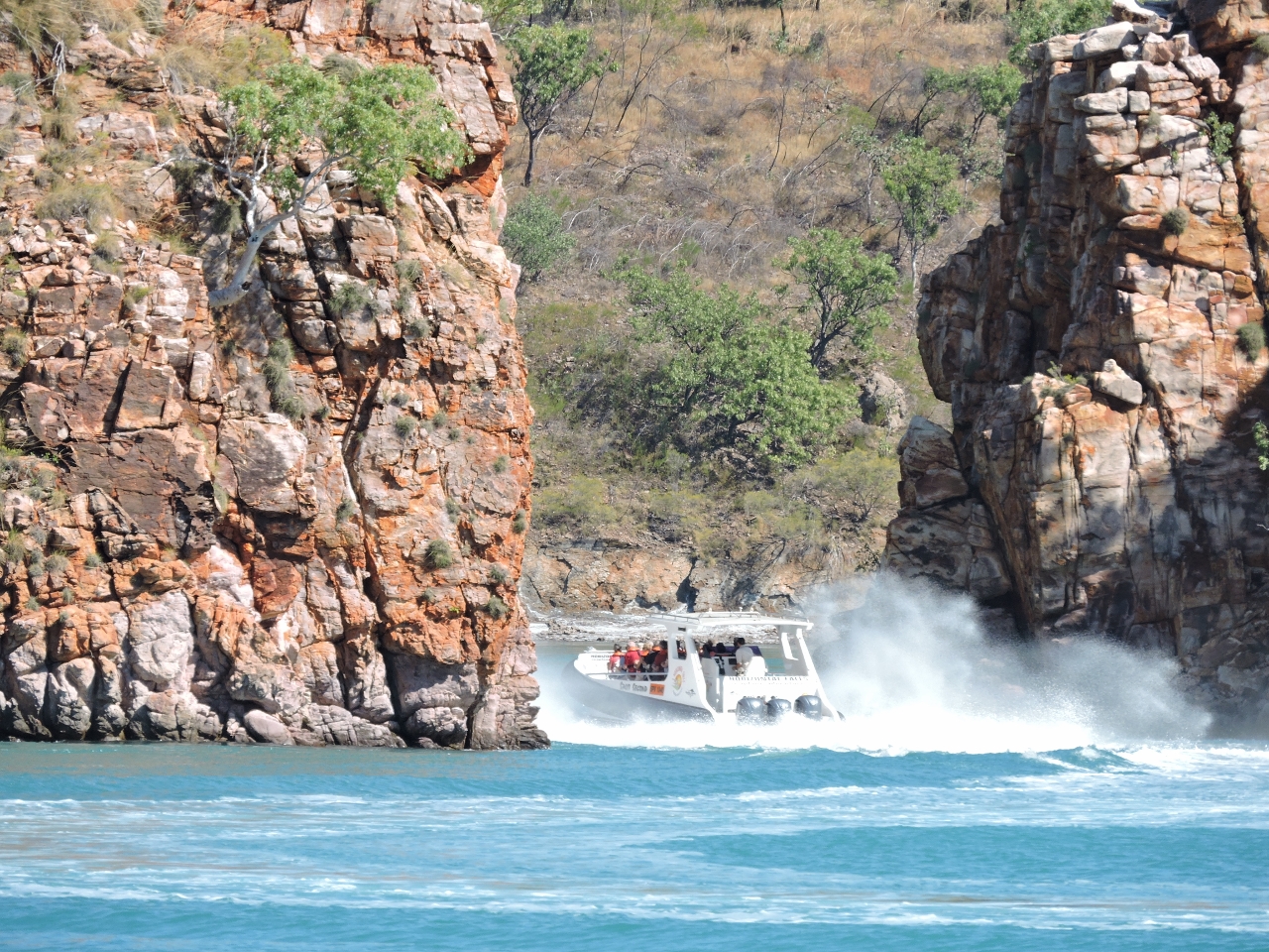 |
6/18/2015: Tourist boat
Position: -16°22.42'S, 123°57.83'E
As we watched from Dirona, a high-speed tourist boat whipped through the opening.
|
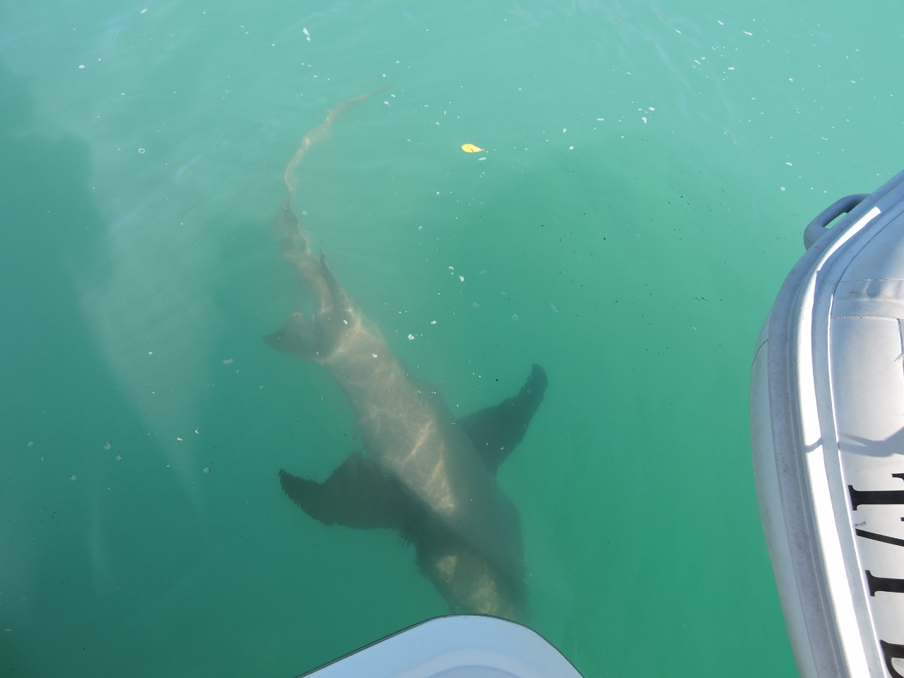 |
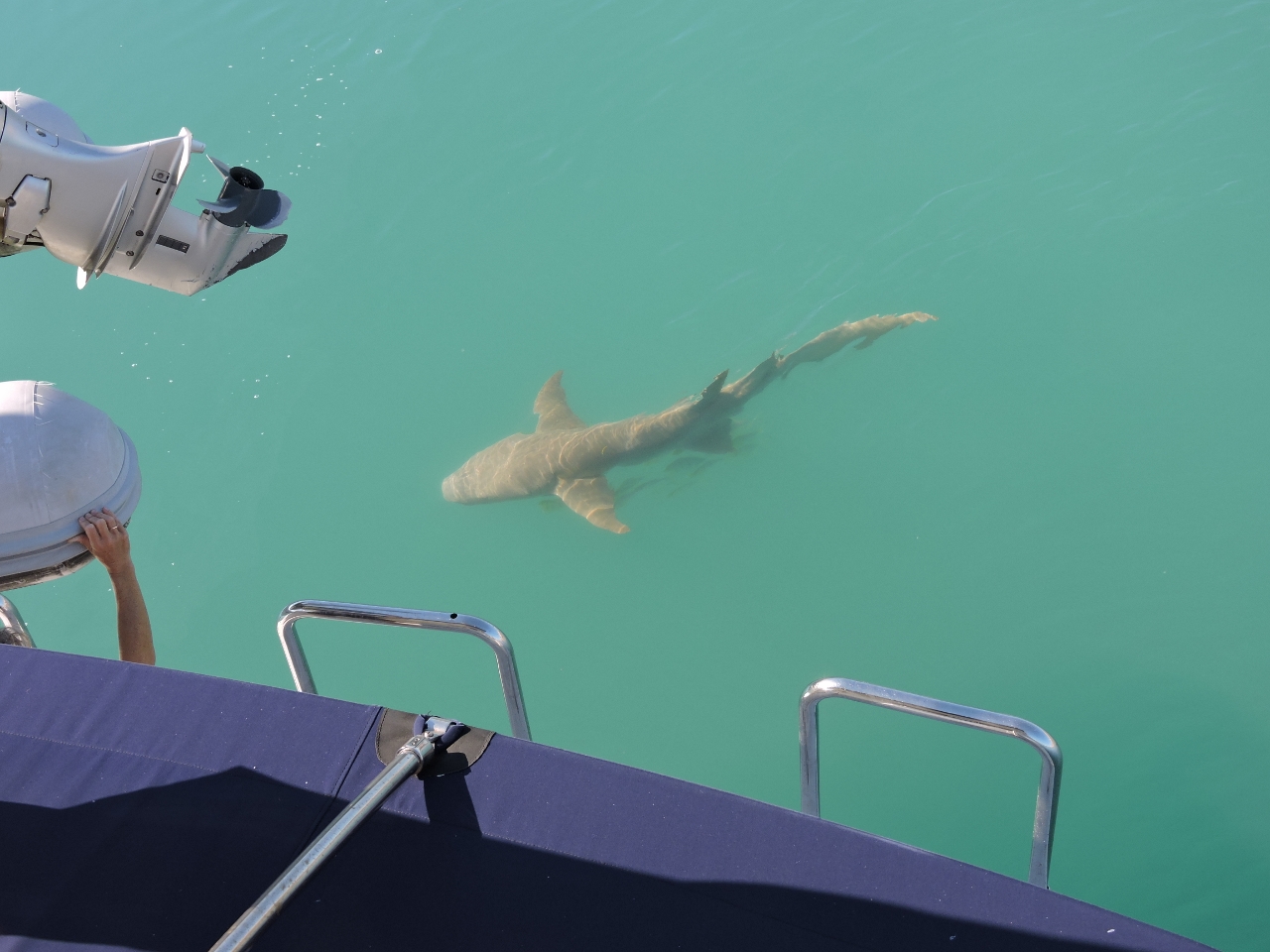
6/18/2015: Shark
Position: -16°22.19'S, 123°58.22'E
Soon after we anchored, this large Tawny Nurse shark arrived to investigate. This breed of shark apparently isn't particularly aggressive towards humans, but Bull Sharks are in the region, and they certainly are.
|
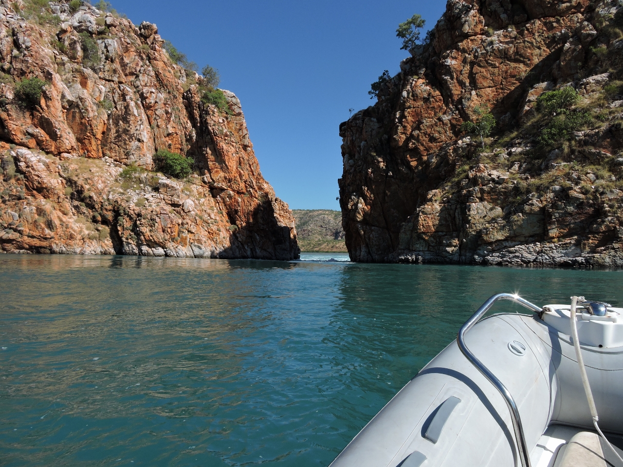 |
6/18/2015: Through the rapids
Position: -16°22.61'S, 123°57.62'E
About 90 minutes after a 32ft (9.82m) high tide in Yampi Sound, the current was still flooding through the first gorge, but it was easily passable by dinghy. The second gorge was a different matter--the water level dropped several feet from one side to the other and the channel was a torrent. The video at https://youtu.be/xMrkCOwwsXo (2:44) shows us passing through the first gorge and arriving at the second. We watched a tour boat zip through a couple of times, then took on the rapids ourselves.
|
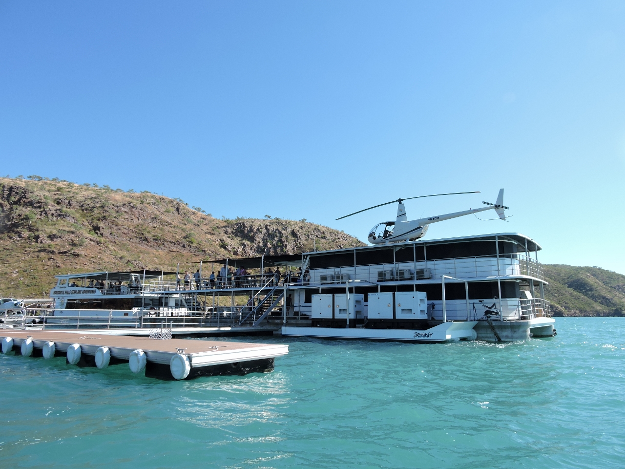 |
6/18/2015: Resort
Position: -16°22.45'S, 123°58.20'E
Horizontal Falls Seaplane Adventures has a base near the falls from which they run helicopter, seaplane and high-speed boat tours. It was a busy operation--all their craft were constantly coming and going.
|
 |
6/18/2015: Cyclone Creek
Position: -16°22.58'S, 123°59.99'E
A strong ebb current was running at the entrance to Cyclone Creek about two hours after high water, but it had slackened notably by the time we returned back out. Just inside the creek entrance the weather has carved these striking patterns into the cliff.
|
 |
6/18/2015: Bluff
Position: -16°24.11'S, 124°1.87'E
Cyclone Creek was quite scenic, particularly this bluff in the distance.
|
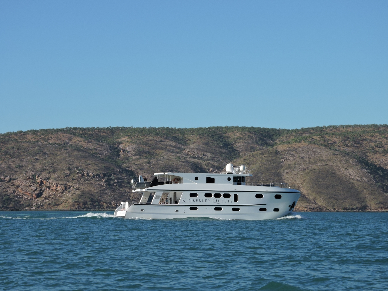 |
6/18/2015: Kimberley Quest
Position: -16°21.60'S, 123°57.21'E
The charter boat Kimberley Quest arrived and anchored nearby. Later, one of the floating barges from the tourist base powered over and moored up against it. We think they might have been transferring fuel from the boat to the barge to support the local base.
|
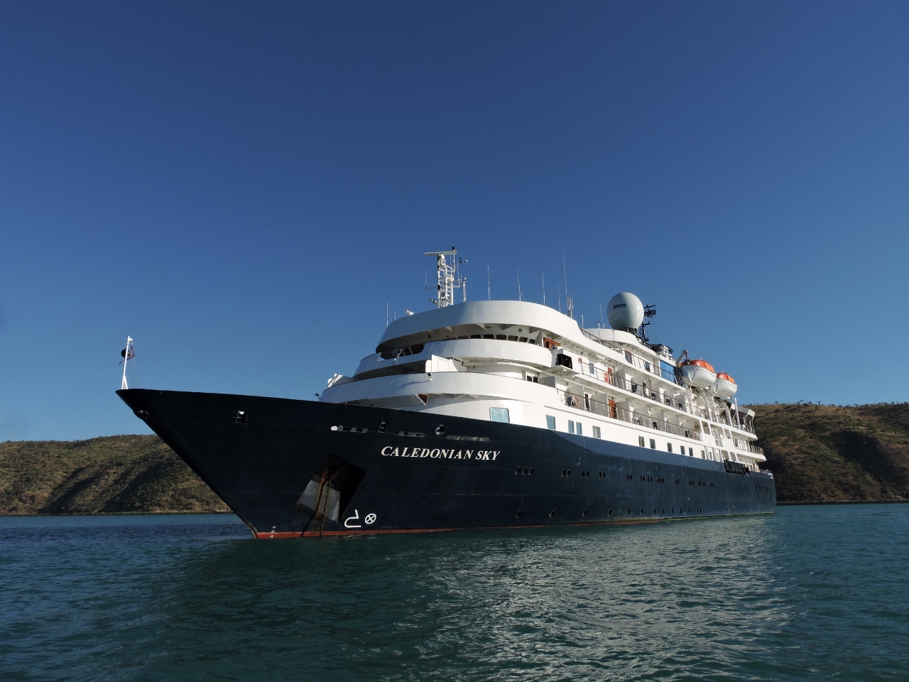 |
6/18/2015: Caledonian Sky
Position: -16°21.23'S, 123°57.05'E
We'd last seen the cruise ship Caledonian Sky off the Hunter River. The ship had a flotilla of small zodiacs trailing astern when passed earlier. We saw many of them at the falls and up Cyclone Creek.
|
 |
6/18/2015: Ebb
Position: -16°22.52'S, 123°57.70'E
About four hours after high tide, we took one more look at the Horizontal Falls. They were ebbing quite strongly now. We didn't go through, but shot the video https://youtu.be/w0A0ie-L6k0 (1:10) showing the flow and of one of the tourist boats going through.
|
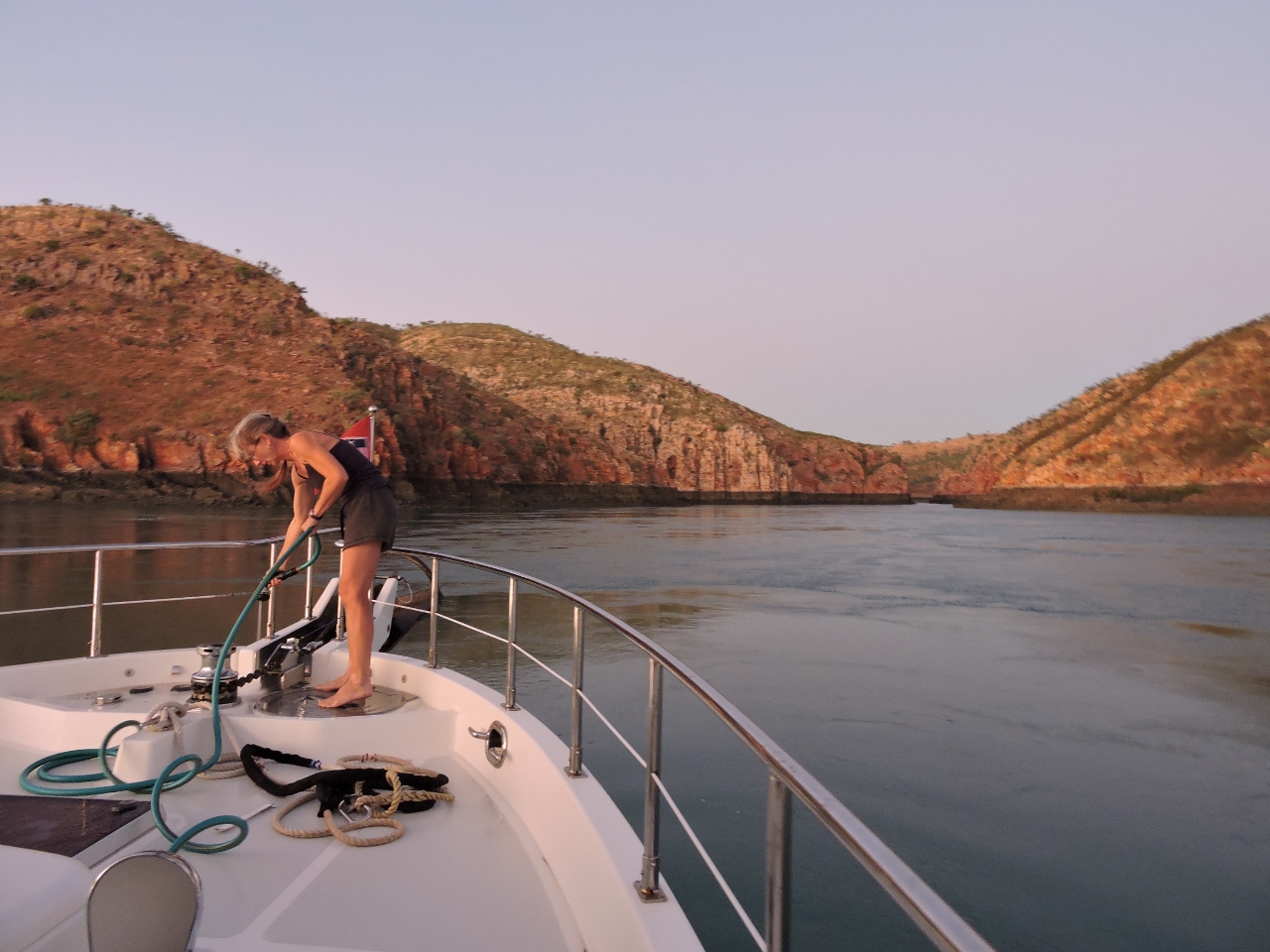 |
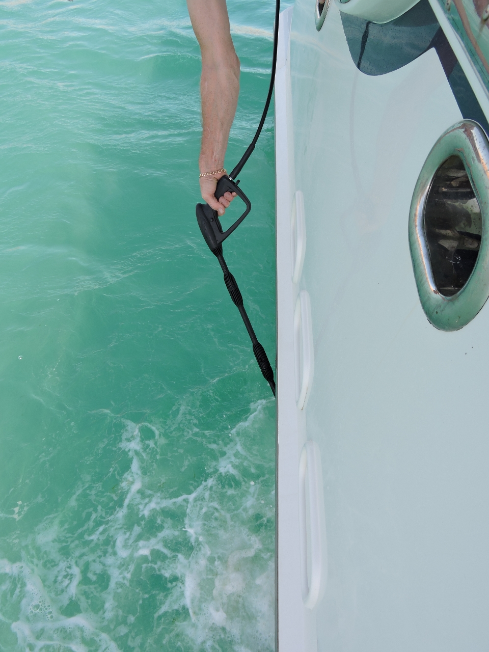
6/19/2015: Washdown
Position: -16°22.26'S, 123°57.88'E
Washing off the bow after raising anchor as depart Talbot Bay. The mud in most anchorages here is incredibly sticky and takes a while to wash off. We nosed over to Horizontal Falls on our way out. The ebbing flow isn't running close to at strength, but even out here it's really ripping.
|
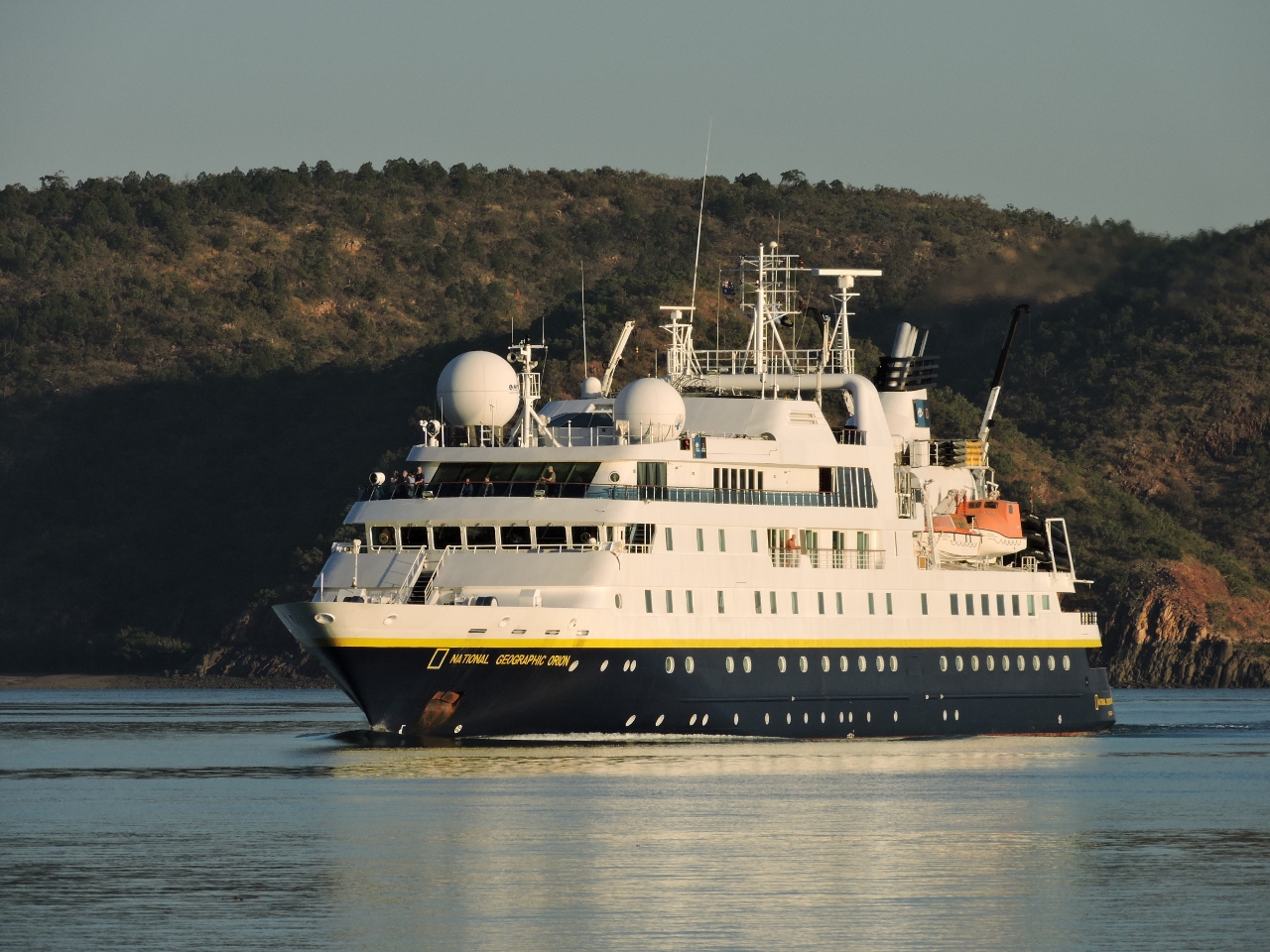 |
6/19/2015: Orion
Position: -16°18.36'S, 123°54.10'E
The National Geographic expedition vessel Orion was entering Talbot Bay as we were leaving. Their captain radioed us to request "red to red". Boats have red navigation lights on their port side and green to starboard, so "red to red" is a request to pass on each other's port side.
|
|
6/19/2015: Shallows
Position: -16°19.96'S, 123°52.05'E
We approached Dugong Bay just past low water to minimize the currents, as we were on a 26ft exchange. With 6.5ft ft of water at Talbot Bay, depths dropped to 12ft as we turned west. Altering course more to starboard gave us deeper water.
|
 |
6/19/2015: Entry channel
Position: -16°20.65'S, 123°52.48'E
The cruising guide indicated two routes into Dugong Bay: one along the mainland shore and another farther east. We took the first and the minimum depth we saw through the channel was 32ft, with a slight flood current. But extensive mudflats were visible on both sides, and the navigable channel felt rather narrow. The route rather east looked more appealing and we will try it on the way back out.
|
 |
6/19/2015: Dugong Bay
Position: -16°23.93'S, 123°53.20'E
We've been to so many places in the past few weeks that are vast and beautiful that it seems unlikely we'll equal anything we've seen so far. Yet here we are again, in vast and beautiful Dugong Bay.
|
 |
6/19/2015: Shark
Position: -16°24.47'S, 123°53.44'E
Another Tawny Nurse shark came over to investigate as soon as we'd anchored. A second arrived soon after and the two seemed to jostle for the territory.
|
 |
6/19/2015: Anchorage view
Position: -16°24.06'S, 123°53.60'E
We climbed partway up the east shore for a sweeping view of the anchorage. Dirona is just visible in the distance on the far side of the bay.
|
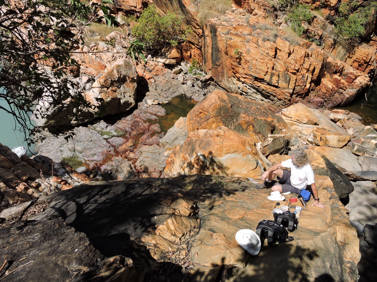 |
6/19/2015: Lunch
Position: -16°24.42'S, 123°50.70'E
Lunch overlooking two freshwater pools to the left and right of James. A small waterfall is just out of the picture to the right.
|
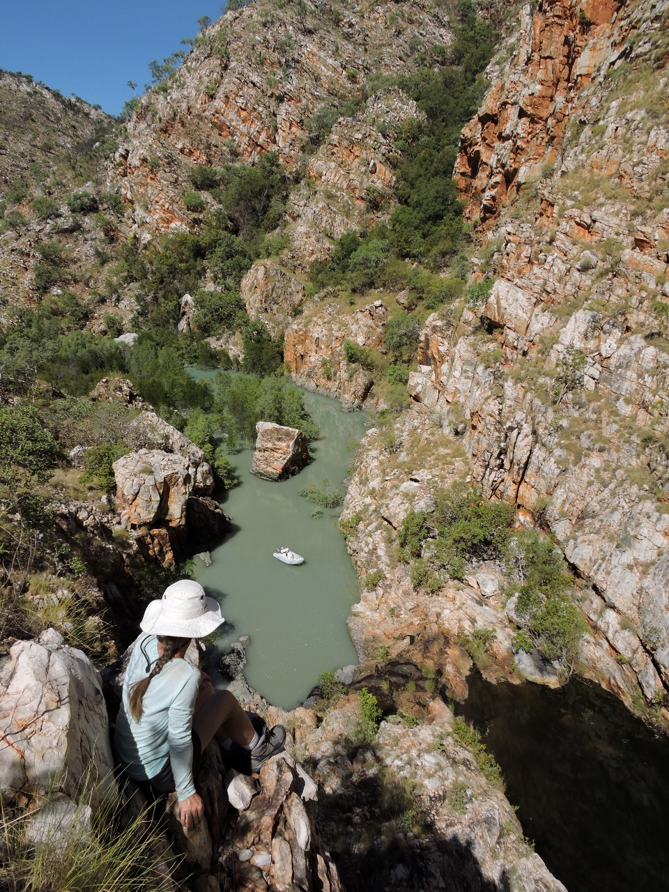 |
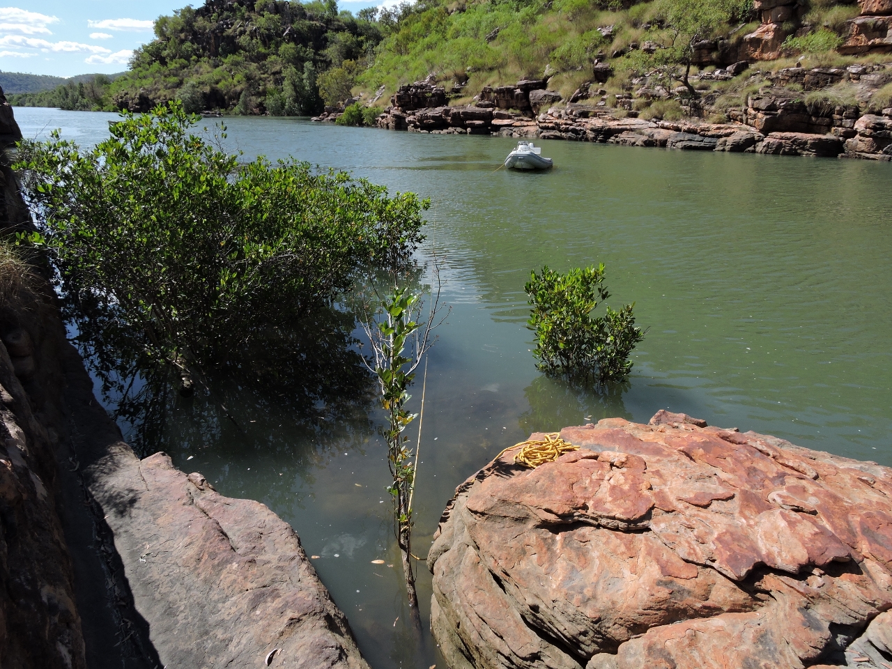
6/19/2015: Gorge
Position: -16°23.03'S, 123°50.08'E
We landed the tender near a small waterfall below a freshwater pool and climbed up the cliffs for a view back down.
|
 |
6/19/2015: Climbing down
Position: -16°23.03'S, 123°50.08'E
The climb up and down wasn't too difficult, but it was quite steep.
|
 |
6/19/2015: Bottom cleaning
Position: -16°24.47'S, 123°53.44'E
We won't dive the boat with the crocodile, and to a far lesser extent shark, risk. So we experimented today with using a power washer and a brush on a long stick to clean the area around the waterline. For us the jury still is out when cleaning the top couple of feet near the water line. For sure the power washer is better on the longer stringier bits right at the surface that tended to clog the brush. But the brush did as well farther below the surface.
|
 |
6/20/2015: One third around
Position: -16°21.08'S, 123°53.36'E
We took the more eastern route leaving Dugong Bay and saw no less than 90ft the whole way out. All around a much better route. We also realized that we are nearly one third of the way around the world now. Seattle is at longitude 122.3477° W and we're currently at 123.8890° E.
|
 |
6/20/2015: Orion
Position: -16°3.74'S, 124°26.64'E
Bluff Head near Raft Point dwarfs the 262-ft (80m) National Geographic Orion anchored below.
|
 |
6/20/2015: Bluffs
Position: -16°4.24'S, 124°28.18'E
A panorama of the bluffs at Raft Point. The scenery in the Kimberley continues to be big and continues to amaze us.
|
 |
6/20/2015: Ruby Falls
Position: -16°5.23'S, 124°39.99'E
At high tide, we ran the tender to Ruby Falls at the head of one of the tributaries to Red Cone Creek. The falls are cascading down the wall at the back of the photo, into the large pool below.
|
 |
6/20/2015: Pool
Position: -16°5.16'S, 124°40.03'E
A tranquil freshwater pool is above Ruby Falls.
|
 |
6/20/2015: Beer
Position: -16°5.22'S, 124°40.03'E
Enjoying a beer by the falls.
|
 |
6/20/2015: Sapphire Falls
Position: -16°6.71'S, 124°38.45'E
Sapphire Falls are a short dinghy ride from our anchorage. This is the first falls, visible from the tributary head.
|
 |
6/20/2015: Second falls
Position: -16°6.72'S, 124°38.47'E
Another falls is behind the first. We didn't go much farther up the creek as the tide was falling and we didn't want to get stranded.
|
 |
6/20/2015: Red Cone Creek
Position: -16°3.70'S, 124°35.88'E
We ran the tender up Red Cone Creek to the end. The video https://youtu.be/kjgF5BS3jlk (1:04) shows us running through one of the tributaries at speed. We're a couple hours past a 37ft (11.41m) high tide and the water still is so high that we're running alongside the tree tops.
|
 |
6/21/2015: Doubtful Bay
Position: -16°5.22'S, 124°30.02'E
The view looking towards the mouth of Doubtful Bay as we depart Red Cone Creek.
|
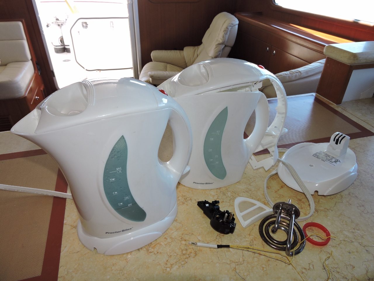 |
6/21/2015: Kettle
Position: -16°4.41'S, 124°27.02'E
Our kettle failed today, but we'd kept another that also had failed. Between the two, we managed to salvage enough parts to create one working kettle (and one that is now thoroughly junk).
|
 |
6/21/2015: Raft Point
Position: -16°4.39'S, 124°27.04'E
We moved to Raft Point to stage for a run to Montgomery Reef the next morning.
|
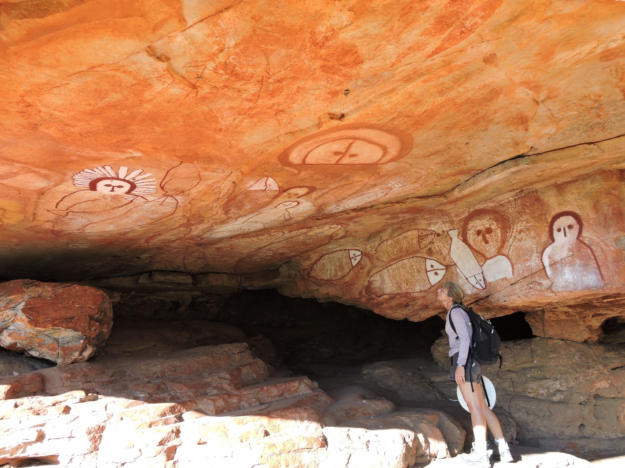 |
6/21/2015: Rock art
Position: -16°4.75'S, 124°28.14'E
A short track from a beach east of Raft Point leads to this overhang covered with some impressive rock art.
|
 |
6/21/2015: More art
Position: -16°4.74'S, 124°28.13'E
A little more art was on another overhang below the first.
|
 |
6/21/2015: Steep Island
Position: -16°4.71'S, 124°28.13'E
The view across Foam Passage to Steep Island from the track.
|
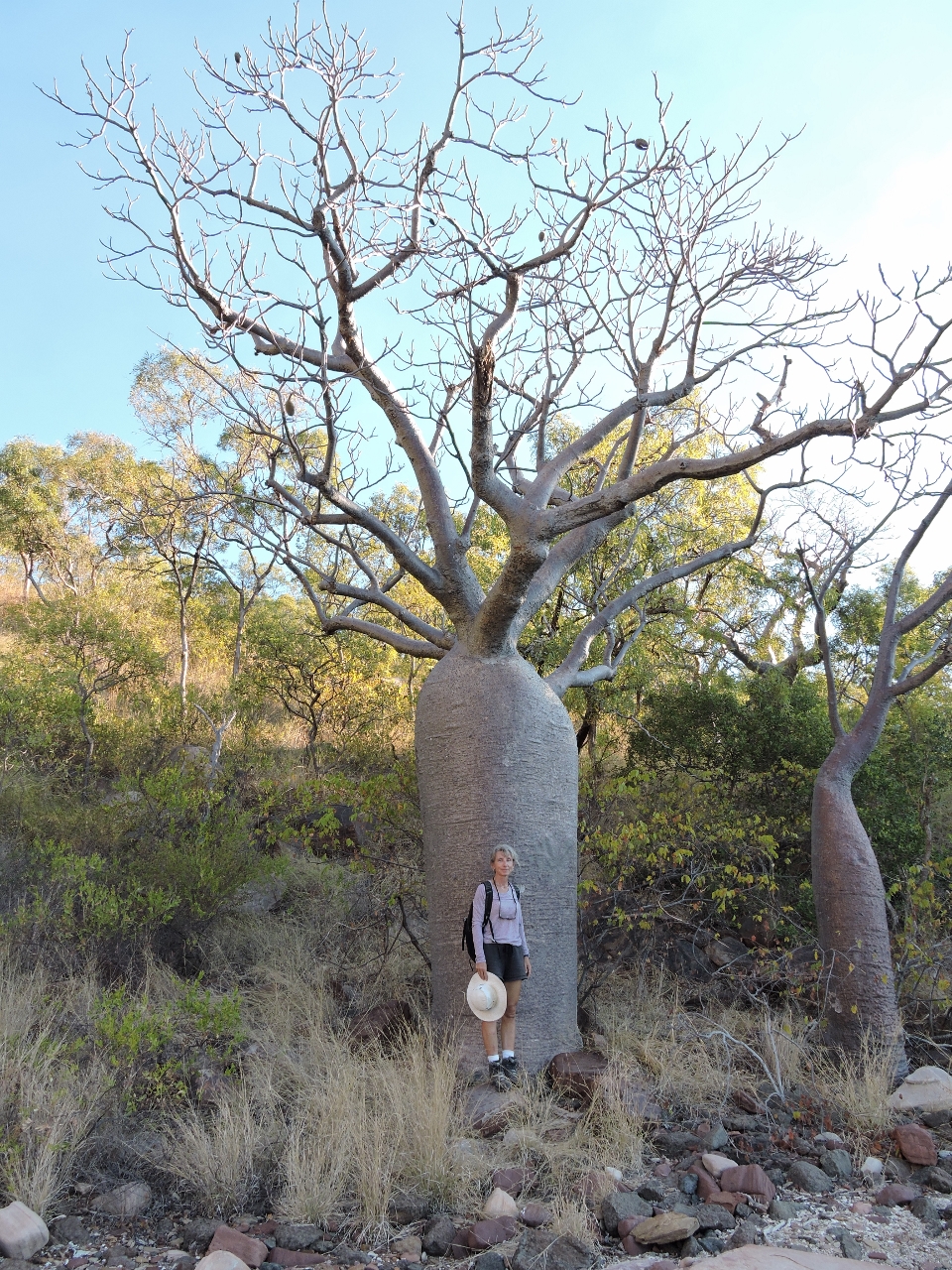 |
6/21/2015: Boab tree
Position: -16°4.54'S, 124°28.10'E
The only Boab trees in Australia are found in and around the Kimberley area. They often are called "Bottle Trees" because their distinctive swollen trunks give the appearance of a bottle. The trunks can grow quite wide—some over 15ft in diameter have been recorded.
|
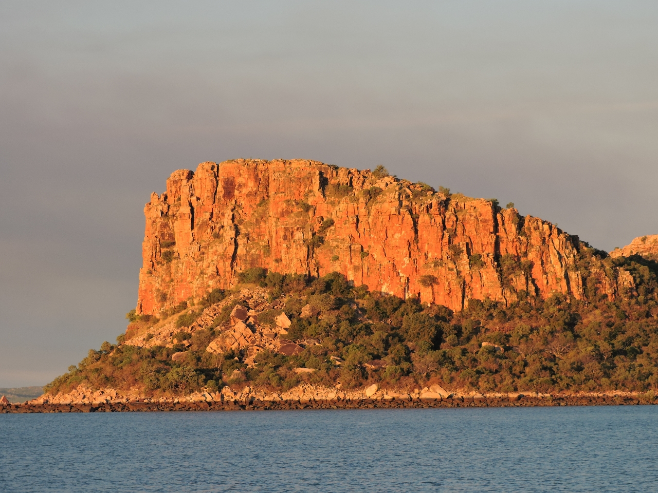 |
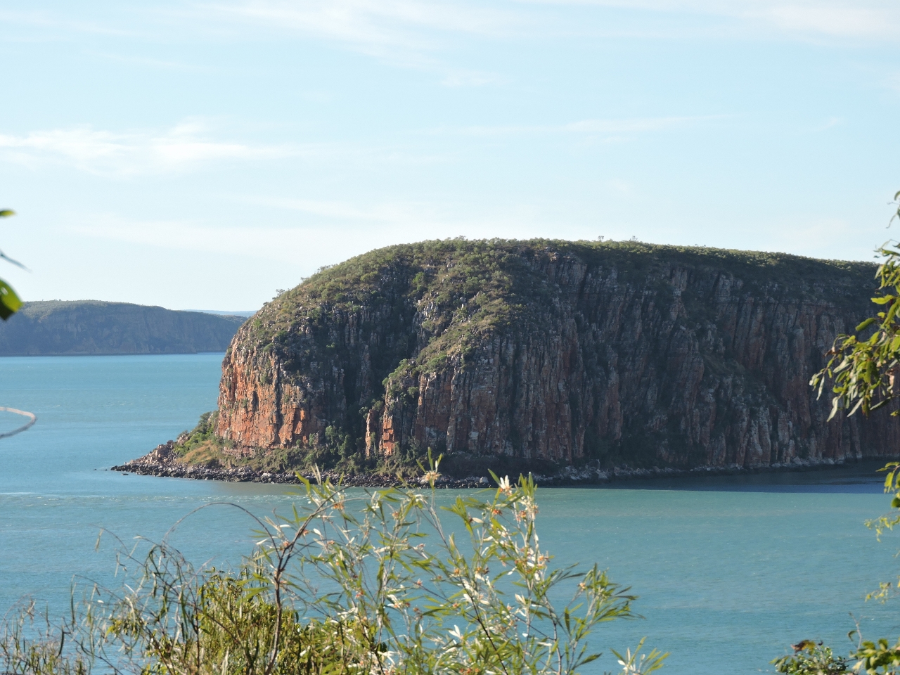
6/21/2015: Bluff Head
Position: -16°4.42'S, 124°27.01'E
Dramatic Bluff Head aglow in the late afternoon light.
|
 |
6/22/2015: True North
Position: -15°59.34'S, 124°17.38'E
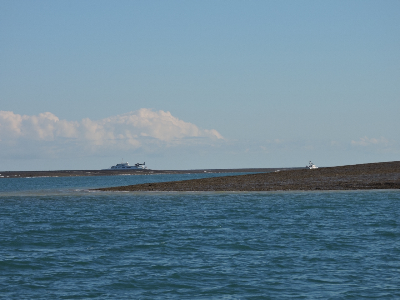
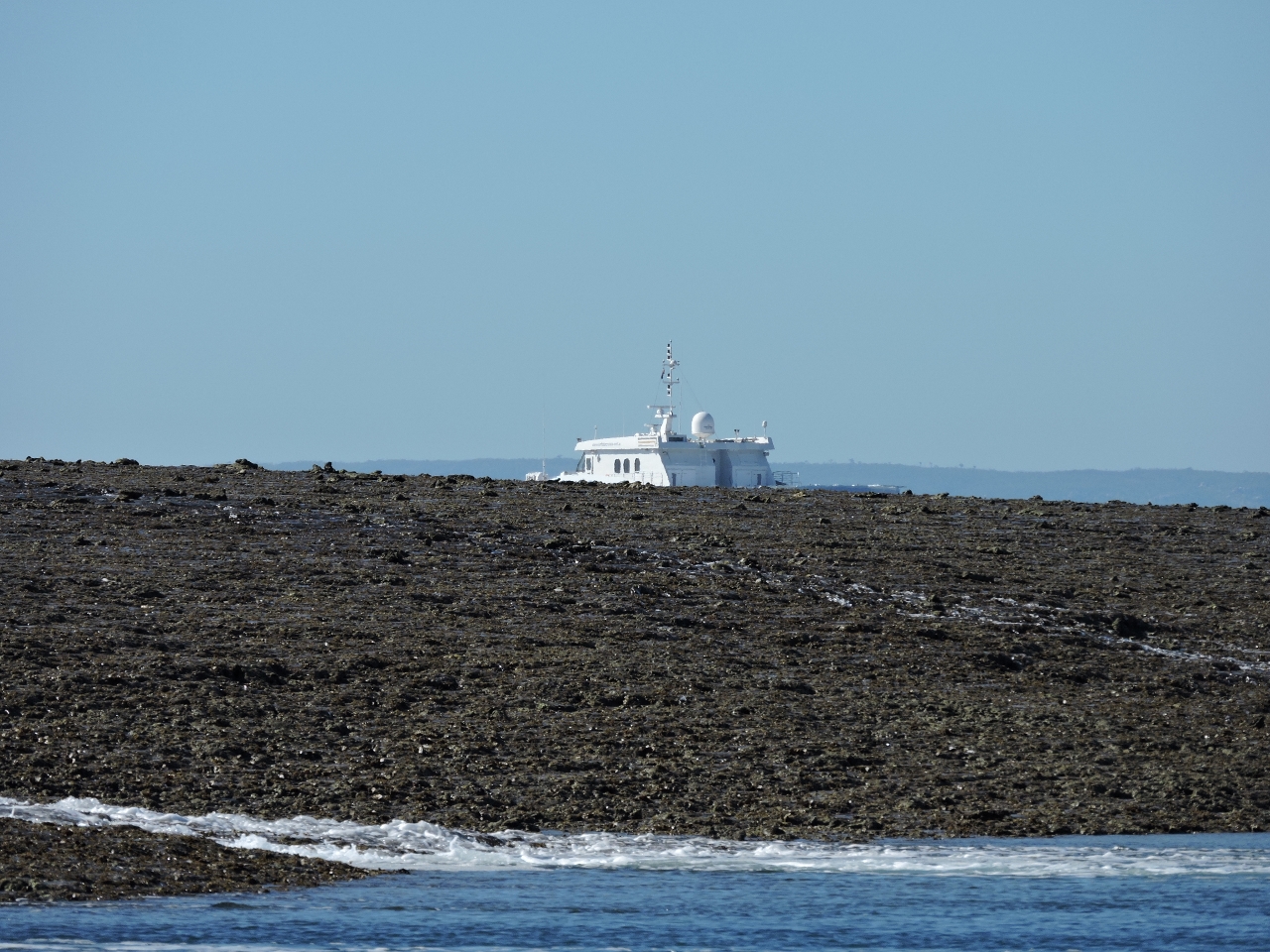
We left before sunrise this morning for Montgomery Reef. True North had arrived at Raft Point overnight and left shortly after we did, also for Montgomery Reef. We approached the reef channel along the route recommended in our cruising guide, but True North entered on quite a different path. They draw slightly more than us, so we recorded their AIS track and followed it on the way back out. Their route was much deeper--we saw 16ft coming in with 13.5ft of tide at Lizard Island, and no less than 33ft on exit with 9.6ft of tide at Lizard Island.
|
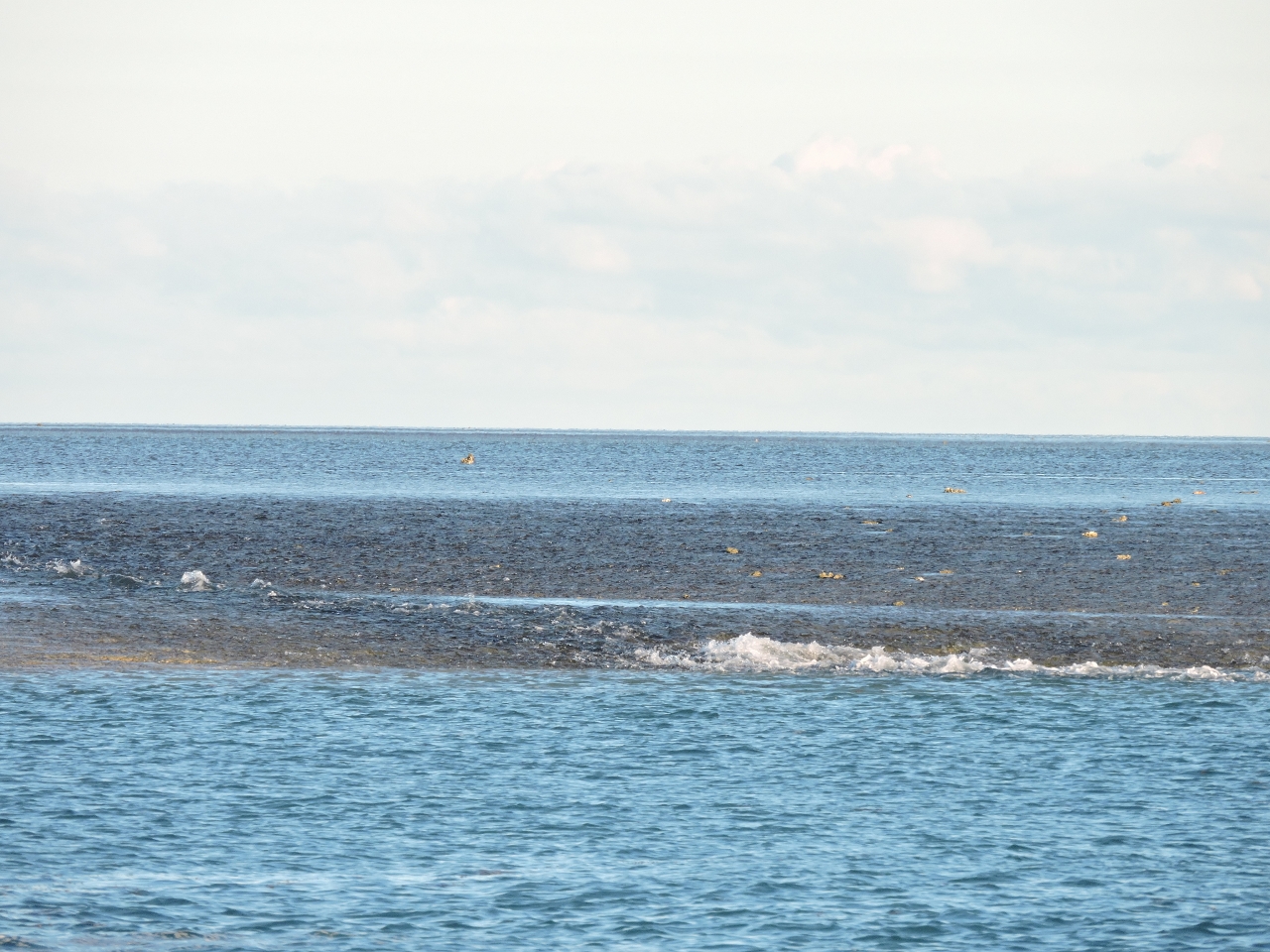 |
6/22/2015: Montgomery Reef
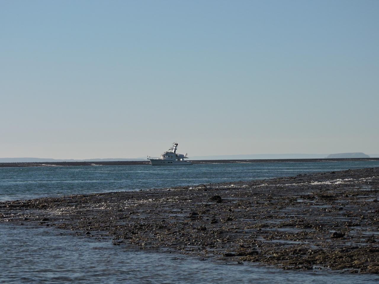
Position: -15°59.09'S, 124°17.34'E
We're following a channel that indents Montgomery Reef. The reef is covered at higher tides, but about two hours before low tide on larger exchanges, it begins to uncover. As the tide level continues to fall, water cascades from inside the reef into the channel we're in. We've arrived just as the reef was starting to uncover.
|
 |
6/22/2015: At anchor
Position: -15°58.43'S, 124°17.10'E
Anchored at Mongtomery Reef with True North.
|
 |
6/22/2015: Reef
Position: -15°58.32'S, 124°16.82'E
More and more of the reef is exposed as the tide falls.
|
 |
6/22/2015: Waterfall
Position: -15°58.39'S, 124°16.97'E
Initially as the tide fell below the reef, water cascaded over from the inside in a continuous stream. As the tide level fell further, distinct waterfalls formed all along the reef.
|
 |
6/22/2015: More reef
Position: -15°59.35'S, 124°17.51'E
True North and Dirona, starting to disappear behind the reef.
|
 |
6/22/2015: Lots of reef
Position: -15°58.03'S, 124°16.44'E
At this point, we can barely see True North as it sinks below the reef.
|
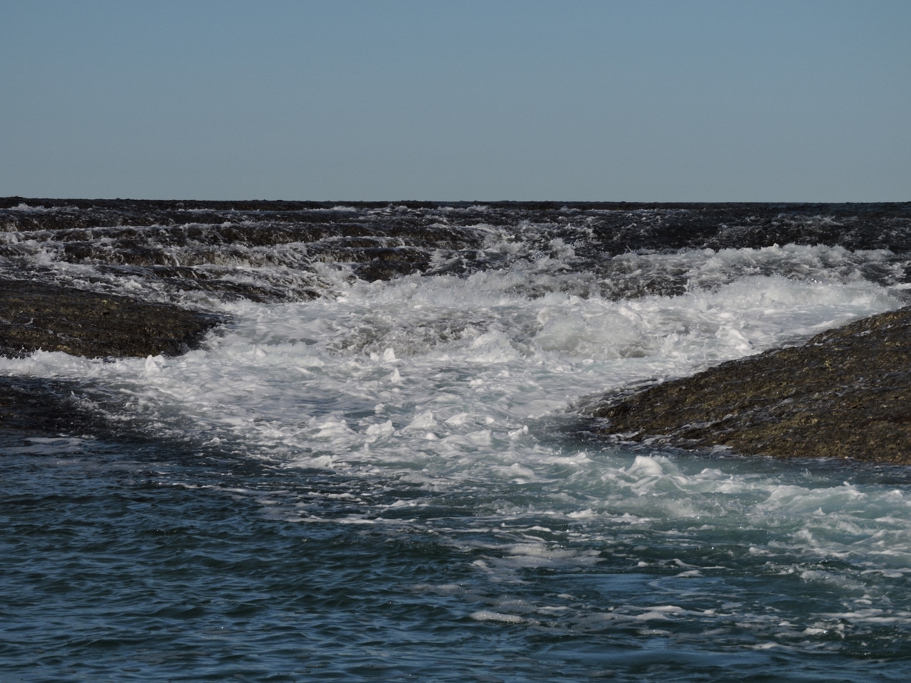 |
6/22/2015: Low tide
Position: -15°58.11'S, 124°16.50'E
The video https://youtu.be/GUp6gSFsdgA (1:42) shows the waterfalls at various stages of the tide as we ran the tender several times through the narrow, shallow channel that extends north of the anchorage. Near the head of the channel, the current became quite strong as all the water poured in from either side and could only escape through this waterway. On each pass, the waterfalls were larger, and louder. There wasn't much wind that day--most of the noise you can hear in the video is from the water motion. It was a wild experience being here. As with so many things in the Kimberley, we've just never seen anything like it.
|
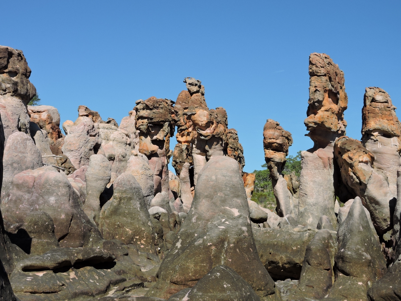 |
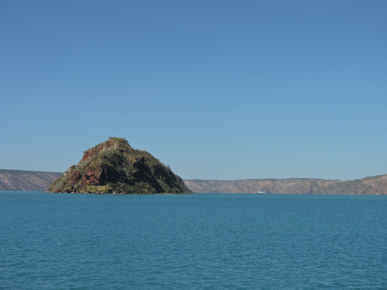
6/22/2015: Langgi
Position: -15°45.40'S, 124°24.06'E
After leaving Montgomery Reef, we stopped at Langgi to see the weather-sculpted rocks. It's recommended to visit during low tide, but nearing a high tide much of the interesting pieces are still exposed.
|
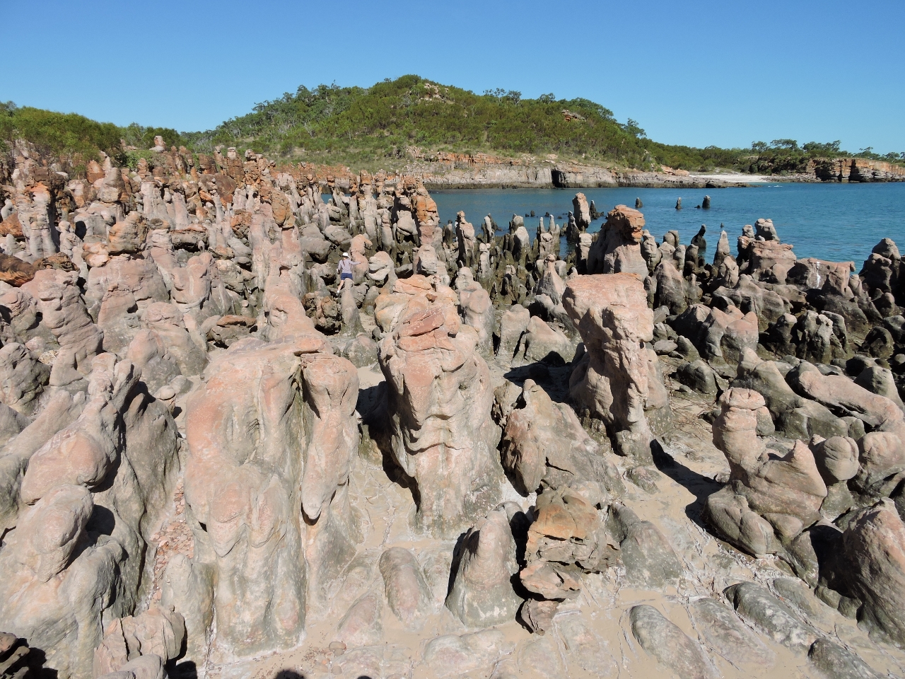 |
6/22/2015: Formations
Position: -15°45.39'S, 124°24.05'E
Jennifer barely is visible in the huge field of sculpted rock. Once again in the Kimberley, and twice today, we found ourselves saying "Amazing. We've never seen anything like it.".
|
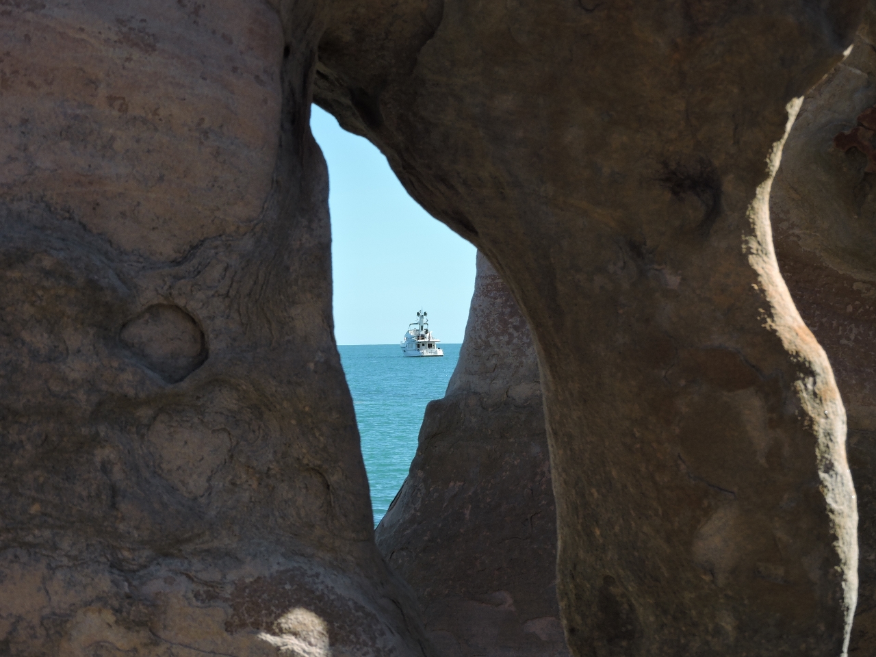 |
6/22/2015: Frame
Position: -15°45.42'S, 124°24.07'E
Dirona framed by the sculpted rock.
|
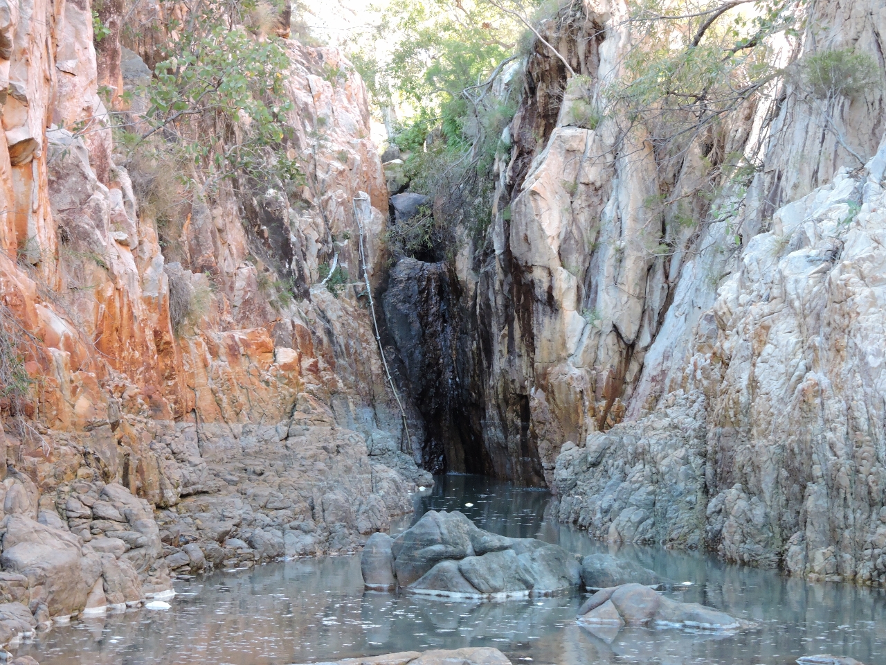 |
6/22/2015: Gorge
Position: -15°45.42'S, 124°24.22'E
A narrow gorge led inland near the rock formations. We didn't have quite enough water to reach the waterfall or the climbing rope visible beside it. Presumably the rope provides access to a freshwater pool above.
|