MV Dirona travel digest for Northern Great Barrier Reef 2015

|
Click the travel log icon on the left to see these locations on a map,
with the complete log of our cruise. On the map page, clicking on a camera or text icon will display a picture and/or log entry for that location, and clicking on the smaller icons along the route will display latitude, longitude and other navigation data for that location. And a live map of our current route and most recent log entries always is available at //mvdirona.com/maps/LocationCurrent.html. |
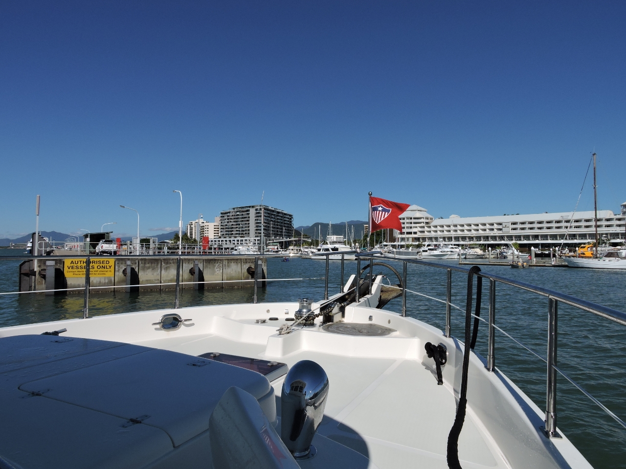 |
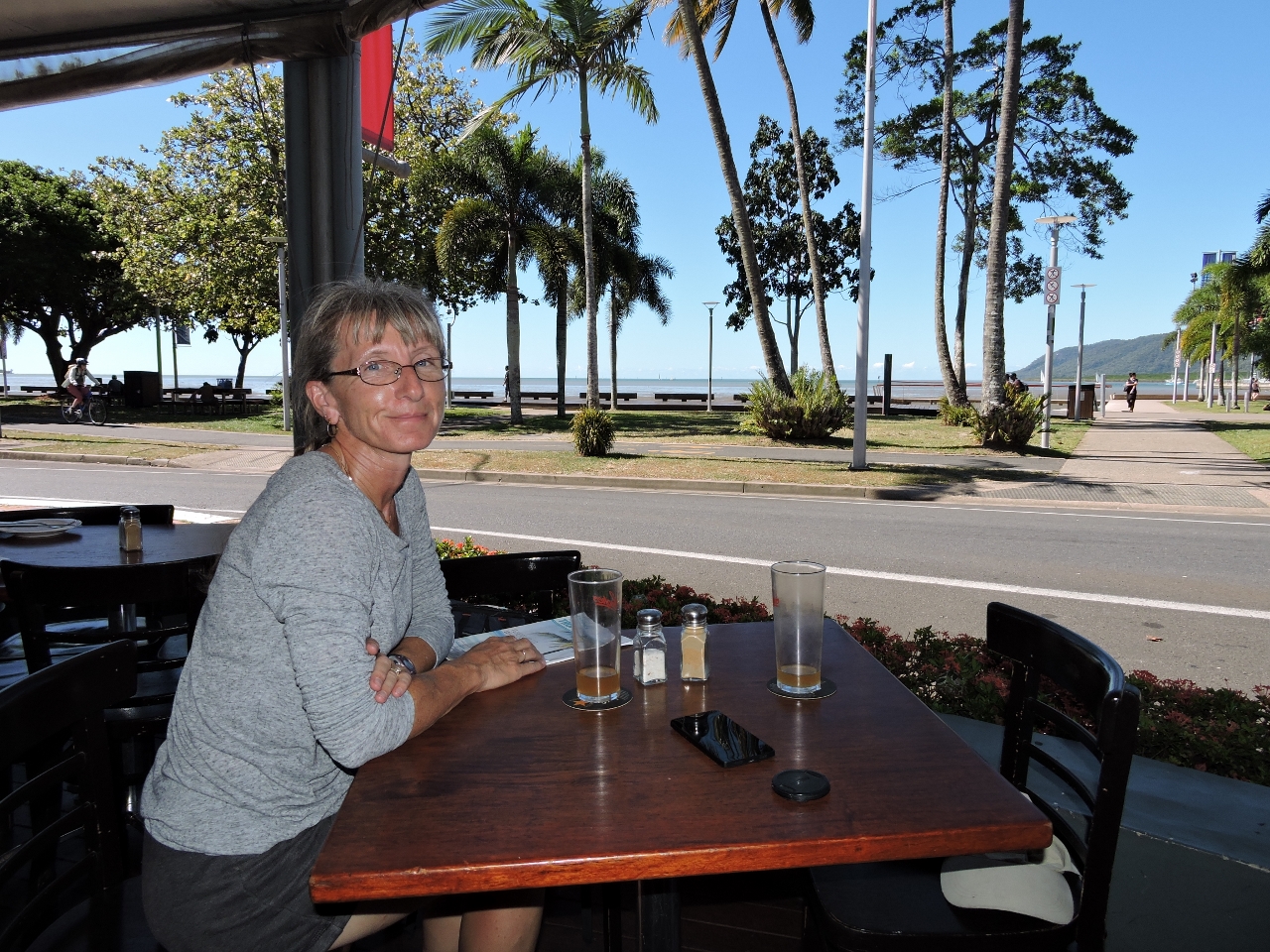
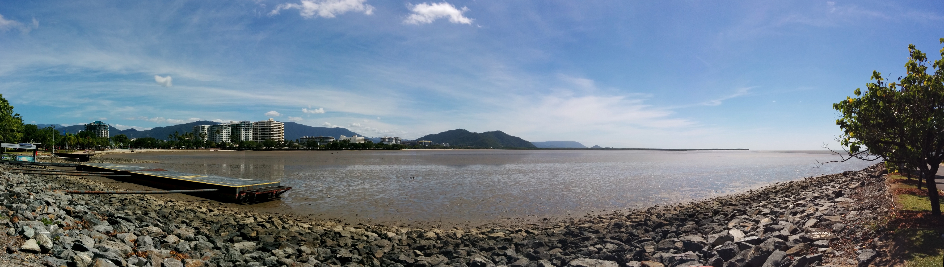
5/6/2015: Port of Cairns
Position: -16°55.15'S, 145°46.94'E
Entering the Marlin Marina in the Port of Cairns. The calm weather we'd been enjoying for the past few days was forecast to end, so it was a good time to go and visit Cairns.
|
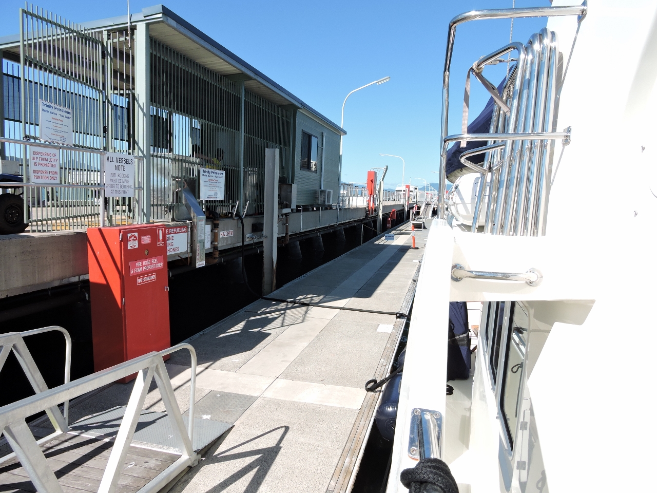 |
5/6/2015: Fueling
Position: -16°55.16'S, 145°46.96'E
We'd only consumed 200 gallons (750 liters) since fueling in Townsville and would have plenty to travel the roughly 1,200 miles to Darwin. But the fuel dock in Cairns was convenient, so we topped off our diesel tanks to allow us to run faster if we needed to.
|
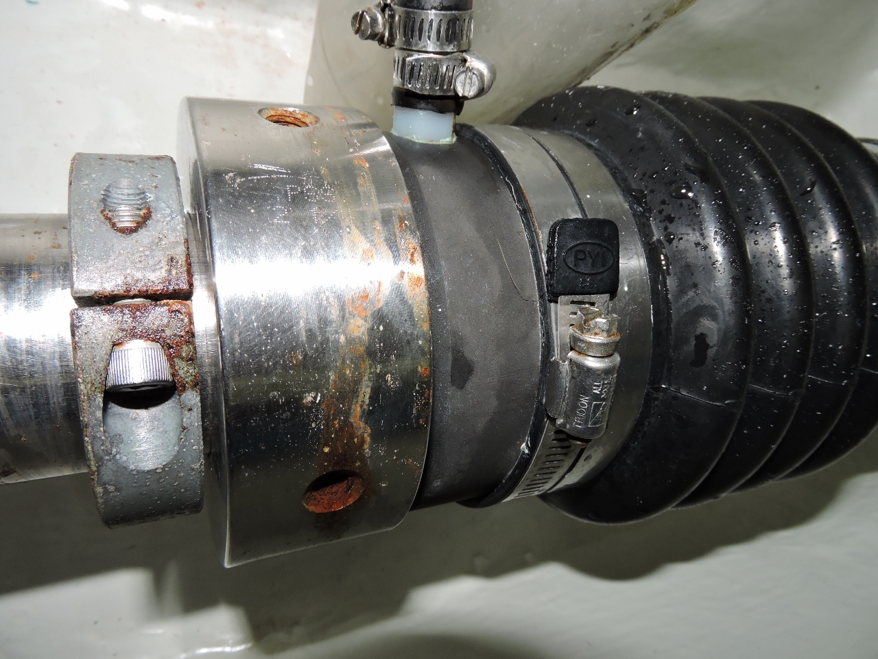 |
5/6/2015: Water leak
Position: -16°55.15'S, 145°46.91'E
Our bilge pump counter showed that we'd picked up a substantial water leak on the way into Cairns--the pump was cycling every 50 seconds. We have lots of bilge pump capacity, so this doesn't represent a concern. When we investigated we found the packless shaft seal collar had backed off, relieving belows tension. This allowed water ingress underway, but it didn't leak at rest. The small stainless shaft collar to the left of the packless shaft seal is a design feature addition we added for exactly this sort of possibility. If for any reason the packless shaft seal backs off, this extra collar prevents large uncontrolled water leaks. Once we'd investigated further, we found the shaft seal collar set screws had backed off. It turned out to be an installation issue where only a single set screw was used. Each hole should have two set screws, where the second is a locking set screw. We replaced the old set screws with new ones, and tightened up and installed the old set screws as locking sets screws.
|
 |
5/6/2015: Marlin Marina
Position: -16°55.18'S, 145°46.85'E
Berthed at the Marlin Marina in the Port of Cairns. Dirona is just beyond the yellow volunteer Coast Guard vessel. Like Townsville, Cairns does not suffer from lack of clear, sunny days.
|
 |
5/6/2015: Boardwalk
Position: -16°55.23'S, 145°46.85'E
Cairns has a beautiful walkway the length of its waterfront, with many restaurants, bars and coffee shops along the way.
|
 |
5/6/2015: La Pizza Tratoria
Position: -16°55.14'S, 145°46.60'E
We had an excellent pizza overlooking the mouth of Trinity Inlet with False Cape visible in the distance on the right.
|
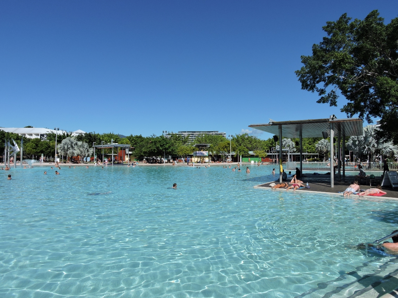 |
5/6/2015: Lagoon
Position: -16°55.19'S, 145°46.67'E
Along the Cairns Esplanade is the 4800sq meter salt water lagoon. The popular pool provides a safe swimming environment free from marine stingers (jellyfish) and crocodiles.
|
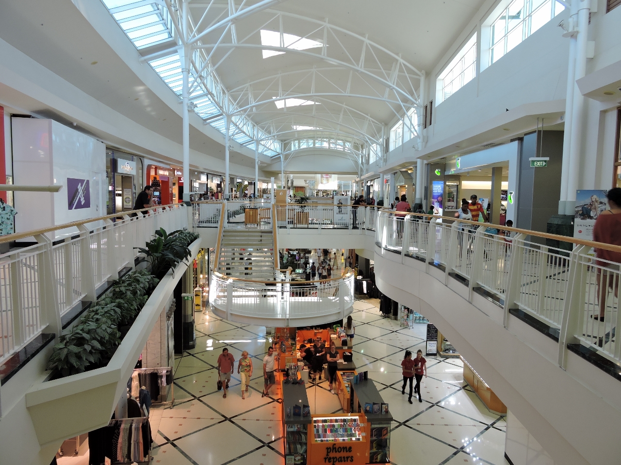 |
5/6/2015: Shopping
Position: -16°55.46'S, 145°46.29'E
After lunch we walked up to the Cairns Central Shopping Center to do a little shopping.
|
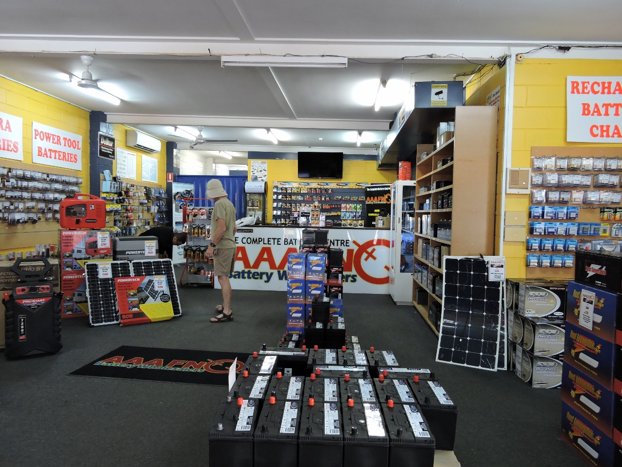 |
5/6/2015: AAA FNQ
Position: -16°55.38'S, 145°46.31'E
We noticed a large battery retailer opposite the mall, AAA FNQ Battery Wholesalers, and picked up three type U1 batteries rated at 385 CCA (cold cranking amps). Two would replace our dinghy start and backup battery that were near end of life with 200 and 170 CCA respectively, and the third would be a spare.
|
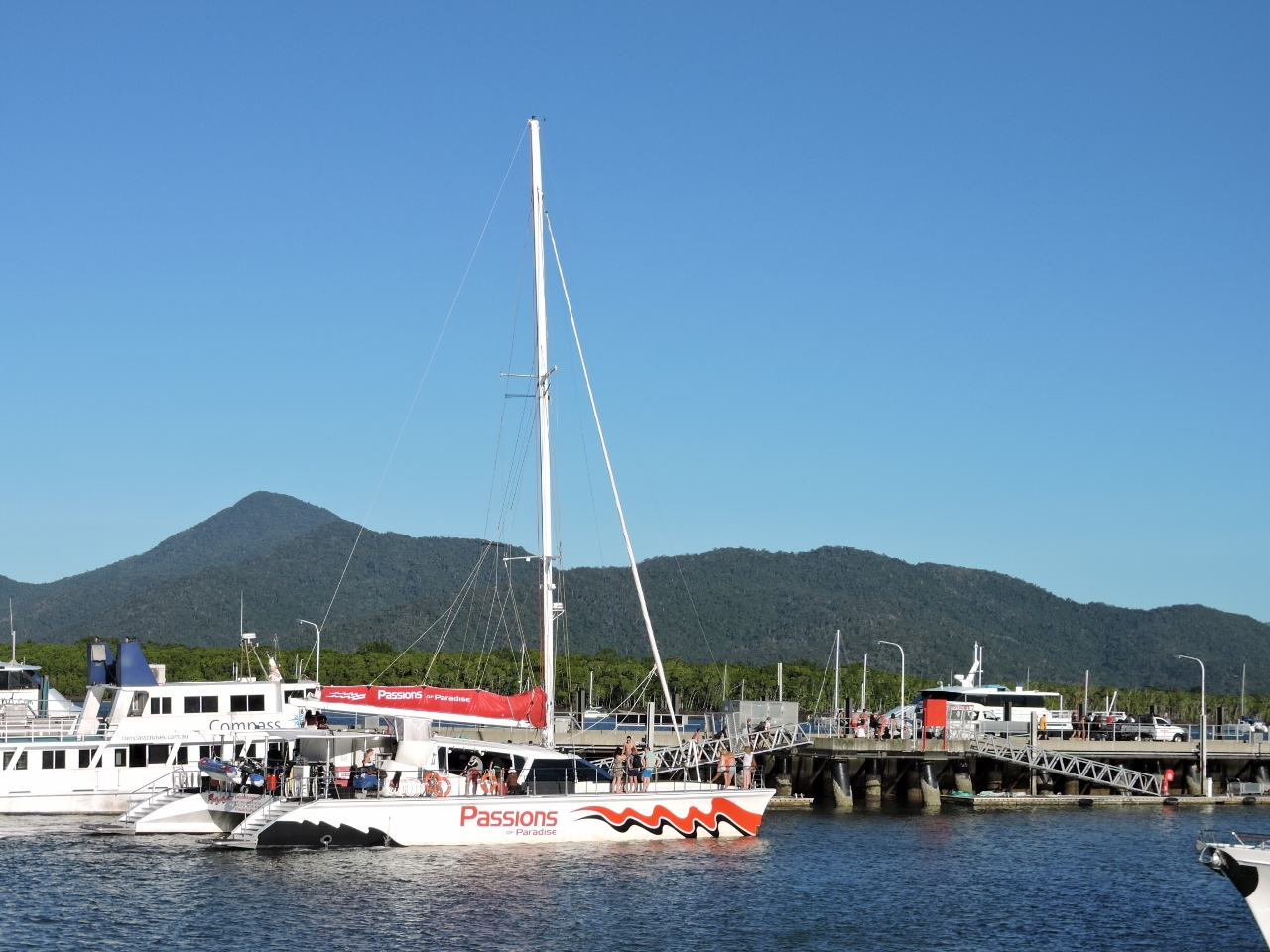 |
5/6/2015: Passions of Paradise
Position: -16°55.15'S, 145°46.91'E
The marina seemed a little empty when we arrived, and we assumed it was just the off-season. But around 5pm, all the day-tour boats began returning, and substantially filled the marina. Pictured heading to its slip is Passions of Paradise, that we'd seen at Michaelmas Cay yesterday.
|
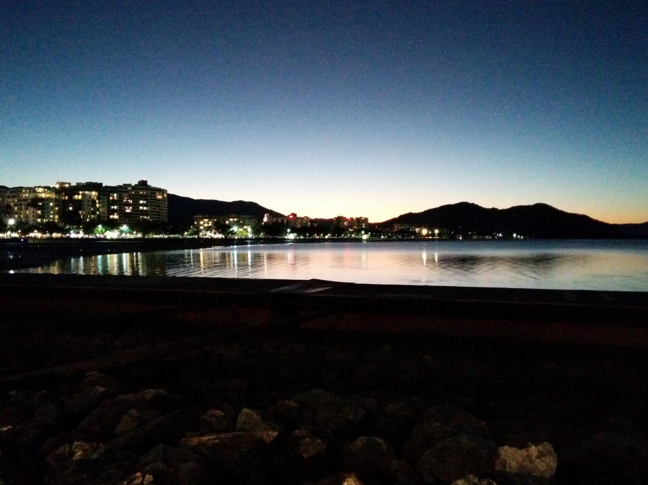 |
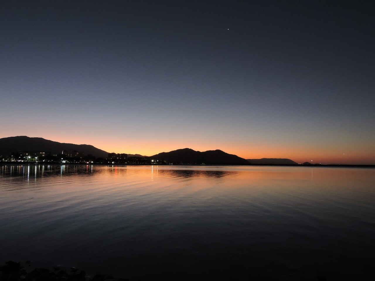
5/6/2015: Dusk
Position: -16°55.11'S, 145°46.84'E
Cairns is a beautiful city, especially at night when the city lights reflect on Trinity Inlet and the trees along the waterfront are lit up from below.
|
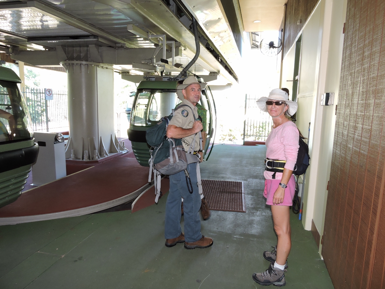 |
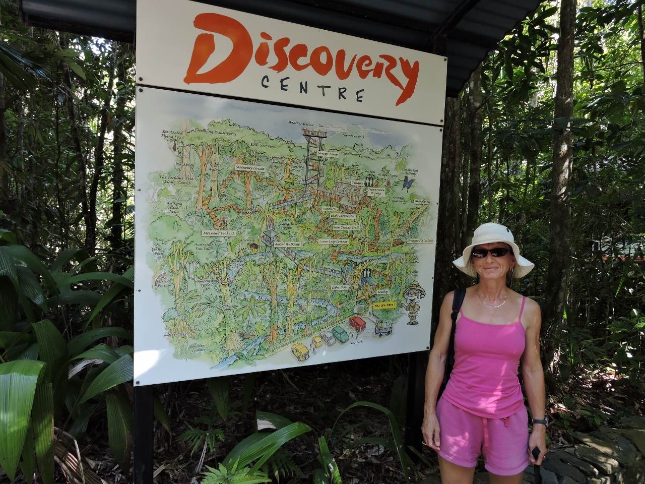
5/8/2015: Skyrail
Position: -16°50.86'S, 145°41.69'E
We took a shuttle bus from the marina to ride Skyrail, a 4.7-mile (7.5 km) cableway over the rainforest in World Heritage Listed Barron Gorge National Park. Pictured with Jennifer at the lower terminal is Skyrail ranger Phil--both wearing a safety harness. We upgraded from the enclosed gondolas to the open Canopy Glider, where riders must be clipped in and accompanied by a ranger.
|
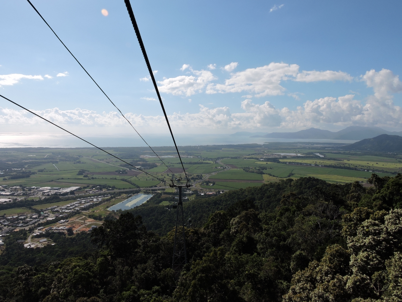 |
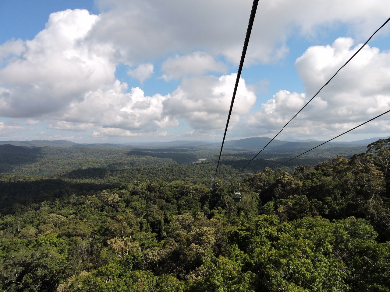
5/8/2015: View
Position: -16°50.94'S, 145°40.55'E
Riding above the rainforest was an amazing experience, with incredible views. Skyrail ranger Phil did a great job of explaining various aspects of the rainforest and the view along the way. The video https://youtu.be/dJSJzwC3_xY (1:15) highlights the first leg between the lower terminal and Red Peak Station.
|
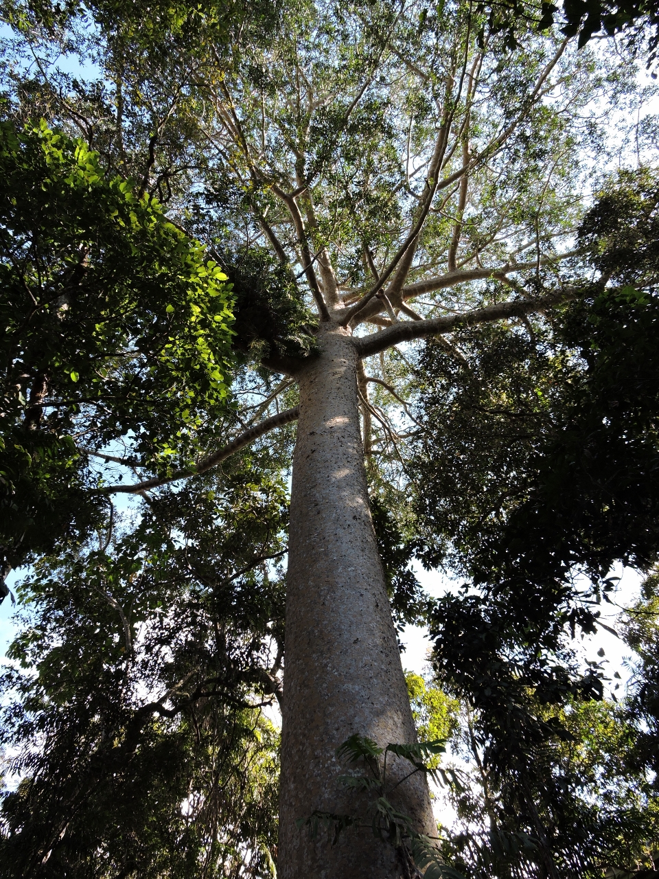 |
5/8/2015: Red Peak Station
Position: -16°50.97'S, 145°40.18'E
Skyrail is actually three separate cableways--riders disembark at two stations en route and switch gondolas. At Red Peak Station we walked a boardwalk through the rainforest, looking up to the trees instead of down from above. The Kuari Pine pictured can grow to 165 feet (50 meters) high and is the tallest Queensland tree species. The tree is an emergent species, meaning it can grow above the rainforest canopy.
|
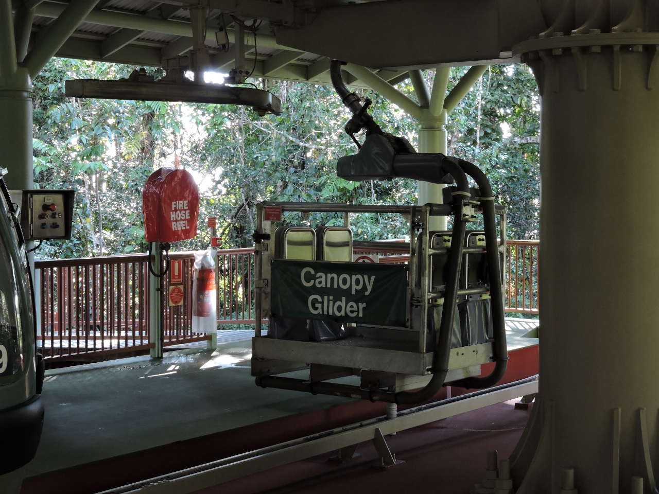 |
5/8/2015: Canopy Glider
Position: -16°50.96'S, 145°40.18'E
Our ride: the open Canopy Glider. Each of the three cableways that make up the total trip have one Canopy Glider. The open-air upgrade was a bit expensive, since for safety reasons each trip requires a ranger. The upside is an unparalleled viewing experience and the advantage of a knowledgeable ranger who can answer questions and point out features of interest.
|
 |
5/8/2015: Red Peak to Barron Falls
Position: -16°50.82'S, 145°39.96'E
The view east between Red Peak and Barron Falls stations.
|
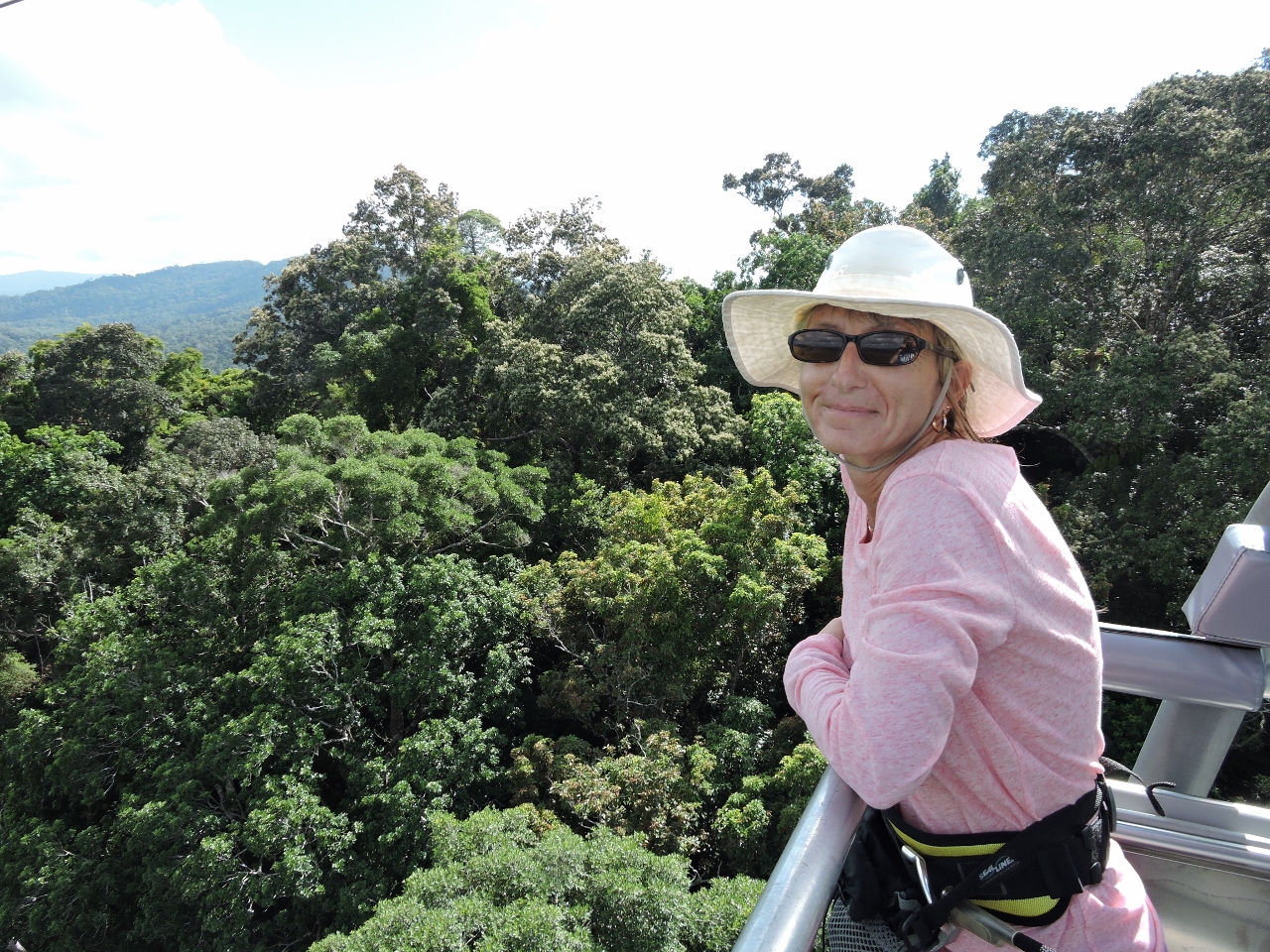 |
5/8/2015: Ride
Position: -16°50.73'S, 145°39.83'E
Enjoying the ride. The glider is a unique experience because you're outside and it feels much closer to the rainforest.
|
 |
5/8/2015: Kuranda Scenic Railway
Position: -16°50.02'S, 145°38.74'E
Looking north across the Baron River to a train on the Kuranda Scenic Railway--that's how we'll be getting back to Cairns.
|
 |
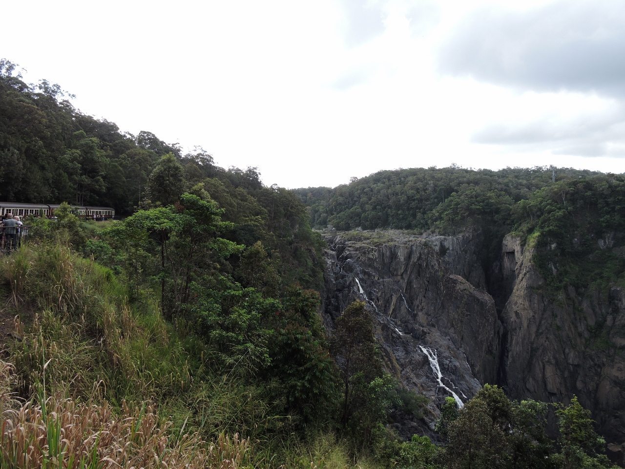
5/8/2015: Barron Falls
Position: -16°50.02'S, 145°38.72'E
We got a pretty good view of Barron Falls from the cableway, but an even better one from the viewing platform at Barron Falls stations.
|
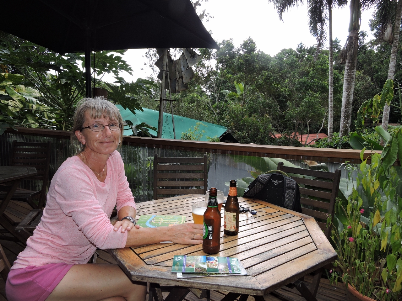 |
5/8/2015: Frogs
Position: -16°49.15'S, 145°37.97'E
The town of Kuranda is larger than we were expecting and has a variety of restaurants and tourist shops. We had an excellent lunch amid the rainforest at Frog's Restaurant at the north end of town. If we found ourselves back in Kuranda, it would be a hard to go anywhere else for lunch even though there are lots of alternatives we've not yet tried.
|
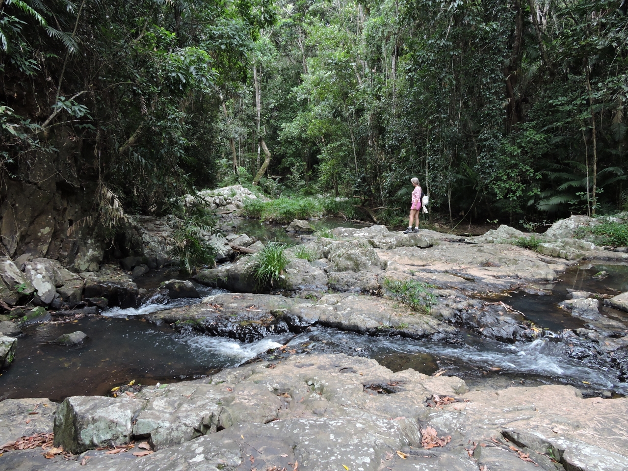 |
5/8/2015: Jum Rum Walk
Position: -16°49.50'S, 145°38.00'E
After lunch we walked the 1.4km Jum Rum track through the rainforest, along the river, and back through town. This is a small creek crossing along the way.
|
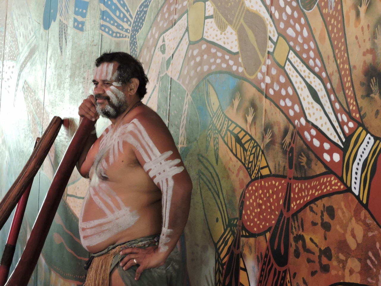 |
5/8/2015: Didgeridoo
Position: -16°49.38'S, 145°39.14'E
Following the Jum Rum walk, we took a 10-minute shuttle to visit Rainforestation Nature Park. The video https://youtu.be/lK5Qv0Y7KqM (0:24) shows an aboriginal Pamagirri playing a didgeridoo there.
|
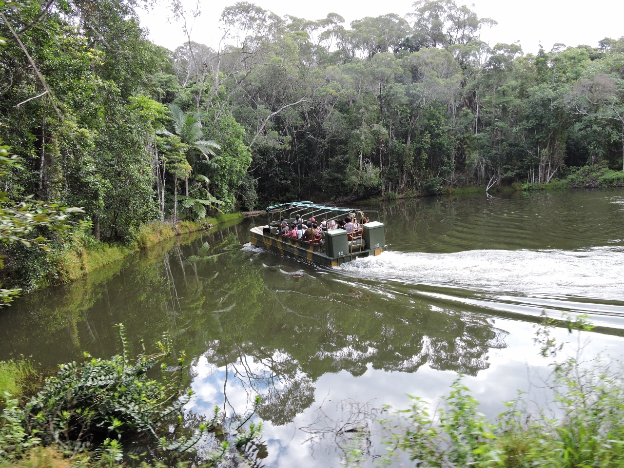 |
5/8/2015: Duck
Position: -16°49.53'S, 145°39.20'E
The primary reason we'd come to Rainforestation was to take the World War II amphibious army duck ride. The video https://youtu.be/ItKrthTI1MM (1:01) shows us entering the water about 20 seconds in. At 41 seconds in, the engine noise changes when the driver reaches behind him and switches to running on the propeller.
|
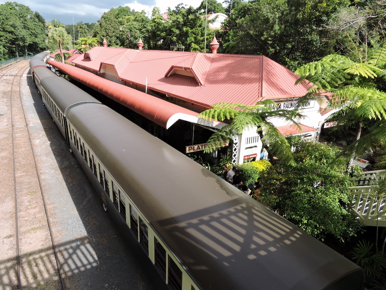 |
5/8/2015: Karunda Station
Position: -16°49.10'S, 145°38.33'E
We returned to Cairns on the 23-mile (37km) Karunda Scenic Railway. The railway was built in the late 1800s as a gold rush supply line. This is Kuranda Station, where we'll embark.
|
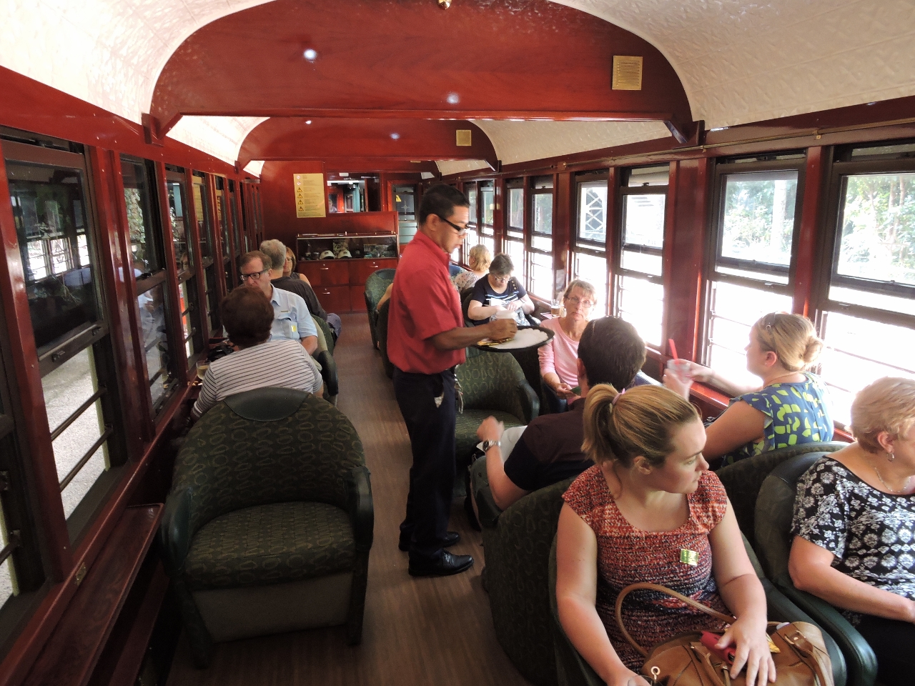 |
5/8/2015: On board
Position: -16°49.10'S, 145°38.34'E
The carriages we traveled in date back to the early 1900s and had a beautiful Silky Oak wood interior. Jennifer, wearing pink, is seated to the right of the man serving drinks.
|
 |
5/8/2015: Barron Falls Lookout
Position: -16°50.21'S, 145°38.61'E
The train, visible on the left, stopped at Barron Falls Lookout so passengers could disembark and take in the falls.
|
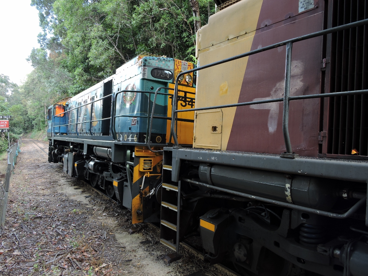 |
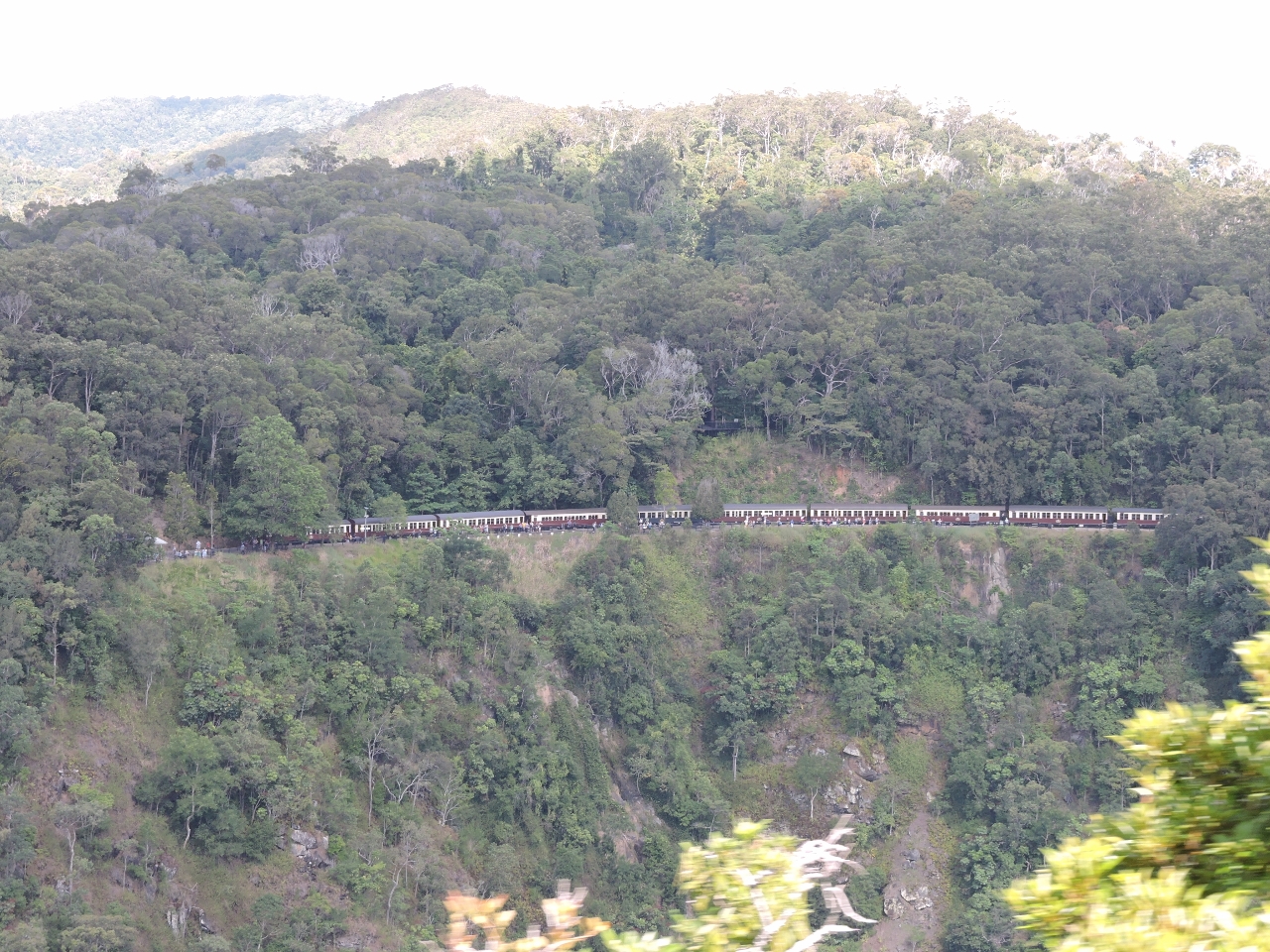
5/8/2015: Locomotive
Position: -16°50.20'S, 145°38.61'E
The train locomotive is a 1720 class diesel-electric model GL18C, built in the 1960s in Brisbane by Commonwealth Engineering. It travels on a 3ft 6in narrow-gauge track. The track itself is a National Engineering Landmark, due to the difficulty of its construction, involving the removal of 2.3 million cubic meters of earth, 15 hand-carved tunnels, and 55 bridges.
|
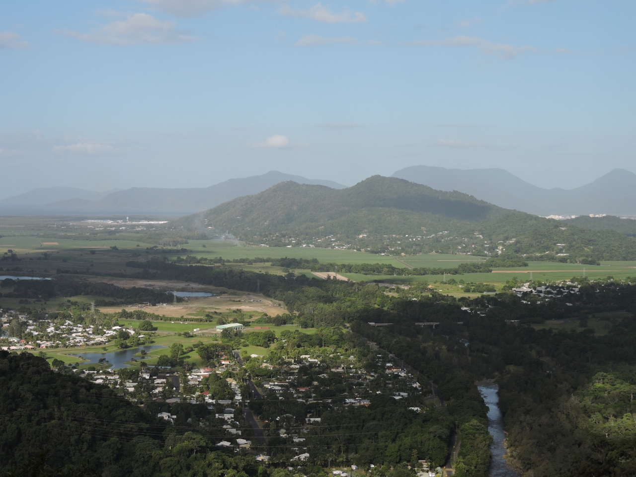 |
5/8/2015: Views
Position: -16°52.06'S, 145°39.98'E
From the Kuranda Scenic Railway, we enjoyed excellent views over the valley and towards the ocean.
|
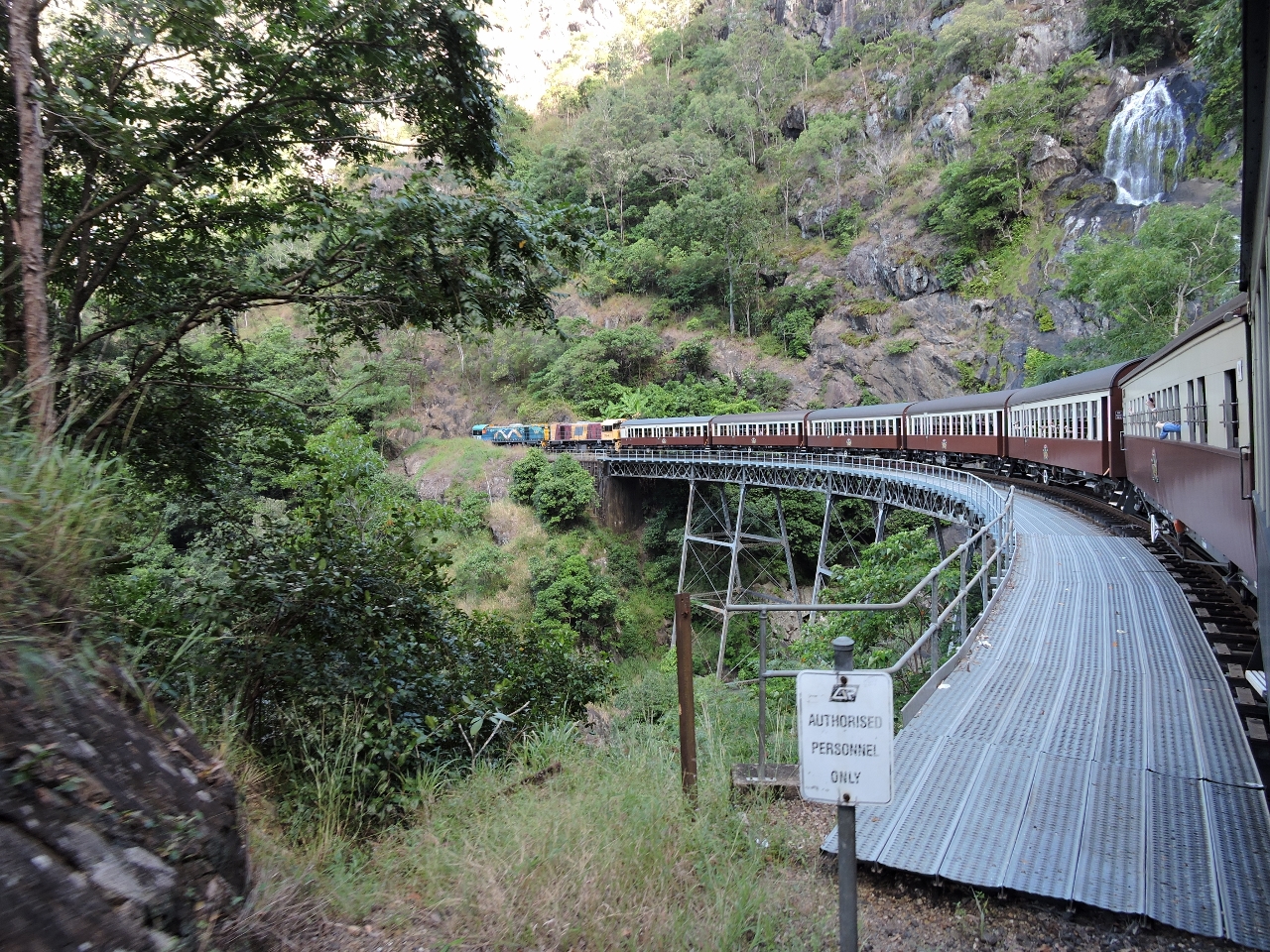 |
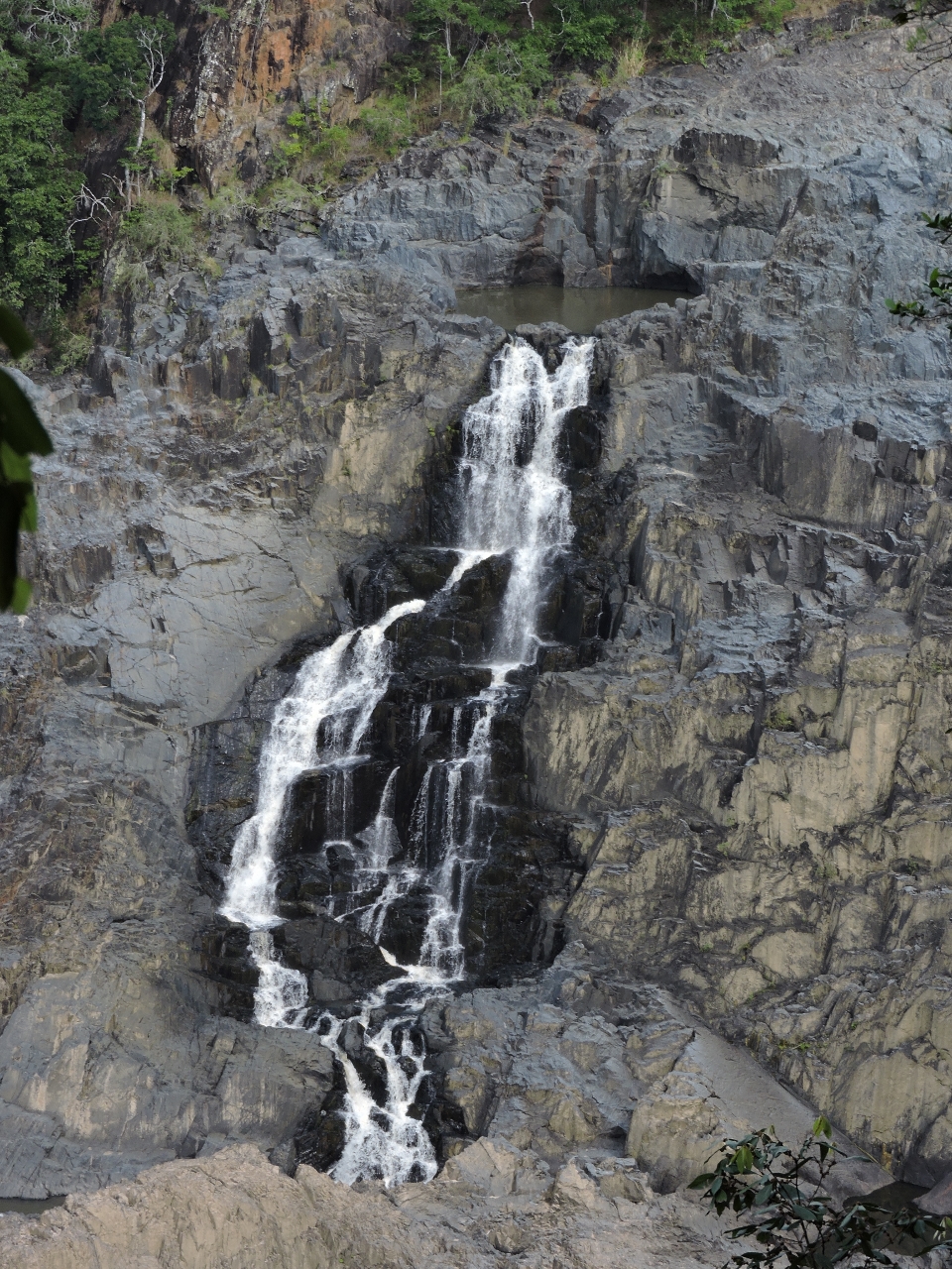
5/8/2015: Stoney Creek
Position: -16°52.84'S, 145°39.12'E
Crossing the Stoney Creek Falls bridge, with the falls visible at the upper right. The iron lattice bridge, completed in 1890, is the most notable feature of the railway. It stands on three trestle piers and has a tight 265-ft (80 m) radius.
|
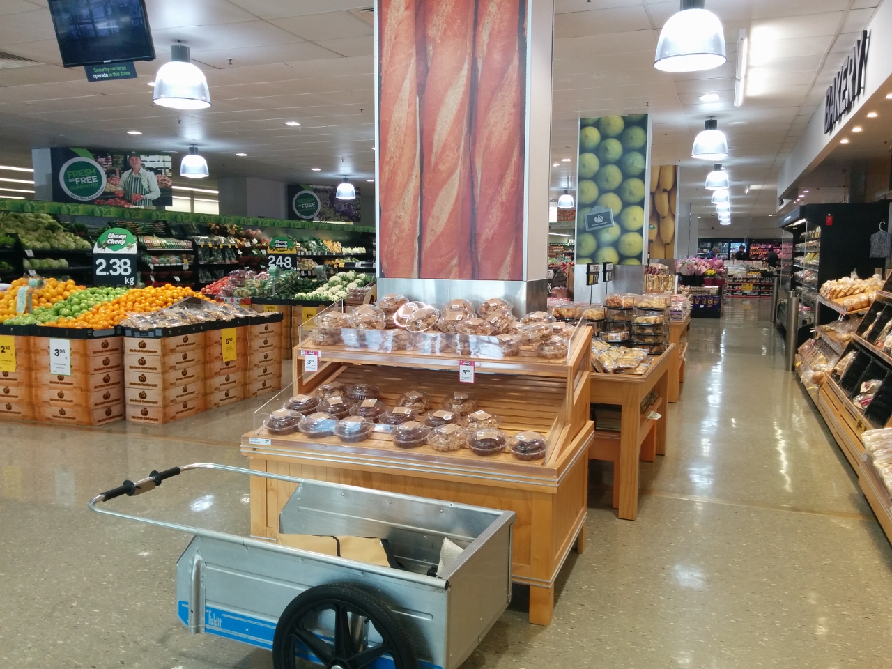 |
5/9/2015: Woolworths
Position: -16°55.32'S, 145°46.64'E
Grocery shopping with our folding cart at Woolworths. Provisioning in Cairns is very convenient--we're all stocked up now for our Kimberley trip and likely will only buy some produce in Darwin as we pass through to refuel.
|
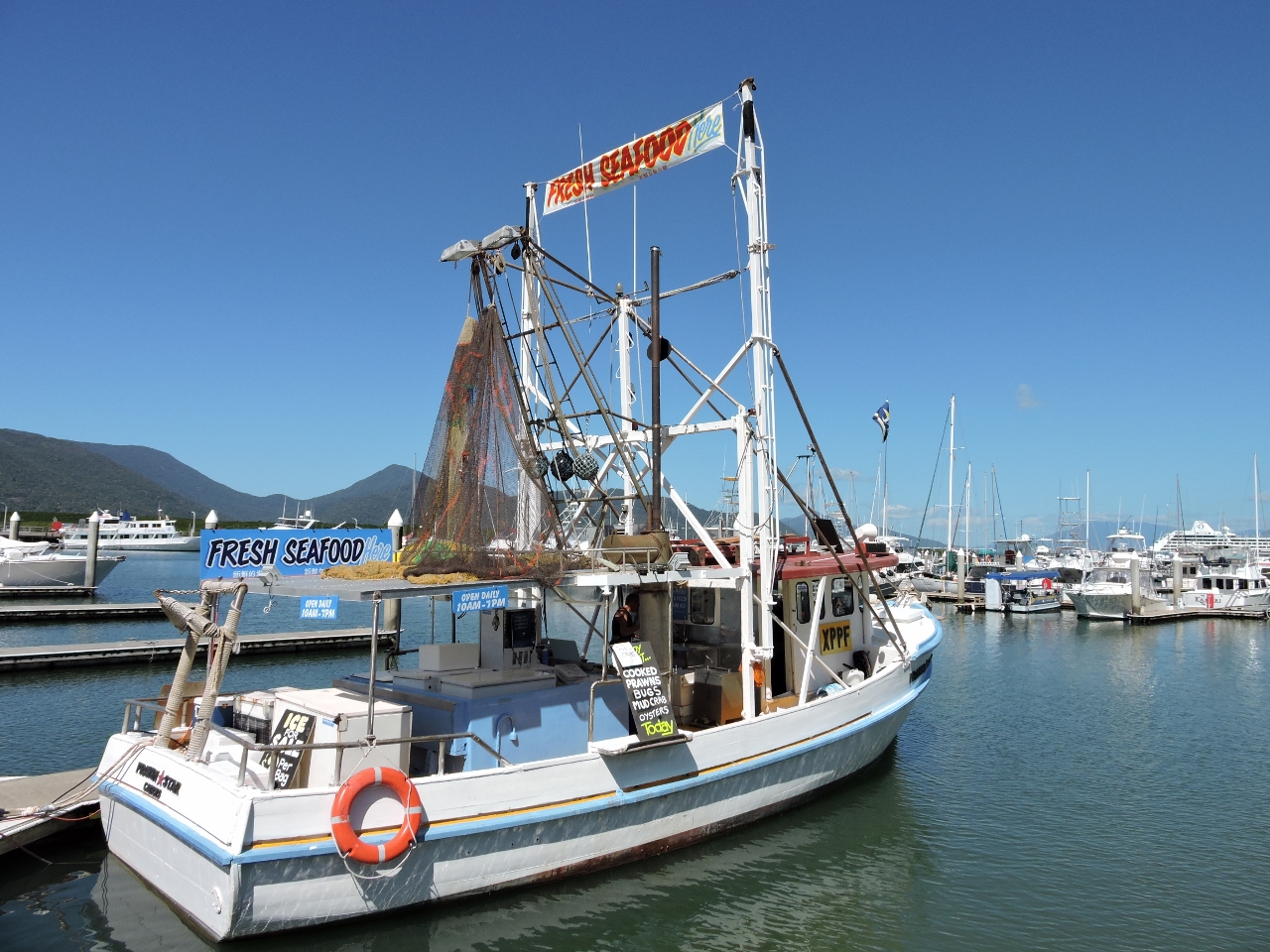 |
5/10/2015: Prawn Star
Position: -16°55.13'S, 145°46.83'E
We bought some delicious oysters and cooked shrimp for lunch on Dirona from Prawn Star moored at the head of our dock. In the evenings we often see patrons eating dinner on or beside the boat with a Prawn Star-supplied cold beer in hand.
|
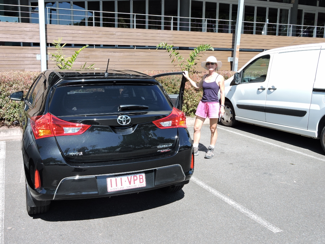 |
5/10/2015: Wheels
Position: -16°55.19'S, 145°46.77'E
We rented a car to drive up the Daintree National Park early tomorrow morning.
|
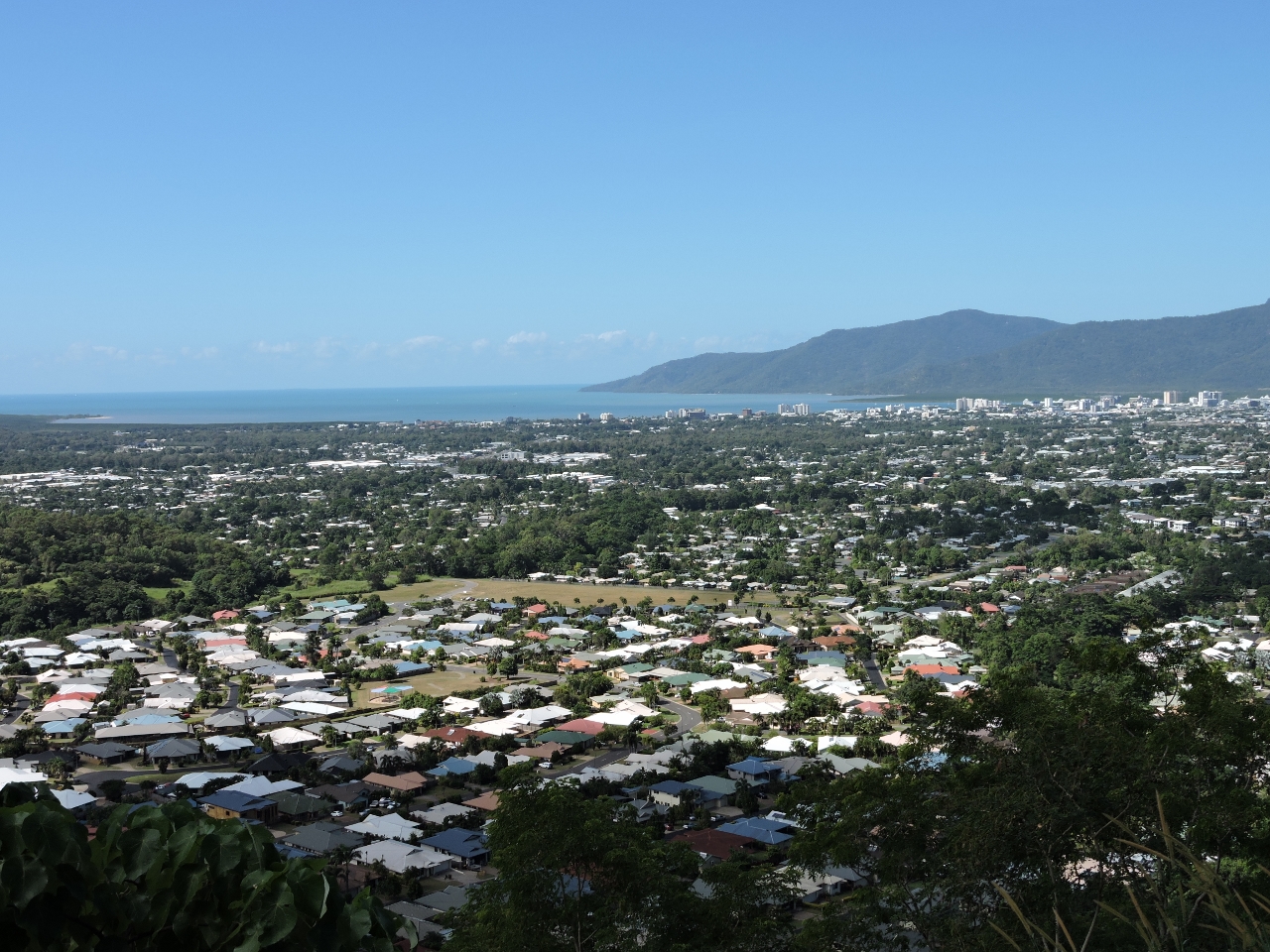 |
5/10/2015: View
Position: -16°55.74'S, 145°43.25'E
Since we already had the rental car for the planned Daintree National Park trip, we took advantage of our increased mobility to drive up to the Copperlode Dam site. This is the view back to Cairns from partway up.
|
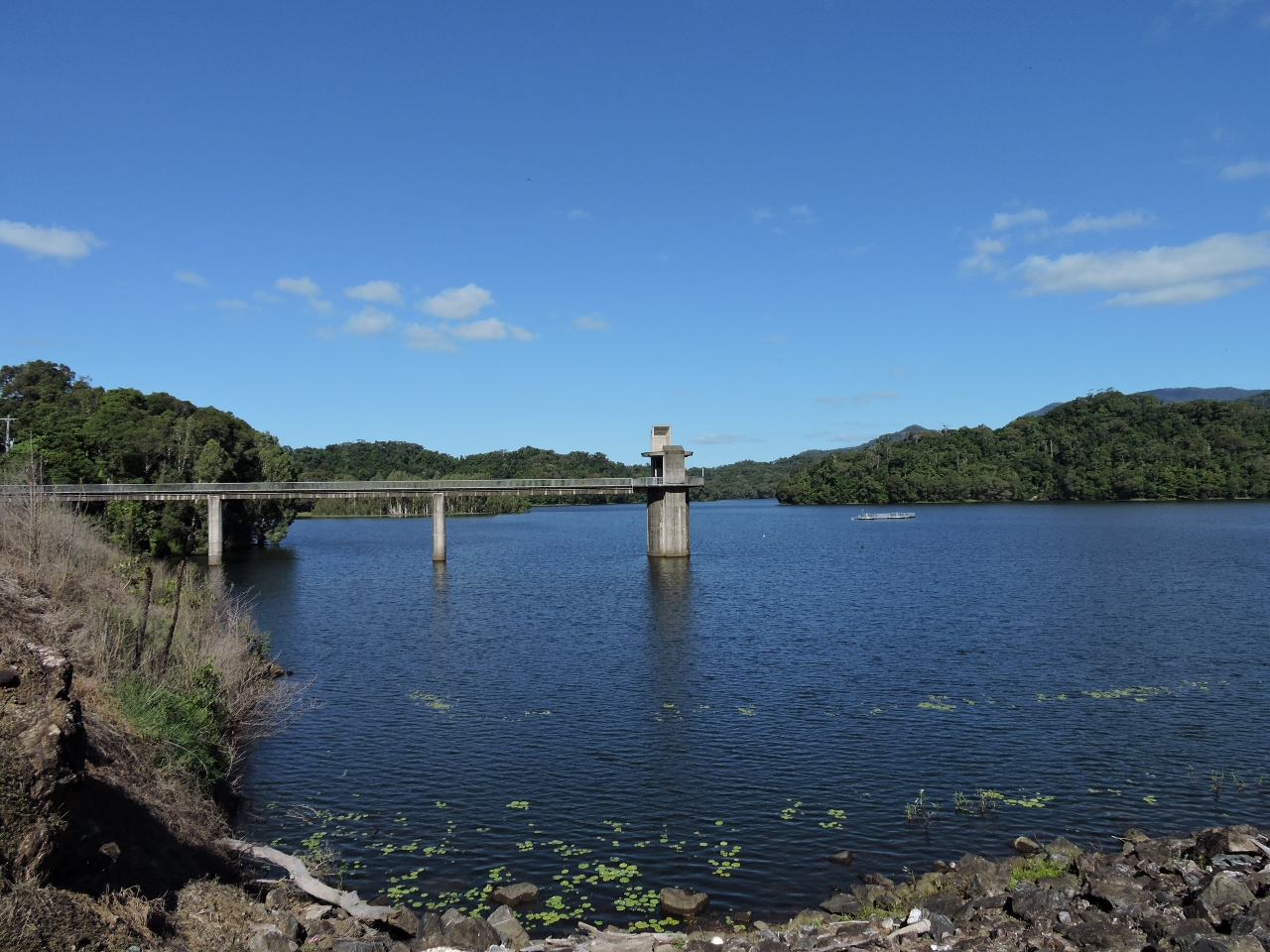 |
5/10/2015: Lake Morris
Position: -16°58.78'S, 145°40.40'E
Copperlode Dam forms Lake Morris and supplies freshwater for Cairns. We later walked out to the end of this pier for good views of the lake.
|
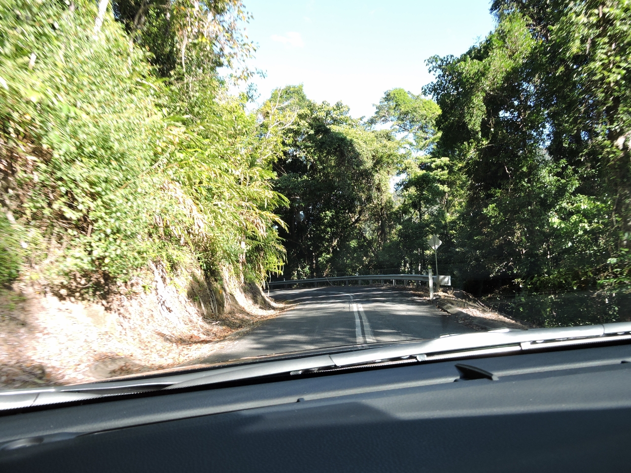 |
5/10/2015: Curves
Position: -16°56.86'S, 145°42.79'E
Lake Morris Road was narrow and twisty with many blind corners, but that was balanced by beautiful scenery en route and at the top.
|
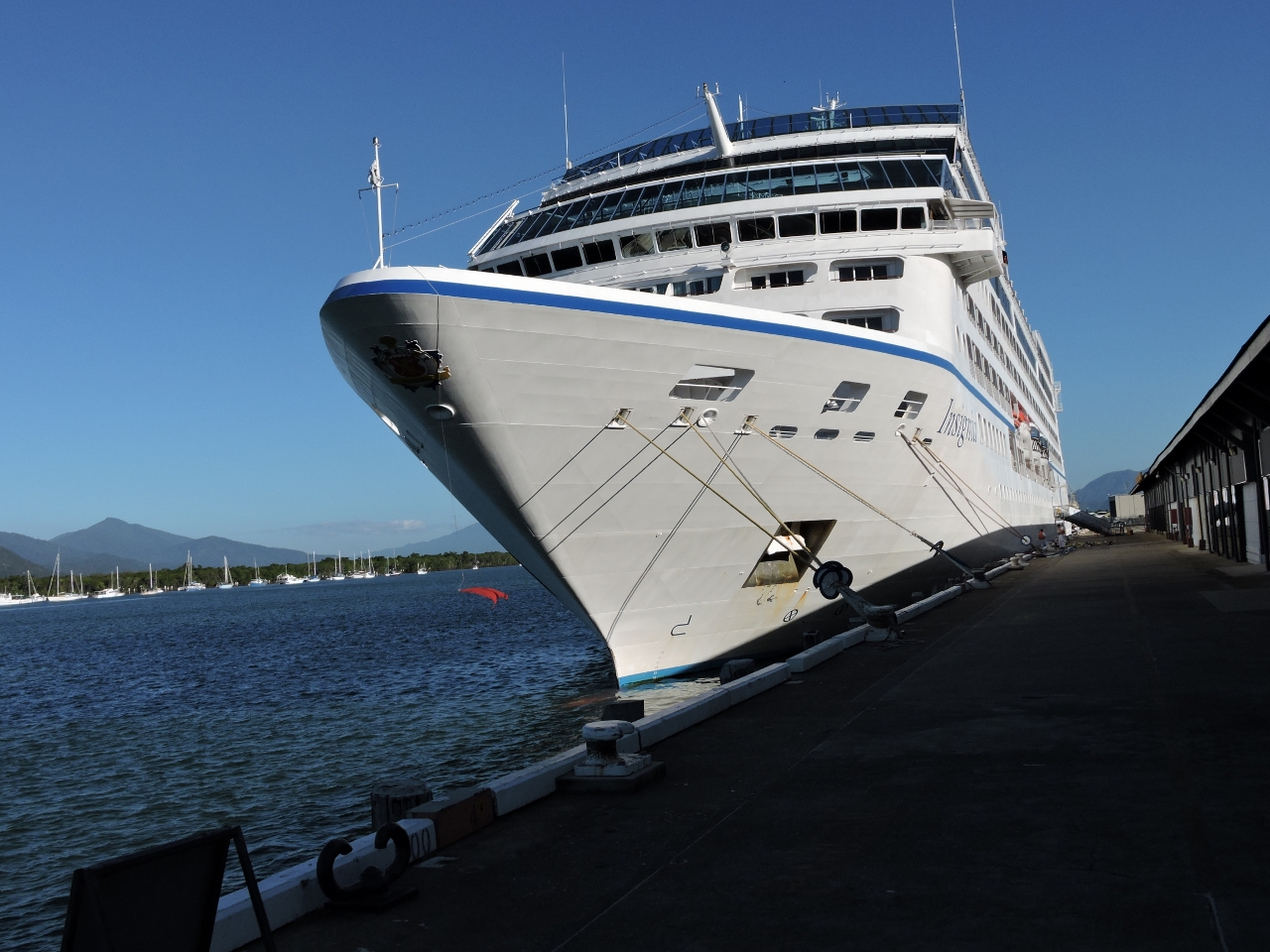 |
5/10/2015: Insignia
Position: -16°55.52'S, 145°46.80'E
From the viewpoint along Lake Morris Road, we could see a cruise ship at the Cairns Cruise Liner Terminal and stopped by on the way back to check it out. In port was the newly-renovated 592-ft Insignia. One of their more interesting cruises is a 180-day circumnavigation. Our trip is pretty much the other end of the spectrum for time taken.
|
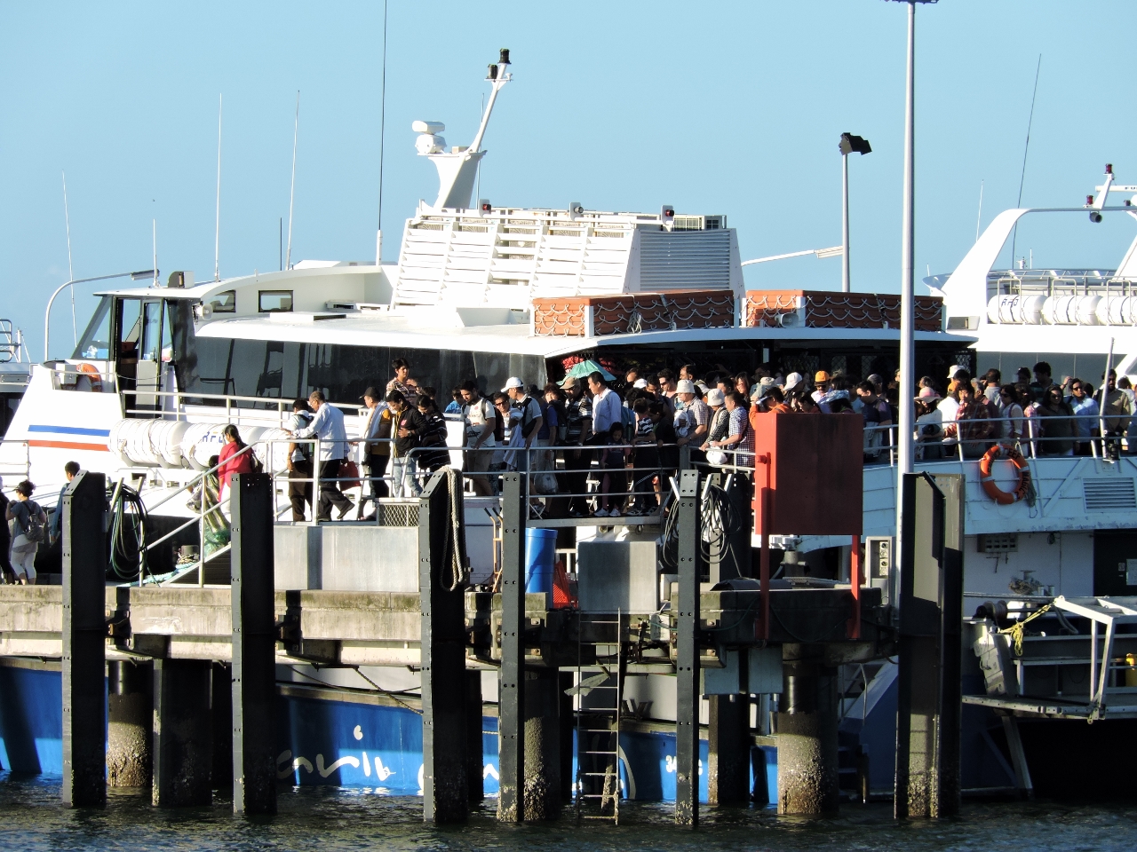 |
5/10/2015: Crowds
Position: -16°55.33'S, 145°46.86'E
The day-tour boats arrive back in the late afternoon and some of them disgorge an incredible number of people.
|
 |
5/10/2015: Dusk
Position: -16°55.03'S, 145°46.87'E
We had sunset drinks on the deck at the excellent Salt House restaurant adjacent to the marina and walked out along the pier to take this photo at dusk.
|
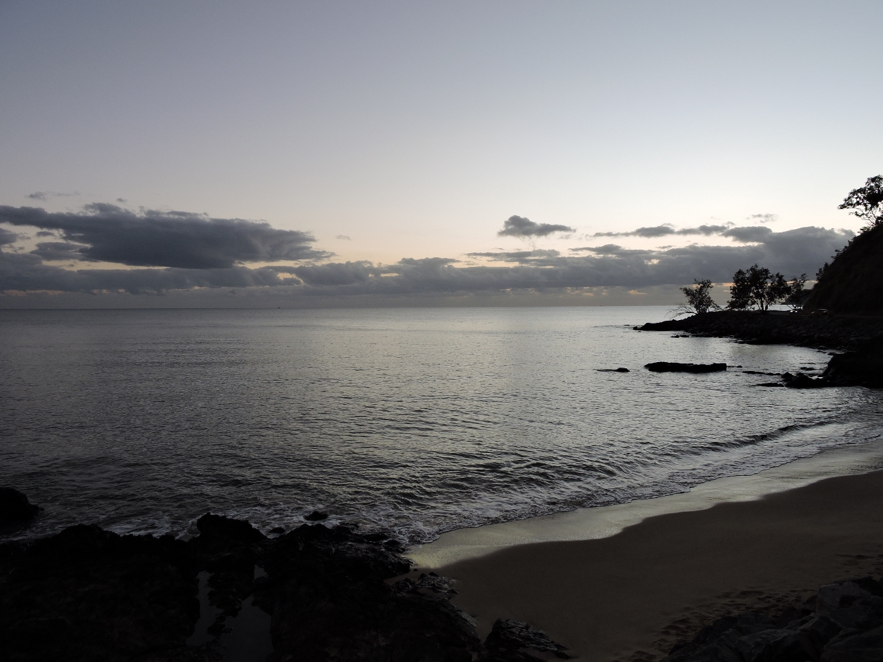 |
5/11/2015: Ellis Beach
Position: -16°43.85'S, 145°39.20'E
We left Cairns before sunrise this morning on a 95-mile (154 km) drive to Cape Tribulation in Daintree National Park. This is the early morning view at Ellis Beach, about an hour north of Cairns.
|
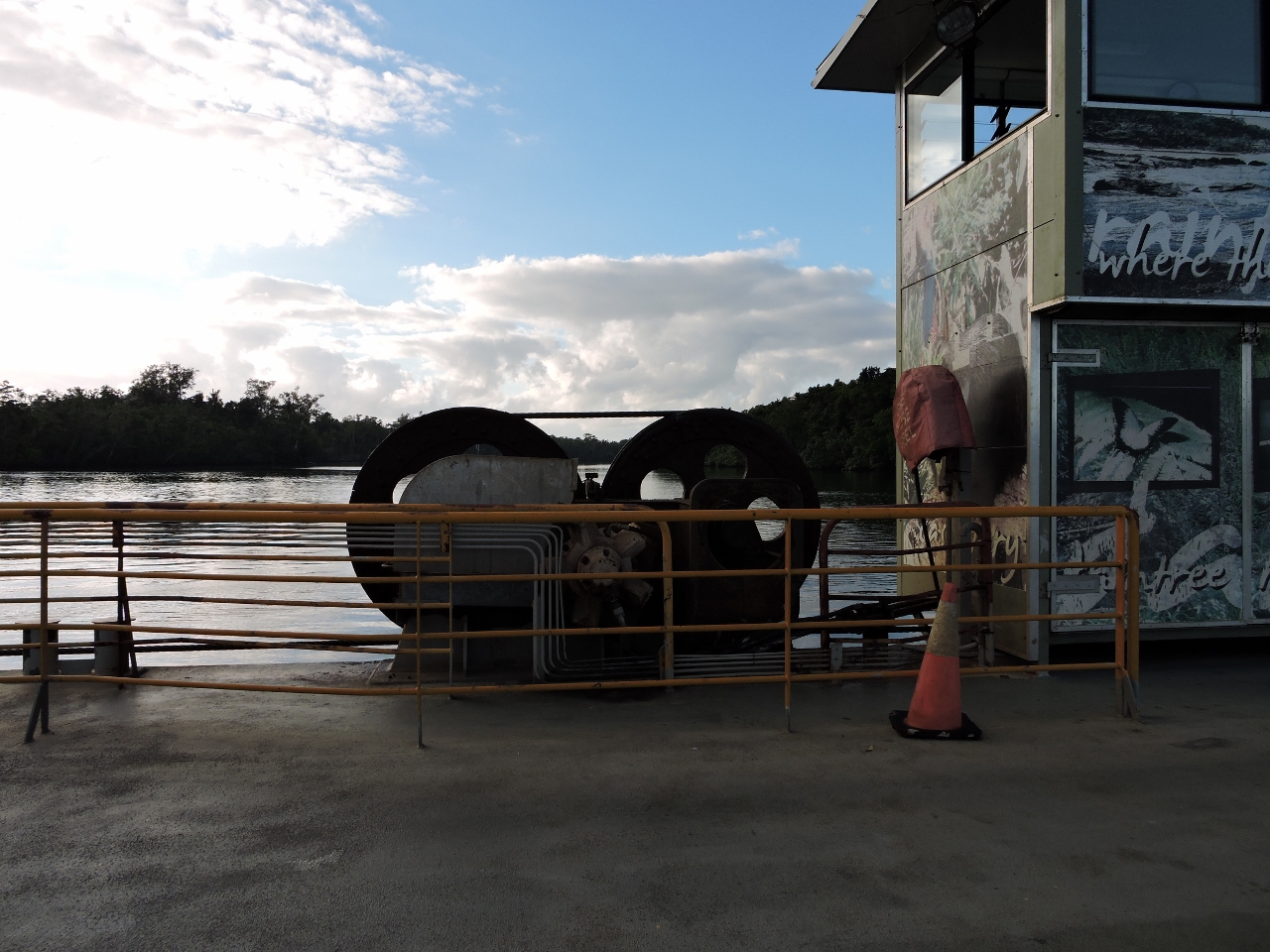 |
5/11/2015: Daintree Ferry
Position: -16°15.53'S, 145°23.92'E
We've passed several cable ferries, but this is our first time riding on one. The service was exceptionally quick. We waited perhaps 2 minutes before boarding and barely had time to pay before we were across.
|
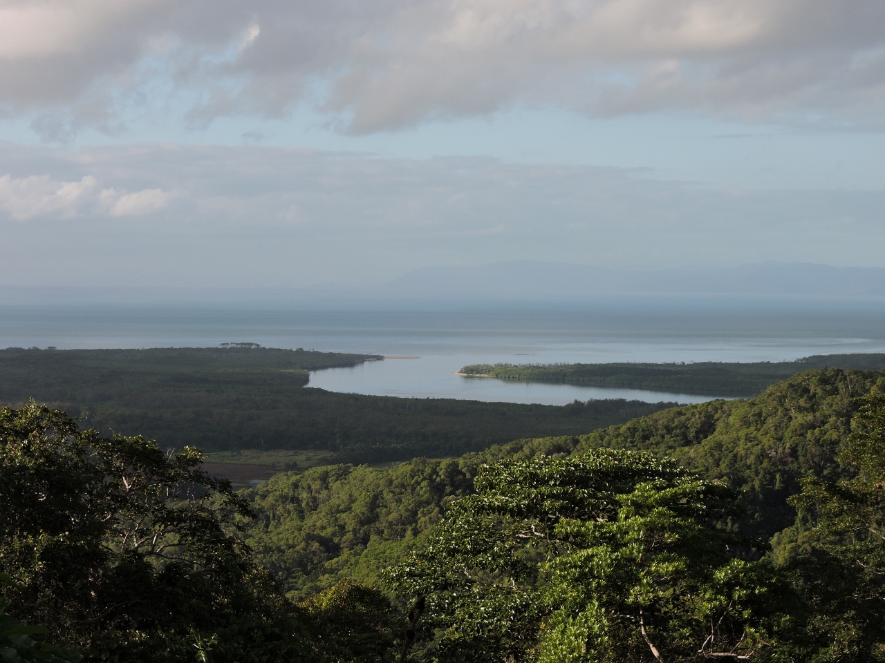 |
5/11/2015: Alexandra Lookout
Position: -16°14.75'S, 145°26.16'E
Our plan was to drive direct to Cape Tribulation and work our way slowly back over the day, but we couldn't resist stopping for the view from the Alexandra Range Lookout Point. This is the mouth of the Daintree River where it meets the sea.
|
 |
5/11/2015: Cape Tribulation
Position: -16°4.68'S, 145°28.19'E
About three hours after leaving Cairns, we arrived at Cape Tribulation. The trip up was excellent with scenery ranging from beaches to rainforest. The road switches from paved to gravel here, so we won't go any further. And the return trip is already going to more than fill the day.
|
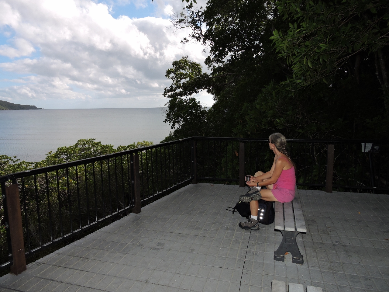 |
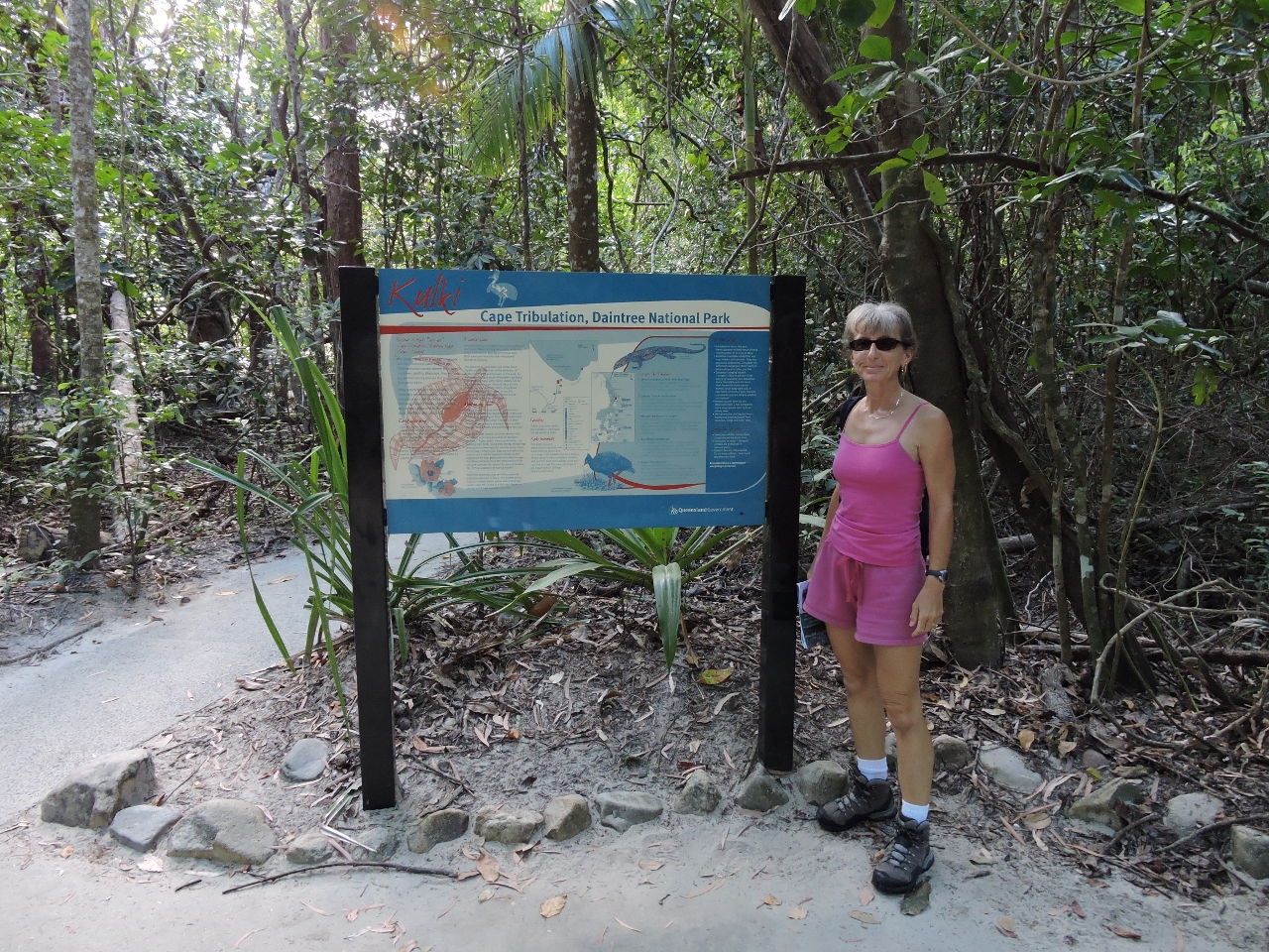
5/11/2015: Kulki boardwalk
Position: -16°4.59'S, 145°28.33'E
We walked the short Kulki boardwalk through the rainforest and stopped for a cup of coffee while we took in the view from the Cape Tribulation lookout.
|
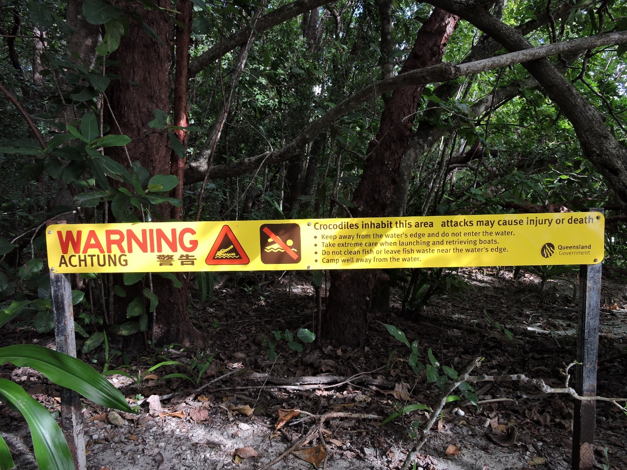 |
5/11/2015: Crocodiles
Position: -16°4.67'S, 145°28.20'E
From the lookout we walked across a beach and back to the parking lot. This sign at the parking lot path to the beach warns visitors of crocodiles in the area we'd just walked through. Either we took the wrong path, or they need another sign.
|
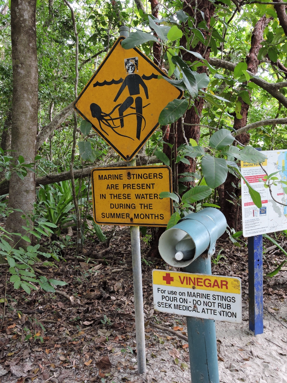 |
5/11/2015: Marine stingers
Position: -16°4.67'S, 145°28.20'E
If the crocodiles weren't enough to keep you out of the water, marine stingers (jellyfish), some of which are deadly, would be.
|
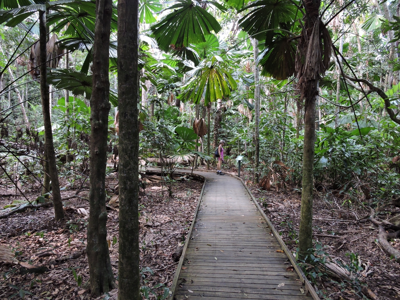 |
5/11/2015: Dubuji boardwalk
Position: -16°5.43'S, 145°27.76'E
The 1-mile (1.4 km) Dubuji boardwalk goes deep into the rainforest and feels far removed from civilization. Interpretive signs along the way describe the plant and animal life and explain how the rainforest evolves.
|
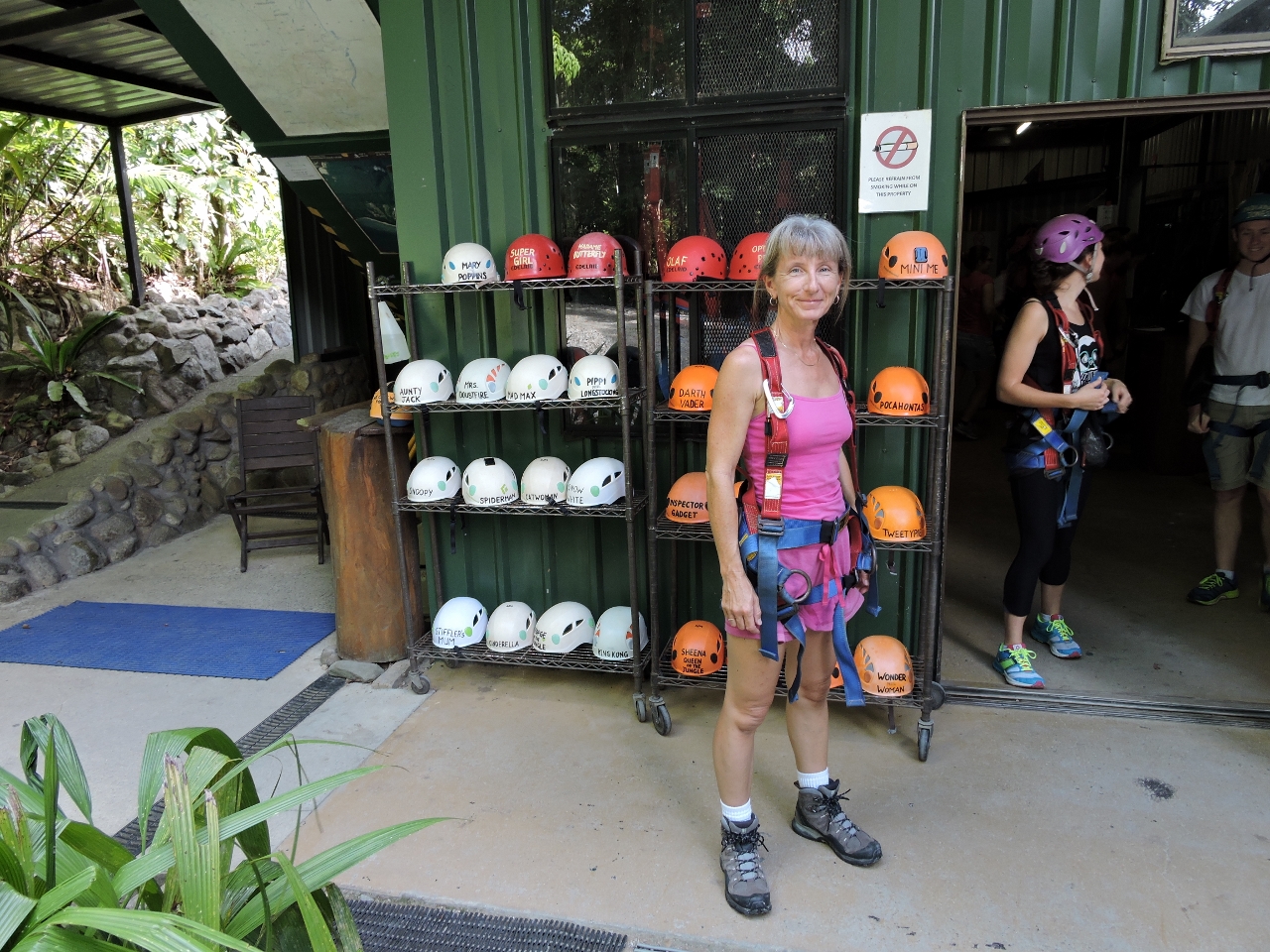 |
5/11/2015: Jungle surfing
Position: -16°5.05'S, 145°26.88'E
At Jungle Surfing Canopy Tours for a two-hour zipline tour through the rainforest. The video https://youtu.be/QusB_Spyt2M (1:01) starts with the "Human hamster wheel" lifting riders up to the first platform. We rode in pairs for the about the first three or so platforms, and singly for the rest. Each of us wears a helmet with a nickname on it that the guides refer to us by--that is why Jennifer is called "Tinkerbell" near the end of the video. The zipline was yet another way to see and learn about the rainforest and we had an exciting time.
|
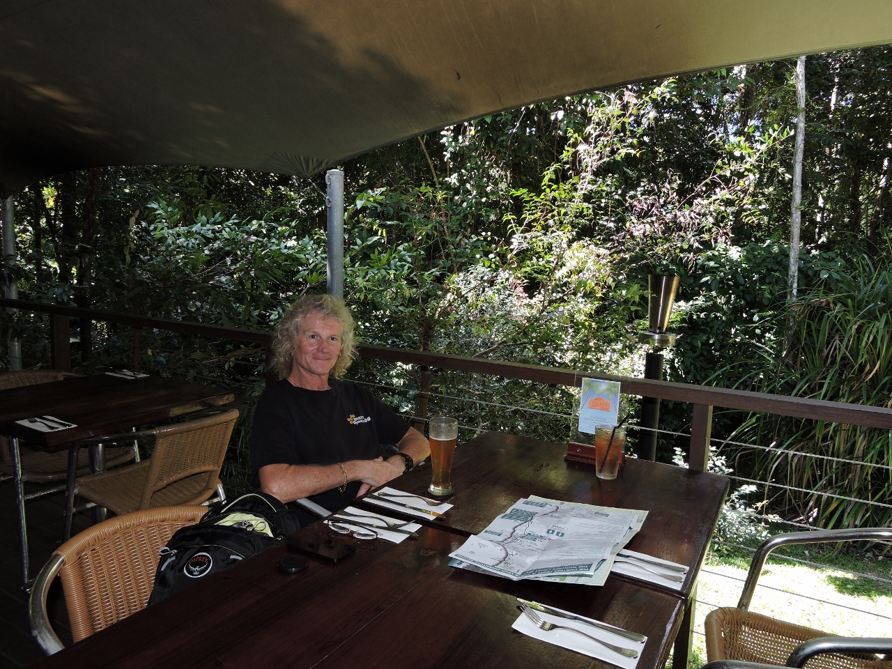 |
5/11/2015: Whet
Position: -16°5.43'S, 145°27.67'E
We had an excellent lunch at Whet restaurant in Cape Tribulation. Besides the delicious food, they have a wonderful patio surrounded by rainforest.
|
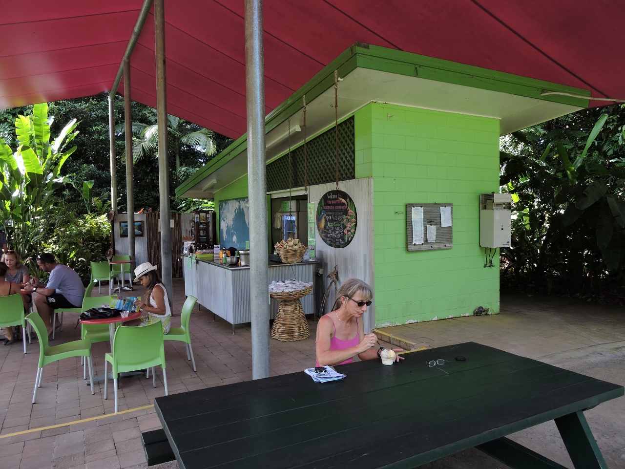 |
5/11/2015: Ice cream
Position: -16°12.83'S, 145°24.27'E
At the Daintree Ice Cream Company we sampled their delicious homemade tropical fruit ice cream while sitting next to their orchards.
|
 |
5/11/2015: Daintree Discover Center
Position: -16°14.27'S, 145°25.71'E
At the Daintree Discovery Center several boardwalks, some elevated, lead through the rainforest. Admission includes an audio guide that explains various aspects of the rainforst along the way.
|
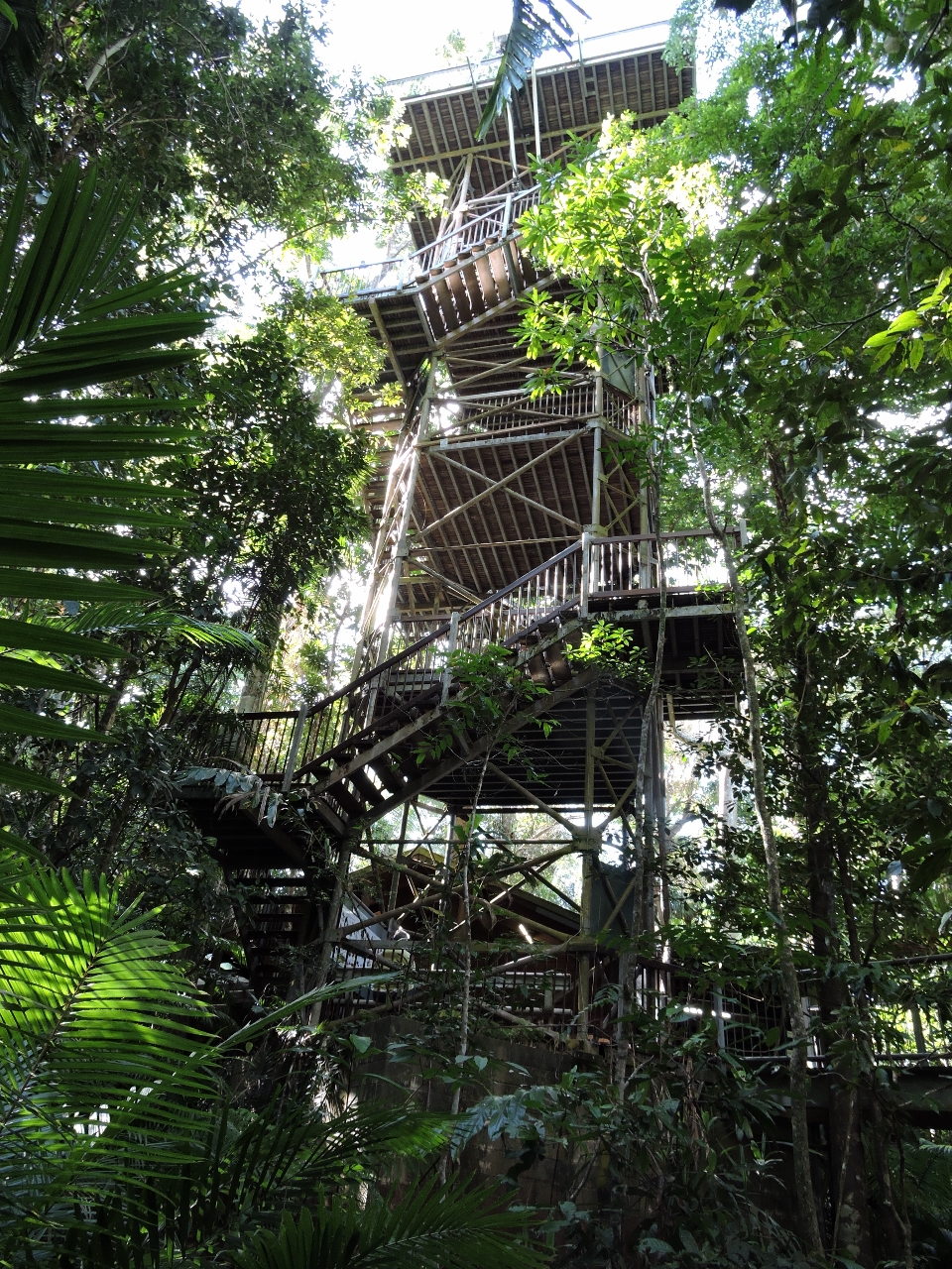 |
5/11/2015: Canopy Tower
Position: -16°14.27'S, 145°25.64'E
The Canopy Tower is a highlight of the Daintree Discovery Center. After walking along ground and mid-level boardwalks, we climbed to the top for a view over the canopy.
|
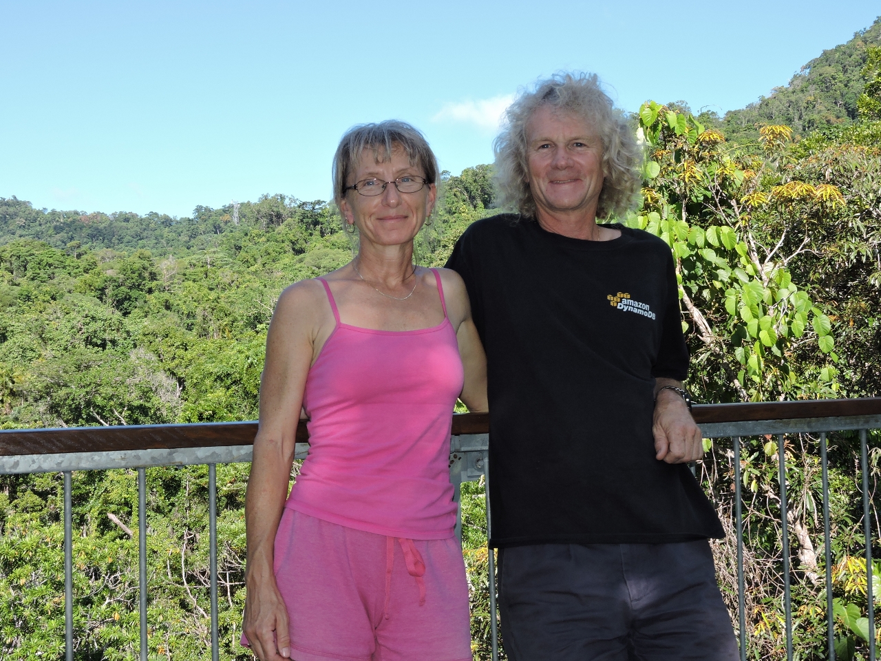 |
5/11/2015: On top
Position: -16°14.27'S, 145°25.64'E
Enjoying the view from atop the Canopy Tower at the Daintree Discover Center.
|
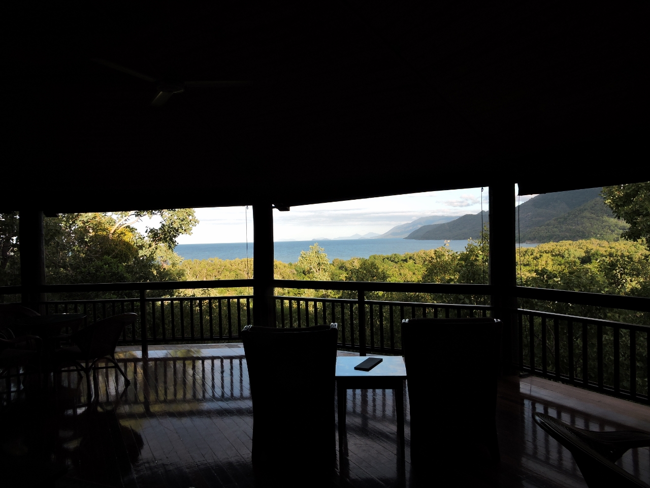 |
5/11/2015: Thala Beach Lodge
Position: -16°35.21'S, 145°31.09'E
Our final stop for the day was at the Thala Beach Lodge. The beautiful resort is perched high on the cliff--we had a drink in their bar overlooking the coast.
|
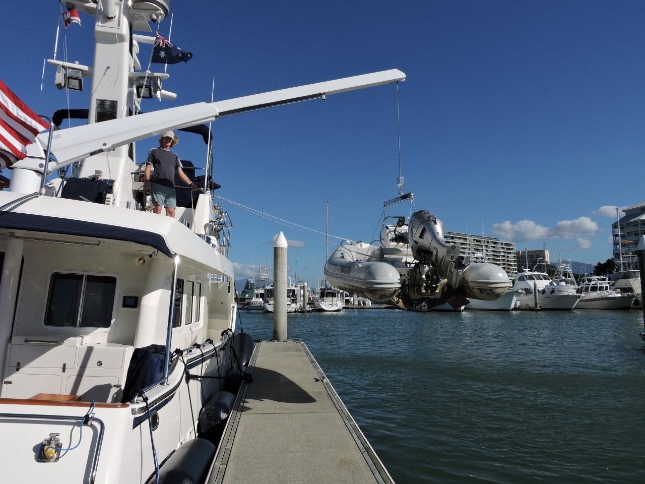 |
5/12/2015: Reach
Position: -16°55.15'S, 145°46.91'E
We have a custom Steelhead ES1500 davit with a 16′ reach. We can launch the dinghy single-handed to the stern or either side of the boat, and even beside the boat to the other side of dock.
|
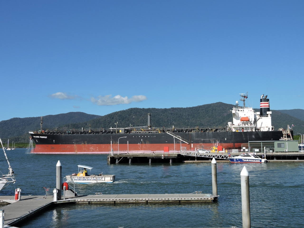 |
5/12/2015: Challenge Prospect
Position: -16°55.15'S, 145°46.91'E
The oil tanker Challenge Prospect leaving port. We were surprised it only had a single tug escort given the narrowness of the entry channel.
|
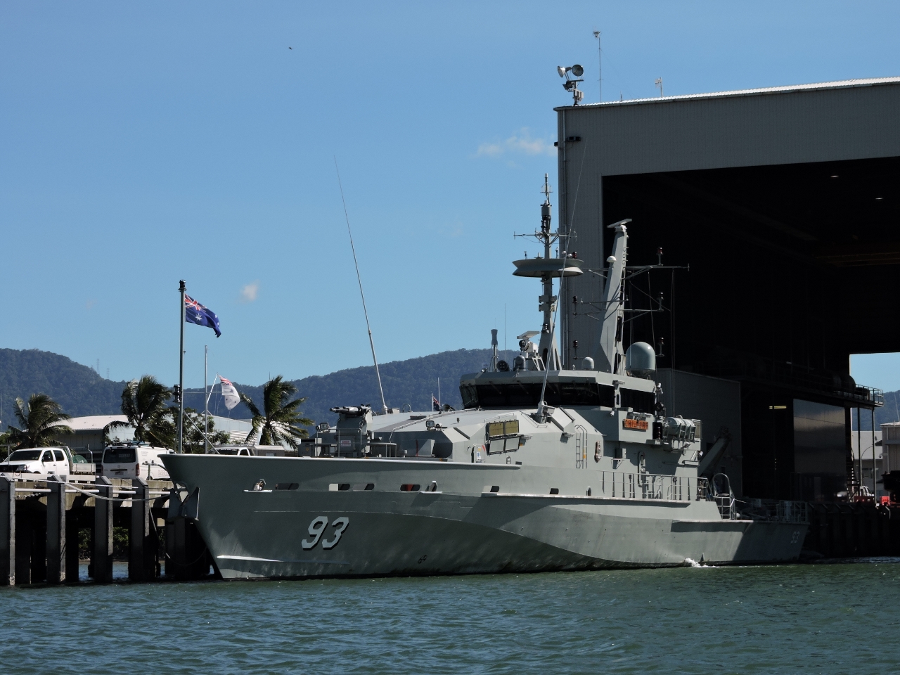 |
5/13/2015: HMAS Childers
Position: -16°56.20'S, 145°46.80'E
On a dinghy tour up Trinity Inlet, we passed the HMAS Childers at the Cairns Navy base. The 186.35 ft (56.8 m) patrol boat can reach speeds of 25 knots and is one of 14 such ships used for fisheries protection, immigration, customs and drug law enforcement operations. An impressive boat--we bet it motivates compliance.
|
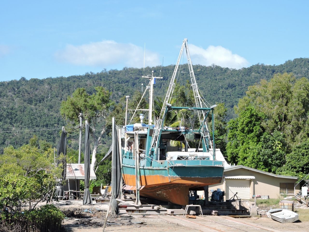 |
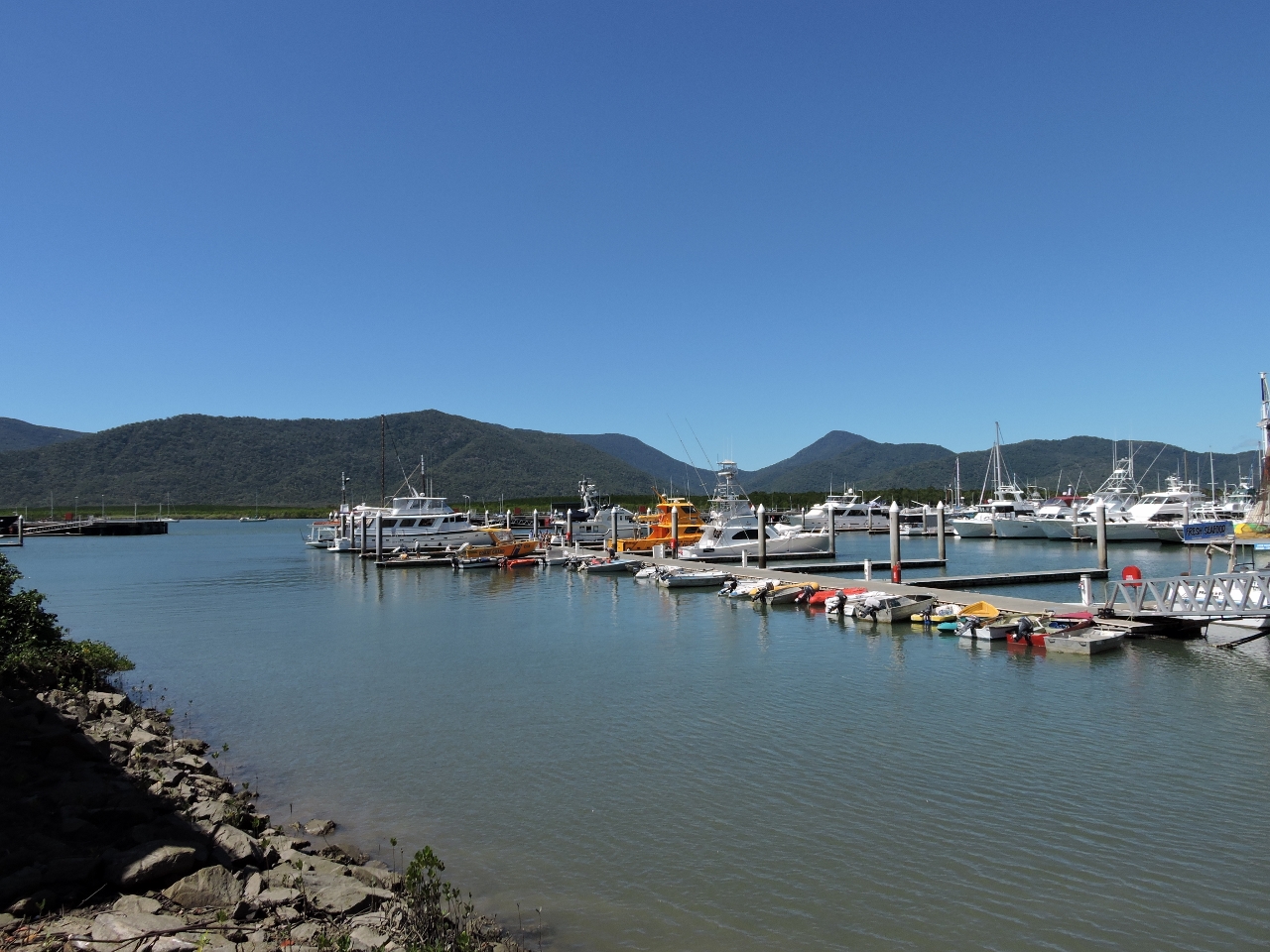
5/13/2015: Haulout
Position: -16°57.91'S, 145°47.58'E
Several boat yards, of varying appearance in quality, are along the waterway here. This one looked fairly well-equipped given the size and quality of the boat they are lifting.
|
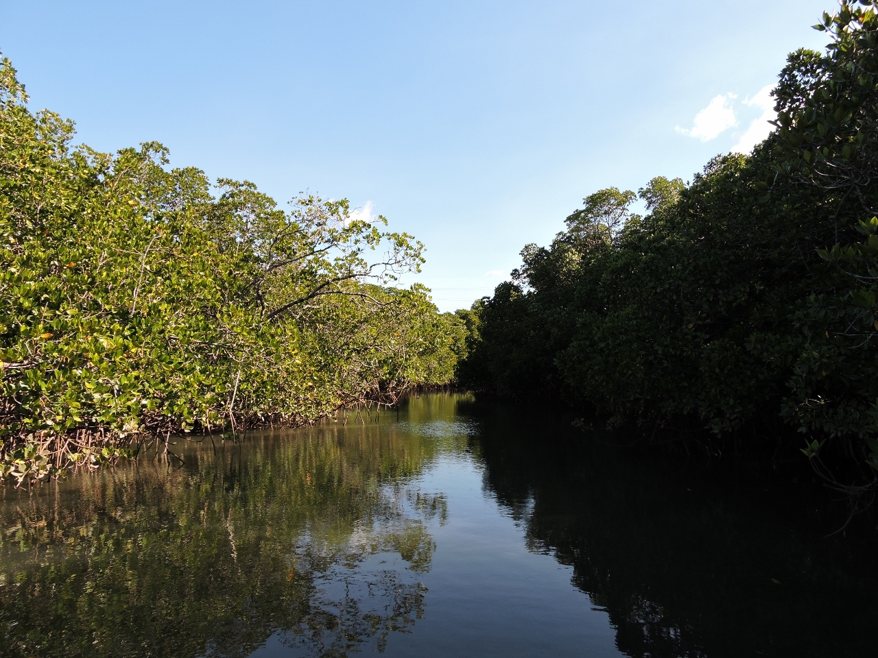 |
5/13/2015: Black Fellow Creek
Position: -16°59.79'S, 145°45.77'E
We worked up to the head of Black Fellow Creek before shallows turned us back. We were hoping we might see a crocodile, but as the water narrowed and we could almost step to shore from the dinghy, the prospect of finding a crocodile went from appealing to worth avoiding.
|
 |
5/13/2015: Smiths Creek
Position: -16°56.60'S, 145°46.50'E
Commercial boat yards and mooring facilities can be found all along Smiths Creek.
|
 |
5/13/2015: Roebuck Bay
Position: -16°57.10'S, 145°46.41'E
The Australia Customs and Border Protection Vessel (ACV) Roebuck Bay was one of three ACV Bay class vessels in the area. These 125 ft (38 m) ships have a range of 1000 miles at 20 knots and carry a 7.62mm general-purpose machine gun. The vessels are used to investigate possible or confirmed incursions into Australian maritime territory and to visit remote or otherwise inaccessible areas within Australia's offshore territories.
|
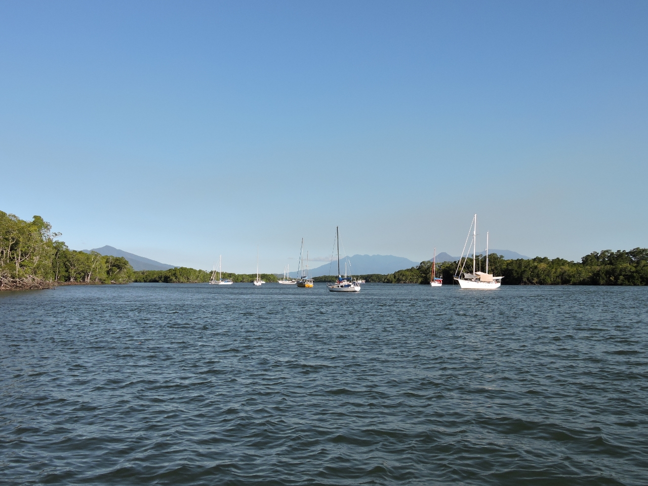 |
5/13/2015: Anchorage
Position: -16°58.08'S, 145°46.29'E
Pleasure craft were moored throughout Smiths Creek and Trinity Inlet. Many appeared to have live-aboards.
|
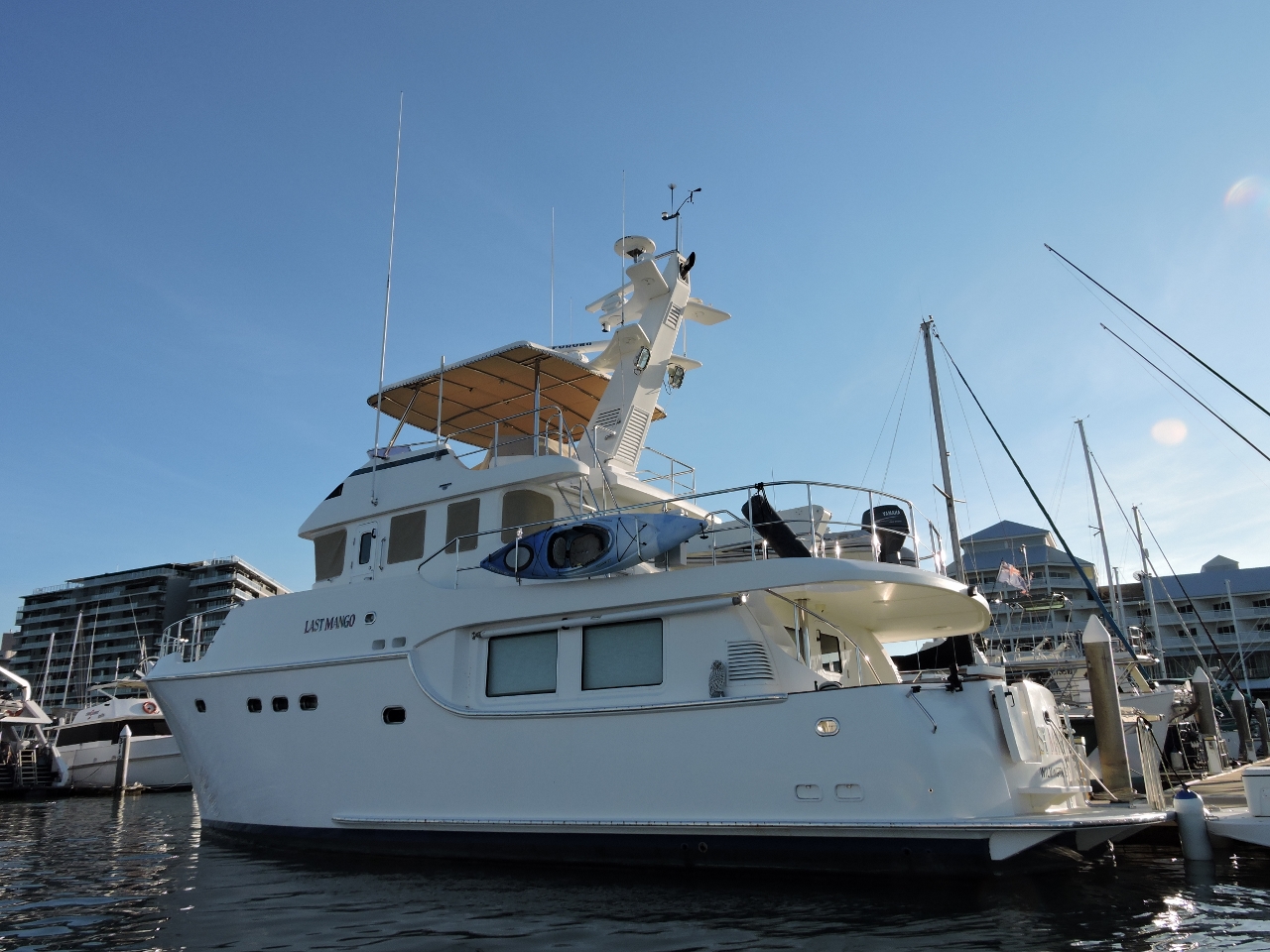 |
5/13/2015: Last Mango
Position: -16°55.26'S, 145°46.89'E
Nordhavn 55 Last Mango at Marlin Marina. We last saw this boat in the Pacific Northwest.
|
 |
5/13/2015: Superyachts
Position: -16°55.09'S, 145°46.98'E
Cairns is a popular superyacht destination. Paul Allen's Octopus was here recently. We seem to be on a very similar course. We saw them in San Francisco, Honolulu and Sydney, and just missed them here.
|
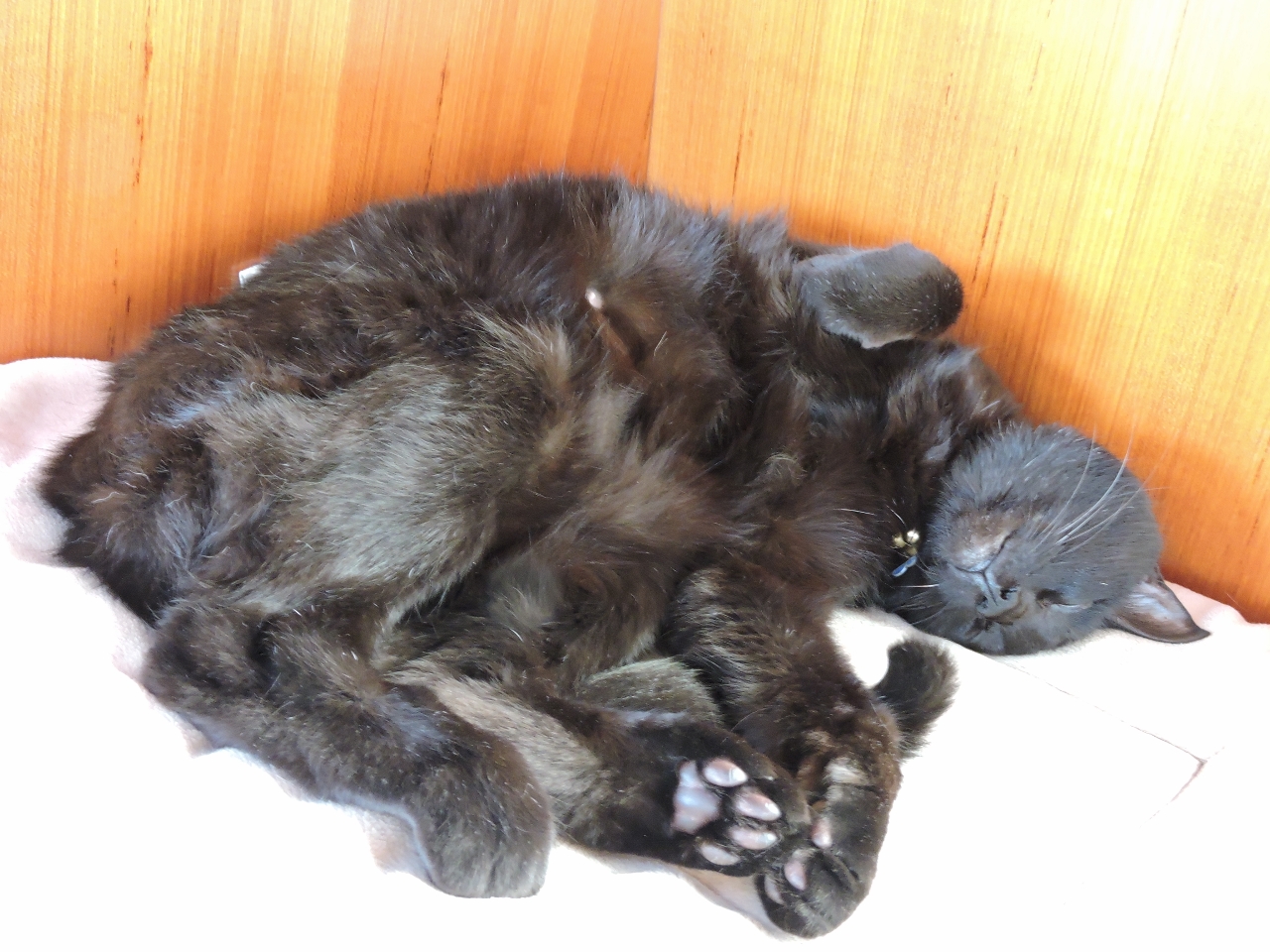 |
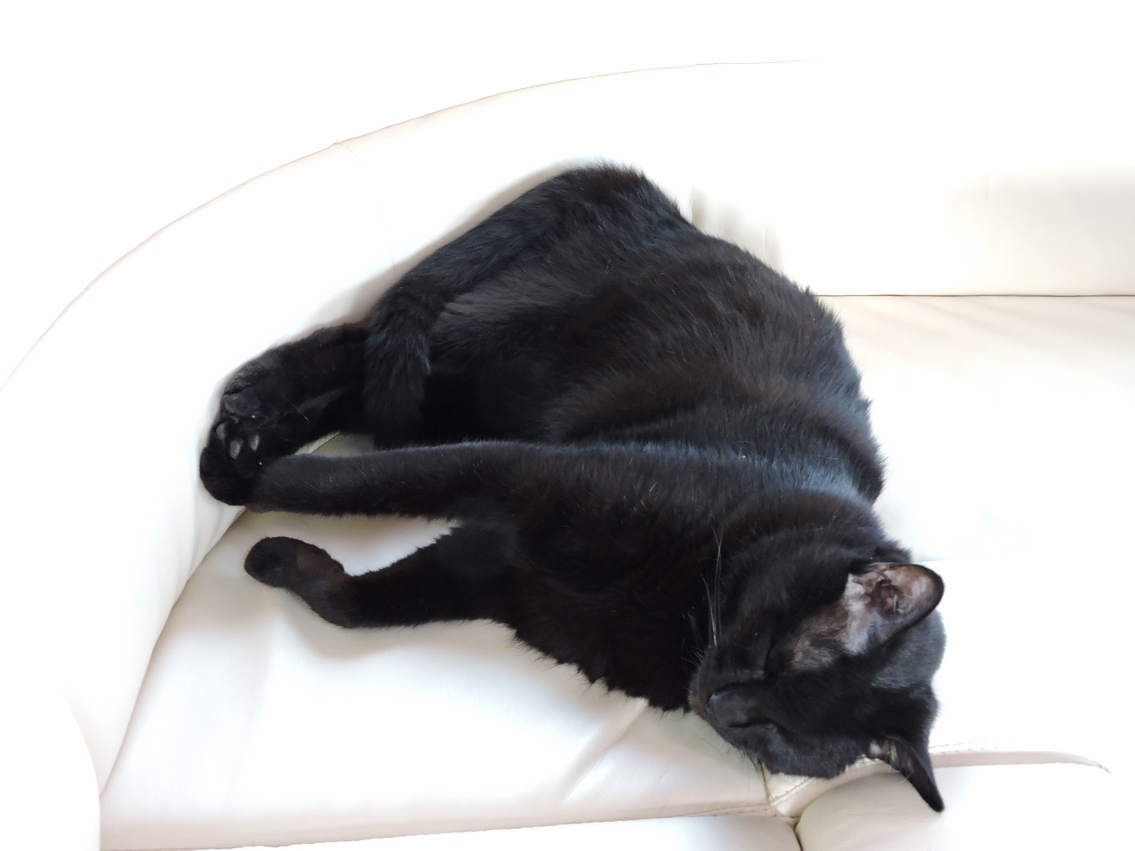
5/14/2015: Relaxing
Position: -16°55.15'S, 145°46.91'E
Spitfire, doing what he does best (and most).
|
 |
5/14/2015: Low tide
Position: -16°55.09'S, 145°46.83'E
The Cairns waterfront is shallow and almost completely drains at low tide.
|
 |
5/14/2015: Photo shoot
Position: -16°55.15'S, 145°46.91'E
A photography crew working on a real-estate advertisement featuring Cairns lifestyle doing some work on Dirona's bow with the Cairns skyline behind.
|
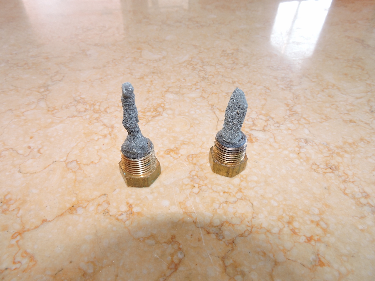 |
5/14/2015: Zincs
Position: -16°55.15'S, 145°46.91'E
After only two months, the hydraulics heat-exchanger zincs definitely needed changing. These are the only zincs on Dirona that don't last for beyond 6 months to a year . We've never figured out why these are consumed more quickly. We've tried both grounding and isolating the heat-exchanger to no effect. It's not a big hassle--they can be changed in under ten minutes--but its surprising how fast we go through them.
|
 |
5/15/2015: Rudder position
Position: -16°55.15'S, 145°46.91'E
We spent much of the day unsuccessfully trying to get the rudder position from our secondary autopilot to feed into the NMEA 2000 bus. Spitfire spent much of that time crawling over James and into the locker he was working in, and eventually just lay down on his chest. We only need rudder position on the NMEA 2000 bus for display at the aft station--all other stations already show rudder position. One pilot works, one pilot doesn't. We chased the problem back to the faulty pilot and it appears that it's not sending the data.
|
 |
5/16/2015: Odyssey
Position: -15°27.22'S, 145°22.44'E
We're on an overnight 150-mile run from Cairns to Lizard Island. Around midnight, the passenger vessel Odyssey was running on a reciprocal course down the eastern edge of the shipping channel. Vessels are advised to keep to the starboard side of the channel when meeting oncoming traffic, but once we got within 4 miles of Odyssey with no sign of a course change, we adjusted course to the west to give us a 1-mile closest point of approach. We usually prefer to have at 2 miles between us and any land or ships at night, but in these tight quarters, looking for more than 1 mile is impractical.
|
 |
5/17/2015: Sargram
Position: -15°6.13'S, 145°24.36'E
Another night passing, this time with the 767-ft (234 m) bulker Sargram. There's plenty of room to pass with both boats on their current course, but we chose to alter course to starboard for an additional margin of safety.
|
 |
5/17/2015: Cape Flattery
Position: -14°59.91'S, 145°24.69'E
We last passed Cape Flattery at the northwest corner of Washington State on our way south from Seattle to San Francisco. This Cape Flattery has a long wharf that is incredibly well-lit at night.
|
 |
5/17/2015: Conditions
Position: -14°40.41'S, 145°25.61'E
Winds have been blowing 20-30 knots from the southeast most of the run up. The waves have gotten up to 10 feet or so on about 8 seconds, but mostly have been around 8 feet on 8 seconds. With the seas behind us, the conditions are actually surprisingly good. The seas look reasonably calm in this photo of a bulker heading south into the waves, but are hitting the bow high enough to completely obscure the ship's name.
|
 |
5/17/2015: North Reef
Position: -14°38.74'S, 145°27.22'E
Once anchored at Lizard Island, we ran the tender out to Mermaid Cove and tied off to the mooring there to dive the North Reef. The coral life and visibility wasn't as good as some recent dives, but the underwater seascape and abundant sea life more than made up for that. The video http://youtu.be/-Bz86IpO6K4 (2:09) starts with us swimming through a channel near the northern reef tip. At 1:02 is a large ray, perhaps 4 ft in diameter, and at 1:46 is a reef shark.
|
 |
5/17/2015: Leaking hose
Position: -14°39.56'S, 145°27.03'E
The main engine timing cover oil drain-back hose was cracked and leaking oil. The only 5/8” ID hose we had to fix it with was high-quality Silicone rubber heater hose. We're pretty sure it's oil-safe, and we have no choice at this point since the old one has hardened up and is crumbling away, leaving a large gap in the middle of the hose.
|
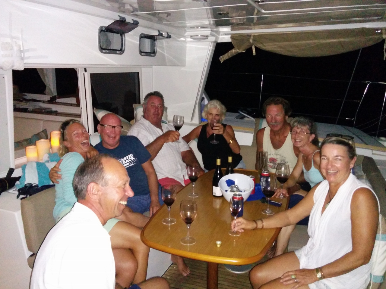 |
5/18/2015: Lu Ali
Position: -14°39.74'S, 145°27.13'E
Sundowners on Lagoon 50 Lu Ali. Owners Noel and Jenny Roots are at the center, directly to Jennifer's right. At the left are the two crew of La Medianoche who are on a westbound circumnavigation from Germany. We've seen La Medianoche a few times over the past several weeks, and finally met in person tonight.
|
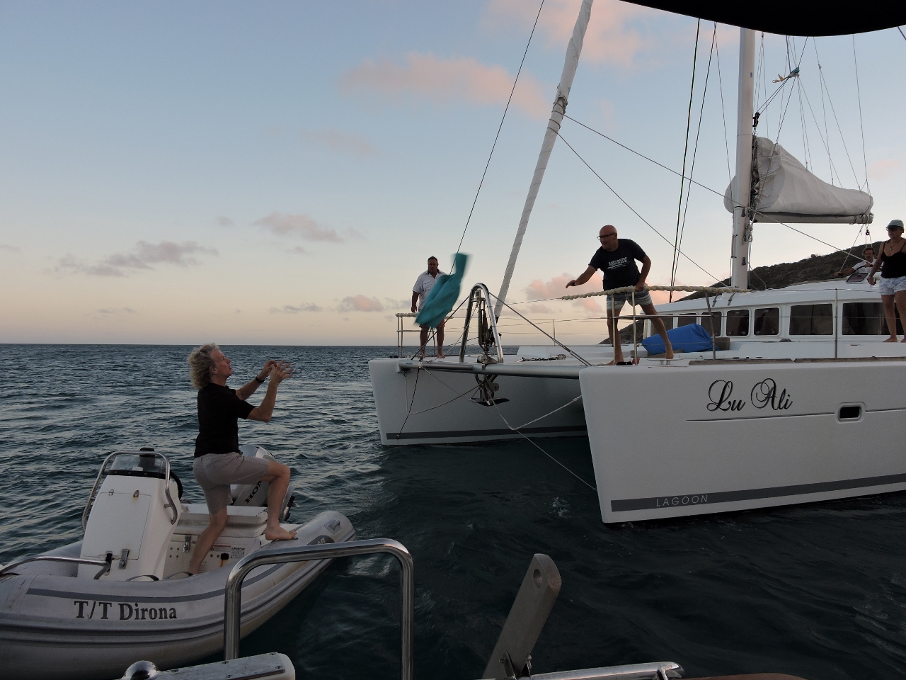 |
5/19/2015: Catch!
Position: -14°39.56'S, 145°27.03'E
The jacket flying through the air was left on board Lu Ali last night from La Medianoche. Nobody was visible on La Medianoche when Lu Ali left early this morning, so we took the jacket to return later. (James did catch it.)
|
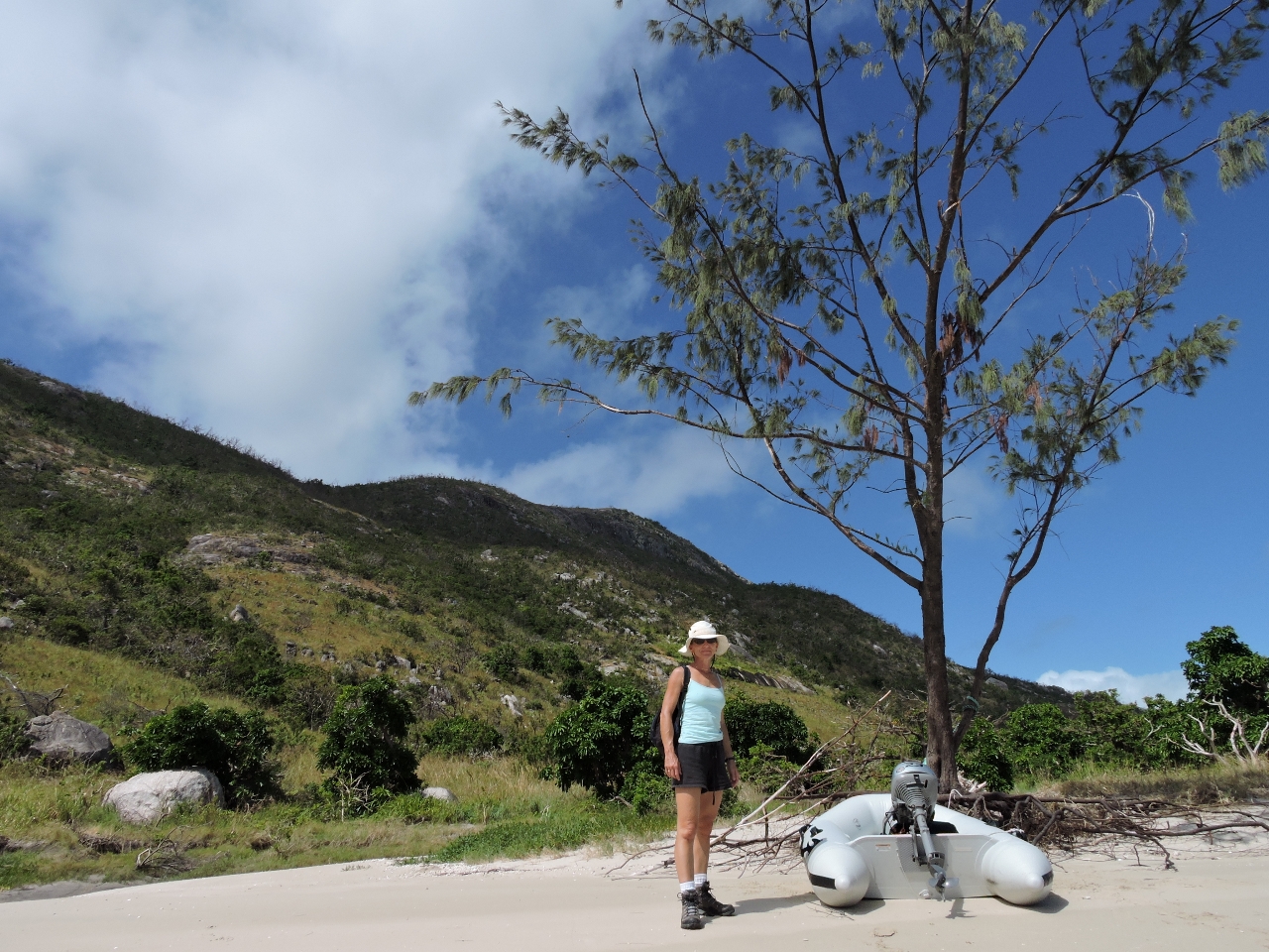 |
5/19/2015: Ready to climb
Position: -14°39.65'S, 145°27.29'E
We landed the micro-tender to climb to Cook's Look, the hilltop in the background just to the left of Jennifer.
|
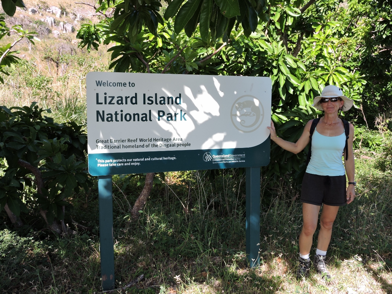 |
5/19/2015: Lizard Island National Park
Position: -14°39.80'S, 145°27.29'E
Another park sign to add to our burgeoning collection.
|
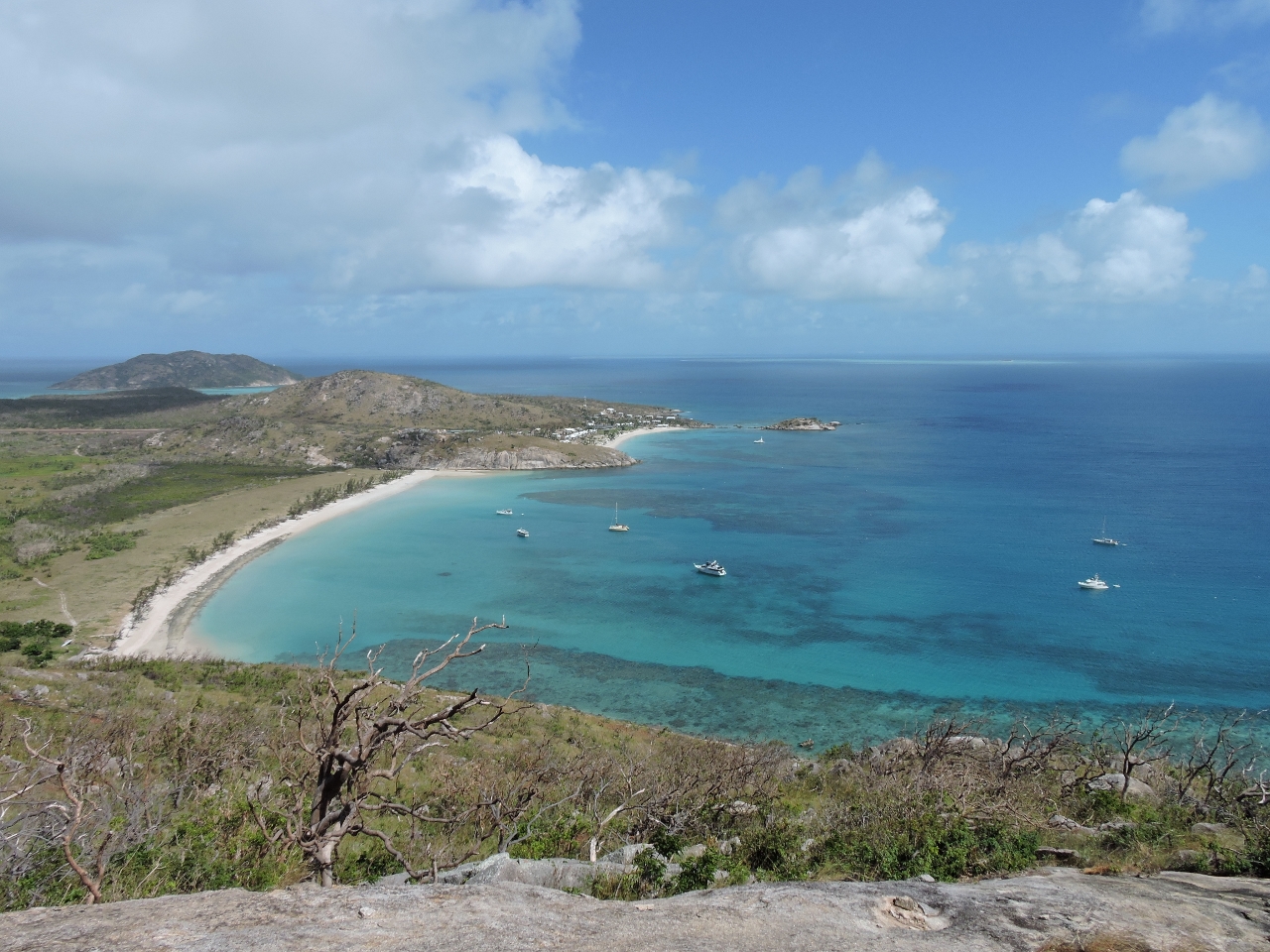 |
5/19/2015: Watsons Bay
Position: -14°39.42'S, 145°27.35'E
A steep climb brought us to this excellent viewpoint looking southwest over Watsons Bay. Dirona is at the bottom right of the photo (click image for a larger view). The Lizard Island Resort is in the smaller cove beyond the anchorage.
|
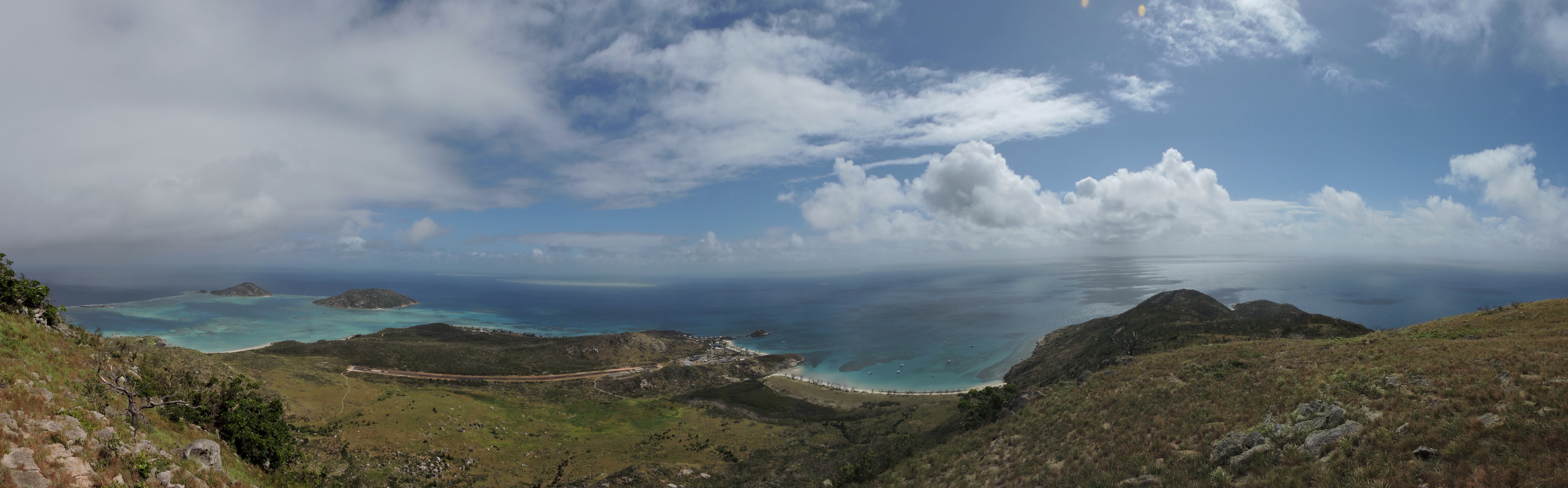 |
5/19/2015: Cook's Look
Position: -14°39.96'S, 145°27.78'E
The panoramic view looking south to north from Cook's Look. At the left of the photo is Blue Lagoon, on the south end of the island, and left of center is the island airstrip with a research station to the south beyond. The Lizard Island Resort is off the right end of the airstrip, with our anchorage in Watsons Bay farther right. Mermaid Cove at the north end of the island, where we dove from yesterday, is at the far right. The hilltop we're on is so named because Captain Cook climbed it in 1770 looking for a way out through the reef.
|
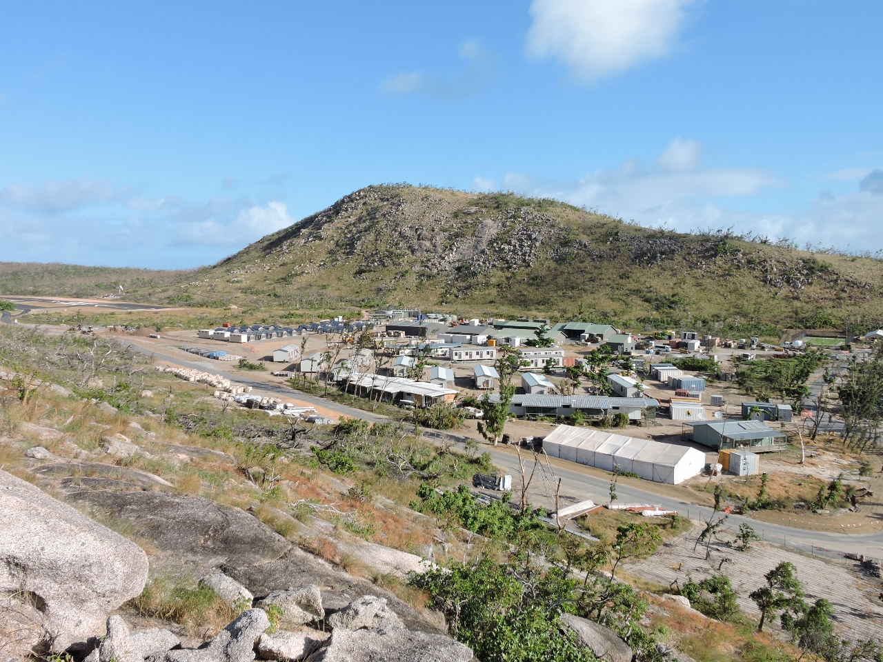 |
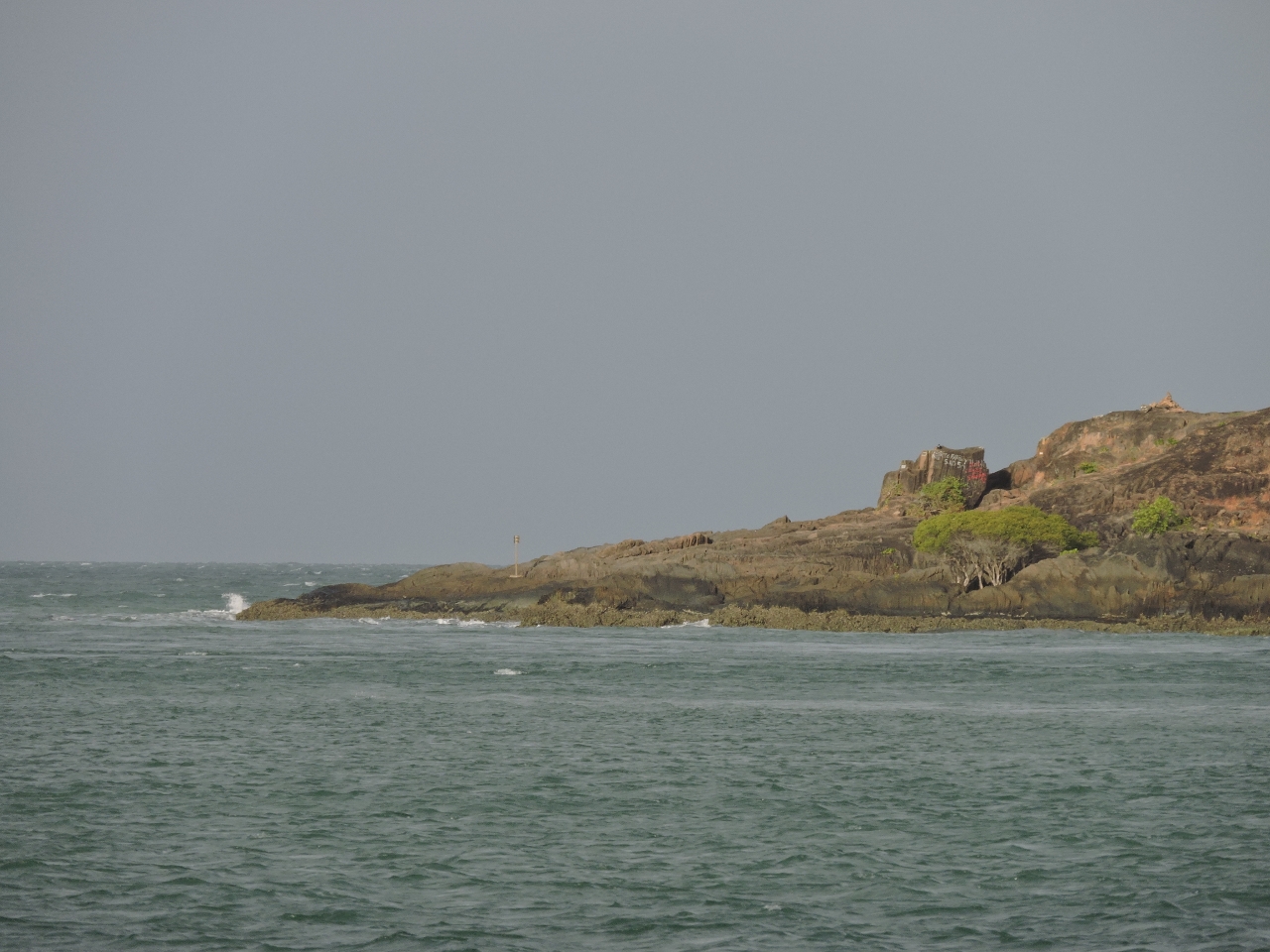
5/19/2015: Work camp
Position: -14°39.97'S, 145°27.00'E
After our hike up Cook's Look, we followed a road from the beach to the airstrip, then walked it back to the Lizard Island Resort. The exclusive resort, ranked among the top ten hotels worldwide, suffered $45 million dollars damage in April, 2014 in Cyclone Ita's 160-km winds. The resort was about to reopen when Cyclone Nathan's 170-km winds did another few million in damage this March. Pictured is the work camp, between the resort and the airstrip, for the 200-person crew that has been on-site to prepare the resort for it's soft-opening in three weeks. The tents at the fair left each have their own air-conditioning unit.
|
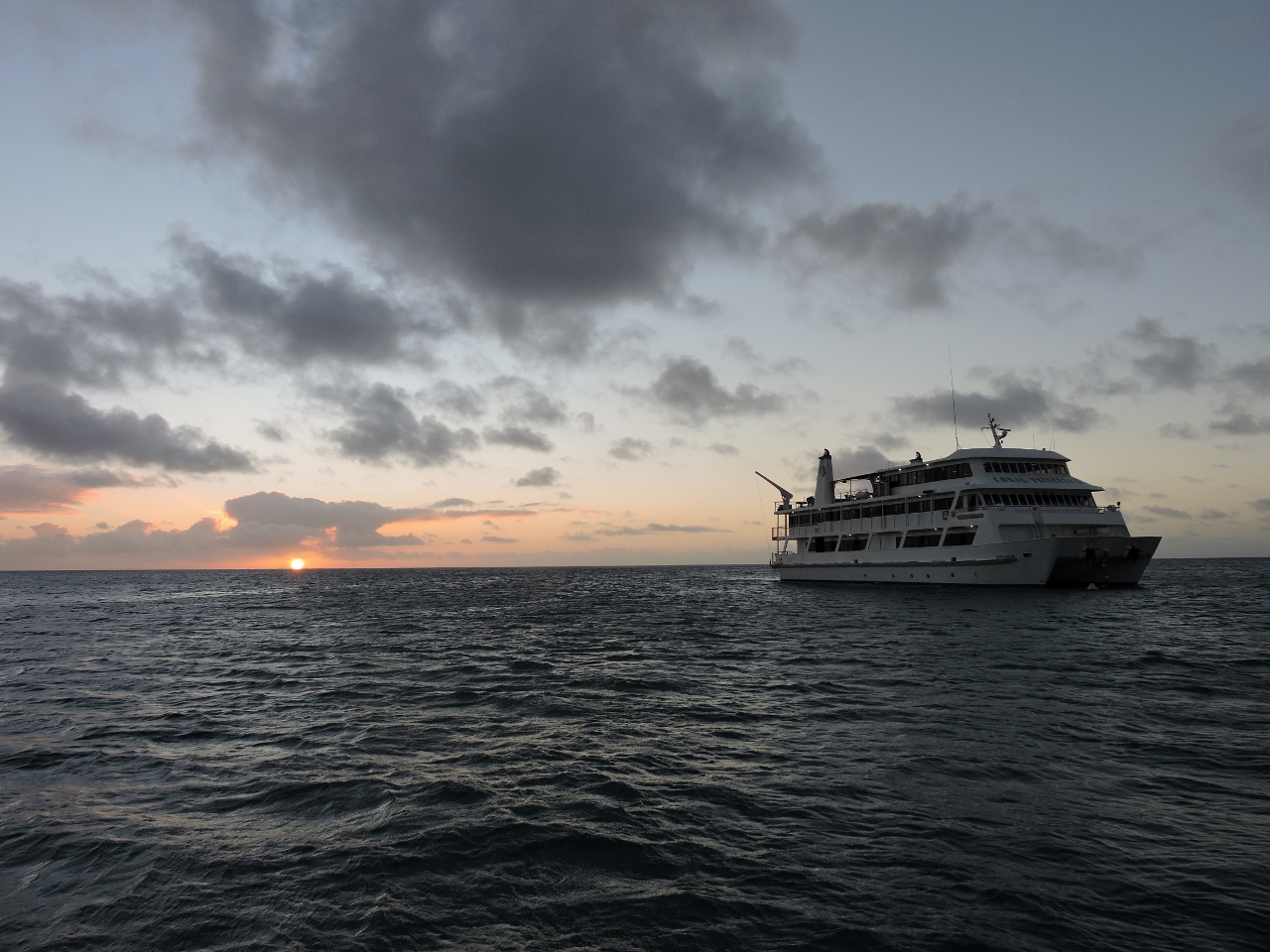 |
5/19/2015: Coral Princess II
Position: -14°39.57'S, 145°27.04'E
Sunset with the Coral Princess II on a mooring behind us. We could see the ship to our west when we were ashore and it looked very close, but back on Dirona it wasn't really that near and it turned out to be fun watching them work and moving their small boats around.
|
_cropped_2.web.jpg) |
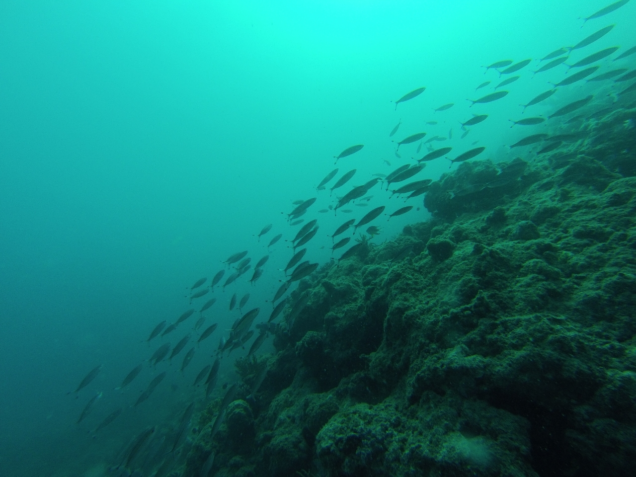
5/20/2015: Cod Hole
Position: -14°39.86'S, 145°39.77'E
From Lizard Island we made a day trip to the Cod Hole on the outer reefs and picked up a Marine Park mooring. The Cod Hole is one of the most famous dive sites on the Great Barrier Reef, mainly due to the huge potato cod that live there. We had a fantastic first dive right off the boat, swimming north along the reef. The visibility was excellent, the seascape was complex and the sealife was rich and varied. In the video http://youtu.be/d4Sog-iPXls (1:41), a small stingray is at 0:22 seconds and a reef shark at 0:34. At 0:50, a second shark can be seen skidding to a stop along the bottom, much like an airplane might land. And at 1:05 is one of the famous resident potato cod. Many of the charter boats feed the cod, so they tend to follow the divers around, looking for a handout. This one kept pretty close and followed us all the way back to Dirona.
|
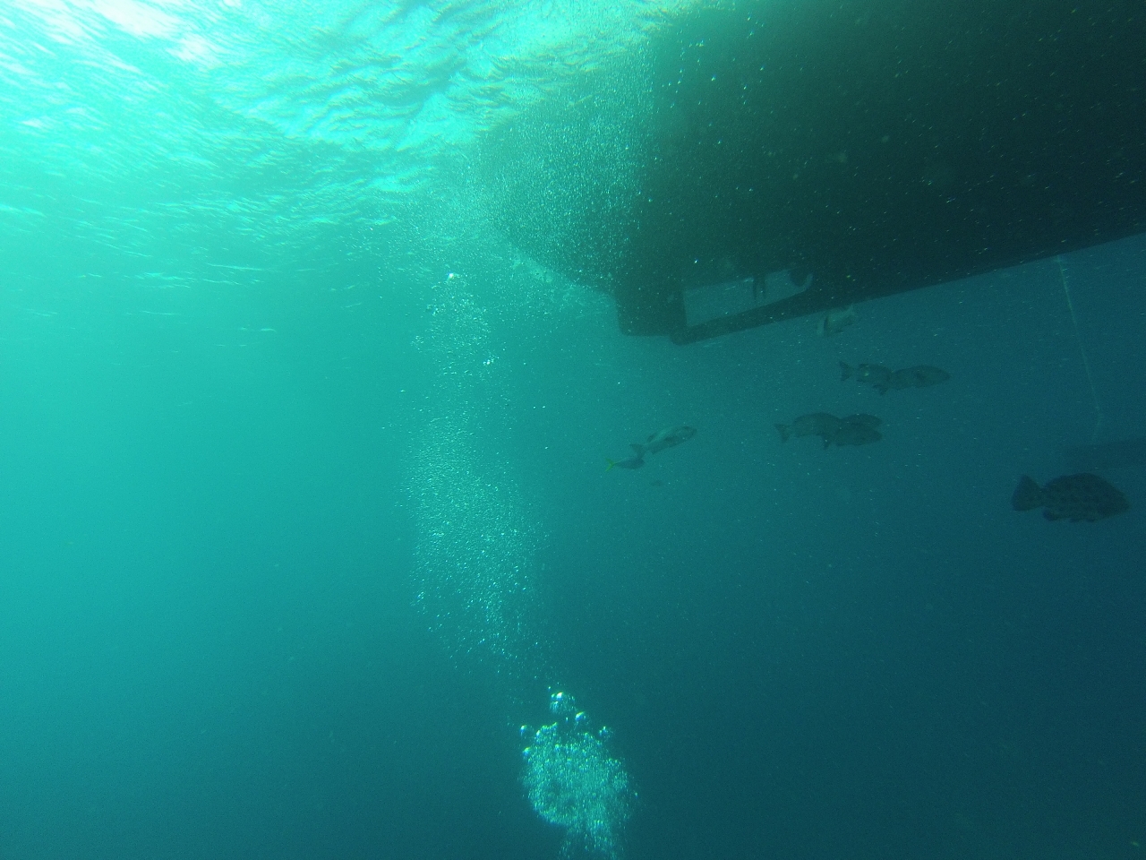 |
5/20/2015: Under Dirona
Position: -14°39.86'S, 145°39.77'E
We don't often dive directly from Dirona, so rarely get footage of the hull below the water. The video at http://youtu.be/C9cCl_ohwjU (0:41) starts with the potato cod that followed us back from our dive and then shows the flopper-stopper in action.
|
 |
5/20/2015: North buoy
Position: -14°39.77'S, 145°39.88'E
The diving improved as we worked north along the reef, so we moved the boat to the more northern buoy to dive from there. Both buoys are quite close to the reef and we'd swing uncomfortably close if the wind switched to northwest from the southeast. If we were staying here overnight we would definitely anchor off to get more clearance from the reef.
|
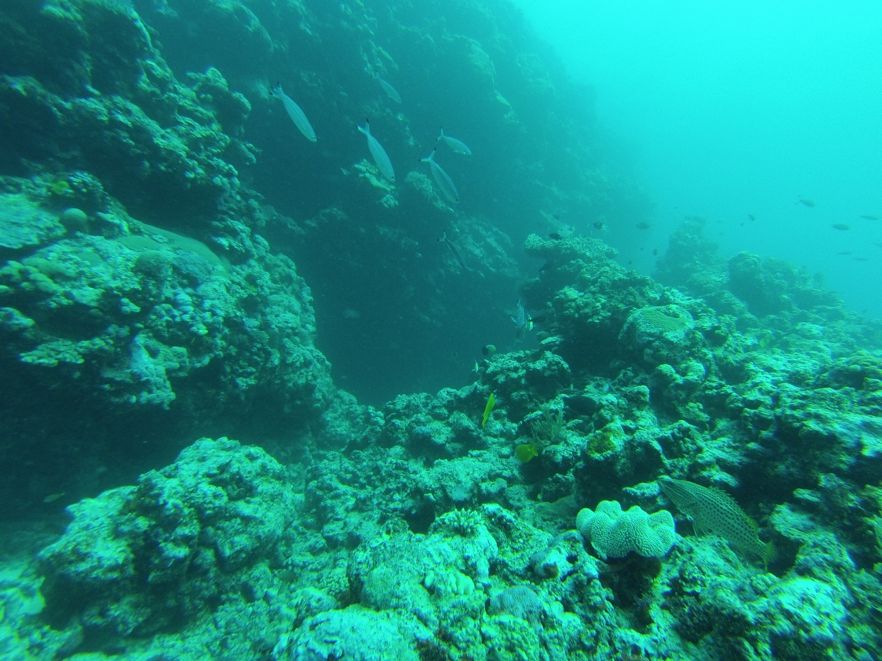 |
5/20/2015: Second Dive
Position: -14°39.77'S, 145°39.88'E
The current was running south on both dives, so we again swam north to start the dive against the current. We worked all the way to the tip of the reef and found an excellent wall there. The seascape along the way was particularly complex and covered with soft and hard coral. Both dives were among the best we've done in the reef. In the video at http://youtu.be/N0mvthFovfA (1:52), you can see the waves crashing into the reef above us at 0:45, and Jennifer swimming through one of the complex formations at 1:31.
|
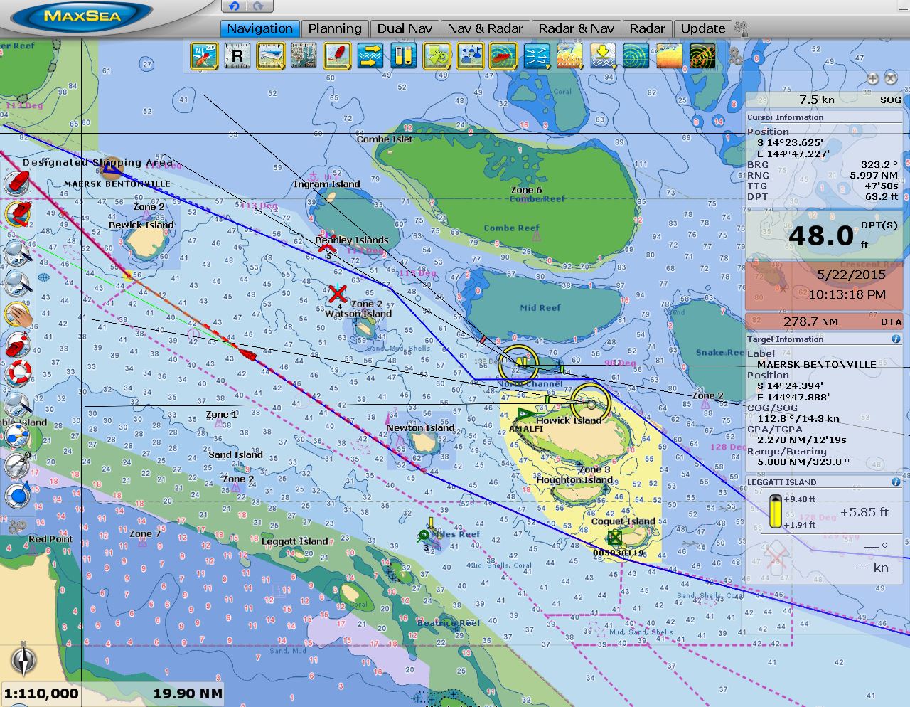 |
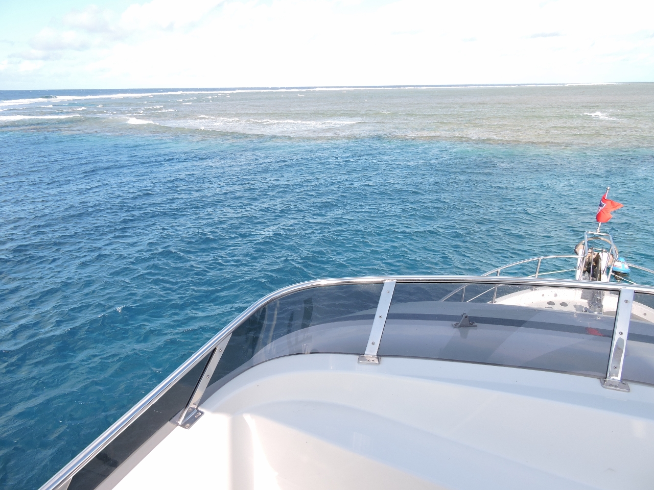
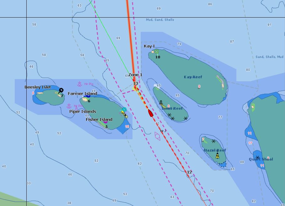
5/21/2015: Maersk Bentonville
Position: -14°28.49'S, 144°50.99'E
In this part of the run north, there are two designated shipping channels. The wider one we are in is only 40-50ft deep and is too shallow for deep-draft ships. They must divert through a much tighter, but deeper, channel to the north. In the screenshot, the red boat icon and dashed line shows our position and route along the northern edge of the shipping channel. The 965-ft Maersk Bentonville, with a 43 ft draft, can be seen on AIS at the upper left. We've drawn in blue the route that it will follow. That sure looks tight north of Howick Island (click image for a larger view).
|
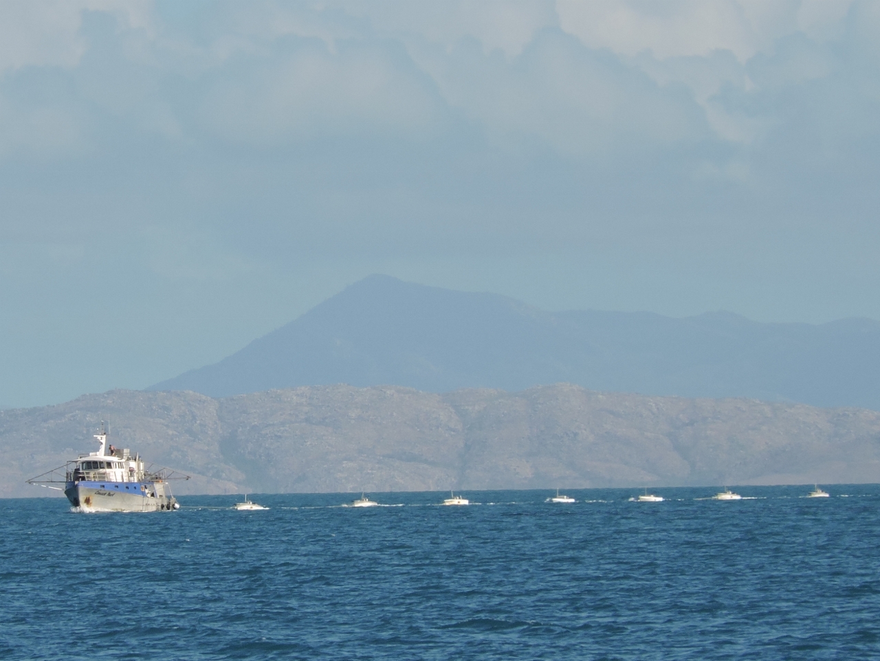 |
5/21/2015: Ducks
Position: -14°25.49'S, 144°46.96'E
This charter boat passed, towing a string of sportsfishing tenders behind like baby ducks following a mother.
|
 |
5/21/2015: Noble Island
Position: -14°23.91'S, 144°45.27'E
Pyramid-shaped Nobel Island to our south as we near Barrow Point.
|
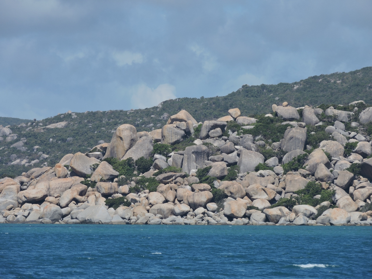 |
5/21/2015: Cape Melville
Position: -14°8.78'S, 144°30.62'E
Smooth granite boulders, some as big as houses, are piled up along the entire headland at Cape Melville. The phenomenon is unique the Queensland Coast and one theory is that they were left by an ancient glacier.
|
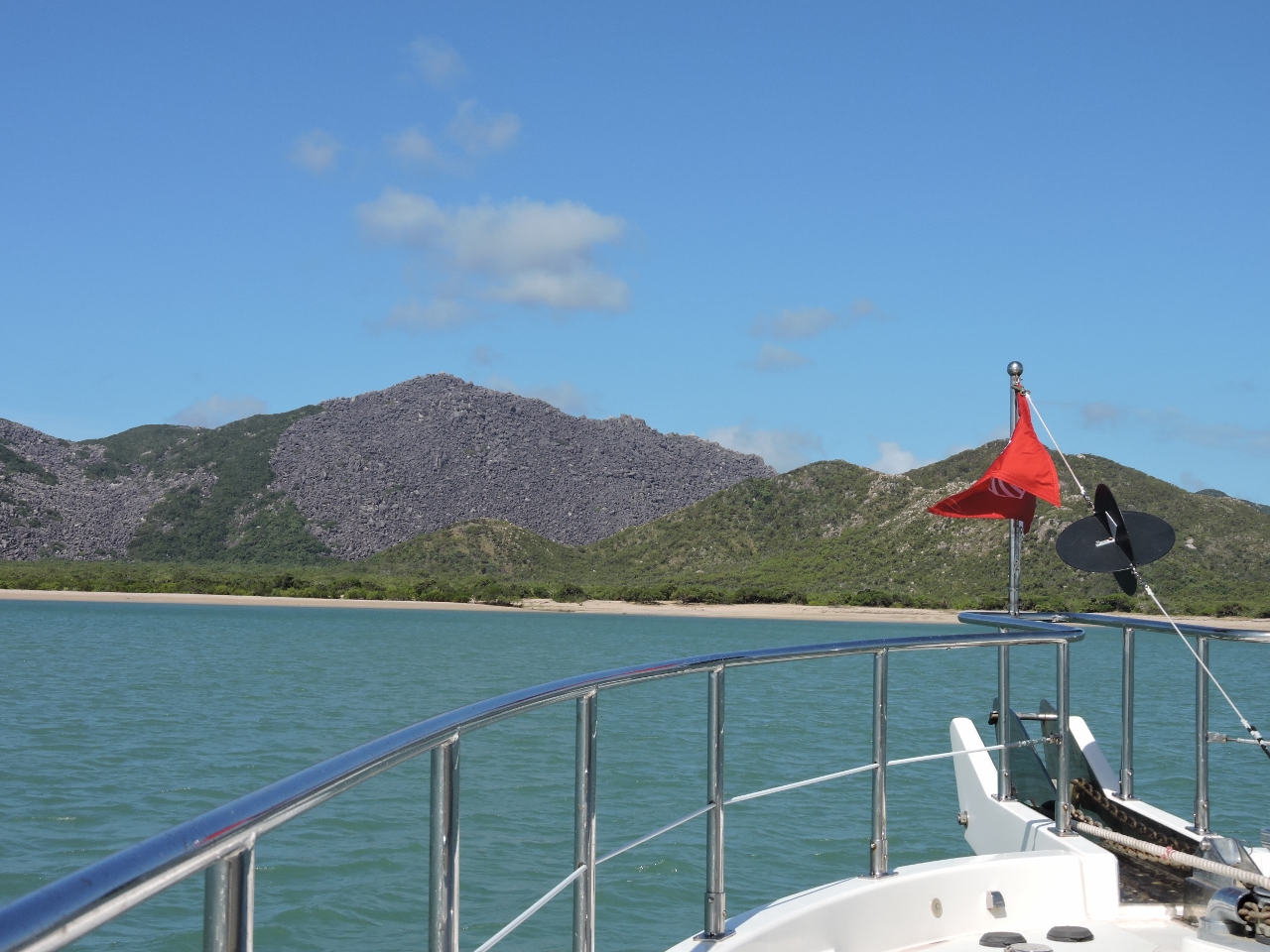 |
5/21/2015: Bathurst Bay
Position: -14°12.31'S, 144°28.23'E
The view south to boulder-strewn Cape Melville from the anchorage in Bathurst Bay. We had good trade-wind protection here, and enjoyed our stay.
|
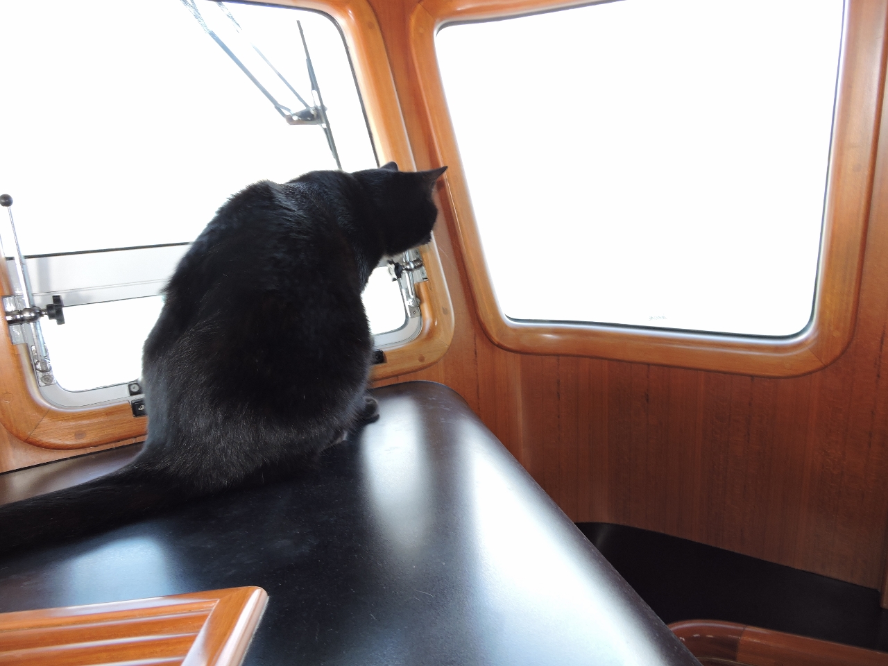 |
5/21/2015: Under attack
Position: -14°12.31'S, 144°28.22'E
Spitfire found the anchorage at Bathurst Bay a lot less relaxing than we did. He was frequently alert with flocks of sparrow-like birds buzzing the boat.
|
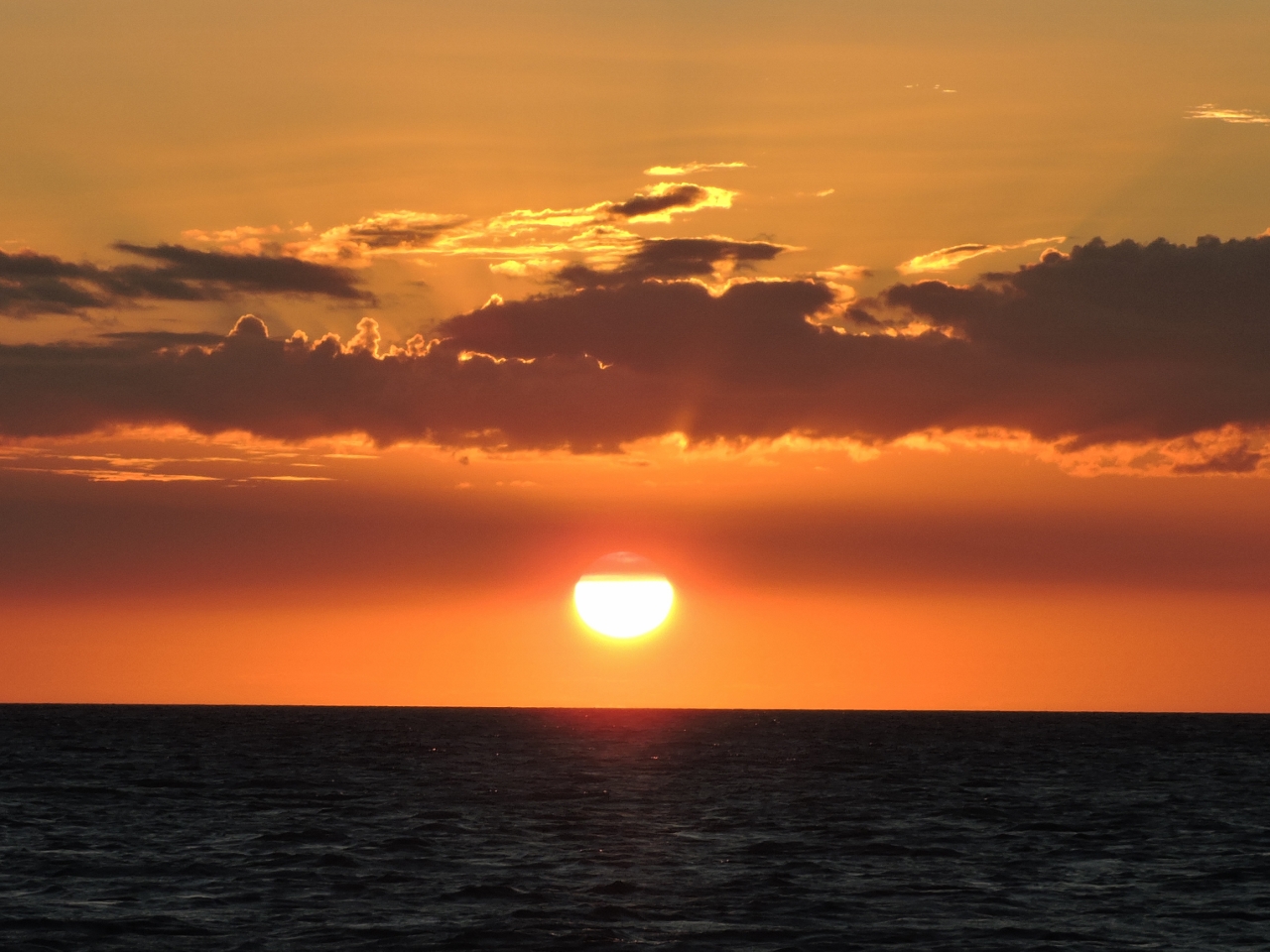 |
5/22/2015: Sunset
Position: -14°12.31'S, 144°28.22'E
Sunset from the anchroage at Bathurst Bay.
|
 |
5/23/2015: Underway
Position: -13°53.30'S, 144°14.68'E
Spitfire doesn't like to slide around in the swell, so if there's any sea running at all he'll wedge himself against something to prevent it.
|
 |
5/24/2015: Tight quarters
Position: -12°15.19'S, 143°15.84'E
The shipping channels are well-marked. But especially when running at night this half-mile constriction feels surprisingly close to the lighted reefs on either side. It's hard to believe the pilots bring 950 ft long, 105'-wide ships through this same channel.
|
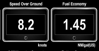 |
5/24/2015: Speed
Position: -11°56.79'S, 143°17.19'E
We're getting a nice push from the current and are doing 8.2 knots with a fuel economy of 1.45 miles per gallon. That combination would be especially nice on an ocean crossing--normally we'd be closer to one nautical mile per gallon at that speed.
|
 |
5/24/2015: Albany Passage
Position: -10°45.29'S, 142°37.15'E
Entering Albany Passage between mainlaind Australia and Albany Island.
|
 |
5/24/2015: Current
Position: -10°44.79'S, 142°36.60'E
The current can run several knots through Albany Passage and generate steep seas in opposing. With 30-knot southeasterly winds behind us, we'd timed our arrival for low tide. The current really must whip through here as at the start of the northbound flood we're already getting pushed along at 9.4 knots with an amazing fuel economy of 1.71 miles per gallon. The maximum speed of the boat is 9.5 knots at wide-open-throttle and at that full speed extreme, the fuel economy is only 3/4 nautical mile per gallon. So you can really see how hard we're being pushed by current.
|
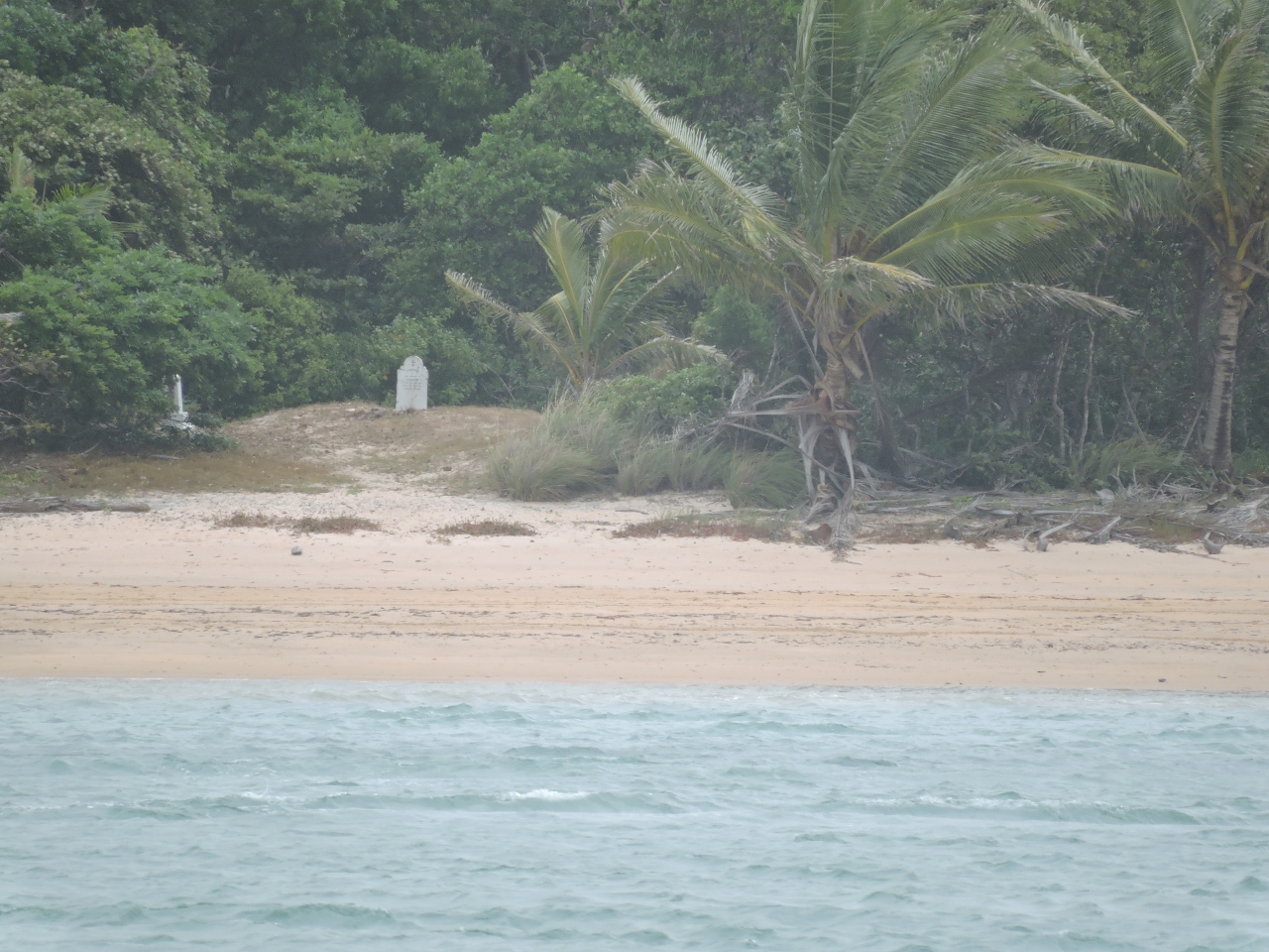 |
5/24/2015: Somerset
Position: -10°44.24'S, 142°35.84'E
In the 1800s, Somerset was a major port and the administrative center for Cape York and Torres Strait. These moved to Thursday Island in 1877 because the swift currents in Albany Passage made for difficult anchoring and navigation. Somerset later was home to the famous Queensland pioneer Frank Jardine who is buried in this graveyard visible from the water.
|
 |
5/24/2015: Engine hours
Position: -10°41.61'S, 142°33.41'E
We've now got 5,433 hours on the main engine, 669 on the wing and 4,000 on the generator.
|
 |
5/24/2015: Milestone
Position: -10°40.70'S, 142°31.87'E
We're at 10°40' south--that's just ten degrees short of the equator. We haven't been this far north since the Marquesas Islands in French Polynesia two years ago. And we likely won't be again until we cross the Atlantic for the Caribbean. This completes the second phase of our triple-attraction tour of Australia, where we explore Tasmania, the Great Barrier Reef and the Kimberly, and as much of everything else we can fit in between.
|
 |
5/24/2015: Cape York
Position: -10°41.20'S, 142°31.45'E
The view east from our anchorage to the tip of Cape York, the northernmost point in mainland Australia. The anchorage was scenic, with good holding and easterly swell protection. 30-40 kt gusts did reach the anchorage over the cape, but generated only small wind waves. We also considered stopping further north at Thursday Island, Australia's northernmost port, but it is part of a special quarantine zone for food and animal products. If we stopped at any Australian island in Torres Strait, we'd need to get a permit to bring Spitfire back to mainland Australia. We definitely didn't want anywhere near that.
|