Our final leg along the ICW brought us to Beaufort, NC. South of here, the ICW is shallower than the section we just ran from Portsmouth, Virginia and has more bridges, current and shoaling issues. So we’ll be making a direct run offshore to our next stop in Charleston, South Carolina. A major weather system would be passing through over the next few days, so we returned to Cape Lookout to wait for calmer conditions before continuing south.
Video highlights of our final leg along the ICW are at https://youtu.be/BjiB_r6rl7o and trip highlights from Dec. 28th, 2016 follow. Click any image for a larger view, or click the position to view the location on a map. And a live map of our current route and most recent log entries always is available at http://mvdirona.com/maps
 |
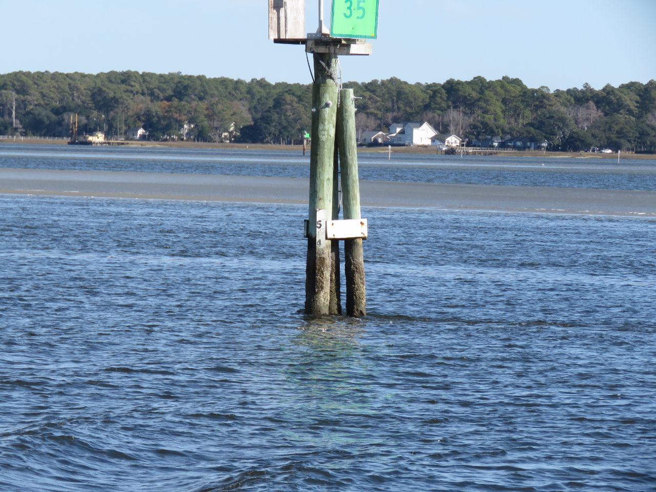
Depth
Position: -76 41.40, 34 50.96
Dredged to 6+ feet wouldn’t support our 6ft 7in draft. Nice diesel price of $2.09/gallon though.
|
 |
Current
Position: -76 41.05, 34 44.18
We’re starting to see some current in the water now. We haven’t seen much since entering Chesapeake Bay. Current is one of the reasons we’re going to run on the outside south of Beaufort, NC. Besides the shallower water with shoaling issues and the many bridges that would need to be opened, we’d also have increasing current to contend with.
|
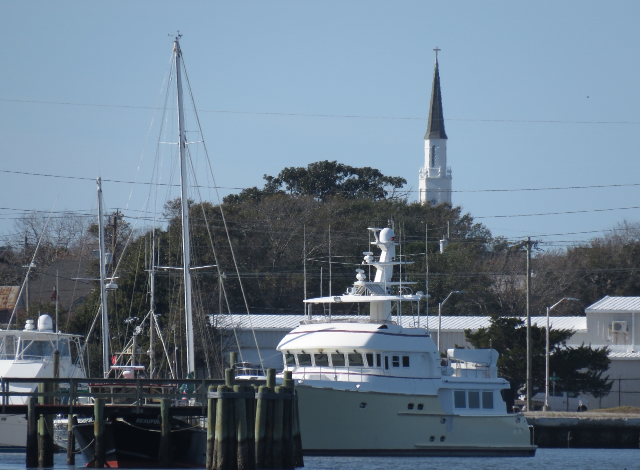 |
Shear Madness
Position: -76 41.62, 34 43.27
We’re pretty sure this is Nordhavn 72 Shear Madness at the Morehead City Yacht Basin, but couldn’t see a name.
|
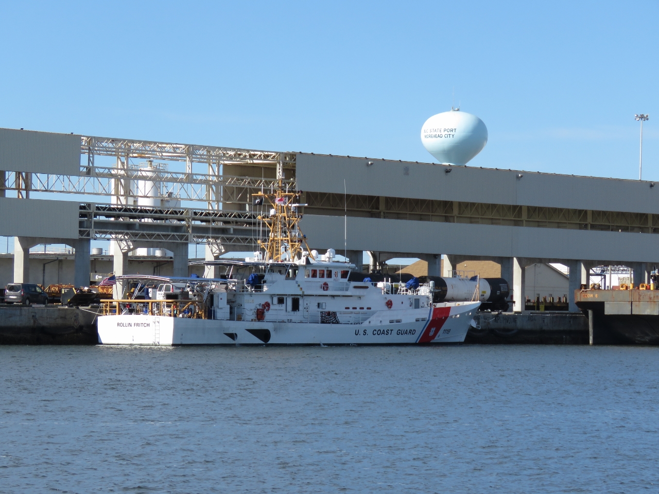 |
Rollin Fitch
Position: -76 41.58, 34 42.87
US Coast Guard fast-response vessel Rollin Fitch on the dock at Morehead City. The 154ft vessel has a minimum top speed of 28 kts.
|
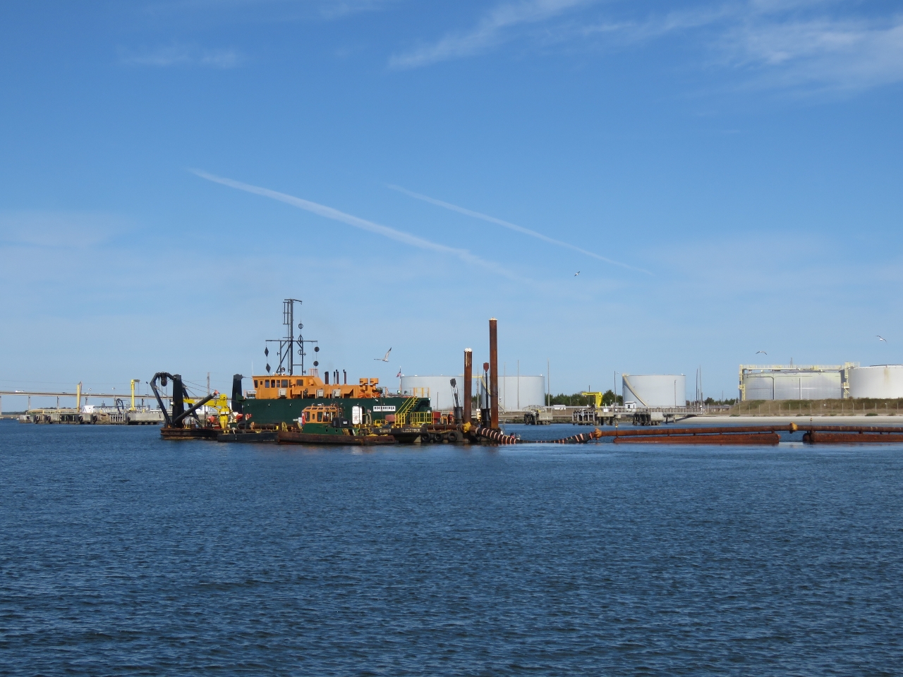 |
Rockbridge
Position: -76 41.38, 34 42.50
The dredger Rockbridge working the channel as we pass. A long pipe runs from the dredger and under the channel to the other side to dispose of the dredged material.
|
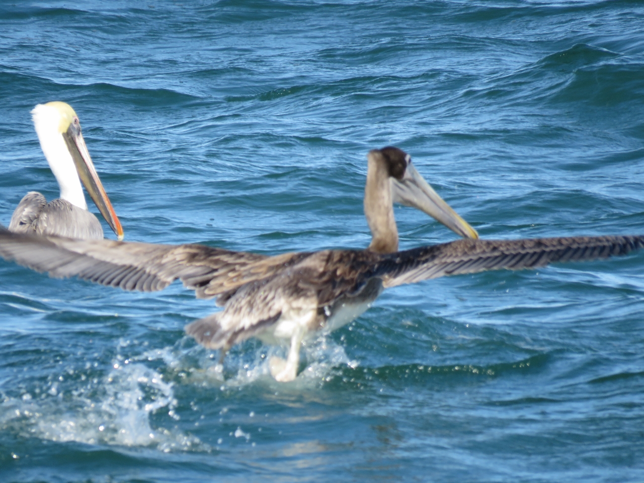 |
Pelicans
Position: -76 35.91, 34 38.69
It’s been a while since we’ve seen Pelicans. These ones are offshore between Beaufort Inlet and Cape Lookout.
|
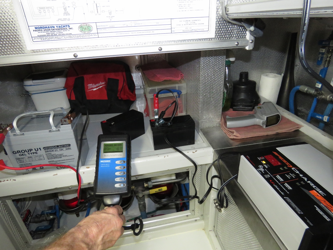 |
Battery Testing
Position: -76 32.91, 34 37.51
Testing our tender and UPS batteries, both operational and backups. One unused tender battery tested bad and could not be recovered with charging. The primary nav system UPS battery tested bad, and both backups were fine.
|
|
|
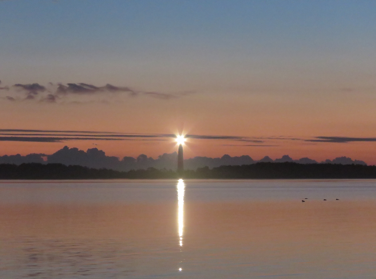
Cape Lookout Light
Position: -76 32.87, 34 37.53
The Cape Lookout Light shining at dawn.
|
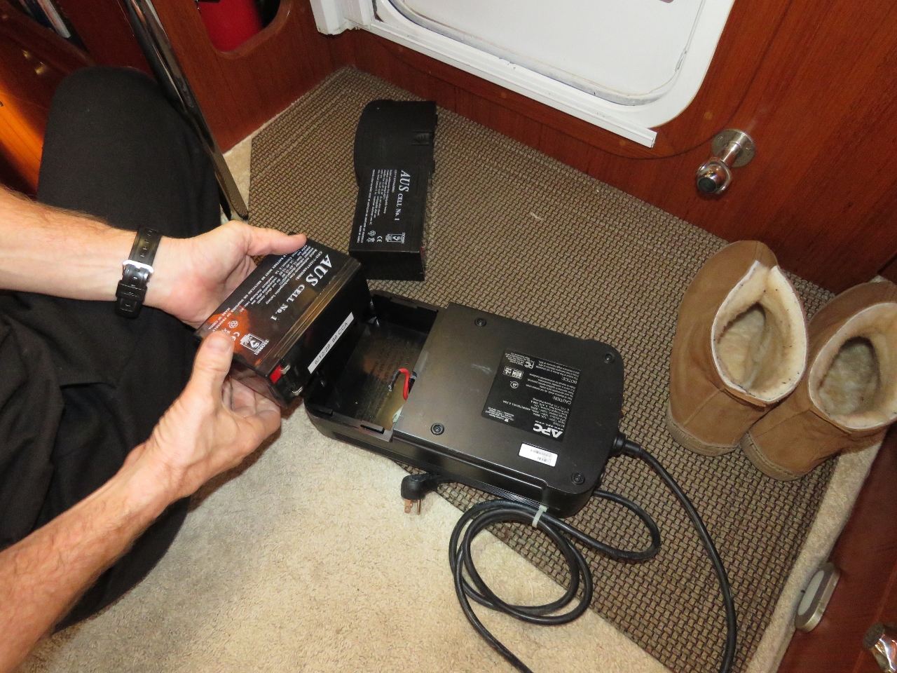 |
UPS
Position: -76 32.88, 34 37.54
The nav computer UPS wouldn’t hold the load for more than about 4 minutes. We tested the battery and it came up bad with only 31 Cold Cranking Amps (CCA) when it should have been 90. So we replaced it with a spare.
|
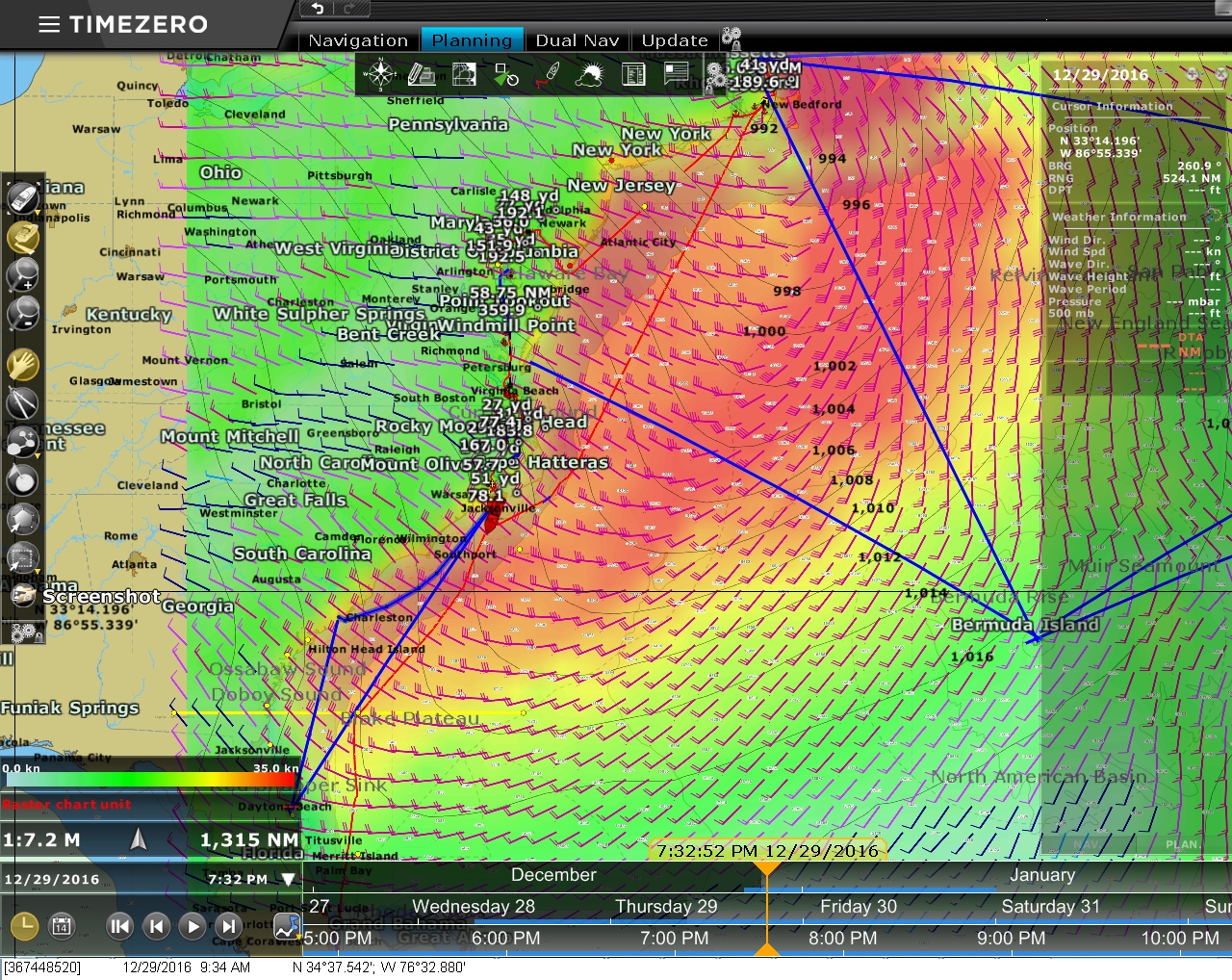 |
Forecast
Position: -76 32.88, 34 37.54
South of here the ICW is shallower than the section we just ran from Portsmouth, Virginia and has more shoaling issues. So we’ll be making a direct run offshore to our next stop, Charleston, South Carolina. A big weather system is predicted to pass through over the next few days, so we’ll hang out at Cape Lookout until it clears.
|
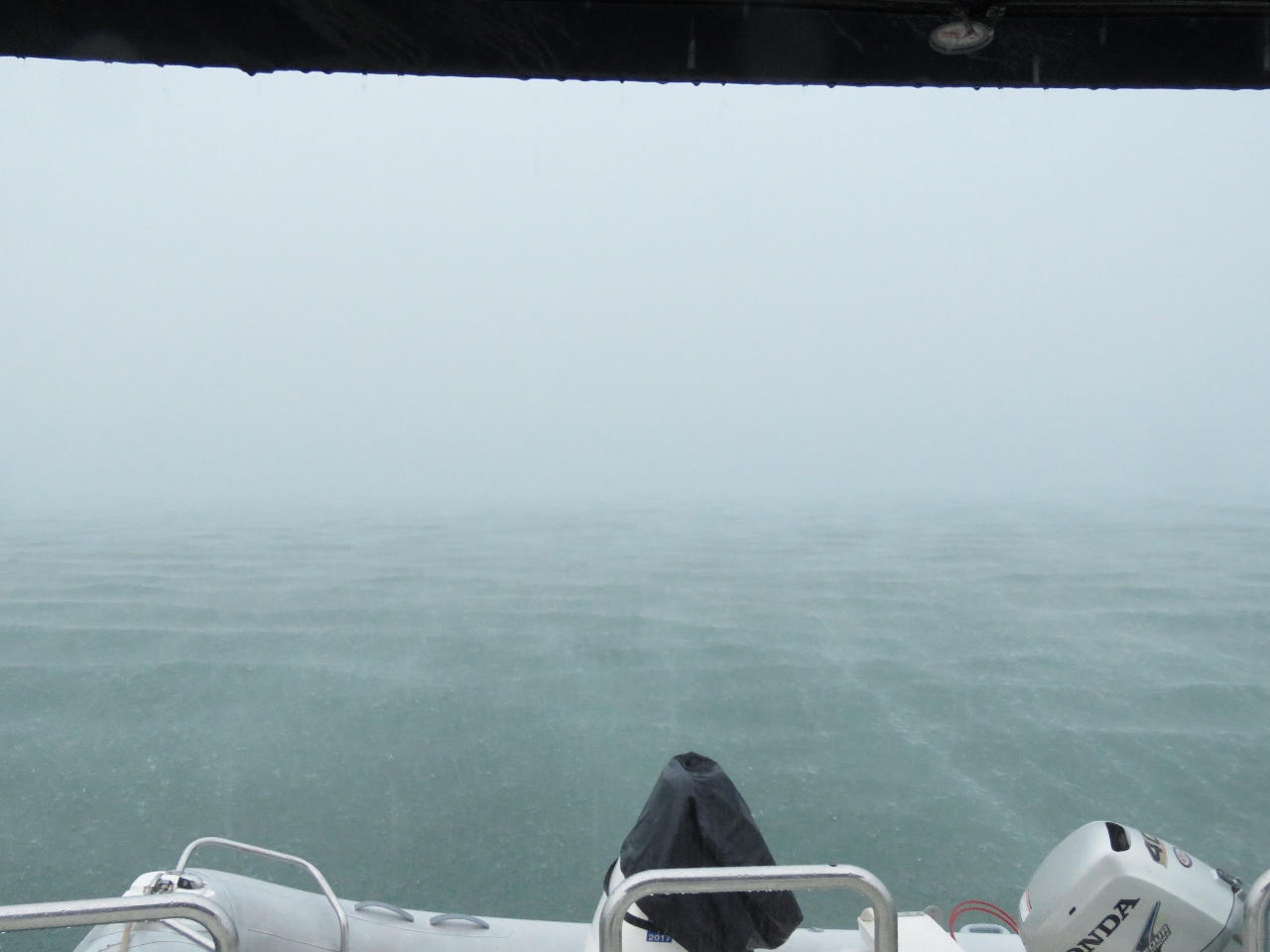 |
Rain
Position: -76 32.86, 34 37.51
The leading edge of that weather system arrived this morning, bringing a torrential downpour.
|
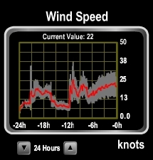 |
Wind
Position: -76 32.85, 34 37.50
The winds picked up briefly during yesterday’s squall and settled back down again. But last night the winds shot up from almost nothing to 38 knots and have stayed pretty steady in the 25-knot range since. The forecasts indicate conditions will settle down overnight tonight but pick up again in a couple of days, so we may run for Charleston tomorrow morning.
|
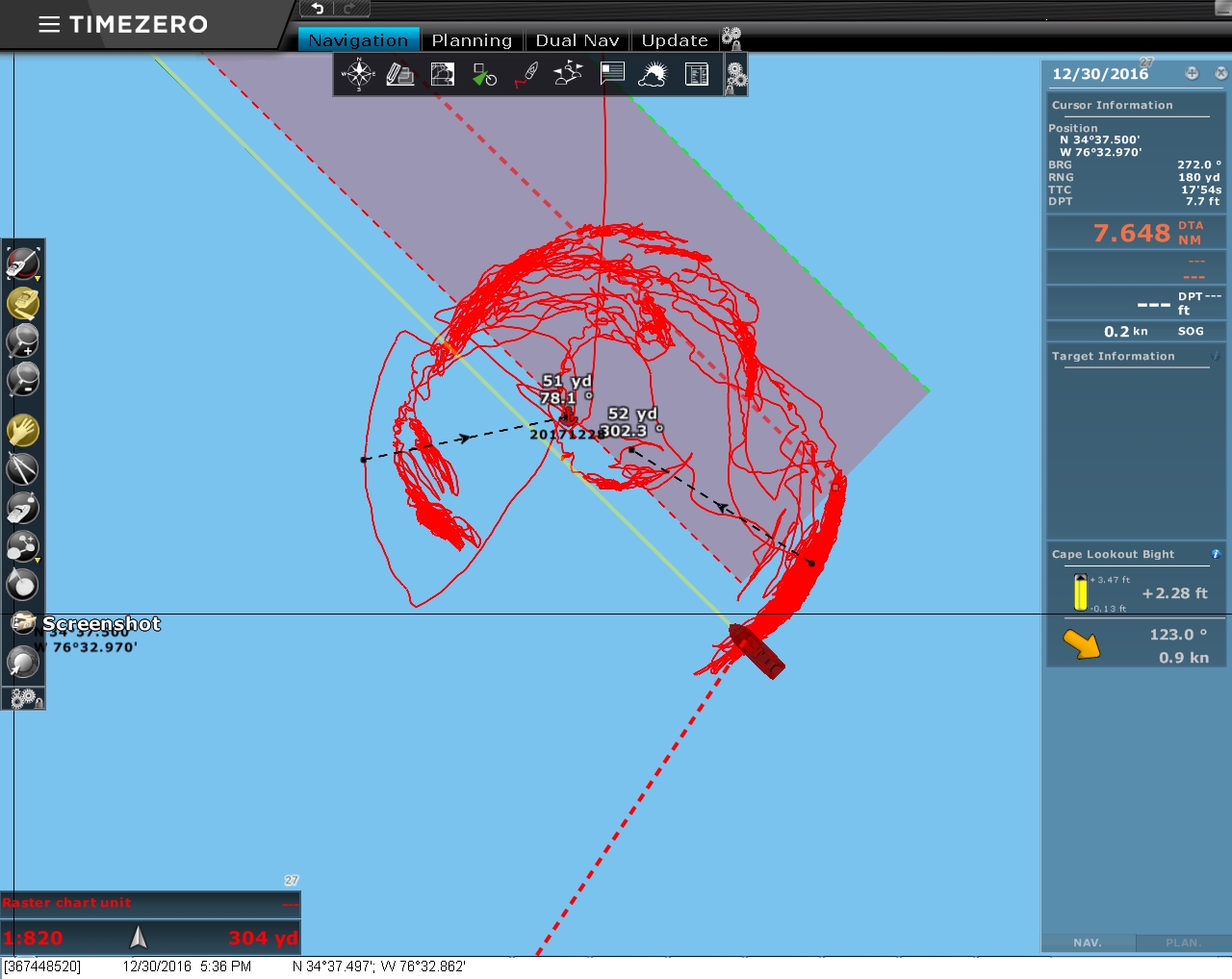 |
Track
Position: -76 32.86, 34 37.50
Our track shows how Dirona has been shifting around in the anchorage as the storm passes through. The winds initially were from south to southeast and currently are from the northwest.
|

|
Click the travel log icon on the left to see these locations on a map, with the complete log of our cruise.
On the map page, clicking on a camera or text icon will display a picture and/or log entry for that location, and clicking on the smaller icons along the route will display latitude, longitude and other navigation data for that location. And a live map of our current route and most recent log entries always is available at http://mvdirona.com/maps. |
If your comment doesn't show up right away, send us email and we'll dredge it out of the spam filter.