MV Dirona travel digest for St. Helena 2016

|
Click the travel log icon on the left to see these locations on a map,
with the complete log of our cruise. On the map page, clicking on a camera or text icon will display a picture and/or log entry for that location, and clicking on the smaller icons along the route will display latitude, longitude and other navigation data for that location. And a live map of our current route and most recent log entries always is available at //mvdirona.com/maps/LocationCurrent.html. |
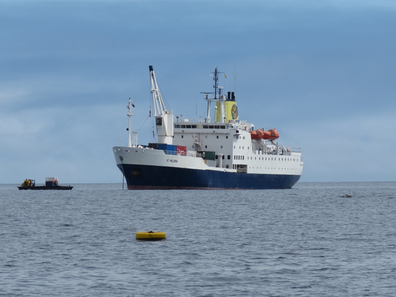 |
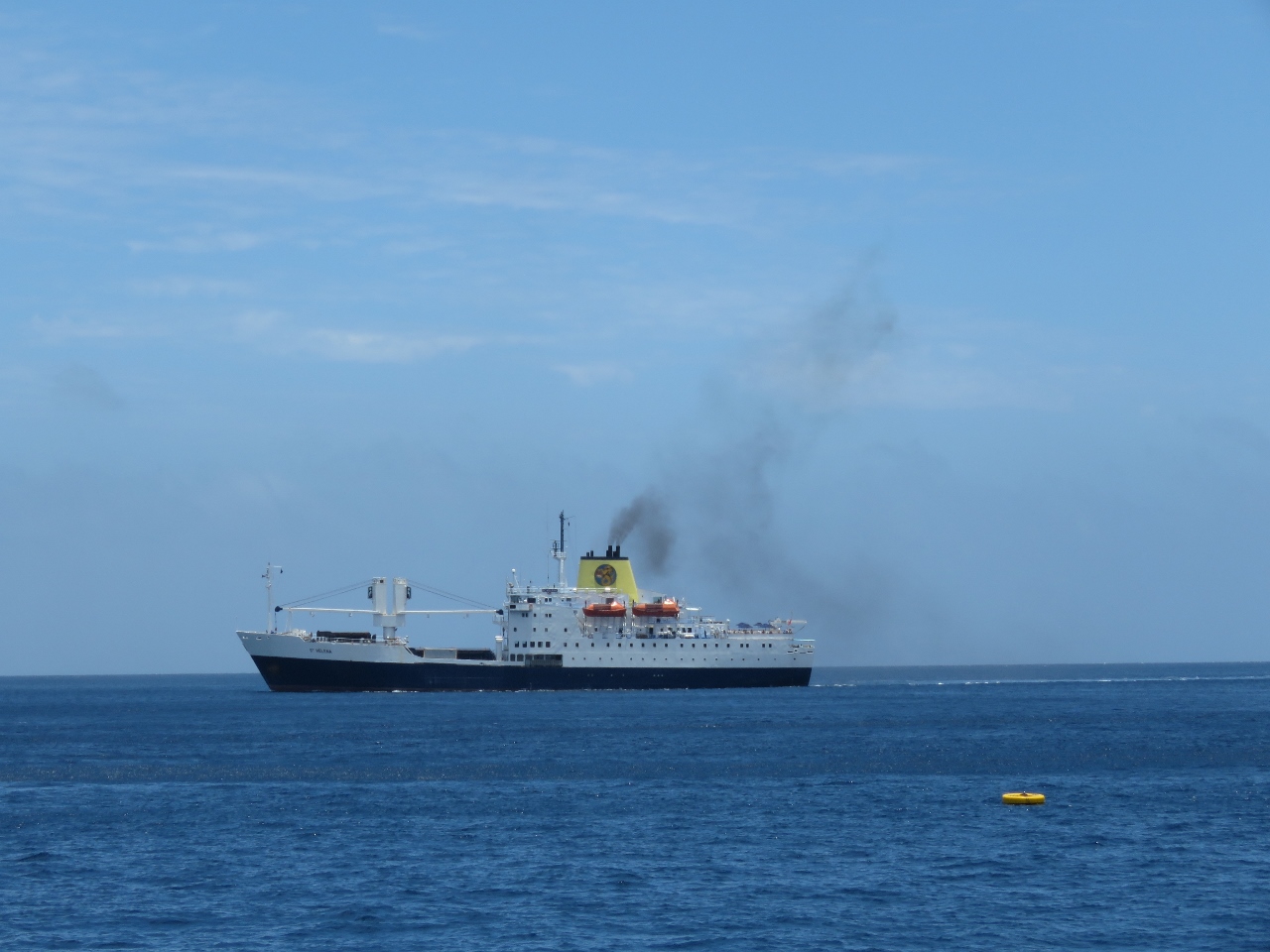
1/4/2016: RMS at anchor
Position: -15°55.50'S, -5°43.51'W
The RMS arrived into Jamestown shortly before we did and already was at anchor by the time we arrived.
|
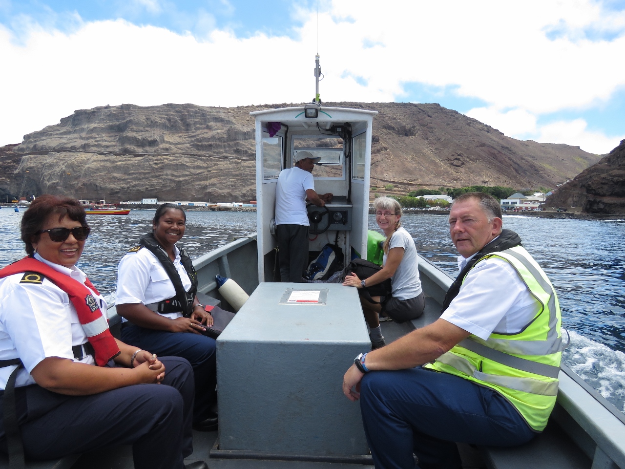 |
1/4/2016: Ferry
Position: -15°55.37'S, -5°43.27'W
Customs (left) and the Harbour Master came out on the harbour ferry to clear us through. We had to wait an hour or so while they cleared the RMS through, but they were fast and efficient once on board. We then rode back them on the ferry into Jamestown.
|
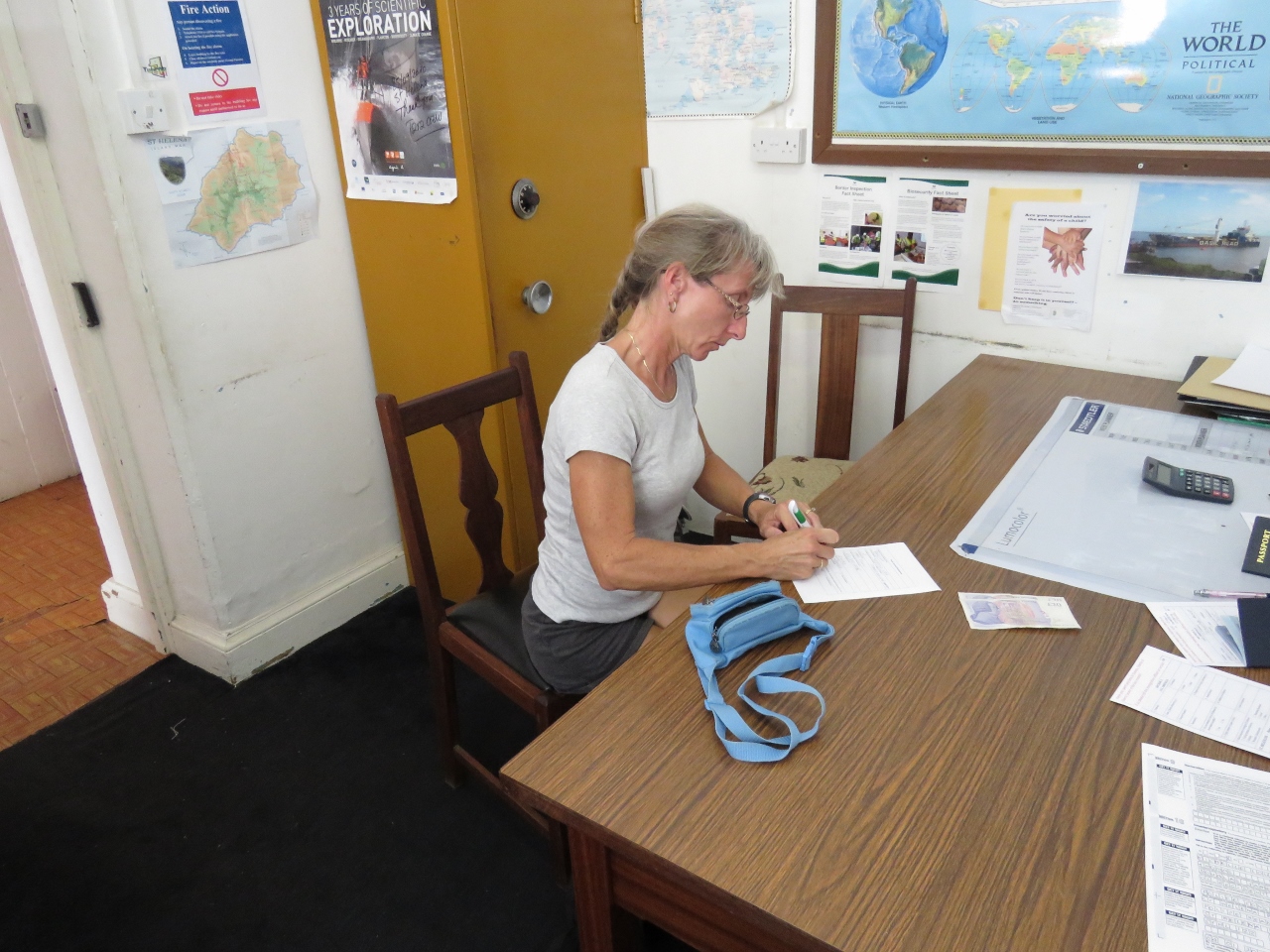 |
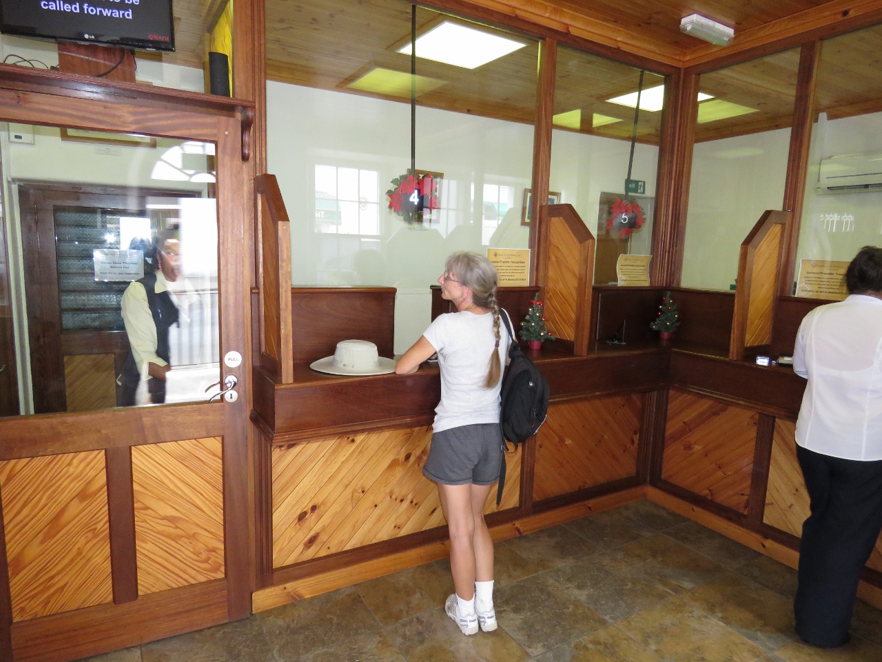
1/4/2016: Immigration
Position: -15°55.52'S, -5°43.10'W
Once ashore, we went to the local police station to clear immigration. As with Customs, this was an efficient process with little paperwork.
|
 |
1/4/2016: Main Street
Position: -15°55.61'S, -5°43.03'W
Looking south down Main Street in Jamestown. Well-preserved colonial-era buildings line both sides of the street.
|
 |
1/4/2016: Bank
Position: -15°55.61'S, -5°43.03'W
We stopped off at the bank to exchange the remainder of our Rand for St. Helena Pounds. Converting less-common currency gets more difficult the farther you are away from that country, so we try to convert at the first opportunity. In Cape Town we could sell Mauritius Rupees, but not Vanuatu currency.
|
 |
1/4/2016: Sure
Position: -15°55.57'S, -5°43.02'W
At the Sure store to purchase a Sim card for our mobile phone. The service is expensive and rather slow, but pretty much anything is more cost-effective than BGAN .
|
 |
1/4/2016: Castle Gardens
Position: -15°55.49'S, -5°43.04'W
Beautiful Castle Gardens provide a shady retreat from the hot sun.
|
 |
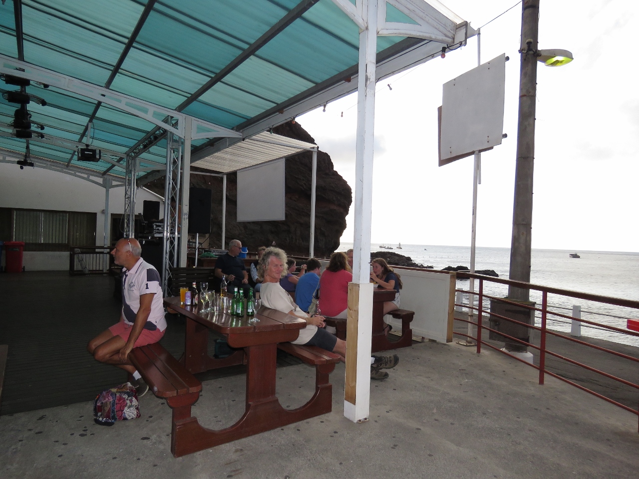
1/4/2016: Anne's Place
Position: -15°55.49'S, -5°43.05'W
Lunch at Anne's Place overlooking the Castle Gardens.
|
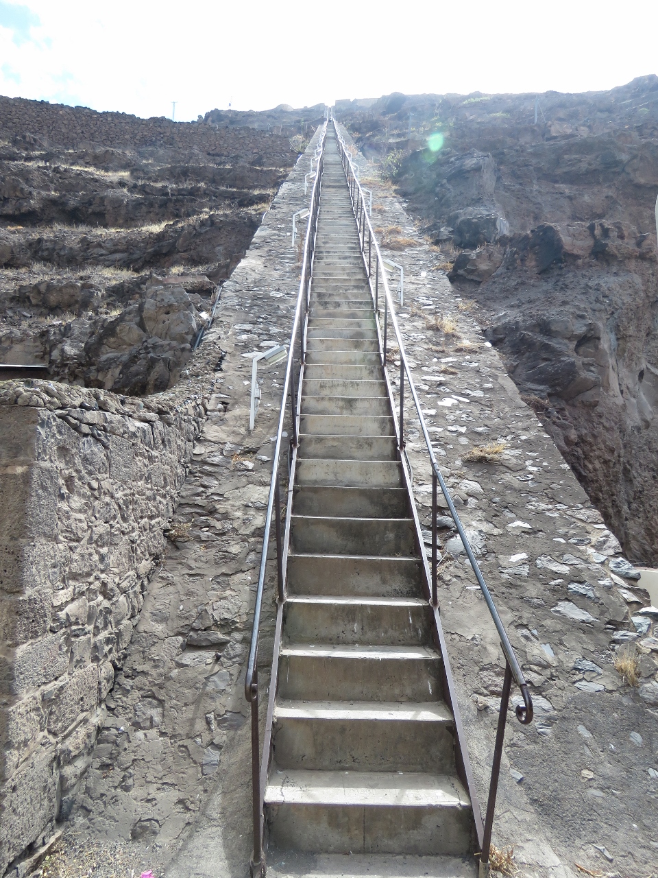 |
1/4/2016: Jacob's Ladder
Position: -15°55.51'S, -5°43.07'W
Jacob's Ladder is a 900ft, 699-step staircase built in 1829 to connect Jamestown with the garrison high above on Ladder Hill. We'll save the climb up for another day.
|
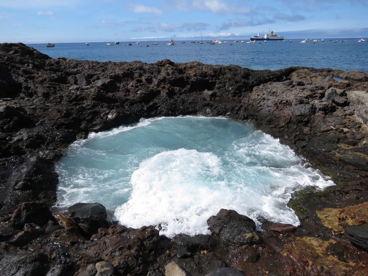 |
1/4/2016: Blow hole
Position: -15°55.47'S, -5°43.20'W
Jamestown is on the lee side of St. Helena for the prevailing winds, but big swell still pounds into shore. The wave action has carved complex patterns into the volcanic rock. This blow hole occasionally ejected a spray of water as we watched.
|
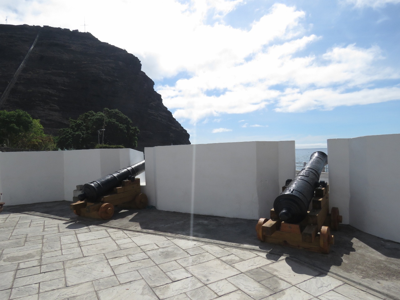 |
1/4/2016: Cannons
Position: -15°55.42'S, -5°43.08'W
Jamestown has a lot of cannons leftover from it's colonial heritage.
|
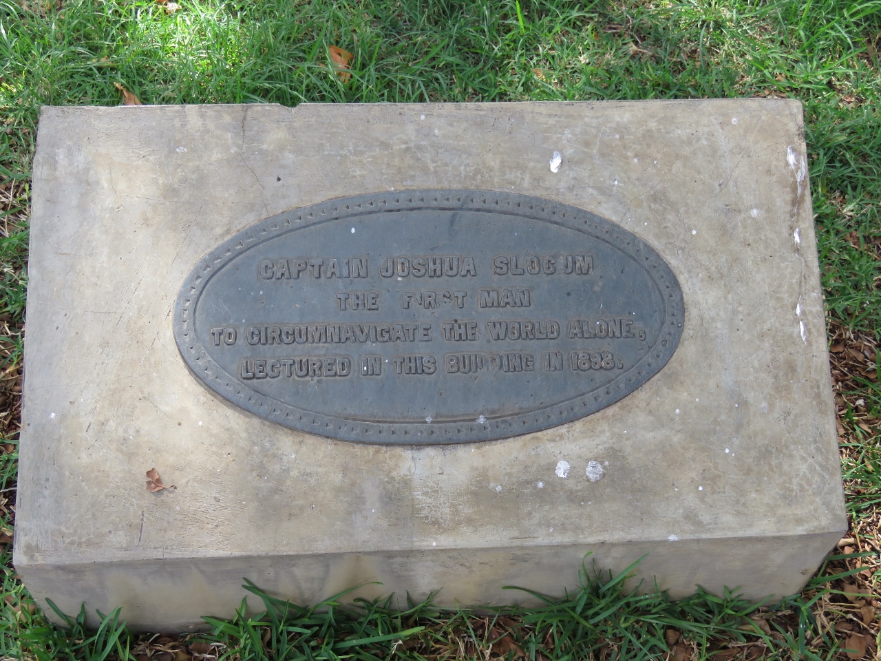 |
1/4/2016: Captain Slocum
Position: -15°55.43'S, -5°43.06'W
This plaque by a building in the Castle Gardens reads "Captain Joshua Slocum, the first man to circumnavigate the world alone, lectured in this building in 1898".
|
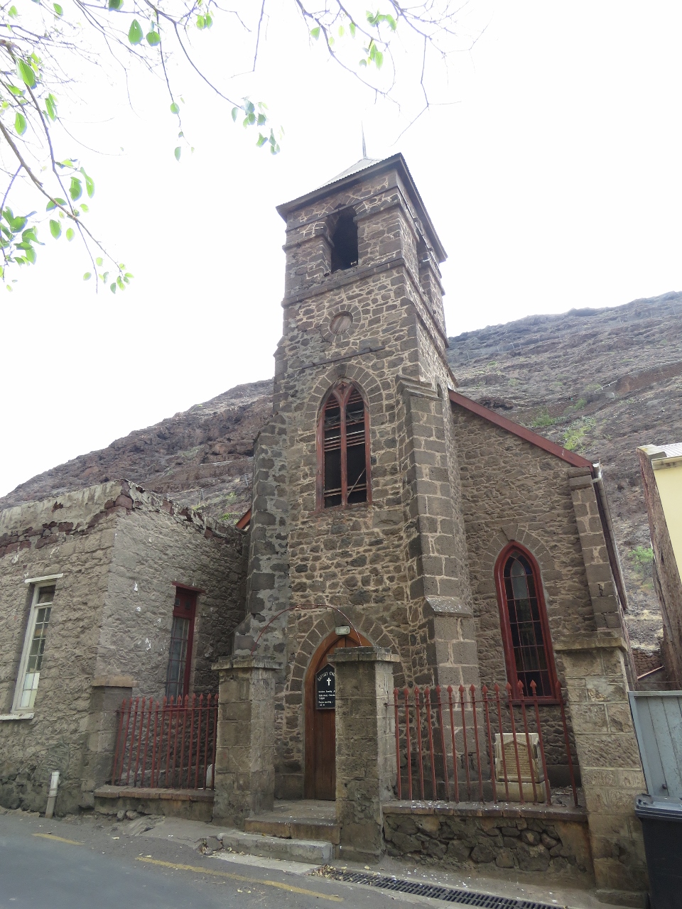 |
1/4/2016: Church
Position: -15°55.76'S, -5°42.88'W
We walked up the Market Street to get more of a look around town. We couldn't find a name or date on this church, but memorials in front dated to the 1800s.
|
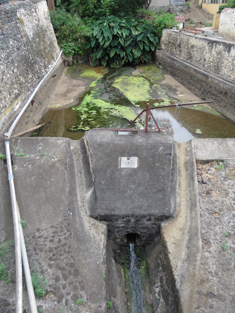 |
1/4/2016: The Run
Position: -15°56.09'S, -5°42.65'W
This channel, called "The Run", is presumed to have been the original channel that carried water through Jametown. It was paved in stone in 1857.
|
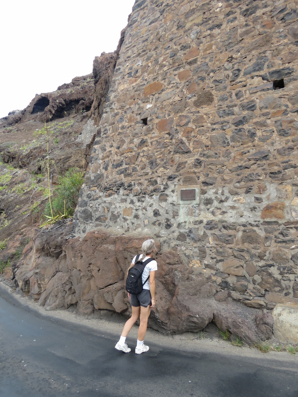 |
1/4/2016: Memorial
Position: -15°55.76'S, -5°43.06'W
We continued walking the road as it twisted up and back towards town. This brick support keeps the wall from collapsing. A memorial plaque describes a massive rockfall that killed several people in the 1800s.
|
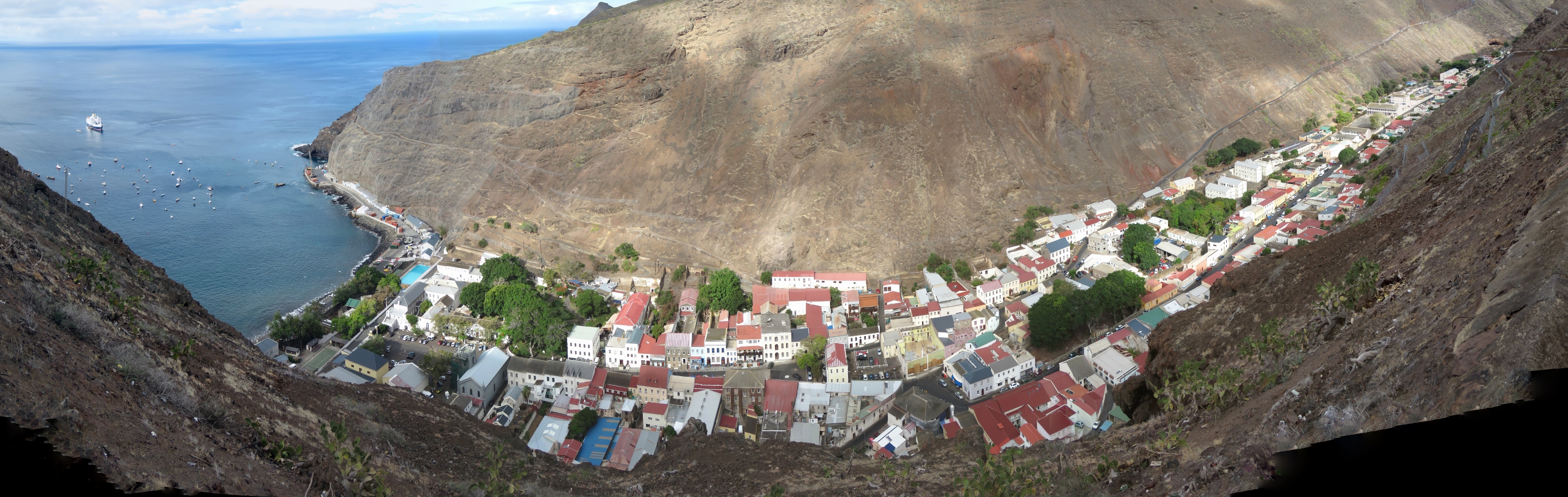 |
1/4/2016: Jamestown from above
Position: -15°55.65'S, -5°43.16'W
The view to Jamestown from the road. The town extends through a valley between two towering cliffs.
|
 |
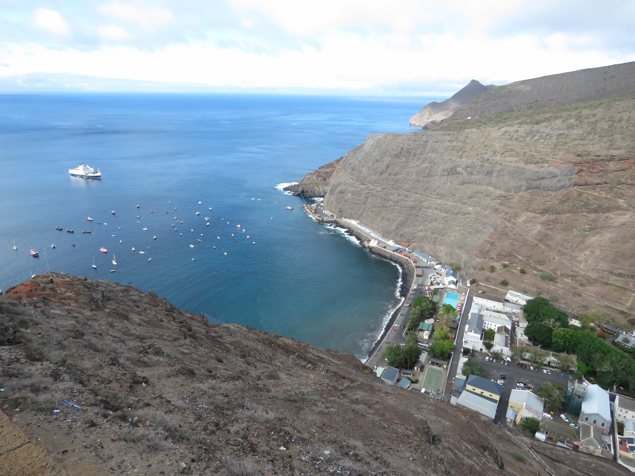
1/4/2016: Ladder Hill
Position: -15°55.59'S, -5°43.21'W
The view from Ladder Hill down to Dirona and the other boats on the moorings.
|
 |
1/4/2016: Jamestown Harbour
Position: -15°55.59'S, -5°43.24'W
Jamestown Harbour from the top of Jacob's Ladder.
|
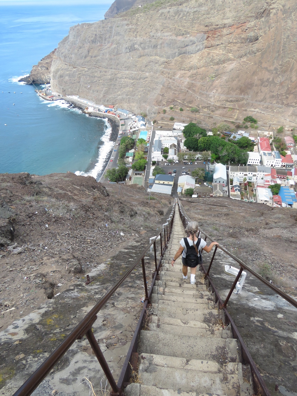 |
1/4/2016: Going down
Position: -15°55.59'S, -5°43.21'W
We took Jacob's Ladder back down. The combination of not being out hiking enough recently, our long hike of today and the steep stairs on the way down left us with stiff thighs for a couple of days.
|
 |
1/5/2016: Fueling
Position: -15°55.49'S, -5°43.51'W
Today we took on 1,086 gallons (4,113 L) of diesel. The fueling was done by barge in several trips. (A larger barge is here that might have filled us in one trip, but we suspect it was in use with the RMS.) The fill process was lengthy, but otherwise went remarkably smoothly. It would be difficult to get another liter on board anywhere.
|
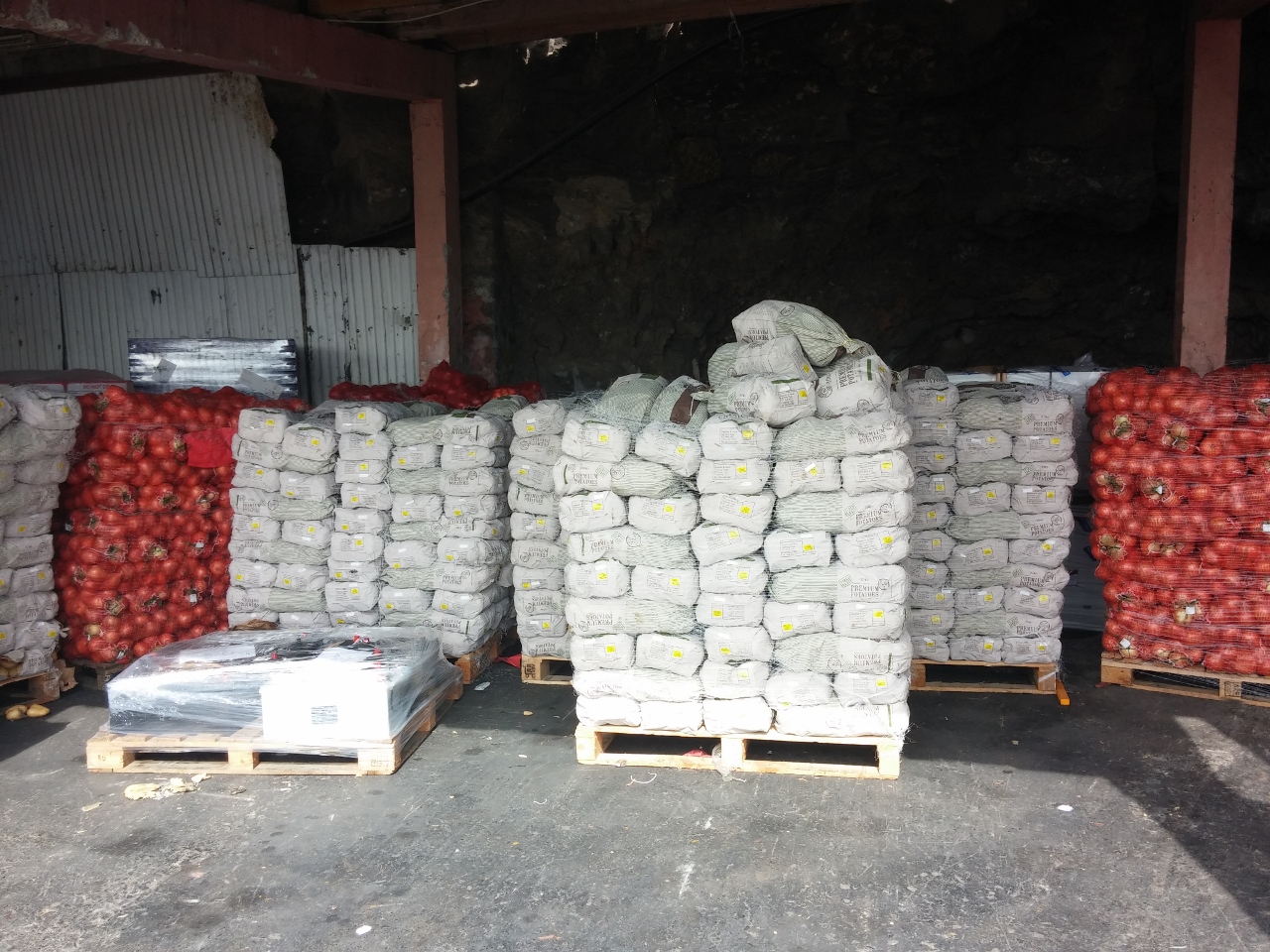 |
1/5/2016: Onions and potatoes
Position: -15°55.23'S, -5°43.06'W
We finished fueling mid-afternoon then took the ferry into town. The storehouses ashore were packed with goods offloaded from the RMS. This shed was full of onions and potatoes.
|
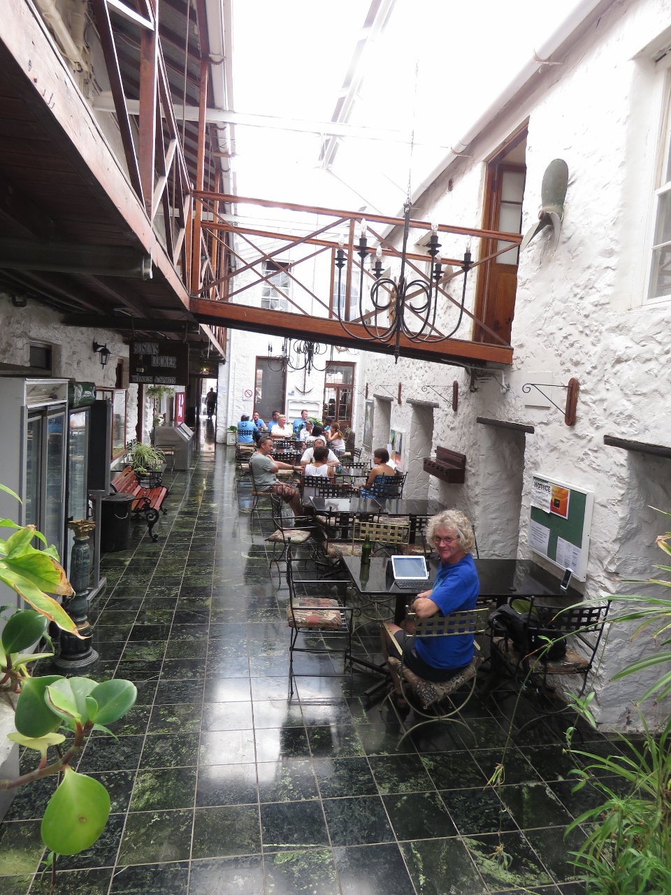 |
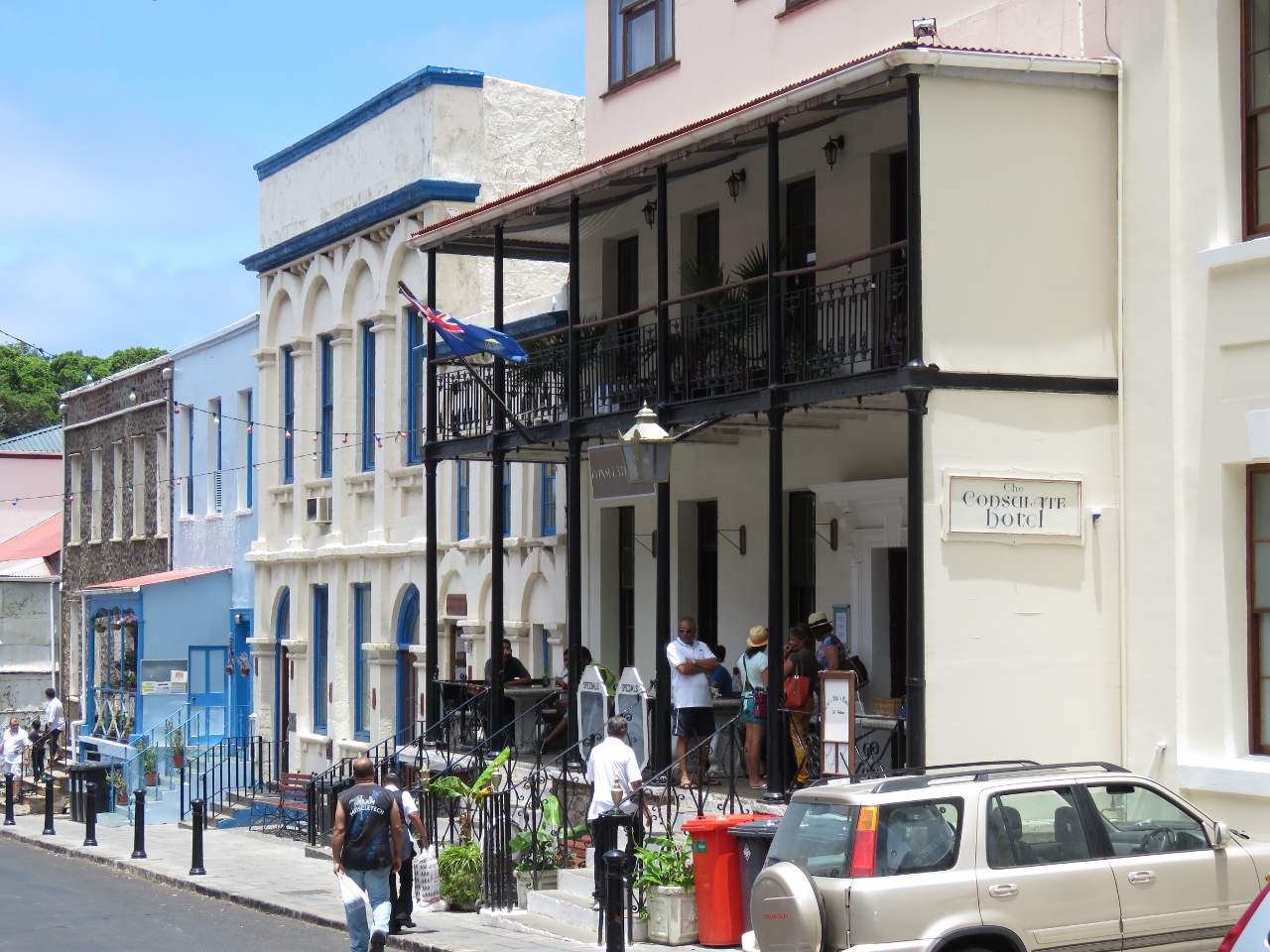
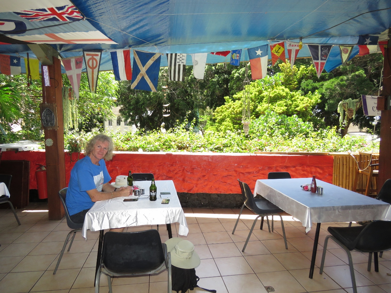
1/5/2016: Consulate Hotel
Position: -15°55.55'S, -5°43.02'W
Cellular connectivity is pretty shaky from the anchorage, so we stopped off for a beer and some Wifi at the Consulate Hotel's atrium bar. It became one of our favourite spots in town.
|
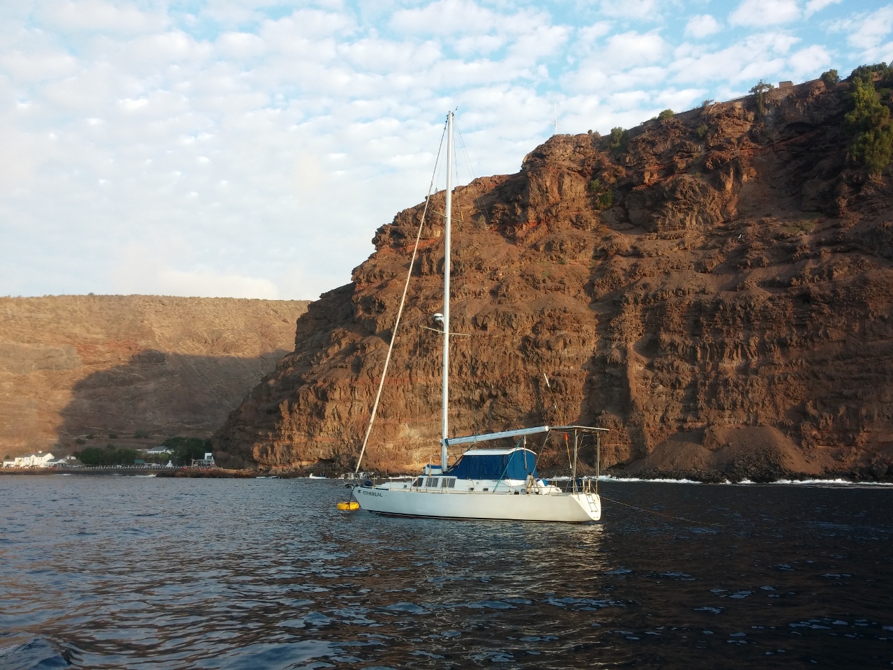 |
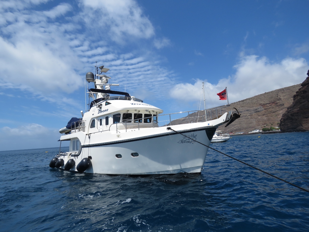
1/5/2016: Ethereal
Position: -15°55.39'S, -5°43.35'W
Ethereal behind us in the mooring off the steep cliffs of St. Helena. Judy Hildebrand, who we met in Darwin, will be arriving in a few weeks to deliver it to the Caribbean.
|
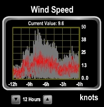 |
1/6/2016: 50 knots
Position: -15°55.50'S, -5°43.50'W
A massive high-pressure system is moving across the southern Atlantic right now, bringing big winds. We saw gusts to 50 knots last night.
|
 |
1/6/2016: Shackle
Position: -15°55.49'S, -5°43.51'W
We normally don't pick up a mooring as most aren't strong enough for our weight, but when we have in the past on our previous boat, we ran a line from the port bow cleat, through the mooring ring and back to the boat on the starboard bow cleat. We did the same thing here, but with the surge and wind gusts the line is wearing heavily as it slides back and forth along the ring, and the slack has a tendency to get caught under the buoy and wear even more against the barnacles. So we decided to switch to a line attached at a single point to the boat with a shackle on the loop end with plenty of anti-chafe. We'll then attach the shackle to the mooring ring. Leaving will be a little more involved because we can't just undo the line and pull it through the ring, but releasing the shackle shouldn't take long.
|
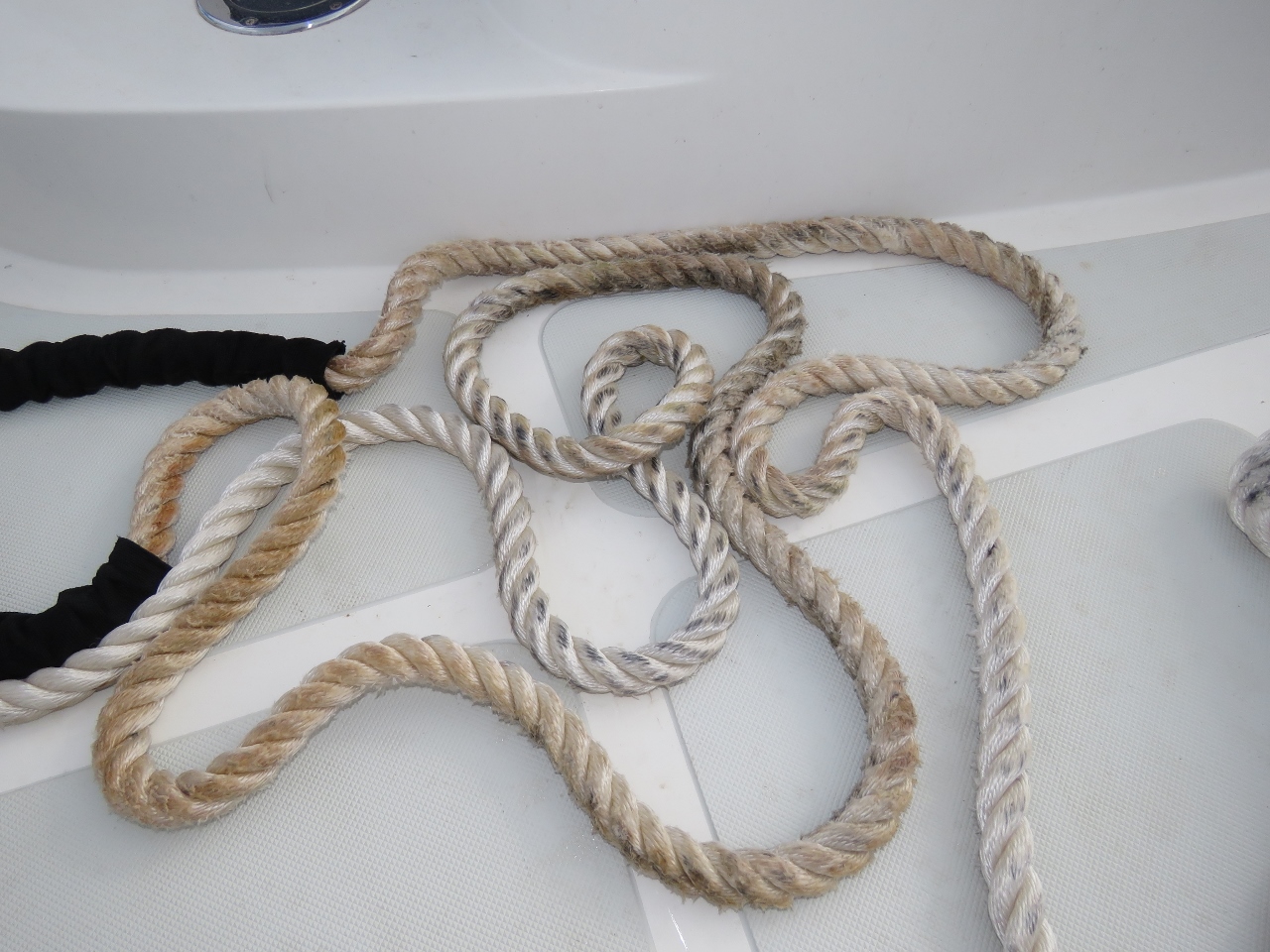 |
1/6/2016: Line wear
Position: -15°55.50'S, -5°43.50'W
This is the original 75ft line we had attached to the buoy. The brown areas are where the line was wearing on the ring. We did have anti-chafe on the line, but the line pulled back and forth so much that the anti-chafe bunched up and rarely was protecting the line.
|
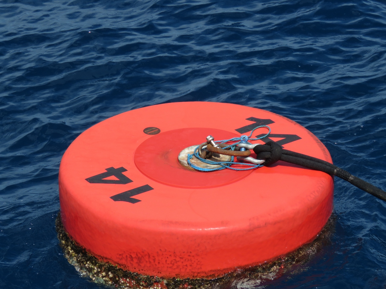 |
1/6/2016: Buoy
Position: -15°55.50'S, -5°43.51'W
The mooring with our shackle attached. This was a much better setup.
|
 |
1/6/2016: RMS
Position: -15°55.50'S, -5°43.50'W
The RMS leaving en route to Ascension Island. The ship had been here since we arrived and the anchorage felt a little empty without it there.
|
 |
1/6/2016: Low
Position: -15°55.49'S, -5°43.51'W
With 2,707 gallons of fuel on board, we're sitting very low in the water. The fenders are out for the fuel barge, and also for the harbour ferry to land against.
|
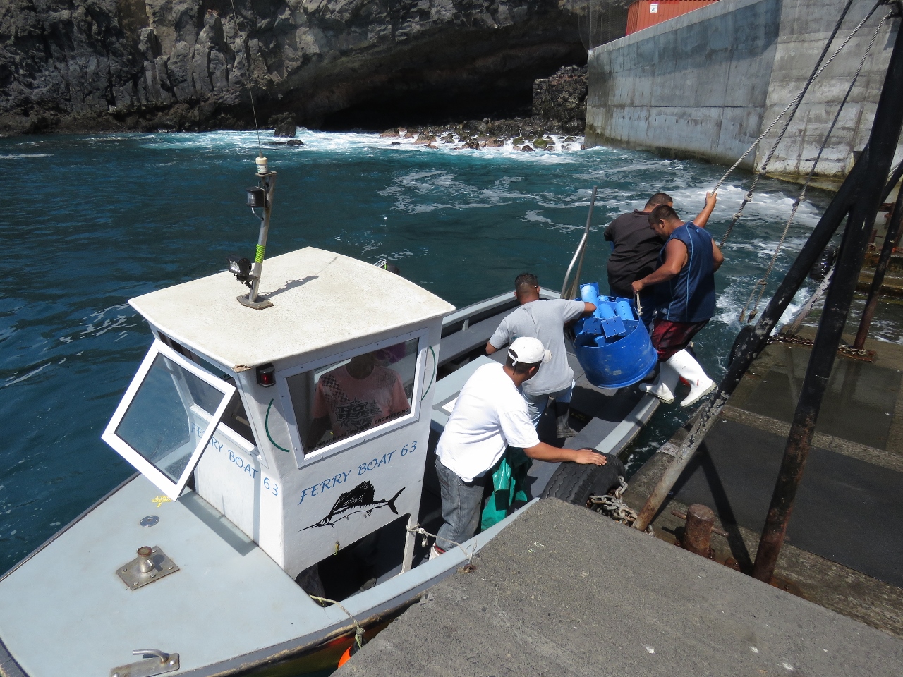 |
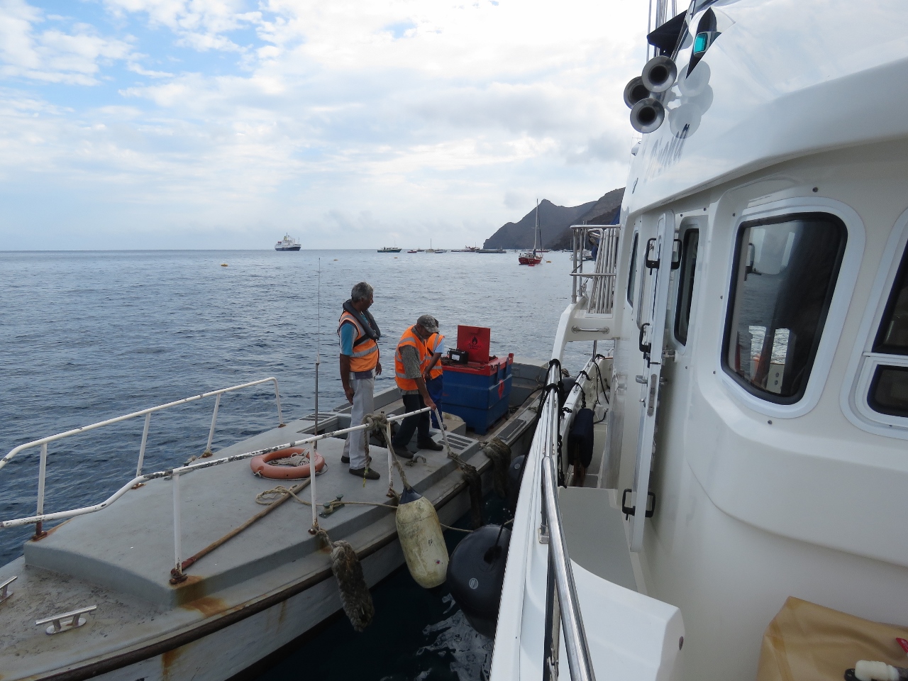
1/6/2016: Harbour ferry
Position: -15°55.23'S, -5°43.05'W
The constant high swell in the harbour, visible in the background, makes landing and mooring a tender challenging, so almost everyone instead uses the harbour ferry. Lines hung above the harbour steps provide a steadying handhold when embarking and disembarking.
|
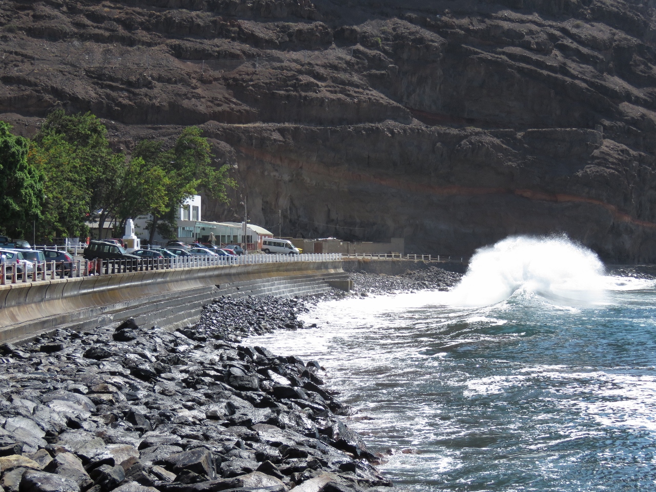 |
1/6/2016: Waves
Position: -15°55.37'S, -5°43.05'W
That big high pressure system moving through the southern Atlantic is bringing bigger winds and waves than normal for this time of year.
|
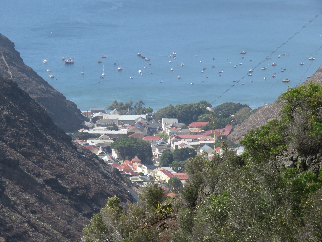 |
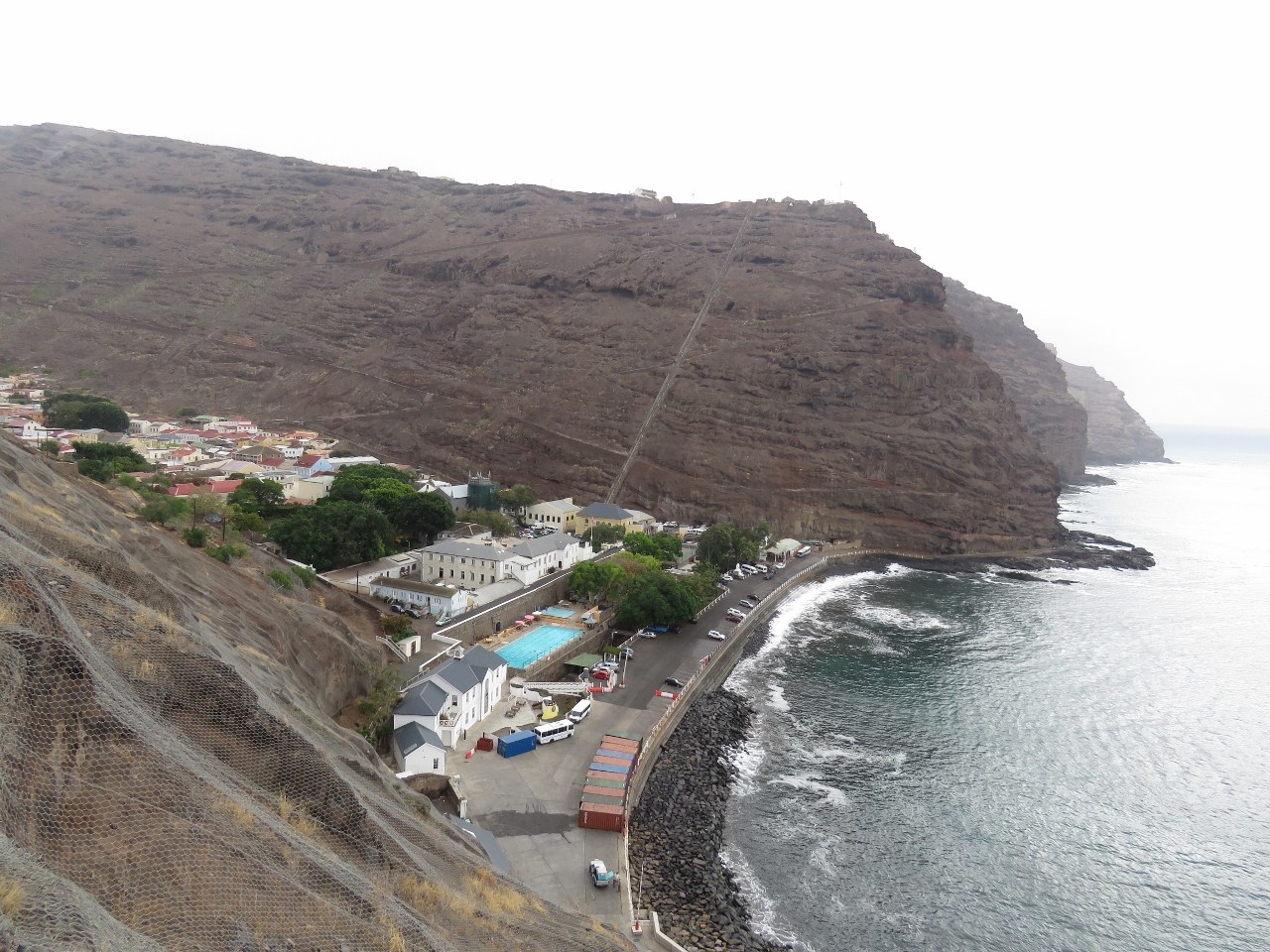
1/6/2016: Jamestown
Position: -15°56.58'S, -5°42.43'W
The view north across Jamestown from the road high above on our way to visit the St. Helena distillery.
|
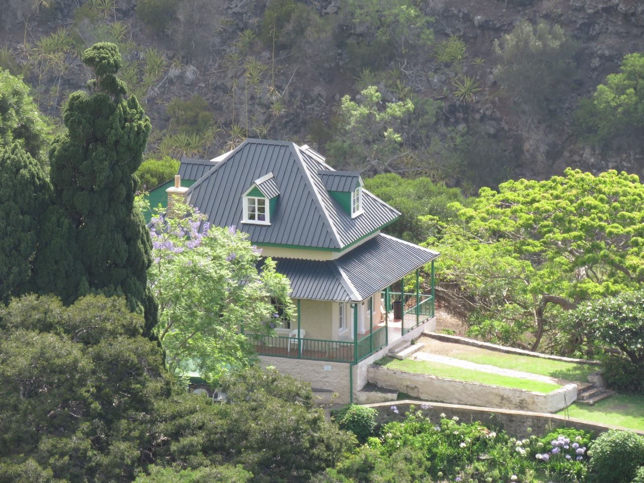 |
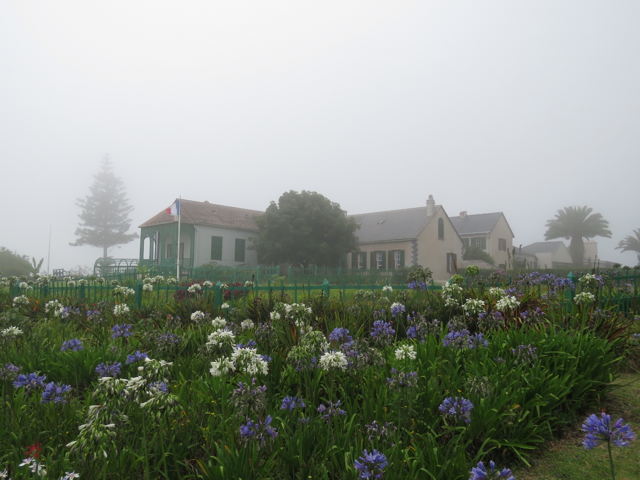
1/6/2016: The Briars Pavilion
Position: -15°56.50'S, -5°42.41'W
St. Helena is the island where the British exiled Napolean. This is The Briars Pavilion, where Napolean was temporarily housed until his permanent residence at Longwood House was complete.
|
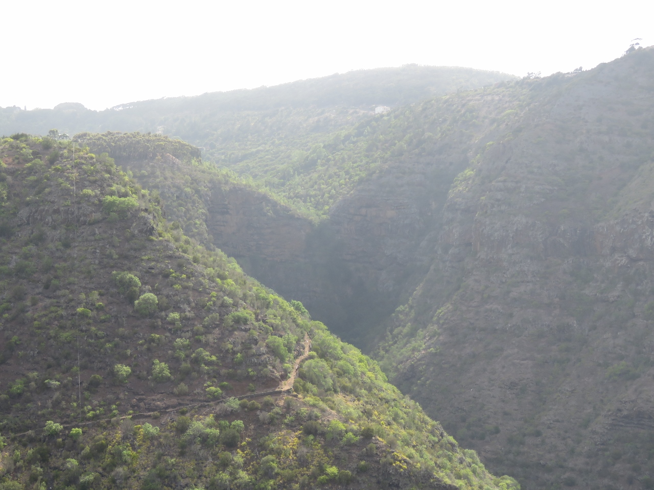 |
1/6/2016: Heart-shaped waterfall
Position: -15°56.50'S, -5°42.41'W
In wetter weather, a waterfall flows over the cleft in the heart-shaped cliff in the distance.
|
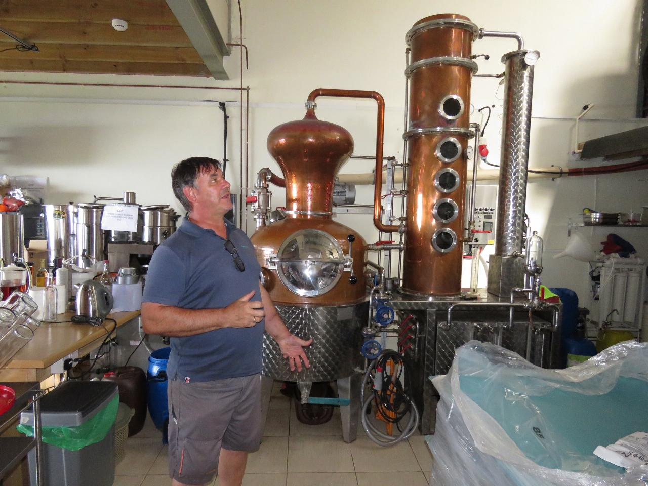 |
1/6/2016: St. Helena Distillery
Position: -15°57.10'S, -5°42.17'W
Wyn Jones has been following our blog and shared it with Paul Hicking, Head Distiller at the St. Helena Distillery. Paul invited us to come tour the distillery and even came into Jamestown this afternoon to drive us up. We had a great time meeting Paul, touring the facility and learning about the distillation process.
|
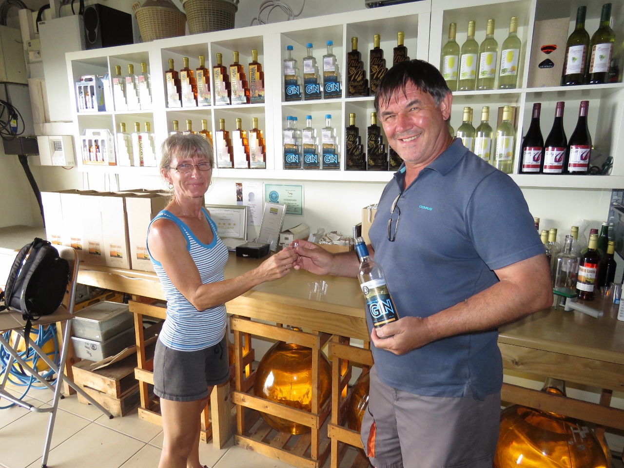 |
1/6/2016: Tasting
Position: -15°57.10'S, -5°42.17'W
We tasted the range of products at the distillery, including their signature produce Tungi, a delicious spirit made from a locally-grown prickly pear called Tungi. Paul also brews excellent beer.
|
 |
1/7/2016: Cannon
Position: -15°55.50'S, -5°43.09'W
A cannon outside the St. Helena museum. We're not sure how many cannons are on the island, but we saw at least a dozen during our stay there.
|
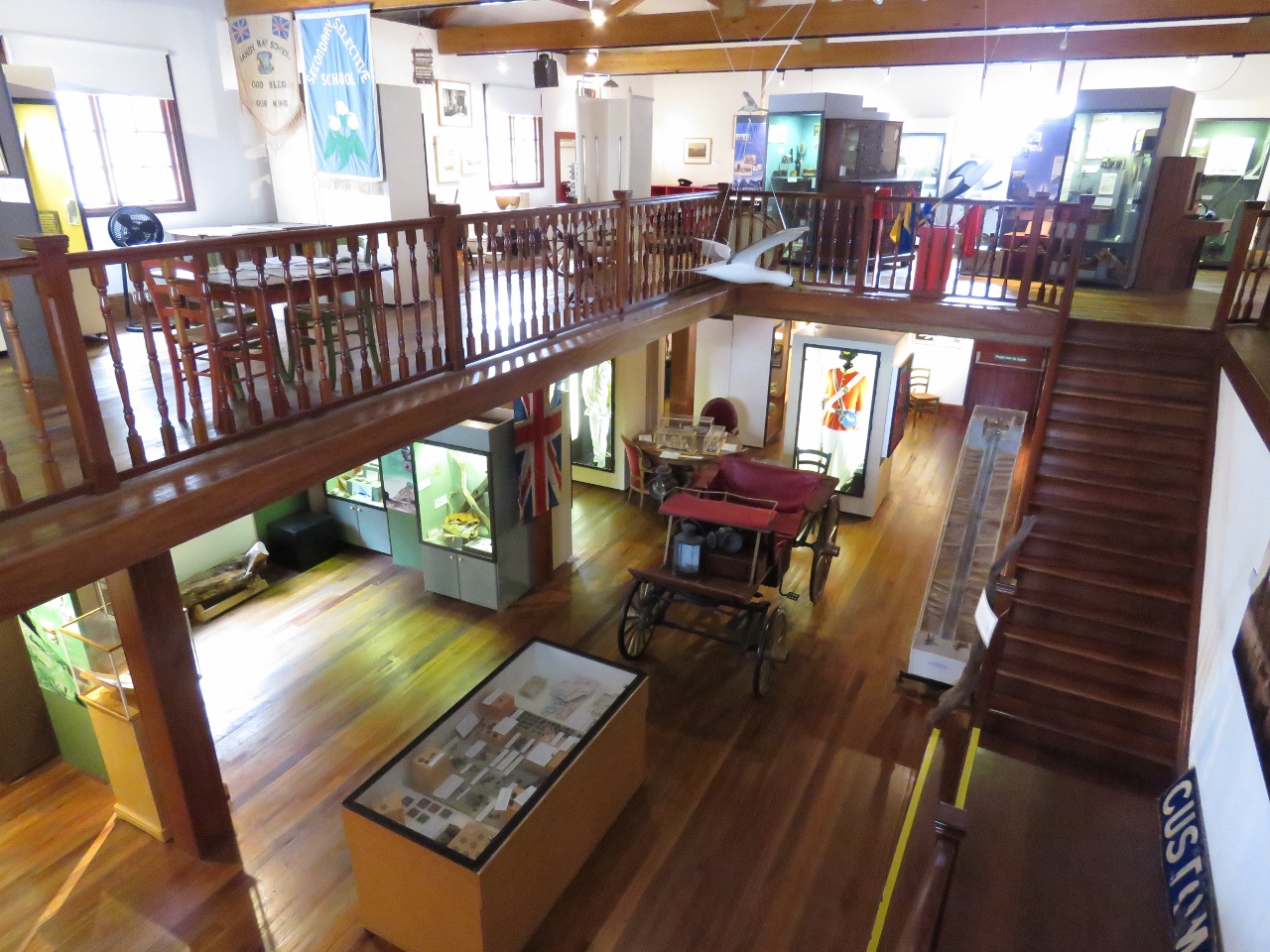 |
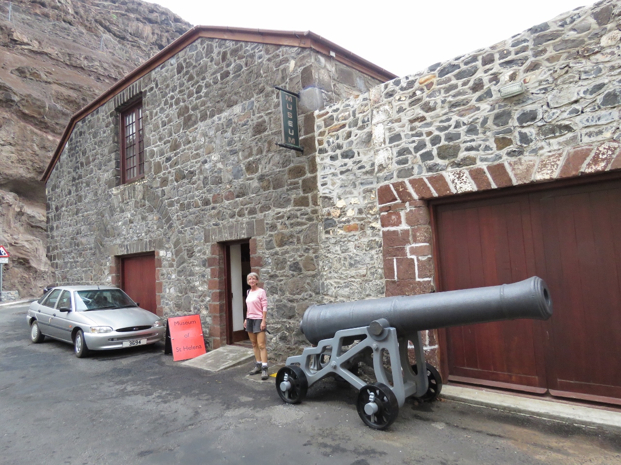
1/7/2016: St. Helena Museum
Position: -15°55.50'S, -5°43.11'W
The St. Helena museum is housed in a beautifully-restored 19th century building and does a great job of detaling the island's history, geology and ecology.
|
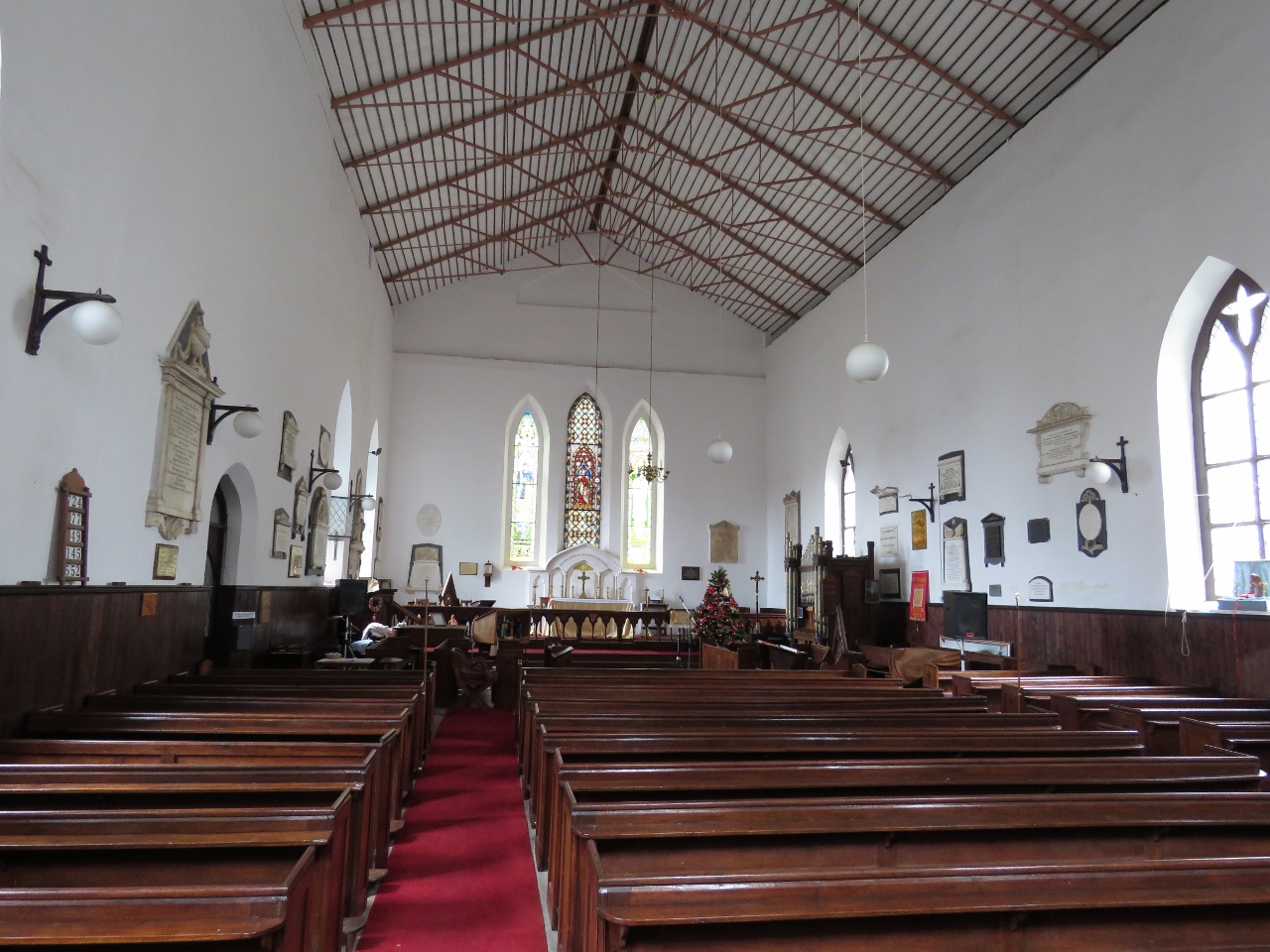 |
1/7/2016: St. James Church
Position: -15°55.51'S, -5°43.09'W
Dating from 1774, St. James Church is the oldest Anglican church in the Southern Hemisphere. Dedication plaques along the walls provide a snapshot into the island's past social structure, health and current events.
|
 |
1/7/2016: James Bay
Position: -15°55.34'S, -5°43.03'W
Looking down to the port and James Bay from the track to Rupert's Bay. The cliffs are sheathed in chain mail to capture falling rocks, similar to what we saw in Reunion.
|
 |
1/7/2016: Munden's Point
Position: -15°55.19'S, -5°42.92'W
Besides Napolean, the British held a variety of prisoners of war on remote St. Helena, including Bahraini princes, South African Chief Dinizulu, and 6,000 Boers. These prison buildings along Munden's Point we believe were used to hold the Bahraini prisoners.
|
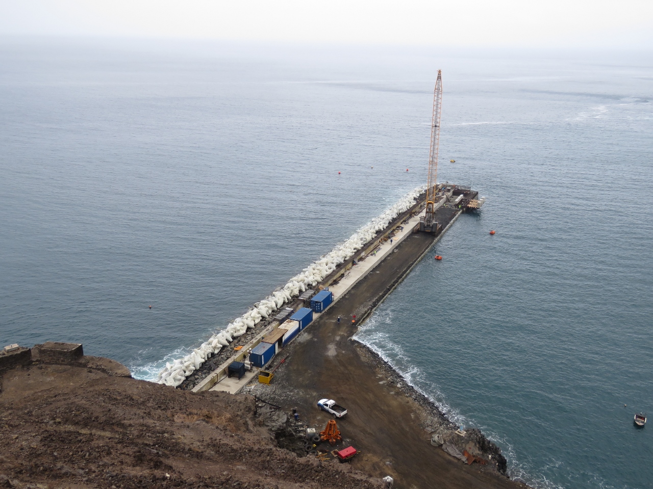 |
1/7/2016: Rupert's Wharf
Position: -15°55.14'S, -5°42.88'W
A new wharf is under construction at Rupert's Bay to berth cargo and cruise ships. When the wharf is complete, port operations will transfer here from James Bay.
|
 |
1/7/2016: Latrines
Position: -15°55.18'S, -5°43.02'W
Latrines in the prison buildings at Munden's Point. We expected them to empty directly into the ocean, but they had plumbing that fed eventually to the water.
|
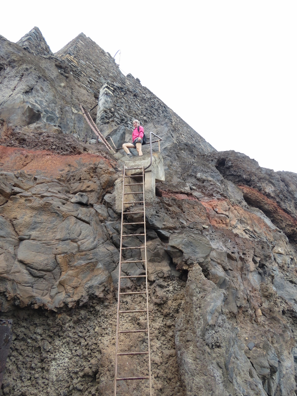 |
1/7/2016: Munden's Battery
Position: -15°55.16'S, -5°43.04'W
Munden's Battery is a fair-sized World War II military facility. A series of ladders lead from the main battery down nearly to the shoreline.
|
 |
1/7/2016: Cannons
Position: -15°55.16'S, -5°43.04'W
More cannons, of different vintages, were piled along the shore near the bottom of the ladders.
|
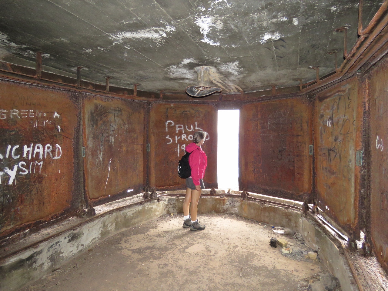 |
1/7/2016: Enclosure
Position: -15°55.16'S, -5°43.04'W
The battery had several enclosures like this one, with wheeled metal walls that rolled back on either side and a mount in the ceiling. The sliding walls provide protection, while offering an ability to see or shoot through 180 degrees.
|
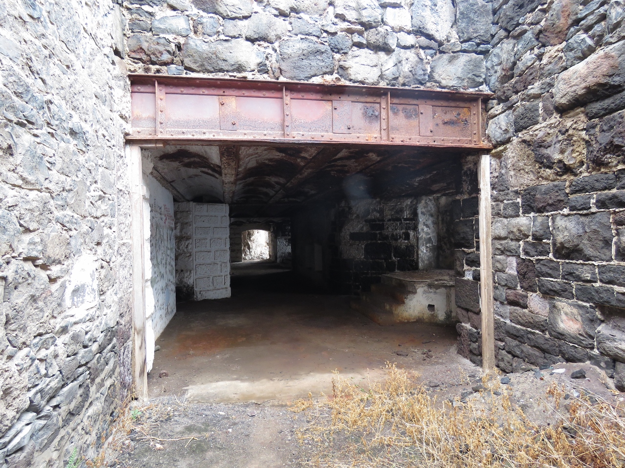 |
1/7/2016: Battery
Position: -15°55.17'S, -5°43.03'W
We kept thinking we'd seen the whole battery, but found more. This section has been carved out of the cliff.
|
 |
1/7/2016: Frame
Position: -15°55.19'S, -5°43.04'W
James Bay framed in one of the cliffside lookouts at Munden's Battery.
|
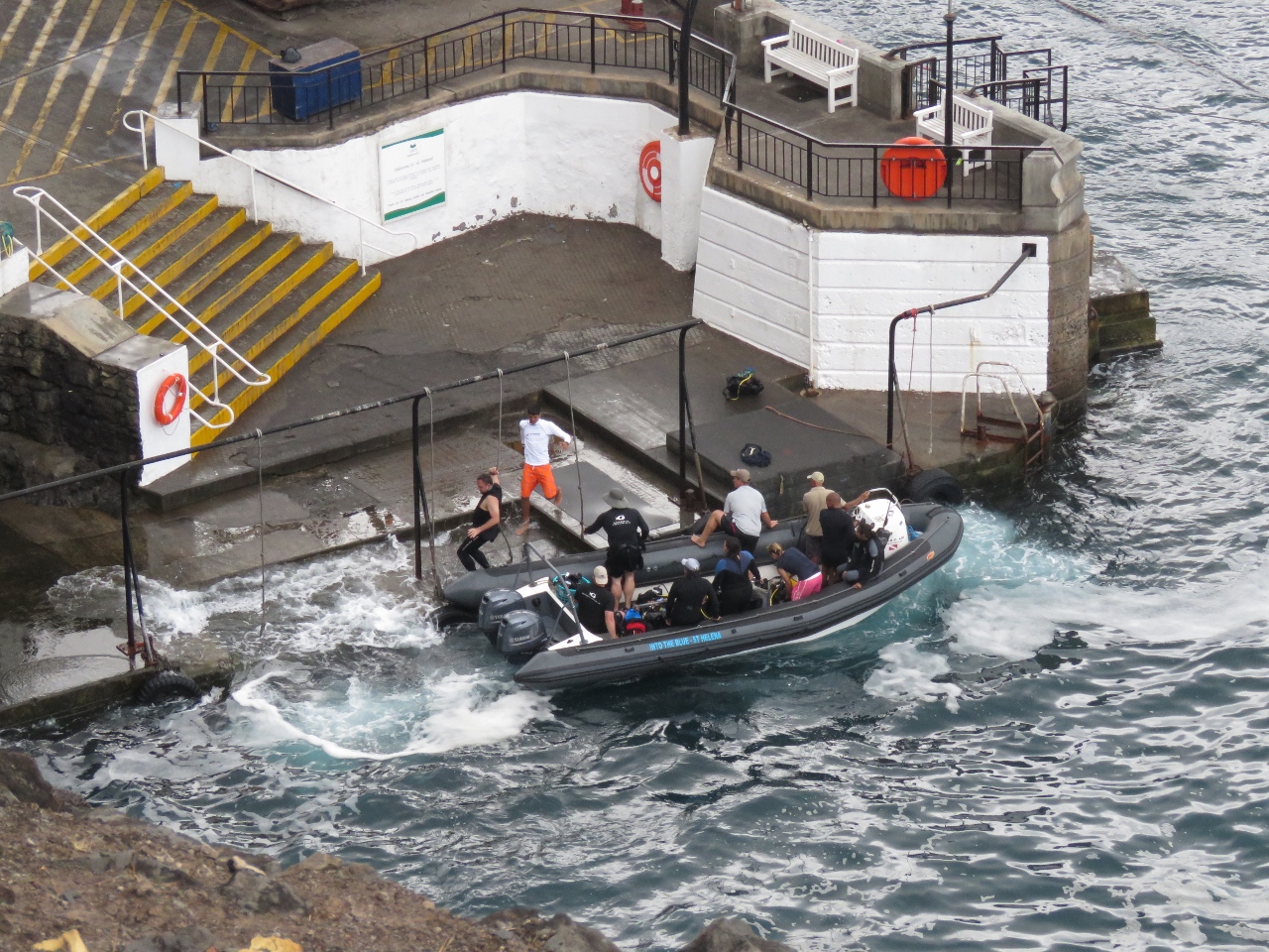 |
1/7/2016: Swell
Position: -15°55.19'S, -5°43.04'W
We watched this dive boat offload from above. You can see the impact of the swell and why everyone just uses the harbour ferry rather than try to land and secure a tender. Once the passengers and gear were offloaded, the dive boat operator moored in the harbour and took the ferry back to shore.
|
 |
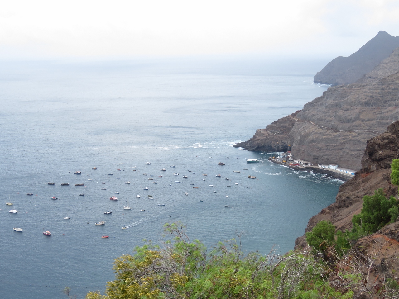
1/7/2016: Breakwater
Position: -15°55.32'S, -5°43.03'W
Looking across the Jamestown harbour front and breakwater. Jacob's Ladder extends up to Ladder Hill in the distance. The pleasure craft moorings are just outside the top right of the photo.
|
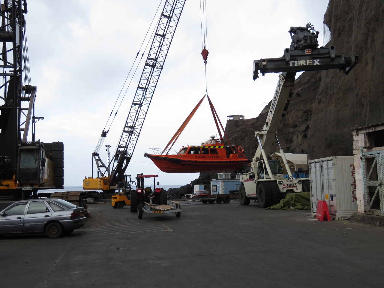 |
1/7/2016: Sea Rescue
Position: -15°55.27'S, -5°43.06'W
St. Helena has several Sea Rescue vessels that are kept ashore and craned in and out of the water. When the new facilities at Ruperts Bay are complete, Sea Rescue also will transfer there and use a ramp instead of a crane to launch and retrieve their vessels.
|
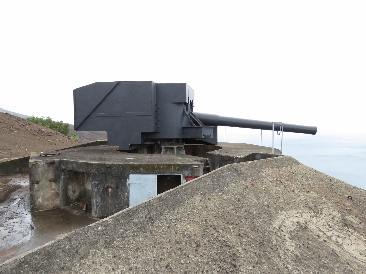 |
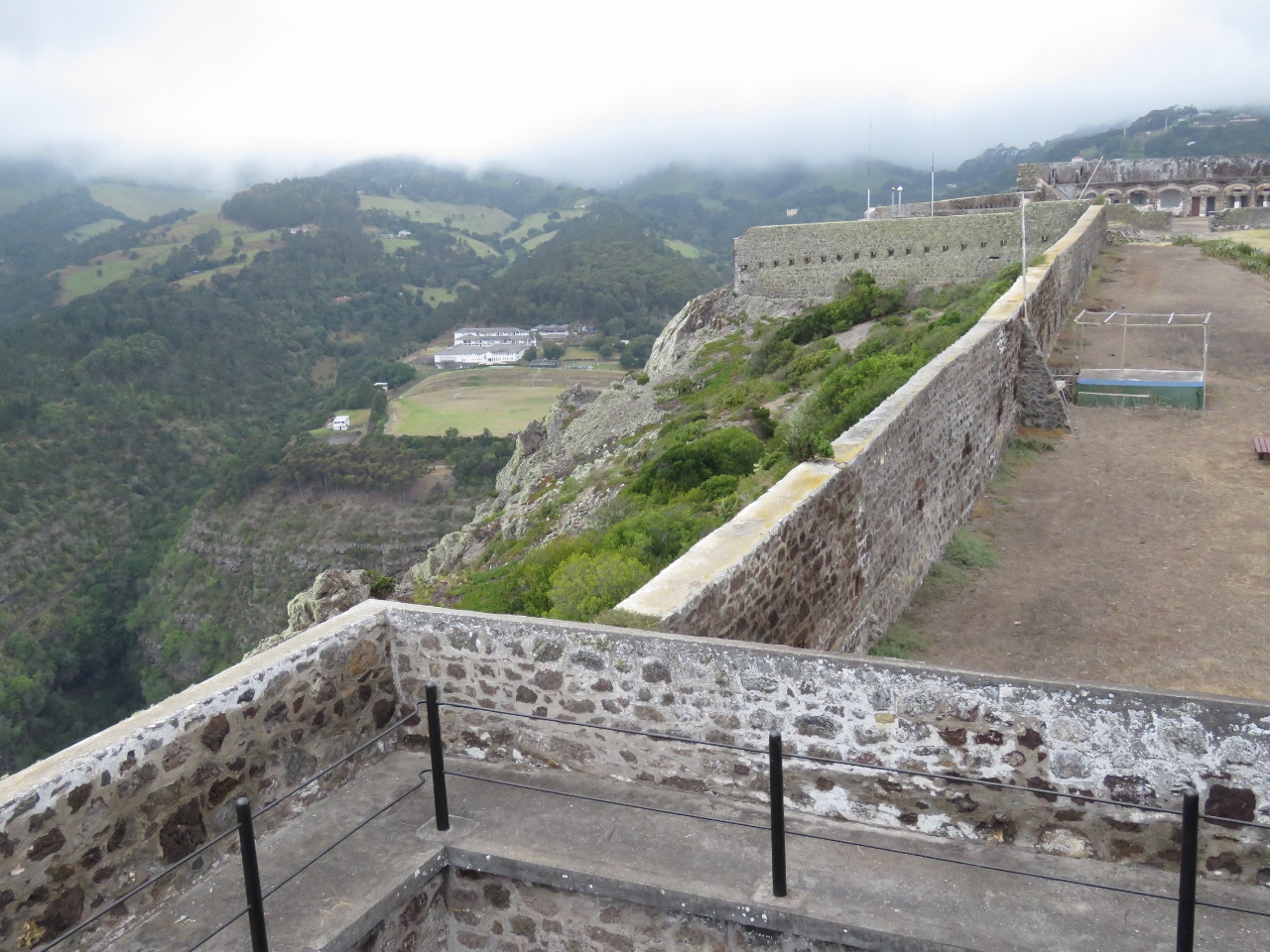
1/8/2016: Ladder Hill Guns
Position: -15°55.65'S, -5°43.36'W
This morning we cleared out for a weekend departure and spent the rest of the day on a personalized island tour with No Limits Travel and Tours. Our first stop was the restored World War I guns at Ladder Hill, just beyond the Ladder Hill Fort.
|
 |
1/8/2016: James Bay
Position: -15°55.65'S, -5°43.35'W
Gun emplacements always have great views, and this was no exception. This is looking to James Bay from the Ladder Hill Guns.
|
 |
1/8/2016: Dirona
Position: -15°55.65'S, -5°43.36'W
Dirona on the mooring far below the Ladder Hill Guns.
|
 |
1/8/2016: Ave del Mar
Position: -15°55.65'S, -5°43.36'W
The harbour ferry arriving to pickup the crew of Ave del Mar of Ottawa, Canada. We met them ashore earlier in the week--they set off on their circumnavigation from Nanaimo, British Columbia. Nanaimo is about fifty miles north of Victoria on Vancouver Island--we've visited there many times by boat and car.
|
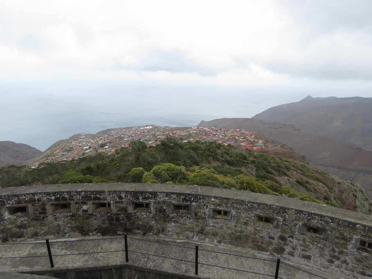 |
1/8/2016: High Knoll Fort
Position: -15°56.59'S, -5°43.00'W
High Knoll Fort is a large military fort built in 1798 with sweeping views of the island. This is the view north across Half Tree Hollow--the largest community on St. Helena with a population of over 1,000.
|
 |
1/8/2016: Prince Andrew School
Position: -15°56.59'S, -5°42.99'W
Prince Andrew School on the left viewed looking south from High Knoll Fort, with the fort extending in the distance on the right. This is the only high school on the island and they have the only sports field. St. Helena is one of the few places where flat ground is scarce. The school's namesake, Prince Andrew, laid one of the cornerstones when he visited the island.
|
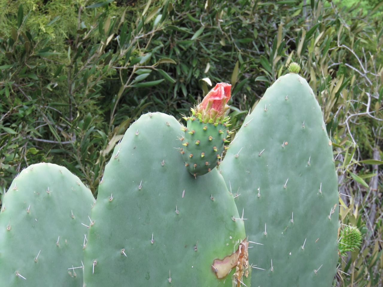 |
1/8/2016: Tungi
Position: -15°56.77'S, -5°43.06'W
The small fruit below the blossom is used to make Tungi, the signature spirit of the St. Helena distillery.
|
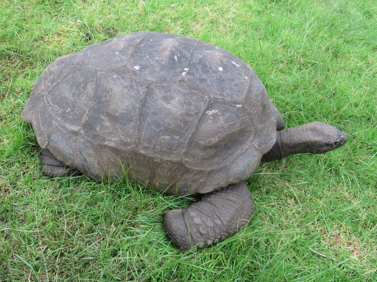 |
1/8/2016: Jonathan
Position: -15°57.30'S, -5°43.31'W
Jonathan the tortoise, estimated to be between 170 and 200 years old, is St. Helena's oldest resident. He lives at the Governer's mansion, Plantation House, along with 4 other tortoises. He's not native to the island, having arrived in about 1882, and is one of the few surviving Seychelles Giant Tortoise in the world.
|
 |
1/8/2016: Longwood House
Position: -15°56.98'S, -5°41.03'W
Longwood House is where Napolean lived in exile until his death. No photography is allowed inside the house, so we've just got an outside shot before our tour. You can see we're experiencing a somewhat visibility-challenged day. This is unusual for St. Helena, but not that unusual for those from the Pacific Northwest.
|
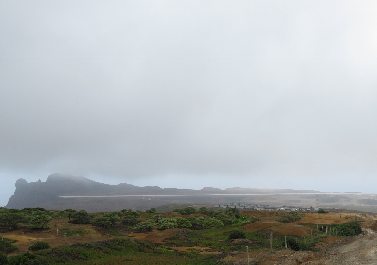 |
1/8/2016: Airport
Position: -15°56.75'S, -5°39.93'W
Everything and everyone on St. Helena arrived by sea. That soon will change with the opening of the St. Helena Airport later this year. You can see the main runway across the center of the picture. Normally building a runway is not that big an engineering challenge, but when there's not that much flat ground at all, a massive amount of earth must be moved to get a jet-capable runway.
|
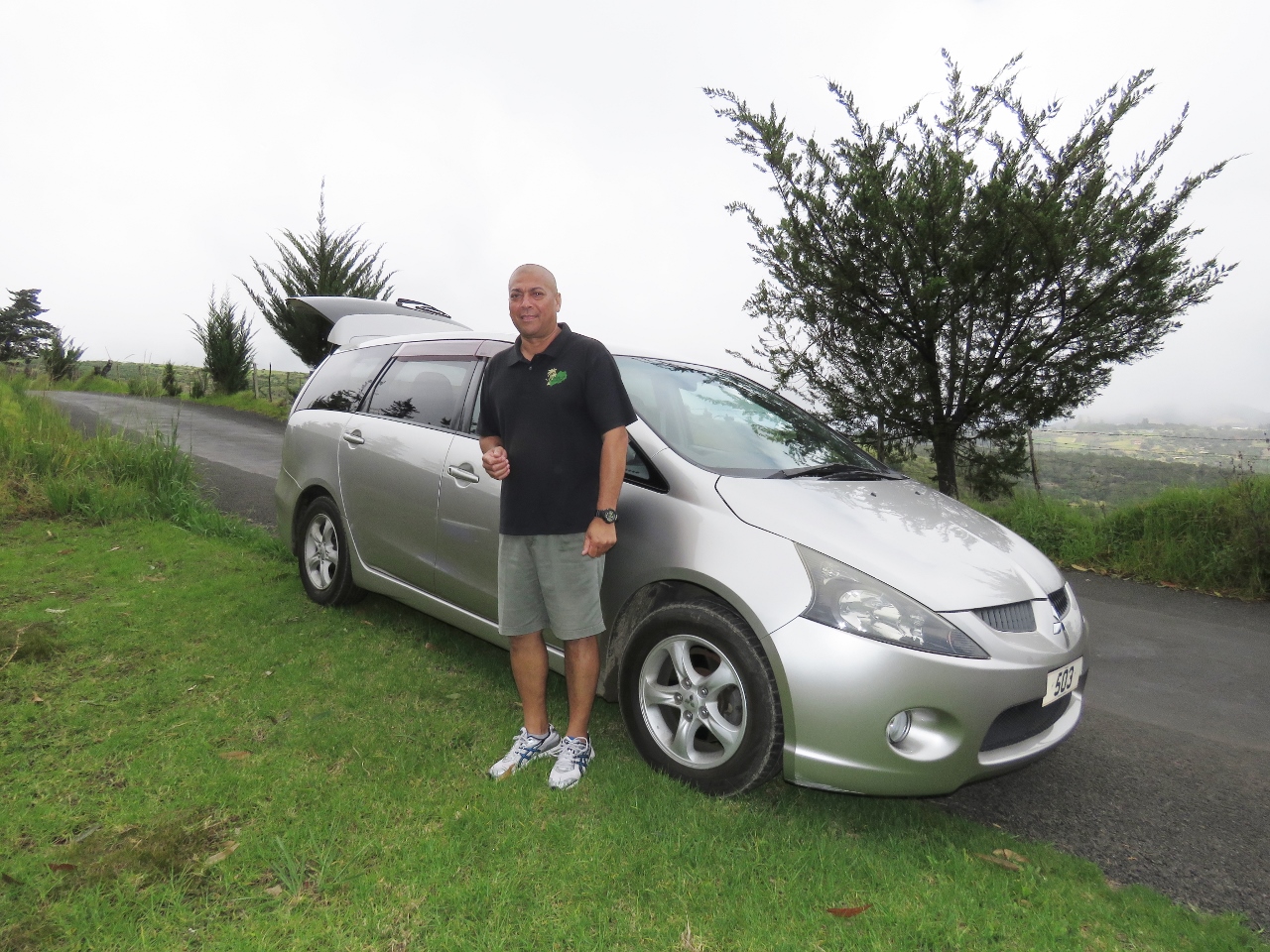 |
1/8/2016: Derek Richards
Position: -15°58.00'S, -5°40.98'W
Our guide, Derek Richards, of No Limits Travel and Tours. We generally don't like the constraints of a guided tour and initially were planning to hire a car, but they were all booked with the holiday season. So we booked a personalized two-person tour with Derek and are really glad we did. We saw more, and had a much better time, than we would have had driving on our own. If you visit St. Helena, this is the way you want to tour the island.
|
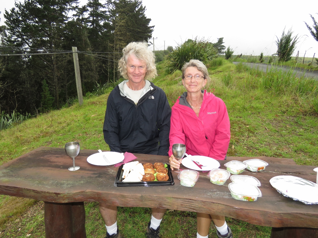 |
1/8/2016: Lunch
Position: -15°58.00'S, -5°40.98'W
The tour price included lunch. We were expecting a sandwich, a coke and a perhaps bag of chips, but Derek laid out an amazing spread prepared by his wife Linda. We had fish cakes and tomato-paste tea sandwiches, both St. Helena specialties, plus devilled eggs and salad. Beveridges included a choice of beer or Chenin Blanc from the St. Helena distillery. We chose the Chenin Blanc served in chilled goblets--it was delicious. And for dessert we had chocolate cake, carrot cake and fresh plums and nectarines. The entire meal was fabulous, and made for an incredibly decadent picnic. We probably ate twice what we normally eat for lunch. Oh, ... and we did get a bag of chips. :)
|
 |
1/8/2016: Silver Hill
Position: -15°58.26'S, -5°40.68'W
The weather cleared and we got some great views later in the day. This is Stone Top Bay viewed from Silver Hill. We believe that is George Island just offshore.
|
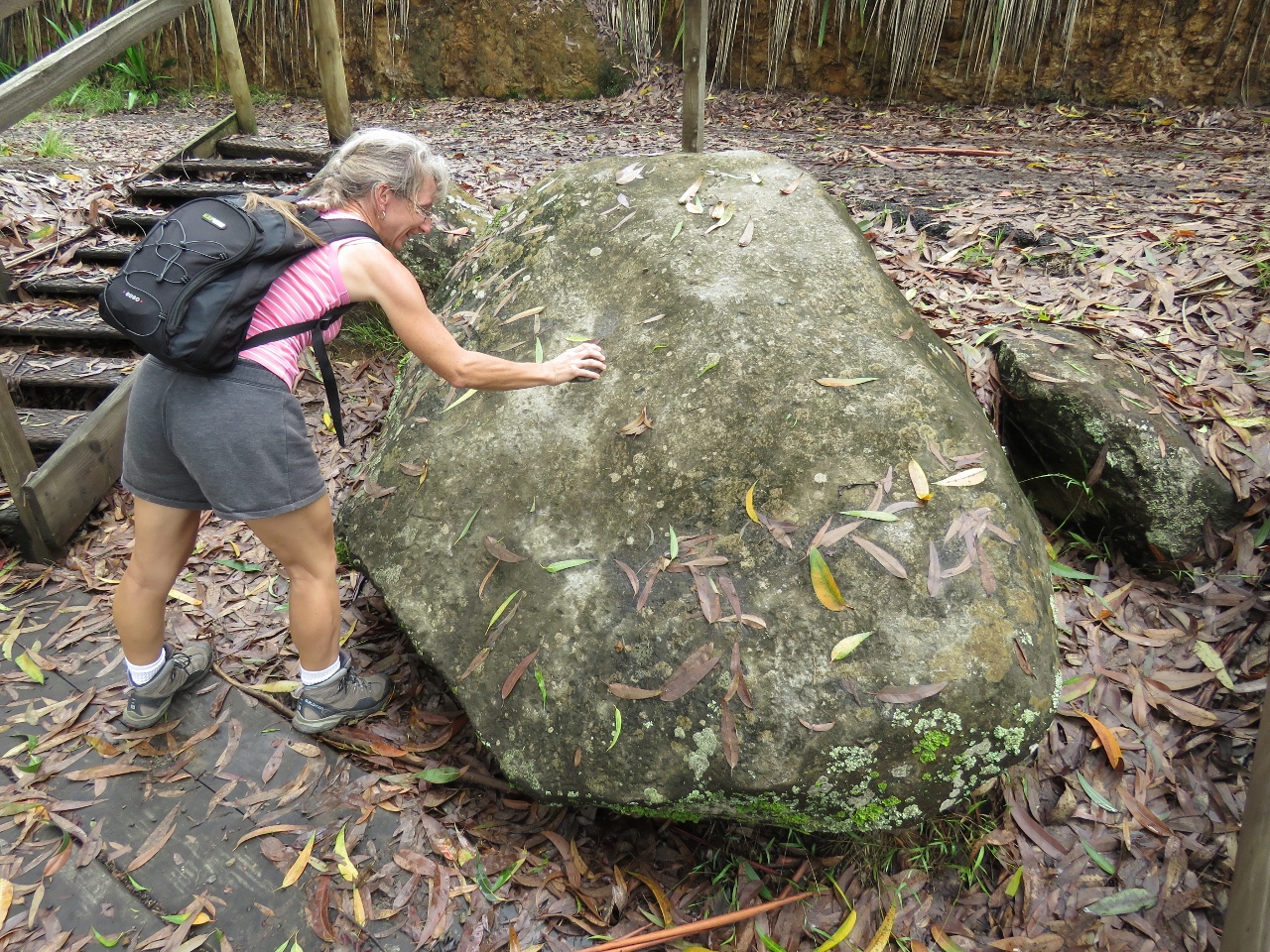 |
1/8/2016: The Bellstone
Position: -15°58.91'S, -5°40.96'W
The Bellstone is a trachyandesite boulder that makes a bell sound when struck with a rock. Actually, even a sharp wrap of knuckle produced a bell sound. We were a little dubious, but it actually does ring when struck.
|
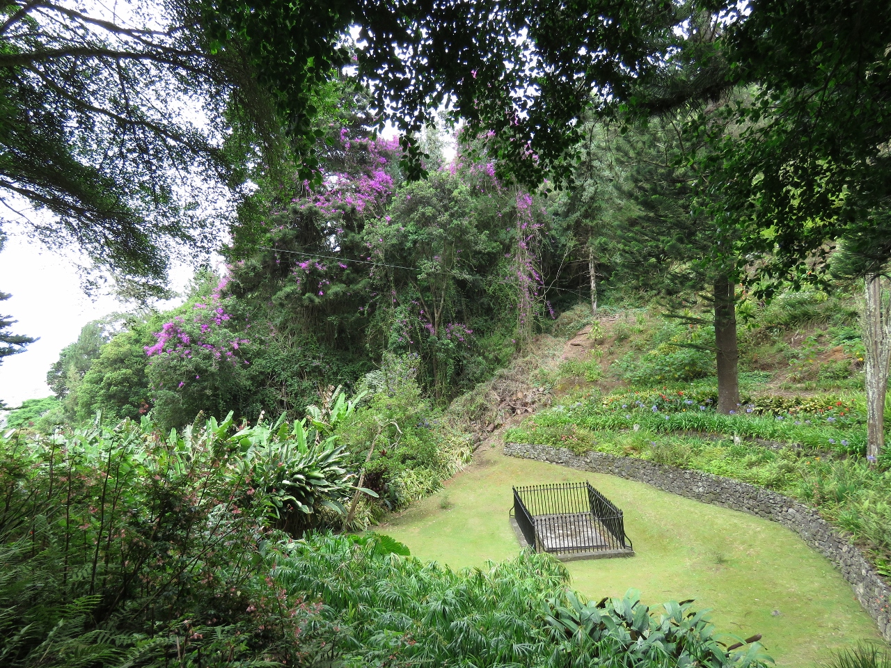 |
1/8/2016: Napoleon's Tomb
Position: -15°57.55'S, -5°41.90'W
Napolean chose this as his burial site if he had to be buried on the island. His remains later were transferred to France.
|
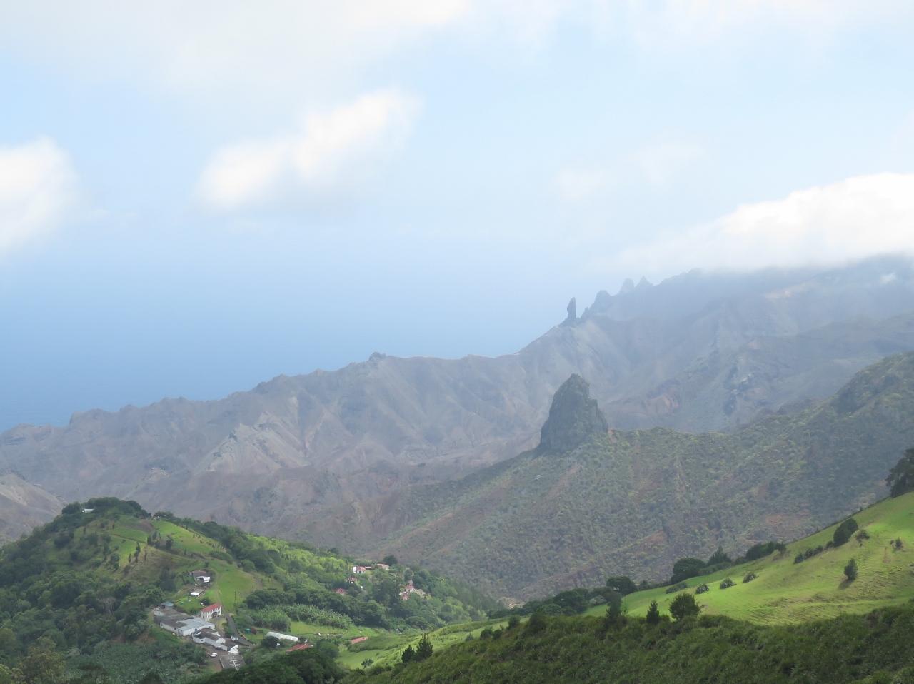 |
1/8/2016: Lot
Position: -15°58.21'S, -5°42.61'W
The view southwest from Sandy Bay Ridge. The volcanically-formed formation in the foreground is called Lot, with Lot's Wife visible directly behind in the distance. The formations to the right of Lot's Wife are called "The Asses Ears". The St. Helena scenery is incredible.
|
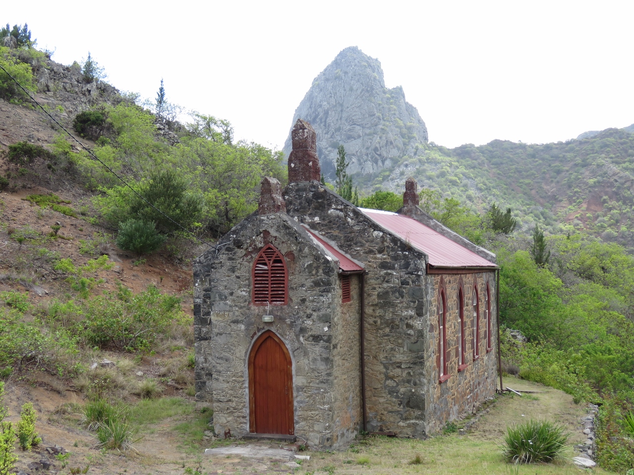 |
1/8/2016: Church
Position: -15°59.09'S, -5°42.93'W
This one of at least ten churches on the island and still is in use today. That's Lot in the background.
|
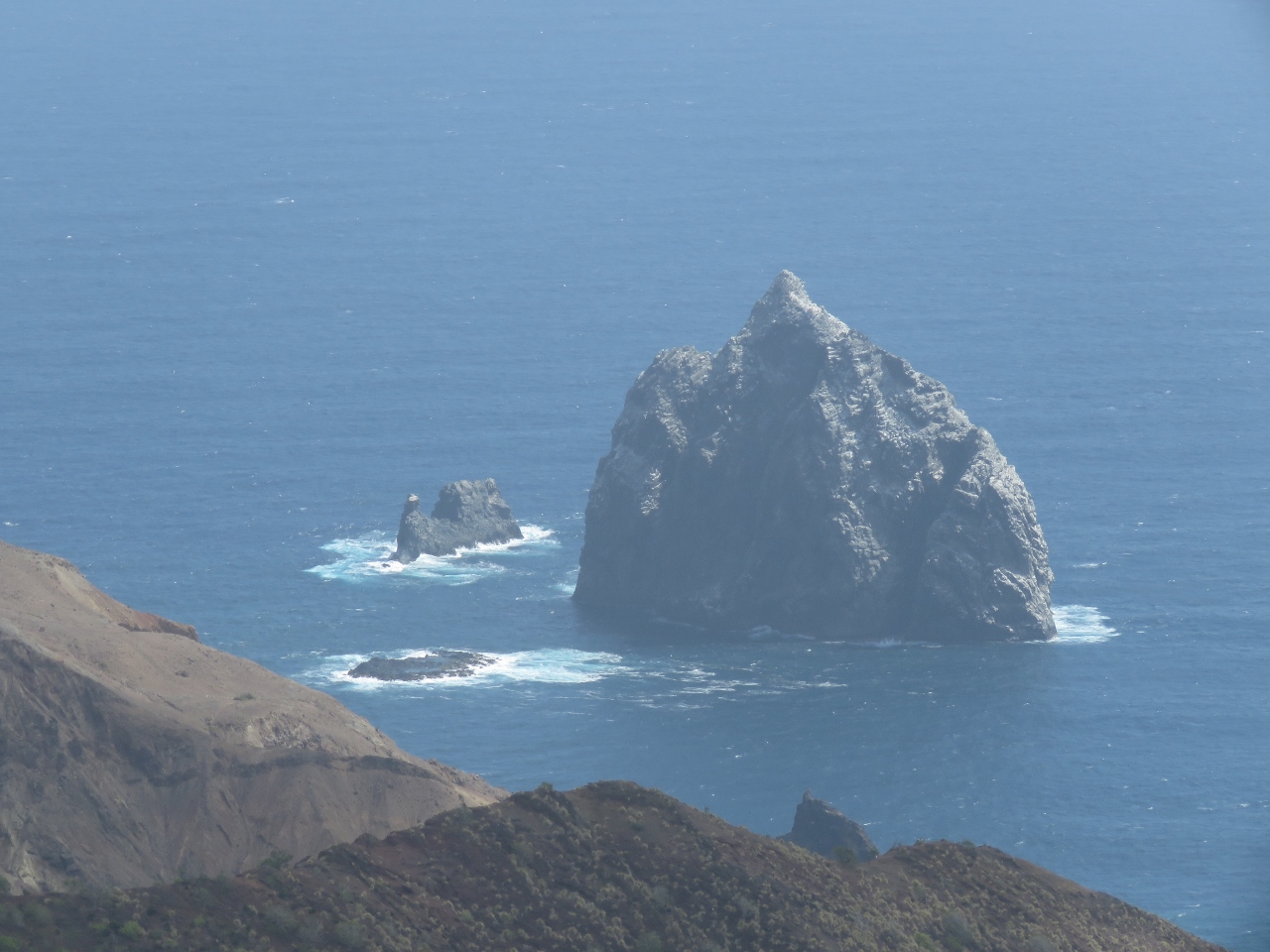 |
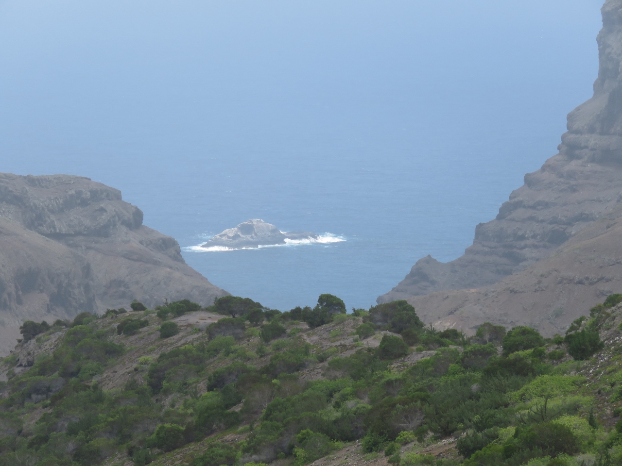
1/8/2016: Speery Island
Position: -15°59.92'S, -5°45.12'W
We saw the south side of Speery Island when we arrived into St. Helena. Today we saw the other side.
|
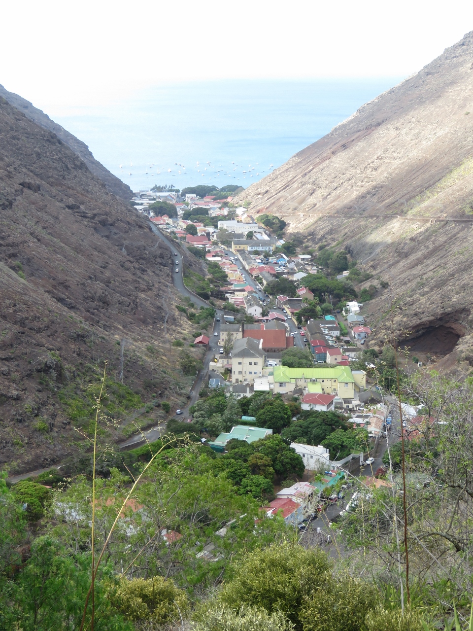 |
1/8/2016: Jamestown
Position: -15°56.29'S, -5°42.58'W
Jamestown viewed from the high above on the east ridge.
|
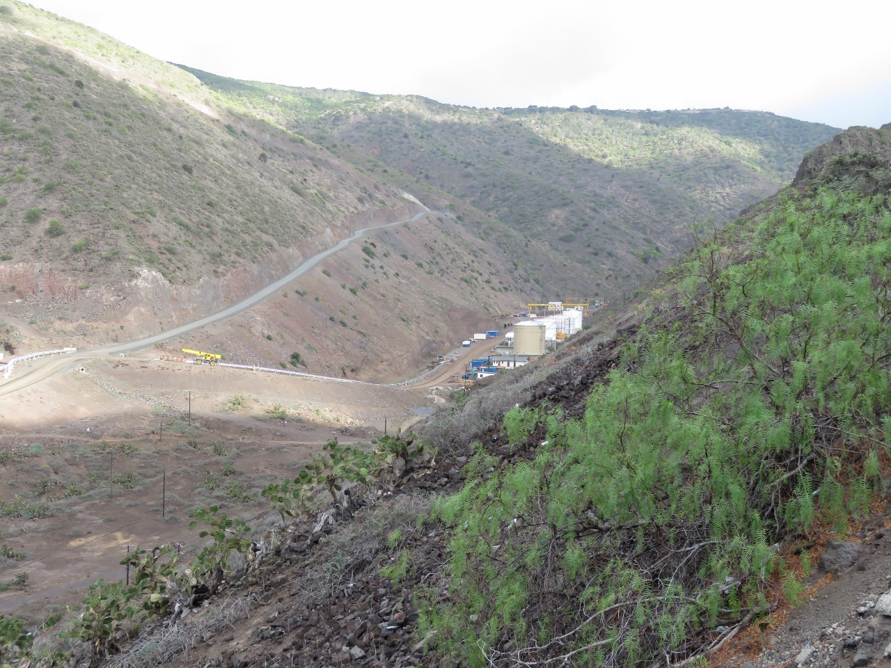 |
1/8/2016: Haul road
Position: -15°55.60'S, -5°42.57'W
The heavy construction equipment for the airport couldn't be moved along the narrow and twisting St. Helena roads. The "haul road" on the left was built from Ruperts Bay, where the equipment was landed, to the airport construction site and later will become a permanent road. The tanks on the right are the new storage facility for aviation fuel. A pipe, just visible at the left of the photo, will carry the fuel from the water delivery point to the storage tanks.
|
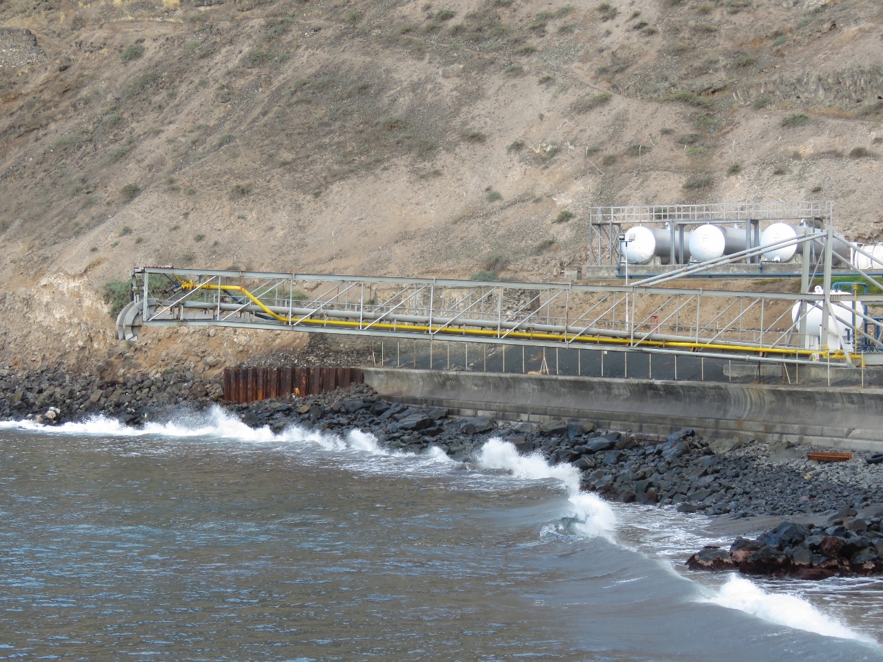 |
1/8/2016: Fuel boom
Position: -15°55.15'S, -5°42.78'W
Fuel is delivered to the island by tanker. The tanker moors in Ruperts Bay with the stern towards shore just before the breaking waves. Fuel hoses are connected between this boom and the tanker to transfer fuel ashore.
|
 |
1/8/2016: Donny's Place
Position: -15°55.47'S, -5°43.14'W
We ended an excellent day with a drink surf-side at Donny's Place.
|