In October of 1939, the German U-boat U-47 crept into Scapa Flow through Kirk Sound and sunk the British battleship Royal Oak. To protect Scapa Flow, Winston Churchill, then First Lord of the Admiralty, ordered the construction of barriers across the eastern side of Scapa Flow. 66,000 locally cast concrete blocks were dropped onto a base of broken rock to block the channel and act as wave breaks.
While anchored at St. Mary’s Bay, we walked Churchill Barrier 1 across Kirk Sound between Mainland and Lamb Holm. We also visited the striking Italian Chapel, built by Italian prisoners of war who were brought in to work on the construction of the Churchill Barriers. And, amazingly, we came across a Pacific Northwest totem pole carved in part by the Squamish First Nation from our native province of British Columbia on Canada’s west coast.
Below are trip highlights from September 22nd and 23rd, 2017 at St. Mary’s Bay in the Orkney Islands, Scotland. Click any image for a larger view, or click the position to view the location on a map. And a live map of our current route and most recent log entries always is available at http://mvdirona.com/maps
 |
Wilson
Position: -3 11.02, 58 48.40
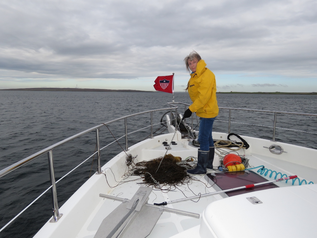
We decided to move on to the next anchorage after returning from the Scapa Flow Museum. Wilson’s anchor trip line came up tangled with a big mass of weeds. It was easier to just pull the whole mess on deck and deal with it there.
|
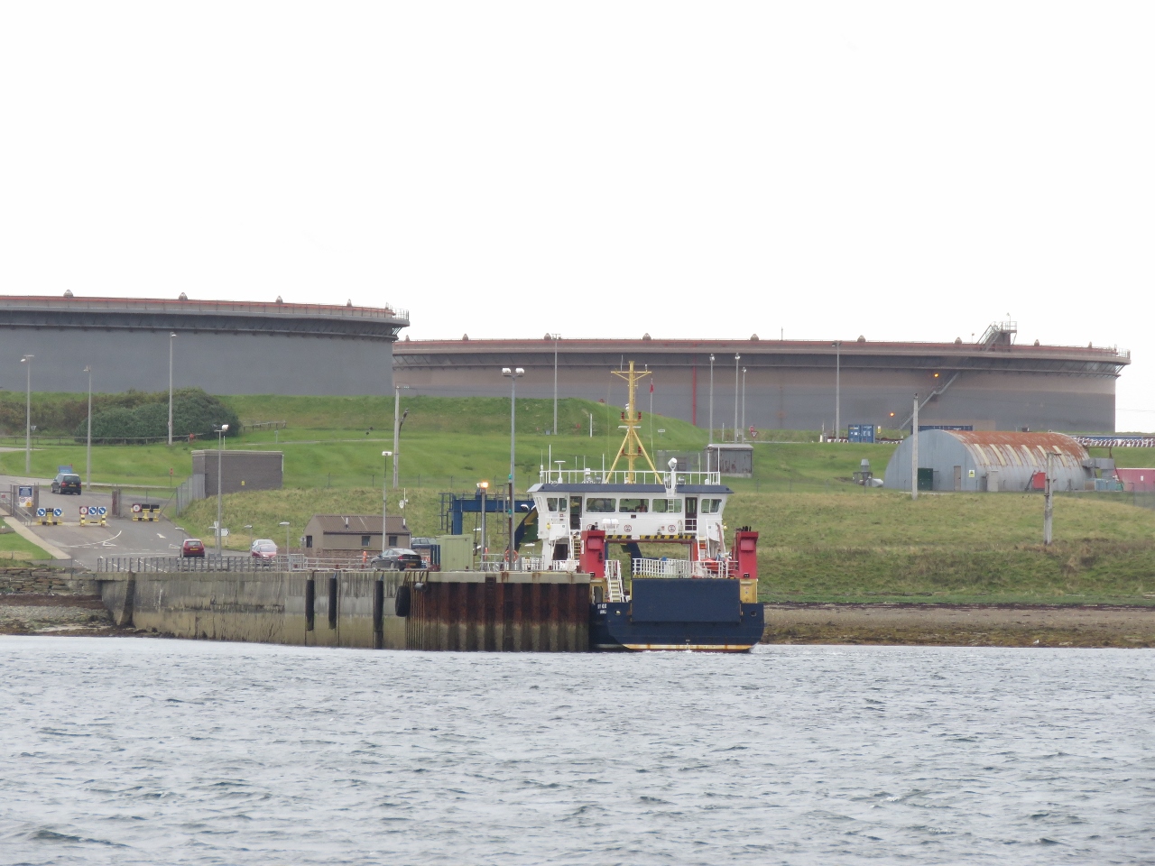 |
Flotta Pier
Position: -3 8.60, 58 50.33
The ferry Hoy Head at the Flotta Island pier with the oil terminal in the background. The Flotta Island oil terminal was completed in 1974 and became the second largest in the UK. It is the landing point for the North Sea Piper and Claymore Oil fields and also is used to receive and transfer oil produced off the UK Atlantic coast.
|
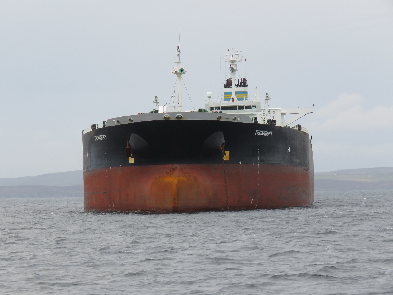 |
Thornbury
Position: -2 57.58, 58 52.39
The oil tanker Thornbury is one of several anchored off Flotta Island. The vessel is incredibly beamy at 141ft (43m) wide, nearly three times the length of Dirona.
|
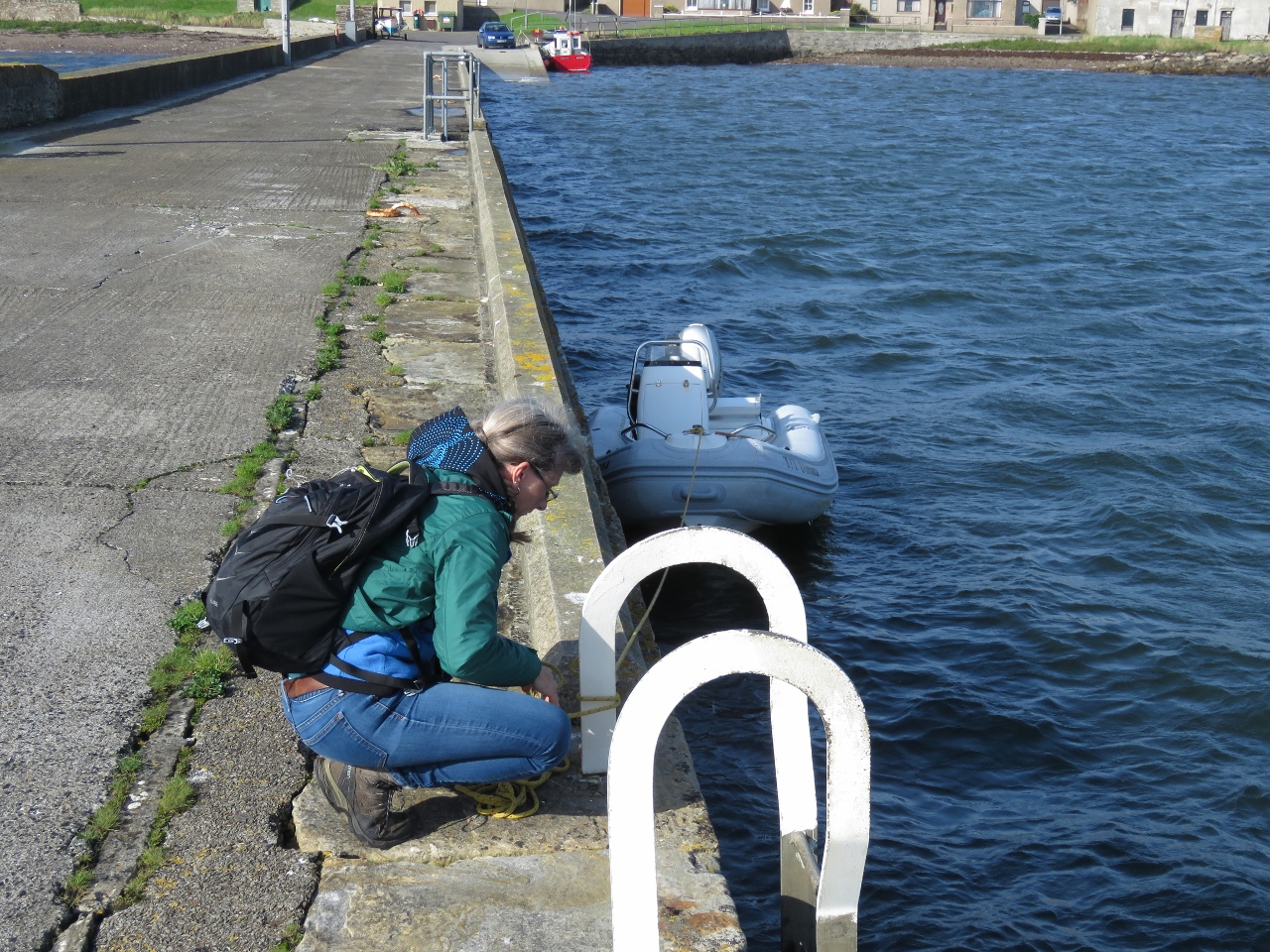 |
St Mary’s Pier
Position: -2 54.65, 58 53.70
Tying the tender off at St. Mary’s pier for a walk around the area.
|
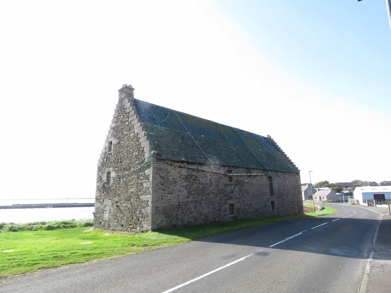 |
Roof
Position: -2 54.52, 58 53.77
This roof is covered with nets weighted down with wooden beams, presumably to prevent the slate tiles from blowing away in heavy winds.
|
 |
Dirona
Position: -2 54.46, 58 53.76
Dirona anchored at St. Mary’s Bay, back lit in the afternoon sun.
|
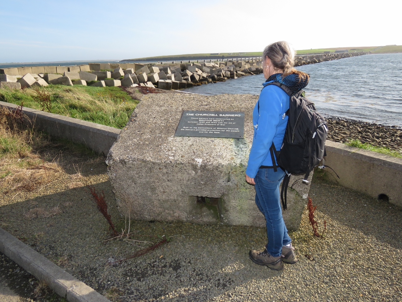 |
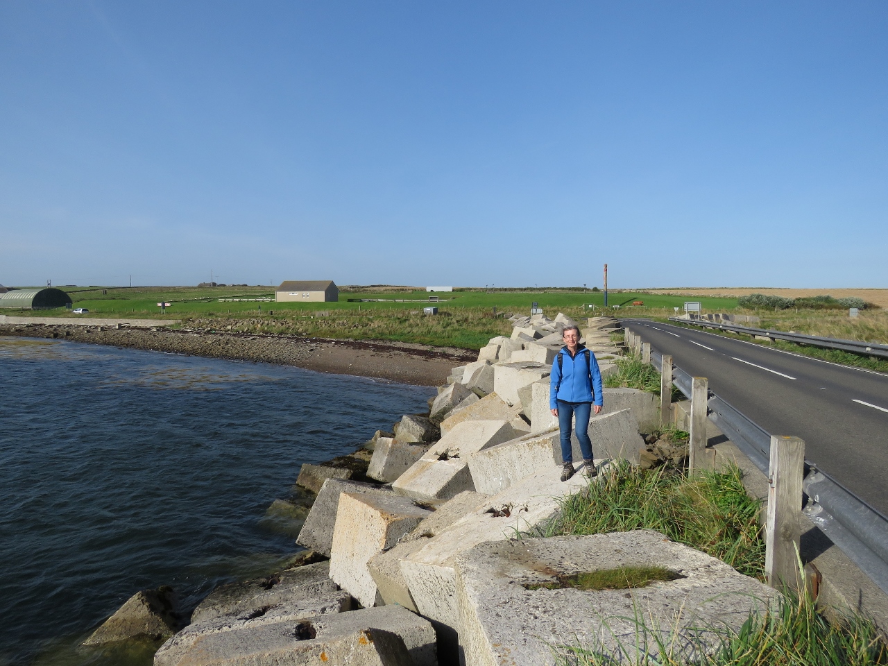
Churchill Barriers
Position: -2 53.91, 58 53.74
Scapa Flow was the base for the British Naval fleet in the First and Second World Wars. In October of 1939, the German U-boat U-47 crept into the bay through Kirk Sound, just visible beyond the road on the left, and sunk the British battleship Royal Oak. To protect Scapa Flow, Winston Churchill, then First Lord of the Admiralty, ordered the construction of barriers across the eastern side of Scapa Flow.
66,000 locally cast concrete blocks, such as the one Jennifer is standing beside, were dropped onto a base of broken rock to block the channel and act as wave breaks. |
|
|
Churchill Barrier 1
Position: -2 53.83, 58 53.70
Walking Churchill Barrier 1 across Kirk Sound between Mainland and Lamb Holm.
|
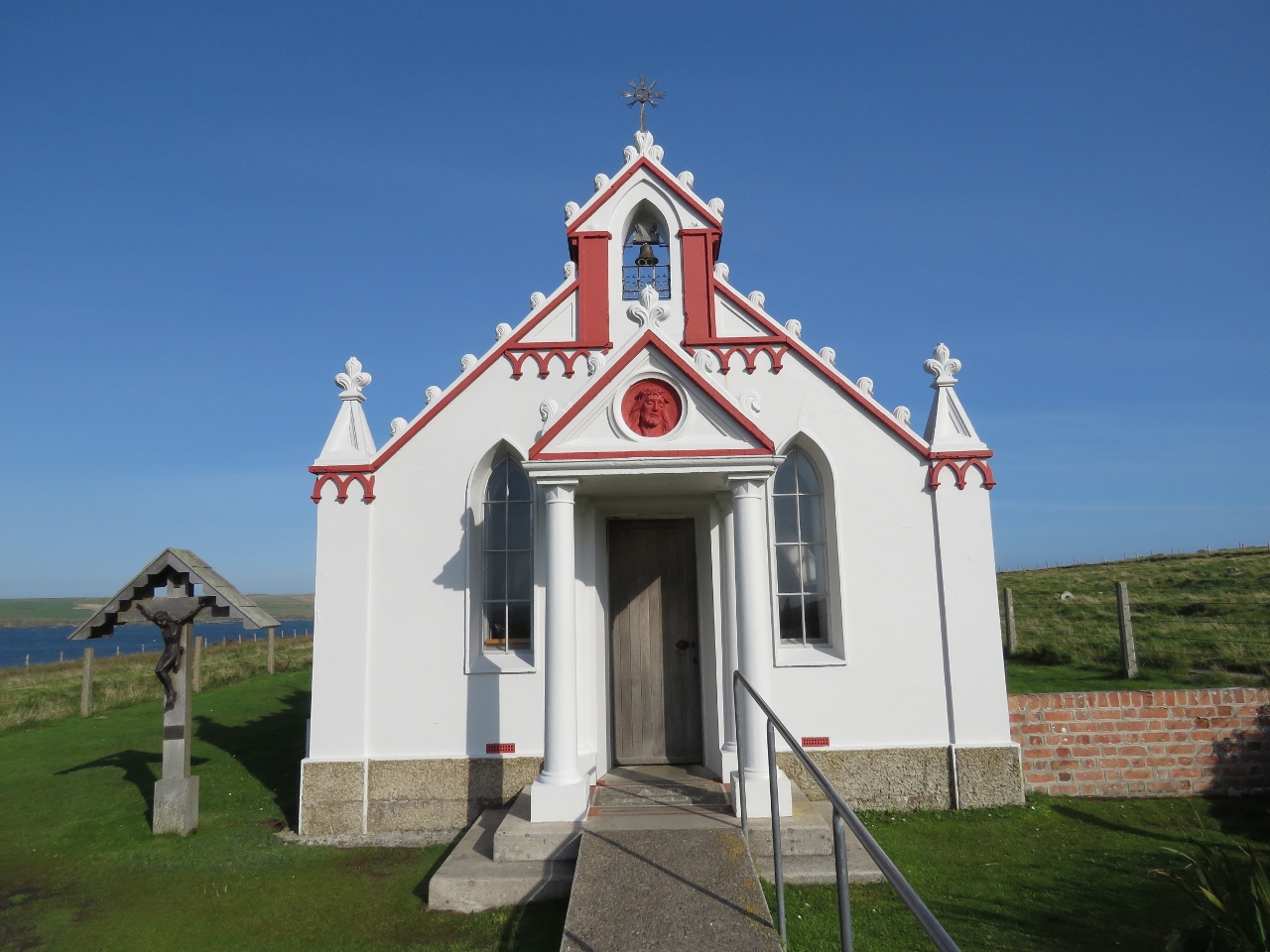 |
Italian Chapel
Position: -2 53.37, 58 53.39
Over 1,300 Italian prisoners of war were brought in to work on the construction of the Churchill Barriers. Those interned on Lamb Holm were given permission to build a chapel using mainly materials on hand. They joined to half-cylindrical Nissen huts together and using concrete leftover from building the barriers, created a facade that hid the huts.
|
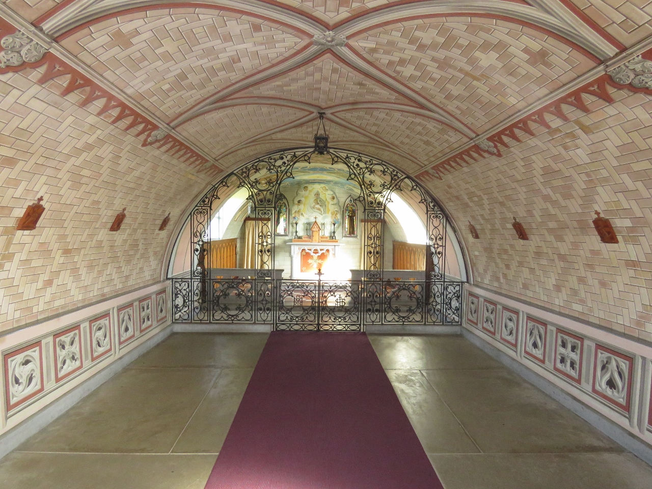 |
Chapel Interior
Position: -2 53.37, 58 53.39
The interior walls and ceiling of the chapel were painted to look like stonework.
|
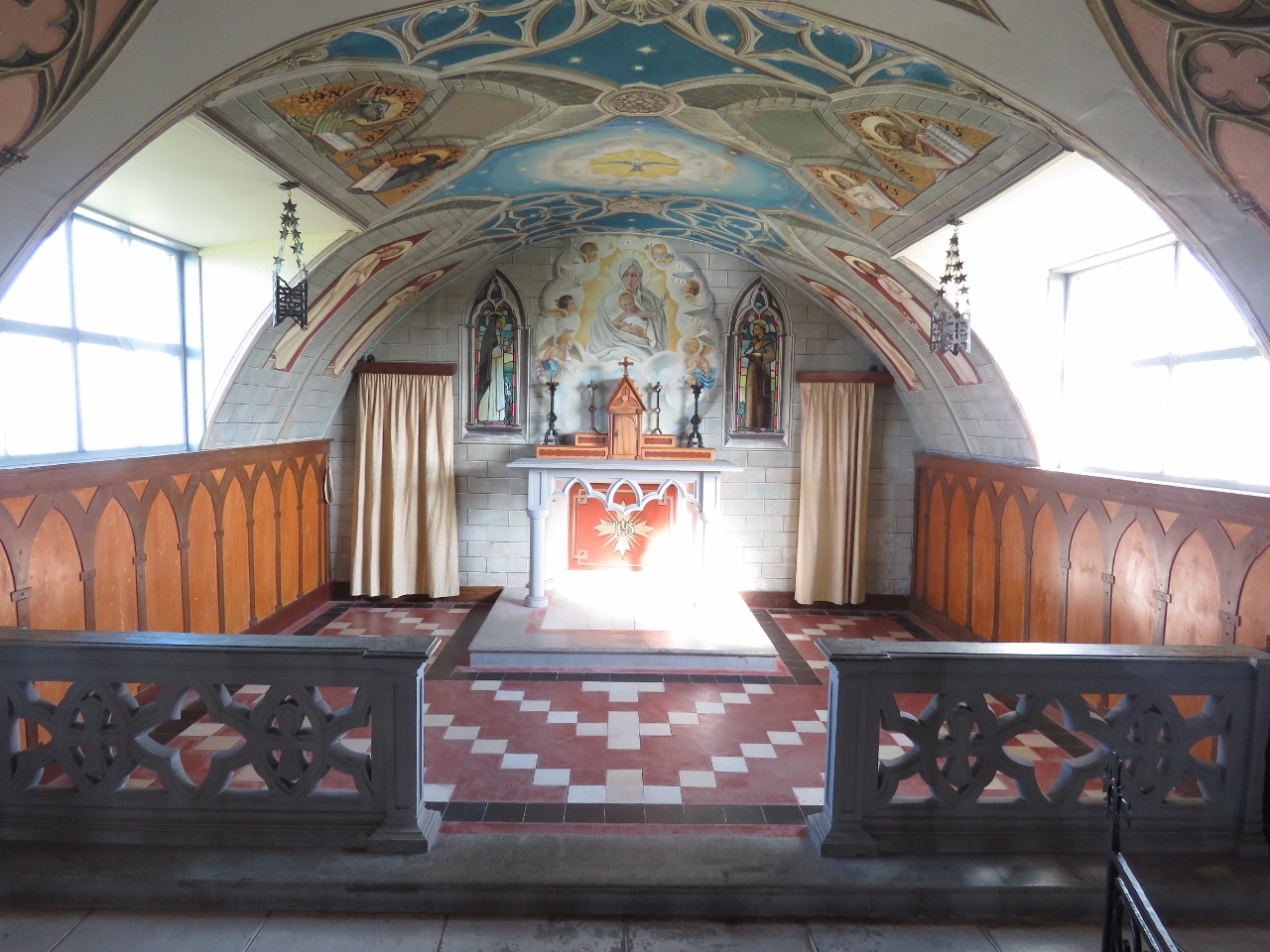 |
Alter
Position: -2 53.38, 58 53.39
Artist Domenico Chiocchetti created most of the chapel interior, with help from fellow prisoners of war blacksmith Giuseppe Palumbi and cement worker Domenico Buttapasta. It is amazing what they were able to create with scavenged materials. Chiocchetti remained to complete the chapel after the prisoners were released shortly before the end of the war, and returned in 1960 to help with a restoration effort.
|
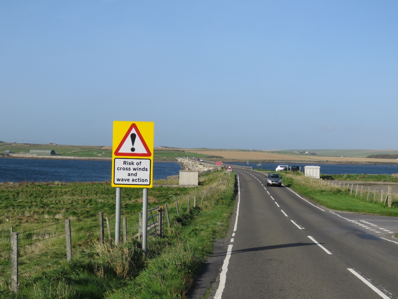 |
Wind Warning
Position: -2 53.73, 58 53.34
The Churchill Barriers support causeways that sometimes are closed due to high winds and waves.
|
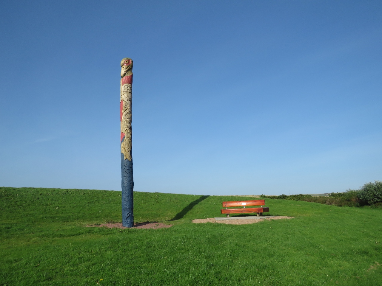 |
Totem Pole
Position: -2 53.85, 58 53.75
Back on Mainland, opposite the north end of Churchill Barrier 1, we were amazed to find a Pacific Northwest totem pole. The pole was built as a joint effort between carvers from Canada’s Squamish First Nation, Scotland, and members of the local community. Squamish is in southern British Columbia, not far from Vancouver.
|
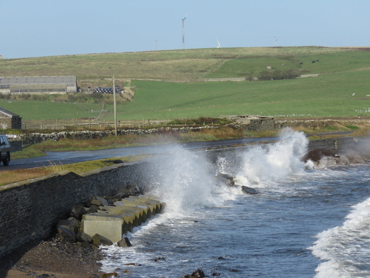 |
Waves
Position: -2 53.45, 58 53.90
From the Italian Chapel we could see waves crashing over the road and walked down to see them. The winds weren’t particularly high today, but waves constantly swept the road.
|

|
Click the travel log icon on the left to see these locations on a map, with the complete log of our cruise.
On the map page, clicking on a camera or text icon will display a picture and/or log entry for that location, and clicking on the smaller icons along the route will display latitude, longitude and other navigation data for that location. And a live map of our current route and most recent log entries always is available at http://mvdirona.com/maps. |
If your comment doesn't show up right away, send us email and we'll dredge it out of the spam filter.