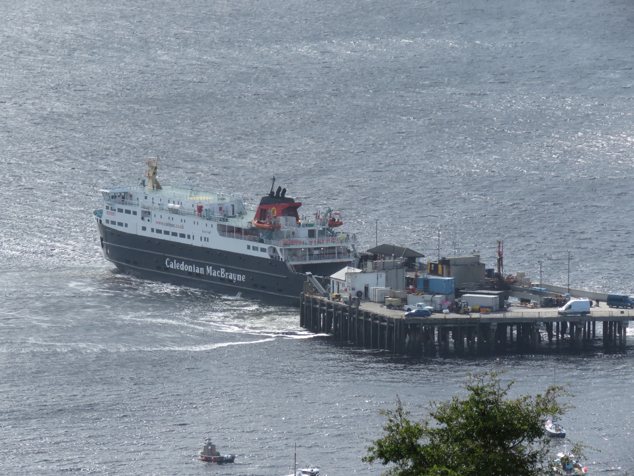
The spectacular Isle of Skye scenery makes it one of Scotland’s top three tourist destinations, along with Edinburgh and Loch Ness. We had considered visiting Skye in Dirona, but instead opted to make a day trip by ferry from Loch Maddy. This gave us the added bonus riding one of the big CalMac ferries, something Jennifer had been wanting to do since first seeing them in Malaig on our West Highland Line trip.
Trip highlights from September 24th on the Isle of Skye, Scotland follow. Click any image for a larger view, or click the position to view the location on a map. And a live map of our current route and most recent log entries always is available at http://mvdirona.com/maps
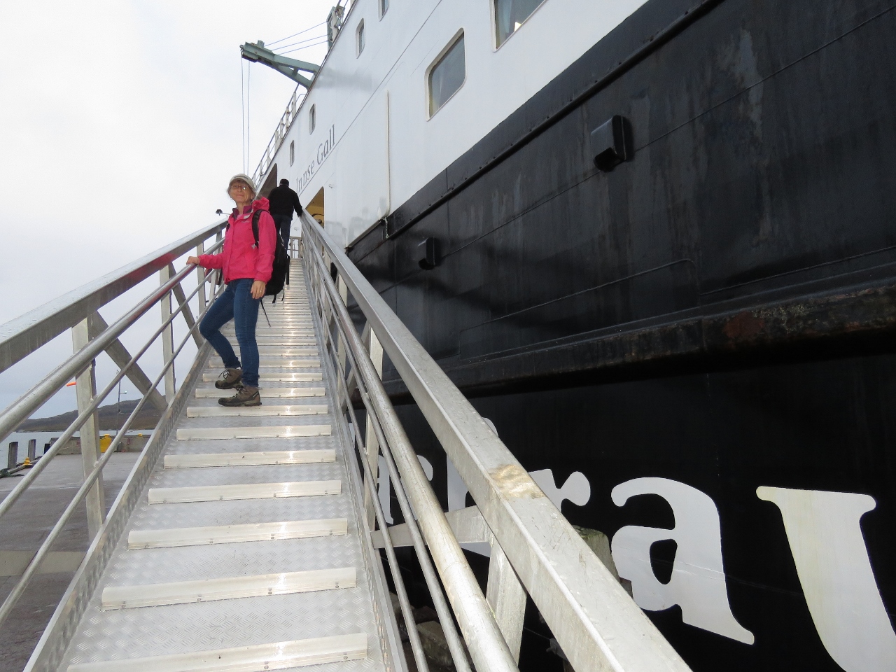 |
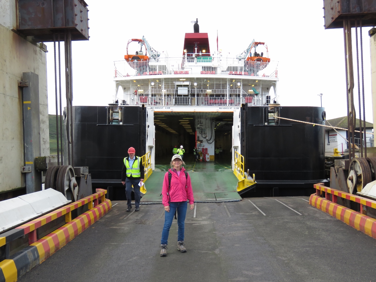
Boarding
Position: -7 9.42, 57 35.79
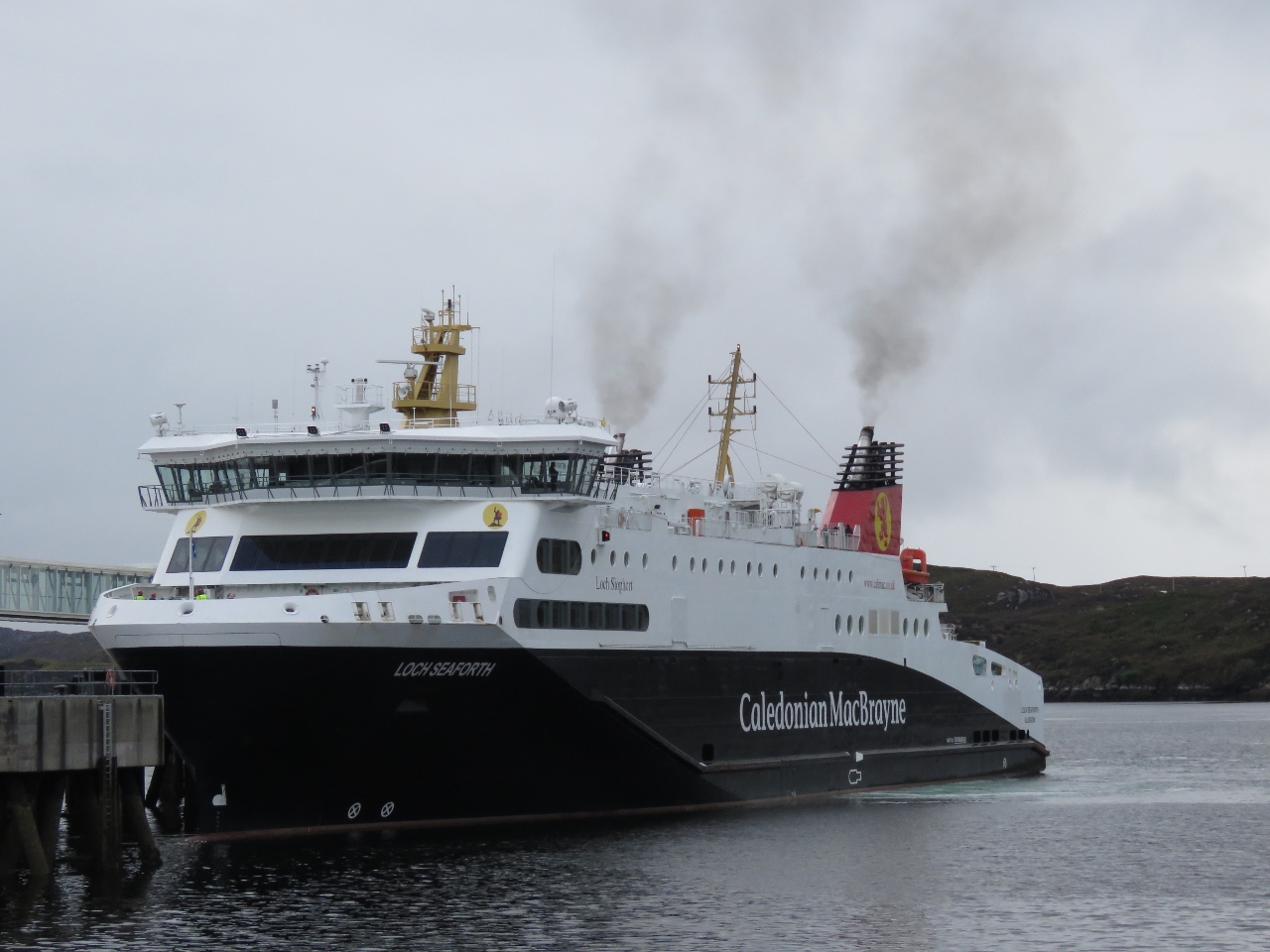
Boarding the Hebrides for our day trip to the Isle of Skye.
|
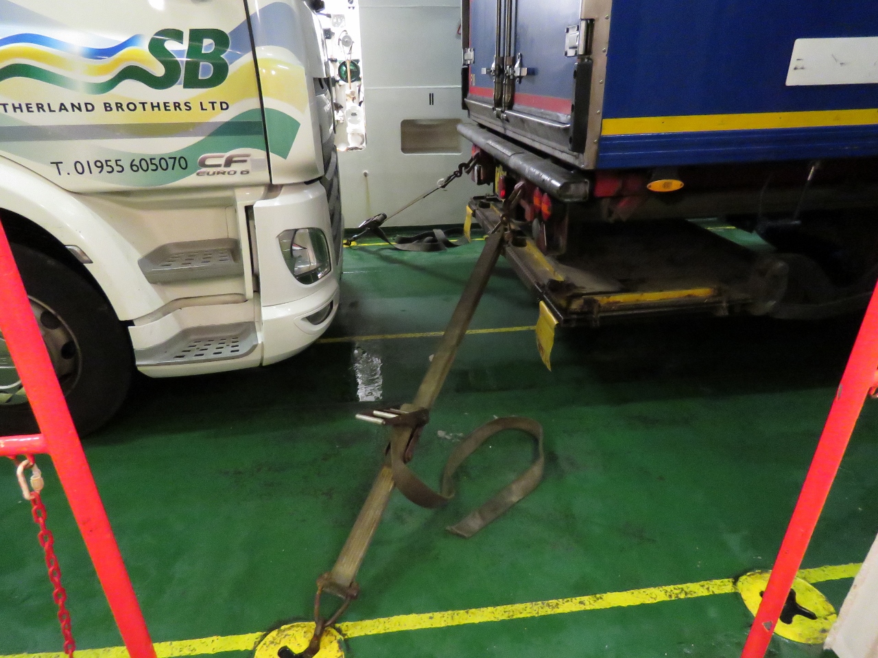 |
Straps
Position: -7 9.42, 57 35.79
All the trucks on the Hebrides were strapped down. Conditions must get pretty rough out there.
|
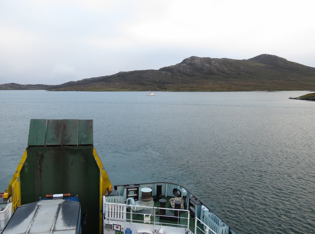 |
Loch Maddy
Position: -7 9.38, 57 35.77
View to our anchorage in Loch Maddy from the Hebrides.
|
 |
Wake
Position: -7 8.30, 57 35.99
Leaving Loch Maddy on the Hebrides.
|
 |
Uig
Position: -6 22.16, 57 35.10
Arriving into Uig on the Isle of Skye.
|
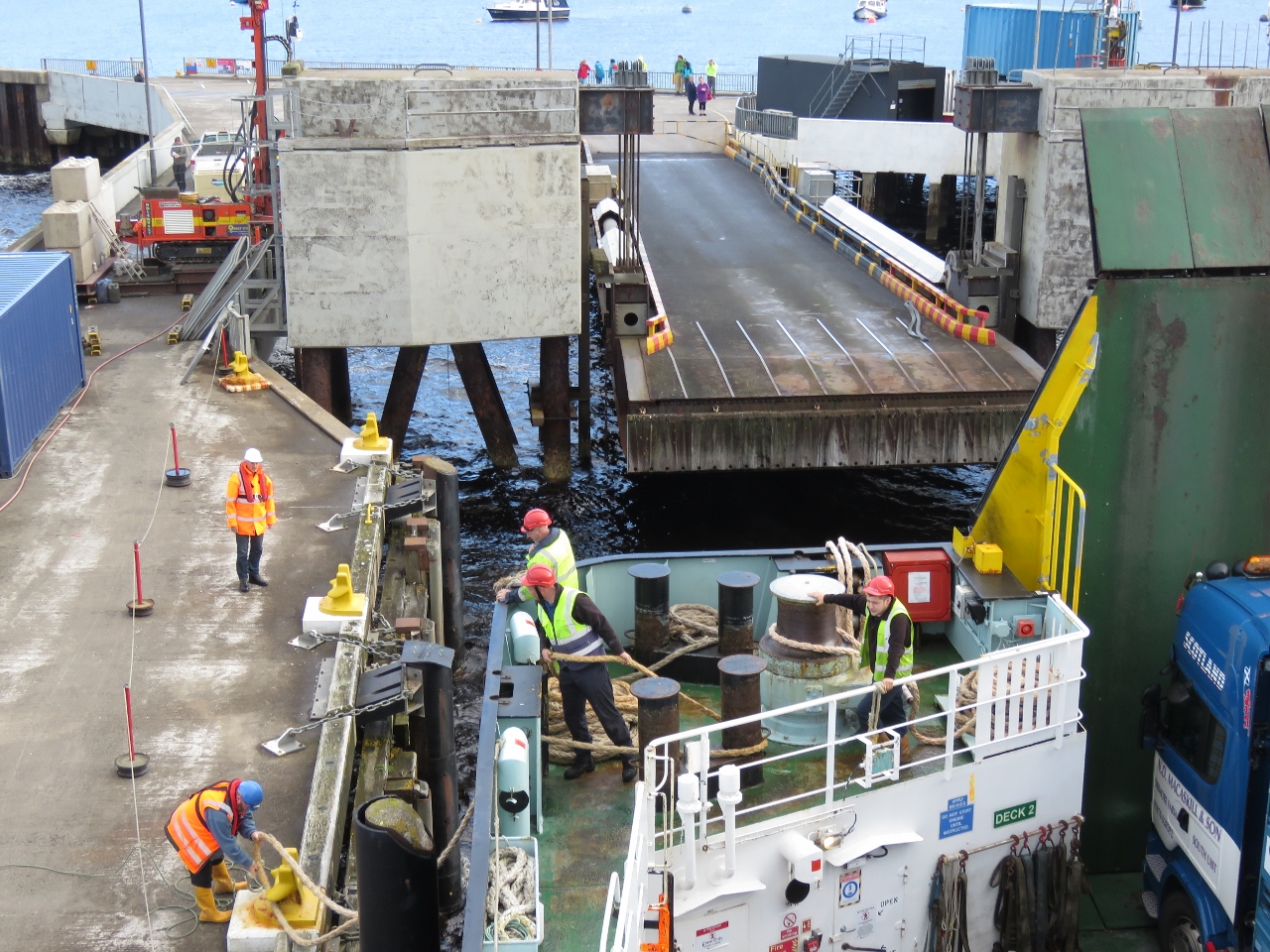 |
Lines
Position: -6 22.30, 57 35.09
The crew running lines ashore as the Hebrides comes onto the pier.
|
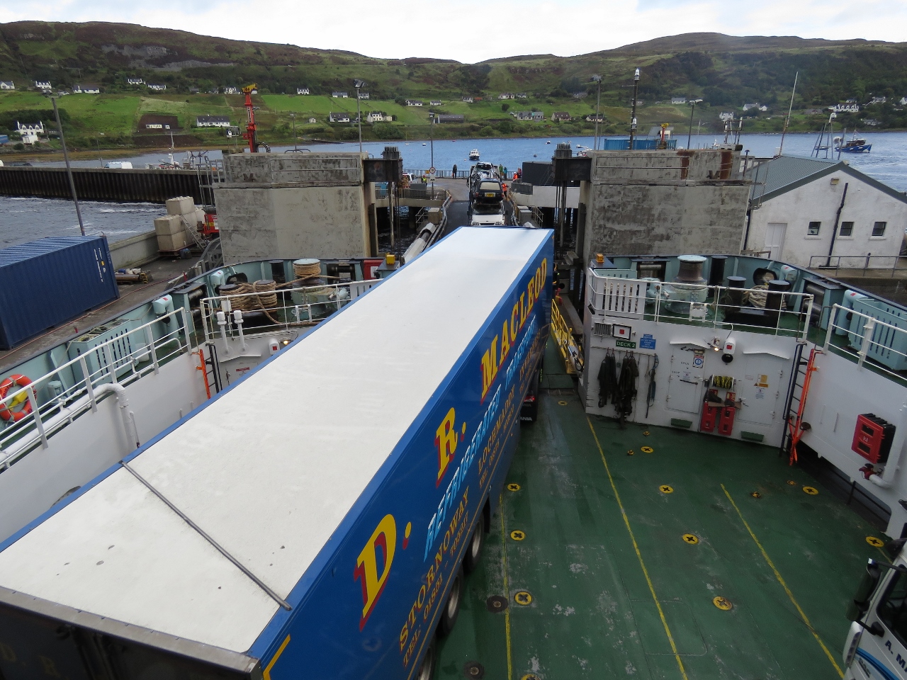 |
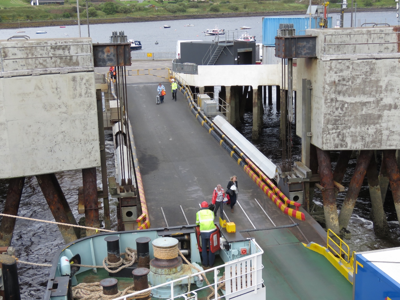
Unloading
Position: -6 22.31, 57 35.10
The pedestrian exit was closed due to construction, so passengers had to wait for the vehicle deck to empty before we could exit through the ramp. So we got to watch the drivers maneuver their big trucks through the narrow ramp.
|
 |
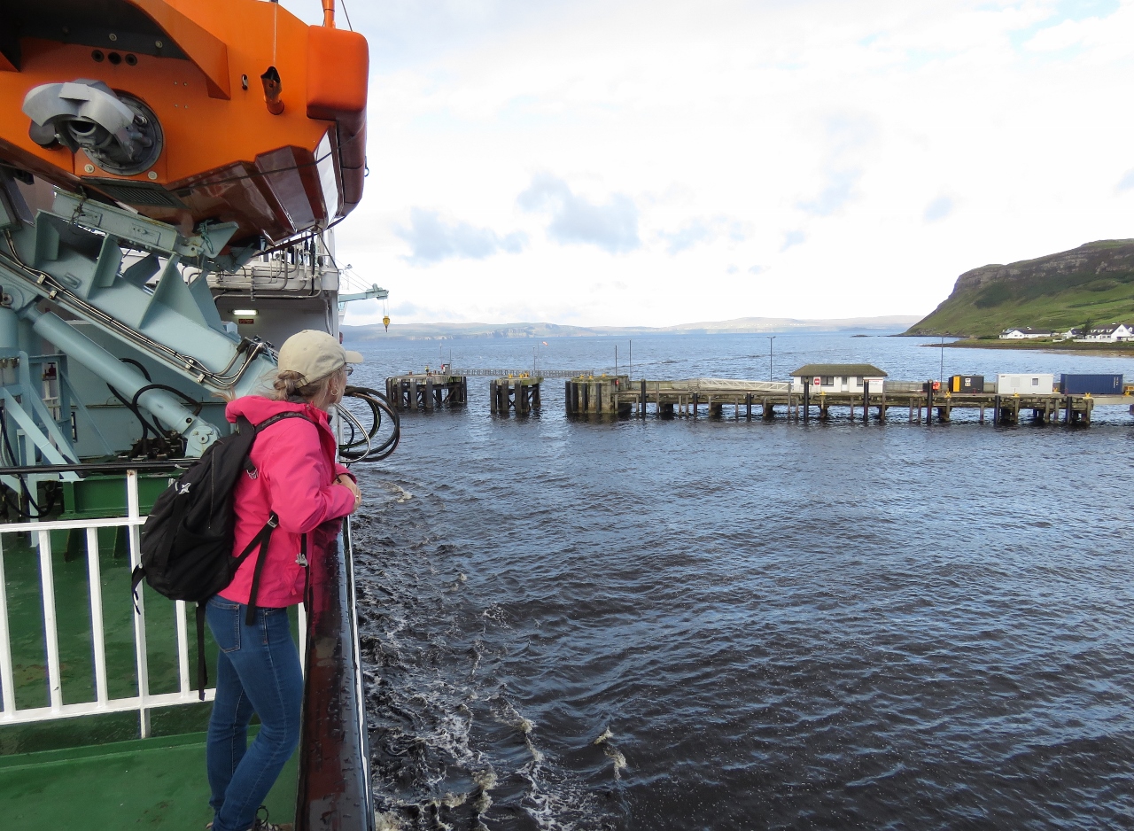
Last One Off
Position: -6 22.31, 57 35.12
Jennifer was the last passenger off the ferry. We had an excellent trip over, including a delicious breakfast.
|
 |
Uig Bay
Position: -6 21.87, 57 34.69
Looking back down to the Hebrides on the dock in Uig Bay shortly after leaving Uig for our tour around Skye.
|
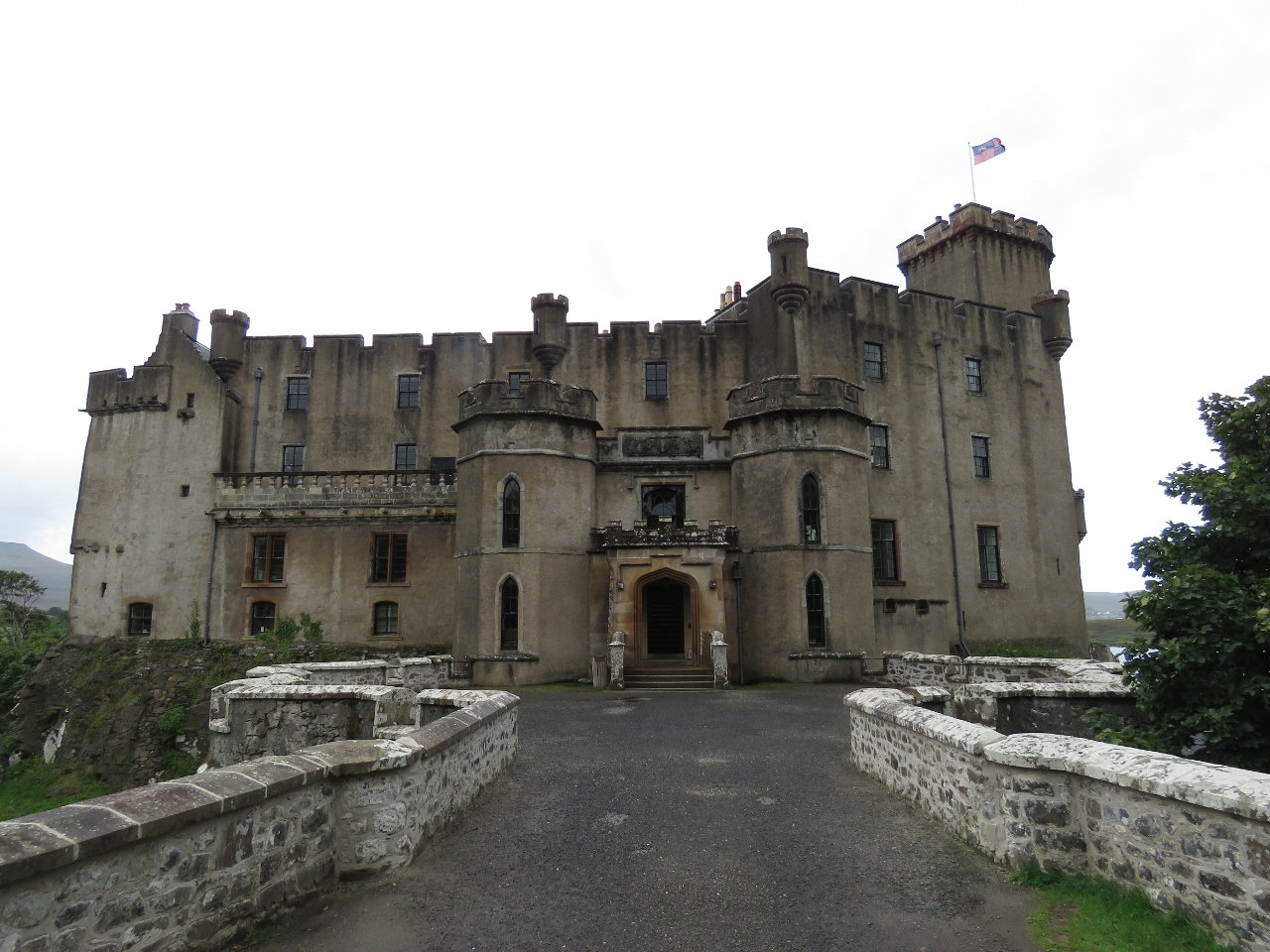 |
Dunvegan Castle
Position: -6 35.37, 57 26.92
Our first stop on Skye was Dunvegan Castle. It has been the ancestral home of the Chiefs of the Clan McLeod for 800 years and is the oldest continuously inhabited castle in Scotland. Currently it is the part-time residence of Hugh Magnus McLeod of MacLeod, the 30th Chief of Clan MacLeaod.
|
 |
Loch Dunvegan
Position: -6 35.39, 57 26.91
Looking out the window to Loch Dunvegan from Dunvegan Castle. The castle is full of historic paintings and artifacts relating to Clan MacLeaod and the fact that the castle still is a Clan MacLeaod residence made everything seem more real and personal. Unfortunately, photography of the living areas inside the castle isn’t allowed.
|
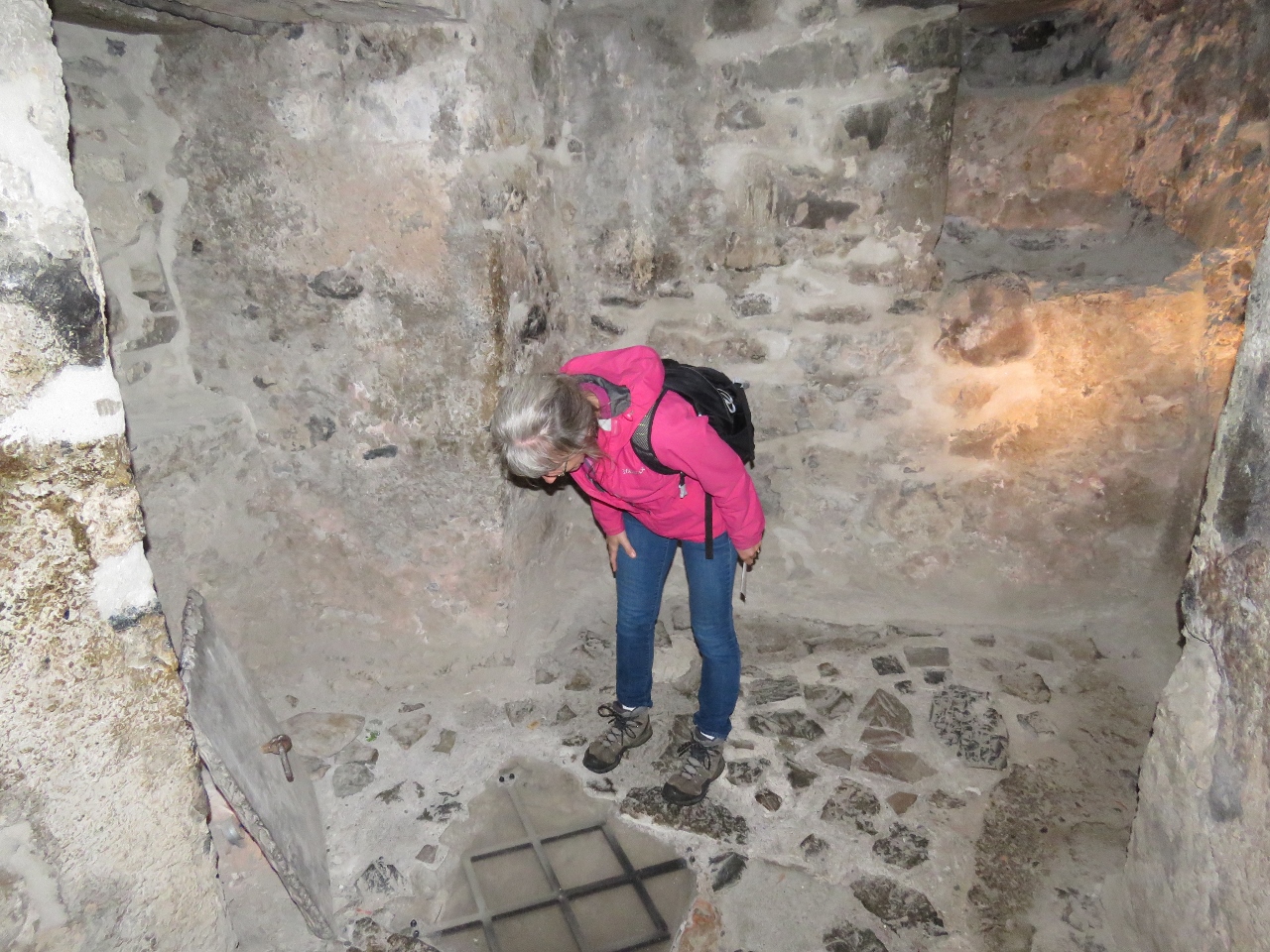 |
Dungeon
Position: -6 35.42, 57 26.91
The castle comes complete with a dungeon. Jennifer is looking down into the cell where prisoners once were kept.
|
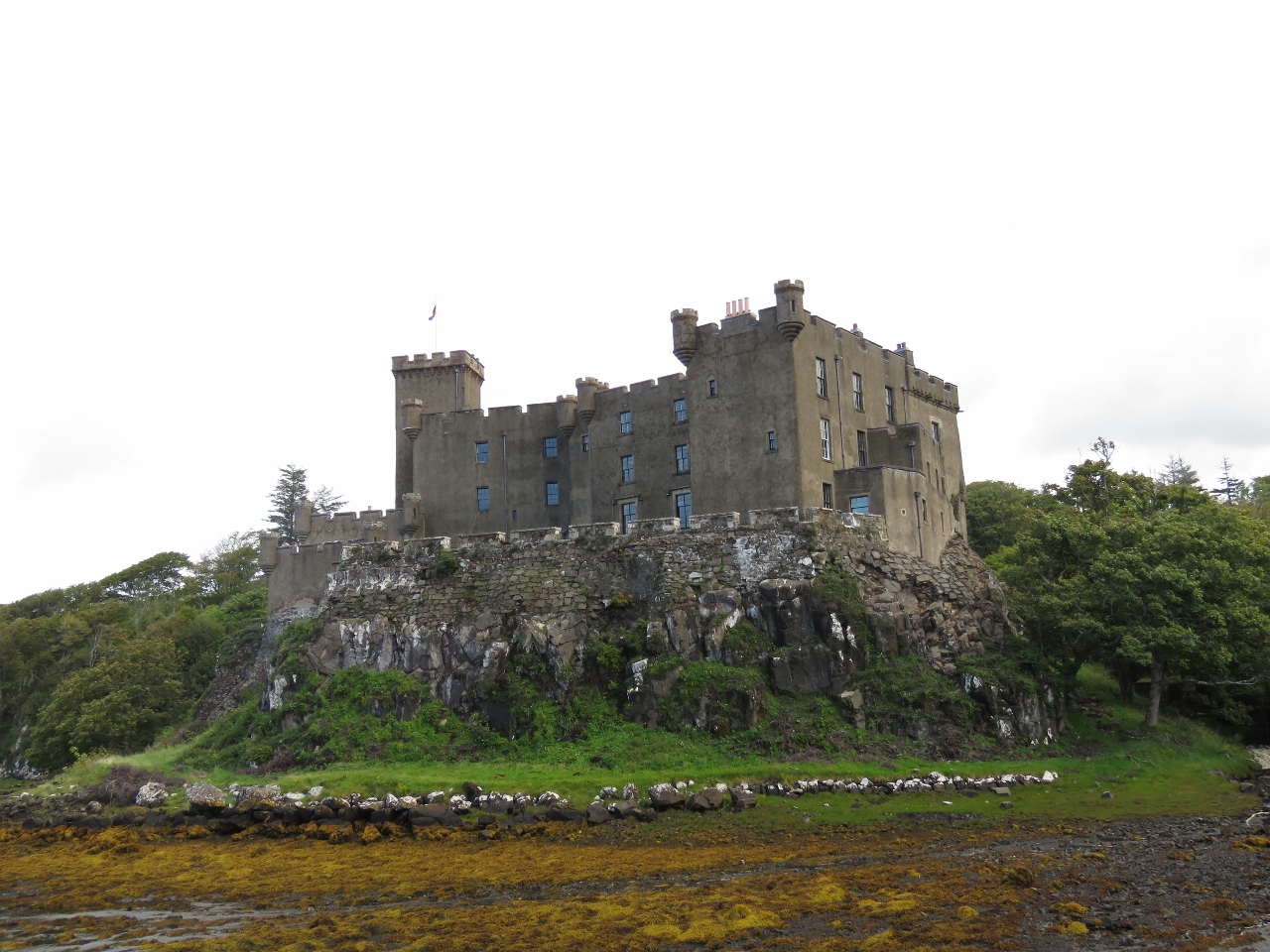 |
Castle View
Position: -6 35.45, 57 26.86
The view to Castle Dunvegan from a peninsula behind.
|
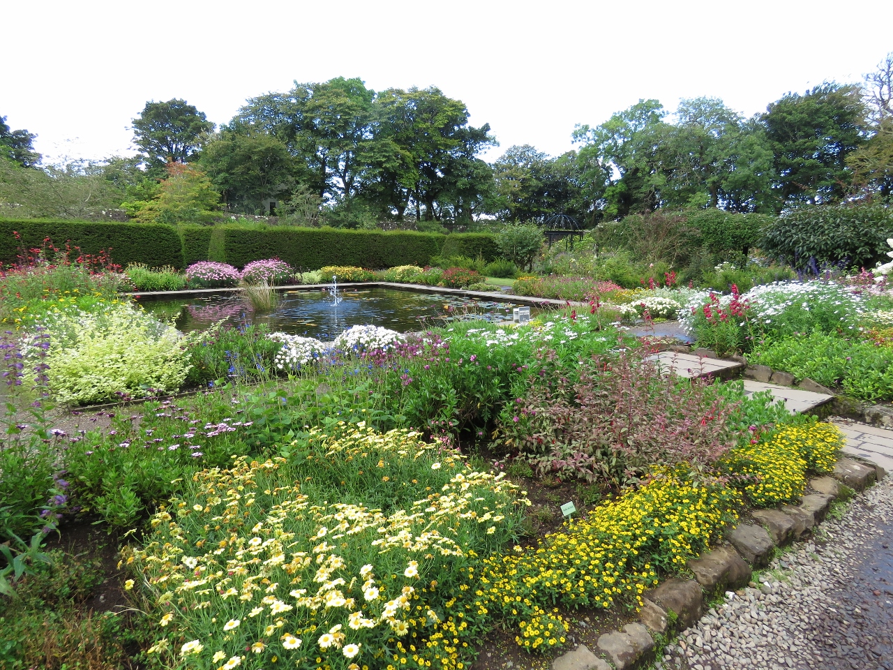 |
Walled Garden
Position: -6 35.33, 57 26.79
After touring the castle, we walked through the impressive grounds. This is the fountain in the center of the “Walled Garden”.
|
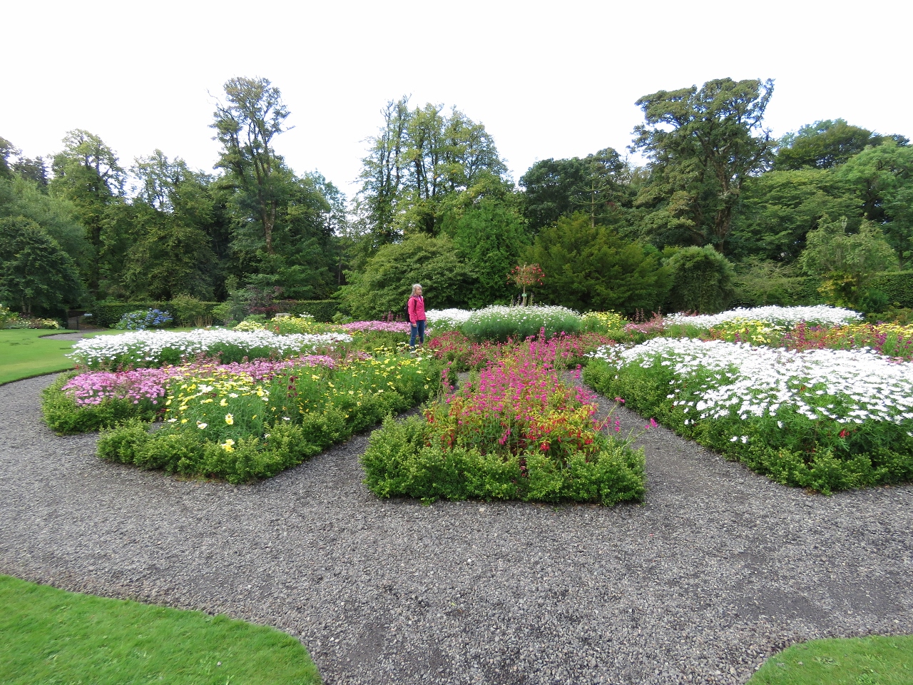 |
Round Garden
Position: -6 35.31, 57 26.82
Jennifer enjoying the flowers in the “Round Garden”.
|
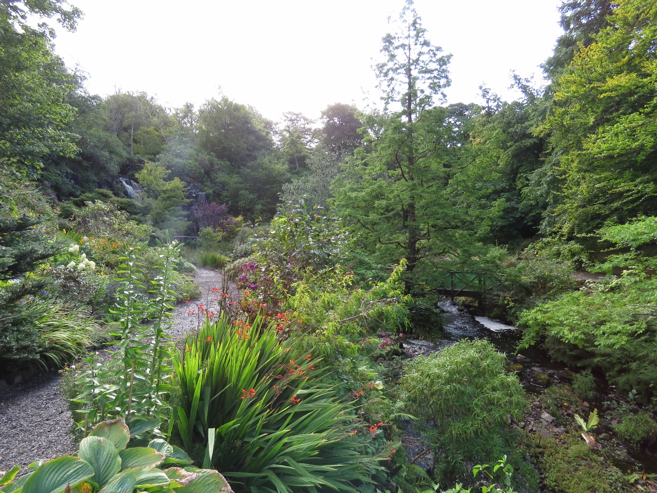 |
Water Garden
Position: -6 35.28, 57 26.86
The “Water Garden” was the most striking garden. At the back on the left is a large waterfall that flows to sea through the stream visible on the rights.
|
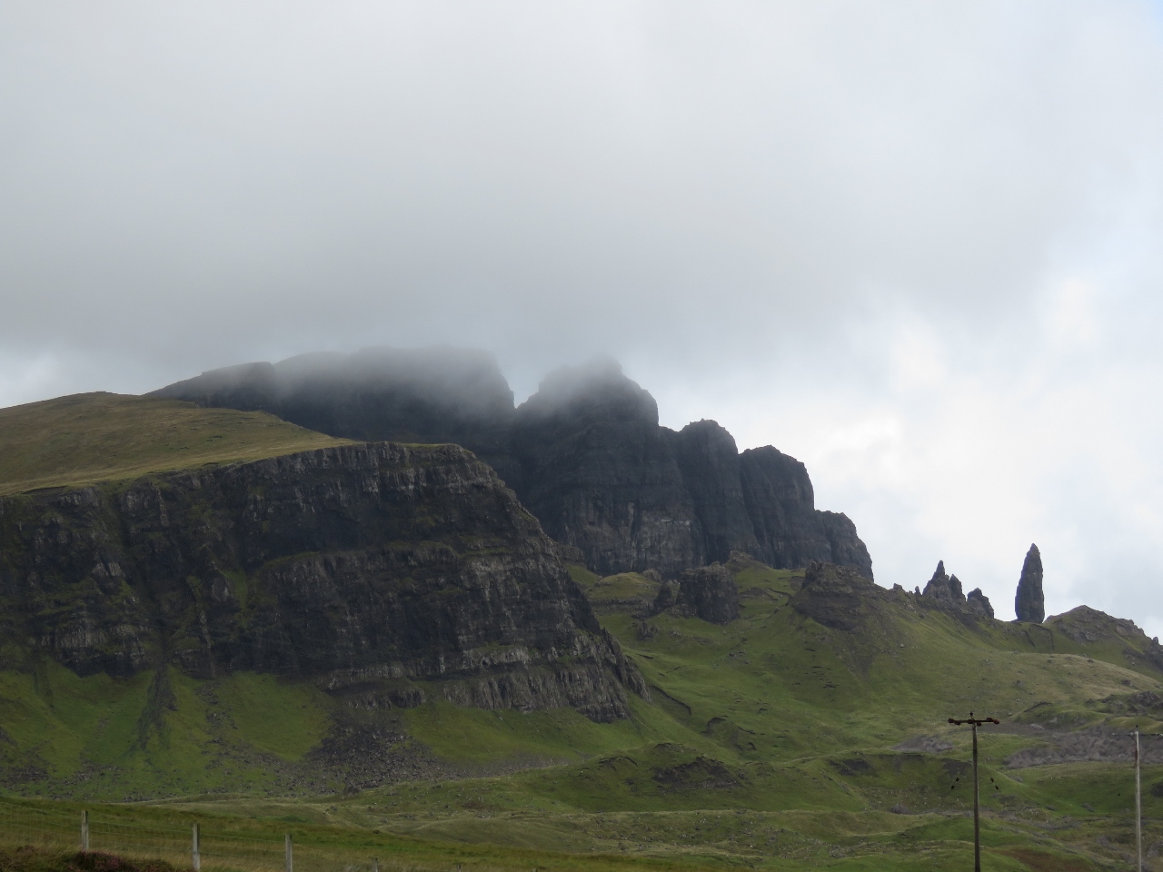 |
Old Man of Storr
Position: -6 10.48, 57 29.12
The pinnacle rock “Old Man of Storr” on the right below the Storr Cliffs on the east shore of Skye. The day had mostly been overcast and the clouds were just starting to lift as we approached.
|
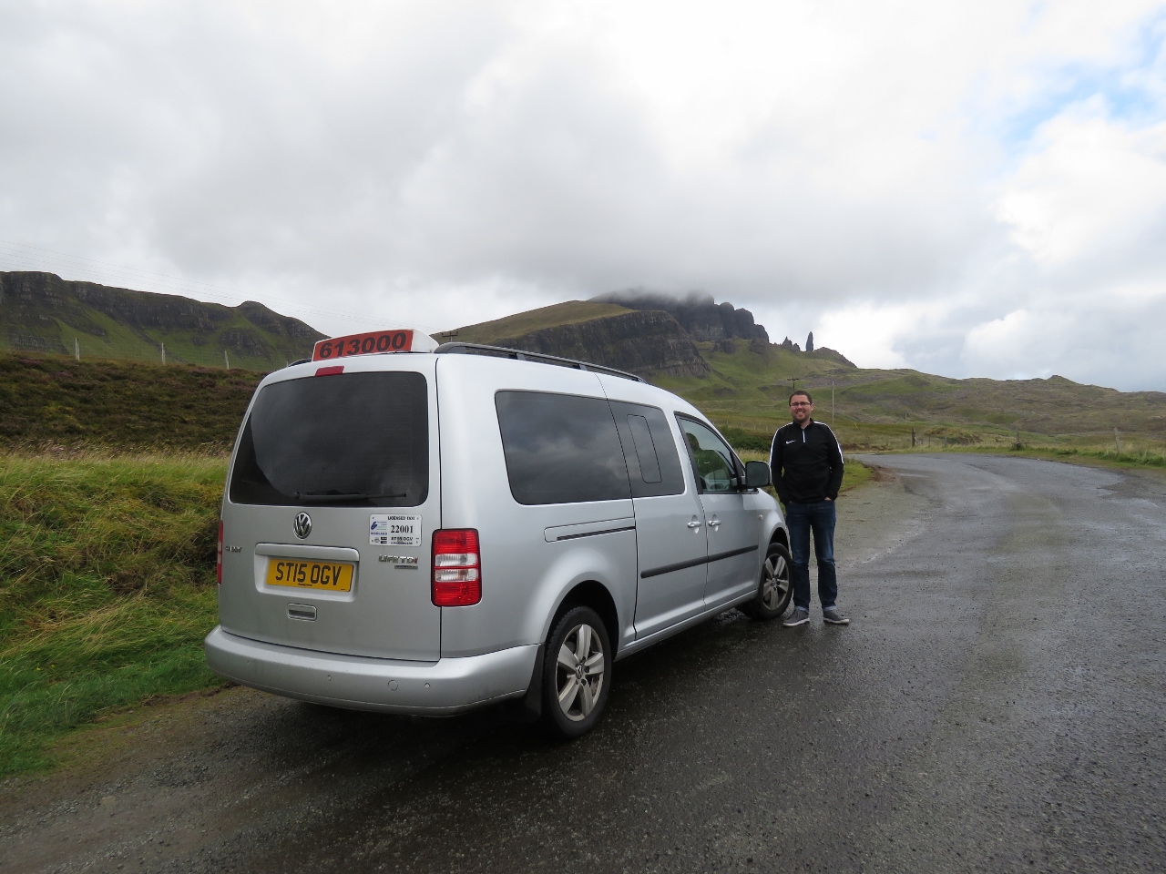 |
Gus’s Taxis, Skye
Position: -6 10.47, 57 29.15
Kenny Gillies of Gus’s Taxis was an excellent tour guide for our time on Skye. He was waiting for us when the ferry arrived and made excellent use of our few hours on the island.
|
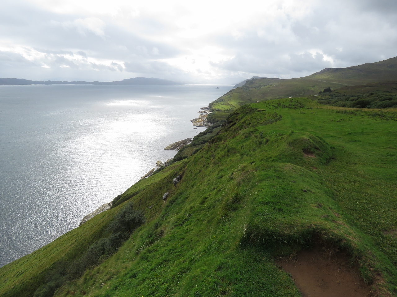 |
Sound of Raasay
Position: -6 8.70, 57 32.50
Looking south across the Sound of Raasay from an excellent viewpoint just off the main road. We had a list of attractions we wanted to see and this was one we didn’t know about but Kenny thought we’d like. He was right.
|
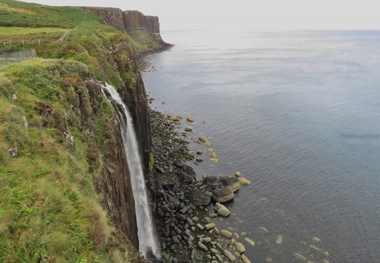 |
Mealt Waterfall
Position: -6 10.33, 57 36.65
Mealt Waterfall with the Kilt Rock sea cliffs in the distance. The cliffs resemble a kilt from face-on.
|
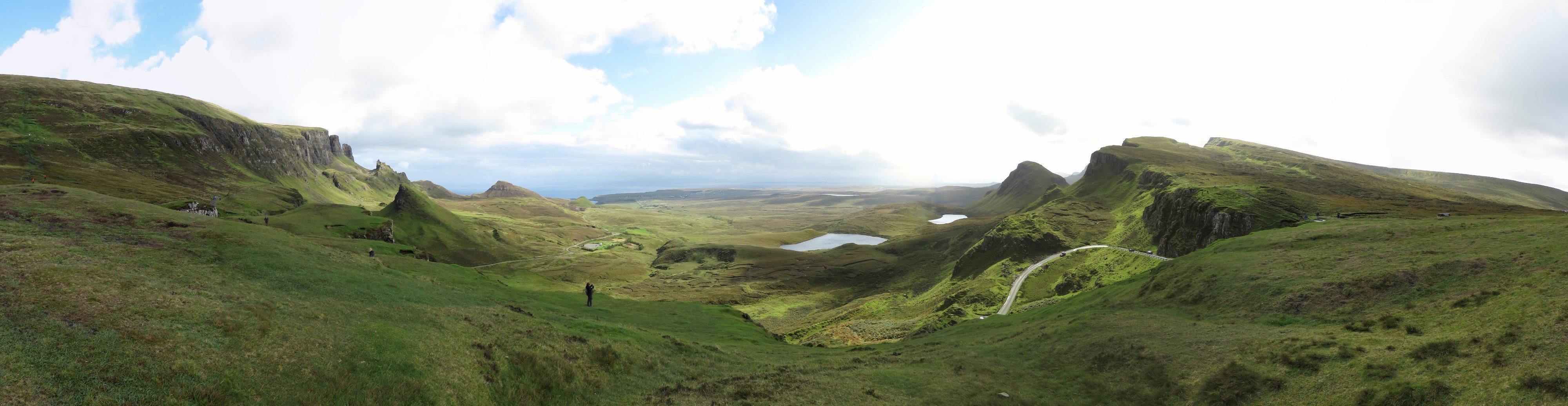 |
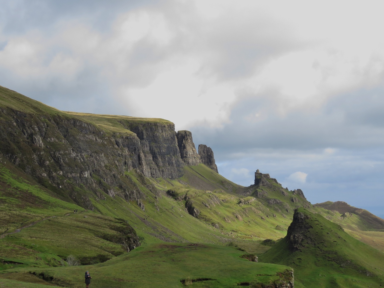
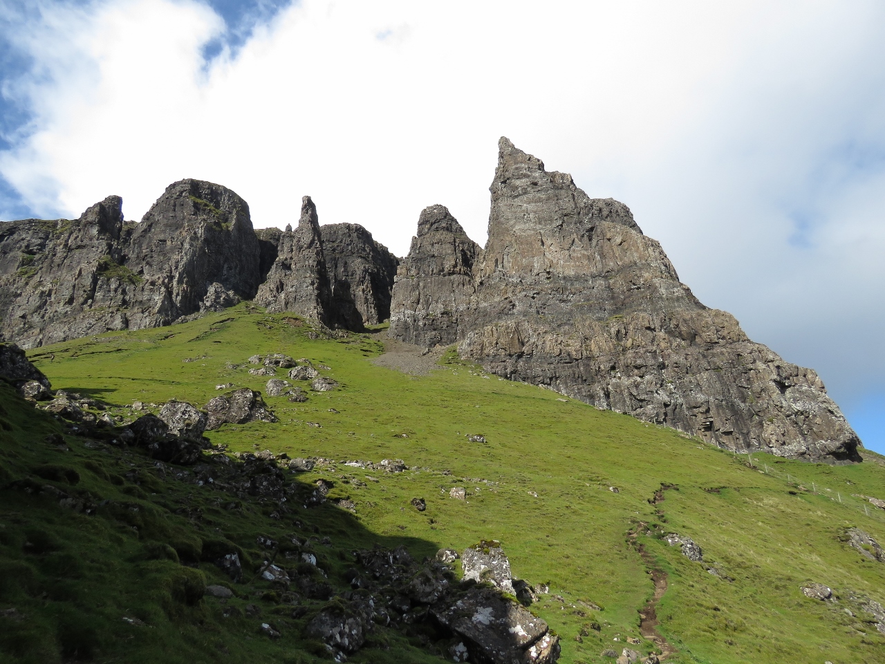
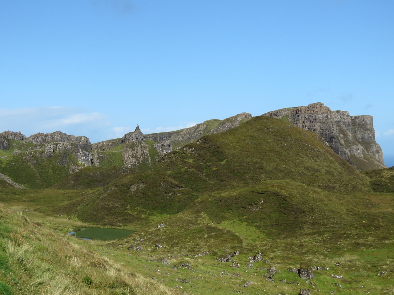
Quiraing
Position: -6 17.33, 57 37.75
Our biggest time allocation on Skye was a visit to the fabulous Quiraing on Trotternish Ridge. The ridge was formed by a huge continuous landslide that created high cliffs, pinnacles and plateaus. The Quiraing portion is actually still moving—the road at its base needs repairing every year. We drove up the curving road you see in the picture and hiked out to the base of the cliffs visible in the distance on the left.
|
|
|
Cliffs
Position: -6 17.33, 57 37.75
We knew the scenery was going to be impressive, but this was even better than we were expecting. And we’d been lucky with the weather so far—the morning’s clouds were clearing.
|
 |
The Prison
Position: -6 16.45, 57 38.23
The formation on the right looks like a prison cell when viewed from certain angles.
|
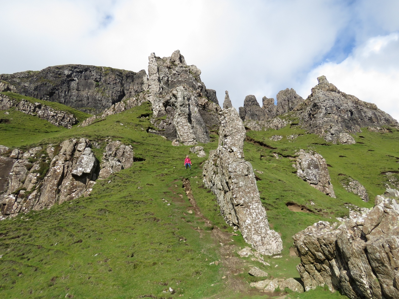 |
Pinnacles
Position: -6 16.28, 57 38.24
Jennifer climbing up to the pinnacles above The Prison. The wind was blowing so hard here that we had to work to stand against it.
|
 |
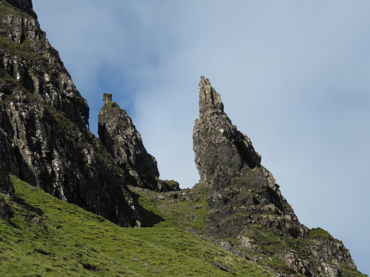
The Needle
Position: -6 16.20, 57 38.31
“The Needle” pinnacle slightly left of center.
|
 |
View to Sea
Position: -6 16.23, 57 38.40
The view to the Sound of Raasay from the pinnacles.
|
 |
Spires
Position: -6 16.24, 57 38.44
More spectacular formations around the corner from the pinnacles.
|
 |
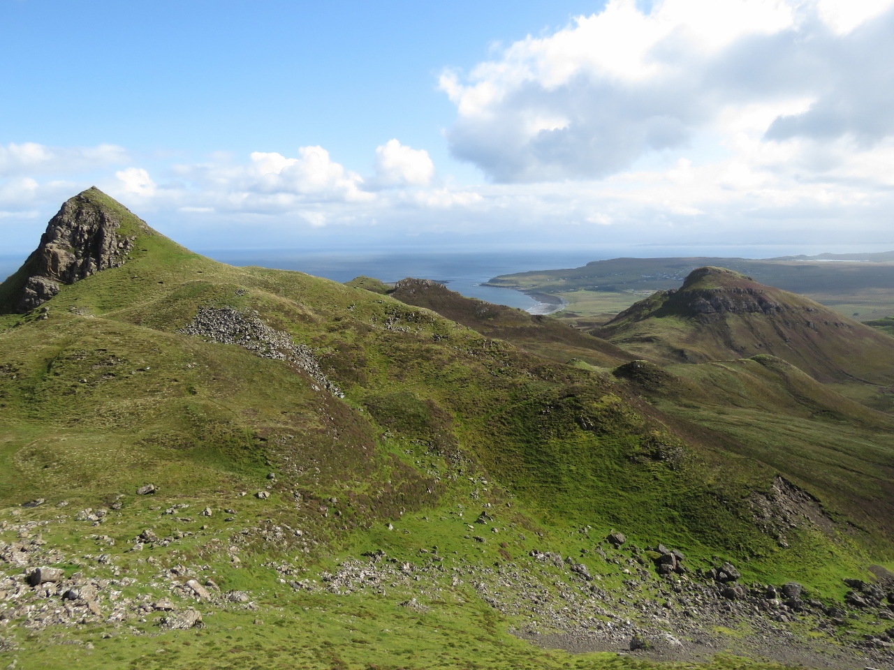
Sron Vourlinn
Position: -6 16.30, 57 38.56
We turned back after taking in the 1,250ft (380m) soaring sea cliffs of Sron Vourlinn. If we had more time, we would have continued back along the loop trail that runs atop the cliffs.
|
 |
Hebrides Arriving
Position: -6 21.83, 57 35.65
We returned back to Uig Bay just as the Hebrides was arriving. We better get hurry up and down the hill.
|
 |
Late Arrivals
Position: -6 22.31, 57 35.10
The ferry departed about 15 minutes behind schedule to wait for a few late-returning passengers.
|
 |
Pulling Away
Position: -6 22.30, 57 35.07
Pulling away from the pier at Uig.
|
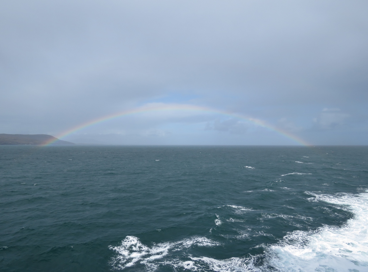 |
Rainbow
Position: -7 5.27, 57 36.06
A beautiful rainbow to cap off a very successful day.
|
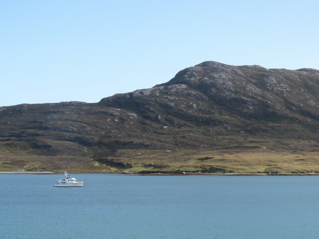 |
Dirona
Position: -7 9.38, 57 35.78
Dirona at anchor viewed from the Hebrides as we return to Loch Maddy.
|

|
Click the travel log icon on the left to see these locations on a map, with the complete log of our cruise.
On the map page, clicking on a camera or text icon will display a picture and/or log entry for that location, and clicking on the smaller icons along the route will display latitude, longitude and other navigation data for that location. And a live map of our current route and most recent log entries always is available at http://mvdirona.com/maps. |
Once again terrific photography and writing. It’s like being on holiday with you without the hectic traveling and expenses.
Cheerio for now,
Paul
There are times when we feel like we are barely keeping up ourselves :-)