In reaching the Butt of Lewis at the north end of Lewis Island, we’d been to both the most northern light in the Outer Hebrides and the most southern, on Berneray Island. Our day trip around Lewis Island also included stops at scenic Mangestra, the Standing Stones of Callanish, an historic roundhouse and several traditional Hebrides blackhouses.
Trip highlights from Sept. 9th, 2017 on the Isle of Lewis in the Outer Hebrides, Scotland follow. Click any image for a larger view, or click the position to view the location on a map. And a live map of our current route and most recent log entries always is available at http://mvdirona.com/maps
 |
Salmon River
Position: -6 45.29, 58 9.58
Salmon fishing is popular on the island and this is one of the top rivers.
|
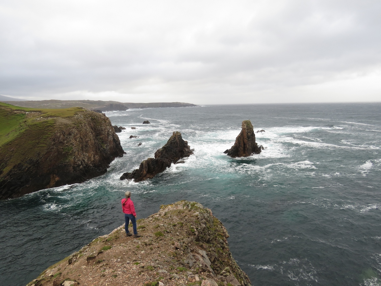 |
Mangerstra
Position: -7 5.65, 58 10.09
Jennifer perched above the fabulous seascape at Mangerstra.
|
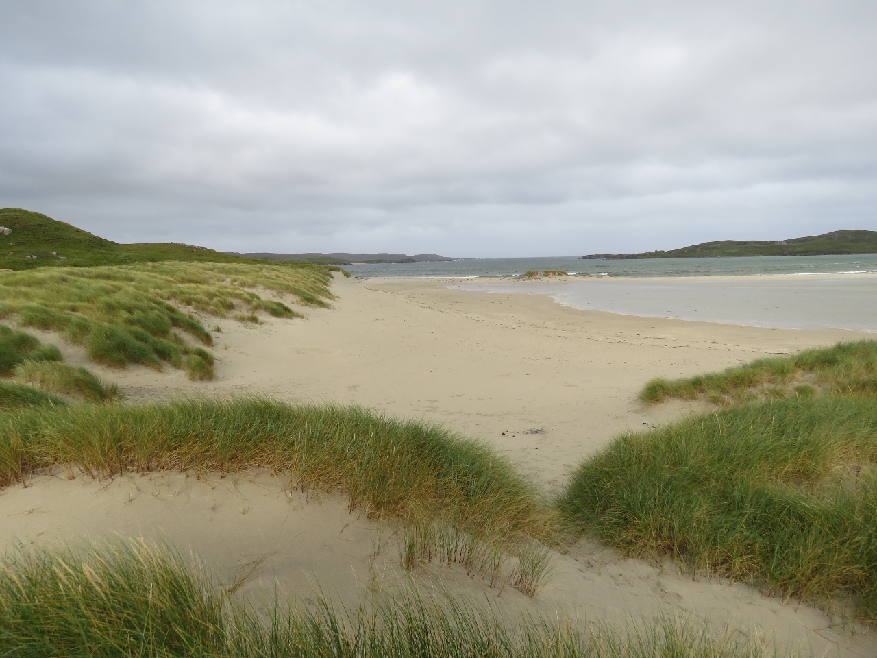 |
Ardroil Beach
Position: -7 1.71, 58 11.14
Ardroil Beach, one of the Outer Hebrides many beautiful sand beaches.
|
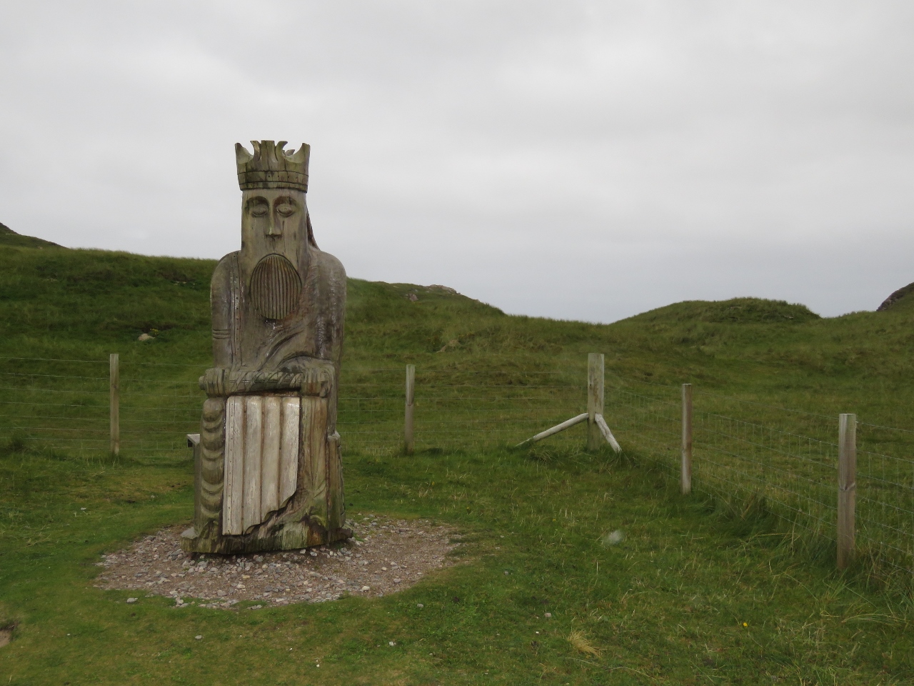 |
Uig Chessmen
Position: -7 1.81, 58 10.83
This wood carving is based in the famous Uig Chessman, or Lewis Chessman. The set of exquisitely carved walrus ivory chess pieces were found on Ardroil Beach in 1831. The pieces date from the 12th century and likely were made in Norway during the 450-year period when the Norse ruled the Outer Hebrides.
|
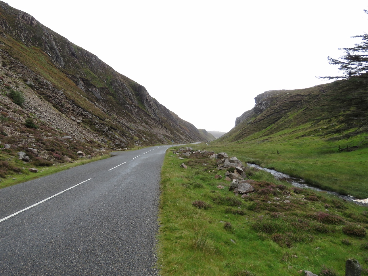 |
Rock Slides
Position: -6 57.63, 58 12.13
The road out to the coast cuts through some steep slopes with huge boulders on either side from rock slides. The road used to be blocked frequently until catch fences were added.
|
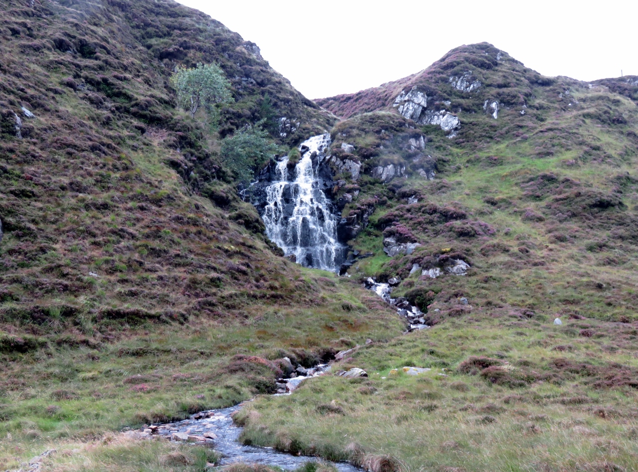 |
Waterfall
Position: -6 58.68, 58 12.16
We’ve had some heavy rain the past few days and several waterfalls were flowing down the steep slopes.
|
 |
Visitor Center
Position: -6 44.66, 58 11.73
The Standing Stones of Callanish are one of the most complete stone circles in Britain. This model at the visitor center shows how 13 large stones are arranged in around a 15ft (4.5m) monolith, with some 40 smaller stones radiating from the circle in a cross shape.
|
 |
Standing Stones of Callanish
Position: -6 44.70, 58 11.85
Jennifer in the center of the Standing Stones of Callanish. The stones date from about 5,000 years ago, about the same time as the Pyramids of Egypt, and little is known of their purpose or origin. Standing high up on a hill, they’re quite an impressive sight.
|
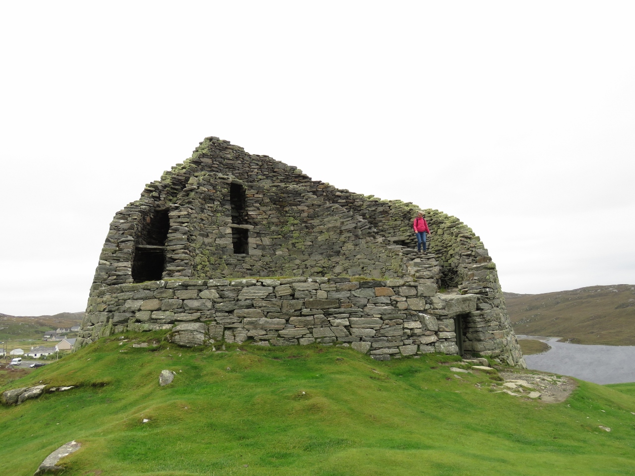 |
Doune Carloway Broch
Position: -6 47.64, 58 16.17
A broch is a stone roundhouse dating from about 2,000 years ago and found mainly in north and west Scotland. They were built primarily as homes for the principal family in the area and would have provided some defense against sporadic raiding, but were not purely defensive structures. The windward facing wall on this one has collapsed, but the back and much of the side walls remain. The double-walled drystone construction allowed for a high building with multiple floors—this one had three. Jennifer is walking down the remains of the stairs that ran between the walls to connect the floors. In the back on the left are openings from the stairs onto interior floors that have long-since collapsed.
|
 |
Blackhouse Village
Position: -6 47.54, 58 17.78
Blackhouses are traditional house common in the Hebrides, the Scottish Highlands and Ireland. The double drystone wall, low profile and insulating thatch roof made the houses suitable for the cold and windy Hebridean weather. The windward facing walls were built with a round shape to help deflect the wind, and they were built with a sloping floor to provide natural drainage underneath.
|
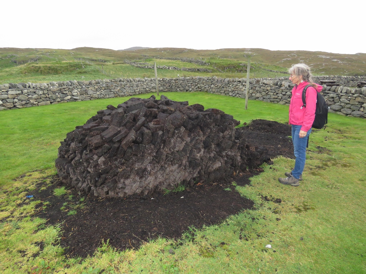 |
Peat
Position: -6 47.53, 58 17.78
We first saw peat harvesters on Arranmore Island along the northwest coast of Ireland. The peat was dug and dried for winter heating. This also was a traditional form of heating in the Hebrides. Jennifer is standing next to a large pile used to heat the houses in Blackhouse Village.
|
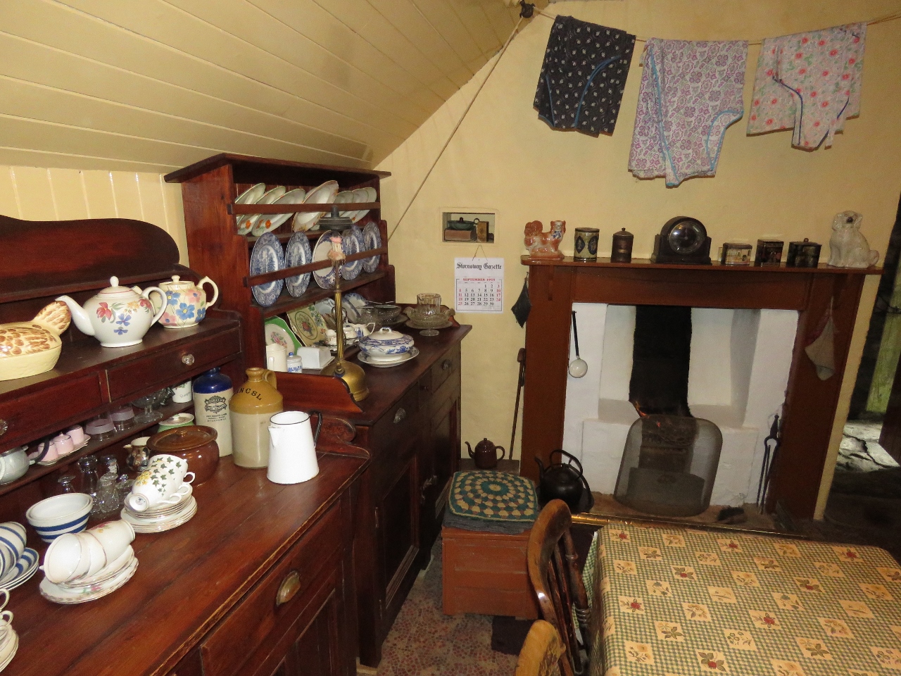 |
Hearth
Position: -6 47.54, 58 17.78
The interior of the blackhouse, showing peat burning in the hearth.
|
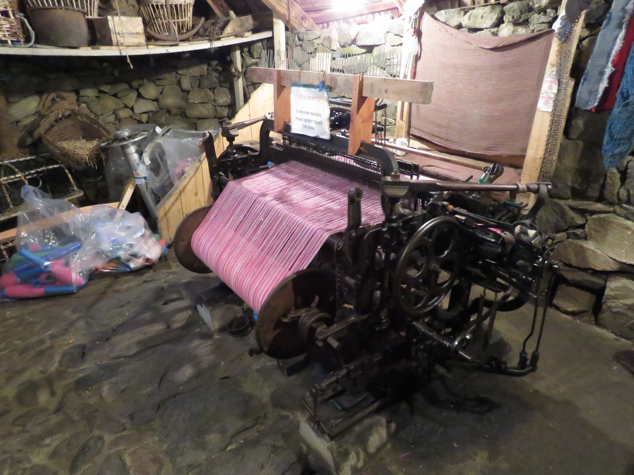 |
Loom
Position: -6 47.53, 58 17.78
The Outer Hebrides are famous for Harris tweed, a high-quality woollen cloth still hand-woven by islanders. This is a loom for weaving the tweed. The material originally was woven for familial use to protect against the cold winters, but became a local currency and eventually a local industry. The material is exported worldwide but can only be made in the Outer Hebrides according to the Harris Tweed Act of 1993.
|
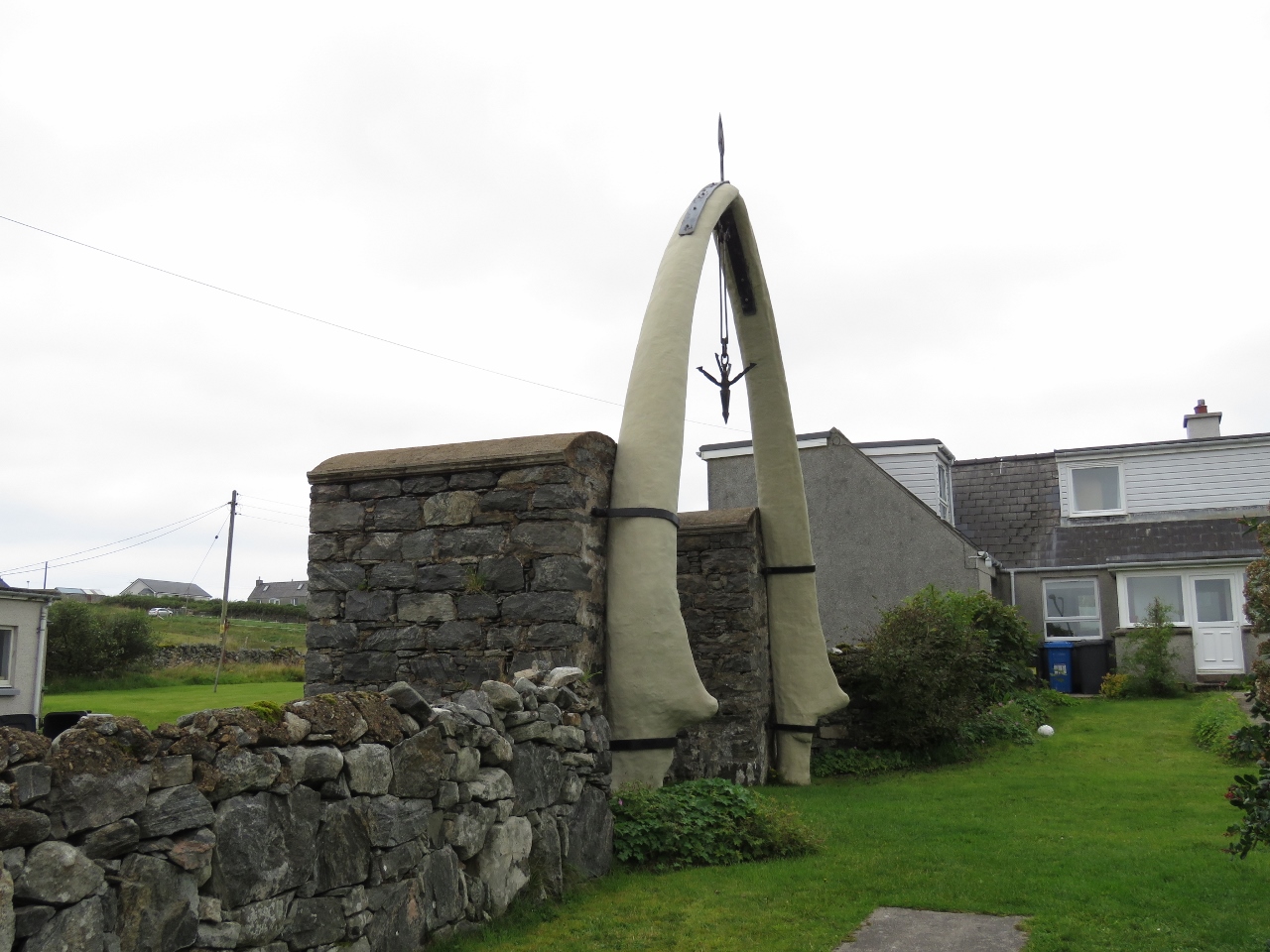 |
Whale Bone Arch
Position: -6 36.01, 58 20.29
in 1921, the carcass of an 80-foot Blue Whale drifted onto the beach on the west side of Lewis. The villagers shared the blubber and any other useful parts and its reported that the local postmaster raised the jaw bone as a gate to his house.
|
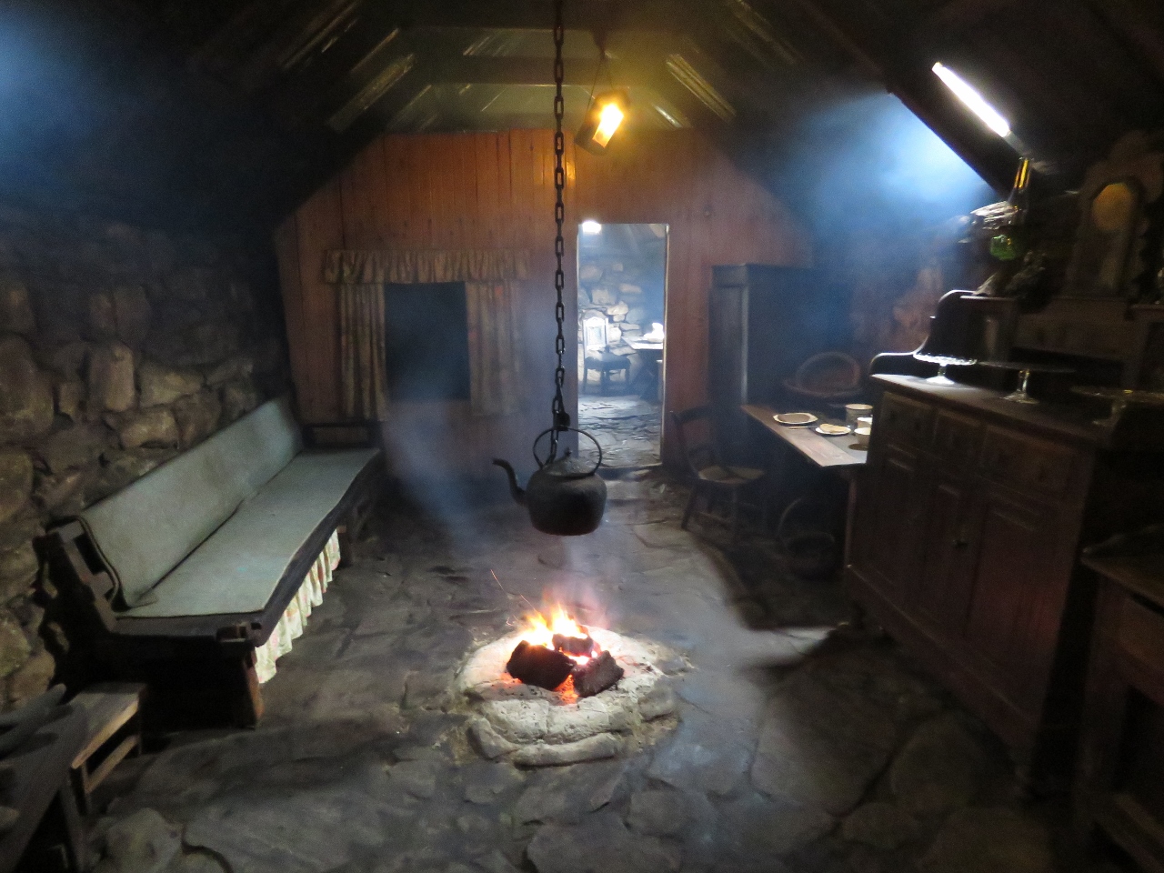 |
Arnol Blackhouse
Position: -6 35.86, 58 20.95
The Arnol Blackhouse has been preserved in exactly the state it was when the final occupants left in the 1960s. This house does not have a hearth and the peat was burned in a small fire in the center of the room, also used for cooking. You can see the smoke billowing around the room—our clothes had a pleasant burned-peat smell for a few hours after our visit.
|
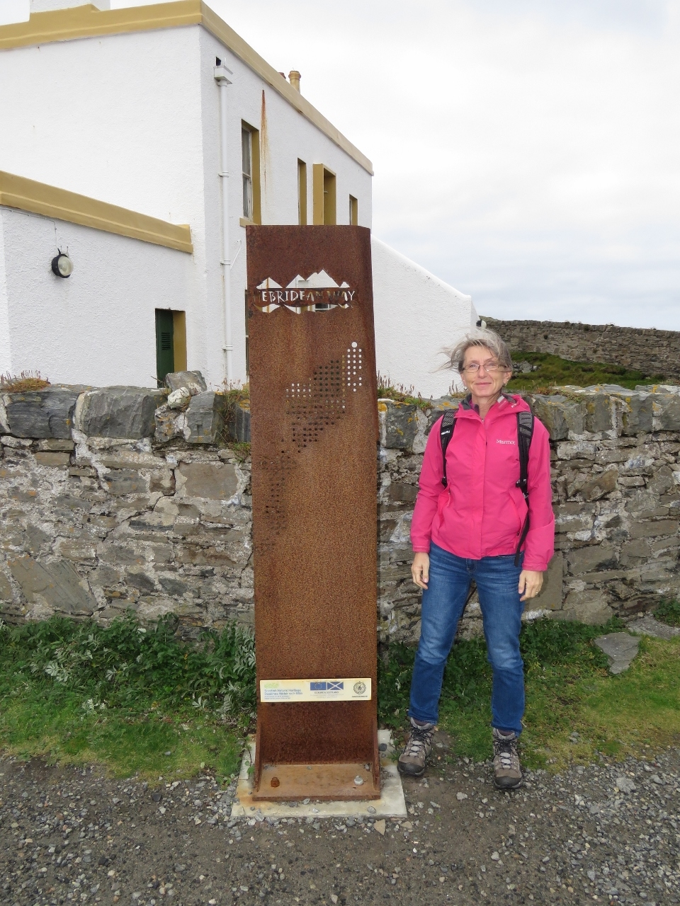 |
Hebridean Way
Position: -6 15.65, 58 30.95
Hebridean Way sign at the Butt of Lewis, the first we’ve seen, similar to the Wild Atlantic Way signs we saw on the West Coast of Ireland.
|
|
|
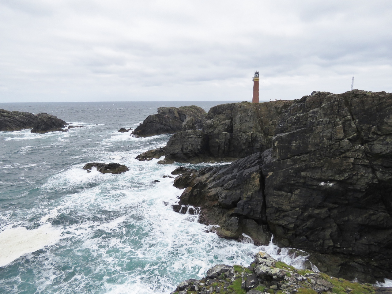
Butt of Lewis
Position: -6 15.92, 58 30.91
The lighthouse at the Butt of Lewis, at the north tip of Harris Island, was established in 1852. The station made the Guinness Book of World Records as the windiest place in the UK. It certainly was windy the day we visited. We’ve now visited the most northern in the Hebrides, and the most southern light, at Barra Head.
|
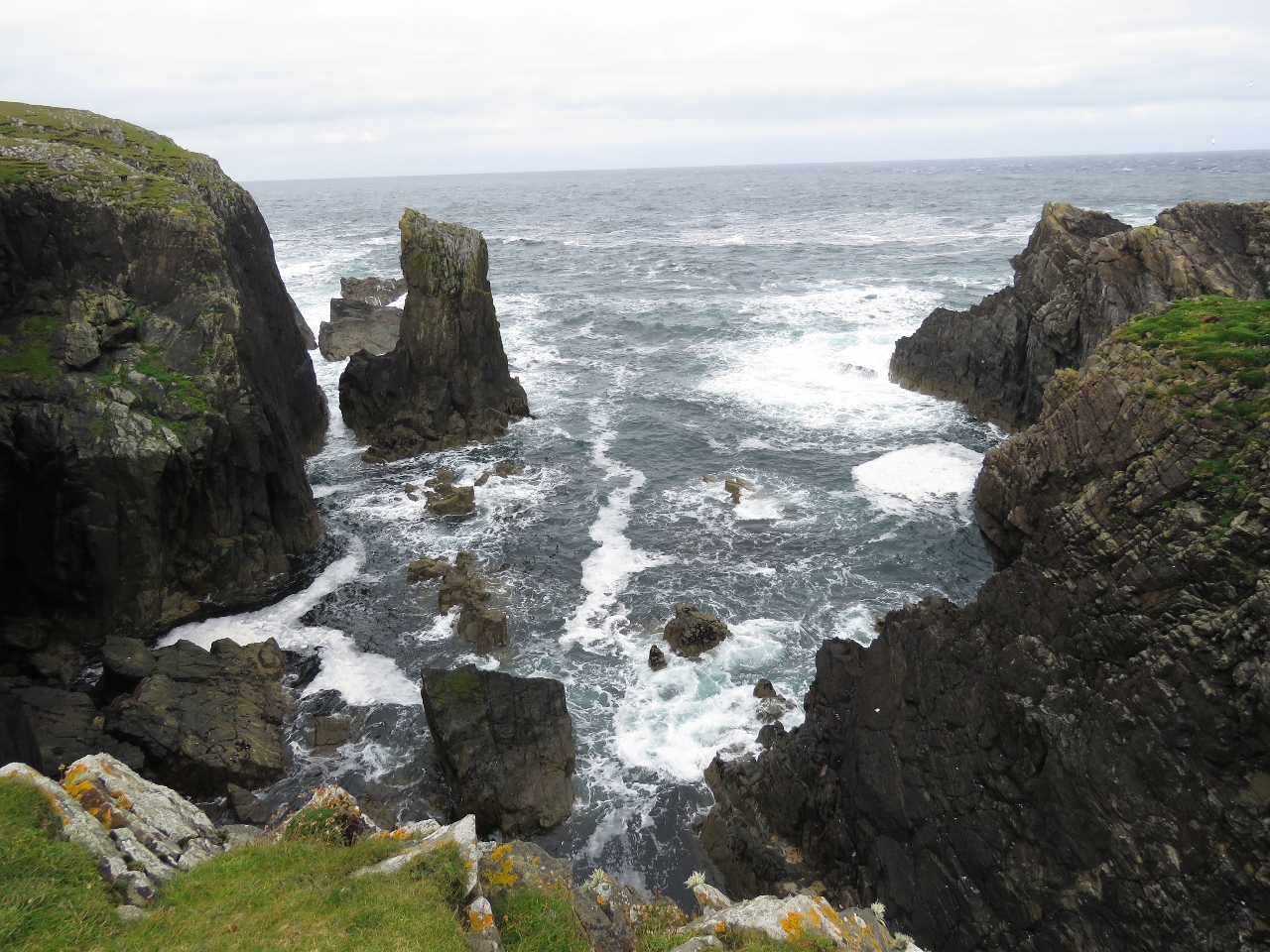 |
Seascape
Position: -6 15.66, 58 30.94
Forbidding seascape off the Butt of Lewis.
|
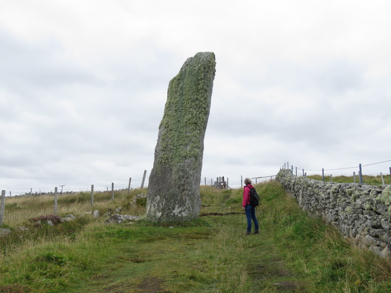 |
Trussel Stone
Position: -6 29.57, 58 23.63
The Trussel Stone, at 20ft (6m) high, is the tallest standing stone in Scotland.
|
 |
STS Taxi
Position: -6 23.32, 58 12.58
Back home in Stornoway after our excellent tour of the island with Stornoway Taxi Service.
|

|
Click the travel log icon on the left to see these locations on a map, with the complete log of our cruise.
On the map page, clicking on a camera or text icon will display a picture and/or log entry for that location, and clicking on the smaller icons along the route will display latitude, longitude and other navigation data for that location. And a live map of our current route and most recent log entries always is available at http://mvdirona.com/maps. |
Ophelia is comming, take care
Yes, thanks Gerhard. We’ve been seeing some surprisingly fast moves on the barometer today and it’s been gusty. It looks like Ireland is going to see some big winds.