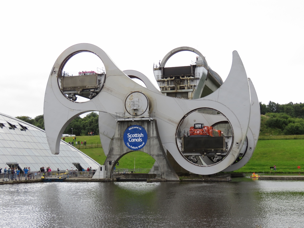
The Falkirk Wheel was completed in 2002 to connect the restored Union and Forth & Clyde Canals, replacing 11 locks that once covered the 115-ft difference in level. The wheel is a unique rotating boat lift that raises and lowers vessels between the two canals. Falkirk is essentially on the route between Edinburgh and Greenock, so we stopped off to see the wheel and other nearby attractions.
Trip highlights from August 8th, 2017 follow. Click any image for a larger view, or click the position to view the location on a map. And a live map of our current route and most recent log entries always is available at http://mvdirona.com/maps
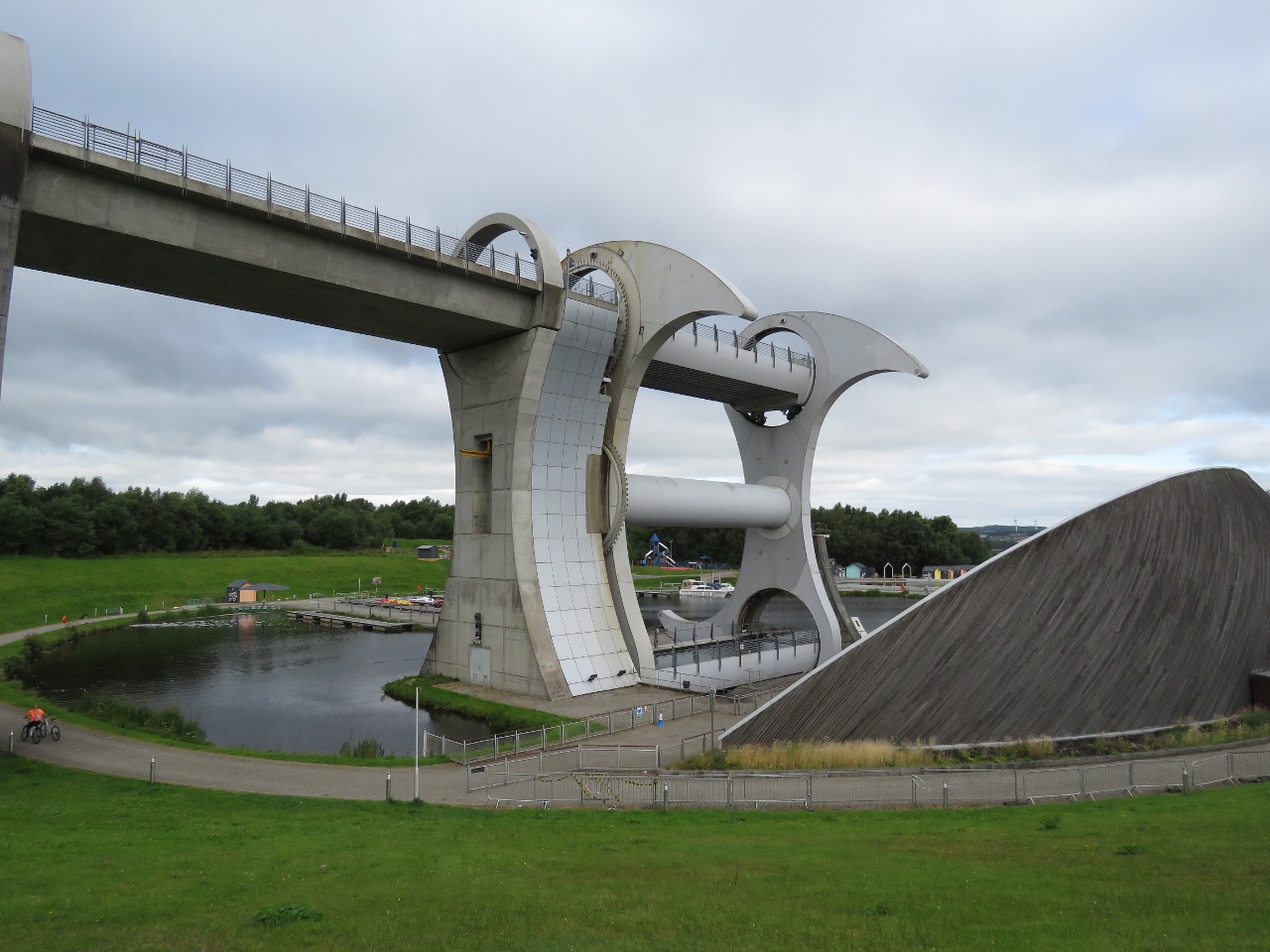 |
Falkirk Wheel
Position: -3 50.47, 55 59.99
Looking down to the wheel from the upper parking lot. Boats enter from the Union Canal at top left and the Forth & Clyde canal at the bottom right.
|
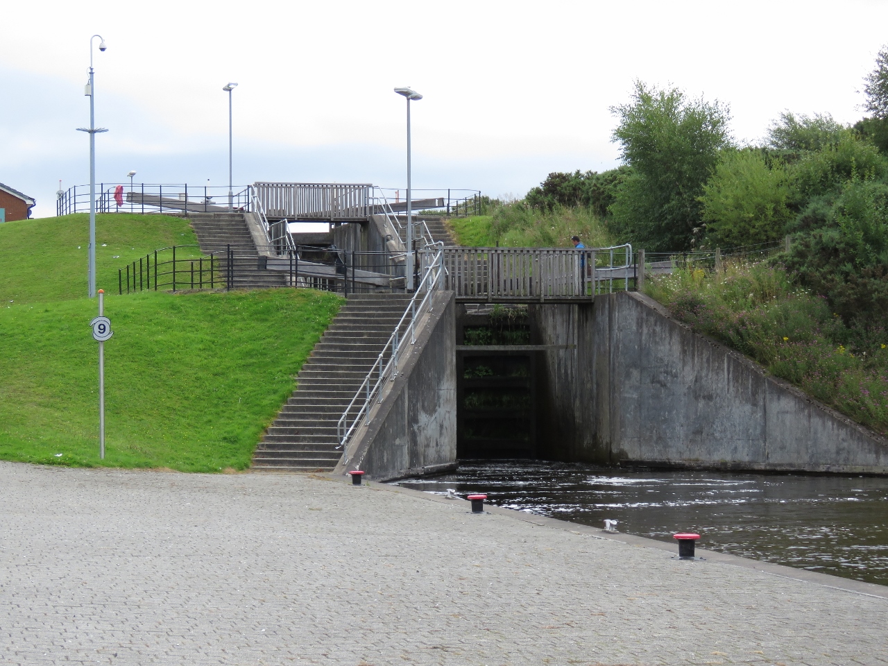 |
Union Canal
Position: -3 50.41, 55 59.74
A short walk through the through Roughtcastle Tunnel brought us to the end of the Union Canal that runs 31-miles to Edinburgh. The canal opened in 1822 to transport coal and other minerals to the capital, but railroads soon eclipsed the canal and it was closed to commercial traffic in 1933 and completely in 1965. The canal was re-opened in 2001 as canals became popular for leisure purposes.
|
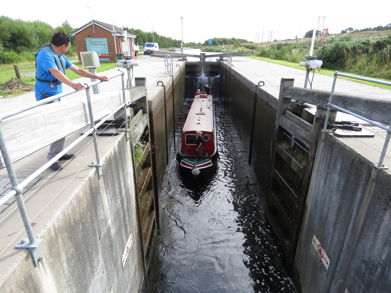 |
Narrowboat
Position: -3 50.38, 55 59.74
When we arrived, a narrowboat was passing through the final Union Canal lock before reaching the wheel. We were particularly interested in the locking through process as we’d be doing the same thing along the Crinan Canal in a week or so.
|
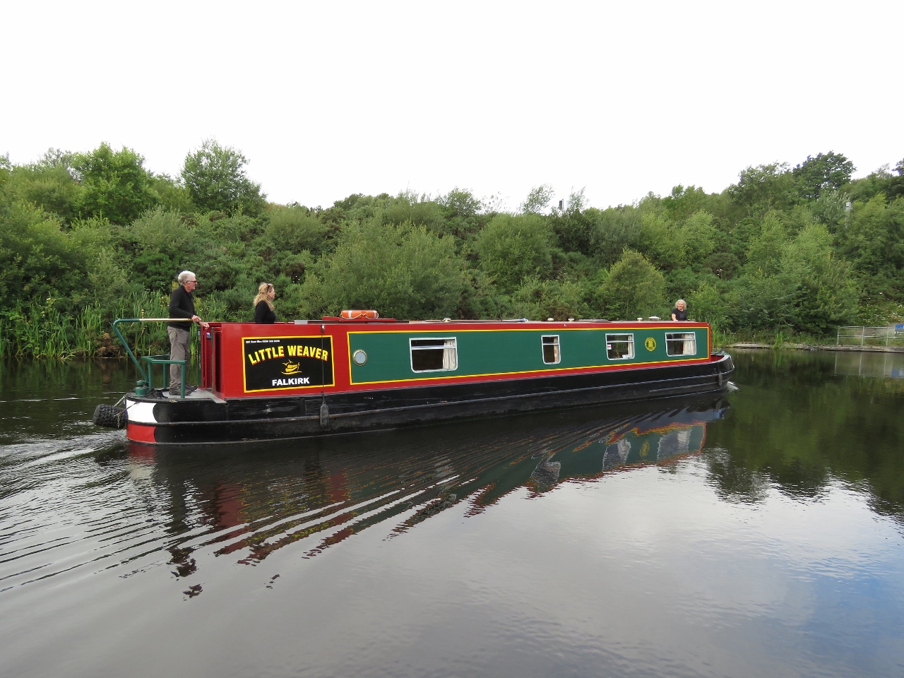 |
Little Weaver
Position: -3 50.46, 55 59.77
On board the narrowboat were Graham and Jennifer Barton, and their adult children Bruce and Kathryn, all from New Zealand. Noting our interest, they asked if we’d like to ride down on the wheel with them. They didn’t have to ask twice. :)
|
 |
Roughtcastle Tunnel
Position: -3 50.49, 55 59.92
Heading through Roughcastle Tunnel in the narrowboat with the Falkirk Wheel in the distance. The maximum air draft for a boat on the Union canal is 9ft 10 in (3m).
|
 |
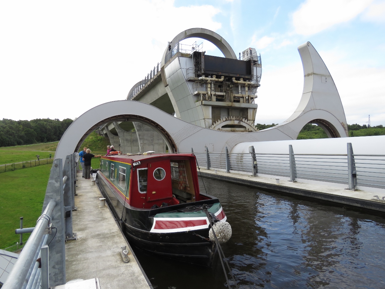
Top of the Wheel
Position: -3 50.49, 55 59.97
About to enter the top of the Falkirk Wheel.
|
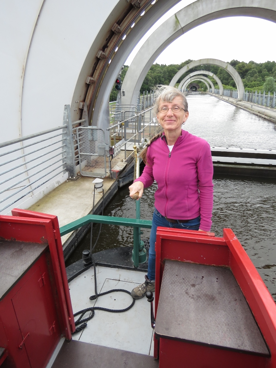 |
At the Helm
Position: -3 50.50, 56 0.02
Jennifer at the helm of the narrowboat as we prepare to descend.
|
 |
Descending
Position: -3 50.49, 56 0.03
Halfway down on the Falkirk Wheel. We’re super-excited to be riding the wheel and it was very generous of the Bartons to invite is aboard.
|
|
|
Wheel in Action
Position: -3 50.53, 56 0.06
After our descent, we stopped to watch the tour boats go up and down, one per side. The tour boats are fully-enclosed with eight seats across. Riding down with the Bartons, we were able to step outside, enjoy the views, and take pictures from all angles.
|
 |
Kelpies
Position: -3 45.34, 56 1.05
We took a taxi to nearby Stirling Castle and stopped off to see the Kelpies along the way. These two 30m-high stainless steel horse heads are named after the mythical Scottish water-horse and commemorate the working horses that once pulled barges through the canals.
|
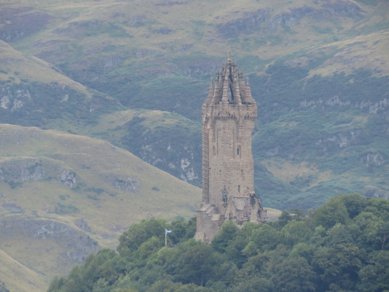 |
Wallace Monument
Position: -3 56.76, 56 7.39
The National Wallace Monument, viewed from the grounds of Stirling Castle. The monument was completed in 1869 to commemorate Sir William Wallace, the hero of Scotland’s 13th-century bid for independence, who was depicted in the movie Braveheart. The memorial stands on the summit of Abbey Craig with views across the Forth Valley, including to Stirling Bridge where Wallace successfully stood against the invading English in 1297.
|
 |
Stirling Castle
Position: -3 56.85, 56 7.41
A fortress has stood on Castle Hill above Stirling since prehistoric times. Stirling Castle overlooks the Forth Valley, where the Stirling River forms a natural barrier between the Scottish Highlands and Lowlands. In most places the river is too deep to fjord. But it’s shallower, and passage is possible, at the village of Stirling. Those who control Stirling Castle control movement between the Highlands and the Lowlands, resulting in the long-held adage that “to hold Stirling is to hold Scotland”.
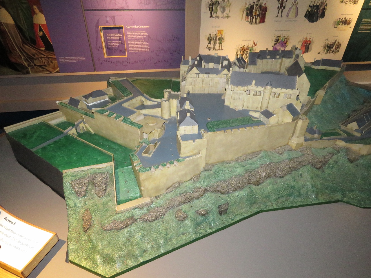
This model inside Stirling Castle shows the current castle, one of the largest in Scotland, dating from the 14th-16th centuries. The castle and its walls have been extended and renovated several times over the centuries. The current entry, where we came through, is at the far left. |
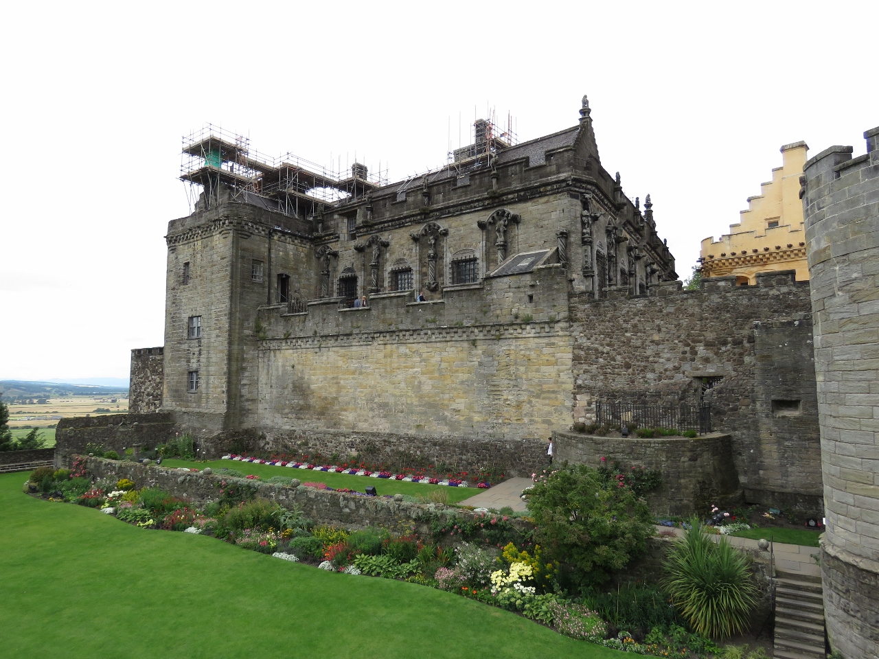 |
Royal Palace
Position: -3 56.82, 56 7.41
The Royal Palace at Stirling Castle, viewed from Queen Anne Garden, was built by King James V in the early 1500s. Covered with unique carved stonework and built to impress his new French bride and European heads of state, the palace is considered one of the most architecturally impressive buildings in Scotland.
|
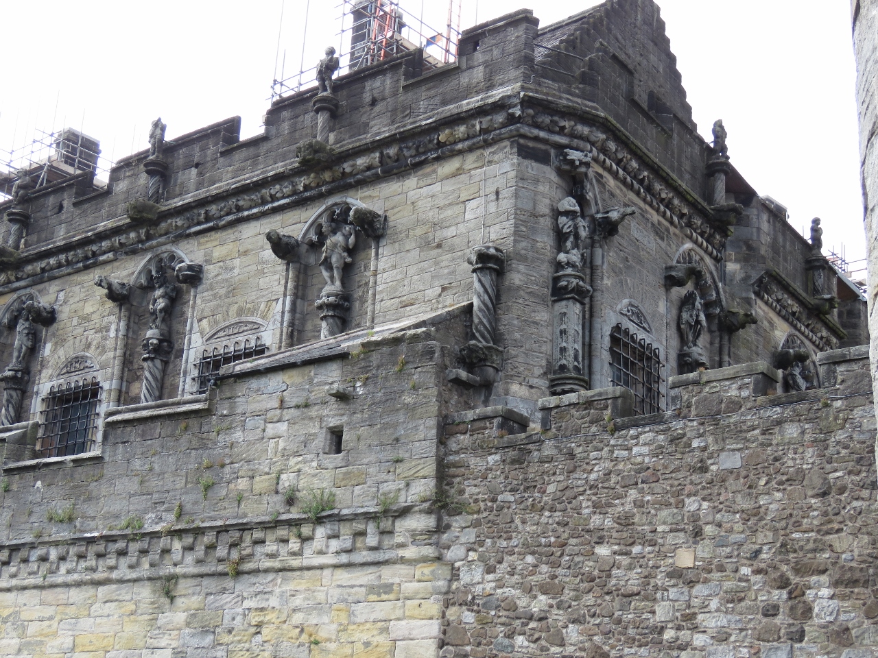 |
Carvings
Position: -3 56.82, 56 7.40
A closer view to some of the unique carvings on the outside of the Royal Palace.
|
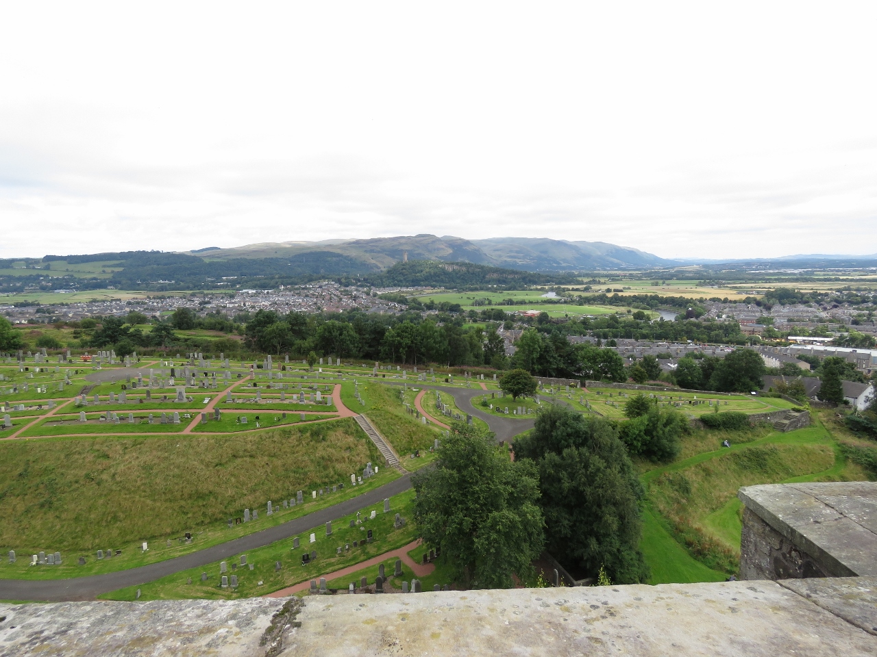 |
Grand Battery
Position: -3 56.81, 56 7.43
The view north across the Forth Valley from the Stirling Castle Grand Battery. The Wallace Monument is visible atop Abbey Craig at center in the distance.
|
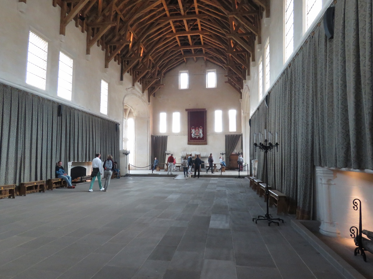 |
Great Hall
Position: -3 56.85, 56 7.43
The Great Hall was built by James IV in the late 1400s. The hammerbeam roof shown here was removed in 1800 when the hall was subdivided for barracks, and later restored in 1999.
|
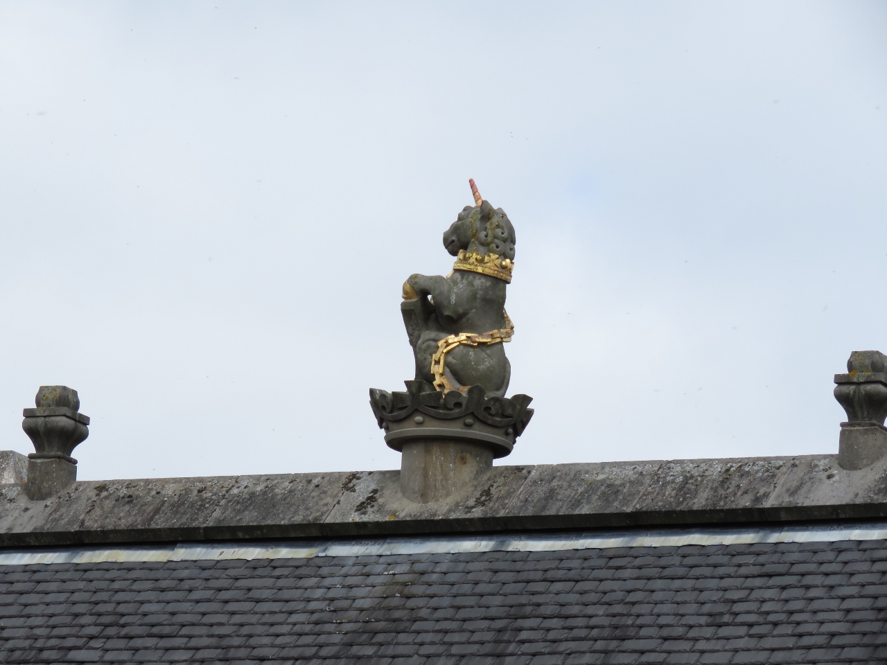 |
Unicorn
Position: -3 56.91, 56 7.44
A statue of a unicorn, Scotland’s national animal, atop the Great Hall. In Scottish heraldry the unicorn often is depicted in chains because it was considered a dangerous animal.
|
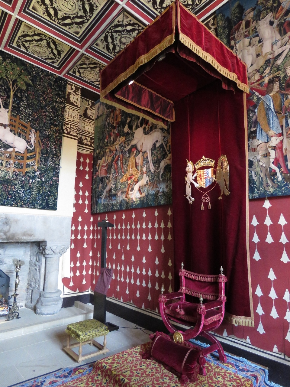 |
Tapestries
Position: -3 56.88, 56 7.41
The inside of the Royal Palace at Stirling Castle has been restored to its 1540s state, when Mary Queen of Scots lived there as a child. Strung on the walls in the Queen’s Presence Chamber are handwoven recreations of the four “Hunt of the Unicorn” tapestries, made in the on-site tapestry studio.
|
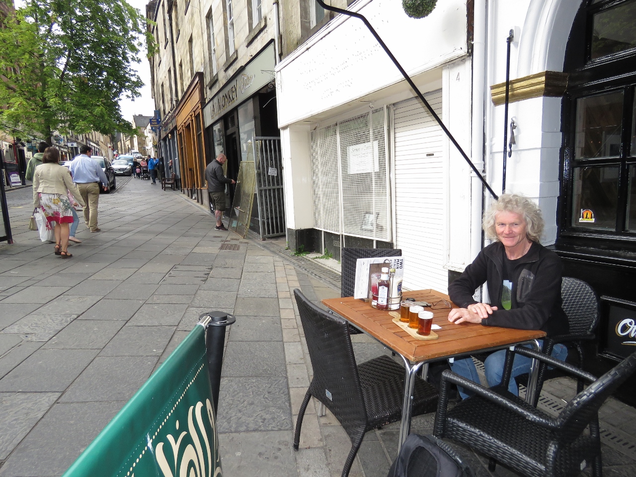 |
No 2 Baker Street
Position: -3 56.32, 56 7.13
A tasting flight of local brews street-side at the pub No 2 Baker Street in the village of Stirling.
|
 |
Stirling Station
Position: -3 56.12, 56 7.19
At Stirling Station for the train back to Greenock.
|

|
Click the travel log icon on the left to see these locations on a map, with the complete log of our cruise.
On the map page, clicking on a camera or text icon will display a picture and/or log entry for that location, and clicking on the smaller icons along the route will display latitude, longitude and other navigation data for that location. And a live map of our current route and most recent log entries always is available at http://mvdirona.com/maps. |
Your adventures are better than post card perfect such a joyful read – like a good book ya just can’t put down.